


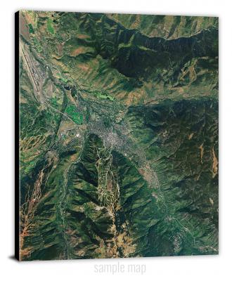
To view satellite imagery and bounding box footprint of individual city/location maps, click below on specific links

• Extra-Large Gallery Canvas Wrap Print
• Hand-Stretched, Expertly Crafted
• Artist Grade Canvas with Fade-Resistant Inks
• Ready to Hang with Pre-Installed Hardware
• 1.5" Thick Gallery Frame
Enrich your office decor or home with a large canvas wrap Satellite map. It is designed for easy hanging with pre-installed hardware. Printed with archival inks and wrapped around a 1.5" thick gallery frame, your favorite map art will have a timeless and impressive look that fits with any decor. This map is fabricated with satellite imagery data from Google Earth, and bounding box coordinates from USGS.
Abbott, Arkansas- Map Components- Imagery: Satellite of Abbott, Arkansas. Bounding Box: Footprint of Abbott, Arkansas at Longitude/Latitude Coordinates (-94.25 x -94.125 x 35.125 x 35).
Aberdeen, Arkansas- Map Components- Imagery: Satellite of Aberdeen, Arkansas. Bounding Box: Footprint of Aberdeen, Arkansas at Longitude/Latitude Coordinates (-91.375 x -91.25 x 34.625 x 34.5).
Acorn, Arkansas- Map Components- Imagery: Satellite of Acorn, Arkansas. Bounding Box: Footprint of Acorn, Arkansas at Longitude/Latitude Coordinates (-94.25 x -94.125 x 34.75 x 34.625).
Adona, Arkansas- Map Components- Imagery: Satellite of Adona, Arkansas. Bounding Box: Footprint of Adona, Arkansas at Longitude/Latitude Coordinates (-93 x -92.875 x 35.125 x 35).
Agnos, Arkansas- Map Components- Imagery: Satellite of Agnos, Arkansas. Bounding Box: Footprint of Agnos, Arkansas at Longitude/Latitude Coordinates (-91.75 x -91.625 x 36.375 x 36.25).
Alexander, Arkansas- Map Components- Imagery: Satellite of Alexander, Arkansas. Bounding Box: Footprint of Alexander, Arkansas at Longitude/Latitude Coordinates (-92.5 x -92.375 x 34.75 x 34.625).
Alicia, Arkansas- Map Components- Imagery: Satellite of Alicia, Arkansas. Bounding Box: Footprint of Alicia, Arkansas at Longitude/Latitude Coordinates (-91.125 x -91 x 36 x 35.875).
Alma, Arkansas- Map Components- Imagery: Satellite of Alma, Arkansas. Bounding Box: Footprint of Alma, Arkansas at Longitude/Latitude Coordinates (-94.25 x -94.125 x 35.5 x 35.375).
Almyra, Arkansas- Map Components- Imagery: Satellite of Almyra, Arkansas. Bounding Box: Footprint of Almyra, Arkansas at Longitude/Latitude Coordinates (-91.5 x -91.375 x 34.5 x 34.375).
Alpena, Arkansas- Map Components- Imagery: Satellite of Alpena, Arkansas. Bounding Box: Footprint of Alpena, Arkansas at Longitude/Latitude Coordinates (-93.375 x -93.25 x 36.375 x 36.25).
Alread, Arkansas- Map Components- Imagery: Satellite of Alread, Arkansas. Bounding Box: Footprint of Alread, Arkansas at Longitude/Latitude Coordinates (-92.75 x -92.625 x 35.75 x 35.625).
Altheimer, Arkansas- Map Components- Imagery: Satellite of Altheimer, Arkansas. Bounding Box: Footprint of Altheimer, Arkansas at Longitude/Latitude Coordinates (-91.875 x -91.75 x 34.375 x 34.25).
Amagon, Arkansas- Map Components- Imagery: Satellite of Amagon, Arkansas. Bounding Box: Footprint of Amagon, Arkansas at Longitude/Latitude Coordinates (-91.125 x -91 x 35.625 x 35.5).
Amity, Arkansas- Map Components- Imagery: Satellite of Amity, Arkansas. Bounding Box: Footprint of Amity, Arkansas at Longitude/Latitude Coordinates (-93.5 x -93.375 x 34.375 x 34.25).
Antoine, Arkansas- Map Components- Imagery: Satellite of Antoine, Arkansas. Bounding Box: Footprint of Antoine, Arkansas at Longitude/Latitude Coordinates (-93.5 x -93.375 x 34.125 x 34).
Aplin, Arkansas- Map Components- Imagery: Satellite of Aplin, Arkansas. Bounding Box: Footprint of Aplin, Arkansas at Longitude/Latitude Coordinates (-93 x -92.875 x 35 x 34.875).
Arden, Arkansas- Map Components- Imagery: Satellite of Arden, Arkansas. Bounding Box: Footprint of Arden, Arkansas at Longitude/Latitude Coordinates (-94.375 x -94.25 x 33.75 x 33.625).
Arkadelphia, Arkansas- Map Components- Imagery: Satellite of Arkadelphia, Arkansas. Bounding Box: Footprint of Arkadelphia, Arkansas at Longitude/Latitude Coordinates (-93.125 x -93 x 34.125 x 34).
Arkansas City, Arkansas- Map Components- Imagery: Satellite of Arkansas City, Arkansas. Bounding Box: Footprint of Arkansas City, Arkansas at Longitude/Latitude Coordinates (-91.25 x -91.125 x 33.625 x 33.5).
Arkansas Post, Arkansas- Map Components- Imagery: Satellite of Arkansas Post, Arkansas. Bounding Box: Footprint of Arkansas Post, Arkansas at Longitude/Latitude Coordinates (-91.375 x -91.25 x 34.125 x 34).
Arkinda, Arkansas- Map Components- Imagery: Satellite of Arkinda, Arkansas. Bounding Box: Footprint of Arkinda, Arkansas at Longitude/Latitude Coordinates (-94.5 x -94.375 x 33.875 x 33.75).
Armorel, Arkansas- Map Components- Imagery: Satellite of Armorel, Arkansas. Bounding Box: Footprint of Armorel, Arkansas at Longitude/Latitude Coordinates (-89.875 x -89.75 x 36 x 35.875).
Artesian, Arkansas- Map Components- Imagery: Satellite of Artesian, Arkansas. Bounding Box: Footprint of Artesian, Arkansas at Longitude/Latitude Coordinates (-92.5 x -92.375 x 33.5 x 33.375).
Ash Flat, Arkansas- Map Components- Imagery: Satellite of Ash Flat, Arkansas. Bounding Box: Footprint of Ash Flat, Arkansas at Longitude/Latitude Coordinates (-91.625 x -91.5 x 36.25 x 36.125).
Ashdown East, Arkansas- Map Components- Imagery: Satellite of Ashdown East, Arkansas. Bounding Box: Footprint of Ashdown East, Arkansas at Longitude/Latitude Coordinates (-94.125 x -94 x 33.75 x 33.625).
Ashdown West, Arkansas- Map Components- Imagery: Satellite of Ashdown West, Arkansas. Bounding Box: Footprint of Ashdown West, Arkansas at Longitude/Latitude Coordinates (-94.25 x -94.125 x 33.75 x 33.625).
Athens, Arkansas- Map Components- Imagery: Satellite of Athens, Arkansas. Bounding Box: Footprint of Athens, Arkansas at Longitude/Latitude Coordinates (-94 x -93.875 x 34.375 x 34.25).
Atkins, Arkansas- Map Components- Imagery: Satellite of Atkins, Arkansas. Bounding Box: Footprint of Atkins, Arkansas at Longitude/Latitude Coordinates (-93 x -92.875 x 35.25 x 35.125).
Aubrey, Arkansas- Map Components- Imagery: Satellite of Aubrey, Arkansas. Bounding Box: Footprint of Aubrey, Arkansas at Longitude/Latitude Coordinates (-91 x -90.875 x 34.75 x 34.625).
Augusta, Arkansas- Map Components- Imagery: Satellite of Augusta, Arkansas. Bounding Box: Footprint of Augusta, Arkansas at Longitude/Latitude Coordinates (-91.375 x -91.25 x 35.375 x 35.25).
Augusta NE, Arkansas- Map Components- Imagery: Satellite of Augusta NE, Arkansas. Bounding Box: Footprint of Augusta NE, Arkansas at Longitude/Latitude Coordinates (-91.375 x -91.25 x 35.5 x 35.375).
Augusta SW, Arkansas- Map Components- Imagery: Satellite of Augusta SW, Arkansas. Bounding Box: Footprint of Augusta SW, Arkansas at Longitude/Latitude Coordinates (-91.5 x -91.375 x 35.375 x 35.25).
Auvergne, Arkansas- Map Components- Imagery: Satellite of Auvergne, Arkansas. Bounding Box: Footprint of Auvergne, Arkansas at Longitude/Latitude Coordinates (-91.25 x -91.125 x 35.625 x 35.5).
Avant, Arkansas- Map Components- Imagery: Satellite of Avant, Arkansas. Bounding Box: Footprint of Avant, Arkansas at Longitude/Latitude Coordinates (-93.375 x -93.25 x 34.75 x 34.625).
Avery, Arkansas- Map Components- Imagery: Satellite of Avery, Arkansas. Bounding Box: Footprint of Avery, Arkansas at Longitude/Latitude Coordinates (-91.75 x -91.625 x 34 x 33.875).
Baker Springs, Arkansas- Map Components- Imagery: Satellite of Baker Springs, Arkansas. Bounding Box: Footprint of Baker Springs, Arkansas at Longitude/Latitude Coordinates (-94.25 x -94.125 x 34.375 x 34.25).
Bald Knob, Arkansas- Map Components- Imagery: Satellite of Bald Knob, Arkansas. Bounding Box: Footprint of Bald Knob, Arkansas at Longitude/Latitude Coordinates (-91.625 x -91.5 x 35.375 x 35.25).
Banks, Arkansas- Map Components- Imagery: Satellite of Banks, Arkansas. Bounding Box: Footprint of Banks, Arkansas at Longitude/Latitude Coordinates (-92.375 x -92.25 x 33.625 x 33.5).
Barber, Arkansas- Map Components- Imagery: Satellite of Barber, Arkansas. Bounding Box: Footprint of Barber, Arkansas at Longitude/Latitude Coordinates (-94.125 x -94 x 35.25 x 35.125).
Barling, Arkansas- Map Components- Imagery: Satellite of Barling, Arkansas. Bounding Box: Footprint of Barling, Arkansas at Longitude/Latitude Coordinates (-94.375 x -94.25 x 35.375 x 35.25).
Barney, Arkansas- Map Components- Imagery: Satellite of Barney, Arkansas. Bounding Box: Footprint of Barney, Arkansas at Longitude/Latitude Coordinates (-92.25 x -92.125 x 35.375 x 35.25).
Batavia, Arkansas- Map Components- Imagery: Satellite of Batavia, Arkansas. Bounding Box: Footprint of Batavia, Arkansas at Longitude/Latitude Coordinates (-93.25 x -93.125 x 36.375 x 36.25).
Bates, Arkansas- Map Components- Imagery: Satellite of Bates, Arkansas. Bounding Box: Footprint of Bates, Arkansas at Longitude/Latitude Coordinates (-94.5 x -94.375 x 35 x 34.875).
Batesville, Arkansas- Map Components- Imagery: Satellite of Batesville, Arkansas. Bounding Box: Footprint of Batesville, Arkansas at Longitude/Latitude Coordinates (-91.75 x -91.625 x 35.875 x 35.75).
Bearden, Arkansas- Map Components- Imagery: Satellite of Bearden, Arkansas. Bounding Box: Footprint of Bearden, Arkansas at Longitude/Latitude Coordinates (-92.625 x -92.5 x 33.75 x 33.625).
Beaver, Arkansas- Map Components- Imagery: Satellite of Beaver, Arkansas. Bounding Box: Footprint of Beaver, Arkansas at Longitude/Latitude Coordinates (-93.875 x -93.75 x 36.5 x 36.375).
Bee Branch, Arkansas- Map Components- Imagery: Satellite of Bee Branch, Arkansas. Bounding Box: Footprint of Bee Branch, Arkansas at Longitude/Latitude Coordinates (-92.5 x -92.375 x 35.5 x 35.375).
Bee Mountain, Arkansas- Map Components- Imagery: Satellite of Bee Mountain, Arkansas. Bounding Box: Footprint of Bee Mountain, Arkansas at Longitude/Latitude Coordinates (-94 x -93.875 x 35 x 34.875).
Beebe, Arkansas- Map Components- Imagery: Satellite of Beebe, Arkansas. Bounding Box: Footprint of Beebe, Arkansas at Longitude/Latitude Coordinates (-92 x -91.875 x 35.125 x 35).
Beedeville, Arkansas- Map Components- Imagery: Satellite of Beedeville, Arkansas. Bounding Box: Footprint of Beedeville, Arkansas at Longitude/Latitude Coordinates (-91.125 x -91 x 35.5 x 35.375).
Belfast, Arkansas- Map Components- Imagery: Satellite of Belfast, Arkansas. Bounding Box: Footprint of Belfast, Arkansas at Longitude/Latitude Coordinates (-92.5 x -92.375 x 34.5 x 34.375).
Ben Lomond, Arkansas- Map Components- Imagery: Satellite of Ben Lomond, Arkansas. Bounding Box: Footprint of Ben Lomond, Arkansas at Longitude/Latitude Coordinates (-94.125 x -94 x 33.875 x 33.75).
Benton, Arkansas- Map Components- Imagery: Satellite of Benton, Arkansas. Bounding Box: Footprint of Benton, Arkansas at Longitude/Latitude Coordinates (-92.625 x -92.5 x 34.625 x 34.5).
Bentonville North, Arkansas- Map Components- Imagery: Satellite of Bentonville North, Arkansas. Bounding Box: Footprint of Bentonville North, Arkansas at Longitude/Latitude Coordinates (-94.25 x -94.125 x 36.5 x 36.375).
Bentonville South, Arkansas- Map Components- Imagery: Satellite of Bentonville South, Arkansas. Bounding Box: Footprint of Bentonville South, Arkansas at Longitude/Latitude Coordinates (-94.25 x -94.125 x 36.375 x 36.25).
Bergman, Arkansas- Map Components- Imagery: Satellite of Bergman, Arkansas. Bounding Box: Footprint of Bergman, Arkansas at Longitude/Latitude Coordinates (-93.125 x -93 x 36.375 x 36.25).
Berlin, Arkansas- Map Components- Imagery: Satellite of Berlin, Arkansas. Bounding Box: Footprint of Berlin, Arkansas at Longitude/Latitude Coordinates (-91.875 x -91.75 x 33.125 x 33).
Berryville, Arkansas- Map Components- Imagery: Satellite of Berryville, Arkansas. Bounding Box: Footprint of Berryville, Arkansas at Longitude/Latitude Coordinates (-93.625 x -93.5 x 36.375 x 36.25).
Bethesda, Arkansas- Map Components- Imagery: Satellite of Bethesda, Arkansas. Bounding Box: Footprint of Bethesda, Arkansas at Longitude/Latitude Coordinates (-91.875 x -91.75 x 35.875 x 35.75).
Bidville, Arkansas- Map Components- Imagery: Satellite of Bidville, Arkansas. Bounding Box: Footprint of Bidville, Arkansas at Longitude/Latitude Coordinates (-94 x -93.875 x 35.75 x 35.625).
Big Flat, Arkansas- Map Components- Imagery: Satellite of Big Flat, Arkansas. Bounding Box: Footprint of Big Flat, Arkansas at Longitude/Latitude Coordinates (-92.5 x -92.375 x 36.125 x 36).
Big Fork, Arkansas- Map Components- Imagery: Satellite of Big Fork, Arkansas. Bounding Box: Footprint of Big Fork, Arkansas at Longitude/Latitude Coordinates (-94 x -93.875 x 34.5 x 34.375).
Bismarck, Arkansas- Map Components- Imagery: Satellite of Bismarck, Arkansas. Bounding Box: Footprint of Bismarck, Arkansas at Longitude/Latitude Coordinates (-93.25 x -93.125 x 34.375 x 34.25).
Black Rock, Arkansas- Map Components- Imagery: Satellite of Black Rock, Arkansas. Bounding Box: Footprint of Black Rock, Arkansas at Longitude/Latitude Coordinates (-91.125 x -91 x 36.125 x 36).
Blevins, Arkansas- Map Components- Imagery: Satellite of Blevins, Arkansas. Bounding Box: Footprint of Blevins, Arkansas at Longitude/Latitude Coordinates (-93.625 x -93.5 x 33.875 x 33.75).
Blue Eye, Arkansas- Map Components- Imagery: Satellite of Blue Eye, Arkansas. Bounding Box: Footprint of Blue Eye, Arkansas at Longitude/Latitude Coordinates (-93.5 x -93.375 x 36.5 x 36.375).
Blue Mountain, Arkansas- Map Components- Imagery: Satellite of Blue Mountain, Arkansas. Bounding Box: Footprint of Blue Mountain, Arkansas at Longitude/Latitude Coordinates (-93.75 x -93.625 x 35.25 x 35.125).
Blue Mountain Dam, Arkansas- Map Components- Imagery: Satellite of Blue Mountain Dam, Arkansas. Bounding Box: Footprint of Blue Mountain Dam, Arkansas at Longitude/Latitude Coordinates (-93.75 x -93.625 x 35.125 x 35).
Bluff City, Arkansas- Map Components- Imagery: Satellite of Bluff City, Arkansas. Bounding Box: Footprint of Bluff City, Arkansas at Longitude/Latitude Coordinates (-93.25 x -93.125 x 33.75 x 33.625).
Bluffton, Arkansas- Map Components- Imagery: Satellite of Bluffton, Arkansas. Bounding Box: Footprint of Bluffton, Arkansas at Longitude/Latitude Coordinates (-93.625 x -93.5 x 35 x 34.875).
Blytheville, Arkansas- Map Components- Imagery: Satellite of Blytheville, Arkansas. Bounding Box: Footprint of Blytheville, Arkansas at Longitude/Latitude Coordinates (-90 x -89.875 x 36 x 35.875).
Board Camp, Arkansas- Map Components- Imagery: Satellite of Board Camp, Arkansas. Bounding Box: Footprint of Board Camp, Arkansas at Longitude/Latitude Coordinates (-94.125 x -94 x 34.625 x 34.5).
Bodcaw, Arkansas- Map Components- Imagery: Satellite of Bodcaw, Arkansas. Bounding Box: Footprint of Bodcaw, Arkansas at Longitude/Latitude Coordinates (-93.5 x -93.375 x 33.625 x 33.5).
Bog Springs, Arkansas- Map Components- Imagery: Satellite of Bog Springs, Arkansas. Bounding Box: Footprint of Bog Springs, Arkansas at Longitude/Latitude Coordinates (-94.5 x -94.375 x 34.375 x 34.25).
Boles, Arkansas- Map Components- Imagery: Satellite of Boles, Arkansas. Bounding Box: Footprint of Boles, Arkansas at Longitude/Latitude Coordinates (-94.125 x -94 x 34.875 x 34.75).
Bonnerdale, Arkansas- Map Components- Imagery: Satellite of Bonnerdale, Arkansas. Bounding Box: Footprint of Bonnerdale, Arkansas at Longitude/Latitude Coordinates (-93.5 x -93.375 x 34.5 x 34.375).
Bono, Arkansas- Map Components- Imagery: Satellite of Bono, Arkansas. Bounding Box: Footprint of Bono, Arkansas at Longitude/Latitude Coordinates (-90.875 x -90.75 x 36 x 35.875).
Booneville, Arkansas- Map Components- Imagery: Satellite of Booneville, Arkansas. Bounding Box: Footprint of Booneville, Arkansas at Longitude/Latitude Coordinates (-94 x -93.875 x 35.25 x 35.125).
Boston, Arkansas- Map Components- Imagery: Satellite of Boston, Arkansas. Bounding Box: Footprint of Boston, Arkansas at Longitude/Latitude Coordinates (-93.625 x -93.5 x 35.875 x 35.75).
Boswell, Arkansas- Map Components- Imagery: Satellite of Boswell, Arkansas. Bounding Box: Footprint of Boswell, Arkansas at Longitude/Latitude Coordinates (-92.125 x -92 x 36.125 x 36).
Botkinburg, Arkansas- Map Components- Imagery: Satellite of Botkinburg, Arkansas. Bounding Box: Footprint of Botkinburg, Arkansas at Longitude/Latitude Coordinates (-92.625 x -92.5 x 35.75 x 35.625).
Boxley, Arkansas- Map Components- Imagery: Satellite of Boxley, Arkansas. Bounding Box: Footprint of Boxley, Arkansas at Longitude/Latitude Coordinates (-93.5 x -93.375 x 36 x 35.875).
Boyd Hill, Arkansas- Map Components- Imagery: Satellite of Boyd Hill, Arkansas. Bounding Box: Footprint of Boyd Hill, Arkansas at Longitude/Latitude Coordinates (-93.75 x -93.625 x 33.5 x 33.375).
Boydsville, Arkansas- Map Components- Imagery: Satellite of Boydsville, Arkansas. Bounding Box: Footprint of Boydsville, Arkansas at Longitude/Latitude Coordinates (-90.5 x -90.375 x 36.375 x 36.25).
Bradford, Arkansas- Map Components- Imagery: Satellite of Bradford, Arkansas. Bounding Box: Footprint of Bradford, Arkansas at Longitude/Latitude Coordinates (-91.5 x -91.375 x 35.5 x 35.375).
Bradley, Arkansas- Map Components- Imagery: Satellite of Bradley, Arkansas. Bounding Box: Footprint of Bradley, Arkansas at Longitude/Latitude Coordinates (-93.75 x -93.625 x 33.125 x 33).
Bradley NE, Arkansas- Map Components- Imagery: Satellite of Bradley NE, Arkansas. Bounding Box: Footprint of Bradley NE, Arkansas at Longitude/Latitude Coordinates (-93.625 x -93.5 x 33.25 x 33.125).
Bradley SE, Arkansas- Map Components- Imagery: Satellite of Bradley SE, Arkansas. Bounding Box: Footprint of Bradley SE, Arkansas at Longitude/Latitude Coordinates (-93.625 x -93.5 x 33.125 x 33).
Bragg City, Arkansas- Map Components- Imagery: Satellite of Bragg City, Arkansas. Bounding Box: Footprint of Bragg City, Arkansas at Longitude/Latitude Coordinates (-93 x -92.875 x 33.75 x 33.625).
Branch, Arkansas- Map Components- Imagery: Satellite of Branch, Arkansas. Bounding Box: Footprint of Branch, Arkansas at Longitude/Latitude Coordinates (-94 x -93.875 x 35.375 x 35.25).
Brentwood, Arkansas- Map Components- Imagery: Satellite of Brentwood, Arkansas. Bounding Box: Footprint of Brentwood, Arkansas at Longitude/Latitude Coordinates (-94.125 x -94 x 35.875 x 35.75).
Brickeys, Arkansas- Map Components- Imagery: Satellite of Brickeys, Arkansas. Bounding Box: Footprint of Brickeys, Arkansas at Longitude/Latitude Coordinates (-90.625 x -90.5 x 34.875 x 34.75).
Brinkley, Arkansas- Map Components- Imagery: Satellite of Brinkley, Arkansas. Bounding Box: Footprint of Brinkley, Arkansas at Longitude/Latitude Coordinates (-91.25 x -91.125 x 35 x 34.875).
Brookland, Arkansas- Map Components- Imagery: Satellite of Brookland, Arkansas. Bounding Box: Footprint of Brookland, Arkansas at Longitude/Latitude Coordinates (-90.625 x -90.5 x 36 x 35.875).
Brownsville, Arkansas- Map Components- Imagery: Satellite of Brownsville, Arkansas. Bounding Box: Footprint of Brownsville, Arkansas at Longitude/Latitude Coordinates (-92.125 x -92 x 35.625 x 35.5).
Bruno, Arkansas- Map Components- Imagery: Satellite of Bruno, Arkansas. Bounding Box: Footprint of Bruno, Arkansas at Longitude/Latitude Coordinates (-92.875 x -92.75 x 36.25 x 36.125).
Brushy Creek Mountain, Arkansas- Map Components- Imagery: Satellite of Brushy Creek Mountain, Arkansas. Bounding Box: Footprint of Brushy Creek Mountain, Arkansas at Longitude/Latitude Coordinates (-93.875 x -93.75 x 34.75 x 34.625).
Bryant, Arkansas- Map Components- Imagery: Satellite of Bryant, Arkansas. Bounding Box: Footprint of Bryant, Arkansas at Longitude/Latitude Coordinates (-92.5 x -92.375 x 34.625 x 34.5).
Buck Knob, Arkansas- Map Components- Imagery: Satellite of Buck Knob, Arkansas. Bounding Box: Footprint of Buck Knob, Arkansas at Longitude/Latitude Coordinates (-94 x -93.875 x 34.75 x 34.625).
Buckner, Arkansas- Map Components- Imagery: Satellite of Buckner, Arkansas. Bounding Box: Footprint of Buckner, Arkansas at Longitude/Latitude Coordinates (-93.5 x -93.375 x 33.375 x 33.25).
Buena Vista, Arkansas- Map Components- Imagery: Satellite of Buena Vista, Arkansas. Bounding Box: Footprint of Buena Vista, Arkansas at Longitude/Latitude Coordinates (-93 x -92.875 x 33.5 x 33.375).
Buffalo City, Arkansas- Map Components- Imagery: Satellite of Buffalo City, Arkansas. Bounding Box: Footprint of Buffalo City, Arkansas at Longitude/Latitude Coordinates (-92.5 x -92.375 x 36.25 x 36.125).
Bull Shoals, Arkansas- Map Components- Imagery: Satellite of Bull Shoals, Arkansas. Bounding Box: Footprint of Bull Shoals, Arkansas at Longitude/Latitude Coordinates (-92.625 x -92.5 x 36.5 x 36.375).
Bunn, Arkansas- Map Components- Imagery: Satellite of Bunn, Arkansas. Bounding Box: Footprint of Bunn, Arkansas at Longitude/Latitude Coordinates (-92.5 x -92.375 x 34.125 x 34).
Burnville, Arkansas- Map Components- Imagery: Satellite of Burnville, Arkansas. Bounding Box: Footprint of Burnville, Arkansas at Longitude/Latitude Coordinates (-94.25 x -94.125 x 35.25 x 35.125).
Bussey, Arkansas- Map Components- Imagery: Satellite of Bussey, Arkansas. Bounding Box: Footprint of Bussey, Arkansas at Longitude/Latitude Coordinates (-93.5 x -93.375 x 33.25 x 33.125).
Byron, Arkansas- Map Components- Imagery: Satellite of Byron, Arkansas. Bounding Box: Footprint of Byron, Arkansas at Longitude/Latitude Coordinates (-92 x -91.875 x 36.375 x 36.25).
Cabot, Arkansas- Map Components- Imagery: Satellite of Cabot, Arkansas. Bounding Box: Footprint of Cabot, Arkansas at Longitude/Latitude Coordinates (-92.125 x -92 x 35 x 34.875).
Caddo Gap, Arkansas- Map Components- Imagery: Satellite of Caddo Gap, Arkansas. Bounding Box: Footprint of Caddo Gap, Arkansas at Longitude/Latitude Coordinates (-93.625 x -93.5 x 34.5 x 34.375).
Caddo Valley, Arkansas- Map Components- Imagery: Satellite of Caddo Valley, Arkansas. Bounding Box: Footprint of Caddo Valley, Arkansas at Longitude/Latitude Coordinates (-93.125 x -93 x 34.25 x 34.125).
Cades, Arkansas- Map Components- Imagery: Satellite of Cades, Arkansas. Bounding Box: Footprint of Cades, Arkansas at Longitude/Latitude Coordinates (-91.625 x -91.5 x 34.125 x 34).
Calhoun, Arkansas- Map Components- Imagery: Satellite of Calhoun, Arkansas. Bounding Box: Footprint of Calhoun, Arkansas at Longitude/Latitude Coordinates (-93.25 x -93.125 x 33.25 x 33.125).
Calico Rock, Arkansas- Map Components- Imagery: Satellite of Calico Rock, Arkansas. Bounding Box: Footprint of Calico Rock, Arkansas at Longitude/Latitude Coordinates (-92.25 x -92.125 x 36.125 x 36).
Calion, Arkansas- Map Components- Imagery: Satellite of Calion, Arkansas. Bounding Box: Footprint of Calion, Arkansas at Longitude/Latitude Coordinates (-92.625 x -92.5 x 33.375 x 33.25).
Calmer, Arkansas- Map Components- Imagery: Satellite of Calmer, Arkansas. Bounding Box: Footprint of Calmer, Arkansas at Longitude/Latitude Coordinates (-92.125 x -92 x 34 x 33.875).
Camden, Arkansas- Map Components- Imagery: Satellite of Camden, Arkansas. Bounding Box: Footprint of Camden, Arkansas at Longitude/Latitude Coordinates (-92.875 x -92.75 x 33.625 x 33.5).
Camden SW, Arkansas- Map Components- Imagery: Satellite of Camden SW, Arkansas. Bounding Box: Footprint of Camden SW, Arkansas at Longitude/Latitude Coordinates (-93 x -92.875 x 33.625 x 33.5).
Camp, Arkansas- Map Components- Imagery: Satellite of Camp, Arkansas. Bounding Box: Footprint of Camp, Arkansas at Longitude/Latitude Coordinates (-91.75 x -91.625 x 36.5 x 36.375).
Canaan, Arkansas- Map Components- Imagery: Satellite of Canaan, Arkansas. Bounding Box: Footprint of Canaan, Arkansas at Longitude/Latitude Coordinates (-92.75 x -92.625 x 35.875 x 35.75).
Cane Creek, Arkansas- Map Components- Imagery: Satellite of Cane Creek, Arkansas. Bounding Box: Footprint of Cane Creek, Arkansas at Longitude/Latitude Coordinates (-92.375 x -92.25 x 34.5 x 34.375).
Canfield, Arkansas- Map Components- Imagery: Satellite of Canfield, Arkansas. Bounding Box: Footprint of Canfield, Arkansas at Longitude/Latitude Coordinates (-93.75 x -93.625 x 33.25 x 33.125).
Caraway, Arkansas- Map Components- Imagery: Satellite of Caraway, Arkansas. Bounding Box: Footprint of Caraway, Arkansas at Longitude/Latitude Coordinates (-90.375 x -90.25 x 35.875 x 35.75).
Carlisle, Arkansas- Map Components- Imagery: Satellite of Carlisle, Arkansas. Bounding Box: Footprint of Carlisle, Arkansas at Longitude/Latitude Coordinates (-91.75 x -91.625 x 34.875 x 34.75).
Carthage, Arkansas- Map Components- Imagery: Satellite of Carthage, Arkansas. Bounding Box: Footprint of Carthage, Arkansas at Longitude/Latitude Coordinates (-92.625 x -92.5 x 34.125 x 34).
Casa, Arkansas- Map Components- Imagery: Satellite of Casa, Arkansas. Bounding Box: Footprint of Casa, Arkansas at Longitude/Latitude Coordinates (-93.125 x -93 x 35.125 x 35).
Cash, Arkansas- Map Components- Imagery: Satellite of Cash, Arkansas. Bounding Box: Footprint of Cash, Arkansas at Longitude/Latitude Coordinates (-91 x -90.875 x 35.875 x 35.75).
Cass, Arkansas- Map Components- Imagery: Satellite of Cass, Arkansas. Bounding Box: Footprint of Cass, Arkansas at Longitude/Latitude Coordinates (-93.875 x -93.75 x 35.75 x 35.625).
Cato, Arkansas- Map Components- Imagery: Satellite of Cato, Arkansas. Bounding Box: Footprint of Cato, Arkansas at Longitude/Latitude Coordinates (-92.375 x -92.25 x 35 x 34.875).
Caulksville, Arkansas- Map Components- Imagery: Satellite of Caulksville, Arkansas. Bounding Box: Footprint of Caulksville, Arkansas at Longitude/Latitude Coordinates (-93.875 x -93.75 x 35.375 x 35.25).
Cauthron, Arkansas- Map Components- Imagery: Satellite of Cauthron, Arkansas. Bounding Box: Footprint of Cauthron, Arkansas at Longitude/Latitude Coordinates (-94.375 x -94.25 x 35 x 34.875).
Cave City, Arkansas- Map Components- Imagery: Satellite of Cave City, Arkansas. Bounding Box: Footprint of Cave City, Arkansas at Longitude/Latitude Coordinates (-91.625 x -91.5 x 36 x 35.875).
Cecil, Arkansas- Map Components- Imagery: Satellite of Cecil, Arkansas. Bounding Box: Footprint of Cecil, Arkansas at Longitude/Latitude Coordinates (-94 x -93.875 x 35.5 x 35.375).
Center Point, Arkansas- Map Components- Imagery: Satellite of Center Point, Arkansas. Bounding Box: Footprint of Center Point, Arkansas at Longitude/Latitude Coordinates (-94 x -93.875 x 34.125 x 34).
Center Point NE, Arkansas- Map Components- Imagery: Satellite of Center Point NE, Arkansas. Bounding Box: Footprint of Center Point NE, Arkansas at Longitude/Latitude Coordinates (-93.875 x -93.75 x 34.25 x 34.125).
Centerton, Arkansas- Map Components- Imagery: Satellite of Centerton, Arkansas. Bounding Box: Footprint of Centerton, Arkansas at Longitude/Latitude Coordinates (-94.375 x -94.25 x 36.375 x 36.25).
Central, Arkansas- Map Components- Imagery: Satellite of Central, Arkansas. Bounding Box: Footprint of Central, Arkansas at Longitude/Latitude Coordinates (-91 x -90.875 x 35.375 x 35.25).
Cerrogordo, Arkansas- Map Components- Imagery: Satellite of Cerrogordo, Arkansas. Bounding Box: Footprint of Cerrogordo, Arkansas at Longitude/Latitude Coordinates (-94.5 x -94.375 x 34 x 33.875).
Chalybeate Mountain East, Arkansas- Map Components- Imagery: Satellite of Chalybeate Mountain East, Arkansas. Bounding Box: Footprint of Chalybeate Mountain East, Arkansas at Longitude/Latitude Coordinates (-93.375 x -93.25 x 34.25 x 34.125).
Chalybeate Mountain West, Arkansas- Map Components- Imagery: Satellite of Chalybeate Mountain West, Arkansas. Bounding Box: Footprint of Chalybeate Mountain West, Arkansas at Longitude/Latitude Coordinates (-93.5 x -93.375 x 34.25 x 34.125).
Chambersville, Arkansas- Map Components- Imagery: Satellite of Chambersville, Arkansas. Bounding Box: Footprint of Chambersville, Arkansas at Longitude/Latitude Coordinates (-92.5 x -92.375 x 33.75 x 33.625).
Chapel Hill, Arkansas- Map Components- Imagery: Satellite of Chapel Hill, Arkansas. Bounding Box: Footprint of Chapel Hill, Arkansas at Longitude/Latitude Coordinates (-94.5 x -94.375 x 34.125 x 34).
Charleston, Arkansas- Map Components- Imagery: Satellite of Charleston, Arkansas. Bounding Box: Footprint of Charleston, Arkansas at Longitude/Latitude Coordinates (-94.125 x -94 x 35.375 x 35.25).
Charlotte, Arkansas- Map Components- Imagery: Satellite of Charlotte, Arkansas. Bounding Box: Footprint of Charlotte, Arkansas at Longitude/Latitude Coordinates (-91.5 x -91.375 x 35.875 x 35.75).
Chatfield, Arkansas- Map Components- Imagery: Satellite of Chatfield, Arkansas. Bounding Box: Footprint of Chatfield, Arkansas at Longitude/Latitude Coordinates (-90.5 x -90.375 x 35.125 x 35).
Cherokee City, Arkansas- Map Components- Imagery: Satellite of Cherokee City, Arkansas. Bounding Box: Footprint of Cherokee City, Arkansas at Longitude/Latitude Coordinates (-94.625 x -94.5 x 36.375 x 36.25).
Cherry Valley East, Arkansas- Map Components- Imagery: Satellite of Cherry Valley East, Arkansas. Bounding Box: Footprint of Cherry Valley East, Arkansas at Longitude/Latitude Coordinates (-90.75 x -90.625 x 35.5 x 35.375).
Cherry Valley West, Arkansas- Map Components- Imagery: Satellite of Cherry Valley West, Arkansas. Bounding Box: Footprint of Cherry Valley West, Arkansas at Longitude/Latitude Coordinates (-90.875 x -90.75 x 35.5 x 35.375).
Chickalah Mountain East, Arkansas- Map Components- Imagery: Satellite of Chickalah Mountain East, Arkansas. Bounding Box: Footprint of Chickalah Mountain East, Arkansas at Longitude/Latitude Coordinates (-93.375 x -93.25 x 35.25 x 35.125).
Chickalah Mountain West, Arkansas- Map Components- Imagery: Satellite of Chickalah Mountain West, Arkansas. Bounding Box: Footprint of Chickalah Mountain West, Arkansas at Longitude/Latitude Coordinates (-93.5 x -93.375 x 35.25 x 35.125).
Chidester, Arkansas- Map Components- Imagery: Satellite of Chidester, Arkansas. Bounding Box: Footprint of Chidester, Arkansas at Longitude/Latitude Coordinates (-93.125 x -93 x 33.75 x 33.625).
Chula Mountain, Arkansas- Map Components- Imagery: Satellite of Chula Mountain, Arkansas. Bounding Box: Footprint of Chula Mountain, Arkansas at Longitude/Latitude Coordinates (-93.625 x -93.5 x 34.875 x 34.75).
Clarendon, Arkansas- Map Components- Imagery: Satellite of Clarendon, Arkansas. Bounding Box: Footprint of Clarendon, Arkansas at Longitude/Latitude Coordinates (-91.375 x -91.25 x 34.75 x 34.625).
Clarkridge, Arkansas- Map Components- Imagery: Satellite of Clarkridge, Arkansas. Bounding Box: Footprint of Clarkridge, Arkansas at Longitude/Latitude Coordinates (-92.375 x -92.25 x 36.5 x 36.375).
Clarksville, Arkansas- Map Components- Imagery: Satellite of Clarksville, Arkansas. Bounding Box: Footprint of Clarksville, Arkansas at Longitude/Latitude Coordinates (-93.5 x -93.375 x 35.5 x 35.375).
Cleveland, Arkansas- Map Components- Imagery: Satellite of Cleveland, Arkansas. Bounding Box: Footprint of Cleveland, Arkansas at Longitude/Latitude Coordinates (-92.75 x -92.625 x 35.5 x 35.375).
Clinton, Arkansas- Map Components- Imagery: Satellite of Clinton, Arkansas. Bounding Box: Footprint of Clinton, Arkansas at Longitude/Latitude Coordinates (-92.5 x -92.375 x 35.625 x 35.5).
Coal Hill, Arkansas- Map Components- Imagery: Satellite of Coal Hill, Arkansas. Bounding Box: Footprint of Coal Hill, Arkansas at Longitude/Latitude Coordinates (-93.75 x -93.625 x 35.5 x 35.375).
Colcord NE, Arkansas- Map Components- Imagery: Satellite of Colcord NE, Arkansas. Bounding Box: Footprint of Colcord NE, Arkansas at Longitude/Latitude Coordinates (-94.625 x -94.5 x 36.5 x 36.375).
Collins, Arkansas- Map Components- Imagery: Satellite of Collins, Arkansas. Bounding Box: Footprint of Collins, Arkansas at Longitude/Latitude Coordinates (-91.625 x -91.5 x 33.625 x 33.5).
Collins NW, Arkansas- Map Components- Imagery: Satellite of Collins NW, Arkansas. Bounding Box: Footprint of Collins NW, Arkansas at Longitude/Latitude Coordinates (-91.75 x -91.625 x 33.75 x 33.625).
Columbus, Arkansas- Map Components- Imagery: Satellite of Columbus, Arkansas. Bounding Box: Footprint of Columbus, Arkansas at Longitude/Latitude Coordinates (-93.875 x -93.75 x 33.875 x 33.75).
Cominto, Arkansas- Map Components- Imagery: Satellite of Cominto, Arkansas. Bounding Box: Footprint of Cominto, Arkansas at Longitude/Latitude Coordinates (-91.75 x -91.625 x 33.625 x 33.5).
Concord, Arkansas- Map Components- Imagery: Satellite of Concord, Arkansas. Bounding Box: Footprint of Concord, Arkansas at Longitude/Latitude Coordinates (-91.875 x -91.75 x 35.75 x 35.625).
Congo, Arkansas- Map Components- Imagery: Satellite of Congo, Arkansas. Bounding Box: Footprint of Congo, Arkansas at Longitude/Latitude Coordinates (-92.625 x -92.5 x 34.75 x 34.625).
Conway, Arkansas- Map Components- Imagery: Satellite of Conway, Arkansas. Bounding Box: Footprint of Conway, Arkansas at Longitude/Latitude Coordinates (-92.5 x -92.375 x 35.125 x 35).
Cord, Arkansas- Map Components- Imagery: Satellite of Cord, Arkansas. Bounding Box: Footprint of Cord, Arkansas at Longitude/Latitude Coordinates (-91.375 x -91.25 x 35.875 x 35.75).
Cornerstone, Arkansas- Map Components- Imagery: Satellite of Cornerstone, Arkansas. Bounding Box: Footprint of Cornerstone, Arkansas at Longitude/Latitude Coordinates (-91.75 x -91.625 x 34.25 x 34.125).
Cornerville, Arkansas- Map Components- Imagery: Satellite of Cornerville, Arkansas. Bounding Box: Footprint of Cornerville, Arkansas at Longitude/Latitude Coordinates (-92 x -91.875 x 33.875 x 33.75).
Corning, Arkansas- Map Components- Imagery: Satellite of Corning, Arkansas. Bounding Box: Footprint of Corning, Arkansas at Longitude/Latitude Coordinates (-90.625 x -90.5 x 36.5 x 36.375).
Cotter, Arkansas- Map Components- Imagery: Satellite of Cotter, Arkansas. Bounding Box: Footprint of Cotter, Arkansas at Longitude/Latitude Coordinates (-92.625 x -92.5 x 36.375 x 36.25).
Cotter NW, Arkansas- Map Components- Imagery: Satellite of Cotter NW, Arkansas. Bounding Box: Footprint of Cotter NW, Arkansas at Longitude/Latitude Coordinates (-92.75 x -92.625 x 36.5 x 36.375).
Cotter SW, Arkansas- Map Components- Imagery: Satellite of Cotter SW, Arkansas. Bounding Box: Footprint of Cotter SW, Arkansas at Longitude/Latitude Coordinates (-92.75 x -92.625 x 36.375 x 36.25).
Cotton Plant, Arkansas- Map Components- Imagery: Satellite of Cotton Plant, Arkansas. Bounding Box: Footprint of Cotton Plant, Arkansas at Longitude/Latitude Coordinates (-91.375 x -91.25 x 35.125 x 35).
Council, Arkansas- Map Components- Imagery: Satellite of Council, Arkansas. Bounding Box: Footprint of Council, Arkansas at Longitude/Latitude Coordinates (-90.5 x -90.375 x 34.875 x 34.75).
Cove, Arkansas- Map Components- Imagery: Satellite of Cove, Arkansas. Bounding Box: Footprint of Cove, Arkansas at Longitude/Latitude Coordinates (-94.5 x -94.375 x 34.5 x 34.375).
Cozahome, Arkansas- Map Components- Imagery: Satellite of Cozahome, Arkansas. Bounding Box: Footprint of Cozahome, Arkansas at Longitude/Latitude Coordinates (-92.625 x -92.5 x 36.125 x 36).
Cravens, Arkansas- Map Components- Imagery: Satellite of Cravens, Arkansas. Bounding Box: Footprint of Cravens, Arkansas at Longitude/Latitude Coordinates (-94 x -93.875 x 35.625 x 35.5).
Crawfordsville, Arkansas- Map Components- Imagery: Satellite of Crawfordsville, Arkansas. Bounding Box: Footprint of Crawfordsville, Arkansas at Longitude/Latitude Coordinates (-90.375 x -90.25 x 35.25 x 35.125).
Crocketts Bluff, Arkansas- Map Components- Imagery: Satellite of Crocketts Bluff, Arkansas. Bounding Box: Footprint of Crocketts Bluff, Arkansas at Longitude/Latitude Coordinates (-91.25 x -91.125 x 34.5 x 34.375).
Crossett North, Arkansas- Map Components- Imagery: Satellite of Crossett North, Arkansas. Bounding Box: Footprint of Crossett North, Arkansas at Longitude/Latitude Coordinates (-92 x -91.875 x 33.25 x 33.125).
Crossett South, Arkansas- Map Components- Imagery: Satellite of Crossett South, Arkansas. Bounding Box: Footprint of Crossett South, Arkansas at Longitude/Latitude Coordinates (-92 x -91.875 x 33.125 x 33).
Crystal Springs, Arkansas- Map Components- Imagery: Satellite of Crystal Springs, Arkansas. Bounding Box: Footprint of Crystal Springs, Arkansas at Longitude/Latitude Coordinates (-93.375 x -93.25 x 34.625 x 34.5).
Culler, Arkansas- Map Components- Imagery: Satellite of Culler, Arkansas. Bounding Box: Footprint of Culler, Arkansas at Longitude/Latitude Coordinates (-91.875 x -91.75 x 34.75 x 34.625).
Curtis, Arkansas- Map Components- Imagery: Satellite of Curtis, Arkansas. Bounding Box: Footprint of Curtis, Arkansas at Longitude/Latitude Coordinates (-93.125 x -93 x 34 x 33.875).
Dalark, Arkansas- Map Components- Imagery: Satellite of Dalark, Arkansas. Bounding Box: Footprint of Dalark, Arkansas at Longitude/Latitude Coordinates (-93 x -92.875 x 34.125 x 34).
Dalton, Arkansas- Map Components- Imagery: Satellite of Dalton, Arkansas. Bounding Box: Footprint of Dalton, Arkansas at Longitude/Latitude Coordinates (-91.25 x -91.125 x 36.5 x 36.375).
Damascus, Arkansas- Map Components- Imagery: Satellite of Damascus, Arkansas. Bounding Box: Footprint of Damascus, Arkansas at Longitude/Latitude Coordinates (-92.5 x -92.375 x 35.375 x 35.25).
Dansby, Arkansas- Map Components- Imagery: Satellite of Dansby, Arkansas. Bounding Box: Footprint of Dansby, Arkansas at Longitude/Latitude Coordinates (-90.75 x -90.625 x 35 x 34.875).
Danville, Arkansas- Map Components- Imagery: Satellite of Danville, Arkansas. Bounding Box: Footprint of Danville, Arkansas at Longitude/Latitude Coordinates (-93.5 x -93.375 x 35.125 x 35).
Danville Mountain, Arkansas- Map Components- Imagery: Satellite of Danville Mountain, Arkansas. Bounding Box: Footprint of Danville Mountain, Arkansas at Longitude/Latitude Coordinates (-93.375 x -93.25 x 35.125 x 35).
Dardanelle, Arkansas- Map Components- Imagery: Satellite of Dardanelle, Arkansas. Bounding Box: Footprint of Dardanelle, Arkansas at Longitude/Latitude Coordinates (-93.25 x -93.125 x 35.25 x 35.125).
Datto, Arkansas- Map Components- Imagery: Satellite of Datto, Arkansas. Bounding Box: Footprint of Datto, Arkansas at Longitude/Latitude Coordinates (-90.75 x -90.625 x 36.5 x 36.375).
De Gray, Arkansas- Map Components- Imagery: Satellite of De Gray, Arkansas. Bounding Box: Footprint of De Gray, Arkansas at Longitude/Latitude Coordinates (-93.25 x -93.125 x 34.25 x 34.125).
De Queen, Arkansas- Map Components- Imagery: Satellite of De Queen, Arkansas. Bounding Box: Footprint of De Queen, Arkansas at Longitude/Latitude Coordinates (-94.375 x -94.25 x 34.125 x 34).
De Queen NW, Arkansas- Map Components- Imagery: Satellite of De Queen NW, Arkansas. Bounding Box: Footprint of De Queen NW, Arkansas at Longitude/Latitude Coordinates (-94.5 x -94.375 x 34.25 x 34.125).
De Roche, Arkansas- Map Components- Imagery: Satellite of De Roche, Arkansas. Bounding Box: Footprint of De Roche, Arkansas at Longitude/Latitude Coordinates (-93.125 x -93 x 34.375 x 34.25).
De Valls Bluff, Arkansas- Map Components- Imagery: Satellite of De Valls Bluff, Arkansas. Bounding Box: Footprint of De Valls Bluff, Arkansas at Longitude/Latitude Coordinates (-91.5 x -91.375 x 34.875 x 34.75).
De Valls Bluff NE, Arkansas- Map Components- Imagery: Satellite of De Valls Bluff NE, Arkansas. Bounding Box: Footprint of De Valls Bluff NE, Arkansas at Longitude/Latitude Coordinates (-91.375 x -91.25 x 35 x 34.875).
De Valls Bluff SE, Arkansas- Map Components- Imagery: Satellite of De Valls Bluff SE, Arkansas. Bounding Box: Footprint of De Valls Bluff SE, Arkansas at Longitude/Latitude Coordinates (-91.375 x -91.25 x 34.875 x 34.75).
De Witt, Arkansas- Map Components- Imagery: Satellite of De Witt, Arkansas. Bounding Box: Footprint of De Witt, Arkansas at Longitude/Latitude Coordinates (-91.375 x -91.25 x 34.375 x 34.25).
De Witt NE, Arkansas- Map Components- Imagery: Satellite of De Witt NE, Arkansas. Bounding Box: Footprint of De Witt NE, Arkansas at Longitude/Latitude Coordinates (-91.375 x -91.25 x 34.5 x 34.375).
De Witt SW, Arkansas- Map Components- Imagery: Satellite of De Witt SW, Arkansas. Bounding Box: Footprint of De Witt SW, Arkansas at Longitude/Latitude Coordinates (-91.5 x -91.375 x 34.375 x 34.25).
Deer, Arkansas- Map Components- Imagery: Satellite of Deer, Arkansas. Bounding Box: Footprint of Deer, Arkansas at Longitude/Latitude Coordinates (-93.25 x -93.125 x 35.875 x 35.75).
Delaney, Arkansas- Map Components- Imagery: Satellite of Delaney, Arkansas. Bounding Box: Footprint of Delaney, Arkansas at Longitude/Latitude Coordinates (-94 x -93.875 x 35.875 x 35.75).
Delaplaine, Arkansas- Map Components- Imagery: Satellite of Delaplaine, Arkansas. Bounding Box: Footprint of Delaplaine, Arkansas at Longitude/Latitude Coordinates (-90.75 x -90.625 x 36.25 x 36.125).
Delaware, Arkansas- Map Components- Imagery: Satellite of Delaware, Arkansas. Bounding Box: Footprint of Delaware, Arkansas at Longitude/Latitude Coordinates (-93.375 x -93.25 x 35.375 x 35.25).
Delight, Arkansas- Map Components- Imagery: Satellite of Delight, Arkansas. Bounding Box: Footprint of Delight, Arkansas at Longitude/Latitude Coordinates (-93.625 x -93.5 x 34.125 x 34).
Dell, Arkansas- Map Components- Imagery: Satellite of Dell, Arkansas. Bounding Box: Footprint of Dell, Arkansas at Longitude/Latitude Coordinates (-90.125 x -90 x 35.875 x 35.75).
Denver, Arkansas- Map Components- Imagery: Satellite of Denver, Arkansas. Bounding Box: Footprint of Denver, Arkansas at Longitude/Latitude Coordinates (-93.375 x -93.25 x 36.5 x 36.375).
Des Arc East, Arkansas- Map Components- Imagery: Satellite of Des Arc East, Arkansas. Bounding Box: Footprint of Des Arc East, Arkansas at Longitude/Latitude Coordinates (-91.5 x -91.375 x 35 x 34.875).
Des Arc West, Arkansas- Map Components- Imagery: Satellite of Des Arc West, Arkansas. Bounding Box: Footprint of Des Arc West, Arkansas at Longitude/Latitude Coordinates (-91.625 x -91.5 x 35 x 34.875).
Diamond City, Arkansas- Map Components- Imagery: Satellite of Diamond City, Arkansas. Bounding Box: Footprint of Diamond City, Arkansas at Longitude/Latitude Coordinates (-93 x -92.875 x 36.5 x 36.375).
Dierks, Arkansas- Map Components- Imagery: Satellite of Dierks, Arkansas. Bounding Box: Footprint of Dierks, Arkansas at Longitude/Latitude Coordinates (-94.125 x -94 x 34.125 x 34).
Dierks Dam, Arkansas- Map Components- Imagery: Satellite of Dierks Dam, Arkansas. Bounding Box: Footprint of Dierks Dam, Arkansas at Longitude/Latitude Coordinates (-94.125 x -94 x 34.25 x 34.125).
Dixie, Arkansas- Map Components- Imagery: Satellite of Dixie, Arkansas. Bounding Box: Footprint of Dixie, Arkansas at Longitude/Latitude Coordinates (-90.5 x -90.375 x 36 x 35.875).
Doddridge, Arkansas- Map Components- Imagery: Satellite of Doddridge, Arkansas. Bounding Box: Footprint of Doddridge, Arkansas at Longitude/Latitude Coordinates (-94 x -93.875 x 33.125 x 33).
Doddridge NE, Arkansas- Map Components- Imagery: Satellite of Doddridge NE, Arkansas. Bounding Box: Footprint of Doddridge NE, Arkansas at Longitude/Latitude Coordinates (-93.875 x -93.75 x 33.25 x 33.125).
Doddridge NW, Arkansas- Map Components- Imagery: Satellite of Doddridge NW, Arkansas. Bounding Box: Footprint of Doddridge NW, Arkansas at Longitude/Latitude Coordinates (-94 x -93.875 x 33.25 x 33.125).
Doddridge SE, Arkansas- Map Components- Imagery: Satellite of Doddridge SE, Arkansas. Bounding Box: Footprint of Doddridge SE, Arkansas at Longitude/Latitude Coordinates (-93.875 x -93.75 x 33.125 x 33).
Donaldson, Arkansas- Map Components- Imagery: Satellite of Donaldson, Arkansas. Bounding Box: Footprint of Donaldson, Arkansas at Longitude/Latitude Coordinates (-93 x -92.875 x 34.25 x 34.125).
Dover, Arkansas- Map Components- Imagery: Satellite of Dover, Arkansas. Bounding Box: Footprint of Dover, Arkansas at Longitude/Latitude Coordinates (-93.125 x -93 x 35.5 x 35.375).
Drasco, Arkansas- Map Components- Imagery: Satellite of Drasco, Arkansas. Bounding Box: Footprint of Drasco, Arkansas at Longitude/Latitude Coordinates (-92 x -91.875 x 35.75 x 35.625).
Dumas, Arkansas- Map Components- Imagery: Satellite of Dumas, Arkansas. Bounding Box: Footprint of Dumas, Arkansas at Longitude/Latitude Coordinates (-91.5 x -91.375 x 34 x 33.875).
Durham, Arkansas- Map Components- Imagery: Satellite of Durham, Arkansas. Bounding Box: Footprint of Durham, Arkansas at Longitude/Latitude Coordinates (-94 x -93.875 x 36 x 35.875).
Eagle Mills, Arkansas- Map Components- Imagery: Satellite of Eagle Mills, Arkansas. Bounding Box: Footprint of Eagle Mills, Arkansas at Longitude/Latitude Coordinates (-92.75 x -92.625 x 33.75 x 33.625).
Eagle Mountain, Arkansas- Map Components- Imagery: Satellite of Eagle Mountain, Arkansas. Bounding Box: Footprint of Eagle Mountain, Arkansas at Longitude/Latitude Coordinates (-94.25 x -94.125 x 34.5 x 34.375).
Earle, Arkansas- Map Components- Imagery: Satellite of Earle, Arkansas. Bounding Box: Footprint of Earle, Arkansas at Longitude/Latitude Coordinates (-90.5 x -90.375 x 35.375 x 35.25).
East Camden, Arkansas- Map Components- Imagery: Satellite of East Camden, Arkansas. Bounding Box: Footprint of East Camden, Arkansas at Longitude/Latitude Coordinates (-92.75 x -92.625 x 33.625 x 33.5).
Eaton, Arkansas- Map Components- Imagery: Satellite of Eaton, Arkansas. Bounding Box: Footprint of Eaton, Arkansas at Longitude/Latitude Coordinates (-91.25 x -91.125 x 36.125 x 36).
Edmondson, Arkansas- Map Components- Imagery: Satellite of Edmondson, Arkansas. Bounding Box: Footprint of Edmondson, Arkansas at Longitude/Latitude Coordinates (-90.375 x -90.25 x 35.125 x 35).
El Dorado East, Arkansas- Map Components- Imagery: Satellite of El Dorado East, Arkansas. Bounding Box: Footprint of El Dorado East, Arkansas at Longitude/Latitude Coordinates (-92.625 x -92.5 x 33.25 x 33.125).
El Dorado West, Arkansas- Map Components- Imagery: Satellite of El Dorado West, Arkansas. Bounding Box: Footprint of El Dorado West, Arkansas at Longitude/Latitude Coordinates (-92.75 x -92.625 x 33.25 x 33.125).
Elaine, Arkansas- Map Components- Imagery: Satellite of Elaine, Arkansas. Bounding Box: Footprint of Elaine, Arkansas at Longitude/Latitude Coordinates (-90.875 x -90.75 x 34.375 x 34.25).
Elizabeth, Arkansas- Map Components- Imagery: Satellite of Elizabeth, Arkansas. Bounding Box: Footprint of Elizabeth, Arkansas at Longitude/Latitude Coordinates (-92.125 x -92 x 36.375 x 36.25).
Elkins, Arkansas- Map Components- Imagery: Satellite of Elkins, Arkansas. Bounding Box: Footprint of Elkins, Arkansas at Longitude/Latitude Coordinates (-94.125 x -94 x 36.125 x 36).
Emerson, Arkansas- Map Components- Imagery: Satellite of Emerson, Arkansas. Bounding Box: Footprint of Emerson, Arkansas at Longitude/Latitude Coordinates (-93.25 x -93.125 x 33.125 x 33).
Emerson SE, Arkansas- Map Components- Imagery: Satellite of Emerson SE, Arkansas. Bounding Box: Footprint of Emerson SE, Arkansas at Longitude/Latitude Coordinates (-93.125 x -93 x 33.125 x 33).
Eminence, Arkansas- Map Components- Imagery: Satellite of Eminence, Arkansas. Bounding Box: Footprint of Eminence, Arkansas at Longitude/Latitude Coordinates (-91.25 x -91.125 x 33.25 x 33.125).
Emmet, Arkansas- Map Components- Imagery: Satellite of Emmet, Arkansas. Bounding Box: Footprint of Emmet, Arkansas at Longitude/Latitude Coordinates (-93.5 x -93.375 x 33.75 x 33.625).
Empire, Arkansas- Map Components- Imagery: Satellite of Empire, Arkansas. Bounding Box: Footprint of Empire, Arkansas at Longitude/Latitude Coordinates (-91.5 x -91.375 x 33.125 x 33).
England, Arkansas- Map Components- Imagery: Satellite of England, Arkansas. Bounding Box: Footprint of England, Arkansas at Longitude/Latitude Coordinates (-92 x -91.875 x 34.625 x 34.5).
Enola, Arkansas- Map Components- Imagery: Satellite of Enola, Arkansas. Bounding Box: Footprint of Enola, Arkansas at Longitude/Latitude Coordinates (-92.25 x -92.125 x 35.25 x 35.125).
Ethel, Arkansas- Map Components- Imagery: Satellite of Ethel, Arkansas. Bounding Box: Footprint of Ethel, Arkansas at Longitude/Latitude Coordinates (-91.25 x -91.125 x 34.375 x 34.25).
Etowah, Arkansas- Map Components- Imagery: Satellite of Etowah, Arkansas. Bounding Box: Footprint of Etowah, Arkansas at Longitude/Latitude Coordinates (-90.25 x -90.125 x 35.75 x 35.625).
Eudora North, Arkansas- Map Components- Imagery: Satellite of Eudora North, Arkansas. Bounding Box: Footprint of Eudora North, Arkansas at Longitude/Latitude Coordinates (-91.375 x -91.25 x 33.25 x 33.125).
Eudora NW, Arkansas- Map Components- Imagery: Satellite of Eudora NW, Arkansas. Bounding Box: Footprint of Eudora NW, Arkansas at Longitude/Latitude Coordinates (-91.5 x -91.375 x 33.25 x 33.125).
Eudora South, Arkansas- Map Components- Imagery: Satellite of Eudora South, Arkansas. Bounding Box: Footprint of Eudora South, Arkansas at Longitude/Latitude Coordinates (-91.375 x -91.25 x 33.125 x 33).
Eula, Arkansas- Map Components- Imagery: Satellite of Eula, Arkansas. Bounding Box: Footprint of Eula, Arkansas at Longitude/Latitude Coordinates (-93 x -92.875 x 36 x 35.875).
Eureka Springs, Arkansas- Map Components- Imagery: Satellite of Eureka Springs, Arkansas. Bounding Box: Footprint of Eureka Springs, Arkansas at Longitude/Latitude Coordinates (-93.75 x -93.625 x 36.5 x 36.375).
Evansville, Arkansas- Map Components- Imagery: Satellite of Evansville, Arkansas. Bounding Box: Footprint of Evansville, Arkansas at Longitude/Latitude Coordinates (-94.5 x -94.375 x 35.875 x 35.75).
Evening Shade, Arkansas- Map Components- Imagery: Satellite of Evening Shade, Arkansas. Bounding Box: Footprint of Evening Shade, Arkansas at Longitude/Latitude Coordinates (-91.625 x -91.5 x 36.125 x 36).
Everton, Arkansas- Map Components- Imagery: Satellite of Everton, Arkansas. Bounding Box: Footprint of Everton, Arkansas at Longitude/Latitude Coordinates (-93 x -92.875 x 36.25 x 36.125).
Fair Oaks, Arkansas- Map Components- Imagery: Satellite of Fair Oaks, Arkansas. Bounding Box: Footprint of Fair Oaks, Arkansas at Longitude/Latitude Coordinates (-91.125 x -91 x 35.25 x 35.125).
Fairfield Bay, Arkansas- Map Components- Imagery: Satellite of Fairfield Bay, Arkansas. Bounding Box: Footprint of Fairfield Bay, Arkansas at Longitude/Latitude Coordinates (-92.375 x -92.25 x 35.625 x 35.5).
Faith, Arkansas- Map Components- Imagery: Satellite of Faith, Arkansas. Bounding Box: Footprint of Faith, Arkansas at Longitude/Latitude Coordinates (-92.125 x -92 x 34.125 x 34).
Falcon, Arkansas- Map Components- Imagery: Satellite of Falcon, Arkansas. Bounding Box: Footprint of Falcon, Arkansas at Longitude/Latitude Coordinates (-93.5 x -93.375 x 33.5 x 33.375).
Falls Chapel, Arkansas- Map Components- Imagery: Satellite of Falls Chapel, Arkansas. Bounding Box: Footprint of Falls Chapel, Arkansas at Longitude/Latitude Coordinates (-94.25 x -94.125 x 33.875 x 33.75).
Fallsville, Arkansas- Map Components- Imagery: Satellite of Fallsville, Arkansas. Bounding Box: Footprint of Fallsville, Arkansas at Longitude/Latitude Coordinates (-93.5 x -93.375 x 35.875 x 35.75).
Fannie, Arkansas- Map Components- Imagery: Satellite of Fannie, Arkansas. Bounding Box: Footprint of Fannie, Arkansas at Longitude/Latitude Coordinates (-93.5 x -93.375 x 34.75 x 34.625).
Farmville, Arkansas- Map Components- Imagery: Satellite of Farmville, Arkansas. Bounding Box: Footprint of Farmville, Arkansas at Longitude/Latitude Coordinates (-92.25 x -92.125 x 33.625 x 33.5).
Fayetteville, Arkansas- Map Components- Imagery: Satellite of Fayetteville, Arkansas. Bounding Box: Footprint of Fayetteville, Arkansas at Longitude/Latitude Coordinates (-94.25 x -94.125 x 36.125 x 36).
Felsenthal Dam, Arkansas- Map Components- Imagery: Satellite of Felsenthal Dam, Arkansas. Bounding Box: Footprint of Felsenthal Dam, Arkansas at Longitude/Latitude Coordinates (-92.125 x -92 x 33.125 x 33).
Fern, Arkansas- Map Components- Imagery: Satellite of Fern, Arkansas. Bounding Box: Footprint of Fern, Arkansas at Longitude/Latitude Coordinates (-94.125 x -94 x 35.75 x 35.625).
Ferndale, Arkansas- Map Components- Imagery: Satellite of Ferndale, Arkansas. Bounding Box: Footprint of Ferndale, Arkansas at Longitude/Latitude Coordinates (-92.625 x -92.5 x 34.875 x 34.75).
Fiftysix, Arkansas- Map Components- Imagery: Satellite of Fiftysix, Arkansas. Bounding Box: Footprint of Fiftysix, Arkansas at Longitude/Latitude Coordinates (-92.25 x -92.125 x 36 x 35.875).
Fletcher Lake, Arkansas- Map Components- Imagery: Satellite of Fletcher Lake, Arkansas. Bounding Box: Footprint of Fletcher Lake, Arkansas at Longitude/Latitude Coordinates (-90.25 x -90.125 x 35.125 x 35).
Floral, Arkansas- Map Components- Imagery: Satellite of Floral, Arkansas. Bounding Box: Footprint of Floral, Arkansas at Longitude/Latitude Coordinates (-91.875 x -91.75 x 35.625 x 35.5).
Floyd, Arkansas- Map Components- Imagery: Satellite of Floyd, Arkansas. Bounding Box: Footprint of Floyd, Arkansas at Longitude/Latitude Coordinates (-92 x -91.875 x 35.25 x 35.125).
Fordyce, Arkansas- Map Components- Imagery: Satellite of Fordyce, Arkansas. Bounding Box: Footprint of Fordyce, Arkansas at Longitude/Latitude Coordinates (-92.5 x -92.375 x 33.875 x 33.75).
Fordyce NE, Arkansas- Map Components- Imagery: Satellite of Fordyce NE, Arkansas. Bounding Box: Footprint of Fordyce NE, Arkansas at Longitude/Latitude Coordinates (-92.375 x -92.25 x 34 x 33.875).
Foreman, Arkansas- Map Components- Imagery: Satellite of Foreman, Arkansas. Bounding Box: Footprint of Foreman, Arkansas at Longitude/Latitude Coordinates (-94.5 x -94.375 x 33.75 x 33.625).
Formosa, Arkansas- Map Components- Imagery: Satellite of Formosa, Arkansas. Bounding Box: Footprint of Formosa, Arkansas at Longitude/Latitude Coordinates (-92.625 x -92.5 x 35.5 x 35.375).
Forrest City, Arkansas- Map Components- Imagery: Satellite of Forrest City, Arkansas. Bounding Box: Footprint of Forrest City, Arkansas at Longitude/Latitude Coordinates (-90.875 x -90.75 x 35.125 x 35).
Fort Douglas, Arkansas- Map Components- Imagery: Satellite of Fort Douglas, Arkansas. Bounding Box: Footprint of Fort Douglas, Arkansas at Longitude/Latitude Coordinates (-93.25 x -93.125 x 35.75 x 35.625).
Fort Smith, Arkansas- Map Components- Imagery: Satellite of Fort Smith, Arkansas. Bounding Box: Footprint of Fort Smith, Arkansas at Longitude/Latitude Coordinates (-94.5 x -94.375 x 35.5 x 35.375).
Forum, Arkansas- Map Components- Imagery: Satellite of Forum, Arkansas. Bounding Box: Footprint of Forum, Arkansas at Longitude/Latitude Coordinates (-93.75 x -93.625 x 36.25 x 36.125).
Fouke, Arkansas- Map Components- Imagery: Satellite of Fouke, Arkansas. Bounding Box: Footprint of Fouke, Arkansas at Longitude/Latitude Coordinates (-94 x -93.875 x 33.375 x 33.25).
Fouke NE, Arkansas- Map Components- Imagery: Satellite of Fouke NE, Arkansas. Bounding Box: Footprint of Fouke NE, Arkansas at Longitude/Latitude Coordinates (-93.875 x -93.75 x 33.5 x 33.375).
Fouke SE, Arkansas- Map Components- Imagery: Satellite of Fouke SE, Arkansas. Bounding Box: Footprint of Fouke SE, Arkansas at Longitude/Latitude Coordinates (-93.875 x -93.75 x 33.375 x 33.25).
Fountain Hill, Arkansas- Map Components- Imagery: Satellite of Fountain Hill, Arkansas. Bounding Box: Footprint of Fountain Hill, Arkansas at Longitude/Latitude Coordinates (-91.875 x -91.75 x 33.375 x 33.25).
Fountain Lake, Arkansas- Map Components- Imagery: Satellite of Fountain Lake, Arkansas. Bounding Box: Footprint of Fountain Lake, Arkansas at Longitude/Latitude Coordinates (-93 x -92.875 x 34.625 x 34.5).
Fourche, Arkansas- Map Components- Imagery: Satellite of Fourche, Arkansas. Bounding Box: Footprint of Fourche, Arkansas at Longitude/Latitude Coordinates (-92.625 x -92.5 x 35 x 34.875).
Fourche SW, Arkansas- Map Components- Imagery: Satellite of Fourche SW, Arkansas. Bounding Box: Footprint of Fourche SW, Arkansas at Longitude/Latitude Coordinates (-92.75 x -92.625 x 34.875 x 34.75).
Fox, Arkansas- Map Components- Imagery: Satellite of Fox, Arkansas. Bounding Box: Footprint of Fox, Arkansas at Longitude/Latitude Coordinates (-92.375 x -92.25 x 35.875 x 35.75).
Franklin, Arkansas- Map Components- Imagery: Satellite of Franklin, Arkansas. Bounding Box: Footprint of Franklin, Arkansas at Longitude/Latitude Coordinates (-91.875 x -91.75 x 36.25 x 36.125).
Freedom Mountain, Arkansas- Map Components- Imagery: Satellite of Freedom Mountain, Arkansas. Bounding Box: Footprint of Freedom Mountain, Arkansas at Longitude/Latitude Coordinates (-93.875 x -93.75 x 35 x 34.875).
Frenchmans Bayou, Arkansas- Map Components- Imagery: Satellite of Frenchmans Bayou, Arkansas. Bounding Box: Footprint of Frenchmans Bayou, Arkansas at Longitude/Latitude Coordinates (-90.25 x -90.125 x 35.5 x 35.375).
Fulton, Arkansas- Map Components- Imagery: Satellite of Fulton, Arkansas. Bounding Box: Footprint of Fulton, Arkansas at Longitude/Latitude Coordinates (-93.875 x -93.75 x 33.625 x 33.5).
Gaither, Arkansas- Map Components- Imagery: Satellite of Gaither, Arkansas. Bounding Box: Footprint of Gaither, Arkansas at Longitude/Latitude Coordinates (-93.25 x -93.125 x 36.25 x 36.125).
Gallatin, Arkansas- Map Components- Imagery: Satellite of Gallatin, Arkansas. Bounding Box: Footprint of Gallatin, Arkansas at Longitude/Latitude Coordinates (-94.5 x -94.375 x 36.25 x 36.125).
Gamaliel, Arkansas- Map Components- Imagery: Satellite of Gamaliel, Arkansas. Bounding Box: Footprint of Gamaliel, Arkansas at Longitude/Latitude Coordinates (-92.25 x -92.125 x 36.5 x 36.375).
Gardner, Arkansas- Map Components- Imagery: Satellite of Gardner, Arkansas. Bounding Box: Footprint of Gardner, Arkansas at Longitude/Latitude Coordinates (-92.5 x -92.375 x 33.125 x 33).
Garfield, Arkansas- Map Components- Imagery: Satellite of Garfield, Arkansas. Bounding Box: Footprint of Garfield, Arkansas at Longitude/Latitude Coordinates (-94 x -93.875 x 36.5 x 36.375).
Garland, Arkansas- Map Components- Imagery: Satellite of Garland, Arkansas. Bounding Box: Footprint of Garland, Arkansas at Longitude/Latitude Coordinates (-93.75 x -93.625 x 33.375 x 33.25).
Garner, Arkansas- Map Components- Imagery: Satellite of Garner, Arkansas. Bounding Box: Footprint of Garner, Arkansas at Longitude/Latitude Coordinates (-91.875 x -91.75 x 35.25 x 35.125).
Garrett Grove, Arkansas- Map Components- Imagery: Satellite of Garrett Grove, Arkansas. Bounding Box: Footprint of Garrett Grove, Arkansas at Longitude/Latitude Coordinates (-91.125 x -91 x 34.875 x 34.75).
Geneva, Arkansas- Map Components- Imagery: Satellite of Geneva, Arkansas. Bounding Box: Footprint of Geneva, Arkansas at Longitude/Latitude Coordinates (-94.25 x -94.125 x 34.125 x 34).
Gentry, Arkansas- Map Components- Imagery: Satellite of Gentry, Arkansas. Bounding Box: Footprint of Gentry, Arkansas at Longitude/Latitude Coordinates (-94.5 x -94.375 x 36.375 x 36.25).
Georgetown, Arkansas- Map Components- Imagery: Satellite of Georgetown, Arkansas. Bounding Box: Footprint of Georgetown, Arkansas at Longitude/Latitude Coordinates (-91.5 x -91.375 x 35.25 x 35.125).
Gepp, Arkansas- Map Components- Imagery: Satellite of Gepp, Arkansas. Bounding Box: Footprint of Gepp, Arkansas at Longitude/Latitude Coordinates (-92.125 x -92 x 36.5 x 36.375).
Geridge, Arkansas- Map Components- Imagery: Satellite of Geridge, Arkansas. Bounding Box: Footprint of Geridge, Arkansas at Longitude/Latitude Coordinates (-91.75 x -91.625 x 34.625 x 34.5).
Gethsemane, Arkansas- Map Components- Imagery: Satellite of Gethsemane, Arkansas. Bounding Box: Footprint of Gethsemane, Arkansas at Longitude/Latitude Coordinates (-91.875 x -91.75 x 34.5 x 34.375).
Gieseck, Arkansas- Map Components- Imagery: Satellite of Gieseck, Arkansas. Bounding Box: Footprint of Gieseck, Arkansas at Longitude/Latitude Coordinates (-90.625 x -90.5 x 35.25 x 35.125).
Gillett, Arkansas- Map Components- Imagery: Satellite of Gillett, Arkansas. Bounding Box: Footprint of Gillett, Arkansas at Longitude/Latitude Coordinates (-91.5 x -91.375 x 34.125 x 34).
Gillham, Arkansas- Map Components- Imagery: Satellite of Gillham, Arkansas. Bounding Box: Footprint of Gillham, Arkansas at Longitude/Latitude Coordinates (-94.375 x -94.25 x 34.25 x 34.125).
Gillham Dam, Arkansas- Map Components- Imagery: Satellite of Gillham Dam, Arkansas. Bounding Box: Footprint of Gillham Dam, Arkansas at Longitude/Latitude Coordinates (-94.25 x -94.125 x 34.25 x 34.125).
Gleason, Arkansas- Map Components- Imagery: Satellite of Gleason, Arkansas. Bounding Box: Footprint of Gleason, Arkansas at Longitude/Latitude Coordinates (-92.625 x -92.5 x 35.125 x 35).
Glendale, Arkansas- Map Components- Imagery: Satellite of Glendale, Arkansas. Bounding Box: Footprint of Glendale, Arkansas at Longitude/Latitude Coordinates (-92 x -91.875 x 34 x 33.875).
Glenwood, Arkansas- Map Components- Imagery: Satellite of Glenwood, Arkansas. Bounding Box: Footprint of Glenwood, Arkansas at Longitude/Latitude Coordinates (-93.625 x -93.5 x 34.375 x 34.25).
Golden City, Arkansas- Map Components- Imagery: Satellite of Golden City, Arkansas. Bounding Box: Footprint of Golden City, Arkansas at Longitude/Latitude Coordinates (-94 x -93.875 x 35.125 x 35).
Goosepond Mountain, Arkansas- Map Components- Imagery: Satellite of Goosepond Mountain, Arkansas. Bounding Box: Footprint of Goosepond Mountain, Arkansas at Longitude/Latitude Coordinates (-93 x -92.875 x 34.75 x 34.625).
Goshen, Arkansas- Map Components- Imagery: Satellite of Goshen, Arkansas. Bounding Box: Footprint of Goshen, Arkansas at Longitude/Latitude Coordinates (-94 x -93.875 x 36.125 x 36).
Gould, Arkansas- Map Components- Imagery: Satellite of Gould, Arkansas. Bounding Box: Footprint of Gould, Arkansas at Longitude/Latitude Coordinates (-91.625 x -91.5 x 34 x 33.875).
Gourd, Arkansas- Map Components- Imagery: Satellite of Gourd, Arkansas. Bounding Box: Footprint of Gourd, Arkansas at Longitude/Latitude Coordinates (-91.625 x -91.5 x 33.875 x 33.75).
Grady, Arkansas- Map Components- Imagery: Satellite of Grady, Arkansas. Bounding Box: Footprint of Grady, Arkansas at Longitude/Latitude Coordinates (-91.75 x -91.625 x 34.125 x 34).
Grandview, Arkansas- Map Components- Imagery: Satellite of Grandview, Arkansas. Bounding Box: Footprint of Grandview, Arkansas at Longitude/Latitude Coordinates (-93.625 x -93.5 x 36.5 x 36.375).
Grange, Arkansas- Map Components- Imagery: Satellite of Grange, Arkansas. Bounding Box: Footprint of Grange, Arkansas at Longitude/Latitude Coordinates (-91.5 x -91.375 x 36 x 35.875).
Grapevine, Arkansas- Map Components- Imagery: Satellite of Grapevine, Arkansas. Bounding Box: Footprint of Grapevine, Arkansas at Longitude/Latitude Coordinates (-92.375 x -92.25 x 34.25 x 34.125).
Gravelly, Arkansas- Map Components- Imagery: Satellite of Gravelly, Arkansas. Bounding Box: Footprint of Gravelly, Arkansas at Longitude/Latitude Coordinates (-93.75 x -93.625 x 35 x 34.875).
Gravette, Arkansas- Map Components- Imagery: Satellite of Gravette, Arkansas. Bounding Box: Footprint of Gravette, Arkansas at Longitude/Latitude Coordinates (-94.5 x -94.375 x 36.5 x 36.375).
Grays, Arkansas- Map Components- Imagery: Satellite of Grays, Arkansas. Bounding Box: Footprint of Grays, Arkansas at Longitude/Latitude Coordinates (-91.25 x -91.125 x 35.25 x 35.125).
Green Forest, Arkansas- Map Components- Imagery: Satellite of Green Forest, Arkansas. Bounding Box: Footprint of Green Forest, Arkansas at Longitude/Latitude Coordinates (-93.5 x -93.375 x 36.375 x 36.25).
Greenbrier, Arkansas- Map Components- Imagery: Satellite of Greenbrier, Arkansas. Bounding Box: Footprint of Greenbrier, Arkansas at Longitude/Latitude Coordinates (-92.5 x -92.375 x 35.25 x 35.125).
Greenfield, Arkansas- Map Components- Imagery: Satellite of Greenfield, Arkansas. Bounding Box: Footprint of Greenfield, Arkansas at Longitude/Latitude Coordinates (-90.75 x -90.625 x 35.75 x 35.625).
Greenway, Arkansas- Map Components- Imagery: Satellite of Greenway, Arkansas. Bounding Box: Footprint of Greenway, Arkansas at Longitude/Latitude Coordinates (-90.25 x -90.125 x 36.375 x 36.25).
Greenwood, Arkansas- Map Components- Imagery: Satellite of Greenwood, Arkansas. Bounding Box: Footprint of Greenwood, Arkansas at Longitude/Latitude Coordinates (-94.375 x -94.25 x 35.25 x 35.125).
Greers Ferry, Arkansas- Map Components- Imagery: Satellite of Greers Ferry, Arkansas. Bounding Box: Footprint of Greers Ferry, Arkansas at Longitude/Latitude Coordinates (-92.25 x -92.125 x 35.625 x 35.5).
Greers Ferry Dam, Arkansas- Map Components- Imagery: Satellite of Greers Ferry Dam, Arkansas. Bounding Box: Footprint of Greers Ferry Dam, Arkansas at Longitude/Latitude Coordinates (-92 x -91.875 x 35.625 x 35.5).
Gregory, Arkansas- Map Components- Imagery: Satellite of Gregory, Arkansas. Bounding Box: Footprint of Gregory, Arkansas at Longitude/Latitude Coordinates (-91.375 x -91.25 x 35.25 x 35.125).
Gregory SW, Arkansas- Map Components- Imagery: Satellite of Gregory SW, Arkansas. Bounding Box: Footprint of Gregory SW, Arkansas at Longitude/Latitude Coordinates (-91.5 x -91.375 x 35.125 x 35).
Grubbs, Arkansas- Map Components- Imagery: Satellite of Grubbs, Arkansas. Bounding Box: Footprint of Grubbs, Arkansas at Longitude/Latitude Coordinates (-91.125 x -91 x 35.75 x 35.625).
Guion, Arkansas- Map Components- Imagery: Satellite of Guion, Arkansas. Bounding Box: Footprint of Guion, Arkansas at Longitude/Latitude Coordinates (-92 x -91.875 x 36 x 35.875).
Gurdon, Arkansas- Map Components- Imagery: Satellite of Gurdon, Arkansas. Bounding Box: Footprint of Gurdon, Arkansas at Longitude/Latitude Coordinates (-93.25 x -93.125 x 34 x 33.875).
Guy, Arkansas- Map Components- Imagery: Satellite of Guy, Arkansas. Bounding Box: Footprint of Guy, Arkansas at Longitude/Latitude Coordinates (-92.375 x -92.25 x 35.375 x 35.25).
Hackett, Arkansas- Map Components- Imagery: Satellite of Hackett, Arkansas. Bounding Box: Footprint of Hackett, Arkansas at Longitude/Latitude Coordinates (-94.5 x -94.375 x 35.25 x 35.125).
Hagarville, Arkansas- Map Components- Imagery: Satellite of Hagarville, Arkansas. Bounding Box: Footprint of Hagarville, Arkansas at Longitude/Latitude Coordinates (-93.375 x -93.25 x 35.625 x 35.5).
Half Moon, Arkansas- Map Components- Imagery: Satellite of Half Moon, Arkansas. Bounding Box: Footprint of Half Moon, Arkansas at Longitude/Latitude Coordinates (-90.125 x -90 x 36 x 35.875).
Halley, Arkansas- Map Components- Imagery: Satellite of Halley, Arkansas. Bounding Box: Footprint of Halley, Arkansas at Longitude/Latitude Coordinates (-91.375 x -91.25 x 33.625 x 33.5).
Hamburg, Arkansas- Map Components- Imagery: Satellite of Hamburg, Arkansas. Bounding Box: Footprint of Hamburg, Arkansas at Longitude/Latitude Coordinates (-91.875 x -91.75 x 33.25 x 33.125).
Hamilton, Arkansas- Map Components- Imagery: Satellite of Hamilton, Arkansas. Bounding Box: Footprint of Hamilton, Arkansas at Longitude/Latitude Coordinates (-93.25 x -93.125 x 34.75 x 34.625).
Hamlet, Arkansas- Map Components- Imagery: Satellite of Hamlet, Arkansas. Bounding Box: Footprint of Hamlet, Arkansas at Longitude/Latitude Coordinates (-92.375 x -92.25 x 35.125 x 35).
Hamlin, Arkansas- Map Components- Imagery: Satellite of Hamlin, Arkansas. Bounding Box: Footprint of Hamlin, Arkansas at Longitude/Latitude Coordinates (-91 x -90.875 x 35.25 x 35.125).
Hampton, Arkansas- Map Components- Imagery: Satellite of Hampton, Arkansas. Bounding Box: Footprint of Hampton, Arkansas at Longitude/Latitude Coordinates (-92.5 x -92.375 x 33.625 x 33.5).
Hardin, Arkansas- Map Components- Imagery: Satellite of Hardin, Arkansas. Bounding Box: Footprint of Hardin, Arkansas at Longitude/Latitude Coordinates (-92.25 x -92.125 x 34.375 x 34.25).
Hardy, Arkansas- Map Components- Imagery: Satellite of Hardy, Arkansas. Bounding Box: Footprint of Hardy, Arkansas at Longitude/Latitude Coordinates (-91.5 x -91.375 x 36.375 x 36.25).
Hardy NE, Arkansas- Map Components- Imagery: Satellite of Hardy NE, Arkansas. Bounding Box: Footprint of Hardy NE, Arkansas at Longitude/Latitude Coordinates (-91.375 x -91.25 x 36.5 x 36.375).
Harmony, Arkansas- Map Components- Imagery: Satellite of Harmony, Arkansas. Bounding Box: Footprint of Harmony, Arkansas at Longitude/Latitude Coordinates (-93.625 x -93.5 x 35.625 x 35.5).
Harmony Grove, Arkansas- Map Components- Imagery: Satellite of Harmony Grove, Arkansas. Bounding Box: Footprint of Harmony Grove, Arkansas at Longitude/Latitude Coordinates (-92.875 x -92.75 x 33.75 x 33.625).
Harrell Brake, Arkansas- Map Components- Imagery: Satellite of Harrell Brake, Arkansas. Bounding Box: Footprint of Harrell Brake, Arkansas at Longitude/Latitude Coordinates (-92.5 x -92.375 x 33.375 x 33.25).
Harriet, Arkansas- Map Components- Imagery: Satellite of Harriet, Arkansas. Bounding Box: Footprint of Harriet, Arkansas at Longitude/Latitude Coordinates (-92.625 x -92.5 x 36 x 35.875).
Harrisburg, Arkansas- Map Components- Imagery: Satellite of Harrisburg, Arkansas. Bounding Box: Footprint of Harrisburg, Arkansas at Longitude/Latitude Coordinates (-90.75 x -90.625 x 35.625 x 35.5).
Harrison, Arkansas- Map Components- Imagery: Satellite of Harrison, Arkansas. Bounding Box: Footprint of Harrison, Arkansas at Longitude/Latitude Coordinates (-93.125 x -93 x 36.25 x 36.125).
Hartford, Arkansas- Map Components- Imagery: Satellite of Hartford, Arkansas. Bounding Box: Footprint of Hartford, Arkansas at Longitude/Latitude Coordinates (-94.5 x -94.375 x 35.125 x 35).
Hartman, Arkansas- Map Components- Imagery: Satellite of Hartman, Arkansas. Bounding Box: Footprint of Hartman, Arkansas at Longitude/Latitude Coordinates (-93.625 x -93.5 x 35.5 x 35.375).
Hartwell, Arkansas- Map Components- Imagery: Satellite of Hartwell, Arkansas. Bounding Box: Footprint of Hartwell, Arkansas at Longitude/Latitude Coordinates (-93.875 x -93.75 x 36.125 x 36).
Harvey, Arkansas- Map Components- Imagery: Satellite of Harvey, Arkansas. Bounding Box: Footprint of Harvey, Arkansas at Longitude/Latitude Coordinates (-93.875 x -93.75 x 34.875 x 34.75).
Haskell, Arkansas- Map Components- Imagery: Satellite of Haskell, Arkansas. Bounding Box: Footprint of Haskell, Arkansas at Longitude/Latitude Coordinates (-92.75 x -92.625 x 34.625 x 34.5).
Hasty, Arkansas- Map Components- Imagery: Satellite of Hasty, Arkansas. Bounding Box: Footprint of Hasty, Arkansas at Longitude/Latitude Coordinates (-93.125 x -93 x 36.125 x 36).
Hatchie Coon, Arkansas- Map Components- Imagery: Satellite of Hatchie Coon, Arkansas. Bounding Box: Footprint of Hatchie Coon, Arkansas at Longitude/Latitude Coordinates (-90.5 x -90.375 x 35.75 x 35.625).
Hattieville, Arkansas- Map Components- Imagery: Satellite of Hattieville, Arkansas. Bounding Box: Footprint of Hattieville, Arkansas at Longitude/Latitude Coordinates (-92.875 x -92.75 x 35.375 x 35.25).
Havana, Arkansas- Map Components- Imagery: Satellite of Havana, Arkansas. Bounding Box: Footprint of Havana, Arkansas at Longitude/Latitude Coordinates (-93.625 x -93.5 x 35.125 x 35).
Hawkins, Arkansas- Map Components- Imagery: Satellite of Hawkins, Arkansas. Bounding Box: Footprint of Hawkins, Arkansas at Longitude/Latitude Coordinates (-91 x -90.875 x 35.125 x 35).
Haynes, Arkansas- Map Components- Imagery: Satellite of Haynes, Arkansas. Bounding Box: Footprint of Haynes, Arkansas at Longitude/Latitude Coordinates (-90.875 x -90.75 x 35 x 34.875).
Hazen, Arkansas- Map Components- Imagery: Satellite of Hazen, Arkansas. Bounding Box: Footprint of Hazen, Arkansas at Longitude/Latitude Coordinates (-91.625 x -91.5 x 34.875 x 34.75).
Heafer, Arkansas- Map Components- Imagery: Satellite of Heafer, Arkansas. Bounding Box: Footprint of Heafer, Arkansas at Longitude/Latitude Coordinates (-90.375 x -90.25 x 35.375 x 35.25).
Heber Springs, Arkansas- Map Components- Imagery: Satellite of Heber Springs, Arkansas. Bounding Box: Footprint of Heber Springs, Arkansas at Longitude/Latitude Coordinates (-92.125 x -92 x 35.5 x 35.375).
Hector, Arkansas- Map Components- Imagery: Satellite of Hector, Arkansas. Bounding Box: Footprint of Hector, Arkansas at Longitude/Latitude Coordinates (-93 x -92.875 x 35.5 x 35.375).
Helena, Arkansas- Map Components- Imagery: Satellite of Helena, Arkansas. Bounding Box: Footprint of Helena, Arkansas at Longitude/Latitude Coordinates (-90.625 x -90.5 x 34.625 x 34.5).
Hempwallace, Arkansas- Map Components- Imagery: Satellite of Hempwallace, Arkansas. Bounding Box: Footprint of Hempwallace, Arkansas at Longitude/Latitude Coordinates (-93.25 x -93.125 x 34.5 x 34.375).
Henrico NE, Arkansas- Map Components- Imagery: Satellite of Henrico NE, Arkansas. Bounding Box: Footprint of Henrico NE, Arkansas at Longitude/Latitude Coordinates (-91.125 x -91 x 34.25 x 34.125).
Henrico SW, Arkansas- Map Components- Imagery: Satellite of Henrico SW, Arkansas. Bounding Box: Footprint of Henrico SW, Arkansas at Longitude/Latitude Coordinates (-91.25 x -91.125 x 34.125 x 34).
Herbine, Arkansas- Map Components- Imagery: Satellite of Herbine, Arkansas. Bounding Box: Footprint of Herbine, Arkansas at Longitude/Latitude Coordinates (-92.125 x -92 x 33.875 x 33.75).
Herman, Arkansas- Map Components- Imagery: Satellite of Herman, Arkansas. Bounding Box: Footprint of Herman, Arkansas at Longitude/Latitude Coordinates (-90.875 x -90.75 x 35.875 x 35.75).
Hermitage, Arkansas- Map Components- Imagery: Satellite of Hermitage, Arkansas. Bounding Box: Footprint of Hermitage, Arkansas at Longitude/Latitude Coordinates (-92.25 x -92.125 x 33.5 x 33.375).
Hickory Plains, Arkansas- Map Components- Imagery: Satellite of Hickory Plains, Arkansas. Bounding Box: Footprint of Hickory Plains, Arkansas at Longitude/Latitude Coordinates (-91.75 x -91.625 x 35 x 34.875).
Hickory Ridge, Arkansas- Map Components- Imagery: Satellite of Hickory Ridge, Arkansas. Bounding Box: Footprint of Hickory Ridge, Arkansas at Longitude/Latitude Coordinates (-91 x -90.875 x 35.5 x 35.375).
Hindsville, Arkansas- Map Components- Imagery: Satellite of Hindsville, Arkansas. Bounding Box: Footprint of Hindsville, Arkansas at Longitude/Latitude Coordinates (-93.875 x -93.75 x 36.25 x 36.125).
Hiwasse, Arkansas- Map Components- Imagery: Satellite of Hiwasse, Arkansas. Bounding Box: Footprint of Hiwasse, Arkansas at Longitude/Latitude Coordinates (-94.375 x -94.25 x 36.5 x 36.375).
Holla Bend, Arkansas- Map Components- Imagery: Satellite of Holla Bend, Arkansas. Bounding Box: Footprint of Holla Bend, Arkansas at Longitude/Latitude Coordinates (-93.125 x -93 x 35.25 x 35.125).
Holland, Arkansas- Map Components- Imagery: Satellite of Holland, Arkansas. Bounding Box: Footprint of Holland, Arkansas at Longitude/Latitude Coordinates (-92.375 x -92.25 x 35.25 x 35.125).
Holly Grove, Arkansas- Map Components- Imagery: Satellite of Holly Grove, Arkansas. Bounding Box: Footprint of Holly Grove, Arkansas at Longitude/Latitude Coordinates (-91.25 x -91.125 x 34.625 x 34.5).
Holly Springs, Arkansas- Map Components- Imagery: Satellite of Holly Springs, Arkansas. Bounding Box: Footprint of Holly Springs, Arkansas at Longitude/Latitude Coordinates (-92.75 x -92.625 x 33.875 x 33.75).
Hollywood, Arkansas- Map Components- Imagery: Satellite of Hollywood, Arkansas. Bounding Box: Footprint of Hollywood, Arkansas at Longitude/Latitude Coordinates (-93.25 x -93.125 x 34.125 x 34).
Homan, Arkansas- Map Components- Imagery: Satellite of Homan, Arkansas. Bounding Box: Footprint of Homan, Arkansas at Longitude/Latitude Coordinates (-94 x -93.875 x 33.625 x 33.5).
Hon, Arkansas- Map Components- Imagery: Satellite of Hon, Arkansas. Bounding Box: Footprint of Hon, Arkansas at Longitude/Latitude Coordinates (-94.25 x -94.125 x 35 x 34.875).
Hope, Arkansas- Map Components- Imagery: Satellite of Hope, Arkansas. Bounding Box: Footprint of Hope, Arkansas at Longitude/Latitude Coordinates (-93.625 x -93.5 x 33.75 x 33.625).
Hopeville, Arkansas- Map Components- Imagery: Satellite of Hopeville, Arkansas. Bounding Box: Footprint of Hopeville, Arkansas at Longitude/Latitude Coordinates (-92.625 x -92.5 x 33.875 x 33.75).
Horatio, Arkansas- Map Components- Imagery: Satellite of Horatio, Arkansas. Bounding Box: Footprint of Horatio, Arkansas at Longitude/Latitude Coordinates (-94.375 x -94.25 x 34 x 33.875).
Horseshoe Lake, Arkansas- Map Components- Imagery: Satellite of Horseshoe Lake, Arkansas. Bounding Box: Footprint of Horseshoe Lake, Arkansas at Longitude/Latitude Coordinates (-90.375 x -90.25 x 35 x 34.875).
Horseshoe Mountain, Arkansas- Map Components- Imagery: Satellite of Horseshoe Mountain, Arkansas. Bounding Box: Footprint of Horseshoe Mountain, Arkansas at Longitude/Latitude Coordinates (-94.375 x -94.25 x 34.875 x 34.75).
Hot Springs North, Arkansas- Map Components- Imagery: Satellite of Hot Springs North, Arkansas. Bounding Box: Footprint of Hot Springs North, Arkansas at Longitude/Latitude Coordinates (-93.125 x -93 x 34.625 x 34.5).
Hot Springs South, Arkansas- Map Components- Imagery: Satellite of Hot Springs South, Arkansas. Bounding Box: Footprint of Hot Springs South, Arkansas at Longitude/Latitude Coordinates (-93.125 x -93 x 34.5 x 34.375).
Houston, Arkansas- Map Components- Imagery: Satellite of Houston, Arkansas. Bounding Box: Footprint of Houston, Arkansas at Longitude/Latitude Coordinates (-92.75 x -92.625 x 35.125 x 35).
Huff, Arkansas- Map Components- Imagery: Satellite of Huff, Arkansas. Bounding Box: Footprint of Huff, Arkansas at Longitude/Latitude Coordinates (-91.625 x -91.5 x 35.625 x 35.5).
Hughes, Arkansas- Map Components- Imagery: Satellite of Hughes, Arkansas. Bounding Box: Footprint of Hughes, Arkansas at Longitude/Latitude Coordinates (-90.5 x -90.375 x 35 x 34.875).
Humnoke, Arkansas- Map Components- Imagery: Satellite of Humnoke, Arkansas. Bounding Box: Footprint of Humnoke, Arkansas at Longitude/Latitude Coordinates (-91.875 x -91.75 x 34.625 x 34.5).
Humphrey, Arkansas- Map Components- Imagery: Satellite of Humphrey, Arkansas. Bounding Box: Footprint of Humphrey, Arkansas at Longitude/Latitude Coordinates (-91.75 x -91.625 x 34.5 x 34.375).
Humphrey SW, Arkansas- Map Components- Imagery: Satellite of Humphrey SW, Arkansas. Bounding Box: Footprint of Humphrey SW, Arkansas at Longitude/Latitude Coordinates (-91.75 x -91.625 x 34.375 x 34.25).
Hunt, Arkansas- Map Components- Imagery: Satellite of Hunt, Arkansas. Bounding Box: Footprint of Hunt, Arkansas at Longitude/Latitude Coordinates (-93.75 x -93.625 x 35.625 x 35.5).
Hunter East, Arkansas- Map Components- Imagery: Satellite of Hunter East, Arkansas. Bounding Box: Footprint of Hunter East, Arkansas at Longitude/Latitude Coordinates (-91.125 x -91 x 35.125 x 35).
Hunter West, Arkansas- Map Components- Imagery: Satellite of Hunter West, Arkansas. Bounding Box: Footprint of Hunter West, Arkansas at Longitude/Latitude Coordinates (-91.25 x -91.125 x 35.125 x 35).
Huntington, Arkansas- Map Components- Imagery: Satellite of Huntington, Arkansas. Bounding Box: Footprint of Huntington, Arkansas at Longitude/Latitude Coordinates (-94.375 x -94.25 x 35.125 x 35).
Huntsville, Arkansas- Map Components- Imagery: Satellite of Huntsville, Arkansas. Bounding Box: Footprint of Huntsville, Arkansas at Longitude/Latitude Coordinates (-93.75 x -93.625 x 36.125 x 36).
Huttig, Arkansas- Map Components- Imagery: Satellite of Huttig, Arkansas. Bounding Box: Footprint of Huttig, Arkansas at Longitude/Latitude Coordinates (-92.25 x -92.125 x 33.125 x 33).
Imboden, Arkansas- Map Components- Imagery: Satellite of Imboden, Arkansas. Bounding Box: Footprint of Imboden, Arkansas at Longitude/Latitude Coordinates (-91.25 x -91.125 x 36.25 x 36.125).
Indian Bay SE, Arkansas- Map Components- Imagery: Satellite of Indian Bay SE, Arkansas. Bounding Box: Footprint of Indian Bay SE, Arkansas at Longitude/Latitude Coordinates (-91.125 x -91 x 34.375 x 34.25).
Ione, Arkansas- Map Components- Imagery: Satellite of Ione, Arkansas. Bounding Box: Footprint of Ione, Arkansas at Longitude/Latitude Coordinates (-94.125 x -94 x 35.125 x 35).
Ivan, Arkansas- Map Components- Imagery: Satellite of Ivan, Arkansas. Bounding Box: Footprint of Ivan, Arkansas at Longitude/Latitude Coordinates (-92.5 x -92.375 x 34 x 33.875).
Jacksonport, Arkansas- Map Components- Imagery: Satellite of Jacksonport, Arkansas. Bounding Box: Footprint of Jacksonport, Arkansas at Longitude/Latitude Coordinates (-91.375 x -91.25 x 35.75 x 35.625).
Jacksonville, Arkansas- Map Components- Imagery: Satellite of Jacksonville, Arkansas. Bounding Box: Footprint of Jacksonville, Arkansas at Longitude/Latitude Coordinates (-92.125 x -92 x 34.875 x 34.75).
Jamestown, Arkansas- Map Components- Imagery: Satellite of Jamestown, Arkansas. Bounding Box: Footprint of Jamestown, Arkansas at Longitude/Latitude Coordinates (-91.75 x -91.625 x 35.75 x 35.625).
Japton, Arkansas- Map Components- Imagery: Satellite of Japton, Arkansas. Bounding Box: Footprint of Japton, Arkansas at Longitude/Latitude Coordinates (-93.875 x -93.75 x 36 x 35.875).
Jasmine, Arkansas- Map Components- Imagery: Satellite of Jasmine, Arkansas. Bounding Box: Footprint of Jasmine, Arkansas at Longitude/Latitude Coordinates (-91.625 x -91.5 x 35.125 x 35).
Jasper, Arkansas- Map Components- Imagery: Satellite of Jasper, Arkansas. Bounding Box: Footprint of Jasper, Arkansas at Longitude/Latitude Coordinates (-93.25 x -93.125 x 36.125 x 36).
Jeanette, Arkansas- Map Components- Imagery: Satellite of Jeanette, Arkansas. Bounding Box: Footprint of Jeanette, Arkansas at Longitude/Latitude Coordinates (-90.5 x -90.375 x 35.25 x 35.125).
Jericho, Arkansas- Map Components- Imagery: Satellite of Jericho, Arkansas. Bounding Box: Footprint of Jericho, Arkansas at Longitude/Latitude Coordinates (-90.25 x -90.125 x 35.375 x 35.25).
Jerome, Arkansas- Map Components- Imagery: Satellite of Jerome, Arkansas. Bounding Box: Footprint of Jerome, Arkansas at Longitude/Latitude Coordinates (-91.5 x -91.375 x 33.5 x 33.375).
Jersey, Arkansas- Map Components- Imagery: Satellite of Jersey, Arkansas. Bounding Box: Footprint of Jersey, Arkansas at Longitude/Latitude Coordinates (-92.375 x -92.25 x 33.5 x 33.375).
Jerusalem, Arkansas- Map Components- Imagery: Satellite of Jerusalem, Arkansas. Bounding Box: Footprint of Jerusalem, Arkansas at Longitude/Latitude Coordinates (-92.875 x -92.75 x 35.5 x 35.375).
Jessieville, Arkansas- Map Components- Imagery: Satellite of Jessieville, Arkansas. Bounding Box: Footprint of Jessieville, Arkansas at Longitude/Latitude Coordinates (-93.125 x -93 x 34.75 x 34.625).
Joiner, Arkansas- Map Components- Imagery: Satellite of Joiner, Arkansas. Bounding Box: Footprint of Joiner, Arkansas at Longitude/Latitude Coordinates (-90.25 x -90.125 x 35.625 x 35.5).
Jonesboro, Arkansas- Map Components- Imagery: Satellite of Jonesboro, Arkansas. Bounding Box: Footprint of Jonesboro, Arkansas at Longitude/Latitude Coordinates (-90.75 x -90.625 x 35.875 x 35.75).
Joyland, Arkansas- Map Components- Imagery: Satellite of Joyland, Arkansas. Bounding Box: Footprint of Joyland, Arkansas at Longitude/Latitude Coordinates (-90.5 x -90.375 x 35.5 x 35.375).
Judsonia, Arkansas- Map Components- Imagery: Satellite of Judsonia, Arkansas. Bounding Box: Footprint of Judsonia, Arkansas at Longitude/Latitude Coordinates (-91.75 x -91.625 x 35.375 x 35.25).
Junction City, Arkansas- Map Components- Imagery: Satellite of Junction City, Arkansas. Bounding Box: Footprint of Junction City, Arkansas at Longitude/Latitude Coordinates (-92.75 x -92.625 x 33.125 x 33).
Kedron, Arkansas- Map Components- Imagery: Satellite of Kedron, Arkansas. Bounding Box: Footprint of Kedron, Arkansas at Longitude/Latitude Coordinates (-92.25 x -92.125 x 34.125 x 34).
Keevil, Arkansas- Map Components- Imagery: Satellite of Keevil, Arkansas. Bounding Box: Footprint of Keevil, Arkansas at Longitude/Latitude Coordinates (-91.25 x -91.125 x 34.875 x 34.75).
Keiser, Arkansas- Map Components- Imagery: Satellite of Keiser, Arkansas. Bounding Box: Footprint of Keiser, Arkansas at Longitude/Latitude Coordinates (-90.125 x -90 x 35.75 x 35.625).
Kelso, Arkansas- Map Components- Imagery: Satellite of Kelso, Arkansas. Bounding Box: Footprint of Kelso, Arkansas at Longitude/Latitude Coordinates (-91.375 x -91.25 x 33.875 x 33.75).
Kensett, Arkansas- Map Components- Imagery: Satellite of Kensett, Arkansas. Bounding Box: Footprint of Kensett, Arkansas at Longitude/Latitude Coordinates (-91.75 x -91.625 x 35.25 x 35.125).
Keo, Arkansas- Map Components- Imagery: Satellite of Keo, Arkansas. Bounding Box: Footprint of Keo, Arkansas at Longitude/Latitude Coordinates (-92.125 x -92 x 34.625 x 34.5).
Kingsland, Arkansas- Map Components- Imagery: Satellite of Kingsland, Arkansas. Bounding Box: Footprint of Kingsland, Arkansas at Longitude/Latitude Coordinates (-92.375 x -92.25 x 33.875 x 33.75).
Kingston, Arkansas- Map Components- Imagery: Satellite of Kingston, Arkansas. Bounding Box: Footprint of Kingston, Arkansas at Longitude/Latitude Coordinates (-93.625 x -93.5 x 36.125 x 36).
Knobel, Arkansas- Map Components- Imagery: Satellite of Knobel, Arkansas. Bounding Box: Footprint of Knobel, Arkansas at Longitude/Latitude Coordinates (-90.625 x -90.5 x 36.375 x 36.25).
Knoxville, Arkansas- Map Components- Imagery: Satellite of Knoxville, Arkansas. Bounding Box: Footprint of Knoxville, Arkansas at Longitude/Latitude Coordinates (-93.375 x -93.25 x 35.5 x 35.375).
La Grange, Arkansas- Map Components- Imagery: Satellite of La Grange, Arkansas. Bounding Box: Footprint of La Grange, Arkansas at Longitude/Latitude Coordinates (-90.75 x -90.625 x 34.75 x 34.625).
Laconia, Arkansas- Map Components- Imagery: Satellite of Laconia, Arkansas. Bounding Box: Footprint of Laconia, Arkansas at Longitude/Latitude Coordinates (-91 x -90.875 x 34.125 x 34).
Ladd, Arkansas- Map Components- Imagery: Satellite of Ladd, Arkansas. Bounding Box: Footprint of Ladd, Arkansas at Longitude/Latitude Coordinates (-92 x -91.875 x 34.25 x 34.125).
Ladelle, Arkansas- Map Components- Imagery: Satellite of Ladelle, Arkansas. Bounding Box: Footprint of Ladelle, Arkansas at Longitude/Latitude Coordinates (-91.875 x -91.75 x 33.5 x 33.375).
Lafe, Arkansas- Map Components- Imagery: Satellite of Lafe, Arkansas. Bounding Box: Footprint of Lafe, Arkansas at Longitude/Latitude Coordinates (-90.625 x -90.5 x 36.25 x 36.125).
Lake Catherine, Arkansas- Map Components- Imagery: Satellite of Lake Catherine, Arkansas. Bounding Box: Footprint of Lake Catherine, Arkansas at Longitude/Latitude Coordinates (-93 x -92.875 x 34.5 x 34.375).
Lake Cheatham, Arkansas- Map Components- Imagery: Satellite of Lake Cheatham, Arkansas. Bounding Box: Footprint of Lake Cheatham, Arkansas at Longitude/Latitude Coordinates (-91.25 x -91.125 x 33.875 x 33.75).
Lake City, Arkansas- Map Components- Imagery: Satellite of Lake City, Arkansas. Bounding Box: Footprint of Lake City, Arkansas at Longitude/Latitude Coordinates (-90.5 x -90.375 x 35.875 x 35.75).
Lake Norrell, Arkansas- Map Components- Imagery: Satellite of Lake Norrell, Arkansas. Bounding Box: Footprint of Lake Norrell, Arkansas at Longitude/Latitude Coordinates (-92.75 x -92.625 x 34.75 x 34.625).
Lake Village, Arkansas- Map Components- Imagery: Satellite of Lake Village, Arkansas. Bounding Box: Footprint of Lake Village, Arkansas at Longitude/Latitude Coordinates (-91.375 x -91.25 x 33.375 x 33.25).
Lakeview, Arkansas- Map Components- Imagery: Satellite of Lakeview, Arkansas. Bounding Box: Footprint of Lakeview, Arkansas at Longitude/Latitude Coordinates (-90.875 x -90.75 x 34.5 x 34.375).
Lamartine, Arkansas- Map Components- Imagery: Satellite of Lamartine, Arkansas. Bounding Box: Footprint of Lamartine, Arkansas at Longitude/Latitude Coordinates (-93.375 x -93.25 x 33.5 x 33.375).
Lambrook, Arkansas- Map Components- Imagery: Satellite of Lambrook, Arkansas. Bounding Box: Footprint of Lambrook, Arkansas at Longitude/Latitude Coordinates (-91 x -90.875 x 34.375 x 34.25).
Landis, Arkansas- Map Components- Imagery: Satellite of Landis, Arkansas. Bounding Box: Footprint of Landis, Arkansas at Longitude/Latitude Coordinates (-92.5 x -92.375 x 36 x 35.875).
Laneburg, Arkansas- Map Components- Imagery: Satellite of Laneburg, Arkansas. Bounding Box: Footprint of Laneburg, Arkansas at Longitude/Latitude Coordinates (-93.375 x -93.25 x 33.75 x 33.625).
Langley, Arkansas- Map Components- Imagery: Satellite of Langley, Arkansas. Bounding Box: Footprint of Langley, Arkansas at Longitude/Latitude Coordinates (-93.875 x -93.75 x 34.375 x 34.25).
Lavaca, Arkansas- Map Components- Imagery: Satellite of Lavaca, Arkansas. Bounding Box: Footprint of Lavaca, Arkansas at Longitude/Latitude Coordinates (-94.25 x -94.125 x 35.375 x 35.25).
Leachville, Arkansas- Map Components- Imagery: Satellite of Leachville, Arkansas. Bounding Box: Footprint of Leachville, Arkansas at Longitude/Latitude Coordinates (-90.375 x -90.25 x 36 x 35.875).
Lee Mountain, Arkansas- Map Components- Imagery: Satellite of Lee Mountain, Arkansas. Bounding Box: Footprint of Lee Mountain, Arkansas at Longitude/Latitude Coordinates (-93.25 x -93.125 x 35.5 x 35.375).
Leola, Arkansas- Map Components- Imagery: Satellite of Leola, Arkansas. Bounding Box: Footprint of Leola, Arkansas at Longitude/Latitude Coordinates (-92.625 x -92.5 x 34.25 x 34.125).
Lepanto, Arkansas- Map Components- Imagery: Satellite of Lepanto, Arkansas. Bounding Box: Footprint of Lepanto, Arkansas at Longitude/Latitude Coordinates (-90.375 x -90.25 x 35.625 x 35.5).
Leslie, Arkansas- Map Components- Imagery: Satellite of Leslie, Arkansas. Bounding Box: Footprint of Leslie, Arkansas at Longitude/Latitude Coordinates (-92.625 x -92.5 x 35.875 x 35.75).
Letona, Arkansas- Map Components- Imagery: Satellite of Letona, Arkansas. Bounding Box: Footprint of Letona, Arkansas at Longitude/Latitude Coordinates (-91.875 x -91.75 x 35.375 x 35.25).
Lewisville, Arkansas- Map Components- Imagery: Satellite of Lewisville, Arkansas. Bounding Box: Footprint of Lewisville, Arkansas at Longitude/Latitude Coordinates (-93.625 x -93.5 x 33.375 x 33.25).
Lexa, Arkansas- Map Components- Imagery: Satellite of Lexa, Arkansas. Bounding Box: Footprint of Lexa, Arkansas at Longitude/Latitude Coordinates (-90.875 x -90.75 x 34.625 x 34.5).
Lincoln, Arkansas- Map Components- Imagery: Satellite of Lincoln, Arkansas. Bounding Box: Footprint of Lincoln, Arkansas at Longitude/Latitude Coordinates (-94.5 x -94.375 x 36 x 35.875).
Line, Arkansas- Map Components- Imagery: Satellite of Line, Arkansas. Bounding Box: Footprint of Line, Arkansas at Longitude/Latitude Coordinates (-91.625 x -91.5 x 33.5 x 33.375).
Lisbon, Arkansas- Map Components- Imagery: Satellite of Lisbon, Arkansas. Bounding Box: Footprint of Lisbon, Arkansas at Longitude/Latitude Coordinates (-92.875 x -92.75 x 33.375 x 33.25).
Little Rock, Arkansas- Map Components- Imagery: Satellite of Little Rock, Arkansas. Bounding Box: Footprint of Little Rock, Arkansas at Longitude/Latitude Coordinates (-92.375 x -92.25 x 34.75 x 34.625).
Little Texas, Arkansas- Map Components- Imagery: Satellite of Little Texas, Arkansas. Bounding Box: Footprint of Little Texas, Arkansas at Longitude/Latitude Coordinates (-93.75 x -93.625 x 34.875 x 34.75).
Lockesburg, Arkansas- Map Components- Imagery: Satellite of Lockesburg, Arkansas. Bounding Box: Footprint of Lockesburg, Arkansas at Longitude/Latitude Coordinates (-94.25 x -94.125 x 34 x 33.875).
Lodge Corner, Arkansas- Map Components- Imagery: Satellite of Lodge Corner, Arkansas. Bounding Box: Footprint of Lodge Corner, Arkansas at Longitude/Latitude Coordinates (-91.625 x -91.5 x 34.375 x 34.25).
Lodi, Arkansas- Map Components- Imagery: Satellite of Lodi, Arkansas. Bounding Box: Footprint of Lodi, Arkansas at Longitude/Latitude Coordinates (-93.75 x -93.625 x 34.375 x 34.25).
Longview, Arkansas- Map Components- Imagery: Satellite of Longview, Arkansas. Bounding Box: Footprint of Longview, Arkansas at Longitude/Latitude Coordinates (-92 x -91.875 x 33.5 x 33.375).
Lonoke, Arkansas- Map Components- Imagery: Satellite of Lonoke, Arkansas. Bounding Box: Footprint of Lonoke, Arkansas at Longitude/Latitude Coordinates (-92 x -91.875 x 34.875 x 34.75).
Lonsdale, Arkansas- Map Components- Imagery: Satellite of Lonsdale, Arkansas. Bounding Box: Footprint of Lonsdale, Arkansas at Longitude/Latitude Coordinates (-92.875 x -92.75 x 34.625 x 34.5).
Lonsdale NE, Arkansas- Map Components- Imagery: Satellite of Lonsdale NE, Arkansas. Bounding Box: Footprint of Lonsdale NE, Arkansas at Longitude/Latitude Coordinates (-92.875 x -92.75 x 34.75 x 34.625).
Lorado, Arkansas- Map Components- Imagery: Satellite of Lorado, Arkansas. Bounding Box: Footprint of Lorado, Arkansas at Longitude/Latitude Coordinates (-90.75 x -90.625 x 36 x 35.875).
Lost Corner, Arkansas- Map Components- Imagery: Satellite of Lost Corner, Arkansas. Bounding Box: Footprint of Lost Corner, Arkansas at Longitude/Latitude Coordinates (-92.875 x -92.75 x 35.625 x 35.5).
Louann, Arkansas- Map Components- Imagery: Satellite of Louann, Arkansas. Bounding Box: Footprint of Louann, Arkansas at Longitude/Latitude Coordinates (-92.875 x -92.75 x 33.5 x 33.375).
Ludwig, Arkansas- Map Components- Imagery: Satellite of Ludwig, Arkansas. Bounding Box: Footprint of Ludwig, Arkansas at Longitude/Latitude Coordinates (-93.5 x -93.375 x 35.625 x 35.5).
Luna, Arkansas- Map Components- Imagery: Satellite of Luna, Arkansas. Bounding Box: Footprint of Luna, Arkansas at Longitude/Latitude Coordinates (-91.25 x -91.125 x 33.5 x 33.375).
Lurton, Arkansas- Map Components- Imagery: Satellite of Lurton, Arkansas. Bounding Box: Footprint of Lurton, Arkansas at Longitude/Latitude Coordinates (-93.125 x -93 x 35.875 x 35.75).
Luxora, Arkansas- Map Components- Imagery: Satellite of Luxora, Arkansas. Bounding Box: Footprint of Luxora, Arkansas at Longitude/Latitude Coordinates (-90 x -89.875 x 35.875 x 35.75).
Macedonia, Arkansas- Map Components- Imagery: Satellite of Macedonia, Arkansas. Bounding Box: Footprint of Macedonia, Arkansas at Longitude/Latitude Coordinates (-93.375 x -93.25 x 33.25 x 33.125).
Macon Lake, Arkansas- Map Components- Imagery: Satellite of Macon Lake, Arkansas. Bounding Box: Footprint of Macon Lake, Arkansas at Longitude/Latitude Coordinates (-91.375 x -91.25 x 33.5 x 33.375).
Madison, Arkansas- Map Components- Imagery: Satellite of Madison, Arkansas. Bounding Box: Footprint of Madison, Arkansas at Longitude/Latitude Coordinates (-90.75 x -90.625 x 35.125 x 35).
Magazine, Arkansas- Map Components- Imagery: Satellite of Magazine, Arkansas. Bounding Box: Footprint of Magazine, Arkansas at Longitude/Latitude Coordinates (-93.875 x -93.75 x 35.25 x 35.125).
Magazine Mountain NE, Arkansas- Map Components- Imagery: Satellite of Magazine Mountain NE, Arkansas. Bounding Box: Footprint of Magazine Mountain NE, Arkansas at Longitude/Latitude Coordinates (-93.625 x -93.5 x 35.25 x 35.125).
Magnolia, Arkansas- Map Components- Imagery: Satellite of Magnolia, Arkansas. Bounding Box: Footprint of Magnolia, Arkansas at Longitude/Latitude Coordinates (-93.25 x -93.125 x 33.375 x 33.25).
Magnolia NW, Arkansas- Map Components- Imagery: Satellite of Magnolia NW, Arkansas. Bounding Box: Footprint of Magnolia NW, Arkansas at Longitude/Latitude Coordinates (-93.25 x -93.125 x 33.5 x 33.375).
Malvern North, Arkansas- Map Components- Imagery: Satellite of Malvern North, Arkansas. Bounding Box: Footprint of Malvern North, Arkansas at Longitude/Latitude Coordinates (-92.875 x -92.75 x 34.5 x 34.375).
Malvern South, Arkansas- Map Components- Imagery: Satellite of Malvern South, Arkansas. Bounding Box: Footprint of Malvern South, Arkansas at Longitude/Latitude Coordinates (-92.875 x -92.75 x 34.375 x 34.25).
Mammoth Spring, Arkansas- Map Components- Imagery: Satellite of Mammoth Spring, Arkansas. Bounding Box: Footprint of Mammoth Spring, Arkansas at Longitude/Latitude Coordinates (-91.625 x -91.5 x 36.5 x 36.375).
Mandeville, Arkansas- Map Components- Imagery: Satellite of Mandeville, Arkansas. Bounding Box: Footprint of Mandeville, Arkansas at Longitude/Latitude Coordinates (-94 x -93.875 x 33.5 x 33.375).
Manila North, Arkansas- Map Components- Imagery: Satellite of Manila North, Arkansas. Bounding Box: Footprint of Manila North, Arkansas at Longitude/Latitude Coordinates (-90.25 x -90.125 x 36 x 35.875).
Manila South, Arkansas- Map Components- Imagery: Satellite of Manila South, Arkansas. Bounding Box: Footprint of Manila South, Arkansas at Longitude/Latitude Coordinates (-90.25 x -90.125 x 35.875 x 35.75).
Manning, Arkansas- Map Components- Imagery: Satellite of Manning, Arkansas. Bounding Box: Footprint of Manning, Arkansas at Longitude/Latitude Coordinates (-92.875 x -92.75 x 34.125 x 34).
Manson, Arkansas- Map Components- Imagery: Satellite of Manson, Arkansas. Bounding Box: Footprint of Manson, Arkansas at Longitude/Latitude Coordinates (-91 x -90.875 x 36.25 x 36.125).
Marais Saline, Arkansas- Map Components- Imagery: Satellite of Marais Saline, Arkansas. Bounding Box: Footprint of Marais Saline, Arkansas at Longitude/Latitude Coordinates (-92.125 x -92 x 33.25 x 33.125).
Marble, Arkansas- Map Components- Imagery: Satellite of Marble, Arkansas. Bounding Box: Footprint of Marble, Arkansas at Longitude/Latitude Coordinates (-93.625 x -93.5 x 36.25 x 36.125).
Marcella, Arkansas- Map Components- Imagery: Satellite of Marcella, Arkansas. Bounding Box: Footprint of Marcella, Arkansas at Longitude/Latitude Coordinates (-92 x -91.875 x 35.875 x 35.75).
Marianna, Arkansas- Map Components- Imagery: Satellite of Marianna, Arkansas. Bounding Box: Footprint of Marianna, Arkansas at Longitude/Latitude Coordinates (-90.875 x -90.75 x 34.875 x 34.75).
Marked Tree, Arkansas- Map Components- Imagery: Satellite of Marked Tree, Arkansas. Bounding Box: Footprint of Marked Tree, Arkansas at Longitude/Latitude Coordinates (-90.5 x -90.375 x 35.625 x 35.5).
Marmaduke, Arkansas- Map Components- Imagery: Satellite of Marmaduke, Arkansas. Bounding Box: Footprint of Marmaduke, Arkansas at Longitude/Latitude Coordinates (-90.5 x -90.375 x 36.25 x 36.125).
Marsden, Arkansas- Map Components- Imagery: Satellite of Marsden, Arkansas. Bounding Box: Footprint of Marsden, Arkansas at Longitude/Latitude Coordinates (-92.25 x -92.125 x 33.375 x 33.25).
Marshall, Arkansas- Map Components- Imagery: Satellite of Marshall, Arkansas. Bounding Box: Footprint of Marshall, Arkansas at Longitude/Latitude Coordinates (-92.75 x -92.625 x 36 x 35.875).
Martindale, Arkansas- Map Components- Imagery: Satellite of Martindale, Arkansas. Bounding Box: Footprint of Martindale, Arkansas at Longitude/Latitude Coordinates (-92.75 x -92.625 x 35 x 34.875).
Marvell, Arkansas- Map Components- Imagery: Satellite of Marvell, Arkansas. Bounding Box: Footprint of Marvell, Arkansas at Longitude/Latitude Coordinates (-91 x -90.875 x 34.625 x 34.5).
Marysville, Arkansas- Map Components- Imagery: Satellite of Marysville, Arkansas. Bounding Box: Footprint of Marysville, Arkansas at Longitude/Latitude Coordinates (-93 x -92.875 x 33.25 x 33.125).
Maumee, Arkansas- Map Components- Imagery: Satellite of Maumee, Arkansas. Bounding Box: Footprint of Maumee, Arkansas at Longitude/Latitude Coordinates (-92.75 x -92.625 x 36.125 x 36).
Mayflower, Arkansas- Map Components- Imagery: Satellite of Mayflower, Arkansas. Bounding Box: Footprint of Mayflower, Arkansas at Longitude/Latitude Coordinates (-92.5 x -92.375 x 35 x 34.875).
Maynard, Arkansas- Map Components- Imagery: Satellite of Maynard, Arkansas. Bounding Box: Footprint of Maynard, Arkansas at Longitude/Latitude Coordinates (-91 x -90.875 x 36.5 x 36.375).
McAlmont, Arkansas- Map Components- Imagery: Satellite of McAlmont, Arkansas. Bounding Box: Footprint of McAlmont, Arkansas at Longitude/Latitude Coordinates (-92.25 x -92.125 x 34.875 x 34.75).
McArthur, Arkansas- Map Components- Imagery: Satellite of McArthur, Arkansas. Bounding Box: Footprint of McArthur, Arkansas at Longitude/Latitude Coordinates (-91.375 x -91.25 x 33.75 x 33.625).
McCaskill, Arkansas- Map Components- Imagery: Satellite of McCaskill, Arkansas. Bounding Box: Footprint of McCaskill, Arkansas at Longitude/Latitude Coordinates (-93.75 x -93.625 x 34 x 33.875).
McCormick, Arkansas- Map Components- Imagery: Satellite of McCormick, Arkansas. Bounding Box: Footprint of McCormick, Arkansas at Longitude/Latitude Coordinates (-90.625 x -90.5 x 35.625 x 35.5).
McCrory, Arkansas- Map Components- Imagery: Satellite of McCrory, Arkansas. Bounding Box: Footprint of McCrory, Arkansas at Longitude/Latitude Coordinates (-91.25 x -91.125 x 35.375 x 35.25).
McDougal, Arkansas- Map Components- Imagery: Satellite of McDougal, Arkansas. Bounding Box: Footprint of McDougal, Arkansas at Longitude/Latitude Coordinates (-90.5 x -90.375 x 36.5 x 36.375).
McGehee North, Arkansas- Map Components- Imagery: Satellite of McGehee North, Arkansas. Bounding Box: Footprint of McGehee North, Arkansas at Longitude/Latitude Coordinates (-91.5 x -91.375 x 33.75 x 33.625).
McGehee South, Arkansas- Map Components- Imagery: Satellite of McGehee South, Arkansas. Bounding Box: Footprint of McGehee South, Arkansas at Longitude/Latitude Coordinates (-91.5 x -91.375 x 33.625 x 33.5).
McGraw Mountain, Arkansas- Map Components- Imagery: Satellite of McGraw Mountain, Arkansas. Bounding Box: Footprint of McGraw Mountain, Arkansas at Longitude/Latitude Coordinates (-93.5 x -93.375 x 34.625 x 34.5).
McKinney, Arkansas- Map Components- Imagery: Satellite of McKinney, Arkansas. Bounding Box: Footprint of McKinney, Arkansas at Longitude/Latitude Coordinates (-92.25 x -92.125 x 33.75 x 33.625).
McNab, Arkansas- Map Components- Imagery: Satellite of McNab, Arkansas. Bounding Box: Footprint of McNab, Arkansas at Longitude/Latitude Coordinates (-93.875 x -93.75 x 33.75 x 33.625).
McRae, Arkansas- Map Components- Imagery: Satellite of McRae, Arkansas. Bounding Box: Footprint of McRae, Arkansas at Longitude/Latitude Coordinates (-91.875 x -91.75 x 35.125 x 35).
Melbourne, Arkansas- Map Components- Imagery: Satellite of Melbourne, Arkansas. Bounding Box: Footprint of Melbourne, Arkansas at Longitude/Latitude Coordinates (-92 x -91.875 x 36.125 x 36).
Mellwood, Arkansas- Map Components- Imagery: Satellite of Mellwood, Arkansas. Bounding Box: Footprint of Mellwood, Arkansas at Longitude/Latitude Coordinates (-91 x -90.875 x 34.25 x 34.125).
Mena, Arkansas- Map Components- Imagery: Satellite of Mena, Arkansas. Bounding Box: Footprint of Mena, Arkansas at Longitude/Latitude Coordinates (-94.25 x -94.125 x 34.625 x 34.5).
Menifee, Arkansas- Map Components- Imagery: Satellite of Menifee, Arkansas. Bounding Box: Footprint of Menifee, Arkansas at Longitude/Latitude Coordinates (-92.625 x -92.5 x 35.25 x 35.125).
Midway, Arkansas- Map Components- Imagery: Satellite of Midway, Arkansas. Bounding Box: Footprint of Midway, Arkansas at Longitude/Latitude Coordinates (-92.5 x -92.375 x 36.5 x 36.375).
Millerville, Arkansas- Map Components- Imagery: Satellite of Millerville, Arkansas. Bounding Box: Footprint of Millerville, Arkansas at Longitude/Latitude Coordinates (-92.5 x -92.375 x 34.25 x 34.125).
Milo, Arkansas- Map Components- Imagery: Satellite of Milo, Arkansas. Bounding Box: Footprint of Milo, Arkansas at Longitude/Latitude Coordinates (-92 x -91.875 x 33.375 x 33.25).
Mineral Springs North, Arkansas- Map Components- Imagery: Satellite of Mineral Springs North, Arkansas. Bounding Box: Footprint of Mineral Springs North, Arkansas at Longitude/Latitude Coordinates (-94 x -93.875 x 34 x 33.875).
Mineral Springs South, Arkansas- Map Components- Imagery: Satellite of Mineral Springs South, Arkansas. Bounding Box: Footprint of Mineral Springs South, Arkansas at Longitude/Latitude Coordinates (-94 x -93.875 x 33.875 x 33.75).
Mist, Arkansas- Map Components- Imagery: Satellite of Mist, Arkansas. Bounding Box: Footprint of Mist, Arkansas at Longitude/Latitude Coordinates (-91.75 x -91.625 x 33.375 x 33.25).
Mist NW, Arkansas- Map Components- Imagery: Satellite of Mist NW, Arkansas. Bounding Box: Footprint of Mist NW, Arkansas at Longitude/Latitude Coordinates (-91.75 x -91.625 x 33.5 x 33.375).
Monroe, Arkansas- Map Components- Imagery: Satellite of Monroe, Arkansas. Bounding Box: Footprint of Monroe, Arkansas at Longitude/Latitude Coordinates (-91.125 x -91 x 34.75 x 34.625).
Monterey, Arkansas- Map Components- Imagery: Satellite of Monterey, Arkansas. Bounding Box: Footprint of Monterey, Arkansas at Longitude/Latitude Coordinates (-90.625 x -90.5 x 35.5 x 35.375).
Montgomery Island, Arkansas- Map Components- Imagery: Satellite of Montgomery Island, Arkansas. Bounding Box: Footprint of Montgomery Island, Arkansas at Longitude/Latitude Coordinates (-91.125 x -91 x 34 x 33.875).
Monticello North, Arkansas- Map Components- Imagery: Satellite of Monticello North, Arkansas. Bounding Box: Footprint of Monticello North, Arkansas at Longitude/Latitude Coordinates (-91.875 x -91.75 x 33.75 x 33.625).
Monticello South, Arkansas- Map Components- Imagery: Satellite of Monticello South, Arkansas. Bounding Box: Footprint of Monticello South, Arkansas at Longitude/Latitude Coordinates (-91.875 x -91.75 x 33.625 x 33.5).
Montrose, Arkansas- Map Components- Imagery: Satellite of Montrose, Arkansas. Bounding Box: Footprint of Montrose, Arkansas at Longitude/Latitude Coordinates (-91.5 x -91.375 x 33.375 x 33.25).
Moore, Arkansas- Map Components- Imagery: Satellite of Moore, Arkansas. Bounding Box: Footprint of Moore, Arkansas at Longitude/Latitude Coordinates (-93 x -92.875 x 35.875 x 35.75).
Moreland, Arkansas- Map Components- Imagery: Satellite of Moreland, Arkansas. Bounding Box: Footprint of Moreland, Arkansas at Longitude/Latitude Coordinates (-93 x -92.875 x 35.375 x 35.25).
Morganton, Arkansas- Map Components- Imagery: Satellite of Morganton, Arkansas. Bounding Box: Footprint of Morganton, Arkansas at Longitude/Latitude Coordinates (-92.375 x -92.25 x 35.5 x 35.375).
Moro, Arkansas- Map Components- Imagery: Satellite of Moro, Arkansas. Bounding Box: Footprint of Moro, Arkansas at Longitude/Latitude Coordinates (-91 x -90.875 x 34.875 x 34.75).
Moro Bay, Arkansas- Map Components- Imagery: Satellite of Moro Bay, Arkansas. Bounding Box: Footprint of Moro Bay, Arkansas at Longitude/Latitude Coordinates (-92.375 x -92.25 x 33.375 x 33.25).
Morrilton East, Arkansas- Map Components- Imagery: Satellite of Morrilton East, Arkansas. Bounding Box: Footprint of Morrilton East, Arkansas at Longitude/Latitude Coordinates (-92.75 x -92.625 x 35.25 x 35.125).
Morrilton West, Arkansas- Map Components- Imagery: Satellite of Morrilton West, Arkansas. Bounding Box: Footprint of Morrilton West, Arkansas at Longitude/Latitude Coordinates (-92.875 x -92.75 x 35.25 x 35.125).
Moscow, Arkansas- Map Components- Imagery: Satellite of Moscow, Arkansas. Bounding Box: Footprint of Moscow, Arkansas at Longitude/Latitude Coordinates (-91.875 x -91.75 x 34.25 x 34.125).
Mounds, Arkansas- Map Components- Imagery: Satellite of Mounds, Arkansas. Bounding Box: Footprint of Mounds, Arkansas at Longitude/Latitude Coordinates (-90.375 x -90.25 x 36.25 x 36.125).
Mount Holly, Arkansas- Map Components- Imagery: Satellite of Mount Holly, Arkansas. Bounding Box: Footprint of Mount Holly, Arkansas at Longitude/Latitude Coordinates (-93 x -92.875 x 33.375 x 33.25).
Mount Ida, Arkansas- Map Components- Imagery: Satellite of Mount Ida, Arkansas. Bounding Box: Footprint of Mount Ida, Arkansas at Longitude/Latitude Coordinates (-93.75 x -93.625 x 34.625 x 34.5).
Mount Judea, Arkansas- Map Components- Imagery: Satellite of Mount Judea, Arkansas. Bounding Box: Footprint of Mount Judea, Arkansas at Longitude/Latitude Coordinates (-93.125 x -93 x 36 x 35.875).
Mount Pleasant, Arkansas- Map Components- Imagery: Satellite of Mount Pleasant, Arkansas. Bounding Box: Footprint of Mount Pleasant, Arkansas at Longitude/Latitude Coordinates (-91.875 x -91.75 x 36 x 35.875).
Mount Vernon, Arkansas- Map Components- Imagery: Satellite of Mount Vernon, Arkansas. Bounding Box: Footprint of Mount Vernon, Arkansas at Longitude/Latitude Coordinates (-92.125 x -92 x 35.25 x 35.125).
Mountain Fork, Arkansas- Map Components- Imagery: Satellite of Mountain Fork, Arkansas. Bounding Box: Footprint of Mountain Fork, Arkansas at Longitude/Latitude Coordinates (-94.5 x -94.375 x 34.75 x 34.625).
Mountain Home East, Arkansas- Map Components- Imagery: Satellite of Mountain Home East, Arkansas. Bounding Box: Footprint of Mountain Home East, Arkansas at Longitude/Latitude Coordinates (-92.375 x -92.25 x 36.375 x 36.25).
Mountain Home West, Arkansas- Map Components- Imagery: Satellite of Mountain Home West, Arkansas. Bounding Box: Footprint of Mountain Home West, Arkansas at Longitude/Latitude Coordinates (-92.5 x -92.375 x 36.375 x 36.25).
Mountain Pine, Arkansas- Map Components- Imagery: Satellite of Mountain Pine, Arkansas. Bounding Box: Footprint of Mountain Pine, Arkansas at Longitude/Latitude Coordinates (-93.25 x -93.125 x 34.625 x 34.5).
Mountain Springs, Arkansas- Map Components- Imagery: Satellite of Mountain Springs, Arkansas. Bounding Box: Footprint of Mountain Springs, Arkansas at Longitude/Latitude Coordinates (-92.125 x -92 x 35.125 x 35).
Mountain View, Arkansas- Map Components- Imagery: Satellite of Mountain View, Arkansas. Bounding Box: Footprint of Mountain View, Arkansas at Longitude/Latitude Coordinates (-92.125 x -92 x 35.875 x 35.75).
Mountain View SW, Arkansas- Map Components- Imagery: Satellite of Mountain View SW, Arkansas. Bounding Box: Footprint of Mountain View SW, Arkansas at Longitude/Latitude Coordinates (-92.25 x -92.125 x 35.875 x 35.75).
Mountainburg, Arkansas- Map Components- Imagery: Satellite of Mountainburg, Arkansas. Bounding Box: Footprint of Mountainburg, Arkansas at Longitude/Latitude Coordinates (-94.25 x -94.125 x 35.75 x 35.625).
Mountainburg SE, Arkansas- Map Components- Imagery: Satellite of Mountainburg SE, Arkansas. Bounding Box: Footprint of Mountainburg SE, Arkansas at Longitude/Latitude Coordinates (-94.125 x -94 x 35.625 x 35.5).
Mountainburg SW, Arkansas- Map Components- Imagery: Satellite of Mountainburg SW, Arkansas. Bounding Box: Footprint of Mountainburg SW, Arkansas at Longitude/Latitude Coordinates (-94.25 x -94.125 x 35.625 x 35.5).
Mud Lake, Arkansas- Map Components- Imagery: Satellite of Mud Lake, Arkansas. Bounding Box: Footprint of Mud Lake, Arkansas at Longitude/Latitude Coordinates (-90.625 x -90.5 x 35 x 34.875).
Mulberry, Arkansas- Map Components- Imagery: Satellite of Mulberry, Arkansas. Bounding Box: Footprint of Mulberry, Arkansas at Longitude/Latitude Coordinates (-94.125 x -94 x 35.5 x 35.375).
Murfreesboro, Arkansas- Map Components- Imagery: Satellite of Murfreesboro, Arkansas. Bounding Box: Footprint of Murfreesboro, Arkansas at Longitude/Latitude Coordinates (-93.75 x -93.625 x 34.125 x 34).
Murfreesboro NE, Arkansas- Map Components- Imagery: Satellite of Murfreesboro NE, Arkansas. Bounding Box: Footprint of Murfreesboro NE, Arkansas at Longitude/Latitude Coordinates (-93.625 x -93.5 x 34.25 x 34.125).
Murray, Arkansas- Map Components- Imagery: Satellite of Murray, Arkansas. Bounding Box: Footprint of Murray, Arkansas at Longitude/Latitude Coordinates (-93.375 x -93.25 x 36 x 35.875).
Myron, Arkansas- Map Components- Imagery: Satellite of Myron, Arkansas. Bounding Box: Footprint of Myron, Arkansas at Longitude/Latitude Coordinates (-91.75 x -91.625 x 36.25 x 36.125).
Narrows Dam, Arkansas- Map Components- Imagery: Satellite of Narrows Dam, Arkansas. Bounding Box: Footprint of Narrows Dam, Arkansas at Longitude/Latitude Coordinates (-93.75 x -93.625 x 34.25 x 34.125).
Nashville, Arkansas- Map Components- Imagery: Satellite of Nashville, Arkansas. Bounding Box: Footprint of Nashville, Arkansas at Longitude/Latitude Coordinates (-93.875 x -93.75 x 34 x 33.875).
Nathan, Arkansas- Map Components- Imagery: Satellite of Nathan, Arkansas. Bounding Box: Footprint of Nathan, Arkansas at Longitude/Latitude Coordinates (-93.875 x -93.75 x 34.125 x 34).
Natural Dam, Arkansas- Map Components- Imagery: Satellite of Natural Dam, Arkansas. Bounding Box: Footprint of Natural Dam, Arkansas at Longitude/Latitude Coordinates (-94.5 x -94.375 x 35.75 x 35.625).
Needham, Arkansas- Map Components- Imagery: Satellite of Needham, Arkansas. Bounding Box: Footprint of Needham, Arkansas at Longitude/Latitude Coordinates (-90.625 x -90.5 x 35.875 x 35.75).
New Blaine, Arkansas- Map Components- Imagery: Satellite of New Blaine, Arkansas. Bounding Box: Footprint of New Blaine, Arkansas at Longitude/Latitude Coordinates (-93.5 x -93.375 x 35.375 x 35.25).
New Edinburg, Arkansas- Map Components- Imagery: Satellite of New Edinburg, Arkansas. Bounding Box: Footprint of New Edinburg, Arkansas at Longitude/Latitude Coordinates (-92.25 x -92.125 x 33.875 x 33.75).
New London, Arkansas- Map Components- Imagery: Satellite of New London, Arkansas. Bounding Box: Footprint of New London, Arkansas at Longitude/Latitude Coordinates (-92.375 x -92.25 x 33.25 x 33.125).
New Union, Arkansas- Map Components- Imagery: Satellite of New Union, Arkansas. Bounding Box: Footprint of New Union, Arkansas at Longitude/Latitude Coordinates (-92.25 x -92.125 x 33.25 x 33.125).
Newark, Arkansas- Map Components- Imagery: Satellite of Newark, Arkansas. Bounding Box: Footprint of Newark, Arkansas at Longitude/Latitude Coordinates (-91.5 x -91.375 x 35.75 x 35.625).
Newell, Arkansas- Map Components- Imagery: Satellite of Newell, Arkansas. Bounding Box: Footprint of Newell, Arkansas at Longitude/Latitude Coordinates (-92.875 x -92.75 x 33.25 x 33.125).
Newhope, Arkansas- Map Components- Imagery: Satellite of Newhope, Arkansas. Bounding Box: Footprint of Newhope, Arkansas at Longitude/Latitude Coordinates (-94 x -93.875 x 34.25 x 34.125).
Newport, Arkansas- Map Components- Imagery: Satellite of Newport, Arkansas. Bounding Box: Footprint of Newport, Arkansas at Longitude/Latitude Coordinates (-91.375 x -91.25 x 35.625 x 35.5).
Nichols Mountain, Arkansas- Map Components- Imagery: Satellite of Nichols Mountain, Arkansas. Bounding Box: Footprint of Nichols Mountain, Arkansas at Longitude/Latitude Coordinates (-94.125 x -94 x 34.5 x 34.375).
Nimrod, Arkansas- Map Components- Imagery: Satellite of Nimrod, Arkansas. Bounding Box: Footprint of Nimrod, Arkansas at Longitude/Latitude Coordinates (-93.125 x -93 x 35 x 34.875).
Nimrod Dam, Arkansas- Map Components- Imagery: Satellite of Nimrod Dam, Arkansas. Bounding Box: Footprint of Nimrod Dam, Arkansas at Longitude/Latitude Coordinates (-93.25 x -93.125 x 35 x 34.875).
Nimrod SE, Arkansas- Map Components- Imagery: Satellite of Nimrod SE, Arkansas. Bounding Box: Footprint of Nimrod SE, Arkansas at Longitude/Latitude Coordinates (-93.125 x -93 x 34.875 x 34.75).
Nimrod SW, Arkansas- Map Components- Imagery: Satellite of Nimrod SW, Arkansas. Bounding Box: Footprint of Nimrod SW, Arkansas at Longitude/Latitude Coordinates (-93.25 x -93.125 x 34.875 x 34.75).
Nodena, Arkansas- Map Components- Imagery: Satellite of Nodena, Arkansas. Bounding Box: Footprint of Nodena, Arkansas at Longitude/Latitude Coordinates (-90 x -89.875 x 35.625 x 35.5).
Noland, Arkansas- Map Components- Imagery: Satellite of Noland, Arkansas. Bounding Box: Footprint of Noland, Arkansas at Longitude/Latitude Coordinates (-91.125 x -91 x 36.25 x 36.125).
Norfork, Arkansas- Map Components- Imagery: Satellite of Norfork, Arkansas. Bounding Box: Footprint of Norfork, Arkansas at Longitude/Latitude Coordinates (-92.375 x -92.25 x 36.25 x 36.125).
Norfork Dam North, Arkansas- Map Components- Imagery: Satellite of Norfork Dam North, Arkansas. Bounding Box: Footprint of Norfork Dam North, Arkansas at Longitude/Latitude Coordinates (-92.25 x -92.125 x 36.375 x 36.25).
Norfork Dam South, Arkansas- Map Components- Imagery: Satellite of Norfork Dam South, Arkansas. Bounding Box: Footprint of Norfork Dam South, Arkansas at Longitude/Latitude Coordinates (-92.25 x -92.125 x 36.25 x 36.125).
Norfork SE, Arkansas- Map Components- Imagery: Satellite of Norfork SE, Arkansas. Bounding Box: Footprint of Norfork SE, Arkansas at Longitude/Latitude Coordinates (-92.375 x -92.25 x 36.125 x 36).
Norman, Arkansas- Map Components- Imagery: Satellite of Norman, Arkansas. Bounding Box: Footprint of Norman, Arkansas at Longitude/Latitude Coordinates (-93.75 x -93.625 x 34.5 x 34.375).
North Little Rock, Arkansas- Map Components- Imagery: Satellite of North Little Rock, Arkansas. Bounding Box: Footprint of North Little Rock, Arkansas at Longitude/Latitude Coordinates (-92.375 x -92.25 x 34.875 x 34.75).
Oak Grove, Arkansas- Map Components- Imagery: Satellite of Oak Grove, Arkansas. Bounding Box: Footprint of Oak Grove, Arkansas at Longitude/Latitude Coordinates (-92 x -91.875 x 35 x 34.875).
Oark, Arkansas- Map Components- Imagery: Satellite of Oark, Arkansas. Bounding Box: Footprint of Oark, Arkansas at Longitude/Latitude Coordinates (-93.625 x -93.5 x 35.75 x 35.625).
Oden, Arkansas- Map Components- Imagery: Satellite of Oden, Arkansas. Bounding Box: Footprint of Oden, Arkansas at Longitude/Latitude Coordinates (-93.875 x -93.75 x 34.625 x 34.5).
Ogden, Arkansas- Map Components- Imagery: Satellite of Ogden, Arkansas. Bounding Box: Footprint of Ogden, Arkansas at Longitude/Latitude Coordinates (-94.125 x -94 x 33.625 x 33.5).
O'Kean, Arkansas- Map Components- Imagery: Satellite of O'Kean, Arkansas. Bounding Box: Footprint of O'Kean, Arkansas at Longitude/Latitude Coordinates (-90.875 x -90.75 x 36.25 x 36.125).
Okolona North, Arkansas- Map Components- Imagery: Satellite of Okolona North, Arkansas. Bounding Box: Footprint of Okolona North, Arkansas at Longitude/Latitude Coordinates (-93.375 x -93.25 x 34.125 x 34).
Okolona South, Arkansas- Map Components- Imagery: Satellite of Okolona South, Arkansas. Bounding Box: Footprint of Okolona South, Arkansas at Longitude/Latitude Coordinates (-93.375 x -93.25 x 34 x 33.875).
Ola, Arkansas- Map Components- Imagery: Satellite of Ola, Arkansas. Bounding Box: Footprint of Ola, Arkansas at Longitude/Latitude Coordinates (-93.25 x -93.125 x 35.125 x 35).
Old Lexington, Arkansas- Map Components- Imagery: Satellite of Old Lexington, Arkansas. Bounding Box: Footprint of Old Lexington, Arkansas at Longitude/Latitude Coordinates (-92.5 x -92.375 x 35.75 x 35.625).
Old Town, Arkansas- Map Components- Imagery: Satellite of Old Town, Arkansas. Bounding Box: Footprint of Old Town, Arkansas at Longitude/Latitude Coordinates (-93.625 x -93.5 x 33.5 x 33.375).
Olmstead, Arkansas- Map Components- Imagery: Satellite of Olmstead, Arkansas. Bounding Box: Footprint of Olmstead, Arkansas at Longitude/Latitude Coordinates (-92.25 x -92.125 x 35 x 34.875).
Olyphant, Arkansas- Map Components- Imagery: Satellite of Olyphant, Arkansas. Bounding Box: Footprint of Olyphant, Arkansas at Longitude/Latitude Coordinates (-91.5 x -91.375 x 35.625 x 35.5).
Omaha, Arkansas- Map Components- Imagery: Satellite of Omaha, Arkansas. Bounding Box: Footprint of Omaha, Arkansas at Longitude/Latitude Coordinates (-93.25 x -93.125 x 36.5 x 36.375).
Omaha NE, Arkansas- Map Components- Imagery: Satellite of Omaha NE, Arkansas. Bounding Box: Footprint of Omaha NE, Arkansas at Longitude/Latitude Coordinates (-93.125 x -93 x 36.5 x 36.375).
One Horse Store, Arkansas- Map Components- Imagery: Satellite of One Horse Store, Arkansas. Bounding Box: Footprint of One Horse Store, Arkansas at Longitude/Latitude Coordinates (-91.5 x -91.375 x 34.25 x 34.125).
Onia, Arkansas- Map Components- Imagery: Satellite of Onia, Arkansas. Bounding Box: Footprint of Onia, Arkansas at Longitude/Latitude Coordinates (-92.375 x -92.25 x 36 x 35.875).
Onyx, Arkansas- Map Components- Imagery: Satellite of Onyx, Arkansas. Bounding Box: Footprint of Onyx, Arkansas at Longitude/Latitude Coordinates (-93.5 x -93.375 x 34.875 x 34.75).
Osage, Arkansas- Map Components- Imagery: Satellite of Osage, Arkansas. Bounding Box: Footprint of Osage, Arkansas at Longitude/Latitude Coordinates (-93.5 x -93.375 x 36.25 x 36.125).
Osage NE, Arkansas- Map Components- Imagery: Satellite of Osage NE, Arkansas. Bounding Box: Footprint of Osage NE, Arkansas at Longitude/Latitude Coordinates (-93.375 x -93.25 x 36.25 x 36.125).
Osage SW, Arkansas- Map Components- Imagery: Satellite of Osage SW, Arkansas. Bounding Box: Footprint of Osage SW, Arkansas at Longitude/Latitude Coordinates (-93.5 x -93.375 x 36.125 x 36).
Osceola, Arkansas- Map Components- Imagery: Satellite of Osceola, Arkansas. Bounding Box: Footprint of Osceola, Arkansas at Longitude/Latitude Coordinates (-90 x -89.875 x 35.75 x 35.625).
Otwell, Arkansas- Map Components- Imagery: Satellite of Otwell, Arkansas. Bounding Box: Footprint of Otwell, Arkansas at Longitude/Latitude Coordinates (-90.875 x -90.75 x 35.75 x 35.625).
Ouachita, Arkansas- Map Components- Imagery: Satellite of Ouachita, Arkansas. Bounding Box: Footprint of Ouachita, Arkansas at Longitude/Latitude Coordinates (-92.875 x -92.75 x 33.875 x 33.75).
Oxford, Arkansas- Map Components- Imagery: Satellite of Oxford, Arkansas. Bounding Box: Footprint of Oxford, Arkansas at Longitude/Latitude Coordinates (-92 x -91.875 x 36.25 x 36.125).
Oxley, Arkansas- Map Components- Imagery: Satellite of Oxley, Arkansas. Bounding Box: Footprint of Oxley, Arkansas at Longitude/Latitude Coordinates (-92.5 x -92.375 x 35.875 x 35.75).
Ozark, Arkansas- Map Components- Imagery: Satellite of Ozark, Arkansas. Bounding Box: Footprint of Ozark, Arkansas at Longitude/Latitude Coordinates (-93.875 x -93.75 x 35.5 x 35.375).
Ozone, Arkansas- Map Components- Imagery: Satellite of Ozone, Arkansas. Bounding Box: Footprint of Ozone, Arkansas at Longitude/Latitude Coordinates (-93.5 x -93.375 x 35.75 x 35.625).
Palestine, Arkansas- Map Components- Imagery: Satellite of Palestine, Arkansas. Bounding Box: Footprint of Palestine, Arkansas at Longitude/Latitude Coordinates (-91 x -90.875 x 35 x 34.875).
Pangburn, Arkansas- Map Components- Imagery: Satellite of Pangburn, Arkansas. Bounding Box: Footprint of Pangburn, Arkansas at Longitude/Latitude Coordinates (-91.875 x -91.75 x 35.5 x 35.375).
Paragould East, Arkansas- Map Components- Imagery: Satellite of Paragould East, Arkansas. Bounding Box: Footprint of Paragould East, Arkansas at Longitude/Latitude Coordinates (-90.5 x -90.375 x 36.125 x 36).
Paragould West, Arkansas- Map Components- Imagery: Satellite of Paragould West, Arkansas. Bounding Box: Footprint of Paragould West, Arkansas at Longitude/Latitude Coordinates (-90.625 x -90.5 x 36.125 x 36).
Paris, Arkansas- Map Components- Imagery: Satellite of Paris, Arkansas. Bounding Box: Footprint of Paris, Arkansas at Longitude/Latitude Coordinates (-93.75 x -93.625 x 35.375 x 35.25).
Park Grove, Arkansas- Map Components- Imagery: Satellite of Park Grove, Arkansas. Bounding Box: Footprint of Park Grove, Arkansas at Longitude/Latitude Coordinates (-91.25 x -91.125 x 34.75 x 34.625).
Parkers Corner, Arkansas- Map Components- Imagery: Satellite of Parkers Corner, Arkansas. Bounding Box: Footprint of Parkers Corner, Arkansas at Longitude/Latitude Coordinates (-91.75 x -91.625 x 34.75 x 34.625).
Parkin, Arkansas- Map Components- Imagery: Satellite of Parkin, Arkansas. Bounding Box: Footprint of Parkin, Arkansas at Longitude/Latitude Coordinates (-90.625 x -90.5 x 35.375 x 35.25).
Parks, Arkansas- Map Components- Imagery: Satellite of Parks, Arkansas. Bounding Box: Footprint of Parks, Arkansas at Longitude/Latitude Coordinates (-94 x -93.875 x 34.875 x 34.75).
Parma, Arkansas- Map Components- Imagery: Satellite of Parma, Arkansas. Bounding Box: Footprint of Parma, Arkansas at Longitude/Latitude Coordinates (-92.25 x -92.125 x 35.75 x 35.625).
Paron, Arkansas- Map Components- Imagery: Satellite of Paron, Arkansas. Bounding Box: Footprint of Paron, Arkansas at Longitude/Latitude Coordinates (-92.875 x -92.75 x 34.875 x 34.75).
Paron SW, Arkansas- Map Components- Imagery: Satellite of Paron SW, Arkansas. Bounding Box: Footprint of Paron SW, Arkansas at Longitude/Latitude Coordinates (-93 x -92.875 x 34.875 x 34.75).
Parthenon, Arkansas- Map Components- Imagery: Satellite of Parthenon, Arkansas. Bounding Box: Footprint of Parthenon, Arkansas at Longitude/Latitude Coordinates (-93.25 x -93.125 x 36 x 35.875).
Patmos, Arkansas- Map Components- Imagery: Satellite of Patmos, Arkansas. Bounding Box: Footprint of Patmos, Arkansas at Longitude/Latitude Coordinates (-93.625 x -93.5 x 33.625 x 33.5).
Pea Ridge, Arkansas- Map Components- Imagery: Satellite of Pea Ridge, Arkansas. Bounding Box: Footprint of Pea Ridge, Arkansas at Longitude/Latitude Coordinates (-94.125 x -94 x 36.5 x 36.375).
Peach Orchard, Arkansas- Map Components- Imagery: Satellite of Peach Orchard, Arkansas. Bounding Box: Footprint of Peach Orchard, Arkansas at Longitude/Latitude Coordinates (-90.75 x -90.625 x 36.375 x 36.25).
Peanut Mountain, Arkansas- Map Components- Imagery: Satellite of Peanut Mountain, Arkansas. Bounding Box: Footprint of Peanut Mountain, Arkansas at Longitude/Latitude Coordinates (-94.25 x -94.125 x 34.875 x 34.75).
Pearcy, Arkansas- Map Components- Imagery: Satellite of Pearcy, Arkansas. Bounding Box: Footprint of Pearcy, Arkansas at Longitude/Latitude Coordinates (-93.375 x -93.25 x 34.5 x 34.375).
Pecan Point, Arkansas- Map Components- Imagery: Satellite of Pecan Point, Arkansas. Bounding Box: Footprint of Pecan Point, Arkansas at Longitude/Latitude Coordinates (-90.125 x -90 x 35.5 x 35.375).
Peel, Arkansas- Map Components- Imagery: Satellite of Peel, Arkansas. Bounding Box: Footprint of Peel, Arkansas at Longitude/Latitude Coordinates (-92.875 x -92.75 x 36.5 x 36.375).
Perryville, Arkansas- Map Components- Imagery: Satellite of Perryville, Arkansas. Bounding Box: Footprint of Perryville, Arkansas at Longitude/Latitude Coordinates (-92.875 x -92.75 x 35.125 x 35).
Pettigrew, Arkansas- Map Components- Imagery: Satellite of Pettigrew, Arkansas. Bounding Box: Footprint of Pettigrew, Arkansas at Longitude/Latitude Coordinates (-93.75 x -93.625 x 35.875 x 35.75).
Pettus, Arkansas- Map Components- Imagery: Satellite of Pettus, Arkansas. Bounding Box: Footprint of Pettus, Arkansas at Longitude/Latitude Coordinates (-92 x -91.875 x 34.75 x 34.625).
Piggott, Arkansas- Map Components- Imagery: Satellite of Piggott, Arkansas. Bounding Box: Footprint of Piggott, Arkansas at Longitude/Latitude Coordinates (-90.25 x -90.125 x 36.5 x 36.375).
Pine Bluff, Arkansas- Map Components- Imagery: Satellite of Pine Bluff, Arkansas. Bounding Box: Footprint of Pine Bluff, Arkansas at Longitude/Latitude Coordinates (-92.125 x -92 x 34.25 x 34.125).
Pine Bluff NW, Arkansas- Map Components- Imagery: Satellite of Pine Bluff NW, Arkansas. Bounding Box: Footprint of Pine Bluff NW, Arkansas at Longitude/Latitude Coordinates (-92.25 x -92.125 x 34.25 x 34.125).
Pine City, Arkansas- Map Components- Imagery: Satellite of Pine City, Arkansas. Bounding Box: Footprint of Pine City, Arkansas at Longitude/Latitude Coordinates (-91.125 x -91 x 34.625 x 34.5).
Pine Ridge, Arkansas- Map Components- Imagery: Satellite of Pine Ridge, Arkansas. Bounding Box: Footprint of Pine Ridge, Arkansas at Longitude/Latitude Coordinates (-94 x -93.875 x 34.625 x 34.5).
Pinebergen, Arkansas- Map Components- Imagery: Satellite of Pinebergen, Arkansas. Bounding Box: Footprint of Pinebergen, Arkansas at Longitude/Latitude Coordinates (-92 x -91.875 x 34.125 x 34).
Pineville, Arkansas- Map Components- Imagery: Satellite of Pineville, Arkansas. Bounding Box: Footprint of Pineville, Arkansas at Longitude/Latitude Coordinates (-92.125 x -92 x 36.25 x 36.125).
Piney Grove, Arkansas- Map Components- Imagery: Satellite of Piney Grove, Arkansas. Bounding Box: Footprint of Piney Grove, Arkansas at Longitude/Latitude Coordinates (-93.5 x -93.375 x 34 x 33.875).
Pinnacle Mountain, Arkansas- Map Components- Imagery: Satellite of Pinnacle Mountain, Arkansas. Bounding Box: Footprint of Pinnacle Mountain, Arkansas at Longitude/Latitude Coordinates (-92.5 x -92.375 x 34.875 x 34.75).
Pisgah, Arkansas- Map Components- Imagery: Satellite of Pisgah, Arkansas. Bounding Box: Footprint of Pisgah, Arkansas at Longitude/Latitude Coordinates (-93.625 x -93.5 x 34 x 33.875).
Plainview, Arkansas- Map Components- Imagery: Satellite of Plainview, Arkansas. Bounding Box: Footprint of Plainview, Arkansas at Longitude/Latitude Coordinates (-93.375 x -93.25 x 35 x 34.875).
Pleasant Plains, Arkansas- Map Components- Imagery: Satellite of Pleasant Plains, Arkansas. Bounding Box: Footprint of Pleasant Plains, Arkansas at Longitude/Latitude Coordinates (-91.75 x -91.625 x 35.625 x 35.5).
Pocahontas, Arkansas- Map Components- Imagery: Satellite of Pocahontas, Arkansas. Bounding Box: Footprint of Pocahontas, Arkansas at Longitude/Latitude Coordinates (-91 x -90.875 x 36.375 x 36.25).
Pocket Prairie, Arkansas- Map Components- Imagery: Satellite of Pocket Prairie, Arkansas. Bounding Box: Footprint of Pocket Prairie, Arkansas at Longitude/Latitude Coordinates (-91.875 x -91.75 x 34.875 x 34.75).
Podo Creek, Arkansas- Map Components- Imagery: Satellite of Podo Creek, Arkansas. Bounding Box: Footprint of Podo Creek, Arkansas at Longitude/Latitude Coordinates (-91 x -90.875 x 36 x 35.875).
Point Cedar, Arkansas- Map Components- Imagery: Satellite of Point Cedar, Arkansas. Bounding Box: Footprint of Point Cedar, Arkansas at Longitude/Latitude Coordinates (-93.375 x -93.25 x 34.375 x 34.25).
Polk Creek Mountain, Arkansas- Map Components- Imagery: Satellite of Polk Creek Mountain, Arkansas. Bounding Box: Footprint of Polk Creek Mountain, Arkansas at Longitude/Latitude Coordinates (-93.875 x -93.75 x 34.5 x 34.375).
Pollard, Arkansas- Map Components- Imagery: Satellite of Pollard, Arkansas. Bounding Box: Footprint of Pollard, Arkansas at Longitude/Latitude Coordinates (-90.375 x -90.25 x 36.5 x 36.375).
Ponca, Arkansas- Map Components- Imagery: Satellite of Ponca, Arkansas. Bounding Box: Footprint of Ponca, Arkansas at Longitude/Latitude Coordinates (-93.375 x -93.25 x 36.125 x 36).
Portland, Arkansas- Map Components- Imagery: Satellite of Portland, Arkansas. Bounding Box: Footprint of Portland, Arkansas at Longitude/Latitude Coordinates (-91.625 x -91.5 x 33.25 x 33.125).
Potter, Arkansas- Map Components- Imagery: Satellite of Potter, Arkansas. Bounding Box: Footprint of Potter, Arkansas at Longitude/Latitude Coordinates (-94.375 x -94.25 x 34.625 x 34.5).
Poughkeepsie, Arkansas- Map Components- Imagery: Satellite of Poughkeepsie, Arkansas. Bounding Box: Footprint of Poughkeepsie, Arkansas at Longitude/Latitude Coordinates (-91.5 x -91.375 x 36.125 x 36).
Powers Slough, Arkansas- Map Components- Imagery: Satellite of Powers Slough, Arkansas. Bounding Box: Footprint of Powers Slough, Arkansas at Longitude/Latitude Coordinates (-90.875 x -90.75 x 35.625 x 35.5).
Poyen, Arkansas- Map Components- Imagery: Satellite of Poyen, Arkansas. Bounding Box: Footprint of Poyen, Arkansas at Longitude/Latitude Coordinates (-92.75 x -92.625 x 34.375 x 34.25).
Prague, Arkansas- Map Components- Imagery: Satellite of Prague, Arkansas. Bounding Box: Footprint of Prague, Arkansas at Longitude/Latitude Coordinates (-92.375 x -92.25 x 34.375 x 34.25).
Prairie Grove, Arkansas- Map Components- Imagery: Satellite of Prairie Grove, Arkansas. Bounding Box: Footprint of Prairie Grove, Arkansas at Longitude/Latitude Coordinates (-94.375 x -94.25 x 36 x 35.875).
Prattsville, Arkansas- Map Components- Imagery: Satellite of Prattsville, Arkansas. Bounding Box: Footprint of Prattsville, Arkansas at Longitude/Latitude Coordinates (-92.625 x -92.5 x 34.375 x 34.25).
Prescott East, Arkansas- Map Components- Imagery: Satellite of Prescott East, Arkansas. Bounding Box: Footprint of Prescott East, Arkansas at Longitude/Latitude Coordinates (-93.375 x -93.25 x 33.875 x 33.75).
Prescott West, Arkansas- Map Components- Imagery: Satellite of Prescott West, Arkansas. Bounding Box: Footprint of Prescott West, Arkansas at Longitude/Latitude Coordinates (-93.5 x -93.375 x 33.875 x 33.75).
Prim, Arkansas- Map Components- Imagery: Satellite of Prim, Arkansas. Bounding Box: Footprint of Prim, Arkansas at Longitude/Latitude Coordinates (-92.125 x -92 x 35.75 x 35.625).
Princedale, Arkansas- Map Components- Imagery: Satellite of Princedale, Arkansas. Bounding Box: Footprint of Princedale, Arkansas at Longitude/Latitude Coordinates (-90.75 x -90.625 x 35.375 x 35.25).
Princeton East, Arkansas- Map Components- Imagery: Satellite of Princeton East, Arkansas. Bounding Box: Footprint of Princeton East, Arkansas at Longitude/Latitude Coordinates (-92.625 x -92.5 x 34 x 33.875).
Princeton West, Arkansas- Map Components- Imagery: Satellite of Princeton West, Arkansas. Bounding Box: Footprint of Princeton West, Arkansas at Longitude/Latitude Coordinates (-92.75 x -92.625 x 34 x 33.875).
Pyatt, Arkansas- Map Components- Imagery: Satellite of Pyatt, Arkansas. Bounding Box: Footprint of Pyatt, Arkansas at Longitude/Latitude Coordinates (-92.875 x -92.75 x 36.375 x 36.25).
Quitman, Arkansas- Map Components- Imagery: Satellite of Quitman, Arkansas. Bounding Box: Footprint of Quitman, Arkansas at Longitude/Latitude Coordinates (-92.25 x -92.125 x 35.5 x 35.375).
Ravanna, Arkansas- Map Components- Imagery: Satellite of Ravanna, Arkansas. Bounding Box: Footprint of Ravanna, Arkansas at Longitude/Latitude Coordinates (-94.125 x -94 x 33.125 x 33).
Ravenden, Arkansas- Map Components- Imagery: Satellite of Ravenden, Arkansas. Bounding Box: Footprint of Ravenden, Arkansas at Longitude/Latitude Coordinates (-91.375 x -91.25 x 36.25 x 36.125).
Ravenden Springs, Arkansas- Map Components- Imagery: Satellite of Ravenden Springs, Arkansas. Bounding Box: Footprint of Ravenden Springs, Arkansas at Longitude/Latitude Coordinates (-91.25 x -91.125 x 36.375 x 36.25).
Ravenden Springs SE, Arkansas- Map Components- Imagery: Satellite of Ravenden Springs SE, Arkansas. Bounding Box: Footprint of Ravenden Springs SE, Arkansas at Longitude/Latitude Coordinates (-91.125 x -91 x 36.375 x 36.25).
Rea Valley, Arkansas- Map Components- Imagery: Satellite of Rea Valley, Arkansas. Bounding Box: Footprint of Rea Valley, Arkansas at Longitude/Latitude Coordinates (-92.625 x -92.5 x 36.25 x 36.125).
Reader, Arkansas- Map Components- Imagery: Satellite of Reader, Arkansas. Bounding Box: Footprint of Reader, Arkansas at Longitude/Latitude Coordinates (-93.125 x -93 x 33.875 x 33.75).
Readland, Arkansas- Map Components- Imagery: Satellite of Readland, Arkansas. Bounding Box: Footprint of Readland, Arkansas at Longitude/Latitude Coordinates (-91.25 x -91.125 x 33.125 x 33).
Rector, Arkansas- Map Components- Imagery: Satellite of Rector, Arkansas. Bounding Box: Footprint of Rector, Arkansas at Longitude/Latitude Coordinates (-90.375 x -90.25 x 36.375 x 36.25).
Red Bluff, Arkansas- Map Components- Imagery: Satellite of Red Bluff, Arkansas. Bounding Box: Footprint of Red Bluff, Arkansas at Longitude/Latitude Coordinates (-94 x -93.875 x 33.75 x 33.625).
Red Leaf, Arkansas- Map Components- Imagery: Satellite of Red Leaf, Arkansas. Bounding Box: Footprint of Red Leaf, Arkansas at Longitude/Latitude Coordinates (-91.25 x -91.125 x 33.375 x 33.25).
Redfield, Arkansas- Map Components- Imagery: Satellite of Redfield, Arkansas. Bounding Box: Footprint of Redfield, Arkansas at Longitude/Latitude Coordinates (-92.25 x -92.125 x 34.5 x 34.375).
Reed Mountain, Arkansas- Map Components- Imagery: Satellite of Reed Mountain, Arkansas. Bounding Box: Footprint of Reed Mountain, Arkansas at Longitude/Latitude Coordinates (-93.625 x -93.5 x 34.625 x 34.5).
Relfs Bluff, Arkansas- Map Components- Imagery: Satellite of Relfs Bluff, Arkansas. Bounding Box: Footprint of Relfs Bluff, Arkansas at Longitude/Latitude Coordinates (-91.875 x -91.75 x 33.875 x 33.75).
Rex, Arkansas- Map Components- Imagery: Satellite of Rex, Arkansas. Bounding Box: Footprint of Rex, Arkansas at Longitude/Latitude Coordinates (-92.75 x -92.625 x 35.625 x 35.5).
Reydell, Arkansas- Map Components- Imagery: Satellite of Reydell, Arkansas. Bounding Box: Footprint of Reydell, Arkansas at Longitude/Latitude Coordinates (-91.625 x -91.5 x 34.25 x 34.125).
Reyno, Arkansas- Map Components- Imagery: Satellite of Reyno, Arkansas. Bounding Box: Footprint of Reyno, Arkansas at Longitude/Latitude Coordinates (-90.875 x -90.75 x 36.375 x 36.25).
Rhea, Arkansas- Map Components- Imagery: Satellite of Rhea, Arkansas. Bounding Box: Footprint of Rhea, Arkansas at Longitude/Latitude Coordinates (-94.5 x -94.375 x 36.125 x 36).
Rich Mountain, Arkansas- Map Components- Imagery: Satellite of Rich Mountain, Arkansas. Bounding Box: Footprint of Rich Mountain, Arkansas at Longitude/Latitude Coordinates (-94.375 x -94.25 x 34.75 x 34.625).
Risher, Arkansas- Map Components- Imagery: Satellite of Risher, Arkansas. Bounding Box: Footprint of Risher, Arkansas at Longitude/Latitude Coordinates (-91 x -90.875 x 35.75 x 35.625).
Rison, Arkansas- Map Components- Imagery: Satellite of Rison, Arkansas. Bounding Box: Footprint of Rison, Arkansas at Longitude/Latitude Coordinates (-92.25 x -92.125 x 34 x 33.875).
Rivervale, Arkansas- Map Components- Imagery: Satellite of Rivervale, Arkansas. Bounding Box: Footprint of Rivervale, Arkansas at Longitude/Latitude Coordinates (-90.375 x -90.25 x 35.75 x 35.625).
Rob Roy, Arkansas- Map Components- Imagery: Satellite of Rob Roy, Arkansas. Bounding Box: Footprint of Rob Roy, Arkansas at Longitude/Latitude Coordinates (-92 x -91.875 x 34.375 x 34.25).
Robinson, Arkansas- Map Components- Imagery: Satellite of Robinson, Arkansas. Bounding Box: Footprint of Robinson, Arkansas at Longitude/Latitude Coordinates (-94.375 x -94.25 x 36.25 x 36.125).
Rockhouse, Arkansas- Map Components- Imagery: Satellite of Rockhouse, Arkansas. Bounding Box: Footprint of Rockhouse, Arkansas at Longitude/Latitude Coordinates (-93.75 x -93.625 x 36.375 x 36.25).
Roe, Arkansas- Map Components- Imagery: Satellite of Roe, Arkansas. Bounding Box: Footprint of Roe, Arkansas at Longitude/Latitude Coordinates (-91.5 x -91.375 x 34.75 x 34.625).
Rogers, Arkansas- Map Components- Imagery: Satellite of Rogers, Arkansas. Bounding Box: Footprint of Rogers, Arkansas at Longitude/Latitude Coordinates (-94.125 x -94 x 36.375 x 36.25).
Rondo, Arkansas- Map Components- Imagery: Satellite of Rondo, Arkansas. Bounding Box: Footprint of Rondo, Arkansas at Longitude/Latitude Coordinates (-90.875 x -90.75 x 34.75 x 34.625).
Rosa, Arkansas- Map Components- Imagery: Satellite of Rosa, Arkansas. Bounding Box: Footprint of Rosa, Arkansas at Longitude/Latitude Coordinates (-89.875 x -89.75 x 35.875 x 35.75).
Rose Bud, Arkansas- Map Components- Imagery: Satellite of Rose Bud, Arkansas. Bounding Box: Footprint of Rose Bud, Arkansas at Longitude/Latitude Coordinates (-92.125 x -92 x 35.375 x 35.25).
Rosetta, Arkansas- Map Components- Imagery: Satellite of Rosetta, Arkansas. Bounding Box: Footprint of Rosetta, Arkansas at Longitude/Latitude Coordinates (-93.375 x -93.25 x 35.75 x 35.625).
Round Hill, Arkansas- Map Components- Imagery: Satellite of Round Hill, Arkansas. Bounding Box: Footprint of Round Hill, Arkansas at Longitude/Latitude Coordinates (-92.875 x -92.75 x 34.25 x 34.125).
Round Pond, Arkansas- Map Components- Imagery: Satellite of Round Pond, Arkansas. Bounding Box: Footprint of Round Pond, Arkansas at Longitude/Latitude Coordinates (-90.625 x -90.5 x 35.125 x 35).
Rover, Arkansas- Map Components- Imagery: Satellite of Rover, Arkansas. Bounding Box: Footprint of Rover, Arkansas at Longitude/Latitude Coordinates (-93.5 x -93.375 x 35 x 34.875).
Rudy, Arkansas- Map Components- Imagery: Satellite of Rudy, Arkansas. Bounding Box: Footprint of Rudy, Arkansas at Longitude/Latitude Coordinates (-94.375 x -94.25 x 35.625 x 35.5).
Rudy NE, Arkansas- Map Components- Imagery: Satellite of Rudy NE, Arkansas. Bounding Box: Footprint of Rudy NE, Arkansas at Longitude/Latitude Coordinates (-94.375 x -94.25 x 35.75 x 35.625).
Russellville East, Arkansas- Map Components- Imagery: Satellite of Russellville East, Arkansas. Bounding Box: Footprint of Russellville East, Arkansas at Longitude/Latitude Coordinates (-93.125 x -93 x 35.375 x 35.25).
Russellville West, Arkansas- Map Components- Imagery: Satellite of Russellville West, Arkansas. Bounding Box: Footprint of Russellville West, Arkansas at Longitude/Latitude Coordinates (-93.25 x -93.125 x 35.375 x 35.25).
Saint Joe, Arkansas- Map Components- Imagery: Satellite of Saint Joe, Arkansas. Bounding Box: Footprint of Saint Joe, Arkansas at Longitude/Latitude Coordinates (-92.875 x -92.75 x 36.125 x 36).
Saint Paul, Arkansas- Map Components- Imagery: Satellite of Saint Paul, Arkansas. Bounding Box: Footprint of Saint Paul, Arkansas at Longitude/Latitude Coordinates (-93.875 x -93.75 x 35.875 x 35.75).
Salado, Arkansas- Map Components- Imagery: Satellite of Salado, Arkansas. Bounding Box: Footprint of Salado, Arkansas at Longitude/Latitude Coordinates (-91.625 x -91.5 x 35.75 x 35.625).
Salem, Arkansas- Map Components- Imagery: Satellite of Salem, Arkansas. Bounding Box: Footprint of Salem, Arkansas at Longitude/Latitude Coordinates (-91.875 x -91.75 x 36.375 x 36.25).
Salem Knob, Arkansas- Map Components- Imagery: Satellite of Salem Knob, Arkansas. Bounding Box: Footprint of Salem Knob, Arkansas at Longitude/Latitude Coordinates (-91.875 x -91.75 x 36.5 x 36.375).
Sand Gap, Arkansas- Map Components- Imagery: Satellite of Sand Gap, Arkansas. Bounding Box: Footprint of Sand Gap, Arkansas at Longitude/Latitude Coordinates (-93.125 x -93 x 35.75 x 35.625).
Sandstone Mountain, Arkansas- Map Components- Imagery: Satellite of Sandstone Mountain, Arkansas. Bounding Box: Footprint of Sandstone Mountain, Arkansas at Longitude/Latitude Coordinates (-93.875 x -93.75 x 36.375 x 36.25).
Sandtown, Arkansas- Map Components- Imagery: Satellite of Sandtown, Arkansas. Bounding Box: Footprint of Sandtown, Arkansas at Longitude/Latitude Coordinates (-91.75 x -91.625 x 36 x 35.875).
Scotland, Arkansas- Map Components- Imagery: Satellite of Scotland, Arkansas. Bounding Box: Footprint of Scotland, Arkansas at Longitude/Latitude Coordinates (-92.625 x -92.5 x 35.625 x 35.5).
Scott, Arkansas- Map Components- Imagery: Satellite of Scott, Arkansas. Bounding Box: Footprint of Scott, Arkansas at Longitude/Latitude Coordinates (-92.125 x -92 x 34.75 x 34.625).
Scranton, Arkansas- Map Components- Imagery: Satellite of Scranton, Arkansas. Bounding Box: Footprint of Scranton, Arkansas at Longitude/Latitude Coordinates (-93.625 x -93.5 x 35.375 x 35.25).
Selma, Arkansas- Map Components- Imagery: Satellite of Selma, Arkansas. Bounding Box: Footprint of Selma, Arkansas at Longitude/Latitude Coordinates (-91.625 x -91.5 x 33.75 x 33.625).
Sheppard, Arkansas- Map Components- Imagery: Satellite of Sheppard, Arkansas. Bounding Box: Footprint of Sheppard, Arkansas at Longitude/Latitude Coordinates (-93.75 x -93.625 x 33.75 x 33.625).
Sheridan, Arkansas- Map Components- Imagery: Satellite of Sheridan, Arkansas. Bounding Box: Footprint of Sheridan, Arkansas at Longitude/Latitude Coordinates (-92.5 x -92.375 x 34.375 x 34.25).
Sherrill, Arkansas- Map Components- Imagery: Satellite of Sherrill, Arkansas. Bounding Box: Footprint of Sherrill, Arkansas at Longitude/Latitude Coordinates (-92 x -91.875 x 34.5 x 34.375).
Shirley, Arkansas- Map Components- Imagery: Satellite of Shirley, Arkansas. Bounding Box: Footprint of Shirley, Arkansas at Longitude/Latitude Coordinates (-92.375 x -92.25 x 35.75 x 35.625).
Sidney, Arkansas- Map Components- Imagery: Satellite of Sidney, Arkansas. Bounding Box: Footprint of Sidney, Arkansas at Longitude/Latitude Coordinates (-91.75 x -91.625 x 36.125 x 36).
Sidon, Arkansas- Map Components- Imagery: Satellite of Sidon, Arkansas. Bounding Box: Footprint of Sidon, Arkansas at Longitude/Latitude Coordinates (-92 x -91.875 x 35.375 x 35.25).
Siloam Springs, Arkansas- Map Components- Imagery: Satellite of Siloam Springs, Arkansas. Bounding Box: Footprint of Siloam Springs, Arkansas at Longitude/Latitude Coordinates (-94.625 x -94.5 x 36.25 x 36.125).
Silver Ridge, Arkansas- Map Components- Imagery: Satellite of Silver Ridge, Arkansas. Bounding Box: Footprint of Silver Ridge, Arkansas at Longitude/Latitude Coordinates (-94.125 x -94 x 34 x 33.875).
Simpson, Arkansas- Map Components- Imagery: Satellite of Simpson, Arkansas. Bounding Box: Footprint of Simpson, Arkansas at Longitude/Latitude Coordinates (-93.125 x -93 x 35.625 x 35.5).
Sims, Arkansas- Map Components- Imagery: Satellite of Sims, Arkansas. Bounding Box: Footprint of Sims, Arkansas at Longitude/Latitude Coordinates (-93.75 x -93.625 x 34.75 x 34.625).
Sitka, Arkansas- Map Components- Imagery: Satellite of Sitka, Arkansas. Bounding Box: Footprint of Sitka, Arkansas at Longitude/Latitude Coordinates (-91.5 x -91.375 x 36.25 x 36.125).
Slovak, Arkansas- Map Components- Imagery: Satellite of Slovak, Arkansas. Bounding Box: Footprint of Slovak, Arkansas at Longitude/Latitude Coordinates (-91.625 x -91.5 x 34.75 x 34.625).
Smackover, Arkansas- Map Components- Imagery: Satellite of Smackover, Arkansas. Bounding Box: Footprint of Smackover, Arkansas at Longitude/Latitude Coordinates (-92.75 x -92.625 x 33.375 x 33.25).
Smackover NE, Arkansas- Map Components- Imagery: Satellite of Smackover NE, Arkansas. Bounding Box: Footprint of Smackover NE, Arkansas at Longitude/Latitude Coordinates (-92.625 x -92.5 x 33.5 x 33.375).
Smithville, Arkansas- Map Components- Imagery: Satellite of Smithville, Arkansas. Bounding Box: Footprint of Smithville, Arkansas at Longitude/Latitude Coordinates (-91.375 x -91.25 x 36.125 x 36).
Smyrna, Arkansas- Map Components- Imagery: Satellite of Smyrna, Arkansas. Bounding Box: Footprint of Smyrna, Arkansas at Longitude/Latitude Coordinates (-93 x -92.875 x 35.75 x 35.625).
Snow Hill, Arkansas- Map Components- Imagery: Satellite of Snow Hill, Arkansas. Bounding Box: Footprint of Snow Hill, Arkansas at Longitude/Latitude Coordinates (-92.75 x -92.625 x 33.5 x 33.375).
Snow Lake, Arkansas- Map Components- Imagery: Satellite of Snow Lake, Arkansas. Bounding Box: Footprint of Snow Lake, Arkansas at Longitude/Latitude Coordinates (-91.125 x -91 x 34.125 x 34).
Snowball, Arkansas- Map Components- Imagery: Satellite of Snowball, Arkansas. Bounding Box: Footprint of Snowball, Arkansas at Longitude/Latitude Coordinates (-92.875 x -92.75 x 36 x 35.875).
Snyder, Arkansas- Map Components- Imagery: Satellite of Snyder, Arkansas. Bounding Box: Footprint of Snyder, Arkansas at Longitude/Latitude Coordinates (-91.625 x -91.5 x 33.375 x 33.25).
Social Hill, Arkansas- Map Components- Imagery: Satellite of Social Hill, Arkansas. Bounding Box: Footprint of Social Hill, Arkansas at Longitude/Latitude Coordinates (-93 x -92.875 x 34.375 x 34.25).
Solgohachia, Arkansas- Map Components- Imagery: Satellite of Solgohachia, Arkansas. Bounding Box: Footprint of Solgohachia, Arkansas at Longitude/Latitude Coordinates (-92.75 x -92.625 x 35.375 x 35.25).
Solo, Arkansas- Map Components- Imagery: Satellite of Solo, Arkansas. Bounding Box: Footprint of Solo, Arkansas at Longitude/Latitude Coordinates (-93 x -92.875 x 35.625 x 35.5).
Sonora, Arkansas- Map Components- Imagery: Satellite of Sonora, Arkansas. Bounding Box: Footprint of Sonora, Arkansas at Longitude/Latitude Coordinates (-94.125 x -94 x 36.25 x 36.125).
Soudan, Arkansas- Map Components- Imagery: Satellite of Soudan, Arkansas. Bounding Box: Footprint of Soudan, Arkansas at Longitude/Latitude Coordinates (-90.75 x -90.625 x 34.875 x 34.75).
South Fort Smith, Arkansas- Map Components- Imagery: Satellite of South Fort Smith, Arkansas. Bounding Box: Footprint of South Fort Smith, Arkansas at Longitude/Latitude Coordinates (-94.5 x -94.375 x 35.375 x 35.25).
Sparkman, Arkansas- Map Components- Imagery: Satellite of Sparkman, Arkansas. Bounding Box: Footprint of Sparkman, Arkansas at Longitude/Latitude Coordinates (-92.875 x -92.75 x 34 x 33.875).
Sparkman NW, Arkansas- Map Components- Imagery: Satellite of Sparkman NW, Arkansas. Bounding Box: Footprint of Sparkman NW, Arkansas at Longitude/Latitude Coordinates (-93 x -92.875 x 34 x 33.875).
Spotville, Arkansas- Map Components- Imagery: Satellite of Spotville, Arkansas. Bounding Box: Footprint of Spotville, Arkansas at Longitude/Latitude Coordinates (-93.125 x -93 x 33.25 x 33.125).
Spring Hill, Arkansas- Map Components- Imagery: Satellite of Spring Hill, Arkansas. Bounding Box: Footprint of Spring Hill, Arkansas at Longitude/Latitude Coordinates (-93.75 x -93.625 x 33.625 x 33.5).
Spring Lake, Arkansas- Map Components- Imagery: Satellite of Spring Lake, Arkansas. Bounding Box: Footprint of Spring Lake, Arkansas at Longitude/Latitude Coordinates (-92.375 x -92.25 x 34.625 x 34.5).
Spring Valley, Arkansas- Map Components- Imagery: Satellite of Spring Valley, Arkansas. Bounding Box: Footprint of Spring Valley, Arkansas at Longitude/Latitude Coordinates (-94 x -93.875 x 36.25 x 36.125).
Springdale, Arkansas- Map Components- Imagery: Satellite of Springdale, Arkansas. Bounding Box: Footprint of Springdale, Arkansas at Longitude/Latitude Coordinates (-94.25 x -94.125 x 36.25 x 36.125).
Springfield, Arkansas- Map Components- Imagery: Satellite of Springfield, Arkansas. Bounding Box: Footprint of Springfield, Arkansas at Longitude/Latitude Coordinates (-92.625 x -92.5 x 35.375 x 35.25).
Star City, Arkansas- Map Components- Imagery: Satellite of Star City, Arkansas. Bounding Box: Footprint of Star City, Arkansas at Longitude/Latitude Coordinates (-91.875 x -91.75 x 34 x 33.875).
Staves, Arkansas- Map Components- Imagery: Satellite of Staves, Arkansas. Bounding Box: Footprint of Staves, Arkansas at Longitude/Latitude Coordinates (-92.375 x -92.25 x 34.125 x 34).
Stephens, Arkansas- Map Components- Imagery: Satellite of Stephens, Arkansas. Bounding Box: Footprint of Stephens, Arkansas at Longitude/Latitude Coordinates (-93.125 x -93 x 33.5 x 33.375).
Steprock, Arkansas- Map Components- Imagery: Satellite of Steprock, Arkansas. Bounding Box: Footprint of Steprock, Arkansas at Longitude/Latitude Coordinates (-91.75 x -91.625 x 35.5 x 35.375).
Steve, Arkansas- Map Components- Imagery: Satellite of Steve, Arkansas. Bounding Box: Footprint of Steve, Arkansas at Longitude/Latitude Coordinates (-93.375 x -93.25 x 34.875 x 34.75).
Story, Arkansas- Map Components- Imagery: Satellite of Story, Arkansas. Bounding Box: Footprint of Story, Arkansas at Longitude/Latitude Coordinates (-93.625 x -93.5 x 34.75 x 34.625).
Strangers Home, Arkansas- Map Components- Imagery: Satellite of Strangers Home, Arkansas. Bounding Box: Footprint of Strangers Home, Arkansas at Longitude/Latitude Coordinates (-91.25 x -91.125 x 36 x 35.875).
Strawberry, Arkansas- Map Components- Imagery: Satellite of Strawberry, Arkansas. Bounding Box: Footprint of Strawberry, Arkansas at Longitude/Latitude Coordinates (-91.375 x -91.25 x 36 x 35.875).
Strickler, Arkansas- Map Components- Imagery: Satellite of Strickler, Arkansas. Bounding Box: Footprint of Strickler, Arkansas at Longitude/Latitude Coordinates (-94.375 x -94.25 x 35.875 x 35.75).
Strong, Arkansas- Map Components- Imagery: Satellite of Strong, Arkansas. Bounding Box: Footprint of Strong, Arkansas at Longitude/Latitude Coordinates (-92.375 x -92.25 x 33.125 x 33).
Stuart, Arkansas- Map Components- Imagery: Satellite of Stuart, Arkansas. Bounding Box: Footprint of Stuart, Arkansas at Longitude/Latitude Coordinates (-91.625 x -91.5 x 36.375 x 36.25).
Stuttgart North, Arkansas- Map Components- Imagery: Satellite of Stuttgart North, Arkansas. Bounding Box: Footprint of Stuttgart North, Arkansas at Longitude/Latitude Coordinates (-91.625 x -91.5 x 34.625 x 34.5).
Stuttgart South, Arkansas- Map Components- Imagery: Satellite of Stuttgart South, Arkansas. Bounding Box: Footprint of Stuttgart South, Arkansas at Longitude/Latitude Coordinates (-91.625 x -91.5 x 34.5 x 34.375).
Sugar Grove, Arkansas- Map Components- Imagery: Satellite of Sugar Grove, Arkansas. Bounding Box: Footprint of Sugar Grove, Arkansas at Longitude/Latitude Coordinates (-93.875 x -93.75 x 35.125 x 35).
Sulphur City, Arkansas- Map Components- Imagery: Satellite of Sulphur City, Arkansas. Bounding Box: Footprint of Sulphur City, Arkansas at Longitude/Latitude Coordinates (-94.125 x -94 x 36 x 35.875).
Sulphur Rock, Arkansas- Map Components- Imagery: Satellite of Sulphur Rock, Arkansas. Bounding Box: Footprint of Sulphur Rock, Arkansas at Longitude/Latitude Coordinates (-91.625 x -91.5 x 35.875 x 35.75).
Sumpter, Arkansas- Map Components- Imagery: Satellite of Sumpter, Arkansas. Bounding Box: Footprint of Sumpter, Arkansas at Longitude/Latitude Coordinates (-92.125 x -92 x 33.5 x 33.375).
Supply, Arkansas- Map Components- Imagery: Satellite of Supply, Arkansas. Bounding Box: Footprint of Supply, Arkansas at Longitude/Latitude Coordinates (-90.875 x -90.75 x 36.5 x 36.375).
Swain, Arkansas- Map Components- Imagery: Satellite of Swain, Arkansas. Bounding Box: Footprint of Swain, Arkansas at Longitude/Latitude Coordinates (-93.375 x -93.25 x 35.875 x 35.75).
Sweet Home, Arkansas- Map Components- Imagery: Satellite of Sweet Home, Arkansas. Bounding Box: Footprint of Sweet Home, Arkansas at Longitude/Latitude Coordinates (-92.25 x -92.125 x 34.75 x 34.625).
Swifton East, Arkansas- Map Components- Imagery: Satellite of Swifton East, Arkansas. Bounding Box: Footprint of Swifton East, Arkansas at Longitude/Latitude Coordinates (-91.125 x -91 x 35.875 x 35.75).
Swifton West, Arkansas- Map Components- Imagery: Satellite of Swifton West, Arkansas. Bounding Box: Footprint of Swifton West, Arkansas at Longitude/Latitude Coordinates (-91.25 x -91.125 x 35.875 x 35.75).
Sylamore, Arkansas- Map Components- Imagery: Satellite of Sylamore, Arkansas. Bounding Box: Footprint of Sylamore, Arkansas at Longitude/Latitude Coordinates (-92.125 x -92 x 36 x 35.875).
Tarry, Arkansas- Map Components- Imagery: Satellite of Tarry, Arkansas. Bounding Box: Footprint of Tarry, Arkansas at Longitude/Latitude Coordinates (-91.875 x -91.75 x 34.125 x 34).
Tates Bluff, Arkansas- Map Components- Imagery: Satellite of Tates Bluff, Arkansas. Bounding Box: Footprint of Tates Bluff, Arkansas at Longitude/Latitude Coordinates (-93 x -92.875 x 33.875 x 33.75).
Taylor, Arkansas- Map Components- Imagery: Satellite of Taylor, Arkansas. Bounding Box: Footprint of Taylor, Arkansas at Longitude/Latitude Coordinates (-93.5 x -93.375 x 33.125 x 33).
Thornburg, Arkansas- Map Components- Imagery: Satellite of Thornburg, Arkansas. Bounding Box: Footprint of Thornburg, Arkansas at Longitude/Latitude Coordinates (-92.875 x -92.75 x 35 x 34.875).
Tichnor, Arkansas- Map Components- Imagery: Satellite of Tichnor, Arkansas. Bounding Box: Footprint of Tichnor, Arkansas at Longitude/Latitude Coordinates (-91.375 x -91.25 x 34.25 x 34.125).
Tilly, Arkansas- Map Components- Imagery: Satellite of Tilly, Arkansas. Bounding Box: Footprint of Tilly, Arkansas at Longitude/Latitude Coordinates (-92.875 x -92.75 x 35.75 x 35.625).
Tilton, Arkansas- Map Components- Imagery: Satellite of Tilton, Arkansas. Bounding Box: Footprint of Tilton, Arkansas at Longitude/Latitude Coordinates (-91.125 x -91 x 35.375 x 35.25).
Tinsman, Arkansas- Map Components- Imagery: Satellite of Tinsman, Arkansas. Bounding Box: Footprint of Tinsman, Arkansas at Longitude/Latitude Coordinates (-92.375 x -92.25 x 33.75 x 33.625).
Traskwood, Arkansas- Map Components- Imagery: Satellite of Traskwood, Arkansas. Bounding Box: Footprint of Traskwood, Arkansas at Longitude/Latitude Coordinates (-92.75 x -92.625 x 34.5 x 34.375).
Treat, Arkansas- Map Components- Imagery: Satellite of Treat, Arkansas. Bounding Box: Footprint of Treat, Arkansas at Longitude/Latitude Coordinates (-93.25 x -93.125 x 35.625 x 35.5).
Troy, Arkansas- Map Components- Imagery: Satellite of Troy, Arkansas. Bounding Box: Footprint of Troy, Arkansas at Longitude/Latitude Coordinates (-93.125 x -93 x 33.625 x 33.5).
Trumann, Arkansas- Map Components- Imagery: Satellite of Trumann, Arkansas. Bounding Box: Footprint of Trumann, Arkansas at Longitude/Latitude Coordinates (-90.625 x -90.5 x 35.75 x 35.625).
Tuckerman, Arkansas- Map Components- Imagery: Satellite of Tuckerman, Arkansas. Bounding Box: Footprint of Tuckerman, Arkansas at Longitude/Latitude Coordinates (-91.25 x -91.125 x 35.75 x 35.625).
Tulip, Arkansas- Map Components- Imagery: Satellite of Tulip, Arkansas. Bounding Box: Footprint of Tulip, Arkansas at Longitude/Latitude Coordinates (-92.75 x -92.625 x 34.125 x 34).
Tull, Arkansas- Map Components- Imagery: Satellite of Tull, Arkansas. Bounding Box: Footprint of Tull, Arkansas at Longitude/Latitude Coordinates (-92.625 x -92.5 x 34.5 x 34.375).
Tupelo, Arkansas- Map Components- Imagery: Satellite of Tupelo, Arkansas. Bounding Box: Footprint of Tupelo, Arkansas at Longitude/Latitude Coordinates (-91.25 x -91.125 x 35.5 x 35.375).
Turner, Arkansas- Map Components- Imagery: Satellite of Turner, Arkansas. Bounding Box: Footprint of Turner, Arkansas at Longitude/Latitude Coordinates (-91.125 x -91 x 34.5 x 34.375).
Tyro, Arkansas- Map Components- Imagery: Satellite of Tyro, Arkansas. Bounding Box: Footprint of Tyro, Arkansas at Longitude/Latitude Coordinates (-91.75 x -91.625 x 33.875 x 33.75).
Tyronza, Arkansas- Map Components- Imagery: Satellite of Tyronza, Arkansas. Bounding Box: Footprint of Tyronza, Arkansas at Longitude/Latitude Coordinates (-90.375 x -90.25 x 35.5 x 35.375).
Ulm, Arkansas- Map Components- Imagery: Satellite of Ulm, Arkansas. Bounding Box: Footprint of Ulm, Arkansas at Longitude/Latitude Coordinates (-91.5 x -91.375 x 34.625 x 34.5).
Umpire, Arkansas- Map Components- Imagery: Satellite of Umpire, Arkansas. Bounding Box: Footprint of Umpire, Arkansas at Longitude/Latitude Coordinates (-94.125 x -94 x 34.375 x 34.25).
Uniontown, Arkansas- Map Components- Imagery: Satellite of Uniontown, Arkansas. Bounding Box: Footprint of Uniontown, Arkansas at Longitude/Latitude Coordinates (-94.5 x -94.375 x 35.625 x 35.5).
Urbana, Arkansas- Map Components- Imagery: Satellite of Urbana, Arkansas. Bounding Box: Footprint of Urbana, Arkansas at Longitude/Latitude Coordinates (-92.5 x -92.375 x 33.25 x 33.125).
Van Buren, Arkansas- Map Components- Imagery: Satellite of Van Buren, Arkansas. Bounding Box: Footprint of Van Buren, Arkansas at Longitude/Latitude Coordinates (-94.375 x -94.25 x 35.5 x 35.375).
Vandervoort, Arkansas- Map Components- Imagery: Satellite of Vandervoort, Arkansas. Bounding Box: Footprint of Vandervoort, Arkansas at Longitude/Latitude Coordinates (-94.375 x -94.25 x 34.5 x 34.375).
Vanndale, Arkansas- Map Components- Imagery: Satellite of Vanndale, Arkansas. Bounding Box: Footprint of Vanndale, Arkansas at Longitude/Latitude Coordinates (-90.875 x -90.75 x 35.375 x 35.25).
Velvet Ridge, Arkansas- Map Components- Imagery: Satellite of Velvet Ridge, Arkansas. Bounding Box: Footprint of Velvet Ridge, Arkansas at Longitude/Latitude Coordinates (-91.625 x -91.5 x 35.5 x 35.375).
Vick, Arkansas- Map Components- Imagery: Satellite of Vick, Arkansas. Bounding Box: Footprint of Vick, Arkansas at Longitude/Latitude Coordinates (-92.125 x -92 x 33.375 x 33.25).
Village, Arkansas- Map Components- Imagery: Satellite of Village, Arkansas. Bounding Box: Footprint of Village, Arkansas at Longitude/Latitude Coordinates (-93.125 x -93 x 33.375 x 33.25).
Vilonia, Arkansas- Map Components- Imagery: Satellite of Vilonia, Arkansas. Bounding Box: Footprint of Vilonia, Arkansas at Longitude/Latitude Coordinates (-92.25 x -92.125 x 35.125 x 35).
Viola, Arkansas- Map Components- Imagery: Satellite of Viola, Arkansas. Bounding Box: Footprint of Viola, Arkansas at Longitude/Latitude Coordinates (-92 x -91.875 x 36.5 x 36.375).
Walcott, Arkansas- Map Components- Imagery: Satellite of Walcott, Arkansas. Bounding Box: Footprint of Walcott, Arkansas at Longitude/Latitude Coordinates (-90.75 x -90.625 x 36.125 x 36).
Waldo, Arkansas- Map Components- Imagery: Satellite of Waldo, Arkansas. Bounding Box: Footprint of Waldo, Arkansas at Longitude/Latitude Coordinates (-93.375 x -93.25 x 33.375 x 33.25).
Waldron, Arkansas- Map Components- Imagery: Satellite of Waldron, Arkansas. Bounding Box: Footprint of Waldron, Arkansas at Longitude/Latitude Coordinates (-94.125 x -94 x 35 x 34.875).
Walker, Arkansas- Map Components- Imagery: Satellite of Walker, Arkansas. Bounding Box: Footprint of Walker, Arkansas at Longitude/Latitude Coordinates (-91.75 x -91.625 x 35.125 x 35).
Walkerville, Arkansas- Map Components- Imagery: Satellite of Walkerville, Arkansas. Bounding Box: Footprint of Walkerville, Arkansas at Longitude/Latitude Coordinates (-93.375 x -93.25 x 33.125 x 33).
Walnut Ridge, Arkansas- Map Components- Imagery: Satellite of Walnut Ridge, Arkansas. Bounding Box: Footprint of Walnut Ridge, Arkansas at Longitude/Latitude Coordinates (-91 x -90.875 x 36.125 x 36).
Walnut Ridge SE, Arkansas- Map Components- Imagery: Satellite of Walnut Ridge SE, Arkansas. Bounding Box: Footprint of Walnut Ridge SE, Arkansas at Longitude/Latitude Coordinates (-90.875 x -90.75 x 36.125 x 36).
War Eagle, Arkansas- Map Components- Imagery: Satellite of War Eagle, Arkansas. Bounding Box: Footprint of War Eagle, Arkansas at Longitude/Latitude Coordinates (-94 x -93.875 x 36.375 x 36.25).
Warm Springs, Arkansas- Map Components- Imagery: Satellite of Warm Springs, Arkansas. Bounding Box: Footprint of Warm Springs, Arkansas at Longitude/Latitude Coordinates (-91.125 x -91 x 36.5 x 36.375).
Warren, Arkansas- Map Components- Imagery: Satellite of Warren, Arkansas. Bounding Box: Footprint of Warren, Arkansas at Longitude/Latitude Coordinates (-92.125 x -92 x 33.625 x 33.5).
Warren NE, Arkansas- Map Components- Imagery: Satellite of Warren NE, Arkansas. Bounding Box: Footprint of Warren NE, Arkansas at Longitude/Latitude Coordinates (-92.125 x -92 x 33.75 x 33.625).
Washington, Arkansas- Map Components- Imagery: Satellite of Washington, Arkansas. Bounding Box: Footprint of Washington, Arkansas at Longitude/Latitude Coordinates (-93.75 x -93.625 x 33.875 x 33.75).
Watalula, Arkansas- Map Components- Imagery: Satellite of Watalula, Arkansas. Bounding Box: Footprint of Watalula, Arkansas at Longitude/Latitude Coordinates (-93.875 x -93.75 x 35.625 x 35.5).
Waterloo, Arkansas- Map Components- Imagery: Satellite of Waterloo, Arkansas. Bounding Box: Footprint of Waterloo, Arkansas at Longitude/Latitude Coordinates (-93.25 x -93.125 x 33.625 x 33.5).
Watkins Corner, Arkansas- Map Components- Imagery: Satellite of Watkins Corner, Arkansas. Bounding Box: Footprint of Watkins Corner, Arkansas at Longitude/Latitude Coordinates (-91 x -90.875 x 34.5 x 34.375).
Watson, Arkansas- Map Components- Imagery: Satellite of Watson, Arkansas. Bounding Box: Footprint of Watson, Arkansas at Longitude/Latitude Coordinates (-91.375 x -91.25 x 34 x 33.875).
Wattensaw, Arkansas- Map Components- Imagery: Satellite of Wattensaw, Arkansas. Bounding Box: Footprint of Wattensaw, Arkansas at Longitude/Latitude Coordinates (-91.875 x -91.75 x 35 x 34.875).
Weathers, Arkansas- Map Components- Imagery: Satellite of Weathers, Arkansas. Bounding Box: Footprint of Weathers, Arkansas at Longitude/Latitude Coordinates (-93.625 x -93.5 x 36 x 35.875).
Weber, Arkansas- Map Components- Imagery: Satellite of Weber, Arkansas. Bounding Box: Footprint of Weber, Arkansas at Longitude/Latitude Coordinates (-91.25 x -91.125 x 34.25 x 34.125).
Weiner, Arkansas- Map Components- Imagery: Satellite of Weiner, Arkansas. Bounding Box: Footprint of Weiner, Arkansas at Longitude/Latitude Coordinates (-91 x -90.875 x 35.625 x 35.5).
Wesson, Arkansas- Map Components- Imagery: Satellite of Wesson, Arkansas. Bounding Box: Footprint of Wesson, Arkansas at Longitude/Latitude Coordinates (-92.875 x -92.75 x 33.125 x 33).
Wesson SW, Arkansas- Map Components- Imagery: Satellite of Wesson SW, Arkansas. Bounding Box: Footprint of Wesson SW, Arkansas at Longitude/Latitude Coordinates (-93 x -92.875 x 33.125 x 33).
West Fork, Arkansas- Map Components- Imagery: Satellite of West Fork, Arkansas. Bounding Box: Footprint of West Fork, Arkansas at Longitude/Latitude Coordinates (-94.25 x -94.125 x 36 x 35.875).
West Helena, Arkansas- Map Components- Imagery: Satellite of West Helena, Arkansas. Bounding Box: Footprint of West Helena, Arkansas at Longitude/Latitude Coordinates (-90.75 x -90.625 x 34.625 x 34.5).
West Memphis, Arkansas- Map Components- Imagery: Satellite of West Memphis, Arkansas. Bounding Box: Footprint of West Memphis, Arkansas at Longitude/Latitude Coordinates (-90.25 x -90.125 x 35.25 x 35.125).
West Pangburn, Arkansas- Map Components- Imagery: Satellite of West Pangburn, Arkansas. Bounding Box: Footprint of West Pangburn, Arkansas at Longitude/Latitude Coordinates (-92 x -91.875 x 35.5 x 35.375).
West Point, Arkansas- Map Components- Imagery: Satellite of West Point, Arkansas. Bounding Box: Footprint of West Point, Arkansas at Longitude/Latitude Coordinates (-91.625 x -91.5 x 35.25 x 35.125).
Western Grove, Arkansas- Map Components- Imagery: Satellite of Western Grove, Arkansas. Bounding Box: Footprint of Western Grove, Arkansas at Longitude/Latitude Coordinates (-93 x -92.875 x 36.125 x 36).
Wheatley, Arkansas- Map Components- Imagery: Satellite of Wheatley, Arkansas. Bounding Box: Footprint of Wheatley, Arkansas at Longitude/Latitude Coordinates (-91.125 x -91 x 35 x 34.875).
Wheeler, Arkansas- Map Components- Imagery: Satellite of Wheeler, Arkansas. Bounding Box: Footprint of Wheeler, Arkansas at Longitude/Latitude Coordinates (-94.375 x -94.25 x 36.125 x 36).
Whelen Springs, Arkansas- Map Components- Imagery: Satellite of Whelen Springs, Arkansas. Bounding Box: Footprint of Whelen Springs, Arkansas at Longitude/Latitude Coordinates (-93.25 x -93.125 x 33.875 x 33.75).
White Hall, Arkansas- Map Components- Imagery: Satellite of White Hall, Arkansas. Bounding Box: Footprint of White Hall, Arkansas at Longitude/Latitude Coordinates (-92.125 x -92 x 34.375 x 34.25).
Wickes, Arkansas- Map Components- Imagery: Satellite of Wickes, Arkansas. Bounding Box: Footprint of Wickes, Arkansas at Longitude/Latitude Coordinates (-94.375 x -94.25 x 34.375 x 34.25).
Williford, Arkansas- Map Components- Imagery: Satellite of Williford, Arkansas. Bounding Box: Footprint of Williford, Arkansas at Longitude/Latitude Coordinates (-91.375 x -91.25 x 36.375 x 36.25).
Willisville, Arkansas- Map Components- Imagery: Satellite of Willisville, Arkansas. Bounding Box: Footprint of Willisville, Arkansas at Longitude/Latitude Coordinates (-93.375 x -93.25 x 33.625 x 33.5).
Willow, Arkansas- Map Components- Imagery: Satellite of Willow, Arkansas. Bounding Box: Footprint of Willow, Arkansas at Longitude/Latitude Coordinates (-92.75 x -92.625 x 34.25 x 34.125).
Wilmar North, Arkansas- Map Components- Imagery: Satellite of Wilmar North, Arkansas. Bounding Box: Footprint of Wilmar North, Arkansas at Longitude/Latitude Coordinates (-92 x -91.875 x 33.75 x 33.625).
Wilmar South, Arkansas- Map Components- Imagery: Satellite of Wilmar South, Arkansas. Bounding Box: Footprint of Wilmar South, Arkansas at Longitude/Latitude Coordinates (-92 x -91.875 x 33.625 x 33.5).
Wilmot, Arkansas- Map Components- Imagery: Satellite of Wilmot, Arkansas. Bounding Box: Footprint of Wilmot, Arkansas at Longitude/Latitude Coordinates (-91.625 x -91.5 x 33.125 x 33).
Wilmot NW, Arkansas- Map Components- Imagery: Satellite of Wilmot NW, Arkansas. Bounding Box: Footprint of Wilmot NW, Arkansas at Longitude/Latitude Coordinates (-91.75 x -91.625 x 33.25 x 33.125).
Wilmot SW, Arkansas- Map Components- Imagery: Satellite of Wilmot SW, Arkansas. Bounding Box: Footprint of Wilmot SW, Arkansas at Longitude/Latitude Coordinates (-91.75 x -91.625 x 33.125 x 33).
Wilson, Arkansas- Map Components- Imagery: Satellite of Wilson, Arkansas. Bounding Box: Footprint of Wilson, Arkansas at Longitude/Latitude Coordinates (-90.125 x -90 x 35.625 x 35.5).
Winchester, Arkansas- Map Components- Imagery: Satellite of Winchester, Arkansas. Bounding Box: Footprint of Winchester, Arkansas at Longitude/Latitude Coordinates (-91.5 x -91.375 x 33.875 x 33.75).
Winslow, Arkansas- Map Components- Imagery: Satellite of Winslow, Arkansas. Bounding Box: Footprint of Winslow, Arkansas at Longitude/Latitude Coordinates (-94.25 x -94.125 x 35.875 x 35.75).
Winthrop, Arkansas- Map Components- Imagery: Satellite of Winthrop, Arkansas. Bounding Box: Footprint of Winthrop, Arkansas at Longitude/Latitude Coordinates (-94.375 x -94.25 x 33.875 x 33.75).
Wirth, Arkansas- Map Components- Imagery: Satellite of Wirth, Arkansas. Bounding Box: Footprint of Wirth, Arkansas at Longitude/Latitude Coordinates (-91.5 x -91.375 x 36.5 x 36.375).
Witter, Arkansas- Map Components- Imagery: Satellite of Witter, Arkansas. Bounding Box: Footprint of Witter, Arkansas at Longitude/Latitude Coordinates (-93.75 x -93.625 x 36 x 35.875).
Witts Springs, Arkansas- Map Components- Imagery: Satellite of Witts Springs, Arkansas. Bounding Box: Footprint of Witts Springs, Arkansas at Longitude/Latitude Coordinates (-92.875 x -92.75 x 35.875 x 35.75).
Wittsburg, Arkansas- Map Components- Imagery: Satellite of Wittsburg, Arkansas. Bounding Box: Footprint of Wittsburg, Arkansas at Longitude/Latitude Coordinates (-90.75 x -90.625 x 35.25 x 35.125).
Woodberry, Arkansas- Map Components- Imagery: Satellite of Woodberry, Arkansas. Bounding Box: Footprint of Woodberry, Arkansas at Longitude/Latitude Coordinates (-92.625 x -92.5 x 33.625 x 33.5).
Woodson, Arkansas- Map Components- Imagery: Satellite of Woodson, Arkansas. Bounding Box: Footprint of Woodson, Arkansas at Longitude/Latitude Coordinates (-92.25 x -92.125 x 34.625 x 34.5).
Wright, Arkansas- Map Components- Imagery: Satellite of Wright, Arkansas. Bounding Box: Footprint of Wright, Arkansas at Longitude/Latitude Coordinates (-92.125 x -92 x 34.5 x 34.375).
Wynne, Arkansas- Map Components- Imagery: Satellite of Wynne, Arkansas. Bounding Box: Footprint of Wynne, Arkansas at Longitude/Latitude Coordinates (-90.875 x -90.75 x 35.25 x 35.125).
Y City, Arkansas- Map Components- Imagery: Satellite of Y City, Arkansas. Bounding Box: Footprint of Y City, Arkansas at Longitude/Latitude Coordinates (-94.125 x -94 x 34.75 x 34.625).
Yale, Arkansas- Map Components- Imagery: Satellite of Yale, Arkansas. Bounding Box: Footprint of Yale, Arkansas at Longitude/Latitude Coordinates (-93.75 x -93.625 x 35.75 x 35.625).
Yancopin, Arkansas- Map Components- Imagery: Satellite of Yancopin, Arkansas. Bounding Box: Footprint of Yancopin, Arkansas at Longitude/Latitude Coordinates (-91.25 x -91.125 x 34 x 33.875).
Yellville, Arkansas- Map Components- Imagery: Satellite of Yellville, Arkansas. Bounding Box: Footprint of Yellville, Arkansas at Longitude/Latitude Coordinates (-92.75 x -92.625 x 36.25 x 36.125).
Zinc, Arkansas- Map Components- Imagery: Satellite of Zinc, Arkansas. Bounding Box: Footprint of Zinc, Arkansas at Longitude/Latitude Coordinates (-93 x -92.875 x 36.375 x 36.25).
Zion, Arkansas- Map Components- Imagery: Satellite of Zion, Arkansas. Bounding Box: Footprint of Zion, Arkansas at Longitude/Latitude Coordinates (-91.875 x -91.75 x 36.125 x 36).
For large or custom orders, please contact us at 385-206-8700 or email at sales@whiteclouds.com
Mapping by USGS in
Superior Quality, Crafted By Hand
Our gallery quality large canvas wraps are each crafted by hand. They are professional canvas wraps meant to compliment any room. Built to last with precision around a wood frame, each canvas wrap is hand-stapled with care, so they stay firm with tight, clean corners for years to come. You will be able to easily hang your canvas wrap in minutes. Comes complete with a hanging kit at no extra cost.
Our archival inks prevent fading to preserve as much fine detail as possible over time. We use artist grade cotton/polyester canvas materials that are acid-free. These canvas materials are heavyweight for a quality feel.
The optional dust covers are designed for large canvas wraps to be used in high traffic areas or commercial spaces.
Our materials are gallery quality. Canvas prints are built with high quality, UV-resistant, environmentally-friendly, fade-resistant, latex archival inks and artist-grade poly-cotton canvas. Our archival inks prevent fading to preserve as much fine detail as possible over time.
Construction:
Built to last with precision around a 1.5 inch kiln-dried wood frame, a processed pine wood material that has all moisture removed to prevent further damage. Each frame also has extra support inside due to the large size of our canvas prints. Each canvas wrap is then hand-stapled with care to ensure tight corner folds and secure construction so they stay firm with tight, clean corners for years to come.
1.5" Kiln-Dried Framework

Hand Stretched, Tight Edges

Canvas material:
We use artist grade cotton/polyester canvas materials that are acid-free, specifically 65% Polyester and 35% Cotton. Polyester is used in order to preserve the durability, elasticity, and low cost of our products, yet still maintaining the natural, breathable qualities that cotton provides. Our acrylic coating further protects our canvas from damage and staining, keeping the canvas as low-maintenance as possible. Our final finish provides a Matte/Natural White look in order to maintain the neutrality of the base, so that our photos will look their best as they are stretched over the frame.
Our canvas prints are slightly more heavyweight for a quality feel, but it is much lighter than a standard framed painting and less likely to cause damage to the wall. With a medium weight of 320 grams per square meter (GSM) or 9.5 ounces per yard squared (OSY), our canvas is made to be just sturdy enough while still keeping the material light and flexible. There are 470 microns which measures the diameter of the fibers, making it about 7 times thicker than the average human hair! This thickness gives our canvas the durability it needs as well as the unique texture that accompanies canvas.
Clean Corner Fabrication

Printers and Ink
We have the latest HP Latex printers and archival ink to produce consistent and quality results. The inks are environment-friendly and reduce fading for up to 200 years according to HP.
Hanging hardware comes installed on each canvas wrap we fabricate. The type of hanger depends on the size of the art-piece. It may be a sawtooth hanger or a pre-installed cable bracket system for larger canvas wraps (see images below).
If you have chosen the finished back on your traditional canvas, we will cover the back of your canvas with a white dust cover. Installation is as easy as placing 1 or 2 screws/nails into the wall and then laying the cable or hanger over them. Lastly, tilt the canvas wrap until it is level.
Stainless steel cable hangers for larger canvas wraps

Sawtooth hangers for smaller canvas wraps

WhiteClouds is located in Ogden, Utah. All products are manufactured and shipped from our facilities. Various shipping methods will be used depending on the size of the product and the size of the order. Your shipment will be delivered by standard shipping carriers. Smaller packages will be delivered by USPS or FedEx. Larger and oversize packages will be delivered by UPS Freight or LTL carriers (motor cargo). Shipments may be divided up and delivered in multiple packages. When the package has been shipped, you will receive an email from us with tracking information.
For special shipping considerations, please contact us at 385-206-8700 or email at sales@whiteclouds.com
ORDER CANCELLATION: At WhiteClouds, we have a great team that works hard to fabricate and complete your order by hand, with the highest degree of quality. Once you place your order, our team begins the process of creating your unique canvas wrap.
To cancel your order, you must contact us within 24 hours of placing your order by calling 1-385-206-8700 or email us at support@whiteclouds.com.
Any cancellation requests after the 24-hour period will not be accepted.
DAMAGED ITEMS: Even though WhiteClouds takes great care in preparing items for shipment, occasionally there is damage during shipping. If you receive your order and it is damaged or broken, we will gladly replace your items.
If you receive the wrong canvas, we will gladly replace it at no extra cost to you!
Please report the damage within 24 hours of receiving the item(s) by contacting us at 1-385-206-8700 or email us at support@whiteclouds.com and we will send you a replacement.
To view our Return Policy and Satisfaction Guarantee, click here.
SATISFACTION GUARANTEE: We want you to be 100% satisfied with your purchase so we offer a 30-day money back guarantee. If you don't like your canvas, simply ship it back to us as per our instructions and we will provide you with a full refund.
Contact us at 1-385-206-8700 or email us at support@whiteclouds.com and we will instruct you on how to return your purchase.
Please note that we do not cover the cost of return shipping, it is the responsibility of the customer to cover return shipping costs.
To view our Return Policy and Satisfaction Guarantee, click here.
How long does it take to fabricate a large canvas wrap? Each canvas wrap is carefully crafted by hand and usually takes 1 -3 days.
Can WhiteClouds ship to multiple locations? Yes, there may be additional shipping and handling charges. Please contact us to discuss options.
What is the warranty? Whiteclouds canvas wraps are warranted against defects in material and workmanship for 3 full years from the date of shipment. Misuse, neglect or alteration of product is not covered under this warranty. To view our Return Policy and Satisfaction Guarantee, click here.
What if I want a different size canvas wrap? We can fabricate custom sizes for our canvas wraps. Please look at our fabrication services at https://www.whiteclouds.com, call us at 1-385-206-8700, or email us at sales@whiteclouds.com.
What types of organizations are WhiteClouds customers? We work with customers all over the world in many industries, including many Fortune 500 organizations. See some of our customers here.
Do you have a question we didn‘t answer? Don't hesitate to contact us at 1-385-206-8700 or email us at support@whiteclouds.com.