


To view satellite imagery and bounding box footprint of individual city/location maps, click below on specific links

• Extra-Large Gallery Canvas Wrap Print
• Hand-Stretched, Expertly Crafted
• Artist Grade Canvas with Fade-Resistant Inks
• Ready to Hang with Pre-Installed Hardware
• 1.5" Thick Gallery Frame
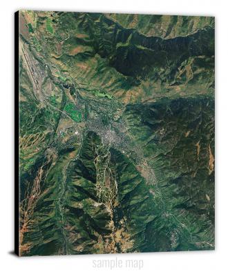
Enrich your office decor or home with a large canvas wrap Satellite map. It is designed for easy hanging with pre-installed hardware. Printed with archival inks and wrapped around a 1.5" thick gallery frame, your favorite map art will have a timeless and impressive look that fits with any decor. This map is fabricated with satellite imagery data from Google Earth, and bounding box coordinates from USGS.
Abbeville North, Georgia- Map Components- Imagery: Satellite of Abbeville North, Georgia. Bounding Box: Footprint of Abbeville North, Georgia at Longitude/Latitude Coordinates (-83.375 x -83.25 x 32.125 x 32).
Abbeville South, Georgia- Map Components- Imagery: Satellite of Abbeville South, Georgia. Bounding Box: Footprint of Abbeville South, Georgia at Longitude/Latitude Coordinates (-83.375 x -83.25 x 32 x 31.875).
Abbottsford, Georgia- Map Components- Imagery: Satellite of Abbottsford, Georgia. Bounding Box: Footprint of Abbottsford, Georgia at Longitude/Latitude Coordinates (-85.25 x -85.125 x 33.125 x 33).
Acree, Georgia- Map Components- Imagery: Satellite of Acree, Georgia. Bounding Box: Footprint of Acree, Georgia at Longitude/Latitude Coordinates (-84 x -83.875 x 31.625 x 31.5).
Acworth, Georgia- Map Components- Imagery: Satellite of Acworth, Georgia. Bounding Box: Footprint of Acworth, Georgia at Longitude/Latitude Coordinates (-84.75 x -84.625 x 34.125 x 34).
Adairsville, Georgia- Map Components- Imagery: Satellite of Adairsville, Georgia. Bounding Box: Footprint of Adairsville, Georgia at Longitude/Latitude Coordinates (-85 x -84.875 x 34.375 x 34.25).
Adel, Georgia- Map Components- Imagery: Satellite of Adel, Georgia. Bounding Box: Footprint of Adel, Georgia at Longitude/Latitude Coordinates (-83.5 x -83.375 x 31.25 x 31.125).
Adrian, Georgia- Map Components- Imagery: Satellite of Adrian, Georgia. Bounding Box: Footprint of Adrian, Georgia at Longitude/Latitude Coordinates (-82.625 x -82.5 x 32.625 x 32.5).
Alamo, Georgia- Map Components- Imagery: Satellite of Alamo, Georgia. Bounding Box: Footprint of Alamo, Georgia at Longitude/Latitude Coordinates (-82.875 x -82.75 x 32.25 x 32.125).
Alapaha, Georgia- Map Components- Imagery: Satellite of Alapaha, Georgia. Bounding Box: Footprint of Alapaha, Georgia at Longitude/Latitude Coordinates (-83.25 x -83.125 x 31.5 x 31.375).
Albany East, Georgia- Map Components- Imagery: Satellite of Albany East, Georgia. Bounding Box: Footprint of Albany East, Georgia at Longitude/Latitude Coordinates (-84.125 x -84 x 31.625 x 31.5).
Albany NE, Georgia- Map Components- Imagery: Satellite of Albany NE, Georgia. Bounding Box: Footprint of Albany NE, Georgia at Longitude/Latitude Coordinates (-84.125 x -84 x 31.75 x 31.625).
Albany West, Georgia- Map Components- Imagery: Satellite of Albany West, Georgia. Bounding Box: Footprint of Albany West, Georgia at Longitude/Latitude Coordinates (-84.25 x -84.125 x 31.625 x 31.5).
Alexander, Georgia- Map Components- Imagery: Satellite of Alexander, Georgia. Bounding Box: Footprint of Alexander, Georgia at Longitude/Latitude Coordinates (-81.875 x -81.75 x 33.125 x 33).
Allatoona Dam, Georgia- Map Components- Imagery: Satellite of Allatoona Dam, Georgia. Bounding Box: Footprint of Allatoona Dam, Georgia at Longitude/Latitude Coordinates (-84.75 x -84.625 x 34.25 x 34.125).
Alma, Georgia- Map Components- Imagery: Satellite of Alma, Georgia. Bounding Box: Footprint of Alma, Georgia at Longitude/Latitude Coordinates (-82.5 x -82.375 x 31.625 x 31.5).
Alma NE, Georgia- Map Components- Imagery: Satellite of Alma NE, Georgia. Bounding Box: Footprint of Alma NE, Georgia at Longitude/Latitude Coordinates (-82.375 x -82.25 x 31.75 x 31.625).
Alma NW, Georgia- Map Components- Imagery: Satellite of Alma NW, Georgia. Bounding Box: Footprint of Alma NW, Georgia at Longitude/Latitude Coordinates (-82.5 x -82.375 x 31.75 x 31.625).
Alston, Georgia- Map Components- Imagery: Satellite of Alston, Georgia. Bounding Box: Footprint of Alston, Georgia at Longitude/Latitude Coordinates (-82.5 x -82.375 x 32.125 x 32).
Altamaha, Georgia- Map Components- Imagery: Satellite of Altamaha, Georgia. Bounding Box: Footprint of Altamaha, Georgia at Longitude/Latitude Coordinates (-82.25 x -82.125 x 32 x 31.875).
Altamaha SE, Georgia- Map Components- Imagery: Satellite of Altamaha SE, Georgia. Bounding Box: Footprint of Altamaha SE, Georgia at Longitude/Latitude Coordinates (-82.125 x -82 x 31.875 x 31.75).
Altamaha Sound, Georgia- Map Components- Imagery: Satellite of Altamaha Sound, Georgia. Bounding Box: Footprint of Altamaha Sound, Georgia at Longitude/Latitude Coordinates (-81.375 x -81.25 x 31.375 x 31.25).
Altamaha SW, Georgia- Map Components- Imagery: Satellite of Altamaha SW, Georgia. Bounding Box: Footprint of Altamaha SW, Georgia at Longitude/Latitude Coordinates (-82.25 x -82.125 x 31.875 x 31.75).
Amboy, Georgia- Map Components- Imagery: Satellite of Amboy, Georgia. Bounding Box: Footprint of Amboy, Georgia at Longitude/Latitude Coordinates (-83.625 x -83.5 x 31.875 x 31.75).
Ambrose, Georgia- Map Components- Imagery: Satellite of Ambrose, Georgia. Bounding Box: Footprint of Ambrose, Georgia at Longitude/Latitude Coordinates (-83.125 x -83 x 31.625 x 31.5).
Americus, Georgia- Map Components- Imagery: Satellite of Americus, Georgia. Bounding Box: Footprint of Americus, Georgia at Longitude/Latitude Coordinates (-84.25 x -84.125 x 32.125 x 32).
Amicalola, Georgia- Map Components- Imagery: Satellite of Amicalola, Georgia. Bounding Box: Footprint of Amicalola, Georgia at Longitude/Latitude Coordinates (-84.375 x -84.25 x 34.625 x 34.5).
Andersonville, Georgia- Map Components- Imagery: Satellite of Andersonville, Georgia. Bounding Box: Footprint of Andersonville, Georgia at Longitude/Latitude Coordinates (-84.25 x -84.125 x 32.25 x 32.125).
Aonia, Georgia- Map Components- Imagery: Satellite of Aonia, Georgia. Bounding Box: Footprint of Aonia, Georgia at Longitude/Latitude Coordinates (-82.625 x -82.5 x 33.75 x 33.625).
Apalachee, Georgia- Map Components- Imagery: Satellite of Apalachee, Georgia. Bounding Box: Footprint of Apalachee, Georgia at Longitude/Latitude Coordinates (-83.5 x -83.375 x 33.75 x 33.625).
Apple Valley, Georgia- Map Components- Imagery: Satellite of Apple Valley, Georgia. Bounding Box: Footprint of Apple Valley, Georgia at Longitude/Latitude Coordinates (-83.625 x -83.5 x 34.25 x 34.125).
Appling, Georgia- Map Components- Imagery: Satellite of Appling, Georgia. Bounding Box: Footprint of Appling, Georgia at Longitude/Latitude Coordinates (-82.375 x -82.25 x 33.625 x 33.5).
Arabi, Georgia- Map Components- Imagery: Satellite of Arabi, Georgia. Bounding Box: Footprint of Arabi, Georgia at Longitude/Latitude Coordinates (-83.75 x -83.625 x 31.875 x 31.75).
Arlington, Georgia- Map Components- Imagery: Satellite of Arlington, Georgia. Bounding Box: Footprint of Arlington, Georgia at Longitude/Latitude Coordinates (-84.75 x -84.625 x 31.5 x 31.375).
Armuchee, Georgia- Map Components- Imagery: Satellite of Armuchee, Georgia. Bounding Box: Footprint of Armuchee, Georgia at Longitude/Latitude Coordinates (-85.25 x -85.125 x 34.5 x 34.375).
Ashburn, Georgia- Map Components- Imagery: Satellite of Ashburn, Georgia. Bounding Box: Footprint of Ashburn, Georgia at Longitude/Latitude Coordinates (-83.75 x -83.625 x 31.75 x 31.625).
Ashland, Georgia- Map Components- Imagery: Satellite of Ashland, Georgia. Bounding Box: Footprint of Ashland, Georgia at Longitude/Latitude Coordinates (-83.375 x -83.25 x 34.375 x 34.25).
Athens East, Georgia- Map Components- Imagery: Satellite of Athens East, Georgia. Bounding Box: Footprint of Athens East, Georgia at Longitude/Latitude Coordinates (-83.375 x -83.25 x 34 x 33.875).
Athens West, Georgia- Map Components- Imagery: Satellite of Athens West, Georgia. Bounding Box: Footprint of Athens West, Georgia at Longitude/Latitude Coordinates (-83.5 x -83.375 x 34 x 33.875).
Auburn, Georgia- Map Components- Imagery: Satellite of Auburn, Georgia. Bounding Box: Footprint of Auburn, Georgia at Longitude/Latitude Coordinates (-83.875 x -83.75 x 34.125 x 34).
Augusta East, Georgia- Map Components- Imagery: Satellite of Augusta East, Georgia. Bounding Box: Footprint of Augusta East, Georgia at Longitude/Latitude Coordinates (-82 x -81.875 x 33.5 x 33.375).
Augusta West, Georgia- Map Components- Imagery: Satellite of Augusta West, Georgia. Bounding Box: Footprint of Augusta West, Georgia at Longitude/Latitude Coordinates (-82.125 x -82 x 33.5 x 33.375).
Austell, Georgia- Map Components- Imagery: Satellite of Austell, Georgia. Bounding Box: Footprint of Austell, Georgia at Longitude/Latitude Coordinates (-84.75 x -84.625 x 33.875 x 33.75).
Avalon, Georgia- Map Components- Imagery: Satellite of Avalon, Georgia. Bounding Box: Footprint of Avalon, Georgia at Longitude/Latitude Coordinates (-83.25 x -83.125 x 34.625 x 34.5).
Avondale, Georgia- Map Components- Imagery: Satellite of Avondale, Georgia. Bounding Box: Footprint of Avondale, Georgia at Longitude/Latitude Coordinates (-82.375 x -82.25 x 33.375 x 33.25).
Axson, Georgia- Map Components- Imagery: Satellite of Axson, Georgia. Bounding Box: Footprint of Axson, Georgia at Longitude/Latitude Coordinates (-82.75 x -82.625 x 31.375 x 31.25).
Ayersville, Georgia- Map Components- Imagery: Satellite of Ayersville, Georgia. Bounding Box: Footprint of Ayersville, Georgia at Longitude/Latitude Coordinates (-83.5 x -83.375 x 34.625 x 34.5).
Baconton North, Georgia- Map Components- Imagery: Satellite of Baconton North, Georgia. Bounding Box: Footprint of Baconton North, Georgia at Longitude/Latitude Coordinates (-84.25 x -84.125 x 31.5 x 31.375).
Baconton South, Georgia- Map Components- Imagery: Satellite of Baconton South, Georgia. Bounding Box: Footprint of Baconton South, Georgia at Longitude/Latitude Coordinates (-84.25 x -84.125 x 31.375 x 31.25).
Baden, Georgia- Map Components- Imagery: Satellite of Baden, Georgia. Bounding Box: Footprint of Baden, Georgia at Longitude/Latitude Coordinates (-83.625 x -83.5 x 30.75 x 30.625).
Bainbridge, Georgia- Map Components- Imagery: Satellite of Bainbridge, Georgia. Bounding Box: Footprint of Bainbridge, Georgia at Longitude/Latitude Coordinates (-84.625 x -84.5 x 31 x 30.875).
Baldwin, Georgia- Map Components- Imagery: Satellite of Baldwin, Georgia. Bounding Box: Footprint of Baldwin, Georgia at Longitude/Latitude Coordinates (-83.625 x -83.5 x 34.5 x 34.375).
Baldwinville, Georgia- Map Components- Imagery: Satellite of Baldwinville, Georgia. Bounding Box: Footprint of Baldwinville, Georgia at Longitude/Latitude Coordinates (-84.5 x -84.375 x 32.75 x 32.625).
Ball Ground East, Georgia- Map Components- Imagery: Satellite of Ball Ground East, Georgia. Bounding Box: Footprint of Ball Ground East, Georgia at Longitude/Latitude Coordinates (-84.375 x -84.25 x 34.375 x 34.25).
Ball Ground West, Georgia- Map Components- Imagery: Satellite of Ball Ground West, Georgia. Bounding Box: Footprint of Ball Ground West, Georgia at Longitude/Latitude Coordinates (-84.5 x -84.375 x 34.375 x 34.25).
Bancroft, Georgia- Map Components- Imagery: Satellite of Bancroft, Georgia. Bounding Box: Footprint of Bancroft, Georgia at Longitude/Latitude Coordinates (-84.875 x -84.75 x 31.5 x 31.375).
Barnesville, Georgia- Map Components- Imagery: Satellite of Barnesville, Georgia. Bounding Box: Footprint of Barnesville, Georgia at Longitude/Latitude Coordinates (-84.25 x -84.125 x 33.125 x 33).
Barnett Shoals, Georgia- Map Components- Imagery: Satellite of Barnett Shoals, Georgia. Bounding Box: Footprint of Barnett Shoals, Georgia at Longitude/Latitude Coordinates (-83.375 x -83.25 x 33.875 x 33.75).
Bartletts Ferry Dam, Georgia- Map Components- Imagery: Satellite of Bartletts Ferry Dam, Georgia. Bounding Box: Footprint of Bartletts Ferry Dam, Georgia at Longitude/Latitude Coordinates (-85.125 x -85 x 32.75 x 32.625).
Bastonville, Georgia- Map Components- Imagery: Satellite of Bastonville, Georgia. Bounding Box: Footprint of Bastonville, Georgia at Longitude/Latitude Coordinates (-82.625 x -82.5 x 33.375 x 33.25).
Baxley, Georgia- Map Components- Imagery: Satellite of Baxley, Georgia. Bounding Box: Footprint of Baxley, Georgia at Longitude/Latitude Coordinates (-82.375 x -82.25 x 31.875 x 31.75).
Baxley NE, Georgia- Map Components- Imagery: Satellite of Baxley NE, Georgia. Bounding Box: Footprint of Baxley NE, Georgia at Longitude/Latitude Coordinates (-82.375 x -82.25 x 32 x 31.875).
Bay Branch, Georgia- Map Components- Imagery: Satellite of Bay Branch, Georgia. Bounding Box: Footprint of Bay Branch, Georgia at Longitude/Latitude Coordinates (-81.875 x -81.75 x 32.875 x 32.75).
Beach, Georgia- Map Components- Imagery: Satellite of Beach, Georgia. Bounding Box: Footprint of Beach, Georgia at Longitude/Latitude Coordinates (-82.625 x -82.5 x 31.5 x 31.375).
Beachton, Georgia- Map Components- Imagery: Satellite of Beachton, Georgia. Bounding Box: Footprint of Beachton, Georgia at Longitude/Latitude Coordinates (-84.25 x -84.125 x 30.75 x 30.625).
Beall Springs, Georgia- Map Components- Imagery: Satellite of Beall Springs, Georgia. Bounding Box: Footprint of Beall Springs, Georgia at Longitude/Latitude Coordinates (-82.75 x -82.625 x 33.375 x 33.25).
Beaverdale, Georgia- Map Components- Imagery: Satellite of Beaverdale, Georgia. Bounding Box: Footprint of Beaverdale, Georgia at Longitude/Latitude Coordinates (-84.875 x -84.75 x 35 x 34.875).
Bellevue, Georgia- Map Components- Imagery: Satellite of Bellevue, Georgia. Bounding Box: Footprint of Bellevue, Georgia at Longitude/Latitude Coordinates (-82.125 x -82 x 33 x 32.875).
Bemiss, Georgia- Map Components- Imagery: Satellite of Bemiss, Georgia. Bounding Box: Footprint of Bemiss, Georgia at Longitude/Latitude Coordinates (-83.25 x -83.125 x 31 x 30.875).
Ben Hill, Georgia- Map Components- Imagery: Satellite of Ben Hill, Georgia. Bounding Box: Footprint of Ben Hill, Georgia at Longitude/Latitude Coordinates (-84.625 x -84.5 x 33.75 x 33.625).
Benedict, Georgia- Map Components- Imagery: Satellite of Benedict, Georgia. Bounding Box: Footprint of Benedict, Georgia at Longitude/Latitude Coordinates (-85.375 x -85.25 x 34 x 33.875).
Benevolence, Georgia- Map Components- Imagery: Satellite of Benevolence, Georgia. Bounding Box: Footprint of Benevolence, Georgia at Longitude/Latitude Coordinates (-84.75 x -84.625 x 32 x 31.875).
Berlin East, Georgia- Map Components- Imagery: Satellite of Berlin East, Georgia. Bounding Box: Footprint of Berlin East, Georgia at Longitude/Latitude Coordinates (-83.625 x -83.5 x 31.125 x 31).
Berlin West, Georgia- Map Components- Imagery: Satellite of Berlin West, Georgia. Bounding Box: Footprint of Berlin West, Georgia at Longitude/Latitude Coordinates (-83.75 x -83.625 x 31.125 x 31).
Bermuda, Georgia- Map Components- Imagery: Satellite of Bermuda, Georgia. Bounding Box: Footprint of Bermuda, Georgia at Longitude/Latitude Coordinates (-84.5 x -84.375 x 31.5 x 31.375).
Berner, Georgia- Map Components- Imagery: Satellite of Berner, Georgia. Bounding Box: Footprint of Berner, Georgia at Longitude/Latitude Coordinates (-83.875 x -83.75 x 33.25 x 33.125).
Bethany, Georgia- Map Components- Imagery: Satellite of Bethany, Georgia. Bounding Box: Footprint of Bethany, Georgia at Longitude/Latitude Coordinates (-84.625 x -84.5 x 31.375 x 31.25).
Bethel, Georgia- Map Components- Imagery: Satellite of Bethel, Georgia. Bounding Box: Footprint of Bethel, Georgia at Longitude/Latitude Coordinates (-83.625 x -83.5 x 31.75 x 31.625).
Between, Georgia- Map Components- Imagery: Satellite of Between, Georgia. Bounding Box: Footprint of Between, Georgia at Longitude/Latitude Coordinates (-83.875 x -83.75 x 33.875 x 33.75).
Billys Island, Georgia- Map Components- Imagery: Satellite of Billys Island, Georgia. Bounding Box: Footprint of Billys Island, Georgia at Longitude/Latitude Coordinates (-82.375 x -82.25 x 30.875 x 30.75).
Birdsville, Georgia- Map Components- Imagery: Satellite of Birdsville, Georgia. Bounding Box: Footprint of Birdsville, Georgia at Longitude/Latitude Coordinates (-82.125 x -82 x 32.875 x 32.75).
Birmingham, Georgia- Map Components- Imagery: Satellite of Birmingham, Georgia. Bounding Box: Footprint of Birmingham, Georgia at Longitude/Latitude Coordinates (-84.375 x -84.25 x 34.25 x 34.125).
Blackjack Island, Georgia- Map Components- Imagery: Satellite of Blackjack Island, Georgia. Bounding Box: Footprint of Blackjack Island, Georgia at Longitude/Latitude Coordinates (-82.375 x -82.25 x 30.75 x 30.625).
Blackshear East, Georgia- Map Components- Imagery: Satellite of Blackshear East, Georgia. Bounding Box: Footprint of Blackshear East, Georgia at Longitude/Latitude Coordinates (-82.25 x -82.125 x 31.375 x 31.25).
Blackshear West, Georgia- Map Components- Imagery: Satellite of Blackshear West, Georgia. Bounding Box: Footprint of Blackshear West, Georgia at Longitude/Latitude Coordinates (-82.375 x -82.25 x 31.375 x 31.25).
Bladen, Georgia- Map Components- Imagery: Satellite of Bladen, Georgia. Bounding Box: Footprint of Bladen, Georgia at Longitude/Latitude Coordinates (-81.75 x -81.625 x 31.25 x 31.125).
Blairsville, Georgia- Map Components- Imagery: Satellite of Blairsville, Georgia. Bounding Box: Footprint of Blairsville, Georgia at Longitude/Latitude Coordinates (-84 x -83.875 x 35 x 34.875).
Blakely North, Georgia- Map Components- Imagery: Satellite of Blakely North, Georgia. Bounding Box: Footprint of Blakely North, Georgia at Longitude/Latitude Coordinates (-85 x -84.875 x 31.5 x 31.375).
Blakely South, Georgia- Map Components- Imagery: Satellite of Blakely South, Georgia. Bounding Box: Footprint of Blakely South, Georgia at Longitude/Latitude Coordinates (-85 x -84.875 x 31.375 x 31.25).
Blue Ridge, Georgia- Map Components- Imagery: Satellite of Blue Ridge, Georgia. Bounding Box: Footprint of Blue Ridge, Georgia at Longitude/Latitude Coordinates (-84.375 x -84.25 x 34.875 x 34.75).
Blue Springs Landing, Georgia- Map Components- Imagery: Satellite of Blue Springs Landing, Georgia. Bounding Box: Footprint of Blue Springs Landing, Georgia at Longitude/Latitude Coordinates (-81.5 x -81.375 x 32.75 x 32.625).
Bluffton, Georgia- Map Components- Imagery: Satellite of Bluffton, Georgia. Bounding Box: Footprint of Bluffton, Georgia at Longitude/Latitude Coordinates (-84.875 x -84.75 x 31.625 x 31.5).
Blythe, Georgia- Map Components- Imagery: Satellite of Blythe, Georgia. Bounding Box: Footprint of Blythe, Georgia at Longitude/Latitude Coordinates (-82.25 x -82.125 x 33.375 x 33.25).
Bold Springs, Georgia- Map Components- Imagery: Satellite of Bold Springs, Georgia. Bounding Box: Footprint of Bold Springs, Georgia at Longitude/Latitude Coordinates (-83.875 x -83.75 x 34 x 33.875).
Bolingbroke, Georgia- Map Components- Imagery: Satellite of Bolingbroke, Georgia. Bounding Box: Footprint of Bolingbroke, Georgia at Longitude/Latitude Coordinates (-83.875 x -83.75 x 33 x 32.875).
Boons Lake, Georgia- Map Components- Imagery: Satellite of Boons Lake, Georgia. Bounding Box: Footprint of Boons Lake, Georgia at Longitude/Latitude Coordinates (-82 x -81.875 x 31.125 x 31).
Boston, Georgia- Map Components- Imagery: Satellite of Boston, Georgia. Bounding Box: Footprint of Boston, Georgia at Longitude/Latitude Coordinates (-83.875 x -83.75 x 30.875 x 30.75).
Bottsford, Georgia- Map Components- Imagery: Satellite of Bottsford, Georgia. Bounding Box: Footprint of Bottsford, Georgia at Longitude/Latitude Coordinates (-84.5 x -84.375 x 32 x 31.875).
Bowdens Pond, Georgia- Map Components- Imagery: Satellite of Bowdens Pond, Georgia. Bounding Box: Footprint of Bowdens Pond, Georgia at Longitude/Latitude Coordinates (-82.5 x -82.375 x 33.375 x 33.25).
Bowdon East, Georgia- Map Components- Imagery: Satellite of Bowdon East, Georgia. Bounding Box: Footprint of Bowdon East, Georgia at Longitude/Latitude Coordinates (-85.25 x -85.125 x 33.625 x 33.5).
Bowdon West, Georgia- Map Components- Imagery: Satellite of Bowdon West, Georgia. Bounding Box: Footprint of Bowdon West, Georgia at Longitude/Latitude Coordinates (-85.375 x -85.25 x 33.625 x 33.5).
Bowman, Georgia- Map Components- Imagery: Satellite of Bowman, Georgia. Bounding Box: Footprint of Bowman, Georgia at Longitude/Latitude Coordinates (-83.125 x -83 x 34.25 x 34.125).
Boykin, Georgia- Map Components- Imagery: Satellite of Boykin, Georgia. Bounding Box: Footprint of Boykin, Georgia at Longitude/Latitude Coordinates (-84.75 x -84.625 x 31.125 x 31).
Branchville, Georgia- Map Components- Imagery: Satellite of Branchville, Georgia. Bounding Box: Footprint of Branchville, Georgia at Longitude/Latitude Coordinates (-84.375 x -84.25 x 31.25 x 31.125).
Bremen, Georgia- Map Components- Imagery: Satellite of Bremen, Georgia. Bounding Box: Footprint of Bremen, Georgia at Longitude/Latitude Coordinates (-85.25 x -85.125 x 33.75 x 33.625).
Bridgeboro, Georgia- Map Components- Imagery: Satellite of Bridgeboro, Georgia. Bounding Box: Footprint of Bridgeboro, Georgia at Longitude/Latitude Coordinates (-84 x -83.875 x 31.5 x 31.375).
Brier Creek Landing, Georgia- Map Components- Imagery: Satellite of Brier Creek Landing, Georgia. Bounding Box: Footprint of Brier Creek Landing, Georgia at Longitude/Latitude Coordinates (-81.5 x -81.375 x 32.875 x 32.75).
Brinson, Georgia- Map Components- Imagery: Satellite of Brinson, Georgia. Bounding Box: Footprint of Brinson, Georgia at Longitude/Latitude Coordinates (-84.75 x -84.625 x 31 x 30.875).
Broad, Georgia- Map Components- Imagery: Satellite of Broad, Georgia. Bounding Box: Footprint of Broad, Georgia at Longitude/Latitude Coordinates (-82.75 x -82.625 x 34 x 33.875).
Bronwood, Georgia- Map Components- Imagery: Satellite of Bronwood, Georgia. Bounding Box: Footprint of Bronwood, Georgia at Longitude/Latitude Coordinates (-84.375 x -84.25 x 31.875 x 31.75).
Brooklet, Georgia- Map Components- Imagery: Satellite of Brooklet, Georgia. Bounding Box: Footprint of Brooklet, Georgia at Longitude/Latitude Coordinates (-81.75 x -81.625 x 32.5 x 32.375).
Brooklyn, Georgia- Map Components- Imagery: Satellite of Brooklyn, Georgia. Bounding Box: Footprint of Brooklyn, Georgia at Longitude/Latitude Coordinates (-84.75 x -84.625 x 32.25 x 32.125).
Brooks, Georgia- Map Components- Imagery: Satellite of Brooks, Georgia. Bounding Box: Footprint of Brooks, Georgia at Longitude/Latitude Coordinates (-84.5 x -84.375 x 33.375 x 33.25).
Brooksville, Georgia- Map Components- Imagery: Satellite of Brooksville, Georgia. Bounding Box: Footprint of Brooksville, Georgia at Longitude/Latitude Coordinates (-84.75 x -84.625 x 31.875 x 31.75).
Browns Crossing, Georgia- Map Components- Imagery: Satellite of Browns Crossing, Georgia. Bounding Box: Footprint of Browns Crossing, Georgia at Longitude/Latitude Coordinates (-83.375 x -83.25 x 33.125 x 33).
Browntown, Georgia- Map Components- Imagery: Satellite of Browntown, Georgia. Bounding Box: Footprint of Browntown, Georgia at Longitude/Latitude Coordinates (-81.875 x -81.75 x 31.375 x 31.25).
Broxton NE, Georgia- Map Components- Imagery: Satellite of Broxton NE, Georgia. Bounding Box: Footprint of Broxton NE, Georgia at Longitude/Latitude Coordinates (-82.875 x -82.75 x 31.75 x 31.625).
Broxton North, Georgia- Map Components- Imagery: Satellite of Broxton North, Georgia. Bounding Box: Footprint of Broxton North, Georgia at Longitude/Latitude Coordinates (-83 x -82.875 x 31.75 x 31.625).
Broxton South, Georgia- Map Components- Imagery: Satellite of Broxton South, Georgia. Bounding Box: Footprint of Broxton South, Georgia at Longitude/Latitude Coordinates (-83 x -82.875 x 31.625 x 31.5).
Brunswick East, Georgia- Map Components- Imagery: Satellite of Brunswick East, Georgia. Bounding Box: Footprint of Brunswick East, Georgia at Longitude/Latitude Coordinates (-81.5 x -81.375 x 31.25 x 31.125).
Brunswick West, Georgia- Map Components- Imagery: Satellite of Brunswick West, Georgia. Bounding Box: Footprint of Brunswick West, Georgia at Longitude/Latitude Coordinates (-81.625 x -81.5 x 31.25 x 31.125).
Buchanan, Georgia- Map Components- Imagery: Satellite of Buchanan, Georgia. Bounding Box: Footprint of Buchanan, Georgia at Longitude/Latitude Coordinates (-85.25 x -85.125 x 33.875 x 33.75).
Buckhead, Georgia- Map Components- Imagery: Satellite of Buckhead, Georgia. Bounding Box: Footprint of Buckhead, Georgia at Longitude/Latitude Coordinates (-83.375 x -83.25 x 33.625 x 33.5).
Buena Vista, Georgia- Map Components- Imagery: Satellite of Buena Vista, Georgia. Bounding Box: Footprint of Buena Vista, Georgia at Longitude/Latitude Coordinates (-84.625 x -84.5 x 32.375 x 32.25).
Buena Vista NE, Georgia- Map Components- Imagery: Satellite of Buena Vista NE, Georgia. Bounding Box: Footprint of Buena Vista NE, Georgia at Longitude/Latitude Coordinates (-84.625 x -84.5 x 32.5 x 32.375).
Buena Vista NW, Georgia- Map Components- Imagery: Satellite of Buena Vista NW, Georgia. Bounding Box: Footprint of Buena Vista NW, Georgia at Longitude/Latitude Coordinates (-84.75 x -84.625 x 32.5 x 32.375).
Buford Dam, Georgia- Map Components- Imagery: Satellite of Buford Dam, Georgia. Bounding Box: Footprint of Buford Dam, Georgia at Longitude/Latitude Coordinates (-84.125 x -84 x 34.25 x 34.125).
Bug Island, Georgia- Map Components- Imagery: Satellite of Bug Island, Georgia. Bounding Box: Footprint of Bug Island, Georgia at Longitude/Latitude Coordinates (-81.75 x -81.625 x 31.625 x 31.5).
Burnt Fort, Georgia- Map Components- Imagery: Satellite of Burnt Fort, Georgia. Bounding Box: Footprint of Burnt Fort, Georgia at Longitude/Latitude Coordinates (-82 x -81.875 x 31 x 30.875).
Burnt Hickory Ridge, Georgia- Map Components- Imagery: Satellite of Burnt Hickory Ridge, Georgia. Bounding Box: Footprint of Burnt Hickory Ridge, Georgia at Longitude/Latitude Coordinates (-84.875 x -84.75 x 34.125 x 34).
Burroughs, Georgia- Map Components- Imagery: Satellite of Burroughs, Georgia. Bounding Box: Footprint of Burroughs, Georgia at Longitude/Latitude Coordinates (-81.25 x -81.125 x 32 x 31.875).
Burtons Ferry Landing, Georgia- Map Components- Imagery: Satellite of Burtons Ferry Landing, Georgia. Bounding Box: Footprint of Burtons Ferry Landing, Georgia at Longitude/Latitude Coordinates (-81.625 x -81.5 x 33 x 32.875).
Butler East, Georgia- Map Components- Imagery: Satellite of Butler East, Georgia. Bounding Box: Footprint of Butler East, Georgia at Longitude/Latitude Coordinates (-84.25 x -84.125 x 32.625 x 32.5).
Butler West, Georgia- Map Components- Imagery: Satellite of Butler West, Georgia. Bounding Box: Footprint of Butler West, Georgia at Longitude/Latitude Coordinates (-84.375 x -84.25 x 32.625 x 32.5).
Byromville, Georgia- Map Components- Imagery: Satellite of Byromville, Georgia. Bounding Box: Footprint of Byromville, Georgia at Longitude/Latitude Coordinates (-84 x -83.875 x 32.25 x 32.125).
Byron, Georgia- Map Components- Imagery: Satellite of Byron, Georgia. Bounding Box: Footprint of Byron, Georgia at Longitude/Latitude Coordinates (-83.875 x -83.75 x 32.75 x 32.625).
Cabretta Inlet, Georgia- Map Components- Imagery: Satellite of Cabretta Inlet, Georgia. Bounding Box: Footprint of Cabretta Inlet, Georgia at Longitude/Latitude Coordinates (-81.25 x -81.125 x 31.5 x 31.375).
Cadley, Georgia- Map Components- Imagery: Satellite of Cadley, Georgia. Bounding Box: Footprint of Cadley, Georgia at Longitude/Latitude Coordinates (-82.75 x -82.625 x 33.625 x 33.5).
Cadwell, Georgia- Map Components- Imagery: Satellite of Cadwell, Georgia. Bounding Box: Footprint of Cadwell, Georgia at Longitude/Latitude Coordinates (-83.125 x -83 x 32.375 x 32.25).
Cairo North, Georgia- Map Components- Imagery: Satellite of Cairo North, Georgia. Bounding Box: Footprint of Cairo North, Georgia at Longitude/Latitude Coordinates (-84.25 x -84.125 x 31 x 30.875).
Cairo South, Georgia- Map Components- Imagery: Satellite of Cairo South, Georgia. Bounding Box: Footprint of Cairo South, Georgia at Longitude/Latitude Coordinates (-84.25 x -84.125 x 30.875 x 30.75).
Calhoun NE, Georgia- Map Components- Imagery: Satellite of Calhoun NE, Georgia. Bounding Box: Footprint of Calhoun NE, Georgia at Longitude/Latitude Coordinates (-84.875 x -84.75 x 34.75 x 34.625).
Calhoun North, Georgia- Map Components- Imagery: Satellite of Calhoun North, Georgia. Bounding Box: Footprint of Calhoun North, Georgia at Longitude/Latitude Coordinates (-85 x -84.875 x 34.625 x 34.5).
Calhoun South, Georgia- Map Components- Imagery: Satellite of Calhoun South, Georgia. Bounding Box: Footprint of Calhoun South, Georgia at Longitude/Latitude Coordinates (-85 x -84.875 x 34.5 x 34.375).
Calvary, Georgia- Map Components- Imagery: Satellite of Calvary, Georgia. Bounding Box: Footprint of Calvary, Georgia at Longitude/Latitude Coordinates (-84.375 x -84.25 x 30.75 x 30.625).
Camilla, Georgia- Map Components- Imagery: Satellite of Camilla, Georgia. Bounding Box: Footprint of Camilla, Georgia at Longitude/Latitude Coordinates (-84.25 x -84.125 x 31.25 x 31.125).
Campbell Mountain, Georgia- Map Components- Imagery: Satellite of Campbell Mountain, Georgia. Bounding Box: Footprint of Campbell Mountain, Georgia at Longitude/Latitude Coordinates (-84.125 x -84 x 34.625 x 34.5).
Campbellton, Georgia- Map Components- Imagery: Satellite of Campbellton, Georgia. Bounding Box: Footprint of Campbellton, Georgia at Longitude/Latitude Coordinates (-84.75 x -84.625 x 33.75 x 33.625).
Cannonville, Georgia- Map Components- Imagery: Satellite of Cannonville, Georgia. Bounding Box: Footprint of Cannonville, Georgia at Longitude/Latitude Coordinates (-85.125 x -85 x 33 x 32.875).
Canoochee, Georgia- Map Components- Imagery: Satellite of Canoochee, Georgia. Bounding Box: Footprint of Canoochee, Georgia at Longitude/Latitude Coordinates (-82.25 x -82.125 x 32.75 x 32.625).
Canton, Georgia- Map Components- Imagery: Satellite of Canton, Georgia. Bounding Box: Footprint of Canton, Georgia at Longitude/Latitude Coordinates (-84.5 x -84.375 x 34.25 x 34.125).
Carlton, Georgia- Map Components- Imagery: Satellite of Carlton, Georgia. Bounding Box: Footprint of Carlton, Georgia at Longitude/Latitude Coordinates (-83.125 x -83 x 34.125 x 34).
Carnegie, Georgia- Map Components- Imagery: Satellite of Carnegie, Georgia. Bounding Box: Footprint of Carnegie, Georgia at Longitude/Latitude Coordinates (-84.875 x -84.75 x 31.75 x 31.625).
Carnesville, Georgia- Map Components- Imagery: Satellite of Carnesville, Georgia. Bounding Box: Footprint of Carnesville, Georgia at Longitude/Latitude Coordinates (-83.25 x -83.125 x 34.375 x 34.25).
Carrollton, Georgia- Map Components- Imagery: Satellite of Carrollton, Georgia. Bounding Box: Footprint of Carrollton, Georgia at Longitude/Latitude Coordinates (-85.125 x -85 x 33.625 x 33.5).
Cartersville, Georgia- Map Components- Imagery: Satellite of Cartersville, Georgia. Bounding Box: Footprint of Cartersville, Georgia at Longitude/Latitude Coordinates (-84.875 x -84.75 x 34.25 x 34.125).
Cashes Valley, Georgia- Map Components- Imagery: Satellite of Cashes Valley, Georgia. Bounding Box: Footprint of Cashes Valley, Georgia at Longitude/Latitude Coordinates (-84.5 x -84.375 x 34.875 x 34.75).
Cataula, Georgia- Map Components- Imagery: Satellite of Cataula, Georgia. Bounding Box: Footprint of Cataula, Georgia at Longitude/Latitude Coordinates (-84.875 x -84.75 x 32.75 x 32.625).
Catlett, Georgia- Map Components- Imagery: Satellite of Catlett, Georgia. Bounding Box: Footprint of Catlett, Georgia at Longitude/Latitude Coordinates (-85.25 x -85.125 x 34.75 x 34.625).
Cecil, Georgia- Map Components- Imagery: Satellite of Cecil, Georgia. Bounding Box: Footprint of Cecil, Georgia at Longitude/Latitude Coordinates (-83.5 x -83.375 x 31.125 x 31).
Cedar Grove, Georgia- Map Components- Imagery: Satellite of Cedar Grove, Georgia. Bounding Box: Footprint of Cedar Grove, Georgia at Longitude/Latitude Coordinates (-85.5 x -85.375 x 34.75 x 34.625).
Cedartown East, Georgia- Map Components- Imagery: Satellite of Cedartown East, Georgia. Bounding Box: Footprint of Cedartown East, Georgia at Longitude/Latitude Coordinates (-85.25 x -85.125 x 34.125 x 34).
Cedartown West, Georgia- Map Components- Imagery: Satellite of Cedartown West, Georgia. Bounding Box: Footprint of Cedartown West, Georgia at Longitude/Latitude Coordinates (-85.375 x -85.25 x 34.125 x 34).
Celeste, Georgia- Map Components- Imagery: Satellite of Celeste, Georgia. Bounding Box: Footprint of Celeste, Georgia at Longitude/Latitude Coordinates (-82.875 x -82.75 x 33.875 x 33.75).
Chamblee, Georgia- Map Components- Imagery: Satellite of Chamblee, Georgia. Bounding Box: Footprint of Chamblee, Georgia at Longitude/Latitude Coordinates (-84.375 x -84.25 x 34 x 33.875).
Chase Prairie, Georgia- Map Components- Imagery: Satellite of Chase Prairie, Georgia. Bounding Box: Footprint of Chase Prairie, Georgia at Longitude/Latitude Coordinates (-82.25 x -82.125 x 30.875 x 30.75).
Chastain, Georgia- Map Components- Imagery: Satellite of Chastain, Georgia. Bounding Box: Footprint of Chastain, Georgia at Longitude/Latitude Coordinates (-84 x -83.875 x 31.125 x 31).
Chatsworth, Georgia- Map Components- Imagery: Satellite of Chatsworth, Georgia. Bounding Box: Footprint of Chatsworth, Georgia at Longitude/Latitude Coordinates (-84.875 x -84.75 x 34.875 x 34.75).
Chattoogaville, Georgia- Map Components- Imagery: Satellite of Chattoogaville, Georgia. Bounding Box: Footprint of Chattoogaville, Georgia at Longitude/Latitude Coordinates (-85.5 x -85.375 x 34.375 x 34.25).
Chennault, Georgia- Map Components- Imagery: Satellite of Chennault, Georgia. Bounding Box: Footprint of Chennault, Georgia at Longitude/Latitude Coordinates (-82.625 x -82.5 x 34 x 33.875).
Chesser Island, Georgia- Map Components- Imagery: Satellite of Chesser Island, Georgia. Bounding Box: Footprint of Chesser Island, Georgia at Longitude/Latitude Coordinates (-82.25 x -82.125 x 30.75 x 30.625).
Chestatee, Georgia- Map Components- Imagery: Satellite of Chestatee, Georgia. Bounding Box: Footprint of Chestatee, Georgia at Longitude/Latitude Coordinates (-84 x -83.875 x 34.375 x 34.25).
Chester, Georgia- Map Components- Imagery: Satellite of Chester, Georgia. Bounding Box: Footprint of Chester, Georgia at Longitude/Latitude Coordinates (-83.25 x -83.125 x 32.5 x 32.375).
Chestnut Mountain, Georgia- Map Components- Imagery: Satellite of Chestnut Mountain, Georgia. Bounding Box: Footprint of Chestnut Mountain, Georgia at Longitude/Latitude Coordinates (-83.875 x -83.75 x 34.25 x 34.125).
Chickasawhatchee, Georgia- Map Components- Imagery: Satellite of Chickasawhatchee, Georgia. Bounding Box: Footprint of Chickasawhatchee, Georgia at Longitude/Latitude Coordinates (-84.5 x -84.375 x 31.75 x 31.625).
China Hill, Georgia- Map Components- Imagery: Satellite of China Hill, Georgia. Bounding Box: Footprint of China Hill, Georgia at Longitude/Latitude Coordinates (-83.125 x -83 x 31.875 x 31.75).
Chula, Georgia- Map Components- Imagery: Satellite of Chula, Georgia. Bounding Box: Footprint of Chula, Georgia at Longitude/Latitude Coordinates (-83.625 x -83.5 x 31.625 x 31.5).
Church Hill, Georgia- Map Components- Imagery: Satellite of Church Hill, Georgia. Bounding Box: Footprint of Church Hill, Georgia at Longitude/Latitude Coordinates (-84.625 x -84.5 x 32.25 x 32.125).
Clarkesville, Georgia- Map Components- Imagery: Satellite of Clarkesville, Georgia. Bounding Box: Footprint of Clarkesville, Georgia at Longitude/Latitude Coordinates (-83.625 x -83.5 x 34.625 x 34.5).
Clarkesville NE, Georgia- Map Components- Imagery: Satellite of Clarkesville NE, Georgia. Bounding Box: Footprint of Clarkesville NE, Georgia at Longitude/Latitude Coordinates (-83.625 x -83.5 x 34.75 x 34.625).
Claxton, Georgia- Map Components- Imagery: Satellite of Claxton, Georgia. Bounding Box: Footprint of Claxton, Georgia at Longitude/Latitude Coordinates (-82 x -81.875 x 32.25 x 32.125).
Clermont, Georgia- Map Components- Imagery: Satellite of Clermont, Georgia. Bounding Box: Footprint of Clermont, Georgia at Longitude/Latitude Coordinates (-83.875 x -83.75 x 34.5 x 34.375).
Cleveland, Georgia- Map Components- Imagery: Satellite of Cleveland, Georgia. Bounding Box: Footprint of Cleveland, Georgia at Longitude/Latitude Coordinates (-83.875 x -83.75 x 34.625 x 34.5).
Climax North, Georgia- Map Components- Imagery: Satellite of Climax North, Georgia. Bounding Box: Footprint of Climax North, Georgia at Longitude/Latitude Coordinates (-84.5 x -84.375 x 31 x 30.875).
Climax South, Georgia- Map Components- Imagery: Satellite of Climax South, Georgia. Bounding Box: Footprint of Climax South, Georgia at Longitude/Latitude Coordinates (-84.5 x -84.375 x 30.875 x 30.75).
Clyattville, Georgia- Map Components- Imagery: Satellite of Clyattville, Georgia. Bounding Box: Footprint of Clyattville, Georgia at Longitude/Latitude Coordinates (-83.375 x -83.25 x 30.75 x 30.625).
Coal Mountain, Georgia- Map Components- Imagery: Satellite of Coal Mountain, Georgia. Bounding Box: Footprint of Coal Mountain, Georgia at Longitude/Latitude Coordinates (-84.125 x -84 x 34.375 x 34.25).
Cobb, Georgia- Map Components- Imagery: Satellite of Cobb, Georgia. Bounding Box: Footprint of Cobb, Georgia at Longitude/Latitude Coordinates (-84 x -83.875 x 32 x 31.875).
Cobbtown, Georgia- Map Components- Imagery: Satellite of Cobbtown, Georgia. Bounding Box: Footprint of Cobbtown, Georgia at Longitude/Latitude Coordinates (-82.25 x -82.125 x 32.375 x 32.25).
Cochran, Georgia- Map Components- Imagery: Satellite of Cochran, Georgia. Bounding Box: Footprint of Cochran, Georgia at Longitude/Latitude Coordinates (-83.375 x -83.25 x 32.5 x 32.375).
Coffee, Georgia- Map Components- Imagery: Satellite of Coffee, Georgia. Bounding Box: Footprint of Coffee, Georgia at Longitude/Latitude Coordinates (-82.375 x -82.25 x 31.625 x 31.5).
Cogdell, Georgia- Map Components- Imagery: Satellite of Cogdell, Georgia. Bounding Box: Footprint of Cogdell, Georgia at Longitude/Latitude Coordinates (-82.75 x -82.625 x 31.25 x 31.125).
Cohutta, Georgia- Map Components- Imagery: Satellite of Cohutta, Georgia. Bounding Box: Footprint of Cohutta, Georgia at Longitude/Latitude Coordinates (-85 x -84.875 x 35 x 34.875).
Coleman, Georgia- Map Components- Imagery: Satellite of Coleman, Georgia. Bounding Box: Footprint of Coleman, Georgia at Longitude/Latitude Coordinates (-85 x -84.875 x 31.75 x 31.625).
Colemans Lake, Georgia- Map Components- Imagery: Satellite of Colemans Lake, Georgia. Bounding Box: Footprint of Colemans Lake, Georgia at Longitude/Latitude Coordinates (-82.375 x -82.25 x 32.875 x 32.75).
Collins, Georgia- Map Components- Imagery: Satellite of Collins, Georgia. Bounding Box: Footprint of Collins, Georgia at Longitude/Latitude Coordinates (-82.125 x -82 x 32.25 x 32.125).
Colon, Georgia- Map Components- Imagery: Satellite of Colon, Georgia. Bounding Box: Footprint of Colon, Georgia at Longitude/Latitude Coordinates (-82.625 x -82.5 x 30.875 x 30.75).
Colquitt, Georgia- Map Components- Imagery: Satellite of Colquitt, Georgia. Bounding Box: Footprint of Colquitt, Georgia at Longitude/Latitude Coordinates (-84.75 x -84.625 x 31.25 x 31.125).
Columbia NE, Georgia- Map Components- Imagery: Satellite of Columbia NE, Georgia. Bounding Box: Footprint of Columbia NE, Georgia at Longitude/Latitude Coordinates (-85.125 x -85 x 31.5 x 31.375).
Columbus, Georgia- Map Components- Imagery: Satellite of Columbus, Georgia. Bounding Box: Footprint of Columbus, Georgia at Longitude/Latitude Coordinates (-85 x -84.875 x 32.5 x 32.375).
Commerce, Georgia- Map Components- Imagery: Satellite of Commerce, Georgia. Bounding Box: Footprint of Commerce, Georgia at Longitude/Latitude Coordinates (-83.5 x -83.375 x 34.25 x 34.125).
Concord, Georgia- Map Components- Imagery: Satellite of Concord, Georgia. Bounding Box: Footprint of Concord, Georgia at Longitude/Latitude Coordinates (-84.5 x -84.375 x 33.125 x 33).
Conyers, Georgia- Map Components- Imagery: Satellite of Conyers, Georgia. Bounding Box: Footprint of Conyers, Georgia at Longitude/Latitude Coordinates (-84.125 x -84 x 33.75 x 33.625).
Cooks Still, Georgia- Map Components- Imagery: Satellite of Cooks Still, Georgia. Bounding Box: Footprint of Cooks Still, Georgia at Longitude/Latitude Coordinates (-83.125 x -83 x 32 x 31.875).
Cooktown, Georgia- Map Components- Imagery: Satellite of Cooktown, Georgia. Bounding Box: Footprint of Cooktown, Georgia at Longitude/Latitude Coordinates (-84.625 x -84.5 x 31.25 x 31.125).
Coolidge, Georgia- Map Components- Imagery: Satellite of Coolidge, Georgia. Bounding Box: Footprint of Coolidge, Georgia at Longitude/Latitude Coordinates (-83.875 x -83.75 x 31.125 x 31).
Coosa Bald, Georgia- Map Components- Imagery: Satellite of Coosa Bald, Georgia. Bounding Box: Footprint of Coosa Bald, Georgia at Longitude/Latitude Coordinates (-84 x -83.875 x 34.875 x 34.75).
Cordele, Georgia- Map Components- Imagery: Satellite of Cordele, Georgia. Bounding Box: Footprint of Cordele, Georgia at Longitude/Latitude Coordinates (-83.875 x -83.75 x 32 x 31.875).
Cotton, Georgia- Map Components- Imagery: Satellite of Cotton, Georgia. Bounding Box: Footprint of Cotton, Georgia at Longitude/Latitude Coordinates (-84.125 x -84 x 31.25 x 31.125).
Council, Georgia- Map Components- Imagery: Satellite of Council, Georgia. Bounding Box: Footprint of Council, Georgia at Longitude/Latitude Coordinates (-82.625 x -82.5 x 30.625 x 30.5).
County Line, Georgia- Map Components- Imagery: Satellite of County Line, Georgia. Bounding Box: Footprint of County Line, Georgia at Longitude/Latitude Coordinates (-84.875 x -84.75 x 32 x 31.875).
Covena, Georgia- Map Components- Imagery: Satellite of Covena, Georgia. Bounding Box: Footprint of Covena, Georgia at Longitude/Latitude Coordinates (-82.5 x -82.375 x 32.5 x 32.375).
Covington, Georgia- Map Components- Imagery: Satellite of Covington, Georgia. Bounding Box: Footprint of Covington, Georgia at Longitude/Latitude Coordinates (-83.875 x -83.75 x 33.625 x 33.5).
Cow Hell Swamp, Georgia- Map Components- Imagery: Satellite of Cow Hell Swamp, Georgia. Bounding Box: Footprint of Cow Hell Swamp, Georgia at Longitude/Latitude Coordinates (-83 x -82.875 x 32.75 x 32.625).
Cowrock, Georgia- Map Components- Imagery: Satellite of Cowrock, Georgia. Bounding Box: Footprint of Cowrock, Georgia at Longitude/Latitude Coordinates (-83.875 x -83.75 x 34.75 x 34.625).
Cox, Georgia- Map Components- Imagery: Satellite of Cox, Georgia. Bounding Box: Footprint of Cox, Georgia at Longitude/Latitude Coordinates (-81.625 x -81.5 x 31.5 x 31.375).
Crandall, Georgia- Map Components- Imagery: Satellite of Crandall, Georgia. Bounding Box: Footprint of Crandall, Georgia at Longitude/Latitude Coordinates (-84.75 x -84.625 x 34.875 x 34.75).
Cravens Island, Georgia- Map Components- Imagery: Satellite of Cravens Island, Georgia. Bounding Box: Footprint of Cravens Island, Georgia at Longitude/Latitude Coordinates (-82.5 x -82.375 x 31 x 30.875).
Crawford, Georgia- Map Components- Imagery: Satellite of Crawford, Georgia. Bounding Box: Footprint of Crawford, Georgia at Longitude/Latitude Coordinates (-83.25 x -83.125 x 34 x 33.875).
Crawfordville, Georgia- Map Components- Imagery: Satellite of Crawfordville, Georgia. Bounding Box: Footprint of Crawfordville, Georgia at Longitude/Latitude Coordinates (-83 x -82.875 x 33.625 x 33.5).
Crawley, Georgia- Map Components- Imagery: Satellite of Crawley, Georgia. Bounding Box: Footprint of Crawley, Georgia at Longitude/Latitude Coordinates (-82.5 x -82.375 x 31.5 x 31.375).
Cuffietown, Georgia- Map Components- Imagery: Satellite of Cuffietown, Georgia. Bounding Box: Footprint of Cuffietown, Georgia at Longitude/Latitude Coordinates (-83.875 x -83.75 x 31.75 x 31.625).
Culloden, Georgia- Map Components- Imagery: Satellite of Culloden, Georgia. Bounding Box: Footprint of Culloden, Georgia at Longitude/Latitude Coordinates (-84.125 x -84 x 32.875 x 32.75).
Cumberland Island North, Georgia- Map Components- Imagery: Satellite of Cumberland Island North, Georgia. Bounding Box: Footprint of Cumberland Island North, Georgia at Longitude/Latitude Coordinates (-81.5 x -81.375 x 31 x 30.875).
Cumberland Island South, Georgia- Map Components- Imagery: Satellite of Cumberland Island South, Georgia. Bounding Box: Footprint of Cumberland Island South, Georgia at Longitude/Latitude Coordinates (-81.5 x -81.375 x 30.875 x 30.75).
Cumming, Georgia- Map Components- Imagery: Satellite of Cumming, Georgia. Bounding Box: Footprint of Cumming, Georgia at Longitude/Latitude Coordinates (-84.25 x -84.125 x 34.25 x 34.125).
Cusseta, Georgia- Map Components- Imagery: Satellite of Cusseta, Georgia. Bounding Box: Footprint of Cusseta, Georgia at Longitude/Latitude Coordinates (-84.875 x -84.75 x 32.375 x 32.25).
Cuthbert, Georgia- Map Components- Imagery: Satellite of Cuthbert, Georgia. Bounding Box: Footprint of Cuthbert, Georgia at Longitude/Latitude Coordinates (-84.875 x -84.75 x 31.875 x 31.75).
Dahlonega, Georgia- Map Components- Imagery: Satellite of Dahlonega, Georgia. Bounding Box: Footprint of Dahlonega, Georgia at Longitude/Latitude Coordinates (-84 x -83.875 x 34.625 x 34.5).
Daisy, Georgia- Map Components- Imagery: Satellite of Daisy, Georgia. Bounding Box: Footprint of Daisy, Georgia at Longitude/Latitude Coordinates (-81.875 x -81.75 x 32.25 x 32.125).
Dallas, Georgia- Map Components- Imagery: Satellite of Dallas, Georgia. Bounding Box: Footprint of Dallas, Georgia at Longitude/Latitude Coordinates (-84.875 x -84.75 x 34 x 33.875).
Dalton North, Georgia- Map Components- Imagery: Satellite of Dalton North, Georgia. Bounding Box: Footprint of Dalton North, Georgia at Longitude/Latitude Coordinates (-85 x -84.875 x 34.875 x 34.75).
Dalton South, Georgia- Map Components- Imagery: Satellite of Dalton South, Georgia. Bounding Box: Footprint of Dalton South, Georgia at Longitude/Latitude Coordinates (-85 x -84.875 x 34.75 x 34.625).
Damascus, Georgia- Map Components- Imagery: Satellite of Damascus, Georgia. Bounding Box: Footprint of Damascus, Georgia at Longitude/Latitude Coordinates (-84.75 x -84.625 x 31.375 x 31.25).
Dames Ferry, Georgia- Map Components- Imagery: Satellite of Dames Ferry, Georgia. Bounding Box: Footprint of Dames Ferry, Georgia at Longitude/Latitude Coordinates (-83.75 x -83.625 x 33.125 x 33).
Danielsville North, Georgia- Map Components- Imagery: Satellite of Danielsville North, Georgia. Bounding Box: Footprint of Danielsville North, Georgia at Longitude/Latitude Coordinates (-83.25 x -83.125 x 34.25 x 34.125).
Danielsville South, Georgia- Map Components- Imagery: Satellite of Danielsville South, Georgia. Bounding Box: Footprint of Danielsville South, Georgia at Longitude/Latitude Coordinates (-83.25 x -83.125 x 34.125 x 34).
Danville East, Georgia- Map Components- Imagery: Satellite of Danville East, Georgia. Bounding Box: Footprint of Danville East, Georgia at Longitude/Latitude Coordinates (-83.25 x -83.125 x 32.625 x 32.5).
Danville West, Georgia- Map Components- Imagery: Satellite of Danville West, Georgia. Bounding Box: Footprint of Danville West, Georgia at Longitude/Latitude Coordinates (-83.375 x -83.25 x 32.625 x 32.5).
Darien, Georgia- Map Components- Imagery: Satellite of Darien, Georgia. Bounding Box: Footprint of Darien, Georgia at Longitude/Latitude Coordinates (-81.5 x -81.375 x 31.375 x 31.25).
Davisboro, Georgia- Map Components- Imagery: Satellite of Davisboro, Georgia. Bounding Box: Footprint of Davisboro, Georgia at Longitude/Latitude Coordinates (-82.625 x -82.5 x 33 x 32.875).
Davisboro SE, Georgia- Map Components- Imagery: Satellite of Davisboro SE, Georgia. Bounding Box: Footprint of Davisboro SE, Georgia at Longitude/Latitude Coordinates (-82.625 x -82.5 x 32.875 x 32.75).
Dawson, Georgia- Map Components- Imagery: Satellite of Dawson, Georgia. Bounding Box: Footprint of Dawson, Georgia at Longitude/Latitude Coordinates (-84.5 x -84.375 x 31.875 x 31.75).
Dawsonville, Georgia- Map Components- Imagery: Satellite of Dawsonville, Georgia. Bounding Box: Footprint of Dawsonville, Georgia at Longitude/Latitude Coordinates (-84.125 x -84 x 34.5 x 34.375).
Deans Crossing, Georgia- Map Components- Imagery: Satellite of Deans Crossing, Georgia. Bounding Box: Footprint of Deans Crossing, Georgia at Longitude/Latitude Coordinates (-82 x -81.875 x 32.125 x 32).
Deepstep, Georgia- Map Components- Imagery: Satellite of Deepstep, Georgia. Bounding Box: Footprint of Deepstep, Georgia at Longitude/Latitude Coordinates (-83 x -82.875 x 33.125 x 33).
Dellwood, Georgia- Map Components- Imagery: Satellite of Dellwood, Georgia. Bounding Box: Footprint of Dellwood, Georgia at Longitude/Latitude Coordinates (-82.5 x -82.375 x 32.75 x 32.625).
Denmark, Georgia- Map Components- Imagery: Satellite of Denmark, Georgia. Bounding Box: Footprint of Denmark, Georgia at Longitude/Latitude Coordinates (-81.75 x -81.625 x 32.375 x 32.25).
Denton, Georgia- Map Components- Imagery: Satellite of Denton, Georgia. Bounding Box: Footprint of Denton, Georgia at Longitude/Latitude Coordinates (-82.75 x -82.625 x 31.75 x 31.625).
Desser, Georgia- Map Components- Imagery: Satellite of Desser, Georgia. Bounding Box: Footprint of Desser, Georgia at Longitude/Latitude Coordinates (-84.875 x -84.75 x 31 x 30.875).
Devereux, Georgia- Map Components- Imagery: Satellite of Devereux, Georgia. Bounding Box: Footprint of Devereux, Georgia at Longitude/Latitude Coordinates (-83.125 x -83 x 33.25 x 33.125).
Dewy Rose, Georgia- Map Components- Imagery: Satellite of Dewy Rose, Georgia. Bounding Box: Footprint of Dewy Rose, Georgia at Longitude/Latitude Coordinates (-83 x -82.875 x 34.25 x 34.125).
Dexter, Georgia- Map Components- Imagery: Satellite of Dexter, Georgia. Bounding Box: Footprint of Dexter, Georgia at Longitude/Latitude Coordinates (-83.125 x -83 x 32.5 x 32.375).
Dillard, Georgia- Map Components- Imagery: Satellite of Dillard, Georgia. Bounding Box: Footprint of Dillard, Georgia at Longitude/Latitude Coordinates (-83.5 x -83.375 x 35 x 34.875).
Dinner Pond, Georgia- Map Components- Imagery: Satellite of Dinner Pond, Georgia. Bounding Box: Footprint of Dinner Pond, Georgia at Longitude/Latitude Coordinates (-82.375 x -82.25 x 31 x 30.875).
Dixie, Georgia- Map Components- Imagery: Satellite of Dixie, Georgia. Bounding Box: Footprint of Dixie, Georgia at Longitude/Latitude Coordinates (-83.75 x -83.625 x 30.875 x 30.75).
Dixie Union, Georgia- Map Components- Imagery: Satellite of Dixie Union, Georgia. Bounding Box: Footprint of Dixie Union, Georgia at Longitude/Latitude Coordinates (-82.5 x -82.375 x 31.375 x 31.25).
Doboy Sound, Georgia- Map Components- Imagery: Satellite of Doboy Sound, Georgia. Bounding Box: Footprint of Doboy Sound, Georgia at Longitude/Latitude Coordinates (-81.375 x -81.25 x 31.5 x 31.375).
Doctortown, Georgia- Map Components- Imagery: Satellite of Doctortown, Georgia. Bounding Box: Footprint of Doctortown, Georgia at Longitude/Latitude Coordinates (-81.875 x -81.75 x 31.75 x 31.625).
Doerun, Georgia- Map Components- Imagery: Satellite of Doerun, Georgia. Bounding Box: Footprint of Doerun, Georgia at Longitude/Latitude Coordinates (-84 x -83.875 x 31.375 x 31.25).
Doles, Georgia- Map Components- Imagery: Satellite of Doles, Georgia. Bounding Box: Footprint of Doles, Georgia at Longitude/Latitude Coordinates (-84 x -83.875 x 31.75 x 31.625).
Donalsonville East, Georgia- Map Components- Imagery: Satellite of Donalsonville East, Georgia. Bounding Box: Footprint of Donalsonville East, Georgia at Longitude/Latitude Coordinates (-84.875 x -84.75 x 31.125 x 31).
Donalsonville NE, Georgia- Map Components- Imagery: Satellite of Donalsonville NE, Georgia. Bounding Box: Footprint of Donalsonville NE, Georgia at Longitude/Latitude Coordinates (-84.875 x -84.75 x 31.25 x 31.125).
Donalsonville West, Georgia- Map Components- Imagery: Satellite of Donalsonville West, Georgia. Bounding Box: Footprint of Donalsonville West, Georgia at Longitude/Latitude Coordinates (-85 x -84.875 x 31.125 x 31).
Dorchester, Georgia- Map Components- Imagery: Satellite of Dorchester, Georgia. Bounding Box: Footprint of Dorchester, Georgia at Longitude/Latitude Coordinates (-81.5 x -81.375 x 31.875 x 31.75).
Double Lakes, Georgia- Map Components- Imagery: Satellite of Double Lakes, Georgia. Bounding Box: Footprint of Double Lakes, Georgia at Longitude/Latitude Coordinates (-82.25 x -82.125 x 31 x 30.875).
Dougherty Gap, Georgia- Map Components- Imagery: Satellite of Dougherty Gap, Georgia. Bounding Box: Footprint of Dougherty Gap, Georgia at Longitude/Latitude Coordinates (-85.5 x -85.375 x 34.625 x 34.5).
Douglas North, Georgia- Map Components- Imagery: Satellite of Douglas North, Georgia. Bounding Box: Footprint of Douglas North, Georgia at Longitude/Latitude Coordinates (-82.875 x -82.75 x 31.625 x 31.5).
Douglas South, Georgia- Map Components- Imagery: Satellite of Douglas South, Georgia. Bounding Box: Footprint of Douglas South, Georgia at Longitude/Latitude Coordinates (-82.875 x -82.75 x 31.5 x 31.375).
Dover, Georgia- Map Components- Imagery: Satellite of Dover, Georgia. Bounding Box: Footprint of Dover, Georgia at Longitude/Latitude Coordinates (-81.75 x -81.625 x 32.625 x 32.5).
Dover Bluff, Georgia- Map Components- Imagery: Satellite of Dover Bluff, Georgia. Bounding Box: Footprint of Dover Bluff, Georgia at Longitude/Latitude Coordinates (-81.625 x -81.5 x 31.125 x 31).
Doverel, Georgia- Map Components- Imagery: Satellite of Doverel, Georgia. Bounding Box: Footprint of Doverel, Georgia at Longitude/Latitude Coordinates (-84.625 x -84.5 x 31.75 x 31.625).
Downs, Georgia- Map Components- Imagery: Satellite of Downs, Georgia. Bounding Box: Footprint of Downs, Georgia at Longitude/Latitude Coordinates (-82.75 x -82.625 x 33.125 x 33).
Draketown, Georgia- Map Components- Imagery: Satellite of Draketown, Georgia. Bounding Box: Footprint of Draketown, Georgia at Longitude/Latitude Coordinates (-85.125 x -85 x 33.875 x 33.75).
Draneville, Georgia- Map Components- Imagery: Satellite of Draneville, Georgia. Bounding Box: Footprint of Draneville, Georgia at Longitude/Latitude Coordinates (-84.5 x -84.375 x 32.25 x 32.125).
Drayton, Georgia- Map Components- Imagery: Satellite of Drayton, Georgia. Bounding Box: Footprint of Drayton, Georgia at Longitude/Latitude Coordinates (-84 x -83.875 x 32.125 x 32).
Dry Branch, Georgia- Map Components- Imagery: Satellite of Dry Branch, Georgia. Bounding Box: Footprint of Dry Branch, Georgia at Longitude/Latitude Coordinates (-83.5 x -83.375 x 32.875 x 32.75).
Du Pont, Georgia- Map Components- Imagery: Satellite of Du Pont, Georgia. Bounding Box: Footprint of Du Pont, Georgia at Longitude/Latitude Coordinates (-82.875 x -82.75 x 31 x 30.875).
Dublin, Georgia- Map Components- Imagery: Satellite of Dublin, Georgia. Bounding Box: Footprint of Dublin, Georgia at Longitude/Latitude Coordinates (-83 x -82.875 x 32.625 x 32.5).
Dudley, Georgia- Map Components- Imagery: Satellite of Dudley, Georgia. Bounding Box: Footprint of Dudley, Georgia at Longitude/Latitude Coordinates (-83.125 x -83 x 32.625 x 32.5).
Duluth, Georgia- Map Components- Imagery: Satellite of Duluth, Georgia. Bounding Box: Footprint of Duluth, Georgia at Longitude/Latitude Coordinates (-84.25 x -84.125 x 34.125 x 34).
Durand, Georgia- Map Components- Imagery: Satellite of Durand, Georgia. Bounding Box: Footprint of Durand, Georgia at Longitude/Latitude Coordinates (-84.875 x -84.75 x 33 x 32.875).
Durham, Georgia- Map Components- Imagery: Satellite of Durham, Georgia. Bounding Box: Footprint of Durham, Georgia at Longitude/Latitude Coordinates (-85.5 x -85.375 x 34.875 x 34.75).
Dyer Gap, Georgia- Map Components- Imagery: Satellite of Dyer Gap, Georgia. Bounding Box: Footprint of Dyer Gap, Georgia at Longitude/Latitude Coordinates (-84.625 x -84.5 x 34.875 x 34.75).
Dyke, Georgia- Map Components- Imagery: Satellite of Dyke, Georgia. Bounding Box: Footprint of Dyke, Georgia at Longitude/Latitude Coordinates (-84.5 x -84.375 x 34.625 x 34.5).
East Dublin, Georgia- Map Components- Imagery: Satellite of East Dublin, Georgia. Bounding Box: Footprint of East Dublin, Georgia at Longitude/Latitude Coordinates (-82.875 x -82.75 x 32.625 x 32.5).
East Juliette, Georgia- Map Components- Imagery: Satellite of East Juliette, Georgia. Bounding Box: Footprint of East Juliette, Georgia at Longitude/Latitude Coordinates (-83.875 x -83.75 x 33.125 x 33).
East of Ludowici, Georgia- Map Components- Imagery: Satellite of East of Ludowici, Georgia. Bounding Box: Footprint of East of Ludowici, Georgia at Longitude/Latitude Coordinates (-81.625 x -81.5 x 31.75 x 31.625).
Eastman, Georgia- Map Components- Imagery: Satellite of Eastman, Georgia. Bounding Box: Footprint of Eastman, Georgia at Longitude/Latitude Coordinates (-83.25 x -83.125 x 32.25 x 32.125).
Eatonton, Georgia- Map Components- Imagery: Satellite of Eatonton, Georgia. Bounding Box: Footprint of Eatonton, Georgia at Longitude/Latitude Coordinates (-83.5 x -83.375 x 33.375 x 33.25).
Eden, Georgia- Map Components- Imagery: Satellite of Eden, Georgia. Bounding Box: Footprint of Eden, Georgia at Longitude/Latitude Coordinates (-81.5 x -81.375 x 32.25 x 32.125).
Edison, Georgia- Map Components- Imagery: Satellite of Edison, Georgia. Bounding Box: Footprint of Edison, Georgia at Longitude/Latitude Coordinates (-84.75 x -84.625 x 31.625 x 31.5).
Egypt, Georgia- Map Components- Imagery: Satellite of Egypt, Georgia. Bounding Box: Footprint of Egypt, Georgia at Longitude/Latitude Coordinates (-81.5 x -81.375 x 32.5 x 32.375).
Elberton East, Georgia- Map Components- Imagery: Satellite of Elberton East, Georgia. Bounding Box: Footprint of Elberton East, Georgia at Longitude/Latitude Coordinates (-82.875 x -82.75 x 34.125 x 34).
Elberton West, Georgia- Map Components- Imagery: Satellite of Elberton West, Georgia. Bounding Box: Footprint of Elberton West, Georgia at Longitude/Latitude Coordinates (-83 x -82.875 x 34.125 x 34).
Ellaville North, Georgia- Map Components- Imagery: Satellite of Ellaville North, Georgia. Bounding Box: Footprint of Ellaville North, Georgia at Longitude/Latitude Coordinates (-84.375 x -84.25 x 32.375 x 32.25).
Ellaville South, Georgia- Map Components- Imagery: Satellite of Ellaville South, Georgia. Bounding Box: Footprint of Ellaville South, Georgia at Longitude/Latitude Coordinates (-84.375 x -84.25 x 32.25 x 32.125).
Ellenton, Georgia- Map Components- Imagery: Satellite of Ellenton, Georgia. Bounding Box: Footprint of Ellenton, Georgia at Longitude/Latitude Coordinates (-83.625 x -83.5 x 31.25 x 31.125).
Ellijay, Georgia- Map Components- Imagery: Satellite of Ellijay, Georgia. Bounding Box: Footprint of Ellijay, Georgia at Longitude/Latitude Coordinates (-84.5 x -84.375 x 34.75 x 34.625).
Elmodel, Georgia- Map Components- Imagery: Satellite of Elmodel, Georgia. Bounding Box: Footprint of Elmodel, Georgia at Longitude/Latitude Coordinates (-84.5 x -84.375 x 31.375 x 31.25).
Empire, Georgia- Map Components- Imagery: Satellite of Empire, Georgia. Bounding Box: Footprint of Empire, Georgia at Longitude/Latitude Coordinates (-83.375 x -83.25 x 32.375 x 32.25).
Enigma, Georgia- Map Components- Imagery: Satellite of Enigma, Georgia. Bounding Box: Footprint of Enigma, Georgia at Longitude/Latitude Coordinates (-83.375 x -83.25 x 31.5 x 31.375).
Epworth, Georgia- Map Components- Imagery: Satellite of Epworth, Georgia. Bounding Box: Footprint of Epworth, Georgia at Longitude/Latitude Coordinates (-84.5 x -84.375 x 35 x 34.875).
Eulonia, Georgia- Map Components- Imagery: Satellite of Eulonia, Georgia. Bounding Box: Footprint of Eulonia, Georgia at Longitude/Latitude Coordinates (-81.5 x -81.375 x 31.625 x 31.5).
Evans, Georgia- Map Components- Imagery: Satellite of Evans, Georgia. Bounding Box: Footprint of Evans, Georgia at Longitude/Latitude Coordinates (-82.25 x -82.125 x 33.625 x 33.5).
Everett, Georgia- Map Components- Imagery: Satellite of Everett, Georgia. Bounding Box: Footprint of Everett, Georgia at Longitude/Latitude Coordinates (-81.75 x -81.625 x 31.5 x 31.375).
Faceville, Georgia- Map Components- Imagery: Satellite of Faceville, Georgia. Bounding Box: Footprint of Faceville, Georgia at Longitude/Latitude Coordinates (-84.75 x -84.625 x 30.875 x 30.75).
Fairburn, Georgia- Map Components- Imagery: Satellite of Fairburn, Georgia. Bounding Box: Footprint of Fairburn, Georgia at Longitude/Latitude Coordinates (-84.625 x -84.5 x 33.625 x 33.5).
Fairchild, Georgia- Map Components- Imagery: Satellite of Fairchild, Georgia. Bounding Box: Footprint of Fairchild, Georgia at Longitude/Latitude Coordinates (-85 x -84.875 x 30.875 x 30.75).
Fairmount, Georgia- Map Components- Imagery: Satellite of Fairmount, Georgia. Bounding Box: Footprint of Fairmount, Georgia at Longitude/Latitude Coordinates (-84.75 x -84.625 x 34.5 x 34.375).
Fargo, Georgia- Map Components- Imagery: Satellite of Fargo, Georgia. Bounding Box: Footprint of Fargo, Georgia at Longitude/Latitude Coordinates (-82.625 x -82.5 x 30.75 x 30.625).
Farrar, Georgia- Map Components- Imagery: Satellite of Farrar, Georgia. Bounding Box: Footprint of Farrar, Georgia at Longitude/Latitude Coordinates (-83.75 x -83.625 x 33.5 x 33.375).
Fayetteville, Georgia- Map Components- Imagery: Satellite of Fayetteville, Georgia. Bounding Box: Footprint of Fayetteville, Georgia at Longitude/Latitude Coordinates (-84.5 x -84.375 x 33.5 x 33.375).
Felton, Georgia- Map Components- Imagery: Satellite of Felton, Georgia. Bounding Box: Footprint of Felton, Georgia at Longitude/Latitude Coordinates (-85.25 x -85.125 x 34 x 33.875).
Fickling Mill, Georgia- Map Components- Imagery: Satellite of Fickling Mill, Georgia. Bounding Box: Footprint of Fickling Mill, Georgia at Longitude/Latitude Coordinates (-84.25 x -84.125 x 32.75 x 32.625).
Finleyson East, Georgia- Map Components- Imagery: Satellite of Finleyson East, Georgia. Bounding Box: Footprint of Finleyson East, Georgia at Longitude/Latitude Coordinates (-83.5 x -83.375 x 32.25 x 32.125).
Finleyson West, Georgia- Map Components- Imagery: Satellite of Finleyson West, Georgia. Bounding Box: Footprint of Finleyson West, Georgia at Longitude/Latitude Coordinates (-83.625 x -83.5 x 32.25 x 32.125).
Fitzgerald East, Georgia- Map Components- Imagery: Satellite of Fitzgerald East, Georgia. Bounding Box: Footprint of Fitzgerald East, Georgia at Longitude/Latitude Coordinates (-83.25 x -83.125 x 31.75 x 31.625).
Fitzgerald West, Georgia- Map Components- Imagery: Satellite of Fitzgerald West, Georgia. Bounding Box: Footprint of Fitzgerald West, Georgia at Longitude/Latitude Coordinates (-83.375 x -83.25 x 31.75 x 31.625).
Five Points, Georgia- Map Components- Imagery: Satellite of Five Points, Georgia. Bounding Box: Footprint of Five Points, Georgia at Longitude/Latitude Coordinates (-83 x -82.875 x 32.375 x 32.25).
Flowery Branch, Georgia- Map Components- Imagery: Satellite of Flowery Branch, Georgia. Bounding Box: Footprint of Flowery Branch, Georgia at Longitude/Latitude Coordinates (-84 x -83.875 x 34.25 x 34.125).
Folkston, Georgia- Map Components- Imagery: Satellite of Folkston, Georgia. Bounding Box: Footprint of Folkston, Georgia at Longitude/Latitude Coordinates (-82.125 x -82 x 30.875 x 30.75).
Forsyth, Georgia- Map Components- Imagery: Satellite of Forsyth, Georgia. Bounding Box: Footprint of Forsyth, Georgia at Longitude/Latitude Coordinates (-84 x -83.875 x 33.125 x 33).
Fort Benning, Georgia- Map Components- Imagery: Satellite of Fort Benning, Georgia. Bounding Box: Footprint of Fort Benning, Georgia at Longitude/Latitude Coordinates (-85 x -84.875 x 32.375 x 32.25).
Fort Gaines, Georgia- Map Components- Imagery: Satellite of Fort Gaines, Georgia. Bounding Box: Footprint of Fort Gaines, Georgia at Longitude/Latitude Coordinates (-85.125 x -85 x 31.625 x 31.5).
Fort Gaines NE, Georgia- Map Components- Imagery: Satellite of Fort Gaines NE, Georgia. Bounding Box: Footprint of Fort Gaines NE, Georgia at Longitude/Latitude Coordinates (-85.125 x -85 x 31.75 x 31.625).
Fort Mudge, Georgia- Map Components- Imagery: Satellite of Fort Mudge, Georgia. Bounding Box: Footprint of Fort Mudge, Georgia at Longitude/Latitude Coordinates (-82.25 x -82.125 x 31.125 x 31).
Fort Oglethorpe, Georgia- Map Components- Imagery: Satellite of Fort Oglethorpe, Georgia. Bounding Box: Footprint of Fort Oglethorpe, Georgia at Longitude/Latitude Coordinates (-85.375 x -85.25 x 35 x 34.875).
Fort Pulaski, Georgia- Map Components- Imagery: Satellite of Fort Pulaski, Georgia. Bounding Box: Footprint of Fort Pulaski, Georgia at Longitude/Latitude Coordinates (-81 x -80.875 x 32.125 x 32).
Fort Valley East, Georgia- Map Components- Imagery: Satellite of Fort Valley East, Georgia. Bounding Box: Footprint of Fort Valley East, Georgia at Longitude/Latitude Coordinates (-83.875 x -83.75 x 32.625 x 32.5).
Fort Valley West, Georgia- Map Components- Imagery: Satellite of Fort Valley West, Georgia. Bounding Box: Footprint of Fort Valley West, Georgia at Longitude/Latitude Coordinates (-84 x -83.875 x 32.625 x 32.5).
Fortson, Georgia- Map Components- Imagery: Satellite of Fortson, Georgia. Bounding Box: Footprint of Fortson, Georgia at Longitude/Latitude Coordinates (-85 x -84.875 x 32.625 x 32.5).
Four Points, Georgia- Map Components- Imagery: Satellite of Four Points, Georgia. Bounding Box: Footprint of Four Points, Georgia at Longitude/Latitude Coordinates (-82 x -81.875 x 32.75 x 32.625).
Fowlstown, Georgia- Map Components- Imagery: Satellite of Fowlstown, Georgia. Bounding Box: Footprint of Fowlstown, Georgia at Longitude/Latitude Coordinates (-84.625 x -84.5 x 30.875 x 30.75).
Franklin, Georgia- Map Components- Imagery: Satellite of Franklin, Georgia. Bounding Box: Footprint of Franklin, Georgia at Longitude/Latitude Coordinates (-85.125 x -85 x 33.375 x 33.25).
Friendship, Georgia- Map Components- Imagery: Satellite of Friendship, Georgia. Bounding Box: Footprint of Friendship, Georgia at Longitude/Latitude Coordinates (-83.125 x -83 x 33.125 x 33).
Frolona, Georgia- Map Components- Imagery: Satellite of Frolona, Georgia. Bounding Box: Footprint of Frolona, Georgia at Longitude/Latitude Coordinates (-85.25 x -85.125 x 33.375 x 33.25).
Gainesville, Georgia- Map Components- Imagery: Satellite of Gainesville, Georgia. Bounding Box: Footprint of Gainesville, Georgia at Longitude/Latitude Coordinates (-83.875 x -83.75 x 34.375 x 34.25).
Garden City, Georgia- Map Components- Imagery: Satellite of Garden City, Georgia. Bounding Box: Footprint of Garden City, Georgia at Longitude/Latitude Coordinates (-81.25 x -81.125 x 32.125 x 32).
Garden Valley, Georgia- Map Components- Imagery: Satellite of Garden Valley, Georgia. Bounding Box: Footprint of Garden Valley, Georgia at Longitude/Latitude Coordinates (-84.125 x -84 x 32.5 x 32.375).
Garfield, Georgia- Map Components- Imagery: Satellite of Garfield, Georgia. Bounding Box: Footprint of Garfield, Georgia at Longitude/Latitude Coordinates (-82.125 x -82 x 32.75 x 32.625).
Gay, Georgia- Map Components- Imagery: Satellite of Gay, Georgia. Bounding Box: Footprint of Gay, Georgia at Longitude/Latitude Coordinates (-84.625 x -84.5 x 33.125 x 33).
Gee Pond, Georgia- Map Components- Imagery: Satellite of Gee Pond, Georgia. Bounding Box: Footprint of Gee Pond, Georgia at Longitude/Latitude Coordinates (-84.375 x -84.25 x 31.125 x 31).
Geneva, Georgia- Map Components- Imagery: Satellite of Geneva, Georgia. Bounding Box: Footprint of Geneva, Georgia at Longitude/Latitude Coordinates (-84.625 x -84.5 x 32.625 x 32.5).
Georgetown, Georgia- Map Components- Imagery: Satellite of Georgetown, Georgia. Bounding Box: Footprint of Georgetown, Georgia at Longitude/Latitude Coordinates (-85.125 x -85 x 32 x 31.875).
Gibson, Georgia- Map Components- Imagery: Satellite of Gibson, Georgia. Bounding Box: Footprint of Gibson, Georgia at Longitude/Latitude Coordinates (-82.625 x -82.5 x 33.25 x 33.125).
Gillsville, Georgia- Map Components- Imagery: Satellite of Gillsville, Georgia. Bounding Box: Footprint of Gillsville, Georgia at Longitude/Latitude Coordinates (-83.75 x -83.625 x 34.375 x 34.25).
Girard, Georgia- Map Components- Imagery: Satellite of Girard, Georgia. Bounding Box: Footprint of Girard, Georgia at Longitude/Latitude Coordinates (-81.75 x -81.625 x 33.125 x 33).
Glen Alta, Georgia- Map Components- Imagery: Satellite of Glen Alta, Georgia. Bounding Box: Footprint of Glen Alta, Georgia at Longitude/Latitude Coordinates (-84.75 x -84.625 x 32.375 x 32.25).
Glenn, Georgia- Map Components- Imagery: Satellite of Glenn, Georgia. Bounding Box: Footprint of Glenn, Georgia at Longitude/Latitude Coordinates (-85.25 x -85.125 x 33.25 x 33.125).
Glennville, Georgia- Map Components- Imagery: Satellite of Glennville, Georgia. Bounding Box: Footprint of Glennville, Georgia at Longitude/Latitude Coordinates (-82 x -81.875 x 32 x 31.875).
Glennville NE, Georgia- Map Components- Imagery: Satellite of Glennville NE, Georgia. Bounding Box: Footprint of Glennville NE, Georgia at Longitude/Latitude Coordinates (-81.875 x -81.75 x 32 x 31.875).
Glennville SE, Georgia- Map Components- Imagery: Satellite of Glennville SE, Georgia. Bounding Box: Footprint of Glennville SE, Georgia at Longitude/Latitude Coordinates (-81.875 x -81.75 x 31.875 x 31.75).
Glennville SW, Georgia- Map Components- Imagery: Satellite of Glennville SW, Georgia. Bounding Box: Footprint of Glennville SW, Georgia at Longitude/Latitude Coordinates (-82 x -81.875 x 31.875 x 31.75).
Glenwood, Georgia- Map Components- Imagery: Satellite of Glenwood, Georgia. Bounding Box: Footprint of Glenwood, Georgia at Longitude/Latitude Coordinates (-82.75 x -82.625 x 32.25 x 32.125).
Glissons Millpond, Georgia- Map Components- Imagery: Satellite of Glissons Millpond, Georgia. Bounding Box: Footprint of Glissons Millpond, Georgia at Longitude/Latitude Coordinates (-81.875 x -81.75 x 32.125 x 32).
Gordon, Georgia- Map Components- Imagery: Satellite of Gordon, Georgia. Bounding Box: Footprint of Gordon, Georgia at Longitude/Latitude Coordinates (-83.375 x -83.25 x 33 x 32.875).
Gough, Georgia- Map Components- Imagery: Satellite of Gough, Georgia. Bounding Box: Footprint of Gough, Georgia at Longitude/Latitude Coordinates (-82.25 x -82.125 x 33.125 x 33).
Grange, Georgia- Map Components- Imagery: Satellite of Grange, Georgia. Bounding Box: Footprint of Grange, Georgia at Longitude/Latitude Coordinates (-82.625 x -82.5 x 33.125 x 33).
Grantville, Georgia- Map Components- Imagery: Satellite of Grantville, Georgia. Bounding Box: Footprint of Grantville, Georgia at Longitude/Latitude Coordinates (-84.875 x -84.75 x 33.25 x 33.125).
Gray, Georgia- Map Components- Imagery: Satellite of Gray, Georgia. Bounding Box: Footprint of Gray, Georgia at Longitude/Latitude Coordinates (-83.625 x -83.5 x 33.125 x 33).
Grays Landing, Georgia- Map Components- Imagery: Satellite of Grays Landing, Georgia. Bounding Box: Footprint of Grays Landing, Georgia at Longitude/Latitude Coordinates (-82.5 x -82.375 x 32 x 31.875).
Greensboro, Georgia- Map Components- Imagery: Satellite of Greensboro, Georgia. Bounding Box: Footprint of Greensboro, Georgia at Longitude/Latitude Coordinates (-83.25 x -83.125 x 33.625 x 33.5).
Greenville, Georgia- Map Components- Imagery: Satellite of Greenville, Georgia. Bounding Box: Footprint of Greenville, Georgia at Longitude/Latitude Coordinates (-84.75 x -84.625 x 33.125 x 33).
Greshamville, Georgia- Map Components- Imagery: Satellite of Greshamville, Georgia. Bounding Box: Footprint of Greshamville, Georgia at Longitude/Latitude Coordinates (-83.375 x -83.25 x 33.75 x 33.625).
Griffin North, Georgia- Map Components- Imagery: Satellite of Griffin North, Georgia. Bounding Box: Footprint of Griffin North, Georgia at Longitude/Latitude Coordinates (-84.375 x -84.25 x 33.375 x 33.25).
Griffin South, Georgia- Map Components- Imagery: Satellite of Griffin South, Georgia. Bounding Box: Footprint of Griffin South, Georgia at Longitude/Latitude Coordinates (-84.375 x -84.25 x 33.25 x 33.125).
Grooverville, Georgia- Map Components- Imagery: Satellite of Grooverville, Georgia. Bounding Box: Footprint of Grooverville, Georgia at Longitude/Latitude Coordinates (-83.75 x -83.625 x 30.75 x 30.625).
Groveland, Georgia- Map Components- Imagery: Satellite of Groveland, Georgia. Bounding Box: Footprint of Groveland, Georgia at Longitude/Latitude Coordinates (-81.75 x -81.625 x 32.25 x 32.125).
Grovetown, Georgia- Map Components- Imagery: Satellite of Grovetown, Georgia. Bounding Box: Footprint of Grovetown, Georgia at Longitude/Latitude Coordinates (-82.25 x -82.125 x 33.5 x 33.375).
Gumm Pond, Georgia- Map Components- Imagery: Satellite of Gumm Pond, Georgia. Bounding Box: Footprint of Gumm Pond, Georgia at Longitude/Latitude Coordinates (-83.125 x -83 x 33 x 32.875).
Guyton, Georgia- Map Components- Imagery: Satellite of Guyton, Georgia. Bounding Box: Footprint of Guyton, Georgia at Longitude/Latitude Coordinates (-81.5 x -81.375 x 32.375 x 32.25).
Haddock, Georgia- Map Components- Imagery: Satellite of Haddock, Georgia. Bounding Box: Footprint of Haddock, Georgia at Longitude/Latitude Coordinates (-83.5 x -83.375 x 33.125 x 33).
Hahira East, Georgia- Map Components- Imagery: Satellite of Hahira East, Georgia. Bounding Box: Footprint of Hahira East, Georgia at Longitude/Latitude Coordinates (-83.375 x -83.25 x 31 x 30.875).
Hahira West, Georgia- Map Components- Imagery: Satellite of Hahira West, Georgia. Bounding Box: Footprint of Hahira West, Georgia at Longitude/Latitude Coordinates (-83.5 x -83.375 x 31 x 30.875).
Hampton, Georgia- Map Components- Imagery: Satellite of Hampton, Georgia. Bounding Box: Footprint of Hampton, Georgia at Longitude/Latitude Coordinates (-84.375 x -84.25 x 33.5 x 33.375).
Haralson, Georgia- Map Components- Imagery: Satellite of Haralson, Georgia. Bounding Box: Footprint of Haralson, Georgia at Longitude/Latitude Coordinates (-84.625 x -84.5 x 33.25 x 33.125).
Harlem, Georgia- Map Components- Imagery: Satellite of Harlem, Georgia. Bounding Box: Footprint of Harlem, Georgia at Longitude/Latitude Coordinates (-82.375 x -82.25 x 33.5 x 33.375).
Harmony, Georgia- Map Components- Imagery: Satellite of Harmony, Georgia. Bounding Box: Footprint of Harmony, Georgia at Longitude/Latitude Coordinates (-83.375 x -83.25 x 33.5 x 33.375).
Harrietts Bluff, Georgia- Map Components- Imagery: Satellite of Harrietts Bluff, Georgia. Bounding Box: Footprint of Harrietts Bluff, Georgia at Longitude/Latitude Coordinates (-81.625 x -81.5 x 30.875 x 30.75).
Harrison, Georgia- Map Components- Imagery: Satellite of Harrison, Georgia. Bounding Box: Footprint of Harrison, Georgia at Longitude/Latitude Coordinates (-82.75 x -82.625 x 32.875 x 32.75).
Hartsfield, Georgia- Map Components- Imagery: Satellite of Hartsfield, Georgia. Bounding Box: Footprint of Hartsfield, Georgia at Longitude/Latitude Coordinates (-84 x -83.875 x 31.25 x 31.125).
Hartwell, Georgia- Map Components- Imagery: Satellite of Hartwell, Georgia. Bounding Box: Footprint of Hartwell, Georgia at Longitude/Latitude Coordinates (-83 x -82.875 x 34.375 x 34.25).
Hartwell Dam, Georgia- Map Components- Imagery: Satellite of Hartwell Dam, Georgia. Bounding Box: Footprint of Hartwell Dam, Georgia at Longitude/Latitude Coordinates (-82.875 x -82.75 x 34.375 x 34.25).
Hastings Fish Pond, Georgia- Map Components- Imagery: Satellite of Hastings Fish Pond, Georgia. Bounding Box: Footprint of Hastings Fish Pond, Georgia at Longitude/Latitude Coordinates (-83.125 x -83 x 31.25 x 31.125).
Hatcher, Georgia- Map Components- Imagery: Satellite of Hatcher, Georgia. Bounding Box: Footprint of Hatcher, Georgia at Longitude/Latitude Coordinates (-85.125 x -85 x 31.875 x 31.75).
Hawkinsville, Georgia- Map Components- Imagery: Satellite of Hawkinsville, Georgia. Bounding Box: Footprint of Hawkinsville, Georgia at Longitude/Latitude Coordinates (-83.5 x -83.375 x 32.375 x 32.25).
Haylow, Georgia- Map Components- Imagery: Satellite of Haylow, Georgia. Bounding Box: Footprint of Haylow, Georgia at Longitude/Latitude Coordinates (-83 x -82.875 x 30.875 x 30.75).
Hayneville, Georgia- Map Components- Imagery: Satellite of Hayneville, Georgia. Bounding Box: Footprint of Hayneville, Georgia at Longitude/Latitude Coordinates (-83.625 x -83.5 x 32.5 x 32.375).
Hazlehurst North, Georgia- Map Components- Imagery: Satellite of Hazlehurst North, Georgia. Bounding Box: Footprint of Hazlehurst North, Georgia at Longitude/Latitude Coordinates (-82.625 x -82.5 x 32 x 31.875).
Hazlehurst South, Georgia- Map Components- Imagery: Satellite of Hazlehurst South, Georgia. Bounding Box: Footprint of Hazlehurst South, Georgia at Longitude/Latitude Coordinates (-82.625 x -82.5 x 31.875 x 31.75).
Headlight, Georgia- Map Components- Imagery: Satellite of Headlight, Georgia. Bounding Box: Footprint of Headlight, Georgia at Longitude/Latitude Coordinates (-82.75 x -82.625 x 30.875 x 30.75).
Heardmont, Georgia- Map Components- Imagery: Satellite of Heardmont, Georgia. Bounding Box: Footprint of Heardmont, Georgia at Longitude/Latitude Coordinates (-82.75 x -82.625 x 34.125 x 34).
Helen, Georgia- Map Components- Imagery: Satellite of Helen, Georgia. Bounding Box: Footprint of Helen, Georgia at Longitude/Latitude Coordinates (-83.75 x -83.625 x 34.75 x 34.625).
Hemp Top, Georgia- Map Components- Imagery: Satellite of Hemp Top, Georgia. Bounding Box: Footprint of Hemp Top, Georgia at Longitude/Latitude Coordinates (-84.625 x -84.5 x 35 x 34.875).
Henderson, Georgia- Map Components- Imagery: Satellite of Henderson, Georgia. Bounding Box: Footprint of Henderson, Georgia at Longitude/Latitude Coordinates (-83.875 x -83.75 x 32.375 x 32.25).
Henderson Still, Georgia- Map Components- Imagery: Satellite of Henderson Still, Georgia. Bounding Box: Footprint of Henderson Still, Georgia at Longitude/Latitude Coordinates (-83 x -82.875 x 31.25 x 31.125).
Hentown, Georgia- Map Components- Imagery: Satellite of Hentown, Georgia. Bounding Box: Footprint of Hentown, Georgia at Longitude/Latitude Coordinates (-84.875 x -84.75 x 31.375 x 31.25).
Hephzibah, Georgia- Map Components- Imagery: Satellite of Hephzibah, Georgia. Bounding Box: Footprint of Hephzibah, Georgia at Longitude/Latitude Coordinates (-82.125 x -82 x 33.375 x 33.25).
Hiawassee, Georgia- Map Components- Imagery: Satellite of Hiawassee, Georgia. Bounding Box: Footprint of Hiawassee, Georgia at Longitude/Latitude Coordinates (-83.875 x -83.75 x 35 x 34.875).
High Falls, Georgia- Map Components- Imagery: Satellite of High Falls, Georgia. Bounding Box: Footprint of High Falls, Georgia at Longitude/Latitude Coordinates (-84.125 x -84 x 33.25 x 33.125).
High Shoals, Georgia- Map Components- Imagery: Satellite of High Shoals, Georgia. Bounding Box: Footprint of High Shoals, Georgia at Longitude/Latitude Coordinates (-83.625 x -83.5 x 33.875 x 33.75).
Hightower Bald, Georgia- Map Components- Imagery: Satellite of Hightower Bald, Georgia. Bounding Box: Footprint of Hightower Bald, Georgia at Longitude/Latitude Coordinates (-83.625 x -83.5 x 35 x 34.875).
Hillcrest, Georgia- Map Components- Imagery: Satellite of Hillcrest, Georgia. Bounding Box: Footprint of Hillcrest, Georgia at Longitude/Latitude Coordinates (-85.125 x -85 x 33.25 x 33.125).
Hillsboro, Georgia- Map Components- Imagery: Satellite of Hillsboro, Georgia. Bounding Box: Footprint of Hillsboro, Georgia at Longitude/Latitude Coordinates (-83.75 x -83.625 x 33.25 x 33.125).
Hilltonia, Georgia- Map Components- Imagery: Satellite of Hilltonia, Georgia. Bounding Box: Footprint of Hilltonia, Georgia at Longitude/Latitude Coordinates (-81.75 x -81.625 x 33 x 32.875).
Hilyer, Georgia- Map Components- Imagery: Satellite of Hilyer, Georgia. Bounding Box: Footprint of Hilyer, Georgia at Longitude/Latitude Coordinates (-85 x -84.875 x 33 x 32.875).
Hinesville, Georgia- Map Components- Imagery: Satellite of Hinesville, Georgia. Bounding Box: Footprint of Hinesville, Georgia at Longitude/Latitude Coordinates (-81.625 x -81.5 x 31.875 x 31.75).
Hoboken East, Georgia- Map Components- Imagery: Satellite of Hoboken East, Georgia. Bounding Box: Footprint of Hoboken East, Georgia at Longitude/Latitude Coordinates (-82.125 x -82 x 31.25 x 31.125).
Hoboken West, Georgia- Map Components- Imagery: Satellite of Hoboken West, Georgia. Bounding Box: Footprint of Hoboken West, Georgia at Longitude/Latitude Coordinates (-82.25 x -82.125 x 31.25 x 31.125).
Hog Mountain, Georgia- Map Components- Imagery: Satellite of Hog Mountain, Georgia. Bounding Box: Footprint of Hog Mountain, Georgia at Longitude/Latitude Coordinates (-84 x -83.875 x 34.125 x 34).
Hogansville, Georgia- Map Components- Imagery: Satellite of Hogansville, Georgia. Bounding Box: Footprint of Hogansville, Georgia at Longitude/Latitude Coordinates (-85 x -84.875 x 33.25 x 33.125).
Hollonville, Georgia- Map Components- Imagery: Satellite of Hollonville, Georgia. Bounding Box: Footprint of Hollonville, Georgia at Longitude/Latitude Coordinates (-84.5 x -84.375 x 33.25 x 33.125).
Holt, Georgia- Map Components- Imagery: Satellite of Holt, Georgia. Bounding Box: Footprint of Holt, Georgia at Longitude/Latitude Coordinates (-84.5 x -84.375 x 31.625 x 31.5).
Homer, Georgia- Map Components- Imagery: Satellite of Homer, Georgia. Bounding Box: Footprint of Homer, Georgia at Longitude/Latitude Coordinates (-83.5 x -83.375 x 34.375 x 34.25).
Homerville East, Georgia- Map Components- Imagery: Satellite of Homerville East, Georgia. Bounding Box: Footprint of Homerville East, Georgia at Longitude/Latitude Coordinates (-82.75 x -82.625 x 31.125 x 31).
Homerville West, Georgia- Map Components- Imagery: Satellite of Homerville West, Georgia. Bounding Box: Footprint of Homerville West, Georgia at Longitude/Latitude Coordinates (-82.875 x -82.75 x 31.125 x 31).
Hooker, Georgia- Map Components- Imagery: Satellite of Hooker, Georgia. Bounding Box: Footprint of Hooker, Georgia at Longitude/Latitude Coordinates (-85.5 x -85.375 x 35 x 34.875).
Hopeful, Georgia- Map Components- Imagery: Satellite of Hopeful, Georgia. Bounding Box: Footprint of Hopeful, Georgia at Longitude/Latitude Coordinates (-84.5 x -84.375 x 31.25 x 31.125).
Hopeulikit, Georgia- Map Components- Imagery: Satellite of Hopeulikit, Georgia. Bounding Box: Footprint of Hopeulikit, Georgia at Longitude/Latitude Coordinates (-81.875 x -81.75 x 32.625 x 32.5).
Hortense, Georgia- Map Components- Imagery: Satellite of Hortense, Georgia. Bounding Box: Footprint of Hortense, Georgia at Longitude/Latitude Coordinates (-82 x -81.875 x 31.375 x 31.25).
Howell, Georgia- Map Components- Imagery: Satellite of Howell, Georgia. Bounding Box: Footprint of Howell, Georgia at Longitude/Latitude Coordinates (-83.125 x -83 x 30.875 x 30.75).
Hulett, Georgia- Map Components- Imagery: Satellite of Hulett, Georgia. Bounding Box: Footprint of Hulett, Georgia at Longitude/Latitude Coordinates (-85 x -84.875 x 33.625 x 33.5).
Hull, Georgia- Map Components- Imagery: Satellite of Hull, Georgia. Bounding Box: Footprint of Hull, Georgia at Longitude/Latitude Coordinates (-83.375 x -83.25 x 34.125 x 34).
Hunters, Georgia- Map Components- Imagery: Satellite of Hunters, Georgia. Bounding Box: Footprint of Hunters, Georgia at Longitude/Latitude Coordinates (-81.625 x -81.5 x 32.75 x 32.625).
Ideal North, Georgia- Map Components- Imagery: Satellite of Ideal North, Georgia. Bounding Box: Footprint of Ideal North, Georgia at Longitude/Latitude Coordinates (-84.25 x -84.125 x 32.5 x 32.375).
Ideal South, Georgia- Map Components- Imagery: Satellite of Ideal South, Georgia. Bounding Box: Footprint of Ideal South, Georgia at Longitude/Latitude Coordinates (-84.25 x -84.125 x 32.375 x 32.25).
Idlewood, Georgia- Map Components- Imagery: Satellite of Idlewood, Georgia. Bounding Box: Footprint of Idlewood, Georgia at Longitude/Latitude Coordinates (-82 x -81.875 x 33.125 x 33).
Ila, Georgia- Map Components- Imagery: Satellite of Ila, Georgia. Bounding Box: Footprint of Ila, Georgia at Longitude/Latitude Coordinates (-83.375 x -83.25 x 34.25 x 34.125).
Indian Springs, Georgia- Map Components- Imagery: Satellite of Indian Springs, Georgia. Bounding Box: Footprint of Indian Springs, Georgia at Longitude/Latitude Coordinates (-84 x -83.875 x 33.25 x 33.125).
Indianola, Georgia- Map Components- Imagery: Satellite of Indianola, Georgia. Bounding Box: Footprint of Indianola, Georgia at Longitude/Latitude Coordinates (-83.25 x -83.125 x 30.875 x 30.75).
Irwins Crossroads, Georgia- Map Components- Imagery: Satellite of Irwins Crossroads, Georgia. Bounding Box: Footprint of Irwins Crossroads, Georgia at Longitude/Latitude Coordinates (-82.875 x -82.75 x 32.875 x 32.75).
Irwinton, Georgia- Map Components- Imagery: Satellite of Irwinton, Georgia. Bounding Box: Footprint of Irwinton, Georgia at Longitude/Latitude Coordinates (-83.25 x -83.125 x 32.875 x 32.75).
Irwinville, Georgia- Map Components- Imagery: Satellite of Irwinville, Georgia. Bounding Box: Footprint of Irwinville, Georgia at Longitude/Latitude Coordinates (-83.5 x -83.375 x 31.75 x 31.625).
Isle of Hope, Georgia- Map Components- Imagery: Satellite of Isle of Hope, Georgia. Bounding Box: Footprint of Isle of Hope, Georgia at Longitude/Latitude Coordinates (-81.125 x -81 x 32 x 31.875).
Jacks Gap, Georgia- Map Components- Imagery: Satellite of Jacks Gap, Georgia. Bounding Box: Footprint of Jacks Gap, Georgia at Longitude/Latitude Coordinates (-83.875 x -83.75 x 34.875 x 34.75).
Jackson, Georgia- Map Components- Imagery: Satellite of Jackson, Georgia. Bounding Box: Footprint of Jackson, Georgia at Longitude/Latitude Coordinates (-84 x -83.875 x 33.375 x 33.25).
Jacksonboro Bridge, Georgia- Map Components- Imagery: Satellite of Jacksonboro Bridge, Georgia. Bounding Box: Footprint of Jacksonboro Bridge, Georgia at Longitude/Latitude Coordinates (-81.625 x -81.5 x 32.875 x 32.75).
Jacksons Crossroads, Georgia- Map Components- Imagery: Satellite of Jacksons Crossroads, Georgia. Bounding Box: Footprint of Jacksons Crossroads, Georgia at Longitude/Latitude Coordinates (-82.875 x -82.75 x 34 x 33.875).
Jacksonville, Georgia- Map Components- Imagery: Satellite of Jacksonville, Georgia. Bounding Box: Footprint of Jacksonville, Georgia at Longitude/Latitude Coordinates (-83 x -82.875 x 31.875 x 31.75).
Jacksonville NE, Georgia- Map Components- Imagery: Satellite of Jacksonville NE, Georgia. Bounding Box: Footprint of Jacksonville NE, Georgia at Longitude/Latitude Coordinates (-82.875 x -82.75 x 32 x 31.875).
James, Georgia- Map Components- Imagery: Satellite of James, Georgia. Bounding Box: Footprint of James, Georgia at Longitude/Latitude Coordinates (-83.5 x -83.375 x 33 x 32.875).
Jasper, Georgia- Map Components- Imagery: Satellite of Jasper, Georgia. Bounding Box: Footprint of Jasper, Georgia at Longitude/Latitude Coordinates (-84.5 x -84.375 x 34.5 x 34.375).
Jay Bird Springs, Georgia- Map Components- Imagery: Satellite of Jay Bird Springs, Georgia. Bounding Box: Footprint of Jay Bird Springs, Georgia at Longitude/Latitude Coordinates (-83.125 x -83 x 32.25 x 32.125).
Jefferson, Georgia- Map Components- Imagery: Satellite of Jefferson, Georgia. Bounding Box: Footprint of Jefferson, Georgia at Longitude/Latitude Coordinates (-83.625 x -83.5 x 34.125 x 34).
Jeffersonville, Georgia- Map Components- Imagery: Satellite of Jeffersonville, Georgia. Bounding Box: Footprint of Jeffersonville, Georgia at Longitude/Latitude Coordinates (-83.375 x -83.25 x 32.75 x 32.625).
Jekyll Island, Georgia- Map Components- Imagery: Satellite of Jekyll Island, Georgia. Bounding Box: Footprint of Jekyll Island, Georgia at Longitude/Latitude Coordinates (-81.5 x -81.375 x 31.125 x 31).
Jersey, Georgia- Map Components- Imagery: Satellite of Jersey, Georgia. Bounding Box: Footprint of Jersey, Georgia at Longitude/Latitude Coordinates (-83.875 x -83.75 x 33.75 x 33.625).
Jerusalem, Georgia- Map Components- Imagery: Satellite of Jerusalem, Georgia. Bounding Box: Footprint of Jerusalem, Georgia at Longitude/Latitude Coordinates (-81.875 x -81.75 x 31 x 30.875).
Jesup East, Georgia- Map Components- Imagery: Satellite of Jesup East, Georgia. Bounding Box: Footprint of Jesup East, Georgia at Longitude/Latitude Coordinates (-81.875 x -81.75 x 31.625 x 31.5).
Jesup NW, Georgia- Map Components- Imagery: Satellite of Jesup NW, Georgia. Bounding Box: Footprint of Jesup NW, Georgia at Longitude/Latitude Coordinates (-82 x -81.875 x 31.75 x 31.625).
Jesup West, Georgia- Map Components- Imagery: Satellite of Jesup West, Georgia. Bounding Box: Footprint of Jesup West, Georgia at Longitude/Latitude Coordinates (-82 x -81.875 x 31.625 x 31.5).
Jewell, Georgia- Map Components- Imagery: Satellite of Jewell, Georgia. Bounding Box: Footprint of Jewell, Georgia at Longitude/Latitude Coordinates (-82.875 x -82.75 x 33.375 x 33.25).
Johnson Corner, Georgia- Map Components- Imagery: Satellite of Johnson Corner, Georgia. Bounding Box: Footprint of Johnson Corner, Georgia at Longitude/Latitude Coordinates (-82.375 x -82.25 x 32.125 x 32).
Johnstonville, Georgia- Map Components- Imagery: Satellite of Johnstonville, Georgia. Bounding Box: Footprint of Johnstonville, Georgia at Longitude/Latitude Coordinates (-84.125 x -84 x 33.125 x 33).
Jonesboro, Georgia- Map Components- Imagery: Satellite of Jonesboro, Georgia. Bounding Box: Footprint of Jonesboro, Georgia at Longitude/Latitude Coordinates (-84.375 x -84.25 x 33.625 x 33.5).
Jordan, Georgia- Map Components- Imagery: Satellite of Jordan, Georgia. Bounding Box: Footprint of Jordan, Georgia at Longitude/Latitude Coordinates (-82.75 x -82.625 x 32.125 x 32).
Junction City, Georgia- Map Components- Imagery: Satellite of Junction City, Georgia. Bounding Box: Footprint of Junction City, Georgia at Longitude/Latitude Coordinates (-84.5 x -84.375 x 32.625 x 32.5).
Juno, Georgia- Map Components- Imagery: Satellite of Juno, Georgia. Bounding Box: Footprint of Juno, Georgia at Longitude/Latitude Coordinates (-84.25 x -84.125 x 34.5 x 34.375).
Kelleytown, Georgia- Map Components- Imagery: Satellite of Kelleytown, Georgia. Bounding Box: Footprint of Kelleytown, Georgia at Longitude/Latitude Coordinates (-84.125 x -84 x 33.625 x 33.5).
Kellys Pond, Georgia- Map Components- Imagery: Satellite of Kellys Pond, Georgia. Bounding Box: Footprint of Kellys Pond, Georgia at Longitude/Latitude Coordinates (-82.375 x -82.25 x 33.125 x 33).
Kennesaw, Georgia- Map Components- Imagery: Satellite of Kennesaw, Georgia. Bounding Box: Footprint of Kennesaw, Georgia at Longitude/Latitude Coordinates (-84.625 x -84.5 x 34.125 x 34).
Kensington, Georgia- Map Components- Imagery: Satellite of Kensington, Georgia. Bounding Box: Footprint of Kensington, Georgia at Longitude/Latitude Coordinates (-85.375 x -85.25 x 34.875 x 34.75).
Keysville, Georgia- Map Components- Imagery: Satellite of Keysville, Georgia. Bounding Box: Footprint of Keysville, Georgia at Longitude/Latitude Coordinates (-82.25 x -82.125 x 33.25 x 33.125).
Kildare, Georgia- Map Components- Imagery: Satellite of Kildare, Georgia. Bounding Box: Footprint of Kildare, Georgia at Longitude/Latitude Coordinates (-81.5 x -81.375 x 32.625 x 32.5).
Kingsland, Georgia- Map Components- Imagery: Satellite of Kingsland, Georgia. Bounding Box: Footprint of Kingsland, Georgia at Longitude/Latitude Coordinates (-81.75 x -81.625 x 30.875 x 30.75).
Kingsland NE, Georgia- Map Components- Imagery: Satellite of Kingsland NE, Georgia. Bounding Box: Footprint of Kingsland NE, Georgia at Longitude/Latitude Coordinates (-81.625 x -81.5 x 31 x 30.875).
Kingston, Georgia- Map Components- Imagery: Satellite of Kingston, Georgia. Bounding Box: Footprint of Kingston, Georgia at Longitude/Latitude Coordinates (-85 x -84.875 x 34.25 x 34.125).
Kirkland, Georgia- Map Components- Imagery: Satellite of Kirkland, Georgia. Bounding Box: Footprint of Kirkland, Georgia at Longitude/Latitude Coordinates (-83 x -82.875 x 31.375 x 31.25).
Kite, Georgia- Map Components- Imagery: Satellite of Kite, Georgia. Bounding Box: Footprint of Kite, Georgia at Longitude/Latitude Coordinates (-82.625 x -82.5 x 32.75 x 32.625).
Klondike, Georgia- Map Components- Imagery: Satellite of Klondike, Georgia. Bounding Box: Footprint of Klondike, Georgia at Longitude/Latitude Coordinates (-83.625 x -83.5 x 32.375 x 32.25).
Knoxville, Georgia- Map Components- Imagery: Satellite of Knoxville, Georgia. Bounding Box: Footprint of Knoxville, Georgia at Longitude/Latitude Coordinates (-84 x -83.875 x 32.75 x 32.625).
K'Ville, Georgia- Map Components- Imagery: Satellite of K'Ville, Georgia. Bounding Box: Footprint of K'Ville, Georgia at Longitude/Latitude Coordinates (-82.25 x -82.125 x 31.625 x 31.5).
La Grange, Georgia- Map Components- Imagery: Satellite of La Grange, Georgia. Bounding Box: Footprint of La Grange, Georgia at Longitude/Latitude Coordinates (-85.125 x -85 x 33.125 x 33).
LaFayette, Georgia- Map Components- Imagery: Satellite of LaFayette, Georgia. Bounding Box: Footprint of LaFayette, Georgia at Longitude/Latitude Coordinates (-85.375 x -85.25 x 34.75 x 34.625).
Lake Burton, Georgia- Map Components- Imagery: Satellite of Lake Burton, Georgia. Bounding Box: Footprint of Lake Burton, Georgia at Longitude/Latitude Coordinates (-83.625 x -83.5 x 34.875 x 34.75).
Lake Collins, Georgia- Map Components- Imagery: Satellite of Lake Collins, Georgia. Bounding Box: Footprint of Lake Collins, Georgia at Longitude/Latitude Coordinates (-84.375 x -84.25 x 32.125 x 32).
Lake Cypress, Georgia- Map Components- Imagery: Satellite of Lake Cypress, Georgia. Bounding Box: Footprint of Lake Cypress, Georgia at Longitude/Latitude Coordinates (-83.25 x -83.125 x 32.125 x 32).
Lake Park, Georgia- Map Components- Imagery: Satellite of Lake Park, Georgia. Bounding Box: Footprint of Lake Park, Georgia at Longitude/Latitude Coordinates (-83.25 x -83.125 x 30.75 x 30.625).
Lake Russell, Georgia- Map Components- Imagery: Satellite of Lake Russell, Georgia. Bounding Box: Footprint of Lake Russell, Georgia at Longitude/Latitude Coordinates (-83.5 x -83.375 x 34.5 x 34.375).
Lake Sinclair East, Georgia- Map Components- Imagery: Satellite of Lake Sinclair East, Georgia. Bounding Box: Footprint of Lake Sinclair East, Georgia at Longitude/Latitude Coordinates (-83.25 x -83.125 x 33.25 x 33.125).
Lake Sinclair West, Georgia- Map Components- Imagery: Satellite of Lake Sinclair West, Georgia. Bounding Box: Footprint of Lake Sinclair West, Georgia at Longitude/Latitude Coordinates (-83.375 x -83.25 x 33.25 x 33.125).
Lakeland, Georgia- Map Components- Imagery: Satellite of Lakeland, Georgia. Bounding Box: Footprint of Lakeland, Georgia at Longitude/Latitude Coordinates (-83.125 x -83 x 31.125 x 31).
Lanier, Georgia- Map Components- Imagery: Satellite of Lanier, Georgia. Bounding Box: Footprint of Lanier, Georgia at Longitude/Latitude Coordinates (-81.625 x -81.5 x 32.25 x 32.125).
Lavonia, Georgia- Map Components- Imagery: Satellite of Lavonia, Georgia. Bounding Box: Footprint of Lavonia, Georgia at Longitude/Latitude Coordinates (-83.125 x -83 x 34.5 x 34.375).
Lawrenceville, Georgia- Map Components- Imagery: Satellite of Lawrenceville, Georgia. Bounding Box: Footprint of Lawrenceville, Georgia at Longitude/Latitude Coordinates (-84 x -83.875 x 34 x 33.875).
Lax, Georgia- Map Components- Imagery: Satellite of Lax, Georgia. Bounding Box: Footprint of Lax, Georgia at Longitude/Latitude Coordinates (-83.125 x -83 x 31.5 x 31.375).
Leaf, Georgia- Map Components- Imagery: Satellite of Leaf, Georgia. Bounding Box: Footprint of Leaf, Georgia at Longitude/Latitude Coordinates (-83.75 x -83.625 x 34.625 x 34.5).
Leah, Georgia- Map Components- Imagery: Satellite of Leah, Georgia. Bounding Box: Footprint of Leah, Georgia at Longitude/Latitude Coordinates (-82.375 x -82.25 x 33.75 x 33.625).
Leary, Georgia- Map Components- Imagery: Satellite of Leary, Georgia. Bounding Box: Footprint of Leary, Georgia at Longitude/Latitude Coordinates (-84.625 x -84.5 x 31.5 x 31.375).
Leefield, Georgia- Map Components- Imagery: Satellite of Leefield, Georgia. Bounding Box: Footprint of Leefield, Georgia at Longitude/Latitude Coordinates (-81.625 x -81.5 x 32.5 x 32.375).
Leesburg, Georgia- Map Components- Imagery: Satellite of Leesburg, Georgia. Bounding Box: Footprint of Leesburg, Georgia at Longitude/Latitude Coordinates (-84.25 x -84.125 x 31.75 x 31.625).
Lenox, Georgia- Map Components- Imagery: Satellite of Lenox, Georgia. Bounding Box: Footprint of Lenox, Georgia at Longitude/Latitude Coordinates (-83.5 x -83.375 x 31.375 x 31.25).
Leslie, Georgia- Map Components- Imagery: Satellite of Leslie, Georgia. Bounding Box: Footprint of Leslie, Georgia at Longitude/Latitude Coordinates (-84.125 x -84 x 32 x 31.875).
Leslie SE, Georgia- Map Components- Imagery: Satellite of Leslie SE, Georgia. Bounding Box: Footprint of Leslie SE, Georgia at Longitude/Latitude Coordinates (-84.125 x -84 x 31.875 x 31.75).
Letford, Georgia- Map Components- Imagery: Satellite of Letford, Georgia. Bounding Box: Footprint of Letford, Georgia at Longitude/Latitude Coordinates (-81.625 x -81.5 x 32.125 x 32).
Lexington, Georgia- Map Components- Imagery: Satellite of Lexington, Georgia. Bounding Box: Footprint of Lexington, Georgia at Longitude/Latitude Coordinates (-83.125 x -83 x 33.875 x 33.75).
Liberty, Georgia- Map Components- Imagery: Satellite of Liberty, Georgia. Bounding Box: Footprint of Liberty, Georgia at Longitude/Latitude Coordinates (-83.25 x -83.125 x 33.5 x 33.375).
Limerick NW, Georgia- Map Components- Imagery: Satellite of Limerick NW, Georgia. Bounding Box: Footprint of Limerick NW, Georgia at Longitude/Latitude Coordinates (-81.5 x -81.375 x 32 x 31.875).
Limerick SE, Georgia- Map Components- Imagery: Satellite of Limerick SE, Georgia. Bounding Box: Footprint of Limerick SE, Georgia at Longitude/Latitude Coordinates (-81.375 x -81.25 x 31.875 x 31.75).
Lincoln Park, Georgia- Map Components- Imagery: Satellite of Lincoln Park, Georgia. Bounding Box: Footprint of Lincoln Park, Georgia at Longitude/Latitude Coordinates (-84.375 x -84.25 x 32.875 x 32.75).
Lincolnton, Georgia- Map Components- Imagery: Satellite of Lincolnton, Georgia. Bounding Box: Footprint of Lincolnton, Georgia at Longitude/Latitude Coordinates (-82.5 x -82.375 x 33.875 x 33.75).
Livingston, Georgia- Map Components- Imagery: Satellite of Livingston, Georgia. Bounding Box: Footprint of Livingston, Georgia at Longitude/Latitude Coordinates (-85.375 x -85.25 x 34.25 x 34.125).
Lizella, Georgia- Map Components- Imagery: Satellite of Lizella, Georgia. Bounding Box: Footprint of Lizella, Georgia at Longitude/Latitude Coordinates (-83.875 x -83.75 x 32.875 x 32.75).
Lloyd Shoals Dam, Georgia- Map Components- Imagery: Satellite of Lloyd Shoals Dam, Georgia. Bounding Box: Footprint of Lloyd Shoals Dam, Georgia at Longitude/Latitude Coordinates (-83.875 x -83.75 x 33.375 x 33.25).
Locust Grove, Georgia- Map Components- Imagery: Satellite of Locust Grove, Georgia. Bounding Box: Footprint of Locust Grove, Georgia at Longitude/Latitude Coordinates (-84.125 x -84 x 33.375 x 33.25).
Loganville, Georgia- Map Components- Imagery: Satellite of Loganville, Georgia. Bounding Box: Footprint of Loganville, Georgia at Longitude/Latitude Coordinates (-84 x -83.875 x 33.875 x 33.75).
Logtown, Georgia- Map Components- Imagery: Satellite of Logtown, Georgia. Bounding Box: Footprint of Logtown, Georgia at Longitude/Latitude Coordinates (-84.25 x -84.125 x 32.875 x 32.75).
Lost Mountain, Georgia- Map Components- Imagery: Satellite of Lost Mountain, Georgia. Bounding Box: Footprint of Lost Mountain, Georgia at Longitude/Latitude Coordinates (-84.75 x -84.625 x 34 x 33.875).
Lothair, Georgia- Map Components- Imagery: Satellite of Lothair, Georgia. Bounding Box: Footprint of Lothair, Georgia at Longitude/Latitude Coordinates (-82.75 x -82.625 x 32.375 x 32.25).
Louisville, Georgia- Map Components- Imagery: Satellite of Louisville, Georgia. Bounding Box: Footprint of Louisville, Georgia at Longitude/Latitude Coordinates (-82.5 x -82.375 x 33.125 x 33).
Louisville South, Georgia- Map Components- Imagery: Satellite of Louisville South, Georgia. Bounding Box: Footprint of Louisville South, Georgia at Longitude/Latitude Coordinates (-82.5 x -82.375 x 33 x 32.875).
Louvale, Georgia- Map Components- Imagery: Satellite of Louvale, Georgia. Bounding Box: Footprint of Louvale, Georgia at Longitude/Latitude Coordinates (-84.875 x -84.75 x 32.25 x 32.125).
Lovett, Georgia- Map Components- Imagery: Satellite of Lovett, Georgia. Bounding Box: Footprint of Lovett, Georgia at Longitude/Latitude Coordinates (-82.875 x -82.75 x 32.75 x 32.625).
Lowell, Georgia- Map Components- Imagery: Satellite of Lowell, Georgia. Bounding Box: Footprint of Lowell, Georgia at Longitude/Latitude Coordinates (-85.125 x -85 x 33.5 x 33.375).
Lowery, Georgia- Map Components- Imagery: Satellite of Lowery, Georgia. Bounding Box: Footprint of Lowery, Georgia at Longitude/Latitude Coordinates (-82.875 x -82.75 x 32.375 x 32.25).
Lucile, Georgia- Map Components- Imagery: Satellite of Lucile, Georgia. Bounding Box: Footprint of Lucile, Georgia at Longitude/Latitude Coordinates (-85 x -84.875 x 31.25 x 31.125).
Ludowici, Georgia- Map Components- Imagery: Satellite of Ludowici, Georgia. Bounding Box: Footprint of Ludowici, Georgia at Longitude/Latitude Coordinates (-81.75 x -81.625 x 31.75 x 31.625).
Ludville, Georgia- Map Components- Imagery: Satellite of Ludville, Georgia. Bounding Box: Footprint of Ludville, Georgia at Longitude/Latitude Coordinates (-84.625 x -84.5 x 34.5 x 34.375).
Luella, Georgia- Map Components- Imagery: Satellite of Luella, Georgia. Bounding Box: Footprint of Luella, Georgia at Longitude/Latitude Coordinates (-84.25 x -84.125 x 33.375 x 33.25).
Lula, Georgia- Map Components- Imagery: Satellite of Lula, Georgia. Bounding Box: Footprint of Lula, Georgia at Longitude/Latitude Coordinates (-83.75 x -83.625 x 34.5 x 34.375).
Lumber City, Georgia- Map Components- Imagery: Satellite of Lumber City, Georgia. Bounding Box: Footprint of Lumber City, Georgia at Longitude/Latitude Coordinates (-82.75 x -82.625 x 32 x 31.875).
Lumpkin, Georgia- Map Components- Imagery: Satellite of Lumpkin, Georgia. Bounding Box: Footprint of Lumpkin, Georgia at Longitude/Latitude Coordinates (-84.875 x -84.75 x 32.125 x 32).
Lumpkin SW, Georgia- Map Components- Imagery: Satellite of Lumpkin SW, Georgia. Bounding Box: Footprint of Lumpkin SW, Georgia at Longitude/Latitude Coordinates (-85 x -84.875 x 32.125 x 32).
Luthersville, Georgia- Map Components- Imagery: Satellite of Luthersville, Georgia. Bounding Box: Footprint of Luthersville, Georgia at Longitude/Latitude Coordinates (-84.75 x -84.625 x 33.25 x 33.125).
Luxomni, Georgia- Map Components- Imagery: Satellite of Luxomni, Georgia. Bounding Box: Footprint of Luxomni, Georgia at Longitude/Latitude Coordinates (-84.125 x -84 x 34 x 33.875).
Lyerly, Georgia- Map Components- Imagery: Satellite of Lyerly, Georgia. Bounding Box: Footprint of Lyerly, Georgia at Longitude/Latitude Coordinates (-85.5 x -85.375 x 34.5 x 34.375).
Lyons, Georgia- Map Components- Imagery: Satellite of Lyons, Georgia. Bounding Box: Footprint of Lyons, Georgia at Longitude/Latitude Coordinates (-82.375 x -82.25 x 32.25 x 32.125).
Mableton, Georgia- Map Components- Imagery: Satellite of Mableton, Georgia. Bounding Box: Footprint of Mableton, Georgia at Longitude/Latitude Coordinates (-84.625 x -84.5 x 33.875 x 33.75).
Macclenny NE, Georgia- Map Components- Imagery: Satellite of Macclenny NE, Georgia. Bounding Box: Footprint of Macclenny NE, Georgia at Longitude/Latitude Coordinates (-82.125 x -82 x 30.5 x 30.375).
Macclenny NW, Georgia- Map Components- Imagery: Satellite of Macclenny NW, Georgia. Bounding Box: Footprint of Macclenny NW, Georgia at Longitude/Latitude Coordinates (-82.25 x -82.125 x 30.5 x 30.375).
Macedonia, Georgia- Map Components- Imagery: Satellite of Macedonia, Georgia. Bounding Box: Footprint of Macedonia, Georgia at Longitude/Latitude Coordinates (-83.75 x -83.625 x 35 x 34.875).
Macon East, Georgia- Map Components- Imagery: Satellite of Macon East, Georgia. Bounding Box: Footprint of Macon East, Georgia at Longitude/Latitude Coordinates (-83.625 x -83.5 x 32.875 x 32.75).
Macon NE, Georgia- Map Components- Imagery: Satellite of Macon NE, Georgia. Bounding Box: Footprint of Macon NE, Georgia at Longitude/Latitude Coordinates (-83.625 x -83.5 x 33 x 32.875).
Macon NW, Georgia- Map Components- Imagery: Satellite of Macon NW, Georgia. Bounding Box: Footprint of Macon NW, Georgia at Longitude/Latitude Coordinates (-83.75 x -83.625 x 33 x 32.875).
Macon West, Georgia- Map Components- Imagery: Satellite of Macon West, Georgia. Bounding Box: Footprint of Macon West, Georgia at Longitude/Latitude Coordinates (-83.75 x -83.625 x 32.875 x 32.75).
Madison, Georgia- Map Components- Imagery: Satellite of Madison, Georgia. Bounding Box: Footprint of Madison, Georgia at Longitude/Latitude Coordinates (-83.5 x -83.375 x 33.625 x 33.5).
Madras, Georgia- Map Components- Imagery: Satellite of Madras, Georgia. Bounding Box: Footprint of Madras, Georgia at Longitude/Latitude Coordinates (-84.75 x -84.625 x 33.5 x 33.375).
Manchester, Georgia- Map Components- Imagery: Satellite of Manchester, Georgia. Bounding Box: Footprint of Manchester, Georgia at Longitude/Latitude Coordinates (-84.625 x -84.5 x 32.875 x 32.75).
Manningtown, Georgia- Map Components- Imagery: Satellite of Manningtown, Georgia. Bounding Box: Footprint of Manningtown, Georgia at Longitude/Latitude Coordinates (-81.875 x -81.75 x 31.5 x 31.375).
Manor, Georgia- Map Components- Imagery: Satellite of Manor, Georgia. Bounding Box: Footprint of Manor, Georgia at Longitude/Latitude Coordinates (-82.625 x -82.5 x 31.125 x 31).
Mansfield, Georgia- Map Components- Imagery: Satellite of Mansfield, Georgia. Bounding Box: Footprint of Mansfield, Georgia at Longitude/Latitude Coordinates (-83.75 x -83.625 x 33.625 x 33.5).
Marietta, Georgia- Map Components- Imagery: Satellite of Marietta, Georgia. Bounding Box: Footprint of Marietta, Georgia at Longitude/Latitude Coordinates (-84.625 x -84.5 x 34 x 33.875).
Marion, Georgia- Map Components- Imagery: Satellite of Marion, Georgia. Bounding Box: Footprint of Marion, Georgia at Longitude/Latitude Coordinates (-83.5 x -83.375 x 32.75 x 32.625).
Marshallville, Georgia- Map Components- Imagery: Satellite of Marshallville, Georgia. Bounding Box: Footprint of Marshallville, Georgia at Longitude/Latitude Coordinates (-84 x -83.875 x 32.5 x 32.375).
Marshallville SW, Georgia- Map Components- Imagery: Satellite of Marshallville SW, Georgia. Bounding Box: Footprint of Marshallville SW, Georgia at Longitude/Latitude Coordinates (-84 x -83.875 x 32.375 x 32.25).
Martin, Georgia- Map Components- Imagery: Satellite of Martin, Georgia. Bounding Box: Footprint of Martin, Georgia at Longitude/Latitude Coordinates (-83.25 x -83.125 x 34.5 x 34.375).
Martinez, Georgia- Map Components- Imagery: Satellite of Martinez, Georgia. Bounding Box: Footprint of Martinez, Georgia at Longitude/Latitude Coordinates (-82.125 x -82 x 33.625 x 33.5).
Martins Crossroads, Georgia- Map Components- Imagery: Satellite of Martins Crossroads, Georgia. Bounding Box: Footprint of Martins Crossroads, Georgia at Longitude/Latitude Coordinates (-84.75 x -84.625 x 31.75 x 31.625).
Massey Hill, Georgia- Map Components- Imagery: Satellite of Massey Hill, Georgia. Bounding Box: Footprint of Massey Hill, Georgia at Longitude/Latitude Coordinates (-83.375 x -83.25 x 32.875 x 32.75).
Matt, Georgia- Map Components- Imagery: Satellite of Matt, Georgia. Bounding Box: Footprint of Matt, Georgia at Longitude/Latitude Coordinates (-84.25 x -84.125 x 34.375 x 34.25).
Matthews, Georgia- Map Components- Imagery: Satellite of Matthews, Georgia. Bounding Box: Footprint of Matthews, Georgia at Longitude/Latitude Coordinates (-82.375 x -82.25 x 33.25 x 33.125).
Maxeys, Georgia- Map Components- Imagery: Satellite of Maxeys, Georgia. Bounding Box: Footprint of Maxeys, Georgia at Longitude/Latitude Coordinates (-83.25 x -83.125 x 33.875 x 33.75).
Maysville, Georgia- Map Components- Imagery: Satellite of Maysville, Georgia. Bounding Box: Footprint of Maysville, Georgia at Longitude/Latitude Coordinates (-83.625 x -83.5 x 34.375 x 34.25).
McBean, Georgia- Map Components- Imagery: Satellite of McBean, Georgia. Bounding Box: Footprint of McBean, Georgia at Longitude/Latitude Coordinates (-82 x -81.875 x 33.25 x 33.125).
McDonough, Georgia- Map Components- Imagery: Satellite of McDonough, Georgia. Bounding Box: Footprint of McDonough, Georgia at Longitude/Latitude Coordinates (-84.25 x -84.125 x 33.5 x 33.375).
McKinnon, Georgia- Map Components- Imagery: Satellite of McKinnon, Georgia. Bounding Box: Footprint of McKinnon, Georgia at Longitude/Latitude Coordinates (-82 x -81.875 x 31.5 x 31.375).
McRae, Georgia- Map Components- Imagery: Satellite of McRae, Georgia. Bounding Box: Footprint of McRae, Georgia at Longitude/Latitude Coordinates (-83 x -82.875 x 32.125 x 32).
McRae NW, Georgia- Map Components- Imagery: Satellite of McRae NW, Georgia. Bounding Box: Footprint of McRae NW, Georgia at Longitude/Latitude Coordinates (-83 x -82.875 x 32.25 x 32.125).
Mechanic Hill, Georgia- Map Components- Imagery: Satellite of Mechanic Hill, Georgia. Bounding Box: Footprint of Mechanic Hill, Georgia at Longitude/Latitude Coordinates (-82 x -81.875 x 33.375 x 33.25).
Meda, Georgia- Map Components- Imagery: Satellite of Meda, Georgia. Bounding Box: Footprint of Meda, Georgia at Longitude/Latitude Coordinates (-83.375 x -83.25 x 33.375 x 33.25).
Meigs, Georgia- Map Components- Imagery: Satellite of Meigs, Georgia. Bounding Box: Footprint of Meigs, Georgia at Longitude/Latitude Coordinates (-84.125 x -84 x 31.125 x 31).
Meldrim, Georgia- Map Components- Imagery: Satellite of Meldrim, Georgia. Bounding Box: Footprint of Meldrim, Georgia at Longitude/Latitude Coordinates (-81.375 x -81.25 x 32.25 x 32.125).
Meldrim SE, Georgia- Map Components- Imagery: Satellite of Meldrim SE, Georgia. Bounding Box: Footprint of Meldrim SE, Georgia at Longitude/Latitude Coordinates (-81.375 x -81.25 x 32.125 x 32).
Meldrim SW, Georgia- Map Components- Imagery: Satellite of Meldrim SW, Georgia. Bounding Box: Footprint of Meldrim SW, Georgia at Longitude/Latitude Coordinates (-81.5 x -81.375 x 32.125 x 32).
Melson, Georgia- Map Components- Imagery: Satellite of Melson, Georgia. Bounding Box: Footprint of Melson, Georgia at Longitude/Latitude Coordinates (-85.5 x -85.375 x 34.25 x 34.125).
Merrillville, Georgia- Map Components- Imagery: Satellite of Merrillville, Georgia. Bounding Box: Footprint of Merrillville, Georgia at Longitude/Latitude Coordinates (-84 x -83.875 x 31 x 30.875).
Mershon, Georgia- Map Components- Imagery: Satellite of Mershon, Georgia. Bounding Box: Footprint of Mershon, Georgia at Longitude/Latitude Coordinates (-82.375 x -82.25 x 31.5 x 31.375).
Metasville, Georgia- Map Components- Imagery: Satellite of Metasville, Georgia. Bounding Box: Footprint of Metasville, Georgia at Longitude/Latitude Coordinates (-82.625 x -82.5 x 33.875 x 33.75).
Metcalf, Georgia- Map Components- Imagery: Satellite of Metcalf, Georgia. Bounding Box: Footprint of Metcalf, Georgia at Longitude/Latitude Coordinates (-84 x -83.875 x 30.75 x 30.625).
Methvins, Georgia- Map Components- Imagery: Satellite of Methvins, Georgia. Bounding Box: Footprint of Methvins, Georgia at Longitude/Latitude Coordinates (-84.125 x -84 x 32.125 x 32).
Metter, Georgia- Map Components- Imagery: Satellite of Metter, Georgia. Bounding Box: Footprint of Metter, Georgia at Longitude/Latitude Coordinates (-82.125 x -82 x 32.5 x 32.375).
Metter SE, Georgia- Map Components- Imagery: Satellite of Metter SE, Georgia. Bounding Box: Footprint of Metter SE, Georgia at Longitude/Latitude Coordinates (-82.125 x -82 x 32.375 x 32.25).
Miccosukee NE, Georgia- Map Components- Imagery: Satellite of Miccosukee NE, Georgia. Bounding Box: Footprint of Miccosukee NE, Georgia at Longitude/Latitude Coordinates (-84.125 x -84 x 30.75 x 30.625).
Midland, Georgia- Map Components- Imagery: Satellite of Midland, Georgia. Bounding Box: Footprint of Midland, Georgia at Longitude/Latitude Coordinates (-84.875 x -84.75 x 32.625 x 32.5).
Midville, Georgia- Map Components- Imagery: Satellite of Midville, Georgia. Bounding Box: Footprint of Midville, Georgia at Longitude/Latitude Coordinates (-82.25 x -82.125 x 32.875 x 32.75).
Midway, Georgia- Map Components- Imagery: Satellite of Midway, Georgia. Bounding Box: Footprint of Midway, Georgia at Longitude/Latitude Coordinates (-82.75 x -82.625 x 31 x 30.875).
Milan, Georgia- Map Components- Imagery: Satellite of Milan, Georgia. Bounding Box: Footprint of Milan, Georgia at Longitude/Latitude Coordinates (-83.125 x -83 x 32.125 x 32).
Milledgeville, Georgia- Map Components- Imagery: Satellite of Milledgeville, Georgia. Bounding Box: Footprint of Milledgeville, Georgia at Longitude/Latitude Coordinates (-83.25 x -83.125 x 33.125 x 33).
Millen, Georgia- Map Components- Imagery: Satellite of Millen, Georgia. Bounding Box: Footprint of Millen, Georgia at Longitude/Latitude Coordinates (-82 x -81.875 x 32.875 x 32.75).
Milstead, Georgia- Map Components- Imagery: Satellite of Milstead, Georgia. Bounding Box: Footprint of Milstead, Georgia at Longitude/Latitude Coordinates (-84 x -83.875 x 33.75 x 33.625).
Mineral Bluff, Georgia- Map Components- Imagery: Satellite of Mineral Bluff, Georgia. Bounding Box: Footprint of Mineral Bluff, Georgia at Longitude/Latitude Coordinates (-84.375 x -84.25 x 35 x 34.875).
Minter, Georgia- Map Components- Imagery: Satellite of Minter, Georgia. Bounding Box: Footprint of Minter, Georgia at Longitude/Latitude Coordinates (-82.875 x -82.75 x 32.5 x 32.375).
Mitchell, Georgia- Map Components- Imagery: Satellite of Mitchell, Georgia. Bounding Box: Footprint of Mitchell, Georgia at Longitude/Latitude Coordinates (-82.75 x -82.625 x 33.25 x 33.125).
Moniac, Georgia- Map Components- Imagery: Satellite of Moniac, Georgia. Bounding Box: Footprint of Moniac, Georgia at Longitude/Latitude Coordinates (-82.25 x -82.125 x 30.625 x 30.5).
Monroe, Georgia- Map Components- Imagery: Satellite of Monroe, Georgia. Bounding Box: Footprint of Monroe, Georgia at Longitude/Latitude Coordinates (-83.75 x -83.625 x 33.875 x 33.75).
Montezuma, Georgia- Map Components- Imagery: Satellite of Montezuma, Georgia. Bounding Box: Footprint of Montezuma, Georgia at Longitude/Latitude Coordinates (-84.125 x -84 x 32.375 x 32.25).
Monticello, Georgia- Map Components- Imagery: Satellite of Monticello, Georgia. Bounding Box: Footprint of Monticello, Georgia at Longitude/Latitude Coordinates (-83.75 x -83.625 x 33.375 x 33.25).
Mora, Georgia- Map Components- Imagery: Satellite of Mora, Georgia. Bounding Box: Footprint of Mora, Georgia at Longitude/Latitude Coordinates (-83 x -82.875 x 31.5 x 31.375).
Moran, Georgia- Map Components- Imagery: Satellite of Moran, Georgia. Bounding Box: Footprint of Moran, Georgia at Longitude/Latitude Coordinates (-84 x -83.875 x 32.875 x 32.75).
Morgan, Georgia- Map Components- Imagery: Satellite of Morgan, Georgia. Bounding Box: Footprint of Morgan, Georgia at Longitude/Latitude Coordinates (-84.625 x -84.5 x 31.625 x 31.5).
Morris, Georgia- Map Components- Imagery: Satellite of Morris, Georgia. Bounding Box: Footprint of Morris, Georgia at Longitude/Latitude Coordinates (-85 x -84.875 x 31.875 x 31.75).
Moultrie, Georgia- Map Components- Imagery: Satellite of Moultrie, Georgia. Bounding Box: Footprint of Moultrie, Georgia at Longitude/Latitude Coordinates (-83.875 x -83.75 x 31.25 x 31.125).
Mount Vernon, Georgia- Map Components- Imagery: Satellite of Mount Vernon, Georgia. Bounding Box: Footprint of Mount Vernon, Georgia at Longitude/Latitude Coordinates (-82.625 x -82.5 x 32.25 x 32.125).
Mountain Park, Georgia- Map Components- Imagery: Satellite of Mountain Park, Georgia. Bounding Box: Footprint of Mountain Park, Georgia at Longitude/Latitude Coordinates (-84.5 x -84.375 x 34.125 x 34).
Mountville, Georgia- Map Components- Imagery: Satellite of Mountville, Georgia. Bounding Box: Footprint of Mountville, Georgia at Longitude/Latitude Coordinates (-85 x -84.875 x 33.125 x 33).
Mulberry Grove, Georgia- Map Components- Imagery: Satellite of Mulberry Grove, Georgia. Bounding Box: Footprint of Mulberry Grove, Georgia at Longitude/Latitude Coordinates (-85 x -84.875 x 32.75 x 32.625).
Mulky Gap, Georgia- Map Components- Imagery: Satellite of Mulky Gap, Georgia. Bounding Box: Footprint of Mulky Gap, Georgia at Longitude/Latitude Coordinates (-84.125 x -84 x 34.875 x 34.75).
Murrayville, Georgia- Map Components- Imagery: Satellite of Murrayville, Georgia. Bounding Box: Footprint of Murrayville, Georgia at Longitude/Latitude Coordinates (-84 x -83.875 x 34.5 x 34.375).
Nahunta, Georgia- Map Components- Imagery: Satellite of Nahunta, Georgia. Bounding Box: Footprint of Nahunta, Georgia at Longitude/Latitude Coordinates (-82 x -81.875 x 31.25 x 31.125).
Nankin, Georgia- Map Components- Imagery: Satellite of Nankin, Georgia. Bounding Box: Footprint of Nankin, Georgia at Longitude/Latitude Coordinates (-83.5 x -83.375 x 30.75 x 30.625).
Napier Pond, Georgia- Map Components- Imagery: Satellite of Napier Pond, Georgia. Bounding Box: Footprint of Napier Pond, Georgia at Longitude/Latitude Coordinates (-83.25 x -83.125 x 33 x 32.875).
Nashville East, Georgia- Map Components- Imagery: Satellite of Nashville East, Georgia. Bounding Box: Footprint of Nashville East, Georgia at Longitude/Latitude Coordinates (-83.25 x -83.125 x 31.25 x 31.125).
Nashville West, Georgia- Map Components- Imagery: Satellite of Nashville West, Georgia. Bounding Box: Footprint of Nashville West, Georgia at Longitude/Latitude Coordinates (-83.375 x -83.25 x 31.25 x 31.125).
Naylor, Georgia- Map Components- Imagery: Satellite of Naylor, Georgia. Bounding Box: Footprint of Naylor, Georgia at Longitude/Latitude Coordinates (-83.125 x -83 x 31 x 30.875).
Nebo, Georgia- Map Components- Imagery: Satellite of Nebo, Georgia. Bounding Box: Footprint of Nebo, Georgia at Longitude/Latitude Coordinates (-84.875 x -84.75 x 33.875 x 33.75).
Needmore, Georgia- Map Components- Imagery: Satellite of Needmore, Georgia. Bounding Box: Footprint of Needmore, Georgia at Longitude/Latitude Coordinates (-82.75 x -82.625 x 30.75 x 30.625).
Neels Gap, Georgia- Map Components- Imagery: Satellite of Neels Gap, Georgia. Bounding Box: Footprint of Neels Gap, Georgia at Longitude/Latitude Coordinates (-84 x -83.875 x 34.75 x 34.625).
Nelson, Georgia- Map Components- Imagery: Satellite of Nelson, Georgia. Bounding Box: Footprint of Nelson, Georgia at Longitude/Latitude Coordinates (-84.375 x -84.25 x 34.5 x 34.375).
Nevils, Georgia- Map Components- Imagery: Satellite of Nevils, Georgia. Bounding Box: Footprint of Nevils, Georgia at Longitude/Latitude Coordinates (-81.875 x -81.75 x 32.375 x 32.25).
New Georgia, Georgia- Map Components- Imagery: Satellite of New Georgia, Georgia. Bounding Box: Footprint of New Georgia, Georgia at Longitude/Latitude Coordinates (-85 x -84.875 x 33.875 x 33.75).
New Home, Georgia- Map Components- Imagery: Satellite of New Home, Georgia. Bounding Box: Footprint of New Home, Georgia at Longitude/Latitude Coordinates (-85.625 x -85.5 x 35 x 34.875).
New Lois, Georgia- Map Components- Imagery: Satellite of New Lois, Georgia. Bounding Box: Footprint of New Lois, Georgia at Longitude/Latitude Coordinates (-83.375 x -83.25 x 31.125 x 31).
Newell, Georgia- Map Components- Imagery: Satellite of Newell, Georgia. Bounding Box: Footprint of Newell, Georgia at Longitude/Latitude Coordinates (-82.125 x -82 x 31 x 30.875).
Newnan North, Georgia- Map Components- Imagery: Satellite of Newnan North, Georgia. Bounding Box: Footprint of Newnan North, Georgia at Longitude/Latitude Coordinates (-84.875 x -84.75 x 33.5 x 33.375).
Newnan South, Georgia- Map Components- Imagery: Satellite of Newnan South, Georgia. Bounding Box: Footprint of Newnan South, Georgia at Longitude/Latitude Coordinates (-84.875 x -84.75 x 33.375 x 33.25).
Newnan SW, Georgia- Map Components- Imagery: Satellite of Newnan SW, Georgia. Bounding Box: Footprint of Newnan SW, Georgia at Longitude/Latitude Coordinates (-85 x -84.875 x 33.375 x 33.25).
Newton, Georgia- Map Components- Imagery: Satellite of Newton, Georgia. Bounding Box: Footprint of Newton, Georgia at Longitude/Latitude Coordinates (-84.375 x -84.25 x 31.375 x 31.25).
Neyami, Georgia- Map Components- Imagery: Satellite of Neyami, Georgia. Bounding Box: Footprint of Neyami, Georgia at Longitude/Latitude Coordinates (-84.25 x -84.125 x 31.875 x 31.75).
Nicholls, Georgia- Map Components- Imagery: Satellite of Nicholls, Georgia. Bounding Box: Footprint of Nicholls, Georgia at Longitude/Latitude Coordinates (-82.75 x -82.625 x 31.625 x 31.5).
Nicholls NE, Georgia- Map Components- Imagery: Satellite of Nicholls NE, Georgia. Bounding Box: Footprint of Nicholls NE, Georgia at Longitude/Latitude Coordinates (-82.625 x -82.5 x 31.75 x 31.625).
Nicholson, Georgia- Map Components- Imagery: Satellite of Nicholson, Georgia. Bounding Box: Footprint of Nicholson, Georgia at Longitude/Latitude Coordinates (-83.5 x -83.375 x 34.125 x 34).
Nickajack Gap, Georgia- Map Components- Imagery: Satellite of Nickajack Gap, Georgia. Bounding Box: Footprint of Nickajack Gap, Georgia at Longitude/Latitude Coordinates (-85.25 x -85.125 x 34.875 x 34.75).
Nicklesville, Georgia- Map Components- Imagery: Satellite of Nicklesville, Georgia. Bounding Box: Footprint of Nicklesville, Georgia at Longitude/Latitude Coordinates (-83.125 x -83 x 32.75 x 32.625).
Nimblewill, Georgia- Map Components- Imagery: Satellite of Nimblewill, Georgia. Bounding Box: Footprint of Nimblewill, Georgia at Longitude/Latitude Coordinates (-84.25 x -84.125 x 34.625 x 34.5).
Noontootla, Georgia- Map Components- Imagery: Satellite of Noontootla, Georgia. Bounding Box: Footprint of Noontootla, Georgia at Longitude/Latitude Coordinates (-84.25 x -84.125 x 34.75 x 34.625).
Norcross, Georgia- Map Components- Imagery: Satellite of Norcross, Georgia. Bounding Box: Footprint of Norcross, Georgia at Longitude/Latitude Coordinates (-84.25 x -84.125 x 34 x 33.875).
Norman Park, Georgia- Map Components- Imagery: Satellite of Norman Park, Georgia. Bounding Box: Footprint of Norman Park, Georgia at Longitude/Latitude Coordinates (-83.75 x -83.625 x 31.375 x 31.25).
Norristown, Georgia- Map Components- Imagery: Satellite of Norristown, Georgia. Bounding Box: Footprint of Norristown, Georgia at Longitude/Latitude Coordinates (-82.5 x -82.375 x 32.625 x 32.5).
Northeast Atlanta, Georgia- Map Components- Imagery: Satellite of Northeast Atlanta, Georgia. Bounding Box: Footprint of Northeast Atlanta, Georgia at Longitude/Latitude Coordinates (-84.375 x -84.25 x 33.875 x 33.75).
Northwest Atlanta, Georgia- Map Components- Imagery: Satellite of Northwest Atlanta, Georgia. Bounding Box: Footprint of Northwest Atlanta, Georgia at Longitude/Latitude Coordinates (-84.5 x -84.375 x 33.875 x 33.75).
Nottely Dam, Georgia- Map Components- Imagery: Satellite of Nottely Dam, Georgia. Bounding Box: Footprint of Nottely Dam, Georgia at Longitude/Latitude Coordinates (-84.125 x -84 x 35 x 34.875).
Nunez, Georgia- Map Components- Imagery: Satellite of Nunez, Georgia. Bounding Box: Footprint of Nunez, Georgia at Longitude/Latitude Coordinates (-82.375 x -82.25 x 32.5 x 32.375).
Oak Level, Georgia- Map Components- Imagery: Satellite of Oak Level, Georgia. Bounding Box: Footprint of Oak Level, Georgia at Longitude/Latitude Coordinates (-81.25 x -81.125 x 31.875 x 31.75).
Oak Park, Georgia- Map Components- Imagery: Satellite of Oak Park, Georgia. Bounding Box: Footprint of Oak Park, Georgia at Longitude/Latitude Coordinates (-82.375 x -82.25 x 32.375 x 32.25).
Oak Park SW, Georgia- Map Components- Imagery: Satellite of Oak Park SW, Georgia. Bounding Box: Footprint of Oak Park SW, Georgia at Longitude/Latitude Coordinates (-82.5 x -82.375 x 32.375 x 32.25).
Oakman, Georgia- Map Components- Imagery: Satellite of Oakman, Georgia. Bounding Box: Footprint of Oakman, Georgia at Longitude/Latitude Coordinates (-84.75 x -84.625 x 34.625 x 34.5).
Ochillee, Georgia- Map Components- Imagery: Satellite of Ochillee, Georgia. Bounding Box: Footprint of Ochillee, Georgia at Longitude/Latitude Coordinates (-84.875 x -84.75 x 32.5 x 32.375).
Ochlocknee, Georgia- Map Components- Imagery: Satellite of Ochlocknee, Georgia. Bounding Box: Footprint of Ochlocknee, Georgia at Longitude/Latitude Coordinates (-84.125 x -84 x 31 x 30.875).
Ocilla East, Georgia- Map Components- Imagery: Satellite of Ocilla East, Georgia. Bounding Box: Footprint of Ocilla East, Georgia at Longitude/Latitude Coordinates (-83.25 x -83.125 x 31.625 x 31.5).
Ocilla West, Georgia- Map Components- Imagery: Satellite of Ocilla West, Georgia. Bounding Box: Footprint of Ocilla West, Georgia at Longitude/Latitude Coordinates (-83.375 x -83.25 x 31.625 x 31.5).
Oconee, Georgia- Map Components- Imagery: Satellite of Oconee, Georgia. Bounding Box: Footprint of Oconee, Georgia at Longitude/Latitude Coordinates (-83 x -82.875 x 32.875 x 32.75).
Odessadale, Georgia- Map Components- Imagery: Satellite of Odessadale, Georgia. Bounding Box: Footprint of Odessadale, Georgia at Longitude/Latitude Coordinates (-84.875 x -84.75 x 33.125 x 33).
Odum, Georgia- Map Components- Imagery: Satellite of Odum, Georgia. Bounding Box: Footprint of Odum, Georgia at Longitude/Latitude Coordinates (-82.125 x -82 x 31.75 x 31.625).
Ohoopee, Georgia- Map Components- Imagery: Satellite of Ohoopee, Georgia. Bounding Box: Footprint of Ohoopee, Georgia at Longitude/Latitude Coordinates (-82.25 x -82.125 x 32.25 x 32.125).
Ola, Georgia- Map Components- Imagery: Satellite of Ola, Georgia. Bounding Box: Footprint of Ola, Georgia at Longitude/Latitude Coordinates (-84.125 x -84 x 33.5 x 33.375).
Old Town, Georgia- Map Components- Imagery: Satellite of Old Town, Georgia. Bounding Box: Footprint of Old Town, Georgia at Longitude/Latitude Coordinates (-82.375 x -82.25 x 33 x 32.875).
Oliver, Georgia- Map Components- Imagery: Satellite of Oliver, Georgia. Bounding Box: Footprint of Oliver, Georgia at Longitude/Latitude Coordinates (-81.625 x -81.5 x 32.625 x 32.5).
Omaha, Georgia- Map Components- Imagery: Satellite of Omaha, Georgia. Bounding Box: Footprint of Omaha, Georgia at Longitude/Latitude Coordinates (-85.125 x -85 x 32.25 x 32.125).
Omega, Georgia- Map Components- Imagery: Satellite of Omega, Georgia. Bounding Box: Footprint of Omega, Georgia at Longitude/Latitude Coordinates (-83.625 x -83.5 x 31.375 x 31.25).
Orchard Hill, Georgia- Map Components- Imagery: Satellite of Orchard Hill, Georgia. Bounding Box: Footprint of Orchard Hill, Georgia at Longitude/Latitude Coordinates (-84.25 x -84.125 x 33.25 x 33.125).
Osierfield, Georgia- Map Components- Imagery: Satellite of Osierfield, Georgia. Bounding Box: Footprint of Osierfield, Georgia at Longitude/Latitude Coordinates (-83.125 x -83 x 31.75 x 31.625).
Ousley, Georgia- Map Components- Imagery: Satellite of Ousley, Georgia. Bounding Box: Footprint of Ousley, Georgia at Longitude/Latitude Coordinates (-83.5 x -83.375 x 30.875 x 30.75).
Palmetto, Georgia- Map Components- Imagery: Satellite of Palmetto, Georgia. Bounding Box: Footprint of Palmetto, Georgia at Longitude/Latitude Coordinates (-84.75 x -84.625 x 33.625 x 33.5).
Parrott, Georgia- Map Components- Imagery: Satellite of Parrott, Georgia. Bounding Box: Footprint of Parrott, Georgia at Longitude/Latitude Coordinates (-84.625 x -84.5 x 32 x 31.875).
Pateville, Georgia- Map Components- Imagery: Satellite of Pateville, Georgia. Bounding Box: Footprint of Pateville, Georgia at Longitude/Latitude Coordinates (-83.875 x -83.75 x 31.875 x 31.75).
Patten, Georgia- Map Components- Imagery: Satellite of Patten, Georgia. Bounding Box: Footprint of Patten, Georgia at Longitude/Latitude Coordinates (-83.875 x -83.75 x 31 x 30.875).
Patterson, Georgia- Map Components- Imagery: Satellite of Patterson, Georgia. Bounding Box: Footprint of Patterson, Georgia at Longitude/Latitude Coordinates (-82.25 x -82.125 x 31.5 x 31.375).
Patterson SE, Georgia- Map Components- Imagery: Satellite of Patterson SE, Georgia. Bounding Box: Footprint of Patterson SE, Georgia at Longitude/Latitude Coordinates (-82.125 x -82 x 31.375 x 31.25).
Pavo, Georgia- Map Components- Imagery: Satellite of Pavo, Georgia. Bounding Box: Footprint of Pavo, Georgia at Longitude/Latitude Coordinates (-83.75 x -83.625 x 31 x 30.875).
Pearson, Georgia- Map Components- Imagery: Satellite of Pearson, Georgia. Bounding Box: Footprint of Pearson, Georgia at Longitude/Latitude Coordinates (-82.875 x -82.75 x 31.375 x 31.25).
Pebble Hill, Georgia- Map Components- Imagery: Satellite of Pebble Hill, Georgia. Bounding Box: Footprint of Pebble Hill, Georgia at Longitude/Latitude Coordinates (-83.625 x -83.5 x 31 x 30.875).
Pelham, Georgia- Map Components- Imagery: Satellite of Pelham, Georgia. Bounding Box: Footprint of Pelham, Georgia at Longitude/Latitude Coordinates (-84.25 x -84.125 x 31.125 x 31).
Pendergrass, Georgia- Map Components- Imagery: Satellite of Pendergrass, Georgia. Bounding Box: Footprint of Pendergrass, Georgia at Longitude/Latitude Coordinates (-83.75 x -83.625 x 34.25 x 34.125).
Penfield, Georgia- Map Components- Imagery: Satellite of Penfield, Georgia. Bounding Box: Footprint of Penfield, Georgia at Longitude/Latitude Coordinates (-83.25 x -83.125 x 33.75 x 33.625).
Penia, Georgia- Map Components- Imagery: Satellite of Penia, Georgia. Bounding Box: Footprint of Penia, Georgia at Longitude/Latitude Coordinates (-83.75 x -83.625 x 32 x 31.875).
Pennington, Georgia- Map Components- Imagery: Satellite of Pennington, Georgia. Bounding Box: Footprint of Pennington, Georgia at Longitude/Latitude Coordinates (-84.125 x -84 x 32.25 x 32.125).
Perkins, Georgia- Map Components- Imagery: Satellite of Perkins, Georgia. Bounding Box: Footprint of Perkins, Georgia at Longitude/Latitude Coordinates (-82 x -81.875 x 33 x 32.875).
Perry East, Georgia- Map Components- Imagery: Satellite of Perry East, Georgia. Bounding Box: Footprint of Perry East, Georgia at Longitude/Latitude Coordinates (-83.75 x -83.625 x 32.5 x 32.375).
Perry West, Georgia- Map Components- Imagery: Satellite of Perry West, Georgia. Bounding Box: Footprint of Perry West, Georgia at Longitude/Latitude Coordinates (-83.875 x -83.75 x 32.5 x 32.375).
Philomath, Georgia- Map Components- Imagery: Satellite of Philomath, Georgia. Bounding Box: Footprint of Philomath, Georgia at Longitude/Latitude Coordinates (-83 x -82.875 x 33.75 x 33.625).
Pine Grove, Georgia- Map Components- Imagery: Satellite of Pine Grove, Georgia. Bounding Box: Footprint of Pine Grove, Georgia at Longitude/Latitude Coordinates (-82.5 x -82.375 x 31.875 x 31.75).
Pine Mountain, Georgia- Map Components- Imagery: Satellite of Pine Mountain, Georgia. Bounding Box: Footprint of Pine Mountain, Georgia at Longitude/Latitude Coordinates (-84.875 x -84.75 x 32.875 x 32.75).
Pine Mountain SW, Georgia- Map Components- Imagery: Satellite of Pine Mountain SW, Georgia. Bounding Box: Footprint of Pine Mountain SW, Georgia at Longitude/Latitude Coordinates (-85 x -84.875 x 32.875 x 32.75).
Pine Park, Georgia- Map Components- Imagery: Satellite of Pine Park, Georgia. Bounding Box: Footprint of Pine Park, Georgia at Longitude/Latitude Coordinates (-84.125 x -84 x 30.875 x 30.75).
Pine Valley, Georgia- Map Components- Imagery: Satellite of Pine Valley, Georgia. Bounding Box: Footprint of Pine Valley, Georgia at Longitude/Latitude Coordinates (-82.625 x -82.5 x 31.25 x 31.125).
Pineboro, Georgia- Map Components- Imagery: Satellite of Pineboro, Georgia. Bounding Box: Footprint of Pineboro, Georgia at Longitude/Latitude Coordinates (-83.75 x -83.625 x 31.25 x 31.125).
Pinehurst, Georgia- Map Components- Imagery: Satellite of Pinehurst, Georgia. Bounding Box: Footprint of Pinehurst, Georgia at Longitude/Latitude Coordinates (-83.875 x -83.75 x 32.25 x 32.125).
Pineland, Georgia- Map Components- Imagery: Satellite of Pineland, Georgia. Bounding Box: Footprint of Pineland, Georgia at Longitude/Latitude Coordinates (-82.875 x -82.75 x 30.75 x 30.625).
Pineview East, Georgia- Map Components- Imagery: Satellite of Pineview East, Georgia. Bounding Box: Footprint of Pineview East, Georgia at Longitude/Latitude Coordinates (-83.5 x -83.375 x 32.125 x 32).
Pineview NW, Georgia- Map Components- Imagery: Satellite of Pineview NW, Georgia. Bounding Box: Footprint of Pineview NW, Georgia at Longitude/Latitude Coordinates (-83.75 x -83.625 x 32.25 x 32.125).
Pineview SW, Georgia- Map Components- Imagery: Satellite of Pineview SW, Georgia. Bounding Box: Footprint of Pineview SW, Georgia at Longitude/Latitude Coordinates (-83.75 x -83.625 x 32.125 x 32).
Pineview West, Georgia- Map Components- Imagery: Satellite of Pineview West, Georgia. Bounding Box: Footprint of Pineview West, Georgia at Longitude/Latitude Coordinates (-83.625 x -83.5 x 32.125 x 32).
Pitts, Georgia- Map Components- Imagery: Satellite of Pitts, Georgia. Bounding Box: Footprint of Pitts, Georgia at Longitude/Latitude Coordinates (-83.625 x -83.5 x 32 x 31.875).
Plains, Georgia- Map Components- Imagery: Satellite of Plains, Georgia. Bounding Box: Footprint of Plains, Georgia at Longitude/Latitude Coordinates (-84.5 x -84.375 x 32.125 x 32).
Plainville, Georgia- Map Components- Imagery: Satellite of Plainville, Georgia. Bounding Box: Footprint of Plainville, Georgia at Longitude/Latitude Coordinates (-85.125 x -85 x 34.5 x 34.375).
Port Wentworth, Georgia- Map Components- Imagery: Satellite of Port Wentworth, Georgia. Bounding Box: Footprint of Port Wentworth, Georgia at Longitude/Latitude Coordinates (-81.25 x -81.125 x 32.25 x 32.125).
Portal, Georgia- Map Components- Imagery: Satellite of Portal, Georgia. Bounding Box: Footprint of Portal, Georgia at Longitude/Latitude Coordinates (-82 x -81.875 x 32.625 x 32.5).
Porterdale, Georgia- Map Components- Imagery: Satellite of Porterdale, Georgia. Bounding Box: Footprint of Porterdale, Georgia at Longitude/Latitude Coordinates (-84 x -83.875 x 33.625 x 33.5).
Prattsburg, Georgia- Map Components- Imagery: Satellite of Prattsburg, Georgia. Bounding Box: Footprint of Prattsburg, Georgia at Longitude/Latitude Coordinates (-84.375 x -84.25 x 32.75 x 32.625).
Preston, Georgia- Map Components- Imagery: Satellite of Preston, Georgia. Bounding Box: Footprint of Preston, Georgia at Longitude/Latitude Coordinates (-84.625 x -84.5 x 32.125 x 32).
Pretoria, Georgia- Map Components- Imagery: Satellite of Pretoria, Georgia. Bounding Box: Footprint of Pretoria, Georgia at Longitude/Latitude Coordinates (-84.375 x -84.25 x 31.625 x 31.5).
Pulaski, Georgia- Map Components- Imagery: Satellite of Pulaski, Georgia. Bounding Box: Footprint of Pulaski, Georgia at Longitude/Latitude Coordinates (-82 x -81.875 x 32.5 x 32.375).
Putney, Georgia- Map Components- Imagery: Satellite of Putney, Georgia. Bounding Box: Footprint of Putney, Georgia at Longitude/Latitude Coordinates (-84.125 x -84 x 31.5 x 31.375).
Queensland, Georgia- Map Components- Imagery: Satellite of Queensland, Georgia. Bounding Box: Footprint of Queensland, Georgia at Longitude/Latitude Coordinates (-83.25 x -83.125 x 31.875 x 31.75).
Quitman, Georgia- Map Components- Imagery: Satellite of Quitman, Georgia. Bounding Box: Footprint of Quitman, Georgia at Longitude/Latitude Coordinates (-83.625 x -83.5 x 30.875 x 30.75).
Rabun Bald, Georgia- Map Components- Imagery: Satellite of Rabun Bald, Georgia. Bounding Box: Footprint of Rabun Bald, Georgia at Longitude/Latitude Coordinates (-83.375 x -83.25 x 35 x 34.875).
Raccoon Key, Georgia- Map Components- Imagery: Satellite of Raccoon Key, Georgia. Bounding Box: Footprint of Raccoon Key, Georgia at Longitude/Latitude Coordinates (-81.125 x -81 x 31.875 x 31.75).
Raccoon Key OE S, Georgia- Map Components- Imagery: Satellite of Raccoon Key OE S, Georgia. Bounding Box: Footprint of Raccoon Key OE S, Georgia at Longitude/Latitude Coordinates (-81.125 x -81 x 31.75 x 31.625).
Rainy Mountain, Georgia- Map Components- Imagery: Satellite of Rainy Mountain, Georgia. Bounding Box: Footprint of Rainy Mountain, Georgia at Longitude/Latitude Coordinates (-83.375 x -83.25 x 34.875 x 34.75).
Ramhurst, Georgia- Map Components- Imagery: Satellite of Ramhurst, Georgia. Bounding Box: Footprint of Ramhurst, Georgia at Longitude/Latitude Coordinates (-84.75 x -84.625 x 34.75 x 34.625).
Ray City, Georgia- Map Components- Imagery: Satellite of Ray City, Georgia. Bounding Box: Footprint of Ray City, Georgia at Longitude/Latitude Coordinates (-83.25 x -83.125 x 31.125 x 31).
Rayle, Georgia- Map Components- Imagery: Satellite of Rayle, Georgia. Bounding Box: Footprint of Rayle, Georgia at Longitude/Latitude Coordinates (-83 x -82.875 x 33.875 x 33.75).
Rebecca, Georgia- Map Components- Imagery: Satellite of Rebecca, Georgia. Bounding Box: Footprint of Rebecca, Georgia at Longitude/Latitude Coordinates (-83.5 x -83.375 x 31.875 x 31.75).
Red Hill, Georgia- Map Components- Imagery: Satellite of Red Hill, Georgia. Bounding Box: Footprint of Red Hill, Georgia at Longitude/Latitude Coordinates (-83.375 x -83.25 x 34.5 x 34.375).
Red Store Crossroads, Georgia- Map Components- Imagery: Satellite of Red Store Crossroads, Georgia. Bounding Box: Footprint of Red Store Crossroads, Georgia at Longitude/Latitude Coordinates (-84.375 x -84.25 x 31.5 x 31.375).
Redan, Georgia- Map Components- Imagery: Satellite of Redan, Georgia. Bounding Box: Footprint of Redan, Georgia at Longitude/Latitude Coordinates (-84.25 x -84.125 x 33.75 x 33.625).
Redbud, Georgia- Map Components- Imagery: Satellite of Redbud, Georgia. Bounding Box: Footprint of Redbud, Georgia at Longitude/Latitude Coordinates (-84.875 x -84.75 x 34.625 x 34.5).
Reed Creek, Georgia- Map Components- Imagery: Satellite of Reed Creek, Georgia. Bounding Box: Footprint of Reed Creek, Georgia at Longitude/Latitude Coordinates (-83 x -82.875 x 34.5 x 34.375).
Register, Georgia- Map Components- Imagery: Satellite of Register, Georgia. Bounding Box: Footprint of Register, Georgia at Longitude/Latitude Coordinates (-82 x -81.875 x 32.375 x 32.25).
Reidsville East, Georgia- Map Components- Imagery: Satellite of Reidsville East, Georgia. Bounding Box: Footprint of Reidsville East, Georgia at Longitude/Latitude Coordinates (-82.125 x -82 x 32.125 x 32).
Reidsville West, Georgia- Map Components- Imagery: Satellite of Reidsville West, Georgia. Bounding Box: Footprint of Reidsville West, Georgia at Longitude/Latitude Coordinates (-82.25 x -82.125 x 32.125 x 32).
Reno, Georgia- Map Components- Imagery: Satellite of Reno, Georgia. Bounding Box: Footprint of Reno, Georgia at Longitude/Latitude Coordinates (-84.375 x -84.25 x 30.875 x 30.75).
Rentz, Georgia- Map Components- Imagery: Satellite of Rentz, Georgia. Bounding Box: Footprint of Rentz, Georgia at Longitude/Latitude Coordinates (-83 x -82.875 x 32.5 x 32.375).
Resseaus Crossroads, Georgia- Map Components- Imagery: Satellite of Resseaus Crossroads, Georgia. Bounding Box: Footprint of Resseaus Crossroads, Georgia at Longitude/Latitude Coordinates (-83.5 x -83.375 x 33.25 x 33.125).
Reynolds, Georgia- Map Components- Imagery: Satellite of Reynolds, Georgia. Bounding Box: Footprint of Reynolds, Georgia at Longitude/Latitude Coordinates (-84.125 x -84 x 32.625 x 32.5).
Reynoldsville, Georgia- Map Components- Imagery: Satellite of Reynoldsville, Georgia. Bounding Box: Footprint of Reynoldsville, Georgia at Longitude/Latitude Coordinates (-84.875 x -84.75 x 30.875 x 30.75).
Rhine, Georgia- Map Components- Imagery: Satellite of Rhine, Georgia. Bounding Box: Footprint of Rhine, Georgia at Longitude/Latitude Coordinates (-83.25 x -83.125 x 32 x 31.875).
Riceboro, Georgia- Map Components- Imagery: Satellite of Riceboro, Georgia. Bounding Box: Footprint of Riceboro, Georgia at Longitude/Latitude Coordinates (-81.5 x -81.375 x 31.75 x 31.625).
Richland, Georgia- Map Components- Imagery: Satellite of Richland, Georgia. Bounding Box: Footprint of Richland, Georgia at Longitude/Latitude Coordinates (-84.75 x -84.625 x 32.125 x 32).
Richmond Hill, Georgia- Map Components- Imagery: Satellite of Richmond Hill, Georgia. Bounding Box: Footprint of Richmond Hill, Georgia at Longitude/Latitude Coordinates (-81.375 x -81.25 x 32 x 31.875).
Rico, Georgia- Map Components- Imagery: Satellite of Rico, Georgia. Bounding Box: Footprint of Rico, Georgia at Longitude/Latitude Coordinates (-84.875 x -84.75 x 33.625 x 33.5).
Riddleville, Georgia- Map Components- Imagery: Satellite of Riddleville, Georgia. Bounding Box: Footprint of Riddleville, Georgia at Longitude/Latitude Coordinates (-82.75 x -82.625 x 33 x 32.875).
Ridgeville, Georgia- Map Components- Imagery: Satellite of Ridgeville, Georgia. Bounding Box: Footprint of Ridgeville, Georgia at Longitude/Latitude Coordinates (-81.5 x -81.375 x 31.5 x 31.375).
Rincon, Georgia- Map Components- Imagery: Satellite of Rincon, Georgia. Bounding Box: Footprint of Rincon, Georgia at Longitude/Latitude Coordinates (-81.25 x -81.125 x 32.375 x 32.25).
Ringgold, Georgia- Map Components- Imagery: Satellite of Ringgold, Georgia. Bounding Box: Footprint of Ringgold, Georgia at Longitude/Latitude Coordinates (-85.125 x -85 x 35 x 34.875).
Ritch, Georgia- Map Components- Imagery: Satellite of Ritch, Georgia. Bounding Box: Footprint of Ritch, Georgia at Longitude/Latitude Coordinates (-82.125 x -82 x 31.625 x 31.5).
Riverdale, Georgia- Map Components- Imagery: Satellite of Riverdale, Georgia. Bounding Box: Footprint of Riverdale, Georgia at Longitude/Latitude Coordinates (-84.5 x -84.375 x 33.625 x 33.5).
Roberta, Georgia- Map Components- Imagery: Satellite of Roberta, Georgia. Bounding Box: Footprint of Roberta, Georgia at Longitude/Latitude Coordinates (-84.125 x -84 x 32.75 x 32.625).
Rochelle, Georgia- Map Components- Imagery: Satellite of Rochelle, Georgia. Bounding Box: Footprint of Rochelle, Georgia at Longitude/Latitude Coordinates (-83.5 x -83.375 x 32 x 31.875).
Rock Branch, Georgia- Map Components- Imagery: Satellite of Rock Branch, Georgia. Bounding Box: Footprint of Rock Branch, Georgia at Longitude/Latitude Coordinates (-82.875 x -82.75 x 34.25 x 34.125).
Rock Eagle Lake, Georgia- Map Components- Imagery: Satellite of Rock Eagle Lake, Georgia. Bounding Box: Footprint of Rock Eagle Lake, Georgia at Longitude/Latitude Coordinates (-83.5 x -83.375 x 33.5 x 33.375).
Rock Mountain, Georgia- Map Components- Imagery: Satellite of Rock Mountain, Georgia. Bounding Box: Footprint of Rock Mountain, Georgia at Longitude/Latitude Coordinates (-85.375 x -85.25 x 34.375 x 34.25).
Rockledge, Georgia- Map Components- Imagery: Satellite of Rockledge, Georgia. Bounding Box: Footprint of Rockledge, Georgia at Longitude/Latitude Coordinates (-82.75 x -82.625 x 32.5 x 32.375).
Rockmart North, Georgia- Map Components- Imagery: Satellite of Rockmart North, Georgia. Bounding Box: Footprint of Rockmart North, Georgia at Longitude/Latitude Coordinates (-85.125 x -85 x 34.125 x 34).
Rockmart South, Georgia- Map Components- Imagery: Satellite of Rockmart South, Georgia. Bounding Box: Footprint of Rockmart South, Georgia at Longitude/Latitude Coordinates (-85.125 x -85 x 34 x 33.875).
Rockville, Georgia- Map Components- Imagery: Satellite of Rockville, Georgia. Bounding Box: Footprint of Rockville, Georgia at Longitude/Latitude Coordinates (-83.25 x -83.125 x 33.375 x 33.25).
Rocky Ford, Georgia- Map Components- Imagery: Satellite of Rocky Ford, Georgia. Bounding Box: Footprint of Rocky Ford, Georgia at Longitude/Latitude Coordinates (-81.875 x -81.75 x 32.75 x 32.625).
Roland, Georgia- Map Components- Imagery: Satellite of Roland, Georgia. Bounding Box: Footprint of Roland, Georgia at Longitude/Latitude Coordinates (-84.5 x -84.375 x 32.875 x 32.75).
Rome North, Georgia- Map Components- Imagery: Satellite of Rome North, Georgia. Bounding Box: Footprint of Rome North, Georgia at Longitude/Latitude Coordinates (-85.25 x -85.125 x 34.375 x 34.25).
Rome South, Georgia- Map Components- Imagery: Satellite of Rome South, Georgia. Bounding Box: Footprint of Rome South, Georgia at Longitude/Latitude Coordinates (-85.25 x -85.125 x 34.25 x 34.125).
Roopville, Georgia- Map Components- Imagery: Satellite of Roopville, Georgia. Bounding Box: Footprint of Roopville, Georgia at Longitude/Latitude Coordinates (-85.25 x -85.125 x 33.5 x 33.375).
Roper, Georgia- Map Components- Imagery: Satellite of Roper, Georgia. Bounding Box: Footprint of Roper, Georgia at Longitude/Latitude Coordinates (-82.75 x -82.625 x 31.875 x 31.75).
Roswell, Georgia- Map Components- Imagery: Satellite of Roswell, Georgia. Bounding Box: Footprint of Roswell, Georgia at Longitude/Latitude Coordinates (-84.375 x -84.25 x 34.125 x 34).
Royston, Georgia- Map Components- Imagery: Satellite of Royston, Georgia. Bounding Box: Footprint of Royston, Georgia at Longitude/Latitude Coordinates (-83.125 x -83 x 34.375 x 34.25).
Rupert, Georgia- Map Components- Imagery: Satellite of Rupert, Georgia. Bounding Box: Footprint of Rupert, Georgia at Longitude/Latitude Coordinates (-84.375 x -84.25 x 32.5 x 32.375).
Rutledge North, Georgia- Map Components- Imagery: Satellite of Rutledge North, Georgia. Bounding Box: Footprint of Rutledge North, Georgia at Longitude/Latitude Coordinates (-83.625 x -83.5 x 33.75 x 33.625).
Rutledge South, Georgia- Map Components- Imagery: Satellite of Rutledge South, Georgia. Bounding Box: Footprint of Rutledge South, Georgia at Longitude/Latitude Coordinates (-83.625 x -83.5 x 33.625 x 33.5).
Saffold, Georgia- Map Components- Imagery: Satellite of Saffold, Georgia. Bounding Box: Footprint of Saffold, Georgia at Longitude/Latitude Coordinates (-85.125 x -85 x 31.125 x 31).
Saint Catherines Sound, Georgia- Map Components- Imagery: Satellite of Saint Catherines Sound, Georgia. Bounding Box: Footprint of Saint Catherines Sound, Georgia at Longitude/Latitude Coordinates (-81.25 x -81.125 x 31.75 x 31.625).
Saint George, Georgia- Map Components- Imagery: Satellite of Saint George, Georgia. Bounding Box: Footprint of Saint George, Georgia at Longitude/Latitude Coordinates (-82.125 x -82 x 30.625 x 30.5).
Saint Marys, Georgia- Map Components- Imagery: Satellite of Saint Marys, Georgia. Bounding Box: Footprint of Saint Marys, Georgia at Longitude/Latitude Coordinates (-81.625 x -81.5 x 30.75 x 30.625).
Sale City, Georgia- Map Components- Imagery: Satellite of Sale City, Georgia. Bounding Box: Footprint of Sale City, Georgia at Longitude/Latitude Coordinates (-84.125 x -84 x 31.375 x 31.25).
Sandersville, Georgia- Map Components- Imagery: Satellite of Sandersville, Georgia. Bounding Box: Footprint of Sandersville, Georgia at Longitude/Latitude Coordinates (-82.875 x -82.75 x 33 x 32.875).
Sandy Bottom, Georgia- Map Components- Imagery: Satellite of Sandy Bottom, Georgia. Bounding Box: Footprint of Sandy Bottom, Georgia at Longitude/Latitude Coordinates (-82.875 x -82.75 x 31.25 x 31.125).
Sandy Cross, Georgia- Map Components- Imagery: Satellite of Sandy Cross, Georgia. Bounding Box: Footprint of Sandy Cross, Georgia at Longitude/Latitude Coordinates (-83.125 x -83 x 34 x 33.875).
Sandy Springs, Georgia- Map Components- Imagery: Satellite of Sandy Springs, Georgia. Bounding Box: Footprint of Sandy Springs, Georgia at Longitude/Latitude Coordinates (-84.5 x -84.375 x 34 x 33.875).
Sanford, Georgia- Map Components- Imagery: Satellite of Sanford, Georgia. Bounding Box: Footprint of Sanford, Georgia at Longitude/Latitude Coordinates (-85 x -84.875 x 32 x 31.875).
Sapelo Sound, Georgia- Map Components- Imagery: Satellite of Sapelo Sound, Georgia. Bounding Box: Footprint of Sapelo Sound, Georgia at Longitude/Latitude Coordinates (-81.25 x -81.125 x 31.625 x 31.5).
Sapps Lake, Georgia- Map Components- Imagery: Satellite of Sapps Lake, Georgia. Bounding Box: Footprint of Sapps Lake, Georgia at Longitude/Latitude Coordinates (-83.375 x -83.25 x 31.375 x 31.25).
Sardis, Georgia- Map Components- Imagery: Satellite of Sardis, Georgia. Bounding Box: Footprint of Sardis, Georgia at Longitude/Latitude Coordinates (-81.875 x -81.75 x 33 x 32.875).
Sasser, Georgia- Map Components- Imagery: Satellite of Sasser, Georgia. Bounding Box: Footprint of Sasser, Georgia at Longitude/Latitude Coordinates (-84.375 x -84.25 x 31.75 x 31.625).
Satolah, Georgia- Map Components- Imagery: Satellite of Satolah, Georgia. Bounding Box: Footprint of Satolah, Georgia at Longitude/Latitude Coordinates (-83.25 x -83.125 x 35 x 34.875).
Savannah, Georgia- Map Components- Imagery: Satellite of Savannah, Georgia. Bounding Box: Footprint of Savannah, Georgia at Longitude/Latitude Coordinates (-81.125 x -81 x 32.125 x 32).
Scotland, Georgia- Map Components- Imagery: Satellite of Scotland, Georgia. Bounding Box: Footprint of Scotland, Georgia at Longitude/Latitude Coordinates (-82.875 x -82.75 x 32.125 x 32).
Scott, Georgia- Map Components- Imagery: Satellite of Scott, Georgia. Bounding Box: Footprint of Scott, Georgia at Longitude/Latitude Coordinates (-82.75 x -82.625 x 32.625 x 32.5).
Scotts Corner, Georgia- Map Components- Imagery: Satellite of Scotts Corner, Georgia. Bounding Box: Footprint of Scotts Corner, Georgia at Longitude/Latitude Coordinates (-82.25 x -82.125 x 33 x 32.875).
Screven, Georgia- Map Components- Imagery: Satellite of Screven, Georgia. Bounding Box: Footprint of Screven, Georgia at Longitude/Latitude Coordinates (-82.125 x -82 x 31.5 x 31.375).
Sea Island, Georgia- Map Components- Imagery: Satellite of Sea Island, Georgia. Bounding Box: Footprint of Sea Island, Georgia at Longitude/Latitude Coordinates (-81.375 x -81.25 x 31.25 x 31.125).
Seabrook, Georgia- Map Components- Imagery: Satellite of Seabrook, Georgia. Bounding Box: Footprint of Seabrook, Georgia at Longitude/Latitude Coordinates (-81.375 x -81.25 x 31.75 x 31.625).
Senoia, Georgia- Map Components- Imagery: Satellite of Senoia, Georgia. Bounding Box: Footprint of Senoia, Georgia at Longitude/Latitude Coordinates (-84.625 x -84.5 x 33.375 x 33.25).
Sessoms, Georgia- Map Components- Imagery: Satellite of Sessoms, Georgia. Bounding Box: Footprint of Sessoms, Georgia at Longitude/Latitude Coordinates (-82.625 x -82.5 x 31.625 x 31.5).
Shady Dale, Georgia- Map Components- Imagery: Satellite of Shady Dale, Georgia. Bounding Box: Footprint of Shady Dale, Georgia at Longitude/Latitude Coordinates (-83.625 x -83.5 x 33.5 x 33.375).
Shannon, Georgia- Map Components- Imagery: Satellite of Shannon, Georgia. Bounding Box: Footprint of Shannon, Georgia at Longitude/Latitude Coordinates (-85.125 x -85 x 34.375 x 34.25).
Sharon, Georgia- Map Components- Imagery: Satellite of Sharon, Georgia. Bounding Box: Footprint of Sharon, Georgia at Longitude/Latitude Coordinates (-82.875 x -82.75 x 33.625 x 33.5).
Sharpsburg, Georgia- Map Components- Imagery: Satellite of Sharpsburg, Georgia. Bounding Box: Footprint of Sharpsburg, Georgia at Longitude/Latitude Coordinates (-84.75 x -84.625 x 33.375 x 33.25).
Shell Bluff Landing, Georgia- Map Components- Imagery: Satellite of Shell Bluff Landing, Georgia. Bounding Box: Footprint of Shell Bluff Landing, Georgia at Longitude/Latitude Coordinates (-81.875 x -81.75 x 33.25 x 33.125).
Shellman, Georgia- Map Components- Imagery: Satellite of Shellman, Georgia. Bounding Box: Footprint of Shellman, Georgia at Longitude/Latitude Coordinates (-84.625 x -84.5 x 31.875 x 31.75).
Shellman Bluff, Georgia- Map Components- Imagery: Satellite of Shellman Bluff, Georgia. Bounding Box: Footprint of Shellman Bluff, Georgia at Longitude/Latitude Coordinates (-81.375 x -81.25 x 31.625 x 31.5).
Shiloh, Georgia- Map Components- Imagery: Satellite of Shiloh, Georgia. Bounding Box: Footprint of Shiloh, Georgia at Longitude/Latitude Coordinates (-84.75 x -84.625 x 32.875 x 32.75).
Shoulderbone, Georgia- Map Components- Imagery: Satellite of Shoulderbone, Georgia. Bounding Box: Footprint of Shoulderbone, Georgia at Longitude/Latitude Coordinates (-83.125 x -83 x 33.375 x 33.25).
Sibbie, Georgia- Map Components- Imagery: Satellite of Sibbie, Georgia. Bounding Box: Footprint of Sibbie, Georgia at Longitude/Latitude Coordinates (-83.375 x -83.25 x 31.875 x 31.75).
Sigsbee, Georgia- Map Components- Imagery: Satellite of Sigsbee, Georgia. Bounding Box: Footprint of Sigsbee, Georgia at Longitude/Latitude Coordinates (-83.875 x -83.75 x 31.375 x 31.25).
Sirmans, Georgia- Map Components- Imagery: Satellite of Sirmans, Georgia. Bounding Box: Footprint of Sirmans, Georgia at Longitude/Latitude Coordinates (-83 x -82.875 x 31.125 x 31).
Smarr, Georgia- Map Components- Imagery: Satellite of Smarr, Georgia. Bounding Box: Footprint of Smarr, Georgia at Longitude/Latitude Coordinates (-84 x -83.875 x 33 x 32.875).
Smithboro, Georgia- Map Components- Imagery: Satellite of Smithboro, Georgia. Bounding Box: Footprint of Smithboro, Georgia at Longitude/Latitude Coordinates (-83.625 x -83.5 x 33.375 x 33.25).
Smithville East, Georgia- Map Components- Imagery: Satellite of Smithville East, Georgia. Bounding Box: Footprint of Smithville East, Georgia at Longitude/Latitude Coordinates (-84.25 x -84.125 x 32 x 31.875).
Smithville West, Georgia- Map Components- Imagery: Satellite of Smithville West, Georgia. Bounding Box: Footprint of Smithville West, Georgia at Longitude/Latitude Coordinates (-84.375 x -84.25 x 32 x 31.875).
Snellville, Georgia- Map Components- Imagery: Satellite of Snellville, Georgia. Bounding Box: Footprint of Snellville, Georgia at Longitude/Latitude Coordinates (-84.125 x -84 x 33.875 x 33.75).
Snipesville, Georgia- Map Components- Imagery: Satellite of Snipesville, Georgia. Bounding Box: Footprint of Snipesville, Georgia at Longitude/Latitude Coordinates (-82.875 x -82.75 x 31.875 x 31.75).
Social Circle, Georgia- Map Components- Imagery: Satellite of Social Circle, Georgia. Bounding Box: Footprint of Social Circle, Georgia at Longitude/Latitude Coordinates (-83.75 x -83.625 x 33.75 x 33.625).
Sonoraville, Georgia- Map Components- Imagery: Satellite of Sonoraville, Georgia. Bounding Box: Footprint of Sonoraville, Georgia at Longitude/Latitude Coordinates (-84.875 x -84.75 x 34.5 x 34.375).
Soperton North, Georgia- Map Components- Imagery: Satellite of Soperton North, Georgia. Bounding Box: Footprint of Soperton North, Georgia at Longitude/Latitude Coordinates (-82.625 x -82.5 x 32.5 x 32.375).
Soperton South, Georgia- Map Components- Imagery: Satellite of Soperton South, Georgia. Bounding Box: Footprint of Soperton South, Georgia at Longitude/Latitude Coordinates (-82.625 x -82.5 x 32.375 x 32.25).
South Canton, Georgia- Map Components- Imagery: Satellite of South Canton, Georgia. Bounding Box: Footprint of South Canton, Georgia at Longitude/Latitude Coordinates (-84.625 x -84.5 x 34.25 x 34.125).
Southeast Atlanta, Georgia- Map Components- Imagery: Satellite of Southeast Atlanta, Georgia. Bounding Box: Footprint of Southeast Atlanta, Georgia at Longitude/Latitude Coordinates (-84.375 x -84.25 x 33.75 x 33.625).
Southwest Atlanta, Georgia- Map Components- Imagery: Satellite of Southwest Atlanta, Georgia. Bounding Box: Footprint of Southwest Atlanta, Georgia at Longitude/Latitude Coordinates (-84.5 x -84.375 x 33.75 x 33.625).
Sparta, Georgia- Map Components- Imagery: Satellite of Sparta, Georgia. Bounding Box: Footprint of Sparta, Georgia at Longitude/Latitude Coordinates (-83 x -82.875 x 33.375 x 33.25).
Sparta NE, Georgia- Map Components- Imagery: Satellite of Sparta NE, Georgia. Bounding Box: Footprint of Sparta NE, Georgia at Longitude/Latitude Coordinates (-82.875 x -82.75 x 33.5 x 33.375).
Sparta NW, Georgia- Map Components- Imagery: Satellite of Sparta NW, Georgia. Bounding Box: Footprint of Sparta NW, Georgia at Longitude/Latitude Coordinates (-83 x -82.875 x 33.5 x 33.375).
Spooner, Georgia- Map Components- Imagery: Satellite of Spooner, Georgia. Bounding Box: Footprint of Spooner, Georgia at Longitude/Latitude Coordinates (-82.625 x -82.5 x 31 x 30.875).
Springfield North, Georgia- Map Components- Imagery: Satellite of Springfield North, Georgia. Bounding Box: Footprint of Springfield North, Georgia at Longitude/Latitude Coordinates (-81.375 x -81.25 x 32.5 x 32.375).
Springfield South, Georgia- Map Components- Imagery: Satellite of Springfield South, Georgia. Bounding Box: Footprint of Springfield South, Georgia at Longitude/Latitude Coordinates (-81.375 x -81.25 x 32.375 x 32.25).
Stanfordville, Georgia- Map Components- Imagery: Satellite of Stanfordville, Georgia. Bounding Box: Footprint of Stanfordville, Georgia at Longitude/Latitude Coordinates (-83.625 x -83.5 x 33.25 x 33.125).
Statenville, Georgia- Map Components- Imagery: Satellite of Statenville, Georgia. Bounding Box: Footprint of Statenville, Georgia at Longitude/Latitude Coordinates (-83.125 x -83 x 30.75 x 30.625).
Statesboro, Georgia- Map Components- Imagery: Satellite of Statesboro, Georgia. Bounding Box: Footprint of Statesboro, Georgia at Longitude/Latitude Coordinates (-81.875 x -81.75 x 32.5 x 32.375).
Statham, Georgia- Map Components- Imagery: Satellite of Statham, Georgia. Bounding Box: Footprint of Statham, Georgia at Longitude/Latitude Coordinates (-83.625 x -83.5 x 34 x 33.875).
Steadhams Store, Georgia- Map Components- Imagery: Satellite of Steadhams Store, Georgia. Bounding Box: Footprint of Steadhams Store, Georgia at Longitude/Latitude Coordinates (-84.625 x -84.5 x 31.125 x 31).
Steam Mill, Georgia- Map Components- Imagery: Satellite of Steam Mill, Georgia. Bounding Box: Footprint of Steam Mill, Georgia at Longitude/Latitude Coordinates (-85 x -84.875 x 31 x 30.875).
Sterling, Georgia- Map Components- Imagery: Satellite of Sterling, Georgia. Bounding Box: Footprint of Sterling, Georgia at Longitude/Latitude Coordinates (-81.625 x -81.5 x 31.375 x 31.25).
Stewart, Georgia- Map Components- Imagery: Satellite of Stewart, Georgia. Bounding Box: Footprint of Stewart, Georgia at Longitude/Latitude Coordinates (-83.875 x -83.75 x 33.5 x 33.375).
Stillmore, Georgia- Map Components- Imagery: Satellite of Stillmore, Georgia. Bounding Box: Footprint of Stillmore, Georgia at Longitude/Latitude Coordinates (-82.25 x -82.125 x 32.5 x 32.375).
Stilson, Georgia- Map Components- Imagery: Satellite of Stilson, Georgia. Bounding Box: Footprint of Stilson, Georgia at Longitude/Latitude Coordinates (-81.625 x -81.5 x 32.375 x 32.25).
Stockbridge, Georgia- Map Components- Imagery: Satellite of Stockbridge, Georgia. Bounding Box: Footprint of Stockbridge, Georgia at Longitude/Latitude Coordinates (-84.25 x -84.125 x 33.625 x 33.5).
Stockton, Georgia- Map Components- Imagery: Satellite of Stockton, Georgia. Bounding Box: Footprint of Stockton, Georgia at Longitude/Latitude Coordinates (-83 x -82.875 x 31 x 30.875).
Stone Mountain, Georgia- Map Components- Imagery: Satellite of Stone Mountain, Georgia. Bounding Box: Footprint of Stone Mountain, Georgia at Longitude/Latitude Coordinates (-84.25 x -84.125 x 33.875 x 33.75).
Storys Millpond, Georgia- Map Components- Imagery: Satellite of Storys Millpond, Georgia. Bounding Box: Footprint of Storys Millpond, Georgia at Longitude/Latitude Coordinates (-82.125 x -82 x 33.25 x 33.125).
Strange Island, Georgia- Map Components- Imagery: Satellite of Strange Island, Georgia. Bounding Box: Footprint of Strange Island, Georgia at Longitude/Latitude Coordinates (-82.5 x -82.375 x 30.75 x 30.625).
Strouds, Georgia- Map Components- Imagery: Satellite of Strouds, Georgia. Bounding Box: Footprint of Strouds, Georgia at Longitude/Latitude Coordinates (-84.125 x -84 x 33 x 32.875).
Stuckey Boone Lake, Georgia- Map Components- Imagery: Satellite of Stuckey Boone Lake, Georgia. Bounding Box: Footprint of Stuckey Boone Lake, Georgia at Longitude/Latitude Coordinates (-83.25 x -83.125 x 32.75 x 32.625).
Subligna, Georgia- Map Components- Imagery: Satellite of Subligna, Georgia. Bounding Box: Footprint of Subligna, Georgia at Longitude/Latitude Coordinates (-85.25 x -85.125 x 34.625 x 34.5).
Suches, Georgia- Map Components- Imagery: Satellite of Suches, Georgia. Bounding Box: Footprint of Suches, Georgia at Longitude/Latitude Coordinates (-84.125 x -84 x 34.75 x 34.625).
Sugar Valley, Georgia- Map Components- Imagery: Satellite of Sugar Valley, Georgia. Bounding Box: Footprint of Sugar Valley, Georgia at Longitude/Latitude Coordinates (-85.125 x -85 x 34.625 x 34.5).
Summertown, Georgia- Map Components- Imagery: Satellite of Summertown, Georgia. Bounding Box: Footprint of Summertown, Georgia at Longitude/Latitude Coordinates (-82.375 x -82.25 x 32.75 x 32.625).
Summerville, Georgia- Map Components- Imagery: Satellite of Summerville, Georgia. Bounding Box: Footprint of Summerville, Georgia at Longitude/Latitude Coordinates (-85.375 x -85.25 x 34.5 x 34.375).
Sumner, Georgia- Map Components- Imagery: Satellite of Sumner, Georgia. Bounding Box: Footprint of Sumner, Georgia at Longitude/Latitude Coordinates (-83.75 x -83.625 x 31.625 x 31.5).
Sunset Village, Georgia- Map Components- Imagery: Satellite of Sunset Village, Georgia. Bounding Box: Footprint of Sunset Village, Georgia at Longitude/Latitude Coordinates (-84.5 x -84.375 x 33 x 32.875).
Surrency, Georgia- Map Components- Imagery: Satellite of Surrency, Georgia. Bounding Box: Footprint of Surrency, Georgia at Longitude/Latitude Coordinates (-82.25 x -82.125 x 31.75 x 31.625).
Suwanee, Georgia- Map Components- Imagery: Satellite of Suwanee, Georgia. Bounding Box: Footprint of Suwanee, Georgia at Longitude/Latitude Coordinates (-84.125 x -84 x 34.125 x 34).
Swainsboro, Georgia- Map Components- Imagery: Satellite of Swainsboro, Georgia. Bounding Box: Footprint of Swainsboro, Georgia at Longitude/Latitude Coordinates (-82.375 x -82.25 x 32.625 x 32.5).
Sylvania North, Georgia- Map Components- Imagery: Satellite of Sylvania North, Georgia. Bounding Box: Footprint of Sylvania North, Georgia at Longitude/Latitude Coordinates (-81.75 x -81.625 x 32.875 x 32.75).
Sylvania South, Georgia- Map Components- Imagery: Satellite of Sylvania South, Georgia. Bounding Box: Footprint of Sylvania South, Georgia at Longitude/Latitude Coordinates (-81.75 x -81.625 x 32.75 x 32.625).
Sylvester, Georgia- Map Components- Imagery: Satellite of Sylvester, Georgia. Bounding Box: Footprint of Sylvester, Georgia at Longitude/Latitude Coordinates (-83.875 x -83.75 x 31.625 x 31.5).
Tabernacle, Georgia- Map Components- Imagery: Satellite of Tabernacle, Georgia. Bounding Box: Footprint of Tabernacle, Georgia at Longitude/Latitude Coordinates (-83 x -82.875 x 33 x 32.875).
Talbotton, Georgia- Map Components- Imagery: Satellite of Talbotton, Georgia. Bounding Box: Footprint of Talbotton, Georgia at Longitude/Latitude Coordinates (-84.625 x -84.5 x 32.75 x 32.625).
Talking Rock, Georgia- Map Components- Imagery: Satellite of Talking Rock, Georgia. Bounding Box: Footprint of Talking Rock, Georgia at Longitude/Latitude Coordinates (-84.625 x -84.5 x 34.625 x 34.5).
Tallapoosa North, Georgia- Map Components- Imagery: Satellite of Tallapoosa North, Georgia. Bounding Box: Footprint of Tallapoosa North, Georgia at Longitude/Latitude Coordinates (-85.375 x -85.25 x 33.875 x 33.75).
Tallapoosa South, Georgia- Map Components- Imagery: Satellite of Tallapoosa South, Georgia. Bounding Box: Footprint of Tallapoosa South, Georgia at Longitude/Latitude Coordinates (-85.375 x -85.25 x 33.75 x 33.625).
Tallulah Falls, Georgia- Map Components- Imagery: Satellite of Tallulah Falls, Georgia. Bounding Box: Footprint of Tallulah Falls, Georgia at Longitude/Latitude Coordinates (-83.5 x -83.375 x 34.75 x 34.625).
Talmo, Georgia- Map Components- Imagery: Satellite of Talmo, Georgia. Bounding Box: Footprint of Talmo, Georgia at Longitude/Latitude Coordinates (-82.625 x -82.5 x 31.375 x 31.25).
Tarboro, Georgia- Map Components- Imagery: Satellite of Tarboro, Georgia. Bounding Box: Footprint of Tarboro, Georgia at Longitude/Latitude Coordinates (-81.875 x -81.75 x 31.125 x 31).
Tarver, Georgia- Map Components- Imagery: Satellite of Tarver, Georgia. Bounding Box: Footprint of Tarver, Georgia at Longitude/Latitude Coordinates (-83 x -82.875 x 30.75 x 30.625).
Tarversville, Georgia- Map Components- Imagery: Satellite of Tarversville, Georgia. Bounding Box: Footprint of Tarversville, Georgia at Longitude/Latitude Coordinates (-83.5 x -83.375 x 32.625 x 32.5).
Taylors Creek, Georgia- Map Components- Imagery: Satellite of Taylors Creek, Georgia. Bounding Box: Footprint of Taylors Creek, Georgia at Longitude/Latitude Coordinates (-81.75 x -81.625 x 32 x 31.875).
Taylorsville, Georgia- Map Components- Imagery: Satellite of Taylorsville, Georgia. Bounding Box: Footprint of Taylorsville, Georgia at Longitude/Latitude Coordinates (-85 x -84.875 x 34.125 x 34).
Tazewell North, Georgia- Map Components- Imagery: Satellite of Tazewell North, Georgia. Bounding Box: Footprint of Tazewell North, Georgia at Longitude/Latitude Coordinates (-84.5 x -84.375 x 32.5 x 32.375).
Tazewell South, Georgia- Map Components- Imagery: Satellite of Tazewell South, Georgia. Bounding Box: Footprint of Tazewell South, Georgia at Longitude/Latitude Coordinates (-84.5 x -84.375 x 32.375 x 32.25).
Temple, Georgia- Map Components- Imagery: Satellite of Temple, Georgia. Bounding Box: Footprint of Temple, Georgia at Longitude/Latitude Coordinates (-85.125 x -85 x 33.75 x 33.625).
Tempy, Georgia- Map Components- Imagery: Satellite of Tempy, Georgia. Bounding Box: Footprint of Tempy, Georgia at Longitude/Latitude Coordinates (-83.875 x -83.75 x 31.5 x 31.375).
Tenmile Bay, Georgia- Map Components- Imagery: Satellite of Tenmile Bay, Georgia. Bounding Box: Footprint of Tenmile Bay, Georgia at Longitude/Latitude Coordinates (-83.25 x -83.125 x 31.375 x 31.25).
Tennga, Georgia- Map Components- Imagery: Satellite of Tennga, Georgia. Bounding Box: Footprint of Tennga, Georgia at Longitude/Latitude Coordinates (-84.75 x -84.625 x 35 x 34.875).
Thalmann, Georgia- Map Components- Imagery: Satellite of Thalmann, Georgia. Bounding Box: Footprint of Thalmann, Georgia at Longitude/Latitude Coordinates (-81.75 x -81.625 x 31.375 x 31.25).
The Pocket, Georgia- Map Components- Imagery: Satellite of The Pocket, Georgia. Bounding Box: Footprint of The Pocket, Georgia at Longitude/Latitude Coordinates (-82.5 x -82.375 x 30.875 x 30.75).
Thelma, Georgia- Map Components- Imagery: Satellite of Thelma, Georgia. Bounding Box: Footprint of Thelma, Georgia at Longitude/Latitude Coordinates (-82.875 x -82.75 x 30.875 x 30.75).
Thomaston, Georgia- Map Components- Imagery: Satellite of Thomaston, Georgia. Bounding Box: Footprint of Thomaston, Georgia at Longitude/Latitude Coordinates (-84.375 x -84.25 x 33 x 32.875).
Thomasville, Georgia- Map Components- Imagery: Satellite of Thomasville, Georgia. Bounding Box: Footprint of Thomasville, Georgia at Longitude/Latitude Coordinates (-84 x -83.875 x 30.875 x 30.75).
Thomson East, Georgia- Map Components- Imagery: Satellite of Thomson East, Georgia. Bounding Box: Footprint of Thomson East, Georgia at Longitude/Latitude Coordinates (-82.5 x -82.375 x 33.5 x 33.375).
Thomson West, Georgia- Map Components- Imagery: Satellite of Thomson West, Georgia. Bounding Box: Footprint of Thomson West, Georgia at Longitude/Latitude Coordinates (-82.625 x -82.5 x 33.5 x 33.375).
Tickanetley, Georgia- Map Components- Imagery: Satellite of Tickanetley, Georgia. Bounding Box: Footprint of Tickanetley, Georgia at Longitude/Latitude Coordinates (-84.375 x -84.25 x 34.75 x 34.625).
Tifton East, Georgia- Map Components- Imagery: Satellite of Tifton East, Georgia. Bounding Box: Footprint of Tifton East, Georgia at Longitude/Latitude Coordinates (-83.5 x -83.375 x 31.5 x 31.375).
Tifton West, Georgia- Map Components- Imagery: Satellite of Tifton West, Georgia. Bounding Box: Footprint of Tifton West, Georgia at Longitude/Latitude Coordinates (-83.625 x -83.5 x 31.5 x 31.375).
Tiger, Georgia- Map Components- Imagery: Satellite of Tiger, Georgia. Bounding Box: Footprint of Tiger, Georgia at Longitude/Latitude Coordinates (-83.5 x -83.375 x 34.875 x 34.75).
Tignall, Georgia- Map Components- Imagery: Satellite of Tignall, Georgia. Bounding Box: Footprint of Tignall, Georgia at Longitude/Latitude Coordinates (-82.75 x -82.625 x 33.875 x 33.75).
Tison, Georgia- Map Components- Imagery: Satellite of Tison, Georgia. Bounding Box: Footprint of Tison, Georgia at Longitude/Latitude Coordinates (-82.125 x -82 x 32 x 31.875).
Toccoa, Georgia- Map Components- Imagery: Satellite of Toccoa, Georgia. Bounding Box: Footprint of Toccoa, Georgia at Longitude/Latitude Coordinates (-83.375 x -83.25 x 34.625 x 34.5).
Toledo, Georgia- Map Components- Imagery: Satellite of Toledo, Georgia. Bounding Box: Footprint of Toledo, Georgia at Longitude/Latitude Coordinates (-82.125 x -82 x 30.75 x 30.625).
Toomsboro, Georgia- Map Components- Imagery: Satellite of Toomsboro, Georgia. Bounding Box: Footprint of Toomsboro, Georgia at Longitude/Latitude Coordinates (-83.125 x -83 x 32.875 x 32.75).
Townsend, Georgia- Map Components- Imagery: Satellite of Townsend, Georgia. Bounding Box: Footprint of Townsend, Georgia at Longitude/Latitude Coordinates (-81.625 x -81.5 x 31.625 x 31.5).
Tray Mountain, Georgia- Map Components- Imagery: Satellite of Tray Mountain, Georgia. Bounding Box: Footprint of Tray Mountain, Georgia at Longitude/Latitude Coordinates (-83.75 x -83.625 x 34.875 x 34.75).
Trenton, Georgia- Map Components- Imagery: Satellite of Trenton, Georgia. Bounding Box: Footprint of Trenton, Georgia at Longitude/Latitude Coordinates (-85.625 x -85.5 x 34.875 x 34.75).
Trinity, Georgia- Map Components- Imagery: Satellite of Trinity, Georgia. Bounding Box: Footprint of Trinity, Georgia at Longitude/Latitude Coordinates (-81.625 x -81.5 x 32 x 31.875).
Trion, Georgia- Map Components- Imagery: Satellite of Trion, Georgia. Bounding Box: Footprint of Trion, Georgia at Longitude/Latitude Coordinates (-85.375 x -85.25 x 34.625 x 34.5).
Tugaloo Lake, Georgia- Map Components- Imagery: Satellite of Tugaloo Lake, Georgia. Bounding Box: Footprint of Tugaloo Lake, Georgia at Longitude/Latitude Coordinates (-83.375 x -83.25 x 34.75 x 34.625).
Tunnel Hill, Georgia- Map Components- Imagery: Satellite of Tunnel Hill, Georgia. Bounding Box: Footprint of Tunnel Hill, Georgia at Longitude/Latitude Coordinates (-85.125 x -85 x 34.875 x 34.75).
Twin City, Georgia- Map Components- Imagery: Satellite of Twin City, Georgia. Bounding Box: Footprint of Twin City, Georgia at Longitude/Latitude Coordinates (-82.25 x -82.125 x 32.625 x 32.5).
Twin City SE, Georgia- Map Components- Imagery: Satellite of Twin City SE, Georgia. Bounding Box: Footprint of Twin City SE, Georgia at Longitude/Latitude Coordinates (-82.125 x -82 x 32.625 x 32.5).
Ty Ty, Georgia- Map Components- Imagery: Satellite of Ty Ty, Georgia. Bounding Box: Footprint of Ty Ty, Georgia at Longitude/Latitude Coordinates (-83.75 x -83.625 x 31.5 x 31.375).
Tybee Island North, Georgia- Map Components- Imagery: Satellite of Tybee Island North, Georgia. Bounding Box: Footprint of Tybee Island North, Georgia at Longitude/Latitude Coordinates (-80.875 x -80.75 x 32.125 x 32).
Tybee Island South, Georgia- Map Components- Imagery: Satellite of Tybee Island South, Georgia. Bounding Box: Footprint of Tybee Island South, Georgia at Longitude/Latitude Coordinates (-80.875 x -80.75 x 32 x 31.875).
Tyrone, Georgia- Map Components- Imagery: Satellite of Tyrone, Georgia. Bounding Box: Footprint of Tyrone, Georgia at Longitude/Latitude Coordinates (-84.625 x -84.5 x 33.5 x 33.375).
Unadilla, Georgia- Map Components- Imagery: Satellite of Unadilla, Georgia. Bounding Box: Footprint of Unadilla, Georgia at Longitude/Latitude Coordinates (-83.75 x -83.625 x 32.375 x 32.25).
Union, Georgia- Map Components- Imagery: Satellite of Union, Georgia. Bounding Box: Footprint of Union, Georgia at Longitude/Latitude Coordinates (-85 x -84.875 x 32.25 x 32.125).
Union Point, Georgia- Map Components- Imagery: Satellite of Union Point, Georgia. Bounding Box: Footprint of Union Point, Georgia at Longitude/Latitude Coordinates (-83.125 x -83 x 33.625 x 33.5).
Upatoi, Georgia- Map Components- Imagery: Satellite of Upatoi, Georgia. Bounding Box: Footprint of Upatoi, Georgia at Longitude/Latitude Coordinates (-84.75 x -84.625 x 32.625 x 32.5).
Uvalda, Georgia- Map Components- Imagery: Satellite of Uvalda, Georgia. Bounding Box: Footprint of Uvalda, Georgia at Longitude/Latitude Coordinates (-82.625 x -82.5 x 32.125 x 32).
Vada, Georgia- Map Components- Imagery: Satellite of Vada, Georgia. Bounding Box: Footprint of Vada, Georgia at Longitude/Latitude Coordinates (-84.5 x -84.375 x 31.125 x 31).
Valdosta, Georgia- Map Components- Imagery: Satellite of Valdosta, Georgia. Bounding Box: Footprint of Valdosta, Georgia at Longitude/Latitude Coordinates (-83.375 x -83.25 x 30.875 x 30.75).
Vesta, Georgia- Map Components- Imagery: Satellite of Vesta, Georgia. Bounding Box: Footprint of Vesta, Georgia at Longitude/Latitude Coordinates (-83 x -82.875 x 34 x 33.875).
Vidalia, Georgia- Map Components- Imagery: Satellite of Vidalia, Georgia. Bounding Box: Footprint of Vidalia, Georgia at Longitude/Latitude Coordinates (-82.5 x -82.375 x 32.25 x 32.125).
Vienna, Georgia- Map Components- Imagery: Satellite of Vienna, Georgia. Bounding Box: Footprint of Vienna, Georgia at Longitude/Latitude Coordinates (-83.875 x -83.75 x 32.125 x 32).
Villa Rica, Georgia- Map Components- Imagery: Satellite of Villa Rica, Georgia. Bounding Box: Footprint of Villa Rica, Georgia at Longitude/Latitude Coordinates (-85 x -84.875 x 33.75 x 33.625).
Villanow, Georgia- Map Components- Imagery: Satellite of Villanow, Georgia. Bounding Box: Footprint of Villanow, Georgia at Longitude/Latitude Coordinates (-85.125 x -85 x 34.75 x 34.625).
Wadley, Georgia- Map Components- Imagery: Satellite of Wadley, Georgia. Bounding Box: Footprint of Wadley, Georgia at Longitude/Latitude Coordinates (-82.5 x -82.375 x 32.875 x 32.75).
Waleska, Georgia- Map Components- Imagery: Satellite of Waleska, Georgia. Bounding Box: Footprint of Waleska, Georgia at Longitude/Latitude Coordinates (-84.625 x -84.5 x 34.375 x 34.25).
Walthourville, Georgia- Map Components- Imagery: Satellite of Walthourville, Georgia. Bounding Box: Footprint of Walthourville, Georgia at Longitude/Latitude Coordinates (-81.75 x -81.625 x 31.875 x 31.75).
Warm Springs, Georgia- Map Components- Imagery: Satellite of Warm Springs, Georgia. Bounding Box: Footprint of Warm Springs, Georgia at Longitude/Latitude Coordinates (-84.75 x -84.625 x 33 x 32.875).
Warner Robins NE, Georgia- Map Components- Imagery: Satellite of Warner Robins NE, Georgia. Bounding Box: Footprint of Warner Robins NE, Georgia at Longitude/Latitude Coordinates (-83.625 x -83.5 x 32.75 x 32.625).
Warner Robins NW, Georgia- Map Components- Imagery: Satellite of Warner Robins NW, Georgia. Bounding Box: Footprint of Warner Robins NW, Georgia at Longitude/Latitude Coordinates (-83.75 x -83.625 x 32.75 x 32.625).
Warner Robins SE, Georgia- Map Components- Imagery: Satellite of Warner Robins SE, Georgia. Bounding Box: Footprint of Warner Robins SE, Georgia at Longitude/Latitude Coordinates (-83.625 x -83.5 x 32.625 x 32.5).
Warner Robins SW, Georgia- Map Components- Imagery: Satellite of Warner Robins SW, Georgia. Bounding Box: Footprint of Warner Robins SW, Georgia at Longitude/Latitude Coordinates (-83.75 x -83.625 x 32.625 x 32.5).
Warrenton, Georgia- Map Components- Imagery: Satellite of Warrenton, Georgia. Bounding Box: Footprint of Warrenton, Georgia at Longitude/Latitude Coordinates (-82.75 x -82.625 x 33.5 x 33.375).
Warthen, Georgia- Map Components- Imagery: Satellite of Warthen, Georgia. Bounding Box: Footprint of Warthen, Georgia at Longitude/Latitude Coordinates (-82.875 x -82.75 x 33.125 x 33).
Warthen NE, Georgia- Map Components- Imagery: Satellite of Warthen NE, Georgia. Bounding Box: Footprint of Warthen NE, Georgia at Longitude/Latitude Coordinates (-82.875 x -82.75 x 33.25 x 33.125).
Warthen NW, Georgia- Map Components- Imagery: Satellite of Warthen NW, Georgia. Bounding Box: Footprint of Warthen NW, Georgia at Longitude/Latitude Coordinates (-83 x -82.875 x 33.25 x 33.125).
Warwick, Georgia- Map Components- Imagery: Satellite of Warwick, Georgia. Bounding Box: Footprint of Warwick, Georgia at Longitude/Latitude Coordinates (-84 x -83.875 x 31.875 x 31.75).
Washington East, Georgia- Map Components- Imagery: Satellite of Washington East, Georgia. Bounding Box: Footprint of Washington East, Georgia at Longitude/Latitude Coordinates (-82.75 x -82.625 x 33.75 x 33.625).
Washington West, Georgia- Map Components- Imagery: Satellite of Washington West, Georgia. Bounding Box: Footprint of Washington West, Georgia at Longitude/Latitude Coordinates (-82.875 x -82.75 x 33.75 x 33.625).
Wassaw Sound, Georgia- Map Components- Imagery: Satellite of Wassaw Sound, Georgia. Bounding Box: Footprint of Wassaw Sound, Georgia at Longitude/Latitude Coordinates (-81 x -80.875 x 32 x 31.875).
Wassaw Sound OE S, Georgia- Map Components- Imagery: Satellite of Wassaw Sound OE S, Georgia. Bounding Box: Footprint of Wassaw Sound OE S, Georgia at Longitude/Latitude Coordinates (-81 x -80.875 x 31.875 x 31.75).
Waterloo, Georgia- Map Components- Imagery: Satellite of Waterloo, Georgia. Bounding Box: Footprint of Waterloo, Georgia at Longitude/Latitude Coordinates (-83.5 x -83.375 x 31.625 x 31.5).
Watkinsville, Georgia- Map Components- Imagery: Satellite of Watkinsville, Georgia. Bounding Box: Footprint of Watkinsville, Georgia at Longitude/Latitude Coordinates (-83.5 x -83.375 x 33.875 x 33.75).
Waverly, Georgia- Map Components- Imagery: Satellite of Waverly, Georgia. Bounding Box: Footprint of Waverly, Georgia at Longitude/Latitude Coordinates (-81.75 x -81.625 x 31.125 x 31).
Waverly Hall, Georgia- Map Components- Imagery: Satellite of Waverly Hall, Georgia. Bounding Box: Footprint of Waverly Hall, Georgia at Longitude/Latitude Coordinates (-84.75 x -84.625 x 32.75 x 32.625).
Wax, Georgia- Map Components- Imagery: Satellite of Wax, Georgia. Bounding Box: Footprint of Wax, Georgia at Longitude/Latitude Coordinates (-85.125 x -85 x 34.25 x 34.125).
Waycross East, Georgia- Map Components- Imagery: Satellite of Waycross East, Georgia. Bounding Box: Footprint of Waycross East, Georgia at Longitude/Latitude Coordinates (-82.375 x -82.25 x 31.25 x 31.125).
Waycross SE, Georgia- Map Components- Imagery: Satellite of Waycross SE, Georgia. Bounding Box: Footprint of Waycross SE, Georgia at Longitude/Latitude Coordinates (-82.375 x -82.25 x 31.125 x 31).
Waycross SW, Georgia- Map Components- Imagery: Satellite of Waycross SW, Georgia. Bounding Box: Footprint of Waycross SW, Georgia at Longitude/Latitude Coordinates (-82.5 x -82.375 x 31.125 x 31).
Waycross West, Georgia- Map Components- Imagery: Satellite of Waycross West, Georgia. Bounding Box: Footprint of Waycross West, Georgia at Longitude/Latitude Coordinates (-82.5 x -82.375 x 31.25 x 31.125).
Waynesboro, Georgia- Map Components- Imagery: Satellite of Waynesboro, Georgia. Bounding Box: Footprint of Waynesboro, Georgia at Longitude/Latitude Coordinates (-82.125 x -82 x 33.125 x 33).
Waynesville, Georgia- Map Components- Imagery: Satellite of Waynesville, Georgia. Bounding Box: Footprint of Waynesville, Georgia at Longitude/Latitude Coordinates (-81.875 x -81.75 x 31.25 x 31.125).
Webb, Georgia- Map Components- Imagery: Satellite of Webb, Georgia. Bounding Box: Footprint of Webb, Georgia at Longitude/Latitude Coordinates (-84.625 x -84.5 x 34.75 x 34.625).
West of Eastman, Georgia- Map Components- Imagery: Satellite of West of Eastman, Georgia. Bounding Box: Footprint of West of Eastman, Georgia at Longitude/Latitude Coordinates (-83.375 x -83.25 x 32.25 x 32.125).
Westlake, Georgia- Map Components- Imagery: Satellite of Westlake, Georgia. Bounding Box: Footprint of Westlake, Georgia at Longitude/Latitude Coordinates (-83.5 x -83.375 x 32.5 x 32.375).
Whigham, Georgia- Map Components- Imagery: Satellite of Whigham, Georgia. Bounding Box: Footprint of Whigham, Georgia at Longitude/Latitude Coordinates (-84.375 x -84.25 x 31 x 30.875).
White East, Georgia- Map Components- Imagery: Satellite of White East, Georgia. Bounding Box: Footprint of White East, Georgia at Longitude/Latitude Coordinates (-84.75 x -84.625 x 34.375 x 34.25).
White Plains, Georgia- Map Components- Imagery: Satellite of White Plains, Georgia. Bounding Box: Footprint of White Plains, Georgia at Longitude/Latitude Coordinates (-83.125 x -83 x 33.5 x 33.375).
White West, Georgia- Map Components- Imagery: Satellite of White West, Georgia. Bounding Box: Footprint of White West, Georgia at Longitude/Latitude Coordinates (-84.875 x -84.75 x 34.375 x 34.25).
Whitesburg, Georgia- Map Components- Imagery: Satellite of Whitesburg, Georgia. Bounding Box: Footprint of Whitesburg, Georgia at Longitude/Latitude Coordinates (-85 x -84.875 x 33.5 x 33.375).
Whitesville, Georgia- Map Components- Imagery: Satellite of Whitesville, Georgia. Bounding Box: Footprint of Whitesville, Georgia at Longitude/Latitude Coordinates (-85.125 x -85 x 32.875 x 32.75).
Willacoochee, Georgia- Map Components- Imagery: Satellite of Willacoochee, Georgia. Bounding Box: Footprint of Willacoochee, Georgia at Longitude/Latitude Coordinates (-83.125 x -83 x 31.375 x 31.25).
Willie, Georgia- Map Components- Imagery: Satellite of Willie, Georgia. Bounding Box: Footprint of Willie, Georgia at Longitude/Latitude Coordinates (-81.75 x -81.625 x 32.125 x 32).
Wilscot, Georgia- Map Components- Imagery: Satellite of Wilscot, Georgia. Bounding Box: Footprint of Wilscot, Georgia at Longitude/Latitude Coordinates (-84.25 x -84.125 x 34.875 x 34.75).
Wilsonville, Georgia- Map Components- Imagery: Satellite of Wilsonville, Georgia. Bounding Box: Footprint of Wilsonville, Georgia at Longitude/Latitude Coordinates (-82.75 x -82.625 x 31.5 x 31.375).
Winder North, Georgia- Map Components- Imagery: Satellite of Winder North, Georgia. Bounding Box: Footprint of Winder North, Georgia at Longitude/Latitude Coordinates (-83.75 x -83.625 x 34.125 x 34).
Winder South, Georgia- Map Components- Imagery: Satellite of Winder South, Georgia. Bounding Box: Footprint of Winder South, Georgia at Longitude/Latitude Coordinates (-83.75 x -83.625 x 34 x 33.875).
Winfield, Georgia- Map Components- Imagery: Satellite of Winfield, Georgia. Bounding Box: Footprint of Winfield, Georgia at Longitude/Latitude Coordinates (-82.5 x -82.375 x 33.625 x 33.5).
Winokur, Georgia- Map Components- Imagery: Satellite of Winokur, Georgia. Bounding Box: Footprint of Winokur, Georgia at Longitude/Latitude Coordinates (-82.125 x -82 x 31.125 x 31).
Winston, Georgia- Map Components- Imagery: Satellite of Winston, Georgia. Bounding Box: Footprint of Winston, Georgia at Longitude/Latitude Coordinates (-84.875 x -84.75 x 33.75 x 33.625).
Woodbine, Georgia- Map Components- Imagery: Satellite of Woodbine, Georgia. Bounding Box: Footprint of Woodbine, Georgia at Longitude/Latitude Coordinates (-81.75 x -81.625 x 31 x 30.875).
Woodbury, Georgia- Map Components- Imagery: Satellite of Woodbury, Georgia. Bounding Box: Footprint of Woodbury, Georgia at Longitude/Latitude Coordinates (-84.625 x -84.5 x 33 x 32.875).
Woodlawn, Georgia- Map Components- Imagery: Satellite of Woodlawn, Georgia. Bounding Box: Footprint of Woodlawn, Georgia at Longitude/Latitude Coordinates (-82.5 x -82.375 x 33.75 x 33.625).
Woodville, Georgia- Map Components- Imagery: Satellite of Woodville, Georgia. Bounding Box: Footprint of Woodville, Georgia at Longitude/Latitude Coordinates (-83.125 x -83 x 33.75 x 33.625).
Workmore, Georgia- Map Components- Imagery: Satellite of Workmore, Georgia. Bounding Box: Footprint of Workmore, Georgia at Longitude/Latitude Coordinates (-83 x -82.875 x 32 x 31.875).
Worthville, Georgia- Map Components- Imagery: Satellite of Worthville, Georgia. Bounding Box: Footprint of Worthville, Georgia at Longitude/Latitude Coordinates (-84 x -83.875 x 33.5 x 33.375).
Wrens, Georgia- Map Components- Imagery: Satellite of Wrens, Georgia. Bounding Box: Footprint of Wrens, Georgia at Longitude/Latitude Coordinates (-82.5 x -82.375 x 33.25 x 33.125).
Wrightsboro, Georgia- Map Components- Imagery: Satellite of Wrightsboro, Georgia. Bounding Box: Footprint of Wrightsboro, Georgia at Longitude/Latitude Coordinates (-82.625 x -82.5 x 33.625 x 33.5).
Wrightsville, Georgia- Map Components- Imagery: Satellite of Wrightsville, Georgia. Bounding Box: Footprint of Wrightsville, Georgia at Longitude/Latitude Coordinates (-82.75 x -82.625 x 32.75 x 32.625).
Yatesville, Georgia- Map Components- Imagery: Satellite of Yatesville, Georgia. Bounding Box: Footprint of Yatesville, Georgia at Longitude/Latitude Coordinates (-84.25 x -84.125 x 33 x 32.875).
Yonkers, Georgia- Map Components- Imagery: Satellite of Yonkers, Georgia. Bounding Box: Footprint of Yonkers, Georgia at Longitude/Latitude Coordinates (-83.25 x -83.125 x 32.375 x 32.25).
Yorkville, Georgia- Map Components- Imagery: Satellite of Yorkville, Georgia. Bounding Box: Footprint of Yorkville, Georgia at Longitude/Latitude Coordinates (-85 x -84.875 x 34 x 33.875).
Zebulon, Georgia- Map Components- Imagery: Satellite of Zebulon, Georgia. Bounding Box: Footprint of Zebulon, Georgia at Longitude/Latitude Coordinates (-84.375 x -84.25 x 33.125 x 33).
Zetto, Georgia- Map Components- Imagery: Satellite of Zetto, Georgia. Bounding Box: Footprint of Zetto, Georgia at Longitude/Latitude Coordinates (-85 x -84.875 x 31.625 x 31.5).
For large or custom orders, please contact us at 385-206-8700 or email at sales@whiteclouds.com
Superior Quality, Crafted By Hand
Our gallery quality large canvas wraps are each crafted by hand. They are professional canvas wraps meant to compliment any room. Built to last with precision around a wood frame, each canvas wrap is hand-stapled with care, so they stay firm with tight, clean corners for years to come. You will be able to easily hang your canvas wrap in minutes. Comes complete with a hanging kit at no extra cost.
Our archival inks prevent fading to preserve as much fine detail as possible over time. We use artist grade cotton/polyester canvas materials that are acid-free. These canvas materials are heavyweight for a quality feel.
The optional dust covers are designed for large canvas wraps to be used in high traffic areas or commercial spaces.
Our materials are gallery quality. Canvas prints are built with high quality, UV-resistant, environmentally-friendly, fade-resistant, latex archival inks and artist-grade poly-cotton canvas. Our archival inks prevent fading to preserve as much fine detail as possible over time.
Construction:
Built to last with precision around a 1.5 inch kiln-dried wood frame, a processed pine wood material that has all moisture removed to prevent further damage. Each frame also has extra support inside due to the large size of our canvas prints. Each canvas wrap is then hand-stapled with care to ensure tight corner folds and secure construction so they stay firm with tight, clean corners for years to come.
1.5" Kiln-Dried Framework

Hand Stretched, Tight Edges

Canvas material:
We use artist grade cotton/polyester canvas materials that are acid-free, specifically 65% Polyester and 35% Cotton. Polyester is used in order to preserve the durability, elasticity, and low cost of our products, yet still maintaining the natural, breathable qualities that cotton provides. Our acrylic coating further protects our canvas from damage and staining, keeping the canvas as low-maintenance as possible. Our final finish provides a Matte/Natural White look in order to maintain the neutrality of the base, so that our photos will look their best as they are stretched over the frame.
Our canvas prints are slightly more heavyweight for a quality feel, but it is much lighter than a standard framed painting and less likely to cause damage to the wall. With a medium weight of 320 grams per square meter (GSM) or 9.5 ounces per yard squared (OSY), our canvas is made to be just sturdy enough while still keeping the material light and flexible. There are 470 microns which measures the diameter of the fibers, making it about 7 times thicker than the average human hair! This thickness gives our canvas the durability it needs as well as the unique texture that accompanies canvas.
Clean Corner Fabrication

Printers and Ink
We have the latest HP Latex printers and archival ink to produce consistent and quality results. The inks are environment-friendly and reduce fading for up to 200 years according to HP.
Hanging hardware comes installed on each canvas wrap we fabricate. The type of hanger depends on the size of the art-piece. It may be a sawtooth hanger or a pre-installed cable bracket system for larger canvas wraps (see images below).
If you have chosen the finished back on your traditional canvas, we will cover the back of your canvas with a white dust cover. Installation is as easy as placing 1 or 2 screws/nails into the wall and then laying the cable or hanger over them. Lastly, tilt the canvas wrap until it is level.
Stainless steel cable hangers for larger canvas wraps

Sawtooth hangers for smaller canvas wraps

WhiteClouds is located in Ogden, Utah. All products are manufactured and shipped from our facilities. Various shipping methods will be used depending on the size of the product and the size of the order. Your shipment will be delivered by standard shipping carriers. Smaller packages will be delivered by USPS or FedEx. Larger and oversize packages will be delivered by UPS Freight or LTL carriers (motor cargo). Shipments may be divided up and delivered in multiple packages. When the package has been shipped, you will receive an email from us with tracking information.
For special shipping considerations, please contact us at 385-206-8700 or email at sales@whiteclouds.com
ORDER CANCELLATION: At WhiteClouds, we have a great team that works hard to fabricate and complete your order by hand, with the highest degree of quality. Once you place your order, our team begins the process of creating your unique canvas wrap.
To cancel your order, you must contact us within 24 hours of placing your order by calling 1-385-206-8700 or email us at support@whiteclouds.com.
Any cancellation requests after the 24-hour period will not be accepted.
DAMAGED ITEMS: Even though WhiteClouds takes great care in preparing items for shipment, occasionally there is damage during shipping. If you receive your order and it is damaged or broken, we will gladly replace your items.
If you receive the wrong canvas, we will gladly replace it at no extra cost to you!
Please report the damage within 24 hours of receiving the item(s) by contacting us at 1-385-206-8700 or email us at support@whiteclouds.com and we will send you a replacement.
To view our Return Policy and Satisfaction Guarantee, click here.
SATISFACTION GUARANTEE: We want you to be 100% satisfied with your purchase so we offer a 30-day money back guarantee. If you don't like your canvas, simply ship it back to us as per our instructions and we will provide you with a full refund.
Contact us at 1-385-206-8700 or email us at support@whiteclouds.com and we will instruct you on how to return your purchase.
Please note that we do not cover the cost of return shipping, it is the responsibility of the customer to cover return shipping costs.
To view our Return Policy and Satisfaction Guarantee, click here.
How long does it take to fabricate a large canvas wrap? Each canvas wrap is carefully crafted by hand and usually takes 1 -3 days.
Can WhiteClouds ship to multiple locations? Yes, there may be additional shipping and handling charges. Please contact us to discuss options.
What is the warranty? Whiteclouds canvas wraps are warranted against defects in material and workmanship for 3 full years from the date of shipment. Misuse, neglect or alteration of product is not covered under this warranty. To view our Return Policy and Satisfaction Guarantee, click here.
What if I want a different size canvas wrap? We can fabricate custom sizes for our canvas wraps. Please look at our fabrication services at https://www.whiteclouds.com, call us at 1-385-206-8700, or email us at sales@whiteclouds.com.
What types of organizations are WhiteClouds customers? We work with customers all over the world in many industries, including many Fortune 500 organizations. See some of our customers here.
Do you have a question we didn‘t answer? Don't hesitate to contact us at 1-385-206-8700 or email us at support@whiteclouds.com.