


To view satellite imagery and bounding box footprint of individual city/location maps, click below on specific links

• Extra-Large Gallery Canvas Wrap Print
• Hand-Stretched, Expertly Crafted
• Artist Grade Canvas with Fade-Resistant Inks
• Ready to Hang with Pre-Installed Hardware
• 1.5" Thick Gallery Frame
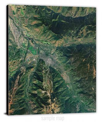
Enrich your office decor or home with a large canvas wrap Satellite map. It is designed for easy hanging with pre-installed hardware. Printed with archival inks and wrapped around a 1.5" thick gallery frame, your favorite map art will have a timeless and impressive look that fits with any decor. This map is fabricated with satellite imagery data from Google Earth, and bounding box coordinates from USGS.
Abilene, Kansas- Map Components- Imagery: Satellite of Abilene, Kansas. Bounding Box: Footprint of Abilene, Kansas at Longitude/Latitude Coordinates (-97.25 x -97.125 x 39 x 38.875).
Abilene SW, Kansas- Map Components- Imagery: Satellite of Abilene SW, Kansas. Bounding Box: Footprint of Abilene SW, Kansas at Longitude/Latitude Coordinates (-97.25 x -97.125 x 38.875 x 38.75).
Achilles, Kansas- Map Components- Imagery: Satellite of Achilles, Kansas. Bounding Box: Footprint of Achilles, Kansas at Longitude/Latitude Coordinates (-100.875 x -100.75 x 39.75 x 39.625).
Achilles SE, Kansas- Map Components- Imagery: Satellite of Achilles SE, Kansas. Bounding Box: Footprint of Achilles SE, Kansas at Longitude/Latitude Coordinates (-100.875 x -100.75 x 39.625 x 39.5).
Ada, Kansas- Map Components- Imagery: Satellite of Ada, Kansas. Bounding Box: Footprint of Ada, Kansas at Longitude/Latitude Coordinates (-98 x -97.875 x 39.25 x 39.125).
Adams, Kansas- Map Components- Imagery: Satellite of Adams, Kansas. Bounding Box: Footprint of Adams, Kansas at Longitude/Latitude Coordinates (-98 x -97.875 x 37.5 x 37.375).
Adamsville, Kansas- Map Components- Imagery: Satellite of Adamsville, Kansas. Bounding Box: Footprint of Adamsville, Kansas at Longitude/Latitude Coordinates (-97.25 x -97.125 x 37.25 x 37.125).
Admire, Kansas- Map Components- Imagery: Satellite of Admire, Kansas. Bounding Box: Footprint of Admire, Kansas at Longitude/Latitude Coordinates (-96.125 x -96 x 38.75 x 38.625).
Aetna, Kansas- Map Components- Imagery: Satellite of Aetna, Kansas. Bounding Box: Footprint of Aetna, Kansas at Longitude/Latitude Coordinates (-99 x -98.875 x 37.125 x 37).
Agenda, Kansas- Map Components- Imagery: Satellite of Agenda, Kansas. Bounding Box: Footprint of Agenda, Kansas at Longitude/Latitude Coordinates (-97.5 x -97.375 x 39.75 x 39.625).
Akron, Kansas- Map Components- Imagery: Satellite of Akron, Kansas. Bounding Box: Footprint of Akron, Kansas at Longitude/Latitude Coordinates (-97.125 x -97 x 37.375 x 37.25).
Alameda, Kansas- Map Components- Imagery: Satellite of Alameda, Kansas. Bounding Box: Footprint of Alameda, Kansas at Longitude/Latitude Coordinates (-98.125 x -98 x 37.625 x 37.5).
Alamota, Kansas- Map Components- Imagery: Satellite of Alamota, Kansas. Bounding Box: Footprint of Alamota, Kansas at Longitude/Latitude Coordinates (-100.375 x -100.25 x 38.5 x 38.375).
Albert, Kansas- Map Components- Imagery: Satellite of Albert, Kansas. Bounding Box: Footprint of Albert, Kansas at Longitude/Latitude Coordinates (-99.125 x -99 x 38.5 x 38.375).
Albert SE, Kansas- Map Components- Imagery: Satellite of Albert SE, Kansas. Bounding Box: Footprint of Albert SE, Kansas at Longitude/Latitude Coordinates (-99.125 x -99 x 38.375 x 38.25).
Alden, Kansas- Map Components- Imagery: Satellite of Alden, Kansas. Bounding Box: Footprint of Alden, Kansas at Longitude/Latitude Coordinates (-98.375 x -98.25 x 38.25 x 38.125).
Alden NW, Kansas- Map Components- Imagery: Satellite of Alden NW, Kansas. Bounding Box: Footprint of Alden NW, Kansas at Longitude/Latitude Coordinates (-98.5 x -98.375 x 38.25 x 38.125).
Alden SE, Kansas- Map Components- Imagery: Satellite of Alden SE, Kansas. Bounding Box: Footprint of Alden SE, Kansas at Longitude/Latitude Coordinates (-98.375 x -98.25 x 38.125 x 38).
Alexander, Kansas- Map Components- Imagery: Satellite of Alexander, Kansas. Bounding Box: Footprint of Alexander, Kansas at Longitude/Latitude Coordinates (-99.625 x -99.5 x 38.5 x 38.375).
Aliceville, Kansas- Map Components- Imagery: Satellite of Aliceville, Kansas. Bounding Box: Footprint of Aliceville, Kansas at Longitude/Latitude Coordinates (-95.625 x -95.5 x 38.25 x 38.125).
Allen, Kansas- Map Components- Imagery: Satellite of Allen, Kansas. Bounding Box: Footprint of Allen, Kansas at Longitude/Latitude Coordinates (-96.25 x -96.125 x 38.75 x 38.625).
Allen SE, Kansas- Map Components- Imagery: Satellite of Allen SE, Kansas. Bounding Box: Footprint of Allen SE, Kansas at Longitude/Latitude Coordinates (-96.125 x -96 x 38.625 x 38.5).
Allen SW, Kansas- Map Components- Imagery: Satellite of Allen SW, Kansas. Bounding Box: Footprint of Allen SW, Kansas at Longitude/Latitude Coordinates (-96.25 x -96.125 x 38.625 x 38.5).
Allendorph, Kansas- Map Components- Imagery: Satellite of Allendorph, Kansas. Bounding Box: Footprint of Allendorph, Kansas at Longitude/Latitude Coordinates (-96.375 x -96.25 x 39 x 38.875).
Allison, Kansas- Map Components- Imagery: Satellite of Allison, Kansas. Bounding Box: Footprint of Allison, Kansas at Longitude/Latitude Coordinates (-100.375 x -100.25 x 39.625 x 39.5).
Alma, Kansas- Map Components- Imagery: Satellite of Alma, Kansas. Bounding Box: Footprint of Alma, Kansas at Longitude/Latitude Coordinates (-96.375 x -96.25 x 39.125 x 39).
Almena, Kansas- Map Components- Imagery: Satellite of Almena, Kansas. Bounding Box: Footprint of Almena, Kansas at Longitude/Latitude Coordinates (-99.75 x -99.625 x 40 x 39.875).
Almena SW, Kansas- Map Components- Imagery: Satellite of Almena SW, Kansas. Bounding Box: Footprint of Almena SW, Kansas at Longitude/Latitude Coordinates (-99.75 x -99.625 x 39.875 x 39.75).
Alta Vista, Kansas- Map Components- Imagery: Satellite of Alta Vista, Kansas. Bounding Box: Footprint of Alta Vista, Kansas at Longitude/Latitude Coordinates (-96.5 x -96.375 x 38.875 x 38.75).
Alta Vista SE, Kansas- Map Components- Imagery: Satellite of Alta Vista SE, Kansas. Bounding Box: Footprint of Alta Vista SE, Kansas at Longitude/Latitude Coordinates (-96.375 x -96.25 x 38.875 x 38.75).
Altamont, Kansas- Map Components- Imagery: Satellite of Altamont, Kansas. Bounding Box: Footprint of Altamont, Kansas at Longitude/Latitude Coordinates (-95.375 x -95.25 x 37.25 x 37.125).
Alton, Kansas- Map Components- Imagery: Satellite of Alton, Kansas. Bounding Box: Footprint of Alton, Kansas at Longitude/Latitude Coordinates (-99 x -98.875 x 39.5 x 39.375).
Alton SW, Kansas- Map Components- Imagery: Satellite of Alton SW, Kansas. Bounding Box: Footprint of Alton SW, Kansas at Longitude/Latitude Coordinates (-99 x -98.875 x 39.375 x 39.25).
Altoona, Kansas- Map Components- Imagery: Satellite of Altoona, Kansas. Bounding Box: Footprint of Altoona, Kansas at Longitude/Latitude Coordinates (-95.75 x -95.625 x 37.625 x 37.5).
Americus, Kansas- Map Components- Imagery: Satellite of Americus, Kansas. Bounding Box: Footprint of Americus, Kansas at Longitude/Latitude Coordinates (-96.375 x -96.25 x 38.625 x 38.5).
Amy, Kansas- Map Components- Imagery: Satellite of Amy, Kansas. Bounding Box: Footprint of Amy, Kansas at Longitude/Latitude Coordinates (-100.625 x -100.5 x 38.5 x 38.375).
Amy SE, Kansas- Map Components- Imagery: Satellite of Amy SE, Kansas. Bounding Box: Footprint of Amy SE, Kansas at Longitude/Latitude Coordinates (-100.625 x -100.5 x 38.375 x 38.25).
Amy SW, Kansas- Map Components- Imagery: Satellite of Amy SW, Kansas. Bounding Box: Footprint of Amy SW, Kansas at Longitude/Latitude Coordinates (-100.75 x -100.625 x 38.375 x 38.25).
Andover, Kansas- Map Components- Imagery: Satellite of Andover, Kansas. Bounding Box: Footprint of Andover, Kansas at Longitude/Latitude Coordinates (-97.25 x -97.125 x 37.75 x 37.625).
Anthony, Kansas- Map Components- Imagery: Satellite of Anthony, Kansas. Bounding Box: Footprint of Anthony, Kansas at Longitude/Latitude Coordinates (-98.125 x -98 x 37.25 x 37.125).
Antioch, Kansas- Map Components- Imagery: Satellite of Antioch, Kansas. Bounding Box: Footprint of Antioch, Kansas at Longitude/Latitude Coordinates (-95 x -94.875 x 38.75 x 38.625).
Antonino, Kansas- Map Components- Imagery: Satellite of Antonino, Kansas. Bounding Box: Footprint of Antonino, Kansas at Longitude/Latitude Coordinates (-99.5 x -99.375 x 38.875 x 38.75).
Argonia, Kansas- Map Components- Imagery: Satellite of Argonia, Kansas. Bounding Box: Footprint of Argonia, Kansas at Longitude/Latitude Coordinates (-97.875 x -97.75 x 37.375 x 37.25).
Arkansas City, Kansas- Map Components- Imagery: Satellite of Arkansas City, Kansas. Bounding Box: Footprint of Arkansas City, Kansas at Longitude/Latitude Coordinates (-97.125 x -97 x 37.125 x 37).
Arlington, Kansas- Map Components- Imagery: Satellite of Arlington, Kansas. Bounding Box: Footprint of Arlington, Kansas at Longitude/Latitude Coordinates (-98.25 x -98.125 x 38 x 37.875).
Arma, Kansas- Map Components- Imagery: Satellite of Arma, Kansas. Bounding Box: Footprint of Arma, Kansas at Longitude/Latitude Coordinates (-94.75 x -94.625 x 37.625 x 37.5).
Arnold, Kansas- Map Components- Imagery: Satellite of Arnold, Kansas. Bounding Box: Footprint of Arnold, Kansas at Longitude/Latitude Coordinates (-100.125 x -100 x 38.75 x 38.625).
Arrington, Kansas- Map Components- Imagery: Satellite of Arrington, Kansas. Bounding Box: Footprint of Arrington, Kansas at Longitude/Latitude Coordinates (-95.625 x -95.5 x 39.5 x 39.375).
Ash Grove, Kansas- Map Components- Imagery: Satellite of Ash Grove, Kansas. Bounding Box: Footprint of Ash Grove, Kansas at Longitude/Latitude Coordinates (-98.375 x -98.25 x 39.25 x 39.125).
Ash Valley, Kansas- Map Components- Imagery: Satellite of Ash Valley, Kansas. Bounding Box: Footprint of Ash Valley, Kansas at Longitude/Latitude Coordinates (-99.25 x -99.125 x 38.375 x 38.25).
Ashland, Kansas- Map Components- Imagery: Satellite of Ashland, Kansas. Bounding Box: Footprint of Ashland, Kansas at Longitude/Latitude Coordinates (-99.875 x -99.75 x 37.25 x 37.125).
Ashland NW, Kansas- Map Components- Imagery: Satellite of Ashland NW, Kansas. Bounding Box: Footprint of Ashland NW, Kansas at Longitude/Latitude Coordinates (-100 x -99.875 x 37.25 x 37.125).
Ashland SE, Kansas- Map Components- Imagery: Satellite of Ashland SE, Kansas. Bounding Box: Footprint of Ashland SE, Kansas at Longitude/Latitude Coordinates (-99.875 x -99.75 x 37.125 x 37).
Assaria, Kansas- Map Components- Imagery: Satellite of Assaria, Kansas. Bounding Box: Footprint of Assaria, Kansas at Longitude/Latitude Coordinates (-97.625 x -97.5 x 38.75 x 38.625).
Atchison East, Kansas- Map Components- Imagery: Satellite of Atchison East, Kansas. Bounding Box: Footprint of Atchison East, Kansas at Longitude/Latitude Coordinates (-95.125 x -95 x 39.625 x 39.5).
Atchison NE, Kansas- Map Components- Imagery: Satellite of Atchison NE, Kansas. Bounding Box: Footprint of Atchison NE, Kansas at Longitude/Latitude Coordinates (-95.125 x -95 x 39.75 x 39.625).
Atchison West, Kansas- Map Components- Imagery: Satellite of Atchison West, Kansas. Bounding Box: Footprint of Atchison West, Kansas at Longitude/Latitude Coordinates (-95.25 x -95.125 x 39.625 x 39.5).
Athol, Kansas- Map Components- Imagery: Satellite of Athol, Kansas. Bounding Box: Footprint of Athol, Kansas at Longitude/Latitude Coordinates (-99 x -98.875 x 39.875 x 39.75).
Atlanta, Kansas- Map Components- Imagery: Satellite of Atlanta, Kansas. Bounding Box: Footprint of Atlanta, Kansas at Longitude/Latitude Coordinates (-96.875 x -96.75 x 37.5 x 37.375).
Attica, Kansas- Map Components- Imagery: Satellite of Attica, Kansas. Bounding Box: Footprint of Attica, Kansas at Longitude/Latitude Coordinates (-98.25 x -98.125 x 37.25 x 37.125).
Atwood, Kansas- Map Components- Imagery: Satellite of Atwood, Kansas. Bounding Box: Footprint of Atwood, Kansas at Longitude/Latitude Coordinates (-101.125 x -101 x 39.875 x 39.75).
Atwood NE, Kansas- Map Components- Imagery: Satellite of Atwood NE, Kansas. Bounding Box: Footprint of Atwood NE, Kansas at Longitude/Latitude Coordinates (-101.125 x -101 x 40 x 39.875).
Atwood NW, Kansas- Map Components- Imagery: Satellite of Atwood NW, Kansas. Bounding Box: Footprint of Atwood NW, Kansas at Longitude/Latitude Coordinates (-101.25 x -101.125 x 40 x 39.875).
Auburn, Kansas- Map Components- Imagery: Satellite of Auburn, Kansas. Bounding Box: Footprint of Auburn, Kansas at Longitude/Latitude Coordinates (-95.875 x -95.75 x 39 x 38.875).
Augusta, Kansas- Map Components- Imagery: Satellite of Augusta, Kansas. Bounding Box: Footprint of Augusta, Kansas at Longitude/Latitude Coordinates (-97 x -96.875 x 37.75 x 37.625).
Augusta SE, Kansas- Map Components- Imagery: Satellite of Augusta SE, Kansas. Bounding Box: Footprint of Augusta SE, Kansas at Longitude/Latitude Coordinates (-96.875 x -96.75 x 37.625 x 37.5).
Aurora, Kansas- Map Components- Imagery: Satellite of Aurora, Kansas. Bounding Box: Footprint of Aurora, Kansas at Longitude/Latitude Coordinates (-97.625 x -97.5 x 39.5 x 39.375).
Aurora NW, Kansas- Map Components- Imagery: Satellite of Aurora NW, Kansas. Bounding Box: Footprint of Aurora NW, Kansas at Longitude/Latitude Coordinates (-97.75 x -97.625 x 39.5 x 39.375).
Aurora SW, Kansas- Map Components- Imagery: Satellite of Aurora SW, Kansas. Bounding Box: Footprint of Aurora SW, Kansas at Longitude/Latitude Coordinates (-97.75 x -97.625 x 39.375 x 39.25).
Axtell, Kansas- Map Components- Imagery: Satellite of Axtell, Kansas. Bounding Box: Footprint of Axtell, Kansas at Longitude/Latitude Coordinates (-96.375 x -96.25 x 39.875 x 39.75).
Axtell NW, Kansas- Map Components- Imagery: Satellite of Axtell NW, Kansas. Bounding Box: Footprint of Axtell NW, Kansas at Longitude/Latitude Coordinates (-96.5 x -96.375 x 40 x 39.875).
Bachelors Run, Kansas- Map Components- Imagery: Satellite of Bachelors Run, Kansas. Bounding Box: Footprint of Bachelors Run, Kansas at Longitude/Latitude Coordinates (-99 x -98.875 x 40 x 39.875).
Baileyville, Kansas- Map Components- Imagery: Satellite of Baileyville, Kansas. Bounding Box: Footprint of Baileyville, Kansas at Longitude/Latitude Coordinates (-96.25 x -96.125 x 39.875 x 39.75).
Bala, Kansas- Map Components- Imagery: Satellite of Bala, Kansas. Bounding Box: Footprint of Bala, Kansas at Longitude/Latitude Coordinates (-97 x -96.875 x 39.375 x 39.25).
Baldwin City, Kansas- Map Components- Imagery: Satellite of Baldwin City, Kansas. Bounding Box: Footprint of Baldwin City, Kansas at Longitude/Latitude Coordinates (-95.25 x -95.125 x 38.875 x 38.75).
Barnard, Kansas- Map Components- Imagery: Satellite of Barnard, Kansas. Bounding Box: Footprint of Barnard, Kansas at Longitude/Latitude Coordinates (-98.125 x -98 x 39.25 x 39.125).
Barnes, Kansas- Map Components- Imagery: Satellite of Barnes, Kansas. Bounding Box: Footprint of Barnes, Kansas at Longitude/Latitude Coordinates (-96.875 x -96.75 x 39.75 x 39.625).
Bartlett, Kansas- Map Components- Imagery: Satellite of Bartlett, Kansas. Bounding Box: Footprint of Bartlett, Kansas at Longitude/Latitude Coordinates (-95.25 x -95.125 x 37.125 x 37).
Basehor, Kansas- Map Components- Imagery: Satellite of Basehor, Kansas. Bounding Box: Footprint of Basehor, Kansas at Longitude/Latitude Coordinates (-95 x -94.875 x 39.25 x 39.125).
Baxter Springs, Kansas- Map Components- Imagery: Satellite of Baxter Springs, Kansas. Bounding Box: Footprint of Baxter Springs, Kansas at Longitude/Latitude Coordinates (-94.75 x -94.625 x 37.125 x 37).
Bayneville, Kansas- Map Components- Imagery: Satellite of Bayneville, Kansas. Bounding Box: Footprint of Bayneville, Kansas at Longitude/Latitude Coordinates (-97.5 x -97.375 x 37.625 x 37.5).
Bazine, Kansas- Map Components- Imagery: Satellite of Bazine, Kansas. Bounding Box: Footprint of Bazine, Kansas at Longitude/Latitude Coordinates (-99.75 x -99.625 x 38.5 x 38.375).
Bazine SE, Kansas- Map Components- Imagery: Satellite of Bazine SE, Kansas. Bounding Box: Footprint of Bazine SE, Kansas at Longitude/Latitude Coordinates (-99.625 x -99.5 x 38.375 x 38.25).
Bazine SW, Kansas- Map Components- Imagery: Satellite of Bazine SW, Kansas. Bounding Box: Footprint of Bazine SW, Kansas at Longitude/Latitude Coordinates (-99.75 x -99.625 x 38.375 x 38.25).
Beardsley, Kansas- Map Components- Imagery: Satellite of Beardsley, Kansas. Bounding Box: Footprint of Beardsley, Kansas at Longitude/Latitude Coordinates (-101.25 x -101.125 x 39.875 x 39.75).
Beattie, Kansas- Map Components- Imagery: Satellite of Beattie, Kansas. Bounding Box: Footprint of Beattie, Kansas at Longitude/Latitude Coordinates (-96.5 x -96.375 x 39.875 x 39.75).
Beaumont, Kansas- Map Components- Imagery: Satellite of Beaumont, Kansas. Bounding Box: Footprint of Beaumont, Kansas at Longitude/Latitude Coordinates (-96.625 x -96.5 x 37.75 x 37.625).
Beaver, Kansas- Map Components- Imagery: Satellite of Beaver, Kansas. Bounding Box: Footprint of Beaver, Kansas at Longitude/Latitude Coordinates (-98.75 x -98.625 x 38.75 x 38.625).
Beeler, Kansas- Map Components- Imagery: Satellite of Beeler, Kansas. Bounding Box: Footprint of Beeler, Kansas at Longitude/Latitude Coordinates (-100.25 x -100.125 x 38.5 x 38.375).
Beeler SE, Kansas- Map Components- Imagery: Satellite of Beeler SE, Kansas. Bounding Box: Footprint of Beeler SE, Kansas at Longitude/Latitude Coordinates (-100.125 x -100 x 38.375 x 38.25).
Beeler SW, Kansas- Map Components- Imagery: Satellite of Beeler SW, Kansas. Bounding Box: Footprint of Beeler SW, Kansas at Longitude/Latitude Coordinates (-100.25 x -100.125 x 38.375 x 38.25).
Bellaire, Kansas- Map Components- Imagery: Satellite of Bellaire, Kansas. Bounding Box: Footprint of Bellaire, Kansas at Longitude/Latitude Coordinates (-98.75 x -98.625 x 39.875 x 39.75).
Belle Plaine, Kansas- Map Components- Imagery: Satellite of Belle Plaine, Kansas. Bounding Box: Footprint of Belle Plaine, Kansas at Longitude/Latitude Coordinates (-97.375 x -97.25 x 37.5 x 37.375).
Bellefont, Kansas- Map Components- Imagery: Satellite of Bellefont, Kansas. Bounding Box: Footprint of Bellefont, Kansas at Longitude/Latitude Coordinates (-99.75 x -99.625 x 37.875 x 37.75).
Belleville, Kansas- Map Components- Imagery: Satellite of Belleville, Kansas. Bounding Box: Footprint of Belleville, Kansas at Longitude/Latitude Coordinates (-97.75 x -97.625 x 39.875 x 39.75).
Belleville NW, Kansas- Map Components- Imagery: Satellite of Belleville NW, Kansas. Bounding Box: Footprint of Belleville NW, Kansas at Longitude/Latitude Coordinates (-97.75 x -97.625 x 40 x 39.875).
Belleville SE, Kansas- Map Components- Imagery: Satellite of Belleville SE, Kansas. Bounding Box: Footprint of Belleville SE, Kansas at Longitude/Latitude Coordinates (-97.625 x -97.5 x 39.875 x 39.75).
Beloit, Kansas- Map Components- Imagery: Satellite of Beloit, Kansas. Bounding Box: Footprint of Beloit, Kansas at Longitude/Latitude Coordinates (-98.125 x -98 x 39.5 x 39.375).
Beloit SE, Kansas- Map Components- Imagery: Satellite of Beloit SE, Kansas. Bounding Box: Footprint of Beloit SE, Kansas at Longitude/Latitude Coordinates (-98.125 x -98 x 39.375 x 39.25).
Beloit SW, Kansas- Map Components- Imagery: Satellite of Beloit SW, Kansas. Bounding Box: Footprint of Beloit SW, Kansas at Longitude/Latitude Coordinates (-98.25 x -98.125 x 39.375 x 39.25).
Belpre, Kansas- Map Components- Imagery: Satellite of Belpre, Kansas. Bounding Box: Footprint of Belpre, Kansas at Longitude/Latitude Coordinates (-99.125 x -99 x 38 x 37.875).
Belpre NW, Kansas- Map Components- Imagery: Satellite of Belpre NW, Kansas. Bounding Box: Footprint of Belpre NW, Kansas at Longitude/Latitude Coordinates (-99.25 x -99.125 x 38 x 37.875).
Belvidere, Kansas- Map Components- Imagery: Satellite of Belvidere, Kansas. Bounding Box: Footprint of Belvidere, Kansas at Longitude/Latitude Coordinates (-99.125 x -99 x 37.5 x 37.375).
Belvue, Kansas- Map Components- Imagery: Satellite of Belvue, Kansas. Bounding Box: Footprint of Belvue, Kansas at Longitude/Latitude Coordinates (-96.25 x -96.125 x 39.25 x 39.125).
Bendena, Kansas- Map Components- Imagery: Satellite of Bendena, Kansas. Bounding Box: Footprint of Bendena, Kansas at Longitude/Latitude Coordinates (-95.25 x -95.125 x 39.75 x 39.625).
Bennington, Kansas- Map Components- Imagery: Satellite of Bennington, Kansas. Bounding Box: Footprint of Bennington, Kansas at Longitude/Latitude Coordinates (-97.625 x -97.5 x 39.125 x 39).
Bentley, Kansas- Map Components- Imagery: Satellite of Bentley, Kansas. Bounding Box: Footprint of Bentley, Kansas at Longitude/Latitude Coordinates (-97.625 x -97.5 x 38 x 37.875).
Benton, Kansas- Map Components- Imagery: Satellite of Benton, Kansas. Bounding Box: Footprint of Benton, Kansas at Longitude/Latitude Coordinates (-97.125 x -97 x 37.875 x 37.75).
Bern, Kansas- Map Components- Imagery: Satellite of Bern, Kansas. Bounding Box: Footprint of Bern, Kansas at Longitude/Latitude Coordinates (-96 x -95.875 x 40 x 39.875).
Beulah Cemetery, Kansas- Map Components- Imagery: Satellite of Beulah Cemetery, Kansas. Bounding Box: Footprint of Beulah Cemetery, Kansas at Longitude/Latitude Coordinates (-101.375 x -101.25 x 38.75 x 38.625).
Big Bow, Kansas- Map Components- Imagery: Satellite of Big Bow, Kansas. Bounding Box: Footprint of Big Bow, Kansas at Longitude/Latitude Coordinates (-101.625 x -101.5 x 37.625 x 37.5).
Big Bow NE, Kansas- Map Components- Imagery: Satellite of Big Bow NE, Kansas. Bounding Box: Footprint of Big Bow NE, Kansas at Longitude/Latitude Coordinates (-101.625 x -101.5 x 37.75 x 37.625).
Big Bow NW, Kansas- Map Components- Imagery: Satellite of Big Bow NW, Kansas. Bounding Box: Footprint of Big Bow NW, Kansas at Longitude/Latitude Coordinates (-101.75 x -101.625 x 37.75 x 37.625).
Big Salt Marsh, Kansas- Map Components- Imagery: Satellite of Big Salt Marsh, Kansas. Bounding Box: Footprint of Big Salt Marsh, Kansas at Longitude/Latitude Coordinates (-98.625 x -98.5 x 38.25 x 38.125).
Bird City North, Kansas- Map Components- Imagery: Satellite of Bird City North, Kansas. Bounding Box: Footprint of Bird City North, Kansas at Longitude/Latitude Coordinates (-101.625 x -101.5 x 39.875 x 39.75).
Bird City South, Kansas- Map Components- Imagery: Satellite of Bird City South, Kansas. Bounding Box: Footprint of Bird City South, Kansas at Longitude/Latitude Coordinates (-101.625 x -101.5 x 39.75 x 39.625).
Bird City South NW, Kansas- Map Components- Imagery: Satellite of Bird City South NW, Kansas. Bounding Box: Footprint of Bird City South NW, Kansas at Longitude/Latitude Coordinates (-101.75 x -101.625 x 39.75 x 39.625).
Bird City South SE, Kansas- Map Components- Imagery: Satellite of Bird City South SE, Kansas. Bounding Box: Footprint of Bird City South SE, Kansas at Longitude/Latitude Coordinates (-101.625 x -101.5 x 39.625 x 39.5).
Bird City South SW, Kansas- Map Components- Imagery: Satellite of Bird City South SW, Kansas. Bounding Box: Footprint of Bird City South SW, Kansas at Longitude/Latitude Coordinates (-101.75 x -101.625 x 39.625 x 39.5).
Bison, Kansas- Map Components- Imagery: Satellite of Bison, Kansas. Bounding Box: Footprint of Bison, Kansas at Longitude/Latitude Coordinates (-99.25 x -99.125 x 38.625 x 38.5).
Black Wolf, Kansas- Map Components- Imagery: Satellite of Black Wolf, Kansas. Bounding Box: Footprint of Black Wolf, Kansas at Longitude/Latitude Coordinates (-98.375 x -98.25 x 38.875 x 38.75).
Bloom, Kansas- Map Components- Imagery: Satellite of Bloom, Kansas. Bounding Box: Footprint of Bloom, Kansas at Longitude/Latitude Coordinates (-100 x -99.875 x 37.5 x 37.375).
Bloom SE, Kansas- Map Components- Imagery: Satellite of Bloom SE, Kansas. Bounding Box: Footprint of Bloom SE, Kansas at Longitude/Latitude Coordinates (-99.875 x -99.75 x 37.375 x 37.25).
Bloom SW, Kansas- Map Components- Imagery: Satellite of Bloom SW, Kansas. Bounding Box: Footprint of Bloom SW, Kansas at Longitude/Latitude Coordinates (-100 x -99.875 x 37.375 x 37.25).
Bloomington, Kansas- Map Components- Imagery: Satellite of Bloomington, Kansas. Bounding Box: Footprint of Bloomington, Kansas at Longitude/Latitude Coordinates (-98.875 x -98.75 x 39.5 x 39.375).
Blue Hill, Kansas- Map Components- Imagery: Satellite of Blue Hill, Kansas. Bounding Box: Footprint of Blue Hill, Kansas at Longitude/Latitude Coordinates (-98.375 x -98.25 x 39.375 x 39.25).
Blue Mound, Kansas- Map Components- Imagery: Satellite of Blue Mound, Kansas. Bounding Box: Footprint of Blue Mound, Kansas at Longitude/Latitude Coordinates (-95.125 x -95 x 38.125 x 38).
Blue Rapids, Kansas- Map Components- Imagery: Satellite of Blue Rapids, Kansas. Bounding Box: Footprint of Blue Rapids, Kansas at Longitude/Latitude Coordinates (-96.75 x -96.625 x 39.75 x 39.625).
Blue Rapids NE, Kansas- Map Components- Imagery: Satellite of Blue Rapids NE, Kansas. Bounding Box: Footprint of Blue Rapids NE, Kansas at Longitude/Latitude Coordinates (-96.625 x -96.5 x 39.75 x 39.625).
Blue Rapids SE, Kansas- Map Components- Imagery: Satellite of Blue Rapids SE, Kansas. Bounding Box: Footprint of Blue Rapids SE, Kansas at Longitude/Latitude Coordinates (-96.625 x -96.5 x 39.625 x 39.5).
Blue Rapids SW, Kansas- Map Components- Imagery: Satellite of Blue Rapids SW, Kansas. Bounding Box: Footprint of Blue Rapids SW, Kansas at Longitude/Latitude Coordinates (-96.75 x -96.625 x 39.625 x 39.5).
Bluff City East, Kansas- Map Components- Imagery: Satellite of Bluff City East, Kansas. Bounding Box: Footprint of Bluff City East, Kansas at Longitude/Latitude Coordinates (-97.875 x -97.75 x 37.125 x 37).
Bluff City NW, Kansas- Map Components- Imagery: Satellite of Bluff City NW, Kansas. Bounding Box: Footprint of Bluff City NW, Kansas at Longitude/Latitude Coordinates (-98 x -97.875 x 37.25 x 37.125).
Bluff City West, Kansas- Map Components- Imagery: Satellite of Bluff City West, Kansas. Bounding Box: Footprint of Bluff City West, Kansas at Longitude/Latitude Coordinates (-98 x -97.875 x 37.125 x 37).
Bogue, Kansas- Map Components- Imagery: Satellite of Bogue, Kansas. Bounding Box: Footprint of Bogue, Kansas at Longitude/Latitude Coordinates (-99.75 x -99.625 x 39.375 x 39.25).
Bogue NW, Kansas- Map Components- Imagery: Satellite of Bogue NW, Kansas. Bounding Box: Footprint of Bogue NW, Kansas at Longitude/Latitude Coordinates (-99.75 x -99.625 x 39.5 x 39.375).
Boicourt, Kansas- Map Components- Imagery: Satellite of Boicourt, Kansas. Bounding Box: Footprint of Boicourt, Kansas at Longitude/Latitude Coordinates (-94.75 x -94.625 x 38.375 x 38.25).
Bolton, Kansas- Map Components- Imagery: Satellite of Bolton, Kansas. Bounding Box: Footprint of Bolton, Kansas at Longitude/Latitude Coordinates (-95.875 x -95.75 x 37.25 x 37.125).
Bonner Springs, Kansas- Map Components- Imagery: Satellite of Bonner Springs, Kansas. Bounding Box: Footprint of Bonner Springs, Kansas at Longitude/Latitude Coordinates (-95 x -94.875 x 39.125 x 39).
Brantford, Kansas- Map Components- Imagery: Satellite of Brantford, Kansas. Bounding Box: Footprint of Brantford, Kansas at Longitude/Latitude Coordinates (-97.375 x -97.25 x 39.75 x 39.625).
Brazilton, Kansas- Map Components- Imagery: Satellite of Brazilton, Kansas. Bounding Box: Footprint of Brazilton, Kansas at Longitude/Latitude Coordinates (-95 x -94.875 x 37.625 x 37.5).
Brenham, Kansas- Map Components- Imagery: Satellite of Brenham, Kansas. Bounding Box: Footprint of Brenham, Kansas at Longitude/Latitude Coordinates (-99.25 x -99.125 x 37.625 x 37.5).
Breton, Kansas- Map Components- Imagery: Satellite of Breton, Kansas. Bounding Box: Footprint of Breton, Kansas at Longitude/Latitude Coordinates (-100.875 x -100.75 x 39.5 x 39.375).
Brewster, Kansas- Map Components- Imagery: Satellite of Brewster, Kansas. Bounding Box: Footprint of Brewster, Kansas at Longitude/Latitude Coordinates (-101.5 x -101.375 x 39.375 x 39.25).
Brewster NE, Kansas- Map Components- Imagery: Satellite of Brewster NE, Kansas. Bounding Box: Footprint of Brewster NE, Kansas at Longitude/Latitude Coordinates (-101.375 x -101.25 x 39.5 x 39.375).
Brewster NW, Kansas- Map Components- Imagery: Satellite of Brewster NW, Kansas. Bounding Box: Footprint of Brewster NW, Kansas at Longitude/Latitude Coordinates (-101.5 x -101.375 x 39.5 x 39.375).
Brewster SE, Kansas- Map Components- Imagery: Satellite of Brewster SE, Kansas. Bounding Box: Footprint of Brewster SE, Kansas at Longitude/Latitude Coordinates (-101.375 x -101.25 x 39.375 x 39.25).
Bronson, Kansas- Map Components- Imagery: Satellite of Bronson, Kansas. Bounding Box: Footprint of Bronson, Kansas at Longitude/Latitude Coordinates (-95.125 x -95 x 38 x 37.875).
Brookville, Kansas- Map Components- Imagery: Satellite of Brookville, Kansas. Bounding Box: Footprint of Brookville, Kansas at Longitude/Latitude Coordinates (-97.875 x -97.75 x 38.875 x 38.75).
Brookville SW, Kansas- Map Components- Imagery: Satellite of Brookville SW, Kansas. Bounding Box: Footprint of Brookville SW, Kansas at Longitude/Latitude Coordinates (-98 x -97.875 x 38.875 x 38.75).
Brownell, Kansas- Map Components- Imagery: Satellite of Brownell, Kansas. Bounding Box: Footprint of Brownell, Kansas at Longitude/Latitude Coordinates (-99.75 x -99.625 x 38.75 x 38.625).
Buckeye, Kansas- Map Components- Imagery: Satellite of Buckeye, Kansas. Bounding Box: Footprint of Buckeye, Kansas at Longitude/Latitude Coordinates (-97.25 x -97.125 x 39.125 x 39).
Bucklin, Kansas- Map Components- Imagery: Satellite of Bucklin, Kansas. Bounding Box: Footprint of Bucklin, Kansas at Longitude/Latitude Coordinates (-99.75 x -99.625 x 37.625 x 37.5).
Bucklin NE, Kansas- Map Components- Imagery: Satellite of Bucklin NE, Kansas. Bounding Box: Footprint of Bucklin NE, Kansas at Longitude/Latitude Coordinates (-99.625 x -99.5 x 37.75 x 37.625).
Bucklin NW, Kansas- Map Components- Imagery: Satellite of Bucklin NW, Kansas. Bounding Box: Footprint of Bucklin NW, Kansas at Longitude/Latitude Coordinates (-99.75 x -99.625 x 37.75 x 37.625).
Bucklin SE, Kansas- Map Components- Imagery: Satellite of Bucklin SE, Kansas. Bounding Box: Footprint of Bucklin SE, Kansas at Longitude/Latitude Coordinates (-99.625 x -99.5 x 37.625 x 37.5).
Bucyrus, Kansas- Map Components- Imagery: Satellite of Bucyrus, Kansas. Bounding Box: Footprint of Bucyrus, Kansas at Longitude/Latitude Coordinates (-94.75 x -94.625 x 38.75 x 38.625).
Buffalo, Kansas- Map Components- Imagery: Satellite of Buffalo, Kansas. Bounding Box: Footprint of Buffalo, Kansas at Longitude/Latitude Coordinates (-95.75 x -95.625 x 37.75 x 37.625).
Buhler, Kansas- Map Components- Imagery: Satellite of Buhler, Kansas. Bounding Box: Footprint of Buhler, Kansas at Longitude/Latitude Coordinates (-97.875 x -97.75 x 38.25 x 38.125).
Burden, Kansas- Map Components- Imagery: Satellite of Burden, Kansas. Bounding Box: Footprint of Burden, Kansas at Longitude/Latitude Coordinates (-96.875 x -96.75 x 37.375 x 37.25).
Burdett, Kansas- Map Components- Imagery: Satellite of Burdett, Kansas. Bounding Box: Footprint of Burdett, Kansas at Longitude/Latitude Coordinates (-99.625 x -99.5 x 38.25 x 38.125).
Burdick, Kansas- Map Components- Imagery: Satellite of Burdick, Kansas. Bounding Box: Footprint of Burdick, Kansas at Longitude/Latitude Coordinates (-96.875 x -96.75 x 38.625 x 38.5).
Burlingame, Kansas- Map Components- Imagery: Satellite of Burlingame, Kansas. Bounding Box: Footprint of Burlingame, Kansas at Longitude/Latitude Coordinates (-95.875 x -95.75 x 38.875 x 38.75).
Burlington, Kansas- Map Components- Imagery: Satellite of Burlington, Kansas. Bounding Box: Footprint of Burlington, Kansas at Longitude/Latitude Coordinates (-95.75 x -95.625 x 38.25 x 38.125).
Burns, Kansas- Map Components- Imagery: Satellite of Burns, Kansas. Bounding Box: Footprint of Burns, Kansas at Longitude/Latitude Coordinates (-97 x -96.875 x 38.125 x 38).
Burr Oak, Kansas- Map Components- Imagery: Satellite of Burr Oak, Kansas. Bounding Box: Footprint of Burr Oak, Kansas at Longitude/Latitude Coordinates (-98.375 x -98.25 x 39.875 x 39.75).
Burr Oak NW, Kansas- Map Components- Imagery: Satellite of Burr Oak NW, Kansas. Bounding Box: Footprint of Burr Oak NW, Kansas at Longitude/Latitude Coordinates (-98.5 x -98.375 x 40 x 39.875).
Burrton, Kansas- Map Components- Imagery: Satellite of Burrton, Kansas. Bounding Box: Footprint of Burrton, Kansas at Longitude/Latitude Coordinates (-97.75 x -97.625 x 38.125 x 38).
Bush City, Kansas- Map Components- Imagery: Satellite of Bush City, Kansas. Bounding Box: Footprint of Bush City, Kansas at Longitude/Latitude Coordinates (-95.25 x -95.125 x 38.25 x 38.125).
Bushong, Kansas- Map Components- Imagery: Satellite of Bushong, Kansas. Bounding Box: Footprint of Bushong, Kansas at Longitude/Latitude Coordinates (-96.375 x -96.25 x 38.75 x 38.625).
Buttermilk, Kansas- Map Components- Imagery: Satellite of Buttermilk, Kansas. Bounding Box: Footprint of Buttermilk, Kansas at Longitude/Latitude Coordinates (-99.375 x -99.25 x 37.125 x 37).
Buxton, Kansas- Map Components- Imagery: Satellite of Buxton, Kansas. Bounding Box: Footprint of Buxton, Kansas at Longitude/Latitude Coordinates (-96 x -95.875 x 37.5 x 37.375).
Byers, Kansas- Map Components- Imagery: Satellite of Byers, Kansas. Bounding Box: Footprint of Byers, Kansas at Longitude/Latitude Coordinates (-98.875 x -98.75 x 37.875 x 37.75).
Cairo, Kansas- Map Components- Imagery: Satellite of Cairo, Kansas. Bounding Box: Footprint of Cairo, Kansas at Longitude/Latitude Coordinates (-98.625 x -98.5 x 37.75 x 37.625).
Caldwell, Kansas- Map Components- Imagery: Satellite of Caldwell, Kansas. Bounding Box: Footprint of Caldwell, Kansas at Longitude/Latitude Coordinates (-97.625 x -97.5 x 37.125 x 37).
Caldwell NW, Kansas- Map Components- Imagery: Satellite of Caldwell NW, Kansas. Bounding Box: Footprint of Caldwell NW, Kansas at Longitude/Latitude Coordinates (-97.75 x -97.625 x 37.25 x 37.125).
Calvert, Kansas- Map Components- Imagery: Satellite of Calvert, Kansas. Bounding Box: Footprint of Calvert, Kansas at Longitude/Latitude Coordinates (-99.875 x -99.75 x 39.875 x 39.75).
Cambridge, Kansas- Map Components- Imagery: Satellite of Cambridge, Kansas. Bounding Box: Footprint of Cambridge, Kansas at Longitude/Latitude Coordinates (-96.75 x -96.625 x 37.375 x 37.25).
Cambridge NE, Kansas- Map Components- Imagery: Satellite of Cambridge NE, Kansas. Bounding Box: Footprint of Cambridge NE, Kansas at Longitude/Latitude Coordinates (-96.625 x -96.5 x 37.5 x 37.375).
Cambridge NW, Kansas- Map Components- Imagery: Satellite of Cambridge NW, Kansas. Bounding Box: Footprint of Cambridge NW, Kansas at Longitude/Latitude Coordinates (-96.75 x -96.625 x 37.5 x 37.375).
Caney, Kansas- Map Components- Imagery: Satellite of Caney, Kansas. Bounding Box: Footprint of Caney, Kansas at Longitude/Latitude Coordinates (-96 x -95.875 x 37.125 x 37).
Caney NW, Kansas- Map Components- Imagery: Satellite of Caney NW, Kansas. Bounding Box: Footprint of Caney NW, Kansas at Longitude/Latitude Coordinates (-96 x -95.875 x 37.25 x 37.125).
Canton, Kansas- Map Components- Imagery: Satellite of Canton, Kansas. Bounding Box: Footprint of Canton, Kansas at Longitude/Latitude Coordinates (-97.5 x -97.375 x 38.5 x 38.375).
Canton SW, Kansas- Map Components- Imagery: Satellite of Canton SW, Kansas. Bounding Box: Footprint of Canton SW, Kansas at Longitude/Latitude Coordinates (-97.5 x -97.375 x 38.375 x 38.25).
Carbondale, Kansas- Map Components- Imagery: Satellite of Carbondale, Kansas. Bounding Box: Footprint of Carbondale, Kansas at Longitude/Latitude Coordinates (-95.75 x -95.625 x 38.875 x 38.75).
Carlton, Kansas- Map Components- Imagery: Satellite of Carlton, Kansas. Bounding Box: Footprint of Carlton, Kansas at Longitude/Latitude Coordinates (-97.375 x -97.25 x 38.75 x 38.625).
Carneiro, Kansas- Map Components- Imagery: Satellite of Carneiro, Kansas. Bounding Box: Footprint of Carneiro, Kansas at Longitude/Latitude Coordinates (-98.125 x -98 x 38.75 x 38.625).
Carwood Cemetery, Kansas- Map Components- Imagery: Satellite of Carwood Cemetery, Kansas. Bounding Box: Footprint of Carwood Cemetery, Kansas at Longitude/Latitude Coordinates (-101.5 x -101.375 x 38.625 x 38.5).
Cassoday, Kansas- Map Components- Imagery: Satellite of Cassoday, Kansas. Bounding Box: Footprint of Cassoday, Kansas at Longitude/Latitude Coordinates (-96.75 x -96.625 x 38.125 x 38).
Castle Rock, Kansas- Map Components- Imagery: Satellite of Castle Rock, Kansas. Bounding Box: Footprint of Castle Rock, Kansas at Longitude/Latitude Coordinates (-100.25 x -100.125 x 38.875 x 38.75).
Castle Rock NE, Kansas- Map Components- Imagery: Satellite of Castle Rock NE, Kansas. Bounding Box: Footprint of Castle Rock NE, Kansas at Longitude/Latitude Coordinates (-100.125 x -100 x 39 x 38.875).
Castle Rock NW, Kansas- Map Components- Imagery: Satellite of Castle Rock NW, Kansas. Bounding Box: Footprint of Castle Rock NW, Kansas at Longitude/Latitude Coordinates (-100.25 x -100.125 x 39 x 38.875).
Castleton, Kansas- Map Components- Imagery: Satellite of Castleton, Kansas. Bounding Box: Footprint of Castleton, Kansas at Longitude/Latitude Coordinates (-98 x -97.875 x 37.875 x 37.75).
Catharine, Kansas- Map Components- Imagery: Satellite of Catharine, Kansas. Bounding Box: Footprint of Catharine, Kansas at Longitude/Latitude Coordinates (-99.25 x -99.125 x 39 x 38.875).
Cato, Kansas- Map Components- Imagery: Satellite of Cato, Kansas. Bounding Box: Footprint of Cato, Kansas at Longitude/Latitude Coordinates (-94.75 x -94.625 x 37.75 x 37.625).
Cawker City, Kansas- Map Components- Imagery: Satellite of Cawker City, Kansas. Bounding Box: Footprint of Cawker City, Kansas at Longitude/Latitude Coordinates (-98.5 x -98.375 x 39.625 x 39.5).
Cawker City NW, Kansas- Map Components- Imagery: Satellite of Cawker City NW, Kansas. Bounding Box: Footprint of Cawker City NW, Kansas at Longitude/Latitude Coordinates (-98.5 x -98.375 x 39.75 x 39.625).
Cedar, Kansas- Map Components- Imagery: Satellite of Cedar, Kansas. Bounding Box: Footprint of Cedar, Kansas at Longitude/Latitude Coordinates (-99 x -98.875 x 39.75 x 39.625).
Cedar Bluff, Kansas- Map Components- Imagery: Satellite of Cedar Bluff, Kansas. Bounding Box: Footprint of Cedar Bluff, Kansas at Longitude/Latitude Coordinates (-99.875 x -99.75 x 38.875 x 38.75).
Cedar Bluff Dam, Kansas- Map Components- Imagery: Satellite of Cedar Bluff Dam, Kansas. Bounding Box: Footprint of Cedar Bluff Dam, Kansas at Longitude/Latitude Coordinates (-99.75 x -99.625 x 38.875 x 38.75).
Cedar Point, Kansas- Map Components- Imagery: Satellite of Cedar Point, Kansas. Bounding Box: Footprint of Cedar Point, Kansas at Longitude/Latitude Coordinates (-96.875 x -96.75 x 38.375 x 38.25).
Cedar Vale East, Kansas- Map Components- Imagery: Satellite of Cedar Vale East, Kansas. Bounding Box: Footprint of Cedar Vale East, Kansas at Longitude/Latitude Coordinates (-96.5 x -96.375 x 37.125 x 37).
Cedar Vale West, Kansas- Map Components- Imagery: Satellite of Cedar Vale West, Kansas. Bounding Box: Footprint of Cedar Vale West, Kansas at Longitude/Latitude Coordinates (-96.625 x -96.5 x 37.125 x 37).
Centerview, Kansas- Map Components- Imagery: Satellite of Centerview, Kansas. Bounding Box: Footprint of Centerview, Kansas at Longitude/Latitude Coordinates (-99.375 x -99.25 x 37.875 x 37.75).
Centerville, Kansas- Map Components- Imagery: Satellite of Centerville, Kansas. Bounding Box: Footprint of Centerville, Kansas at Longitude/Latitude Coordinates (-95.125 x -95 x 38.25 x 38.125).
Centralia, Kansas- Map Components- Imagery: Satellite of Centralia, Kansas. Bounding Box: Footprint of Centralia, Kansas at Longitude/Latitude Coordinates (-96.25 x -96.125 x 39.75 x 39.625).
Chanute, Kansas- Map Components- Imagery: Satellite of Chanute, Kansas. Bounding Box: Footprint of Chanute, Kansas at Longitude/Latitude Coordinates (-95.5 x -95.375 x 37.75 x 37.625).
Chapman, Kansas- Map Components- Imagery: Satellite of Chapman, Kansas. Bounding Box: Footprint of Chapman, Kansas at Longitude/Latitude Coordinates (-97.125 x -97 x 39 x 38.875).
Chardon, Kansas- Map Components- Imagery: Satellite of Chardon, Kansas. Bounding Box: Footprint of Chardon, Kansas at Longitude/Latitude Coordinates (-101.125 x -101 x 39.75 x 39.625).
Chardon NW, Kansas- Map Components- Imagery: Satellite of Chardon NW, Kansas. Bounding Box: Footprint of Chardon NW, Kansas at Longitude/Latitude Coordinates (-101.25 x -101.125 x 39.75 x 39.625).
Chardon SE, Kansas- Map Components- Imagery: Satellite of Chardon SE, Kansas. Bounding Box: Footprint of Chardon SE, Kansas at Longitude/Latitude Coordinates (-101.125 x -101 x 39.625 x 39.5).
Chardon SW, Kansas- Map Components- Imagery: Satellite of Chardon SW, Kansas. Bounding Box: Footprint of Chardon SW, Kansas at Longitude/Latitude Coordinates (-101.25 x -101.125 x 39.625 x 39.5).
Charleston, Kansas- Map Components- Imagery: Satellite of Charleston, Kansas. Bounding Box: Footprint of Charleston, Kansas at Longitude/Latitude Coordinates (-100.625 x -100.5 x 37.875 x 37.75).
Chase, Kansas- Map Components- Imagery: Satellite of Chase, Kansas. Bounding Box: Footprint of Chase, Kansas at Longitude/Latitude Coordinates (-98.375 x -98.25 x 38.375 x 38.25).
Chase NE, Kansas- Map Components- Imagery: Satellite of Chase NE, Kansas. Bounding Box: Footprint of Chase NE, Kansas at Longitude/Latitude Coordinates (-98.375 x -98.25 x 38.5 x 38.375).
Chase NW, Kansas- Map Components- Imagery: Satellite of Chase NW, Kansas. Bounding Box: Footprint of Chase NW, Kansas at Longitude/Latitude Coordinates (-98.5 x -98.375 x 38.5 x 38.375).
Chautauqua, Kansas- Map Components- Imagery: Satellite of Chautauqua, Kansas. Bounding Box: Footprint of Chautauqua, Kansas at Longitude/Latitude Coordinates (-96.25 x -96.125 x 37.125 x 37).
Cheney, Kansas- Map Components- Imagery: Satellite of Cheney, Kansas. Bounding Box: Footprint of Cheney, Kansas at Longitude/Latitude Coordinates (-97.875 x -97.75 x 37.75 x 37.625).
Cheney SE, Kansas- Map Components- Imagery: Satellite of Cheney SE, Kansas. Bounding Box: Footprint of Cheney SE, Kansas at Longitude/Latitude Coordinates (-97.875 x -97.75 x 37.625 x 37.5).
Cherokee, Kansas- Map Components- Imagery: Satellite of Cherokee, Kansas. Bounding Box: Footprint of Cherokee, Kansas at Longitude/Latitude Coordinates (-94.875 x -94.75 x 37.375 x 37.25).
Cherryvale, Kansas- Map Components- Imagery: Satellite of Cherryvale, Kansas. Bounding Box: Footprint of Cherryvale, Kansas at Longitude/Latitude Coordinates (-95.625 x -95.5 x 37.375 x 37.25).
Chetopa, Kansas- Map Components- Imagery: Satellite of Chetopa, Kansas. Bounding Box: Footprint of Chetopa, Kansas at Longitude/Latitude Coordinates (-95.125 x -95 x 37.125 x 37).
Cheyenne Creek, Kansas- Map Components- Imagery: Satellite of Cheyenne Creek, Kansas. Bounding Box: Footprint of Cheyenne Creek, Kansas at Longitude/Latitude Coordinates (-100.625 x -100.5 x 38.75 x 38.625).
Cimarron, Kansas- Map Components- Imagery: Satellite of Cimarron, Kansas. Bounding Box: Footprint of Cimarron, Kansas at Longitude/Latitude Coordinates (-100.375 x -100.25 x 37.875 x 37.75).
Cimarron NE, Kansas- Map Components- Imagery: Satellite of Cimarron NE, Kansas. Bounding Box: Footprint of Cimarron NE, Kansas at Longitude/Latitude Coordinates (-100.375 x -100.25 x 38 x 37.875).
Cimarron NW, Kansas- Map Components- Imagery: Satellite of Cimarron NW, Kansas. Bounding Box: Footprint of Cimarron NW, Kansas at Longitude/Latitude Coordinates (-100.5 x -100.375 x 38 x 37.875).
Circleville, Kansas- Map Components- Imagery: Satellite of Circleville, Kansas. Bounding Box: Footprint of Circleville, Kansas at Longitude/Latitude Coordinates (-95.875 x -95.75 x 39.625 x 39.5).
Claflin, Kansas- Map Components- Imagery: Satellite of Claflin, Kansas. Bounding Box: Footprint of Claflin, Kansas at Longitude/Latitude Coordinates (-98.625 x -98.5 x 38.625 x 38.5).
Clay Center NE, Kansas- Map Components- Imagery: Satellite of Clay Center NE, Kansas. Bounding Box: Footprint of Clay Center NE, Kansas at Longitude/Latitude Coordinates (-97.125 x -97 x 39.5 x 39.375).
Clay Center NW, Kansas- Map Components- Imagery: Satellite of Clay Center NW, Kansas. Bounding Box: Footprint of Clay Center NW, Kansas at Longitude/Latitude Coordinates (-97.25 x -97.125 x 39.5 x 39.375).
Clay Center SE, Kansas- Map Components- Imagery: Satellite of Clay Center SE, Kansas. Bounding Box: Footprint of Clay Center SE, Kansas at Longitude/Latitude Coordinates (-97.125 x -97 x 39.375 x 39.25).
Clay Center SW, Kansas- Map Components- Imagery: Satellite of Clay Center SW, Kansas. Bounding Box: Footprint of Clay Center SW, Kansas at Longitude/Latitude Coordinates (-97.25 x -97.125 x 39.375 x 39.25).
Clayton, Kansas- Map Components- Imagery: Satellite of Clayton, Kansas. Bounding Box: Footprint of Clayton, Kansas at Longitude/Latitude Coordinates (-100.25 x -100.125 x 39.75 x 39.625).
Clayton NE, Kansas- Map Components- Imagery: Satellite of Clayton NE, Kansas. Bounding Box: Footprint of Clayton NE, Kansas at Longitude/Latitude Coordinates (-100.125 x -100 x 39.75 x 39.625).
Clayton SW, Kansas- Map Components- Imagery: Satellite of Clayton SW, Kansas. Bounding Box: Footprint of Clayton SW, Kansas at Longitude/Latitude Coordinates (-100.25 x -100.125 x 39.625 x 39.5).
Clearwater, Kansas- Map Components- Imagery: Satellite of Clearwater, Kansas. Bounding Box: Footprint of Clearwater, Kansas at Longitude/Latitude Coordinates (-97.625 x -97.5 x 37.625 x 37.5).
Cleveland, Kansas- Map Components- Imagery: Satellite of Cleveland, Kansas. Bounding Box: Footprint of Cleveland, Kansas at Longitude/Latitude Coordinates (-98.25 x -98.125 x 37.625 x 37.5).
Clifton, Kansas- Map Components- Imagery: Satellite of Clifton, Kansas. Bounding Box: Footprint of Clifton, Kansas at Longitude/Latitude Coordinates (-97.375 x -97.25 x 39.625 x 39.5).
Clinton, Kansas- Map Components- Imagery: Satellite of Clinton, Kansas. Bounding Box: Footprint of Clinton, Kansas at Longitude/Latitude Coordinates (-95.5 x -95.375 x 39 x 38.875).
Cloverdale, Kansas- Map Components- Imagery: Satellite of Cloverdale, Kansas. Bounding Box: Footprint of Cloverdale, Kansas at Longitude/Latitude Coordinates (-96.5 x -96.375 x 37.25 x 37.125).
Clyde, Kansas- Map Components- Imagery: Satellite of Clyde, Kansas. Bounding Box: Footprint of Clyde, Kansas at Longitude/Latitude Coordinates (-97.5 x -97.375 x 39.625 x 39.5).
Coats, Kansas- Map Components- Imagery: Satellite of Coats, Kansas. Bounding Box: Footprint of Coats, Kansas at Longitude/Latitude Coordinates (-98.875 x -98.75 x 37.625 x 37.5).
Coats NE, Kansas- Map Components- Imagery: Satellite of Coats NE, Kansas. Bounding Box: Footprint of Coats NE, Kansas at Longitude/Latitude Coordinates (-98.875 x -98.75 x 37.75 x 37.625).
Codell, Kansas- Map Components- Imagery: Satellite of Codell, Kansas. Bounding Box: Footprint of Codell, Kansas at Longitude/Latitude Coordinates (-99.25 x -99.125 x 39.25 x 39.125).
Coffeyville East, Kansas- Map Components- Imagery: Satellite of Coffeyville East, Kansas. Bounding Box: Footprint of Coffeyville East, Kansas at Longitude/Latitude Coordinates (-95.625 x -95.5 x 37.125 x 37).
Coffeyville West, Kansas- Map Components- Imagery: Satellite of Coffeyville West, Kansas. Bounding Box: Footprint of Coffeyville West, Kansas at Longitude/Latitude Coordinates (-95.75 x -95.625 x 37.125 x 37).
Colby, Kansas- Map Components- Imagery: Satellite of Colby, Kansas. Bounding Box: Footprint of Colby, Kansas at Longitude/Latitude Coordinates (-101.125 x -101 x 39.5 x 39.375).
Colby SE, Kansas- Map Components- Imagery: Satellite of Colby SE, Kansas. Bounding Box: Footprint of Colby SE, Kansas at Longitude/Latitude Coordinates (-101.125 x -101 x 39.375 x 39.25).
Colby SW, Kansas- Map Components- Imagery: Satellite of Colby SW, Kansas. Bounding Box: Footprint of Colby SW, Kansas at Longitude/Latitude Coordinates (-101.25 x -101.125 x 39.375 x 39.25).
Coldwater, Kansas- Map Components- Imagery: Satellite of Coldwater, Kansas. Bounding Box: Footprint of Coldwater, Kansas at Longitude/Latitude Coordinates (-99.375 x -99.25 x 37.375 x 37.25).
Coldwater NE, Kansas- Map Components- Imagery: Satellite of Coldwater NE, Kansas. Bounding Box: Footprint of Coldwater NE, Kansas at Longitude/Latitude Coordinates (-99.375 x -99.25 x 37.5 x 37.375).
Collyer, Kansas- Map Components- Imagery: Satellite of Collyer, Kansas. Bounding Box: Footprint of Collyer, Kansas at Longitude/Latitude Coordinates (-100.125 x -100 x 39.125 x 39).
Colony, Kansas- Map Components- Imagery: Satellite of Colony, Kansas. Bounding Box: Footprint of Colony, Kansas at Longitude/Latitude Coordinates (-95.375 x -95.25 x 38.125 x 38).
Colony Township West, Kansas- Map Components- Imagery: Satellite of Colony Township West, Kansas. Bounding Box: Footprint of Colony Township West, Kansas at Longitude/Latitude Coordinates (-102.125 x -102 x 38.625 x 38.5).
Columbus, Kansas- Map Components- Imagery: Satellite of Columbus, Kansas. Bounding Box: Footprint of Columbus, Kansas at Longitude/Latitude Coordinates (-94.875 x -94.75 x 37.25 x 37.125).
Colwich, Kansas- Map Components- Imagery: Satellite of Colwich, Kansas. Bounding Box: Footprint of Colwich, Kansas at Longitude/Latitude Coordinates (-97.625 x -97.5 x 37.875 x 37.75).
Concordia, Kansas- Map Components- Imagery: Satellite of Concordia, Kansas. Bounding Box: Footprint of Concordia, Kansas at Longitude/Latitude Coordinates (-97.75 x -97.625 x 39.625 x 39.5).
Concordia NW, Kansas- Map Components- Imagery: Satellite of Concordia NW, Kansas. Bounding Box: Footprint of Concordia NW, Kansas at Longitude/Latitude Coordinates (-97.75 x -97.625 x 39.75 x 39.625).
Conway, Kansas- Map Components- Imagery: Satellite of Conway, Kansas. Bounding Box: Footprint of Conway, Kansas at Longitude/Latitude Coordinates (-97.875 x -97.75 x 38.375 x 38.25).
Conway Springs, Kansas- Map Components- Imagery: Satellite of Conway Springs, Kansas. Bounding Box: Footprint of Conway Springs, Kansas at Longitude/Latitude Coordinates (-97.75 x -97.625 x 37.5 x 37.375).
Copeland, Kansas- Map Components- Imagery: Satellite of Copeland, Kansas. Bounding Box: Footprint of Copeland, Kansas at Longitude/Latitude Coordinates (-100.75 x -100.625 x 37.625 x 37.5).
Copeland NE, Kansas- Map Components- Imagery: Satellite of Copeland NE, Kansas. Bounding Box: Footprint of Copeland NE, Kansas at Longitude/Latitude Coordinates (-100.625 x -100.5 x 37.75 x 37.625).
Copeland NW, Kansas- Map Components- Imagery: Satellite of Copeland NW, Kansas. Bounding Box: Footprint of Copeland NW, Kansas at Longitude/Latitude Coordinates (-100.75 x -100.625 x 37.75 x 37.625).
Copeland SE, Kansas- Map Components- Imagery: Satellite of Copeland SE, Kansas. Bounding Box: Footprint of Copeland SE, Kansas at Longitude/Latitude Coordinates (-100.625 x -100.5 x 37.625 x 37.5).
Cora, Kansas- Map Components- Imagery: Satellite of Cora, Kansas. Bounding Box: Footprint of Cora, Kansas at Longitude/Latitude Coordinates (-98.75 x -98.625 x 40 x 39.875).
Corning, Kansas- Map Components- Imagery: Satellite of Corning, Kansas. Bounding Box: Footprint of Corning, Kansas at Longitude/Latitude Coordinates (-96.125 x -96 x 39.75 x 39.625).
Coronado Cemetery, Kansas- Map Components- Imagery: Satellite of Coronado Cemetery, Kansas. Bounding Box: Footprint of Coronado Cemetery, Kansas at Longitude/Latitude Coordinates (-101.375 x -101.25 x 38.625 x 38.5).
Corwin, Kansas- Map Components- Imagery: Satellite of Corwin, Kansas. Bounding Box: Footprint of Corwin, Kansas at Longitude/Latitude Coordinates (-98.375 x -98.25 x 37.125 x 37).
Cottonwood Falls, Kansas- Map Components- Imagery: Satellite of Cottonwood Falls, Kansas. Bounding Box: Footprint of Cottonwood Falls, Kansas at Longitude/Latitude Coordinates (-96.625 x -96.5 x 38.375 x 38.25).
Council Grove, Kansas- Map Components- Imagery: Satellite of Council Grove, Kansas. Bounding Box: Footprint of Council Grove, Kansas at Longitude/Latitude Coordinates (-96.5 x -96.375 x 38.75 x 38.625).
Council Grove Lake, Kansas- Map Components- Imagery: Satellite of Council Grove Lake, Kansas. Bounding Box: Footprint of Council Grove Lake, Kansas at Longitude/Latitude Coordinates (-96.625 x -96.5 x 38.75 x 38.625).
Courtland, Kansas- Map Components- Imagery: Satellite of Courtland, Kansas. Bounding Box: Footprint of Courtland, Kansas at Longitude/Latitude Coordinates (-98 x -97.875 x 39.875 x 39.75).
Covert, Kansas- Map Components- Imagery: Satellite of Covert, Kansas. Bounding Box: Footprint of Covert, Kansas at Longitude/Latitude Coordinates (-98.875 x -98.75 x 39.375 x 39.25).
Coyville, Kansas- Map Components- Imagery: Satellite of Coyville, Kansas. Bounding Box: Footprint of Coyville, Kansas at Longitude/Latitude Coordinates (-96 x -95.875 x 37.75 x 37.625).
Crawford, Kansas- Map Components- Imagery: Satellite of Crawford, Kansas. Bounding Box: Footprint of Crawford, Kansas at Longitude/Latitude Coordinates (-98.125 x -98 x 38.625 x 38.5).
Crestline, Kansas- Map Components- Imagery: Satellite of Crestline, Kansas. Bounding Box: Footprint of Crestline, Kansas at Longitude/Latitude Coordinates (-94.75 x -94.625 x 37.25 x 37.125).
Crisfield, Kansas- Map Components- Imagery: Satellite of Crisfield, Kansas. Bounding Box: Footprint of Crisfield, Kansas at Longitude/Latitude Coordinates (-98.375 x -98.25 x 37.25 x 37.125).
Croft, Kansas- Map Components- Imagery: Satellite of Croft, Kansas. Bounding Box: Footprint of Croft, Kansas at Longitude/Latitude Coordinates (-99 x -98.875 x 37.625 x 37.5).
Crosby Creek, Kansas- Map Components- Imagery: Satellite of Crosby Creek, Kansas. Bounding Box: Footprint of Crosby Creek, Kansas at Longitude/Latitude Coordinates (-102 x -101.875 x 39.75 x 39.625).
Crystal Springs, Kansas- Map Components- Imagery: Satellite of Crystal Springs, Kansas. Bounding Box: Footprint of Crystal Springs, Kansas at Longitude/Latitude Coordinates (-98.25 x -98.125 x 37.375 x 37.25).
Cuba, Kansas- Map Components- Imagery: Satellite of Cuba, Kansas. Bounding Box: Footprint of Cuba, Kansas at Longitude/Latitude Coordinates (-97.5 x -97.375 x 39.875 x 39.75).
Cullison, Kansas- Map Components- Imagery: Satellite of Cullison, Kansas. Bounding Box: Footprint of Cullison, Kansas at Longitude/Latitude Coordinates (-99 x -98.875 x 37.75 x 37.625).
Culver, Kansas- Map Components- Imagery: Satellite of Culver, Kansas. Bounding Box: Footprint of Culver, Kansas at Longitude/Latitude Coordinates (-97.875 x -97.75 x 39 x 38.875).
Cunningham, Kansas- Map Components- Imagery: Satellite of Cunningham, Kansas. Bounding Box: Footprint of Cunningham, Kansas at Longitude/Latitude Coordinates (-98.5 x -98.375 x 37.75 x 37.625).
Dalton, Kansas- Map Components- Imagery: Satellite of Dalton, Kansas. Bounding Box: Footprint of Dalton, Kansas at Longitude/Latitude Coordinates (-97.375 x -97.25 x 37.375 x 37.25).
Danville, Kansas- Map Components- Imagery: Satellite of Danville, Kansas. Bounding Box: Footprint of Danville, Kansas at Longitude/Latitude Coordinates (-98 x -97.875 x 37.375 x 37.25).
De Graff, Kansas- Map Components- Imagery: Satellite of De Graff, Kansas. Bounding Box: Footprint of De Graff, Kansas at Longitude/Latitude Coordinates (-96.875 x -96.75 x 38 x 37.875).
De Soto, Kansas- Map Components- Imagery: Satellite of De Soto, Kansas. Bounding Box: Footprint of De Soto, Kansas at Longitude/Latitude Coordinates (-95 x -94.875 x 39 x 38.875).
Deerfield, Kansas- Map Components- Imagery: Satellite of Deerfield, Kansas. Bounding Box: Footprint of Deerfield, Kansas at Longitude/Latitude Coordinates (-101.25 x -101.125 x 38 x 37.875).
Deerfield NE, Kansas- Map Components- Imagery: Satellite of Deerfield NE, Kansas. Bounding Box: Footprint of Deerfield NE, Kansas at Longitude/Latitude Coordinates (-101.125 x -101 x 38 x 37.875).
Deerfield SE, Kansas- Map Components- Imagery: Satellite of Deerfield SE, Kansas. Bounding Box: Footprint of Deerfield SE, Kansas at Longitude/Latitude Coordinates (-101.125 x -101 x 37.875 x 37.75).
Deerfield SW, Kansas- Map Components- Imagery: Satellite of Deerfield SW, Kansas. Bounding Box: Footprint of Deerfield SW, Kansas at Longitude/Latitude Coordinates (-101.25 x -101.125 x 37.875 x 37.75).
Deerhead, Kansas- Map Components- Imagery: Satellite of Deerhead, Kansas. Bounding Box: Footprint of Deerhead, Kansas at Longitude/Latitude Coordinates (-99 x -98.875 x 37.25 x 37.125).
Delavan, Kansas- Map Components- Imagery: Satellite of Delavan, Kansas. Bounding Box: Footprint of Delavan, Kansas at Longitude/Latitude Coordinates (-96.875 x -96.75 x 38.75 x 38.625).
Dennis, Kansas- Map Components- Imagery: Satellite of Dennis, Kansas. Bounding Box: Footprint of Dennis, Kansas at Longitude/Latitude Coordinates (-95.5 x -95.375 x 37.375 x 37.25).
Densmore, Kansas- Map Components- Imagery: Satellite of Densmore, Kansas. Bounding Box: Footprint of Densmore, Kansas at Longitude/Latitude Coordinates (-99.75 x -99.625 x 39.75 x 39.625).
Denton, Kansas- Map Components- Imagery: Satellite of Denton, Kansas. Bounding Box: Footprint of Denton, Kansas at Longitude/Latitude Coordinates (-95.375 x -95.25 x 39.75 x 39.625).
Derby, Kansas- Map Components- Imagery: Satellite of Derby, Kansas. Bounding Box: Footprint of Derby, Kansas at Longitude/Latitude Coordinates (-97.375 x -97.25 x 37.625 x 37.5).
Devizes, Kansas- Map Components- Imagery: Satellite of Devizes, Kansas. Bounding Box: Footprint of Devizes, Kansas at Longitude/Latitude Coordinates (-100.125 x -100 x 40 x 39.875).
Devon, Kansas- Map Components- Imagery: Satellite of Devon, Kansas. Bounding Box: Footprint of Devon, Kansas at Longitude/Latitude Coordinates (-94.875 x -94.75 x 38 x 37.875).
Dewey Ranch, Kansas- Map Components- Imagery: Satellite of Dewey Ranch, Kansas. Bounding Box: Footprint of Dewey Ranch, Kansas at Longitude/Latitude Coordinates (-101.375 x -101.25 x 39.75 x 39.625).
Dewey Ranch NW, Kansas- Map Components- Imagery: Satellite of Dewey Ranch NW, Kansas. Bounding Box: Footprint of Dewey Ranch NW, Kansas at Longitude/Latitude Coordinates (-101.5 x -101.375 x 39.75 x 39.625).
Dewey Ranch SE, Kansas- Map Components- Imagery: Satellite of Dewey Ranch SE, Kansas. Bounding Box: Footprint of Dewey Ranch SE, Kansas at Longitude/Latitude Coordinates (-101.375 x -101.25 x 39.625 x 39.5).
Dewey Ranch SW, Kansas- Map Components- Imagery: Satellite of Dewey Ranch SW, Kansas. Bounding Box: Footprint of Dewey Ranch SW, Kansas at Longitude/Latitude Coordinates (-101.5 x -101.375 x 39.625 x 39.5).
Dexter, Kansas- Map Components- Imagery: Satellite of Dexter, Kansas. Bounding Box: Footprint of Dexter, Kansas at Longitude/Latitude Coordinates (-96.75 x -96.625 x 37.25 x 37.125).
Dexter NE, Kansas- Map Components- Imagery: Satellite of Dexter NE, Kansas. Bounding Box: Footprint of Dexter NE, Kansas at Longitude/Latitude Coordinates (-96.625 x -96.5 x 37.25 x 37.125).
Dexter SW, Kansas- Map Components- Imagery: Satellite of Dexter SW, Kansas. Bounding Box: Footprint of Dexter SW, Kansas at Longitude/Latitude Coordinates (-96.75 x -96.625 x 37.125 x 37).
Diamond Springs, Kansas- Map Components- Imagery: Satellite of Diamond Springs, Kansas. Bounding Box: Footprint of Diamond Springs, Kansas at Longitude/Latitude Coordinates (-96.75 x -96.625 x 38.625 x 38.5).
Dighton, Kansas- Map Components- Imagery: Satellite of Dighton, Kansas. Bounding Box: Footprint of Dighton, Kansas at Longitude/Latitude Coordinates (-100.5 x -100.375 x 38.5 x 38.375).
Dighton SE, Kansas- Map Components- Imagery: Satellite of Dighton SE, Kansas. Bounding Box: Footprint of Dighton SE, Kansas at Longitude/Latitude Coordinates (-100.375 x -100.25 x 38.375 x 38.25).
Dighton SW, Kansas- Map Components- Imagery: Satellite of Dighton SW, Kansas. Bounding Box: Footprint of Dighton SW, Kansas at Longitude/Latitude Coordinates (-100.5 x -100.375 x 38.375 x 38.25).
Dodge City, Kansas- Map Components- Imagery: Satellite of Dodge City, Kansas. Bounding Box: Footprint of Dodge City, Kansas at Longitude/Latitude Coordinates (-100.125 x -100 x 37.875 x 37.75).
Dodge City NE, Kansas- Map Components- Imagery: Satellite of Dodge City NE, Kansas. Bounding Box: Footprint of Dodge City NE, Kansas at Longitude/Latitude Coordinates (-100.125 x -100 x 38 x 37.875).
Dodge City NW, Kansas- Map Components- Imagery: Satellite of Dodge City NW, Kansas. Bounding Box: Footprint of Dodge City NW, Kansas at Longitude/Latitude Coordinates (-100.25 x -100.125 x 38 x 37.875).
Dodge City SW, Kansas- Map Components- Imagery: Satellite of Dodge City SW, Kansas. Bounding Box: Footprint of Dodge City SW, Kansas at Longitude/Latitude Coordinates (-100.25 x -100.125 x 37.875 x 37.75).
Dorrance, Kansas- Map Components- Imagery: Satellite of Dorrance, Kansas. Bounding Box: Footprint of Dorrance, Kansas at Longitude/Latitude Coordinates (-98.625 x -98.5 x 38.875 x 38.75).
Dorrance NE, Kansas- Map Components- Imagery: Satellite of Dorrance NE, Kansas. Bounding Box: Footprint of Dorrance NE, Kansas at Longitude/Latitude Coordinates (-98.625 x -98.5 x 39 x 38.875).
Dorrance NW, Kansas- Map Components- Imagery: Satellite of Dorrance NW, Kansas. Bounding Box: Footprint of Dorrance NW, Kansas at Longitude/Latitude Coordinates (-98.75 x -98.625 x 39 x 38.875).
Dorrance SW, Kansas- Map Components- Imagery: Satellite of Dorrance SW, Kansas. Bounding Box: Footprint of Dorrance SW, Kansas at Longitude/Latitude Coordinates (-98.75 x -98.625 x 38.875 x 38.75).
Doster, Kansas- Map Components- Imagery: Satellite of Doster, Kansas. Bounding Box: Footprint of Doster, Kansas at Longitude/Latitude Coordinates (-97.75 x -97.625 x 37.125 x 37).
Douglass, Kansas- Map Components- Imagery: Satellite of Douglass, Kansas. Bounding Box: Footprint of Douglass, Kansas at Longitude/Latitude Coordinates (-97.125 x -97 x 37.625 x 37.5).
Dover, Kansas- Map Components- Imagery: Satellite of Dover, Kansas. Bounding Box: Footprint of Dover, Kansas at Longitude/Latitude Coordinates (-96 x -95.875 x 39 x 38.875).
Downs North, Kansas- Map Components- Imagery: Satellite of Downs North, Kansas. Bounding Box: Footprint of Downs North, Kansas at Longitude/Latitude Coordinates (-98.625 x -98.5 x 39.625 x 39.5).
Downs South, Kansas- Map Components- Imagery: Satellite of Downs South, Kansas. Bounding Box: Footprint of Downs South, Kansas at Longitude/Latitude Coordinates (-98.625 x -98.5 x 39.5 x 39.375).
Dresden North, Kansas- Map Components- Imagery: Satellite of Dresden North, Kansas. Bounding Box: Footprint of Dresden North, Kansas at Longitude/Latitude Coordinates (-100.5 x -100.375 x 39.75 x 39.625).
Dresden South, Kansas- Map Components- Imagery: Satellite of Dresden South, Kansas. Bounding Box: Footprint of Dresden South, Kansas at Longitude/Latitude Coordinates (-100.5 x -100.375 x 39.625 x 39.5).
Drury Creek, Kansas- Map Components- Imagery: Satellite of Drury Creek, Kansas. Bounding Box: Footprint of Drury Creek, Kansas at Longitude/Latitude Coordinates (-101.875 x -101.75 x 39.75 x 39.625).
Dubuque, Kansas- Map Components- Imagery: Satellite of Dubuque, Kansas. Bounding Box: Footprint of Dubuque, Kansas at Longitude/Latitude Coordinates (-98.625 x -98.5 x 38.75 x 38.625).
Duluth, Kansas- Map Components- Imagery: Satellite of Duluth, Kansas. Bounding Box: Footprint of Duluth, Kansas at Longitude/Latitude Coordinates (-96.25 x -96.125 x 39.625 x 39.5).
Durham, Kansas- Map Components- Imagery: Satellite of Durham, Kansas. Bounding Box: Footprint of Durham, Kansas at Longitude/Latitude Coordinates (-97.25 x -97.125 x 38.5 x 38.375).
Dwight, Kansas- Map Components- Imagery: Satellite of Dwight, Kansas. Bounding Box: Footprint of Dwight, Kansas at Longitude/Latitude Coordinates (-96.625 x -96.5 x 38.875 x 38.75).
Earlton, Kansas- Map Components- Imagery: Satellite of Earlton, Kansas. Bounding Box: Footprint of Earlton, Kansas at Longitude/Latitude Coordinates (-95.5 x -95.375 x 37.625 x 37.5).
East Bridge Creek North, Kansas- Map Components- Imagery: Satellite of East Bridge Creek North, Kansas. Bounding Box: Footprint of East Bridge Creek North, Kansas at Longitude/Latitude Coordinates (-102 x -101.875 x 38.25 x 38.125).
East Bridge Creek South, Kansas- Map Components- Imagery: Satellite of East Bridge Creek South, Kansas. Bounding Box: Footprint of East Bridge Creek South, Kansas at Longitude/Latitude Coordinates (-102 x -101.875 x 38.125 x 38).
East Kiowa Creek North, Kansas- Map Components- Imagery: Satellite of East Kiowa Creek North, Kansas. Bounding Box: Footprint of East Kiowa Creek North, Kansas at Longitude/Latitude Coordinates (-99.5 x -99.375 x 37.5 x 37.375).
East Kiowa Creek South, Kansas- Map Components- Imagery: Satellite of East Kiowa Creek South, Kansas. Bounding Box: Footprint of East Kiowa Creek South, Kansas at Longitude/Latitude Coordinates (-99.5 x -99.375 x 37.375 x 37.25).
Easton, Kansas- Map Components- Imagery: Satellite of Easton, Kansas. Bounding Box: Footprint of Easton, Kansas at Longitude/Latitude Coordinates (-95.125 x -95 x 39.375 x 39.25).
Easton SW, Kansas- Map Components- Imagery: Satellite of Easton SW, Kansas. Bounding Box: Footprint of Easton SW, Kansas at Longitude/Latitude Coordinates (-95.25 x -95.125 x 39.375 x 39.25).
Eaton, Kansas- Map Components- Imagery: Satellite of Eaton, Kansas. Bounding Box: Footprint of Eaton, Kansas at Longitude/Latitude Coordinates (-96.875 x -96.75 x 37.25 x 37.125).
Edgerton, Kansas- Map Components- Imagery: Satellite of Edgerton, Kansas. Bounding Box: Footprint of Edgerton, Kansas at Longitude/Latitude Coordinates (-95.125 x -95 x 38.875 x 38.75).
Edmond, Kansas- Map Components- Imagery: Satellite of Edmond, Kansas. Bounding Box: Footprint of Edmond, Kansas at Longitude/Latitude Coordinates (-99.875 x -99.75 x 39.75 x 39.625).
Edmond NW, Kansas- Map Components- Imagery: Satellite of Edmond NW, Kansas. Bounding Box: Footprint of Edmond NW, Kansas at Longitude/Latitude Coordinates (-100 x -99.875 x 39.75 x 39.625).
Edmond SE, Kansas- Map Components- Imagery: Satellite of Edmond SE, Kansas. Bounding Box: Footprint of Edmond SE, Kansas at Longitude/Latitude Coordinates (-99.875 x -99.75 x 39.625 x 39.5).
Edna, Kansas- Map Components- Imagery: Satellite of Edna, Kansas. Bounding Box: Footprint of Edna, Kansas at Longitude/Latitude Coordinates (-95.375 x -95.25 x 37.125 x 37).
Edson, Kansas- Map Components- Imagery: Satellite of Edson, Kansas. Bounding Box: Footprint of Edson, Kansas at Longitude/Latitude Coordinates (-101.625 x -101.5 x 39.375 x 39.25).
Edwardsville, Kansas- Map Components- Imagery: Satellite of Edwardsville, Kansas. Bounding Box: Footprint of Edwardsville, Kansas at Longitude/Latitude Coordinates (-94.875 x -94.75 x 39.125 x 39).
Effingham, Kansas- Map Components- Imagery: Satellite of Effingham, Kansas. Bounding Box: Footprint of Effingham, Kansas at Longitude/Latitude Coordinates (-95.5 x -95.375 x 39.625 x 39.5).
El Dorado, Kansas- Map Components- Imagery: Satellite of El Dorado, Kansas. Bounding Box: Footprint of El Dorado, Kansas at Longitude/Latitude Coordinates (-96.875 x -96.75 x 37.875 x 37.75).
El Dorado NW, Kansas- Map Components- Imagery: Satellite of El Dorado NW, Kansas. Bounding Box: Footprint of El Dorado NW, Kansas at Longitude/Latitude Coordinates (-97 x -96.875 x 38 x 37.875).
El Dorado SW, Kansas- Map Components- Imagery: Satellite of El Dorado SW, Kansas. Bounding Box: Footprint of El Dorado SW, Kansas at Longitude/Latitude Coordinates (-97 x -96.875 x 37.875 x 37.75).
Elbing, Kansas- Map Components- Imagery: Satellite of Elbing, Kansas. Bounding Box: Footprint of Elbing, Kansas at Longitude/Latitude Coordinates (-97.25 x -97.125 x 38.125 x 38).
Elgin, Kansas- Map Components- Imagery: Satellite of Elgin, Kansas. Bounding Box: Footprint of Elgin, Kansas at Longitude/Latitude Coordinates (-96.375 x -96.25 x 37.125 x 37).
Elgin NE, Kansas- Map Components- Imagery: Satellite of Elgin NE, Kansas. Bounding Box: Footprint of Elgin NE, Kansas at Longitude/Latitude Coordinates (-96.375 x -96.25 x 37.25 x 37.125).
Elk City, Kansas- Map Components- Imagery: Satellite of Elk City, Kansas. Bounding Box: Footprint of Elk City, Kansas at Longitude/Latitude Coordinates (-96 x -95.875 x 37.375 x 37.25).
Elk Falls, Kansas- Map Components- Imagery: Satellite of Elk Falls, Kansas. Bounding Box: Footprint of Elk Falls, Kansas at Longitude/Latitude Coordinates (-96.25 x -96.125 x 37.375 x 37.25).
Elkader, Kansas- Map Components- Imagery: Satellite of Elkader, Kansas. Bounding Box: Footprint of Elkader, Kansas at Longitude/Latitude Coordinates (-100.875 x -100.75 x 38.875 x 38.75).
Elkader NE, Kansas- Map Components- Imagery: Satellite of Elkader NE, Kansas. Bounding Box: Footprint of Elkader NE, Kansas at Longitude/Latitude Coordinates (-100.875 x -100.75 x 39 x 38.875).
Elkader NW, Kansas- Map Components- Imagery: Satellite of Elkader NW, Kansas. Bounding Box: Footprint of Elkader NW, Kansas at Longitude/Latitude Coordinates (-101 x -100.875 x 39 x 38.875).
Elkader SW, Kansas- Map Components- Imagery: Satellite of Elkader SW, Kansas. Bounding Box: Footprint of Elkader SW, Kansas at Longitude/Latitude Coordinates (-101 x -100.875 x 38.875 x 38.75).
Elkhart NE, Kansas- Map Components- Imagery: Satellite of Elkhart NE, Kansas. Bounding Box: Footprint of Elkhart NE, Kansas at Longitude/Latitude Coordinates (-101.875 x -101.75 x 37.25 x 37.125).
Elkhart North, Kansas- Map Components- Imagery: Satellite of Elkhart North, Kansas. Bounding Box: Footprint of Elkhart North, Kansas at Longitude/Latitude Coordinates (-102 x -101.875 x 37.125 x 37).
Elkhart NW, Kansas- Map Components- Imagery: Satellite of Elkhart NW, Kansas. Bounding Box: Footprint of Elkhart NW, Kansas at Longitude/Latitude Coordinates (-102 x -101.875 x 37.25 x 37.125).
Elkhart South, Kansas- Map Components- Imagery: Satellite of Elkhart South, Kansas. Bounding Box: Footprint of Elkhart South, Kansas at Longitude/Latitude Coordinates (-102 x -101.875 x 37 x 36.875).
Ellinwood, Kansas- Map Components- Imagery: Satellite of Ellinwood, Kansas. Bounding Box: Footprint of Ellinwood, Kansas at Longitude/Latitude Coordinates (-98.625 x -98.5 x 38.375 x 38.25).
Ellinwood NE, Kansas- Map Components- Imagery: Satellite of Ellinwood NE, Kansas. Bounding Box: Footprint of Ellinwood NE, Kansas at Longitude/Latitude Coordinates (-98.625 x -98.5 x 38.5 x 38.375).
Ellinwood NW, Kansas- Map Components- Imagery: Satellite of Ellinwood NW, Kansas. Bounding Box: Footprint of Ellinwood NW, Kansas at Longitude/Latitude Coordinates (-98.75 x -98.625 x 38.5 x 38.375).
Ellinwood SW, Kansas- Map Components- Imagery: Satellite of Ellinwood SW, Kansas. Bounding Box: Footprint of Ellinwood SW, Kansas at Longitude/Latitude Coordinates (-98.75 x -98.625 x 38.375 x 38.25).
Ellis, Kansas- Map Components- Imagery: Satellite of Ellis, Kansas. Bounding Box: Footprint of Ellis, Kansas at Longitude/Latitude Coordinates (-99.625 x -99.5 x 39 x 38.875).
Ellis SE, Kansas- Map Components- Imagery: Satellite of Ellis SE, Kansas. Bounding Box: Footprint of Ellis SE, Kansas at Longitude/Latitude Coordinates (-99.625 x -99.5 x 38.875 x 38.75).
Ellsworth, Kansas- Map Components- Imagery: Satellite of Ellsworth, Kansas. Bounding Box: Footprint of Ellsworth, Kansas at Longitude/Latitude Coordinates (-98.25 x -98.125 x 38.75 x 38.625).
Elmdale, Kansas- Map Components- Imagery: Satellite of Elmdale, Kansas. Bounding Box: Footprint of Elmdale, Kansas at Longitude/Latitude Coordinates (-96.75 x -96.625 x 38.375 x 38.25).
Elmer, Kansas- Map Components- Imagery: Satellite of Elmer, Kansas. Bounding Box: Footprint of Elmer, Kansas at Longitude/Latitude Coordinates (-98 x -97.875 x 38 x 37.875).
Elmo, Kansas- Map Components- Imagery: Satellite of Elmo, Kansas. Bounding Box: Footprint of Elmo, Kansas at Longitude/Latitude Coordinates (-97.25 x -97.125 x 38.75 x 38.625).
Elmont, Kansas- Map Components- Imagery: Satellite of Elmont, Kansas. Bounding Box: Footprint of Elmont, Kansas at Longitude/Latitude Coordinates (-95.75 x -95.625 x 39.25 x 39.125).
Elsmore, Kansas- Map Components- Imagery: Satellite of Elsmore, Kansas. Bounding Box: Footprint of Elsmore, Kansas at Longitude/Latitude Coordinates (-95.25 x -95.125 x 37.875 x 37.75).
Eminence Cemetery, Kansas- Map Components- Imagery: Satellite of Eminence Cemetery, Kansas. Bounding Box: Footprint of Eminence Cemetery, Kansas at Longitude/Latitude Coordinates (-100.625 x -100.5 x 38.25 x 38.125).
Emmett, Kansas- Map Components- Imagery: Satellite of Emmett, Kansas. Bounding Box: Footprint of Emmett, Kansas at Longitude/Latitude Coordinates (-96.125 x -96 x 39.375 x 39.25).
Emporia, Kansas- Map Components- Imagery: Satellite of Emporia, Kansas. Bounding Box: Footprint of Emporia, Kansas at Longitude/Latitude Coordinates (-96.25 x -96.125 x 38.5 x 38.375).
Emporia SE, Kansas- Map Components- Imagery: Satellite of Emporia SE, Kansas. Bounding Box: Footprint of Emporia SE, Kansas at Longitude/Latitude Coordinates (-96.125 x -96 x 38.375 x 38.25).
Englewood, Kansas- Map Components- Imagery: Satellite of Englewood, Kansas. Bounding Box: Footprint of Englewood, Kansas at Longitude/Latitude Coordinates (-100 x -99.875 x 37.125 x 37).
Ensign, Kansas- Map Components- Imagery: Satellite of Ensign, Kansas. Bounding Box: Footprint of Ensign, Kansas at Longitude/Latitude Coordinates (-100.25 x -100.125 x 37.75 x 37.625).
Ensign SE, Kansas- Map Components- Imagery: Satellite of Ensign SE, Kansas. Bounding Box: Footprint of Ensign SE, Kansas at Longitude/Latitude Coordinates (-100.125 x -100 x 37.625 x 37.5).
Ensign SW, Kansas- Map Components- Imagery: Satellite of Ensign SW, Kansas. Bounding Box: Footprint of Ensign SW, Kansas at Longitude/Latitude Coordinates (-100.25 x -100.125 x 37.625 x 37.5).
Erie, Kansas- Map Components- Imagery: Satellite of Erie, Kansas. Bounding Box: Footprint of Erie, Kansas at Longitude/Latitude Coordinates (-95.25 x -95.125 x 37.625 x 37.5).
Esbon, Kansas- Map Components- Imagery: Satellite of Esbon, Kansas. Bounding Box: Footprint of Esbon, Kansas at Longitude/Latitude Coordinates (-98.5 x -98.375 x 39.875 x 39.75).
Eskridge, Kansas- Map Components- Imagery: Satellite of Eskridge, Kansas. Bounding Box: Footprint of Eskridge, Kansas at Longitude/Latitude Coordinates (-96.125 x -96 x 38.875 x 38.75).
Eudora, Kansas- Map Components- Imagery: Satellite of Eudora, Kansas. Bounding Box: Footprint of Eudora, Kansas at Longitude/Latitude Coordinates (-95.125 x -95 x 39 x 38.875).
Eureka, Kansas- Map Components- Imagery: Satellite of Eureka, Kansas. Bounding Box: Footprint of Eureka, Kansas at Longitude/Latitude Coordinates (-96.375 x -96.25 x 37.875 x 37.75).
Eureka NE, Kansas- Map Components- Imagery: Satellite of Eureka NE, Kansas. Bounding Box: Footprint of Eureka NE, Kansas at Longitude/Latitude Coordinates (-96.375 x -96.25 x 38 x 37.875).
Everest, Kansas- Map Components- Imagery: Satellite of Everest, Kansas. Bounding Box: Footprint of Everest, Kansas at Longitude/Latitude Coordinates (-95.5 x -95.375 x 39.75 x 39.625).
Fairport, Kansas- Map Components- Imagery: Satellite of Fairport, Kansas. Bounding Box: Footprint of Fairport, Kansas at Longitude/Latitude Coordinates (-99.125 x -99 x 39.125 x 39).
Fairview, Kansas- Map Components- Imagery: Satellite of Fairview, Kansas. Bounding Box: Footprint of Fairview, Kansas at Longitude/Latitude Coordinates (-95.75 x -95.625 x 39.875 x 39.75).
Fall River, Kansas- Map Components- Imagery: Satellite of Fall River, Kansas. Bounding Box: Footprint of Fall River, Kansas at Longitude/Latitude Coordinates (-96.125 x -96 x 37.625 x 37.5).
Fall River Lake, Kansas- Map Components- Imagery: Satellite of Fall River Lake, Kansas. Bounding Box: Footprint of Fall River Lake, Kansas at Longitude/Latitude Coordinates (-96.125 x -96 x 37.75 x 37.625).
Falun, Kansas- Map Components- Imagery: Satellite of Falun, Kansas. Bounding Box: Footprint of Falun, Kansas at Longitude/Latitude Coordinates (-97.875 x -97.75 x 38.75 x 38.625).
Fancy Canyon, Kansas- Map Components- Imagery: Satellite of Fancy Canyon, Kansas. Bounding Box: Footprint of Fancy Canyon, Kansas at Longitude/Latitude Coordinates (-99.125 x -99 x 37.125 x 37).
Fellsburg, Kansas- Map Components- Imagery: Satellite of Fellsburg, Kansas. Bounding Box: Footprint of Fellsburg, Kansas at Longitude/Latitude Coordinates (-99.25 x -99.125 x 37.875 x 37.75).
Feterita, Kansas- Map Components- Imagery: Satellite of Feterita, Kansas. Bounding Box: Footprint of Feterita, Kansas at Longitude/Latitude Coordinates (-101.5 x -101.375 x 37.25 x 37.125).
Five Mounds, Kansas- Map Components- Imagery: Satellite of Five Mounds, Kansas. Bounding Box: Footprint of Five Mounds, Kansas at Longitude/Latitude Coordinates (-95.625 x -95.5 x 37.625 x 37.5).
Florence, Kansas- Map Components- Imagery: Satellite of Florence, Kansas. Bounding Box: Footprint of Florence, Kansas at Longitude/Latitude Coordinates (-97 x -96.875 x 38.25 x 38.125).
Florence SE, Kansas- Map Components- Imagery: Satellite of Florence SE, Kansas. Bounding Box: Footprint of Florence SE, Kansas at Longitude/Latitude Coordinates (-96.875 x -96.75 x 38.125 x 38).
Flush, Kansas- Map Components- Imagery: Satellite of Flush, Kansas. Bounding Box: Footprint of Flush, Kansas at Longitude/Latitude Coordinates (-96.5 x -96.375 x 39.375 x 39.25).
Fontana, Kansas- Map Components- Imagery: Satellite of Fontana, Kansas. Bounding Box: Footprint of Fontana, Kansas at Longitude/Latitude Coordinates (-94.875 x -94.75 x 38.5 x 38.375).
Ford, Kansas- Map Components- Imagery: Satellite of Ford, Kansas. Bounding Box: Footprint of Ford, Kansas at Longitude/Latitude Coordinates (-99.875 x -99.75 x 37.75 x 37.625).
Fort Dodge, Kansas- Map Components- Imagery: Satellite of Fort Dodge, Kansas. Bounding Box: Footprint of Fort Dodge, Kansas at Longitude/Latitude Coordinates (-100 x -99.875 x 37.75 x 37.625).
Fort Dodge SW, Kansas- Map Components- Imagery: Satellite of Fort Dodge SW, Kansas. Bounding Box: Footprint of Fort Dodge SW, Kansas at Longitude/Latitude Coordinates (-100 x -99.875 x 37.625 x 37.5).
Fort Downer, Kansas- Map Components- Imagery: Satellite of Fort Downer, Kansas. Bounding Box: Footprint of Fort Downer, Kansas at Longitude/Latitude Coordinates (-100 x -99.875 x 38.875 x 38.75).
Fort Larned, Kansas- Map Components- Imagery: Satellite of Fort Larned, Kansas. Bounding Box: Footprint of Fort Larned, Kansas at Longitude/Latitude Coordinates (-99.25 x -99.125 x 38.25 x 38.125).
Fort Riley NE, Kansas- Map Components- Imagery: Satellite of Fort Riley NE, Kansas. Bounding Box: Footprint of Fort Riley NE, Kansas at Longitude/Latitude Coordinates (-96.875 x -96.75 x 39.25 x 39.125).
Fort Scott, Kansas- Map Components- Imagery: Satellite of Fort Scott, Kansas. Bounding Box: Footprint of Fort Scott, Kansas at Longitude/Latitude Coordinates (-94.75 x -94.625 x 37.875 x 37.75).
Fowler, Kansas- Map Components- Imagery: Satellite of Fowler, Kansas. Bounding Box: Footprint of Fowler, Kansas at Longitude/Latitude Coordinates (-100.25 x -100.125 x 37.5 x 37.375).
Fowler SE, Kansas- Map Components- Imagery: Satellite of Fowler SE, Kansas. Bounding Box: Footprint of Fowler SE, Kansas at Longitude/Latitude Coordinates (-100.125 x -100 x 37.375 x 37.25).
Fowler SW, Kansas- Map Components- Imagery: Satellite of Fowler SW, Kansas. Bounding Box: Footprint of Fowler SW, Kansas at Longitude/Latitude Coordinates (-100.25 x -100.125 x 37.375 x 37.25).
Frankfort, Kansas- Map Components- Imagery: Satellite of Frankfort, Kansas. Bounding Box: Footprint of Frankfort, Kansas at Longitude/Latitude Coordinates (-96.5 x -96.375 x 39.75 x 39.625).
Frankfort SW, Kansas- Map Components- Imagery: Satellite of Frankfort SW, Kansas. Bounding Box: Footprint of Frankfort SW, Kansas at Longitude/Latitude Coordinates (-96.5 x -96.375 x 39.625 x 39.5).
Fredonia, Kansas- Map Components- Imagery: Satellite of Fredonia, Kansas. Bounding Box: Footprint of Fredonia, Kansas at Longitude/Latitude Coordinates (-95.875 x -95.75 x 37.625 x 37.5).
Freeport, Kansas- Map Components- Imagery: Satellite of Freeport, Kansas. Bounding Box: Footprint of Freeport, Kansas at Longitude/Latitude Coordinates (-97.875 x -97.75 x 37.25 x 37.125).
Galatia, Kansas- Map Components- Imagery: Satellite of Galatia, Kansas. Bounding Box: Footprint of Galatia, Kansas at Longitude/Latitude Coordinates (-99 x -98.875 x 38.75 x 38.625).
Galesburg, Kansas- Map Components- Imagery: Satellite of Galesburg, Kansas. Bounding Box: Footprint of Galesburg, Kansas at Longitude/Latitude Coordinates (-95.375 x -95.25 x 37.5 x 37.375).
Galva, Kansas- Map Components- Imagery: Satellite of Galva, Kansas. Bounding Box: Footprint of Galva, Kansas at Longitude/Latitude Coordinates (-97.625 x -97.5 x 38.5 x 38.375).
Garden City East, Kansas- Map Components- Imagery: Satellite of Garden City East, Kansas. Bounding Box: Footprint of Garden City East, Kansas at Longitude/Latitude Coordinates (-100.875 x -100.75 x 38 x 37.875).
Garden City SW, Kansas- Map Components- Imagery: Satellite of Garden City SW, Kansas. Bounding Box: Footprint of Garden City SW, Kansas at Longitude/Latitude Coordinates (-101 x -100.875 x 37.875 x 37.75).
Garden City West, Kansas- Map Components- Imagery: Satellite of Garden City West, Kansas. Bounding Box: Footprint of Garden City West, Kansas at Longitude/Latitude Coordinates (-101 x -100.875 x 38 x 37.875).
Garden Plain, Kansas- Map Components- Imagery: Satellite of Garden Plain, Kansas. Bounding Box: Footprint of Garden Plain, Kansas at Longitude/Latitude Coordinates (-97.75 x -97.625 x 37.75 x 37.625).
Gardner, Kansas- Map Components- Imagery: Satellite of Gardner, Kansas. Bounding Box: Footprint of Gardner, Kansas at Longitude/Latitude Coordinates (-95 x -94.875 x 38.875 x 38.75).
Garfield, Kansas- Map Components- Imagery: Satellite of Garfield, Kansas. Bounding Box: Footprint of Garfield, Kansas at Longitude/Latitude Coordinates (-99.25 x -99.125 x 38.125 x 38).
Garland, Kansas- Map Components- Imagery: Satellite of Garland, Kansas. Bounding Box: Footprint of Garland, Kansas at Longitude/Latitude Coordinates (-94.625 x -94.5 x 37.75 x 37.625).
Garnett East, Kansas- Map Components- Imagery: Satellite of Garnett East, Kansas. Bounding Box: Footprint of Garnett East, Kansas at Longitude/Latitude Coordinates (-95.25 x -95.125 x 38.375 x 38.25).
Garnett NW, Kansas- Map Components- Imagery: Satellite of Garnett NW, Kansas. Bounding Box: Footprint of Garnett NW, Kansas at Longitude/Latitude Coordinates (-95.25 x -95.125 x 38.5 x 38.375).
Garnett SE, Kansas- Map Components- Imagery: Satellite of Garnett SE, Kansas. Bounding Box: Footprint of Garnett SE, Kansas at Longitude/Latitude Coordinates (-95.125 x -95 x 38.375 x 38.25).
Garnett West, Kansas- Map Components- Imagery: Satellite of Garnett West, Kansas. Bounding Box: Footprint of Garnett West, Kansas at Longitude/Latitude Coordinates (-95.375 x -95.25 x 38.375 x 38.25).
Gaylord, Kansas- Map Components- Imagery: Satellite of Gaylord, Kansas. Bounding Box: Footprint of Gaylord, Kansas at Longitude/Latitude Coordinates (-98.875 x -98.75 x 39.75 x 39.625).
Gaylord SW, Kansas- Map Components- Imagery: Satellite of Gaylord SW, Kansas. Bounding Box: Footprint of Gaylord SW, Kansas at Longitude/Latitude Coordinates (-99 x -98.875 x 39.625 x 39.5).
Gem, Kansas- Map Components- Imagery: Satellite of Gem, Kansas. Bounding Box: Footprint of Gem, Kansas at Longitude/Latitude Coordinates (-101 x -100.875 x 39.5 x 39.375).
Geneseo, Kansas- Map Components- Imagery: Satellite of Geneseo, Kansas. Bounding Box: Footprint of Geneseo, Kansas at Longitude/Latitude Coordinates (-98.25 x -98.125 x 38.625 x 38.5).
Geneva, Kansas- Map Components- Imagery: Satellite of Geneva, Kansas. Bounding Box: Footprint of Geneva, Kansas at Longitude/Latitude Coordinates (-95.5 x -95.375 x 38.125 x 38).
Gerlane, Kansas- Map Components- Imagery: Satellite of Gerlane, Kansas. Bounding Box: Footprint of Gerlane, Kansas at Longitude/Latitude Coordinates (-98.625 x -98.5 x 37.25 x 37.125).
Geuda Springs, Kansas- Map Components- Imagery: Satellite of Geuda Springs, Kansas. Bounding Box: Footprint of Geuda Springs, Kansas at Longitude/Latitude Coordinates (-97.25 x -97.125 x 37.125 x 37).
Gibson Creek, Kansas- Map Components- Imagery: Satellite of Gibson Creek, Kansas. Bounding Box: Footprint of Gibson Creek, Kansas at Longitude/Latitude Coordinates (-100.125 x -100 x 38.875 x 38.75).
Girard, Kansas- Map Components- Imagery: Satellite of Girard, Kansas. Bounding Box: Footprint of Girard, Kansas at Longitude/Latitude Coordinates (-94.875 x -94.75 x 37.625 x 37.5).
Glade SE, Kansas- Map Components- Imagery: Satellite of Glade SE, Kansas. Bounding Box: Footprint of Glade SE, Kansas at Longitude/Latitude Coordinates (-99.375 x -99.25 x 39.625 x 39.5).
Glade SW, Kansas- Map Components- Imagery: Satellite of Glade SW, Kansas. Bounding Box: Footprint of Glade SW, Kansas at Longitude/Latitude Coordinates (-99.5 x -99.375 x 39.625 x 39.5).
Gladstone, Kansas- Map Components- Imagery: Satellite of Gladstone, Kansas. Bounding Box: Footprint of Gladstone, Kansas at Longitude/Latitude Coordinates (-96.5 x -96.375 x 38.375 x 38.25).
Glasco, Kansas- Map Components- Imagery: Satellite of Glasco, Kansas. Bounding Box: Footprint of Glasco, Kansas at Longitude/Latitude Coordinates (-97.875 x -97.75 x 39.375 x 39.25).
Glasco NE, Kansas- Map Components- Imagery: Satellite of Glasco NE, Kansas. Bounding Box: Footprint of Glasco NE, Kansas at Longitude/Latitude Coordinates (-97.875 x -97.75 x 39.5 x 39.375).
Glasco SW, Kansas- Map Components- Imagery: Satellite of Glasco SW, Kansas. Bounding Box: Footprint of Glasco SW, Kansas at Longitude/Latitude Coordinates (-98 x -97.875 x 39.375 x 39.25).
Glen Elder North, Kansas- Map Components- Imagery: Satellite of Glen Elder North, Kansas. Bounding Box: Footprint of Glen Elder North, Kansas at Longitude/Latitude Coordinates (-98.375 x -98.25 x 39.625 x 39.5).
Glen Elder South, Kansas- Map Components- Imagery: Satellite of Glen Elder South, Kansas. Bounding Box: Footprint of Glen Elder South, Kansas at Longitude/Latitude Coordinates (-98.375 x -98.25 x 39.5 x 39.375).
Globe, Kansas- Map Components- Imagery: Satellite of Globe, Kansas. Bounding Box: Footprint of Globe, Kansas at Longitude/Latitude Coordinates (-95.5 x -95.375 x 38.875 x 38.75).
Goddard, Kansas- Map Components- Imagery: Satellite of Goddard, Kansas. Bounding Box: Footprint of Goddard, Kansas at Longitude/Latitude Coordinates (-97.625 x -97.5 x 37.75 x 37.625).
Goessel, Kansas- Map Components- Imagery: Satellite of Goessel, Kansas. Bounding Box: Footprint of Goessel, Kansas at Longitude/Latitude Coordinates (-97.375 x -97.25 x 38.25 x 38.125).
Goff, Kansas- Map Components- Imagery: Satellite of Goff, Kansas. Bounding Box: Footprint of Goff, Kansas at Longitude/Latitude Coordinates (-96 x -95.875 x 39.75 x 39.625).
Goodland, Kansas- Map Components- Imagery: Satellite of Goodland, Kansas. Bounding Box: Footprint of Goodland, Kansas at Longitude/Latitude Coordinates (-101.75 x -101.625 x 39.375 x 39.25).
Goodland NE, Kansas- Map Components- Imagery: Satellite of Goodland NE, Kansas. Bounding Box: Footprint of Goodland NE, Kansas at Longitude/Latitude Coordinates (-101.625 x -101.5 x 39.5 x 39.375).
Goodland NW, Kansas- Map Components- Imagery: Satellite of Goodland NW, Kansas. Bounding Box: Footprint of Goodland NW, Kansas at Longitude/Latitude Coordinates (-101.75 x -101.625 x 39.5 x 39.375).
Gordon, Kansas- Map Components- Imagery: Satellite of Gordon, Kansas. Bounding Box: Footprint of Gordon, Kansas at Longitude/Latitude Coordinates (-97 x -96.875 x 37.625 x 37.5).
Gorham, Kansas- Map Components- Imagery: Satellite of Gorham, Kansas. Bounding Box: Footprint of Gorham, Kansas at Longitude/Latitude Coordinates (-99.125 x -99 x 39 x 38.875).
Gove, Kansas- Map Components- Imagery: Satellite of Gove, Kansas. Bounding Box: Footprint of Gove, Kansas at Longitude/Latitude Coordinates (-100.5 x -100.375 x 39 x 38.875).
Gove NE, Kansas- Map Components- Imagery: Satellite of Gove NE, Kansas. Bounding Box: Footprint of Gove NE, Kansas at Longitude/Latitude Coordinates (-100.375 x -100.25 x 39 x 38.875).
Gove SE, Kansas- Map Components- Imagery: Satellite of Gove SE, Kansas. Bounding Box: Footprint of Gove SE, Kansas at Longitude/Latitude Coordinates (-100.375 x -100.25 x 38.875 x 38.75).
Gove SW, Kansas- Map Components- Imagery: Satellite of Gove SW, Kansas. Bounding Box: Footprint of Gove SW, Kansas at Longitude/Latitude Coordinates (-100.5 x -100.375 x 38.875 x 38.75).
Grainfield, Kansas- Map Components- Imagery: Satellite of Grainfield, Kansas. Bounding Box: Footprint of Grainfield, Kansas at Longitude/Latitude Coordinates (-100.5 x -100.375 x 39.125 x 39).
Grand Summit, Kansas- Map Components- Imagery: Satellite of Grand Summit, Kansas. Bounding Box: Footprint of Grand Summit, Kansas at Longitude/Latitude Coordinates (-96.625 x -96.5 x 37.375 x 37.25).
Grantville, Kansas- Map Components- Imagery: Satellite of Grantville, Kansas. Bounding Box: Footprint of Grantville, Kansas at Longitude/Latitude Coordinates (-95.625 x -95.5 x 39.125 x 39).
Great Bend, Kansas- Map Components- Imagery: Satellite of Great Bend, Kansas. Bounding Box: Footprint of Great Bend, Kansas at Longitude/Latitude Coordinates (-98.875 x -98.75 x 38.375 x 38.25).
Great Bend NE, Kansas- Map Components- Imagery: Satellite of Great Bend NE, Kansas. Bounding Box: Footprint of Great Bend NE, Kansas at Longitude/Latitude Coordinates (-98.875 x -98.75 x 38.5 x 38.375).
Greenleaf, Kansas- Map Components- Imagery: Satellite of Greenleaf, Kansas. Bounding Box: Footprint of Greenleaf, Kansas at Longitude/Latitude Coordinates (-97 x -96.875 x 39.75 x 39.625).
Greenleaf SE, Kansas- Map Components- Imagery: Satellite of Greenleaf SE, Kansas. Bounding Box: Footprint of Greenleaf SE, Kansas at Longitude/Latitude Coordinates (-96.875 x -96.75 x 39.625 x 39.5).
Greensburg, Kansas- Map Components- Imagery: Satellite of Greensburg, Kansas. Bounding Box: Footprint of Greensburg, Kansas at Longitude/Latitude Coordinates (-99.375 x -99.25 x 37.625 x 37.5).
Greensburg NE, Kansas- Map Components- Imagery: Satellite of Greensburg NE, Kansas. Bounding Box: Footprint of Greensburg NE, Kansas at Longitude/Latitude Coordinates (-99.375 x -99.25 x 37.75 x 37.625).
Greensburg NW, Kansas- Map Components- Imagery: Satellite of Greensburg NW, Kansas. Bounding Box: Footprint of Greensburg NW, Kansas at Longitude/Latitude Coordinates (-99.5 x -99.375 x 37.75 x 37.625).
Greenwich, Kansas- Map Components- Imagery: Satellite of Greenwich, Kansas. Bounding Box: Footprint of Greenwich, Kansas at Longitude/Latitude Coordinates (-97.25 x -97.125 x 37.875 x 37.75).
Grenola, Kansas- Map Components- Imagery: Satellite of Grenola, Kansas. Bounding Box: Footprint of Grenola, Kansas at Longitude/Latitude Coordinates (-96.5 x -96.375 x 37.375 x 37.25).
Gretna, Kansas- Map Components- Imagery: Satellite of Gretna, Kansas. Bounding Box: Footprint of Gretna, Kansas at Longitude/Latitude Coordinates (-99.25 x -99.125 x 39.875 x 39.75).
Gridley, Kansas- Map Components- Imagery: Satellite of Gridley, Kansas. Bounding Box: Footprint of Gridley, Kansas at Longitude/Latitude Coordinates (-96 x -95.875 x 38.125 x 38).
Gridley NW, Kansas- Map Components- Imagery: Satellite of Gridley NW, Kansas. Bounding Box: Footprint of Gridley NW, Kansas at Longitude/Latitude Coordinates (-96 x -95.875 x 38.25 x 38.125).
Gridley SE, Kansas- Map Components- Imagery: Satellite of Gridley SE, Kansas. Bounding Box: Footprint of Gridley SE, Kansas at Longitude/Latitude Coordinates (-95.875 x -95.75 x 38.125 x 38).
Grigston, Kansas- Map Components- Imagery: Satellite of Grigston, Kansas. Bounding Box: Footprint of Grigston, Kansas at Longitude/Latitude Coordinates (-100.75 x -100.625 x 38.5 x 38.375).
Grindstone Creek, Kansas- Map Components- Imagery: Satellite of Grindstone Creek, Kansas. Bounding Box: Footprint of Grindstone Creek, Kansas at Longitude/Latitude Coordinates (-95 x -94.875 x 37.5 x 37.375).
Grinnell NE, Kansas- Map Components- Imagery: Satellite of Grinnell NE, Kansas. Bounding Box: Footprint of Grinnell NE, Kansas at Longitude/Latitude Coordinates (-100.625 x -100.5 x 39.25 x 39.125).
Grinnell North, Kansas- Map Components- Imagery: Satellite of Grinnell North, Kansas. Bounding Box: Footprint of Grinnell North, Kansas at Longitude/Latitude Coordinates (-100.75 x -100.625 x 39.25 x 39.125).
Grinnell South, Kansas- Map Components- Imagery: Satellite of Grinnell South, Kansas. Bounding Box: Footprint of Grinnell South, Kansas at Longitude/Latitude Coordinates (-100.75 x -100.625 x 39.125 x 39).
Grove, Kansas- Map Components- Imagery: Satellite of Grove, Kansas. Bounding Box: Footprint of Grove, Kansas at Longitude/Latitude Coordinates (-95.875 x -95.75 x 39.25 x 39.125).
Gypsum, Kansas- Map Components- Imagery: Satellite of Gypsum, Kansas. Bounding Box: Footprint of Gypsum, Kansas at Longitude/Latitude Coordinates (-97.5 x -97.375 x 38.75 x 38.625).
Gypsum SE, Kansas- Map Components- Imagery: Satellite of Gypsum SE, Kansas. Bounding Box: Footprint of Gypsum SE, Kansas at Longitude/Latitude Coordinates (-97.375 x -97.25 x 38.625 x 38.5).
Hackberry Creek, Kansas- Map Components- Imagery: Satellite of Hackberry Creek, Kansas. Bounding Box: Footprint of Hackberry Creek, Kansas at Longitude/Latitude Coordinates (-98.875 x -98.75 x 37.125 x 37).
Hackney, Kansas- Map Components- Imagery: Satellite of Hackney, Kansas. Bounding Box: Footprint of Hackney, Kansas at Longitude/Latitude Coordinates (-97.125 x -97 x 37.25 x 37.125).
Haddam, Kansas- Map Components- Imagery: Satellite of Haddam, Kansas. Bounding Box: Footprint of Haddam, Kansas at Longitude/Latitude Coordinates (-97.375 x -97.25 x 39.875 x 39.75).
Haggard, Kansas- Map Components- Imagery: Satellite of Haggard, Kansas. Bounding Box: Footprint of Haggard, Kansas at Longitude/Latitude Coordinates (-100.375 x -100.25 x 37.75 x 37.625).
Hale, Kansas- Map Components- Imagery: Satellite of Hale, Kansas. Bounding Box: Footprint of Hale, Kansas at Longitude/Latitude Coordinates (-96.125 x -96 x 37.25 x 37.125).
Half Mound, Kansas- Map Components- Imagery: Satellite of Half Mound, Kansas. Bounding Box: Footprint of Half Mound, Kansas at Longitude/Latitude Coordinates (-95.5 x -95.375 x 39.5 x 39.375).
Halford, Kansas- Map Components- Imagery: Satellite of Halford, Kansas. Bounding Box: Footprint of Halford, Kansas at Longitude/Latitude Coordinates (-100.875 x -100.75 x 39.375 x 39.25).
Hallowell, Kansas- Map Components- Imagery: Satellite of Hallowell, Kansas. Bounding Box: Footprint of Hallowell, Kansas at Longitude/Latitude Coordinates (-95 x -94.875 x 37.25 x 37.125).
Halstead, Kansas- Map Components- Imagery: Satellite of Halstead, Kansas. Bounding Box: Footprint of Halstead, Kansas at Longitude/Latitude Coordinates (-97.625 x -97.5 x 38.125 x 38).
Halstead NW, Kansas- Map Components- Imagery: Satellite of Halstead NW, Kansas. Bounding Box: Footprint of Halstead NW, Kansas at Longitude/Latitude Coordinates (-97.75 x -97.625 x 38.25 x 38.125).
Hamilton, Kansas- Map Components- Imagery: Satellite of Hamilton, Kansas. Bounding Box: Footprint of Hamilton, Kansas at Longitude/Latitude Coordinates (-96.25 x -96.125 x 38 x 37.875).
Hammond, Kansas- Map Components- Imagery: Satellite of Hammond, Kansas. Bounding Box: Footprint of Hammond, Kansas at Longitude/Latitude Coordinates (-94.75 x -94.625 x 38 x 37.875).
Hanover East, Kansas- Map Components- Imagery: Satellite of Hanover East, Kansas. Bounding Box: Footprint of Hanover East, Kansas at Longitude/Latitude Coordinates (-96.875 x -96.75 x 40 x 39.875).
Hanover SE, Kansas- Map Components- Imagery: Satellite of Hanover SE, Kansas. Bounding Box: Footprint of Hanover SE, Kansas at Longitude/Latitude Coordinates (-96.875 x -96.75 x 39.875 x 39.75).
Hanover SW, Kansas- Map Components- Imagery: Satellite of Hanover SW, Kansas. Bounding Box: Footprint of Hanover SW, Kansas at Longitude/Latitude Coordinates (-97 x -96.875 x 39.875 x 39.75).
Hanover West, Kansas- Map Components- Imagery: Satellite of Hanover West, Kansas. Bounding Box: Footprint of Hanover West, Kansas at Longitude/Latitude Coordinates (-97 x -96.875 x 40 x 39.875).
Hanston, Kansas- Map Components- Imagery: Satellite of Hanston, Kansas. Bounding Box: Footprint of Hanston, Kansas at Longitude/Latitude Coordinates (-99.75 x -99.625 x 38.125 x 38).
Hanston NW, Kansas- Map Components- Imagery: Satellite of Hanston NW, Kansas. Bounding Box: Footprint of Hanston NW, Kansas at Longitude/Latitude Coordinates (-99.75 x -99.625 x 38.25 x 38.125).
Hanston SE, Kansas- Map Components- Imagery: Satellite of Hanston SE, Kansas. Bounding Box: Footprint of Hanston SE, Kansas at Longitude/Latitude Coordinates (-99.625 x -99.5 x 38.125 x 38).
Hardtner, Kansas- Map Components- Imagery: Satellite of Hardtner, Kansas. Bounding Box: Footprint of Hardtner, Kansas at Longitude/Latitude Coordinates (-98.75 x -98.625 x 37.125 x 37).
Hardtner NW, Kansas- Map Components- Imagery: Satellite of Hardtner NW, Kansas. Bounding Box: Footprint of Hardtner NW, Kansas at Longitude/Latitude Coordinates (-98.75 x -98.625 x 37.25 x 37.125).
Hargrave, Kansas- Map Components- Imagery: Satellite of Hargrave, Kansas. Bounding Box: Footprint of Hargrave, Kansas at Longitude/Latitude Coordinates (-99.5 x -99.375 x 38.625 x 38.5).
Harlan, Kansas- Map Components- Imagery: Satellite of Harlan, Kansas. Bounding Box: Footprint of Harlan, Kansas at Longitude/Latitude Coordinates (-98.875 x -98.75 x 39.625 x 39.5).
Harper, Kansas- Map Components- Imagery: Satellite of Harper, Kansas. Bounding Box: Footprint of Harper, Kansas at Longitude/Latitude Coordinates (-98.125 x -98 x 37.375 x 37.25).
Harris, Kansas- Map Components- Imagery: Satellite of Harris, Kansas. Bounding Box: Footprint of Harris, Kansas at Longitude/Latitude Coordinates (-95.5 x -95.375 x 38.375 x 38.25).
Harris Draw East, Kansas- Map Components- Imagery: Satellite of Harris Draw East, Kansas. Bounding Box: Footprint of Harris Draw East, Kansas at Longitude/Latitude Coordinates (-101.625 x -101.5 x 39.125 x 39).
Harris Draw NE, Kansas- Map Components- Imagery: Satellite of Harris Draw NE, Kansas. Bounding Box: Footprint of Harris Draw NE, Kansas at Longitude/Latitude Coordinates (-101.625 x -101.5 x 39.25 x 39.125).
Harris Draw West, Kansas- Map Components- Imagery: Satellite of Harris Draw West, Kansas. Bounding Box: Footprint of Harris Draw West, Kansas at Longitude/Latitude Coordinates (-101.75 x -101.625 x 39.125 x 39).
Harrison Flats, Kansas- Map Components- Imagery: Satellite of Harrison Flats, Kansas. Bounding Box: Footprint of Harrison Flats, Kansas at Longitude/Latitude Coordinates (-101.625 x -101.5 x 38.875 x 38.75).
Hartford, Kansas- Map Components- Imagery: Satellite of Hartford, Kansas. Bounding Box: Footprint of Hartford, Kansas at Longitude/Latitude Coordinates (-96 x -95.875 x 38.375 x 38.25).
Harveyville, Kansas- Map Components- Imagery: Satellite of Harveyville, Kansas. Bounding Box: Footprint of Harveyville, Kansas at Longitude/Latitude Coordinates (-96 x -95.875 x 38.875 x 38.75).
Haven, Kansas- Map Components- Imagery: Satellite of Haven, Kansas. Bounding Box: Footprint of Haven, Kansas at Longitude/Latitude Coordinates (-97.875 x -97.75 x 38 x 37.875).
Haven SE, Kansas- Map Components- Imagery: Satellite of Haven SE, Kansas. Bounding Box: Footprint of Haven SE, Kansas at Longitude/Latitude Coordinates (-97.875 x -97.75 x 37.875 x 37.75).
Havensville, Kansas- Map Components- Imagery: Satellite of Havensville, Kansas. Bounding Box: Footprint of Havensville, Kansas at Longitude/Latitude Coordinates (-96.125 x -96 x 39.625 x 39.5).
Haviland, Kansas- Map Components- Imagery: Satellite of Haviland, Kansas. Bounding Box: Footprint of Haviland, Kansas at Longitude/Latitude Coordinates (-99.125 x -99 x 37.625 x 37.5).
Haviland NE, Kansas- Map Components- Imagery: Satellite of Haviland NE, Kansas. Bounding Box: Footprint of Haviland NE, Kansas at Longitude/Latitude Coordinates (-99.125 x -99 x 37.75 x 37.625).
Haviland NW, Kansas- Map Components- Imagery: Satellite of Haviland NW, Kansas. Bounding Box: Footprint of Haviland NW, Kansas at Longitude/Latitude Coordinates (-99.25 x -99.125 x 37.75 x 37.625).
Hay Canyon, Kansas- Map Components- Imagery: Satellite of Hay Canyon, Kansas. Bounding Box: Footprint of Hay Canyon, Kansas at Longitude/Latitude Coordinates (-100.375 x -100.25 x 38.25 x 38.125).
Hay Hollow, Kansas- Map Components- Imagery: Satellite of Hay Hollow, Kansas. Bounding Box: Footprint of Hay Hollow, Kansas at Longitude/Latitude Coordinates (-100 x -99.875 x 39.25 x 39.125).
Hayne, Kansas- Map Components- Imagery: Satellite of Hayne, Kansas. Bounding Box: Footprint of Hayne, Kansas at Longitude/Latitude Coordinates (-100.875 x -100.75 x 37.125 x 37).
Hays North, Kansas- Map Components- Imagery: Satellite of Hays North, Kansas. Bounding Box: Footprint of Hays North, Kansas at Longitude/Latitude Coordinates (-99.375 x -99.25 x 39 x 38.875).
Hays South, Kansas- Map Components- Imagery: Satellite of Hays South, Kansas. Bounding Box: Footprint of Hays South, Kansas at Longitude/Latitude Coordinates (-99.375 x -99.25 x 38.875 x 38.75).
Healy, Kansas- Map Components- Imagery: Satellite of Healy, Kansas. Bounding Box: Footprint of Healy, Kansas at Longitude/Latitude Coordinates (-100.625 x -100.5 x 38.625 x 38.5).
Healy NW, Kansas- Map Components- Imagery: Satellite of Healy NW, Kansas. Bounding Box: Footprint of Healy NW, Kansas at Longitude/Latitude Coordinates (-100.75 x -100.625 x 38.75 x 38.625).
Heinzelman Canyon, Kansas- Map Components- Imagery: Satellite of Heinzelman Canyon, Kansas. Bounding Box: Footprint of Heinzelman Canyon, Kansas at Longitude/Latitude Coordinates (-101.75 x -101.625 x 40 x 39.875).
Heizer, Kansas- Map Components- Imagery: Satellite of Heizer, Kansas. Bounding Box: Footprint of Heizer, Kansas at Longitude/Latitude Coordinates (-99 x -98.875 x 38.5 x 38.375).
Henkle Canyon, Kansas- Map Components- Imagery: Satellite of Henkle Canyon, Kansas. Bounding Box: Footprint of Henkle Canyon, Kansas at Longitude/Latitude Coordinates (-101.625 x -101.5 x 40 x 39.875).
Hepler, Kansas- Map Components- Imagery: Satellite of Hepler, Kansas. Bounding Box: Footprint of Hepler, Kansas at Longitude/Latitude Coordinates (-95 x -94.875 x 37.75 x 37.625).
Herington, Kansas- Map Components- Imagery: Satellite of Herington, Kansas. Bounding Box: Footprint of Herington, Kansas at Longitude/Latitude Coordinates (-97 x -96.875 x 38.75 x 38.625).
Herkimer, Kansas- Map Components- Imagery: Satellite of Herkimer, Kansas. Bounding Box: Footprint of Herkimer, Kansas at Longitude/Latitude Coordinates (-96.75 x -96.625 x 40 x 39.875).
Herndon, Kansas- Map Components- Imagery: Satellite of Herndon, Kansas. Bounding Box: Footprint of Herndon, Kansas at Longitude/Latitude Coordinates (-100.875 x -100.75 x 40 x 39.875).
Herndon NW, Kansas- Map Components- Imagery: Satellite of Herndon NW, Kansas. Bounding Box: Footprint of Herndon NW, Kansas at Longitude/Latitude Coordinates (-101 x -100.875 x 40 x 39.875).
Hessdale, Kansas- Map Components- Imagery: Satellite of Hessdale, Kansas. Bounding Box: Footprint of Hessdale, Kansas at Longitude/Latitude Coordinates (-96.25 x -96.125 x 39 x 38.875).
Hesston, Kansas- Map Components- Imagery: Satellite of Hesston, Kansas. Bounding Box: Footprint of Hesston, Kansas at Longitude/Latitude Coordinates (-97.5 x -97.375 x 38.25 x 38.125).
Hiattville, Kansas- Map Components- Imagery: Satellite of Hiattville, Kansas. Bounding Box: Footprint of Hiattville, Kansas at Longitude/Latitude Coordinates (-94.875 x -94.75 x 37.75 x 37.625).
Hiawatha, Kansas- Map Components- Imagery: Satellite of Hiawatha, Kansas. Bounding Box: Footprint of Hiawatha, Kansas at Longitude/Latitude Coordinates (-95.625 x -95.5 x 39.875 x 39.75).
Hickok, Kansas- Map Components- Imagery: Satellite of Hickok, Kansas. Bounding Box: Footprint of Hickok, Kansas at Longitude/Latitude Coordinates (-101.25 x -101.125 x 37.625 x 37.5).
Hickok NE, Kansas- Map Components- Imagery: Satellite of Hickok NE, Kansas. Bounding Box: Footprint of Hickok NE, Kansas at Longitude/Latitude Coordinates (-101.125 x -101 x 37.75 x 37.625).
Hickok NW, Kansas- Map Components- Imagery: Satellite of Hickok NW, Kansas. Bounding Box: Footprint of Hickok NW, Kansas at Longitude/Latitude Coordinates (-101.25 x -101.125 x 37.75 x 37.625).
Hickok SE, Kansas- Map Components- Imagery: Satellite of Hickok SE, Kansas. Bounding Box: Footprint of Hickok SE, Kansas at Longitude/Latitude Coordinates (-101.125 x -101 x 37.625 x 37.5).
Highland, Kansas- Map Components- Imagery: Satellite of Highland, Kansas. Bounding Box: Footprint of Highland, Kansas at Longitude/Latitude Coordinates (-95.375 x -95.25 x 39.875 x 39.75).
Highland NW, Kansas- Map Components- Imagery: Satellite of Highland NW, Kansas. Bounding Box: Footprint of Highland NW, Kansas at Longitude/Latitude Coordinates (-95.5 x -95.375 x 40 x 39.875).
Hill City North, Kansas- Map Components- Imagery: Satellite of Hill City North, Kansas. Bounding Box: Footprint of Hill City North, Kansas at Longitude/Latitude Coordinates (-99.875 x -99.75 x 39.5 x 39.375).
Hill City NW, Kansas- Map Components- Imagery: Satellite of Hill City NW, Kansas. Bounding Box: Footprint of Hill City NW, Kansas at Longitude/Latitude Coordinates (-100 x -99.875 x 39.5 x 39.375).
Hill City South, Kansas- Map Components- Imagery: Satellite of Hill City South, Kansas. Bounding Box: Footprint of Hill City South, Kansas at Longitude/Latitude Coordinates (-99.875 x -99.75 x 39.375 x 39.25).
Hillsboro, Kansas- Map Components- Imagery: Satellite of Hillsboro, Kansas. Bounding Box: Footprint of Hillsboro, Kansas at Longitude/Latitude Coordinates (-97.25 x -97.125 x 38.375 x 38.25).
Hoisington, Kansas- Map Components- Imagery: Satellite of Hoisington, Kansas. Bounding Box: Footprint of Hoisington, Kansas at Longitude/Latitude Coordinates (-98.875 x -98.75 x 38.625 x 38.5).
Holland, Kansas- Map Components- Imagery: Satellite of Holland, Kansas. Bounding Box: Footprint of Holland, Kansas at Longitude/Latitude Coordinates (-97.375 x -97.25 x 38.875 x 38.75).
Holton, Kansas- Map Components- Imagery: Satellite of Holton, Kansas. Bounding Box: Footprint of Holton, Kansas at Longitude/Latitude Coordinates (-95.75 x -95.625 x 39.5 x 39.375).
Holton SE, Kansas- Map Components- Imagery: Satellite of Holton SE, Kansas. Bounding Box: Footprint of Holton SE, Kansas at Longitude/Latitude Coordinates (-95.625 x -95.5 x 39.375 x 39.25).
Holyrood, Kansas- Map Components- Imagery: Satellite of Holyrood, Kansas. Bounding Box: Footprint of Holyrood, Kansas at Longitude/Latitude Coordinates (-98.5 x -98.375 x 38.625 x 38.5).
Holyrood NE, Kansas- Map Components- Imagery: Satellite of Holyrood NE, Kansas. Bounding Box: Footprint of Holyrood NE, Kansas at Longitude/Latitude Coordinates (-98.375 x -98.25 x 38.75 x 38.625).
Holyrood NW, Kansas- Map Components- Imagery: Satellite of Holyrood NW, Kansas. Bounding Box: Footprint of Holyrood NW, Kansas at Longitude/Latitude Coordinates (-98.5 x -98.375 x 38.75 x 38.625).
Home, Kansas- Map Components- Imagery: Satellite of Home, Kansas. Bounding Box: Footprint of Home, Kansas at Longitude/Latitude Coordinates (-96.625 x -96.5 x 39.875 x 39.75).
Homer, Kansas- Map Components- Imagery: Satellite of Homer, Kansas. Bounding Box: Footprint of Homer, Kansas at Longitude/Latitude Coordinates (-98.875 x -98.75 x 38.875 x 38.75).
Homestead, Kansas- Map Components- Imagery: Satellite of Homestead, Kansas. Bounding Box: Footprint of Homestead, Kansas at Longitude/Latitude Coordinates (-96.75 x -96.625 x 38.25 x 38.125).
Hope, Kansas- Map Components- Imagery: Satellite of Hope, Kansas. Bounding Box: Footprint of Hope, Kansas at Longitude/Latitude Coordinates (-97.125 x -97 x 38.75 x 38.625).
Hopewell, Kansas- Map Components- Imagery: Satellite of Hopewell, Kansas. Bounding Box: Footprint of Hopewell, Kansas at Longitude/Latitude Coordinates (-99 x -98.875 x 37.875 x 37.75).
Horse Thief Canyon, Kansas- Map Components- Imagery: Satellite of Horse Thief Canyon, Kansas. Bounding Box: Footprint of Horse Thief Canyon, Kansas at Longitude/Latitude Coordinates (-100.125 x -100 x 38.125 x 38).
Horse Thief Canyon NE, Kansas- Map Components- Imagery: Satellite of Horse Thief Canyon NE, Kansas. Bounding Box: Footprint of Horse Thief Canyon NE, Kansas at Longitude/Latitude Coordinates (-100.125 x -100 x 38.25 x 38.125).
Horse Thief Canyon NW, Kansas- Map Components- Imagery: Satellite of Horse Thief Canyon NW, Kansas. Bounding Box: Footprint of Horse Thief Canyon NW, Kansas at Longitude/Latitude Coordinates (-100.25 x -100.125 x 38.25 x 38.125).
Horse Thief Canyon SW, Kansas- Map Components- Imagery: Satellite of Horse Thief Canyon SW, Kansas. Bounding Box: Footprint of Horse Thief Canyon SW, Kansas at Longitude/Latitude Coordinates (-100.25 x -100.125 x 38.125 x 38).
Horsethief Draw, Kansas- Map Components- Imagery: Satellite of Horsethief Draw, Kansas. Bounding Box: Footprint of Horsethief Draw, Kansas at Longitude/Latitude Coordinates (-102 x -101.875 x 39.125 x 39).
Horsethief Draw NE, Kansas- Map Components- Imagery: Satellite of Horsethief Draw NE, Kansas. Bounding Box: Footprint of Horsethief Draw NE, Kansas at Longitude/Latitude Coordinates (-101.875 x -101.75 x 39.25 x 39.125).
Horsethief Draw NW, Kansas- Map Components- Imagery: Satellite of Horsethief Draw NW, Kansas. Bounding Box: Footprint of Horsethief Draw NW, Kansas at Longitude/Latitude Coordinates (-102 x -101.875 x 39.25 x 39.125).
Horsethief Draw SE, Kansas- Map Components- Imagery: Satellite of Horsethief Draw SE, Kansas. Bounding Box: Footprint of Horsethief Draw SE, Kansas at Longitude/Latitude Coordinates (-101.875 x -101.75 x 39.125 x 39).
Horton, Kansas- Map Components- Imagery: Satellite of Horton, Kansas. Bounding Box: Footprint of Horton, Kansas at Longitude/Latitude Coordinates (-95.625 x -95.5 x 39.75 x 39.625).
Horton NW, Kansas- Map Components- Imagery: Satellite of Horton NW, Kansas. Bounding Box: Footprint of Horton NW, Kansas at Longitude/Latitude Coordinates (-95.75 x -95.625 x 39.75 x 39.625).
Howard, Kansas- Map Components- Imagery: Satellite of Howard, Kansas. Bounding Box: Footprint of Howard, Kansas at Longitude/Latitude Coordinates (-96.375 x -96.25 x 37.5 x 37.375).
Howard NW, Kansas- Map Components- Imagery: Satellite of Howard NW, Kansas. Bounding Box: Footprint of Howard NW, Kansas at Longitude/Latitude Coordinates (-96.5 x -96.375 x 37.5 x 37.375).
Hoxie, Kansas- Map Components- Imagery: Satellite of Hoxie, Kansas. Bounding Box: Footprint of Hoxie, Kansas at Longitude/Latitude Coordinates (-100.5 x -100.375 x 39.375 x 39.25).
Hoxie NE, Kansas- Map Components- Imagery: Satellite of Hoxie NE, Kansas. Bounding Box: Footprint of Hoxie NE, Kansas at Longitude/Latitude Coordinates (-100.375 x -100.25 x 39.5 x 39.375).
Hoxie NW, Kansas- Map Components- Imagery: Satellite of Hoxie NW, Kansas. Bounding Box: Footprint of Hoxie NW, Kansas at Longitude/Latitude Coordinates (-100.5 x -100.375 x 39.5 x 39.375).
Hudson, Kansas- Map Components- Imagery: Satellite of Hudson, Kansas. Bounding Box: Footprint of Hudson, Kansas at Longitude/Latitude Coordinates (-98.75 x -98.625 x 38.125 x 38).
Hudson NW, Kansas- Map Components- Imagery: Satellite of Hudson NW, Kansas. Bounding Box: Footprint of Hudson NW, Kansas at Longitude/Latitude Coordinates (-98.75 x -98.625 x 38.25 x 38.125).
Hudson SE, Kansas- Map Components- Imagery: Satellite of Hudson SE, Kansas. Bounding Box: Footprint of Hudson SE, Kansas at Longitude/Latitude Coordinates (-98.625 x -98.5 x 38.125 x 38).
Hugoton, Kansas- Map Components- Imagery: Satellite of Hugoton, Kansas. Bounding Box: Footprint of Hugoton, Kansas at Longitude/Latitude Coordinates (-101.375 x -101.25 x 37.25 x 37.125).
Hugoton SE, Kansas- Map Components- Imagery: Satellite of Hugoton SE, Kansas. Bounding Box: Footprint of Hugoton SE, Kansas at Longitude/Latitude Coordinates (-101.375 x -101.25 x 37.125 x 37).
Hugoton SW, Kansas- Map Components- Imagery: Satellite of Hugoton SW, Kansas. Bounding Box: Footprint of Hugoton SW, Kansas at Longitude/Latitude Coordinates (-101.5 x -101.375 x 37.125 x 37).
Humboldt, Kansas- Map Components- Imagery: Satellite of Humboldt, Kansas. Bounding Box: Footprint of Humboldt, Kansas at Longitude/Latitude Coordinates (-95.5 x -95.375 x 37.875 x 37.75).
Hunter, Kansas- Map Components- Imagery: Satellite of Hunter, Kansas. Bounding Box: Footprint of Hunter, Kansas at Longitude/Latitude Coordinates (-98.5 x -98.375 x 39.25 x 39.125).
Hutchinson, Kansas- Map Components- Imagery: Satellite of Hutchinson, Kansas. Bounding Box: Footprint of Hutchinson, Kansas at Longitude/Latitude Coordinates (-98 x -97.875 x 38.125 x 38).
Hutchinson NW, Kansas- Map Components- Imagery: Satellite of Hutchinson NW, Kansas. Bounding Box: Footprint of Hutchinson NW, Kansas at Longitude/Latitude Coordinates (-98 x -97.875 x 38.25 x 38.125).
Hutchinson SE, Kansas- Map Components- Imagery: Satellite of Hutchinson SE, Kansas. Bounding Box: Footprint of Hutchinson SE, Kansas at Longitude/Latitude Coordinates (-97.875 x -97.75 x 38.125 x 38).
Hymer, Kansas- Map Components- Imagery: Satellite of Hymer, Kansas. Bounding Box: Footprint of Hymer, Kansas at Longitude/Latitude Coordinates (-96.75 x -96.625 x 38.5 x 38.375).
Idana, Kansas- Map Components- Imagery: Satellite of Idana, Kansas. Bounding Box: Footprint of Idana, Kansas at Longitude/Latitude Coordinates (-97.375 x -97.25 x 39.375 x 39.25).
Independence, Kansas- Map Components- Imagery: Satellite of Independence, Kansas. Bounding Box: Footprint of Independence, Kansas at Longitude/Latitude Coordinates (-95.75 x -95.625 x 37.25 x 37.125).
Indian Creek, Kansas- Map Components- Imagery: Satellite of Indian Creek, Kansas. Bounding Box: Footprint of Indian Creek, Kansas at Longitude/Latitude Coordinates (-99.125 x -99 x 37.25 x 37.125).
Industry, Kansas- Map Components- Imagery: Satellite of Industry, Kansas. Bounding Box: Footprint of Industry, Kansas at Longitude/Latitude Coordinates (-97.25 x -97.125 x 39.25 x 39.125).
Ingalls, Kansas- Map Components- Imagery: Satellite of Ingalls, Kansas. Bounding Box: Footprint of Ingalls, Kansas at Longitude/Latitude Coordinates (-100.5 x -100.375 x 37.875 x 37.75).
Iola, Kansas- Map Components- Imagery: Satellite of Iola, Kansas. Bounding Box: Footprint of Iola, Kansas at Longitude/Latitude Coordinates (-95.5 x -95.375 x 38 x 37.875).
Iola SE, Kansas- Map Components- Imagery: Satellite of Iola SE, Kansas. Bounding Box: Footprint of Iola SE, Kansas at Longitude/Latitude Coordinates (-95.375 x -95.25 x 37.875 x 37.75).
Ionia, Kansas- Map Components- Imagery: Satellite of Ionia, Kansas. Bounding Box: Footprint of Ionia, Kansas at Longitude/Latitude Coordinates (-98.375 x -98.25 x 39.75 x 39.625).
Irish Flats, Kansas- Map Components- Imagery: Satellite of Irish Flats, Kansas. Bounding Box: Footprint of Irish Flats, Kansas at Longitude/Latitude Coordinates (-100.5 x -100.375 x 37.125 x 37).
Irish Flats NE, Kansas- Map Components- Imagery: Satellite of Irish Flats NE, Kansas. Bounding Box: Footprint of Irish Flats NE, Kansas at Longitude/Latitude Coordinates (-100.375 x -100.25 x 37.25 x 37.125).
Irish Flats SE, Kansas- Map Components- Imagery: Satellite of Irish Flats SE, Kansas. Bounding Box: Footprint of Irish Flats SE, Kansas at Longitude/Latitude Coordinates (-100.375 x -100.25 x 37.125 x 37).
Iron Mountain, Kansas- Map Components- Imagery: Satellite of Iron Mountain, Kansas. Bounding Box: Footprint of Iron Mountain, Kansas at Longitude/Latitude Coordinates (-99.25 x -99.125 x 37.5 x 37.375).
Isabel, Kansas- Map Components- Imagery: Satellite of Isabel, Kansas. Bounding Box: Footprint of Isabel, Kansas at Longitude/Latitude Coordinates (-98.625 x -98.5 x 37.5 x 37.375).
Jamestown, Kansas- Map Components- Imagery: Satellite of Jamestown, Kansas. Bounding Box: Footprint of Jamestown, Kansas at Longitude/Latitude Coordinates (-97.875 x -97.75 x 39.625 x 39.5).
Jamestown NW, Kansas- Map Components- Imagery: Satellite of Jamestown NW, Kansas. Bounding Box: Footprint of Jamestown NW, Kansas at Longitude/Latitude Coordinates (-98 x -97.875 x 39.75 x 39.625).
Jarbalo, Kansas- Map Components- Imagery: Satellite of Jarbalo, Kansas. Bounding Box: Footprint of Jarbalo, Kansas at Longitude/Latitude Coordinates (-95.125 x -95 x 39.25 x 39.125).
Jennings, Kansas- Map Components- Imagery: Satellite of Jennings, Kansas. Bounding Box: Footprint of Jennings, Kansas at Longitude/Latitude Coordinates (-100.375 x -100.25 x 39.75 x 39.625).
Jetmore, Kansas- Map Components- Imagery: Satellite of Jetmore, Kansas. Bounding Box: Footprint of Jetmore, Kansas at Longitude/Latitude Coordinates (-100 x -99.875 x 38.125 x 38).
Jetmore NE, Kansas- Map Components- Imagery: Satellite of Jetmore NE, Kansas. Bounding Box: Footprint of Jetmore NE, Kansas at Longitude/Latitude Coordinates (-99.875 x -99.75 x 38.25 x 38.125).
Jetmore NW, Kansas- Map Components- Imagery: Satellite of Jetmore NW, Kansas. Bounding Box: Footprint of Jetmore NW, Kansas at Longitude/Latitude Coordinates (-100 x -99.875 x 38.25 x 38.125).
Jetmore SE, Kansas- Map Components- Imagery: Satellite of Jetmore SE, Kansas. Bounding Box: Footprint of Jetmore SE, Kansas at Longitude/Latitude Coordinates (-99.875 x -99.75 x 38.125 x 38).
Jewell, Kansas- Map Components- Imagery: Satellite of Jewell, Kansas. Bounding Box: Footprint of Jewell, Kansas at Longitude/Latitude Coordinates (-98.25 x -98.125 x 39.75 x 39.625).
Jewell SE, Kansas- Map Components- Imagery: Satellite of Jewell SE, Kansas. Bounding Box: Footprint of Jewell SE, Kansas at Longitude/Latitude Coordinates (-98.125 x -98 x 39.625 x 39.5).
Jewell SW, Kansas- Map Components- Imagery: Satellite of Jewell SW, Kansas. Bounding Box: Footprint of Jewell SW, Kansas at Longitude/Latitude Coordinates (-98.25 x -98.125 x 39.625 x 39.5).
John Redmond Dam, Kansas- Map Components- Imagery: Satellite of John Redmond Dam, Kansas. Bounding Box: Footprint of John Redmond Dam, Kansas at Longitude/Latitude Coordinates (-95.875 x -95.75 x 38.25 x 38.125).
Johnson East, Kansas- Map Components- Imagery: Satellite of Johnson East, Kansas. Bounding Box: Footprint of Johnson East, Kansas at Longitude/Latitude Coordinates (-101.75 x -101.625 x 37.625 x 37.5).
Johnson NE, Kansas- Map Components- Imagery: Satellite of Johnson NE, Kansas. Bounding Box: Footprint of Johnson NE, Kansas at Longitude/Latitude Coordinates (-101.875 x -101.75 x 37.75 x 37.625).
Johnson NW, Kansas- Map Components- Imagery: Satellite of Johnson NW, Kansas. Bounding Box: Footprint of Johnson NW, Kansas at Longitude/Latitude Coordinates (-102 x -101.875 x 37.75 x 37.625).
Johnson West, Kansas- Map Components- Imagery: Satellite of Johnson West, Kansas. Bounding Box: Footprint of Johnson West, Kansas at Longitude/Latitude Coordinates (-101.875 x -101.75 x 37.625 x 37.5).
Junction City, Kansas- Map Components- Imagery: Satellite of Junction City, Kansas. Bounding Box: Footprint of Junction City, Kansas at Longitude/Latitude Coordinates (-96.875 x -96.75 x 39.125 x 39).
Juniata, Kansas- Map Components- Imagery: Satellite of Juniata, Kansas. Bounding Box: Footprint of Juniata, Kansas at Longitude/Latitude Coordinates (-98 x -97.875 x 39 x 38.875).
Kackley, Kansas- Map Components- Imagery: Satellite of Kackley, Kansas. Bounding Box: Footprint of Kackley, Kansas at Longitude/Latitude Coordinates (-97.875 x -97.75 x 39.75 x 39.625).
Kalvesta, Kansas- Map Components- Imagery: Satellite of Kalvesta, Kansas. Bounding Box: Footprint of Kalvesta, Kansas at Longitude/Latitude Coordinates (-100.375 x -100.25 x 38.125 x 38).
Kalvesta SW, Kansas- Map Components- Imagery: Satellite of Kalvesta SW, Kansas. Bounding Box: Footprint of Kalvesta SW, Kansas at Longitude/Latitude Coordinates (-100.5 x -100.375 x 38.125 x 38).
Kanona, Kansas- Map Components- Imagery: Satellite of Kanona, Kansas. Bounding Box: Footprint of Kanona, Kansas at Longitude/Latitude Coordinates (-100.5 x -100.375 x 39.875 x 39.75).
Kanona NE, Kansas- Map Components- Imagery: Satellite of Kanona NE, Kansas. Bounding Box: Footprint of Kanona NE, Kansas at Longitude/Latitude Coordinates (-100.375 x -100.25 x 40 x 39.875).
Kanona NW, Kansas- Map Components- Imagery: Satellite of Kanona NW, Kansas. Bounding Box: Footprint of Kanona NW, Kansas at Longitude/Latitude Coordinates (-100.5 x -100.375 x 40 x 39.875).
Kanona SE, Kansas- Map Components- Imagery: Satellite of Kanona SE, Kansas. Bounding Box: Footprint of Kanona SE, Kansas at Longitude/Latitude Coordinates (-100.375 x -100.25 x 39.875 x 39.75).
Kanorado, Kansas- Map Components- Imagery: Satellite of Kanorado, Kansas. Bounding Box: Footprint of Kanorado, Kansas at Longitude/Latitude Coordinates (-102.125 x -102 x 39.375 x 39.25).
Kansas Falls, Kansas- Map Components- Imagery: Satellite of Kansas Falls, Kansas. Bounding Box: Footprint of Kansas Falls, Kansas at Longitude/Latitude Coordinates (-97 x -96.875 x 39 x 38.875).
Keats, Kansas- Map Components- Imagery: Satellite of Keats, Kansas. Bounding Box: Footprint of Keats, Kansas at Longitude/Latitude Coordinates (-96.75 x -96.625 x 39.25 x 39.125).
Keene, Kansas- Map Components- Imagery: Satellite of Keene, Kansas. Bounding Box: Footprint of Keene, Kansas at Longitude/Latitude Coordinates (-96.125 x -96 x 39 x 38.875).
Keighley, Kansas- Map Components- Imagery: Satellite of Keighley, Kansas. Bounding Box: Footprint of Keighley, Kansas at Longitude/Latitude Coordinates (-96.75 x -96.625 x 37.75 x 37.625).
Kendall, Kansas- Map Components- Imagery: Satellite of Kendall, Kansas. Bounding Box: Footprint of Kendall, Kansas at Longitude/Latitude Coordinates (-101.625 x -101.5 x 38 x 37.875).
Kensington, Kansas- Map Components- Imagery: Satellite of Kensington, Kansas. Bounding Box: Footprint of Kensington, Kansas at Longitude/Latitude Coordinates (-99.125 x -99 x 39.875 x 39.75).
Kensington NE, Kansas- Map Components- Imagery: Satellite of Kensington NE, Kansas. Bounding Box: Footprint of Kensington NE, Kansas at Longitude/Latitude Coordinates (-99.125 x -99 x 40 x 39.875).
Kensington NW, Kansas- Map Components- Imagery: Satellite of Kensington NW, Kansas. Bounding Box: Footprint of Kensington NW, Kansas at Longitude/Latitude Coordinates (-99.25 x -99.125 x 40 x 39.875).
Kimeo, Kansas- Map Components- Imagery: Satellite of Kimeo, Kansas. Bounding Box: Footprint of Kimeo, Kansas at Longitude/Latitude Coordinates (-97 x -96.875 x 39.625 x 39.5).
Kincaid, Kansas- Map Components- Imagery: Satellite of Kincaid, Kansas. Bounding Box: Footprint of Kincaid, Kansas at Longitude/Latitude Coordinates (-95.25 x -95.125 x 38.125 x 38).
Kingman, Kansas- Map Components- Imagery: Satellite of Kingman, Kansas. Bounding Box: Footprint of Kingman, Kansas at Longitude/Latitude Coordinates (-98.125 x -98 x 37.75 x 37.625).
Kingman NW, Kansas- Map Components- Imagery: Satellite of Kingman NW, Kansas. Bounding Box: Footprint of Kingman NW, Kansas at Longitude/Latitude Coordinates (-98.25 x -98.125 x 37.75 x 37.625).
Kingsdown, Kansas- Map Components- Imagery: Satellite of Kingsdown, Kansas. Bounding Box: Footprint of Kingsdown, Kansas at Longitude/Latitude Coordinates (-99.875 x -99.75 x 37.625 x 37.5).
Kinsley, Kansas- Map Components- Imagery: Satellite of Kinsley, Kansas. Bounding Box: Footprint of Kinsley, Kansas at Longitude/Latitude Coordinates (-99.5 x -99.375 x 38 x 37.875).
Kinsley SW, Kansas- Map Components- Imagery: Satellite of Kinsley SW, Kansas. Bounding Box: Footprint of Kinsley SW, Kansas at Longitude/Latitude Coordinates (-99.5 x -99.375 x 37.875 x 37.75).
Kiowa, Kansas- Map Components- Imagery: Satellite of Kiowa, Kansas. Bounding Box: Footprint of Kiowa, Kansas at Longitude/Latitude Coordinates (-98.5 x -98.375 x 37.125 x 37).
Kipp, Kansas- Map Components- Imagery: Satellite of Kipp, Kansas. Bounding Box: Footprint of Kipp, Kansas at Longitude/Latitude Coordinates (-97.5 x -97.375 x 38.875 x 38.75).
Kirkwood, Kansas- Map Components- Imagery: Satellite of Kirkwood, Kansas. Bounding Box: Footprint of Kirkwood, Kansas at Longitude/Latitude Coordinates (-94.75 x -94.625 x 37.375 x 37.25).
Kirwin, Kansas- Map Components- Imagery: Satellite of Kirwin, Kansas. Bounding Box: Footprint of Kirwin, Kansas at Longitude/Latitude Coordinates (-99.125 x -99 x 39.75 x 39.625).
Kirwin Reservoir, Kansas- Map Components- Imagery: Satellite of Kirwin Reservoir, Kansas. Bounding Box: Footprint of Kirwin Reservoir, Kansas at Longitude/Latitude Coordinates (-99.25 x -99.125 x 39.75 x 39.625).
Kirwin SE, Kansas- Map Components- Imagery: Satellite of Kirwin SE, Kansas. Bounding Box: Footprint of Kirwin SE, Kansas at Longitude/Latitude Coordinates (-99.125 x -99 x 39.625 x 39.5).
Kirwin SW, Kansas- Map Components- Imagery: Satellite of Kirwin SW, Kansas. Bounding Box: Footprint of Kirwin SW, Kansas at Longitude/Latitude Coordinates (-99.25 x -99.125 x 39.625 x 39.5).
Kismet, Kansas- Map Components- Imagery: Satellite of Kismet, Kansas. Bounding Box: Footprint of Kismet, Kansas at Longitude/Latitude Coordinates (-100.75 x -100.625 x 37.25 x 37.125).
Kismet NE, Kansas- Map Components- Imagery: Satellite of Kismet NE, Kansas. Bounding Box: Footprint of Kismet NE, Kansas at Longitude/Latitude Coordinates (-100.625 x -100.5 x 37.25 x 37.125).
Kismet SE, Kansas- Map Components- Imagery: Satellite of Kismet SE, Kansas. Bounding Box: Footprint of Kismet SE, Kansas at Longitude/Latitude Coordinates (-100.625 x -100.5 x 37.125 x 37).
Kismet SW, Kansas- Map Components- Imagery: Satellite of Kismet SW, Kansas. Bounding Box: Footprint of Kismet SW, Kansas at Longitude/Latitude Coordinates (-100.75 x -100.625 x 37.125 x 37).
La Crosse, Kansas- Map Components- Imagery: Satellite of La Crosse, Kansas. Bounding Box: Footprint of La Crosse, Kansas at Longitude/Latitude Coordinates (-99.375 x -99.25 x 38.625 x 38.5).
La Crosse NW, Kansas- Map Components- Imagery: Satellite of La Crosse NW, Kansas. Bounding Box: Footprint of La Crosse NW, Kansas at Longitude/Latitude Coordinates (-99.5 x -99.375 x 38.75 x 38.625).
La Cygne, Kansas- Map Components- Imagery: Satellite of La Cygne, Kansas. Bounding Box: Footprint of La Cygne, Kansas at Longitude/Latitude Coordinates (-94.875 x -94.75 x 38.375 x 38.25).
La Harpe, Kansas- Map Components- Imagery: Satellite of La Harpe, Kansas. Bounding Box: Footprint of La Harpe, Kansas at Longitude/Latitude Coordinates (-95.375 x -95.25 x 38 x 37.875).
Labette, Kansas- Map Components- Imagery: Satellite of Labette, Kansas. Bounding Box: Footprint of Labette, Kansas at Longitude/Latitude Coordinates (-95.25 x -95.125 x 37.25 x 37.125).
Laclede, Kansas- Map Components- Imagery: Satellite of Laclede, Kansas. Bounding Box: Footprint of Laclede, Kansas at Longitude/Latitude Coordinates (-96.25 x -96.125 x 39.375 x 39.25).
Lafontaine, Kansas- Map Components- Imagery: Satellite of Lafontaine, Kansas. Bounding Box: Footprint of Lafontaine, Kansas at Longitude/Latitude Coordinates (-95.875 x -95.75 x 37.5 x 37.375).
Laird, Kansas- Map Components- Imagery: Satellite of Laird, Kansas. Bounding Box: Footprint of Laird, Kansas at Longitude/Latitude Coordinates (-100.125 x -100 x 38.5 x 38.375).
Lake Afton, Kansas- Map Components- Imagery: Satellite of Lake Afton, Kansas. Bounding Box: Footprint of Lake Afton, Kansas at Longitude/Latitude Coordinates (-97.75 x -97.625 x 37.625 x 37.5).
Lake City, Kansas- Map Components- Imagery: Satellite of Lake City, Kansas. Bounding Box: Footprint of Lake City, Kansas at Longitude/Latitude Coordinates (-98.875 x -98.75 x 37.375 x 37.25).
Lake Kahola, Kansas- Map Components- Imagery: Satellite of Lake Kahola, Kansas. Bounding Box: Footprint of Lake Kahola, Kansas at Longitude/Latitude Coordinates (-96.5 x -96.375 x 38.625 x 38.5).
Lake Meade, Kansas- Map Components- Imagery: Satellite of Lake Meade, Kansas. Bounding Box: Footprint of Lake Meade, Kansas at Longitude/Latitude Coordinates (-100.5 x -100.375 x 37.25 x 37.125).
Lake Scott, Kansas- Map Components- Imagery: Satellite of Lake Scott, Kansas. Bounding Box: Footprint of Lake Scott, Kansas at Longitude/Latitude Coordinates (-101 x -100.875 x 38.75 x 38.625).
Lake Scott NE, Kansas- Map Components- Imagery: Satellite of Lake Scott NE, Kansas. Bounding Box: Footprint of Lake Scott NE, Kansas at Longitude/Latitude Coordinates (-100.875 x -100.75 x 38.75 x 38.625).
Lake Scott SE, Kansas- Map Components- Imagery: Satellite of Lake Scott SE, Kansas. Bounding Box: Footprint of Lake Scott SE, Kansas at Longitude/Latitude Coordinates (-100.875 x -100.75 x 38.625 x 38.5).
Lake Scott SW, Kansas- Map Components- Imagery: Satellite of Lake Scott SW, Kansas. Bounding Box: Footprint of Lake Scott SW, Kansas at Longitude/Latitude Coordinates (-101 x -100.875 x 38.625 x 38.5).
Lake Wabaunsee, Kansas- Map Components- Imagery: Satellite of Lake Wabaunsee, Kansas. Bounding Box: Footprint of Lake Wabaunsee, Kansas at Longitude/Latitude Coordinates (-96.25 x -96.125 x 38.875 x 38.75).
Lakin, Kansas- Map Components- Imagery: Satellite of Lakin, Kansas. Bounding Box: Footprint of Lakin, Kansas at Longitude/Latitude Coordinates (-101.375 x -101.25 x 38 x 37.875).
Lakin NW, Kansas- Map Components- Imagery: Satellite of Lakin NW, Kansas. Bounding Box: Footprint of Lakin NW, Kansas at Longitude/Latitude Coordinates (-101.5 x -101.375 x 38 x 37.875).
Lakin SE, Kansas- Map Components- Imagery: Satellite of Lakin SE, Kansas. Bounding Box: Footprint of Lakin SE, Kansas at Longitude/Latitude Coordinates (-101.375 x -101.25 x 37.875 x 37.75).
Lakin SW, Kansas- Map Components- Imagery: Satellite of Lakin SW, Kansas. Bounding Box: Footprint of Lakin SW, Kansas at Longitude/Latitude Coordinates (-101.5 x -101.375 x 37.875 x 37.75).
Lamar, Kansas- Map Components- Imagery: Satellite of Lamar, Kansas. Bounding Box: Footprint of Lamar, Kansas at Longitude/Latitude Coordinates (-97.625 x -97.5 x 39.375 x 39.25).
Lamont, Kansas- Map Components- Imagery: Satellite of Lamont, Kansas. Bounding Box: Footprint of Lamont, Kansas at Longitude/Latitude Coordinates (-96.125 x -96 x 38.125 x 38).
Lancaster, Kansas- Map Components- Imagery: Satellite of Lancaster, Kansas. Bounding Box: Footprint of Lancaster, Kansas at Longitude/Latitude Coordinates (-95.375 x -95.25 x 39.625 x 39.5).
Lane, Kansas- Map Components- Imagery: Satellite of Lane, Kansas. Bounding Box: Footprint of Lane, Kansas at Longitude/Latitude Coordinates (-95.125 x -95 x 38.5 x 38.375).
Lang, Kansas- Map Components- Imagery: Satellite of Lang, Kansas. Bounding Box: Footprint of Lang, Kansas at Longitude/Latitude Coordinates (-96.125 x -96 x 38.5 x 38.375).
Langdon, Kansas- Map Components- Imagery: Satellite of Langdon, Kansas. Bounding Box: Footprint of Langdon, Kansas at Longitude/Latitude Coordinates (-98.375 x -98.25 x 37.875 x 37.75).
Langley, Kansas- Map Components- Imagery: Satellite of Langley, Kansas. Bounding Box: Footprint of Langley, Kansas at Longitude/Latitude Coordinates (-98 x -97.875 x 38.625 x 38.5).
Lapland, Kansas- Map Components- Imagery: Satellite of Lapland, Kansas. Bounding Box: Footprint of Lapland, Kansas at Longitude/Latitude Coordinates (-96.5 x -96.375 x 38 x 37.875).
Larned, Kansas- Map Components- Imagery: Satellite of Larned, Kansas. Bounding Box: Footprint of Larned, Kansas at Longitude/Latitude Coordinates (-99.125 x -99 x 38.25 x 38.125).
Lasita, Kansas- Map Components- Imagery: Satellite of Lasita, Kansas. Bounding Box: Footprint of Lasita, Kansas at Longitude/Latitude Coordinates (-97 x -96.875 x 39.5 x 39.375).
Latham, Kansas- Map Components- Imagery: Satellite of Latham, Kansas. Bounding Box: Footprint of Latham, Kansas at Longitude/Latitude Coordinates (-96.75 x -96.625 x 37.625 x 37.5).
Latham SE, Kansas- Map Components- Imagery: Satellite of Latham SE, Kansas. Bounding Box: Footprint of Latham SE, Kansas at Longitude/Latitude Coordinates (-96.625 x -96.5 x 37.625 x 37.5).
Laton, Kansas- Map Components- Imagery: Satellite of Laton, Kansas. Bounding Box: Footprint of Laton, Kansas at Longitude/Latitude Coordinates (-99.125 x -99 x 39.375 x 39.25).
Lawrence East, Kansas- Map Components- Imagery: Satellite of Lawrence East, Kansas. Bounding Box: Footprint of Lawrence East, Kansas at Longitude/Latitude Coordinates (-95.25 x -95.125 x 39 x 38.875).
Lawrence West, Kansas- Map Components- Imagery: Satellite of Lawrence West, Kansas. Bounding Box: Footprint of Lawrence West, Kansas at Longitude/Latitude Coordinates (-95.375 x -95.25 x 39 x 38.875).
Le Loup, Kansas- Map Components- Imagery: Satellite of Le Loup, Kansas. Bounding Box: Footprint of Le Loup, Kansas at Longitude/Latitude Coordinates (-95.25 x -95.125 x 38.75 x 38.625).
Le Roy, Kansas- Map Components- Imagery: Satellite of Le Roy, Kansas. Bounding Box: Footprint of Le Roy, Kansas at Longitude/Latitude Coordinates (-95.75 x -95.625 x 38.125 x 38).
Leavenworth, Kansas- Map Components- Imagery: Satellite of Leavenworth, Kansas. Bounding Box: Footprint of Leavenworth, Kansas at Longitude/Latitude Coordinates (-95 x -94.875 x 39.375 x 39.25).
Lebanon, Kansas- Map Components- Imagery: Satellite of Lebanon, Kansas. Bounding Box: Footprint of Lebanon, Kansas at Longitude/Latitude Coordinates (-98.625 x -98.5 x 39.875 x 39.75).
Lebo, Kansas- Map Components- Imagery: Satellite of Lebo, Kansas. Bounding Box: Footprint of Lebo, Kansas at Longitude/Latitude Coordinates (-95.875 x -95.75 x 38.5 x 38.375).
Lebo NW, Kansas- Map Components- Imagery: Satellite of Lebo NW, Kansas. Bounding Box: Footprint of Lebo NW, Kansas at Longitude/Latitude Coordinates (-96 x -95.875 x 38.5 x 38.375).
Lehigh, Kansas- Map Components- Imagery: Satellite of Lehigh, Kansas. Bounding Box: Footprint of Lehigh, Kansas at Longitude/Latitude Coordinates (-97.375 x -97.25 x 38.375 x 38.25).
Lenexa, Kansas- Map Components- Imagery: Satellite of Lenexa, Kansas. Bounding Box: Footprint of Lenexa, Kansas at Longitude/Latitude Coordinates (-94.75 x -94.625 x 39 x 38.875).
Lenora East, Kansas- Map Components- Imagery: Satellite of Lenora East, Kansas. Bounding Box: Footprint of Lenora East, Kansas at Longitude/Latitude Coordinates (-100 x -99.875 x 39.625 x 39.5).
Lenora West, Kansas- Map Components- Imagery: Satellite of Lenora West, Kansas. Bounding Box: Footprint of Lenora West, Kansas at Longitude/Latitude Coordinates (-100.125 x -100 x 39.625 x 39.5).
Leon, Kansas- Map Components- Imagery: Satellite of Leon, Kansas. Bounding Box: Footprint of Leon, Kansas at Longitude/Latitude Coordinates (-96.875 x -96.75 x 37.75 x 37.625).
Leoti, Kansas- Map Components- Imagery: Satellite of Leoti, Kansas. Bounding Box: Footprint of Leoti, Kansas at Longitude/Latitude Coordinates (-101.375 x -101.25 x 38.5 x 38.375).
Leoti NW, Kansas- Map Components- Imagery: Satellite of Leoti NW, Kansas. Bounding Box: Footprint of Leoti NW, Kansas at Longitude/Latitude Coordinates (-101.5 x -101.375 x 38.5 x 38.375).
Leoti SW, Kansas- Map Components- Imagery: Satellite of Leoti SW, Kansas. Bounding Box: Footprint of Leoti SW, Kansas at Longitude/Latitude Coordinates (-101.5 x -101.375 x 38.375 x 38.25).
Levant, Kansas- Map Components- Imagery: Satellite of Levant, Kansas. Bounding Box: Footprint of Levant, Kansas at Longitude/Latitude Coordinates (-101.25 x -101.125 x 39.5 x 39.375).
Lewis, Kansas- Map Components- Imagery: Satellite of Lewis, Kansas. Bounding Box: Footprint of Lewis, Kansas at Longitude/Latitude Coordinates (-99.375 x -99.25 x 38 x 37.875).
Lexington, Kansas- Map Components- Imagery: Satellite of Lexington, Kansas. Bounding Box: Footprint of Lexington, Kansas at Longitude/Latitude Coordinates (-99.625 x -99.5 x 37.375 x 37.25).
Liberal, Kansas- Map Components- Imagery: Satellite of Liberal, Kansas. Bounding Box: Footprint of Liberal, Kansas at Longitude/Latitude Coordinates (-101 x -100.875 x 37.125 x 37).
Liberal NE, Kansas- Map Components- Imagery: Satellite of Liberal NE, Kansas. Bounding Box: Footprint of Liberal NE, Kansas at Longitude/Latitude Coordinates (-100.875 x -100.75 x 37.25 x 37.125).
Liberal NW, Kansas- Map Components- Imagery: Satellite of Liberal NW, Kansas. Bounding Box: Footprint of Liberal NW, Kansas at Longitude/Latitude Coordinates (-101 x -100.875 x 37.25 x 37.125).
Liberty, Kansas- Map Components- Imagery: Satellite of Liberty, Kansas. Bounding Box: Footprint of Liberty, Kansas at Longitude/Latitude Coordinates (-95.625 x -95.5 x 37.25 x 37.125).
Liebenthal, Kansas- Map Components- Imagery: Satellite of Liebenthal, Kansas. Bounding Box: Footprint of Liebenthal, Kansas at Longitude/Latitude Coordinates (-99.375 x -99.25 x 38.75 x 38.625).
Lincoln, Kansas- Map Components- Imagery: Satellite of Lincoln, Kansas. Bounding Box: Footprint of Lincoln, Kansas at Longitude/Latitude Coordinates (-98.25 x -98.125 x 39.125 x 39).
Lincoln NW, Kansas- Map Components- Imagery: Satellite of Lincoln NW, Kansas. Bounding Box: Footprint of Lincoln NW, Kansas at Longitude/Latitude Coordinates (-98.25 x -98.125 x 39.25 x 39.125).
Lincolnville, Kansas- Map Components- Imagery: Satellite of Lincolnville, Kansas. Bounding Box: Footprint of Lincolnville, Kansas at Longitude/Latitude Coordinates (-97 x -96.875 x 38.5 x 38.375).
Lincolnville NE, Kansas- Map Components- Imagery: Satellite of Lincolnville NE, Kansas. Bounding Box: Footprint of Lincolnville NE, Kansas at Longitude/Latitude Coordinates (-96.875 x -96.75 x 38.5 x 38.375).
Lincolnville SW, Kansas- Map Components- Imagery: Satellite of Lincolnville SW, Kansas. Bounding Box: Footprint of Lincolnville SW, Kansas at Longitude/Latitude Coordinates (-97 x -96.875 x 38.375 x 38.25).
Lindsborg, Kansas- Map Components- Imagery: Satellite of Lindsborg, Kansas. Bounding Box: Footprint of Lindsborg, Kansas at Longitude/Latitude Coordinates (-97.75 x -97.625 x 38.625 x 38.5).
Lindsborg SE, Kansas- Map Components- Imagery: Satellite of Lindsborg SE, Kansas. Bounding Box: Footprint of Lindsborg SE, Kansas at Longitude/Latitude Coordinates (-97.625 x -97.5 x 38.625 x 38.5).
Linn, Kansas- Map Components- Imagery: Satellite of Linn, Kansas. Bounding Box: Footprint of Linn, Kansas at Longitude/Latitude Coordinates (-97.125 x -97 x 39.75 x 39.625).
Linn SE, Kansas- Map Components- Imagery: Satellite of Linn SE, Kansas. Bounding Box: Footprint of Linn SE, Kansas at Longitude/Latitude Coordinates (-97.125 x -97 x 39.625 x 39.5).
Linn SW, Kansas- Map Components- Imagery: Satellite of Linn SW, Kansas. Bounding Box: Footprint of Linn SW, Kansas at Longitude/Latitude Coordinates (-97.25 x -97.125 x 39.625 x 39.5).
Little River, Kansas- Map Components- Imagery: Satellite of Little River, Kansas. Bounding Box: Footprint of Little River, Kansas at Longitude/Latitude Coordinates (-98.125 x -98 x 38.5 x 38.375).
Little Salt Marsh, Kansas- Map Components- Imagery: Satellite of Little Salt Marsh, Kansas. Bounding Box: Footprint of Little Salt Marsh, Kansas at Longitude/Latitude Coordinates (-98.5 x -98.375 x 38.125 x 38).
Logan, Kansas- Map Components- Imagery: Satellite of Logan, Kansas. Bounding Box: Footprint of Logan, Kansas at Longitude/Latitude Coordinates (-99.625 x -99.5 x 39.75 x 39.625).
Logan SE, Kansas- Map Components- Imagery: Satellite of Logan SE, Kansas. Bounding Box: Footprint of Logan SE, Kansas at Longitude/Latitude Coordinates (-99.625 x -99.5 x 39.625 x 39.5).
Logan SW, Kansas- Map Components- Imagery: Satellite of Logan SW, Kansas. Bounding Box: Footprint of Logan SW, Kansas at Longitude/Latitude Coordinates (-99.75 x -99.625 x 39.625 x 39.5).
Lone Butte, Kansas- Map Components- Imagery: Satellite of Lone Butte, Kansas. Bounding Box: Footprint of Lone Butte, Kansas at Longitude/Latitude Coordinates (-101.25 x -101.125 x 38.875 x 38.75).
Lone Star, Kansas- Map Components- Imagery: Satellite of Lone Star, Kansas. Bounding Box: Footprint of Lone Star, Kansas at Longitude/Latitude Coordinates (-95.375 x -95.25 x 38.875 x 38.75).
Long Draw North, Kansas- Map Components- Imagery: Satellite of Long Draw North, Kansas. Bounding Box: Footprint of Long Draw North, Kansas at Longitude/Latitude Coordinates (-101 x -100.875 x 39.75 x 39.625).
Long Draw South, Kansas- Map Components- Imagery: Satellite of Long Draw South, Kansas. Bounding Box: Footprint of Long Draw South, Kansas at Longitude/Latitude Coordinates (-101 x -100.875 x 39.625 x 39.5).
Long Island, Kansas- Map Components- Imagery: Satellite of Long Island, Kansas. Bounding Box: Footprint of Long Island, Kansas at Longitude/Latitude Coordinates (-99.625 x -99.5 x 40 x 39.875).
Longford, Kansas- Map Components- Imagery: Satellite of Longford, Kansas. Bounding Box: Footprint of Longford, Kansas at Longitude/Latitude Coordinates (-97.375 x -97.25 x 39.25 x 39.125).
Longton, Kansas- Map Components- Imagery: Satellite of Longton, Kansas. Bounding Box: Footprint of Longton, Kansas at Longitude/Latitude Coordinates (-96.125 x -96 x 37.5 x 37.375).
Longton NW, Kansas- Map Components- Imagery: Satellite of Longton NW, Kansas. Bounding Box: Footprint of Longton NW, Kansas at Longitude/Latitude Coordinates (-96.25 x -96.125 x 37.5 x 37.375).
Lorraine, Kansas- Map Components- Imagery: Satellite of Lorraine, Kansas. Bounding Box: Footprint of Lorraine, Kansas at Longitude/Latitude Coordinates (-98.375 x -98.25 x 38.625 x 38.5).
Lost Springs, Kansas- Map Components- Imagery: Satellite of Lost Springs, Kansas. Bounding Box: Footprint of Lost Springs, Kansas at Longitude/Latitude Coordinates (-97 x -96.875 x 38.625 x 38.5).
Louisburg, Kansas- Map Components- Imagery: Satellite of Louisburg, Kansas. Bounding Box: Footprint of Louisburg, Kansas at Longitude/Latitude Coordinates (-94.75 x -94.625 x 38.625 x 38.5).
Louisville, Kansas- Map Components- Imagery: Satellite of Louisville, Kansas. Bounding Box: Footprint of Louisville, Kansas at Longitude/Latitude Coordinates (-96.375 x -96.25 x 39.375 x 39.25).
Lowe, Kansas- Map Components- Imagery: Satellite of Lowe, Kansas. Bounding Box: Footprint of Lowe, Kansas at Longitude/Latitude Coordinates (-101 x -100.875 x 38.125 x 38).
Lucas, Kansas- Map Components- Imagery: Satellite of Lucas, Kansas. Bounding Box: Footprint of Lucas, Kansas at Longitude/Latitude Coordinates (-98.625 x -98.5 x 39.125 x 39).
Lucerne, Kansas- Map Components- Imagery: Satellite of Lucerne, Kansas. Bounding Box: Footprint of Lucerne, Kansas at Longitude/Latitude Coordinates (-100.25 x -100.125 x 39.5 x 39.375).
Ludell, Kansas- Map Components- Imagery: Satellite of Ludell, Kansas. Bounding Box: Footprint of Ludell, Kansas at Longitude/Latitude Coordinates (-101 x -100.875 x 39.875 x 39.75).
Luray, Kansas- Map Components- Imagery: Satellite of Luray, Kansas. Bounding Box: Footprint of Luray, Kansas at Longitude/Latitude Coordinates (-98.75 x -98.625 x 39.125 x 39).
Lydia, Kansas- Map Components- Imagery: Satellite of Lydia, Kansas. Bounding Box: Footprint of Lydia, Kansas at Longitude/Latitude Coordinates (-101.375 x -101.25 x 38.375 x 38.25).
Lyle, Kansas- Map Components- Imagery: Satellite of Lyle, Kansas. Bounding Box: Footprint of Lyle, Kansas at Longitude/Latitude Coordinates (-100.25 x -100.125 x 40 x 39.875).
Lyndon, Kansas- Map Components- Imagery: Satellite of Lyndon, Kansas. Bounding Box: Footprint of Lyndon, Kansas at Longitude/Latitude Coordinates (-95.75 x -95.625 x 38.625 x 38.5).
Lyndon NW, Kansas- Map Components- Imagery: Satellite of Lyndon NW, Kansas. Bounding Box: Footprint of Lyndon NW, Kansas at Longitude/Latitude Coordinates (-95.75 x -95.625 x 38.75 x 38.625).
Lyons, Kansas- Map Components- Imagery: Satellite of Lyons, Kansas. Bounding Box: Footprint of Lyons, Kansas at Longitude/Latitude Coordinates (-98.25 x -98.125 x 38.375 x 38.25).
Lyons NW, Kansas- Map Components- Imagery: Satellite of Lyons NW, Kansas. Bounding Box: Footprint of Lyons NW, Kansas at Longitude/Latitude Coordinates (-98.25 x -98.125 x 38.5 x 38.375).
Lyons SE, Kansas- Map Components- Imagery: Satellite of Lyons SE, Kansas. Bounding Box: Footprint of Lyons SE, Kansas at Longitude/Latitude Coordinates (-98.125 x -98 x 38.375 x 38.25).
Macksville, Kansas- Map Components- Imagery: Satellite of Macksville, Kansas. Bounding Box: Footprint of Macksville, Kansas at Longitude/Latitude Coordinates (-99 x -98.875 x 38 x 37.875).
Madison, Kansas- Map Components- Imagery: Satellite of Madison, Kansas. Bounding Box: Footprint of Madison, Kansas at Longitude/Latitude Coordinates (-96.25 x -96.125 x 38.25 x 38.125).
Madison NE, Kansas- Map Components- Imagery: Satellite of Madison NE, Kansas. Bounding Box: Footprint of Madison NE, Kansas at Longitude/Latitude Coordinates (-96.125 x -96 x 38.25 x 38.125).
Madison SW, Kansas- Map Components- Imagery: Satellite of Madison SW, Kansas. Bounding Box: Footprint of Madison SW, Kansas at Longitude/Latitude Coordinates (-96.25 x -96.125 x 38.125 x 38).
Mahaska, Kansas- Map Components- Imagery: Satellite of Mahaska, Kansas. Bounding Box: Footprint of Mahaska, Kansas at Longitude/Latitude Coordinates (-97.375 x -97.25 x 40 x 39.875).
Maize, Kansas- Map Components- Imagery: Satellite of Maize, Kansas. Bounding Box: Footprint of Maize, Kansas at Longitude/Latitude Coordinates (-97.5 x -97.375 x 37.875 x 37.75).
Manchester, Kansas- Map Components- Imagery: Satellite of Manchester, Kansas. Bounding Box: Footprint of Manchester, Kansas at Longitude/Latitude Coordinates (-97.375 x -97.25 x 39.125 x 39).
Manchester NW, Kansas- Map Components- Imagery: Satellite of Manchester NW, Kansas. Bounding Box: Footprint of Manchester NW, Kansas at Longitude/Latitude Coordinates (-97.5 x -97.375 x 39.25 x 39.125).
Manhattan, Kansas- Map Components- Imagery: Satellite of Manhattan, Kansas. Bounding Box: Footprint of Manhattan, Kansas at Longitude/Latitude Coordinates (-96.625 x -96.5 x 39.25 x 39.125).
Mankato, Kansas- Map Components- Imagery: Satellite of Mankato, Kansas. Bounding Box: Footprint of Mankato, Kansas at Longitude/Latitude Coordinates (-98.25 x -98.125 x 39.875 x 39.75).
Mankato NW, Kansas- Map Components- Imagery: Satellite of Mankato NW, Kansas. Bounding Box: Footprint of Mankato NW, Kansas at Longitude/Latitude Coordinates (-98.25 x -98.125 x 40 x 39.875).
Manning, Kansas- Map Components- Imagery: Satellite of Manning, Kansas. Bounding Box: Footprint of Manning, Kansas at Longitude/Latitude Coordinates (-100.75 x -100.625 x 38.625 x 38.5).
Manter, Kansas- Map Components- Imagery: Satellite of Manter, Kansas. Bounding Box: Footprint of Manter, Kansas at Longitude/Latitude Coordinates (-102 x -101.875 x 37.625 x 37.5).
Mantey, Kansas- Map Components- Imagery: Satellite of Mantey, Kansas. Bounding Box: Footprint of Mantey, Kansas at Longitude/Latitude Coordinates (-94.875 x -94.75 x 38.125 x 38).
Maple City, Kansas- Map Components- Imagery: Satellite of Maple City, Kansas. Bounding Box: Footprint of Maple City, Kansas at Longitude/Latitude Coordinates (-96.875 x -96.75 x 37.125 x 37).
Maple Hill, Kansas- Map Components- Imagery: Satellite of Maple Hill, Kansas. Bounding Box: Footprint of Maple Hill, Kansas at Longitude/Latitude Coordinates (-96.125 x -96 x 39.125 x 39).
Mapleton, Kansas- Map Components- Imagery: Satellite of Mapleton, Kansas. Bounding Box: Footprint of Mapleton, Kansas at Longitude/Latitude Coordinates (-95 x -94.875 x 38.125 x 38).
Marienthal, Kansas- Map Components- Imagery: Satellite of Marienthal, Kansas. Bounding Box: Footprint of Marienthal, Kansas at Longitude/Latitude Coordinates (-101.25 x -101.125 x 38.5 x 38.375).
Marion, Kansas- Map Components- Imagery: Satellite of Marion, Kansas. Bounding Box: Footprint of Marion, Kansas at Longitude/Latitude Coordinates (-97.125 x -97 x 38.375 x 38.25).
Marmaton, Kansas- Map Components- Imagery: Satellite of Marmaton, Kansas. Bounding Box: Footprint of Marmaton, Kansas at Longitude/Latitude Coordinates (-94.875 x -94.75 x 37.875 x 37.75).
Marquette, Kansas- Map Components- Imagery: Satellite of Marquette, Kansas. Bounding Box: Footprint of Marquette, Kansas at Longitude/Latitude Coordinates (-97.875 x -97.75 x 38.625 x 38.5).
Marysville, Kansas- Map Components- Imagery: Satellite of Marysville, Kansas. Bounding Box: Footprint of Marysville, Kansas at Longitude/Latitude Coordinates (-96.75 x -96.625 x 39.875 x 39.75).
Matfield Green, Kansas- Map Components- Imagery: Satellite of Matfield Green, Kansas. Bounding Box: Footprint of Matfield Green, Kansas at Longitude/Latitude Coordinates (-96.625 x -96.5 x 38.25 x 38.125).
Matfield Green SE, Kansas- Map Components- Imagery: Satellite of Matfield Green SE, Kansas. Bounding Box: Footprint of Matfield Green SE, Kansas at Longitude/Latitude Coordinates (-96.625 x -96.5 x 38.125 x 38).
Mattox Draw NE, Kansas- Map Components- Imagery: Satellite of Mattox Draw NE, Kansas. Bounding Box: Footprint of Mattox Draw NE, Kansas at Longitude/Latitude Coordinates (-101.375 x -101.25 x 38.25 x 38.125).
Mattox Draw NW, Kansas- Map Components- Imagery: Satellite of Mattox Draw NW, Kansas. Bounding Box: Footprint of Mattox Draw NW, Kansas at Longitude/Latitude Coordinates (-101.5 x -101.375 x 38.25 x 38.125).
Mattox Draw SE, Kansas- Map Components- Imagery: Satellite of Mattox Draw SE, Kansas. Bounding Box: Footprint of Mattox Draw SE, Kansas at Longitude/Latitude Coordinates (-101.375 x -101.25 x 38.125 x 38).
Mattox Draw SW, Kansas- Map Components- Imagery: Satellite of Mattox Draw SW, Kansas. Bounding Box: Footprint of Mattox Draw SW, Kansas at Longitude/Latitude Coordinates (-101.5 x -101.375 x 38.125 x 38).
Mayetta, Kansas- Map Components- Imagery: Satellite of Mayetta, Kansas. Bounding Box: Footprint of Mayetta, Kansas at Longitude/Latitude Coordinates (-95.75 x -95.625 x 39.375 x 39.25).
Mayfield, Kansas- Map Components- Imagery: Satellite of Mayfield, Kansas. Bounding Box: Footprint of Mayfield, Kansas at Longitude/Latitude Coordinates (-97.625 x -97.5 x 37.375 x 37.25).
McAllaster, Kansas- Map Components- Imagery: Satellite of McAllaster, Kansas. Bounding Box: Footprint of McAllaster, Kansas at Longitude/Latitude Coordinates (-101.5 x -101.375 x 39.125 x 39).
McAllaster NE, Kansas- Map Components- Imagery: Satellite of McAllaster NE, Kansas. Bounding Box: Footprint of McAllaster NE, Kansas at Longitude/Latitude Coordinates (-101.375 x -101.25 x 39.25 x 39.125).
McAllaster NW, Kansas- Map Components- Imagery: Satellite of McAllaster NW, Kansas. Bounding Box: Footprint of McAllaster NW, Kansas at Longitude/Latitude Coordinates (-101.5 x -101.375 x 39.25 x 39.125).
McAllaster SE, Kansas- Map Components- Imagery: Satellite of McAllaster SE, Kansas. Bounding Box: Footprint of McAllaster SE, Kansas at Longitude/Latitude Coordinates (-101.375 x -101.25 x 39.125 x 39).
McCracken, Kansas- Map Components- Imagery: Satellite of McCracken, Kansas. Bounding Box: Footprint of McCracken, Kansas at Longitude/Latitude Coordinates (-99.625 x -99.5 x 38.625 x 38.5).
McCracken Branch, Kansas- Map Components- Imagery: Satellite of McCracken Branch, Kansas. Bounding Box: Footprint of McCracken Branch, Kansas at Longitude/Latitude Coordinates (-98.625 x -98.5 x 40 x 39.875).
McCracken NE, Kansas- Map Components- Imagery: Satellite of McCracken NE, Kansas. Bounding Box: Footprint of McCracken NE, Kansas at Longitude/Latitude Coordinates (-99.625 x -99.5 x 38.75 x 38.625).
McCracken SW, Kansas- Map Components- Imagery: Satellite of McCracken SW, Kansas. Bounding Box: Footprint of McCracken SW, Kansas at Longitude/Latitude Coordinates (-99.75 x -99.625 x 38.625 x 38.5).
McCune, Kansas- Map Components- Imagery: Satellite of McCune, Kansas. Bounding Box: Footprint of McCune, Kansas at Longitude/Latitude Coordinates (-95.125 x -95 x 37.375 x 37.25).
McCune NE, Kansas- Map Components- Imagery: Satellite of McCune NE, Kansas. Bounding Box: Footprint of McCune NE, Kansas at Longitude/Latitude Coordinates (-95.125 x -95 x 37.5 x 37.375).
McDonald, Kansas- Map Components- Imagery: Satellite of McDonald, Kansas. Bounding Box: Footprint of McDonald, Kansas at Longitude/Latitude Coordinates (-101.375 x -101.25 x 39.875 x 39.75).
McDonald NE, Kansas- Map Components- Imagery: Satellite of McDonald NE, Kansas. Bounding Box: Footprint of McDonald NE, Kansas at Longitude/Latitude Coordinates (-101.375 x -101.25 x 40 x 39.875).
McDonald NW, Kansas- Map Components- Imagery: Satellite of McDonald NW, Kansas. Bounding Box: Footprint of McDonald NW, Kansas at Longitude/Latitude Coordinates (-101.5 x -101.375 x 40 x 39.875).
McDonald SW, Kansas- Map Components- Imagery: Satellite of McDonald SW, Kansas. Bounding Box: Footprint of McDonald SW, Kansas at Longitude/Latitude Coordinates (-101.5 x -101.375 x 39.875 x 39.75).
McFarland, Kansas- Map Components- Imagery: Satellite of McFarland, Kansas. Bounding Box: Footprint of McFarland, Kansas at Longitude/Latitude Coordinates (-96.25 x -96.125 x 39.125 x 39).
McLouth, Kansas- Map Components- Imagery: Satellite of McLouth, Kansas. Bounding Box: Footprint of McLouth, Kansas at Longitude/Latitude Coordinates (-95.25 x -95.125 x 39.25 x 39.125).
McPherson North, Kansas- Map Components- Imagery: Satellite of McPherson North, Kansas. Bounding Box: Footprint of McPherson North, Kansas at Longitude/Latitude Coordinates (-97.75 x -97.625 x 38.5 x 38.375).
McPherson SE, Kansas- Map Components- Imagery: Satellite of McPherson SE, Kansas. Bounding Box: Footprint of McPherson SE, Kansas at Longitude/Latitude Coordinates (-97.625 x -97.5 x 38.375 x 38.25).
McPherson South, Kansas- Map Components- Imagery: Satellite of McPherson South, Kansas. Bounding Box: Footprint of McPherson South, Kansas at Longitude/Latitude Coordinates (-97.75 x -97.625 x 38.375 x 38.25).
Meade, Kansas- Map Components- Imagery: Satellite of Meade, Kansas. Bounding Box: Footprint of Meade, Kansas at Longitude/Latitude Coordinates (-100.375 x -100.25 x 37.375 x 37.25).
Meade NE, Kansas- Map Components- Imagery: Satellite of Meade NE, Kansas. Bounding Box: Footprint of Meade NE, Kansas at Longitude/Latitude Coordinates (-100.375 x -100.25 x 37.5 x 37.375).
Meade NW, Kansas- Map Components- Imagery: Satellite of Meade NW, Kansas. Bounding Box: Footprint of Meade NW, Kansas at Longitude/Latitude Coordinates (-100.5 x -100.375 x 37.5 x 37.375).
Meades Ranch, Kansas- Map Components- Imagery: Satellite of Meades Ranch, Kansas. Bounding Box: Footprint of Meades Ranch, Kansas at Longitude/Latitude Coordinates (-98.625 x -98.5 x 39.25 x 39.125).
Medicine Lodge, Kansas- Map Components- Imagery: Satellite of Medicine Lodge, Kansas. Bounding Box: Footprint of Medicine Lodge, Kansas at Longitude/Latitude Coordinates (-98.625 x -98.5 x 37.375 x 37.25).
Medicine Lodge SW, Kansas- Map Components- Imagery: Satellite of Medicine Lodge SW, Kansas. Bounding Box: Footprint of Medicine Lodge SW, Kansas at Longitude/Latitude Coordinates (-98.75 x -98.625 x 37.375 x 37.25).
Melrose, Kansas- Map Components- Imagery: Satellite of Melrose, Kansas. Bounding Box: Footprint of Melrose, Kansas at Longitude/Latitude Coordinates (-95 x -94.875 x 37.125 x 37).
Menlo, Kansas- Map Components- Imagery: Satellite of Menlo, Kansas. Bounding Box: Footprint of Menlo, Kansas at Longitude/Latitude Coordinates (-100.75 x -100.625 x 39.375 x 39.25).
Meriden, Kansas- Map Components- Imagery: Satellite of Meriden, Kansas. Bounding Box: Footprint of Meriden, Kansas at Longitude/Latitude Coordinates (-95.625 x -95.5 x 39.25 x 39.125).
Middle Ladder Creek East, Kansas- Map Components- Imagery: Satellite of Middle Ladder Creek East, Kansas. Bounding Box: Footprint of Middle Ladder Creek East, Kansas at Longitude/Latitude Coordinates (-101.75 x -101.625 x 38.75 x 38.625).
Middle Ladder Creek West, Kansas- Map Components- Imagery: Satellite of Middle Ladder Creek West, Kansas. Bounding Box: Footprint of Middle Ladder Creek West, Kansas at Longitude/Latitude Coordinates (-101.875 x -101.75 x 38.75 x 38.625).
Middletown, Kansas- Map Components- Imagery: Satellite of Middletown, Kansas. Bounding Box: Footprint of Middletown, Kansas at Longitude/Latitude Coordinates (-95.875 x -95.75 x 37.75 x 37.625).
Midland, Kansas- Map Components- Imagery: Satellite of Midland, Kansas. Bounding Box: Footprint of Midland, Kansas at Longitude/Latitude Coordinates (-95.25 x -95.125 x 39.125 x 39).
Midway, Kansas- Map Components- Imagery: Satellite of Midway, Kansas. Bounding Box: Footprint of Midway, Kansas at Longitude/Latitude Coordinates (-100.875 x -100.75 x 39.875 x 39.75).
Midway Draw East, Kansas- Map Components- Imagery: Satellite of Midway Draw East, Kansas. Bounding Box: Footprint of Midway Draw East, Kansas at Longitude/Latitude Coordinates (-100.375 x -100.25 x 39.25 x 39.125).
Midway Draw West, Kansas- Map Components- Imagery: Satellite of Midway Draw West, Kansas. Bounding Box: Footprint of Midway Draw West, Kansas at Longitude/Latitude Coordinates (-100.5 x -100.375 x 39.25 x 39.125).
Milan, Kansas- Map Components- Imagery: Satellite of Milan, Kansas. Bounding Box: Footprint of Milan, Kansas at Longitude/Latitude Coordinates (-97.75 x -97.625 x 37.375 x 37.25).
Milford, Kansas- Map Components- Imagery: Satellite of Milford, Kansas. Bounding Box: Footprint of Milford, Kansas at Longitude/Latitude Coordinates (-97 x -96.875 x 39.25 x 39.125).
Milford Dam, Kansas- Map Components- Imagery: Satellite of Milford Dam, Kansas. Bounding Box: Footprint of Milford Dam, Kansas at Longitude/Latitude Coordinates (-97 x -96.875 x 39.125 x 39).
Mill Creek, Kansas- Map Components- Imagery: Satellite of Mill Creek, Kansas. Bounding Box: Footprint of Mill Creek, Kansas at Longitude/Latitude Coordinates (-98.5 x -98.375 x 39.5 x 39.375).
Miller, Kansas- Map Components- Imagery: Satellite of Miller, Kansas. Bounding Box: Footprint of Miller, Kansas at Longitude/Latitude Coordinates (-96 x -95.875 x 38.75 x 38.625).
Millerton, Kansas- Map Components- Imagery: Satellite of Millerton, Kansas. Bounding Box: Footprint of Millerton, Kansas at Longitude/Latitude Coordinates (-97.625 x -97.5 x 37.5 x 37.375).
Miltonvale, Kansas- Map Components- Imagery: Satellite of Miltonvale, Kansas. Bounding Box: Footprint of Miltonvale, Kansas at Longitude/Latitude Coordinates (-97.5 x -97.375 x 39.375 x 39.25).
Miltonvale NE, Kansas- Map Components- Imagery: Satellite of Miltonvale NE, Kansas. Bounding Box: Footprint of Miltonvale NE, Kansas at Longitude/Latitude Coordinates (-97.375 x -97.25 x 39.5 x 39.375).
Miltonvale NW, Kansas- Map Components- Imagery: Satellite of Miltonvale NW, Kansas. Bounding Box: Footprint of Miltonvale NW, Kansas at Longitude/Latitude Coordinates (-97.5 x -97.375 x 39.5 x 39.375).
Mingo, Kansas- Map Components- Imagery: Satellite of Mingo, Kansas. Bounding Box: Footprint of Mingo, Kansas at Longitude/Latitude Coordinates (-101 x -100.875 x 39.375 x 39.25).
Minneapolis North, Kansas- Map Components- Imagery: Satellite of Minneapolis North, Kansas. Bounding Box: Footprint of Minneapolis North, Kansas at Longitude/Latitude Coordinates (-97.75 x -97.625 x 39.25 x 39.125).
Minneapolis South, Kansas- Map Components- Imagery: Satellite of Minneapolis South, Kansas. Bounding Box: Footprint of Minneapolis South, Kansas at Longitude/Latitude Coordinates (-97.75 x -97.625 x 39.125 x 39).
Minneola, Kansas- Map Components- Imagery: Satellite of Minneola, Kansas. Bounding Box: Footprint of Minneola, Kansas at Longitude/Latitude Coordinates (-100.125 x -100 x 37.5 x 37.375).
Missler, Kansas- Map Components- Imagery: Satellite of Missler, Kansas. Bounding Box: Footprint of Missler, Kansas at Longitude/Latitude Coordinates (-100.5 x -100.375 x 37.375 x 37.25).
Modoc, Kansas- Map Components- Imagery: Satellite of Modoc, Kansas. Bounding Box: Footprint of Modoc, Kansas at Longitude/Latitude Coordinates (-101.125 x -101 x 38.5 x 38.375).
Modoc SE, Kansas- Map Components- Imagery: Satellite of Modoc SE, Kansas. Bounding Box: Footprint of Modoc SE, Kansas at Longitude/Latitude Coordinates (-101.125 x -101 x 38.375 x 38.25).
Modoc SW, Kansas- Map Components- Imagery: Satellite of Modoc SW, Kansas. Bounding Box: Footprint of Modoc SW, Kansas at Longitude/Latitude Coordinates (-101.25 x -101.125 x 38.375 x 38.25).
Moline, Kansas- Map Components- Imagery: Satellite of Moline, Kansas. Bounding Box: Footprint of Moline, Kansas at Longitude/Latitude Coordinates (-96.375 x -96.25 x 37.375 x 37.25).
Montezuma, Kansas- Map Components- Imagery: Satellite of Montezuma, Kansas. Bounding Box: Footprint of Montezuma, Kansas at Longitude/Latitude Coordinates (-100.5 x -100.375 x 37.625 x 37.5).
Montezuma NW, Kansas- Map Components- Imagery: Satellite of Montezuma NW, Kansas. Bounding Box: Footprint of Montezuma NW, Kansas at Longitude/Latitude Coordinates (-100.5 x -100.375 x 37.75 x 37.625).
Montezuma SE, Kansas- Map Components- Imagery: Satellite of Montezuma SE, Kansas. Bounding Box: Footprint of Montezuma SE, Kansas at Longitude/Latitude Coordinates (-100.375 x -100.25 x 37.625 x 37.5).
Montrose, Kansas- Map Components- Imagery: Satellite of Montrose, Kansas. Bounding Box: Footprint of Montrose, Kansas at Longitude/Latitude Coordinates (-98.125 x -98 x 39.875 x 39.75).
Monument, Kansas- Map Components- Imagery: Satellite of Monument, Kansas. Bounding Box: Footprint of Monument, Kansas at Longitude/Latitude Coordinates (-101.125 x -101 x 39.125 x 39).
Moran, Kansas- Map Components- Imagery: Satellite of Moran, Kansas. Bounding Box: Footprint of Moran, Kansas at Longitude/Latitude Coordinates (-95.25 x -95.125 x 38 x 37.875).
Moran SE, Kansas- Map Components- Imagery: Satellite of Moran SE, Kansas. Bounding Box: Footprint of Moran SE, Kansas at Longitude/Latitude Coordinates (-95.125 x -95 x 37.875 x 37.75).
Morehead, Kansas- Map Components- Imagery: Satellite of Morehead, Kansas. Bounding Box: Footprint of Morehead, Kansas at Longitude/Latitude Coordinates (-95.625 x -95.5 x 37.5 x 37.375).
Morland, Kansas- Map Components- Imagery: Satellite of Morland, Kansas. Bounding Box: Footprint of Morland, Kansas at Longitude/Latitude Coordinates (-100.125 x -100 x 39.375 x 39.25).
Morland NE, Kansas- Map Components- Imagery: Satellite of Morland NE, Kansas. Bounding Box: Footprint of Morland NE, Kansas at Longitude/Latitude Coordinates (-100.125 x -100 x 39.5 x 39.375).
Morrill, Kansas- Map Components- Imagery: Satellite of Morrill, Kansas. Bounding Box: Footprint of Morrill, Kansas at Longitude/Latitude Coordinates (-95.75 x -95.625 x 40 x 39.875).
Morrowville, Kansas- Map Components- Imagery: Satellite of Morrowville, Kansas. Bounding Box: Footprint of Morrowville, Kansas at Longitude/Latitude Coordinates (-97.25 x -97.125 x 39.875 x 39.75).
Moscow, Kansas- Map Components- Imagery: Satellite of Moscow, Kansas. Bounding Box: Footprint of Moscow, Kansas at Longitude/Latitude Coordinates (-101.25 x -101.125 x 37.375 x 37.25).
Moscow NW, Kansas- Map Components- Imagery: Satellite of Moscow NW, Kansas. Bounding Box: Footprint of Moscow NW, Kansas at Longitude/Latitude Coordinates (-101.25 x -101.125 x 37.5 x 37.375).
Moscow SE, Kansas- Map Components- Imagery: Satellite of Moscow SE, Kansas. Bounding Box: Footprint of Moscow SE, Kansas at Longitude/Latitude Coordinates (-101.125 x -101 x 37.375 x 37.25).
Mound City, Kansas- Map Components- Imagery: Satellite of Mound City, Kansas. Bounding Box: Footprint of Mound City, Kansas at Longitude/Latitude Coordinates (-94.875 x -94.75 x 38.25 x 38.125).
Mound City NW, Kansas- Map Components- Imagery: Satellite of Mound City NW, Kansas. Bounding Box: Footprint of Mound City NW, Kansas at Longitude/Latitude Coordinates (-95 x -94.875 x 38.25 x 38.125).
Mound Valley, Kansas- Map Components- Imagery: Satellite of Mound Valley, Kansas. Bounding Box: Footprint of Mound Valley, Kansas at Longitude/Latitude Coordinates (-95.5 x -95.375 x 37.25 x 37.125).
Moundridge, Kansas- Map Components- Imagery: Satellite of Moundridge, Kansas. Bounding Box: Footprint of Moundridge, Kansas at Longitude/Latitude Coordinates (-97.625 x -97.5 x 38.25 x 38.125).
Mount Helen, Kansas- Map Components- Imagery: Satellite of Mount Helen, Kansas. Bounding Box: Footprint of Mount Helen, Kansas at Longitude/Latitude Coordinates (-100.125 x -100 x 37.125 x 37).
Mount Hope, Kansas- Map Components- Imagery: Satellite of Mount Hope, Kansas. Bounding Box: Footprint of Mount Hope, Kansas at Longitude/Latitude Coordinates (-97.75 x -97.625 x 37.875 x 37.75).
Mount Jesus, Kansas- Map Components- Imagery: Satellite of Mount Jesus, Kansas. Bounding Box: Footprint of Mount Jesus, Kansas at Longitude/Latitude Coordinates (-99.75 x -99.625 x 37.375 x 37.25).
Mount Jesus NW, Kansas- Map Components- Imagery: Satellite of Mount Jesus NW, Kansas. Bounding Box: Footprint of Mount Jesus NW, Kansas at Longitude/Latitude Coordinates (-99.75 x -99.625 x 37.5 x 37.375).
Mount Sunflower, Kansas- Map Components- Imagery: Satellite of Mount Sunflower, Kansas. Bounding Box: Footprint of Mount Sunflower, Kansas at Longitude/Latitude Coordinates (-102.125 x -102 x 39.125 x 39).
Mouth of Lake Creek, Kansas- Map Components- Imagery: Satellite of Mouth of Lake Creek, Kansas. Bounding Box: Footprint of Mouth of Lake Creek, Kansas at Longitude/Latitude Coordinates (-101.5 x -101.375 x 39 x 38.875).
Mouth of Shaw Creek, Kansas- Map Components- Imagery: Satellite of Mouth of Shaw Creek, Kansas. Bounding Box: Footprint of Mouth of Shaw Creek, Kansas at Longitude/Latitude Coordinates (-99.75 x -99.625 x 39.125 x 39).
Mouth of Wild Horse Creek, Kansas- Map Components- Imagery: Satellite of Mouth of Wild Horse Creek, Kansas. Bounding Box: Footprint of Mouth of Wild Horse Creek, Kansas at Longitude/Latitude Coordinates (-99.625 x -99.5 x 39.125 x 39).
Mullinville, Kansas- Map Components- Imagery: Satellite of Mullinville, Kansas. Bounding Box: Footprint of Mullinville, Kansas at Longitude/Latitude Coordinates (-99.5 x -99.375 x 37.625 x 37.5).
Mulvane, Kansas- Map Components- Imagery: Satellite of Mulvane, Kansas. Bounding Box: Footprint of Mulvane, Kansas at Longitude/Latitude Coordinates (-97.25 x -97.125 x 37.5 x 37.375).
Munden, Kansas- Map Components- Imagery: Satellite of Munden, Kansas. Bounding Box: Footprint of Munden, Kansas at Longitude/Latitude Coordinates (-97.625 x -97.5 x 40 x 39.875).
Murdock, Kansas- Map Components- Imagery: Satellite of Murdock, Kansas. Bounding Box: Footprint of Murdock, Kansas at Longitude/Latitude Coordinates (-98 x -97.875 x 37.625 x 37.5).
Narka, Kansas- Map Components- Imagery: Satellite of Narka, Kansas. Bounding Box: Footprint of Narka, Kansas at Longitude/Latitude Coordinates (-97.5 x -97.375 x 40 x 39.875).
Nashville, Kansas- Map Components- Imagery: Satellite of Nashville, Kansas. Bounding Box: Footprint of Nashville, Kansas at Longitude/Latitude Coordinates (-98.5 x -98.375 x 37.5 x 37.375).
Natoma, Kansas- Map Components- Imagery: Satellite of Natoma, Kansas. Bounding Box: Footprint of Natoma, Kansas at Longitude/Latitude Coordinates (-99.125 x -99 x 39.25 x 39.125).
Navarre, Kansas- Map Components- Imagery: Satellite of Navarre, Kansas. Bounding Box: Footprint of Navarre, Kansas at Longitude/Latitude Coordinates (-97.125 x -97 x 38.875 x 38.75).
Neal, Kansas- Map Components- Imagery: Satellite of Neal, Kansas. Bounding Box: Footprint of Neal, Kansas at Longitude/Latitude Coordinates (-96.125 x -96 x 37.875 x 37.75).
Nekoma, Kansas- Map Components- Imagery: Satellite of Nekoma, Kansas. Bounding Box: Footprint of Nekoma, Kansas at Longitude/Latitude Coordinates (-99.5 x -99.375 x 38.5 x 38.375).
Neodesha, Kansas- Map Components- Imagery: Satellite of Neodesha, Kansas. Bounding Box: Footprint of Neodesha, Kansas at Longitude/Latitude Coordinates (-95.75 x -95.625 x 37.5 x 37.375).
Neosho Falls, Kansas- Map Components- Imagery: Satellite of Neosho Falls, Kansas. Bounding Box: Footprint of Neosho Falls, Kansas at Longitude/Latitude Coordinates (-95.625 x -95.5 x 38.125 x 38).
Nescatunga Creek North, Kansas- Map Components- Imagery: Satellite of Nescatunga Creek North, Kansas. Bounding Box: Footprint of Nescatunga Creek North, Kansas at Longitude/Latitude Coordinates (-99.25 x -99.125 x 37.25 x 37.125).
Nescatunga Creek South, Kansas- Map Components- Imagery: Satellite of Nescatunga Creek South, Kansas. Bounding Box: Footprint of Nescatunga Creek South, Kansas at Longitude/Latitude Coordinates (-99.25 x -99.125 x 37.125 x 37).
Ness City, Kansas- Map Components- Imagery: Satellite of Ness City, Kansas. Bounding Box: Footprint of Ness City, Kansas at Longitude/Latitude Coordinates (-100 x -99.875 x 38.5 x 38.375).
Ness City NE, Kansas- Map Components- Imagery: Satellite of Ness City NE, Kansas. Bounding Box: Footprint of Ness City NE, Kansas at Longitude/Latitude Coordinates (-99.875 x -99.75 x 38.5 x 38.375).
Ness City SE, Kansas- Map Components- Imagery: Satellite of Ness City SE, Kansas. Bounding Box: Footprint of Ness City SE, Kansas at Longitude/Latitude Coordinates (-99.875 x -99.75 x 38.375 x 38.25).
Ness City SW, Kansas- Map Components- Imagery: Satellite of Ness City SW, Kansas. Bounding Box: Footprint of Ness City SW, Kansas at Longitude/Latitude Coordinates (-100 x -99.875 x 38.375 x 38.25).
Netawaka, Kansas- Map Components- Imagery: Satellite of Netawaka, Kansas. Bounding Box: Footprint of Netawaka, Kansas at Longitude/Latitude Coordinates (-95.75 x -95.625 x 39.625 x 39.5).
Neutral, Kansas- Map Components- Imagery: Satellite of Neutral, Kansas. Bounding Box: Footprint of Neutral, Kansas at Longitude/Latitude Coordinates (-94.875 x -94.75 x 37.125 x 37).
New Albany, Kansas- Map Components- Imagery: Satellite of New Albany, Kansas. Bounding Box: Footprint of New Albany, Kansas at Longitude/Latitude Coordinates (-96 x -95.875 x 37.625 x 37.5).
New Cambria, Kansas- Map Components- Imagery: Satellite of New Cambria, Kansas. Bounding Box: Footprint of New Cambria, Kansas at Longitude/Latitude Coordinates (-97.625 x -97.5 x 39 x 38.875).
New Lancaster, Kansas- Map Components- Imagery: Satellite of New Lancaster, Kansas. Bounding Box: Footprint of New Lancaster, Kansas at Longitude/Latitude Coordinates (-94.75 x -94.625 x 38.5 x 38.375).
New Salem, Kansas- Map Components- Imagery: Satellite of New Salem, Kansas. Bounding Box: Footprint of New Salem, Kansas at Longitude/Latitude Coordinates (-97 x -96.875 x 37.375 x 37.25).
New Strawn, Kansas- Map Components- Imagery: Satellite of New Strawn, Kansas. Bounding Box: Footprint of New Strawn, Kansas at Longitude/Latitude Coordinates (-95.75 x -95.625 x 38.375 x 38.25).
Newton, Kansas- Map Components- Imagery: Satellite of Newton, Kansas. Bounding Box: Footprint of Newton, Kansas at Longitude/Latitude Coordinates (-97.375 x -97.25 x 38.125 x 38).
Nickel Mine Spring, Kansas- Map Components- Imagery: Satellite of Nickel Mine Spring, Kansas. Bounding Box: Footprint of Nickel Mine Spring, Kansas at Longitude/Latitude Coordinates (-101.375 x -101.25 x 38.875 x 38.75).
Nickerson, Kansas- Map Components- Imagery: Satellite of Nickerson, Kansas. Bounding Box: Footprint of Nickerson, Kansas at Longitude/Latitude Coordinates (-98.125 x -98 x 38.25 x 38.125).
Nicodemus, Kansas- Map Components- Imagery: Satellite of Nicodemus, Kansas. Bounding Box: Footprint of Nicodemus, Kansas at Longitude/Latitude Coordinates (-99.625 x -99.5 x 39.5 x 39.375).
Niles, Kansas- Map Components- Imagery: Satellite of Niles, Kansas. Bounding Box: Footprint of Niles, Kansas at Longitude/Latitude Coordinates (-97.5 x -97.375 x 39 x 38.875).
Norcatur, Kansas- Map Components- Imagery: Satellite of Norcatur, Kansas. Bounding Box: Footprint of Norcatur, Kansas at Longitude/Latitude Coordinates (-100.25 x -100.125 x 39.875 x 39.75).
North of Pierceville, Kansas- Map Components- Imagery: Satellite of North of Pierceville, Kansas. Bounding Box: Footprint of North of Pierceville, Kansas at Longitude/Latitude Coordinates (-100.75 x -100.625 x 38.125 x 38).
North of Sand Creek, Kansas- Map Components- Imagery: Satellite of North of Sand Creek, Kansas. Bounding Box: Footprint of North of Sand Creek, Kansas at Longitude/Latitude Coordinates (-101.75 x -101.625 x 38.25 x 38.125).
North of Satanta, Kansas- Map Components- Imagery: Satellite of North of Satanta, Kansas. Bounding Box: Footprint of North of Satanta, Kansas at Longitude/Latitude Coordinates (-101 x -100.875 x 37.625 x 37.5).
North of Shirley Creek, Kansas- Map Components- Imagery: Satellite of North of Shirley Creek, Kansas. Bounding Box: Footprint of North of Shirley Creek, Kansas at Longitude/Latitude Coordinates (-101.625 x -101.5 x 38.25 x 38.125).
North of Tribune, Kansas- Map Components- Imagery: Satellite of North of Tribune, Kansas. Bounding Box: Footprint of North of Tribune, Kansas at Longitude/Latitude Coordinates (-101.875 x -101.75 x 38.625 x 38.5).
Northbranch, Kansas- Map Components- Imagery: Satellite of Northbranch, Kansas. Bounding Box: Footprint of Northbranch, Kansas at Longitude/Latitude Coordinates (-98.375 x -98.25 x 40 x 39.875).
Norton, Kansas- Map Components- Imagery: Satellite of Norton, Kansas. Bounding Box: Footprint of Norton, Kansas at Longitude/Latitude Coordinates (-100 x -99.875 x 39.875 x 39.75).
Norton NE, Kansas- Map Components- Imagery: Satellite of Norton NE, Kansas. Bounding Box: Footprint of Norton NE, Kansas at Longitude/Latitude Coordinates (-99.875 x -99.75 x 40 x 39.875).
Norton NW, Kansas- Map Components- Imagery: Satellite of Norton NW, Kansas. Bounding Box: Footprint of Norton NW, Kansas at Longitude/Latitude Coordinates (-100 x -99.875 x 40 x 39.875).
Nortonville, Kansas- Map Components- Imagery: Satellite of Nortonville, Kansas. Bounding Box: Footprint of Nortonville, Kansas at Longitude/Latitude Coordinates (-95.375 x -95.25 x 39.5 x 39.375).
Norwich, Kansas- Map Components- Imagery: Satellite of Norwich, Kansas. Bounding Box: Footprint of Norwich, Kansas at Longitude/Latitude Coordinates (-97.875 x -97.75 x 37.5 x 37.375).
Oak Mills, Kansas- Map Components- Imagery: Satellite of Oak Mills, Kansas. Bounding Box: Footprint of Oak Mills, Kansas at Longitude/Latitude Coordinates (-95.125 x -95 x 39.5 x 39.375).
Oak Valley, Kansas- Map Components- Imagery: Satellite of Oak Valley, Kansas. Bounding Box: Footprint of Oak Valley, Kansas at Longitude/Latitude Coordinates (-96.125 x -96 x 37.375 x 37.25).
Oakley North, Kansas- Map Components- Imagery: Satellite of Oakley North, Kansas. Bounding Box: Footprint of Oakley North, Kansas at Longitude/Latitude Coordinates (-100.875 x -100.75 x 39.25 x 39.125).
Oakley South, Kansas- Map Components- Imagery: Satellite of Oakley South, Kansas. Bounding Box: Footprint of Oakley South, Kansas at Longitude/Latitude Coordinates (-100.875 x -100.75 x 39.125 x 39).
Oakley SW, Kansas- Map Components- Imagery: Satellite of Oakley SW, Kansas. Bounding Box: Footprint of Oakley SW, Kansas at Longitude/Latitude Coordinates (-101 x -100.875 x 39.125 x 39).
Oberlin, Kansas- Map Components- Imagery: Satellite of Oberlin, Kansas. Bounding Box: Footprint of Oberlin, Kansas at Longitude/Latitude Coordinates (-100.625 x -100.5 x 39.875 x 39.75).
Oberlin NE, Kansas- Map Components- Imagery: Satellite of Oberlin NE, Kansas. Bounding Box: Footprint of Oberlin NE, Kansas at Longitude/Latitude Coordinates (-100.625 x -100.5 x 40 x 39.875).
Oberlin SW, Kansas- Map Components- Imagery: Satellite of Oberlin SW, Kansas. Bounding Box: Footprint of Oberlin SW, Kansas at Longitude/Latitude Coordinates (-100.75 x -100.625 x 39.875 x 39.75).
Ocheltree, Kansas- Map Components- Imagery: Satellite of Ocheltree, Kansas. Bounding Box: Footprint of Ocheltree, Kansas at Longitude/Latitude Coordinates (-94.875 x -94.75 x 38.875 x 38.75).
Offerle, Kansas- Map Components- Imagery: Satellite of Offerle, Kansas. Bounding Box: Footprint of Offerle, Kansas at Longitude/Latitude Coordinates (-99.625 x -99.5 x 38 x 37.875).
Offerle NW, Kansas- Map Components- Imagery: Satellite of Offerle NW, Kansas. Bounding Box: Footprint of Offerle NW, Kansas at Longitude/Latitude Coordinates (-99.75 x -99.625 x 38 x 37.875).
Offerle SE, Kansas- Map Components- Imagery: Satellite of Offerle SE, Kansas. Bounding Box: Footprint of Offerle SE, Kansas at Longitude/Latitude Coordinates (-99.625 x -99.5 x 37.875 x 37.75).
Ogallah, Kansas- Map Components- Imagery: Satellite of Ogallah, Kansas. Bounding Box: Footprint of Ogallah, Kansas at Longitude/Latitude Coordinates (-99.75 x -99.625 x 39 x 38.875).
Ogden, Kansas- Map Components- Imagery: Satellite of Ogden, Kansas. Bounding Box: Footprint of Ogden, Kansas at Longitude/Latitude Coordinates (-96.75 x -96.625 x 39.125 x 39).
Oketo, Kansas- Map Components- Imagery: Satellite of Oketo, Kansas. Bounding Box: Footprint of Oketo, Kansas at Longitude/Latitude Coordinates (-96.625 x -96.5 x 40 x 39.875).
Olathe, Kansas- Map Components- Imagery: Satellite of Olathe, Kansas. Bounding Box: Footprint of Olathe, Kansas at Longitude/Latitude Coordinates (-94.875 x -94.75 x 39 x 38.875).
Olmitz, Kansas- Map Components- Imagery: Satellite of Olmitz, Kansas. Bounding Box: Footprint of Olmitz, Kansas at Longitude/Latitude Coordinates (-99 x -98.875 x 38.625 x 38.5).
Olpe, Kansas- Map Components- Imagery: Satellite of Olpe, Kansas. Bounding Box: Footprint of Olpe, Kansas at Longitude/Latitude Coordinates (-96.25 x -96.125 x 38.375 x 38.25).
Olsburg, Kansas- Map Components- Imagery: Satellite of Olsburg, Kansas. Bounding Box: Footprint of Olsburg, Kansas at Longitude/Latitude Coordinates (-96.625 x -96.5 x 39.5 x 39.375).
Olsburg NW, Kansas- Map Components- Imagery: Satellite of Olsburg NW, Kansas. Bounding Box: Footprint of Olsburg NW, Kansas at Longitude/Latitude Coordinates (-96.75 x -96.625 x 39.5 x 39.375).
Olsburg SW, Kansas- Map Components- Imagery: Satellite of Olsburg SW, Kansas. Bounding Box: Footprint of Olsburg SW, Kansas at Longitude/Latitude Coordinates (-96.75 x -96.625 x 39.375 x 39.25).
Onaga, Kansas- Map Components- Imagery: Satellite of Onaga, Kansas. Bounding Box: Footprint of Onaga, Kansas at Longitude/Latitude Coordinates (-96.25 x -96.125 x 39.5 x 39.375).
Onaga NE, Kansas- Map Components- Imagery: Satellite of Onaga NE, Kansas. Bounding Box: Footprint of Onaga NE, Kansas at Longitude/Latitude Coordinates (-96.125 x -96 x 39.5 x 39.375).
Oneida, Kansas- Map Components- Imagery: Satellite of Oneida, Kansas. Bounding Box: Footprint of Oneida, Kansas at Longitude/Latitude Coordinates (-96 x -95.875 x 39.875 x 39.75).
Orion, Kansas- Map Components- Imagery: Satellite of Orion, Kansas. Bounding Box: Footprint of Orion, Kansas at Longitude/Latitude Coordinates (-100.75 x -100.625 x 39 x 38.875).
Orion NE, Kansas- Map Components- Imagery: Satellite of Orion NE, Kansas. Bounding Box: Footprint of Orion NE, Kansas at Longitude/Latitude Coordinates (-100.625 x -100.5 x 39 x 38.875).
Orion SE, Kansas- Map Components- Imagery: Satellite of Orion SE, Kansas. Bounding Box: Footprint of Orion SE, Kansas at Longitude/Latitude Coordinates (-100.625 x -100.5 x 38.875 x 38.75).
Orion SW, Kansas- Map Components- Imagery: Satellite of Orion SW, Kansas. Bounding Box: Footprint of Orion SW, Kansas at Longitude/Latitude Coordinates (-100.75 x -100.625 x 38.875 x 38.75).
Osage City, Kansas- Map Components- Imagery: Satellite of Osage City, Kansas. Bounding Box: Footprint of Osage City, Kansas at Longitude/Latitude Coordinates (-95.875 x -95.75 x 38.75 x 38.625).
Osage City SE, Kansas- Map Components- Imagery: Satellite of Osage City SE, Kansas. Bounding Box: Footprint of Osage City SE, Kansas at Longitude/Latitude Coordinates (-95.875 x -95.75 x 38.625 x 38.5).
Osawatomie, Kansas- Map Components- Imagery: Satellite of Osawatomie, Kansas. Bounding Box: Footprint of Osawatomie, Kansas at Longitude/Latitude Coordinates (-95 x -94.875 x 38.5 x 38.375).
Osborne, Kansas- Map Components- Imagery: Satellite of Osborne, Kansas. Bounding Box: Footprint of Osborne, Kansas at Longitude/Latitude Coordinates (-98.75 x -98.625 x 39.5 x 39.375).
Osborne SE, Kansas- Map Components- Imagery: Satellite of Osborne SE, Kansas. Bounding Box: Footprint of Osborne SE, Kansas at Longitude/Latitude Coordinates (-98.625 x -98.5 x 39.375 x 39.25).
Osborne SW, Kansas- Map Components- Imagery: Satellite of Osborne SW, Kansas. Bounding Box: Footprint of Osborne SW, Kansas at Longitude/Latitude Coordinates (-98.75 x -98.625 x 39.375 x 39.25).
Osgood, Kansas- Map Components- Imagery: Satellite of Osgood, Kansas. Bounding Box: Footprint of Osgood, Kansas at Longitude/Latitude Coordinates (-99.875 x -99.75 x 38.75 x 38.625).
Oskaloosa, Kansas- Map Components- Imagery: Satellite of Oskaloosa, Kansas. Bounding Box: Footprint of Oskaloosa, Kansas at Longitude/Latitude Coordinates (-95.375 x -95.25 x 39.25 x 39.125).
Oswego, Kansas- Map Components- Imagery: Satellite of Oswego, Kansas. Bounding Box: Footprint of Oswego, Kansas at Longitude/Latitude Coordinates (-95.125 x -95 x 37.25 x 37.125).
Otis, Kansas- Map Components- Imagery: Satellite of Otis, Kansas. Bounding Box: Footprint of Otis, Kansas at Longitude/Latitude Coordinates (-99.125 x -99 x 38.625 x 38.5).
Otis NE, Kansas- Map Components- Imagery: Satellite of Otis NE, Kansas. Bounding Box: Footprint of Otis NE, Kansas at Longitude/Latitude Coordinates (-99.125 x -99 x 38.75 x 38.625).
Ottawa North, Kansas- Map Components- Imagery: Satellite of Ottawa North, Kansas. Bounding Box: Footprint of Ottawa North, Kansas at Longitude/Latitude Coordinates (-95.375 x -95.25 x 38.75 x 38.625).
Ottawa NW, Kansas- Map Components- Imagery: Satellite of Ottawa NW, Kansas. Bounding Box: Footprint of Ottawa NW, Kansas at Longitude/Latitude Coordinates (-95.5 x -95.375 x 38.75 x 38.625).
Ottawa South, Kansas- Map Components- Imagery: Satellite of Ottawa South, Kansas. Bounding Box: Footprint of Ottawa South, Kansas at Longitude/Latitude Coordinates (-95.375 x -95.25 x 38.625 x 38.5).
Ottumwa, Kansas- Map Components- Imagery: Satellite of Ottumwa, Kansas. Bounding Box: Footprint of Ottumwa, Kansas at Longitude/Latitude Coordinates (-95.875 x -95.75 x 38.375 x 38.25).
Overbrook, Kansas- Map Components- Imagery: Satellite of Overbrook, Kansas. Bounding Box: Footprint of Overbrook, Kansas at Longitude/Latitude Coordinates (-95.625 x -95.5 x 38.875 x 38.75).
Oxford, Kansas- Map Components- Imagery: Satellite of Oxford, Kansas. Bounding Box: Footprint of Oxford, Kansas at Longitude/Latitude Coordinates (-97.25 x -97.125 x 37.375 x 37.25).
Ozawkie, Kansas- Map Components- Imagery: Satellite of Ozawkie, Kansas. Bounding Box: Footprint of Ozawkie, Kansas at Longitude/Latitude Coordinates (-95.5 x -95.375 x 39.25 x 39.125).
Palco, Kansas- Map Components- Imagery: Satellite of Palco, Kansas. Bounding Box: Footprint of Palco, Kansas at Longitude/Latitude Coordinates (-99.625 x -99.5 x 39.375 x 39.25).
Palmer, Kansas- Map Components- Imagery: Satellite of Palmer, Kansas. Bounding Box: Footprint of Palmer, Kansas at Longitude/Latitude Coordinates (-97.25 x -97.125 x 39.75 x 39.625).
Paola East, Kansas- Map Components- Imagery: Satellite of Paola East, Kansas. Bounding Box: Footprint of Paola East, Kansas at Longitude/Latitude Coordinates (-94.875 x -94.75 x 38.625 x 38.5).
Paola West, Kansas- Map Components- Imagery: Satellite of Paola West, Kansas. Bounding Box: Footprint of Paola West, Kansas at Longitude/Latitude Coordinates (-95 x -94.875 x 38.625 x 38.5).
Paradise, Kansas- Map Components- Imagery: Satellite of Paradise, Kansas. Bounding Box: Footprint of Paradise, Kansas at Longitude/Latitude Coordinates (-99 x -98.875 x 39.125 x 39).
Paradise NE, Kansas- Map Components- Imagery: Satellite of Paradise NE, Kansas. Bounding Box: Footprint of Paradise NE, Kansas at Longitude/Latitude Coordinates (-98.875 x -98.75 x 39.25 x 39.125).
Paradise NW, Kansas- Map Components- Imagery: Satellite of Paradise NW, Kansas. Bounding Box: Footprint of Paradise NW, Kansas at Longitude/Latitude Coordinates (-99 x -98.875 x 39.25 x 39.125).
Park, Kansas- Map Components- Imagery: Satellite of Park, Kansas. Bounding Box: Footprint of Park, Kansas at Longitude/Latitude Coordinates (-100.375 x -100.25 x 39.125 x 39).
Parker, Kansas- Map Components- Imagery: Satellite of Parker, Kansas. Bounding Box: Footprint of Parker, Kansas at Longitude/Latitude Coordinates (-95 x -94.875 x 38.375 x 38.25).
Parsons East, Kansas- Map Components- Imagery: Satellite of Parsons East, Kansas. Bounding Box: Footprint of Parsons East, Kansas at Longitude/Latitude Coordinates (-95.25 x -95.125 x 37.375 x 37.25).
Parsons West, Kansas- Map Components- Imagery: Satellite of Parsons West, Kansas. Bounding Box: Footprint of Parsons West, Kansas at Longitude/Latitude Coordinates (-95.375 x -95.25 x 37.375 x 37.25).
Partridge, Kansas- Map Components- Imagery: Satellite of Partridge, Kansas. Bounding Box: Footprint of Partridge, Kansas at Longitude/Latitude Coordinates (-98.125 x -98 x 38 x 37.875).
Patterson, Kansas- Map Components- Imagery: Satellite of Patterson, Kansas. Bounding Box: Footprint of Patterson, Kansas at Longitude/Latitude Coordinates (-97.75 x -97.625 x 38 x 37.875).
Pawnee Mound, Kansas- Map Components- Imagery: Satellite of Pawnee Mound, Kansas. Bounding Box: Footprint of Pawnee Mound, Kansas at Longitude/Latitude Coordinates (-100.875 x -100.75 x 38.375 x 38.25).
Pawnee Rock, Kansas- Map Components- Imagery: Satellite of Pawnee Rock, Kansas. Bounding Box: Footprint of Pawnee Rock, Kansas at Longitude/Latitude Coordinates (-99 x -98.875 x 38.375 x 38.25).
Peabody, Kansas- Map Components- Imagery: Satellite of Peabody, Kansas. Bounding Box: Footprint of Peabody, Kansas at Longitude/Latitude Coordinates (-97.125 x -97 x 38.25 x 38.125).
Peabody NW, Kansas- Map Components- Imagery: Satellite of Peabody NW, Kansas. Bounding Box: Footprint of Peabody NW, Kansas at Longitude/Latitude Coordinates (-97.25 x -97.125 x 38.25 x 38.125).
Peabody SE, Kansas- Map Components- Imagery: Satellite of Peabody SE, Kansas. Bounding Box: Footprint of Peabody SE, Kansas at Longitude/Latitude Coordinates (-97.125 x -97 x 38.125 x 38).
Penalosa, Kansas- Map Components- Imagery: Satellite of Penalosa, Kansas. Bounding Box: Footprint of Penalosa, Kansas at Longitude/Latitude Coordinates (-98.375 x -98.25 x 37.75 x 37.625).
Pence, Kansas- Map Components- Imagery: Satellite of Pence, Kansas. Bounding Box: Footprint of Pence, Kansas at Longitude/Latitude Coordinates (-101.125 x -101 x 38.75 x 38.625).
Pence NW, Kansas- Map Components- Imagery: Satellite of Pence NW, Kansas. Bounding Box: Footprint of Pence NW, Kansas at Longitude/Latitude Coordinates (-101.25 x -101.125 x 38.75 x 38.625).
Pence SE, Kansas- Map Components- Imagery: Satellite of Pence SE, Kansas. Bounding Box: Footprint of Pence SE, Kansas at Longitude/Latitude Coordinates (-101.125 x -101 x 38.625 x 38.5).
Pence SW, Kansas- Map Components- Imagery: Satellite of Pence SW, Kansas. Bounding Box: Footprint of Pence SW, Kansas at Longitude/Latitude Coordinates (-101.25 x -101.125 x 38.625 x 38.5).
Pendennis, Kansas- Map Components- Imagery: Satellite of Pendennis, Kansas. Bounding Box: Footprint of Pendennis, Kansas at Longitude/Latitude Coordinates (-100.375 x -100.25 x 38.75 x 38.625).
Penokee, Kansas- Map Components- Imagery: Satellite of Penokee, Kansas. Bounding Box: Footprint of Penokee, Kansas at Longitude/Latitude Coordinates (-100 x -99.875 x 39.375 x 39.25).
Peoria, Kansas- Map Components- Imagery: Satellite of Peoria, Kansas. Bounding Box: Footprint of Peoria, Kansas at Longitude/Latitude Coordinates (-95.25 x -95.125 x 38.625 x 38.5).
Perry, Kansas- Map Components- Imagery: Satellite of Perry, Kansas. Bounding Box: Footprint of Perry, Kansas at Longitude/Latitude Coordinates (-95.5 x -95.375 x 39.125 x 39).
Perth, Kansas- Map Components- Imagery: Satellite of Perth, Kansas. Bounding Box: Footprint of Perth, Kansas at Longitude/Latitude Coordinates (-97.625 x -97.5 x 37.25 x 37.125).
Peru, Kansas- Map Components- Imagery: Satellite of Peru, Kansas. Bounding Box: Footprint of Peru, Kansas at Longitude/Latitude Coordinates (-96.125 x -96 x 37.125 x 37).
Pfeifer, Kansas- Map Components- Imagery: Satellite of Pfeifer, Kansas. Bounding Box: Footprint of Pfeifer, Kansas at Longitude/Latitude Coordinates (-99.25 x -99.125 x 38.75 x 38.625).
Phenis Creek, Kansas- Map Components- Imagery: Satellite of Phenis Creek, Kansas. Bounding Box: Footprint of Phenis Creek, Kansas at Longitude/Latitude Coordinates (-96.375 x -96.25 x 38.375 x 38.25).
Phillipsburg North, Kansas- Map Components- Imagery: Satellite of Phillipsburg North, Kansas. Bounding Box: Footprint of Phillipsburg North, Kansas at Longitude/Latitude Coordinates (-99.375 x -99.25 x 39.875 x 39.75).
Phillipsburg South, Kansas- Map Components- Imagery: Satellite of Phillipsburg South, Kansas. Bounding Box: Footprint of Phillipsburg South, Kansas at Longitude/Latitude Coordinates (-99.375 x -99.25 x 39.75 x 39.625).
Piedmont, Kansas- Map Components- Imagery: Satellite of Piedmont, Kansas. Bounding Box: Footprint of Piedmont, Kansas at Longitude/Latitude Coordinates (-96.375 x -96.25 x 37.625 x 37.5).
Piedmont NE, Kansas- Map Components- Imagery: Satellite of Piedmont NE, Kansas. Bounding Box: Footprint of Piedmont NE, Kansas at Longitude/Latitude Coordinates (-96.375 x -96.25 x 37.75 x 37.625).
Piedmont NW, Kansas- Map Components- Imagery: Satellite of Piedmont NW, Kansas. Bounding Box: Footprint of Piedmont NW, Kansas at Longitude/Latitude Coordinates (-96.5 x -96.375 x 37.75 x 37.625).
Piedmont SW, Kansas- Map Components- Imagery: Satellite of Piedmont SW, Kansas. Bounding Box: Footprint of Piedmont SW, Kansas at Longitude/Latitude Coordinates (-96.5 x -96.375 x 37.625 x 37.5).
Pierceville, Kansas- Map Components- Imagery: Satellite of Pierceville, Kansas. Bounding Box: Footprint of Pierceville, Kansas at Longitude/Latitude Coordinates (-100.75 x -100.625 x 38 x 37.875).
Pierceville NE, Kansas- Map Components- Imagery: Satellite of Pierceville NE, Kansas. Bounding Box: Footprint of Pierceville NE, Kansas at Longitude/Latitude Coordinates (-100.625 x -100.5 x 38 x 37.875).
Pierceville SW, Kansas- Map Components- Imagery: Satellite of Pierceville SW, Kansas. Bounding Box: Footprint of Pierceville SW, Kansas at Longitude/Latitude Coordinates (-100.75 x -100.625 x 37.875 x 37.75).
Pilsen, Kansas- Map Components- Imagery: Satellite of Pilsen, Kansas. Bounding Box: Footprint of Pilsen, Kansas at Longitude/Latitude Coordinates (-97.125 x -97 x 38.5 x 38.375).
Piqua, Kansas- Map Components- Imagery: Satellite of Piqua, Kansas. Bounding Box: Footprint of Piqua, Kansas at Longitude/Latitude Coordinates (-95.625 x -95.5 x 38 x 37.875).
Pittsburg, Kansas- Map Components- Imagery: Satellite of Pittsburg, Kansas. Bounding Box: Footprint of Pittsburg, Kansas at Longitude/Latitude Coordinates (-94.75 x -94.625 x 37.5 x 37.375).
Plains, Kansas- Map Components- Imagery: Satellite of Plains, Kansas. Bounding Box: Footprint of Plains, Kansas at Longitude/Latitude Coordinates (-100.625 x -100.5 x 37.375 x 37.25).
Plains NE, Kansas- Map Components- Imagery: Satellite of Plains NE, Kansas. Bounding Box: Footprint of Plains NE, Kansas at Longitude/Latitude Coordinates (-100.625 x -100.5 x 37.5 x 37.375).
Plains NW, Kansas- Map Components- Imagery: Satellite of Plains NW, Kansas. Bounding Box: Footprint of Plains NW, Kansas at Longitude/Latitude Coordinates (-100.75 x -100.625 x 37.5 x 37.375).
Plains SW, Kansas- Map Components- Imagery: Satellite of Plains SW, Kansas. Bounding Box: Footprint of Plains SW, Kansas at Longitude/Latitude Coordinates (-100.75 x -100.625 x 37.375 x 37.25).
Plainville, Kansas- Map Components- Imagery: Satellite of Plainville, Kansas. Bounding Box: Footprint of Plainville, Kansas at Longitude/Latitude Coordinates (-99.375 x -99.25 x 39.25 x 39.125).
Plainville SE, Kansas- Map Components- Imagery: Satellite of Plainville SE, Kansas. Bounding Box: Footprint of Plainville SE, Kansas at Longitude/Latitude Coordinates (-99.375 x -99.25 x 39.125 x 39).
Plainville SW, Kansas- Map Components- Imagery: Satellite of Plainville SW, Kansas. Bounding Box: Footprint of Plainville SW, Kansas at Longitude/Latitude Coordinates (-99.5 x -99.375 x 39.125 x 39).
Pleasanton, Kansas- Map Components- Imagery: Satellite of Pleasanton, Kansas. Bounding Box: Footprint of Pleasanton, Kansas at Longitude/Latitude Coordinates (-94.75 x -94.625 x 38.25 x 38.125).
Plevna, Kansas- Map Components- Imagery: Satellite of Plevna, Kansas. Bounding Box: Footprint of Plevna, Kansas at Longitude/Latitude Coordinates (-98.375 x -98.25 x 38 x 37.875).
Plum Creek North, Kansas- Map Components- Imagery: Satellite of Plum Creek North, Kansas. Bounding Box: Footprint of Plum Creek North, Kansas at Longitude/Latitude Coordinates (-101.875 x -101.75 x 38.25 x 38.125).
Plum Creek South, Kansas- Map Components- Imagery: Satellite of Plum Creek South, Kansas. Bounding Box: Footprint of Plum Creek South, Kansas at Longitude/Latitude Coordinates (-101.875 x -101.75 x 38.125 x 38).
Plymell, Kansas- Map Components- Imagery: Satellite of Plymell, Kansas. Bounding Box: Footprint of Plymell, Kansas at Longitude/Latitude Coordinates (-100.875 x -100.75 x 37.875 x 37.75).
Plymouth, Kansas- Map Components- Imagery: Satellite of Plymouth, Kansas. Bounding Box: Footprint of Plymouth, Kansas at Longitude/Latitude Coordinates (-96.375 x -96.25 x 38.5 x 38.375).
Pomona, Kansas- Map Components- Imagery: Satellite of Pomona, Kansas. Bounding Box: Footprint of Pomona, Kansas at Longitude/Latitude Coordinates (-95.5 x -95.375 x 38.625 x 38.5).
Pontiac, Kansas- Map Components- Imagery: Satellite of Pontiac, Kansas. Bounding Box: Footprint of Pontiac, Kansas at Longitude/Latitude Coordinates (-96.75 x -96.625 x 37.875 x 37.75).
Porterville, Kansas- Map Components- Imagery: Satellite of Porterville, Kansas. Bounding Box: Footprint of Porterville, Kansas at Longitude/Latitude Coordinates (-95.125 x -95 x 37.75 x 37.625).
Portis, Kansas- Map Components- Imagery: Satellite of Portis, Kansas. Bounding Box: Footprint of Portis, Kansas at Longitude/Latitude Coordinates (-98.75 x -98.625 x 39.625 x 39.5).
Portis NE, Kansas- Map Components- Imagery: Satellite of Portis NE, Kansas. Bounding Box: Footprint of Portis NE, Kansas at Longitude/Latitude Coordinates (-98.625 x -98.5 x 39.75 x 39.625).
Portis NW, Kansas- Map Components- Imagery: Satellite of Portis NW, Kansas. Bounding Box: Footprint of Portis NW, Kansas at Longitude/Latitude Coordinates (-98.75 x -98.625 x 39.75 x 39.625).
Portland, Kansas- Map Components- Imagery: Satellite of Portland, Kansas. Bounding Box: Footprint of Portland, Kansas at Longitude/Latitude Coordinates (-97.375 x -97.25 x 37.125 x 37).
Potter, Kansas- Map Components- Imagery: Satellite of Potter, Kansas. Bounding Box: Footprint of Potter, Kansas at Longitude/Latitude Coordinates (-95.25 x -95.125 x 39.5 x 39.375).
Potwin, Kansas- Map Components- Imagery: Satellite of Potwin, Kansas. Bounding Box: Footprint of Potwin, Kansas at Longitude/Latitude Coordinates (-97.125 x -97 x 38 x 37.875).
Prairie View, Kansas- Map Components- Imagery: Satellite of Prairie View, Kansas. Bounding Box: Footprint of Prairie View, Kansas at Longitude/Latitude Coordinates (-99.625 x -99.5 x 39.875 x 39.75).
Pratt, Kansas- Map Components- Imagery: Satellite of Pratt, Kansas. Bounding Box: Footprint of Pratt, Kansas at Longitude/Latitude Coordinates (-98.75 x -98.625 x 37.75 x 37.625).
Pratt SE, Kansas- Map Components- Imagery: Satellite of Pratt SE, Kansas. Bounding Box: Footprint of Pratt SE, Kansas at Longitude/Latitude Coordinates (-98.625 x -98.5 x 37.625 x 37.5).
Pratt SW, Kansas- Map Components- Imagery: Satellite of Pratt SW, Kansas. Bounding Box: Footprint of Pratt SW, Kansas at Longitude/Latitude Coordinates (-98.75 x -98.625 x 37.625 x 37.5).
Prescott, Kansas- Map Components- Imagery: Satellite of Prescott, Kansas. Bounding Box: Footprint of Prescott, Kansas at Longitude/Latitude Coordinates (-94.75 x -94.625 x 38.125 x 38).
Preston, Kansas- Map Components- Imagery: Satellite of Preston, Kansas. Bounding Box: Footprint of Preston, Kansas at Longitude/Latitude Coordinates (-98.625 x -98.5 x 37.875 x 37.75).
Pretty Prairie, Kansas- Map Components- Imagery: Satellite of Pretty Prairie, Kansas. Bounding Box: Footprint of Pretty Prairie, Kansas at Longitude/Latitude Coordinates (-98.125 x -98 x 37.875 x 37.75).
Pretty Prairie SW, Kansas- Map Components- Imagery: Satellite of Pretty Prairie SW, Kansas. Bounding Box: Footprint of Pretty Prairie SW, Kansas at Longitude/Latitude Coordinates (-98.25 x -98.125 x 37.875 x 37.75).
Proffitt Lake, Kansas- Map Components- Imagery: Satellite of Proffitt Lake, Kansas. Bounding Box: Footprint of Proffitt Lake, Kansas at Longitude/Latitude Coordinates (-100.125 x -100 x 37.25 x 37.125).
Proffitt Lake NW, Kansas- Map Components- Imagery: Satellite of Proffitt Lake NW, Kansas. Bounding Box: Footprint of Proffitt Lake NW, Kansas at Longitude/Latitude Coordinates (-100.25 x -100.125 x 37.25 x 37.125).
Proffitt Lake SW, Kansas- Map Components- Imagery: Satellite of Proffitt Lake SW, Kansas. Bounding Box: Footprint of Proffitt Lake SW, Kansas at Longitude/Latitude Coordinates (-100.25 x -100.125 x 37.125 x 37).
Protection, Kansas- Map Components- Imagery: Satellite of Protection, Kansas. Bounding Box: Footprint of Protection, Kansas at Longitude/Latitude Coordinates (-99.5 x -99.375 x 37.25 x 37.125).
Protection NE, Kansas- Map Components- Imagery: Satellite of Protection NE, Kansas. Bounding Box: Footprint of Protection NE, Kansas at Longitude/Latitude Coordinates (-99.375 x -99.25 x 37.25 x 37.125).
Protection SW, Kansas- Map Components- Imagery: Satellite of Protection SW, Kansas. Bounding Box: Footprint of Protection SW, Kansas at Longitude/Latitude Coordinates (-99.5 x -99.375 x 37.125 x 37).
Pump Creek, Kansas- Map Components- Imagery: Satellite of Pump Creek, Kansas. Bounding Box: Footprint of Pump Creek, Kansas at Longitude/Latitude Coordinates (-98.875 x -98.75 x 37.25 x 37.125).
Quenemo, Kansas- Map Components- Imagery: Satellite of Quenemo, Kansas. Bounding Box: Footprint of Quenemo, Kansas at Longitude/Latitude Coordinates (-95.625 x -95.5 x 38.625 x 38.5).
Quincy, Kansas- Map Components- Imagery: Satellite of Quincy, Kansas. Bounding Box: Footprint of Quincy, Kansas at Longitude/Latitude Coordinates (-96 x -95.875 x 38 x 37.875).
Quinter, Kansas- Map Components- Imagery: Satellite of Quinter, Kansas. Bounding Box: Footprint of Quinter, Kansas at Longitude/Latitude Coordinates (-100.25 x -100.125 x 39.125 x 39).
Quinter NW, Kansas- Map Components- Imagery: Satellite of Quinter NW, Kansas. Bounding Box: Footprint of Quinter NW, Kansas at Longitude/Latitude Coordinates (-100.25 x -100.125 x 39.25 x 39.125).
Radium, Kansas- Map Components- Imagery: Satellite of Radium, Kansas. Bounding Box: Footprint of Radium, Kansas at Longitude/Latitude Coordinates (-99 x -98.875 x 38.25 x 38.125).
Radley, Kansas- Map Components- Imagery: Satellite of Radley, Kansas. Bounding Box: Footprint of Radley, Kansas at Longitude/Latitude Coordinates (-94.875 x -94.75 x 37.5 x 37.375).
Rago, Kansas- Map Components- Imagery: Satellite of Rago, Kansas. Bounding Box: Footprint of Rago, Kansas at Longitude/Latitude Coordinates (-98.125 x -98 x 37.5 x 37.375).
Ramona, Kansas- Map Components- Imagery: Satellite of Ramona, Kansas. Bounding Box: Footprint of Ramona, Kansas at Longitude/Latitude Coordinates (-97.125 x -97 x 38.625 x 38.5).
Randall, Kansas- Map Components- Imagery: Satellite of Randall, Kansas. Bounding Box: Footprint of Randall, Kansas at Longitude/Latitude Coordinates (-98.125 x -98 x 39.75 x 39.625).
Randolph, Kansas- Map Components- Imagery: Satellite of Randolph, Kansas. Bounding Box: Footprint of Randolph, Kansas at Longitude/Latitude Coordinates (-96.875 x -96.75 x 39.5 x 39.375).
Ransom, Kansas- Map Components- Imagery: Satellite of Ransom, Kansas. Bounding Box: Footprint of Ransom, Kansas at Longitude/Latitude Coordinates (-100 x -99.875 x 38.75 x 38.625).
Ransom SE, Kansas- Map Components- Imagery: Satellite of Ransom SE, Kansas. Bounding Box: Footprint of Ransom SE, Kansas at Longitude/Latitude Coordinates (-99.875 x -99.75 x 38.625 x 38.5).
Ransom SW, Kansas- Map Components- Imagery: Satellite of Ransom SW, Kansas. Bounding Box: Footprint of Ransom SW, Kansas at Longitude/Latitude Coordinates (-100 x -99.875 x 38.625 x 38.5).
Rantoul, Kansas- Map Components- Imagery: Satellite of Rantoul, Kansas. Bounding Box: Footprint of Rantoul, Kansas at Longitude/Latitude Coordinates (-95.125 x -95 x 38.625 x 38.5).
Ravanna, Kansas- Map Components- Imagery: Satellite of Ravanna, Kansas. Bounding Box: Footprint of Ravanna, Kansas at Longitude/Latitude Coordinates (-100.5 x -100.375 x 38.25 x 38.125).
Raymond, Kansas- Map Components- Imagery: Satellite of Raymond, Kansas. Bounding Box: Footprint of Raymond, Kansas at Longitude/Latitude Coordinates (-98.5 x -98.375 x 38.375 x 38.25).
Reading, Kansas- Map Components- Imagery: Satellite of Reading, Kansas. Bounding Box: Footprint of Reading, Kansas at Longitude/Latitude Coordinates (-96 x -95.875 x 38.625 x 38.5).
Reager, Kansas- Map Components- Imagery: Satellite of Reager, Kansas. Bounding Box: Footprint of Reager, Kansas at Longitude/Latitude Coordinates (-100.125 x -100 x 39.875 x 39.75).
Reamsville, Kansas- Map Components- Imagery: Satellite of Reamsville, Kansas. Bounding Box: Footprint of Reamsville, Kansas at Longitude/Latitude Coordinates (-98.875 x -98.75 x 40 x 39.875).
Redline Church, Kansas- Map Components- Imagery: Satellite of Redline Church, Kansas. Bounding Box: Footprint of Redline Church, Kansas at Longitude/Latitude Coordinates (-99.75 x -99.625 x 39.25 x 39.125).
Redwing, Kansas- Map Components- Imagery: Satellite of Redwing, Kansas. Bounding Box: Footprint of Redwing, Kansas at Longitude/Latitude Coordinates (-98.75 x -98.625 x 38.625 x 38.5).
Reece, Kansas- Map Components- Imagery: Satellite of Reece, Kansas. Bounding Box: Footprint of Reece, Kansas at Longitude/Latitude Coordinates (-96.5 x -96.375 x 37.875 x 37.75).
Republic, Kansas- Map Components- Imagery: Satellite of Republic, Kansas. Bounding Box: Footprint of Republic, Kansas at Longitude/Latitude Coordinates (-97.875 x -97.75 x 40 x 39.875).
Reserve, Kansas- Map Components- Imagery: Satellite of Reserve, Kansas. Bounding Box: Footprint of Reserve, Kansas at Longitude/Latitude Coordinates (-95.625 x -95.5 x 40 x 39.875).
Rexford, Kansas- Map Components- Imagery: Satellite of Rexford, Kansas. Bounding Box: Footprint of Rexford, Kansas at Longitude/Latitude Coordinates (-100.75 x -100.625 x 39.5 x 39.375).
Rexford NE, Kansas- Map Components- Imagery: Satellite of Rexford NE, Kansas. Bounding Box: Footprint of Rexford NE, Kansas at Longitude/Latitude Coordinates (-100.625 x -100.5 x 39.5 x 39.375).
Rice, Kansas- Map Components- Imagery: Satellite of Rice, Kansas. Bounding Box: Footprint of Rice, Kansas at Longitude/Latitude Coordinates (-97.625 x -97.5 x 39.625 x 39.5).
Richfield, Kansas- Map Components- Imagery: Satellite of Richfield, Kansas. Bounding Box: Footprint of Richfield, Kansas at Longitude/Latitude Coordinates (-101.875 x -101.75 x 37.375 x 37.25).
Richfield NE, Kansas- Map Components- Imagery: Satellite of Richfield NE, Kansas. Bounding Box: Footprint of Richfield NE, Kansas at Longitude/Latitude Coordinates (-101.875 x -101.75 x 37.5 x 37.375).
Richfield NW, Kansas- Map Components- Imagery: Satellite of Richfield NW, Kansas. Bounding Box: Footprint of Richfield NW, Kansas at Longitude/Latitude Coordinates (-102 x -101.875 x 37.5 x 37.375).
Richfield SW, Kansas- Map Components- Imagery: Satellite of Richfield SW, Kansas. Bounding Box: Footprint of Richfield SW, Kansas at Longitude/Latitude Coordinates (-102 x -101.875 x 37.375 x 37.25).
Richland, Kansas- Map Components- Imagery: Satellite of Richland, Kansas. Bounding Box: Footprint of Richland, Kansas at Longitude/Latitude Coordinates (-95.625 x -95.5 x 39 x 38.875).
Richmond, Kansas- Map Components- Imagery: Satellite of Richmond, Kansas. Bounding Box: Footprint of Richmond, Kansas at Longitude/Latitude Coordinates (-95.375 x -95.25 x 38.5 x 38.375).
Riley, Kansas- Map Components- Imagery: Satellite of Riley, Kansas. Bounding Box: Footprint of Riley, Kansas at Longitude/Latitude Coordinates (-96.875 x -96.75 x 39.375 x 39.25).
Robinson, Kansas- Map Components- Imagery: Satellite of Robinson, Kansas. Bounding Box: Footprint of Robinson, Kansas at Longitude/Latitude Coordinates (-95.5 x -95.375 x 39.875 x 39.75).
Rolla, Kansas- Map Components- Imagery: Satellite of Rolla, Kansas. Bounding Box: Footprint of Rolla, Kansas at Longitude/Latitude Coordinates (-101.75 x -101.625 x 37.125 x 37).
Rolla NE, Kansas- Map Components- Imagery: Satellite of Rolla NE, Kansas. Bounding Box: Footprint of Rolla NE, Kansas at Longitude/Latitude Coordinates (-101.625 x -101.5 x 37.25 x 37.125).
Rolla NW, Kansas- Map Components- Imagery: Satellite of Rolla NW, Kansas. Bounding Box: Footprint of Rolla NW, Kansas at Longitude/Latitude Coordinates (-101.75 x -101.625 x 37.25 x 37.125).
Rolla SE, Kansas- Map Components- Imagery: Satellite of Rolla SE, Kansas. Bounding Box: Footprint of Rolla SE, Kansas at Longitude/Latitude Coordinates (-101.625 x -101.5 x 37.125 x 37).
Rollin, Kansas- Map Components- Imagery: Satellite of Rollin, Kansas. Bounding Box: Footprint of Rollin, Kansas at Longitude/Latitude Coordinates (-95.375 x -95.25 x 37.75 x 37.625).
Rome, Kansas- Map Components- Imagery: Satellite of Rome, Kansas. Bounding Box: Footprint of Rome, Kansas at Longitude/Latitude Coordinates (-97.5 x -97.375 x 37.25 x 37.125).
Rosalia, Kansas- Map Components- Imagery: Satellite of Rosalia, Kansas. Bounding Box: Footprint of Rosalia, Kansas at Longitude/Latitude Coordinates (-96.625 x -96.5 x 37.875 x 37.75).
Rosalia NE, Kansas- Map Components- Imagery: Satellite of Rosalia NE, Kansas. Bounding Box: Footprint of Rosalia NE, Kansas at Longitude/Latitude Coordinates (-96.625 x -96.5 x 38 x 37.875).
Rosalia NW, Kansas- Map Components- Imagery: Satellite of Rosalia NW, Kansas. Bounding Box: Footprint of Rosalia NW, Kansas at Longitude/Latitude Coordinates (-96.75 x -96.625 x 38 x 37.875).
Rose, Kansas- Map Components- Imagery: Satellite of Rose, Kansas. Bounding Box: Footprint of Rose, Kansas at Longitude/Latitude Coordinates (-95.75 x -95.625 x 37.875 x 37.75).
Rose Hill, Kansas- Map Components- Imagery: Satellite of Rose Hill, Kansas. Bounding Box: Footprint of Rose Hill, Kansas at Longitude/Latitude Coordinates (-97.25 x -97.125 x 37.625 x 37.5).
Rossville, Kansas- Map Components- Imagery: Satellite of Rossville, Kansas. Bounding Box: Footprint of Rossville, Kansas at Longitude/Latitude Coordinates (-96 x -95.875 x 39.25 x 39.125).
Roxbury, Kansas- Map Components- Imagery: Satellite of Roxbury, Kansas. Bounding Box: Footprint of Roxbury, Kansas at Longitude/Latitude Coordinates (-97.5 x -97.375 x 38.625 x 38.5).
Rozel, Kansas- Map Components- Imagery: Satellite of Rozel, Kansas. Bounding Box: Footprint of Rozel, Kansas at Longitude/Latitude Coordinates (-99.5 x -99.375 x 38.25 x 38.125).
Rozel SE, Kansas- Map Components- Imagery: Satellite of Rozel SE, Kansas. Bounding Box: Footprint of Rozel SE, Kansas at Longitude/Latitude Coordinates (-99.375 x -99.25 x 38.125 x 38).
Rozel SW, Kansas- Map Components- Imagery: Satellite of Rozel SW, Kansas. Bounding Box: Footprint of Rozel SW, Kansas at Longitude/Latitude Coordinates (-99.5 x -99.375 x 38.125 x 38).
Ruleton, Kansas- Map Components- Imagery: Satellite of Ruleton, Kansas. Bounding Box: Footprint of Ruleton, Kansas at Longitude/Latitude Coordinates (-102 x -101.875 x 39.375 x 39.25).
Ruleton NE, Kansas- Map Components- Imagery: Satellite of Ruleton NE, Kansas. Bounding Box: Footprint of Ruleton NE, Kansas at Longitude/Latitude Coordinates (-101.875 x -101.75 x 39.5 x 39.375).
Ruleton NW, Kansas- Map Components- Imagery: Satellite of Ruleton NW, Kansas. Bounding Box: Footprint of Ruleton NW, Kansas at Longitude/Latitude Coordinates (-102 x -101.875 x 39.5 x 39.375).
Ruleton SE, Kansas- Map Components- Imagery: Satellite of Ruleton SE, Kansas. Bounding Box: Footprint of Ruleton SE, Kansas at Longitude/Latitude Coordinates (-101.875 x -101.75 x 39.375 x 39.25).
Rush Center, Kansas- Map Components- Imagery: Satellite of Rush Center, Kansas. Bounding Box: Footprint of Rush Center, Kansas at Longitude/Latitude Coordinates (-99.375 x -99.25 x 38.5 x 38.375).
Rush Center SE, Kansas- Map Components- Imagery: Satellite of Rush Center SE, Kansas. Bounding Box: Footprint of Rush Center SE, Kansas at Longitude/Latitude Coordinates (-99.375 x -99.25 x 38.375 x 38.25).
Rush Center SW, Kansas- Map Components- Imagery: Satellite of Rush Center SW, Kansas. Bounding Box: Footprint of Rush Center SW, Kansas at Longitude/Latitude Coordinates (-99.5 x -99.375 x 38.375 x 38.25).
Russell, Kansas- Map Components- Imagery: Satellite of Russell, Kansas. Bounding Box: Footprint of Russell, Kansas at Longitude/Latitude Coordinates (-98.875 x -98.75 x 39 x 38.875).
Russell NW, Kansas- Map Components- Imagery: Satellite of Russell NW, Kansas. Bounding Box: Footprint of Russell NW, Kansas at Longitude/Latitude Coordinates (-99 x -98.875 x 39 x 38.875).
Russell Springs, Kansas- Map Components- Imagery: Satellite of Russell Springs, Kansas. Bounding Box: Footprint of Russell Springs, Kansas at Longitude/Latitude Coordinates (-101.25 x -101.125 x 39 x 38.875).
Russell Springs NE, Kansas- Map Components- Imagery: Satellite of Russell Springs NE, Kansas. Bounding Box: Footprint of Russell Springs NE, Kansas at Longitude/Latitude Coordinates (-101.125 x -101 x 39 x 38.875).
Russell Springs SE, Kansas- Map Components- Imagery: Satellite of Russell Springs SE, Kansas. Bounding Box: Footprint of Russell Springs SE, Kansas at Longitude/Latitude Coordinates (-101.125 x -101 x 38.875 x 38.75).
Russell SW, Kansas- Map Components- Imagery: Satellite of Russell SW, Kansas. Bounding Box: Footprint of Russell SW, Kansas at Longitude/Latitude Coordinates (-99 x -98.875 x 38.875 x 38.75).
Ryus, Kansas- Map Components- Imagery: Satellite of Ryus, Kansas. Bounding Box: Footprint of Ryus, Kansas at Longitude/Latitude Coordinates (-101.125 x -101 x 37.5 x 37.375).
Sabetha, Kansas- Map Components- Imagery: Satellite of Sabetha, Kansas. Bounding Box: Footprint of Sabetha, Kansas at Longitude/Latitude Coordinates (-95.875 x -95.75 x 40 x 39.875).
Saffordville, Kansas- Map Components- Imagery: Satellite of Saffordville, Kansas. Bounding Box: Footprint of Saffordville, Kansas at Longitude/Latitude Coordinates (-96.5 x -96.375 x 38.5 x 38.375).
Saint Benedict, Kansas- Map Components- Imagery: Satellite of Saint Benedict, Kansas. Bounding Box: Footprint of Saint Benedict, Kansas at Longitude/Latitude Coordinates (-96.125 x -96 x 40 x 39.875).
Saint Francis, Kansas- Map Components- Imagery: Satellite of Saint Francis, Kansas. Bounding Box: Footprint of Saint Francis, Kansas at Longitude/Latitude Coordinates (-101.875 x -101.75 x 39.875 x 39.75).
Saint Francis NW, Kansas- Map Components- Imagery: Satellite of Saint Francis NW, Kansas. Bounding Box: Footprint of Saint Francis NW, Kansas at Longitude/Latitude Coordinates (-102 x -101.875 x 40 x 39.875).
Saint Francis SW, Kansas- Map Components- Imagery: Satellite of Saint Francis SW, Kansas. Bounding Box: Footprint of Saint Francis SW, Kansas at Longitude/Latitude Coordinates (-102 x -101.875 x 39.875 x 39.75).
Saint George, Kansas- Map Components- Imagery: Satellite of Saint George, Kansas. Bounding Box: Footprint of Saint George, Kansas at Longitude/Latitude Coordinates (-96.5 x -96.375 x 39.25 x 39.125).
Saint John North, Kansas- Map Components- Imagery: Satellite of Saint John North, Kansas. Bounding Box: Footprint of Saint John North, Kansas at Longitude/Latitude Coordinates (-98.875 x -98.75 x 38.125 x 38).
Saint John South, Kansas- Map Components- Imagery: Satellite of Saint John South, Kansas. Bounding Box: Footprint of Saint John South, Kansas at Longitude/Latitude Coordinates (-98.875 x -98.75 x 38 x 37.875).
Saint John SW, Kansas- Map Components- Imagery: Satellite of Saint John SW, Kansas. Bounding Box: Footprint of Saint John SW, Kansas at Longitude/Latitude Coordinates (-99 x -98.875 x 38.125 x 38).
Saint Leo, Kansas- Map Components- Imagery: Satellite of Saint Leo, Kansas. Bounding Box: Footprint of Saint Leo, Kansas at Longitude/Latitude Coordinates (-98.5 x -98.375 x 37.625 x 37.5).
Saint Marys, Kansas- Map Components- Imagery: Satellite of Saint Marys, Kansas. Bounding Box: Footprint of Saint Marys, Kansas at Longitude/Latitude Coordinates (-96.125 x -96 x 39.25 x 39.125).
Saint Peter, Kansas- Map Components- Imagery: Satellite of Saint Peter, Kansas. Bounding Box: Footprint of Saint Peter, Kansas at Longitude/Latitude Coordinates (-100.125 x -100 x 39.25 x 39.125).
Sainte Theresa Church, Kansas- Map Components- Imagery: Satellite of Sainte Theresa Church, Kansas. Bounding Box: Footprint of Sainte Theresa Church, Kansas at Longitude/Latitude Coordinates (-101.625 x -101.5 x 38.625 x 38.5).
Salina, Kansas- Map Components- Imagery: Satellite of Salina, Kansas. Bounding Box: Footprint of Salina, Kansas at Longitude/Latitude Coordinates (-97.625 x -97.5 x 38.875 x 38.75).
Salina SW, Kansas- Map Components- Imagery: Satellite of Salina SW, Kansas. Bounding Box: Footprint of Salina SW, Kansas at Longitude/Latitude Coordinates (-97.75 x -97.625 x 38.875 x 38.75).
Sand Creek, Kansas- Map Components- Imagery: Satellite of Sand Creek, Kansas. Bounding Box: Footprint of Sand Creek, Kansas at Longitude/Latitude Coordinates (-101.75 x -101.625 x 38.125 x 38).
Sanford, Kansas- Map Components- Imagery: Satellite of Sanford, Kansas. Bounding Box: Footprint of Sanford, Kansas at Longitude/Latitude Coordinates (-99.375 x -99.25 x 38.25 x 38.125).
Santa Fe Lake, Kansas- Map Components- Imagery: Satellite of Santa Fe Lake, Kansas. Bounding Box: Footprint of Santa Fe Lake, Kansas at Longitude/Latitude Coordinates (-97.125 x -97 x 37.75 x 37.625).
Satanta, Kansas- Map Components- Imagery: Satellite of Satanta, Kansas. Bounding Box: Footprint of Satanta, Kansas at Longitude/Latitude Coordinates (-101 x -100.875 x 37.5 x 37.375).
Saunders, Kansas- Map Components- Imagery: Satellite of Saunders, Kansas. Bounding Box: Footprint of Saunders, Kansas at Longitude/Latitude Coordinates (-102.125 x -102 x 37.5 x 37.375).
Sawyer, Kansas- Map Components- Imagery: Satellite of Sawyer, Kansas. Bounding Box: Footprint of Sawyer, Kansas at Longitude/Latitude Coordinates (-98.75 x -98.625 x 37.5 x 37.375).
Scandia, Kansas- Map Components- Imagery: Satellite of Scandia, Kansas. Bounding Box: Footprint of Scandia, Kansas at Longitude/Latitude Coordinates (-97.875 x -97.75 x 39.875 x 39.75).
Scandia NW, Kansas- Map Components- Imagery: Satellite of Scandia NW, Kansas. Bounding Box: Footprint of Scandia NW, Kansas at Longitude/Latitude Coordinates (-98 x -97.875 x 40 x 39.875).
Scott City, Kansas- Map Components- Imagery: Satellite of Scott City, Kansas. Bounding Box: Footprint of Scott City, Kansas at Longitude/Latitude Coordinates (-101 x -100.875 x 38.5 x 38.375).
Scottsville, Kansas- Map Components- Imagery: Satellite of Scottsville, Kansas. Bounding Box: Footprint of Scottsville, Kansas at Longitude/Latitude Coordinates (-98 x -97.875 x 39.625 x 39.5).
Sedan, Kansas- Map Components- Imagery: Satellite of Sedan, Kansas. Bounding Box: Footprint of Sedan, Kansas at Longitude/Latitude Coordinates (-96.25 x -96.125 x 37.25 x 37.125).
Sedgwick, Kansas- Map Components- Imagery: Satellite of Sedgwick, Kansas. Bounding Box: Footprint of Sedgwick, Kansas at Longitude/Latitude Coordinates (-97.5 x -97.375 x 38 x 37.875).
Sedgwick NE, Kansas- Map Components- Imagery: Satellite of Sedgwick NE, Kansas. Bounding Box: Footprint of Sedgwick NE, Kansas at Longitude/Latitude Coordinates (-97.375 x -97.25 x 38 x 37.875).
Seguin, Kansas- Map Components- Imagery: Satellite of Seguin, Kansas. Bounding Box: Footprint of Seguin, Kansas at Longitude/Latitude Coordinates (-100.625 x -100.5 x 39.375 x 39.25).
Selden, Kansas- Map Components- Imagery: Satellite of Selden, Kansas. Bounding Box: Footprint of Selden, Kansas at Longitude/Latitude Coordinates (-100.625 x -100.5 x 39.625 x 39.5).
Selden NE, Kansas- Map Components- Imagery: Satellite of Selden NE, Kansas. Bounding Box: Footprint of Selden NE, Kansas at Longitude/Latitude Coordinates (-100.625 x -100.5 x 39.75 x 39.625).
Selden NW, Kansas- Map Components- Imagery: Satellite of Selden NW, Kansas. Bounding Box: Footprint of Selden NW, Kansas at Longitude/Latitude Coordinates (-100.75 x -100.625 x 39.75 x 39.625).
Selden SW, Kansas- Map Components- Imagery: Satellite of Selden SW, Kansas. Bounding Box: Footprint of Selden SW, Kansas at Longitude/Latitude Coordinates (-100.75 x -100.625 x 39.625 x 39.5).
Selkirk, Kansas- Map Components- Imagery: Satellite of Selkirk, Kansas. Bounding Box: Footprint of Selkirk, Kansas at Longitude/Latitude Coordinates (-101.625 x -101.5 x 38.5 x 38.375).
Selkirk NW, Kansas- Map Components- Imagery: Satellite of Selkirk NW, Kansas. Bounding Box: Footprint of Selkirk NW, Kansas at Longitude/Latitude Coordinates (-101.75 x -101.625 x 38.5 x 38.375).
Selkirk SE, Kansas- Map Components- Imagery: Satellite of Selkirk SE, Kansas. Bounding Box: Footprint of Selkirk SE, Kansas at Longitude/Latitude Coordinates (-101.625 x -101.5 x 38.375 x 38.25).
Selkirk SW, Kansas- Map Components- Imagery: Satellite of Selkirk SW, Kansas. Bounding Box: Footprint of Selkirk SW, Kansas at Longitude/Latitude Coordinates (-101.75 x -101.625 x 38.375 x 38.25).
Seneca, Kansas- Map Components- Imagery: Satellite of Seneca, Kansas. Bounding Box: Footprint of Seneca, Kansas at Longitude/Latitude Coordinates (-96.125 x -96 x 39.875 x 39.75).
Seneca NW, Kansas- Map Components- Imagery: Satellite of Seneca NW, Kansas. Bounding Box: Footprint of Seneca NW, Kansas at Longitude/Latitude Coordinates (-96.25 x -96.125 x 40 x 39.875).
Severy North, Kansas- Map Components- Imagery: Satellite of Severy North, Kansas. Bounding Box: Footprint of Severy North, Kansas at Longitude/Latitude Coordinates (-96.25 x -96.125 x 37.75 x 37.625).
Severy South, Kansas- Map Components- Imagery: Satellite of Severy South, Kansas. Bounding Box: Footprint of Severy South, Kansas at Longitude/Latitude Coordinates (-96.25 x -96.125 x 37.625 x 37.5).
Seward, Kansas- Map Components- Imagery: Satellite of Seward, Kansas. Bounding Box: Footprint of Seward, Kansas at Longitude/Latitude Coordinates (-98.875 x -98.75 x 38.25 x 38.125).
Shady Bend, Kansas- Map Components- Imagery: Satellite of Shady Bend, Kansas. Bounding Box: Footprint of Shady Bend, Kansas at Longitude/Latitude Coordinates (-98.125 x -98 x 39.125 x 39).
Shallow Water, Kansas- Map Components- Imagery: Satellite of Shallow Water, Kansas. Bounding Box: Footprint of Shallow Water, Kansas at Longitude/Latitude Coordinates (-101 x -100.875 x 38.375 x 38.25).
Sharon North, Kansas- Map Components- Imagery: Satellite of Sharon North, Kansas. Bounding Box: Footprint of Sharon North, Kansas at Longitude/Latitude Coordinates (-98.5 x -98.375 x 37.375 x 37.25).
Sharon South, Kansas- Map Components- Imagery: Satellite of Sharon South, Kansas. Bounding Box: Footprint of Sharon South, Kansas at Longitude/Latitude Coordinates (-98.5 x -98.375 x 37.25 x 37.125).
Sharon Springs East, Kansas- Map Components- Imagery: Satellite of Sharon Springs East, Kansas. Bounding Box: Footprint of Sharon Springs East, Kansas at Longitude/Latitude Coordinates (-101.75 x -101.625 x 39 x 38.875).
Sharon Springs West, Kansas- Map Components- Imagery: Satellite of Sharon Springs West, Kansas. Bounding Box: Footprint of Sharon Springs West, Kansas at Longitude/Latitude Coordinates (-101.875 x -101.75 x 39 x 38.875).
Shaw, Kansas- Map Components- Imagery: Satellite of Shaw, Kansas. Bounding Box: Footprint of Shaw, Kansas at Longitude/Latitude Coordinates (-95.375 x -95.25 x 37.625 x 37.5).
Shaw Creek, Kansas- Map Components- Imagery: Satellite of Shaw Creek, Kansas. Bounding Box: Footprint of Shaw Creek, Kansas at Longitude/Latitude Coordinates (-96.375 x -96.25 x 38.25 x 38.125).
Shawnee, Kansas- Map Components- Imagery: Satellite of Shawnee, Kansas. Bounding Box: Footprint of Shawnee, Kansas at Longitude/Latitude Coordinates (-94.75 x -94.625 x 39.125 x 39).
Shields, Kansas- Map Components- Imagery: Satellite of Shields, Kansas. Bounding Box: Footprint of Shields, Kansas at Longitude/Latitude Coordinates (-100.5 x -100.375 x 38.625 x 38.5).
Shields NW, Kansas- Map Components- Imagery: Satellite of Shields NW, Kansas. Bounding Box: Footprint of Shields NW, Kansas at Longitude/Latitude Coordinates (-100.5 x -100.375 x 38.75 x 38.625).
Shields SE, Kansas- Map Components- Imagery: Satellite of Shields SE, Kansas. Bounding Box: Footprint of Shields SE, Kansas at Longitude/Latitude Coordinates (-100.375 x -100.25 x 38.625 x 38.5).
Shirley Creek, Kansas- Map Components- Imagery: Satellite of Shirley Creek, Kansas. Bounding Box: Footprint of Shirley Creek, Kansas at Longitude/Latitude Coordinates (-101.625 x -101.5 x 38.125 x 38).
Shore Airport, Kansas- Map Components- Imagery: Satellite of Shore Airport, Kansas. Bounding Box: Footprint of Shore Airport, Kansas at Longitude/Latitude Coordinates (-101.75 x -101.625 x 37.5 x 37.375).
Shore Airport NE, Kansas- Map Components- Imagery: Satellite of Shore Airport NE, Kansas. Bounding Box: Footprint of Shore Airport NE, Kansas at Longitude/Latitude Coordinates (-101.625 x -101.5 x 37.5 x 37.375).
Shore Airport SE, Kansas- Map Components- Imagery: Satellite of Shore Airport SE, Kansas. Bounding Box: Footprint of Shore Airport SE, Kansas at Longitude/Latitude Coordinates (-101.625 x -101.5 x 37.375 x 37.25).
Shore Airport SW, Kansas- Map Components- Imagery: Satellite of Shore Airport SW, Kansas. Bounding Box: Footprint of Shore Airport SW, Kansas at Longitude/Latitude Coordinates (-101.75 x -101.625 x 37.375 x 37.25).
Silver Lake, Kansas- Map Components- Imagery: Satellite of Silver Lake, Kansas. Bounding Box: Footprint of Silver Lake, Kansas at Longitude/Latitude Coordinates (-95.875 x -95.75 x 39.125 x 39).
Silverdale, Kansas- Map Components- Imagery: Satellite of Silverdale, Kansas. Bounding Box: Footprint of Silverdale, Kansas at Longitude/Latitude Coordinates (-97 x -96.875 x 37.125 x 37).
Simmons Creek, Kansas- Map Components- Imagery: Satellite of Simmons Creek, Kansas. Bounding Box: Footprint of Simmons Creek, Kansas at Longitude/Latitude Coordinates (-99.875 x -99.75 x 37.5 x 37.375).
Simpson, Kansas- Map Components- Imagery: Satellite of Simpson, Kansas. Bounding Box: Footprint of Simpson, Kansas at Longitude/Latitude Coordinates (-98 x -97.875 x 39.5 x 39.375).
Sitka, Kansas- Map Components- Imagery: Satellite of Sitka, Kansas. Bounding Box: Footprint of Sitka, Kansas at Longitude/Latitude Coordinates (-99.75 x -99.625 x 37.25 x 37.125).
Sitka SW, Kansas- Map Components- Imagery: Satellite of Sitka SW, Kansas. Bounding Box: Footprint of Sitka SW, Kansas at Longitude/Latitude Coordinates (-99.75 x -99.625 x 37.125 x 37).
Skiddy, Kansas- Map Components- Imagery: Satellite of Skiddy, Kansas. Bounding Box: Footprint of Skiddy, Kansas at Longitude/Latitude Coordinates (-96.875 x -96.75 x 38.875 x 38.75).
Smith Center, Kansas- Map Components- Imagery: Satellite of Smith Center, Kansas. Bounding Box: Footprint of Smith Center, Kansas at Longitude/Latitude Coordinates (-98.875 x -98.75 x 39.875 x 39.75).
Smolan, Kansas- Map Components- Imagery: Satellite of Smolan, Kansas. Bounding Box: Footprint of Smolan, Kansas at Longitude/Latitude Coordinates (-97.75 x -97.625 x 38.75 x 38.625).
Soldier, Kansas- Map Components- Imagery: Satellite of Soldier, Kansas. Bounding Box: Footprint of Soldier, Kansas at Longitude/Latitude Coordinates (-96 x -95.875 x 39.625 x 39.5).
Soldier Creek NE, Kansas- Map Components- Imagery: Satellite of Soldier Creek NE, Kansas. Bounding Box: Footprint of Soldier Creek NE, Kansas at Longitude/Latitude Coordinates (-95.875 x -95.75 x 39.5 x 39.375).
Soldier Creek NW, Kansas- Map Components- Imagery: Satellite of Soldier Creek NW, Kansas. Bounding Box: Footprint of Soldier Creek NW, Kansas at Longitude/Latitude Coordinates (-96 x -95.875 x 39.5 x 39.375).
Soldier Creek SE, Kansas- Map Components- Imagery: Satellite of Soldier Creek SE, Kansas. Bounding Box: Footprint of Soldier Creek SE, Kansas at Longitude/Latitude Coordinates (-95.875 x -95.75 x 39.375 x 39.25).
Soldier Creek SW, Kansas- Map Components- Imagery: Satellite of Soldier Creek SW, Kansas. Bounding Box: Footprint of Soldier Creek SW, Kansas at Longitude/Latitude Coordinates (-96 x -95.875 x 39.375 x 39.25).
Solomon, Kansas- Map Components- Imagery: Satellite of Solomon, Kansas. Bounding Box: Footprint of Solomon, Kansas at Longitude/Latitude Coordinates (-97.375 x -97.25 x 39 x 38.875).
Solomon Rapids, Kansas- Map Components- Imagery: Satellite of Solomon Rapids, Kansas. Bounding Box: Footprint of Solomon Rapids, Kansas at Longitude/Latitude Coordinates (-98.25 x -98.125 x 39.5 x 39.375).
South Dodge, Kansas- Map Components- Imagery: Satellite of South Dodge, Kansas. Bounding Box: Footprint of South Dodge, Kansas at Longitude/Latitude Coordinates (-100.125 x -100 x 37.75 x 37.625).
South Flats, Kansas- Map Components- Imagery: Satellite of South Flats, Kansas. Bounding Box: Footprint of South Flats, Kansas at Longitude/Latitude Coordinates (-101.75 x -101.625 x 38.875 x 38.75).
South Haven, Kansas- Map Components- Imagery: Satellite of South Haven, Kansas. Bounding Box: Footprint of South Haven, Kansas at Longitude/Latitude Coordinates (-97.5 x -97.375 x 37.125 x 37).
South Haven NE, Kansas- Map Components- Imagery: Satellite of South Haven NE, Kansas. Bounding Box: Footprint of South Haven NE, Kansas at Longitude/Latitude Coordinates (-97.375 x -97.25 x 37.25 x 37.125).
South Mound, Kansas- Map Components- Imagery: Satellite of South Mound, Kansas. Bounding Box: Footprint of South Mound, Kansas at Longitude/Latitude Coordinates (-95.25 x -95.125 x 37.5 x 37.375).
South of Crosby Creek, Kansas- Map Components- Imagery: Satellite of South of Crosby Creek, Kansas. Bounding Box: Footprint of South of Crosby Creek, Kansas at Longitude/Latitude Coordinates (-102 x -101.875 x 39.625 x 39.5).
South of Drury Creek, Kansas- Map Components- Imagery: Satellite of South of Drury Creek, Kansas. Bounding Box: Footprint of South of Drury Creek, Kansas at Longitude/Latitude Coordinates (-101.875 x -101.75 x 39.625 x 39.5).
South of Eminence Cemetery, Kansas- Map Components- Imagery: Satellite of South of Eminence Cemetery, Kansas. Bounding Box: Footprint of South of Eminence Cemetery, Kansas at Longitude/Latitude Coordinates (-100.625 x -100.5 x 38.125 x 38).
South of Stockholm Cemetery, Kansas- Map Components- Imagery: Satellite of South of Stockholm Cemetery, Kansas. Bounding Box: Footprint of South of Stockholm Cemetery, Kansas at Longitude/Latitude Coordinates (-102 x -101.875 x 38.625 x 38.5).
South of Twin Butte, Kansas- Map Components- Imagery: Satellite of South of Twin Butte, Kansas. Bounding Box: Footprint of South of Twin Butte, Kansas at Longitude/Latitude Coordinates (-101.5 x -101.375 x 38.75 x 38.625).
Sparks, Kansas- Map Components- Imagery: Satellite of Sparks, Kansas. Bounding Box: Footprint of Sparks, Kansas at Longitude/Latitude Coordinates (-95.25 x -95.125 x 39.875 x 39.75).
Spearville, Kansas- Map Components- Imagery: Satellite of Spearville, Kansas. Bounding Box: Footprint of Spearville, Kansas at Longitude/Latitude Coordinates (-99.875 x -99.75 x 37.875 x 37.75).
Spearville NE, Kansas- Map Components- Imagery: Satellite of Spearville NE, Kansas. Bounding Box: Footprint of Spearville NE, Kansas at Longitude/Latitude Coordinates (-99.875 x -99.75 x 38 x 37.875).
Spearville NW, Kansas- Map Components- Imagery: Satellite of Spearville NW, Kansas. Bounding Box: Footprint of Spearville NW, Kansas at Longitude/Latitude Coordinates (-100 x -99.875 x 38 x 37.875).
Speed, Kansas- Map Components- Imagery: Satellite of Speed, Kansas. Bounding Box: Footprint of Speed, Kansas at Longitude/Latitude Coordinates (-99.5 x -99.375 x 39.75 x 39.625).
Spica, Kansas- Map Components- Imagery: Satellite of Spica, Kansas. Bounding Box: Footprint of Spica, Kansas at Longitude/Latitude Coordinates (-101 x -100.875 x 39.25 x 39.125).
Spivey, Kansas- Map Components- Imagery: Satellite of Spivey, Kansas. Bounding Box: Footprint of Spivey, Kansas at Longitude/Latitude Coordinates (-98.25 x -98.125 x 37.5 x 37.375).
Spring, Kansas- Map Components- Imagery: Satellite of Spring, Kansas. Bounding Box: Footprint of Spring, Kansas at Longitude/Latitude Coordinates (-98.125 x -98 x 37.125 x 37).
Spring Hill, Kansas- Map Components- Imagery: Satellite of Spring Hill, Kansas. Bounding Box: Footprint of Spring Hill, Kansas at Longitude/Latitude Coordinates (-94.875 x -94.75 x 38.75 x 38.625).
Spring Valley Ranch, Kansas- Map Components- Imagery: Satellite of Spring Valley Ranch, Kansas. Bounding Box: Footprint of Spring Valley Ranch, Kansas at Longitude/Latitude Coordinates (-101.875 x -101.75 x 38.875 x 38.75).
Stafford, Kansas- Map Components- Imagery: Satellite of Stafford, Kansas. Bounding Box: Footprint of Stafford, Kansas at Longitude/Latitude Coordinates (-98.625 x -98.5 x 38 x 37.875).
Stafford NW, Kansas- Map Components- Imagery: Satellite of Stafford NW, Kansas. Bounding Box: Footprint of Stafford NW, Kansas at Longitude/Latitude Coordinates (-98.75 x -98.625 x 38 x 37.875).
Stafford SW, Kansas- Map Components- Imagery: Satellite of Stafford SW, Kansas. Bounding Box: Footprint of Stafford SW, Kansas at Longitude/Latitude Coordinates (-98.75 x -98.625 x 37.875 x 37.75).
Stark, Kansas- Map Components- Imagery: Satellite of Stark, Kansas. Bounding Box: Footprint of Stark, Kansas at Longitude/Latitude Coordinates (-95.25 x -95.125 x 37.75 x 37.625).
Sterling, Kansas- Map Components- Imagery: Satellite of Sterling, Kansas. Bounding Box: Footprint of Sterling, Kansas at Longitude/Latitude Coordinates (-98.25 x -98.125 x 38.25 x 38.125).
Sterling SW, Kansas- Map Components- Imagery: Satellite of Sterling SW, Kansas. Bounding Box: Footprint of Sterling SW, Kansas at Longitude/Latitude Coordinates (-98.25 x -98.125 x 38.125 x 38).
Stilwell, Kansas- Map Components- Imagery: Satellite of Stilwell, Kansas. Bounding Box: Footprint of Stilwell, Kansas at Longitude/Latitude Coordinates (-94.75 x -94.625 x 38.875 x 38.75).
Stockholm Cemetery, Kansas- Map Components- Imagery: Satellite of Stockholm Cemetery, Kansas. Bounding Box: Footprint of Stockholm Cemetery, Kansas at Longitude/Latitude Coordinates (-102 x -101.875 x 38.75 x 38.625).
Stockton, Kansas- Map Components- Imagery: Satellite of Stockton, Kansas. Bounding Box: Footprint of Stockton, Kansas at Longitude/Latitude Coordinates (-99.375 x -99.25 x 39.5 x 39.375).
Stockton SE, Kansas- Map Components- Imagery: Satellite of Stockton SE, Kansas. Bounding Box: Footprint of Stockton SE, Kansas at Longitude/Latitude Coordinates (-99.375 x -99.25 x 39.375 x 39.25).
Stockton SW, Kansas- Map Components- Imagery: Satellite of Stockton SW, Kansas. Bounding Box: Footprint of Stockton SW, Kansas at Longitude/Latitude Coordinates (-99.5 x -99.375 x 39.375 x 39.25).
Strong City, Kansas- Map Components- Imagery: Satellite of Strong City, Kansas. Bounding Box: Footprint of Strong City, Kansas at Longitude/Latitude Coordinates (-96.625 x -96.5 x 38.5 x 38.375).
Stubbs, Kansas- Map Components- Imagery: Satellite of Stubbs, Kansas. Bounding Box: Footprint of Stubbs, Kansas at Longitude/Latitude Coordinates (-98.625 x -98.5 x 37.125 x 37).
Studley, Kansas- Map Components- Imagery: Satellite of Studley, Kansas. Bounding Box: Footprint of Studley, Kansas at Longitude/Latitude Coordinates (-100.25 x -100.125 x 39.375 x 39.25).
Stuttgart, Kansas- Map Components- Imagery: Satellite of Stuttgart, Kansas. Bounding Box: Footprint of Stuttgart, Kansas at Longitude/Latitude Coordinates (-99.5 x -99.375 x 39.875 x 39.75).
Stuttgart NE, Kansas- Map Components- Imagery: Satellite of Stuttgart NE, Kansas. Bounding Box: Footprint of Stuttgart NE, Kansas at Longitude/Latitude Coordinates (-99.375 x -99.25 x 40 x 39.875).
Sublette, Kansas- Map Components- Imagery: Satellite of Sublette, Kansas. Bounding Box: Footprint of Sublette, Kansas at Longitude/Latitude Coordinates (-100.875 x -100.75 x 37.5 x 37.375).
Sublette SE, Kansas- Map Components- Imagery: Satellite of Sublette SE, Kansas. Bounding Box: Footprint of Sublette SE, Kansas at Longitude/Latitude Coordinates (-100.875 x -100.75 x 37.375 x 37.25).
Sublette SW, Kansas- Map Components- Imagery: Satellite of Sublette SW, Kansas. Bounding Box: Footprint of Sublette SW, Kansas at Longitude/Latitude Coordinates (-101 x -100.875 x 37.375 x 37.25).
Sugarloaf, Kansas- Map Components- Imagery: Satellite of Sugarloaf, Kansas. Bounding Box: Footprint of Sugarloaf, Kansas at Longitude/Latitude Coordinates (-99.625 x -99.5 x 37.25 x 37.125).
Summerfield, Kansas- Map Components- Imagery: Satellite of Summerfield, Kansas. Bounding Box: Footprint of Summerfield, Kansas at Longitude/Latitude Coordinates (-96.375 x -96.25 x 40 x 39.875).
Sun City, Kansas- Map Components- Imagery: Satellite of Sun City, Kansas. Bounding Box: Footprint of Sun City, Kansas at Longitude/Latitude Coordinates (-99 x -98.875 x 37.5 x 37.375).
Sun City NE, Kansas- Map Components- Imagery: Satellite of Sun City NE, Kansas. Bounding Box: Footprint of Sun City NE, Kansas at Longitude/Latitude Coordinates (-98.875 x -98.75 x 37.5 x 37.375).
Sun City SW, Kansas- Map Components- Imagery: Satellite of Sun City SW, Kansas. Bounding Box: Footprint of Sun City SW, Kansas at Longitude/Latitude Coordinates (-99 x -98.875 x 37.375 x 37.25).
Sunny Slope Lake, Kansas- Map Components- Imagery: Satellite of Sunny Slope Lake, Kansas. Bounding Box: Footprint of Sunny Slope Lake, Kansas at Longitude/Latitude Coordinates (-100.625 x -100.5 x 39.125 x 39).
Susank, Kansas- Map Components- Imagery: Satellite of Susank, Kansas. Bounding Box: Footprint of Susank, Kansas at Longitude/Latitude Coordinates (-98.875 x -98.75 x 38.75 x 38.625).
Swede Creek, Kansas- Map Components- Imagery: Satellite of Swede Creek, Kansas. Bounding Box: Footprint of Swede Creek, Kansas at Longitude/Latitude Coordinates (-96.625 x -96.5 x 39.125 x 39).
Sycamore, Kansas- Map Components- Imagery: Satellite of Sycamore, Kansas. Bounding Box: Footprint of Sycamore, Kansas at Longitude/Latitude Coordinates (-95.75 x -95.625 x 37.375 x 37.25).
Sylvan Grove, Kansas- Map Components- Imagery: Satellite of Sylvan Grove, Kansas. Bounding Box: Footprint of Sylvan Grove, Kansas at Longitude/Latitude Coordinates (-98.5 x -98.375 x 39.125 x 39).
Sylvia, Kansas- Map Components- Imagery: Satellite of Sylvia, Kansas. Bounding Box: Footprint of Sylvia, Kansas at Longitude/Latitude Coordinates (-98.5 x -98.375 x 38 x 37.875).
Syracuse East, Kansas- Map Components- Imagery: Satellite of Syracuse East, Kansas. Bounding Box: Footprint of Syracuse East, Kansas at Longitude/Latitude Coordinates (-101.75 x -101.625 x 38 x 37.875).
Syracuse East SE, Kansas- Map Components- Imagery: Satellite of Syracuse East SE, Kansas. Bounding Box: Footprint of Syracuse East SE, Kansas at Longitude/Latitude Coordinates (-101.625 x -101.5 x 37.875 x 37.75).
Syracuse East SW, Kansas- Map Components- Imagery: Satellite of Syracuse East SW, Kansas. Bounding Box: Footprint of Syracuse East SW, Kansas at Longitude/Latitude Coordinates (-101.75 x -101.625 x 37.875 x 37.75).
Syracuse West, Kansas- Map Components- Imagery: Satellite of Syracuse West, Kansas. Bounding Box: Footprint of Syracuse West, Kansas at Longitude/Latitude Coordinates (-101.875 x -101.75 x 38 x 37.875).
Syracuse West NW, Kansas- Map Components- Imagery: Satellite of Syracuse West NW, Kansas. Bounding Box: Footprint of Syracuse West NW, Kansas at Longitude/Latitude Coordinates (-102 x -101.875 x 38 x 37.875).
Syracuse West SE, Kansas- Map Components- Imagery: Satellite of Syracuse West SE, Kansas. Bounding Box: Footprint of Syracuse West SE, Kansas at Longitude/Latitude Coordinates (-101.875 x -101.75 x 37.875 x 37.75).
Syracuse West SW, Kansas- Map Components- Imagery: Satellite of Syracuse West SW, Kansas. Bounding Box: Footprint of Syracuse West SW, Kansas at Longitude/Latitude Coordinates (-102 x -101.875 x 37.875 x 37.75).
Table Mound, Kansas- Map Components- Imagery: Satellite of Table Mound, Kansas. Bounding Box: Footprint of Table Mound, Kansas at Longitude/Latitude Coordinates (-95.875 x -95.75 x 37.375 x 37.25).
Tampa, Kansas- Map Components- Imagery: Satellite of Tampa, Kansas. Bounding Box: Footprint of Tampa, Kansas at Longitude/Latitude Coordinates (-97.25 x -97.125 x 38.625 x 38.5).
Tasco, Kansas- Map Components- Imagery: Satellite of Tasco, Kansas. Bounding Box: Footprint of Tasco, Kansas at Longitude/Latitude Coordinates (-100.375 x -100.25 x 39.375 x 39.25).
Tennis, Kansas- Map Components- Imagery: Satellite of Tennis, Kansas. Bounding Box: Footprint of Tennis, Kansas at Longitude/Latitude Coordinates (-101 x -100.875 x 38.25 x 38.125).
Tennis NE, Kansas- Map Components- Imagery: Satellite of Tennis NE, Kansas. Bounding Box: Footprint of Tennis NE, Kansas at Longitude/Latitude Coordinates (-100.875 x -100.75 x 38.25 x 38.125).
Tescott, Kansas- Map Components- Imagery: Satellite of Tescott, Kansas. Bounding Box: Footprint of Tescott, Kansas at Longitude/Latitude Coordinates (-98 x -97.875 x 39.125 x 39).
Tescott NE, Kansas- Map Components- Imagery: Satellite of Tescott NE, Kansas. Bounding Box: Footprint of Tescott NE, Kansas at Longitude/Latitude Coordinates (-97.875 x -97.75 x 39.25 x 39.125).
Tescott SE, Kansas- Map Components- Imagery: Satellite of Tescott SE, Kansas. Bounding Box: Footprint of Tescott SE, Kansas at Longitude/Latitude Coordinates (-97.875 x -97.75 x 39.125 x 39).
Teterville, Kansas- Map Components- Imagery: Satellite of Teterville, Kansas. Bounding Box: Footprint of Teterville, Kansas at Longitude/Latitude Coordinates (-96.5 x -96.375 x 38.125 x 38).
Thayer, Kansas- Map Components- Imagery: Satellite of Thayer, Kansas. Bounding Box: Footprint of Thayer, Kansas at Longitude/Latitude Coordinates (-95.5 x -95.375 x 37.5 x 37.375).
Thrall, Kansas- Map Components- Imagery: Satellite of Thrall, Kansas. Bounding Box: Footprint of Thrall, Kansas at Longitude/Latitude Coordinates (-96.375 x -96.25 x 38.125 x 38).
Thrall NW, Kansas- Map Components- Imagery: Satellite of Thrall NW, Kansas. Bounding Box: Footprint of Thrall NW, Kansas at Longitude/Latitude Coordinates (-96.5 x -96.375 x 38.25 x 38.125).
Timken, Kansas- Map Components- Imagery: Satellite of Timken, Kansas. Bounding Box: Footprint of Timken, Kansas at Longitude/Latitude Coordinates (-99.25 x -99.125 x 38.5 x 38.375).
Tipton, Kansas- Map Components- Imagery: Satellite of Tipton, Kansas. Bounding Box: Footprint of Tipton, Kansas at Longitude/Latitude Coordinates (-98.5 x -98.375 x 39.375 x 39.25).
Togo, Kansas- Map Components- Imagery: Satellite of Togo, Kansas. Bounding Box: Footprint of Togo, Kansas at Longitude/Latitude Coordinates (-99.875 x -99.75 x 39.25 x 39.125).
Tonganoxie, Kansas- Map Components- Imagery: Satellite of Tonganoxie, Kansas. Bounding Box: Footprint of Tonganoxie, Kansas at Longitude/Latitude Coordinates (-95.125 x -95 x 39.125 x 39).
Tonovay, Kansas- Map Components- Imagery: Satellite of Tonovay, Kansas. Bounding Box: Footprint of Tonovay, Kansas at Longitude/Latitude Coordinates (-96.25 x -96.125 x 37.875 x 37.75).
Topeka, Kansas- Map Components- Imagery: Satellite of Topeka, Kansas. Bounding Box: Footprint of Topeka, Kansas at Longitude/Latitude Coordinates (-95.75 x -95.625 x 39.125 x 39).
Toronto, Kansas- Map Components- Imagery: Satellite of Toronto, Kansas. Bounding Box: Footprint of Toronto, Kansas at Longitude/Latitude Coordinates (-96 x -95.875 x 37.875 x 37.75).
Toronto NE, Kansas- Map Components- Imagery: Satellite of Toronto NE, Kansas. Bounding Box: Footprint of Toronto NE, Kansas at Longitude/Latitude Coordinates (-95.875 x -95.75 x 38 x 37.875).
Toronto SE, Kansas- Map Components- Imagery: Satellite of Toronto SE, Kansas. Bounding Box: Footprint of Toronto SE, Kansas at Longitude/Latitude Coordinates (-95.875 x -95.75 x 37.875 x 37.75).
Tractor, Kansas- Map Components- Imagery: Satellite of Tractor, Kansas. Bounding Box: Footprint of Tractor, Kansas at Longitude/Latitude Coordinates (-100.875 x -100.75 x 38.5 x 38.375).
Traer, Kansas- Map Components- Imagery: Satellite of Traer, Kansas. Bounding Box: Footprint of Traer, Kansas at Longitude/Latitude Coordinates (-100.75 x -100.625 x 40 x 39.875).
Trego Center, Kansas- Map Components- Imagery: Satellite of Trego Center, Kansas. Bounding Box: Footprint of Trego Center, Kansas at Longitude/Latitude Coordinates (-100 x -99.875 x 39 x 38.875).
Trego Center NE, Kansas- Map Components- Imagery: Satellite of Trego Center NE, Kansas. Bounding Box: Footprint of Trego Center NE, Kansas at Longitude/Latitude Coordinates (-99.875 x -99.75 x 39 x 38.875).
Trenton, Kansas- Map Components- Imagery: Satellite of Trenton, Kansas. Bounding Box: Footprint of Trenton, Kansas at Longitude/Latitude Coordinates (-97.75 x -97.625 x 39 x 38.875).
Tribune, Kansas- Map Components- Imagery: Satellite of Tribune, Kansas. Bounding Box: Footprint of Tribune, Kansas at Longitude/Latitude Coordinates (-101.875 x -101.75 x 38.5 x 38.375).
Tribune NW, Kansas- Map Components- Imagery: Satellite of Tribune NW, Kansas. Bounding Box: Footprint of Tribune NW, Kansas at Longitude/Latitude Coordinates (-102 x -101.875 x 38.5 x 38.375).
Tribune SE, Kansas- Map Components- Imagery: Satellite of Tribune SE, Kansas. Bounding Box: Footprint of Tribune SE, Kansas at Longitude/Latitude Coordinates (-101.875 x -101.75 x 38.375 x 38.25).
Tribune SW, Kansas- Map Components- Imagery: Satellite of Tribune SW, Kansas. Bounding Box: Footprint of Tribune SW, Kansas at Longitude/Latitude Coordinates (-102 x -101.875 x 38.375 x 38.25).
Trousdale, Kansas- Map Components- Imagery: Satellite of Trousdale, Kansas. Bounding Box: Footprint of Trousdale, Kansas at Longitude/Latitude Coordinates (-99.125 x -99 x 37.875 x 37.75).
Trout Creek, Kansas- Map Components- Imagery: Satellite of Trout Creek, Kansas. Bounding Box: Footprint of Trout Creek, Kansas at Longitude/Latitude Coordinates (-99.625 x -99.5 x 37.125 x 37).
Troy, Kansas- Map Components- Imagery: Satellite of Troy, Kansas. Bounding Box: Footprint of Troy, Kansas at Longitude/Latitude Coordinates (-95.125 x -95 x 39.875 x 39.75).
Turkey Creek, Kansas- Map Components- Imagery: Satellite of Turkey Creek, Kansas. Bounding Box: Footprint of Turkey Creek, Kansas at Longitude/Latitude Coordinates (-99.625 x -99.5 x 37.5 x 37.375).
Turkville, Kansas- Map Components- Imagery: Satellite of Turkville, Kansas. Bounding Box: Footprint of Turkville, Kansas at Longitude/Latitude Coordinates (-99.25 x -99.125 x 39.125 x 39).
Turon, Kansas- Map Components- Imagery: Satellite of Turon, Kansas. Bounding Box: Footprint of Turon, Kansas at Longitude/Latitude Coordinates (-98.5 x -98.375 x 37.875 x 37.75).
Tuttle Creek Dam, Kansas- Map Components- Imagery: Satellite of Tuttle Creek Dam, Kansas. Bounding Box: Footprint of Tuttle Creek Dam, Kansas at Longitude/Latitude Coordinates (-96.625 x -96.5 x 39.375 x 39.25).
Twin Butte, Kansas- Map Components- Imagery: Satellite of Twin Butte, Kansas. Bounding Box: Footprint of Twin Butte, Kansas at Longitude/Latitude Coordinates (-101.5 x -101.375 x 38.875 x 38.75).
Twin Mound, Kansas- Map Components- Imagery: Satellite of Twin Mound, Kansas. Bounding Box: Footprint of Twin Mound, Kansas at Longitude/Latitude Coordinates (-99.25 x -99.125 x 39.375 x 39.25).
Tyro, Kansas- Map Components- Imagery: Satellite of Tyro, Kansas. Bounding Box: Footprint of Tyro, Kansas at Longitude/Latitude Coordinates (-95.875 x -95.75 x 37.125 x 37).
Udall, Kansas- Map Components- Imagery: Satellite of Udall, Kansas. Bounding Box: Footprint of Udall, Kansas at Longitude/Latitude Coordinates (-97.125 x -97 x 37.5 x 37.375).
Ulysses, Kansas- Map Components- Imagery: Satellite of Ulysses, Kansas. Bounding Box: Footprint of Ulysses, Kansas at Longitude/Latitude Coordinates (-101.375 x -101.25 x 37.625 x 37.5).
Ulysses NE, Kansas- Map Components- Imagery: Satellite of Ulysses NE, Kansas. Bounding Box: Footprint of Ulysses NE, Kansas at Longitude/Latitude Coordinates (-101.375 x -101.25 x 37.75 x 37.625).
Ulysses NW, Kansas- Map Components- Imagery: Satellite of Ulysses NW, Kansas. Bounding Box: Footprint of Ulysses NW, Kansas at Longitude/Latitude Coordinates (-101.5 x -101.375 x 37.75 x 37.625).
Ulysses SW, Kansas- Map Components- Imagery: Satellite of Ulysses SW, Kansas. Bounding Box: Footprint of Ulysses SW, Kansas at Longitude/Latitude Coordinates (-101.5 x -101.375 x 37.625 x 37.5).
Uniontown, Kansas- Map Components- Imagery: Satellite of Uniontown, Kansas. Bounding Box: Footprint of Uniontown, Kansas at Longitude/Latitude Coordinates (-95 x -94.875 x 37.875 x 37.75).
Upland, Kansas- Map Components- Imagery: Satellite of Upland, Kansas. Bounding Box: Footprint of Upland, Kansas at Longitude/Latitude Coordinates (-97.125 x -97 x 39.125 x 39).
Utica, Kansas- Map Components- Imagery: Satellite of Utica, Kansas. Bounding Box: Footprint of Utica, Kansas at Longitude/Latitude Coordinates (-100.25 x -100.125 x 38.75 x 38.625).
Utica SE, Kansas- Map Components- Imagery: Satellite of Utica SE, Kansas. Bounding Box: Footprint of Utica SE, Kansas at Longitude/Latitude Coordinates (-100.125 x -100 x 38.625 x 38.5).
Utica SW, Kansas- Map Components- Imagery: Satellite of Utica SW, Kansas. Bounding Box: Footprint of Utica SW, Kansas at Longitude/Latitude Coordinates (-100.25 x -100.125 x 38.625 x 38.5).
Valeda, Kansas- Map Components- Imagery: Satellite of Valeda, Kansas. Bounding Box: Footprint of Valeda, Kansas at Longitude/Latitude Coordinates (-95.5 x -95.375 x 37.125 x 37).
Valley Center, Kansas- Map Components- Imagery: Satellite of Valley Center, Kansas. Bounding Box: Footprint of Valley Center, Kansas at Longitude/Latitude Coordinates (-97.375 x -97.25 x 37.875 x 37.75).
Valley Falls, Kansas- Map Components- Imagery: Satellite of Valley Falls, Kansas. Bounding Box: Footprint of Valley Falls, Kansas at Longitude/Latitude Coordinates (-95.5 x -95.375 x 39.375 x 39.25).
Vassar, Kansas- Map Components- Imagery: Satellite of Vassar, Kansas. Bounding Box: Footprint of Vassar, Kansas at Longitude/Latitude Coordinates (-95.625 x -95.5 x 38.75 x 38.625).
Venango, Kansas- Map Components- Imagery: Satellite of Venango, Kansas. Bounding Box: Footprint of Venango, Kansas at Longitude/Latitude Coordinates (-98 x -97.875 x 38.75 x 38.625).
Vermillion, Kansas- Map Components- Imagery: Satellite of Vermillion, Kansas. Bounding Box: Footprint of Vermillion, Kansas at Longitude/Latitude Coordinates (-96.375 x -96.25 x 39.75 x 39.625).
Vesper, Kansas- Map Components- Imagery: Satellite of Vesper, Kansas. Bounding Box: Footprint of Vesper, Kansas at Longitude/Latitude Coordinates (-98.375 x -98.25 x 39.125 x 39).
Victoria, Kansas- Map Components- Imagery: Satellite of Victoria, Kansas. Bounding Box: Footprint of Victoria, Kansas at Longitude/Latitude Coordinates (-99.25 x -99.125 x 38.875 x 38.75).
Vilas, Kansas- Map Components- Imagery: Satellite of Vilas, Kansas. Bounding Box: Footprint of Vilas, Kansas at Longitude/Latitude Coordinates (-95.625 x -95.5 x 37.75 x 37.625).
Vincent, Kansas- Map Components- Imagery: Satellite of Vincent, Kansas. Bounding Box: Footprint of Vincent, Kansas at Longitude/Latitude Coordinates (-98.75 x -98.625 x 39.25 x 39.125).
Vine Creek, Kansas- Map Components- Imagery: Satellite of Vine Creek, Kansas. Bounding Box: Footprint of Vine Creek, Kansas at Longitude/Latitude Coordinates (-97.5 x -97.375 x 39.125 x 39).
Virgil, Kansas- Map Components- Imagery: Satellite of Virgil, Kansas. Bounding Box: Footprint of Virgil, Kansas at Longitude/Latitude Coordinates (-96.125 x -96 x 38 x 37.875).
Volland, Kansas- Map Components- Imagery: Satellite of Volland, Kansas. Bounding Box: Footprint of Volland, Kansas at Longitude/Latitude Coordinates (-96.5 x -96.375 x 39 x 38.875).
Wagon Bed Spring, Kansas- Map Components- Imagery: Satellite of Wagon Bed Spring, Kansas. Bounding Box: Footprint of Wagon Bed Spring, Kansas at Longitude/Latitude Coordinates (-101.375 x -101.25 x 37.5 x 37.375).
Wagon Bed Spring NW, Kansas- Map Components- Imagery: Satellite of Wagon Bed Spring NW, Kansas. Bounding Box: Footprint of Wagon Bed Spring NW, Kansas at Longitude/Latitude Coordinates (-101.5 x -101.375 x 37.5 x 37.375).
Wagon Bed Spring SE, Kansas- Map Components- Imagery: Satellite of Wagon Bed Spring SE, Kansas. Bounding Box: Footprint of Wagon Bed Spring SE, Kansas at Longitude/Latitude Coordinates (-101.375 x -101.25 x 37.375 x 37.25).
Wagon Bed Spring SW, Kansas- Map Components- Imagery: Satellite of Wagon Bed Spring SW, Kansas. Bounding Box: Footprint of Wagon Bed Spring SW, Kansas at Longitude/Latitude Coordinates (-101.5 x -101.375 x 37.375 x 37.25).
Wakarusa, Kansas- Map Components- Imagery: Satellite of Wakarusa, Kansas. Bounding Box: Footprint of Wakarusa, Kansas at Longitude/Latitude Coordinates (-95.75 x -95.625 x 39 x 38.875).
WaKeeney East, Kansas- Map Components- Imagery: Satellite of WaKeeney East, Kansas. Bounding Box: Footprint of WaKeeney East, Kansas at Longitude/Latitude Coordinates (-99.875 x -99.75 x 39.125 x 39).
WaKeeney West, Kansas- Map Components- Imagery: Satellite of WaKeeney West, Kansas. Bounding Box: Footprint of WaKeeney West, Kansas at Longitude/Latitude Coordinates (-100 x -99.875 x 39.125 x 39).
Wakefield, Kansas- Map Components- Imagery: Satellite of Wakefield, Kansas. Bounding Box: Footprint of Wakefield, Kansas at Longitude/Latitude Coordinates (-97.125 x -97 x 39.25 x 39.125).
Waldeck, Kansas- Map Components- Imagery: Satellite of Waldeck, Kansas. Bounding Box: Footprint of Waldeck, Kansas at Longitude/Latitude Coordinates (-97.375 x -97.25 x 38.5 x 38.375).
Waldo, Kansas- Map Components- Imagery: Satellite of Waldo, Kansas. Bounding Box: Footprint of Waldo, Kansas at Longitude/Latitude Coordinates (-98.875 x -98.75 x 39.125 x 39).
Waldron, Kansas- Map Components- Imagery: Satellite of Waldron, Kansas. Bounding Box: Footprint of Waldron, Kansas at Longitude/Latitude Coordinates (-98.25 x -98.125 x 37.125 x 37).
Walker, Kansas- Map Components- Imagery: Satellite of Walker, Kansas. Bounding Box: Footprint of Walker, Kansas at Longitude/Latitude Coordinates (-99.125 x -99 x 38.875 x 38.75).
Wallace, Kansas- Map Components- Imagery: Satellite of Wallace, Kansas. Bounding Box: Footprint of Wallace, Kansas at Longitude/Latitude Coordinates (-101.625 x -101.5 x 39 x 38.875).
Walnut, Kansas- Map Components- Imagery: Satellite of Walnut, Kansas. Bounding Box: Footprint of Walnut, Kansas at Longitude/Latitude Coordinates (-95.125 x -95 x 37.625 x 37.5).
Wamego, Kansas- Map Components- Imagery: Satellite of Wamego, Kansas. Bounding Box: Footprint of Wamego, Kansas at Longitude/Latitude Coordinates (-96.375 x -96.25 x 39.25 x 39.125).
Wamego SW, Kansas- Map Components- Imagery: Satellite of Wamego SW, Kansas. Bounding Box: Footprint of Wamego SW, Kansas at Longitude/Latitude Coordinates (-96.5 x -96.375 x 39.125 x 39).
Washington, Kansas- Map Components- Imagery: Satellite of Washington, Kansas. Bounding Box: Footprint of Washington, Kansas at Longitude/Latitude Coordinates (-97.125 x -97 x 39.875 x 39.75).
Washington NE, Kansas- Map Components- Imagery: Satellite of Washington NE, Kansas. Bounding Box: Footprint of Washington NE, Kansas at Longitude/Latitude Coordinates (-97.125 x -97 x 40 x 39.875).
Washington NW, Kansas- Map Components- Imagery: Satellite of Washington NW, Kansas. Bounding Box: Footprint of Washington NW, Kansas at Longitude/Latitude Coordinates (-97.25 x -97.125 x 40 x 39.875).
Waterloo, Kansas- Map Components- Imagery: Satellite of Waterloo, Kansas. Bounding Box: Footprint of Waterloo, Kansas at Longitude/Latitude Coordinates (-98 x -97.875 x 37.75 x 37.625).
Wathena, Kansas- Map Components- Imagery: Satellite of Wathena, Kansas. Bounding Box: Footprint of Wathena, Kansas at Longitude/Latitude Coordinates (-95 x -94.875 x 39.875 x 39.75).
Waverly, Kansas- Map Components- Imagery: Satellite of Waverly, Kansas. Bounding Box: Footprint of Waverly, Kansas at Longitude/Latitude Coordinates (-95.625 x -95.5 x 38.5 x 38.375).
Waverly NW, Kansas- Map Components- Imagery: Satellite of Waverly NW, Kansas. Bounding Box: Footprint of Waverly NW, Kansas at Longitude/Latitude Coordinates (-95.75 x -95.625 x 38.5 x 38.375).
Waverly SE, Kansas- Map Components- Imagery: Satellite of Waverly SE, Kansas. Bounding Box: Footprint of Waverly SE, Kansas at Longitude/Latitude Coordinates (-95.625 x -95.5 x 38.375 x 38.25).
Wayne, Kansas- Map Components- Imagery: Satellite of Wayne, Kansas. Bounding Box: Footprint of Wayne, Kansas at Longitude/Latitude Coordinates (-97.625 x -97.5 x 39.75 x 39.625).
Webber, Kansas- Map Components- Imagery: Satellite of Webber, Kansas. Bounding Box: Footprint of Webber, Kansas at Longitude/Latitude Coordinates (-98.125 x -98 x 40 x 39.875).
Webster Dam, Kansas- Map Components- Imagery: Satellite of Webster Dam, Kansas. Bounding Box: Footprint of Webster Dam, Kansas at Longitude/Latitude Coordinates (-99.5 x -99.375 x 39.5 x 39.375).
Welda, Kansas- Map Components- Imagery: Satellite of Welda, Kansas. Bounding Box: Footprint of Welda, Kansas at Longitude/Latitude Coordinates (-95.375 x -95.25 x 38.25 x 38.125).
Wellington, Kansas- Map Components- Imagery: Satellite of Wellington, Kansas. Bounding Box: Footprint of Wellington, Kansas at Longitude/Latitude Coordinates (-97.5 x -97.375 x 37.375 x 37.25).
Wells, Kansas- Map Components- Imagery: Satellite of Wells, Kansas. Bounding Box: Footprint of Wells, Kansas at Longitude/Latitude Coordinates (-97.625 x -97.5 x 39.25 x 39.125).
Wellsville, Kansas- Map Components- Imagery: Satellite of Wellsville, Kansas. Bounding Box: Footprint of Wellsville, Kansas at Longitude/Latitude Coordinates (-95.125 x -95 x 38.75 x 38.625).
Weskan, Kansas- Map Components- Imagery: Satellite of Weskan, Kansas. Bounding Box: Footprint of Weskan, Kansas at Longitude/Latitude Coordinates (-102 x -101.875 x 38.875 x 38.75).
Weskan NW, Kansas- Map Components- Imagery: Satellite of Weskan NW, Kansas. Bounding Box: Footprint of Weskan NW, Kansas at Longitude/Latitude Coordinates (-102 x -101.875 x 39 x 38.875).
West Bethany Church, Kansas- Map Components- Imagery: Satellite of West Bethany Church, Kansas. Bounding Box: Footprint of West Bethany Church, Kansas at Longitude/Latitude Coordinates (-101.625 x -101.5 x 38.75 x 38.625).
West Mineral, Kansas- Map Components- Imagery: Satellite of West Mineral, Kansas. Bounding Box: Footprint of West Mineral, Kansas at Longitude/Latitude Coordinates (-95 x -94.875 x 37.375 x 37.25).
West of Copeland, Kansas- Map Components- Imagery: Satellite of West of Copeland, Kansas. Bounding Box: Footprint of West of Copeland, Kansas at Longitude/Latitude Coordinates (-100.875 x -100.75 x 37.625 x 37.5).
West of Eminence Cemetery, Kansas- Map Components- Imagery: Satellite of West of Eminence Cemetery, Kansas. Bounding Box: Footprint of West of Eminence Cemetery, Kansas at Longitude/Latitude Coordinates (-100.75 x -100.625 x 38.25 x 38.125).
West of Russell Springs, Kansas- Map Components- Imagery: Satellite of West of Russell Springs, Kansas. Bounding Box: Footprint of West of Russell Springs, Kansas at Longitude/Latitude Coordinates (-101.375 x -101.25 x 39 x 38.875).
West of Sainte Theresa Church, Kansas- Map Components- Imagery: Satellite of West of Sainte Theresa Church, Kansas. Bounding Box: Footprint of West of Sainte Theresa Church, Kansas at Longitude/Latitude Coordinates (-101.75 x -101.625 x 38.625 x 38.5).
West of Wild Horse Lake, Kansas- Map Components- Imagery: Satellite of West of Wild Horse Lake, Kansas. Bounding Box: Footprint of West of Wild Horse Lake, Kansas at Longitude/Latitude Coordinates (-101 x -100.875 x 37.75 x 37.625).
Westfall, Kansas- Map Components- Imagery: Satellite of Westfall, Kansas. Bounding Box: Footprint of Westfall, Kansas at Longitude/Latitude Coordinates (-98.125 x -98 x 39 x 38.875).
Westfall NW, Kansas- Map Components- Imagery: Satellite of Westfall NW, Kansas. Bounding Box: Footprint of Westfall NW, Kansas at Longitude/Latitude Coordinates (-98.25 x -98.125 x 39 x 38.875).
Westfall SE, Kansas- Map Components- Imagery: Satellite of Westfall SE, Kansas. Bounding Box: Footprint of Westfall SE, Kansas at Longitude/Latitude Coordinates (-98.125 x -98 x 38.875 x 38.75).
Westfall SW, Kansas- Map Components- Imagery: Satellite of Westfall SW, Kansas. Bounding Box: Footprint of Westfall SW, Kansas at Longitude/Latitude Coordinates (-98.25 x -98.125 x 38.875 x 38.75).
Westmoreland, Kansas- Map Components- Imagery: Satellite of Westmoreland, Kansas. Bounding Box: Footprint of Westmoreland, Kansas at Longitude/Latitude Coordinates (-96.5 x -96.375 x 39.5 x 39.375).
Westmoreland NE, Kansas- Map Components- Imagery: Satellite of Westmoreland NE, Kansas. Bounding Box: Footprint of Westmoreland NE, Kansas at Longitude/Latitude Coordinates (-96.375 x -96.25 x 39.5 x 39.375).
Westphalia, Kansas- Map Components- Imagery: Satellite of Westphalia, Kansas. Bounding Box: Footprint of Westphalia, Kansas at Longitude/Latitude Coordinates (-95.5 x -95.375 x 38.25 x 38.125).
Wetmore, Kansas- Map Components- Imagery: Satellite of Wetmore, Kansas. Bounding Box: Footprint of Wetmore, Kansas at Longitude/Latitude Coordinates (-95.875 x -95.75 x 39.75 x 39.625).
Wheaton, Kansas- Map Components- Imagery: Satellite of Wheaton, Kansas. Bounding Box: Footprint of Wheaton, Kansas at Longitude/Latitude Coordinates (-96.375 x -96.25 x 39.625 x 39.5).
Wheeler, Kansas- Map Components- Imagery: Satellite of Wheeler, Kansas. Bounding Box: Footprint of Wheeler, Kansas at Longitude/Latitude Coordinates (-101.75 x -101.625 x 39.875 x 39.75).
White Canyon, Kansas- Map Components- Imagery: Satellite of White Canyon, Kansas. Bounding Box: Footprint of White Canyon, Kansas at Longitude/Latitude Coordinates (-101.875 x -101.75 x 40 x 39.875).
White City, Kansas- Map Components- Imagery: Satellite of White City, Kansas. Bounding Box: Footprint of White City, Kansas at Longitude/Latitude Coordinates (-96.75 x -96.625 x 38.875 x 38.75).
White City NE, Kansas- Map Components- Imagery: Satellite of White City NE, Kansas. Bounding Box: Footprint of White City NE, Kansas at Longitude/Latitude Coordinates (-96.625 x -96.5 x 39 x 38.875).
White City NW, Kansas- Map Components- Imagery: Satellite of White City NW, Kansas. Bounding Box: Footprint of White City NW, Kansas at Longitude/Latitude Coordinates (-96.75 x -96.625 x 39 x 38.875).
White Cloud, Kansas- Map Components- Imagery: Satellite of White Cloud, Kansas. Bounding Box: Footprint of White Cloud, Kansas at Longitude/Latitude Coordinates (-95.375 x -95.25 x 40 x 39.875).
White Woman Bottoms, Kansas- Map Components- Imagery: Satellite of White Woman Bottoms, Kansas. Bounding Box: Footprint of White Woman Bottoms, Kansas at Longitude/Latitude Coordinates (-100.875 x -100.75 x 38.125 x 38).
Whitewater, Kansas- Map Components- Imagery: Satellite of Whitewater, Kansas. Bounding Box: Footprint of Whitewater, Kansas at Longitude/Latitude Coordinates (-97.25 x -97.125 x 38 x 37.875).
Whiting, Kansas- Map Components- Imagery: Satellite of Whiting, Kansas. Bounding Box: Footprint of Whiting, Kansas at Longitude/Latitude Coordinates (-95.625 x -95.5 x 39.625 x 39.5).
Wichita East, Kansas- Map Components- Imagery: Satellite of Wichita East, Kansas. Bounding Box: Footprint of Wichita East, Kansas at Longitude/Latitude Coordinates (-97.375 x -97.25 x 37.75 x 37.625).
Wichita West, Kansas- Map Components- Imagery: Satellite of Wichita West, Kansas. Bounding Box: Footprint of Wichita West, Kansas at Longitude/Latitude Coordinates (-97.5 x -97.375 x 37.75 x 37.625).
Wilburton, Kansas- Map Components- Imagery: Satellite of Wilburton, Kansas. Bounding Box: Footprint of Wilburton, Kansas at Longitude/Latitude Coordinates (-101.875 x -101.75 x 37.125 x 37).
Wild Horse Creek, Kansas- Map Components- Imagery: Satellite of Wild Horse Creek, Kansas. Bounding Box: Footprint of Wild Horse Creek, Kansas at Longitude/Latitude Coordinates (-99.625 x -99.5 x 39.25 x 39.125).
Wild Horse Draw, Kansas- Map Components- Imagery: Satellite of Wild Horse Draw, Kansas. Bounding Box: Footprint of Wild Horse Draw, Kansas at Longitude/Latitude Coordinates (-101.75 x -101.625 x 39.25 x 39.125).
Wild Horse Lake, Kansas- Map Components- Imagery: Satellite of Wild Horse Lake, Kansas. Bounding Box: Footprint of Wild Horse Lake, Kansas at Longitude/Latitude Coordinates (-100.875 x -100.75 x 37.75 x 37.625).
Willard, Kansas- Map Components- Imagery: Satellite of Willard, Kansas. Bounding Box: Footprint of Willard, Kansas at Longitude/Latitude Coordinates (-96 x -95.875 x 39.125 x 39).
Williamsburg, Kansas- Map Components- Imagery: Satellite of Williamsburg, Kansas. Bounding Box: Footprint of Williamsburg, Kansas at Longitude/Latitude Coordinates (-95.5 x -95.375 x 38.5 x 38.375).
Williamstown, Kansas- Map Components- Imagery: Satellite of Williamstown, Kansas. Bounding Box: Footprint of Williamstown, Kansas at Longitude/Latitude Coordinates (-95.375 x -95.25 x 39.125 x 39).
Willowdale, Kansas- Map Components- Imagery: Satellite of Willowdale, Kansas. Bounding Box: Footprint of Willowdale, Kansas at Longitude/Latitude Coordinates (-98.375 x -98.25 x 37.625 x 37.5).
Wilmore, Kansas- Map Components- Imagery: Satellite of Wilmore, Kansas. Bounding Box: Footprint of Wilmore, Kansas at Longitude/Latitude Coordinates (-99.25 x -99.125 x 37.375 x 37.25).
Wilmore SE, Kansas- Map Components- Imagery: Satellite of Wilmore SE, Kansas. Bounding Box: Footprint of Wilmore SE, Kansas at Longitude/Latitude Coordinates (-99.125 x -99 x 37.375 x 37.25).
Wilmot, Kansas- Map Components- Imagery: Satellite of Wilmot, Kansas. Bounding Box: Footprint of Wilmot, Kansas at Longitude/Latitude Coordinates (-97 x -96.875 x 37.5 x 37.375).
Wilsey, Kansas- Map Components- Imagery: Satellite of Wilsey, Kansas. Bounding Box: Footprint of Wilsey, Kansas at Longitude/Latitude Coordinates (-96.75 x -96.625 x 38.75 x 38.625).
Wilsey SE, Kansas- Map Components- Imagery: Satellite of Wilsey SE, Kansas. Bounding Box: Footprint of Wilsey SE, Kansas at Longitude/Latitude Coordinates (-96.625 x -96.5 x 38.625 x 38.5).
Wilson, Kansas- Map Components- Imagery: Satellite of Wilson, Kansas. Bounding Box: Footprint of Wilson, Kansas at Longitude/Latitude Coordinates (-98.5 x -98.375 x 38.875 x 38.75).
Wilson NE, Kansas- Map Components- Imagery: Satellite of Wilson NE, Kansas. Bounding Box: Footprint of Wilson NE, Kansas at Longitude/Latitude Coordinates (-98.375 x -98.25 x 39 x 38.875).
Wilson NW, Kansas- Map Components- Imagery: Satellite of Wilson NW, Kansas. Bounding Box: Footprint of Wilson NW, Kansas at Longitude/Latitude Coordinates (-98.5 x -98.375 x 39 x 38.875).
Winchester, Kansas- Map Components- Imagery: Satellite of Winchester, Kansas. Bounding Box: Footprint of Winchester, Kansas at Longitude/Latitude Coordinates (-95.375 x -95.25 x 39.375 x 39.25).
Windom, Kansas- Map Components- Imagery: Satellite of Windom, Kansas. Bounding Box: Footprint of Windom, Kansas at Longitude/Latitude Coordinates (-98 x -97.875 x 38.5 x 38.375).
Windom NE, Kansas- Map Components- Imagery: Satellite of Windom NE, Kansas. Bounding Box: Footprint of Windom NE, Kansas at Longitude/Latitude Coordinates (-97.875 x -97.75 x 38.5 x 38.375).
Windom SW, Kansas- Map Components- Imagery: Satellite of Windom SW, Kansas. Bounding Box: Footprint of Windom SW, Kansas at Longitude/Latitude Coordinates (-98 x -97.875 x 38.375 x 38.25).
Winfield, Kansas- Map Components- Imagery: Satellite of Winfield, Kansas. Bounding Box: Footprint of Winfield, Kansas at Longitude/Latitude Coordinates (-97 x -96.875 x 37.25 x 37.125).
Winona, Kansas- Map Components- Imagery: Satellite of Winona, Kansas. Bounding Box: Footprint of Winona, Kansas at Longitude/Latitude Coordinates (-101.25 x -101.125 x 39.125 x 39).
Winona NE, Kansas- Map Components- Imagery: Satellite of Winona NE, Kansas. Bounding Box: Footprint of Winona NE, Kansas at Longitude/Latitude Coordinates (-101.125 x -101 x 39.25 x 39.125).
Winona NW, Kansas- Map Components- Imagery: Satellite of Winona NW, Kansas. Bounding Box: Footprint of Winona NW, Kansas at Longitude/Latitude Coordinates (-101.25 x -101.125 x 39.25 x 39.125).
Wolcott, Kansas- Map Components- Imagery: Satellite of Wolcott, Kansas. Bounding Box: Footprint of Wolcott, Kansas at Longitude/Latitude Coordinates (-94.875 x -94.75 x 39.25 x 39.125).
Wolf, Kansas- Map Components- Imagery: Satellite of Wolf, Kansas. Bounding Box: Footprint of Wolf, Kansas at Longitude/Latitude Coordinates (-101.125 x -101 x 38.125 x 38).
Wolf NE, Kansas- Map Components- Imagery: Satellite of Wolf NE, Kansas. Bounding Box: Footprint of Wolf NE, Kansas at Longitude/Latitude Coordinates (-101.125 x -101 x 38.25 x 38.125).
Wolf NW, Kansas- Map Components- Imagery: Satellite of Wolf NW, Kansas. Bounding Box: Footprint of Wolf NW, Kansas at Longitude/Latitude Coordinates (-101.25 x -101.125 x 38.25 x 38.125).
Wolf SW, Kansas- Map Components- Imagery: Satellite of Wolf SW, Kansas. Bounding Box: Footprint of Wolf SW, Kansas at Longitude/Latitude Coordinates (-101.25 x -101.125 x 38.125 x 38).
Wonsevu, Kansas- Map Components- Imagery: Satellite of Wonsevu, Kansas. Bounding Box: Footprint of Wonsevu, Kansas at Longitude/Latitude Coordinates (-96.875 x -96.75 x 38.25 x 38.125).
Woodbine, Kansas- Map Components- Imagery: Satellite of Woodbine, Kansas. Bounding Box: Footprint of Woodbine, Kansas at Longitude/Latitude Coordinates (-97 x -96.875 x 38.875 x 38.75).
Woodlawn, Kansas- Map Components- Imagery: Satellite of Woodlawn, Kansas. Bounding Box: Footprint of Woodlawn, Kansas at Longitude/Latitude Coordinates (-95.875 x -95.75 x 39.875 x 39.75).
Woodruff, Kansas- Map Components- Imagery: Satellite of Woodruff, Kansas. Bounding Box: Footprint of Woodruff, Kansas at Longitude/Latitude Coordinates (-99.5 x -99.375 x 40 x 39.875).
Woods, Kansas- Map Components- Imagery: Satellite of Woods, Kansas. Bounding Box: Footprint of Woods, Kansas at Longitude/Latitude Coordinates (-101.125 x -101 x 37.25 x 37.125).
Woods NW, Kansas- Map Components- Imagery: Satellite of Woods NW, Kansas. Bounding Box: Footprint of Woods NW, Kansas at Longitude/Latitude Coordinates (-101.25 x -101.125 x 37.25 x 37.125).
Woods SE, Kansas- Map Components- Imagery: Satellite of Woods SE, Kansas. Bounding Box: Footprint of Woods SE, Kansas at Longitude/Latitude Coordinates (-101.125 x -101 x 37.125 x 37).
Woods SW, Kansas- Map Components- Imagery: Satellite of Woods SW, Kansas. Bounding Box: Footprint of Woods SW, Kansas at Longitude/Latitude Coordinates (-101.25 x -101.125 x 37.125 x 37).
Woodston, Kansas- Map Components- Imagery: Satellite of Woodston, Kansas. Bounding Box: Footprint of Woodston, Kansas at Longitude/Latitude Coordinates (-99.125 x -99 x 39.5 x 39.375).
Woodston NW, Kansas- Map Components- Imagery: Satellite of Woodston NW, Kansas. Bounding Box: Footprint of Woodston NW, Kansas at Longitude/Latitude Coordinates (-99.25 x -99.125 x 39.5 x 39.375).
Wreford, Kansas- Map Components- Imagery: Satellite of Wreford, Kansas. Bounding Box: Footprint of Wreford, Kansas at Longitude/Latitude Coordinates (-96.875 x -96.75 x 39 x 38.875).
Wright, Kansas- Map Components- Imagery: Satellite of Wright, Kansas. Bounding Box: Footprint of Wright, Kansas at Longitude/Latitude Coordinates (-100 x -99.875 x 37.875 x 37.75).
Xenia, Kansas- Map Components- Imagery: Satellite of Xenia, Kansas. Bounding Box: Footprint of Xenia, Kansas at Longitude/Latitude Coordinates (-95 x -94.875 x 38 x 37.875).
Yaggy, Kansas- Map Components- Imagery: Satellite of Yaggy, Kansas. Bounding Box: Footprint of Yaggy, Kansas at Longitude/Latitude Coordinates (-98.125 x -98 x 38.125 x 38).
Yates Center, Kansas- Map Components- Imagery: Satellite of Yates Center, Kansas. Bounding Box: Footprint of Yates Center, Kansas at Longitude/Latitude Coordinates (-95.75 x -95.625 x 38 x 37.875).
Yates Center SE, Kansas- Map Components- Imagery: Satellite of Yates Center SE, Kansas. Bounding Box: Footprint of Yates Center SE, Kansas at Longitude/Latitude Coordinates (-95.625 x -95.5 x 37.875 x 37.75).
Yocemento, Kansas- Map Components- Imagery: Satellite of Yocemento, Kansas. Bounding Box: Footprint of Yocemento, Kansas at Longitude/Latitude Coordinates (-99.5 x -99.375 x 39 x 38.875).
Zenda, Kansas- Map Components- Imagery: Satellite of Zenda, Kansas. Bounding Box: Footprint of Zenda, Kansas at Longitude/Latitude Coordinates (-98.375 x -98.25 x 37.5 x 37.375).
Zenda SE, Kansas- Map Components- Imagery: Satellite of Zenda SE, Kansas. Bounding Box: Footprint of Zenda SE, Kansas at Longitude/Latitude Coordinates (-98.375 x -98.25 x 37.375 x 37.25).
Zimmerdale, Kansas- Map Components- Imagery: Satellite of Zimmerdale, Kansas. Bounding Box: Footprint of Zimmerdale, Kansas at Longitude/Latitude Coordinates (-97.5 x -97.375 x 38.125 x 38).
Zook, Kansas- Map Components- Imagery: Satellite of Zook, Kansas. Bounding Box: Footprint of Zook, Kansas at Longitude/Latitude Coordinates (-99.125 x -99 x 38.125 x 38).
Zurich, Kansas- Map Components- Imagery: Satellite of Zurich, Kansas. Bounding Box: Footprint of Zurich, Kansas at Longitude/Latitude Coordinates (-99.5 x -99.375 x 39.25 x 39.125).
Zyba, Kansas- Map Components- Imagery: Satellite of Zyba, Kansas. Bounding Box: Footprint of Zyba, Kansas at Longitude/Latitude Coordinates (-97.5 x -97.375 x 37.5 x 37.375).
For large or custom orders, please contact us at 385-206-8700 or email at sales@whiteclouds.com
Superior Quality, Crafted By Hand
Our gallery quality large canvas wraps are each crafted by hand. They are professional canvas wraps meant to compliment any room. Built to last with precision around a wood frame, each canvas wrap is hand-stapled with care, so they stay firm with tight, clean corners for years to come. You will be able to easily hang your canvas wrap in minutes. Comes complete with a hanging kit at no extra cost.
Our archival inks prevent fading to preserve as much fine detail as possible over time. We use artist grade cotton/polyester canvas materials that are acid-free. These canvas materials are heavyweight for a quality feel.
The optional dust covers are designed for large canvas wraps to be used in high traffic areas or commercial spaces.
Our materials are gallery quality. Canvas prints are built with high quality, UV-resistant, environmentally-friendly, fade-resistant, latex archival inks and artist-grade poly-cotton canvas. Our archival inks prevent fading to preserve as much fine detail as possible over time.
Construction:
Built to last with precision around a 1.5 inch kiln-dried wood frame, a processed pine wood material that has all moisture removed to prevent further damage. Each frame also has extra support inside due to the large size of our canvas prints. Each canvas wrap is then hand-stapled with care to ensure tight corner folds and secure construction so they stay firm with tight, clean corners for years to come.
1.5" Kiln-Dried Framework

Hand Stretched, Tight Edges

Canvas material:
We use artist grade cotton/polyester canvas materials that are acid-free, specifically 65% Polyester and 35% Cotton. Polyester is used in order to preserve the durability, elasticity, and low cost of our products, yet still maintaining the natural, breathable qualities that cotton provides. Our acrylic coating further protects our canvas from damage and staining, keeping the canvas as low-maintenance as possible. Our final finish provides a Matte/Natural White look in order to maintain the neutrality of the base, so that our photos will look their best as they are stretched over the frame.
Our canvas prints are slightly more heavyweight for a quality feel, but it is much lighter than a standard framed painting and less likely to cause damage to the wall. With a medium weight of 320 grams per square meter (GSM) or 9.5 ounces per yard squared (OSY), our canvas is made to be just sturdy enough while still keeping the material light and flexible. There are 470 microns which measures the diameter of the fibers, making it about 7 times thicker than the average human hair! This thickness gives our canvas the durability it needs as well as the unique texture that accompanies canvas.
Clean Corner Fabrication

Printers and Ink
We have the latest HP Latex printers and archival ink to produce consistent and quality results. The inks are environment-friendly and reduce fading for up to 200 years according to HP.
Hanging hardware comes installed on each canvas wrap we fabricate. The type of hanger depends on the size of the art-piece. It may be a sawtooth hanger or a pre-installed cable bracket system for larger canvas wraps (see images below).
If you have chosen the finished back on your traditional canvas, we will cover the back of your canvas with a white dust cover. Installation is as easy as placing 1 or 2 screws/nails into the wall and then laying the cable or hanger over them. Lastly, tilt the canvas wrap until it is level.
Stainless steel cable hangers for larger canvas wraps

Sawtooth hangers for smaller canvas wraps

WhiteClouds is located in Ogden, Utah. All products are manufactured and shipped from our facilities. Various shipping methods will be used depending on the size of the product and the size of the order. Your shipment will be delivered by standard shipping carriers. Smaller packages will be delivered by USPS or FedEx. Larger and oversize packages will be delivered by UPS Freight or LTL carriers (motor cargo). Shipments may be divided up and delivered in multiple packages. When the package has been shipped, you will receive an email from us with tracking information.
For special shipping considerations, please contact us at 385-206-8700 or email at sales@whiteclouds.com
ORDER CANCELLATION: At WhiteClouds, we have a great team that works hard to fabricate and complete your order by hand, with the highest degree of quality. Once you place your order, our team begins the process of creating your unique canvas wrap.
To cancel your order, you must contact us within 24 hours of placing your order by calling 1-385-206-8700 or email us at support@whiteclouds.com.
Any cancellation requests after the 24-hour period will not be accepted.
DAMAGED ITEMS: Even though WhiteClouds takes great care in preparing items for shipment, occasionally there is damage during shipping. If you receive your order and it is damaged or broken, we will gladly replace your items.
If you receive the wrong canvas, we will gladly replace it at no extra cost to you!
Please report the damage within 24 hours of receiving the item(s) by contacting us at 1-385-206-8700 or email us at support@whiteclouds.com and we will send you a replacement.
To view our Return Policy and Satisfaction Guarantee, click here.
SATISFACTION GUARANTEE: We want you to be 100% satisfied with your purchase so we offer a 30-day money back guarantee. If you don't like your canvas, simply ship it back to us as per our instructions and we will provide you with a full refund.
Contact us at 1-385-206-8700 or email us at support@whiteclouds.com and we will instruct you on how to return your purchase.
Please note that we do not cover the cost of return shipping, it is the responsibility of the customer to cover return shipping costs.
To view our Return Policy and Satisfaction Guarantee, click here.
How long does it take to fabricate a large canvas wrap? Each canvas wrap is carefully crafted by hand and usually takes 1 -3 days.
Can WhiteClouds ship to multiple locations? Yes, there may be additional shipping and handling charges. Please contact us to discuss options.
What is the warranty? Whiteclouds canvas wraps are warranted against defects in material and workmanship for 3 full years from the date of shipment. Misuse, neglect or alteration of product is not covered under this warranty. To view our Return Policy and Satisfaction Guarantee, click here.
What if I want a different size canvas wrap? We can fabricate custom sizes for our canvas wraps. Please look at our fabrication services at https://www.whiteclouds.com, call us at 1-385-206-8700, or email us at sales@whiteclouds.com.
What types of organizations are WhiteClouds customers? We work with customers all over the world in many industries, including many Fortune 500 organizations. See some of our customers here.
Do you have a question we didn‘t answer? Don't hesitate to contact us at 1-385-206-8700 or email us at support@whiteclouds.com.