


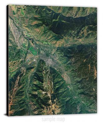
To view satellite imagery and bounding box footprint of individual city/location maps, click below on specific links

• Extra-Large Gallery Canvas Wrap Print
• Hand-Stretched, Expertly Crafted
• Artist Grade Canvas with Fade-Resistant Inks
• Ready to Hang with Pre-Installed Hardware
• 1.5" Thick Gallery Frame
Enrich your office decor or home with a large canvas wrap Satellite map. It is designed for easy hanging with pre-installed hardware. Printed with archival inks and wrapped around a 1.5" thick gallery frame, your favorite map art will have a timeless and impressive look that fits with any decor. This map is fabricated with satellite imagery data from Google Earth, and bounding box coordinates from USGS.
Abbott Lake, Montana- Map Components- Imagery: Satellite of Abbott Lake, Montana. Bounding Box: Footprint of Abbott Lake, Montana at Longitude/Latitude Coordinates (-112.25 x -112.125 x 48.5 x 48.375).
Absarokee, Montana- Map Components- Imagery: Satellite of Absarokee, Montana. Bounding Box: Footprint of Absarokee, Montana at Longitude/Latitude Coordinates (-109.5 x -109.375 x 45.625 x 45.5).
Ackley Lake, Montana- Map Components- Imagery: Satellite of Ackley Lake, Montana. Bounding Box: Footprint of Ackley Lake, Montana at Longitude/Latitude Coordinates (-110 x -109.875 x 47 x 46.875).
Acorn Flats, Montana- Map Components- Imagery: Satellite of Acorn Flats, Montana. Bounding Box: Footprint of Acorn Flats, Montana at Longitude/Latitude Coordinates (-107.125 x -107 x 46.875 x 46.75).
Acton, Montana- Map Components- Imagery: Satellite of Acton, Montana. Bounding Box: Footprint of Acton, Montana at Longitude/Latitude Coordinates (-108.75 x -108.625 x 46 x 45.875).
Ada Creek, Montana- Map Components- Imagery: Satellite of Ada Creek, Montana. Bounding Box: Footprint of Ada Creek, Montana at Longitude/Latitude Coordinates (-106.625 x -106.5 x 47.375 x 47.25).
Agawam North, Montana- Map Components- Imagery: Satellite of Agawam North, Montana. Bounding Box: Footprint of Agawam North, Montana at Longitude/Latitude Coordinates (-112.25 x -112.125 x 48.125 x 48).
Agawam South, Montana- Map Components- Imagery: Satellite of Agawam South, Montana. Bounding Box: Footprint of Agawam South, Montana at Longitude/Latitude Coordinates (-112.25 x -112.125 x 48 x 47.875).
Ahern Pass, Montana- Map Components- Imagery: Satellite of Ahern Pass, Montana. Bounding Box: Footprint of Ahern Pass, Montana at Longitude/Latitude Coordinates (-113.875 x -113.75 x 48.875 x 48.75).
Ahles, Montana- Map Components- Imagery: Satellite of Ahles, Montana. Bounding Box: Footprint of Ahles, Montana at Longitude/Latitude Coordinates (-107.25 x -107.125 x 46.5 x 46.375).
Ajax Ranch, Montana- Map Components- Imagery: Satellite of Ajax Ranch, Montana. Bounding Box: Footprint of Ajax Ranch, Montana at Longitude/Latitude Coordinates (-113.625 x -113.5 x 45.5 x 45.375).
Akers Ranch, Montana- Map Components- Imagery: Satellite of Akers Ranch, Montana. Bounding Box: Footprint of Akers Ranch, Montana at Longitude/Latitude Coordinates (-108.125 x -108 x 46.75 x 46.625).
Alaska Bench, Montana- Map Components- Imagery: Satellite of Alaska Bench, Montana. Bounding Box: Footprint of Alaska Bench, Montana at Longitude/Latitude Coordinates (-109.25 x -109.125 x 46.875 x 46.75).
Alberton, Montana- Map Components- Imagery: Satellite of Alberton, Montana. Bounding Box: Footprint of Alberton, Montana at Longitude/Latitude Coordinates (-114.5 x -114.375 x 47.125 x 47).
Albion, Montana- Map Components- Imagery: Satellite of Albion, Montana. Bounding Box: Footprint of Albion, Montana at Longitude/Latitude Coordinates (-104.375 x -104.25 x 45.25 x 45.125).
Alder, Montana- Map Components- Imagery: Satellite of Alder, Montana. Bounding Box: Footprint of Alder, Montana at Longitude/Latitude Coordinates (-112.125 x -112 x 45.375 x 45.25).
Alder Gulch, Montana- Map Components- Imagery: Satellite of Alder Gulch, Montana. Bounding Box: Footprint of Alder Gulch, Montana at Longitude/Latitude Coordinates (-113.625 x -113.5 x 46.5 x 46.375).
Alexander Mountain, Montana- Map Components- Imagery: Satellite of Alexander Mountain, Montana. Bounding Box: Footprint of Alexander Mountain, Montana at Longitude/Latitude Coordinates (-115.375 x -115.25 x 48.5 x 48.375).
Alkali Coulee, Montana- Map Components- Imagery: Satellite of Alkali Coulee, Montana. Bounding Box: Footprint of Alkali Coulee, Montana at Longitude/Latitude Coordinates (-104.625 x -104.5 x 48.625 x 48.5).
Alkali Creek, Montana- Map Components- Imagery: Satellite of Alkali Creek, Montana. Bounding Box: Footprint of Alkali Creek, Montana at Longitude/Latitude Coordinates (-106.375 x -106.25 x 46.75 x 46.625).
Alkali Lake, Montana- Map Components- Imagery: Satellite of Alkali Lake, Montana. Bounding Box: Footprint of Alkali Lake, Montana at Longitude/Latitude Coordinates (-111.125 x -111 x 46.5 x 46.375).
Allard, Montana- Map Components- Imagery: Satellite of Allard, Montana. Bounding Box: Footprint of Allard, Montana at Longitude/Latitude Coordinates (-104.625 x -104.5 x 47.125 x 47).
Allard Ranch, Montana- Map Components- Imagery: Satellite of Allard Ranch, Montana. Bounding Box: Footprint of Allard Ranch, Montana at Longitude/Latitude Coordinates (-104.625 x -104.5 x 47.5 x 47.375).
Aloe, Montana- Map Components- Imagery: Satellite of Aloe, Montana. Bounding Box: Footprint of Aloe, Montana at Longitude/Latitude Coordinates (-112.125 x -112 x 48.75 x 48.625).
Alpine, Montana- Map Components- Imagery: Satellite of Alpine, Montana. Bounding Box: Footprint of Alpine, Montana at Longitude/Latitude Coordinates (-109.75 x -109.625 x 45.25 x 45.125).
Alta, Montana- Map Components- Imagery: Satellite of Alta, Montana. Bounding Box: Footprint of Alta, Montana at Longitude/Latitude Coordinates (-114.375 x -114.25 x 45.625 x 45.5).
Alzada, Montana- Map Components- Imagery: Satellite of Alzada, Montana. Bounding Box: Footprint of Alzada, Montana at Longitude/Latitude Coordinates (-104.5 x -104.375 x 45.125 x 45).
Alzada NW, Montana- Map Components- Imagery: Satellite of Alzada NW, Montana. Bounding Box: Footprint of Alzada NW, Montana at Longitude/Latitude Coordinates (-104.5 x -104.375 x 45.25 x 45.125).
Amelong Creek, Montana- Map Components- Imagery: Satellite of Amelong Creek, Montana. Bounding Box: Footprint of Amelong Creek, Montana at Longitude/Latitude Coordinates (-110.25 x -110.125 x 46.125 x 46).
Amphitheatre Mountain, Montana- Map Components- Imagery: Satellite of Amphitheatre Mountain, Montana. Bounding Box: Footprint of Amphitheatre Mountain, Montana at Longitude/Latitude Coordinates (-113.25 x -113.125 x 47.75 x 47.625).
Anaconda North, Montana- Map Components- Imagery: Satellite of Anaconda North, Montana. Bounding Box: Footprint of Anaconda North, Montana at Longitude/Latitude Coordinates (-113 x -112.875 x 46.25 x 46.125).
Anaconda South, Montana- Map Components- Imagery: Satellite of Anaconda South, Montana. Bounding Box: Footprint of Anaconda South, Montana at Longitude/Latitude Coordinates (-113 x -112.875 x 46.125 x 46).
Anceney, Montana- Map Components- Imagery: Satellite of Anceney, Montana. Bounding Box: Footprint of Anceney, Montana at Longitude/Latitude Coordinates (-111.375 x -111.25 x 45.75 x 45.625).
Anderson Bridge, Montana- Map Components- Imagery: Satellite of Anderson Bridge, Montana. Bounding Box: Footprint of Anderson Bridge, Montana at Longitude/Latitude Coordinates (-109.625 x -109.5 x 47.625 x 47.5).
Andes, Montana- Map Components- Imagery: Satellite of Andes, Montana. Bounding Box: Footprint of Andes, Montana at Longitude/Latitude Coordinates (-104.625 x -104.5 x 48 x 47.875).
Angela, Montana- Map Components- Imagery: Satellite of Angela, Montana. Bounding Box: Footprint of Angela, Montana at Longitude/Latitude Coordinates (-106.25 x -106.125 x 46.75 x 46.625).
Angela NE, Montana- Map Components- Imagery: Satellite of Angela NE, Montana. Bounding Box: Footprint of Angela NE, Montana at Longitude/Latitude Coordinates (-106.125 x -106 x 46.75 x 46.625).
Antelope, Montana- Map Components- Imagery: Satellite of Antelope, Montana. Bounding Box: Footprint of Antelope, Montana at Longitude/Latitude Coordinates (-104.5 x -104.375 x 48.75 x 48.625).
Antelope Butte, Montana- Map Components- Imagery: Satellite of Antelope Butte, Montana. Bounding Box: Footprint of Antelope Butte, Montana at Longitude/Latitude Coordinates (-111.5 x -111.375 x 47.5 x 47.375).
Antelope Coulee NW, Montana- Map Components- Imagery: Satellite of Antelope Coulee NW, Montana. Bounding Box: Footprint of Antelope Coulee NW, Montana at Longitude/Latitude Coordinates (-111.75 x -111.625 x 48.75 x 48.625).
Antelope Coulee SE, Montana- Map Components- Imagery: Satellite of Antelope Coulee SE, Montana. Bounding Box: Footprint of Antelope Coulee SE, Montana at Longitude/Latitude Coordinates (-111.625 x -111.5 x 48.625 x 48.5).
Antelope Coulee SW, Montana- Map Components- Imagery: Satellite of Antelope Coulee SW, Montana. Bounding Box: Footprint of Antelope Coulee SW, Montana at Longitude/Latitude Coordinates (-111.75 x -111.625 x 48.625 x 48.5).
Antelope Creek, Montana- Map Components- Imagery: Satellite of Antelope Creek, Montana. Bounding Box: Footprint of Antelope Creek, Montana at Longitude/Latitude Coordinates (-113.5 x -113.375 x 46.375 x 46.25).
Antelope Creek Reservoir, Montana- Map Components- Imagery: Satellite of Antelope Creek Reservoir, Montana. Bounding Box: Footprint of Antelope Creek Reservoir, Montana at Longitude/Latitude Coordinates (-105.75 x -105.625 x 48 x 47.875).
Antelope Flat, Montana- Map Components- Imagery: Satellite of Antelope Flat, Montana. Bounding Box: Footprint of Antelope Flat, Montana at Longitude/Latitude Coordinates (-111.25 x -111.125 x 47.875 x 47.75).
Antelope Lake, Montana- Map Components- Imagery: Satellite of Antelope Lake, Montana. Bounding Box: Footprint of Antelope Lake, Montana at Longitude/Latitude Coordinates (-111.125 x -111 x 47.875 x 47.75).
Antelope Pass, Montana- Map Components- Imagery: Satellite of Antelope Pass, Montana. Bounding Box: Footprint of Antelope Pass, Montana at Longitude/Latitude Coordinates (-107 x -106.875 x 48.875 x 48.75).
Antelope Peak, Montana- Map Components- Imagery: Satellite of Antelope Peak, Montana. Bounding Box: Footprint of Antelope Peak, Montana at Longitude/Latitude Coordinates (-112.125 x -112 x 44.75 x 44.625).
Antelope Point, Montana- Map Components- Imagery: Satellite of Antelope Point, Montana. Bounding Box: Footprint of Antelope Point, Montana at Longitude/Latitude Coordinates (-109.5 x -109.375 x 45.875 x 45.75).
Antelope Springs, Montana- Map Components- Imagery: Satellite of Antelope Springs, Montana. Bounding Box: Footprint of Antelope Springs, Montana at Longitude/Latitude Coordinates (-106.875 x -106.75 x 47 x 46.875).
Antone Peak, Montana- Map Components- Imagery: Satellite of Antone Peak, Montana. Bounding Box: Footprint of Antone Peak, Montana at Longitude/Latitude Coordinates (-112.25 x -112.125 x 44.875 x 44.75).
Apple School, Montana- Map Components- Imagery: Satellite of Apple School, Montana. Bounding Box: Footprint of Apple School, Montana at Longitude/Latitude Coordinates (-111 x -110.875 x 48 x 47.875).
Archer, Montana- Map Components- Imagery: Satellite of Archer, Montana. Bounding Box: Footprint of Archer, Montana at Longitude/Latitude Coordinates (-104.875 x -104.75 x 48.875 x 48.75).
Argenta, Montana- Map Components- Imagery: Satellite of Argenta, Montana. Bounding Box: Footprint of Argenta, Montana at Longitude/Latitude Coordinates (-112.875 x -112.75 x 45.375 x 45.25).
Arlee, Montana- Map Components- Imagery: Satellite of Arlee, Montana. Bounding Box: Footprint of Arlee, Montana at Longitude/Latitude Coordinates (-114.125 x -114 x 47.25 x 47.125).
Armells, Montana- Map Components- Imagery: Satellite of Armells, Montana. Bounding Box: Footprint of Armells, Montana at Longitude/Latitude Coordinates (-109.25 x -109.125 x 47.375 x 47.25).
Armington, Montana- Map Components- Imagery: Satellite of Armington, Montana. Bounding Box: Footprint of Armington, Montana at Longitude/Latitude Coordinates (-111 x -110.875 x 47.375 x 47.25).
Arrastra Mountain, Montana- Map Components- Imagery: Satellite of Arrastra Mountain, Montana. Bounding Box: Footprint of Arrastra Mountain, Montana at Longitude/Latitude Coordinates (-112.875 x -112.75 x 47.125 x 47).
Arrow Creek, Montana- Map Components- Imagery: Satellite of Arrow Creek, Montana. Bounding Box: Footprint of Arrow Creek, Montana at Longitude/Latitude Coordinates (-110.25 x -110.125 x 47.375 x 47.25).
Arrow Peak, Montana- Map Components- Imagery: Satellite of Arrow Peak, Montana. Bounding Box: Footprint of Arrow Peak, Montana at Longitude/Latitude Coordinates (-110.625 x -110.5 x 47.5 x 47.375).
Arsenic Mountain, Montana- Map Components- Imagery: Satellite of Arsenic Mountain, Montana. Bounding Box: Footprint of Arsenic Mountain, Montana at Longitude/Latitude Coordinates (-112.875 x -112.75 x 47.75 x 47.625).
Ash Creek East, Montana- Map Components- Imagery: Satellite of Ash Creek East, Montana. Bounding Box: Footprint of Ash Creek East, Montana at Longitude/Latitude Coordinates (-106.375 x -106.25 x 47.75 x 47.625).
Ash Creek West, Montana- Map Components- Imagery: Satellite of Ash Creek West, Montana. Bounding Box: Footprint of Ash Creek West, Montana at Longitude/Latitude Coordinates (-106.5 x -106.375 x 47.75 x 47.625).
Ash Mountain, Montana- Map Components- Imagery: Satellite of Ash Mountain, Montana. Bounding Box: Footprint of Ash Mountain, Montana at Longitude/Latitude Coordinates (-110.625 x -110.5 x 45.125 x 45).
Ashbough Canyon, Montana- Map Components- Imagery: Satellite of Ashbough Canyon, Montana. Bounding Box: Footprint of Ashbough Canyon, Montana at Longitude/Latitude Coordinates (-112.625 x -112.5 x 45.125 x 45).
Ashford Coulee, Montana- Map Components- Imagery: Satellite of Ashford Coulee, Montana. Bounding Box: Footprint of Ashford Coulee, Montana at Longitude/Latitude Coordinates (-107.25 x -107.125 x 48.375 x 48.25).
Ashland, Montana- Map Components- Imagery: Satellite of Ashland, Montana. Bounding Box: Footprint of Ashland, Montana at Longitude/Latitude Coordinates (-106.375 x -106.25 x 45.625 x 45.5).
Ashland NE, Montana- Map Components- Imagery: Satellite of Ashland NE, Montana. Bounding Box: Footprint of Ashland NE, Montana at Longitude/Latitude Coordinates (-106.375 x -106.25 x 45.75 x 45.625).
Ashley Mountain, Montana- Map Components- Imagery: Satellite of Ashley Mountain, Montana. Bounding Box: Footprint of Ashley Mountain, Montana at Longitude/Latitude Coordinates (-114.75 x -114.625 x 48.375 x 48.25).
Aubrey Dam, Montana- Map Components- Imagery: Satellite of Aubrey Dam, Montana. Bounding Box: Footprint of Aubrey Dam, Montana at Longitude/Latitude Coordinates (-108.875 x -108.75 x 49 x 48.875).
Augusta, Montana- Map Components- Imagery: Satellite of Augusta, Montana. Bounding Box: Footprint of Augusta, Montana at Longitude/Latitude Coordinates (-112.5 x -112.375 x 47.5 x 47.375).
Austin, Montana- Map Components- Imagery: Satellite of Austin, Montana. Bounding Box: Footprint of Austin, Montana at Longitude/Latitude Coordinates (-112.25 x -112.125 x 46.75 x 46.625).
Austin Coulee, Montana- Map Components- Imagery: Satellite of Austin Coulee, Montana. Bounding Box: Footprint of Austin Coulee, Montana at Longitude/Latitude Coordinates (-107.875 x -107.75 x 48.75 x 48.625).
Austin Lake, Montana- Map Components- Imagery: Satellite of Austin Lake, Montana. Bounding Box: Footprint of Austin Lake, Montana at Longitude/Latitude Coordinates (-107.75 x -107.625 x 48.75 x 48.625).
Avon, Montana- Map Components- Imagery: Satellite of Avon, Montana. Bounding Box: Footprint of Avon, Montana at Longitude/Latitude Coordinates (-112.625 x -112.5 x 46.625 x 46.5).
Ayer Spring, Montana- Map Components- Imagery: Satellite of Ayer Spring, Montana. Bounding Box: Footprint of Ayer Spring, Montana at Longitude/Latitude Coordinates (-104.75 x -104.625 x 46.625 x 46.5).
Ayer Spring NE, Montana- Map Components- Imagery: Satellite of Ayer Spring NE, Montana. Bounding Box: Footprint of Ayer Spring NE, Montana at Longitude/Latitude Coordinates (-104.625 x -104.5 x 46.75 x 46.625).
B K Ranch, Montana- Map Components- Imagery: Satellite of B K Ranch, Montana. Bounding Box: Footprint of B K Ranch, Montana at Longitude/Latitude Coordinates (-111.625 x -111.5 x 47 x 46.875).
Babb, Montana- Map Components- Imagery: Satellite of Babb, Montana. Bounding Box: Footprint of Babb, Montana at Longitude/Latitude Coordinates (-113.5 x -113.375 x 48.875 x 48.75).
Bachelor Mountain, Montana- Map Components- Imagery: Satellite of Bachelor Mountain, Montana. Bounding Box: Footprint of Bachelor Mountain, Montana at Longitude/Latitude Coordinates (-113.25 x -113.125 x 45.125 x 45).
Bad Luck Creek, Montana- Map Components- Imagery: Satellite of Bad Luck Creek, Montana. Bounding Box: Footprint of Bad Luck Creek, Montana at Longitude/Latitude Coordinates (-111.625 x -111.5 x 45 x 44.875).
Badbaby Coulee, Montana- Map Components- Imagery: Satellite of Badbaby Coulee, Montana. Bounding Box: Footprint of Badbaby Coulee, Montana at Longitude/Latitude Coordinates (-108.375 x -108.25 x 45.75 x 45.625).
Badger Creek, Montana- Map Components- Imagery: Satellite of Badger Creek, Montana. Bounding Box: Footprint of Badger Creek, Montana at Longitude/Latitude Coordinates (-105.25 x -105.125 x 48.25 x 48.125).
Badger Peak, Montana- Map Components- Imagery: Satellite of Badger Peak, Montana. Bounding Box: Footprint of Badger Peak, Montana at Longitude/Latitude Coordinates (-106.625 x -106.5 x 45.75 x 45.625).
Badland Draw, Montana- Map Components- Imagery: Satellite of Badland Draw, Montana. Bounding Box: Footprint of Badland Draw, Montana at Longitude/Latitude Coordinates (-104.125 x -104 x 46.5 x 46.375).
Baggs Creek, Montana- Map Components- Imagery: Satellite of Baggs Creek, Montana. Bounding Box: Footprint of Baggs Creek, Montana at Longitude/Latitude Coordinates (-112.625 x -112.5 x 46.5 x 46.375).
Bailey Mountain, Montana- Map Components- Imagery: Satellite of Bailey Mountain, Montana. Bounding Box: Footprint of Bailey Mountain, Montana at Longitude/Latitude Coordinates (-113 x -112.875 x 46.75 x 46.625).
Bailey Reservoir, Montana- Map Components- Imagery: Satellite of Bailey Reservoir, Montana. Bounding Box: Footprint of Bailey Reservoir, Montana at Longitude/Latitude Coordinates (-110.125 x -110 x 48.5 x 48.375).
Bainville, Montana- Map Components- Imagery: Satellite of Bainville, Montana. Bounding Box: Footprint of Bainville, Montana at Longitude/Latitude Coordinates (-104.25 x -104.125 x 48.25 x 48.125).
Bainville SE, Montana- Map Components- Imagery: Satellite of Bainville SE, Montana. Bounding Box: Footprint of Bainville SE, Montana at Longitude/Latitude Coordinates (-104.125 x -104 x 48.125 x 48).
Bainville SW, Montana- Map Components- Imagery: Satellite of Bainville SW, Montana. Bounding Box: Footprint of Bainville SW, Montana at Longitude/Latitude Coordinates (-104.25 x -104.125 x 48.125 x 48).
Baker, Montana- Map Components- Imagery: Satellite of Baker, Montana. Bounding Box: Footprint of Baker, Montana at Longitude/Latitude Coordinates (-104.375 x -104.25 x 46.375 x 46.25).
Baker Monument, Montana- Map Components- Imagery: Satellite of Baker Monument, Montana. Bounding Box: Footprint of Baker Monument, Montana at Longitude/Latitude Coordinates (-109 x -108.875 x 47.75 x 47.625).
Baker NE, Montana- Map Components- Imagery: Satellite of Baker NE, Montana. Bounding Box: Footprint of Baker NE, Montana at Longitude/Latitude Coordinates (-104.375 x -104.25 x 46.5 x 46.375).
Baker NW, Montana- Map Components- Imagery: Satellite of Baker NW, Montana. Bounding Box: Footprint of Baker NW, Montana at Longitude/Latitude Coordinates (-104.5 x -104.375 x 46.5 x 46.375).
Bakers Spring, Montana- Map Components- Imagery: Satellite of Bakers Spring, Montana. Bounding Box: Footprint of Bakers Spring, Montana at Longitude/Latitude Coordinates (-109.125 x -109 x 47.625 x 47.5).
Bald Butte, Montana- Map Components- Imagery: Satellite of Bald Butte, Montana. Bounding Box: Footprint of Bald Butte, Montana at Longitude/Latitude Coordinates (-109 x -108.875 x 46.875 x 46.75).
Bald Hills, Montana- Map Components- Imagery: Satellite of Bald Hills, Montana. Bounding Box: Footprint of Bald Hills, Montana at Longitude/Latitude Coordinates (-111.25 x -111.125 x 47 x 46.875).
Bald Knob, Montana- Map Components- Imagery: Satellite of Bald Knob, Montana. Bounding Box: Footprint of Bald Knob, Montana at Longitude/Latitude Coordinates (-110.875 x -110.75 x 45.625 x 45.5).
Bald Top Mountain, Montana- Map Components- Imagery: Satellite of Bald Top Mountain, Montana. Bounding Box: Footprint of Bald Top Mountain, Montana at Longitude/Latitude Coordinates (-114 x -113.875 x 46.125 x 46).
Baldy Lake, Montana- Map Components- Imagery: Satellite of Baldy Lake, Montana. Bounding Box: Footprint of Baldy Lake, Montana at Longitude/Latitude Coordinates (-114.875 x -114.75 x 47.625 x 47.5).
Baldy Peak, Montana- Map Components- Imagery: Satellite of Baldy Peak, Montana. Bounding Box: Footprint of Baldy Peak, Montana at Longitude/Latitude Coordinates (-105.625 x -105.5 x 45.25 x 45.125).
Ball Coulee, Montana- Map Components- Imagery: Satellite of Ball Coulee, Montana. Bounding Box: Footprint of Ball Coulee, Montana at Longitude/Latitude Coordinates (-108.5 x -108.375 x 48.125 x 48).
Bandbox Mountain, Montana- Map Components- Imagery: Satellite of Bandbox Mountain, Montana. Bounding Box: Footprint of Bandbox Mountain, Montana at Longitude/Latitude Coordinates (-110.5 x -110.375 x 47 x 46.875).
Banfield Mountain, Montana- Map Components- Imagery: Satellite of Banfield Mountain, Montana. Bounding Box: Footprint of Banfield Mountain, Montana at Longitude/Latitude Coordinates (-115.5 x -115.375 x 48.625 x 48.5).
Bannack, Montana- Map Components- Imagery: Satellite of Bannack, Montana. Bounding Box: Footprint of Bannack, Montana at Longitude/Latitude Coordinates (-113 x -112.875 x 45.25 x 45.125).
Bannock Pass, Montana- Map Components- Imagery: Satellite of Bannock Pass, Montana. Bounding Box: Footprint of Bannock Pass, Montana at Longitude/Latitude Coordinates (-113.375 x -113.25 x 44.875 x 44.75).
Bar V Ranch, Montana- Map Components- Imagery: Satellite of Bar V Ranch, Montana. Bounding Box: Footprint of Bar V Ranch, Montana at Longitude/Latitude Coordinates (-107.125 x -107 x 45.125 x 45).
Bar V Ranch NE, Montana- Map Components- Imagery: Satellite of Bar V Ranch NE, Montana. Bounding Box: Footprint of Bar V Ranch NE, Montana at Longitude/Latitude Coordinates (-107.125 x -107 x 45.25 x 45.125).
Barber Butte, Montana- Map Components- Imagery: Satellite of Barber Butte, Montana. Bounding Box: Footprint of Barber Butte, Montana at Longitude/Latitude Coordinates (-109.5 x -109.375 x 48.375 x 48.25).
Barber Coulee, Montana- Map Components- Imagery: Satellite of Barber Coulee, Montana. Bounding Box: Footprint of Barber Coulee, Montana at Longitude/Latitude Coordinates (-108.125 x -108 x 47.875 x 47.75).
Bare Cone, Montana- Map Components- Imagery: Satellite of Bare Cone, Montana. Bounding Box: Footprint of Bare Cone, Montana at Longitude/Latitude Coordinates (-114.5 x -114.375 x 45.75 x 45.625).
Bare Mountain, Montana- Map Components- Imagery: Satellite of Bare Mountain, Montana. Bounding Box: Footprint of Bare Mountain, Montana at Longitude/Latitude Coordinates (-109.5 x -109.375 x 45.25 x 45.125).
Barker, Montana- Map Components- Imagery: Satellite of Barker, Montana. Bounding Box: Footprint of Barker, Montana at Longitude/Latitude Coordinates (-110.75 x -110.625 x 47.125 x 47).
Barney Pinnacle, Montana- Map Components- Imagery: Satellite of Barney Pinnacle, Montana. Bounding Box: Footprint of Barney Pinnacle, Montana at Longitude/Latitude Coordinates (-107.875 x -107.75 x 47.125 x 47).
Barr Creek, Montana- Map Components- Imagery: Satellite of Barr Creek, Montana. Bounding Box: Footprint of Barr Creek, Montana at Longitude/Latitude Coordinates (-112.625 x -112.5 x 47.625 x 47.5).
Barren Peak, Montana- Map Components- Imagery: Satellite of Barren Peak, Montana. Bounding Box: Footprint of Barren Peak, Montana at Longitude/Latitude Coordinates (-115.5 x -115.375 x 48.125 x 48).
Basin, Montana- Map Components- Imagery: Satellite of Basin, Montana. Bounding Box: Footprint of Basin, Montana at Longitude/Latitude Coordinates (-112.375 x -112.25 x 46.375 x 46.25).
Bassoo Peak, Montana- Map Components- Imagery: Satellite of Bassoo Peak, Montana. Bounding Box: Footprint of Bassoo Peak, Montana at Longitude/Latitude Coordinates (-114.875 x -114.75 x 47.875 x 47.75).
Bata Mountain, Montana- Map Components- Imagery: Satellite of Bata Mountain, Montana. Bounding Box: Footprint of Bata Mountain, Montana at Longitude/Latitude Coordinates (-113.375 x -113.25 x 47 x 46.875).
Bateman Coulee, Montana- Map Components- Imagery: Satellite of Bateman Coulee, Montana. Bounding Box: Footprint of Bateman Coulee, Montana at Longitude/Latitude Coordinates (-106.75 x -106.625 x 47.5 x 47.375).
Bateman Coulee NE, Montana- Map Components- Imagery: Satellite of Bateman Coulee NE, Montana. Bounding Box: Footprint of Bateman Coulee NE, Montana at Longitude/Latitude Coordinates (-106.625 x -106.5 x 47.5 x 47.375).
Battle Butte, Montana- Map Components- Imagery: Satellite of Battle Butte, Montana. Bounding Box: Footprint of Battle Butte, Montana at Longitude/Latitude Coordinates (-109.25 x -109.125 x 46 x 45.875).
Battle Mountain, Montana- Map Components- Imagery: Satellite of Battle Mountain, Montana. Bounding Box: Footprint of Battle Mountain, Montana at Longitude/Latitude Coordinates (-111.125 x -111 x 46.375 x 46.25).
Battleship Butte, Montana- Map Components- Imagery: Satellite of Battleship Butte, Montana. Bounding Box: Footprint of Battleship Butte, Montana at Longitude/Latitude Coordinates (-110.125 x -110 x 46.125 x 46).
Bay Horse, Montana- Map Components- Imagery: Satellite of Bay Horse, Montana. Bounding Box: Footprint of Bay Horse, Montana at Longitude/Latitude Coordinates (-105.625 x -105.5 x 45.125 x 45).
Baylor, Montana- Map Components- Imagery: Satellite of Baylor, Montana. Bounding Box: Footprint of Baylor, Montana at Longitude/Latitude Coordinates (-106.5 x -106.375 x 48.75 x 48.625).
Baylor NE, Montana- Map Components- Imagery: Satellite of Baylor NE, Montana. Bounding Box: Footprint of Baylor NE, Montana at Longitude/Latitude Coordinates (-106.375 x -106.25 x 48.75 x 48.625).
Baylor SE, Montana- Map Components- Imagery: Satellite of Baylor SE, Montana. Bounding Box: Footprint of Baylor SE, Montana at Longitude/Latitude Coordinates (-106.375 x -106.25 x 48.625 x 48.5).
Beacon Point, Montana- Map Components- Imagery: Satellite of Beacon Point, Montana. Bounding Box: Footprint of Beacon Point, Montana at Longitude/Latitude Coordinates (-111.375 x -111.25 x 45.5 x 45.375).
Bean Lake, Montana- Map Components- Imagery: Satellite of Bean Lake, Montana. Bounding Box: Footprint of Bean Lake, Montana at Longitude/Latitude Coordinates (-112.5 x -112.375 x 47.375 x 47.25).
Bear Canyon, Montana- Map Components- Imagery: Satellite of Bear Canyon, Montana. Bounding Box: Footprint of Bear Canyon, Montana at Longitude/Latitude Coordinates (-108.625 x -108.5 x 45.125 x 45).
Bear Coulee, Montana- Map Components- Imagery: Satellite of Bear Coulee, Montana. Bounding Box: Footprint of Bear Coulee, Montana at Longitude/Latitude Coordinates (-108.25 x -108.125 x 45.5 x 45.375).
Bear Coulee SW, Montana- Map Components- Imagery: Satellite of Bear Coulee SW, Montana. Bounding Box: Footprint of Bear Coulee SW, Montana at Longitude/Latitude Coordinates (-108.25 x -108.125 x 45.375 x 45.25).
Bear Creek Reservoir, Montana- Map Components- Imagery: Satellite of Bear Creek Reservoir, Montana. Bounding Box: Footprint of Bear Creek Reservoir, Montana at Longitude/Latitude Coordinates (-108.75 x -108.625 x 47.375 x 47.25).
Bear Creek Reservoir SE, Montana- Map Components- Imagery: Satellite of Bear Creek Reservoir SE, Montana. Bounding Box: Footprint of Bear Creek Reservoir SE, Montana at Longitude/Latitude Coordinates (-108.625 x -108.5 x 47.375 x 47.25).
Bear Creek School, Montana- Map Components- Imagery: Satellite of Bear Creek School, Montana. Bounding Box: Footprint of Bear Creek School, Montana at Longitude/Latitude Coordinates (-106.25 x -106.125 x 45.125 x 45).
Bear Hole, Montana- Map Components- Imagery: Satellite of Bear Hole, Montana. Bounding Box: Footprint of Bear Hole, Montana at Longitude/Latitude Coordinates (-108 x -107.875 x 45.125 x 45).
Bear Jaw Creek, Montana- Map Components- Imagery: Satellite of Bear Jaw Creek, Montana. Bounding Box: Footprint of Bear Jaw Creek, Montana at Longitude/Latitude Coordinates (-105.25 x -105.125 x 46.125 x 46).
Bear Mountain, Montana- Map Components- Imagery: Satellite of Bear Mountain, Montana. Bounding Box: Footprint of Bear Mountain, Montana at Longitude/Latitude Coordinates (-108.5 x -108.375 x 48 x 47.875).
Bear Skull Mountain, Montana- Map Components- Imagery: Satellite of Bear Skull Mountain, Montana. Bounding Box: Footprint of Bear Skull Mountain, Montana at Longitude/Latitude Coordinates (-105.5 x -105.375 x 45.25 x 45.125).
Bear Trap Creek, Montana- Map Components- Imagery: Satellite of Bear Trap Creek, Montana. Bounding Box: Footprint of Bear Trap Creek, Montana at Longitude/Latitude Coordinates (-111.625 x -111.5 x 45.625 x 45.5).
Bearmouth, Montana- Map Components- Imagery: Satellite of Bearmouth, Montana. Bounding Box: Footprint of Bearmouth, Montana at Longitude/Latitude Coordinates (-113.375 x -113.25 x 46.75 x 46.625).
Bearpaw Lake, Montana- Map Components- Imagery: Satellite of Bearpaw Lake, Montana. Bounding Box: Footprint of Bearpaw Lake, Montana at Longitude/Latitude Coordinates (-109.75 x -109.625 x 48.375 x 48.25).
Bears Nest, Montana- Map Components- Imagery: Satellite of Bears Nest, Montana. Bounding Box: Footprint of Bears Nest, Montana at Longitude/Latitude Coordinates (-105.5 x -105.375 x 48.5 x 48.375).
Bearshack Creek, Montana- Map Components- Imagery: Satellite of Bearshack Creek, Montana. Bounding Box: Footprint of Bearshack Creek, Montana at Longitude/Latitude Coordinates (-105.625 x -105.5 x 47.25 x 47.125).
Beartooth Mountain, Montana- Map Components- Imagery: Satellite of Beartooth Mountain, Montana. Bounding Box: Footprint of Beartooth Mountain, Montana at Longitude/Latitude Coordinates (-112 x -111.875 x 47 x 46.875).
Beartrap Mountain, Montana- Map Components- Imagery: Satellite of Beartrap Mountain, Montana. Bounding Box: Footprint of Beartrap Mountain, Montana at Longitude/Latitude Coordinates (-115.25 x -115.125 x 48.875 x 48.75).
Beaupre Coulee, Montana- Map Components- Imagery: Satellite of Beaupre Coulee, Montana. Bounding Box: Footprint of Beaupre Coulee, Montana at Longitude/Latitude Coordinates (-111.75 x -111.625 x 49 x 48.875).
Beauty Creek, Montana- Map Components- Imagery: Satellite of Beauty Creek, Montana. Bounding Box: Footprint of Beauty Creek, Montana at Longitude/Latitude Coordinates (-106 x -105.875 x 47.375 x 47.25).
Beaver Creek School, Montana- Map Components- Imagery: Satellite of Beaver Creek School, Montana. Bounding Box: Footprint of Beaver Creek School, Montana at Longitude/Latitude Coordinates (-106.125 x -106 x 45.75 x 45.625).
Beaver Flats North, Montana- Map Components- Imagery: Satellite of Beaver Flats North, Montana. Bounding Box: Footprint of Beaver Flats North, Montana at Longitude/Latitude Coordinates (-104.75 x -104.625 x 46 x 45.875).
Beaver Flats South, Montana- Map Components- Imagery: Satellite of Beaver Flats South, Montana. Bounding Box: Footprint of Beaver Flats South, Montana at Longitude/Latitude Coordinates (-104.75 x -104.625 x 45.875 x 45.75).
Beaver Lake, Montana- Map Components- Imagery: Satellite of Beaver Lake, Montana. Bounding Box: Footprint of Beaver Lake, Montana at Longitude/Latitude Coordinates (-114.5 x -114.375 x 48.5 x 48.375).
Beaverhead Rock, Montana- Map Components- Imagery: Satellite of Beaverhead Rock, Montana. Bounding Box: Footprint of Beaverhead Rock, Montana at Longitude/Latitude Coordinates (-112.5 x -112.375 x 45.5 x 45.375).
Beaverhead Rock NE, Montana- Map Components- Imagery: Satellite of Beaverhead Rock NE, Montana. Bounding Box: Footprint of Beaverhead Rock NE, Montana at Longitude/Latitude Coordinates (-112.375 x -112.25 x 45.5 x 45.375).
Beaverhead Rock SE, Montana- Map Components- Imagery: Satellite of Beaverhead Rock SE, Montana. Bounding Box: Footprint of Beaverhead Rock SE, Montana at Longitude/Latitude Coordinates (-112.375 x -112.25 x 45.375 x 45.25).
Beaverhead Rock SW, Montana- Map Components- Imagery: Satellite of Beaverhead Rock SW, Montana. Bounding Box: Footprint of Beaverhead Rock SW, Montana at Longitude/Latitude Coordinates (-112.5 x -112.375 x 45.375 x 45.25).
Becker Dam, Montana- Map Components- Imagery: Satellite of Becker Dam, Montana. Bounding Box: Footprint of Becker Dam, Montana at Longitude/Latitude Coordinates (-105.625 x -105.5 x 47.125 x 47).
Becket, Montana- Map Components- Imagery: Satellite of Becket, Montana. Bounding Box: Footprint of Becket, Montana at Longitude/Latitude Coordinates (-109 x -108.875 x 47 x 46.875).
Becket NE, Montana- Map Components- Imagery: Satellite of Becket NE, Montana. Bounding Box: Footprint of Becket NE, Montana at Longitude/Latitude Coordinates (-108.875 x -108.75 x 47 x 46.875).
Beebe, Montana- Map Components- Imagery: Satellite of Beebe, Montana. Bounding Box: Footprint of Beebe, Montana at Longitude/Latitude Coordinates (-105.625 x -105.5 x 46.125 x 46).
Beebe SW, Montana- Map Components- Imagery: Satellite of Beebe SW, Montana. Bounding Box: Footprint of Beebe SW, Montana at Longitude/Latitude Coordinates (-105.75 x -105.625 x 46.125 x 46).
Beech Creek, Montana- Map Components- Imagery: Satellite of Beech Creek, Montana. Bounding Box: Footprint of Beech Creek, Montana at Longitude/Latitude Coordinates (-112.625 x -112.5 x 45 x 44.875).
Beehive, Montana- Map Components- Imagery: Satellite of Beehive, Montana. Bounding Box: Footprint of Beehive, Montana at Longitude/Latitude Coordinates (-109.75 x -109.625 x 45.5 x 45.375).
Beery Reservoir, Montana- Map Components- Imagery: Satellite of Beery Reservoir, Montana. Bounding Box: Footprint of Beery Reservoir, Montana at Longitude/Latitude Coordinates (-105.5 x -105.375 x 47.75 x 47.625).
Belfry, Montana- Map Components- Imagery: Satellite of Belfry, Montana. Bounding Box: Footprint of Belfry, Montana at Longitude/Latitude Coordinates (-109.125 x -109 x 45.25 x 45.125).
Belgian Hill, Montana- Map Components- Imagery: Satellite of Belgian Hill, Montana. Bounding Box: Footprint of Belgian Hill, Montana at Longitude/Latitude Coordinates (-112.125 x -112 x 48.375 x 48.25).
Belgrade, Montana- Map Components- Imagery: Satellite of Belgrade, Montana. Bounding Box: Footprint of Belgrade, Montana at Longitude/Latitude Coordinates (-111.25 x -111.125 x 45.875 x 45.75).
Belknap, Montana- Map Components- Imagery: Satellite of Belknap, Montana. Bounding Box: Footprint of Belknap, Montana at Longitude/Latitude Coordinates (-115.5 x -115.375 x 47.75 x 47.625).
Bell Ridge East, Montana- Map Components- Imagery: Satellite of Bell Ridge East, Montana. Bounding Box: Footprint of Bell Ridge East, Montana at Longitude/Latitude Coordinates (-108.625 x -108.5 x 47.75 x 47.625).
Bell Ridge West, Montana- Map Components- Imagery: Satellite of Bell Ridge West, Montana. Bounding Box: Footprint of Bell Ridge West, Montana at Longitude/Latitude Coordinates (-108.75 x -108.625 x 47.75 x 47.625).
Belle Creek North, Montana- Map Components- Imagery: Satellite of Belle Creek North, Montana. Bounding Box: Footprint of Belle Creek North, Montana at Longitude/Latitude Coordinates (-105.125 x -105 x 45.25 x 45.125).
Belle Creek South, Montana- Map Components- Imagery: Satellite of Belle Creek South, Montana. Bounding Box: Footprint of Belle Creek South, Montana at Longitude/Latitude Coordinates (-105.125 x -105 x 45.125 x 45).
Belle Creek SW, Montana- Map Components- Imagery: Satellite of Belle Creek SW, Montana. Bounding Box: Footprint of Belle Creek SW, Montana at Longitude/Latitude Coordinates (-105.25 x -105.125 x 45.125 x 45).
Belle Prairie, Montana- Map Components- Imagery: Satellite of Belle Prairie, Montana. Bounding Box: Footprint of Belle Prairie, Montana at Longitude/Latitude Coordinates (-104.625 x -104.5 x 47.25 x 47.125).
Belltower, Montana- Map Components- Imagery: Satellite of Belltower, Montana. Bounding Box: Footprint of Belltower, Montana at Longitude/Latitude Coordinates (-104.375 x -104.25 x 45.75 x 45.625).
Belltower Butte, Montana- Map Components- Imagery: Satellite of Belltower Butte, Montana. Bounding Box: Footprint of Belltower Butte, Montana at Longitude/Latitude Coordinates (-104.375 x -104.25 x 45.625 x 45.5).
Belmont, Montana- Map Components- Imagery: Satellite of Belmont, Montana. Bounding Box: Footprint of Belmont, Montana at Longitude/Latitude Coordinates (-109 x -108.875 x 46.25 x 46.125).
Belmont Park Ranch, Montana- Map Components- Imagery: Satellite of Belmont Park Ranch, Montana. Bounding Box: Footprint of Belmont Park Ranch, Montana at Longitude/Latitude Coordinates (-112.25 x -112.125 x 45.125 x 45).
Belmont Point, Montana- Map Components- Imagery: Satellite of Belmont Point, Montana. Bounding Box: Footprint of Belmont Point, Montana at Longitude/Latitude Coordinates (-113.625 x -113.5 x 47.125 x 47).
Belmore Sloughs, Montana- Map Components- Imagery: Satellite of Belmore Sloughs, Montana. Bounding Box: Footprint of Belmore Sloughs, Montana at Longitude/Latitude Coordinates (-113.875 x -113.75 x 47.25 x 47.125).
Belt, Montana- Map Components- Imagery: Satellite of Belt, Montana. Bounding Box: Footprint of Belt, Montana at Longitude/Latitude Coordinates (-111 x -110.875 x 47.5 x 47.375).
Belt NE, Montana- Map Components- Imagery: Satellite of Belt NE, Montana. Bounding Box: Footprint of Belt NE, Montana at Longitude/Latitude Coordinates (-110.875 x -110.75 x 47.5 x 47.375).
Belt Park Butte, Montana- Map Components- Imagery: Satellite of Belt Park Butte, Montana. Bounding Box: Footprint of Belt Park Butte, Montana at Longitude/Latitude Coordinates (-110.875 x -110.75 x 47 x 46.875).
Benchland, Montana- Map Components- Imagery: Satellite of Benchland, Montana. Bounding Box: Footprint of Benchland, Montana at Longitude/Latitude Coordinates (-110.125 x -110 x 47.125 x 47).
Benchmark, Montana- Map Components- Imagery: Satellite of Benchmark, Montana. Bounding Box: Footprint of Benchmark, Montana at Longitude/Latitude Coordinates (-113 x -112.875 x 47.5 x 47.375).
Bend, Montana- Map Components- Imagery: Satellite of Bend, Montana. Bounding Box: Footprint of Bend, Montana at Longitude/Latitude Coordinates (-115.125 x -115 x 48 x 47.875).
Bender Point, Montana- Map Components- Imagery: Satellite of Bender Point, Montana. Bounding Box: Footprint of Bender Point, Montana at Longitude/Latitude Coordinates (-113.75 x -113.625 x 45.875 x 45.75).
Bennett Lake, Montana- Map Components- Imagery: Satellite of Bennett Lake, Montana. Bounding Box: Footprint of Bennett Lake, Montana at Longitude/Latitude Coordinates (-107.875 x -107.75 x 48.25 x 48.125).
Bennett Lake NW, Montana- Map Components- Imagery: Satellite of Bennett Lake NW, Montana. Bounding Box: Footprint of Bennett Lake NW, Montana at Longitude/Latitude Coordinates (-108 x -107.875 x 48.25 x 48.125).
Benteen, Montana- Map Components- Imagery: Satellite of Benteen, Montana. Bounding Box: Footprint of Benteen, Montana at Longitude/Latitude Coordinates (-107.5 x -107.375 x 45.5 x 45.375).
Benton Lake East, Montana- Map Components- Imagery: Satellite of Benton Lake East, Montana. Bounding Box: Footprint of Benton Lake East, Montana at Longitude/Latitude Coordinates (-111.375 x -111.25 x 47.75 x 47.625).
Benton Lake West, Montana- Map Components- Imagery: Satellite of Benton Lake West, Montana. Bounding Box: Footprint of Benton Lake West, Montana at Longitude/Latitude Coordinates (-111.5 x -111.375 x 47.75 x 47.625).
Bentonite Flats, Montana- Map Components- Imagery: Satellite of Bentonite Flats, Montana. Bounding Box: Footprint of Bentonite Flats, Montana at Longitude/Latitude Coordinates (-108 x -107.875 x 45.625 x 45.5).
Benzien, Montana- Map Components- Imagery: Satellite of Benzien, Montana. Bounding Box: Footprint of Benzien, Montana at Longitude/Latitude Coordinates (-107.75 x -107.625 x 47.375 x 47.25).
Berkholder Reservoir, Montana- Map Components- Imagery: Satellite of Berkholder Reservoir, Montana. Bounding Box: Footprint of Berkholder Reservoir, Montana at Longitude/Latitude Coordinates (-111.375 x -111.25 x 48.75 x 48.625).
Berry School, Montana- Map Components- Imagery: Satellite of Berry School, Montana. Bounding Box: Footprint of Berry School, Montana at Longitude/Latitude Coordinates (-106 x -105.875 x 47.25 x 47.125).
Biddle, Montana- Map Components- Imagery: Satellite of Biddle, Montana. Bounding Box: Footprint of Biddle, Montana at Longitude/Latitude Coordinates (-105.375 x -105.25 x 45.125 x 45).
Biem School, Montana- Map Components- Imagery: Satellite of Biem School, Montana. Bounding Box: Footprint of Biem School, Montana at Longitude/Latitude Coordinates (-105 x -104.875 x 48.5 x 48.375).
Big Bend School, Montana- Map Components- Imagery: Satellite of Big Bend School, Montana. Bounding Box: Footprint of Big Bend School, Montana at Longitude/Latitude Coordinates (-110.25 x -110.125 x 48 x 47.875).
Big Coulee, Montana- Map Components- Imagery: Satellite of Big Coulee, Montana. Bounding Box: Footprint of Big Coulee, Montana at Longitude/Latitude Coordinates (-109 x -108.875 x 48.5 x 48.375).
Big Draw, Montana- Map Components- Imagery: Satellite of Big Draw, Montana. Bounding Box: Footprint of Big Draw, Montana at Longitude/Latitude Coordinates (-110.875 x -110.75 x 45.5 x 45.375).
Big Dry School, Montana- Map Components- Imagery: Satellite of Big Dry School, Montana. Bounding Box: Footprint of Big Dry School, Montana at Longitude/Latitude Coordinates (-107.25 x -107.125 x 47.25 x 47.125).
Big Flat East, Montana- Map Components- Imagery: Satellite of Big Flat East, Montana. Bounding Box: Footprint of Big Flat East, Montana at Longitude/Latitude Coordinates (-108.375 x -108.25 x 48.25 x 48.125).
Big Flat West, Montana- Map Components- Imagery: Satellite of Big Flat West, Montana. Bounding Box: Footprint of Big Flat West, Montana at Longitude/Latitude Coordinates (-108.5 x -108.375 x 48.25 x 48.125).
Big Hawk Mountain, Montana- Map Components- Imagery: Satellite of Big Hawk Mountain, Montana. Bounding Box: Footprint of Big Hawk Mountain, Montana at Longitude/Latitude Coordinates (-113.875 x -113.75 x 48.125 x 48).
Big Hill, Montana- Map Components- Imagery: Satellite of Big Hill, Montana. Bounding Box: Footprint of Big Hill, Montana at Longitude/Latitude Coordinates (-106 x -105.875 x 46.5 x 46.375).
Big Hole Battlefield, Montana- Map Components- Imagery: Satellite of Big Hole Battlefield, Montana. Bounding Box: Footprint of Big Hole Battlefield, Montana at Longitude/Latitude Coordinates (-113.75 x -113.625 x 45.75 x 45.625).
Big Hole Peak, Montana- Map Components- Imagery: Satellite of Big Hole Peak, Montana. Bounding Box: Footprint of Big Hole Peak, Montana at Longitude/Latitude Coordinates (-115.125 x -115 x 47.625 x 47.5).
Big Horn Mountain, Montana- Map Components- Imagery: Satellite of Big Horn Mountain, Montana. Bounding Box: Footprint of Big Horn Mountain, Montana at Longitude/Latitude Coordinates (-111.875 x -111.75 x 45 x 44.875).
Big Horn Peak, Montana- Map Components- Imagery: Satellite of Big Horn Peak, Montana. Bounding Box: Footprint of Big Horn Peak, Montana at Longitude/Latitude Coordinates (-111.125 x -111 x 45.125 x 45).
Big Ice Cave, Montana- Map Components- Imagery: Satellite of Big Ice Cave, Montana. Bounding Box: Footprint of Big Ice Cave, Montana at Longitude/Latitude Coordinates (-108.5 x -108.375 x 45.25 x 45.125).
Big John Butte, Montana- Map Components- Imagery: Satellite of Big John Butte, Montana. Bounding Box: Footprint of Big John Butte, Montana at Longitude/Latitude Coordinates (-109.625 x -109.5 x 48.25 x 48.125).
Big Marys Island, Montana- Map Components- Imagery: Satellite of Big Marys Island, Montana. Bounding Box: Footprint of Big Marys Island, Montana at Longitude/Latitude Coordinates (-108 x -107.875 x 46.125 x 46).
Big Rock, Montana- Map Components- Imagery: Satellite of Big Rock, Montana. Bounding Box: Footprint of Big Rock, Montana at Longitude/Latitude Coordinates (-113.125 x -113 x 48.5 x 48.375).
Big Sag, Montana- Map Components- Imagery: Satellite of Big Sag, Montana. Bounding Box: Footprint of Big Sag, Montana at Longitude/Latitude Coordinates (-110.75 x -110.625 x 47.625 x 47.5).
Big Salmon Lake East, Montana- Map Components- Imagery: Satellite of Big Salmon Lake East, Montana. Bounding Box: Footprint of Big Salmon Lake East, Montana at Longitude/Latitude Coordinates (-113.375 x -113.25 x 47.625 x 47.5).
Big Salmon Lake West, Montana- Map Components- Imagery: Satellite of Big Salmon Lake West, Montana. Bounding Box: Footprint of Big Salmon Lake West, Montana at Longitude/Latitude Coordinates (-113.5 x -113.375 x 47.625 x 47.5).
Big Sandy, Montana- Map Components- Imagery: Satellite of Big Sandy, Montana. Bounding Box: Footprint of Big Sandy, Montana at Longitude/Latitude Coordinates (-110.125 x -110 x 48.25 x 48.125).
Big Sheep Mountain, Montana- Map Components- Imagery: Satellite of Big Sheep Mountain, Montana. Bounding Box: Footprint of Big Sheep Mountain, Montana at Longitude/Latitude Coordinates (-105.75 x -105.625 x 47.125 x 47).
Big Sheep Mountain NW, Montana- Map Components- Imagery: Satellite of Big Sheep Mountain NW, Montana. Bounding Box: Footprint of Big Sheep Mountain NW, Montana at Longitude/Latitude Coordinates (-105.75 x -105.625 x 47.25 x 47.125).
Big Spring, Montana- Map Components- Imagery: Satellite of Big Spring, Montana. Bounding Box: Footprint of Big Spring, Montana at Longitude/Latitude Coordinates (-110 x -109.875 x 47.25 x 47.125).
Big Timber, Montana- Map Components- Imagery: Satellite of Big Timber, Montana. Bounding Box: Footprint of Big Timber, Montana at Longitude/Latitude Coordinates (-110 x -109.875 x 45.875 x 45.75).
Big Wall East, Montana- Map Components- Imagery: Satellite of Big Wall East, Montana. Bounding Box: Footprint of Big Wall East, Montana at Longitude/Latitude Coordinates (-108.375 x -108.25 x 46.625 x 46.5).
Big Wall NW, Montana- Map Components- Imagery: Satellite of Big Wall NW, Montana. Bounding Box: Footprint of Big Wall NW, Montana at Longitude/Latitude Coordinates (-108.5 x -108.375 x 46.75 x 46.625).
Big Wall West, Montana- Map Components- Imagery: Satellite of Big Wall West, Montana. Bounding Box: Footprint of Big Wall West, Montana at Longitude/Latitude Coordinates (-108.5 x -108.375 x 46.625 x 46.5).
Bigby Lake, Montana- Map Components- Imagery: Satellite of Bigby Lake, Montana. Bounding Box: Footprint of Bigby Lake, Montana at Longitude/Latitude Coordinates (-108.625 x -108.5 x 48.375 x 48.25).
Bigfork, Montana- Map Components- Imagery: Satellite of Bigfork, Montana. Bounding Box: Footprint of Bigfork, Montana at Longitude/Latitude Coordinates (-114.125 x -114 x 48.125 x 48).
Bighorn, Montana- Map Components- Imagery: Satellite of Bighorn, Montana. Bounding Box: Footprint of Bighorn, Montana at Longitude/Latitude Coordinates (-107.5 x -107.375 x 46.25 x 46.125).
Billick Coulee, Montana- Map Components- Imagery: Satellite of Billick Coulee, Montana. Bounding Box: Footprint of Billick Coulee, Montana at Longitude/Latitude Coordinates (-107 x -106.875 x 48.25 x 48.125).
Billings East, Montana- Map Components- Imagery: Satellite of Billings East, Montana. Bounding Box: Footprint of Billings East, Montana at Longitude/Latitude Coordinates (-108.5 x -108.375 x 45.875 x 45.75).
Billings West, Montana- Map Components- Imagery: Satellite of Billings West, Montana. Bounding Box: Footprint of Billings West, Montana at Longitude/Latitude Coordinates (-108.625 x -108.5 x 45.875 x 45.75).
Bing, Montana- Map Components- Imagery: Satellite of Bing, Montana. Bounding Box: Footprint of Bing, Montana at Longitude/Latitude Coordinates (-114.125 x -114 x 46.5 x 46.375).
Bingham Lake, Montana- Map Components- Imagery: Satellite of Bingham Lake, Montana. Bounding Box: Footprint of Bingham Lake, Montana at Longitude/Latitude Coordinates (-111.125 x -111 x 49 x 48.875).
Bird Rapids, Montana- Map Components- Imagery: Satellite of Bird Rapids, Montana. Bounding Box: Footprint of Bird Rapids, Montana at Longitude/Latitude Coordinates (-109.25 x -109.125 x 47.875 x 47.75).
Birdseye Spring, Montana- Map Components- Imagery: Satellite of Birdseye Spring, Montana. Bounding Box: Footprint of Birdseye Spring, Montana at Longitude/Latitude Coordinates (-107 x -106.875 x 45.5 x 45.375).
Birney, Montana- Map Components- Imagery: Satellite of Birney, Montana. Bounding Box: Footprint of Birney, Montana at Longitude/Latitude Coordinates (-106.625 x -106.5 x 45.375 x 45.25).
Birney Day School, Montana- Map Components- Imagery: Satellite of Birney Day School, Montana. Bounding Box: Footprint of Birney Day School, Montana at Longitude/Latitude Coordinates (-106.5 x -106.375 x 45.5 x 45.375).
Birney SW, Montana- Map Components- Imagery: Satellite of Birney SW, Montana. Bounding Box: Footprint of Birney SW, Montana at Longitude/Latitude Coordinates (-106.75 x -106.625 x 45.375 x 45.25).
Biscuit Butte, Montana- Map Components- Imagery: Satellite of Biscuit Butte, Montana. Bounding Box: Footprint of Biscuit Butte, Montana at Longitude/Latitude Coordinates (-107.125 x -107 x 47.5 x 47.375).
Bison Bone Reservoir, Montana- Map Components- Imagery: Satellite of Bison Bone Reservoir, Montana. Bounding Box: Footprint of Bison Bone Reservoir, Montana at Longitude/Latitude Coordinates (-108.375 x -108.25 x 47.875 x 47.75).
Bison Canyon, Montana- Map Components- Imagery: Satellite of Bison Canyon, Montana. Bounding Box: Footprint of Bison Canyon, Montana at Longitude/Latitude Coordinates (-112.375 x -112.25 x 46.25 x 46.125).
Bison Mountain, Montana- Map Components- Imagery: Satellite of Bison Mountain, Montana. Bounding Box: Footprint of Bison Mountain, Montana at Longitude/Latitude Coordinates (-112.5 x -112.375 x 46.5 x 46.375).
Bjornberg Bridge, Montana- Map Components- Imagery: Satellite of Bjornberg Bridge, Montana. Bounding Box: Footprint of Bjornberg Bridge, Montana at Longitude/Latitude Coordinates (-107.25 x -107.125 x 48.625 x 48.5).
Black Butte, Montana- Map Components- Imagery: Satellite of Black Butte, Montana. Bounding Box: Footprint of Black Butte, Montana at Longitude/Latitude Coordinates (-112.125 x -112 x 46 x 45.875).
Black Butte Mountain, Montana- Map Components- Imagery: Satellite of Black Butte Mountain, Montana. Bounding Box: Footprint of Black Butte Mountain, Montana at Longitude/Latitude Coordinates (-111 x -110.875 x 46.375 x 46.25).
Black Calf Reservoir, Montana- Map Components- Imagery: Satellite of Black Calf Reservoir, Montana. Bounding Box: Footprint of Black Calf Reservoir, Montana at Longitude/Latitude Coordinates (-107.125 x -107 x 49 x 48.875).
Black Coulee, Montana- Map Components- Imagery: Satellite of Black Coulee, Montana. Bounding Box: Footprint of Black Coulee, Montana at Longitude/Latitude Coordinates (-106.75 x -106.625 x 46.5 x 46.375).
Black Gulch, Montana- Map Components- Imagery: Satellite of Black Gulch, Montana. Bounding Box: Footprint of Black Gulch, Montana at Longitude/Latitude Coordinates (-107.625 x -107.5 x 45.125 x 45).
Black Hills, Montana- Map Components- Imagery: Satellite of Black Hills, Montana. Bounding Box: Footprint of Black Hills, Montana at Longitude/Latitude Coordinates (-106.75 x -106.625 x 47 x 46.875).
Black John Coulee, Montana- Map Components- Imagery: Satellite of Black John Coulee, Montana. Bounding Box: Footprint of Black John Coulee, Montana at Longitude/Latitude Coordinates (-106.75 x -106.625 x 47.375 x 47.25).
Black Mountain, Montana- Map Components- Imagery: Satellite of Black Mountain, Montana. Bounding Box: Footprint of Black Mountain, Montana at Longitude/Latitude Coordinates (-112.25 x -112.125 x 46.625 x 46.5).
Black Peak, Montana- Map Components- Imagery: Satellite of Black Peak, Montana. Bounding Box: Footprint of Black Peak, Montana at Longitude/Latitude Coordinates (-115.75 x -115.625 x 47.75 x 47.625).
Black Pine Ridge, Montana- Map Components- Imagery: Satellite of Black Pine Ridge, Montana. Bounding Box: Footprint of Black Pine Ridge, Montana at Longitude/Latitude Coordinates (-113.5 x -113.375 x 46.5 x 46.375).
Black Point, Montana- Map Components- Imagery: Satellite of Black Point, Montana. Bounding Box: Footprint of Black Point, Montana at Longitude/Latitude Coordinates (-104.75 x -104.625 x 45.25 x 45.125).
Black Point NE, Montana- Map Components- Imagery: Satellite of Black Point NE, Montana. Bounding Box: Footprint of Black Point NE, Montana at Longitude/Latitude Coordinates (-104.625 x -104.5 x 45.25 x 45.125).
Black Pyramid Mountain, Montana- Map Components- Imagery: Satellite of Black Pyramid Mountain, Montana. Bounding Box: Footprint of Black Pyramid Mountain, Montana at Longitude/Latitude Coordinates (-109.5 x -109.375 x 45.125 x 45).
Black Sea Reservoir, Montana- Map Components- Imagery: Satellite of Black Sea Reservoir, Montana. Bounding Box: Footprint of Black Sea Reservoir, Montana at Longitude/Latitude Coordinates (-107.375 x -107.25 x 46.75 x 46.625).
Black Spring, Montana- Map Components- Imagery: Satellite of Black Spring, Montana. Bounding Box: Footprint of Black Spring, Montana at Longitude/Latitude Coordinates (-106.875 x -106.75 x 45.75 x 45.625).
Blackfoot, Montana- Map Components- Imagery: Satellite of Blackfoot, Montana. Bounding Box: Footprint of Blackfoot, Montana at Longitude/Latitude Coordinates (-113 x -112.875 x 48.625 x 48.5).
Blackfoot School, Montana- Map Components- Imagery: Satellite of Blackfoot School, Montana. Bounding Box: Footprint of Blackfoot School, Montana at Longitude/Latitude Coordinates (-107.5 x -107.375 x 47.5 x 47.375).
Blackleaf, Montana- Map Components- Imagery: Satellite of Blackleaf, Montana. Bounding Box: Footprint of Blackleaf, Montana at Longitude/Latitude Coordinates (-112.625 x -112.5 x 48.125 x 48).
Blacktail, Montana- Map Components- Imagery: Satellite of Blacktail, Montana. Bounding Box: Footprint of Blacktail, Montana at Longitude/Latitude Coordinates (-113.5 x -113.375 x 48.375 x 48.25).
Blacktail Creek NW, Montana- Map Components- Imagery: Satellite of Blacktail Creek NW, Montana. Bounding Box: Footprint of Blacktail Creek NW, Montana at Longitude/Latitude Coordinates (-105 x -104.875 x 46 x 45.875).
Blacktail Creek SE, Montana- Map Components- Imagery: Satellite of Blacktail Creek SE, Montana. Bounding Box: Footprint of Blacktail Creek SE, Montana at Longitude/Latitude Coordinates (-104.875 x -104.75 x 45.875 x 45.75).
Blacktail Creek SW, Montana- Map Components- Imagery: Satellite of Blacktail Creek SW, Montana. Bounding Box: Footprint of Blacktail Creek SW, Montana at Longitude/Latitude Coordinates (-105 x -104.875 x 45.875 x 45.75).
Blacktail Mountain, Montana- Map Components- Imagery: Satellite of Blacktail Mountain, Montana. Bounding Box: Footprint of Blacktail Mountain, Montana at Longitude/Latitude Coordinates (-111.125 x -111 x 46.125 x 46).
Blair Ranch, Montana- Map Components- Imagery: Satellite of Blair Ranch, Montana. Bounding Box: Footprint of Blair Ranch, Montana at Longitude/Latitude Coordinates (-111.25 x -111.125 x 48.75 x 48.625).
Blanchard Ranch, Montana- Map Components- Imagery: Satellite of Blanchard Ranch, Montana. Bounding Box: Footprint of Blanchard Ranch, Montana at Longitude/Latitude Coordinates (-106.75 x -106.625 x 48.125 x 48).
Blankenbaker Flats, Montana- Map Components- Imagery: Satellite of Blankenbaker Flats, Montana. Bounding Box: Footprint of Blankenbaker Flats, Montana at Longitude/Latitude Coordinates (-111.125 x -111 x 47.125 x 47).
Blink Springs, Montana- Map Components- Imagery: Satellite of Blink Springs, Montana. Bounding Box: Footprint of Blink Springs, Montana at Longitude/Latitude Coordinates (-106.125 x -106 x 48.625 x 48.5).
Blizzard Reservoir, Montana- Map Components- Imagery: Satellite of Blizzard Reservoir, Montana. Bounding Box: Footprint of Blizzard Reservoir, Montana at Longitude/Latitude Coordinates (-108.375 x -108.25 x 47.75 x 47.625).
Block Mountain, Montana- Map Components- Imagery: Satellite of Block Mountain, Montana. Bounding Box: Footprint of Block Mountain, Montana at Longitude/Latitude Coordinates (-112.625 x -112.5 x 45.5 x 45.375).
Bloom Creek, Montana- Map Components- Imagery: Satellite of Bloom Creek, Montana. Bounding Box: Footprint of Bloom Creek, Montana at Longitude/Latitude Coordinates (-105.875 x -105.75 x 45.25 x 45.125).
Bloom Peak, Montana- Map Components- Imagery: Satellite of Bloom Peak, Montana. Bounding Box: Footprint of Bloom Peak, Montana at Longitude/Latitude Coordinates (-115.875 x -115.75 x 47.875 x 47.75).
Bloomfield, Montana- Map Components- Imagery: Satellite of Bloomfield, Montana. Bounding Box: Footprint of Bloomfield, Montana at Longitude/Latitude Coordinates (-105 x -104.875 x 47.5 x 47.375).
Blowout Mountain, Montana- Map Components- Imagery: Satellite of Blowout Mountain, Montana. Bounding Box: Footprint of Blowout Mountain, Montana at Longitude/Latitude Coordinates (-112.5 x -112.375 x 47.25 x 47.125).
Blue Grass Ridge, Montana- Map Components- Imagery: Satellite of Blue Grass Ridge, Montana. Bounding Box: Footprint of Blue Grass Ridge, Montana at Longitude/Latitude Coordinates (-114.5 x -114.375 x 48.25 x 48.125).
Blue Hill, Montana- Map Components- Imagery: Satellite of Blue Hill, Montana. Bounding Box: Footprint of Blue Hill, Montana at Longitude/Latitude Coordinates (-104.5 x -104.375 x 48 x 47.875).
Blue Mountain, Montana- Map Components- Imagery: Satellite of Blue Mountain, Montana. Bounding Box: Footprint of Blue Mountain, Montana at Longitude/Latitude Coordinates (-114.25 x -114.125 x 46.875 x 46.75).
Blue Point, Montana- Map Components- Imagery: Satellite of Blue Point, Montana. Bounding Box: Footprint of Blue Point, Montana at Longitude/Latitude Coordinates (-113.875 x -113.75 x 47 x 46.875).
Blue Spring, Montana- Map Components- Imagery: Satellite of Blue Spring, Montana. Bounding Box: Footprint of Blue Spring, Montana at Longitude/Latitude Coordinates (-107.875 x -107.75 x 45.875 x 45.75).
Blue Stone Peak, Montana- Map Components- Imagery: Satellite of Blue Stone Peak, Montana. Bounding Box: Footprint of Blue Stone Peak, Montana at Longitude/Latitude Coordinates (-109.5 x -109.375 x 48.125 x 48).
Bluewater, Montana- Map Components- Imagery: Satellite of Bluewater, Montana. Bounding Box: Footprint of Bluewater, Montana at Longitude/Latitude Coordinates (-108.875 x -108.75 x 45.375 x 45.25).
Blythe, Montana- Map Components- Imagery: Satellite of Blythe, Montana. Bounding Box: Footprint of Blythe, Montana at Longitude/Latitude Coordinates (-110.875 x -110.75 x 47.375 x 47.25).
Board Corral Creek, Montana- Map Components- Imagery: Satellite of Board Corral Creek, Montana. Bounding Box: Footprint of Board Corral Creek, Montana at Longitude/Latitude Coordinates (-104.875 x -104.75 x 46 x 45.875).
Bobcat Coulee NE, Montana- Map Components- Imagery: Satellite of Bobcat Coulee NE, Montana. Bounding Box: Footprint of Bobcat Coulee NE, Montana at Longitude/Latitude Coordinates (-110.875 x -110.75 x 49 x 48.875).
Bobcat Coulee SE, Montana- Map Components- Imagery: Satellite of Bobcat Coulee SE, Montana. Bounding Box: Footprint of Bobcat Coulee SE, Montana at Longitude/Latitude Coordinates (-110.875 x -110.75 x 48.875 x 48.75).
Bobcat Creek, Montana- Map Components- Imagery: Satellite of Bobcat Creek, Montana. Bounding Box: Footprint of Bobcat Creek, Montana at Longitude/Latitude Coordinates (-106.375 x -106.25 x 48 x 47.875).
Boggs Island, Montana- Map Components- Imagery: Satellite of Boggs Island, Montana. Bounding Box: Footprint of Boggs Island, Montana at Longitude/Latitude Coordinates (-110.375 x -110.25 x 48.125 x 48).
Bohemian Corners, Montana- Map Components- Imagery: Satellite of Bohemian Corners, Montana. Bounding Box: Footprint of Bohemian Corners, Montana at Longitude/Latitude Coordinates (-108.875 x -108.75 x 47.375 x 47.25).
Bomber Coulee, Montana- Map Components- Imagery: Satellite of Bomber Coulee, Montana. Bounding Box: Footprint of Bomber Coulee, Montana at Longitude/Latitude Coordinates (-106.875 x -106.75 x 48 x 47.875).
Bond, Montana- Map Components- Imagery: Satellite of Bond, Montana. Bounding Box: Footprint of Bond, Montana at Longitude/Latitude Coordinates (-112.75 x -112.625 x 45.375 x 45.25).
Bonner, Montana- Map Components- Imagery: Satellite of Bonner, Montana. Bounding Box: Footprint of Bonner, Montana at Longitude/Latitude Coordinates (-113.875 x -113.75 x 46.875 x 46.75).
Bonnet Top, Montana- Map Components- Imagery: Satellite of Bonnet Top, Montana. Bounding Box: Footprint of Bonnet Top, Montana at Longitude/Latitude Coordinates (-115.75 x -115.625 x 49 x 48.875).
Bonnet Top OE N, Montana- Map Components- Imagery: Satellite of Bonnet Top OE N, Montana. Bounding Box: Footprint of Bonnet Top OE N, Montana at Longitude/Latitude Coordinates (-115.75 x -115.625 x 49.125 x 49).
Boru Spring, Montana- Map Components- Imagery: Satellite of Boru Spring, Montana. Bounding Box: Footprint of Boru Spring, Montana at Longitude/Latitude Coordinates (-112.25 x -112.125 x 48.625 x 48.5).
Boston Coulee School, Montana- Map Components- Imagery: Satellite of Boston Coulee School, Montana. Bounding Box: Footprint of Boston Coulee School, Montana at Longitude/Latitude Coordinates (-111.375 x -111.25 x 47.25 x 47.125).
Boulder Baldy, Montana- Map Components- Imagery: Satellite of Boulder Baldy, Montana. Bounding Box: Footprint of Boulder Baldy, Montana at Longitude/Latitude Coordinates (-111.375 x -111.25 x 46.625 x 46.5).
Boulder East, Montana- Map Components- Imagery: Satellite of Boulder East, Montana. Bounding Box: Footprint of Boulder East, Montana at Longitude/Latitude Coordinates (-112.125 x -112 x 46.25 x 46.125).
Boulder Lakes, Montana- Map Components- Imagery: Satellite of Boulder Lakes, Montana. Bounding Box: Footprint of Boulder Lakes, Montana at Longitude/Latitude Coordinates (-115.5 x -115.375 x 48.875 x 48.75).
Boulder Peak, Montana- Map Components- Imagery: Satellite of Boulder Peak, Montana. Bounding Box: Footprint of Boulder Peak, Montana at Longitude/Latitude Coordinates (-114.375 x -114.25 x 45.875 x 45.75).
Boulder West, Montana- Map Components- Imagery: Satellite of Boulder West, Montana. Bounding Box: Footprint of Boulder West, Montana at Longitude/Latitude Coordinates (-112.25 x -112.125 x 46.25 x 46.125).
Bowdoin, Montana- Map Components- Imagery: Satellite of Bowdoin, Montana. Bounding Box: Footprint of Bowdoin, Montana at Longitude/Latitude Coordinates (-107.625 x -107.5 x 48.5 x 48.375).
Bowen Lake, Montana- Map Components- Imagery: Satellite of Bowen Lake, Montana. Bounding Box: Footprint of Bowen Lake, Montana at Longitude/Latitude Coordinates (-115 x -114.875 x 48.5 x 48.375).
Bowery Peak, Montana- Map Components- Imagery: Satellite of Bowery Peak, Montana. Bounding Box: Footprint of Bowery Peak, Montana at Longitude/Latitude Coordinates (-109.75 x -109.625 x 48.25 x 48.125).
Bowler, Montana- Map Components- Imagery: Satellite of Bowler, Montana. Bounding Box: Footprint of Bowler, Montana at Longitude/Latitude Coordinates (-108.75 x -108.625 x 45.25 x 45.125).
Bowmans Corners, Montana- Map Components- Imagery: Satellite of Bowmans Corners, Montana. Bounding Box: Footprint of Bowmans Corners, Montana at Longitude/Latitude Coordinates (-112.25 x -112.125 x 47.375 x 47.25).
Bowmans Corners NE, Montana- Map Components- Imagery: Satellite of Bowmans Corners NE, Montana. Bounding Box: Footprint of Bowmans Corners NE, Montana at Longitude/Latitude Coordinates (-112.125 x -112 x 47.5 x 47.375).
Bowmans Corners NW, Montana- Map Components- Imagery: Satellite of Bowmans Corners NW, Montana. Bounding Box: Footprint of Bowmans Corners NW, Montana at Longitude/Latitude Coordinates (-112.25 x -112.125 x 47.5 x 47.375).
Box Canyon Coulee, Montana- Map Components- Imagery: Satellite of Box Canyon Coulee, Montana. Bounding Box: Footprint of Box Canyon Coulee, Montana at Longitude/Latitude Coordinates (-106.5 x -106.375 x 46.5 x 46.375).
Box Elder, Montana- Map Components- Imagery: Satellite of Box Elder, Montana. Bounding Box: Footprint of Box Elder, Montana at Longitude/Latitude Coordinates (-110.125 x -110 x 48.375 x 48.25).
Box Elder Creek, Montana- Map Components- Imagery: Satellite of Box Elder Creek, Montana. Bounding Box: Footprint of Box Elder Creek, Montana at Longitude/Latitude Coordinates (-105.75 x -105.625 x 45.75 x 45.625).
Box Elder NW, Montana- Map Components- Imagery: Satellite of Box Elder NW, Montana. Bounding Box: Footprint of Box Elder NW, Montana at Longitude/Latitude Coordinates (-110.25 x -110.125 x 48.5 x 48.375).
Boyd, Montana- Map Components- Imagery: Satellite of Boyd, Montana. Bounding Box: Footprint of Boyd, Montana at Longitude/Latitude Coordinates (-109.125 x -109 x 45.5 x 45.375).
Boyd Mountain, Montana- Map Components- Imagery: Satellite of Boyd Mountain, Montana. Bounding Box: Footprint of Boyd Mountain, Montana at Longitude/Latitude Coordinates (-115.25 x -115.125 x 47.375 x 47.25).
Boyes, Montana- Map Components- Imagery: Satellite of Boyes, Montana. Bounding Box: Footprint of Boyes, Montana at Longitude/Latitude Coordinates (-105.125 x -105 x 45.375 x 45.25).
Bozeman, Montana- Map Components- Imagery: Satellite of Bozeman, Montana. Bounding Box: Footprint of Bozeman, Montana at Longitude/Latitude Coordinates (-111.125 x -111 x 45.75 x 45.625).
Bozeman Hot Springs, Montana- Map Components- Imagery: Satellite of Bozeman Hot Springs, Montana. Bounding Box: Footprint of Bozeman Hot Springs, Montana at Longitude/Latitude Coordinates (-111.25 x -111.125 x 45.75 x 45.625).
Bozeman Pass, Montana- Map Components- Imagery: Satellite of Bozeman Pass, Montana. Bounding Box: Footprint of Bozeman Pass, Montana at Longitude/Latitude Coordinates (-110.875 x -110.75 x 45.75 x 45.625).
Bracket Butte, Montana- Map Components- Imagery: Satellite of Bracket Butte, Montana. Bounding Box: Footprint of Bracket Butte, Montana at Longitude/Latitude Coordinates (-105 x -104.875 x 46.5 x 46.375).
Bracket Butte SE, Montana- Map Components- Imagery: Satellite of Bracket Butte SE, Montana. Bounding Box: Footprint of Bracket Butte SE, Montana at Longitude/Latitude Coordinates (-104.875 x -104.75 x 46.375 x 46.25).
Bradshaw Creek, Montana- Map Components- Imagery: Satellite of Bradshaw Creek, Montana. Bounding Box: Footprint of Bradshaw Creek, Montana at Longitude/Latitude Coordinates (-106 x -105.875 x 45.125 x 45).
Brady, Montana- Map Components- Imagery: Satellite of Brady, Montana. Bounding Box: Footprint of Brady, Montana at Longitude/Latitude Coordinates (-111.875 x -111.75 x 48.125 x 48).
Brandenberg, Montana- Map Components- Imagery: Satellite of Brandenberg, Montana. Bounding Box: Footprint of Brandenberg, Montana at Longitude/Latitude Coordinates (-106.25 x -106.125 x 45.875 x 45.75).
Brandenberg NW, Montana- Map Components- Imagery: Satellite of Brandenberg NW, Montana. Bounding Box: Footprint of Brandenberg NW, Montana at Longitude/Latitude Coordinates (-106.25 x -106.125 x 46 x 45.875).
Brays Canyon, Montana- Map Components- Imagery: Satellite of Brays Canyon, Montana. Bounding Box: Footprint of Brays Canyon, Montana at Longitude/Latitude Coordinates (-113.25 x -113.125 x 45.25 x 45.125).
Bredette, Montana- Map Components- Imagery: Satellite of Bredette, Montana. Bounding Box: Footprint of Bredette, Montana at Longitude/Latitude Coordinates (-105.375 x -105.25 x 48.625 x 48.5).
Breed Spring, Montana- Map Components- Imagery: Satellite of Breed Spring, Montana. Bounding Box: Footprint of Breed Spring, Montana at Longitude/Latitude Coordinates (-108.125 x -108 x 47 x 46.875).
Bridge Coulee, Montana- Map Components- Imagery: Satellite of Bridge Coulee, Montana. Bounding Box: Footprint of Bridge Coulee, Montana at Longitude/Latitude Coordinates (-108 x -107.875 x 47.25 x 47.125).
Bridger, Montana- Map Components- Imagery: Satellite of Bridger, Montana. Bounding Box: Footprint of Bridger, Montana at Longitude/Latitude Coordinates (-109 x -108.875 x 45.375 x 45.25).
Briggs Coulee, Montana- Map Components- Imagery: Satellite of Briggs Coulee, Montana. Bounding Box: Footprint of Briggs Coulee, Montana at Longitude/Latitude Coordinates (-108.75 x -108.625 x 47.125 x 47).
Briggs Ranch, Montana- Map Components- Imagery: Satellite of Briggs Ranch, Montana. Bounding Box: Footprint of Briggs Ranch, Montana at Longitude/Latitude Coordinates (-112.75 x -112.625 x 44.875 x 44.75).
Brisbin, Montana- Map Components- Imagery: Satellite of Brisbin, Montana. Bounding Box: Footprint of Brisbin, Montana at Longitude/Latitude Coordinates (-110.625 x -110.5 x 45.625 x 45.5).
Broadus, Montana- Map Components- Imagery: Satellite of Broadus, Montana. Bounding Box: Footprint of Broadus, Montana at Longitude/Latitude Coordinates (-105.5 x -105.375 x 45.5 x 45.375).
Broadview East, Montana- Map Components- Imagery: Satellite of Broadview East, Montana. Bounding Box: Footprint of Broadview East, Montana at Longitude/Latitude Coordinates (-108.875 x -108.75 x 46.125 x 46).
Broadview NE, Montana- Map Components- Imagery: Satellite of Broadview NE, Montana. Bounding Box: Footprint of Broadview NE, Montana at Longitude/Latitude Coordinates (-108.875 x -108.75 x 46.25 x 46.125).
Broadview West, Montana- Map Components- Imagery: Satellite of Broadview West, Montana. Bounding Box: Footprint of Broadview West, Montana at Longitude/Latitude Coordinates (-109 x -108.875 x 46.125 x 46).
Brockton, Montana- Map Components- Imagery: Satellite of Brockton, Montana. Bounding Box: Footprint of Brockton, Montana at Longitude/Latitude Coordinates (-105 x -104.875 x 48.25 x 48.125).
Brockway, Montana- Map Components- Imagery: Satellite of Brockway, Montana. Bounding Box: Footprint of Brockway, Montana at Longitude/Latitude Coordinates (-105.875 x -105.75 x 47.375 x 47.25).
Brockway NE, Montana- Map Components- Imagery: Satellite of Brockway NE, Montana. Bounding Box: Footprint of Brockway NE, Montana at Longitude/Latitude Coordinates (-105.875 x -105.75 x 47.5 x 47.375).
Brockway Spring, Montana- Map Components- Imagery: Satellite of Brockway Spring, Montana. Bounding Box: Footprint of Brockway Spring, Montana at Longitude/Latitude Coordinates (-106.125 x -106 x 49 x 48.875).
Brooks, Montana- Map Components- Imagery: Satellite of Brooks, Montana. Bounding Box: Footprint of Brooks, Montana at Longitude/Latitude Coordinates (-109.5 x -109.375 x 47.25 x 47.125).
Broomtail Ridge, Montana- Map Components- Imagery: Satellite of Broomtail Ridge, Montana. Bounding Box: Footprint of Broomtail Ridge, Montana at Longitude/Latitude Coordinates (-111.875 x -111.75 x 45.125 x 45).
Brorson, Montana- Map Components- Imagery: Satellite of Brorson, Montana. Bounding Box: Footprint of Brorson, Montana at Longitude/Latitude Coordinates (-104.375 x -104.25 x 47.875 x 47.75).
Brown Coulee, Montana- Map Components- Imagery: Satellite of Brown Coulee, Montana. Bounding Box: Footprint of Brown Coulee, Montana at Longitude/Latitude Coordinates (-107.125 x -107 x 46.75 x 46.625).
Brown Pass, Montana- Map Components- Imagery: Satellite of Brown Pass, Montana. Bounding Box: Footprint of Brown Pass, Montana at Longitude/Latitude Coordinates (-107 x -106.875 x 47.875 x 47.75).
Brown Spring, Montana- Map Components- Imagery: Satellite of Brown Spring, Montana. Bounding Box: Footprint of Brown Spring, Montana at Longitude/Latitude Coordinates (-108.375 x -108.25 x 47.375 x 47.25).
Browning, Montana- Map Components- Imagery: Satellite of Browning, Montana. Bounding Box: Footprint of Browning, Montana at Longitude/Latitude Coordinates (-113.125 x -113 x 48.625 x 48.5).
Browning NE, Montana- Map Components- Imagery: Satellite of Browning NE, Montana. Bounding Box: Footprint of Browning NE, Montana at Longitude/Latitude Coordinates (-113.125 x -113 x 48.75 x 48.625).
Browns Canyon, Montana- Map Components- Imagery: Satellite of Browns Canyon, Montana. Bounding Box: Footprint of Browns Canyon, Montana at Longitude/Latitude Coordinates (-110.25 x -110.125 x 46.875 x 46.75).
Browns Lake, Montana- Map Components- Imagery: Satellite of Browns Lake, Montana. Bounding Box: Footprint of Browns Lake, Montana at Longitude/Latitude Coordinates (-113.125 x -113 x 47 x 46.875).
Browns Mountain, Montana- Map Components- Imagery: Satellite of Browns Mountain, Montana. Bounding Box: Footprint of Browns Mountain, Montana at Longitude/Latitude Coordinates (-106.5 x -106.375 x 45.375 x 45.25).
Brusett, Montana- Map Components- Imagery: Satellite of Brusett, Montana. Bounding Box: Footprint of Brusett, Montana at Longitude/Latitude Coordinates (-107.375 x -107.25 x 47.5 x 47.375).
Brush Lake, Montana- Map Components- Imagery: Satellite of Brush Lake, Montana. Bounding Box: Footprint of Brush Lake, Montana at Longitude/Latitude Coordinates (-104.125 x -104 x 48.625 x 48.5).
Brush Mountain, Montana- Map Components- Imagery: Satellite of Brush Mountain, Montana. Bounding Box: Footprint of Brush Mountain, Montana at Longitude/Latitude Coordinates (-104.125 x -104 x 48.5 x 48.375).
Brush Mountain SW, Montana- Map Components- Imagery: Satellite of Brush Mountain SW, Montana. Bounding Box: Footprint of Brush Mountain SW, Montana at Longitude/Latitude Coordinates (-104.25 x -104.125 x 48.375 x 48.25).
Bubbling Springs, Montana- Map Components- Imagery: Satellite of Bubbling Springs, Montana. Bounding Box: Footprint of Bubbling Springs, Montana at Longitude/Latitude Coordinates (-111 x -110.875 x 47 x 46.875).
Buck Mountain, Montana- Map Components- Imagery: Satellite of Buck Mountain, Montana. Bounding Box: Footprint of Buck Mountain, Montana at Longitude/Latitude Coordinates (-105.5 x -105.375 x 46.5 x 46.375).
Buckley Lake, Montana- Map Components- Imagery: Satellite of Buckley Lake, Montana. Bounding Box: Footprint of Buckley Lake, Montana at Longitude/Latitude Coordinates (-107.625 x -107.5 x 48 x 47.875).
Bucks Nest, Montana- Map Components- Imagery: Satellite of Bucks Nest, Montana. Bounding Box: Footprint of Bucks Nest, Montana at Longitude/Latitude Coordinates (-111.75 x -111.625 x 45.125 x 45).
Buffalo, Montana- Map Components- Imagery: Satellite of Buffalo, Montana. Bounding Box: Footprint of Buffalo, Montana at Longitude/Latitude Coordinates (-109.875 x -109.75 x 46.875 x 46.75).
Buffalo Bridge, Montana- Map Components- Imagery: Satellite of Buffalo Bridge, Montana. Bounding Box: Footprint of Buffalo Bridge, Montana at Longitude/Latitude Coordinates (-114.375 x -114.25 x 47.75 x 47.625).
Buffalo Creek, Montana- Map Components- Imagery: Satellite of Buffalo Creek, Montana. Bounding Box: Footprint of Buffalo Creek, Montana at Longitude/Latitude Coordinates (-105.5 x -105.375 x 47.625 x 47.5).
Buffalo Creek NE, Montana- Map Components- Imagery: Satellite of Buffalo Creek NE, Montana. Bounding Box: Footprint of Buffalo Creek NE, Montana at Longitude/Latitude Coordinates (-105.375 x -105.25 x 47.75 x 47.625).
Buffalo Creek SE, Montana- Map Components- Imagery: Satellite of Buffalo Creek SE, Montana. Bounding Box: Footprint of Buffalo Creek SE, Montana at Longitude/Latitude Coordinates (-105.375 x -105.25 x 47.625 x 47.5).
Buffalo Hill, Montana- Map Components- Imagery: Satellite of Buffalo Hill, Montana. Bounding Box: Footprint of Buffalo Hill, Montana at Longitude/Latitude Coordinates (-106.875 x -106.75 x 47.625 x 47.5).
Buffalo Lake, Montana- Map Components- Imagery: Satellite of Buffalo Lake, Montana. Bounding Box: Footprint of Buffalo Lake, Montana at Longitude/Latitude Coordinates (-112.75 x -112.625 x 48.875 x 48.75).
Buffalo Reservoir, Montana- Map Components- Imagery: Satellite of Buffalo Reservoir, Montana. Bounding Box: Footprint of Buffalo Reservoir, Montana at Longitude/Latitude Coordinates (-104.25 x -104.125 x 46.375 x 46.25).
Bug Creek, Montana- Map Components- Imagery: Satellite of Bug Creek, Montana. Bounding Box: Footprint of Bug Creek, Montana at Longitude/Latitude Coordinates (-106.25 x -106.125 x 47.75 x 47.625).
Bull Creek Lookout, Montana- Map Components- Imagery: Satellite of Bull Creek Lookout, Montana. Bounding Box: Footprint of Bull Creek Lookout, Montana at Longitude/Latitude Coordinates (-106.875 x -106.75 x 45.5 x 45.375).
Bull Island, Montana- Map Components- Imagery: Satellite of Bull Island, Montana. Bounding Box: Footprint of Bull Island, Montana at Longitude/Latitude Coordinates (-114.125 x -114 x 47.875 x 47.75).
Bull Lake, Montana- Map Components- Imagery: Satellite of Bull Lake, Montana. Bounding Box: Footprint of Bull Lake, Montana at Longitude/Latitude Coordinates (-114.75 x -114.625 x 48.75 x 48.625).
Bull Mountain, Montana- Map Components- Imagery: Satellite of Bull Mountain, Montana. Bounding Box: Footprint of Bull Mountain, Montana at Longitude/Latitude Coordinates (-107.875 x -107.75 x 46.125 x 46).
Bull Mountain NW, Montana- Map Components- Imagery: Satellite of Bull Mountain NW, Montana. Bounding Box: Footprint of Bull Mountain NW, Montana at Longitude/Latitude Coordinates (-108 x -107.875 x 46.25 x 46.125).
Bullhead Reservoir, Montana- Map Components- Imagery: Satellite of Bullhead Reservoir, Montana. Bounding Box: Footprint of Bullhead Reservoir, Montana at Longitude/Latitude Coordinates (-106.375 x -106.25 x 48.5 x 48.375).
Bundy, Montana- Map Components- Imagery: Satellite of Bundy, Montana. Bounding Box: Footprint of Bundy, Montana at Longitude/Latitude Coordinates (-108.875 x -108.75 x 46.375 x 46.25).
Bungalow Mountain, Montana- Map Components- Imagery: Satellite of Bungalow Mountain, Montana. Bounding Box: Footprint of Bungalow Mountain, Montana at Longitude/Latitude Coordinates (-113.25 x -113.125 x 47.875 x 47.75).
Burnett Creek, Montana- Map Components- Imagery: Satellite of Burnett Creek, Montana. Bounding Box: Footprint of Burnett Creek, Montana at Longitude/Latitude Coordinates (-107 x -106.875 x 48.75 x 48.625).
Burnett Flats East, Montana- Map Components- Imagery: Satellite of Burnett Flats East, Montana. Bounding Box: Footprint of Burnett Flats East, Montana at Longitude/Latitude Coordinates (-107.125 x -107 x 48.125 x 48).
Burnett Flats West, Montana- Map Components- Imagery: Satellite of Burnett Flats West, Montana. Bounding Box: Footprint of Burnett Flats West, Montana at Longitude/Latitude Coordinates (-107.25 x -107.125 x 48.125 x 48).
Burns Mountain, Montana- Map Components- Imagery: Satellite of Burns Mountain, Montana. Bounding Box: Footprint of Burns Mountain, Montana at Longitude/Latitude Coordinates (-112.875 x -112.75 x 45.25 x 45.125).
Burnt Fork Lake, Montana- Map Components- Imagery: Satellite of Burnt Fork Lake, Montana. Bounding Box: Footprint of Burnt Fork Lake, Montana at Longitude/Latitude Coordinates (-113.875 x -113.75 x 46.375 x 46.25).
Burnt Mountain, Montana- Map Components- Imagery: Satellite of Burnt Mountain, Montana. Bounding Box: Footprint of Burnt Mountain, Montana at Longitude/Latitude Coordinates (-112.875 x -112.75 x 46 x 45.875).
Burnt Ridge, Montana- Map Components- Imagery: Satellite of Burnt Ridge, Montana. Bounding Box: Footprint of Burnt Ridge, Montana at Longitude/Latitude Coordinates (-114.25 x -114.125 x 46 x 45.875).
Busby, Montana- Map Components- Imagery: Satellite of Busby, Montana. Bounding Box: Footprint of Busby, Montana at Longitude/Latitude Coordinates (-107 x -106.875 x 45.625 x 45.5).
Bushnell Hill, Montana- Map Components- Imagery: Satellite of Bushnell Hill, Montana. Bounding Box: Footprint of Bushnell Hill, Montana at Longitude/Latitude Coordinates (-113 x -112.875 x 49 x 48.875).
Butch Hill, Montana- Map Components- Imagery: Satellite of Butch Hill, Montana. Bounding Box: Footprint of Butch Hill, Montana at Longitude/Latitude Coordinates (-113.375 x -113.25 x 45.375 x 45.25).
Butch Reservoir, Montana- Map Components- Imagery: Satellite of Butch Reservoir, Montana. Bounding Box: Footprint of Butch Reservoir, Montana at Longitude/Latitude Coordinates (-109.125 x -109 x 48 x 47.875).
Butler Table, Montana- Map Components- Imagery: Satellite of Butler Table, Montana. Bounding Box: Footprint of Butler Table, Montana at Longitude/Latitude Coordinates (-104.75 x -104.625 x 47.625 x 47.5).
Butte North, Montana- Map Components- Imagery: Satellite of Butte North, Montana. Bounding Box: Footprint of Butte North, Montana at Longitude/Latitude Coordinates (-112.625 x -112.5 x 46.125 x 46).
Butte South, Montana- Map Components- Imagery: Satellite of Butte South, Montana. Bounding Box: Footprint of Butte South, Montana at Longitude/Latitude Coordinates (-112.625 x -112.5 x 46 x 45.875).
Butterfly Creek, Montana- Map Components- Imagery: Satellite of Butterfly Creek, Montana. Bounding Box: Footprint of Butterfly Creek, Montana at Longitude/Latitude Coordinates (-106.125 x -106 x 46.5 x 46.375).
Button Butte, Montana- Map Components- Imagery: Satellite of Button Butte, Montana. Bounding Box: Footprint of Button Butte, Montana at Longitude/Latitude Coordinates (-108 x -107.875 x 48.125 x 48).
Buxton, Montana- Map Components- Imagery: Satellite of Buxton, Montana. Bounding Box: Footprint of Buxton, Montana at Longitude/Latitude Coordinates (-112.75 x -112.625 x 46 x 45.875).
Bynum, Montana- Map Components- Imagery: Satellite of Bynum, Montana. Bounding Box: Footprint of Bynum, Montana at Longitude/Latitude Coordinates (-112.375 x -112.25 x 48 x 47.875).
Bynum Reservoir, Montana- Map Components- Imagery: Satellite of Bynum Reservoir, Montana. Bounding Box: Footprint of Bynum Reservoir, Montana at Longitude/Latitude Coordinates (-112.5 x -112.375 x 48 x 47.875).
Byrne Creek, Montana- Map Components- Imagery: Satellite of Byrne Creek, Montana. Bounding Box: Footprint of Byrne Creek, Montana at Longitude/Latitude Coordinates (-110.625 x -110.5 x 47.375 x 47.25).
Cabarett Coulee, Montana- Map Components- Imagery: Satellite of Cabarett Coulee, Montana. Bounding Box: Footprint of Cabarett Coulee, Montana at Longitude/Latitude Coordinates (-105.5 x -105.375 x 48.75 x 48.625).
Cable Mountain, Montana- Map Components- Imagery: Satellite of Cable Mountain, Montana. Bounding Box: Footprint of Cable Mountain, Montana at Longitude/Latitude Coordinates (-115.625 x -115.5 x 48.25 x 48.125).
Caboose Canyon, Montana- Map Components- Imagery: Satellite of Caboose Canyon, Montana. Bounding Box: Footprint of Caboose Canyon, Montana at Longitude/Latitude Coordinates (-112.875 x -112.75 x 44.625 x 44.5).
Cactus Creek East, Montana- Map Components- Imagery: Satellite of Cactus Creek East, Montana. Bounding Box: Footprint of Cactus Creek East, Montana at Longitude/Latitude Coordinates (-104.125 x -104 x 45.375 x 45.25).
Cactus Creek West, Montana- Map Components- Imagery: Satellite of Cactus Creek West, Montana. Bounding Box: Footprint of Cactus Creek West, Montana at Longitude/Latitude Coordinates (-104.25 x -104.125 x 45.375 x 45.25).
Cactus Flat, Montana- Map Components- Imagery: Satellite of Cactus Flat, Montana. Bounding Box: Footprint of Cactus Flat, Montana at Longitude/Latitude Coordinates (-112.125 x -112 x 48.5 x 48.375).
Cadotte Creek, Montana- Map Components- Imagery: Satellite of Cadotte Creek, Montana. Bounding Box: Footprint of Cadotte Creek, Montana at Longitude/Latitude Coordinates (-112.5 x -112.375 x 47.125 x 47).
Calais, Montana- Map Components- Imagery: Satellite of Calais, Montana. Bounding Box: Footprint of Calais, Montana at Longitude/Latitude Coordinates (-104.875 x -104.75 x 48.25 x 48.125).
Calamity Coulee, Montana- Map Components- Imagery: Satellite of Calamity Coulee, Montana. Bounding Box: Footprint of Calamity Coulee, Montana at Longitude/Latitude Coordinates (-106.5 x -106.375 x 47.125 x 47).
Calico Creek, Montana- Map Components- Imagery: Satellite of Calico Creek, Montana. Bounding Box: Footprint of Calico Creek, Montana at Longitude/Latitude Coordinates (-115.125 x -115 x 47.75 x 47.625).
Calvert, Montana- Map Components- Imagery: Satellite of Calvert, Montana. Bounding Box: Footprint of Calvert, Montana at Longitude/Latitude Coordinates (-111.25 x -111.125 x 47.25 x 47.125).
Calx Mountain, Montana- Map Components- Imagery: Satellite of Calx Mountain, Montana. Bounding Box: Footprint of Calx Mountain, Montana at Longitude/Latitude Coordinates (-115.25 x -115.125 x 48.25 x 48.125).
Calypso, Montana- Map Components- Imagery: Satellite of Calypso, Montana. Bounding Box: Footprint of Calypso, Montana at Longitude/Latitude Coordinates (-105.5 x -105.375 x 46.875 x 46.75).
Camas Prairie, Montana- Map Components- Imagery: Satellite of Camas Prairie, Montana. Bounding Box: Footprint of Camas Prairie, Montana at Longitude/Latitude Coordinates (-114.625 x -114.5 x 47.5 x 47.375).
Camas Ridge East, Montana- Map Components- Imagery: Satellite of Camas Ridge East, Montana. Bounding Box: Footprint of Camas Ridge East, Montana at Longitude/Latitude Coordinates (-114 x -113.875 x 48.75 x 48.625).
Camas Ridge West, Montana- Map Components- Imagery: Satellite of Camas Ridge West, Montana. Bounding Box: Footprint of Camas Ridge West, Montana at Longitude/Latitude Coordinates (-114.125 x -114 x 48.75 x 48.625).
Cameron, Montana- Map Components- Imagery: Satellite of Cameron, Montana. Bounding Box: Footprint of Cameron, Montana at Longitude/Latitude Coordinates (-111.75 x -111.625 x 45.25 x 45.125).
Cameron Lake, Montana- Map Components- Imagery: Satellite of Cameron Lake, Montana. Bounding Box: Footprint of Cameron Lake, Montana at Longitude/Latitude Coordinates (-111.5 x -111.375 x 48.875 x 48.75).
Cameron Point, Montana- Map Components- Imagery: Satellite of Cameron Point, Montana. Bounding Box: Footprint of Cameron Point, Montana at Longitude/Latitude Coordinates (-106.5 x -106.375 x 48.625 x 48.5).
Camp Creek, Montana- Map Components- Imagery: Satellite of Camp Creek, Montana. Bounding Box: Footprint of Camp Creek, Montana at Longitude/Latitude Coordinates (-114.375 x -114.25 x 46.875 x 46.75).
Camp Four, Montana- Map Components- Imagery: Satellite of Camp Four, Montana. Bounding Box: Footprint of Camp Four, Montana at Longitude/Latitude Coordinates (-108 x -107.875 x 45.5 x 45.375).
Camp Needmore, Montana- Map Components- Imagery: Satellite of Camp Needmore, Montana. Bounding Box: Footprint of Camp Needmore, Montana at Longitude/Latitude Coordinates (-104.5 x -104.375 x 45.875 x 45.75).
Campfire Lake, Montana- Map Components- Imagery: Satellite of Campfire Lake, Montana. Bounding Box: Footprint of Campfire Lake, Montana at Longitude/Latitude Coordinates (-110.5 x -110.375 x 46.125 x 46).
Candle Mountain, Montana- Map Components- Imagery: Satellite of Candle Mountain, Montana. Bounding Box: Footprint of Candle Mountain, Montana at Longitude/Latitude Coordinates (-111.875 x -111.75 x 47 x 46.875).
Canuck Peak, Montana- Map Components- Imagery: Satellite of Canuck Peak, Montana. Bounding Box: Footprint of Canuck Peak, Montana at Longitude/Latitude Coordinates (-116.125 x -116 x 49 x 48.875).
Canyon Creek, Montana- Map Components- Imagery: Satellite of Canyon Creek, Montana. Bounding Box: Footprint of Canyon Creek, Montana at Longitude/Latitude Coordinates (-112.375 x -112.25 x 46.875 x 46.75).
Canyon Ferry, Montana- Map Components- Imagery: Satellite of Canyon Ferry, Montana. Bounding Box: Footprint of Canyon Ferry, Montana at Longitude/Latitude Coordinates (-111.75 x -111.625 x 46.75 x 46.625).
Canyon Ferry SE, Montana- Map Components- Imagery: Satellite of Canyon Ferry SE, Montana. Bounding Box: Footprint of Canyon Ferry SE, Montana at Longitude/Latitude Coordinates (-111.625 x -111.5 x 46.625 x 46.5).
Canyon Ferry SW, Montana- Map Components- Imagery: Satellite of Canyon Ferry SW, Montana. Bounding Box: Footprint of Canyon Ferry SW, Montana at Longitude/Latitude Coordinates (-111.75 x -111.625 x 46.625 x 46.5).
Cap Rock, Montana- Map Components- Imagery: Satellite of Cap Rock, Montana. Bounding Box: Footprint of Cap Rock, Montana at Longitude/Latitude Coordinates (-104.375 x -104.25 x 46.75 x 46.625).
Cap Rock Butte, Montana- Map Components- Imagery: Satellite of Cap Rock Butte, Montana. Bounding Box: Footprint of Cap Rock Butte, Montana at Longitude/Latitude Coordinates (-107.75 x -107.625 x 47.5 x 47.375).
Capeneys Lake, Montana- Map Components- Imagery: Satellite of Capeneys Lake, Montana. Bounding Box: Footprint of Capeneys Lake, Montana at Longitude/Latitude Coordinates (-104.375 x -104.25 x 48.5 x 48.375).
Capitol, Montana- Map Components- Imagery: Satellite of Capitol, Montana. Bounding Box: Footprint of Capitol, Montana at Longitude/Latitude Coordinates (-104.125 x -104 x 45.5 x 45.375).
Capitol Mountain, Montana- Map Components- Imagery: Satellite of Capitol Mountain, Montana. Bounding Box: Footprint of Capitol Mountain, Montana at Longitude/Latitude Coordinates (-113.375 x -113.25 x 48.125 x 48).
Capitol NW, Montana- Map Components- Imagery: Satellite of Capitol NW, Montana. Bounding Box: Footprint of Capitol NW, Montana at Longitude/Latitude Coordinates (-104.25 x -104.125 x 45.5 x 45.375).
Capitol Rock, Montana- Map Components- Imagery: Satellite of Capitol Rock, Montana. Bounding Box: Footprint of Capitol Rock, Montana at Longitude/Latitude Coordinates (-104.125 x -104 x 45.625 x 45.5).
Carbert, Montana- Map Components- Imagery: Satellite of Carbert, Montana. Bounding Box: Footprint of Carbert, Montana at Longitude/Latitude Coordinates (-105.875 x -105.75 x 49 x 48.875).
Carda Coulee, Montana- Map Components- Imagery: Satellite of Carda Coulee, Montana. Bounding Box: Footprint of Carda Coulee, Montana at Longitude/Latitude Coordinates (-104.875 x -104.75 x 47.875 x 47.75).
Carey-Malone School, Montana- Map Components- Imagery: Satellite of Carey-Malone School, Montana. Bounding Box: Footprint of Carey-Malone School, Montana at Longitude/Latitude Coordinates (-105.875 x -105.75 x 46 x 45.875).
Caribou Peak, Montana- Map Components- Imagery: Satellite of Caribou Peak, Montana. Bounding Box: Footprint of Caribou Peak, Montana at Longitude/Latitude Coordinates (-112.625 x -112.5 x 47.25 x 47.125).
Carlson Coulee, Montana- Map Components- Imagery: Satellite of Carlson Coulee, Montana. Bounding Box: Footprint of Carlson Coulee, Montana at Longitude/Latitude Coordinates (-111.25 x -111.125 x 48.25 x 48.125).
Carlton Lake, Montana- Map Components- Imagery: Satellite of Carlton Lake, Montana. Bounding Box: Footprint of Carlton Lake, Montana at Longitude/Latitude Coordinates (-114.25 x -114.125 x 46.75 x 46.625).
Carlyle, Montana- Map Components- Imagery: Satellite of Carlyle, Montana. Bounding Box: Footprint of Carlyle, Montana at Longitude/Latitude Coordinates (-104.125 x -104 x 46.75 x 46.625).
Carlyle NW, Montana- Map Components- Imagery: Satellite of Carlyle NW, Montana. Bounding Box: Footprint of Carlyle NW, Montana at Longitude/Latitude Coordinates (-104.25 x -104.125 x 46.75 x 46.625).
Carney, Montana- Map Components- Imagery: Satellite of Carney, Montana. Bounding Box: Footprint of Carney, Montana at Longitude/Latitude Coordinates (-110.125 x -110 x 45.875 x 45.75).
Carpp Ridge, Montana- Map Components- Imagery: Satellite of Carpp Ridge, Montana. Bounding Box: Footprint of Carpp Ridge, Montana at Longitude/Latitude Coordinates (-113.5 x -113.375 x 46.125 x 46).
Carter, Montana- Map Components- Imagery: Satellite of Carter, Montana. Bounding Box: Footprint of Carter, Montana at Longitude/Latitude Coordinates (-111 x -110.875 x 47.875 x 47.75).
Carter Coulee, Montana- Map Components- Imagery: Satellite of Carter Coulee, Montana. Bounding Box: Footprint of Carter Coulee, Montana at Longitude/Latitude Coordinates (-108.625 x -108.5 x 47.625 x 47.5).
Carter Mountain, Montana- Map Components- Imagery: Satellite of Carter Mountain, Montana. Bounding Box: Footprint of Carter Mountain, Montana at Longitude/Latitude Coordinates (-110.625 x -110.5 x 47.625 x 47.5).
Carter NE, Montana- Map Components- Imagery: Satellite of Carter NE, Montana. Bounding Box: Footprint of Carter NE, Montana at Longitude/Latitude Coordinates (-110.875 x -110.75 x 48 x 47.875).
Cascade, Montana- Map Components- Imagery: Satellite of Cascade, Montana. Bounding Box: Footprint of Cascade, Montana at Longitude/Latitude Coordinates (-111.75 x -111.625 x 47.375 x 47.25).
Cascade Colony, Montana- Map Components- Imagery: Satellite of Cascade Colony, Montana. Bounding Box: Footprint of Cascade Colony, Montana at Longitude/Latitude Coordinates (-111.875 x -111.75 x 47.5 x 47.375).
Casey Peak, Montana- Map Components- Imagery: Satellite of Casey Peak, Montana. Bounding Box: Footprint of Casey Peak, Montana at Longitude/Latitude Coordinates (-111.875 x -111.75 x 46.5 x 46.375).
Castagne, Montana- Map Components- Imagery: Satellite of Castagne, Montana. Bounding Box: Footprint of Castagne, Montana at Longitude/Latitude Coordinates (-109.375 x -109.25 x 45.375 x 45.25).
Castle Butte, Montana- Map Components- Imagery: Satellite of Castle Butte, Montana. Bounding Box: Footprint of Castle Butte, Montana at Longitude/Latitude Coordinates (-109.5 x -109.375 x 47 x 46.875).
Castle Mountain, Montana- Map Components- Imagery: Satellite of Castle Mountain, Montana. Bounding Box: Footprint of Castle Mountain, Montana at Longitude/Latitude Coordinates (-109.75 x -109.625 x 45.125 x 45).
Castle Reef, Montana- Map Components- Imagery: Satellite of Castle Reef, Montana. Bounding Box: Footprint of Castle Reef, Montana at Longitude/Latitude Coordinates (-112.75 x -112.625 x 47.75 x 47.625).
Castle Rocks, Montana- Map Components- Imagery: Satellite of Castle Rocks, Montana. Bounding Box: Footprint of Castle Rocks, Montana at Longitude/Latitude Coordinates (-108.625 x -108.5 x 45.375 x 45.25).
Castle Town, Montana- Map Components- Imagery: Satellite of Castle Town, Montana. Bounding Box: Footprint of Castle Town, Montana at Longitude/Latitude Coordinates (-110.75 x -110.625 x 46.5 x 46.375).
Cat Creek, Montana- Map Components- Imagery: Satellite of Cat Creek, Montana. Bounding Box: Footprint of Cat Creek, Montana at Longitude/Latitude Coordinates (-108.125 x -108 x 47.125 x 47).
Cat Creek NW, Montana- Map Components- Imagery: Satellite of Cat Creek NW, Montana. Bounding Box: Footprint of Cat Creek NW, Montana at Longitude/Latitude Coordinates (-108.25 x -108.125 x 47.25 x 47.125).
Cathedral Peak, Montana- Map Components- Imagery: Satellite of Cathedral Peak, Montana. Bounding Box: Footprint of Cathedral Peak, Montana at Longitude/Latitude Coordinates (-113.375 x -113.25 x 47.875 x 47.75).
Cathedral Point, Montana- Map Components- Imagery: Satellite of Cathedral Point, Montana. Bounding Box: Footprint of Cathedral Point, Montana at Longitude/Latitude Coordinates (-110 x -109.875 x 45.375 x 45.25).
Catlin Spring, Montana- Map Components- Imagery: Satellite of Catlin Spring, Montana. Bounding Box: Footprint of Catlin Spring, Montana at Longitude/Latitude Coordinates (-111 x -110.875 x 46.5 x 46.375).
Cattle Gulch, Montana- Map Components- Imagery: Satellite of Cattle Gulch, Montana. Bounding Box: Footprint of Cattle Gulch, Montana at Longitude/Latitude Coordinates (-112.875 x -112.75 x 45.75 x 45.625).
Cave Mountain, Montana- Map Components- Imagery: Satellite of Cave Mountain, Montana. Bounding Box: Footprint of Cave Mountain, Montana at Longitude/Latitude Coordinates (-112.75 x -112.625 x 48 x 47.875).
Cayuse Basin, Montana- Map Components- Imagery: Satellite of Cayuse Basin, Montana. Bounding Box: Footprint of Cayuse Basin, Montana at Longitude/Latitude Coordinates (-110.375 x -110.25 x 47.125 x 47).
Cedar Coulee, Montana- Map Components- Imagery: Satellite of Cedar Coulee, Montana. Bounding Box: Footprint of Cedar Coulee, Montana at Longitude/Latitude Coordinates (-104.375 x -104.25 x 48.125 x 48).
Cedar Lake, Montana- Map Components- Imagery: Satellite of Cedar Lake, Montana. Bounding Box: Footprint of Cedar Lake, Montana at Longitude/Latitude Coordinates (-114 x -113.875 x 47.75 x 47.625).
Cement Hill, Montana- Map Components- Imagery: Satellite of Cement Hill, Montana. Bounding Box: Footprint of Cement Hill, Montana at Longitude/Latitude Coordinates (-109.75 x -109.625 x 48.5 x 48.375).
Cemetery Coulee, Montana- Map Components- Imagery: Satellite of Cemetery Coulee, Montana. Bounding Box: Footprint of Cemetery Coulee, Montana at Longitude/Latitude Coordinates (-106.125 x -106 x 47.375 x 47.25).
Centennial Mountain, Montana- Map Components- Imagery: Satellite of Centennial Mountain, Montana. Bounding Box: Footprint of Centennial Mountain, Montana at Longitude/Latitude Coordinates (-109.875 x -109.75 x 48.25 x 48.125).
Central School, Montana- Map Components- Imagery: Satellite of Central School, Montana. Bounding Box: Footprint of Central School, Montana at Longitude/Latitude Coordinates (-111.625 x -111.5 x 48.375 x 48.25).
Chadborn, Montana- Map Components- Imagery: Satellite of Chadborn, Montana. Bounding Box: Footprint of Chadborn, Montana at Longitude/Latitude Coordinates (-110.625 x -110.5 x 45.875 x 45.75).
Chain Buttes, Montana- Map Components- Imagery: Satellite of Chain Buttes, Montana. Bounding Box: Footprint of Chain Buttes, Montana at Longitude/Latitude Coordinates (-108.125 x -108 x 47.625 x 47.5).
Chalk Butte, Montana- Map Components- Imagery: Satellite of Chalk Butte, Montana. Bounding Box: Footprint of Chalk Butte, Montana at Longitude/Latitude Coordinates (-107.375 x -107.25 x 47.625 x 47.5).
Chalk Buttes, Montana- Map Components- Imagery: Satellite of Chalk Buttes, Montana. Bounding Box: Footprint of Chalk Buttes, Montana at Longitude/Latitude Coordinates (-104.75 x -104.625 x 45.75 x 45.625).
Chalky Point, Montana- Map Components- Imagery: Satellite of Chalky Point, Montana. Bounding Box: Footprint of Chalky Point, Montana at Longitude/Latitude Coordinates (-107 x -106.875 x 45.75 x 45.625).
Chamberlain Mountain, Montana- Map Components- Imagery: Satellite of Chamberlain Mountain, Montana. Bounding Box: Footprint of Chamberlain Mountain, Montana at Longitude/Latitude Coordinates (-113.25 x -113.125 x 47 x 46.875).
Chandler Spring, Montana- Map Components- Imagery: Satellite of Chandler Spring, Montana. Bounding Box: Footprint of Chandler Spring, Montana at Longitude/Latitude Coordinates (-108 x -107.875 x 46.5 x 46.375).
Chapman, Montana- Map Components- Imagery: Satellite of Chapman, Montana. Bounding Box: Footprint of Chapman, Montana at Longitude/Latitude Coordinates (-108.25 x -108.125 x 48.875 x 48.75).
Chapman Coulee, Montana- Map Components- Imagery: Satellite of Chapman Coulee, Montana. Bounding Box: Footprint of Chapman Coulee, Montana at Longitude/Latitude Coordinates (-106.75 x -106.625 x 48.375 x 48.25).
Chapman Coulee NE, Montana- Map Components- Imagery: Satellite of Chapman Coulee NE, Montana. Bounding Box: Footprint of Chapman Coulee NE, Montana at Longitude/Latitude Coordinates (-106.625 x -106.5 x 48.5 x 48.375).
Chapman NW, Montana- Map Components- Imagery: Satellite of Chapman NW, Montana. Bounding Box: Footprint of Chapman NW, Montana at Longitude/Latitude Coordinates (-108.25 x -108.125 x 49 x 48.875).
Charcoal Gulch, Montana- Map Components- Imagery: Satellite of Charcoal Gulch, Montana. Bounding Box: Footprint of Charcoal Gulch, Montana at Longitude/Latitude Coordinates (-110.875 x -110.75 x 46.75 x 46.625).
Charlo, Montana- Map Components- Imagery: Satellite of Charlo, Montana. Bounding Box: Footprint of Charlo, Montana at Longitude/Latitude Coordinates (-114.25 x -114.125 x 47.5 x 47.375).
Chase Hill, Montana- Map Components- Imagery: Satellite of Chase Hill, Montana. Bounding Box: Footprint of Chase Hill, Montana at Longitude/Latitude Coordinates (-109.625 x -109.5 x 47.875 x 47.75).
Checkerboard, Montana- Map Components- Imagery: Satellite of Checkerboard, Montana. Bounding Box: Footprint of Checkerboard, Montana at Longitude/Latitude Coordinates (-110.625 x -110.5 x 46.625 x 46.5).
Chelsea, Montana- Map Components- Imagery: Satellite of Chelsea, Montana. Bounding Box: Footprint of Chelsea, Montana at Longitude/Latitude Coordinates (-105.375 x -105.25 x 48.25 x 48.125).
Chelsea NW, Montana- Map Components- Imagery: Satellite of Chelsea NW, Montana. Bounding Box: Footprint of Chelsea NW, Montana at Longitude/Latitude Coordinates (-105.5 x -105.375 x 48.25 x 48.125).
Chelsea SW, Montana- Map Components- Imagery: Satellite of Chelsea SW, Montana. Bounding Box: Footprint of Chelsea SW, Montana at Longitude/Latitude Coordinates (-105.5 x -105.375 x 48.125 x 48).
Cherry Creek Canyon, Montana- Map Components- Imagery: Satellite of Cherry Creek Canyon, Montana. Bounding Box: Footprint of Cherry Creek Canyon, Montana at Longitude/Latitude Coordinates (-111.5 x -111.375 x 45.625 x 45.5).
Cherry Lake, Montana- Map Components- Imagery: Satellite of Cherry Lake, Montana. Bounding Box: Footprint of Cherry Lake, Montana at Longitude/Latitude Coordinates (-111.625 x -111.5 x 45.5 x 45.375).
Cherry Spring, Montana- Map Components- Imagery: Satellite of Cherry Spring, Montana. Bounding Box: Footprint of Cherry Spring, Montana at Longitude/Latitude Coordinates (-108.25 x -108.125 x 46.375 x 46.25).
Chessman Reservoir, Montana- Map Components- Imagery: Satellite of Chessman Reservoir, Montana. Bounding Box: Footprint of Chessman Reservoir, Montana at Longitude/Latitude Coordinates (-112.25 x -112.125 x 46.5 x 46.375).
Chester, Montana- Map Components- Imagery: Satellite of Chester, Montana. Bounding Box: Footprint of Chester, Montana at Longitude/Latitude Coordinates (-111 x -110.875 x 48.625 x 48.5).
Chester NE, Montana- Map Components- Imagery: Satellite of Chester NE, Montana. Bounding Box: Footprint of Chester NE, Montana at Longitude/Latitude Coordinates (-110.875 x -110.75 x 48.75 x 48.625).
Chester NW, Montana- Map Components- Imagery: Satellite of Chester NW, Montana. Bounding Box: Footprint of Chester NW, Montana at Longitude/Latitude Coordinates (-111 x -110.875 x 48.75 x 48.625).
Chief Mountain, Montana- Map Components- Imagery: Satellite of Chief Mountain, Montana. Bounding Box: Footprint of Chief Mountain, Montana at Longitude/Latitude Coordinates (-113.625 x -113.5 x 49 x 48.875).
Chilkoot Coulee, Montana- Map Components- Imagery: Satellite of Chilkoot Coulee, Montana. Bounding Box: Footprint of Chilkoot Coulee, Montana at Longitude/Latitude Coordinates (-108.375 x -108.25 x 45.5 x 45.375).
Chimney Butte, Montana- Map Components- Imagery: Satellite of Chimney Butte, Montana. Bounding Box: Footprint of Chimney Butte, Montana at Longitude/Latitude Coordinates (-108.25 x -108.125 x 46.5 x 46.375).
Chimney Creek, Montana- Map Components- Imagery: Satellite of Chimney Creek, Montana. Bounding Box: Footprint of Chimney Creek, Montana at Longitude/Latitude Coordinates (-107.75 x -107.625 x 45.875 x 45.75).
Chimney Lakes, Montana- Map Components- Imagery: Satellite of Chimney Lakes, Montana. Bounding Box: Footprint of Chimney Lakes, Montana at Longitude/Latitude Coordinates (-113.125 x -113 x 46.875 x 46.75).
Chimney Rock, Montana- Map Components- Imagery: Satellite of Chimney Rock, Montana. Bounding Box: Footprint of Chimney Rock, Montana at Longitude/Latitude Coordinates (-110.75 x -110.625 x 45.625 x 45.5).
Chinook, Montana- Map Components- Imagery: Satellite of Chinook, Montana. Bounding Box: Footprint of Chinook, Montana at Longitude/Latitude Coordinates (-109.25 x -109.125 x 48.625 x 48.5).
Choteau, Montana- Map Components- Imagery: Satellite of Choteau, Montana. Bounding Box: Footprint of Choteau, Montana at Longitude/Latitude Coordinates (-112.25 x -112.125 x 47.875 x 47.75).
Choteau SE, Montana- Map Components- Imagery: Satellite of Choteau SE, Montana. Bounding Box: Footprint of Choteau SE, Montana at Longitude/Latitude Coordinates (-112.125 x -112 x 47.875 x 47.75).
Christensen Ranch, Montana- Map Components- Imagery: Satellite of Christensen Ranch, Montana. Bounding Box: Footprint of Christensen Ranch, Montana at Longitude/Latitude Coordinates (-112.5 x -112.375 x 45.25 x 45.125).
Christenson Reservoir, Montana- Map Components- Imagery: Satellite of Christenson Reservoir, Montana. Bounding Box: Footprint of Christenson Reservoir, Montana at Longitude/Latitude Coordinates (-106.625 x -106.5 x 47 x 46.875).
Christina, Montana- Map Components- Imagery: Satellite of Christina, Montana. Bounding Box: Footprint of Christina, Montana at Longitude/Latitude Coordinates (-109.375 x -109.25 x 47.5 x 47.375).
Christmas Reservoir, Montana- Map Components- Imagery: Satellite of Christmas Reservoir, Montana. Bounding Box: Footprint of Christmas Reservoir, Montana at Longitude/Latitude Coordinates (-107.25 x -107.125 x 48.25 x 48.125).
Chrome Mountain, Montana- Map Components- Imagery: Satellite of Chrome Mountain, Montana. Bounding Box: Footprint of Chrome Mountain, Montana at Longitude/Latitude Coordinates (-110.25 x -110.125 x 45.5 x 45.375).
Cilly Creek, Montana- Map Components- Imagery: Satellite of Cilly Creek, Montana. Bounding Box: Footprint of Cilly Creek, Montana at Longitude/Latitude Coordinates (-113.875 x -113.75 x 47.875 x 47.75).
Cinnamon Peak, Montana- Map Components- Imagery: Satellite of Cinnamon Peak, Montana. Bounding Box: Footprint of Cinnamon Peak, Montana at Longitude/Latitude Coordinates (-110.375 x -110.25 x 46.375 x 46.25).
Cinnamon Spring, Montana- Map Components- Imagery: Satellite of Cinnamon Spring, Montana. Bounding Box: Footprint of Cinnamon Spring, Montana at Longitude/Latitude Coordinates (-110.25 x -110.125 x 46.375 x 46.25).
Circle, Montana- Map Components- Imagery: Satellite of Circle, Montana. Bounding Box: Footprint of Circle, Montana at Longitude/Latitude Coordinates (-105.625 x -105.5 x 47.5 x 47.375).
Circle Bridge, Montana- Map Components- Imagery: Satellite of Circle Bridge, Montana. Bounding Box: Footprint of Circle Bridge, Montana at Longitude/Latitude Coordinates (-111 x -110.875 x 48.375 x 48.25).
Circle L Creek, Montana- Map Components- Imagery: Satellite of Circle L Creek, Montana. Bounding Box: Footprint of Circle L Creek, Montana at Longitude/Latitude Coordinates (-105.875 x -105.75 x 46.25 x 46.125).
Circle Reservoir, Montana- Map Components- Imagery: Satellite of Circle Reservoir, Montana. Bounding Box: Footprint of Circle Reservoir, Montana at Longitude/Latitude Coordinates (-105.25 x -105.125 x 47.625 x 47.5).
Circle SW, Montana- Map Components- Imagery: Satellite of Circle SW, Montana. Bounding Box: Footprint of Circle SW, Montana at Longitude/Latitude Coordinates (-105.75 x -105.625 x 47.375 x 47.25).
Circus Peak, Montana- Map Components- Imagery: Satellite of Circus Peak, Montana. Bounding Box: Footprint of Circus Peak, Montana at Longitude/Latitude Coordinates (-113.625 x -113.5 x 48.125 x 48).
Cirque Lake, Montana- Map Components- Imagery: Satellite of Cirque Lake, Montana. Bounding Box: Footprint of Cirque Lake, Montana at Longitude/Latitude Coordinates (-112 x -111.875 x 45.25 x 45.125).
Clancy, Montana- Map Components- Imagery: Satellite of Clancy, Montana. Bounding Box: Footprint of Clancy, Montana at Longitude/Latitude Coordinates (-112 x -111.875 x 46.5 x 46.375).
Clanton Coulee, Montana- Map Components- Imagery: Satellite of Clanton Coulee, Montana. Bounding Box: Footprint of Clanton Coulee, Montana at Longitude/Latitude Coordinates (-107.75 x -107.625 x 48.375 x 48.25).
Clark Mountain, Montana- Map Components- Imagery: Satellite of Clark Mountain, Montana. Bounding Box: Footprint of Clark Mountain, Montana at Longitude/Latitude Coordinates (-115.875 x -115.75 x 48.875 x 48.75).
Clay Butte, Montana- Map Components- Imagery: Satellite of Clay Butte, Montana. Bounding Box: Footprint of Clay Butte, Montana at Longitude/Latitude Coordinates (-105 x -104.875 x 47.625 x 47.5).
Clear Water Reservoir, Montana- Map Components- Imagery: Satellite of Clear Water Reservoir, Montana. Bounding Box: Footprint of Clear Water Reservoir, Montana at Longitude/Latitude Coordinates (-106.5 x -106.375 x 46.875 x 46.75).
Cleiv, Montana- Map Components- Imagery: Satellite of Cleiv, Montana. Bounding Box: Footprint of Cleiv, Montana at Longitude/Latitude Coordinates (-112 x -111.875 x 47.75 x 47.625).
Cleveland, Montana- Map Components- Imagery: Satellite of Cleveland, Montana. Bounding Box: Footprint of Cleveland, Montana at Longitude/Latitude Coordinates (-109.25 x -109.125 x 48.375 x 48.25).
Cleveland Mountain, Montana- Map Components- Imagery: Satellite of Cleveland Mountain, Montana. Bounding Box: Footprint of Cleveland Mountain, Montana at Longitude/Latitude Coordinates (-113.875 x -113.75 x 46.625 x 46.5).
Cleveland NE, Montana- Map Components- Imagery: Satellite of Cleveland NE, Montana. Bounding Box: Footprint of Cleveland NE, Montana at Longitude/Latitude Coordinates (-109.125 x -109 x 48.5 x 48.375).
Cleveland NW, Montana- Map Components- Imagery: Satellite of Cleveland NW, Montana. Bounding Box: Footprint of Cleveland NW, Montana at Longitude/Latitude Coordinates (-109.25 x -109.125 x 48.5 x 48.375).
Cliff Lake, Montana- Map Components- Imagery: Satellite of Cliff Lake, Montana. Bounding Box: Footprint of Cliff Lake, Montana at Longitude/Latitude Coordinates (-111.625 x -111.5 x 44.875 x 44.75).
Clinton, Montana- Map Components- Imagery: Satellite of Clinton, Montana. Bounding Box: Footprint of Clinton, Montana at Longitude/Latitude Coordinates (-113.75 x -113.625 x 46.875 x 46.75).
Clubfoot Creek, Montana- Map Components- Imagery: Satellite of Clubfoot Creek, Montana. Bounding Box: Footprint of Clubfoot Creek, Montana at Longitude/Latitude Coordinates (-106.625 x -106.5 x 45.5 x 45.375).
Cluster Buttes, Montana- Map Components- Imagery: Satellite of Cluster Buttes, Montana. Bounding Box: Footprint of Cluster Buttes, Montana at Longitude/Latitude Coordinates (-104.375 x -104.25 x 47.25 x 47.125).
Cluster Buttes NW, Montana- Map Components- Imagery: Satellite of Cluster Buttes NW, Montana. Bounding Box: Footprint of Cluster Buttes NW, Montana at Longitude/Latitude Coordinates (-104.5 x -104.375 x 47.25 x 47.125).
Cluster Buttes SE, Montana- Map Components- Imagery: Satellite of Cluster Buttes SE, Montana. Bounding Box: Footprint of Cluster Buttes SE, Montana at Longitude/Latitude Coordinates (-104.375 x -104.25 x 47.125 x 47).
Cluster Buttes SW, Montana- Map Components- Imagery: Satellite of Cluster Buttes SW, Montana. Bounding Box: Footprint of Cluster Buttes SW, Montana at Longitude/Latitude Coordinates (-104.5 x -104.375 x 47.125 x 47).
Clyde Park, Montana- Map Components- Imagery: Satellite of Clyde Park, Montana. Bounding Box: Footprint of Clyde Park, Montana at Longitude/Latitude Coordinates (-110.625 x -110.5 x 46 x 45.875).
Coal Bank Creek, Montana- Map Components- Imagery: Satellite of Coal Bank Creek, Montana. Bounding Box: Footprint of Coal Bank Creek, Montana at Longitude/Latitude Coordinates (-107.75 x -107.625 x 46.25 x 46.125).
Coal Bank Spring, Montana- Map Components- Imagery: Satellite of Coal Bank Spring, Montana. Bounding Box: Footprint of Coal Bank Spring, Montana at Longitude/Latitude Coordinates (-105.875 x -105.75 x 46.75 x 46.625).
Coal Creek, Montana- Map Components- Imagery: Satellite of Coal Creek, Montana. Bounding Box: Footprint of Coal Creek, Montana at Longitude/Latitude Coordinates (-106.375 x -106.25 x 47.375 x 47.25).
Coal Mine Creek East, Montana- Map Components- Imagery: Satellite of Coal Mine Creek East, Montana. Bounding Box: Footprint of Coal Mine Creek East, Montana at Longitude/Latitude Coordinates (-106.625 x -106.5 x 49 x 48.875).
Coal Mine Creek West, Montana- Map Components- Imagery: Satellite of Coal Mine Creek West, Montana. Bounding Box: Footprint of Coal Mine Creek West, Montana at Longitude/Latitude Coordinates (-106.75 x -106.625 x 49 x 48.875).
Coal Mine Hill, Montana- Map Components- Imagery: Satellite of Coal Mine Hill, Montana. Bounding Box: Footprint of Coal Mine Hill, Montana at Longitude/Latitude Coordinates (-107.625 x -107.5 x 47.875 x 47.75).
Coalridge, Montana- Map Components- Imagery: Satellite of Coalridge, Montana. Bounding Box: Footprint of Coalridge, Montana at Longitude/Latitude Coordinates (-104.25 x -104.125 x 48.75 x 48.625).
Coalwood, Montana- Map Components- Imagery: Satellite of Coalwood, Montana. Bounding Box: Footprint of Coalwood, Montana at Longitude/Latitude Coordinates (-105.625 x -105.5 x 45.75 x 45.625).
Coburg, Montana- Map Components- Imagery: Satellite of Coburg, Montana. Bounding Box: Footprint of Coburg, Montana at Longitude/Latitude Coordinates (-108.5 x -108.375 x 48.5 x 48.375).
Coburg SE, Montana- Map Components- Imagery: Satellite of Coburg SE, Montana. Bounding Box: Footprint of Coburg SE, Montana at Longitude/Latitude Coordinates (-108.375 x -108.25 x 48.375 x 48.25).
Coburn Butte, Montana- Map Components- Imagery: Satellite of Coburn Butte, Montana. Bounding Box: Footprint of Coburn Butte, Montana at Longitude/Latitude Coordinates (-108.375 x -108.25 x 48 x 47.875).
Coburn Mountain, Montana- Map Components- Imagery: Satellite of Coburn Mountain, Montana. Bounding Box: Footprint of Coburn Mountain, Montana at Longitude/Latitude Coordinates (-112.125 x -112 x 47.25 x 47.125).
Cochran Reservoir, Montana- Map Components- Imagery: Satellite of Cochran Reservoir, Montana. Bounding Box: Footprint of Cochran Reservoir, Montana at Longitude/Latitude Coordinates (-104.75 x -104.625 x 45.125 x 45).
Coffee Creek, Montana- Map Components- Imagery: Satellite of Coffee Creek, Montana. Bounding Box: Footprint of Coffee Creek, Montana at Longitude/Latitude Coordinates (-110.125 x -110 x 47.375 x 47.25).
Coffin Butte, Montana- Map Components- Imagery: Satellite of Coffin Butte, Montana. Bounding Box: Footprint of Coffin Butte, Montana at Longitude/Latitude Coordinates (-107.625 x -107.5 x 47.25 x 47.125).
Cohagen, Montana- Map Components- Imagery: Satellite of Cohagen, Montana. Bounding Box: Footprint of Cohagen, Montana at Longitude/Latitude Coordinates (-106.625 x -106.5 x 47.125 x 47).
Cohagen NE, Montana- Map Components- Imagery: Satellite of Cohagen NE, Montana. Bounding Box: Footprint of Cohagen NE, Montana at Longitude/Latitude Coordinates (-106.625 x -106.5 x 47.25 x 47.125).
Cohagen SW, Montana- Map Components- Imagery: Satellite of Cohagen SW, Montana. Bounding Box: Footprint of Cohagen SW, Montana at Longitude/Latitude Coordinates (-106.75 x -106.625 x 47.125 x 47).
Cole, Montana- Map Components- Imagery: Satellite of Cole, Montana. Bounding Box: Footprint of Cole, Montana at Longitude/Latitude Coordinates (-107.5 x -107.375 x 48.625 x 48.5).
Coleman Coulee, Montana- Map Components- Imagery: Satellite of Coleman Coulee, Montana. Bounding Box: Footprint of Coleman Coulee, Montana at Longitude/Latitude Coordinates (-106.375 x -106.25 x 47 x 46.875).
Coleman Draw, Montana- Map Components- Imagery: Satellite of Coleman Draw, Montana. Bounding Box: Footprint of Coleman Draw, Montana at Longitude/Latitude Coordinates (-106.125 x -106 x 45.625 x 45.5).
Collins, Montana- Map Components- Imagery: Satellite of Collins, Montana. Bounding Box: Footprint of Collins, Montana at Longitude/Latitude Coordinates (-111.875 x -111.75 x 48 x 47.875).
Collins NW, Montana- Map Components- Imagery: Satellite of Collins NW, Montana. Bounding Box: Footprint of Collins NW, Montana at Longitude/Latitude Coordinates (-112 x -111.875 x 48 x 47.875).
Collins Reservoir, Montana- Map Components- Imagery: Satellite of Collins Reservoir, Montana. Bounding Box: Footprint of Collins Reservoir, Montana at Longitude/Latitude Coordinates (-107 x -106.875 x 48 x 47.875).
Collins SE, Montana- Map Components- Imagery: Satellite of Collins SE, Montana. Bounding Box: Footprint of Collins SE, Montana at Longitude/Latitude Coordinates (-111.875 x -111.75 x 47.875 x 47.75).
Colstrip East, Montana- Map Components- Imagery: Satellite of Colstrip East, Montana. Bounding Box: Footprint of Colstrip East, Montana at Longitude/Latitude Coordinates (-106.625 x -106.5 x 46 x 45.875).
Colstrip SE, Montana- Map Components- Imagery: Satellite of Colstrip SE, Montana. Bounding Box: Footprint of Colstrip SE, Montana at Longitude/Latitude Coordinates (-106.625 x -106.5 x 45.875 x 45.75).
Colstrip SW, Montana- Map Components- Imagery: Satellite of Colstrip SW, Montana. Bounding Box: Footprint of Colstrip SW, Montana at Longitude/Latitude Coordinates (-106.75 x -106.625 x 45.875 x 45.75).
Colstrip West, Montana- Map Components- Imagery: Satellite of Colstrip West, Montana. Bounding Box: Footprint of Colstrip West, Montana at Longitude/Latitude Coordinates (-106.75 x -106.625 x 46 x 45.875).
Columbia Falls North, Montana- Map Components- Imagery: Satellite of Columbia Falls North, Montana. Bounding Box: Footprint of Columbia Falls North, Montana at Longitude/Latitude Coordinates (-114.25 x -114.125 x 48.5 x 48.375).
Columbia Falls South, Montana- Map Components- Imagery: Satellite of Columbia Falls South, Montana. Bounding Box: Footprint of Columbia Falls South, Montana at Longitude/Latitude Coordinates (-114.25 x -114.125 x 48.375 x 48.25).
Columbus East, Montana- Map Components- Imagery: Satellite of Columbus East, Montana. Bounding Box: Footprint of Columbus East, Montana at Longitude/Latitude Coordinates (-109.25 x -109.125 x 45.75 x 45.625).
Columbus West, Montana- Map Components- Imagery: Satellite of Columbus West, Montana. Bounding Box: Footprint of Columbus West, Montana at Longitude/Latitude Coordinates (-109.375 x -109.25 x 45.75 x 45.625).
Comanche, Montana- Map Components- Imagery: Satellite of Comanche, Montana. Bounding Box: Footprint of Comanche, Montana at Longitude/Latitude Coordinates (-108.875 x -108.75 x 46 x 45.875).
Comb Rock, Montana- Map Components- Imagery: Satellite of Comb Rock, Montana. Bounding Box: Footprint of Comb Rock, Montana at Longitude/Latitude Coordinates (-112.25 x -112.125 x 47.25 x 47.125).
Combs Ranch, Montana- Map Components- Imagery: Satellite of Combs Ranch, Montana. Bounding Box: Footprint of Combs Ranch, Montana at Longitude/Latitude Coordinates (-106 x -105.875 x 47 x 46.875).
Como Peaks, Montana- Map Components- Imagery: Satellite of Como Peaks, Montana. Bounding Box: Footprint of Como Peaks, Montana at Longitude/Latitude Coordinates (-114.375 x -114.25 x 46.125 x 46).
Condon, Montana- Map Components- Imagery: Satellite of Condon, Montana. Bounding Box: Footprint of Condon, Montana at Longitude/Latitude Coordinates (-113.75 x -113.625 x 47.625 x 47.5).
Coney Peak, Montana- Map Components- Imagery: Satellite of Coney Peak, Montana. Bounding Box: Footprint of Coney Peak, Montana at Longitude/Latitude Coordinates (-114.875 x -114.75 x 47.75 x 47.625).
Conleys Lake, Montana- Map Components- Imagery: Satellite of Conleys Lake, Montana. Bounding Box: Footprint of Conleys Lake, Montana at Longitude/Latitude Coordinates (-112.875 x -112.75 x 46.5 x 46.375).
Connor Creek, Montana- Map Components- Imagery: Satellite of Connor Creek, Montana. Bounding Box: Footprint of Connor Creek, Montana at Longitude/Latitude Coordinates (-113.75 x -113.625 x 48 x 47.875).
Conrad, Montana- Map Components- Imagery: Satellite of Conrad, Montana. Bounding Box: Footprint of Conrad, Montana at Longitude/Latitude Coordinates (-112 x -111.875 x 48.25 x 48.125).
Conrad Butte, Montana- Map Components- Imagery: Satellite of Conrad Butte, Montana. Bounding Box: Footprint of Conrad Butte, Montana at Longitude/Latitude Coordinates (-111.75 x -111.625 x 48.375 x 48.25).
Conrad SW, Montana- Map Components- Imagery: Satellite of Conrad SW, Montana. Bounding Box: Footprint of Conrad SW, Montana at Longitude/Latitude Coordinates (-112 x -111.875 x 48.125 x 48).
Content, Montana- Map Components- Imagery: Satellite of Content, Montana. Bounding Box: Footprint of Content, Montana at Longitude/Latitude Coordinates (-107.625 x -107.5 x 48.125 x 48).
Content NW, Montana- Map Components- Imagery: Satellite of Content NW, Montana. Bounding Box: Footprint of Content NW, Montana at Longitude/Latitude Coordinates (-107.75 x -107.625 x 48.25 x 48.125).
Conway Ridge, Montana- Map Components- Imagery: Satellite of Conway Ridge, Montana. Bounding Box: Footprint of Conway Ridge, Montana at Longitude/Latitude Coordinates (-111.5 x -111.375 x 47.125 x 47).
Cook Creek Butte, Montana- Map Components- Imagery: Satellite of Cook Creek Butte, Montana. Bounding Box: Footprint of Cook Creek Butte, Montana at Longitude/Latitude Coordinates (-106.75 x -106.625 x 45.5 x 45.375).
Cook Creek Reservoir, Montana- Map Components- Imagery: Satellite of Cook Creek Reservoir, Montana. Bounding Box: Footprint of Cook Creek Reservoir, Montana at Longitude/Latitude Coordinates (-106.25 x -106.125 x 45.75 x 45.625).
Cook Mountain, Montana- Map Components- Imagery: Satellite of Cook Mountain, Montana. Bounding Box: Footprint of Cook Mountain, Montana at Longitude/Latitude Coordinates (-115 x -114.875 x 47.875 x 47.75).
Cooke City, Montana- Map Components- Imagery: Satellite of Cooke City, Montana. Bounding Box: Footprint of Cooke City, Montana at Longitude/Latitude Coordinates (-110 x -109.875 x 45.125 x 45).
Cooney Reservoir, Montana- Map Components- Imagery: Satellite of Cooney Reservoir, Montana. Bounding Box: Footprint of Cooney Reservoir, Montana at Longitude/Latitude Coordinates (-109.25 x -109.125 x 45.5 x 45.375).
Coopers Lake, Montana- Map Components- Imagery: Satellite of Coopers Lake, Montana. Bounding Box: Footprint of Coopers Lake, Montana at Longitude/Latitude Coordinates (-113 x -112.875 x 47.125 x 47).
Copper Mountain, Montana- Map Components- Imagery: Satellite of Copper Mountain, Montana. Bounding Box: Footprint of Copper Mountain, Montana at Longitude/Latitude Coordinates (-112.125 x -112 x 45.5 x 45.375).
Corey Flat, Montana- Map Components- Imagery: Satellite of Corey Flat, Montana. Bounding Box: Footprint of Corey Flat, Montana at Longitude/Latitude Coordinates (-108.125 x -108 x 46.5 x 46.375).
Corinth, Montana- Map Components- Imagery: Satellite of Corinth, Montana. Bounding Box: Footprint of Corinth, Montana at Longitude/Latitude Coordinates (-108 x -107.875 x 45.875 x 45.75).
Corley Gulch, Montana- Map Components- Imagery: Satellite of Corley Gulch, Montana. Bounding Box: Footprint of Corley Gulch, Montana at Longitude/Latitude Coordinates (-114 x -113.875 x 46.5 x 46.375).
Cornish Gulch, Montana- Map Components- Imagery: Satellite of Cornish Gulch, Montana. Bounding Box: Footprint of Cornish Gulch, Montana at Longitude/Latitude Coordinates (-113.625 x -113.5 x 46.375 x 46.25).
Cornwell Reservoir, Montana- Map Components- Imagery: Satellite of Cornwell Reservoir, Montana. Bounding Box: Footprint of Cornwell Reservoir, Montana at Longitude/Latitude Coordinates (-106.75 x -106.625 x 48.5 x 48.375).
Corral Butte, Montana- Map Components- Imagery: Satellite of Corral Butte, Montana. Bounding Box: Footprint of Corral Butte, Montana at Longitude/Latitude Coordinates (-105.5 x -105.375 x 46.625 x 46.5).
Corral Creek, Montana- Map Components- Imagery: Satellite of Corral Creek, Montana. Bounding Box: Footprint of Corral Creek, Montana at Longitude/Latitude Coordinates (-112.25 x -112.125 x 44.625 x 44.5).
Corrigan Mountain, Montana- Map Components- Imagery: Satellite of Corrigan Mountain, Montana. Bounding Box: Footprint of Corrigan Mountain, Montana at Longitude/Latitude Coordinates (-109.375 x -109.25 x 48.25 x 48.125).
Corvallis, Montana- Map Components- Imagery: Satellite of Corvallis, Montana. Bounding Box: Footprint of Corvallis, Montana at Longitude/Latitude Coordinates (-114.125 x -114 x 46.375 x 46.25).
Cotton Creek, Montana- Map Components- Imagery: Satellite of Cotton Creek, Montana. Bounding Box: Footprint of Cotton Creek, Montana at Longitude/Latitude Coordinates (-108.375 x -108.25 x 46.125 x 46).
Cottonwood, Montana- Map Components- Imagery: Satellite of Cottonwood, Montana. Bounding Box: Footprint of Cottonwood, Montana at Longitude/Latitude Coordinates (-110 x -109.875 x 48.875 x 48.75).
Cottonwood Creek, Montana- Map Components- Imagery: Satellite of Cottonwood Creek, Montana. Bounding Box: Footprint of Cottonwood Creek, Montana at Longitude/Latitude Coordinates (-108.375 x -108.25 x 45.875 x 45.75).
Cottonwood Reservoir, Montana- Map Components- Imagery: Satellite of Cottonwood Reservoir, Montana. Bounding Box: Footprint of Cottonwood Reservoir, Montana at Longitude/Latitude Coordinates (-110.75 x -110.625 x 46.125 x 46).
Coulter Coulee, Montana- Map Components- Imagery: Satellite of Coulter Coulee, Montana. Bounding Box: Footprint of Coulter Coulee, Montana at Longitude/Latitude Coordinates (-107.25 x -107.125 x 48.875 x 48.75).
Council Island, Montana- Map Components- Imagery: Satellite of Council Island, Montana. Bounding Box: Footprint of Council Island, Montana at Longitude/Latitude Coordinates (-109.625 x -109.5 x 47.75 x 47.625).
Cow Creek, Montana- Map Components- Imagery: Satellite of Cow Creek, Montana. Bounding Box: Footprint of Cow Creek, Montana at Longitude/Latitude Coordinates (-108.25 x -108.125 x 48.375 x 48.25).
Cow Face Hill, Montana- Map Components- Imagery: Satellite of Cow Face Hill, Montana. Bounding Box: Footprint of Cow Face Hill, Montana at Longitude/Latitude Coordinates (-109.75 x -109.625 x 45.625 x 45.5).
Cow Island, Montana- Map Components- Imagery: Satellite of Cow Island, Montana. Bounding Box: Footprint of Cow Island, Montana at Longitude/Latitude Coordinates (-109 x -108.875 x 47.875 x 47.75).
Cowan Reservoir, Montana- Map Components- Imagery: Satellite of Cowan Reservoir, Montana. Bounding Box: Footprint of Cowan Reservoir, Montana at Longitude/Latitude Coordinates (-110 x -109.875 x 48.375 x 48.25).
Cox Butte, Montana- Map Components- Imagery: Satellite of Cox Butte, Montana. Bounding Box: Footprint of Cox Butte, Montana at Longitude/Latitude Coordinates (-107.625 x -107.5 x 47.125 x 47).
Coxcombe Butte, Montana- Map Components- Imagery: Satellite of Coxcombe Butte, Montana. Bounding Box: Footprint of Coxcombe Butte, Montana at Longitude/Latitude Coordinates (-111 x -110.875 x 46.75 x 46.625).
Coyote Coulee, Montana- Map Components- Imagery: Satellite of Coyote Coulee, Montana. Bounding Box: Footprint of Coyote Coulee, Montana at Longitude/Latitude Coordinates (-104.875 x -104.75 x 48.375 x 48.25).
Coyote Creek, Montana- Map Components- Imagery: Satellite of Coyote Creek, Montana. Bounding Box: Footprint of Coyote Creek, Montana at Longitude/Latitude Coordinates (-113.375 x -113.25 x 45.125 x 45).
Craig, Montana- Map Components- Imagery: Satellite of Craig, Montana. Bounding Box: Footprint of Craig, Montana at Longitude/Latitude Coordinates (-112 x -111.875 x 47.125 x 47).
Craig Reservoir, Montana- Map Components- Imagery: Satellite of Craig Reservoir, Montana. Bounding Box: Footprint of Craig Reservoir, Montana at Longitude/Latitude Coordinates (-107.375 x -107.25 x 48.125 x 48).
Crain Place, Montana- Map Components- Imagery: Satellite of Crain Place, Montana. Bounding Box: Footprint of Crain Place, Montana at Longitude/Latitude Coordinates (-106.375 x -106.25 x 46.125 x 46).
Crane, Montana- Map Components- Imagery: Satellite of Crane, Montana. Bounding Box: Footprint of Crane, Montana at Longitude/Latitude Coordinates (-104.375 x -104.25 x 47.625 x 47.5).
Crane NE, Montana- Map Components- Imagery: Satellite of Crane NE, Montana. Bounding Box: Footprint of Crane NE, Montana at Longitude/Latitude Coordinates (-104.375 x -104.25 x 47.75 x 47.625).
Crane NW, Montana- Map Components- Imagery: Satellite of Crane NW, Montana. Bounding Box: Footprint of Crane NW, Montana at Longitude/Latitude Coordinates (-104.5 x -104.375 x 47.75 x 47.625).
Crater Lake, Montana- Map Components- Imagery: Satellite of Crater Lake, Montana. Bounding Box: Footprint of Crater Lake, Montana at Longitude/Latitude Coordinates (-114 x -113.875 x 48.125 x 48).
Crazy Peak, Montana- Map Components- Imagery: Satellite of Crazy Peak, Montana. Bounding Box: Footprint of Crazy Peak, Montana at Longitude/Latitude Coordinates (-110.375 x -110.25 x 46.125 x 46).
Crazyman Coulee, Montana- Map Components- Imagery: Satellite of Crazyman Coulee, Montana. Bounding Box: Footprint of Crazyman Coulee, Montana at Longitude/Latitude Coordinates (-108.875 x -108.75 x 48 x 47.875).
Creedman Coulee East, Montana- Map Components- Imagery: Satellite of Creedman Coulee East, Montana. Bounding Box: Footprint of Creedman Coulee East, Montana at Longitude/Latitude Coordinates (-109.75 x -109.625 x 49 x 48.875).
Creedman Coulee East OE N, Montana- Map Components- Imagery: Satellite of Creedman Coulee East OE N, Montana. Bounding Box: Footprint of Creedman Coulee East OE N, Montana at Longitude/Latitude Coordinates (-109.75 x -109.625 x 49.125 x 49).
Creedman Coulee West, Montana- Map Components- Imagery: Satellite of Creedman Coulee West, Montana. Bounding Box: Footprint of Creedman Coulee West, Montana at Longitude/Latitude Coordinates (-109.875 x -109.75 x 49 x 48.875).
Crescent Cliff, Montana- Map Components- Imagery: Satellite of Crescent Cliff, Montana. Bounding Box: Footprint of Crescent Cliff, Montana at Longitude/Latitude Coordinates (-113.25 x -113.125 x 48.25 x 48.125).
Creston, Montana- Map Components- Imagery: Satellite of Creston, Montana. Bounding Box: Footprint of Creston, Montana at Longitude/Latitude Coordinates (-114.25 x -114.125 x 48.25 x 48.125).
Crimson Peak, Montana- Map Components- Imagery: Satellite of Crimson Peak, Montana. Bounding Box: Footprint of Crimson Peak, Montana at Longitude/Latitude Coordinates (-113.375 x -113.25 x 47.375 x 47.25).
Cripple Horse Mountain, Montana- Map Components- Imagery: Satellite of Cripple Horse Mountain, Montana. Bounding Box: Footprint of Cripple Horse Mountain, Montana at Longitude/Latitude Coordinates (-115.25 x -115.125 x 48.5 x 48.375).
Cross S School, Montana- Map Components- Imagery: Satellite of Cross S School, Montana. Bounding Box: Footprint of Cross S School, Montana at Longitude/Latitude Coordinates (-105.375 x -105.25 x 45.75 x 45.625).
Crow Agency, Montana- Map Components- Imagery: Satellite of Crow Agency, Montana. Bounding Box: Footprint of Crow Agency, Montana at Longitude/Latitude Coordinates (-107.5 x -107.375 x 45.625 x 45.5).
Crow Agency NE, Montana- Map Components- Imagery: Satellite of Crow Agency NE, Montana. Bounding Box: Footprint of Crow Agency NE, Montana at Longitude/Latitude Coordinates (-107.375 x -107.25 x 45.75 x 45.625).
Crow Agency SE, Montana- Map Components- Imagery: Satellite of Crow Agency SE, Montana. Bounding Box: Footprint of Crow Agency SE, Montana at Longitude/Latitude Coordinates (-107.375 x -107.25 x 45.625 x 45.5).
Crow Creek Dam, Montana- Map Components- Imagery: Satellite of Crow Creek Dam, Montana. Bounding Box: Footprint of Crow Creek Dam, Montana at Longitude/Latitude Coordinates (-107.25 x -107.125 x 49 x 48.875).
Crow Creek Dam OE N, Montana- Map Components- Imagery: Satellite of Crow Creek Dam OE N, Montana. Bounding Box: Footprint of Crow Creek Dam OE N, Montana at Longitude/Latitude Coordinates (-107.25 x -107.125 x 49.125 x 49).
Crow Creek Falls, Montana- Map Components- Imagery: Satellite of Crow Creek Falls, Montana. Bounding Box: Footprint of Crow Creek Falls, Montana at Longitude/Latitude Coordinates (-111.875 x -111.75 x 46.375 x 46.25).
Crow Rock, Montana- Map Components- Imagery: Satellite of Crow Rock, Montana. Bounding Box: Footprint of Crow Rock, Montana at Longitude/Latitude Coordinates (-106.125 x -106 x 47 x 46.875).
Crow Rock SE, Montana- Map Components- Imagery: Satellite of Crow Rock SE, Montana. Bounding Box: Footprint of Crow Rock SE, Montana at Longitude/Latitude Coordinates (-106.125 x -106 x 46.875 x 46.75).
Crow Springs, Montana- Map Components- Imagery: Satellite of Crow Springs, Montana. Bounding Box: Footprint of Crow Springs, Montana at Longitude/Latitude Coordinates (-106.125 x -106 x 47.75 x 47.625).
Crowell Mountain, Montana- Map Components- Imagery: Satellite of Crowell Mountain, Montana. Bounding Box: Footprint of Crowell Mountain, Montana at Longitude/Latitude Coordinates (-115.875 x -115.75 x 48.375 x 48.25).
Crowley Dam, Montana- Map Components- Imagery: Satellite of Crowley Dam, Montana. Bounding Box: Footprint of Crowley Dam, Montana at Longitude/Latitude Coordinates (-108.375 x -108.25 x 46.875 x 46.75).
Crystal Lake, Montana- Map Components- Imagery: Satellite of Crystal Lake, Montana. Bounding Box: Footprint of Crystal Lake, Montana at Longitude/Latitude Coordinates (-109.625 x -109.5 x 46.875 x 46.75).
Culbertson, Montana- Map Components- Imagery: Satellite of Culbertson, Montana. Bounding Box: Footprint of Culbertson, Montana at Longitude/Latitude Coordinates (-104.625 x -104.5 x 48.25 x 48.125).
Cushman, Montana- Map Components- Imagery: Satellite of Cushman, Montana. Bounding Box: Footprint of Cushman, Montana at Longitude/Latitude Coordinates (-109.125 x -109 x 46.375 x 46.25).
Cushman NE, Montana- Map Components- Imagery: Satellite of Cushman NE, Montana. Bounding Box: Footprint of Cushman NE, Montana at Longitude/Latitude Coordinates (-109.125 x -109 x 46.5 x 46.375).
Cushman NW, Montana- Map Components- Imagery: Satellite of Cushman NW, Montana. Bounding Box: Footprint of Cushman NW, Montana at Longitude/Latitude Coordinates (-109.25 x -109.125 x 46.5 x 46.375).
Custer, Montana- Map Components- Imagery: Satellite of Custer, Montana. Bounding Box: Footprint of Custer, Montana at Longitude/Latitude Coordinates (-107.625 x -107.5 x 46.25 x 46.125).
Cut Bank, Montana- Map Components- Imagery: Satellite of Cut Bank, Montana. Bounding Box: Footprint of Cut Bank, Montana at Longitude/Latitude Coordinates (-112.375 x -112.25 x 48.75 x 48.625).
Cut Bank Pass, Montana- Map Components- Imagery: Satellite of Cut Bank Pass, Montana. Bounding Box: Footprint of Cut Bank Pass, Montana at Longitude/Latitude Coordinates (-113.5 x -113.375 x 48.625 x 48.5).
Cut Bank SE, Montana- Map Components- Imagery: Satellite of Cut Bank SE, Montana. Bounding Box: Footprint of Cut Bank SE, Montana at Longitude/Latitude Coordinates (-112.375 x -112.25 x 48.625 x 48.5).
Cutoff Mountain, Montana- Map Components- Imagery: Satellite of Cutoff Mountain, Montana. Bounding Box: Footprint of Cutoff Mountain, Montana at Longitude/Latitude Coordinates (-110.125 x -110 x 45.125 x 45).
Cyclone Lake, Montana- Map Components- Imagery: Satellite of Cyclone Lake, Montana. Bounding Box: Footprint of Cyclone Lake, Montana at Longitude/Latitude Coordinates (-114.375 x -114.25 x 48.75 x 48.625).
Cygnet Lake, Montana- Map Components- Imagery: Satellite of Cygnet Lake, Montana. Bounding Box: Footprint of Cygnet Lake, Montana at Longitude/Latitude Coordinates (-113.75 x -113.625 x 47.5 x 47.375).
D Y Junction, Montana- Map Components- Imagery: Satellite of D Y Junction, Montana. Bounding Box: Footprint of D Y Junction, Montana at Longitude/Latitude Coordinates (-108.75 x -108.625 x 47.875 x 47.75).
Dagmar, Montana- Map Components- Imagery: Satellite of Dagmar, Montana. Bounding Box: Footprint of Dagmar, Montana at Longitude/Latitude Coordinates (-104.25 x -104.125 x 48.625 x 48.5).
Dahl Lake, Montana- Map Components- Imagery: Satellite of Dahl Lake, Montana. Bounding Box: Footprint of Dahl Lake, Montana at Longitude/Latitude Coordinates (-114.875 x -114.75 x 48.25 x 48.125).
Dailey Lake, Montana- Map Components- Imagery: Satellite of Dailey Lake, Montana. Bounding Box: Footprint of Dailey Lake, Montana at Longitude/Latitude Coordinates (-110.875 x -110.75 x 45.375 x 45.25).
Dailey Spring, Montana- Map Components- Imagery: Satellite of Dailey Spring, Montana. Bounding Box: Footprint of Dailey Spring, Montana at Longitude/Latitude Coordinates (-105.75 x -105.625 x 47.875 x 47.75).
Daisy Peak, Montana- Map Components- Imagery: Satellite of Daisy Peak, Montana. Bounding Box: Footprint of Daisy Peak, Montana at Longitude/Latitude Coordinates (-110.375 x -110.25 x 46.75 x 46.625).
Daleview, Montana- Map Components- Imagery: Satellite of Daleview, Montana. Bounding Box: Footprint of Daleview, Montana at Longitude/Latitude Coordinates (-105 x -104.875 x 49 x 48.875).
Dalys, Montana- Map Components- Imagery: Satellite of Dalys, Montana. Bounding Box: Footprint of Dalys, Montana at Longitude/Latitude Coordinates (-112.875 x -112.75 x 45.125 x 45).
Dammel Reservoir, Montana- Map Components- Imagery: Satellite of Dammel Reservoir, Montana. Bounding Box: Footprint of Dammel Reservoir, Montana at Longitude/Latitude Coordinates (-110.25 x -110.125 x 47.75 x 47.625).
Dana Ranch, Montana- Map Components- Imagery: Satellite of Dana Ranch, Montana. Bounding Box: Footprint of Dana Ranch, Montana at Longitude/Latitude Coordinates (-111.625 x -111.5 x 47.125 x 47).
Danaher Mountain, Montana- Map Components- Imagery: Satellite of Danaher Mountain, Montana. Bounding Box: Footprint of Danaher Mountain, Montana at Longitude/Latitude Coordinates (-113.125 x -113 x 47.375 x 47.25).
Dancing Lady Mountain, Montana- Map Components- Imagery: Satellite of Dancing Lady Mountain, Montana. Bounding Box: Footprint of Dancing Lady Mountain, Montana at Longitude/Latitude Coordinates (-113.375 x -113.25 x 48.5 x 48.375).
Danvers, Montana- Map Components- Imagery: Satellite of Danvers, Montana. Bounding Box: Footprint of Danvers, Montana at Longitude/Latitude Coordinates (-109.75 x -109.625 x 47.25 x 47.125).
Darby, Montana- Map Components- Imagery: Satellite of Darby, Montana. Bounding Box: Footprint of Darby, Montana at Longitude/Latitude Coordinates (-114.25 x -114.125 x 46.125 x 46).
Darby Buttes, Montana- Map Components- Imagery: Satellite of Darby Buttes, Montana. Bounding Box: Footprint of Darby Buttes, Montana at Longitude/Latitude Coordinates (-107 x -106.875 x 47.25 x 47.125).
Darby Buttes SW, Montana- Map Components- Imagery: Satellite of Darby Buttes SW, Montana. Bounding Box: Footprint of Darby Buttes SW, Montana at Longitude/Latitude Coordinates (-107 x -106.875 x 47.125 x 47).
Dark Butte, Montana- Map Components- Imagery: Satellite of Dark Butte, Montana. Bounding Box: Footprint of Dark Butte, Montana at Longitude/Latitude Coordinates (-110 x -109.875 x 47.875 x 47.75).
Davis Creek East, Montana- Map Components- Imagery: Satellite of Davis Creek East, Montana. Bounding Box: Footprint of Davis Creek East, Montana at Longitude/Latitude Coordinates (-104.875 x -104.75 x 45.75 x 45.625).
Davis Creek West, Montana- Map Components- Imagery: Satellite of Davis Creek West, Montana. Bounding Box: Footprint of Davis Creek West, Montana at Longitude/Latitude Coordinates (-105 x -104.875 x 45.75 x 45.625).
Davis Mountain, Montana- Map Components- Imagery: Satellite of Davis Mountain, Montana. Bounding Box: Footprint of Davis Mountain, Montana at Longitude/Latitude Coordinates (-115.125 x -115 x 48.625 x 48.5).
Davis Point, Montana- Map Components- Imagery: Satellite of Davis Point, Montana. Bounding Box: Footprint of Davis Point, Montana at Longitude/Latitude Coordinates (-114 x -113.875 x 46.75 x 46.625).
Davis Spring, Montana- Map Components- Imagery: Satellite of Davis Spring, Montana. Bounding Box: Footprint of Davis Spring, Montana at Longitude/Latitude Coordinates (-108.25 x -108.125 x 47.375 x 47.25).
Day School, Montana- Map Components- Imagery: Satellite of Day School, Montana. Bounding Box: Footprint of Day School, Montana at Longitude/Latitude Coordinates (-110.625 x -110.5 x 48.125 x 48).
Day School SW, Montana- Map Components- Imagery: Satellite of Day School SW, Montana. Bounding Box: Footprint of Day School SW, Montana at Longitude/Latitude Coordinates (-110.75 x -110.625 x 48.125 x 48).
De Borgia North, Montana- Map Components- Imagery: Satellite of De Borgia North, Montana. Bounding Box: Footprint of De Borgia North, Montana at Longitude/Latitude Coordinates (-115.375 x -115.25 x 47.5 x 47.375).
De Borgia South, Montana- Map Components- Imagery: Satellite of De Borgia South, Montana. Bounding Box: Footprint of De Borgia South, Montana at Longitude/Latitude Coordinates (-115.375 x -115.25 x 47.375 x 47.25).
Dead Boy Divide, Montana- Map Components- Imagery: Satellite of Dead Boy Divide, Montana. Bounding Box: Footprint of Dead Boy Divide, Montana at Longitude/Latitude Coordinates (-104.625 x -104.5 x 45.75 x 45.625).
Dead Horse Coulee, Montana- Map Components- Imagery: Satellite of Dead Horse Coulee, Montana. Bounding Box: Footprint of Dead Horse Coulee, Montana at Longitude/Latitude Coordinates (-107.375 x -107.25 x 48.875 x 48.75).
Dead Indian Hill, Montana- Map Components- Imagery: Satellite of Dead Indian Hill, Montana. Bounding Box: Footprint of Dead Indian Hill, Montana at Longitude/Latitude Coordinates (-108.25 x -108.125 x 45.25 x 45.125).
Dead Indian Spring, Montana- Map Components- Imagery: Satellite of Dead Indian Spring, Montana. Bounding Box: Footprint of Dead Indian Spring, Montana at Longitude/Latitude Coordinates (-112.5 x -112.375 x 48.875 x 48.75).
Deadman Creek, Montana- Map Components- Imagery: Satellite of Deadman Creek, Montana. Bounding Box: Footprint of Deadman Creek, Montana at Longitude/Latitude Coordinates (-106 x -105.875 x 46.625 x 46.5).
Deadman Lake, Montana- Map Components- Imagery: Satellite of Deadman Lake, Montana. Bounding Box: Footprint of Deadman Lake, Montana at Longitude/Latitude Coordinates (-112.875 x -112.75 x 44.5 x 44.375).
Deadman Pass, Montana- Map Components- Imagery: Satellite of Deadman Pass, Montana. Bounding Box: Footprint of Deadman Pass, Montana at Longitude/Latitude Coordinates (-113.25 x -113.125 x 44.875 x 44.75).
Deadmans Basin Reservoir, Montana- Map Components- Imagery: Satellite of Deadmans Basin Reservoir, Montana. Bounding Box: Footprint of Deadmans Basin Reservoir, Montana at Longitude/Latitude Coordinates (-109.5 x -109.375 x 46.375 x 46.25).
Decker, Montana- Map Components- Imagery: Satellite of Decker, Montana. Bounding Box: Footprint of Decker, Montana at Longitude/Latitude Coordinates (-106.875 x -106.75 x 45.125 x 45).
Deep Creek, Montana- Map Components- Imagery: Satellite of Deep Creek, Montana. Bounding Box: Footprint of Deep Creek, Montana at Longitude/Latitude Coordinates (-108.5 x -108.375 x 45.5 x 45.375).
Deep Creek Park, Montana- Map Components- Imagery: Satellite of Deep Creek Park, Montana. Bounding Box: Footprint of Deep Creek Park, Montana at Longitude/Latitude Coordinates (-111.25 x -111.125 x 47.125 x 47).
Deep Creek SE, Montana- Map Components- Imagery: Satellite of Deep Creek SE, Montana. Bounding Box: Footprint of Deep Creek SE, Montana at Longitude/Latitude Coordinates (-108.375 x -108.25 x 45.375 x 45.25).
Deep Creek SW, Montana- Map Components- Imagery: Satellite of Deep Creek SW, Montana. Bounding Box: Footprint of Deep Creek SW, Montana at Longitude/Latitude Coordinates (-108.5 x -108.375 x 45.375 x 45.25).
Deer Canyon, Montana- Map Components- Imagery: Satellite of Deer Canyon, Montana. Bounding Box: Footprint of Deer Canyon, Montana at Longitude/Latitude Coordinates (-113 x -112.875 x 44.875 x 44.75).
Deer Creek, Montana- Map Components- Imagery: Satellite of Deer Creek, Montana. Bounding Box: Footprint of Deer Creek, Montana at Longitude/Latitude Coordinates (-115.125 x -115 x 48.25 x 48.125).
Deer Creek Buttes, Montana- Map Components- Imagery: Satellite of Deer Creek Buttes, Montana. Bounding Box: Footprint of Deer Creek Buttes, Montana at Longitude/Latitude Coordinates (-105.25 x -105.125 x 45.625 x 45.5).
Deer Creek Church, Montana- Map Components- Imagery: Satellite of Deer Creek Church, Montana. Bounding Box: Footprint of Deer Creek Church, Montana at Longitude/Latitude Coordinates (-105.25 x -105.125 x 47.375 x 47.25).
Deer Lodge, Montana- Map Components- Imagery: Satellite of Deer Lodge, Montana. Bounding Box: Footprint of Deer Lodge, Montana at Longitude/Latitude Coordinates (-112.75 x -112.625 x 46.5 x 46.375).
Deer Mountain, Montana- Map Components- Imagery: Satellite of Deer Mountain, Montana. Bounding Box: Footprint of Deer Mountain, Montana at Longitude/Latitude Coordinates (-114.125 x -114 x 46.125 x 46).
Deer Park, Montana- Map Components- Imagery: Satellite of Deer Park, Montana. Bounding Box: Footprint of Deer Park, Montana at Longitude/Latitude Coordinates (-111.375 x -111.25 x 46.25 x 46.125).
Deer Peak, Montana- Map Components- Imagery: Satellite of Deer Peak, Montana. Bounding Box: Footprint of Deer Peak, Montana at Longitude/Latitude Coordinates (-114.625 x -114.5 x 47 x 46.875).
Del Bonita, Montana- Map Components- Imagery: Satellite of Del Bonita, Montana. Bounding Box: Footprint of Del Bonita, Montana at Longitude/Latitude Coordinates (-112.875 x -112.75 x 49 x 48.875).
Dell, Montana- Map Components- Imagery: Satellite of Dell, Montana. Bounding Box: Footprint of Dell, Montana at Longitude/Latitude Coordinates (-112.75 x -112.625 x 44.75 x 44.625).
Delmoe Lake, Montana- Map Components- Imagery: Satellite of Delmoe Lake, Montana. Bounding Box: Footprint of Delmoe Lake, Montana at Longitude/Latitude Coordinates (-112.375 x -112.25 x 46 x 45.875).
Delphia, Montana- Map Components- Imagery: Satellite of Delphia, Montana. Bounding Box: Footprint of Delphia, Montana at Longitude/Latitude Coordinates (-108.25 x -108.125 x 46.625 x 46.5).
Demers Ridge, Montana- Map Components- Imagery: Satellite of Demers Ridge, Montana. Bounding Box: Footprint of Demers Ridge, Montana at Longitude/Latitude Coordinates (-114.25 x -114.125 x 48.75 x 48.625).
Denson Ranch, Montana- Map Components- Imagery: Satellite of Denson Ranch, Montana. Bounding Box: Footprint of Denson Ranch, Montana at Longitude/Latitude Coordinates (-111.5 x -111.375 x 48.375 x 48.25).
Dent Bridge, Montana- Map Components- Imagery: Satellite of Dent Bridge, Montana. Bounding Box: Footprint of Dent Bridge, Montana at Longitude/Latitude Coordinates (-111.25 x -111.125 x 48 x 47.875).
Dent Bridge NE, Montana- Map Components- Imagery: Satellite of Dent Bridge NE, Montana. Bounding Box: Footprint of Dent Bridge NE, Montana at Longitude/Latitude Coordinates (-111.125 x -111 x 48 x 47.875).
Denton, Montana- Map Components- Imagery: Satellite of Denton, Montana. Bounding Box: Footprint of Denton, Montana at Longitude/Latitude Coordinates (-110 x -109.875 x 47.375 x 47.25).
Devils Fence, Montana- Map Components- Imagery: Satellite of Devils Fence, Montana. Bounding Box: Footprint of Devils Fence, Montana at Longitude/Latitude Coordinates (-111.875 x -111.75 x 46.25 x 46.125).
Devils Footstool, Montana- Map Components- Imagery: Satellite of Devils Footstool, Montana. Bounding Box: Footprint of Devils Footstool, Montana at Longitude/Latitude Coordinates (-111.25 x -111.125 x 46.875 x 46.75).
Devils Hole Lake, Montana- Map Components- Imagery: Satellite of Devils Hole Lake, Montana. Bounding Box: Footprint of Devils Hole Lake, Montana at Longitude/Latitude Coordinates (-109 x -108.875 x 46.75 x 46.625).
Devils Kitchen, Montana- Map Components- Imagery: Satellite of Devils Kitchen, Montana. Bounding Box: Footprint of Devils Kitchen, Montana at Longitude/Latitude Coordinates (-107.625 x -107.5 x 46.375 x 46.25).
Devils Pocket, Montana- Map Components- Imagery: Satellite of Devils Pocket, Montana. Bounding Box: Footprint of Devils Pocket, Montana at Longitude/Latitude Coordinates (-109.75 x -109.625 x 46.375 x 46.25).
Devon, Montana- Map Components- Imagery: Satellite of Devon, Montana. Bounding Box: Footprint of Devon, Montana at Longitude/Latitude Coordinates (-111.5 x -111.375 x 48.5 x 48.375).
Dewey, Montana- Map Components- Imagery: Satellite of Dewey, Montana. Bounding Box: Footprint of Dewey, Montana at Longitude/Latitude Coordinates (-112.875 x -112.75 x 45.875 x 45.75).
Dexter Point, Montana- Map Components- Imagery: Satellite of Dexter Point, Montana. Bounding Box: Footprint of Dexter Point, Montana at Longitude/Latitude Coordinates (-110.625 x -110.5 x 45.5 x 45.375).
Diamond City, Montana- Map Components- Imagery: Satellite of Diamond City, Montana. Bounding Box: Footprint of Diamond City, Montana at Longitude/Latitude Coordinates (-111.5 x -111.375 x 46.625 x 46.5).
Diamond G Butte, Montana- Map Components- Imagery: Satellite of Diamond G Butte, Montana. Bounding Box: Footprint of Diamond G Butte, Montana at Longitude/Latitude Coordinates (-105.375 x -105.25 x 47.125 x 47).
Diamond G Butte NW, Montana- Map Components- Imagery: Satellite of Diamond G Butte NW, Montana. Bounding Box: Footprint of Diamond G Butte NW, Montana at Longitude/Latitude Coordinates (-105.5 x -105.375 x 47.25 x 47.125).
Diamond G Creek, Montana- Map Components- Imagery: Satellite of Diamond G Creek, Montana. Bounding Box: Footprint of Diamond G Creek, Montana at Longitude/Latitude Coordinates (-105.375 x -105.25 x 47 x 46.875).
Diamond Point, Montana- Map Components- Imagery: Satellite of Diamond Point, Montana. Bounding Box: Footprint of Diamond Point, Montana at Longitude/Latitude Coordinates (-114.375 x -114.25 x 47 x 46.875).
Dice Dam, Montana- Map Components- Imagery: Satellite of Dice Dam, Montana. Bounding Box: Footprint of Dice Dam, Montana at Longitude/Latitude Coordinates (-106.875 x -106.75 x 47.125 x 47).
Dick Creek, Montana- Map Components- Imagery: Satellite of Dick Creek, Montana. Bounding Box: Footprint of Dick Creek, Montana at Longitude/Latitude Coordinates (-114.375 x -114.25 x 46.75 x 46.625).
Dickie Hills, Montana- Map Components- Imagery: Satellite of Dickie Hills, Montana. Bounding Box: Footprint of Dickie Hills, Montana at Longitude/Latitude Coordinates (-113.125 x -113 x 45.875 x 45.75).
Dickie Peak, Montana- Map Components- Imagery: Satellite of Dickie Peak, Montana. Bounding Box: Footprint of Dickie Peak, Montana at Longitude/Latitude Coordinates (-113 x -112.875 x 46 x 45.875).
Dillon East, Montana- Map Components- Imagery: Satellite of Dillon East, Montana. Bounding Box: Footprint of Dillon East, Montana at Longitude/Latitude Coordinates (-112.625 x -112.5 x 45.25 x 45.125).
Dillon West, Montana- Map Components- Imagery: Satellite of Dillon West, Montana. Bounding Box: Footprint of Dillon West, Montana at Longitude/Latitude Coordinates (-112.75 x -112.625 x 45.25 x 45.125).
Dione Reservoir, Montana- Map Components- Imagery: Satellite of Dione Reservoir, Montana. Bounding Box: Footprint of Dione Reservoir, Montana at Longitude/Latitude Coordinates (-108 x -107.875 x 47.875 x 47.75).
Discovery Butte, Montana- Map Components- Imagery: Satellite of Discovery Butte, Montana. Bounding Box: Footprint of Discovery Butte, Montana at Longitude/Latitude Coordinates (-110.625 x -110.5 x 48.25 x 48.125).
Divide School, Montana- Map Components- Imagery: Satellite of Divide School, Montana. Bounding Box: Footprint of Divide School, Montana at Longitude/Latitude Coordinates (-105.625 x -105.5 x 45.875 x 45.75).
Dixon, Montana- Map Components- Imagery: Satellite of Dixon, Montana. Bounding Box: Footprint of Dixon, Montana at Longitude/Latitude Coordinates (-114.375 x -114.25 x 47.375 x 47.25).
Dixon Mountain, Montana- Map Components- Imagery: Satellite of Dixon Mountain, Montana. Bounding Box: Footprint of Dixon Mountain, Montana at Longitude/Latitude Coordinates (-112.875 x -112.75 x 44.75 x 44.625).
Dodge Reservoir, Montana- Map Components- Imagery: Satellite of Dodge Reservoir, Montana. Bounding Box: Footprint of Dodge Reservoir, Montana at Longitude/Latitude Coordinates (-106.75 x -106.625 x 48.875 x 48.75).
Dodson, Montana- Map Components- Imagery: Satellite of Dodson, Montana. Bounding Box: Footprint of Dodson, Montana at Longitude/Latitude Coordinates (-108.25 x -108.125 x 48.5 x 48.375).
Dodson Dam, Montana- Map Components- Imagery: Satellite of Dodson Dam, Montana. Bounding Box: Footprint of Dodson Dam, Montana at Longitude/Latitude Coordinates (-108.375 x -108.25 x 48.5 x 48.375).
Dodson NE, Montana- Map Components- Imagery: Satellite of Dodson NE, Montana. Bounding Box: Footprint of Dodson NE, Montana at Longitude/Latitude Coordinates (-108.125 x -108 x 48.5 x 48.375).
Doherty Mountain, Montana- Map Components- Imagery: Satellite of Doherty Mountain, Montana. Bounding Box: Footprint of Doherty Mountain, Montana at Longitude/Latitude Coordinates (-112 x -111.875 x 46 x 45.875).
Dome Mountain, Montana- Map Components- Imagery: Satellite of Dome Mountain, Montana. Bounding Box: Footprint of Dome Mountain, Montana at Longitude/Latitude Coordinates (-110.875 x -110.75 x 45.25 x 45.125).
Dominek Lake, Montana- Map Components- Imagery: Satellite of Dominek Lake, Montana. Bounding Box: Footprint of Dominek Lake, Montana at Longitude/Latitude Coordinates (-104.125 x -104 x 48.75 x 48.625).
Donleys Reservoir, Montana- Map Components- Imagery: Satellite of Donleys Reservoir, Montana. Bounding Box: Footprint of Donleys Reservoir, Montana at Longitude/Latitude Coordinates (-107 x -106.875 x 46.5 x 46.375).
Dooley, Montana- Map Components- Imagery: Satellite of Dooley, Montana. Bounding Box: Footprint of Dooley, Montana at Longitude/Latitude Coordinates (-104.5 x -104.375 x 49 x 48.875).
Dooley SE, Montana- Map Components- Imagery: Satellite of Dooley SE, Montana. Bounding Box: Footprint of Dooley SE, Montana at Longitude/Latitude Coordinates (-104.375 x -104.25 x 48.875 x 48.75).
Dooley SW, Montana- Map Components- Imagery: Satellite of Dooley SW, Montana. Bounding Box: Footprint of Dooley SW, Montana at Longitude/Latitude Coordinates (-104.5 x -104.375 x 48.875 x 48.75).
Doris Mountain, Montana- Map Components- Imagery: Satellite of Doris Mountain, Montana. Bounding Box: Footprint of Doris Mountain, Montana at Longitude/Latitude Coordinates (-114.125 x -114 x 48.375 x 48.25).
Dorner School, Montana- Map Components- Imagery: Satellite of Dorner School, Montana. Bounding Box: Footprint of Dorner School, Montana at Longitude/Latitude Coordinates (-111 x -110.875 x 48.125 x 48).
Dorothy Draw, Montana- Map Components- Imagery: Satellite of Dorothy Draw, Montana. Bounding Box: Footprint of Dorothy Draw, Montana at Longitude/Latitude Coordinates (-104.75 x -104.625 x 46.75 x 46.625).
Double Falls, Montana- Map Components- Imagery: Satellite of Double Falls, Montana. Bounding Box: Footprint of Double Falls, Montana at Longitude/Latitude Coordinates (-112.75 x -112.625 x 47.5 x 47.375).
Double S Hill, Montana- Map Components- Imagery: Satellite of Double S Hill, Montana. Bounding Box: Footprint of Double S Hill, Montana at Longitude/Latitude Coordinates (-107.375 x -107.25 x 48.625 x 48.5).
Dovetail Butte, Montana- Map Components- Imagery: Satellite of Dovetail Butte, Montana. Bounding Box: Footprint of Dovetail Butte, Montana at Longitude/Latitude Coordinates (-108.375 x -108.25 x 47.5 x 47.375).
Down Reservoir, Montana- Map Components- Imagery: Satellite of Down Reservoir, Montana. Bounding Box: Footprint of Down Reservoir, Montana at Longitude/Latitude Coordinates (-108.375 x -108.25 x 48.625 x 48.5).
Down Reservoir NE, Montana- Map Components- Imagery: Satellite of Down Reservoir NE, Montana. Bounding Box: Footprint of Down Reservoir NE, Montana at Longitude/Latitude Coordinates (-108.375 x -108.25 x 48.75 x 48.625).
Down Reservoir NW, Montana- Map Components- Imagery: Satellite of Down Reservoir NW, Montana. Bounding Box: Footprint of Down Reservoir NW, Montana at Longitude/Latitude Coordinates (-108.5 x -108.375 x 48.75 x 48.625).
Down Reservoir SW, Montana- Map Components- Imagery: Satellite of Down Reservoir SW, Montana. Bounding Box: Footprint of Down Reservoir SW, Montana at Longitude/Latitude Coordinates (-108.5 x -108.375 x 48.625 x 48.5).
Dowse Coulee, Montana- Map Components- Imagery: Satellite of Dowse Coulee, Montana. Bounding Box: Footprint of Dowse Coulee, Montana at Longitude/Latitude Coordinates (-105.375 x -105.25 x 48 x 47.875).
Driveway Peak, Montana- Map Components- Imagery: Satellite of Driveway Peak, Montana. Bounding Box: Footprint of Driveway Peak, Montana at Longitude/Latitude Coordinates (-115.625 x -115.5 x 47.625 x 47.5).
Drummond, Montana- Map Components- Imagery: Satellite of Drummond, Montana. Bounding Box: Footprint of Drummond, Montana at Longitude/Latitude Coordinates (-113.25 x -113.125 x 46.75 x 46.625).
Dry Blood Creek East, Montana- Map Components- Imagery: Satellite of Dry Blood Creek East, Montana. Bounding Box: Footprint of Dry Blood Creek East, Montana at Longitude/Latitude Coordinates (-108.375 x -108.25 x 47.25 x 47.125).
Dry Blood Creek West, Montana- Map Components- Imagery: Satellite of Dry Blood Creek West, Montana. Bounding Box: Footprint of Dry Blood Creek West, Montana at Longitude/Latitude Coordinates (-108.5 x -108.375 x 47.25 x 47.125).
Dry Coulee, Montana- Map Components- Imagery: Satellite of Dry Coulee, Montana. Bounding Box: Footprint of Dry Coulee, Montana at Longitude/Latitude Coordinates (-108.25 x -108.125 x 47.625 x 47.5).
Dry Creek Butte, Montana- Map Components- Imagery: Satellite of Dry Creek Butte, Montana. Bounding Box: Footprint of Dry Creek Butte, Montana at Longitude/Latitude Coordinates (-105.25 x -105.125 x 45.375 x 45.25).
Dry Fork Creek, Montana- Map Components- Imagery: Satellite of Dry Fork Creek, Montana. Bounding Box: Footprint of Dry Fork Creek, Montana at Longitude/Latitude Coordinates (-106.625 x -106.5 x 48.625 x 48.5).
Dry Fork Ridge, Montana- Map Components- Imagery: Satellite of Dry Fork Ridge, Montana. Bounding Box: Footprint of Dry Fork Ridge, Montana at Longitude/Latitude Coordinates (-108.25 x -108.125 x 47.875 x 47.75).
Dry Lake, Montana- Map Components- Imagery: Satellite of Dry Lake, Montana. Bounding Box: Footprint of Dry Lake, Montana at Longitude/Latitude Coordinates (-110.25 x -110.125 x 48.75 x 48.625).
Dry Mountain, Montana- Map Components- Imagery: Satellite of Dry Mountain, Montana. Bounding Box: Footprint of Dry Mountain, Montana at Longitude/Latitude Coordinates (-112.25 x -112.125 x 46 x 45.875).
Dry Soap Creek, Montana- Map Components- Imagery: Satellite of Dry Soap Creek, Montana. Bounding Box: Footprint of Dry Soap Creek, Montana at Longitude/Latitude Coordinates (-107.75 x -107.625 x 45.25 x 45.125).
Dubbe Reservoir, Montana- Map Components- Imagery: Satellite of Dubbe Reservoir, Montana. Bounding Box: Footprint of Dubbe Reservoir, Montana at Longitude/Latitude Coordinates (-106.125 x -106 x 48.25 x 48.125).
Duck Creek, Montana- Map Components- Imagery: Satellite of Duck Creek, Montana. Bounding Box: Footprint of Duck Creek, Montana at Longitude/Latitude Coordinates (-104.125 x -104 x 46.875 x 46.75).
Duck Lake, Montana- Map Components- Imagery: Satellite of Duck Lake, Montana. Bounding Box: Footprint of Duck Lake, Montana at Longitude/Latitude Coordinates (-113.375 x -113.25 x 48.875 x 48.75).
Duckhead Buttes, Montana- Map Components- Imagery: Satellite of Duckhead Buttes, Montana. Bounding Box: Footprint of Duckhead Buttes, Montana at Longitude/Latitude Coordinates (-112.5 x -112.375 x 48.625 x 48.5).
Dudley Spring, Montana- Map Components- Imagery: Satellite of Dudley Spring, Montana. Bounding Box: Footprint of Dudley Spring, Montana at Longitude/Latitude Coordinates (-107.5 x -107.375 x 46 x 45.875).
Dugout Creek, Montana- Map Components- Imagery: Satellite of Dugout Creek, Montana. Bounding Box: Footprint of Dugout Creek, Montana at Longitude/Latitude Coordinates (-104.625 x -104.5 x 48.125 x 48).
Dunham Point, Montana- Map Components- Imagery: Satellite of Dunham Point, Montana. Bounding Box: Footprint of Dunham Point, Montana at Longitude/Latitude Coordinates (-113.25 x -113.125 x 47.25 x 47.125).
Dunkirk, Montana- Map Components- Imagery: Satellite of Dunkirk, Montana. Bounding Box: Footprint of Dunkirk, Montana at Longitude/Latitude Coordinates (-111.75 x -111.625 x 48.5 x 48.375).
Dunkleberg Creek, Montana- Map Components- Imagery: Satellite of Dunkleberg Creek, Montana. Bounding Box: Footprint of Dunkleberg Creek, Montana at Longitude/Latitude Coordinates (-113.125 x -113 x 46.625 x 46.5).
Dunn Creek, Montana- Map Components- Imagery: Satellite of Dunn Creek, Montana. Bounding Box: Footprint of Dunn Creek, Montana at Longitude/Latitude Coordinates (-112 x -111.875 x 46.125 x 46).
Dunn Mountain North, Montana- Map Components- Imagery: Satellite of Dunn Mountain North, Montana. Bounding Box: Footprint of Dunn Mountain North, Montana at Longitude/Latitude Coordinates (-108.375 x -108.25 x 46.375 x 46.25).
Dunn Mountain South, Montana- Map Components- Imagery: Satellite of Dunn Mountain South, Montana. Bounding Box: Footprint of Dunn Mountain South, Montana at Longitude/Latitude Coordinates (-108.375 x -108.25 x 46.25 x 46.125).
Dunsire Point, Montana- Map Components- Imagery: Satellite of Dunsire Point, Montana. Bounding Box: Footprint of Dunsire Point, Montana at Longitude/Latitude Coordinates (-114.875 x -114.75 x 48.5 x 48.375).
Duplisse Creek North, Montana- Map Components- Imagery: Satellite of Duplisse Creek North, Montana. Bounding Box: Footprint of Duplisse Creek North, Montana at Longitude/Latitude Coordinates (-105.125 x -105 x 48 x 47.875).
Duplisse Creek South, Montana- Map Components- Imagery: Satellite of Duplisse Creek South, Montana. Bounding Box: Footprint of Duplisse Creek South, Montana at Longitude/Latitude Coordinates (-105.125 x -105 x 47.875 x 47.75).
Dupuyer East, Montana- Map Components- Imagery: Satellite of Dupuyer East, Montana. Bounding Box: Footprint of Dupuyer East, Montana at Longitude/Latitude Coordinates (-112.5 x -112.375 x 48.25 x 48.125).
Dupuyer West, Montana- Map Components- Imagery: Satellite of Dupuyer West, Montana. Bounding Box: Footprint of Dupuyer West, Montana at Longitude/Latitude Coordinates (-112.625 x -112.5 x 48.25 x 48.125).
Dutch Henry Coulee, Montana- Map Components- Imagery: Satellite of Dutch Henry Coulee, Montana. Bounding Box: Footprint of Dutch Henry Coulee, Montana at Longitude/Latitude Coordinates (-110.75 x -110.625 x 48.25 x 48.125).
Dutchman Creek, Montana- Map Components- Imagery: Satellite of Dutchman Creek, Montana. Bounding Box: Footprint of Dutchman Creek, Montana at Longitude/Latitude Coordinates (-104.75 x -104.625 x 45.625 x 45.5).
Dutchmans Hill, Montana- Map Components- Imagery: Satellite of Dutchmans Hill, Montana. Bounding Box: Footprint of Dutchmans Hill, Montana at Longitude/Latitude Coordinates (-104.375 x -104.25 x 46 x 45.875).
Dutton, Montana- Map Components- Imagery: Satellite of Dutton, Montana. Bounding Box: Footprint of Dutton, Montana at Longitude/Latitude Coordinates (-111.75 x -111.625 x 47.875 x 47.75).
Dutton NE, Montana- Map Components- Imagery: Satellite of Dutton NE, Montana. Bounding Box: Footprint of Dutton NE, Montana at Longitude/Latitude Coordinates (-111.625 x -111.5 x 48 x 47.875).
Dutton NW, Montana- Map Components- Imagery: Satellite of Dutton NW, Montana. Bounding Box: Footprint of Dutton NW, Montana at Longitude/Latitude Coordinates (-111.75 x -111.625 x 48 x 47.875).
Dutton Ranch, Montana- Map Components- Imagery: Satellite of Dutton Ranch, Montana. Bounding Box: Footprint of Dutton Ranch, Montana at Longitude/Latitude Coordinates (-107.75 x -107.625 x 47 x 46.875).
Dutton SE, Montana- Map Components- Imagery: Satellite of Dutton SE, Montana. Bounding Box: Footprint of Dutton SE, Montana at Longitude/Latitude Coordinates (-111.625 x -111.5 x 47.875 x 47.75).
Eagle Buttes, Montana- Map Components- Imagery: Satellite of Eagle Buttes, Montana. Bounding Box: Footprint of Eagle Buttes, Montana at Longitude/Latitude Coordinates (-110.125 x -110 x 47.875 x 47.75).
Eagle Buttes SW, Montana- Map Components- Imagery: Satellite of Eagle Buttes SW, Montana. Bounding Box: Footprint of Eagle Buttes SW, Montana at Longitude/Latitude Coordinates (-110.25 x -110.125 x 47.875 x 47.75).
Eagle Point, Montana- Map Components- Imagery: Satellite of Eagle Point, Montana. Bounding Box: Footprint of Eagle Point, Montana at Longitude/Latitude Coordinates (-109.125 x -109 x 46.25 x 46.125).
Eagleton NW, Montana- Map Components- Imagery: Satellite of Eagleton NW, Montana. Bounding Box: Footprint of Eagleton NW, Montana at Longitude/Latitude Coordinates (-110 x -109.875 x 48 x 47.875).
Ear Mountain, Montana- Map Components- Imagery: Satellite of Ear Mountain, Montana. Bounding Box: Footprint of Ear Mountain, Montana at Longitude/Latitude Coordinates (-112.75 x -112.625 x 47.875 x 47.75).
Earls Gulch, Montana- Map Components- Imagery: Satellite of Earls Gulch, Montana. Bounding Box: Footprint of Earls Gulch, Montana at Longitude/Latitude Coordinates (-112.75 x -112.625 x 45.625 x 45.5).
Earthquake Lake, Montana- Map Components- Imagery: Satellite of Earthquake Lake, Montana. Bounding Box: Footprint of Earthquake Lake, Montana at Longitude/Latitude Coordinates (-111.5 x -111.375 x 44.875 x 44.75).
East Bay, Montana- Map Components- Imagery: Satellite of East Bay, Montana. Bounding Box: Footprint of East Bay, Montana at Longitude/Latitude Coordinates (-114.125 x -114 x 47.75 x 47.625).
East Butte, Montana- Map Components- Imagery: Satellite of East Butte, Montana. Bounding Box: Footprint of East Butte, Montana at Longitude/Latitude Coordinates (-108.875 x -108.75 x 48.75 x 48.625).
East Glacier Park, Montana- Map Components- Imagery: Satellite of East Glacier Park, Montana. Bounding Box: Footprint of East Glacier Park, Montana at Longitude/Latitude Coordinates (-113.25 x -113.125 x 48.5 x 48.375).
East Helena, Montana- Map Components- Imagery: Satellite of East Helena, Montana. Bounding Box: Footprint of East Helena, Montana at Longitude/Latitude Coordinates (-112 x -111.875 x 46.625 x 46.5).
East Pryor Mountain, Montana- Map Components- Imagery: Satellite of East Pryor Mountain, Montana. Bounding Box: Footprint of East Pryor Mountain, Montana at Longitude/Latitude Coordinates (-108.375 x -108.25 x 45.25 x 45.125).
Eddy Mountain, Montana- Map Components- Imagery: Satellite of Eddy Mountain, Montana. Bounding Box: Footprint of Eddy Mountain, Montana at Longitude/Latitude Coordinates (-115.25 x -115.125 x 47.625 x 47.5).
Eden, Montana- Map Components- Imagery: Satellite of Eden, Montana. Bounding Box: Footprint of Eden, Montana at Longitude/Latitude Coordinates (-111.375 x -111.25 x 47.375 x 47.25).
Edgar, Montana- Map Components- Imagery: Satellite of Edgar, Montana. Bounding Box: Footprint of Edgar, Montana at Longitude/Latitude Coordinates (-108.875 x -108.75 x 45.5 x 45.375).
Edna Mountain, Montana- Map Components- Imagery: Satellite of Edna Mountain, Montana. Bounding Box: Footprint of Edna Mountain, Montana at Longitude/Latitude Coordinates (-115 x -114.875 x 48.75 x 48.625).
Edwards, Montana- Map Components- Imagery: Satellite of Edwards, Montana. Bounding Box: Footprint of Edwards, Montana at Longitude/Latitude Coordinates (-107.375 x -107.25 x 47.25 x 47.125).
Een School, Montana- Map Components- Imagery: Satellite of Een School, Montana. Bounding Box: Footprint of Een School, Montana at Longitude/Latitude Coordinates (-110.625 x -110.5 x 48.5 x 48.375).
Eighteenmile Peak, Montana- Map Components- Imagery: Satellite of Eighteenmile Peak, Montana. Bounding Box: Footprint of Eighteenmile Peak, Montana at Longitude/Latitude Coordinates (-113 x -112.875 x 44.5 x 44.375).
Eightmile Creek, Montana- Map Components- Imagery: Satellite of Eightmile Creek, Montana. Bounding Box: Footprint of Eightmile Creek, Montana at Longitude/Latitude Coordinates (-111.875 x -111.75 x 45.375 x 45.25).
Ekalaka, Montana- Map Components- Imagery: Satellite of Ekalaka, Montana. Bounding Box: Footprint of Ekalaka, Montana at Longitude/Latitude Coordinates (-104.625 x -104.5 x 46 x 45.875).
El Capitan, Montana- Map Components- Imagery: Satellite of El Capitan, Montana. Bounding Box: Footprint of El Capitan, Montana at Longitude/Latitude Coordinates (-114.5 x -114.375 x 46.125 x 46).
Eldering Ranch, Montana- Map Components- Imagery: Satellite of Eldering Ranch, Montana. Bounding Box: Footprint of Eldering Ranch, Montana at Longitude/Latitude Coordinates (-107.375 x -107.25 x 46.25 x 46.125).
Eldon Mountain, Montana- Map Components- Imagery: Satellite of Eldon Mountain, Montana. Bounding Box: Footprint of Eldon Mountain, Montana at Longitude/Latitude Coordinates (-105.5 x -105.375 x 45.375 x 45.25).
Electric Peak, Montana- Map Components- Imagery: Satellite of Electric Peak, Montana. Bounding Box: Footprint of Electric Peak, Montana at Longitude/Latitude Coordinates (-110.875 x -110.75 x 45.125 x 45).
Elephant Peak, Montana- Map Components- Imagery: Satellite of Elephant Peak, Montana. Bounding Box: Footprint of Elephant Peak, Montana at Longitude/Latitude Coordinates (-115.75 x -115.625 x 48.125 x 48).
Elephant Rocks, Montana- Map Components- Imagery: Satellite of Elephant Rocks, Montana. Bounding Box: Footprint of Elephant Rocks, Montana at Longitude/Latitude Coordinates (-109.75 x -109.625 x 46.75 x 46.625).
Elevation Mountain, Montana- Map Components- Imagery: Satellite of Elevation Mountain, Montana. Bounding Box: Footprint of Elevation Mountain, Montana at Longitude/Latitude Coordinates (-113.375 x -113.25 x 46.875 x 46.75).
Eli Spring, Montana- Map Components- Imagery: Satellite of Eli Spring, Montana. Bounding Box: Footprint of Eli Spring, Montana at Longitude/Latitude Coordinates (-113 x -112.875 x 45.125 x 45).
Elk Creek, Montana- Map Components- Imagery: Satellite of Elk Creek, Montana. Bounding Box: Footprint of Elk Creek, Montana at Longitude/Latitude Coordinates (-113.875 x -113.75 x 45.75 x 45.625).
Elk Gulch, Montana- Map Components- Imagery: Satellite of Elk Gulch, Montana. Bounding Box: Footprint of Elk Gulch, Montana at Longitude/Latitude Coordinates (-112.5 x -112.375 x 45.125 x 45).
Elk Mountain, Montana- Map Components- Imagery: Satellite of Elk Mountain, Montana. Bounding Box: Footprint of Elk Mountain, Montana at Longitude/Latitude Coordinates (-113.875 x -113.75 x 46.75 x 46.625).
Elk Park Pass, Montana- Map Components- Imagery: Satellite of Elk Park Pass, Montana. Bounding Box: Footprint of Elk Park Pass, Montana at Longitude/Latitude Coordinates (-112.5 x -112.375 x 46.125 x 46).
Elk Ridge, Montana- Map Components- Imagery: Satellite of Elk Ridge, Montana. Bounding Box: Footprint of Elk Ridge, Montana at Longitude/Latitude Coordinates (-105.875 x -105.75 x 45.75 x 45.625).
Elk Springs, Montana- Map Components- Imagery: Satellite of Elk Springs, Montana. Bounding Box: Footprint of Elk Springs, Montana at Longitude/Latitude Coordinates (-111.75 x -111.625 x 44.75 x 44.625).
Elkhorn, Montana- Map Components- Imagery: Satellite of Elkhorn, Montana. Bounding Box: Footprint of Elkhorn, Montana at Longitude/Latitude Coordinates (-112 x -111.875 x 46.375 x 46.25).
Elkhorn Creek East, Montana- Map Components- Imagery: Satellite of Elkhorn Creek East, Montana. Bounding Box: Footprint of Elkhorn Creek East, Montana at Longitude/Latitude Coordinates (-104.125 x -104 x 45.25 x 45.125).
Elkhorn Creek SE, Montana- Map Components- Imagery: Satellite of Elkhorn Creek SE, Montana. Bounding Box: Footprint of Elkhorn Creek SE, Montana at Longitude/Latitude Coordinates (-104.125 x -104 x 45.125 x 45).
Elkhorn Creek SW, Montana- Map Components- Imagery: Satellite of Elkhorn Creek SW, Montana. Bounding Box: Footprint of Elkhorn Creek SW, Montana at Longitude/Latitude Coordinates (-104.25 x -104.125 x 45.125 x 45).
Elkhorn Creek West, Montana- Map Components- Imagery: Satellite of Elkhorn Creek West, Montana. Bounding Box: Footprint of Elkhorn Creek West, Montana at Longitude/Latitude Coordinates (-104.25 x -104.125 x 45.25 x 45.125).
Elkhorn Hot Springs, Montana- Map Components- Imagery: Satellite of Elkhorn Hot Springs, Montana. Bounding Box: Footprint of Elkhorn Hot Springs, Montana at Longitude/Latitude Coordinates (-113.125 x -113 x 45.5 x 45.375).
Ellis Canyon, Montana- Map Components- Imagery: Satellite of Ellis Canyon, Montana. Bounding Box: Footprint of Ellis Canyon, Montana at Longitude/Latitude Coordinates (-111.375 x -111.25 x 46.875 x 46.75).
Elliston, Montana- Map Components- Imagery: Satellite of Elliston, Montana. Bounding Box: Footprint of Elliston, Montana at Longitude/Latitude Coordinates (-112.5 x -112.375 x 46.625 x 46.5).
Ellsworth Coulee, Montana- Map Components- Imagery: Satellite of Ellsworth Coulee, Montana. Bounding Box: Footprint of Ellsworth Coulee, Montana at Longitude/Latitude Coordinates (-107 x -106.875 x 48.5 x 48.375).
Elm Coulee, Montana- Map Components- Imagery: Satellite of Elm Coulee, Montana. Bounding Box: Footprint of Elm Coulee, Montana at Longitude/Latitude Coordinates (-104.75 x -104.625 x 48 x 47.875).
Elmdale, Montana- Map Components- Imagery: Satellite of Elmdale, Montana. Bounding Box: Footprint of Elmdale, Montana at Longitude/Latitude Coordinates (-104.875 x -104.75 x 48 x 47.875).
Elmdale NW, Montana- Map Components- Imagery: Satellite of Elmdale NW, Montana. Bounding Box: Footprint of Elmdale NW, Montana at Longitude/Latitude Coordinates (-105 x -104.875 x 48 x 47.875).
Elmdale SW, Montana- Map Components- Imagery: Satellite of Elmdale SW, Montana. Bounding Box: Footprint of Elmdale SW, Montana at Longitude/Latitude Coordinates (-105 x -104.875 x 47.875 x 47.75).
Elmo, Montana- Map Components- Imagery: Satellite of Elmo, Montana. Bounding Box: Footprint of Elmo, Montana at Longitude/Latitude Coordinates (-114.375 x -114.25 x 47.875 x 47.75).
Elso, Montana- Map Components- Imagery: Satellite of Elso, Montana. Bounding Box: Footprint of Elso, Montana at Longitude/Latitude Coordinates (-108.75 x -108.625 x 46.375 x 46.25).
Elton, Montana- Map Components- Imagery: Satellite of Elton, Montana. Bounding Box: Footprint of Elton, Montana at Longitude/Latitude Coordinates (-110.375 x -110.25 x 45.75 x 45.625).
Emerald Lake, Montana- Map Components- Imagery: Satellite of Emerald Lake, Montana. Bounding Box: Footprint of Emerald Lake, Montana at Longitude/Latitude Coordinates (-109.75 x -109.625 x 45.375 x 45.25).
Emerick Bench, Montana- Map Components- Imagery: Satellite of Emerick Bench, Montana. Bounding Box: Footprint of Emerick Bench, Montana at Longitude/Latitude Coordinates (-108.25 x -108.125 x 48.75 x 48.625).
Emigrant, Montana- Map Components- Imagery: Satellite of Emigrant, Montana. Bounding Box: Footprint of Emigrant, Montana at Longitude/Latitude Coordinates (-110.75 x -110.625 x 45.375 x 45.25).
Emigrant Gap, Montana- Map Components- Imagery: Satellite of Emigrant Gap, Montana. Bounding Box: Footprint of Emigrant Gap, Montana at Longitude/Latitude Coordinates (-113.125 x -113 x 49 x 48.875).
Emily Coulee, Montana- Map Components- Imagery: Satellite of Emily Coulee, Montana. Bounding Box: Footprint of Emily Coulee, Montana at Longitude/Latitude Coordinates (-105.875 x -105.75 x 48 x 47.875).
Emma Butte, Montana- Map Components- Imagery: Satellite of Emma Butte, Montana. Bounding Box: Footprint of Emma Butte, Montana at Longitude/Latitude Coordinates (-107.375 x -107.25 x 47 x 46.875).
Emond Ranch, Montana- Map Components- Imagery: Satellite of Emond Ranch, Montana. Bounding Box: Footprint of Emond Ranch, Montana at Longitude/Latitude Coordinates (-108 x -107.875 x 48 x 47.875).
Emory School, Montana- Map Components- Imagery: Satellite of Emory School, Montana. Bounding Box: Footprint of Emory School, Montana at Longitude/Latitude Coordinates (-109 x -108.875 x 46.625 x 46.5).
Engstrom Ranch, Montana- Map Components- Imagery: Satellite of Engstrom Ranch, Montana. Bounding Box: Footprint of Engstrom Ranch, Montana at Longitude/Latitude Coordinates (-106.875 x -106.75 x 48.25 x 48.125).
Enid, Montana- Map Components- Imagery: Satellite of Enid, Montana. Bounding Box: Footprint of Enid, Montana at Longitude/Latitude Coordinates (-104.875 x -104.75 x 47.75 x 47.625).
Enid SE, Montana- Map Components- Imagery: Satellite of Enid SE, Montana. Bounding Box: Footprint of Enid SE, Montana at Longitude/Latitude Coordinates (-104.875 x -104.75 x 47.625 x 47.5).
Ennis, Montana- Map Components- Imagery: Satellite of Ennis, Montana. Bounding Box: Footprint of Ennis, Montana at Longitude/Latitude Coordinates (-111.75 x -111.625 x 45.375 x 45.25).
Ennis Lake, Montana- Map Components- Imagery: Satellite of Ennis Lake, Montana. Bounding Box: Footprint of Ennis Lake, Montana at Longitude/Latitude Coordinates (-111.75 x -111.625 x 45.5 x 45.375).
Enos Mountain, Montana- Map Components- Imagery: Satellite of Enos Mountain, Montana. Bounding Box: Footprint of Enos Mountain, Montana at Longitude/Latitude Coordinates (-110.125 x -110 x 45.625 x 45.5).
Epsie, Montana- Map Components- Imagery: Satellite of Epsie, Montana. Bounding Box: Footprint of Epsie, Montana at Longitude/Latitude Coordinates (-105.75 x -105.625 x 45.5 x 45.375).
Epsie NE, Montana- Map Components- Imagery: Satellite of Epsie NE, Montana. Bounding Box: Footprint of Epsie NE, Montana at Longitude/Latitude Coordinates (-105.625 x -105.5 x 45.5 x 45.375).
Ermont, Montana- Map Components- Imagery: Satellite of Ermont, Montana. Bounding Box: Footprint of Ermont, Montana at Longitude/Latitude Coordinates (-113 x -112.875 x 45.375 x 45.25).
Eskay NE, Montana- Map Components- Imagery: Satellite of Eskay NE, Montana. Bounding Box: Footprint of Eskay NE, Montana at Longitude/Latitude Coordinates (-109.625 x -109.5 x 48 x 47.875).
Eskay NW, Montana- Map Components- Imagery: Satellite of Eskay NW, Montana. Bounding Box: Footprint of Eskay NW, Montana at Longitude/Latitude Coordinates (-109.75 x -109.625 x 48 x 47.875).
Esmeralda Hill, Montana- Map Components- Imagery: Satellite of Esmeralda Hill, Montana. Bounding Box: Footprint of Esmeralda Hill, Montana at Longitude/Latitude Coordinates (-112.5 x -112.375 x 46.75 x 46.625).
Essex, Montana- Map Components- Imagery: Satellite of Essex, Montana. Bounding Box: Footprint of Essex, Montana at Longitude/Latitude Coordinates (-113.625 x -113.5 x 48.375 x 48.25).
Ester Lake, Montana- Map Components- Imagery: Satellite of Ester Lake, Montana. Bounding Box: Footprint of Ester Lake, Montana at Longitude/Latitude Coordinates (-108.375 x -108.25 x 48.125 x 48).
Ethels Coulee, Montana- Map Components- Imagery: Satellite of Ethels Coulee, Montana. Bounding Box: Footprint of Ethels Coulee, Montana at Longitude/Latitude Coordinates (-109.75 x -109.625 x 46.5 x 46.375).
Ethridge, Montana- Map Components- Imagery: Satellite of Ethridge, Montana. Bounding Box: Footprint of Ethridge, Montana at Longitude/Latitude Coordinates (-112.125 x -112 x 48.625 x 48.5).
Ethridge NW, Montana- Map Components- Imagery: Satellite of Ethridge NW, Montana. Bounding Box: Footprint of Ethridge NW, Montana at Longitude/Latitude Coordinates (-112.25 x -112.125 x 48.75 x 48.625).
Ettien Spring, Montana- Map Components- Imagery: Satellite of Ettien Spring, Montana. Bounding Box: Footprint of Ettien Spring, Montana at Longitude/Latitude Coordinates (-110.5 x -110.375 x 46.875 x 46.75).
Eureka Basin, Montana- Map Components- Imagery: Satellite of Eureka Basin, Montana. Bounding Box: Footprint of Eureka Basin, Montana at Longitude/Latitude Coordinates (-112 x -111.875 x 44.875 x 44.75).
Eureka North, Montana- Map Components- Imagery: Satellite of Eureka North, Montana. Bounding Box: Footprint of Eureka North, Montana at Longitude/Latitude Coordinates (-115.125 x -115 x 49 x 48.875).
Eureka South, Montana- Map Components- Imagery: Satellite of Eureka South, Montana. Bounding Box: Footprint of Eureka South, Montana at Longitude/Latitude Coordinates (-115.125 x -115 x 48.875 x 48.75).
Evans, Montana- Map Components- Imagery: Satellite of Evans, Montana. Bounding Box: Footprint of Evans, Montana at Longitude/Latitude Coordinates (-111.125 x -111 x 47.25 x 47.125).
Evaro, Montana- Map Components- Imagery: Satellite of Evaro, Montana. Bounding Box: Footprint of Evaro, Montana at Longitude/Latitude Coordinates (-114.125 x -114 x 47.125 x 47).
Everson Creek, Montana- Map Components- Imagery: Satellite of Everson Creek, Montana. Bounding Box: Footprint of Everson Creek, Montana at Longitude/Latitude Coordinates (-113.375 x -113.25 x 45 x 44.875).
Eyraud Lakes, Montana- Map Components- Imagery: Satellite of Eyraud Lakes, Montana. Bounding Box: Footprint of Eyraud Lakes, Montana at Longitude/Latitude Coordinates (-112.125 x -112 x 48 x 47.875).
Fail Ranch, Montana- Map Components- Imagery: Satellite of Fail Ranch, Montana. Bounding Box: Footprint of Fail Ranch, Montana at Longitude/Latitude Coordinates (-108 x -107.875 x 47.125 x 47).
Fair Haven Colony, Montana- Map Components- Imagery: Satellite of Fair Haven Colony, Montana. Bounding Box: Footprint of Fair Haven Colony, Montana at Longitude/Latitude Coordinates (-111.75 x -111.625 x 47.5 x 47.375).
Fairfield, Montana- Map Components- Imagery: Satellite of Fairfield, Montana. Bounding Box: Footprint of Fairfield, Montana at Longitude/Latitude Coordinates (-112 x -111.875 x 47.625 x 47.5).
Fairview, Montana- Map Components- Imagery: Satellite of Fairview, Montana. Bounding Box: Footprint of Fairview, Montana at Longitude/Latitude Coordinates (-104.125 x -104 x 47.875 x 47.75).
Fairview NW, Montana- Map Components- Imagery: Satellite of Fairview NW, Montana. Bounding Box: Footprint of Fairview NW, Montana at Longitude/Latitude Coordinates (-104.25 x -104.125 x 48 x 47.875).
Fairview Peak, Montana- Map Components- Imagery: Satellite of Fairview Peak, Montana. Bounding Box: Footprint of Fairview Peak, Montana at Longitude/Latitude Coordinates (-110.375 x -110.25 x 46 x 45.875).
Fairview SW, Montana- Map Components- Imagery: Satellite of Fairview SW, Montana. Bounding Box: Footprint of Fairview SW, Montana at Longitude/Latitude Coordinates (-104.25 x -104.125 x 47.875 x 47.75).
Fallon, Montana- Map Components- Imagery: Satellite of Fallon, Montana. Bounding Box: Footprint of Fallon, Montana at Longitude/Latitude Coordinates (-105.125 x -105 x 46.875 x 46.75).
Fallon NE, Montana- Map Components- Imagery: Satellite of Fallon NE, Montana. Bounding Box: Footprint of Fallon NE, Montana at Longitude/Latitude Coordinates (-105.125 x -105 x 47 x 46.875).
Fallon SW, Montana- Map Components- Imagery: Satellite of Fallon SW, Montana. Bounding Box: Footprint of Fallon SW, Montana at Longitude/Latitude Coordinates (-105.25 x -105.125 x 46.875 x 46.75).
Fan Mountain, Montana- Map Components- Imagery: Satellite of Fan Mountain, Montana. Bounding Box: Footprint of Fan Mountain, Montana at Longitude/Latitude Coordinates (-111.625 x -111.5 x 45.375 x 45.25).
Fanny Hill, Montana- Map Components- Imagery: Satellite of Fanny Hill, Montana. Bounding Box: Footprint of Fanny Hill, Montana at Longitude/Latitude Coordinates (-107.875 x -107.75 x 48.625 x 48.5).
Faris School, Montana- Map Components- Imagery: Satellite of Faris School, Montana. Bounding Box: Footprint of Faris School, Montana at Longitude/Latitude Coordinates (-111.5 x -111.375 x 48.125 x 48).
Felix Peak, Montana- Map Components- Imagery: Satellite of Felix Peak, Montana. Bounding Box: Footprint of Felix Peak, Montana at Longitude/Latitude Coordinates (-113.75 x -113.625 x 48.25 x 48.125).
Ferdig, Montana- Map Components- Imagery: Satellite of Ferdig, Montana. Bounding Box: Footprint of Ferdig, Montana at Longitude/Latitude Coordinates (-111.875 x -111.75 x 48.875 x 48.75).
Fergus, Montana- Map Components- Imagery: Satellite of Fergus, Montana. Bounding Box: Footprint of Fergus, Montana at Longitude/Latitude Coordinates (-109.125 x -109 x 47.375 x 47.25).
Fergus NE, Montana- Map Components- Imagery: Satellite of Fergus NE, Montana. Bounding Box: Footprint of Fergus NE, Montana at Longitude/Latitude Coordinates (-109.125 x -109 x 47.5 x 47.375).
Fey Lakes, Montana- Map Components- Imagery: Satellite of Fey Lakes, Montana. Bounding Box: Footprint of Fey Lakes, Montana at Longitude/Latitude Coordinates (-111.5 x -111.375 x 49 x 48.875).
Fife, Montana- Map Components- Imagery: Satellite of Fife, Montana. Bounding Box: Footprint of Fife, Montana at Longitude/Latitude Coordinates (-111.125 x -111 x 47.5 x 47.375).
Fig Mountain, Montana- Map Components- Imagery: Satellite of Fig Mountain, Montana. Bounding Box: Footprint of Fig Mountain, Montana at Longitude/Latitude Coordinates (-107.125 x -107 x 47.125 x 47).
Fighting Butte, Montana- Map Components- Imagery: Satellite of Fighting Butte, Montana. Bounding Box: Footprint of Fighting Butte, Montana at Longitude/Latitude Coordinates (-105.375 x -105.25 x 45.375 x 45.25).
Figure Eight Creek, Montana- Map Components- Imagery: Satellite of Figure Eight Creek, Montana. Bounding Box: Footprint of Figure Eight Creek, Montana at Longitude/Latitude Coordinates (-106 x -105.875 x 47.75 x 47.625).
Finch, Montana- Map Components- Imagery: Satellite of Finch, Montana. Bounding Box: Footprint of Finch, Montana at Longitude/Latitude Coordinates (-107 x -106.875 x 46.375 x 46.25).
Finch NE, Montana- Map Components- Imagery: Satellite of Finch NE, Montana. Bounding Box: Footprint of Finch NE, Montana at Longitude/Latitude Coordinates (-106.875 x -106.75 x 46.5 x 46.375).
Finger Buttes East, Montana- Map Components- Imagery: Satellite of Finger Buttes East, Montana. Bounding Box: Footprint of Finger Buttes East, Montana at Longitude/Latitude Coordinates (-104.375 x -104.25 x 45.375 x 45.25).
Finger Buttes West, Montana- Map Components- Imagery: Satellite of Finger Buttes West, Montana. Bounding Box: Footprint of Finger Buttes West, Montana at Longitude/Latitude Coordinates (-104.5 x -104.375 x 45.375 x 45.25).
Finn, Montana- Map Components- Imagery: Satellite of Finn, Montana. Bounding Box: Footprint of Finn, Montana at Longitude/Latitude Coordinates (-112.75 x -112.625 x 46.875 x 46.75).
First Creek, Montana- Map Components- Imagery: Satellite of First Creek, Montana. Bounding Box: Footprint of First Creek, Montana at Longitude/Latitude Coordinates (-105.625 x -105.5 x 46.25 x 46.125).
Fish Dam, Montana- Map Components- Imagery: Satellite of Fish Dam, Montana. Bounding Box: Footprint of Fish Dam, Montana at Longitude/Latitude Coordinates (-109 x -108.875 x 47.125 x 47).
Fish Lake, Montana- Map Components- Imagery: Satellite of Fish Lake, Montana. Bounding Box: Footprint of Fish Lake, Montana at Longitude/Latitude Coordinates (-112.875 x -112.75 x 48.25 x 48.125).
Fisher Butte, Montana- Map Components- Imagery: Satellite of Fisher Butte, Montana. Bounding Box: Footprint of Fisher Butte, Montana at Longitude/Latitude Coordinates (-106.625 x -106.5 x 45.625 x 45.5).
Fisher Mountain, Montana- Map Components- Imagery: Satellite of Fisher Mountain, Montana. Bounding Box: Footprint of Fisher Mountain, Montana at Longitude/Latitude Coordinates (-115.375 x -115.25 x 48.25 x 48.125).
Fishtail, Montana- Map Components- Imagery: Satellite of Fishtail, Montana. Bounding Box: Footprint of Fishtail, Montana at Longitude/Latitude Coordinates (-109.625 x -109.5 x 45.5 x 45.375).
Fishtrap Lake, Montana- Map Components- Imagery: Satellite of Fishtrap Lake, Montana. Bounding Box: Footprint of Fishtrap Lake, Montana at Longitude/Latitude Coordinates (-115.25 x -115.125 x 47.875 x 47.75).
Fitzpatrick Lake, Montana- Map Components- Imagery: Satellite of Fitzpatrick Lake, Montana. Bounding Box: Footprint of Fitzpatrick Lake, Montana at Longitude/Latitude Coordinates (-112.25 x -112.125 x 49 x 48.875).
Fivemile Coulee East, Montana- Map Components- Imagery: Satellite of Fivemile Coulee East, Montana. Bounding Box: Footprint of Fivemile Coulee East, Montana at Longitude/Latitude Coordinates (-111.625 x -111.5 x 48.875 x 48.75).
Fivemile Coulee West, Montana- Map Components- Imagery: Satellite of Fivemile Coulee West, Montana. Bounding Box: Footprint of Fivemile Coulee West, Montana at Longitude/Latitude Coordinates (-111.75 x -111.625 x 48.875 x 48.75).
Flag Butte, Montana- Map Components- Imagery: Satellite of Flag Butte, Montana. Bounding Box: Footprint of Flag Butte, Montana at Longitude/Latitude Coordinates (-112.5 x -112.375 x 48.5 x 48.375).
Flagstaff Hill, Montana- Map Components- Imagery: Satellite of Flagstaff Hill, Montana. Bounding Box: Footprint of Flagstaff Hill, Montana at Longitude/Latitude Coordinates (-104.75 x -104.625 x 48.625 x 48.5).
Flaherty Coulee, Montana- Map Components- Imagery: Satellite of Flaherty Coulee, Montana. Bounding Box: Footprint of Flaherty Coulee, Montana at Longitude/Latitude Coordinates (-106 x -105.875 x 49 x 48.875).
Flasted Hill, Montana- Map Components- Imagery: Satellite of Flasted Hill, Montana. Bounding Box: Footprint of Flasted Hill, Montana at Longitude/Latitude Coordinates (-104.25 x -104.125 x 46 x 45.875).
Flat Bottom Coulee NE, Montana- Map Components- Imagery: Satellite of Flat Bottom Coulee NE, Montana. Bounding Box: Footprint of Flat Bottom Coulee NE, Montana at Longitude/Latitude Coordinates (-106.875 x -106.75 x 46.75 x 46.625).
Flat Bottom Coulee NW, Montana- Map Components- Imagery: Satellite of Flat Bottom Coulee NW, Montana. Bounding Box: Footprint of Flat Bottom Coulee NW, Montana at Longitude/Latitude Coordinates (-107 x -106.875 x 46.75 x 46.625).
Flat Bottom Coulee SE, Montana- Map Components- Imagery: Satellite of Flat Bottom Coulee SE, Montana. Bounding Box: Footprint of Flat Bottom Coulee SE, Montana at Longitude/Latitude Coordinates (-106.875 x -106.75 x 46.625 x 46.5).
Flat Bottom Coulee SW, Montana- Map Components- Imagery: Satellite of Flat Bottom Coulee SW, Montana. Bounding Box: Footprint of Flat Bottom Coulee SW, Montana at Longitude/Latitude Coordinates (-107 x -106.875 x 46.625 x 46.5).
Flat Coulee, Montana- Map Components- Imagery: Satellite of Flat Coulee, Montana. Bounding Box: Footprint of Flat Coulee, Montana at Longitude/Latitude Coordinates (-107.375 x -107.25 x 48.25 x 48.125).
Flat Creek School, Montana- Map Components- Imagery: Satellite of Flat Creek School, Montana. Bounding Box: Footprint of Flat Creek School, Montana at Longitude/Latitude Coordinates (-106.5 x -106.375 x 47.625 x 47.5).
Flat Top Butte, Montana- Map Components- Imagery: Satellite of Flat Top Butte, Montana. Bounding Box: Footprint of Flat Top Butte, Montana at Longitude/Latitude Coordinates (-105.25 x -105.125 x 46.75 x 46.625).
Flat Top Butte NE, Montana- Map Components- Imagery: Satellite of Flat Top Butte NE, Montana. Bounding Box: Footprint of Flat Top Butte NE, Montana at Longitude/Latitude Coordinates (-105.125 x -105 x 46.75 x 46.625).
Flat Top Butte SW, Montana- Map Components- Imagery: Satellite of Flat Top Butte SW, Montana. Bounding Box: Footprint of Flat Top Butte SW, Montana at Longitude/Latitude Coordinates (-105.25 x -105.125 x 46.625 x 46.5).
Flathead Pass, Montana- Map Components- Imagery: Satellite of Flathead Pass, Montana. Bounding Box: Footprint of Flathead Pass, Montana at Longitude/Latitude Coordinates (-111.125 x -111 x 46 x 45.875).
Flatiron Mountain, Montana- Map Components- Imagery: Satellite of Flatiron Mountain, Montana. Bounding Box: Footprint of Flatiron Mountain, Montana at Longitude/Latitude Coordinates (-115.75 x -115.625 x 48.75 x 48.625).
Flatwillow, Montana- Map Components- Imagery: Satellite of Flatwillow, Montana. Bounding Box: Footprint of Flatwillow, Montana at Longitude/Latitude Coordinates (-108.5 x -108.375 x 46.875 x 46.75).
Flaxville, Montana- Map Components- Imagery: Satellite of Flaxville, Montana. Bounding Box: Footprint of Flaxville, Montana at Longitude/Latitude Coordinates (-105.25 x -105.125 x 48.875 x 48.75).
Flick Lake, Montana- Map Components- Imagery: Satellite of Flick Lake, Montana. Bounding Box: Footprint of Flick Lake, Montana at Longitude/Latitude Coordinates (-111.25 x -111.125 x 47.75 x 47.625).
Flint Mountain, Montana- Map Components- Imagery: Satellite of Flint Mountain, Montana. Bounding Box: Footprint of Flint Mountain, Montana at Longitude/Latitude Coordinates (-113 x -112.875 x 47.375 x 47.25).
Florence, Montana- Map Components- Imagery: Satellite of Florence, Montana. Bounding Box: Footprint of Florence, Montana at Longitude/Latitude Coordinates (-114.125 x -114 x 46.75 x 46.625).
Floweree, Montana- Map Components- Imagery: Satellite of Floweree, Montana. Bounding Box: Footprint of Floweree, Montana at Longitude/Latitude Coordinates (-111.125 x -111 x 47.75 x 47.625).
Flowing Well, Montana- Map Components- Imagery: Satellite of Flowing Well, Montana. Bounding Box: Footprint of Flowing Well, Montana at Longitude/Latitude Coordinates (-106.25 x -106.125 x 47.375 x 47.25).
Flynn Creek North, Montana- Map Components- Imagery: Satellite of Flynn Creek North, Montana. Bounding Box: Footprint of Flynn Creek North, Montana at Longitude/Latitude Coordinates (-105.875 x -105.75 x 48.25 x 48.125).
Flynn Creek South, Montana- Map Components- Imagery: Satellite of Flynn Creek South, Montana. Bounding Box: Footprint of Flynn Creek South, Montana at Longitude/Latitude Coordinates (-105.875 x -105.75 x 48.125 x 48).
Foolhen Mountain, Montana- Map Components- Imagery: Satellite of Foolhen Mountain, Montana. Bounding Box: Footprint of Foolhen Mountain, Montana at Longitude/Latitude Coordinates (-113.25 x -113.125 x 45.875 x 45.75).
Forest Park, Montana- Map Components- Imagery: Satellite of Forest Park, Montana. Bounding Box: Footprint of Forest Park, Montana at Longitude/Latitude Coordinates (-104.875 x -104.75 x 47.125 x 47).
Forestgrove, Montana- Map Components- Imagery: Satellite of Forestgrove, Montana. Bounding Box: Footprint of Forestgrove, Montana at Longitude/Latitude Coordinates (-109.125 x -109 x 47 x 46.875).
Forks, Montana- Map Components- Imagery: Satellite of Forks, Montana. Bounding Box: Footprint of Forks, Montana at Longitude/Latitude Coordinates (-107.5 x -107.375 x 48.75 x 48.625).
Forks Ranch, Montana- Map Components- Imagery: Satellite of Forks Ranch, Montana. Bounding Box: Footprint of Forks Ranch, Montana at Longitude/Latitude Coordinates (-106.5 x -106.375 x 45.125 x 45).
Forsman Reservoir, Montana- Map Components- Imagery: Satellite of Forsman Reservoir, Montana. Bounding Box: Footprint of Forsman Reservoir, Montana at Longitude/Latitude Coordinates (-106.75 x -106.625 x 48.625 x 48.5).
Forsyth, Montana- Map Components- Imagery: Satellite of Forsyth, Montana. Bounding Box: Footprint of Forsyth, Montana at Longitude/Latitude Coordinates (-106.75 x -106.625 x 46.375 x 46.25).
Fort Belknap Agency, Montana- Map Components- Imagery: Satellite of Fort Belknap Agency, Montana. Bounding Box: Footprint of Fort Belknap Agency, Montana at Longitude/Latitude Coordinates (-108.875 x -108.75 x 48.5 x 48.375).
Fort Belknap Agency SE, Montana- Map Components- Imagery: Satellite of Fort Belknap Agency SE, Montana. Bounding Box: Footprint of Fort Belknap Agency SE, Montana at Longitude/Latitude Coordinates (-108.875 x -108.75 x 48.375 x 48.25).
Fort Belknap Siding, Montana- Map Components- Imagery: Satellite of Fort Belknap Siding, Montana. Bounding Box: Footprint of Fort Belknap Siding, Montana at Longitude/Latitude Coordinates (-109 x -108.875 x 48.625 x 48.5).
Fort Benton, Montana- Map Components- Imagery: Satellite of Fort Benton, Montana. Bounding Box: Footprint of Fort Benton, Montana at Longitude/Latitude Coordinates (-110.75 x -110.625 x 47.875 x 47.75).
Fort Benton NW, Montana- Map Components- Imagery: Satellite of Fort Benton NW, Montana. Bounding Box: Footprint of Fort Benton NW, Montana at Longitude/Latitude Coordinates (-110.75 x -110.625 x 48 x 47.875).
Fort Connah, Montana- Map Components- Imagery: Satellite of Fort Connah, Montana. Bounding Box: Footprint of Fort Connah, Montana at Longitude/Latitude Coordinates (-114.125 x -114 x 47.5 x 47.375).
Fort Howes, Montana- Map Components- Imagery: Satellite of Fort Howes, Montana. Bounding Box: Footprint of Fort Howes, Montana at Longitude/Latitude Coordinates (-106.25 x -106.125 x 45.375 x 45.25).
Fort Kipp, Montana- Map Components- Imagery: Satellite of Fort Kipp, Montana. Bounding Box: Footprint of Fort Kipp, Montana at Longitude/Latitude Coordinates (-104.75 x -104.625 x 48.25 x 48.125).
Fort Logan, Montana- Map Components- Imagery: Satellite of Fort Logan, Montana. Bounding Box: Footprint of Fort Logan, Montana at Longitude/Latitude Coordinates (-111.25 x -111.125 x 46.75 x 46.625).
Fort Peck, Montana- Map Components- Imagery: Satellite of Fort Peck, Montana. Bounding Box: Footprint of Fort Peck, Montana at Longitude/Latitude Coordinates (-106.5 x -106.375 x 48.125 x 48).
Fort Piegan, Montana- Map Components- Imagery: Satellite of Fort Piegan, Montana. Bounding Box: Footprint of Fort Piegan, Montana at Longitude/Latitude Coordinates (-112.75 x -112.625 x 48.75 x 48.625).
Fort Shaw, Montana- Map Components- Imagery: Satellite of Fort Shaw, Montana. Bounding Box: Footprint of Fort Shaw, Montana at Longitude/Latitude Coordinates (-111.875 x -111.75 x 47.625 x 47.5).
Fortine, Montana- Map Components- Imagery: Satellite of Fortine, Montana. Bounding Box: Footprint of Fortine, Montana at Longitude/Latitude Coordinates (-115 x -114.875 x 48.875 x 48.75).
Forty Creek, Montana- Map Components- Imagery: Satellite of Forty Creek, Montana. Bounding Box: Footprint of Forty Creek, Montana at Longitude/Latitude Coordinates (-105.375 x -105.25 x 46.125 x 46).
Fortyfour Coulee, Montana- Map Components- Imagery: Satellite of Fortyfour Coulee, Montana. Bounding Box: Footprint of Fortyfour Coulee, Montana at Longitude/Latitude Coordinates (-106.25 x -106.125 x 47.5 x 47.375).
Fossil Lake, Montana- Map Components- Imagery: Satellite of Fossil Lake, Montana. Bounding Box: Footprint of Fossil Lake, Montana at Longitude/Latitude Coordinates (-109.875 x -109.75 x 45.125 x 45).
Foster, Montana- Map Components- Imagery: Satellite of Foster, Montana. Bounding Box: Footprint of Foster, Montana at Longitude/Latitude Coordinates (-107.625 x -107.5 x 46 x 45.875).
Foster Creek School, Montana- Map Components- Imagery: Satellite of Foster Creek School, Montana. Bounding Box: Footprint of Foster Creek School, Montana at Longitude/Latitude Coordinates (-105.875 x -105.75 x 45.875 x 45.75).
Foundation Spring, Montana- Map Components- Imagery: Satellite of Foundation Spring, Montana. Bounding Box: Footprint of Foundation Spring, Montana at Longitude/Latitude Coordinates (-105 x -104.875 x 46.375 x 46.25).
Four Buttes, Montana- Map Components- Imagery: Satellite of Four Buttes, Montana. Bounding Box: Footprint of Four Buttes, Montana at Longitude/Latitude Coordinates (-105.625 x -105.5 x 48.875 x 48.75).
Four Buttes NE, Montana- Map Components- Imagery: Satellite of Four Buttes NE, Montana. Bounding Box: Footprint of Four Buttes NE, Montana at Longitude/Latitude Coordinates (-105.625 x -105.5 x 49 x 48.875).
Four Buttes NW, Montana- Map Components- Imagery: Satellite of Four Buttes NW, Montana. Bounding Box: Footprint of Four Buttes NW, Montana at Longitude/Latitude Coordinates (-105.75 x -105.625 x 49 x 48.875).
Four Horns Lake, Montana- Map Components- Imagery: Satellite of Four Horns Lake, Montana. Bounding Box: Footprint of Four Horns Lake, Montana at Longitude/Latitude Coordinates (-112.75 x -112.625 x 48.375 x 48.25).
Fourmile Creek, Montana- Map Components- Imagery: Satellite of Fourmile Creek, Montana. Bounding Box: Footprint of Fourmile Creek, Montana at Longitude/Latitude Coordinates (-106 x -105.875 x 46 x 45.875).
Fourmile Spring, Montana- Map Components- Imagery: Satellite of Fourmile Spring, Montana. Bounding Box: Footprint of Fourmile Spring, Montana at Longitude/Latitude Coordinates (-110.75 x -110.625 x 46.625 x 46.5).
Fourteenmile Coulee NE, Montana- Map Components- Imagery: Satellite of Fourteenmile Coulee NE, Montana. Bounding Box: Footprint of Fourteenmile Coulee NE, Montana at Longitude/Latitude Coordinates (-110.375 x -110.25 x 48.5 x 48.375).
Fourteenmile Coulee NW, Montana- Map Components- Imagery: Satellite of Fourteenmile Coulee NW, Montana. Bounding Box: Footprint of Fourteenmile Coulee NW, Montana at Longitude/Latitude Coordinates (-110.5 x -110.375 x 48.5 x 48.375).
Fourteenmile Coulee SE, Montana- Map Components- Imagery: Satellite of Fourteenmile Coulee SE, Montana. Bounding Box: Footprint of Fourteenmile Coulee SE, Montana at Longitude/Latitude Coordinates (-110.375 x -110.25 x 48.375 x 48.25).
Fourteenmile Coulee SW, Montana- Map Components- Imagery: Satellite of Fourteenmile Coulee SW, Montana. Bounding Box: Footprint of Fourteenmile Coulee SW, Montana at Longitude/Latitude Coordinates (-110.5 x -110.375 x 48.375 x 48.25).
Fowler Coulee NE, Montana- Map Components- Imagery: Satellite of Fowler Coulee NE, Montana. Bounding Box: Footprint of Fowler Coulee NE, Montana at Longitude/Latitude Coordinates (-111.625 x -111.5 x 48.25 x 48.125).
Fowler Coulee NW, Montana- Map Components- Imagery: Satellite of Fowler Coulee NW, Montana. Bounding Box: Footprint of Fowler Coulee NW, Montana at Longitude/Latitude Coordinates (-111.75 x -111.625 x 48.25 x 48.125).
Fowler Coulee SE, Montana- Map Components- Imagery: Satellite of Fowler Coulee SE, Montana. Bounding Box: Footprint of Fowler Coulee SE, Montana at Longitude/Latitude Coordinates (-111.625 x -111.5 x 48.125 x 48).
Fowler Coulee SW, Montana- Map Components- Imagery: Satellite of Fowler Coulee SW, Montana. Bounding Box: Footprint of Fowler Coulee SW, Montana at Longitude/Latitude Coordinates (-111.75 x -111.625 x 48.125 x 48).
Fox Creek, Montana- Map Components- Imagery: Satellite of Fox Creek, Montana. Bounding Box: Footprint of Fox Creek, Montana at Longitude/Latitude Coordinates (-113.375 x -113.25 x 48.75 x 48.625).
Fox Gulch, Montana- Map Components- Imagery: Satellite of Fox Gulch, Montana. Bounding Box: Footprint of Fox Gulch, Montana at Longitude/Latitude Coordinates (-113.5 x -113.375 x 45.5 x 45.375).
Fox Lake, Montana- Map Components- Imagery: Satellite of Fox Lake, Montana. Bounding Box: Footprint of Fox Lake, Montana at Longitude/Latitude Coordinates (-104.75 x -104.625 x 47.75 x 47.625).
Francis, Montana- Map Components- Imagery: Satellite of Francis, Montana. Bounding Box: Footprint of Francis, Montana at Longitude/Latitude Coordinates (-111.125 x -111 x 46.25 x 46.125).
Frank Coulee, Montana- Map Components- Imagery: Satellite of Frank Coulee, Montana. Bounding Box: Footprint of Frank Coulee, Montana at Longitude/Latitude Coordinates (-106.375 x -106.25 x 47.5 x 47.375).
Frazer, Montana- Map Components- Imagery: Satellite of Frazer, Montana. Bounding Box: Footprint of Frazer, Montana at Longitude/Latitude Coordinates (-106.125 x -106 x 48.125 x 48).
Fred Burr Lake, Montana- Map Components- Imagery: Satellite of Fred Burr Lake, Montana. Bounding Box: Footprint of Fred Burr Lake, Montana at Longitude/Latitude Coordinates (-113.25 x -113.125 x 46.375 x 46.25).
Freeman Creek, Montana- Map Components- Imagery: Satellite of Freeman Creek, Montana. Bounding Box: Footprint of Freeman Creek, Montana at Longitude/Latitude Coordinates (-104.375 x -104.25 x 47 x 46.875).
Freezeout Lake, Montana- Map Components- Imagery: Satellite of Freezeout Lake, Montana. Bounding Box: Footprint of Freezeout Lake, Montana at Longitude/Latitude Coordinates (-112.125 x -112 x 47.75 x 47.625).
Freezeout Mountain, Montana- Map Components- Imagery: Satellite of Freezeout Mountain, Montana. Bounding Box: Footprint of Freezeout Mountain, Montana at Longitude/Latitude Coordinates (-111.75 x -111.625 x 44.875 x 44.75).
French Basin, Montana- Map Components- Imagery: Satellite of French Basin, Montana. Bounding Box: Footprint of French Basin, Montana at Longitude/Latitude Coordinates (-114 x -113.875 x 46 x 45.875).
Frenchtown, Montana- Map Components- Imagery: Satellite of Frenchtown, Montana. Bounding Box: Footprint of Frenchtown, Montana at Longitude/Latitude Coordinates (-114.25 x -114.125 x 47.125 x 47).
Fresno Dam, Montana- Map Components- Imagery: Satellite of Fresno Dam, Montana. Bounding Box: Footprint of Fresno Dam, Montana at Longitude/Latitude Coordinates (-110 x -109.875 x 48.625 x 48.5).
Fridley Peak, Montana- Map Components- Imagery: Satellite of Fridley Peak, Montana. Bounding Box: Footprint of Fridley Peak, Montana at Longitude/Latitude Coordinates (-111 x -110.875 x 45.5 x 45.375).
Froehlich Butte, Montana- Map Components- Imagery: Satellite of Froehlich Butte, Montana. Bounding Box: Footprint of Froehlich Butte, Montana at Longitude/Latitude Coordinates (-107.75 x -107.625 x 47.125 x 47).
Frog Coulee, Montana- Map Components- Imagery: Satellite of Frog Coulee, Montana. Bounding Box: Footprint of Frog Coulee, Montana at Longitude/Latitude Coordinates (-104.875 x -104.75 x 48.125 x 48).
Froid, Montana- Map Components- Imagery: Satellite of Froid, Montana. Bounding Box: Footprint of Froid, Montana at Longitude/Latitude Coordinates (-104.5 x -104.375 x 48.375 x 48.25).
Froid SE, Montana- Map Components- Imagery: Satellite of Froid SE, Montana. Bounding Box: Footprint of Froid SE, Montana at Longitude/Latitude Coordinates (-104.375 x -104.25 x 48.375 x 48.25).
Fromberg, Montana- Map Components- Imagery: Satellite of Fromberg, Montana. Bounding Box: Footprint of Fromberg, Montana at Longitude/Latitude Coordinates (-109 x -108.875 x 45.5 x 45.375).
Gable Mountain, Montana- Map Components- Imagery: Satellite of Gable Mountain, Montana. Bounding Box: Footprint of Gable Mountain, Montana at Longitude/Latitude Coordinates (-113.75 x -113.625 x 49 x 48.875).
Gable Peaks, Montana- Map Components- Imagery: Satellite of Gable Peaks, Montana. Bounding Box: Footprint of Gable Peaks, Montana at Longitude/Latitude Coordinates (-113.25 x -113.125 x 48.125 x 48).
Gady Coulee, Montana- Map Components- Imagery: Satellite of Gady Coulee, Montana. Bounding Box: Footprint of Gady Coulee, Montana at Longitude/Latitude Coordinates (-105.5 x -105.375 x 48 x 47.875).
Gage, Montana- Map Components- Imagery: Satellite of Gage, Montana. Bounding Box: Footprint of Gage, Montana at Longitude/Latitude Coordinates (-108.5 x -108.375 x 46.5 x 46.375).
Gage NE, Montana- Map Components- Imagery: Satellite of Gage NE, Montana. Bounding Box: Footprint of Gage NE, Montana at Longitude/Latitude Coordinates (-108.375 x -108.25 x 46.5 x 46.375).
Gails Coulee, Montana- Map Components- Imagery: Satellite of Gails Coulee, Montana. Bounding Box: Footprint of Gails Coulee, Montana at Longitude/Latitude Coordinates (-108.125 x -108 x 45.875 x 45.75).
Galata, Montana- Map Components- Imagery: Satellite of Galata, Montana. Bounding Box: Footprint of Galata, Montana at Longitude/Latitude Coordinates (-111.375 x -111.25 x 48.5 x 48.375).
Gallagher Gulch, Montana- Map Components- Imagery: Satellite of Gallagher Gulch, Montana. Bounding Box: Footprint of Gallagher Gulch, Montana at Longitude/Latitude Coordinates (-112.75 x -112.625 x 44.625 x 44.5).
Gallagher Mountain, Montana- Map Components- Imagery: Satellite of Gallagher Mountain, Montana. Bounding Box: Footprint of Gallagher Mountain, Montana at Longitude/Latitude Coordinates (-112.75 x -112.625 x 45.125 x 45).
Gallatin Gateway, Montana- Map Components- Imagery: Satellite of Gallatin Gateway, Montana. Bounding Box: Footprint of Gallatin Gateway, Montana at Longitude/Latitude Coordinates (-111.25 x -111.125 x 45.625 x 45.5).
Gallatin Peak, Montana- Map Components- Imagery: Satellite of Gallatin Peak, Montana. Bounding Box: Footprint of Gallatin Peak, Montana at Longitude/Latitude Coordinates (-111.375 x -111.25 x 45.375 x 45.25).
Gallatin Rapids, Montana- Map Components- Imagery: Satellite of Gallatin Rapids, Montana. Bounding Box: Footprint of Gallatin Rapids, Montana at Longitude/Latitude Coordinates (-109.5 x -109.375 x 47.75 x 47.625).
Gallup City, Montana- Map Components- Imagery: Satellite of Gallup City, Montana. Bounding Box: Footprint of Gallup City, Montana at Longitude/Latitude Coordinates (-112.125 x -112 x 48.125 x 48).
Garden Point, Montana- Map Components- Imagery: Satellite of Garden Point, Montana. Bounding Box: Footprint of Garden Point, Montana at Longitude/Latitude Coordinates (-114.5 x -114.375 x 46.875 x 46.75).
Gardiner, Montana- Map Components- Imagery: Satellite of Gardiner, Montana. Bounding Box: Footprint of Gardiner, Montana at Longitude/Latitude Coordinates (-110.75 x -110.625 x 45.125 x 45).
Garfield Canyon, Montana- Map Components- Imagery: Satellite of Garfield Canyon, Montana. Bounding Box: Footprint of Garfield Canyon, Montana at Longitude/Latitude Coordinates (-113 x -112.875 x 45 x 44.875).
Garfield Peak, Montana- Map Components- Imagery: Satellite of Garfield Peak, Montana. Bounding Box: Footprint of Garfield Peak, Montana at Longitude/Latitude Coordinates (-106.5 x -106.375 x 45.75 x 45.625).
Garland Creek, Montana- Map Components- Imagery: Satellite of Garland Creek, Montana. Bounding Box: Footprint of Garland Creek, Montana at Longitude/Latitude Coordinates (-108 x -107.875 x 48.625 x 48.5).
Garland School, Montana- Map Components- Imagery: Satellite of Garland School, Montana. Bounding Box: Footprint of Garland School, Montana at Longitude/Latitude Coordinates (-106 x -105.875 x 46.125 x 46).
Garnet Mountain, Montana- Map Components- Imagery: Satellite of Garnet Mountain, Montana. Bounding Box: Footprint of Garnet Mountain, Montana at Longitude/Latitude Coordinates (-111.25 x -111.125 x 45.5 x 45.375).
Garrison, Montana- Map Components- Imagery: Satellite of Garrison, Montana. Bounding Box: Footprint of Garrison, Montana at Longitude/Latitude Coordinates (-112.875 x -112.75 x 46.625 x 46.5).
Garver Mountain, Montana- Map Components- Imagery: Satellite of Garver Mountain, Montana. Bounding Box: Footprint of Garver Mountain, Montana at Longitude/Latitude Coordinates (-115.875 x -115.75 x 49 x 48.875).
Garver Mountain OE N, Montana- Map Components- Imagery: Satellite of Garver Mountain OE N, Montana. Bounding Box: Footprint of Garver Mountain OE N, Montana at Longitude/Latitude Coordinates (-115.875 x -115.75 x 49.125 x 49).
Gash Point, Montana- Map Components- Imagery: Satellite of Gash Point, Montana. Bounding Box: Footprint of Gash Point, Montana at Longitude/Latitude Coordinates (-114.375 x -114.25 x 46.5 x 46.375).
Gates Park, Montana- Map Components- Imagery: Satellite of Gates Park, Montana. Bounding Box: Footprint of Gates Park, Montana at Longitude/Latitude Coordinates (-113 x -112.875 x 47.875 x 47.75).
Gateway Pass, Montana- Map Components- Imagery: Satellite of Gateway Pass, Montana. Bounding Box: Footprint of Gateway Pass, Montana at Longitude/Latitude Coordinates (-113 x -112.875 x 48.125 x 48).
Gay Dam, Montana- Map Components- Imagery: Satellite of Gay Dam, Montana. Bounding Box: Footprint of Gay Dam, Montana at Longitude/Latitude Coordinates (-106.875 x -106.75 x 48.75 x 48.625).
Geddart Lake, Montana- Map Components- Imagery: Satellite of Geddart Lake, Montana. Bounding Box: Footprint of Geddart Lake, Montana at Longitude/Latitude Coordinates (-105.125 x -105 x 48.375 x 48.25).
Gem Peak, Montana- Map Components- Imagery: Satellite of Gem Peak, Montana. Bounding Box: Footprint of Gem Peak, Montana at Longitude/Latitude Coordinates (-116 x -115.875 x 48 x 47.875).
Genevieve, Montana- Map Components- Imagery: Satellite of Genevieve, Montana. Bounding Box: Footprint of Genevieve, Montana at Longitude/Latitude Coordinates (-107.25 x -107.125 x 48.75 x 48.625).
Georgetown Lake, Montana- Map Components- Imagery: Satellite of Georgetown Lake, Montana. Bounding Box: Footprint of Georgetown Lake, Montana at Longitude/Latitude Coordinates (-113.375 x -113.25 x 46.25 x 46.125).
Geraldine, Montana- Map Components- Imagery: Satellite of Geraldine, Montana. Bounding Box: Footprint of Geraldine, Montana at Longitude/Latitude Coordinates (-110.375 x -110.25 x 47.625 x 47.5).
Geraldine NE, Montana- Map Components- Imagery: Satellite of Geraldine NE, Montana. Bounding Box: Footprint of Geraldine NE, Montana at Longitude/Latitude Coordinates (-110.375 x -110.25 x 47.75 x 47.625).
Gerhard Corner, Montana- Map Components- Imagery: Satellite of Gerhard Corner, Montana. Bounding Box: Footprint of Gerhard Corner, Montana at Longitude/Latitude Coordinates (-109.25 x -109.125 x 47.625 x 47.5).
Germaine Coulee East, Montana- Map Components- Imagery: Satellite of Germaine Coulee East, Montana. Bounding Box: Footprint of Germaine Coulee East, Montana at Longitude/Latitude Coordinates (-107.875 x -107.75 x 47.5 x 47.375).
Germaine Coulee West, Montana- Map Components- Imagery: Satellite of Germaine Coulee West, Montana. Bounding Box: Footprint of Germaine Coulee West, Montana at Longitude/Latitude Coordinates (-108 x -107.875 x 47.5 x 47.375).
Geyser, Montana- Map Components- Imagery: Satellite of Geyser, Montana. Bounding Box: Footprint of Geyser, Montana at Longitude/Latitude Coordinates (-110.5 x -110.375 x 47.375 x 47.25).
Giant Hill, Montana- Map Components- Imagery: Satellite of Giant Hill, Montana. Bounding Box: Footprint of Giant Hill, Montana at Longitude/Latitude Coordinates (-111.75 x -111.625 x 46.375 x 46.25).
Gibbons School, Montana- Map Components- Imagery: Satellite of Gibbons School, Montana. Bounding Box: Footprint of Gibbons School, Montana at Longitude/Latitude Coordinates (-113.625 x -113.5 x 45.75 x 45.625).
Gibson, Montana- Map Components- Imagery: Satellite of Gibson, Montana. Bounding Box: Footprint of Gibson, Montana at Longitude/Latitude Coordinates (-109.625 x -109.5 x 46.125 x 46).
Gibson Coulee, Montana- Map Components- Imagery: Satellite of Gibson Coulee, Montana. Bounding Box: Footprint of Gibson Coulee, Montana at Longitude/Latitude Coordinates (-107.25 x -107.125 x 47.875 x 47.75).
Gibson SW, Montana- Map Components- Imagery: Satellite of Gibson SW, Montana. Bounding Box: Footprint of Gibson SW, Montana at Longitude/Latitude Coordinates (-109.75 x -109.625 x 46.125 x 46).
Gilbert Creek, Montana- Map Components- Imagery: Satellite of Gilbert Creek, Montana. Bounding Box: Footprint of Gilbert Creek, Montana at Longitude/Latitude Coordinates (-106.625 x -106.5 x 47.75 x 47.625).
Gilbert Creek SE, Montana- Map Components- Imagery: Satellite of Gilbert Creek SE, Montana. Bounding Box: Footprint of Gilbert Creek SE, Montana at Longitude/Latitude Coordinates (-106.625 x -106.5 x 47.625 x 47.5).
Gildford, Montana- Map Components- Imagery: Satellite of Gildford, Montana. Bounding Box: Footprint of Gildford, Montana at Longitude/Latitude Coordinates (-110.375 x -110.25 x 48.625 x 48.5).
Gildford NE, Montana- Map Components- Imagery: Satellite of Gildford NE, Montana. Bounding Box: Footprint of Gildford NE, Montana at Longitude/Latitude Coordinates (-110.375 x -110.25 x 48.75 x 48.625).
Gildford NW, Montana- Map Components- Imagery: Satellite of Gildford NW, Montana. Bounding Box: Footprint of Gildford NW, Montana at Longitude/Latitude Coordinates (-110.5 x -110.375 x 48.75 x 48.625).
Gilman, Montana- Map Components- Imagery: Satellite of Gilman, Montana. Bounding Box: Footprint of Gilman, Montana at Longitude/Latitude Coordinates (-112.375 x -112.25 x 47.625 x 47.5).
Gipsy Lake, Montana- Map Components- Imagery: Satellite of Gipsy Lake, Montana. Bounding Box: Footprint of Gipsy Lake, Montana at Longitude/Latitude Coordinates (-111.25 x -111.125 x 46.625 x 46.5).
Girard, Montana- Map Components- Imagery: Satellite of Girard, Montana. Bounding Box: Footprint of Girard, Montana at Longitude/Latitude Coordinates (-104.5 x -104.375 x 47.875 x 47.75).
Gird Point, Montana- Map Components- Imagery: Satellite of Gird Point, Montana. Bounding Box: Footprint of Gird Point, Montana at Longitude/Latitude Coordinates (-114 x -113.875 x 46.25 x 46.125).
Glacier Colony, Montana- Map Components- Imagery: Satellite of Glacier Colony, Montana. Bounding Box: Footprint of Glacier Colony, Montana at Longitude/Latitude Coordinates (-112.25 x -112.125 x 48.875 x 48.75).
Glasgow, Montana- Map Components- Imagery: Satellite of Glasgow, Montana. Bounding Box: Footprint of Glasgow, Montana at Longitude/Latitude Coordinates (-106.75 x -106.625 x 48.25 x 48.125).
Glass Hill, Montana- Map Components- Imagery: Satellite of Glass Hill, Montana. Bounding Box: Footprint of Glass Hill, Montana at Longitude/Latitude Coordinates (-106.375 x -106.25 x 49 x 48.875).
Glen, Montana- Map Components- Imagery: Satellite of Glen, Montana. Bounding Box: Footprint of Glen, Montana at Longitude/Latitude Coordinates (-112.75 x -112.625 x 45.5 x 45.375).
Glen SE, Montana- Map Components- Imagery: Satellite of Glen SE, Montana. Bounding Box: Footprint of Glen SE, Montana at Longitude/Latitude Coordinates (-112.625 x -112.5 x 45.375 x 45.25).
Glendive, Montana- Map Components- Imagery: Satellite of Glendive, Montana. Bounding Box: Footprint of Glendive, Montana at Longitude/Latitude Coordinates (-104.75 x -104.625 x 47.125 x 47).
Glengarry, Montana- Map Components- Imagery: Satellite of Glengarry, Montana. Bounding Box: Footprint of Glengarry, Montana at Longitude/Latitude Coordinates (-109.625 x -109.5 x 47.125 x 47).
Glenn Creek, Montana- Map Components- Imagery: Satellite of Glenn Creek, Montana. Bounding Box: Footprint of Glenn Creek, Montana at Longitude/Latitude Coordinates (-113 x -112.875 x 47.75 x 47.625).
Glentana East, Montana- Map Components- Imagery: Satellite of Glentana East, Montana. Bounding Box: Footprint of Glentana East, Montana at Longitude/Latitude Coordinates (-106.25 x -106.125 x 48.875 x 48.75).
Glentana West, Montana- Map Components- Imagery: Satellite of Glentana West, Montana. Bounding Box: Footprint of Glentana West, Montana at Longitude/Latitude Coordinates (-106.375 x -106.25 x 48.875 x 48.75).
Goat Peak, Montana- Map Components- Imagery: Satellite of Goat Peak, Montana. Bounding Box: Footprint of Goat Peak, Montana at Longitude/Latitude Coordinates (-115.625 x -115.5 x 48 x 47.875).
Gobblers Knob, Montana- Map Components- Imagery: Satellite of Gobblers Knob, Montana. Bounding Box: Footprint of Gobblers Knob, Montana at Longitude/Latitude Coordinates (-110.75 x -110.625 x 45.875 x 45.75).
Gold Creek, Montana- Map Components- Imagery: Satellite of Gold Creek, Montana. Bounding Box: Footprint of Gold Creek, Montana at Longitude/Latitude Coordinates (-114 x -113.875 x 47.25 x 47.125).
Gold Creek Peak, Montana- Map Components- Imagery: Satellite of Gold Creek Peak, Montana. Bounding Box: Footprint of Gold Creek Peak, Montana at Longitude/Latitude Coordinates (-113.75 x -113.625 x 47.125 x 47).
Gold Hill, Montana- Map Components- Imagery: Satellite of Gold Hill, Montana. Bounding Box: Footprint of Gold Hill, Montana at Longitude/Latitude Coordinates (-115.625 x -115.5 x 48.625 x 48.5).
Golden Ridge, Montana- Map Components- Imagery: Satellite of Golden Ridge, Montana. Bounding Box: Footprint of Golden Ridge, Montana at Longitude/Latitude Coordinates (-112.25 x -112.125 x 47.625 x 47.5).
Goldstone, Montana- Map Components- Imagery: Satellite of Goldstone, Montana. Bounding Box: Footprint of Goldstone, Montana at Longitude/Latitude Coordinates (-110.625 x -110.5 x 49 x 48.875).
Goldstone Pass, Montana- Map Components- Imagery: Satellite of Goldstone Pass, Montana. Bounding Box: Footprint of Goldstone Pass, Montana at Longitude/Latitude Coordinates (-113.625 x -113.5 x 45.25 x 45.125).
Goldstone SW, Montana- Map Components- Imagery: Satellite of Goldstone SW, Montana. Bounding Box: Footprint of Goldstone SW, Montana at Longitude/Latitude Coordinates (-110.75 x -110.625 x 48.875 x 48.75).
Gomer Draw, Montana- Map Components- Imagery: Satellite of Gomer Draw, Montana. Bounding Box: Footprint of Gomer Draw, Montana at Longitude/Latitude Coordinates (-104.625 x -104.5 x 45.125 x 45).
Good Luck Creek, Montana- Map Components- Imagery: Satellite of Good Luck Creek, Montana. Bounding Box: Footprint of Good Luck Creek, Montana at Longitude/Latitude Coordinates (-107.5 x -107.375 x 45.375 x 45.25).
Goodale Coulee, Montana- Map Components- Imagery: Satellite of Goodale Coulee, Montana. Bounding Box: Footprint of Goodale Coulee, Montana at Longitude/Latitude Coordinates (-105.125 x -105 x 49 x 48.875).
Goodspeed Butte, Montana- Map Components- Imagery: Satellite of Goodspeed Butte, Montana. Bounding Box: Footprint of Goodspeed Butte, Montana at Longitude/Latitude Coordinates (-106.125 x -106 x 45.375 x 45.25).
Goose Bill Butte, Montana- Map Components- Imagery: Satellite of Goose Bill Butte, Montana. Bounding Box: Footprint of Goose Bill Butte, Montana at Longitude/Latitude Coordinates (-110.875 x -110.75 x 48.125 x 48).
Goose Bill Butte NW, Montana- Map Components- Imagery: Satellite of Goose Bill Butte NW, Montana. Bounding Box: Footprint of Goose Bill Butte NW, Montana at Longitude/Latitude Coordinates (-111 x -110.875 x 48.25 x 48.125).
Goose Lake, Montana- Map Components- Imagery: Satellite of Goose Lake, Montana. Bounding Box: Footprint of Goose Lake, Montana at Longitude/Latitude Coordinates (-113.375 x -113.25 x 49 x 48.875).
Gooseberry Park, Montana- Map Components- Imagery: Satellite of Gooseberry Park, Montana. Bounding Box: Footprint of Gooseberry Park, Montana at Longitude/Latitude Coordinates (-113.125 x -113 x 48.125 x 48).
Gouchnour Ranch, Montana- Map Components- Imagery: Satellite of Gouchnour Ranch, Montana. Bounding Box: Footprint of Gouchnour Ranch, Montana at Longitude/Latitude Coordinates (-112.375 x -112.25 x 47.5 x 47.375).
Gougley Creek, Montana- Map Components- Imagery: Satellite of Gougley Creek, Montana. Bounding Box: Footprint of Gougley Creek, Montana at Longitude/Latitude Coordinates (-109.875 x -109.75 x 46.25 x 46.125).
Government Hill, Montana- Map Components- Imagery: Satellite of Government Hill, Montana. Bounding Box: Footprint of Government Hill, Montana at Longitude/Latitude Coordinates (-105.75 x -105.625 x 46.5 x 46.375).
Government Hill SE, Montana- Map Components- Imagery: Satellite of Government Hill SE, Montana. Bounding Box: Footprint of Government Hill SE, Montana at Longitude/Latitude Coordinates (-105.625 x -105.5 x 46.375 x 46.25).
Grable Coulee, Montana- Map Components- Imagery: Satellite of Grable Coulee, Montana. Bounding Box: Footprint of Grable Coulee, Montana at Longitude/Latitude Coordinates (-108.75 x -108.625 x 48.625 x 48.5).
Grace, Montana- Map Components- Imagery: Satellite of Grace, Montana. Bounding Box: Footprint of Grace, Montana at Longitude/Latitude Coordinates (-112.375 x -112.25 x 45.875 x 45.75).
Grand Island, Montana- Map Components- Imagery: Satellite of Grand Island, Montana. Bounding Box: Footprint of Grand Island, Montana at Longitude/Latitude Coordinates (-108.875 x -108.75 x 47.75 x 47.625).
Granite Butte, Montana- Map Components- Imagery: Satellite of Granite Butte, Montana. Bounding Box: Footprint of Granite Butte, Montana at Longitude/Latitude Coordinates (-112.5 x -112.375 x 46.875 x 46.75).
Granite Mountain, Montana- Map Components- Imagery: Satellite of Granite Mountain, Montana. Bounding Box: Footprint of Granite Mountain, Montana at Longitude/Latitude Coordinates (-111.75 x -111.625 x 45 x 44.875).
Granite Peak, Montana- Map Components- Imagery: Satellite of Granite Peak, Montana. Bounding Box: Footprint of Granite Peak, Montana at Longitude/Latitude Coordinates (-109.875 x -109.75 x 45.25 x 45.125).
Grannis, Montana- Map Components- Imagery: Satellite of Grannis, Montana. Bounding Box: Footprint of Grannis, Montana at Longitude/Latitude Coordinates (-110.5 x -110.375 x 45.875 x 45.75).
Grant, Montana- Map Components- Imagery: Satellite of Grant, Montana. Bounding Box: Footprint of Grant, Montana at Longitude/Latitude Coordinates (-113.125 x -113 x 45.125 x 45).
Grapevine Dome, Montana- Map Components- Imagery: Satellite of Grapevine Dome, Montana. Bounding Box: Footprint of Grapevine Dome, Montana at Longitude/Latitude Coordinates (-108.125 x -108 x 45.375 x 45.25).
Graphite Mountain, Montana- Map Components- Imagery: Satellite of Graphite Mountain, Montana. Bounding Box: Footprint of Graphite Mountain, Montana at Longitude/Latitude Coordinates (-113 x -112.875 x 44.75 x 44.625).
Grass Range, Montana- Map Components- Imagery: Satellite of Grass Range, Montana. Bounding Box: Footprint of Grass Range, Montana at Longitude/Latitude Coordinates (-108.875 x -108.75 x 47.125 x 47).
Grass Range NE, Montana- Map Components- Imagery: Satellite of Grass Range NE, Montana. Bounding Box: Footprint of Grass Range NE, Montana at Longitude/Latitude Coordinates (-108.875 x -108.75 x 47.25 x 47.125).
Grass Range NW, Montana- Map Components- Imagery: Satellite of Grass Range NW, Montana. Bounding Box: Footprint of Grass Range NW, Montana at Longitude/Latitude Coordinates (-109 x -108.875 x 47.25 x 47.125).
Grassy Butte, Montana- Map Components- Imagery: Satellite of Grassy Butte, Montana. Bounding Box: Footprint of Grassy Butte, Montana at Longitude/Latitude Coordinates (-111.375 x -111.25 x 48.875 x 48.75).
Grassy Mountain, Montana- Map Components- Imagery: Satellite of Grassy Mountain, Montana. Bounding Box: Footprint of Grassy Mountain, Montana at Longitude/Latitude Coordinates (-110.875 x -110.75 x 45.875 x 45.75).
Gravely Mountain, Montana- Map Components- Imagery: Satellite of Gravely Mountain, Montana. Bounding Box: Footprint of Gravely Mountain, Montana at Longitude/Latitude Coordinates (-112.75 x -112.625 x 46.75 x 46.625).
Graveyard Hill, Montana- Map Components- Imagery: Satellite of Graveyard Hill, Montana. Bounding Box: Footprint of Graveyard Hill, Montana at Longitude/Latitude Coordinates (-104.625 x -104.5 x 46.875 x 46.75).
Graveyard Hill SW, Montana- Map Components- Imagery: Satellite of Graveyard Hill SW, Montana. Bounding Box: Footprint of Graveyard Hill SW, Montana at Longitude/Latitude Coordinates (-104.75 x -104.625 x 46.875 x 46.75).
Gray Wolf Lake, Montana- Map Components- Imagery: Satellite of Gray Wolf Lake, Montana. Bounding Box: Footprint of Gray Wolf Lake, Montana at Longitude/Latitude Coordinates (-113.875 x -113.75 x 47.375 x 47.25).
Grayhorse Creek, Montana- Map Components- Imagery: Satellite of Grayhorse Creek, Montana. Bounding Box: Footprint of Grayhorse Creek, Montana at Longitude/Latitude Coordinates (-114 x -113.875 x 46.625 x 46.5).
Greasy Hill, Montana- Map Components- Imagery: Satellite of Greasy Hill, Montana. Bounding Box: Footprint of Greasy Hill, Montana at Longitude/Latitude Coordinates (-104.875 x -104.75 x 45.25 x 45.125).
Grebe Ranch, Montana- Map Components- Imagery: Satellite of Grebe Ranch, Montana. Bounding Box: Footprint of Grebe Ranch, Montana at Longitude/Latitude Coordinates (-107.75 x -107.625 x 46.75 x 46.625).
Green Ashly Gulch, Montana- Map Components- Imagery: Satellite of Green Ashly Gulch, Montana. Bounding Box: Footprint of Green Ashly Gulch, Montana at Longitude/Latitude Coordinates (-109.375 x -109.25 x 46.75 x 46.625).
Green Creek, Montana- Map Components- Imagery: Satellite of Green Creek, Montana. Bounding Box: Footprint of Green Creek, Montana at Longitude/Latitude Coordinates (-106.375 x -106.25 x 45.5 x 45.375).
Greenfield, Montana- Map Components- Imagery: Satellite of Greenfield, Montana. Bounding Box: Footprint of Greenfield, Montana at Longitude/Latitude Coordinates (-111.875 x -111.75 x 47.75 x 47.625).
Greenhorn Mountain, Montana- Map Components- Imagery: Satellite of Greenhorn Mountain, Montana. Bounding Box: Footprint of Greenhorn Mountain, Montana at Longitude/Latitude Coordinates (-112.375 x -112.25 x 46.75 x 46.625).
Greenough, Montana- Map Components- Imagery: Satellite of Greenough, Montana. Bounding Box: Footprint of Greenough, Montana at Longitude/Latitude Coordinates (-113.5 x -113.375 x 47 x 46.875).
Greycliff, Montana- Map Components- Imagery: Satellite of Greycliff, Montana. Bounding Box: Footprint of Greycliff, Montana at Longitude/Latitude Coordinates (-109.875 x -109.75 x 45.875 x 45.75).
Griffee Coulee, Montana- Map Components- Imagery: Satellite of Griffee Coulee, Montana. Bounding Box: Footprint of Griffee Coulee, Montana at Longitude/Latitude Coordinates (-108.875 x -108.75 x 47.5 x 47.375).
Griffin Coulee, Montana- Map Components- Imagery: Satellite of Griffin Coulee, Montana. Bounding Box: Footprint of Griffin Coulee, Montana at Longitude/Latitude Coordinates (-106.875 x -106.75 x 46.125 x 46).
Griffin Coulee NE, Montana- Map Components- Imagery: Satellite of Griffin Coulee NE, Montana. Bounding Box: Footprint of Griffin Coulee NE, Montana at Longitude/Latitude Coordinates (-106.875 x -106.75 x 46.25 x 46.125).
Griffin Coulee NW, Montana- Map Components- Imagery: Satellite of Griffin Coulee NW, Montana. Bounding Box: Footprint of Griffin Coulee NW, Montana at Longitude/Latitude Coordinates (-107 x -106.875 x 46.25 x 46.125).
Griffin Coulee SW, Montana- Map Components- Imagery: Satellite of Griffin Coulee SW, Montana. Bounding Box: Footprint of Griffin Coulee SW, Montana at Longitude/Latitude Coordinates (-107 x -106.875 x 46.125 x 46).
Griffin Creek, Montana- Map Components- Imagery: Satellite of Griffin Creek, Montana. Bounding Box: Footprint of Griffin Creek, Montana at Longitude/Latitude Coordinates (-113 x -112.875 x 46.625 x 46.5).
Grizzly Point, Montana- Map Components- Imagery: Satellite of Grizzly Point, Montana. Bounding Box: Footprint of Grizzly Point, Montana at Longitude/Latitude Coordinates (-113.75 x -113.625 x 46.625 x 46.5).
Grosfield Ranch, Montana- Map Components- Imagery: Satellite of Grosfield Ranch, Montana. Bounding Box: Footprint of Grosfield Ranch, Montana at Longitude/Latitude Coordinates (-110.125 x -110 x 46 x 45.875).
Groveland, Montana- Map Components- Imagery: Satellite of Groveland, Montana. Bounding Box: Footprint of Groveland, Montana at Longitude/Latitude Coordinates (-110.5 x -110.375 x 46.5 x 46.375).
Gunsight, Montana- Map Components- Imagery: Satellite of Gunsight, Montana. Bounding Box: Footprint of Gunsight, Montana at Longitude/Latitude Coordinates (-112.5 x -112.375 x 48.75 x 48.625).
Gurnett Creek East, Montana- Map Components- Imagery: Satellite of Gurnett Creek East, Montana. Bounding Box: Footprint of Gurnett Creek East, Montana at Longitude/Latitude Coordinates (-111.375 x -111.25 x 46.5 x 46.375).
Gurnett Creek West, Montana- Map Components- Imagery: Satellite of Gurnett Creek West, Montana. Bounding Box: Footprint of Gurnett Creek West, Montana at Longitude/Latitude Coordinates (-111.5 x -111.375 x 46.5 x 46.375).
Gustin Coulee, Montana- Map Components- Imagery: Satellite of Gustin Coulee, Montana. Bounding Box: Footprint of Gustin Coulee, Montana at Longitude/Latitude Coordinates (-107.75 x -107.625 x 49 x 48.875).
Guthridge Ranch, Montana- Map Components- Imagery: Satellite of Guthridge Ranch, Montana. Bounding Box: Footprint of Guthridge Ranch, Montana at Longitude/Latitude Coordinates (-107.75 x -107.625 x 46.625 x 46.5).
Hafla School, Montana- Map Components- Imagery: Satellite of Hafla School, Montana. Bounding Box: Footprint of Hafla School, Montana at Longitude/Latitude Coordinates (-106.5 x -106.375 x 47.25 x 47.125).
Hagen Gap, Montana- Map Components- Imagery: Satellite of Hagen Gap, Montana. Bounding Box: Footprint of Hagen Gap, Montana at Longitude/Latitude Coordinates (-106.5 x -106.375 x 47.5 x 47.375).
Hagen Ranch, Montana- Map Components- Imagery: Satellite of Hagen Ranch, Montana. Bounding Box: Footprint of Hagen Ranch, Montana at Longitude/Latitude Coordinates (-107.25 x -107.125 x 46.75 x 46.625).
Hahn Creek Pass, Montana- Map Components- Imagery: Satellite of Hahn Creek Pass, Montana. Bounding Box: Footprint of Hahn Creek Pass, Montana at Longitude/Latitude Coordinates (-113.25 x -113.125 x 47.375 x 47.25).
Hailstone Basin, Montana- Map Components- Imagery: Satellite of Hailstone Basin, Montana. Bounding Box: Footprint of Hailstone Basin, Montana at Longitude/Latitude Coordinates (-109.25 x -109.125 x 46.125 x 46).
Hailstone Basin SE, Montana- Map Components- Imagery: Satellite of Hailstone Basin SE, Montana. Bounding Box: Footprint of Hailstone Basin SE, Montana at Longitude/Latitude Coordinates (-109.125 x -109 x 46.125 x 46).
Halbert Creek North, Montana- Map Components- Imagery: Satellite of Halbert Creek North, Montana. Bounding Box: Footprint of Halbert Creek North, Montana at Longitude/Latitude Coordinates (-109.5 x -109.375 x 46.625 x 46.5).
Halbert Creek South, Montana- Map Components- Imagery: Satellite of Halbert Creek South, Montana. Bounding Box: Footprint of Halbert Creek South, Montana at Longitude/Latitude Coordinates (-109.5 x -109.375 x 46.5 x 46.375).
Half Dome Crag, Montana- Map Components- Imagery: Satellite of Half Dome Crag, Montana. Bounding Box: Footprint of Half Dome Crag, Montana at Longitude/Latitude Coordinates (-113.125 x -113 x 48.375 x 48.25).
Half Moon Canyon, Montana- Map Components- Imagery: Satellite of Half Moon Canyon, Montana. Bounding Box: Footprint of Half Moon Canyon, Montana at Longitude/Latitude Coordinates (-109.375 x -109.25 x 46.875 x 46.75).
Half Moon Hill, Montana- Map Components- Imagery: Satellite of Half Moon Hill, Montana. Bounding Box: Footprint of Half Moon Hill, Montana at Longitude/Latitude Coordinates (-107 x -106.875 x 45.25 x 45.125).
Hall, Montana- Map Components- Imagery: Satellite of Hall, Montana. Bounding Box: Footprint of Hall, Montana at Longitude/Latitude Coordinates (-113.25 x -113.125 x 46.625 x 46.5).
Hall Coulee, Montana- Map Components- Imagery: Satellite of Hall Coulee, Montana. Bounding Box: Footprint of Hall Coulee, Montana at Longitude/Latitude Coordinates (-113.25 x -113.125 x 49 x 48.875).
Hamen, Montana- Map Components- Imagery: Satellite of Hamen, Montana. Bounding Box: Footprint of Hamen, Montana at Longitude/Latitude Coordinates (-110.75 x -110.625 x 46.375 x 46.25).
Hamilton Draw, Montana- Map Components- Imagery: Satellite of Hamilton Draw, Montana. Bounding Box: Footprint of Hamilton Draw, Montana at Longitude/Latitude Coordinates (-106.375 x -106.25 x 45.25 x 45.125).
Hamilton North, Montana- Map Components- Imagery: Satellite of Hamilton North, Montana. Bounding Box: Footprint of Hamilton North, Montana at Longitude/Latitude Coordinates (-114.25 x -114.125 x 46.375 x 46.25).
Hamilton South, Montana- Map Components- Imagery: Satellite of Hamilton South, Montana. Bounding Box: Footprint of Hamilton South, Montana at Longitude/Latitude Coordinates (-114.25 x -114.125 x 46.25 x 46.125).
Hammond, Montana- Map Components- Imagery: Satellite of Hammond, Montana. Bounding Box: Footprint of Hammond, Montana at Longitude/Latitude Coordinates (-105 x -104.875 x 45.25 x 45.125).
Hammond Draw, Montana- Map Components- Imagery: Satellite of Hammond Draw, Montana. Bounding Box: Footprint of Hammond Draw, Montana at Longitude/Latitude Coordinates (-106.375 x -106.25 x 45.875 x 45.75).
Hammond Draw NW, Montana- Map Components- Imagery: Satellite of Hammond Draw NW, Montana. Bounding Box: Footprint of Hammond Draw NW, Montana at Longitude/Latitude Coordinates (-106.5 x -106.375 x 46 x 45.875).
Hammond Draw SW, Montana- Map Components- Imagery: Satellite of Hammond Draw SW, Montana. Bounding Box: Footprint of Hammond Draw SW, Montana at Longitude/Latitude Coordinates (-106.5 x -106.375 x 45.875 x 45.75).
Hammond Ranch, Montana- Map Components- Imagery: Satellite of Hammond Ranch, Montana. Bounding Box: Footprint of Hammond Ranch, Montana at Longitude/Latitude Coordinates (-107.375 x -107.25 x 46 x 45.875).
Hammond SE, Montana- Map Components- Imagery: Satellite of Hammond SE, Montana. Bounding Box: Footprint of Hammond SE, Montana at Longitude/Latitude Coordinates (-104.875 x -104.75 x 45.125 x 45).
Hansen Ranch, Montana- Map Components- Imagery: Satellite of Hansen Ranch, Montana. Bounding Box: Footprint of Hansen Ranch, Montana at Longitude/Latitude Coordinates (-113.125 x -113 x 45 x 44.875).
Hanson Flat, Montana- Map Components- Imagery: Satellite of Hanson Flat, Montana. Bounding Box: Footprint of Hanson Flat, Montana at Longitude/Latitude Coordinates (-108.375 x -108.25 x 47.625 x 47.5).
Hanson Reservoir, Montana- Map Components- Imagery: Satellite of Hanson Reservoir, Montana. Bounding Box: Footprint of Hanson Reservoir, Montana at Longitude/Latitude Coordinates (-111.125 x -111 x 46.625 x 46.5).
Harb, Montana- Map Components- Imagery: Satellite of Harb, Montana. Bounding Box: Footprint of Harb, Montana at Longitude/Latitude Coordinates (-107.5 x -107.375 x 48.25 x 48.125).
Harb SW, Montana- Map Components- Imagery: Satellite of Harb SW, Montana. Bounding Box: Footprint of Harb SW, Montana at Longitude/Latitude Coordinates (-107.5 x -107.375 x 48.125 x 48).
Hardin, Montana- Map Components- Imagery: Satellite of Hardin, Montana. Bounding Box: Footprint of Hardin, Montana at Longitude/Latitude Coordinates (-107.625 x -107.5 x 45.75 x 45.625).
Hardin SW, Montana- Map Components- Imagery: Satellite of Hardin SW, Montana. Bounding Box: Footprint of Hardin SW, Montana at Longitude/Latitude Coordinates (-107.75 x -107.625 x 45.625 x 45.5).
Hardpan Coulee, Montana- Map Components- Imagery: Satellite of Hardpan Coulee, Montana. Bounding Box: Footprint of Hardpan Coulee, Montana at Longitude/Latitude Coordinates (-107.125 x -107 x 48.25 x 48.125).
Hardy, Montana- Map Components- Imagery: Satellite of Hardy, Montana. Bounding Box: Footprint of Hardy, Montana at Longitude/Latitude Coordinates (-111.875 x -111.75 x 47.25 x 47.125).
Harlem, Montana- Map Components- Imagery: Satellite of Harlem, Montana. Bounding Box: Footprint of Harlem, Montana at Longitude/Latitude Coordinates (-108.875 x -108.75 x 48.625 x 48.5).
Harlem NW, Montana- Map Components- Imagery: Satellite of Harlem NW, Montana. Bounding Box: Footprint of Harlem NW, Montana at Longitude/Latitude Coordinates (-109 x -108.875 x 48.75 x 48.625).
Harlowton, Montana- Map Components- Imagery: Satellite of Harlowton, Montana. Bounding Box: Footprint of Harlowton, Montana at Longitude/Latitude Coordinates (-109.875 x -109.75 x 46.5 x 46.375).
Harlowton SW, Montana- Map Components- Imagery: Satellite of Harlowton SW, Montana. Bounding Box: Footprint of Harlowton SW, Montana at Longitude/Latitude Coordinates (-110 x -109.875 x 46.375 x 46.25).
Harmon Butte, Montana- Map Components- Imagery: Satellite of Harmon Butte, Montana. Bounding Box: Footprint of Harmon Butte, Montana at Longitude/Latitude Coordinates (-104.75 x -104.625 x 46.25 x 46.125).
Harper Camp, Montana- Map Components- Imagery: Satellite of Harper Camp, Montana. Bounding Box: Footprint of Harper Camp, Montana at Longitude/Latitude Coordinates (-107.125 x -107 x 47.75 x 47.625).
Harper Coulee, Montana- Map Components- Imagery: Satellite of Harper Coulee, Montana. Bounding Box: Footprint of Harper Coulee, Montana at Longitude/Latitude Coordinates (-108.625 x -108.5 x 46.375 x 46.25).
Harris Buttes, Montana- Map Components- Imagery: Satellite of Harris Buttes, Montana. Bounding Box: Footprint of Harris Buttes, Montana at Longitude/Latitude Coordinates (-105.625 x -105.5 x 46 x 45.875).
Harrison, Montana- Map Components- Imagery: Satellite of Harrison, Montana. Bounding Box: Footprint of Harrison, Montana at Longitude/Latitude Coordinates (-111.875 x -111.75 x 45.75 x 45.625).
Harvey Point, Montana- Map Components- Imagery: Satellite of Harvey Point, Montana. Bounding Box: Footprint of Harvey Point, Montana at Longitude/Latitude Coordinates (-113.5 x -113.375 x 46.625 x 46.5).
Harwood Bench, Montana- Map Components- Imagery: Satellite of Harwood Bench, Montana. Bounding Box: Footprint of Harwood Bench, Montana at Longitude/Latitude Coordinates (-109.875 x -109.75 x 47.25 x 47.125).
Hash Mountain, Montana- Map Components- Imagery: Satellite of Hash Mountain, Montana. Bounding Box: Footprint of Hash Mountain, Montana at Longitude/Latitude Coordinates (-114.125 x -114 x 48.25 x 48.125).
Haskill Mountain, Montana- Map Components- Imagery: Satellite of Haskill Mountain, Montana. Bounding Box: Footprint of Haskill Mountain, Montana at Longitude/Latitude Coordinates (-114.625 x -114.5 x 48.125 x 48).
Hatcher Pass, Montana- Map Components- Imagery: Satellite of Hatcher Pass, Montana. Bounding Box: Footprint of Hatcher Pass, Montana at Longitude/Latitude Coordinates (-109 x -108.875 x 45.25 x 45.125).
Hatfield Mountain, Montana- Map Components- Imagery: Satellite of Hatfield Mountain, Montana. Bounding Box: Footprint of Hatfield Mountain, Montana at Longitude/Latitude Coordinates (-111 x -110.875 x 46.125 x 46).
Hathaway, Montana- Map Components- Imagery: Satellite of Hathaway, Montana. Bounding Box: Footprint of Hathaway, Montana at Longitude/Latitude Coordinates (-106.25 x -106.125 x 46.375 x 46.25).
Hathaway NW, Montana- Map Components- Imagery: Satellite of Hathaway NW, Montana. Bounding Box: Footprint of Hathaway NW, Montana at Longitude/Latitude Coordinates (-106.25 x -106.125 x 46.5 x 46.375).
Hauck Coulee, Montana- Map Components- Imagery: Satellite of Hauck Coulee, Montana. Bounding Box: Footprint of Hauck Coulee, Montana at Longitude/Latitude Coordinates (-106.125 x -106 x 48.375 x 48.25).
Haugan, Montana- Map Components- Imagery: Satellite of Haugan, Montana. Bounding Box: Footprint of Haugan, Montana at Longitude/Latitude Coordinates (-115.5 x -115.375 x 47.5 x 47.375).
Haugens Hill, Montana- Map Components- Imagery: Satellite of Haugens Hill, Montana. Bounding Box: Footprint of Haugens Hill, Montana at Longitude/Latitude Coordinates (-106 x -105.875 x 48.625 x 48.5).
Hauser Lake, Montana- Map Components- Imagery: Satellite of Hauser Lake, Montana. Bounding Box: Footprint of Hauser Lake, Montana at Longitude/Latitude Coordinates (-111.875 x -111.75 x 46.75 x 46.625).
Havre, Montana- Map Components- Imagery: Satellite of Havre, Montana. Bounding Box: Footprint of Havre, Montana at Longitude/Latitude Coordinates (-109.75 x -109.625 x 48.625 x 48.5).
Havre NE, Montana- Map Components- Imagery: Satellite of Havre NE, Montana. Bounding Box: Footprint of Havre NE, Montana at Longitude/Latitude Coordinates (-109.625 x -109.5 x 48.75 x 48.625).
Havre NW, Montana- Map Components- Imagery: Satellite of Havre NW, Montana. Bounding Box: Footprint of Havre NW, Montana at Longitude/Latitude Coordinates (-109.75 x -109.625 x 48.75 x 48.625).
Havre SE, Montana- Map Components- Imagery: Satellite of Havre SE, Montana. Bounding Box: Footprint of Havre SE, Montana at Longitude/Latitude Coordinates (-109.625 x -109.5 x 48.625 x 48.5).
Hawk Coulee, Montana- Map Components- Imagery: Satellite of Hawk Coulee, Montana. Bounding Box: Footprint of Hawk Coulee, Montana at Longitude/Latitude Coordinates (-106.625 x -106.5 x 48.375 x 48.25).
Hawkey Creek, Montana- Map Components- Imagery: Satellite of Hawkey Creek, Montana. Bounding Box: Footprint of Hawkey Creek, Montana at Longitude/Latitude Coordinates (-105.375 x -105.25 x 45.625 x 45.5).
Hawley Hill, Montana- Map Components- Imagery: Satellite of Hawley Hill, Montana. Bounding Box: Footprint of Hawley Hill, Montana at Longitude/Latitude Coordinates (-111.25 x -111.125 x 49 x 48.875).
Hawthorne School, Montana- Map Components- Imagery: Satellite of Hawthorne School, Montana. Bounding Box: Footprint of Hawthorne School, Montana at Longitude/Latitude Coordinates (-111.5 x -111.375 x 48.75 x 48.625).
Hay Basin NE, Montana- Map Components- Imagery: Satellite of Hay Basin NE, Montana. Bounding Box: Footprint of Hay Basin NE, Montana at Longitude/Latitude Coordinates (-108.625 x -108.5 x 46.25 x 46.125).
Hay Basin North, Montana- Map Components- Imagery: Satellite of Hay Basin North, Montana. Bounding Box: Footprint of Hay Basin North, Montana at Longitude/Latitude Coordinates (-108.75 x -108.625 x 46.25 x 46.125).
Hay Basin South, Montana- Map Components- Imagery: Satellite of Hay Basin South, Montana. Bounding Box: Footprint of Hay Basin South, Montana at Longitude/Latitude Coordinates (-108.75 x -108.625 x 46.125 x 46).
Hay Coulee, Montana- Map Components- Imagery: Satellite of Hay Coulee, Montana. Bounding Box: Footprint of Hay Coulee, Montana at Longitude/Latitude Coordinates (-107.625 x -107.5 x 47.375 x 47.25).
Hay Creek, Montana- Map Components- Imagery: Satellite of Hay Creek, Montana. Bounding Box: Footprint of Hay Creek, Montana at Longitude/Latitude Coordinates (-105.125 x -105 x 48.5 x 48.375).
Hay Creek NW, Montana- Map Components- Imagery: Satellite of Hay Creek NW, Montana. Bounding Box: Footprint of Hay Creek NW, Montana at Longitude/Latitude Coordinates (-105.25 x -105.125 x 48.5 x 48.375).
Hayes Point, Montana- Map Components- Imagery: Satellite of Hayes Point, Montana. Bounding Box: Footprint of Hayes Point, Montana at Longitude/Latitude Coordinates (-106.125 x -106 x 45.875 x 45.75).
Haymaker Narrows, Montana- Map Components- Imagery: Satellite of Haymaker Narrows, Montana. Bounding Box: Footprint of Haymaker Narrows, Montana at Longitude/Latitude Coordinates (-110.25 x -110.125 x 46.75 x 46.625).
Haymaker Ranch, Montana- Map Components- Imagery: Satellite of Haymaker Ranch, Montana. Bounding Box: Footprint of Haymaker Ranch, Montana at Longitude/Latitude Coordinates (-110.125 x -110 x 46.625 x 46.5).
Haymaker Ranch SW, Montana- Map Components- Imagery: Satellite of Haymaker Ranch SW, Montana. Bounding Box: Footprint of Haymaker Ranch SW, Montana at Longitude/Latitude Coordinates (-110.25 x -110.125 x 46.625 x 46.5).
Haynie Reservoir, Montana- Map Components- Imagery: Satellite of Haynie Reservoir, Montana. Bounding Box: Footprint of Haynie Reservoir, Montana at Longitude/Latitude Coordinates (-105.75 x -105.625 x 47.625 x 47.5).
Hays, Montana- Map Components- Imagery: Satellite of Hays, Montana. Bounding Box: Footprint of Hays, Montana at Longitude/Latitude Coordinates (-108.75 x -108.625 x 48 x 47.875).
Hays SE, Montana- Map Components- Imagery: Satellite of Hays SE, Montana. Bounding Box: Footprint of Hays SE, Montana at Longitude/Latitude Coordinates (-108.625 x -108.5 x 47.875 x 47.75).
Haystack Butte, Montana- Map Components- Imagery: Satellite of Haystack Butte, Montana. Bounding Box: Footprint of Haystack Butte, Montana at Longitude/Latitude Coordinates (-111.25 x -111.125 x 48.875 x 48.75).
Haystack Mountain, Montana- Map Components- Imagery: Satellite of Haystack Mountain, Montana. Bounding Box: Footprint of Haystack Mountain, Montana at Longitude/Latitude Coordinates (-113.25 x -113.125 x 47.625 x 47.5).
Haystack Peak, Montana- Map Components- Imagery: Satellite of Haystack Peak, Montana. Bounding Box: Footprint of Haystack Peak, Montana at Longitude/Latitude Coordinates (-110.25 x -110.125 x 45.25 x 45.125).
Headlight Butte, Montana- Map Components- Imagery: Satellite of Headlight Butte, Montana. Bounding Box: Footprint of Headlight Butte, Montana at Longitude/Latitude Coordinates (-112.375 x -112.25 x 48.875 x 48.75).
Headlight Butte NE, Montana- Map Components- Imagery: Satellite of Headlight Butte NE, Montana. Bounding Box: Footprint of Headlight Butte NE, Montana at Longitude/Latitude Coordinates (-112.375 x -112.25 x 49 x 48.875).
Headlight Butte NW, Montana- Map Components- Imagery: Satellite of Headlight Butte NW, Montana. Bounding Box: Footprint of Headlight Butte NW, Montana at Longitude/Latitude Coordinates (-112.5 x -112.375 x 49 x 48.875).
Heart Butte, Montana- Map Components- Imagery: Satellite of Heart Butte, Montana. Bounding Box: Footprint of Heart Butte, Montana at Longitude/Latitude Coordinates (-112.875 x -112.75 x 48.375 x 48.25).
Heart Lake, Montana- Map Components- Imagery: Satellite of Heart Lake, Montana. Bounding Box: Footprint of Heart Lake, Montana at Longitude/Latitude Coordinates (-112.75 x -112.625 x 47.25 x 47.125).
Heath, Montana- Map Components- Imagery: Satellite of Heath, Montana. Bounding Box: Footprint of Heath, Montana at Longitude/Latitude Coordinates (-109.375 x -109.25 x 47 x 46.875).
Hebgen Dam, Montana- Map Components- Imagery: Satellite of Hebgen Dam, Montana. Bounding Box: Footprint of Hebgen Dam, Montana at Longitude/Latitude Coordinates (-111.375 x -111.25 x 44.875 x 44.75).
Hecker Ranch, Montana- Map Components- Imagery: Satellite of Hecker Ranch, Montana. Bounding Box: Footprint of Hecker Ranch, Montana at Longitude/Latitude Coordinates (-107.625 x -107.5 x 46.75 x 46.625).
Hedgesville, Montana- Map Components- Imagery: Satellite of Hedgesville, Montana. Bounding Box: Footprint of Hedgesville, Montana at Longitude/Latitude Coordinates (-109.625 x -109.5 x 46.5 x 46.375).
Hedstrom Lake, Montana- Map Components- Imagery: Satellite of Hedstrom Lake, Montana. Bounding Box: Footprint of Hedstrom Lake, Montana at Longitude/Latitude Coordinates (-106.125 x -106 x 47.25 x 47.125).
Hedstrom Lake NW, Montana- Map Components- Imagery: Satellite of Hedstrom Lake NW, Montana. Bounding Box: Footprint of Hedstrom Lake NW, Montana at Longitude/Latitude Coordinates (-106.25 x -106.125 x 47.25 x 47.125).
Hedstrom Lake SE, Montana- Map Components- Imagery: Satellite of Hedstrom Lake SE, Montana. Bounding Box: Footprint of Hedstrom Lake SE, Montana at Longitude/Latitude Coordinates (-106.125 x -106 x 47.125 x 47).
Heitz School, Montana- Map Components- Imagery: Satellite of Heitz School, Montana. Bounding Box: Footprint of Heitz School, Montana at Longitude/Latitude Coordinates (-106 x -105.875 x 47.125 x 47).
Helena, Montana- Map Components- Imagery: Satellite of Helena, Montana. Bounding Box: Footprint of Helena, Montana at Longitude/Latitude Coordinates (-112.125 x -112 x 46.625 x 46.5).
Hell Hollow, Montana- Map Components- Imagery: Satellite of Hell Hollow, Montana. Bounding Box: Footprint of Hell Hollow, Montana at Longitude/Latitude Coordinates (-107.25 x -107.125 x 47.625 x 47.5).
Hellgate Gulch, Montana- Map Components- Imagery: Satellite of Hellgate Gulch, Montana. Bounding Box: Footprint of Hellgate Gulch, Montana at Longitude/Latitude Coordinates (-111.625 x -111.5 x 46.75 x 46.625).
Helmville, Montana- Map Components- Imagery: Satellite of Helmville, Montana. Bounding Box: Footprint of Helmville, Montana at Longitude/Latitude Coordinates (-113 x -112.875 x 46.875 x 46.75).
Helwick Peak, Montana- Map Components- Imagery: Satellite of Helwick Peak, Montana. Bounding Box: Footprint of Helwick Peak, Montana at Longitude/Latitude Coordinates (-115.625 x -115.5 x 47.75 x 47.625).
Hemlock Lake, Montana- Map Components- Imagery: Satellite of Hemlock Lake, Montana. Bounding Box: Footprint of Hemlock Lake, Montana at Longitude/Latitude Coordinates (-113.875 x -113.75 x 47.5 x 47.375).
Henderson Mountain, Montana- Map Components- Imagery: Satellite of Henderson Mountain, Montana. Bounding Box: Footprint of Henderson Mountain, Montana at Longitude/Latitude Coordinates (-113.375 x -113.25 x 46.5 x 46.375).
Hendrickson Coulee, Montana- Map Components- Imagery: Satellite of Hendrickson Coulee, Montana. Bounding Box: Footprint of Hendrickson Coulee, Montana at Longitude/Latitude Coordinates (-105.25 x -105.125 x 47 x 46.875).
Henry Creek, Montana- Map Components- Imagery: Satellite of Henry Creek, Montana. Bounding Box: Footprint of Henry Creek, Montana at Longitude/Latitude Coordinates (-112.125 x -112 x 47.375 x 47.25).
Henry Gulch, Montana- Map Components- Imagery: Satellite of Henry Gulch, Montana. Bounding Box: Footprint of Henry Gulch, Montana at Longitude/Latitude Coordinates (-112.5 x -112.375 x 44.75 x 44.625).
Herman Point, Montana- Map Components- Imagery: Satellite of Herman Point, Montana. Bounding Box: Footprint of Herman Point, Montana at Longitude/Latitude Coordinates (-107.75 x -107.625 x 47.75 x 47.625).
Heron, Montana- Map Components- Imagery: Satellite of Heron, Montana. Bounding Box: Footprint of Heron, Montana at Longitude/Latitude Coordinates (-116 x -115.875 x 48.125 x 48).
Herron Park, Montana- Map Components- Imagery: Satellite of Herron Park, Montana. Bounding Box: Footprint of Herron Park, Montana at Longitude/Latitude Coordinates (-109.875 x -109.75 x 48.625 x 48.5).
Hessler Ridge, Montana- Map Components- Imagery: Satellite of Hessler Ridge, Montana. Bounding Box: Footprint of Hessler Ridge, Montana at Longitude/Latitude Coordinates (-108.75 x -108.625 x 47.625 x 47.5).
Hewitt Lake, Montana- Map Components- Imagery: Satellite of Hewitt Lake, Montana. Bounding Box: Footprint of Hewitt Lake, Montana at Longitude/Latitude Coordinates (-107.625 x -107.5 x 48.625 x 48.5).
Hewitt Lake SW, Montana- Map Components- Imagery: Satellite of Hewitt Lake SW, Montana. Bounding Box: Footprint of Hewitt Lake SW, Montana at Longitude/Latitude Coordinates (-107.75 x -107.625 x 48.625 x 48.5).
Hewolf Mountain, Montana- Map Components- Imagery: Satellite of Hewolf Mountain, Montana. Bounding Box: Footprint of Hewolf Mountain, Montana at Longitude/Latitude Coordinates (-114.375 x -114.25 x 47.25 x 47.125).
Hickson Ranch, Montana- Map Components- Imagery: Satellite of Hickson Ranch, Montana. Bounding Box: Footprint of Hickson Ranch, Montana at Longitude/Latitude Coordinates (-108.625 x -108.5 x 46 x 45.875).
Hidden Lake Bench, Montana- Map Components- Imagery: Satellite of Hidden Lake Bench, Montana. Bounding Box: Footprint of Hidden Lake Bench, Montana at Longitude/Latitude Coordinates (-111.625 x -111.5 x 44.75 x 44.625).
Hidden Lakes, Montana- Map Components- Imagery: Satellite of Hidden Lakes, Montana. Bounding Box: Footprint of Hidden Lakes, Montana at Longitude/Latitude Coordinates (-111.25 x -111.125 x 45.375 x 45.25).
Highland Ranch, Montana- Map Components- Imagery: Satellite of Highland Ranch, Montana. Bounding Box: Footprint of Highland Ranch, Montana at Longitude/Latitude Coordinates (-113.625 x -113.5 x 45.625 x 45.5).
Highwood, Montana- Map Components- Imagery: Satellite of Highwood, Montana. Bounding Box: Footprint of Highwood, Montana at Longitude/Latitude Coordinates (-110.875 x -110.75 x 47.625 x 47.5).
Highwood Baldy, Montana- Map Components- Imagery: Satellite of Highwood Baldy, Montana. Bounding Box: Footprint of Highwood Baldy, Montana at Longitude/Latitude Coordinates (-110.75 x -110.625 x 47.5 x 47.375).
Hilgard Peak, Montana- Map Components- Imagery: Satellite of Hilgard Peak, Montana. Bounding Box: Footprint of Hilgard Peak, Montana at Longitude/Latitude Coordinates (-111.5 x -111.375 x 45 x 44.875).
Hilger, Montana- Map Components- Imagery: Satellite of Hilger, Montana. Bounding Box: Footprint of Hilger, Montana at Longitude/Latitude Coordinates (-109.375 x -109.25 x 47.375 x 47.25).
Hilger NW, Montana- Map Components- Imagery: Satellite of Hilger NW, Montana. Bounding Box: Footprint of Hilger NW, Montana at Longitude/Latitude Coordinates (-109.5 x -109.375 x 47.5 x 47.375).
Hill Ranch, Montana- Map Components- Imagery: Satellite of Hill Ranch, Montana. Bounding Box: Footprint of Hill Ranch, Montana at Longitude/Latitude Coordinates (-107.875 x -107.75 x 47 x 46.875).
Hilldale Colony, Montana- Map Components- Imagery: Satellite of Hilldale Colony, Montana. Bounding Box: Footprint of Hilldale Colony, Montana at Longitude/Latitude Coordinates (-109.875 x -109.75 x 48.875 x 48.75).
Hillsboro, Montana- Map Components- Imagery: Satellite of Hillsboro, Montana. Bounding Box: Footprint of Hillsboro, Montana at Longitude/Latitude Coordinates (-108.25 x -108.125 x 45.125 x 45).
Hillside, Montana- Map Components- Imagery: Satellite of Hillside, Montana. Bounding Box: Footprint of Hillside, Montana at Longitude/Latitude Coordinates (-106.5 x -106.375 x 47 x 46.875).
Hillside Colony, Montana- Map Components- Imagery: Satellite of Hillside Colony, Montana. Bounding Box: Footprint of Hillside Colony, Montana at Longitude/Latitude Coordinates (-112.125 x -112 x 49 x 48.875).
Hingham, Montana- Map Components- Imagery: Satellite of Hingham, Montana. Bounding Box: Footprint of Hingham, Montana at Longitude/Latitude Coordinates (-110.5 x -110.375 x 48.625 x 48.5).
Hinsdale, Montana- Map Components- Imagery: Satellite of Hinsdale, Montana. Bounding Box: Footprint of Hinsdale, Montana at Longitude/Latitude Coordinates (-107.125 x -107 x 48.5 x 48.375).
Hinsdale NW, Montana- Map Components- Imagery: Satellite of Hinsdale NW, Montana. Bounding Box: Footprint of Hinsdale NW, Montana at Longitude/Latitude Coordinates (-107.25 x -107.125 x 48.5 x 48.375).
Hinsdale SE, Montana- Map Components- Imagery: Satellite of Hinsdale SE, Montana. Bounding Box: Footprint of Hinsdale SE, Montana at Longitude/Latitude Coordinates (-107.125 x -107 x 48.375 x 48.25).
Hobo Coulee, Montana- Map Components- Imagery: Satellite of Hobo Coulee, Montana. Bounding Box: Footprint of Hobo Coulee, Montana at Longitude/Latitude Coordinates (-106.25 x -106.125 x 46.625 x 46.5).
Hodges, Montana- Map Components- Imagery: Satellite of Hodges, Montana. Bounding Box: Footprint of Hodges, Montana at Longitude/Latitude Coordinates (-104.5 x -104.375 x 47 x 46.875).
Hodges SE, Montana- Map Components- Imagery: Satellite of Hodges SE, Montana. Bounding Box: Footprint of Hodges SE, Montana at Longitude/Latitude Coordinates (-104.375 x -104.25 x 46.875 x 46.75).
Hodges SW, Montana- Map Components- Imagery: Satellite of Hodges SW, Montana. Bounding Box: Footprint of Hodges SW, Montana at Longitude/Latitude Coordinates (-104.5 x -104.375 x 46.875 x 46.75).
Hodsdon Flats, Montana- Map Components- Imagery: Satellite of Hodsdon Flats, Montana. Bounding Box: Footprint of Hodsdon Flats, Montana at Longitude/Latitude Coordinates (-105.875 x -105.75 x 45.375 x 45.25).
Hogan Creek, Montana- Map Components- Imagery: Satellite of Hogan Creek, Montana. Bounding Box: Footprint of Hogan Creek, Montana at Longitude/Latitude Coordinates (-105.25 x -105.125 x 46.5 x 46.375).
Hogback Mountain, Montana- Map Components- Imagery: Satellite of Hogback Mountain, Montana. Bounding Box: Footprint of Hogback Mountain, Montana at Longitude/Latitude Coordinates (-111.75 x -111.625 x 46.875 x 46.75).
Hogeland, Montana- Map Components- Imagery: Satellite of Hogeland, Montana. Bounding Box: Footprint of Hogeland, Montana at Longitude/Latitude Coordinates (-108.75 x -108.625 x 48.875 x 48.75).
Hogeland NW, Montana- Map Components- Imagery: Satellite of Hogeland NW, Montana. Bounding Box: Footprint of Hogeland NW, Montana at Longitude/Latitude Coordinates (-108.75 x -108.625 x 49 x 48.875).
Hogeland SE, Montana- Map Components- Imagery: Satellite of Hogeland SE, Montana. Bounding Box: Footprint of Hogeland SE, Montana at Longitude/Latitude Coordinates (-108.625 x -108.5 x 48.875 x 48.75).
Hole-in-the-Rock, Montana- Map Components- Imagery: Satellite of Hole-in-the-Rock, Montana. Bounding Box: Footprint of Hole-in-the-Rock, Montana at Longitude/Latitude Coordinates (-107.25 x -107.125 x 46.875 x 46.75).
Holker, Montana- Map Components- Imagery: Satellite of Holker, Montana. Bounding Box: Footprint of Holker, Montana at Longitude/Latitude Coordinates (-111.5 x -111.375 x 46.375 x 46.25).
Holland Lake, Montana- Map Components- Imagery: Satellite of Holland Lake, Montana. Bounding Box: Footprint of Holland Lake, Montana at Longitude/Latitude Coordinates (-113.625 x -113.5 x 47.5 x 47.375).
Holland Peak, Montana- Map Components- Imagery: Satellite of Holland Peak, Montana. Bounding Box: Footprint of Holland Peak, Montana at Longitude/Latitude Coordinates (-113.625 x -113.5 x 47.625 x 47.5).
Hollenbeck Draw, Montana- Map Components- Imagery: Satellite of Hollenbeck Draw, Montana. Bounding Box: Footprint of Hollenbeck Draw, Montana at Longitude/Latitude Coordinates (-109.125 x -109 x 45.125 x 45).
Hollowwood Creek, Montana- Map Components- Imagery: Satellite of Hollowwood Creek, Montana. Bounding Box: Footprint of Hollowwood Creek, Montana at Longitude/Latitude Coordinates (-106.5 x -106.375 x 45.625 x 45.5).
Holmes Ranch, Montana- Map Components- Imagery: Satellite of Holmes Ranch, Montana. Bounding Box: Footprint of Holmes Ranch, Montana at Longitude/Latitude Coordinates (-106.75 x -106.625 x 45.125 x 45).
Holzhey Reservoir, Montana- Map Components- Imagery: Satellite of Holzhey Reservoir, Montana. Bounding Box: Footprint of Holzhey Reservoir, Montana at Longitude/Latitude Coordinates (-108.125 x -108 x 48 x 47.875).
Home Creek Butte, Montana- Map Components- Imagery: Satellite of Home Creek Butte, Montana. Bounding Box: Footprint of Home Creek Butte, Montana at Longitude/Latitude Coordinates (-106 x -105.875 x 45.625 x 45.5).
Home Park Ranch, Montana- Map Components- Imagery: Satellite of Home Park Ranch, Montana. Bounding Box: Footprint of Home Park Ranch, Montana at Longitude/Latitude Coordinates (-112.125 x -112 x 45.125 x 45).
Homer Youngs Peak, Montana- Map Components- Imagery: Satellite of Homer Youngs Peak, Montana. Bounding Box: Footprint of Homer Youngs Peak, Montana at Longitude/Latitude Coordinates (-113.75 x -113.625 x 45.375 x 45.25).
Homestake, Montana- Map Components- Imagery: Satellite of Homestake, Montana. Bounding Box: Footprint of Homestake, Montana at Longitude/Latitude Coordinates (-112.5 x -112.375 x 46 x 45.875).
Homestead, Montana- Map Components- Imagery: Satellite of Homestead, Montana. Bounding Box: Footprint of Homestead, Montana at Longitude/Latitude Coordinates (-104.625 x -104.5 x 48.5 x 48.375).
Homestead NW, Montana- Map Components- Imagery: Satellite of Homestead NW, Montana. Bounding Box: Footprint of Homestead NW, Montana at Longitude/Latitude Coordinates (-104.75 x -104.625 x 48.5 x 48.375).
Hoodoo Hill, Montana- Map Components- Imagery: Satellite of Hoodoo Hill, Montana. Bounding Box: Footprint of Hoodoo Hill, Montana at Longitude/Latitude Coordinates (-113.125 x -113 x 48.875 x 48.75).
Hooky Dam, Montana- Map Components- Imagery: Satellite of Hooky Dam, Montana. Bounding Box: Footprint of Hooky Dam, Montana at Longitude/Latitude Coordinates (-105 x -104.875 x 46.25 x 46.125).
Hoosac, Montana- Map Components- Imagery: Satellite of Hoosac, Montana. Bounding Box: Footprint of Hoosac, Montana at Longitude/Latitude Coordinates (-109.875 x -109.75 x 47.375 x 47.25).
Hoover Spring, Montana- Map Components- Imagery: Satellite of Hoover Spring, Montana. Bounding Box: Footprint of Hoover Spring, Montana at Longitude/Latitude Coordinates (-110.625 x -110.5 x 46.75 x 46.625).
Hope Ranch, Montana- Map Components- Imagery: Satellite of Hope Ranch, Montana. Bounding Box: Footprint of Hope Ranch, Montana at Longitude/Latitude Coordinates (-107.375 x -107.25 x 46.125 x 46).
Hopley Creek North, Montana- Map Components- Imagery: Satellite of Hopley Creek North, Montana. Bounding Box: Footprint of Hopley Creek North, Montana at Longitude/Latitude Coordinates (-110 x -109.875 x 46.625 x 46.5).
Hopley Creek South, Montana- Map Components- Imagery: Satellite of Hopley Creek South, Montana. Bounding Box: Footprint of Hopley Creek South, Montana at Longitude/Latitude Coordinates (-110 x -109.875 x 46.5 x 46.375).
Hoppers, Montana- Map Components- Imagery: Satellite of Hoppers, Montana. Bounding Box: Footprint of Hoppers, Montana at Longitude/Latitude Coordinates (-110.75 x -110.625 x 45.75 x 45.625).
Hornbeck Lake, Montana- Map Components- Imagery: Satellite of Hornbeck Lake, Montana. Bounding Box: Footprint of Hornbeck Lake, Montana at Longitude/Latitude Coordinates (-108.625 x -108.5 x 48.75 x 48.625).
Horse Butte, Montana- Map Components- Imagery: Satellite of Horse Butte, Montana. Bounding Box: Footprint of Horse Butte, Montana at Longitude/Latitude Coordinates (-109.125 x -109 x 45.75 x 45.625).
Horse Creek, Montana- Map Components- Imagery: Satellite of Horse Creek, Montana. Bounding Box: Footprint of Horse Creek, Montana at Longitude/Latitude Coordinates (-105.75 x -105.625 x 46.25 x 46.125).
Horse Creek Hill, Montana- Map Components- Imagery: Satellite of Horse Creek Hill, Montana. Bounding Box: Footprint of Horse Creek Hill, Montana at Longitude/Latitude Coordinates (-106 x -105.875 x 46.75 x 46.625).
Horse Creek Pass, Montana- Map Components- Imagery: Satellite of Horse Creek Pass, Montana. Bounding Box: Footprint of Horse Creek Pass, Montana at Longitude/Latitude Coordinates (-114.5 x -114.375 x 45.625 x 45.5).
Horse Hill, Montana- Map Components- Imagery: Satellite of Horse Hill, Montana. Bounding Box: Footprint of Horse Hill, Montana at Longitude/Latitude Coordinates (-115 x -114.875 x 48.375 x 48.25).
Horse Lake, Montana- Map Components- Imagery: Satellite of Horse Lake, Montana. Bounding Box: Footprint of Horse Lake, Montana at Longitude/Latitude Coordinates (-113.25 x -113.125 x 48.75 x 48.625).
Horse Mountain, Montana- Map Components- Imagery: Satellite of Horse Mountain, Montana. Bounding Box: Footprint of Horse Mountain, Montana at Longitude/Latitude Coordinates (-115.5 x -115.375 x 48.25 x 48.125).
Horse Pasture Coulee, Montana- Map Components- Imagery: Satellite of Horse Pasture Coulee, Montana. Bounding Box: Footprint of Horse Pasture Coulee, Montana at Longitude/Latitude Coordinates (-107.75 x -107.625 x 48.125 x 48).
Horsehead Peak, Montana- Map Components- Imagery: Satellite of Horsehead Peak, Montana. Bounding Box: Footprint of Horsehead Peak, Montana at Longitude/Latitude Coordinates (-114.75 x -114.625 x 47.25 x 47.125).
Horseshoe Basin, Montana- Map Components- Imagery: Satellite of Horseshoe Basin, Montana. Bounding Box: Footprint of Horseshoe Basin, Montana at Longitude/Latitude Coordinates (-106 x -105.875 x 48.875 x 48.75).
Horseshoe Creek, Montana- Map Components- Imagery: Satellite of Horseshoe Creek, Montana. Bounding Box: Footprint of Horseshoe Creek, Montana at Longitude/Latitude Coordinates (-111.25 x -111.125 x 46 x 45.875).
Horseshoe Lake, Montana- Map Components- Imagery: Satellite of Horseshoe Lake, Montana. Bounding Box: Footprint of Horseshoe Lake, Montana at Longitude/Latitude Coordinates (-108.125 x -108 x 48.875 x 48.75).
Horseshoe Peak, Montana- Map Components- Imagery: Satellite of Horseshoe Peak, Montana. Bounding Box: Footprint of Horseshoe Peak, Montana at Longitude/Latitude Coordinates (-113.5 x -113.375 x 48.125 x 48).
Horsethief Coulee East, Montana- Map Components- Imagery: Satellite of Horsethief Coulee East, Montana. Bounding Box: Footprint of Horsethief Coulee East, Montana at Longitude/Latitude Coordinates (-109.125 x -109 x 47.125 x 47).
Horsethief Coulee West, Montana- Map Components- Imagery: Satellite of Horsethief Coulee West, Montana. Bounding Box: Footprint of Horsethief Coulee West, Montana at Longitude/Latitude Coordinates (-109.25 x -109.125 x 47.125 x 47).
Horsethief Creek, Montana- Map Components- Imagery: Satellite of Horsethief Creek, Montana. Bounding Box: Footprint of Horsethief Creek, Montana at Longitude/Latitude Coordinates (-108.75 x -108.625 x 46.5 x 46.375).
Horton, Montana- Map Components- Imagery: Satellite of Horton, Montana. Bounding Box: Footprint of Horton, Montana at Longitude/Latitude Coordinates (-106.125 x -106 x 46.375 x 46.25).
Hot Springs, Montana- Map Components- Imagery: Satellite of Hot Springs, Montana. Bounding Box: Footprint of Hot Springs, Montana at Longitude/Latitude Coordinates (-114.75 x -114.625 x 47.625 x 47.5).
Hot Springs NE, Montana- Map Components- Imagery: Satellite of Hot Springs NE, Montana. Bounding Box: Footprint of Hot Springs NE, Montana at Longitude/Latitude Coordinates (-114.625 x -114.5 x 47.75 x 47.625).
Hound Creek Reservoir, Montana- Map Components- Imagery: Satellite of Hound Creek Reservoir, Montana. Bounding Box: Footprint of Hound Creek Reservoir, Montana at Longitude/Latitude Coordinates (-111.75 x -111.625 x 47.125 x 47).
Howard Lake, Montana- Map Components- Imagery: Satellite of Howard Lake, Montana. Bounding Box: Footprint of Howard Lake, Montana at Longitude/Latitude Coordinates (-115.625 x -115.5 x 48.125 x 48).
Hoyt, Montana- Map Components- Imagery: Satellite of Hoyt, Montana. Bounding Box: Footprint of Hoyt, Montana at Longitude/Latitude Coordinates (-104.875 x -104.75 x 47 x 46.875).
Hubbart Reservoir, Montana- Map Components- Imagery: Satellite of Hubbart Reservoir, Montana. Bounding Box: Footprint of Hubbart Reservoir, Montana at Longitude/Latitude Coordinates (-114.75 x -114.625 x 48 x 47.875).
Hubert Hill, Montana- Map Components- Imagery: Satellite of Hubert Hill, Montana. Bounding Box: Footprint of Hubert Hill, Montana at Longitude/Latitude Coordinates (-108.125 x -108 x 48.75 x 48.625).
Hubert Hill SE, Montana- Map Components- Imagery: Satellite of Hubert Hill SE, Montana. Bounding Box: Footprint of Hubert Hill SE, Montana at Longitude/Latitude Coordinates (-108.125 x -108 x 48.625 x 48.5).
Hubert Hill SW, Montana- Map Components- Imagery: Satellite of Hubert Hill SW, Montana. Bounding Box: Footprint of Hubert Hill SW, Montana at Longitude/Latitude Coordinates (-108.25 x -108.125 x 48.625 x 48.5).
Huckins School, Montana- Map Components- Imagery: Satellite of Huckins School, Montana. Bounding Box: Footprint of Huckins School, Montana at Longitude/Latitude Coordinates (-105.75 x -105.625 x 45.25 x 45.125).
Huckleberry Mountain, Montana- Map Components- Imagery: Satellite of Huckleberry Mountain, Montana. Bounding Box: Footprint of Huckleberry Mountain, Montana at Longitude/Latitude Coordinates (-114.25 x -114.125 x 48.625 x 48.5).
Hudiburgh Reservoir, Montana- Map Components- Imagery: Satellite of Hudiburgh Reservoir, Montana. Bounding Box: Footprint of Hudiburgh Reservoir, Montana at Longitude/Latitude Coordinates (-105.625 x -105.5 x 47.75 x 47.625).
Hudiburgh Reservoir NW, Montana- Map Components- Imagery: Satellite of Hudiburgh Reservoir NW, Montana. Bounding Box: Footprint of Hudiburgh Reservoir NW, Montana at Longitude/Latitude Coordinates (-105.75 x -105.625 x 47.75 x 47.625).
Hudiburgh Reservoir SE, Montana- Map Components- Imagery: Satellite of Hudiburgh Reservoir SE, Montana. Bounding Box: Footprint of Hudiburgh Reservoir SE, Montana at Longitude/Latitude Coordinates (-105.625 x -105.5 x 47.625 x 47.5).
Humbolt Hills, Montana- Map Components- Imagery: Satellite of Humbolt Hills, Montana. Bounding Box: Footprint of Humbolt Hills, Montana at Longitude/Latitude Coordinates (-104.125 x -104 x 45.875 x 45.75).
Hummingbird Peak, Montana- Map Components- Imagery: Satellite of Hummingbird Peak, Montana. Bounding Box: Footprint of Hummingbird Peak, Montana at Longitude/Latitude Coordinates (-110.375 x -110.25 x 45.125 x 45).
Hungry Horse, Montana- Map Components- Imagery: Satellite of Hungry Horse, Montana. Bounding Box: Footprint of Hungry Horse, Montana at Longitude/Latitude Coordinates (-114.125 x -114 x 48.5 x 48.375).
Hunter Lake, Montana- Map Components- Imagery: Satellite of Hunter Lake, Montana. Bounding Box: Footprint of Hunter Lake, Montana at Longitude/Latitude Coordinates (-109.125 x -109 x 45.875 x 45.75).
Hunters Creek, Montana- Map Components- Imagery: Satellite of Hunters Creek, Montana. Bounding Box: Footprint of Hunters Creek, Montana at Longitude/Latitude Coordinates (-108.875 x -108.75 x 45.125 x 45).
Hunters Hot Springs, Montana- Map Components- Imagery: Satellite of Hunters Hot Springs, Montana. Bounding Box: Footprint of Hunters Hot Springs, Montana at Longitude/Latitude Coordinates (-110.375 x -110.25 x 45.875 x 45.75).
Huntley, Montana- Map Components- Imagery: Satellite of Huntley, Montana. Bounding Box: Footprint of Huntley, Montana at Longitude/Latitude Coordinates (-108.375 x -108.25 x 46 x 45.875).
Huson, Montana- Map Components- Imagery: Satellite of Huson, Montana. Bounding Box: Footprint of Huson, Montana at Longitude/Latitude Coordinates (-114.375 x -114.25 x 47.125 x 47).
Hyde Creek, Montana- Map Components- Imagery: Satellite of Hyde Creek, Montana. Bounding Box: Footprint of Hyde Creek, Montana at Longitude/Latitude Coordinates (-113.25 x -113.125 x 48.375 x 48.25).
Hysham, Montana- Map Components- Imagery: Satellite of Hysham, Montana. Bounding Box: Footprint of Hysham, Montana at Longitude/Latitude Coordinates (-107.25 x -107.125 x 46.375 x 46.25).
Ibex Mountain, Montana- Map Components- Imagery: Satellite of Ibex Mountain, Montana. Bounding Box: Footprint of Ibex Mountain, Montana at Longitude/Latitude Coordinates (-110.5 x -110.375 x 46 x 45.875).
Ibex Peak, Montana- Map Components- Imagery: Satellite of Ibex Peak, Montana. Bounding Box: Footprint of Ibex Peak, Montana at Longitude/Latitude Coordinates (-115.875 x -115.75 x 48.25 x 48.125).
Idaho Gulch, Montana- Map Components- Imagery: Satellite of Idaho Gulch, Montana. Bounding Box: Footprint of Idaho Gulch, Montana at Longitude/Latitude Coordinates (-114.875 x -114.75 x 47.25 x 47.125).
Ihmsen Well, Montana- Map Components- Imagery: Satellite of Ihmsen Well, Montana. Bounding Box: Footprint of Ihmsen Well, Montana at Longitude/Latitude Coordinates (-110.25 x -110.125 x 48.25 x 48.125).
Ikey Creek, Montana- Map Components- Imagery: Satellite of Ikey Creek, Montana. Bounding Box: Footprint of Ikey Creek, Montana at Longitude/Latitude Coordinates (-104.625 x -104.5 x 45.625 x 45.5).
Iliad, Montana- Map Components- Imagery: Satellite of Iliad, Montana. Bounding Box: Footprint of Iliad, Montana at Longitude/Latitude Coordinates (-109.875 x -109.75 x 47.875 x 47.75).
Illinois Peak, Montana- Map Components- Imagery: Satellite of Illinois Peak, Montana. Bounding Box: Footprint of Illinois Peak, Montana at Longitude/Latitude Coordinates (-115.125 x -115 x 47.125 x 47).
Inch Mountain, Montana- Map Components- Imagery: Satellite of Inch Mountain, Montana. Bounding Box: Footprint of Inch Mountain, Montana at Longitude/Latitude Coordinates (-115.375 x -115.25 x 48.75 x 48.625).
Indian Arrow, Montana- Map Components- Imagery: Satellite of Indian Arrow, Montana. Bounding Box: Footprint of Indian Arrow, Montana at Longitude/Latitude Coordinates (-108.25 x -108.125 x 45.875 x 45.75).
Indian Creek, Montana- Map Components- Imagery: Satellite of Indian Creek, Montana. Bounding Box: Footprint of Indian Creek, Montana at Longitude/Latitude Coordinates (-106.375 x -106.25 x 46.25 x 46.125).
Indian Hill, Montana- Map Components- Imagery: Satellite of Indian Hill, Montana. Bounding Box: Footprint of Indian Hill, Montana at Longitude/Latitude Coordinates (-110.375 x -110.25 x 46.875 x 46.75).
Indian Lake, Montana- Map Components- Imagery: Satellite of Indian Lake, Montana. Bounding Box: Footprint of Indian Lake, Montana at Longitude/Latitude Coordinates (-107.875 x -107.75 x 47.75 x 47.625).
Indian Spring, Montana- Map Components- Imagery: Satellite of Indian Spring, Montana. Bounding Box: Footprint of Indian Spring, Montana at Longitude/Latitude Coordinates (-108.625 x -108.5 x 45.25 x 45.125).
Ingals Dam, Montana- Map Components- Imagery: Satellite of Ingals Dam, Montana. Bounding Box: Footprint of Ingals Dam, Montana at Longitude/Latitude Coordinates (-108.25 x -108.125 x 47.125 x 47).
Ingomar East, Montana- Map Components- Imagery: Satellite of Ingomar East, Montana. Bounding Box: Footprint of Ingomar East, Montana at Longitude/Latitude Coordinates (-107.375 x -107.25 x 46.625 x 46.5).
Ingomar West, Montana- Map Components- Imagery: Satellite of Ingomar West, Montana. Bounding Box: Footprint of Ingomar West, Montana at Longitude/Latitude Coordinates (-107.5 x -107.375 x 46.625 x 46.5).
Intake, Montana- Map Components- Imagery: Satellite of Intake, Montana. Bounding Box: Footprint of Intake, Montana at Longitude/Latitude Coordinates (-104.625 x -104.5 x 47.375 x 47.25).
Intake NW, Montana- Map Components- Imagery: Satellite of Intake NW, Montana. Bounding Box: Footprint of Intake NW, Montana at Longitude/Latitude Coordinates (-104.75 x -104.625 x 47.5 x 47.375).
Inverness, Montana- Map Components- Imagery: Satellite of Inverness, Montana. Bounding Box: Footprint of Inverness, Montana at Longitude/Latitude Coordinates (-110.75 x -110.625 x 48.625 x 48.5).
Iris Point, Montana- Map Components- Imagery: Satellite of Iris Point, Montana. Bounding Box: Footprint of Iris Point, Montana at Longitude/Latitude Coordinates (-113.75 x -113.625 x 46.75 x 46.625).
Iron Creek, Montana- Map Components- Imagery: Satellite of Iron Creek, Montana. Bounding Box: Footprint of Iron Creek, Montana at Longitude/Latitude Coordinates (-112 x -111.875 x 45 x 44.875).
Iron Mountain, Montana- Map Components- Imagery: Satellite of Iron Mountain, Montana. Bounding Box: Footprint of Iron Mountain, Montana at Longitude/Latitude Coordinates (-110.375 x -110.25 x 45.25 x 45.125).
Iron Spring, Montana- Map Components- Imagery: Satellite of Iron Spring, Montana. Bounding Box: Footprint of Iron Spring, Montana at Longitude/Latitude Coordinates (-107.25 x -107.125 x 46 x 45.875).
Iron Spring SW, Montana- Map Components- Imagery: Satellite of Iron Spring SW, Montana. Bounding Box: Footprint of Iron Spring SW, Montana at Longitude/Latitude Coordinates (-107.25 x -107.125 x 45.875 x 45.75).
Irvine Hill, Montana- Map Components- Imagery: Satellite of Irvine Hill, Montana. Bounding Box: Footprint of Irvine Hill, Montana at Longitude/Latitude Coordinates (-114.5 x -114.375 x 47.75 x 47.625).
Irvine Lookout Tower, Montana- Map Components- Imagery: Satellite of Irvine Lookout Tower, Montana. Bounding Box: Footprint of Irvine Lookout Tower, Montana at Longitude/Latitude Coordinates (-114.5 x -114.375 x 47.875 x 47.75).
Irvins Coulee, Montana- Map Components- Imagery: Satellite of Irvins Coulee, Montana. Bounding Box: Footprint of Irvins Coulee, Montana at Longitude/Latitude Coordinates (-109 x -108.875 x 49 x 48.875).
Isaac Meadows, Montana- Map Components- Imagery: Satellite of Isaac Meadows, Montana. Bounding Box: Footprint of Isaac Meadows, Montana at Longitude/Latitude Coordinates (-113.75 x -113.625 x 45.625 x 45.5).
Island Butte, Montana- Map Components- Imagery: Satellite of Island Butte, Montana. Bounding Box: Footprint of Island Butte, Montana at Longitude/Latitude Coordinates (-113 x -112.875 x 44.625 x 44.5).
Ismay North, Montana- Map Components- Imagery: Satellite of Ismay North, Montana. Bounding Box: Footprint of Ismay North, Montana at Longitude/Latitude Coordinates (-104.875 x -104.75 x 46.625 x 46.5).
Ismay South, Montana- Map Components- Imagery: Satellite of Ismay South, Montana. Bounding Box: Footprint of Ismay South, Montana at Longitude/Latitude Coordinates (-104.875 x -104.75 x 46.5 x 46.375).
Jack Creek, Montana- Map Components- Imagery: Satellite of Jack Creek, Montana. Bounding Box: Footprint of Jack Creek, Montana at Longitude/Latitude Coordinates (-105.875 x -105.75 x 46.125 x 46).
Jack Creek NW, Montana- Map Components- Imagery: Satellite of Jack Creek NW, Montana. Bounding Box: Footprint of Jack Creek NW, Montana at Longitude/Latitude Coordinates (-106 x -105.875 x 46.25 x 46.125).
Jack Straw Basin, Montana- Map Components- Imagery: Satellite of Jack Straw Basin, Montana. Bounding Box: Footprint of Jack Straw Basin, Montana at Longitude/Latitude Coordinates (-111.125 x -111 x 44.625 x 44.5).
Jackson, Montana- Map Components- Imagery: Satellite of Jackson, Montana. Bounding Box: Footprint of Jackson, Montana at Longitude/Latitude Coordinates (-113.5 x -113.375 x 45.375 x 45.25).
Jackson Hill, Montana- Map Components- Imagery: Satellite of Jackson Hill, Montana. Bounding Box: Footprint of Jackson Hill, Montana at Longitude/Latitude Coordinates (-113.375 x -113.25 x 45.5 x 45.375).
Jakes Coulee, Montana- Map Components- Imagery: Satellite of Jakes Coulee, Montana. Bounding Box: Footprint of Jakes Coulee, Montana at Longitude/Latitude Coordinates (-105.625 x -105.5 x 48.625 x 48.5).
Jakie Creek, Montana- Map Components- Imagery: Satellite of Jakie Creek, Montana. Bounding Box: Footprint of Jakie Creek, Montana at Longitude/Latitude Coordinates (-112.75 x -112.625 x 47.375 x 47.25).
Jeans Fork NE, Montana- Map Components- Imagery: Satellite of Jeans Fork NE, Montana. Bounding Box: Footprint of Jeans Fork NE, Montana at Longitude/Latitude Coordinates (-107.125 x -107 x 45.75 x 45.625).
Jeans Fork NW, Montana- Map Components- Imagery: Satellite of Jeans Fork NW, Montana. Bounding Box: Footprint of Jeans Fork NW, Montana at Longitude/Latitude Coordinates (-107.25 x -107.125 x 45.75 x 45.625).
Jeans Fork SE, Montana- Map Components- Imagery: Satellite of Jeans Fork SE, Montana. Bounding Box: Footprint of Jeans Fork SE, Montana at Longitude/Latitude Coordinates (-107.125 x -107 x 45.625 x 45.5).
Jeans Fork SW, Montana- Map Components- Imagery: Satellite of Jeans Fork SW, Montana. Bounding Box: Footprint of Jeans Fork SW, Montana at Longitude/Latitude Coordinates (-107.25 x -107.125 x 45.625 x 45.5).
Jeff Davis Peak, Montana- Map Components- Imagery: Satellite of Jeff Davis Peak, Montana. Bounding Box: Footprint of Jeff Davis Peak, Montana at Longitude/Latitude Coordinates (-113.25 x -113.125 x 45 x 44.875).
Jefferson City, Montana- Map Components- Imagery: Satellite of Jefferson City, Montana. Bounding Box: Footprint of Jefferson City, Montana at Longitude/Latitude Coordinates (-112.125 x -112 x 46.5 x 46.375).
Jefferson Island, Montana- Map Components- Imagery: Satellite of Jefferson Island, Montana. Bounding Box: Footprint of Jefferson Island, Montana at Longitude/Latitude Coordinates (-112 x -111.875 x 45.875 x 45.75).
Jellison Place, Montana- Map Components- Imagery: Satellite of Jellison Place, Montana. Bounding Box: Footprint of Jellison Place, Montana at Longitude/Latitude Coordinates (-110.125 x -110 x 46.75 x 46.625).
Jennings Camp Creek, Montana- Map Components- Imagery: Satellite of Jennings Camp Creek, Montana. Bounding Box: Footprint of Jennings Camp Creek, Montana at Longitude/Latitude Coordinates (-113.875 x -113.75 x 46 x 45.875).
Jewel Basin, Montana- Map Components- Imagery: Satellite of Jewel Basin, Montana. Bounding Box: Footprint of Jewel Basin, Montana at Longitude/Latitude Coordinates (-114 x -113.875 x 48.25 x 48.125).
Jiggs Flat, Montana- Map Components- Imagery: Satellite of Jiggs Flat, Montana. Bounding Box: Footprint of Jiggs Flat, Montana at Longitude/Latitude Coordinates (-110.375 x -110.25 x 47.5 x 47.375).
Jim Coulee, Montana- Map Components- Imagery: Satellite of Jim Coulee, Montana. Bounding Box: Footprint of Jim Coulee, Montana at Longitude/Latitude Coordinates (-108.375 x -108.25 x 46.75 x 46.625).
Jim Creek, Montana- Map Components- Imagery: Satellite of Jim Creek, Montana. Bounding Box: Footprint of Jim Creek, Montana at Longitude/Latitude Coordinates (-109.75 x -109.625 x 46.25 x 46.125).
Jimtown, Montana- Map Components- Imagery: Satellite of Jimtown, Montana. Bounding Box: Footprint of Jimtown, Montana at Longitude/Latitude Coordinates (-106.75 x -106.625 x 45.75 x 45.625).
Johannson Coulee, Montana- Map Components- Imagery: Satellite of Johannson Coulee, Montana. Bounding Box: Footprint of Johannson Coulee, Montana at Longitude/Latitude Coordinates (-111.625 x -111.5 x 48.75 x 48.625).
John Coulee, Montana- Map Components- Imagery: Satellite of John Coulee, Montana. Bounding Box: Footprint of John Coulee, Montana at Longitude/Latitude Coordinates (-109 x -108.875 x 48 x 47.875).
John Hen Creek, Montana- Map Components- Imagery: Satellite of John Hen Creek, Montana. Bounding Box: Footprint of John Hen Creek, Montana at Longitude/Latitude Coordinates (-106.375 x -106.25 x 46 x 45.875).
Johnnie Creek, Montana- Map Components- Imagery: Satellite of Johnnie Creek, Montana. Bounding Box: Footprint of Johnnie Creek, Montana at Longitude/Latitude Coordinates (-105.5 x -105.375 x 45.75 x 45.625).
Johnnys Hill, Montana- Map Components- Imagery: Satellite of Johnnys Hill, Montana. Bounding Box: Footprint of Johnnys Hill, Montana at Longitude/Latitude Coordinates (-106.125 x -106 x 48.75 x 48.625).
Johnson Coulee East, Montana- Map Components- Imagery: Satellite of Johnson Coulee East, Montana. Bounding Box: Footprint of Johnson Coulee East, Montana at Longitude/Latitude Coordinates (-106 x -105.875 x 47.5 x 47.375).
Johnson Coulee West, Montana- Map Components- Imagery: Satellite of Johnson Coulee West, Montana. Bounding Box: Footprint of Johnson Coulee West, Montana at Longitude/Latitude Coordinates (-106.125 x -106 x 47.5 x 47.375).
Johnson Dam, Montana- Map Components- Imagery: Satellite of Johnson Dam, Montana. Bounding Box: Footprint of Johnson Dam, Montana at Longitude/Latitude Coordinates (-107.625 x -107.5 x 48.25 x 48.125).
Johnson Lake, Montana- Map Components- Imagery: Satellite of Johnson Lake, Montana. Bounding Box: Footprint of Johnson Lake, Montana at Longitude/Latitude Coordinates (-104.625 x -104.5 x 48.375 x 48.25).
Johnson Mountain, Montana- Map Components- Imagery: Satellite of Johnson Mountain, Montana. Bounding Box: Footprint of Johnson Mountain, Montana at Longitude/Latitude Coordinates (-112.375 x -112.25 x 47.25 x 47.125).
Johnson Peak, Montana- Map Components- Imagery: Satellite of Johnson Peak, Montana. Bounding Box: Footprint of Johnson Peak, Montana at Longitude/Latitude Coordinates (-114.75 x -114.625 x 48.5 x 48.375).
Johnson Reservoir, Montana- Map Components- Imagery: Satellite of Johnson Reservoir, Montana. Bounding Box: Footprint of Johnson Reservoir, Montana at Longitude/Latitude Coordinates (-105.125 x -105 x 47.375 x 47.25).
Johnson Reservoir NE, Montana- Map Components- Imagery: Satellite of Johnson Reservoir NE, Montana. Bounding Box: Footprint of Johnson Reservoir NE, Montana at Longitude/Latitude Coordinates (-105.125 x -105 x 47.5 x 47.375).
Johnson Reservoir NW, Montana- Map Components- Imagery: Satellite of Johnson Reservoir NW, Montana. Bounding Box: Footprint of Johnson Reservoir NW, Montana at Longitude/Latitude Coordinates (-105.25 x -105.125 x 47.5 x 47.375).
Jones Coulee, Montana- Map Components- Imagery: Satellite of Jones Coulee, Montana. Bounding Box: Footprint of Jones Coulee, Montana at Longitude/Latitude Coordinates (-107.125 x -107 x 48.625 x 48.5).
Joplin, Montana- Map Components- Imagery: Satellite of Joplin, Montana. Bounding Box: Footprint of Joplin, Montana at Longitude/Latitude Coordinates (-110.875 x -110.75 x 48.625 x 48.5).
Jordan, Montana- Map Components- Imagery: Satellite of Jordan, Montana. Bounding Box: Footprint of Jordan, Montana at Longitude/Latitude Coordinates (-107 x -106.875 x 47.375 x 47.25).
Jordan NE, Montana- Map Components- Imagery: Satellite of Jordan NE, Montana. Bounding Box: Footprint of Jordan NE, Montana at Longitude/Latitude Coordinates (-106.875 x -106.75 x 47.5 x 47.375).
Jordan NW, Montana- Map Components- Imagery: Satellite of Jordan NW, Montana. Bounding Box: Footprint of Jordan NW, Montana at Longitude/Latitude Coordinates (-107 x -106.875 x 47.5 x 47.375).
Jordan SE, Montana- Map Components- Imagery: Satellite of Jordan SE, Montana. Bounding Box: Footprint of Jordan SE, Montana at Longitude/Latitude Coordinates (-106.875 x -106.75 x 47.375 x 47.25).
Judith Gap, Montana- Map Components- Imagery: Satellite of Judith Gap, Montana. Bounding Box: Footprint of Judith Gap, Montana at Longitude/Latitude Coordinates (-109.875 x -109.75 x 46.75 x 46.625).
Judith Peak, Montana- Map Components- Imagery: Satellite of Judith Peak, Montana. Bounding Box: Footprint of Judith Peak, Montana at Longitude/Latitude Coordinates (-109.25 x -109.125 x 47.25 x 47.125).
Jumbo Mountain, Montana- Map Components- Imagery: Satellite of Jumbo Mountain, Montana. Bounding Box: Footprint of Jumbo Mountain, Montana at Longitude/Latitude Coordinates (-113.75 x -113.625 x 45.5 x 45.375).
Jump Off Peak, Montana- Map Components- Imagery: Satellite of Jump Off Peak, Montana. Bounding Box: Footprint of Jump Off Peak, Montana at Longitude/Latitude Coordinates (-109.5 x -109.375 x 46.875 x 46.75).
Kachia Reservoir, Montana- Map Components- Imagery: Satellite of Kachia Reservoir, Montana. Bounding Box: Footprint of Kachia Reservoir, Montana at Longitude/Latitude Coordinates (-108.625 x -108.5 x 47.5 x 47.375).
Kalispell, Montana- Map Components- Imagery: Satellite of Kalispell, Montana. Bounding Box: Footprint of Kalispell, Montana at Longitude/Latitude Coordinates (-114.375 x -114.25 x 48.25 x 48.125).
Kaminski Hill, Montana- Map Components- Imagery: Satellite of Kaminski Hill, Montana. Bounding Box: Footprint of Kaminski Hill, Montana at Longitude/Latitude Coordinates (-106.25 x -106.125 x 49 x 48.875).
Karsten Coulee, Montana- Map Components- Imagery: Satellite of Karsten Coulee, Montana. Bounding Box: Footprint of Karsten Coulee, Montana at Longitude/Latitude Coordinates (-108.125 x -108 x 47.75 x 47.625).
Kelley, Montana- Map Components- Imagery: Satellite of Kelley, Montana. Bounding Box: Footprint of Kelley, Montana at Longitude/Latitude Coordinates (-108.25 x -108.125 x 46.875 x 46.75).
Kelly Creek, Montana- Map Components- Imagery: Satellite of Kelly Creek, Montana. Bounding Box: Footprint of Kelly Creek, Montana at Longitude/Latitude Coordinates (-111 x -110.875 x 45.75 x 45.625).
Kelly Hills, Montana- Map Components- Imagery: Satellite of Kelly Hills, Montana. Bounding Box: Footprint of Kelly Hills, Montana at Longitude/Latitude Coordinates (-110.25 x -110.125 x 45.875 x 45.75).
Kelly Lake, Montana- Map Components- Imagery: Satellite of Kelly Lake, Montana. Bounding Box: Footprint of Kelly Lake, Montana at Longitude/Latitude Coordinates (-113.625 x -113.5 x 46 x 45.875).
Kendall, Montana- Map Components- Imagery: Satellite of Kendall, Montana. Bounding Box: Footprint of Kendall, Montana at Longitude/Latitude Coordinates (-109.5 x -109.375 x 47.375 x 47.25).
Kenelty Mountain, Montana- Map Components- Imagery: Satellite of Kenelty Mountain, Montana. Bounding Box: Footprint of Kenelty Mountain, Montana at Longitude/Latitude Coordinates (-115.375 x -115.25 x 48.125 x 48).
Kenilworth, Montana- Map Components- Imagery: Satellite of Kenilworth, Montana. Bounding Box: Footprint of Kenilworth, Montana at Longitude/Latitude Coordinates (-110.5 x -110.375 x 48.25 x 48.125).
Kenilworth NE, Montana- Map Components- Imagery: Satellite of Kenilworth NE, Montana. Bounding Box: Footprint of Kenilworth NE, Montana at Longitude/Latitude Coordinates (-110.375 x -110.25 x 48.25 x 48.125).
Kenilworth SW, Montana- Map Components- Imagery: Satellite of Kenilworth SW, Montana. Bounding Box: Footprint of Kenilworth SW, Montana at Longitude/Latitude Coordinates (-110.5 x -110.375 x 48.125 x 48).
Kent Peak, Montana- Map Components- Imagery: Satellite of Kent Peak, Montana. Bounding Box: Footprint of Kent Peak, Montana at Longitude/Latitude Coordinates (-113.875 x -113.75 x 46.125 x 46).
Kepple Bottoms, Montana- Map Components- Imagery: Satellite of Kepple Bottoms, Montana. Bounding Box: Footprint of Kepple Bottoms, Montana at Longitude/Latitude Coordinates (-108.5 x -108.375 x 47.625 x 47.5).
Kerr Cow Camp, Montana- Map Components- Imagery: Satellite of Kerr Cow Camp, Montana. Bounding Box: Footprint of Kerr Cow Camp, Montana at Longitude/Latitude Coordinates (-106.75 x -106.625 x 48.75 x 48.625).
Kester School, Montana- Map Components- Imagery: Satellite of Kester School, Montana. Bounding Box: Footprint of Kester School, Montana at Longitude/Latitude Coordinates (-106.75 x -106.625 x 47.625 x 47.5).
Kevin North, Montana- Map Components- Imagery: Satellite of Kevin North, Montana. Bounding Box: Footprint of Kevin North, Montana at Longitude/Latitude Coordinates (-112 x -111.875 x 48.875 x 48.75).
Kevin South, Montana- Map Components- Imagery: Satellite of Kevin South, Montana. Bounding Box: Footprint of Kevin South, Montana at Longitude/Latitude Coordinates (-112 x -111.875 x 48.75 x 48.625).
Keystone Peak, Montana- Map Components- Imagery: Satellite of Keystone Peak, Montana. Bounding Box: Footprint of Keystone Peak, Montana at Longitude/Latitude Coordinates (-115 x -114.875 x 47.375 x 47.25).
Kid Creek, Montana- Map Components- Imagery: Satellite of Kid Creek, Montana. Bounding Box: Footprint of Kid Creek, Montana at Longitude/Latitude Coordinates (-107.25 x -107.125 x 45.25 x 45.125).
Kidd, Montana- Map Components- Imagery: Satellite of Kidd, Montana. Bounding Box: Footprint of Kidd, Montana at Longitude/Latitude Coordinates (-112.875 x -112.75 x 44.875 x 44.75).
Kiehns Coulee, Montana- Map Components- Imagery: Satellite of Kiehns Coulee, Montana. Bounding Box: Footprint of Kiehns Coulee, Montana at Longitude/Latitude Coordinates (-110 x -109.875 x 48.75 x 48.625).
Kila, Montana- Map Components- Imagery: Satellite of Kila, Montana. Bounding Box: Footprint of Kila, Montana at Longitude/Latitude Coordinates (-114.5 x -114.375 x 48.125 x 48).
Kilbrennan Lake, Montana- Map Components- Imagery: Satellite of Kilbrennan Lake, Montana. Bounding Box: Footprint of Kilbrennan Lake, Montana at Longitude/Latitude Coordinates (-116 x -115.875 x 48.625 x 48.5).
Killenbeck Reservoir, Montana- Map Components- Imagery: Satellite of Killenbeck Reservoir, Montana. Bounding Box: Footprint of Killenbeck Reservoir, Montana at Longitude/Latitude Coordinates (-105.75 x -105.625 x 48.875 x 48.75).
Kincheloe Ranch, Montana- Map Components- Imagery: Satellite of Kincheloe Ranch, Montana. Bounding Box: Footprint of Kincheloe Ranch, Montana at Longitude/Latitude Coordinates (-107.75 x -107.625 x 46.875 x 46.75).
King Mountain, Montana- Map Components- Imagery: Satellite of King Mountain, Montana. Bounding Box: Footprint of King Mountain, Montana at Longitude/Latitude Coordinates (-106.25 x -106.125 x 45.5 x 45.375).
Kings Hill, Montana- Map Components- Imagery: Satellite of Kings Hill, Montana. Bounding Box: Footprint of Kings Hill, Montana at Longitude/Latitude Coordinates (-110.75 x -110.625 x 46.875 x 46.75).
Kinsey, Montana- Map Components- Imagery: Satellite of Kinsey, Montana. Bounding Box: Footprint of Kinsey, Montana at Longitude/Latitude Coordinates (-105.75 x -105.625 x 46.625 x 46.5).
Kinsey NE, Montana- Map Components- Imagery: Satellite of Kinsey NE, Montana. Bounding Box: Footprint of Kinsey NE, Montana at Longitude/Latitude Coordinates (-105.625 x -105.5 x 46.75 x 46.625).
Kinsey NW, Montana- Map Components- Imagery: Satellite of Kinsey NW, Montana. Bounding Box: Footprint of Kinsey NW, Montana at Longitude/Latitude Coordinates (-105.75 x -105.625 x 46.75 x 46.625).
Kintla Lake, Montana- Map Components- Imagery: Satellite of Kintla Lake, Montana. Bounding Box: Footprint of Kintla Lake, Montana at Longitude/Latitude Coordinates (-114.375 x -114.25 x 49 x 48.875).
Kintla Lake OE N, Montana- Map Components- Imagery: Satellite of Kintla Lake OE N, Montana. Bounding Box: Footprint of Kintla Lake OE N, Montana at Longitude/Latitude Coordinates (-114.375 x -114.25 x 49.125 x 49).
Kintla Peak, Montana- Map Components- Imagery: Satellite of Kintla Peak, Montana. Bounding Box: Footprint of Kintla Peak, Montana at Longitude/Latitude Coordinates (-114.25 x -114.125 x 49 x 48.875).
Kintla Peak OE N, Montana- Map Components- Imagery: Satellite of Kintla Peak OE N, Montana. Bounding Box: Footprint of Kintla Peak OE N, Montana at Longitude/Latitude Coordinates (-114.25 x -114.125 x 49.125 x 49).
Kintyre, Montana- Map Components- Imagery: Satellite of Kintyre, Montana. Bounding Box: Footprint of Kintyre, Montana at Longitude/Latitude Coordinates (-106.25 x -106.125 x 48.125 x 48).
Kiowa, Montana- Map Components- Imagery: Satellite of Kiowa, Montana. Bounding Box: Footprint of Kiowa, Montana at Longitude/Latitude Coordinates (-113.375 x -113.25 x 48.625 x 48.5).
Kipp Lake, Montana- Map Components- Imagery: Satellite of Kipp Lake, Montana. Bounding Box: Footprint of Kipp Lake, Montana at Longitude/Latitude Coordinates (-112.875 x -112.75 x 48.625 x 48.5).
Kirby, Montana- Map Components- Imagery: Satellite of Kirby, Montana. Bounding Box: Footprint of Kirby, Montana at Longitude/Latitude Coordinates (-107 x -106.875 x 45.375 x 45.25).
Kirby Ranch, Montana- Map Components- Imagery: Satellite of Kirby Ranch, Montana. Bounding Box: Footprint of Kirby Ranch, Montana at Longitude/Latitude Coordinates (-106.875 x -106.75 x 47.25 x 47.125).
Kirkendal Flat, Montana- Map Components- Imagery: Satellite of Kirkendal Flat, Montana. Bounding Box: Footprint of Kirkendal Flat, Montana at Longitude/Latitude Coordinates (-108.125 x -108 x 47.375 x 47.25).
Kirkpatrick Hill, Montana- Map Components- Imagery: Satellite of Kirkpatrick Hill, Montana. Bounding Box: Footprint of Kirkpatrick Hill, Montana at Longitude/Latitude Coordinates (-105.75 x -105.625 x 46 x 45.875).
Kisler Butte, Montana- Map Components- Imagery: Satellite of Kisler Butte, Montana. Bounding Box: Footprint of Kisler Butte, Montana at Longitude/Latitude Coordinates (-104.75 x -104.625 x 48.75 x 48.625).
Kitty Creek, Montana- Map Components- Imagery: Satellite of Kitty Creek, Montana. Bounding Box: Footprint of Kitty Creek, Montana at Longitude/Latitude Coordinates (-113.5 x -113.375 x 45.125 x 45).
Knees, Montana- Map Components- Imagery: Satellite of Knees, Montana. Bounding Box: Footprint of Knees, Montana at Longitude/Latitude Coordinates (-111.375 x -111.25 x 48.125 x 48).
Knees NE, Montana- Map Components- Imagery: Satellite of Knees NE, Montana. Bounding Box: Footprint of Knees NE, Montana at Longitude/Latitude Coordinates (-111.375 x -111.25 x 48.25 x 48.125).
Knife River Mine, Montana- Map Components- Imagery: Satellite of Knife River Mine, Montana. Bounding Box: Footprint of Knife River Mine, Montana at Longitude/Latitude Coordinates (-104.5 x -104.375 x 47.5 x 47.375).
Knowles, Montana- Map Components- Imagery: Satellite of Knowles, Montana. Bounding Box: Footprint of Knowles, Montana at Longitude/Latitude Coordinates (-114.75 x -114.625 x 47.375 x 47.25).
Knowles Peak, Montana- Map Components- Imagery: Satellite of Knowles Peak, Montana. Bounding Box: Footprint of Knowles Peak, Montana at Longitude/Latitude Coordinates (-110.625 x -110.5 x 45.375 x 45.25).
Knowlton, Montana- Map Components- Imagery: Satellite of Knowlton, Montana. Bounding Box: Footprint of Knowlton, Montana at Longitude/Latitude Coordinates (-105.125 x -105 x 46.375 x 46.25).
Knudson Draw, Montana- Map Components- Imagery: Satellite of Knudson Draw, Montana. Bounding Box: Footprint of Knudson Draw, Montana at Longitude/Latitude Coordinates (-105 x -104.875 x 45.375 x 45.25).
Knudson Draw NE, Montana- Map Components- Imagery: Satellite of Knudson Draw NE, Montana. Bounding Box: Footprint of Knudson Draw NE, Montana at Longitude/Latitude Coordinates (-104.875 x -104.75 x 45.5 x 45.375).
Koch Peak, Montana- Map Components- Imagery: Satellite of Koch Peak, Montana. Bounding Box: Footprint of Koch Peak, Montana at Longitude/Latitude Coordinates (-111.5 x -111.375 x 45.125 x 45).
Kofford Ridge, Montana- Map Components- Imagery: Satellite of Kofford Ridge, Montana. Bounding Box: Footprint of Kofford Ridge, Montana at Longitude/Latitude Coordinates (-114.625 x -114.5 x 48 x 47.875).
Kolberg Ranch, Montana- Map Components- Imagery: Satellite of Kolberg Ranch, Montana. Bounding Box: Footprint of Kolberg Ranch, Montana at Longitude/Latitude Coordinates (-104.75 x -104.625 x 47.375 x 47.25).
Kolin, Montana- Map Components- Imagery: Satellite of Kolin, Montana. Bounding Box: Footprint of Kolin, Montana at Longitude/Latitude Coordinates (-109.875 x -109.75 x 47.125 x 47).
Kootenai Falls, Montana- Map Components- Imagery: Satellite of Kootenai Falls, Montana. Bounding Box: Footprint of Kootenai Falls, Montana at Longitude/Latitude Coordinates (-115.875 x -115.75 x 48.5 x 48.375).
Kramer Ranch, Montana- Map Components- Imagery: Satellite of Kramer Ranch, Montana. Bounding Box: Footprint of Kramer Ranch, Montana at Longitude/Latitude Coordinates (-107.125 x -107 x 47 x 46.875).
Kraut Coulee, Montana- Map Components- Imagery: Satellite of Kraut Coulee, Montana. Bounding Box: Footprint of Kraut Coulee, Montana at Longitude/Latitude Coordinates (-105.375 x -105.25 x 47.875 x 47.75).
Kremlin, Montana- Map Components- Imagery: Satellite of Kremlin, Montana. Bounding Box: Footprint of Kremlin, Montana at Longitude/Latitude Coordinates (-110.125 x -110 x 48.625 x 48.5).
Krone Ranch, Montana- Map Components- Imagery: Satellite of Krone Ranch, Montana. Bounding Box: Footprint of Krone Ranch, Montana at Longitude/Latitude Coordinates (-112.375 x -112.25 x 47.375 x 47.25).
Ksanka Peak, Montana- Map Components- Imagery: Satellite of Ksanka Peak, Montana. Bounding Box: Footprint of Ksanka Peak, Montana at Longitude/Latitude Coordinates (-115 x -114.875 x 49 x 48.875).
Ksanka Peak OE N, Montana- Map Components- Imagery: Satellite of Ksanka Peak OE N, Montana. Bounding Box: Footprint of Ksanka Peak OE N, Montana at Longitude/Latitude Coordinates (-115 x -114.875 x 49.125 x 49).
Kuester Lake, Montana- Map Components- Imagery: Satellite of Kuester Lake, Montana. Bounding Box: Footprint of Kuester Lake, Montana at Longitude/Latitude Coordinates (-105 x -104.875 x 47.75 x 47.625).
Kuka Crossing, Montana- Map Components- Imagery: Satellite of Kuka Crossing, Montana. Bounding Box: Footprint of Kuka Crossing, Montana at Longitude/Latitude Coordinates (-112.5 x -112.375 x 48.375 x 48.25).
Lacey Gulch, Montana- Map Components- Imagery: Satellite of Lacey Gulch, Montana. Bounding Box: Footprint of Lacey Gulch, Montana at Longitude/Latitude Coordinates (-106.625 x -106.5 x 45.25 x 45.125).
Laird Lake, Montana- Map Components- Imagery: Satellite of Laird Lake, Montana. Bounding Box: Footprint of Laird Lake, Montana at Longitude/Latitude Coordinates (-110.75 x -110.625 x 49 x 48.875).
Laird School, Montana- Map Components- Imagery: Satellite of Laird School, Montana. Bounding Box: Footprint of Laird School, Montana at Longitude/Latitude Coordinates (-111 x -110.875 x 49 x 48.875).
Lake Bowdoin, Montana- Map Components- Imagery: Satellite of Lake Bowdoin, Montana. Bounding Box: Footprint of Lake Bowdoin, Montana at Longitude/Latitude Coordinates (-107.75 x -107.625 x 48.5 x 48.375).
Lake Cameron, Montana- Map Components- Imagery: Satellite of Lake Cameron, Montana. Bounding Box: Footprint of Lake Cameron, Montana at Longitude/Latitude Coordinates (-111.625 x -111.5 x 45.25 x 45.125).
Lake Helena, Montana- Map Components- Imagery: Satellite of Lake Helena, Montana. Bounding Box: Footprint of Lake Helena, Montana at Longitude/Latitude Coordinates (-112 x -111.875 x 46.75 x 46.625).
Lake Inez, Montana- Map Components- Imagery: Satellite of Lake Inez, Montana. Bounding Box: Footprint of Lake Inez, Montana at Longitude/Latitude Coordinates (-113.625 x -113.5 x 47.375 x 47.25).
Lake Marshall, Montana- Map Components- Imagery: Satellite of Lake Marshall, Montana. Bounding Box: Footprint of Lake Marshall, Montana at Longitude/Latitude Coordinates (-113.75 x -113.625 x 47.375 x 47.25).
Lake Mary Ronan, Montana- Map Components- Imagery: Satellite of Lake Mary Ronan, Montana. Bounding Box: Footprint of Lake Mary Ronan, Montana at Longitude/Latitude Coordinates (-114.5 x -114.375 x 48 x 47.875).
Lake Mason, Montana- Map Components- Imagery: Satellite of Lake Mason, Montana. Bounding Box: Footprint of Lake Mason, Montana at Longitude/Latitude Coordinates (-108.75 x -108.625 x 46.625 x 46.5).
Lake Mason NE, Montana- Map Components- Imagery: Satellite of Lake Mason NE, Montana. Bounding Box: Footprint of Lake Mason NE, Montana at Longitude/Latitude Coordinates (-108.625 x -108.5 x 46.75 x 46.625).
Lake Mason NW, Montana- Map Components- Imagery: Satellite of Lake Mason NW, Montana. Bounding Box: Footprint of Lake Mason NW, Montana at Longitude/Latitude Coordinates (-108.75 x -108.625 x 46.75 x 46.625).
Lake Mason SE, Montana- Map Components- Imagery: Satellite of Lake Mason SE, Montana. Bounding Box: Footprint of Lake Mason SE, Montana at Longitude/Latitude Coordinates (-108.625 x -108.5 x 46.625 x 46.5).
Lake McDonald East, Montana- Map Components- Imagery: Satellite of Lake McDonald East, Montana. Bounding Box: Footprint of Lake McDonald East, Montana at Longitude/Latitude Coordinates (-113.875 x -113.75 x 48.625 x 48.5).
Lake McDonald West, Montana- Map Components- Imagery: Satellite of Lake McDonald West, Montana. Bounding Box: Footprint of Lake McDonald West, Montana at Longitude/Latitude Coordinates (-114 x -113.875 x 48.625 x 48.5).
Lake Mountain, Montana- Map Components- Imagery: Satellite of Lake Mountain, Montana. Bounding Box: Footprint of Lake Mountain, Montana at Longitude/Latitude Coordinates (-113 x -112.875 x 47.25 x 47.125).
Lake Reservoir, Montana- Map Components- Imagery: Satellite of Lake Reservoir, Montana. Bounding Box: Footprint of Lake Reservoir, Montana at Longitude/Latitude Coordinates (-108.25 x -108.125 x 47.75 x 47.625).
Lake Seventeen East, Montana- Map Components- Imagery: Satellite of Lake Seventeen East, Montana. Bounding Box: Footprint of Lake Seventeen East, Montana at Longitude/Latitude Coordinates (-108.875 x -108.75 x 48.125 x 48).
Lake Seventeen NE, Montana- Map Components- Imagery: Satellite of Lake Seventeen NE, Montana. Bounding Box: Footprint of Lake Seventeen NE, Montana at Longitude/Latitude Coordinates (-108.875 x -108.75 x 48.25 x 48.125).
Lake Seventeen West, Montana- Map Components- Imagery: Satellite of Lake Seventeen West, Montana. Bounding Box: Footprint of Lake Seventeen West, Montana at Longitude/Latitude Coordinates (-109 x -108.875 x 48.125 x 48).
Lake Sherburne, Montana- Map Components- Imagery: Satellite of Lake Sherburne, Montana. Bounding Box: Footprint of Lake Sherburne, Montana at Longitude/Latitude Coordinates (-113.625 x -113.5 x 48.875 x 48.75).
Lake Theboe, Montana- Map Components- Imagery: Satellite of Lake Theboe, Montana. Bounding Box: Footprint of Lake Theboe, Montana at Longitude/Latitude Coordinates (-112.625 x -112.5 x 47.875 x 47.75).
Lake Thibadeau, Montana- Map Components- Imagery: Satellite of Lake Thibadeau, Montana. Bounding Box: Footprint of Lake Thibadeau, Montana at Longitude/Latitude Coordinates (-109.625 x -109.5 x 48.875 x 48.75).
Lake Thibadeau NE, Montana- Map Components- Imagery: Satellite of Lake Thibadeau NE, Montana. Bounding Box: Footprint of Lake Thibadeau NE, Montana at Longitude/Latitude Coordinates (-109.625 x -109.5 x 49 x 48.875).
Lake Thibadeau NE OE N, Montana- Map Components- Imagery: Satellite of Lake Thibadeau NE OE N, Montana. Bounding Box: Footprint of Lake Thibadeau NE OE N, Montana at Longitude/Latitude Coordinates (-109.625 x -109.5 x 49.125 x 49).
Lake Thibadeau SW, Montana- Map Components- Imagery: Satellite of Lake Thibadeau SW, Montana. Bounding Box: Footprint of Lake Thibadeau SW, Montana at Longitude/Latitude Coordinates (-109.75 x -109.625 x 48.875 x 48.75).
Lakey Ranch, Montana- Map Components- Imagery: Satellite of Lakey Ranch, Montana. Bounding Box: Footprint of Lakey Ranch, Montana at Longitude/Latitude Coordinates (-111.125 x -111 x 48.75 x 48.625).
Lambert, Montana- Map Components- Imagery: Satellite of Lambert, Montana. Bounding Box: Footprint of Lambert, Montana at Longitude/Latitude Coordinates (-104.625 x -104.5 x 47.75 x 47.625).
Lame Deer, Montana- Map Components- Imagery: Satellite of Lame Deer, Montana. Bounding Box: Footprint of Lame Deer, Montana at Longitude/Latitude Coordinates (-106.75 x -106.625 x 45.625 x 45.5).
Lampkin Gulch, Montana- Map Components- Imagery: Satellite of Lampkin Gulch, Montana. Bounding Box: Footprint of Lampkin Gulch, Montana at Longitude/Latitude Coordinates (-104.375 x -104.25 x 45.875 x 45.75).
Lander Crossing, Montana- Map Components- Imagery: Satellite of Lander Crossing, Montana. Bounding Box: Footprint of Lander Crossing, Montana at Longitude/Latitude Coordinates (-111 x -110.875 x 47.75 x 47.625).
Landowner Mountain, Montana- Map Components- Imagery: Satellite of Landowner Mountain, Montana. Bounding Box: Footprint of Landowner Mountain, Montana at Longitude/Latitude Coordinates (-115 x -114.875 x 47.125 x 47).
Landslide Butte, Montana- Map Components- Imagery: Satellite of Landslide Butte, Montana. Bounding Box: Footprint of Landslide Butte, Montana at Longitude/Latitude Coordinates (-112.75 x -112.625 x 49 x 48.875).
Larchwood, Montana- Map Components- Imagery: Satellite of Larchwood, Montana. Bounding Box: Footprint of Larchwood, Montana at Longitude/Latitude Coordinates (-115.75 x -115.625 x 47.875 x 47.75).
Laredo, Montana- Map Components- Imagery: Satellite of Laredo, Montana. Bounding Box: Footprint of Laredo, Montana at Longitude/Latitude Coordinates (-110 x -109.875 x 48.5 x 48.375).
Laredo NE, Montana- Map Components- Imagery: Satellite of Laredo NE, Montana. Bounding Box: Footprint of Laredo NE, Montana at Longitude/Latitude Coordinates (-109.875 x -109.75 x 48.5 x 48.375).
Larslan, Montana- Map Components- Imagery: Satellite of Larslan, Montana. Bounding Box: Footprint of Larslan, Montana at Longitude/Latitude Coordinates (-106.25 x -106.125 x 48.625 x 48.5).
Larslan NW, Montana- Map Components- Imagery: Satellite of Larslan NW, Montana. Bounding Box: Footprint of Larslan NW, Montana at Longitude/Latitude Coordinates (-106.25 x -106.125 x 48.75 x 48.625).
Larson School, Montana- Map Components- Imagery: Satellite of Larson School, Montana. Bounding Box: Footprint of Larson School, Montana at Longitude/Latitude Coordinates (-104.5 x -104.375 x 47.625 x 47.5).
Last Chance Bench, Montana- Map Components- Imagery: Satellite of Last Chance Bench, Montana. Bounding Box: Footprint of Last Chance Bench, Montana at Longitude/Latitude Coordinates (-110 x -109.875 x 47.75 x 47.625).
Last Chance Reservoir, Montana- Map Components- Imagery: Satellite of Last Chance Reservoir, Montana. Bounding Box: Footprint of Last Chance Reservoir, Montana at Longitude/Latitude Coordinates (-106.875 x -106.75 x 48.875 x 48.75).
Laundry Hill, Montana- Map Components- Imagery: Satellite of Laundry Hill, Montana. Bounding Box: Footprint of Laundry Hill, Montana at Longitude/Latitude Coordinates (-106.875 x -106.75 x 48.625 x 48.5).
Laurel, Montana- Map Components- Imagery: Satellite of Laurel, Montana. Bounding Box: Footprint of Laurel, Montana at Longitude/Latitude Coordinates (-108.875 x -108.75 x 45.75 x 45.625).
Laurin Canyon, Montana- Map Components- Imagery: Satellite of Laurin Canyon, Montana. Bounding Box: Footprint of Laurin Canyon, Montana at Longitude/Latitude Coordinates (-112.25 x -112.125 x 45.375 x 45.25).
Lavina, Montana- Map Components- Imagery: Satellite of Lavina, Montana. Bounding Box: Footprint of Lavina, Montana at Longitude/Latitude Coordinates (-109 x -108.875 x 46.375 x 46.25).
Lavina NW, Montana- Map Components- Imagery: Satellite of Lavina NW, Montana. Bounding Box: Footprint of Lavina NW, Montana at Longitude/Latitude Coordinates (-109 x -108.875 x 46.5 x 46.375).
Lawrence Creek East, Montana- Map Components- Imagery: Satellite of Lawrence Creek East, Montana. Bounding Box: Footprint of Lawrence Creek East, Montana at Longitude/Latitude Coordinates (-104.5 x -104.375 x 46.625 x 46.5).
Lawrence Creek West, Montana- Map Components- Imagery: Satellite of Lawrence Creek West, Montana. Bounding Box: Footprint of Lawrence Creek West, Montana at Longitude/Latitude Coordinates (-104.625 x -104.5 x 46.625 x 46.5).
Lebo, Montana- Map Components- Imagery: Satellite of Lebo, Montana. Bounding Box: Footprint of Lebo, Montana at Longitude/Latitude Coordinates (-110.5 x -110.375 x 46.375 x 46.25).
Lebo Lake, Montana- Map Components- Imagery: Satellite of Lebo Lake, Montana. Bounding Box: Footprint of Lebo Lake, Montana at Longitude/Latitude Coordinates (-110.125 x -110 x 46.375 x 46.25).
Ledger, Montana- Map Components- Imagery: Satellite of Ledger, Montana. Bounding Box: Footprint of Ledger, Montana at Longitude/Latitude Coordinates (-111.875 x -111.75 x 48.375 x 48.25).
Ledger NW, Montana- Map Components- Imagery: Satellite of Ledger NW, Montana. Bounding Box: Footprint of Ledger NW, Montana at Longitude/Latitude Coordinates (-112 x -111.875 x 48.5 x 48.375).
Leiberg Coulee, Montana- Map Components- Imagery: Satellite of Leiberg Coulee, Montana. Bounding Box: Footprint of Leiberg Coulee, Montana at Longitude/Latitude Coordinates (-110.375 x -110.25 x 47.375 x 47.25).
Lelig Coulee, Montana- Map Components- Imagery: Satellite of Lelig Coulee, Montana. Bounding Box: Footprint of Lelig Coulee, Montana at Longitude/Latitude Coordinates (-107.875 x -107.75 x 47.25 x 47.125).
Lemhi Pass, Montana- Map Components- Imagery: Satellite of Lemhi Pass, Montana. Bounding Box: Footprint of Lemhi Pass, Montana at Longitude/Latitude Coordinates (-113.5 x -113.375 x 45 x 44.875).
Lemon Ranch, Montana- Map Components- Imagery: Satellite of Lemon Ranch, Montana. Bounding Box: Footprint of Lemon Ranch, Montana at Longitude/Latitude Coordinates (-107.75 x -107.625 x 46 x 45.875).
Lemonade Springs, Montana- Map Components- Imagery: Satellite of Lemonade Springs, Montana. Bounding Box: Footprint of Lemonade Springs, Montana at Longitude/Latitude Coordinates (-107.875 x -107.75 x 45.5 x 45.375).
Lena Creek, Montana- Map Components- Imagery: Satellite of Lena Creek, Montana. Bounding Box: Footprint of Lena Creek, Montana at Longitude/Latitude Coordinates (-110.625 x -110.5 x 46.125 x 46).
Lennep, Montana- Map Components- Imagery: Satellite of Lennep, Montana. Bounding Box: Footprint of Lennep, Montana at Longitude/Latitude Coordinates (-110.625 x -110.5 x 46.5 x 46.375).
Leonard Creek, Montana- Map Components- Imagery: Satellite of Leonard Creek, Montana. Bounding Box: Footprint of Leonard Creek, Montana at Longitude/Latitude Coordinates (-111.875 x -111.75 x 45.5 x 45.375).
Lepleys Creek, Montana- Map Components- Imagery: Satellite of Lepleys Creek, Montana. Bounding Box: Footprint of Lepleys Creek, Montana at Longitude/Latitude Coordinates (-110.5 x -110.375 x 47.625 x 47.5).
Leroy, Montana- Map Components- Imagery: Satellite of Leroy, Montana. Bounding Box: Footprint of Leroy, Montana at Longitude/Latitude Coordinates (-109.375 x -109.25 x 47.875 x 47.75).
Leslie Creek, Montana- Map Components- Imagery: Satellite of Leslie Creek, Montana. Bounding Box: Footprint of Leslie Creek, Montana at Longitude/Latitude Coordinates (-105.75 x -105.625 x 45.625 x 45.5).
Letz Lake, Montana- Map Components- Imagery: Satellite of Letz Lake, Montana. Bounding Box: Footprint of Letz Lake, Montana at Longitude/Latitude Coordinates (-111.875 x -111.75 x 48.25 x 48.125).
Lewis Creek, Montana- Map Components- Imagery: Satellite of Lewis Creek, Montana. Bounding Box: Footprint of Lewis Creek, Montana at Longitude/Latitude Coordinates (-111 x -110.875 x 45.375 x 45.25).
Lewis Peak, Montana- Map Components- Imagery: Satellite of Lewis Peak, Montana. Bounding Box: Footprint of Lewis Peak, Montana at Longitude/Latitude Coordinates (-109.125 x -109 x 47.25 x 47.125).
Lewis Reservoir, Montana- Map Components- Imagery: Satellite of Lewis Reservoir, Montana. Bounding Box: Footprint of Lewis Reservoir, Montana at Longitude/Latitude Coordinates (-106.75 x -106.625 x 48 x 47.875).
Lewistown, Montana- Map Components- Imagery: Satellite of Lewistown, Montana. Bounding Box: Footprint of Lewistown, Montana at Longitude/Latitude Coordinates (-109.5 x -109.375 x 47.125 x 47).
Libby, Montana- Map Components- Imagery: Satellite of Libby, Montana. Bounding Box: Footprint of Libby, Montana at Longitude/Latitude Coordinates (-115.625 x -115.5 x 48.5 x 48.375).
Lick Creek, Montana- Map Components- Imagery: Satellite of Lick Creek, Montana. Bounding Box: Footprint of Lick Creek, Montana at Longitude/Latitude Coordinates (-113.75 x -113.625 x 46 x 45.875).
Lighthouse Hill, Montana- Map Components- Imagery: Satellite of Lighthouse Hill, Montana. Bounding Box: Footprint of Lighthouse Hill, Montana at Longitude/Latitude Coordinates (-106.875 x -106.75 x 49 x 48.875).
Lightning Butte, Montana- Map Components- Imagery: Satellite of Lightning Butte, Montana. Bounding Box: Footprint of Lightning Butte, Montana at Longitude/Latitude Coordinates (-105.125 x -105 x 45.5 x 45.375).
Lignite Creek, Montana- Map Components- Imagery: Satellite of Lignite Creek, Montana. Bounding Box: Footprint of Lignite Creek, Montana at Longitude/Latitude Coordinates (-106 x -105.875 x 46.375 x 46.25).
Lima, Montana- Map Components- Imagery: Satellite of Lima, Montana. Bounding Box: Footprint of Lima, Montana at Longitude/Latitude Coordinates (-112.625 x -112.5 x 44.75 x 44.625).
Lima Dam, Montana- Map Components- Imagery: Satellite of Lima Dam, Montana. Bounding Box: Footprint of Lima Dam, Montana at Longitude/Latitude Coordinates (-112.375 x -112.25 x 44.75 x 44.625).
Lima Peaks, Montana- Map Components- Imagery: Satellite of Lima Peaks, Montana. Bounding Box: Footprint of Lima Peaks, Montana at Longitude/Latitude Coordinates (-112.625 x -112.5 x 44.625 x 44.5).
Limestone Butte, Montana- Map Components- Imagery: Satellite of Limestone Butte, Montana. Bounding Box: Footprint of Limestone Butte, Montana at Longitude/Latitude Coordinates (-110.75 x -110.625 x 47.25 x 47.125).
Limestone Canyon, Montana- Map Components- Imagery: Satellite of Limestone Canyon, Montana. Bounding Box: Footprint of Limestone Canyon, Montana at Longitude/Latitude Coordinates (-107.875 x -107.75 x 45.25 x 45.125).
Limestone Ridge, Montana- Map Components- Imagery: Satellite of Limestone Ridge, Montana. Bounding Box: Footprint of Limestone Ridge, Montana at Longitude/Latitude Coordinates (-113.125 x -113 x 46.75 x 46.625).
Lincoln, Montana- Map Components- Imagery: Satellite of Lincoln, Montana. Bounding Box: Footprint of Lincoln, Montana at Longitude/Latitude Coordinates (-112.75 x -112.625 x 47 x 46.875).
Lincoln Gulch, Montana- Map Components- Imagery: Satellite of Lincoln Gulch, Montana. Bounding Box: Footprint of Lincoln Gulch, Montana at Longitude/Latitude Coordinates (-113.125 x -113 x 46 x 45.875).
Lincoln Mountain, Montana- Map Components- Imagery: Satellite of Lincoln Mountain, Montana. Bounding Box: Footprint of Lincoln Mountain, Montana at Longitude/Latitude Coordinates (-111.375 x -111.25 x 45.125 x 45).
Lindeke Coulee, Montana- Map Components- Imagery: Satellite of Lindeke Coulee, Montana. Bounding Box: Footprint of Lindeke Coulee, Montana at Longitude/Latitude Coordinates (-106.5 x -106.375 x 48.25 x 48.125).
Lindemulder Hill, Montana- Map Components- Imagery: Satellite of Lindemulder Hill, Montana. Bounding Box: Footprint of Lindemulder Hill, Montana at Longitude/Latitude Coordinates (-109.375 x -109.25 x 45.875 x 45.75).
Lindsay, Montana- Map Components- Imagery: Satellite of Lindsay, Montana. Bounding Box: Footprint of Lindsay, Montana at Longitude/Latitude Coordinates (-105.25 x -105.125 x 47.25 x 47.125).
Lindsay SW, Montana- Map Components- Imagery: Satellite of Lindsay SW, Montana. Bounding Box: Footprint of Lindsay SW, Montana at Longitude/Latitude Coordinates (-105.25 x -105.125 x 47.125 x 47).
Line Coulee, Montana- Map Components- Imagery: Satellite of Line Coulee, Montana. Bounding Box: Footprint of Line Coulee, Montana at Longitude/Latitude Coordinates (-105.375 x -105.25 x 48.75 x 48.625).
Lingshire, Montana- Map Components- Imagery: Satellite of Lingshire, Montana. Bounding Box: Footprint of Lingshire, Montana at Longitude/Latitude Coordinates (-111.5 x -111.375 x 46.875 x 46.75).
Lingshire NE, Montana- Map Components- Imagery: Satellite of Lingshire NE, Montana. Bounding Box: Footprint of Lingshire NE, Montana at Longitude/Latitude Coordinates (-111.375 x -111.25 x 47 x 46.875).
Lingshire NW, Montana- Map Components- Imagery: Satellite of Lingshire NW, Montana. Bounding Box: Footprint of Lingshire NW, Montana at Longitude/Latitude Coordinates (-111.5 x -111.375 x 47 x 46.875).
Lion Mountain, Montana- Map Components- Imagery: Satellite of Lion Mountain, Montana. Bounding Box: Footprint of Lion Mountain, Montana at Longitude/Latitude Coordinates (-114.375 x -114.25 x 48.125 x 48).
Lippert Gulch, Montana- Map Components- Imagery: Satellite of Lippert Gulch, Montana. Bounding Box: Footprint of Lippert Gulch, Montana at Longitude/Latitude Coordinates (-111.375 x -111.25 x 46.375 x 46.25).
Lisk Creek, Montana- Map Components- Imagery: Satellite of Lisk Creek, Montana. Bounding Box: Footprint of Lisk Creek, Montana at Longitude/Latitude Coordinates (-105.25 x -105.125 x 47.875 x 47.75).
Little Bear Creek, Montana- Map Components- Imagery: Satellite of Little Bear Creek, Montana. Bounding Box: Footprint of Little Bear Creek, Montana at Longitude/Latitude Coordinates (-107.25 x -107.125 x 45.125 x 45).
Little Bear Lake, Montana- Map Components- Imagery: Satellite of Little Bear Lake, Montana. Bounding Box: Footprint of Little Bear Lake, Montana at Longitude/Latitude Coordinates (-108.5 x -108.375 x 47.125 x 47).
Little Buffalo Hill, Montana- Map Components- Imagery: Satellite of Little Buffalo Hill, Montana. Bounding Box: Footprint of Little Buffalo Hill, Montana at Longitude/Latitude Coordinates (-106.875 x -106.75 x 47.75 x 47.625).
Little Chalk Butte, Montana- Map Components- Imagery: Satellite of Little Chalk Butte, Montana. Bounding Box: Footprint of Little Chalk Butte, Montana at Longitude/Latitude Coordinates (-106.25 x -106.125 x 47 x 46.875).
Little Dry Creek, Montana- Map Components- Imagery: Satellite of Little Dry Creek, Montana. Bounding Box: Footprint of Little Dry Creek, Montana at Longitude/Latitude Coordinates (-107.5 x -107.375 x 45.75 x 45.625).
Little Finger Ridge, Montana- Map Components- Imagery: Satellite of Little Finger Ridge, Montana. Bounding Box: Footprint of Little Finger Ridge, Montana at Longitude/Latitude Coordinates (-108.125 x -108 x 45.25 x 45.125).
Little Hoodoo Mountain, Montana- Map Components- Imagery: Satellite of Little Hoodoo Mountain, Montana. Bounding Box: Footprint of Little Hoodoo Mountain, Montana at Longitude/Latitude Coordinates (-115.625 x -115.5 x 48.375 x 48.25).
Little Park Mountain, Montana- Map Components- Imagery: Satellite of Little Park Mountain, Montana. Bounding Box: Footprint of Little Park Mountain, Montana at Longitude/Latitude Coordinates (-110 x -109.875 x 45.25 x 45.125).
Little Pilgrim Butte, Montana- Map Components- Imagery: Satellite of Little Pilgrim Butte, Montana. Bounding Box: Footprint of Little Pilgrim Butte, Montana at Longitude/Latitude Coordinates (-105.25 x -105.125 x 45.5 x 45.375).
Little Pine Creek, Montana- Map Components- Imagery: Satellite of Little Pine Creek, Montana. Bounding Box: Footprint of Little Pine Creek, Montana at Longitude/Latitude Coordinates (-104.625 x -104.5 x 46.375 x 46.25).
Little Sheep Mountain, Montana- Map Components- Imagery: Satellite of Little Sheep Mountain, Montana. Bounding Box: Footprint of Little Sheep Mountain, Montana at Longitude/Latitude Coordinates (-105.875 x -105.75 x 47 x 46.875).
Little Whitney Creek, Montana- Map Components- Imagery: Satellite of Little Whitney Creek, Montana. Bounding Box: Footprint of Little Whitney Creek, Montana at Longitude/Latitude Coordinates (-105.125 x -105 x 46.625 x 46.5).
Livingston, Montana- Map Components- Imagery: Satellite of Livingston, Montana. Bounding Box: Footprint of Livingston, Montana at Longitude/Latitude Coordinates (-110.625 x -110.5 x 45.75 x 45.625).
Livingston Peak, Montana- Map Components- Imagery: Satellite of Livingston Peak, Montana. Bounding Box: Footprint of Livingston Peak, Montana at Longitude/Latitude Coordinates (-110.5 x -110.375 x 45.625 x 45.5).
Lloyd, Montana- Map Components- Imagery: Satellite of Lloyd, Montana. Bounding Box: Footprint of Lloyd, Montana at Longitude/Latitude Coordinates (-109.375 x -109.25 x 48.375 x 48.25).
Lloyd NW, Montana- Map Components- Imagery: Satellite of Lloyd NW, Montana. Bounding Box: Footprint of Lloyd NW, Montana at Longitude/Latitude Coordinates (-109.5 x -109.375 x 48.5 x 48.375).
Loaf of Bread Butte, Montana- Map Components- Imagery: Satellite of Loaf of Bread Butte, Montana. Bounding Box: Footprint of Loaf of Bread Butte, Montana at Longitude/Latitude Coordinates (-105.5 x -105.375 x 46.25 x 46.125).
Locate, Montana- Map Components- Imagery: Satellite of Locate, Montana. Bounding Box: Footprint of Locate, Montana at Longitude/Latitude Coordinates (-105.375 x -105.25 x 46.5 x 46.375).
Locate SE, Montana- Map Components- Imagery: Satellite of Locate SE, Montana. Bounding Box: Footprint of Locate SE, Montana at Longitude/Latitude Coordinates (-105.375 x -105.25 x 46.375 x 46.25).
Locate SW, Montana- Map Components- Imagery: Satellite of Locate SW, Montana. Bounding Box: Footprint of Locate SW, Montana at Longitude/Latitude Coordinates (-105.5 x -105.375 x 46.375 x 46.25).
Locke Ranch, Montana- Map Components- Imagery: Satellite of Locke Ranch, Montana. Bounding Box: Footprint of Locke Ranch, Montana at Longitude/Latitude Coordinates (-108 x -107.875 x 47.625 x 47.5).
Lockhart Meadows, Montana- Map Components- Imagery: Satellite of Lockhart Meadows, Montana. Bounding Box: Footprint of Lockhart Meadows, Montana at Longitude/Latitude Coordinates (-112.625 x -112.5 x 46.25 x 46.125).
Loco Mountain, Montana- Map Components- Imagery: Satellite of Loco Mountain, Montana. Bounding Box: Footprint of Loco Mountain, Montana at Longitude/Latitude Coordinates (-110.375 x -110.25 x 46.25 x 46.125).
Loco Ridge, Montana- Map Components- Imagery: Satellite of Loco Ridge, Montana. Bounding Box: Footprint of Loco Ridge, Montana at Longitude/Latitude Coordinates (-109.25 x -109.125 x 47 x 46.875).
Locomotive Butte, Montana- Map Components- Imagery: Satellite of Locomotive Butte, Montana. Bounding Box: Footprint of Locomotive Butte, Montana at Longitude/Latitude Coordinates (-109.375 x -109.25 x 46.25 x 46.125).
Locomotive Butte SE, Montana- Map Components- Imagery: Satellite of Locomotive Butte SE, Montana. Bounding Box: Footprint of Locomotive Butte SE, Montana at Longitude/Latitude Coordinates (-109.375 x -109.25 x 46.125 x 46).
Locomotive Butte SW, Montana- Map Components- Imagery: Satellite of Locomotive Butte SW, Montana. Bounding Box: Footprint of Locomotive Butte SW, Montana at Longitude/Latitude Coordinates (-109.5 x -109.375 x 46.125 x 46).
Lodge Grass, Montana- Map Components- Imagery: Satellite of Lodge Grass, Montana. Bounding Box: Footprint of Lodge Grass, Montana at Longitude/Latitude Coordinates (-107.375 x -107.25 x 45.375 x 45.25).
Lodge Grass NE, Montana- Map Components- Imagery: Satellite of Lodge Grass NE, Montana. Bounding Box: Footprint of Lodge Grass NE, Montana at Longitude/Latitude Coordinates (-107.375 x -107.25 x 45.5 x 45.375).
Lodge Pole, Montana- Map Components- Imagery: Satellite of Lodge Pole, Montana. Bounding Box: Footprint of Lodge Pole, Montana at Longitude/Latitude Coordinates (-108.625 x -108.5 x 48.125 x 48).
Lodge Pole NE, Montana- Map Components- Imagery: Satellite of Lodge Pole NE, Montana. Bounding Box: Footprint of Lodge Pole NE, Montana at Longitude/Latitude Coordinates (-108.625 x -108.5 x 48.25 x 48.125).
Lodge Pole NW, Montana- Map Components- Imagery: Satellite of Lodge Pole NW, Montana. Bounding Box: Footprint of Lodge Pole NW, Montana at Longitude/Latitude Coordinates (-108.75 x -108.625 x 48.25 x 48.125).
Logan, Montana- Map Components- Imagery: Satellite of Logan, Montana. Bounding Box: Footprint of Logan, Montana at Longitude/Latitude Coordinates (-111.5 x -111.375 x 46 x 45.875).
Logan Pass, Montana- Map Components- Imagery: Satellite of Logan Pass, Montana. Bounding Box: Footprint of Logan Pass, Montana at Longitude/Latitude Coordinates (-113.75 x -113.625 x 48.75 x 48.625).
Lohman, Montana- Map Components- Imagery: Satellite of Lohman, Montana. Bounding Box: Footprint of Lohman, Montana at Longitude/Latitude Coordinates (-109.5 x -109.375 x 48.625 x 48.5).
Lohman SE, Montana- Map Components- Imagery: Satellite of Lohman SE, Montana. Bounding Box: Footprint of Lohman SE, Montana at Longitude/Latitude Coordinates (-109.375 x -109.25 x 48.625 x 48.5).
Lolo Hot Springs, Montana- Map Components- Imagery: Satellite of Lolo Hot Springs, Montana. Bounding Box: Footprint of Lolo Hot Springs, Montana at Longitude/Latitude Coordinates (-114.625 x -114.5 x 46.75 x 46.625).
Loma East, Montana- Map Components- Imagery: Satellite of Loma East, Montana. Bounding Box: Footprint of Loma East, Montana at Longitude/Latitude Coordinates (-110.5 x -110.375 x 48 x 47.875).
Loma West, Montana- Map Components- Imagery: Satellite of Loma West, Montana. Bounding Box: Footprint of Loma West, Montana at Longitude/Latitude Coordinates (-110.625 x -110.5 x 48 x 47.875).
Lombard, Montana- Map Components- Imagery: Satellite of Lombard, Montana. Bounding Box: Footprint of Lombard, Montana at Longitude/Latitude Coordinates (-111.5 x -111.375 x 46.125 x 46).
Lone Indian Butte, Montana- Map Components- Imagery: Satellite of Lone Indian Butte, Montana. Bounding Box: Footprint of Lone Indian Butte, Montana at Longitude/Latitude Coordinates (-109.75 x -109.625 x 45.875 x 45.75).
Lone Indian Peak, Montana- Map Components- Imagery: Satellite of Lone Indian Peak, Montana. Bounding Box: Footprint of Lone Indian Peak, Montana at Longitude/Latitude Coordinates (-111.25 x -111.125 x 45.25 x 45.125).
Lone Lake, Montana- Map Components- Imagery: Satellite of Lone Lake, Montana. Bounding Box: Footprint of Lone Lake, Montana at Longitude/Latitude Coordinates (-114.625 x -114.5 x 48.25 x 48.125).
Lone Man Coulee East, Montana- Map Components- Imagery: Satellite of Lone Man Coulee East, Montana. Bounding Box: Footprint of Lone Man Coulee East, Montana at Longitude/Latitude Coordinates (-112.25 x -112.125 x 48.25 x 48.125).
Lone Man Coulee West, Montana- Map Components- Imagery: Satellite of Lone Man Coulee West, Montana. Bounding Box: Footprint of Lone Man Coulee West, Montana at Longitude/Latitude Coordinates (-112.375 x -112.25 x 48.25 x 48.125).
Lone Mountain, Montana- Map Components- Imagery: Satellite of Lone Mountain, Montana. Bounding Box: Footprint of Lone Mountain, Montana at Longitude/Latitude Coordinates (-111.5 x -111.375 x 45.375 x 45.25).
Lone Pine School, Montana- Map Components- Imagery: Satellite of Lone Pine School, Montana. Bounding Box: Footprint of Lone Pine School, Montana at Longitude/Latitude Coordinates (-105.625 x -105.5 x 47.875 x 47.75).
Lone Tree Creek, Montana- Map Components- Imagery: Satellite of Lone Tree Creek, Montana. Bounding Box: Footprint of Lone Tree Creek, Montana at Longitude/Latitude Coordinates (-104.375 x -104.25 x 45.5 x 45.375).
Lone Tree Lake, Montana- Map Components- Imagery: Satellite of Lone Tree Lake, Montana. Bounding Box: Footprint of Lone Tree Lake, Montana at Longitude/Latitude Coordinates (-104.25 x -104.125 x 49 x 48.875).
Loneman Creek, Montana- Map Components- Imagery: Satellite of Loneman Creek, Montana. Bounding Box: Footprint of Loneman Creek, Montana at Longitude/Latitude Coordinates (-115 x -114.875 x 47.75 x 47.625).
Lonepine, Montana- Map Components- Imagery: Satellite of Lonepine, Montana. Bounding Box: Footprint of Lonepine, Montana at Longitude/Latitude Coordinates (-114.75 x -114.625 x 47.75 x 47.625).
Lonesome Lake, Montana- Map Components- Imagery: Satellite of Lonesome Lake, Montana. Bounding Box: Footprint of Lonesome Lake, Montana at Longitude/Latitude Coordinates (-110.25 x -110.125 x 48.375 x 48.25).
Lonesome Peak, Montana- Map Components- Imagery: Satellite of Lonesome Peak, Montana. Bounding Box: Footprint of Lonesome Peak, Montana at Longitude/Latitude Coordinates (-105.625 x -105.5 x 45.375 x 45.25).
Lonetree Coulee, Montana- Map Components- Imagery: Satellite of Lonetree Coulee, Montana. Bounding Box: Footprint of Lonetree Coulee, Montana at Longitude/Latitude Coordinates (-110.125 x -110 x 48.125 x 48).
Long Creek East, Montana- Map Components- Imagery: Satellite of Long Creek East, Montana. Bounding Box: Footprint of Long Creek East, Montana at Longitude/Latitude Coordinates (-105.25 x -105.125 x 48.375 x 48.25).
Long Creek West, Montana- Map Components- Imagery: Satellite of Long Creek West, Montana. Bounding Box: Footprint of Long Creek West, Montana at Longitude/Latitude Coordinates (-105.375 x -105.25 x 48.375 x 48.25).
Long Draw, Montana- Map Components- Imagery: Satellite of Long Draw, Montana. Bounding Box: Footprint of Long Draw, Montana at Longitude/Latitude Coordinates (-109 x -108.875 x 45.125 x 45).
Long Peak, Montana- Map Components- Imagery: Satellite of Long Peak, Montana. Bounding Box: Footprint of Long Peak, Montana at Longitude/Latitude Coordinates (-113.375 x -113.25 x 46 x 45.875).
Lookout, Montana- Map Components- Imagery: Satellite of Lookout, Montana. Bounding Box: Footprint of Lookout, Montana at Longitude/Latitude Coordinates (-106.5 x -106.375 x 48.5 x 48.375).
Lookout Pass, Montana- Map Components- Imagery: Satellite of Lookout Pass, Montana. Bounding Box: Footprint of Lookout Pass, Montana at Longitude/Latitude Coordinates (-115.75 x -115.625 x 47.5 x 47.375).
Loon Lake, Montana- Map Components- Imagery: Satellite of Loon Lake, Montana. Bounding Box: Footprint of Loon Lake, Montana at Longitude/Latitude Coordinates (-115.25 x -115.125 x 48.125 x 48).
Loony Hollow, Montana- Map Components- Imagery: Satellite of Loony Hollow, Montana. Bounding Box: Footprint of Loony Hollow, Montana at Longitude/Latitude Coordinates (-105 x -104.875 x 46.625 x 46.5).
Loring, Montana- Map Components- Imagery: Satellite of Loring, Montana. Bounding Box: Footprint of Loring, Montana at Longitude/Latitude Coordinates (-107.875 x -107.75 x 48.875 x 48.75).
Loring NW, Montana- Map Components- Imagery: Satellite of Loring NW, Montana. Bounding Box: Footprint of Loring NW, Montana at Longitude/Latitude Coordinates (-108 x -107.875 x 49 x 48.875).
Lost Creek, Montana- Map Components- Imagery: Satellite of Lost Creek, Montana. Bounding Box: Footprint of Lost Creek, Montana at Longitude/Latitude Coordinates (-107.75 x -107.625 x 47.625 x 47.5).
Lost Creek Divide, Montana- Map Components- Imagery: Satellite of Lost Creek Divide, Montana. Bounding Box: Footprint of Lost Creek Divide, Montana at Longitude/Latitude Coordinates (-114.625 x -114.5 x 48.375 x 48.25).
Lost Horse Mountain, Montana- Map Components- Imagery: Satellite of Lost Horse Mountain, Montana. Bounding Box: Footprint of Lost Horse Mountain, Montana at Longitude/Latitude Coordinates (-115.625 x -115.5 x 48.875 x 48.75).
Lost River, Montana- Map Components- Imagery: Satellite of Lost River, Montana. Bounding Box: Footprint of Lost River, Montana at Longitude/Latitude Coordinates (-110.5 x -110.375 x 49 x 48.875).
Lost River NE, Montana- Map Components- Imagery: Satellite of Lost River NE, Montana. Bounding Box: Footprint of Lost River NE, Montana at Longitude/Latitude Coordinates (-110.375 x -110.25 x 49 x 48.875).
Lost Trail Pass, Montana- Map Components- Imagery: Satellite of Lost Trail Pass, Montana. Bounding Box: Footprint of Lost Trail Pass, Montana at Longitude/Latitude Coordinates (-114 x -113.875 x 45.75 x 45.625).
Lothair, Montana- Map Components- Imagery: Satellite of Lothair, Montana. Bounding Box: Footprint of Lothair, Montana at Longitude/Latitude Coordinates (-111.25 x -111.125 x 48.5 x 48.375).
Lothair SW, Montana- Map Components- Imagery: Satellite of Lothair SW, Montana. Bounding Box: Footprint of Lothair SW, Montana at Longitude/Latitude Coordinates (-111.25 x -111.125 x 48.375 x 48.25).
Louisville, Montana- Map Components- Imagery: Satellite of Louisville, Montana. Bounding Box: Footprint of Louisville, Montana at Longitude/Latitude Coordinates (-111.875 x -111.75 x 46.625 x 46.5).
Love Rock, Montana- Map Components- Imagery: Satellite of Love Rock, Montana. Bounding Box: Footprint of Love Rock, Montana at Longitude/Latitude Coordinates (-112.625 x -112.5 x 49 x 48.875).
Lovejoy, Montana- Map Components- Imagery: Satellite of Lovejoy, Montana. Bounding Box: Footprint of Lovejoy, Montana at Longitude/Latitude Coordinates (-108 x -107.875 x 48.75 x 48.625).
Lower Crow Reservoir, Montana- Map Components- Imagery: Satellite of Lower Crow Reservoir, Montana. Bounding Box: Footprint of Lower Crow Reservoir, Montana at Longitude/Latitude Coordinates (-114.25 x -114.125 x 47.625 x 47.5).
Lower Miner Lakes, Montana- Map Components- Imagery: Satellite of Lower Miner Lakes, Montana. Bounding Box: Footprint of Lower Miner Lakes, Montana at Longitude/Latitude Coordinates (-113.625 x -113.5 x 45.375 x 45.25).
Lower Red Rock Lake, Montana- Map Components- Imagery: Satellite of Lower Red Rock Lake, Montana. Bounding Box: Footprint of Lower Red Rock Lake, Montana at Longitude/Latitude Coordinates (-111.875 x -111.75 x 44.75 x 44.625).
Lower Seymour Lake, Montana- Map Components- Imagery: Satellite of Lower Seymour Lake, Montana. Bounding Box: Footprint of Lower Seymour Lake, Montana at Longitude/Latitude Coordinates (-113.25 x -113.125 x 46 x 45.875).
Lowry, Montana- Map Components- Imagery: Satellite of Lowry, Montana. Bounding Box: Footprint of Lowry, Montana at Longitude/Latitude Coordinates (-112.125 x -112 x 47.625 x 47.5).
Lozeau, Montana- Map Components- Imagery: Satellite of Lozeau, Montana. Bounding Box: Footprint of Lozeau, Montana at Longitude/Latitude Coordinates (-114.875 x -114.75 x 47.125 x 47).
Luke Mountain, Montana- Map Components- Imagery: Satellite of Luke Mountain, Montana. Bounding Box: Footprint of Luke Mountain, Montana at Longitude/Latitude Coordinates (-112.75 x -112.625 x 46.625 x 46.5).
Lupine Creek, Montana- Map Components- Imagery: Satellite of Lupine Creek, Montana. Bounding Box: Footprint of Lupine Creek, Montana at Longitude/Latitude Coordinates (-114.625 x -114.5 x 46.875 x 46.75).
Lustre, Montana- Map Components- Imagery: Satellite of Lustre, Montana. Bounding Box: Footprint of Lustre, Montana at Longitude/Latitude Coordinates (-106 x -105.875 x 48.5 x 48.375).
Lynch Lake, Montana- Map Components- Imagery: Satellite of Lynch Lake, Montana. Bounding Box: Footprint of Lynch Lake, Montana at Longitude/Latitude Coordinates (-115 x -114.875 x 48.25 x 48.125).
MacDonald Pass, Montana- Map Components- Imagery: Satellite of MacDonald Pass, Montana. Bounding Box: Footprint of MacDonald Pass, Montana at Longitude/Latitude Coordinates (-112.375 x -112.25 x 46.625 x 46.5).
Mackay Ranch, Montana- Map Components- Imagery: Satellite of Mackay Ranch, Montana. Bounding Box: Footprint of Mackay Ranch, Montana at Longitude/Latitude Coordinates (-109.625 x -109.5 x 45.375 x 45.25).
Macon, Montana- Map Components- Imagery: Satellite of Macon, Montana. Bounding Box: Footprint of Macon, Montana at Longitude/Latitude Coordinates (-105.625 x -105.5 x 48.125 x 48).
Maddux, Montana- Map Components- Imagery: Satellite of Maddux, Montana. Bounding Box: Footprint of Maddux, Montana at Longitude/Latitude Coordinates (-109.5 x -109.375 x 48.25 x 48.125).
Madison Arm, Montana- Map Components- Imagery: Satellite of Madison Arm, Montana. Bounding Box: Footprint of Madison Arm, Montana at Longitude/Latitude Coordinates (-111.25 x -111.125 x 44.75 x 44.625).
Madison Plateau, Montana- Map Components- Imagery: Satellite of Madison Plateau, Montana. Bounding Box: Footprint of Madison Plateau, Montana at Longitude/Latitude Coordinates (-111.5 x -111.375 x 45.75 x 45.625).
Madoc, Montana- Map Components- Imagery: Satellite of Madoc, Montana. Bounding Box: Footprint of Madoc, Montana at Longitude/Latitude Coordinates (-105.375 x -105.25 x 48.875 x 48.75).
Magee Ranch, Montana- Map Components- Imagery: Satellite of Magee Ranch, Montana. Bounding Box: Footprint of Magee Ranch, Montana at Longitude/Latitude Coordinates (-113 x -112.875 x 48.5 x 48.375).
Mahoney Hill, Montana- Map Components- Imagery: Satellite of Mahoney Hill, Montana. Bounding Box: Footprint of Mahoney Hill, Montana at Longitude/Latitude Coordinates (-111.125 x -111 x 47.375 x 47.25).
Mailbox Hill, Montana- Map Components- Imagery: Satellite of Mailbox Hill, Montana. Bounding Box: Footprint of Mailbox Hill, Montana at Longitude/Latitude Coordinates (-107.875 x -107.75 x 46.375 x 46.25).
Maloney Hill, Montana- Map Components- Imagery: Satellite of Maloney Hill, Montana. Bounding Box: Footprint of Maloney Hill, Montana at Longitude/Latitude Coordinates (-107 x -106.875 x 47.625 x 47.5).
Malta East, Montana- Map Components- Imagery: Satellite of Malta East, Montana. Bounding Box: Footprint of Malta East, Montana at Longitude/Latitude Coordinates (-107.875 x -107.75 x 48.375 x 48.25).
Malta NE, Montana- Map Components- Imagery: Satellite of Malta NE, Montana. Bounding Box: Footprint of Malta NE, Montana at Longitude/Latitude Coordinates (-107.875 x -107.75 x 48.5 x 48.375).
Malta NW, Montana- Map Components- Imagery: Satellite of Malta NW, Montana. Bounding Box: Footprint of Malta NW, Montana at Longitude/Latitude Coordinates (-108 x -107.875 x 48.5 x 48.375).
Malta West, Montana- Map Components- Imagery: Satellite of Malta West, Montana. Bounding Box: Footprint of Malta West, Montana at Longitude/Latitude Coordinates (-108 x -107.875 x 48.375 x 48.25).
Maltbys Mound, Montana- Map Components- Imagery: Satellite of Maltbys Mound, Montana. Bounding Box: Footprint of Maltbys Mound, Montana at Longitude/Latitude Coordinates (-111.875 x -111.75 x 45.625 x 45.5).
Manchester, Montana- Map Components- Imagery: Satellite of Manchester, Montana. Bounding Box: Footprint of Manchester, Montana at Longitude/Latitude Coordinates (-111.5 x -111.375 x 47.625 x 47.5).
Manger Park, Montana- Map Components- Imagery: Satellite of Manger Park, Montana. Bounding Box: Footprint of Manger Park, Montana at Longitude/Latitude Coordinates (-110.875 x -110.75 x 46.5 x 46.375).
Manhattan, Montana- Map Components- Imagery: Satellite of Manhattan, Montana. Bounding Box: Footprint of Manhattan, Montana at Longitude/Latitude Coordinates (-111.375 x -111.25 x 45.875 x 45.75).
Manhattan SW, Montana- Map Components- Imagery: Satellite of Manhattan SW, Montana. Bounding Box: Footprint of Manhattan SW, Montana at Longitude/Latitude Coordinates (-111.5 x -111.375 x 45.875 x 45.75).
Manhead Mountain, Montana- Map Components- Imagery: Satellite of Manhead Mountain, Montana. Bounding Box: Footprint of Manhead Mountain, Montana at Longitude/Latitude Coordinates (-112.125 x -112 x 45.75 x 45.625).
Mantrap Fork, Montana- Map Components- Imagery: Satellite of Mantrap Fork, Montana. Bounding Box: Footprint of Mantrap Fork, Montana at Longitude/Latitude Coordinates (-115.25 x -115.125 x 48 x 47.875).
Many Glacier, Montana- Map Components- Imagery: Satellite of Many Glacier, Montana. Bounding Box: Footprint of Many Glacier, Montana at Longitude/Latitude Coordinates (-113.75 x -113.625 x 48.875 x 48.75).
Marcum Mountain, Montana- Map Components- Imagery: Satellite of Marcum Mountain, Montana. Bounding Box: Footprint of Marcum Mountain, Montana at Longitude/Latitude Coordinates (-113 x -112.875 x 47 x 46.875).
Marion, Montana- Map Components- Imagery: Satellite of Marion, Montana. Bounding Box: Footprint of Marion, Montana at Longitude/Latitude Coordinates (-114.75 x -114.625 x 48.125 x 48).
Markle Pass, Montana- Map Components- Imagery: Satellite of Markle Pass, Montana. Bounding Box: Footprint of Markle Pass, Montana at Longitude/Latitude Coordinates (-114.625 x -114.5 x 47.625 x 47.5).
Marmot Mountain, Montana- Map Components- Imagery: Satellite of Marmot Mountain, Montana. Bounding Box: Footprint of Marmot Mountain, Montana at Longitude/Latitude Coordinates (-113.5 x -113.375 x 47.75 x 47.625).
Marsh, Montana- Map Components- Imagery: Satellite of Marsh, Montana. Bounding Box: Footprint of Marsh, Montana at Longitude/Latitude Coordinates (-105 x -104.875 x 47 x 46.875).
Marsh Coulee, Montana- Map Components- Imagery: Satellite of Marsh Coulee, Montana. Bounding Box: Footprint of Marsh Coulee, Montana at Longitude/Latitude Coordinates (-107.5 x -107.375 x 46.125 x 46).
Marsh SW, Montana- Map Components- Imagery: Satellite of Marsh SW, Montana. Bounding Box: Footprint of Marsh SW, Montana at Longitude/Latitude Coordinates (-105 x -104.875 x 46.875 x 46.75).
Martin Coulee, Montana- Map Components- Imagery: Satellite of Martin Coulee, Montana. Bounding Box: Footprint of Martin Coulee, Montana at Longitude/Latitude Coordinates (-110 x -109.875 x 46.875 x 46.75).
Martin Lake, Montana- Map Components- Imagery: Satellite of Martin Lake, Montana. Bounding Box: Footprint of Martin Lake, Montana at Longitude/Latitude Coordinates (-108 x -107.875 x 48.875 x 48.75).
Martinsdale, Montana- Map Components- Imagery: Satellite of Martinsdale, Montana. Bounding Box: Footprint of Martinsdale, Montana at Longitude/Latitude Coordinates (-110.375 x -110.25 x 46.5 x 46.375).
Maudlow, Montana- Map Components- Imagery: Satellite of Maudlow, Montana. Bounding Box: Footprint of Maudlow, Montana at Longitude/Latitude Coordinates (-111.25 x -111.125 x 46.125 x 46).
Maukey Gulch, Montana- Map Components- Imagery: Satellite of Maukey Gulch, Montana. Bounding Box: Footprint of Maukey Gulch, Montana at Longitude/Latitude Coordinates (-113.625 x -113.5 x 46.25 x 46.125).
Maurice Mountain, Montana- Map Components- Imagery: Satellite of Maurice Mountain, Montana. Bounding Box: Footprint of Maurice Mountain, Montana at Longitude/Latitude Coordinates (-113.125 x -113 x 45.625 x 45.5).
Maverick Mountain, Montana- Map Components- Imagery: Satellite of Maverick Mountain, Montana. Bounding Box: Footprint of Maverick Mountain, Montana at Longitude/Latitude Coordinates (-113.25 x -113.125 x 45.5 x 45.375).
Maxville, Montana- Map Components- Imagery: Satellite of Maxville, Montana. Bounding Box: Footprint of Maxville, Montana at Longitude/Latitude Coordinates (-113.25 x -113.125 x 46.5 x 46.375).
Maxwell Butte, Montana- Map Components- Imagery: Satellite of Maxwell Butte, Montana. Bounding Box: Footprint of Maxwell Butte, Montana at Longitude/Latitude Coordinates (-105.375 x -105.25 x 46 x 45.875).
Maxwell Coulee, Montana- Map Components- Imagery: Satellite of Maxwell Coulee, Montana. Bounding Box: Footprint of Maxwell Coulee, Montana at Longitude/Latitude Coordinates (-106.5 x -106.375 x 47.375 x 47.25).
Maxwell Ranch, Montana- Map Components- Imagery: Satellite of Maxwell Ranch, Montana. Bounding Box: Footprint of Maxwell Ranch, Montana at Longitude/Latitude Coordinates (-108 x -107.875 x 46.875 x 46.75).
McBridy Spring, Montana- Map Components- Imagery: Satellite of McBridy Spring, Montana. Bounding Box: Footprint of McBridy Spring, Montana at Longitude/Latitude Coordinates (-111.25 x -111.125 x 48.125 x 48).
McCabe East, Montana- Map Components- Imagery: Satellite of McCabe East, Montana. Bounding Box: Footprint of McCabe East, Montana at Longitude/Latitude Coordinates (-104.375 x -104.25 x 48.25 x 48.125).
McCabe West, Montana- Map Components- Imagery: Satellite of McCabe West, Montana. Bounding Box: Footprint of McCabe West, Montana at Longitude/Latitude Coordinates (-104.5 x -104.375 x 48.25 x 48.125).
McCarters Lake, Montana- Map Components- Imagery: Satellite of McCarters Lake, Montana. Bounding Box: Footprint of McCarters Lake, Montana at Longitude/Latitude Coordinates (-111.5 x -111.375 x 48.625 x 48.5).
McCarters Lake SE, Montana- Map Components- Imagery: Satellite of McCarters Lake SE, Montana. Bounding Box: Footprint of McCarters Lake SE, Montana at Longitude/Latitude Coordinates (-111.375 x -111.25 x 48.625 x 48.5).
McCloud, Montana- Map Components- Imagery: Satellite of McCloud, Montana. Bounding Box: Footprint of McCloud, Montana at Longitude/Latitude Coordinates (-105.625 x -105.5 x 47 x 46.875).
McClure Creek, Montana- Map Components- Imagery: Satellite of McClure Creek, Montana. Bounding Box: Footprint of McClure Creek, Montana at Longitude/Latitude Coordinates (-107 x -106.875 x 46 x 45.875).
McClure Reservoir, Montana- Map Components- Imagery: Satellite of McClure Reservoir, Montana. Bounding Box: Footprint of McClure Reservoir, Montana at Longitude/Latitude Coordinates (-105.625 x -105.5 x 46.875 x 46.75).
McCone Heights, Montana- Map Components- Imagery: Satellite of McCone Heights, Montana. Bounding Box: Footprint of McCone Heights, Montana at Longitude/Latitude Coordinates (-104.625 x -104.5 x 47.625 x 47.5).
McCormick Peak, Montana- Map Components- Imagery: Satellite of McCormick Peak, Montana. Bounding Box: Footprint of McCormick Peak, Montana at Longitude/Latitude Coordinates (-114.5 x -114.375 x 47.25 x 47.125).
McDonald, Montana- Map Components- Imagery: Satellite of McDonald, Montana. Bounding Box: Footprint of McDonald, Montana at Longitude/Latitude Coordinates (-114.5 x -114.375 x 47.375 x 47.25).
McGee Meadow, Montana- Map Components- Imagery: Satellite of McGee Meadow, Montana. Bounding Box: Footprint of McGee Meadow, Montana at Longitude/Latitude Coordinates (-114.125 x -114 x 48.625 x 48.5).
McGee Peak, Montana- Map Components- Imagery: Satellite of McGee Peak, Montana. Bounding Box: Footprint of McGee Peak, Montana at Longitude/Latitude Coordinates (-115.5 x -115.375 x 47.375 x 47.25).
McGinnis Butte, Montana- Map Components- Imagery: Satellite of McGinnis Butte, Montana. Bounding Box: Footprint of McGinnis Butte, Montana at Longitude/Latitude Coordinates (-107.5 x -107.375 x 47 x 46.875).
McGinnis Butte SE, Montana- Map Components- Imagery: Satellite of McGinnis Butte SE, Montana. Bounding Box: Footprint of McGinnis Butte SE, Montana at Longitude/Latitude Coordinates (-107.375 x -107.25 x 46.875 x 46.75).
McGinnis Butte SW, Montana- Map Components- Imagery: Satellite of McGinnis Butte SW, Montana. Bounding Box: Footprint of McGinnis Butte SW, Montana at Longitude/Latitude Coordinates (-107.5 x -107.375 x 46.875 x 46.75).
McGregor Peak, Montana- Map Components- Imagery: Satellite of McGregor Peak, Montana. Bounding Box: Footprint of McGregor Peak, Montana at Longitude/Latitude Coordinates (-114.875 x -114.75 x 48.125 x 48).
McGuire Mountain, Montana- Map Components- Imagery: Satellite of McGuire Mountain, Montana. Bounding Box: Footprint of McGuire Mountain, Montana at Longitude/Latitude Coordinates (-115.25 x -115.125 x 48.75 x 48.625).
McKenzie Creek, Montana- Map Components- Imagery: Satellite of McKenzie Creek, Montana. Bounding Box: Footprint of McKenzie Creek, Montana at Longitude/Latitude Coordinates (-105.125 x -105 x 45.625 x 45.5).
McKerlich Creek, Montana- Map Components- Imagery: Satellite of McKerlich Creek, Montana. Bounding Box: Footprint of McKerlich Creek, Montana at Longitude/Latitude Coordinates (-106.625 x -106.5 x 46.125 x 46).
McKinnsey Reservoir East, Montana- Map Components- Imagery: Satellite of McKinnsey Reservoir East, Montana. Bounding Box: Footprint of McKinnsey Reservoir East, Montana at Longitude/Latitude Coordinates (-110.5 x -110.375 x 48.875 x 48.75).
McKinnsey Reservoir West, Montana- Map Components- Imagery: Satellite of McKinnsey Reservoir West, Montana. Bounding Box: Footprint of McKinnsey Reservoir West, Montana at Longitude/Latitude Coordinates (-110.625 x -110.5 x 48.875 x 48.75).
McKonkey Creek, Montana- Map Components- Imagery: Satellite of McKonkey Creek, Montana. Bounding Box: Footprint of McKonkey Creek, Montana at Longitude/Latitude Coordinates (-107.5 x -107.375 x 46.5 x 46.375).
McLaren Reservoir, Montana- Map Components- Imagery: Satellite of McLaren Reservoir, Montana. Bounding Box: Footprint of McLaren Reservoir, Montana at Longitude/Latitude Coordinates (-109.5 x -109.375 x 48.875 x 48.75).
McLeod, Montana- Map Components- Imagery: Satellite of McLeod, Montana. Bounding Box: Footprint of McLeod, Montana at Longitude/Latitude Coordinates (-110.125 x -110 x 45.75 x 45.625).
McLeod Basin, Montana- Map Components- Imagery: Satellite of McLeod Basin, Montana. Bounding Box: Footprint of McLeod Basin, Montana at Longitude/Latitude Coordinates (-110.25 x -110.125 x 45.625 x 45.5).
McRae Springs, Montana- Map Components- Imagery: Satellite of McRae Springs, Montana. Bounding Box: Footprint of McRae Springs, Montana at Longitude/Latitude Coordinates (-106.25 x -106.125 x 48 x 47.875).
McWilliams Springs, Montana- Map Components- Imagery: Satellite of McWilliams Springs, Montana. Bounding Box: Footprint of McWilliams Springs, Montana at Longitude/Latitude Coordinates (-107.625 x -107.5 x 47 x 46.875).
Mead Creek, Montana- Map Components- Imagery: Satellite of Mead Creek, Montana. Bounding Box: Footprint of Mead Creek, Montana at Longitude/Latitude Coordinates (-110 x -109.875 x 46.75 x 46.625).
Meadow Creek, Montana- Map Components- Imagery: Satellite of Meadow Creek, Montana. Bounding Box: Footprint of Meadow Creek, Montana at Longitude/Latitude Coordinates (-113.5 x -113.375 x 47.875 x 47.75).
Meadow Peak, Montana- Map Components- Imagery: Satellite of Meadow Peak, Montana. Bounding Box: Footprint of Meadow Peak, Montana at Longitude/Latitude Coordinates (-115 x -114.875 x 48.125 x 48).
Medicine Hot Springs, Montana- Map Components- Imagery: Satellite of Medicine Hot Springs, Montana. Bounding Box: Footprint of Medicine Hot Springs, Montana at Longitude/Latitude Coordinates (-114.125 x -114 x 45.875 x 45.75).
Medicine Lake, Montana- Map Components- Imagery: Satellite of Medicine Lake, Montana. Bounding Box: Footprint of Medicine Lake, Montana at Longitude/Latitude Coordinates (-104.5 x -104.375 x 48.5 x 48.375).
Medicine Lodge Peak, Montana- Map Components- Imagery: Satellite of Medicine Lodge Peak, Montana. Bounding Box: Footprint of Medicine Lodge Peak, Montana at Longitude/Latitude Coordinates (-113.125 x -113 x 44.875 x 44.75).
Medicine Rocks State Park, Montana- Map Components- Imagery: Satellite of Medicine Rocks State Park, Montana. Bounding Box: Footprint of Medicine Rocks State Park, Montana at Longitude/Latitude Coordinates (-104.5 x -104.375 x 46.125 x 46).
Medicine Tree Hill, Montana- Map Components- Imagery: Satellite of Medicine Tree Hill, Montana. Bounding Box: Footprint of Medicine Tree Hill, Montana at Longitude/Latitude Coordinates (-113.5 x -113.375 x 46.75 x 46.625).
Melrose, Montana- Map Components- Imagery: Satellite of Melrose, Montana. Bounding Box: Footprint of Melrose, Montana at Longitude/Latitude Coordinates (-112.75 x -112.625 x 45.75 x 45.625).
Melstone, Montana- Map Components- Imagery: Satellite of Melstone, Montana. Bounding Box: Footprint of Melstone, Montana at Longitude/Latitude Coordinates (-107.875 x -107.75 x 46.625 x 46.5).
Melstone NE, Montana- Map Components- Imagery: Satellite of Melstone NE, Montana. Bounding Box: Footprint of Melstone NE, Montana at Longitude/Latitude Coordinates (-107.875 x -107.75 x 46.75 x 46.625).
Melstone NW, Montana- Map Components- Imagery: Satellite of Melstone NW, Montana. Bounding Box: Footprint of Melstone NW, Montana at Longitude/Latitude Coordinates (-108 x -107.875 x 46.75 x 46.625).
Melton Ranch, Montana- Map Components- Imagery: Satellite of Melton Ranch, Montana. Bounding Box: Footprint of Melton Ranch, Montana at Longitude/Latitude Coordinates (-114.5 x -114.375 x 47.5 x 47.375).
Melville, Montana- Map Components- Imagery: Satellite of Melville, Montana. Bounding Box: Footprint of Melville, Montana at Longitude/Latitude Coordinates (-110 x -109.875 x 46.125 x 46).
Melville NW, Montana- Map Components- Imagery: Satellite of Melville NW, Montana. Bounding Box: Footprint of Melville NW, Montana at Longitude/Latitude Coordinates (-110 x -109.875 x 46.25 x 46.125).
Merino, Montana- Map Components- Imagery: Satellite of Merino, Montana. Bounding Box: Footprint of Merino, Montana at Longitude/Latitude Coordinates (-110.375 x -110.25 x 47.25 x 47.125).
Metzel Creek, Montana- Map Components- Imagery: Satellite of Metzel Creek, Montana. Bounding Box: Footprint of Metzel Creek, Montana at Longitude/Latitude Coordinates (-112 x -111.875 x 44.75 x 44.625).
Metzel Ranch, Montana- Map Components- Imagery: Satellite of Metzel Ranch, Montana. Bounding Box: Footprint of Metzel Ranch, Montana at Longitude/Latitude Coordinates (-112.25 x -112.125 x 45.25 x 45.125).
Mexican Buttes, Montana- Map Components- Imagery: Satellite of Mexican Buttes, Montana. Bounding Box: Footprint of Mexican Buttes, Montana at Longitude/Latitude Coordinates (-107.75 x -107.625 x 46.375 x 46.25).
Meyer Mountain, Montana- Map Components- Imagery: Satellite of Meyer Mountain, Montana. Bounding Box: Footprint of Meyer Mountain, Montana at Longitude/Latitude Coordinates (-110 x -109.875 x 45.5 x 45.375).
Mickey Butte, Montana- Map Components- Imagery: Satellite of Mickey Butte, Montana. Bounding Box: Footprint of Mickey Butte, Montana at Longitude/Latitude Coordinates (-107.875 x -107.75 x 47.625 x 47.5).
Mid Canon, Montana- Map Components- Imagery: Satellite of Mid Canon, Montana. Bounding Box: Footprint of Mid Canon, Montana at Longitude/Latitude Coordinates (-112 x -111.875 x 47.25 x 47.125).
Middle Creek Lake, Montana- Map Components- Imagery: Satellite of Middle Creek Lake, Montana. Bounding Box: Footprint of Middle Creek Lake, Montana at Longitude/Latitude Coordinates (-111.75 x -111.625 x 47 x 46.875).
Middle Eighth Coulee, Montana- Map Components- Imagery: Satellite of Middle Eighth Coulee, Montana. Bounding Box: Footprint of Middle Eighth Coulee, Montana at Longitude/Latitude Coordinates (-106.875 x -106.75 x 47.875 x 47.75).
Mildred, Montana- Map Components- Imagery: Satellite of Mildred, Montana. Bounding Box: Footprint of Mildred, Montana at Longitude/Latitude Coordinates (-105 x -104.875 x 46.75 x 46.625).
Mildred NE, Montana- Map Components- Imagery: Satellite of Mildred NE, Montana. Bounding Box: Footprint of Mildred NE, Montana at Longitude/Latitude Coordinates (-104.875 x -104.75 x 46.75 x 46.625).
Miles Butte, Montana- Map Components- Imagery: Satellite of Miles Butte, Montana. Bounding Box: Footprint of Miles Butte, Montana at Longitude/Latitude Coordinates (-109.125 x -109 x 48.375 x 48.25).
Miles City, Montana- Map Components- Imagery: Satellite of Miles City, Montana. Bounding Box: Footprint of Miles City, Montana at Longitude/Latitude Coordinates (-105.875 x -105.75 x 46.5 x 46.375).
Miles City Creek, Montana- Map Components- Imagery: Satellite of Miles City Creek, Montana. Bounding Box: Footprint of Miles City Creek, Montana at Longitude/Latitude Coordinates (-105.5 x -105.375 x 46.125 x 46).
Milk River Coulee, Montana- Map Components- Imagery: Satellite of Milk River Coulee, Montana. Bounding Box: Footprint of Milk River Coulee, Montana at Longitude/Latitude Coordinates (-106.25 x -106.125 x 48.25 x 48.125).
Milk River Hills, Montana- Map Components- Imagery: Satellite of Milk River Hills, Montana. Bounding Box: Footprint of Milk River Hills, Montana at Longitude/Latitude Coordinates (-106.375 x -106.25 x 48.125 x 48).
Milk Springs, Montana- Map Components- Imagery: Satellite of Milk Springs, Montana. Bounding Box: Footprint of Milk Springs, Montana at Longitude/Latitude Coordinates (-108.75 x -108.625 x 47 x 46.875).
Mill Iron, Montana- Map Components- Imagery: Satellite of Mill Iron, Montana. Bounding Box: Footprint of Mill Iron, Montana at Longitude/Latitude Coordinates (-104.25 x -104.125 x 45.875 x 45.75).
Mill Pocket Creek, Montana- Map Components- Imagery: Satellite of Mill Pocket Creek, Montana. Bounding Box: Footprint of Mill Pocket Creek, Montana at Longitude/Latitude Coordinates (-114.75 x -114.625 x 47.875 x 47.75).
Mill Point, Montana- Map Components- Imagery: Satellite of Mill Point, Montana. Bounding Box: Footprint of Mill Point, Montana at Longitude/Latitude Coordinates (-113.125 x -113 x 45.25 x 45.125).
Millegan, Montana- Map Components- Imagery: Satellite of Millegan, Montana. Bounding Box: Footprint of Millegan, Montana at Longitude/Latitude Coordinates (-111.375 x -111.25 x 47.125 x 47).
Miller Coulee East, Montana- Map Components- Imagery: Satellite of Miller Coulee East, Montana. Bounding Box: Footprint of Miller Coulee East, Montana at Longitude/Latitude Coordinates (-106.875 x -106.75 x 48.125 x 48).
Miller Coulee West, Montana- Map Components- Imagery: Satellite of Miller Coulee West, Montana. Bounding Box: Footprint of Miller Coulee West, Montana at Longitude/Latitude Coordinates (-107 x -106.875 x 48.125 x 48).
Miller Creek, Montana- Map Components- Imagery: Satellite of Miller Creek, Montana. Bounding Box: Footprint of Miller Creek, Montana at Longitude/Latitude Coordinates (-106.125 x -106 x 46.125 x 46).
Miller Creek NW, Montana- Map Components- Imagery: Satellite of Miller Creek NW, Montana. Bounding Box: Footprint of Miller Creek NW, Montana at Longitude/Latitude Coordinates (-106.25 x -106.125 x 46.25 x 46.125).
Miller Creek SW, Montana- Map Components- Imagery: Satellite of Miller Creek SW, Montana. Bounding Box: Footprint of Miller Creek SW, Montana at Longitude/Latitude Coordinates (-106.25 x -106.125 x 46.125 x 46).
Miller Lake, Montana- Map Components- Imagery: Satellite of Miller Lake, Montana. Bounding Box: Footprint of Miller Lake, Montana at Longitude/Latitude Coordinates (-115.375 x -115.25 x 48 x 47.875).
Miller Springs, Montana- Map Components- Imagery: Satellite of Miller Springs, Montana. Bounding Box: Footprint of Miller Springs, Montana at Longitude/Latitude Coordinates (-107 x -106.875 x 48.625 x 48.5).
Milligan Canyon, Montana- Map Components- Imagery: Satellite of Milligan Canyon, Montana. Bounding Box: Footprint of Milligan Canyon, Montana at Longitude/Latitude Coordinates (-111.75 x -111.625 x 46 x 45.875).
Mills Creek East, Montana- Map Components- Imagery: Satellite of Mills Creek East, Montana. Bounding Box: Footprint of Mills Creek East, Montana at Longitude/Latitude Coordinates (-105.125 x -105 x 46 x 45.875).
Mills Creek West, Montana- Map Components- Imagery: Satellite of Mills Creek West, Montana. Bounding Box: Footprint of Mills Creek West, Montana at Longitude/Latitude Coordinates (-105.25 x -105.125 x 46 x 45.875).
Mine Gulch, Montana- Map Components- Imagery: Satellite of Mine Gulch, Montana. Bounding Box: Footprint of Mine Gulch, Montana at Longitude/Latitude Coordinates (-112.375 x -112.25 x 45.25 x 45.125).
Miner, Montana- Map Components- Imagery: Satellite of Miner, Montana. Bounding Box: Footprint of Miner, Montana at Longitude/Latitude Coordinates (-111 x -110.875 x 45.25 x 45.125).
Mineral Mountain, Montana- Map Components- Imagery: Satellite of Mineral Mountain, Montana. Bounding Box: Footprint of Mineral Mountain, Montana at Longitude/Latitude Coordinates (-110.625 x -110.5 x 45.25 x 45.125).
Mineral Ridge, Montana- Map Components- Imagery: Satellite of Mineral Ridge, Montana. Bounding Box: Footprint of Mineral Ridge, Montana at Longitude/Latitude Coordinates (-113.625 x -113.5 x 46.875 x 46.75).
Minnehaha Creek North, Montana- Map Components- Imagery: Satellite of Minnehaha Creek North, Montana. Bounding Box: Footprint of Minnehaha Creek North, Montana at Longitude/Latitude Coordinates (-107.125 x -107 x 46.125 x 46).
Minnehaha Creek South, Montana- Map Components- Imagery: Satellite of Minnehaha Creek South, Montana. Bounding Box: Footprint of Minnehaha Creek South, Montana at Longitude/Latitude Coordinates (-107.125 x -107 x 46 x 45.875).
Miser Creek, Montana- Map Components- Imagery: Satellite of Miser Creek, Montana. Bounding Box: Footprint of Miser Creek, Montana at Longitude/Latitude Coordinates (-111.125 x -111 x 45.875 x 45.75).
Mission, Montana- Map Components- Imagery: Satellite of Mission, Montana. Bounding Box: Footprint of Mission, Montana at Longitude/Latitude Coordinates (-110.5 x -110.375 x 45.75 x 45.625).
Mission Coulee, Montana- Map Components- Imagery: Satellite of Mission Coulee, Montana. Bounding Box: Footprint of Mission Coulee, Montana at Longitude/Latitude Coordinates (-107.75 x -107.625 x 45.375 x 45.25).
Mission Creek, Montana- Map Components- Imagery: Satellite of Mission Creek, Montana. Bounding Box: Footprint of Mission Creek, Montana at Longitude/Latitude Coordinates (-107.625 x -107.5 x 46.125 x 46).
Mission Lake East, Montana- Map Components- Imagery: Satellite of Mission Lake East, Montana. Bounding Box: Footprint of Mission Lake East, Montana at Longitude/Latitude Coordinates (-112.625 x -112.5 x 48.625 x 48.5).
Mission Lake West, Montana- Map Components- Imagery: Satellite of Mission Lake West, Montana. Bounding Box: Footprint of Mission Lake West, Montana at Longitude/Latitude Coordinates (-112.75 x -112.625 x 48.625 x 48.5).
Mitchell Corner, Montana- Map Components- Imagery: Satellite of Mitchell Corner, Montana. Bounding Box: Footprint of Mitchell Corner, Montana at Longitude/Latitude Coordinates (-107.875 x -107.75 x 48.125 x 48).
Mitchell Coulee, Montana- Map Components- Imagery: Satellite of Mitchell Coulee, Montana. Bounding Box: Footprint of Mitchell Coulee, Montana at Longitude/Latitude Coordinates (-106.5 x -106.375 x 46.125 x 46).
Mitchell Crossing, Montana- Map Components- Imagery: Satellite of Mitchell Crossing, Montana. Bounding Box: Footprint of Mitchell Crossing, Montana at Longitude/Latitude Coordinates (-108.875 x -108.75 x 47.625 x 47.5).
Mitchell Mountain, Montana- Map Components- Imagery: Satellite of Mitchell Mountain, Montana. Bounding Box: Footprint of Mitchell Mountain, Montana at Longitude/Latitude Coordinates (-112.25 x -112.125 x 47 x 46.875).
Mitten Lake, Montana- Map Components- Imagery: Satellite of Mitten Lake, Montana. Bounding Box: Footprint of Mitten Lake, Montana at Longitude/Latitude Coordinates (-113 x -112.875 x 48.375 x 48.25).
Mixes Baldy, Montana- Map Components- Imagery: Satellite of Mixes Baldy, Montana. Bounding Box: Footprint of Mixes Baldy, Montana at Longitude/Latitude Coordinates (-110.625 x -110.5 x 47.125 x 47).
Mizpah, Montana- Map Components- Imagery: Satellite of Mizpah, Montana. Bounding Box: Footprint of Mizpah, Montana at Longitude/Latitude Coordinates (-105.375 x -105.25 x 46.25 x 46.125).
Moccasin, Montana- Map Components- Imagery: Satellite of Moccasin, Montana. Bounding Box: Footprint of Moccasin, Montana at Longitude/Latitude Coordinates (-110 x -109.875 x 47.125 x 47).
Molt, Montana- Map Components- Imagery: Satellite of Molt, Montana. Bounding Box: Footprint of Molt, Montana at Longitude/Latitude Coordinates (-109 x -108.875 x 45.875 x 45.75).
Monarch, Montana- Map Components- Imagery: Satellite of Monarch, Montana. Bounding Box: Footprint of Monarch, Montana at Longitude/Latitude Coordinates (-110.875 x -110.75 x 47.125 x 47).
Monarch NE, Montana- Map Components- Imagery: Satellite of Monarch NE, Montana. Bounding Box: Footprint of Monarch NE, Montana at Longitude/Latitude Coordinates (-110.875 x -110.75 x 47.25 x 47.125).
Monday Creek, Montana- Map Components- Imagery: Satellite of Monday Creek, Montana. Bounding Box: Footprint of Monday Creek, Montana at Longitude/Latitude Coordinates (-105.375 x -105.25 x 45.5 x 45.375).
Monida, Montana- Map Components- Imagery: Satellite of Monida, Montana. Bounding Box: Footprint of Monida, Montana at Longitude/Latitude Coordinates (-112.375 x -112.25 x 44.625 x 44.5).
Monitor Peak, Montana- Map Components- Imagery: Satellite of Monitor Peak, Montana. Bounding Box: Footprint of Monitor Peak, Montana at Longitude/Latitude Coordinates (-110.75 x -110.625 x 45.25 x 45.125).
Montague, Montana- Map Components- Imagery: Satellite of Montague, Montana. Bounding Box: Footprint of Montague, Montana at Longitude/Latitude Coordinates (-110.5 x -110.375 x 47.75 x 47.625).
Montague Butte, Montana- Map Components- Imagery: Satellite of Montague Butte, Montana. Bounding Box: Footprint of Montague Butte, Montana at Longitude/Latitude Coordinates (-105.125 x -105 x 46.5 x 46.375).
Montaqua, Montana- Map Components- Imagery: Satellite of Montaqua, Montana. Bounding Box: Footprint of Montaqua, Montana at Longitude/Latitude Coordinates (-109 x -108.875 x 45.625 x 45.5).
Monument Hill, Montana- Map Components- Imagery: Satellite of Monument Hill, Montana. Bounding Box: Footprint of Monument Hill, Montana at Longitude/Latitude Coordinates (-112.75 x -112.625 x 45 x 44.875).
Monument Peak, Montana- Map Components- Imagery: Satellite of Monument Peak, Montana. Bounding Box: Footprint of Monument Peak, Montana at Longitude/Latitude Coordinates (-111.125 x -111 x 47 x 46.875).
Moon Creek School, Montana- Map Components- Imagery: Satellite of Moon Creek School, Montana. Bounding Box: Footprint of Moon Creek School, Montana at Longitude/Latitude Coordinates (-106.125 x -106 x 46.25 x 46.125).
Moonlight Creek, Montana- Map Components- Imagery: Satellite of Moonlight Creek, Montana. Bounding Box: Footprint of Moonlight Creek, Montana at Longitude/Latitude Coordinates (-107.25 x -107.125 x 47.5 x 47.375).
Moore, Montana- Map Components- Imagery: Satellite of Moore, Montana. Bounding Box: Footprint of Moore, Montana at Longitude/Latitude Coordinates (-109.75 x -109.625 x 47 x 46.875).
Moore SW, Montana- Map Components- Imagery: Satellite of Moore SW, Montana. Bounding Box: Footprint of Moore SW, Montana at Longitude/Latitude Coordinates (-109.75 x -109.625 x 46.875 x 46.75).
Moorhead, Montana- Map Components- Imagery: Satellite of Moorhead, Montana. Bounding Box: Footprint of Moorhead, Montana at Longitude/Latitude Coordinates (-105.875 x -105.75 x 45.125 x 45).
Moose Creek, Montana- Map Components- Imagery: Satellite of Moose Creek, Montana. Bounding Box: Footprint of Moose Creek, Montana at Longitude/Latitude Coordinates (-112.875 x -112.75 x 47 x 46.875).
Moose Lake, Montana- Map Components- Imagery: Satellite of Moose Lake, Montana. Bounding Box: Footprint of Moose Lake, Montana at Longitude/Latitude Coordinates (-113.625 x -113.5 x 46.125 x 46).
Moose Mountain, Montana- Map Components- Imagery: Satellite of Moose Mountain, Montana. Bounding Box: Footprint of Moose Mountain, Montana at Longitude/Latitude Coordinates (-110.875 x -110.75 x 46.875 x 46.75).
Moose Peak, Montana- Map Components- Imagery: Satellite of Moose Peak, Montana. Bounding Box: Footprint of Moose Peak, Montana at Longitude/Latitude Coordinates (-114.5 x -114.375 x 48.75 x 48.625).
Morehouse Creek, Montana- Map Components- Imagery: Satellite of Morehouse Creek, Montana. Bounding Box: Footprint of Morehouse Creek, Montana at Longitude/Latitude Coordinates (-105.875 x -105.75 x 46.875 x 46.75).
Morgan, Montana- Map Components- Imagery: Satellite of Morgan, Montana. Bounding Box: Footprint of Morgan, Montana at Longitude/Latitude Coordinates (-107.875 x -107.75 x 49 x 48.875).
Morgan Creek School, Montana- Map Components- Imagery: Satellite of Morgan Creek School, Montana. Bounding Box: Footprint of Morgan Creek School, Montana at Longitude/Latitude Coordinates (-104.875 x -104.75 x 47.375 x 47.25).
Morningstar Mountain, Montana- Map Components- Imagery: Satellite of Morningstar Mountain, Montana. Bounding Box: Footprint of Morningstar Mountain, Montana at Longitude/Latitude Coordinates (-113.125 x -113 x 48.25 x 48.125).
Morony Dam, Montana- Map Components- Imagery: Satellite of Morony Dam, Montana. Bounding Box: Footprint of Morony Dam, Montana at Longitude/Latitude Coordinates (-111.125 x -111 x 47.625 x 47.5).
Morrell Lake, Montana- Map Components- Imagery: Satellite of Morrell Lake, Montana. Bounding Box: Footprint of Morrell Lake, Montana at Longitude/Latitude Coordinates (-113.5 x -113.375 x 47.375 x 47.25).
Morrell Mountain, Montana- Map Components- Imagery: Satellite of Morrell Mountain, Montana. Bounding Box: Footprint of Morrell Mountain, Montana at Longitude/Latitude Coordinates (-113.375 x -113.25 x 47.25 x 47.125).
Morris Butte, Montana- Map Components- Imagery: Satellite of Morris Butte, Montana. Bounding Box: Footprint of Morris Butte, Montana at Longitude/Latitude Coordinates (-104.25 x -104.125 x 46.5 x 46.375).
Morrison Lake, Montana- Map Components- Imagery: Satellite of Morrison Lake, Montana. Bounding Box: Footprint of Morrison Lake, Montana at Longitude/Latitude Coordinates (-113.125 x -113 x 44.625 x 44.5).
Mortarstone Bluff, Montana- Map Components- Imagery: Satellite of Mortarstone Bluff, Montana. Bounding Box: Footprint of Mortarstone Bluff, Montana at Longitude/Latitude Coordinates (-105 x -104.875 x 48.125 x 48).
Mosby, Montana- Map Components- Imagery: Satellite of Mosby, Montana. Bounding Box: Footprint of Mosby, Montana at Longitude/Latitude Coordinates (-108 x -107.875 x 47 x 46.875).
Mosby SE, Montana- Map Components- Imagery: Satellite of Mosby SE, Montana. Bounding Box: Footprint of Mosby SE, Montana at Longitude/Latitude Coordinates (-107.875 x -107.75 x 46.875 x 46.75).
Mosquito Springs, Montana- Map Components- Imagery: Satellite of Mosquito Springs, Montana. Bounding Box: Footprint of Mosquito Springs, Montana at Longitude/Latitude Coordinates (-108.625 x -108.5 x 49 x 48.875).
Mossmain, Montana- Map Components- Imagery: Satellite of Mossmain, Montana. Bounding Box: Footprint of Mossmain, Montana at Longitude/Latitude Coordinates (-108.75 x -108.625 x 45.75 x 45.625).
Mossmain SW, Montana- Map Components- Imagery: Satellite of Mossmain SW, Montana. Bounding Box: Footprint of Mossmain SW, Montana at Longitude/Latitude Coordinates (-108.75 x -108.625 x 45.625 x 45.5).
Mother Butte, Montana- Map Components- Imagery: Satellite of Mother Butte, Montana. Bounding Box: Footprint of Mother Butte, Montana at Longitude/Latitude Coordinates (-107 x -106.875 x 47 x 46.875).
Mott Creek, Montana- Map Components- Imagery: Satellite of Mott Creek, Montana. Bounding Box: Footprint of Mott Creek, Montana at Longitude/Latitude Coordinates (-108.125 x -108 x 45.5 x 45.375).
Mount Antelope, Montana- Map Components- Imagery: Satellite of Mount Antelope, Montana. Bounding Box: Footprint of Mount Antelope, Montana at Longitude/Latitude Coordinates (-105.5 x -105.375 x 47.375 x 47.25).
Mount Baldy, Montana- Map Components- Imagery: Satellite of Mount Baldy, Montana. Bounding Box: Footprint of Mount Baldy, Montana at Longitude/Latitude Coordinates (-116 x -115.875 x 48.875 x 48.75).
Mount Blackmore, Montana- Map Components- Imagery: Satellite of Mount Blackmore, Montana. Bounding Box: Footprint of Mount Blackmore, Montana at Longitude/Latitude Coordinates (-111.125 x -111 x 45.5 x 45.375).
Mount Bradley, Montana- Map Components- Imagery: Satellite of Mount Bradley, Montana. Bounding Box: Footprint of Mount Bradley, Montana at Longitude/Latitude Coordinates (-113.5 x -113.375 x 48.25 x 48.125).
Mount Calowahcan, Montana- Map Components- Imagery: Satellite of Mount Calowahcan, Montana. Bounding Box: Footprint of Mount Calowahcan, Montana at Longitude/Latitude Coordinates (-114 x -113.875 x 47.5 x 47.375).
Mount Cannon, Montana- Map Components- Imagery: Satellite of Mount Cannon, Montana. Bounding Box: Footprint of Mount Cannon, Montana at Longitude/Latitude Coordinates (-113.875 x -113.75 x 48.75 x 48.625).
Mount Carter, Montana- Map Components- Imagery: Satellite of Mount Carter, Montana. Bounding Box: Footprint of Mount Carter, Montana at Longitude/Latitude Coordinates (-114.125 x -114 x 49 x 48.875).
Mount Cecelia, Montana- Map Components- Imagery: Satellite of Mount Cecelia, Montana. Bounding Box: Footprint of Mount Cecelia, Montana at Longitude/Latitude Coordinates (-111.875 x -111.75 x 47.375 x 47.25).
Mount Cleveland, Montana- Map Components- Imagery: Satellite of Mount Cleveland, Montana. Bounding Box: Footprint of Mount Cleveland, Montana at Longitude/Latitude Coordinates (-113.875 x -113.75 x 49 x 48.875).
Mount Cowen, Montana- Map Components- Imagery: Satellite of Mount Cowen, Montana. Bounding Box: Footprint of Mount Cowen, Montana at Longitude/Latitude Coordinates (-110.5 x -110.375 x 45.5 x 45.375).
Mount Douglas, Montana- Map Components- Imagery: Satellite of Mount Douglas, Montana. Bounding Box: Footprint of Mount Douglas, Montana at Longitude/Latitude Coordinates (-110.25 x -110.125 x 45.375 x 45.25).
Mount Edith, Montana- Map Components- Imagery: Satellite of Mount Edith, Montana. Bounding Box: Footprint of Mount Edith, Montana at Longitude/Latitude Coordinates (-111.25 x -111.125 x 46.5 x 46.375).
Mount Ellis, Montana- Map Components- Imagery: Satellite of Mount Ellis, Montana. Bounding Box: Footprint of Mount Ellis, Montana at Longitude/Latitude Coordinates (-111 x -110.875 x 45.625 x 45.5).
Mount Emerine, Montana- Map Components- Imagery: Satellite of Mount Emerine, Montana. Bounding Box: Footprint of Mount Emerine, Montana at Longitude/Latitude Coordinates (-113.75 x -113.625 x 46.25 x 46.125).
Mount Evans, Montana- Map Components- Imagery: Satellite of Mount Evans, Montana. Bounding Box: Footprint of Mount Evans, Montana at Longitude/Latitude Coordinates (-113.25 x -113.125 x 46.125 x 46).
Mount Geduhn, Montana- Map Components- Imagery: Satellite of Mount Geduhn, Montana. Bounding Box: Footprint of Mount Geduhn, Montana at Longitude/Latitude Coordinates (-114 x -113.875 x 48.875 x 48.75).
Mount Grant, Montana- Map Components- Imagery: Satellite of Mount Grant, Montana. Bounding Box: Footprint of Mount Grant, Montana at Longitude/Latitude Coordinates (-113.875 x -113.75 x 48.375 x 48.25).
Mount Haggin, Montana- Map Components- Imagery: Satellite of Mount Haggin, Montana. Bounding Box: Footprint of Mount Haggin, Montana at Longitude/Latitude Coordinates (-113.125 x -113 x 46.125 x 46).
Mount Headley, Montana- Map Components- Imagery: Satellite of Mount Headley, Montana. Bounding Box: Footprint of Mount Headley, Montana at Longitude/Latitude Coordinates (-115.375 x -115.25 x 47.75 x 47.625).
Mount Hebgen, Montana- Map Components- Imagery: Satellite of Mount Hebgen, Montana. Bounding Box: Footprint of Mount Hebgen, Montana at Longitude/Latitude Coordinates (-111.25 x -111.125 x 44.875 x 44.75).
Mount Hefty, Montana- Map Components- Imagery: Satellite of Mount Hefty, Montana. Bounding Box: Footprint of Mount Hefty, Montana at Longitude/Latitude Coordinates (-114.625 x -114.5 x 49 x 48.875).
Mount Hefty OE N, Montana- Map Components- Imagery: Satellite of Mount Hefty OE N, Montana. Bounding Box: Footprint of Mount Hefty OE N, Montana at Longitude/Latitude Coordinates (-114.625 x -114.5 x 49.125 x 49).
Mount Henry, Montana- Map Components- Imagery: Satellite of Mount Henry, Montana. Bounding Box: Footprint of Mount Henry, Montana at Longitude/Latitude Coordinates (-115.625 x -115.5 x 49 x 48.875).
Mount Henry OE N, Montana- Map Components- Imagery: Satellite of Mount Henry OE N, Montana. Bounding Box: Footprint of Mount Henry OE N, Montana at Longitude/Latitude Coordinates (-115.625 x -115.5 x 49.125 x 49).
Mount Howe, Montana- Map Components- Imagery: Satellite of Mount Howe, Montana. Bounding Box: Footprint of Mount Howe, Montana at Longitude/Latitude Coordinates (-110.5 x -110.375 x 46.625 x 46.5).
Mount Humbug, Montana- Map Components- Imagery: Satellite of Mount Humbug, Montana. Bounding Box: Footprint of Mount Humbug, Montana at Longitude/Latitude Coordinates (-112.625 x -112.5 x 45.875 x 45.75).
Mount Jackson, Montana- Map Components- Imagery: Satellite of Mount Jackson, Montana. Bounding Box: Footprint of Mount Jackson, Montana at Longitude/Latitude Coordinates (-113.75 x -113.625 x 48.625 x 48.5).
Mount Jefferson, Montana- Map Components- Imagery: Satellite of Mount Jefferson, Montana. Bounding Box: Footprint of Mount Jefferson, Montana at Longitude/Latitude Coordinates (-111.625 x -111.5 x 44.625 x 44.5).
Mount Jerusalem, Montana- Map Components- Imagery: Satellite of Mount Jerusalem, Montana. Bounding Box: Footprint of Mount Jerusalem, Montana at Longitude/Latitude Coordinates (-114.5 x -114.375 x 45.875 x 45.75).
Mount Lebanon, Montana- Map Components- Imagery: Satellite of Mount Lebanon, Montana. Bounding Box: Footprint of Mount Lebanon, Montana at Longitude/Latitude Coordinates (-111.125 x -111 x 48.875 x 48.75).
Mount Marston, Montana- Map Components- Imagery: Satellite of Mount Marston, Montana. Bounding Box: Footprint of Mount Marston, Montana at Longitude/Latitude Coordinates (-114.875 x -114.75 x 48.875 x 48.75).
Mount Maurice, Montana- Map Components- Imagery: Satellite of Mount Maurice, Montana. Bounding Box: Footprint of Mount Maurice, Montana at Longitude/Latitude Coordinates (-109.375 x -109.25 x 45.125 x 45).
Mount Powell, Montana- Map Components- Imagery: Satellite of Mount Powell, Montana. Bounding Box: Footprint of Mount Powell, Montana at Longitude/Latitude Coordinates (-113 x -112.875 x 46.375 x 46.25).
Mount Rae, Montana- Map Components- Imagery: Satellite of Mount Rae, Montana. Bounding Box: Footprint of Mount Rae, Montana at Longitude/Latitude Coordinates (-110.375 x -110.25 x 45.625 x 45.5).
Mount Rockwell, Montana- Map Components- Imagery: Satellite of Mount Rockwell, Montana. Bounding Box: Footprint of Mount Rockwell, Montana at Longitude/Latitude Coordinates (-113.5 x -113.375 x 48.5 x 48.375).
Mount Saint Nicholas, Montana- Map Components- Imagery: Satellite of Mount Saint Nicholas, Montana. Bounding Box: Footprint of Mount Saint Nicholas, Montana at Longitude/Latitude Coordinates (-113.625 x -113.5 x 48.5 x 48.375).
Mount Sinai, Montana- Map Components- Imagery: Satellite of Mount Sinai, Montana. Bounding Box: Footprint of Mount Sinai, Montana at Longitude/Latitude Coordinates (-109.25 x -109.125 x 46.25 x 46.125).
Mount Stimson, Montana- Map Components- Imagery: Satellite of Mount Stimson, Montana. Bounding Box: Footprint of Mount Stimson, Montana at Longitude/Latitude Coordinates (-113.625 x -113.5 x 48.625 x 48.5).
Mount Tahepia, Montana- Map Components- Imagery: Satellite of Mount Tahepia, Montana. Bounding Box: Footprint of Mount Tahepia, Montana at Longitude/Latitude Coordinates (-113 x -112.875 x 45.625 x 45.5).
Mount Thompson, Montana- Map Components- Imagery: Satellite of Mount Thompson, Montana. Bounding Box: Footprint of Mount Thompson, Montana at Longitude/Latitude Coordinates (-112.25 x -112.125 x 46.375 x 46.25).
Mount Thompson-Seton, Montana- Map Components- Imagery: Satellite of Mount Thompson-Seton, Montana. Bounding Box: Footprint of Mount Thompson-Seton, Montana at Longitude/Latitude Coordinates (-114.75 x -114.625 x 48.875 x 48.75).
Mount Wallace, Montana- Map Components- Imagery: Satellite of Mount Wallace, Montana. Bounding Box: Footprint of Mount Wallace, Montana at Longitude/Latitude Coordinates (-110.5 x -110.375 x 45.25 x 45.125).
Mount Wood, Montana- Map Components- Imagery: Satellite of Mount Wood, Montana. Bounding Box: Footprint of Mount Wood, Montana at Longitude/Latitude Coordinates (-109.875 x -109.75 x 45.375 x 45.25).
Mount Wright, Montana- Map Components- Imagery: Satellite of Mount Wright, Montana. Bounding Box: Footprint of Mount Wright, Montana at Longitude/Latitude Coordinates (-112.875 x -112.75 x 48 x 47.875).
Mountain House, Montana- Map Components- Imagery: Satellite of Mountain House, Montana. Bounding Box: Footprint of Mountain House, Montana at Longitude/Latitude Coordinates (-114.125 x -114 x 46.25 x 46.125).
Mountain Pocket Creek, Montana- Map Components- Imagery: Satellite of Mountain Pocket Creek, Montana. Bounding Box: Footprint of Mountain Pocket Creek, Montana at Longitude/Latitude Coordinates (-107.875 x -107.75 x 45.375 x 45.25).
Mountain View School, Montana- Map Components- Imagery: Satellite of Mountain View School, Montana. Bounding Box: Footprint of Mountain View School, Montana at Longitude/Latitude Coordinates (-112.125 x -112 x 48.875 x 48.75).
Mud Butte, Montana- Map Components- Imagery: Satellite of Mud Butte, Montana. Bounding Box: Footprint of Mud Butte, Montana at Longitude/Latitude Coordinates (-107.875 x -107.75 x 46.25 x 46.125).
Mud Creek, Montana- Map Components- Imagery: Satellite of Mud Creek, Montana. Bounding Box: Footprint of Mud Creek, Montana at Longitude/Latitude Coordinates (-110.375 x -110.25 x 46.625 x 46.5).
Mud Lake, Montana- Map Components- Imagery: Satellite of Mud Lake, Montana. Bounding Box: Footprint of Mud Lake, Montana at Longitude/Latitude Coordinates (-113.5 x -113.375 x 45.75 x 45.625).
Mud Spring, Montana- Map Components- Imagery: Satellite of Mud Spring, Montana. Bounding Box: Footprint of Mud Spring, Montana at Longitude/Latitude Coordinates (-108.125 x -108 x 46.875 x 46.75).
Murr Peak, Montana- Map Components- Imagery: Satellite of Murr Peak, Montana. Bounding Box: Footprint of Murr Peak, Montana at Longitude/Latitude Coordinates (-114.875 x -114.75 x 48 x 47.875).
Murray Hill, Montana- Map Components- Imagery: Satellite of Murray Hill, Montana. Bounding Box: Footprint of Murray Hill, Montana at Longitude/Latitude Coordinates (-107.125 x -107 x 47.875 x 47.75).
Musselshell, Montana- Map Components- Imagery: Satellite of Musselshell, Montana. Bounding Box: Footprint of Musselshell, Montana at Longitude/Latitude Coordinates (-108.125 x -108 x 46.625 x 46.5).
Musselshell NW, Montana- Map Components- Imagery: Satellite of Musselshell NW, Montana. Bounding Box: Footprint of Musselshell NW, Montana at Longitude/Latitude Coordinates (-108.25 x -108.125 x 46.75 x 46.625).
Mussigbrod Lake, Montana- Map Components- Imagery: Satellite of Mussigbrod Lake, Montana. Bounding Box: Footprint of Mussigbrod Lake, Montana at Longitude/Latitude Coordinates (-113.625 x -113.5 x 45.875 x 45.75).
Myers, Montana- Map Components- Imagery: Satellite of Myers, Montana. Bounding Box: Footprint of Myers, Montana at Longitude/Latitude Coordinates (-107.375 x -107.25 x 46.375 x 46.25).
Mystery Cave, Montana- Map Components- Imagery: Satellite of Mystery Cave, Montana. Bounding Box: Footprint of Mystery Cave, Montana at Longitude/Latitude Coordinates (-108.375 x -108.25 x 45.125 x 45).
N Bar Coulee, Montana- Map Components- Imagery: Satellite of N Bar Coulee, Montana. Bounding Box: Footprint of N Bar Coulee, Montana at Longitude/Latitude Coordinates (-106.125 x -106 x 46.625 x 46.5).
Naismith, Montana- Map Components- Imagery: Satellite of Naismith, Montana. Bounding Box: Footprint of Naismith, Montana at Longitude/Latitude Coordinates (-111.875 x -111.75 x 48.5 x 48.375).
Nashua, Montana- Map Components- Imagery: Satellite of Nashua, Montana. Bounding Box: Footprint of Nashua, Montana at Longitude/Latitude Coordinates (-106.375 x -106.25 x 48.25 x 48.125).
Navajo, Montana- Map Components- Imagery: Satellite of Navajo, Montana. Bounding Box: Footprint of Navajo, Montana at Longitude/Latitude Coordinates (-105.125 x -105 x 48.875 x 48.75).
Needle Butte, Montana- Map Components- Imagery: Satellite of Needle Butte, Montana. Bounding Box: Footprint of Needle Butte, Montana at Longitude/Latitude Coordinates (-106.625 x -106.5 x 46.875 x 46.75).
Needle Butte Reservoir, Montana- Map Components- Imagery: Satellite of Needle Butte Reservoir, Montana. Bounding Box: Footprint of Needle Butte Reservoir, Montana at Longitude/Latitude Coordinates (-106.75 x -106.625 x 46.875 x 46.75).
Negro Hollow, Montana- Map Components- Imagery: Satellite of Negro Hollow, Montana. Bounding Box: Footprint of Negro Hollow, Montana at Longitude/Latitude Coordinates (-111.875 x -111.75 x 46 x 45.875).
Neihart, Montana- Map Components- Imagery: Satellite of Neihart, Montana. Bounding Box: Footprint of Neihart, Montana at Longitude/Latitude Coordinates (-110.75 x -110.625 x 47 x 46.875).
Nelson, Montana- Map Components- Imagery: Satellite of Nelson, Montana. Bounding Box: Footprint of Nelson, Montana at Longitude/Latitude Coordinates (-111.875 x -111.75 x 46.875 x 46.75).
Nelson Butte, Montana- Map Components- Imagery: Satellite of Nelson Butte, Montana. Bounding Box: Footprint of Nelson Butte, Montana at Longitude/Latitude Coordinates (-104.875 x -104.75 x 46.25 x 46.125).
Nelson Coulee, Montana- Map Components- Imagery: Satellite of Nelson Coulee, Montana. Bounding Box: Footprint of Nelson Coulee, Montana at Longitude/Latitude Coordinates (-108 x -107.875 x 47.375 x 47.25).
Nelson Creek Bay, Montana- Map Components- Imagery: Satellite of Nelson Creek Bay, Montana. Bounding Box: Footprint of Nelson Creek Bay, Montana at Longitude/Latitude Coordinates (-106.25 x -106.125 x 47.625 x 47.5).
Nelson Island, Montana- Map Components- Imagery: Satellite of Nelson Island, Montana. Bounding Box: Footprint of Nelson Island, Montana at Longitude/Latitude Coordinates (-111.625 x -111.5 x 47.375 x 47.25).
Nevada Lake, Montana- Map Components- Imagery: Satellite of Nevada Lake, Montana. Bounding Box: Footprint of Nevada Lake, Montana at Longitude/Latitude Coordinates (-112.875 x -112.75 x 46.875 x 46.75).
Nevada Mountain, Montana- Map Components- Imagery: Satellite of Nevada Mountain, Montana. Bounding Box: Footprint of Nevada Mountain, Montana at Longitude/Latitude Coordinates (-112.625 x -112.5 x 46.875 x 46.75).
New Year, Montana- Map Components- Imagery: Satellite of New Year, Montana. Bounding Box: Footprint of New Year, Montana at Longitude/Latitude Coordinates (-109.375 x -109.25 x 47.25 x 47.125).
Newhouse Reservoir, Montana- Map Components- Imagery: Satellite of Newhouse Reservoir, Montana. Bounding Box: Footprint of Newhouse Reservoir, Montana at Longitude/Latitude Coordinates (-109 x -108.875 x 48.375 x 48.25).
Newton Mountain, Montana- Map Components- Imagery: Satellite of Newton Mountain, Montana. Bounding Box: Footprint of Newton Mountain, Montana at Longitude/Latitude Coordinates (-116 x -115.875 x 48.75 x 48.625).
Nez Perce Hollow, Montana- Map Components- Imagery: Satellite of Nez Perce Hollow, Montana. Bounding Box: Footprint of Nez Perce Hollow, Montana at Longitude/Latitude Coordinates (-112.625 x -112.5 x 45.625 x 45.5).
Niarada, Montana- Map Components- Imagery: Satellite of Niarada, Montana. Bounding Box: Footprint of Niarada, Montana at Longitude/Latitude Coordinates (-114.625 x -114.5 x 47.875 x 47.75).
Nibbe, Montana- Map Components- Imagery: Satellite of Nibbe, Montana. Bounding Box: Footprint of Nibbe, Montana at Longitude/Latitude Coordinates (-108.125 x -108 x 46 x 45.875).
Nichols, Montana- Map Components- Imagery: Satellite of Nichols, Montana. Bounding Box: Footprint of Nichols, Montana at Longitude/Latitude Coordinates (-106.875 x -106.75 x 46.375 x 46.25).
Nickwall, Montana- Map Components- Imagery: Satellite of Nickwall, Montana. Bounding Box: Footprint of Nickwall, Montana at Longitude/Latitude Coordinates (-105.375 x -105.25 x 48.125 x 48).
Nielsen Coulee, Montana- Map Components- Imagery: Satellite of Nielsen Coulee, Montana. Bounding Box: Footprint of Nielsen Coulee, Montana at Longitude/Latitude Coordinates (-105.5 x -105.375 x 48.625 x 48.5).
Nightshoot Coulee, Montana- Map Components- Imagery: Satellite of Nightshoot Coulee, Montana. Bounding Box: Footprint of Nightshoot Coulee, Montana at Longitude/Latitude Coordinates (-113 x -112.875 x 48.875 x 48.75).
Nihill, Montana- Map Components- Imagery: Satellite of Nihill, Montana. Bounding Box: Footprint of Nihill, Montana at Longitude/Latitude Coordinates (-109.625 x -109.5 x 46.625 x 46.5).
Nilan Reservoir, Montana- Map Components- Imagery: Satellite of Nilan Reservoir, Montana. Bounding Box: Footprint of Nilan Reservoir, Montana at Longitude/Latitude Coordinates (-112.625 x -112.5 x 47.5 x 47.375).
Niles Coulee, Montana- Map Components- Imagery: Satellite of Niles Coulee, Montana. Bounding Box: Footprint of Niles Coulee, Montana at Longitude/Latitude Coordinates (-107.375 x -107.25 x 48 x 47.875).
Nimrod, Montana- Map Components- Imagery: Satellite of Nimrod, Montana. Bounding Box: Footprint of Nimrod, Montana at Longitude/Latitude Coordinates (-113.625 x -113.5 x 48.25 x 48.125).
Ninemile Coulee East, Montana- Map Components- Imagery: Satellite of Ninemile Coulee East, Montana. Bounding Box: Footprint of Ninemile Coulee East, Montana at Longitude/Latitude Coordinates (-110.25 x -110.125 x 48.875 x 48.75).
Ninemile Coulee West, Montana- Map Components- Imagery: Satellite of Ninemile Coulee West, Montana. Bounding Box: Footprint of Ninemile Coulee West, Montana at Longitude/Latitude Coordinates (-110.375 x -110.25 x 48.875 x 48.75).
Ninemile Point, Montana- Map Components- Imagery: Satellite of Ninemile Point, Montana. Bounding Box: Footprint of Ninemile Point, Montana at Longitude/Latitude Coordinates (-107.625 x -107.5 x 45.875 x 45.75).
Nirling Hill, Montana- Map Components- Imagery: Satellite of Nirling Hill, Montana. Bounding Box: Footprint of Nirling Hill, Montana at Longitude/Latitude Coordinates (-113.375 x -113.25 x 46.625 x 46.5).
Nixon Gulch, Montana- Map Components- Imagery: Satellite of Nixon Gulch, Montana. Bounding Box: Footprint of Nixon Gulch, Montana at Longitude/Latitude Coordinates (-111.375 x -111.25 x 46 x 45.875).
No Man Peak, Montana- Map Components- Imagery: Satellite of No Man Peak, Montana. Bounding Box: Footprint of No Man Peak, Montana at Longitude/Latitude Coordinates (-111.625 x -111.5 x 45.125 x 45).
Noble Peak, Montana- Map Components- Imagery: Satellite of Noble Peak, Montana. Bounding Box: Footprint of Noble Peak, Montana at Longitude/Latitude Coordinates (-112.125 x -112 x 45.625 x 45.5).
Noble Reservoir, Montana- Map Components- Imagery: Satellite of Noble Reservoir, Montana. Bounding Box: Footprint of Noble Reservoir, Montana at Longitude/Latitude Coordinates (-105.875 x -105.75 x 46.625 x 46.5).
Nolan Reservoir, Montana- Map Components- Imagery: Satellite of Nolan Reservoir, Montana. Bounding Box: Footprint of Nolan Reservoir, Montana at Longitude/Latitude Coordinates (-109.375 x -109.25 x 48 x 47.875).
Norris, Montana- Map Components- Imagery: Satellite of Norris, Montana. Bounding Box: Footprint of Norris, Montana at Longitude/Latitude Coordinates (-111.75 x -111.625 x 45.625 x 45.5).
Norris NE, Montana- Map Components- Imagery: Satellite of Norris NE, Montana. Bounding Box: Footprint of Norris NE, Montana at Longitude/Latitude Coordinates (-111.625 x -111.5 x 45.75 x 45.625).
North Chinook Reservoir, Montana- Map Components- Imagery: Satellite of North Chinook Reservoir, Montana. Bounding Box: Footprint of North Chinook Reservoir, Montana at Longitude/Latitude Coordinates (-109.375 x -109.25 x 48.875 x 48.75).
North Chinook Reservoir NE, Montana- Map Components- Imagery: Satellite of North Chinook Reservoir NE, Montana. Bounding Box: Footprint of North Chinook Reservoir NE, Montana at Longitude/Latitude Coordinates (-109.375 x -109.25 x 49 x 48.875).
North Chinook Reservoir NE OE N, Montana- Map Components- Imagery: Satellite of North Chinook Reservoir NE OE N, Montana. Bounding Box: Footprint of North Chinook Reservoir NE OE N, Montana at Longitude/Latitude Coordinates (-109.375 x -109.25 x 49.125 x 49).
North Chinook Reservoir NW, Montana- Map Components- Imagery: Satellite of North Chinook Reservoir NW, Montana. Bounding Box: Footprint of North Chinook Reservoir NW, Montana at Longitude/Latitude Coordinates (-109.5 x -109.375 x 49 x 48.875).
North Chinook Reservoir NW OE N, Montana- Map Components- Imagery: Satellite of North Chinook Reservoir NW OE N, Montana. Bounding Box: Footprint of North Chinook Reservoir NW OE N, Montana at Longitude/Latitude Coordinates (-109.5 x -109.375 x 49.125 x 49).
North Coulee, Montana- Map Components- Imagery: Satellite of North Coulee, Montana. Bounding Box: Footprint of North Coulee, Montana at Longitude/Latitude Coordinates (-105.5 x -105.375 x 47.125 x 47).
North Fork Alkali Creek, Montana- Map Components- Imagery: Satellite of North Fork Alkali Creek, Montana. Bounding Box: Footprint of North Fork Alkali Creek, Montana at Longitude/Latitude Coordinates (-105 x -104.875 x 46.125 x 46).
North Fork Crooked Creek East, Montana- Map Components- Imagery: Satellite of North Fork Crooked Creek East, Montana. Bounding Box: Footprint of North Fork Crooked Creek East, Montana at Longitude/Latitude Coordinates (-108.5 x -108.375 x 46.125 x 46).
North Fork Crooked Creek West, Montana- Map Components- Imagery: Satellite of North Fork Crooked Creek West, Montana. Bounding Box: Footprint of North Fork Crooked Creek West, Montana at Longitude/Latitude Coordinates (-108.625 x -108.5 x 46.125 x 46).
North Fork Horse Creek, Montana- Map Components- Imagery: Satellite of North Fork Horse Creek, Montana. Bounding Box: Footprint of North Fork Horse Creek, Montana at Longitude/Latitude Coordinates (-105.875 x -105.75 x 47.625 x 47.5).
North Lothair School, Montana- Map Components- Imagery: Satellite of North Lothair School, Montana. Bounding Box: Footprint of North Lothair School, Montana at Longitude/Latitude Coordinates (-111.25 x -111.125 x 48.625 x 48.5).
North of Volt, Montana- Map Components- Imagery: Satellite of North of Volt, Montana. Bounding Box: Footprint of North of Volt, Montana at Longitude/Latitude Coordinates (-105.75 x -105.625 x 48.625 x 48.5).
North Slick Creek, Montana- Map Components- Imagery: Satellite of North Slick Creek, Montana. Bounding Box: Footprint of North Slick Creek, Montana at Longitude/Latitude Coordinates (-104.125 x -104 x 45.75 x 45.625).
North Stacey School, Montana- Map Components- Imagery: Satellite of North Stacey School, Montana. Bounding Box: Footprint of North Stacey School, Montana at Longitude/Latitude Coordinates (-106 x -105.875 x 45.875 x 45.75).
North Telegraph Creek, Montana- Map Components- Imagery: Satellite of North Telegraph Creek, Montana. Bounding Box: Footprint of North Telegraph Creek, Montana at Longitude/Latitude Coordinates (-108.125 x -108 x 45.75 x 45.625).
Northeast Great Falls, Montana- Map Components- Imagery: Satellite of Northeast Great Falls, Montana. Bounding Box: Footprint of Northeast Great Falls, Montana at Longitude/Latitude Coordinates (-111.25 x -111.125 x 47.625 x 47.5).
Northeast Missoula, Montana- Map Components- Imagery: Satellite of Northeast Missoula, Montana. Bounding Box: Footprint of Northeast Missoula, Montana at Longitude/Latitude Coordinates (-114 x -113.875 x 47 x 46.875).
Northwest Great Falls, Montana- Map Components- Imagery: Satellite of Northwest Great Falls, Montana. Bounding Box: Footprint of Northwest Great Falls, Montana at Longitude/Latitude Coordinates (-111.375 x -111.25 x 47.625 x 47.5).
Northwest Missoula, Montana- Map Components- Imagery: Satellite of Northwest Missoula, Montana. Bounding Box: Footprint of Northwest Missoula, Montana at Longitude/Latitude Coordinates (-114.125 x -114 x 47 x 46.875).
Northwest Peak, Montana- Map Components- Imagery: Satellite of Northwest Peak, Montana. Bounding Box: Footprint of Northwest Peak, Montana at Longitude/Latitude Coordinates (-116 x -115.875 x 49 x 48.875).
Northwest Peak OE N, Montana- Map Components- Imagery: Satellite of Northwest Peak OE N, Montana. Bounding Box: Footprint of Northwest Peak OE N, Montana at Longitude/Latitude Coordinates (-116 x -115.875 x 49.125 x 49).
Norville Creek, Montana- Map Components- Imagery: Satellite of Norville Creek, Montana. Bounding Box: Footprint of Norville Creek, Montana at Longitude/Latitude Coordinates (-106.5 x -106.375 x 47.875 x 47.75).
Noxon, Montana- Map Components- Imagery: Satellite of Noxon, Montana. Bounding Box: Footprint of Noxon, Montana at Longitude/Latitude Coordinates (-115.875 x -115.75 x 48 x 47.875).
Noxon Rapids Dam, Montana- Map Components- Imagery: Satellite of Noxon Rapids Dam, Montana. Bounding Box: Footprint of Noxon Rapids Dam, Montana at Longitude/Latitude Coordinates (-115.75 x -115.625 x 48 x 47.875).
Nunemaker Hill, Montana- Map Components- Imagery: Satellite of Nunemaker Hill, Montana. Bounding Box: Footprint of Nunemaker Hill, Montana at Longitude/Latitude Coordinates (-112.375 x -112.25 x 47.75 x 47.625).
Nyack, Montana- Map Components- Imagery: Satellite of Nyack, Montana. Bounding Box: Footprint of Nyack, Montana at Longitude/Latitude Coordinates (-113.875 x -113.75 x 48.5 x 48.375).
Nyack SW, Montana- Map Components- Imagery: Satellite of Nyack SW, Montana. Bounding Box: Footprint of Nyack SW, Montana at Longitude/Latitude Coordinates (-114 x -113.875 x 48.375 x 48.25).
Nye, Montana- Map Components- Imagery: Satellite of Nye, Montana. Bounding Box: Footprint of Nye, Montana at Longitude/Latitude Coordinates (-109.875 x -109.75 x 45.5 x 45.375).
O'Brien Hill, Montana- Map Components- Imagery: Satellite of O'Brien Hill, Montana. Bounding Box: Footprint of O'Brien Hill, Montana at Longitude/Latitude Coordinates (-109.5 x -109.375 x 46.25 x 46.125).
Odell Lake, Montana- Map Components- Imagery: Satellite of Odell Lake, Montana. Bounding Box: Footprint of Odell Lake, Montana at Longitude/Latitude Coordinates (-113.25 x -113.125 x 45.625 x 45.5).
Odland Dam NE, Montana- Map Components- Imagery: Satellite of Odland Dam NE, Montana. Bounding Box: Footprint of Odland Dam NE, Montana at Longitude/Latitude Coordinates (-104.125 x -104 x 47.25 x 47.125).
Odland Dam NW, Montana- Map Components- Imagery: Satellite of Odland Dam NW, Montana. Bounding Box: Footprint of Odland Dam NW, Montana at Longitude/Latitude Coordinates (-104.25 x -104.125 x 47.25 x 47.125).
Odland Dam SW, Montana- Map Components- Imagery: Satellite of Odland Dam SW, Montana. Bounding Box: Footprint of Odland Dam SW, Montana at Longitude/Latitude Coordinates (-104.25 x -104.125 x 47.125 x 47).
O'Hanlon Coulee, Montana- Map Components- Imagery: Satellite of O'Hanlon Coulee, Montana. Bounding Box: Footprint of O'Hanlon Coulee, Montana at Longitude/Latitude Coordinates (-110.625 x -110.5 x 47.875 x 47.75).
Oilmont, Montana- Map Components- Imagery: Satellite of Oilmont, Montana. Bounding Box: Footprint of Oilmont, Montana at Longitude/Latitude Coordinates (-111.875 x -111.75 x 48.75 x 48.625).
O'Juel Lake, Montana- Map Components- Imagery: Satellite of O'Juel Lake, Montana. Bounding Box: Footprint of O'Juel Lake, Montana at Longitude/Latitude Coordinates (-106.625 x -106.5 x 48.875 x 48.75).
Oka, Montana- Map Components- Imagery: Satellite of Oka, Montana. Bounding Box: Footprint of Oka, Montana at Longitude/Latitude Coordinates (-109.875 x -109.75 x 46.625 x 46.5).
Old Baldy Mountain, Montana- Map Components- Imagery: Satellite of Old Baldy Mountain, Montana. Bounding Box: Footprint of Old Baldy Mountain, Montana at Longitude/Latitude Coordinates (-112.25 x -112.125 x 45.625 x 45.5).
Oliphant Butte, Montana- Map Components- Imagery: Satellite of Oliphant Butte, Montana. Bounding Box: Footprint of Oliphant Butte, Montana at Longitude/Latitude Coordinates (-105.25 x -105.125 x 45.75 x 45.625).
Olive, Montana- Map Components- Imagery: Satellite of Olive, Montana. Bounding Box: Footprint of Olive, Montana at Longitude/Latitude Coordinates (-105.625 x -105.5 x 45.625 x 45.5).
Oliver Point, Montana- Map Components- Imagery: Satellite of Oliver Point, Montana. Bounding Box: Footprint of Oliver Point, Montana at Longitude/Latitude Coordinates (-114.5 x -114.375 x 47.625 x 47.5).
Ollie, Montana- Map Components- Imagery: Satellite of Ollie, Montana. Bounding Box: Footprint of Ollie, Montana at Longitude/Latitude Coordinates (-104.125 x -104 x 46.625 x 46.5).
Olney, Montana- Map Components- Imagery: Satellite of Olney, Montana. Bounding Box: Footprint of Olney, Montana at Longitude/Latitude Coordinates (-114.625 x -114.5 x 48.625 x 48.5).
Olson Coulee North, Montana- Map Components- Imagery: Satellite of Olson Coulee North, Montana. Bounding Box: Footprint of Olson Coulee North, Montana at Longitude/Latitude Coordinates (-105.375 x -105.25 x 47.5 x 47.375).
Olson Coulee South, Montana- Map Components- Imagery: Satellite of Olson Coulee South, Montana. Bounding Box: Footprint of Olson Coulee South, Montana at Longitude/Latitude Coordinates (-105.375 x -105.25 x 47.375 x 47.25).
Olson Peak, Montana- Map Components- Imagery: Satellite of Olson Peak, Montana. Bounding Box: Footprint of Olson Peak, Montana at Longitude/Latitude Coordinates (-112.875 x -112.75 x 47.25 x 47.125).
Opheim, Montana- Map Components- Imagery: Satellite of Opheim, Montana. Bounding Box: Footprint of Opheim, Montana at Longitude/Latitude Coordinates (-106.5 x -106.375 x 48.875 x 48.75).
Ophir Creek, Montana- Map Components- Imagery: Satellite of Ophir Creek, Montana. Bounding Box: Footprint of Ophir Creek, Montana at Longitude/Latitude Coordinates (-112.625 x -112.5 x 46.75 x 46.625).
Opportunity, Montana- Map Components- Imagery: Satellite of Opportunity, Montana. Bounding Box: Footprint of Opportunity, Montana at Longitude/Latitude Coordinates (-112.875 x -112.75 x 46.125 x 46).
Orinoco, Montana- Map Components- Imagery: Satellite of Orinoco, Montana. Bounding Box: Footprint of Orinoco, Montana at Longitude/Latitude Coordinates (-106.625 x -106.5 x 46.375 x 46.25).
Orofino Creek, Montana- Map Components- Imagery: Satellite of Orofino Creek, Montana. Bounding Box: Footprint of Orofino Creek, Montana at Longitude/Latitude Coordinates (-112.75 x -112.625 x 46.375 x 46.25).
Orofino Mountain, Montana- Map Components- Imagery: Satellite of Orofino Mountain, Montana. Bounding Box: Footprint of Orofino Mountain, Montana at Longitude/Latitude Coordinates (-112.75 x -112.625 x 46.25 x 46.125).
Oswego, Montana- Map Components- Imagery: Satellite of Oswego, Montana. Bounding Box: Footprint of Oswego, Montana at Longitude/Latitude Coordinates (-106 x -105.875 x 48.125 x 48).
Oswego NW, Montana- Map Components- Imagery: Satellite of Oswego NW, Montana. Bounding Box: Footprint of Oswego NW, Montana at Longitude/Latitude Coordinates (-106 x -105.875 x 48.25 x 48.125).
Otter, Montana- Map Components- Imagery: Satellite of Otter, Montana. Bounding Box: Footprint of Otter, Montana at Longitude/Latitude Coordinates (-106.25 x -106.125 x 45.25 x 45.125).
Otter Creek School, Montana- Map Components- Imagery: Satellite of Otter Creek School, Montana. Bounding Box: Footprint of Otter Creek School, Montana at Longitude/Latitude Coordinates (-110 x -109.875 x 46 x 45.875).
Our Lake, Montana- Map Components- Imagery: Satellite of Our Lake, Montana. Bounding Box: Footprint of Our Lake, Montana at Longitude/Latitude Coordinates (-112.875 x -112.75 x 47.875 x 47.75).
Ousel Falls, Montana- Map Components- Imagery: Satellite of Ousel Falls, Montana. Bounding Box: Footprint of Ousel Falls, Montana at Longitude/Latitude Coordinates (-111.375 x -111.25 x 45.25 x 45.125).
Outlook, Montana- Map Components- Imagery: Satellite of Outlook, Montana. Bounding Box: Footprint of Outlook, Montana at Longitude/Latitude Coordinates (-104.875 x -104.75 x 49 x 48.875).
Ovando, Montana- Map Components- Imagery: Satellite of Ovando, Montana. Bounding Box: Footprint of Ovando, Montana at Longitude/Latitude Coordinates (-113.25 x -113.125 x 47.125 x 47).
Ovando Mountain, Montana- Map Components- Imagery: Satellite of Ovando Mountain, Montana. Bounding Box: Footprint of Ovando Mountain, Montana at Longitude/Latitude Coordinates (-113.125 x -113 x 47.125 x 47).
Overwhich Falls, Montana- Map Components- Imagery: Satellite of Overwhich Falls, Montana. Bounding Box: Footprint of Overwhich Falls, Montana at Longitude/Latitude Coordinates (-114.125 x -114 x 45.75 x 45.625).
Oxford, Montana- Map Components- Imagery: Satellite of Oxford, Montana. Bounding Box: Footprint of Oxford, Montana at Longitude/Latitude Coordinates (-109.75 x -109.625 x 46.625 x 46.5).
P K Ranch, Montana- Map Components- Imagery: Satellite of P K Ranch, Montana. Bounding Box: Footprint of P K Ranch, Montana at Longitude/Latitude Coordinates (-108.25 x -108.125 x 46.25 x 46.125).
P K Ranch NE, Montana- Map Components- Imagery: Satellite of P K Ranch NE, Montana. Bounding Box: Footprint of P K Ranch NE, Montana at Longitude/Latitude Coordinates (-108.125 x -108 x 46.25 x 46.125).
P K Ranch SE, Montana- Map Components- Imagery: Satellite of P K Ranch SE, Montana. Bounding Box: Footprint of P K Ranch SE, Montana at Longitude/Latitude Coordinates (-108.125 x -108 x 46.125 x 46).
P K Ranch SW, Montana- Map Components- Imagery: Satellite of P K Ranch SW, Montana. Bounding Box: Footprint of P K Ranch SW, Montana at Longitude/Latitude Coordinates (-108.25 x -108.125 x 46.125 x 46).
P N Ranch, Montana- Map Components- Imagery: Satellite of P N Ranch, Montana. Bounding Box: Footprint of P N Ranch, Montana at Longitude/Latitude Coordinates (-109.75 x -109.625 x 47.75 x 47.625).
Packsaddle Butte, Montana- Map Components- Imagery: Satellite of Packsaddle Butte, Montana. Bounding Box: Footprint of Packsaddle Butte, Montana at Longitude/Latitude Coordinates (-109.875 x -109.75 x 45.75 x 45.625).
Paddy Fay Creek, Montana- Map Components- Imagery: Satellite of Paddy Fay Creek, Montana. Bounding Box: Footprint of Paddy Fay Creek, Montana at Longitude/Latitude Coordinates (-105.875 x -105.75 x 46.375 x 46.25).
Padlock Ranch, Montana- Map Components- Imagery: Satellite of Padlock Ranch, Montana. Bounding Box: Footprint of Padlock Ranch, Montana at Longitude/Latitude Coordinates (-107.375 x -107.25 x 45.875 x 45.75).
Pagoda Mountain, Montana- Map Components- Imagery: Satellite of Pagoda Mountain, Montana. Bounding Box: Footprint of Pagoda Mountain, Montana at Longitude/Latitude Coordinates (-113.375 x -113.25 x 47.75 x 47.625).
Painted Hill, Montana- Map Components- Imagery: Satellite of Painted Hill, Montana. Bounding Box: Footprint of Painted Hill, Montana at Longitude/Latitude Coordinates (-106.875 x -106.75 x 45.625 x 45.5).
Painted Rocks Lake, Montana- Map Components- Imagery: Satellite of Painted Rocks Lake, Montana. Bounding Box: Footprint of Painted Rocks Lake, Montana at Longitude/Latitude Coordinates (-114.375 x -114.25 x 45.75 x 45.625).
Palisade Butte, Montana- Map Components- Imagery: Satellite of Palisade Butte, Montana. Bounding Box: Footprint of Palisade Butte, Montana at Longitude/Latitude Coordinates (-110.5 x -110.375 x 47.5 x 47.375).
Papoose Hills, Montana- Map Components- Imagery: Satellite of Papoose Hills, Montana. Bounding Box: Footprint of Papoose Hills, Montana at Longitude/Latitude Coordinates (-107.125 x -107 x 48.75 x 48.625).
Papps Reservoir, Montana- Map Components- Imagery: Satellite of Papps Reservoir, Montana. Bounding Box: Footprint of Papps Reservoir, Montana at Longitude/Latitude Coordinates (-105.5 x -105.375 x 47 x 46.875).
Paradise, Montana- Map Components- Imagery: Satellite of Paradise, Montana. Bounding Box: Footprint of Paradise, Montana at Longitude/Latitude Coordinates (-114.875 x -114.75 x 47.5 x 47.375).
Park City, Montana- Map Components- Imagery: Satellite of Park City, Montana. Bounding Box: Footprint of Park City, Montana at Longitude/Latitude Coordinates (-109 x -108.875 x 45.75 x 45.625).
Park Coulee, Montana- Map Components- Imagery: Satellite of Park Coulee, Montana. Bounding Box: Footprint of Park Coulee, Montana at Longitude/Latitude Coordinates (-108.5 x -108.375 x 46.25 x 46.125).
Park Lake, Montana- Map Components- Imagery: Satellite of Park Lake, Montana. Bounding Box: Footprint of Park Lake, Montana at Longitude/Latitude Coordinates (-104.375 x -104.25 x 49 x 48.875).
Parker, Montana- Map Components- Imagery: Satellite of Parker, Montana. Bounding Box: Footprint of Parker, Montana at Longitude/Latitude Coordinates (-111.625 x -111.5 x 46.25 x 46.125).
Parsnip Mountain, Montana- Map Components- Imagery: Satellite of Parsnip Mountain, Montana. Bounding Box: Footprint of Parsnip Mountain, Montana at Longitude/Latitude Coordinates (-115.5 x -115.375 x 48.75 x 48.625).
Parson Creek, Montana- Map Components- Imagery: Satellite of Parson Creek, Montana. Bounding Box: Footprint of Parson Creek, Montana at Longitude/Latitude Coordinates (-104.25 x -104.125 x 47.375 x 47.25).
Pass Creek East, Montana- Map Components- Imagery: Satellite of Pass Creek East, Montana. Bounding Box: Footprint of Pass Creek East, Montana at Longitude/Latitude Coordinates (-107.375 x -107.25 x 45.125 x 45).
Pass Creek West, Montana- Map Components- Imagery: Satellite of Pass Creek West, Montana. Bounding Box: Footprint of Pass Creek West, Montana at Longitude/Latitude Coordinates (-107.5 x -107.375 x 45.125 x 45).
Pasture Creek, Montana- Map Components- Imagery: Satellite of Pasture Creek, Montana. Bounding Box: Footprint of Pasture Creek, Montana at Longitude/Latitude Coordinates (-106.125 x -106 x 48 x 47.875).
Patricks Basin, Montana- Map Components- Imagery: Satellite of Patricks Basin, Montana. Bounding Box: Footprint of Patricks Basin, Montana at Longitude/Latitude Coordinates (-112.875 x -112.75 x 47.625 x 47.5).
Patterson Canyon, Montana- Map Components- Imagery: Satellite of Patterson Canyon, Montana. Bounding Box: Footprint of Patterson Canyon, Montana at Longitude/Latitude Coordinates (-109.25 x -109.125 x 46.75 x 46.625).
Pea Lake, Montana- Map Components- Imagery: Satellite of Pea Lake, Montana. Bounding Box: Footprint of Pea Lake, Montana at Longitude/Latitude Coordinates (-107.625 x -107.5 x 49 x 48.875).
Pea Ridge, Montana- Map Components- Imagery: Satellite of Pea Ridge, Montana. Bounding Box: Footprint of Pea Ridge, Montana at Longitude/Latitude Coordinates (-108 x -107.875 x 47.75 x 47.625).
Pearl School, Montana- Map Components- Imagery: Satellite of Pearl School, Montana. Bounding Box: Footprint of Pearl School, Montana at Longitude/Latitude Coordinates (-107 x -106.875 x 45.125 x 45).
Peck Lake, Montana- Map Components- Imagery: Satellite of Peck Lake, Montana. Bounding Box: Footprint of Peck Lake, Montana at Longitude/Latitude Coordinates (-113.875 x -113.75 x 47.625 x 47.5).
Pedigo Coulee, Montana- Map Components- Imagery: Satellite of Pedigo Coulee, Montana. Bounding Box: Footprint of Pedigo Coulee, Montana at Longitude/Latitude Coordinates (-105.875 x -105.75 x 47.75 x 47.625).
Peerless, Montana- Map Components- Imagery: Satellite of Peerless, Montana. Bounding Box: Footprint of Peerless, Montana at Longitude/Latitude Coordinates (-105.875 x -105.75 x 48.875 x 48.75).
Pender Coulee, Montana- Map Components- Imagery: Satellite of Pender Coulee, Montana. Bounding Box: Footprint of Pender Coulee, Montana at Longitude/Latitude Coordinates (-108.875 x -108.75 x 46.75 x 46.625).
Pendroy, Montana- Map Components- Imagery: Satellite of Pendroy, Montana. Bounding Box: Footprint of Pendroy, Montana at Longitude/Latitude Coordinates (-112.375 x -112.25 x 48.125 x 48).
Pennock Creek, Montana- Map Components- Imagery: Satellite of Pennock Creek, Montana. Bounding Box: Footprint of Pennock Creek, Montana at Longitude/Latitude Coordinates (-105.25 x -105.125 x 46.25 x 46.125).
Penrose Peak, Montana- Map Components- Imagery: Satellite of Penrose Peak, Montana. Bounding Box: Footprint of Penrose Peak, Montana at Longitude/Latitude Coordinates (-115.25 x -115.125 x 47.5 x 47.375).
Pentagon Mountain, Montana- Map Components- Imagery: Satellite of Pentagon Mountain, Montana. Bounding Box: Footprint of Pentagon Mountain, Montana at Longitude/Latitude Coordinates (-113.125 x -113 x 48 x 47.875).
Pentecost Reservoir, Montana- Map Components- Imagery: Satellite of Pentecost Reservoir, Montana. Bounding Box: Footprint of Pentecost Reservoir, Montana at Longitude/Latitude Coordinates (-105 x -104.875 x 45.5 x 45.375).
Penzer School, Montana- Map Components- Imagery: Satellite of Penzer School, Montana. Bounding Box: Footprint of Penzer School, Montana at Longitude/Latitude Coordinates (-110.875 x -110.75 x 48.25 x 48.125).
Perma, Montana- Map Components- Imagery: Satellite of Perma, Montana. Bounding Box: Footprint of Perma, Montana at Longitude/Latitude Coordinates (-114.625 x -114.5 x 47.375 x 47.25).
Peterson Lake, Montana- Map Components- Imagery: Satellite of Peterson Lake, Montana. Bounding Box: Footprint of Peterson Lake, Montana at Longitude/Latitude Coordinates (-113.375 x -113.25 x 45.25 x 45.125).
Peterson Point, Montana- Map Components- Imagery: Satellite of Peterson Point, Montana. Bounding Box: Footprint of Peterson Point, Montana at Longitude/Latitude Coordinates (-107 x -106.875 x 47.75 x 47.625).
Petrolia Lake, Montana- Map Components- Imagery: Satellite of Petrolia Lake, Montana. Bounding Box: Footprint of Petrolia Lake, Montana at Longitude/Latitude Coordinates (-108.25 x -108.125 x 47 x 46.875).
Petty Mountain, Montana- Map Components- Imagery: Satellite of Petty Mountain, Montana. Bounding Box: Footprint of Petty Mountain, Montana at Longitude/Latitude Coordinates (-114.5 x -114.375 x 47 x 46.875).
Peyote Point, Montana- Map Components- Imagery: Satellite of Peyote Point, Montana. Bounding Box: Footprint of Peyote Point, Montana at Longitude/Latitude Coordinates (-108 x -107.875 x 45.25 x 45.125).
Philipsburg, Montana- Map Components- Imagery: Satellite of Philipsburg, Montana. Bounding Box: Footprint of Philipsburg, Montana at Longitude/Latitude Coordinates (-113.375 x -113.25 x 46.375 x 46.25).
Phillippi Reservoir, Montana- Map Components- Imagery: Satellite of Phillippi Reservoir, Montana. Bounding Box: Footprint of Phillippi Reservoir, Montana at Longitude/Latitude Coordinates (-104.875 x -104.75 x 45.375 x 45.25).
Phillips, Montana- Map Components- Imagery: Satellite of Phillips, Montana. Bounding Box: Footprint of Phillips, Montana at Longitude/Latitude Coordinates (-108.25 x -108.125 x 48.125 x 48).
Phillips Butte, Montana- Map Components- Imagery: Satellite of Phillips Butte, Montana. Bounding Box: Footprint of Phillips Butte, Montana at Longitude/Latitude Coordinates (-106 x -105.875 x 45.375 x 45.25).
Physic Creek, Montana- Map Components- Imagery: Satellite of Physic Creek, Montana. Bounding Box: Footprint of Physic Creek, Montana at Longitude/Latitude Coordinates (-105.75 x -105.625 x 46.875 x 46.75).
Piche, Montana- Map Components- Imagery: Satellite of Piche, Montana. Bounding Box: Footprint of Piche, Montana at Longitude/Latitude Coordinates (-104.25 x -104.125 x 47.625 x 47.5).
Picket Pin Mountain, Montana- Map Components- Imagery: Satellite of Picket Pin Mountain, Montana. Bounding Box: Footprint of Picket Pin Mountain, Montana at Longitude/Latitude Coordinates (-110.125 x -110 x 45.5 x 45.375).
Piegan, Montana- Map Components- Imagery: Satellite of Piegan, Montana. Bounding Box: Footprint of Piegan, Montana at Longitude/Latitude Coordinates (-112.75 x -112.625 x 48.5 x 48.375).
Pigtail Coulee, Montana- Map Components- Imagery: Satellite of Pigtail Coulee, Montana. Bounding Box: Footprint of Pigtail Coulee, Montana at Longitude/Latitude Coordinates (-109.75 x -109.625 x 47.875 x 47.75).
Pika Point, Montana- Map Components- Imagery: Satellite of Pika Point, Montana. Bounding Box: Footprint of Pika Point, Montana at Longitude/Latitude Coordinates (-111.375 x -111.25 x 45 x 44.875).
Pike Creek, Montana- Map Components- Imagery: Satellite of Pike Creek, Montana. Bounding Box: Footprint of Pike Creek, Montana at Longitude/Latitude Coordinates (-109.375 x -109.25 x 47.125 x 47).
Pike Creek Hills East, Montana- Map Components- Imagery: Satellite of Pike Creek Hills East, Montana. Bounding Box: Footprint of Pike Creek Hills East, Montana at Longitude/Latitude Coordinates (-108.625 x -108.5 x 46.875 x 46.75).
Pike Creek Hills West, Montana- Map Components- Imagery: Satellite of Pike Creek Hills West, Montana. Bounding Box: Footprint of Pike Creek Hills West, Montana at Longitude/Latitude Coordinates (-108.75 x -108.625 x 46.875 x 46.75).
Pike Lake, Montana- Map Components- Imagery: Satellite of Pike Lake, Montana. Bounding Box: Footprint of Pike Lake, Montana at Longitude/Latitude Coordinates (-113.5 x -113.375 x 49 x 48.875).
Pikes Peak, Montana- Map Components- Imagery: Satellite of Pikes Peak, Montana. Bounding Box: Footprint of Pikes Peak, Montana at Longitude/Latitude Coordinates (-113.125 x -113 x 46.5 x 46.375).
Pilot Peak, Montana- Map Components- Imagery: Satellite of Pilot Peak, Montana. Bounding Box: Footprint of Pilot Peak, Montana at Longitude/Latitude Coordinates (-113.25 x -113.125 x 47.5 x 47.375).
Pilot Rock, Montana- Map Components- Imagery: Satellite of Pilot Rock, Montana. Bounding Box: Footprint of Pilot Rock, Montana at Longitude/Latitude Coordinates (-110.125 x -110 x 48 x 47.875).
Pinchout Creek, Montana- Map Components- Imagery: Satellite of Pinchout Creek, Montana. Bounding Box: Footprint of Pinchout Creek, Montana at Longitude/Latitude Coordinates (-110.875 x -110.75 x 46.625 x 46.5).
Pine Butte School, Montana- Map Components- Imagery: Satellite of Pine Butte School, Montana. Bounding Box: Footprint of Pine Butte School, Montana at Longitude/Latitude Coordinates (-106.625 x -106.5 x 45.125 x 45).
Pine Creek, Montana- Map Components- Imagery: Satellite of Pine Creek, Montana. Bounding Box: Footprint of Pine Creek, Montana at Longitude/Latitude Coordinates (-105.375 x -105.25 x 45.25 x 45.125).
Pine Grove School, Montana- Map Components- Imagery: Satellite of Pine Grove School, Montana. Bounding Box: Footprint of Pine Grove School, Montana at Longitude/Latitude Coordinates (-107.625 x -107.5 x 47.625 x 47.5).
Pine Hill, Montana- Map Components- Imagery: Satellite of Pine Hill, Montana. Bounding Box: Footprint of Pine Hill, Montana at Longitude/Latitude Coordinates (-113.375 x -113.25 x 45.875 x 45.75).
Pine View, Montana- Map Components- Imagery: Satellite of Pine View, Montana. Bounding Box: Footprint of Pine View, Montana at Longitude/Latitude Coordinates (-108 x -107.875 x 46.375 x 46.25).
Piney Butte, Montana- Map Components- Imagery: Satellite of Piney Butte, Montana. Bounding Box: Footprint of Piney Butte, Montana at Longitude/Latitude Coordinates (-104.625 x -104.5 x 46.125 x 46).
Piney Butte SW, Montana- Map Components- Imagery: Satellite of Piney Butte SW, Montana. Bounding Box: Footprint of Piney Butte SW, Montana at Longitude/Latitude Coordinates (-104.75 x -104.625 x 46.125 x 46).
Pink Mountain, Montana- Map Components- Imagery: Satellite of Pink Mountain, Montana. Bounding Box: Footprint of Pink Mountain, Montana at Longitude/Latitude Coordinates (-115.625 x -115.5 x 48.75 x 48.625).
Pinkham Mountain, Montana- Map Components- Imagery: Satellite of Pinkham Mountain, Montana. Bounding Box: Footprint of Pinkham Mountain, Montana at Longitude/Latitude Coordinates (-115.125 x -115 x 48.75 x 48.625).
Pinks, Montana- Map Components- Imagery: Satellite of Pinks, Montana. Bounding Box: Footprint of Pinks, Montana at Longitude/Latitude Coordinates (-107.625 x -107.5 x 48.375 x 48.25).
Pinnacle, Montana- Map Components- Imagery: Satellite of Pinnacle, Montana. Bounding Box: Footprint of Pinnacle, Montana at Longitude/Latitude Coordinates (-113.75 x -113.625 x 48.375 x 48.25).
Pinnacle Mountain, Montana- Map Components- Imagery: Satellite of Pinnacle Mountain, Montana. Bounding Box: Footprint of Pinnacle Mountain, Montana at Longitude/Latitude Coordinates (-110.125 x -110 x 45.25 x 45.125).
Pintler Lake, Montana- Map Components- Imagery: Satellite of Pintler Lake, Montana. Bounding Box: Footprint of Pintler Lake, Montana at Longitude/Latitude Coordinates (-113.5 x -113.375 x 45.875 x 45.75).
Pioneer Ridge, Montana- Map Components- Imagery: Satellite of Pioneer Ridge, Montana. Bounding Box: Footprint of Pioneer Ridge, Montana at Longitude/Latitude Coordinates (-113.875 x -113.75 x 48.25 x 48.125).
Pioneer School, Montana- Map Components- Imagery: Satellite of Pioneer School, Montana. Bounding Box: Footprint of Pioneer School, Montana at Longitude/Latitude Coordinates (-112 x -111.875 x 48.375 x 48.25).
Piper-Crow Pass, Montana- Map Components- Imagery: Satellite of Piper-Crow Pass, Montana. Bounding Box: Footprint of Piper-Crow Pass, Montana at Longitude/Latitude Coordinates (-114 x -113.875 x 47.625 x 47.5).
Pipes Coulee, Montana- Map Components- Imagery: Satellite of Pipes Coulee, Montana. Bounding Box: Footprint of Pipes Coulee, Montana at Longitude/Latitude Coordinates (-108.5 x -108.375 x 47.5 x 47.375).
Pipestone Pass, Montana- Map Components- Imagery: Satellite of Pipestone Pass, Montana. Bounding Box: Footprint of Pipestone Pass, Montana at Longitude/Latitude Coordinates (-112.5 x -112.375 x 45.875 x 45.75).
Piquett Creek, Montana- Map Components- Imagery: Satellite of Piquett Creek, Montana. Bounding Box: Footprint of Piquett Creek, Montana at Longitude/Latitude Coordinates (-114.25 x -114.125 x 45.875 x 45.75).
Piquett Mountain, Montana- Map Components- Imagery: Satellite of Piquett Mountain, Montana. Bounding Box: Footprint of Piquett Mountain, Montana at Longitude/Latitude Coordinates (-114.25 x -114.125 x 45.75 x 45.625).
Pishkun Reservoir, Montana- Map Components- Imagery: Satellite of Pishkun Reservoir, Montana. Bounding Box: Footprint of Pishkun Reservoir, Montana at Longitude/Latitude Coordinates (-112.5 x -112.375 x 47.75 x 47.625).
Plains, Montana- Map Components- Imagery: Satellite of Plains, Montana. Bounding Box: Footprint of Plains, Montana at Longitude/Latitude Coordinates (-115 x -114.875 x 47.5 x 47.375).
Pleasant Prairie, Montana- Map Components- Imagery: Satellite of Pleasant Prairie, Montana. Bounding Box: Footprint of Pleasant Prairie, Montana at Longitude/Latitude Coordinates (-105.125 x -105 x 48.625 x 48.5).
Pleasant Prairie NE, Montana- Map Components- Imagery: Satellite of Pleasant Prairie NE, Montana. Bounding Box: Footprint of Pleasant Prairie NE, Montana at Longitude/Latitude Coordinates (-105.125 x -105 x 48.75 x 48.625).
Pleasant Prairie NW, Montana- Map Components- Imagery: Satellite of Pleasant Prairie NW, Montana. Bounding Box: Footprint of Pleasant Prairie NW, Montana at Longitude/Latitude Coordinates (-105.25 x -105.125 x 48.75 x 48.625).
Pleasant Prairie SW, Montana- Map Components- Imagery: Satellite of Pleasant Prairie SW, Montana. Bounding Box: Footprint of Pleasant Prairie SW, Montana at Longitude/Latitude Coordinates (-105.25 x -105.125 x 48.625 x 48.5).
Pleasant Valley Mountain, Montana- Map Components- Imagery: Satellite of Pleasant Valley Mountain, Montana. Bounding Box: Footprint of Pleasant Valley Mountain, Montana at Longitude/Latitude Coordinates (-114.75 x -114.625 x 48.25 x 48.125).
Pleasant View, Montana- Map Components- Imagery: Satellite of Pleasant View, Montana. Bounding Box: Footprint of Pleasant View, Montana at Longitude/Latitude Coordinates (-105 x -104.875 x 47.125 x 47).
Plentywood, Montana- Map Components- Imagery: Satellite of Plentywood, Montana. Bounding Box: Footprint of Plentywood, Montana at Longitude/Latitude Coordinates (-104.625 x -104.5 x 48.875 x 48.75).
Plentywood NW, Montana- Map Components- Imagery: Satellite of Plentywood NW, Montana. Bounding Box: Footprint of Plentywood NW, Montana at Longitude/Latitude Coordinates (-104.75 x -104.625 x 49 x 48.875).
Plentywood SW, Montana- Map Components- Imagery: Satellite of Plentywood SW, Montana. Bounding Box: Footprint of Plentywood SW, Montana at Longitude/Latitude Coordinates (-104.75 x -104.625 x 48.875 x 48.75).
Plevna, Montana- Map Components- Imagery: Satellite of Plevna, Montana. Bounding Box: Footprint of Plevna, Montana at Longitude/Latitude Coordinates (-104.625 x -104.5 x 46.5 x 46.375).
Plunket Lake, Montana- Map Components- Imagery: Satellite of Plunket Lake, Montana. Bounding Box: Footprint of Plunket Lake, Montana at Longitude/Latitude Coordinates (-111.625 x -111.5 x 46.125 x 46).
Pocochichee Butte, Montana- Map Components- Imagery: Satellite of Pocochichee Butte, Montana. Bounding Box: Footprint of Pocochichee Butte, Montana at Longitude/Latitude Coordinates (-105 x -104.875 x 45.625 x 45.5).
Poker Jim Butte, Montana- Map Components- Imagery: Satellite of Poker Jim Butte, Montana. Bounding Box: Footprint of Poker Jim Butte, Montana at Longitude/Latitude Coordinates (-106.375 x -106.25 x 45.375 x 45.25).
Polaris, Montana- Map Components- Imagery: Satellite of Polaris, Montana. Bounding Box: Footprint of Polaris, Montana at Longitude/Latitude Coordinates (-113.125 x -113 x 45.375 x 45.25).
Polebridge, Montana- Map Components- Imagery: Satellite of Polebridge, Montana. Bounding Box: Footprint of Polebridge, Montana at Longitude/Latitude Coordinates (-114.375 x -114.25 x 48.875 x 48.75).
Polson, Montana- Map Components- Imagery: Satellite of Polson, Montana. Bounding Box: Footprint of Polson, Montana at Longitude/Latitude Coordinates (-114.25 x -114.125 x 47.75 x 47.625).
Pompeys Pillar, Montana- Map Components- Imagery: Satellite of Pompeys Pillar, Montana. Bounding Box: Footprint of Pompeys Pillar, Montana at Longitude/Latitude Coordinates (-108 x -107.875 x 46 x 45.875).
Pondera School, Montana- Map Components- Imagery: Satellite of Pondera School, Montana. Bounding Box: Footprint of Pondera School, Montana at Longitude/Latitude Coordinates (-111.375 x -111.25 x 48.375 x 48.25).
Pony, Montana- Map Components- Imagery: Satellite of Pony, Montana. Bounding Box: Footprint of Pony, Montana at Longitude/Latitude Coordinates (-112 x -111.875 x 45.75 x 45.625).
Poplar, Montana- Map Components- Imagery: Satellite of Poplar, Montana. Bounding Box: Footprint of Poplar, Montana at Longitude/Latitude Coordinates (-105.25 x -105.125 x 48.125 x 48).
Poplar Coulee, Montana- Map Components- Imagery: Satellite of Poplar Coulee, Montana. Bounding Box: Footprint of Poplar Coulee, Montana at Longitude/Latitude Coordinates (-105.875 x -105.75 x 48.625 x 48.5).
Poplar NE, Montana- Map Components- Imagery: Satellite of Poplar NE, Montana. Bounding Box: Footprint of Poplar NE, Montana at Longitude/Latitude Coordinates (-105.125 x -105 x 48.25 x 48.125).
Porcupine Butte, Montana- Map Components- Imagery: Satellite of Porcupine Butte, Montana. Bounding Box: Footprint of Porcupine Butte, Montana at Longitude/Latitude Coordinates (-110.125 x -110 x 46.25 x 46.125).
Porcupine Coulee, Montana- Map Components- Imagery: Satellite of Porcupine Coulee, Montana. Bounding Box: Footprint of Porcupine Coulee, Montana at Longitude/Latitude Coordinates (-107.375 x -107.25 x 48.75 x 48.625).
Porcupine Creek, Montana- Map Components- Imagery: Satellite of Porcupine Creek, Montana. Bounding Box: Footprint of Porcupine Creek, Montana at Longitude/Latitude Coordinates (-114 x -113.875 x 47.875 x 47.75).
Porcupine Ridge, Montana- Map Components- Imagery: Satellite of Porcupine Ridge, Montana. Bounding Box: Footprint of Porcupine Ridge, Montana at Longitude/Latitude Coordinates (-114 x -113.875 x 49 x 48.875).
Porphyry Reef, Montana- Map Components- Imagery: Satellite of Porphyry Reef, Montana. Bounding Box: Footprint of Porphyry Reef, Montana at Longitude/Latitude Coordinates (-113 x -112.875 x 48 x 47.875).
Possum Run Creek, Montana- Map Components- Imagery: Satellite of Possum Run Creek, Montana. Bounding Box: Footprint of Possum Run Creek, Montana at Longitude/Latitude Coordinates (-110 x -109.875 x 47.5 x 47.375).
Potato Buttes, Montana- Map Components- Imagery: Satellite of Potato Buttes, Montana. Bounding Box: Footprint of Potato Buttes, Montana at Longitude/Latitude Coordinates (-104.625 x -104.5 x 45.375 x 45.25).
Potato Lakes, Montana- Map Components- Imagery: Satellite of Potato Lakes, Montana. Bounding Box: Footprint of Potato Lakes, Montana at Longitude/Latitude Coordinates (-113.5 x -113.375 x 46.25 x 46.125).
Potomac, Montana- Map Components- Imagery: Satellite of Potomac, Montana. Bounding Box: Footprint of Potomac, Montana at Longitude/Latitude Coordinates (-113.625 x -113.5 x 47 x 46.875).
Potosi Peak, Montana- Map Components- Imagery: Satellite of Potosi Peak, Montana. Bounding Box: Footprint of Potosi Peak, Montana at Longitude/Latitude Coordinates (-112 x -111.875 x 45.625 x 45.5).
Poverty Coulee, Montana- Map Components- Imagery: Satellite of Poverty Coulee, Montana. Bounding Box: Footprint of Poverty Coulee, Montana at Longitude/Latitude Coordinates (-111 x -110.875 x 48.5 x 48.375).
Poverty Coulee NE, Montana- Map Components- Imagery: Satellite of Poverty Coulee NE, Montana. Bounding Box: Footprint of Poverty Coulee NE, Montana at Longitude/Latitude Coordinates (-110.875 x -110.75 x 48.5 x 48.375).
Poverty Coulee SE, Montana- Map Components- Imagery: Satellite of Poverty Coulee SE, Montana. Bounding Box: Footprint of Poverty Coulee SE, Montana at Longitude/Latitude Coordinates (-110.875 x -110.75 x 48.375 x 48.25).
Poverty Flat East, Montana- Map Components- Imagery: Satellite of Poverty Flat East, Montana. Bounding Box: Footprint of Poverty Flat East, Montana at Longitude/Latitude Coordinates (-104.875 x -104.75 x 47.25 x 47.125).
Poverty Flat West, Montana- Map Components- Imagery: Satellite of Poverty Flat West, Montana. Bounding Box: Footprint of Poverty Flat West, Montana at Longitude/Latitude Coordinates (-105 x -104.875 x 47.25 x 47.125).
Powderville, Montana- Map Components- Imagery: Satellite of Powderville, Montana. Bounding Box: Footprint of Powderville, Montana at Longitude/Latitude Coordinates (-105.125 x -105 x 45.875 x 45.75).
Power, Montana- Map Components- Imagery: Satellite of Power, Montana. Bounding Box: Footprint of Power, Montana at Longitude/Latitude Coordinates (-111.75 x -111.625 x 47.75 x 47.625).
Pownal, Montana- Map Components- Imagery: Satellite of Pownal, Montana. Bounding Box: Footprint of Pownal, Montana at Longitude/Latitude Coordinates (-110.25 x -110.125 x 47.5 x 47.375).
Pozega Lakes, Montana- Map Components- Imagery: Satellite of Pozega Lakes, Montana. Bounding Box: Footprint of Pozega Lakes, Montana at Longitude/Latitude Coordinates (-113.125 x -113 x 46.375 x 46.25).
Prairie Dog Creek, Montana- Map Components- Imagery: Satellite of Prairie Dog Creek, Montana. Bounding Box: Footprint of Prairie Dog Creek, Montana at Longitude/Latitude Coordinates (-104.5 x -104.375 x 45.5 x 45.375).
Prairie Reef, Montana- Map Components- Imagery: Satellite of Prairie Reef, Montana. Bounding Box: Footprint of Prairie Reef, Montana at Longitude/Latitude Coordinates (-113.125 x -113 x 47.625 x 47.5).
Prante Ranch, Montana- Map Components- Imagery: Satellite of Prante Ranch, Montana. Bounding Box: Footprint of Prante Ranch, Montana at Longitude/Latitude Coordinates (-107.625 x -107.5 x 45.625 x 45.5).
Pray, Montana- Map Components- Imagery: Satellite of Pray, Montana. Bounding Box: Footprint of Pray, Montana at Longitude/Latitude Coordinates (-110.75 x -110.625 x 45.5 x 45.375).
Pretty Prairie, Montana- Map Components- Imagery: Satellite of Pretty Prairie, Montana. Bounding Box: Footprint of Pretty Prairie, Montana at Longitude/Latitude Coordinates (-113 x -112.875 x 47.625 x 47.5).
Price Creek, Montana- Map Components- Imagery: Satellite of Price Creek, Montana. Bounding Box: Footprint of Price Creek, Montana at Longitude/Latitude Coordinates (-112.5 x -112.375 x 45 x 44.875).
Price Creek NE, Montana- Map Components- Imagery: Satellite of Price Creek NE, Montana. Bounding Box: Footprint of Price Creek NE, Montana at Longitude/Latitude Coordinates (-112.375 x -112.25 x 45 x 44.875).
Primrose, Montana- Map Components- Imagery: Satellite of Primrose, Montana. Bounding Box: Footprint of Primrose, Montana at Longitude/Latitude Coordinates (-114.25 x -114.125 x 47 x 46.875).
Printz Ridge, Montana- Map Components- Imagery: Satellite of Printz Ridge, Montana. Bounding Box: Footprint of Printz Ridge, Montana at Longitude/Latitude Coordinates (-114.375 x -114.25 x 46.375 x 46.25).
Priscilla Peak, Montana- Map Components- Imagery: Satellite of Priscilla Peak, Montana. Bounding Box: Footprint of Priscilla Peak, Montana at Longitude/Latitude Coordinates (-115.25 x -115.125 x 47.75 x 47.625).
Proctor, Montana- Map Components- Imagery: Satellite of Proctor, Montana. Bounding Box: Footprint of Proctor, Montana at Longitude/Latitude Coordinates (-114.375 x -114.25 x 48 x 47.875).
Progress, Montana- Map Components- Imagery: Satellite of Progress, Montana. Bounding Box: Footprint of Progress, Montana at Longitude/Latitude Coordinates (-109.625 x -109.5 x 46.25 x 46.125).
Proposal Rock, Montana- Map Components- Imagery: Satellite of Proposal Rock, Montana. Bounding Box: Footprint of Proposal Rock, Montana at Longitude/Latitude Coordinates (-113.375 x -113.25 x 45.75 x 45.625).
Pryor, Montana- Map Components- Imagery: Satellite of Pryor, Montana. Bounding Box: Footprint of Pryor, Montana at Longitude/Latitude Coordinates (-108.625 x -108.5 x 45.5 x 45.375).
Pryor NW, Montana- Map Components- Imagery: Satellite of Pryor NW, Montana. Bounding Box: Footprint of Pryor NW, Montana at Longitude/Latitude Coordinates (-108.75 x -108.625 x 45.5 x 45.375).
Pulpit Mountain, Montana- Map Components- Imagery: Satellite of Pulpit Mountain, Montana. Bounding Box: Footprint of Pulpit Mountain, Montana at Longitude/Latitude Coordinates (-115.875 x -115.75 x 48.625 x 48.5).
Putnam Lake, Montana- Map Components- Imagery: Satellite of Putnam Lake, Montana. Bounding Box: Footprint of Putnam Lake, Montana at Longitude/Latitude Coordinates (-109 x -108.875 x 48.25 x 48.125).
Quartz Ridge, Montana- Map Components- Imagery: Satellite of Quartz Ridge, Montana. Bounding Box: Footprint of Quartz Ridge, Montana at Longitude/Latitude Coordinates (-114.25 x -114.125 x 48.875 x 48.75).
Queens Point, Montana- Map Components- Imagery: Satellite of Queens Point, Montana. Bounding Box: Footprint of Queens Point, Montana at Longitude/Latitude Coordinates (-108 x -107.875 x 46.625 x 46.5).
Quick Reservoir, Montana- Map Components- Imagery: Satellite of Quick Reservoir, Montana. Bounding Box: Footprint of Quick Reservoir, Montana at Longitude/Latitude Coordinates (-105.625 x -105.5 x 47.375 x 47.25).
Quietus, Montana- Map Components- Imagery: Satellite of Quietus, Montana. Bounding Box: Footprint of Quietus, Montana at Longitude/Latitude Coordinates (-106.375 x -106.25 x 45.125 x 45).
Quigg Peak, Montana- Map Components- Imagery: Satellite of Quigg Peak, Montana. Bounding Box: Footprint of Quigg Peak, Montana at Longitude/Latitude Coordinates (-113.75 x -113.625 x 46.5 x 46.375).
Quigley Coulee, Montana- Map Components- Imagery: Satellite of Quigley Coulee, Montana. Bounding Box: Footprint of Quigley Coulee, Montana at Longitude/Latitude Coordinates (-109.875 x -109.75 x 48.75 x 48.625).
Quinns Hot Springs, Montana- Map Components- Imagery: Satellite of Quinns Hot Springs, Montana. Bounding Box: Footprint of Quinns Hot Springs, Montana at Longitude/Latitude Coordinates (-114.875 x -114.75 x 47.375 x 47.25).
Quintonkon, Montana- Map Components- Imagery: Satellite of Quintonkon, Montana. Bounding Box: Footprint of Quintonkon, Montana at Longitude/Latitude Coordinates (-113.75 x -113.625 x 48.125 x 48).
Rabbit Hills, Montana- Map Components- Imagery: Satellite of Rabbit Hills, Montana. Bounding Box: Footprint of Rabbit Hills, Montana at Longitude/Latitude Coordinates (-109.25 x -109.125 x 48.75 x 48.625).
Racetrack, Montana- Map Components- Imagery: Satellite of Racetrack, Montana. Bounding Box: Footprint of Racetrack, Montana at Longitude/Latitude Coordinates (-112.875 x -112.75 x 46.375 x 46.25).
Radersburg, Montana- Map Components- Imagery: Satellite of Radersburg, Montana. Bounding Box: Footprint of Radersburg, Montana at Longitude/Latitude Coordinates (-111.75 x -111.625 x 46.25 x 46.125).
Radersburg SW, Montana- Map Components- Imagery: Satellite of Radersburg SW, Montana. Bounding Box: Footprint of Radersburg SW, Montana at Longitude/Latitude Coordinates (-111.75 x -111.625 x 46.125 x 46).
Radnor, Montana- Map Components- Imagery: Satellite of Radnor, Montana. Bounding Box: Footprint of Radnor, Montana at Longitude/Latitude Coordinates (-114.75 x -114.625 x 48.625 x 48.5).
Ragland Bench, Montana- Map Components- Imagery: Satellite of Ragland Bench, Montana. Bounding Box: Footprint of Ragland Bench, Montana at Longitude/Latitude Coordinates (-109.5 x -109.375 x 47.875 x 47.75).
Ramsay, Montana- Map Components- Imagery: Satellite of Ramsay, Montana. Bounding Box: Footprint of Ramsay, Montana at Longitude/Latitude Coordinates (-112.75 x -112.625 x 46.125 x 46).
Ramshorn Mountain, Montana- Map Components- Imagery: Satellite of Ramshorn Mountain, Montana. Bounding Box: Footprint of Ramshorn Mountain, Montana at Longitude/Latitude Coordinates (-112 x -111.875 x 45.5 x 45.375).
Ramshorn Peak, Montana- Map Components- Imagery: Satellite of Ramshorn Peak, Montana. Bounding Box: Footprint of Ramshorn Peak, Montana at Longitude/Latitude Coordinates (-111.125 x -111 x 45.25 x 45.125).
Rancher Cemetery, Montana- Map Components- Imagery: Satellite of Rancher Cemetery, Montana. Bounding Box: Footprint of Rancher Cemetery, Montana at Longitude/Latitude Coordinates (-107.5 x -107.375 x 46.375 x 46.25).
Rapelje, Montana- Map Components- Imagery: Satellite of Rapelje, Montana. Bounding Box: Footprint of Rapelje, Montana at Longitude/Latitude Coordinates (-109.375 x -109.25 x 46 x 45.875).
Rapids, Montana- Map Components- Imagery: Satellite of Rapids, Montana. Bounding Box: Footprint of Rapids, Montana at Longitude/Latitude Coordinates (-109.125 x -109 x 45.625 x 45.5).
Raspberry Butte, Montana- Map Components- Imagery: Satellite of Raspberry Butte, Montana. Bounding Box: Footprint of Raspberry Butte, Montana at Longitude/Latitude Coordinates (-110.25 x -110.125 x 46 x 45.875).
Ratio Mountain, Montana- Map Components- Imagery: Satellite of Ratio Mountain, Montana. Bounding Box: Footprint of Ratio Mountain, Montana at Longitude/Latitude Coordinates (-112.25 x -112.125 x 46.125 x 46).
Rattlesnake, Montana- Map Components- Imagery: Satellite of Rattlesnake, Montana. Bounding Box: Footprint of Rattlesnake, Montana at Longitude/Latitude Coordinates (-109.125 x -109 x 48.125 x 48).
Rattlesnake Butte, Montana- Map Components- Imagery: Satellite of Rattlesnake Butte, Montana. Bounding Box: Footprint of Rattlesnake Butte, Montana at Longitude/Latitude Coordinates (-108.5 x -108.375 x 46 x 45.875).
Rattlesnake Hill, Montana- Map Components- Imagery: Satellite of Rattlesnake Hill, Montana. Bounding Box: Footprint of Rattlesnake Hill, Montana at Longitude/Latitude Coordinates (-105.375 x -105.25 x 45.875 x 45.75).
Rattlesnake Mountain, Montana- Map Components- Imagery: Satellite of Rattlesnake Mountain, Montana. Bounding Box: Footprint of Rattlesnake Mountain, Montana at Longitude/Latitude Coordinates (-112.125 x -112 x 46.875 x 46.75).
Rattlesnake Ridge, Montana- Map Components- Imagery: Satellite of Rattlesnake Ridge, Montana. Bounding Box: Footprint of Rattlesnake Ridge, Montana at Longitude/Latitude Coordinates (-105.125 x -105 x 45.75 x 45.625).
Ravalli, Montana- Map Components- Imagery: Satellite of Ravalli, Montana. Bounding Box: Footprint of Ravalli, Montana at Longitude/Latitude Coordinates (-114.25 x -114.125 x 47.375 x 47.25).
Ravenna, Montana- Map Components- Imagery: Satellite of Ravenna, Montana. Bounding Box: Footprint of Ravenna, Montana at Longitude/Latitude Coordinates (-113.625 x -113.5 x 46.75 x 46.625).
Raymond, Montana- Map Components- Imagery: Satellite of Raymond, Montana. Bounding Box: Footprint of Raymond, Montana at Longitude/Latitude Coordinates (-104.625 x -104.5 x 49 x 48.875).
Raynesford, Montana- Map Components- Imagery: Satellite of Raynesford, Montana. Bounding Box: Footprint of Raynesford, Montana at Longitude/Latitude Coordinates (-110.75 x -110.625 x 47.375 x 47.25).
Reanus Cone, Montana- Map Components- Imagery: Satellite of Reanus Cone, Montana. Bounding Box: Footprint of Reanus Cone, Montana at Longitude/Latitude Coordinates (-106.125 x -106 x 45.25 x 45.125).
Red Bank Creek, Montana- Map Components- Imagery: Satellite of Red Bank Creek, Montana. Bounding Box: Footprint of Red Bank Creek, Montana at Longitude/Latitude Coordinates (-104.125 x -104 x 48.25 x 48.125).
Red Buttes, Montana- Map Components- Imagery: Satellite of Red Buttes, Montana. Bounding Box: Footprint of Red Buttes, Montana at Longitude/Latitude Coordinates (-106.375 x -106.25 x 46.875 x 46.75).
Red Canyon, Montana- Map Components- Imagery: Satellite of Red Canyon, Montana. Bounding Box: Footprint of Red Canyon, Montana at Longitude/Latitude Coordinates (-112.375 x -112.25 x 45.125 x 45).
Red Hill, Montana- Map Components- Imagery: Satellite of Red Hill, Montana. Bounding Box: Footprint of Red Hill, Montana at Longitude/Latitude Coordinates (-110.25 x -110.125 x 47 x 46.875).
Red Knob, Montana- Map Components- Imagery: Satellite of Red Knob, Montana. Bounding Box: Footprint of Red Knob, Montana at Longitude/Latitude Coordinates (-105.25 x -105.125 x 46.375 x 46.25).
Red Lodge East, Montana- Map Components- Imagery: Satellite of Red Lodge East, Montana. Bounding Box: Footprint of Red Lodge East, Montana at Longitude/Latitude Coordinates (-109.25 x -109.125 x 45.25 x 45.125).
Red Lodge West, Montana- Map Components- Imagery: Satellite of Red Lodge West, Montana. Bounding Box: Footprint of Red Lodge West, Montana at Longitude/Latitude Coordinates (-109.375 x -109.25 x 45.25 x 45.125).
Red Meadow Lake, Montana- Map Components- Imagery: Satellite of Red Meadow Lake, Montana. Bounding Box: Footprint of Red Meadow Lake, Montana at Longitude/Latitude Coordinates (-114.625 x -114.5 x 48.875 x 48.75).
Red Mountain, Montana- Map Components- Imagery: Satellite of Red Mountain, Montana. Bounding Box: Footprint of Red Mountain, Montana at Longitude/Latitude Coordinates (-115.375 x -115.25 x 49 x 48.875).
Red Mountain OE N, Montana- Map Components- Imagery: Satellite of Red Mountain OE N, Montana. Bounding Box: Footprint of Red Mountain OE N, Montana at Longitude/Latitude Coordinates (-115.375 x -115.25 x 49.125 x 49).
Red Plume Mountain, Montana- Map Components- Imagery: Satellite of Red Plume Mountain, Montana. Bounding Box: Footprint of Red Plume Mountain, Montana at Longitude/Latitude Coordinates (-113.375 x -113.25 x 48.25 x 48.125).
Red Pryor Mountain, Montana- Map Components- Imagery: Satellite of Red Pryor Mountain, Montana. Bounding Box: Footprint of Red Pryor Mountain, Montana at Longitude/Latitude Coordinates (-108.5 x -108.375 x 45.125 x 45).
Red Rock, Montana- Map Components- Imagery: Satellite of Red Rock, Montana. Bounding Box: Footprint of Red Rock, Montana at Longitude/Latitude Coordinates (-112.875 x -112.75 x 45 x 44.875).
Red Springs, Montana- Map Components- Imagery: Satellite of Red Springs, Montana. Bounding Box: Footprint of Red Springs, Montana at Longitude/Latitude Coordinates (-107.875 x -107.75 x 45.125 x 45).
Red Top, Montana- Map Components- Imagery: Satellite of Red Top, Montana. Bounding Box: Footprint of Red Top, Montana at Longitude/Latitude Coordinates (-104.875 x -104.75 x 47.5 x 47.375).
Red Top Butte, Montana- Map Components- Imagery: Satellite of Red Top Butte, Montana. Bounding Box: Footprint of Red Top Butte, Montana at Longitude/Latitude Coordinates (-104.25 x -104.125 x 46.875 x 46.75).
Redstone, Montana- Map Components- Imagery: Satellite of Redstone, Montana. Bounding Box: Footprint of Redstone, Montana at Longitude/Latitude Coordinates (-105 x -104.875 x 48.875 x 48.75).
Reed Point, Montana- Map Components- Imagery: Satellite of Reed Point, Montana. Bounding Box: Footprint of Reed Point, Montana at Longitude/Latitude Coordinates (-109.625 x -109.5 x 45.75 x 45.625).
Reed Springs, Montana- Map Components- Imagery: Satellite of Reed Springs, Montana. Bounding Box: Footprint of Reed Springs, Montana at Longitude/Latitude Coordinates (-105.625 x -105.5 x 48.5 x 48.375).
Regal Coulee, Montana- Map Components- Imagery: Satellite of Regal Coulee, Montana. Bounding Box: Footprint of Regal Coulee, Montana at Longitude/Latitude Coordinates (-107.5 x -107.375 x 48.375 x 48.25).
Regnal Coulee, Montana- Map Components- Imagery: Satellite of Regnal Coulee, Montana. Bounding Box: Footprint of Regnal Coulee, Montana at Longitude/Latitude Coordinates (-107.625 x -107.5 x 46.875 x 46.75).
Rein Lake, Montana- Map Components- Imagery: Satellite of Rein Lake, Montana. Bounding Box: Footprint of Rein Lake, Montana at Longitude/Latitude Coordinates (-110.25 x -110.125 x 46.25 x 46.125).
Reppe Butte, Montana- Map Components- Imagery: Satellite of Reppe Butte, Montana. Bounding Box: Footprint of Reppe Butte, Montana at Longitude/Latitude Coordinates (-109.125 x -109 x 47.75 x 47.625).
Reserve, Montana- Map Components- Imagery: Satellite of Reserve, Montana. Bounding Box: Footprint of Reserve, Montana at Longitude/Latitude Coordinates (-104.5 x -104.375 x 48.625 x 48.5).
Reserve NE, Montana- Map Components- Imagery: Satellite of Reserve NE, Montana. Bounding Box: Footprint of Reserve NE, Montana at Longitude/Latitude Coordinates (-104.375 x -104.25 x 48.75 x 48.625).
Reserve SE, Montana- Map Components- Imagery: Satellite of Reserve SE, Montana. Bounding Box: Footprint of Reserve SE, Montana at Longitude/Latitude Coordinates (-104.375 x -104.25 x 48.625 x 48.5).
Reservoir Coulee, Montana- Map Components- Imagery: Satellite of Reservoir Coulee, Montana. Bounding Box: Footprint of Reservoir Coulee, Montana at Longitude/Latitude Coordinates (-109.5 x -109.375 x 48.75 x 48.625).
Rexford, Montana- Map Components- Imagery: Satellite of Rexford, Montana. Bounding Box: Footprint of Rexford, Montana at Longitude/Latitude Coordinates (-115.25 x -115.125 x 49 x 48.875).
Rhodes, Montana- Map Components- Imagery: Satellite of Rhodes, Montana. Bounding Box: Footprint of Rhodes, Montana at Longitude/Latitude Coordinates (-114.5 x -114.375 x 48.375 x 48.25).
Rice Reservoir, Montana- Map Components- Imagery: Satellite of Rice Reservoir, Montana. Bounding Box: Footprint of Rice Reservoir, Montana at Longitude/Latitude Coordinates (-110.875 x -110.75 x 47.75 x 47.625).
Riceville, Montana- Map Components- Imagery: Satellite of Riceville, Montana. Bounding Box: Footprint of Riceville, Montana at Longitude/Latitude Coordinates (-111 x -110.875 x 47.25 x 47.125).
Richards Creek, Montana- Map Components- Imagery: Satellite of Richards Creek, Montana. Bounding Box: Footprint of Richards Creek, Montana at Longitude/Latitude Coordinates (-111.125 x -111 x 44.875 x 44.75).
Richards Mountain, Montana- Map Components- Imagery: Satellite of Richards Mountain, Montana. Bounding Box: Footprint of Richards Mountain, Montana at Longitude/Latitude Coordinates (-115.25 x -115.125 x 48.375 x 48.25).
Richards Peak, Montana- Map Components- Imagery: Satellite of Richards Peak, Montana. Bounding Box: Footprint of Richards Peak, Montana at Longitude/Latitude Coordinates (-115.125 x -115 x 47.875 x 47.75).
Richey, Montana- Map Components- Imagery: Satellite of Richey, Montana. Bounding Box: Footprint of Richey, Montana at Longitude/Latitude Coordinates (-105.125 x -105 x 47.75 x 47.625).
Richey NW, Montana- Map Components- Imagery: Satellite of Richey NW, Montana. Bounding Box: Footprint of Richey NW, Montana at Longitude/Latitude Coordinates (-105.25 x -105.125 x 47.75 x 47.625).
Richey SE, Montana- Map Components- Imagery: Satellite of Richey SE, Montana. Bounding Box: Footprint of Richey SE, Montana at Longitude/Latitude Coordinates (-105.125 x -105 x 47.625 x 47.5).
Richland, Montana- Map Components- Imagery: Satellite of Richland, Montana. Bounding Box: Footprint of Richland, Montana at Longitude/Latitude Coordinates (-106.125 x -106 x 48.875 x 48.75).
Richmond Reservoir, Montana- Map Components- Imagery: Satellite of Richmond Reservoir, Montana. Bounding Box: Footprint of Richmond Reservoir, Montana at Longitude/Latitude Coordinates (-109.125 x -109 x 48.875 x 48.75).
Richmond Reservoir NE, Montana- Map Components- Imagery: Satellite of Richmond Reservoir NE, Montana. Bounding Box: Footprint of Richmond Reservoir NE, Montana at Longitude/Latitude Coordinates (-109.125 x -109 x 49 x 48.875).
Richmond Reservoir NW, Montana- Map Components- Imagery: Satellite of Richmond Reservoir NW, Montana. Bounding Box: Footprint of Richmond Reservoir NW, Montana at Longitude/Latitude Coordinates (-109.25 x -109.125 x 49 x 48.875).
Richmond Reservoir SW, Montana- Map Components- Imagery: Satellite of Richmond Reservoir SW, Montana. Bounding Box: Footprint of Richmond Reservoir SW, Montana at Longitude/Latitude Coordinates (-109.25 x -109.125 x 48.875 x 48.75).
Ridgway, Montana- Map Components- Imagery: Satellite of Ridgway, Montana. Bounding Box: Footprint of Ridgway, Montana at Longitude/Latitude Coordinates (-104.625 x -104.5 x 45.5 x 45.375).
Rimrock, Montana- Map Components- Imagery: Satellite of Rimrock, Montana. Bounding Box: Footprint of Rimrock, Montana at Longitude/Latitude Coordinates (-108.75 x -108.625 x 45.875 x 45.75).
Rimrock Butte, Montana- Map Components- Imagery: Satellite of Rimrock Butte, Montana. Bounding Box: Footprint of Rimrock Butte, Montana at Longitude/Latitude Coordinates (-112.875 x -112.75 x 48.75 x 48.625).
Rimrock Divide, Montana- Map Components- Imagery: Satellite of Rimrock Divide, Montana. Bounding Box: Footprint of Rimrock Divide, Montana at Longitude/Latitude Coordinates (-110.625 x -110.5 x 46.375 x 46.25).
Rimrock Ranch, Montana- Map Components- Imagery: Satellite of Rimrock Ranch, Montana. Bounding Box: Footprint of Rimrock Ranch, Montana at Longitude/Latitude Coordinates (-112.875 x -112.75 x 48.875 x 48.75).
Ringling, Montana- Map Components- Imagery: Satellite of Ringling, Montana. Bounding Box: Footprint of Ringling, Montana at Longitude/Latitude Coordinates (-110.875 x -110.75 x 46.375 x 46.25).
Rising Sun, Montana- Map Components- Imagery: Satellite of Rising Sun, Montana. Bounding Box: Footprint of Rising Sun, Montana at Longitude/Latitude Coordinates (-113.625 x -113.5 x 48.75 x 48.625).
Roanwood, Montana- Map Components- Imagery: Satellite of Roanwood, Montana. Bounding Box: Footprint of Roanwood, Montana at Longitude/Latitude Coordinates (-106.5 x -106.375 x 49 x 48.875).
Robbins Gulch, Montana- Map Components- Imagery: Satellite of Robbins Gulch, Montana. Bounding Box: Footprint of Robbins Gulch, Montana at Longitude/Latitude Coordinates (-114.125 x -114 x 46 x 45.875).
Robere, Montana- Map Components- Imagery: Satellite of Robere, Montana. Bounding Box: Footprint of Robere, Montana at Longitude/Latitude Coordinates (-112.625 x -112.5 x 48.375 x 48.25).
Roberts, Montana- Map Components- Imagery: Satellite of Roberts, Montana. Bounding Box: Footprint of Roberts, Montana at Longitude/Latitude Coordinates (-109.25 x -109.125 x 45.375 x 45.25).
Roberts Mountain, Montana- Map Components- Imagery: Satellite of Roberts Mountain, Montana. Bounding Box: Footprint of Roberts Mountain, Montana at Longitude/Latitude Coordinates (-112.25 x -112.125 x 47.125 x 47).
Robertson School, Montana- Map Components- Imagery: Satellite of Robertson School, Montana. Bounding Box: Footprint of Robertson School, Montana at Longitude/Latitude Coordinates (-107.375 x -107.25 x 47.125 x 47).
Robinson Mountain, Montana- Map Components- Imagery: Satellite of Robinson Mountain, Montana. Bounding Box: Footprint of Robinson Mountain, Montana at Longitude/Latitude Coordinates (-115.5 x -115.375 x 49 x 48.875).
Robinson Mountain OE N, Montana- Map Components- Imagery: Satellite of Robinson Mountain OE N, Montana. Bounding Box: Footprint of Robinson Mountain OE N, Montana at Longitude/Latitude Coordinates (-115.5 x -115.375 x 49.125 x 49).
Robinson Ranch, Montana- Map Components- Imagery: Satellite of Robinson Ranch, Montana. Bounding Box: Footprint of Robinson Ranch, Montana at Longitude/Latitude Coordinates (-107.5 x -107.375 x 48.5 x 48.375).
Robinson School, Montana- Map Components- Imagery: Satellite of Robinson School, Montana. Bounding Box: Footprint of Robinson School, Montana at Longitude/Latitude Coordinates (-108.5 x -108.375 x 47.875 x 47.75).
Rock City, Montana- Map Components- Imagery: Satellite of Rock City, Montana. Bounding Box: Footprint of Rock City, Montana at Longitude/Latitude Coordinates (-112.375 x -112.25 x 48.5 x 48.375).
Rock Creek, Montana- Map Components- Imagery: Satellite of Rock Creek, Montana. Bounding Box: Footprint of Rock Creek, Montana at Longitude/Latitude Coordinates (-105.625 x -105.5 x 48 x 47.875).
Rock Creek Lake, Montana- Map Components- Imagery: Satellite of Rock Creek Lake, Montana. Bounding Box: Footprint of Rock Creek Lake, Montana at Longitude/Latitude Coordinates (-113 x -112.875 x 46.5 x 46.375).
Rock Island Ranch, Montana- Map Components- Imagery: Satellite of Rock Island Ranch, Montana. Bounding Box: Footprint of Rock Island Ranch, Montana at Longitude/Latitude Coordinates (-112.625 x -112.5 x 44.875 x 44.75).
Rock Spring, Montana- Map Components- Imagery: Satellite of Rock Spring, Montana. Bounding Box: Footprint of Rock Spring, Montana at Longitude/Latitude Coordinates (-109 x -108.875 x 46 x 45.875).
Rock Springs School, Montana- Map Components- Imagery: Satellite of Rock Springs School, Montana. Bounding Box: Footprint of Rock Springs School, Montana at Longitude/Latitude Coordinates (-106.25 x -106.125 x 46.875 x 46.75).
Rocking Chair Butte, Montana- Map Components- Imagery: Satellite of Rocking Chair Butte, Montana. Bounding Box: Footprint of Rocking Chair Butte, Montana at Longitude/Latitude Coordinates (-104.5 x -104.375 x 46.75 x 46.625).
Rocky Boy, Montana- Map Components- Imagery: Satellite of Rocky Boy, Montana. Bounding Box: Footprint of Rocky Boy, Montana at Longitude/Latitude Coordinates (-109.875 x -109.75 x 48.375 x 48.25).
Rocky Buttes, Montana- Map Components- Imagery: Satellite of Rocky Buttes, Montana. Bounding Box: Footprint of Rocky Buttes, Montana at Longitude/Latitude Coordinates (-112.625 x -112.5 x 48.875 x 48.75).
Rocky Coulee, Montana- Map Components- Imagery: Satellite of Rocky Coulee, Montana. Bounding Box: Footprint of Rocky Coulee, Montana at Longitude/Latitude Coordinates (-110.75 x -110.625 x 48.5 x 48.375).
Rocky Coulee SE, Montana- Map Components- Imagery: Satellite of Rocky Coulee SE, Montana. Bounding Box: Footprint of Rocky Coulee SE, Montana at Longitude/Latitude Coordinates (-110.625 x -110.5 x 48.375 x 48.25).
Rocky Coulee SW, Montana- Map Components- Imagery: Satellite of Rocky Coulee SW, Montana. Bounding Box: Footprint of Rocky Coulee SW, Montana at Longitude/Latitude Coordinates (-110.75 x -110.625 x 48.375 x 48.25).
Rocky Lake, Montana- Map Components- Imagery: Satellite of Rocky Lake, Montana. Bounding Box: Footprint of Rocky Lake, Montana at Longitude/Latitude Coordinates (-110.5 x -110.375 x 47.875 x 47.75).
Rocky Point, Montana- Map Components- Imagery: Satellite of Rocky Point, Montana. Bounding Box: Footprint of Rocky Point, Montana at Longitude/Latitude Coordinates (-104.75 x -104.625 x 48.375 x 48.25).
Rocky Reef, Montana- Map Components- Imagery: Satellite of Rocky Reef, Montana. Bounding Box: Footprint of Rocky Reef, Montana at Longitude/Latitude Coordinates (-111.75 x -111.625 x 47.25 x 47.125).
Rocky Ridge, Montana- Map Components- Imagery: Satellite of Rocky Ridge, Montana. Bounding Box: Footprint of Rocky Ridge, Montana at Longitude/Latitude Coordinates (-112.625 x -112.5 x 48.5 x 48.375).
Rodgers Hall, Montana- Map Components- Imagery: Satellite of Rodgers Hall, Montana. Bounding Box: Footprint of Rodgers Hall, Montana at Longitude/Latitude Coordinates (-106.125 x -106 x 47.625 x 47.5).
Rogers Pass, Montana- Map Components- Imagery: Satellite of Rogers Pass, Montana. Bounding Box: Footprint of Rogers Pass, Montana at Longitude/Latitude Coordinates (-112.375 x -112.25 x 47.125 x 47).
Rollins, Montana- Map Components- Imagery: Satellite of Rollins, Montana. Bounding Box: Footprint of Rollins, Montana at Longitude/Latitude Coordinates (-114.25 x -114.125 x 48 x 47.875).
Ronan, Montana- Map Components- Imagery: Satellite of Ronan, Montana. Bounding Box: Footprint of Ronan, Montana at Longitude/Latitude Coordinates (-114.125 x -114 x 47.625 x 47.5).
Roscoe, Montana- Map Components- Imagery: Satellite of Roscoe, Montana. Bounding Box: Footprint of Roscoe, Montana at Longitude/Latitude Coordinates (-109.5 x -109.375 x 45.375 x 45.25).
Roscoe NE, Montana- Map Components- Imagery: Satellite of Roscoe NE, Montana. Bounding Box: Footprint of Roscoe NE, Montana at Longitude/Latitude Coordinates (-109.375 x -109.25 x 45.5 x 45.375).
Roscoe NW, Montana- Map Components- Imagery: Satellite of Roscoe NW, Montana. Bounding Box: Footprint of Roscoe NW, Montana at Longitude/Latitude Coordinates (-109.5 x -109.375 x 45.5 x 45.375).
Rose Crossing, Montana- Map Components- Imagery: Satellite of Rose Crossing, Montana. Bounding Box: Footprint of Rose Crossing, Montana at Longitude/Latitude Coordinates (-114.375 x -114.25 x 48.375 x 48.25).
Rosebud, Montana- Map Components- Imagery: Satellite of Rosebud, Montana. Bounding Box: Footprint of Rosebud, Montana at Longitude/Latitude Coordinates (-106.5 x -106.375 x 46.375 x 46.25).
Rosebud Buttes, Montana- Map Components- Imagery: Satellite of Rosebud Buttes, Montana. Bounding Box: Footprint of Rosebud Buttes, Montana at Longitude/Latitude Coordinates (-106.5 x -106.375 x 46.25 x 46.125).
Ross Canyon, Montana- Map Components- Imagery: Satellite of Ross Canyon, Montana. Bounding Box: Footprint of Ross Canyon, Montana at Longitude/Latitude Coordinates (-110 x -109.875 x 45.75 x 45.625).
Ross Fork, Montana- Map Components- Imagery: Satellite of Ross Fork, Montana. Bounding Box: Footprint of Ross Fork, Montana at Longitude/Latitude Coordinates (-109.75 x -109.625 x 47.125 x 47).
Rothiemay, Montana- Map Components- Imagery: Satellite of Rothiemay, Montana. Bounding Box: Footprint of Rothiemay, Montana at Longitude/Latitude Coordinates (-109.375 x -109.25 x 46.625 x 46.5).
Rough Creek NE, Montana- Map Components- Imagery: Satellite of Rough Creek NE, Montana. Bounding Box: Footprint of Rough Creek NE, Montana at Longitude/Latitude Coordinates (-106.625 x -106.5 x 46.75 x 46.625).
Rough Creek SE, Montana- Map Components- Imagery: Satellite of Rough Creek SE, Montana. Bounding Box: Footprint of Rough Creek SE, Montana at Longitude/Latitude Coordinates (-106.625 x -106.5 x 46.625 x 46.5).
Rough Creek SW, Montana- Map Components- Imagery: Satellite of Rough Creek SW, Montana. Bounding Box: Footprint of Rough Creek SW, Montana at Longitude/Latitude Coordinates (-106.75 x -106.625 x 46.625 x 46.5).
Rough Draw, Montana- Map Components- Imagery: Satellite of Rough Draw, Montana. Bounding Box: Footprint of Rough Draw, Montana at Longitude/Latitude Coordinates (-106.875 x -106.75 x 45.875 x 45.75).
Round Butte, Montana- Map Components- Imagery: Satellite of Round Butte, Montana. Bounding Box: Footprint of Round Butte, Montana at Longitude/Latitude Coordinates (-114.375 x -114.25 x 47.625 x 47.5).
Roundhead Butte, Montana- Map Components- Imagery: Satellite of Roundhead Butte, Montana. Bounding Box: Footprint of Roundhead Butte, Montana at Longitude/Latitude Coordinates (-110.25 x -110.125 x 45.125 x 45).
Roundup, Montana- Map Components- Imagery: Satellite of Roundup, Montana. Bounding Box: Footprint of Roundup, Montana at Longitude/Latitude Coordinates (-108.625 x -108.5 x 46.5 x 46.375).
Rowley, Montana- Map Components- Imagery: Satellite of Rowley, Montana. Bounding Box: Footprint of Rowley, Montana at Longitude/Latitude Coordinates (-107.875 x -107.75 x 45.75 x 45.625).
Rowley NW, Montana- Map Components- Imagery: Satellite of Rowley NW, Montana. Bounding Box: Footprint of Rowley NW, Montana at Longitude/Latitude Coordinates (-108 x -107.875 x 45.75 x 45.625).
Roy, Montana- Map Components- Imagery: Satellite of Roy, Montana. Bounding Box: Footprint of Roy, Montana at Longitude/Latitude Coordinates (-109 x -108.875 x 47.375 x 47.25).
Roy Gulch, Montana- Map Components- Imagery: Satellite of Roy Gulch, Montana. Bounding Box: Footprint of Roy Gulch, Montana at Longitude/Latitude Coordinates (-111.375 x -111.25 x 46.125 x 46).
Roy NW, Montana- Map Components- Imagery: Satellite of Roy NW, Montana. Bounding Box: Footprint of Roy NW, Montana at Longitude/Latitude Coordinates (-109 x -108.875 x 47.5 x 47.375).
Ruby Dam, Montana- Map Components- Imagery: Satellite of Ruby Dam, Montana. Bounding Box: Footprint of Ruby Dam, Montana at Longitude/Latitude Coordinates (-112.125 x -112 x 45.25 x 45.125).
Ruby Mountain, Montana- Map Components- Imagery: Satellite of Ruby Mountain, Montana. Bounding Box: Footprint of Ruby Mountain, Montana at Longitude/Latitude Coordinates (-111.375 x -111.25 x 45.625 x 45.5).
Rudie Coulee, Montana- Map Components- Imagery: Satellite of Rudie Coulee, Montana. Bounding Box: Footprint of Rudie Coulee, Montana at Longitude/Latitude Coordinates (-106.75 x -106.625 x 46.75 x 46.625).
Rudyard, Montana- Map Components- Imagery: Satellite of Rudyard, Montana. Bounding Box: Footprint of Rudyard, Montana at Longitude/Latitude Coordinates (-110.625 x -110.5 x 48.625 x 48.5).
Rudyard NE, Montana- Map Components- Imagery: Satellite of Rudyard NE, Montana. Bounding Box: Footprint of Rudyard NE, Montana at Longitude/Latitude Coordinates (-110.625 x -110.5 x 48.75 x 48.625).
Rudyard NW, Montana- Map Components- Imagery: Satellite of Rudyard NW, Montana. Bounding Box: Footprint of Rudyard NW, Montana at Longitude/Latitude Coordinates (-110.75 x -110.625 x 48.75 x 48.625).
Runyan Bench, Montana- Map Components- Imagery: Satellite of Runyan Bench, Montana. Bounding Box: Footprint of Runyan Bench, Montana at Longitude/Latitude Coordinates (-109.25 x -109.125 x 48.125 x 48).
Rush Hall Reservoir, Montana- Map Components- Imagery: Satellite of Rush Hall Reservoir, Montana. Bounding Box: Footprint of Rush Hall Reservoir, Montana at Longitude/Latitude Coordinates (-104.375 x -104.25 x 46.625 x 46.5).
Ruskosky Ridge, Montana- Map Components- Imagery: Satellite of Ruskosky Ridge, Montana. Bounding Box: Footprint of Ruskosky Ridge, Montana at Longitude/Latitude Coordinates (-107.625 x -107.5 x 46.5 x 46.375).
Russell Chapel, Montana- Map Components- Imagery: Satellite of Russell Chapel, Montana. Bounding Box: Footprint of Russell Chapel, Montana at Longitude/Latitude Coordinates (-111.125 x -111 x 48.125 x 48).
Russell Gulch, Montana- Map Components- Imagery: Satellite of Russell Gulch, Montana. Bounding Box: Footprint of Russell Gulch, Montana at Longitude/Latitude Coordinates (-109.5 x -109.375 x 46 x 45.875).
Russian Flat, Montana- Map Components- Imagery: Satellite of Russian Flat, Montana. Bounding Box: Footprint of Russian Flat, Montana at Longitude/Latitude Coordinates (-110.5 x -110.375 x 46.75 x 46.625).
Rustler Divide, Montana- Map Components- Imagery: Satellite of Rustler Divide, Montana. Bounding Box: Footprint of Rustler Divide, Montana at Longitude/Latitude Coordinates (-104.25 x -104.125 x 45.75 x 45.625).
Ryan Butte, Montana- Map Components- Imagery: Satellite of Ryan Butte, Montana. Bounding Box: Footprint of Ryan Butte, Montana at Longitude/Latitude Coordinates (-109.875 x -109.75 x 48.125 x 48).
Ryan Creek, Montana- Map Components- Imagery: Satellite of Ryan Creek, Montana. Bounding Box: Footprint of Ryan Creek, Montana at Longitude/Latitude Coordinates (-109.875 x -109.75 x 46 x 45.875).
Ryegate East, Montana- Map Components- Imagery: Satellite of Ryegate East, Montana. Bounding Box: Footprint of Ryegate East, Montana at Longitude/Latitude Coordinates (-109.25 x -109.125 x 46.375 x 46.25).
Ryegate West, Montana- Map Components- Imagery: Satellite of Ryegate West, Montana. Bounding Box: Footprint of Ryegate West, Montana at Longitude/Latitude Coordinates (-109.375 x -109.25 x 46.375 x 46.25).
S H School, Montana- Map Components- Imagery: Satellite of S H School, Montana. Bounding Box: Footprint of S H School, Montana at Longitude/Latitude Coordinates (-106.125 x -106 x 46 x 45.875).
Sacagawea Peak, Montana- Map Components- Imagery: Satellite of Sacagawea Peak, Montana. Bounding Box: Footprint of Sacagawea Peak, Montana at Longitude/Latitude Coordinates (-111 x -110.875 x 46 x 45.875).
Saco, Montana- Map Components- Imagery: Satellite of Saco, Montana. Bounding Box: Footprint of Saco, Montana at Longitude/Latitude Coordinates (-107.375 x -107.25 x 48.5 x 48.375).
Saddle Butte, Montana- Map Components- Imagery: Satellite of Saddle Butte, Montana. Bounding Box: Footprint of Saddle Butte, Montana at Longitude/Latitude Coordinates (-110.125 x -110 x 48.75 x 48.625).
Saddle Horse Butte, Montana- Map Components- Imagery: Satellite of Saddle Horse Butte, Montana. Bounding Box: Footprint of Saddle Horse Butte, Montana at Longitude/Latitude Coordinates (-105.5 x -105.375 x 46 x 45.875).
Saddle Mountain, Montana- Map Components- Imagery: Satellite of Saddle Mountain, Montana. Bounding Box: Footprint of Saddle Mountain, Montana at Longitude/Latitude Coordinates (-114.25 x -114.125 x 47.25 x 47.125).
Saddle Peak, Montana- Map Components- Imagery: Satellite of Saddle Peak, Montana. Bounding Box: Footprint of Saddle Peak, Montana at Longitude/Latitude Coordinates (-111 x -110.875 x 45.875 x 45.75).
Saddle Rock, Montana- Map Components- Imagery: Satellite of Saddle Rock, Montana. Bounding Box: Footprint of Saddle Rock, Montana at Longitude/Latitude Coordinates (-109.5 x -109.375 x 48 x 47.875).
Sadie Coulee, Montana- Map Components- Imagery: Satellite of Sadie Coulee, Montana. Bounding Box: Footprint of Sadie Coulee, Montana at Longitude/Latitude Coordinates (-105.875 x -105.75 x 47.875 x 47.75).
Sage Creek Point, Montana- Map Components- Imagery: Satellite of Sage Creek Point, Montana. Bounding Box: Footprint of Sage Creek Point, Montana at Longitude/Latitude Coordinates (-106.625 x -106.5 x 47.875 x 47.75).
Sage Lake, Montana- Map Components- Imagery: Satellite of Sage Lake, Montana. Bounding Box: Footprint of Sage Lake, Montana at Longitude/Latitude Coordinates (-110.25 x -110.125 x 48.625 x 48.5).
Sagebrush Coulee, Montana- Map Components- Imagery: Satellite of Sagebrush Coulee, Montana. Bounding Box: Footprint of Sagebrush Coulee, Montana at Longitude/Latitude Coordinates (-111.125 x -111 x 48.5 x 48.375).
Sagebrush Reservoir, Montana- Map Components- Imagery: Satellite of Sagebrush Reservoir, Montana. Bounding Box: Footprint of Sagebrush Reservoir, Montana at Longitude/Latitude Coordinates (-108.5 x -108.375 x 47.75 x 47.625).
Sahara Hill, Montana- Map Components- Imagery: Satellite of Sahara Hill, Montana. Bounding Box: Footprint of Sahara Hill, Montana at Longitude/Latitude Coordinates (-109.125 x -109 x 46.75 x 46.625).
Sahara Hill SE, Montana- Map Components- Imagery: Satellite of Sahara Hill SE, Montana. Bounding Box: Footprint of Sahara Hill SE, Montana at Longitude/Latitude Coordinates (-109.125 x -109 x 46.625 x 46.5).
Sahara Hill SW, Montana- Map Components- Imagery: Satellite of Sahara Hill SW, Montana. Bounding Box: Footprint of Sahara Hill SW, Montana at Longitude/Latitude Coordinates (-109.25 x -109.125 x 46.625 x 46.5).
Saint Ignatius, Montana- Map Components- Imagery: Satellite of Saint Ignatius, Montana. Bounding Box: Footprint of Saint Ignatius, Montana at Longitude/Latitude Coordinates (-114.125 x -114 x 47.375 x 47.25).
Saint Johns, Montana- Map Components- Imagery: Satellite of Saint Johns, Montana. Bounding Box: Footprint of Saint Johns, Montana at Longitude/Latitude Coordinates (-110.125 x -110 x 48.875 x 48.75).
Saint Joseph Peak, Montana- Map Components- Imagery: Satellite of Saint Joseph Peak, Montana. Bounding Box: Footprint of Saint Joseph Peak, Montana at Longitude/Latitude Coordinates (-114.375 x -114.25 x 46.625 x 46.5).
Saint Mary, Montana- Map Components- Imagery: Satellite of Saint Mary, Montana. Bounding Box: Footprint of Saint Mary, Montana at Longitude/Latitude Coordinates (-113.5 x -113.375 x 48.75 x 48.625).
Saint Mary Peak, Montana- Map Components- Imagery: Satellite of Saint Mary Peak, Montana. Bounding Box: Footprint of Saint Mary Peak, Montana at Longitude/Latitude Coordinates (-114.25 x -114.125 x 46.625 x 46.5).
Saint Marys Lake, Montana- Map Components- Imagery: Satellite of Saint Marys Lake, Montana. Bounding Box: Footprint of Saint Marys Lake, Montana at Longitude/Latitude Coordinates (-114 x -113.875 x 47.375 x 47.25).
Saint Patrick Peak, Montana- Map Components- Imagery: Satellite of Saint Patrick Peak, Montana. Bounding Box: Footprint of Saint Patrick Peak, Montana at Longitude/Latitude Coordinates (-114.875 x -114.75 x 47 x 46.875).
Saint Regis, Montana- Map Components- Imagery: Satellite of Saint Regis, Montana. Bounding Box: Footprint of Saint Regis, Montana at Longitude/Latitude Coordinates (-115.125 x -115 x 47.375 x 47.25).
Saint Xavier, Montana- Map Components- Imagery: Satellite of Saint Xavier, Montana. Bounding Box: Footprint of Saint Xavier, Montana at Longitude/Latitude Coordinates (-107.75 x -107.625 x 45.5 x 45.375).
Saint Xavier NE, Montana- Map Components- Imagery: Satellite of Saint Xavier NE, Montana. Bounding Box: Footprint of Saint Xavier NE, Montana at Longitude/Latitude Coordinates (-107.625 x -107.5 x 45.5 x 45.375).
Salmon Lake, Montana- Map Components- Imagery: Satellite of Salmon Lake, Montana. Bounding Box: Footprint of Salmon Lake, Montana at Longitude/Latitude Coordinates (-113.5 x -113.375 x 47.125 x 47).
Salmon Prairie, Montana- Map Components- Imagery: Satellite of Salmon Prairie, Montana. Bounding Box: Footprint of Salmon Prairie, Montana at Longitude/Latitude Coordinates (-113.875 x -113.75 x 47.75 x 47.625).
Salsbery Reservoir, Montana- Map Components- Imagery: Satellite of Salsbery Reservoir, Montana. Bounding Box: Footprint of Salsbery Reservoir, Montana at Longitude/Latitude Coordinates (-107.5 x -107.375 x 48.875 x 48.75).
Saltese, Montana- Map Components- Imagery: Satellite of Saltese, Montana. Bounding Box: Footprint of Saltese, Montana at Longitude/Latitude Coordinates (-115.625 x -115.5 x 47.5 x 47.375).
Sam George Hill, Montana- Map Components- Imagery: Satellite of Sam George Hill, Montana. Bounding Box: Footprint of Sam George Hill, Montana at Longitude/Latitude Coordinates (-112.125 x -112 x 48.25 x 48.125).
Samuelson Ranch, Montana- Map Components- Imagery: Satellite of Samuelson Ranch, Montana. Bounding Box: Footprint of Samuelson Ranch, Montana at Longitude/Latitude Coordinates (-105.875 x -105.75 x 45.625 x 45.5).
Sanburn Reservoir, Montana- Map Components- Imagery: Satellite of Sanburn Reservoir, Montana. Bounding Box: Footprint of Sanburn Reservoir, Montana at Longitude/Latitude Coordinates (-105.25 x -105.125 x 45.25 x 45.125).
Sand Arroyo, Montana- Map Components- Imagery: Satellite of Sand Arroyo, Montana. Bounding Box: Footprint of Sand Arroyo, Montana at Longitude/Latitude Coordinates (-106.25 x -106.125 x 47.875 x 47.75).
Sand Buttes, Montana- Map Components- Imagery: Satellite of Sand Buttes, Montana. Bounding Box: Footprint of Sand Buttes, Montana at Longitude/Latitude Coordinates (-106.375 x -106.25 x 46.5 x 46.375).
Sand Point, Montana- Map Components- Imagery: Satellite of Sand Point, Montana. Bounding Box: Footprint of Sand Point, Montana at Longitude/Latitude Coordinates (-110.625 x -110.5 x 46.875 x 46.75).
Sand Springs, Montana- Map Components- Imagery: Satellite of Sand Springs, Montana. Bounding Box: Footprint of Sand Springs, Montana at Longitude/Latitude Coordinates (-107.5 x -107.375 x 47.125 x 47).
Sandborn Creek, Montana- Map Components- Imagery: Satellite of Sandborn Creek, Montana. Bounding Box: Footprint of Sandborn Creek, Montana at Longitude/Latitude Coordinates (-109.625 x -109.5 x 45.625 x 45.5).
Sanders, Montana- Map Components- Imagery: Satellite of Sanders, Montana. Bounding Box: Footprint of Sanders, Montana at Longitude/Latitude Coordinates (-107.125 x -107 x 46.375 x 46.25).
Sandpiper Reservoir, Montana- Map Components- Imagery: Satellite of Sandpiper Reservoir, Montana. Bounding Box: Footprint of Sandpiper Reservoir, Montana at Longitude/Latitude Coordinates (-109.25 x -109.125 x 48 x 47.875).
Sappington, Montana- Map Components- Imagery: Satellite of Sappington, Montana. Bounding Box: Footprint of Sappington, Montana at Longitude/Latitude Coordinates (-111.875 x -111.75 x 45.875 x 45.75).
Sargent Creek, Montana- Map Components- Imagery: Satellite of Sargent Creek, Montana. Bounding Box: Footprint of Sargent Creek, Montana at Longitude/Latitude Coordinates (-106.375 x -106.25 x 48.375 x 48.25).
Sarpy School, Montana- Map Components- Imagery: Satellite of Sarpy School, Montana. Bounding Box: Footprint of Sarpy School, Montana at Longitude/Latitude Coordinates (-107 x -106.875 x 45.875 x 45.75).
Savage, Montana- Map Components- Imagery: Satellite of Savage, Montana. Bounding Box: Footprint of Savage, Montana at Longitude/Latitude Coordinates (-104.375 x -104.25 x 47.5 x 47.375).
Savage SE, Montana- Map Components- Imagery: Satellite of Savage SE, Montana. Bounding Box: Footprint of Savage SE, Montana at Longitude/Latitude Coordinates (-104.375 x -104.25 x 47.375 x 47.25).
Savage SW, Montana- Map Components- Imagery: Satellite of Savage SW, Montana. Bounding Box: Footprint of Savage SW, Montana at Longitude/Latitude Coordinates (-104.5 x -104.375 x 47.375 x 47.25).
Savoy, Montana- Map Components- Imagery: Satellite of Savoy, Montana. Bounding Box: Footprint of Savoy, Montana at Longitude/Latitude Coordinates (-108.625 x -108.5 x 48.5 x 48.375).
Sawmill Creek, Montana- Map Components- Imagery: Satellite of Sawmill Creek, Montana. Bounding Box: Footprint of Sawmill Creek, Montana at Longitude/Latitude Coordinates (-107.5 x -107.375 x 47.625 x 47.5).
Sawmill Saddle, Montana- Map Components- Imagery: Satellite of Sawmill Saddle, Montana. Bounding Box: Footprint of Sawmill Saddle, Montana at Longitude/Latitude Coordinates (-113.875 x -113.75 x 46.5 x 46.375).
Sawtooth Mountain, Montana- Map Components- Imagery: Satellite of Sawtooth Mountain, Montana. Bounding Box: Footprint of Sawtooth Mountain, Montana at Longitude/Latitude Coordinates (-116 x -115.875 x 48.25 x 48.125).
Sawtooth Ridge, Montana- Map Components- Imagery: Satellite of Sawtooth Ridge, Montana. Bounding Box: Footprint of Sawtooth Ridge, Montana at Longitude/Latitude Coordinates (-112.75 x -112.625 x 47.625 x 47.5).
Sayer Butte, Montana- Map Components- Imagery: Satellite of Sayer Butte, Montana. Bounding Box: Footprint of Sayer Butte, Montana at Longitude/Latitude Coordinates (-109.375 x -109.25 x 48.5 x 48.375).
Sayle, Montana- Map Components- Imagery: Satellite of Sayle, Montana. Bounding Box: Footprint of Sayle, Montana at Longitude/Latitude Coordinates (-106 x -105.875 x 45.25 x 45.125).
Sayle Hall, Montana- Map Components- Imagery: Satellite of Sayle Hall, Montana. Bounding Box: Footprint of Sayle Hall, Montana at Longitude/Latitude Coordinates (-106.125 x -106 x 45.125 x 45).
Scab Rock Mountain, Montana- Map Components- Imagery: Satellite of Scab Rock Mountain, Montana. Bounding Box: Footprint of Scab Rock Mountain, Montana at Longitude/Latitude Coordinates (-110.625 x -110.5 x 46.25 x 46.125).
Scapegoat Mountain, Montana- Map Components- Imagery: Satellite of Scapegoat Mountain, Montana. Bounding Box: Footprint of Scapegoat Mountain, Montana at Longitude/Latitude Coordinates (-112.875 x -112.75 x 47.375 x 47.25).
Scenery Mountain, Montana- Map Components- Imagery: Satellite of Scenery Mountain, Montana. Bounding Box: Footprint of Scenery Mountain, Montana at Longitude/Latitude Coordinates (-115.75 x -115.625 x 48.5 x 48.375).
Schley Mountain, Montana- Map Components- Imagery: Satellite of Schley Mountain, Montana. Bounding Box: Footprint of Schley Mountain, Montana at Longitude/Latitude Coordinates (-114.875 x -114.75 x 46.875 x 46.75).
School Butte, Montana- Map Components- Imagery: Satellite of School Butte, Montana. Bounding Box: Footprint of School Butte, Montana at Longitude/Latitude Coordinates (-107.25 x -107.125 x 47 x 46.875).
School Section Creek, Montana- Map Components- Imagery: Satellite of School Section Creek, Montana. Bounding Box: Footprint of School Section Creek, Montana at Longitude/Latitude Coordinates (-104.5 x -104.375 x 45.625 x 45.5).
Schrammeck Lake, Montana- Map Components- Imagery: Satellite of Schrammeck Lake, Montana. Bounding Box: Footprint of Schrammeck Lake, Montana at Longitude/Latitude Coordinates (-111.625 x -111.5 x 47.25 x 47.125).
Schultz Coulee, Montana- Map Components- Imagery: Satellite of Schultz Coulee, Montana. Bounding Box: Footprint of Schultz Coulee, Montana at Longitude/Latitude Coordinates (-106.625 x -106.5 x 46.5 x 46.375).
Schultz Saddle, Montana- Map Components- Imagery: Satellite of Schultz Saddle, Montana. Bounding Box: Footprint of Schultz Saddle, Montana at Longitude/Latitude Coordinates (-113.875 x -113.75 x 45.875 x 45.75).
Schuyler Butte, Montana- Map Components- Imagery: Satellite of Schuyler Butte, Montana. Bounding Box: Footprint of Schuyler Butte, Montana at Longitude/Latitude Coordinates (-107.625 x -107.5 x 47.75 x 47.625).
Scobey, Montana- Map Components- Imagery: Satellite of Scobey, Montana. Bounding Box: Footprint of Scobey, Montana at Longitude/Latitude Coordinates (-105.5 x -105.375 x 48.875 x 48.75).
Scobey NW, Montana- Map Components- Imagery: Satellite of Scobey NW, Montana. Bounding Box: Footprint of Scobey NW, Montana at Longitude/Latitude Coordinates (-105.5 x -105.375 x 49 x 48.875).
Scoffin Butte, Montana- Map Components- Imagery: Satellite of Scoffin Butte, Montana. Bounding Box: Footprint of Scoffin Butte, Montana at Longitude/Latitude Coordinates (-112.75 x -112.625 x 48.25 x 48.125).
Scole School, Montana- Map Components- Imagery: Satellite of Scole School, Montana. Bounding Box: Footprint of Scole School, Montana at Longitude/Latitude Coordinates (-104.125 x -104 x 46.125 x 46).
Scotty Butte, Montana- Map Components- Imagery: Satellite of Scotty Butte, Montana. Bounding Box: Footprint of Scotty Butte, Montana at Longitude/Latitude Coordinates (-109.25 x -109.125 x 48.25 x 48.125).
Scraper Coulee, Montana- Map Components- Imagery: Satellite of Scraper Coulee, Montana. Bounding Box: Footprint of Scraper Coulee, Montana at Longitude/Latitude Coordinates (-107.25 x -107.125 x 46.25 x 46.125).
Scratchgravel Hills, Montana- Map Components- Imagery: Satellite of Scratchgravel Hills, Montana. Bounding Box: Footprint of Scratchgravel Hills, Montana at Longitude/Latitude Coordinates (-112.125 x -112 x 46.75 x 46.625).
Searl Coulee, Montana- Map Components- Imagery: Satellite of Searl Coulee, Montana. Bounding Box: Footprint of Searl Coulee, Montana at Longitude/Latitude Coordinates (-107.75 x -107.625 x 47.25 x 47.125).
Section House Draw, Montana- Map Components- Imagery: Satellite of Section House Draw, Montana. Bounding Box: Footprint of Section House Draw, Montana at Longitude/Latitude Coordinates (-108.75 x -108.625 x 45.375 x 45.25).
Sedan, Montana- Map Components- Imagery: Satellite of Sedan, Montana. Bounding Box: Footprint of Sedan, Montana at Longitude/Latitude Coordinates (-110.875 x -110.75 x 46 x 45.875).
Seeley Lake East, Montana- Map Components- Imagery: Satellite of Seeley Lake East, Montana. Bounding Box: Footprint of Seeley Lake East, Montana at Longitude/Latitude Coordinates (-113.5 x -113.375 x 47.25 x 47.125).
Seeley Lake West, Montana- Map Components- Imagery: Satellite of Seeley Lake West, Montana. Bounding Box: Footprint of Seeley Lake West, Montana at Longitude/Latitude Coordinates (-113.625 x -113.5 x 47.25 x 47.125).
Seifort Reservoir, Montana- Map Components- Imagery: Satellite of Seifort Reservoir, Montana. Bounding Box: Footprint of Seifort Reservoir, Montana at Longitude/Latitude Coordinates (-109.875 x -109.75 x 48 x 47.875).
Selway Mountain, Montana- Map Components- Imagery: Satellite of Selway Mountain, Montana. Bounding Box: Footprint of Selway Mountain, Montana at Longitude/Latitude Coordinates (-113.5 x -113.375 x 45.25 x 45.125).
Seven Point Mountain, Montana- Map Components- Imagery: Satellite of Seven Point Mountain, Montana. Bounding Box: Footprint of Seven Point Mountain, Montana at Longitude/Latitude Coordinates (-115.5 x -115.375 x 47.875 x 47.75).
Sevenmile Creek, Montana- Map Components- Imagery: Satellite of Sevenmile Creek, Montana. Bounding Box: Footprint of Sevenmile Creek, Montana at Longitude/Latitude Coordinates (-104.375 x -104.25 x 45.125 x 45).
Sevenmile Hill, Montana- Map Components- Imagery: Satellite of Sevenmile Hill, Montana. Bounding Box: Footprint of Sevenmile Hill, Montana at Longitude/Latitude Coordinates (-112.25 x -112.125 x 47.75 x 47.625).
Seventh Point Buttes, Montana- Map Components- Imagery: Satellite of Seventh Point Buttes, Montana. Bounding Box: Footprint of Seventh Point Buttes, Montana at Longitude/Latitude Coordinates (-106.75 x -106.625 x 47.875 x 47.75).
Seventynine Coulee, Montana- Map Components- Imagery: Satellite of Seventynine Coulee, Montana. Bounding Box: Footprint of Seventynine Coulee, Montana at Longitude/Latitude Coordinates (-107.875 x -107.75 x 47.375 x 47.25).
Seventytwo Hills, Montana- Map Components- Imagery: Satellite of Seventytwo Hills, Montana. Bounding Box: Footprint of Seventytwo Hills, Montana at Longitude/Latitude Coordinates (-109.625 x -109.5 x 47.375 x 47.25).
Seven-up Butte, Montana- Map Components- Imagery: Satellite of Seven-up Butte, Montana. Bounding Box: Footprint of Seven-up Butte, Montana at Longitude/Latitude Coordinates (-104.625 x -104.5 x 46.25 x 46.125).
Seymour Reservoir, Montana- Map Components- Imagery: Satellite of Seymour Reservoir, Montana. Bounding Box: Footprint of Seymour Reservoir, Montana at Longitude/Latitude Coordinates (-108.125 x -108 x 48.125 x 48).
Shade Creek, Montana- Map Components- Imagery: Satellite of Shade Creek, Montana. Bounding Box: Footprint of Shade Creek, Montana at Longitude/Latitude Coordinates (-106 x -105.875 x 47.875 x 47.75).
Shambo NE, Montana- Map Components- Imagery: Satellite of Shambo NE, Montana. Bounding Box: Footprint of Shambo NE, Montana at Longitude/Latitude Coordinates (-109.625 x -109.5 x 48.5 x 48.375).
Shambo SE, Montana- Map Components- Imagery: Satellite of Shambo SE, Montana. Bounding Box: Footprint of Shambo SE, Montana at Longitude/Latitude Coordinates (-109.625 x -109.5 x 48.375 x 48.25).
Shane Ridge, Montana- Map Components- Imagery: Satellite of Shane Ridge, Montana. Bounding Box: Footprint of Shane Ridge, Montana at Longitude/Latitude Coordinates (-109.25 x -109.125 x 45.625 x 45.5).
Shannon Bridge, Montana- Map Components- Imagery: Satellite of Shannon Bridge, Montana. Bounding Box: Footprint of Shannon Bridge, Montana at Longitude/Latitude Coordinates (-111.375 x -111.25 x 48 x 47.875).
Sharp Lake, Montana- Map Components- Imagery: Satellite of Sharp Lake, Montana. Bounding Box: Footprint of Sharp Lake, Montana at Longitude/Latitude Coordinates (-113 x -112.875 x 48.75 x 48.625).
Shaw Creek, Montana- Map Components- Imagery: Satellite of Shaw Creek, Montana. Bounding Box: Footprint of Shaw Creek, Montana at Longitude/Latitude Coordinates (-113.5 x -113.375 x 47.5 x 47.375).
Shaw Mountain, Montana- Map Components- Imagery: Satellite of Shaw Mountain, Montana. Bounding Box: Footprint of Shaw Mountain, Montana at Longitude/Latitude Coordinates (-113.25 x -113.125 x 45.75 x 45.625).
Shawmut, Montana- Map Components- Imagery: Satellite of Shawmut, Montana. Bounding Box: Footprint of Shawmut, Montana at Longitude/Latitude Coordinates (-109.625 x -109.5 x 46.375 x 46.25).
Sheep Coulee, Montana- Map Components- Imagery: Satellite of Sheep Coulee, Montana. Bounding Box: Footprint of Sheep Coulee, Montana at Longitude/Latitude Coordinates (-107.75 x -107.625 x 48 x 47.875).
Sheep Coulee Spring, Montana- Map Components- Imagery: Satellite of Sheep Coulee Spring, Montana. Bounding Box: Footprint of Sheep Coulee Spring, Montana at Longitude/Latitude Coordinates (-111.375 x -111.25 x 47.875 x 47.75).
Sheep Creek, Montana- Map Components- Imagery: Satellite of Sheep Creek, Montana. Bounding Box: Footprint of Sheep Creek, Montana at Longitude/Latitude Coordinates (-112.125 x -112 x 47 x 46.875).
Sheep Creek Camp, Montana- Map Components- Imagery: Satellite of Sheep Creek Camp, Montana. Bounding Box: Footprint of Sheep Creek Camp, Montana at Longitude/Latitude Coordinates (-106.75 x -106.625 x 46.125 x 46).
Sheep Mountain, Montana- Map Components- Imagery: Satellite of Sheep Mountain, Montana. Bounding Box: Footprint of Sheep Mountain, Montana at Longitude/Latitude Coordinates (-111.125 x -111 x 46.875 x 46.75).
Sheepshead Mountain, Montana- Map Components- Imagery: Satellite of Sheepshead Mountain, Montana. Bounding Box: Footprint of Sheepshead Mountain, Montana at Longitude/Latitude Coordinates (-112.5 x -112.375 x 46.25 x 46.125).
Shelby, Montana- Map Components- Imagery: Satellite of Shelby, Montana. Bounding Box: Footprint of Shelby, Montana at Longitude/Latitude Coordinates (-111.875 x -111.75 x 48.625 x 48.5).
Shell Butte, Montana- Map Components- Imagery: Satellite of Shell Butte, Montana. Bounding Box: Footprint of Shell Butte, Montana at Longitude/Latitude Coordinates (-104.25 x -104.125 x 46.625 x 46.5).
Sheridan, Montana- Map Components- Imagery: Satellite of Sheridan, Montana. Bounding Box: Footprint of Sheridan, Montana at Longitude/Latitude Coordinates (-112.25 x -112.125 x 45.5 x 45.375).
Shetland Divide, Montana- Map Components- Imagery: Satellite of Shetland Divide, Montana. Bounding Box: Footprint of Shetland Divide, Montana at Longitude/Latitude Coordinates (-108.875 x -108.75 x 47.875 x 47.75).
Shick Ranch, Montana- Map Components- Imagery: Satellite of Shick Ranch, Montana. Bounding Box: Footprint of Shick Ranch, Montana at Longitude/Latitude Coordinates (-107.625 x -107.5 x 45.375 x 45.25).
Shippe Canyon, Montana- Map Components- Imagery: Satellite of Shippe Canyon, Montana. Bounding Box: Footprint of Shippe Canyon, Montana at Longitude/Latitude Coordinates (-104.625 x -104.5 x 48.75 x 48.625).
Shipstead Coulee, Montana- Map Components- Imagery: Satellite of Shipstead Coulee, Montana. Bounding Box: Footprint of Shipstead Coulee, Montana at Longitude/Latitude Coordinates (-105.75 x -105.625 x 48.75 x 48.625).
Shirley, Montana- Map Components- Imagery: Satellite of Shirley, Montana. Bounding Box: Footprint of Shirley, Montana at Longitude/Latitude Coordinates (-105.625 x -105.5 x 46.625 x 46.5).
Shonkin, Montana- Map Components- Imagery: Satellite of Shonkin, Montana. Bounding Box: Footprint of Shonkin, Montana at Longitude/Latitude Coordinates (-110.625 x -110.5 x 47.75 x 47.625).
Shonkin NW, Montana- Map Components- Imagery: Satellite of Shonkin NW, Montana. Bounding Box: Footprint of Shonkin NW, Montana at Longitude/Latitude Coordinates (-110.75 x -110.625 x 47.75 x 47.625).
Short Creek, Montana- Map Components- Imagery: Satellite of Short Creek, Montana. Bounding Box: Footprint of Short Creek, Montana at Longitude/Latitude Coordinates (-106.375 x -106.25 x 47.625 x 47.5).
Shroder Creek, Montana- Map Components- Imagery: Satellite of Shroder Creek, Montana. Bounding Box: Footprint of Shroder Creek, Montana at Longitude/Latitude Coordinates (-115 x -114.875 x 48 x 47.875).
Si Merrell Slough, Montana- Map Components- Imagery: Satellite of Si Merrell Slough, Montana. Bounding Box: Footprint of Si Merrell Slough, Montana at Longitude/Latitude Coordinates (-105.375 x -105.25 x 49 x 48.875).
Sidney, Montana- Map Components- Imagery: Satellite of Sidney, Montana. Bounding Box: Footprint of Sidney, Montana at Longitude/Latitude Coordinates (-104.25 x -104.125 x 47.75 x 47.625).
Sidney NE, Montana- Map Components- Imagery: Satellite of Sidney NE, Montana. Bounding Box: Footprint of Sidney NE, Montana at Longitude/Latitude Coordinates (-104.125 x -104 x 47.75 x 47.625).
Sidney SE, Montana- Map Components- Imagery: Satellite of Sidney SE, Montana. Bounding Box: Footprint of Sidney SE, Montana at Longitude/Latitude Coordinates (-104.125 x -104 x 47.625 x 47.5).
Signal Butte, Montana- Map Components- Imagery: Satellite of Signal Butte, Montana. Bounding Box: Footprint of Signal Butte, Montana at Longitude/Latitude Coordinates (-106.75 x -106.625 x 47.75 x 47.625).
Signal Mountain, Montana- Map Components- Imagery: Satellite of Signal Mountain, Montana. Bounding Box: Footprint of Signal Mountain, Montana at Longitude/Latitude Coordinates (-108.5 x -108.375 x 46.375 x 46.25).
Silesia, Montana- Map Components- Imagery: Satellite of Silesia, Montana. Bounding Box: Footprint of Silesia, Montana at Longitude/Latitude Coordinates (-108.875 x -108.75 x 45.625 x 45.5).
Silver Bow Lake, Montana- Map Components- Imagery: Satellite of Silver Bow Lake, Montana. Bounding Box: Footprint of Silver Bow Lake, Montana at Longitude/Latitude Coordinates (-109 x -108.875 x 48.875 x 48.75).
Silver Bow Spring, Montana- Map Components- Imagery: Satellite of Silver Bow Spring, Montana. Bounding Box: Footprint of Silver Bow Spring, Montana at Longitude/Latitude Coordinates (-108.875 x -108.75 x 48.875 x 48.75).
Silver Butte Pass, Montana- Map Components- Imagery: Satellite of Silver Butte Pass, Montana. Bounding Box: Footprint of Silver Butte Pass, Montana at Longitude/Latitude Coordinates (-115.5 x -115.375 x 48 x 47.875).
Silver City, Montana- Map Components- Imagery: Satellite of Silver City, Montana. Bounding Box: Footprint of Silver City, Montana at Longitude/Latitude Coordinates (-112.25 x -112.125 x 46.875 x 46.75).
Silver King Mountain, Montana- Map Components- Imagery: Satellite of Silver King Mountain, Montana. Bounding Box: Footprint of Silver King Mountain, Montana at Longitude/Latitude Coordinates (-112.625 x -112.5 x 47.125 x 47).
Silver Lake, Montana- Map Components- Imagery: Satellite of Silver Lake, Montana. Bounding Box: Footprint of Silver Lake, Montana at Longitude/Latitude Coordinates (-113.25 x -113.125 x 46.25 x 46.125).
Silver Run Peak, Montana- Map Components- Imagery: Satellite of Silver Run Peak, Montana. Bounding Box: Footprint of Silver Run Peak, Montana at Longitude/Latitude Coordinates (-109.625 x -109.5 x 45.125 x 45).
Silver Star, Montana- Map Components- Imagery: Satellite of Silver Star, Montana. Bounding Box: Footprint of Silver Star, Montana at Longitude/Latitude Coordinates (-112.375 x -112.25 x 45.75 x 45.625).
Simms, Montana- Map Components- Imagery: Satellite of Simms, Montana. Bounding Box: Footprint of Simms, Montana at Longitude/Latitude Coordinates (-112 x -111.875 x 47.5 x 47.375).
Simons Butte, Montana- Map Components- Imagery: Satellite of Simons Butte, Montana. Bounding Box: Footprint of Simons Butte, Montana at Longitude/Latitude Coordinates (-104.875 x -104.75 x 46.875 x 46.75).
Simpson, Montana- Map Components- Imagery: Satellite of Simpson, Montana. Bounding Box: Footprint of Simpson, Montana at Longitude/Latitude Coordinates (-110.25 x -110.125 x 49 x 48.875).
Sims Spring, Montana- Map Components- Imagery: Satellite of Sims Spring, Montana. Bounding Box: Footprint of Sims Spring, Montana at Longitude/Latitude Coordinates (-105.5 x -105.375 x 48.375 x 48.25).
Sioux Pass, Montana- Map Components- Imagery: Satellite of Sioux Pass, Montana. Bounding Box: Footprint of Sioux Pass, Montana at Longitude/Latitude Coordinates (-104.375 x -104.25 x 48 x 47.875).
Sipple, Montana- Map Components- Imagery: Satellite of Sipple, Montana. Bounding Box: Footprint of Sipple, Montana at Longitude/Latitude Coordinates (-109.875 x -109.75 x 47 x 46.875).
Sixmile Mountain, Montana- Map Components- Imagery: Satellite of Sixmile Mountain, Montana. Bounding Box: Footprint of Sixmile Mountain, Montana at Longitude/Latitude Coordinates (-111.25 x -111.125 x 46.25 x 46.125).
Sixteen, Montana- Map Components- Imagery: Satellite of Sixteen, Montana. Bounding Box: Footprint of Sixteen, Montana at Longitude/Latitude Coordinates (-111 x -110.875 x 46.25 x 46.125).
Sixteen NE, Montana- Map Components- Imagery: Satellite of Sixteen NE, Montana. Bounding Box: Footprint of Sixteen NE, Montana at Longitude/Latitude Coordinates (-110.875 x -110.75 x 46.25 x 46.125).
Skaar NE, Montana- Map Components- Imagery: Satellite of Skaar NE, Montana. Bounding Box: Footprint of Skaar NE, Montana at Longitude/Latitude Coordinates (-104.125 x -104 x 47.5 x 47.375).
Skaar NW, Montana- Map Components- Imagery: Satellite of Skaar NW, Montana. Bounding Box: Footprint of Skaar NW, Montana at Longitude/Latitude Coordinates (-104.25 x -104.125 x 47.5 x 47.375).
Skalkaho Pass, Montana- Map Components- Imagery: Satellite of Skalkaho Pass, Montana. Bounding Box: Footprint of Skalkaho Pass, Montana at Longitude/Latitude Coordinates (-113.875 x -113.75 x 46.25 x 46.125).
Skillet Mountain, Montana- Map Components- Imagery: Satellite of Skillet Mountain, Montana. Bounding Box: Footprint of Skillet Mountain, Montana at Longitude/Latitude Coordinates (-115 x -114.875 x 48.625 x 48.5).
Skookoleel Creek, Montana- Map Components- Imagery: Satellite of Skookoleel Creek, Montana. Bounding Box: Footprint of Skookoleel Creek, Montana at Longitude/Latitude Coordinates (-114.375 x -114.25 x 48.625 x 48.5).
Skunk Coulee, Montana- Map Components- Imagery: Satellite of Skunk Coulee, Montana. Bounding Box: Footprint of Skunk Coulee, Montana at Longitude/Latitude Coordinates (-106.625 x -106.5 x 48 x 47.875).
Skunk Creek, Montana- Map Components- Imagery: Satellite of Skunk Creek, Montana. Bounding Box: Footprint of Skunk Creek, Montana at Longitude/Latitude Coordinates (-104.875 x -104.75 x 46.125 x 46).
Slategoat Mountain, Montana- Map Components- Imagery: Satellite of Slategoat Mountain, Montana. Bounding Box: Footprint of Slategoat Mountain, Montana at Longitude/Latitude Coordinates (-113.125 x -113 x 47.75 x 47.625).
Sleepy Hollow, Montana- Map Components- Imagery: Satellite of Sleepy Hollow, Montana. Bounding Box: Footprint of Sleepy Hollow, Montana at Longitude/Latitude Coordinates (-106.375 x -106.25 x 47.125 x 47).
Slide Mountain, Montana- Map Components- Imagery: Satellite of Slide Mountain, Montana. Bounding Box: Footprint of Slide Mountain, Montana at Longitude/Latitude Coordinates (-111.875 x -111.75 x 44.625 x 44.5).
Sliderock Mountain, Montana- Map Components- Imagery: Satellite of Sliderock Mountain, Montana. Bounding Box: Footprint of Sliderock Mountain, Montana at Longitude/Latitude Coordinates (-110 x -109.875 x 45.625 x 45.5).
Sloan, Montana- Map Components- Imagery: Satellite of Sloan, Montana. Bounding Box: Footprint of Sloan, Montana at Longitude/Latitude Coordinates (-114.375 x -114.25 x 47.5 x 47.375).
Sloan Reservoir, Montana- Map Components- Imagery: Satellite of Sloan Reservoir, Montana. Bounding Box: Footprint of Sloan Reservoir, Montana at Longitude/Latitude Coordinates (-108.75 x -108.625 x 47.5 x 47.375).
Smeads Bench, Montana- Map Components- Imagery: Satellite of Smeads Bench, Montana. Bounding Box: Footprint of Smeads Bench, Montana at Longitude/Latitude Coordinates (-115.875 x -115.75 x 48.125 x 48).
Smith Coulee, Montana- Map Components- Imagery: Satellite of Smith Coulee, Montana. Bounding Box: Footprint of Smith Coulee, Montana at Longitude/Latitude Coordinates (-107.375 x -107.25 x 47.875 x 47.75).
Smith Creek, Montana- Map Components- Imagery: Satellite of Smith Creek, Montana. Bounding Box: Footprint of Smith Creek, Montana at Longitude/Latitude Coordinates (-106.75 x -106.625 x 46.25 x 46.125).
Smith Creek NE, Montana- Map Components- Imagery: Satellite of Smith Creek NE, Montana. Bounding Box: Footprint of Smith Creek NE, Montana at Longitude/Latitude Coordinates (-106.625 x -106.5 x 46.25 x 46.125).
Smoke Creek NE, Montana- Map Components- Imagery: Satellite of Smoke Creek NE, Montana. Bounding Box: Footprint of Smoke Creek NE, Montana at Longitude/Latitude Coordinates (-104.875 x -104.75 x 48.5 x 48.375).
Smoke Creek SW, Montana- Map Components- Imagery: Satellite of Smoke Creek SW, Montana. Bounding Box: Footprint of Smoke Creek SW, Montana at Longitude/Latitude Coordinates (-105 x -104.875 x 48.375 x 48.25).
Smoky Butte, Montana- Map Components- Imagery: Satellite of Smoky Butte, Montana. Bounding Box: Footprint of Smoky Butte, Montana at Longitude/Latitude Coordinates (-107.125 x -107 x 47.375 x 47.25).
Smoky Butte Creek, Montana- Map Components- Imagery: Satellite of Smoky Butte Creek, Montana. Bounding Box: Footprint of Smoky Butte Creek, Montana at Longitude/Latitude Coordinates (-107.25 x -107.125 x 47.375 x 47.25).
Snake Butte, Montana- Map Components- Imagery: Satellite of Snake Butte, Montana. Bounding Box: Footprint of Snake Butte, Montana at Longitude/Latitude Coordinates (-105.25 x -105.125 x 45.875 x 45.75).
Snake Creek School, Montana- Map Components- Imagery: Satellite of Snake Creek School, Montana. Bounding Box: Footprint of Snake Creek School, Montana at Longitude/Latitude Coordinates (-107.125 x -107 x 48.875 x 48.75).
Snedaker Basin, Montana- Map Components- Imagery: Satellite of Snedaker Basin, Montana. Bounding Box: Footprint of Snedaker Basin, Montana at Longitude/Latitude Coordinates (-111.625 x -111.5 x 46.875 x 46.75).
Snider Hill, Montana- Map Components- Imagery: Satellite of Snider Hill, Montana. Bounding Box: Footprint of Snider Hill, Montana at Longitude/Latitude Coordinates (-104.125 x -104 x 46 x 45.875).
Snoose Creek, Montana- Map Components- Imagery: Satellite of Snoose Creek, Montana. Bounding Box: Footprint of Snoose Creek, Montana at Longitude/Latitude Coordinates (-108.625 x -108.5 x 47 x 46.875).
Snow Saucer Coulee, Montana- Map Components- Imagery: Satellite of Snow Saucer Coulee, Montana. Bounding Box: Footprint of Snow Saucer Coulee, Montana at Longitude/Latitude Coordinates (-109.5 x -109.375 x 46.75 x 46.625).
Snowline, Montana- Map Components- Imagery: Satellite of Snowline, Montana. Bounding Box: Footprint of Snowline, Montana at Longitude/Latitude Coordinates (-112.5 x -112.375 x 44.625 x 44.5).
Snowshoe Peak, Montana- Map Components- Imagery: Satellite of Snowshoe Peak, Montana. Bounding Box: Footprint of Snowshoe Peak, Montana at Longitude/Latitude Coordinates (-115.75 x -115.625 x 48.25 x 48.125).
Soap Creek, Montana- Map Components- Imagery: Satellite of Soap Creek, Montana. Bounding Box: Footprint of Soap Creek, Montana at Longitude/Latitude Coordinates (-112.5 x -112.375 x 48.125 x 48).
Soda Spring Coulee, Montana- Map Components- Imagery: Satellite of Soda Spring Coulee, Montana. Bounding Box: Footprint of Soda Spring Coulee, Montana at Longitude/Latitude Coordinates (-109.875 x -109.75 x 47.5 x 47.375).
Soda Springs, Montana- Map Components- Imagery: Satellite of Soda Springs, Montana. Bounding Box: Footprint of Soda Springs, Montana at Longitude/Latitude Coordinates (-108.375 x -108.25 x 45.625 x 45.5).
Soda Springs NW, Montana- Map Components- Imagery: Satellite of Soda Springs NW, Montana. Bounding Box: Footprint of Soda Springs NW, Montana at Longitude/Latitude Coordinates (-108.5 x -108.375 x 45.75 x 45.625).
Sollid School, Montana- Map Components- Imagery: Satellite of Sollid School, Montana. Bounding Box: Footprint of Sollid School, Montana at Longitude/Latitude Coordinates (-111.5 x -111.375 x 48.25 x 48.125).
Somers, Montana- Map Components- Imagery: Satellite of Somers, Montana. Bounding Box: Footprint of Somers, Montana at Longitude/Latitude Coordinates (-114.25 x -114.125 x 48.125 x 48).
Sonnette, Montana- Map Components- Imagery: Satellite of Sonnette, Montana. Bounding Box: Footprint of Sonnette, Montana at Longitude/Latitude Coordinates (-105.875 x -105.75 x 45.5 x 45.375).
Soo, Montana- Map Components- Imagery: Satellite of Soo, Montana. Bounding Box: Footprint of Soo, Montana at Longitude/Latitude Coordinates (-105 x -104.875 x 48.625 x 48.5).
Soo NE, Montana- Map Components- Imagery: Satellite of Soo NE, Montana. Bounding Box: Footprint of Soo NE, Montana at Longitude/Latitude Coordinates (-104.875 x -104.75 x 48.75 x 48.625).
Soo NW, Montana- Map Components- Imagery: Satellite of Soo NW, Montana. Bounding Box: Footprint of Soo NW, Montana at Longitude/Latitude Coordinates (-105 x -104.875 x 48.75 x 48.625).
Sourdough School, Montana- Map Components- Imagery: Satellite of Sourdough School, Montana. Bounding Box: Footprint of Sourdough School, Montana at Longitude/Latitude Coordinates (-109.75 x -109.625 x 46 x 45.875).
South Bear Creek, Montana- Map Components- Imagery: Satellite of South Bear Creek, Montana. Bounding Box: Footprint of South Bear Creek, Montana at Longitude/Latitude Coordinates (-107.25 x -107.125 x 46.125 x 46).
South Bench, Montana- Map Components- Imagery: Satellite of South Bench, Montana. Bounding Box: Footprint of South Bench, Montana at Longitude/Latitude Coordinates (-109.125 x -109 x 46.875 x 46.75).
South Devon School, Montana- Map Components- Imagery: Satellite of South Devon School, Montana. Bounding Box: Footprint of South Devon School, Montana at Longitude/Latitude Coordinates (-111.625 x -111.5 x 48.5 x 48.375).
South Fork Reservoir, Montana- Map Components- Imagery: Satellite of South Fork Reservoir, Montana. Bounding Box: Footprint of South Fork Reservoir, Montana at Longitude/Latitude Coordinates (-105.75 x -105.625 x 47 x 46.875).
South of Four Buttes, Montana- Map Components- Imagery: Satellite of South of Four Buttes, Montana. Bounding Box: Footprint of South of Four Buttes, Montana at Longitude/Latitude Coordinates (-105.625 x -105.5 x 48.75 x 48.625).
South Sandstone Reservoir, Montana- Map Components- Imagery: Satellite of South Sandstone Reservoir, Montana. Bounding Box: Footprint of South Sandstone Reservoir, Montana at Longitude/Latitude Coordinates (-104.5 x -104.375 x 46.375 x 46.25).
Southeast Great Falls, Montana- Map Components- Imagery: Satellite of Southeast Great Falls, Montana. Bounding Box: Footprint of Southeast Great Falls, Montana at Longitude/Latitude Coordinates (-111.25 x -111.125 x 47.5 x 47.375).
Southeast Missoula, Montana- Map Components- Imagery: Satellite of Southeast Missoula, Montana. Bounding Box: Footprint of Southeast Missoula, Montana at Longitude/Latitude Coordinates (-114 x -113.875 x 46.875 x 46.75).
Southwest Great Falls, Montana- Map Components- Imagery: Satellite of Southwest Great Falls, Montana. Bounding Box: Footprint of Southwest Great Falls, Montana at Longitude/Latitude Coordinates (-111.375 x -111.25 x 47.5 x 47.375).
Southwest Missoula, Montana- Map Components- Imagery: Satellite of Southwest Missoula, Montana. Bounding Box: Footprint of Southwest Missoula, Montana at Longitude/Latitude Coordinates (-114.125 x -114 x 46.875 x 46.75).
Spanish Coulee School, Montana- Map Components- Imagery: Satellite of Spanish Coulee School, Montana. Bounding Box: Footprint of Spanish Coulee School, Montana at Longitude/Latitude Coordinates (-111.5 x -111.375 x 47.25 x 47.125).
Spar Lake, Montana- Map Components- Imagery: Satellite of Spar Lake, Montana. Bounding Box: Footprint of Spar Lake, Montana at Longitude/Latitude Coordinates (-116 x -115.875 x 48.375 x 48.25).
Specimen Creek, Montana- Map Components- Imagery: Satellite of Specimen Creek, Montana. Bounding Box: Footprint of Specimen Creek, Montana at Longitude/Latitude Coordinates (-110.5 x -110.375 x 45.125 x 45).
Spencer Point, Montana- Map Components- Imagery: Satellite of Spencer Point, Montana. Bounding Box: Footprint of Spencer Point, Montana at Longitude/Latitude Coordinates (-107.375 x -107.25 x 48.375 x 48.25).
Sphinx Mountain, Montana- Map Components- Imagery: Satellite of Sphinx Mountain, Montana. Bounding Box: Footprint of Sphinx Mountain, Montana at Longitude/Latitude Coordinates (-111.5 x -111.375 x 45.25 x 45.125).
Spink Point, Montana- Map Components- Imagery: Satellite of Spink Point, Montana. Bounding Box: Footprint of Spink Point, Montana at Longitude/Latitude Coordinates (-113.625 x -113.5 x 46.625 x 46.5).
Split Rock Junction, Montana- Map Components- Imagery: Satellite of Split Rock Junction, Montana. Bounding Box: Footprint of Split Rock Junction, Montana at Longitude/Latitude Coordinates (-112.5 x -112.375 x 47.625 x 47.5).
Split Rock Lake, Montana- Map Components- Imagery: Satellite of Split Rock Lake, Montana. Bounding Box: Footprint of Split Rock Lake, Montana at Longitude/Latitude Coordinates (-112.625 x -112.5 x 47.75 x 47.625).
Sportsman Lake, Montana- Map Components- Imagery: Satellite of Sportsman Lake, Montana. Bounding Box: Footprint of Sportsman Lake, Montana at Longitude/Latitude Coordinates (-111 x -110.875 x 45.125 x 45).
Sportsman Pond, Montana- Map Components- Imagery: Satellite of Sportsman Pond, Montana. Bounding Box: Footprint of Sportsman Pond, Montana at Longitude/Latitude Coordinates (-104.5 x -104.375 x 46.25 x 46.125).
Spotted Bear Mountain, Montana- Map Components- Imagery: Satellite of Spotted Bear Mountain, Montana. Bounding Box: Footprint of Spotted Bear Mountain, Montana at Longitude/Latitude Coordinates (-113.5 x -113.375 x 48 x 47.875).
Spread Mountain, Montana- Map Components- Imagery: Satellite of Spread Mountain, Montana. Bounding Box: Footprint of Spread Mountain, Montana at Longitude/Latitude Coordinates (-113.125 x -113 x 47.25 x 47.125).
Spring Coulee, Montana- Map Components- Imagery: Satellite of Spring Coulee, Montana. Bounding Box: Footprint of Spring Coulee, Montana at Longitude/Latitude Coordinates (-109.875 x -109.75 x 47.625 x 47.5).
Spring Creek Bay, Montana- Map Components- Imagery: Satellite of Spring Creek Bay, Montana. Bounding Box: Footprint of Spring Creek Bay, Montana at Longitude/Latitude Coordinates (-106.375 x -106.25 x 47.875 x 47.75).
Spring Creek Junction, Montana- Map Components- Imagery: Satellite of Spring Creek Junction, Montana. Bounding Box: Footprint of Spring Creek Junction, Montana at Longitude/Latitude Coordinates (-109.625 x -109.5 x 47.25 x 47.125).
Spring Creek Ranch, Montana- Map Components- Imagery: Satellite of Spring Creek Ranch, Montana. Bounding Box: Footprint of Spring Creek Ranch, Montana at Longitude/Latitude Coordinates (-107.125 x -107 x 45.375 x 45.25).
Spring Creek School, Montana- Map Components- Imagery: Satellite of Spring Creek School, Montana. Bounding Box: Footprint of Spring Creek School, Montana at Longitude/Latitude Coordinates (-107.625 x -107.5 x 47.5 x 47.375).
Spring Creek SW, Montana- Map Components- Imagery: Satellite of Spring Creek SW, Montana. Bounding Box: Footprint of Spring Creek SW, Montana at Longitude/Latitude Coordinates (-106.25 x -106.125 x 48.375 x 48.25).
Spring Draw, Montana- Map Components- Imagery: Satellite of Spring Draw, Montana. Bounding Box: Footprint of Spring Draw, Montana at Longitude/Latitude Coordinates (-105.375 x -105.25 x 46.625 x 46.5).
Spring Gulch, Montana- Map Components- Imagery: Satellite of Spring Gulch, Montana. Bounding Box: Footprint of Spring Gulch, Montana at Longitude/Latitude Coordinates (-106.75 x -106.625 x 45.25 x 45.125).
Spring Valley East, Montana- Map Components- Imagery: Satellite of Spring Valley East, Montana. Bounding Box: Footprint of Spring Valley East, Montana at Longitude/Latitude Coordinates (-106.125 x -106 x 48.5 x 48.375).
Spring Valley West, Montana- Map Components- Imagery: Satellite of Spring Valley West, Montana. Bounding Box: Footprint of Spring Valley West, Montana at Longitude/Latitude Coordinates (-106.25 x -106.125 x 48.5 x 48.375).
Springdale, Montana- Map Components- Imagery: Satellite of Springdale, Montana. Bounding Box: Footprint of Springdale, Montana at Longitude/Latitude Coordinates (-110.25 x -110.125 x 45.75 x 45.625).
Springtime, Montana- Map Components- Imagery: Satellite of Springtime, Montana. Bounding Box: Footprint of Springtime, Montana at Longitude/Latitude Coordinates (-109.5 x -109.375 x 45.75 x 45.625).
Sprole, Montana- Map Components- Imagery: Satellite of Sprole, Montana. Bounding Box: Footprint of Sprole, Montana at Longitude/Latitude Coordinates (-105.125 x -105 x 48.125 x 48).
Spur Mountain, Montana- Map Components- Imagery: Satellite of Spur Mountain, Montana. Bounding Box: Footprint of Spur Mountain, Montana at Longitude/Latitude Coordinates (-112.125 x -112 x 45 x 44.875).
Square Butte, Montana- Map Components- Imagery: Satellite of Square Butte, Montana. Bounding Box: Footprint of Square Butte, Montana at Longitude/Latitude Coordinates (-110.25 x -110.125 x 47.625 x 47.5).
Square Butte NE, Montana- Map Components- Imagery: Satellite of Square Butte NE, Montana. Bounding Box: Footprint of Square Butte NE, Montana at Longitude/Latitude Coordinates (-110.125 x -110 x 47.75 x 47.625).
Square Butte SE, Montana- Map Components- Imagery: Satellite of Square Butte SE, Montana. Bounding Box: Footprint of Square Butte SE, Montana at Longitude/Latitude Coordinates (-110.125 x -110 x 47.625 x 47.5).
Stacey, Montana- Map Components- Imagery: Satellite of Stacey, Montana. Bounding Box: Footprint of Stacey, Montana at Longitude/Latitude Coordinates (-106 x -105.875 x 45.75 x 45.625).
Stack Rocks, Montana- Map Components- Imagery: Satellite of Stack Rocks, Montana. Bounding Box: Footprint of Stack Rocks, Montana at Longitude/Latitude Coordinates (-105 x -104.875 x 45.125 x 45).
Stagville Draw, Montana- Map Components- Imagery: Satellite of Stagville Draw, Montana. Bounding Box: Footprint of Stagville Draw, Montana at Longitude/Latitude Coordinates (-104.625 x -104.5 x 45.875 x 45.75).
Stahl Peak, Montana- Map Components- Imagery: Satellite of Stahl Peak, Montana. Bounding Box: Footprint of Stahl Peak, Montana at Longitude/Latitude Coordinates (-114.875 x -114.75 x 49 x 48.875).
Stahl Peak OE N, Montana- Map Components- Imagery: Satellite of Stahl Peak OE N, Montana. Bounding Box: Footprint of Stahl Peak OE N, Montana at Longitude/Latitude Coordinates (-114.875 x -114.75 x 49.125 x 49).
Stanford, Montana- Map Components- Imagery: Satellite of Stanford, Montana. Bounding Box: Footprint of Stanford, Montana at Longitude/Latitude Coordinates (-110.25 x -110.125 x 47.25 x 47.125).
Stanford NE, Montana- Map Components- Imagery: Satellite of Stanford NE, Montana. Bounding Box: Footprint of Stanford NE, Montana at Longitude/Latitude Coordinates (-110.125 x -110 x 47.25 x 47.125).
Stanton Lake, Montana- Map Components- Imagery: Satellite of Stanton Lake, Montana. Bounding Box: Footprint of Stanton Lake, Montana at Longitude/Latitude Coordinates (-113.75 x -113.625 x 48.5 x 48.375).
Stark North, Montana- Map Components- Imagery: Satellite of Stark North, Montana. Bounding Box: Footprint of Stark North, Montana at Longitude/Latitude Coordinates (-114.625 x -114.5 x 47.25 x 47.125).
Stark South, Montana- Map Components- Imagery: Satellite of Stark South, Montana. Bounding Box: Footprint of Stark South, Montana at Longitude/Latitude Coordinates (-114.625 x -114.5 x 47.125 x 47).
Starr School, Montana- Map Components- Imagery: Satellite of Starr School, Montana. Bounding Box: Footprint of Starr School, Montana at Longitude/Latitude Coordinates (-113.25 x -113.125 x 48.625 x 48.5).
Starve Out Flat, Montana- Map Components- Imagery: Satellite of Starve Out Flat, Montana. Bounding Box: Footprint of Starve Out Flat, Montana at Longitude/Latitude Coordinates (-109.875 x -109.75 x 47.75 x 47.625).
Steamboat Butte, Montana- Map Components- Imagery: Satellite of Steamboat Butte, Montana. Bounding Box: Footprint of Steamboat Butte, Montana at Longitude/Latitude Coordinates (-108.125 x -108 x 46.375 x 46.25).
Steamboat Mountain, Montana- Map Components- Imagery: Satellite of Steamboat Mountain, Montana. Bounding Box: Footprint of Steamboat Mountain, Montana at Longitude/Latitude Coordinates (-112.625 x -112.5 x 47.375 x 47.25).
Steele Lake Coulee, Montana- Map Components- Imagery: Satellite of Steele Lake Coulee, Montana. Bounding Box: Footprint of Steele Lake Coulee, Montana at Longitude/Latitude Coordinates (-110 x -109.875 x 47.625 x 47.5).
Steie Ranch, Montana- Map Components- Imagery: Satellite of Steie Ranch, Montana. Bounding Box: Footprint of Steie Ranch, Montana at Longitude/Latitude Coordinates (-107.375 x -107.25 x 46.5 x 46.375).
Stellar Lake, Montana- Map Components- Imagery: Satellite of Stellar Lake, Montana. Bounding Box: Footprint of Stellar Lake, Montana at Longitude/Latitude Coordinates (-106.875 x -106.75 x 46.875 x 46.75).
Stemple Pass, Montana- Map Components- Imagery: Satellite of Stemple Pass, Montana. Bounding Box: Footprint of Stemple Pass, Montana at Longitude/Latitude Coordinates (-112.5 x -112.375 x 47 x 46.875).
Stephens Hill, Montana- Map Components- Imagery: Satellite of Stephens Hill, Montana. Bounding Box: Footprint of Stephens Hill, Montana at Longitude/Latitude Coordinates (-109.625 x -109.5 x 45.875 x 45.75).
Stephens Hill NE, Montana- Map Components- Imagery: Satellite of Stephens Hill NE, Montana. Bounding Box: Footprint of Stephens Hill NE, Montana at Longitude/Latitude Coordinates (-109.625 x -109.5 x 46 x 45.875).
Steve Forks, Montana- Map Components- Imagery: Satellite of Steve Forks, Montana. Bounding Box: Footprint of Steve Forks, Montana at Longitude/Latitude Coordinates (-107.375 x -107.25 x 47.375 x 47.25).
Steve Forks SW, Montana- Map Components- Imagery: Satellite of Steve Forks SW, Montana. Bounding Box: Footprint of Steve Forks SW, Montana at Longitude/Latitude Coordinates (-107.5 x -107.375 x 47.375 x 47.25).
Stevensville, Montana- Map Components- Imagery: Satellite of Stevensville, Montana. Bounding Box: Footprint of Stevensville, Montana at Longitude/Latitude Coordinates (-114.125 x -114 x 46.625 x 46.5).
Stewart Mountain, Montana- Map Components- Imagery: Satellite of Stewart Mountain, Montana. Bounding Box: Footprint of Stewart Mountain, Montana at Longitude/Latitude Coordinates (-113.375 x -113.25 x 45.625 x 45.5).
Stiffarm Coulee, Montana- Map Components- Imagery: Satellite of Stiffarm Coulee, Montana. Bounding Box: Footprint of Stiffarm Coulee, Montana at Longitude/Latitude Coordinates (-108.75 x -108.625 x 48.125 x 48).
Stine Mountain, Montana- Map Components- Imagery: Satellite of Stine Mountain, Montana. Bounding Box: Footprint of Stine Mountain, Montana at Longitude/Latitude Coordinates (-113.125 x -113 x 45.75 x 45.625).
Stinking Coulee, Montana- Map Components- Imagery: Satellite of Stinking Coulee, Montana. Bounding Box: Footprint of Stinking Coulee, Montana at Longitude/Latitude Coordinates (-105 x -104.875 x 47.375 x 47.25).
Stipek, Montana- Map Components- Imagery: Satellite of Stipek, Montana. Bounding Box: Footprint of Stipek, Montana at Longitude/Latitude Coordinates (-104.75 x -104.625 x 47.25 x 47.125).
Stockett, Montana- Map Components- Imagery: Satellite of Stockett, Montana. Bounding Box: Footprint of Stockett, Montana at Longitude/Latitude Coordinates (-111.25 x -111.125 x 47.375 x 47.25).
Stonehouse Mountain, Montana- Map Components- Imagery: Satellite of Stonehouse Mountain, Montana. Bounding Box: Footprint of Stonehouse Mountain, Montana at Longitude/Latitude Coordinates (-112.125 x -112 x 44.875 x 44.75).
Stonewall Mountain, Montana- Map Components- Imagery: Satellite of Stonewall Mountain, Montana. Bounding Box: Footprint of Stonewall Mountain, Montana at Longitude/Latitude Coordinates (-112.75 x -112.625 x 47.125 x 47).
Stony Creek, Montana- Map Components- Imagery: Satellite of Stony Creek, Montana. Bounding Box: Footprint of Stony Creek, Montana at Longitude/Latitude Coordinates (-113.75 x -113.625 x 46.375 x 46.25).
Storm Lake, Montana- Map Components- Imagery: Satellite of Storm Lake, Montana. Bounding Box: Footprint of Storm Lake, Montana at Longitude/Latitude Coordinates (-113.375 x -113.25 x 46.125 x 46).
Storm Peak, Montana- Map Components- Imagery: Satellite of Storm Peak, Montana. Bounding Box: Footprint of Storm Peak, Montana at Longitude/Latitude Coordinates (-112.875 x -112.75 x 45.625 x 45.5).
Straight Peak, Montana- Map Components- Imagery: Satellite of Straight Peak, Montana. Bounding Box: Footprint of Straight Peak, Montana at Longitude/Latitude Coordinates (-115 x -114.875 x 47 x 46.875).
Stranahan, Montana- Map Components- Imagery: Satellite of Stranahan, Montana. Bounding Box: Footprint of Stranahan, Montana at Longitude/Latitude Coordinates (-110.375 x -110.25 x 48 x 47.875).
Stranahan SE, Montana- Map Components- Imagery: Satellite of Stranahan SE, Montana. Bounding Box: Footprint of Stranahan SE, Montana at Longitude/Latitude Coordinates (-110.375 x -110.25 x 47.875 x 47.75).
Stratford Hill, Montana- Map Components- Imagery: Satellite of Stratford Hill, Montana. Bounding Box: Footprint of Stratford Hill, Montana at Longitude/Latitude Coordinates (-108.625 x -108.5 x 45.625 x 45.5).
Stratton Reservoir, Montana- Map Components- Imagery: Satellite of Stratton Reservoir, Montana. Bounding Box: Footprint of Stratton Reservoir, Montana at Longitude/Latitude Coordinates (-107.875 x -107.75 x 47.875 x 47.75).
Strawberry Butte, Montana- Map Components- Imagery: Satellite of Strawberry Butte, Montana. Bounding Box: Footprint of Strawberry Butte, Montana at Longitude/Latitude Coordinates (-111 x -110.875 x 46.875 x 46.75).
String Creek, Montana- Map Components- Imagery: Satellite of String Creek, Montana. Bounding Box: Footprint of String Creek, Montana at Longitude/Latitude Coordinates (-113.625 x -113.5 x 47.875 x 47.75).
Stroud Creek, Montana- Map Components- Imagery: Satellite of Stroud Creek, Montana. Bounding Box: Footprint of Stroud Creek, Montana at Longitude/Latitude Coordinates (-106.5 x -106.375 x 45.25 x 45.125).
Strouf Island, Montana- Map Components- Imagery: Satellite of Strouf Island, Montana. Bounding Box: Footprint of Strouf Island, Montana at Longitude/Latitude Coordinates (-110.125 x -110 x 47.5 x 47.375).
Stryker, Montana- Map Components- Imagery: Satellite of Stryker, Montana. Bounding Box: Footprint of Stryker, Montana at Longitude/Latitude Coordinates (-114.875 x -114.75 x 48.75 x 48.625).
Stuart Peak, Montana- Map Components- Imagery: Satellite of Stuart Peak, Montana. Bounding Box: Footprint of Stuart Peak, Montana at Longitude/Latitude Coordinates (-114 x -113.875 x 47.125 x 47).
Studhorse Butte, Montana- Map Components- Imagery: Satellite of Studhorse Butte, Montana. Bounding Box: Footprint of Studhorse Butte, Montana at Longitude/Latitude Coordinates (-110 x -109.875 x 48.125 x 48).
Sturgeon Island, Montana- Map Components- Imagery: Satellite of Sturgeon Island, Montana. Bounding Box: Footprint of Sturgeon Island, Montana at Longitude/Latitude Coordinates (-109.125 x -109 x 47.875 x 47.75).
Suction Butte, Montana- Map Components- Imagery: Satellite of Suction Butte, Montana. Bounding Box: Footprint of Suction Butte, Montana at Longitude/Latitude Coordinates (-109.125 x -109 x 48.25 x 48.125).
Sugarloaf Mountain, Montana- Map Components- Imagery: Satellite of Sugarloaf Mountain, Montana. Bounding Box: Footprint of Sugarloaf Mountain, Montana at Longitude/Latitude Coordinates (-112.625 x -112.5 x 46.375 x 46.25).
Sula, Montana- Map Components- Imagery: Satellite of Sula, Montana. Bounding Box: Footprint of Sula, Montana at Longitude/Latitude Coordinates (-114 x -113.875 x 45.875 x 45.75).
Sullivan Coulee, Montana- Map Components- Imagery: Satellite of Sullivan Coulee, Montana. Bounding Box: Footprint of Sullivan Coulee, Montana at Longitude/Latitude Coordinates (-105.25 x -105.125 x 48 x 47.875).
Sulphur Bar Creek, Montana- Map Components- Imagery: Satellite of Sulphur Bar Creek, Montana. Bounding Box: Footprint of Sulphur Bar Creek, Montana at Longitude/Latitude Coordinates (-111.25 x -111.125 x 46.375 x 46.25).
Sumatra, Montana- Map Components- Imagery: Satellite of Sumatra, Montana. Bounding Box: Footprint of Sumatra, Montana at Longitude/Latitude Coordinates (-107.625 x -107.5 x 46.625 x 46.5).
Summit, Montana- Map Components- Imagery: Satellite of Summit, Montana. Bounding Box: Footprint of Summit, Montana at Longitude/Latitude Coordinates (-113.375 x -113.25 x 48.375 x 48.25).
Sun Prairie, Montana- Map Components- Imagery: Satellite of Sun Prairie, Montana. Bounding Box: Footprint of Sun Prairie, Montana at Longitude/Latitude Coordinates (-107.75 x -107.625 x 47.875 x 47.75).
Sun River, Montana- Map Components- Imagery: Satellite of Sun River, Montana. Bounding Box: Footprint of Sun River, Montana at Longitude/Latitude Coordinates (-111.75 x -111.625 x 47.625 x 47.5).
Sunburst, Montana- Map Components- Imagery: Satellite of Sunburst, Montana. Bounding Box: Footprint of Sunburst, Montana at Longitude/Latitude Coordinates (-112 x -111.875 x 49 x 48.875).
Sunburst Lake, Montana- Map Components- Imagery: Satellite of Sunburst Lake, Montana. Bounding Box: Footprint of Sunburst Lake, Montana at Longitude/Latitude Coordinates (-113.625 x -113.5 x 47.75 x 47.625).
Sundance, Montana- Map Components- Imagery: Satellite of Sundance, Montana. Bounding Box: Footprint of Sundance, Montana at Longitude/Latitude Coordinates (-112.625 x -112.5 x 48.75 x 48.625).
Sunday Mountain, Montana- Map Components- Imagery: Satellite of Sunday Mountain, Montana. Bounding Box: Footprint of Sunday Mountain, Montana at Longitude/Latitude Coordinates (-114.875 x -114.75 x 48.625 x 48.5).
Sunflower Mountain, Montana- Map Components- Imagery: Satellite of Sunflower Mountain, Montana. Bounding Box: Footprint of Sunflower Mountain, Montana at Longitude/Latitude Coordinates (-113.75 x -113.625 x 47 x 46.875).
Sunny Slope School, Montana- Map Components- Imagery: Satellite of Sunny Slope School, Montana. Bounding Box: Footprint of Sunny Slope School, Montana at Longitude/Latitude Coordinates (-108.125 x -108 x 49 x 48.875).
Sunnyhill School, Montana- Map Components- Imagery: Satellite of Sunnyhill School, Montana. Bounding Box: Footprint of Sunnyhill School, Montana at Longitude/Latitude Coordinates (-104.25 x -104.125 x 48.5 x 48.375).
Sunrise Spring, Montana- Map Components- Imagery: Satellite of Sunrise Spring, Montana. Bounding Box: Footprint of Sunrise Spring, Montana at Longitude/Latitude Coordinates (-114.75 x -114.625 x 47.5 x 47.375).
Sunset Peak, Montana- Map Components- Imagery: Satellite of Sunset Peak, Montana. Bounding Box: Footprint of Sunset Peak, Montana at Longitude/Latitude Coordinates (-115.125 x -115 x 47.5 x 47.375).
Sunshine Point, Montana- Map Components- Imagery: Satellite of Sunshine Point, Montana. Bounding Box: Footprint of Sunshine Point, Montana at Longitude/Latitude Coordinates (-111.25 x -111.125 x 45.125 x 45).
Superior, Montana- Map Components- Imagery: Satellite of Superior, Montana. Bounding Box: Footprint of Superior, Montana at Longitude/Latitude Coordinates (-115 x -114.875 x 47.25 x 47.125).
Swamp Creek, Montana- Map Components- Imagery: Satellite of Swamp Creek, Montana. Bounding Box: Footprint of Swamp Creek, Montana at Longitude/Latitude Coordinates (-112.25 x -112.125 x 45 x 44.875).
Swan Lake, Montana- Map Components- Imagery: Satellite of Swan Lake, Montana. Bounding Box: Footprint of Swan Lake, Montana at Longitude/Latitude Coordinates (-113.875 x -113.75 x 48 x 47.875).
Swan Peak, Montana- Map Components- Imagery: Satellite of Swan Peak, Montana. Bounding Box: Footprint of Swan Peak, Montana at Longitude/Latitude Coordinates (-113.75 x -113.625 x 47.75 x 47.625).
Swede Gulch, Montana- Map Components- Imagery: Satellite of Swede Gulch, Montana. Bounding Box: Footprint of Swede Gulch, Montana at Longitude/Latitude Coordinates (-112.625 x -112.5 x 47 x 46.875).
Swede Mountain, Montana- Map Components- Imagery: Satellite of Swede Mountain, Montana. Bounding Box: Footprint of Swede Mountain, Montana at Longitude/Latitude Coordinates (-115.5 x -115.375 x 48.375 x 48.25).
Swede Ridge, Montana- Map Components- Imagery: Satellite of Swede Ridge, Montana. Bounding Box: Footprint of Swede Ridge, Montana at Longitude/Latitude Coordinates (-107.5 x -107.375 x 47.75 x 47.625).
Swift Reservoir, Montana- Map Components- Imagery: Satellite of Swift Reservoir, Montana. Bounding Box: Footprint of Swift Reservoir, Montana at Longitude/Latitude Coordinates (-113 x -112.875 x 48.25 x 48.125).
Sylvan Peak, Montana- Map Components- Imagery: Satellite of Sylvan Peak, Montana. Bounding Box: Footprint of Sylvan Peak, Montana at Longitude/Latitude Coordinates (-109.625 x -109.5 x 45.25 x 45.125).
Sylvanite, Montana- Map Components- Imagery: Satellite of Sylvanite, Montana. Bounding Box: Footprint of Sylvanite, Montana at Longitude/Latitude Coordinates (-115.875 x -115.75 x 48.75 x 48.625).
Sylvia Lake, Montana- Map Components- Imagery: Satellite of Sylvia Lake, Montana. Bounding Box: Footprint of Sylvia Lake, Montana at Longitude/Latitude Coordinates (-114.875 x -114.75 x 48.375 x 48.25).
T Creek, Montana- Map Components- Imagery: Satellite of T Creek, Montana. Bounding Box: Footprint of T Creek, Montana at Longitude/Latitude Coordinates (-105.5 x -105.375 x 45.625 x 45.5).
T G Creek, Montana- Map Components- Imagery: Satellite of T G Creek, Montana. Bounding Box: Footprint of T G Creek, Montana at Longitude/Latitude Coordinates (-104.75 x -104.625 x 46.375 x 46.25).
T L Gap, Montana- Map Components- Imagery: Satellite of T L Gap, Montana. Bounding Box: Footprint of T L Gap, Montana at Longitude/Latitude Coordinates (-112 x -111.875 x 47.875 x 47.75).
Table Butte, Montana- Map Components- Imagery: Satellite of Table Butte, Montana. Bounding Box: Footprint of Table Butte, Montana at Longitude/Latitude Coordinates (-110 x -109.875 x 48.25 x 48.125).
Table Mountain, Montana- Map Components- Imagery: Satellite of Table Mountain, Montana. Bounding Box: Footprint of Table Mountain, Montana at Longitude/Latitude Coordinates (-112.5 x -112.375 x 45.75 x 45.625).
Table Top Mountain, Montana- Map Components- Imagery: Satellite of Table Top Mountain, Montana. Bounding Box: Footprint of Table Top Mountain, Montana at Longitude/Latitude Coordinates (-115.5 x -115.375 x 47.625 x 47.5).
Tacoma Park, Montana- Map Components- Imagery: Satellite of Tacoma Park, Montana. Bounding Box: Footprint of Tacoma Park, Montana at Longitude/Latitude Coordinates (-112 x -111.875 x 46.25 x 46.125).
Tadpole Lake, Montana- Map Components- Imagery: Satellite of Tadpole Lake, Montana. Bounding Box: Footprint of Tadpole Lake, Montana at Longitude/Latitude Coordinates (-104.25 x -104.125 x 48.875 x 48.75).
Taffy Ridge, Montana- Map Components- Imagery: Satellite of Taffy Ridge, Montana. Bounding Box: Footprint of Taffy Ridge, Montana at Longitude/Latitude Coordinates (-109.375 x -109.25 x 47.75 x 47.625).
Taintor Desert, Montana- Map Components- Imagery: Satellite of Taintor Desert, Montana. Bounding Box: Footprint of Taintor Desert, Montana at Longitude/Latitude Coordinates (-106.875 x -106.75 x 45.375 x 45.25).
Tally Lake, Montana- Map Components- Imagery: Satellite of Tally Lake, Montana. Bounding Box: Footprint of Tally Lake, Montana at Longitude/Latitude Coordinates (-114.625 x -114.5 x 48.5 x 48.375).
Tampico, Montana- Map Components- Imagery: Satellite of Tampico, Montana. Bounding Box: Footprint of Tampico, Montana at Longitude/Latitude Coordinates (-106.875 x -106.75 x 48.375 x 48.25).
Tampico NE, Montana- Map Components- Imagery: Satellite of Tampico NE, Montana. Bounding Box: Footprint of Tampico NE, Montana at Longitude/Latitude Coordinates (-106.875 x -106.75 x 48.5 x 48.375).
Tarkio, Montana- Map Components- Imagery: Satellite of Tarkio, Montana. Bounding Box: Footprint of Tarkio, Montana at Longitude/Latitude Coordinates (-114.75 x -114.625 x 47.125 x 47).
Tash Peak, Montana- Map Components- Imagery: Satellite of Tash Peak, Montana. Bounding Box: Footprint of Tash Peak, Montana at Longitude/Latitude Coordinates (-113.25 x -113.125 x 45.375 x 45.25).
Tattnall, Montana- Map Components- Imagery: Satellite of Tattnall, Montana. Bounding Box: Footprint of Tattnall, Montana at Longitude/Latitude Coordinates (-107.625 x -107.5 x 48.75 x 48.625).
Taylor Hills, Montana- Map Components- Imagery: Satellite of Taylor Hills, Montana. Bounding Box: Footprint of Taylor Hills, Montana at Longitude/Latitude Coordinates (-104.5 x -104.375 x 45.75 x 45.625).
Teigen, Montana- Map Components- Imagery: Satellite of Teigen, Montana. Bounding Box: Footprint of Teigen, Montana at Longitude/Latitude Coordinates (-108.625 x -108.5 x 47.125 x 47).
Teigen NW, Montana- Map Components- Imagery: Satellite of Teigen NW, Montana. Bounding Box: Footprint of Teigen NW, Montana at Longitude/Latitude Coordinates (-108.75 x -108.625 x 47.25 x 47.125).
Telegraph Mountain, Montana- Map Components- Imagery: Satellite of Telegraph Mountain, Montana. Bounding Box: Footprint of Telegraph Mountain, Montana at Longitude/Latitude Coordinates (-112 x -111.875 x 47.375 x 47.25).
Telescope Coulee, Montana- Map Components- Imagery: Satellite of Telescope Coulee, Montana. Bounding Box: Footprint of Telescope Coulee, Montana at Longitude/Latitude Coordinates (-109.375 x -109.25 x 48.75 x 48.625).
Ten O'Clock Gate, Montana- Map Components- Imagery: Satellite of Ten O'Clock Gate, Montana. Bounding Box: Footprint of Ten O'Clock Gate, Montana at Longitude/Latitude Coordinates (-109.875 x -109.75 x 46.375 x 46.25).
Tenmile Lake, Montana- Map Components- Imagery: Satellite of Tenmile Lake, Montana. Bounding Box: Footprint of Tenmile Lake, Montana at Longitude/Latitude Coordinates (-114.5 x -114.375 x 46.25 x 46.125).
Tepee Butte, Montana- Map Components- Imagery: Satellite of Tepee Butte, Montana. Bounding Box: Footprint of Tepee Butte, Montana at Longitude/Latitude Coordinates (-105.125 x -105 x 46.125 x 46).
Tepee Butte NE, Montana- Map Components- Imagery: Satellite of Tepee Butte NE, Montana. Bounding Box: Footprint of Tepee Butte NE, Montana at Longitude/Latitude Coordinates (-105.125 x -105 x 46.25 x 46.125).
Tepee Mountain, Montana- Map Components- Imagery: Satellite of Tepee Mountain, Montana. Bounding Box: Footprint of Tepee Mountain, Montana at Longitude/Latitude Coordinates (-113.125 x -113 x 44.75 x 44.625).
Terrell Creek, Montana- Map Components- Imagery: Satellite of Terrell Creek, Montana. Bounding Box: Footprint of Terrell Creek, Montana at Longitude/Latitude Coordinates (-104.5 x -104.375 x 46 x 45.875).
Terry, Montana- Map Components- Imagery: Satellite of Terry, Montana. Bounding Box: Footprint of Terry, Montana at Longitude/Latitude Coordinates (-105.375 x -105.25 x 46.875 x 46.75).
Teton Buttes, Montana- Map Components- Imagery: Satellite of Teton Buttes, Montana. Bounding Box: Footprint of Teton Buttes, Montana at Longitude/Latitude Coordinates (-112.375 x -112.25 x 47.875 x 47.75).
The Arch, Montana- Map Components- Imagery: Satellite of The Arch, Montana. Bounding Box: Footprint of The Arch, Montana at Longitude/Latitude Coordinates (-110.625 x -110.5 x 47.25 x 47.125).
The Big Slide, Montana- Map Components- Imagery: Satellite of The Big Slide, Montana. Bounding Box: Footprint of The Big Slide, Montana at Longitude/Latitude Coordinates (-109.125 x -109 x 45.375 x 45.25).
The Dugout, Montana- Map Components- Imagery: Satellite of The Dugout, Montana. Bounding Box: Footprint of The Dugout, Montana at Longitude/Latitude Coordinates (-107.5 x -107.375 x 45.875 x 45.75).
The Horse Ranch, Montana- Map Components- Imagery: Satellite of The Horse Ranch, Montana. Bounding Box: Footprint of The Horse Ranch, Montana at Longitude/Latitude Coordinates (-109.25 x -109.125 x 47.5 x 47.375).
The Knob, Montana- Map Components- Imagery: Satellite of The Knob, Montana. Bounding Box: Footprint of The Knob, Montana at Longitude/Latitude Coordinates (-105.625 x -105.5 x 46.5 x 46.375).
The Needles, Montana- Map Components- Imagery: Satellite of The Needles, Montana. Bounding Box: Footprint of The Needles, Montana at Longitude/Latitude Coordinates (-110.375 x -110.25 x 45.375 x 45.25).
The Pyramid, Montana- Map Components- Imagery: Satellite of The Pyramid, Montana. Bounding Box: Footprint of The Pyramid, Montana at Longitude/Latitude Coordinates (-110.5 x -110.375 x 45.375 x 45.25).
The Sawteeth, Montana- Map Components- Imagery: Satellite of The Sawteeth, Montana. Bounding Box: Footprint of The Sawteeth, Montana at Longitude/Latitude Coordinates (-111.875 x -111.75 x 47.125 x 47).
The Sentinel, Montana- Map Components- Imagery: Satellite of The Sentinel, Montana. Bounding Box: Footprint of The Sentinel, Montana at Longitude/Latitude Coordinates (-111.125 x -111 x 45.375 x 45.25).
Thebes, Montana- Map Components- Imagery: Satellite of Thebes, Montana. Bounding Box: Footprint of Thebes, Montana at Longitude/Latitude Coordinates (-107.25 x -107.125 x 46.625 x 46.5).
Thoeny, Montana- Map Components- Imagery: Satellite of Thoeny, Montana. Bounding Box: Footprint of Thoeny, Montana at Longitude/Latitude Coordinates (-107 x -106.875 x 49 x 48.875).
Thoeny Hills East, Montana- Map Components- Imagery: Satellite of Thoeny Hills East, Montana. Bounding Box: Footprint of Thoeny Hills East, Montana at Longitude/Latitude Coordinates (-107.375 x -107.25 x 49 x 48.875).
Thoeny Hills East OE N, Montana- Map Components- Imagery: Satellite of Thoeny Hills East OE N, Montana. Bounding Box: Footprint of Thoeny Hills East OE N, Montana at Longitude/Latitude Coordinates (-107.375 x -107.25 x 49.125 x 49).
Thoeny Hills West, Montana- Map Components- Imagery: Satellite of Thoeny Hills West, Montana. Bounding Box: Footprint of Thoeny Hills West, Montana at Longitude/Latitude Coordinates (-107.5 x -107.375 x 49 x 48.875).
Thompson Coulee, Montana- Map Components- Imagery: Satellite of Thompson Coulee, Montana. Bounding Box: Footprint of Thompson Coulee, Montana at Longitude/Latitude Coordinates (-109 x -108.875 x 47.625 x 47.5).
Thompson Creek, Montana- Map Components- Imagery: Satellite of Thompson Creek, Montana. Bounding Box: Footprint of Thompson Creek, Montana at Longitude/Latitude Coordinates (-107.125 x -107 x 45.5 x 45.375).
Thompson Creek NW, Montana- Map Components- Imagery: Satellite of Thompson Creek NW, Montana. Bounding Box: Footprint of Thompson Creek NW, Montana at Longitude/Latitude Coordinates (-107.25 x -107.125 x 45.5 x 45.375).
Thompson Falls, Montana- Map Components- Imagery: Satellite of Thompson Falls, Montana. Bounding Box: Footprint of Thompson Falls, Montana at Longitude/Latitude Coordinates (-115.375 x -115.25 x 47.625 x 47.5).
Thompson Lakes, Montana- Map Components- Imagery: Satellite of Thompson Lakes, Montana. Bounding Box: Footprint of Thompson Lakes, Montana at Longitude/Latitude Coordinates (-115.125 x -115 x 48.125 x 48).
Thompson Pass, Montana- Map Components- Imagery: Satellite of Thompson Pass, Montana. Bounding Box: Footprint of Thompson Pass, Montana at Longitude/Latitude Coordinates (-115.75 x -115.625 x 47.625 x 47.5).
Thornwood Ranch, Montana- Map Components- Imagery: Satellite of Thornwood Ranch, Montana. Bounding Box: Footprint of Thornwood Ranch, Montana at Longitude/Latitude Coordinates (-104.875 x -104.75 x 48.625 x 48.5).
Three Bar Ranch, Montana- Map Components- Imagery: Satellite of Three Bar Ranch, Montana. Bounding Box: Footprint of Three Bar Ranch, Montana at Longitude/Latitude Coordinates (-105.75 x -105.625 x 45.125 x 45).
Three Brothers, Montana- Map Components- Imagery: Satellite of Three Brothers, Montana. Bounding Box: Footprint of Three Brothers, Montana at Longitude/Latitude Coordinates (-112.375 x -112.25 x 46.5 x 46.375).
Three Buttes, Montana- Map Components- Imagery: Satellite of Three Buttes, Montana. Bounding Box: Footprint of Three Buttes, Montana at Longitude/Latitude Coordinates (-104.5 x -104.375 x 48.125 x 48).
Three Buttes Creek East, Montana- Map Components- Imagery: Satellite of Three Buttes Creek East, Montana. Bounding Box: Footprint of Three Buttes Creek East, Montana at Longitude/Latitude Coordinates (-104.625 x -104.5 x 47.875 x 47.75).
Three Buttes Creek West, Montana- Map Components- Imagery: Satellite of Three Buttes Creek West, Montana. Bounding Box: Footprint of Three Buttes Creek West, Montana at Longitude/Latitude Coordinates (-104.75 x -104.625 x 47.875 x 47.75).
Three Forks, Montana- Map Components- Imagery: Satellite of Three Forks, Montana. Bounding Box: Footprint of Three Forks, Montana at Longitude/Latitude Coordinates (-111.625 x -111.5 x 46 x 45.875).
Three Forks SE, Montana- Map Components- Imagery: Satellite of Three Forks SE, Montana. Bounding Box: Footprint of Three Forks SE, Montana at Longitude/Latitude Coordinates (-111.625 x -111.5 x 45.875 x 45.75).
Three Sisters, Montana- Map Components- Imagery: Satellite of Three Sisters, Montana. Bounding Box: Footprint of Three Sisters, Montana at Longitude/Latitude Coordinates (-113.125 x -113 x 47.875 x 47.75).
Threemile Buttes, Montana- Map Components- Imagery: Satellite of Threemile Buttes, Montana. Bounding Box: Footprint of Threemile Buttes, Montana at Longitude/Latitude Coordinates (-106 x -105.875 x 45.5 x 45.375).
Threemile Reservoir, Montana- Map Components- Imagery: Satellite of Threemile Reservoir, Montana. Bounding Box: Footprint of Threemile Reservoir, Montana at Longitude/Latitude Coordinates (-108.75 x -108.625 x 48.5 x 48.375).
Thunder Mountain, Montana- Map Components- Imagery: Satellite of Thunder Mountain, Montana. Bounding Box: Footprint of Thunder Mountain, Montana at Longitude/Latitude Coordinates (-111 x -110.875 x 47.125 x 47).
Thunderbolt Creek, Montana- Map Components- Imagery: Satellite of Thunderbolt Creek, Montana. Bounding Box: Footprint of Thunderbolt Creek, Montana at Longitude/Latitude Coordinates (-112.5 x -112.375 x 46.375 x 46.25).
Thunderbolt Mountain, Montana- Map Components- Imagery: Satellite of Thunderbolt Mountain, Montana. Bounding Box: Footprint of Thunderbolt Mountain, Montana at Longitude/Latitude Coordinates (-113.75 x -113.625 x 47.875 x 47.75).
Thurlow, Montana- Map Components- Imagery: Satellite of Thurlow, Montana. Bounding Box: Footprint of Thurlow, Montana at Longitude/Latitude Coordinates (-106.375 x -106.25 x 46.375 x 46.25).
Tiber, Montana- Map Components- Imagery: Satellite of Tiber, Montana. Bounding Box: Footprint of Tiber, Montana at Longitude/Latitude Coordinates (-111.125 x -111 x 48.625 x 48.5).
Tiber Dam, Montana- Map Components- Imagery: Satellite of Tiber Dam, Montana. Bounding Box: Footprint of Tiber Dam, Montana at Longitude/Latitude Coordinates (-111.125 x -111 x 48.375 x 48.25).
Tiger Butte, Montana- Map Components- Imagery: Satellite of Tiger Butte, Montana. Bounding Box: Footprint of Tiger Butte, Montana at Longitude/Latitude Coordinates (-109.75 x -109.625 x 48.125 x 48).
Timber Buttes North, Montana- Map Components- Imagery: Satellite of Timber Buttes North, Montana. Bounding Box: Footprint of Timber Buttes North, Montana at Longitude/Latitude Coordinates (-108.875 x -108.75 x 46.625 x 46.5).
Timber Buttes South, Montana- Map Components- Imagery: Satellite of Timber Buttes South, Montana. Bounding Box: Footprint of Timber Buttes South, Montana at Longitude/Latitude Coordinates (-108.875 x -108.75 x 46.5 x 46.375).
Timber Coulee North, Montana- Map Components- Imagery: Satellite of Timber Coulee North, Montana. Bounding Box: Footprint of Timber Coulee North, Montana at Longitude/Latitude Coordinates (-111.5 x -111.375 x 48 x 47.875).
Timber Coulee South, Montana- Map Components- Imagery: Satellite of Timber Coulee South, Montana. Bounding Box: Footprint of Timber Coulee South, Montana at Longitude/Latitude Coordinates (-111.5 x -111.375 x 47.875 x 47.75).
Timber Hill, Montana- Map Components- Imagery: Satellite of Timber Hill, Montana. Bounding Box: Footprint of Timber Hill, Montana at Longitude/Latitude Coordinates (-104.25 x -104.125 x 45.625 x 45.5).
Tin Can Hill, Montana- Map Components- Imagery: Satellite of Tin Can Hill, Montana. Bounding Box: Footprint of Tin Can Hill, Montana at Longitude/Latitude Coordinates (-108.125 x -108 x 47.25 x 47.125).
Tin Creek, Montana- Map Components- Imagery: Satellite of Tin Creek, Montana. Bounding Box: Footprint of Tin Creek, Montana at Longitude/Latitude Coordinates (-113.625 x -113.5 x 48 x 47.875).
Tin Cup Lake, Montana- Map Components- Imagery: Satellite of Tin Cup Lake, Montana. Bounding Box: Footprint of Tin Cup Lake, Montana at Longitude/Latitude Coordinates (-114.5 x -114.375 x 46 x 45.875).
Tip Top Butte, Montana- Map Components- Imagery: Satellite of Tip Top Butte, Montana. Bounding Box: Footprint of Tip Top Butte, Montana at Longitude/Latitude Coordinates (-104.75 x -104.625 x 45.375 x 45.25).
Todd Lakes, Montana- Map Components- Imagery: Satellite of Todd Lakes, Montana. Bounding Box: Footprint of Todd Lakes, Montana at Longitude/Latitude Coordinates (-106 x -105.875 x 48.375 x 48.25).
Todd Lakes NE, Montana- Map Components- Imagery: Satellite of Todd Lakes NE, Montana. Bounding Box: Footprint of Todd Lakes NE, Montana at Longitude/Latitude Coordinates (-105.875 x -105.75 x 48.5 x 48.375).
Todd Lakes SE, Montana- Map Components- Imagery: Satellite of Todd Lakes SE, Montana. Bounding Box: Footprint of Todd Lakes SE, Montana at Longitude/Latitude Coordinates (-105.875 x -105.75 x 48.375 x 48.25).
Tolman Flat, Montana- Map Components- Imagery: Satellite of Tolman Flat, Montana. Bounding Box: Footprint of Tolman Flat, Montana at Longitude/Latitude Coordinates (-109.25 x -109.125 x 45.125 x 45).
Toney Bench, Montana- Map Components- Imagery: Satellite of Toney Bench, Montana. Bounding Box: Footprint of Toney Bench, Montana at Longitude/Latitude Coordinates (-109.75 x -109.625 x 47.375 x 47.25).
Tongue River Dam, Montana- Map Components- Imagery: Satellite of Tongue River Dam, Montana. Bounding Box: Footprint of Tongue River Dam, Montana at Longitude/Latitude Coordinates (-106.875 x -106.75 x 45.25 x 45.125).
Tony Peak, Montana- Map Components- Imagery: Satellite of Tony Peak, Montana. Bounding Box: Footprint of Tony Peak, Montana at Longitude/Latitude Coordinates (-115.375 x -115.25 x 48.375 x 48.25).
Torino Peak, Montana- Map Components- Imagery: Satellite of Torino Peak, Montana. Bounding Box: Footprint of Torino Peak, Montana at Longitude/Latitude Coordinates (-115.25 x -115.125 x 47.25 x 47.125).
Torrey Mountain, Montana- Map Components- Imagery: Satellite of Torrey Mountain, Montana. Bounding Box: Footprint of Torrey Mountain, Montana at Longitude/Latitude Coordinates (-113 x -112.875 x 45.5 x 45.375).
Toston, Montana- Map Components- Imagery: Satellite of Toston, Montana. Bounding Box: Footprint of Toston, Montana at Longitude/Latitude Coordinates (-111.5 x -111.375 x 46.25 x 46.125).
Townsend, Montana- Map Components- Imagery: Satellite of Townsend, Montana. Bounding Box: Footprint of Townsend, Montana at Longitude/Latitude Coordinates (-111.625 x -111.5 x 46.375 x 46.25).
Townsend NE, Montana- Map Components- Imagery: Satellite of Townsend NE, Montana. Bounding Box: Footprint of Townsend NE, Montana at Longitude/Latitude Coordinates (-111.625 x -111.5 x 46.5 x 46.375).
Trail Creek School, Montana- Map Components- Imagery: Satellite of Trail Creek School, Montana. Bounding Box: Footprint of Trail Creek School, Montana at Longitude/Latitude Coordinates (-106.875 x -106.75 x 46 x 45.875).
Trailcreek, Montana- Map Components- Imagery: Satellite of Trailcreek, Montana. Bounding Box: Footprint of Trailcreek, Montana at Longitude/Latitude Coordinates (-114.5 x -114.375 x 49 x 48.875).
Trailcreek OE N, Montana- Map Components- Imagery: Satellite of Trailcreek OE N, Montana. Bounding Box: Footprint of Trailcreek OE N, Montana at Longitude/Latitude Coordinates (-114.5 x -114.375 x 49.125 x 49).
Trap Mountain, Montana- Map Components- Imagery: Satellite of Trap Mountain, Montana. Bounding Box: Footprint of Trap Mountain, Montana at Longitude/Latitude Coordinates (-113.125 x -113 x 47.5 x 47.375).
Trapper Peak, Montana- Map Components- Imagery: Satellite of Trapper Peak, Montana. Bounding Box: Footprint of Trapper Peak, Montana at Longitude/Latitude Coordinates (-114.375 x -114.25 x 46 x 45.875).
Treasure Mountain, Montana- Map Components- Imagery: Satellite of Treasure Mountain, Montana. Bounding Box: Footprint of Treasure Mountain, Montana at Longitude/Latitude Coordinates (-115.75 x -115.625 x 48.375 x 48.25).
Tree Coulee School, Montana- Map Components- Imagery: Satellite of Tree Coulee School, Montana. Bounding Box: Footprint of Tree Coulee School, Montana at Longitude/Latitude Coordinates (-106.25 x -106.125 x 47.125 x 47).
Trilobite Peak, Montana- Map Components- Imagery: Satellite of Trilobite Peak, Montana. Bounding Box: Footprint of Trilobite Peak, Montana at Longitude/Latitude Coordinates (-113.25 x -113.125 x 48 x 47.875).
Triple Crossing Reservoir East, Montana- Map Components- Imagery: Satellite of Triple Crossing Reservoir East, Montana. Bounding Box: Footprint of Triple Crossing Reservoir East, Montana at Longitude/Latitude Coordinates (-107.125 x -107 x 48 x 47.875).
Triple Crossing Reservoir West, Montana- Map Components- Imagery: Satellite of Triple Crossing Reservoir West, Montana. Bounding Box: Footprint of Triple Crossing Reservoir West, Montana at Longitude/Latitude Coordinates (-107.25 x -107.125 x 48 x 47.875).
Trout Creek, Montana- Map Components- Imagery: Satellite of Trout Creek, Montana. Bounding Box: Footprint of Trout Creek, Montana at Longitude/Latitude Coordinates (-115.625 x -115.5 x 47.875 x 47.75).
Troy, Montana- Map Components- Imagery: Satellite of Troy, Montana. Bounding Box: Footprint of Troy, Montana at Longitude/Latitude Coordinates (-116 x -115.875 x 48.5 x 48.375).
Truly, Montana- Map Components- Imagery: Satellite of Truly, Montana. Bounding Box: Footprint of Truly, Montana at Longitude/Latitude Coordinates (-111.5 x -111.375 x 47.375 x 47.25).
Trumbo Ranch, Montana- Map Components- Imagery: Satellite of Trumbo Ranch, Montana. Bounding Box: Footprint of Trumbo Ranch, Montana at Longitude/Latitude Coordinates (-107.125 x -107 x 47.625 x 47.5).
Tuchuck Mountain, Montana- Map Components- Imagery: Satellite of Tuchuck Mountain, Montana. Bounding Box: Footprint of Tuchuck Mountain, Montana at Longitude/Latitude Coordinates (-114.75 x -114.625 x 49 x 48.875).
Tuchuck Mountain OE N, Montana- Map Components- Imagery: Satellite of Tuchuck Mountain OE N, Montana. Bounding Box: Footprint of Tuchuck Mountain OE N, Montana at Longitude/Latitude Coordinates (-114.75 x -114.625 x 49.125 x 49).
Tucker Creek, Montana- Map Components- Imagery: Satellite of Tucker Creek, Montana. Bounding Box: Footprint of Tucker Creek, Montana at Longitude/Latitude Coordinates (-112.75 x -112.625 x 45.875 x 45.75).
Tule Lake, Montana- Map Components- Imagery: Satellite of Tule Lake, Montana. Bounding Box: Footprint of Tule Lake, Montana at Longitude/Latitude Coordinates (-109.125 x -109 x 48.75 x 48.625).
Tule Valley East, Montana- Map Components- Imagery: Satellite of Tule Valley East, Montana. Bounding Box: Footprint of Tule Valley East, Montana at Longitude/Latitude Coordinates (-105.625 x -105.5 x 48.375 x 48.25).
Tule Valley West, Montana- Map Components- Imagery: Satellite of Tule Valley West, Montana. Bounding Box: Footprint of Tule Valley West, Montana at Longitude/Latitude Coordinates (-105.75 x -105.625 x 48.375 x 48.25).
Tumble Mountain, Montana- Map Components- Imagery: Satellite of Tumble Mountain, Montana. Bounding Box: Footprint of Tumble Mountain, Montana at Longitude/Latitude Coordinates (-110.125 x -110 x 45.375 x 45.25).
Tunis, Montana- Map Components- Imagery: Satellite of Tunis, Montana. Bounding Box: Footprint of Tunis, Montana at Longitude/Latitude Coordinates (-110.875 x -110.75 x 47.875 x 47.75).
Turner, Montana- Map Components- Imagery: Satellite of Turner, Montana. Bounding Box: Footprint of Turner, Montana at Longitude/Latitude Coordinates (-108.5 x -108.375 x 48.875 x 48.75).
Turner Mountain, Montana- Map Components- Imagery: Satellite of Turner Mountain, Montana. Bounding Box: Footprint of Turner Mountain, Montana at Longitude/Latitude Coordinates (-115.75 x -115.625 x 48.625 x 48.5).
Turner NE, Montana- Map Components- Imagery: Satellite of Turner NE, Montana. Bounding Box: Footprint of Turner NE, Montana at Longitude/Latitude Coordinates (-108.375 x -108.25 x 49 x 48.875).
Turner NW, Montana- Map Components- Imagery: Satellite of Turner NW, Montana. Bounding Box: Footprint of Turner NW, Montana at Longitude/Latitude Coordinates (-108.5 x -108.375 x 49 x 48.875).
Turner SE, Montana- Map Components- Imagery: Satellite of Turner SE, Montana. Bounding Box: Footprint of Turner SE, Montana at Longitude/Latitude Coordinates (-108.375 x -108.25 x 48.875 x 48.75).
Turtle Creek, Montana- Map Components- Imagery: Satellite of Turtle Creek, Montana. Bounding Box: Footprint of Turtle Creek, Montana at Longitude/Latitude Coordinates (-106 x -105.875 x 48 x 47.875).
Twin Adams Mountain, Montana- Map Components- Imagery: Satellite of Twin Adams Mountain, Montana. Bounding Box: Footprint of Twin Adams Mountain, Montana at Longitude/Latitude Coordinates (-112.875 x -112.75 x 45.5 x 45.375).
Twin Bridges, Montana- Map Components- Imagery: Satellite of Twin Bridges, Montana. Bounding Box: Footprint of Twin Bridges, Montana at Longitude/Latitude Coordinates (-112.375 x -112.25 x 45.625 x 45.5).
Twin Bridges SW, Montana- Map Components- Imagery: Satellite of Twin Bridges SW, Montana. Bounding Box: Footprint of Twin Bridges SW, Montana at Longitude/Latitude Coordinates (-112.5 x -112.375 x 45.625 x 45.5).
Twin Buttes, Montana- Map Components- Imagery: Satellite of Twin Buttes, Montana. Bounding Box: Footprint of Twin Buttes, Montana at Longitude/Latitude Coordinates (-107.5 x -107.375 x 47.25 x 47.125).
Twin Buttes School, Montana- Map Components- Imagery: Satellite of Twin Buttes School, Montana. Bounding Box: Footprint of Twin Buttes School, Montana at Longitude/Latitude Coordinates (-106 x -105.875 x 46.875 x 46.75).
Twin Forks Reservoir, Montana- Map Components- Imagery: Satellite of Twin Forks Reservoir, Montana. Bounding Box: Footprint of Twin Forks Reservoir, Montana at Longitude/Latitude Coordinates (-104.625 x -104.5 x 47 x 46.875).
Twin Lakes, Montana- Map Components- Imagery: Satellite of Twin Lakes, Montana. Bounding Box: Footprint of Twin Lakes, Montana at Longitude/Latitude Coordinates (-112.625 x -112.5 x 48 x 47.875).
Twin Sisters, Montana- Map Components- Imagery: Satellite of Twin Sisters, Montana. Bounding Box: Footprint of Twin Sisters, Montana at Longitude/Latitude Coordinates (-110.125 x -110 x 46.875 x 46.75).
Two Pine School, Montana- Map Components- Imagery: Satellite of Two Pine School, Montana. Bounding Box: Footprint of Two Pine School, Montana at Longitude/Latitude Coordinates (-108.875 x -108.75 x 45.875 x 45.75).
Two Point, Montana- Map Components- Imagery: Satellite of Two Point, Montana. Bounding Box: Footprint of Two Point, Montana at Longitude/Latitude Coordinates (-108.125 x -108 x 45.125 x 45).
Twodot, Montana- Map Components- Imagery: Satellite of Twodot, Montana. Bounding Box: Footprint of Twodot, Montana at Longitude/Latitude Coordinates (-110.125 x -110 x 46.5 x 46.375).
Twodot NW, Montana- Map Components- Imagery: Satellite of Twodot NW, Montana. Bounding Box: Footprint of Twodot NW, Montana at Longitude/Latitude Coordinates (-110.25 x -110.125 x 46.5 x 46.375).
Twomile Creek, Montana- Map Components- Imagery: Satellite of Twomile Creek, Montana. Bounding Box: Footprint of Twomile Creek, Montana at Longitude/Latitude Coordinates (-104.75 x -104.625 x 48.125 x 48).
Tyler, Montana- Map Components- Imagery: Satellite of Tyler, Montana. Bounding Box: Footprint of Tyler, Montana at Longitude/Latitude Coordinates (-108.875 x -108.75 x 46.875 x 46.75).
Uhlan Coulee, Montana- Map Components- Imagery: Satellite of Uhlan Coulee, Montana. Bounding Box: Footprint of Uhlan Coulee, Montana at Longitude/Latitude Coordinates (-106.5 x -106.375 x 48.375 x 48.25).
Ulm, Montana- Map Components- Imagery: Satellite of Ulm, Montana. Bounding Box: Footprint of Ulm, Montana at Longitude/Latitude Coordinates (-111.625 x -111.5 x 47.5 x 47.375).
Una Mountain, Montana- Map Components- Imagery: Satellite of Una Mountain, Montana. Bounding Box: Footprint of Una Mountain, Montana at Longitude/Latitude Coordinates (-113.375 x -113.25 x 47.5 x 47.375).
Union Peak, Montana- Map Components- Imagery: Satellite of Union Peak, Montana. Bounding Box: Footprint of Union Peak, Montana at Longitude/Latitude Coordinates (-113.5 x -113.375 x 46.875 x 46.75).
Union School, Montana- Map Components- Imagery: Satellite of Union School, Montana. Bounding Box: Footprint of Union School, Montana at Longitude/Latitude Coordinates (-105.375 x -105.25 x 47.25 x 47.125).
Uphill Creek, Montana- Map Components- Imagery: Satellite of Uphill Creek, Montana. Bounding Box: Footprint of Uphill Creek, Montana at Longitude/Latitude Coordinates (-111.125 x -111 x 48.25 x 48.125).
Upper Cracker Box School, Montana- Map Components- Imagery: Satellite of Upper Cracker Box School, Montana. Bounding Box: Footprint of Upper Cracker Box School, Montana at Longitude/Latitude Coordinates (-105.125 x -105 x 47.125 x 47).
Upper Glaston Lake, Montana- Map Components- Imagery: Satellite of Upper Glaston Lake, Montana. Bounding Box: Footprint of Upper Glaston Lake, Montana at Longitude/Latitude Coordinates (-109.875 x -109.75 x 46.125 x 46).
Upper Holter Lake, Montana- Map Components- Imagery: Satellite of Upper Holter Lake, Montana. Bounding Box: Footprint of Upper Holter Lake, Montana at Longitude/Latitude Coordinates (-112 x -111.875 x 46.875 x 46.75).
Upper Jocko Lake, Montana- Map Components- Imagery: Satellite of Upper Jocko Lake, Montana. Bounding Box: Footprint of Upper Jocko Lake, Montana at Longitude/Latitude Coordinates (-113.75 x -113.625 x 47.25 x 47.125).
Upper Magpie Reservoir, Montana- Map Components- Imagery: Satellite of Upper Magpie Reservoir, Montana. Bounding Box: Footprint of Upper Magpie Reservoir, Montana at Longitude/Latitude Coordinates (-104.75 x -104.625 x 47 x 46.875).
Upper Red Rock Lake, Montana- Map Components- Imagery: Satellite of Upper Red Rock Lake, Montana. Bounding Box: Footprint of Upper Red Rock Lake, Montana at Longitude/Latitude Coordinates (-111.75 x -111.625 x 44.625 x 44.5).
Upper Tepee Basin, Montana- Map Components- Imagery: Satellite of Upper Tepee Basin, Montana. Bounding Box: Footprint of Upper Tepee Basin, Montana at Longitude/Latitude Coordinates (-111.25 x -111.125 x 45 x 44.875).
Upper Whitefish Lake, Montana- Map Components- Imagery: Satellite of Upper Whitefish Lake, Montana. Bounding Box: Footprint of Upper Whitefish Lake, Montana at Longitude/Latitude Coordinates (-114.625 x -114.5 x 48.75 x 48.625).
Ural Creek, Montana- Map Components- Imagery: Satellite of Ural Creek, Montana. Bounding Box: Footprint of Ural Creek, Montana at Longitude/Latitude Coordinates (-115.375 x -115.25 x 48.625 x 48.5).
Utica, Montana- Map Components- Imagery: Satellite of Utica, Montana. Bounding Box: Footprint of Utica, Montana at Longitude/Latitude Coordinates (-110.125 x -110 x 47 x 46.875).
Vale Creek Ranch, Montana- Map Components- Imagery: Satellite of Vale Creek Ranch, Montana. Bounding Box: Footprint of Vale Creek Ranch, Montana at Longitude/Latitude Coordinates (-108.5 x -108.375 x 45.625 x 45.5).
Valentine, Montana- Map Components- Imagery: Satellite of Valentine, Montana. Bounding Box: Footprint of Valentine, Montana at Longitude/Latitude Coordinates (-108.5 x -108.375 x 47.375 x 47.25).
Valier East, Montana- Map Components- Imagery: Satellite of Valier East, Montana. Bounding Box: Footprint of Valier East, Montana at Longitude/Latitude Coordinates (-112.25 x -112.125 x 48.375 x 48.25).
Valier West, Montana- Map Components- Imagery: Satellite of Valier West, Montana. Bounding Box: Footprint of Valier West, Montana at Longitude/Latitude Coordinates (-112.375 x -112.25 x 48.375 x 48.25).
Van Burton Creek, Montana- Map Components- Imagery: Satellite of Van Burton Creek, Montana. Bounding Box: Footprint of Van Burton Creek, Montana at Longitude/Latitude Coordinates (-106.5 x -106.375 x 46.75 x 46.625).
Van Dusen Spring, Montana- Map Components- Imagery: Satellite of Van Dusen Spring, Montana. Bounding Box: Footprint of Van Dusen Spring, Montana at Longitude/Latitude Coordinates (-107.25 x -107.125 x 47.125 x 47).
Vananda, Montana- Map Components- Imagery: Satellite of Vananda, Montana. Bounding Box: Footprint of Vananda, Montana at Longitude/Latitude Coordinates (-107.125 x -107 x 46.5 x 46.375).
Vandalia, Montana- Map Components- Imagery: Satellite of Vandalia, Montana. Bounding Box: Footprint of Vandalia, Montana at Longitude/Latitude Coordinates (-107 x -106.875 x 48.375 x 48.25).
Vanstel, Montana- Map Components- Imagery: Satellite of Vanstel, Montana. Bounding Box: Footprint of Vanstel, Montana at Longitude/Latitude Coordinates (-107 x -106.875 x 46.875 x 46.75).
Varney, Montana- Map Components- Imagery: Satellite of Varney, Montana. Bounding Box: Footprint of Varney, Montana at Longitude/Latitude Coordinates (-111.875 x -111.75 x 45.25 x 45.125).
Vaughn, Montana- Map Components- Imagery: Satellite of Vaughn, Montana. Bounding Box: Footprint of Vaughn, Montana at Longitude/Latitude Coordinates (-111.625 x -111.5 x 47.625 x 47.5).
Vaughn NE, Montana- Map Components- Imagery: Satellite of Vaughn NE, Montana. Bounding Box: Footprint of Vaughn NE, Montana at Longitude/Latitude Coordinates (-111.625 x -111.5 x 47.75 x 47.625).
Vaver Reservoir, Montana- Map Components- Imagery: Satellite of Vaver Reservoir, Montana. Bounding Box: Footprint of Vaver Reservoir, Montana at Longitude/Latitude Coordinates (-111 x -110.875 x 48.875 x 48.75).
Vendome, Montana- Map Components- Imagery: Satellite of Vendome, Montana. Bounding Box: Footprint of Vendome, Montana at Longitude/Latitude Coordinates (-112.25 x -112.125 x 45.875 x 45.75).
Vermiculite Mountain, Montana- Map Components- Imagery: Satellite of Vermiculite Mountain, Montana. Bounding Box: Footprint of Vermiculite Mountain, Montana at Longitude/Latitude Coordinates (-115.5 x -115.375 x 48.5 x 48.375).
Vermilion Peak, Montana- Map Components- Imagery: Satellite of Vermilion Peak, Montana. Bounding Box: Footprint of Vermilion Peak, Montana at Longitude/Latitude Coordinates (-115.375 x -115.25 x 47.875 x 47.75).
Verona, Montana- Map Components- Imagery: Satellite of Verona, Montana. Bounding Box: Footprint of Verona, Montana at Longitude/Latitude Coordinates (-110.25 x -110.125 x 48.125 x 48).
Veseth Reservoir, Montana- Map Components- Imagery: Satellite of Veseth Reservoir, Montana. Bounding Box: Footprint of Veseth Reservoir, Montana at Longitude/Latitude Coordinates (-108.25 x -108.125 x 48 x 47.875).
Victor, Montana- Map Components- Imagery: Satellite of Victor, Montana. Bounding Box: Footprint of Victor, Montana at Longitude/Latitude Coordinates (-114.25 x -114.125 x 46.5 x 46.375).
Vida, Montana- Map Components- Imagery: Satellite of Vida, Montana. Bounding Box: Footprint of Vida, Montana at Longitude/Latitude Coordinates (-105.5 x -105.375 x 47.875 x 47.75).
Vinegar Hill, Montana- Map Components- Imagery: Satellite of Vinegar Hill, Montana. Bounding Box: Footprint of Vinegar Hill, Montana at Longitude/Latitude Coordinates (-112.5 x -112.375 x 44.875 x 44.75).
Vipond Park, Montana- Map Components- Imagery: Satellite of Vipond Park, Montana. Bounding Box: Footprint of Vipond Park, Montana at Longitude/Latitude Coordinates (-113 x -112.875 x 45.75 x 45.625).
Virden, Montana- Map Components- Imagery: Satellite of Virden, Montana. Bounding Box: Footprint of Virden, Montana at Longitude/Latitude Coordinates (-112 x -111.875 x 48.625 x 48.5).
Virginia City, Montana- Map Components- Imagery: Satellite of Virginia City, Montana. Bounding Box: Footprint of Virginia City, Montana at Longitude/Latitude Coordinates (-112 x -111.875 x 45.375 x 45.25).
Virginia Peak, Montana- Map Components- Imagery: Satellite of Virginia Peak, Montana. Bounding Box: Footprint of Virginia Peak, Montana at Longitude/Latitude Coordinates (-110.5 x -110.375 x 46.25 x 46.125).
Volborg, Montana- Map Components- Imagery: Satellite of Volborg, Montana. Bounding Box: Footprint of Volborg, Montana at Longitude/Latitude Coordinates (-105.75 x -105.625 x 45.875 x 45.75).
Volcano Butte, Montana- Map Components- Imagery: Satellite of Volcano Butte, Montana. Bounding Box: Footprint of Volcano Butte, Montana at Longitude/Latitude Coordinates (-110.75 x -110.625 x 46.75 x 46.625).
Volcano Reef, Montana- Map Components- Imagery: Satellite of Volcano Reef, Montana. Bounding Box: Footprint of Volcano Reef, Montana at Longitude/Latitude Coordinates (-112.75 x -112.625 x 48.125 x 48).
Volcour Gulch, Montana- Map Components- Imagery: Satellite of Volcour Gulch, Montana. Bounding Box: Footprint of Volcour Gulch, Montana at Longitude/Latitude Coordinates (-115.25 x -115.125 x 48.625 x 48.5).
Volt, Montana- Map Components- Imagery: Satellite of Volt, Montana. Bounding Box: Footprint of Volt, Montana at Longitude/Latitude Coordinates (-105.75 x -105.625 x 48.5 x 48.375).
Vulture Peak, Montana- Map Components- Imagery: Satellite of Vulture Peak, Montana. Bounding Box: Footprint of Vulture Peak, Montana at Longitude/Latitude Coordinates (-114.125 x -114 x 48.875 x 48.75).
W L Butte, Montana- Map Components- Imagery: Satellite of W L Butte, Montana. Bounding Box: Footprint of W L Butte, Montana at Longitude/Latitude Coordinates (-104.875 x -104.75 x 45.625 x 45.5).
Waco, Montana- Map Components- Imagery: Satellite of Waco, Montana. Bounding Box: Footprint of Waco, Montana at Longitude/Latitude Coordinates (-107.75 x -107.625 x 46.125 x 46).
Wade, Montana- Map Components- Imagery: Satellite of Wade, Montana. Bounding Box: Footprint of Wade, Montana at Longitude/Latitude Coordinates (-108.875 x -108.75 x 45.25 x 45.125).
Wagner, Montana- Map Components- Imagery: Satellite of Wagner, Montana. Bounding Box: Footprint of Wagner, Montana at Longitude/Latitude Coordinates (-108.125 x -108 x 48.375 x 48.25).
Wagon Box Spring, Montana- Map Components- Imagery: Satellite of Wagon Box Spring, Montana. Bounding Box: Footprint of Wagon Box Spring, Montana at Longitude/Latitude Coordinates (-107.875 x -107.75 x 46 x 45.875).
Wagon Coulee, Montana- Map Components- Imagery: Satellite of Wagon Coulee, Montana. Bounding Box: Footprint of Wagon Coulee, Montana at Longitude/Latitude Coordinates (-107.25 x -107.125 x 47.75 x 47.625).
Walker Hill, Montana- Map Components- Imagery: Satellite of Walker Hill, Montana. Bounding Box: Footprint of Walker Hill, Montana at Longitude/Latitude Coordinates (-107.75 x -107.625 x 45.75 x 45.625).
Walling Reef, Montana- Map Components- Imagery: Satellite of Walling Reef, Montana. Bounding Box: Footprint of Walling Reef, Montana at Longitude/Latitude Coordinates (-112.875 x -112.75 x 48.125 x 48).
Wallrock, Montana- Map Components- Imagery: Satellite of Wallrock, Montana. Bounding Box: Footprint of Wallrock, Montana at Longitude/Latitude Coordinates (-110.875 x -110.75 x 46.125 x 46).
Wallum, Montana- Map Components- Imagery: Satellite of Wallum, Montana. Bounding Box: Footprint of Wallum, Montana at Longitude/Latitude Coordinates (-109.375 x -109.25 x 46.5 x 46.375).
Waltham, Montana- Map Components- Imagery: Satellite of Waltham, Montana. Bounding Box: Footprint of Waltham, Montana at Longitude/Latitude Coordinates (-111 x -110.875 x 47.625 x 47.5).
Wapiti Lake, Montana- Map Components- Imagery: Satellite of Wapiti Lake, Montana. Bounding Box: Footprint of Wapiti Lake, Montana at Longitude/Latitude Coordinates (-113.875 x -113.75 x 47.125 x 47).
Ward Mountain, Montana- Map Components- Imagery: Satellite of Ward Mountain, Montana. Bounding Box: Footprint of Ward Mountain, Montana at Longitude/Latitude Coordinates (-114.375 x -114.25 x 46.25 x 46.125).
Wards Dam, Montana- Map Components- Imagery: Satellite of Wards Dam, Montana. Bounding Box: Footprint of Wards Dam, Montana at Longitude/Latitude Coordinates (-106.625 x -106.5 x 48.75 x 48.625).
Warland Peak, Montana- Map Components- Imagery: Satellite of Warland Peak, Montana. Bounding Box: Footprint of Warland Peak, Montana at Longitude/Latitude Coordinates (-115.125 x -115 x 48.5 x 48.375).
Warm Springs, Montana- Map Components- Imagery: Satellite of Warm Springs, Montana. Bounding Box: Footprint of Warm Springs, Montana at Longitude/Latitude Coordinates (-112.875 x -112.75 x 46.25 x 46.125).
Warm Springs Creek, Montana- Map Components- Imagery: Satellite of Warm Springs Creek, Montana. Bounding Box: Footprint of Warm Springs Creek, Montana at Longitude/Latitude Coordinates (-112 x -111.875 x 45.125 x 45).
Warren, Montana- Map Components- Imagery: Satellite of Warren, Montana. Bounding Box: Footprint of Warren, Montana at Longitude/Latitude Coordinates (-108.75 x -108.625 x 45.125 x 45).
Warren Peak, Montana- Map Components- Imagery: Satellite of Warren Peak, Montana. Bounding Box: Footprint of Warren Peak, Montana at Longitude/Latitude Coordinates (-113.5 x -113.375 x 46 x 45.875).
Warrick, Montana- Map Components- Imagery: Satellite of Warrick, Montana. Bounding Box: Footprint of Warrick, Montana at Longitude/Latitude Coordinates (-109.625 x -109.5 x 48.125 x 48).
Waterhole Creek, Montana- Map Components- Imagery: Satellite of Waterhole Creek, Montana. Bounding Box: Footprint of Waterhole Creek, Montana at Longitude/Latitude Coordinates (-104.125 x -104 x 46.375 x 46.25).
Waterloo, Montana- Map Components- Imagery: Satellite of Waterloo, Montana. Bounding Box: Footprint of Waterloo, Montana at Longitude/Latitude Coordinates (-112.25 x -112.125 x 45.75 x 45.625).
Watkins, Montana- Map Components- Imagery: Satellite of Watkins, Montana. Bounding Box: Footprint of Watkins, Montana at Longitude/Latitude Coordinates (-105.875 x -105.75 x 47.25 x 47.125).
Watkins SE, Montana- Map Components- Imagery: Satellite of Watkins SE, Montana. Bounding Box: Footprint of Watkins SE, Montana at Longitude/Latitude Coordinates (-105.875 x -105.75 x 47.125 x 47).
Watson, Montana- Map Components- Imagery: Satellite of Watson, Montana. Bounding Box: Footprint of Watson, Montana at Longitude/Latitude Coordinates (-111.375 x -111.25 x 46.75 x 46.625).
Watson Flats, Montana- Map Components- Imagery: Satellite of Watson Flats, Montana. Bounding Box: Footprint of Watson Flats, Montana at Longitude/Latitude Coordinates (-112.5 x -112.375 x 47.875 x 47.75).
Wayne Creek NW, Montana- Map Components- Imagery: Satellite of Wayne Creek NW, Montana. Bounding Box: Footprint of Wayne Creek NW, Montana at Longitude/Latitude Coordinates (-108.75 x -108.625 x 48.75 x 48.625).
Wayne Creek SE, Montana- Map Components- Imagery: Satellite of Wayne Creek SE, Montana. Bounding Box: Footprint of Wayne Creek SE, Montana at Longitude/Latitude Coordinates (-108.625 x -108.5 x 48.625 x 48.5).
Webb Mountain, Montana- Map Components- Imagery: Satellite of Webb Mountain, Montana. Bounding Box: Footprint of Webb Mountain, Montana at Longitude/Latitude Coordinates (-115.375 x -115.25 x 48.875 x 48.75).
Webster, Montana- Map Components- Imagery: Satellite of Webster, Montana. Bounding Box: Footprint of Webster, Montana at Longitude/Latitude Coordinates (-104.25 x -104.125 x 46.125 x 46).
Webster NE, Montana- Map Components- Imagery: Satellite of Webster NE, Montana. Bounding Box: Footprint of Webster NE, Montana at Longitude/Latitude Coordinates (-104.125 x -104 x 46.25 x 46.125).
Webster NW, Montana- Map Components- Imagery: Satellite of Webster NW, Montana. Bounding Box: Footprint of Webster NW, Montana at Longitude/Latitude Coordinates (-104.25 x -104.125 x 46.25 x 46.125).
Weed Creek East, Montana- Map Components- Imagery: Satellite of Weed Creek East, Montana. Bounding Box: Footprint of Weed Creek East, Montana at Longitude/Latitude Coordinates (-107.75 x -107.625 x 46.5 x 46.375).
Weed Creek West, Montana- Map Components- Imagery: Satellite of Weed Creek West, Montana. Bounding Box: Footprint of Weed Creek West, Montana at Longitude/Latitude Coordinates (-107.875 x -107.75 x 46.5 x 46.375).
Weeksville, Montana- Map Components- Imagery: Satellite of Weeksville, Montana. Bounding Box: Footprint of Weeksville, Montana at Longitude/Latitude Coordinates (-115 x -114.875 x 47.625 x 47.5).
Weigand Reservoir, Montana- Map Components- Imagery: Satellite of Weigand Reservoir, Montana. Bounding Box: Footprint of Weigand Reservoir, Montana at Longitude/Latitude Coordinates (-108.5 x -108.375 x 48.375 x 48.25).
Weingart Place, Montana- Map Components- Imagery: Satellite of Weingart Place, Montana. Bounding Box: Footprint of Weingart Place, Montana at Longitude/Latitude Coordinates (-108.125 x -108 x 47.5 x 47.375).
Weingart Place NW, Montana- Map Components- Imagery: Satellite of Weingart Place NW, Montana. Bounding Box: Footprint of Weingart Place NW, Montana at Longitude/Latitude Coordinates (-108.25 x -108.125 x 47.5 x 47.375).
Weldon, Montana- Map Components- Imagery: Satellite of Weldon, Montana. Bounding Box: Footprint of Weldon, Montana at Longitude/Latitude Coordinates (-106 x -105.875 x 47.625 x 47.5).
Werner Peak, Montana- Map Components- Imagery: Satellite of Werner Peak, Montana. Bounding Box: Footprint of Werner Peak, Montana at Longitude/Latitude Coordinates (-114.5 x -114.375 x 48.625 x 48.5).
West Alkali Reservoir, Montana- Map Components- Imagery: Satellite of West Alkali Reservoir, Montana. Bounding Box: Footprint of West Alkali Reservoir, Montana at Longitude/Latitude Coordinates (-108.125 x -108 x 48.25 x 48.125).
West Boulder Plateau, Montana- Map Components- Imagery: Satellite of West Boulder Plateau, Montana. Bounding Box: Footprint of West Boulder Plateau, Montana at Longitude/Latitude Coordinates (-110.375 x -110.25 x 45.5 x 45.375).
West Butte, Montana- Map Components- Imagery: Satellite of West Butte, Montana. Bounding Box: Footprint of West Butte, Montana at Longitude/Latitude Coordinates (-111.625 x -111.5 x 49 x 48.875).
West Fork, Montana- Map Components- Imagery: Satellite of West Fork, Montana. Bounding Box: Footprint of West Fork, Montana at Longitude/Latitude Coordinates (-106 x -105.875 x 48.75 x 48.625).
West Fork Beaver Creek, Montana- Map Components- Imagery: Satellite of West Fork Beaver Creek, Montana. Bounding Box: Footprint of West Fork Beaver Creek, Montana at Longitude/Latitude Coordinates (-109.625 x -109.5 x 47 x 46.875).
West Fork Butte, Montana- Map Components- Imagery: Satellite of West Fork Butte, Montana. Bounding Box: Footprint of West Fork Butte, Montana at Longitude/Latitude Coordinates (-114.5 x -114.375 x 46.75 x 46.625).
West Fork NE, Montana- Map Components- Imagery: Satellite of West Fork NE, Montana. Bounding Box: Footprint of West Fork NE, Montana at Longitude/Latitude Coordinates (-105.875 x -105.75 x 48.75 x 48.625).
West Glacier, Montana- Map Components- Imagery: Satellite of West Glacier, Montana. Bounding Box: Footprint of West Glacier, Montana at Longitude/Latitude Coordinates (-114 x -113.875 x 48.5 x 48.375).
West Valley, Montana- Map Components- Imagery: Satellite of West Valley, Montana. Bounding Box: Footprint of West Valley, Montana at Longitude/Latitude Coordinates (-113.125 x -113 x 46.25 x 46.125).
West Yellowstone, Montana- Map Components- Imagery: Satellite of West Yellowstone, Montana. Bounding Box: Footprint of West Yellowstone, Montana at Longitude/Latitude Coordinates (-111.125 x -111 x 44.75 x 44.625).
Westby North, Montana- Map Components- Imagery: Satellite of Westby North, Montana. Bounding Box: Footprint of Westby North, Montana at Longitude/Latitude Coordinates (-104.125 x -104 x 49 x 48.875).
Westby South, Montana- Map Components- Imagery: Satellite of Westby South, Montana. Bounding Box: Footprint of Westby South, Montana at Longitude/Latitude Coordinates (-104.125 x -104 x 48.875 x 48.75).
Westmore, Montana- Map Components- Imagery: Satellite of Westmore, Montana. Bounding Box: Footprint of Westmore, Montana at Longitude/Latitude Coordinates (-104.75 x -104.625 x 46.5 x 46.375).
Wetzel, Montana- Map Components- Imagery: Satellite of Wetzel, Montana. Bounding Box: Footprint of Wetzel, Montana at Longitude/Latitude Coordinates (-113.25 x -113.125 x 48.875 x 48.75).
Whale Buttes, Montana- Map Components- Imagery: Satellite of Whale Buttes, Montana. Bounding Box: Footprint of Whale Buttes, Montana at Longitude/Latitude Coordinates (-114.5 x -114.375 x 48.875 x 48.75).
Whately, Montana- Map Components- Imagery: Satellite of Whately, Montana. Bounding Box: Footprint of Whately, Montana at Longitude/Latitude Coordinates (-106.625 x -106.5 x 48.25 x 48.125).
Wheat Basin, Montana- Map Components- Imagery: Satellite of Wheat Basin, Montana. Bounding Box: Footprint of Wheat Basin, Montana at Longitude/Latitude Coordinates (-109.125 x -109 x 46 x 45.875).
Wheat Basin SW, Montana- Map Components- Imagery: Satellite of Wheat Basin SW, Montana. Bounding Box: Footprint of Wheat Basin SW, Montana at Longitude/Latitude Coordinates (-109.25 x -109.125 x 45.875 x 45.75).
Wheeler, Montana- Map Components- Imagery: Satellite of Wheeler, Montana. Bounding Box: Footprint of Wheeler, Montana at Longitude/Latitude Coordinates (-106.625 x -106.5 x 48.125 x 48).
Wheeler Mountain, Montana- Map Components- Imagery: Satellite of Wheeler Mountain, Montana. Bounding Box: Footprint of Wheeler Mountain, Montana at Longitude/Latitude Coordinates (-111.125 x -111 x 45.625 x 45.5).
Whetstone Ridge, Montana- Map Components- Imagery: Satellite of Whetstone Ridge, Montana. Bounding Box: Footprint of Whetstone Ridge, Montana at Longitude/Latitude Coordinates (-113.75 x -113.625 x 46.125 x 46).
Whiskey Coulee, Montana- Map Components- Imagery: Satellite of Whiskey Coulee, Montana. Bounding Box: Footprint of Whiskey Coulee, Montana at Longitude/Latitude Coordinates (-107.5 x -107.375 x 47.875 x 47.75).
Whiskey Spring, Montana- Map Components- Imagery: Satellite of Whiskey Spring, Montana. Bounding Box: Footprint of Whiskey Spring, Montana at Longitude/Latitude Coordinates (-112.375 x -112.25 x 44.875 x 44.75).
Whitcomb Lake, Montana- Map Components- Imagery: Satellite of Whitcomb Lake, Montana. Bounding Box: Footprint of Whitcomb Lake, Montana at Longitude/Latitude Coordinates (-107.875 x -107.75 x 48 x 47.875).
Whitcomb Peak, Montana- Map Components- Imagery: Satellite of Whitcomb Peak, Montana. Bounding Box: Footprint of Whitcomb Peak, Montana at Longitude/Latitude Coordinates (-113.375 x -113.25 x 48 x 47.875).
White Horse Coulee, Montana- Map Components- Imagery: Satellite of White Horse Coulee, Montana. Bounding Box: Footprint of White Horse Coulee, Montana at Longitude/Latitude Coordinates (-107.5 x -107.375 x 48 x 47.875).
White Man Coulee, Montana- Map Components- Imagery: Satellite of White Man Coulee, Montana. Bounding Box: Footprint of White Man Coulee, Montana at Longitude/Latitude Coordinates (-112.875 x -112.75 x 48.5 x 48.375).
White Mountain, Montana- Map Components- Imagery: Satellite of White Mountain, Montana. Bounding Box: Footprint of White Mountain, Montana at Longitude/Latitude Coordinates (-114.75 x -114.625 x 46.875 x 46.75).
White Sulphur Springs, Montana- Map Components- Imagery: Satellite of White Sulphur Springs, Montana. Bounding Box: Footprint of White Sulphur Springs, Montana at Longitude/Latitude Coordinates (-111 x -110.875 x 46.625 x 46.5).
Whitebird School, Montana- Map Components- Imagery: Satellite of Whitebird School, Montana. Bounding Box: Footprint of Whitebird School, Montana at Longitude/Latitude Coordinates (-109.375 x -109.25 x 45.625 x 45.5).
Whitefish, Montana- Map Components- Imagery: Satellite of Whitefish, Montana. Bounding Box: Footprint of Whitefish, Montana at Longitude/Latitude Coordinates (-114.375 x -114.25 x 48.5 x 48.375).
Whitehall, Montana- Map Components- Imagery: Satellite of Whitehall, Montana. Bounding Box: Footprint of Whitehall, Montana at Longitude/Latitude Coordinates (-112.125 x -112 x 45.875 x 45.75).
Whites City, Montana- Map Components- Imagery: Satellite of Whites City, Montana. Bounding Box: Footprint of Whites City, Montana at Longitude/Latitude Coordinates (-111.5 x -111.375 x 46.75 x 46.625).
Whiteside Ranch, Montana- Map Components- Imagery: Satellite of Whiteside Ranch, Montana. Bounding Box: Footprint of Whiteside Ranch, Montana at Longitude/Latitude Coordinates (-106.375 x -106.25 x 47.25 x 47.125).
Whitetail, Montana- Map Components- Imagery: Satellite of Whitetail, Montana. Bounding Box: Footprint of Whitetail, Montana at Longitude/Latitude Coordinates (-105.25 x -105.125 x 49 x 48.875).
Whitetail Creek, Montana- Map Components- Imagery: Satellite of Whitetail Creek, Montana. Bounding Box: Footprint of Whitetail Creek, Montana at Longitude/Latitude Coordinates (-104.75 x -104.625 x 45.5 x 45.375).
Whitetail Peak, Montana- Map Components- Imagery: Satellite of Whitetail Peak, Montana. Bounding Box: Footprint of Whitetail Peak, Montana at Longitude/Latitude Coordinates (-112.375 x -112.25 x 46.125 x 46).
Whitetail Reservoir, Montana- Map Components- Imagery: Satellite of Whitetail Reservoir, Montana. Bounding Box: Footprint of Whitetail Reservoir, Montana at Longitude/Latitude Coordinates (-111.125 x -111 x 46.75 x 46.625).
Whitewater East, Montana- Map Components- Imagery: Satellite of Whitewater East, Montana. Bounding Box: Footprint of Whitewater East, Montana at Longitude/Latitude Coordinates (-107.625 x -107.5 x 48.875 x 48.75).
Whitewater West, Montana- Map Components- Imagery: Satellite of Whitewater West, Montana. Bounding Box: Footprint of Whitewater West, Montana at Longitude/Latitude Coordinates (-107.75 x -107.625 x 48.875 x 48.75).
Whitlash, Montana- Map Components- Imagery: Satellite of Whitlash, Montana. Bounding Box: Footprint of Whitlash, Montana at Longitude/Latitude Coordinates (-111.375 x -111.25 x 49 x 48.875).
Whitney Creek, Montana- Map Components- Imagery: Satellite of Whitney Creek, Montana. Bounding Box: Footprint of Whitney Creek, Montana at Longitude/Latitude Coordinates (-105.75 x -105.625 x 46.375 x 46.25).
Wibaux, Montana- Map Components- Imagery: Satellite of Wibaux, Montana. Bounding Box: Footprint of Wibaux, Montana at Longitude/Latitude Coordinates (-104.25 x -104.125 x 47 x 46.875).
Wickes, Montana- Map Components- Imagery: Satellite of Wickes, Montana. Bounding Box: Footprint of Wickes, Montana at Longitude/Latitude Coordinates (-112.125 x -112 x 46.375 x 46.25).
Wickiup Creek, Montana- Map Components- Imagery: Satellite of Wickiup Creek, Montana. Bounding Box: Footprint of Wickiup Creek, Montana at Longitude/Latitude Coordinates (-112.625 x -112.5 x 45.75 x 45.625).
Wilborn, Montana- Map Components- Imagery: Satellite of Wilborn, Montana. Bounding Box: Footprint of Wilborn, Montana at Longitude/Latitude Coordinates (-112.375 x -112.25 x 47 x 46.875).
Wild Bill Creek, Montana- Map Components- Imagery: Satellite of Wild Bill Creek, Montana. Bounding Box: Footprint of Wild Bill Creek, Montana at Longitude/Latitude Coordinates (-105.5 x -105.375 x 45.125 x 45).
Wild Bill Flat East, Montana- Map Components- Imagery: Satellite of Wild Bill Flat East, Montana. Bounding Box: Footprint of Wild Bill Flat East, Montana at Longitude/Latitude Coordinates (-109.625 x -109.5 x 47.5 x 47.375).
Wild Bill Flat West, Montana- Map Components- Imagery: Satellite of Wild Bill Flat West, Montana. Bounding Box: Footprint of Wild Bill Flat West, Montana at Longitude/Latitude Coordinates (-109.75 x -109.625 x 47.5 x 47.375).
Wild Horse Butte, Montana- Map Components- Imagery: Satellite of Wild Horse Butte, Montana. Bounding Box: Footprint of Wild Horse Butte, Montana at Longitude/Latitude Coordinates (-108.75 x -108.625 x 48.375 x 48.25).
Wild Horse Island, Montana- Map Components- Imagery: Satellite of Wild Horse Island, Montana. Bounding Box: Footprint of Wild Horse Island, Montana at Longitude/Latitude Coordinates (-114.25 x -114.125 x 47.875 x 47.75).
Wild Horse Lake, Montana- Map Components- Imagery: Satellite of Wild Horse Lake, Montana. Bounding Box: Footprint of Wild Horse Lake, Montana at Longitude/Latitude Coordinates (-108.625 x -108.5 x 47.25 x 47.125).
Wild Horse Lake East, Montana- Map Components- Imagery: Satellite of Wild Horse Lake East, Montana. Bounding Box: Footprint of Wild Horse Lake East, Montana at Longitude/Latitude Coordinates (-110 x -109.875 x 49 x 48.875).
Wild Horse Lake West, Montana- Map Components- Imagery: Satellite of Wild Horse Lake West, Montana. Bounding Box: Footprint of Wild Horse Lake West, Montana at Longitude/Latitude Coordinates (-110.125 x -110 x 49 x 48.875).
Wild Horse Parks, Montana- Map Components- Imagery: Satellite of Wild Horse Parks, Montana. Bounding Box: Footprint of Wild Horse Parks, Montana at Longitude/Latitude Coordinates (-113.25 x -113.125 x 46.875 x 46.75).
Wild Horse Pass, Montana- Map Components- Imagery: Satellite of Wild Horse Pass, Montana. Bounding Box: Footprint of Wild Horse Pass, Montana at Longitude/Latitude Coordinates (-106.5 x -106.375 x 46.625 x 46.5).
Wild Horse Pass SE, Montana- Map Components- Imagery: Satellite of Wild Horse Pass SE, Montana. Bounding Box: Footprint of Wild Horse Pass SE, Montana at Longitude/Latitude Coordinates (-106.375 x -106.25 x 46.625 x 46.5).
Wild Horse Reservoir, Montana- Map Components- Imagery: Satellite of Wild Horse Reservoir, Montana. Bounding Box: Footprint of Wild Horse Reservoir, Montana at Longitude/Latitude Coordinates (-108.25 x -108.125 x 48.25 x 48.125).
Wildcat Draw, Montana- Map Components- Imagery: Satellite of Wildcat Draw, Montana. Bounding Box: Footprint of Wildcat Draw, Montana at Longitude/Latitude Coordinates (-109.875 x -109.75 x 45.625 x 45.5).
Willard, Montana- Map Components- Imagery: Satellite of Willard, Montana. Bounding Box: Footprint of Willard, Montana at Longitude/Latitude Coordinates (-104.375 x -104.25 x 46.25 x 46.125).
Willard SE, Montana- Map Components- Imagery: Satellite of Willard SE, Montana. Bounding Box: Footprint of Willard SE, Montana at Longitude/Latitude Coordinates (-104.375 x -104.25 x 46.125 x 46).
Williams Peak, Montana- Map Components- Imagery: Satellite of Williams Peak, Montana. Bounding Box: Footprint of Williams Peak, Montana at Longitude/Latitude Coordinates (-114.75 x -114.625 x 47 x 46.875).
Williamson Butte, Montana- Map Components- Imagery: Satellite of Williamson Butte, Montana. Bounding Box: Footprint of Williamson Butte, Montana at Longitude/Latitude Coordinates (-109.375 x -109.25 x 48.125 x 48).
Willis Buttes, Montana- Map Components- Imagery: Satellite of Willis Buttes, Montana. Bounding Box: Footprint of Willis Buttes, Montana at Longitude/Latitude Coordinates (-106.125 x -106 x 47.875 x 47.75).
Willow Creek, Montana- Map Components- Imagery: Satellite of Willow Creek, Montana. Bounding Box: Footprint of Willow Creek, Montana at Longitude/Latitude Coordinates (-111.75 x -111.625 x 45.875 x 45.75).
Willow Creek Dam, Montana- Map Components- Imagery: Satellite of Willow Creek Dam, Montana. Bounding Box: Footprint of Willow Creek Dam, Montana at Longitude/Latitude Coordinates (-107.625 x -107.5 x 45.25 x 45.125).
Willow Creek Dam SW, Montana- Map Components- Imagery: Satellite of Willow Creek Dam SW, Montana. Bounding Box: Footprint of Willow Creek Dam SW, Montana at Longitude/Latitude Coordinates (-107.75 x -107.625 x 45.125 x 45).
Willow Creek Reservoir, Montana- Map Components- Imagery: Satellite of Willow Creek Reservoir, Montana. Bounding Box: Footprint of Willow Creek Reservoir, Montana at Longitude/Latitude Coordinates (-111.75 x -111.625 x 45.75 x 45.625).
Willow Crossing, Montana- Map Components- Imagery: Satellite of Willow Crossing, Montana. Bounding Box: Footprint of Willow Crossing, Montana at Longitude/Latitude Coordinates (-106.25 x -106.125 x 45.625 x 45.5).
Willow Mountain, Montana- Map Components- Imagery: Satellite of Willow Mountain, Montana. Bounding Box: Footprint of Willow Mountain, Montana at Longitude/Latitude Coordinates (-114 x -113.875 x 46.375 x 46.25).
Willow Springs, Montana- Map Components- Imagery: Satellite of Willow Springs, Montana. Bounding Box: Footprint of Willow Springs, Montana at Longitude/Latitude Coordinates (-111.875 x -111.75 x 46.125 x 46).
Willow Swamp, Montana- Map Components- Imagery: Satellite of Willow Swamp, Montana. Bounding Box: Footprint of Willow Swamp, Montana at Longitude/Latitude Coordinates (-111.5 x -111.375 x 45.5 x 45.375).
Willshaw Flats, Montana- Map Components- Imagery: Satellite of Willshaw Flats, Montana. Bounding Box: Footprint of Willshaw Flats, Montana at Longitude/Latitude Coordinates (-111.875 x -111.75 x 49 x 48.875).
Wilsall, Montana- Map Components- Imagery: Satellite of Wilsall, Montana. Bounding Box: Footprint of Wilsall, Montana at Longitude/Latitude Coordinates (-110.75 x -110.625 x 46 x 45.875).
Wilson Gulch, Montana- Map Components- Imagery: Satellite of Wilson Gulch, Montana. Bounding Box: Footprint of Wilson Gulch, Montana at Longitude/Latitude Coordinates (-115.125 x -115 x 47.25 x 47.125).
Wilson Park, Montana- Map Components- Imagery: Satellite of Wilson Park, Montana. Bounding Box: Footprint of Wilson Park, Montana at Longitude/Latitude Coordinates (-112.125 x -112 x 46.125 x 46).
Windham, Montana- Map Components- Imagery: Satellite of Windham, Montana. Bounding Box: Footprint of Windham, Montana at Longitude/Latitude Coordinates (-110.25 x -110.125 x 47.125 x 47).
Windy Butte, Montana- Map Components- Imagery: Satellite of Windy Butte, Montana. Bounding Box: Footprint of Windy Butte, Montana at Longitude/Latitude Coordinates (-105.375 x -105.25 x 48.5 x 48.375).
Windy Hill, Montana- Map Components- Imagery: Satellite of Windy Hill, Montana. Bounding Box: Footprint of Windy Hill, Montana at Longitude/Latitude Coordinates (-111.875 x -111.75 x 44.875 x 44.75).
Windy Rock, Montana- Map Components- Imagery: Satellite of Windy Rock, Montana. Bounding Box: Footprint of Windy Rock, Montana at Longitude/Latitude Coordinates (-112.875 x -112.75 x 46.75 x 46.625).
Winifred East, Montana- Map Components- Imagery: Satellite of Winifred East, Montana. Bounding Box: Footprint of Winifred East, Montana at Longitude/Latitude Coordinates (-109.375 x -109.25 x 47.625 x 47.5).
Winifred West, Montana- Map Components- Imagery: Satellite of Winifred West, Montana. Bounding Box: Footprint of Winifred West, Montana at Longitude/Latitude Coordinates (-109.5 x -109.375 x 47.625 x 47.5).
Winnett North, Montana- Map Components- Imagery: Satellite of Winnett North, Montana. Bounding Box: Footprint of Winnett North, Montana at Longitude/Latitude Coordinates (-108.375 x -108.25 x 47.125 x 47).
Winnett South, Montana- Map Components- Imagery: Satellite of Winnett South, Montana. Bounding Box: Footprint of Winnett South, Montana at Longitude/Latitude Coordinates (-108.375 x -108.25 x 47 x 46.875).
Winslow Creek, Montana- Map Components- Imagery: Satellite of Winslow Creek, Montana. Bounding Box: Footprint of Winslow Creek, Montana at Longitude/Latitude Coordinates (-112 x -111.875 x 44.625 x 44.5).
Winston, Montana- Map Components- Imagery: Satellite of Winston, Montana. Bounding Box: Footprint of Winston, Montana at Longitude/Latitude Coordinates (-111.75 x -111.625 x 46.5 x 46.375).
Wisdom, Montana- Map Components- Imagery: Satellite of Wisdom, Montana. Bounding Box: Footprint of Wisdom, Montana at Longitude/Latitude Coordinates (-113.5 x -113.375 x 45.625 x 45.5).
Wise River, Montana- Map Components- Imagery: Satellite of Wise River, Montana. Bounding Box: Footprint of Wise River, Montana at Longitude/Latitude Coordinates (-113 x -112.875 x 45.875 x 45.75).
Witcher Reservoir, Montana- Map Components- Imagery: Satellite of Witcher Reservoir, Montana. Bounding Box: Footprint of Witcher Reservoir, Montana at Longitude/Latitude Coordinates (-105.5 x -105.375 x 45.875 x 45.75).
Wolf Butte, Montana- Map Components- Imagery: Satellite of Wolf Butte, Montana. Bounding Box: Footprint of Wolf Butte, Montana at Longitude/Latitude Coordinates (-110.5 x -110.375 x 47.125 x 47).
Wolf Butte NW, Montana- Map Components- Imagery: Satellite of Wolf Butte NW, Montana. Bounding Box: Footprint of Wolf Butte NW, Montana at Longitude/Latitude Coordinates (-110.5 x -110.375 x 47.25 x 47.125).
Wolf Creek, Montana- Map Components- Imagery: Satellite of Wolf Creek, Montana. Bounding Box: Footprint of Wolf Creek, Montana at Longitude/Latitude Coordinates (-112.125 x -112 x 47.125 x 47).
Wolf Creek Falls, Montana- Map Components- Imagery: Satellite of Wolf Creek Falls, Montana. Bounding Box: Footprint of Wolf Creek Falls, Montana at Longitude/Latitude Coordinates (-109.75 x -109.625 x 47.625 x 47.5).
Wolf Hill, Montana- Map Components- Imagery: Satellite of Wolf Hill, Montana. Bounding Box: Footprint of Wolf Hill, Montana at Longitude/Latitude Coordinates (-110.75 x -110.625 x 46.25 x 46.125).
Wolf Mountain Lookout, Montana- Map Components- Imagery: Satellite of Wolf Mountain Lookout, Montana. Bounding Box: Footprint of Wolf Mountain Lookout, Montana at Longitude/Latitude Coordinates (-107.25 x -107.125 x 45.375 x 45.25).
Wolf Point, Montana- Map Components- Imagery: Satellite of Wolf Point, Montana. Bounding Box: Footprint of Wolf Point, Montana at Longitude/Latitude Coordinates (-105.75 x -105.625 x 48.125 x 48).
Wolf Point NE, Montana- Map Components- Imagery: Satellite of Wolf Point NE, Montana. Bounding Box: Footprint of Wolf Point NE, Montana at Longitude/Latitude Coordinates (-105.625 x -105.5 x 48.25 x 48.125).
Wolf Point NW, Montana- Map Components- Imagery: Satellite of Wolf Point NW, Montana. Bounding Box: Footprint of Wolf Point NW, Montana at Longitude/Latitude Coordinates (-105.75 x -105.625 x 48.25 x 48.125).
Wolf Prairie, Montana- Map Components- Imagery: Satellite of Wolf Prairie, Montana. Bounding Box: Footprint of Wolf Prairie, Montana at Longitude/Latitude Coordinates (-115.125 x -115 x 48.375 x 48.25).
Wolf School, Montana- Map Components- Imagery: Satellite of Wolf School, Montana. Bounding Box: Footprint of Wolf School, Montana at Longitude/Latitude Coordinates (-107.125 x -107 x 45.875 x 45.75).
Wolfe Coulee, Montana- Map Components- Imagery: Satellite of Wolfe Coulee, Montana. Bounding Box: Footprint of Wolfe Coulee, Montana at Longitude/Latitude Coordinates (-107.375 x -107.25 x 47.75 x 47.625).
Wolverine Creek, Montana- Map Components- Imagery: Satellite of Wolverine Creek, Montana. Bounding Box: Footprint of Wolverine Creek, Montana at Longitude/Latitude Coordinates (-112.25 x -112.125 x 44.75 x 44.625).
Wood Lake, Montana- Map Components- Imagery: Satellite of Wood Lake, Montana. Bounding Box: Footprint of Wood Lake, Montana at Longitude/Latitude Coordinates (-112.875 x -112.75 x 47.5 x 47.375).
Woodhawk Hill, Montana- Map Components- Imagery: Satellite of Woodhawk Hill, Montana. Bounding Box: Footprint of Woodhawk Hill, Montana at Longitude/Latitude Coordinates (-109.25 x -109.125 x 47.75 x 47.625).
Woodhurst Mountain, Montana- Map Components- Imagery: Satellite of Woodhurst Mountain, Montana. Bounding Box: Footprint of Woodhurst Mountain, Montana at Longitude/Latitude Coordinates (-110.375 x -110.25 x 47 x 46.875).
Woodrow, Montana- Map Components- Imagery: Satellite of Woodrow, Montana. Bounding Box: Footprint of Woodrow, Montana at Longitude/Latitude Coordinates (-105.125 x -105 x 47.25 x 47.125).
Woods Bay, Montana- Map Components- Imagery: Satellite of Woods Bay, Montana. Bounding Box: Footprint of Woods Bay, Montana at Longitude/Latitude Coordinates (-114.125 x -114 x 48 x 47.875).
Woods Water, Montana- Map Components- Imagery: Satellite of Woods Water, Montana. Bounding Box: Footprint of Woods Water, Montana at Longitude/Latitude Coordinates (-107.125 x -107 x 46.25 x 46.125).
Woodworth, Montana- Map Components- Imagery: Satellite of Woodworth, Montana. Bounding Box: Footprint of Woodworth, Montana at Longitude/Latitude Coordinates (-113.375 x -113.25 x 47.125 x 47).
Woodworth Hill, Montana- Map Components- Imagery: Satellite of Woodworth Hill, Montana. Bounding Box: Footprint of Woodworth Hill, Montana at Longitude/Latitude Coordinates (-105.5 x -105.375 x 47.5 x 47.375).
Woody Creek Camp, Montana- Map Components- Imagery: Satellite of Woody Creek Camp, Montana. Bounding Box: Footprint of Woody Creek Camp, Montana at Longitude/Latitude Coordinates (-107.875 x -107.75 x 45.625 x 45.5).
Woody Mountain, Montana- Map Components- Imagery: Satellite of Woody Mountain, Montana. Bounding Box: Footprint of Woody Mountain, Montana at Longitude/Latitude Coordinates (-108.25 x -108.125 x 45.625 x 45.5).
Woody Mountain NW, Montana- Map Components- Imagery: Satellite of Woody Mountain NW, Montana. Bounding Box: Footprint of Woody Mountain NW, Montana at Longitude/Latitude Coordinates (-108.25 x -108.125 x 45.75 x 45.625).
Woody Mountain SE, Montana- Map Components- Imagery: Satellite of Woody Mountain SE, Montana. Bounding Box: Footprint of Woody Mountain SE, Montana at Longitude/Latitude Coordinates (-108.125 x -108 x 45.625 x 45.5).
Worden, Montana- Map Components- Imagery: Satellite of Worden, Montana. Bounding Box: Footprint of Worden, Montana at Longitude/Latitude Coordinates (-108.25 x -108.125 x 46 x 45.875).
Work Creek, Montana- Map Components- Imagery: Satellite of Work Creek, Montana. Bounding Box: Footprint of Work Creek, Montana at Longitude/Latitude Coordinates (-109.75 x -109.625 x 45.75 x 45.625).
Wyola, Montana- Map Components- Imagery: Satellite of Wyola, Montana. Bounding Box: Footprint of Wyola, Montana at Longitude/Latitude Coordinates (-107.5 x -107.375 x 45.25 x 45.125).
Wyola NE, Montana- Map Components- Imagery: Satellite of Wyola NE, Montana. Bounding Box: Footprint of Wyola NE, Montana at Longitude/Latitude Coordinates (-107.375 x -107.25 x 45.25 x 45.125).
Yaak, Montana- Map Components- Imagery: Satellite of Yaak, Montana. Bounding Box: Footprint of Yaak, Montana at Longitude/Latitude Coordinates (-115.75 x -115.625 x 48.875 x 48.75).
Yablonski Ranch, Montana- Map Components- Imagery: Satellite of Yablonski Ranch, Montana. Bounding Box: Footprint of Yablonski Ranch, Montana at Longitude/Latitude Coordinates (-107.5 x -107.375 x 46.75 x 46.625).
Yager Butte, Montana- Map Components- Imagery: Satellite of Yager Butte, Montana. Bounding Box: Footprint of Yager Butte, Montana at Longitude/Latitude Coordinates (-106.125 x -106 x 45.5 x 45.375).
Yaple Bench, Montana- Map Components- Imagery: Satellite of Yaple Bench, Montana. Bounding Box: Footprint of Yaple Bench, Montana at Longitude/Latitude Coordinates (-109.625 x -109.5 x 46.75 x 46.625).
Yarger Butte, Montana- Map Components- Imagery: Satellite of Yarger Butte, Montana. Bounding Box: Footprint of Yarger Butte, Montana at Longitude/Latitude Coordinates (-105.75 x -105.625 x 45.375 x 45.25).
Yegen, Montana- Map Components- Imagery: Satellite of Yegen, Montana. Bounding Box: Footprint of Yegen, Montana at Longitude/Latitude Coordinates (-108.625 x -108.5 x 45.75 x 45.625).
Yellow Water Reservoir, Montana- Map Components- Imagery: Satellite of Yellow Water Reservoir, Montana. Bounding Box: Footprint of Yellow Water Reservoir, Montana at Longitude/Latitude Coordinates (-108.5 x -108.375 x 47 x 46.875).
Yellowtail Dam, Montana- Map Components- Imagery: Satellite of Yellowtail Dam, Montana. Bounding Box: Footprint of Yellowtail Dam, Montana at Longitude/Latitude Coordinates (-108 x -107.875 x 45.375 x 45.25).
Yew Creek, Montana- Map Components- Imagery: Satellite of Yew Creek, Montana. Bounding Box: Footprint of Yew Creek, Montana at Longitude/Latitude Coordinates (-114 x -113.875 x 48 x 47.875).
Yogo Peak, Montana- Map Components- Imagery: Satellite of Yogo Peak, Montana. Bounding Box: Footprint of Yogo Peak, Montana at Longitude/Latitude Coordinates (-110.625 x -110.5 x 47 x 46.875).
York Island, Montana- Map Components- Imagery: Satellite of York Island, Montana. Bounding Box: Footprint of York Island, Montana at Longitude/Latitude Coordinates (-106.5 x -106.375 x 48 x 47.875).
York Reservoir, Montana- Map Components- Imagery: Satellite of York Reservoir, Montana. Bounding Box: Footprint of York Reservoir, Montana at Longitude/Latitude Coordinates (-106.75 x -106.625 x 47.25 x 47.125).
Youngquist Mine, Montana- Map Components- Imagery: Satellite of Youngquist Mine, Montana. Bounding Box: Footprint of Youngquist Mine, Montana at Longitude/Latitude Coordinates (-105.75 x -105.625 x 47.5 x 47.375).
Zempel Lake, Montana- Map Components- Imagery: Satellite of Zempel Lake, Montana. Bounding Box: Footprint of Zempel Lake, Montana at Longitude/Latitude Coordinates (-107.125 x -107 x 46.625 x 46.5).
Zero, Montana- Map Components- Imagery: Satellite of Zero, Montana. Bounding Box: Footprint of Zero, Montana at Longitude/Latitude Coordinates (-105.5 x -105.375 x 46.75 x 46.625).
Zero NE, Montana- Map Components- Imagery: Satellite of Zero NE, Montana. Bounding Box: Footprint of Zero NE, Montana at Longitude/Latitude Coordinates (-105.375 x -105.25 x 46.75 x 46.625).
Ziegele Coulee, Montana- Map Components- Imagery: Satellite of Ziegele Coulee, Montana. Bounding Box: Footprint of Ziegele Coulee, Montana at Longitude/Latitude Coordinates (-107.125 x -107 x 47.25 x 47.125).
Zortman, Montana- Map Components- Imagery: Satellite of Zortman, Montana. Bounding Box: Footprint of Zortman, Montana at Longitude/Latitude Coordinates (-108.625 x -108.5 x 48 x 47.875).
Zurich, Montana- Map Components- Imagery: Satellite of Zurich, Montana. Bounding Box: Footprint of Zurich, Montana at Longitude/Latitude Coordinates (-109.125 x -109 x 48.625 x 48.5).
For large or custom orders, please contact us at 385-206-8700 or email at sales@whiteclouds.com
Superior Quality, Crafted By Hand
Our gallery quality large canvas wraps are each crafted by hand. They are professional canvas wraps meant to compliment any room. Built to last with precision around a wood frame, each canvas wrap is hand-stapled with care, so they stay firm with tight, clean corners for years to come. You will be able to easily hang your canvas wrap in minutes. Comes complete with a hanging kit at no extra cost.
Our archival inks prevent fading to preserve as much fine detail as possible over time. We use artist grade cotton/polyester canvas materials that are acid-free. These canvas materials are heavyweight for a quality feel.
The optional dust covers are designed for large canvas wraps to be used in high traffic areas or commercial spaces.
Our materials are gallery quality. Canvas prints are built with high quality, UV-resistant, environmentally-friendly, fade-resistant, latex archival inks and artist-grade poly-cotton canvas. Our archival inks prevent fading to preserve as much fine detail as possible over time.
Construction:
Built to last with precision around a 1.5 inch kiln-dried wood frame, a processed pine wood material that has all moisture removed to prevent further damage. Each frame also has extra support inside due to the large size of our canvas prints. Each canvas wrap is then hand-stapled with care to ensure tight corner folds and secure construction so they stay firm with tight, clean corners for years to come.
1.5" Kiln-Dried Framework

Hand Stretched, Tight Edges

Canvas material:
We use artist grade cotton/polyester canvas materials that are acid-free, specifically 65% Polyester and 35% Cotton. Polyester is used in order to preserve the durability, elasticity, and low cost of our products, yet still maintaining the natural, breathable qualities that cotton provides. Our acrylic coating further protects our canvas from damage and staining, keeping the canvas as low-maintenance as possible. Our final finish provides a Matte/Natural White look in order to maintain the neutrality of the base, so that our photos will look their best as they are stretched over the frame.
Our canvas prints are slightly more heavyweight for a quality feel, but it is much lighter than a standard framed painting and less likely to cause damage to the wall. With a medium weight of 320 grams per square meter (GSM) or 9.5 ounces per yard squared (OSY), our canvas is made to be just sturdy enough while still keeping the material light and flexible. There are 470 microns which measures the diameter of the fibers, making it about 7 times thicker than the average human hair! This thickness gives our canvas the durability it needs as well as the unique texture that accompanies canvas.
Clean Corner Fabrication

Printers and Ink
We have the latest HP Latex printers and archival ink to produce consistent and quality results. The inks are environment-friendly and reduce fading for up to 200 years according to HP.
Hanging hardware comes installed on each canvas wrap we fabricate. The type of hanger depends on the size of the art-piece. It may be a sawtooth hanger or a pre-installed cable bracket system for larger canvas wraps (see images below).
If you have chosen the finished back on your traditional canvas, we will cover the back of your canvas with a white dust cover. Installation is as easy as placing 1 or 2 screws/nails into the wall and then laying the cable or hanger over them. Lastly, tilt the canvas wrap until it is level.
Stainless steel cable hangers for larger canvas wraps

Sawtooth hangers for smaller canvas wraps

WhiteClouds is located in Ogden, Utah. All products are manufactured and shipped from our facilities. Various shipping methods will be used depending on the size of the product and the size of the order. Your shipment will be delivered by standard shipping carriers. Smaller packages will be delivered by USPS or FedEx. Larger and oversize packages will be delivered by UPS Freight or LTL carriers (motor cargo). Shipments may be divided up and delivered in multiple packages. When the package has been shipped, you will receive an email from us with tracking information.
For special shipping considerations, please contact us at 385-206-8700 or email at sales@whiteclouds.com
ORDER CANCELLATION: At WhiteClouds, we have a great team that works hard to fabricate and complete your order by hand, with the highest degree of quality. Once you place your order, our team begins the process of creating your unique canvas wrap.
To cancel your order, you must contact us within 24 hours of placing your order by calling 1-385-206-8700 or email us at support@whiteclouds.com.
Any cancellation requests after the 24-hour period will not be accepted.
DAMAGED ITEMS: Even though WhiteClouds takes great care in preparing items for shipment, occasionally there is damage during shipping. If you receive your order and it is damaged or broken, we will gladly replace your items.
If you receive the wrong canvas, we will gladly replace it at no extra cost to you!
Please report the damage within 24 hours of receiving the item(s) by contacting us at 1-385-206-8700 or email us at support@whiteclouds.com and we will send you a replacement.
To view our Return Policy and Satisfaction Guarantee, click here.
SATISFACTION GUARANTEE: We want you to be 100% satisfied with your purchase so we offer a 30-day money back guarantee. If you don't like your canvas, simply ship it back to us as per our instructions and we will provide you with a full refund.
Contact us at 1-385-206-8700 or email us at support@whiteclouds.com and we will instruct you on how to return your purchase.
Please note that we do not cover the cost of return shipping, it is the responsibility of the customer to cover return shipping costs.
To view our Return Policy and Satisfaction Guarantee, click here.
How long does it take to fabricate a large canvas wrap? Each canvas wrap is carefully crafted by hand and usually takes 1 -3 days.
Can WhiteClouds ship to multiple locations? Yes, there may be additional shipping and handling charges. Please contact us to discuss options.
What is the warranty? Whiteclouds canvas wraps are warranted against defects in material and workmanship for 3 full years from the date of shipment. Misuse, neglect or alteration of product is not covered under this warranty. To view our Return Policy and Satisfaction Guarantee, click here.
What if I want a different size canvas wrap? We can fabricate custom sizes for our canvas wraps. Please look at our fabrication services at https://www.whiteclouds.com, call us at 1-385-206-8700, or email us at sales@whiteclouds.com.
What types of organizations are WhiteClouds customers? We work with customers all over the world in many industries, including many Fortune 500 organizations. See some of our customers here.
Do you have a question we didn‘t answer? Don't hesitate to contact us at 1-385-206-8700 or email us at support@whiteclouds.com.