


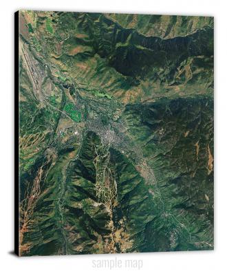
To view satellite imagery and bounding box footprint of individual city/location maps, click below on specific links

• Extra-Large Gallery Canvas Wrap Print
• Hand-Stretched, Expertly Crafted
• Artist Grade Canvas with Fade-Resistant Inks
• Ready to Hang with Pre-Installed Hardware
• 1.5" Thick Gallery Frame
Enrich your office decor or home with a large canvas wrap Satellite map. It is designed for easy hanging with pre-installed hardware. Printed with archival inks and wrapped around a 1.5" thick gallery frame, your favorite map art will have a timeless and impressive look that fits with any decor. This map is fabricated with satellite imagery data from Google Earth, and bounding box coordinates from USGS.
Abbott, Nebraska- Map Components- Imagery: Satellite of Abbott, Nebraska. Bounding Box: Footprint of Abbott, Nebraska at Longitude/Latitude Coordinates (-98.5 x -98.375 x 41 x 40.875).
Abbott Ranch, Nebraska- Map Components- Imagery: Satellite of Abbott Ranch, Nebraska. Bounding Box: Footprint of Abbott Ranch, Nebraska at Longitude/Latitude Coordinates (-99.125 x -99 x 42.125 x 42).
Adams, Nebraska- Map Components- Imagery: Satellite of Adams, Nebraska. Bounding Box: Footprint of Adams, Nebraska at Longitude/Latitude Coordinates (-96.625 x -96.5 x 40.5 x 40.375).
Agate, Nebraska- Map Components- Imagery: Satellite of Agate, Nebraska. Bounding Box: Footprint of Agate, Nebraska at Longitude/Latitude Coordinates (-103.875 x -103.75 x 42.5 x 42.375).
Agate NW, Nebraska- Map Components- Imagery: Satellite of Agate NW, Nebraska. Bounding Box: Footprint of Agate NW, Nebraska at Longitude/Latitude Coordinates (-104 x -103.875 x 42.5 x 42.375).
Agate SW, Nebraska- Map Components- Imagery: Satellite of Agate SW, Nebraska. Bounding Box: Footprint of Agate SW, Nebraska at Longitude/Latitude Coordinates (-104 x -103.875 x 42.375 x 42.25).
Ainsworth, Nebraska- Map Components- Imagery: Satellite of Ainsworth, Nebraska. Bounding Box: Footprint of Ainsworth, Nebraska at Longitude/Latitude Coordinates (-99.875 x -99.75 x 42.625 x 42.5).
Ainsworth NW, Nebraska- Map Components- Imagery: Satellite of Ainsworth NW, Nebraska. Bounding Box: Footprint of Ainsworth NW, Nebraska at Longitude/Latitude Coordinates (-100 x -99.875 x 42.75 x 42.625).
Ainsworth SW, Nebraska- Map Components- Imagery: Satellite of Ainsworth SW, Nebraska. Bounding Box: Footprint of Ainsworth SW, Nebraska at Longitude/Latitude Coordinates (-100 x -99.875 x 42.625 x 42.5).
Akron, Nebraska- Map Components- Imagery: Satellite of Akron, Nebraska. Bounding Box: Footprint of Akron, Nebraska at Longitude/Latitude Coordinates (-98.25 x -98.125 x 41.75 x 41.625).
Albion East, Nebraska- Map Components- Imagery: Satellite of Albion East, Nebraska. Bounding Box: Footprint of Albion East, Nebraska at Longitude/Latitude Coordinates (-98 x -97.875 x 41.75 x 41.625).
Albion West, Nebraska- Map Components- Imagery: Satellite of Albion West, Nebraska. Bounding Box: Footprint of Albion West, Nebraska at Longitude/Latitude Coordinates (-98.125 x -98 x 41.75 x 41.625).
Alda, Nebraska- Map Components- Imagery: Satellite of Alda, Nebraska. Bounding Box: Footprint of Alda, Nebraska at Longitude/Latitude Coordinates (-98.5 x -98.375 x 40.875 x 40.75).
Alexandria, Nebraska- Map Components- Imagery: Satellite of Alexandria, Nebraska. Bounding Box: Footprint of Alexandria, Nebraska at Longitude/Latitude Coordinates (-97.5 x -97.375 x 40.25 x 40.125).
Alfalfa Center, Nebraska- Map Components- Imagery: Satellite of Alfalfa Center, Nebraska. Bounding Box: Footprint of Alfalfa Center, Nebraska at Longitude/Latitude Coordinates (-99.25 x -99.125 x 40.75 x 40.625).
Alkali Lake, Nebraska- Map Components- Imagery: Satellite of Alkali Lake, Nebraska. Bounding Box: Footprint of Alkali Lake, Nebraska at Longitude/Latitude Coordinates (-102.125 x -102 x 42 x 41.875).
Allen, Nebraska- Map Components- Imagery: Satellite of Allen, Nebraska. Bounding Box: Footprint of Allen, Nebraska at Longitude/Latitude Coordinates (-96.875 x -96.75 x 42.5 x 42.375).
Allen Valley, Nebraska- Map Components- Imagery: Satellite of Allen Valley, Nebraska. Bounding Box: Footprint of Allen Valley, Nebraska at Longitude/Latitude Coordinates (-101 x -100.875 x 42.375 x 42.25).
Alliance East, Nebraska- Map Components- Imagery: Satellite of Alliance East, Nebraska. Bounding Box: Footprint of Alliance East, Nebraska at Longitude/Latitude Coordinates (-102.875 x -102.75 x 42.125 x 42).
Alliance West, Nebraska- Map Components- Imagery: Satellite of Alliance West, Nebraska. Bounding Box: Footprint of Alliance West, Nebraska at Longitude/Latitude Coordinates (-103 x -102.875 x 42.125 x 42).
Alma, Nebraska- Map Components- Imagery: Satellite of Alma, Nebraska. Bounding Box: Footprint of Alma, Nebraska at Longitude/Latitude Coordinates (-99.375 x -99.25 x 40.125 x 40).
Alma SW, Nebraska- Map Components- Imagery: Satellite of Alma SW, Nebraska. Bounding Box: Footprint of Alma SW, Nebraska at Longitude/Latitude Coordinates (-99.5 x -99.375 x 40.125 x 40).
Almeria, Nebraska- Map Components- Imagery: Satellite of Almeria, Nebraska. Bounding Box: Footprint of Almeria, Nebraska at Longitude/Latitude Coordinates (-99.625 x -99.5 x 41.875 x 41.75).
Almeria NE, Nebraska- Map Components- Imagery: Satellite of Almeria NE, Nebraska. Bounding Box: Footprint of Almeria NE, Nebraska at Longitude/Latitude Coordinates (-99.625 x -99.5 x 42 x 41.875).
Almeria NW, Nebraska- Map Components- Imagery: Satellite of Almeria NW, Nebraska. Bounding Box: Footprint of Almeria NW, Nebraska at Longitude/Latitude Coordinates (-99.75 x -99.625 x 42 x 41.875).
Almeria SW, Nebraska- Map Components- Imagery: Satellite of Almeria SW, Nebraska. Bounding Box: Footprint of Almeria SW, Nebraska at Longitude/Latitude Coordinates (-99.75 x -99.625 x 41.875 x 41.75).
Aloys, Nebraska- Map Components- Imagery: Satellite of Aloys, Nebraska. Bounding Box: Footprint of Aloys, Nebraska at Longitude/Latitude Coordinates (-97 x -96.875 x 41.875 x 41.75).
Altona, Nebraska- Map Components- Imagery: Satellite of Altona, Nebraska. Bounding Box: Footprint of Altona, Nebraska at Longitude/Latitude Coordinates (-97 x -96.875 x 42.125 x 42).
Altona NE, Nebraska- Map Components- Imagery: Satellite of Altona NE, Nebraska. Bounding Box: Footprint of Altona NE, Nebraska at Longitude/Latitude Coordinates (-96.875 x -96.75 x 42.25 x 42.125).
Altona NW, Nebraska- Map Components- Imagery: Satellite of Altona NW, Nebraska. Bounding Box: Footprint of Altona NW, Nebraska at Longitude/Latitude Coordinates (-97 x -96.875 x 42.25 x 42.125).
Altona SE, Nebraska- Map Components- Imagery: Satellite of Altona SE, Nebraska. Bounding Box: Footprint of Altona SE, Nebraska at Longitude/Latitude Coordinates (-96.875 x -96.75 x 42.125 x 42).
Amboy, Nebraska- Map Components- Imagery: Satellite of Amboy, Nebraska. Bounding Box: Footprint of Amboy, Nebraska at Longitude/Latitude Coordinates (-98.5 x -98.375 x 40.125 x 40).
Amelia, Nebraska- Map Components- Imagery: Satellite of Amelia, Nebraska. Bounding Box: Footprint of Amelia, Nebraska at Longitude/Latitude Coordinates (-99 x -98.875 x 42.25 x 42.125).
Amherst, Nebraska- Map Components- Imagery: Satellite of Amherst, Nebraska. Bounding Box: Footprint of Amherst, Nebraska at Longitude/Latitude Coordinates (-99.375 x -99.25 x 40.875 x 40.75).
Andrews, Nebraska- Map Components- Imagery: Satellite of Andrews, Nebraska. Bounding Box: Footprint of Andrews, Nebraska at Longitude/Latitude Coordinates (-103.75 x -103.625 x 42.75 x 42.625).
Angora, Nebraska- Map Components- Imagery: Satellite of Angora, Nebraska. Bounding Box: Footprint of Angora, Nebraska at Longitude/Latitude Coordinates (-103.25 x -103.125 x 41.875 x 41.75).
Angora NE, Nebraska- Map Components- Imagery: Satellite of Angora NE, Nebraska. Bounding Box: Footprint of Angora NE, Nebraska at Longitude/Latitude Coordinates (-103.125 x -103 x 42 x 41.875).
Angora NW, Nebraska- Map Components- Imagery: Satellite of Angora NW, Nebraska. Bounding Box: Footprint of Angora NW, Nebraska at Longitude/Latitude Coordinates (-103.25 x -103.125 x 42 x 41.875).
Angora SE, Nebraska- Map Components- Imagery: Satellite of Angora SE, Nebraska. Bounding Box: Footprint of Angora SE, Nebraska at Longitude/Latitude Coordinates (-103.125 x -103 x 41.875 x 41.75).
Anselmo, Nebraska- Map Components- Imagery: Satellite of Anselmo, Nebraska. Bounding Box: Footprint of Anselmo, Nebraska at Longitude/Latitude Coordinates (-99.875 x -99.75 x 41.625 x 41.5).
Anselmo NE, Nebraska- Map Components- Imagery: Satellite of Anselmo NE, Nebraska. Bounding Box: Footprint of Anselmo NE, Nebraska at Longitude/Latitude Coordinates (-99.875 x -99.75 x 41.75 x 41.625).
Anselmo NW, Nebraska- Map Components- Imagery: Satellite of Anselmo NW, Nebraska. Bounding Box: Footprint of Anselmo NW, Nebraska at Longitude/Latitude Coordinates (-100 x -99.875 x 41.75 x 41.625).
Anselmo SW, Nebraska- Map Components- Imagery: Satellite of Anselmo SW, Nebraska. Bounding Box: Footprint of Anselmo SW, Nebraska at Longitude/Latitude Coordinates (-100 x -99.875 x 41.625 x 41.5).
Ansley, Nebraska- Map Components- Imagery: Satellite of Ansley, Nebraska. Bounding Box: Footprint of Ansley, Nebraska at Longitude/Latitude Coordinates (-99.5 x -99.375 x 41.375 x 41.25).
Ansley NE, Nebraska- Map Components- Imagery: Satellite of Ansley NE, Nebraska. Bounding Box: Footprint of Ansley NE, Nebraska at Longitude/Latitude Coordinates (-99.375 x -99.25 x 41.5 x 41.375).
Ansley SE, Nebraska- Map Components- Imagery: Satellite of Ansley SE, Nebraska. Bounding Box: Footprint of Ansley SE, Nebraska at Longitude/Latitude Coordinates (-99.375 x -99.25 x 41.375 x 41.25).
Antioch, Nebraska- Map Components- Imagery: Satellite of Antioch, Nebraska. Bounding Box: Footprint of Antioch, Nebraska at Longitude/Latitude Coordinates (-102.625 x -102.5 x 42.125 x 42).
Applegate Ranch, Nebraska- Map Components- Imagery: Satellite of Applegate Ranch, Nebraska. Bounding Box: Footprint of Applegate Ranch, Nebraska at Longitude/Latitude Coordinates (-101.25 x -101.125 x 41.375 x 41.25).
Arabia, Nebraska- Map Components- Imagery: Satellite of Arabia, Nebraska. Bounding Box: Footprint of Arabia, Nebraska at Longitude/Latitude Coordinates (-100.375 x -100.25 x 42.75 x 42.625).
Arabia NW, Nebraska- Map Components- Imagery: Satellite of Arabia NW, Nebraska. Bounding Box: Footprint of Arabia NW, Nebraska at Longitude/Latitude Coordinates (-100.5 x -100.375 x 42.75 x 42.625).
Arabia SE, Nebraska- Map Components- Imagery: Satellite of Arabia SE, Nebraska. Bounding Box: Footprint of Arabia SE, Nebraska at Longitude/Latitude Coordinates (-100.375 x -100.25 x 42.625 x 42.5).
Arabia SW, Nebraska- Map Components- Imagery: Satellite of Arabia SW, Nebraska. Bounding Box: Footprint of Arabia SW, Nebraska at Longitude/Latitude Coordinates (-100.5 x -100.375 x 42.625 x 42.5).
Arapahoe, Nebraska- Map Components- Imagery: Satellite of Arapahoe, Nebraska. Bounding Box: Footprint of Arapahoe, Nebraska at Longitude/Latitude Coordinates (-100 x -99.875 x 40.375 x 40.25).
Arapahoe NE, Nebraska- Map Components- Imagery: Satellite of Arapahoe NE, Nebraska. Bounding Box: Footprint of Arapahoe NE, Nebraska at Longitude/Latitude Coordinates (-99.875 x -99.75 x 40.5 x 40.375).
Arapahoe NW, Nebraska- Map Components- Imagery: Satellite of Arapahoe NW, Nebraska. Bounding Box: Footprint of Arapahoe NW, Nebraska at Longitude/Latitude Coordinates (-100 x -99.875 x 40.5 x 40.375).
Arcadia East, Nebraska- Map Components- Imagery: Satellite of Arcadia East, Nebraska. Bounding Box: Footprint of Arcadia East, Nebraska at Longitude/Latitude Coordinates (-99.125 x -99 x 41.5 x 41.375).
Arcadia SE, Nebraska- Map Components- Imagery: Satellite of Arcadia SE, Nebraska. Bounding Box: Footprint of Arcadia SE, Nebraska at Longitude/Latitude Coordinates (-99.125 x -99 x 41.375 x 41.25).
Arcadia SW, Nebraska- Map Components- Imagery: Satellite of Arcadia SW, Nebraska. Bounding Box: Footprint of Arcadia SW, Nebraska at Longitude/Latitude Coordinates (-99.25 x -99.125 x 41.375 x 41.25).
Arcadia West, Nebraska- Map Components- Imagery: Satellite of Arcadia West, Nebraska. Bounding Box: Footprint of Arcadia West, Nebraska at Longitude/Latitude Coordinates (-99.25 x -99.125 x 41.5 x 41.375).
Archer, Nebraska- Map Components- Imagery: Satellite of Archer, Nebraska. Bounding Box: Footprint of Archer, Nebraska at Longitude/Latitude Coordinates (-98.25 x -98.125 x 41.25 x 41.125).
Argo Hill, Nebraska- Map Components- Imagery: Satellite of Argo Hill, Nebraska. Bounding Box: Footprint of Argo Hill, Nebraska at Longitude/Latitude Coordinates (-102.25 x -102.125 x 42.375 x 42.25).
Arlington, Nebraska- Map Components- Imagery: Satellite of Arlington, Nebraska. Bounding Box: Footprint of Arlington, Nebraska at Longitude/Latitude Coordinates (-96.375 x -96.25 x 41.5 x 41.375).
Arnold, Nebraska- Map Components- Imagery: Satellite of Arnold, Nebraska. Bounding Box: Footprint of Arnold, Nebraska at Longitude/Latitude Coordinates (-100.25 x -100.125 x 41.5 x 41.375).
Arnold Lake, Nebraska- Map Components- Imagery: Satellite of Arnold Lake, Nebraska. Bounding Box: Footprint of Arnold Lake, Nebraska at Longitude/Latitude Coordinates (-102.25 x -102.125 x 42.25 x 42.125).
Arnold SW, Nebraska- Map Components- Imagery: Satellite of Arnold SW, Nebraska. Bounding Box: Footprint of Arnold SW, Nebraska at Longitude/Latitude Coordinates (-100.25 x -100.125 x 41.375 x 41.25).
Arrowhead Lake, Nebraska- Map Components- Imagery: Satellite of Arrowhead Lake, Nebraska. Bounding Box: Footprint of Arrowhead Lake, Nebraska at Longitude/Latitude Coordinates (-101.625 x -101.5 x 40.25 x 40.125).
Arterburn Lake, Nebraska- Map Components- Imagery: Satellite of Arterburn Lake, Nebraska. Bounding Box: Footprint of Arterburn Lake, Nebraska at Longitude/Latitude Coordinates (-102 x -101.875 x 40.5 x 40.375).
Arthur, Nebraska- Map Components- Imagery: Satellite of Arthur, Nebraska. Bounding Box: Footprint of Arthur, Nebraska at Longitude/Latitude Coordinates (-101.75 x -101.625 x 41.625 x 41.5).
Ashby, Nebraska- Map Components- Imagery: Satellite of Ashby, Nebraska. Bounding Box: Footprint of Ashby, Nebraska at Longitude/Latitude Coordinates (-102 x -101.875 x 42.125 x 42).
Ashland East, Nebraska- Map Components- Imagery: Satellite of Ashland East, Nebraska. Bounding Box: Footprint of Ashland East, Nebraska at Longitude/Latitude Coordinates (-96.375 x -96.25 x 41.125 x 41).
Ashland West, Nebraska- Map Components- Imagery: Satellite of Ashland West, Nebraska. Bounding Box: Footprint of Ashland West, Nebraska at Longitude/Latitude Coordinates (-96.5 x -96.375 x 41.125 x 41).
Ashton, Nebraska- Map Components- Imagery: Satellite of Ashton, Nebraska. Bounding Box: Footprint of Ashton, Nebraska at Longitude/Latitude Coordinates (-98.875 x -98.75 x 41.25 x 41.125).
Atkinson, Nebraska- Map Components- Imagery: Satellite of Atkinson, Nebraska. Bounding Box: Footprint of Atkinson, Nebraska at Longitude/Latitude Coordinates (-99 x -98.875 x 42.625 x 42.5).
Atkinson NE, Nebraska- Map Components- Imagery: Satellite of Atkinson NE, Nebraska. Bounding Box: Footprint of Atkinson NE, Nebraska at Longitude/Latitude Coordinates (-98.875 x -98.75 x 42.75 x 42.625).
Atkinson NW, Nebraska- Map Components- Imagery: Satellite of Atkinson NW, Nebraska. Bounding Box: Footprint of Atkinson NW, Nebraska at Longitude/Latitude Coordinates (-99 x -98.875 x 42.75 x 42.625).
Atkinson SE, Nebraska- Map Components- Imagery: Satellite of Atkinson SE, Nebraska. Bounding Box: Footprint of Atkinson SE, Nebraska at Longitude/Latitude Coordinates (-98.875 x -98.75 x 42.625 x 42.5).
Atlanta, Nebraska- Map Components- Imagery: Satellite of Atlanta, Nebraska. Bounding Box: Footprint of Atlanta, Nebraska at Longitude/Latitude Coordinates (-99.5 x -99.375 x 40.375 x 40.25).
Auburn, Nebraska- Map Components- Imagery: Satellite of Auburn, Nebraska. Bounding Box: Footprint of Auburn, Nebraska at Longitude/Latitude Coordinates (-95.875 x -95.75 x 40.5 x 40.375).
Aurora East, Nebraska- Map Components- Imagery: Satellite of Aurora East, Nebraska. Bounding Box: Footprint of Aurora East, Nebraska at Longitude/Latitude Coordinates (-98 x -97.875 x 40.875 x 40.75).
Aurora West, Nebraska- Map Components- Imagery: Satellite of Aurora West, Nebraska. Bounding Box: Footprint of Aurora West, Nebraska at Longitude/Latitude Coordinates (-98.125 x -98 x 40.875 x 40.75).
Avoca, Nebraska- Map Components- Imagery: Satellite of Avoca, Nebraska. Bounding Box: Footprint of Avoca, Nebraska at Longitude/Latitude Coordinates (-96.125 x -96 x 40.875 x 40.75).
Axtell East, Nebraska- Map Components- Imagery: Satellite of Axtell East, Nebraska. Bounding Box: Footprint of Axtell East, Nebraska at Longitude/Latitude Coordinates (-99.125 x -99 x 40.5 x 40.375).
Axtell West, Nebraska- Map Components- Imagery: Satellite of Axtell West, Nebraska. Bounding Box: Footprint of Axtell West, Nebraska at Longitude/Latitude Coordinates (-99.25 x -99.125 x 40.5 x 40.375).
Ayr, Nebraska- Map Components- Imagery: Satellite of Ayr, Nebraska. Bounding Box: Footprint of Ayr, Nebraska at Longitude/Latitude Coordinates (-98.5 x -98.375 x 40.5 x 40.375).
Bancroft, Nebraska- Map Components- Imagery: Satellite of Bancroft, Nebraska. Bounding Box: Footprint of Bancroft, Nebraska at Longitude/Latitude Coordinates (-96.625 x -96.5 x 42.125 x 42).
Barada, Nebraska- Map Components- Imagery: Satellite of Barada, Nebraska. Bounding Box: Footprint of Barada, Nebraska at Longitude/Latitude Coordinates (-95.625 x -95.5 x 40.25 x 40.125).
Barent Valley, Nebraska- Map Components- Imagery: Satellite of Barent Valley, Nebraska. Bounding Box: Footprint of Barent Valley, Nebraska at Longitude/Latitude Coordinates (-101 x -100.875 x 42.25 x 42.125).
Barn Butte, Nebraska- Map Components- Imagery: Satellite of Barn Butte, Nebraska. Bounding Box: Footprint of Barn Butte, Nebraska at Longitude/Latitude Coordinates (-102.375 x -102.25 x 41.375 x 41.25).
Barneston, Nebraska- Map Components- Imagery: Satellite of Barneston, Nebraska. Bounding Box: Footprint of Barneston, Nebraska at Longitude/Latitude Coordinates (-96.625 x -96.5 x 40.125 x 40).
Barrel Springs Creek North, Nebraska- Map Components- Imagery: Satellite of Barrel Springs Creek North, Nebraska. Bounding Box: Footprint of Barrel Springs Creek North, Nebraska at Longitude/Latitude Coordinates (-103.25 x -103.125 x 42.25 x 42.125).
Barrel Springs Creek South, Nebraska- Map Components- Imagery: Satellite of Barrel Springs Creek South, Nebraska. Bounding Box: Footprint of Barrel Springs Creek South, Nebraska at Longitude/Latitude Coordinates (-103.25 x -103.125 x 42.125 x 42).
Bartlett, Nebraska- Map Components- Imagery: Satellite of Bartlett, Nebraska. Bounding Box: Footprint of Bartlett, Nebraska at Longitude/Latitude Coordinates (-98.625 x -98.5 x 42 x 41.875).
Bartlett NW, Nebraska- Map Components- Imagery: Satellite of Bartlett NW, Nebraska. Bounding Box: Footprint of Bartlett NW, Nebraska at Longitude/Latitude Coordinates (-98.75 x -98.625 x 42 x 41.875).
Bartlett SE, Nebraska- Map Components- Imagery: Satellite of Bartlett SE, Nebraska. Bounding Box: Footprint of Bartlett SE, Nebraska at Longitude/Latitude Coordinates (-98.625 x -98.5 x 41.875 x 41.75).
Bartley, Nebraska- Map Components- Imagery: Satellite of Bartley, Nebraska. Bounding Box: Footprint of Bartley, Nebraska at Longitude/Latitude Coordinates (-100.375 x -100.25 x 40.375 x 40.25).
Bartley NW, Nebraska- Map Components- Imagery: Satellite of Bartley NW, Nebraska. Bounding Box: Footprint of Bartley NW, Nebraska at Longitude/Latitude Coordinates (-100.5 x -100.375 x 40.5 x 40.375).
Bartley SW, Nebraska- Map Components- Imagery: Satellite of Bartley SW, Nebraska. Bounding Box: Footprint of Bartley SW, Nebraska at Longitude/Latitude Coordinates (-100.5 x -100.375 x 40.375 x 40.25).
Barton, Nebraska- Map Components- Imagery: Satellite of Barton, Nebraska. Bounding Box: Footprint of Barton, Nebraska at Longitude/Latitude Coordinates (-102.25 x -102.125 x 41.125 x 41).
Bassett, Nebraska- Map Components- Imagery: Satellite of Bassett, Nebraska. Bounding Box: Footprint of Bassett, Nebraska at Longitude/Latitude Coordinates (-99.625 x -99.5 x 42.625 x 42.5).
Bassett NW, Nebraska- Map Components- Imagery: Satellite of Bassett NW, Nebraska. Bounding Box: Footprint of Bassett NW, Nebraska at Longitude/Latitude Coordinates (-99.75 x -99.625 x 42.75 x 42.625).
Battle Creek, Nebraska- Map Components- Imagery: Satellite of Battle Creek, Nebraska. Bounding Box: Footprint of Battle Creek, Nebraska at Longitude/Latitude Coordinates (-97.625 x -97.5 x 42 x 41.875).
Battle Creek SE, Nebraska- Map Components- Imagery: Satellite of Battle Creek SE, Nebraska. Bounding Box: Footprint of Battle Creek SE, Nebraska at Longitude/Latitude Coordinates (-97.625 x -97.5 x 41.875 x 41.75).
Battle Creek SW, Nebraska- Map Components- Imagery: Satellite of Battle Creek SW, Nebraska. Bounding Box: Footprint of Battle Creek SW, Nebraska at Longitude/Latitude Coordinates (-97.75 x -97.625 x 41.875 x 41.75).
Bayard, Nebraska- Map Components- Imagery: Satellite of Bayard, Nebraska. Bounding Box: Footprint of Bayard, Nebraska at Longitude/Latitude Coordinates (-103.375 x -103.25 x 41.875 x 41.75).
Bayard NE, Nebraska- Map Components- Imagery: Satellite of Bayard NE, Nebraska. Bounding Box: Footprint of Bayard NE, Nebraska at Longitude/Latitude Coordinates (-103.375 x -103.25 x 42 x 41.875).
Bayard SW, Nebraska- Map Components- Imagery: Satellite of Bayard SW, Nebraska. Bounding Box: Footprint of Bayard SW, Nebraska at Longitude/Latitude Coordinates (-103.5 x -103.375 x 41.875 x 41.75).
Bean Lake, Nebraska- Map Components- Imagery: Satellite of Bean Lake, Nebraska. Bounding Box: Footprint of Bean Lake, Nebraska at Longitude/Latitude Coordinates (-102.625 x -102.5 x 41.875 x 41.75).
Bean Soup Lake, Nebraska- Map Components- Imagery: Satellite of Bean Soup Lake, Nebraska. Bounding Box: Footprint of Bean Soup Lake, Nebraska at Longitude/Latitude Coordinates (-101.625 x -101.5 x 41.75 x 41.625).
Bear Hill, Nebraska- Map Components- Imagery: Satellite of Bear Hill, Nebraska. Bounding Box: Footprint of Bear Hill, Nebraska at Longitude/Latitude Coordinates (-101.875 x -101.75 x 41.5 x 41.375).
Beatrice East, Nebraska- Map Components- Imagery: Satellite of Beatrice East, Nebraska. Bounding Box: Footprint of Beatrice East, Nebraska at Longitude/Latitude Coordinates (-96.75 x -96.625 x 40.375 x 40.25).
Beatrice West, Nebraska- Map Components- Imagery: Satellite of Beatrice West, Nebraska. Bounding Box: Footprint of Beatrice West, Nebraska at Longitude/Latitude Coordinates (-96.875 x -96.75 x 40.375 x 40.25).
Beaver City, Nebraska- Map Components- Imagery: Satellite of Beaver City, Nebraska. Bounding Box: Footprint of Beaver City, Nebraska at Longitude/Latitude Coordinates (-99.875 x -99.75 x 40.25 x 40.125).
Beaver City SE, Nebraska- Map Components- Imagery: Satellite of Beaver City SE, Nebraska. Bounding Box: Footprint of Beaver City SE, Nebraska at Longitude/Latitude Coordinates (-99.875 x -99.75 x 40.125 x 40).
Beaver City SW, Nebraska- Map Components- Imagery: Satellite of Beaver City SW, Nebraska. Bounding Box: Footprint of Beaver City SW, Nebraska at Longitude/Latitude Coordinates (-100 x -99.875 x 40.125 x 40).
Beaver Crossing, Nebraska- Map Components- Imagery: Satellite of Beaver Crossing, Nebraska. Bounding Box: Footprint of Beaver Crossing, Nebraska at Longitude/Latitude Coordinates (-97.375 x -97.25 x 40.875 x 40.75).
Beaver Wall, Nebraska- Map Components- Imagery: Satellite of Beaver Wall, Nebraska. Bounding Box: Footprint of Beaver Wall, Nebraska at Longitude/Latitude Coordinates (-102.75 x -102.625 x 43 x 42.875).
Beck Lake, Nebraska- Map Components- Imagery: Satellite of Beck Lake, Nebraska. Bounding Box: Footprint of Beck Lake, Nebraska at Longitude/Latitude Coordinates (-102.625 x -102.5 x 42 x 41.875).
Beemer, Nebraska- Map Components- Imagery: Satellite of Beemer, Nebraska. Bounding Box: Footprint of Beemer, Nebraska at Longitude/Latitude Coordinates (-96.875 x -96.75 x 42 x 41.875).
Belden, Nebraska- Map Components- Imagery: Satellite of Belden, Nebraska. Bounding Box: Footprint of Belden, Nebraska at Longitude/Latitude Coordinates (-97.25 x -97.125 x 42.5 x 42.375).
Belgrade, Nebraska- Map Components- Imagery: Satellite of Belgrade, Nebraska. Bounding Box: Footprint of Belgrade, Nebraska at Longitude/Latitude Coordinates (-98.125 x -98 x 41.5 x 41.375).
Belgrade NW, Nebraska- Map Components- Imagery: Satellite of Belgrade NW, Nebraska. Bounding Box: Footprint of Belgrade NW, Nebraska at Longitude/Latitude Coordinates (-98.25 x -98.125 x 41.5 x 41.375).
Belgrade SE, Nebraska- Map Components- Imagery: Satellite of Belgrade SE, Nebraska. Bounding Box: Footprint of Belgrade SE, Nebraska at Longitude/Latitude Coordinates (-98.125 x -98 x 41.375 x 41.25).
Belgrade SW, Nebraska- Map Components- Imagery: Satellite of Belgrade SW, Nebraska. Bounding Box: Footprint of Belgrade SW, Nebraska at Longitude/Latitude Coordinates (-98.25 x -98.125 x 41.375 x 41.25).
Belmar, Nebraska- Map Components- Imagery: Satellite of Belmar, Nebraska. Bounding Box: Footprint of Belmar, Nebraska at Longitude/Latitude Coordinates (-102 x -101.875 x 41.375 x 41.25).
Belmont, Nebraska- Map Components- Imagery: Satellite of Belmont, Nebraska. Bounding Box: Footprint of Belmont, Nebraska at Longitude/Latitude Coordinates (-103.375 x -103.25 x 42.625 x 42.5).
Benkelman, Nebraska- Map Components- Imagery: Satellite of Benkelman, Nebraska. Bounding Box: Footprint of Benkelman, Nebraska at Longitude/Latitude Coordinates (-101.625 x -101.5 x 40.125 x 40).
Benkelman NW, Nebraska- Map Components- Imagery: Satellite of Benkelman NW, Nebraska. Bounding Box: Footprint of Benkelman NW, Nebraska at Longitude/Latitude Coordinates (-101.75 x -101.625 x 40.25 x 40.125).
Bennet, Nebraska- Map Components- Imagery: Satellite of Bennet, Nebraska. Bounding Box: Footprint of Bennet, Nebraska at Longitude/Latitude Coordinates (-96.625 x -96.5 x 40.75 x 40.625).
Bennett Reservoir East, Nebraska- Map Components- Imagery: Satellite of Bennett Reservoir East, Nebraska. Bounding Box: Footprint of Bennett Reservoir East, Nebraska at Longitude/Latitude Coordinates (-103.625 x -103.5 x 41.375 x 41.25).
Bennett Reservoir NW, Nebraska- Map Components- Imagery: Satellite of Bennett Reservoir NW, Nebraska. Bounding Box: Footprint of Bennett Reservoir NW, Nebraska at Longitude/Latitude Coordinates (-103.75 x -103.625 x 41.5 x 41.375).
Bennett Reservoir West, Nebraska- Map Components- Imagery: Satellite of Bennett Reservoir West, Nebraska. Bounding Box: Footprint of Bennett Reservoir West, Nebraska at Longitude/Latitude Coordinates (-103.75 x -103.625 x 41.375 x 41.25).
Berea Creek East, Nebraska- Map Components- Imagery: Satellite of Berea Creek East, Nebraska. Bounding Box: Footprint of Berea Creek East, Nebraska at Longitude/Latitude Coordinates (-102.875 x -102.75 x 42.25 x 42.125).
Berea Creek West, Nebraska- Map Components- Imagery: Satellite of Berea Creek West, Nebraska. Bounding Box: Footprint of Berea Creek West, Nebraska at Longitude/Latitude Coordinates (-103 x -102.875 x 42.25 x 42.125).
Bertha, Nebraska- Map Components- Imagery: Satellite of Bertha, Nebraska. Bounding Box: Footprint of Bertha, Nebraska at Longitude/Latitude Coordinates (-96.375 x -96.25 x 42 x 41.875).
Bertrand, Nebraska- Map Components- Imagery: Satellite of Bertrand, Nebraska. Bounding Box: Footprint of Bertrand, Nebraska at Longitude/Latitude Coordinates (-99.75 x -99.625 x 40.625 x 40.5).
Bertrand NW, Nebraska- Map Components- Imagery: Satellite of Bertrand NW, Nebraska. Bounding Box: Footprint of Bertrand NW, Nebraska at Longitude/Latitude Coordinates (-99.75 x -99.625 x 40.75 x 40.625).
Bertrand SE, Nebraska- Map Components- Imagery: Satellite of Bertrand SE, Nebraska. Bounding Box: Footprint of Bertrand SE, Nebraska at Longitude/Latitude Coordinates (-99.625 x -99.5 x 40.625 x 40.5).
Bethel Cemetery, Nebraska- Map Components- Imagery: Satellite of Bethel Cemetery, Nebraska. Bounding Box: Footprint of Bethel Cemetery, Nebraska at Longitude/Latitude Coordinates (-103.5 x -103.375 x 41.375 x 41.25).
Beverly, Nebraska- Map Components- Imagery: Satellite of Beverly, Nebraska. Bounding Box: Footprint of Beverly, Nebraska at Longitude/Latitude Coordinates (-101 x -100.875 x 40.375 x 40.25).
Big Bald Hill, Nebraska- Map Components- Imagery: Satellite of Big Bald Hill, Nebraska. Bounding Box: Footprint of Big Bald Hill, Nebraska at Longitude/Latitude Coordinates (-101.5 x -101.375 x 41.375 x 41.25).
Big Bald Hill NE, Nebraska- Map Components- Imagery: Satellite of Big Bald Hill NE, Nebraska. Bounding Box: Footprint of Big Bald Hill NE, Nebraska at Longitude/Latitude Coordinates (-101.375 x -101.25 x 41.5 x 41.375).
Big Bald Hill SE, Nebraska- Map Components- Imagery: Satellite of Big Bald Hill SE, Nebraska. Bounding Box: Footprint of Big Bald Hill SE, Nebraska at Longitude/Latitude Coordinates (-101.375 x -101.25 x 41.375 x 41.25).
Big Falls, Nebraska- Map Components- Imagery: Satellite of Big Falls, Nebraska. Bounding Box: Footprint of Big Falls, Nebraska at Longitude/Latitude Coordinates (-101.25 x -101.125 x 42.5 x 42.375).
Big Lake, Nebraska- Map Components- Imagery: Satellite of Big Lake, Nebraska. Bounding Box: Footprint of Big Lake, Nebraska at Longitude/Latitude Coordinates (-100.625 x -100.5 x 42.5 x 42.375).
Big Springs, Nebraska- Map Components- Imagery: Satellite of Big Springs, Nebraska. Bounding Box: Footprint of Big Springs, Nebraska at Longitude/Latitude Coordinates (-102.125 x -102 x 41.125 x 41).
Big Springs NE, Nebraska- Map Components- Imagery: Satellite of Big Springs NE, Nebraska. Bounding Box: Footprint of Big Springs NE, Nebraska at Longitude/Latitude Coordinates (-102.125 x -102 x 41.25 x 41.125).
Big Springs NW, Nebraska- Map Components- Imagery: Satellite of Big Springs NW, Nebraska. Bounding Box: Footprint of Big Springs NW, Nebraska at Longitude/Latitude Coordinates (-102.25 x -102.125 x 41.25 x 41.125).
Billys Lake, Nebraska- Map Components- Imagery: Satellite of Billys Lake, Nebraska. Bounding Box: Footprint of Billys Lake, Nebraska at Longitude/Latitude Coordinates (-102.125 x -102 x 42.5 x 42.375).
Bingham, Nebraska- Map Components- Imagery: Satellite of Bingham, Nebraska. Bounding Box: Footprint of Bingham, Nebraska at Longitude/Latitude Coordinates (-102.125 x -102 x 42.125 x 42).
Bixby, Nebraska- Map Components- Imagery: Satellite of Bixby, Nebraska. Bounding Box: Footprint of Bixby, Nebraska at Longitude/Latitude Coordinates (-97.875 x -97.75 x 40.75 x 40.625).
Black Lake, Nebraska- Map Components- Imagery: Satellite of Black Lake, Nebraska. Bounding Box: Footprint of Black Lake, Nebraska at Longitude/Latitude Coordinates (-102.375 x -102.25 x 42 x 41.875).
Bladen, Nebraska- Map Components- Imagery: Satellite of Bladen, Nebraska. Bounding Box: Footprint of Bladen, Nebraska at Longitude/Latitude Coordinates (-98.625 x -98.5 x 40.375 x 40.25).
Blair, Nebraska- Map Components- Imagery: Satellite of Blair, Nebraska. Bounding Box: Footprint of Blair, Nebraska at Longitude/Latitude Coordinates (-96.25 x -96.125 x 41.625 x 41.5).
Bloomfield, Nebraska- Map Components- Imagery: Satellite of Bloomfield, Nebraska. Bounding Box: Footprint of Bloomfield, Nebraska at Longitude/Latitude Coordinates (-97.75 x -97.625 x 42.625 x 42.5).
Bloomfield NE, Nebraska- Map Components- Imagery: Satellite of Bloomfield NE, Nebraska. Bounding Box: Footprint of Bloomfield NE, Nebraska at Longitude/Latitude Coordinates (-97.625 x -97.5 x 42.75 x 42.625).
Bloomfield SE, Nebraska- Map Components- Imagery: Satellite of Bloomfield SE, Nebraska. Bounding Box: Footprint of Bloomfield SE, Nebraska at Longitude/Latitude Coordinates (-97.625 x -97.5 x 42.625 x 42.5).
Bloomington, Nebraska- Map Components- Imagery: Satellite of Bloomington, Nebraska. Bounding Box: Footprint of Bloomington, Nebraska at Longitude/Latitude Coordinates (-99.125 x -99 x 40.125 x 40).
Blue Hill, Nebraska- Map Components- Imagery: Satellite of Blue Hill, Nebraska. Bounding Box: Footprint of Blue Hill, Nebraska at Longitude/Latitude Coordinates (-98.5 x -98.375 x 40.375 x 40.25).
Blue Springs, Nebraska- Map Components- Imagery: Satellite of Blue Springs, Nebraska. Bounding Box: Footprint of Blue Springs, Nebraska at Longitude/Latitude Coordinates (-96.75 x -96.625 x 40.25 x 40.125).
Bodarc, Nebraska- Map Components- Imagery: Satellite of Bodarc, Nebraska. Bounding Box: Footprint of Bodarc, Nebraska at Longitude/Latitude Coordinates (-103.875 x -103.75 x 42.875 x 42.75).
Boelus, Nebraska- Map Components- Imagery: Satellite of Boelus, Nebraska. Bounding Box: Footprint of Boelus, Nebraska at Longitude/Latitude Coordinates (-98.75 x -98.625 x 41.125 x 41).
Bohemian Creek, Nebraska- Map Components- Imagery: Satellite of Bohemian Creek, Nebraska. Bounding Box: Footprint of Bohemian Creek, Nebraska at Longitude/Latitude Coordinates (-103.125 x -103 x 43 x 42.875).
Boiling Spring, Nebraska- Map Components- Imagery: Satellite of Boiling Spring, Nebraska. Bounding Box: Footprint of Boiling Spring, Nebraska at Longitude/Latitude Coordinates (-99.75 x -99.625 x 42.125 x 42).
Bordeaux, Nebraska- Map Components- Imagery: Satellite of Bordeaux, Nebraska. Bounding Box: Footprint of Bordeaux, Nebraska at Longitude/Latitude Coordinates (-102.875 x -102.75 x 42.875 x 42.75).
Bornemann Lake, Nebraska- Map Components- Imagery: Satellite of Bornemann Lake, Nebraska. Bounding Box: Footprint of Bornemann Lake, Nebraska at Longitude/Latitude Coordinates (-101.875 x -101.75 x 42.75 x 42.625).
Bostwick, Nebraska- Map Components- Imagery: Satellite of Bostwick, Nebraska. Bounding Box: Footprint of Bostwick, Nebraska at Longitude/Latitude Coordinates (-98.25 x -98.125 x 40.125 x 40).
Bourquim Hill, Nebraska- Map Components- Imagery: Satellite of Bourquim Hill, Nebraska. Bounding Box: Footprint of Bourquim Hill, Nebraska at Longitude/Latitude Coordinates (-102 x -101.875 x 41.75 x 41.625).
Bovee Valley East, Nebraska- Map Components- Imagery: Satellite of Bovee Valley East, Nebraska. Bounding Box: Footprint of Bovee Valley East, Nebraska at Longitude/Latitude Coordinates (-102.125 x -102 x 42.625 x 42.5).
Bovee Valley West, Nebraska- Map Components- Imagery: Satellite of Bovee Valley West, Nebraska. Bounding Box: Footprint of Bovee Valley West, Nebraska at Longitude/Latitude Coordinates (-102.25 x -102.125 x 42.625 x 42.5).
Box Butte, Nebraska- Map Components- Imagery: Satellite of Box Butte, Nebraska. Bounding Box: Footprint of Box Butte, Nebraska at Longitude/Latitude Coordinates (-102.875 x -102.75 x 42.375 x 42.25).
Box Butte NE, Nebraska- Map Components- Imagery: Satellite of Box Butte NE, Nebraska. Bounding Box: Footprint of Box Butte NE, Nebraska at Longitude/Latitude Coordinates (-102.875 x -102.75 x 42.5 x 42.375).
Box Butte NW, Nebraska- Map Components- Imagery: Satellite of Box Butte NW, Nebraska. Bounding Box: Footprint of Box Butte NW, Nebraska at Longitude/Latitude Coordinates (-103 x -102.875 x 42.5 x 42.375).
Box Butte Reservoir East, Nebraska- Map Components- Imagery: Satellite of Box Butte Reservoir East, Nebraska. Bounding Box: Footprint of Box Butte Reservoir East, Nebraska at Longitude/Latitude Coordinates (-103.125 x -103 x 42.5 x 42.375).
Box Butte Reservoir West, Nebraska- Map Components- Imagery: Satellite of Box Butte Reservoir West, Nebraska. Bounding Box: Footprint of Box Butte Reservoir West, Nebraska at Longitude/Latitude Coordinates (-103.25 x -103.125 x 42.5 x 42.375).
Box Butte SW, Nebraska- Map Components- Imagery: Satellite of Box Butte SW, Nebraska. Bounding Box: Footprint of Box Butte SW, Nebraska at Longitude/Latitude Coordinates (-103 x -102.875 x 42.375 x 42.25).
Bradshaw, Nebraska- Map Components- Imagery: Satellite of Bradshaw, Nebraska. Bounding Box: Footprint of Bradshaw, Nebraska at Longitude/Latitude Coordinates (-97.75 x -97.625 x 41 x 40.875).
Brady, Nebraska- Map Components- Imagery: Satellite of Brady, Nebraska. Bounding Box: Footprint of Brady, Nebraska at Longitude/Latitude Coordinates (-100.375 x -100.25 x 41.125 x 41).
Brady NE, Nebraska- Map Components- Imagery: Satellite of Brady NE, Nebraska. Bounding Box: Footprint of Brady NE, Nebraska at Longitude/Latitude Coordinates (-100.375 x -100.25 x 41.25 x 41.125).
Brady NW, Nebraska- Map Components- Imagery: Satellite of Brady NW, Nebraska. Bounding Box: Footprint of Brady NW, Nebraska at Longitude/Latitude Coordinates (-100.5 x -100.375 x 41.25 x 41.125).
Brady SW, Nebraska- Map Components- Imagery: Satellite of Brady SW, Nebraska. Bounding Box: Footprint of Brady SW, Nebraska at Longitude/Latitude Coordinates (-100.5 x -100.375 x 41.125 x 41).
Brainard, Nebraska- Map Components- Imagery: Satellite of Brainard, Nebraska. Bounding Box: Footprint of Brainard, Nebraska at Longitude/Latitude Coordinates (-97.125 x -97 x 41.25 x 41.125).
Brandon, Nebraska- Map Components- Imagery: Satellite of Brandon, Nebraska. Bounding Box: Footprint of Brandon, Nebraska at Longitude/Latitude Coordinates (-102 x -101.875 x 40.875 x 40.75).
Brandon NE, Nebraska- Map Components- Imagery: Satellite of Brandon NE, Nebraska. Bounding Box: Footprint of Brandon NE, Nebraska at Longitude/Latitude Coordinates (-101.875 x -101.75 x 41 x 40.875).
Brandon NW, Nebraska- Map Components- Imagery: Satellite of Brandon NW, Nebraska. Bounding Box: Footprint of Brandon NW, Nebraska at Longitude/Latitude Coordinates (-102 x -101.875 x 41 x 40.875).
Brandon SE, Nebraska- Map Components- Imagery: Satellite of Brandon SE, Nebraska. Bounding Box: Footprint of Brandon SE, Nebraska at Longitude/Latitude Coordinates (-101.875 x -101.75 x 40.875 x 40.75).
Brewster, Nebraska- Map Components- Imagery: Satellite of Brewster, Nebraska. Bounding Box: Footprint of Brewster, Nebraska at Longitude/Latitude Coordinates (-99.875 x -99.75 x 42 x 41.875).
Brewster NW, Nebraska- Map Components- Imagery: Satellite of Brewster NW, Nebraska. Bounding Box: Footprint of Brewster NW, Nebraska at Longitude/Latitude Coordinates (-100 x -99.875 x 42 x 41.875).
Brewster SE, Nebraska- Map Components- Imagery: Satellite of Brewster SE, Nebraska. Bounding Box: Footprint of Brewster SE, Nebraska at Longitude/Latitude Coordinates (-99.875 x -99.75 x 41.875 x 41.75).
Brewster SW, Nebraska- Map Components- Imagery: Satellite of Brewster SW, Nebraska. Bounding Box: Footprint of Brewster SW, Nebraska at Longitude/Latitude Coordinates (-100 x -99.875 x 41.875 x 41.75).
Bridgeport, Nebraska- Map Components- Imagery: Satellite of Bridgeport, Nebraska. Bounding Box: Footprint of Bridgeport, Nebraska at Longitude/Latitude Coordinates (-103.125 x -103 x 41.75 x 41.625).
Bridgeport NW, Nebraska- Map Components- Imagery: Satellite of Bridgeport NW, Nebraska. Bounding Box: Footprint of Bridgeport NW, Nebraska at Longitude/Latitude Coordinates (-103.25 x -103.125 x 41.75 x 41.625).
Bristol Lake, Nebraska- Map Components- Imagery: Satellite of Bristol Lake, Nebraska. Bounding Box: Footprint of Bristol Lake, Nebraska at Longitude/Latitude Coordinates (-101.875 x -101.75 x 42.375 x 42.25).
Bristow, Nebraska- Map Components- Imagery: Satellite of Bristow, Nebraska. Bounding Box: Footprint of Bristow, Nebraska at Longitude/Latitude Coordinates (-98.625 x -98.5 x 42.875 x 42.75).
Broadwater, Nebraska- Map Components- Imagery: Satellite of Broadwater, Nebraska. Bounding Box: Footprint of Broadwater, Nebraska at Longitude/Latitude Coordinates (-102.875 x -102.75 x 41.625 x 41.5).
Broadwater NE, Nebraska- Map Components- Imagery: Satellite of Broadwater NE, Nebraska. Bounding Box: Footprint of Broadwater NE, Nebraska at Longitude/Latitude Coordinates (-102.875 x -102.75 x 41.75 x 41.625).
Broadwater NW, Nebraska- Map Components- Imagery: Satellite of Broadwater NW, Nebraska. Bounding Box: Footprint of Broadwater NW, Nebraska at Longitude/Latitude Coordinates (-103 x -102.875 x 41.75 x 41.625).
Broadwater SW, Nebraska- Map Components- Imagery: Satellite of Broadwater SW, Nebraska. Bounding Box: Footprint of Broadwater SW, Nebraska at Longitude/Latitude Coordinates (-103 x -102.875 x 41.625 x 41.5).
Brock, Nebraska- Map Components- Imagery: Satellite of Brock, Nebraska. Bounding Box: Footprint of Brock, Nebraska at Longitude/Latitude Coordinates (-96 x -95.875 x 40.5 x 40.375).
Broken Bow, Nebraska- Map Components- Imagery: Satellite of Broken Bow, Nebraska. Bounding Box: Footprint of Broken Bow, Nebraska at Longitude/Latitude Coordinates (-99.75 x -99.625 x 41.5 x 41.375).
Broken Bow NE, Nebraska- Map Components- Imagery: Satellite of Broken Bow NE, Nebraska. Bounding Box: Footprint of Broken Bow NE, Nebraska at Longitude/Latitude Coordinates (-99.625 x -99.5 x 41.5 x 41.375).
Broken Bow SE, Nebraska- Map Components- Imagery: Satellite of Broken Bow SE, Nebraska. Bounding Box: Footprint of Broken Bow SE, Nebraska at Longitude/Latitude Coordinates (-99.625 x -99.5 x 41.375 x 41.25).
Broken Bow SW, Nebraska- Map Components- Imagery: Satellite of Broken Bow SW, Nebraska. Bounding Box: Footprint of Broken Bow SW, Nebraska at Longitude/Latitude Coordinates (-99.75 x -99.625 x 41.375 x 41.25).
Brownlee, Nebraska- Map Components- Imagery: Satellite of Brownlee, Nebraska. Bounding Box: Footprint of Brownlee, Nebraska at Longitude/Latitude Coordinates (-100.625 x -100.5 x 42.375 x 42.25).
Brownlee Flats, Nebraska- Map Components- Imagery: Satellite of Brownlee Flats, Nebraska. Bounding Box: Footprint of Brownlee Flats, Nebraska at Longitude/Latitude Coordinates (-100.75 x -100.625 x 42.375 x 42.25).
Brownson, Nebraska- Map Components- Imagery: Satellite of Brownson, Nebraska. Bounding Box: Footprint of Brownson, Nebraska at Longitude/Latitude Coordinates (-103.125 x -103 x 41.25 x 41.125).
Brule, Nebraska- Map Components- Imagery: Satellite of Brule, Nebraska. Bounding Box: Footprint of Brule, Nebraska at Longitude/Latitude Coordinates (-102 x -101.875 x 41.125 x 41).
Brule NE, Nebraska- Map Components- Imagery: Satellite of Brule NE, Nebraska. Bounding Box: Footprint of Brule NE, Nebraska at Longitude/Latitude Coordinates (-101.875 x -101.75 x 41.25 x 41.125).
Brule NW, Nebraska- Map Components- Imagery: Satellite of Brule NW, Nebraska. Bounding Box: Footprint of Brule NW, Nebraska at Longitude/Latitude Coordinates (-102 x -101.875 x 41.25 x 41.125).
Brule SE, Nebraska- Map Components- Imagery: Satellite of Brule SE, Nebraska. Bounding Box: Footprint of Brule SE, Nebraska at Longitude/Latitude Coordinates (-101.875 x -101.75 x 41.125 x 41).
Bruner Lake, Nebraska- Map Components- Imagery: Satellite of Bruner Lake, Nebraska. Bounding Box: Footprint of Bruner Lake, Nebraska at Longitude/Latitude Coordinates (-99.25 x -99.125 x 42.25 x 42.125).
Bruning, Nebraska- Map Components- Imagery: Satellite of Bruning, Nebraska. Bounding Box: Footprint of Bruning, Nebraska at Longitude/Latitude Coordinates (-97.625 x -97.5 x 40.375 x 40.25).
Bruno, Nebraska- Map Components- Imagery: Satellite of Bruno, Nebraska. Bounding Box: Footprint of Bruno, Nebraska at Longitude/Latitude Coordinates (-97 x -96.875 x 41.375 x 41.25).
Brunswick, Nebraska- Map Components- Imagery: Satellite of Brunswick, Nebraska. Bounding Box: Footprint of Brunswick, Nebraska at Longitude/Latitude Coordinates (-98 x -97.875 x 42.375 x 42.25).
Brush Creek, Nebraska- Map Components- Imagery: Satellite of Brush Creek, Nebraska. Bounding Box: Footprint of Brush Creek, Nebraska at Longitude/Latitude Coordinates (-100.25 x -100.125 x 42.625 x 42.5).
Brush Hill, Nebraska- Map Components- Imagery: Satellite of Brush Hill, Nebraska. Bounding Box: Footprint of Brush Hill, Nebraska at Longitude/Latitude Coordinates (-101.125 x -101 x 42.5 x 42.375).
Buckeye Valley, Nebraska- Map Components- Imagery: Satellite of Buckeye Valley, Nebraska. Bounding Box: Footprint of Buckeye Valley, Nebraska at Longitude/Latitude Coordinates (-99 x -98.875 x 40.875 x 40.75).
Bucktail, Nebraska- Map Components- Imagery: Satellite of Bucktail, Nebraska. Bounding Box: Footprint of Bucktail, Nebraska at Longitude/Latitude Coordinates (-101.5 x -101.375 x 41.625 x 41.5).
Bucktail Lake, Nebraska- Map Components- Imagery: Satellite of Bucktail Lake, Nebraska. Bounding Box: Footprint of Bucktail Lake, Nebraska at Longitude/Latitude Coordinates (-101.5 x -101.375 x 41.5 x 41.375).
Buffalo, Nebraska- Map Components- Imagery: Satellite of Buffalo, Nebraska. Bounding Box: Footprint of Buffalo, Nebraska at Longitude/Latitude Coordinates (-99.875 x -99.75 x 41 x 40.875).
Bull Lake, Nebraska- Map Components- Imagery: Satellite of Bull Lake, Nebraska. Bounding Box: Footprint of Bull Lake, Nebraska at Longitude/Latitude Coordinates (-100.875 x -100.75 x 42.5 x 42.375).
Bunner Lake, Nebraska- Map Components- Imagery: Satellite of Bunner Lake, Nebraska. Bounding Box: Footprint of Bunner Lake, Nebraska at Longitude/Latitude Coordinates (-101.625 x -101.5 x 42 x 41.875).
Burchard, Nebraska- Map Components- Imagery: Satellite of Burchard, Nebraska. Bounding Box: Footprint of Burchard, Nebraska at Longitude/Latitude Coordinates (-96.375 x -96.25 x 40.25 x 40.125).
Burger Canyon East, Nebraska- Map Components- Imagery: Satellite of Burger Canyon East, Nebraska. Bounding Box: Footprint of Burger Canyon East, Nebraska at Longitude/Latitude Coordinates (-100.875 x -100.75 x 40.5 x 40.375).
Burger Canyon SE, Nebraska- Map Components- Imagery: Satellite of Burger Canyon SE, Nebraska. Bounding Box: Footprint of Burger Canyon SE, Nebraska at Longitude/Latitude Coordinates (-100.875 x -100.75 x 40.375 x 40.25).
Burger Canyon West, Nebraska- Map Components- Imagery: Satellite of Burger Canyon West, Nebraska. Bounding Box: Footprint of Burger Canyon West, Nebraska at Longitude/Latitude Coordinates (-101 x -100.875 x 40.5 x 40.375).
Burr, Nebraska- Map Components- Imagery: Satellite of Burr, Nebraska. Bounding Box: Footprint of Burr, Nebraska at Longitude/Latitude Coordinates (-96.375 x -96.25 x 40.625 x 40.5).
Burton, Nebraska- Map Components- Imagery: Satellite of Burton, Nebraska. Bounding Box: Footprint of Burton, Nebraska at Longitude/Latitude Coordinates (-99.625 x -99.5 x 43 x 42.875).
Burwell, Nebraska- Map Components- Imagery: Satellite of Burwell, Nebraska. Bounding Box: Footprint of Burwell, Nebraska at Longitude/Latitude Coordinates (-99.25 x -99.125 x 41.875 x 41.75).
Burwell NE, Nebraska- Map Components- Imagery: Satellite of Burwell NE, Nebraska. Bounding Box: Footprint of Burwell NE, Nebraska at Longitude/Latitude Coordinates (-99.125 x -99 x 42 x 41.875).
Burwell NW, Nebraska- Map Components- Imagery: Satellite of Burwell NW, Nebraska. Bounding Box: Footprint of Burwell NW, Nebraska at Longitude/Latitude Coordinates (-99.25 x -99.125 x 42 x 41.875).
Burwell SE, Nebraska- Map Components- Imagery: Satellite of Burwell SE, Nebraska. Bounding Box: Footprint of Burwell SE, Nebraska at Longitude/Latitude Coordinates (-99.125 x -99 x 41.875 x 41.75).
Bushnell, Nebraska- Map Components- Imagery: Satellite of Bushnell, Nebraska. Bounding Box: Footprint of Bushnell, Nebraska at Longitude/Latitude Coordinates (-104 x -103.875 x 41.25 x 41.125).
Bushnell SE, Nebraska- Map Components- Imagery: Satellite of Bushnell SE, Nebraska. Bounding Box: Footprint of Bushnell SE, Nebraska at Longitude/Latitude Coordinates (-103.875 x -103.75 x 41.125 x 41).
Bushnell SW, Nebraska- Map Components- Imagery: Satellite of Bushnell SW, Nebraska. Bounding Box: Footprint of Bushnell SW, Nebraska at Longitude/Latitude Coordinates (-104 x -103.875 x 41.125 x 41).
Buske Ranch, Nebraska- Map Components- Imagery: Satellite of Buske Ranch, Nebraska. Bounding Box: Footprint of Buske Ranch, Nebraska at Longitude/Latitude Coordinates (-102.625 x -102.5 x 41.625 x 41.5).
Butte, Nebraska- Map Components- Imagery: Satellite of Butte, Nebraska. Bounding Box: Footprint of Butte, Nebraska at Longitude/Latitude Coordinates (-98.875 x -98.75 x 43 x 42.875).
Butte NW, Nebraska- Map Components- Imagery: Satellite of Butte NW, Nebraska. Bounding Box: Footprint of Butte NW, Nebraska at Longitude/Latitude Coordinates (-99 x -98.875 x 43 x 42.875).
Butte SE, Nebraska- Map Components- Imagery: Satellite of Butte SE, Nebraska. Bounding Box: Footprint of Butte SE, Nebraska at Longitude/Latitude Coordinates (-98.875 x -98.75 x 42.875 x 42.75).
Butte SW, Nebraska- Map Components- Imagery: Satellite of Butte SW, Nebraska. Bounding Box: Footprint of Butte SW, Nebraska at Longitude/Latitude Coordinates (-99 x -98.875 x 42.875 x 42.75).
Byron, Nebraska- Map Components- Imagery: Satellite of Byron, Nebraska. Bounding Box: Footprint of Byron, Nebraska at Longitude/Latitude Coordinates (-97.875 x -97.75 x 40.125 x 40).
Callaway, Nebraska- Map Components- Imagery: Satellite of Callaway, Nebraska. Bounding Box: Footprint of Callaway, Nebraska at Longitude/Latitude Coordinates (-100 x -99.875 x 41.375 x 41.25).
Callaway NW, Nebraska- Map Components- Imagery: Satellite of Callaway NW, Nebraska. Bounding Box: Footprint of Callaway NW, Nebraska at Longitude/Latitude Coordinates (-100 x -99.875 x 41.5 x 41.375).
Callaway SE, Nebraska- Map Components- Imagery: Satellite of Callaway SE, Nebraska. Bounding Box: Footprint of Callaway SE, Nebraska at Longitude/Latitude Coordinates (-99.875 x -99.75 x 41.375 x 41.25).
Cambridge, Nebraska- Map Components- Imagery: Satellite of Cambridge, Nebraska. Bounding Box: Footprint of Cambridge, Nebraska at Longitude/Latitude Coordinates (-100.25 x -100.125 x 40.375 x 40.25).
Cambridge NE, Nebraska- Map Components- Imagery: Satellite of Cambridge NE, Nebraska. Bounding Box: Footprint of Cambridge NE, Nebraska at Longitude/Latitude Coordinates (-100.125 x -100 x 40.5 x 40.375).
Cameron, Nebraska- Map Components- Imagery: Satellite of Cameron, Nebraska. Bounding Box: Footprint of Cameron, Nebraska at Longitude/Latitude Coordinates (-98.75 x -98.625 x 41 x 40.875).
Camp Hayes Lake, Nebraska- Map Components- Imagery: Satellite of Camp Hayes Lake, Nebraska. Bounding Box: Footprint of Camp Hayes Lake, Nebraska at Longitude/Latitude Coordinates (-101 x -100.875 x 40.625 x 40.5).
Camp Hayes Lake NE, Nebraska- Map Components- Imagery: Satellite of Camp Hayes Lake NE, Nebraska. Bounding Box: Footprint of Camp Hayes Lake NE, Nebraska at Longitude/Latitude Coordinates (-100.875 x -100.75 x 40.75 x 40.625).
Camp Hayes Lake SE, Nebraska- Map Components- Imagery: Satellite of Camp Hayes Lake SE, Nebraska. Bounding Box: Footprint of Camp Hayes Lake SE, Nebraska at Longitude/Latitude Coordinates (-100.875 x -100.75 x 40.625 x 40.5).
Camp Lake, Nebraska- Map Components- Imagery: Satellite of Camp Lake, Nebraska. Bounding Box: Footprint of Camp Lake, Nebraska at Longitude/Latitude Coordinates (-103 x -102.875 x 41.875 x 41.75).
Camp Valley, Nebraska- Map Components- Imagery: Satellite of Camp Valley, Nebraska. Bounding Box: Footprint of Camp Valley, Nebraska at Longitude/Latitude Coordinates (-102 x -101.875 x 42.25 x 42.125).
Campbell, Nebraska- Map Components- Imagery: Satellite of Campbell, Nebraska. Bounding Box: Footprint of Campbell, Nebraska at Longitude/Latitude Coordinates (-98.75 x -98.625 x 40.375 x 40.25).
Card Lake, Nebraska- Map Components- Imagery: Satellite of Card Lake, Nebraska. Bounding Box: Footprint of Card Lake, Nebraska at Longitude/Latitude Coordinates (-102 x -101.875 x 42.375 x 42.25).
Carleton, Nebraska- Map Components- Imagery: Satellite of Carleton, Nebraska. Bounding Box: Footprint of Carleton, Nebraska at Longitude/Latitude Coordinates (-97.75 x -97.625 x 40.375 x 40.25).
Carns, Nebraska- Map Components- Imagery: Satellite of Carns, Nebraska. Bounding Box: Footprint of Carns, Nebraska at Longitude/Latitude Coordinates (-99.5 x -99.375 x 42.75 x 42.625).
Carpenter Ranch, Nebraska- Map Components- Imagery: Satellite of Carpenter Ranch, Nebraska. Bounding Box: Footprint of Carpenter Ranch, Nebraska at Longitude/Latitude Coordinates (-104.125 x -104 x 42.25 x 42.125).
Carr Lake, Nebraska- Map Components- Imagery: Satellite of Carr Lake, Nebraska. Bounding Box: Footprint of Carr Lake, Nebraska at Longitude/Latitude Coordinates (-101.5 x -101.375 x 42 x 41.875).
Carr Lake NE, Nebraska- Map Components- Imagery: Satellite of Carr Lake NE, Nebraska. Bounding Box: Footprint of Carr Lake NE, Nebraska at Longitude/Latitude Coordinates (-101.375 x -101.25 x 42 x 41.875).
Carrico Lakes, Nebraska- Map Components- Imagery: Satellite of Carrico Lakes, Nebraska. Bounding Box: Footprint of Carrico Lakes, Nebraska at Longitude/Latitude Coordinates (-101.75 x -101.625 x 42.375 x 42.25).
Carroll, Nebraska- Map Components- Imagery: Satellite of Carroll, Nebraska. Bounding Box: Footprint of Carroll, Nebraska at Longitude/Latitude Coordinates (-97.25 x -97.125 x 42.375 x 42.25).
Carson Lake, Nebraska- Map Components- Imagery: Satellite of Carson Lake, Nebraska. Bounding Box: Footprint of Carson Lake, Nebraska at Longitude/Latitude Coordinates (-99.25 x -99.125 x 42.125 x 42).
Cedar Creek, Nebraska- Map Components- Imagery: Satellite of Cedar Creek, Nebraska. Bounding Box: Footprint of Cedar Creek, Nebraska at Longitude/Latitude Coordinates (-96.125 x -96 x 41.125 x 41).
Cedar Rapids, Nebraska- Map Components- Imagery: Satellite of Cedar Rapids, Nebraska. Bounding Box: Footprint of Cedar Rapids, Nebraska at Longitude/Latitude Coordinates (-98.25 x -98.125 x 41.625 x 41.5).
Cedar Rapids SE, Nebraska- Map Components- Imagery: Satellite of Cedar Rapids SE, Nebraska. Bounding Box: Footprint of Cedar Rapids SE, Nebraska at Longitude/Latitude Coordinates (-98.125 x -98 x 41.625 x 41.5).
Center East, Nebraska- Map Components- Imagery: Satellite of Center East, Nebraska. Bounding Box: Footprint of Center East, Nebraska at Longitude/Latitude Coordinates (-97.875 x -97.75 x 42.625 x 42.5).
Center West, Nebraska- Map Components- Imagery: Satellite of Center West, Nebraska. Bounding Box: Footprint of Center West, Nebraska at Longitude/Latitude Coordinates (-98 x -97.875 x 42.625 x 42.5).
Central City East, Nebraska- Map Components- Imagery: Satellite of Central City East, Nebraska. Bounding Box: Footprint of Central City East, Nebraska at Longitude/Latitude Coordinates (-98 x -97.875 x 41.125 x 41).
Central City West, Nebraska- Map Components- Imagery: Satellite of Central City West, Nebraska. Bounding Box: Footprint of Central City West, Nebraska at Longitude/Latitude Coordinates (-98.125 x -98 x 41.125 x 41).
Ceresco, Nebraska- Map Components- Imagery: Satellite of Ceresco, Nebraska. Bounding Box: Footprint of Ceresco, Nebraska at Longitude/Latitude Coordinates (-96.75 x -96.625 x 41.125 x 41).
Chadron East, Nebraska- Map Components- Imagery: Satellite of Chadron East, Nebraska. Bounding Box: Footprint of Chadron East, Nebraska at Longitude/Latitude Coordinates (-103 x -102.875 x 42.875 x 42.75).
Chadron NE, Nebraska- Map Components- Imagery: Satellite of Chadron NE, Nebraska. Bounding Box: Footprint of Chadron NE, Nebraska at Longitude/Latitude Coordinates (-102.875 x -102.75 x 43 x 42.875).
Chadron West, Nebraska- Map Components- Imagery: Satellite of Chadron West, Nebraska. Bounding Box: Footprint of Chadron West, Nebraska at Longitude/Latitude Coordinates (-103.125 x -103 x 42.875 x 42.75).
Chain Lake, Nebraska- Map Components- Imagery: Satellite of Chain Lake, Nebraska. Bounding Box: Footprint of Chain Lake, Nebraska at Longitude/Latitude Coordinates (-99 x -98.875 x 42.125 x 42).
Chalk Buttes, Nebraska- Map Components- Imagery: Satellite of Chalk Buttes, Nebraska. Bounding Box: Footprint of Chalk Buttes, Nebraska at Longitude/Latitude Coordinates (-104 x -103.875 x 42.25 x 42.125).
Chalk Buttes NE, Nebraska- Map Components- Imagery: Satellite of Chalk Buttes NE, Nebraska. Bounding Box: Footprint of Chalk Buttes NE, Nebraska at Longitude/Latitude Coordinates (-103.875 x -103.75 x 42.25 x 42.125).
Chambers East, Nebraska- Map Components- Imagery: Satellite of Chambers East, Nebraska. Bounding Box: Footprint of Chambers East, Nebraska at Longitude/Latitude Coordinates (-98.75 x -98.625 x 42.25 x 42.125).
Chambers West, Nebraska- Map Components- Imagery: Satellite of Chambers West, Nebraska. Bounding Box: Footprint of Chambers West, Nebraska at Longitude/Latitude Coordinates (-98.875 x -98.75 x 42.25 x 42.125).
Champion, Nebraska- Map Components- Imagery: Satellite of Champion, Nebraska. Bounding Box: Footprint of Champion, Nebraska at Longitude/Latitude Coordinates (-101.75 x -101.625 x 40.5 x 40.375).
Champion SW, Nebraska- Map Components- Imagery: Satellite of Champion SW, Nebraska. Bounding Box: Footprint of Champion SW, Nebraska at Longitude/Latitude Coordinates (-101.75 x -101.625 x 40.375 x 40.25).
Chapman, Nebraska- Map Components- Imagery: Satellite of Chapman, Nebraska. Bounding Box: Footprint of Chapman, Nebraska at Longitude/Latitude Coordinates (-98.25 x -98.125 x 41.125 x 41).
Chappell, Nebraska- Map Components- Imagery: Satellite of Chappell, Nebraska. Bounding Box: Footprint of Chappell, Nebraska at Longitude/Latitude Coordinates (-102.5 x -102.375 x 41.125 x 41).
Chappell NE, Nebraska- Map Components- Imagery: Satellite of Chappell NE, Nebraska. Bounding Box: Footprint of Chappell NE, Nebraska at Longitude/Latitude Coordinates (-102.375 x -102.25 x 41.25 x 41.125).
Chappell NW, Nebraska- Map Components- Imagery: Satellite of Chappell NW, Nebraska. Bounding Box: Footprint of Chappell NW, Nebraska at Longitude/Latitude Coordinates (-102.5 x -102.375 x 41.25 x 41.125).
Chappell SE, Nebraska- Map Components- Imagery: Satellite of Chappell SE, Nebraska. Bounding Box: Footprint of Chappell SE, Nebraska at Longitude/Latitude Coordinates (-102.375 x -102.25 x 41.125 x 41).
Chase, Nebraska- Map Components- Imagery: Satellite of Chase, Nebraska. Bounding Box: Footprint of Chase, Nebraska at Longitude/Latitude Coordinates (-101.875 x -101.75 x 40.625 x 40.5).
Chester, Nebraska- Map Components- Imagery: Satellite of Chester, Nebraska. Bounding Box: Footprint of Chester, Nebraska at Longitude/Latitude Coordinates (-97.625 x -97.5 x 40.125 x 40).
Chesterfield Flats, Nebraska- Map Components- Imagery: Satellite of Chesterfield Flats, Nebraska. Bounding Box: Footprint of Chesterfield Flats, Nebraska at Longitude/Latitude Coordinates (-101.125 x -101 x 42.625 x 42.5).
Chimney Butte, Nebraska- Map Components- Imagery: Satellite of Chimney Butte, Nebraska. Bounding Box: Footprint of Chimney Butte, Nebraska at Longitude/Latitude Coordinates (-103.25 x -103.125 x 42.75 x 42.625).
Clarks, Nebraska- Map Components- Imagery: Satellite of Clarks, Nebraska. Bounding Box: Footprint of Clarks, Nebraska at Longitude/Latitude Coordinates (-97.875 x -97.75 x 41.25 x 41.125).
Clarkson, Nebraska- Map Components- Imagery: Satellite of Clarkson, Nebraska. Bounding Box: Footprint of Clarkson, Nebraska at Longitude/Latitude Coordinates (-97.125 x -97 x 41.75 x 41.625).
Clarkson SE, Nebraska- Map Components- Imagery: Satellite of Clarkson SE, Nebraska. Bounding Box: Footprint of Clarkson SE, Nebraska at Longitude/Latitude Coordinates (-97.125 x -97 x 41.625 x 41.5).
Clarkson SW, Nebraska- Map Components- Imagery: Satellite of Clarkson SW, Nebraska. Bounding Box: Footprint of Clarkson SW, Nebraska at Longitude/Latitude Coordinates (-97.25 x -97.125 x 41.625 x 41.5).
Clatonia, Nebraska- Map Components- Imagery: Satellite of Clatonia, Nebraska. Bounding Box: Footprint of Clatonia, Nebraska at Longitude/Latitude Coordinates (-96.875 x -96.75 x 40.5 x 40.375).
Clearwater, Nebraska- Map Components- Imagery: Satellite of Clearwater, Nebraska. Bounding Box: Footprint of Clearwater, Nebraska at Longitude/Latitude Coordinates (-98.25 x -98.125 x 42.25 x 42.125).
Clinton, Nebraska- Map Components- Imagery: Satellite of Clinton, Nebraska. Bounding Box: Footprint of Clinton, Nebraska at Longitude/Latitude Coordinates (-102.375 x -102.25 x 42.875 x 42.75).
Clinton NE, Nebraska- Map Components- Imagery: Satellite of Clinton NE, Nebraska. Bounding Box: Footprint of Clinton NE, Nebraska at Longitude/Latitude Coordinates (-102.375 x -102.25 x 43 x 42.875).
Clinton NW, Nebraska- Map Components- Imagery: Satellite of Clinton NW, Nebraska. Bounding Box: Footprint of Clinton NW, Nebraska at Longitude/Latitude Coordinates (-102.5 x -102.375 x 43 x 42.875).
Clinton SW, Nebraska- Map Components- Imagery: Satellite of Clinton SW, Nebraska. Bounding Box: Footprint of Clinton SW, Nebraska at Longitude/Latitude Coordinates (-102.5 x -102.375 x 42.875 x 42.75).
Closter, Nebraska- Map Components- Imagery: Satellite of Closter, Nebraska. Bounding Box: Footprint of Closter, Nebraska at Longitude/Latitude Coordinates (-98 x -97.875 x 42 x 41.875).
Closter NE, Nebraska- Map Components- Imagery: Satellite of Closter NE, Nebraska. Bounding Box: Footprint of Closter NE, Nebraska at Longitude/Latitude Coordinates (-97.875 x -97.75 x 42 x 41.875).
Closter SE, Nebraska- Map Components- Imagery: Satellite of Closter SE, Nebraska. Bounding Box: Footprint of Closter SE, Nebraska at Longitude/Latitude Coordinates (-97.875 x -97.75 x 41.875 x 41.75).
Closter SW, Nebraska- Map Components- Imagery: Satellite of Closter SW, Nebraska. Bounding Box: Footprint of Closter SW, Nebraska at Longitude/Latitude Coordinates (-98 x -97.875 x 41.875 x 41.75).
Coburn Canyon, Nebraska- Map Components- Imagery: Satellite of Coburn Canyon, Nebraska. Bounding Box: Footprint of Coburn Canyon, Nebraska at Longitude/Latitude Coordinates (-102.125 x -102 x 42.75 x 42.625).
Cody East, Nebraska- Map Components- Imagery: Satellite of Cody East, Nebraska. Bounding Box: Footprint of Cody East, Nebraska at Longitude/Latitude Coordinates (-101.25 x -101.125 x 43 x 42.875).
Cody Lake, Nebraska- Map Components- Imagery: Satellite of Cody Lake, Nebraska. Bounding Box: Footprint of Cody Lake, Nebraska at Longitude/Latitude Coordinates (-100.625 x -100.5 x 41.625 x 41.5).
Cody Lake NW, Nebraska- Map Components- Imagery: Satellite of Cody Lake NW, Nebraska. Bounding Box: Footprint of Cody Lake NW, Nebraska at Longitude/Latitude Coordinates (-100.75 x -100.625 x 41.75 x 41.625).
Cody Lake SW, Nebraska- Map Components- Imagery: Satellite of Cody Lake SW, Nebraska. Bounding Box: Footprint of Cody Lake SW, Nebraska at Longitude/Latitude Coordinates (-100.75 x -100.625 x 41.625 x 41.5).
Cody SE, Nebraska- Map Components- Imagery: Satellite of Cody SE, Nebraska. Bounding Box: Footprint of Cody SE, Nebraska at Longitude/Latitude Coordinates (-101.125 x -101 x 42.875 x 42.75).
Cody West, Nebraska- Map Components- Imagery: Satellite of Cody West, Nebraska. Bounding Box: Footprint of Cody West, Nebraska at Longitude/Latitude Coordinates (-101.375 x -101.25 x 43 x 42.875).
Coffee Mill Butte, Nebraska- Map Components- Imagery: Satellite of Coffee Mill Butte, Nebraska. Bounding Box: Footprint of Coffee Mill Butte, Nebraska at Longitude/Latitude Coordinates (-103.125 x -103 x 42.75 x 42.625).
Coffee Mill Butte SE, Nebraska- Map Components- Imagery: Satellite of Coffee Mill Butte SE, Nebraska. Bounding Box: Footprint of Coffee Mill Butte SE, Nebraska at Longitude/Latitude Coordinates (-103.125 x -103 x 42.625 x 42.5).
Coffee Mill Butte SW, Nebraska- Map Components- Imagery: Satellite of Coffee Mill Butte SW, Nebraska. Bounding Box: Footprint of Coffee Mill Butte SW, Nebraska at Longitude/Latitude Coordinates (-103.25 x -103.125 x 42.625 x 42.5).
Coleman Lake, Nebraska- Map Components- Imagery: Satellite of Coleman Lake, Nebraska. Bounding Box: Footprint of Coleman Lake, Nebraska at Longitude/Latitude Coordinates (-101.25 x -101.125 x 42.375 x 42.25).
Coleridge, Nebraska- Map Components- Imagery: Satellite of Coleridge, Nebraska. Bounding Box: Footprint of Coleridge, Nebraska at Longitude/Latitude Coordinates (-97.25 x -97.125 x 42.625 x 42.5).
Coleridge SE, Nebraska- Map Components- Imagery: Satellite of Coleridge SE, Nebraska. Bounding Box: Footprint of Coleridge SE, Nebraska at Longitude/Latitude Coordinates (-97.125 x -97 x 42.625 x 42.5).
Colon, Nebraska- Map Components- Imagery: Satellite of Colon, Nebraska. Bounding Box: Footprint of Colon, Nebraska at Longitude/Latitude Coordinates (-96.625 x -96.5 x 41.375 x 41.25).
Columbus, Nebraska- Map Components- Imagery: Satellite of Columbus, Nebraska. Bounding Box: Footprint of Columbus, Nebraska at Longitude/Latitude Coordinates (-97.375 x -97.25 x 41.5 x 41.375).
Columbus SE, Nebraska- Map Components- Imagery: Satellite of Columbus SE, Nebraska. Bounding Box: Footprint of Columbus SE, Nebraska at Longitude/Latitude Coordinates (-97.375 x -97.25 x 41.375 x 41.25).
Columbus SW, Nebraska- Map Components- Imagery: Satellite of Columbus SW, Nebraska. Bounding Box: Footprint of Columbus SW, Nebraska at Longitude/Latitude Coordinates (-97.5 x -97.375 x 41.375 x 41.25).
Comstock, Nebraska- Map Components- Imagery: Satellite of Comstock, Nebraska. Bounding Box: Footprint of Comstock, Nebraska at Longitude/Latitude Coordinates (-99.25 x -99.125 x 41.625 x 41.5).
Comstock NW, Nebraska- Map Components- Imagery: Satellite of Comstock NW, Nebraska. Bounding Box: Footprint of Comstock NW, Nebraska at Longitude/Latitude Coordinates (-99.25 x -99.125 x 41.75 x 41.625).
Comstock SE, Nebraska- Map Components- Imagery: Satellite of Comstock SE, Nebraska. Bounding Box: Footprint of Comstock SE, Nebraska at Longitude/Latitude Coordinates (-99.125 x -99 x 41.625 x 41.5).
Concord, Nebraska- Map Components- Imagery: Satellite of Concord, Nebraska. Bounding Box: Footprint of Concord, Nebraska at Longitude/Latitude Coordinates (-97 x -96.875 x 42.5 x 42.375).
Cook, Nebraska- Map Components- Imagery: Satellite of Cook, Nebraska. Bounding Box: Footprint of Cook, Nebraska at Longitude/Latitude Coordinates (-96.25 x -96.125 x 40.625 x 40.5).
Cooper Canyon, Nebraska- Map Components- Imagery: Satellite of Cooper Canyon, Nebraska. Bounding Box: Footprint of Cooper Canyon, Nebraska at Longitude/Latitude Coordinates (-101 x -100.875 x 42.875 x 42.75).
Cornell Dam, Nebraska- Map Components- Imagery: Satellite of Cornell Dam, Nebraska. Bounding Box: Footprint of Cornell Dam, Nebraska at Longitude/Latitude Coordinates (-100.5 x -100.375 x 43 x 42.875).
Cornlea, Nebraska- Map Components- Imagery: Satellite of Cornlea, Nebraska. Bounding Box: Footprint of Cornlea, Nebraska at Longitude/Latitude Coordinates (-97.625 x -97.5 x 41.75 x 41.625).
Cortland, Nebraska- Map Components- Imagery: Satellite of Cortland, Nebraska. Bounding Box: Footprint of Cortland, Nebraska at Longitude/Latitude Coordinates (-96.75 x -96.625 x 40.625 x 40.5).
Cotesfield, Nebraska- Map Components- Imagery: Satellite of Cotesfield, Nebraska. Bounding Box: Footprint of Cotesfield, Nebraska at Longitude/Latitude Coordinates (-98.75 x -98.625 x 41.375 x 41.25).
Cottonwood Lake, Nebraska- Map Components- Imagery: Satellite of Cottonwood Lake, Nebraska. Bounding Box: Footprint of Cottonwood Lake, Nebraska at Longitude/Latitude Coordinates (-99.125 x -99 x 42.375 x 42.25).
Coumbe Bluff, Nebraska- Map Components- Imagery: Satellite of Coumbe Bluff, Nebraska. Bounding Box: Footprint of Coumbe Bluff, Nebraska at Longitude/Latitude Coordinates (-102.5 x -102.375 x 41.5 x 41.375).
Courthouse Rock, Nebraska- Map Components- Imagery: Satellite of Courthouse Rock, Nebraska. Bounding Box: Footprint of Courthouse Rock, Nebraska at Longitude/Latitude Coordinates (-103.125 x -103 x 41.625 x 41.5).
Cowboy Hill, Nebraska- Map Components- Imagery: Satellite of Cowboy Hill, Nebraska. Bounding Box: Footprint of Cowboy Hill, Nebraska at Longitude/Latitude Coordinates (-103 x -102.875 x 42 x 41.875).
Cowles, Nebraska- Map Components- Imagery: Satellite of Cowles, Nebraska. Bounding Box: Footprint of Cowles, Nebraska at Longitude/Latitude Coordinates (-98.5 x -98.375 x 40.25 x 40.125).
Cozad, Nebraska- Map Components- Imagery: Satellite of Cozad, Nebraska. Bounding Box: Footprint of Cozad, Nebraska at Longitude/Latitude Coordinates (-100 x -99.875 x 40.875 x 40.75).
Cozad NW, Nebraska- Map Components- Imagery: Satellite of Cozad NW, Nebraska. Bounding Box: Footprint of Cozad NW, Nebraska at Longitude/Latitude Coordinates (-100 x -99.875 x 41 x 40.875).
Crab Orchard, Nebraska- Map Components- Imagery: Satellite of Crab Orchard, Nebraska. Bounding Box: Footprint of Crab Orchard, Nebraska at Longitude/Latitude Coordinates (-96.5 x -96.375 x 40.375 x 40.25).
Craig, Nebraska- Map Components- Imagery: Satellite of Craig, Nebraska. Bounding Box: Footprint of Craig, Nebraska at Longitude/Latitude Coordinates (-96.375 x -96.25 x 41.875 x 41.75).
Crawford, Nebraska- Map Components- Imagery: Satellite of Crawford, Nebraska. Bounding Box: Footprint of Crawford, Nebraska at Longitude/Latitude Coordinates (-103.5 x -103.375 x 42.75 x 42.625).
Creighton, Nebraska- Map Components- Imagery: Satellite of Creighton, Nebraska. Bounding Box: Footprint of Creighton, Nebraska at Longitude/Latitude Coordinates (-98 x -97.875 x 42.5 x 42.375).
Crescent Lake, Nebraska- Map Components- Imagery: Satellite of Crescent Lake, Nebraska. Bounding Box: Footprint of Crescent Lake, Nebraska at Longitude/Latitude Coordinates (-102.5 x -102.375 x 41.75 x 41.625).
Crescent Lake SE, Nebraska- Map Components- Imagery: Satellite of Crescent Lake SE, Nebraska. Bounding Box: Footprint of Crescent Lake SE, Nebraska at Longitude/Latitude Coordinates (-102.375 x -102.25 x 41.625 x 41.5).
Creston, Nebraska- Map Components- Imagery: Satellite of Creston, Nebraska. Bounding Box: Footprint of Creston, Nebraska at Longitude/Latitude Coordinates (-97.375 x -97.25 x 41.75 x 41.625).
Crete North, Nebraska- Map Components- Imagery: Satellite of Crete North, Nebraska. Bounding Box: Footprint of Crete North, Nebraska at Longitude/Latitude Coordinates (-97 x -96.875 x 40.75 x 40.625).
Crete South, Nebraska- Map Components- Imagery: Satellite of Crete South, Nebraska. Bounding Box: Footprint of Crete South, Nebraska at Longitude/Latitude Coordinates (-97 x -96.875 x 40.625 x 40.5).
Crofton, Nebraska- Map Components- Imagery: Satellite of Crofton, Nebraska. Bounding Box: Footprint of Crofton, Nebraska at Longitude/Latitude Coordinates (-97.5 x -97.375 x 42.75 x 42.625).
Crookston East, Nebraska- Map Components- Imagery: Satellite of Crookston East, Nebraska. Bounding Box: Footprint of Crookston East, Nebraska at Longitude/Latitude Coordinates (-100.75 x -100.625 x 43 x 42.875).
Crookston West, Nebraska- Map Components- Imagery: Satellite of Crookston West, Nebraska. Bounding Box: Footprint of Crookston West, Nebraska at Longitude/Latitude Coordinates (-100.875 x -100.75 x 43 x 42.875).
Crow Butte, Nebraska- Map Components- Imagery: Satellite of Crow Butte, Nebraska. Bounding Box: Footprint of Crow Butte, Nebraska at Longitude/Latitude Coordinates (-103.375 x -103.25 x 42.75 x 42.625).
Culbertson, Nebraska- Map Components- Imagery: Satellite of Culbertson, Nebraska. Bounding Box: Footprint of Culbertson, Nebraska at Longitude/Latitude Coordinates (-100.875 x -100.75 x 40.25 x 40.125).
Culbertson NW, Nebraska- Map Components- Imagery: Satellite of Culbertson NW, Nebraska. Bounding Box: Footprint of Culbertson NW, Nebraska at Longitude/Latitude Coordinates (-101 x -100.875 x 40.25 x 40.125).
Culbertson SE, Nebraska- Map Components- Imagery: Satellite of Culbertson SE, Nebraska. Bounding Box: Footprint of Culbertson SE, Nebraska at Longitude/Latitude Coordinates (-100.875 x -100.75 x 40.125 x 40).
Culbertson SW, Nebraska- Map Components- Imagery: Satellite of Culbertson SW, Nebraska. Bounding Box: Footprint of Culbertson SW, Nebraska at Longitude/Latitude Coordinates (-101 x -100.875 x 40.125 x 40).
Curry Lake, Nebraska- Map Components- Imagery: Satellite of Curry Lake, Nebraska. Bounding Box: Footprint of Curry Lake, Nebraska at Longitude/Latitude Coordinates (-102.125 x -102 x 41.875 x 41.75).
Curtis, Nebraska- Map Components- Imagery: Satellite of Curtis, Nebraska. Bounding Box: Footprint of Curtis, Nebraska at Longitude/Latitude Coordinates (-100.625 x -100.5 x 40.75 x 40.625).
Curtis NW, Nebraska- Map Components- Imagery: Satellite of Curtis NW, Nebraska. Bounding Box: Footprint of Curtis NW, Nebraska at Longitude/Latitude Coordinates (-100.75 x -100.625 x 40.75 x 40.625).
Curtis SE, Nebraska- Map Components- Imagery: Satellite of Curtis SE, Nebraska. Bounding Box: Footprint of Curtis SE, Nebraska at Longitude/Latitude Coordinates (-100.625 x -100.5 x 40.625 x 40.5).
Curtis SW, Nebraska- Map Components- Imagery: Satellite of Curtis SW, Nebraska. Bounding Box: Footprint of Curtis SW, Nebraska at Longitude/Latitude Coordinates (-100.75 x -100.625 x 40.625 x 40.5).
Cushing, Nebraska- Map Components- Imagery: Satellite of Cushing, Nebraska. Bounding Box: Footprint of Cushing, Nebraska at Longitude/Latitude Coordinates (-98.375 x -98.25 x 41.375 x 41.25).
Dalton, Nebraska- Map Components- Imagery: Satellite of Dalton, Nebraska. Bounding Box: Footprint of Dalton, Nebraska at Longitude/Latitude Coordinates (-103 x -102.875 x 41.5 x 41.375).
Dalton SE, Nebraska- Map Components- Imagery: Satellite of Dalton SE, Nebraska. Bounding Box: Footprint of Dalton SE, Nebraska at Longitude/Latitude Coordinates (-102.875 x -102.75 x 41.375 x 41.25).
Danbury, Nebraska- Map Components- Imagery: Satellite of Danbury, Nebraska. Bounding Box: Footprint of Danbury, Nebraska at Longitude/Latitude Coordinates (-100.5 x -100.375 x 40.125 x 40).
Danbury NE, Nebraska- Map Components- Imagery: Satellite of Danbury NE, Nebraska. Bounding Box: Footprint of Danbury NE, Nebraska at Longitude/Latitude Coordinates (-100.375 x -100.25 x 40.25 x 40.125).
Dannebrog, Nebraska- Map Components- Imagery: Satellite of Dannebrog, Nebraska. Bounding Box: Footprint of Dannebrog, Nebraska at Longitude/Latitude Coordinates (-98.625 x -98.5 x 41.125 x 41).
Davenport, Nebraska- Map Components- Imagery: Satellite of Davenport, Nebraska. Bounding Box: Footprint of Davenport, Nebraska at Longitude/Latitude Coordinates (-97.875 x -97.75 x 40.375 x 40.25).
Davenport Table, Nebraska- Map Components- Imagery: Satellite of Davenport Table, Nebraska. Bounding Box: Footprint of Davenport Table, Nebraska at Longitude/Latitude Coordinates (-100.125 x -100 x 41.5 x 41.375).
Davey, Nebraska- Map Components- Imagery: Satellite of Davey, Nebraska. Bounding Box: Footprint of Davey, Nebraska at Longitude/Latitude Coordinates (-96.75 x -96.625 x 41 x 40.875).
David City East, Nebraska- Map Components- Imagery: Satellite of David City East, Nebraska. Bounding Box: Footprint of David City East, Nebraska at Longitude/Latitude Coordinates (-97.125 x -97 x 41.375 x 41.25).
David City West, Nebraska- Map Components- Imagery: Satellite of David City West, Nebraska. Bounding Box: Footprint of David City West, Nebraska at Longitude/Latitude Coordinates (-97.25 x -97.125 x 41.375 x 41.25).
Dawson, Nebraska- Map Components- Imagery: Satellite of Dawson, Nebraska. Bounding Box: Footprint of Dawson, Nebraska at Longitude/Latitude Coordinates (-95.875 x -95.75 x 40.25 x 40.125).
Daykin, Nebraska- Map Components- Imagery: Satellite of Daykin, Nebraska. Bounding Box: Footprint of Daykin, Nebraska at Longitude/Latitude Coordinates (-97.375 x -97.25 x 40.375 x 40.25).
Dead Mans Creek, Nebraska- Map Components- Imagery: Satellite of Dead Mans Creek, Nebraska. Bounding Box: Footprint of Dead Mans Creek, Nebraska at Longitude/Latitude Coordinates (-103.5 x -103.375 x 42.625 x 42.5).
Deer Lake, Nebraska- Map Components- Imagery: Satellite of Deer Lake, Nebraska. Bounding Box: Footprint of Deer Lake, Nebraska at Longitude/Latitude Coordinates (-102.375 x -102.25 x 41.75 x 41.625).
Deloit, Nebraska- Map Components- Imagery: Satellite of Deloit, Nebraska. Bounding Box: Footprint of Deloit, Nebraska at Longitude/Latitude Coordinates (-98.375 x -98.25 x 42.125 x 42).
Deloit NE, Nebraska- Map Components- Imagery: Satellite of Deloit NE, Nebraska. Bounding Box: Footprint of Deloit NE, Nebraska at Longitude/Latitude Coordinates (-98.375 x -98.25 x 42.25 x 42.125).
Deloit NW, Nebraska- Map Components- Imagery: Satellite of Deloit NW, Nebraska. Bounding Box: Footprint of Deloit NW, Nebraska at Longitude/Latitude Coordinates (-98.5 x -98.375 x 42.25 x 42.125).
Deloit SW, Nebraska- Map Components- Imagery: Satellite of Deloit SW, Nebraska. Bounding Box: Footprint of Deloit SW, Nebraska at Longitude/Latitude Coordinates (-98.5 x -98.375 x 42.125 x 42).
Denman, Nebraska- Map Components- Imagery: Satellite of Denman, Nebraska. Bounding Box: Footprint of Denman, Nebraska at Longitude/Latitude Coordinates (-98.75 x -98.625 x 40.75 x 40.625).
Denton, Nebraska- Map Components- Imagery: Satellite of Denton, Nebraska. Bounding Box: Footprint of Denton, Nebraska at Longitude/Latitude Coordinates (-96.875 x -96.75 x 40.75 x 40.625).
Deshler, Nebraska- Map Components- Imagery: Satellite of Deshler, Nebraska. Bounding Box: Footprint of Deshler, Nebraska at Longitude/Latitude Coordinates (-97.75 x -97.625 x 40.25 x 40.125).
Deweese, Nebraska- Map Components- Imagery: Satellite of Deweese, Nebraska. Bounding Box: Footprint of Deweese, Nebraska at Longitude/Latitude Coordinates (-98.25 x -98.125 x 40.375 x 40.25).
Dickens, Nebraska- Map Components- Imagery: Satellite of Dickens, Nebraska. Bounding Box: Footprint of Dickens, Nebraska at Longitude/Latitude Coordinates (-101 x -100.875 x 40.875 x 40.75).
Dickens NE, Nebraska- Map Components- Imagery: Satellite of Dickens NE, Nebraska. Bounding Box: Footprint of Dickens NE, Nebraska at Longitude/Latitude Coordinates (-100.875 x -100.75 x 41 x 40.875).
Dickens NW, Nebraska- Map Components- Imagery: Satellite of Dickens NW, Nebraska. Bounding Box: Footprint of Dickens NW, Nebraska at Longitude/Latitude Coordinates (-101 x -100.875 x 41 x 40.875).
Diller, Nebraska- Map Components- Imagery: Satellite of Diller, Nebraska. Bounding Box: Footprint of Diller, Nebraska at Longitude/Latitude Coordinates (-97 x -96.875 x 40.125 x 40).
Dismal River Ranch, Nebraska- Map Components- Imagery: Satellite of Dismal River Ranch, Nebraska. Bounding Box: Footprint of Dismal River Ranch, Nebraska at Longitude/Latitude Coordinates (-101.125 x -101 x 41.875 x 41.75).
Dismal River Ranch NE, Nebraska- Map Components- Imagery: Satellite of Dismal River Ranch NE, Nebraska. Bounding Box: Footprint of Dismal River Ranch NE, Nebraska at Longitude/Latitude Coordinates (-101.125 x -101 x 42 x 41.875).
Dismal River Ranch NW, Nebraska- Map Components- Imagery: Satellite of Dismal River Ranch NW, Nebraska. Bounding Box: Footprint of Dismal River Ranch NW, Nebraska at Longitude/Latitude Coordinates (-101.25 x -101.125 x 42 x 41.875).
Dismal River Ranch SW, Nebraska- Map Components- Imagery: Satellite of Dismal River Ranch SW, Nebraska. Bounding Box: Footprint of Dismal River Ranch SW, Nebraska at Longitude/Latitude Coordinates (-101.25 x -101.125 x 41.875 x 41.75).
Dittons Creek, Nebraska- Map Components- Imagery: Satellite of Dittons Creek, Nebraska. Bounding Box: Footprint of Dittons Creek, Nebraska at Longitude/Latitude Coordinates (-101.5 x -101.375 x 40.625 x 40.5).
Dittons Creek NE, Nebraska- Map Components- Imagery: Satellite of Dittons Creek NE, Nebraska. Bounding Box: Footprint of Dittons Creek NE, Nebraska at Longitude/Latitude Coordinates (-101.375 x -101.25 x 40.75 x 40.625).
Dittons Creek NW, Nebraska- Map Components- Imagery: Satellite of Dittons Creek NW, Nebraska. Bounding Box: Footprint of Dittons Creek NW, Nebraska at Longitude/Latitude Coordinates (-101.5 x -101.375 x 40.75 x 40.625).
Dittons Creek SE, Nebraska- Map Components- Imagery: Satellite of Dittons Creek SE, Nebraska. Bounding Box: Footprint of Dittons Creek SE, Nebraska at Longitude/Latitude Coordinates (-101.375 x -101.25 x 40.625 x 40.5).
Dix, Nebraska- Map Components- Imagery: Satellite of Dix, Nebraska. Bounding Box: Footprint of Dix, Nebraska at Longitude/Latitude Coordinates (-103.5 x -103.375 x 41.25 x 41.125).
Dodge, Nebraska- Map Components- Imagery: Satellite of Dodge, Nebraska. Bounding Box: Footprint of Dodge, Nebraska at Longitude/Latitude Coordinates (-97 x -96.875 x 41.75 x 41.625).
Dodge SW, Nebraska- Map Components- Imagery: Satellite of Dodge SW, Nebraska. Bounding Box: Footprint of Dodge SW, Nebraska at Longitude/Latitude Coordinates (-97 x -96.875 x 41.625 x 41.5).
Dolly Warden Lake, Nebraska- Map Components- Imagery: Satellite of Dolly Warden Lake, Nebraska. Bounding Box: Footprint of Dolly Warden Lake, Nebraska at Longitude/Latitude Coordinates (-102.25 x -102.125 x 42.5 x 42.375).
Doniphan, Nebraska- Map Components- Imagery: Satellite of Doniphan, Nebraska. Bounding Box: Footprint of Doniphan, Nebraska at Longitude/Latitude Coordinates (-98.375 x -98.25 x 40.875 x 40.75).
Dora Lake, Nebraska- Map Components- Imagery: Satellite of Dora Lake, Nebraska. Bounding Box: Footprint of Dora Lake, Nebraska at Longitude/Latitude Coordinates (-99.25 x -99.125 x 42.5 x 42.375).
Dorchester, Nebraska- Map Components- Imagery: Satellite of Dorchester, Nebraska. Bounding Box: Footprint of Dorchester, Nebraska at Longitude/Latitude Coordinates (-97.125 x -97 x 40.75 x 40.625).
Dorchester NW, Nebraska- Map Components- Imagery: Satellite of Dorchester NW, Nebraska. Bounding Box: Footprint of Dorchester NW, Nebraska at Longitude/Latitude Coordinates (-97.25 x -97.125 x 40.75 x 40.625).
Dorchester SW, Nebraska- Map Components- Imagery: Satellite of Dorchester SW, Nebraska. Bounding Box: Footprint of Dorchester SW, Nebraska at Longitude/Latitude Coordinates (-97.25 x -97.125 x 40.625 x 40.5).
Dorsey, Nebraska- Map Components- Imagery: Satellite of Dorsey, Nebraska. Bounding Box: Footprint of Dorsey, Nebraska at Longitude/Latitude Coordinates (-98.375 x -98.25 x 42.75 x 42.625).
Dorsey NW, Nebraska- Map Components- Imagery: Satellite of Dorsey NW, Nebraska. Bounding Box: Footprint of Dorsey NW, Nebraska at Longitude/Latitude Coordinates (-98.5 x -98.375 x 42.75 x 42.625).
Dorsey SW, Nebraska- Map Components- Imagery: Satellite of Dorsey SW, Nebraska. Bounding Box: Footprint of Dorsey SW, Nebraska at Longitude/Latitude Coordinates (-98.5 x -98.375 x 42.625 x 42.5).
Douglas, Nebraska- Map Components- Imagery: Satellite of Douglas, Nebraska. Bounding Box: Footprint of Douglas, Nebraska at Longitude/Latitude Coordinates (-96.5 x -96.375 x 40.625 x 40.5).
Dry Sheep Creek, Nebraska- Map Components- Imagery: Satellite of Dry Sheep Creek, Nebraska. Bounding Box: Footprint of Dry Sheep Creek, Nebraska at Longitude/Latitude Coordinates (-104 x -103.875 x 42.125 x 42).
Du Bois, Nebraska- Map Components- Imagery: Satellite of Du Bois, Nebraska. Bounding Box: Footprint of Du Bois, Nebraska at Longitude/Latitude Coordinates (-96.125 x -96 x 40.125 x 40).
Duck Lake, Nebraska- Map Components- Imagery: Satellite of Duck Lake, Nebraska. Bounding Box: Footprint of Duck Lake, Nebraska at Longitude/Latitude Coordinates (-100.75 x -100.625 x 42.25 x 42.125).
Duck Lake NE, Nebraska- Map Components- Imagery: Satellite of Duck Lake NE, Nebraska. Bounding Box: Footprint of Duck Lake NE, Nebraska at Longitude/Latitude Coordinates (-100.625 x -100.5 x 42.25 x 42.125).
Duck Lake SE, Nebraska- Map Components- Imagery: Satellite of Duck Lake SE, Nebraska. Bounding Box: Footprint of Duck Lake SE, Nebraska at Longitude/Latitude Coordinates (-100.625 x -100.5 x 42.125 x 42).
Duck Lake SW, Nebraska- Map Components- Imagery: Satellite of Duck Lake SW, Nebraska. Bounding Box: Footprint of Duck Lake SW, Nebraska at Longitude/Latitude Coordinates (-100.75 x -100.625 x 42.125 x 42).
Dunbar, Nebraska- Map Components- Imagery: Satellite of Dunbar, Nebraska. Bounding Box: Footprint of Dunbar, Nebraska at Longitude/Latitude Coordinates (-96.125 x -96 x 40.75 x 40.625).
Duncan, Nebraska- Map Components- Imagery: Satellite of Duncan, Nebraska. Bounding Box: Footprint of Duncan, Nebraska at Longitude/Latitude Coordinates (-97.5 x -97.375 x 41.5 x 41.375).
Dunning, Nebraska- Map Components- Imagery: Satellite of Dunning, Nebraska. Bounding Box: Footprint of Dunning, Nebraska at Longitude/Latitude Coordinates (-100.125 x -100 x 41.875 x 41.75).
Dunning NE, Nebraska- Map Components- Imagery: Satellite of Dunning NE, Nebraska. Bounding Box: Footprint of Dunning NE, Nebraska at Longitude/Latitude Coordinates (-100.125 x -100 x 42 x 41.875).
Dunning NW, Nebraska- Map Components- Imagery: Satellite of Dunning NW, Nebraska. Bounding Box: Footprint of Dunning NW, Nebraska at Longitude/Latitude Coordinates (-100.25 x -100.125 x 42 x 41.875).
Dunning SW, Nebraska- Map Components- Imagery: Satellite of Dunning SW, Nebraska. Bounding Box: Footprint of Dunning SW, Nebraska at Longitude/Latitude Coordinates (-100.25 x -100.125 x 41.875 x 41.75).
Durant, Nebraska- Map Components- Imagery: Satellite of Durant, Nebraska. Bounding Box: Footprint of Durant, Nebraska at Longitude/Latitude Coordinates (-97.75 x -97.625 x 41.125 x 41).
Dustin, Nebraska- Map Components- Imagery: Satellite of Dustin, Nebraska. Bounding Box: Footprint of Dustin, Nebraska at Longitude/Latitude Coordinates (-99.125 x -99 x 42.875 x 42.75).
Dutch Creek, Nebraska- Map Components- Imagery: Satellite of Dutch Creek, Nebraska. Bounding Box: Footprint of Dutch Creek, Nebraska at Longitude/Latitude Coordinates (-99.875 x -99.75 x 42.75 x 42.625).
Dwight, Nebraska- Map Components- Imagery: Satellite of Dwight, Nebraska. Bounding Box: Footprint of Dwight, Nebraska at Longitude/Latitude Coordinates (-97.125 x -97 x 41.125 x 41).
Eagle, Nebraska- Map Components- Imagery: Satellite of Eagle, Nebraska. Bounding Box: Footprint of Eagle, Nebraska at Longitude/Latitude Coordinates (-96.5 x -96.375 x 40.875 x 40.75).
Easterly Airport, Nebraska- Map Components- Imagery: Satellite of Easterly Airport, Nebraska. Bounding Box: Footprint of Easterly Airport, Nebraska at Longitude/Latitude Coordinates (-103.25 x -103.125 x 41.125 x 41).
Eddyville, Nebraska- Map Components- Imagery: Satellite of Eddyville, Nebraska. Bounding Box: Footprint of Eddyville, Nebraska at Longitude/Latitude Coordinates (-99.625 x -99.5 x 41.125 x 41).
Eddyville NE, Nebraska- Map Components- Imagery: Satellite of Eddyville NE, Nebraska. Bounding Box: Footprint of Eddyville NE, Nebraska at Longitude/Latitude Coordinates (-99.625 x -99.5 x 41.25 x 41.125).
Eddyville NW, Nebraska- Map Components- Imagery: Satellite of Eddyville NW, Nebraska. Bounding Box: Footprint of Eddyville NW, Nebraska at Longitude/Latitude Coordinates (-99.75 x -99.625 x 41.25 x 41.125).
Eddyville SW, Nebraska- Map Components- Imagery: Satellite of Eddyville SW, Nebraska. Bounding Box: Footprint of Eddyville SW, Nebraska at Longitude/Latitude Coordinates (-99.75 x -99.625 x 41.125 x 41).
Edgar, Nebraska- Map Components- Imagery: Satellite of Edgar, Nebraska. Bounding Box: Footprint of Edgar, Nebraska at Longitude/Latitude Coordinates (-98 x -97.875 x 40.375 x 40.25).
Edgar NW, Nebraska- Map Components- Imagery: Satellite of Edgar NW, Nebraska. Bounding Box: Footprint of Edgar NW, Nebraska at Longitude/Latitude Coordinates (-98 x -97.875 x 40.5 x 40.375).
Edison, Nebraska- Map Components- Imagery: Satellite of Edison, Nebraska. Bounding Box: Footprint of Edison, Nebraska at Longitude/Latitude Coordinates (-99.875 x -99.75 x 40.375 x 40.25).
Elba, Nebraska- Map Components- Imagery: Satellite of Elba, Nebraska. Bounding Box: Footprint of Elba, Nebraska at Longitude/Latitude Coordinates (-98.625 x -98.5 x 41.375 x 41.25).
Elgin, Nebraska- Map Components- Imagery: Satellite of Elgin, Nebraska. Bounding Box: Footprint of Elgin, Nebraska at Longitude/Latitude Coordinates (-98.125 x -98 x 42 x 41.875).
Elgin NW, Nebraska- Map Components- Imagery: Satellite of Elgin NW, Nebraska. Bounding Box: Footprint of Elgin NW, Nebraska at Longitude/Latitude Coordinates (-98.25 x -98.125 x 42 x 41.875).
Elgin SW, Nebraska- Map Components- Imagery: Satellite of Elgin SW, Nebraska. Bounding Box: Footprint of Elgin SW, Nebraska at Longitude/Latitude Coordinates (-98.25 x -98.125 x 41.875 x 41.75).
Eli, Nebraska- Map Components- Imagery: Satellite of Eli, Nebraska. Bounding Box: Footprint of Eli, Nebraska at Longitude/Latitude Coordinates (-101.5 x -101.375 x 43 x 42.875).
Eli SE, Nebraska- Map Components- Imagery: Satellite of Eli SE, Nebraska. Bounding Box: Footprint of Eli SE, Nebraska at Longitude/Latitude Coordinates (-101.375 x -101.25 x 42.875 x 42.75).
Eli SW, Nebraska- Map Components- Imagery: Satellite of Eli SW, Nebraska. Bounding Box: Footprint of Eli SW, Nebraska at Longitude/Latitude Coordinates (-101.5 x -101.375 x 42.875 x 42.75).
Elkhorn, Nebraska- Map Components- Imagery: Satellite of Elkhorn, Nebraska. Bounding Box: Footprint of Elkhorn, Nebraska at Longitude/Latitude Coordinates (-96.25 x -96.125 x 41.375 x 41.25).
Ell Lake, Nebraska- Map Components- Imagery: Satellite of Ell Lake, Nebraska. Bounding Box: Footprint of Ell Lake, Nebraska at Longitude/Latitude Coordinates (-100.625 x -100.5 x 42.75 x 42.625).
Ellsworth, Nebraska- Map Components- Imagery: Satellite of Ellsworth, Nebraska. Bounding Box: Footprint of Ellsworth, Nebraska at Longitude/Latitude Coordinates (-102.375 x -102.25 x 42.125 x 42).
Elm Creek East, Nebraska- Map Components- Imagery: Satellite of Elm Creek East, Nebraska. Bounding Box: Footprint of Elm Creek East, Nebraska at Longitude/Latitude Coordinates (-99.375 x -99.25 x 40.75 x 40.625).
Elm Creek SE, Nebraska- Map Components- Imagery: Satellite of Elm Creek SE, Nebraska. Bounding Box: Footprint of Elm Creek SE, Nebraska at Longitude/Latitude Coordinates (-99.375 x -99.25 x 40.625 x 40.5).
Elm Creek SW, Nebraska- Map Components- Imagery: Satellite of Elm Creek SW, Nebraska. Bounding Box: Footprint of Elm Creek SW, Nebraska at Longitude/Latitude Coordinates (-99.5 x -99.375 x 40.625 x 40.5).
Elm Creek West, Nebraska- Map Components- Imagery: Satellite of Elm Creek West, Nebraska. Bounding Box: Footprint of Elm Creek West, Nebraska at Longitude/Latitude Coordinates (-99.5 x -99.375 x 40.75 x 40.625).
Elmwood, Nebraska- Map Components- Imagery: Satellite of Elmwood, Nebraska. Bounding Box: Footprint of Elmwood, Nebraska at Longitude/Latitude Coordinates (-96.375 x -96.25 x 40.875 x 40.75).
Elsie, Nebraska- Map Components- Imagery: Satellite of Elsie, Nebraska. Bounding Box: Footprint of Elsie, Nebraska at Longitude/Latitude Coordinates (-101.5 x -101.375 x 40.875 x 40.75).
Elsie NE, Nebraska- Map Components- Imagery: Satellite of Elsie NE, Nebraska. Bounding Box: Footprint of Elsie NE, Nebraska at Longitude/Latitude Coordinates (-101.375 x -101.25 x 41 x 40.875).
Elsie NW, Nebraska- Map Components- Imagery: Satellite of Elsie NW, Nebraska. Bounding Box: Footprint of Elsie NW, Nebraska at Longitude/Latitude Coordinates (-101.5 x -101.375 x 41 x 40.875).
Elsmere, Nebraska- Map Components- Imagery: Satellite of Elsmere, Nebraska. Bounding Box: Footprint of Elsmere, Nebraska at Longitude/Latitude Coordinates (-100.25 x -100.125 x 42.25 x 42.125).
Elwood, Nebraska- Map Components- Imagery: Satellite of Elwood, Nebraska. Bounding Box: Footprint of Elwood, Nebraska at Longitude/Latitude Coordinates (-99.875 x -99.75 x 40.625 x 40.5).
Elwood NW, Nebraska- Map Components- Imagery: Satellite of Elwood NW, Nebraska. Bounding Box: Footprint of Elwood NW, Nebraska at Longitude/Latitude Coordinates (-100 x -99.875 x 40.75 x 40.625).
Elwood SW, Nebraska- Map Components- Imagery: Satellite of Elwood SW, Nebraska. Bounding Box: Footprint of Elwood SW, Nebraska at Longitude/Latitude Coordinates (-100 x -99.875 x 40.625 x 40.5).
Elyria, Nebraska- Map Components- Imagery: Satellite of Elyria, Nebraska. Bounding Box: Footprint of Elyria, Nebraska at Longitude/Latitude Coordinates (-99.125 x -99 x 41.75 x 41.625).
Emerald, Nebraska- Map Components- Imagery: Satellite of Emerald, Nebraska. Bounding Box: Footprint of Emerald, Nebraska at Longitude/Latitude Coordinates (-96.875 x -96.75 x 40.875 x 40.75).
Emerick, Nebraska- Map Components- Imagery: Satellite of Emerick, Nebraska. Bounding Box: Footprint of Emerick, Nebraska at Longitude/Latitude Coordinates (-97.75 x -97.625 x 42 x 41.875).
Emerson, Nebraska- Map Components- Imagery: Satellite of Emerson, Nebraska. Bounding Box: Footprint of Emerson, Nebraska at Longitude/Latitude Coordinates (-96.75 x -96.625 x 42.375 x 42.25).
Emerson SE, Nebraska- Map Components- Imagery: Satellite of Emerson SE, Nebraska. Bounding Box: Footprint of Emerson SE, Nebraska at Longitude/Latitude Coordinates (-96.625 x -96.5 x 42.375 x 42.25).
Emmet, Nebraska- Map Components- Imagery: Satellite of Emmet, Nebraska. Bounding Box: Footprint of Emmet, Nebraska at Longitude/Latitude Coordinates (-98.875 x -98.75 x 42.5 x 42.375).
Emmet NW, Nebraska- Map Components- Imagery: Satellite of Emmet NW, Nebraska. Bounding Box: Footprint of Emmet NW, Nebraska at Longitude/Latitude Coordinates (-99 x -98.875 x 42.5 x 42.375).
Emmet SE, Nebraska- Map Components- Imagery: Satellite of Emmet SE, Nebraska. Bounding Box: Footprint of Emmet SE, Nebraska at Longitude/Latitude Coordinates (-98.875 x -98.75 x 42.375 x 42.25).
Emmet SW, Nebraska- Map Components- Imagery: Satellite of Emmet SW, Nebraska. Bounding Box: Footprint of Emmet SW, Nebraska at Longitude/Latitude Coordinates (-99 x -98.875 x 42.375 x 42.25).
Enders, Nebraska- Map Components- Imagery: Satellite of Enders, Nebraska. Bounding Box: Footprint of Enders, Nebraska at Longitude/Latitude Coordinates (-101.625 x -101.5 x 40.5 x 40.375).
Endicott, Nebraska- Map Components- Imagery: Satellite of Endicott, Nebraska. Bounding Box: Footprint of Endicott, Nebraska at Longitude/Latitude Coordinates (-97.125 x -97 x 40.125 x 40).
Enola, Nebraska- Map Components- Imagery: Satellite of Enola, Nebraska. Bounding Box: Footprint of Enola, Nebraska at Longitude/Latitude Coordinates (-97.5 x -97.375 x 42 x 41.875).
Erdman Ranch, Nebraska- Map Components- Imagery: Satellite of Erdman Ranch, Nebraska. Bounding Box: Footprint of Erdman Ranch, Nebraska at Longitude/Latitude Coordinates (-103.875 x -103.75 x 42.125 x 42).
Ericson, Nebraska- Map Components- Imagery: Satellite of Ericson, Nebraska. Bounding Box: Footprint of Ericson, Nebraska at Longitude/Latitude Coordinates (-98.75 x -98.625 x 41.875 x 41.75).
Eustis, Nebraska- Map Components- Imagery: Satellite of Eustis, Nebraska. Bounding Box: Footprint of Eustis, Nebraska at Longitude/Latitude Coordinates (-100.125 x -100 x 40.75 x 40.625).
Eustis SE, Nebraska- Map Components- Imagery: Satellite of Eustis SE, Nebraska. Bounding Box: Footprint of Eustis SE, Nebraska at Longitude/Latitude Coordinates (-100.125 x -100 x 40.625 x 40.5).
Eustis SW, Nebraska- Map Components- Imagery: Satellite of Eustis SW, Nebraska. Bounding Box: Footprint of Eustis SW, Nebraska at Longitude/Latitude Coordinates (-100.25 x -100.125 x 40.625 x 40.5).
Ewing, Nebraska- Map Components- Imagery: Satellite of Ewing, Nebraska. Bounding Box: Footprint of Ewing, Nebraska at Longitude/Latitude Coordinates (-98.375 x -98.25 x 42.375 x 42.25).
Ewing SW, Nebraska- Map Components- Imagery: Satellite of Ewing SW, Nebraska. Bounding Box: Footprint of Ewing SW, Nebraska at Longitude/Latitude Coordinates (-98.5 x -98.375 x 42.375 x 42.25).
Exeter, Nebraska- Map Components- Imagery: Satellite of Exeter, Nebraska. Bounding Box: Footprint of Exeter, Nebraska at Longitude/Latitude Coordinates (-97.5 x -97.375 x 40.75 x 40.625).
Fairbury, Nebraska- Map Components- Imagery: Satellite of Fairbury, Nebraska. Bounding Box: Footprint of Fairbury, Nebraska at Longitude/Latitude Coordinates (-97.25 x -97.125 x 40.25 x 40.125).
Fairbury SW, Nebraska- Map Components- Imagery: Satellite of Fairbury SW, Nebraska. Bounding Box: Footprint of Fairbury SW, Nebraska at Longitude/Latitude Coordinates (-97.25 x -97.125 x 40.125 x 40).
Fairchild Ranch, Nebraska- Map Components- Imagery: Satellite of Fairchild Ranch, Nebraska. Bounding Box: Footprint of Fairchild Ranch, Nebraska at Longitude/Latitude Coordinates (-102.875 x -102.75 x 41.5 x 41.375).
Fairfield, Nebraska- Map Components- Imagery: Satellite of Fairfield, Nebraska. Bounding Box: Footprint of Fairfield, Nebraska at Longitude/Latitude Coordinates (-98.125 x -98 x 40.5 x 40.375).
Fairfield NW, Nebraska- Map Components- Imagery: Satellite of Fairfield NW, Nebraska. Bounding Box: Footprint of Fairfield NW, Nebraska at Longitude/Latitude Coordinates (-98.25 x -98.125 x 40.5 x 40.375).
Fairfield SE, Nebraska- Map Components- Imagery: Satellite of Fairfield SE, Nebraska. Bounding Box: Footprint of Fairfield SE, Nebraska at Longitude/Latitude Coordinates (-98.125 x -98 x 40.375 x 40.25).
Fairmont, Nebraska- Map Components- Imagery: Satellite of Fairmont, Nebraska. Bounding Box: Footprint of Fairmont, Nebraska at Longitude/Latitude Coordinates (-97.625 x -97.5 x 40.75 x 40.625).
Falls City, Nebraska- Map Components- Imagery: Satellite of Falls City, Nebraska. Bounding Box: Footprint of Falls City, Nebraska at Longitude/Latitude Coordinates (-95.625 x -95.5 x 40.125 x 40).
Farm Flat, Nebraska- Map Components- Imagery: Satellite of Farm Flat, Nebraska. Bounding Box: Footprint of Farm Flat, Nebraska at Longitude/Latitude Coordinates (-101.375 x -101.25 x 42.625 x 42.5).
Farnam, Nebraska- Map Components- Imagery: Satellite of Farnam, Nebraska. Bounding Box: Footprint of Farnam, Nebraska at Longitude/Latitude Coordinates (-100.25 x -100.125 x 40.75 x 40.625).
Farwell, Nebraska- Map Components- Imagery: Satellite of Farwell, Nebraska. Bounding Box: Footprint of Farwell, Nebraska at Longitude/Latitude Coordinates (-98.75 x -98.625 x 41.25 x 41.125).
Filley, Nebraska- Map Components- Imagery: Satellite of Filley, Nebraska. Bounding Box: Footprint of Filley, Nebraska at Longitude/Latitude Coordinates (-96.625 x -96.5 x 40.375 x 40.25).
Firth, Nebraska- Map Components- Imagery: Satellite of Firth, Nebraska. Bounding Box: Footprint of Firth, Nebraska at Longitude/Latitude Coordinates (-96.625 x -96.5 x 40.625 x 40.5).
Five Points, Nebraska- Map Components- Imagery: Satellite of Five Points, Nebraska. Bounding Box: Footprint of Five Points, Nebraska at Longitude/Latitude Coordinates (-103.75 x -103.625 x 42.875 x 42.75).
Flats, Nebraska- Map Components- Imagery: Satellite of Flats, Nebraska. Bounding Box: Footprint of Flats, Nebraska at Longitude/Latitude Coordinates (-101.375 x -101.25 x 41.625 x 41.5).
Fordyce, Nebraska- Map Components- Imagery: Satellite of Fordyce, Nebraska. Bounding Box: Footprint of Fordyce, Nebraska at Longitude/Latitude Coordinates (-97.375 x -97.25 x 42.75 x 42.625).
Fort Calhoun, Nebraska- Map Components- Imagery: Satellite of Fort Calhoun, Nebraska. Bounding Box: Footprint of Fort Calhoun, Nebraska at Longitude/Latitude Coordinates (-96.125 x -96 x 41.5 x 41.375).
Foster, Nebraska- Map Components- Imagery: Satellite of Foster, Nebraska. Bounding Box: Footprint of Foster, Nebraska at Longitude/Latitude Coordinates (-97.75 x -97.625 x 42.375 x 42.25).
Franklin, Nebraska- Map Components- Imagery: Satellite of Franklin, Nebraska. Bounding Box: Footprint of Franklin, Nebraska at Longitude/Latitude Coordinates (-99 x -98.875 x 40.125 x 40).
Franklin NE, Nebraska- Map Components- Imagery: Satellite of Franklin NE, Nebraska. Bounding Box: Footprint of Franklin NE, Nebraska at Longitude/Latitude Coordinates (-98.875 x -98.75 x 40.25 x 40.125).
Freedom, Nebraska- Map Components- Imagery: Satellite of Freedom, Nebraska. Bounding Box: Footprint of Freedom, Nebraska at Longitude/Latitude Coordinates (-100.375 x -100.25 x 40.5 x 40.375).
Fremont East, Nebraska- Map Components- Imagery: Satellite of Fremont East, Nebraska. Bounding Box: Footprint of Fremont East, Nebraska at Longitude/Latitude Coordinates (-96.5 x -96.375 x 41.5 x 41.375).
Fremont West, Nebraska- Map Components- Imagery: Satellite of Fremont West, Nebraska. Bounding Box: Footprint of Fremont West, Nebraska at Longitude/Latitude Coordinates (-96.625 x -96.5 x 41.5 x 41.375).
Friend, Nebraska- Map Components- Imagery: Satellite of Friend, Nebraska. Bounding Box: Footprint of Friend, Nebraska at Longitude/Latitude Coordinates (-97.375 x -97.25 x 40.75 x 40.625).
Friend SE, Nebraska- Map Components- Imagery: Satellite of Friend SE, Nebraska. Bounding Box: Footprint of Friend SE, Nebraska at Longitude/Latitude Coordinates (-97.375 x -97.25 x 40.625 x 40.5).
Friend SW, Nebraska- Map Components- Imagery: Satellite of Friend SW, Nebraska. Bounding Box: Footprint of Friend SW, Nebraska at Longitude/Latitude Coordinates (-97.5 x -97.375 x 40.625 x 40.5).
Frye Lake, Nebraska- Map Components- Imagery: Satellite of Frye Lake, Nebraska. Bounding Box: Footprint of Frye Lake, Nebraska at Longitude/Latitude Coordinates (-101.75 x -101.625 x 42.125 x 42).
Fullerton, Nebraska- Map Components- Imagery: Satellite of Fullerton, Nebraska. Bounding Box: Footprint of Fullerton, Nebraska at Longitude/Latitude Coordinates (-98 x -97.875 x 41.375 x 41.25).
Fullerton NE, Nebraska- Map Components- Imagery: Satellite of Fullerton NE, Nebraska. Bounding Box: Footprint of Fullerton NE, Nebraska at Longitude/Latitude Coordinates (-97.875 x -97.75 x 41.5 x 41.375).
Gabe Rock, Nebraska- Map Components- Imagery: Satellite of Gabe Rock, Nebraska. Bounding Box: Footprint of Gabe Rock, Nebraska at Longitude/Latitude Coordinates (-103.875 x -103.75 x 41.625 x 41.5).
Gables, Nebraska- Map Components- Imagery: Satellite of Gables, Nebraska. Bounding Box: Footprint of Gables, Nebraska at Longitude/Latitude Coordinates (-98.875 x -98.75 x 42 x 41.875).
Gables NW, Nebraska- Map Components- Imagery: Satellite of Gables NW, Nebraska. Bounding Box: Footprint of Gables NW, Nebraska at Longitude/Latitude Coordinates (-99 x -98.875 x 42 x 41.875).
Gables SE, Nebraska- Map Components- Imagery: Satellite of Gables SE, Nebraska. Bounding Box: Footprint of Gables SE, Nebraska at Longitude/Latitude Coordinates (-98.875 x -98.75 x 41.875 x 41.75).
Gables SW, Nebraska- Map Components- Imagery: Satellite of Gables SW, Nebraska. Bounding Box: Footprint of Gables SW, Nebraska at Longitude/Latitude Coordinates (-99 x -98.875 x 41.875 x 41.75).
Gandy, Nebraska- Map Components- Imagery: Satellite of Gandy, Nebraska. Bounding Box: Footprint of Gandy, Nebraska at Longitude/Latitude Coordinates (-100.5 x -100.375 x 41.5 x 41.375).
Gandy SW, Nebraska- Map Components- Imagery: Satellite of Gandy SW, Nebraska. Bounding Box: Footprint of Gandy SW, Nebraska at Longitude/Latitude Coordinates (-100.5 x -100.375 x 41.375 x 41.25).
Garland, Nebraska- Map Components- Imagery: Satellite of Garland, Nebraska. Bounding Box: Footprint of Garland, Nebraska at Longitude/Latitude Coordinates (-97 x -96.875 x 41 x 40.875).
Garrison, Nebraska- Map Components- Imagery: Satellite of Garrison, Nebraska. Bounding Box: Footprint of Garrison, Nebraska at Longitude/Latitude Coordinates (-97.25 x -97.125 x 41.25 x 41.125).
Gaunt Lake, Nebraska- Map Components- Imagery: Satellite of Gaunt Lake, Nebraska. Bounding Box: Footprint of Gaunt Lake, Nebraska at Longitude/Latitude Coordinates (-102.25 x -102.125 x 42.125 x 42).
Geneva, Nebraska- Map Components- Imagery: Satellite of Geneva, Nebraska. Bounding Box: Footprint of Geneva, Nebraska at Longitude/Latitude Coordinates (-97.625 x -97.5 x 40.625 x 40.5).
Geneva SW, Nebraska- Map Components- Imagery: Satellite of Geneva SW, Nebraska. Bounding Box: Footprint of Geneva SW, Nebraska at Longitude/Latitude Coordinates (-97.75 x -97.625 x 40.625 x 40.5).
Genoa, Nebraska- Map Components- Imagery: Satellite of Genoa, Nebraska. Bounding Box: Footprint of Genoa, Nebraska at Longitude/Latitude Coordinates (-97.75 x -97.625 x 41.5 x 41.375).
George Lake SE, Nebraska- Map Components- Imagery: Satellite of George Lake SE, Nebraska. Bounding Box: Footprint of George Lake SE, Nebraska at Longitude/Latitude Coordinates (-101.875 x -101.75 x 41.875 x 41.75).
Gibbon North, Nebraska- Map Components- Imagery: Satellite of Gibbon North, Nebraska. Bounding Box: Footprint of Gibbon North, Nebraska at Longitude/Latitude Coordinates (-98.875 x -98.75 x 40.875 x 40.75).
Gibbon South, Nebraska- Map Components- Imagery: Satellite of Gibbon South, Nebraska. Bounding Box: Footprint of Gibbon South, Nebraska at Longitude/Latitude Coordinates (-98.875 x -98.75 x 40.75 x 40.625).
Giltner, Nebraska- Map Components- Imagery: Satellite of Giltner, Nebraska. Bounding Box: Footprint of Giltner, Nebraska at Longitude/Latitude Coordinates (-98.25 x -98.125 x 40.875 x 40.75).
Gladstone, Nebraska- Map Components- Imagery: Satellite of Gladstone, Nebraska. Bounding Box: Footprint of Gladstone, Nebraska at Longitude/Latitude Coordinates (-97.375 x -97.25 x 40.25 x 40.125).
Glen, Nebraska- Map Components- Imagery: Satellite of Glen, Nebraska. Bounding Box: Footprint of Glen, Nebraska at Longitude/Latitude Coordinates (-103.625 x -103.5 x 42.625 x 42.5).
Glinn Ranch, Nebraska- Map Components- Imagery: Satellite of Glinn Ranch, Nebraska. Bounding Box: Footprint of Glinn Ranch, Nebraska at Longitude/Latitude Coordinates (-101.625 x -101.5 x 41.375 x 41.25).
Goehner, Nebraska- Map Components- Imagery: Satellite of Goehner, Nebraska. Bounding Box: Footprint of Goehner, Nebraska at Longitude/Latitude Coordinates (-97.25 x -97.125 x 40.875 x 40.75).
Goldman Lake, Nebraska- Map Components- Imagery: Satellite of Goldman Lake, Nebraska. Bounding Box: Footprint of Goldman Lake, Nebraska at Longitude/Latitude Coordinates (-100 x -99.875 x 42.125 x 42).
Goldman Lake NE, Nebraska- Map Components- Imagery: Satellite of Goldman Lake NE, Nebraska. Bounding Box: Footprint of Goldman Lake NE, Nebraska at Longitude/Latitude Coordinates (-99.875 x -99.75 x 42.25 x 42.125).
Goldman Lake NW, Nebraska- Map Components- Imagery: Satellite of Goldman Lake NW, Nebraska. Bounding Box: Footprint of Goldman Lake NW, Nebraska at Longitude/Latitude Coordinates (-100 x -99.875 x 42.25 x 42.125).
Goldman Lake SE, Nebraska- Map Components- Imagery: Satellite of Goldman Lake SE, Nebraska. Bounding Box: Footprint of Goldman Lake SE, Nebraska at Longitude/Latitude Coordinates (-99.875 x -99.75 x 42.125 x 42).
Good Hope Cemetery, Nebraska- Map Components- Imagery: Satellite of Good Hope Cemetery, Nebraska. Bounding Box: Footprint of Good Hope Cemetery, Nebraska at Longitude/Latitude Coordinates (-100.875 x -100.75 x 41.375 x 41.25).
Goose Lake, Nebraska- Map Components- Imagery: Satellite of Goose Lake, Nebraska. Bounding Box: Footprint of Goose Lake, Nebraska at Longitude/Latitude Coordinates (-98.625 x -98.5 x 42.125 x 42).
Goose Lake NE, Nebraska- Map Components- Imagery: Satellite of Goose Lake NE, Nebraska. Bounding Box: Footprint of Goose Lake NE, Nebraska at Longitude/Latitude Coordinates (-98.625 x -98.5 x 42.25 x 42.125).
Goose Lake SW, Nebraska- Map Components- Imagery: Satellite of Goose Lake SW, Nebraska. Bounding Box: Footprint of Goose Lake SW, Nebraska at Longitude/Latitude Coordinates (-98.75 x -98.625 x 42.125 x 42).
Gordon, Nebraska- Map Components- Imagery: Satellite of Gordon, Nebraska. Bounding Box: Footprint of Gordon, Nebraska at Longitude/Latitude Coordinates (-102.25 x -102.125 x 42.875 x 42.75).
Gordon NW, Nebraska- Map Components- Imagery: Satellite of Gordon NW, Nebraska. Bounding Box: Footprint of Gordon NW, Nebraska at Longitude/Latitude Coordinates (-102.25 x -102.125 x 43 x 42.875).
Gordon SE, Nebraska- Map Components- Imagery: Satellite of Gordon SE, Nebraska. Bounding Box: Footprint of Gordon SE, Nebraska at Longitude/Latitude Coordinates (-102.125 x -102 x 42.875 x 42.75).
Gothenburg, Nebraska- Map Components- Imagery: Satellite of Gothenburg, Nebraska. Bounding Box: Footprint of Gothenburg, Nebraska at Longitude/Latitude Coordinates (-100.25 x -100.125 x 41 x 40.875).
Gothenburg SE, Nebraska- Map Components- Imagery: Satellite of Gothenburg SE, Nebraska. Bounding Box: Footprint of Gothenburg SE, Nebraska at Longitude/Latitude Coordinates (-100.125 x -100 x 40.875 x 40.75).
Gothenburg SW, Nebraska- Map Components- Imagery: Satellite of Gothenburg SW, Nebraska. Bounding Box: Footprint of Gothenburg SW, Nebraska at Longitude/Latitude Coordinates (-100.25 x -100.125 x 40.875 x 40.75).
Grafton, Nebraska- Map Components- Imagery: Satellite of Grafton, Nebraska. Bounding Box: Footprint of Grafton, Nebraska at Longitude/Latitude Coordinates (-97.75 x -97.625 x 40.75 x 40.625).
Gragg Ranch, Nebraska- Map Components- Imagery: Satellite of Gragg Ranch, Nebraska. Bounding Box: Footprint of Gragg Ranch, Nebraska at Longitude/Latitude Coordinates (-100.875 x -100.75 x 41.5 x 41.375).
Grainton, Nebraska- Map Components- Imagery: Satellite of Grainton, Nebraska. Bounding Box: Footprint of Grainton, Nebraska at Longitude/Latitude Coordinates (-101.375 x -101.25 x 40.875 x 40.75).
Grand Island, Nebraska- Map Components- Imagery: Satellite of Grand Island, Nebraska. Bounding Box: Footprint of Grand Island, Nebraska at Longitude/Latitude Coordinates (-98.375 x -98.25 x 41 x 40.875).
Grant, Nebraska- Map Components- Imagery: Satellite of Grant, Nebraska. Bounding Box: Footprint of Grant, Nebraska at Longitude/Latitude Coordinates (-101.75 x -101.625 x 40.875 x 40.75).
Grant NE, Nebraska- Map Components- Imagery: Satellite of Grant NE, Nebraska. Bounding Box: Footprint of Grant NE, Nebraska at Longitude/Latitude Coordinates (-101.625 x -101.5 x 41 x 40.875).
Greeley, Nebraska- Map Components- Imagery: Satellite of Greeley, Nebraska. Bounding Box: Footprint of Greeley, Nebraska at Longitude/Latitude Coordinates (-98.625 x -98.5 x 41.625 x 41.5).
Greeley NE, Nebraska- Map Components- Imagery: Satellite of Greeley NE, Nebraska. Bounding Box: Footprint of Greeley NE, Nebraska at Longitude/Latitude Coordinates (-98.625 x -98.5 x 41.75 x 41.625).
Greeley NW, Nebraska- Map Components- Imagery: Satellite of Greeley NW, Nebraska. Bounding Box: Footprint of Greeley NW, Nebraska at Longitude/Latitude Coordinates (-98.75 x -98.625 x 41.75 x 41.625).
Green Lake, Nebraska- Map Components- Imagery: Satellite of Green Lake, Nebraska. Bounding Box: Footprint of Green Lake, Nebraska at Longitude/Latitude Coordinates (-102.375 x -102.25 x 42.375 x 42.25).
Green Ranch, Nebraska- Map Components- Imagery: Satellite of Green Ranch, Nebraska. Bounding Box: Footprint of Green Ranch, Nebraska at Longitude/Latitude Coordinates (-101.125 x -101 x 41.375 x 41.25).
Greenwood, Nebraska- Map Components- Imagery: Satellite of Greenwood, Nebraska. Bounding Box: Footprint of Greenwood, Nebraska at Longitude/Latitude Coordinates (-96.5 x -96.375 x 41 x 40.875).
Gresham, Nebraska- Map Components- Imagery: Satellite of Gresham, Nebraska. Bounding Box: Footprint of Gresham, Nebraska at Longitude/Latitude Coordinates (-97.5 x -97.375 x 41.125 x 41).
Gretna, Nebraska- Map Components- Imagery: Satellite of Gretna, Nebraska. Bounding Box: Footprint of Gretna, Nebraska at Longitude/Latitude Coordinates (-96.25 x -96.125 x 41.25 x 41.125).
Gross, Nebraska- Map Components- Imagery: Satellite of Gross, Nebraska. Bounding Box: Footprint of Gross, Nebraska at Longitude/Latitude Coordinates (-98.625 x -98.5 x 43 x 42.875).
Guide Rock, Nebraska- Map Components- Imagery: Satellite of Guide Rock, Nebraska. Bounding Box: Footprint of Guide Rock, Nebraska at Longitude/Latitude Coordinates (-98.375 x -98.25 x 40.125 x 40).
Guide Rock NE, Nebraska- Map Components- Imagery: Satellite of Guide Rock NE, Nebraska. Bounding Box: Footprint of Guide Rock NE, Nebraska at Longitude/Latitude Coordinates (-98.375 x -98.25 x 40.25 x 40.125).
Gurley, Nebraska- Map Components- Imagery: Satellite of Gurley, Nebraska. Bounding Box: Footprint of Gurley, Nebraska at Longitude/Latitude Coordinates (-103 x -102.875 x 41.375 x 41.25).
Gusher Spring, Nebraska- Map Components- Imagery: Satellite of Gusher Spring, Nebraska. Bounding Box: Footprint of Gusher Spring, Nebraska at Longitude/Latitude Coordinates (-102.25 x -102.125 x 41.625 x 41.5).
Gypsy Valley, Nebraska- Map Components- Imagery: Satellite of Gypsy Valley, Nebraska. Bounding Box: Footprint of Gypsy Valley, Nebraska at Longitude/Latitude Coordinates (-102 x -101.875 x 42.625 x 42.5).
Hackberry Creek, Nebraska- Map Components- Imagery: Satellite of Hackberry Creek, Nebraska. Bounding Box: Footprint of Hackberry Creek, Nebraska at Longitude/Latitude Coordinates (-103.5 x -103.375 x 41.625 x 41.5).
Hagaman Cemetery, Nebraska- Map Components- Imagery: Satellite of Hagaman Cemetery, Nebraska. Bounding Box: Footprint of Hagaman Cemetery, Nebraska at Longitude/Latitude Coordinates (-103.125 x -103 x 42.125 x 42).
Hagan Lake, Nebraska- Map Components- Imagery: Satellite of Hagan Lake, Nebraska. Bounding Box: Footprint of Hagan Lake, Nebraska at Longitude/Latitude Coordinates (-99.75 x -99.625 x 42.375 x 42.25).
Hagan Lake NE, Nebraska- Map Components- Imagery: Satellite of Hagan Lake NE, Nebraska. Bounding Box: Footprint of Hagan Lake NE, Nebraska at Longitude/Latitude Coordinates (-99.625 x -99.5 x 42.5 x 42.375).
Hagan Lake NW, Nebraska- Map Components- Imagery: Satellite of Hagan Lake NW, Nebraska. Bounding Box: Footprint of Hagan Lake NW, Nebraska at Longitude/Latitude Coordinates (-99.75 x -99.625 x 42.5 x 42.375).
Haigler, Nebraska- Map Components- Imagery: Satellite of Haigler, Nebraska. Bounding Box: Footprint of Haigler, Nebraska at Longitude/Latitude Coordinates (-102 x -101.875 x 40.125 x 40).
Haigler NE, Nebraska- Map Components- Imagery: Satellite of Haigler NE, Nebraska. Bounding Box: Footprint of Haigler NE, Nebraska at Longitude/Latitude Coordinates (-101.875 x -101.75 x 40.25 x 40.125).
Haigler NW, Nebraska- Map Components- Imagery: Satellite of Haigler NW, Nebraska. Bounding Box: Footprint of Haigler NW, Nebraska at Longitude/Latitude Coordinates (-102 x -101.875 x 40.25 x 40.125).
Hallam, Nebraska- Map Components- Imagery: Satellite of Hallam, Nebraska. Bounding Box: Footprint of Hallam, Nebraska at Longitude/Latitude Coordinates (-96.875 x -96.75 x 40.625 x 40.5).
Halsey, Nebraska- Map Components- Imagery: Satellite of Halsey, Nebraska. Bounding Box: Footprint of Halsey, Nebraska at Longitude/Latitude Coordinates (-100.375 x -100.25 x 42 x 41.875).
Halsey SE, Nebraska- Map Components- Imagery: Satellite of Halsey SE, Nebraska. Bounding Box: Footprint of Halsey SE, Nebraska at Longitude/Latitude Coordinates (-100.375 x -100.25 x 41.875 x 41.75).
Halsey SW, Nebraska- Map Components- Imagery: Satellite of Halsey SW, Nebraska. Bounding Box: Footprint of Halsey SW, Nebraska at Longitude/Latitude Coordinates (-100.5 x -100.375 x 41.875 x 41.75).
Hamlet, Nebraska- Map Components- Imagery: Satellite of Hamlet, Nebraska. Bounding Box: Footprint of Hamlet, Nebraska at Longitude/Latitude Coordinates (-101.25 x -101.125 x 40.5 x 40.375).
Hampton, Nebraska- Map Components- Imagery: Satellite of Hampton, Nebraska. Bounding Box: Footprint of Hampton, Nebraska at Longitude/Latitude Coordinates (-98 x -97.875 x 41 x 40.875).
Happy Hollow, Nebraska- Map Components- Imagery: Satellite of Happy Hollow, Nebraska. Bounding Box: Footprint of Happy Hollow, Nebraska at Longitude/Latitude Coordinates (-100.625 x -100.5 x 41.75 x 41.625).
Harbine, Nebraska- Map Components- Imagery: Satellite of Harbine, Nebraska. Bounding Box: Footprint of Harbine, Nebraska at Longitude/Latitude Coordinates (-97 x -96.875 x 40.25 x 40.125).
Hardy, Nebraska- Map Components- Imagery: Satellite of Hardy, Nebraska. Bounding Box: Footprint of Hardy, Nebraska at Longitude/Latitude Coordinates (-98 x -97.875 x 40.125 x 40).
Harr Valley, Nebraska- Map Components- Imagery: Satellite of Harr Valley, Nebraska. Bounding Box: Footprint of Harr Valley, Nebraska at Longitude/Latitude Coordinates (-100.25 x -100.125 x 42.5 x 42.375).
Harrisburg, Nebraska- Map Components- Imagery: Satellite of Harrisburg, Nebraska. Bounding Box: Footprint of Harrisburg, Nebraska at Longitude/Latitude Coordinates (-103.75 x -103.625 x 41.625 x 41.5).
Harrison East, Nebraska- Map Components- Imagery: Satellite of Harrison East, Nebraska. Bounding Box: Footprint of Harrison East, Nebraska at Longitude/Latitude Coordinates (-103.875 x -103.75 x 42.75 x 42.625).
Harrison SE, Nebraska- Map Components- Imagery: Satellite of Harrison SE, Nebraska. Bounding Box: Footprint of Harrison SE, Nebraska at Longitude/Latitude Coordinates (-103.875 x -103.75 x 42.625 x 42.5).
Harrison SW, Nebraska- Map Components- Imagery: Satellite of Harrison SW, Nebraska. Bounding Box: Footprint of Harrison SW, Nebraska at Longitude/Latitude Coordinates (-104 x -103.875 x 42.625 x 42.5).
Harrison West, Nebraska- Map Components- Imagery: Satellite of Harrison West, Nebraska. Bounding Box: Footprint of Harrison West, Nebraska at Longitude/Latitude Coordinates (-104 x -103.875 x 42.75 x 42.625).
Hartington, Nebraska- Map Components- Imagery: Satellite of Hartington, Nebraska. Bounding Box: Footprint of Hartington, Nebraska at Longitude/Latitude Coordinates (-97.375 x -97.25 x 42.625 x 42.5).
Hartington SW, Nebraska- Map Components- Imagery: Satellite of Hartington SW, Nebraska. Bounding Box: Footprint of Hartington SW, Nebraska at Longitude/Latitude Coordinates (-97.5 x -97.375 x 42.625 x 42.5).
Harvard, Nebraska- Map Components- Imagery: Satellite of Harvard, Nebraska. Bounding Box: Footprint of Harvard, Nebraska at Longitude/Latitude Coordinates (-98.125 x -98 x 40.625 x 40.5).
Harvard NE, Nebraska- Map Components- Imagery: Satellite of Harvard NE, Nebraska. Bounding Box: Footprint of Harvard NE, Nebraska at Longitude/Latitude Coordinates (-98.125 x -98 x 40.75 x 40.625).
Harvard NW, Nebraska- Map Components- Imagery: Satellite of Harvard NW, Nebraska. Bounding Box: Footprint of Harvard NW, Nebraska at Longitude/Latitude Coordinates (-98.25 x -98.125 x 40.75 x 40.625).
Hastings East, Nebraska- Map Components- Imagery: Satellite of Hastings East, Nebraska. Bounding Box: Footprint of Hastings East, Nebraska at Longitude/Latitude Coordinates (-98.375 x -98.25 x 40.625 x 40.5).
Hastings NW, Nebraska- Map Components- Imagery: Satellite of Hastings NW, Nebraska. Bounding Box: Footprint of Hastings NW, Nebraska at Longitude/Latitude Coordinates (-98.5 x -98.375 x 40.75 x 40.625).
Hastings West, Nebraska- Map Components- Imagery: Satellite of Hastings West, Nebraska. Bounding Box: Footprint of Hastings West, Nebraska at Longitude/Latitude Coordinates (-98.5 x -98.375 x 40.625 x 40.5).
Havens, Nebraska- Map Components- Imagery: Satellite of Havens, Nebraska. Bounding Box: Footprint of Havens, Nebraska at Longitude/Latitude Coordinates (-97.875 x -97.75 x 41.375 x 41.25).
Hay Springs, Nebraska- Map Components- Imagery: Satellite of Hay Springs, Nebraska. Bounding Box: Footprint of Hay Springs, Nebraska at Longitude/Latitude Coordinates (-102.75 x -102.625 x 42.75 x 42.625).
Hay Springs Creek, Nebraska- Map Components- Imagery: Satellite of Hay Springs Creek, Nebraska. Bounding Box: Footprint of Hay Springs Creek, Nebraska at Longitude/Latitude Coordinates (-102.875 x -102.75 x 42.75 x 42.625).
Hay Springs NE, Nebraska- Map Components- Imagery: Satellite of Hay Springs NE, Nebraska. Bounding Box: Footprint of Hay Springs NE, Nebraska at Longitude/Latitude Coordinates (-102.625 x -102.5 x 42.75 x 42.625).
Hay Springs SE, Nebraska- Map Components- Imagery: Satellite of Hay Springs SE, Nebraska. Bounding Box: Footprint of Hay Springs SE, Nebraska at Longitude/Latitude Coordinates (-102.625 x -102.5 x 42.625 x 42.5).
Hay Springs SW, Nebraska- Map Components- Imagery: Satellite of Hay Springs SW, Nebraska. Bounding Box: Footprint of Hay Springs SW, Nebraska at Longitude/Latitude Coordinates (-102.75 x -102.625 x 42.625 x 42.5).
Hayes Center, Nebraska- Map Components- Imagery: Satellite of Hayes Center, Nebraska. Bounding Box: Footprint of Hayes Center, Nebraska at Longitude/Latitude Coordinates (-101.125 x -101 x 40.625 x 40.5).
Hayes Center NW, Nebraska- Map Components- Imagery: Satellite of Hayes Center NW, Nebraska. Bounding Box: Footprint of Hayes Center NW, Nebraska at Longitude/Latitude Coordinates (-101.25 x -101.125 x 40.75 x 40.625).
Hayes Center SW, Nebraska- Map Components- Imagery: Satellite of Hayes Center SW, Nebraska. Bounding Box: Footprint of Hayes Center SW, Nebraska at Longitude/Latitude Coordinates (-101.25 x -101.125 x 40.625 x 40.5).
Hayford Lake, Nebraska- Map Components- Imagery: Satellite of Hayford Lake, Nebraska. Bounding Box: Footprint of Hayford Lake, Nebraska at Longitude/Latitude Coordinates (-100.125 x -100 x 43 x 42.875).
Hazard, Nebraska- Map Components- Imagery: Satellite of Hazard, Nebraska. Bounding Box: Footprint of Hazard, Nebraska at Longitude/Latitude Coordinates (-99.125 x -99 x 41.125 x 41).
Head of Rocky Hollow, Nebraska- Map Components- Imagery: Satellite of Head of Rocky Hollow, Nebraska. Bounding Box: Footprint of Head of Rocky Hollow, Nebraska at Longitude/Latitude Coordinates (-104 x -103.875 x 41.5 x 41.375).
Heartwell, Nebraska- Map Components- Imagery: Satellite of Heartwell, Nebraska. Bounding Box: Footprint of Heartwell, Nebraska at Longitude/Latitude Coordinates (-98.875 x -98.75 x 40.625 x 40.5).
Heath Valley, Nebraska- Map Components- Imagery: Satellite of Heath Valley, Nebraska. Bounding Box: Footprint of Heath Valley, Nebraska at Longitude/Latitude Coordinates (-101.375 x -101.25 x 42.75 x 42.625).
Hebron, Nebraska- Map Components- Imagery: Satellite of Hebron, Nebraska. Bounding Box: Footprint of Hebron, Nebraska at Longitude/Latitude Coordinates (-97.625 x -97.5 x 40.25 x 40.125).
Hebron SW, Nebraska- Map Components- Imagery: Satellite of Hebron SW, Nebraska. Bounding Box: Footprint of Hebron SW, Nebraska at Longitude/Latitude Coordinates (-97.75 x -97.625 x 40.125 x 40).
Hecla, Nebraska- Map Components- Imagery: Satellite of Hecla, Nebraska. Bounding Box: Footprint of Hecla, Nebraska at Longitude/Latitude Coordinates (-101.25 x -101.125 x 42.125 x 42).
Hemingford, Nebraska- Map Components- Imagery: Satellite of Hemingford, Nebraska. Bounding Box: Footprint of Hemingford, Nebraska at Longitude/Latitude Coordinates (-103.125 x -103 x 42.375 x 42.25).
Henderson, Nebraska- Map Components- Imagery: Satellite of Henderson, Nebraska. Bounding Box: Footprint of Henderson, Nebraska at Longitude/Latitude Coordinates (-97.875 x -97.75 x 40.875 x 40.75).
Henderson NE, Nebraska- Map Components- Imagery: Satellite of Henderson NE, Nebraska. Bounding Box: Footprint of Henderson NE, Nebraska at Longitude/Latitude Coordinates (-97.875 x -97.75 x 41 x 40.875).
Hendley, Nebraska- Map Components- Imagery: Satellite of Hendley, Nebraska. Bounding Box: Footprint of Hendley, Nebraska at Longitude/Latitude Coordinates (-100 x -99.875 x 40.25 x 40.125).
Herman, Nebraska- Map Components- Imagery: Satellite of Herman, Nebraska. Bounding Box: Footprint of Herman, Nebraska at Longitude/Latitude Coordinates (-96.25 x -96.125 x 41.75 x 41.625).
Hershey East, Nebraska- Map Components- Imagery: Satellite of Hershey East, Nebraska. Bounding Box: Footprint of Hershey East, Nebraska at Longitude/Latitude Coordinates (-101 x -100.875 x 41.25 x 41.125).
Hershey West, Nebraska- Map Components- Imagery: Satellite of Hershey West, Nebraska. Bounding Box: Footprint of Hershey West, Nebraska at Longitude/Latitude Coordinates (-101.125 x -101 x 41.25 x 41.125).
Hessey Lake, Nebraska- Map Components- Imagery: Satellite of Hessey Lake, Nebraska. Bounding Box: Footprint of Hessey Lake, Nebraska at Longitude/Latitude Coordinates (-102.375 x -102.25 x 41.875 x 41.75).
Hildreth, Nebraska- Map Components- Imagery: Satellite of Hildreth, Nebraska. Bounding Box: Footprint of Hildreth, Nebraska at Longitude/Latitude Coordinates (-99.125 x -99 x 40.375 x 40.25).
Hill Lake, Nebraska- Map Components- Imagery: Satellite of Hill Lake, Nebraska. Bounding Box: Footprint of Hill Lake, Nebraska at Longitude/Latitude Coordinates (-101.625 x -101.5 x 42.375 x 42.25).
Hire, Nebraska- Map Components- Imagery: Satellite of Hire, Nebraska. Bounding Box: Footprint of Hire, Nebraska at Longitude/Latitude Coordinates (-101.5 x -101.375 x 42.25 x 42.125).
Hire NE, Nebraska- Map Components- Imagery: Satellite of Hire NE, Nebraska. Bounding Box: Footprint of Hire NE, Nebraska at Longitude/Latitude Coordinates (-101.375 x -101.25 x 42.25 x 42.125).
Hire SE, Nebraska- Map Components- Imagery: Satellite of Hire SE, Nebraska. Bounding Box: Footprint of Hire SE, Nebraska at Longitude/Latitude Coordinates (-101.375 x -101.25 x 42.125 x 42).
Hire SW, Nebraska- Map Components- Imagery: Satellite of Hire SW, Nebraska. Bounding Box: Footprint of Hire SW, Nebraska at Longitude/Latitude Coordinates (-101.5 x -101.375 x 42.125 x 42).
Hoagland, Nebraska- Map Components- Imagery: Satellite of Hoagland, Nebraska. Bounding Box: Footprint of Hoagland, Nebraska at Longitude/Latitude Coordinates (-100.375 x -100.25 x 41.625 x 41.5).
Hoagland NE, Nebraska- Map Components- Imagery: Satellite of Hoagland NE, Nebraska. Bounding Box: Footprint of Hoagland NE, Nebraska at Longitude/Latitude Coordinates (-100.375 x -100.25 x 41.75 x 41.625).
Hofeld Lake, Nebraska- Map Components- Imagery: Satellite of Hofeld Lake, Nebraska. Bounding Box: Footprint of Hofeld Lake, Nebraska at Longitude/Latitude Coordinates (-99.875 x -99.75 x 42.5 x 42.375).
Hog Island, Nebraska- Map Components- Imagery: Satellite of Hog Island, Nebraska. Bounding Box: Footprint of Hog Island, Nebraska at Longitude/Latitude Coordinates (-102.125 x -102 x 43 x 42.875).
Holbrook, Nebraska- Map Components- Imagery: Satellite of Holbrook, Nebraska. Bounding Box: Footprint of Holbrook, Nebraska at Longitude/Latitude Coordinates (-100.125 x -100 x 40.375 x 40.25).
Holdrege East, Nebraska- Map Components- Imagery: Satellite of Holdrege East, Nebraska. Bounding Box: Footprint of Holdrege East, Nebraska at Longitude/Latitude Coordinates (-99.375 x -99.25 x 40.5 x 40.375).
Holdrege West, Nebraska- Map Components- Imagery: Satellite of Holdrege West, Nebraska. Bounding Box: Footprint of Holdrege West, Nebraska at Longitude/Latitude Coordinates (-99.5 x -99.375 x 40.5 x 40.375).
Hollinger, Nebraska- Map Components- Imagery: Satellite of Hollinger, Nebraska. Bounding Box: Footprint of Hollinger, Nebraska at Longitude/Latitude Coordinates (-99.75 x -99.625 x 40.25 x 40.125).
Holstein, Nebraska- Map Components- Imagery: Satellite of Holstein, Nebraska. Bounding Box: Footprint of Holstein, Nebraska at Longitude/Latitude Coordinates (-98.75 x -98.625 x 40.5 x 40.375).
Homer, Nebraska- Map Components- Imagery: Satellite of Homer, Nebraska. Bounding Box: Footprint of Homer, Nebraska at Longitude/Latitude Coordinates (-96.5 x -96.375 x 42.375 x 42.25).
Hooper, Nebraska- Map Components- Imagery: Satellite of Hooper, Nebraska. Bounding Box: Footprint of Hooper, Nebraska at Longitude/Latitude Coordinates (-96.625 x -96.5 x 41.625 x 41.5).
Horace, Nebraska- Map Components- Imagery: Satellite of Horace, Nebraska. Bounding Box: Footprint of Horace, Nebraska at Longitude/Latitude Coordinates (-98.75 x -98.625 x 41.625 x 41.5).
Hord, Nebraska- Map Components- Imagery: Satellite of Hord, Nebraska. Bounding Box: Footprint of Hord, Nebraska at Longitude/Latitude Coordinates (-98.125 x -98 x 41.25 x 41.125).
Horn, Nebraska- Map Components- Imagery: Satellite of Horn, Nebraska. Bounding Box: Footprint of Horn, Nebraska at Longitude/Latitude Coordinates (-103.5 x -103.375 x 42.875 x 42.75).
Horsehead Ranch, Nebraska- Map Components- Imagery: Satellite of Horsehead Ranch, Nebraska. Bounding Box: Footprint of Horsehead Ranch, Nebraska at Longitude/Latitude Coordinates (-103.25 x -103.125 x 41.5 x 41.375).
Hoskins, Nebraska- Map Components- Imagery: Satellite of Hoskins, Nebraska. Bounding Box: Footprint of Hoskins, Nebraska at Longitude/Latitude Coordinates (-97.375 x -97.25 x 42.125 x 42).
Howe, Nebraska- Map Components- Imagery: Satellite of Howe, Nebraska. Bounding Box: Footprint of Howe, Nebraska at Longitude/Latitude Coordinates (-95.875 x -95.75 x 40.375 x 40.25).
Howe Creek, Nebraska- Map Components- Imagery: Satellite of Howe Creek, Nebraska. Bounding Box: Footprint of Howe Creek, Nebraska at Longitude/Latitude Coordinates (-97.875 x -97.75 x 42.75 x 42.625).
Howe SW, Nebraska- Map Components- Imagery: Satellite of Howe SW, Nebraska. Bounding Box: Footprint of Howe SW, Nebraska at Longitude/Latitude Coordinates (-96 x -95.875 x 40.375 x 40.25).
Hubbell, Nebraska- Map Components- Imagery: Satellite of Hubbell, Nebraska. Bounding Box: Footprint of Hubbell, Nebraska at Longitude/Latitude Coordinates (-97.5 x -97.375 x 40.125 x 40).
Huddle Table, Nebraska- Map Components- Imagery: Satellite of Huddle Table, Nebraska. Bounding Box: Footprint of Huddle Table, Nebraska at Longitude/Latitude Coordinates (-100 x -99.875 x 42.875 x 42.75).
Hudson Lake, Nebraska- Map Components- Imagery: Satellite of Hudson Lake, Nebraska. Bounding Box: Footprint of Hudson Lake, Nebraska at Longitude/Latitude Coordinates (-100.75 x -100.625 x 42.75 x 42.625).
Hulbert Lake, Nebraska- Map Components- Imagery: Satellite of Hulbert Lake, Nebraska. Bounding Box: Footprint of Hulbert Lake, Nebraska at Longitude/Latitude Coordinates (-101.875 x -101.75 x 41.625 x 41.5).
Humboldt, Nebraska- Map Components- Imagery: Satellite of Humboldt, Nebraska. Bounding Box: Footprint of Humboldt, Nebraska at Longitude/Latitude Coordinates (-96 x -95.875 x 40.25 x 40.125).
Humboldt SE, Nebraska- Map Components- Imagery: Satellite of Humboldt SE, Nebraska. Bounding Box: Footprint of Humboldt SE, Nebraska at Longitude/Latitude Coordinates (-95.875 x -95.75 x 40.125 x 40).
Humboldt SW, Nebraska- Map Components- Imagery: Satellite of Humboldt SW, Nebraska. Bounding Box: Footprint of Humboldt SW, Nebraska at Longitude/Latitude Coordinates (-96 x -95.875 x 40.125 x 40).
Humphrey, Nebraska- Map Components- Imagery: Satellite of Humphrey, Nebraska. Bounding Box: Footprint of Humphrey, Nebraska at Longitude/Latitude Coordinates (-97.5 x -97.375 x 41.75 x 41.625).
Humphrey SE, Nebraska- Map Components- Imagery: Satellite of Humphrey SE, Nebraska. Bounding Box: Footprint of Humphrey SE, Nebraska at Longitude/Latitude Coordinates (-97.375 x -97.25 x 41.625 x 41.5).
Huntley, Nebraska- Map Components- Imagery: Satellite of Huntley, Nebraska. Bounding Box: Footprint of Huntley, Nebraska at Longitude/Latitude Coordinates (-99.375 x -99.25 x 40.25 x 40.125).
Hyannis North, Nebraska- Map Components- Imagery: Satellite of Hyannis North, Nebraska. Bounding Box: Footprint of Hyannis North, Nebraska at Longitude/Latitude Coordinates (-101.875 x -101.75 x 42.125 x 42).
Hyannis South, Nebraska- Map Components- Imagery: Satellite of Hyannis South, Nebraska. Bounding Box: Footprint of Hyannis South, Nebraska at Longitude/Latitude Coordinates (-101.875 x -101.75 x 42 x 41.875).
Imperial, Nebraska- Map Components- Imagery: Satellite of Imperial, Nebraska. Bounding Box: Footprint of Imperial, Nebraska at Longitude/Latitude Coordinates (-101.75 x -101.625 x 40.625 x 40.5).
Imperial Municipal Airport, Nebraska- Map Components- Imagery: Satellite of Imperial Municipal Airport, Nebraska. Bounding Box: Footprint of Imperial Municipal Airport, Nebraska at Longitude/Latitude Coordinates (-101.625 x -101.5 x 40.625 x 40.5).
Imperial NE, Nebraska- Map Components- Imagery: Satellite of Imperial NE, Nebraska. Bounding Box: Footprint of Imperial NE, Nebraska at Longitude/Latitude Coordinates (-101.625 x -101.5 x 40.75 x 40.625).
Imperial NW, Nebraska- Map Components- Imagery: Satellite of Imperial NW, Nebraska. Bounding Box: Footprint of Imperial NW, Nebraska at Longitude/Latitude Coordinates (-101.75 x -101.625 x 40.75 x 40.625).
Inavale, Nebraska- Map Components- Imagery: Satellite of Inavale, Nebraska. Bounding Box: Footprint of Inavale, Nebraska at Longitude/Latitude Coordinates (-98.75 x -98.625 x 40.125 x 40).
Indian Hill, Nebraska- Map Components- Imagery: Satellite of Indian Hill, Nebraska. Bounding Box: Footprint of Indian Hill, Nebraska at Longitude/Latitude Coordinates (-101.5 x -101.375 x 42.625 x 42.5).
Indian Springs, Nebraska- Map Components- Imagery: Satellite of Indian Springs, Nebraska. Bounding Box: Footprint of Indian Springs, Nebraska at Longitude/Latitude Coordinates (-103.625 x -103.5 x 41.625 x 41.5).
Indianola, Nebraska- Map Components- Imagery: Satellite of Indianola, Nebraska. Bounding Box: Footprint of Indianola, Nebraska at Longitude/Latitude Coordinates (-100.5 x -100.375 x 40.25 x 40.125).
Inland, Nebraska- Map Components- Imagery: Satellite of Inland, Nebraska. Bounding Box: Footprint of Inland, Nebraska at Longitude/Latitude Coordinates (-98.25 x -98.125 x 40.625 x 40.5).
Inman, Nebraska- Map Components- Imagery: Satellite of Inman, Nebraska. Bounding Box: Footprint of Inman, Nebraska at Longitude/Latitude Coordinates (-98.625 x -98.5 x 42.5 x 42.375).
Irvington, Nebraska- Map Components- Imagery: Satellite of Irvington, Nebraska. Bounding Box: Footprint of Irvington, Nebraska at Longitude/Latitude Coordinates (-96.125 x -96 x 41.375 x 41.25).
Irwin, Nebraska- Map Components- Imagery: Satellite of Irwin, Nebraska. Bounding Box: Footprint of Irwin, Nebraska at Longitude/Latitude Coordinates (-102 x -101.875 x 43 x 42.875).
Irwin SE, Nebraska- Map Components- Imagery: Satellite of Irwin SE, Nebraska. Bounding Box: Footprint of Irwin SE, Nebraska at Longitude/Latitude Coordinates (-101.875 x -101.75 x 42.875 x 42.75).
Irwin SW, Nebraska- Map Components- Imagery: Satellite of Irwin SW, Nebraska. Bounding Box: Footprint of Irwin SW, Nebraska at Longitude/Latitude Coordinates (-102 x -101.875 x 42.875 x 42.75).
Isinglass Buttes, Nebraska- Map Components- Imagery: Satellite of Isinglass Buttes, Nebraska. Bounding Box: Footprint of Isinglass Buttes, Nebraska at Longitude/Latitude Coordinates (-103 x -102.875 x 43 x 42.875).
Jackson, Nebraska- Map Components- Imagery: Satellite of Jackson, Nebraska. Bounding Box: Footprint of Jackson, Nebraska at Longitude/Latitude Coordinates (-96.625 x -96.5 x 42.5 x 42.375).
Jamison, Nebraska- Map Components- Imagery: Satellite of Jamison, Nebraska. Bounding Box: Footprint of Jamison, Nebraska at Longitude/Latitude Coordinates (-99.375 x -99.25 x 43 x 42.875).
Jamison SW, Nebraska- Map Components- Imagery: Satellite of Jamison SW, Nebraska. Bounding Box: Footprint of Jamison SW, Nebraska at Longitude/Latitude Coordinates (-99.5 x -99.375 x 42.875 x 42.75).
Jansen, Nebraska- Map Components- Imagery: Satellite of Jansen, Nebraska. Bounding Box: Footprint of Jansen, Nebraska at Longitude/Latitude Coordinates (-97.125 x -97 x 40.25 x 40.125).
Jefford Lake, Nebraska- Map Components- Imagery: Satellite of Jefford Lake, Nebraska. Bounding Box: Footprint of Jefford Lake, Nebraska at Longitude/Latitude Coordinates (-101.375 x -101.25 x 41.875 x 41.75).
Jeffrey Reservoir, Nebraska- Map Components- Imagery: Satellite of Jeffrey Reservoir, Nebraska. Bounding Box: Footprint of Jeffrey Reservoir, Nebraska at Longitude/Latitude Coordinates (-100.5 x -100.375 x 41 x 40.875).
Jeffrey Reservoir NE, Nebraska- Map Components- Imagery: Satellite of Jeffrey Reservoir NE, Nebraska. Bounding Box: Footprint of Jeffrey Reservoir NE, Nebraska at Longitude/Latitude Coordinates (-100.375 x -100.25 x 41 x 40.875).
Jeffrey Reservoir SE, Nebraska- Map Components- Imagery: Satellite of Jeffrey Reservoir SE, Nebraska. Bounding Box: Footprint of Jeffrey Reservoir SE, Nebraska at Longitude/Latitude Coordinates (-100.375 x -100.25 x 40.875 x 40.75).
Jeffrey Reservoir SW, Nebraska- Map Components- Imagery: Satellite of Jeffrey Reservoir SW, Nebraska. Bounding Box: Footprint of Jeffrey Reservoir SW, Nebraska at Longitude/Latitude Coordinates (-100.5 x -100.375 x 40.875 x 40.75).
Jensen Lake, Nebraska- Map Components- Imagery: Satellite of Jensen Lake, Nebraska. Bounding Box: Footprint of Jensen Lake, Nebraska at Longitude/Latitude Coordinates (-101.875 x -101.75 x 41.75 x 41.625).
Jesse Lake, Nebraska- Map Components- Imagery: Satellite of Jesse Lake, Nebraska. Bounding Box: Footprint of Jesse Lake, Nebraska at Longitude/Latitude Coordinates (-102.75 x -102.625 x 42.125 x 42).
Johnson Lake, Nebraska- Map Components- Imagery: Satellite of Johnson Lake, Nebraska. Bounding Box: Footprint of Johnson Lake, Nebraska at Longitude/Latitude Coordinates (-99.875 x -99.75 x 40.75 x 40.625).
Johnstown, Nebraska- Map Components- Imagery: Satellite of Johnstown, Nebraska. Bounding Box: Footprint of Johnstown, Nebraska at Longitude/Latitude Coordinates (-100.125 x -100 x 42.625 x 42.5).
Julian, Nebraska- Map Components- Imagery: Satellite of Julian, Nebraska. Bounding Box: Footprint of Julian, Nebraska at Longitude/Latitude Coordinates (-95.875 x -95.75 x 40.625 x 40.5).
Juniata, Nebraska- Map Components- Imagery: Satellite of Juniata, Nebraska. Bounding Box: Footprint of Juniata, Nebraska at Longitude/Latitude Coordinates (-98.625 x -98.5 x 40.625 x 40.5).
K C Lake, Nebraska- Map Components- Imagery: Satellite of K C Lake, Nebraska. Bounding Box: Footprint of K C Lake, Nebraska at Longitude/Latitude Coordinates (-101.75 x -101.625 x 41.75 x 41.625).
Kearney, Nebraska- Map Components- Imagery: Satellite of Kearney, Nebraska. Bounding Box: Footprint of Kearney, Nebraska at Longitude/Latitude Coordinates (-99.125 x -99 x 40.75 x 40.625).
Kearney SE, Nebraska- Map Components- Imagery: Satellite of Kearney SE, Nebraska. Bounding Box: Footprint of Kearney SE, Nebraska at Longitude/Latitude Coordinates (-99.125 x -99 x 40.625 x 40.5).
Kearney SW, Nebraska- Map Components- Imagery: Satellite of Kearney SW, Nebraska. Bounding Box: Footprint of Kearney SW, Nebraska at Longitude/Latitude Coordinates (-99.25 x -99.125 x 40.625 x 40.5).
Kenesaw, Nebraska- Map Components- Imagery: Satellite of Kenesaw, Nebraska. Bounding Box: Footprint of Kenesaw, Nebraska at Longitude/Latitude Coordinates (-98.75 x -98.625 x 40.625 x 40.5).
Kennard, Nebraska- Map Components- Imagery: Satellite of Kennard, Nebraska. Bounding Box: Footprint of Kennard, Nebraska at Longitude/Latitude Coordinates (-96.25 x -96.125 x 41.5 x 41.375).
Kennedy, Nebraska- Map Components- Imagery: Satellite of Kennedy, Nebraska. Bounding Box: Footprint of Kennedy, Nebraska at Longitude/Latitude Coordinates (-100.875 x -100.75 x 42.625 x 42.5).
Kennedy NW, Nebraska- Map Components- Imagery: Satellite of Kennedy NW, Nebraska. Bounding Box: Footprint of Kennedy NW, Nebraska at Longitude/Latitude Coordinates (-101 x -100.875 x 42.75 x 42.625).
Keystone, Nebraska- Map Components- Imagery: Satellite of Keystone, Nebraska. Bounding Box: Footprint of Keystone, Nebraska at Longitude/Latitude Coordinates (-101.625 x -101.5 x 41.25 x 41.125).
Kilgore, Nebraska- Map Components- Imagery: Satellite of Kilgore, Nebraska. Bounding Box: Footprint of Kilgore, Nebraska at Longitude/Latitude Coordinates (-101 x -100.875 x 43 x 42.875).
Kilgore SE, Nebraska- Map Components- Imagery: Satellite of Kilgore SE, Nebraska. Bounding Box: Footprint of Kilgore SE, Nebraska at Longitude/Latitude Coordinates (-100.875 x -100.75 x 42.875 x 42.75).
Kilmer Valley, Nebraska- Map Components- Imagery: Satellite of Kilmer Valley, Nebraska. Bounding Box: Footprint of Kilmer Valley, Nebraska at Longitude/Latitude Coordinates (-100.375 x -100.25 x 41.375 x 41.25).
Kilpatrick Lake, Nebraska- Map Components- Imagery: Satellite of Kilpatrick Lake, Nebraska. Bounding Box: Footprint of Kilpatrick Lake, Nebraska at Longitude/Latitude Coordinates (-103.375 x -103.25 x 42.125 x 42).
Kilpatrick Lake NE, Nebraska- Map Components- Imagery: Satellite of Kilpatrick Lake NE, Nebraska. Bounding Box: Footprint of Kilpatrick Lake NE, Nebraska at Longitude/Latitude Coordinates (-103.375 x -103.25 x 42.25 x 42.125).
Kilpatrick Lake NW, Nebraska- Map Components- Imagery: Satellite of Kilpatrick Lake NW, Nebraska. Bounding Box: Footprint of Kilpatrick Lake NW, Nebraska at Longitude/Latitude Coordinates (-103.5 x -103.375 x 42.25 x 42.125).
Kilpatrick Lake SW, Nebraska- Map Components- Imagery: Satellite of Kilpatrick Lake SW, Nebraska. Bounding Box: Footprint of Kilpatrick Lake SW, Nebraska at Longitude/Latitude Coordinates (-103.5 x -103.375 x 42.125 x 42).
Kimball, Nebraska- Map Components- Imagery: Satellite of Kimball, Nebraska. Bounding Box: Footprint of Kimball, Nebraska at Longitude/Latitude Coordinates (-103.75 x -103.625 x 41.25 x 41.125).
Kimball SE, Nebraska- Map Components- Imagery: Satellite of Kimball SE, Nebraska. Bounding Box: Footprint of Kimball SE, Nebraska at Longitude/Latitude Coordinates (-103.625 x -103.5 x 41.125 x 41).
Kimball SW, Nebraska- Map Components- Imagery: Satellite of Kimball SW, Nebraska. Bounding Box: Footprint of Kimball SW, Nebraska at Longitude/Latitude Coordinates (-103.75 x -103.625 x 41.125 x 41).
Kings Canyon, Nebraska- Map Components- Imagery: Satellite of Kings Canyon, Nebraska. Bounding Box: Footprint of Kings Canyon, Nebraska at Longitude/Latitude Coordinates (-103 x -102.875 x 42.75 x 42.625).
Koshopah, Nebraska- Map Components- Imagery: Satellite of Koshopah, Nebraska. Bounding Box: Footprint of Koshopah, Nebraska at Longitude/Latitude Coordinates (-100.125 x -100 x 42.125 x 42).
Koshopah NE, Nebraska- Map Components- Imagery: Satellite of Koshopah NE, Nebraska. Bounding Box: Footprint of Koshopah NE, Nebraska at Longitude/Latitude Coordinates (-100.125 x -100 x 42.25 x 42.125).
Koshopah SW, Nebraska- Map Components- Imagery: Satellite of Koshopah SW, Nebraska. Bounding Box: Footprint of Koshopah SW, Nebraska at Longitude/Latitude Coordinates (-100.25 x -100.125 x 42.125 x 42).
Krause Lake East, Nebraska- Map Components- Imagery: Satellite of Krause Lake East, Nebraska. Bounding Box: Footprint of Krause Lake East, Nebraska at Longitude/Latitude Coordinates (-102.625 x -102.5 x 42.25 x 42.125).
Krause Lake West, Nebraska- Map Components- Imagery: Satellite of Krause Lake West, Nebraska. Bounding Box: Footprint of Krause Lake West, Nebraska at Longitude/Latitude Coordinates (-102.75 x -102.625 x 42.25 x 42.125).
Kyle Creek, Nebraska- Map Components- Imagery: Satellite of Kyle Creek, Nebraska. Bounding Box: Footprint of Kyle Creek, Nebraska at Longitude/Latitude Coordinates (-103.75 x -103.625 x 42.625 x 42.5).
Lake Alice, Nebraska- Map Components- Imagery: Satellite of Lake Alice, Nebraska. Bounding Box: Footprint of Lake Alice, Nebraska at Longitude/Latitude Coordinates (-103.625 x -103.5 x 42 x 41.875).
Lake George, Nebraska- Map Components- Imagery: Satellite of Lake George, Nebraska. Bounding Box: Footprint of Lake George, Nebraska at Longitude/Latitude Coordinates (-99.625 x -99.5 x 42.375 x 42.25).
Lake Maloney, Nebraska- Map Components- Imagery: Satellite of Lake Maloney, Nebraska. Bounding Box: Footprint of Lake Maloney, Nebraska at Longitude/Latitude Coordinates (-100.875 x -100.75 x 41.125 x 41).
Lake Minatare, Nebraska- Map Components- Imagery: Satellite of Lake Minatare, Nebraska. Bounding Box: Footprint of Lake Minatare, Nebraska at Longitude/Latitude Coordinates (-103.5 x -103.375 x 42 x 41.875).
Lakeside, Nebraska- Map Components- Imagery: Satellite of Lakeside, Nebraska. Bounding Box: Footprint of Lakeside, Nebraska at Longitude/Latitude Coordinates (-102.5 x -102.375 x 42.125 x 42).
Lamar, Nebraska- Map Components- Imagery: Satellite of Lamar, Nebraska. Bounding Box: Footprint of Lamar, Nebraska at Longitude/Latitude Coordinates (-102 x -101.875 x 40.625 x 40.5).
Lamar NE, Nebraska- Map Components- Imagery: Satellite of Lamar NE, Nebraska. Bounding Box: Footprint of Lamar NE, Nebraska at Longitude/Latitude Coordinates (-101.875 x -101.75 x 40.75 x 40.625).
Lamar NW, Nebraska- Map Components- Imagery: Satellite of Lamar NW, Nebraska. Bounding Box: Footprint of Lamar NW, Nebraska at Longitude/Latitude Coordinates (-102 x -101.875 x 40.75 x 40.625).
Lambs Lake, Nebraska- Map Components- Imagery: Satellite of Lambs Lake, Nebraska. Bounding Box: Footprint of Lambs Lake, Nebraska at Longitude/Latitude Coordinates (-99.25 x -99.125 x 42.375 x 42.25).
Lambs Lake NE, Nebraska- Map Components- Imagery: Satellite of Lambs Lake NE, Nebraska. Bounding Box: Footprint of Lambs Lake NE, Nebraska at Longitude/Latitude Coordinates (-99.125 x -99 x 42.5 x 42.375).
Laurel, Nebraska- Map Components- Imagery: Satellite of Laurel, Nebraska. Bounding Box: Footprint of Laurel, Nebraska at Longitude/Latitude Coordinates (-97.125 x -97 x 42.5 x 42.375).
Laurel SE, Nebraska- Map Components- Imagery: Satellite of Laurel SE, Nebraska. Bounding Box: Footprint of Laurel SE, Nebraska at Longitude/Latitude Coordinates (-97.125 x -97 x 42.375 x 42.25).
Lawrence, Nebraska- Map Components- Imagery: Satellite of Lawrence, Nebraska. Bounding Box: Footprint of Lawrence, Nebraska at Longitude/Latitude Coordinates (-98.375 x -98.25 x 40.375 x 40.25).
Lawrence Fork, Nebraska- Map Components- Imagery: Satellite of Lawrence Fork, Nebraska. Bounding Box: Footprint of Lawrence Fork, Nebraska at Longitude/Latitude Coordinates (-103.375 x -103.25 x 41.5 x 41.375).
Lebanon, Nebraska- Map Components- Imagery: Satellite of Lebanon, Nebraska. Bounding Box: Footprint of Lebanon, Nebraska at Longitude/Latitude Coordinates (-100.375 x -100.25 x 40.125 x 40).
Leigh, Nebraska- Map Components- Imagery: Satellite of Leigh, Nebraska. Bounding Box: Footprint of Leigh, Nebraska at Longitude/Latitude Coordinates (-97.25 x -97.125 x 41.75 x 41.625).
Lemoyne, Nebraska- Map Components- Imagery: Satellite of Lemoyne, Nebraska. Bounding Box: Footprint of Lemoyne, Nebraska at Longitude/Latitude Coordinates (-101.875 x -101.75 x 41.375 x 41.25).
Lena, Nebraska- Map Components- Imagery: Satellite of Lena, Nebraska. Bounding Box: Footprint of Lena, Nebraska at Longitude/Latitude Coordinates (-101.5 x -101.375 x 41.75 x 41.625).
Leshara, Nebraska- Map Components- Imagery: Satellite of Leshara, Nebraska. Bounding Box: Footprint of Leshara, Nebraska at Longitude/Latitude Coordinates (-96.5 x -96.375 x 41.375 x 41.25).
Lewellen, Nebraska- Map Components- Imagery: Satellite of Lewellen, Nebraska. Bounding Box: Footprint of Lewellen, Nebraska at Longitude/Latitude Coordinates (-102.25 x -102.125 x 41.375 x 41.25).
Lewiston, Nebraska- Map Components- Imagery: Satellite of Lewiston, Nebraska. Bounding Box: Footprint of Lewiston, Nebraska at Longitude/Latitude Coordinates (-96.5 x -96.375 x 40.25 x 40.125).
Lexington East, Nebraska- Map Components- Imagery: Satellite of Lexington East, Nebraska. Bounding Box: Footprint of Lexington East, Nebraska at Longitude/Latitude Coordinates (-99.75 x -99.625 x 40.875 x 40.75).
Lexington NW, Nebraska- Map Components- Imagery: Satellite of Lexington NW, Nebraska. Bounding Box: Footprint of Lexington NW, Nebraska at Longitude/Latitude Coordinates (-99.75 x -99.625 x 41 x 40.875).
Lexington SE, Nebraska- Map Components- Imagery: Satellite of Lexington SE, Nebraska. Bounding Box: Footprint of Lexington SE, Nebraska at Longitude/Latitude Coordinates (-99.625 x -99.5 x 40.875 x 40.75).
Lexington West, Nebraska- Map Components- Imagery: Satellite of Lexington West, Nebraska. Bounding Box: Footprint of Lexington West, Nebraska at Longitude/Latitude Coordinates (-99.875 x -99.75 x 40.875 x 40.75).
Liberty, Nebraska- Map Components- Imagery: Satellite of Liberty, Nebraska. Bounding Box: Footprint of Liberty, Nebraska at Longitude/Latitude Coordinates (-96.5 x -96.375 x 40.125 x 40).
Liberty SE, Nebraska- Map Components- Imagery: Satellite of Liberty SE, Nebraska. Bounding Box: Footprint of Liberty SE, Nebraska at Longitude/Latitude Coordinates (-96.375 x -96.25 x 40.125 x 40).
Lightning Valley, Nebraska- Map Components- Imagery: Satellite of Lightning Valley, Nebraska. Bounding Box: Footprint of Lightning Valley, Nebraska at Longitude/Latitude Coordinates (-101.625 x -101.5 x 41.625 x 41.5).
Lillian, Nebraska- Map Components- Imagery: Satellite of Lillian, Nebraska. Bounding Box: Footprint of Lillian, Nebraska at Longitude/Latitude Coordinates (-99.75 x -99.625 x 41.625 x 41.5).
Lincoln, Nebraska- Map Components- Imagery: Satellite of Lincoln, Nebraska. Bounding Box: Footprint of Lincoln, Nebraska at Longitude/Latitude Coordinates (-96.75 x -96.625 x 40.875 x 40.75).
Lindsay, Nebraska- Map Components- Imagery: Satellite of Lindsay, Nebraska. Bounding Box: Footprint of Lindsay, Nebraska at Longitude/Latitude Coordinates (-97.75 x -97.625 x 41.75 x 41.625).
Lindsay SW, Nebraska- Map Components- Imagery: Satellite of Lindsay SW, Nebraska. Bounding Box: Footprint of Lindsay SW, Nebraska at Longitude/Latitude Coordinates (-97.75 x -97.625 x 41.625 x 41.5).
Lindy, Nebraska- Map Components- Imagery: Satellite of Lindy, Nebraska. Bounding Box: Footprint of Lindy, Nebraska at Longitude/Latitude Coordinates (-97.75 x -97.625 x 42.75 x 42.625).
Linke Lake, Nebraska- Map Components- Imagery: Satellite of Linke Lake, Nebraska. Bounding Box: Footprint of Linke Lake, Nebraska at Longitude/Latitude Coordinates (-99.5 x -99.375 x 42.5 x 42.375).
Linscott, Nebraska- Map Components- Imagery: Satellite of Linscott, Nebraska. Bounding Box: Footprint of Linscott, Nebraska at Longitude/Latitude Coordinates (-100.125 x -100 x 41.75 x 41.625).
Linscott NW, Nebraska- Map Components- Imagery: Satellite of Linscott NW, Nebraska. Bounding Box: Footprint of Linscott NW, Nebraska at Longitude/Latitude Coordinates (-100.25 x -100.125 x 41.75 x 41.625).
Linscott SE, Nebraska- Map Components- Imagery: Satellite of Linscott SE, Nebraska. Bounding Box: Footprint of Linscott SE, Nebraska at Longitude/Latitude Coordinates (-100.125 x -100 x 41.625 x 41.5).
Linscott SW, Nebraska- Map Components- Imagery: Satellite of Linscott SW, Nebraska. Bounding Box: Footprint of Linscott SW, Nebraska at Longitude/Latitude Coordinates (-100.25 x -100.125 x 41.625 x 41.5).
Lisco, Nebraska- Map Components- Imagery: Satellite of Lisco, Nebraska. Bounding Box: Footprint of Lisco, Nebraska at Longitude/Latitude Coordinates (-102.625 x -102.5 x 41.5 x 41.375).
Lisco NW, Nebraska- Map Components- Imagery: Satellite of Lisco NW, Nebraska. Bounding Box: Footprint of Lisco NW, Nebraska at Longitude/Latitude Coordinates (-102.75 x -102.625 x 41.5 x 41.375).
Lisco SE, Nebraska- Map Components- Imagery: Satellite of Lisco SE, Nebraska. Bounding Box: Footprint of Lisco SE, Nebraska at Longitude/Latitude Coordinates (-102.625 x -102.5 x 41.375 x 41.25).
Lisco SW, Nebraska- Map Components- Imagery: Satellite of Lisco SW, Nebraska. Bounding Box: Footprint of Lisco SW, Nebraska at Longitude/Latitude Coordinates (-102.75 x -102.625 x 41.375 x 41.25).
Litchfield, Nebraska- Map Components- Imagery: Satellite of Litchfield, Nebraska. Bounding Box: Footprint of Litchfield, Nebraska at Longitude/Latitude Coordinates (-99.25 x -99.125 x 41.25 x 41.125).
Litchfield NE, Nebraska- Map Components- Imagery: Satellite of Litchfield NE, Nebraska. Bounding Box: Footprint of Litchfield NE, Nebraska at Longitude/Latitude Coordinates (-99.125 x -99 x 41.25 x 41.125).
Litchfield SW, Nebraska- Map Components- Imagery: Satellite of Litchfield SW, Nebraska. Bounding Box: Footprint of Litchfield SW, Nebraska at Longitude/Latitude Coordinates (-99.25 x -99.125 x 41.125 x 41).
Lodgepole, Nebraska- Map Components- Imagery: Satellite of Lodgepole, Nebraska. Bounding Box: Footprint of Lodgepole, Nebraska at Longitude/Latitude Coordinates (-102.75 x -102.625 x 41.25 x 41.125).
Lodgepole SE, Nebraska- Map Components- Imagery: Satellite of Lodgepole SE, Nebraska. Bounding Box: Footprint of Lodgepole SE, Nebraska at Longitude/Latitude Coordinates (-102.625 x -102.5 x 41.125 x 41).
Lodgepole SW, Nebraska- Map Components- Imagery: Satellite of Lodgepole SW, Nebraska. Bounding Box: Footprint of Lodgepole SW, Nebraska at Longitude/Latitude Coordinates (-102.75 x -102.625 x 41.125 x 41).
Logan, Nebraska- Map Components- Imagery: Satellite of Logan, Nebraska. Bounding Box: Footprint of Logan, Nebraska at Longitude/Latitude Coordinates (-100.375 x -100.25 x 41.5 x 41.375).
Loma, Nebraska- Map Components- Imagery: Satellite of Loma, Nebraska. Bounding Box: Footprint of Loma, Nebraska at Longitude/Latitude Coordinates (-97 x -96.875 x 41.25 x 41.125).
Lone Pine Butte, Nebraska- Map Components- Imagery: Satellite of Lone Pine Butte, Nebraska. Bounding Box: Footprint of Lone Pine Butte, Nebraska at Longitude/Latitude Coordinates (-103.625 x -103.5 x 41.5 x 41.375).
Lone Tree Ranch, Nebraska- Map Components- Imagery: Satellite of Lone Tree Ranch, Nebraska. Bounding Box: Footprint of Lone Tree Ranch, Nebraska at Longitude/Latitude Coordinates (-103.375 x -103.25 x 43 x 42.875).
Long Lake, Nebraska- Map Components- Imagery: Satellite of Long Lake, Nebraska. Bounding Box: Footprint of Long Lake, Nebraska at Longitude/Latitude Coordinates (-100.5 x -100.375 x 42.5 x 42.375).
Long Lake SE, Nebraska- Map Components- Imagery: Satellite of Long Lake SE, Nebraska. Bounding Box: Footprint of Long Lake SE, Nebraska at Longitude/Latitude Coordinates (-100.375 x -100.25 x 42.375 x 42.25).
Long Lake SW, Nebraska- Map Components- Imagery: Satellite of Long Lake SW, Nebraska. Bounding Box: Footprint of Long Lake SW, Nebraska at Longitude/Latitude Coordinates (-100.5 x -100.375 x 42.375 x 42.25).
Long Pine, Nebraska- Map Components- Imagery: Satellite of Long Pine, Nebraska. Bounding Box: Footprint of Long Pine, Nebraska at Longitude/Latitude Coordinates (-99.75 x -99.625 x 42.625 x 42.5).
Long Valley, Nebraska- Map Components- Imagery: Satellite of Long Valley, Nebraska. Bounding Box: Footprint of Long Valley, Nebraska at Longitude/Latitude Coordinates (-102 x -101.875 x 41.875 x 41.75).
Loomis, Nebraska- Map Components- Imagery: Satellite of Loomis, Nebraska. Bounding Box: Footprint of Loomis, Nebraska at Longitude/Latitude Coordinates (-99.625 x -99.5 x 40.5 x 40.375).
Lorenzo, Nebraska- Map Components- Imagery: Satellite of Lorenzo, Nebraska. Bounding Box: Footprint of Lorenzo, Nebraska at Longitude/Latitude Coordinates (-103.125 x -103 x 41.125 x 41).
Lost Lake Ranch, Nebraska- Map Components- Imagery: Satellite of Lost Lake Ranch, Nebraska. Bounding Box: Footprint of Lost Lake Ranch, Nebraska at Longitude/Latitude Coordinates (-100 x -99.875 x 42.5 x 42.375).
Loup City, Nebraska- Map Components- Imagery: Satellite of Loup City, Nebraska. Bounding Box: Footprint of Loup City, Nebraska at Longitude/Latitude Coordinates (-99 x -98.875 x 41.375 x 41.25).
Loup City NW, Nebraska- Map Components- Imagery: Satellite of Loup City NW, Nebraska. Bounding Box: Footprint of Loup City NW, Nebraska at Longitude/Latitude Coordinates (-99 x -98.875 x 41.5 x 41.375).
Loup City SE, Nebraska- Map Components- Imagery: Satellite of Loup City SE, Nebraska. Bounding Box: Footprint of Loup City SE, Nebraska at Longitude/Latitude Coordinates (-98.875 x -98.75 x 41.375 x 41.25).
Lowe Valley, Nebraska- Map Components- Imagery: Satellite of Lowe Valley, Nebraska. Bounding Box: Footprint of Lowe Valley, Nebraska at Longitude/Latitude Coordinates (-102.125 x -102 x 42.25 x 42.125).
Lowes Lake, Nebraska- Map Components- Imagery: Satellite of Lowes Lake, Nebraska. Bounding Box: Footprint of Lowes Lake, Nebraska at Longitude/Latitude Coordinates (-100.875 x -100.75 x 42.375 x 42.25).
Lyman, Nebraska- Map Components- Imagery: Satellite of Lyman, Nebraska. Bounding Box: Footprint of Lyman, Nebraska at Longitude/Latitude Coordinates (-104.125 x -104 x 42 x 41.875).
Lynch, Nebraska- Map Components- Imagery: Satellite of Lynch, Nebraska. Bounding Box: Footprint of Lynch, Nebraska at Longitude/Latitude Coordinates (-98.5 x -98.375 x 42.875 x 42.75).
Lyons, Nebraska- Map Components- Imagery: Satellite of Lyons, Nebraska. Bounding Box: Footprint of Lyons, Nebraska at Longitude/Latitude Coordinates (-96.5 x -96.375 x 42 x 41.875).
Macon, Nebraska- Map Components- Imagery: Satellite of Macon, Nebraska. Bounding Box: Footprint of Macon, Nebraska at Longitude/Latitude Coordinates (-99 x -98.875 x 40.25 x 40.125).
Macy, Nebraska- Map Components- Imagery: Satellite of Macy, Nebraska. Bounding Box: Footprint of Macy, Nebraska at Longitude/Latitude Coordinates (-96.375 x -96.25 x 42.125 x 42).
Madison, Nebraska- Map Components- Imagery: Satellite of Madison, Nebraska. Bounding Box: Footprint of Madison, Nebraska at Longitude/Latitude Coordinates (-97.5 x -97.375 x 41.875 x 41.75).
Madison NE, Nebraska- Map Components- Imagery: Satellite of Madison NE, Nebraska. Bounding Box: Footprint of Madison NE, Nebraska at Longitude/Latitude Coordinates (-97.375 x -97.25 x 42 x 41.875).
Madison SE, Nebraska- Map Components- Imagery: Satellite of Madison SE, Nebraska. Bounding Box: Footprint of Madison SE, Nebraska at Longitude/Latitude Coordinates (-97.375 x -97.25 x 41.875 x 41.75).
Madrid, Nebraska- Map Components- Imagery: Satellite of Madrid, Nebraska. Bounding Box: Footprint of Madrid, Nebraska at Longitude/Latitude Coordinates (-101.625 x -101.5 x 40.875 x 40.75).
Magnet, Nebraska- Map Components- Imagery: Satellite of Magnet, Nebraska. Bounding Box: Footprint of Magnet, Nebraska at Longitude/Latitude Coordinates (-97.5 x -97.375 x 42.5 x 42.375).
Malmo, Nebraska- Map Components- Imagery: Satellite of Malmo, Nebraska. Bounding Box: Footprint of Malmo, Nebraska at Longitude/Latitude Coordinates (-96.75 x -96.625 x 41.375 x 41.25).
Malmo NW, Nebraska- Map Components- Imagery: Satellite of Malmo NW, Nebraska. Bounding Box: Footprint of Malmo NW, Nebraska at Longitude/Latitude Coordinates (-96.75 x -96.625 x 41.5 x 41.375).
Manley, Nebraska- Map Components- Imagery: Satellite of Manley, Nebraska. Bounding Box: Footprint of Manley, Nebraska at Longitude/Latitude Coordinates (-96.25 x -96.125 x 41 x 40.875).
Mariaville, Nebraska- Map Components- Imagery: Satellite of Mariaville, Nebraska. Bounding Box: Footprint of Mariaville, Nebraska at Longitude/Latitude Coordinates (-99.375 x -99.25 x 42.875 x 42.75).
Marsland, Nebraska- Map Components- Imagery: Satellite of Marsland, Nebraska. Bounding Box: Footprint of Marsland, Nebraska at Longitude/Latitude Coordinates (-103.375 x -103.25 x 42.5 x 42.375).
Marsland NW, Nebraska- Map Components- Imagery: Satellite of Marsland NW, Nebraska. Bounding Box: Footprint of Marsland NW, Nebraska at Longitude/Latitude Coordinates (-103.5 x -103.375 x 42.5 x 42.375).
Marsland SE, Nebraska- Map Components- Imagery: Satellite of Marsland SE, Nebraska. Bounding Box: Footprint of Marsland SE, Nebraska at Longitude/Latitude Coordinates (-103.375 x -103.25 x 42.375 x 42.25).
Marsland SW, Nebraska- Map Components- Imagery: Satellite of Marsland SW, Nebraska. Bounding Box: Footprint of Marsland SW, Nebraska at Longitude/Latitude Coordinates (-103.5 x -103.375 x 42.375 x 42.25).
Martin, Nebraska- Map Components- Imagery: Satellite of Martin, Nebraska. Bounding Box: Footprint of Martin, Nebraska at Longitude/Latitude Coordinates (-101.75 x -101.625 x 41.375 x 41.25).
Martinsburg, Nebraska- Map Components- Imagery: Satellite of Martinsburg, Nebraska. Bounding Box: Footprint of Martinsburg, Nebraska at Longitude/Latitude Coordinates (-96.875 x -96.75 x 42.625 x 42.5).
Martinsburg SW, Nebraska- Map Components- Imagery: Satellite of Martinsburg SW, Nebraska. Bounding Box: Footprint of Martinsburg SW, Nebraska at Longitude/Latitude Coordinates (-97 x -96.875 x 42.625 x 42.5).
Mascot, Nebraska- Map Components- Imagery: Satellite of Mascot, Nebraska. Bounding Box: Footprint of Mascot, Nebraska at Longitude/Latitude Coordinates (-99.625 x -99.5 x 40.375 x 40.25).
Maskell, Nebraska- Map Components- Imagery: Satellite of Maskell, Nebraska. Bounding Box: Footprint of Maskell, Nebraska at Longitude/Latitude Coordinates (-97 x -96.875 x 42.75 x 42.625).
Mason City, Nebraska- Map Components- Imagery: Satellite of Mason City, Nebraska. Bounding Box: Footprint of Mason City, Nebraska at Longitude/Latitude Coordinates (-99.375 x -99.25 x 41.25 x 41.125).
Mason City NW, Nebraska- Map Components- Imagery: Satellite of Mason City NW, Nebraska. Bounding Box: Footprint of Mason City NW, Nebraska at Longitude/Latitude Coordinates (-99.5 x -99.375 x 41.25 x 41.125).
Mason City SE, Nebraska- Map Components- Imagery: Satellite of Mason City SE, Nebraska. Bounding Box: Footprint of Mason City SE, Nebraska at Longitude/Latitude Coordinates (-99.375 x -99.25 x 41.125 x 41).
Mason City SW, Nebraska- Map Components- Imagery: Satellite of Mason City SW, Nebraska. Bounding Box: Footprint of Mason City SW, Nebraska at Longitude/Latitude Coordinates (-99.5 x -99.375 x 41.125 x 41).
Max, Nebraska- Map Components- Imagery: Satellite of Max, Nebraska. Bounding Box: Footprint of Max, Nebraska at Longitude/Latitude Coordinates (-101.5 x -101.375 x 40.125 x 40).
Max NE, Nebraska- Map Components- Imagery: Satellite of Max NE, Nebraska. Bounding Box: Footprint of Max NE, Nebraska at Longitude/Latitude Coordinates (-101.375 x -101.25 x 40.25 x 40.125).
Max SE, Nebraska- Map Components- Imagery: Satellite of Max SE, Nebraska. Bounding Box: Footprint of Max SE, Nebraska at Longitude/Latitude Coordinates (-101.375 x -101.25 x 40.125 x 40).
Maxwell, Nebraska- Map Components- Imagery: Satellite of Maxwell, Nebraska. Bounding Box: Footprint of Maxwell, Nebraska at Longitude/Latitude Coordinates (-100.625 x -100.5 x 41.125 x 41).
Maxwell NE, Nebraska- Map Components- Imagery: Satellite of Maxwell NE, Nebraska. Bounding Box: Footprint of Maxwell NE, Nebraska at Longitude/Latitude Coordinates (-100.625 x -100.5 x 41.25 x 41.125).
Maxwell SW, Nebraska- Map Components- Imagery: Satellite of Maxwell SW, Nebraska. Bounding Box: Footprint of Maxwell SW, Nebraska at Longitude/Latitude Coordinates (-100.75 x -100.625 x 41.125 x 41).
Mayhew Lake, Nebraska- Map Components- Imagery: Satellite of Mayhew Lake, Nebraska. Bounding Box: Footprint of Mayhew Lake, Nebraska at Longitude/Latitude Coordinates (-101.125 x -101 x 42.375 x 42.25).
McCarthy Lake, Nebraska- Map Components- Imagery: Satellite of McCarthy Lake, Nebraska. Bounding Box: Footprint of McCarthy Lake, Nebraska at Longitude/Latitude Coordinates (-102.75 x -102.625 x 42 x 41.875).
McCarty Lake, Nebraska- Map Components- Imagery: Satellite of McCarty Lake, Nebraska. Bounding Box: Footprint of McCarty Lake, Nebraska at Longitude/Latitude Coordinates (-102.25 x -102.125 x 42 x 41.875).
McCook East, Nebraska- Map Components- Imagery: Satellite of McCook East, Nebraska. Bounding Box: Footprint of McCook East, Nebraska at Longitude/Latitude Coordinates (-100.625 x -100.5 x 40.25 x 40.125).
McCook SE, Nebraska- Map Components- Imagery: Satellite of McCook SE, Nebraska. Bounding Box: Footprint of McCook SE, Nebraska at Longitude/Latitude Coordinates (-100.625 x -100.5 x 40.125 x 40).
McCook SW, Nebraska- Map Components- Imagery: Satellite of McCook SW, Nebraska. Bounding Box: Footprint of McCook SW, Nebraska at Longitude/Latitude Coordinates (-100.75 x -100.625 x 40.125 x 40).
McCook West, Nebraska- Map Components- Imagery: Satellite of McCook West, Nebraska. Bounding Box: Footprint of McCook West, Nebraska at Longitude/Latitude Coordinates (-100.75 x -100.625 x 40.25 x 40.125).
McGrew, Nebraska- Map Components- Imagery: Satellite of McGrew, Nebraska. Bounding Box: Footprint of McGrew, Nebraska at Longitude/Latitude Coordinates (-103.5 x -103.375 x 41.75 x 41.625).
Mead, Nebraska- Map Components- Imagery: Satellite of Mead, Nebraska. Bounding Box: Footprint of Mead, Nebraska at Longitude/Latitude Coordinates (-96.5 x -96.375 x 41.25 x 41.125).
Meadow Grove, Nebraska- Map Components- Imagery: Satellite of Meadow Grove, Nebraska. Bounding Box: Footprint of Meadow Grove, Nebraska at Longitude/Latitude Coordinates (-97.75 x -97.625 x 42.125 x 42).
Meadville, Nebraska- Map Components- Imagery: Satellite of Meadville, Nebraska. Bounding Box: Footprint of Meadville, Nebraska at Longitude/Latitude Coordinates (-99.875 x -99.75 x 42.875 x 42.75).
Meadville NE, Nebraska- Map Components- Imagery: Satellite of Meadville NE, Nebraska. Bounding Box: Footprint of Meadville NE, Nebraska at Longitude/Latitude Coordinates (-99.875 x -99.75 x 43 x 42.875).
Meadville NW, Nebraska- Map Components- Imagery: Satellite of Meadville NW, Nebraska. Bounding Box: Footprint of Meadville NW, Nebraska at Longitude/Latitude Coordinates (-100 x -99.875 x 43 x 42.875).
Medicine Creek Dam, Nebraska- Map Components- Imagery: Satellite of Medicine Creek Dam, Nebraska. Bounding Box: Footprint of Medicine Creek Dam, Nebraska at Longitude/Latitude Coordinates (-100.25 x -100.125 x 40.5 x 40.375).
Medicine Lake, Nebraska- Map Components- Imagery: Satellite of Medicine Lake, Nebraska. Bounding Box: Footprint of Medicine Lake, Nebraska at Longitude/Latitude Coordinates (-101.5 x -101.375 x 42.75 x 42.625).
Meek, Nebraska- Map Components- Imagery: Satellite of Meek, Nebraska. Bounding Box: Footprint of Meek, Nebraska at Longitude/Latitude Coordinates (-98.75 x -98.625 x 42.75 x 42.625).
Meek NE, Nebraska- Map Components- Imagery: Satellite of Meek NE, Nebraska. Bounding Box: Footprint of Meek NE, Nebraska at Longitude/Latitude Coordinates (-98.625 x -98.5 x 42.75 x 42.625).
Meek SW, Nebraska- Map Components- Imagery: Satellite of Meek SW, Nebraska. Bounding Box: Footprint of Meek SW, Nebraska at Longitude/Latitude Coordinates (-98.75 x -98.625 x 42.625 x 42.5).
Melton Ranch Airport, Nebraska- Map Components- Imagery: Satellite of Melton Ranch Airport, Nebraska. Bounding Box: Footprint of Melton Ranch Airport, Nebraska at Longitude/Latitude Coordinates (-101.125 x -101 x 40.875 x 40.75).
Menominee, Nebraska- Map Components- Imagery: Satellite of Menominee, Nebraska. Bounding Box: Footprint of Menominee, Nebraska at Longitude/Latitude Coordinates (-97.375 x -97.25 x 42.875 x 42.75).
Merchiston, Nebraska- Map Components- Imagery: Satellite of Merchiston, Nebraska. Bounding Box: Footprint of Merchiston, Nebraska at Longitude/Latitude Coordinates (-98 x -97.875 x 41.5 x 41.375).
Merna, Nebraska- Map Components- Imagery: Satellite of Merna, Nebraska. Bounding Box: Footprint of Merna, Nebraska at Longitude/Latitude Coordinates (-99.875 x -99.75 x 41.5 x 41.375).
Merriman, Nebraska- Map Components- Imagery: Satellite of Merriman, Nebraska. Bounding Box: Footprint of Merriman, Nebraska at Longitude/Latitude Coordinates (-101.75 x -101.625 x 43 x 42.875).
Merriman NE, Nebraska- Map Components- Imagery: Satellite of Merriman NE, Nebraska. Bounding Box: Footprint of Merriman NE, Nebraska at Longitude/Latitude Coordinates (-101.625 x -101.5 x 43 x 42.875).
Merriman SE, Nebraska- Map Components- Imagery: Satellite of Merriman SE, Nebraska. Bounding Box: Footprint of Merriman SE, Nebraska at Longitude/Latitude Coordinates (-101.625 x -101.5 x 42.875 x 42.75).
Merriman SW, Nebraska- Map Components- Imagery: Satellite of Merriman SW, Nebraska. Bounding Box: Footprint of Merriman SW, Nebraska at Longitude/Latitude Coordinates (-101.75 x -101.625 x 42.875 x 42.75).
Middle Valley, Nebraska- Map Components- Imagery: Satellite of Middle Valley, Nebraska. Bounding Box: Footprint of Middle Valley, Nebraska at Longitude/Latitude Coordinates (-101.625 x -101.5 x 41.875 x 41.75).
Midland, Nebraska- Map Components- Imagery: Satellite of Midland, Nebraska. Bounding Box: Footprint of Midland, Nebraska at Longitude/Latitude Coordinates (-97.75 x -97.625 x 42.5 x 42.375).
Mignery Ranch, Nebraska- Map Components- Imagery: Satellite of Mignery Ranch, Nebraska. Bounding Box: Footprint of Mignery Ranch, Nebraska at Longitude/Latitude Coordinates (-98.5 x -98.375 x 42 x 41.875).
Milburn, Nebraska- Map Components- Imagery: Satellite of Milburn, Nebraska. Bounding Box: Footprint of Milburn, Nebraska at Longitude/Latitude Coordinates (-99.75 x -99.625 x 41.75 x 41.625).
Miles Ranch, Nebraska- Map Components- Imagery: Satellite of Miles Ranch, Nebraska. Bounding Box: Footprint of Miles Ranch, Nebraska at Longitude/Latitude Coordinates (-98.875 x -98.75 x 42.125 x 42).
Milford, Nebraska- Map Components- Imagery: Satellite of Milford, Nebraska. Bounding Box: Footprint of Milford, Nebraska at Longitude/Latitude Coordinates (-97.125 x -97 x 40.875 x 40.75).
Miller, Nebraska- Map Components- Imagery: Satellite of Miller, Nebraska. Bounding Box: Footprint of Miller, Nebraska at Longitude/Latitude Coordinates (-99.5 x -99.375 x 41 x 40.875).
Miller NE, Nebraska- Map Components- Imagery: Satellite of Miller NE, Nebraska. Bounding Box: Footprint of Miller NE, Nebraska at Longitude/Latitude Coordinates (-99.375 x -99.25 x 41 x 40.875).
Miller SW, Nebraska- Map Components- Imagery: Satellite of Miller SW, Nebraska. Bounding Box: Footprint of Miller SW, Nebraska at Longitude/Latitude Coordinates (-99.5 x -99.375 x 40.875 x 40.75).
Mills, Nebraska- Map Components- Imagery: Satellite of Mills, Nebraska. Bounding Box: Footprint of Mills, Nebraska at Longitude/Latitude Coordinates (-99.5 x -99.375 x 43 x 42.875).
Minatare, Nebraska- Map Components- Imagery: Satellite of Minatare, Nebraska. Bounding Box: Footprint of Minatare, Nebraska at Longitude/Latitude Coordinates (-103.625 x -103.5 x 41.875 x 41.75).
Minden North, Nebraska- Map Components- Imagery: Satellite of Minden North, Nebraska. Bounding Box: Footprint of Minden North, Nebraska at Longitude/Latitude Coordinates (-99 x -98.875 x 40.625 x 40.5).
Minden South, Nebraska- Map Components- Imagery: Satellite of Minden South, Nebraska. Bounding Box: Footprint of Minden South, Nebraska at Longitude/Latitude Coordinates (-99 x -98.875 x 40.5 x 40.375).
Mitchell, Nebraska- Map Components- Imagery: Satellite of Mitchell, Nebraska. Bounding Box: Footprint of Mitchell, Nebraska at Longitude/Latitude Coordinates (-103.875 x -103.75 x 42 x 41.875).
Monowi, Nebraska- Map Components- Imagery: Satellite of Monowi, Nebraska. Bounding Box: Footprint of Monowi, Nebraska at Longitude/Latitude Coordinates (-98.375 x -98.25 x 42.875 x 42.75).
Monroe, Nebraska- Map Components- Imagery: Satellite of Monroe, Nebraska. Bounding Box: Footprint of Monroe, Nebraska at Longitude/Latitude Coordinates (-97.625 x -97.5 x 41.5 x 41.375).
Monterey, Nebraska- Map Components- Imagery: Satellite of Monterey, Nebraska. Bounding Box: Footprint of Monterey, Nebraska at Longitude/Latitude Coordinates (-96.875 x -96.75 x 41.875 x 41.75).
Montrose, Nebraska- Map Components- Imagery: Satellite of Montrose, Nebraska. Bounding Box: Footprint of Montrose, Nebraska at Longitude/Latitude Coordinates (-103.75 x -103.625 x 43 x 42.875).
Moorefield, Nebraska- Map Components- Imagery: Satellite of Moorefield, Nebraska. Bounding Box: Footprint of Moorefield, Nebraska at Longitude/Latitude Coordinates (-100.5 x -100.375 x 40.75 x 40.625).
Morrill, Nebraska- Map Components- Imagery: Satellite of Morrill, Nebraska. Bounding Box: Footprint of Morrill, Nebraska at Longitude/Latitude Coordinates (-104 x -103.875 x 42 x 41.875).
Mother Lake, Nebraska- Map Components- Imagery: Satellite of Mother Lake, Nebraska. Bounding Box: Footprint of Mother Lake, Nebraska at Longitude/Latitude Coordinates (-101.875 x -101.75 x 42.25 x 42.125).
Mount Clare, Nebraska- Map Components- Imagery: Satellite of Mount Clare, Nebraska. Bounding Box: Footprint of Mount Clare, Nebraska at Longitude/Latitude Coordinates (-98.25 x -98.125 x 40.25 x 40.125).
Mount Edna, Nebraska- Map Components- Imagery: Satellite of Mount Edna, Nebraska. Bounding Box: Footprint of Mount Edna, Nebraska at Longitude/Latitude Coordinates (-103.875 x -103.75 x 42.375 x 42.25).
Mount Vernon, Nebraska- Map Components- Imagery: Satellite of Mount Vernon, Nebraska. Bounding Box: Footprint of Mount Vernon, Nebraska at Longitude/Latitude Coordinates (-102.625 x -102.5 x 41.25 x 41.125).
Mud Creek, Nebraska- Map Components- Imagery: Satellite of Mud Creek, Nebraska. Bounding Box: Footprint of Mud Creek, Nebraska at Longitude/Latitude Coordinates (-98.375 x -98.25 x 41.875 x 41.75).
Mud Springs, Nebraska- Map Components- Imagery: Satellite of Mud Springs, Nebraska. Bounding Box: Footprint of Mud Springs, Nebraska at Longitude/Latitude Coordinates (-103.125 x -103 x 41.5 x 41.375).
Mud Springs SE, Nebraska- Map Components- Imagery: Satellite of Mud Springs SE, Nebraska. Bounding Box: Footprint of Mud Springs SE, Nebraska at Longitude/Latitude Coordinates (-103.125 x -103 x 41.375 x 41.25).
Mud Springs SW, Nebraska- Map Components- Imagery: Satellite of Mud Springs SW, Nebraska. Bounding Box: Footprint of Mud Springs SW, Nebraska at Longitude/Latitude Coordinates (-103.25 x -103.125 x 41.375 x 41.25).
Mudd Lake, Nebraska- Map Components- Imagery: Satellite of Mudd Lake, Nebraska. Bounding Box: Footprint of Mudd Lake, Nebraska at Longitude/Latitude Coordinates (-100.5 x -100.375 x 41.75 x 41.625).
Mule Lake, Nebraska- Map Components- Imagery: Satellite of Mule Lake, Nebraska. Bounding Box: Footprint of Mule Lake, Nebraska at Longitude/Latitude Coordinates (-100.75 x -100.625 x 42.5 x 42.375).
Muleshoe Creek, Nebraska- Map Components- Imagery: Satellite of Muleshoe Creek, Nebraska. Bounding Box: Footprint of Muleshoe Creek, Nebraska at Longitude/Latitude Coordinates (-100.25 x -100.125 x 42.875 x 42.75).
Mullen, Nebraska- Map Components- Imagery: Satellite of Mullen, Nebraska. Bounding Box: Footprint of Mullen, Nebraska at Longitude/Latitude Coordinates (-101.125 x -101 x 42.125 x 42).
Mullen NE, Nebraska- Map Components- Imagery: Satellite of Mullen NE, Nebraska. Bounding Box: Footprint of Mullen NE, Nebraska at Longitude/Latitude Coordinates (-101.125 x -101 x 42.25 x 42.125).
Mullen NW, Nebraska- Map Components- Imagery: Satellite of Mullen NW, Nebraska. Bounding Box: Footprint of Mullen NW, Nebraska at Longitude/Latitude Coordinates (-101.25 x -101.125 x 42.25 x 42.125).
Mumper, Nebraska- Map Components- Imagery: Satellite of Mumper, Nebraska. Bounding Box: Footprint of Mumper, Nebraska at Longitude/Latitude Coordinates (-102.5 x -102.375 x 41.875 x 41.75).
Murdock, Nebraska- Map Components- Imagery: Satellite of Murdock, Nebraska. Bounding Box: Footprint of Murdock, Nebraska at Longitude/Latitude Coordinates (-96.375 x -96.25 x 41 x 40.875).
Murphy, Nebraska- Map Components- Imagery: Satellite of Murphy, Nebraska. Bounding Box: Footprint of Murphy, Nebraska at Longitude/Latitude Coordinates (-98.125 x -98 x 41 x 40.875).
Murphy Table, Nebraska- Map Components- Imagery: Satellite of Murphy Table, Nebraska. Bounding Box: Footprint of Murphy Table, Nebraska at Longitude/Latitude Coordinates (-100.125 x -100 x 41.375 x 41.25).
Murray, Nebraska- Map Components- Imagery: Satellite of Murray, Nebraska. Bounding Box: Footprint of Murray, Nebraska at Longitude/Latitude Coordinates (-96 x -95.875 x 41 x 40.875).
Murray Lake, Nebraska- Map Components- Imagery: Satellite of Murray Lake, Nebraska. Bounding Box: Footprint of Murray Lake, Nebraska at Longitude/Latitude Coordinates (-104 x -103.875 x 41.75 x 41.625).
Murray Lake NE, Nebraska- Map Components- Imagery: Satellite of Murray Lake NE, Nebraska. Bounding Box: Footprint of Murray Lake NE, Nebraska at Longitude/Latitude Coordinates (-103.875 x -103.75 x 41.75 x 41.625).
Murray Lake SW, Nebraska- Map Components- Imagery: Satellite of Murray Lake SW, Nebraska. Bounding Box: Footprint of Murray Lake SW, Nebraska at Longitude/Latitude Coordinates (-104 x -103.875 x 41.625 x 41.5).
Naper, Nebraska- Map Components- Imagery: Satellite of Naper, Nebraska. Bounding Box: Footprint of Naper, Nebraska at Longitude/Latitude Coordinates (-99.125 x -99 x 43 x 42.875).
Naper NW, Nebraska- Map Components- Imagery: Satellite of Naper NW, Nebraska. Bounding Box: Footprint of Naper NW, Nebraska at Longitude/Latitude Coordinates (-99.25 x -99.125 x 43 x 42.875).
Naper SW, Nebraska- Map Components- Imagery: Satellite of Naper SW, Nebraska. Bounding Box: Footprint of Naper SW, Nebraska at Longitude/Latitude Coordinates (-99.25 x -99.125 x 42.875 x 42.75).
Natick, Nebraska- Map Components- Imagery: Satellite of Natick, Nebraska. Bounding Box: Footprint of Natick, Nebraska at Longitude/Latitude Coordinates (-100.5 x -100.375 x 42 x 41.875).
Nebraska City, Nebraska- Map Components- Imagery: Satellite of Nebraska City, Nebraska. Bounding Box: Footprint of Nebraska City, Nebraska at Longitude/Latitude Coordinates (-95.875 x -95.75 x 40.75 x 40.625).
Nebraska City NW, Nebraska- Map Components- Imagery: Satellite of Nebraska City NW, Nebraska. Bounding Box: Footprint of Nebraska City NW, Nebraska at Longitude/Latitude Coordinates (-96 x -95.875 x 40.75 x 40.625).
Nehawka, Nebraska- Map Components- Imagery: Satellite of Nehawka, Nebraska. Bounding Box: Footprint of Nehawka, Nebraska at Longitude/Latitude Coordinates (-96 x -95.875 x 40.875 x 40.75).
Neligh, Nebraska- Map Components- Imagery: Satellite of Neligh, Nebraska. Bounding Box: Footprint of Neligh, Nebraska at Longitude/Latitude Coordinates (-98.125 x -98 x 42.25 x 42.125).
Neligh SE, Nebraska- Map Components- Imagery: Satellite of Neligh SE, Nebraska. Bounding Box: Footprint of Neligh SE, Nebraska at Longitude/Latitude Coordinates (-98.125 x -98 x 42.125 x 42).
Neligh SW, Nebraska- Map Components- Imagery: Satellite of Neligh SW, Nebraska. Bounding Box: Footprint of Neligh SW, Nebraska at Longitude/Latitude Coordinates (-98.25 x -98.125 x 42.125 x 42).
Nelson, Nebraska- Map Components- Imagery: Satellite of Nelson, Nebraska. Bounding Box: Footprint of Nelson, Nebraska at Longitude/Latitude Coordinates (-98.125 x -98 x 40.25 x 40.125).
Nemaha, Nebraska- Map Components- Imagery: Satellite of Nemaha, Nebraska. Bounding Box: Footprint of Nemaha, Nebraska at Longitude/Latitude Coordinates (-95.75 x -95.625 x 40.375 x 40.25).
Nenzel, Nebraska- Map Components- Imagery: Satellite of Nenzel, Nebraska. Bounding Box: Footprint of Nenzel, Nebraska at Longitude/Latitude Coordinates (-101.125 x -101 x 43 x 42.875).
Nevens, Nebraska- Map Components- Imagery: Satellite of Nevens, Nebraska. Bounding Box: Footprint of Nevens, Nebraska at Longitude/Latitude Coordinates (-101.5 x -101.375 x 41.25 x 41.125).
Newark, Nebraska- Map Components- Imagery: Satellite of Newark, Nebraska. Bounding Box: Footprint of Newark, Nebraska at Longitude/Latitude Coordinates (-99 x -98.875 x 40.75 x 40.625).
Newman Grove, Nebraska- Map Components- Imagery: Satellite of Newman Grove, Nebraska. Bounding Box: Footprint of Newman Grove, Nebraska at Longitude/Latitude Coordinates (-97.875 x -97.75 x 41.75 x 41.625).
Newport, Nebraska- Map Components- Imagery: Satellite of Newport, Nebraska. Bounding Box: Footprint of Newport, Nebraska at Longitude/Latitude Coordinates (-99.375 x -99.25 x 42.625 x 42.5).
Newport NE, Nebraska- Map Components- Imagery: Satellite of Newport NE, Nebraska. Bounding Box: Footprint of Newport NE, Nebraska at Longitude/Latitude Coordinates (-99.375 x -99.25 x 42.75 x 42.625).
Newport SW, Nebraska- Map Components- Imagery: Satellite of Newport SW, Nebraska. Bounding Box: Footprint of Newport SW, Nebraska at Longitude/Latitude Coordinates (-99.5 x -99.375 x 42.625 x 42.5).
Nickerson, Nebraska- Map Components- Imagery: Satellite of Nickerson, Nebraska. Bounding Box: Footprint of Nickerson, Nebraska at Longitude/Latitude Coordinates (-96.5 x -96.375 x 41.625 x 41.5).
Nickerson NE, Nebraska- Map Components- Imagery: Satellite of Nickerson NE, Nebraska. Bounding Box: Footprint of Nickerson NE, Nebraska at Longitude/Latitude Coordinates (-96.375 x -96.25 x 41.75 x 41.625).
Nickerson NW, Nebraska- Map Components- Imagery: Satellite of Nickerson NW, Nebraska. Bounding Box: Footprint of Nickerson NW, Nebraska at Longitude/Latitude Coordinates (-96.5 x -96.375 x 41.75 x 41.625).
Niobrara, Nebraska- Map Components- Imagery: Satellite of Niobrara, Nebraska. Bounding Box: Footprint of Niobrara, Nebraska at Longitude/Latitude Coordinates (-98.125 x -98 x 42.875 x 42.75).
Nonpareil, Nebraska- Map Components- Imagery: Satellite of Nonpareil, Nebraska. Bounding Box: Footprint of Nonpareil, Nebraska at Longitude/Latitude Coordinates (-103.25 x -103.125 x 42.375 x 42.25).
Norden, Nebraska- Map Components- Imagery: Satellite of Norden, Nebraska. Bounding Box: Footprint of Norden, Nebraska at Longitude/Latitude Coordinates (-100.125 x -100 x 42.875 x 42.75).
Norden NW, Nebraska- Map Components- Imagery: Satellite of Norden NW, Nebraska. Bounding Box: Footprint of Norden NW, Nebraska at Longitude/Latitude Coordinates (-100.25 x -100.125 x 43 x 42.875).
Norfolk, Nebraska- Map Components- Imagery: Satellite of Norfolk, Nebraska. Bounding Box: Footprint of Norfolk, Nebraska at Longitude/Latitude Coordinates (-97.5 x -97.375 x 42.125 x 42).
Norfolk NE, Nebraska- Map Components- Imagery: Satellite of Norfolk NE, Nebraska. Bounding Box: Footprint of Norfolk NE, Nebraska at Longitude/Latitude Coordinates (-97.375 x -97.25 x 42.25 x 42.125).
Norman, Nebraska- Map Components- Imagery: Satellite of Norman, Nebraska. Bounding Box: Footprint of Norman, Nebraska at Longitude/Latitude Coordinates (-98.875 x -98.75 x 40.5 x 40.375).
Norris Lake, Nebraska- Map Components- Imagery: Satellite of Norris Lake, Nebraska. Bounding Box: Footprint of Norris Lake, Nebraska at Longitude/Latitude Coordinates (-102.875 x -102.75 x 41.875 x 41.75).
North Bend, Nebraska- Map Components- Imagery: Satellite of North Bend, Nebraska. Bounding Box: Footprint of North Bend, Nebraska at Longitude/Latitude Coordinates (-96.875 x -96.75 x 41.5 x 41.375).
North Loup, Nebraska- Map Components- Imagery: Satellite of North Loup, Nebraska. Bounding Box: Footprint of North Loup, Nebraska at Longitude/Latitude Coordinates (-98.875 x -98.75 x 41.5 x 41.375).
North of Bushnell, Nebraska- Map Components- Imagery: Satellite of North of Bushnell, Nebraska. Bounding Box: Footprint of North of Bushnell, Nebraska at Longitude/Latitude Coordinates (-104 x -103.875 x 41.375 x 41.25).
North of Hershey, Nebraska- Map Components- Imagery: Satellite of North of Hershey, Nebraska. Bounding Box: Footprint of North of Hershey, Nebraska at Longitude/Latitude Coordinates (-101 x -100.875 x 41.375 x 41.25).
North of Oliver Reservoir, Nebraska- Map Components- Imagery: Satellite of North of Oliver Reservoir, Nebraska. Bounding Box: Footprint of North of Oliver Reservoir, Nebraska at Longitude/Latitude Coordinates (-103.875 x -103.75 x 41.375 x 41.25).
North Platte East, Nebraska- Map Components- Imagery: Satellite of North Platte East, Nebraska. Bounding Box: Footprint of North Platte East, Nebraska at Longitude/Latitude Coordinates (-100.75 x -100.625 x 41.25 x 41.125).
North Platte SW, Nebraska- Map Components- Imagery: Satellite of North Platte SW, Nebraska. Bounding Box: Footprint of North Platte SW, Nebraska at Longitude/Latitude Coordinates (-101 x -100.875 x 41.125 x 41).
North Platte West, Nebraska- Map Components- Imagery: Satellite of North Platte West, Nebraska. Bounding Box: Footprint of North Platte West, Nebraska at Longitude/Latitude Coordinates (-100.875 x -100.75 x 41.25 x 41.125).
North Valley, Nebraska- Map Components- Imagery: Satellite of North Valley, Nebraska. Bounding Box: Footprint of North Valley, Nebraska at Longitude/Latitude Coordinates (-101.875 x -101.75 x 42.625 x 42.5).
Norway, Nebraska- Map Components- Imagery: Satellite of Norway, Nebraska. Bounding Box: Footprint of Norway, Nebraska at Longitude/Latitude Coordinates (-100.75 x -100.625 x 42 x 41.875).
Nysted, Nebraska- Map Components- Imagery: Satellite of Nysted, Nebraska. Bounding Box: Footprint of Nysted, Nebraska at Longitude/Latitude Coordinates (-98.625 x -98.5 x 41.25 x 41.125).
Oak, Nebraska- Map Components- Imagery: Satellite of Oak, Nebraska. Bounding Box: Footprint of Oak, Nebraska at Longitude/Latitude Coordinates (-98 x -97.875 x 40.25 x 40.125).
Oakdale, Nebraska- Map Components- Imagery: Satellite of Oakdale, Nebraska. Bounding Box: Footprint of Oakdale, Nebraska at Longitude/Latitude Coordinates (-98 x -97.875 x 42.125 x 42).
Oakland, Nebraska- Map Components- Imagery: Satellite of Oakland, Nebraska. Bounding Box: Footprint of Oakland, Nebraska at Longitude/Latitude Coordinates (-96.5 x -96.375 x 41.875 x 41.75).
Obert, Nebraska- Map Components- Imagery: Satellite of Obert, Nebraska. Bounding Box: Footprint of Obert, Nebraska at Longitude/Latitude Coordinates (-97.125 x -97 x 42.75 x 42.625).
Oconto, Nebraska- Map Components- Imagery: Satellite of Oconto, Nebraska. Bounding Box: Footprint of Oconto, Nebraska at Longitude/Latitude Coordinates (-99.875 x -99.75 x 41.25 x 41.125).
Oconto NW, Nebraska- Map Components- Imagery: Satellite of Oconto NW, Nebraska. Bounding Box: Footprint of Oconto NW, Nebraska at Longitude/Latitude Coordinates (-100 x -99.875 x 41.25 x 41.125).
Oconto SE, Nebraska- Map Components- Imagery: Satellite of Oconto SE, Nebraska. Bounding Box: Footprint of Oconto SE, Nebraska at Longitude/Latitude Coordinates (-99.875 x -99.75 x 41.125 x 41).
Oconto SW, Nebraska- Map Components- Imagery: Satellite of Oconto SW, Nebraska. Bounding Box: Footprint of Oconto SW, Nebraska at Longitude/Latitude Coordinates (-100 x -99.875 x 41.125 x 41).
Odell, Nebraska- Map Components- Imagery: Satellite of Odell, Nebraska. Bounding Box: Footprint of Odell, Nebraska at Longitude/Latitude Coordinates (-96.875 x -96.75 x 40.125 x 40).
Odell NE, Nebraska- Map Components- Imagery: Satellite of Odell NE, Nebraska. Bounding Box: Footprint of Odell NE, Nebraska at Longitude/Latitude Coordinates (-96.875 x -96.75 x 40.25 x 40.125).
Odencranze Table North, Nebraska- Map Components- Imagery: Satellite of Odencranze Table North, Nebraska. Bounding Box: Footprint of Odencranze Table North, Nebraska at Longitude/Latitude Coordinates (-100.25 x -100.125 x 41.25 x 41.125).
Odencranze Table South, Nebraska- Map Components- Imagery: Satellite of Odencranze Table South, Nebraska. Bounding Box: Footprint of Odencranze Table South, Nebraska at Longitude/Latitude Coordinates (-100.25 x -100.125 x 41.125 x 41).
Ogallala, Nebraska- Map Components- Imagery: Satellite of Ogallala, Nebraska. Bounding Box: Footprint of Ogallala, Nebraska at Longitude/Latitude Coordinates (-101.75 x -101.625 x 41.25 x 41.125).
Ogallala SE, Nebraska- Map Components- Imagery: Satellite of Ogallala SE, Nebraska. Bounding Box: Footprint of Ogallala SE, Nebraska at Longitude/Latitude Coordinates (-101.625 x -101.5 x 41.125 x 41).
Ogallala SW, Nebraska- Map Components- Imagery: Satellite of Ogallala SW, Nebraska. Bounding Box: Footprint of Ogallala SW, Nebraska at Longitude/Latitude Coordinates (-101.75 x -101.625 x 41.125 x 41).
Ohiowa, Nebraska- Map Components- Imagery: Satellite of Ohiowa, Nebraska. Bounding Box: Footprint of Ohiowa, Nebraska at Longitude/Latitude Coordinates (-97.5 x -97.375 x 40.5 x 40.375).
Old Baldy, Nebraska- Map Components- Imagery: Satellite of Old Baldy, Nebraska. Bounding Box: Footprint of Old Baldy, Nebraska at Longitude/Latitude Coordinates (-102.125 x -102 x 41.5 x 41.375).
Oliver Reservoir, Nebraska- Map Components- Imagery: Satellite of Oliver Reservoir, Nebraska. Bounding Box: Footprint of Oliver Reservoir, Nebraska at Longitude/Latitude Coordinates (-103.875 x -103.75 x 41.25 x 41.125).
Omaha North, Nebraska- Map Components- Imagery: Satellite of Omaha North, Nebraska. Bounding Box: Footprint of Omaha North, Nebraska at Longitude/Latitude Coordinates (-96 x -95.875 x 41.375 x 41.25).
Omaha South, Nebraska- Map Components- Imagery: Satellite of Omaha South, Nebraska. Bounding Box: Footprint of Omaha South, Nebraska at Longitude/Latitude Coordinates (-96 x -95.875 x 41.25 x 41.125).
O'Neill, Nebraska- Map Components- Imagery: Satellite of O'Neill, Nebraska. Bounding Box: Footprint of O'Neill, Nebraska at Longitude/Latitude Coordinates (-98.75 x -98.625 x 42.5 x 42.375).
O'Neill SE, Nebraska- Map Components- Imagery: Satellite of O'Neill SE, Nebraska. Bounding Box: Footprint of O'Neill SE, Nebraska at Longitude/Latitude Coordinates (-98.625 x -98.5 x 42.375 x 42.25).
O'Neill SW, Nebraska- Map Components- Imagery: Satellite of O'Neill SW, Nebraska. Bounding Box: Footprint of O'Neill SW, Nebraska at Longitude/Latitude Coordinates (-98.75 x -98.625 x 42.375 x 42.25).
Ong, Nebraska- Map Components- Imagery: Satellite of Ong, Nebraska. Bounding Box: Footprint of Ong, Nebraska at Longitude/Latitude Coordinates (-97.875 x -97.75 x 40.5 x 40.375).
Opportunity, Nebraska- Map Components- Imagery: Satellite of Opportunity, Nebraska. Bounding Box: Footprint of Opportunity, Nebraska at Longitude/Latitude Coordinates (-98.625 x -98.5 x 42.625 x 42.5).
Orchard, Nebraska- Map Components- Imagery: Satellite of Orchard, Nebraska. Bounding Box: Footprint of Orchard, Nebraska at Longitude/Latitude Coordinates (-98.25 x -98.125 x 42.375 x 42.25).
Orchard NE, Nebraska- Map Components- Imagery: Satellite of Orchard NE, Nebraska. Bounding Box: Footprint of Orchard NE, Nebraska at Longitude/Latitude Coordinates (-98.125 x -98 x 42.5 x 42.375).
Orchard NW, Nebraska- Map Components- Imagery: Satellite of Orchard NW, Nebraska. Bounding Box: Footprint of Orchard NW, Nebraska at Longitude/Latitude Coordinates (-98.25 x -98.125 x 42.5 x 42.375).
Ord, Nebraska- Map Components- Imagery: Satellite of Ord, Nebraska. Bounding Box: Footprint of Ord, Nebraska at Longitude/Latitude Coordinates (-99 x -98.875 x 41.625 x 41.5).
Ord NE, Nebraska- Map Components- Imagery: Satellite of Ord NE, Nebraska. Bounding Box: Footprint of Ord NE, Nebraska at Longitude/Latitude Coordinates (-98.875 x -98.75 x 41.75 x 41.625).
Ord NW, Nebraska- Map Components- Imagery: Satellite of Ord NW, Nebraska. Bounding Box: Footprint of Ord NW, Nebraska at Longitude/Latitude Coordinates (-99 x -98.875 x 41.75 x 41.625).
Ord SE, Nebraska- Map Components- Imagery: Satellite of Ord SE, Nebraska. Bounding Box: Footprint of Ord SE, Nebraska at Longitude/Latitude Coordinates (-98.875 x -98.75 x 41.625 x 41.5).
Orella, Nebraska- Map Components- Imagery: Satellite of Orella, Nebraska. Bounding Box: Footprint of Orella, Nebraska at Longitude/Latitude Coordinates (-103.625 x -103.5 x 43 x 42.875).
Orleans, Nebraska- Map Components- Imagery: Satellite of Orleans, Nebraska. Bounding Box: Footprint of Orleans, Nebraska at Longitude/Latitude Coordinates (-99.5 x -99.375 x 40.25 x 40.125).
Orum, Nebraska- Map Components- Imagery: Satellite of Orum, Nebraska. Bounding Box: Footprint of Orum, Nebraska at Longitude/Latitude Coordinates (-96.375 x -96.25 x 41.625 x 41.5).
Osceola, Nebraska- Map Components- Imagery: Satellite of Osceola, Nebraska. Bounding Box: Footprint of Osceola, Nebraska at Longitude/Latitude Coordinates (-97.625 x -97.5 x 41.25 x 41.125).
Oshkosh, Nebraska- Map Components- Imagery: Satellite of Oshkosh, Nebraska. Bounding Box: Footprint of Oshkosh, Nebraska at Longitude/Latitude Coordinates (-102.375 x -102.25 x 41.5 x 41.375).
Oshkosh SW, Nebraska- Map Components- Imagery: Satellite of Oshkosh SW, Nebraska. Bounding Box: Footprint of Oshkosh SW, Nebraska at Longitude/Latitude Coordinates (-102.5 x -102.375 x 41.375 x 41.25).
Osmond, Nebraska- Map Components- Imagery: Satellite of Osmond, Nebraska. Bounding Box: Footprint of Osmond, Nebraska at Longitude/Latitude Coordinates (-97.625 x -97.5 x 42.375 x 42.25).
Ough, Nebraska- Map Components- Imagery: Satellite of Ough, Nebraska. Bounding Box: Footprint of Ough, Nebraska at Longitude/Latitude Coordinates (-101.625 x -101.5 x 40.375 x 40.25).
Overton, Nebraska- Map Components- Imagery: Satellite of Overton, Nebraska. Bounding Box: Footprint of Overton, Nebraska at Longitude/Latitude Coordinates (-99.625 x -99.5 x 40.75 x 40.625).
Owasco, Nebraska- Map Components- Imagery: Satellite of Owasco, Nebraska. Bounding Box: Footprint of Owasco, Nebraska at Longitude/Latitude Coordinates (-103.625 x -103.5 x 41.25 x 41.125).
Oxford, Nebraska- Map Components- Imagery: Satellite of Oxford, Nebraska. Bounding Box: Footprint of Oxford, Nebraska at Longitude/Latitude Coordinates (-99.75 x -99.625 x 40.375 x 40.25).
Oxford NW, Nebraska- Map Components- Imagery: Satellite of Oxford NW, Nebraska. Bounding Box: Footprint of Oxford NW, Nebraska at Longitude/Latitude Coordinates (-99.75 x -99.625 x 40.5 x 40.375).
Packard Ranch, Nebraska- Map Components- Imagery: Satellite of Packard Ranch, Nebraska. Bounding Box: Footprint of Packard Ranch, Nebraska at Longitude/Latitude Coordinates (-101.75 x -101.625 x 41.5 x 41.375).
Page, Nebraska- Map Components- Imagery: Satellite of Page, Nebraska. Bounding Box: Footprint of Page, Nebraska at Longitude/Latitude Coordinates (-98.5 x -98.375 x 42.5 x 42.375).
Palisade, Nebraska- Map Components- Imagery: Satellite of Palisade, Nebraska. Bounding Box: Footprint of Palisade, Nebraska at Longitude/Latitude Coordinates (-101.125 x -101 x 40.375 x 40.25).
Palisade NE, Nebraska- Map Components- Imagery: Satellite of Palisade NE, Nebraska. Bounding Box: Footprint of Palisade NE, Nebraska at Longitude/Latitude Coordinates (-101.125 x -101 x 40.5 x 40.375).
Palisade SW, Nebraska- Map Components- Imagery: Satellite of Palisade SW, Nebraska. Bounding Box: Footprint of Palisade SW, Nebraska at Longitude/Latitude Coordinates (-101.25 x -101.125 x 40.375 x 40.25).
Palmer, Nebraska- Map Components- Imagery: Satellite of Palmer, Nebraska. Bounding Box: Footprint of Palmer, Nebraska at Longitude/Latitude Coordinates (-98.375 x -98.25 x 41.25 x 41.125).
Palmyra, Nebraska- Map Components- Imagery: Satellite of Palmyra, Nebraska. Bounding Box: Footprint of Palmyra, Nebraska at Longitude/Latitude Coordinates (-96.5 x -96.375 x 40.75 x 40.625).
Paramount Valley, Nebraska- Map Components- Imagery: Satellite of Paramount Valley, Nebraska. Bounding Box: Footprint of Paramount Valley, Nebraska at Longitude/Latitude Coordinates (-99.75 x -99.625 x 42.25 x 42.125).
Park Church, Nebraska- Map Components- Imagery: Satellite of Park Church, Nebraska. Bounding Box: Footprint of Park Church, Nebraska at Longitude/Latitude Coordinates (-98.375 x -98.25 x 42 x 41.875).
Parks, Nebraska- Map Components- Imagery: Satellite of Parks, Nebraska. Bounding Box: Footprint of Parks, Nebraska at Longitude/Latitude Coordinates (-101.75 x -101.625 x 40.125 x 40).
Paul, Nebraska- Map Components- Imagery: Satellite of Paul, Nebraska. Bounding Box: Footprint of Paul, Nebraska at Longitude/Latitude Coordinates (-96 x -95.875 x 40.625 x 40.5).
Pauline, Nebraska- Map Components- Imagery: Satellite of Pauline, Nebraska. Bounding Box: Footprint of Pauline, Nebraska at Longitude/Latitude Coordinates (-98.375 x -98.25 x 40.5 x 40.375).
Pawnee City, Nebraska- Map Components- Imagery: Satellite of Pawnee City, Nebraska. Bounding Box: Footprint of Pawnee City, Nebraska at Longitude/Latitude Coordinates (-96.25 x -96.125 x 40.125 x 40).
Paxton North, Nebraska- Map Components- Imagery: Satellite of Paxton North, Nebraska. Bounding Box: Footprint of Paxton North, Nebraska at Longitude/Latitude Coordinates (-101.375 x -101.25 x 41.25 x 41.125).
Paxton South, Nebraska- Map Components- Imagery: Satellite of Paxton South, Nebraska. Bounding Box: Footprint of Paxton South, Nebraska at Longitude/Latitude Coordinates (-101.375 x -101.25 x 41.125 x 41).
Paxton SW, Nebraska- Map Components- Imagery: Satellite of Paxton SW, Nebraska. Bounding Box: Footprint of Paxton SW, Nebraska at Longitude/Latitude Coordinates (-101.5 x -101.375 x 41.125 x 41).
Pender, Nebraska- Map Components- Imagery: Satellite of Pender, Nebraska. Bounding Box: Footprint of Pender, Nebraska at Longitude/Latitude Coordinates (-96.75 x -96.625 x 42.125 x 42).
Pender NE, Nebraska- Map Components- Imagery: Satellite of Pender NE, Nebraska. Bounding Box: Footprint of Pender NE, Nebraska at Longitude/Latitude Coordinates (-96.625 x -96.5 x 42.25 x 42.125).
Peru, Nebraska- Map Components- Imagery: Satellite of Peru, Nebraska. Bounding Box: Footprint of Peru, Nebraska at Longitude/Latitude Coordinates (-95.75 x -95.625 x 40.5 x 40.375).
Peter Long Lake, Nebraska- Map Components- Imagery: Satellite of Peter Long Lake, Nebraska. Bounding Box: Footprint of Peter Long Lake, Nebraska at Longitude/Latitude Coordinates (-102.5 x -102.375 x 42.25 x 42.125).
Petersburg, Nebraska- Map Components- Imagery: Satellite of Petersburg, Nebraska. Bounding Box: Footprint of Petersburg, Nebraska at Longitude/Latitude Coordinates (-98.125 x -98 x 41.875 x 41.75).
Philbrick Lake, Nebraska- Map Components- Imagery: Satellite of Philbrick Lake, Nebraska. Bounding Box: Footprint of Philbrick Lake, Nebraska at Longitude/Latitude Coordinates (-100.125 x -100 x 42.375 x 42.25).
Phillips, Nebraska- Map Components- Imagery: Satellite of Phillips, Nebraska. Bounding Box: Footprint of Phillips, Nebraska at Longitude/Latitude Coordinates (-98.25 x -98.125 x 41 x 40.875).
Pickrell, Nebraska- Map Components- Imagery: Satellite of Pickrell, Nebraska. Bounding Box: Footprint of Pickrell, Nebraska at Longitude/Latitude Coordinates (-96.75 x -96.625 x 40.5 x 40.375).
Pierce, Nebraska- Map Components- Imagery: Satellite of Pierce, Nebraska. Bounding Box: Footprint of Pierce, Nebraska at Longitude/Latitude Coordinates (-97.625 x -97.5 x 42.25 x 42.125).
Pierce NW, Nebraska- Map Components- Imagery: Satellite of Pierce NW, Nebraska. Bounding Box: Footprint of Pierce NW, Nebraska at Longitude/Latitude Coordinates (-97.75 x -97.625 x 42.25 x 42.125).
Pierce SE, Nebraska- Map Components- Imagery: Satellite of Pierce SE, Nebraska. Bounding Box: Footprint of Pierce SE, Nebraska at Longitude/Latitude Coordinates (-97.625 x -97.5 x 42.125 x 42).
Pierson Ranch, Nebraska- Map Components- Imagery: Satellite of Pierson Ranch, Nebraska. Bounding Box: Footprint of Pierson Ranch, Nebraska at Longitude/Latitude Coordinates (-101.125 x -101 x 41.5 x 41.375).
Pilger, Nebraska- Map Components- Imagery: Satellite of Pilger, Nebraska. Bounding Box: Footprint of Pilger, Nebraska at Longitude/Latitude Coordinates (-97.125 x -97 x 42.125 x 42).
Pishelville, Nebraska- Map Components- Imagery: Satellite of Pishelville, Nebraska. Bounding Box: Footprint of Pishelville, Nebraska at Longitude/Latitude Coordinates (-98.25 x -98.125 x 42.75 x 42.625).
Plainview, Nebraska- Map Components- Imagery: Satellite of Plainview, Nebraska. Bounding Box: Footprint of Plainview, Nebraska at Longitude/Latitude Coordinates (-97.875 x -97.75 x 42.375 x 42.25).
Plainview NE, Nebraska- Map Components- Imagery: Satellite of Plainview NE, Nebraska. Bounding Box: Footprint of Plainview NE, Nebraska at Longitude/Latitude Coordinates (-97.875 x -97.75 x 42.5 x 42.375).
Platte Center, Nebraska- Map Components- Imagery: Satellite of Platte Center, Nebraska. Bounding Box: Footprint of Platte Center, Nebraska at Longitude/Latitude Coordinates (-97.5 x -97.375 x 41.625 x 41.5).
Plattsmouth, Nebraska- Map Components- Imagery: Satellite of Plattsmouth, Nebraska. Bounding Box: Footprint of Plattsmouth, Nebraska at Longitude/Latitude Coordinates (-96 x -95.875 x 41.125 x 41).
Pleasant Dale, Nebraska- Map Components- Imagery: Satellite of Pleasant Dale, Nebraska. Bounding Box: Footprint of Pleasant Dale, Nebraska at Longitude/Latitude Coordinates (-97 x -96.875 x 40.875 x 40.75).
Pleasant Hill, Nebraska- Map Components- Imagery: Satellite of Pleasant Hill, Nebraska. Bounding Box: Footprint of Pleasant Hill, Nebraska at Longitude/Latitude Coordinates (-97.125 x -97 x 40.625 x 40.5).
Pleasanton, Nebraska- Map Components- Imagery: Satellite of Pleasanton, Nebraska. Bounding Box: Footprint of Pleasanton, Nebraska at Longitude/Latitude Coordinates (-99.125 x -99 x 41 x 40.875).
Pleasanton NW, Nebraska- Map Components- Imagery: Satellite of Pleasanton NW, Nebraska. Bounding Box: Footprint of Pleasanton NW, Nebraska at Longitude/Latitude Coordinates (-99.25 x -99.125 x 41 x 40.875).
Pleasanton SE, Nebraska- Map Components- Imagery: Satellite of Pleasanton SE, Nebraska. Bounding Box: Footprint of Pleasanton SE, Nebraska at Longitude/Latitude Coordinates (-99.125 x -99 x 40.875 x 40.75).
Plymouth, Nebraska- Map Components- Imagery: Satellite of Plymouth, Nebraska. Bounding Box: Footprint of Plymouth, Nebraska at Longitude/Latitude Coordinates (-97 x -96.875 x 40.375 x 40.25).
Point of Rocks, Nebraska- Map Components- Imagery: Satellite of Point of Rocks, Nebraska. Bounding Box: Footprint of Point of Rocks, Nebraska at Longitude/Latitude Coordinates (-103.25 x -103.125 x 41.25 x 41.125).
Pole Creek Valley, Nebraska- Map Components- Imagery: Satellite of Pole Creek Valley, Nebraska. Bounding Box: Footprint of Pole Creek Valley, Nebraska at Longitude/Latitude Coordinates (-102 x -101.875 x 42.75 x 42.625).
Polk, Nebraska- Map Components- Imagery: Satellite of Polk, Nebraska. Bounding Box: Footprint of Polk, Nebraska at Longitude/Latitude Coordinates (-97.875 x -97.75 x 41.125 x 41).
Polk NW, Nebraska- Map Components- Imagery: Satellite of Polk NW, Nebraska. Bounding Box: Footprint of Polk NW, Nebraska at Longitude/Latitude Coordinates (-98 x -97.875 x 41.25 x 41.125).
Ponca, Nebraska- Map Components- Imagery: Satellite of Ponca, Nebraska. Bounding Box: Footprint of Ponca, Nebraska at Longitude/Latitude Coordinates (-96.75 x -96.625 x 42.625 x 42.5).
Pony Lake, Nebraska- Map Components- Imagery: Satellite of Pony Lake, Nebraska. Bounding Box: Footprint of Pony Lake, Nebraska at Longitude/Latitude Coordinates (-99.375 x -99.25 x 42.5 x 42.375).
Poole, Nebraska- Map Components- Imagery: Satellite of Poole, Nebraska. Bounding Box: Footprint of Poole, Nebraska at Longitude/Latitude Coordinates (-99 x -98.875 x 41 x 40.875).
Poole NE, Nebraska- Map Components- Imagery: Satellite of Poole NE, Nebraska. Bounding Box: Footprint of Poole NE, Nebraska at Longitude/Latitude Coordinates (-98.875 x -98.75 x 41 x 40.875).
Potter, Nebraska- Map Components- Imagery: Satellite of Potter, Nebraska. Bounding Box: Footprint of Potter, Nebraska at Longitude/Latitude Coordinates (-103.375 x -103.25 x 41.25 x 41.125).
Potter SE, Nebraska- Map Components- Imagery: Satellite of Potter SE, Nebraska. Bounding Box: Footprint of Potter SE, Nebraska at Longitude/Latitude Coordinates (-103.375 x -103.25 x 41.125 x 41).
Potter SW, Nebraska- Map Components- Imagery: Satellite of Potter SW, Nebraska. Bounding Box: Footprint of Potter SW, Nebraska at Longitude/Latitude Coordinates (-103.5 x -103.375 x 41.125 x 41).
Powderhorn Valley, Nebraska- Map Components- Imagery: Satellite of Powderhorn Valley, Nebraska. Bounding Box: Footprint of Powderhorn Valley, Nebraska at Longitude/Latitude Coordinates (-101.125 x -101 x 42.75 x 42.625).
Powderhorn Valley SW, Nebraska- Map Components- Imagery: Satellite of Powderhorn Valley SW, Nebraska. Bounding Box: Footprint of Powderhorn Valley SW, Nebraska at Longitude/Latitude Coordinates (-101.25 x -101.125 x 42.625 x 42.5).
Prague, Nebraska- Map Components- Imagery: Satellite of Prague, Nebraska. Bounding Box: Footprint of Prague, Nebraska at Longitude/Latitude Coordinates (-96.875 x -96.75 x 41.375 x 41.25).
Pratt Valley, Nebraska- Map Components- Imagery: Satellite of Pratt Valley, Nebraska. Bounding Box: Footprint of Pratt Valley, Nebraska at Longitude/Latitude Coordinates (-101.75 x -101.625 x 42 x 41.875).
Precept, Nebraska- Map Components- Imagery: Satellite of Precept, Nebraska. Bounding Box: Footprint of Precept, Nebraska at Longitude/Latitude Coordinates (-99.75 x -99.625 x 40.125 x 40).
Prosser, Nebraska- Map Components- Imagery: Satellite of Prosser, Nebraska. Bounding Box: Footprint of Prosser, Nebraska at Longitude/Latitude Coordinates (-98.625 x -98.5 x 40.75 x 40.625).
Pullen Ranch, Nebraska- Map Components- Imagery: Satellite of Pullen Ranch, Nebraska. Bounding Box: Footprint of Pullen Ranch, Nebraska at Longitude/Latitude Coordinates (-101 x -100.875 x 41.5 x 41.375).
Purdum, Nebraska- Map Components- Imagery: Satellite of Purdum, Nebraska. Bounding Box: Footprint of Purdum, Nebraska at Longitude/Latitude Coordinates (-100.375 x -100.25 x 42.125 x 42).
Purdum NE, Nebraska- Map Components- Imagery: Satellite of Purdum NE, Nebraska. Bounding Box: Footprint of Purdum NE, Nebraska at Longitude/Latitude Coordinates (-100.375 x -100.25 x 42.25 x 42.125).
Purdum NW, Nebraska- Map Components- Imagery: Satellite of Purdum NW, Nebraska. Bounding Box: Footprint of Purdum NW, Nebraska at Longitude/Latitude Coordinates (-100.5 x -100.375 x 42.25 x 42.125).
Purdum SW, Nebraska- Map Components- Imagery: Satellite of Purdum SW, Nebraska. Bounding Box: Footprint of Purdum SW, Nebraska at Longitude/Latitude Coordinates (-100.5 x -100.375 x 42.125 x 42).
Quick, Nebraska- Map Components- Imagery: Satellite of Quick, Nebraska. Bounding Box: Footprint of Quick, Nebraska at Longitude/Latitude Coordinates (-100.75 x -100.625 x 40.5 x 40.375).
Quick NE, Nebraska- Map Components- Imagery: Satellite of Quick NE, Nebraska. Bounding Box: Footprint of Quick NE, Nebraska at Longitude/Latitude Coordinates (-100.625 x -100.5 x 40.5 x 40.375).
Quick SE, Nebraska- Map Components- Imagery: Satellite of Quick SE, Nebraska. Bounding Box: Footprint of Quick SE, Nebraska at Longitude/Latitude Coordinates (-100.625 x -100.5 x 40.375 x 40.25).
Rackett, Nebraska- Map Components- Imagery: Satellite of Rackett, Nebraska. Bounding Box: Footprint of Rackett, Nebraska at Longitude/Latitude Coordinates (-102.25 x -102.125 x 41.75 x 41.625).
Rackett SE, Nebraska- Map Components- Imagery: Satellite of Rackett SE, Nebraska. Bounding Box: Footprint of Rackett SE, Nebraska at Longitude/Latitude Coordinates (-102.125 x -102 x 41.625 x 41.5).
Ragan, Nebraska- Map Components- Imagery: Satellite of Ragan, Nebraska. Bounding Box: Footprint of Ragan, Nebraska at Longitude/Latitude Coordinates (-99.375 x -99.25 x 40.375 x 40.25).
Ralston, Nebraska- Map Components- Imagery: Satellite of Ralston, Nebraska. Bounding Box: Footprint of Ralston, Nebraska at Longitude/Latitude Coordinates (-96.125 x -96 x 41.25 x 41.125).
Randolph North, Nebraska- Map Components- Imagery: Satellite of Randolph North, Nebraska. Bounding Box: Footprint of Randolph North, Nebraska at Longitude/Latitude Coordinates (-97.375 x -97.25 x 42.5 x 42.375).
Randolph South, Nebraska- Map Components- Imagery: Satellite of Randolph South, Nebraska. Bounding Box: Footprint of Randolph South, Nebraska at Longitude/Latitude Coordinates (-97.375 x -97.25 x 42.375 x 42.25).
Randolph SW, Nebraska- Map Components- Imagery: Satellite of Randolph SW, Nebraska. Bounding Box: Footprint of Randolph SW, Nebraska at Longitude/Latitude Coordinates (-97.5 x -97.375 x 42.375 x 42.25).
Raven, Nebraska- Map Components- Imagery: Satellite of Raven, Nebraska. Bounding Box: Footprint of Raven, Nebraska at Longitude/Latitude Coordinates (-99.875 x -99.75 x 42.375 x 42.25).
Raven SW, Nebraska- Map Components- Imagery: Satellite of Raven SW, Nebraska. Bounding Box: Footprint of Raven SW, Nebraska at Longitude/Latitude Coordinates (-100 x -99.875 x 42.375 x 42.25).
Ravenna, Nebraska- Map Components- Imagery: Satellite of Ravenna, Nebraska. Bounding Box: Footprint of Ravenna, Nebraska at Longitude/Latitude Coordinates (-99 x -98.875 x 41.125 x 41).
Ravenna NW, Nebraska- Map Components- Imagery: Satellite of Ravenna NW, Nebraska. Bounding Box: Footprint of Ravenna NW, Nebraska at Longitude/Latitude Coordinates (-99 x -98.875 x 41.25 x 41.125).
Raymond, Nebraska- Map Components- Imagery: Satellite of Raymond, Nebraska. Bounding Box: Footprint of Raymond, Nebraska at Longitude/Latitude Coordinates (-96.875 x -96.75 x 41 x 40.875).
Red Cloud, Nebraska- Map Components- Imagery: Satellite of Red Cloud, Nebraska. Bounding Box: Footprint of Red Cloud, Nebraska at Longitude/Latitude Coordinates (-98.625 x -98.5 x 40.125 x 40).
Red Cloud NE, Nebraska- Map Components- Imagery: Satellite of Red Cloud NE, Nebraska. Bounding Box: Footprint of Red Cloud NE, Nebraska at Longitude/Latitude Coordinates (-98.625 x -98.5 x 40.25 x 40.125).
Red Cloud NW, Nebraska- Map Components- Imagery: Satellite of Red Cloud NW, Nebraska. Bounding Box: Footprint of Red Cloud NW, Nebraska at Longitude/Latitude Coordinates (-98.75 x -98.625 x 40.25 x 40.125).
Red Willow Dam, Nebraska- Map Components- Imagery: Satellite of Red Willow Dam, Nebraska. Bounding Box: Footprint of Red Willow Dam, Nebraska at Longitude/Latitude Coordinates (-100.75 x -100.625 x 40.375 x 40.25).
Redington, Nebraska- Map Components- Imagery: Satellite of Redington, Nebraska. Bounding Box: Footprint of Redington, Nebraska at Longitude/Latitude Coordinates (-103.375 x -103.25 x 41.625 x 41.5).
Republican City, Nebraska- Map Components- Imagery: Satellite of Republican City, Nebraska. Bounding Box: Footprint of Republican City, Nebraska at Longitude/Latitude Coordinates (-99.25 x -99.125 x 40.125 x 40).
Republican City NE, Nebraska- Map Components- Imagery: Satellite of Republican City NE, Nebraska. Bounding Box: Footprint of Republican City NE, Nebraska at Longitude/Latitude Coordinates (-99.125 x -99 x 40.25 x 40.125).
Republican City NW, Nebraska- Map Components- Imagery: Satellite of Republican City NW, Nebraska. Bounding Box: Footprint of Republican City NW, Nebraska at Longitude/Latitude Coordinates (-99.25 x -99.125 x 40.25 x 40.125).
Reservoir Lake, Nebraska- Map Components- Imagery: Satellite of Reservoir Lake, Nebraska. Bounding Box: Footprint of Reservoir Lake, Nebraska at Longitude/Latitude Coordinates (-101.875 x -101.75 x 40.5 x 40.375).
Reservoir Lake SE, Nebraska- Map Components- Imagery: Satellite of Reservoir Lake SE, Nebraska. Bounding Box: Footprint of Reservoir Lake SE, Nebraska at Longitude/Latitude Coordinates (-101.875 x -101.75 x 40.375 x 40.25).
Reservoir Lake SW, Nebraska- Map Components- Imagery: Satellite of Reservoir Lake SW, Nebraska. Bounding Box: Footprint of Reservoir Lake SW, Nebraska at Longitude/Latitude Coordinates (-102 x -101.875 x 40.375 x 40.25).
Reynolds, Nebraska- Map Components- Imagery: Satellite of Reynolds, Nebraska. Bounding Box: Footprint of Reynolds, Nebraska at Longitude/Latitude Coordinates (-97.375 x -97.25 x 40.125 x 40).
Richardson Lake, Nebraska- Map Components- Imagery: Satellite of Richardson Lake, Nebraska. Bounding Box: Footprint of Richardson Lake, Nebraska at Longitude/Latitude Coordinates (-102.625 x -102.5 x 41.75 x 41.625).
Richland, Nebraska- Map Components- Imagery: Satellite of Richland, Nebraska. Bounding Box: Footprint of Richland, Nebraska at Longitude/Latitude Coordinates (-97.25 x -97.125 x 41.5 x 41.375).
Ringgold, Nebraska- Map Components- Imagery: Satellite of Ringgold, Nebraska. Bounding Box: Footprint of Ringgold, Nebraska at Longitude/Latitude Coordinates (-100.875 x -100.75 x 41.625 x 41.5).
Rising City, Nebraska- Map Components- Imagery: Satellite of Rising City, Nebraska. Bounding Box: Footprint of Rising City, Nebraska at Longitude/Latitude Coordinates (-97.375 x -97.25 x 41.25 x 41.125).
Riverdale, Nebraska- Map Components- Imagery: Satellite of Riverdale, Nebraska. Bounding Box: Footprint of Riverdale, Nebraska at Longitude/Latitude Coordinates (-99.25 x -99.125 x 40.875 x 40.75).
Riverton, Nebraska- Map Components- Imagery: Satellite of Riverton, Nebraska. Bounding Box: Footprint of Riverton, Nebraska at Longitude/Latitude Coordinates (-98.875 x -98.75 x 40.125 x 40).
Riverview, Nebraska- Map Components- Imagery: Satellite of Riverview, Nebraska. Bounding Box: Footprint of Riverview, Nebraska at Longitude/Latitude Coordinates (-99.625 x -99.5 x 42.75 x 42.625).
Roca, Nebraska- Map Components- Imagery: Satellite of Roca, Nebraska. Bounding Box: Footprint of Roca, Nebraska at Longitude/Latitude Coordinates (-96.75 x -96.625 x 40.75 x 40.625).
Rock Bluff, Nebraska- Map Components- Imagery: Satellite of Rock Bluff, Nebraska. Bounding Box: Footprint of Rock Bluff, Nebraska at Longitude/Latitude Coordinates (-95.875 x -95.75 x 41 x 40.875).
Rock Canyon, Nebraska- Map Components- Imagery: Satellite of Rock Canyon, Nebraska. Bounding Box: Footprint of Rock Canyon, Nebraska at Longitude/Latitude Coordinates (-101.5 x -101.375 x 40.25 x 40.125).
Rock Creek Lake, Nebraska- Map Components- Imagery: Satellite of Rock Creek Lake, Nebraska. Bounding Box: Footprint of Rock Creek Lake, Nebraska at Longitude/Latitude Coordinates (-101.875 x -101.75 x 40.125 x 40).
Rockville, Nebraska- Map Components- Imagery: Satellite of Rockville, Nebraska. Bounding Box: Footprint of Rockville, Nebraska at Longitude/Latitude Coordinates (-98.875 x -98.75 x 41.125 x 41).
Rogers, Nebraska- Map Components- Imagery: Satellite of Rogers, Nebraska. Bounding Box: Footprint of Rogers, Nebraska at Longitude/Latitude Coordinates (-97 x -96.875 x 41.5 x 41.375).
Rose, Nebraska- Map Components- Imagery: Satellite of Rose, Nebraska. Bounding Box: Footprint of Rose, Nebraska at Longitude/Latitude Coordinates (-99.625 x -99.5 x 42.25 x 42.125).
Rose Valley, Nebraska- Map Components- Imagery: Satellite of Rose Valley, Nebraska. Bounding Box: Footprint of Rose Valley, Nebraska at Longitude/Latitude Coordinates (-100.875 x -100.75 x 42.25 x 42.125).
Rosebud Lake, Nebraska- Map Components- Imagery: Satellite of Rosebud Lake, Nebraska. Bounding Box: Footprint of Rosebud Lake, Nebraska at Longitude/Latitude Coordinates (-101.5 x -101.375 x 41.875 x 41.75).
Rosebud Valley, Nebraska- Map Components- Imagery: Satellite of Rosebud Valley, Nebraska. Bounding Box: Footprint of Rosebud Valley, Nebraska at Longitude/Latitude Coordinates (-101.375 x -101.25 x 42.5 x 42.375).
Roseland, Nebraska- Map Components- Imagery: Satellite of Roseland, Nebraska. Bounding Box: Footprint of Roseland, Nebraska at Longitude/Latitude Coordinates (-98.625 x -98.5 x 40.5 x 40.375).
Roten Valley North, Nebraska- Map Components- Imagery: Satellite of Roten Valley North, Nebraska. Bounding Box: Footprint of Roten Valley North, Nebraska at Longitude/Latitude Coordinates (-100.125 x -100 x 41.25 x 41.125).
Roten Valley South, Nebraska- Map Components- Imagery: Satellite of Roten Valley South, Nebraska. Bounding Box: Footprint of Roten Valley South, Nebraska at Longitude/Latitude Coordinates (-100.125 x -100 x 41.125 x 41).
Roubadeau Pass, Nebraska- Map Components- Imagery: Satellite of Roubadeau Pass, Nebraska. Bounding Box: Footprint of Roubadeau Pass, Nebraska at Longitude/Latitude Coordinates (-103.875 x -103.75 x 41.875 x 41.75).
Round Lake, Nebraska- Map Components- Imagery: Satellite of Round Lake, Nebraska. Bounding Box: Footprint of Round Lake, Nebraska at Longitude/Latitude Coordinates (-101.625 x -101.5 x 42.5 x 42.375).
Round Valley, Nebraska- Map Components- Imagery: Satellite of Round Valley, Nebraska. Bounding Box: Footprint of Round Valley, Nebraska at Longitude/Latitude Coordinates (-99.625 x -99.5 x 41.625 x 41.5).
Roundhouse Rock, Nebraska- Map Components- Imagery: Satellite of Roundhouse Rock, Nebraska. Bounding Box: Footprint of Roundhouse Rock, Nebraska at Longitude/Latitude Coordinates (-103.25 x -103.125 x 41.625 x 41.5).
Roundtop, Nebraska- Map Components- Imagery: Satellite of Roundtop, Nebraska. Bounding Box: Footprint of Roundtop, Nebraska at Longitude/Latitude Coordinates (-103.625 x -103.5 x 42.875 x 42.75).
Royal, Nebraska- Map Components- Imagery: Satellite of Royal, Nebraska. Bounding Box: Footprint of Royal, Nebraska at Longitude/Latitude Coordinates (-98.125 x -98 x 42.375 x 42.25).
Rulo, Nebraska- Map Components- Imagery: Satellite of Rulo, Nebraska. Bounding Box: Footprint of Rulo, Nebraska at Longitude/Latitude Coordinates (-95.5 x -95.375 x 40.125 x 40).
Rush Lake, Nebraska- Map Components- Imagery: Satellite of Rush Lake, Nebraska. Bounding Box: Footprint of Rush Lake, Nebraska at Longitude/Latitude Coordinates (-102.875 x -102.75 x 42 x 41.875).
Rushville, Nebraska- Map Components- Imagery: Satellite of Rushville, Nebraska. Bounding Box: Footprint of Rushville, Nebraska at Longitude/Latitude Coordinates (-102.5 x -102.375 x 42.75 x 42.625).
Rushville NE, Nebraska- Map Components- Imagery: Satellite of Rushville NE, Nebraska. Bounding Box: Footprint of Rushville NE, Nebraska at Longitude/Latitude Coordinates (-102.375 x -102.25 x 42.75 x 42.625).
Rushville SE, Nebraska- Map Components- Imagery: Satellite of Rushville SE, Nebraska. Bounding Box: Footprint of Rushville SE, Nebraska at Longitude/Latitude Coordinates (-102.375 x -102.25 x 42.625 x 42.5).
Rushville SW, Nebraska- Map Components- Imagery: Satellite of Rushville SW, Nebraska. Bounding Box: Footprint of Rushville SW, Nebraska at Longitude/Latitude Coordinates (-102.5 x -102.375 x 42.625 x 42.5).
Ruskin, Nebraska- Map Components- Imagery: Satellite of Ruskin, Nebraska. Bounding Box: Footprint of Ruskin, Nebraska at Longitude/Latitude Coordinates (-97.875 x -97.75 x 40.25 x 40.125).
Ruthton, Nebraska- Map Components- Imagery: Satellite of Ruthton, Nebraska. Bounding Box: Footprint of Ruthton, Nebraska at Longitude/Latitude Coordinates (-102.125 x -102 x 41.375 x 41.25).
Saint Edward, Nebraska- Map Components- Imagery: Satellite of Saint Edward, Nebraska. Bounding Box: Footprint of Saint Edward, Nebraska at Longitude/Latitude Coordinates (-97.875 x -97.75 x 41.625 x 41.5).
Saint Edward SW, Nebraska- Map Components- Imagery: Satellite of Saint Edward SW, Nebraska. Bounding Box: Footprint of Saint Edward SW, Nebraska at Longitude/Latitude Coordinates (-98 x -97.875 x 41.625 x 41.5).
Saint Helena, Nebraska- Map Components- Imagery: Satellite of Saint Helena, Nebraska. Bounding Box: Footprint of Saint Helena, Nebraska at Longitude/Latitude Coordinates (-97.25 x -97.125 x 42.875 x 42.75).
Saint Libory, Nebraska- Map Components- Imagery: Satellite of Saint Libory, Nebraska. Bounding Box: Footprint of Saint Libory, Nebraska at Longitude/Latitude Coordinates (-98.375 x -98.25 x 41.125 x 41).
Saint Mary, Nebraska- Map Components- Imagery: Satellite of Saint Mary, Nebraska. Bounding Box: Footprint of Saint Mary, Nebraska at Longitude/Latitude Coordinates (-96.375 x -96.25 x 40.5 x 40.375).
Saint Paul, Nebraska- Map Components- Imagery: Satellite of Saint Paul, Nebraska. Bounding Box: Footprint of Saint Paul, Nebraska at Longitude/Latitude Coordinates (-98.5 x -98.375 x 41.25 x 41.125).
Saint Paul SW, Nebraska- Map Components- Imagery: Satellite of Saint Paul SW, Nebraska. Bounding Box: Footprint of Saint Paul SW, Nebraska at Longitude/Latitude Coordinates (-98.5 x -98.375 x 41.125 x 41).
Salem, Nebraska- Map Components- Imagery: Satellite of Salem, Nebraska. Bounding Box: Footprint of Salem, Nebraska at Longitude/Latitude Coordinates (-95.75 x -95.625 x 40.125 x 40).
Sand Canyon East, Nebraska- Map Components- Imagery: Satellite of Sand Canyon East, Nebraska. Bounding Box: Footprint of Sand Canyon East, Nebraska at Longitude/Latitude Coordinates (-102.875 x -102.75 x 42.625 x 42.5).
Sand Canyon West, Nebraska- Map Components- Imagery: Satellite of Sand Canyon West, Nebraska. Bounding Box: Footprint of Sand Canyon West, Nebraska at Longitude/Latitude Coordinates (-103 x -102.875 x 42.625 x 42.5).
Santee, Nebraska- Map Components- Imagery: Satellite of Santee, Nebraska. Bounding Box: Footprint of Santee, Nebraska at Longitude/Latitude Coordinates (-97.875 x -97.75 x 42.875 x 42.75).
Sargent East, Nebraska- Map Components- Imagery: Satellite of Sargent East, Nebraska. Bounding Box: Footprint of Sargent East, Nebraska at Longitude/Latitude Coordinates (-99.375 x -99.25 x 41.75 x 41.625).
Sargent SE, Nebraska- Map Components- Imagery: Satellite of Sargent SE, Nebraska. Bounding Box: Footprint of Sargent SE, Nebraska at Longitude/Latitude Coordinates (-99.375 x -99.25 x 41.625 x 41.5).
Sargent SW, Nebraska- Map Components- Imagery: Satellite of Sargent SW, Nebraska. Bounding Box: Footprint of Sargent SW, Nebraska at Longitude/Latitude Coordinates (-99.5 x -99.375 x 41.625 x 41.5).
Sargent West, Nebraska- Map Components- Imagery: Satellite of Sargent West, Nebraska. Bounding Box: Footprint of Sargent West, Nebraska at Longitude/Latitude Coordinates (-99.5 x -99.375 x 41.75 x 41.625).
Saronville, Nebraska- Map Components- Imagery: Satellite of Saronville, Nebraska. Bounding Box: Footprint of Saronville, Nebraska at Longitude/Latitude Coordinates (-98 x -97.875 x 40.625 x 40.5).
Schneringer Valley, Nebraska- Map Components- Imagery: Satellite of Schneringer Valley, Nebraska. Bounding Box: Footprint of Schneringer Valley, Nebraska at Longitude/Latitude Coordinates (-101.125 x -101 x 41.625 x 41.5).
School Number 20, Nebraska- Map Components- Imagery: Satellite of School Number 20, Nebraska. Bounding Box: Footprint of School Number 20, Nebraska at Longitude/Latitude Coordinates (-98.5 x -98.375 x 41.875 x 41.75).
School Number 7, Nebraska- Map Components- Imagery: Satellite of School Number 7, Nebraska. Bounding Box: Footprint of School Number 7, Nebraska at Longitude/Latitude Coordinates (-103.125 x -103 x 42.25 x 42.125).
Schoonover Lake, Nebraska- Map Components- Imagery: Satellite of Schoonover Lake, Nebraska. Bounding Box: Footprint of Schoonover Lake, Nebraska at Longitude/Latitude Coordinates (-102.5 x -102.375 x 42 x 41.875).
Schuyler, Nebraska- Map Components- Imagery: Satellite of Schuyler, Nebraska. Bounding Box: Footprint of Schuyler, Nebraska at Longitude/Latitude Coordinates (-97.125 x -97 x 41.5 x 41.375).
Scotia, Nebraska- Map Components- Imagery: Satellite of Scotia, Nebraska. Bounding Box: Footprint of Scotia, Nebraska at Longitude/Latitude Coordinates (-98.75 x -98.625 x 41.5 x 41.375).
Scotia NE, Nebraska- Map Components- Imagery: Satellite of Scotia NE, Nebraska. Bounding Box: Footprint of Scotia NE, Nebraska at Longitude/Latitude Coordinates (-98.625 x -98.5 x 41.5 x 41.375).
Scottsbluff North, Nebraska- Map Components- Imagery: Satellite of Scottsbluff North, Nebraska. Bounding Box: Footprint of Scottsbluff North, Nebraska at Longitude/Latitude Coordinates (-103.75 x -103.625 x 42 x 41.875).
Scottsbluff South, Nebraska- Map Components- Imagery: Satellite of Scottsbluff South, Nebraska. Bounding Box: Footprint of Scottsbluff South, Nebraska at Longitude/Latitude Coordinates (-103.75 x -103.625 x 41.875 x 41.75).
Scribner, Nebraska- Map Components- Imagery: Satellite of Scribner, Nebraska. Bounding Box: Footprint of Scribner, Nebraska at Longitude/Latitude Coordinates (-96.75 x -96.625 x 41.75 x 41.625).
Scribner SW, Nebraska- Map Components- Imagery: Satellite of Scribner SW, Nebraska. Bounding Box: Footprint of Scribner SW, Nebraska at Longitude/Latitude Coordinates (-96.75 x -96.625 x 41.625 x 41.5).
Seneca, Nebraska- Map Components- Imagery: Satellite of Seneca, Nebraska. Bounding Box: Footprint of Seneca, Nebraska at Longitude/Latitude Coordinates (-100.875 x -100.75 x 42.125 x 42).
Seneca SW, Nebraska- Map Components- Imagery: Satellite of Seneca SW, Nebraska. Bounding Box: Footprint of Seneca SW, Nebraska at Longitude/Latitude Coordinates (-101 x -100.875 x 42.125 x 42).
Sevenmile Hill, Nebraska- Map Components- Imagery: Satellite of Sevenmile Hill, Nebraska. Bounding Box: Footprint of Sevenmile Hill, Nebraska at Longitude/Latitude Coordinates (-101.375 x -101.25 x 42.375 x 42.25).
Seward, Nebraska- Map Components- Imagery: Satellite of Seward, Nebraska. Bounding Box: Footprint of Seward, Nebraska at Longitude/Latitude Coordinates (-97.125 x -97 x 41 x 40.875).
Shelby, Nebraska- Map Components- Imagery: Satellite of Shelby, Nebraska. Bounding Box: Footprint of Shelby, Nebraska at Longitude/Latitude Coordinates (-97.5 x -97.375 x 41.25 x 41.125).
Shelton, Nebraska- Map Components- Imagery: Satellite of Shelton, Nebraska. Bounding Box: Footprint of Shelton, Nebraska at Longitude/Latitude Coordinates (-98.75 x -98.625 x 40.875 x 40.75).
Shelton NE, Nebraska- Map Components- Imagery: Satellite of Shelton NE, Nebraska. Bounding Box: Footprint of Shelton NE, Nebraska at Longitude/Latitude Coordinates (-98.625 x -98.5 x 41 x 40.875).
Shickley, Nebraska- Map Components- Imagery: Satellite of Shickley, Nebraska. Bounding Box: Footprint of Shickley, Nebraska at Longitude/Latitude Coordinates (-97.75 x -97.625 x 40.5 x 40.375).
Shimmins Lake, Nebraska- Map Components- Imagery: Satellite of Shimmins Lake, Nebraska. Bounding Box: Footprint of Shimmins Lake, Nebraska at Longitude/Latitude Coordinates (-101 x -100.875 x 41.875 x 41.75).
Shimmins Lake NE, Nebraska- Map Components- Imagery: Satellite of Shimmins Lake NE, Nebraska. Bounding Box: Footprint of Shimmins Lake NE, Nebraska at Longitude/Latitude Coordinates (-100.875 x -100.75 x 42 x 41.875).
Shimmins Lake NW, Nebraska- Map Components- Imagery: Satellite of Shimmins Lake NW, Nebraska. Bounding Box: Footprint of Shimmins Lake NW, Nebraska at Longitude/Latitude Coordinates (-101 x -100.875 x 42 x 41.875).
Shimmins Lake SE, Nebraska- Map Components- Imagery: Satellite of Shimmins Lake SE, Nebraska. Bounding Box: Footprint of Shimmins Lake SE, Nebraska at Longitude/Latitude Coordinates (-100.875 x -100.75 x 41.875 x 41.75).
Shippee, Nebraska- Map Components- Imagery: Satellite of Shippee, Nebraska. Bounding Box: Footprint of Shippee, Nebraska at Longitude/Latitude Coordinates (-100.25 x -100.125 x 40.125 x 40).
Shovel Dot Ranch, Nebraska- Map Components- Imagery: Satellite of Shovel Dot Ranch, Nebraska. Bounding Box: Footprint of Shovel Dot Ranch, Nebraska at Longitude/Latitude Coordinates (-99.625 x -99.5 x 42.125 x 42).
Sidney, Nebraska- Map Components- Imagery: Satellite of Sidney, Nebraska. Bounding Box: Footprint of Sidney, Nebraska at Longitude/Latitude Coordinates (-103 x -102.875 x 41.25 x 41.125).
Sidney Municipal Airport, Nebraska- Map Components- Imagery: Satellite of Sidney Municipal Airport, Nebraska. Bounding Box: Footprint of Sidney Municipal Airport, Nebraska at Longitude/Latitude Coordinates (-103 x -102.875 x 41.125 x 41).
Sidney SE, Nebraska- Map Components- Imagery: Satellite of Sidney SE, Nebraska. Bounding Box: Footprint of Sidney SE, Nebraska at Longitude/Latitude Coordinates (-102.875 x -102.75 x 41.125 x 41).
Silver Creek, Nebraska- Map Components- Imagery: Satellite of Silver Creek, Nebraska. Bounding Box: Footprint of Silver Creek, Nebraska at Longitude/Latitude Coordinates (-97.75 x -97.625 x 41.375 x 41.25).
Silver Creek SE, Nebraska- Map Components- Imagery: Satellite of Silver Creek SE, Nebraska. Bounding Box: Footprint of Silver Creek SE, Nebraska at Longitude/Latitude Coordinates (-97.625 x -97.5 x 41.375 x 41.25).
Simeon, Nebraska- Map Components- Imagery: Satellite of Simeon, Nebraska. Bounding Box: Footprint of Simeon, Nebraska at Longitude/Latitude Coordinates (-100.75 x -100.625 x 42.625 x 42.5).
Singleton Ranch, Nebraska- Map Components- Imagery: Satellite of Singleton Ranch, Nebraska. Bounding Box: Footprint of Singleton Ranch, Nebraska at Longitude/Latitude Coordinates (-103.5 x -103.375 x 41.5 x 41.375).
Skull Lake, Nebraska- Map Components- Imagery: Satellite of Skull Lake, Nebraska. Bounding Box: Footprint of Skull Lake, Nebraska at Longitude/Latitude Coordinates (-100.25 x -100.125 x 42.375 x 42.25).
Skunk Lake, Nebraska- Map Components- Imagery: Satellite of Skunk Lake, Nebraska. Bounding Box: Footprint of Skunk Lake, Nebraska at Longitude/Latitude Coordinates (-102.625 x -102.5 x 42.375 x 42.25).
Skunk Lake NE, Nebraska- Map Components- Imagery: Satellite of Skunk Lake NE, Nebraska. Bounding Box: Footprint of Skunk Lake NE, Nebraska at Longitude/Latitude Coordinates (-102.625 x -102.5 x 42.5 x 42.375).
Skunk Lake NW, Nebraska- Map Components- Imagery: Satellite of Skunk Lake NW, Nebraska. Bounding Box: Footprint of Skunk Lake NW, Nebraska at Longitude/Latitude Coordinates (-102.75 x -102.625 x 42.5 x 42.375).
Skunk Lake SW, Nebraska- Map Components- Imagery: Satellite of Skunk Lake SW, Nebraska. Bounding Box: Footprint of Skunk Lake SW, Nebraska at Longitude/Latitude Coordinates (-102.75 x -102.625 x 42.375 x 42.25).
Smiley Canyon, Nebraska- Map Components- Imagery: Satellite of Smiley Canyon, Nebraska. Bounding Box: Footprint of Smiley Canyon, Nebraska at Longitude/Latitude Coordinates (-103.625 x -103.5 x 42.75 x 42.625).
Smith Lake, Nebraska- Map Components- Imagery: Satellite of Smith Lake, Nebraska. Bounding Box: Footprint of Smith Lake, Nebraska at Longitude/Latitude Coordinates (-102.5 x -102.375 x 42.5 x 42.375).
Smyrna Cemetery, Nebraska- Map Components- Imagery: Satellite of Smyrna Cemetery, Nebraska. Bounding Box: Footprint of Smyrna Cemetery, Nebraska at Longitude/Latitude Coordinates (-103.375 x -103.25 x 41.375 x 41.25).
Snake River Falls, Nebraska- Map Components- Imagery: Satellite of Snake River Falls, Nebraska. Bounding Box: Footprint of Snake River Falls, Nebraska at Longitude/Latitude Coordinates (-100.875 x -100.75 x 42.75 x 42.625).
Snyder, Nebraska- Map Components- Imagery: Satellite of Snyder, Nebraska. Bounding Box: Footprint of Snyder, Nebraska at Longitude/Latitude Coordinates (-96.875 x -96.75 x 41.75 x 41.625).
Snyder Lake, Nebraska- Map Components- Imagery: Satellite of Snyder Lake, Nebraska. Bounding Box: Footprint of Snyder Lake, Nebraska at Longitude/Latitude Coordinates (-101.25 x -101.125 x 41.625 x 41.5).
Somerset, Nebraska- Map Components- Imagery: Satellite of Somerset, Nebraska. Bounding Box: Footprint of Somerset, Nebraska at Longitude/Latitude Coordinates (-100.875 x -100.75 x 40.875 x 40.75).
South Bayard, Nebraska- Map Components- Imagery: Satellite of South Bayard, Nebraska. Bounding Box: Footprint of South Bayard, Nebraska at Longitude/Latitude Coordinates (-103.375 x -103.25 x 41.75 x 41.625).
South of Gabe Rock, Nebraska- Map Components- Imagery: Satellite of South of Gabe Rock, Nebraska. Bounding Box: Footprint of South of Gabe Rock, Nebraska at Longitude/Latitude Coordinates (-103.875 x -103.75 x 41.5 x 41.375).
South of Gordon, Nebraska- Map Components- Imagery: Satellite of South of Gordon, Nebraska. Bounding Box: Footprint of South of Gordon, Nebraska at Longitude/Latitude Coordinates (-102.25 x -102.125 x 42.75 x 42.625).
Spalding, Nebraska- Map Components- Imagery: Satellite of Spalding, Nebraska. Bounding Box: Footprint of Spalding, Nebraska at Longitude/Latitude Coordinates (-98.375 x -98.25 x 41.75 x 41.625).
Spalding NW, Nebraska- Map Components- Imagery: Satellite of Spalding NW, Nebraska. Bounding Box: Footprint of Spalding NW, Nebraska at Longitude/Latitude Coordinates (-98.5 x -98.375 x 41.75 x 41.625).
Spalding SE, Nebraska- Map Components- Imagery: Satellite of Spalding SE, Nebraska. Bounding Box: Footprint of Spalding SE, Nebraska at Longitude/Latitude Coordinates (-98.375 x -98.25 x 41.625 x 41.5).
Spalding SW, Nebraska- Map Components- Imagery: Satellite of Spalding SW, Nebraska. Bounding Box: Footprint of Spalding SW, Nebraska at Longitude/Latitude Coordinates (-98.5 x -98.375 x 41.625 x 41.5).
Sparks, Nebraska- Map Components- Imagery: Satellite of Sparks, Nebraska. Bounding Box: Footprint of Sparks, Nebraska at Longitude/Latitude Coordinates (-100.375 x -100.25 x 43 x 42.875).
Sparks SE, Nebraska- Map Components- Imagery: Satellite of Sparks SE, Nebraska. Bounding Box: Footprint of Sparks SE, Nebraska at Longitude/Latitude Coordinates (-100.375 x -100.25 x 42.875 x 42.75).
Sparta, Nebraska- Map Components- Imagery: Satellite of Sparta, Nebraska. Bounding Box: Footprint of Sparta, Nebraska at Longitude/Latitude Coordinates (-98 x -97.875 x 42.75 x 42.625).
Spencer North, Nebraska- Map Components- Imagery: Satellite of Spencer North, Nebraska. Bounding Box: Footprint of Spencer North, Nebraska at Longitude/Latitude Coordinates (-98.75 x -98.625 x 43 x 42.875).
Spencer South, Nebraska- Map Components- Imagery: Satellite of Spencer South, Nebraska. Bounding Box: Footprint of Spencer South, Nebraska at Longitude/Latitude Coordinates (-98.75 x -98.625 x 42.875 x 42.75).
Spotted Horse Valley, Nebraska- Map Components- Imagery: Satellite of Spotted Horse Valley, Nebraska. Bounding Box: Footprint of Spotted Horse Valley, Nebraska at Longitude/Latitude Coordinates (-101.625 x -101.5 x 41.5 x 41.375).
Spring Canyon, Nebraska- Map Components- Imagery: Satellite of Spring Canyon, Nebraska. Bounding Box: Footprint of Spring Canyon, Nebraska at Longitude/Latitude Coordinates (-101.25 x -101.125 x 42.875 x 42.75).
Spring Lake, Nebraska- Map Components- Imagery: Satellite of Spring Lake, Nebraska. Bounding Box: Footprint of Spring Lake, Nebraska at Longitude/Latitude Coordinates (-101.25 x -101.125 x 42.75 x 42.625).
Spring Valley, Nebraska- Map Components- Imagery: Satellite of Spring Valley, Nebraska. Bounding Box: Footprint of Spring Valley, Nebraska at Longitude/Latitude Coordinates (-101.75 x -101.625 x 41.875 x 41.75).
Springfield, Nebraska- Map Components- Imagery: Satellite of Springfield, Nebraska. Bounding Box: Footprint of Springfield, Nebraska at Longitude/Latitude Coordinates (-96.25 x -96.125 x 41.125 x 41).
Springview, Nebraska- Map Components- Imagery: Satellite of Springview, Nebraska. Bounding Box: Footprint of Springview, Nebraska at Longitude/Latitude Coordinates (-99.75 x -99.625 x 42.875 x 42.75).
Springview NW, Nebraska- Map Components- Imagery: Satellite of Springview NW, Nebraska. Bounding Box: Footprint of Springview NW, Nebraska at Longitude/Latitude Coordinates (-99.75 x -99.625 x 43 x 42.875).
Springview SE, Nebraska- Map Components- Imagery: Satellite of Springview SE, Nebraska. Bounding Box: Footprint of Springview SE, Nebraska at Longitude/Latitude Coordinates (-99.625 x -99.5 x 42.875 x 42.75).
Square Lake, Nebraska- Map Components- Imagery: Satellite of Square Lake, Nebraska. Bounding Box: Footprint of Square Lake, Nebraska at Longitude/Latitude Coordinates (-101 x -100.875 x 42.5 x 42.375).
Stamford, Nebraska- Map Components- Imagery: Satellite of Stamford, Nebraska. Bounding Box: Footprint of Stamford, Nebraska at Longitude/Latitude Coordinates (-99.625 x -99.5 x 40.25 x 40.125).
Stamford SE, Nebraska- Map Components- Imagery: Satellite of Stamford SE, Nebraska. Bounding Box: Footprint of Stamford SE, Nebraska at Longitude/Latitude Coordinates (-99.625 x -99.5 x 40.125 x 40).
Stanton, Nebraska- Map Components- Imagery: Satellite of Stanton, Nebraska. Bounding Box: Footprint of Stanton, Nebraska at Longitude/Latitude Coordinates (-97.25 x -97.125 x 42 x 41.875).
Stanton NE, Nebraska- Map Components- Imagery: Satellite of Stanton NE, Nebraska. Bounding Box: Footprint of Stanton NE, Nebraska at Longitude/Latitude Coordinates (-97.125 x -97 x 42 x 41.875).
Stanton SE, Nebraska- Map Components- Imagery: Satellite of Stanton SE, Nebraska. Bounding Box: Footprint of Stanton SE, Nebraska at Longitude/Latitude Coordinates (-97.125 x -97 x 41.875 x 41.75).
Stanton SW, Nebraska- Map Components- Imagery: Satellite of Stanton SW, Nebraska. Bounding Box: Footprint of Stanton SW, Nebraska at Longitude/Latitude Coordinates (-97.25 x -97.125 x 41.875 x 41.75).
Staplehurst, Nebraska- Map Components- Imagery: Satellite of Staplehurst, Nebraska. Bounding Box: Footprint of Staplehurst, Nebraska at Longitude/Latitude Coordinates (-97.25 x -97.125 x 41 x 40.875).
Stapleton, Nebraska- Map Components- Imagery: Satellite of Stapleton, Nebraska. Bounding Box: Footprint of Stapleton, Nebraska at Longitude/Latitude Coordinates (-100.625 x -100.5 x 41.5 x 41.375).
Stapleton NW, Nebraska- Map Components- Imagery: Satellite of Stapleton NW, Nebraska. Bounding Box: Footprint of Stapleton NW, Nebraska at Longitude/Latitude Coordinates (-100.75 x -100.625 x 41.5 x 41.375).
Stapleton SE, Nebraska- Map Components- Imagery: Satellite of Stapleton SE, Nebraska. Bounding Box: Footprint of Stapleton SE, Nebraska at Longitude/Latitude Coordinates (-100.625 x -100.5 x 41.375 x 41.25).
Stapleton SW, Nebraska- Map Components- Imagery: Satellite of Stapleton SW, Nebraska. Bounding Box: Footprint of Stapleton SW, Nebraska at Longitude/Latitude Coordinates (-100.75 x -100.625 x 41.375 x 41.25).
Star, Nebraska- Map Components- Imagery: Satellite of Star, Nebraska. Bounding Box: Footprint of Star, Nebraska at Longitude/Latitude Coordinates (-98.375 x -98.25 x 42.625 x 42.5).
Stegall, Nebraska- Map Components- Imagery: Satellite of Stegall, Nebraska. Bounding Box: Footprint of Stegall, Nebraska at Longitude/Latitude Coordinates (-104 x -103.875 x 41.875 x 41.75).
Steinauer, Nebraska- Map Components- Imagery: Satellite of Steinauer, Nebraska. Bounding Box: Footprint of Steinauer, Nebraska at Longitude/Latitude Coordinates (-96.25 x -96.125 x 40.25 x 40.125).
Sterling, Nebraska- Map Components- Imagery: Satellite of Sterling, Nebraska. Bounding Box: Footprint of Sterling, Nebraska at Longitude/Latitude Coordinates (-96.5 x -96.375 x 40.5 x 40.375).
Steverson Lake, Nebraska- Map Components- Imagery: Satellite of Steverson Lake, Nebraska. Bounding Box: Footprint of Steverson Lake, Nebraska at Longitude/Latitude Coordinates (-101.75 x -101.625 x 42.5 x 42.375).
Stockdale Lake, Nebraska- Map Components- Imagery: Satellite of Stockdale Lake, Nebraska. Bounding Box: Footprint of Stockdale Lake, Nebraska at Longitude/Latitude Coordinates (-99.5 x -99.375 x 42.375 x 42.25).
Stockham, Nebraska- Map Components- Imagery: Satellite of Stockham, Nebraska. Bounding Box: Footprint of Stockham, Nebraska at Longitude/Latitude Coordinates (-98 x -97.875 x 40.75 x 40.625).
Stockville, Nebraska- Map Components- Imagery: Satellite of Stockville, Nebraska. Bounding Box: Footprint of Stockville, Nebraska at Longitude/Latitude Coordinates (-100.5 x -100.375 x 40.625 x 40.5).
Stockville NE, Nebraska- Map Components- Imagery: Satellite of Stockville NE, Nebraska. Bounding Box: Footprint of Stockville NE, Nebraska at Longitude/Latitude Coordinates (-100.375 x -100.25 x 40.75 x 40.625).
Stockville SE, Nebraska- Map Components- Imagery: Satellite of Stockville SE, Nebraska. Bounding Box: Footprint of Stockville SE, Nebraska at Longitude/Latitude Coordinates (-100.375 x -100.25 x 40.625 x 40.5).
Stonehouse Ranch, Nebraska- Map Components- Imagery: Satellite of Stonehouse Ranch, Nebraska. Bounding Box: Footprint of Stonehouse Ranch, Nebraska at Longitude/Latitude Coordinates (-99.375 x -99.25 x 42.125 x 42).
Stonehouse Ranch NE, Nebraska- Map Components- Imagery: Satellite of Stonehouse Ranch NE, Nebraska. Bounding Box: Footprint of Stonehouse Ranch NE, Nebraska at Longitude/Latitude Coordinates (-99.375 x -99.25 x 42.25 x 42.125).
Stonehouse Ranch NW, Nebraska- Map Components- Imagery: Satellite of Stonehouse Ranch NW, Nebraska. Bounding Box: Footprint of Stonehouse Ranch NW, Nebraska at Longitude/Latitude Coordinates (-99.5 x -99.375 x 42.25 x 42.125).
Stonehouse Ranch SW, Nebraska- Map Components- Imagery: Satellite of Stonehouse Ranch SW, Nebraska. Bounding Box: Footprint of Stonehouse Ranch SW, Nebraska at Longitude/Latitude Coordinates (-99.5 x -99.375 x 42.125 x 42).
Storm Lake, Nebraska- Map Components- Imagery: Satellite of Storm Lake, Nebraska. Bounding Box: Footprint of Storm Lake, Nebraska at Longitude/Latitude Coordinates (-102.75 x -102.625 x 41.875 x 41.75).
Story, Nebraska- Map Components- Imagery: Satellite of Story, Nebraska. Bounding Box: Footprint of Story, Nebraska at Longitude/Latitude Coordinates (-104 x -103.875 x 43 x 42.875).
Story NE, Nebraska- Map Components- Imagery: Satellite of Story NE, Nebraska. Bounding Box: Footprint of Story NE, Nebraska at Longitude/Latitude Coordinates (-103.875 x -103.75 x 43 x 42.875).
Strang, Nebraska- Map Components- Imagery: Satellite of Strang, Nebraska. Bounding Box: Footprint of Strang, Nebraska at Longitude/Latitude Coordinates (-97.625 x -97.5 x 40.5 x 40.375).
Stratton, Nebraska- Map Components- Imagery: Satellite of Stratton, Nebraska. Bounding Box: Footprint of Stratton, Nebraska at Longitude/Latitude Coordinates (-101.25 x -101.125 x 40.25 x 40.125).
Stromsburg, Nebraska- Map Components- Imagery: Satellite of Stromsburg, Nebraska. Bounding Box: Footprint of Stromsburg, Nebraska at Longitude/Latitude Coordinates (-97.625 x -97.5 x 41.125 x 41).
Stuart, Nebraska- Map Components- Imagery: Satellite of Stuart, Nebraska. Bounding Box: Footprint of Stuart, Nebraska at Longitude/Latitude Coordinates (-99.25 x -99.125 x 42.625 x 42.5).
Stuart NE, Nebraska- Map Components- Imagery: Satellite of Stuart NE, Nebraska. Bounding Box: Footprint of Stuart NE, Nebraska at Longitude/Latitude Coordinates (-99.125 x -99 x 42.75 x 42.625).
Stuart NW, Nebraska- Map Components- Imagery: Satellite of Stuart NW, Nebraska. Bounding Box: Footprint of Stuart NW, Nebraska at Longitude/Latitude Coordinates (-99.25 x -99.125 x 42.75 x 42.625).
Stuart SE, Nebraska- Map Components- Imagery: Satellite of Stuart SE, Nebraska. Bounding Box: Footprint of Stuart SE, Nebraska at Longitude/Latitude Coordinates (-99.125 x -99 x 42.625 x 42.5).
Sugar Loaf Hill, Nebraska- Map Components- Imagery: Satellite of Sugar Loaf Hill, Nebraska. Bounding Box: Footprint of Sugar Loaf Hill, Nebraska at Longitude/Latitude Coordinates (-102.5 x -102.375 x 41.625 x 41.5).
Sumner, Nebraska- Map Components- Imagery: Satellite of Sumner, Nebraska. Bounding Box: Footprint of Sumner, Nebraska at Longitude/Latitude Coordinates (-99.625 x -99.5 x 41 x 40.875).
Sunflower Lake, Nebraska- Map Components- Imagery: Satellite of Sunflower Lake, Nebraska. Bounding Box: Footprint of Sunflower Lake, Nebraska at Longitude/Latitude Coordinates (-101.625 x -101.5 x 42.25 x 42.125).
Sunol, Nebraska- Map Components- Imagery: Satellite of Sunol, Nebraska. Bounding Box: Footprint of Sunol, Nebraska at Longitude/Latitude Coordinates (-102.875 x -102.75 x 41.25 x 41.125).
Superior, Nebraska- Map Components- Imagery: Satellite of Superior, Nebraska. Bounding Box: Footprint of Superior, Nebraska at Longitude/Latitude Coordinates (-98.125 x -98 x 40.125 x 40).
Surprise, Nebraska- Map Components- Imagery: Satellite of Surprise, Nebraska. Bounding Box: Footprint of Surprise, Nebraska at Longitude/Latitude Coordinates (-97.375 x -97.25 x 41.125 x 41).
Sutherland Reservoir East, Nebraska- Map Components- Imagery: Satellite of Sutherland Reservoir East, Nebraska. Bounding Box: Footprint of Sutherland Reservoir East, Nebraska at Longitude/Latitude Coordinates (-101.125 x -101 x 41.125 x 41).
Sutherland Reservoir NW, Nebraska- Map Components- Imagery: Satellite of Sutherland Reservoir NW, Nebraska. Bounding Box: Footprint of Sutherland Reservoir NW, Nebraska at Longitude/Latitude Coordinates (-101.25 x -101.125 x 41.25 x 41.125).
Sutherland Reservoir West, Nebraska- Map Components- Imagery: Satellite of Sutherland Reservoir West, Nebraska. Bounding Box: Footprint of Sutherland Reservoir West, Nebraska at Longitude/Latitude Coordinates (-101.25 x -101.125 x 41.125 x 41).
Suttlers Canyon East, Nebraska- Map Components- Imagery: Satellite of Suttlers Canyon East, Nebraska. Bounding Box: Footprint of Suttlers Canyon East, Nebraska at Longitude/Latitude Coordinates (-101 x -100.875 x 40.75 x 40.625).
Suttlers Canyon West, Nebraska- Map Components- Imagery: Satellite of Suttlers Canyon West, Nebraska. Bounding Box: Footprint of Suttlers Canyon West, Nebraska at Longitude/Latitude Coordinates (-101.125 x -101 x 40.75 x 40.625).
Sutton, Nebraska- Map Components- Imagery: Satellite of Sutton, Nebraska. Bounding Box: Footprint of Sutton, Nebraska at Longitude/Latitude Coordinates (-97.875 x -97.75 x 40.625 x 40.5).
Swan Lake, Nebraska- Map Components- Imagery: Satellite of Swan Lake, Nebraska. Bounding Box: Footprint of Swan Lake, Nebraska at Longitude/Latitude Coordinates (-99.125 x -99 x 42.25 x 42.125).
Swanton, Nebraska- Map Components- Imagery: Satellite of Swanton, Nebraska. Bounding Box: Footprint of Swanton, Nebraska at Longitude/Latitude Coordinates (-97.125 x -97 x 40.5 x 40.375).
Swedehome, Nebraska- Map Components- Imagery: Satellite of Swedehome, Nebraska. Bounding Box: Footprint of Swedehome, Nebraska at Longitude/Latitude Coordinates (-97.75 x -97.625 x 41.25 x 41.125).
Sybrant, Nebraska- Map Components- Imagery: Satellite of Sybrant, Nebraska. Bounding Box: Footprint of Sybrant, Nebraska at Longitude/Latitude Coordinates (-99.375 x -99.25 x 42.375 x 42.25).
Syracuse, Nebraska- Map Components- Imagery: Satellite of Syracuse, Nebraska. Bounding Box: Footprint of Syracuse, Nebraska at Longitude/Latitude Coordinates (-96.25 x -96.125 x 40.75 x 40.625).
Table Rock, Nebraska- Map Components- Imagery: Satellite of Table Rock, Nebraska. Bounding Box: Footprint of Table Rock, Nebraska at Longitude/Latitude Coordinates (-96.125 x -96 x 40.25 x 40.125).
Tabor SE, Nebraska- Map Components- Imagery: Satellite of Tabor SE, Nebraska. Bounding Box: Footprint of Tabor SE, Nebraska at Longitude/Latitude Coordinates (-97.625 x -97.5 x 42.875 x 42.75).
Talmage, Nebraska- Map Components- Imagery: Satellite of Talmage, Nebraska. Bounding Box: Footprint of Talmage, Nebraska at Longitude/Latitude Coordinates (-96.125 x -96 x 40.625 x 40.5).
Tar Valley, Nebraska- Map Components- Imagery: Satellite of Tar Valley, Nebraska. Bounding Box: Footprint of Tar Valley, Nebraska at Longitude/Latitude Coordinates (-102.75 x -102.625 x 41.75 x 41.625).
Tar Valley SW, Nebraska- Map Components- Imagery: Satellite of Tar Valley SW, Nebraska. Bounding Box: Footprint of Tar Valley SW, Nebraska at Longitude/Latitude Coordinates (-102.75 x -102.625 x 41.625 x 41.5).
Tarbox Lake, Nebraska- Map Components- Imagery: Satellite of Tarbox Lake, Nebraska. Bounding Box: Footprint of Tarbox Lake, Nebraska at Longitude/Latitude Coordinates (-100.5 x -100.375 x 41.625 x 41.5).
Tarnov, Nebraska- Map Components- Imagery: Satellite of Tarnov, Nebraska. Bounding Box: Footprint of Tarnov, Nebraska at Longitude/Latitude Coordinates (-97.625 x -97.5 x 41.625 x 41.5).
Taylor, Nebraska- Map Components- Imagery: Satellite of Taylor, Nebraska. Bounding Box: Footprint of Taylor, Nebraska at Longitude/Latitude Coordinates (-99.5 x -99.375 x 41.875 x 41.75).
Taylor NE, Nebraska- Map Components- Imagery: Satellite of Taylor NE, Nebraska. Bounding Box: Footprint of Taylor NE, Nebraska at Longitude/Latitude Coordinates (-99.375 x -99.25 x 42 x 41.875).
Taylor NW, Nebraska- Map Components- Imagery: Satellite of Taylor NW, Nebraska. Bounding Box: Footprint of Taylor NW, Nebraska at Longitude/Latitude Coordinates (-99.5 x -99.375 x 42 x 41.875).
Taylor SE, Nebraska- Map Components- Imagery: Satellite of Taylor SE, Nebraska. Bounding Box: Footprint of Taylor SE, Nebraska at Longitude/Latitude Coordinates (-99.375 x -99.25 x 41.875 x 41.75).
Tecumseh, Nebraska- Map Components- Imagery: Satellite of Tecumseh, Nebraska. Bounding Box: Footprint of Tecumseh, Nebraska at Longitude/Latitude Coordinates (-96.25 x -96.125 x 40.375 x 40.25).
Tecumseh NE, Nebraska- Map Components- Imagery: Satellite of Tecumseh NE, Nebraska. Bounding Box: Footprint of Tecumseh NE, Nebraska at Longitude/Latitude Coordinates (-96.125 x -96 x 40.5 x 40.375).
Tecumseh NW, Nebraska- Map Components- Imagery: Satellite of Tecumseh NW, Nebraska. Bounding Box: Footprint of Tecumseh NW, Nebraska at Longitude/Latitude Coordinates (-96.25 x -96.125 x 40.5 x 40.375).
Tecumseh SE, Nebraska- Map Components- Imagery: Satellite of Tecumseh SE, Nebraska. Bounding Box: Footprint of Tecumseh SE, Nebraska at Longitude/Latitude Coordinates (-96.125 x -96 x 40.375 x 40.25).
Tekamah, Nebraska- Map Components- Imagery: Satellite of Tekamah, Nebraska. Bounding Box: Footprint of Tekamah, Nebraska at Longitude/Latitude Coordinates (-96.25 x -96.125 x 41.875 x 41.75).
Tekamah NW, Nebraska- Map Components- Imagery: Satellite of Tekamah NW, Nebraska. Bounding Box: Footprint of Tekamah NW, Nebraska at Longitude/Latitude Coordinates (-96.25 x -96.125 x 42 x 41.875).
Thatcher, Nebraska- Map Components- Imagery: Satellite of Thatcher, Nebraska. Bounding Box: Footprint of Thatcher, Nebraska at Longitude/Latitude Coordinates (-100.5 x -100.375 x 42.875 x 42.75).
Thedford, Nebraska- Map Components- Imagery: Satellite of Thedford, Nebraska. Bounding Box: Footprint of Thedford, Nebraska at Longitude/Latitude Coordinates (-100.625 x -100.5 x 42 x 41.875).
Thedford SE, Nebraska- Map Components- Imagery: Satellite of Thedford SE, Nebraska. Bounding Box: Footprint of Thedford SE, Nebraska at Longitude/Latitude Coordinates (-100.625 x -100.5 x 41.875 x 41.75).
Thedford SW, Nebraska- Map Components- Imagery: Satellite of Thedford SW, Nebraska. Bounding Box: Footprint of Thedford SW, Nebraska at Longitude/Latitude Coordinates (-100.75 x -100.625 x 41.875 x 41.75).
Thurston, Nebraska- Map Components- Imagery: Satellite of Thurston, Nebraska. Bounding Box: Footprint of Thurston, Nebraska at Longitude/Latitude Coordinates (-96.75 x -96.625 x 42.25 x 42.125).
Tilden, Nebraska- Map Components- Imagery: Satellite of Tilden, Nebraska. Bounding Box: Footprint of Tilden, Nebraska at Longitude/Latitude Coordinates (-97.875 x -97.75 x 42.125 x 42).
Tilden NE, Nebraska- Map Components- Imagery: Satellite of Tilden NE, Nebraska. Bounding Box: Footprint of Tilden NE, Nebraska at Longitude/Latitude Coordinates (-97.875 x -97.75 x 42.25 x 42.125).
Tilden NW, Nebraska- Map Components- Imagery: Satellite of Tilden NW, Nebraska. Bounding Box: Footprint of Tilden NW, Nebraska at Longitude/Latitude Coordinates (-98 x -97.875 x 42.25 x 42.125).
Tin Camp Ranch, Nebraska- Map Components- Imagery: Satellite of Tin Camp Ranch, Nebraska. Bounding Box: Footprint of Tin Camp Ranch, Nebraska at Longitude/Latitude Coordinates (-101.25 x -101.125 x 41.5 x 41.375).
Tobias, Nebraska- Map Components- Imagery: Satellite of Tobias, Nebraska. Bounding Box: Footprint of Tobias, Nebraska at Longitude/Latitude Coordinates (-97.375 x -97.25 x 40.5 x 40.375).
Tobias SW, Nebraska- Map Components- Imagery: Satellite of Tobias SW, Nebraska. Bounding Box: Footprint of Tobias SW, Nebraska at Longitude/Latitude Coordinates (-97.5 x -97.375 x 40.375 x 40.25).
Touhy, Nebraska- Map Components- Imagery: Satellite of Touhy, Nebraska. Bounding Box: Footprint of Touhy, Nebraska at Longitude/Latitude Coordinates (-96.875 x -96.75 x 41.25 x 41.125).
Trenton, Nebraska- Map Components- Imagery: Satellite of Trenton, Nebraska. Bounding Box: Footprint of Trenton, Nebraska at Longitude/Latitude Coordinates (-101.125 x -101 x 40.25 x 40.125).
Trenton SE, Nebraska- Map Components- Imagery: Satellite of Trenton SE, Nebraska. Bounding Box: Footprint of Trenton SE, Nebraska at Longitude/Latitude Coordinates (-101.125 x -101 x 40.125 x 40).
Trenton SW, Nebraska- Map Components- Imagery: Satellite of Trenton SW, Nebraska. Bounding Box: Footprint of Trenton SW, Nebraska at Longitude/Latitude Coordinates (-101.25 x -101.125 x 40.125 x 40).
Trumbull, Nebraska- Map Components- Imagery: Satellite of Trumbull, Nebraska. Bounding Box: Footprint of Trumbull, Nebraska at Longitude/Latitude Coordinates (-98.375 x -98.25 x 40.75 x 40.625).
Trumbull Lake, Nebraska- Map Components- Imagery: Satellite of Trumbull Lake, Nebraska. Bounding Box: Footprint of Trumbull Lake, Nebraska at Longitude/Latitude Coordinates (-101.875 x -101.75 x 43 x 42.875).
Trunk Butte, Nebraska- Map Components- Imagery: Satellite of Trunk Butte, Nebraska. Bounding Box: Footprint of Trunk Butte, Nebraska at Longitude/Latitude Coordinates (-103.25 x -103.125 x 42.875 x 42.75).
Tryon, Nebraska- Map Components- Imagery: Satellite of Tryon, Nebraska. Bounding Box: Footprint of Tryon, Nebraska at Longitude/Latitude Coordinates (-101 x -100.875 x 41.625 x 41.5).
Tryon NE, Nebraska- Map Components- Imagery: Satellite of Tryon NE, Nebraska. Bounding Box: Footprint of Tryon NE, Nebraska at Longitude/Latitude Coordinates (-100.875 x -100.75 x 41.75 x 41.625).
Tryon NW, Nebraska- Map Components- Imagery: Satellite of Tryon NW, Nebraska. Bounding Box: Footprint of Tryon NW, Nebraska at Longitude/Latitude Coordinates (-101 x -100.875 x 41.75 x 41.625).
Turpin Lake East, Nebraska- Map Components- Imagery: Satellite of Turpin Lake East, Nebraska. Bounding Box: Footprint of Turpin Lake East, Nebraska at Longitude/Latitude Coordinates (-101.875 x -101.75 x 42.5 x 42.375).
Turpin Lake West, Nebraska- Map Components- Imagery: Satellite of Turpin Lake West, Nebraska. Bounding Box: Footprint of Turpin Lake West, Nebraska at Longitude/Latitude Coordinates (-102 x -101.875 x 42.5 x 42.375).
Twin Buttes, Nebraska- Map Components- Imagery: Satellite of Twin Buttes, Nebraska. Bounding Box: Footprint of Twin Buttes, Nebraska at Longitude/Latitude Coordinates (-102.25 x -102.125 x 41.5 x 41.375).
Twin Lakes, Nebraska- Map Components- Imagery: Satellite of Twin Lakes, Nebraska. Bounding Box: Footprint of Twin Lakes, Nebraska at Longitude/Latitude Coordinates (-102.5 x -102.375 x 42.375 x 42.25).
Twin Lakes NE, Nebraska- Map Components- Imagery: Satellite of Twin Lakes NE, Nebraska. Bounding Box: Footprint of Twin Lakes NE, Nebraska at Longitude/Latitude Coordinates (-102.375 x -102.25 x 42.5 x 42.375).
Uehling, Nebraska- Map Components- Imagery: Satellite of Uehling, Nebraska. Bounding Box: Footprint of Uehling, Nebraska at Longitude/Latitude Coordinates (-96.625 x -96.5 x 41.75 x 41.625).
Ulysses, Nebraska- Map Components- Imagery: Satellite of Ulysses, Nebraska. Bounding Box: Footprint of Ulysses, Nebraska at Longitude/Latitude Coordinates (-97.25 x -97.125 x 41.125 x 41).
Unadilla, Nebraska- Map Components- Imagery: Satellite of Unadilla, Nebraska. Bounding Box: Footprint of Unadilla, Nebraska at Longitude/Latitude Coordinates (-96.375 x -96.25 x 40.75 x 40.625).
University Lake, Nebraska- Map Components- Imagery: Satellite of University Lake, Nebraska. Bounding Box: Footprint of University Lake, Nebraska at Longitude/Latitude Coordinates (-103.75 x -103.625 x 42.125 x 42).
University Lake NE, Nebraska- Map Components- Imagery: Satellite of University Lake NE, Nebraska. Bounding Box: Footprint of University Lake NE, Nebraska at Longitude/Latitude Coordinates (-103.625 x -103.5 x 42.25 x 42.125).
University Lake NW, Nebraska- Map Components- Imagery: Satellite of University Lake NW, Nebraska. Bounding Box: Footprint of University Lake NW, Nebraska at Longitude/Latitude Coordinates (-103.75 x -103.625 x 42.25 x 42.125).
University Lake SE, Nebraska- Map Components- Imagery: Satellite of University Lake SE, Nebraska. Bounding Box: Footprint of University Lake SE, Nebraska at Longitude/Latitude Coordinates (-103.625 x -103.5 x 42.125 x 42).
Upland, Nebraska- Map Components- Imagery: Satellite of Upland, Nebraska. Bounding Box: Footprint of Upland, Nebraska at Longitude/Latitude Coordinates (-99 x -98.875 x 40.375 x 40.25).
Upland SE, Nebraska- Map Components- Imagery: Satellite of Upland SE, Nebraska. Bounding Box: Footprint of Upland SE, Nebraska at Longitude/Latitude Coordinates (-98.875 x -98.75 x 40.375 x 40.25).
Utica, Nebraska- Map Components- Imagery: Satellite of Utica, Nebraska. Bounding Box: Footprint of Utica, Nebraska at Longitude/Latitude Coordinates (-97.375 x -97.25 x 41 x 40.875).
Utica SW, Nebraska- Map Components- Imagery: Satellite of Utica SW, Nebraska. Bounding Box: Footprint of Utica SW, Nebraska at Longitude/Latitude Coordinates (-97.5 x -97.375 x 40.875 x 40.75).
Valentine North, Nebraska- Map Components- Imagery: Satellite of Valentine North, Nebraska. Bounding Box: Footprint of Valentine North, Nebraska at Longitude/Latitude Coordinates (-100.625 x -100.5 x 43 x 42.875).
Valentine South, Nebraska- Map Components- Imagery: Satellite of Valentine South, Nebraska. Bounding Box: Footprint of Valentine South, Nebraska at Longitude/Latitude Coordinates (-100.625 x -100.5 x 42.875 x 42.75).
Valentine SW, Nebraska- Map Components- Imagery: Satellite of Valentine SW, Nebraska. Bounding Box: Footprint of Valentine SW, Nebraska at Longitude/Latitude Coordinates (-100.75 x -100.625 x 42.875 x 42.75).
Valley, Nebraska- Map Components- Imagery: Satellite of Valley, Nebraska. Bounding Box: Footprint of Valley, Nebraska at Longitude/Latitude Coordinates (-96.375 x -96.25 x 41.375 x 41.25).
Valparaiso, Nebraska- Map Components- Imagery: Satellite of Valparaiso, Nebraska. Bounding Box: Footprint of Valparaiso, Nebraska at Longitude/Latitude Coordinates (-96.875 x -96.75 x 41.125 x 41).
Valparaiso SW, Nebraska- Map Components- Imagery: Satellite of Valparaiso SW, Nebraska. Bounding Box: Footprint of Valparaiso SW, Nebraska at Longitude/Latitude Coordinates (-97 x -96.875 x 41.125 x 41).
Velma SW, Nebraska- Map Components- Imagery: Satellite of Velma SW, Nebraska. Bounding Box: Footprint of Velma SW, Nebraska at Longitude/Latitude Coordinates (-102 x -101.875 x 41.625 x 41.5).
Venango, Nebraska- Map Components- Imagery: Satellite of Venango, Nebraska. Bounding Box: Footprint of Venango, Nebraska at Longitude/Latitude Coordinates (-102.125 x -102 x 40.875 x 40.75).
Venus, Nebraska- Map Components- Imagery: Satellite of Venus, Nebraska. Bounding Box: Footprint of Venus, Nebraska at Longitude/Latitude Coordinates (-98.375 x -98.25 x 42.5 x 42.375).
Verdel, Nebraska- Map Components- Imagery: Satellite of Verdel, Nebraska. Bounding Box: Footprint of Verdel, Nebraska at Longitude/Latitude Coordinates (-98.25 x -98.125 x 42.875 x 42.75).
Verdigre, Nebraska- Map Components- Imagery: Satellite of Verdigre, Nebraska. Bounding Box: Footprint of Verdigre, Nebraska at Longitude/Latitude Coordinates (-98.125 x -98 x 42.625 x 42.5).
Verdigre NE, Nebraska- Map Components- Imagery: Satellite of Verdigre NE, Nebraska. Bounding Box: Footprint of Verdigre NE, Nebraska at Longitude/Latitude Coordinates (-98.125 x -98 x 42.75 x 42.625).
Verdon, Nebraska- Map Components- Imagery: Satellite of Verdon, Nebraska. Bounding Box: Footprint of Verdon, Nebraska at Longitude/Latitude Coordinates (-95.75 x -95.625 x 40.25 x 40.125).
Vesta, Nebraska- Map Components- Imagery: Satellite of Vesta, Nebraska. Bounding Box: Footprint of Vesta, Nebraska at Longitude/Latitude Coordinates (-96.375 x -96.25 x 40.375 x 40.25).
Waco, Nebraska- Map Components- Imagery: Satellite of Waco, Nebraska. Bounding Box: Footprint of Waco, Nebraska at Longitude/Latitude Coordinates (-97.5 x -97.375 x 41 x 40.875).
Wahoo East, Nebraska- Map Components- Imagery: Satellite of Wahoo East, Nebraska. Bounding Box: Footprint of Wahoo East, Nebraska at Longitude/Latitude Coordinates (-96.625 x -96.5 x 41.25 x 41.125).
Wahoo SE, Nebraska- Map Components- Imagery: Satellite of Wahoo SE, Nebraska. Bounding Box: Footprint of Wahoo SE, Nebraska at Longitude/Latitude Coordinates (-96.625 x -96.5 x 41.125 x 41).
Wahoo West, Nebraska- Map Components- Imagery: Satellite of Wahoo West, Nebraska. Bounding Box: Footprint of Wahoo West, Nebraska at Longitude/Latitude Coordinates (-96.75 x -96.625 x 41.25 x 41.125).
Wakefield, Nebraska- Map Components- Imagery: Satellite of Wakefield, Nebraska. Bounding Box: Footprint of Wakefield, Nebraska at Longitude/Latitude Coordinates (-96.875 x -96.75 x 42.375 x 42.25).
Wakefield SW, Nebraska- Map Components- Imagery: Satellite of Wakefield SW, Nebraska. Bounding Box: Footprint of Wakefield SW, Nebraska at Longitude/Latitude Coordinates (-97 x -96.875 x 42.375 x 42.25).
Wallace, Nebraska- Map Components- Imagery: Satellite of Wallace, Nebraska. Bounding Box: Footprint of Wallace, Nebraska at Longitude/Latitude Coordinates (-101.25 x -101.125 x 40.875 x 40.75).
Wallace NE, Nebraska- Map Components- Imagery: Satellite of Wallace NE, Nebraska. Bounding Box: Footprint of Wallace NE, Nebraska at Longitude/Latitude Coordinates (-101.125 x -101 x 41 x 40.875).
Wallace NW, Nebraska- Map Components- Imagery: Satellite of Wallace NW, Nebraska. Bounding Box: Footprint of Wallace NW, Nebraska at Longitude/Latitude Coordinates (-101.25 x -101.125 x 41 x 40.875).
Walnut, Nebraska- Map Components- Imagery: Satellite of Walnut, Nebraska. Bounding Box: Footprint of Walnut, Nebraska at Longitude/Latitude Coordinates (-98.25 x -98.125 x 42.625 x 42.5).
Walthill, Nebraska- Map Components- Imagery: Satellite of Walthill, Nebraska. Bounding Box: Footprint of Walthill, Nebraska at Longitude/Latitude Coordinates (-96.5 x -96.375 x 42.25 x 42.125).
Walthill SW, Nebraska- Map Components- Imagery: Satellite of Walthill SW, Nebraska. Bounding Box: Footprint of Walthill SW, Nebraska at Longitude/Latitude Coordinates (-96.5 x -96.375 x 42.125 x 42).
Walton, Nebraska- Map Components- Imagery: Satellite of Walton, Nebraska. Bounding Box: Footprint of Walton, Nebraska at Longitude/Latitude Coordinates (-96.625 x -96.5 x 40.875 x 40.75).
Walworth, Nebraska- Map Components- Imagery: Satellite of Walworth, Nebraska. Bounding Box: Footprint of Walworth, Nebraska at Longitude/Latitude Coordinates (-99.625 x -99.5 x 41.75 x 41.625).
Wann, Nebraska- Map Components- Imagery: Satellite of Wann, Nebraska. Bounding Box: Footprint of Wann, Nebraska at Longitude/Latitude Coordinates (-96.375 x -96.25 x 41.25 x 41.125).
Warbonnet Ranch, Nebraska- Map Components- Imagery: Satellite of Warbonnet Ranch, Nebraska. Bounding Box: Footprint of Warbonnet Ranch, Nebraska at Longitude/Latitude Coordinates (-104 x -103.875 x 42.875 x 42.75).
Waterbury, Nebraska- Map Components- Imagery: Satellite of Waterbury, Nebraska. Bounding Box: Footprint of Waterbury, Nebraska at Longitude/Latitude Coordinates (-96.75 x -96.625 x 42.5 x 42.375).
Wauneta East, Nebraska- Map Components- Imagery: Satellite of Wauneta East, Nebraska. Bounding Box: Footprint of Wauneta East, Nebraska at Longitude/Latitude Coordinates (-101.375 x -101.25 x 40.5 x 40.375).
Wauneta SE, Nebraska- Map Components- Imagery: Satellite of Wauneta SE, Nebraska. Bounding Box: Footprint of Wauneta SE, Nebraska at Longitude/Latitude Coordinates (-101.375 x -101.25 x 40.375 x 40.25).
Wauneta SW, Nebraska- Map Components- Imagery: Satellite of Wauneta SW, Nebraska. Bounding Box: Footprint of Wauneta SW, Nebraska at Longitude/Latitude Coordinates (-101.5 x -101.375 x 40.375 x 40.25).
Wauneta West, Nebraska- Map Components- Imagery: Satellite of Wauneta West, Nebraska. Bounding Box: Footprint of Wauneta West, Nebraska at Longitude/Latitude Coordinates (-101.5 x -101.375 x 40.5 x 40.375).
Wausa, Nebraska- Map Components- Imagery: Satellite of Wausa, Nebraska. Bounding Box: Footprint of Wausa, Nebraska at Longitude/Latitude Coordinates (-97.625 x -97.5 x 42.5 x 42.375).
Waverly, Nebraska- Map Components- Imagery: Satellite of Waverly, Nebraska. Bounding Box: Footprint of Waverly, Nebraska at Longitude/Latitude Coordinates (-96.625 x -96.5 x 41 x 40.875).
Wayne, Nebraska- Map Components- Imagery: Satellite of Wayne, Nebraska. Bounding Box: Footprint of Wayne, Nebraska at Longitude/Latitude Coordinates (-97.125 x -97 x 42.25 x 42.125).
Wayne SW, Nebraska- Map Components- Imagery: Satellite of Wayne SW, Nebraska. Bounding Box: Footprint of Wayne SW, Nebraska at Longitude/Latitude Coordinates (-97.25 x -97.125 x 42.125 x 42).
Wayside, Nebraska- Map Components- Imagery: Satellite of Wayside, Nebraska. Bounding Box: Footprint of Wayside, Nebraska at Longitude/Latitude Coordinates (-103.25 x -103.125 x 43 x 42.875).
Webster, Nebraska- Map Components- Imagery: Satellite of Webster, Nebraska. Bounding Box: Footprint of Webster, Nebraska at Longitude/Latitude Coordinates (-96.875 x -96.75 x 41.625 x 41.5).
Wee Town, Nebraska- Map Components- Imagery: Satellite of Wee Town, Nebraska. Bounding Box: Footprint of Wee Town, Nebraska at Longitude/Latitude Coordinates (-97.5 x -97.375 x 42.25 x 42.125).
Weeping Water, Nebraska- Map Components- Imagery: Satellite of Weeping Water, Nebraska. Bounding Box: Footprint of Weeping Water, Nebraska at Longitude/Latitude Coordinates (-96.25 x -96.125 x 40.875 x 40.75).
Weeping Water NE, Nebraska- Map Components- Imagery: Satellite of Weeping Water NE, Nebraska. Bounding Box: Footprint of Weeping Water NE, Nebraska at Longitude/Latitude Coordinates (-96.125 x -96 x 41 x 40.875).
Well Valley, Nebraska- Map Components- Imagery: Satellite of Well Valley, Nebraska. Bounding Box: Footprint of Well Valley, Nebraska at Longitude/Latitude Coordinates (-102.125 x -102 x 41.75 x 41.625).
Wellfleet, Nebraska- Map Components- Imagery: Satellite of Wellfleet, Nebraska. Bounding Box: Footprint of Wellfleet, Nebraska at Longitude/Latitude Coordinates (-100.75 x -100.625 x 40.875 x 40.75).
Wellfleet NE, Nebraska- Map Components- Imagery: Satellite of Wellfleet NE, Nebraska. Bounding Box: Footprint of Wellfleet NE, Nebraska at Longitude/Latitude Coordinates (-100.625 x -100.5 x 41 x 40.875).
Wellfleet NW, Nebraska- Map Components- Imagery: Satellite of Wellfleet NW, Nebraska. Bounding Box: Footprint of Wellfleet NW, Nebraska at Longitude/Latitude Coordinates (-100.75 x -100.625 x 41 x 40.875).
Wellfleet SE, Nebraska- Map Components- Imagery: Satellite of Wellfleet SE, Nebraska. Bounding Box: Footprint of Wellfleet SE, Nebraska at Longitude/Latitude Coordinates (-100.625 x -100.5 x 40.875 x 40.75).
West Point, Nebraska- Map Components- Imagery: Satellite of West Point, Nebraska. Bounding Box: Footprint of West Point, Nebraska at Longitude/Latitude Coordinates (-96.75 x -96.625 x 41.875 x 41.75).
West Point NE, Nebraska- Map Components- Imagery: Satellite of West Point NE, Nebraska. Bounding Box: Footprint of West Point NE, Nebraska at Longitude/Latitude Coordinates (-96.625 x -96.5 x 42 x 41.875).
West Point NW, Nebraska- Map Components- Imagery: Satellite of West Point NW, Nebraska. Bounding Box: Footprint of West Point NW, Nebraska at Longitude/Latitude Coordinates (-96.75 x -96.625 x 42 x 41.875).
West Point SE, Nebraska- Map Components- Imagery: Satellite of West Point SE, Nebraska. Bounding Box: Footprint of West Point SE, Nebraska at Longitude/Latitude Coordinates (-96.625 x -96.5 x 41.875 x 41.75).
Western, Nebraska- Map Components- Imagery: Satellite of Western, Nebraska. Bounding Box: Footprint of Western, Nebraska at Longitude/Latitude Coordinates (-97.25 x -97.125 x 40.5 x 40.375).
Western SE, Nebraska- Map Components- Imagery: Satellite of Western SE, Nebraska. Bounding Box: Footprint of Western SE, Nebraska at Longitude/Latitude Coordinates (-97.125 x -97 x 40.375 x 40.25).
Western SW, Nebraska- Map Components- Imagery: Satellite of Western SW, Nebraska. Bounding Box: Footprint of Western SW, Nebraska at Longitude/Latitude Coordinates (-97.25 x -97.125 x 40.375 x 40.25).
Westerville, Nebraska- Map Components- Imagery: Satellite of Westerville, Nebraska. Bounding Box: Footprint of Westerville, Nebraska at Longitude/Latitude Coordinates (-99.5 x -99.375 x 41.5 x 41.375).
Whistle Creek NE, Nebraska- Map Components- Imagery: Satellite of Whistle Creek NE, Nebraska. Bounding Box: Footprint of Whistle Creek NE, Nebraska at Longitude/Latitude Coordinates (-103.625 x -103.5 x 42.5 x 42.375).
Whistle Creek NW, Nebraska- Map Components- Imagery: Satellite of Whistle Creek NW, Nebraska. Bounding Box: Footprint of Whistle Creek NW, Nebraska at Longitude/Latitude Coordinates (-103.75 x -103.625 x 42.5 x 42.375).
Whistle Creek SE, Nebraska- Map Components- Imagery: Satellite of Whistle Creek SE, Nebraska. Bounding Box: Footprint of Whistle Creek SE, Nebraska at Longitude/Latitude Coordinates (-103.625 x -103.5 x 42.375 x 42.25).
Whistle Creek SW, Nebraska- Map Components- Imagery: Satellite of Whistle Creek SW, Nebraska. Bounding Box: Footprint of Whistle Creek SW, Nebraska at Longitude/Latitude Coordinates (-103.75 x -103.625 x 42.375 x 42.25).
White Cap Hill, Nebraska- Map Components- Imagery: Satellite of White Cap Hill, Nebraska. Bounding Box: Footprint of White Cap Hill, Nebraska at Longitude/Latitude Coordinates (-100.125 x -100 x 42.5 x 42.375).
White Lake, Nebraska- Map Components- Imagery: Satellite of White Lake, Nebraska. Bounding Box: Footprint of White Lake, Nebraska at Longitude/Latitude Coordinates (-102.375 x -102.25 x 42.25 x 42.125).
White Willow Lake, Nebraska- Map Components- Imagery: Satellite of White Willow Lake, Nebraska. Bounding Box: Footprint of White Willow Lake, Nebraska at Longitude/Latitude Coordinates (-101.5 x -101.375 x 42.375 x 42.25).
Whiteclay, Nebraska- Map Components- Imagery: Satellite of Whiteclay, Nebraska. Bounding Box: Footprint of Whiteclay, Nebraska at Longitude/Latitude Coordinates (-102.625 x -102.5 x 43 x 42.875).
Whiteclay SE, Nebraska- Map Components- Imagery: Satellite of Whiteclay SE, Nebraska. Bounding Box: Footprint of Whiteclay SE, Nebraska at Longitude/Latitude Coordinates (-102.625 x -102.5 x 42.875 x 42.75).
Whiteclay SW, Nebraska- Map Components- Imagery: Satellite of Whiteclay SW, Nebraska. Bounding Box: Footprint of Whiteclay SW, Nebraska at Longitude/Latitude Coordinates (-102.75 x -102.625 x 42.875 x 42.75).
Whitewater Lake, Nebraska- Map Components- Imagery: Satellite of Whitewater Lake, Nebraska. Bounding Box: Footprint of Whitewater Lake, Nebraska at Longitude/Latitude Coordinates (-101.375 x -101.25 x 41.75 x 41.625).
Whitman, Nebraska- Map Components- Imagery: Satellite of Whitman, Nebraska. Bounding Box: Footprint of Whitman, Nebraska at Longitude/Latitude Coordinates (-101.625 x -101.5 x 42.125 x 42).
Whitman NW, Nebraska- Map Components- Imagery: Satellite of Whitman NW, Nebraska. Bounding Box: Footprint of Whitman NW, Nebraska at Longitude/Latitude Coordinates (-101.75 x -101.625 x 42.25 x 42.125).
Whitney, Nebraska- Map Components- Imagery: Satellite of Whitney, Nebraska. Bounding Box: Footprint of Whitney, Nebraska at Longitude/Latitude Coordinates (-103.375 x -103.25 x 42.875 x 42.75).
Wilber, Nebraska- Map Components- Imagery: Satellite of Wilber, Nebraska. Bounding Box: Footprint of Wilber, Nebraska at Longitude/Latitude Coordinates (-97 x -96.875 x 40.5 x 40.375).
Wilcox, Nebraska- Map Components- Imagery: Satellite of Wilcox, Nebraska. Bounding Box: Footprint of Wilcox, Nebraska at Longitude/Latitude Coordinates (-99.25 x -99.125 x 40.375 x 40.25).
Wild Horse Hill, Nebraska- Map Components- Imagery: Satellite of Wild Horse Hill, Nebraska. Bounding Box: Footprint of Wild Horse Hill, Nebraska at Longitude/Latitude Coordinates (-102 x -101.875 x 42 x 41.875).
Wild Horse Spring, Nebraska- Map Components- Imagery: Satellite of Wild Horse Spring, Nebraska. Bounding Box: Footprint of Wild Horse Spring, Nebraska at Longitude/Latitude Coordinates (-101.75 x -101.625 x 41 x 40.875).
Wild Mare Lake, Nebraska- Map Components- Imagery: Satellite of Wild Mare Lake, Nebraska. Bounding Box: Footprint of Wild Mare Lake, Nebraska at Longitude/Latitude Coordinates (-101.625 x -101.5 x 42.75 x 42.625).
Wild Mare Lake NW, Nebraska- Map Components- Imagery: Satellite of Wild Mare Lake NW, Nebraska. Bounding Box: Footprint of Wild Mare Lake NW, Nebraska at Longitude/Latitude Coordinates (-101.75 x -101.625 x 42.75 x 42.625).
Wild Mare Lake SE, Nebraska- Map Components- Imagery: Satellite of Wild Mare Lake SE, Nebraska. Bounding Box: Footprint of Wild Mare Lake SE, Nebraska at Longitude/Latitude Coordinates (-101.625 x -101.5 x 42.625 x 42.5).
Wild Mare Lake SW, Nebraska- Map Components- Imagery: Satellite of Wild Mare Lake SW, Nebraska. Bounding Box: Footprint of Wild Mare Lake SW, Nebraska at Longitude/Latitude Coordinates (-101.75 x -101.625 x 42.625 x 42.5).
Wildcat Mountain, Nebraska- Map Components- Imagery: Satellite of Wildcat Mountain, Nebraska. Bounding Box: Footprint of Wildcat Mountain, Nebraska at Longitude/Latitude Coordinates (-103.75 x -103.625 x 41.75 x 41.625).
Williams Ranch, Nebraska- Map Components- Imagery: Satellite of Williams Ranch, Nebraska. Bounding Box: Footprint of Williams Ranch, Nebraska at Longitude/Latitude Coordinates (-102 x -101.875 x 41.5 x 41.375).
Willow Island, Nebraska- Map Components- Imagery: Satellite of Willow Island, Nebraska. Bounding Box: Footprint of Willow Island, Nebraska at Longitude/Latitude Coordinates (-100.125 x -100 x 41 x 40.875).
Willow Lake, Nebraska- Map Components- Imagery: Satellite of Willow Lake, Nebraska. Bounding Box: Footprint of Willow Lake, Nebraska at Longitude/Latitude Coordinates (-100.625 x -100.5 x 42.625 x 42.5).
Wilson Valley, Nebraska- Map Components- Imagery: Satellite of Wilson Valley, Nebraska. Bounding Box: Footprint of Wilson Valley, Nebraska at Longitude/Latitude Coordinates (-100.375 x -100.25 x 42.5 x 42.375).
Wilsonville, Nebraska- Map Components- Imagery: Satellite of Wilsonville, Nebraska. Bounding Box: Footprint of Wilsonville, Nebraska at Longitude/Latitude Coordinates (-100.125 x -100 x 40.125 x 40).
Wilsonville NE, Nebraska- Map Components- Imagery: Satellite of Wilsonville NE, Nebraska. Bounding Box: Footprint of Wilsonville NE, Nebraska at Longitude/Latitude Coordinates (-100.125 x -100 x 40.25 x 40.125).
Wilsonville NW, Nebraska- Map Components- Imagery: Satellite of Wilsonville NW, Nebraska. Bounding Box: Footprint of Wilsonville NW, Nebraska at Longitude/Latitude Coordinates (-100.25 x -100.125 x 40.25 x 40.125).
Windmill Lake, Nebraska- Map Components- Imagery: Satellite of Windmill Lake, Nebraska. Bounding Box: Footprint of Windmill Lake, Nebraska at Longitude/Latitude Coordinates (-101 x -100.875 x 42.625 x 42.5).
Winside, Nebraska- Map Components- Imagery: Satellite of Winside, Nebraska. Bounding Box: Footprint of Winside, Nebraska at Longitude/Latitude Coordinates (-97.25 x -97.125 x 42.25 x 42.125).
Wisner, Nebraska- Map Components- Imagery: Satellite of Wisner, Nebraska. Bounding Box: Footprint of Wisner, Nebraska at Longitude/Latitude Coordinates (-97 x -96.875 x 42 x 41.875).
Wolbach, Nebraska- Map Components- Imagery: Satellite of Wolbach, Nebraska. Bounding Box: Footprint of Wolbach, Nebraska at Longitude/Latitude Coordinates (-98.5 x -98.375 x 41.5 x 41.375).
Wolbach NE, Nebraska- Map Components- Imagery: Satellite of Wolbach NE, Nebraska. Bounding Box: Footprint of Wolbach NE, Nebraska at Longitude/Latitude Coordinates (-98.375 x -98.25 x 41.5 x 41.375).
Wolbach SW, Nebraska- Map Components- Imagery: Satellite of Wolbach SW, Nebraska. Bounding Box: Footprint of Wolbach SW, Nebraska at Longitude/Latitude Coordinates (-98.5 x -98.375 x 41.375 x 41.25).
Wolf Butte, Nebraska- Map Components- Imagery: Satellite of Wolf Butte, Nebraska. Bounding Box: Footprint of Wolf Butte, Nebraska at Longitude/Latitude Coordinates (-103.5 x -103.375 x 43 x 42.875).
Wolf Lake, Nebraska- Map Components- Imagery: Satellite of Wolf Lake, Nebraska. Bounding Box: Footprint of Wolf Lake, Nebraska at Longitude/Latitude Coordinates (-101.5 x -101.375 x 42.5 x 42.375).
Wolford Valley, Nebraska- Map Components- Imagery: Satellite of Wolford Valley, Nebraska. Bounding Box: Footprint of Wolford Valley, Nebraska at Longitude/Latitude Coordinates (-102.125 x -102 x 42.375 x 42.25).
Wood Lake, Nebraska- Map Components- Imagery: Satellite of Wood Lake, Nebraska. Bounding Box: Footprint of Wood Lake, Nebraska at Longitude/Latitude Coordinates (-100.25 x -100.125 x 42.75 x 42.625).
Wood Lake NE, Nebraska- Map Components- Imagery: Satellite of Wood Lake NE, Nebraska. Bounding Box: Footprint of Wood Lake NE, Nebraska at Longitude/Latitude Coordinates (-100.125 x -100 x 42.75 x 42.625).
Wood River, Nebraska- Map Components- Imagery: Satellite of Wood River, Nebraska. Bounding Box: Footprint of Wood River, Nebraska at Longitude/Latitude Coordinates (-98.625 x -98.5 x 40.875 x 40.75).
Wright Gap, Nebraska- Map Components- Imagery: Satellite of Wright Gap, Nebraska. Bounding Box: Footprint of Wright Gap, Nebraska at Longitude/Latitude Coordinates (-103.625 x -103.5 x 41.75 x 41.625).
Wright Valley, Nebraska- Map Components- Imagery: Satellite of Wright Valley, Nebraska. Bounding Box: Footprint of Wright Valley, Nebraska at Longitude/Latitude Coordinates (-101.25 x -101.125 x 41.75 x 41.625).
Wright Valley NE, Nebraska- Map Components- Imagery: Satellite of Wright Valley NE, Nebraska. Bounding Box: Footprint of Wright Valley NE, Nebraska at Longitude/Latitude Coordinates (-101.125 x -101 x 41.75 x 41.625).
Wymore, Nebraska- Map Components- Imagery: Satellite of Wymore, Nebraska. Bounding Box: Footprint of Wymore, Nebraska at Longitude/Latitude Coordinates (-96.75 x -96.625 x 40.125 x 40).
Wymore NE, Nebraska- Map Components- Imagery: Satellite of Wymore NE, Nebraska. Bounding Box: Footprint of Wymore NE, Nebraska at Longitude/Latitude Coordinates (-96.625 x -96.5 x 40.25 x 40.125).
Wynot, Nebraska- Map Components- Imagery: Satellite of Wynot, Nebraska. Bounding Box: Footprint of Wynot, Nebraska at Longitude/Latitude Coordinates (-97.25 x -97.125 x 42.75 x 42.625).
York North, Nebraska- Map Components- Imagery: Satellite of York North, Nebraska. Bounding Box: Footprint of York North, Nebraska at Longitude/Latitude Coordinates (-97.625 x -97.5 x 41 x 40.875).
York South, Nebraska- Map Components- Imagery: Satellite of York South, Nebraska. Bounding Box: Footprint of York South, Nebraska at Longitude/Latitude Coordinates (-97.625 x -97.5 x 40.875 x 40.75).
York SW, Nebraska- Map Components- Imagery: Satellite of York SW, Nebraska. Bounding Box: Footprint of York SW, Nebraska at Longitude/Latitude Coordinates (-97.75 x -97.625 x 40.875 x 40.75).
Young Valley, Nebraska- Map Components- Imagery: Satellite of Young Valley, Nebraska. Bounding Box: Footprint of Young Valley, Nebraska at Longitude/Latitude Coordinates (-102.25 x -102.125 x 41.875 x 41.75).
For large or custom orders, please contact us at 385-206-8700 or email at sales@whiteclouds.com
Superior Quality, Crafted By Hand
Our gallery quality large canvas wraps are each crafted by hand. They are professional canvas wraps meant to compliment any room. Built to last with precision around a wood frame, each canvas wrap is hand-stapled with care, so they stay firm with tight, clean corners for years to come. You will be able to easily hang your canvas wrap in minutes. Comes complete with a hanging kit at no extra cost.
Our archival inks prevent fading to preserve as much fine detail as possible over time. We use artist grade cotton/polyester canvas materials that are acid-free. These canvas materials are heavyweight for a quality feel.
The optional dust covers are designed for large canvas wraps to be used in high traffic areas or commercial spaces.
Our materials are gallery quality. Canvas prints are built with high quality, UV-resistant, environmentally-friendly, fade-resistant, latex archival inks and artist-grade poly-cotton canvas. Our archival inks prevent fading to preserve as much fine detail as possible over time.
Construction:
Built to last with precision around a 1.5 inch kiln-dried wood frame, a processed pine wood material that has all moisture removed to prevent further damage. Each frame also has extra support inside due to the large size of our canvas prints. Each canvas wrap is then hand-stapled with care to ensure tight corner folds and secure construction so they stay firm with tight, clean corners for years to come.
1.5" Kiln-Dried Framework

Hand Stretched, Tight Edges

Canvas material:
We use artist grade cotton/polyester canvas materials that are acid-free, specifically 65% Polyester and 35% Cotton. Polyester is used in order to preserve the durability, elasticity, and low cost of our products, yet still maintaining the natural, breathable qualities that cotton provides. Our acrylic coating further protects our canvas from damage and staining, keeping the canvas as low-maintenance as possible. Our final finish provides a Matte/Natural White look in order to maintain the neutrality of the base, so that our photos will look their best as they are stretched over the frame.
Our canvas prints are slightly more heavyweight for a quality feel, but it is much lighter than a standard framed painting and less likely to cause damage to the wall. With a medium weight of 320 grams per square meter (GSM) or 9.5 ounces per yard squared (OSY), our canvas is made to be just sturdy enough while still keeping the material light and flexible. There are 470 microns which measures the diameter of the fibers, making it about 7 times thicker than the average human hair! This thickness gives our canvas the durability it needs as well as the unique texture that accompanies canvas.
Clean Corner Fabrication

Printers and Ink
We have the latest HP Latex printers and archival ink to produce consistent and quality results. The inks are environment-friendly and reduce fading for up to 200 years according to HP.
Hanging hardware comes installed on each canvas wrap we fabricate. The type of hanger depends on the size of the art-piece. It may be a sawtooth hanger or a pre-installed cable bracket system for larger canvas wraps (see images below).
If you have chosen the finished back on your traditional canvas, we will cover the back of your canvas with a white dust cover. Installation is as easy as placing 1 or 2 screws/nails into the wall and then laying the cable or hanger over them. Lastly, tilt the canvas wrap until it is level.
Stainless steel cable hangers for larger canvas wraps

Sawtooth hangers for smaller canvas wraps

WhiteClouds is located in Ogden, Utah. All products are manufactured and shipped from our facilities. Various shipping methods will be used depending on the size of the product and the size of the order. Your shipment will be delivered by standard shipping carriers. Smaller packages will be delivered by USPS or FedEx. Larger and oversize packages will be delivered by UPS Freight or LTL carriers (motor cargo). Shipments may be divided up and delivered in multiple packages. When the package has been shipped, you will receive an email from us with tracking information.
For special shipping considerations, please contact us at 385-206-8700 or email at sales@whiteclouds.com
ORDER CANCELLATION: At WhiteClouds, we have a great team that works hard to fabricate and complete your order by hand, with the highest degree of quality. Once you place your order, our team begins the process of creating your unique canvas wrap.
To cancel your order, you must contact us within 24 hours of placing your order by calling 1-385-206-8700 or email us at support@whiteclouds.com.
Any cancellation requests after the 24-hour period will not be accepted.
DAMAGED ITEMS: Even though WhiteClouds takes great care in preparing items for shipment, occasionally there is damage during shipping. If you receive your order and it is damaged or broken, we will gladly replace your items.
If you receive the wrong canvas, we will gladly replace it at no extra cost to you!
Please report the damage within 24 hours of receiving the item(s) by contacting us at 1-385-206-8700 or email us at support@whiteclouds.com and we will send you a replacement.
To view our Return Policy and Satisfaction Guarantee, click here.
SATISFACTION GUARANTEE: We want you to be 100% satisfied with your purchase so we offer a 30-day money back guarantee. If you don't like your canvas, simply ship it back to us as per our instructions and we will provide you with a full refund.
Contact us at 1-385-206-8700 or email us at support@whiteclouds.com and we will instruct you on how to return your purchase.
Please note that we do not cover the cost of return shipping, it is the responsibility of the customer to cover return shipping costs.
To view our Return Policy and Satisfaction Guarantee, click here.
How long does it take to fabricate a large canvas wrap? Each canvas wrap is carefully crafted by hand and usually takes 1 -3 days.
Can WhiteClouds ship to multiple locations? Yes, there may be additional shipping and handling charges. Please contact us to discuss options.
What is the warranty? Whiteclouds canvas wraps are warranted against defects in material and workmanship for 3 full years from the date of shipment. Misuse, neglect or alteration of product is not covered under this warranty. To view our Return Policy and Satisfaction Guarantee, click here.
What if I want a different size canvas wrap? We can fabricate custom sizes for our canvas wraps. Please look at our fabrication services at https://www.whiteclouds.com, call us at 1-385-206-8700, or email us at sales@whiteclouds.com.
What types of organizations are WhiteClouds customers? We work with customers all over the world in many industries, including many Fortune 500 organizations. See some of our customers here.
Do you have a question we didn‘t answer? Don't hesitate to contact us at 1-385-206-8700 or email us at support@whiteclouds.com.