


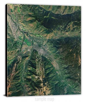
To view satellite imagery and bounding box footprint of individual city/location maps, click below on specific links

• Extra-Large Gallery Canvas Wrap Print
• Hand-Stretched, Expertly Crafted
• Artist Grade Canvas with Fade-Resistant Inks
• Ready to Hang with Pre-Installed Hardware
• 1.5" Thick Gallery Frame
Enrich your office decor or home with a large canvas wrap Satellite map. It is designed for easy hanging with pre-installed hardware. Printed with archival inks and wrapped around a 1.5" thick gallery frame, your favorite map art will have a timeless and impressive look that fits with any decor. This map is fabricated with satellite imagery data from Google Earth, and bounding box coordinates from USGS.
Ada, Ohio- Map Components- Imagery: Satellite of Ada, Ohio. Bounding Box: Footprint of Ada, Ohio at Longitude/Latitude Coordinates (-83.875 x -83.75 x 40.875 x 40.75).
Adamsville, Ohio- Map Components- Imagery: Satellite of Adamsville, Ohio. Bounding Box: Footprint of Adamsville, Ohio at Longitude/Latitude Coordinates (-82 x -81.875 x 40.125 x 40).
Addison, Ohio- Map Components- Imagery: Satellite of Addison, Ohio. Bounding Box: Footprint of Addison, Ohio at Longitude/Latitude Coordinates (-82.25 x -82.125 x 39 x 38.875).
Addyston, Ohio- Map Components- Imagery: Satellite of Addyston, Ohio. Bounding Box: Footprint of Addyston, Ohio at Longitude/Latitude Coordinates (-84.75 x -84.625 x 39.25 x 39.125).
Aid, Ohio- Map Components- Imagery: Satellite of Aid, Ohio. Bounding Box: Footprint of Aid, Ohio at Longitude/Latitude Coordinates (-82.5 x -82.375 x 38.625 x 38.5).
Akron East, Ohio- Map Components- Imagery: Satellite of Akron East, Ohio. Bounding Box: Footprint of Akron East, Ohio at Longitude/Latitude Coordinates (-81.5 x -81.375 x 41.125 x 41).
Akron West, Ohio- Map Components- Imagery: Satellite of Akron West, Ohio. Bounding Box: Footprint of Akron West, Ohio at Longitude/Latitude Coordinates (-81.625 x -81.5 x 41.125 x 41).
Albany, Ohio- Map Components- Imagery: Satellite of Albany, Ohio. Bounding Box: Footprint of Albany, Ohio at Longitude/Latitude Coordinates (-82.25 x -82.125 x 39.25 x 39.125).
Alfred, Ohio- Map Components- Imagery: Satellite of Alfred, Ohio. Bounding Box: Footprint of Alfred, Ohio at Longitude/Latitude Coordinates (-82 x -81.875 x 39.25 x 39.125).
Alger, Ohio- Map Components- Imagery: Satellite of Alger, Ohio. Bounding Box: Footprint of Alger, Ohio at Longitude/Latitude Coordinates (-83.875 x -83.75 x 40.75 x 40.625).
Allensville, Ohio- Map Components- Imagery: Satellite of Allensville, Ohio. Bounding Box: Footprint of Allensville, Ohio at Longitude/Latitude Coordinates (-82.625 x -82.5 x 39.375 x 39.25).
Alliance, Ohio- Map Components- Imagery: Satellite of Alliance, Ohio. Bounding Box: Footprint of Alliance, Ohio at Longitude/Latitude Coordinates (-81.125 x -81 x 41 x 40.875).
Alvada, Ohio- Map Components- Imagery: Satellite of Alvada, Ohio. Bounding Box: Footprint of Alvada, Ohio at Longitude/Latitude Coordinates (-83.5 x -83.375 x 41.125 x 41).
Alvordton, Ohio- Map Components- Imagery: Satellite of Alvordton, Ohio. Bounding Box: Footprint of Alvordton, Ohio at Longitude/Latitude Coordinates (-84.5 x -84.375 x 41.75 x 41.625).
Amanda, Ohio- Map Components- Imagery: Satellite of Amanda, Ohio. Bounding Box: Footprint of Amanda, Ohio at Longitude/Latitude Coordinates (-82.75 x -82.625 x 39.75 x 39.625).
Amesville, Ohio- Map Components- Imagery: Satellite of Amesville, Ohio. Bounding Box: Footprint of Amesville, Ohio at Longitude/Latitude Coordinates (-82 x -81.875 x 39.5 x 39.375).
Amsterdam, Ohio- Map Components- Imagery: Satellite of Amsterdam, Ohio. Bounding Box: Footprint of Amsterdam, Ohio at Longitude/Latitude Coordinates (-81 x -80.875 x 40.5 x 40.375).
Andersonville, Ohio- Map Components- Imagery: Satellite of Andersonville, Ohio. Bounding Box: Footprint of Andersonville, Ohio at Longitude/Latitude Coordinates (-83.125 x -83 x 39.5 x 39.375).
Andover, Ohio- Map Components- Imagery: Satellite of Andover, Ohio. Bounding Box: Footprint of Andover, Ohio at Longitude/Latitude Coordinates (-80.625 x -80.5 x 41.625 x 41.5).
Ansonia, Ohio- Map Components- Imagery: Satellite of Ansonia, Ohio. Bounding Box: Footprint of Ansonia, Ohio at Longitude/Latitude Coordinates (-84.75 x -84.625 x 40.25 x 40.125).
Antioch, Ohio- Map Components- Imagery: Satellite of Antioch, Ohio. Bounding Box: Footprint of Antioch, Ohio at Longitude/Latitude Coordinates (-81.125 x -81 x 39.75 x 39.625).
Antrim, Ohio- Map Components- Imagery: Satellite of Antrim, Ohio. Bounding Box: Footprint of Antrim, Ohio at Longitude/Latitude Coordinates (-81.375 x -81.25 x 40.125 x 40).
Antwerp, Ohio- Map Components- Imagery: Satellite of Antwerp, Ohio. Bounding Box: Footprint of Antwerp, Ohio at Longitude/Latitude Coordinates (-84.75 x -84.625 x 41.25 x 41.125).
Arcadia, Ohio- Map Components- Imagery: Satellite of Arcadia, Ohio. Bounding Box: Footprint of Arcadia, Ohio at Longitude/Latitude Coordinates (-83.625 x -83.5 x 41.125 x 41).
Arcanum, Ohio- Map Components- Imagery: Satellite of Arcanum, Ohio. Bounding Box: Footprint of Arcanum, Ohio at Longitude/Latitude Coordinates (-84.625 x -84.5 x 40 x 39.875).
Archbold, Ohio- Map Components- Imagery: Satellite of Archbold, Ohio. Bounding Box: Footprint of Archbold, Ohio at Longitude/Latitude Coordinates (-84.375 x -84.25 x 41.625 x 41.5).
Arlington, Ohio- Map Components- Imagery: Satellite of Arlington, Ohio. Bounding Box: Footprint of Arlington, Ohio at Longitude/Latitude Coordinates (-83.75 x -83.625 x 41 x 40.875).
Armstrongs Mills, Ohio- Map Components- Imagery: Satellite of Armstrongs Mills, Ohio. Bounding Box: Footprint of Armstrongs Mills, Ohio at Longitude/Latitude Coordinates (-81 x -80.875 x 40 x 39.875).
Ash Ridge, Ohio- Map Components- Imagery: Satellite of Ash Ridge, Ohio. Bounding Box: Footprint of Ash Ridge, Ohio at Longitude/Latitude Coordinates (-83.875 x -83.75 x 39 x 38.875).
Ashland North, Ohio- Map Components- Imagery: Satellite of Ashland North, Ohio. Bounding Box: Footprint of Ashland North, Ohio at Longitude/Latitude Coordinates (-82.375 x -82.25 x 41 x 40.875).
Ashland South, Ohio- Map Components- Imagery: Satellite of Ashland South, Ohio. Bounding Box: Footprint of Ashland South, Ohio at Longitude/Latitude Coordinates (-82.375 x -82.25 x 40.875 x 40.75).
Ashley, Ohio- Map Components- Imagery: Satellite of Ashley, Ohio. Bounding Box: Footprint of Ashley, Ohio at Longitude/Latitude Coordinates (-83 x -82.875 x 40.5 x 40.375).
Ashtabula North, Ohio- Map Components- Imagery: Satellite of Ashtabula North, Ohio. Bounding Box: Footprint of Ashtabula North, Ohio at Longitude/Latitude Coordinates (-80.875 x -80.75 x 42 x 41.875).
Ashtabula South, Ohio- Map Components- Imagery: Satellite of Ashtabula South, Ohio. Bounding Box: Footprint of Ashtabula South, Ohio at Longitude/Latitude Coordinates (-80.875 x -80.75 x 41.875 x 41.75).
Ashville, Ohio- Map Components- Imagery: Satellite of Ashville, Ohio. Bounding Box: Footprint of Ashville, Ohio at Longitude/Latitude Coordinates (-83 x -82.875 x 39.75 x 39.625).
Assumption, Ohio- Map Components- Imagery: Satellite of Assumption, Ohio. Bounding Box: Footprint of Assumption, Ohio at Longitude/Latitude Coordinates (-84 x -83.875 x 41.75 x 41.625).
Athalia, Ohio- Map Components- Imagery: Satellite of Athalia, Ohio. Bounding Box: Footprint of Athalia, Ohio at Longitude/Latitude Coordinates (-82.375 x -82.25 x 38.625 x 38.5).
Athens, Ohio- Map Components- Imagery: Satellite of Athens, Ohio. Bounding Box: Footprint of Athens, Ohio at Longitude/Latitude Coordinates (-82.125 x -82 x 39.375 x 39.25).
Attica, Ohio- Map Components- Imagery: Satellite of Attica, Ohio. Bounding Box: Footprint of Attica, Ohio at Longitude/Latitude Coordinates (-83 x -82.875 x 41.125 x 41).
Atwater, Ohio- Map Components- Imagery: Satellite of Atwater, Ohio. Bounding Box: Footprint of Atwater, Ohio at Longitude/Latitude Coordinates (-81.25 x -81.125 x 41.125 x 41).
Aurora, Ohio- Map Components- Imagery: Satellite of Aurora, Ohio. Bounding Box: Footprint of Aurora, Ohio at Longitude/Latitude Coordinates (-81.375 x -81.25 x 41.375 x 41.25).
Avon, Ohio- Map Components- Imagery: Satellite of Avon, Ohio. Bounding Box: Footprint of Avon, Ohio at Longitude/Latitude Coordinates (-82.125 x -82 x 41.5 x 41.375).
Avon OE N, Ohio- Map Components- Imagery: Satellite of Avon OE N, Ohio. Bounding Box: Footprint of Avon OE N, Ohio at Longitude/Latitude Coordinates (-82.125 x -82 x 41.625 x 41.5).
Ayersville, Ohio- Map Components- Imagery: Satellite of Ayersville, Ohio. Bounding Box: Footprint of Ayersville, Ohio at Longitude/Latitude Coordinates (-84.375 x -84.25 x 41.25 x 41.125).
Bainbridge, Ohio- Map Components- Imagery: Satellite of Bainbridge, Ohio. Bounding Box: Footprint of Bainbridge, Ohio at Longitude/Latitude Coordinates (-83.375 x -83.25 x 39.25 x 39.125).
Baltic, Ohio- Map Components- Imagery: Satellite of Baltic, Ohio. Bounding Box: Footprint of Baltic, Ohio at Longitude/Latitude Coordinates (-81.75 x -81.625 x 40.5 x 40.375).
Baltimore, Ohio- Map Components- Imagery: Satellite of Baltimore, Ohio. Bounding Box: Footprint of Baltimore, Ohio at Longitude/Latitude Coordinates (-82.625 x -82.5 x 39.875 x 39.75).
Barnesville, Ohio- Map Components- Imagery: Satellite of Barnesville, Ohio. Bounding Box: Footprint of Barnesville, Ohio at Longitude/Latitude Coordinates (-81.25 x -81.125 x 40 x 39.875).
Bascom, Ohio- Map Components- Imagery: Satellite of Bascom, Ohio. Bounding Box: Footprint of Bascom, Ohio at Longitude/Latitude Coordinates (-83.375 x -83.25 x 41.25 x 41.125).
Batavia, Ohio- Map Components- Imagery: Satellite of Batavia, Ohio. Bounding Box: Footprint of Batavia, Ohio at Longitude/Latitude Coordinates (-84.25 x -84.125 x 39.125 x 39).
Beaver, Ohio- Map Components- Imagery: Satellite of Beaver, Ohio. Bounding Box: Footprint of Beaver, Ohio at Longitude/Latitude Coordinates (-82.875 x -82.75 x 39.125 x 39).
Beaverdam, Ohio- Map Components- Imagery: Satellite of Beaverdam, Ohio. Bounding Box: Footprint of Beaverdam, Ohio at Longitude/Latitude Coordinates (-84 x -83.875 x 40.875 x 40.75).
Belfast, Ohio- Map Components- Imagery: Satellite of Belfast, Ohio. Bounding Box: Footprint of Belfast, Ohio at Longitude/Latitude Coordinates (-83.625 x -83.5 x 39.125 x 39).
Bellbrook, Ohio- Map Components- Imagery: Satellite of Bellbrook, Ohio. Bounding Box: Footprint of Bellbrook, Ohio at Longitude/Latitude Coordinates (-84.125 x -84 x 39.75 x 39.625).
Bellefontaine, Ohio- Map Components- Imagery: Satellite of Bellefontaine, Ohio. Bounding Box: Footprint of Bellefontaine, Ohio at Longitude/Latitude Coordinates (-83.875 x -83.75 x 40.375 x 40.25).
Bellevue, Ohio- Map Components- Imagery: Satellite of Bellevue, Ohio. Bounding Box: Footprint of Bellevue, Ohio at Longitude/Latitude Coordinates (-82.875 x -82.75 x 41.375 x 41.25).
Bellville, Ohio- Map Components- Imagery: Satellite of Bellville, Ohio. Bounding Box: Footprint of Bellville, Ohio at Longitude/Latitude Coordinates (-82.625 x -82.5 x 40.625 x 40.5).
Berea, Ohio- Map Components- Imagery: Satellite of Berea, Ohio. Bounding Box: Footprint of Berea, Ohio at Longitude/Latitude Coordinates (-81.875 x -81.75 x 41.375 x 41.25).
Bergholz, Ohio- Map Components- Imagery: Satellite of Bergholz, Ohio. Bounding Box: Footprint of Bergholz, Ohio at Longitude/Latitude Coordinates (-81 x -80.875 x 40.625 x 40.5).
Berkey, Ohio- Map Components- Imagery: Satellite of Berkey, Ohio. Bounding Box: Footprint of Berkey, Ohio at Longitude/Latitude Coordinates (-83.875 x -83.75 x 41.75 x 41.625).
Berlin, Ohio- Map Components- Imagery: Satellite of Berlin, Ohio. Bounding Box: Footprint of Berlin, Ohio at Longitude/Latitude Coordinates (-81.875 x -81.75 x 40.625 x 40.5).
Berlin Heights, Ohio- Map Components- Imagery: Satellite of Berlin Heights, Ohio. Bounding Box: Footprint of Berlin Heights, Ohio at Longitude/Latitude Coordinates (-82.5 x -82.375 x 41.375 x 41.25).
Bethel, Ohio- Map Components- Imagery: Satellite of Bethel, Ohio. Bounding Box: Footprint of Bethel, Ohio at Longitude/Latitude Coordinates (-84.125 x -84 x 39 x 38.875).
Bethesda, Ohio- Map Components- Imagery: Satellite of Bethesda, Ohio. Bounding Box: Footprint of Bethesda, Ohio at Longitude/Latitude Coordinates (-81.125 x -81 x 40.125 x 40).
Beverly, Ohio- Map Components- Imagery: Satellite of Beverly, Ohio. Bounding Box: Footprint of Beverly, Ohio at Longitude/Latitude Coordinates (-81.75 x -81.625 x 39.625 x 39.5).
Big Plain, Ohio- Map Components- Imagery: Satellite of Big Plain, Ohio. Bounding Box: Footprint of Big Plain, Ohio at Longitude/Latitude Coordinates (-83.375 x -83.25 x 39.875 x 39.75).
Birmingham, Ohio- Map Components- Imagery: Satellite of Birmingham, Ohio. Bounding Box: Footprint of Birmingham, Ohio at Longitude/Latitude Coordinates (-81.5 x -81.375 x 40.25 x 40.125).
Blakeslee, Ohio- Map Components- Imagery: Satellite of Blakeslee, Ohio. Bounding Box: Footprint of Blakeslee, Ohio at Longitude/Latitude Coordinates (-84.75 x -84.625 x 41.625 x 41.5).
Blanchester, Ohio- Map Components- Imagery: Satellite of Blanchester, Ohio. Bounding Box: Footprint of Blanchester, Ohio at Longitude/Latitude Coordinates (-84 x -83.875 x 39.375 x 39.25).
Bloomdale, Ohio- Map Components- Imagery: Satellite of Bloomdale, Ohio. Bounding Box: Footprint of Bloomdale, Ohio at Longitude/Latitude Coordinates (-83.625 x -83.5 x 41.25 x 41.125).
Bloomfield, Ohio- Map Components- Imagery: Satellite of Bloomfield, Ohio. Bounding Box: Footprint of Bloomfield, Ohio at Longitude/Latitude Coordinates (-81.75 x -81.625 x 40.125 x 40).
Blooming Grove, Ohio- Map Components- Imagery: Satellite of Blooming Grove, Ohio. Bounding Box: Footprint of Blooming Grove, Ohio at Longitude/Latitude Coordinates (-82.75 x -82.625 x 40.75 x 40.625).
Bloomville, Ohio- Map Components- Imagery: Satellite of Bloomville, Ohio. Bounding Box: Footprint of Bloomville, Ohio at Longitude/Latitude Coordinates (-83.125 x -83 x 41.125 x 41).
Blue Creek, Ohio- Map Components- Imagery: Satellite of Blue Creek, Ohio. Bounding Box: Footprint of Blue Creek, Ohio at Longitude/Latitude Coordinates (-83.375 x -83.25 x 38.875 x 38.75).
Bluffton, Ohio- Map Components- Imagery: Satellite of Bluffton, Ohio. Bounding Box: Footprint of Bluffton, Ohio at Longitude/Latitude Coordinates (-84 x -83.875 x 41 x 40.875).
Bolivar, Ohio- Map Components- Imagery: Satellite of Bolivar, Ohio. Bounding Box: Footprint of Bolivar, Ohio at Longitude/Latitude Coordinates (-81.5 x -81.375 x 40.75 x 40.625).
Botkins, Ohio- Map Components- Imagery: Satellite of Botkins, Ohio. Bounding Box: Footprint of Botkins, Ohio at Longitude/Latitude Coordinates (-84.25 x -84.125 x 40.5 x 40.375).
Bourneville, Ohio- Map Components- Imagery: Satellite of Bourneville, Ohio. Bounding Box: Footprint of Bourneville, Ohio at Longitude/Latitude Coordinates (-83.25 x -83.125 x 39.375 x 39.25).
Bowerston, Ohio- Map Components- Imagery: Satellite of Bowerston, Ohio. Bounding Box: Footprint of Bowerston, Ohio at Longitude/Latitude Coordinates (-81.25 x -81.125 x 40.5 x 40.375).
Bowersville, Ohio- Map Components- Imagery: Satellite of Bowersville, Ohio. Bounding Box: Footprint of Bowersville, Ohio at Longitude/Latitude Coordinates (-83.75 x -83.625 x 39.625 x 39.5).
Bowling Green North, Ohio- Map Components- Imagery: Satellite of Bowling Green North, Ohio. Bounding Box: Footprint of Bowling Green North, Ohio at Longitude/Latitude Coordinates (-83.75 x -83.625 x 41.5 x 41.375).
Bowling Green South, Ohio- Map Components- Imagery: Satellite of Bowling Green South, Ohio. Bounding Box: Footprint of Bowling Green South, Ohio at Longitude/Latitude Coordinates (-83.75 x -83.625 x 41.375 x 41.25).
Bradner, Ohio- Map Components- Imagery: Satellite of Bradner, Ohio. Bounding Box: Footprint of Bradner, Ohio at Longitude/Latitude Coordinates (-83.5 x -83.375 x 41.375 x 41.25).
Bremen, Ohio- Map Components- Imagery: Satellite of Bremen, Ohio. Bounding Box: Footprint of Bremen, Ohio at Longitude/Latitude Coordinates (-82.5 x -82.375 x 39.75 x 39.625).
Brighton, Ohio- Map Components- Imagery: Satellite of Brighton, Ohio. Bounding Box: Footprint of Brighton, Ohio at Longitude/Latitude Coordinates (-82.375 x -82.25 x 41.25 x 41.125).
Brinkhaven, Ohio- Map Components- Imagery: Satellite of Brinkhaven, Ohio. Bounding Box: Footprint of Brinkhaven, Ohio at Longitude/Latitude Coordinates (-82.25 x -82.125 x 40.5 x 40.375).
Bristolville, Ohio- Map Components- Imagery: Satellite of Bristolville, Ohio. Bounding Box: Footprint of Bristolville, Ohio at Longitude/Latitude Coordinates (-80.875 x -80.75 x 41.5 x 41.375).
Broadview Heights, Ohio- Map Components- Imagery: Satellite of Broadview Heights, Ohio. Bounding Box: Footprint of Broadview Heights, Ohio at Longitude/Latitude Coordinates (-81.75 x -81.625 x 41.375 x 41.25).
Brookville, Ohio- Map Components- Imagery: Satellite of Brookville, Ohio. Bounding Box: Footprint of Brookville, Ohio at Longitude/Latitude Coordinates (-84.5 x -84.375 x 39.875 x 39.75).
Bryan, Ohio- Map Components- Imagery: Satellite of Bryan, Ohio. Bounding Box: Footprint of Bryan, Ohio at Longitude/Latitude Coordinates (-84.625 x -84.5 x 41.5 x 41.375).
Bucyrus, Ohio- Map Components- Imagery: Satellite of Bucyrus, Ohio. Bounding Box: Footprint of Bucyrus, Ohio at Longitude/Latitude Coordinates (-83 x -82.875 x 40.875 x 40.75).
Buena Vista, Ohio- Map Components- Imagery: Satellite of Buena Vista, Ohio. Bounding Box: Footprint of Buena Vista, Ohio at Longitude/Latitude Coordinates (-83.375 x -83.25 x 38.75 x 38.625).
Burton, Ohio- Map Components- Imagery: Satellite of Burton, Ohio. Bounding Box: Footprint of Burton, Ohio at Longitude/Latitude Coordinates (-81.25 x -81.125 x 41.5 x 41.375).
Businessburg, Ohio- Map Components- Imagery: Satellite of Businessburg, Ohio. Bounding Box: Footprint of Businessburg, Ohio at Longitude/Latitude Coordinates (-80.875 x -80.75 x 40 x 39.875).
Butler, Ohio- Map Components- Imagery: Satellite of Butler, Ohio. Bounding Box: Footprint of Butler, Ohio at Longitude/Latitude Coordinates (-82.5 x -82.375 x 40.625 x 40.5).
Byer, Ohio- Map Components- Imagery: Satellite of Byer, Ohio. Bounding Box: Footprint of Byer, Ohio at Longitude/Latitude Coordinates (-82.75 x -82.625 x 39.25 x 39.125).
Byesville, Ohio- Map Components- Imagery: Satellite of Byesville, Ohio. Bounding Box: Footprint of Byesville, Ohio at Longitude/Latitude Coordinates (-81.625 x -81.5 x 40 x 39.875).
Byington, Ohio- Map Components- Imagery: Satellite of Byington, Ohio. Bounding Box: Footprint of Byington, Ohio at Longitude/Latitude Coordinates (-83.375 x -83.25 x 39.125 x 39).
Cadiz, Ohio- Map Components- Imagery: Satellite of Cadiz, Ohio. Bounding Box: Footprint of Cadiz, Ohio at Longitude/Latitude Coordinates (-81 x -80.875 x 40.375 x 40.25).
Cairo, Ohio- Map Components- Imagery: Satellite of Cairo, Ohio. Bounding Box: Footprint of Cairo, Ohio at Longitude/Latitude Coordinates (-84.125 x -84 x 40.875 x 40.75).
Caldwell North, Ohio- Map Components- Imagery: Satellite of Caldwell North, Ohio. Bounding Box: Footprint of Caldwell North, Ohio at Longitude/Latitude Coordinates (-81.625 x -81.5 x 39.875 x 39.75).
Caldwell South, Ohio- Map Components- Imagery: Satellite of Caldwell South, Ohio. Bounding Box: Footprint of Caldwell South, Ohio at Longitude/Latitude Coordinates (-81.625 x -81.5 x 39.75 x 39.625).
Caledonia, Ohio- Map Components- Imagery: Satellite of Caledonia, Ohio. Bounding Box: Footprint of Caledonia, Ohio at Longitude/Latitude Coordinates (-83 x -82.875 x 40.75 x 40.625).
Cambridge, Ohio- Map Components- Imagery: Satellite of Cambridge, Ohio. Bounding Box: Footprint of Cambridge, Ohio at Longitude/Latitude Coordinates (-81.625 x -81.5 x 40.125 x 40).
Cameron, Ohio- Map Components- Imagery: Satellite of Cameron, Ohio. Bounding Box: Footprint of Cameron, Ohio at Longitude/Latitude Coordinates (-81 x -80.875 x 39.875 x 39.75).
Campbell, Ohio- Map Components- Imagery: Satellite of Campbell, Ohio. Bounding Box: Footprint of Campbell, Ohio at Longitude/Latitude Coordinates (-80.625 x -80.5 x 41.125 x 41).
Canal Fulton, Ohio- Map Components- Imagery: Satellite of Canal Fulton, Ohio. Bounding Box: Footprint of Canal Fulton, Ohio at Longitude/Latitude Coordinates (-81.625 x -81.5 x 41 x 40.875).
Canal Winchester, Ohio- Map Components- Imagery: Satellite of Canal Winchester, Ohio. Bounding Box: Footprint of Canal Winchester, Ohio at Longitude/Latitude Coordinates (-82.875 x -82.75 x 39.875 x 39.75).
Canfield, Ohio- Map Components- Imagery: Satellite of Canfield, Ohio. Bounding Box: Footprint of Canfield, Ohio at Longitude/Latitude Coordinates (-80.875 x -80.75 x 41.125 x 41).
Canton East, Ohio- Map Components- Imagery: Satellite of Canton East, Ohio. Bounding Box: Footprint of Canton East, Ohio at Longitude/Latitude Coordinates (-81.375 x -81.25 x 40.875 x 40.75).
Canton West, Ohio- Map Components- Imagery: Satellite of Canton West, Ohio. Bounding Box: Footprint of Canton West, Ohio at Longitude/Latitude Coordinates (-81.5 x -81.375 x 40.875 x 40.75).
Carey, Ohio- Map Components- Imagery: Satellite of Carey, Ohio. Bounding Box: Footprint of Carey, Ohio at Longitude/Latitude Coordinates (-83.5 x -83.375 x 41 x 40.875).
Carroll, Ohio- Map Components- Imagery: Satellite of Carroll, Ohio. Bounding Box: Footprint of Carroll, Ohio at Longitude/Latitude Coordinates (-82.75 x -82.625 x 39.875 x 39.75).
Carrollton, Ohio- Map Components- Imagery: Satellite of Carrollton, Ohio. Bounding Box: Footprint of Carrollton, Ohio at Longitude/Latitude Coordinates (-81.125 x -81 x 40.625 x 40.5).
Castalia, Ohio- Map Components- Imagery: Satellite of Castalia, Ohio. Bounding Box: Footprint of Castalia, Ohio at Longitude/Latitude Coordinates (-82.875 x -82.75 x 41.5 x 41.375).
Cedarville, Ohio- Map Components- Imagery: Satellite of Cedarville, Ohio. Bounding Box: Footprint of Cedarville, Ohio at Longitude/Latitude Coordinates (-83.875 x -83.75 x 39.75 x 39.625).
Celina, Ohio- Map Components- Imagery: Satellite of Celina, Ohio. Bounding Box: Footprint of Celina, Ohio at Longitude/Latitude Coordinates (-84.625 x -84.5 x 40.625 x 40.5).
Centerburg, Ohio- Map Components- Imagery: Satellite of Centerburg, Ohio. Bounding Box: Footprint of Centerburg, Ohio at Longitude/Latitude Coordinates (-82.75 x -82.625 x 40.375 x 40.25).
Centerton, Ohio- Map Components- Imagery: Satellite of Centerton, Ohio. Bounding Box: Footprint of Centerton, Ohio at Longitude/Latitude Coordinates (-82.875 x -82.75 x 41.125 x 41).
Chagrin Falls, Ohio- Map Components- Imagery: Satellite of Chagrin Falls, Ohio. Bounding Box: Footprint of Chagrin Falls, Ohio at Longitude/Latitude Coordinates (-81.5 x -81.375 x 41.5 x 41.375).
Champion, Ohio- Map Components- Imagery: Satellite of Champion, Ohio. Bounding Box: Footprint of Champion, Ohio at Longitude/Latitude Coordinates (-80.875 x -80.75 x 41.375 x 41.25).
Chardon, Ohio- Map Components- Imagery: Satellite of Chardon, Ohio. Bounding Box: Footprint of Chardon, Ohio at Longitude/Latitude Coordinates (-81.25 x -81.125 x 41.625 x 41.5).
Chatfield, Ohio- Map Components- Imagery: Satellite of Chatfield, Ohio. Bounding Box: Footprint of Chatfield, Ohio at Longitude/Latitude Coordinates (-83 x -82.875 x 41 x 40.875).
Cherry Valley, Ohio- Map Components- Imagery: Satellite of Cherry Valley, Ohio. Bounding Box: Footprint of Cherry Valley, Ohio at Longitude/Latitude Coordinates (-80.75 x -80.625 x 41.625 x 41.5).
Cheshire, Ohio- Map Components- Imagery: Satellite of Cheshire, Ohio. Bounding Box: Footprint of Cheshire, Ohio at Longitude/Latitude Coordinates (-82.125 x -82 x 39 x 38.875).
Chester, Ohio- Map Components- Imagery: Satellite of Chester, Ohio. Bounding Box: Footprint of Chester, Ohio at Longitude/Latitude Coordinates (-82 x -81.875 x 39.125 x 39).
Chesterhill, Ohio- Map Components- Imagery: Satellite of Chesterhill, Ohio. Bounding Box: Footprint of Chesterhill, Ohio at Longitude/Latitude Coordinates (-81.875 x -81.75 x 39.5 x 39.375).
Chesterland, Ohio- Map Components- Imagery: Satellite of Chesterland, Ohio. Bounding Box: Footprint of Chesterland, Ohio at Longitude/Latitude Coordinates (-81.375 x -81.25 x 41.625 x 41.5).
Chesterville, Ohio- Map Components- Imagery: Satellite of Chesterville, Ohio. Bounding Box: Footprint of Chesterville, Ohio at Longitude/Latitude Coordinates (-82.75 x -82.625 x 40.5 x 40.375).
Chillicothe East, Ohio- Map Components- Imagery: Satellite of Chillicothe East, Ohio. Bounding Box: Footprint of Chillicothe East, Ohio at Longitude/Latitude Coordinates (-83 x -82.875 x 39.375 x 39.25).
Chillicothe West, Ohio- Map Components- Imagery: Satellite of Chillicothe West, Ohio. Bounding Box: Footprint of Chillicothe West, Ohio at Longitude/Latitude Coordinates (-83.125 x -83 x 39.375 x 39.25).
Christiansburg, Ohio- Map Components- Imagery: Satellite of Christiansburg, Ohio. Bounding Box: Footprint of Christiansburg, Ohio at Longitude/Latitude Coordinates (-84.125 x -84 x 40.125 x 40).
Cincinnati East, Ohio- Map Components- Imagery: Satellite of Cincinnati East, Ohio. Bounding Box: Footprint of Cincinnati East, Ohio at Longitude/Latitude Coordinates (-84.5 x -84.375 x 39.25 x 39.125).
Cincinnati West, Ohio- Map Components- Imagery: Satellite of Cincinnati West, Ohio. Bounding Box: Footprint of Cincinnati West, Ohio at Longitude/Latitude Coordinates (-84.625 x -84.5 x 39.25 x 39.125).
Circleville, Ohio- Map Components- Imagery: Satellite of Circleville, Ohio. Bounding Box: Footprint of Circleville, Ohio at Longitude/Latitude Coordinates (-83 x -82.875 x 39.625 x 39.5).
Clarksburg, Ohio- Map Components- Imagery: Satellite of Clarksburg, Ohio. Bounding Box: Footprint of Clarksburg, Ohio at Longitude/Latitude Coordinates (-83.25 x -83.125 x 39.625 x 39.5).
Clarksfield, Ohio- Map Components- Imagery: Satellite of Clarksfield, Ohio. Bounding Box: Footprint of Clarksfield, Ohio at Longitude/Latitude Coordinates (-82.5 x -82.375 x 41.25 x 41.125).
Clarksville, Ohio- Map Components- Imagery: Satellite of Clarksville, Ohio. Bounding Box: Footprint of Clarksville, Ohio at Longitude/Latitude Coordinates (-84 x -83.875 x 39.5 x 39.375).
Clearport, Ohio- Map Components- Imagery: Satellite of Clearport, Ohio. Bounding Box: Footprint of Clearport, Ohio at Longitude/Latitude Coordinates (-82.75 x -82.625 x 39.625 x 39.5).
Cleveland North, Ohio- Map Components- Imagery: Satellite of Cleveland North, Ohio. Bounding Box: Footprint of Cleveland North, Ohio at Longitude/Latitude Coordinates (-81.75 x -81.625 x 41.625 x 41.5).
Cleveland South, Ohio- Map Components- Imagery: Satellite of Cleveland South, Ohio. Bounding Box: Footprint of Cleveland South, Ohio at Longitude/Latitude Coordinates (-81.75 x -81.625 x 41.5 x 41.375).
Clifton, Ohio- Map Components- Imagery: Satellite of Clifton, Ohio. Bounding Box: Footprint of Clifton, Ohio at Longitude/Latitude Coordinates (-83.875 x -83.75 x 39.875 x 39.75).
Clyde, Ohio- Map Components- Imagery: Satellite of Clyde, Ohio. Bounding Box: Footprint of Clyde, Ohio at Longitude/Latitude Coordinates (-83 x -82.875 x 41.375 x 41.25).
Coldwater, Ohio- Map Components- Imagery: Satellite of Coldwater, Ohio. Bounding Box: Footprint of Coldwater, Ohio at Longitude/Latitude Coordinates (-84.75 x -84.625 x 40.5 x 40.375).
College Corner, Ohio- Map Components- Imagery: Satellite of College Corner, Ohio. Bounding Box: Footprint of College Corner, Ohio at Longitude/Latitude Coordinates (-84.875 x -84.75 x 39.625 x 39.5).
Colton, Ohio- Map Components- Imagery: Satellite of Colton, Ohio. Bounding Box: Footprint of Colton, Ohio at Longitude/Latitude Coordinates (-84 x -83.875 x 41.5 x 41.375).
Columbiana, Ohio- Map Components- Imagery: Satellite of Columbiana, Ohio. Bounding Box: Footprint of Columbiana, Ohio at Longitude/Latitude Coordinates (-80.75 x -80.625 x 41 x 40.875).
Columbus Grove, Ohio- Map Components- Imagery: Satellite of Columbus Grove, Ohio. Bounding Box: Footprint of Columbus Grove, Ohio at Longitude/Latitude Coordinates (-84.125 x -84 x 41 x 40.875).
Commercial Point, Ohio- Map Components- Imagery: Satellite of Commercial Point, Ohio. Bounding Box: Footprint of Commercial Point, Ohio at Longitude/Latitude Coordinates (-83.125 x -83 x 39.875 x 39.75).
Conesville, Ohio- Map Components- Imagery: Satellite of Conesville, Ohio. Bounding Box: Footprint of Conesville, Ohio at Longitude/Latitude Coordinates (-82 x -81.875 x 40.25 x 40.125).
Conneaut, Ohio- Map Components- Imagery: Satellite of Conneaut, Ohio. Bounding Box: Footprint of Conneaut, Ohio at Longitude/Latitude Coordinates (-80.625 x -80.5 x 42 x 41.875).
Continental, Ohio- Map Components- Imagery: Satellite of Continental, Ohio. Bounding Box: Footprint of Continental, Ohio at Longitude/Latitude Coordinates (-84.375 x -84.25 x 41.125 x 41).
Convoy, Ohio- Map Components- Imagery: Satellite of Convoy, Ohio. Bounding Box: Footprint of Convoy, Ohio at Longitude/Latitude Coordinates (-84.75 x -84.625 x 41 x 40.875).
Coolville, Ohio- Map Components- Imagery: Satellite of Coolville, Ohio. Bounding Box: Footprint of Coolville, Ohio at Longitude/Latitude Coordinates (-81.875 x -81.75 x 39.25 x 39.125).
Corning, Ohio- Map Components- Imagery: Satellite of Corning, Ohio. Bounding Box: Footprint of Corning, Ohio at Longitude/Latitude Coordinates (-82.125 x -82 x 39.625 x 39.5).
Cortland, Ohio- Map Components- Imagery: Satellite of Cortland, Ohio. Bounding Box: Footprint of Cortland, Ohio at Longitude/Latitude Coordinates (-80.75 x -80.625 x 41.375 x 41.25).
Coshocton, Ohio- Map Components- Imagery: Satellite of Coshocton, Ohio. Bounding Box: Footprint of Coshocton, Ohio at Longitude/Latitude Coordinates (-81.875 x -81.75 x 40.375 x 40.25).
Cosmos, Ohio- Map Components- Imagery: Satellite of Cosmos, Ohio. Bounding Box: Footprint of Cosmos, Ohio at Longitude/Latitude Coordinates (-84.875 x -84.75 x 40.375 x 40.25).
Crestline, Ohio- Map Components- Imagery: Satellite of Crestline, Ohio. Bounding Box: Footprint of Crestline, Ohio at Longitude/Latitude Coordinates (-82.75 x -82.625 x 40.875 x 40.75).
Creston, Ohio- Map Components- Imagery: Satellite of Creston, Ohio. Bounding Box: Footprint of Creston, Ohio at Longitude/Latitude Coordinates (-82 x -81.875 x 41 x 40.875).
Cridersville, Ohio- Map Components- Imagery: Satellite of Cridersville, Ohio. Bounding Box: Footprint of Cridersville, Ohio at Longitude/Latitude Coordinates (-84.25 x -84.125 x 40.75 x 40.625).
Crooksville, Ohio- Map Components- Imagery: Satellite of Crooksville, Ohio. Bounding Box: Footprint of Crooksville, Ohio at Longitude/Latitude Coordinates (-82.125 x -82 x 39.875 x 39.75).
Cumberland, Ohio- Map Components- Imagery: Satellite of Cumberland, Ohio. Bounding Box: Footprint of Cumberland, Ohio at Longitude/Latitude Coordinates (-81.75 x -81.625 x 39.875 x 39.75).
Cutler, Ohio- Map Components- Imagery: Satellite of Cutler, Ohio. Bounding Box: Footprint of Cutler, Ohio at Longitude/Latitude Coordinates (-81.875 x -81.75 x 39.375 x 39.25).
Dalton, Ohio- Map Components- Imagery: Satellite of Dalton, Ohio. Bounding Box: Footprint of Dalton, Ohio at Longitude/Latitude Coordinates (-81.75 x -81.625 x 40.875 x 40.75).
Dalzell, Ohio- Map Components- Imagery: Satellite of Dalzell, Ohio. Bounding Box: Footprint of Dalzell, Ohio at Longitude/Latitude Coordinates (-81.375 x -81.25 x 39.625 x 39.5).
Damascus, Ohio- Map Components- Imagery: Satellite of Damascus, Ohio. Bounding Box: Footprint of Damascus, Ohio at Longitude/Latitude Coordinates (-81 x -80.875 x 41 x 40.875).
Danville, Ohio- Map Components- Imagery: Satellite of Danville, Ohio. Bounding Box: Footprint of Danville, Ohio at Longitude/Latitude Coordinates (-82.375 x -82.25 x 40.5 x 40.375).
Darbyville, Ohio- Map Components- Imagery: Satellite of Darbyville, Ohio. Bounding Box: Footprint of Darbyville, Ohio at Longitude/Latitude Coordinates (-83.125 x -83 x 39.75 x 39.625).
Dawn, Ohio- Map Components- Imagery: Satellite of Dawn, Ohio. Bounding Box: Footprint of Dawn, Ohio at Longitude/Latitude Coordinates (-84.625 x -84.5 x 40.25 x 40.125).
Dayton North, Ohio- Map Components- Imagery: Satellite of Dayton North, Ohio. Bounding Box: Footprint of Dayton North, Ohio at Longitude/Latitude Coordinates (-84.25 x -84.125 x 39.875 x 39.75).
Dayton South, Ohio- Map Components- Imagery: Satellite of Dayton South, Ohio. Bounding Box: Footprint of Dayton South, Ohio at Longitude/Latitude Coordinates (-84.25 x -84.125 x 39.75 x 39.625).
De Graff, Ohio- Map Components- Imagery: Satellite of De Graff, Ohio. Bounding Box: Footprint of De Graff, Ohio at Longitude/Latitude Coordinates (-84 x -83.875 x 40.375 x 40.25).
Deavertown, Ohio- Map Components- Imagery: Satellite of Deavertown, Ohio. Bounding Box: Footprint of Deavertown, Ohio at Longitude/Latitude Coordinates (-82.125 x -82 x 39.75 x 39.625).
Decatur, Ohio- Map Components- Imagery: Satellite of Decatur, Ohio. Bounding Box: Footprint of Decatur, Ohio at Longitude/Latitude Coordinates (-83.75 x -83.625 x 38.875 x 38.75).
Deerfield, Ohio- Map Components- Imagery: Satellite of Deerfield, Ohio. Bounding Box: Footprint of Deerfield, Ohio at Longitude/Latitude Coordinates (-81.125 x -81 x 41.125 x 41).
Deersville, Ohio- Map Components- Imagery: Satellite of Deersville, Ohio. Bounding Box: Footprint of Deersville, Ohio at Longitude/Latitude Coordinates (-81.25 x -81.125 x 40.375 x 40.25).
Defiance East, Ohio- Map Components- Imagery: Satellite of Defiance East, Ohio. Bounding Box: Footprint of Defiance East, Ohio at Longitude/Latitude Coordinates (-84.375 x -84.25 x 41.375 x 41.25).
Defiance West, Ohio- Map Components- Imagery: Satellite of Defiance West, Ohio. Bounding Box: Footprint of Defiance West, Ohio at Longitude/Latitude Coordinates (-84.5 x -84.375 x 41.375 x 41.25).
Delaware, Ohio- Map Components- Imagery: Satellite of Delaware, Ohio. Bounding Box: Footprint of Delaware, Ohio at Longitude/Latitude Coordinates (-83.125 x -83 x 40.375 x 40.25).
Dellroy, Ohio- Map Components- Imagery: Satellite of Dellroy, Ohio. Bounding Box: Footprint of Dellroy, Ohio at Longitude/Latitude Coordinates (-81.25 x -81.125 x 40.625 x 40.5).
Delphos, Ohio- Map Components- Imagery: Satellite of Delphos, Ohio. Bounding Box: Footprint of Delphos, Ohio at Longitude/Latitude Coordinates (-84.375 x -84.25 x 40.875 x 40.75).
Delta, Ohio- Map Components- Imagery: Satellite of Delta, Ohio. Bounding Box: Footprint of Delta, Ohio at Longitude/Latitude Coordinates (-84.125 x -84 x 41.625 x 41.5).
Denmark, Ohio- Map Components- Imagery: Satellite of Denmark, Ohio. Bounding Box: Footprint of Denmark, Ohio at Longitude/Latitude Coordinates (-83 x -82.875 x 40.625 x 40.5).
Deshler, Ohio- Map Components- Imagery: Satellite of Deshler, Ohio. Bounding Box: Footprint of Deshler, Ohio at Longitude/Latitude Coordinates (-84 x -83.875 x 41.25 x 41.125).
Dillonvale, Ohio- Map Components- Imagery: Satellite of Dillonvale, Ohio. Bounding Box: Footprint of Dillonvale, Ohio at Longitude/Latitude Coordinates (-80.875 x -80.75 x 40.25 x 40.125).
Donnelsville, Ohio- Map Components- Imagery: Satellite of Donnelsville, Ohio. Bounding Box: Footprint of Donnelsville, Ohio at Longitude/Latitude Coordinates (-84 x -83.875 x 40 x 39.875).
Dorset, Ohio- Map Components- Imagery: Satellite of Dorset, Ohio. Bounding Box: Footprint of Dorset, Ohio at Longitude/Latitude Coordinates (-80.75 x -80.625 x 41.75 x 41.625).
Dover, Ohio- Map Components- Imagery: Satellite of Dover, Ohio. Bounding Box: Footprint of Dover, Ohio at Longitude/Latitude Coordinates (-81.5 x -81.375 x 40.625 x 40.5).
Doylestown, Ohio- Map Components- Imagery: Satellite of Doylestown, Ohio. Bounding Box: Footprint of Doylestown, Ohio at Longitude/Latitude Coordinates (-81.75 x -81.625 x 41 x 40.875).
Dresden, Ohio- Map Components- Imagery: Satellite of Dresden, Ohio. Bounding Box: Footprint of Dresden, Ohio at Longitude/Latitude Coordinates (-82.125 x -82 x 40.125 x 40).
Dunbridge, Ohio- Map Components- Imagery: Satellite of Dunbridge, Ohio. Bounding Box: Footprint of Dunbridge, Ohio at Longitude/Latitude Coordinates (-83.625 x -83.5 x 41.5 x 41.375).
Dunkirk, Ohio- Map Components- Imagery: Satellite of Dunkirk, Ohio. Bounding Box: Footprint of Dunkirk, Ohio at Longitude/Latitude Coordinates (-83.75 x -83.625 x 40.875 x 40.75).
East Claridon, Ohio- Map Components- Imagery: Satellite of East Claridon, Ohio. Bounding Box: Footprint of East Claridon, Ohio at Longitude/Latitude Coordinates (-81.125 x -81 x 41.625 x 41.5).
East Cleveland, Ohio- Map Components- Imagery: Satellite of East Cleveland, Ohio. Bounding Box: Footprint of East Cleveland, Ohio at Longitude/Latitude Coordinates (-81.625 x -81.5 x 41.625 x 41.5).
East Liberty, Ohio- Map Components- Imagery: Satellite of East Liberty, Ohio. Bounding Box: Footprint of East Liberty, Ohio at Longitude/Latitude Coordinates (-83.625 x -83.5 x 40.375 x 40.25).
East Liverpool North, Ohio- Map Components- Imagery: Satellite of East Liverpool North, Ohio. Bounding Box: Footprint of East Liverpool North, Ohio at Longitude/Latitude Coordinates (-80.625 x -80.5 x 40.75 x 40.625).
East Liverpool South, Ohio- Map Components- Imagery: Satellite of East Liverpool South, Ohio. Bounding Box: Footprint of East Liverpool South, Ohio at Longitude/Latitude Coordinates (-80.625 x -80.5 x 40.625 x 40.5).
East Palestine, Ohio- Map Components- Imagery: Satellite of East Palestine, Ohio. Bounding Box: Footprint of East Palestine, Ohio at Longitude/Latitude Coordinates (-80.625 x -80.5 x 40.875 x 40.75).
East Ringgold, Ohio- Map Components- Imagery: Satellite of East Ringgold, Ohio. Bounding Box: Footprint of East Ringgold, Ohio at Longitude/Latitude Coordinates (-82.875 x -82.75 x 39.75 x 39.625).
East Trumbull, Ohio- Map Components- Imagery: Satellite of East Trumbull, Ohio. Bounding Box: Footprint of East Trumbull, Ohio at Longitude/Latitude Coordinates (-81 x -80.875 x 41.75 x 41.625).
Eastlake, Ohio- Map Components- Imagery: Satellite of Eastlake, Ohio. Bounding Box: Footprint of Eastlake, Ohio at Longitude/Latitude Coordinates (-81.5 x -81.375 x 41.75 x 41.625).
Eaton North, Ohio- Map Components- Imagery: Satellite of Eaton North, Ohio. Bounding Box: Footprint of Eaton North, Ohio at Longitude/Latitude Coordinates (-84.75 x -84.625 x 39.875 x 39.75).
Eaton South, Ohio- Map Components- Imagery: Satellite of Eaton South, Ohio. Bounding Box: Footprint of Eaton South, Ohio at Longitude/Latitude Coordinates (-84.75 x -84.625 x 39.75 x 39.625).
Edgerton, Ohio- Map Components- Imagery: Satellite of Edgerton, Ohio. Bounding Box: Footprint of Edgerton, Ohio at Longitude/Latitude Coordinates (-84.75 x -84.625 x 41.5 x 41.375).
Edon, Ohio- Map Components- Imagery: Satellite of Edon, Ohio. Bounding Box: Footprint of Edon, Ohio at Longitude/Latitude Coordinates (-84.875 x -84.75 x 41.625 x 41.5).
Elgin, Ohio- Map Components- Imagery: Satellite of Elgin, Ohio. Bounding Box: Footprint of Elgin, Ohio at Longitude/Latitude Coordinates (-84.5 x -84.375 x 40.75 x 40.625).
Elida, Ohio- Map Components- Imagery: Satellite of Elida, Ohio. Bounding Box: Footprint of Elida, Ohio at Longitude/Latitude Coordinates (-84.25 x -84.125 x 40.875 x 40.75).
Elkton, Ohio- Map Components- Imagery: Satellite of Elkton, Ohio. Bounding Box: Footprint of Elkton, Ohio at Longitude/Latitude Coordinates (-80.75 x -80.625 x 40.875 x 40.75).
Elmore, Ohio- Map Components- Imagery: Satellite of Elmore, Ohio. Bounding Box: Footprint of Elmore, Ohio at Longitude/Latitude Coordinates (-83.375 x -83.25 x 41.5 x 41.375).
Erastus, Ohio- Map Components- Imagery: Satellite of Erastus, Ohio. Bounding Box: Footprint of Erastus, Ohio at Longitude/Latitude Coordinates (-84.75 x -84.625 x 40.625 x 40.5).
Evansport, Ohio- Map Components- Imagery: Satellite of Evansport, Ohio. Bounding Box: Footprint of Evansport, Ohio at Longitude/Latitude Coordinates (-84.5 x -84.375 x 41.5 x 41.375).
Fairborn, Ohio- Map Components- Imagery: Satellite of Fairborn, Ohio. Bounding Box: Footprint of Fairborn, Ohio at Longitude/Latitude Coordinates (-84.125 x -84 x 39.875 x 39.75).
Fairhaven, Ohio- Map Components- Imagery: Satellite of Fairhaven, Ohio. Bounding Box: Footprint of Fairhaven, Ohio at Longitude/Latitude Coordinates (-84.875 x -84.75 x 39.75 x 39.625).
Fairview, Ohio- Map Components- Imagery: Satellite of Fairview, Ohio. Bounding Box: Footprint of Fairview, Ohio at Longitude/Latitude Coordinates (-81.25 x -81.125 x 40.125 x 40).
Farmersville, Ohio- Map Components- Imagery: Satellite of Farmersville, Ohio. Bounding Box: Footprint of Farmersville, Ohio at Longitude/Latitude Coordinates (-84.5 x -84.375 x 39.75 x 39.625).
Fayette, Ohio- Map Components- Imagery: Satellite of Fayette, Ohio. Bounding Box: Footprint of Fayette, Ohio at Longitude/Latitude Coordinates (-84.375 x -84.25 x 41.75 x 41.625).
Fayetteville, Ohio- Map Components- Imagery: Satellite of Fayetteville, Ohio. Bounding Box: Footprint of Fayetteville, Ohio at Longitude/Latitude Coordinates (-84 x -83.875 x 39.25 x 39.125).
Felicity, Ohio- Map Components- Imagery: Satellite of Felicity, Ohio. Bounding Box: Footprint of Felicity, Ohio at Longitude/Latitude Coordinates (-84.125 x -84 x 38.875 x 38.75).
Findlay, Ohio- Map Components- Imagery: Satellite of Findlay, Ohio. Bounding Box: Footprint of Findlay, Ohio at Longitude/Latitude Coordinates (-83.75 x -83.625 x 41.125 x 41).
Fireside, Ohio- Map Components- Imagery: Satellite of Fireside, Ohio. Bounding Box: Footprint of Fireside, Ohio at Longitude/Latitude Coordinates (-83 x -82.875 x 41.25 x 41.125).
Five Points, Ohio- Map Components- Imagery: Satellite of Five Points, Ohio. Bounding Box: Footprint of Five Points, Ohio at Longitude/Latitude Coordinates (-83.25 x -83.125 x 39.75 x 39.625).
Flat Rock, Ohio- Map Components- Imagery: Satellite of Flat Rock, Ohio. Bounding Box: Footprint of Flat Rock, Ohio at Longitude/Latitude Coordinates (-82.875 x -82.75 x 41.25 x 41.125).
Fleming, Ohio- Map Components- Imagery: Satellite of Fleming, Ohio. Bounding Box: Footprint of Fleming, Ohio at Longitude/Latitude Coordinates (-81.625 x -81.5 x 39.5 x 39.375).
Fletcher, Ohio- Map Components- Imagery: Satellite of Fletcher, Ohio. Bounding Box: Footprint of Fletcher, Ohio at Longitude/Latitude Coordinates (-84.125 x -84 x 40.25 x 40.125).
Florence, Ohio- Map Components- Imagery: Satellite of Florence, Ohio. Bounding Box: Footprint of Florence, Ohio at Longitude/Latitude Coordinates (-83.625 x -83.5 x 39.875 x 39.75).
Florida, Ohio- Map Components- Imagery: Satellite of Florida, Ohio. Bounding Box: Footprint of Florida, Ohio at Longitude/Latitude Coordinates (-84.25 x -84.125 x 41.375 x 41.25).
Flushing, Ohio- Map Components- Imagery: Satellite of Flushing, Ohio. Bounding Box: Footprint of Flushing, Ohio at Longitude/Latitude Coordinates (-81.125 x -81 x 40.25 x 40.125).
Foraker, Ohio- Map Components- Imagery: Satellite of Foraker, Ohio. Bounding Box: Footprint of Foraker, Ohio at Longitude/Latitude Coordinates (-83.75 x -83.625 x 40.75 x 40.625).
Forest, Ohio- Map Components- Imagery: Satellite of Forest, Ohio. Bounding Box: Footprint of Forest, Ohio at Longitude/Latitude Coordinates (-83.625 x -83.5 x 40.875 x 40.75).
Fort Loramie, Ohio- Map Components- Imagery: Satellite of Fort Loramie, Ohio. Bounding Box: Footprint of Fort Loramie, Ohio at Longitude/Latitude Coordinates (-84.375 x -84.25 x 40.375 x 40.25).
Fort Recovery, Ohio- Map Components- Imagery: Satellite of Fort Recovery, Ohio. Bounding Box: Footprint of Fort Recovery, Ohio at Longitude/Latitude Coordinates (-84.875 x -84.75 x 40.5 x 40.375).
Fostoria, Ohio- Map Components- Imagery: Satellite of Fostoria, Ohio. Bounding Box: Footprint of Fostoria, Ohio at Longitude/Latitude Coordinates (-83.5 x -83.375 x 41.25 x 41.125).
Frankfort, Ohio- Map Components- Imagery: Satellite of Frankfort, Ohio. Bounding Box: Footprint of Frankfort, Ohio at Longitude/Latitude Coordinates (-83.25 x -83.125 x 39.5 x 39.375).
Franklin, Ohio- Map Components- Imagery: Satellite of Franklin, Ohio. Bounding Box: Footprint of Franklin, Ohio at Longitude/Latitude Coordinates (-84.375 x -84.25 x 39.625 x 39.5).
Fredericksburg, Ohio- Map Components- Imagery: Satellite of Fredericksburg, Ohio. Bounding Box: Footprint of Fredericksburg, Ohio at Longitude/Latitude Coordinates (-81.875 x -81.75 x 40.75 x 40.625).
Fredericktown, Ohio- Map Components- Imagery: Satellite of Fredericktown, Ohio. Bounding Box: Footprint of Fredericktown, Ohio at Longitude/Latitude Coordinates (-82.625 x -82.5 x 40.5 x 40.375).
Fredonia, Ohio- Map Components- Imagery: Satellite of Fredonia, Ohio. Bounding Box: Footprint of Fredonia, Ohio at Longitude/Latitude Coordinates (-82.625 x -82.5 x 40.25 x 40.125).
Freeport, Ohio- Map Components- Imagery: Satellite of Freeport, Ohio. Bounding Box: Footprint of Freeport, Ohio at Longitude/Latitude Coordinates (-81.375 x -81.25 x 40.25 x 40.125).
Fremont East, Ohio- Map Components- Imagery: Satellite of Fremont East, Ohio. Bounding Box: Footprint of Fremont East, Ohio at Longitude/Latitude Coordinates (-83.125 x -83 x 41.375 x 41.25).
Fremont West, Ohio- Map Components- Imagery: Satellite of Fremont West, Ohio. Bounding Box: Footprint of Fremont West, Ohio at Longitude/Latitude Coordinates (-83.25 x -83.125 x 41.375 x 41.25).
Fresno, Ohio- Map Components- Imagery: Satellite of Fresno, Ohio. Bounding Box: Footprint of Fresno, Ohio at Longitude/Latitude Coordinates (-81.75 x -81.625 x 40.375 x 40.25).
Friendship, Ohio- Map Components- Imagery: Satellite of Friendship, Ohio. Bounding Box: Footprint of Friendship, Ohio at Longitude/Latitude Coordinates (-83.125 x -83 x 38.75 x 38.625).
Fultonham, Ohio- Map Components- Imagery: Satellite of Fultonham, Ohio. Bounding Box: Footprint of Fultonham, Ohio at Longitude/Latitude Coordinates (-82.25 x -82.125 x 39.875 x 39.75).
Gageville, Ohio- Map Components- Imagery: Satellite of Gageville, Ohio. Bounding Box: Footprint of Gageville, Ohio at Longitude/Latitude Coordinates (-80.75 x -80.625 x 41.875 x 41.75).
Galena, Ohio- Map Components- Imagery: Satellite of Galena, Ohio. Bounding Box: Footprint of Galena, Ohio at Longitude/Latitude Coordinates (-83 x -82.875 x 40.25 x 40.125).
Galion, Ohio- Map Components- Imagery: Satellite of Galion, Ohio. Bounding Box: Footprint of Galion, Ohio at Longitude/Latitude Coordinates (-82.875 x -82.75 x 40.75 x 40.625).
Gallia, Ohio- Map Components- Imagery: Satellite of Gallia, Ohio. Bounding Box: Footprint of Gallia, Ohio at Longitude/Latitude Coordinates (-82.625 x -82.5 x 38.875 x 38.75).
Gallipolis, Ohio- Map Components- Imagery: Satellite of Gallipolis, Ohio. Bounding Box: Footprint of Gallipolis, Ohio at Longitude/Latitude Coordinates (-82.25 x -82.125 x 38.875 x 38.75).
Galloway, Ohio- Map Components- Imagery: Satellite of Galloway, Ohio. Bounding Box: Footprint of Galloway, Ohio at Longitude/Latitude Coordinates (-83.25 x -83.125 x 40 x 39.875).
Garrettsville, Ohio- Map Components- Imagery: Satellite of Garrettsville, Ohio. Bounding Box: Footprint of Garrettsville, Ohio at Longitude/Latitude Coordinates (-81.125 x -81 x 41.375 x 41.25).
Gavers, Ohio- Map Components- Imagery: Satellite of Gavers, Ohio. Bounding Box: Footprint of Gavers, Ohio at Longitude/Latitude Coordinates (-80.875 x -80.75 x 40.75 x 40.625).
Geneva, Ohio- Map Components- Imagery: Satellite of Geneva, Ohio. Bounding Box: Footprint of Geneva, Ohio at Longitude/Latitude Coordinates (-81 x -80.875 x 41.875 x 41.75).
Geneva OE N, Ohio- Map Components- Imagery: Satellite of Geneva OE N, Ohio. Bounding Box: Footprint of Geneva OE N, Ohio at Longitude/Latitude Coordinates (-81 x -80.875 x 42 x 41.875).
Genoa, Ohio- Map Components- Imagery: Satellite of Genoa, Ohio. Bounding Box: Footprint of Genoa, Ohio at Longitude/Latitude Coordinates (-83.375 x -83.25 x 41.625 x 41.5).
Gettysburg, Ohio- Map Components- Imagery: Satellite of Gettysburg, Ohio. Bounding Box: Footprint of Gettysburg, Ohio at Longitude/Latitude Coordinates (-84.5 x -84.375 x 40.125 x 40).
Girard, Ohio- Map Components- Imagery: Satellite of Girard, Ohio. Bounding Box: Footprint of Girard, Ohio at Longitude/Latitude Coordinates (-80.75 x -80.625 x 41.25 x 41.125).
Glendale, Ohio- Map Components- Imagery: Satellite of Glendale, Ohio. Bounding Box: Footprint of Glendale, Ohio at Longitude/Latitude Coordinates (-84.5 x -84.375 x 39.375 x 39.25).
Glenford, Ohio- Map Components- Imagery: Satellite of Glenford, Ohio. Bounding Box: Footprint of Glenford, Ohio at Longitude/Latitude Coordinates (-82.375 x -82.25 x 40 x 39.875).
Glenmont, Ohio- Map Components- Imagery: Satellite of Glenmont, Ohio. Bounding Box: Footprint of Glenmont, Ohio at Longitude/Latitude Coordinates (-82.125 x -82 x 40.625 x 40.5).
Glenmore, Ohio- Map Components- Imagery: Satellite of Glenmore, Ohio. Bounding Box: Footprint of Glenmore, Ohio at Longitude/Latitude Coordinates (-84.75 x -84.625 x 40.875 x 40.75).
Gnadenhutten, Ohio- Map Components- Imagery: Satellite of Gnadenhutten, Ohio. Bounding Box: Footprint of Gnadenhutten, Ohio at Longitude/Latitude Coordinates (-81.5 x -81.375 x 40.375 x 40.25).
Good Hope, Ohio- Map Components- Imagery: Satellite of Good Hope, Ohio. Bounding Box: Footprint of Good Hope, Ohio at Longitude/Latitude Coordinates (-83.375 x -83.25 x 39.5 x 39.375).
Gore, Ohio- Map Components- Imagery: Satellite of Gore, Ohio. Bounding Box: Footprint of Gore, Ohio at Longitude/Latitude Coordinates (-82.375 x -82.25 x 39.625 x 39.5).
Goshen, Ohio- Map Components- Imagery: Satellite of Goshen, Ohio. Bounding Box: Footprint of Goshen, Ohio at Longitude/Latitude Coordinates (-84.25 x -84.125 x 39.25 x 39.125).
Grafton, Ohio- Map Components- Imagery: Satellite of Grafton, Ohio. Bounding Box: Footprint of Grafton, Ohio at Longitude/Latitude Coordinates (-82.125 x -82 x 41.375 x 41.25).
Grand Rapids, Ohio- Map Components- Imagery: Satellite of Grand Rapids, Ohio. Bounding Box: Footprint of Grand Rapids, Ohio at Longitude/Latitude Coordinates (-83.875 x -83.75 x 41.5 x 41.375).
Granville, Ohio- Map Components- Imagery: Satellite of Granville, Ohio. Bounding Box: Footprint of Granville, Ohio at Longitude/Latitude Coordinates (-82.625 x -82.5 x 40.125 x 40).
Gratiot, Ohio- Map Components- Imagery: Satellite of Gratiot, Ohio. Bounding Box: Footprint of Gratiot, Ohio at Longitude/Latitude Coordinates (-82.25 x -82.125 x 40 x 39.875).
Graysville, Ohio- Map Components- Imagery: Satellite of Graysville, Ohio. Bounding Box: Footprint of Graysville, Ohio at Longitude/Latitude Coordinates (-81.25 x -81.125 x 39.75 x 39.625).
Greenfield, Ohio- Map Components- Imagery: Satellite of Greenfield, Ohio. Bounding Box: Footprint of Greenfield, Ohio at Longitude/Latitude Coordinates (-83.5 x -83.375 x 39.375 x 39.25).
Greenhills, Ohio- Map Components- Imagery: Satellite of Greenhills, Ohio. Bounding Box: Footprint of Greenhills, Ohio at Longitude/Latitude Coordinates (-84.625 x -84.5 x 39.375 x 39.25).
Greenville East, Ohio- Map Components- Imagery: Satellite of Greenville East, Ohio. Bounding Box: Footprint of Greenville East, Ohio at Longitude/Latitude Coordinates (-84.625 x -84.5 x 40.125 x 40).
Greenville West, Ohio- Map Components- Imagery: Satellite of Greenville West, Ohio. Bounding Box: Footprint of Greenville West, Ohio at Longitude/Latitude Coordinates (-84.75 x -84.625 x 40.125 x 40).
Greenwich, Ohio- Map Components- Imagery: Satellite of Greenwich, Ohio. Bounding Box: Footprint of Greenwich, Ohio at Longitude/Latitude Coordinates (-82.625 x -82.5 x 41.125 x 41).
Greer, Ohio- Map Components- Imagery: Satellite of Greer, Ohio. Bounding Box: Footprint of Greer, Ohio at Longitude/Latitude Coordinates (-82.25 x -82.125 x 40.625 x 40.5).
Gustavus, Ohio- Map Components- Imagery: Satellite of Gustavus, Ohio. Bounding Box: Footprint of Gustavus, Ohio at Longitude/Latitude Coordinates (-80.75 x -80.625 x 41.5 x 41.375).
Gypsum, Ohio- Map Components- Imagery: Satellite of Gypsum, Ohio. Bounding Box: Footprint of Gypsum, Ohio at Longitude/Latitude Coordinates (-82.875 x -82.75 x 41.625 x 41.5).
Hallsville, Ohio- Map Components- Imagery: Satellite of Hallsville, Ohio. Bounding Box: Footprint of Hallsville, Ohio at Longitude/Latitude Coordinates (-82.875 x -82.75 x 39.5 x 39.375).
Hamden, Ohio- Map Components- Imagery: Satellite of Hamden, Ohio. Bounding Box: Footprint of Hamden, Ohio at Longitude/Latitude Coordinates (-82.625 x -82.5 x 39.25 x 39.125).
Hamersville, Ohio- Map Components- Imagery: Satellite of Hamersville, Ohio. Bounding Box: Footprint of Hamersville, Ohio at Longitude/Latitude Coordinates (-84 x -83.875 x 39 x 38.875).
Hamilton, Ohio- Map Components- Imagery: Satellite of Hamilton, Ohio. Bounding Box: Footprint of Hamilton, Ohio at Longitude/Latitude Coordinates (-84.625 x -84.5 x 39.5 x 39.375).
Hamler, Ohio- Map Components- Imagery: Satellite of Hamler, Ohio. Bounding Box: Footprint of Hamler, Ohio at Longitude/Latitude Coordinates (-84.125 x -84 x 41.25 x 41.125).
Hanover, Ohio- Map Components- Imagery: Satellite of Hanover, Ohio. Bounding Box: Footprint of Hanover, Ohio at Longitude/Latitude Coordinates (-82.375 x -82.25 x 40.125 x 40).
Hanoverton, Ohio- Map Components- Imagery: Satellite of Hanoverton, Ohio. Bounding Box: Footprint of Hanoverton, Ohio at Longitude/Latitude Coordinates (-81 x -80.875 x 40.875 x 40.75).
Harrisburg, Ohio- Map Components- Imagery: Satellite of Harrisburg, Ohio. Bounding Box: Footprint of Harrisburg, Ohio at Longitude/Latitude Coordinates (-83.25 x -83.125 x 39.875 x 39.75).
Harrison, Ohio- Map Components- Imagery: Satellite of Harrison, Ohio. Bounding Box: Footprint of Harrison, Ohio at Longitude/Latitude Coordinates (-84.875 x -84.75 x 39.375 x 39.25).
Harrisville, Ohio- Map Components- Imagery: Satellite of Harrisville, Ohio. Bounding Box: Footprint of Harrisville, Ohio at Longitude/Latitude Coordinates (-81 x -80.875 x 40.25 x 40.125).
Harrod, Ohio- Map Components- Imagery: Satellite of Harrod, Ohio. Bounding Box: Footprint of Harrod, Ohio at Longitude/Latitude Coordinates (-84 x -83.875 x 40.75 x 40.625).
Hartville, Ohio- Map Components- Imagery: Satellite of Hartville, Ohio. Bounding Box: Footprint of Hartville, Ohio at Longitude/Latitude Coordinates (-81.375 x -81.25 x 41 x 40.875).
Helena, Ohio- Map Components- Imagery: Satellite of Helena, Ohio. Bounding Box: Footprint of Helena, Ohio at Longitude/Latitude Coordinates (-83.375 x -83.25 x 41.375 x 41.25).
Hickman, Ohio- Map Components- Imagery: Satellite of Hickman, Ohio. Bounding Box: Footprint of Hickman, Ohio at Longitude/Latitude Coordinates (-82.375 x -82.25 x 40.25 x 40.125).
Hicksville, Ohio- Map Components- Imagery: Satellite of Hicksville, Ohio. Bounding Box: Footprint of Hicksville, Ohio at Longitude/Latitude Coordinates (-84.875 x -84.75 x 41.375 x 41.25).
Higginsport, Ohio- Map Components- Imagery: Satellite of Higginsport, Ohio. Bounding Box: Footprint of Higginsport, Ohio at Longitude/Latitude Coordinates (-84 x -83.875 x 38.875 x 38.75).
Hilliard, Ohio- Map Components- Imagery: Satellite of Hilliard, Ohio. Bounding Box: Footprint of Hilliard, Ohio at Longitude/Latitude Coordinates (-83.25 x -83.125 x 40.125 x 40).
Hillsboro, Ohio- Map Components- Imagery: Satellite of Hillsboro, Ohio. Bounding Box: Footprint of Hillsboro, Ohio at Longitude/Latitude Coordinates (-83.625 x -83.5 x 39.25 x 39.125).
Holmesville, Ohio- Map Components- Imagery: Satellite of Holmesville, Ohio. Bounding Box: Footprint of Holmesville, Ohio at Longitude/Latitude Coordinates (-82 x -81.875 x 40.75 x 40.625).
Homer, Ohio- Map Components- Imagery: Satellite of Homer, Ohio. Bounding Box: Footprint of Homer, Ohio at Longitude/Latitude Coordinates (-82.625 x -82.5 x 40.375 x 40.25).
Homeworth, Ohio- Map Components- Imagery: Satellite of Homeworth, Ohio. Bounding Box: Footprint of Homeworth, Ohio at Longitude/Latitude Coordinates (-81.125 x -81 x 40.875 x 40.75).
Hooven, Ohio- Map Components- Imagery: Satellite of Hooven, Ohio. Bounding Box: Footprint of Hooven, Ohio at Longitude/Latitude Coordinates (-84.875 x -84.75 x 39.25 x 39.125).
Hoytville, Ohio- Map Components- Imagery: Satellite of Hoytville, Ohio. Bounding Box: Footprint of Hoytville, Ohio at Longitude/Latitude Coordinates (-83.875 x -83.75 x 41.25 x 41.125).
Hudson, Ohio- Map Components- Imagery: Satellite of Hudson, Ohio. Bounding Box: Footprint of Hudson, Ohio at Longitude/Latitude Coordinates (-81.5 x -81.375 x 41.25 x 41.125).
Hunt, Ohio- Map Components- Imagery: Satellite of Hunt, Ohio. Bounding Box: Footprint of Hunt, Ohio at Longitude/Latitude Coordinates (-82.5 x -82.375 x 40.375 x 40.25).
Hunter, Ohio- Map Components- Imagery: Satellite of Hunter, Ohio. Bounding Box: Footprint of Hunter, Ohio at Longitude/Latitude Coordinates (-81.125 x -81 x 40 x 39.875).
Huntsville, Ohio- Map Components- Imagery: Satellite of Huntsville, Ohio. Bounding Box: Footprint of Huntsville, Ohio at Longitude/Latitude Coordinates (-83.875 x -83.75 x 40.5 x 40.375).
Huron, Ohio- Map Components- Imagery: Satellite of Huron, Ohio. Bounding Box: Footprint of Huron, Ohio at Longitude/Latitude Coordinates (-82.625 x -82.5 x 41.5 x 41.375).
Ironton, Ohio- Map Components- Imagery: Satellite of Ironton, Ohio. Bounding Box: Footprint of Ironton, Ohio at Longitude/Latitude Coordinates (-82.75 x -82.625 x 38.625 x 38.5).
Jackson, Ohio- Map Components- Imagery: Satellite of Jackson, Ohio. Bounding Box: Footprint of Jackson, Ohio at Longitude/Latitude Coordinates (-82.75 x -82.625 x 39.125 x 39).
Jackson Center, Ohio- Map Components- Imagery: Satellite of Jackson Center, Ohio. Bounding Box: Footprint of Jackson Center, Ohio at Longitude/Latitude Coordinates (-84.125 x -84 x 40.5 x 40.375).
Jacksonville, Ohio- Map Components- Imagery: Satellite of Jacksonville, Ohio. Bounding Box: Footprint of Jacksonville, Ohio at Longitude/Latitude Coordinates (-82.125 x -82 x 39.5 x 39.375).
Jamestown, Ohio- Map Components- Imagery: Satellite of Jamestown, Ohio. Bounding Box: Footprint of Jamestown, Ohio at Longitude/Latitude Coordinates (-83.75 x -83.625 x 39.75 x 39.625).
Jaybird, Ohio- Map Components- Imagery: Satellite of Jaybird, Ohio. Bounding Box: Footprint of Jaybird, Ohio at Longitude/Latitude Coordinates (-83.375 x -83.25 x 39 x 38.875).
Jefferson, Ohio- Map Components- Imagery: Satellite of Jefferson, Ohio. Bounding Box: Footprint of Jefferson, Ohio at Longitude/Latitude Coordinates (-80.875 x -80.75 x 41.75 x 41.625).
Jeffersonville, Ohio- Map Components- Imagery: Satellite of Jeffersonville, Ohio. Bounding Box: Footprint of Jeffersonville, Ohio at Longitude/Latitude Coordinates (-83.625 x -83.5 x 39.75 x 39.625).
Jelloway, Ohio- Map Components- Imagery: Satellite of Jelloway, Ohio. Bounding Box: Footprint of Jelloway, Ohio at Longitude/Latitude Coordinates (-82.375 x -82.25 x 40.625 x 40.5).
Jeromesville, Ohio- Map Components- Imagery: Satellite of Jeromesville, Ohio. Bounding Box: Footprint of Jeromesville, Ohio at Longitude/Latitude Coordinates (-82.25 x -82.125 x 40.875 x 40.75).
Jerry City, Ohio- Map Components- Imagery: Satellite of Jerry City, Ohio. Bounding Box: Footprint of Jerry City, Ohio at Longitude/Latitude Coordinates (-83.625 x -83.5 x 41.375 x 41.25).
Jersey, Ohio- Map Components- Imagery: Satellite of Jersey, Ohio. Bounding Box: Footprint of Jersey, Ohio at Longitude/Latitude Coordinates (-82.75 x -82.625 x 40.125 x 40).
Jewett, Ohio- Map Components- Imagery: Satellite of Jewett, Ohio. Bounding Box: Footprint of Jewett, Ohio at Longitude/Latitude Coordinates (-81.125 x -81 x 40.375 x 40.25).
Johnstown, Ohio- Map Components- Imagery: Satellite of Johnstown, Ohio. Bounding Box: Footprint of Johnstown, Ohio at Longitude/Latitude Coordinates (-82.75 x -82.625 x 40.25 x 40.125).
Junction, Ohio- Map Components- Imagery: Satellite of Junction, Ohio. Bounding Box: Footprint of Junction, Ohio at Longitude/Latitude Coordinates (-84.5 x -84.375 x 41.25 x 41.125).
Junction City, Ohio- Map Components- Imagery: Satellite of Junction City, Ohio. Bounding Box: Footprint of Junction City, Ohio at Longitude/Latitude Coordinates (-82.375 x -82.25 x 39.75 x 39.625).
Kalida, Ohio- Map Components- Imagery: Satellite of Kalida, Ohio. Bounding Box: Footprint of Kalida, Ohio at Longitude/Latitude Coordinates (-84.25 x -84.125 x 41 x 40.875).
Kelleys Island, Ohio- Map Components- Imagery: Satellite of Kelleys Island, Ohio. Bounding Box: Footprint of Kelleys Island, Ohio at Longitude/Latitude Coordinates (-82.75 x -82.625 x 41.625 x 41.5).
Kensington, Ohio- Map Components- Imagery: Satellite of Kensington, Ohio. Bounding Box: Footprint of Kensington, Ohio at Longitude/Latitude Coordinates (-81 x -80.875 x 40.75 x 40.625).
Kent, Ohio- Map Components- Imagery: Satellite of Kent, Ohio. Bounding Box: Footprint of Kent, Ohio at Longitude/Latitude Coordinates (-81.375 x -81.25 x 41.25 x 41.125).
Kenton, Ohio- Map Components- Imagery: Satellite of Kenton, Ohio. Bounding Box: Footprint of Kenton, Ohio at Longitude/Latitude Coordinates (-83.625 x -83.5 x 40.75 x 40.625).
Kilbourne, Ohio- Map Components- Imagery: Satellite of Kilbourne, Ohio. Bounding Box: Footprint of Kilbourne, Ohio at Longitude/Latitude Coordinates (-83 x -82.875 x 40.375 x 40.25).
Killbuck, Ohio- Map Components- Imagery: Satellite of Killbuck, Ohio. Bounding Box: Footprint of Killbuck, Ohio at Longitude/Latitude Coordinates (-82 x -81.875 x 40.5 x 40.375).
Kimball, Ohio- Map Components- Imagery: Satellite of Kimball, Ohio. Bounding Box: Footprint of Kimball, Ohio at Longitude/Latitude Coordinates (-82.75 x -82.625 x 41.375 x 41.25).
Kimbolton, Ohio- Map Components- Imagery: Satellite of Kimbolton, Ohio. Bounding Box: Footprint of Kimbolton, Ohio at Longitude/Latitude Coordinates (-81.625 x -81.5 x 40.25 x 40.125).
Kingscreek, Ohio- Map Components- Imagery: Satellite of Kingscreek, Ohio. Bounding Box: Footprint of Kingscreek, Ohio at Longitude/Latitude Coordinates (-83.75 x -83.625 x 40.25 x 40.125).
Kingston, Ohio- Map Components- Imagery: Satellite of Kingston, Ohio. Bounding Box: Footprint of Kingston, Ohio at Longitude/Latitude Coordinates (-83 x -82.875 x 39.5 x 39.375).
Kinsman, Ohio- Map Components- Imagery: Satellite of Kinsman, Ohio. Bounding Box: Footprint of Kinsman, Ohio at Longitude/Latitude Coordinates (-80.625 x -80.5 x 41.5 x 41.375).
Kipton, Ohio- Map Components- Imagery: Satellite of Kipton, Ohio. Bounding Box: Footprint of Kipton, Ohio at Longitude/Latitude Coordinates (-82.375 x -82.25 x 41.375 x 41.25).
Kitts Hill, Ohio- Map Components- Imagery: Satellite of Kitts Hill, Ohio. Bounding Box: Footprint of Kitts Hill, Ohio at Longitude/Latitude Coordinates (-82.625 x -82.5 x 38.625 x 38.5).
Knoxville, Ohio- Map Components- Imagery: Satellite of Knoxville, Ohio. Bounding Box: Footprint of Knoxville, Ohio at Longitude/Latitude Coordinates (-80.75 x -80.625 x 40.5 x 40.375).
La Rue, Ohio- Map Components- Imagery: Satellite of La Rue, Ohio. Bounding Box: Footprint of La Rue, Ohio at Longitude/Latitude Coordinates (-83.5 x -83.375 x 40.625 x 40.5).
Lacarne, Ohio- Map Components- Imagery: Satellite of Lacarne, Ohio. Bounding Box: Footprint of Lacarne, Ohio at Longitude/Latitude Coordinates (-83.125 x -83 x 41.625 x 41.5).
Lagrange, Ohio- Map Components- Imagery: Satellite of Lagrange, Ohio. Bounding Box: Footprint of Lagrange, Ohio at Longitude/Latitude Coordinates (-82.125 x -82 x 41.25 x 41.125).
Lake Milton, Ohio- Map Components- Imagery: Satellite of Lake Milton, Ohio. Bounding Box: Footprint of Lake Milton, Ohio at Longitude/Latitude Coordinates (-81 x -80.875 x 41.125 x 41).
Lakewood, Ohio- Map Components- Imagery: Satellite of Lakewood, Ohio. Bounding Box: Footprint of Lakewood, Ohio at Longitude/Latitude Coordinates (-81.875 x -81.75 x 41.5 x 41.375).
Lancaster, Ohio- Map Components- Imagery: Satellite of Lancaster, Ohio. Bounding Box: Footprint of Lancaster, Ohio at Longitude/Latitude Coordinates (-82.625 x -82.5 x 39.75 x 39.625).
Lansing, Ohio- Map Components- Imagery: Satellite of Lansing, Ohio. Bounding Box: Footprint of Lansing, Ohio at Longitude/Latitude Coordinates (-80.875 x -80.75 x 40.125 x 40).
Latham, Ohio- Map Components- Imagery: Satellite of Latham, Ohio. Bounding Box: Footprint of Latham, Ohio at Longitude/Latitude Coordinates (-83.25 x -83.125 x 39.125 x 39).
Latty, Ohio- Map Components- Imagery: Satellite of Latty, Ohio. Bounding Box: Footprint of Latty, Ohio at Longitude/Latitude Coordinates (-84.625 x -84.5 x 41.125 x 41).
Laura, Ohio- Map Components- Imagery: Satellite of Laura, Ohio. Bounding Box: Footprint of Laura, Ohio at Longitude/Latitude Coordinates (-84.5 x -84.375 x 40 x 39.875).
Laurel, Ohio- Map Components- Imagery: Satellite of Laurel, Ohio. Bounding Box: Footprint of Laurel, Ohio at Longitude/Latitude Coordinates (-84.25 x -84.125 x 39 x 38.875).
Laurelville, Ohio- Map Components- Imagery: Satellite of Laurelville, Ohio. Bounding Box: Footprint of Laurelville, Ohio at Longitude/Latitude Coordinates (-82.75 x -82.625 x 39.5 x 39.375).
Lebanon, Ohio- Map Components- Imagery: Satellite of Lebanon, Ohio. Bounding Box: Footprint of Lebanon, Ohio at Longitude/Latitude Coordinates (-84.25 x -84.125 x 39.5 x 39.375).
Leesburg, Ohio- Map Components- Imagery: Satellite of Leesburg, Ohio. Bounding Box: Footprint of Leesburg, Ohio at Longitude/Latitude Coordinates (-83.625 x -83.5 x 39.375 x 39.25).
Leipsic, Ohio- Map Components- Imagery: Satellite of Leipsic, Ohio. Bounding Box: Footprint of Leipsic, Ohio at Longitude/Latitude Coordinates (-84 x -83.875 x 41.125 x 41).
Leon, Ohio- Map Components- Imagery: Satellite of Leon, Ohio. Bounding Box: Footprint of Leon, Ohio at Longitude/Latitude Coordinates (-80.625 x -80.5 x 41.75 x 41.625).
Lewisburg, Ohio- Map Components- Imagery: Satellite of Lewisburg, Ohio. Bounding Box: Footprint of Lewisburg, Ohio at Longitude/Latitude Coordinates (-84.625 x -84.5 x 39.875 x 39.75).
Lewisville, Ohio- Map Components- Imagery: Satellite of Lewisville, Ohio. Bounding Box: Footprint of Lewisville, Ohio at Longitude/Latitude Coordinates (-81.25 x -81.125 x 39.875 x 39.75).
Lima, Ohio- Map Components- Imagery: Satellite of Lima, Ohio. Bounding Box: Footprint of Lima, Ohio at Longitude/Latitude Coordinates (-84.125 x -84 x 40.75 x 40.625).
Limaville, Ohio- Map Components- Imagery: Satellite of Limaville, Ohio. Bounding Box: Footprint of Limaville, Ohio at Longitude/Latitude Coordinates (-81.25 x -81.125 x 41 x 40.875).
Lindsey, Ohio- Map Components- Imagery: Satellite of Lindsey, Ohio. Bounding Box: Footprint of Lindsey, Ohio at Longitude/Latitude Coordinates (-83.25 x -83.125 x 41.5 x 41.375).
Lisbon, Ohio- Map Components- Imagery: Satellite of Lisbon, Ohio. Bounding Box: Footprint of Lisbon, Ohio at Longitude/Latitude Coordinates (-80.875 x -80.75 x 40.875 x 40.75).
Little Hocking, Ohio- Map Components- Imagery: Satellite of Little Hocking, Ohio. Bounding Box: Footprint of Little Hocking, Ohio at Longitude/Latitude Coordinates (-81.75 x -81.625 x 39.375 x 39.25).
Lockbourne, Ohio- Map Components- Imagery: Satellite of Lockbourne, Ohio. Bounding Box: Footprint of Lockbourne, Ohio at Longitude/Latitude Coordinates (-83 x -82.875 x 39.875 x 39.75).
Lodi, Ohio- Map Components- Imagery: Satellite of Lodi, Ohio. Bounding Box: Footprint of Lodi, Ohio at Longitude/Latitude Coordinates (-82.125 x -82 x 41.125 x 41).
Logan, Ohio- Map Components- Imagery: Satellite of Logan, Ohio. Bounding Box: Footprint of Logan, Ohio at Longitude/Latitude Coordinates (-82.5 x -82.375 x 39.625 x 39.5).
London, Ohio- Map Components- Imagery: Satellite of London, Ohio. Bounding Box: Footprint of London, Ohio at Longitude/Latitude Coordinates (-83.5 x -83.375 x 40 x 39.875).
Londonderry, Ohio- Map Components- Imagery: Satellite of Londonderry, Ohio. Bounding Box: Footprint of Londonderry, Ohio at Longitude/Latitude Coordinates (-82.875 x -82.75 x 39.375 x 39.25).
Lorain, Ohio- Map Components- Imagery: Satellite of Lorain, Ohio. Bounding Box: Footprint of Lorain, Ohio at Longitude/Latitude Coordinates (-82.25 x -82.125 x 41.5 x 41.375).
Loudonville, Ohio- Map Components- Imagery: Satellite of Loudonville, Ohio. Bounding Box: Footprint of Loudonville, Ohio at Longitude/Latitude Coordinates (-82.25 x -82.125 x 40.75 x 40.625).
Lowell, Ohio- Map Components- Imagery: Satellite of Lowell, Ohio. Bounding Box: Footprint of Lowell, Ohio at Longitude/Latitude Coordinates (-81.625 x -81.5 x 39.625 x 39.5).
Lower Salem, Ohio- Map Components- Imagery: Satellite of Lower Salem, Ohio. Bounding Box: Footprint of Lower Salem, Ohio at Longitude/Latitude Coordinates (-81.5 x -81.375 x 39.625 x 39.5).
Lucas, Ohio- Map Components- Imagery: Satellite of Lucas, Ohio. Bounding Box: Footprint of Lucas, Ohio at Longitude/Latitude Coordinates (-82.5 x -82.375 x 40.75 x 40.625).
Lucasville, Ohio- Map Components- Imagery: Satellite of Lucasville, Ohio. Bounding Box: Footprint of Lucasville, Ohio at Longitude/Latitude Coordinates (-83 x -82.875 x 39 x 38.875).
Lykens, Ohio- Map Components- Imagery: Satellite of Lykens, Ohio. Bounding Box: Footprint of Lykens, Ohio at Longitude/Latitude Coordinates (-83.125 x -83 x 41 x 40.875).
Lynchburg, Ohio- Map Components- Imagery: Satellite of Lynchburg, Ohio. Bounding Box: Footprint of Lynchburg, Ohio at Longitude/Latitude Coordinates (-83.875 x -83.75 x 39.25 x 39.125).
Lynx, Ohio- Map Components- Imagery: Satellite of Lynx, Ohio. Bounding Box: Footprint of Lynx, Ohio at Longitude/Latitude Coordinates (-83.5 x -83.375 x 38.875 x 38.75).
Lyons, Ohio- Map Components- Imagery: Satellite of Lyons, Ohio. Bounding Box: Footprint of Lyons, Ohio at Longitude/Latitude Coordinates (-84.125 x -84 x 41.75 x 41.625).
Macksburg, Ohio- Map Components- Imagery: Satellite of Macksburg, Ohio. Bounding Box: Footprint of Macksburg, Ohio at Longitude/Latitude Coordinates (-81.5 x -81.375 x 39.75 x 39.625).
Madeira, Ohio- Map Components- Imagery: Satellite of Madeira, Ohio. Bounding Box: Footprint of Madeira, Ohio at Longitude/Latitude Coordinates (-84.375 x -84.25 x 39.25 x 39.125).
Madison, Ohio- Map Components- Imagery: Satellite of Madison, Ohio. Bounding Box: Footprint of Madison, Ohio at Longitude/Latitude Coordinates (-81.125 x -81 x 41.875 x 41.75).
Magnetic Springs, Ohio- Map Components- Imagery: Satellite of Magnetic Springs, Ohio. Bounding Box: Footprint of Magnetic Springs, Ohio at Longitude/Latitude Coordinates (-83.375 x -83.25 x 40.375 x 40.25).
Malinta, Ohio- Map Components- Imagery: Satellite of Malinta, Ohio. Bounding Box: Footprint of Malinta, Ohio at Longitude/Latitude Coordinates (-84.125 x -84 x 41.375 x 41.25).
Mallet Creek, Ohio- Map Components- Imagery: Satellite of Mallet Creek, Ohio. Bounding Box: Footprint of Mallet Creek, Ohio at Longitude/Latitude Coordinates (-82 x -81.875 x 41.25 x 41.125).
Malvern, Ohio- Map Components- Imagery: Satellite of Malvern, Ohio. Bounding Box: Footprint of Malvern, Ohio at Longitude/Latitude Coordinates (-81.25 x -81.125 x 40.75 x 40.625).
Mansfield North, Ohio- Map Components- Imagery: Satellite of Mansfield North, Ohio. Bounding Box: Footprint of Mansfield North, Ohio at Longitude/Latitude Coordinates (-82.625 x -82.5 x 40.875 x 40.75).
Mansfield South, Ohio- Map Components- Imagery: Satellite of Mansfield South, Ohio. Bounding Box: Footprint of Mansfield South, Ohio at Longitude/Latitude Coordinates (-82.625 x -82.5 x 40.75 x 40.625).
Mantua, Ohio- Map Components- Imagery: Satellite of Mantua, Ohio. Bounding Box: Footprint of Mantua, Ohio at Longitude/Latitude Coordinates (-81.25 x -81.125 x 41.375 x 41.25).
Marengo, Ohio- Map Components- Imagery: Satellite of Marengo, Ohio. Bounding Box: Footprint of Marengo, Ohio at Longitude/Latitude Coordinates (-82.875 x -82.75 x 40.5 x 40.375).
Marietta, Ohio- Map Components- Imagery: Satellite of Marietta, Ohio. Bounding Box: Footprint of Marietta, Ohio at Longitude/Latitude Coordinates (-81.5 x -81.375 x 39.5 x 39.375).
Marion East, Ohio- Map Components- Imagery: Satellite of Marion East, Ohio. Bounding Box: Footprint of Marion East, Ohio at Longitude/Latitude Coordinates (-83.125 x -83 x 40.625 x 40.5).
Marion West, Ohio- Map Components- Imagery: Satellite of Marion West, Ohio. Bounding Box: Footprint of Marion West, Ohio at Longitude/Latitude Coordinates (-83.25 x -83.125 x 40.625 x 40.5).
Mark Center, Ohio- Map Components- Imagery: Satellite of Mark Center, Ohio. Bounding Box: Footprint of Mark Center, Ohio at Longitude/Latitude Coordinates (-84.75 x -84.625 x 41.375 x 41.25).
Marseilles, Ohio- Map Components- Imagery: Satellite of Marseilles, Ohio. Bounding Box: Footprint of Marseilles, Ohio at Longitude/Latitude Coordinates (-83.5 x -83.375 x 40.75 x 40.625).
Martinsburg, Ohio- Map Components- Imagery: Satellite of Martinsburg, Ohio. Bounding Box: Footprint of Martinsburg, Ohio at Longitude/Latitude Coordinates (-82.375 x -82.25 x 40.375 x 40.25).
Martinsville, Ohio- Map Components- Imagery: Satellite of Martinsville, Ohio. Bounding Box: Footprint of Martinsville, Ohio at Longitude/Latitude Coordinates (-83.875 x -83.75 x 39.375 x 39.25).
Marysville, Ohio- Map Components- Imagery: Satellite of Marysville, Ohio. Bounding Box: Footprint of Marysville, Ohio at Longitude/Latitude Coordinates (-83.375 x -83.25 x 40.25 x 40.125).
Mason, Ohio- Map Components- Imagery: Satellite of Mason, Ohio. Bounding Box: Footprint of Mason, Ohio at Longitude/Latitude Coordinates (-84.375 x -84.25 x 39.375 x 39.25).
Massillon, Ohio- Map Components- Imagery: Satellite of Massillon, Ohio. Bounding Box: Footprint of Massillon, Ohio at Longitude/Latitude Coordinates (-81.625 x -81.5 x 40.875 x 40.75).
Maumee, Ohio- Map Components- Imagery: Satellite of Maumee, Ohio. Bounding Box: Footprint of Maumee, Ohio at Longitude/Latitude Coordinates (-83.75 x -83.625 x 41.625 x 41.5).
Mayfield Heights, Ohio- Map Components- Imagery: Satellite of Mayfield Heights, Ohio. Bounding Box: Footprint of Mayfield Heights, Ohio at Longitude/Latitude Coordinates (-81.5 x -81.375 x 41.625 x 41.5).
McArthur, Ohio- Map Components- Imagery: Satellite of McArthur, Ohio. Bounding Box: Footprint of McArthur, Ohio at Longitude/Latitude Coordinates (-82.5 x -82.375 x 39.25 x 39.125).
McClure, Ohio- Map Components- Imagery: Satellite of McClure, Ohio. Bounding Box: Footprint of McClure, Ohio at Longitude/Latitude Coordinates (-84 x -83.875 x 41.375 x 41.25).
McComb, Ohio- Map Components- Imagery: Satellite of McComb, Ohio. Bounding Box: Footprint of McComb, Ohio at Longitude/Latitude Coordinates (-83.875 x -83.75 x 41.125 x 41).
McConnelsville, Ohio- Map Components- Imagery: Satellite of McConnelsville, Ohio. Bounding Box: Footprint of McConnelsville, Ohio at Longitude/Latitude Coordinates (-81.875 x -81.75 x 39.75 x 39.625).
McCutchenville, Ohio- Map Components- Imagery: Satellite of McCutchenville, Ohio. Bounding Box: Footprint of McCutchenville, Ohio at Longitude/Latitude Coordinates (-83.375 x -83.25 x 41 x 40.875).
Mechanicsburg, Ohio- Map Components- Imagery: Satellite of Mechanicsburg, Ohio. Bounding Box: Footprint of Mechanicsburg, Ohio at Longitude/Latitude Coordinates (-83.625 x -83.5 x 40.125 x 40).
Medina, Ohio- Map Components- Imagery: Satellite of Medina, Ohio. Bounding Box: Footprint of Medina, Ohio at Longitude/Latitude Coordinates (-81.875 x -81.75 x 41.25 x 41.125).
Meeker, Ohio- Map Components- Imagery: Satellite of Meeker, Ohio. Bounding Box: Footprint of Meeker, Ohio at Longitude/Latitude Coordinates (-83.375 x -83.25 x 40.75 x 40.625).
Memphis, Ohio- Map Components- Imagery: Satellite of Memphis, Ohio. Bounding Box: Footprint of Memphis, Ohio at Longitude/Latitude Coordinates (-83.625 x -83.5 x 39.5 x 39.375).
Mendon, Ohio- Map Components- Imagery: Satellite of Mendon, Ohio. Bounding Box: Footprint of Mendon, Ohio at Longitude/Latitude Coordinates (-84.625 x -84.5 x 40.75 x 40.625).
Mentor, Ohio- Map Components- Imagery: Satellite of Mentor, Ohio. Bounding Box: Footprint of Mentor, Ohio at Longitude/Latitude Coordinates (-81.375 x -81.25 x 41.75 x 41.625).
Mentor OE N, Ohio- Map Components- Imagery: Satellite of Mentor OE N, Ohio. Bounding Box: Footprint of Mentor OE N, Ohio at Longitude/Latitude Coordinates (-81.375 x -81.25 x 41.875 x 41.75).
Mercerville, Ohio- Map Components- Imagery: Satellite of Mercerville, Ohio. Bounding Box: Footprint of Mercerville, Ohio at Longitude/Latitude Coordinates (-82.375 x -82.25 x 38.75 x 38.625).
Metzger Marsh, Ohio- Map Components- Imagery: Satellite of Metzger Marsh, Ohio. Bounding Box: Footprint of Metzger Marsh, Ohio at Longitude/Latitude Coordinates (-83.25 x -83.125 x 41.75 x 41.625).
Metzger Marsh OE E, Ohio- Map Components- Imagery: Satellite of Metzger Marsh OE E, Ohio. Bounding Box: Footprint of Metzger Marsh OE E, Ohio at Longitude/Latitude Coordinates (-83.125 x -83 x 41.75 x 41.625).
Miamisburg, Ohio- Map Components- Imagery: Satellite of Miamisburg, Ohio. Bounding Box: Footprint of Miamisburg, Ohio at Longitude/Latitude Coordinates (-84.375 x -84.25 x 39.75 x 39.625).
Middle Point, Ohio- Map Components- Imagery: Satellite of Middle Point, Ohio. Bounding Box: Footprint of Middle Point, Ohio at Longitude/Latitude Coordinates (-84.5 x -84.375 x 40.875 x 40.75).
Middlefield, Ohio- Map Components- Imagery: Satellite of Middlefield, Ohio. Bounding Box: Footprint of Middlefield, Ohio at Longitude/Latitude Coordinates (-81.125 x -81 x 41.5 x 41.375).
Middletown, Ohio- Map Components- Imagery: Satellite of Middletown, Ohio. Bounding Box: Footprint of Middletown, Ohio at Longitude/Latitude Coordinates (-84.5 x -84.375 x 39.625 x 39.5).
Midway, Ohio- Map Components- Imagery: Satellite of Midway, Ohio. Bounding Box: Footprint of Midway, Ohio at Longitude/Latitude Coordinates (-83.5 x -83.375 x 39.75 x 39.625).
Milan, Ohio- Map Components- Imagery: Satellite of Milan, Ohio. Bounding Box: Footprint of Milan, Ohio at Longitude/Latitude Coordinates (-82.625 x -82.5 x 41.375 x 41.25).
Milford Center, Ohio- Map Components- Imagery: Satellite of Milford Center, Ohio. Bounding Box: Footprint of Milford Center, Ohio at Longitude/Latitude Coordinates (-83.5 x -83.375 x 40.25 x 40.125).
Milledgeville, Ohio- Map Components- Imagery: Satellite of Milledgeville, Ohio. Bounding Box: Footprint of Milledgeville, Ohio at Longitude/Latitude Coordinates (-83.625 x -83.5 x 39.625 x 39.5).
Miller City, Ohio- Map Components- Imagery: Satellite of Miller City, Ohio. Bounding Box: Footprint of Miller City, Ohio at Longitude/Latitude Coordinates (-84.25 x -84.125 x 41.125 x 41).
Millersburg, Ohio- Map Components- Imagery: Satellite of Millersburg, Ohio. Bounding Box: Footprint of Millersburg, Ohio at Longitude/Latitude Coordinates (-82 x -81.875 x 40.625 x 40.5).
Millersport, Ohio- Map Components- Imagery: Satellite of Millersport, Ohio. Bounding Box: Footprint of Millersport, Ohio at Longitude/Latitude Coordinates (-82.625 x -82.5 x 40 x 39.875).
Millville, Ohio- Map Components- Imagery: Satellite of Millville, Ohio. Bounding Box: Footprint of Millville, Ohio at Longitude/Latitude Coordinates (-84.75 x -84.625 x 39.5 x 39.375).
Mineral, Ohio- Map Components- Imagery: Satellite of Mineral, Ohio. Bounding Box: Footprint of Mineral, Ohio at Longitude/Latitude Coordinates (-82.375 x -82.25 x 39.375 x 39.25).
Mineral City, Ohio- Map Components- Imagery: Satellite of Mineral City, Ohio. Bounding Box: Footprint of Mineral City, Ohio at Longitude/Latitude Coordinates (-81.375 x -81.25 x 40.625 x 40.5).
Minerva, Ohio- Map Components- Imagery: Satellite of Minerva, Ohio. Bounding Box: Footprint of Minerva, Ohio at Longitude/Latitude Coordinates (-81.125 x -81 x 40.75 x 40.625).
Minford, Ohio- Map Components- Imagery: Satellite of Minford, Ohio. Bounding Box: Footprint of Minford, Ohio at Longitude/Latitude Coordinates (-82.875 x -82.75 x 38.875 x 38.75).
Monnett, Ohio- Map Components- Imagery: Satellite of Monnett, Ohio. Bounding Box: Footprint of Monnett, Ohio at Longitude/Latitude Coordinates (-83.125 x -83 x 40.75 x 40.625).
Monroe, Ohio- Map Components- Imagery: Satellite of Monroe, Ohio. Bounding Box: Footprint of Monroe, Ohio at Longitude/Latitude Coordinates (-84.375 x -84.25 x 39.5 x 39.375).
Monroeville, Ohio- Map Components- Imagery: Satellite of Monroeville, Ohio. Bounding Box: Footprint of Monroeville, Ohio at Longitude/Latitude Coordinates (-82.75 x -82.625 x 41.25 x 41.125).
Montezuma, Ohio- Map Components- Imagery: Satellite of Montezuma, Ohio. Bounding Box: Footprint of Montezuma, Ohio at Longitude/Latitude Coordinates (-84.625 x -84.5 x 40.5 x 40.375).
Montpelier, Ohio- Map Components- Imagery: Satellite of Montpelier, Ohio. Bounding Box: Footprint of Montpelier, Ohio at Longitude/Latitude Coordinates (-84.625 x -84.5 x 41.625 x 41.5).
Morgantown, Ohio- Map Components- Imagery: Satellite of Morgantown, Ohio. Bounding Box: Footprint of Morgantown, Ohio at Longitude/Latitude Coordinates (-83.25 x -83.125 x 39.25 x 39.125).
Morral, Ohio- Map Components- Imagery: Satellite of Morral, Ohio. Bounding Box: Footprint of Morral, Ohio at Longitude/Latitude Coordinates (-83.25 x -83.125 x 40.75 x 40.625).
Moscow, Ohio- Map Components- Imagery: Satellite of Moscow, Ohio. Bounding Box: Footprint of Moscow, Ohio at Longitude/Latitude Coordinates (-84.25 x -84.125 x 38.875 x 38.75).
Moulton, Ohio- Map Components- Imagery: Satellite of Moulton, Ohio. Bounding Box: Footprint of Moulton, Ohio at Longitude/Latitude Coordinates (-84.375 x -84.25 x 40.625 x 40.5).
Mount Blanchard, Ohio- Map Components- Imagery: Satellite of Mount Blanchard, Ohio. Bounding Box: Footprint of Mount Blanchard, Ohio at Longitude/Latitude Coordinates (-83.625 x -83.5 x 41 x 40.875).
Mount Gilead, Ohio- Map Components- Imagery: Satellite of Mount Gilead, Ohio. Bounding Box: Footprint of Mount Gilead, Ohio at Longitude/Latitude Coordinates (-82.875 x -82.75 x 40.625 x 40.5).
Mount Orab, Ohio- Map Components- Imagery: Satellite of Mount Orab, Ohio. Bounding Box: Footprint of Mount Orab, Ohio at Longitude/Latitude Coordinates (-84 x -83.875 x 39.125 x 39).
Mount Sterling, Ohio- Map Components- Imagery: Satellite of Mount Sterling, Ohio. Bounding Box: Footprint of Mount Sterling, Ohio at Longitude/Latitude Coordinates (-83.375 x -83.25 x 39.75 x 39.625).
Mount Vernon, Ohio- Map Components- Imagery: Satellite of Mount Vernon, Ohio. Bounding Box: Footprint of Mount Vernon, Ohio at Longitude/Latitude Coordinates (-82.5 x -82.375 x 40.5 x 40.375).
Mount Victory, Ohio- Map Components- Imagery: Satellite of Mount Victory, Ohio. Bounding Box: Footprint of Mount Victory, Ohio at Longitude/Latitude Coordinates (-83.625 x -83.5 x 40.625 x 40.5).
Mulga, Ohio- Map Components- Imagery: Satellite of Mulga, Ohio. Bounding Box: Footprint of Mulga, Ohio at Longitude/Latitude Coordinates (-82.5 x -82.375 x 39.125 x 39).
Napoleon East, Ohio- Map Components- Imagery: Satellite of Napoleon East, Ohio. Bounding Box: Footprint of Napoleon East, Ohio at Longitude/Latitude Coordinates (-84.125 x -84 x 41.5 x 41.375).
Napoleon West, Ohio- Map Components- Imagery: Satellite of Napoleon West, Ohio. Bounding Box: Footprint of Napoleon West, Ohio at Longitude/Latitude Coordinates (-84.25 x -84.125 x 41.5 x 41.375).
Navarre, Ohio- Map Components- Imagery: Satellite of Navarre, Ohio. Bounding Box: Footprint of Navarre, Ohio at Longitude/Latitude Coordinates (-81.625 x -81.5 x 40.75 x 40.625).
Nelsonville, Ohio- Map Components- Imagery: Satellite of Nelsonville, Ohio. Bounding Box: Footprint of Nelsonville, Ohio at Longitude/Latitude Coordinates (-82.25 x -82.125 x 39.5 x 39.375).
Nettle Lake, Ohio- Map Components- Imagery: Satellite of Nettle Lake, Ohio. Bounding Box: Footprint of Nettle Lake, Ohio at Longitude/Latitude Coordinates (-84.75 x -84.625 x 41.75 x 41.625).
Nevada, Ohio- Map Components- Imagery: Satellite of Nevada, Ohio. Bounding Box: Footprint of Nevada, Ohio at Longitude/Latitude Coordinates (-83.25 x -83.125 x 40.875 x 40.75).
New Albany, Ohio- Map Components- Imagery: Satellite of New Albany, Ohio. Bounding Box: Footprint of New Albany, Ohio at Longitude/Latitude Coordinates (-82.875 x -82.75 x 40.125 x 40).
New Bavaria, Ohio- Map Components- Imagery: Satellite of New Bavaria, Ohio. Bounding Box: Footprint of New Bavaria, Ohio at Longitude/Latitude Coordinates (-84.25 x -84.125 x 41.25 x 41.125).
New Bedford, Ohio- Map Components- Imagery: Satellite of New Bedford, Ohio. Bounding Box: Footprint of New Bedford, Ohio at Longitude/Latitude Coordinates (-81.875 x -81.75 x 40.5 x 40.375).
New Bloomington, Ohio- Map Components- Imagery: Satellite of New Bloomington, Ohio. Bounding Box: Footprint of New Bloomington, Ohio at Longitude/Latitude Coordinates (-83.375 x -83.25 x 40.625 x 40.5).
New Boston, Ohio- Map Components- Imagery: Satellite of New Boston, Ohio. Bounding Box: Footprint of New Boston, Ohio at Longitude/Latitude Coordinates (-83 x -82.875 x 38.875 x 38.75).
New Bremen, Ohio- Map Components- Imagery: Satellite of New Bremen, Ohio. Bounding Box: Footprint of New Bremen, Ohio at Longitude/Latitude Coordinates (-84.5 x -84.375 x 40.5 x 40.375).
New Burlington, Ohio- Map Components- Imagery: Satellite of New Burlington, Ohio. Bounding Box: Footprint of New Burlington, Ohio at Longitude/Latitude Coordinates (-84 x -83.875 x 39.625 x 39.5).
New Carlisle, Ohio- Map Components- Imagery: Satellite of New Carlisle, Ohio. Bounding Box: Footprint of New Carlisle, Ohio at Longitude/Latitude Coordinates (-84.125 x -84 x 40 x 39.875).
New Concord, Ohio- Map Components- Imagery: Satellite of New Concord, Ohio. Bounding Box: Footprint of New Concord, Ohio at Longitude/Latitude Coordinates (-81.75 x -81.625 x 40 x 39.875).
New Holland, Ohio- Map Components- Imagery: Satellite of New Holland, Ohio. Bounding Box: Footprint of New Holland, Ohio at Longitude/Latitude Coordinates (-83.375 x -83.25 x 39.625 x 39.5).
New Knoxville, Ohio- Map Components- Imagery: Satellite of New Knoxville, Ohio. Bounding Box: Footprint of New Knoxville, Ohio at Longitude/Latitude Coordinates (-84.375 x -84.25 x 40.5 x 40.375).
New Lexington, Ohio- Map Components- Imagery: Satellite of New Lexington, Ohio. Bounding Box: Footprint of New Lexington, Ohio at Longitude/Latitude Coordinates (-82.25 x -82.125 x 39.75 x 39.625).
New London, Ohio- Map Components- Imagery: Satellite of New London, Ohio. Bounding Box: Footprint of New London, Ohio at Longitude/Latitude Coordinates (-82.5 x -82.375 x 41.125 x 41).
New Madison, Ohio- Map Components- Imagery: Satellite of New Madison, Ohio. Bounding Box: Footprint of New Madison, Ohio at Longitude/Latitude Coordinates (-84.75 x -84.625 x 40 x 39.875).
New Market, Ohio- Map Components- Imagery: Satellite of New Market, Ohio. Bounding Box: Footprint of New Market, Ohio at Longitude/Latitude Coordinates (-83.75 x -83.625 x 39.25 x 39.125).
New Martinsburg, Ohio- Map Components- Imagery: Satellite of New Martinsburg, Ohio. Bounding Box: Footprint of New Martinsburg, Ohio at Longitude/Latitude Coordinates (-83.5 x -83.375 x 39.5 x 39.375).
New Matamoras, Ohio- Map Components- Imagery: Satellite of New Matamoras, Ohio. Bounding Box: Footprint of New Matamoras, Ohio at Longitude/Latitude Coordinates (-81.125 x -81 x 39.625 x 39.5).
New Middletown, Ohio- Map Components- Imagery: Satellite of New Middletown, Ohio. Bounding Box: Footprint of New Middletown, Ohio at Longitude/Latitude Coordinates (-80.625 x -80.5 x 41 x 40.875).
New Moorefield, Ohio- Map Components- Imagery: Satellite of New Moorefield, Ohio. Bounding Box: Footprint of New Moorefield, Ohio at Longitude/Latitude Coordinates (-83.75 x -83.625 x 40 x 39.875).
New Paris, Ohio- Map Components- Imagery: Satellite of New Paris, Ohio. Bounding Box: Footprint of New Paris, Ohio at Longitude/Latitude Coordinates (-84.875 x -84.75 x 39.875 x 39.75).
New Philadelphia, Ohio- Map Components- Imagery: Satellite of New Philadelphia, Ohio. Bounding Box: Footprint of New Philadelphia, Ohio at Longitude/Latitude Coordinates (-81.5 x -81.375 x 40.5 x 40.375).
New Pittsburg, Ohio- Map Components- Imagery: Satellite of New Pittsburg, Ohio. Bounding Box: Footprint of New Pittsburg, Ohio at Longitude/Latitude Coordinates (-82.125 x -82 x 40.875 x 40.75).
New Plymouth, Ohio- Map Components- Imagery: Satellite of New Plymouth, Ohio. Bounding Box: Footprint of New Plymouth, Ohio at Longitude/Latitude Coordinates (-82.5 x -82.375 x 39.5 x 39.375).
New Richmond, Ohio- Map Components- Imagery: Satellite of New Richmond, Ohio. Bounding Box: Footprint of New Richmond, Ohio at Longitude/Latitude Coordinates (-84.375 x -84.25 x 39 x 38.875).
New Riegel, Ohio- Map Components- Imagery: Satellite of New Riegel, Ohio. Bounding Box: Footprint of New Riegel, Ohio at Longitude/Latitude Coordinates (-83.375 x -83.25 x 41.125 x 41).
New Straitsville, Ohio- Map Components- Imagery: Satellite of New Straitsville, Ohio. Bounding Box: Footprint of New Straitsville, Ohio at Longitude/Latitude Coordinates (-82.25 x -82.125 x 39.625 x 39.5).
New Vienna, Ohio- Map Components- Imagery: Satellite of New Vienna, Ohio. Bounding Box: Footprint of New Vienna, Ohio at Longitude/Latitude Coordinates (-83.75 x -83.625 x 39.375 x 39.25).
New Washington, Ohio- Map Components- Imagery: Satellite of New Washington, Ohio. Bounding Box: Footprint of New Washington, Ohio at Longitude/Latitude Coordinates (-82.875 x -82.75 x 41 x 40.875).
Newark, Ohio- Map Components- Imagery: Satellite of Newark, Ohio. Bounding Box: Footprint of Newark, Ohio at Longitude/Latitude Coordinates (-82.5 x -82.375 x 40.125 x 40).
Newcomerstown, Ohio- Map Components- Imagery: Satellite of Newcomerstown, Ohio. Bounding Box: Footprint of Newcomerstown, Ohio at Longitude/Latitude Coordinates (-81.625 x -81.5 x 40.375 x 40.25).
Newton Falls, Ohio- Map Components- Imagery: Satellite of Newton Falls, Ohio. Bounding Box: Footprint of Newton Falls, Ohio at Longitude/Latitude Coordinates (-81 x -80.875 x 41.25 x 41.125).
Newtonsville, Ohio- Map Components- Imagery: Satellite of Newtonsville, Ohio. Bounding Box: Footprint of Newtonsville, Ohio at Longitude/Latitude Coordinates (-84.125 x -84 x 39.25 x 39.125).
North Baltimore, Ohio- Map Components- Imagery: Satellite of North Baltimore, Ohio. Bounding Box: Footprint of North Baltimore, Ohio at Longitude/Latitude Coordinates (-83.75 x -83.625 x 41.25 x 41.125).
North Canton, Ohio- Map Components- Imagery: Satellite of North Canton, Ohio. Bounding Box: Footprint of North Canton, Ohio at Longitude/Latitude Coordinates (-81.5 x -81.375 x 41 x 40.875).
North Kingsville, Ohio- Map Components- Imagery: Satellite of North Kingsville, Ohio. Bounding Box: Footprint of North Kingsville, Ohio at Longitude/Latitude Coordinates (-80.75 x -80.625 x 42 x 41.875).
North Lewisburg, Ohio- Map Components- Imagery: Satellite of North Lewisburg, Ohio. Bounding Box: Footprint of North Lewisburg, Ohio at Longitude/Latitude Coordinates (-83.625 x -83.5 x 40.25 x 40.125).
North Olmsted, Ohio- Map Components- Imagery: Satellite of North Olmsted, Ohio. Bounding Box: Footprint of North Olmsted, Ohio at Longitude/Latitude Coordinates (-82 x -81.875 x 41.5 x 41.375).
North Olmsted OE N, Ohio- Map Components- Imagery: Satellite of North Olmsted OE N, Ohio. Bounding Box: Footprint of North Olmsted OE N, Ohio at Longitude/Latitude Coordinates (-82 x -81.875 x 41.625 x 41.5).
North Robinson, Ohio- Map Components- Imagery: Satellite of North Robinson, Ohio. Bounding Box: Footprint of North Robinson, Ohio at Longitude/Latitude Coordinates (-82.875 x -82.75 x 40.875 x 40.75).
North Star, Ohio- Map Components- Imagery: Satellite of North Star, Ohio. Bounding Box: Footprint of North Star, Ohio at Longitude/Latitude Coordinates (-84.625 x -84.5 x 40.375 x 40.25).
Northeast Columbus, Ohio- Map Components- Imagery: Satellite of Northeast Columbus, Ohio. Bounding Box: Footprint of Northeast Columbus, Ohio at Longitude/Latitude Coordinates (-83 x -82.875 x 40.125 x 40).
Northfield, Ohio- Map Components- Imagery: Satellite of Northfield, Ohio. Bounding Box: Footprint of Northfield, Ohio at Longitude/Latitude Coordinates (-81.625 x -81.5 x 41.375 x 41.25).
Northville, Ohio- Map Components- Imagery: Satellite of Northville, Ohio. Bounding Box: Footprint of Northville, Ohio at Longitude/Latitude Coordinates (-83.875 x -83.75 x 40.25 x 40.125).
Northwest Columbus, Ohio- Map Components- Imagery: Satellite of Northwest Columbus, Ohio. Bounding Box: Footprint of Northwest Columbus, Ohio at Longitude/Latitude Coordinates (-83.125 x -83 x 40.125 x 40).
Norwalk, Ohio- Map Components- Imagery: Satellite of Norwalk, Ohio. Bounding Box: Footprint of Norwalk, Ohio at Longitude/Latitude Coordinates (-82.625 x -82.5 x 41.25 x 41.125).
Norwich, Ohio- Map Components- Imagery: Satellite of Norwich, Ohio. Bounding Box: Footprint of Norwich, Ohio at Longitude/Latitude Coordinates (-81.875 x -81.75 x 40 x 39.875).
Nova, Ohio- Map Components- Imagery: Satellite of Nova, Ohio. Bounding Box: Footprint of Nova, Ohio at Longitude/Latitude Coordinates (-82.375 x -82.25 x 41.125 x 41).
Oak Harbor, Ohio- Map Components- Imagery: Satellite of Oak Harbor, Ohio. Bounding Box: Footprint of Oak Harbor, Ohio at Longitude/Latitude Coordinates (-83.25 x -83.125 x 41.625 x 41.5).
Oak Hill, Ohio- Map Components- Imagery: Satellite of Oak Hill, Ohio. Bounding Box: Footprint of Oak Hill, Ohio at Longitude/Latitude Coordinates (-82.625 x -82.5 x 39 x 38.875).
Oakwood, Ohio- Map Components- Imagery: Satellite of Oakwood, Ohio. Bounding Box: Footprint of Oakwood, Ohio at Longitude/Latitude Coordinates (-84.5 x -84.375 x 41.125 x 41).
Oberlin, Ohio- Map Components- Imagery: Satellite of Oberlin, Ohio. Bounding Box: Footprint of Oberlin, Ohio at Longitude/Latitude Coordinates (-82.25 x -82.125 x 41.375 x 41.25).
Oceola, Ohio- Map Components- Imagery: Satellite of Oceola, Ohio. Bounding Box: Footprint of Oceola, Ohio at Longitude/Latitude Coordinates (-83.125 x -83 x 40.875 x 40.75).
Old Washington, Ohio- Map Components- Imagery: Satellite of Old Washington, Ohio. Bounding Box: Footprint of Old Washington, Ohio at Longitude/Latitude Coordinates (-81.5 x -81.375 x 40.125 x 40).
Olive Green, Ohio- Map Components- Imagery: Satellite of Olive Green, Ohio. Bounding Box: Footprint of Olive Green, Ohio at Longitude/Latitude Coordinates (-82.875 x -82.75 x 40.375 x 40.25).
Olivesburg, Ohio- Map Components- Imagery: Satellite of Olivesburg, Ohio. Bounding Box: Footprint of Olivesburg, Ohio at Longitude/Latitude Coordinates (-82.5 x -82.375 x 41 x 40.875).
Orangeville, Ohio- Map Components- Imagery: Satellite of Orangeville, Ohio. Bounding Box: Footprint of Orangeville, Ohio at Longitude/Latitude Coordinates (-80.625 x -80.5 x 41.375 x 41.25).
Oregon, Ohio- Map Components- Imagery: Satellite of Oregon, Ohio. Bounding Box: Footprint of Oregon, Ohio at Longitude/Latitude Coordinates (-83.5 x -83.375 x 41.75 x 41.625).
Oregonia, Ohio- Map Components- Imagery: Satellite of Oregonia, Ohio. Bounding Box: Footprint of Oregonia, Ohio at Longitude/Latitude Coordinates (-84.125 x -84 x 39.5 x 39.375).
Orrville, Ohio- Map Components- Imagery: Satellite of Orrville, Ohio. Bounding Box: Footprint of Orrville, Ohio at Longitude/Latitude Coordinates (-81.875 x -81.75 x 40.875 x 40.75).
Orwell, Ohio- Map Components- Imagery: Satellite of Orwell, Ohio. Bounding Box: Footprint of Orwell, Ohio at Longitude/Latitude Coordinates (-80.875 x -80.75 x 41.625 x 41.5).
Osgood, Ohio- Map Components- Imagery: Satellite of Osgood, Ohio. Bounding Box: Footprint of Osgood, Ohio at Longitude/Latitude Coordinates (-84.5 x -84.375 x 40.375 x 40.25).
Ostrander, Ohio- Map Components- Imagery: Satellite of Ostrander, Ohio. Bounding Box: Footprint of Ostrander, Ohio at Longitude/Latitude Coordinates (-83.25 x -83.125 x 40.375 x 40.25).
Otsego, Ohio- Map Components- Imagery: Satellite of Otsego, Ohio. Bounding Box: Footprint of Otsego, Ohio at Longitude/Latitude Coordinates (-81.875 x -81.75 x 40.125 x 40).
Ottawa, Ohio- Map Components- Imagery: Satellite of Ottawa, Ohio. Bounding Box: Footprint of Ottawa, Ohio at Longitude/Latitude Coordinates (-84.125 x -84 x 41.125 x 41).
Ottoville, Ohio- Map Components- Imagery: Satellite of Ottoville, Ohio. Bounding Box: Footprint of Ottoville, Ohio at Longitude/Latitude Coordinates (-84.375 x -84.25 x 41 x 40.875).
Otway, Ohio- Map Components- Imagery: Satellite of Otway, Ohio. Bounding Box: Footprint of Otway, Ohio at Longitude/Latitude Coordinates (-83.25 x -83.125 x 38.875 x 38.75).
Oxford, Ohio- Map Components- Imagery: Satellite of Oxford, Ohio. Bounding Box: Footprint of Oxford, Ohio at Longitude/Latitude Coordinates (-84.75 x -84.625 x 39.625 x 39.5).
Painesville, Ohio- Map Components- Imagery: Satellite of Painesville, Ohio. Bounding Box: Footprint of Painesville, Ohio at Longitude/Latitude Coordinates (-81.25 x -81.125 x 41.75 x 41.625).
Pataskala, Ohio- Map Components- Imagery: Satellite of Pataskala, Ohio. Bounding Box: Footprint of Pataskala, Ohio at Longitude/Latitude Coordinates (-82.75 x -82.625 x 40 x 39.875).
Patriot, Ohio- Map Components- Imagery: Satellite of Patriot, Ohio. Bounding Box: Footprint of Patriot, Ohio at Longitude/Latitude Coordinates (-82.5 x -82.375 x 38.875 x 38.75).
Paulding, Ohio- Map Components- Imagery: Satellite of Paulding, Ohio. Bounding Box: Footprint of Paulding, Ohio at Longitude/Latitude Coordinates (-84.625 x -84.5 x 41.25 x 41.125).
Pavonia, Ohio- Map Components- Imagery: Satellite of Pavonia, Ohio. Bounding Box: Footprint of Pavonia, Ohio at Longitude/Latitude Coordinates (-82.5 x -82.375 x 40.875 x 40.75).
Payne, Ohio- Map Components- Imagery: Satellite of Payne, Ohio. Bounding Box: Footprint of Payne, Ohio at Longitude/Latitude Coordinates (-84.75 x -84.625 x 41.125 x 41).
Pedro, Ohio- Map Components- Imagery: Satellite of Pedro, Ohio. Bounding Box: Footprint of Pedro, Ohio at Longitude/Latitude Coordinates (-82.75 x -82.625 x 38.75 x 38.625).
Peebles, Ohio- Map Components- Imagery: Satellite of Peebles, Ohio. Bounding Box: Footprint of Peebles, Ohio at Longitude/Latitude Coordinates (-83.5 x -83.375 x 39 x 38.875).
Pemberville, Ohio- Map Components- Imagery: Satellite of Pemberville, Ohio. Bounding Box: Footprint of Pemberville, Ohio at Longitude/Latitude Coordinates (-83.5 x -83.375 x 41.5 x 41.375).
Peninsula, Ohio- Map Components- Imagery: Satellite of Peninsula, Ohio. Bounding Box: Footprint of Peninsula, Ohio at Longitude/Latitude Coordinates (-81.625 x -81.5 x 41.25 x 41.125).
Peoria, Ohio- Map Components- Imagery: Satellite of Peoria, Ohio. Bounding Box: Footprint of Peoria, Ohio at Longitude/Latitude Coordinates (-83.5 x -83.375 x 40.375 x 40.25).
Perry, Ohio- Map Components- Imagery: Satellite of Perry, Ohio. Bounding Box: Footprint of Perry, Ohio at Longitude/Latitude Coordinates (-81.25 x -81.125 x 41.875 x 41.75).
Perrysville, Ohio- Map Components- Imagery: Satellite of Perrysville, Ohio. Bounding Box: Footprint of Perrysville, Ohio at Longitude/Latitude Coordinates (-82.375 x -82.25 x 40.75 x 40.625).
Perryton, Ohio- Map Components- Imagery: Satellite of Perryton, Ohio. Bounding Box: Footprint of Perryton, Ohio at Longitude/Latitude Coordinates (-82.25 x -82.125 x 40.25 x 40.125).
Petersburg, Ohio- Map Components- Imagery: Satellite of Petersburg, Ohio. Bounding Box: Footprint of Petersburg, Ohio at Longitude/Latitude Coordinates (-82.75 x -82.625 x 39 x 38.875).
Philo, Ohio- Map Components- Imagery: Satellite of Philo, Ohio. Bounding Box: Footprint of Philo, Ohio at Longitude/Latitude Coordinates (-82 x -81.875 x 39.875 x 39.75).
Piedmont, Ohio- Map Components- Imagery: Satellite of Piedmont, Ohio. Bounding Box: Footprint of Piedmont, Ohio at Longitude/Latitude Coordinates (-81.25 x -81.125 x 40.25 x 40.125).
Pierpont, Ohio- Map Components- Imagery: Satellite of Pierpont, Ohio. Bounding Box: Footprint of Pierpont, Ohio at Longitude/Latitude Coordinates (-80.625 x -80.5 x 41.875 x 41.75).
Piketon, Ohio- Map Components- Imagery: Satellite of Piketon, Ohio. Bounding Box: Footprint of Piketon, Ohio at Longitude/Latitude Coordinates (-83.125 x -83 x 39.125 x 39).
Pioneer, Ohio- Map Components- Imagery: Satellite of Pioneer, Ohio. Bounding Box: Footprint of Pioneer, Ohio at Longitude/Latitude Coordinates (-84.625 x -84.5 x 41.75 x 41.625).
Piqua East, Ohio- Map Components- Imagery: Satellite of Piqua East, Ohio. Bounding Box: Footprint of Piqua East, Ohio at Longitude/Latitude Coordinates (-84.25 x -84.125 x 40.25 x 40.125).
Piqua West, Ohio- Map Components- Imagery: Satellite of Piqua West, Ohio. Bounding Box: Footprint of Piqua West, Ohio at Longitude/Latitude Coordinates (-84.375 x -84.25 x 40.25 x 40.125).
Plain City, Ohio- Map Components- Imagery: Satellite of Plain City, Ohio. Bounding Box: Footprint of Plain City, Ohio at Longitude/Latitude Coordinates (-83.375 x -83.25 x 40.125 x 40).
Plainfield, Ohio- Map Components- Imagery: Satellite of Plainfield, Ohio. Bounding Box: Footprint of Plainfield, Ohio at Longitude/Latitude Coordinates (-81.75 x -81.625 x 40.25 x 40.125).
Pleasant Hill, Ohio- Map Components- Imagery: Satellite of Pleasant Hill, Ohio. Bounding Box: Footprint of Pleasant Hill, Ohio at Longitude/Latitude Coordinates (-84.375 x -84.25 x 40.125 x 40).
Pleasant Plain, Ohio- Map Components- Imagery: Satellite of Pleasant Plain, Ohio. Bounding Box: Footprint of Pleasant Plain, Ohio at Longitude/Latitude Coordinates (-84.125 x -84 x 39.375 x 39.25).
Plumwood, Ohio- Map Components- Imagery: Satellite of Plumwood, Ohio. Bounding Box: Footprint of Plumwood, Ohio at Longitude/Latitude Coordinates (-83.5 x -83.375 x 40.125 x 40).
Polk, Ohio- Map Components- Imagery: Satellite of Polk, Ohio. Bounding Box: Footprint of Polk, Ohio at Longitude/Latitude Coordinates (-82.25 x -82.125 x 41 x 40.875).
Pomeroy, Ohio- Map Components- Imagery: Satellite of Pomeroy, Ohio. Bounding Box: Footprint of Pomeroy, Ohio at Longitude/Latitude Coordinates (-82.125 x -82 x 39.125 x 39).
Pond Run, Ohio- Map Components- Imagery: Satellite of Pond Run, Ohio. Bounding Box: Footprint of Pond Run, Ohio at Longitude/Latitude Coordinates (-83.25 x -83.125 x 38.75 x 38.625).
Port Clinton, Ohio- Map Components- Imagery: Satellite of Port Clinton, Ohio. Bounding Box: Footprint of Port Clinton, Ohio at Longitude/Latitude Coordinates (-83 x -82.875 x 41.625 x 41.5).
Port Jefferson, Ohio- Map Components- Imagery: Satellite of Port Jefferson, Ohio. Bounding Box: Footprint of Port Jefferson, Ohio at Longitude/Latitude Coordinates (-84.125 x -84 x 40.375 x 40.25).
Port William, Ohio- Map Components- Imagery: Satellite of Port William, Ohio. Bounding Box: Footprint of Port William, Ohio at Longitude/Latitude Coordinates (-83.875 x -83.75 x 39.625 x 39.5).
Portland, Ohio- Map Components- Imagery: Satellite of Portland, Ohio. Bounding Box: Footprint of Portland, Ohio at Longitude/Latitude Coordinates (-81.875 x -81.75 x 39.125 x 39).
Portsmouth, Ohio- Map Components- Imagery: Satellite of Portsmouth, Ohio. Bounding Box: Footprint of Portsmouth, Ohio at Longitude/Latitude Coordinates (-83 x -82.875 x 38.75 x 38.625).
Powell, Ohio- Map Components- Imagery: Satellite of Powell, Ohio. Bounding Box: Footprint of Powell, Ohio at Longitude/Latitude Coordinates (-83.125 x -83 x 40.25 x 40.125).
Powhatan Point, Ohio- Map Components- Imagery: Satellite of Powhatan Point, Ohio. Bounding Box: Footprint of Powhatan Point, Ohio at Longitude/Latitude Coordinates (-80.875 x -80.75 x 39.875 x 39.75).
Prospect, Ohio- Map Components- Imagery: Satellite of Prospect, Ohio. Bounding Box: Footprint of Prospect, Ohio at Longitude/Latitude Coordinates (-83.25 x -83.125 x 40.5 x 40.375).
Put-in-Bay, Ohio- Map Components- Imagery: Satellite of Put-in-Bay, Ohio. Bounding Box: Footprint of Put-in-Bay, Ohio at Longitude/Latitude Coordinates (-82.875 x -82.75 x 41.75 x 41.625).
Quaker City, Ohio- Map Components- Imagery: Satellite of Quaker City, Ohio. Bounding Box: Footprint of Quaker City, Ohio at Longitude/Latitude Coordinates (-81.375 x -81.25 x 40 x 39.875).
Rainsboro, Ohio- Map Components- Imagery: Satellite of Rainsboro, Ohio. Bounding Box: Footprint of Rainsboro, Ohio at Longitude/Latitude Coordinates (-83.5 x -83.375 x 39.25 x 39.125).
Randle, Ohio- Map Components- Imagery: Satellite of Randle, Ohio. Bounding Box: Footprint of Randle, Ohio at Longitude/Latitude Coordinates (-82 x -81.875 x 40.375 x 40.25).
Rarden, Ohio- Map Components- Imagery: Satellite of Rarden, Ohio. Bounding Box: Footprint of Rarden, Ohio at Longitude/Latitude Coordinates (-83.25 x -83.125 x 39 x 38.875).
Ratcliffburg, Ohio- Map Components- Imagery: Satellite of Ratcliffburg, Ohio. Bounding Box: Footprint of Ratcliffburg, Ohio at Longitude/Latitude Coordinates (-82.75 x -82.625 x 39.375 x 39.25).
Ravenna, Ohio- Map Components- Imagery: Satellite of Ravenna, Ohio. Bounding Box: Footprint of Ravenna, Ohio at Longitude/Latitude Coordinates (-81.25 x -81.125 x 41.25 x 41.125).
Rawson, Ohio- Map Components- Imagery: Satellite of Rawson, Ohio. Bounding Box: Footprint of Rawson, Ohio at Longitude/Latitude Coordinates (-83.875 x -83.75 x 41 x 40.875).
Reily, Ohio- Map Components- Imagery: Satellite of Reily, Ohio. Bounding Box: Footprint of Reily, Ohio at Longitude/Latitude Coordinates (-84.875 x -84.75 x 39.5 x 39.375).
Reinersville, Ohio- Map Components- Imagery: Satellite of Reinersville, Ohio. Bounding Box: Footprint of Reinersville, Ohio at Longitude/Latitude Coordinates (-81.75 x -81.625 x 39.75 x 39.625).
Reno Beach, Ohio- Map Components- Imagery: Satellite of Reno Beach, Ohio. Bounding Box: Footprint of Reno Beach, Ohio at Longitude/Latitude Coordinates (-83.375 x -83.25 x 41.75 x 41.625).
Reynoldsburg, Ohio- Map Components- Imagery: Satellite of Reynoldsburg, Ohio. Bounding Box: Footprint of Reynoldsburg, Ohio at Longitude/Latitude Coordinates (-82.875 x -82.75 x 40 x 39.875).
Richmond, Ohio- Map Components- Imagery: Satellite of Richmond, Ohio. Bounding Box: Footprint of Richmond, Ohio at Longitude/Latitude Coordinates (-80.875 x -80.75 x 40.5 x 40.375).
Richmond Dale, Ohio- Map Components- Imagery: Satellite of Richmond Dale, Ohio. Bounding Box: Footprint of Richmond Dale, Ohio at Longitude/Latitude Coordinates (-82.875 x -82.75 x 39.25 x 39.125).
Richwood, Ohio- Map Components- Imagery: Satellite of Richwood, Ohio. Bounding Box: Footprint of Richwood, Ohio at Longitude/Latitude Coordinates (-83.375 x -83.25 x 40.5 x 40.375).
Ridgeville Corners, Ohio- Map Components- Imagery: Satellite of Ridgeville Corners, Ohio. Bounding Box: Footprint of Ridgeville Corners, Ohio at Longitude/Latitude Coordinates (-84.375 x -84.25 x 41.5 x 41.375).
Rinard Mills, Ohio- Map Components- Imagery: Satellite of Rinard Mills, Ohio. Bounding Box: Footprint of Rinard Mills, Ohio at Longitude/Latitude Coordinates (-81.25 x -81.125 x 39.625 x 39.5).
Ringgold, Ohio- Map Components- Imagery: Satellite of Ringgold, Ohio. Bounding Box: Footprint of Ringgold, Ohio at Longitude/Latitude Coordinates (-82 x -81.875 x 39.625 x 39.5).
Rio Grande, Ohio- Map Components- Imagery: Satellite of Rio Grande, Ohio. Bounding Box: Footprint of Rio Grande, Ohio at Longitude/Latitude Coordinates (-82.5 x -82.375 x 39 x 38.875).
Rittman, Ohio- Map Components- Imagery: Satellite of Rittman, Ohio. Bounding Box: Footprint of Rittman, Ohio at Longitude/Latitude Coordinates (-81.875 x -81.75 x 41 x 40.875).
Robertsville, Ohio- Map Components- Imagery: Satellite of Robertsville, Ohio. Bounding Box: Footprint of Robertsville, Ohio at Longitude/Latitude Coordinates (-81.25 x -81.125 x 40.875 x 40.75).
Rockbridge, Ohio- Map Components- Imagery: Satellite of Rockbridge, Ohio. Bounding Box: Footprint of Rockbridge, Ohio at Longitude/Latitude Coordinates (-82.625 x -82.5 x 39.625 x 39.5).
Rockford, Ohio- Map Components- Imagery: Satellite of Rockford, Ohio. Bounding Box: Footprint of Rockford, Ohio at Longitude/Latitude Coordinates (-84.75 x -84.625 x 40.75 x 40.625).
Rodney, Ohio- Map Components- Imagery: Satellite of Rodney, Ohio. Bounding Box: Footprint of Rodney, Ohio at Longitude/Latitude Coordinates (-82.375 x -82.25 x 38.875 x 38.75).
Rokeby Lock, Ohio- Map Components- Imagery: Satellite of Rokeby Lock, Ohio. Bounding Box: Footprint of Rokeby Lock, Ohio at Longitude/Latitude Coordinates (-82 x -81.875 x 39.75 x 39.625).
Rossburg, Ohio- Map Components- Imagery: Satellite of Rossburg, Ohio. Bounding Box: Footprint of Rossburg, Ohio at Longitude/Latitude Coordinates (-84.75 x -84.625 x 40.375 x 40.25).
Rossford, Ohio- Map Components- Imagery: Satellite of Rossford, Ohio. Bounding Box: Footprint of Rossford, Ohio at Longitude/Latitude Coordinates (-83.625 x -83.5 x 41.625 x 41.5).
Round Bottom, Ohio- Map Components- Imagery: Satellite of Round Bottom, Ohio. Bounding Box: Footprint of Round Bottom, Ohio at Longitude/Latitude Coordinates (-81 x -80.875 x 39.75 x 39.625).
Roundhead, Ohio- Map Components- Imagery: Satellite of Roundhead, Ohio. Bounding Box: Footprint of Roundhead, Ohio at Longitude/Latitude Coordinates (-83.875 x -83.75 x 40.625 x 40.5).
Ruraldale, Ohio- Map Components- Imagery: Satellite of Ruraldale, Ohio. Bounding Box: Footprint of Ruraldale, Ohio at Longitude/Latitude Coordinates (-81.875 x -81.75 x 39.875 x 39.75).
Rushsylvania, Ohio- Map Components- Imagery: Satellite of Rushsylvania, Ohio. Bounding Box: Footprint of Rushsylvania, Ohio at Longitude/Latitude Coordinates (-83.75 x -83.625 x 40.5 x 40.375).
Rushville, Ohio- Map Components- Imagery: Satellite of Rushville, Ohio. Bounding Box: Footprint of Rushville, Ohio at Longitude/Latitude Coordinates (-82.5 x -82.375 x 39.875 x 39.75).
Russells Point, Ohio- Map Components- Imagery: Satellite of Russells Point, Ohio. Bounding Box: Footprint of Russells Point, Ohio at Longitude/Latitude Coordinates (-84 x -83.875 x 40.5 x 40.375).
Russellville, Ohio- Map Components- Imagery: Satellite of Russellville, Ohio. Bounding Box: Footprint of Russellville, Ohio at Longitude/Latitude Coordinates (-83.875 x -83.75 x 38.875 x 38.75).
Rutland, Ohio- Map Components- Imagery: Satellite of Rutland, Ohio. Bounding Box: Footprint of Rutland, Ohio at Longitude/Latitude Coordinates (-82.25 x -82.125 x 39.125 x 39).
Sabina, Ohio- Map Components- Imagery: Satellite of Sabina, Ohio. Bounding Box: Footprint of Sabina, Ohio at Longitude/Latitude Coordinates (-83.75 x -83.625 x 39.5 x 39.375).
Saint Clairsville, Ohio- Map Components- Imagery: Satellite of Saint Clairsville, Ohio. Bounding Box: Footprint of Saint Clairsville, Ohio at Longitude/Latitude Coordinates (-81 x -80.875 x 40.125 x 40).
Saint Marys, Ohio- Map Components- Imagery: Satellite of Saint Marys, Ohio. Bounding Box: Footprint of Saint Marys, Ohio at Longitude/Latitude Coordinates (-84.5 x -84.375 x 40.625 x 40.5).
Saint Paris, Ohio- Map Components- Imagery: Satellite of Saint Paris, Ohio. Bounding Box: Footprint of Saint Paris, Ohio at Longitude/Latitude Coordinates (-84 x -83.875 x 40.25 x 40.125).
Salem, Ohio- Map Components- Imagery: Satellite of Salem, Ohio. Bounding Box: Footprint of Salem, Ohio at Longitude/Latitude Coordinates (-80.875 x -80.75 x 41 x 40.875).
Salineville, Ohio- Map Components- Imagery: Satellite of Salineville, Ohio. Bounding Box: Footprint of Salineville, Ohio at Longitude/Latitude Coordinates (-80.875 x -80.75 x 40.625 x 40.5).
Sandusky, Ohio- Map Components- Imagery: Satellite of Sandusky, Ohio. Bounding Box: Footprint of Sandusky, Ohio at Longitude/Latitude Coordinates (-82.75 x -82.625 x 41.5 x 41.375).
Sarahsville, Ohio- Map Components- Imagery: Satellite of Sarahsville, Ohio. Bounding Box: Footprint of Sarahsville, Ohio at Longitude/Latitude Coordinates (-81.5 x -81.375 x 39.875 x 39.75).
Sardinia, Ohio- Map Components- Imagery: Satellite of Sardinia, Ohio. Bounding Box: Footprint of Sardinia, Ohio at Longitude/Latitude Coordinates (-83.875 x -83.75 x 39.125 x 39).
Scio, Ohio- Map Components- Imagery: Satellite of Scio, Ohio. Bounding Box: Footprint of Scio, Ohio at Longitude/Latitude Coordinates (-81.125 x -81 x 40.5 x 40.375).
Scott, Ohio- Map Components- Imagery: Satellite of Scott, Ohio. Bounding Box: Footprint of Scott, Ohio at Longitude/Latitude Coordinates (-84.625 x -84.5 x 41 x 40.875).
Seaman, Ohio- Map Components- Imagery: Satellite of Seaman, Ohio. Bounding Box: Footprint of Seaman, Ohio at Longitude/Latitude Coordinates (-83.625 x -83.5 x 39 x 38.875).
Senecaville, Ohio- Map Components- Imagery: Satellite of Senecaville, Ohio. Bounding Box: Footprint of Senecaville, Ohio at Longitude/Latitude Coordinates (-81.5 x -81.375 x 40 x 39.875).
Seville, Ohio- Map Components- Imagery: Satellite of Seville, Ohio. Bounding Box: Footprint of Seville, Ohio at Longitude/Latitude Coordinates (-81.875 x -81.75 x 41.125 x 41).
Shade, Ohio- Map Components- Imagery: Satellite of Shade, Ohio. Bounding Box: Footprint of Shade, Ohio at Longitude/Latitude Coordinates (-82.125 x -82 x 39.25 x 39.125).
Shaker Heights, Ohio- Map Components- Imagery: Satellite of Shaker Heights, Ohio. Bounding Box: Footprint of Shaker Heights, Ohio at Longitude/Latitude Coordinates (-81.625 x -81.5 x 41.5 x 41.375).
Shandon, Ohio- Map Components- Imagery: Satellite of Shandon, Ohio. Bounding Box: Footprint of Shandon, Ohio at Longitude/Latitude Coordinates (-84.75 x -84.625 x 39.375 x 39.25).
Shauck, Ohio- Map Components- Imagery: Satellite of Shauck, Ohio. Bounding Box: Footprint of Shauck, Ohio at Longitude/Latitude Coordinates (-82.75 x -82.625 x 40.625 x 40.5).
Shawnee Hills, Ohio- Map Components- Imagery: Satellite of Shawnee Hills, Ohio. Bounding Box: Footprint of Shawnee Hills, Ohio at Longitude/Latitude Coordinates (-83.25 x -83.125 x 40.25 x 40.125).
Shelby, Ohio- Map Components- Imagery: Satellite of Shelby, Ohio. Bounding Box: Footprint of Shelby, Ohio at Longitude/Latitude Coordinates (-82.75 x -82.625 x 41 x 40.875).
Sherritts, Ohio- Map Components- Imagery: Satellite of Sherritts, Ohio. Bounding Box: Footprint of Sherritts, Ohio at Longitude/Latitude Coordinates (-82.625 x -82.5 x 38.75 x 38.625).
Sherwood, Ohio- Map Components- Imagery: Satellite of Sherwood, Ohio. Bounding Box: Footprint of Sherwood, Ohio at Longitude/Latitude Coordinates (-84.625 x -84.5 x 41.375 x 41.25).
Shiloh, Ohio- Map Components- Imagery: Satellite of Shiloh, Ohio. Bounding Box: Footprint of Shiloh, Ohio at Longitude/Latitude Coordinates (-82.625 x -82.5 x 41 x 40.875).
Shreve, Ohio- Map Components- Imagery: Satellite of Shreve, Ohio. Bounding Box: Footprint of Shreve, Ohio at Longitude/Latitude Coordinates (-82.125 x -82 x 40.75 x 40.625).
Sidney, Ohio- Map Components- Imagery: Satellite of Sidney, Ohio. Bounding Box: Footprint of Sidney, Ohio at Longitude/Latitude Coordinates (-84.25 x -84.125 x 40.375 x 40.25).
Silver Creek, Ohio- Map Components- Imagery: Satellite of Silver Creek, Ohio. Bounding Box: Footprint of Silver Creek, Ohio at Longitude/Latitude Coordinates (-83.75 x -83.625 x 40.625 x 40.5).
Sinking Spring, Ohio- Map Components- Imagery: Satellite of Sinking Spring, Ohio. Bounding Box: Footprint of Sinking Spring, Ohio at Longitude/Latitude Coordinates (-83.5 x -83.375 x 39.125 x 39).
Smithfield, Ohio- Map Components- Imagery: Satellite of Smithfield, Ohio. Bounding Box: Footprint of Smithfield, Ohio at Longitude/Latitude Coordinates (-80.875 x -80.75 x 40.375 x 40.25).
Somerset, Ohio- Map Components- Imagery: Satellite of Somerset, Ohio. Bounding Box: Footprint of Somerset, Ohio at Longitude/Latitude Coordinates (-82.375 x -82.25 x 39.875 x 39.75).
South Bloomingville, Ohio- Map Components- Imagery: Satellite of South Bloomingville, Ohio. Bounding Box: Footprint of South Bloomingville, Ohio at Longitude/Latitude Coordinates (-82.625 x -82.5 x 39.5 x 39.375).
South Charleston, Ohio- Map Components- Imagery: Satellite of South Charleston, Ohio. Bounding Box: Footprint of South Charleston, Ohio at Longitude/Latitude Coordinates (-83.75 x -83.625 x 39.875 x 39.75).
South Lebanon, Ohio- Map Components- Imagery: Satellite of South Lebanon, Ohio. Bounding Box: Footprint of South Lebanon, Ohio at Longitude/Latitude Coordinates (-84.25 x -84.125 x 39.375 x 39.25).
South Russell, Ohio- Map Components- Imagery: Satellite of South Russell, Ohio. Bounding Box: Footprint of South Russell, Ohio at Longitude/Latitude Coordinates (-81.375 x -81.25 x 41.5 x 41.375).
South Salem, Ohio- Map Components- Imagery: Satellite of South Salem, Ohio. Bounding Box: Footprint of South Salem, Ohio at Longitude/Latitude Coordinates (-83.375 x -83.25 x 39.375 x 39.25).
South Vienna, Ohio- Map Components- Imagery: Satellite of South Vienna, Ohio. Bounding Box: Footprint of South Vienna, Ohio at Longitude/Latitude Coordinates (-83.625 x -83.5 x 40 x 39.875).
South Webster, Ohio- Map Components- Imagery: Satellite of South Webster, Ohio. Bounding Box: Footprint of South Webster, Ohio at Longitude/Latitude Coordinates (-82.75 x -82.625 x 38.875 x 38.75).
Southeast Columbus, Ohio- Map Components- Imagery: Satellite of Southeast Columbus, Ohio. Bounding Box: Footprint of Southeast Columbus, Ohio at Longitude/Latitude Coordinates (-83 x -82.875 x 40 x 39.875).
Southington, Ohio- Map Components- Imagery: Satellite of Southington, Ohio. Bounding Box: Footprint of Southington, Ohio at Longitude/Latitude Coordinates (-81 x -80.875 x 41.375 x 41.25).
Southwest Columbus, Ohio- Map Components- Imagery: Satellite of Southwest Columbus, Ohio. Bounding Box: Footprint of Southwest Columbus, Ohio at Longitude/Latitude Coordinates (-83.125 x -83 x 40 x 39.875).
Spencerville, Ohio- Map Components- Imagery: Satellite of Spencerville, Ohio. Bounding Box: Footprint of Spencerville, Ohio at Longitude/Latitude Coordinates (-84.375 x -84.25 x 40.75 x 40.625).
Spring Mountain, Ohio- Map Components- Imagery: Satellite of Spring Mountain, Ohio. Bounding Box: Footprint of Spring Mountain, Ohio at Longitude/Latitude Coordinates (-82.125 x -82 x 40.5 x 40.375).
Springboro, Ohio- Map Components- Imagery: Satellite of Springboro, Ohio. Bounding Box: Footprint of Springboro, Ohio at Longitude/Latitude Coordinates (-84.25 x -84.125 x 39.625 x 39.5).
Springfield, Ohio- Map Components- Imagery: Satellite of Springfield, Ohio. Bounding Box: Footprint of Springfield, Ohio at Longitude/Latitude Coordinates (-83.875 x -83.75 x 40 x 39.875).
Stafford, Ohio- Map Components- Imagery: Satellite of Stafford, Ohio. Bounding Box: Footprint of Stafford, Ohio at Longitude/Latitude Coordinates (-81.375 x -81.25 x 39.75 x 39.625).
Steubenville East, Ohio- Map Components- Imagery: Satellite of Steubenville East, Ohio. Bounding Box: Footprint of Steubenville East, Ohio at Longitude/Latitude Coordinates (-80.625 x -80.5 x 40.375 x 40.25).
Steubenville West, Ohio- Map Components- Imagery: Satellite of Steubenville West, Ohio. Bounding Box: Footprint of Steubenville West, Ohio at Longitude/Latitude Coordinates (-80.75 x -80.625 x 40.375 x 40.25).
Stewart, Ohio- Map Components- Imagery: Satellite of Stewart, Ohio. Bounding Box: Footprint of Stewart, Ohio at Longitude/Latitude Coordinates (-82 x -81.875 x 39.375 x 39.25).
Stockdale, Ohio- Map Components- Imagery: Satellite of Stockdale, Ohio. Bounding Box: Footprint of Stockdale, Ohio at Longitude/Latitude Coordinates (-82.875 x -82.75 x 39 x 38.875).
Stockport, Ohio- Map Components- Imagery: Satellite of Stockport, Ohio. Bounding Box: Footprint of Stockport, Ohio at Longitude/Latitude Coordinates (-81.875 x -81.75 x 39.625 x 39.5).
Stone Creek, Ohio- Map Components- Imagery: Satellite of Stone Creek, Ohio. Bounding Box: Footprint of Stone Creek, Ohio at Longitude/Latitude Coordinates (-81.625 x -81.5 x 40.5 x 40.375).
Stoutsville, Ohio- Map Components- Imagery: Satellite of Stoutsville, Ohio. Bounding Box: Footprint of Stoutsville, Ohio at Longitude/Latitude Coordinates (-82.875 x -82.75 x 39.625 x 39.5).
Strasburg, Ohio- Map Components- Imagery: Satellite of Strasburg, Ohio. Bounding Box: Footprint of Strasburg, Ohio at Longitude/Latitude Coordinates (-81.625 x -81.5 x 40.625 x 40.5).
Suffield, Ohio- Map Components- Imagery: Satellite of Suffield, Ohio. Bounding Box: Footprint of Suffield, Ohio at Longitude/Latitude Coordinates (-81.375 x -81.25 x 41.125 x 41).
Sugar Tree Ridge, Ohio- Map Components- Imagery: Satellite of Sugar Tree Ridge, Ohio. Bounding Box: Footprint of Sugar Tree Ridge, Ohio at Longitude/Latitude Coordinates (-83.75 x -83.625 x 39.125 x 39).
Sugarcreek, Ohio- Map Components- Imagery: Satellite of Sugarcreek, Ohio. Bounding Box: Footprint of Sugarcreek, Ohio at Longitude/Latitude Coordinates (-81.75 x -81.625 x 40.625 x 40.5).
Sullivan, Ohio- Map Components- Imagery: Satellite of Sullivan, Ohio. Bounding Box: Footprint of Sullivan, Ohio at Longitude/Latitude Coordinates (-82.25 x -82.125 x 41.125 x 41).
Summerfield, Ohio- Map Components- Imagery: Satellite of Summerfield, Ohio. Bounding Box: Footprint of Summerfield, Ohio at Longitude/Latitude Coordinates (-81.375 x -81.25 x 39.875 x 39.75).
Summithill, Ohio- Map Components- Imagery: Satellite of Summithill, Ohio. Bounding Box: Footprint of Summithill, Ohio at Longitude/Latitude Coordinates (-83.125 x -83 x 39.25 x 39.125).
Sunbury, Ohio- Map Components- Imagery: Satellite of Sunbury, Ohio. Bounding Box: Footprint of Sunbury, Ohio at Longitude/Latitude Coordinates (-82.875 x -82.75 x 40.25 x 40.125).
Swanton, Ohio- Map Components- Imagery: Satellite of Swanton, Ohio. Bounding Box: Footprint of Swanton, Ohio at Longitude/Latitude Coordinates (-84 x -83.875 x 41.625 x 41.5).
Sycamore, Ohio- Map Components- Imagery: Satellite of Sycamore, Ohio. Bounding Box: Footprint of Sycamore, Ohio at Longitude/Latitude Coordinates (-83.25 x -83.125 x 41 x 40.875).
Sylvania, Ohio- Map Components- Imagery: Satellite of Sylvania, Ohio. Bounding Box: Footprint of Sylvania, Ohio at Longitude/Latitude Coordinates (-83.75 x -83.625 x 41.75 x 41.625).
Thackery, Ohio- Map Components- Imagery: Satellite of Thackery, Ohio. Bounding Box: Footprint of Thackery, Ohio at Longitude/Latitude Coordinates (-84 x -83.875 x 40.125 x 40).
The Plains, Ohio- Map Components- Imagery: Satellite of The Plains, Ohio. Bounding Box: Footprint of The Plains, Ohio at Longitude/Latitude Coordinates (-82.25 x -82.125 x 39.375 x 39.25).
Thompson, Ohio- Map Components- Imagery: Satellite of Thompson, Ohio. Bounding Box: Footprint of Thompson, Ohio at Longitude/Latitude Coordinates (-81.125 x -81 x 41.75 x 41.625).
Thornville, Ohio- Map Components- Imagery: Satellite of Thornville, Ohio. Bounding Box: Footprint of Thornville, Ohio at Longitude/Latitude Coordinates (-82.5 x -82.375 x 40 x 39.875).
Tiffin North, Ohio- Map Components- Imagery: Satellite of Tiffin North, Ohio. Bounding Box: Footprint of Tiffin North, Ohio at Longitude/Latitude Coordinates (-83.25 x -83.125 x 41.25 x 41.125).
Tiffin South, Ohio- Map Components- Imagery: Satellite of Tiffin South, Ohio. Bounding Box: Footprint of Tiffin South, Ohio at Longitude/Latitude Coordinates (-83.25 x -83.125 x 41.125 x 41).
Tiltonsville, Ohio- Map Components- Imagery: Satellite of Tiltonsville, Ohio. Bounding Box: Footprint of Tiltonsville, Ohio at Longitude/Latitude Coordinates (-80.75 x -80.625 x 40.25 x 40.125).
Tipp City, Ohio- Map Components- Imagery: Satellite of Tipp City, Ohio. Bounding Box: Footprint of Tipp City, Ohio at Longitude/Latitude Coordinates (-84.25 x -84.125 x 40 x 39.875).
Tippecanoe, Ohio- Map Components- Imagery: Satellite of Tippecanoe, Ohio. Bounding Box: Footprint of Tippecanoe, Ohio at Longitude/Latitude Coordinates (-81.375 x -81.25 x 40.375 x 40.25).
Toboso, Ohio- Map Components- Imagery: Satellite of Toboso, Ohio. Bounding Box: Footprint of Toboso, Ohio at Longitude/Latitude Coordinates (-82.25 x -82.125 x 40.125 x 40).
Toledo, Ohio- Map Components- Imagery: Satellite of Toledo, Ohio. Bounding Box: Footprint of Toledo, Ohio at Longitude/Latitude Coordinates (-83.625 x -83.5 x 41.75 x 41.625).
Trenton, Ohio- Map Components- Imagery: Satellite of Trenton, Ohio. Bounding Box: Footprint of Trenton, Ohio at Longitude/Latitude Coordinates (-84.5 x -84.375 x 39.5 x 39.375).
Trinway, Ohio- Map Components- Imagery: Satellite of Trinway, Ohio. Bounding Box: Footprint of Trinway, Ohio at Longitude/Latitude Coordinates (-82.125 x -82 x 40.25 x 40.125).
Trotwood, Ohio- Map Components- Imagery: Satellite of Trotwood, Ohio. Bounding Box: Footprint of Trotwood, Ohio at Longitude/Latitude Coordinates (-84.375 x -84.25 x 39.875 x 39.75).
Troy, Ohio- Map Components- Imagery: Satellite of Troy, Ohio. Bounding Box: Footprint of Troy, Ohio at Longitude/Latitude Coordinates (-84.25 x -84.125 x 40.125 x 40).
Twinsburg, Ohio- Map Components- Imagery: Satellite of Twinsburg, Ohio. Bounding Box: Footprint of Twinsburg, Ohio at Longitude/Latitude Coordinates (-81.5 x -81.375 x 41.375 x 41.25).
Uhrichsville, Ohio- Map Components- Imagery: Satellite of Uhrichsville, Ohio. Bounding Box: Footprint of Uhrichsville, Ohio at Longitude/Latitude Coordinates (-81.375 x -81.25 x 40.5 x 40.375).
Union Furnace, Ohio- Map Components- Imagery: Satellite of Union Furnace, Ohio. Bounding Box: Footprint of Union Furnace, Ohio at Longitude/Latitude Coordinates (-82.375 x -82.25 x 39.5 x 39.375).
Uniopolis, Ohio- Map Components- Imagery: Satellite of Uniopolis, Ohio. Bounding Box: Footprint of Uniopolis, Ohio at Longitude/Latitude Coordinates (-84.125 x -84 x 40.625 x 40.5).
Upper Sandusky, Ohio- Map Components- Imagery: Satellite of Upper Sandusky, Ohio. Bounding Box: Footprint of Upper Sandusky, Ohio at Longitude/Latitude Coordinates (-83.375 x -83.25 x 40.875 x 40.75).
Urbana East, Ohio- Map Components- Imagery: Satellite of Urbana East, Ohio. Bounding Box: Footprint of Urbana East, Ohio at Longitude/Latitude Coordinates (-83.75 x -83.625 x 40.125 x 40).
Urbana West, Ohio- Map Components- Imagery: Satellite of Urbana West, Ohio. Bounding Box: Footprint of Urbana West, Ohio at Longitude/Latitude Coordinates (-83.875 x -83.75 x 40.125 x 40).
Utica, Ohio- Map Components- Imagery: Satellite of Utica, Ohio. Bounding Box: Footprint of Utica, Ohio at Longitude/Latitude Coordinates (-82.5 x -82.375 x 40.25 x 40.125).
Vales Mills, Ohio- Map Components- Imagery: Satellite of Vales Mills, Ohio. Bounding Box: Footprint of Vales Mills, Ohio at Longitude/Latitude Coordinates (-82.375 x -82.25 x 39.25 x 39.125).
Van Wert, Ohio- Map Components- Imagery: Satellite of Van Wert, Ohio. Bounding Box: Footprint of Van Wert, Ohio at Longitude/Latitude Coordinates (-84.625 x -84.5 x 40.875 x 40.75).
Vermilion East, Ohio- Map Components- Imagery: Satellite of Vermilion East, Ohio. Bounding Box: Footprint of Vermilion East, Ohio at Longitude/Latitude Coordinates (-82.375 x -82.25 x 41.5 x 41.375).
Vermilion West, Ohio- Map Components- Imagery: Satellite of Vermilion West, Ohio. Bounding Box: Footprint of Vermilion West, Ohio at Longitude/Latitude Coordinates (-82.5 x -82.375 x 41.5 x 41.375).
Versailles, Ohio- Map Components- Imagery: Satellite of Versailles, Ohio. Bounding Box: Footprint of Versailles, Ohio at Longitude/Latitude Coordinates (-84.5 x -84.375 x 40.25 x 40.125).
Vickery, Ohio- Map Components- Imagery: Satellite of Vickery, Ohio. Bounding Box: Footprint of Vickery, Ohio at Longitude/Latitude Coordinates (-83 x -82.875 x 41.5 x 41.375).
Vinton, Ohio- Map Components- Imagery: Satellite of Vinton, Ohio. Bounding Box: Footprint of Vinton, Ohio at Longitude/Latitude Coordinates (-82.375 x -82.25 x 39 x 38.875).
Wadsworth, Ohio- Map Components- Imagery: Satellite of Wadsworth, Ohio. Bounding Box: Footprint of Wadsworth, Ohio at Longitude/Latitude Coordinates (-81.75 x -81.625 x 41.125 x 41).
Wakefield, Ohio- Map Components- Imagery: Satellite of Wakefield, Ohio. Bounding Box: Footprint of Wakefield, Ohio at Longitude/Latitude Coordinates (-83.125 x -83 x 39 x 38.875).
Walbridge, Ohio- Map Components- Imagery: Satellite of Walbridge, Ohio. Bounding Box: Footprint of Walbridge, Ohio at Longitude/Latitude Coordinates (-83.5 x -83.375 x 41.625 x 41.5).
Waldo, Ohio- Map Components- Imagery: Satellite of Waldo, Ohio. Bounding Box: Footprint of Waldo, Ohio at Longitude/Latitude Coordinates (-83.125 x -83 x 40.5 x 40.375).
Walhonding, Ohio- Map Components- Imagery: Satellite of Walhonding, Ohio. Bounding Box: Footprint of Walhonding, Ohio at Longitude/Latitude Coordinates (-82.25 x -82.125 x 40.375 x 40.25).
Walnut Run, Ohio- Map Components- Imagery: Satellite of Walnut Run, Ohio. Bounding Box: Footprint of Walnut Run, Ohio at Longitude/Latitude Coordinates (-83.5 x -83.375 x 39.875 x 39.75).
Wapakoneta, Ohio- Map Components- Imagery: Satellite of Wapakoneta, Ohio. Bounding Box: Footprint of Wapakoneta, Ohio at Longitude/Latitude Coordinates (-84.25 x -84.125 x 40.625 x 40.5).
Warren, Ohio- Map Components- Imagery: Satellite of Warren, Ohio. Bounding Box: Footprint of Warren, Ohio at Longitude/Latitude Coordinates (-80.875 x -80.75 x 41.25 x 41.125).
Warsaw, Ohio- Map Components- Imagery: Satellite of Warsaw, Ohio. Bounding Box: Footprint of Warsaw, Ohio at Longitude/Latitude Coordinates (-82.125 x -82 x 40.375 x 40.25).
Washington Court House, Ohio- Map Components- Imagery: Satellite of Washington Court House, Ohio. Bounding Box: Footprint of Washington Court House, Ohio at Longitude/Latitude Coordinates (-83.5 x -83.375 x 39.625 x 39.5).
Waterloo, Ohio- Map Components- Imagery: Satellite of Waterloo, Ohio. Bounding Box: Footprint of Waterloo, Ohio at Longitude/Latitude Coordinates (-82.5 x -82.375 x 38.75 x 38.625).
Watertown, Ohio- Map Components- Imagery: Satellite of Watertown, Ohio. Bounding Box: Footprint of Watertown, Ohio at Longitude/Latitude Coordinates (-81.75 x -81.625 x 39.5 x 39.375).
Watson, Ohio- Map Components- Imagery: Satellite of Watson, Ohio. Bounding Box: Footprint of Watson, Ohio at Longitude/Latitude Coordinates (-83.125 x -83 x 41.25 x 41.125).
Wauseon, Ohio- Map Components- Imagery: Satellite of Wauseon, Ohio. Bounding Box: Footprint of Wauseon, Ohio at Longitude/Latitude Coordinates (-84.25 x -84.125 x 41.625 x 41.5).
Waverly North, Ohio- Map Components- Imagery: Satellite of Waverly North, Ohio. Bounding Box: Footprint of Waverly North, Ohio at Longitude/Latitude Coordinates (-83 x -82.875 x 39.25 x 39.125).
Waverly South, Ohio- Map Components- Imagery: Satellite of Waverly South, Ohio. Bounding Box: Footprint of Waverly South, Ohio at Longitude/Latitude Coordinates (-83 x -82.875 x 39.125 x 39).
Waynesburg, Ohio- Map Components- Imagery: Satellite of Waynesburg, Ohio. Bounding Box: Footprint of Waynesburg, Ohio at Longitude/Latitude Coordinates (-81.375 x -81.25 x 40.75 x 40.625).
Waynesfield, Ohio- Map Components- Imagery: Satellite of Waynesfield, Ohio. Bounding Box: Footprint of Waynesfield, Ohio at Longitude/Latitude Coordinates (-84 x -83.875 x 40.625 x 40.5).
Waynesville, Ohio- Map Components- Imagery: Satellite of Waynesville, Ohio. Bounding Box: Footprint of Waynesville, Ohio at Longitude/Latitude Coordinates (-84.125 x -84 x 39.625 x 39.5).
Wellington, Ohio- Map Components- Imagery: Satellite of Wellington, Ohio. Bounding Box: Footprint of Wellington, Ohio at Longitude/Latitude Coordinates (-82.25 x -82.125 x 41.25 x 41.125).
Wellston, Ohio- Map Components- Imagery: Satellite of Wellston, Ohio. Bounding Box: Footprint of Wellston, Ohio at Longitude/Latitude Coordinates (-82.625 x -82.5 x 39.125 x 39).
Wellsville, Ohio- Map Components- Imagery: Satellite of Wellsville, Ohio. Bounding Box: Footprint of Wellsville, Ohio at Longitude/Latitude Coordinates (-80.75 x -80.625 x 40.625 x 40.5).
West Alexandria, Ohio- Map Components- Imagery: Satellite of West Alexandria, Ohio. Bounding Box: Footprint of West Alexandria, Ohio at Longitude/Latitude Coordinates (-84.625 x -84.5 x 39.75 x 39.625).
West Elkton, Ohio- Map Components- Imagery: Satellite of West Elkton, Ohio. Bounding Box: Footprint of West Elkton, Ohio at Longitude/Latitude Coordinates (-84.625 x -84.5 x 39.625 x 39.5).
West Farmington, Ohio- Map Components- Imagery: Satellite of West Farmington, Ohio. Bounding Box: Footprint of West Farmington, Ohio at Longitude/Latitude Coordinates (-81 x -80.875 x 41.5 x 41.375).
West Jefferson, Ohio- Map Components- Imagery: Satellite of West Jefferson, Ohio. Bounding Box: Footprint of West Jefferson, Ohio at Longitude/Latitude Coordinates (-83.375 x -83.25 x 40 x 39.875).
West Mansfield, Ohio- Map Components- Imagery: Satellite of West Mansfield, Ohio. Bounding Box: Footprint of West Mansfield, Ohio at Longitude/Latitude Coordinates (-83.625 x -83.5 x 40.5 x 40.375).
West Milton, Ohio- Map Components- Imagery: Satellite of West Milton, Ohio. Bounding Box: Footprint of West Milton, Ohio at Longitude/Latitude Coordinates (-84.375 x -84.25 x 40 x 39.875).
West Point, Ohio- Map Components- Imagery: Satellite of West Point, Ohio. Bounding Box: Footprint of West Point, Ohio at Longitude/Latitude Coordinates (-80.75 x -80.625 x 40.75 x 40.625).
West Portsmouth, Ohio- Map Components- Imagery: Satellite of West Portsmouth, Ohio. Bounding Box: Footprint of West Portsmouth, Ohio at Longitude/Latitude Coordinates (-83.125 x -83 x 38.875 x 38.75).
West Richfield, Ohio- Map Components- Imagery: Satellite of West Richfield, Ohio. Bounding Box: Footprint of West Richfield, Ohio at Longitude/Latitude Coordinates (-81.75 x -81.625 x 41.25 x 41.125).
West Salem, Ohio- Map Components- Imagery: Satellite of West Salem, Ohio. Bounding Box: Footprint of West Salem, Ohio at Longitude/Latitude Coordinates (-82.125 x -82 x 41 x 40.875).
West Union, Ohio- Map Components- Imagery: Satellite of West Union, Ohio. Bounding Box: Footprint of West Union, Ohio at Longitude/Latitude Coordinates (-83.625 x -83.5 x 38.875 x 38.75).
West Unity, Ohio- Map Components- Imagery: Satellite of West Unity, Ohio. Bounding Box: Footprint of West Unity, Ohio at Longitude/Latitude Coordinates (-84.5 x -84.375 x 41.625 x 41.5).
West View, Ohio- Map Components- Imagery: Satellite of West View, Ohio. Bounding Box: Footprint of West View, Ohio at Longitude/Latitude Coordinates (-82 x -81.875 x 41.375 x 41.25).
Westfield Center, Ohio- Map Components- Imagery: Satellite of Westfield Center, Ohio. Bounding Box: Footprint of Westfield Center, Ohio at Longitude/Latitude Coordinates (-82 x -81.875 x 41.125 x 41).
Weston, Ohio- Map Components- Imagery: Satellite of Weston, Ohio. Bounding Box: Footprint of Weston, Ohio at Longitude/Latitude Coordinates (-83.875 x -83.75 x 41.375 x 41.25).
Wetsel, Ohio- Map Components- Imagery: Satellite of Wetsel, Ohio. Bounding Box: Footprint of Wetsel, Ohio at Longitude/Latitude Coordinates (-84.5 x -84.375 x 41 x 40.875).
Wharton, Ohio- Map Components- Imagery: Satellite of Wharton, Ohio. Bounding Box: Footprint of Wharton, Ohio at Longitude/Latitude Coordinates (-83.5 x -83.375 x 40.875 x 40.75).
Wheelersburg, Ohio- Map Components- Imagery: Satellite of Wheelersburg, Ohio. Bounding Box: Footprint of Wheelersburg, Ohio at Longitude/Latitude Coordinates (-82.875 x -82.75 x 38.75 x 38.625).
Whitehouse, Ohio- Map Components- Imagery: Satellite of Whitehouse, Ohio. Bounding Box: Footprint of Whitehouse, Ohio at Longitude/Latitude Coordinates (-83.875 x -83.75 x 41.625 x 41.5).
Wightmans Grove, Ohio- Map Components- Imagery: Satellite of Wightmans Grove, Ohio. Bounding Box: Footprint of Wightmans Grove, Ohio at Longitude/Latitude Coordinates (-83.125 x -83 x 41.5 x 41.375).
Wilkesville, Ohio- Map Components- Imagery: Satellite of Wilkesville, Ohio. Bounding Box: Footprint of Wilkesville, Ohio at Longitude/Latitude Coordinates (-82.375 x -82.25 x 39.125 x 39).
Willard, Ohio- Map Components- Imagery: Satellite of Willard, Ohio. Bounding Box: Footprint of Willard, Ohio at Longitude/Latitude Coordinates (-82.75 x -82.625 x 41.125 x 41).
Williamsburg, Ohio- Map Components- Imagery: Satellite of Williamsburg, Ohio. Bounding Box: Footprint of Williamsburg, Ohio at Longitude/Latitude Coordinates (-84.125 x -84 x 39.125 x 39).
Williamsport, Ohio- Map Components- Imagery: Satellite of Williamsport, Ohio. Bounding Box: Footprint of Williamsport, Ohio at Longitude/Latitude Coordinates (-83.125 x -83 x 39.625 x 39.5).
Wills Creek, Ohio- Map Components- Imagery: Satellite of Wills Creek, Ohio. Bounding Box: Footprint of Wills Creek, Ohio at Longitude/Latitude Coordinates (-81.875 x -81.75 x 40.25 x 40.125).
Willshire, Ohio- Map Components- Imagery: Satellite of Willshire, Ohio. Bounding Box: Footprint of Willshire, Ohio at Longitude/Latitude Coordinates (-84.875 x -84.75 x 40.75 x 40.625).
Wilmington, Ohio- Map Components- Imagery: Satellite of Wilmington, Ohio. Bounding Box: Footprint of Wilmington, Ohio at Longitude/Latitude Coordinates (-83.875 x -83.75 x 39.5 x 39.375).
Wilmot, Ohio- Map Components- Imagery: Satellite of Wilmot, Ohio. Bounding Box: Footprint of Wilmot, Ohio at Longitude/Latitude Coordinates (-81.75 x -81.625 x 40.75 x 40.625).
Winchester, Ohio- Map Components- Imagery: Satellite of Winchester, Ohio. Bounding Box: Footprint of Winchester, Ohio at Longitude/Latitude Coordinates (-83.75 x -83.625 x 39 x 38.875).
Windham, Ohio- Map Components- Imagery: Satellite of Windham, Ohio. Bounding Box: Footprint of Windham, Ohio at Longitude/Latitude Coordinates (-81.125 x -81 x 41.25 x 41.125).
Windsor, Ohio- Map Components- Imagery: Satellite of Windsor, Ohio. Bounding Box: Footprint of Windsor, Ohio at Longitude/Latitude Coordinates (-81 x -80.875 x 41.625 x 41.5).
Withamsville, Ohio- Map Components- Imagery: Satellite of Withamsville, Ohio. Bounding Box: Footprint of Withamsville, Ohio at Longitude/Latitude Coordinates (-84.375 x -84.25 x 39.125 x 39).
Woodsfield, Ohio- Map Components- Imagery: Satellite of Woodsfield, Ohio. Bounding Box: Footprint of Woodsfield, Ohio at Longitude/Latitude Coordinates (-81.125 x -81 x 39.875 x 39.75).
Wooster, Ohio- Map Components- Imagery: Satellite of Wooster, Ohio. Bounding Box: Footprint of Wooster, Ohio at Longitude/Latitude Coordinates (-82 x -81.875 x 40.875 x 40.75).
Wren, Ohio- Map Components- Imagery: Satellite of Wren, Ohio. Bounding Box: Footprint of Wren, Ohio at Longitude/Latitude Coordinates (-84.875 x -84.75 x 40.875 x 40.75).
Xenia, Ohio- Map Components- Imagery: Satellite of Xenia, Ohio. Bounding Box: Footprint of Xenia, Ohio at Longitude/Latitude Coordinates (-84 x -83.875 x 39.75 x 39.625).
Yellow Springs, Ohio- Map Components- Imagery: Satellite of Yellow Springs, Ohio. Bounding Box: Footprint of Yellow Springs, Ohio at Longitude/Latitude Coordinates (-84 x -83.875 x 39.875 x 39.75).
York Center, Ohio- Map Components- Imagery: Satellite of York Center, Ohio. Bounding Box: Footprint of York Center, Ohio at Longitude/Latitude Coordinates (-83.5 x -83.375 x 40.5 x 40.375).
Youngstown, Ohio- Map Components- Imagery: Satellite of Youngstown, Ohio. Bounding Box: Footprint of Youngstown, Ohio at Longitude/Latitude Coordinates (-80.75 x -80.625 x 41.125 x 41).
Zaleski, Ohio- Map Components- Imagery: Satellite of Zaleski, Ohio. Bounding Box: Footprint of Zaleski, Ohio at Longitude/Latitude Coordinates (-82.5 x -82.375 x 39.375 x 39.25).
Zanesfield, Ohio- Map Components- Imagery: Satellite of Zanesfield, Ohio. Bounding Box: Footprint of Zanesfield, Ohio at Longitude/Latitude Coordinates (-83.75 x -83.625 x 40.375 x 40.25).
Zanesville East, Ohio- Map Components- Imagery: Satellite of Zanesville East, Ohio. Bounding Box: Footprint of Zanesville East, Ohio at Longitude/Latitude Coordinates (-82 x -81.875 x 40 x 39.875).
Zanesville West, Ohio- Map Components- Imagery: Satellite of Zanesville West, Ohio. Bounding Box: Footprint of Zanesville West, Ohio at Longitude/Latitude Coordinates (-82.125 x -82 x 40 x 39.875).
For large or custom orders, please contact us at 385-206-8700 or email at sales@whiteclouds.com
Superior Quality, Crafted By Hand
Our gallery quality large canvas wraps are each crafted by hand. They are professional canvas wraps meant to compliment any room. Built to last with precision around a wood frame, each canvas wrap is hand-stapled with care, so they stay firm with tight, clean corners for years to come. You will be able to easily hang your canvas wrap in minutes. Comes complete with a hanging kit at no extra cost.
Our archival inks prevent fading to preserve as much fine detail as possible over time. We use artist grade cotton/polyester canvas materials that are acid-free. These canvas materials are heavyweight for a quality feel.
The optional dust covers are designed for large canvas wraps to be used in high traffic areas or commercial spaces.
Our materials are gallery quality. Canvas prints are built with high quality, UV-resistant, environmentally-friendly, fade-resistant, latex archival inks and artist-grade poly-cotton canvas. Our archival inks prevent fading to preserve as much fine detail as possible over time.
Construction:
Built to last with precision around a 1.5 inch kiln-dried wood frame, a processed pine wood material that has all moisture removed to prevent further damage. Each frame also has extra support inside due to the large size of our canvas prints. Each canvas wrap is then hand-stapled with care to ensure tight corner folds and secure construction so they stay firm with tight, clean corners for years to come.
1.5" Kiln-Dried Framework

Hand Stretched, Tight Edges

Canvas material:
We use artist grade cotton/polyester canvas materials that are acid-free, specifically 65% Polyester and 35% Cotton. Polyester is used in order to preserve the durability, elasticity, and low cost of our products, yet still maintaining the natural, breathable qualities that cotton provides. Our acrylic coating further protects our canvas from damage and staining, keeping the canvas as low-maintenance as possible. Our final finish provides a Matte/Natural White look in order to maintain the neutrality of the base, so that our photos will look their best as they are stretched over the frame.
Our canvas prints are slightly more heavyweight for a quality feel, but it is much lighter than a standard framed painting and less likely to cause damage to the wall. With a medium weight of 320 grams per square meter (GSM) or 9.5 ounces per yard squared (OSY), our canvas is made to be just sturdy enough while still keeping the material light and flexible. There are 470 microns which measures the diameter of the fibers, making it about 7 times thicker than the average human hair! This thickness gives our canvas the durability it needs as well as the unique texture that accompanies canvas.
Clean Corner Fabrication

Printers and Ink
We have the latest HP Latex printers and archival ink to produce consistent and quality results. The inks are environment-friendly and reduce fading for up to 200 years according to HP.
Hanging hardware comes installed on each canvas wrap we fabricate. The type of hanger depends on the size of the art-piece. It may be a sawtooth hanger or a pre-installed cable bracket system for larger canvas wraps (see images below).
If you have chosen the finished back on your traditional canvas, we will cover the back of your canvas with a white dust cover. Installation is as easy as placing 1 or 2 screws/nails into the wall and then laying the cable or hanger over them. Lastly, tilt the canvas wrap until it is level.
Stainless steel cable hangers for larger canvas wraps

Sawtooth hangers for smaller canvas wraps

WhiteClouds is located in Ogden, Utah. All products are manufactured and shipped from our facilities. Various shipping methods will be used depending on the size of the product and the size of the order. Your shipment will be delivered by standard shipping carriers. Smaller packages will be delivered by USPS or FedEx. Larger and oversize packages will be delivered by UPS Freight or LTL carriers (motor cargo). Shipments may be divided up and delivered in multiple packages. When the package has been shipped, you will receive an email from us with tracking information.
For special shipping considerations, please contact us at 385-206-8700 or email at sales@whiteclouds.com
ORDER CANCELLATION: At WhiteClouds, we have a great team that works hard to fabricate and complete your order by hand, with the highest degree of quality. Once you place your order, our team begins the process of creating your unique canvas wrap.
To cancel your order, you must contact us within 24 hours of placing your order by calling 1-385-206-8700 or email us at support@whiteclouds.com.
Any cancellation requests after the 24-hour period will not be accepted.
DAMAGED ITEMS: Even though WhiteClouds takes great care in preparing items for shipment, occasionally there is damage during shipping. If you receive your order and it is damaged or broken, we will gladly replace your items.
If you receive the wrong canvas, we will gladly replace it at no extra cost to you!
Please report the damage within 24 hours of receiving the item(s) by contacting us at 1-385-206-8700 or email us at support@whiteclouds.com and we will send you a replacement.
To view our Return Policy and Satisfaction Guarantee, click here.
SATISFACTION GUARANTEE: We want you to be 100% satisfied with your purchase so we offer a 30-day money back guarantee. If you don't like your canvas, simply ship it back to us as per our instructions and we will provide you with a full refund.
Contact us at 1-385-206-8700 or email us at support@whiteclouds.com and we will instruct you on how to return your purchase.
Please note that we do not cover the cost of return shipping, it is the responsibility of the customer to cover return shipping costs.
To view our Return Policy and Satisfaction Guarantee, click here.
How long does it take to fabricate a large canvas wrap? Each canvas wrap is carefully crafted by hand and usually takes 1 -3 days.
Can WhiteClouds ship to multiple locations? Yes, there may be additional shipping and handling charges. Please contact us to discuss options.
What is the warranty? Whiteclouds canvas wraps are warranted against defects in material and workmanship for 3 full years from the date of shipment. Misuse, neglect or alteration of product is not covered under this warranty. To view our Return Policy and Satisfaction Guarantee, click here.
What if I want a different size canvas wrap? We can fabricate custom sizes for our canvas wraps. Please look at our fabrication services at https://www.whiteclouds.com, call us at 1-385-206-8700, or email us at sales@whiteclouds.com.
What types of organizations are WhiteClouds customers? We work with customers all over the world in many industries, including many Fortune 500 organizations. See some of our customers here.
Do you have a question we didn‘t answer? Don't hesitate to contact us at 1-385-206-8700 or email us at support@whiteclouds.com.