


To view terrain imagery and bounding box footprint of individual city/location maps, click below on specific links

• Extra-Large Gallery Canvas Wrap Print
• Hand-Stretched, Expertly Crafted
• Artist Grade Canvas with Fade-Resistant Inks
• Ready to Hang with Pre-Installed Hardware
• 1.5" Thick Gallery Frame
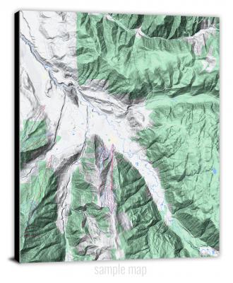
Enrich your office decor or home with a large canvas wrap Terrain map. It is designed for easy hanging with pre-installed hardware. Printed with archival inks and wrapped around a 1.5" thick gallery frame, your favorite map art will have a timeless and impressive look that fits with any decor. This map is fabricated with terrain imagery data from Google Maps, and bounding box coordinates from USGS.
Adamana, Arizona- Map Components- Imagery: Terrain of Adamana, Arizona. Bounding Box: Footprint of Adamana, Arizona at Longitude/Latitude Coordinates (-109.875 x -109.75 x 35 x 34.875).
Adams Mesa, Arizona- Map Components- Imagery: Terrain of Adams Mesa, Arizona. Bounding Box: Footprint of Adams Mesa, Arizona at Longitude/Latitude Coordinates (-111.625 x -111.5 x 33.75 x 33.625).
Additional Hill, Arizona- Map Components- Imagery: Terrain of Additional Hill, Arizona. Bounding Box: Footprint of Additional Hill, Arizona at Longitude/Latitude Coordinates (-111.75 x -111.625 x 35.75 x 35.625).
Agate House, Arizona- Map Components- Imagery: Terrain of Agate House, Arizona. Bounding Box: Footprint of Agate House, Arizona at Longitude/Latitude Coordinates (-109.875 x -109.75 x 34.875 x 34.75).
Agathla Peak, Arizona- Map Components- Imagery: Terrain of Agathla Peak, Arizona. Bounding Box: Footprint of Agathla Peak, Arizona at Longitude/Latitude Coordinates (-110.25 x -110.125 x 36.875 x 36.75).
Agua Caliente, Arizona- Map Components- Imagery: Terrain of Agua Caliente, Arizona. Bounding Box: Footprint of Agua Caliente, Arizona at Longitude/Latitude Coordinates (-113.375 x -113.25 x 33 x 32.875).
Agua Caliente Hill, Arizona- Map Components- Imagery: Terrain of Agua Caliente Hill, Arizona. Bounding Box: Footprint of Agua Caliente Hill, Arizona at Longitude/Latitude Coordinates (-110.75 x -110.625 x 32.375 x 32.25).
Agua Dulce Mountains, Arizona- Map Components- Imagery: Terrain of Agua Dulce Mountains, Arizona. Bounding Box: Footprint of Agua Dulce Mountains, Arizona at Longitude/Latitude Coordinates (-113.25 x -113.125 x 32.125 x 32).
Aguila, Arizona- Map Components- Imagery: Terrain of Aguila, Arizona. Bounding Box: Footprint of Aguila, Arizona at Longitude/Latitude Coordinates (-113.25 x -113.125 x 34 x 33.875).
Aguila Mountains NE, Arizona- Map Components- Imagery: Terrain of Aguila Mountains NE, Arizona. Bounding Box: Footprint of Aguila Mountains NE, Arizona at Longitude/Latitude Coordinates (-113.375 x -113.25 x 32.75 x 32.625).
Aguila Mountains NW, Arizona- Map Components- Imagery: Terrain of Aguila Mountains NW, Arizona. Bounding Box: Footprint of Aguila Mountains NW, Arizona at Longitude/Latitude Coordinates (-113.5 x -113.375 x 32.75 x 32.625).
Aguila Mountains SE, Arizona- Map Components- Imagery: Terrain of Aguila Mountains SE, Arizona. Bounding Box: Footprint of Aguila Mountains SE, Arizona at Longitude/Latitude Coordinates (-113.375 x -113.25 x 32.625 x 32.5).
Aguila Mountains SW, Arizona- Map Components- Imagery: Terrain of Aguila Mountains SW, Arizona. Bounding Box: Footprint of Aguila Mountains SW, Arizona at Longitude/Latitude Coordinates (-113.5 x -113.375 x 32.625 x 32.5).
Aguirre Peak, Arizona- Map Components- Imagery: Terrain of Aguirre Peak, Arizona. Bounding Box: Footprint of Aguirre Peak, Arizona at Longitude/Latitude Coordinates (-111.75 x -111.625 x 31.75 x 31.625).
Ajo North, Arizona- Map Components- Imagery: Terrain of Ajo North, Arizona. Bounding Box: Footprint of Ajo North, Arizona at Longitude/Latitude Coordinates (-112.875 x -112.75 x 32.5 x 32.375).
Ajo South, Arizona- Map Components- Imagery: Terrain of Ajo South, Arizona. Bounding Box: Footprint of Ajo South, Arizona at Longitude/Latitude Coordinates (-112.875 x -112.75 x 32.375 x 32.25).
Alamo Dam, Arizona- Map Components- Imagery: Terrain of Alamo Dam, Arizona. Bounding Box: Footprint of Alamo Dam, Arizona at Longitude/Latitude Coordinates (-113.625 x -113.5 x 34.25 x 34.125).
Alamo Dam SE, Arizona- Map Components- Imagery: Terrain of Alamo Dam SE, Arizona. Bounding Box: Footprint of Alamo Dam SE, Arizona at Longitude/Latitude Coordinates (-113.625 x -113.5 x 34.125 x 34).
Alamo Spring, Arizona- Map Components- Imagery: Terrain of Alamo Spring, Arizona. Bounding Box: Footprint of Alamo Spring, Arizona at Longitude/Latitude Coordinates (-111.25 x -111.125 x 31.375 x 31.25).
Alchesay Flat, Arizona- Map Components- Imagery: Terrain of Alchesay Flat, Arizona. Bounding Box: Footprint of Alchesay Flat, Arizona at Longitude/Latitude Coordinates (-110 x -109.875 x 34 x 33.875).
Alma Mesa, Arizona- Map Components- Imagery: Terrain of Alma Mesa, Arizona. Bounding Box: Footprint of Alma Mesa, Arizona at Longitude/Latitude Coordinates (-109.125 x -109 x 33.5 x 33.375).
Alpine, Arizona- Map Components- Imagery: Terrain of Alpine, Arizona. Bounding Box: Footprint of Alpine, Arizona at Longitude/Latitude Coordinates (-109.25 x -109.125 x 33.875 x 33.75).
Amado, Arizona- Map Components- Imagery: Terrain of Amado, Arizona. Bounding Box: Footprint of Amado, Arizona at Longitude/Latitude Coordinates (-111.125 x -111 x 31.75 x 31.625).
Amos Point, Arizona- Map Components- Imagery: Terrain of Amos Point, Arizona. Bounding Box: Footprint of Amos Point, Arizona at Longitude/Latitude Coordinates (-113.625 x -113.5 x 36 x 35.875).
Anderson Canyon, Arizona- Map Components- Imagery: Terrain of Anderson Canyon, Arizona. Bounding Box: Footprint of Anderson Canyon, Arizona at Longitude/Latitude Coordinates (-111.25 x -111.125 x 35.125 x 35).
Angell, Arizona- Map Components- Imagery: Terrain of Angell, Arizona. Bounding Box: Footprint of Angell, Arizona at Longitude/Latitude Coordinates (-111.375 x -111.25 x 35.25 x 35.125).
Antares, Arizona- Map Components- Imagery: Terrain of Antares, Arizona. Bounding Box: Footprint of Antares, Arizona at Longitude/Latitude Coordinates (-113.875 x -113.75 x 35.5 x 35.375).
Antelope Hills, Arizona- Map Components- Imagery: Terrain of Antelope Hills, Arizona. Bounding Box: Footprint of Antelope Hills, Arizona at Longitude/Latitude Coordinates (-113.375 x -113.25 x 32.25 x 32.125).
Antelope Knoll, Arizona- Map Components- Imagery: Terrain of Antelope Knoll, Arizona. Bounding Box: Footprint of Antelope Knoll, Arizona at Longitude/Latitude Coordinates (-113.25 x -113.125 x 36.75 x 36.625).
Antelope Lake, Arizona- Map Components- Imagery: Terrain of Antelope Lake, Arizona. Bounding Box: Footprint of Antelope Lake, Arizona at Longitude/Latitude Coordinates (-109.375 x -109.25 x 35.625 x 35.5).
Antelope Peak, Arizona- Map Components- Imagery: Terrain of Antelope Peak, Arizona. Bounding Box: Footprint of Antelope Peak, Arizona at Longitude/Latitude Coordinates (-112.25 x -112.125 x 32.875 x 32.75).
Antelope Peak NE, Arizona- Map Components- Imagery: Terrain of Antelope Peak NE, Arizona. Bounding Box: Footprint of Antelope Peak NE, Arizona at Longitude/Latitude Coordinates (-112.125 x -112 x 33 x 32.875).
Antelope Point, Arizona- Map Components- Imagery: Terrain of Antelope Point, Arizona. Bounding Box: Footprint of Antelope Point, Arizona at Longitude/Latitude Coordinates (-112.625 x -112.5 x 36.125 x 36).
Anvil Rock, Arizona- Map Components- Imagery: Terrain of Anvil Rock, Arizona. Bounding Box: Footprint of Anvil Rock, Arizona at Longitude/Latitude Coordinates (-113.125 x -113 x 35.125 x 35).
Anvil Rock Ranch, Arizona- Map Components- Imagery: Terrain of Anvil Rock Ranch, Arizona. Bounding Box: Footprint of Anvil Rock Ranch, Arizona at Longitude/Latitude Coordinates (-113.25 x -113.125 x 35.125 x 35).
Apache, Arizona- Map Components- Imagery: Terrain of Apache, Arizona. Bounding Box: Footprint of Apache, Arizona at Longitude/Latitude Coordinates (-109.25 x -109.125 x 31.75 x 31.625).
Apache Butte, Arizona- Map Components- Imagery: Terrain of Apache Butte, Arizona. Bounding Box: Footprint of Apache Butte, Arizona at Longitude/Latitude Coordinates (-110.5 x -110.375 x 35 x 34.875).
Apache Junction, Arizona- Map Components- Imagery: Terrain of Apache Junction, Arizona. Bounding Box: Footprint of Apache Junction, Arizona at Longitude/Latitude Coordinates (-111.625 x -111.5 x 33.5 x 33.375).
Apache Maid Mountain, Arizona- Map Components- Imagery: Terrain of Apache Maid Mountain, Arizona. Bounding Box: Footprint of Apache Maid Mountain, Arizona at Longitude/Latitude Coordinates (-111.625 x -111.5 x 34.75 x 34.625).
Apache Peak, Arizona- Map Components- Imagery: Terrain of Apache Peak, Arizona. Bounding Box: Footprint of Apache Peak, Arizona at Longitude/Latitude Coordinates (-110.5 x -110.375 x 31.875 x 31.75).
Appaloosa Ridge, Arizona- Map Components- Imagery: Terrain of Appaloosa Ridge, Arizona. Bounding Box: Footprint of Appaloosa Ridge, Arizona at Longitude/Latitude Coordinates (-111.125 x -111 x 36 x 35.875).
Arch Tank, Arizona- Map Components- Imagery: Terrain of Arch Tank, Arizona. Bounding Box: Footprint of Arch Tank, Arizona at Longitude/Latitude Coordinates (-114.25 x -114.125 x 33.25 x 33.125).
Aripine, Arizona- Map Components- Imagery: Terrain of Aripine, Arizona. Bounding Box: Footprint of Aripine, Arizona at Longitude/Latitude Coordinates (-110.5 x -110.375 x 34.5 x 34.375).
Arivaca, Arizona- Map Components- Imagery: Terrain of Arivaca, Arizona. Bounding Box: Footprint of Arivaca, Arizona at Longitude/Latitude Coordinates (-111.375 x -111.25 x 31.625 x 31.5).
Arizona City, Arizona- Map Components- Imagery: Terrain of Arizona City, Arizona. Bounding Box: Footprint of Arizona City, Arizona at Longitude/Latitude Coordinates (-111.75 x -111.625 x 32.75 x 32.625).
Arlington, Arizona- Map Components- Imagery: Terrain of Arlington, Arizona. Bounding Box: Footprint of Arlington, Arizona at Longitude/Latitude Coordinates (-112.875 x -112.75 x 33.375 x 33.25).
Armenta Well, Arizona- Map Components- Imagery: Terrain of Armenta Well, Arizona. Bounding Box: Footprint of Armenta Well, Arizona at Longitude/Latitude Coordinates (-112.875 x -112.75 x 32.25 x 32.125).
Armer Mountain, Arizona- Map Components- Imagery: Terrain of Armer Mountain, Arizona. Bounding Box: Footprint of Armer Mountain, Arizona at Longitude/Latitude Coordinates (-111.125 x -111 x 33.875 x 33.75).
Arnold Mesa, Arizona- Map Components- Imagery: Terrain of Arnold Mesa, Arizona. Bounding Box: Footprint of Arnold Mesa, Arizona at Longitude/Latitude Coordinates (-112 x -111.875 x 34.5 x 34.375).
Arrastra Mountain, Arizona- Map Components- Imagery: Terrain of Arrastra Mountain, Arizona. Bounding Box: Footprint of Arrastra Mountain, Arizona at Longitude/Latitude Coordinates (-113.5 x -113.375 x 34.5 x 34.375).
Arrastra Mountain NE, Arizona- Map Components- Imagery: Terrain of Arrastra Mountain NE, Arizona. Bounding Box: Footprint of Arrastra Mountain NE, Arizona at Longitude/Latitude Coordinates (-113.375 x -113.25 x 34.5 x 34.375).
Arrastra Mountain SE, Arizona- Map Components- Imagery: Terrain of Arrastra Mountain SE, Arizona. Bounding Box: Footprint of Arrastra Mountain SE, Arizona at Longitude/Latitude Coordinates (-113.375 x -113.25 x 34.375 x 34.25).
Arrowhead Butte, Arizona- Map Components- Imagery: Terrain of Arrowhead Butte, Arizona. Bounding Box: Footprint of Arrowhead Butte, Arizona at Longitude/Latitude Coordinates (-110 x -109.875 x 35.375 x 35.25).
Arrowhead Butte NE, Arizona- Map Components- Imagery: Terrain of Arrowhead Butte NE, Arizona. Bounding Box: Footprint of Arrowhead Butte NE, Arizona at Longitude/Latitude Coordinates (-109.875 x -109.75 x 35.5 x 35.375).
Arrowhead Mesa, Arizona- Map Components- Imagery: Terrain of Arrowhead Mesa, Arizona. Bounding Box: Footprint of Arrowhead Mesa, Arizona at Longitude/Latitude Coordinates (-111.25 x -111.125 x 36.625 x 36.5).
Artesia, Arizona- Map Components- Imagery: Terrain of Artesia, Arizona. Bounding Box: Footprint of Artesia, Arizona at Longitude/Latitude Coordinates (-109.75 x -109.625 x 32.75 x 32.625).
Artesia NE, Arizona- Map Components- Imagery: Terrain of Artesia NE, Arizona. Bounding Box: Footprint of Artesia NE, Arizona at Longitude/Latitude Coordinates (-109.625 x -109.5 x 32.75 x 32.625).
Artillery Peak, Arizona- Map Components- Imagery: Terrain of Artillery Peak, Arizona. Bounding Box: Footprint of Artillery Peak, Arizona at Longitude/Latitude Coordinates (-113.625 x -113.5 x 34.375 x 34.25).
Ash Creek NE, Arizona- Map Components- Imagery: Terrain of Ash Creek NE, Arizona. Bounding Box: Footprint of Ash Creek NE, Arizona at Longitude/Latitude Coordinates (-110.125 x -110 x 33.5 x 33.375).
Ash Creek Ranch, Arizona- Map Components- Imagery: Terrain of Ash Creek Ranch, Arizona. Bounding Box: Footprint of Ash Creek Ranch, Arizona at Longitude/Latitude Coordinates (-110.125 x -110 x 33.375 x 33.25).
Ash Fork, Arizona- Map Components- Imagery: Terrain of Ash Fork, Arizona. Bounding Box: Footprint of Ash Fork, Arizona at Longitude/Latitude Coordinates (-112.5 x -112.375 x 35.25 x 35.125).
Ash Peak, Arizona- Map Components- Imagery: Terrain of Ash Peak, Arizona. Bounding Box: Footprint of Ash Peak, Arizona at Longitude/Latitude Coordinates (-109.375 x -109.25 x 32.875 x 32.75).
Ashurst Lake, Arizona- Map Components- Imagery: Terrain of Ashurst Lake, Arizona. Bounding Box: Footprint of Ashurst Lake, Arizona at Longitude/Latitude Coordinates (-111.5 x -111.375 x 35.125 x 35).
Aubrey Peak, Arizona- Map Components- Imagery: Terrain of Aubrey Peak, Arizona. Bounding Box: Footprint of Aubrey Peak, Arizona at Longitude/Latitude Coordinates (-113.75 x -113.625 x 34.75 x 34.625).
Audley, Arizona- Map Components- Imagery: Terrain of Audley, Arizona. Bounding Box: Footprint of Audley, Arizona at Longitude/Latitude Coordinates (-113.125 x -113 x 35.5 x 35.375).
Austin Peak, Arizona- Map Components- Imagery: Terrain of Austin Peak, Arizona. Bounding Box: Footprint of Austin Peak, Arizona at Longitude/Latitude Coordinates (-113.625 x -113.5 x 35.125 x 35).
Avondale SE, Arizona- Map Components- Imagery: Terrain of Avondale SE, Arizona. Bounding Box: Footprint of Avondale SE, Arizona at Longitude/Latitude Coordinates (-112.375 x -112.25 x 33.375 x 33.25).
Avondale SW, Arizona- Map Components- Imagery: Terrain of Avondale SW, Arizona. Bounding Box: Footprint of Avondale SW, Arizona at Longitude/Latitude Coordinates (-112.5 x -112.375 x 33.375 x 33.25).
Avra, Arizona- Map Components- Imagery: Terrain of Avra, Arizona. Bounding Box: Footprint of Avra, Arizona at Longitude/Latitude Coordinates (-111.25 x -111.125 x 32.375 x 32.25).
Aztec Hills, Arizona- Map Components- Imagery: Terrain of Aztec Hills, Arizona. Bounding Box: Footprint of Aztec Hills, Arizona at Longitude/Latitude Coordinates (-113.5 x -113.375 x 32.875 x 32.75).
Aztec NW, Arizona- Map Components- Imagery: Terrain of Aztec NW, Arizona. Bounding Box: Footprint of Aztec NW, Arizona at Longitude/Latitude Coordinates (-113.5 x -113.375 x 33 x 32.875).
Aztec Peak, Arizona- Map Components- Imagery: Terrain of Aztec Peak, Arizona. Bounding Box: Footprint of Aztec Peak, Arizona at Longitude/Latitude Coordinates (-111 x -110.875 x 33.875 x 33.75).
Aztec SE, Arizona- Map Components- Imagery: Terrain of Aztec SE, Arizona. Bounding Box: Footprint of Aztec SE, Arizona at Longitude/Latitude Coordinates (-113.375 x -113.25 x 32.875 x 32.75).
Babbitt Wash, Arizona- Map Components- Imagery: Terrain of Babbitt Wash, Arizona. Bounding Box: Footprint of Babbitt Wash, Arizona at Longitude/Latitude Coordinates (-111.25 x -111.125 x 35.25 x 35.125).
Baboquivari Peak, Arizona- Map Components- Imagery: Terrain of Baboquivari Peak, Arizona. Bounding Box: Footprint of Baboquivari Peak, Arizona at Longitude/Latitude Coordinates (-111.625 x -111.5 x 31.875 x 31.75).
Baby Rocks, Arizona- Map Components- Imagery: Terrain of Baby Rocks, Arizona. Bounding Box: Footprint of Baby Rocks, Arizona at Longitude/Latitude Coordinates (-110.125 x -110 x 36.875 x 36.75).
Bad Bug Butte, Arizona- Map Components- Imagery: Terrain of Bad Bug Butte, Arizona. Bounding Box: Footprint of Bad Bug Butte, Arizona at Longitude/Latitude Coordinates (-109.375 x -109.25 x 36.5 x 36.375).
Badger Spring, Arizona- Map Components- Imagery: Terrain of Badger Spring, Arizona. Bounding Box: Footprint of Badger Spring, Arizona at Longitude/Latitude Coordinates (-111.25 x -111.125 x 35.75 x 35.625).
Bagdad, Arizona- Map Components- Imagery: Terrain of Bagdad, Arizona. Bounding Box: Footprint of Bagdad, Arizona at Longitude/Latitude Coordinates (-113.25 x -113.125 x 34.625 x 34.5).
Bailey Peak, Arizona- Map Components- Imagery: Terrain of Bailey Peak, Arizona. Bounding Box: Footprint of Bailey Peak, Arizona at Longitude/Latitude Coordinates (-112.5 x -112.375 x 31.875 x 31.75).
Baldy Basin, Arizona- Map Components- Imagery: Terrain of Baldy Basin, Arizona. Bounding Box: Footprint of Baldy Basin, Arizona at Longitude/Latitude Coordinates (-112.625 x -112.5 x 36 x 35.875).
Baldy Bill Point, Arizona- Map Components- Imagery: Terrain of Baldy Bill Point, Arizona. Bounding Box: Footprint of Baldy Bill Point, Arizona at Longitude/Latitude Coordinates (-109.5 x -109.375 x 33.625 x 33.5).
Baldy Mountain, Arizona- Map Components- Imagery: Terrain of Baldy Mountain, Arizona. Bounding Box: Footprint of Baldy Mountain, Arizona at Longitude/Latitude Coordinates (-112.375 x -112.25 x 33.875 x 33.75).
Baragan Mountain, Arizona- Map Components- Imagery: Terrain of Baragan Mountain, Arizona. Bounding Box: Footprint of Baragan Mountain, Arizona at Longitude/Latitude Coordinates (-113.5 x -113.375 x 33.125 x 33).
Barth Well, Arizona- Map Components- Imagery: Terrain of Barth Well, Arizona. Bounding Box: Footprint of Barth Well, Arizona at Longitude/Latitude Coordinates (-109.125 x -109 x 35 x 34.875).
Bartlett Dam, Arizona- Map Components- Imagery: Terrain of Bartlett Dam, Arizona. Bounding Box: Footprint of Bartlett Dam, Arizona at Longitude/Latitude Coordinates (-111.75 x -111.625 x 33.875 x 33.75).
Bartlett Mountain, Arizona- Map Components- Imagery: Terrain of Bartlett Mountain, Arizona. Bounding Box: Footprint of Bartlett Mountain, Arizona at Longitude/Latitude Coordinates (-111.375 x -111.25 x 31.5 x 31.375).
Bassett Peak, Arizona- Map Components- Imagery: Terrain of Bassett Peak, Arizona. Bounding Box: Footprint of Bassett Peak, Arizona at Longitude/Latitude Coordinates (-110.375 x -110.25 x 32.625 x 32.5).
Bat Canyon, Arizona- Map Components- Imagery: Terrain of Bat Canyon, Arizona. Bounding Box: Footprint of Bat Canyon, Arizona at Longitude/Latitude Coordinates (-111 x -110.875 x 36.125 x 36).
Bat Cave, Arizona- Map Components- Imagery: Terrain of Bat Cave, Arizona. Bounding Box: Footprint of Bat Cave, Arizona at Longitude/Latitude Coordinates (-113.875 x -113.75 x 36.125 x 36).
Bat Spring, Arizona- Map Components- Imagery: Terrain of Bat Spring, Arizona. Bounding Box: Footprint of Bat Spring, Arizona at Longitude/Latitude Coordinates (-110.875 x -110.75 x 36.125 x 36).
Batamote Hills, Arizona- Map Components- Imagery: Terrain of Batamote Hills, Arizona. Bounding Box: Footprint of Batamote Hills, Arizona at Longitude/Latitude Coordinates (-111.25 x -111.125 x 31.875 x 31.75).
Bates Well, Arizona- Map Components- Imagery: Terrain of Bates Well, Arizona. Bounding Box: Footprint of Bates Well, Arizona at Longitude/Latitude Coordinates (-113 x -112.875 x 32.25 x 32.125).
Battle Flat, Arizona- Map Components- Imagery: Terrain of Battle Flat, Arizona. Bounding Box: Footprint of Battle Flat, Arizona at Longitude/Latitude Coordinates (-112.375 x -112.25 x 34.375 x 34.25).
Battleship Butte, Arizona- Map Components- Imagery: Terrain of Battleship Butte, Arizona. Bounding Box: Footprint of Battleship Butte, Arizona at Longitude/Latitude Coordinates (-112.5 x -112.375 x 34.375 x 34.25).
Beacon Well, Arizona- Map Components- Imagery: Terrain of Beacon Well, Arizona. Bounding Box: Footprint of Beacon Well, Arizona at Longitude/Latitude Coordinates (-109.375 x -109.25 x 35.125 x 35).
Bear Hills, Arizona- Map Components- Imagery: Terrain of Bear Hills, Arizona. Bounding Box: Footprint of Bear Hills, Arizona at Longitude/Latitude Coordinates (-114 x -113.875 x 33.75 x 33.625).
Bear Mountain, Arizona- Map Components- Imagery: Terrain of Bear Mountain, Arizona. Bounding Box: Footprint of Bear Mountain, Arizona at Longitude/Latitude Coordinates (-109.25 x -109.125 x 33.625 x 33.5).
Bear Ridge, Arizona- Map Components- Imagery: Terrain of Bear Ridge, Arizona. Bounding Box: Footprint of Bear Ridge, Arizona at Longitude/Latitude Coordinates (-110.5 x -110.375 x 34.25 x 34.125).
Beargrass Basin, Arizona- Map Components- Imagery: Terrain of Beargrass Basin, Arizona. Bounding Box: Footprint of Beargrass Basin, Arizona at Longitude/Latitude Coordinates (-110.25 x -110.125 x 33.125 x 33).
Beautiful Valley Well, Arizona- Map Components- Imagery: Terrain of Beautiful Valley Well, Arizona. Bounding Box: Footprint of Beautiful Valley Well, Arizona at Longitude/Latitude Coordinates (-109.625 x -109.5 x 36 x 35.875).
Beaverhead, Arizona- Map Components- Imagery: Terrain of Beaverhead, Arizona. Bounding Box: Footprint of Beaverhead, Arizona at Longitude/Latitude Coordinates (-109.25 x -109.125 x 33.75 x 33.625).
Beckers Butte, Arizona- Map Components- Imagery: Terrain of Beckers Butte, Arizona. Bounding Box: Footprint of Beckers Butte, Arizona at Longitude/Latitude Coordinates (-110.5 x -110.375 x 33.875 x 33.75).
Bee Canyon, Arizona- Map Components- Imagery: Terrain of Bee Canyon, Arizona. Bounding Box: Footprint of Bee Canyon, Arizona at Longitude/Latitude Coordinates (-109.5 x -109.375 x 33.375 x 33.25).
Beecher Canyon, Arizona- Map Components- Imagery: Terrain of Beecher Canyon, Arizona. Bounding Box: Footprint of Beecher Canyon, Arizona at Longitude/Latitude Coordinates (-113.875 x -113.75 x 34.75 x 34.625).
Beeshsikad Spring, Arizona- Map Components- Imagery: Terrain of Beeshsikad Spring, Arizona. Bounding Box: Footprint of Beeshsikad Spring, Arizona at Longitude/Latitude Coordinates (-110 x -109.875 x 36 x 35.875).
Begashibito Canyon, Arizona- Map Components- Imagery: Terrain of Begashibito Canyon, Arizona. Bounding Box: Footprint of Begashibito Canyon, Arizona at Longitude/Latitude Coordinates (-111 x -110.875 x 36.25 x 36.125).
Behm Mesa, Arizona- Map Components- Imagery: Terrain of Behm Mesa, Arizona. Bounding Box: Footprint of Behm Mesa, Arizona at Longitude/Latitude Coordinates (-113.125 x -113 x 34.75 x 34.625).
Bellemont, Arizona- Map Components- Imagery: Terrain of Bellemont, Arizona. Bounding Box: Footprint of Bellemont, Arizona at Longitude/Latitude Coordinates (-111.875 x -111.75 x 35.25 x 35.125).
Belmont Mountain, Arizona- Map Components- Imagery: Terrain of Belmont Mountain, Arizona. Bounding Box: Footprint of Belmont Mountain, Arizona at Longitude/Latitude Coordinates (-113 x -112.875 x 33.75 x 33.625).
Ben Nevis Mountain, Arizona- Map Components- Imagery: Terrain of Ben Nevis Mountain, Arizona. Bounding Box: Footprint of Ben Nevis Mountain, Arizona at Longitude/Latitude Coordinates (-112.25 x -112.125 x 32.125 x 32).
Benson, Arizona- Map Components- Imagery: Terrain of Benson, Arizona. Bounding Box: Footprint of Benson, Arizona at Longitude/Latitude Coordinates (-110.375 x -110.25 x 32 x 31.875).
Betty Well, Arizona- Map Components- Imagery: Terrain of Betty Well, Arizona. Bounding Box: Footprint of Betty Well, Arizona at Longitude/Latitude Coordinates (-109.875 x -109.75 x 35.375 x 35.25).
Big Bud Tank, Arizona- Map Components- Imagery: Terrain of Big Bud Tank, Arizona. Bounding Box: Footprint of Big Bud Tank, Arizona at Longitude/Latitude Coordinates (-112.875 x -112.75 x 35.625 x 35.5).
Big Chief Tank, Arizona- Map Components- Imagery: Terrain of Big Chief Tank, Arizona. Bounding Box: Footprint of Big Chief Tank, Arizona at Longitude/Latitude Coordinates (-113.125 x -113 x 35.625 x 35.5).
Big Horn, Arizona- Map Components- Imagery: Terrain of Big Horn, Arizona. Bounding Box: Footprint of Big Horn, Arizona at Longitude/Latitude Coordinates (-112.5 x -112.375 x 32.875 x 32.75).
Big Horn Peak, Arizona- Map Components- Imagery: Terrain of Big Horn Peak, Arizona. Bounding Box: Footprint of Big Horn Peak, Arizona at Longitude/Latitude Coordinates (-113.25 x -113.125 x 33.625 x 33.5).
Big Lake North, Arizona- Map Components- Imagery: Terrain of Big Lake North, Arizona. Bounding Box: Footprint of Big Lake North, Arizona at Longitude/Latitude Coordinates (-109.5 x -109.375 x 34 x 33.875).
Big Lake South, Arizona- Map Components- Imagery: Terrain of Big Lake South, Arizona. Bounding Box: Footprint of Big Lake South, Arizona at Longitude/Latitude Coordinates (-109.5 x -109.375 x 33.875 x 33.75).
Big Lue Mountains, Arizona- Map Components- Imagery: Terrain of Big Lue Mountains, Arizona. Bounding Box: Footprint of Big Lue Mountains, Arizona at Longitude/Latitude Coordinates (-109.125 x -109 x 33.125 x 33).
Big Mountain Dam, Arizona- Map Components- Imagery: Terrain of Big Mountain Dam, Arizona. Bounding Box: Footprint of Big Mountain Dam, Arizona at Longitude/Latitude Coordinates (-110.5 x -110.375 x 36.25 x 36.125).
Big Point, Arizona- Map Components- Imagery: Terrain of Big Point, Arizona. Bounding Box: Footprint of Big Point, Arizona at Longitude/Latitude Coordinates (-110.5 x -110.375 x 37 x 36.875).
Big Pug Tank, Arizona- Map Components- Imagery: Terrain of Big Pug Tank, Arizona. Bounding Box: Footprint of Big Pug Tank, Arizona at Longitude/Latitude Coordinates (-110.375 x -110.25 x 34.5 x 34.375).
Big Shipp Mountain, Arizona- Map Components- Imagery: Terrain of Big Shipp Mountain, Arizona. Bounding Box: Footprint of Big Shipp Mountain, Arizona at Longitude/Latitude Coordinates (-113.125 x -113 x 34.625 x 34.5).
Big Springs, Arizona- Map Components- Imagery: Terrain of Big Springs, Arizona. Bounding Box: Footprint of Big Springs, Arizona at Longitude/Latitude Coordinates (-112.375 x -112.25 x 36.625 x 36.5).
Big Whisker Well, Arizona- Map Components- Imagery: Terrain of Big Whisker Well, Arizona. Bounding Box: Footprint of Big Whisker Well, Arizona at Longitude/Latitude Coordinates (-111.125 x -111 x 36.5 x 36.375).
Big Willow Spring Canyon, Arizona- Map Components- Imagery: Terrain of Big Willow Spring Canyon, Arizona. Bounding Box: Footprint of Big Willow Spring Canyon, Arizona at Longitude/Latitude Coordinates (-110 x -109.875 x 35.875 x 35.75).
Bird Springs Wash, Arizona- Map Components- Imagery: Terrain of Bird Springs Wash, Arizona. Bounding Box: Footprint of Bird Springs Wash, Arizona at Longitude/Latitude Coordinates (-110.75 x -110.625 x 35.375 x 35.25).
Bisbee, Arizona- Map Components- Imagery: Terrain of Bisbee, Arizona. Bounding Box: Footprint of Bisbee, Arizona at Longitude/Latitude Coordinates (-110 x -109.875 x 31.5 x 31.375).
Bisbee NE, Arizona- Map Components- Imagery: Terrain of Bisbee NE, Arizona. Bounding Box: Footprint of Bisbee NE, Arizona at Longitude/Latitude Coordinates (-109.875 x -109.75 x 31.5 x 31.375).
Bisbee SE, Arizona- Map Components- Imagery: Terrain of Bisbee SE, Arizona. Bounding Box: Footprint of Bisbee SE, Arizona at Longitude/Latitude Coordinates (-109.875 x -109.75 x 31.375 x 31.25).
Biscuit Flat, Arizona- Map Components- Imagery: Terrain of Biscuit Flat, Arizona. Bounding Box: Footprint of Biscuit Flat, Arizona at Longitude/Latitude Coordinates (-112.25 x -112.125 x 33.875 x 33.75).
Bishop Lake, Arizona- Map Components- Imagery: Terrain of Bishop Lake, Arizona. Bounding Box: Footprint of Bishop Lake, Arizona at Longitude/Latitude Coordinates (-112.75 x -112.625 x 35.625 x 35.5).
Bismarck Mesa, Arizona- Map Components- Imagery: Terrain of Bismarck Mesa, Arizona. Bounding Box: Footprint of Bismarck Mesa, Arizona at Longitude/Latitude Coordinates (-112.875 x -112.75 x 34.5 x 34.375).
Bitter Springs, Arizona- Map Components- Imagery: Terrain of Bitter Springs, Arizona. Bounding Box: Footprint of Bitter Springs, Arizona at Longitude/Latitude Coordinates (-111.75 x -111.625 x 36.75 x 36.625).
Black Butte, Arizona- Map Components- Imagery: Terrain of Black Butte, Arizona. Bounding Box: Footprint of Black Butte, Arizona at Longitude/Latitude Coordinates (-113.125 x -113 x 33.875 x 33.75).
Black Canyon City, Arizona- Map Components- Imagery: Terrain of Black Canyon City, Arizona. Bounding Box: Footprint of Black Canyon City, Arizona at Longitude/Latitude Coordinates (-112.25 x -112.125 x 34.125 x 34).
Black Diamond Peak, Arizona- Map Components- Imagery: Terrain of Black Diamond Peak, Arizona. Bounding Box: Footprint of Black Diamond Peak, Arizona at Longitude/Latitude Coordinates (-110 x -109.875 x 31.875 x 31.75).
Black Gap, Arizona- Map Components- Imagery: Terrain of Black Gap, Arizona. Bounding Box: Footprint of Black Gap, Arizona at Longitude/Latitude Coordinates (-112.875 x -112.75 x 32.875 x 32.75).
Black Hills, Arizona- Map Components- Imagery: Terrain of Black Hills, Arizona. Bounding Box: Footprint of Black Hills, Arizona at Longitude/Latitude Coordinates (-111.75 x -111.625 x 32.25 x 32.125).
Black Mesa Wash NE, Arizona- Map Components- Imagery: Terrain of Black Mesa Wash NE, Arizona. Bounding Box: Footprint of Black Mesa Wash NE, Arizona at Longitude/Latitude Coordinates (-110.625 x -110.5 x 36.5 x 36.375).
Black Mesa Wash NW, Arizona- Map Components- Imagery: Terrain of Black Mesa Wash NW, Arizona. Bounding Box: Footprint of Black Mesa Wash NW, Arizona at Longitude/Latitude Coordinates (-110.75 x -110.625 x 36.5 x 36.375).
Black Mountain, Arizona- Map Components- Imagery: Terrain of Black Mountain, Arizona. Bounding Box: Footprint of Black Mountain, Arizona at Longitude/Latitude Coordinates (-111 x -110.875 x 32.875 x 32.75).
Black Peak, Arizona- Map Components- Imagery: Terrain of Black Peak, Arizona. Bounding Box: Footprint of Black Peak, Arizona at Longitude/Latitude Coordinates (-114.25 x -114.125 x 34.125 x 34).
Black Rock Butte, Arizona- Map Components- Imagery: Terrain of Black Rock Butte, Arizona. Bounding Box: Footprint of Black Rock Butte, Arizona at Longitude/Latitude Coordinates (-109.375 x -109.25 x 36.25 x 36.125).
Black Tank, Arizona- Map Components- Imagery: Terrain of Black Tank, Arizona. Bounding Box: Footprint of Black Tank, Arizona at Longitude/Latitude Coordinates (-112.75 x -112.625 x 35.75 x 35.625).
Blackwater, Arizona- Map Components- Imagery: Terrain of Blackwater, Arizona. Bounding Box: Footprint of Blackwater, Arizona at Longitude/Latitude Coordinates (-111.625 x -111.5 x 33.125 x 33).
Blairs Spring, Arizona- Map Components- Imagery: Terrain of Blairs Spring, Arizona. Bounding Box: Footprint of Blairs Spring, Arizona at Longitude/Latitude Coordinates (-110.375 x -110.25 x 35.125 x 35).
Blankenship Well, Arizona- Map Components- Imagery: Terrain of Blankenship Well, Arizona. Bounding Box: Footprint of Blankenship Well, Arizona at Longitude/Latitude Coordinates (-112.75 x -112.625 x 31.875 x 31.75).
Bloody Basin, Arizona- Map Components- Imagery: Terrain of Bloody Basin, Arizona. Bounding Box: Footprint of Bloody Basin, Arizona at Longitude/Latitude Coordinates (-111.875 x -111.75 x 34.25 x 34.125).
Blue, Arizona- Map Components- Imagery: Terrain of Blue, Arizona. Bounding Box: Footprint of Blue, Arizona at Longitude/Latitude Coordinates (-109.125 x -109 x 33.625 x 33.5).
Blue Gap, Arizona- Map Components- Imagery: Terrain of Blue Gap, Arizona. Bounding Box: Footprint of Blue Gap, Arizona at Longitude/Latitude Coordinates (-110 x -109.875 x 36.25 x 36.125).
Blue House Mountain, Arizona- Map Components- Imagery: Terrain of Blue House Mountain, Arizona. Bounding Box: Footprint of Blue House Mountain, Arizona at Longitude/Latitude Coordinates (-110.625 x -110.5 x 34 x 33.875).
Blue Jay Peak, Arizona- Map Components- Imagery: Terrain of Blue Jay Peak, Arizona. Bounding Box: Footprint of Blue Jay Peak, Arizona at Longitude/Latitude Coordinates (-110.125 x -110 x 32.75 x 32.625).
Blue Moon Reservoir, Arizona- Map Components- Imagery: Terrain of Blue Moon Reservoir, Arizona. Bounding Box: Footprint of Blue Moon Reservoir, Arizona at Longitude/Latitude Coordinates (-111.75 x -111.625 x 36.375 x 36.25).
Blue Mountain, Arizona- Map Components- Imagery: Terrain of Blue Mountain, Arizona. Bounding Box: Footprint of Blue Mountain, Arizona at Longitude/Latitude Coordinates (-109.25 x -109.125 x 32.125 x 32).
Blue Plateau, Arizona- Map Components- Imagery: Terrain of Blue Plateau, Arizona. Bounding Box: Footprint of Blue Plateau, Arizona at Longitude/Latitude Coordinates (-112.625 x -112.5 x 32.875 x 32.75).
Blue Spring, Arizona- Map Components- Imagery: Terrain of Blue Spring, Arizona. Bounding Box: Footprint of Blue Spring, Arizona at Longitude/Latitude Coordinates (-111.75 x -111.625 x 36.125 x 36).
Blue Spring SE, Arizona- Map Components- Imagery: Terrain of Blue Spring SE, Arizona. Bounding Box: Footprint of Blue Spring SE, Arizona at Longitude/Latitude Coordinates (-111.625 x -111.5 x 36.125 x 36).
Blye Canyon NE, Arizona- Map Components- Imagery: Terrain of Blye Canyon NE, Arizona. Bounding Box: Footprint of Blye Canyon NE, Arizona at Longitude/Latitude Coordinates (-113.375 x -113.25 x 35.5 x 35.375).
Blye Canyon SE, Arizona- Map Components- Imagery: Terrain of Blye Canyon SE, Arizona. Bounding Box: Footprint of Blye Canyon SE, Arizona at Longitude/Latitude Coordinates (-113.375 x -113.25 x 35.375 x 35.25).
Bob Thompson Peak, Arizona- Map Components- Imagery: Terrain of Bob Thompson Peak, Arizona. Bounding Box: Footprint of Bob Thompson Peak, Arizona at Longitude/Latitude Coordinates (-110.25 x -110.125 x 31.375 x 31.25).
Bobs Well, Arizona- Map Components- Imagery: Terrain of Bobs Well, Arizona. Bounding Box: Footprint of Bobs Well, Arizona at Longitude/Latitude Coordinates (-114.125 x -114 x 34.125 x 34).
Bodaway Mesa, Arizona- Map Components- Imagery: Terrain of Bodaway Mesa, Arizona. Bounding Box: Footprint of Bodaway Mesa, Arizona at Longitude/Latitude Coordinates (-111.625 x -111.5 x 36.375 x 36.25).
Boggy Lake Well, Arizona- Map Components- Imagery: Terrain of Boggy Lake Well, Arizona. Bounding Box: Footprint of Boggy Lake Well, Arizona at Longitude/Latitude Coordinates (-109.75 x -109.625 x 35.5 x 35.375).
Boiling Over Well, Arizona- Map Components- Imagery: Terrain of Boiling Over Well, Arizona. Bounding Box: Footprint of Boiling Over Well, Arizona at Longitude/Latitude Coordinates (-109.25 x -109.125 x 36.75 x 36.625).
Bonelli Bay, Arizona- Map Components- Imagery: Terrain of Bonelli Bay, Arizona. Bounding Box: Footprint of Bonelli Bay, Arizona at Longitude/Latitude Coordinates (-114.5 x -114.375 x 36.125 x 36).
Bonita Spring, Arizona- Map Components- Imagery: Terrain of Bonita Spring, Arizona. Bounding Box: Footprint of Bonita Spring, Arizona at Longitude/Latitude Coordinates (-109.625 x -109.5 x 33.125 x 33).
Bonita Tank, Arizona- Map Components- Imagery: Terrain of Bonita Tank, Arizona. Bounding Box: Footprint of Bonita Tank, Arizona at Longitude/Latitude Coordinates (-109.875 x -109.75 x 33.25 x 33.125).
Bonito Prairie, Arizona- Map Components- Imagery: Terrain of Bonito Prairie, Arizona. Bounding Box: Footprint of Bonito Prairie, Arizona at Longitude/Latitude Coordinates (-110 x -109.875 x 33.75 x 33.625).
Bonito Rock, Arizona- Map Components- Imagery: Terrain of Bonito Rock, Arizona. Bounding Box: Footprint of Bonito Rock, Arizona at Longitude/Latitude Coordinates (-109.625 x -109.5 x 33.875 x 33.75).
Booger Canyon, Arizona- Map Components- Imagery: Terrain of Booger Canyon, Arizona. Bounding Box: Footprint of Booger Canyon, Arizona at Longitude/Latitude Coordinates (-110.5 x -110.375 x 33 x 32.875).
Boot Mesa, Arizona- Map Components- Imagery: Terrain of Boot Mesa, Arizona. Bounding Box: Footprint of Boot Mesa, Arizona at Longitude/Latitude Coordinates (-110.375 x -110.25 x 37 x 36.875).
Bosque, Arizona- Map Components- Imagery: Terrain of Bosque, Arizona. Bounding Box: Footprint of Bosque, Arizona at Longitude/Latitude Coordinates (-112.625 x -112.5 x 33 x 32.875).
Bottleneck Wash, Arizona- Map Components- Imagery: Terrain of Bottleneck Wash, Arizona. Bounding Box: Footprint of Bottleneck Wash, Arizona at Longitude/Latitude Coordinates (-113.75 x -113.625 x 35.125 x 35).
Boulder Mountain, Arizona- Map Components- Imagery: Terrain of Boulder Mountain, Arizona. Bounding Box: Footprint of Boulder Mountain, Arizona at Longitude/Latitude Coordinates (-111.5 x -111.375 x 33.875 x 33.75).
Boundary Butte, Arizona- Map Components- Imagery: Terrain of Boundary Butte, Arizona. Bounding Box: Footprint of Boundary Butte, Arizona at Longitude/Latitude Coordinates (-109.75 x -109.625 x 34.25 x 34.125).
Boundary Cone, Arizona- Map Components- Imagery: Terrain of Boundary Cone, Arizona. Bounding Box: Footprint of Boundary Cone, Arizona at Longitude/Latitude Coordinates (-114.5 x -114.375 x 35 x 34.875).
Bouse, Arizona- Map Components- Imagery: Terrain of Bouse, Arizona. Bounding Box: Footprint of Bouse, Arizona at Longitude/Latitude Coordinates (-114.125 x -114 x 34 x 33.875).
Bouse Hills East, Arizona- Map Components- Imagery: Terrain of Bouse Hills East, Arizona. Bounding Box: Footprint of Bouse Hills East, Arizona at Longitude/Latitude Coordinates (-113.875 x -113.75 x 34 x 33.875).
Bouse Hills West, Arizona- Map Components- Imagery: Terrain of Bouse Hills West, Arizona. Bounding Box: Footprint of Bouse Hills West, Arizona at Longitude/Latitude Coordinates (-114 x -113.875 x 34 x 33.875).
Bouse NW, Arizona- Map Components- Imagery: Terrain of Bouse NW, Arizona. Bounding Box: Footprint of Bouse NW, Arizona at Longitude/Latitude Coordinates (-114.25 x -114.125 x 34 x 33.875).
Bouse SW, Arizona- Map Components- Imagery: Terrain of Bouse SW, Arizona. Bounding Box: Footprint of Bouse SW, Arizona at Longitude/Latitude Coordinates (-114.25 x -114.125 x 33.875 x 33.75).
Bowie, Arizona- Map Components- Imagery: Terrain of Bowie, Arizona. Bounding Box: Footprint of Bowie, Arizona at Longitude/Latitude Coordinates (-109.5 x -109.375 x 32.375 x 32.25).
Bowie Mountain North, Arizona- Map Components- Imagery: Terrain of Bowie Mountain North, Arizona. Bounding Box: Footprint of Bowie Mountain North, Arizona at Longitude/Latitude Coordinates (-109.5 x -109.375 x 32.25 x 32.125).
Bowie Mountain South, Arizona- Map Components- Imagery: Terrain of Bowie Mountain South, Arizona. Bounding Box: Footprint of Bowie Mountain South, Arizona at Longitude/Latitude Coordinates (-109.5 x -109.375 x 32.125 x 32).
Box K Ranch, Arizona- Map Components- Imagery: Terrain of Box K Ranch, Arizona. Bounding Box: Footprint of Box K Ranch, Arizona at Longitude/Latitude Coordinates (-112.5 x -112.375 x 36 x 35.875).
Bozarth Mesa, Arizona- Map Components- Imagery: Terrain of Bozarth Mesa, Arizona. Bounding Box: Footprint of Bozarth Mesa, Arizona at Longitude/Latitude Coordinates (-113.25 x -113.125 x 34.75 x 34.625).
Branaman Spring, Arizona- Map Components- Imagery: Terrain of Branaman Spring, Arizona. Bounding Box: Footprint of Branaman Spring, Arizona at Longitude/Latitude Coordinates (-110.25 x -110.125 x 33.375 x 33.25).
Brandenburg Mountain, Arizona- Map Components- Imagery: Terrain of Brandenburg Mountain, Arizona. Bounding Box: Footprint of Brandenburg Mountain, Arizona at Longitude/Latitude Coordinates (-110.625 x -110.5 x 33 x 32.875).
Bright Angel Point, Arizona- Map Components- Imagery: Terrain of Bright Angel Point, Arizona. Bounding Box: Footprint of Bright Angel Point, Arizona at Longitude/Latitude Coordinates (-112.125 x -112 x 36.25 x 36.125).
Bronco Gulch, Arizona- Map Components- Imagery: Terrain of Bronco Gulch, Arizona. Bounding Box: Footprint of Bronco Gulch, Arizona at Longitude/Latitude Coordinates (-110.25 x -110.125 x 33.5 x 33.375).
Brookbank Point, Arizona- Map Components- Imagery: Terrain of Brookbank Point, Arizona. Bounding Box: Footprint of Brookbank Point, Arizona at Longitude/Latitude Coordinates (-110.75 x -110.625 x 34.375 x 34.25).
Brooklyn Peak, Arizona- Map Components- Imagery: Terrain of Brooklyn Peak, Arizona. Bounding Box: Footprint of Brooklyn Peak, Arizona at Longitude/Latitude Coordinates (-112 x -111.875 x 34.25 x 34.125).
Brown Mountain, Arizona- Map Components- Imagery: Terrain of Brown Mountain, Arizona. Bounding Box: Footprint of Brown Mountain, Arizona at Longitude/Latitude Coordinates (-111.25 x -111.125 x 32.25 x 32.125).
Bruno Peak, Arizona- Map Components- Imagery: Terrain of Bruno Peak, Arizona. Bounding Box: Footprint of Bruno Peak, Arizona at Longitude/Latitude Coordinates (-109.5 x -109.375 x 31.75 x 31.625).
Brushy Canyon, Arizona- Map Components- Imagery: Terrain of Brushy Canyon, Arizona. Bounding Box: Footprint of Brushy Canyon, Arizona at Longitude/Latitude Coordinates (-110.5 x -110.375 x 33.75 x 33.625).
Bryan Mountains, Arizona- Map Components- Imagery: Terrain of Bryan Mountains, Arizona. Bounding Box: Footprint of Bryan Mountains, Arizona at Longitude/Latitude Coordinates (-113.5 x -113.375 x 32.375 x 32.25).
Bryce Mountain, Arizona- Map Components- Imagery: Terrain of Bryce Mountain, Arizona. Bounding Box: Footprint of Bryce Mountain, Arizona at Longitude/Latitude Coordinates (-109.75 x -109.625 x 33.125 x 33).
Bubbling Spring Canyon, Arizona- Map Components- Imagery: Terrain of Bubbling Spring Canyon, Arizona. Bounding Box: Footprint of Bubbling Spring Canyon, Arizona at Longitude/Latitude Coordinates (-110.625 x -110.5 x 36.75 x 36.625).
Buck Mountains, Arizona- Map Components- Imagery: Terrain of Buck Mountains, Arizona. Bounding Box: Footprint of Buck Mountains, Arizona at Longitude/Latitude Coordinates (-114.25 x -114.125 x 34.75 x 34.625).
Buck Mountains NE, Arizona- Map Components- Imagery: Terrain of Buck Mountains NE, Arizona. Bounding Box: Footprint of Buck Mountains NE, Arizona at Longitude/Latitude Coordinates (-114.125 x -114 x 34.75 x 34.625).
Buck Mountains SE, Arizona- Map Components- Imagery: Terrain of Buck Mountains SE, Arizona. Bounding Box: Footprint of Buck Mountains SE, Arizona at Longitude/Latitude Coordinates (-114.125 x -114 x 34.625 x 34.5).
Buck Pasture Canyon, Arizona- Map Components- Imagery: Terrain of Buck Pasture Canyon, Arizona. Bounding Box: Footprint of Buck Pasture Canyon, Arizona at Longitude/Latitude Coordinates (-112.25 x -112.125 x 37 x 36.875).
Buck Peak, Arizona- Map Components- Imagery: Terrain of Buck Peak, Arizona. Bounding Box: Footprint of Buck Peak, Arizona at Longitude/Latitude Coordinates (-114 x -113.875 x 32.5 x 32.375).
Bucket Mountain, Arizona- Map Components- Imagery: Terrain of Bucket Mountain, Arizona. Bounding Box: Footprint of Bucket Mountain, Arizona at Longitude/Latitude Coordinates (-110.625 x -110.5 x 33.375 x 33.25).
Buckeye, Arizona- Map Components- Imagery: Terrain of Buckeye, Arizona. Bounding Box: Footprint of Buckeye, Arizona at Longitude/Latitude Coordinates (-112.625 x -112.5 x 33.375 x 33.25).
Buckeye NW, Arizona- Map Components- Imagery: Terrain of Buckeye NW, Arizona. Bounding Box: Footprint of Buckeye NW, Arizona at Longitude/Latitude Coordinates (-112.75 x -112.625 x 33.5 x 33.375).
Buckhead Mesa, Arizona- Map Components- Imagery: Terrain of Buckhead Mesa, Arizona. Bounding Box: Footprint of Buckhead Mesa, Arizona at Longitude/Latitude Coordinates (-111.5 x -111.375 x 34.375 x 34.25).
Buckhorn, Arizona- Map Components- Imagery: Terrain of Buckhorn, Arizona. Bounding Box: Footprint of Buckhorn, Arizona at Longitude/Latitude Coordinates (-111.75 x -111.625 x 33.5 x 33.375).
Buckhorn Mountain, Arizona- Map Components- Imagery: Terrain of Buckhorn Mountain, Arizona. Bounding Box: Footprint of Buckhorn Mountain, Arizona at Longitude/Latitude Coordinates (-111.625 x -111.5 x 34.625 x 34.5).
Buehman Canyon, Arizona- Map Components- Imagery: Terrain of Buehman Canyon, Arizona. Bounding Box: Footprint of Buehman Canyon, Arizona at Longitude/Latitude Coordinates (-110.625 x -110.5 x 32.5 x 32.375).
Buell Park, Arizona- Map Components- Imagery: Terrain of Buell Park, Arizona. Bounding Box: Footprint of Buell Park, Arizona at Longitude/Latitude Coordinates (-109.125 x -109 x 36 x 35.875).
Buffalo Crossing, Arizona- Map Components- Imagery: Terrain of Buffalo Crossing, Arizona. Bounding Box: Footprint of Buffalo Crossing, Arizona at Longitude/Latitude Coordinates (-109.375 x -109.25 x 33.875 x 33.75).
Buffalo Ranch, Arizona- Map Components- Imagery: Terrain of Buffalo Ranch, Arizona. Bounding Box: Footprint of Buffalo Ranch, Arizona at Longitude/Latitude Coordinates (-112 x -111.875 x 36.5 x 36.375).
Buffalo Tanks, Arizona- Map Components- Imagery: Terrain of Buffalo Tanks, Arizona. Bounding Box: Footprint of Buffalo Tanks, Arizona at Longitude/Latitude Coordinates (-112 x -111.875 x 36.625 x 36.5).
Buford Hill, Arizona- Map Components- Imagery: Terrain of Buford Hill, Arizona. Bounding Box: Footprint of Buford Hill, Arizona at Longitude/Latitude Coordinates (-110.25 x -110.125 x 32.875 x 32.75).
Bull Spring, Arizona- Map Components- Imagery: Terrain of Bull Spring, Arizona. Bounding Box: Footprint of Bull Spring, Arizona at Longitude/Latitude Coordinates (-113.5 x -113.375 x 35.25 x 35.125).
Bumble Bee, Arizona- Map Components- Imagery: Terrain of Bumble Bee, Arizona. Bounding Box: Footprint of Bumble Bee, Arizona at Longitude/Latitude Coordinates (-112.25 x -112.125 x 34.25 x 34.125).
Burns Spring, Arizona- Map Components- Imagery: Terrain of Burns Spring, Arizona. Bounding Box: Footprint of Burns Spring, Arizona at Longitude/Latitude Coordinates (-114.5 x -114.375 x 35.375 x 35.25).
Burnt Corn Spring, Arizona- Map Components- Imagery: Terrain of Burnt Corn Spring, Arizona. Bounding Box: Footprint of Burnt Corn Spring, Arizona at Longitude/Latitude Coordinates (-110.125 x -110 x 36.25 x 36.125).
Burnt Mountain, Arizona- Map Components- Imagery: Terrain of Burnt Mountain, Arizona. Bounding Box: Footprint of Burnt Mountain, Arizona at Longitude/Latitude Coordinates (-113.125 x -113 x 33.625 x 33.5).
Burntwater Wash, Arizona- Map Components- Imagery: Terrain of Burntwater Wash, Arizona. Bounding Box: Footprint of Burntwater Wash, Arizona at Longitude/Latitude Coordinates (-109.375 x -109.25 x 35.375 x 35.25).
Burro Gap, Arizona- Map Components- Imagery: Terrain of Burro Gap, Arizona. Bounding Box: Footprint of Burro Gap, Arizona at Longitude/Latitude Coordinates (-112.75 x -112.625 x 32.5 x 32.375).
Burro Mesa, Arizona- Map Components- Imagery: Terrain of Burro Mesa, Arizona. Bounding Box: Footprint of Burro Mesa, Arizona at Longitude/Latitude Coordinates (-113.25 x -113.125 x 34.875 x 34.75).
Burro Spring, Arizona- Map Components- Imagery: Terrain of Burro Spring, Arizona. Bounding Box: Footprint of Burro Spring, Arizona at Longitude/Latitude Coordinates (-110.75 x -110.625 x 35.75 x 35.625).
Butler Mountains, Arizona- Map Components- Imagery: Terrain of Butler Mountains, Arizona. Bounding Box: Footprint of Butler Mountains, Arizona at Longitude/Latitude Coordinates (-114.25 x -114.125 x 32.375 x 32.25).
Butler Pass, Arizona- Map Components- Imagery: Terrain of Butler Pass, Arizona. Bounding Box: Footprint of Butler Pass, Arizona at Longitude/Latitude Coordinates (-113.875 x -113.75 x 34.125 x 34).
Butler Well, Arizona- Map Components- Imagery: Terrain of Butler Well, Arizona. Bounding Box: Footprint of Butler Well, Arizona at Longitude/Latitude Coordinates (-113.75 x -113.625 x 34.125 x 34).
Butterfield Pass, Arizona- Map Components- Imagery: Terrain of Butterfield Pass, Arizona. Bounding Box: Footprint of Butterfield Pass, Arizona at Longitude/Latitude Coordinates (-112.5 x -112.375 x 33.125 x 33).
Buzzard Roost Mesa, Arizona- Map Components- Imagery: Terrain of Buzzard Roost Mesa, Arizona. Bounding Box: Footprint of Buzzard Roost Mesa, Arizona at Longitude/Latitude Coordinates (-111.125 x -111 x 34.125 x 34).
Bylas, Arizona- Map Components- Imagery: Terrain of Bylas, Arizona. Bounding Box: Footprint of Bylas, Arizona at Longitude/Latitude Coordinates (-110.125 x -110 x 33.25 x 33.125).
C.C. Cragin Reservoir, Arizona- Map Components- Imagery: Terrain of C.C. Cragin Reservoir, Arizona. Bounding Box: Footprint of C.C. Cragin Reservoir, Arizona at Longitude/Latitude Coordinates (-111.25 x -111.125 x 34.625 x 34.5).
Cabeza Prieta Peak, Arizona- Map Components- Imagery: Terrain of Cabeza Prieta Peak, Arizona. Bounding Box: Footprint of Cabeza Prieta Peak, Arizona at Longitude/Latitude Coordinates (-113.875 x -113.75 x 32.375 x 32.25).
Cactus Flat, Arizona- Map Components- Imagery: Terrain of Cactus Flat, Arizona. Bounding Box: Footprint of Cactus Flat, Arizona at Longitude/Latitude Coordinates (-110.25 x -110.125 x 34.5 x 34.375).
Cactus Forest, Arizona- Map Components- Imagery: Terrain of Cactus Forest, Arizona. Bounding Box: Footprint of Cactus Forest, Arizona at Longitude/Latitude Coordinates (-111.375 x -111.25 x 33 x 32.875).
Calderwood Butte, Arizona- Map Components- Imagery: Terrain of Calderwood Butte, Arizona. Bounding Box: Footprint of Calderwood Butte, Arizona at Longitude/Latitude Coordinates (-112.375 x -112.25 x 33.75 x 33.625).
Calloway Butte, Arizona- Map Components- Imagery: Terrain of Calloway Butte, Arizona. Bounding Box: Footprint of Calloway Butte, Arizona at Longitude/Latitude Coordinates (-111.5 x -111.375 x 34.625 x 34.5).
Calva, Arizona- Map Components- Imagery: Terrain of Calva, Arizona. Bounding Box: Footprint of Calva, Arizona at Longitude/Latitude Coordinates (-110.25 x -110.125 x 33.25 x 33.125).
Cameron NE, Arizona- Map Components- Imagery: Terrain of Cameron NE, Arizona. Bounding Box: Footprint of Cameron NE, Arizona at Longitude/Latitude Coordinates (-111.375 x -111.25 x 36 x 35.875).
Cameron North, Arizona- Map Components- Imagery: Terrain of Cameron North, Arizona. Bounding Box: Footprint of Cameron North, Arizona at Longitude/Latitude Coordinates (-111.5 x -111.375 x 36 x 35.875).
Cameron SE, Arizona- Map Components- Imagery: Terrain of Cameron SE, Arizona. Bounding Box: Footprint of Cameron SE, Arizona at Longitude/Latitude Coordinates (-111.375 x -111.25 x 35.875 x 35.75).
Cameron South, Arizona- Map Components- Imagery: Terrain of Cameron South, Arizona. Bounding Box: Footprint of Cameron South, Arizona at Longitude/Latitude Coordinates (-111.5 x -111.375 x 35.875 x 35.75).
Cammerman Wash, Arizona- Map Components- Imagery: Terrain of Cammerman Wash, Arizona. Bounding Box: Footprint of Cammerman Wash, Arizona at Longitude/Latitude Coordinates (-110.75 x -110.625 x 33.5 x 33.375).
Camp Verde, Arizona- Map Components- Imagery: Terrain of Camp Verde, Arizona. Bounding Box: Footprint of Camp Verde, Arizona at Longitude/Latitude Coordinates (-111.875 x -111.75 x 34.625 x 34.5).
Camp Wood, Arizona- Map Components- Imagery: Terrain of Camp Wood, Arizona. Bounding Box: Footprint of Camp Wood, Arizona at Longitude/Latitude Coordinates (-113 x -112.875 x 34.875 x 34.75).
Campbell Francis Wash, Arizona- Map Components- Imagery: Terrain of Campbell Francis Wash, Arizona. Bounding Box: Footprint of Campbell Francis Wash, Arizona at Longitude/Latitude Coordinates (-111.625 x -111.5 x 35.75 x 35.625).
Campini Mesa, Arizona- Map Components- Imagery: Terrain of Campini Mesa, Arizona. Bounding Box: Footprint of Campini Mesa, Arizona at Longitude/Latitude Coordinates (-110.5 x -110.375 x 31.375 x 31.25).
Campo Bonito, Arizona- Map Components- Imagery: Terrain of Campo Bonito, Arizona. Bounding Box: Footprint of Campo Bonito, Arizona at Longitude/Latitude Coordinates (-110.75 x -110.625 x 32.625 x 32.5).
Cane Springs, Arizona- Map Components- Imagery: Terrain of Cane Springs, Arizona. Bounding Box: Footprint of Cane Springs, Arizona at Longitude/Latitude Coordinates (-113.875 x -113.75 x 36.75 x 36.625).
Cane Springs Mountain, Arizona- Map Components- Imagery: Terrain of Cane Springs Mountain, Arizona. Bounding Box: Footprint of Cane Springs Mountain, Arizona at Longitude/Latitude Coordinates (-111.625 x -111.5 x 34.375 x 34.25).
Cane Springs SE, Arizona- Map Components- Imagery: Terrain of Cane Springs SE, Arizona. Bounding Box: Footprint of Cane Springs SE, Arizona at Longitude/Latitude Coordinates (-113.875 x -113.75 x 36.625 x 36.5).
Canelo Pass, Arizona- Map Components- Imagery: Terrain of Canelo Pass, Arizona. Bounding Box: Footprint of Canelo Pass, Arizona at Longitude/Latitude Coordinates (-110.625 x -110.5 x 31.5 x 31.375).
Canyon Day, Arizona- Map Components- Imagery: Terrain of Canyon Day, Arizona. Bounding Box: Footprint of Canyon Day, Arizona at Longitude/Latitude Coordinates (-110.125 x -110 x 33.875 x 33.75).
Canyon Diablo, Arizona- Map Components- Imagery: Terrain of Canyon Diablo, Arizona. Bounding Box: Footprint of Canyon Diablo, Arizona at Longitude/Latitude Coordinates (-111.125 x -111 x 35.25 x 35.125).
Cape Royal, Arizona- Map Components- Imagery: Terrain of Cape Royal, Arizona. Bounding Box: Footprint of Cape Royal, Arizona at Longitude/Latitude Coordinates (-112 x -111.875 x 36.125 x 36).
Cape Solitude, Arizona- Map Components- Imagery: Terrain of Cape Solitude, Arizona. Bounding Box: Footprint of Cape Solitude, Arizona at Longitude/Latitude Coordinates (-111.875 x -111.75 x 36.25 x 36.125).
Caponera Peak, Arizona- Map Components- Imagery: Terrain of Caponera Peak, Arizona. Bounding Box: Footprint of Caponera Peak, Arizona at Longitude/Latitude Coordinates (-111.75 x -111.625 x 31.625 x 31.5).
Carrisito Spring, Arizona- Map Components- Imagery: Terrain of Carrisito Spring, Arizona. Bounding Box: Footprint of Carrisito Spring, Arizona at Longitude/Latitude Coordinates (-109.125 x -109 x 34.625 x 34.5).
Carrizo, Arizona- Map Components- Imagery: Terrain of Carrizo, Arizona. Bounding Box: Footprint of Carrizo, Arizona at Longitude/Latitude Coordinates (-110.375 x -110.25 x 34 x 33.875).
Carrizo Butte, Arizona- Map Components- Imagery: Terrain of Carrizo Butte, Arizona. Bounding Box: Footprint of Carrizo Butte, Arizona at Longitude/Latitude Coordinates (-110 x -109.875 x 35 x 34.875).
Carrizo SE, Arizona- Map Components- Imagery: Terrain of Carrizo SE, Arizona. Bounding Box: Footprint of Carrizo SE, Arizona at Longitude/Latitude Coordinates (-110.375 x -110.25 x 33.875 x 33.75).
Casa Grande East, Arizona- Map Components- Imagery: Terrain of Casa Grande East, Arizona. Bounding Box: Footprint of Casa Grande East, Arizona at Longitude/Latitude Coordinates (-111.75 x -111.625 x 33 x 32.875).
Casa Grande Mountains, Arizona- Map Components- Imagery: Terrain of Casa Grande Mountains, Arizona. Bounding Box: Footprint of Casa Grande Mountains, Arizona at Longitude/Latitude Coordinates (-111.75 x -111.625 x 32.875 x 32.75).
Casa Grande West, Arizona- Map Components- Imagery: Terrain of Casa Grande West, Arizona. Bounding Box: Footprint of Casa Grande West, Arizona at Longitude/Latitude Coordinates (-111.875 x -111.75 x 33 x 32.875).
Casner Butte, Arizona- Map Components- Imagery: Terrain of Casner Butte, Arizona. Bounding Box: Footprint of Casner Butte, Arizona at Longitude/Latitude Coordinates (-111.75 x -111.625 x 34.75 x 34.625).
Cassadore Spring, Arizona- Map Components- Imagery: Terrain of Cassadore Spring, Arizona. Bounding Box: Footprint of Cassadore Spring, Arizona at Longitude/Latitude Coordinates (-110.5 x -110.375 x 33.625 x 33.5).
Castaneda Hills, Arizona- Map Components- Imagery: Terrain of Castaneda Hills, Arizona. Bounding Box: Footprint of Castaneda Hills, Arizona at Longitude/Latitude Coordinates (-114 x -113.875 x 34.5 x 34.375).
Castaneda Hills SW, Arizona- Map Components- Imagery: Terrain of Castaneda Hills SW, Arizona. Bounding Box: Footprint of Castaneda Hills SW, Arizona at Longitude/Latitude Coordinates (-114 x -113.875 x 34.375 x 34.25).
Castle Dome Peak, Arizona- Map Components- Imagery: Terrain of Castle Dome Peak, Arizona. Bounding Box: Footprint of Castle Dome Peak, Arizona at Longitude/Latitude Coordinates (-114.25 x -114.125 x 33.125 x 33).
Castle Peak, Arizona- Map Components- Imagery: Terrain of Castle Peak, Arizona. Bounding Box: Footprint of Castle Peak, Arizona at Longitude/Latitude Coordinates (-113.625 x -113.5 x 36.25 x 36.125).
Castle Rock, Arizona- Map Components- Imagery: Terrain of Castle Rock, Arizona. Bounding Box: Footprint of Castle Rock, Arizona at Longitude/Latitude Coordinates (-114.5 x -114.375 x 34.625 x 34.5).
Cat Mountain, Arizona- Map Components- Imagery: Terrain of Cat Mountain, Arizona. Bounding Box: Footprint of Cat Mountain, Arizona at Longitude/Latitude Coordinates (-111.125 x -111 x 32.25 x 32.125).
Cataract Tank, Arizona- Map Components- Imagery: Terrain of Cataract Tank, Arizona. Bounding Box: Footprint of Cataract Tank, Arizona at Longitude/Latitude Coordinates (-112.375 x -112.25 x 35.5 x 35.375).
Cathedral Caves, Arizona- Map Components- Imagery: Terrain of Cathedral Caves, Arizona. Bounding Box: Footprint of Cathedral Caves, Arizona at Longitude/Latitude Coordinates (-112.625 x -112.5 x 35.25 x 35.125).
Cattle Canyon, Arizona- Map Components- Imagery: Terrain of Cattle Canyon, Arizona. Bounding Box: Footprint of Cattle Canyon, Arizona at Longitude/Latitude Coordinates (-110.625 x -110.5 x 37 x 36.875).
Cave Creek, Arizona- Map Components- Imagery: Terrain of Cave Creek, Arizona. Bounding Box: Footprint of Cave Creek, Arizona at Longitude/Latitude Coordinates (-112 x -111.875 x 33.875 x 33.75).
Ceadro Spring, Arizona- Map Components- Imagery: Terrain of Ceadro Spring, Arizona. Bounding Box: Footprint of Ceadro Spring, Arizona at Longitude/Latitude Coordinates (-109.25 x -109.125 x 34.875 x 34.75).
Ceadro Spring SE, Arizona- Map Components- Imagery: Terrain of Ceadro Spring SE, Arizona. Bounding Box: Footprint of Ceadro Spring SE, Arizona at Longitude/Latitude Coordinates (-109.125 x -109 x 34.875 x 34.75).
Cedar Basin, Arizona- Map Components- Imagery: Terrain of Cedar Basin, Arizona. Bounding Box: Footprint of Cedar Basin, Arizona at Longitude/Latitude Coordinates (-113.5 x -113.375 x 34.875 x 34.75).
Cedar Creek, Arizona- Map Components- Imagery: Terrain of Cedar Creek, Arizona. Bounding Box: Footprint of Cedar Creek, Arizona at Longitude/Latitude Coordinates (-110.25 x -110.125 x 34 x 33.875).
Cedar Lake Wash, Arizona- Map Components- Imagery: Terrain of Cedar Lake Wash, Arizona. Bounding Box: Footprint of Cedar Lake Wash, Arizona at Longitude/Latitude Coordinates (-109.5 x -109.375 x 34.75 x 34.625).
Cedar Mountain, Arizona- Map Components- Imagery: Terrain of Cedar Mountain, Arizona. Bounding Box: Footprint of Cedar Mountain, Arizona at Longitude/Latitude Coordinates (-112.125 x -112 x 35.5 x 35.375).
Cedar Ridge, Arizona- Map Components- Imagery: Terrain of Cedar Ridge, Arizona. Bounding Box: Footprint of Cedar Ridge, Arizona at Longitude/Latitude Coordinates (-111.625 x -111.5 x 36.5 x 36.375).
Cedar Tree Bench, Arizona- Map Components- Imagery: Terrain of Cedar Tree Bench, Arizona. Bounding Box: Footprint of Cedar Tree Bench, Arizona at Longitude/Latitude Coordinates (-111.25 x -111.125 x 36.875 x 36.75).
Cedar Tree Hills, Arizona- Map Components- Imagery: Terrain of Cedar Tree Hills, Arizona. Bounding Box: Footprint of Cedar Tree Hills, Arizona at Longitude/Latitude Coordinates (-111.625 x -111.5 x 36.625 x 36.5).
Cementosa Wash, Arizona- Map Components- Imagery: Terrain of Cementosa Wash, Arizona. Bounding Box: Footprint of Cementosa Wash, Arizona at Longitude/Latitude Coordinates (-113.75 x -113.625 x 33.375 x 33.25).
Centennial Wash, Arizona- Map Components- Imagery: Terrain of Centennial Wash, Arizona. Bounding Box: Footprint of Centennial Wash, Arizona at Longitude/Latitude Coordinates (-113.875 x -113.75 x 34.375 x 34.25).
Cerbat, Arizona- Map Components- Imagery: Terrain of Cerbat, Arizona. Bounding Box: Footprint of Cerbat, Arizona at Longitude/Latitude Coordinates (-114.25 x -114.125 x 35.375 x 35.25).
Cerro Colorado, Arizona- Map Components- Imagery: Terrain of Cerro Colorado, Arizona. Bounding Box: Footprint of Cerro Colorado, Arizona at Longitude/Latitude Coordinates (-111.375 x -111.25 x 31.75 x 31.625).
Cerro Hueco, Arizona- Map Components- Imagery: Terrain of Cerro Hueco, Arizona. Bounding Box: Footprint of Cerro Hueco, Arizona at Longitude/Latitude Coordinates (-109.625 x -109.5 x 34.375 x 34.25).
Chafin Well, Arizona- Map Components- Imagery: Terrain of Chafin Well, Arizona. Bounding Box: Footprint of Chafin Well, Arizona at Longitude/Latitude Coordinates (-109.125 x -109 x 35.25 x 35.125).
Chaiyahi Flat, Arizona- Map Components- Imagery: Terrain of Chaiyahi Flat, Arizona. Bounding Box: Footprint of Chaiyahi Flat, Arizona at Longitude/Latitude Coordinates (-111 x -110.875 x 37 x 36.875).
Chaiyahi Rim NE, Arizona- Map Components- Imagery: Terrain of Chaiyahi Rim NE, Arizona. Bounding Box: Footprint of Chaiyahi Rim NE, Arizona at Longitude/Latitude Coordinates (-110.875 x -110.75 x 37 x 36.875).
Chaiyahi Rim SE, Arizona- Map Components- Imagery: Terrain of Chaiyahi Rim SE, Arizona. Bounding Box: Footprint of Chaiyahi Rim SE, Arizona at Longitude/Latitude Coordinates (-110.875 x -110.75 x 36.875 x 36.75).
Chaiyahi Rim SW, Arizona- Map Components- Imagery: Terrain of Chaiyahi Rim SW, Arizona. Bounding Box: Footprint of Chaiyahi Rim SW, Arizona at Longitude/Latitude Coordinates (-111 x -110.875 x 36.875 x 36.75).
Chalk Mountain, Arizona- Map Components- Imagery: Terrain of Chalk Mountain, Arizona. Bounding Box: Footprint of Chalk Mountain, Arizona at Longitude/Latitude Coordinates (-111.75 x -111.625 x 34.125 x 34).
Chambers, Arizona- Map Components- Imagery: Terrain of Chambers, Arizona. Bounding Box: Footprint of Chambers, Arizona at Longitude/Latitude Coordinates (-109.5 x -109.375 x 35.25 x 35.125).
Chamisa Tank, Arizona- Map Components- Imagery: Terrain of Chamisa Tank, Arizona. Bounding Box: Footprint of Chamisa Tank, Arizona at Longitude/Latitude Coordinates (-112.5 x -112.375 x 36.125 x 36).
Chandler, Arizona- Map Components- Imagery: Terrain of Chandler, Arizona. Bounding Box: Footprint of Chandler, Arizona at Longitude/Latitude Coordinates (-111.875 x -111.75 x 33.375 x 33.25).
Chandler Heights, Arizona- Map Components- Imagery: Terrain of Chandler Heights, Arizona. Bounding Box: Footprint of Chandler Heights, Arizona at Longitude/Latitude Coordinates (-111.75 x -111.625 x 33.25 x 33.125).
Chapel Mountain, Arizona- Map Components- Imagery: Terrain of Chapel Mountain, Arizona. Bounding Box: Footprint of Chapel Mountain, Arizona at Longitude/Latitude Coordinates (-111.875 x -111.75 x 35.625 x 35.5).
Charlie Died Tank, Arizona- Map Components- Imagery: Terrain of Charlie Died Tank, Arizona. Bounding Box: Footprint of Charlie Died Tank, Arizona at Longitude/Latitude Coordinates (-114 x -113.875 x 33.25 x 33.125).
Chavez Mountain East, Arizona- Map Components- Imagery: Terrain of Chavez Mountain East, Arizona. Bounding Box: Footprint of Chavez Mountain East, Arizona at Longitude/Latitude Coordinates (-111.125 x -111 x 34.875 x 34.75).
Chavez Mountain NE, Arizona- Map Components- Imagery: Terrain of Chavez Mountain NE, Arizona. Bounding Box: Footprint of Chavez Mountain NE, Arizona at Longitude/Latitude Coordinates (-111.125 x -111 x 35 x 34.875).
Chavez Mountain NW, Arizona- Map Components- Imagery: Terrain of Chavez Mountain NW, Arizona. Bounding Box: Footprint of Chavez Mountain NW, Arizona at Longitude/Latitude Coordinates (-111.25 x -111.125 x 35 x 34.875).
Chavez Mountain West, Arizona- Map Components- Imagery: Terrain of Chavez Mountain West, Arizona. Bounding Box: Footprint of Chavez Mountain West, Arizona at Longitude/Latitude Coordinates (-111.25 x -111.125 x 34.875 x 34.75).
Chediski Peak, Arizona- Map Components- Imagery: Terrain of Chediski Peak, Arizona. Bounding Box: Footprint of Chediski Peak, Arizona at Longitude/Latitude Coordinates (-110.75 x -110.625 x 34.25 x 34.125).
Cherokee Point, Arizona- Map Components- Imagery: Terrain of Cherokee Point, Arizona. Bounding Box: Footprint of Cherokee Point, Arizona at Longitude/Latitude Coordinates (-113.5 x -113.375 x 35.5 x 35.375).
Cherry, Arizona- Map Components- Imagery: Terrain of Cherry, Arizona. Bounding Box: Footprint of Cherry, Arizona at Longitude/Latitude Coordinates (-112.125 x -112 x 34.625 x 34.5).
Cherry Spring Peak, Arizona- Map Components- Imagery: Terrain of Cherry Spring Peak, Arizona. Bounding Box: Footprint of Cherry Spring Peak, Arizona at Longitude/Latitude Coordinates (-110.375 x -110.25 x 32.5 x 32.375).
Chevelon Butte, Arizona- Map Components- Imagery: Terrain of Chevelon Butte, Arizona. Bounding Box: Footprint of Chevelon Butte, Arizona at Longitude/Latitude Coordinates (-110.875 x -110.75 x 34.75 x 34.625).
Chevelon Crossing, Arizona- Map Components- Imagery: Terrain of Chevelon Crossing, Arizona. Bounding Box: Footprint of Chevelon Crossing, Arizona at Longitude/Latitude Coordinates (-110.875 x -110.75 x 34.625 x 34.5).
Chico Shunie, Arizona- Map Components- Imagery: Terrain of Chico Shunie, Arizona. Bounding Box: Footprint of Chico Shunie, Arizona at Longitude/Latitude Coordinates (-113 x -112.875 x 32.375 x 32.25).
Chief Butte, Arizona- Map Components- Imagery: Terrain of Chief Butte, Arizona. Bounding Box: Footprint of Chief Butte, Arizona at Longitude/Latitude Coordinates (-111.125 x -111 x 32.75 x 32.625).
Chilchinbito, Arizona- Map Components- Imagery: Terrain of Chilchinbito, Arizona. Bounding Box: Footprint of Chilchinbito, Arizona at Longitude/Latitude Coordinates (-110.125 x -110 x 36.625 x 36.5).
Chilchinbito Canyon, Arizona- Map Components- Imagery: Terrain of Chilchinbito Canyon, Arizona. Bounding Box: Footprint of Chilchinbito Canyon, Arizona at Longitude/Latitude Coordinates (-110.125 x -110 x 36.5 x 36.375).
Childs Mountain, Arizona- Map Components- Imagery: Terrain of Childs Mountain, Arizona. Bounding Box: Footprint of Childs Mountain, Arizona at Longitude/Latitude Coordinates (-113 x -112.875 x 32.5 x 32.375).
Chimney Butte, Arizona- Map Components- Imagery: Terrain of Chimney Butte, Arizona. Bounding Box: Footprint of Chimney Butte, Arizona at Longitude/Latitude Coordinates (-110.5 x -110.375 x 35.375 x 35.25).
Chimney Canyon, Arizona- Map Components- Imagery: Terrain of Chimney Canyon, Arizona. Bounding Box: Footprint of Chimney Canyon, Arizona at Longitude/Latitude Coordinates (-110.5 x -110.375 x 34.875 x 34.75).
Chinde Mesa, Arizona- Map Components- Imagery: Terrain of Chinde Mesa, Arizona. Bounding Box: Footprint of Chinde Mesa, Arizona at Longitude/Latitude Coordinates (-109.875 x -109.75 x 35.25 x 35.125).
Chinle, Arizona- Map Components- Imagery: Terrain of Chinle, Arizona. Bounding Box: Footprint of Chinle, Arizona at Longitude/Latitude Coordinates (-109.625 x -109.5 x 36.25 x 36.125).
Chino Valley North, Arizona- Map Components- Imagery: Terrain of Chino Valley North, Arizona. Bounding Box: Footprint of Chino Valley North, Arizona at Longitude/Latitude Coordinates (-112.5 x -112.375 x 34.875 x 34.75).
Chino Valley South, Arizona- Map Components- Imagery: Terrain of Chino Valley South, Arizona. Bounding Box: Footprint of Chino Valley South, Arizona at Longitude/Latitude Coordinates (-112.5 x -112.375 x 34.75 x 34.625).
Chiricahua Butte, Arizona- Map Components- Imagery: Terrain of Chiricahua Butte, Arizona. Bounding Box: Footprint of Chiricahua Butte, Arizona at Longitude/Latitude Coordinates (-110.25 x -110.125 x 33.625 x 33.5).
Chiricahua Peak, Arizona- Map Components- Imagery: Terrain of Chiricahua Peak, Arizona. Bounding Box: Footprint of Chiricahua Peak, Arizona at Longitude/Latitude Coordinates (-109.375 x -109.25 x 31.875 x 31.75).
Chiuli Shaik, Arizona- Map Components- Imagery: Terrain of Chiuli Shaik, Arizona. Bounding Box: Footprint of Chiuli Shaik, Arizona at Longitude/Latitude Coordinates (-111.75 x -111.625 x 31.875 x 31.75).
Chloride, Arizona- Map Components- Imagery: Terrain of Chloride, Arizona. Bounding Box: Footprint of Chloride, Arizona at Longitude/Latitude Coordinates (-114.25 x -114.125 x 35.5 x 35.375).
Cholla Tank, Arizona- Map Components- Imagery: Terrain of Cholla Tank, Arizona. Bounding Box: Footprint of Cholla Tank, Arizona at Longitude/Latitude Coordinates (-113.875 x -113.75 x 33.5 x 33.375).
Christmas, Arizona- Map Components- Imagery: Terrain of Christmas, Arizona. Bounding Box: Footprint of Christmas, Arizona at Longitude/Latitude Coordinates (-110.75 x -110.625 x 33.125 x 33).
Christmas Pass, Arizona- Map Components- Imagery: Terrain of Christmas Pass, Arizona. Bounding Box: Footprint of Christmas Pass, Arizona at Longitude/Latitude Coordinates (-113.75 x -113.625 x 32.375 x 32.25).
Chrome Butte, Arizona- Map Components- Imagery: Terrain of Chrome Butte, Arizona. Bounding Box: Footprint of Chrome Butte, Arizona at Longitude/Latitude Coordinates (-110.75 x -110.625 x 33.625 x 33.5).
Chrysotile, Arizona- Map Components- Imagery: Terrain of Chrysotile, Arizona. Bounding Box: Footprint of Chrysotile, Arizona at Longitude/Latitude Coordinates (-110.625 x -110.5 x 33.75 x 33.625).
Chuichu, Arizona- Map Components- Imagery: Terrain of Chuichu, Arizona. Bounding Box: Footprint of Chuichu, Arizona at Longitude/Latitude Coordinates (-111.875 x -111.75 x 32.875 x 32.75).
Chukut Kuk, Arizona- Map Components- Imagery: Terrain of Chukut Kuk, Arizona. Bounding Box: Footprint of Chukut Kuk, Arizona at Longitude/Latitude Coordinates (-112.125 x -112 x 31.875 x 31.75).
Chupan Mountain, Arizona- Map Components- Imagery: Terrain of Chupan Mountain, Arizona. Bounding Box: Footprint of Chupan Mountain, Arizona at Longitude/Latitude Coordinates (-112.5 x -112.375 x 32 x 31.875).
Church Rock, Arizona- Map Components- Imagery: Terrain of Church Rock, Arizona. Bounding Box: Footprint of Church Rock, Arizona at Longitude/Latitude Coordinates (-110.125 x -110 x 36.75 x 36.625).
Cibecue, Arizona- Map Components- Imagery: Terrain of Cibecue, Arizona. Bounding Box: Footprint of Cibecue, Arizona at Longitude/Latitude Coordinates (-110.5 x -110.375 x 34.125 x 34).
Cibecue Peak, Arizona- Map Components- Imagery: Terrain of Cibecue Peak, Arizona. Bounding Box: Footprint of Cibecue Peak, Arizona at Longitude/Latitude Coordinates (-110.5 x -110.375 x 34 x 33.875).
Cibola, Arizona- Map Components- Imagery: Terrain of Cibola, Arizona. Bounding Box: Footprint of Cibola, Arizona at Longitude/Latitude Coordinates (-114.75 x -114.625 x 33.375 x 33.25).
Cibola SE, Arizona- Map Components- Imagery: Terrain of Cibola SE, Arizona. Bounding Box: Footprint of Cibola SE, Arizona at Longitude/Latitude Coordinates (-114.625 x -114.5 x 33.375 x 33.25).
Cimarron Peak, Arizona- Map Components- Imagery: Terrain of Cimarron Peak, Arizona. Bounding Box: Footprint of Cimarron Peak, Arizona at Longitude/Latitude Coordinates (-112.5 x -112.375 x 32.5 x 32.375).
Cinder Hill, Arizona- Map Components- Imagery: Terrain of Cinder Hill, Arizona. Bounding Box: Footprint of Cinder Hill, Arizona at Longitude/Latitude Coordinates (-109.375 x -109.25 x 31.5 x 31.375).
Cipriano Pass, Arizona- Map Components- Imagery: Terrain of Cipriano Pass, Arizona. Bounding Box: Footprint of Cipriano Pass, Arizona at Longitude/Latitude Coordinates (-114.25 x -114.125 x 32.5 x 32.375).
Citrus Valley East, Arizona- Map Components- Imagery: Terrain of Citrus Valley East, Arizona. Bounding Box: Footprint of Citrus Valley East, Arizona at Longitude/Latitude Coordinates (-112.875 x -112.75 x 33.125 x 33).
Citrus Valley West, Arizona- Map Components- Imagery: Terrain of Citrus Valley West, Arizona. Bounding Box: Footprint of Citrus Valley West, Arizona at Longitude/Latitude Coordinates (-113 x -112.875 x 33.125 x 33).
Clark Ranch, Arizona- Map Components- Imagery: Terrain of Clark Ranch, Arizona. Bounding Box: Footprint of Clark Ranch, Arizona at Longitude/Latitude Coordinates (-110.625 x -110.5 x 32.75 x 32.625).
Clarkdale, Arizona- Map Components- Imagery: Terrain of Clarkdale, Arizona. Bounding Box: Footprint of Clarkdale, Arizona at Longitude/Latitude Coordinates (-112.125 x -112 x 34.875 x 34.75).
Clay Springs, Arizona- Map Components- Imagery: Terrain of Clay Springs, Arizona. Bounding Box: Footprint of Clay Springs, Arizona at Longitude/Latitude Coordinates (-110.375 x -110.25 x 34.375 x 34.25).
Clear Creek Reservoir, Arizona- Map Components- Imagery: Terrain of Clear Creek Reservoir, Arizona. Bounding Box: Footprint of Clear Creek Reservoir, Arizona at Longitude/Latitude Coordinates (-110.75 x -110.625 x 35 x 34.875).
Clear Water Spring, Arizona- Map Components- Imagery: Terrain of Clear Water Spring, Arizona. Bounding Box: Footprint of Clear Water Spring, Arizona at Longitude/Latitude Coordinates (-112.625 x -112.5 x 36.875 x 36.75).
Cleator, Arizona- Map Components- Imagery: Terrain of Cleator, Arizona. Bounding Box: Footprint of Cleator, Arizona at Longitude/Latitude Coordinates (-112.25 x -112.125 x 34.375 x 34.25).
Cliff Rose Hill, Arizona- Map Components- Imagery: Terrain of Cliff Rose Hill, Arizona. Bounding Box: Footprint of Cliff Rose Hill, Arizona at Longitude/Latitude Coordinates (-110.25 x -110.125 x 36.5 x 36.375).
Clifton, Arizona- Map Components- Imagery: Terrain of Clifton, Arizona. Bounding Box: Footprint of Clifton, Arizona at Longitude/Latitude Coordinates (-109.375 x -109.25 x 33.125 x 33).
Coal Mine Mesa, Arizona- Map Components- Imagery: Terrain of Coal Mine Mesa, Arizona. Bounding Box: Footprint of Coal Mine Mesa, Arizona at Longitude/Latitude Coordinates (-111 x -110.875 x 36 x 35.875).
Coat Spring, Arizona- Map Components- Imagery: Terrain of Coat Spring, Arizona. Bounding Box: Footprint of Coat Spring, Arizona at Longitude/Latitude Coordinates (-110.375 x -110.25 x 36.25 x 36.125).
Cobre Grande Mountain, Arizona- Map Components- Imagery: Terrain of Cobre Grande Mountain, Arizona. Bounding Box: Footprint of Cobre Grande Mountain, Arizona at Longitude/Latitude Coordinates (-110.375 x -110.25 x 33 x 32.875).
Cochise, Arizona- Map Components- Imagery: Terrain of Cochise, Arizona. Bounding Box: Footprint of Cochise, Arizona at Longitude/Latitude Coordinates (-110 x -109.875 x 32.125 x 32).
Cochise Head, Arizona- Map Components- Imagery: Terrain of Cochise Head, Arizona. Bounding Box: Footprint of Cochise Head, Arizona at Longitude/Latitude Coordinates (-109.375 x -109.25 x 32.125 x 32).
Cochise Stronghold, Arizona- Map Components- Imagery: Terrain of Cochise Stronghold, Arizona. Bounding Box: Footprint of Cochise Stronghold, Arizona at Longitude/Latitude Coordinates (-110 x -109.875 x 32 x 31.875).
Coconino Point, Arizona- Map Components- Imagery: Terrain of Coconino Point, Arizona. Bounding Box: Footprint of Coconino Point, Arizona at Longitude/Latitude Coordinates (-111.625 x -111.5 x 36 x 35.875).
Coconino Point SE, Arizona- Map Components- Imagery: Terrain of Coconino Point SE, Arizona. Bounding Box: Footprint of Coconino Point SE, Arizona at Longitude/Latitude Coordinates (-111.625 x -111.5 x 35.875 x 35.75).
Cocoraque Butte, Arizona- Map Components- Imagery: Terrain of Cocoraque Butte, Arizona. Bounding Box: Footprint of Cocoraque Butte, Arizona at Longitude/Latitude Coordinates (-111.375 x -111.25 x 32.25 x 32.125).
Coffeepot Mountain, Arizona- Map Components- Imagery: Terrain of Coffeepot Mountain, Arizona. Bounding Box: Footprint of Coffeepot Mountain, Arizona at Longitude/Latitude Coordinates (-112.625 x -112.5 x 32.5 x 32.375).
Cold Spring, Arizona- Map Components- Imagery: Terrain of Cold Spring, Arizona. Bounding Box: Footprint of Cold Spring, Arizona at Longitude/Latitude Coordinates (-113.375 x -113.25 x 36.375 x 36.25).
College Peaks, Arizona- Map Components- Imagery: Terrain of College Peaks, Arizona. Bounding Box: Footprint of College Peaks, Arizona at Longitude/Latitude Coordinates (-109.5 x -109.375 x 31.5 x 31.375).
Colorado City, Arizona- Map Components- Imagery: Terrain of Colorado City, Arizona. Bounding Box: Footprint of Colorado City, Arizona at Longitude/Latitude Coordinates (-113 x -112.875 x 37 x 36.875).
Columbia, Arizona- Map Components- Imagery: Terrain of Columbia, Arizona. Bounding Box: Footprint of Columbia, Arizona at Longitude/Latitude Coordinates (-112.375 x -112.25 x 34.125 x 34).
Columbine Falls, Arizona- Map Components- Imagery: Terrain of Columbine Falls, Arizona. Bounding Box: Footprint of Columbine Falls, Arizona at Longitude/Latitude Coordinates (-114 x -113.875 x 36.125 x 36).
Columbus Peak, Arizona- Map Components- Imagery: Terrain of Columbus Peak, Arizona. Bounding Box: Footprint of Columbus Peak, Arizona at Longitude/Latitude Coordinates (-113.375 x -113.25 x 33.375 x 33.25).
Comobabi, Arizona- Map Components- Imagery: Terrain of Comobabi, Arizona. Bounding Box: Footprint of Comobabi, Arizona at Longitude/Latitude Coordinates (-111.875 x -111.75 x 32.125 x 32).
Concho, Arizona- Map Components- Imagery: Terrain of Concho, Arizona. Bounding Box: Footprint of Concho, Arizona at Longitude/Latitude Coordinates (-109.625 x -109.5 x 34.5 x 34.375).
Concho Lake, Arizona- Map Components- Imagery: Terrain of Concho Lake, Arizona. Bounding Box: Footprint of Concho Lake, Arizona at Longitude/Latitude Coordinates (-109.75 x -109.625 x 34.5 x 34.375).
Cone Butte, Arizona- Map Components- Imagery: Terrain of Cone Butte, Arizona. Bounding Box: Footprint of Cone Butte, Arizona at Longitude/Latitude Coordinates (-110.25 x -110.125 x 33.875 x 33.75).
Congress, Arizona- Map Components- Imagery: Terrain of Congress, Arizona. Bounding Box: Footprint of Congress, Arizona at Longitude/Latitude Coordinates (-112.875 x -112.75 x 34.25 x 34.125).
Congress SW, Arizona- Map Components- Imagery: Terrain of Congress SW, Arizona. Bounding Box: Footprint of Congress SW, Arizona at Longitude/Latitude Coordinates (-113 x -112.875 x 34.125 x 34).
Conley Well, Arizona- Map Components- Imagery: Terrain of Conley Well, Arizona. Bounding Box: Footprint of Conley Well, Arizona at Longitude/Latitude Coordinates (-112.375 x -112.25 x 33 x 32.875).
Cooks Mesa, Arizona- Map Components- Imagery: Terrain of Cooks Mesa, Arizona. Bounding Box: Footprint of Cooks Mesa, Arizona at Longitude/Latitude Coordinates (-112 x -111.875 x 34.125 x 34).
Coolidge, Arizona- Map Components- Imagery: Terrain of Coolidge, Arizona. Bounding Box: Footprint of Coolidge, Arizona at Longitude/Latitude Coordinates (-111.625 x -111.5 x 33 x 32.875).
Coolidge Dam, Arizona- Map Components- Imagery: Terrain of Coolidge Dam, Arizona. Bounding Box: Footprint of Coolidge Dam, Arizona at Longitude/Latitude Coordinates (-110.625 x -110.5 x 33.25 x 33.125).
Cooper Ridge, Arizona- Map Components- Imagery: Terrain of Cooper Ridge, Arizona. Bounding Box: Footprint of Cooper Ridge, Arizona at Longitude/Latitude Coordinates (-112.25 x -112.125 x 36.875 x 36.75).
Copper Mountain, Arizona- Map Components- Imagery: Terrain of Copper Mountain, Arizona. Bounding Box: Footprint of Copper Mountain, Arizona at Longitude/Latitude Coordinates (-111.125 x -111 x 34 x 33.875).
Copperopolis, Arizona- Map Components- Imagery: Terrain of Copperopolis, Arizona. Bounding Box: Footprint of Copperopolis, Arizona at Longitude/Latitude Coordinates (-112.5 x -112.375 x 34.125 x 34).
Copperosity Hills, Arizona- Map Components- Imagery: Terrain of Copperosity Hills, Arizona. Bounding Box: Footprint of Copperosity Hills, Arizona at Longitude/Latitude Coordinates (-112.25 x -112.125 x 32.625 x 32.5).
Copperplate Gulch, Arizona- Map Components- Imagery: Terrain of Copperplate Gulch, Arizona. Bounding Box: Footprint of Copperplate Gulch, Arizona at Longitude/Latitude Coordinates (-109.5 x -109.375 x 33.125 x 33).
Cordes Junction, Arizona- Map Components- Imagery: Terrain of Cordes Junction, Arizona. Bounding Box: Footprint of Cordes Junction, Arizona at Longitude/Latitude Coordinates (-112.125 x -112 x 34.375 x 34.25).
Corn Creek, Arizona- Map Components- Imagery: Terrain of Corn Creek, Arizona. Bounding Box: Footprint of Corn Creek, Arizona at Longitude/Latitude Coordinates (-109.875 x -109.75 x 33.75 x 33.625).
Corn Creek Plateau, Arizona- Map Components- Imagery: Terrain of Corn Creek Plateau, Arizona. Bounding Box: Footprint of Corn Creek Plateau, Arizona at Longitude/Latitude Coordinates (-109.875 x -109.75 x 33.875 x 33.75).
Cornfields, Arizona- Map Components- Imagery: Terrain of Cornfields, Arizona. Bounding Box: Footprint of Cornfields, Arizona at Longitude/Latitude Coordinates (-109.75 x -109.625 x 35.75 x 35.625).
Cornville, Arizona- Map Components- Imagery: Terrain of Cornville, Arizona. Bounding Box: Footprint of Cornville, Arizona at Longitude/Latitude Coordinates (-112 x -111.875 x 34.75 x 34.625).
Corona De Tucson, Arizona- Map Components- Imagery: Terrain of Corona De Tucson, Arizona. Bounding Box: Footprint of Corona De Tucson, Arizona at Longitude/Latitude Coordinates (-110.875 x -110.75 x 32 x 31.875).
Coronado Mountain, Arizona- Map Components- Imagery: Terrain of Coronado Mountain, Arizona. Bounding Box: Footprint of Coronado Mountain, Arizona at Longitude/Latitude Coordinates (-109.5 x -109.375 x 33.25 x 33.125).
Cortez Peak, Arizona- Map Components- Imagery: Terrain of Cortez Peak, Arizona. Bounding Box: Footprint of Cortez Peak, Arizona at Longitude/Latitude Coordinates (-113.25 x -113.125 x 33.375 x 33.25).
Cortez Peak NW, Arizona- Map Components- Imagery: Terrain of Cortez Peak NW, Arizona. Bounding Box: Footprint of Cortez Peak NW, Arizona at Longitude/Latitude Coordinates (-113.25 x -113.125 x 33.5 x 33.375).
Cotton Center, Arizona- Map Components- Imagery: Terrain of Cotton Center, Arizona. Bounding Box: Footprint of Cotton Center, Arizona at Longitude/Latitude Coordinates (-112.75 x -112.625 x 33.125 x 33).
Cotton Center NW, Arizona- Map Components- Imagery: Terrain of Cotton Center NW, Arizona. Bounding Box: Footprint of Cotton Center NW, Arizona at Longitude/Latitude Coordinates (-112.75 x -112.625 x 33.25 x 33.125).
Cotton Center SE, Arizona- Map Components- Imagery: Terrain of Cotton Center SE, Arizona. Bounding Box: Footprint of Cotton Center SE, Arizona at Longitude/Latitude Coordinates (-112.625 x -112.5 x 33.125 x 33).
Cottonwood, Arizona- Map Components- Imagery: Terrain of Cottonwood, Arizona. Bounding Box: Footprint of Cottonwood, Arizona at Longitude/Latitude Coordinates (-112.125 x -112 x 34.75 x 34.625).
Courthouse Well, Arizona- Map Components- Imagery: Terrain of Courthouse Well, Arizona. Bounding Box: Footprint of Courthouse Well, Arizona at Longitude/Latitude Coordinates (-113.375 x -113.25 x 33.625 x 33.5).
Cove, Arizona- Map Components- Imagery: Terrain of Cove, Arizona. Bounding Box: Footprint of Cove, Arizona at Longitude/Latitude Coordinates (-109.25 x -109.125 x 36.625 x 36.5).
Cow Butte, Arizona- Map Components- Imagery: Terrain of Cow Butte, Arizona. Bounding Box: Footprint of Cow Butte, Arizona at Longitude/Latitude Coordinates (-109.25 x -109.125 x 37 x 36.875).
Cow Springs, Arizona- Map Components- Imagery: Terrain of Cow Springs, Arizona. Bounding Box: Footprint of Cow Springs, Arizona at Longitude/Latitude Coordinates (-110.875 x -110.75 x 36.5 x 36.375).
Cowlic, Arizona- Map Components- Imagery: Terrain of Cowlic, Arizona. Bounding Box: Footprint of Cowlic, Arizona at Longitude/Latitude Coordinates (-112 x -111.875 x 31.875 x 31.75).
Coyote Buttes, Arizona- Map Components- Imagery: Terrain of Coyote Buttes, Arizona. Bounding Box: Footprint of Coyote Buttes, Arizona at Longitude/Latitude Coordinates (-112.125 x -112 x 37 x 36.875).
Coyote Hills, Arizona- Map Components- Imagery: Terrain of Coyote Hills, Arizona. Bounding Box: Footprint of Coyote Hills, Arizona at Longitude/Latitude Coordinates (-109.25 x -109.125 x 34.25 x 34.125).
Coyote Peak, Arizona- Map Components- Imagery: Terrain of Coyote Peak, Arizona. Bounding Box: Footprint of Coyote Peak, Arizona at Longitude/Latitude Coordinates (-113.75 x -113.625 x 33.5 x 33.375).
Coyote Water, Arizona- Map Components- Imagery: Terrain of Coyote Water, Arizona. Bounding Box: Footprint of Coyote Water, Arizona at Longitude/Latitude Coordinates (-114 x -113.875 x 32.375 x 32.25).
Crater Canyon, Arizona- Map Components- Imagery: Terrain of Crater Canyon, Arizona. Bounding Box: Footprint of Crater Canyon, Arizona at Longitude/Latitude Coordinates (-113.125 x -113 x 35.75 x 35.625).
Creamery Canyon, Arizona- Map Components- Imagery: Terrain of Creamery Canyon, Arizona. Bounding Box: Footprint of Creamery Canyon, Arizona at Longitude/Latitude Coordinates (-114 x -113.875 x 34.875 x 34.75).
Crookton, Arizona- Map Components- Imagery: Terrain of Crookton, Arizona. Bounding Box: Footprint of Crookton, Arizona at Longitude/Latitude Coordinates (-112.75 x -112.625 x 35.375 x 35.25).
Cross Mountain, Arizona- Map Components- Imagery: Terrain of Cross Mountain, Arizona. Bounding Box: Footprint of Cross Mountain, Arizona at Longitude/Latitude Coordinates (-113.25 x -113.125 x 35.25 x 35.125).
Crossman Peak, Arizona- Map Components- Imagery: Terrain of Crossman Peak, Arizona. Bounding Box: Footprint of Crossman Peak, Arizona at Longitude/Latitude Coordinates (-114.25 x -114.125 x 34.625 x 34.5).
Crown King, Arizona- Map Components- Imagery: Terrain of Crown King, Arizona. Bounding Box: Footprint of Crown King, Arizona at Longitude/Latitude Coordinates (-112.375 x -112.25 x 34.25 x 34.125).
Crozier Peak, Arizona- Map Components- Imagery: Terrain of Crozier Peak, Arizona. Bounding Box: Footprint of Crozier Peak, Arizona at Longitude/Latitude Coordinates (-111 x -110.875 x 33 x 32.875).
Crystal Hill, Arizona- Map Components- Imagery: Terrain of Crystal Hill, Arizona. Bounding Box: Footprint of Crystal Hill, Arizona at Longitude/Latitude Coordinates (-114.125 x -114 x 33.625 x 33.5).
Cumero Canyon, Arizona- Map Components- Imagery: Terrain of Cumero Canyon, Arizona. Bounding Box: Footprint of Cumero Canyon, Arizona at Longitude/Latitude Coordinates (-110.875 x -110.75 x 31.5 x 31.375).
Cumero Mountain, Arizona- Map Components- Imagery: Terrain of Cumero Mountain, Arizona. Bounding Box: Footprint of Cumero Mountain, Arizona at Longitude/Latitude Coordinates (-111.5 x -111.375 x 31.5 x 31.375).
Cunningham Mountain, Arizona- Map Components- Imagery: Terrain of Cunningham Mountain, Arizona. Bounding Box: Footprint of Cunningham Mountain, Arizona at Longitude/Latitude Coordinates (-114.375 x -114.25 x 33.625 x 33.5).
Cunningham Pass, Arizona- Map Components- Imagery: Terrain of Cunningham Pass, Arizona. Bounding Box: Footprint of Cunningham Pass, Arizona at Longitude/Latitude Coordinates (-113.625 x -113.5 x 34 x 33.875).
Currys Corner, Arizona- Map Components- Imagery: Terrain of Currys Corner, Arizona. Bounding Box: Footprint of Currys Corner, Arizona at Longitude/Latitude Coordinates (-112 x -111.875 x 33.75 x 33.625).
Cutter, Arizona- Map Components- Imagery: Terrain of Cutter, Arizona. Bounding Box: Footprint of Cutter, Arizona at Longitude/Latitude Coordinates (-110.75 x -110.625 x 33.375 x 33.25).
Cypress Butte, Arizona- Map Components- Imagery: Terrain of Cypress Butte, Arizona. Bounding Box: Footprint of Cypress Butte, Arizona at Longitude/Latitude Coordinates (-111.625 x -111.5 x 34.25 x 34.125).
Dagger Peak, Arizona- Map Components- Imagery: Terrain of Dagger Peak, Arizona. Bounding Box: Footprint of Dagger Peak, Arizona at Longitude/Latitude Coordinates (-110.875 x -110.75 x 33.75 x 33.625).
Daggs Tank, Arizona- Map Components- Imagery: Terrain of Daggs Tank, Arizona. Bounding Box: Footprint of Daggs Tank, Arizona at Longitude/Latitude Coordinates (-112.75 x -112.625 x 33.75 x 33.625).
Daisy Mountain, Arizona- Map Components- Imagery: Terrain of Daisy Mountain, Arizona. Bounding Box: Footprint of Daisy Mountain, Arizona at Longitude/Latitude Coordinates (-112.125 x -112 x 34 x 33.875).
Dancing Rocks, Arizona- Map Components- Imagery: Terrain of Dancing Rocks, Arizona. Bounding Box: Footprint of Dancing Rocks, Arizona at Longitude/Latitude Coordinates (-109.625 x -109.5 x 36.75 x 36.625).
Dane Canyon, Arizona- Map Components- Imagery: Terrain of Dane Canyon, Arizona. Bounding Box: Footprint of Dane Canyon, Arizona at Longitude/Latitude Coordinates (-111.25 x -111.125 x 34.5 x 34.375).
Date, Arizona- Map Components- Imagery: Terrain of Date, Arizona. Bounding Box: Footprint of Date, Arizona at Longitude/Latitude Coordinates (-113 x -112.875 x 34.375 x 34.25).
Date Creek Ranch, Arizona- Map Components- Imagery: Terrain of Date Creek Ranch, Arizona. Bounding Box: Footprint of Date Creek Ranch, Arizona at Longitude/Latitude Coordinates (-113.125 x -113 x 34.25 x 34.125).
Date Creek Ranch NW, Arizona- Map Components- Imagery: Terrain of Date Creek Ranch NW, Arizona. Bounding Box: Footprint of Date Creek Ranch NW, Arizona at Longitude/Latitude Coordinates (-113.25 x -113.125 x 34.25 x 34.125).
Date Creek Ranch SE, Arizona- Map Components- Imagery: Terrain of Date Creek Ranch SE, Arizona. Bounding Box: Footprint of Date Creek Ranch SE, Arizona at Longitude/Latitude Coordinates (-113.125 x -113 x 34.125 x 34).
Date Creek Ranch SW, Arizona- Map Components- Imagery: Terrain of Date Creek Ranch SW, Arizona. Bounding Box: Footprint of Date Creek Ranch SW, Arizona at Longitude/Latitude Coordinates (-113.25 x -113.125 x 34.125 x 34).
Dateland, Arizona- Map Components- Imagery: Terrain of Dateland, Arizona. Bounding Box: Footprint of Dateland, Arizona at Longitude/Latitude Coordinates (-113.625 x -113.5 x 32.875 x 32.75).
Davenport Hill, Arizona- Map Components- Imagery: Terrain of Davenport Hill, Arizona. Bounding Box: Footprint of Davenport Hill, Arizona at Longitude/Latitude Coordinates (-112.125 x -112 x 35.25 x 35.125).
Davis Dam, Arizona- Map Components- Imagery: Terrain of Davis Dam, Arizona. Bounding Box: Footprint of Davis Dam, Arizona at Longitude/Latitude Coordinates (-114.625 x -114.5 x 35.25 x 35.125).
Davis Dam SE, Arizona- Map Components- Imagery: Terrain of Davis Dam SE, Arizona. Bounding Box: Footprint of Davis Dam SE, Arizona at Longitude/Latitude Coordinates (-114.625 x -114.5 x 35.125 x 35).
Day Spring, Arizona- Map Components- Imagery: Terrain of Day Spring, Arizona. Bounding Box: Footprint of Day Spring, Arizona at Longitude/Latitude Coordinates (-110.5 x -110.375 x 34.375 x 34.25).
De Motte Park, Arizona- Map Components- Imagery: Terrain of De Motte Park, Arizona. Bounding Box: Footprint of De Motte Park, Arizona at Longitude/Latitude Coordinates (-112.25 x -112.125 x 36.5 x 36.375).
Dead Monkey Ridge, Arizona- Map Components- Imagery: Terrain of Dead Monkey Ridge, Arizona. Bounding Box: Footprint of Dead Monkey Ridge, Arizona at Longitude/Latitude Coordinates (-111.5 x -111.375 x 36.75 x 36.625).
Deadman Gap, Arizona- Map Components- Imagery: Terrain of Deadman Gap, Arizona. Bounding Box: Footprint of Deadman Gap, Arizona at Longitude/Latitude Coordinates (-112.875 x -112.75 x 32.625 x 32.5).
Dean Peak, Arizona- Map Components- Imagery: Terrain of Dean Peak, Arizona. Bounding Box: Footprint of Dean Peak, Arizona at Longitude/Latitude Coordinates (-113.875 x -113.75 x 35.125 x 35).
Deep Lake, Arizona- Map Components- Imagery: Terrain of Deep Lake, Arizona. Bounding Box: Footprint of Deep Lake, Arizona at Longitude/Latitude Coordinates (-109.25 x -109.125 x 35.125 x 35).
Deepwell Ranch, Arizona- Map Components- Imagery: Terrain of Deepwell Ranch, Arizona. Bounding Box: Footprint of Deepwell Ranch, Arizona at Longitude/Latitude Coordinates (-110.25 x -110.125 x 32.25 x 32.125).
Del Muerto, Arizona- Map Components- Imagery: Terrain of Del Muerto, Arizona. Bounding Box: Footprint of Del Muerto, Arizona at Longitude/Latitude Coordinates (-109.5 x -109.375 x 36.25 x 36.125).
Dendora Valley, Arizona- Map Components- Imagery: Terrain of Dendora Valley, Arizona. Bounding Box: Footprint of Dendora Valley, Arizona at Longitude/Latitude Coordinates (-113.125 x -113 x 33.125 x 33).
Dennehotso, Arizona- Map Components- Imagery: Terrain of Dennehotso, Arizona. Bounding Box: Footprint of Dennehotso, Arizona at Longitude/Latitude Coordinates (-109.875 x -109.75 x 36.875 x 36.75).
Desert Peak, Arizona- Map Components- Imagery: Terrain of Desert Peak, Arizona. Bounding Box: Footprint of Desert Peak, Arizona at Longitude/Latitude Coordinates (-111.25 x -111.125 x 32.625 x 32.5).
Desert View, Arizona- Map Components- Imagery: Terrain of Desert View, Arizona. Bounding Box: Footprint of Desert View, Arizona at Longitude/Latitude Coordinates (-111.875 x -111.75 x 36.125 x 36).
Desert Well, Arizona- Map Components- Imagery: Terrain of Desert Well, Arizona. Bounding Box: Footprint of Desert Well, Arizona at Longitude/Latitude Coordinates (-111.625 x -111.5 x 33.375 x 33.25).
Devils Hump, Arizona- Map Components- Imagery: Terrain of Devils Hump, Arizona. Bounding Box: Footprint of Devils Hump, Arizona at Longitude/Latitude Coordinates (-113.375 x -113.25 x 35.125 x 35).
Devils Slide Rapids, Arizona- Map Components- Imagery: Terrain of Devils Slide Rapids, Arizona. Bounding Box: Footprint of Devils Slide Rapids, Arizona at Longitude/Latitude Coordinates (-113.75 x -113.625 x 36 x 35.875).
Dewey Flat, Arizona- Map Components- Imagery: Terrain of Dewey Flat, Arizona. Bounding Box: Footprint of Dewey Flat, Arizona at Longitude/Latitude Coordinates (-110.375 x -110.25 x 33.25 x 33.125).
Diamond Butte, Arizona- Map Components- Imagery: Terrain of Diamond Butte, Arizona. Bounding Box: Footprint of Diamond Butte, Arizona at Longitude/Latitude Coordinates (-111.125 x -111 x 34.25 x 34.125).
Diamond Joe Peak, Arizona- Map Components- Imagery: Terrain of Diamond Joe Peak, Arizona. Bounding Box: Footprint of Diamond Joe Peak, Arizona at Longitude/Latitude Coordinates (-113.875 x -113.75 x 34.875 x 34.75).
Diamond Peak, Arizona- Map Components- Imagery: Terrain of Diamond Peak, Arizona. Bounding Box: Footprint of Diamond Peak, Arizona at Longitude/Latitude Coordinates (-113.375 x -113.25 x 35.875 x 35.75).
Diamond Point, Arizona- Map Components- Imagery: Terrain of Diamond Point, Arizona. Bounding Box: Footprint of Diamond Point, Arizona at Longitude/Latitude Coordinates (-111.25 x -111.125 x 34.375 x 34.25).
Diaz Peak, Arizona- Map Components- Imagery: Terrain of Diaz Peak, Arizona. Bounding Box: Footprint of Diaz Peak, Arizona at Longitude/Latitude Coordinates (-112.75 x -112.625 x 32 x 31.875).
Dike Tank, Arizona- Map Components- Imagery: Terrain of Dike Tank, Arizona. Bounding Box: Footprint of Dike Tank, Arizona at Longitude/Latitude Coordinates (-113 x -112.875 x 35.875 x 35.75).
Dilkon, Arizona- Map Components- Imagery: Terrain of Dilkon, Arizona. Bounding Box: Footprint of Dilkon, Arizona at Longitude/Latitude Coordinates (-110.375 x -110.25 x 35.5 x 35.375).
Dinnebito Spring, Arizona- Map Components- Imagery: Terrain of Dinnebito Spring, Arizona. Bounding Box: Footprint of Dinnebito Spring, Arizona at Longitude/Latitude Coordinates (-111 x -110.875 x 35.875 x 35.75).
Dipping Water Well, Arizona- Map Components- Imagery: Terrain of Dipping Water Well, Arizona. Bounding Box: Footprint of Dipping Water Well, Arizona at Longitude/Latitude Coordinates (-109.625 x -109.5 x 35.375 x 35.25).
Dix Creek, Arizona- Map Components- Imagery: Terrain of Dix Creek, Arizona. Bounding Box: Footprint of Dix Creek, Arizona at Longitude/Latitude Coordinates (-109.25 x -109.125 x 33.25 x 33.125).
Dog Knobs, Arizona- Map Components- Imagery: Terrain of Dog Knobs, Arizona. Bounding Box: Footprint of Dog Knobs, Arizona at Longitude/Latitude Coordinates (-112 x -111.875 x 35.75 x 35.625).
Dog Point, Arizona- Map Components- Imagery: Terrain of Dog Point, Arizona. Bounding Box: Footprint of Dog Point, Arizona at Longitude/Latitude Coordinates (-112.125 x -112 x 36.5 x 36.375).
Dolan Springs, Arizona- Map Components- Imagery: Terrain of Dolan Springs, Arizona. Bounding Box: Footprint of Dolan Springs, Arizona at Longitude/Latitude Coordinates (-114.375 x -114.25 x 35.625 x 35.5).
Dome, Arizona- Map Components- Imagery: Terrain of Dome, Arizona. Bounding Box: Footprint of Dome, Arizona at Longitude/Latitude Coordinates (-114.375 x -114.25 x 32.875 x 32.75).
Dome Rock Mountains SW, Arizona- Map Components- Imagery: Terrain of Dome Rock Mountains SW, Arizona. Bounding Box: Footprint of Dome Rock Mountains SW, Arizona at Longitude/Latitude Coordinates (-114.5 x -114.375 x 33.625 x 33.5).
Dos Cabezas, Arizona- Map Components- Imagery: Terrain of Dos Cabezas, Arizona. Bounding Box: Footprint of Dos Cabezas, Arizona at Longitude/Latitude Coordinates (-109.625 x -109.5 x 32.25 x 32.125).
Dos Cabezas SW, Arizona- Map Components- Imagery: Terrain of Dos Cabezas SW, Arizona. Bounding Box: Footprint of Dos Cabezas SW, Arizona at Longitude/Latitude Coordinates (-109.75 x -109.625 x 32.125 x 32).
Double Adobe, Arizona- Map Components- Imagery: Terrain of Double Adobe, Arizona. Bounding Box: Footprint of Double Adobe, Arizona at Longitude/Latitude Coordinates (-109.75 x -109.625 x 31.5 x 31.375).
Double Buttes, Arizona- Map Components- Imagery: Terrain of Double Buttes, Arizona. Bounding Box: Footprint of Double Buttes, Arizona at Longitude/Latitude Coordinates (-110.75 x -110.625 x 34 x 33.875).
Double Peak, Arizona- Map Components- Imagery: Terrain of Double Peak, Arizona. Bounding Box: Footprint of Double Peak, Arizona at Longitude/Latitude Coordinates (-112 x -111.875 x 32.875 x 32.75).
Doubtful Canyon, Arizona- Map Components- Imagery: Terrain of Doubtful Canyon, Arizona. Bounding Box: Footprint of Doubtful Canyon, Arizona at Longitude/Latitude Coordinates (-109.125 x -109 x 32.375 x 32.25).
Douglas, Arizona- Map Components- Imagery: Terrain of Douglas, Arizona. Bounding Box: Footprint of Douglas, Arizona at Longitude/Latitude Coordinates (-109.625 x -109.5 x 31.375 x 31.25).
Douglas NE, Arizona- Map Components- Imagery: Terrain of Douglas NE, Arizona. Bounding Box: Footprint of Douglas NE, Arizona at Longitude/Latitude Coordinates (-109.625 x -109.5 x 31.5 x 31.375).
Dourine Canyon, Arizona- Map Components- Imagery: Terrain of Dourine Canyon, Arizona. Bounding Box: Footprint of Dourine Canyon, Arizona at Longitude/Latitude Coordinates (-110.625 x -110.5 x 33.5 x 33.375).
Dove Spring, Arizona- Map Components- Imagery: Terrain of Dove Spring, Arizona. Bounding Box: Footprint of Dove Spring, Arizona at Longitude/Latitude Coordinates (-111.5 x -111.375 x 36.625 x 36.5).
Dove Spring SE, Arizona- Map Components- Imagery: Terrain of Dove Spring SE, Arizona. Bounding Box: Footprint of Dove Spring SE, Arizona at Longitude/Latitude Coordinates (-111.375 x -111.25 x 36.625 x 36.5).
Dragoon, Arizona- Map Components- Imagery: Terrain of Dragoon, Arizona. Bounding Box: Footprint of Dragoon, Arizona at Longitude/Latitude Coordinates (-110.125 x -110 x 32.125 x 32).
Drew Spring Well, Arizona- Map Components- Imagery: Terrain of Drew Spring Well, Arizona. Bounding Box: Footprint of Drew Spring Well, Arizona at Longitude/Latitude Coordinates (-112.125 x -112 x 32.5 x 32.375).
Driftwood Canyon, Arizona- Map Components- Imagery: Terrain of Driftwood Canyon, Arizona. Bounding Box: Footprint of Driftwood Canyon, Arizona at Longitude/Latitude Coordinates (-112.75 x -112.625 x 36.125 x 36).
Dry Lake NE, Arizona- Map Components- Imagery: Terrain of Dry Lake NE, Arizona. Bounding Box: Footprint of Dry Lake NE, Arizona at Longitude/Latitude Coordinates (-110.375 x -110.25 x 34.75 x 34.625).
Dry Lake NW, Arizona- Map Components- Imagery: Terrain of Dry Lake NW, Arizona. Bounding Box: Footprint of Dry Lake NW, Arizona at Longitude/Latitude Coordinates (-110.5 x -110.375 x 34.75 x 34.625).
Dry Mountain, Arizona- Map Components- Imagery: Terrain of Dry Mountain, Arizona. Bounding Box: Footprint of Dry Mountain, Arizona at Longitude/Latitude Coordinates (-109.5 x -109.375 x 32.75 x 32.625).
Dudleyville, Arizona- Map Components- Imagery: Terrain of Dudleyville, Arizona. Bounding Box: Footprint of Dudleyville, Arizona at Longitude/Latitude Coordinates (-110.75 x -110.625 x 33 x 32.875).
Dugas, Arizona- Map Components- Imagery: Terrain of Dugas, Arizona. Bounding Box: Footprint of Dugas, Arizona at Longitude/Latitude Coordinates (-112 x -111.875 x 34.375 x 34.25).
Duncan, Arizona- Map Components- Imagery: Terrain of Duncan, Arizona. Bounding Box: Footprint of Duncan, Arizona at Longitude/Latitude Coordinates (-109.125 x -109 x 32.75 x 32.625).
Duquesne, Arizona- Map Components- Imagery: Terrain of Duquesne, Arizona. Bounding Box: Footprint of Duquesne, Arizona at Longitude/Latitude Coordinates (-110.75 x -110.625 x 31.375 x 31.25).
Durham Hills, Arizona- Map Components- Imagery: Terrain of Durham Hills, Arizona. Bounding Box: Footprint of Durham Hills, Arizona at Longitude/Latitude Coordinates (-111.25 x -111.125 x 32.75 x 32.625).
Dutch Blue Creek, Arizona- Map Components- Imagery: Terrain of Dutch Blue Creek, Arizona. Bounding Box: Footprint of Dutch Blue Creek, Arizona at Longitude/Latitude Coordinates (-109.25 x -109.125 x 33.5 x 33.375).
Dutch Flat NW, Arizona- Map Components- Imagery: Terrain of Dutch Flat NW, Arizona. Bounding Box: Footprint of Dutch Flat NW, Arizona at Longitude/Latitude Coordinates (-114 x -113.875 x 34.75 x 34.625).
Dutch Flat SE, Arizona- Map Components- Imagery: Terrain of Dutch Flat SE, Arizona. Bounding Box: Footprint of Dutch Flat SE, Arizona at Longitude/Latitude Coordinates (-113.875 x -113.75 x 34.625 x 34.5).
Dutch Flat SW, Arizona- Map Components- Imagery: Terrain of Dutch Flat SW, Arizona. Bounding Box: Footprint of Dutch Flat SW, Arizona at Longitude/Latitude Coordinates (-114 x -113.875 x 34.625 x 34.5).
Dutchman Draw, Arizona- Map Components- Imagery: Terrain of Dutchman Draw, Arizona. Bounding Box: Footprint of Dutchman Draw, Arizona at Longitude/Latitude Coordinates (-113.5 x -113.375 x 36.75 x 36.625).
Dutton Hill, Arizona- Map Components- Imagery: Terrain of Dutton Hill, Arizona. Bounding Box: Footprint of Dutton Hill, Arizona at Longitude/Latitude Coordinates (-111.875 x -111.75 x 35.125 x 35).
E C P Peak, Arizona- Map Components- Imagery: Terrain of E C P Peak, Arizona. Bounding Box: Footprint of E C P Peak, Arizona at Longitude/Latitude Coordinates (-113.5 x -113.375 x 34.125 x 34).
Eagar, Arizona- Map Components- Imagery: Terrain of Eagar, Arizona. Bounding Box: Footprint of Eagar, Arizona at Longitude/Latitude Coordinates (-109.375 x -109.25 x 34.125 x 34).
Eagle Nest Mountain, Arizona- Map Components- Imagery: Terrain of Eagle Nest Mountain, Arizona. Bounding Box: Footprint of Eagle Nest Mountain, Arizona at Longitude/Latitude Coordinates (-112.625 x -112.5 x 35.5 x 35.375).
Eagletail Mountains East, Arizona- Map Components- Imagery: Terrain of Eagletail Mountains East, Arizona. Bounding Box: Footprint of Eagletail Mountains East, Arizona at Longitude/Latitude Coordinates (-113.375 x -113.25 x 33.5 x 33.375).
Eagletail Mountains West, Arizona- Map Components- Imagery: Terrain of Eagletail Mountains West, Arizona. Bounding Box: Footprint of Eagletail Mountains West, Arizona at Longitude/Latitude Coordinates (-113.5 x -113.375 x 33.5 x 33.375).
East of Buck Peak, Arizona- Map Components- Imagery: Terrain of East of Buck Peak, Arizona. Bounding Box: Footprint of East of Buck Peak, Arizona at Longitude/Latitude Coordinates (-113.875 x -113.75 x 32.5 x 32.375).
East of Douglas, Arizona- Map Components- Imagery: Terrain of East of Douglas, Arizona. Bounding Box: Footprint of East of Douglas, Arizona at Longitude/Latitude Coordinates (-109.5 x -109.375 x 31.375 x 31.25).
East of Kinlichee, Arizona- Map Components- Imagery: Terrain of East of Kinlichee, Arizona. Bounding Box: Footprint of East of Kinlichee, Arizona at Longitude/Latitude Coordinates (-109.375 x -109.25 x 35.75 x 35.625).
East of Old Leupp, Arizona- Map Components- Imagery: Terrain of East of Old Leupp, Arizona. Bounding Box: Footprint of East of Old Leupp, Arizona at Longitude/Latitude Coordinates (-110.875 x -110.75 x 35.375 x 35.25).
East of S P Mountain, Arizona- Map Components- Imagery: Terrain of East of S P Mountain, Arizona. Bounding Box: Footprint of East of S P Mountain, Arizona at Longitude/Latitude Coordinates (-111.625 x -111.5 x 35.625 x 35.5).
East of Utting, Arizona- Map Components- Imagery: Terrain of East of Utting, Arizona. Bounding Box: Footprint of East of Utting, Arizona at Longitude/Latitude Coordinates (-113.875 x -113.75 x 33.875 x 33.75).
East Pass, Arizona- Map Components- Imagery: Terrain of East Pass, Arizona. Bounding Box: Footprint of East Pass, Arizona at Longitude/Latitude Coordinates (-113.125 x -113 x 32.625 x 32.5).
Ebert Mountain, Arizona- Map Components- Imagery: Terrain of Ebert Mountain, Arizona. Bounding Box: Footprint of Ebert Mountain, Arizona at Longitude/Latitude Coordinates (-112 x -111.875 x 35.625 x 35.5).
Echo Canyon, Arizona- Map Components- Imagery: Terrain of Echo Canyon, Arizona. Bounding Box: Footprint of Echo Canyon, Arizona at Longitude/Latitude Coordinates (-110.25 x -110.125 x 36 x 35.875).
Eden, Arizona- Map Components- Imagery: Terrain of Eden, Arizona. Bounding Box: Footprint of Eden, Arizona at Longitude/Latitude Coordinates (-110 x -109.875 x 33 x 32.875).
Egloffstein Butte, Arizona- Map Components- Imagery: Terrain of Egloffstein Butte, Arizona. Bounding Box: Footprint of Egloffstein Butte, Arizona at Longitude/Latitude Coordinates (-110.5 x -110.375 x 35.625 x 35.5).
El Capitan Mountain, Arizona- Map Components- Imagery: Terrain of El Capitan Mountain, Arizona. Bounding Box: Footprint of El Capitan Mountain, Arizona at Longitude/Latitude Coordinates (-110.875 x -110.75 x 33.25 x 33.125).
El Mirage, Arizona- Map Components- Imagery: Terrain of El Mirage, Arizona. Bounding Box: Footprint of El Mirage, Arizona at Longitude/Latitude Coordinates (-112.375 x -112.25 x 33.625 x 33.5).
Elbow Canyon, Arizona- Map Components- Imagery: Terrain of Elbow Canyon, Arizona. Bounding Box: Footprint of Elbow Canyon, Arizona at Longitude/Latitude Coordinates (-114 x -113.875 x 36.875 x 36.75).
Elements Canyon, Arizona- Map Components- Imagery: Terrain of Elements Canyon, Arizona. Bounding Box: Footprint of Elements Canyon, Arizona at Longitude/Latitude Coordinates (-114.125 x -114 x 35.5 x 35.375).
Elephant Butte, Arizona- Map Components- Imagery: Terrain of Elephant Butte, Arizona. Bounding Box: Footprint of Elephant Butte, Arizona at Longitude/Latitude Coordinates (-110.625 x -110.5 x 35.375 x 35.25).
Elephant Mountain, Arizona- Map Components- Imagery: Terrain of Elephant Mountain, Arizona. Bounding Box: Footprint of Elephant Mountain, Arizona at Longitude/Latitude Coordinates (-113.5 x -113.375 x 34.75 x 34.625).
Elevator Mountain, Arizona- Map Components- Imagery: Terrain of Elevator Mountain, Arizona. Bounding Box: Footprint of Elevator Mountain, Arizona at Longitude/Latitude Coordinates (-109.625 x -109.5 x 33.25 x 33.125).
Elfrida, Arizona- Map Components- Imagery: Terrain of Elfrida, Arizona. Bounding Box: Footprint of Elfrida, Arizona at Longitude/Latitude Coordinates (-109.75 x -109.625 x 31.75 x 31.625).
Elgin, Arizona- Map Components- Imagery: Terrain of Elgin, Arizona. Bounding Box: Footprint of Elgin, Arizona at Longitude/Latitude Coordinates (-110.625 x -110.5 x 31.75 x 31.625).
Elliott Canyon, Arizona- Map Components- Imagery: Terrain of Elliott Canyon, Arizona. Bounding Box: Footprint of Elliott Canyon, Arizona at Longitude/Latitude Coordinates (-111.375 x -111.25 x 35.125 x 35).
Eloy North, Arizona- Map Components- Imagery: Terrain of Eloy North, Arizona. Bounding Box: Footprint of Eloy North, Arizona at Longitude/Latitude Coordinates (-111.625 x -111.5 x 32.875 x 32.75).
Eloy South, Arizona- Map Components- Imagery: Terrain of Eloy South, Arizona. Bounding Box: Footprint of Eloy South, Arizona at Longitude/Latitude Coordinates (-111.625 x -111.5 x 32.75 x 32.625).
Elwood Canyon, Arizona- Map Components- Imagery: Terrain of Elwood Canyon, Arizona. Bounding Box: Footprint of Elwood Canyon, Arizona at Longitude/Latitude Coordinates (-110 x -109.875 x 33.625 x 33.5).
Emmett Hill, Arizona- Map Components- Imagery: Terrain of Emmett Hill, Arizona. Bounding Box: Footprint of Emmett Hill, Arizona at Longitude/Latitude Coordinates (-112 x -111.875 x 36.75 x 36.625).
Emmett Wash, Arizona- Map Components- Imagery: Terrain of Emmett Wash, Arizona. Bounding Box: Footprint of Emmett Wash, Arizona at Longitude/Latitude Coordinates (-111.875 x -111.75 x 36.75 x 36.625).
Empire Ranch, Arizona- Map Components- Imagery: Terrain of Empire Ranch, Arizona. Bounding Box: Footprint of Empire Ranch, Arizona at Longitude/Latitude Coordinates (-110.75 x -110.625 x 31.875 x 31.75).
Engesser Pass, Arizona- Map Components- Imagery: Terrain of Engesser Pass, Arizona. Bounding Box: Footprint of Engesser Pass, Arizona at Longitude/Latitude Coordinates (-113.875 x -113.75 x 33.25 x 33.125).
Engesser Pass SW, Arizona- Map Components- Imagery: Terrain of Engesser Pass SW, Arizona. Bounding Box: Footprint of Engesser Pass SW, Arizona at Longitude/Latitude Coordinates (-114 x -113.875 x 33.125 x 33).
Engine Mountain, Arizona- Map Components- Imagery: Terrain of Engine Mountain, Arizona. Bounding Box: Footprint of Engine Mountain, Arizona at Longitude/Latitude Coordinates (-109.125 x -109 x 32.5 x 32.375).
Enid, Arizona- Map Components- Imagery: Terrain of Enid, Arizona. Bounding Box: Footprint of Enid, Arizona at Longitude/Latitude Coordinates (-112.25 x -112.125 x 33.125 x 33).
Escudilla Mountain, Arizona- Map Components- Imagery: Terrain of Escudilla Mountain, Arizona. Bounding Box: Footprint of Escudilla Mountain, Arizona at Longitude/Latitude Coordinates (-109.125 x -109 x 34 x 33.875).
Esperanza Mill, Arizona- Map Components- Imagery: Terrain of Esperanza Mill, Arizona. Bounding Box: Footprint of Esperanza Mill, Arizona at Longitude/Latitude Coordinates (-111.125 x -111 x 31.875 x 31.75).
Estler Peak, Arizona- Map Components- Imagery: Terrain of Estler Peak, Arizona. Bounding Box: Footprint of Estler Peak, Arizona at Longitude/Latitude Coordinates (-112.125 x -112 x 34.5 x 34.375).
Estrella, Arizona- Map Components- Imagery: Terrain of Estrella, Arizona. Bounding Box: Footprint of Estrella, Arizona at Longitude/Latitude Coordinates (-112.5 x -112.375 x 33 x 32.875).
Eureka Ranch, Arizona- Map Components- Imagery: Terrain of Eureka Ranch, Arizona. Bounding Box: Footprint of Eureka Ranch, Arizona at Longitude/Latitude Coordinates (-110.25 x -110.125 x 32.75 x 32.625).
Explorers Monument, Arizona- Map Components- Imagery: Terrain of Explorers Monument, Arizona. Bounding Box: Footprint of Explorers Monument, Arizona at Longitude/Latitude Coordinates (-112.5 x -112.375 x 36.25 x 36.125).
Explosive Rock, Arizona- Map Components- Imagery: Terrain of Explosive Rock, Arizona. Bounding Box: Footprint of Explosive Rock, Arizona at Longitude/Latitude Coordinates (-111.625 x -111.5 x 36.75 x 36.625).
Face Canyon, Arizona- Map Components- Imagery: Terrain of Face Canyon, Arizona. Bounding Box: Footprint of Face Canyon, Arizona at Longitude/Latitude Coordinates (-111.25 x -111.125 x 37 x 36.875).
Fairbank, Arizona- Map Components- Imagery: Terrain of Fairbank, Arizona. Bounding Box: Footprint of Fairbank, Arizona at Longitude/Latitude Coordinates (-110.25 x -110.125 x 31.75 x 31.625).
Fairchild Well, Arizona- Map Components- Imagery: Terrain of Fairchild Well, Arizona. Bounding Box: Footprint of Fairchild Well, Arizona at Longitude/Latitude Coordinates (-109.375 x -109.25 x 35 x 34.875).
Faught Ridge, Arizona- Map Components- Imagery: Terrain of Faught Ridge, Arizona. Bounding Box: Footprint of Faught Ridge, Arizona at Longitude/Latitude Coordinates (-110.125 x -110 x 34.125 x 34).
Fern Glen Canyon, Arizona- Map Components- Imagery: Terrain of Fern Glen Canyon, Arizona. Bounding Box: Footprint of Fern Glen Canyon, Arizona at Longitude/Latitude Coordinates (-113 x -112.875 x 36.375 x 36.25).
Ferry Swale, Arizona- Map Components- Imagery: Terrain of Ferry Swale, Arizona. Bounding Box: Footprint of Ferry Swale, Arizona at Longitude/Latitude Coordinates (-111.625 x -111.5 x 37 x 36.875).
Fife Peak, Arizona- Map Components- Imagery: Terrain of Fife Peak, Arizona. Bounding Box: Footprint of Fife Peak, Arizona at Longitude/Latitude Coordinates (-109.5 x -109.375 x 32 x 31.875).
Findlay Tank, Arizona- Map Components- Imagery: Terrain of Findlay Tank, Arizona. Bounding Box: Footprint of Findlay Tank, Arizona at Longitude/Latitude Coordinates (-112.75 x -112.625 x 36.75 x 36.625).
Fire Dance Mesa, Arizona- Map Components- Imagery: Terrain of Fire Dance Mesa, Arizona. Bounding Box: Footprint of Fire Dance Mesa, Arizona at Longitude/Latitude Coordinates (-109.5 x -109.375 x 36.5 x 36.375).
Fire Mountain, Arizona- Map Components- Imagery: Terrain of Fire Mountain, Arizona. Bounding Box: Footprint of Fire Mountain, Arizona at Longitude/Latitude Coordinates (-114.75 x -114.625 x 35.75 x 35.625).
First Flat Mesa, Arizona- Map Components- Imagery: Terrain of First Flat Mesa, Arizona. Bounding Box: Footprint of First Flat Mesa, Arizona at Longitude/Latitude Coordinates (-110.25 x -110.125 x 35.625 x 35.5).
Fisher Hills, Arizona- Map Components- Imagery: Terrain of Fisher Hills, Arizona. Bounding Box: Footprint of Fisher Hills, Arizona at Longitude/Latitude Coordinates (-109.625 x -109.5 x 32.5 x 32.375).
Fishtail Mesa, Arizona- Map Components- Imagery: Terrain of Fishtail Mesa, Arizona. Bounding Box: Footprint of Fishtail Mesa, Arizona at Longitude/Latitude Coordinates (-112.625 x -112.5 x 36.5 x 36.375).
Fitzgerald Hill, Arizona- Map Components- Imagery: Terrain of Fitzgerald Hill, Arizona. Bounding Box: Footprint of Fitzgerald Hill, Arizona at Longitude/Latitude Coordinates (-112.5 x -112.375 x 35.375 x 35.25).
Five Buttes, Arizona- Map Components- Imagery: Terrain of Five Buttes, Arizona. Bounding Box: Footprint of Five Buttes, Arizona at Longitude/Latitude Coordinates (-110.125 x -110 x 35.375 x 35.25).
Flagstaff East, Arizona- Map Components- Imagery: Terrain of Flagstaff East, Arizona. Bounding Box: Footprint of Flagstaff East, Arizona at Longitude/Latitude Coordinates (-111.625 x -111.5 x 35.25 x 35.125).
Flagstaff West, Arizona- Map Components- Imagery: Terrain of Flagstaff West, Arizona. Bounding Box: Footprint of Flagstaff West, Arizona at Longitude/Latitude Coordinates (-111.75 x -111.625 x 35.25 x 35.125).
Flatiron Mountain, Arizona- Map Components- Imagery: Terrain of Flatiron Mountain, Arizona. Bounding Box: Footprint of Flatiron Mountain, Arizona at Longitude/Latitude Coordinates (-112.875 x -112.75 x 33.625 x 33.5).
Flattop Hill, Arizona- Map Components- Imagery: Terrain of Flattop Hill, Arizona. Bounding Box: Footprint of Flattop Hill, Arizona at Longitude/Latitude Coordinates (-110.25 x -110.125 x 34.75 x 34.625).
Florence, Arizona- Map Components- Imagery: Terrain of Florence, Arizona. Bounding Box: Footprint of Florence, Arizona at Longitude/Latitude Coordinates (-111.5 x -111.375 x 33.125 x 33).
Florence Junction, Arizona- Map Components- Imagery: Terrain of Florence Junction, Arizona. Bounding Box: Footprint of Florence Junction, Arizona at Longitude/Latitude Coordinates (-111.375 x -111.25 x 33.375 x 33.25).
Florence NE, Arizona- Map Components- Imagery: Terrain of Florence NE, Arizona. Bounding Box: Footprint of Florence NE, Arizona at Longitude/Latitude Coordinates (-111.375 x -111.25 x 33.25 x 33.125).
Florence SE, Arizona- Map Components- Imagery: Terrain of Florence SE, Arizona. Bounding Box: Footprint of Florence SE, Arizona at Longitude/Latitude Coordinates (-111.375 x -111.25 x 33.125 x 33).
Flores, Arizona- Map Components- Imagery: Terrain of Flores, Arizona. Bounding Box: Footprint of Flores, Arizona at Longitude/Latitude Coordinates (-112.875 x -112.75 x 34.125 x 34).
Forepaugh Peak, Arizona- Map Components- Imagery: Terrain of Forepaugh Peak, Arizona. Bounding Box: Footprint of Forepaugh Peak, Arizona at Longitude/Latitude Coordinates (-113.125 x -113 x 34 x 33.875).
Forks Butte, Arizona- Map Components- Imagery: Terrain of Forks Butte, Arizona. Bounding Box: Footprint of Forks Butte, Arizona at Longitude/Latitude Coordinates (-110.25 x -110.125 x 33.75 x 33.625).
Formaster Well, Arizona- Map Components- Imagery: Terrain of Formaster Well, Arizona. Bounding Box: Footprint of Formaster Well, Arizona at Longitude/Latitude Coordinates (-113.125 x -113 x 36.875 x 36.75).
Fort Defiance, Arizona- Map Components- Imagery: Terrain of Fort Defiance, Arizona. Bounding Box: Footprint of Fort Defiance, Arizona at Longitude/Latitude Coordinates (-109.125 x -109 x 35.875 x 35.75).
Fort Grant, Arizona- Map Components- Imagery: Terrain of Fort Grant, Arizona. Bounding Box: Footprint of Fort Grant, Arizona at Longitude/Latitude Coordinates (-110 x -109.875 x 32.625 x 32.5).
Fort Huachuca, Arizona- Map Components- Imagery: Terrain of Fort Huachuca, Arizona. Bounding Box: Footprint of Fort Huachuca, Arizona at Longitude/Latitude Coordinates (-110.375 x -110.25 x 31.625 x 31.5).
Fort McDowell, Arizona- Map Components- Imagery: Terrain of Fort McDowell, Arizona. Bounding Box: Footprint of Fort McDowell, Arizona at Longitude/Latitude Coordinates (-111.75 x -111.625 x 33.75 x 33.625).
Fort Rock Ranch, Arizona- Map Components- Imagery: Terrain of Fort Rock Ranch, Arizona. Bounding Box: Footprint of Fort Rock Ranch, Arizona at Longitude/Latitude Coordinates (-113.375 x -113.25 x 35.25 x 35.125).
Fort Thomas, Arizona- Map Components- Imagery: Terrain of Fort Thomas, Arizona. Bounding Box: Footprint of Fort Thomas, Arizona at Longitude/Latitude Coordinates (-110 x -109.875 x 33.125 x 33).
Fortified Peak, Arizona- Map Components- Imagery: Terrain of Fortified Peak, Arizona. Bounding Box: Footprint of Fortified Peak, Arizona at Longitude/Latitude Coordinates (-111 x -110.875 x 32.75 x 32.625).
Fortuna, Arizona- Map Components- Imagery: Terrain of Fortuna, Arizona. Bounding Box: Footprint of Fortuna, Arizona at Longitude/Latitude Coordinates (-114.5 x -114.375 x 32.75 x 32.625).
Fortuna Mine, Arizona- Map Components- Imagery: Terrain of Fortuna Mine, Arizona. Bounding Box: Footprint of Fortuna Mine, Arizona at Longitude/Latitude Coordinates (-114.375 x -114.25 x 32.625 x 32.5).
Fortuna SW, Arizona- Map Components- Imagery: Terrain of Fortuna SW, Arizona. Bounding Box: Footprint of Fortuna SW, Arizona at Longitude/Latitude Coordinates (-114.5 x -114.375 x 32.625 x 32.5).
Fossil Bay, Arizona- Map Components- Imagery: Terrain of Fossil Bay, Arizona. Bounding Box: Footprint of Fossil Bay, Arizona at Longitude/Latitude Coordinates (-112.625 x -112.5 x 36.375 x 36.25).
Four Peaks, Arizona- Map Components- Imagery: Terrain of Four Peaks, Arizona. Bounding Box: Footprint of Four Peaks, Arizona at Longitude/Latitude Coordinates (-111.375 x -111.25 x 33.75 x 33.625).
Fourth of July Butte, Arizona- Map Components- Imagery: Terrain of Fourth of July Butte, Arizona. Bounding Box: Footprint of Fourth of July Butte, Arizona at Longitude/Latitude Coordinates (-113.125 x -113 x 33.375 x 33.25).
Fowler, Arizona- Map Components- Imagery: Terrain of Fowler, Arizona. Bounding Box: Footprint of Fowler, Arizona at Longitude/Latitude Coordinates (-112.25 x -112.125 x 33.5 x 33.375).
Franconia, Arizona- Map Components- Imagery: Terrain of Franconia, Arizona. Bounding Box: Footprint of Franconia, Arizona at Longitude/Latitude Coordinates (-114.375 x -114.25 x 34.75 x 34.625).
Frazier Wells, Arizona- Map Components- Imagery: Terrain of Frazier Wells, Arizona. Bounding Box: Footprint of Frazier Wells, Arizona at Longitude/Latitude Coordinates (-113.125 x -113 x 35.875 x 35.75).
Frazier Wells SW, Arizona- Map Components- Imagery: Terrain of Frazier Wells SW, Arizona. Bounding Box: Footprint of Frazier Wells SW, Arizona at Longitude/Latitude Coordinates (-113.25 x -113.125 x 35.875 x 35.75).
Fredonia, Arizona- Map Components- Imagery: Terrain of Fredonia, Arizona. Bounding Box: Footprint of Fredonia, Arizona at Longitude/Latitude Coordinates (-112.625 x -112.5 x 37 x 36.875).
Freezeout Mountain, Arizona- Map Components- Imagery: Terrain of Freezeout Mountain, Arizona. Bounding Box: Footprint of Freezeout Mountain, Arizona at Longitude/Latitude Coordinates (-109.625 x -109.5 x 33.625 x 33.5).
French Butte, Arizona- Map Components- Imagery: Terrain of French Butte, Arizona. Bounding Box: Footprint of French Butte, Arizona at Longitude/Latitude Coordinates (-110.375 x -110.25 x 35.375 x 35.25).
Fresno Wash, Arizona- Map Components- Imagery: Terrain of Fresno Wash, Arizona. Bounding Box: Footprint of Fresno Wash, Arizona at Longitude/Latitude Coordinates (-111.5 x -111.375 x 31.875 x 31.75).
Friendly Corners, Arizona- Map Components- Imagery: Terrain of Friendly Corners, Arizona. Bounding Box: Footprint of Friendly Corners, Arizona at Longitude/Latitude Coordinates (-111.625 x -111.5 x 32.625 x 32.5).
Fritz Canyon, Arizona- Map Components- Imagery: Terrain of Fritz Canyon, Arizona. Bounding Box: Footprint of Fritz Canyon, Arizona at Longitude/Latitude Coordinates (-109.25 x -109.125 x 33.375 x 33.25).
Gadsden, Arizona- Map Components- Imagery: Terrain of Gadsden, Arizona. Bounding Box: Footprint of Gadsden, Arizona at Longitude/Latitude Coordinates (-114.875 x -114.75 x 32.625 x 32.5).
Gadsden OE S, Arizona- Map Components- Imagery: Terrain of Gadsden OE S, Arizona. Bounding Box: Footprint of Gadsden OE S, Arizona at Longitude/Latitude Coordinates (-114.875 x -114.75 x 32.5 x 32.375).
Gakolik Mountains, Arizona- Map Components- Imagery: Terrain of Gakolik Mountains, Arizona. Bounding Box: Footprint of Gakolik Mountains, Arizona at Longitude/Latitude Coordinates (-112.625 x -112.5 x 32.375 x 32.25).
Galleta Flat East, Arizona- Map Components- Imagery: Terrain of Galleta Flat East, Arizona. Bounding Box: Footprint of Galleta Flat East, Arizona at Longitude/Latitude Coordinates (-110.375 x -110.25 x 32.125 x 32).
Galleta Flat West, Arizona- Map Components- Imagery: Terrain of Galleta Flat West, Arizona. Bounding Box: Footprint of Galleta Flat West, Arizona at Longitude/Latitude Coordinates (-110.5 x -110.375 x 32.125 x 32).
Ganado, Arizona- Map Components- Imagery: Terrain of Ganado, Arizona. Bounding Box: Footprint of Ganado, Arizona at Longitude/Latitude Coordinates (-109.625 x -109.5 x 35.75 x 35.625).
Ganado Mesa, Arizona- Map Components- Imagery: Terrain of Ganado Mesa, Arizona. Bounding Box: Footprint of Ganado Mesa, Arizona at Longitude/Latitude Coordinates (-109.625 x -109.5 x 35.875 x 35.75).
Ganado Mesa SW, Arizona- Map Components- Imagery: Terrain of Ganado Mesa SW, Arizona. Bounding Box: Footprint of Ganado Mesa SW, Arizona at Longitude/Latitude Coordinates (-109.75 x -109.625 x 35.875 x 35.75).
Gap Tank, Arizona- Map Components- Imagery: Terrain of Gap Tank, Arizona. Bounding Box: Footprint of Gap Tank, Arizona at Longitude/Latitude Coordinates (-111.75 x -111.625 x 32.5 x 32.375).
Garces Mesas NE, Arizona- Map Components- Imagery: Terrain of Garces Mesas NE, Arizona. Bounding Box: Footprint of Garces Mesas NE, Arizona at Longitude/Latitude Coordinates (-110.875 x -110.75 x 35.75 x 35.625).
Garces Mesas SE, Arizona- Map Components- Imagery: Terrain of Garces Mesas SE, Arizona. Bounding Box: Footprint of Garces Mesas SE, Arizona at Longitude/Latitude Coordinates (-110.875 x -110.75 x 35.625 x 35.5).
Garfias Mountain, Arizona- Map Components- Imagery: Terrain of Garfias Mountain, Arizona. Bounding Box: Footprint of Garfias Mountain, Arizona at Longitude/Latitude Coordinates (-112.5 x -112.375 x 34 x 33.875).
Garland Prairie, Arizona- Map Components- Imagery: Terrain of Garland Prairie, Arizona. Bounding Box: Footprint of Garland Prairie, Arizona at Longitude/Latitude Coordinates (-112 x -111.875 x 35.25 x 35.125).
Garnet Mountain, Arizona- Map Components- Imagery: Terrain of Garnet Mountain, Arizona. Bounding Box: Footprint of Garnet Mountain, Arizona at Longitude/Latitude Coordinates (-114.125 x -114 x 35.875 x 35.75).
Garnet Mountain NW, Arizona- Map Components- Imagery: Terrain of Garnet Mountain NW, Arizona. Bounding Box: Footprint of Garnet Mountain NW, Arizona at Longitude/Latitude Coordinates (-114.25 x -114.125 x 36 x 35.875).
Garnet Ridge, Arizona- Map Components- Imagery: Terrain of Garnet Ridge, Arizona. Bounding Box: Footprint of Garnet Ridge, Arizona at Longitude/Latitude Coordinates (-109.875 x -109.75 x 37 x 36.875).
Gateway Rapids, Arizona- Map Components- Imagery: Terrain of Gateway Rapids, Arizona. Bounding Box: Footprint of Gateway Rapids, Arizona at Longitude/Latitude Coordinates (-113 x -112.875 x 36.25 x 36.125).
Gentry Mountain, Arizona- Map Components- Imagery: Terrain of Gentry Mountain, Arizona. Bounding Box: Footprint of Gentry Mountain, Arizona at Longitude/Latitude Coordinates (-110.875 x -110.75 x 34.125 x 34).
Georges Butte, Arizona- Map Components- Imagery: Terrain of Georges Butte, Arizona. Bounding Box: Footprint of Georges Butte, Arizona at Longitude/Latitude Coordinates (-110.125 x -110 x 33.625 x 33.5).
Geronimo, Arizona- Map Components- Imagery: Terrain of Geronimo, Arizona. Bounding Box: Footprint of Geronimo, Arizona at Longitude/Latitude Coordinates (-110.125 x -110 x 33.125 x 33).
Giants Chair, Arizona- Map Components- Imagery: Terrain of Giants Chair, Arizona. Bounding Box: Footprint of Giants Chair, Arizona at Longitude/Latitude Coordinates (-110.625 x -110.5 x 35.75 x 35.625).
Gila Bend, Arizona- Map Components- Imagery: Terrain of Gila Bend, Arizona. Bounding Box: Footprint of Gila Bend, Arizona at Longitude/Latitude Coordinates (-112.75 x -112.625 x 33 x 32.875).
Gila Box, Arizona- Map Components- Imagery: Terrain of Gila Box, Arizona. Bounding Box: Footprint of Gila Box, Arizona at Longitude/Latitude Coordinates (-109.5 x -109.375 x 33 x 32.875).
Gila Butte, Arizona- Map Components- Imagery: Terrain of Gila Butte, Arizona. Bounding Box: Footprint of Gila Butte, Arizona at Longitude/Latitude Coordinates (-111.875 x -111.75 x 33.25 x 33.125).
Gila Butte NW, Arizona- Map Components- Imagery: Terrain of Gila Butte NW, Arizona. Bounding Box: Footprint of Gila Butte NW, Arizona at Longitude/Latitude Coordinates (-112 x -111.875 x 33.25 x 33.125).
Gila Butte SE, Arizona- Map Components- Imagery: Terrain of Gila Butte SE, Arizona. Bounding Box: Footprint of Gila Butte SE, Arizona at Longitude/Latitude Coordinates (-111.875 x -111.75 x 33.125 x 33).
Gila Peak, Arizona- Map Components- Imagery: Terrain of Gila Peak, Arizona. Bounding Box: Footprint of Gila Peak, Arizona at Longitude/Latitude Coordinates (-110 x -109.875 x 33.25 x 33.125).
Gillespie, Arizona- Map Components- Imagery: Terrain of Gillespie, Arizona. Bounding Box: Footprint of Gillespie, Arizona at Longitude/Latitude Coordinates (-113 x -112.875 x 33.375 x 33.25).
Gillespie Mountain, Arizona- Map Components- Imagery: Terrain of Gillespie Mountain, Arizona. Bounding Box: Footprint of Gillespie Mountain, Arizona at Longitude/Latitude Coordinates (-109.75 x -109.625 x 32.625 x 32.5).
Gisela, Arizona- Map Components- Imagery: Terrain of Gisela, Arizona. Bounding Box: Footprint of Gisela, Arizona at Longitude/Latitude Coordinates (-111.375 x -111.25 x 34.125 x 34).
Gladden, Arizona- Map Components- Imagery: Terrain of Gladden, Arizona. Bounding Box: Footprint of Gladden, Arizona at Longitude/Latitude Coordinates (-113.375 x -113.25 x 34 x 33.875).
Gleeson SE, Arizona- Map Components- Imagery: Terrain of Gleeson SE, Arizona. Bounding Box: Footprint of Gleeson SE, Arizona at Longitude/Latitude Coordinates (-109.875 x -109.75 x 31.625 x 31.5).
Glendale, Arizona- Map Components- Imagery: Terrain of Glendale, Arizona. Bounding Box: Footprint of Glendale, Arizona at Longitude/Latitude Coordinates (-112.25 x -112.125 x 33.625 x 33.5).
Globe, Arizona- Map Components- Imagery: Terrain of Globe, Arizona. Bounding Box: Footprint of Globe, Arizona at Longitude/Latitude Coordinates (-110.875 x -110.75 x 33.5 x 33.375).
Gold Basin, Arizona- Map Components- Imagery: Terrain of Gold Basin, Arizona. Bounding Box: Footprint of Gold Basin, Arizona at Longitude/Latitude Coordinates (-114.25 x -114.125 x 35.875 x 35.75).
Gold Spring, Arizona- Map Components- Imagery: Terrain of Gold Spring, Arizona. Bounding Box: Footprint of Gold Spring, Arizona at Longitude/Latitude Coordinates (-111.125 x -111 x 35.875 x 35.75).
Goldfield, Arizona- Map Components- Imagery: Terrain of Goldfield, Arizona. Bounding Box: Footprint of Goldfield, Arizona at Longitude/Latitude Coordinates (-111.5 x -111.375 x 33.5 x 33.375).
Goldtooth, Arizona- Map Components- Imagery: Terrain of Goldtooth, Arizona. Bounding Box: Footprint of Goldtooth, Arizona at Longitude/Latitude Coordinates (-111.25 x -111.125 x 36 x 35.875).
Gonzales Wash, Arizona- Map Components- Imagery: Terrain of Gonzales Wash, Arizona. Bounding Box: Footprint of Gonzales Wash, Arizona at Longitude/Latitude Coordinates (-113.5 x -113.375 x 35 x 34.875).
Gopher Spring, Arizona- Map Components- Imagery: Terrain of Gopher Spring, Arizona. Bounding Box: Footprint of Gopher Spring, Arizona at Longitude/Latitude Coordinates (-111.125 x -111 x 36.375 x 36.25).
Governors Peak, Arizona- Map Components- Imagery: Terrain of Governors Peak, Arizona. Bounding Box: Footprint of Governors Peak, Arizona at Longitude/Latitude Coordinates (-112.375 x -112.25 x 34 x 33.875).
Grama Draw, Arizona- Map Components- Imagery: Terrain of Grama Draw, Arizona. Bounding Box: Footprint of Grama Draw, Arizona at Longitude/Latitude Coordinates (-111 x -110.875 x 34.625 x 34.5).
Grama Spring, Arizona- Map Components- Imagery: Terrain of Grama Spring, Arizona. Bounding Box: Footprint of Grama Spring, Arizona at Longitude/Latitude Coordinates (-112.75 x -112.625 x 36.625 x 36.5).
Grand Canyon, Arizona- Map Components- Imagery: Terrain of Grand Canyon, Arizona. Bounding Box: Footprint of Grand Canyon, Arizona at Longitude/Latitude Coordinates (-112.25 x -112.125 x 36.125 x 36).
Grand Canyon Caverns, Arizona- Map Components- Imagery: Terrain of Grand Canyon Caverns, Arizona. Bounding Box: Footprint of Grand Canyon Caverns, Arizona at Longitude/Latitude Coordinates (-113.25 x -113.125 x 35.625 x 35.5).
Grand Falls, Arizona- Map Components- Imagery: Terrain of Grand Falls, Arizona. Bounding Box: Footprint of Grand Falls, Arizona at Longitude/Latitude Coordinates (-111.25 x -111.125 x 35.5 x 35.375).
Grand Falls NE, Arizona- Map Components- Imagery: Terrain of Grand Falls NE, Arizona. Bounding Box: Footprint of Grand Falls NE, Arizona at Longitude/Latitude Coordinates (-111.125 x -111 x 35.5 x 35.375).
Grand Falls SE, Arizona- Map Components- Imagery: Terrain of Grand Falls SE, Arizona. Bounding Box: Footprint of Grand Falls SE, Arizona at Longitude/Latitude Coordinates (-111.125 x -111 x 35.375 x 35.25).
Grand Falls SW, Arizona- Map Components- Imagery: Terrain of Grand Falls SW, Arizona. Bounding Box: Footprint of Grand Falls SW, Arizona at Longitude/Latitude Coordinates (-111.25 x -111.125 x 35.375 x 35.25).
Grand Gulch Bench, Arizona- Map Components- Imagery: Terrain of Grand Gulch Bench, Arizona. Bounding Box: Footprint of Grand Gulch Bench, Arizona at Longitude/Latitude Coordinates (-113.875 x -113.75 x 36.375 x 36.25).
Grandview Point, Arizona- Map Components- Imagery: Terrain of Grandview Point, Arizona. Bounding Box: Footprint of Grandview Point, Arizona at Longitude/Latitude Coordinates (-112 x -111.875 x 36 x 35.875).
Grandview Point NE, Arizona- Map Components- Imagery: Terrain of Grandview Point NE, Arizona. Bounding Box: Footprint of Grandview Point NE, Arizona at Longitude/Latitude Coordinates (-111.875 x -111.75 x 36 x 35.875).
Granite Mountains North, Arizona- Map Components- Imagery: Terrain of Granite Mountains North, Arizona. Bounding Box: Footprint of Granite Mountains North, Arizona at Longitude/Latitude Coordinates (-113.375 x -113.25 x 32.5 x 32.375).
Granite Mountains South, Arizona- Map Components- Imagery: Terrain of Granite Mountains South, Arizona. Bounding Box: Footprint of Granite Mountains South, Arizona at Longitude/Latitude Coordinates (-113.375 x -113.25 x 32.375 x 32.25).
Granite Park, Arizona- Map Components- Imagery: Terrain of Granite Park, Arizona. Bounding Box: Footprint of Granite Park, Arizona at Longitude/Latitude Coordinates (-113.375 x -113.25 x 36 x 35.875).
Granite Reef Dam, Arizona- Map Components- Imagery: Terrain of Granite Reef Dam, Arizona. Bounding Box: Footprint of Granite Reef Dam, Arizona at Longitude/Latitude Coordinates (-111.75 x -111.625 x 33.625 x 33.5).
Grapevine Canyon, Arizona- Map Components- Imagery: Terrain of Grapevine Canyon, Arizona. Bounding Box: Footprint of Grapevine Canyon, Arizona at Longitude/Latitude Coordinates (-114 x -113.875 x 36 x 35.875).
Grasshopper Junction, Arizona- Map Components- Imagery: Terrain of Grasshopper Junction, Arizona. Bounding Box: Footprint of Grasshopper Junction, Arizona at Longitude/Latitude Coordinates (-114.375 x -114.25 x 35.5 x 35.375).
Grasshopper Junction NW, Arizona- Map Components- Imagery: Terrain of Grasshopper Junction NW, Arizona. Bounding Box: Footprint of Grasshopper Junction NW, Arizona at Longitude/Latitude Coordinates (-114.5 x -114.375 x 35.5 x 35.375).
Grasshopper Junction SE, Arizona- Map Components- Imagery: Terrain of Grasshopper Junction SE, Arizona. Bounding Box: Footprint of Grasshopper Junction SE, Arizona at Longitude/Latitude Coordinates (-114.375 x -114.25 x 35.375 x 35.25).
Grassy Mountain, Arizona- Map Components- Imagery: Terrain of Grassy Mountain, Arizona. Bounding Box: Footprint of Grassy Mountain, Arizona at Longitude/Latitude Coordinates (-113.5 x -113.375 x 36.375 x 36.25).
Gray Mountain, Arizona- Map Components- Imagery: Terrain of Gray Mountain, Arizona. Bounding Box: Footprint of Gray Mountain, Arizona at Longitude/Latitude Coordinates (-111.5 x -111.375 x 35.75 x 35.625).
Grayback, Arizona- Map Components- Imagery: Terrain of Grayback, Arizona. Bounding Box: Footprint of Grayback, Arizona at Longitude/Latitude Coordinates (-111.125 x -111 x 33.125 x 33).
Grayback Mountains, Arizona- Map Components- Imagery: Terrain of Grayback Mountains, Arizona. Bounding Box: Footprint of Grayback Mountains, Arizona at Longitude/Latitude Coordinates (-113.375 x -113.25 x 34.625 x 34.5).
Greasewood, Arizona- Map Components- Imagery: Terrain of Greasewood, Arizona. Bounding Box: Footprint of Greasewood, Arizona at Longitude/Latitude Coordinates (-109.875 x -109.75 x 35.625 x 35.5).
Greasewood Mountain, Arizona- Map Components- Imagery: Terrain of Greasewood Mountain, Arizona. Bounding Box: Footprint of Greasewood Mountain, Arizona at Longitude/Latitude Coordinates (-109.875 x -109.75 x 32.5 x 32.375).
Greasewood Spring, Arizona- Map Components- Imagery: Terrain of Greasewood Spring, Arizona. Bounding Box: Footprint of Greasewood Spring, Arizona at Longitude/Latitude Coordinates (-110 x -109.875 x 35.5 x 35.375).
Great Spring, Arizona- Map Components- Imagery: Terrain of Great Spring, Arizona. Bounding Box: Footprint of Great Spring, Arizona at Longitude/Latitude Coordinates (-110.5 x -110.375 x 36.5 x 36.375).
Green Valley, Arizona- Map Components- Imagery: Terrain of Green Valley, Arizona. Bounding Box: Footprint of Green Valley, Arizona at Longitude/Latitude Coordinates (-111 x -110.875 x 31.875 x 31.75).
Greenback Creek, Arizona- Map Components- Imagery: Terrain of Greenback Creek, Arizona. Bounding Box: Footprint of Greenback Creek, Arizona at Longitude/Latitude Coordinates (-111.25 x -111.125 x 33.875 x 33.75).
Greene Reservoir, Arizona- Map Components- Imagery: Terrain of Greene Reservoir, Arizona. Bounding Box: Footprint of Greene Reservoir, Arizona at Longitude/Latitude Coordinates (-111.75 x -111.625 x 32.625 x 32.5).
Greens Peak, Arizona- Map Components- Imagery: Terrain of Greens Peak, Arizona. Bounding Box: Footprint of Greens Peak, Arizona at Longitude/Latitude Coordinates (-109.625 x -109.5 x 34.125 x 34).
Greenwood Peak, Arizona- Map Components- Imagery: Terrain of Greenwood Peak, Arizona. Bounding Box: Footprint of Greenwood Peak, Arizona at Longitude/Latitude Coordinates (-113.625 x -113.5 x 34.625 x 34.5).
Greer, Arizona- Map Components- Imagery: Terrain of Greer, Arizona. Bounding Box: Footprint of Greer, Arizona at Longitude/Latitude Coordinates (-109.5 x -109.375 x 34.125 x 34).
Groom Creek, Arizona- Map Components- Imagery: Terrain of Groom Creek, Arizona. Bounding Box: Footprint of Groom Creek, Arizona at Longitude/Latitude Coordinates (-112.5 x -112.375 x 34.5 x 34.375).
Groom Spring, Arizona- Map Components- Imagery: Terrain of Groom Spring, Arizona. Bounding Box: Footprint of Groom Spring, Arizona at Longitude/Latitude Coordinates (-113.75 x -113.625 x 34.625 x 34.5).
Growler, Arizona- Map Components- Imagery: Terrain of Growler, Arizona. Bounding Box: Footprint of Growler, Arizona at Longitude/Latitude Coordinates (-113.875 x -113.75 x 32.875 x 32.75).
Growler Peak, Arizona- Map Components- Imagery: Terrain of Growler Peak, Arizona. Bounding Box: Footprint of Growler Peak, Arizona at Longitude/Latitude Coordinates (-113.125 x -113 x 32.5 x 32.375).
Gu Oidak, Arizona- Map Components- Imagery: Terrain of Gu Oidak, Arizona. Bounding Box: Footprint of Gu Oidak, Arizona at Longitude/Latitude Coordinates (-112.125 x -112 x 32 x 31.875).
Gu Vo, Arizona- Map Components- Imagery: Terrain of Gu Vo, Arizona. Bounding Box: Footprint of Gu Vo, Arizona at Longitude/Latitude Coordinates (-112.625 x -112.5 x 32.125 x 32).
Guadalupe, Arizona- Map Components- Imagery: Terrain of Guadalupe, Arizona. Bounding Box: Footprint of Guadalupe, Arizona at Longitude/Latitude Coordinates (-112 x -111.875 x 33.375 x 33.25).
Guadalupe Canyon, Arizona- Map Components- Imagery: Terrain of Guadalupe Canyon, Arizona. Bounding Box: Footprint of Guadalupe Canyon, Arizona at Longitude/Latitude Coordinates (-109.125 x -109 x 31.375 x 31.25).
Gunsight, Arizona- Map Components- Imagery: Terrain of Gunsight, Arizona. Bounding Box: Footprint of Gunsight, Arizona at Longitude/Latitude Coordinates (-112.75 x -112.625 x 32.25 x 32.125).
Gunsight Canyon, Arizona- Map Components- Imagery: Terrain of Gunsight Canyon, Arizona. Bounding Box: Footprint of Gunsight Canyon, Arizona at Longitude/Latitude Coordinates (-113.75 x -113.625 x 34.875 x 34.75).
Gunsight Point, Arizona- Map Components- Imagery: Terrain of Gunsight Point, Arizona. Bounding Box: Footprint of Gunsight Point, Arizona at Longitude/Latitude Coordinates (-112.625 x -112.5 x 36.75 x 36.625).
Gurli Put Vo, Arizona- Map Components- Imagery: Terrain of Gurli Put Vo, Arizona. Bounding Box: Footprint of Gurli Put Vo, Arizona at Longitude/Latitude Coordinates (-112.125 x -112 x 32.25 x 32.125).
Guthrie, Arizona- Map Components- Imagery: Terrain of Guthrie, Arizona. Bounding Box: Footprint of Guthrie, Arizona at Longitude/Latitude Coordinates (-109.375 x -109.25 x 33 x 32.875).
Gyp Hills, Arizona- Map Components- Imagery: Terrain of Gyp Hills, Arizona. Bounding Box: Footprint of Gyp Hills, Arizona at Longitude/Latitude Coordinates (-114 x -113.875 x 36.375 x 36.25).
Gyp Pocket, Arizona- Map Components- Imagery: Terrain of Gyp Pocket, Arizona. Bounding Box: Footprint of Gyp Pocket, Arizona at Longitude/Latitude Coordinates (-113.375 x -113.25 x 36.875 x 36.75).
Haberstock Hill, Arizona- Map Components- Imagery: Terrain of Haberstock Hill, Arizona. Bounding Box: Footprint of Haberstock Hill, Arizona at Longitude/Latitude Coordinates (-110.125 x -110 x 31.875 x 31.75).
Hackberry, Arizona- Map Components- Imagery: Terrain of Hackberry, Arizona. Bounding Box: Footprint of Hackberry, Arizona at Longitude/Latitude Coordinates (-113.75 x -113.625 x 35.375 x 35.25).
Hackberry Mountain, Arizona- Map Components- Imagery: Terrain of Hackberry Mountain, Arizona. Bounding Box: Footprint of Hackberry Mountain, Arizona at Longitude/Latitude Coordinates (-111.75 x -111.625 x 34.5 x 34.375).
Haivana Nakya, Arizona- Map Components- Imagery: Terrain of Haivana Nakya, Arizona. Bounding Box: Footprint of Haivana Nakya, Arizona at Longitude/Latitude Coordinates (-111.75 x -111.625 x 32.125 x 32).
Haley Hills, Arizona- Map Components- Imagery: Terrain of Haley Hills, Arizona. Bounding Box: Footprint of Haley Hills, Arizona at Longitude/Latitude Coordinates (-112.25 x -112.125 x 33 x 32.875).
Hamilton Crossing, Arizona- Map Components- Imagery: Terrain of Hamilton Crossing, Arizona. Bounding Box: Footprint of Hamilton Crossing, Arizona at Longitude/Latitude Coordinates (-111 x -110.875 x 34.75 x 34.625).
Hancock Knolls, Arizona- Map Components- Imagery: Terrain of Hancock Knolls, Arizona. Bounding Box: Footprint of Hancock Knolls, Arizona at Longitude/Latitude Coordinates (-113 x -112.875 x 36.5 x 36.375).
Hanks Draw, Arizona- Map Components- Imagery: Terrain of Hanks Draw, Arizona. Bounding Box: Footprint of Hanks Draw, Arizona at Longitude/Latitude Coordinates (-110.75 x -110.625 x 34.5 x 34.375).
Hannagan Meadow, Arizona- Map Components- Imagery: Terrain of Hannagan Meadow, Arizona. Bounding Box: Footprint of Hannagan Meadow, Arizona at Longitude/Latitude Coordinates (-109.375 x -109.25 x 33.75 x 33.625).
Happy Jack, Arizona- Map Components- Imagery: Terrain of Happy Jack, Arizona. Bounding Box: Footprint of Happy Jack, Arizona at Longitude/Latitude Coordinates (-111.5 x -111.375 x 34.75 x 34.625).
Happy Valley, Arizona- Map Components- Imagery: Terrain of Happy Valley, Arizona. Bounding Box: Footprint of Happy Valley, Arizona at Longitude/Latitude Coordinates (-110.5 x -110.375 x 32.25 x 32.125).
Harbison Tank, Arizona- Map Components- Imagery: Terrain of Harbison Tank, Arizona. Bounding Box: Footprint of Harbison Tank, Arizona at Longitude/Latitude Coordinates (-112 x -111.875 x 35.875 x 35.75).
Harcuvar, Arizona- Map Components- Imagery: Terrain of Harcuvar, Arizona. Bounding Box: Footprint of Harcuvar, Arizona at Longitude/Latitude Coordinates (-113.75 x -113.625 x 33.875 x 33.75).
Harcuvar Peak, Arizona- Map Components- Imagery: Terrain of Harcuvar Peak, Arizona. Bounding Box: Footprint of Harcuvar Peak, Arizona at Longitude/Latitude Coordinates (-113.75 x -113.625 x 34 x 33.875).
Hard Rocks, Arizona- Map Components- Imagery: Terrain of Hard Rocks, Arizona. Bounding Box: Footprint of Hard Rocks, Arizona at Longitude/Latitude Coordinates (-110.5 x -110.375 x 36.125 x 36).
Harquahala Mountain, Arizona- Map Components- Imagery: Terrain of Harquahala Mountain, Arizona. Bounding Box: Footprint of Harquahala Mountain, Arizona at Longitude/Latitude Coordinates (-113.375 x -113.25 x 33.875 x 33.75).
Harrisburg Valley, Arizona- Map Components- Imagery: Terrain of Harrisburg Valley, Arizona. Bounding Box: Footprint of Harrisburg Valley, Arizona at Longitude/Latitude Coordinates (-113.625 x -113.5 x 33.75 x 33.625).
Harrison Canyon, Arizona- Map Components- Imagery: Terrain of Harrison Canyon, Arizona. Bounding Box: Footprint of Harrison Canyon, Arizona at Longitude/Latitude Coordinates (-110.25 x -110.125 x 32.625 x 32.5).
Harshaw, Arizona- Map Components- Imagery: Terrain of Harshaw, Arizona. Bounding Box: Footprint of Harshaw, Arizona at Longitude/Latitude Coordinates (-110.75 x -110.625 x 31.5 x 31.375).
Hassayampa, Arizona- Map Components- Imagery: Terrain of Hassayampa, Arizona. Bounding Box: Footprint of Hassayampa, Arizona at Longitude/Latitude Coordinates (-112.75 x -112.625 x 33.375 x 33.25).
Hat Knoll, Arizona- Map Components- Imagery: Terrain of Hat Knoll, Arizona. Bounding Box: Footprint of Hat Knoll, Arizona at Longitude/Latitude Coordinates (-113.125 x -113 x 36.625 x 36.5).
Hat Mountain, Arizona- Map Components- Imagery: Terrain of Hat Mountain, Arizona. Bounding Box: Footprint of Hat Mountain, Arizona at Longitude/Latitude Coordinates (-112.75 x -112.625 x 32.75 x 32.625).
Hat Mountain SW, Arizona- Map Components- Imagery: Terrain of Hat Mountain SW, Arizona. Bounding Box: Footprint of Hat Mountain SW, Arizona at Longitude/Latitude Coordinates (-112.75 x -112.625 x 32.625 x 32.5).
Hauke Mesa, Arizona- Map Components- Imagery: Terrain of Hauke Mesa, Arizona. Bounding Box: Footprint of Hauke Mesa, Arizona at Longitude/Latitude Coordinates (-110.375 x -110.25 x 35.625 x 35.5).
Haunted Canyon, Arizona- Map Components- Imagery: Terrain of Haunted Canyon, Arizona. Bounding Box: Footprint of Haunted Canyon, Arizona at Longitude/Latitude Coordinates (-111.125 x -111 x 33.5 x 33.375).
Havasu Falls, Arizona- Map Components- Imagery: Terrain of Havasu Falls, Arizona. Bounding Box: Footprint of Havasu Falls, Arizona at Longitude/Latitude Coordinates (-112.75 x -112.625 x 36.375 x 36.25).
Havasupai Point, Arizona- Map Components- Imagery: Terrain of Havasupai Point, Arizona. Bounding Box: Footprint of Havasupai Point, Arizona at Longitude/Latitude Coordinates (-112.375 x -112.25 x 36.25 x 36.125).
Hawley Lake East, Arizona- Map Components- Imagery: Terrain of Hawley Lake East, Arizona. Bounding Box: Footprint of Hawley Lake East, Arizona at Longitude/Latitude Coordinates (-109.75 x -109.625 x 34 x 33.875).
Hawley Lake West, Arizona- Map Components- Imagery: Terrain of Hawley Lake West, Arizona. Bounding Box: Footprint of Hawley Lake West, Arizona at Longitude/Latitude Coordinates (-109.875 x -109.75 x 34 x 33.875).
Hay Hollow, Arizona- Map Components- Imagery: Terrain of Hay Hollow, Arizona. Bounding Box: Footprint of Hay Hollow, Arizona at Longitude/Latitude Coordinates (-110 x -109.875 x 34.75 x 34.625).
Hay Lake, Arizona- Map Components- Imagery: Terrain of Hay Lake, Arizona. Bounding Box: Footprint of Hay Lake, Arizona at Longitude/Latitude Coordinates (-111.25 x -111.125 x 34.75 x 34.625).
Hay Mountain, Arizona- Map Components- Imagery: Terrain of Hay Mountain, Arizona. Bounding Box: Footprint of Hay Mountain, Arizona at Longitude/Latitude Coordinates (-110 x -109.875 x 31.75 x 31.625).
Hayden, Arizona- Map Components- Imagery: Terrain of Hayden, Arizona. Bounding Box: Footprint of Hayden, Arizona at Longitude/Latitude Coordinates (-110.875 x -110.75 x 33.125 x 33).
Haystack Butte, Arizona- Map Components- Imagery: Terrain of Haystack Butte, Arizona. Bounding Box: Footprint of Haystack Butte, Arizona at Longitude/Latitude Coordinates (-110.75 x -110.625 x 33.75 x 33.625).
Hazen Hole Tank, Arizona- Map Components- Imagery: Terrain of Hazen Hole Tank, Arizona. Bounding Box: Footprint of Hazen Hole Tank, Arizona at Longitude/Latitude Coordinates (-112.75 x -112.625 x 35.875 x 35.75).
Hearst Mountain, Arizona- Map Components- Imagery: Terrain of Hearst Mountain, Arizona. Bounding Box: Footprint of Hearst Mountain, Arizona at Longitude/Latitude Coordinates (-112.375 x -112.25 x 35.375 x 35.25).
Heaton Knolls, Arizona- Map Components- Imagery: Terrain of Heaton Knolls, Arizona. Bounding Box: Footprint of Heaton Knolls, Arizona at Longitude/Latitude Coordinates (-113 x -112.875 x 36.625 x 36.5).
Heber, Arizona- Map Components- Imagery: Terrain of Heber, Arizona. Bounding Box: Footprint of Heber, Arizona at Longitude/Latitude Coordinates (-110.625 x -110.5 x 34.5 x 34.375).
Hedgpeth Hills, Arizona- Map Components- Imagery: Terrain of Hedgpeth Hills, Arizona. Bounding Box: Footprint of Hedgpeth Hills, Arizona at Longitude/Latitude Coordinates (-112.25 x -112.125 x 33.75 x 33.625).
Hell Point, Arizona- Map Components- Imagery: Terrain of Hell Point, Arizona. Bounding Box: Footprint of Hell Point, Arizona at Longitude/Latitude Coordinates (-112.375 x -112.25 x 35 x 34.875).
Hellhole Bend, Arizona- Map Components- Imagery: Terrain of Hellhole Bend, Arizona. Bounding Box: Footprint of Hellhole Bend, Arizona at Longitude/Latitude Coordinates (-111.75 x -111.625 x 36 x 35.875).
Helvetia, Arizona- Map Components- Imagery: Terrain of Helvetia, Arizona. Bounding Box: Footprint of Helvetia, Arizona at Longitude/Latitude Coordinates (-110.875 x -110.75 x 31.875 x 31.75).
Hennessy Buttes, Arizona- Map Components- Imagery: Terrain of Hennessy Buttes, Arizona. Bounding Box: Footprint of Hennessy Buttes, Arizona at Longitude/Latitude Coordinates (-110.125 x -110 x 35.125 x 35).
Hereford, Arizona- Map Components- Imagery: Terrain of Hereford, Arizona. Bounding Box: Footprint of Hereford, Arizona at Longitude/Latitude Coordinates (-110.125 x -110 x 31.5 x 31.375).
Hibbard, Arizona- Map Components- Imagery: Terrain of Hibbard, Arizona. Bounding Box: Footprint of Hibbard, Arizona at Longitude/Latitude Coordinates (-110.625 x -110.5 x 35 x 34.875).
Hibernia Peak, Arizona- Map Components- Imagery: Terrain of Hibernia Peak, Arizona. Bounding Box: Footprint of Hibernia Peak, Arizona at Longitude/Latitude Coordinates (-113.875 x -113.75 x 35 x 34.875).
Hickey Mountain, Arizona- Map Components- Imagery: Terrain of Hickey Mountain, Arizona. Bounding Box: Footprint of Hickey Mountain, Arizona at Longitude/Latitude Coordinates (-112.25 x -112.125 x 34.75 x 34.625).
Hickiwan, Arizona- Map Components- Imagery: Terrain of Hickiwan, Arizona. Bounding Box: Footprint of Hickiwan, Arizona at Longitude/Latitude Coordinates (-112.5 x -112.375 x 32.375 x 32.25).
Hidden Valley, Arizona- Map Components- Imagery: Terrain of Hidden Valley, Arizona. Bounding Box: Footprint of Hidden Valley, Arizona at Longitude/Latitude Coordinates (-114.625 x -114.5 x 33.25 x 33.125).
Hieroglyphic Mountains SW, Arizona- Map Components- Imagery: Terrain of Hieroglyphic Mountains SW, Arizona. Bounding Box: Footprint of Hieroglyphic Mountains SW, Arizona at Longitude/Latitude Coordinates (-112.5 x -112.375 x 33.875 x 33.75).
Higgins Tank, Arizona- Map Components- Imagery: Terrain of Higgins Tank, Arizona. Bounding Box: Footprint of Higgins Tank, Arizona at Longitude/Latitude Coordinates (-112.875 x -112.75 x 36.125 x 36).
High Lonesome Well, Arizona- Map Components- Imagery: Terrain of High Lonesome Well, Arizona. Bounding Box: Footprint of High Lonesome Well, Arizona at Longitude/Latitude Coordinates (-109.125 x -109 x 35.125 x 35).
Higley, Arizona- Map Components- Imagery: Terrain of Higley, Arizona. Bounding Box: Footprint of Higley, Arizona at Longitude/Latitude Coordinates (-111.75 x -111.625 x 33.375 x 33.25).
Hillside, Arizona- Map Components- Imagery: Terrain of Hillside, Arizona. Bounding Box: Footprint of Hillside, Arizona at Longitude/Latitude Coordinates (-113 x -112.875 x 34.5 x 34.375).
Hindu Canyon, Arizona- Map Components- Imagery: Terrain of Hindu Canyon, Arizona. Bounding Box: Footprint of Hindu Canyon, Arizona at Longitude/Latitude Coordinates (-113.625 x -113.5 x 35.75 x 35.625).
Hitson Tank, Arizona- Map Components- Imagery: Terrain of Hitson Tank, Arizona. Bounding Box: Footprint of Hitson Tank, Arizona at Longitude/Latitude Coordinates (-112.875 x -112.75 x 36.5 x 36.375).
Hobble Tank, Arizona- Map Components- Imagery: Terrain of Hobble Tank, Arizona. Bounding Box: Footprint of Hobble Tank, Arizona at Longitude/Latitude Coordinates (-112.125 x -112 x 35.625 x 35.5).
Hockey Puck Spring, Arizona- Map Components- Imagery: Terrain of Hockey Puck Spring, Arizona. Bounding Box: Footprint of Hockey Puck Spring, Arizona at Longitude/Latitude Coordinates (-113.25 x -113.125 x 36 x 35.875).
Hogan Well, Arizona- Map Components- Imagery: Terrain of Hogan Well, Arizona. Bounding Box: Footprint of Hogan Well, Arizona at Longitude/Latitude Coordinates (-109.5 x -109.375 x 35 x 34.875).
Hogansaani Spring, Arizona- Map Components- Imagery: Terrain of Hogansaani Spring, Arizona. Bounding Box: Footprint of Hogansaani Spring, Arizona at Longitude/Latitude Coordinates (-109.625 x -109.5 x 36.875 x 36.75).
Holbrook, Arizona- Map Components- Imagery: Terrain of Holbrook, Arizona. Bounding Box: Footprint of Holbrook, Arizona at Longitude/Latitude Coordinates (-110.25 x -110.125 x 35 x 34.875).
Hole In Rock Valley, Arizona- Map Components- Imagery: Terrain of Hole In Rock Valley, Arizona. Bounding Box: Footprint of Hole In Rock Valley, Arizona at Longitude/Latitude Coordinates (-110.125 x -110 x 36.375 x 36.25).
Hole-n-Wall Canyon, Arizona- Map Components- Imagery: Terrain of Hole-n-Wall Canyon, Arizona. Bounding Box: Footprint of Hole-n-Wall Canyon, Arizona at Longitude/Latitude Coordinates (-113.5 x -113.375 x 36.875 x 36.75).
Holy Joe Peak, Arizona- Map Components- Imagery: Terrain of Holy Joe Peak, Arizona. Bounding Box: Footprint of Holy Joe Peak, Arizona at Longitude/Latitude Coordinates (-110.625 x -110.5 x 32.875 x 32.75).
Hoodoo Knoll, Arizona- Map Components- Imagery: Terrain of Hoodoo Knoll, Arizona. Bounding Box: Footprint of Hoodoo Knoll, Arizona at Longitude/Latitude Coordinates (-109.5 x -109.375 x 33.75 x 33.625).
Hoodoo Well, Arizona- Map Components- Imagery: Terrain of Hoodoo Well, Arizona. Bounding Box: Footprint of Hoodoo Well, Arizona at Longitude/Latitude Coordinates (-113.875 x -113.75 x 33.375 x 33.25).
Hookers Hot Springs, Arizona- Map Components- Imagery: Terrain of Hookers Hot Springs, Arizona. Bounding Box: Footprint of Hookers Hot Springs, Arizona at Longitude/Latitude Coordinates (-110.25 x -110.125 x 32.375 x 32.25).
Hope, Arizona- Map Components- Imagery: Terrain of Hope, Arizona. Bounding Box: Footprint of Hope, Arizona at Longitude/Latitude Coordinates (-113.75 x -113.625 x 33.75 x 33.625).
Hope SE, Arizona- Map Components- Imagery: Terrain of Hope SE, Arizona. Bounding Box: Footprint of Hope SE, Arizona at Longitude/Latitude Coordinates (-113.625 x -113.5 x 33.625 x 33.5).
Hope SW, Arizona- Map Components- Imagery: Terrain of Hope SW, Arizona. Bounding Box: Footprint of Hope SW, Arizona at Longitude/Latitude Coordinates (-113.75 x -113.625 x 33.625 x 33.5).
Horn, Arizona- Map Components- Imagery: Terrain of Horn, Arizona. Bounding Box: Footprint of Horn, Arizona at Longitude/Latitude Coordinates (-113.625 x -113.5 x 33 x 32.875).
Horner Mountain, Arizona- Map Components- Imagery: Terrain of Horner Mountain, Arizona. Bounding Box: Footprint of Horner Mountain, Arizona at Longitude/Latitude Coordinates (-111.875 x -111.75 x 34.5 x 34.375).
Horse Flat, Arizona- Map Components- Imagery: Terrain of Horse Flat, Arizona. Bounding Box: Footprint of Horse Flat, Arizona at Longitude/Latitude Coordinates (-113.875 x -113.75 x 35.875 x 35.75).
Horse Mesa, Arizona- Map Components- Imagery: Terrain of Horse Mesa, Arizona. Bounding Box: Footprint of Horse Mesa, Arizona at Longitude/Latitude Coordinates (-109.125 x -109 x 36.75 x 36.625).
Horse Mesa Dam, Arizona- Map Components- Imagery: Terrain of Horse Mesa Dam, Arizona. Bounding Box: Footprint of Horse Mesa Dam, Arizona at Longitude/Latitude Coordinates (-111.375 x -111.25 x 33.625 x 33.5).
Horse Trap Mesa, Arizona- Map Components- Imagery: Terrain of Horse Trap Mesa, Arizona. Bounding Box: Footprint of Horse Trap Mesa, Arizona at Longitude/Latitude Coordinates (-112.625 x -112.5 x 35.375 x 35.25).
Horseshoe Cienega, Arizona- Map Components- Imagery: Terrain of Horseshoe Cienega, Arizona. Bounding Box: Footprint of Horseshoe Cienega, Arizona at Longitude/Latitude Coordinates (-109.75 x -109.625 x 34.125 x 34).
Horseshoe Dam, Arizona- Map Components- Imagery: Terrain of Horseshoe Dam, Arizona. Bounding Box: Footprint of Horseshoe Dam, Arizona at Longitude/Latitude Coordinates (-111.75 x -111.625 x 34 x 33.875).
Horsethief Mesa, Arizona- Map Components- Imagery: Terrain of Horsethief Mesa, Arizona. Bounding Box: Footprint of Horsethief Mesa, Arizona at Longitude/Latitude Coordinates (-111.25 x -111.125 x 36.75 x 36.625).
Hot Rock Mountain, Arizona- Map Components- Imagery: Terrain of Hot Rock Mountain, Arizona. Bounding Box: Footprint of Hot Rock Mountain, Arizona at Longitude/Latitude Coordinates (-113 x -112.875 x 33.625 x 33.5).
Hot Tamale Peak, Arizona- Map Components- Imagery: Terrain of Hot Tamale Peak, Arizona. Bounding Box: Footprint of Hot Tamale Peak, Arizona at Longitude/Latitude Coordinates (-111 x -110.875 x 33.25 x 33.125).
Hot Well, Arizona- Map Components- Imagery: Terrain of Hot Well, Arizona. Bounding Box: Footprint of Hot Well, Arizona at Longitude/Latitude Coordinates (-109.25 x -109.125 x 32.75 x 32.625).
Hotason Vo, Arizona- Map Components- Imagery: Terrain of Hotason Vo, Arizona. Bounding Box: Footprint of Hotason Vo, Arizona at Longitude/Latitude Coordinates (-112.625 x -112.5 x 32.25 x 32.125).
Hotevilla, Arizona- Map Components- Imagery: Terrain of Hotevilla, Arizona. Bounding Box: Footprint of Hotevilla, Arizona at Longitude/Latitude Coordinates (-110.75 x -110.625 x 36 x 35.875).
Houck, Arizona- Map Components- Imagery: Terrain of Houck, Arizona. Bounding Box: Footprint of Houck, Arizona at Longitude/Latitude Coordinates (-109.25 x -109.125 x 35.375 x 35.25).
House Rock, Arizona- Map Components- Imagery: Terrain of House Rock, Arizona. Bounding Box: Footprint of House Rock, Arizona at Longitude/Latitude Coordinates (-112.125 x -112 x 36.75 x 36.625).
House Rock Spring, Arizona- Map Components- Imagery: Terrain of House Rock Spring, Arizona. Bounding Box: Footprint of House Rock Spring, Arizona at Longitude/Latitude Coordinates (-112.125 x -112 x 36.875 x 36.75).
Housholder Pass, Arizona- Map Components- Imagery: Terrain of Housholder Pass, Arizona. Bounding Box: Footprint of Housholder Pass, Arizona at Longitude/Latitude Coordinates (-114.625 x -114.5 x 35.875 x 35.75).
Howard Hill, Arizona- Map Components- Imagery: Terrain of Howard Hill, Arizona. Bounding Box: Footprint of Howard Hill, Arizona at Longitude/Latitude Coordinates (-112.375 x -112.25 x 35.875 x 35.75).
Howard Lake, Arizona- Map Components- Imagery: Terrain of Howard Lake, Arizona. Bounding Box: Footprint of Howard Lake, Arizona at Longitude/Latitude Coordinates (-112.25 x -112.125 x 35.625 x 35.5).
Howard Mesa, Arizona- Map Components- Imagery: Terrain of Howard Mesa, Arizona. Bounding Box: Footprint of Howard Mesa, Arizona at Longitude/Latitude Coordinates (-112.25 x -112.125 x 35.5 x 35.375).
Howard Spring, Arizona- Map Components- Imagery: Terrain of Howard Spring, Arizona. Bounding Box: Footprint of Howard Spring, Arizona at Longitude/Latitude Coordinates (-112.625 x -112.5 x 35.625 x 35.5).
Howell Mesa, Arizona- Map Components- Imagery: Terrain of Howell Mesa, Arizona. Bounding Box: Footprint of Howell Mesa, Arizona at Longitude/Latitude Coordinates (-110.875 x -110.75 x 36 x 35.875).
Huachuca City, Arizona- Map Components- Imagery: Terrain of Huachuca City, Arizona. Bounding Box: Footprint of Huachuca City, Arizona at Longitude/Latitude Coordinates (-110.375 x -110.25 x 31.75 x 31.625).
Huachuca Peak, Arizona- Map Components- Imagery: Terrain of Huachuca Peak, Arizona. Bounding Box: Footprint of Huachuca Peak, Arizona at Longitude/Latitude Coordinates (-110.5 x -110.375 x 31.5 x 31.375).
Hualapai Peak, Arizona- Map Components- Imagery: Terrain of Hualapai Peak, Arizona. Bounding Box: Footprint of Hualapai Peak, Arizona at Longitude/Latitude Coordinates (-114 x -113.875 x 35.125 x 35).
Hualapai Spring, Arizona- Map Components- Imagery: Terrain of Hualapai Spring, Arizona. Bounding Box: Footprint of Hualapai Spring, Arizona at Longitude/Latitude Coordinates (-113.875 x -113.75 x 35.25 x 35.125).
Hualapai Tank, Arizona- Map Components- Imagery: Terrain of Hualapai Tank, Arizona. Bounding Box: Footprint of Hualapai Tank, Arizona at Longitude/Latitude Coordinates (-112.75 x -112.625 x 36 x 35.875).
Humboldt, Arizona- Map Components- Imagery: Terrain of Humboldt, Arizona. Bounding Box: Footprint of Humboldt, Arizona at Longitude/Latitude Coordinates (-112.25 x -112.125 x 34.625 x 34.5).
Humboldt Mountain, Arizona- Map Components- Imagery: Terrain of Humboldt Mountain, Arizona. Bounding Box: Footprint of Humboldt Mountain, Arizona at Longitude/Latitude Coordinates (-111.875 x -111.75 x 34 x 33.875).
Hummingbird Spring, Arizona- Map Components- Imagery: Terrain of Hummingbird Spring, Arizona. Bounding Box: Footprint of Hummingbird Spring, Arizona at Longitude/Latitude Coordinates (-113.125 x -113 x 33.75 x 33.625).
Humphreys Peak, Arizona- Map Components- Imagery: Terrain of Humphreys Peak, Arizona. Bounding Box: Footprint of Humphreys Peak, Arizona at Longitude/Latitude Coordinates (-111.75 x -111.625 x 35.375 x 35.25).
Humpy Camp Well, Arizona- Map Components- Imagery: Terrain of Humpy Camp Well, Arizona. Bounding Box: Footprint of Humpy Camp Well, Arizona at Longitude/Latitude Coordinates (-110.5 x -110.375 x 35.125 x 35).
Hunt, Arizona- Map Components- Imagery: Terrain of Hunt, Arizona. Bounding Box: Footprint of Hunt, Arizona at Longitude/Latitude Coordinates (-109.75 x -109.625 x 34.625 x 34.5).
Hunters Point, Arizona- Map Components- Imagery: Terrain of Hunters Point, Arizona. Bounding Box: Footprint of Hunters Point, Arizona at Longitude/Latitude Coordinates (-109.125 x -109 x 35.625 x 35.5).
Hutch Mountain, Arizona- Map Components- Imagery: Terrain of Hutch Mountain, Arizona. Bounding Box: Footprint of Hutch Mountain, Arizona at Longitude/Latitude Coordinates (-111.5 x -111.375 x 34.875 x 34.75).
Hyder, Arizona- Map Components- Imagery: Terrain of Hyder, Arizona. Bounding Box: Footprint of Hyder, Arizona at Longitude/Latitude Coordinates (-113.375 x -113.25 x 33.125 x 33).
Hyder NE, Arizona- Map Components- Imagery: Terrain of Hyder NE, Arizona. Bounding Box: Footprint of Hyder NE, Arizona at Longitude/Latitude Coordinates (-113.375 x -113.25 x 33.25 x 33.125).
Ibex Peak, Arizona- Map Components- Imagery: Terrain of Ibex Peak, Arizona. Bounding Box: Footprint of Ibex Peak, Arizona at Longitude/Latitude Coordinates (-114.125 x -114 x 33.875 x 33.75).
Imperial Reservoir, Arizona- Map Components- Imagery: Terrain of Imperial Reservoir, Arizona. Bounding Box: Footprint of Imperial Reservoir, Arizona at Longitude/Latitude Coordinates (-114.5 x -114.375 x 33 x 32.875).
Indian Butte, Arizona- Map Components- Imagery: Terrain of Indian Butte, Arizona. Bounding Box: Footprint of Indian Butte, Arizona at Longitude/Latitude Coordinates (-112.125 x -112 x 32.875 x 32.75).
Indian Peak, Arizona- Map Components- Imagery: Terrain of Indian Peak, Arizona. Bounding Box: Footprint of Indian Peak, Arizona at Longitude/Latitude Coordinates (-112.875 x -112.75 x 35 x 34.875).
Indian Pine, Arizona- Map Components- Imagery: Terrain of Indian Pine, Arizona. Bounding Box: Footprint of Indian Pine, Arizona at Longitude/Latitude Coordinates (-110 x -109.875 x 34.125 x 34).
Indian Wells, Arizona- Map Components- Imagery: Terrain of Indian Wells, Arizona. Bounding Box: Footprint of Indian Wells, Arizona at Longitude/Latitude Coordinates (-110.125 x -110 x 35.5 x 35.375).
Inspiration, Arizona- Map Components- Imagery: Terrain of Inspiration, Arizona. Bounding Box: Footprint of Inspiration, Arizona at Longitude/Latitude Coordinates (-111 x -110.875 x 33.5 x 33.375).
Iron Mountain, Arizona- Map Components- Imagery: Terrain of Iron Mountain, Arizona. Bounding Box: Footprint of Iron Mountain, Arizona at Longitude/Latitude Coordinates (-111.25 x -111.125 x 33.5 x 33.375).
Iron Springs, Arizona- Map Components- Imagery: Terrain of Iron Springs, Arizona. Bounding Box: Footprint of Iron Springs, Arizona at Longitude/Latitude Coordinates (-112.625 x -112.5 x 34.625 x 34.5).
Isla Pinta, Arizona- Map Components- Imagery: Terrain of Isla Pinta, Arizona. Bounding Box: Footprint of Isla Pinta, Arizona at Longitude/Latitude Coordinates (-113.625 x -113.5 x 32.375 x 32.25).
Ives Peak, Arizona- Map Components- Imagery: Terrain of Ives Peak, Arizona. Bounding Box: Footprint of Ives Peak, Arizona at Longitude/Latitude Coordinates (-113.25 x -113.125 x 34.375 x 34.25).
Jackson Mountain, Arizona- Map Components- Imagery: Terrain of Jackson Mountain, Arizona. Bounding Box: Footprint of Jackson Mountain, Arizona at Longitude/Latitude Coordinates (-110.25 x -110.125 x 33 x 32.875).
Jacob Lake, Arizona- Map Components- Imagery: Terrain of Jacob Lake, Arizona. Bounding Box: Footprint of Jacob Lake, Arizona at Longitude/Latitude Coordinates (-112.25 x -112.125 x 36.75 x 36.625).
Jacobs Well, Arizona- Map Components- Imagery: Terrain of Jacobs Well, Arizona. Bounding Box: Footprint of Jacobs Well, Arizona at Longitude/Latitude Coordinates (-114 x -113.875 x 36.75 x 36.625).
Javelina Peak, Arizona- Map Components- Imagery: Terrain of Javelina Peak, Arizona. Bounding Box: Footprint of Javelina Peak, Arizona at Longitude/Latitude Coordinates (-109.5 x -109.375 x 32.625 x 32.5).
Jaycox Mountain, Arizona- Map Components- Imagery: Terrain of Jaycox Mountain, Arizona. Bounding Box: Footprint of Jaycox Mountain, Arizona at Longitude/Latitude Coordinates (-111.375 x -111.25 x 34.875 x 34.75).
Jaynes, Arizona- Map Components- Imagery: Terrain of Jaynes, Arizona. Bounding Box: Footprint of Jaynes, Arizona at Longitude/Latitude Coordinates (-111.125 x -111 x 32.375 x 32.25).
Jeddito Spring, Arizona- Map Components- Imagery: Terrain of Jeddito Spring, Arizona. Bounding Box: Footprint of Jeddito Spring, Arizona at Longitude/Latitude Coordinates (-110.25 x -110.125 x 35.75 x 35.625).
Jerome Canyon, Arizona- Map Components- Imagery: Terrain of Jerome Canyon, Arizona. Bounding Box: Footprint of Jerome Canyon, Arizona at Longitude/Latitude Coordinates (-112.625 x -112.5 x 34.75 x 34.625).
Jerusalem Mountain, Arizona- Map Components- Imagery: Terrain of Jerusalem Mountain, Arizona. Bounding Box: Footprint of Jerusalem Mountain, Arizona at Longitude/Latitude Coordinates (-110.625 x -110.5 x 33.125 x 33).
Joe Woody Well, Arizona- Map Components- Imagery: Terrain of Joe Woody Well, Arizona. Bounding Box: Footprint of Joe Woody Well, Arizona at Longitude/Latitude Coordinates (-109.25 x -109.125 x 35.625 x 35.5).
Joes Hill, Arizona- Map Components- Imagery: Terrain of Joes Hill, Arizona. Bounding Box: Footprint of Joes Hill, Arizona at Longitude/Latitude Coordinates (-112.125 x -112 x 34.25 x 34.125).
John Daw Mesa, Arizona- Map Components- Imagery: Terrain of John Daw Mesa, Arizona. Bounding Box: Footprint of John Daw Mesa, Arizona at Longitude/Latitude Coordinates (-110.875 x -110.75 x 36.375 x 36.25).
Johnson Well, Arizona- Map Components- Imagery: Terrain of Johnson Well, Arizona. Bounding Box: Footprint of Johnson Well, Arizona at Longitude/Latitude Coordinates (-112.375 x -112.25 x 32.75 x 32.625).
Jones Hill, Arizona- Map Components- Imagery: Terrain of Jones Hill, Arizona. Bounding Box: Footprint of Jones Hill, Arizona at Longitude/Latitude Coordinates (-113.375 x -113.25 x 36.5 x 36.375).
Joseph City, Arizona- Map Components- Imagery: Terrain of Joseph City, Arizona. Bounding Box: Footprint of Joseph City, Arizona at Longitude/Latitude Coordinates (-110.375 x -110.25 x 35 x 34.875).
Jumpup Point, Arizona- Map Components- Imagery: Terrain of Jumpup Point, Arizona. Bounding Box: Footprint of Jumpup Point, Arizona at Longitude/Latitude Coordinates (-112.625 x -112.5 x 36.625 x 36.5).
Juniper Mountains, Arizona- Map Components- Imagery: Terrain of Juniper Mountains, Arizona. Bounding Box: Footprint of Juniper Mountains, Arizona at Longitude/Latitude Coordinates (-113 x -112.875 x 35 x 34.875).
Kachina Point, Arizona- Map Components- Imagery: Terrain of Kachina Point, Arizona. Bounding Box: Footprint of Kachina Point, Arizona at Longitude/Latitude Coordinates (-109.875 x -109.75 x 35.125 x 35).
Kaibab, Arizona- Map Components- Imagery: Terrain of Kaibab, Arizona. Bounding Box: Footprint of Kaibab, Arizona at Longitude/Latitude Coordinates (-112.75 x -112.625 x 37 x 36.875).
Kaibito, Arizona- Map Components- Imagery: Terrain of Kaibito, Arizona. Bounding Box: Footprint of Kaibito, Arizona at Longitude/Latitude Coordinates (-111.125 x -111 x 36.625 x 36.5).
Kaiser Spring, Arizona- Map Components- Imagery: Terrain of Kaiser Spring, Arizona. Bounding Box: Footprint of Kaiser Spring, Arizona at Longitude/Latitude Coordinates (-113.5 x -113.375 x 34.625 x 34.5).
Kaka, Arizona- Map Components- Imagery: Terrain of Kaka, Arizona. Bounding Box: Footprint of Kaka, Arizona at Longitude/Latitude Coordinates (-112.375 x -112.25 x 32.625 x 32.5).
Kaka NW, Arizona- Map Components- Imagery: Terrain of Kaka NW, Arizona. Bounding Box: Footprint of Kaka NW, Arizona at Longitude/Latitude Coordinates (-112.5 x -112.375 x 32.75 x 32.625).
Kanab Point, Arizona- Map Components- Imagery: Terrain of Kanab Point, Arizona. Bounding Box: Footprint of Kanab Point, Arizona at Longitude/Latitude Coordinates (-112.75 x -112.625 x 36.5 x 36.375).
Kanabownits Spring, Arizona- Map Components- Imagery: Terrain of Kanabownits Spring, Arizona. Bounding Box: Footprint of Kanabownits Spring, Arizona at Longitude/Latitude Coordinates (-112.25 x -112.125 x 36.375 x 36.25).
Kane Ranch, Arizona- Map Components- Imagery: Terrain of Kane Ranch, Arizona. Bounding Box: Footprint of Kane Ranch, Arizona at Longitude/Latitude Coordinates (-112.125 x -112 x 36.625 x 36.5).
Kayenta East, Arizona- Map Components- Imagery: Terrain of Kayenta East, Arizona. Bounding Box: Footprint of Kayenta East, Arizona at Longitude/Latitude Coordinates (-110.25 x -110.125 x 36.75 x 36.625).
Kayenta West, Arizona- Map Components- Imagery: Terrain of Kayenta West, Arizona. Bounding Box: Footprint of Kayenta West, Arizona at Longitude/Latitude Coordinates (-110.375 x -110.25 x 36.75 x 36.625).
Kayler Butte, Arizona- Map Components- Imagery: Terrain of Kayler Butte, Arizona. Bounding Box: Footprint of Kayler Butte, Arizona at Longitude/Latitude Coordinates (-111.375 x -111.25 x 34 x 33.875).
Keams Canyon, Arizona- Map Components- Imagery: Terrain of Keams Canyon, Arizona. Bounding Box: Footprint of Keams Canyon, Arizona at Longitude/Latitude Coordinates (-110.25 x -110.125 x 35.875 x 35.75).
Kearn Lake, Arizona- Map Components- Imagery: Terrain of Kearn Lake, Arizona. Bounding Box: Footprint of Kearn Lake, Arizona at Longitude/Latitude Coordinates (-109.25 x -109.125 x 34.625 x 34.5).
Kearny, Arizona- Map Components- Imagery: Terrain of Kearny, Arizona. Bounding Box: Footprint of Kearny, Arizona at Longitude/Latitude Coordinates (-111 x -110.875 x 33.125 x 33).
Keet Seel Canyon, Arizona- Map Components- Imagery: Terrain of Keet Seel Canyon, Arizona. Bounding Box: Footprint of Keet Seel Canyon, Arizona at Longitude/Latitude Coordinates (-110.5 x -110.375 x 36.875 x 36.75).
Kehl Ridge, Arizona- Map Components- Imagery: Terrain of Kehl Ridge, Arizona. Bounding Box: Footprint of Kehl Ridge, Arizona at Longitude/Latitude Coordinates (-111.375 x -111.25 x 34.5 x 34.375).
Kendrick Peak, Arizona- Map Components- Imagery: Terrain of Kendrick Peak, Arizona. Bounding Box: Footprint of Kendrick Peak, Arizona at Longitude/Latitude Coordinates (-111.875 x -111.75 x 35.5 x 35.375).
Kennedy Peak, Arizona- Map Components- Imagery: Terrain of Kennedy Peak, Arizona. Bounding Box: Footprint of Kennedy Peak, Arizona at Longitude/Latitude Coordinates (-110.375 x -110.25 x 32.75 x 32.625).
Kielberg Canyon, Arizona- Map Components- Imagery: Terrain of Kielberg Canyon, Arizona. Bounding Box: Footprint of Kielberg Canyon, Arizona at Longitude/Latitude Coordinates (-110.5 x -110.375 x 32.625 x 32.5).
King Arthur Castle, Arizona- Map Components- Imagery: Terrain of King Arthur Castle, Arizona. Bounding Box: Footprint of King Arthur Castle, Arizona at Longitude/Latitude Coordinates (-112.375 x -112.25 x 36.375 x 36.25).
King Canyon, Arizona- Map Components- Imagery: Terrain of King Canyon, Arizona. Bounding Box: Footprint of King Canyon, Arizona at Longitude/Latitude Coordinates (-112.375 x -112.25 x 34.875 x 34.75).
Kingman, Arizona- Map Components- Imagery: Terrain of Kingman, Arizona. Bounding Box: Footprint of Kingman, Arizona at Longitude/Latitude Coordinates (-114.125 x -114 x 35.25 x 35.125).
Kingman Airport, Arizona- Map Components- Imagery: Terrain of Kingman Airport, Arizona. Bounding Box: Footprint of Kingman Airport, Arizona at Longitude/Latitude Coordinates (-114 x -113.875 x 35.375 x 35.25).
Kingman NW, Arizona- Map Components- Imagery: Terrain of Kingman NW, Arizona. Bounding Box: Footprint of Kingman NW, Arizona at Longitude/Latitude Coordinates (-114.25 x -114.125 x 35.25 x 35.125).
Kingman SE, Arizona- Map Components- Imagery: Terrain of Kingman SE, Arizona. Bounding Box: Footprint of Kingman SE, Arizona at Longitude/Latitude Coordinates (-114.125 x -114 x 35.125 x 35).
Kingman SW, Arizona- Map Components- Imagery: Terrain of Kingman SW, Arizona. Bounding Box: Footprint of Kingman SW, Arizona at Longitude/Latitude Coordinates (-114.25 x -114.125 x 35.125 x 35).
Kinlichee, Arizona- Map Components- Imagery: Terrain of Kinlichee, Arizona. Bounding Box: Footprint of Kinlichee, Arizona at Longitude/Latitude Coordinates (-109.5 x -109.375 x 35.75 x 35.625).
Kinnikinick Lake, Arizona- Map Components- Imagery: Terrain of Kinnikinick Lake, Arizona. Bounding Box: Footprint of Kinnikinick Lake, Arizona at Longitude/Latitude Coordinates (-111.375 x -111.25 x 35 x 34.875).
Kino Peak, Arizona- Map Components- Imagery: Terrain of Kino Peak, Arizona. Bounding Box: Footprint of Kino Peak, Arizona at Longitude/Latitude Coordinates (-113 x -112.875 x 32.125 x 32).
Kino Springs, Arizona- Map Components- Imagery: Terrain of Kino Springs, Arizona. Bounding Box: Footprint of Kino Springs, Arizona at Longitude/Latitude Coordinates (-110.875 x -110.75 x 31.375 x 31.25).
Kinusta Mesa, Arizona- Map Components- Imagery: Terrain of Kinusta Mesa, Arizona. Bounding Box: Footprint of Kinusta Mesa, Arizona at Longitude/Latitude Coordinates (-109.375 x -109.25 x 36.75 x 36.625).
Kirkland, Arizona- Map Components- Imagery: Terrain of Kirkland, Arizona. Bounding Box: Footprint of Kirkland, Arizona at Longitude/Latitude Coordinates (-112.75 x -112.625 x 34.5 x 34.375).
Kitt Peak, Arizona- Map Components- Imagery: Terrain of Kitt Peak, Arizona. Bounding Box: Footprint of Kitt Peak, Arizona at Longitude/Latitude Coordinates (-111.625 x -111.5 x 32 x 31.875).
Klagetoh North, Arizona- Map Components- Imagery: Terrain of Klagetoh North, Arizona. Bounding Box: Footprint of Klagetoh North, Arizona at Longitude/Latitude Coordinates (-109.625 x -109.5 x 35.625 x 35.5).
Klagetoh South, Arizona- Map Components- Imagery: Terrain of Klagetoh South, Arizona. Bounding Box: Footprint of Klagetoh South, Arizona at Longitude/Latitude Coordinates (-109.625 x -109.5 x 35.5 x 35.375).
Klondyke, Arizona- Map Components- Imagery: Terrain of Klondyke, Arizona. Bounding Box: Footprint of Klondyke, Arizona at Longitude/Latitude Coordinates (-110.375 x -110.25 x 32.875 x 32.75).
Knob Hill, Arizona- Map Components- Imagery: Terrain of Knob Hill, Arizona. Bounding Box: Footprint of Knob Hill, Arizona at Longitude/Latitude Coordinates (-110.125 x -110 x 32 x 31.875).
Knoll Lake, Arizona- Map Components- Imagery: Terrain of Knoll Lake, Arizona. Bounding Box: Footprint of Knoll Lake, Arizona at Longitude/Latitude Coordinates (-111.125 x -111 x 34.5 x 34.375).
Ko Vaya, Arizona- Map Components- Imagery: Terrain of Ko Vaya, Arizona. Bounding Box: Footprint of Ko Vaya, Arizona at Longitude/Latitude Coordinates (-112 x -111.875 x 32.125 x 32).
Kofa, Arizona- Map Components- Imagery: Terrain of Kofa, Arizona. Bounding Box: Footprint of Kofa, Arizona at Longitude/Latitude Coordinates (-113.75 x -113.625 x 33 x 32.875).
Kofa Butte, Arizona- Map Components- Imagery: Terrain of Kofa Butte, Arizona. Bounding Box: Footprint of Kofa Butte, Arizona at Longitude/Latitude Coordinates (-114 x -113.875 x 33.375 x 33.25).
Kofa Deep Well, Arizona- Map Components- Imagery: Terrain of Kofa Deep Well, Arizona. Bounding Box: Footprint of Kofa Deep Well, Arizona at Longitude/Latitude Coordinates (-114.125 x -114 x 33.25 x 33.125).
Kohatk, Arizona- Map Components- Imagery: Terrain of Kohatk, Arizona. Bounding Box: Footprint of Kohatk, Arizona at Longitude/Latitude Coordinates (-112.125 x -112 x 32.625 x 32.5).
Koht Kohl Hill, Arizona- Map Components- Imagery: Terrain of Koht Kohl Hill, Arizona. Bounding Box: Footprint of Koht Kohl Hill, Arizona at Longitude/Latitude Coordinates (-111.625 x -111.5 x 32.375 x 32.25).
Kom Vo, Arizona- Map Components- Imagery: Terrain of Kom Vo, Arizona. Bounding Box: Footprint of Kom Vo, Arizona at Longitude/Latitude Coordinates (-112.375 x -112.25 x 32 x 31.875).
Kots Kug Ranch, Arizona- Map Components- Imagery: Terrain of Kots Kug Ranch, Arizona. Bounding Box: Footprint of Kots Kug Ranch, Arizona at Longitude/Latitude Coordinates (-112.25 x -112.125 x 31.875 x 31.75).
Kupk, Arizona- Map Components- Imagery: Terrain of Kupk, Arizona. Bounding Box: Footprint of Kupk, Arizona at Longitude/Latitude Coordinates (-112.25 x -112.125 x 32 x 31.875).
Kydestea Spring, Arizona- Map Components- Imagery: Terrain of Kydestea Spring, Arizona. Bounding Box: Footprint of Kydestea Spring, Arizona at Longitude/Latitude Coordinates (-110.75 x -110.625 x 36.375 x 36.25).
Kykotsmovi, Arizona- Map Components- Imagery: Terrain of Kykotsmovi, Arizona. Bounding Box: Footprint of Kykotsmovi, Arizona at Longitude/Latitude Coordinates (-110.625 x -110.5 x 36 x 35.875).
La Lesna Mountains, Arizona- Map Components- Imagery: Terrain of La Lesna Mountains, Arizona. Bounding Box: Footprint of La Lesna Mountains, Arizona at Longitude/Latitude Coordinates (-112.25 x -112.125 x 31.75 x 31.625).
La Paz Mountain, Arizona- Map Components- Imagery: Terrain of La Paz Mountain, Arizona. Bounding Box: Footprint of La Paz Mountain, Arizona at Longitude/Latitude Coordinates (-114.5 x -114.375 x 33.75 x 33.625).
La Tortuga Butte, Arizona- Map Components- Imagery: Terrain of La Tortuga Butte, Arizona. Bounding Box: Footprint of La Tortuga Butte, Arizona at Longitude/Latitude Coordinates (-111.5 x -111.375 x 32.25 x 32.125).
Laguna Dam, Arizona- Map Components- Imagery: Terrain of Laguna Dam, Arizona. Bounding Box: Footprint of Laguna Dam, Arizona at Longitude/Latitude Coordinates (-114.5 x -114.375 x 32.875 x 32.75).
Lake Havasu City North, Arizona- Map Components- Imagery: Terrain of Lake Havasu City North, Arizona. Bounding Box: Footprint of Lake Havasu City North, Arizona at Longitude/Latitude Coordinates (-114.375 x -114.25 x 34.625 x 34.5).
Lake Havasu City South, Arizona- Map Components- Imagery: Terrain of Lake Havasu City South, Arizona. Bounding Box: Footprint of Lake Havasu City South, Arizona at Longitude/Latitude Coordinates (-114.375 x -114.25 x 34.5 x 34.375).
Lake Montezuma, Arizona- Map Components- Imagery: Terrain of Lake Montezuma, Arizona. Bounding Box: Footprint of Lake Montezuma, Arizona at Longitude/Latitude Coordinates (-111.875 x -111.75 x 34.75 x 34.625).
Lakeside, Arizona- Map Components- Imagery: Terrain of Lakeside, Arizona. Bounding Box: Footprint of Lakeside, Arizona at Longitude/Latitude Coordinates (-110 x -109.875 x 34.25 x 34.125).
Lamb Well, Arizona- Map Components- Imagery: Terrain of Lamb Well, Arizona. Bounding Box: Footprint of Lamb Well, Arizona at Longitude/Latitude Coordinates (-110.125 x -110 x 35.875 x 35.75).
Land, Arizona- Map Components- Imagery: Terrain of Land, Arizona. Bounding Box: Footprint of Land, Arizona at Longitude/Latitude Coordinates (-110.25 x -110.125 x 31.875 x 31.75).
Las Guijas, Arizona- Map Components- Imagery: Terrain of Las Guijas, Arizona. Bounding Box: Footprint of Las Guijas, Arizona at Longitude/Latitude Coordinates (-111.5 x -111.375 x 31.75 x 31.625).
Las Playas, Arizona- Map Components- Imagery: Terrain of Las Playas, Arizona. Bounding Box: Footprint of Las Playas, Arizona at Longitude/Latitude Coordinates (-113.5 x -113.375 x 32.125 x 32).
Last Chance Canyon, Arizona- Map Components- Imagery: Terrain of Last Chance Canyon, Arizona. Bounding Box: Footprint of Last Chance Canyon, Arizona at Longitude/Latitude Coordinates (-113.75 x -113.625 x 36.5 x 36.375).
Laveen, Arizona- Map Components- Imagery: Terrain of Laveen, Arizona. Bounding Box: Footprint of Laveen, Arizona at Longitude/Latitude Coordinates (-112.25 x -112.125 x 33.375 x 33.25).
Le Fevre Ridge, Arizona- Map Components- Imagery: Terrain of Le Fevre Ridge, Arizona. Bounding Box: Footprint of Le Fevre Ridge, Arizona at Longitude/Latitude Coordinates (-112.375 x -112.25 x 36.875 x 36.75).
LeChee Rock, Arizona- Map Components- Imagery: Terrain of LeChee Rock, Arizona. Bounding Box: Footprint of LeChee Rock, Arizona at Longitude/Latitude Coordinates (-111.375 x -111.25 x 36.875 x 36.75).
Lee Mountain, Arizona- Map Components- Imagery: Terrain of Lee Mountain, Arizona. Bounding Box: Footprint of Lee Mountain, Arizona at Longitude/Latitude Coordinates (-110.25 x -110.125 x 35.125 x 35).
Lees Ferry, Arizona- Map Components- Imagery: Terrain of Lees Ferry, Arizona. Bounding Box: Footprint of Lees Ferry, Arizona at Longitude/Latitude Coordinates (-111.625 x -111.5 x 36.875 x 36.75).
Leonard Canyon, Arizona- Map Components- Imagery: Terrain of Leonard Canyon, Arizona. Bounding Box: Footprint of Leonard Canyon, Arizona at Longitude/Latitude Coordinates (-111.125 x -111 x 34.625 x 34.5).
Leslie Canyon, Arizona- Map Components- Imagery: Terrain of Leslie Canyon, Arizona. Bounding Box: Footprint of Leslie Canyon, Arizona at Longitude/Latitude Coordinates (-109.625 x -109.5 x 31.625 x 31.5).
Lewis Springs, Arizona- Map Components- Imagery: Terrain of Lewis Springs, Arizona. Bounding Box: Footprint of Lewis Springs, Arizona at Longitude/Latitude Coordinates (-110.25 x -110.125 x 31.625 x 31.5).
Ligurta, Arizona- Map Components- Imagery: Terrain of Ligurta, Arizona. Bounding Box: Footprint of Ligurta, Arizona at Longitude/Latitude Coordinates (-114.375 x -114.25 x 32.75 x 32.625).
Limestone Canyon North, Arizona- Map Components- Imagery: Terrain of Limestone Canyon North, Arizona. Bounding Box: Footprint of Limestone Canyon North, Arizona at Longitude/Latitude Coordinates (-110.375 x -110.25 x 34.25 x 34.125).
Limestone Canyon South, Arizona- Map Components- Imagery: Terrain of Limestone Canyon South, Arizona. Bounding Box: Footprint of Limestone Canyon South, Arizona at Longitude/Latitude Coordinates (-110.375 x -110.25 x 34.125 x 34).
Limestone Peak, Arizona- Map Components- Imagery: Terrain of Limestone Peak, Arizona. Bounding Box: Footprint of Limestone Peak, Arizona at Longitude/Latitude Coordinates (-112.75 x -112.625 x 35 x 34.875).
Lion Mountain, Arizona- Map Components- Imagery: Terrain of Lion Mountain, Arizona. Bounding Box: Footprint of Lion Mountain, Arizona at Longitude/Latitude Coordinates (-111.625 x -111.5 x 34 x 33.875).
Little Black Spot Mountain, Arizona- Map Components- Imagery: Terrain of Little Black Spot Mountain, Arizona. Bounding Box: Footprint of Little Black Spot Mountain, Arizona at Longitude/Latitude Coordinates (-110.375 x -110.25 x 36.125 x 36).
Little Clayhole Valley, Arizona- Map Components- Imagery: Terrain of Little Clayhole Valley, Arizona. Bounding Box: Footprint of Little Clayhole Valley, Arizona at Longitude/Latitude Coordinates (-113.125 x -113 x 36.75 x 36.625).
Little Harpo Canyon, Arizona- Map Components- Imagery: Terrain of Little Harpo Canyon, Arizona. Bounding Box: Footprint of Little Harpo Canyon, Arizona at Longitude/Latitude Coordinates (-112.5 x -112.375 x 35.875 x 35.75).
Little Horn Mountains NE, Arizona- Map Components- Imagery: Terrain of Little Horn Mountains NE, Arizona. Bounding Box: Footprint of Little Horn Mountains NE, Arizona at Longitude/Latitude Coordinates (-113.625 x -113.5 x 33.5 x 33.375).
Little Horn Mountains SE, Arizona- Map Components- Imagery: Terrain of Little Horn Mountains SE, Arizona. Bounding Box: Footprint of Little Horn Mountains SE, Arizona at Longitude/Latitude Coordinates (-113.625 x -113.5 x 33.375 x 33.25).
Little Horn Peak, Arizona- Map Components- Imagery: Terrain of Little Horn Peak, Arizona. Bounding Box: Footprint of Little Horn Peak, Arizona at Longitude/Latitude Coordinates (-113.25 x -113.125 x 33.75 x 33.625).
Little Lithodendron Tank, Arizona- Map Components- Imagery: Terrain of Little Lithodendron Tank, Arizona. Bounding Box: Footprint of Little Lithodendron Tank, Arizona at Longitude/Latitude Coordinates (-110 x -109.875 x 35.125 x 35).
Little Milky Wash, Arizona- Map Components- Imagery: Terrain of Little Milky Wash, Arizona. Bounding Box: Footprint of Little Milky Wash, Arizona at Longitude/Latitude Coordinates (-109.875 x -109.75 x 34.75 x 34.625).
Little Park Lake, Arizona- Map Components- Imagery: Terrain of Little Park Lake, Arizona. Bounding Box: Footprint of Little Park Lake, Arizona at Longitude/Latitude Coordinates (-112.125 x -112 x 36.375 x 36.25).
Little Round Rock, Arizona- Map Components- Imagery: Terrain of Little Round Rock, Arizona. Bounding Box: Footprint of Little Round Rock, Arizona at Longitude/Latitude Coordinates (-109.625 x -109.5 x 36.625 x 36.5).
Little Table Top, Arizona- Map Components- Imagery: Terrain of Little Table Top, Arizona. Bounding Box: Footprint of Little Table Top, Arizona at Longitude/Latitude Coordinates (-112.25 x -112.125 x 32.75 x 32.625).
Little Tanks, Arizona- Map Components- Imagery: Terrain of Little Tanks, Arizona. Bounding Box: Footprint of Little Tanks, Arizona at Longitude/Latitude Coordinates (-113.5 x -113.375 x 36.625 x 36.5).
Little Wood Canyon, Arizona- Map Components- Imagery: Terrain of Little Wood Canyon, Arizona. Bounding Box: Footprint of Little Wood Canyon, Arizona at Longitude/Latitude Coordinates (-109.375 x -109.25 x 32.25 x 32.125).
Littlefield, Arizona- Map Components- Imagery: Terrain of Littlefield, Arizona. Bounding Box: Footprint of Littlefield, Arizona at Longitude/Latitude Coordinates (-114 x -113.875 x 37 x 36.875).
Livingston Hills, Arizona- Map Components- Imagery: Terrain of Livingston Hills, Arizona. Bounding Box: Footprint of Livingston Hills, Arizona at Longitude/Latitude Coordinates (-114.125 x -114 x 33.5 x 33.375).
Livingston Hills NW, Arizona- Map Components- Imagery: Terrain of Livingston Hills NW, Arizona. Bounding Box: Footprint of Livingston Hills NW, Arizona at Longitude/Latitude Coordinates (-114.25 x -114.125 x 33.5 x 33.375).
Lizard Point, Arizona- Map Components- Imagery: Terrain of Lizard Point, Arizona. Bounding Box: Footprint of Lizard Point, Arizona at Longitude/Latitude Coordinates (-113.625 x -113.5 x 37 x 36.875).
Lochiel, Arizona- Map Components- Imagery: Terrain of Lochiel, Arizona. Bounding Box: Footprint of Lochiel, Arizona at Longitude/Latitude Coordinates (-110.625 x -110.5 x 31.375 x 31.25).
Lockwood Canyon, Arizona- Map Components- Imagery: Terrain of Lockwood Canyon, Arizona. Bounding Box: Footprint of Lockwood Canyon, Arizona at Longitude/Latitude Coordinates (-111.875 x -111.75 x 35.75 x 35.625).
Loco Knoll, Arizona- Map Components- Imagery: Terrain of Loco Knoll, Arizona. Bounding Box: Footprint of Loco Knoll, Arizona at Longitude/Latitude Coordinates (-109.125 x -109 x 34.125 x 34).
Lohali Point, Arizona- Map Components- Imagery: Terrain of Lohali Point, Arizona. Bounding Box: Footprint of Lohali Point, Arizona at Longitude/Latitude Coordinates (-109.875 x -109.75 x 36.25 x 36.125).
Lone Butte, Arizona- Map Components- Imagery: Terrain of Lone Butte, Arizona. Bounding Box: Footprint of Lone Butte, Arizona at Longitude/Latitude Coordinates (-112.125 x -112 x 33.375 x 33.25).
Lone Mountain, Arizona- Map Components- Imagery: Terrain of Lone Mountain, Arizona. Bounding Box: Footprint of Lone Mountain, Arizona at Longitude/Latitude Coordinates (-113.5 x -113.375 x 33.625 x 33.5).
Lone Star Mountain, Arizona- Map Components- Imagery: Terrain of Lone Star Mountain, Arizona. Bounding Box: Footprint of Lone Star Mountain, Arizona at Longitude/Latitude Coordinates (-109.625 x -109.5 x 33 x 32.875).
Long H Ranch, Arizona- Map Components- Imagery: Terrain of Long H Ranch, Arizona. Bounding Box: Footprint of Long H Ranch, Arizona at Longitude/Latitude Coordinates (-109.5 x -109.375 x 34.875 x 34.75).
Long House Valley, Arizona- Map Components- Imagery: Terrain of Long House Valley, Arizona. Bounding Box: Footprint of Long House Valley, Arizona at Longitude/Latitude Coordinates (-110.5 x -110.375 x 36.625 x 36.5).
Long Mountain, Arizona- Map Components- Imagery: Terrain of Long Mountain, Arizona. Bounding Box: Footprint of Long Mountain, Arizona at Longitude/Latitude Coordinates (-114 x -113.875 x 35.5 x 35.375).
Long Tom Canyon, Arizona- Map Components- Imagery: Terrain of Long Tom Canyon, Arizona. Bounding Box: Footprint of Long Tom Canyon, Arizona at Longitude/Latitude Coordinates (-110.25 x -110.125 x 34.125 x 34).
Long Valley, Arizona- Map Components- Imagery: Terrain of Long Valley, Arizona. Bounding Box: Footprint of Long Valley, Arizona at Longitude/Latitude Coordinates (-111.375 x -111.25 x 34.625 x 34.5).
Lookout Mountain, Arizona- Map Components- Imagery: Terrain of Lookout Mountain, Arizona. Bounding Box: Footprint of Lookout Mountain, Arizona at Longitude/Latitude Coordinates (-110.75 x -110.625 x 32.875 x 32.75).
Lost Horse Peak, Arizona- Map Components- Imagery: Terrain of Lost Horse Peak, Arizona. Bounding Box: Footprint of Lost Horse Peak, Arizona at Longitude/Latitude Coordinates (-112.375 x -112.25 x 32.875 x 32.75).
Lost Spring Mountain East, Arizona- Map Components- Imagery: Terrain of Lost Spring Mountain East, Arizona. Bounding Box: Footprint of Lost Spring Mountain East, Arizona at Longitude/Latitude Coordinates (-113.125 x -113 x 37 x 36.875).
Lost Spring Mountain West, Arizona- Map Components- Imagery: Terrain of Lost Spring Mountain West, Arizona. Bounding Box: Footprint of Lost Spring Mountain West, Arizona at Longitude/Latitude Coordinates (-113.25 x -113.125 x 37 x 36.875).
Low Mountain, Arizona- Map Components- Imagery: Terrain of Low Mountain, Arizona. Bounding Box: Footprint of Low Mountain, Arizona at Longitude/Latitude Coordinates (-110.125 x -110 x 36 x 35.875).
Lower Lake Mary, Arizona- Map Components- Imagery: Terrain of Lower Lake Mary, Arizona. Bounding Box: Footprint of Lower Lake Mary, Arizona at Longitude/Latitude Coordinates (-111.625 x -111.5 x 35.125 x 35).
Lower Wheatfields, Arizona- Map Components- Imagery: Terrain of Lower Wheatfields, Arizona. Bounding Box: Footprint of Lower Wheatfields, Arizona at Longitude/Latitude Coordinates (-109.25 x -109.125 x 36.25 x 36.125).
Loy Butte, Arizona- Map Components- Imagery: Terrain of Loy Butte, Arizona. Bounding Box: Footprint of Loy Butte, Arizona at Longitude/Latitude Coordinates (-112 x -111.875 x 35 x 34.875).
Lukachukai, Arizona- Map Components- Imagery: Terrain of Lukachukai, Arizona. Bounding Box: Footprint of Lukachukai, Arizona at Longitude/Latitude Coordinates (-109.25 x -109.125 x 36.5 x 36.375).
Lukeville, Arizona- Map Components- Imagery: Terrain of Lukeville, Arizona. Bounding Box: Footprint of Lukeville, Arizona at Longitude/Latitude Coordinates (-112.875 x -112.75 x 32 x 31.875).
Luna Lake, Arizona- Map Components- Imagery: Terrain of Luna Lake, Arizona. Bounding Box: Footprint of Luna Lake, Arizona at Longitude/Latitude Coordinates (-109.125 x -109 x 33.875 x 33.75).
Lupton, Arizona- Map Components- Imagery: Terrain of Lupton, Arizona. Bounding Box: Footprint of Lupton, Arizona at Longitude/Latitude Coordinates (-109.125 x -109 x 35.375 x 35.25).
Luzena, Arizona- Map Components- Imagery: Terrain of Luzena, Arizona. Bounding Box: Footprint of Luzena, Arizona at Longitude/Latitude Coordinates (-109.625 x -109.5 x 32.375 x 32.25).
Lyman Lake, Arizona- Map Components- Imagery: Terrain of Lyman Lake, Arizona. Bounding Box: Footprint of Lyman Lake, Arizona at Longitude/Latitude Coordinates (-109.375 x -109.25 x 34.375 x 34.25).
Lyman Lake SW, Arizona- Map Components- Imagery: Terrain of Lyman Lake SW, Arizona. Bounding Box: Footprint of Lyman Lake SW, Arizona at Longitude/Latitude Coordinates (-109.5 x -109.375 x 34.375 x 34.25).
Magma, Arizona- Map Components- Imagery: Terrain of Magma, Arizona. Bounding Box: Footprint of Magma, Arizona at Longitude/Latitude Coordinates (-111.5 x -111.375 x 33.25 x 33.125).
Maish Vaya, Arizona- Map Components- Imagery: Terrain of Maish Vaya, Arizona. Bounding Box: Footprint of Maish Vaya, Arizona at Longitude/Latitude Coordinates (-112.25 x -112.125 x 32.25 x 32.125).
Malpais Hill, Arizona- Map Components- Imagery: Terrain of Malpais Hill, Arizona. Bounding Box: Footprint of Malpais Hill, Arizona at Longitude/Latitude Coordinates (-113.125 x -113 x 32.75 x 32.625).
Malpais Mesa, Arizona- Map Components- Imagery: Terrain of Malpais Mesa, Arizona. Bounding Box: Footprint of Malpais Mesa, Arizona at Longitude/Latitude Coordinates (-113.125 x -113 x 34.375 x 34.25).
Malpais Mesa NE, Arizona- Map Components- Imagery: Terrain of Malpais Mesa NE, Arizona. Bounding Box: Footprint of Malpais Mesa NE, Arizona at Longitude/Latitude Coordinates (-113.125 x -113 x 34.5 x 34.375).
Mammoth, Arizona- Map Components- Imagery: Terrain of Mammoth, Arizona. Bounding Box: Footprint of Mammoth, Arizona at Longitude/Latitude Coordinates (-110.75 x -110.625 x 32.75 x 32.625).
Maness Peak, Arizona- Map Components- Imagery: Terrain of Maness Peak, Arizona. Bounding Box: Footprint of Maness Peak, Arizona at Longitude/Latitude Coordinates (-109.125 x -109 x 33.75 x 33.625).
Manuel Seep, Arizona- Map Components- Imagery: Terrain of Manuel Seep, Arizona. Bounding Box: Footprint of Manuel Seep, Arizona at Longitude/Latitude Coordinates (-109.875 x -109.75 x 34.625 x 34.5).
Many Farms, Arizona- Map Components- Imagery: Terrain of Many Farms, Arizona. Bounding Box: Footprint of Many Farms, Arizona at Longitude/Latitude Coordinates (-109.625 x -109.5 x 36.375 x 36.25).
Many Farms NE, Arizona- Map Components- Imagery: Terrain of Many Farms NE, Arizona. Bounding Box: Footprint of Many Farms NE, Arizona at Longitude/Latitude Coordinates (-109.625 x -109.5 x 36.5 x 36.375).
Many Farms SW, Arizona- Map Components- Imagery: Terrain of Many Farms SW, Arizona. Bounding Box: Footprint of Many Farms SW, Arizona at Longitude/Latitude Coordinates (-109.75 x -109.625 x 36.375 x 36.25).
Many Ghosts Hill, Arizona- Map Components- Imagery: Terrain of Many Ghosts Hill, Arizona. Bounding Box: Footprint of Many Ghosts Hill, Arizona at Longitude/Latitude Coordinates (-111.375 x -111.25 x 36.75 x 36.625).
Maple Peak, Arizona- Map Components- Imagery: Terrain of Maple Peak, Arizona. Bounding Box: Footprint of Maple Peak, Arizona at Longitude/Latitude Coordinates (-109.125 x -109 x 33.375 x 33.25).
Marana, Arizona- Map Components- Imagery: Terrain of Marana, Arizona. Bounding Box: Footprint of Marana, Arizona at Longitude/Latitude Coordinates (-111.25 x -111.125 x 32.5 x 32.375).
Margies Peak, Arizona- Map Components- Imagery: Terrain of Margies Peak, Arizona. Bounding Box: Footprint of Margies Peak, Arizona at Longitude/Latitude Coordinates (-112.625 x -112.5 x 33.25 x 33.125).
Maricopa, Arizona- Map Components- Imagery: Terrain of Maricopa, Arizona. Bounding Box: Footprint of Maricopa, Arizona at Longitude/Latitude Coordinates (-112.125 x -112 x 33.125 x 33).
Markham Creek, Arizona- Map Components- Imagery: Terrain of Markham Creek, Arizona. Bounding Box: Footprint of Markham Creek, Arizona at Longitude/Latitude Coordinates (-109.875 x -109.75 x 33.125 x 33).
Markham Dam, Arizona- Map Components- Imagery: Terrain of Markham Dam, Arizona. Bounding Box: Footprint of Markham Dam, Arizona at Longitude/Latitude Coordinates (-112.5 x -112.375 x 35.75 x 35.625).
Maroney Well, Arizona- Map Components- Imagery: Terrain of Maroney Well, Arizona. Bounding Box: Footprint of Maroney Well, Arizona at Longitude/Latitude Coordinates (-113 x -112.875 x 36.875 x 36.75).
Marsh Pass, Arizona- Map Components- Imagery: Terrain of Marsh Pass, Arizona. Bounding Box: Footprint of Marsh Pass, Arizona at Longitude/Latitude Coordinates (-110.5 x -110.375 x 36.75 x 36.625).
Marsh Pass SE, Arizona- Map Components- Imagery: Terrain of Marsh Pass SE, Arizona. Bounding Box: Footprint of Marsh Pass SE, Arizona at Longitude/Latitude Coordinates (-110.375 x -110.25 x 36.625 x 36.5).
Marshall Butte, Arizona- Map Components- Imagery: Terrain of Marshall Butte, Arizona. Bounding Box: Footprint of Marshall Butte, Arizona at Longitude/Latitude Coordinates (-109.75 x -109.625 x 33.875 x 33.75).
Martin Mountain, Arizona- Map Components- Imagery: Terrain of Martin Mountain, Arizona. Bounding Box: Footprint of Martin Mountain, Arizona at Longitude/Latitude Coordinates (-112.875 x -112.75 x 34.625 x 34.5).
Martin Well, Arizona- Map Components- Imagery: Terrain of Martin Well, Arizona. Bounding Box: Footprint of Martin Well, Arizona at Longitude/Latitude Coordinates (-109.375 x -109.25 x 32.5 x 32.375).
Matterhorn, Arizona- Map Components- Imagery: Terrain of Matterhorn, Arizona. Bounding Box: Footprint of Matterhorn, Arizona at Longitude/Latitude Coordinates (-112.375 x -112.25 x 35.125 x 35).
Maverick, Arizona- Map Components- Imagery: Terrain of Maverick, Arizona. Bounding Box: Footprint of Maverick, Arizona at Longitude/Latitude Coordinates (-109.625 x -109.5 x 33.75 x 33.625).
Maverick Mountain, Arizona- Map Components- Imagery: Terrain of Maverick Mountain, Arizona. Bounding Box: Footprint of Maverick Mountain, Arizona at Longitude/Latitude Coordinates (-111.625 x -111.5 x 33.875 x 33.75).
Maverick SW, Arizona- Map Components- Imagery: Terrain of Maverick SW, Arizona. Bounding Box: Footprint of Maverick SW, Arizona at Longitude/Latitude Coordinates (-109.75 x -109.625 x 33.625 x 33.5).
May Tank Pocket, Arizona- Map Components- Imagery: Terrain of May Tank Pocket, Arizona. Bounding Box: Footprint of May Tank Pocket, Arizona at Longitude/Latitude Coordinates (-112.25 x -112.125 x 35.125 x 35).
Mayer, Arizona- Map Components- Imagery: Terrain of Mayer, Arizona. Bounding Box: Footprint of Mayer, Arizona at Longitude/Latitude Coordinates (-112.25 x -112.125 x 34.5 x 34.375).
Mazatzal Peak, Arizona- Map Components- Imagery: Terrain of Mazatzal Peak, Arizona. Bounding Box: Footprint of Mazatzal Peak, Arizona at Longitude/Latitude Coordinates (-111.5 x -111.375 x 34.125 x 34).
McCauley Sinks, Arizona- Map Components- Imagery: Terrain of McCauley Sinks, Arizona. Bounding Box: Footprint of McCauley Sinks, Arizona at Longitude/Latitude Coordinates (-110.625 x -110.5 x 34.875 x 34.75).
McCracken Peak, Arizona- Map Components- Imagery: Terrain of McCracken Peak, Arizona. Bounding Box: Footprint of McCracken Peak, Arizona at Longitude/Latitude Coordinates (-113.875 x -113.75 x 34.5 x 34.375).
McDonald Mountain, Arizona- Map Components- Imagery: Terrain of McDonald Mountain, Arizona. Bounding Box: Footprint of McDonald Mountain, Arizona at Longitude/Latitude Coordinates (-111.25 x -111.125 x 34.25 x 34.125).
McDowell Peak, Arizona- Map Components- Imagery: Terrain of McDowell Peak, Arizona. Bounding Box: Footprint of McDowell Peak, Arizona at Longitude/Latitude Coordinates (-111.875 x -111.75 x 33.75 x 33.625).
McFadden Peak, Arizona- Map Components- Imagery: Terrain of McFadden Peak, Arizona. Bounding Box: Footprint of McFadden Peak, Arizona at Longitude/Latitude Coordinates (-111 x -110.875 x 34 x 33.875).
McGrew Spring, Arizona- Map Components- Imagery: Terrain of McGrew Spring, Arizona. Bounding Box: Footprint of McGrew Spring, Arizona at Longitude/Latitude Coordinates (-110.375 x -110.25 x 31.875 x 31.75).
McLellan Reservoir, Arizona- Map Components- Imagery: Terrain of McLellan Reservoir, Arizona. Bounding Box: Footprint of McLellan Reservoir, Arizona at Longitude/Latitude Coordinates (-112.375 x -112.25 x 35.25 x 35.125).
McMicken Dam, Arizona- Map Components- Imagery: Terrain of McMicken Dam, Arizona. Bounding Box: Footprint of McMicken Dam, Arizona at Longitude/Latitude Coordinates (-112.5 x -112.375 x 33.75 x 33.625).
McNary, Arizona- Map Components- Imagery: Terrain of McNary, Arizona. Bounding Box: Footprint of McNary, Arizona at Longitude/Latitude Coordinates (-109.875 x -109.75 x 34.125 x 34).
McNeal, Arizona- Map Components- Imagery: Terrain of McNeal, Arizona. Bounding Box: Footprint of McNeal, Arizona at Longitude/Latitude Coordinates (-109.75 x -109.625 x 31.625 x 31.5).
Meadview North, Arizona- Map Components- Imagery: Terrain of Meadview North, Arizona. Bounding Box: Footprint of Meadview North, Arizona at Longitude/Latitude Coordinates (-114.125 x -114 x 36.125 x 36).
Meadview South, Arizona- Map Components- Imagery: Terrain of Meadview South, Arizona. Bounding Box: Footprint of Meadview South, Arizona at Longitude/Latitude Coordinates (-114.125 x -114 x 36 x 35.875).
Meath Spring, Arizona- Map Components- Imagery: Terrain of Meath Spring, Arizona. Bounding Box: Footprint of Meath Spring, Arizona at Longitude/Latitude Coordinates (-112.5 x -112.375 x 35.125 x 35).
Meddler Wash, Arizona- Map Components- Imagery: Terrain of Meddler Wash, Arizona. Bounding Box: Footprint of Meddler Wash, Arizona at Longitude/Latitude Coordinates (-111 x -110.875 x 33.75 x 33.625).
Menagers Lake, Arizona- Map Components- Imagery: Terrain of Menagers Lake, Arizona. Bounding Box: Footprint of Menagers Lake, Arizona at Longitude/Latitude Coordinates (-112.625 x -112.5 x 31.875 x 31.75).
Merriam Crater, Arizona- Map Components- Imagery: Terrain of Merriam Crater, Arizona. Bounding Box: Footprint of Merriam Crater, Arizona at Longitude/Latitude Coordinates (-111.375 x -111.25 x 35.375 x 35.25).
Mesa, Arizona- Map Components- Imagery: Terrain of Mesa, Arizona. Bounding Box: Footprint of Mesa, Arizona at Longitude/Latitude Coordinates (-111.875 x -111.75 x 33.5 x 33.375).
Mesa Parada, Arizona- Map Components- Imagery: Terrain of Mesa Parada, Arizona. Bounding Box: Footprint of Mesa Parada, Arizona at Longitude/Latitude Coordinates (-109.125 x -109 x 34.5 x 34.375).
Mesa Parada NW, Arizona- Map Components- Imagery: Terrain of Mesa Parada NW, Arizona. Bounding Box: Footprint of Mesa Parada NW, Arizona at Longitude/Latitude Coordinates (-109.25 x -109.125 x 34.5 x 34.375).
Mesa Redonda, Arizona- Map Components- Imagery: Terrain of Mesa Redonda, Arizona. Bounding Box: Footprint of Mesa Redonda, Arizona at Longitude/Latitude Coordinates (-109.875 x -109.75 x 34.5 x 34.375).
Mesa Redonda NW, Arizona- Map Components- Imagery: Terrain of Mesa Redonda NW, Arizona. Bounding Box: Footprint of Mesa Redonda NW, Arizona at Longitude/Latitude Coordinates (-110 x -109.875 x 34.5 x 34.375).
Mescal, Arizona- Map Components- Imagery: Terrain of Mescal, Arizona. Bounding Box: Footprint of Mescal, Arizona at Longitude/Latitude Coordinates (-110.5 x -110.375 x 32 x 31.875).
Mescal Warm Spring, Arizona- Map Components- Imagery: Terrain of Mescal Warm Spring, Arizona. Bounding Box: Footprint of Mescal Warm Spring, Arizona at Longitude/Latitude Coordinates (-110.75 x -110.625 x 33.25 x 33.125).
Mesquite Jim Well, Arizona- Map Components- Imagery: Terrain of Mesquite Jim Well, Arizona. Bounding Box: Footprint of Mesquite Jim Well, Arizona at Longitude/Latitude Coordinates (-113.875 x -113.75 x 33 x 32.875).
Meteor Crater, Arizona- Map Components- Imagery: Terrain of Meteor Crater, Arizona. Bounding Box: Footprint of Meteor Crater, Arizona at Longitude/Latitude Coordinates (-111.125 x -111 x 35.125 x 35).
Metzger Tank, Arizona- Map Components- Imagery: Terrain of Metzger Tank, Arizona. Bounding Box: Footprint of Metzger Tank, Arizona at Longitude/Latitude Coordinates (-112.375 x -112.25 x 36 x 35.875).
Mexican Cry Mesa, Arizona- Map Components- Imagery: Terrain of Mexican Cry Mesa, Arizona. Bounding Box: Footprint of Mexican Cry Mesa, Arizona at Longitude/Latitude Coordinates (-109.375 x -109.25 x 36.625 x 36.5).
Mexican Water, Arizona- Map Components- Imagery: Terrain of Mexican Water, Arizona. Bounding Box: Footprint of Mexican Water, Arizona at Longitude/Latitude Coordinates (-109.75 x -109.625 x 37 x 36.875).
Mexican Water SW, Arizona- Map Components- Imagery: Terrain of Mexican Water SW, Arizona. Bounding Box: Footprint of Mexican Water SW, Arizona at Longitude/Latitude Coordinates (-109.75 x -109.625 x 36.875 x 36.75).
Mica Mountain, Arizona- Map Components- Imagery: Terrain of Mica Mountain, Arizona. Bounding Box: Footprint of Mica Mountain, Arizona at Longitude/Latitude Coordinates (-110.625 x -110.5 x 32.25 x 32.125).
Middle Camp Mountain, Arizona- Map Components- Imagery: Terrain of Middle Camp Mountain, Arizona. Bounding Box: Footprint of Middle Camp Mountain, Arizona at Longitude/Latitude Coordinates (-114.375 x -114.25 x 33.75 x 33.625).
Middle Mesa, Arizona- Map Components- Imagery: Terrain of Middle Mesa, Arizona. Bounding Box: Footprint of Middle Mesa, Arizona at Longitude/Latitude Coordinates (-111.125 x -111 x 36.25 x 36.125).
Middle Mountains North, Arizona- Map Components- Imagery: Terrain of Middle Mountains North, Arizona. Bounding Box: Footprint of Middle Mountains North, Arizona at Longitude/Latitude Coordinates (-114.375 x -114.25 x 33.125 x 33).
Middle Mountains South, Arizona- Map Components- Imagery: Terrain of Middle Mountains South, Arizona. Bounding Box: Footprint of Middle Mountains South, Arizona at Longitude/Latitude Coordinates (-114.375 x -114.25 x 33 x 32.875).
Middle Verde, Arizona- Map Components- Imagery: Terrain of Middle Verde, Arizona. Bounding Box: Footprint of Middle Verde, Arizona at Longitude/Latitude Coordinates (-112 x -111.875 x 34.625 x 34.5).
Middle Water Spring, Arizona- Map Components- Imagery: Terrain of Middle Water Spring, Arizona. Bounding Box: Footprint of Middle Water Spring, Arizona at Longitude/Latitude Coordinates (-114.5 x -114.375 x 35.625 x 35.5).
Midway, Arizona- Map Components- Imagery: Terrain of Midway, Arizona. Bounding Box: Footprint of Midway, Arizona at Longitude/Latitude Coordinates (-112.875 x -112.75 x 32.75 x 32.625).
Midway NW, Arizona- Map Components- Imagery: Terrain of Midway NW, Arizona. Bounding Box: Footprint of Midway NW, Arizona at Longitude/Latitude Coordinates (-113 x -112.875 x 32.75 x 32.625).
Midway SW, Arizona- Map Components- Imagery: Terrain of Midway SW, Arizona. Bounding Box: Footprint of Midway SW, Arizona at Longitude/Latitude Coordinates (-113 x -112.875 x 32.625 x 32.5).
Mildred Peak, Arizona- Map Components- Imagery: Terrain of Mildred Peak, Arizona. Bounding Box: Footprint of Mildred Peak, Arizona at Longitude/Latitude Coordinates (-111.625 x -111.5 x 31.75 x 31.625).
Milkweed Canyon NW, Arizona- Map Components- Imagery: Terrain of Milkweed Canyon NW, Arizona. Bounding Box: Footprint of Milkweed Canyon NW, Arizona at Longitude/Latitude Coordinates (-113.75 x -113.625 x 35.75 x 35.625).
Milkweed Canyon SE, Arizona- Map Components- Imagery: Terrain of Milkweed Canyon SE, Arizona. Bounding Box: Footprint of Milkweed Canyon SE, Arizona at Longitude/Latitude Coordinates (-113.625 x -113.5 x 35.625 x 35.5).
Milkweed Canyon SW, Arizona- Map Components- Imagery: Terrain of Milkweed Canyon SW, Arizona. Bounding Box: Footprint of Milkweed Canyon SW, Arizona at Longitude/Latitude Coordinates (-113.75 x -113.625 x 35.625 x 35.5).
Milky Ranch, Arizona- Map Components- Imagery: Terrain of Milky Ranch, Arizona. Bounding Box: Footprint of Milky Ranch, Arizona at Longitude/Latitude Coordinates (-109.75 x -109.625 x 34.875 x 34.75).
Miller Peak, Arizona- Map Components- Imagery: Terrain of Miller Peak, Arizona. Bounding Box: Footprint of Miller Peak, Arizona at Longitude/Latitude Coordinates (-110.375 x -110.25 x 31.5 x 31.375).
Miller Tank, Arizona- Map Components- Imagery: Terrain of Miller Tank, Arizona. Bounding Box: Footprint of Miller Tank, Arizona at Longitude/Latitude Coordinates (-112.375 x -112.25 x 35.75 x 35.625).
Million Dollar Tank, Arizona- Map Components- Imagery: Terrain of Million Dollar Tank, Arizona. Bounding Box: Footprint of Million Dollar Tank, Arizona at Longitude/Latitude Coordinates (-109.25 x -109.125 x 31.5 x 31.375).
Mine Mountain, Arizona- Map Components- Imagery: Terrain of Mine Mountain, Arizona. Bounding Box: Footprint of Mine Mountain, Arizona at Longitude/Latitude Coordinates (-111.5 x -111.375 x 33.75 x 33.625).
Mineral Mountain, Arizona- Map Components- Imagery: Terrain of Mineral Mountain, Arizona. Bounding Box: Footprint of Mineral Mountain, Arizona at Longitude/Latitude Coordinates (-111.25 x -111.125 x 33.25 x 33.125).
Minnehaha, Arizona- Map Components- Imagery: Terrain of Minnehaha, Arizona. Bounding Box: Footprint of Minnehaha, Arizona at Longitude/Latitude Coordinates (-112.5 x -112.375 x 34.25 x 34.125).
Mitchell Peak, Arizona- Map Components- Imagery: Terrain of Mitchell Peak, Arizona. Bounding Box: Footprint of Mitchell Peak, Arizona at Longitude/Latitude Coordinates (-109.375 x -109.25 x 33.25 x 33.125).
Mitten Buttes, Arizona- Map Components- Imagery: Terrain of Mitten Buttes, Arizona. Bounding Box: Footprint of Mitten Buttes, Arizona at Longitude/Latitude Coordinates (-110.125 x -110 x 37 x 36.875).
Mitten Peak, Arizona- Map Components- Imagery: Terrain of Mitten Peak, Arizona. Bounding Box: Footprint of Mitten Peak, Arizona at Longitude/Latitude Coordinates (-110.125 x -110 x 35.25 x 35.125).
Mixon Tank, Arizona- Map Components- Imagery: Terrain of Mixon Tank, Arizona. Bounding Box: Footprint of Mixon Tank, Arizona at Longitude/Latitude Coordinates (-112.375 x -112.25 x 35.625 x 35.5).
Mobile, Arizona- Map Components- Imagery: Terrain of Mobile, Arizona. Bounding Box: Footprint of Mobile, Arizona at Longitude/Latitude Coordinates (-112.375 x -112.25 x 33.125 x 33).
Mobile NE, Arizona- Map Components- Imagery: Terrain of Mobile NE, Arizona. Bounding Box: Footprint of Mobile NE, Arizona at Longitude/Latitude Coordinates (-112.375 x -112.25 x 33.25 x 33.125).
Mobile NW, Arizona- Map Components- Imagery: Terrain of Mobile NW, Arizona. Bounding Box: Footprint of Mobile NW, Arizona at Longitude/Latitude Coordinates (-112.5 x -112.375 x 33.25 x 33.125).
Moccasin, Arizona- Map Components- Imagery: Terrain of Moccasin, Arizona. Bounding Box: Footprint of Moccasin, Arizona at Longitude/Latitude Coordinates (-112.875 x -112.75 x 37 x 36.875).
Moenave, Arizona- Map Components- Imagery: Terrain of Moenave, Arizona. Bounding Box: Footprint of Moenave, Arizona at Longitude/Latitude Coordinates (-111.375 x -111.25 x 36.25 x 36.125).
Moenave SE, Arizona- Map Components- Imagery: Terrain of Moenave SE, Arizona. Bounding Box: Footprint of Moenave SE, Arizona at Longitude/Latitude Coordinates (-111.375 x -111.25 x 36.125 x 36).
Moenkopi, Arizona- Map Components- Imagery: Terrain of Moenkopi, Arizona. Bounding Box: Footprint of Moenkopi, Arizona at Longitude/Latitude Coordinates (-111.25 x -111.125 x 36.125 x 36).
Mohave Mine, Arizona- Map Components- Imagery: Terrain of Mohave Mine, Arizona. Bounding Box: Footprint of Mohave Mine, Arizona at Longitude/Latitude Coordinates (-114.625 x -114.5 x 35.75 x 35.625).
Mohave Peak, Arizona- Map Components- Imagery: Terrain of Mohave Peak, Arizona. Bounding Box: Footprint of Mohave Peak, Arizona at Longitude/Latitude Coordinates (-114.5 x -114.375 x 33.375 x 33.25).
Mohave Springs, Arizona- Map Components- Imagery: Terrain of Mohave Springs, Arizona. Bounding Box: Footprint of Mohave Springs, Arizona at Longitude/Latitude Coordinates (-114.125 x -114 x 34.5 x 34.375).
Mohawk, Arizona- Map Components- Imagery: Terrain of Mohawk, Arizona. Bounding Box: Footprint of Mohawk, Arizona at Longitude/Latitude Coordinates (-113.875 x -113.75 x 32.75 x 32.625).
Mohawk Mountains NE, Arizona- Map Components- Imagery: Terrain of Mohawk Mountains NE, Arizona. Bounding Box: Footprint of Mohawk Mountains NE, Arizona at Longitude/Latitude Coordinates (-113.625 x -113.5 x 32.75 x 32.625).
Mohawk Mountains NW, Arizona- Map Components- Imagery: Terrain of Mohawk Mountains NW, Arizona. Bounding Box: Footprint of Mohawk Mountains NW, Arizona at Longitude/Latitude Coordinates (-113.75 x -113.625 x 32.75 x 32.625).
Mohawk Mountains SE, Arizona- Map Components- Imagery: Terrain of Mohawk Mountains SE, Arizona. Bounding Box: Footprint of Mohawk Mountains SE, Arizona at Longitude/Latitude Coordinates (-113.625 x -113.5 x 32.625 x 32.5).
Mohawk Mountains SW, Arizona- Map Components- Imagery: Terrain of Mohawk Mountains SW, Arizona. Bounding Box: Footprint of Mohawk Mountains SW, Arizona at Longitude/Latitude Coordinates (-113.75 x -113.625 x 32.625 x 32.5).
Mohawk SE, Arizona- Map Components- Imagery: Terrain of Mohawk SE, Arizona. Bounding Box: Footprint of Mohawk SE, Arizona at Longitude/Latitude Coordinates (-113.875 x -113.75 x 32.625 x 32.5).
Mohawk SW, Arizona- Map Components- Imagery: Terrain of Mohawk SW, Arizona. Bounding Box: Footprint of Mohawk SW, Arizona at Longitude/Latitude Coordinates (-114 x -113.875 x 32.625 x 32.5).
Mohon Peak, Arizona- Map Components- Imagery: Terrain of Mohon Peak, Arizona. Bounding Box: Footprint of Mohon Peak, Arizona at Longitude/Latitude Coordinates (-113.375 x -113.25 x 35 x 34.875).
Moivayi, Arizona- Map Components- Imagery: Terrain of Moivayi, Arizona. Bounding Box: Footprint of Moivayi, Arizona at Longitude/Latitude Coordinates (-112.5 x -112.375 x 32.625 x 32.5).
Molly Ann Draw, Arizona- Map Components- Imagery: Terrain of Molly Ann Draw, Arizona. Bounding Box: Footprint of Molly Ann Draw, Arizona at Longitude/Latitude Coordinates (-112.125 x -112 x 35.75 x 35.625).
Monk Draw, Arizona- Map Components- Imagery: Terrain of Monk Draw, Arizona. Bounding Box: Footprint of Monk Draw, Arizona at Longitude/Latitude Coordinates (-109.75 x -109.625 x 32.5 x 32.375).
Monkeys Head, Arizona- Map Components- Imagery: Terrain of Monkeys Head, Arizona. Bounding Box: Footprint of Monkeys Head, Arizona at Longitude/Latitude Coordinates (-114.125 x -114 x 34.375 x 34.25).
Monreal Well, Arizona- Map Components- Imagery: Terrain of Monreal Well, Arizona. Bounding Box: Footprint of Monreal Well, Arizona at Longitude/Latitude Coordinates (-113.5 x -113.375 x 32.5 x 32.375).
Montezuma Pass, Arizona- Map Components- Imagery: Terrain of Montezuma Pass, Arizona. Bounding Box: Footprint of Montezuma Pass, Arizona at Longitude/Latitude Coordinates (-110.375 x -110.25 x 31.375 x 31.25).
Montezuma Peak, Arizona- Map Components- Imagery: Terrain of Montezuma Peak, Arizona. Bounding Box: Footprint of Montezuma Peak, Arizona at Longitude/Latitude Coordinates (-112.25 x -112.125 x 33.25 x 33.125).
Montezumas Chair, Arizona- Map Components- Imagery: Terrain of Montezumas Chair, Arizona. Bounding Box: Footprint of Montezumas Chair, Arizona at Longitude/Latitude Coordinates (-110.625 x -110.5 x 35.5 x 35.375).
Montezumas Chair NW, Arizona- Map Components- Imagery: Terrain of Montezumas Chair NW, Arizona. Bounding Box: Footprint of Montezumas Chair NW, Arizona at Longitude/Latitude Coordinates (-110.75 x -110.625 x 35.5 x 35.375).
Monument Bluff, Arizona- Map Components- Imagery: Terrain of Monument Bluff, Arizona. Bounding Box: Footprint of Monument Bluff, Arizona at Longitude/Latitude Coordinates (-113.625 x -113.5 x 32.125 x 32).
Monument Point, Arizona- Map Components- Imagery: Terrain of Monument Point, Arizona. Bounding Box: Footprint of Monument Point, Arizona at Longitude/Latitude Coordinates (-111 x -110.875 x 35.625 x 35.5).
Moon Mountain, Arizona- Map Components- Imagery: Terrain of Moon Mountain, Arizona. Bounding Box: Footprint of Moon Mountain, Arizona at Longitude/Latitude Coordinates (-114.5 x -114.375 x 33.875 x 33.75).
Moon Mountain NE, Arizona- Map Components- Imagery: Terrain of Moon Mountain NE, Arizona. Bounding Box: Footprint of Moon Mountain NE, Arizona at Longitude/Latitude Coordinates (-114.375 x -114.25 x 34 x 33.875).
Moon Mountain SE, Arizona- Map Components- Imagery: Terrain of Moon Mountain SE, Arizona. Bounding Box: Footprint of Moon Mountain SE, Arizona at Longitude/Latitude Coordinates (-114.375 x -114.25 x 33.875 x 33.75).
Morgan Butte, Arizona- Map Components- Imagery: Terrain of Morgan Butte, Arizona. Bounding Box: Footprint of Morgan Butte, Arizona at Longitude/Latitude Coordinates (-112.625 x -112.5 x 34.125 x 34).
Moriah Knoll, Arizona- Map Components- Imagery: Terrain of Moriah Knoll, Arizona. Bounding Box: Footprint of Moriah Knoll, Arizona at Longitude/Latitude Coordinates (-113.25 x -113.125 x 36.625 x 36.5).
Moritz Ridge, Arizona- Map Components- Imagery: Terrain of Moritz Ridge, Arizona. Bounding Box: Footprint of Moritz Ridge, Arizona at Longitude/Latitude Coordinates (-112 x -111.875 x 35.5 x 35.375).
Mormon Flat Dam, Arizona- Map Components- Imagery: Terrain of Mormon Flat Dam, Arizona. Bounding Box: Footprint of Mormon Flat Dam, Arizona at Longitude/Latitude Coordinates (-111.5 x -111.375 x 33.625 x 33.5).
Mormon Lake, Arizona- Map Components- Imagery: Terrain of Mormon Lake, Arizona. Bounding Box: Footprint of Mormon Lake, Arizona at Longitude/Latitude Coordinates (-111.5 x -111.375 x 35 x 34.875).
Mormon Mountain, Arizona- Map Components- Imagery: Terrain of Mormon Mountain, Arizona. Bounding Box: Footprint of Mormon Mountain, Arizona at Longitude/Latitude Coordinates (-111.625 x -111.5 x 35 x 34.875).
Mount Ajo, Arizona- Map Components- Imagery: Terrain of Mount Ajo, Arizona. Bounding Box: Footprint of Mount Ajo, Arizona at Longitude/Latitude Coordinates (-112.75 x -112.625 x 32.125 x 32).
Mount Baldy, Arizona- Map Components- Imagery: Terrain of Mount Baldy, Arizona. Bounding Box: Footprint of Mount Baldy, Arizona at Longitude/Latitude Coordinates (-109.625 x -109.5 x 34 x 33.875).
Mount Bangs, Arizona- Map Components- Imagery: Terrain of Mount Bangs, Arizona. Bounding Box: Footprint of Mount Bangs, Arizona at Longitude/Latitude Coordinates (-113.875 x -113.75 x 36.875 x 36.75).
Mount Bigelow, Arizona- Map Components- Imagery: Terrain of Mount Bigelow, Arizona. Bounding Box: Footprint of Mount Bigelow, Arizona at Longitude/Latitude Coordinates (-110.75 x -110.625 x 32.5 x 32.375).
Mount Davis, Arizona- Map Components- Imagery: Terrain of Mount Davis, Arizona. Bounding Box: Footprint of Mount Davis, Arizona at Longitude/Latitude Coordinates (-114.75 x -114.625 x 35.625 x 35.5).
Mount Dellenbaugh, Arizona- Map Components- Imagery: Terrain of Mount Dellenbaugh, Arizona. Bounding Box: Footprint of Mount Dellenbaugh, Arizona at Longitude/Latitude Coordinates (-113.625 x -113.5 x 36.125 x 36).
Mount Fagan, Arizona- Map Components- Imagery: Terrain of Mount Fagan, Arizona. Bounding Box: Footprint of Mount Fagan, Arizona at Longitude/Latitude Coordinates (-110.75 x -110.625 x 32 x 31.875).
Mount Floyd, Arizona- Map Components- Imagery: Terrain of Mount Floyd, Arizona. Bounding Box: Footprint of Mount Floyd, Arizona at Longitude/Latitude Coordinates (-112.75 x -112.625 x 35.5 x 35.375).
Mount Graham, Arizona- Map Components- Imagery: Terrain of Mount Graham, Arizona. Bounding Box: Footprint of Mount Graham, Arizona at Longitude/Latitude Coordinates (-109.875 x -109.75 x 32.75 x 32.625).
Mount Hope, Arizona- Map Components- Imagery: Terrain of Mount Hope, Arizona. Bounding Box: Footprint of Mount Hope, Arizona at Longitude/Latitude Coordinates (-113.125 x -113 x 35 x 34.875).
Mount Hopkins, Arizona- Map Components- Imagery: Terrain of Mount Hopkins, Arizona. Bounding Box: Footprint of Mount Hopkins, Arizona at Longitude/Latitude Coordinates (-111 x -110.875 x 31.75 x 31.625).
Mount Hughes, Arizona- Map Components- Imagery: Terrain of Mount Hughes, Arizona. Bounding Box: Footprint of Mount Hughes, Arizona at Longitude/Latitude Coordinates (-110.75 x -110.625 x 31.625 x 31.5).
Mount Josh, Arizona- Map Components- Imagery: Terrain of Mount Josh, Arizona. Bounding Box: Footprint of Mount Josh, Arizona at Longitude/Latitude Coordinates (-112.75 x -112.625 x 34.75 x 34.625).
Mount Lemmon, Arizona- Map Components- Imagery: Terrain of Mount Lemmon, Arizona. Bounding Box: Footprint of Mount Lemmon, Arizona at Longitude/Latitude Coordinates (-110.875 x -110.75 x 32.5 x 32.375).
Mount Logan, Arizona- Map Components- Imagery: Terrain of Mount Logan, Arizona. Bounding Box: Footprint of Mount Logan, Arizona at Longitude/Latitude Coordinates (-113.25 x -113.125 x 36.375 x 36.25).
Mount Nutt, Arizona- Map Components- Imagery: Terrain of Mount Nutt, Arizona. Bounding Box: Footprint of Mount Nutt, Arizona at Longitude/Latitude Coordinates (-114.375 x -114.25 x 35.125 x 35).
Mount Perkins, Arizona- Map Components- Imagery: Terrain of Mount Perkins, Arizona. Bounding Box: Footprint of Mount Perkins, Arizona at Longitude/Latitude Coordinates (-114.625 x -114.5 x 35.625 x 35.5).
Mount Tipton, Arizona- Map Components- Imagery: Terrain of Mount Tipton, Arizona. Bounding Box: Footprint of Mount Tipton, Arizona at Longitude/Latitude Coordinates (-114.25 x -114.125 x 35.625 x 35.5).
Mount Tipton NW, Arizona- Map Components- Imagery: Terrain of Mount Tipton NW, Arizona. Bounding Box: Footprint of Mount Tipton NW, Arizona at Longitude/Latitude Coordinates (-114.25 x -114.125 x 35.75 x 35.625).
Mount Tipton SE, Arizona- Map Components- Imagery: Terrain of Mount Tipton SE, Arizona. Bounding Box: Footprint of Mount Tipton SE, Arizona at Longitude/Latitude Coordinates (-114.125 x -114 x 35.625 x 35.5).
Mount Triplet, Arizona- Map Components- Imagery: Terrain of Mount Triplet, Arizona. Bounding Box: Footprint of Mount Triplet, Arizona at Longitude/Latitude Coordinates (-110.375 x -110.25 x 33.375 x 33.25).
Mount Trumbull, Arizona- Map Components- Imagery: Terrain of Mount Trumbull, Arizona. Bounding Box: Footprint of Mount Trumbull, Arizona at Longitude/Latitude Coordinates (-113.25 x -113.125 x 36.5 x 36.375).
Mount Trumbull NE, Arizona- Map Components- Imagery: Terrain of Mount Trumbull NE, Arizona. Bounding Box: Footprint of Mount Trumbull NE, Arizona at Longitude/Latitude Coordinates (-113.125 x -113 x 36.5 x 36.375).
Mount Trumbull SE, Arizona- Map Components- Imagery: Terrain of Mount Trumbull SE, Arizona. Bounding Box: Footprint of Mount Trumbull SE, Arizona at Longitude/Latitude Coordinates (-113.125 x -113 x 36.375 x 36.25).
Mount Turnbull, Arizona- Map Components- Imagery: Terrain of Mount Turnbull, Arizona. Bounding Box: Footprint of Mount Turnbull, Arizona at Longitude/Latitude Coordinates (-110.375 x -110.25 x 33.125 x 33).
Mount Wilson, Arizona- Map Components- Imagery: Terrain of Mount Wilson, Arizona. Bounding Box: Footprint of Mount Wilson, Arizona at Longitude/Latitude Coordinates (-114.625 x -114.5 x 36 x 35.875).
Mount Wrightson, Arizona- Map Components- Imagery: Terrain of Mount Wrightson, Arizona. Bounding Box: Footprint of Mount Wrightson, Arizona at Longitude/Latitude Coordinates (-110.875 x -110.75 x 31.75 x 31.625).
Mountain Sheep Spring, Arizona- Map Components- Imagery: Terrain of Mountain Sheep Spring, Arizona. Bounding Box: Footprint of Mountain Sheep Spring, Arizona at Longitude/Latitude Coordinates (-113.875 x -113.75 x 37 x 36.875).
Mountainaire, Arizona- Map Components- Imagery: Terrain of Mountainaire, Arizona. Bounding Box: Footprint of Mountainaire, Arizona at Longitude/Latitude Coordinates (-111.75 x -111.625 x 35.125 x 35).
Mowaapi, Arizona- Map Components- Imagery: Terrain of Mowaapi, Arizona. Bounding Box: Footprint of Mowaapi, Arizona at Longitude/Latitude Coordinates (-110.75 x -110.625 x 35.875 x 35.75).
Mud Spring, Arizona- Map Components- Imagery: Terrain of Mud Spring, Arizona. Bounding Box: Footprint of Mud Spring, Arizona at Longitude/Latitude Coordinates (-109.625 x -109.5 x 36.125 x 36).
Muggins Flat, Arizona- Map Components- Imagery: Terrain of Muggins Flat, Arizona. Bounding Box: Footprint of Muggins Flat, Arizona at Longitude/Latitude Coordinates (-112.375 x -112.25 x 37 x 36.875).
Mule Hoof Bend, Arizona- Map Components- Imagery: Terrain of Mule Hoof Bend, Arizona. Bounding Box: Footprint of Mule Hoof Bend, Arizona at Longitude/Latitude Coordinates (-110.625 x -110.5 x 33.875 x 33.75).
Mule Wash, Arizona- Map Components- Imagery: Terrain of Mule Wash, Arizona. Bounding Box: Footprint of Mule Wash, Arizona at Longitude/Latitude Coordinates (-114.625 x -114.5 x 33.5 x 33.375).
Muleshoe Ranch, Arizona- Map Components- Imagery: Terrain of Muleshoe Ranch, Arizona. Bounding Box: Footprint of Muleshoe Ranch, Arizona at Longitude/Latitude Coordinates (-113 x -112.875 x 34.625 x 34.5).
Munds Draw, Arizona- Map Components- Imagery: Terrain of Munds Draw, Arizona. Bounding Box: Footprint of Munds Draw, Arizona at Longitude/Latitude Coordinates (-112.25 x -112.125 x 34.875 x 34.75).
Munds Mountain, Arizona- Map Components- Imagery: Terrain of Munds Mountain, Arizona. Bounding Box: Footprint of Munds Mountain, Arizona at Longitude/Latitude Coordinates (-111.75 x -111.625 x 34.875 x 34.75).
Munds Park, Arizona- Map Components- Imagery: Terrain of Munds Park, Arizona. Bounding Box: Footprint of Munds Park, Arizona at Longitude/Latitude Coordinates (-111.75 x -111.625 x 35 x 34.875).
Murphy Peak, Arizona- Map Components- Imagery: Terrain of Murphy Peak, Arizona. Bounding Box: Footprint of Murphy Peak, Arizona at Longitude/Latitude Coordinates (-111.25 x -111.125 x 31.625 x 31.5).
Music Mountains NE, Arizona- Map Components- Imagery: Terrain of Music Mountains NE, Arizona. Bounding Box: Footprint of Music Mountains NE, Arizona at Longitude/Latitude Coordinates (-113.875 x -113.75 x 35.75 x 35.625).
Music Mountains NW, Arizona- Map Components- Imagery: Terrain of Music Mountains NW, Arizona. Bounding Box: Footprint of Music Mountains NW, Arizona at Longitude/Latitude Coordinates (-114 x -113.875 x 35.75 x 35.625).
Music Mountains SE, Arizona- Map Components- Imagery: Terrain of Music Mountains SE, Arizona. Bounding Box: Footprint of Music Mountains SE, Arizona at Longitude/Latitude Coordinates (-113.875 x -113.75 x 35.625 x 35.5).
Music Mountains SW, Arizona- Map Components- Imagery: Terrain of Music Mountains SW, Arizona. Bounding Box: Footprint of Music Mountains SW, Arizona at Longitude/Latitude Coordinates (-114 x -113.875 x 35.625 x 35.5).
Muskhog Mountain, Arizona- Map Components- Imagery: Terrain of Muskhog Mountain, Arizona. Bounding Box: Footprint of Muskhog Mountain, Arizona at Longitude/Latitude Coordinates (-110.125 x -110 x 32.375 x 32.25).
Mustang Knoll, Arizona- Map Components- Imagery: Terrain of Mustang Knoll, Arizona. Bounding Box: Footprint of Mustang Knoll, Arizona at Longitude/Latitude Coordinates (-113.75 x -113.625 x 36.75 x 36.625).
Mustang Mountains, Arizona- Map Components- Imagery: Terrain of Mustang Mountains, Arizona. Bounding Box: Footprint of Mustang Mountains, Arizona at Longitude/Latitude Coordinates (-110.5 x -110.375 x 31.75 x 31.625).
Mustang Point, Arizona- Map Components- Imagery: Terrain of Mustang Point, Arizona. Bounding Box: Footprint of Mustang Point, Arizona at Longitude/Latitude Coordinates (-113.75 x -113.625 x 36.375 x 36.25).
Mystery Valley, Arizona- Map Components- Imagery: Terrain of Mystery Valley, Arizona. Bounding Box: Footprint of Mystery Valley, Arizona at Longitude/Latitude Coordinates (-110.25 x -110.125 x 37 x 36.875).
Na Ah Tee Canyon, Arizona- Map Components- Imagery: Terrain of Na Ah Tee Canyon, Arizona. Bounding Box: Footprint of Na Ah Tee Canyon, Arizona at Longitude/Latitude Coordinates (-110.25 x -110.125 x 35.5 x 35.375).
Naco, Arizona- Map Components- Imagery: Terrain of Naco, Arizona. Bounding Box: Footprint of Naco, Arizona at Longitude/Latitude Coordinates (-110 x -109.875 x 31.375 x 31.25).
Nankoweap Mesa, Arizona- Map Components- Imagery: Terrain of Nankoweap Mesa, Arizona. Bounding Box: Footprint of Nankoweap Mesa, Arizona at Longitude/Latitude Coordinates (-111.875 x -111.75 x 36.375 x 36.25).
Natanes Mountains NE, Arizona- Map Components- Imagery: Terrain of Natanes Mountains NE, Arizona. Bounding Box: Footprint of Natanes Mountains NE, Arizona at Longitude/Latitude Coordinates (-109.875 x -109.75 x 33.5 x 33.375).
Natanes Mountains NW, Arizona- Map Components- Imagery: Terrain of Natanes Mountains NW, Arizona. Bounding Box: Footprint of Natanes Mountains NW, Arizona at Longitude/Latitude Coordinates (-110 x -109.875 x 33.5 x 33.375).
National Canyon SW, Arizona- Map Components- Imagery: Terrain of National Canyon SW, Arizona. Bounding Box: Footprint of National Canyon SW, Arizona at Longitude/Latitude Coordinates (-113 x -112.875 x 36.125 x 36).
National Tank, Arizona- Map Components- Imagery: Terrain of National Tank, Arizona. Bounding Box: Footprint of National Tank, Arizona at Longitude/Latitude Coordinates (-113 x -112.875 x 36 x 35.875).
Natural Corral, Arizona- Map Components- Imagery: Terrain of Natural Corral, Arizona. Bounding Box: Footprint of Natural Corral, Arizona at Longitude/Latitude Coordinates (-110.5 x -110.375 x 33.5 x 33.375).
Navajo Bridge, Arizona- Map Components- Imagery: Terrain of Navajo Bridge, Arizona. Bounding Box: Footprint of Navajo Bridge, Arizona at Longitude/Latitude Coordinates (-111.75 x -111.625 x 36.875 x 36.75).
Navajo North, Arizona- Map Components- Imagery: Terrain of Navajo North, Arizona. Bounding Box: Footprint of Navajo North, Arizona at Longitude/Latitude Coordinates (-109.625 x -109.5 x 35.25 x 35.125).
Navajo South, Arizona- Map Components- Imagery: Terrain of Navajo South, Arizona. Bounding Box: Footprint of Navajo South, Arizona at Longitude/Latitude Coordinates (-109.625 x -109.5 x 35.125 x 35).
Navajo Springs, Arizona- Map Components- Imagery: Terrain of Navajo Springs, Arizona. Bounding Box: Footprint of Navajo Springs, Arizona at Longitude/Latitude Coordinates (-109.5 x -109.375 x 35.125 x 35).
Nazlini, Arizona- Map Components- Imagery: Terrain of Nazlini, Arizona. Bounding Box: Footprint of Nazlini, Arizona at Longitude/Latitude Coordinates (-109.5 x -109.375 x 36 x 35.875).
Needles NE, Arizona- Map Components- Imagery: Terrain of Needles NE, Arizona. Bounding Box: Footprint of Needles NE, Arizona at Longitude/Latitude Coordinates (-114.625 x -114.5 x 35 x 34.875).
Negro Ed, Arizona- Map Components- Imagery: Terrain of Negro Ed, Arizona. Bounding Box: Footprint of Negro Ed, Arizona at Longitude/Latitude Coordinates (-113.375 x -113.25 x 34.75 x 34.625).
Nelson, Arizona- Map Components- Imagery: Terrain of Nelson, Arizona. Bounding Box: Footprint of Nelson, Arizona at Longitude/Latitude Coordinates (-113.375 x -113.25 x 35.625 x 35.5).
Nelson Reservoir, Arizona- Map Components- Imagery: Terrain of Nelson Reservoir, Arizona. Bounding Box: Footprint of Nelson Reservoir, Arizona at Longitude/Latitude Coordinates (-109.25 x -109.125 x 34.125 x 34).
Nelson Reservoir NE, Arizona- Map Components- Imagery: Terrain of Nelson Reservoir NE, Arizona. Bounding Box: Footprint of Nelson Reservoir NE, Arizona at Longitude/Latitude Coordinates (-109.125 x -109 x 34.25 x 34.125).
Neversweat Ridge, Arizona- Map Components- Imagery: Terrain of Neversweat Ridge, Arizona. Bounding Box: Footprint of Neversweat Ridge, Arizona at Longitude/Latitude Coordinates (-113.875 x -113.75 x 33.125 x 33).
New River, Arizona- Map Components- Imagery: Terrain of New River, Arizona. Bounding Box: Footprint of New River, Arizona at Longitude/Latitude Coordinates (-112.25 x -112.125 x 34 x 33.875).
New River Mesa, Arizona- Map Components- Imagery: Terrain of New River Mesa, Arizona. Bounding Box: Footprint of New River Mesa, Arizona at Longitude/Latitude Coordinates (-112 x -111.875 x 34 x 33.875).
New River SE, Arizona- Map Components- Imagery: Terrain of New River SE, Arizona. Bounding Box: Footprint of New River SE, Arizona at Longitude/Latitude Coordinates (-112.125 x -112 x 33.875 x 33.75).
New Water Mountains, Arizona- Map Components- Imagery: Terrain of New Water Mountains, Arizona. Bounding Box: Footprint of New Water Mountains, Arizona at Longitude/Latitude Coordinates (-114 x -113.875 x 33.625 x 33.5).
New Water Well, Arizona- Map Components- Imagery: Terrain of New Water Well, Arizona. Bounding Box: Footprint of New Water Well, Arizona at Longitude/Latitude Coordinates (-113.875 x -113.75 x 33.625 x 33.5).
Newberry Mesa, Arizona- Map Components- Imagery: Terrain of Newberry Mesa, Arizona. Bounding Box: Footprint of Newberry Mesa, Arizona at Longitude/Latitude Coordinates (-111 x -110.875 x 35.5 x 35.375).
Newman Peak, Arizona- Map Components- Imagery: Terrain of Newman Peak, Arizona. Bounding Box: Footprint of Newman Peak, Arizona at Longitude/Latitude Coordinates (-111.5 x -111.375 x 32.75 x 32.625).
Nicksville, Arizona- Map Components- Imagery: Terrain of Nicksville, Arizona. Bounding Box: Footprint of Nicksville, Arizona at Longitude/Latitude Coordinates (-110.25 x -110.125 x 31.5 x 31.375).
Ninemile Seep, Arizona- Map Components- Imagery: Terrain of Ninemile Seep, Arizona. Bounding Box: Footprint of Ninemile Seep, Arizona at Longitude/Latitude Coordinates (-109.625 x -109.5 x 35 x 34.875).
Ninetysix Hills NE, Arizona- Map Components- Imagery: Terrain of Ninetysix Hills NE, Arizona. Bounding Box: Footprint of Ninetysix Hills NE, Arizona at Longitude/Latitude Coordinates (-111.125 x -111 x 33 x 32.875).
Ninetysix Hills NW, Arizona- Map Components- Imagery: Terrain of Ninetysix Hills NW, Arizona. Bounding Box: Footprint of Ninetysix Hills NW, Arizona at Longitude/Latitude Coordinates (-111.25 x -111.125 x 33 x 32.875).
Ninetysix Hills SE, Arizona- Map Components- Imagery: Terrain of Ninetysix Hills SE, Arizona. Bounding Box: Footprint of Ninetysix Hills SE, Arizona at Longitude/Latitude Coordinates (-111.125 x -111 x 32.875 x 32.75).
Ninetysix Hills SW, Arizona- Map Components- Imagery: Terrain of Ninetysix Hills SW, Arizona. Bounding Box: Footprint of Ninetysix Hills SW, Arizona at Longitude/Latitude Coordinates (-111.25 x -111.125 x 32.875 x 32.75).
Nogales, Arizona- Map Components- Imagery: Terrain of Nogales, Arizona. Bounding Box: Footprint of Nogales, Arizona at Longitude/Latitude Coordinates (-111 x -110.875 x 31.375 x 31.25).
North Butte, Arizona- Map Components- Imagery: Terrain of North Butte, Arizona. Bounding Box: Footprint of North Butte, Arizona at Longitude/Latitude Coordinates (-111.25 x -111.125 x 33.125 x 33).
North Canyon Point, Arizona- Map Components- Imagery: Terrain of North Canyon Point, Arizona. Bounding Box: Footprint of North Canyon Point, Arizona at Longitude/Latitude Coordinates (-111.875 x -111.75 x 36.625 x 36.5).
North Komelik, Arizona- Map Components- Imagery: Terrain of North Komelik, Arizona. Bounding Box: Footprint of North Komelik, Arizona at Longitude/Latitude Coordinates (-112 x -111.875 x 32.625 x 32.5).
North Mill Well, Arizona- Map Components- Imagery: Terrain of North Mill Well, Arizona. Bounding Box: Footprint of North Mill Well, Arizona at Longitude/Latitude Coordinates (-109.75 x -109.625 x 35.25 x 35.125).
North of Agua Dulce Mountains, Arizona- Map Components- Imagery: Terrain of North of Agua Dulce Mountains, Arizona. Bounding Box: Footprint of North of Agua Dulce Mountains, Arizona at Longitude/Latitude Coordinates (-113.25 x -113.125 x 32.25 x 32.125).
North of Isla Pinta, Arizona- Map Components- Imagery: Terrain of North of Isla Pinta, Arizona. Bounding Box: Footprint of North of Isla Pinta, Arizona at Longitude/Latitude Coordinates (-113.625 x -113.5 x 32.5 x 32.375).
North of Oracle, Arizona- Map Components- Imagery: Terrain of North of Oracle, Arizona. Bounding Box: Footprint of North of Oracle, Arizona at Longitude/Latitude Coordinates (-110.875 x -110.75 x 32.75 x 32.625).
North of Roll, Arizona- Map Components- Imagery: Terrain of North of Roll, Arizona. Bounding Box: Footprint of North of Roll, Arizona at Longitude/Latitude Coordinates (-114 x -113.875 x 33 x 32.875).
North Peak, Arizona- Map Components- Imagery: Terrain of North Peak, Arizona. Bounding Box: Footprint of North Peak, Arizona at Longitude/Latitude Coordinates (-111.5 x -111.375 x 34.25 x 34.125).
North Trigo Peaks, Arizona- Map Components- Imagery: Terrain of North Trigo Peaks, Arizona. Bounding Box: Footprint of North Trigo Peaks, Arizona at Longitude/Latitude Coordinates (-114.5 x -114.375 x 33.5 x 33.375).
Nottbusch Butte, Arizona- Map Components- Imagery: Terrain of Nottbusch Butte, Arizona. Bounding Box: Footprint of Nottbusch Butte, Arizona at Longitude/Latitude Coordinates (-113.5 x -113.375 x 33.375 x 33.25).
Nutrioso, Arizona- Map Components- Imagery: Terrain of Nutrioso, Arizona. Bounding Box: Footprint of Nutrioso, Arizona at Longitude/Latitude Coordinates (-109.25 x -109.125 x 34 x 33.875).
O W Point, Arizona- Map Components- Imagery: Terrain of O W Point, Arizona. Bounding Box: Footprint of O W Point, Arizona at Longitude/Latitude Coordinates (-110.875 x -110.75 x 34.375 x 34.25).
Oak Creek Mountain, Arizona- Map Components- Imagery: Terrain of Oak Creek Mountain, Arizona. Bounding Box: Footprint of Oak Creek Mountain, Arizona at Longitude/Latitude Coordinates (-109.375 x -109.25 x 35.875 x 35.75).
Oak Creek Ranch, Arizona- Map Components- Imagery: Terrain of Oak Creek Ranch, Arizona. Bounding Box: Footprint of Oak Creek Ranch, Arizona at Longitude/Latitude Coordinates (-110.75 x -110.625 x 34.125 x 34).
Oak Grove Canyon, Arizona- Map Components- Imagery: Terrain of Oak Grove Canyon, Arizona. Bounding Box: Footprint of Oak Grove Canyon, Arizona at Longitude/Latitude Coordinates (-110.5 x -110.375 x 32.875 x 32.75).
Oak Springs, Arizona- Map Components- Imagery: Terrain of Oak Springs, Arizona. Bounding Box: Footprint of Oak Springs, Arizona at Longitude/Latitude Coordinates (-110.75 x -110.625 x 36.875 x 36.75).
Oatman, Arizona- Map Components- Imagery: Terrain of Oatman, Arizona. Bounding Box: Footprint of Oatman, Arizona at Longitude/Latitude Coordinates (-114.5 x -114.375 x 35.125 x 35).
Oatman Mountain, Arizona- Map Components- Imagery: Terrain of Oatman Mountain, Arizona. Bounding Box: Footprint of Oatman Mountain, Arizona at Longitude/Latitude Coordinates (-113.25 x -113.125 x 33.125 x 33).
Odart Mountain, Arizona- Map Components- Imagery: Terrain of Odart Mountain, Arizona. Bounding Box: Footprint of Odart Mountain, Arizona at Longitude/Latitude Coordinates (-109.75 x -109.625 x 33.75 x 33.625).
O'Donnell Canyon, Arizona- Map Components- Imagery: Terrain of O'Donnell Canyon, Arizona. Bounding Box: Footprint of O'Donnell Canyon, Arizona at Longitude/Latitude Coordinates (-110.625 x -110.5 x 31.625 x 31.5).
Okie Well, Arizona- Map Components- Imagery: Terrain of Okie Well, Arizona. Bounding Box: Footprint of Okie Well, Arizona at Longitude/Latitude Coordinates (-113.25 x -113.125 x 32.625 x 32.5).
Olaf Knolls, Arizona- Map Components- Imagery: Terrain of Olaf Knolls, Arizona. Bounding Box: Footprint of Olaf Knolls, Arizona at Longitude/Latitude Coordinates (-113.875 x -113.75 x 36.5 x 36.375).
Old Leupp, Arizona- Map Components- Imagery: Terrain of Old Leupp, Arizona. Bounding Box: Footprint of Old Leupp, Arizona at Longitude/Latitude Coordinates (-111 x -110.875 x 35.375 x 35.25).
O'Leary Peak, Arizona- Map Components- Imagery: Terrain of O'Leary Peak, Arizona. Bounding Box: Footprint of O'Leary Peak, Arizona at Longitude/Latitude Coordinates (-111.625 x -111.5 x 35.5 x 35.375).
Olga, Arizona- Map Components- Imagery: Terrain of Olga, Arizona. Bounding Box: Footprint of Olga, Arizona at Longitude/Latitude Coordinates (-109.375 x -109.25 x 32.375 x 32.25).
One Toe Ridge, Arizona- Map Components- Imagery: Terrain of One Toe Ridge, Arizona. Bounding Box: Footprint of One Toe Ridge, Arizona at Longitude/Latitude Coordinates (-112 x -111.875 x 36.875 x 36.75).
O'Neill Hills, Arizona- Map Components- Imagery: Terrain of O'Neill Hills, Arizona. Bounding Box: Footprint of O'Neill Hills, Arizona at Longitude/Latitude Coordinates (-113.375 x -113.25 x 32.125 x 32).
O'Neill Pass, Arizona- Map Components- Imagery: Terrain of O'Neill Pass, Arizona. Bounding Box: Footprint of O'Neill Pass, Arizona at Longitude/Latitude Coordinates (-113 x -112.875 x 34.25 x 34.125).
Onion Spring, Arizona- Map Components- Imagery: Terrain of Onion Spring, Arizona. Bounding Box: Footprint of Onion Spring, Arizona at Longitude/Latitude Coordinates (-110.5 x -110.375 x 36 x 35.875).
Oracle, Arizona- Map Components- Imagery: Terrain of Oracle, Arizona. Bounding Box: Footprint of Oracle, Arizona at Longitude/Latitude Coordinates (-110.875 x -110.75 x 32.625 x 32.5).
Oracle Junction, Arizona- Map Components- Imagery: Terrain of Oracle Junction, Arizona. Bounding Box: Footprint of Oracle Junction, Arizona at Longitude/Latitude Coordinates (-111 x -110.875 x 32.625 x 32.5).
Orange Butte, Arizona- Map Components- Imagery: Terrain of Orange Butte, Arizona. Bounding Box: Footprint of Orange Butte, Arizona at Longitude/Latitude Coordinates (-109.25 x -109.125 x 32.5 x 32.375).
Oro Valley, Arizona- Map Components- Imagery: Terrain of Oro Valley, Arizona. Bounding Box: Footprint of Oro Valley, Arizona at Longitude/Latitude Coordinates (-111 x -110.875 x 32.5 x 32.375).
Ortega Mountain, Arizona- Map Components- Imagery: Terrain of Ortega Mountain, Arizona. Bounding Box: Footprint of Ortega Mountain, Arizona at Longitude/Latitude Coordinates (-109.875 x -109.75 x 34.375 x 34.25).
Osborne Well, Arizona- Map Components- Imagery: Terrain of Osborne Well, Arizona. Bounding Box: Footprint of Osborne Well, Arizona at Longitude/Latitude Coordinates (-114.125 x -114 x 34.25 x 34.125).
Outlaw Draw, Arizona- Map Components- Imagery: Terrain of Outlaw Draw, Arizona. Bounding Box: Footprint of Outlaw Draw, Arizona at Longitude/Latitude Coordinates (-110.625 x -110.5 x 34.375 x 34.25).
Outlaw Hill, Arizona- Map Components- Imagery: Terrain of Outlaw Hill, Arizona. Bounding Box: Footprint of Outlaw Hill, Arizona at Longitude/Latitude Coordinates (-113 x -112.875 x 34 x 33.875).
Outlaw Mountain, Arizona- Map Components- Imagery: Terrain of Outlaw Mountain, Arizona. Bounding Box: Footprint of Outlaw Mountain, Arizona at Longitude/Latitude Coordinates (-109.875 x -109.75 x 31.75 x 31.625).
Owl Head, Arizona- Map Components- Imagery: Terrain of Owl Head, Arizona. Bounding Box: Footprint of Owl Head, Arizona at Longitude/Latitude Coordinates (-114 x -113.875 x 33.5 x 33.375).
Owl Spring, Arizona- Map Components- Imagery: Terrain of Owl Spring, Arizona. Bounding Box: Footprint of Owl Spring, Arizona at Longitude/Latitude Coordinates (-110.25 x -110.125 x 36.625 x 36.5).
Owl Valley, Arizona- Map Components- Imagery: Terrain of Owl Valley, Arizona. Bounding Box: Footprint of Owl Valley, Arizona at Longitude/Latitude Coordinates (-110.5 x -110.375 x 36.375 x 36.25).
Oxbow Mountain, Arizona- Map Components- Imagery: Terrain of Oxbow Mountain, Arizona. Bounding Box: Footprint of Oxbow Mountain, Arizona at Longitude/Latitude Coordinates (-111 x -110.875 x 34.25 x 34.125).
Padilla Mesa, Arizona- Map Components- Imagery: Terrain of Padilla Mesa, Arizona. Bounding Box: Footprint of Padilla Mesa, Arizona at Longitude/Latitude Coordinates (-110.875 x -110.75 x 35.875 x 35.75).
Padilla Tank, Arizona- Map Components- Imagery: Terrain of Padilla Tank, Arizona. Bounding Box: Footprint of Padilla Tank, Arizona at Longitude/Latitude Coordinates (-110 x -109.875 x 34.875 x 34.75).
Page, Arizona- Map Components- Imagery: Terrain of Page, Arizona. Bounding Box: Footprint of Page, Arizona at Longitude/Latitude Coordinates (-111.5 x -111.375 x 37 x 36.875).
Page Springs, Arizona- Map Components- Imagery: Terrain of Page Springs, Arizona. Bounding Box: Footprint of Page Springs, Arizona at Longitude/Latitude Coordinates (-112 x -111.875 x 34.875 x 34.75).
Pajarito Peak, Arizona- Map Components- Imagery: Terrain of Pajarito Peak, Arizona. Bounding Box: Footprint of Pajarito Peak, Arizona at Longitude/Latitude Coordinates (-111.125 x -111 x 31.375 x 31.25).
Pakoon Springs, Arizona- Map Components- Imagery: Terrain of Pakoon Springs, Arizona. Bounding Box: Footprint of Pakoon Springs, Arizona at Longitude/Latitude Coordinates (-114 x -113.875 x 36.5 x 36.375).
Palm Canyon, Arizona- Map Components- Imagery: Terrain of Palm Canyon, Arizona. Bounding Box: Footprint of Palm Canyon, Arizona at Longitude/Latitude Coordinates (-114.125 x -114 x 33.375 x 33.25).
Palmerita Ranch, Arizona- Map Components- Imagery: Terrain of Palmerita Ranch, Arizona. Bounding Box: Footprint of Palmerita Ranch, Arizona at Longitude/Latitude Coordinates (-113.5 x -113.375 x 34.375 x 34.25).
Palo Alto Ranch, Arizona- Map Components- Imagery: Terrain of Palo Alto Ranch, Arizona. Bounding Box: Footprint of Palo Alto Ranch, Arizona at Longitude/Latitude Coordinates (-111.5 x -111.375 x 32 x 31.875).
Palo Verde Camp, Arizona- Map Components- Imagery: Terrain of Palo Verde Camp, Arizona. Bounding Box: Footprint of Palo Verde Camp, Arizona at Longitude/Latitude Coordinates (-113.125 x -113 x 32.25 x 32.125).
Palomas Mountains NE, Arizona- Map Components- Imagery: Terrain of Palomas Mountains NE, Arizona. Bounding Box: Footprint of Palomas Mountains NE, Arizona at Longitude/Latitude Coordinates (-113.625 x -113.5 x 33.25 x 33.125).
Palomas Mountains NW, Arizona- Map Components- Imagery: Terrain of Palomas Mountains NW, Arizona. Bounding Box: Footprint of Palomas Mountains NW, Arizona at Longitude/Latitude Coordinates (-113.75 x -113.625 x 33.25 x 33.125).
Palomas Mountains SE, Arizona- Map Components- Imagery: Terrain of Palomas Mountains SE, Arizona. Bounding Box: Footprint of Palomas Mountains SE, Arizona at Longitude/Latitude Coordinates (-113.625 x -113.5 x 33.125 x 33).
Palomas Mountains SW, Arizona- Map Components- Imagery: Terrain of Palomas Mountains SW, Arizona. Bounding Box: Footprint of Palomas Mountains SW, Arizona at Longitude/Latitude Coordinates (-113.75 x -113.625 x 33.125 x 33).
Pan Tak, Arizona- Map Components- Imagery: Terrain of Pan Tak, Arizona. Bounding Box: Footprint of Pan Tak, Arizona at Longitude/Latitude Coordinates (-111.625 x -111.5 x 32.125 x 32).
Papago Farms, Arizona- Map Components- Imagery: Terrain of Papago Farms, Arizona. Bounding Box: Footprint of Papago Farms, Arizona at Longitude/Latitude Coordinates (-112.375 x -112.25 x 31.875 x 31.75).
Paradise Canyon, Arizona- Map Components- Imagery: Terrain of Paradise Canyon, Arizona. Bounding Box: Footprint of Paradise Canyon, Arizona at Longitude/Latitude Coordinates (-113.625 x -113.5 x 32.25 x 32.125).
Paradise Valley, Arizona- Map Components- Imagery: Terrain of Paradise Valley, Arizona. Bounding Box: Footprint of Paradise Valley, Arizona at Longitude/Latitude Coordinates (-112 x -111.875 x 33.625 x 33.5).
Parallel Canyon, Arizona- Map Components- Imagery: Terrain of Parallel Canyon, Arizona. Bounding Box: Footprint of Parallel Canyon, Arizona at Longitude/Latitude Coordinates (-110.875 x -110.75 x 34.25 x 34.125).
Paramore Crater, Arizona- Map Components- Imagery: Terrain of Paramore Crater, Arizona. Bounding Box: Footprint of Paramore Crater, Arizona at Longitude/Latitude Coordinates (-109.25 x -109.125 x 31.625 x 31.5).
Park Creek Cabins, Arizona- Map Components- Imagery: Terrain of Park Creek Cabins, Arizona. Bounding Box: Footprint of Park Creek Cabins, Arizona at Longitude/Latitude Coordinates (-109.75 x -109.625 x 33.25 x 33.125).
Parker, Arizona- Map Components- Imagery: Terrain of Parker, Arizona. Bounding Box: Footprint of Parker, Arizona at Longitude/Latitude Coordinates (-114.375 x -114.25 x 34.25 x 34.125).
Parker SE, Arizona- Map Components- Imagery: Terrain of Parker SE, Arizona. Bounding Box: Footprint of Parker SE, Arizona at Longitude/Latitude Coordinates (-114.375 x -114.25 x 34.125 x 34).
Parks, Arizona- Map Components- Imagery: Terrain of Parks, Arizona. Bounding Box: Footprint of Parks, Arizona at Longitude/Latitude Coordinates (-112 x -111.875 x 35.375 x 35.25).
Pastora Peak, Arizona- Map Components- Imagery: Terrain of Pastora Peak, Arizona. Bounding Box: Footprint of Pastora Peak, Arizona at Longitude/Latitude Coordinates (-109.25 x -109.125 x 36.875 x 36.75).
Pat Hills North, Arizona- Map Components- Imagery: Terrain of Pat Hills North, Arizona. Bounding Box: Footprint of Pat Hills North, Arizona at Longitude/Latitude Coordinates (-109.625 x -109.5 x 32.125 x 32).
Pat Hills South, Arizona- Map Components- Imagery: Terrain of Pat Hills South, Arizona. Bounding Box: Footprint of Pat Hills South, Arizona at Longitude/Latitude Coordinates (-109.625 x -109.5 x 32 x 31.875).
Patagonia, Arizona- Map Components- Imagery: Terrain of Patagonia, Arizona. Bounding Box: Footprint of Patagonia, Arizona at Longitude/Latitude Coordinates (-110.875 x -110.75 x 31.625 x 31.5).
Paul Spur, Arizona- Map Components- Imagery: Terrain of Paul Spur, Arizona. Bounding Box: Footprint of Paul Spur, Arizona at Longitude/Latitude Coordinates (-109.75 x -109.625 x 31.375 x 31.25).
Paulden, Arizona- Map Components- Imagery: Terrain of Paulden, Arizona. Bounding Box: Footprint of Paulden, Arizona at Longitude/Latitude Coordinates (-112.5 x -112.375 x 35 x 34.875).
Payson North, Arizona- Map Components- Imagery: Terrain of Payson North, Arizona. Bounding Box: Footprint of Payson North, Arizona at Longitude/Latitude Coordinates (-111.375 x -111.25 x 34.375 x 34.25).
Payson South, Arizona- Map Components- Imagery: Terrain of Payson South, Arizona. Bounding Box: Footprint of Payson South, Arizona at Longitude/Latitude Coordinates (-111.375 x -111.25 x 34.25 x 34.125).
Peach Springs, Arizona- Map Components- Imagery: Terrain of Peach Springs, Arizona. Bounding Box: Footprint of Peach Springs, Arizona at Longitude/Latitude Coordinates (-113.5 x -113.375 x 35.625 x 35.5).
Peach Springs Canyon, Arizona- Map Components- Imagery: Terrain of Peach Springs Canyon, Arizona. Bounding Box: Footprint of Peach Springs Canyon, Arizona at Longitude/Latitude Coordinates (-113.5 x -113.375 x 35.75 x 35.625).
Peach Springs NE, Arizona- Map Components- Imagery: Terrain of Peach Springs NE, Arizona. Bounding Box: Footprint of Peach Springs NE, Arizona at Longitude/Latitude Coordinates (-113.375 x -113.25 x 35.75 x 35.625).
Peacock Peak, Arizona- Map Components- Imagery: Terrain of Peacock Peak, Arizona. Bounding Box: Footprint of Peacock Peak, Arizona at Longitude/Latitude Coordinates (-113.875 x -113.75 x 35.375 x 35.25).
Pearce, Arizona- Map Components- Imagery: Terrain of Pearce, Arizona. Bounding Box: Footprint of Pearce, Arizona at Longitude/Latitude Coordinates (-109.875 x -109.75 x 32 x 31.875).
Pedregosa Mountains East, Arizona- Map Components- Imagery: Terrain of Pedregosa Mountains East, Arizona. Bounding Box: Footprint of Pedregosa Mountains East, Arizona at Longitude/Latitude Coordinates (-109.375 x -109.25 x 31.625 x 31.5).
Pedregosa Mountains West, Arizona- Map Components- Imagery: Terrain of Pedregosa Mountains West, Arizona. Bounding Box: Footprint of Pedregosa Mountains West, Arizona at Longitude/Latitude Coordinates (-109.5 x -109.375 x 31.625 x 31.5).
Peeples Valley, Arizona- Map Components- Imagery: Terrain of Peeples Valley, Arizona. Bounding Box: Footprint of Peeples Valley, Arizona at Longitude/Latitude Coordinates (-112.75 x -112.625 x 34.375 x 34.25).
Pena Blanca Lake, Arizona- Map Components- Imagery: Terrain of Pena Blanca Lake, Arizona. Bounding Box: Footprint of Pena Blanca Lake, Arizona at Longitude/Latitude Coordinates (-111.125 x -111 x 31.5 x 31.375).
Penitas Hills, Arizona- Map Components- Imagery: Terrain of Penitas Hills, Arizona. Bounding Box: Footprint of Penitas Hills, Arizona at Longitude/Latitude Coordinates (-111.375 x -111.25 x 31.875 x 31.75).
Penitentiary Mountain, Arizona- Map Components- Imagery: Terrain of Penitentiary Mountain, Arizona. Bounding Box: Footprint of Penitentiary Mountain, Arizona at Longitude/Latitude Coordinates (-113.5 x -113.375 x 35.125 x 35).
Pepper Canyon, Arizona- Map Components- Imagery: Terrain of Pepper Canyon, Arizona. Bounding Box: Footprint of Pepper Canyon, Arizona at Longitude/Latitude Coordinates (-110.625 x -110.5 x 34.25 x 34.125).
Peppersauce Wash, Arizona- Map Components- Imagery: Terrain of Peppersauce Wash, Arizona. Bounding Box: Footprint of Peppersauce Wash, Arizona at Longitude/Latitude Coordinates (-110.625 x -110.5 x 32.625 x 32.5).
Perkinsville, Arizona- Map Components- Imagery: Terrain of Perkinsville, Arizona. Bounding Box: Footprint of Perkinsville, Arizona at Longitude/Latitude Coordinates (-112.25 x -112.125 x 35 x 34.875).
Perryville, Arizona- Map Components- Imagery: Terrain of Perryville, Arizona. Bounding Box: Footprint of Perryville, Arizona at Longitude/Latitude Coordinates (-112.5 x -112.375 x 33.5 x 33.375).
Peterson Flat, Arizona- Map Components- Imagery: Terrain of Peterson Flat, Arizona. Bounding Box: Footprint of Peterson Flat, Arizona at Longitude/Latitude Coordinates (-111.875 x -111.75 x 35.875 x 35.75).
Petroglyph Wash, Arizona- Map Components- Imagery: Terrain of Petroglyph Wash, Arizona. Bounding Box: Footprint of Petroglyph Wash, Arizona at Longitude/Latitude Coordinates (-114.625 x -114.5 x 36.125 x 36).
Phantom Ranch, Arizona- Map Components- Imagery: Terrain of Phantom Ranch, Arizona. Bounding Box: Footprint of Phantom Ranch, Arizona at Longitude/Latitude Coordinates (-112.125 x -112 x 36.125 x 36).
Phoenix, Arizona- Map Components- Imagery: Terrain of Phoenix, Arizona. Bounding Box: Footprint of Phoenix, Arizona at Longitude/Latitude Coordinates (-112.125 x -112 x 33.5 x 33.375).
Pia Oik, Arizona- Map Components- Imagery: Terrain of Pia Oik, Arizona. Bounding Box: Footprint of Pia Oik, Arizona at Longitude/Latitude Coordinates (-112.625 x -112.5 x 32 x 31.875).
Picacho Butte, Arizona- Map Components- Imagery: Terrain of Picacho Butte, Arizona. Bounding Box: Footprint of Picacho Butte, Arizona at Longitude/Latitude Coordinates (-112.75 x -112.625 x 35.25 x 35.125).
Picacho Butte SE, Arizona- Map Components- Imagery: Terrain of Picacho Butte SE, Arizona. Bounding Box: Footprint of Picacho Butte SE, Arizona at Longitude/Latitude Coordinates (-112.625 x -112.5 x 35.125 x 35).
Picacho Colorado, Arizona- Map Components- Imagery: Terrain of Picacho Colorado, Arizona. Bounding Box: Footprint of Picacho Colorado, Arizona at Longitude/Latitude Coordinates (-110.75 x -110.625 x 33.875 x 33.75).
Picacho Pass, Arizona- Map Components- Imagery: Terrain of Picacho Pass, Arizona. Bounding Box: Footprint of Picacho Pass, Arizona at Longitude/Latitude Coordinates (-111.375 x -111.25 x 32.75 x 32.625).
Picacho Reservoir, Arizona- Map Components- Imagery: Terrain of Picacho Reservoir, Arizona. Bounding Box: Footprint of Picacho Reservoir, Arizona at Longitude/Latitude Coordinates (-111.5 x -111.375 x 32.875 x 32.75).
Picacho Reservoir SE, Arizona- Map Components- Imagery: Terrain of Picacho Reservoir SE, Arizona. Bounding Box: Footprint of Picacho Reservoir SE, Arizona at Longitude/Latitude Coordinates (-111.375 x -111.25 x 32.875 x 32.75).
Picketpost Mountain, Arizona- Map Components- Imagery: Terrain of Picketpost Mountain, Arizona. Bounding Box: Footprint of Picketpost Mountain, Arizona at Longitude/Latitude Coordinates (-111.25 x -111.125 x 33.375 x 33.25).
Picture Mountain, Arizona- Map Components- Imagery: Terrain of Picture Mountain, Arizona. Bounding Box: Footprint of Picture Mountain, Arizona at Longitude/Latitude Coordinates (-111.25 x -111.125 x 34 x 33.875).
Piety Hill, Arizona- Map Components- Imagery: Terrain of Piety Hill, Arizona. Bounding Box: Footprint of Piety Hill, Arizona at Longitude/Latitude Coordinates (-110.625 x -110.5 x 32.375 x 32.25).
Pilgrim Wash, Arizona- Map Components- Imagery: Terrain of Pilgrim Wash, Arizona. Bounding Box: Footprint of Pilgrim Wash, Arizona at Longitude/Latitude Coordinates (-113.75 x -113.625 x 35 x 34.875).
Pillars of Hercules, Arizona- Map Components- Imagery: Terrain of Pillars of Hercules, Arizona. Bounding Box: Footprint of Pillars of Hercules, Arizona at Longitude/Latitude Coordinates (-110.875 x -110.75 x 36.25 x 36.125).
Pillow Mountain, Arizona- Map Components- Imagery: Terrain of Pillow Mountain, Arizona. Bounding Box: Footprint of Pillow Mountain, Arizona at Longitude/Latitude Coordinates (-111.625 x -111.5 x 36.25 x 36.125).
Pilot Knob, Arizona- Map Components- Imagery: Terrain of Pilot Knob, Arizona. Bounding Box: Footprint of Pilot Knob, Arizona at Longitude/Latitude Coordinates (-113.375 x -113.25 x 34.875 x 34.75).
Pilot Rock, Arizona- Map Components- Imagery: Terrain of Pilot Rock, Arizona. Bounding Box: Footprint of Pilot Rock, Arizona at Longitude/Latitude Coordinates (-110 x -109.875 x 35.25 x 35.125).
Pima, Arizona- Map Components- Imagery: Terrain of Pima, Arizona. Bounding Box: Footprint of Pima, Arizona at Longitude/Latitude Coordinates (-109.875 x -109.75 x 33 x 32.875).
Pima Butte, Arizona- Map Components- Imagery: Terrain of Pima Butte, Arizona. Bounding Box: Footprint of Pima Butte, Arizona at Longitude/Latitude Coordinates (-112.125 x -112 x 33.25 x 33.125).
Pinal Peak, Arizona- Map Components- Imagery: Terrain of Pinal Peak, Arizona. Bounding Box: Footprint of Pinal Peak, Arizona at Longitude/Latitude Coordinates (-110.875 x -110.75 x 33.375 x 33.25).
Pinal Ranch, Arizona- Map Components- Imagery: Terrain of Pinal Ranch, Arizona. Bounding Box: Footprint of Pinal Ranch, Arizona at Longitude/Latitude Coordinates (-111 x -110.875 x 33.375 x 33.25).
Pine, Arizona- Map Components- Imagery: Terrain of Pine, Arizona. Bounding Box: Footprint of Pine, Arizona at Longitude/Latitude Coordinates (-111.5 x -111.375 x 34.5 x 34.375).
Pine Springs, Arizona- Map Components- Imagery: Terrain of Pine Springs, Arizona. Bounding Box: Footprint of Pine Springs, Arizona at Longitude/Latitude Coordinates (-109.375 x -109.25 x 35.5 x 35.375).
Pinedale, Arizona- Map Components- Imagery: Terrain of Pinedale, Arizona. Bounding Box: Footprint of Pinedale, Arizona at Longitude/Latitude Coordinates (-110.25 x -110.125 x 34.375 x 34.25).
Piney Hill, Arizona- Map Components- Imagery: Terrain of Piney Hill, Arizona. Bounding Box: Footprint of Piney Hill, Arizona at Longitude/Latitude Coordinates (-109.25 x -109.125 x 35.875 x 35.75).
Pinon, Arizona- Map Components- Imagery: Terrain of Pinon, Arizona. Bounding Box: Footprint of Pinon, Arizona at Longitude/Latitude Coordinates (-110.25 x -110.125 x 36.125 x 36).
Pinon NW, Arizona- Map Components- Imagery: Terrain of Pinon NW, Arizona. Bounding Box: Footprint of Pinon NW, Arizona at Longitude/Latitude Coordinates (-110.25 x -110.125 x 36.25 x 36.125).
Pinta, Arizona- Map Components- Imagery: Terrain of Pinta, Arizona. Bounding Box: Footprint of Pinta, Arizona at Longitude/Latitude Coordinates (-109.75 x -109.625 x 35.125 x 35).
Pinta Playa, Arizona- Map Components- Imagery: Terrain of Pinta Playa, Arizona. Bounding Box: Footprint of Pinta Playa, Arizona at Longitude/Latitude Coordinates (-113.5 x -113.375 x 32.25 x 32.125).
Pinyon Mountain, Arizona- Map Components- Imagery: Terrain of Pinyon Mountain, Arizona. Bounding Box: Footprint of Pinyon Mountain, Arizona at Longitude/Latitude Coordinates (-111.25 x -111.125 x 33.625 x 33.5).
Pipe Spring, Arizona- Map Components- Imagery: Terrain of Pipe Spring, Arizona. Bounding Box: Footprint of Pipe Spring, Arizona at Longitude/Latitude Coordinates (-112.75 x -112.625 x 36.875 x 36.75).
Pipe Valley, Arizona- Map Components- Imagery: Terrain of Pipe Valley, Arizona. Bounding Box: Footprint of Pipe Valley, Arizona at Longitude/Latitude Coordinates (-112.875 x -112.75 x 36.875 x 36.75).
Pipestem Mountain, Arizona- Map Components- Imagery: Terrain of Pipestem Mountain, Arizona. Bounding Box: Footprint of Pipestem Mountain, Arizona at Longitude/Latitude Coordinates (-109.375 x -109.25 x 33.375 x 33.25).
Pisinimo, Arizona- Map Components- Imagery: Terrain of Pisinimo, Arizona. Bounding Box: Footprint of Pisinimo, Arizona at Longitude/Latitude Coordinates (-112.375 x -112.25 x 32.125 x 32).
Piute Point, Arizona- Map Components- Imagery: Terrain of Piute Point, Arizona. Bounding Box: Footprint of Piute Point, Arizona at Longitude/Latitude Coordinates (-112.375 x -112.25 x 36.125 x 36).
Planet, Arizona- Map Components- Imagery: Terrain of Planet, Arizona. Bounding Box: Footprint of Planet, Arizona at Longitude/Latitude Coordinates (-114 x -113.875 x 34.25 x 34.125).
Platt Well, Arizona- Map Components- Imagery: Terrain of Platt Well, Arizona. Bounding Box: Footprint of Platt Well, Arizona at Longitude/Latitude Coordinates (-112.625 x -112.5 x 32.75 x 32.625).
Plomosa Pass, Arizona- Map Components- Imagery: Terrain of Plomosa Pass, Arizona. Bounding Box: Footprint of Plomosa Pass, Arizona at Longitude/Latitude Coordinates (-114.125 x -114 x 33.75 x 33.625).
Point Imperial, Arizona- Map Components- Imagery: Terrain of Point Imperial, Arizona. Bounding Box: Footprint of Point Imperial, Arizona at Longitude/Latitude Coordinates (-112 x -111.875 x 36.375 x 36.25).
Point of Pines East, Arizona- Map Components- Imagery: Terrain of Point of Pines East, Arizona. Bounding Box: Footprint of Point of Pines East, Arizona at Longitude/Latitude Coordinates (-109.75 x -109.625 x 33.375 x 33.25).
Point of Pines West, Arizona- Map Components- Imagery: Terrain of Point of Pines West, Arizona. Bounding Box: Footprint of Point of Pines West, Arizona at Longitude/Latitude Coordinates (-109.875 x -109.75 x 33.375 x 33.25).
Point of the Mountain, Arizona- Map Components- Imagery: Terrain of Point of the Mountain, Arizona. Bounding Box: Footprint of Point of the Mountain, Arizona at Longitude/Latitude Coordinates (-110 x -109.875 x 34.625 x 34.5).
Point of the Pintas, Arizona- Map Components- Imagery: Terrain of Point of the Pintas, Arizona. Bounding Box: Footprint of Point of the Pintas, Arizona at Longitude/Latitude Coordinates (-113.75 x -113.625 x 32.5 x 32.375).
Polacca, Arizona- Map Components- Imagery: Terrain of Polacca, Arizona. Bounding Box: Footprint of Polacca, Arizona at Longitude/Latitude Coordinates (-110.5 x -110.375 x 35.875 x 35.75).
Poland Junction, Arizona- Map Components- Imagery: Terrain of Poland Junction, Arizona. Bounding Box: Footprint of Poland Junction, Arizona at Longitude/Latitude Coordinates (-112.375 x -112.25 x 34.5 x 34.375).
Popcorn Canyon, Arizona- Map Components- Imagery: Terrain of Popcorn Canyon, Arizona. Bounding Box: Footprint of Popcorn Canyon, Arizona at Longitude/Latitude Coordinates (-110.375 x -110.25 x 33.75 x 33.625).
Porcupine Ridge, Arizona- Map Components- Imagery: Terrain of Porcupine Ridge, Arizona. Bounding Box: Footprint of Porcupine Ridge, Arizona at Longitude/Latitude Coordinates (-111 x -110.875 x 34.5 x 34.375).
Portal, Arizona- Map Components- Imagery: Terrain of Portal, Arizona. Bounding Box: Footprint of Portal, Arizona at Longitude/Latitude Coordinates (-109.25 x -109.125 x 32 x 31.875).
Portal NE, Arizona- Map Components- Imagery: Terrain of Portal NE, Arizona. Bounding Box: Footprint of Portal NE, Arizona at Longitude/Latitude Coordinates (-109.125 x -109 x 32 x 31.875).
Portal Peak, Arizona- Map Components- Imagery: Terrain of Portal Peak, Arizona. Bounding Box: Footprint of Portal Peak, Arizona at Longitude/Latitude Coordinates (-109.25 x -109.125 x 31.875 x 31.75).
Porter Canyon, Arizona- Map Components- Imagery: Terrain of Porter Canyon, Arizona. Bounding Box: Footprint of Porter Canyon, Arizona at Longitude/Latitude Coordinates (-110.25 x -110.125 x 34.875 x 34.75).
Poston, Arizona- Map Components- Imagery: Terrain of Poston, Arizona. Bounding Box: Footprint of Poston, Arizona at Longitude/Latitude Coordinates (-114.5 x -114.375 x 34 x 33.875).
Potato Wash NE, Arizona- Map Components- Imagery: Terrain of Potato Wash NE, Arizona. Bounding Box: Footprint of Potato Wash NE, Arizona at Longitude/Latitude Coordinates (-110.625 x -110.5 x 34.75 x 34.625).
Potato Wash North, Arizona- Map Components- Imagery: Terrain of Potato Wash North, Arizona. Bounding Box: Footprint of Potato Wash North, Arizona at Longitude/Latitude Coordinates (-110.75 x -110.625 x 34.75 x 34.625).
Potato Wash South, Arizona- Map Components- Imagery: Terrain of Potato Wash South, Arizona. Bounding Box: Footprint of Potato Wash South, Arizona at Longitude/Latitude Coordinates (-110.75 x -110.625 x 34.625 x 34.5).
Potter Mesa Tank, Arizona- Map Components- Imagery: Terrain of Potter Mesa Tank, Arizona. Bounding Box: Footprint of Potter Mesa Tank, Arizona at Longitude/Latitude Coordinates (-109.75 x -109.625 x 34.75 x 34.625).
Potter Mountain, Arizona- Map Components- Imagery: Terrain of Potter Mountain, Arizona. Bounding Box: Footprint of Potter Mountain, Arizona at Longitude/Latitude Coordinates (-110 x -109.875 x 31.625 x 31.5).
Poverty Flat, Arizona- Map Components- Imagery: Terrain of Poverty Flat, Arizona. Bounding Box: Footprint of Poverty Flat, Arizona at Longitude/Latitude Coordinates (-112 x -111.875 x 37 x 36.875).
Poverty Knoll, Arizona- Map Components- Imagery: Terrain of Poverty Knoll, Arizona. Bounding Box: Footprint of Poverty Knoll, Arizona at Longitude/Latitude Coordinates (-113.5 x -113.375 x 36.5 x 36.375).
Poverty Spring, Arizona- Map Components- Imagery: Terrain of Poverty Spring, Arizona. Bounding Box: Footprint of Poverty Spring, Arizona at Longitude/Latitude Coordinates (-113.625 x -113.5 x 36.5 x 36.375).
Powell Plateau, Arizona- Map Components- Imagery: Terrain of Powell Plateau, Arizona. Bounding Box: Footprint of Powell Plateau, Arizona at Longitude/Latitude Coordinates (-112.5 x -112.375 x 36.375 x 36.25).
Powerline Well, Arizona- Map Components- Imagery: Terrain of Powerline Well, Arizona. Bounding Box: Footprint of Powerline Well, Arizona at Longitude/Latitude Coordinates (-114 x -113.875 x 34.125 x 34).
Pozo Nuevo Well, Arizona- Map Components- Imagery: Terrain of Pozo Nuevo Well, Arizona. Bounding Box: Footprint of Pozo Nuevo Well, Arizona at Longitude/Latitude Coordinates (-113.125 x -113 x 32.125 x 32).
Prescott, Arizona- Map Components- Imagery: Terrain of Prescott, Arizona. Bounding Box: Footprint of Prescott, Arizona at Longitude/Latitude Coordinates (-112.5 x -112.375 x 34.625 x 34.5).
Prescott Valley North, Arizona- Map Components- Imagery: Terrain of Prescott Valley North, Arizona. Bounding Box: Footprint of Prescott Valley North, Arizona at Longitude/Latitude Coordinates (-112.375 x -112.25 x 34.75 x 34.625).
Prescott Valley South, Arizona- Map Components- Imagery: Terrain of Prescott Valley South, Arizona. Bounding Box: Footprint of Prescott Valley South, Arizona at Longitude/Latitude Coordinates (-112.375 x -112.25 x 34.625 x 34.5).
Preston Mesa North, Arizona- Map Components- Imagery: Terrain of Preston Mesa North, Arizona. Bounding Box: Footprint of Preston Mesa North, Arizona at Longitude/Latitude Coordinates (-111.25 x -111.125 x 36.5 x 36.375).
Preston Mesa South, Arizona- Map Components- Imagery: Terrain of Preston Mesa South, Arizona. Bounding Box: Footprint of Preston Mesa South, Arizona at Longitude/Latitude Coordinates (-111.25 x -111.125 x 36.375 x 36.25).
Preston Well, Arizona- Map Components- Imagery: Terrain of Preston Well, Arizona. Bounding Box: Footprint of Preston Well, Arizona at Longitude/Latitude Coordinates (-111.375 x -111.25 x 36.375 x 36.25).
Presumido Peak, Arizona- Map Components- Imagery: Terrain of Presumido Peak, Arizona. Bounding Box: Footprint of Presumido Peak, Arizona at Longitude/Latitude Coordinates (-111.625 x -111.5 x 31.625 x 31.5).
Price Point, Arizona- Map Components- Imagery: Terrain of Price Point, Arizona. Bounding Box: Footprint of Price Point, Arizona at Longitude/Latitude Coordinates (-113.5 x -113.375 x 36 x 35.875).
Promontory Butte, Arizona- Map Components- Imagery: Terrain of Promontory Butte, Arizona. Bounding Box: Footprint of Promontory Butte, Arizona at Longitude/Latitude Coordinates (-111.125 x -111 x 34.375 x 34.25).
Prospect Point, Arizona- Map Components- Imagery: Terrain of Prospect Point, Arizona. Bounding Box: Footprint of Prospect Point, Arizona at Longitude/Latitude Coordinates (-113.125 x -113 x 36 x 35.875).
Prospect Spring, Arizona- Map Components- Imagery: Terrain of Prospect Spring, Arizona. Bounding Box: Footprint of Prospect Spring, Arizona at Longitude/Latitude Coordinates (-109.375 x -109.25 x 34.875 x 34.75).
Pump Ranch Tank, Arizona- Map Components- Imagery: Terrain of Pump Ranch Tank, Arizona. Bounding Box: Footprint of Pump Ranch Tank, Arizona at Longitude/Latitude Coordinates (-110.875 x -110.75 x 34.875 x 34.75).
Purcell Canyon, Arizona- Map Components- Imagery: Terrain of Purcell Canyon, Arizona. Bounding Box: Footprint of Purcell Canyon, Arizona at Longitude/Latitude Coordinates (-113 x -112.875 x 35.25 x 35.125).
Purgatory Canyon, Arizona- Map Components- Imagery: Terrain of Purgatory Canyon, Arizona. Bounding Box: Footprint of Purgatory Canyon, Arizona at Longitude/Latitude Coordinates (-113.75 x -113.625 x 37 x 36.875).
Putnam Wash, Arizona- Map Components- Imagery: Terrain of Putnam Wash, Arizona. Bounding Box: Footprint of Putnam Wash, Arizona at Longitude/Latitude Coordinates (-110.875 x -110.75 x 32.875 x 32.75).
Pyeatt Ranch, Arizona- Map Components- Imagery: Terrain of Pyeatt Ranch, Arizona. Bounding Box: Footprint of Pyeatt Ranch, Arizona at Longitude/Latitude Coordinates (-110.5 x -110.375 x 31.625 x 31.5).
Quail Spring Wash, Arizona- Map Components- Imagery: Terrain of Quail Spring Wash, Arizona. Bounding Box: Footprint of Quail Spring Wash, Arizona at Longitude/Latitude Coordinates (-113.125 x -113 x 33.25 x 33.125).
Quartermaster Canyon, Arizona- Map Components- Imagery: Terrain of Quartermaster Canyon, Arizona. Bounding Box: Footprint of Quartermaster Canyon, Arizona at Longitude/Latitude Coordinates (-113.875 x -113.75 x 36 x 35.875).
Quartermaster Canyon SW, Arizona- Map Components- Imagery: Terrain of Quartermaster Canyon SW, Arizona. Bounding Box: Footprint of Quartermaster Canyon SW, Arizona at Longitude/Latitude Coordinates (-114 x -113.875 x 35.875 x 35.75).
Quartzsite, Arizona- Map Components- Imagery: Terrain of Quartzsite, Arizona. Bounding Box: Footprint of Quartzsite, Arizona at Longitude/Latitude Coordinates (-114.25 x -114.125 x 33.75 x 33.625).
Quayle Hill, Arizona- Map Components- Imagery: Terrain of Quayle Hill, Arizona. Bounding Box: Footprint of Quayle Hill, Arizona at Longitude/Latitude Coordinates (-111.125 x -111 x 34.75 x 34.625).
Queens Well, Arizona- Map Components- Imagery: Terrain of Queens Well, Arizona. Bounding Box: Footprint of Queens Well, Arizona at Longitude/Latitude Coordinates (-111.75 x -111.625 x 32.375 x 32.25).
Quitobaquito Springs, Arizona- Map Components- Imagery: Terrain of Quitobaquito Springs, Arizona. Bounding Box: Footprint of Quitobaquito Springs, Arizona at Longitude/Latitude Coordinates (-113.125 x -113 x 32 x 31.875).
Railroad Pass, Arizona- Map Components- Imagery: Terrain of Railroad Pass, Arizona. Bounding Box: Footprint of Railroad Pass, Arizona at Longitude/Latitude Coordinates (-109.75 x -109.625 x 32.375 x 32.25).
Rattlesnake Hill, Arizona- Map Components- Imagery: Terrain of Rattlesnake Hill, Arizona. Bounding Box: Footprint of Rattlesnake Hill, Arizona at Longitude/Latitude Coordinates (-114 x -113.875 x 35.25 x 35.125).
Rattlesnake Spring, Arizona- Map Components- Imagery: Terrain of Rattlesnake Spring, Arizona. Bounding Box: Footprint of Rattlesnake Spring, Arizona at Longitude/Latitude Coordinates (-109.25 x -109.125 x 33.125 x 33).
Raven Butte, Arizona- Map Components- Imagery: Terrain of Raven Butte, Arizona. Bounding Box: Footprint of Raven Butte, Arizona at Longitude/Latitude Coordinates (-114.125 x -114 x 32.5 x 32.375).
Rawhide Mountain, Arizona- Map Components- Imagery: Terrain of Rawhide Mountain, Arizona. Bounding Box: Footprint of Rawhide Mountain, Arizona at Longitude/Latitude Coordinates (-110.5 x -110.375 x 33.125 x 33).
Rawhide Wash, Arizona- Map Components- Imagery: Terrain of Rawhide Wash, Arizona. Bounding Box: Footprint of Rawhide Wash, Arizona at Longitude/Latitude Coordinates (-113.75 x -113.625 x 34.375 x 34.25).
Red Bird Hills, Arizona- Map Components- Imagery: Terrain of Red Bird Hills, Arizona. Bounding Box: Footprint of Red Bird Hills, Arizona at Longitude/Latitude Coordinates (-110 x -109.875 x 32.25 x 32.125).
Red Bluff Mountain East, Arizona- Map Components- Imagery: Terrain of Red Bluff Mountain East, Arizona. Bounding Box: Footprint of Red Bluff Mountain East, Arizona at Longitude/Latitude Coordinates (-114.125 x -114 x 32.875 x 32.75).
Red Bluff Mountain NW, Arizona- Map Components- Imagery: Terrain of Red Bluff Mountain NW, Arizona. Bounding Box: Footprint of Red Bluff Mountain NW, Arizona at Longitude/Latitude Coordinates (-114.25 x -114.125 x 33 x 32.875).
Red Bluff Mountain West, Arizona- Map Components- Imagery: Terrain of Red Bluff Mountain West, Arizona. Bounding Box: Footprint of Red Bluff Mountain West, Arizona at Longitude/Latitude Coordinates (-114.25 x -114.125 x 32.875 x 32.75).
Red Butte, Arizona- Map Components- Imagery: Terrain of Red Butte, Arizona. Bounding Box: Footprint of Red Butte, Arizona at Longitude/Latitude Coordinates (-112.125 x -112 x 35.875 x 35.75).
Red Butte SW, Arizona- Map Components- Imagery: Terrain of Red Butte SW, Arizona. Bounding Box: Footprint of Red Butte SW, Arizona at Longitude/Latitude Coordinates (-112.25 x -112.125 x 35.875 x 35.75).
Red Clay Wash, Arizona- Map Components- Imagery: Terrain of Red Clay Wash, Arizona. Bounding Box: Footprint of Red Clay Wash, Arizona at Longitude/Latitude Coordinates (-109.5 x -109.375 x 35.875 x 35.75).
Red Cornfield Mesa, Arizona- Map Components- Imagery: Terrain of Red Cornfield Mesa, Arizona. Bounding Box: Footprint of Red Cornfield Mesa, Arizona at Longitude/Latitude Coordinates (-109.375 x -109.25 x 36.375 x 36.25).
Red Hill, Arizona- Map Components- Imagery: Terrain of Red Hill, Arizona. Bounding Box: Footprint of Red Hill, Arizona at Longitude/Latitude Coordinates (-114.5 x -114.375 x 33.25 x 33.125).
Red Hill NE, Arizona- Map Components- Imagery: Terrain of Red Hill NE, Arizona. Bounding Box: Footprint of Red Hill NE, Arizona at Longitude/Latitude Coordinates (-114.375 x -114.25 x 33.25 x 33.125).
Red Hill Ranch, Arizona- Map Components- Imagery: Terrain of Red Hill Ranch, Arizona. Bounding Box: Footprint of Red Hill Ranch, Arizona at Longitude/Latitude Coordinates (-112.5 x -112.375 x 35.625 x 35.5).
Red Hill SW, Arizona- Map Components- Imagery: Terrain of Red Hill SW, Arizona. Bounding Box: Footprint of Red Hill SW, Arizona at Longitude/Latitude Coordinates (-114.5 x -114.375 x 33.125 x 33).
Red Knoll, Arizona- Map Components- Imagery: Terrain of Red Knoll, Arizona. Bounding Box: Footprint of Red Knoll, Arizona at Longitude/Latitude Coordinates (-110.625 x -110.5 x 34.625 x 34.5).
Red Lake, Arizona- Map Components- Imagery: Terrain of Red Lake, Arizona. Bounding Box: Footprint of Red Lake, Arizona at Longitude/Latitude Coordinates (-114.125 x -114 x 35.75 x 35.625).
Red Lake Flat, Arizona- Map Components- Imagery: Terrain of Red Lake Flat, Arizona. Bounding Box: Footprint of Red Lake Flat, Arizona at Longitude/Latitude Coordinates (-113.125 x -113 x 35.25 x 35.125).
Red Mesa, Arizona- Map Components- Imagery: Terrain of Red Mesa, Arizona. Bounding Box: Footprint of Red Mesa, Arizona at Longitude/Latitude Coordinates (-113 x -112.875 x 35.5 x 35.375).
Red Mountain, Arizona- Map Components- Imagery: Terrain of Red Mountain, Arizona. Bounding Box: Footprint of Red Mountain, Arizona at Longitude/Latitude Coordinates (-112.875 x -112.75 x 35.125 x 35).
Red Picacho, Arizona- Map Components- Imagery: Terrain of Red Picacho, Arizona. Bounding Box: Footprint of Red Picacho, Arizona at Longitude/Latitude Coordinates (-112.625 x -112.5 x 34 x 33.875).
Red Pockets, Arizona- Map Components- Imagery: Terrain of Red Pockets, Arizona. Bounding Box: Footprint of Red Pockets, Arizona at Longitude/Latitude Coordinates (-114 x -113.875 x 36.625 x 36.5).
Red Point, Arizona- Map Components- Imagery: Terrain of Red Point, Arizona. Bounding Box: Footprint of Red Point, Arizona at Longitude/Latitude Coordinates (-110 x -109.875 x 36.875 x 36.75).
Red Point Mesa, Arizona- Map Components- Imagery: Terrain of Red Point Mesa, Arizona. Bounding Box: Footprint of Red Point Mesa, Arizona at Longitude/Latitude Coordinates (-110 x -109.875 x 36.75 x 36.625).
Red Rock, Arizona- Map Components- Imagery: Terrain of Red Rock, Arizona. Bounding Box: Footprint of Red Rock, Arizona at Longitude/Latitude Coordinates (-111.375 x -111.25 x 32.625 x 32.5).
Red Slide Peak, Arizona- Map Components- Imagery: Terrain of Red Slide Peak, Arizona. Bounding Box: Footprint of Red Slide Peak, Arizona at Longitude/Latitude Coordinates (-110.375 x -110.25 x 36.375 x 36.25).
Red Top Mountain, Arizona- Map Components- Imagery: Terrain of Red Top Mountain, Arizona. Bounding Box: Footprint of Red Top Mountain, Arizona at Longitude/Latitude Coordinates (-110.25 x -110.125 x 34.25 x 34.125).
Red Valley, Arizona- Map Components- Imagery: Terrain of Red Valley, Arizona. Bounding Box: Footprint of Red Valley, Arizona at Longitude/Latitude Coordinates (-109.125 x -109 x 36.625 x 36.5).
Red Willow Spring, Arizona- Map Components- Imagery: Terrain of Red Willow Spring, Arizona. Bounding Box: Footprint of Red Willow Spring, Arizona at Longitude/Latitude Coordinates (-110.625 x -110.5 x 36.375 x 36.25).
Redington, Arizona- Map Components- Imagery: Terrain of Redington, Arizona. Bounding Box: Footprint of Redington, Arizona at Longitude/Latitude Coordinates (-110.5 x -110.375 x 32.5 x 32.375).
Reid Valley, Arizona- Map Components- Imagery: Terrain of Reid Valley, Arizona. Bounding Box: Footprint of Reid Valley, Arizona at Longitude/Latitude Coordinates (-113.75 x -113.625 x 34.25 x 34.125).
Reiley Peak, Arizona- Map Components- Imagery: Terrain of Reiley Peak, Arizona. Bounding Box: Footprint of Reiley Peak, Arizona at Longitude/Latitude Coordinates (-110.125 x -110 x 32.5 x 32.375).
Reno Pass, Arizona- Map Components- Imagery: Terrain of Reno Pass, Arizona. Bounding Box: Footprint of Reno Pass, Arizona at Longitude/Latitude Coordinates (-111.5 x -111.375 x 34 x 33.875).
Rhodes Canyon, Arizona- Map Components- Imagery: Terrain of Rhodes Canyon, Arizona. Bounding Box: Footprint of Rhodes Canyon, Arizona at Longitude/Latitude Coordinates (-113 x -112.875 x 35.625 x 35.5).
Rhodes Peak, Arizona- Map Components- Imagery: Terrain of Rhodes Peak, Arizona. Bounding Box: Footprint of Rhodes Peak, Arizona at Longitude/Latitude Coordinates (-110.5 x -110.375 x 32.75 x 32.625).
Rincon Peak, Arizona- Map Components- Imagery: Terrain of Rincon Peak, Arizona. Bounding Box: Footprint of Rincon Peak, Arizona at Longitude/Latitude Coordinates (-110.625 x -110.5 x 32.125 x 32).
Rincon Ranch, Arizona- Map Components- Imagery: Terrain of Rincon Ranch, Arizona. Bounding Box: Footprint of Rincon Ranch, Arizona at Longitude/Latitude Coordinates (-110.625 x -110.5 x 35.125 x 35).
Ringbolt Rapids, Arizona- Map Components- Imagery: Terrain of Ringbolt Rapids, Arizona. Bounding Box: Footprint of Ringbolt Rapids, Arizona at Longitude/Latitude Coordinates (-114.75 x -114.625 x 36 x 35.875).
Rio Rico, Arizona- Map Components- Imagery: Terrain of Rio Rico, Arizona. Bounding Box: Footprint of Rio Rico, Arizona at Longitude/Latitude Coordinates (-111 x -110.875 x 31.5 x 31.375).
Robbers Roost Canyon, Arizona- Map Components- Imagery: Terrain of Robbers Roost Canyon, Arizona. Bounding Box: Footprint of Robbers Roost Canyon, Arizona at Longitude/Latitude Coordinates (-113.25 x -113.125 x 35.75 x 35.625).
Robinson Canyon, Arizona- Map Components- Imagery: Terrain of Robinson Canyon, Arizona. Bounding Box: Footprint of Robinson Canyon, Arizona at Longitude/Latitude Coordinates (-112.875 x -112.75 x 36.625 x 36.5).
Robinson Mesa, Arizona- Map Components- Imagery: Terrain of Robinson Mesa, Arizona. Bounding Box: Footprint of Robinson Mesa, Arizona at Longitude/Latitude Coordinates (-109.5 x -109.375 x 33.5 x 33.375).
Rock Canyon, Arizona- Map Components- Imagery: Terrain of Rock Canyon, Arizona. Bounding Box: Footprint of Rock Canyon, Arizona at Longitude/Latitude Coordinates (-113.375 x -113.25 x 37 x 36.875).
Rock Head, Arizona- Map Components- Imagery: Terrain of Rock Head, Arizona. Bounding Box: Footprint of Rock Head, Arizona at Longitude/Latitude Coordinates (-111.125 x -111 x 35.75 x 35.625).
Rock House, Arizona- Map Components- Imagery: Terrain of Rock House, Arizona. Bounding Box: Footprint of Rock House, Arizona at Longitude/Latitude Coordinates (-110.875 x -110.75 x 34 x 33.875).
Rock Point, Arizona- Map Components- Imagery: Terrain of Rock Point, Arizona. Bounding Box: Footprint of Rock Point, Arizona at Longitude/Latitude Coordinates (-109.75 x -109.625 x 36.75 x 36.625).
Rock Point SW, Arizona- Map Components- Imagery: Terrain of Rock Point SW, Arizona. Bounding Box: Footprint of Rock Point SW, Arizona at Longitude/Latitude Coordinates (-109.75 x -109.625 x 36.625 x 36.5).
Rock Station, Arizona- Map Components- Imagery: Terrain of Rock Station, Arizona. Bounding Box: Footprint of Rock Station, Arizona at Longitude/Latitude Coordinates (-110.875 x -110.75 x 35 x 34.875).
Rockinstraw Mountain, Arizona- Map Components- Imagery: Terrain of Rockinstraw Mountain, Arizona. Bounding Box: Footprint of Rockinstraw Mountain, Arizona at Longitude/Latitude Coordinates (-110.875 x -110.75 x 33.625 x 33.5).
Rocky Ridge NE, Arizona- Map Components- Imagery: Terrain of Rocky Ridge NE, Arizona. Bounding Box: Footprint of Rocky Ridge NE, Arizona at Longitude/Latitude Coordinates (-110.625 x -110.5 x 36.25 x 36.125).
Rocky Ridge NW, Arizona- Map Components- Imagery: Terrain of Rocky Ridge NW, Arizona. Bounding Box: Footprint of Rocky Ridge NW, Arizona at Longitude/Latitude Coordinates (-110.75 x -110.625 x 36.25 x 36.125).
Rocky Ridge SE, Arizona- Map Components- Imagery: Terrain of Rocky Ridge SE, Arizona. Bounding Box: Footprint of Rocky Ridge SE, Arizona at Longitude/Latitude Coordinates (-110.625 x -110.5 x 36.125 x 36).
Rocky Ridge SW, Arizona- Map Components- Imagery: Terrain of Rocky Ridge SW, Arizona. Bounding Box: Footprint of Rocky Ridge SW, Arizona at Longitude/Latitude Coordinates (-110.75 x -110.625 x 36.125 x 36).
Roden Crater, Arizona- Map Components- Imagery: Terrain of Roden Crater, Arizona. Bounding Box: Footprint of Roden Crater, Arizona at Longitude/Latitude Coordinates (-111.375 x -111.25 x 35.5 x 35.375).
Roll, Arizona- Map Components- Imagery: Terrain of Roll, Arizona. Bounding Box: Footprint of Roll, Arizona at Longitude/Latitude Coordinates (-114 x -113.875 x 32.875 x 32.75).
Roof Butte, Arizona- Map Components- Imagery: Terrain of Roof Butte, Arizona. Bounding Box: Footprint of Roof Butte, Arizona at Longitude/Latitude Coordinates (-109.125 x -109 x 36.5 x 36.375).
Rooster Rock, Arizona- Map Components- Imagery: Terrain of Rooster Rock, Arizona. Bounding Box: Footprint of Rooster Rock, Arizona at Longitude/Latitude Coordinates (-110 x -109.875 x 37 x 36.875).
Rose Peak, Arizona- Map Components- Imagery: Terrain of Rose Peak, Arizona. Bounding Box: Footprint of Rose Peak, Arizona at Longitude/Latitude Coordinates (-109.375 x -109.25 x 33.5 x 33.375).
Rose Well Camp East, Arizona- Map Components- Imagery: Terrain of Rose Well Camp East, Arizona. Bounding Box: Footprint of Rose Well Camp East, Arizona at Longitude/Latitude Coordinates (-112.875 x -112.75 x 35.75 x 35.625).
Rose Well Camp West, Arizona- Map Components- Imagery: Terrain of Rose Well Camp West, Arizona. Bounding Box: Footprint of Rose Well Camp West, Arizona at Longitude/Latitude Coordinates (-113 x -112.875 x 35.75 x 35.625).
Rosebud Tank, Arizona- Map Components- Imagery: Terrain of Rosebud Tank, Arizona. Bounding Box: Footprint of Rosebud Tank, Arizona at Longitude/Latitude Coordinates (-112.625 x -112.5 x 35.875 x 35.75).
Rotten Bananas Butte, Arizona- Map Components- Imagery: Terrain of Rotten Bananas Butte, Arizona. Bounding Box: Footprint of Rotten Bananas Butte, Arizona at Longitude/Latitude Coordinates (-110.375 x -110.25 x 35.25 x 35.125).
Rough Rock, Arizona- Map Components- Imagery: Terrain of Rough Rock, Arizona. Bounding Box: Footprint of Rough Rock, Arizona at Longitude/Latitude Coordinates (-109.875 x -109.75 x 36.5 x 36.375).
Rough Rock NW, Arizona- Map Components- Imagery: Terrain of Rough Rock NW, Arizona. Bounding Box: Footprint of Rough Rock NW, Arizona at Longitude/Latitude Coordinates (-110 x -109.875 x 36.5 x 36.375).
Round Mountain, Arizona- Map Components- Imagery: Terrain of Round Mountain, Arizona. Bounding Box: Footprint of Round Mountain, Arizona at Longitude/Latitude Coordinates (-109.125 x -109 x 32.625 x 32.5).
Round Rock, Arizona- Map Components- Imagery: Terrain of Round Rock, Arizona. Bounding Box: Footprint of Round Rock, Arizona at Longitude/Latitude Coordinates (-109.5 x -109.375 x 36.625 x 36.5).
Round Top Mountain, Arizona- Map Components- Imagery: Terrain of Round Top Mountain, Arizona. Bounding Box: Footprint of Round Top Mountain, Arizona at Longitude/Latitude Coordinates (-110.125 x -110 x 34 x 33.875).
Rover Peak, Arizona- Map Components- Imagery: Terrain of Rover Peak, Arizona. Bounding Box: Footprint of Rover Peak, Arizona at Longitude/Latitude Coordinates (-111.875 x -111.75 x 34.125 x 34).
Ruby, Arizona- Map Components- Imagery: Terrain of Ruby, Arizona. Bounding Box: Footprint of Ruby, Arizona at Longitude/Latitude Coordinates (-111.25 x -111.125 x 31.5 x 31.375).
Rudd Knoll, Arizona- Map Components- Imagery: Terrain of Rudd Knoll, Arizona. Bounding Box: Footprint of Rudd Knoll, Arizona at Longitude/Latitude Coordinates (-109.375 x -109.25 x 34 x 33.875).
Ruelas Canyon, Arizona- Map Components- Imagery: Terrain of Ruelas Canyon, Arizona. Bounding Box: Footprint of Ruelas Canyon, Arizona at Longitude/Latitude Coordinates (-111.125 x -111 x 32.5 x 32.375).
Russell Spring, Arizona- Map Components- Imagery: Terrain of Russell Spring, Arizona. Bounding Box: Footprint of Russell Spring, Arizona at Longitude/Latitude Coordinates (-113.375 x -113.25 x 36.625 x 36.5).
Rustler Park, Arizona- Map Components- Imagery: Terrain of Rustler Park, Arizona. Bounding Box: Footprint of Rustler Park, Arizona at Longitude/Latitude Coordinates (-109.375 x -109.25 x 32 x 31.875).
Ryan Draw, Arizona- Map Components- Imagery: Terrain of Ryan Draw, Arizona. Bounding Box: Footprint of Ryan Draw, Arizona at Longitude/Latitude Coordinates (-109.5 x -109.375 x 32.5 x 32.375).
S B Point, Arizona- Map Components- Imagery: Terrain of S B Point, Arizona. Bounding Box: Footprint of S B Point, Arizona at Longitude/Latitude Coordinates (-112.875 x -112.75 x 36.375 x 36.25).
S P Mountain, Arizona- Map Components- Imagery: Terrain of S P Mountain, Arizona. Bounding Box: Footprint of S P Mountain, Arizona at Longitude/Latitude Coordinates (-111.75 x -111.625 x 35.625 x 35.5).
Sabino Canyon, Arizona- Map Components- Imagery: Terrain of Sabino Canyon, Arizona. Bounding Box: Footprint of Sabino Canyon, Arizona at Longitude/Latitude Coordinates (-110.875 x -110.75 x 32.375 x 32.25).
Sacaton, Arizona- Map Components- Imagery: Terrain of Sacaton, Arizona. Bounding Box: Footprint of Sacaton, Arizona at Longitude/Latitude Coordinates (-111.75 x -111.625 x 33.125 x 33).
Sacaton Butte, Arizona- Map Components- Imagery: Terrain of Sacaton Butte, Arizona. Bounding Box: Footprint of Sacaton Butte, Arizona at Longitude/Latitude Coordinates (-112 x -111.875 x 33.125 x 33).
Sacaton NE, Arizona- Map Components- Imagery: Terrain of Sacaton NE, Arizona. Bounding Box: Footprint of Sacaton NE, Arizona at Longitude/Latitude Coordinates (-111.625 x -111.5 x 33.25 x 33.125).
Saddle Mountain, Arizona- Map Components- Imagery: Terrain of Saddle Mountain, Arizona. Bounding Box: Footprint of Saddle Mountain, Arizona at Longitude/Latitude Coordinates (-113.125 x -113 x 33.5 x 33.375).
Safford, Arizona- Map Components- Imagery: Terrain of Safford, Arizona. Bounding Box: Footprint of Safford, Arizona at Longitude/Latitude Coordinates (-109.75 x -109.625 x 32.875 x 32.75).
Saguaro Gap Well, Arizona- Map Components- Imagery: Terrain of Saguaro Gap Well, Arizona. Bounding Box: Footprint of Saguaro Gap Well, Arizona at Longitude/Latitude Coordinates (-113.25 x -113.125 x 32.375 x 32.25).
Sahuarita, Arizona- Map Components- Imagery: Terrain of Sahuarita, Arizona. Bounding Box: Footprint of Sahuarita, Arizona at Longitude/Latitude Coordinates (-111 x -110.875 x 32 x 31.875).
Saint David, Arizona- Map Components- Imagery: Terrain of Saint David, Arizona. Bounding Box: Footprint of Saint David, Arizona at Longitude/Latitude Coordinates (-110.25 x -110.125 x 32 x 31.875).
Saint George Canyon, Arizona- Map Components- Imagery: Terrain of Saint George Canyon, Arizona. Bounding Box: Footprint of Saint George Canyon, Arizona at Longitude/Latitude Coordinates (-113.75 x -113.625 x 36.625 x 36.5).
Saint Johns North, Arizona- Map Components- Imagery: Terrain of Saint Johns North, Arizona. Bounding Box: Footprint of Saint Johns North, Arizona at Longitude/Latitude Coordinates (-109.375 x -109.25 x 34.625 x 34.5).
Saint Johns South, Arizona- Map Components- Imagery: Terrain of Saint Johns South, Arizona. Bounding Box: Footprint of Saint Johns South, Arizona at Longitude/Latitude Coordinates (-109.375 x -109.25 x 34.5 x 34.375).
Salado, Arizona- Map Components- Imagery: Terrain of Salado, Arizona. Bounding Box: Footprint of Salado, Arizona at Longitude/Latitude Coordinates (-109.5 x -109.375 x 34.5 x 34.375).
Salina, Arizona- Map Components- Imagery: Terrain of Salina, Arizona. Bounding Box: Footprint of Salina, Arizona at Longitude/Latitude Coordinates (-109.875 x -109.75 x 36.125 x 36).
Salome, Arizona- Map Components- Imagery: Terrain of Salome, Arizona. Bounding Box: Footprint of Salome, Arizona at Longitude/Latitude Coordinates (-113.625 x -113.5 x 33.875 x 33.75).
Salt River Peak, Arizona- Map Components- Imagery: Terrain of Salt River Peak, Arizona. Bounding Box: Footprint of Salt River Peak, Arizona at Longitude/Latitude Coordinates (-111 x -110.875 x 33.625 x 33.5).
Salt Trail Canyon, Arizona- Map Components- Imagery: Terrain of Salt Trail Canyon, Arizona. Bounding Box: Footprint of Salt Trail Canyon, Arizona at Longitude/Latitude Coordinates (-111.75 x -111.625 x 36.25 x 36.125).
Salton Tanks, Arizona- Map Components- Imagery: Terrain of Salton Tanks, Arizona. Bounding Box: Footprint of Salton Tanks, Arizona at Longitude/Latitude Coordinates (-114.125 x -114 x 33 x 32.875).
Sam Powell Peak, Arizona- Map Components- Imagery: Terrain of Sam Powell Peak, Arizona. Bounding Box: Footprint of Sam Powell Peak, Arizona at Longitude/Latitude Coordinates (-112.75 x -112.625 x 34.125 x 34).
Samaniego Hills, Arizona- Map Components- Imagery: Terrain of Samaniego Hills, Arizona. Bounding Box: Footprint of Samaniego Hills, Arizona at Longitude/Latitude Coordinates (-111.5 x -111.375 x 32.625 x 32.5).
Samaniego Peak, Arizona- Map Components- Imagery: Terrain of Samaniego Peak, Arizona. Bounding Box: Footprint of Samaniego Peak, Arizona at Longitude/Latitude Coordinates (-111.25 x -111.125 x 32 x 31.875).
San Agustin, Arizona- Map Components- Imagery: Terrain of San Agustin, Arizona. Bounding Box: Footprint of San Agustin, Arizona at Longitude/Latitude Coordinates (-112 x -111.875 x 31.625 x 31.5).
San Bernardino Ranch, Arizona- Map Components- Imagery: Terrain of San Bernardino Ranch, Arizona. Bounding Box: Footprint of San Bernardino Ranch, Arizona at Longitude/Latitude Coordinates (-109.375 x -109.25 x 31.375 x 31.25).
San Carlos, Arizona- Map Components- Imagery: Terrain of San Carlos, Arizona. Bounding Box: Footprint of San Carlos, Arizona at Longitude/Latitude Coordinates (-110.5 x -110.375 x 33.375 x 33.25).
San Carlos Reservoir, Arizona- Map Components- Imagery: Terrain of San Carlos Reservoir, Arizona. Bounding Box: Footprint of San Carlos Reservoir, Arizona at Longitude/Latitude Coordinates (-110.5 x -110.375 x 33.25 x 33.125).
San Cayetano Mountains, Arizona- Map Components- Imagery: Terrain of San Cayetano Mountains, Arizona. Bounding Box: Footprint of San Cayetano Mountains, Arizona at Longitude/Latitude Coordinates (-111 x -110.875 x 31.625 x 31.5).
San Ignacio Ranch, Arizona- Map Components- Imagery: Terrain of San Ignacio Ranch, Arizona. Bounding Box: Footprint of San Ignacio Ranch, Arizona at Longitude/Latitude Coordinates (-111.625 x -111.5 x 32.25 x 32.125).
San Jose, Arizona- Map Components- Imagery: Terrain of San Jose, Arizona. Bounding Box: Footprint of San Jose, Arizona at Longitude/Latitude Coordinates (-109.625 x -109.5 x 32.875 x 32.75).
San Juan Spring, Arizona- Map Components- Imagery: Terrain of San Juan Spring, Arizona. Bounding Box: Footprint of San Juan Spring, Arizona at Longitude/Latitude Coordinates (-111.75 x -111.625 x 32 x 31.875).
San Miguel, Arizona- Map Components- Imagery: Terrain of San Miguel, Arizona. Bounding Box: Footprint of San Miguel, Arizona at Longitude/Latitude Coordinates (-111.875 x -111.75 x 31.625 x 31.5).
San Pedro, Arizona- Map Components- Imagery: Terrain of San Pedro, Arizona. Bounding Box: Footprint of San Pedro, Arizona at Longitude/Latitude Coordinates (-111.5 x -111.375 x 32.125 x 32).
San Pedro Ranch, Arizona- Map Components- Imagery: Terrain of San Pedro Ranch, Arizona. Bounding Box: Footprint of San Pedro Ranch, Arizona at Longitude/Latitude Coordinates (-110.25 x -110.125 x 32.125 x 32).
San Simon, Arizona- Map Components- Imagery: Terrain of San Simon, Arizona. Bounding Box: Footprint of San Simon, Arizona at Longitude/Latitude Coordinates (-109.25 x -109.125 x 32.375 x 32.25).
San Xavier Mission, Arizona- Map Components- Imagery: Terrain of San Xavier Mission, Arizona. Bounding Box: Footprint of San Xavier Mission, Arizona at Longitude/Latitude Coordinates (-111.125 x -111 x 32.125 x 32).
San Xavier Mission SW, Arizona- Map Components- Imagery: Terrain of San Xavier Mission SW, Arizona. Bounding Box: Footprint of San Xavier Mission SW, Arizona at Longitude/Latitude Coordinates (-111.25 x -111.125 x 32.125 x 32).
Sand Springs, Arizona- Map Components- Imagery: Terrain of Sand Springs, Arizona. Bounding Box: Footprint of Sand Springs, Arizona at Longitude/Latitude Coordinates (-111 x -110.875 x 35.75 x 35.625).
Sand Wells, Arizona- Map Components- Imagery: Terrain of Sand Wells, Arizona. Bounding Box: Footprint of Sand Wells, Arizona at Longitude/Latitude Coordinates (-112 x -111.875 x 32.25 x 32.125).
Sanders, Arizona- Map Components- Imagery: Terrain of Sanders, Arizona. Bounding Box: Footprint of Sanders, Arizona at Longitude/Latitude Coordinates (-109.375 x -109.25 x 35.25 x 35.125).
Santa Rosa, Arizona- Map Components- Imagery: Terrain of Santa Rosa, Arizona. Bounding Box: Footprint of Santa Rosa, Arizona at Longitude/Latitude Coordinates (-112.125 x -112 x 32.375 x 32.25).
Santa Rosa Mountains NE, Arizona- Map Components- Imagery: Terrain of Santa Rosa Mountains NE, Arizona. Bounding Box: Footprint of Santa Rosa Mountains NE, Arizona at Longitude/Latitude Coordinates (-111.875 x -111.75 x 32.5 x 32.375).
Santa Rosa Mountains NW, Arizona- Map Components- Imagery: Terrain of Santa Rosa Mountains NW, Arizona. Bounding Box: Footprint of Santa Rosa Mountains NW, Arizona at Longitude/Latitude Coordinates (-112 x -111.875 x 32.5 x 32.375).
Santa Rosa Mountains SE, Arizona- Map Components- Imagery: Terrain of Santa Rosa Mountains SE, Arizona. Bounding Box: Footprint of Santa Rosa Mountains SE, Arizona at Longitude/Latitude Coordinates (-111.875 x -111.75 x 32.375 x 32.25).
Santa Rosa Mountains SW, Arizona- Map Components- Imagery: Terrain of Santa Rosa Mountains SW, Arizona. Bounding Box: Footprint of Santa Rosa Mountains SW, Arizona at Longitude/Latitude Coordinates (-112 x -111.875 x 32.375 x 32.25).
Sasabe, Arizona- Map Components- Imagery: Terrain of Sasabe, Arizona. Bounding Box: Footprint of Sasabe, Arizona at Longitude/Latitude Coordinates (-111.625 x -111.5 x 31.5 x 31.375).
Satan Butte, Arizona- Map Components- Imagery: Terrain of Satan Butte, Arizona. Bounding Box: Footprint of Satan Butte, Arizona at Longitude/Latitude Coordinates (-110 x -109.875 x 35.625 x 35.5).
Saucito Mountain, Arizona- Map Components- Imagery: Terrain of Saucito Mountain, Arizona. Bounding Box: Footprint of Saucito Mountain, Arizona at Longitude/Latitude Coordinates (-111.25 x -111.125 x 31.75 x 31.625).
Saunders Draw, Arizona- Map Components- Imagery: Terrain of Saunders Draw, Arizona. Bounding Box: Footprint of Saunders Draw, Arizona at Longitude/Latitude Coordinates (-110.375 x -110.25 x 34.875 x 34.75).
Sawbuck Mountain, Arizona- Map Components- Imagery: Terrain of Sawbuck Mountain, Arizona. Bounding Box: Footprint of Sawbuck Mountain, Arizona at Longitude/Latitude Coordinates (-109.75 x -109.625 x 33.5 x 33.375).
Sawik Mountain, Arizona- Map Components- Imagery: Terrain of Sawik Mountain, Arizona. Bounding Box: Footprint of Sawik Mountain, Arizona at Longitude/Latitude Coordinates (-111.875 x -111.75 x 33.625 x 33.5).
Sawmill, Arizona- Map Components- Imagery: Terrain of Sawmill, Arizona. Bounding Box: Footprint of Sawmill, Arizona at Longitude/Latitude Coordinates (-109.25 x -109.125 x 36 x 35.875).
Schnebly Well, Arizona- Map Components- Imagery: Terrain of Schnebly Well, Arizona. Bounding Box: Footprint of Schnebly Well, Arizona at Longitude/Latitude Coordinates (-109.375 x -109.25 x 34.75 x 34.625).
Scratch Canyon, Arizona- Map Components- Imagery: Terrain of Scratch Canyon, Arizona. Bounding Box: Footprint of Scratch Canyon, Arizona at Longitude/Latitude Coordinates (-113.125 x -113 x 34.875 x 34.75).
Second Knolls, Arizona- Map Components- Imagery: Terrain of Second Knolls, Arizona. Bounding Box: Footprint of Second Knolls, Arizona at Longitude/Latitude Coordinates (-110.25 x -110.125 x 34.625 x 34.5).
Secret Pass, Arizona- Map Components- Imagery: Terrain of Secret Pass, Arizona. Bounding Box: Footprint of Secret Pass, Arizona at Longitude/Latitude Coordinates (-114.375 x -114.25 x 35.25 x 35.125).
Sedona, Arizona- Map Components- Imagery: Terrain of Sedona, Arizona. Bounding Box: Footprint of Sedona, Arizona at Longitude/Latitude Coordinates (-111.875 x -111.75 x 34.875 x 34.75).
Seepage Mountain, Arizona- Map Components- Imagery: Terrain of Seepage Mountain, Arizona. Bounding Box: Footprint of Seepage Mountain, Arizona at Longitude/Latitude Coordinates (-112.875 x -112.75 x 34.875 x 34.75).
Segihatsosi Canyon, Arizona- Map Components- Imagery: Terrain of Segihatsosi Canyon, Arizona. Bounding Box: Footprint of Segihatsosi Canyon, Arizona at Longitude/Latitude Coordinates (-110.375 x -110.25 x 36.875 x 36.75).
Seligman East, Arizona- Map Components- Imagery: Terrain of Seligman East, Arizona. Bounding Box: Footprint of Seligman East, Arizona at Longitude/Latitude Coordinates (-112.875 x -112.75 x 35.375 x 35.25).
Seligman West, Arizona- Map Components- Imagery: Terrain of Seligman West, Arizona. Bounding Box: Footprint of Seligman West, Arizona at Longitude/Latitude Coordinates (-113 x -112.875 x 35.375 x 35.25).
Sells East, Arizona- Map Components- Imagery: Terrain of Sells East, Arizona. Bounding Box: Footprint of Sells East, Arizona at Longitude/Latitude Coordinates (-111.875 x -111.75 x 32 x 31.875).
Sells West, Arizona- Map Components- Imagery: Terrain of Sells West, Arizona. Bounding Box: Footprint of Sells West, Arizona at Longitude/Latitude Coordinates (-112 x -111.875 x 32 x 31.875).
Senator Mountain, Arizona- Map Components- Imagery: Terrain of Senator Mountain, Arizona. Bounding Box: Footprint of Senator Mountain, Arizona at Longitude/Latitude Coordinates (-114.375 x -114.25 x 35.875 x 35.75).
Senator Mountain NE, Arizona- Map Components- Imagery: Terrain of Senator Mountain NE, Arizona. Bounding Box: Footprint of Senator Mountain NE, Arizona at Longitude/Latitude Coordinates (-114.375 x -114.25 x 36 x 35.875).
Senator Mountain NW, Arizona- Map Components- Imagery: Terrain of Senator Mountain NW, Arizona. Bounding Box: Footprint of Senator Mountain NW, Arizona at Longitude/Latitude Coordinates (-114.5 x -114.375 x 36 x 35.875).
Senator Mountain SW, Arizona- Map Components- Imagery: Terrain of Senator Mountain SW, Arizona. Bounding Box: Footprint of Senator Mountain SW, Arizona at Longitude/Latitude Coordinates (-114.5 x -114.375 x 35.875 x 35.75).
Sentinel, Arizona- Map Components- Imagery: Terrain of Sentinel, Arizona. Bounding Box: Footprint of Sentinel, Arizona at Longitude/Latitude Coordinates (-113.25 x -113.125 x 32.875 x 32.75).
Sentinel NE, Arizona- Map Components- Imagery: Terrain of Sentinel NE, Arizona. Bounding Box: Footprint of Sentinel NE, Arizona at Longitude/Latitude Coordinates (-113.125 x -113 x 33 x 32.875).
Sentinel Peak, Arizona- Map Components- Imagery: Terrain of Sentinel Peak, Arizona. Bounding Box: Footprint of Sentinel Peak, Arizona at Longitude/Latitude Coordinates (-113.25 x -113.125 x 33 x 32.875).
Sentinel SE, Arizona- Map Components- Imagery: Terrain of Sentinel SE, Arizona. Bounding Box: Footprint of Sentinel SE, Arizona at Longitude/Latitude Coordinates (-113.125 x -113 x 32.875 x 32.75).
Separation Canyon, Arizona- Map Components- Imagery: Terrain of Separation Canyon, Arizona. Bounding Box: Footprint of Separation Canyon, Arizona at Longitude/Latitude Coordinates (-113.625 x -113.5 x 35.875 x 35.75).
Seven Springs, Arizona- Map Components- Imagery: Terrain of Seven Springs, Arizona. Bounding Box: Footprint of Seven Springs, Arizona at Longitude/Latitude Coordinates (-109.625 x -109.5 x 34.875 x 34.75).
Sevenmile Mountains, Arizona- Map Components- Imagery: Terrain of Sevenmile Mountains, Arizona. Bounding Box: Footprint of Sevenmile Mountains, Arizona at Longitude/Latitude Coordinates (-110.625 x -110.5 x 33.625 x 33.5).
Shadow Mountain Well, Arizona- Map Components- Imagery: Terrain of Shadow Mountain Well, Arizona. Bounding Box: Footprint of Shadow Mountain Well, Arizona at Longitude/Latitude Coordinates (-111.5 x -111.375 x 36.125 x 36).
Sheep Basin Mountain, Arizona- Map Components- Imagery: Terrain of Sheep Basin Mountain, Arizona. Bounding Box: Footprint of Sheep Basin Mountain, Arizona at Longitude/Latitude Coordinates (-111.25 x -111.125 x 34.125 x 34).
Sheepskin Wash, Arizona- Map Components- Imagery: Terrain of Sheepskin Wash, Arizona. Bounding Box: Footprint of Sheepskin Wash, Arizona at Longitude/Latitude Coordinates (-110.375 x -110.25 x 34.625 x 34.5).
Sheldon, Arizona- Map Components- Imagery: Terrain of Sheldon, Arizona. Bounding Box: Footprint of Sheldon, Arizona at Longitude/Latitude Coordinates (-109.25 x -109.125 x 32.875 x 32.75).
Sheridan Mountain, Arizona- Map Components- Imagery: Terrain of Sheridan Mountain, Arizona. Bounding Box: Footprint of Sheridan Mountain, Arizona at Longitude/Latitude Coordinates (-113 x -112.875 x 34.75 x 34.625).
Shinarump Point, Arizona- Map Components- Imagery: Terrain of Shinarump Point, Arizona. Bounding Box: Footprint of Shinarump Point, Arizona at Longitude/Latitude Coordinates (-112.5 x -112.375 x 37 x 36.875).
Shingle Mill Mountain, Arizona- Map Components- Imagery: Terrain of Shingle Mill Mountain, Arizona. Bounding Box: Footprint of Shingle Mill Mountain, Arizona at Longitude/Latitude Coordinates (-110 x -109.875 x 32.875 x 32.75).
Shinumo Altar, Arizona- Map Components- Imagery: Terrain of Shinumo Altar, Arizona. Bounding Box: Footprint of Shinumo Altar, Arizona at Longitude/Latitude Coordinates (-111.75 x -111.625 x 36.5 x 36.375).
Shiva Temple, Arizona- Map Components- Imagery: Terrain of Shiva Temple, Arizona. Bounding Box: Footprint of Shiva Temple, Arizona at Longitude/Latitude Coordinates (-112.25 x -112.125 x 36.25 x 36.125).
Shonto, Arizona- Map Components- Imagery: Terrain of Shonto, Arizona. Bounding Box: Footprint of Shonto, Arizona at Longitude/Latitude Coordinates (-110.75 x -110.625 x 36.625 x 36.5).
Shonto Butte, Arizona- Map Components- Imagery: Terrain of Shonto Butte, Arizona. Bounding Box: Footprint of Shonto Butte, Arizona at Longitude/Latitude Coordinates (-110.5 x -110.375 x 35.5 x 35.375).
Shonto NW, Arizona- Map Components- Imagery: Terrain of Shonto NW, Arizona. Bounding Box: Footprint of Shonto NW, Arizona at Longitude/Latitude Coordinates (-110.75 x -110.625 x 36.75 x 36.625).
Shonto SE, Arizona- Map Components- Imagery: Terrain of Shonto SE, Arizona. Bounding Box: Footprint of Shonto SE, Arizona at Longitude/Latitude Coordinates (-110.625 x -110.5 x 36.625 x 36.5).
Show Low North, Arizona- Map Components- Imagery: Terrain of Show Low North, Arizona. Bounding Box: Footprint of Show Low North, Arizona at Longitude/Latitude Coordinates (-110.125 x -110 x 34.375 x 34.25).
Show Low South, Arizona- Map Components- Imagery: Terrain of Show Low South, Arizona. Bounding Box: Footprint of Show Low South, Arizona at Longitude/Latitude Coordinates (-110.125 x -110 x 34.25 x 34.125).
Shungopavi, Arizona- Map Components- Imagery: Terrain of Shungopavi, Arizona. Bounding Box: Footprint of Shungopavi, Arizona at Longitude/Latitude Coordinates (-110.625 x -110.5 x 35.875 x 35.75).
Sierra Arida, Arizona- Map Components- Imagery: Terrain of Sierra Arida, Arizona. Bounding Box: Footprint of Sierra Arida, Arizona at Longitude/Latitude Coordinates (-113.75 x -113.625 x 32.25 x 32.125).
Sierra Bonita Ranch, Arizona- Map Components- Imagery: Terrain of Sierra Bonita Ranch, Arizona. Bounding Box: Footprint of Sierra Bonita Ranch, Arizona at Longitude/Latitude Coordinates (-110.125 x -110 x 32.625 x 32.5).
Sierra de la Lechuguilla, Arizona- Map Components- Imagery: Terrain of Sierra de la Lechuguilla, Arizona. Bounding Box: Footprint of Sierra de la Lechuguilla, Arizona at Longitude/Latitude Coordinates (-114 x -113.875 x 32.25 x 32.125).
Signal, Arizona- Map Components- Imagery: Terrain of Signal, Arizona. Bounding Box: Footprint of Signal, Arizona at Longitude/Latitude Coordinates (-113.75 x -113.625 x 34.5 x 34.375).
Signal Mountain, Arizona- Map Components- Imagery: Terrain of Signal Mountain, Arizona. Bounding Box: Footprint of Signal Mountain, Arizona at Longitude/Latitude Coordinates (-113.625 x -113.5 x 34.5 x 34.375).
Sikort Chuapo, Arizona- Map Components- Imagery: Terrain of Sikort Chuapo, Arizona. Bounding Box: Footprint of Sikort Chuapo, Arizona at Longitude/Latitude Coordinates (-112.75 x -112.625 x 32.375 x 32.25).
Sil Nakya, Arizona- Map Components- Imagery: Terrain of Sil Nakya, Arizona. Bounding Box: Footprint of Sil Nakya, Arizona at Longitude/Latitude Coordinates (-111.875 x -111.75 x 32.25 x 32.125).
Silver Bell East, Arizona- Map Components- Imagery: Terrain of Silver Bell East, Arizona. Bounding Box: Footprint of Silver Bell East, Arizona at Longitude/Latitude Coordinates (-111.5 x -111.375 x 32.5 x 32.375).
Silver Bell West, Arizona- Map Components- Imagery: Terrain of Silver Bell West, Arizona. Bounding Box: Footprint of Silver Bell West, Arizona at Longitude/Latitude Coordinates (-111.625 x -111.5 x 32.5 x 32.375).
Silver Reef Mountains, Arizona- Map Components- Imagery: Terrain of Silver Reef Mountains, Arizona. Bounding Box: Footprint of Silver Reef Mountains, Arizona at Longitude/Latitude Coordinates (-111.875 x -111.75 x 32.75 x 32.625).
Silver Reef Mountains SE, Arizona- Map Components- Imagery: Terrain of Silver Reef Mountains SE, Arizona. Bounding Box: Footprint of Silver Reef Mountains SE, Arizona at Longitude/Latitude Coordinates (-111.875 x -111.75 x 32.625 x 32.5).
Silver Springs, Arizona- Map Components- Imagery: Terrain of Silver Springs, Arizona. Bounding Box: Footprint of Silver Springs, Arizona at Longitude/Latitude Coordinates (-110 x -109.875 x 34.375 x 34.25).
Simmons, Arizona- Map Components- Imagery: Terrain of Simmons, Arizona. Bounding Box: Footprint of Simmons, Arizona at Longitude/Latitude Coordinates (-112.75 x -112.625 x 34.875 x 34.75).
Simmons Peak, Arizona- Map Components- Imagery: Terrain of Simmons Peak, Arizona. Bounding Box: Footprint of Simmons Peak, Arizona at Longitude/Latitude Coordinates (-109.75 x -109.625 x 32.25 x 32.125).
Sitgreaves Mountain, Arizona- Map Components- Imagery: Terrain of Sitgreaves Mountain, Arizona. Bounding Box: Footprint of Sitgreaves Mountain, Arizona at Longitude/Latitude Coordinates (-112.125 x -112 x 35.375 x 35.25).
Sitting Coyote Hill, Arizona- Map Components- Imagery: Terrain of Sitting Coyote Hill, Arizona. Bounding Box: Footprint of Sitting Coyote Hill, Arizona at Longitude/Latitude Coordinates (-111.375 x -111.25 x 36.5 x 36.375).
Skull Valley, Arizona- Map Components- Imagery: Terrain of Skull Valley, Arizona. Bounding Box: Footprint of Skull Valley, Arizona at Longitude/Latitude Coordinates (-112.75 x -112.625 x 34.625 x 34.5).
Slumgullion Pass, Arizona- Map Components- Imagery: Terrain of Slumgullion Pass, Arizona. Bounding Box: Footprint of Slumgullion Pass, Arizona at Longitude/Latitude Coordinates (-114.125 x -114 x 33.125 x 33).
Smith Mesa, Arizona- Map Components- Imagery: Terrain of Smith Mesa, Arizona. Bounding Box: Footprint of Smith Mesa, Arizona at Longitude/Latitude Coordinates (-112.875 x -112.75 x 34.75 x 34.625).
Smith Peak, Arizona- Map Components- Imagery: Terrain of Smith Peak, Arizona. Bounding Box: Footprint of Smith Peak, Arizona at Longitude/Latitude Coordinates (-113.375 x -113.25 x 34.125 x 34).
Smith Peak NE, Arizona- Map Components- Imagery: Terrain of Smith Peak NE, Arizona. Bounding Box: Footprint of Smith Peak NE, Arizona at Longitude/Latitude Coordinates (-113.375 x -113.25 x 34.25 x 34.125).
Smith Peak NW, Arizona- Map Components- Imagery: Terrain of Smith Peak NW, Arizona. Bounding Box: Footprint of Smith Peak NW, Arizona at Longitude/Latitude Coordinates (-113.5 x -113.375 x 34.25 x 34.125).
Smurr, Arizona- Map Components- Imagery: Terrain of Smurr, Arizona. Bounding Box: Footprint of Smurr, Arizona at Longitude/Latitude Coordinates (-112.875 x -112.75 x 33 x 32.875).
Snake Butte, Arizona- Map Components- Imagery: Terrain of Snake Butte, Arizona. Bounding Box: Footprint of Snake Butte, Arizona at Longitude/Latitude Coordinates (-110.5 x -110.375 x 35.75 x 35.625).
Snap Canyon East, Arizona- Map Components- Imagery: Terrain of Snap Canyon East, Arizona. Bounding Box: Footprint of Snap Canyon East, Arizona at Longitude/Latitude Coordinates (-113.875 x -113.75 x 36.25 x 36.125).
Snap Canyon West, Arizona- Map Components- Imagery: Terrain of Snap Canyon West, Arizona. Bounding Box: Footprint of Snap Canyon West, Arizona at Longitude/Latitude Coordinates (-114 x -113.875 x 36.25 x 36.125).
Snap Draw, Arizona- Map Components- Imagery: Terrain of Snap Draw, Arizona. Bounding Box: Footprint of Snap Draw, Arizona at Longitude/Latitude Coordinates (-113.75 x -113.625 x 36.25 x 36.125).
Snowflake, Arizona- Map Components- Imagery: Terrain of Snowflake, Arizona. Bounding Box: Footprint of Snowflake, Arizona at Longitude/Latitude Coordinates (-110.125 x -110 x 34.625 x 34.5).
Socorro Mine, Arizona- Map Components- Imagery: Terrain of Socorro Mine, Arizona. Bounding Box: Footprint of Socorro Mine, Arizona at Longitude/Latitude Coordinates (-113.5 x -113.375 x 33.75 x 33.625).
Socorro Peak, Arizona- Map Components- Imagery: Terrain of Socorro Peak, Arizona. Bounding Box: Footprint of Socorro Peak, Arizona at Longitude/Latitude Coordinates (-113.5 x -113.375 x 33.875 x 33.75).
Sombrero Peak, Arizona- Map Components- Imagery: Terrain of Sombrero Peak, Arizona. Bounding Box: Footprint of Sombrero Peak, Arizona at Longitude/Latitude Coordinates (-110.875 x -110.75 x 33.875 x 33.75).
Somerton, Arizona- Map Components- Imagery: Terrain of Somerton, Arizona. Bounding Box: Footprint of Somerton, Arizona at Longitude/Latitude Coordinates (-114.75 x -114.625 x 32.625 x 32.5).
Sonoita, Arizona- Map Components- Imagery: Terrain of Sonoita, Arizona. Bounding Box: Footprint of Sonoita, Arizona at Longitude/Latitude Coordinates (-110.75 x -110.625 x 31.75 x 31.625).
Sonsela Buttes, Arizona- Map Components- Imagery: Terrain of Sonsela Buttes, Arizona. Bounding Box: Footprint of Sonsela Buttes, Arizona at Longitude/Latitude Coordinates (-109.125 x -109 x 36.125 x 36).
Sontag Creek, Arizona- Map Components- Imagery: Terrain of Sontag Creek, Arizona. Bounding Box: Footprint of Sontag Creek, Arizona at Longitude/Latitude Coordinates (-110.375 x -110.25 x 33.625 x 33.5).
Sontag Mesa, Arizona- Map Components- Imagery: Terrain of Sontag Mesa, Arizona. Bounding Box: Footprint of Sontag Mesa, Arizona at Longitude/Latitude Coordinates (-110.375 x -110.25 x 33.5 x 33.375).
Sorrel Horse Mesa, Arizona- Map Components- Imagery: Terrain of Sorrel Horse Mesa, Arizona. Bounding Box: Footprint of Sorrel Horse Mesa, Arizona at Longitude/Latitude Coordinates (-109.75 x -109.625 x 35 x 34.875).
South Butte, Arizona- Map Components- Imagery: Terrain of South Butte, Arizona. Bounding Box: Footprint of South Butte, Arizona at Longitude/Latitude Coordinates (-112.75 x -112.625 x 35.125 x 35).
South Komelik, Arizona- Map Components- Imagery: Terrain of South Komelik, Arizona. Bounding Box: Footprint of South Komelik, Arizona at Longitude/Latitude Coordinates (-111.875 x -111.75 x 31.75 x 31.625).
South of Bailey Peak, Arizona- Map Components- Imagery: Terrain of South of Bailey Peak, Arizona. Bounding Box: Footprint of South of Bailey Peak, Arizona at Longitude/Latitude Coordinates (-112.5 x -112.375 x 31.75 x 31.625).
South of Gila Bend, Arizona- Map Components- Imagery: Terrain of South of Gila Bend, Arizona. Bounding Box: Footprint of South of Gila Bend, Arizona at Longitude/Latitude Coordinates (-112.75 x -112.625 x 32.875 x 32.75).
South of Lukeville, Arizona- Map Components- Imagery: Terrain of South of Lukeville, Arizona. Bounding Box: Footprint of South of Lukeville, Arizona at Longitude/Latitude Coordinates (-112.875 x -112.75 x 31.875 x 31.75).
South of Papago Farms, Arizona- Map Components- Imagery: Terrain of South of Papago Farms, Arizona. Bounding Box: Footprint of South of Papago Farms, Arizona at Longitude/Latitude Coordinates (-112.375 x -112.25 x 31.75 x 31.625).
South of Quartzsite, Arizona- Map Components- Imagery: Terrain of South of Quartzsite, Arizona. Bounding Box: Footprint of South of Quartzsite, Arizona at Longitude/Latitude Coordinates (-114.25 x -114.125 x 33.625 x 33.5).
South of Sentinel, Arizona- Map Components- Imagery: Terrain of South of Sentinel, Arizona. Bounding Box: Footprint of South of Sentinel, Arizona at Longitude/Latitude Coordinates (-113.25 x -113.125 x 32.75 x 32.625).
South of Somerton, Arizona- Map Components- Imagery: Terrain of South of Somerton, Arizona. Bounding Box: Footprint of South of Somerton, Arizona at Longitude/Latitude Coordinates (-114.75 x -114.625 x 32.5 x 32.375).
South of Theba, Arizona- Map Components- Imagery: Terrain of South of Theba, Arizona. Bounding Box: Footprint of South of Theba, Arizona at Longitude/Latitude Coordinates (-113 x -112.875 x 32.875 x 32.75).
Southeast of Somerton, Arizona- Map Components- Imagery: Terrain of Southeast of Somerton, Arizona. Bounding Box: Footprint of Southeast of Somerton, Arizona at Longitude/Latitude Coordinates (-114.625 x -114.5 x 32.5 x 32.375).
Sowats Spring, Arizona- Map Components- Imagery: Terrain of Sowats Spring, Arizona. Bounding Box: Footprint of Sowats Spring, Arizona at Longitude/Latitude Coordinates (-112.5 x -112.375 x 36.625 x 36.5).
Soza Canyon, Arizona- Map Components- Imagery: Terrain of Soza Canyon, Arizona. Bounding Box: Footprint of Soza Canyon, Arizona at Longitude/Latitude Coordinates (-110.5 x -110.375 x 32.375 x 32.25).
Soza Mesa, Arizona- Map Components- Imagery: Terrain of Soza Mesa, Arizona. Bounding Box: Footprint of Soza Mesa, Arizona at Longitude/Latitude Coordinates (-110.375 x -110.25 x 32.375 x 32.25).
Spencer Canyon, Arizona- Map Components- Imagery: Terrain of Spencer Canyon, Arizona. Bounding Box: Footprint of Spencer Canyon, Arizona at Longitude/Latitude Coordinates (-113.75 x -113.625 x 35.875 x 35.75).
Spider Rock, Arizona- Map Components- Imagery: Terrain of Spider Rock, Arizona. Bounding Box: Footprint of Spider Rock, Arizona at Longitude/Latitude Coordinates (-109.375 x -109.25 x 36.125 x 36).
Spirit Mountain NE, Arizona- Map Components- Imagery: Terrain of Spirit Mountain NE, Arizona. Bounding Box: Footprint of Spirit Mountain NE, Arizona at Longitude/Latitude Coordinates (-114.625 x -114.5 x 35.5 x 35.375).
Spirit Mountain SE, Arizona- Map Components- Imagery: Terrain of Spirit Mountain SE, Arizona. Bounding Box: Footprint of Spirit Mountain SE, Arizona at Longitude/Latitude Coordinates (-114.625 x -114.5 x 35.375 x 35.25).
Sponseller Mountain, Arizona- Map Components- Imagery: Terrain of Sponseller Mountain, Arizona. Bounding Box: Footprint of Sponseller Mountain, Arizona at Longitude/Latitude Coordinates (-109.875 x -109.75 x 34.25 x 34.125).
Spotted Mountain, Arizona- Map Components- Imagery: Terrain of Spotted Mountain, Arizona. Bounding Box: Footprint of Spotted Mountain, Arizona at Longitude/Latitude Coordinates (-110.625 x -110.5 x 34.125 x 34).
Spring Mountain, Arizona- Map Components- Imagery: Terrain of Spring Mountain, Arizona. Bounding Box: Footprint of Spring Mountain, Arizona at Longitude/Latitude Coordinates (-112.875 x -112.75 x 33.25 x 33.125).
Spring Water Canyon, Arizona- Map Components- Imagery: Terrain of Spring Water Canyon, Arizona. Bounding Box: Footprint of Spring Water Canyon, Arizona at Longitude/Latitude Coordinates (-110.625 x -110.5 x 31.875 x 31.75).
Springerville, Arizona- Map Components- Imagery: Terrain of Springerville, Arizona. Bounding Box: Footprint of Springerville, Arizona at Longitude/Latitude Coordinates (-109.375 x -109.25 x 34.25 x 34.125).
Springerville NW, Arizona- Map Components- Imagery: Terrain of Springerville NW, Arizona. Bounding Box: Footprint of Springerville NW, Arizona at Longitude/Latitude Coordinates (-109.5 x -109.375 x 34.25 x 34.125).
Square Butte, Arizona- Map Components- Imagery: Terrain of Square Butte, Arizona. Bounding Box: Footprint of Square Butte, Arizona at Longitude/Latitude Coordinates (-111 x -110.875 x 36.625 x 36.5).
Square Mountain, Arizona- Map Components- Imagery: Terrain of Square Mountain, Arizona. Bounding Box: Footprint of Square Mountain, Arizona at Longitude/Latitude Coordinates (-110 x -109.875 x 32.375 x 32.25).
Squaretop Hills East, Arizona- Map Components- Imagery: Terrain of Squaretop Hills East, Arizona. Bounding Box: Footprint of Squaretop Hills East, Arizona at Longitude/Latitude Coordinates (-109.625 x -109.5 x 31.875 x 31.75).
Squaretop Hills West, Arizona- Map Components- Imagery: Terrain of Squaretop Hills West, Arizona. Bounding Box: Footprint of Squaretop Hills West, Arizona at Longitude/Latitude Coordinates (-109.75 x -109.625 x 31.875 x 31.75).
Standard Wash, Arizona- Map Components- Imagery: Terrain of Standard Wash, Arizona. Bounding Box: Footprint of Standard Wash, Arizona at Longitude/Latitude Coordinates (-114.25 x -114.125 x 34.5 x 34.375).
Standing Horse Mesa, Arizona- Map Components- Imagery: Terrain of Standing Horse Mesa, Arizona. Bounding Box: Footprint of Standing Horse Mesa, Arizona at Longitude/Latitude Coordinates (-110.5 x -110.375 x 35.25 x 35.125).
Standing Rocks, Arizona- Map Components- Imagery: Terrain of Standing Rocks, Arizona. Bounding Box: Footprint of Standing Rocks, Arizona at Longitude/Latitude Coordinates (-111.25 x -111.125 x 35.625 x 35.5).
Stanfield, Arizona- Map Components- Imagery: Terrain of Stanfield, Arizona. Bounding Box: Footprint of Stanfield, Arizona at Longitude/Latitude Coordinates (-112 x -111.875 x 33 x 32.875).
Stanford Canyon, Arizona- Map Components- Imagery: Terrain of Stanford Canyon, Arizona. Bounding Box: Footprint of Stanford Canyon, Arizona at Longitude/Latitude Coordinates (-109.5 x -109.375 x 31.875 x 31.75).
Stanford Tank, Arizona- Map Components- Imagery: Terrain of Stanford Tank, Arizona. Bounding Box: Footprint of Stanford Tank, Arizona at Longitude/Latitude Coordinates (-112.5 x -112.375 x 35.5 x 35.375).
Star Mountain, Arizona- Map Components- Imagery: Terrain of Star Mountain, Arizona. Bounding Box: Footprint of Star Mountain, Arizona at Longitude/Latitude Coordinates (-110.375 x -110.25 x 35.75 x 35.625).
Star Well, Arizona- Map Components- Imagery: Terrain of Star Well, Arizona. Bounding Box: Footprint of Star Well, Arizona at Longitude/Latitude Coordinates (-112.875 x -112.75 x 33.75 x 33.625).
Stark, Arizona- Map Components- Imagery: Terrain of Stark, Arizona. Bounding Box: Footprint of Stark, Arizona at Longitude/Latitude Coordinates (-110.125 x -110 x 31.375 x 31.25).
Steamboat Canyon, Arizona- Map Components- Imagery: Terrain of Steamboat Canyon, Arizona. Bounding Box: Footprint of Steamboat Canyon, Arizona at Longitude/Latitude Coordinates (-109.875 x -109.75 x 35.75 x 35.625).
Steamboat Rock, Arizona- Map Components- Imagery: Terrain of Steamboat Rock, Arizona. Bounding Box: Footprint of Steamboat Rock, Arizona at Longitude/Latitude Coordinates (-109.875 x -109.75 x 35.875 x 35.75).
Steamboat Rock NE, Arizona- Map Components- Imagery: Terrain of Steamboat Rock NE, Arizona. Bounding Box: Footprint of Steamboat Rock NE, Arizona at Longitude/Latitude Coordinates (-109.875 x -109.75 x 36 x 35.875).
Steele Hills, Arizona- Map Components- Imagery: Terrain of Steele Hills, Arizona. Bounding Box: Footprint of Steele Hills, Arizona at Longitude/Latitude Coordinates (-110.125 x -110 x 32.25 x 32.125).
Stevens Mountain, Arizona- Map Components- Imagery: Terrain of Stevens Mountain, Arizona. Bounding Box: Footprint of Stevens Mountain, Arizona at Longitude/Latitude Coordinates (-111.375 x -111.25 x 32 x 31.875).
Stewart Mountain, Arizona- Map Components- Imagery: Terrain of Stewart Mountain, Arizona. Bounding Box: Footprint of Stewart Mountain, Arizona at Longitude/Latitude Coordinates (-111.625 x -111.5 x 33.625 x 33.5).
Stinking Springs, Arizona- Map Components- Imagery: Terrain of Stinking Springs, Arizona. Bounding Box: Footprint of Stinking Springs, Arizona at Longitude/Latitude Coordinates (-109.625 x -109.5 x 34.625 x 34.5).
Stinking Springs Mountain, Arizona- Map Components- Imagery: Terrain of Stinking Springs Mountain, Arizona. Bounding Box: Footprint of Stinking Springs Mountain, Arizona at Longitude/Latitude Coordinates (-109.625 x -109.5 x 34.75 x 34.625).
Stockton Hill, Arizona- Map Components- Imagery: Terrain of Stockton Hill, Arizona. Bounding Box: Footprint of Stockton Hill, Arizona at Longitude/Latitude Coordinates (-114.125 x -114 x 35.375 x 35.25).
Stockton Pass, Arizona- Map Components- Imagery: Terrain of Stockton Pass, Arizona. Bounding Box: Footprint of Stockton Pass, Arizona at Longitude/Latitude Coordinates (-109.875 x -109.75 x 32.625 x 32.5).
Stone Cabin, Arizona- Map Components- Imagery: Terrain of Stone Cabin, Arizona. Bounding Box: Footprint of Stone Cabin, Arizona at Longitude/Latitude Coordinates (-114.25 x -114.125 x 33.375 x 33.25).
Stoneman Lake, Arizona- Map Components- Imagery: Terrain of Stoneman Lake, Arizona. Bounding Box: Footprint of Stoneman Lake, Arizona at Longitude/Latitude Coordinates (-111.625 x -111.5 x 34.875 x 34.75).
Strawberry, Arizona- Map Components- Imagery: Terrain of Strawberry, Arizona. Bounding Box: Footprint of Strawberry, Arizona at Longitude/Latitude Coordinates (-111.625 x -111.5 x 34.5 x 34.375).
Strawberry Crater, Arizona- Map Components- Imagery: Terrain of Strawberry Crater, Arizona. Bounding Box: Footprint of Strawberry Crater, Arizona at Longitude/Latitude Coordinates (-111.5 x -111.375 x 35.5 x 35.375).
Strayhorse, Arizona- Map Components- Imagery: Terrain of Strayhorse, Arizona. Bounding Box: Footprint of Strayhorse, Arizona at Longitude/Latitude Coordinates (-109.375 x -109.25 x 33.625 x 33.5).
Sugarloaf Peak, Arizona- Map Components- Imagery: Terrain of Sugarloaf Peak, Arizona. Bounding Box: Footprint of Sugarloaf Peak, Arizona at Longitude/Latitude Coordinates (-113.25 x -113.125 x 35.375 x 35.25).
Sullivan Buttes, Arizona- Map Components- Imagery: Terrain of Sullivan Buttes, Arizona. Bounding Box: Footprint of Sullivan Buttes, Arizona at Longitude/Latitude Coordinates (-112.625 x -112.5 x 34.875 x 34.75).
Sullivan Draw North, Arizona- Map Components- Imagery: Terrain of Sullivan Draw North, Arizona. Bounding Box: Footprint of Sullivan Draw North, Arizona at Longitude/Latitude Coordinates (-113.625 x -113.5 x 36.75 x 36.625).
Sullivan Draw South, Arizona- Map Components- Imagery: Terrain of Sullivan Draw South, Arizona. Bounding Box: Footprint of Sullivan Draw South, Arizona at Longitude/Latitude Coordinates (-113.625 x -113.5 x 36.625 x 36.5).
Sulphur Hills, Arizona- Map Components- Imagery: Terrain of Sulphur Hills, Arizona. Bounding Box: Footprint of Sulphur Hills, Arizona at Longitude/Latitude Coordinates (-109.75 x -109.625 x 32 x 31.875).
Sulphur Spring, Arizona- Map Components- Imagery: Terrain of Sulphur Spring, Arizona. Bounding Box: Footprint of Sulphur Spring, Arizona at Longitude/Latitude Coordinates (-109.875 x -109.75 x 32.125 x 32).
Sun Altar, Arizona- Map Components- Imagery: Terrain of Sun Altar, Arizona. Bounding Box: Footprint of Sun Altar, Arizona at Longitude/Latitude Coordinates (-110.375 x -110.25 x 35.875 x 35.75).
Sun Valley, Arizona- Map Components- Imagery: Terrain of Sun Valley, Arizona. Bounding Box: Footprint of Sun Valley, Arizona at Longitude/Latitude Coordinates (-110.125 x -110 x 35 x 34.875).
Sunflower Butte, Arizona- Map Components- Imagery: Terrain of Sunflower Butte, Arizona. Bounding Box: Footprint of Sunflower Butte, Arizona at Longitude/Latitude Coordinates (-110.25 x -110.125 x 35.375 x 35.25).
Sunnyslope, Arizona- Map Components- Imagery: Terrain of Sunnyslope, Arizona. Bounding Box: Footprint of Sunnyslope, Arizona at Longitude/Latitude Coordinates (-112.125 x -112 x 33.625 x 33.5).
Sunrise Peak, Arizona- Map Components- Imagery: Terrain of Sunrise Peak, Arizona. Bounding Box: Footprint of Sunrise Peak, Arizona at Longitude/Latitude Coordinates (-113.25 x -113.125 x 35 x 34.875).
Sunrise Springs, Arizona- Map Components- Imagery: Terrain of Sunrise Springs, Arizona. Bounding Box: Footprint of Sunrise Springs, Arizona at Longitude/Latitude Coordinates (-109.75 x -109.625 x 35.625 x 35.5).
Sunset Crater East, Arizona- Map Components- Imagery: Terrain of Sunset Crater East, Arizona. Bounding Box: Footprint of Sunset Crater East, Arizona at Longitude/Latitude Coordinates (-111.5 x -111.375 x 35.375 x 35.25).
Sunset Crater West, Arizona- Map Components- Imagery: Terrain of Sunset Crater West, Arizona. Bounding Box: Footprint of Sunset Crater West, Arizona at Longitude/Latitude Coordinates (-111.625 x -111.5 x 35.375 x 35.25).
Sunset Pass, Arizona- Map Components- Imagery: Terrain of Sunset Pass, Arizona. Bounding Box: Footprint of Sunset Pass, Arizona at Longitude/Latitude Coordinates (-111 x -110.875 x 34.875 x 34.75).
Sunshine Ridge, Arizona- Map Components- Imagery: Terrain of Sunshine Ridge, Arizona. Bounding Box: Footprint of Sunshine Ridge, Arizona at Longitude/Latitude Coordinates (-112.875 x -112.75 x 36.75 x 36.625).
Supai, Arizona- Map Components- Imagery: Terrain of Supai, Arizona. Bounding Box: Footprint of Supai, Arizona at Longitude/Latitude Coordinates (-112.75 x -112.625 x 36.25 x 36.125).
Supai Camp, Arizona- Map Components- Imagery: Terrain of Supai Camp, Arizona. Bounding Box: Footprint of Supai Camp, Arizona at Longitude/Latitude Coordinates (-112.875 x -112.75 x 36 x 35.875).
Supai Camp SE, Arizona- Map Components- Imagery: Terrain of Supai Camp SE, Arizona. Bounding Box: Footprint of Supai Camp SE, Arizona at Longitude/Latitude Coordinates (-112.875 x -112.75 x 35.875 x 35.75).
Superior, Arizona- Map Components- Imagery: Terrain of Superior, Arizona. Bounding Box: Footprint of Superior, Arizona at Longitude/Latitude Coordinates (-111.125 x -111 x 33.375 x 33.25).
Superstition Mountains SW, Arizona- Map Components- Imagery: Terrain of Superstition Mountains SW, Arizona. Bounding Box: Footprint of Superstition Mountains SW, Arizona at Longitude/Latitude Coordinates (-111.5 x -111.375 x 33.375 x 33.25).
Swansea, Arizona- Map Components- Imagery: Terrain of Swansea, Arizona. Bounding Box: Footprint of Swansea, Arizona at Longitude/Latitude Coordinates (-113.875 x -113.75 x 34.25 x 34.125).
Sweathouse Peak, Arizona- Map Components- Imagery: Terrain of Sweathouse Peak, Arizona. Bounding Box: Footprint of Sweathouse Peak, Arizona at Longitude/Latitude Coordinates (-109.875 x -109.75 x 36.375 x 36.25).
Swede Peak, Arizona- Map Components- Imagery: Terrain of Swede Peak, Arizona. Bounding Box: Footprint of Swede Peak, Arizona at Longitude/Latitude Coordinates (-109.375 x -109.25 x 31.75 x 31.625).
Sweetwater Mesa, Arizona- Map Components- Imagery: Terrain of Sweetwater Mesa, Arizona. Bounding Box: Footprint of Sweetwater Mesa, Arizona at Longitude/Latitude Coordinates (-110 x -109.875 x 36.625 x 36.5).
Swisshelm Mountain, Arizona- Map Components- Imagery: Terrain of Swisshelm Mountain, Arizona. Bounding Box: Footprint of Swisshelm Mountain, Arizona at Longitude/Latitude Coordinates (-109.625 x -109.5 x 31.75 x 31.625).
Sycamore Basin, Arizona- Map Components- Imagery: Terrain of Sycamore Basin, Arizona. Bounding Box: Footprint of Sycamore Basin, Arizona at Longitude/Latitude Coordinates (-112.125 x -112 x 35 x 34.875).
Sycamore Point, Arizona- Map Components- Imagery: Terrain of Sycamore Point, Arizona. Bounding Box: Footprint of Sycamore Point, Arizona at Longitude/Latitude Coordinates (-112 x -111.875 x 35.125 x 35).
Table Mountain, Arizona- Map Components- Imagery: Terrain of Table Mountain, Arizona. Bounding Box: Footprint of Table Mountain, Arizona at Longitude/Latitude Coordinates (-111.625 x -111.5 x 34.125 x 34).
Tacna, Arizona- Map Components- Imagery: Terrain of Tacna, Arizona. Bounding Box: Footprint of Tacna, Arizona at Longitude/Latitude Coordinates (-114 x -113.875 x 32.75 x 32.625).
Tah Chee Wash, Arizona- Map Components- Imagery: Terrain of Tah Chee Wash, Arizona. Bounding Box: Footprint of Tah Chee Wash, Arizona at Longitude/Latitude Coordinates (-110 x -109.875 x 36.375 x 36.25).
Tall Mesa, Arizona- Map Components- Imagery: Terrain of Tall Mesa, Arizona. Bounding Box: Footprint of Tall Mesa, Arizona at Longitude/Latitude Coordinates (-109.875 x -109.75 x 36.75 x 36.625).
Tall Mountain, Arizona- Map Components- Imagery: Terrain of Tall Mountain, Arizona. Bounding Box: Footprint of Tall Mountain, Arizona at Longitude/Latitude Coordinates (-110.625 x -110.5 x 36.875 x 36.75).
Tall Mountain NW, Arizona- Map Components- Imagery: Terrain of Tall Mountain NW, Arizona. Bounding Box: Footprint of Tall Mountain NW, Arizona at Longitude/Latitude Coordinates (-110.75 x -110.625 x 37 x 36.875).
Tall Tree Mesa, Arizona- Map Components- Imagery: Terrain of Tall Tree Mesa, Arizona. Bounding Box: Footprint of Tall Tree Mesa, Arizona at Longitude/Latitude Coordinates (-109.5 x -109.375 x 36.375 x 36.25).
Tanner Springs, Arizona- Map Components- Imagery: Terrain of Tanner Springs, Arizona. Bounding Box: Footprint of Tanner Springs, Arizona at Longitude/Latitude Coordinates (-109.75 x -109.625 x 35.375 x 35.25).
Tanner Well, Arizona- Map Components- Imagery: Terrain of Tanner Well, Arizona. Bounding Box: Footprint of Tanner Well, Arizona at Longitude/Latitude Coordinates (-111.75 x -111.625 x 36.625 x 36.5).
Tanque, Arizona- Map Components- Imagery: Terrain of Tanque, Arizona. Bounding Box: Footprint of Tanque, Arizona at Longitude/Latitude Coordinates (-109.625 x -109.5 x 32.625 x 32.5).
Tanque Verde Peak, Arizona- Map Components- Imagery: Terrain of Tanque Verde Peak, Arizona. Bounding Box: Footprint of Tanque Verde Peak, Arizona at Longitude/Latitude Coordinates (-110.75 x -110.625 x 32.25 x 32.125).
Tapeats Amphitheater, Arizona- Map Components- Imagery: Terrain of Tapeats Amphitheater, Arizona. Bounding Box: Footprint of Tapeats Amphitheater, Arizona at Longitude/Latitude Coordinates (-112.5 x -112.375 x 36.5 x 36.375).
Tatahatso Point, Arizona- Map Components- Imagery: Terrain of Tatahatso Point, Arizona. Bounding Box: Footprint of Tatahatso Point, Arizona at Longitude/Latitude Coordinates (-111.875 x -111.75 x 36.5 x 36.375).
Taylor, Arizona- Map Components- Imagery: Terrain of Taylor, Arizona. Bounding Box: Footprint of Taylor, Arizona at Longitude/Latitude Coordinates (-110.125 x -110 x 34.5 x 34.375).
Teapot Mountain, Arizona- Map Components- Imagery: Terrain of Teapot Mountain, Arizona. Bounding Box: Footprint of Teapot Mountain, Arizona at Longitude/Latitude Coordinates (-111.125 x -111 x 33.25 x 33.125).
Tecolote Ranch, Arizona- Map Components- Imagery: Terrain of Tecolote Ranch, Arizona. Bounding Box: Footprint of Tecolote Ranch, Arizona at Longitude/Latitude Coordinates (-112.125 x -112 x 31.75 x 31.625).
Teec Nos Pos, Arizona- Map Components- Imagery: Terrain of Teec Nos Pos, Arizona. Bounding Box: Footprint of Teec Nos Pos, Arizona at Longitude/Latitude Coordinates (-109.125 x -109 x 37 x 36.875).
Telegraph Wash, Arizona- Map Components- Imagery: Terrain of Telegraph Wash, Arizona. Bounding Box: Footprint of Telegraph Wash, Arizona at Longitude/Latitude Coordinates (-110.125 x -110 x 33 x 32.875).
Telephone Hill, Arizona- Map Components- Imagery: Terrain of Telephone Hill, Arizona. Bounding Box: Footprint of Telephone Hill, Arizona at Longitude/Latitude Coordinates (-112.25 x -112.125 x 36.625 x 36.5).
Tempe, Arizona- Map Components- Imagery: Terrain of Tempe, Arizona. Bounding Box: Footprint of Tempe, Arizona at Longitude/Latitude Coordinates (-112 x -111.875 x 33.5 x 33.375).
Temporal Pass, Arizona- Map Components- Imagery: Terrain of Temporal Pass, Arizona. Bounding Box: Footprint of Temporal Pass, Arizona at Longitude/Latitude Coordinates (-113.125 x -113 x 32.375 x 32.25).
Tenmile Cedars, Arizona- Map Components- Imagery: Terrain of Tenmile Cedars, Arizona. Bounding Box: Footprint of Tenmile Cedars, Arizona at Longitude/Latitude Coordinates (-110.125 x -110 x 34.75 x 34.625).
Texas Hill, Arizona- Map Components- Imagery: Terrain of Texas Hill, Arizona. Bounding Box: Footprint of Texas Hill, Arizona at Longitude/Latitude Coordinates (-113.75 x -113.625 x 32.875 x 32.75).
Thatcher, Arizona- Map Components- Imagery: Terrain of Thatcher, Arizona. Bounding Box: Footprint of Thatcher, Arizona at Longitude/Latitude Coordinates (-109.875 x -109.75 x 32.875 x 32.75).
The Big Knoll, Arizona- Map Components- Imagery: Terrain of The Big Knoll, Arizona. Bounding Box: Footprint of The Big Knoll, Arizona at Longitude/Latitude Coordinates (-111.875 x -111.75 x 36.875 x 36.75).
The Gap, Arizona- Map Components- Imagery: Terrain of The Gap, Arizona. Bounding Box: Footprint of The Gap, Arizona at Longitude/Latitude Coordinates (-111.5 x -111.375 x 36.375 x 36.25).
The Grandstand, Arizona- Map Components- Imagery: Terrain of The Grandstand, Arizona. Bounding Box: Footprint of The Grandstand, Arizona at Longitude/Latitude Coordinates (-113.375 x -113.25 x 36.75 x 36.625).
The Landmark, Arizona- Map Components- Imagery: Terrain of The Landmark, Arizona. Bounding Box: Footprint of The Landmark, Arizona at Longitude/Latitude Coordinates (-111.25 x -111.125 x 35.875 x 35.75).
The Mesas, Arizona- Map Components- Imagery: Terrain of The Mesas, Arizona. Bounding Box: Footprint of The Mesas, Arizona at Longitude/Latitude Coordinates (-110.25 x -110.125 x 32.5 x 32.375).
The Narrows, Arizona- Map Components- Imagery: Terrain of The Narrows, Arizona. Bounding Box: Footprint of The Narrows, Arizona at Longitude/Latitude Coordinates (-110.625 x -110.5 x 32 x 31.875).
The Rincon, Arizona- Map Components- Imagery: Terrain of The Rincon, Arizona. Bounding Box: Footprint of The Rincon, Arizona at Longitude/Latitude Coordinates (-109.125 x -109 x 34.375 x 34.25).
Theba, Arizona- Map Components- Imagery: Terrain of Theba, Arizona. Bounding Box: Footprint of Theba, Arizona at Longitude/Latitude Coordinates (-113 x -112.875 x 33 x 32.875).
Theodore Roosevelt Dam, Arizona- Map Components- Imagery: Terrain of Theodore Roosevelt Dam, Arizona. Bounding Box: Footprint of Theodore Roosevelt Dam, Arizona at Longitude/Latitude Coordinates (-111.25 x -111.125 x 33.75 x 33.625).
Thorn Peak, Arizona- Map Components- Imagery: Terrain of Thorn Peak, Arizona. Bounding Box: Footprint of Thorn Peak, Arizona at Longitude/Latitude Coordinates (-113.25 x -113.125 x 34.5 x 34.375).
Three Points, Arizona- Map Components- Imagery: Terrain of Three Points, Arizona. Bounding Box: Footprint of Three Points, Arizona at Longitude/Latitude Coordinates (-111.375 x -111.25 x 32.125 x 32).
Three Turkey Canyon, Arizona- Map Components- Imagery: Terrain of Three Turkey Canyon, Arizona. Bounding Box: Footprint of Three Turkey Canyon, Arizona at Longitude/Latitude Coordinates (-109.5 x -109.375 x 36.125 x 36).
Tiger Well, Arizona- Map Components- Imagery: Terrain of Tiger Well, Arizona. Bounding Box: Footprint of Tiger Well, Arizona at Longitude/Latitude Coordinates (-113.25 x -113.125 x 33.875 x 33.75).
Tillotson Peak, Arizona- Map Components- Imagery: Terrain of Tillotson Peak, Arizona. Bounding Box: Footprint of Tillotson Peak, Arizona at Longitude/Latitude Coordinates (-112.875 x -112.75 x 32.125 x 32).
Timp Point, Arizona- Map Components- Imagery: Terrain of Timp Point, Arizona. Bounding Box: Footprint of Timp Point, Arizona at Longitude/Latitude Coordinates (-112.375 x -112.25 x 36.5 x 36.375).
Tin House, Arizona- Map Components- Imagery: Terrain of Tin House, Arizona. Bounding Box: Footprint of Tin House, Arizona at Longitude/Latitude Coordinates (-112.625 x -112.5 x 35.75 x 35.625).
Tin Mountain, Arizona- Map Components- Imagery: Terrain of Tin Mountain, Arizona. Bounding Box: Footprint of Tin Mountain, Arizona at Longitude/Latitude Coordinates (-113.625 x -113.5 x 35.25 x 35.125).
Tin Mountain NW, Arizona- Map Components- Imagery: Terrain of Tin Mountain NW, Arizona. Bounding Box: Footprint of Tin Mountain NW, Arizona at Longitude/Latitude Coordinates (-113.75 x -113.625 x 35.25 x 35.125).
Tinajas Altas, Arizona- Map Components- Imagery: Terrain of Tinajas Altas, Arizona. Bounding Box: Footprint of Tinajas Altas, Arizona at Longitude/Latitude Coordinates (-114.125 x -114 x 32.375 x 32.25).
Tinajas Altas OE S, Arizona- Map Components- Imagery: Terrain of Tinajas Altas OE S, Arizona. Bounding Box: Footprint of Tinajas Altas OE S, Arizona at Longitude/Latitude Coordinates (-114.125 x -114 x 32.25 x 32.125).
Tincanebitts Point, Arizona- Map Components- Imagery: Terrain of Tincanebitts Point, Arizona. Bounding Box: Footprint of Tincanebitts Point, Arizona at Longitude/Latitude Coordinates (-113.75 x -113.625 x 36.125 x 36).
Toadindaaska Mesa, Arizona- Map Components- Imagery: Terrain of Toadindaaska Mesa, Arizona. Bounding Box: Footprint of Toadindaaska Mesa, Arizona at Longitude/Latitude Coordinates (-110 x -109.875 x 36.125 x 36).
Toenleshushe Canyon, Arizona- Map Components- Imagery: Terrain of Toenleshushe Canyon, Arizona. Bounding Box: Footprint of Toenleshushe Canyon, Arizona at Longitude/Latitude Coordinates (-110.875 x -110.75 x 36.75 x 36.625).
Toh Atin Mesa East, Arizona- Map Components- Imagery: Terrain of Toh Atin Mesa East, Arizona. Bounding Box: Footprint of Toh Atin Mesa East, Arizona at Longitude/Latitude Coordinates (-109.375 x -109.25 x 37 x 36.875).
Toh Atin Mesa West, Arizona- Map Components- Imagery: Terrain of Toh Atin Mesa West, Arizona. Bounding Box: Footprint of Toh Atin Mesa West, Arizona at Longitude/Latitude Coordinates (-109.5 x -109.375 x 37 x 36.875).
Toh Bih Nosteny, Arizona- Map Components- Imagery: Terrain of Toh Bih Nosteny, Arizona. Bounding Box: Footprint of Toh Bih Nosteny, Arizona at Longitude/Latitude Coordinates (-111.5 x -111.375 x 36.5 x 36.375).
Toh Chin Lini Mesa, Arizona- Map Components- Imagery: Terrain of Toh Chin Lini Mesa, Arizona. Bounding Box: Footprint of Toh Chin Lini Mesa, Arizona at Longitude/Latitude Coordinates (-109.375 x -109.25 x 36.875 x 36.75).
Toh De Niihe, Arizona- Map Components- Imagery: Terrain of Toh De Niihe, Arizona. Bounding Box: Footprint of Toh De Niihe, Arizona at Longitude/Latitude Coordinates (-109.75 x -109.625 x 36.125 x 36).
Toh Ne Zhonnie Spring, Arizona- Map Components- Imagery: Terrain of Toh Ne Zhonnie Spring, Arizona. Bounding Box: Footprint of Toh Ne Zhonnie Spring, Arizona at Longitude/Latitude Coordinates (-110.25 x -110.125 x 36.375 x 36.25).
Tolani, Arizona- Map Components- Imagery: Terrain of Tolani, Arizona. Bounding Box: Footprint of Tolani, Arizona at Longitude/Latitude Coordinates (-109.75 x -109.625 x 36 x 35.875).
Tolani Lake, Arizona- Map Components- Imagery: Terrain of Tolani Lake, Arizona. Bounding Box: Footprint of Tolani Lake, Arizona at Longitude/Latitude Coordinates (-110.875 x -110.75 x 35.5 x 35.375).
Tolapai Spring, Arizona- Map Components- Imagery: Terrain of Tolapai Spring, Arizona. Bounding Box: Footprint of Tolapai Spring, Arizona at Longitude/Latitude Coordinates (-109.25 x -109.125 x 35.25 x 35.125).
Tolleson, Arizona- Map Components- Imagery: Terrain of Tolleson, Arizona. Bounding Box: Footprint of Tolleson, Arizona at Longitude/Latitude Coordinates (-112.375 x -112.25 x 33.5 x 33.375).
Tollgate Tank, Arizona- Map Components- Imagery: Terrain of Tollgate Tank, Arizona. Bounding Box: Footprint of Tollgate Tank, Arizona at Longitude/Latitude Coordinates (-109.5 x -109.375 x 32.875 x 32.75).
Tom Brown Canyon, Arizona- Map Components- Imagery: Terrain of Tom Brown Canyon, Arizona. Bounding Box: Footprint of Tom Brown Canyon, Arizona at Longitude/Latitude Coordinates (-113.625 x -113.5 x 35 x 34.875).
Tom Thumb, Arizona- Map Components- Imagery: Terrain of Tom Thumb, Arizona. Bounding Box: Footprint of Tom Thumb, Arizona at Longitude/Latitude Coordinates (-112.625 x -112.5 x 32.625 x 32.5).
Tombstone, Arizona- Map Components- Imagery: Terrain of Tombstone, Arizona. Bounding Box: Footprint of Tombstone, Arizona at Longitude/Latitude Coordinates (-110.125 x -110 x 31.75 x 31.625).
Tombstone SE, Arizona- Map Components- Imagery: Terrain of Tombstone SE, Arizona. Bounding Box: Footprint of Tombstone SE, Arizona at Longitude/Latitude Coordinates (-110.125 x -110 x 31.625 x 31.5).
Tonalea, Arizona- Map Components- Imagery: Terrain of Tonalea, Arizona. Bounding Box: Footprint of Tonalea, Arizona at Longitude/Latitude Coordinates (-111 x -110.875 x 36.375 x 36.25).
Tonopah, Arizona- Map Components- Imagery: Terrain of Tonopah, Arizona. Bounding Box: Footprint of Tonopah, Arizona at Longitude/Latitude Coordinates (-113 x -112.875 x 33.5 x 33.375).
Tonto Basin, Arizona- Map Components- Imagery: Terrain of Tonto Basin, Arizona. Bounding Box: Footprint of Tonto Basin, Arizona at Longitude/Latitude Coordinates (-111.375 x -111.25 x 33.875 x 33.75).
Toothpick Ridge, Arizona- Map Components- Imagery: Terrain of Toothpick Ridge, Arizona. Bounding Box: Footprint of Toothpick Ridge, Arizona at Longitude/Latitude Coordinates (-112.5 x -112.375 x 36.75 x 36.625).
Topawa, Arizona- Map Components- Imagery: Terrain of Topawa, Arizona. Bounding Box: Footprint of Topawa, Arizona at Longitude/Latitude Coordinates (-111.875 x -111.75 x 31.875 x 31.75).
Topock, Arizona- Map Components- Imagery: Terrain of Topock, Arizona. Bounding Box: Footprint of Topock, Arizona at Longitude/Latitude Coordinates (-114.5 x -114.375 x 34.75 x 34.625).
Topocoba Hilltop, Arizona- Map Components- Imagery: Terrain of Topocoba Hilltop, Arizona. Bounding Box: Footprint of Topocoba Hilltop, Arizona at Longitude/Latitude Coordinates (-112.625 x -112.5 x 36.25 x 36.125).
Tortolita Mountains, Arizona- Map Components- Imagery: Terrain of Tortolita Mountains, Arizona. Bounding Box: Footprint of Tortolita Mountains, Arizona at Longitude/Latitude Coordinates (-111.125 x -111 x 32.625 x 32.5).
Tovar Mesa East, Arizona- Map Components- Imagery: Terrain of Tovar Mesa East, Arizona. Bounding Box: Footprint of Tovar Mesa East, Arizona at Longitude/Latitude Coordinates (-110.625 x -110.5 x 35.625 x 35.5).
Tovar Mesa West, Arizona- Map Components- Imagery: Terrain of Tovar Mesa West, Arizona. Bounding Box: Footprint of Tovar Mesa West, Arizona at Longitude/Latitude Coordinates (-110.75 x -110.625 x 35.625 x 35.5).
Toyei School, Arizona- Map Components- Imagery: Terrain of Toyei School, Arizona. Bounding Box: Footprint of Toyei School, Arizona at Longitude/Latitude Coordinates (-110 x -109.875 x 35.75 x 35.625).
Travertine Rapids, Arizona- Map Components- Imagery: Terrain of Travertine Rapids, Arizona. Bounding Box: Footprint of Travertine Rapids, Arizona at Longitude/Latitude Coordinates (-113.5 x -113.375 x 35.875 x 35.75).
Trigo Pass, Arizona- Map Components- Imagery: Terrain of Trigo Pass, Arizona. Bounding Box: Footprint of Trigo Pass, Arizona at Longitude/Latitude Coordinates (-114.375 x -114.25 x 33.5 x 33.375).
Trinity Mountain, Arizona- Map Components- Imagery: Terrain of Trinity Mountain, Arizona. Bounding Box: Footprint of Trinity Mountain, Arizona at Longitude/Latitude Coordinates (-112.875 x -112.75 x 35.5 x 35.375).
Tripp Canyon, Arizona- Map Components- Imagery: Terrain of Tripp Canyon, Arizona. Bounding Box: Footprint of Tripp Canyon, Arizona at Longitude/Latitude Coordinates (-110.125 x -110 x 32.875 x 32.75).
Truxton, Arizona- Map Components- Imagery: Terrain of Truxton, Arizona. Bounding Box: Footprint of Truxton, Arizona at Longitude/Latitude Coordinates (-113.625 x -113.5 x 35.5 x 35.375).
Tsaile, Arizona- Map Components- Imagery: Terrain of Tsaile, Arizona. Bounding Box: Footprint of Tsaile, Arizona at Longitude/Latitude Coordinates (-109.25 x -109.125 x 36.375 x 36.25).
Tsaile Butte, Arizona- Map Components- Imagery: Terrain of Tsaile Butte, Arizona. Bounding Box: Footprint of Tsaile Butte, Arizona at Longitude/Latitude Coordinates (-109.125 x -109 x 36.375 x 36.25).
Tse Esgizii, Arizona- Map Components- Imagery: Terrain of Tse Esgizii, Arizona. Bounding Box: Footprint of Tse Esgizii, Arizona at Longitude/Latitude Coordinates (-111.125 x -111 x 36.875 x 36.75).
Tsin Naan Tee, Arizona- Map Components- Imagery: Terrain of Tsin Naan Tee, Arizona. Bounding Box: Footprint of Tsin Naan Tee, Arizona at Longitude/Latitude Coordinates (-110.125 x -110 x 35.75 x 35.625).
Tuba City, Arizona- Map Components- Imagery: Terrain of Tuba City, Arizona. Bounding Box: Footprint of Tuba City, Arizona at Longitude/Latitude Coordinates (-111.25 x -111.125 x 36.25 x 36.125).
Tuba City SE, Arizona- Map Components- Imagery: Terrain of Tuba City SE, Arizona. Bounding Box: Footprint of Tuba City SE, Arizona at Longitude/Latitude Coordinates (-111.125 x -111 x 36.125 x 36).
Tubac, Arizona- Map Components- Imagery: Terrain of Tubac, Arizona. Bounding Box: Footprint of Tubac, Arizona at Longitude/Latitude Coordinates (-111.125 x -111 x 31.625 x 31.5).
Tuckayou Spring, Arizona- Map Components- Imagery: Terrain of Tuckayou Spring, Arizona. Bounding Box: Footprint of Tuckayou Spring, Arizona at Longitude/Latitude Coordinates (-113.5 x -113.375 x 35.375 x 35.25).
Tucker Mesa, Arizona- Map Components- Imagery: Terrain of Tucker Mesa, Arizona. Bounding Box: Footprint of Tucker Mesa, Arizona at Longitude/Latitude Coordinates (-110.875 x -110.75 x 35.125 x 35).
Tucker Mesa NE, Arizona- Map Components- Imagery: Terrain of Tucker Mesa NE, Arizona. Bounding Box: Footprint of Tucker Mesa NE, Arizona at Longitude/Latitude Coordinates (-110.875 x -110.75 x 35.25 x 35.125).
Tucker Mesa NW, Arizona- Map Components- Imagery: Terrain of Tucker Mesa NW, Arizona. Bounding Box: Footprint of Tucker Mesa NW, Arizona at Longitude/Latitude Coordinates (-111 x -110.875 x 35.25 x 35.125).
Tucker Mesa SW, Arizona- Map Components- Imagery: Terrain of Tucker Mesa SW, Arizona. Bounding Box: Footprint of Tucker Mesa SW, Arizona at Longitude/Latitude Coordinates (-111 x -110.875 x 35.125 x 35).
Tucson, Arizona- Map Components- Imagery: Terrain of Tucson, Arizona. Bounding Box: Footprint of Tucson, Arizona at Longitude/Latitude Coordinates (-111 x -110.875 x 32.25 x 32.125).
Tucson East, Arizona- Map Components- Imagery: Terrain of Tucson East, Arizona. Bounding Box: Footprint of Tucson East, Arizona at Longitude/Latitude Coordinates (-110.875 x -110.75 x 32.25 x 32.125).
Tucson North, Arizona- Map Components- Imagery: Terrain of Tucson North, Arizona. Bounding Box: Footprint of Tucson North, Arizona at Longitude/Latitude Coordinates (-111 x -110.875 x 32.375 x 32.25).
Tucson SE, Arizona- Map Components- Imagery: Terrain of Tucson SE, Arizona. Bounding Box: Footprint of Tucson SE, Arizona at Longitude/Latitude Coordinates (-110.875 x -110.75 x 32.125 x 32).
Tucson SW, Arizona- Map Components- Imagery: Terrain of Tucson SW, Arizona. Bounding Box: Footprint of Tucson SW, Arizona at Longitude/Latitude Coordinates (-111 x -110.875 x 32.125 x 32).
Tudecoz Spring, Arizona- Map Components- Imagery: Terrain of Tudecoz Spring, Arizona. Bounding Box: Footprint of Tudecoz Spring, Arizona at Longitude/Latitude Coordinates (-109.5 x -109.375 x 35.625 x 35.5).
Tule Mesa, Arizona- Map Components- Imagery: Terrain of Tule Mesa, Arizona. Bounding Box: Footprint of Tule Mesa, Arizona at Longitude/Latitude Coordinates (-111.875 x -111.75 x 34.375 x 34.25).
Tule Mountains, Arizona- Map Components- Imagery: Terrain of Tule Mountains, Arizona. Bounding Box: Footprint of Tule Mountains, Arizona at Longitude/Latitude Coordinates (-113.875 x -113.75 x 32.25 x 32.125).
Tule Tubs, Arizona- Map Components- Imagery: Terrain of Tule Tubs, Arizona. Bounding Box: Footprint of Tule Tubs, Arizona at Longitude/Latitude Coordinates (-110 x -109.875 x 33.375 x 33.25).
Tule Wash, Arizona- Map Components- Imagery: Terrain of Tule Wash, Arizona. Bounding Box: Footprint of Tule Wash, Arizona at Longitude/Latitude Coordinates (-113.625 x -113.5 x 34.875 x 34.75).
Turkey Canyon, Arizona- Map Components- Imagery: Terrain of Turkey Canyon, Arizona. Bounding Box: Footprint of Turkey Canyon, Arizona at Longitude/Latitude Coordinates (-113 x -112.875 x 35.125 x 35).
Turkey Canyon NE, Arizona- Map Components- Imagery: Terrain of Turkey Canyon NE, Arizona. Bounding Box: Footprint of Turkey Canyon NE, Arizona at Longitude/Latitude Coordinates (-112.875 x -112.75 x 35.25 x 35.125).
Turkey Mountain, Arizona- Map Components- Imagery: Terrain of Turkey Mountain, Arizona. Bounding Box: Footprint of Turkey Mountain, Arizona at Longitude/Latitude Coordinates (-111.375 x -111.25 x 34.75 x 34.625).
Turkey Track Butte, Arizona- Map Components- Imagery: Terrain of Turkey Track Butte, Arizona. Bounding Box: Footprint of Turkey Track Butte, Arizona at Longitude/Latitude Coordinates (-110.25 x -110.125 x 35.25 x 35.125).
Turquoise Mountain, Arizona- Map Components- Imagery: Terrain of Turquoise Mountain, Arizona. Bounding Box: Footprint of Turquoise Mountain, Arizona at Longitude/Latitude Coordinates (-109.875 x -109.75 x 31.875 x 31.75).
Turtleback Mountain, Arizona- Map Components- Imagery: Terrain of Turtleback Mountain, Arizona. Bounding Box: Footprint of Turtleback Mountain, Arizona at Longitude/Latitude Coordinates (-113.5 x -113.375 x 33.25 x 33.125).
Tusayan East, Arizona- Map Components- Imagery: Terrain of Tusayan East, Arizona. Bounding Box: Footprint of Tusayan East, Arizona at Longitude/Latitude Coordinates (-112.125 x -112 x 36 x 35.875).
Tusayan West, Arizona- Map Components- Imagery: Terrain of Tusayan West, Arizona. Bounding Box: Footprint of Tusayan West, Arizona at Longitude/Latitude Coordinates (-112.25 x -112.125 x 36 x 35.875).
Tweed Mine, Arizona- Map Components- Imagery: Terrain of Tweed Mine, Arizona. Bounding Box: Footprint of Tweed Mine, Arizona at Longitude/Latitude Coordinates (-114.375 x -114.25 x 33.375 x 33.25).
Twentymile Hill, Arizona- Map Components- Imagery: Terrain of Twentymile Hill, Arizona. Bounding Box: Footprint of Twentymile Hill, Arizona at Longitude/Latitude Coordinates (-110.75 x -110.625 x 34.875 x 34.75).
Twin Buttes, Arizona- Map Components- Imagery: Terrain of Twin Buttes, Arizona. Bounding Box: Footprint of Twin Buttes, Arizona at Longitude/Latitude Coordinates (-111.125 x -111 x 32 x 31.875).
Two Bar Mountain, Arizona- Map Components- Imagery: Terrain of Two Bar Mountain, Arizona. Bounding Box: Footprint of Two Bar Mountain, Arizona at Longitude/Latitude Coordinates (-111.125 x -111 x 33.625 x 33.5).
Two Red Mesas, Arizona- Map Components- Imagery: Terrain of Two Red Mesas, Arizona. Bounding Box: Footprint of Two Red Mesas, Arizona at Longitude/Latitude Coordinates (-111 x -110.875 x 36.75 x 36.625).
Union Hills, Arizona- Map Components- Imagery: Terrain of Union Hills, Arizona. Bounding Box: Footprint of Union Hills, Arizona at Longitude/Latitude Coordinates (-112.125 x -112 x 33.75 x 33.625).
Union Pass, Arizona- Map Components- Imagery: Terrain of Union Pass, Arizona. Bounding Box: Footprint of Union Pass, Arizona at Longitude/Latitude Coordinates (-114.5 x -114.375 x 35.25 x 35.125).
Upper Wheatfields, Arizona- Map Components- Imagery: Terrain of Upper Wheatfields, Arizona. Bounding Box: Footprint of Upper Wheatfields, Arizona at Longitude/Latitude Coordinates (-109.125 x -109 x 36.25 x 36.125).
Uranium Spring, Arizona- Map Components- Imagery: Terrain of Uranium Spring, Arizona. Bounding Box: Footprint of Uranium Spring, Arizona at Longitude/Latitude Coordinates (-109.25 x -109.125 x 35.5 x 35.375).
Utting, Arizona- Map Components- Imagery: Terrain of Utting, Arizona. Bounding Box: Footprint of Utting, Arizona at Longitude/Latitude Coordinates (-114 x -113.875 x 33.875 x 33.75).
Vail, Arizona- Map Components- Imagery: Terrain of Vail, Arizona. Bounding Box: Footprint of Vail, Arizona at Longitude/Latitude Coordinates (-110.75 x -110.625 x 32.125 x 32).
Vainom Kug, Arizona- Map Components- Imagery: Terrain of Vainom Kug, Arizona. Bounding Box: Footprint of Vainom Kug, Arizona at Longitude/Latitude Coordinates (-112.125 x -112 x 32.125 x 32).
Vaiva Vo, Arizona- Map Components- Imagery: Terrain of Vaiva Vo, Arizona. Bounding Box: Footprint of Vaiva Vo, Arizona at Longitude/Latitude Coordinates (-112 x -111.875 x 32.75 x 32.625).
Valencia, Arizona- Map Components- Imagery: Terrain of Valencia, Arizona. Bounding Box: Footprint of Valencia, Arizona at Longitude/Latitude Coordinates (-112.625 x -112.5 x 33.5 x 33.375).
Valentine, Arizona- Map Components- Imagery: Terrain of Valentine, Arizona. Bounding Box: Footprint of Valentine, Arizona at Longitude/Latitude Coordinates (-113.75 x -113.625 x 35.5 x 35.375).
Valentine SE, Arizona- Map Components- Imagery: Terrain of Valentine SE, Arizona. Bounding Box: Footprint of Valentine SE, Arizona at Longitude/Latitude Coordinates (-113.625 x -113.5 x 35.375 x 35.25).
Valle Bonito, Arizona- Map Components- Imagery: Terrain of Valle Bonito, Arizona. Bounding Box: Footprint of Valle Bonito, Arizona at Longitude/Latitude Coordinates (-109.25 x -109.125 x 34.75 x 34.625).
Valle Bonito NE, Arizona- Map Components- Imagery: Terrain of Valle Bonito NE, Arizona. Bounding Box: Footprint of Valle Bonito NE, Arizona at Longitude/Latitude Coordinates (-109.125 x -109 x 34.75 x 34.625).
Valle Tank, Arizona- Map Components- Imagery: Terrain of Valle Tank, Arizona. Bounding Box: Footprint of Valle Tank, Arizona at Longitude/Latitude Coordinates (-112.25 x -112.125 x 35.75 x 35.625).
Valley Farms, Arizona- Map Components- Imagery: Terrain of Valley Farms, Arizona. Bounding Box: Footprint of Valley Farms, Arizona at Longitude/Latitude Coordinates (-111.5 x -111.375 x 33 x 32.875).
Vamori, Arizona- Map Components- Imagery: Terrain of Vamori, Arizona. Bounding Box: Footprint of Vamori, Arizona at Longitude/Latitude Coordinates (-112 x -111.875 x 31.75 x 31.625).
Vanar, Arizona- Map Components- Imagery: Terrain of Vanar, Arizona. Bounding Box: Footprint of Vanar, Arizona at Longitude/Latitude Coordinates (-109.125 x -109 x 32.25 x 32.125).
Vanar NW, Arizona- Map Components- Imagery: Terrain of Vanar NW, Arizona. Bounding Box: Footprint of Vanar NW, Arizona at Longitude/Latitude Coordinates (-109.25 x -109.125 x 32.25 x 32.125).
Vaya Chin, Arizona- Map Components- Imagery: Terrain of Vaya Chin, Arizona. Bounding Box: Footprint of Vaya Chin, Arizona at Longitude/Latitude Coordinates (-112.375 x -112.25 x 32.375 x 32.25).
Vekol Mountains NE, Arizona- Map Components- Imagery: Terrain of Vekol Mountains NE, Arizona. Bounding Box: Footprint of Vekol Mountains NE, Arizona at Longitude/Latitude Coordinates (-112.125 x -112 x 32.75 x 32.625).
Velasquez Butte, Arizona- Map Components- Imagery: Terrain of Velasquez Butte, Arizona. Bounding Box: Footprint of Velasquez Butte, Arizona at Longitude/Latitude Coordinates (-110.125 x -110 x 33.75 x 33.625).
Ventana, Arizona- Map Components- Imagery: Terrain of Ventana, Arizona. Bounding Box: Footprint of Ventana, Arizona at Longitude/Latitude Coordinates (-112.25 x -112.125 x 32.5 x 32.375).
Ventana Mesa, Arizona- Map Components- Imagery: Terrain of Ventana Mesa, Arizona. Bounding Box: Footprint of Ventana Mesa, Arizona at Longitude/Latitude Coordinates (-109.75 x -109.625 x 36.25 x 36.125).
Verde Hot Springs, Arizona- Map Components- Imagery: Terrain of Verde Hot Springs, Arizona. Bounding Box: Footprint of Verde Hot Springs, Arizona at Longitude/Latitude Coordinates (-111.75 x -111.625 x 34.375 x 34.25).
Vernon, Arizona- Map Components- Imagery: Terrain of Vernon, Arizona. Bounding Box: Footprint of Vernon, Arizona at Longitude/Latitude Coordinates (-109.75 x -109.625 x 34.375 x 34.25).
Vicksburg, Arizona- Map Components- Imagery: Terrain of Vicksburg, Arizona. Bounding Box: Footprint of Vicksburg, Arizona at Longitude/Latitude Coordinates (-113.875 x -113.75 x 33.75 x 33.625).
Voigt Ranch, Arizona- Map Components- Imagery: Terrain of Voigt Ranch, Arizona. Bounding Box: Footprint of Voigt Ranch, Arizona at Longitude/Latitude Coordinates (-109.25 x -109.125 x 34.375 x 34.25).
Vopoki Ridge, Arizona- Map Components- Imagery: Terrain of Vopoki Ridge, Arizona. Bounding Box: Footprint of Vopoki Ridge, Arizona at Longitude/Latitude Coordinates (-114.375 x -114.25 x 32.5 x 32.375).
Vopoki Ridge SE, Arizona- Map Components- Imagery: Terrain of Vopoki Ridge SE, Arizona. Bounding Box: Footprint of Vopoki Ridge SE, Arizona at Longitude/Latitude Coordinates (-114.375 x -114.25 x 32.375 x 32.25).
Vulcans Throne, Arizona- Map Components- Imagery: Terrain of Vulcans Throne, Arizona. Bounding Box: Footprint of Vulcans Throne, Arizona at Longitude/Latitude Coordinates (-113.125 x -113 x 36.25 x 36.125).
Vulcans Throne SE, Arizona- Map Components- Imagery: Terrain of Vulcans Throne SE, Arizona. Bounding Box: Footprint of Vulcans Throne SE, Arizona at Longitude/Latitude Coordinates (-113.125 x -113 x 36.125 x 36).
Vulcans Throne SW, Arizona- Map Components- Imagery: Terrain of Vulcans Throne SW, Arizona. Bounding Box: Footprint of Vulcans Throne SW, Arizona at Longitude/Latitude Coordinates (-113.25 x -113.125 x 36.125 x 36).
Vulture Mine, Arizona- Map Components- Imagery: Terrain of Vulture Mine, Arizona. Bounding Box: Footprint of Vulture Mine, Arizona at Longitude/Latitude Coordinates (-112.875 x -112.75 x 33.875 x 33.75).
Vulture Peak, Arizona- Map Components- Imagery: Terrain of Vulture Peak, Arizona. Bounding Box: Footprint of Vulture Peak, Arizona at Longitude/Latitude Coordinates (-112.875 x -112.75 x 34 x 33.875).
Wabayuma Peak, Arizona- Map Components- Imagery: Terrain of Wabayuma Peak, Arizona. Bounding Box: Footprint of Wabayuma Peak, Arizona at Longitude/Latitude Coordinates (-114 x -113.875 x 35 x 34.875).
Waddell, Arizona- Map Components- Imagery: Terrain of Waddell, Arizona. Bounding Box: Footprint of Waddell, Arizona at Longitude/Latitude Coordinates (-112.5 x -112.375 x 33.625 x 33.5).
Wagner Wash Well, Arizona- Map Components- Imagery: Terrain of Wagner Wash Well, Arizona. Bounding Box: Footprint of Wagner Wash Well, Arizona at Longitude/Latitude Coordinates (-112.75 x -112.625 x 33.625 x 33.5).
Wagoner, Arizona- Map Components- Imagery: Terrain of Wagoner, Arizona. Bounding Box: Footprint of Wagoner, Arizona at Longitude/Latitude Coordinates (-112.625 x -112.5 x 34.25 x 34.125).
Wahak Hotrontk, Arizona- Map Components- Imagery: Terrain of Wahak Hotrontk, Arizona. Bounding Box: Footprint of Wahak Hotrontk, Arizona at Longitude/Latitude Coordinates (-112.375 x -112.25 x 32.25 x 32.125).
Walhalla Plateau, Arizona- Map Components- Imagery: Terrain of Walhalla Plateau, Arizona. Bounding Box: Footprint of Walhalla Plateau, Arizona at Longitude/Latitude Coordinates (-112 x -111.875 x 36.25 x 36.125).
Walker Butte, Arizona- Map Components- Imagery: Terrain of Walker Butte, Arizona. Bounding Box: Footprint of Walker Butte, Arizona at Longitude/Latitude Coordinates (-109.5 x -109.375 x 36.875 x 36.75).
Walker Creek Reservoir, Arizona- Map Components- Imagery: Terrain of Walker Creek Reservoir, Arizona. Bounding Box: Footprint of Walker Creek Reservoir, Arizona at Longitude/Latitude Coordinates (-109.625 x -109.5 x 37 x 36.875).
Walker Mountain, Arizona- Map Components- Imagery: Terrain of Walker Mountain, Arizona. Bounding Box: Footprint of Walker Mountain, Arizona at Longitude/Latitude Coordinates (-111.75 x -111.625 x 34.625 x 34.5).
Walnut Grove, Arizona- Map Components- Imagery: Terrain of Walnut Grove, Arizona. Bounding Box: Footprint of Walnut Grove, Arizona at Longitude/Latitude Coordinates (-112.625 x -112.5 x 34.375 x 34.25).
Warm Springs, Arizona- Map Components- Imagery: Terrain of Warm Springs, Arizona. Bounding Box: Footprint of Warm Springs, Arizona at Longitude/Latitude Coordinates (-114.375 x -114.25 x 35 x 34.875).
Warm Springs Canyon, Arizona- Map Components- Imagery: Terrain of Warm Springs Canyon, Arizona. Bounding Box: Footprint of Warm Springs Canyon, Arizona at Longitude/Latitude Coordinates (-112.375 x -112.25 x 36.75 x 36.625).
Warm Springs SE, Arizona- Map Components- Imagery: Terrain of Warm Springs SE, Arizona. Bounding Box: Footprint of Warm Springs SE, Arizona at Longitude/Latitude Coordinates (-114.375 x -114.25 x 34.875 x 34.75).
Warm Springs SW, Arizona- Map Components- Imagery: Terrain of Warm Springs SW, Arizona. Bounding Box: Footprint of Warm Springs SW, Arizona at Longitude/Latitude Coordinates (-114.5 x -114.375 x 34.875 x 34.75).
Water Pockets, Arizona- Map Components- Imagery: Terrain of Water Pockets, Arizona. Bounding Box: Footprint of Water Pockets, Arizona at Longitude/Latitude Coordinates (-111.75 x -111.625 x 37 x 36.875).
Waterman Peak, Arizona- Map Components- Imagery: Terrain of Waterman Peak, Arizona. Bounding Box: Footprint of Waterman Peak, Arizona at Longitude/Latitude Coordinates (-111.5 x -111.375 x 32.375 x 32.25).
Weaver Peak, Arizona- Map Components- Imagery: Terrain of Weaver Peak, Arizona. Bounding Box: Footprint of Weaver Peak, Arizona at Longitude/Latitude Coordinates (-112.875 x -112.75 x 34.375 x 34.25).
Weavers Needle, Arizona- Map Components- Imagery: Terrain of Weavers Needle, Arizona. Bounding Box: Footprint of Weavers Needle, Arizona at Longitude/Latitude Coordinates (-111.375 x -111.25 x 33.5 x 33.375).
Webb Peak, Arizona- Map Components- Imagery: Terrain of Webb Peak, Arizona. Bounding Box: Footprint of Webb Peak, Arizona at Longitude/Latitude Coordinates (-110 x -109.875 x 32.75 x 32.625).
Webber Canyon, Arizona- Map Components- Imagery: Terrain of Webber Canyon, Arizona. Bounding Box: Footprint of Webber Canyon, Arizona at Longitude/Latitude Coordinates (-113.5 x -113.375 x 34 x 33.875).
Weber Peak, Arizona- Map Components- Imagery: Terrain of Weber Peak, Arizona. Bounding Box: Footprint of Weber Peak, Arizona at Longitude/Latitude Coordinates (-109.75 x -109.625 x 33 x 32.875).
Weimer Point, Arizona- Map Components- Imagery: Terrain of Weimer Point, Arizona. Bounding Box: Footprint of Weimer Point, Arizona at Longitude/Latitude Coordinates (-110.875 x -110.75 x 34.5 x 34.375).
Weldon Hill, Arizona- Map Components- Imagery: Terrain of Weldon Hill, Arizona. Bounding Box: Footprint of Weldon Hill, Arizona at Longitude/Latitude Coordinates (-113.375 x -113.25 x 33.75 x 33.625).
Wellton, Arizona- Map Components- Imagery: Terrain of Wellton, Arizona. Bounding Box: Footprint of Wellton, Arizona at Longitude/Latitude Coordinates (-114.25 x -114.125 x 32.75 x 32.625).
Wellton Hills, Arizona- Map Components- Imagery: Terrain of Wellton Hills, Arizona. Bounding Box: Footprint of Wellton Hills, Arizona at Longitude/Latitude Coordinates (-114.25 x -114.125 x 32.625 x 32.5).
Wellton Mesa, Arizona- Map Components- Imagery: Terrain of Wellton Mesa, Arizona. Bounding Box: Footprint of Wellton Mesa, Arizona at Longitude/Latitude Coordinates (-114.125 x -114 x 32.75 x 32.625).
Wellton SE, Arizona- Map Components- Imagery: Terrain of Wellton SE, Arizona. Bounding Box: Footprint of Wellton SE, Arizona at Longitude/Latitude Coordinates (-114.125 x -114 x 32.625 x 32.5).
Wepo Village, Arizona- Map Components- Imagery: Terrain of Wepo Village, Arizona. Bounding Box: Footprint of Wepo Village, Arizona at Longitude/Latitude Coordinates (-110.375 x -110.25 x 36 x 35.875).
West Canyon Creek, Arizona- Map Components- Imagery: Terrain of West Canyon Creek, Arizona. Bounding Box: Footprint of West Canyon Creek, Arizona at Longitude/Latitude Coordinates (-111.125 x -111 x 37 x 36.875).
West of Avra, Arizona- Map Components- Imagery: Terrain of West of Avra, Arizona. Bounding Box: Footprint of West of Avra, Arizona at Longitude/Latitude Coordinates (-111.375 x -111.25 x 32.375 x 32.25).
West of Greasewood Mountain, Arizona- Map Components- Imagery: Terrain of West of Greasewood Mountain, Arizona. Bounding Box: Footprint of West of Greasewood Mountain, Arizona at Longitude/Latitude Coordinates (-110 x -109.875 x 32.5 x 32.375).
West of Growler Peak, Arizona- Map Components- Imagery: Terrain of West of Growler Peak, Arizona. Bounding Box: Footprint of West of Growler Peak, Arizona at Longitude/Latitude Coordinates (-113.25 x -113.125 x 32.5 x 32.375).
West of Guadalupe Canyon, Arizona- Map Components- Imagery: Terrain of West of Guadalupe Canyon, Arizona. Bounding Box: Footprint of West of Guadalupe Canyon, Arizona at Longitude/Latitude Coordinates (-109.25 x -109.125 x 31.375 x 31.25).
West of Lukeville, Arizona- Map Components- Imagery: Terrain of West of Lukeville, Arizona. Bounding Box: Footprint of West of Lukeville, Arizona at Longitude/Latitude Coordinates (-113 x -112.875 x 32 x 31.875).
West of Marana, Arizona- Map Components- Imagery: Terrain of West of Marana, Arizona. Bounding Box: Footprint of West of Marana, Arizona at Longitude/Latitude Coordinates (-111.375 x -111.25 x 32.5 x 32.375).
West of Pisinimo, Arizona- Map Components- Imagery: Terrain of West of Pisinimo, Arizona. Bounding Box: Footprint of West of Pisinimo, Arizona at Longitude/Latitude Coordinates (-112.5 x -112.375 x 32.125 x 32).
West of Quitobaquito Springs, Arizona- Map Components- Imagery: Terrain of West of Quitobaquito Springs, Arizona. Bounding Box: Footprint of West of Quitobaquito Springs, Arizona at Longitude/Latitude Coordinates (-113.25 x -113.125 x 32 x 31.875).
West of Ventana, Arizona- Map Components- Imagery: Terrain of West of Ventana, Arizona. Bounding Box: Footprint of West of Ventana, Arizona at Longitude/Latitude Coordinates (-112.375 x -112.25 x 32.5 x 32.375).
West of Vopoki Ridge, Arizona- Map Components- Imagery: Terrain of West of Vopoki Ridge, Arizona. Bounding Box: Footprint of West of Vopoki Ridge, Arizona at Longitude/Latitude Coordinates (-114.5 x -114.375 x 32.5 x 32.375).
West of Vopoki Ridge OE S, Arizona- Map Components- Imagery: Terrain of West of Vopoki Ridge OE S, Arizona. Bounding Box: Footprint of West of Vopoki Ridge OE S, Arizona at Longitude/Latitude Coordinates (-114.5 x -114.375 x 32.375 x 32.25).
West of Wahak Hotrontk, Arizona- Map Components- Imagery: Terrain of West of Wahak Hotrontk, Arizona. Bounding Box: Footprint of West of Wahak Hotrontk, Arizona at Longitude/Latitude Coordinates (-112.5 x -112.375 x 32.25 x 32.125).
West of Window Rock, Arizona- Map Components- Imagery: Terrain of West of Window Rock, Arizona. Bounding Box: Footprint of West of Window Rock, Arizona at Longitude/Latitude Coordinates (-109.25 x -109.125 x 35.75 x 35.625).
West Poker Mountain, Arizona- Map Components- Imagery: Terrain of West Poker Mountain, Arizona. Bounding Box: Footprint of West Poker Mountain, Arizona at Longitude/Latitude Coordinates (-109.875 x -109.75 x 33.625 x 33.5).
West Sunset Mountain, Arizona- Map Components- Imagery: Terrain of West Sunset Mountain, Arizona. Bounding Box: Footprint of West Sunset Mountain, Arizona at Longitude/Latitude Coordinates (-111 x -110.875 x 35 x 34.875).
Wet Bottom Mesa, Arizona- Map Components- Imagery: Terrain of Wet Bottom Mesa, Arizona. Bounding Box: Footprint of Wet Bottom Mesa, Arizona at Longitude/Latitude Coordinates (-111.75 x -111.625 x 34.25 x 34.125).
Whippoorwill Spring, Arizona- Map Components- Imagery: Terrain of Whippoorwill Spring, Arizona. Bounding Box: Footprint of Whippoorwill Spring, Arizona at Longitude/Latitude Coordinates (-110.125 x -110 x 36.125 x 36).
Whirlwind Rock, Arizona- Map Components- Imagery: Terrain of Whirlwind Rock, Arizona. Bounding Box: Footprint of Whirlwind Rock, Arizona at Longitude/Latitude Coordinates (-110.875 x -110.75 x 36.625 x 36.5).
White Area Canyon, Arizona- Map Components- Imagery: Terrain of White Area Canyon, Arizona. Bounding Box: Footprint of White Area Canyon, Arizona at Longitude/Latitude Coordinates (-109.5 x -109.375 x 36.75 x 36.625).
White Clay, Arizona- Map Components- Imagery: Terrain of White Clay, Arizona. Bounding Box: Footprint of White Clay, Arizona at Longitude/Latitude Coordinates (-109.25 x -109.125 x 36.125 x 36).
White Cone, Arizona- Map Components- Imagery: Terrain of White Cone, Arizona. Bounding Box: Footprint of White Cone, Arizona at Longitude/Latitude Coordinates (-110.125 x -110 x 35.625 x 35.5).
White Dome, Arizona- Map Components- Imagery: Terrain of White Dome, Arizona. Bounding Box: Footprint of White Dome, Arizona at Longitude/Latitude Coordinates (-111.5 x -111.375 x 36.875 x 36.75).
White Hill, Arizona- Map Components- Imagery: Terrain of White Hill, Arizona. Bounding Box: Footprint of White Hill, Arizona at Longitude/Latitude Coordinates (-111.125 x -111 x 36.75 x 36.625).
White Hills East, Arizona- Map Components- Imagery: Terrain of White Hills East, Arizona. Bounding Box: Footprint of White Hills East, Arizona at Longitude/Latitude Coordinates (-114.375 x -114.25 x 35.75 x 35.625).
White Hills West, Arizona- Map Components- Imagery: Terrain of White Hills West, Arizona. Bounding Box: Footprint of White Hills West, Arizona at Longitude/Latitude Coordinates (-114.5 x -114.375 x 35.75 x 35.625).
White Horse Hills, Arizona- Map Components- Imagery: Terrain of White Horse Hills, Arizona. Bounding Box: Footprint of White Horse Hills, Arizona at Longitude/Latitude Coordinates (-111.75 x -111.625 x 35.5 x 35.375).
White Horse Lake, Arizona- Map Components- Imagery: Terrain of White Horse Lake, Arizona. Bounding Box: Footprint of White Horse Lake, Arizona at Longitude/Latitude Coordinates (-112.125 x -112 x 35.125 x 35).
White Mesa Arch, Arizona- Map Components- Imagery: Terrain of White Mesa Arch, Arizona. Bounding Box: Footprint of White Mesa Arch, Arizona at Longitude/Latitude Coordinates (-111 x -110.875 x 36.5 x 36.375).
White Pockets, Arizona- Map Components- Imagery: Terrain of White Pockets, Arizona. Bounding Box: Footprint of White Pockets, Arizona at Longitude/Latitude Coordinates (-113.25 x -113.125 x 36.875 x 36.75).
White Point, Arizona- Map Components- Imagery: Terrain of White Point, Arizona. Bounding Box: Footprint of White Point, Arizona at Longitude/Latitude Coordinates (-109.875 x -109.75 x 36.625 x 36.5).
White Rock Wash, Arizona- Map Components- Imagery: Terrain of White Rock Wash, Arizona. Bounding Box: Footprint of White Rock Wash, Arizona at Longitude/Latitude Coordinates (-109.375 x -109.25 x 36 x 35.875).
White Sage Flat, Arizona- Map Components- Imagery: Terrain of White Sage Flat, Arizona. Bounding Box: Footprint of White Sage Flat, Arizona at Longitude/Latitude Coordinates (-112.5 x -112.375 x 36.875 x 36.75).
White Tank Mountains, Arizona- Map Components- Imagery: Terrain of White Tank Mountains, Arizona. Bounding Box: Footprint of White Tank Mountains, Arizona at Longitude/Latitude Coordinates (-112.625 x -112.5 x 33.625 x 33.5).
White Tank Mountains NE, Arizona- Map Components- Imagery: Terrain of White Tank Mountains NE, Arizona. Bounding Box: Footprint of White Tank Mountains NE, Arizona at Longitude/Latitude Coordinates (-112.625 x -112.5 x 33.75 x 33.625).
White Water Tank, Arizona- Map Components- Imagery: Terrain of White Water Tank, Arizona. Bounding Box: Footprint of White Water Tank, Arizona at Longitude/Latitude Coordinates (-111.125 x -111 x 35.625 x 35.5).
Whiteriver, Arizona- Map Components- Imagery: Terrain of Whiteriver, Arizona. Bounding Box: Footprint of Whiteriver, Arizona at Longitude/Latitude Coordinates (-110 x -109.875 x 33.875 x 33.75).
Whiting Knoll, Arizona- Map Components- Imagery: Terrain of Whiting Knoll, Arizona. Bounding Box: Footprint of Whiting Knoll, Arizona at Longitude/Latitude Coordinates (-109.625 x -109.5 x 34.25 x 34.125).
Whitlock Cienega, Arizona- Map Components- Imagery: Terrain of Whitlock Cienega, Arizona. Bounding Box: Footprint of Whitlock Cienega, Arizona at Longitude/Latitude Coordinates (-109.375 x -109.25 x 32.625 x 32.5).
Whitlock Mountains NE, Arizona- Map Components- Imagery: Terrain of Whitlock Mountains NE, Arizona. Bounding Box: Footprint of Whitlock Mountains NE, Arizona at Longitude/Latitude Coordinates (-109.375 x -109.25 x 32.75 x 32.625).
Whitlock Peak, Arizona- Map Components- Imagery: Terrain of Whitlock Peak, Arizona. Bounding Box: Footprint of Whitlock Peak, Arizona at Longitude/Latitude Coordinates (-109.25 x -109.125 x 32.625 x 32.5).
Whitmore Point, Arizona- Map Components- Imagery: Terrain of Whitmore Point, Arizona. Bounding Box: Footprint of Whitmore Point, Arizona at Longitude/Latitude Coordinates (-113.375 x -113.25 x 36.25 x 36.125).
Whitmore Point SE, Arizona- Map Components- Imagery: Terrain of Whitmore Point SE, Arizona. Bounding Box: Footprint of Whitmore Point SE, Arizona at Longitude/Latitude Coordinates (-113.375 x -113.25 x 36.125 x 36).
Whitmore Point SW, Arizona- Map Components- Imagery: Terrain of Whitmore Point SW, Arizona. Bounding Box: Footprint of Whitmore Point SW, Arizona at Longitude/Latitude Coordinates (-113.5 x -113.375 x 36.125 x 36).
Whitmore Rapids, Arizona- Map Components- Imagery: Terrain of Whitmore Rapids, Arizona. Bounding Box: Footprint of Whitmore Rapids, Arizona at Longitude/Latitude Coordinates (-113.25 x -113.125 x 36.25 x 36.125).
Wickenburg, Arizona- Map Components- Imagery: Terrain of Wickenburg, Arizona. Bounding Box: Footprint of Wickenburg, Arizona at Longitude/Latitude Coordinates (-112.75 x -112.625 x 34 x 33.875).
Wickenburg SW, Arizona- Map Components- Imagery: Terrain of Wickenburg SW, Arizona. Bounding Box: Footprint of Wickenburg SW, Arizona at Longitude/Latitude Coordinates (-112.75 x -112.625 x 33.875 x 33.75).
Wide Ruins, Arizona- Map Components- Imagery: Terrain of Wide Ruins, Arizona. Bounding Box: Footprint of Wide Ruins, Arizona at Longitude/Latitude Coordinates (-109.5 x -109.375 x 35.5 x 35.375).
Wide Ruins SW, Arizona- Map Components- Imagery: Terrain of Wide Ruins SW, Arizona. Bounding Box: Footprint of Wide Ruins SW, Arizona at Longitude/Latitude Coordinates (-109.5 x -109.375 x 35.375 x 35.25).
Wikieup, Arizona- Map Components- Imagery: Terrain of Wikieup, Arizona. Bounding Box: Footprint of Wikieup, Arizona at Longitude/Latitude Coordinates (-113.625 x -113.5 x 34.75 x 34.625).
Wilbur Canyon, Arizona- Map Components- Imagery: Terrain of Wilbur Canyon, Arizona. Bounding Box: Footprint of Wilbur Canyon, Arizona at Longitude/Latitude Coordinates (-111.5 x -111.375 x 31.625 x 31.5).
Wild Band Pockets, Arizona- Map Components- Imagery: Terrain of Wild Band Pockets, Arizona. Bounding Box: Footprint of Wild Band Pockets, Arizona at Longitude/Latitude Coordinates (-113 x -112.875 x 36.75 x 36.625).
Wild Cow Lake, Arizona- Map Components- Imagery: Terrain of Wild Cow Lake, Arizona. Bounding Box: Footprint of Wild Cow Lake, Arizona at Longitude/Latitude Coordinates (-109.25 x -109.125 x 35 x 34.875).
Wild Horse Mesa, Arizona- Map Components- Imagery: Terrain of Wild Horse Mesa, Arizona. Bounding Box: Footprint of Wild Horse Mesa, Arizona at Longitude/Latitude Coordinates (-111.375 x -111.25 x 37 x 36.875).
Wildcat Hill, Arizona- Map Components- Imagery: Terrain of Wildcat Hill, Arizona. Bounding Box: Footprint of Wildcat Hill, Arizona at Longitude/Latitude Coordinates (-111.875 x -111.75 x 33.875 x 33.75).
Wildcat Ranch, Arizona- Map Components- Imagery: Terrain of Wildcat Ranch, Arizona. Bounding Box: Footprint of Wildcat Ranch, Arizona at Longitude/Latitude Coordinates (-113.625 x -113.5 x 36.375 x 36.25).
Wildcat Well, Arizona- Map Components- Imagery: Terrain of Wildcat Well, Arizona. Bounding Box: Footprint of Wildcat Well, Arizona at Longitude/Latitude Coordinates (-113 x -112.875 x 33.875 x 33.75).
Wildhorse Mountain, Arizona- Map Components- Imagery: Terrain of Wildhorse Mountain, Arizona. Bounding Box: Footprint of Wildhorse Mountain, Arizona at Longitude/Latitude Coordinates (-110.375 x -110.25 x 32.25 x 32.125).
Wilhoit, Arizona- Map Components- Imagery: Terrain of Wilhoit, Arizona. Bounding Box: Footprint of Wilhoit, Arizona at Longitude/Latitude Coordinates (-112.625 x -112.5 x 34.5 x 34.375).
Willcox North, Arizona- Map Components- Imagery: Terrain of Willcox North, Arizona. Bounding Box: Footprint of Willcox North, Arizona at Longitude/Latitude Coordinates (-109.875 x -109.75 x 32.375 x 32.25).
Willcox South, Arizona- Map Components- Imagery: Terrain of Willcox South, Arizona. Bounding Box: Footprint of Willcox South, Arizona at Longitude/Latitude Coordinates (-109.875 x -109.75 x 32.25 x 32.125).
Williams North, Arizona- Map Components- Imagery: Terrain of Williams North, Arizona. Bounding Box: Footprint of Williams North, Arizona at Longitude/Latitude Coordinates (-112.25 x -112.125 x 35.375 x 35.25).
Williams South, Arizona- Map Components- Imagery: Terrain of Williams South, Arizona. Bounding Box: Footprint of Williams South, Arizona at Longitude/Latitude Coordinates (-112.25 x -112.125 x 35.25 x 35.125).
Willow Beach, Arizona- Map Components- Imagery: Terrain of Willow Beach, Arizona. Bounding Box: Footprint of Willow Beach, Arizona at Longitude/Latitude Coordinates (-114.75 x -114.625 x 35.875 x 35.75).
Willow Mountain, Arizona- Map Components- Imagery: Terrain of Willow Mountain, Arizona. Bounding Box: Footprint of Willow Mountain, Arizona at Longitude/Latitude Coordinates (-109.625 x -109.5 x 33.5 x 33.375).
Willow Mountain SE, Arizona- Map Components- Imagery: Terrain of Willow Mountain SE, Arizona. Bounding Box: Footprint of Willow Mountain SE, Arizona at Longitude/Latitude Coordinates (-109.625 x -109.5 x 33.375 x 33.25).
Willow Spring Canyon, Arizona- Map Components- Imagery: Terrain of Willow Spring Canyon, Arizona. Bounding Box: Footprint of Willow Spring Canyon, Arizona at Longitude/Latitude Coordinates (-112.125 x -112 x 34.125 x 34).
Willow Springs, Arizona- Map Components- Imagery: Terrain of Willow Springs, Arizona. Bounding Box: Footprint of Willow Springs, Arizona at Longitude/Latitude Coordinates (-111.5 x -111.375 x 36.25 x 36.125).
Willows Camp, Arizona- Map Components- Imagery: Terrain of Willows Camp, Arizona. Bounding Box: Footprint of Willows Camp, Arizona at Longitude/Latitude Coordinates (-111.75 x -111.625 x 35.875 x 35.75).
Wilson Mountain, Arizona- Map Components- Imagery: Terrain of Wilson Mountain, Arizona. Bounding Box: Footprint of Wilson Mountain, Arizona at Longitude/Latitude Coordinates (-111.875 x -111.75 x 35 x 34.875).
Window Mountain, Arizona- Map Components- Imagery: Terrain of Window Mountain, Arizona. Bounding Box: Footprint of Window Mountain, Arizona at Longitude/Latitude Coordinates (-112.25 x -112.125 x 32.375 x 32.25).
Window Rock, Arizona- Map Components- Imagery: Terrain of Window Rock, Arizona. Bounding Box: Footprint of Window Rock, Arizona at Longitude/Latitude Coordinates (-109.125 x -109 x 35.75 x 35.625).
Windy Hill, Arizona- Map Components- Imagery: Terrain of Windy Hill, Arizona. Bounding Box: Footprint of Windy Hill, Arizona at Longitude/Latitude Coordinates (-111.125 x -111 x 33.75 x 33.625).
Windy Valley, Arizona- Map Components- Imagery: Terrain of Windy Valley, Arizona. Bounding Box: Footprint of Windy Valley, Arizona at Longitude/Latitude Coordinates (-109.75 x -109.625 x 36.5 x 36.375).
Wineglass Ranch, Arizona- Map Components- Imagery: Terrain of Wineglass Ranch, Arizona. Bounding Box: Footprint of Wineglass Ranch, Arizona at Longitude/Latitude Coordinates (-112.625 x -112.5 x 35 x 34.875).
Wing Mountain, Arizona- Map Components- Imagery: Terrain of Wing Mountain, Arizona. Bounding Box: Footprint of Wing Mountain, Arizona at Longitude/Latitude Coordinates (-111.875 x -111.75 x 35.375 x 35.25).
Winkelman, Arizona- Map Components- Imagery: Terrain of Winkelman, Arizona. Bounding Box: Footprint of Winkelman, Arizona at Longitude/Latitude Coordinates (-110.875 x -110.75 x 33 x 32.875).
Winona, Arizona- Map Components- Imagery: Terrain of Winona, Arizona. Bounding Box: Footprint of Winona, Arizona at Longitude/Latitude Coordinates (-111.5 x -111.375 x 35.25 x 35.125).
Winslow, Arizona- Map Components- Imagery: Terrain of Winslow, Arizona. Bounding Box: Footprint of Winslow, Arizona at Longitude/Latitude Coordinates (-110.75 x -110.625 x 35.125 x 35).
Winslow NE, Arizona- Map Components- Imagery: Terrain of Winslow NE, Arizona. Bounding Box: Footprint of Winslow NE, Arizona at Longitude/Latitude Coordinates (-110.625 x -110.5 x 35.25 x 35.125).
Winslow NW, Arizona- Map Components- Imagery: Terrain of Winslow NW, Arizona. Bounding Box: Footprint of Winslow NW, Arizona at Longitude/Latitude Coordinates (-110.75 x -110.625 x 35.25 x 35.125).
Wintersburg, Arizona- Map Components- Imagery: Terrain of Wintersburg, Arizona. Bounding Box: Footprint of Wintersburg, Arizona at Longitude/Latitude Coordinates (-112.875 x -112.75 x 33.5 x 33.375).
Wittmann, Arizona- Map Components- Imagery: Terrain of Wittmann, Arizona. Bounding Box: Footprint of Wittmann, Arizona at Longitude/Latitude Coordinates (-112.625 x -112.5 x 33.875 x 33.75).
Wolf Hole Mountain East, Arizona- Map Components- Imagery: Terrain of Wolf Hole Mountain East, Arizona. Bounding Box: Footprint of Wolf Hole Mountain East, Arizona at Longitude/Latitude Coordinates (-113.625 x -113.5 x 36.875 x 36.75).
Wolf Hole Mountain West, Arizona- Map Components- Imagery: Terrain of Wolf Hole Mountain West, Arizona. Bounding Box: Footprint of Wolf Hole Mountain West, Arizona at Longitude/Latitude Coordinates (-113.75 x -113.625 x 36.875 x 36.75).
Woodruff, Arizona- Map Components- Imagery: Terrain of Woodruff, Arizona. Bounding Box: Footprint of Woodruff, Arizona at Longitude/Latitude Coordinates (-110.125 x -110 x 34.875 x 34.75).
Woods Canyon, Arizona- Map Components- Imagery: Terrain of Woods Canyon, Arizona. Bounding Box: Footprint of Woods Canyon, Arizona at Longitude/Latitude Coordinates (-111 x -110.875 x 34.375 x 34.25).
Woolsey Peak, Arizona- Map Components- Imagery: Terrain of Woolsey Peak, Arizona. Bounding Box: Footprint of Woolsey Peak, Arizona at Longitude/Latitude Coordinates (-113 x -112.875 x 33.25 x 33.125).
Wrather Arch, Arizona- Map Components- Imagery: Terrain of Wrather Arch, Arizona. Bounding Box: Footprint of Wrather Arch, Arizona at Longitude/Latitude Coordinates (-111.875 x -111.75 x 37 x 36.875).
Wupatki NE, Arizona- Map Components- Imagery: Terrain of Wupatki NE, Arizona. Bounding Box: Footprint of Wupatki NE, Arizona at Longitude/Latitude Coordinates (-111.375 x -111.25 x 35.75 x 35.625).
Wupatki SE, Arizona- Map Components- Imagery: Terrain of Wupatki SE, Arizona. Bounding Box: Footprint of Wupatki SE, Arizona at Longitude/Latitude Coordinates (-111.375 x -111.25 x 35.625 x 35.5).
Wupatki SW, Arizona- Map Components- Imagery: Terrain of Wupatki SW, Arizona. Bounding Box: Footprint of Wupatki SW, Arizona at Longitude/Latitude Coordinates (-111.5 x -111.375 x 35.625 x 35.5).
Yampai, Arizona- Map Components- Imagery: Terrain of Yampai, Arizona. Bounding Box: Footprint of Yampai, Arizona at Longitude/Latitude Coordinates (-113.25 x -113.125 x 35.5 x 35.375).
Yampai SE, Arizona- Map Components- Imagery: Terrain of Yampai SE, Arizona. Bounding Box: Footprint of Yampai SE, Arizona at Longitude/Latitude Coordinates (-113.125 x -113 x 35.375 x 35.25).
Yarnell, Arizona- Map Components- Imagery: Terrain of Yarnell, Arizona. Bounding Box: Footprint of Yarnell, Arizona at Longitude/Latitude Coordinates (-112.75 x -112.625 x 34.25 x 34.125).
Yellow John Mountain, Arizona- Map Components- Imagery: Terrain of Yellow John Mountain, Arizona. Bounding Box: Footprint of Yellow John Mountain, Arizona at Longitude/Latitude Coordinates (-113.5 x -113.375 x 36.25 x 36.125).
Yellow Medicine Butte, Arizona- Map Components- Imagery: Terrain of Yellow Medicine Butte, Arizona. Bounding Box: Footprint of Yellow Medicine Butte, Arizona at Longitude/Latitude Coordinates (-113.25 x -113.125 x 33.25 x 33.125).
Yellowhorse Flat, Arizona- Map Components- Imagery: Terrain of Yellowhorse Flat, Arizona. Bounding Box: Footprint of Yellowhorse Flat, Arizona at Longitude/Latitude Coordinates (-113.5 x -113.375 x 37 x 36.875).
York, Arizona- Map Components- Imagery: Terrain of York, Arizona. Bounding Box: Footprint of York, Arizona at Longitude/Latitude Coordinates (-109.25 x -109.125 x 33 x 32.875).
Young, Arizona- Map Components- Imagery: Terrain of Young, Arizona. Bounding Box: Footprint of Young, Arizona at Longitude/Latitude Coordinates (-111 x -110.875 x 34.125 x 34).
Yucca, Arizona- Map Components- Imagery: Terrain of Yucca, Arizona. Bounding Box: Footprint of Yucca, Arizona at Longitude/Latitude Coordinates (-114.25 x -114.125 x 34.875 x 34.75).
Yucca Hill, Arizona- Map Components- Imagery: Terrain of Yucca Hill, Arizona. Bounding Box: Footprint of Yucca Hill, Arizona at Longitude/Latitude Coordinates (-110.375 x -110.25 x 36.5 x 36.375).
Yucca NE, Arizona- Map Components- Imagery: Terrain of Yucca NE, Arizona. Bounding Box: Footprint of Yucca NE, Arizona at Longitude/Latitude Coordinates (-114.125 x -114 x 35 x 34.875).
Yucca NW, Arizona- Map Components- Imagery: Terrain of Yucca NW, Arizona. Bounding Box: Footprint of Yucca NW, Arizona at Longitude/Latitude Coordinates (-114.25 x -114.125 x 35 x 34.875).
Yucca SE, Arizona- Map Components- Imagery: Terrain of Yucca SE, Arizona. Bounding Box: Footprint of Yucca SE, Arizona at Longitude/Latitude Coordinates (-114.125 x -114 x 34.875 x 34.75).
Yuma East, Arizona- Map Components- Imagery: Terrain of Yuma East, Arizona. Bounding Box: Footprint of Yuma East, Arizona at Longitude/Latitude Coordinates (-114.625 x -114.5 x 32.75 x 32.625).
Yuma SE, Arizona- Map Components- Imagery: Terrain of Yuma SE, Arizona. Bounding Box: Footprint of Yuma SE, Arizona at Longitude/Latitude Coordinates (-114.625 x -114.5 x 32.625 x 32.5).
Yuma West, Arizona- Map Components- Imagery: Terrain of Yuma West, Arizona. Bounding Box: Footprint of Yuma West, Arizona at Longitude/Latitude Coordinates (-114.75 x -114.625 x 32.75 x 32.625).
Yunosi Point, Arizona- Map Components- Imagery: Terrain of Yunosi Point, Arizona. Bounding Box: Footprint of Yunosi Point, Arizona at Longitude/Latitude Coordinates (-112.875 x -112.75 x 36.25 x 36.125).
Zeniff, Arizona- Map Components- Imagery: Terrain of Zeniff, Arizona. Bounding Box: Footprint of Zeniff, Arizona at Longitude/Latitude Coordinates (-110.5 x -110.375 x 34.625 x 34.5).
Zion Reservoir, Arizona- Map Components- Imagery: Terrain of Zion Reservoir, Arizona. Bounding Box: Footprint of Zion Reservoir, Arizona at Longitude/Latitude Coordinates (-109.5 x -109.375 x 34.625 x 34.5).
For large or custom orders, please contact us at 385-206-8700 or email at sales@whiteclouds.com
Superior Quality, Crafted By Hand
Our gallery quality large canvas wraps are each crafted by hand. They are professional canvas wraps meant to compliment any room. Built to last with precision around a wood frame, each canvas wrap is hand-stapled with care, so they stay firm with tight, clean corners for years to come. You will be able to easily hang your canvas wrap in minutes. Comes complete with a hanging kit at no extra cost.
Our archival inks prevent fading to preserve as much fine detail as possible over time. We use artist grade cotton/polyester canvas materials that are acid-free. These canvas materials are heavyweight for a quality feel.
The optional dust covers are designed for large canvas wraps to be used in high traffic areas or commercial spaces.
Our materials are gallery quality. Canvas prints are built with high quality, UV-resistant, environmentally-friendly, fade-resistant, latex archival inks and artist-grade poly-cotton canvas. Our archival inks prevent fading to preserve as much fine detail as possible over time.
Construction:
Built to last with precision around a 1.5 inch kiln-dried wood frame, a processed pine wood material that has all moisture removed to prevent further damage. Each frame also has extra support inside due to the large size of our canvas prints. Each canvas wrap is then hand-stapled with care to ensure tight corner folds and secure construction so they stay firm with tight, clean corners for years to come.
1.5" Kiln-Dried Framework

Hand Stretched, Tight Edges

Canvas material:
We use artist grade cotton/polyester canvas materials that are acid-free, specifically 65% Polyester and 35% Cotton. Polyester is used in order to preserve the durability, elasticity, and low cost of our products, yet still maintaining the natural, breathable qualities that cotton provides. Our acrylic coating further protects our canvas from damage and staining, keeping the canvas as low-maintenance as possible. Our final finish provides a Matte/Natural White look in order to maintain the neutrality of the base, so that our photos will look their best as they are stretched over the frame.
Our canvas prints are slightly more heavyweight for a quality feel, but it is much lighter than a standard framed painting and less likely to cause damage to the wall. With a medium weight of 320 grams per square meter (GSM) or 9.5 ounces per yard squared (OSY), our canvas is made to be just sturdy enough while still keeping the material light and flexible. There are 470 microns which measures the diameter of the fibers, making it about 7 times thicker than the average human hair! This thickness gives our canvas the durability it needs as well as the unique texture that accompanies canvas.
Clean Corner Fabrication

Printers and Ink
We have the latest HP Latex printers and archival ink to produce consistent and quality results. The inks are environment-friendly and reduce fading for up to 200 years according to HP.
Hanging hardware comes installed on each canvas wrap we fabricate. The type of hanger depends on the size of the art-piece. It may be a sawtooth hanger or a pre-installed cable bracket system for larger canvas wraps (see images below).
If you have chosen the finished back on your traditional canvas, we will cover the back of your canvas with a white dust cover. Installation is as easy as placing 1 or 2 screws/nails into the wall and then laying the cable or hanger over them. Lastly, tilt the canvas wrap until it is level.
Stainless steel cable hangers for larger canvas wraps

Sawtooth hangers for smaller canvas wraps

WhiteClouds is located in Ogden, Utah. All products are manufactured and shipped from our facilities. Various shipping methods will be used depending on the size of the product and the size of the order. Your shipment will be delivered by standard shipping carriers. Smaller packages will be delivered by USPS or FedEx. Larger and oversize packages will be delivered by UPS Freight or LTL carriers (motor cargo). Shipments may be divided up and delivered in multiple packages. When the package has been shipped, you will receive an email from us with tracking information.
For special shipping considerations, please contact us at 385-206-8700 or email at sales@whiteclouds.com
ORDER CANCELLATION: At WhiteClouds, we have a great team that works hard to fabricate and complete your order by hand, with the highest degree of quality. Once you place your order, our team begins the process of creating your unique canvas wrap.
To cancel your order, you must contact us within 24 hours of placing your order by calling 1-385-206-8700 or email us at support@whiteclouds.com.
Any cancellation requests after the 24-hour period will not be accepted.
DAMAGED ITEMS: Even though WhiteClouds takes great care in preparing items for shipment, occasionally there is damage during shipping. If you receive your order and it is damaged or broken, we will gladly replace your items.
If you receive the wrong canvas, we will gladly replace it at no extra cost to you!
Please report the damage within 24 hours of receiving the item(s) by contacting us at 1-385-206-8700 or email us at support@whiteclouds.com and we will send you a replacement.
To view our Return Policy and Satisfaction Guarantee, click here.
SATISFACTION GUARANTEE: We want you to be 100% satisfied with your purchase so we offer a 30-day money back guarantee. If you don't like your canvas, simply ship it back to us as per our instructions and we will provide you with a full refund.
Contact us at 1-385-206-8700 or email us at support@whiteclouds.com and we will instruct you on how to return your purchase.
Please note that we do not cover the cost of return shipping, it is the responsibility of the customer to cover return shipping costs.
To view our Return Policy and Satisfaction Guarantee, click here.
How long does it take to fabricate a large canvas wrap? Each canvas wrap is carefully crafted by hand and usually takes 1 -3 days.
Can WhiteClouds ship to multiple locations? Yes, there may be additional shipping and handling charges. Please contact us to discuss options.
What is the warranty? Whiteclouds canvas wraps are warranted against defects in material and workmanship for 3 full years from the date of shipment. Misuse, neglect or alteration of product is not covered under this warranty. To view our Return Policy and Satisfaction Guarantee, click here.
What if I want a different size canvas wrap? We can fabricate custom sizes for our canvas wraps. Please look at our fabrication services at https://www.whiteclouds.com, call us at 1-385-206-8700, or email us at sales@whiteclouds.com.
What types of organizations are WhiteClouds customers? We work with customers all over the world in many industries, including many Fortune 500 organizations. See some of our customers here.
Do you have a question we didn‘t answer? Don't hesitate to contact us at 1-385-206-8700 or email us at support@whiteclouds.com.