


To view terrain imagery and bounding box footprint of individual city/location maps, click below on specific links

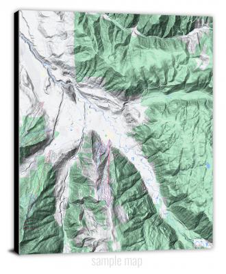
• Extra-Large Gallery Canvas Wrap Print
• Hand-Stretched, Expertly Crafted
• Artist Grade Canvas with Fade-Resistant Inks
• Ready to Hang with Pre-Installed Hardware
• 1.5" Thick Gallery Frame
Enrich your office decor or home with a large canvas wrap Terrain map. It is designed for easy hanging with pre-installed hardware. Printed with archival inks and wrapped around a 1.5" thick gallery frame, your favorite map art will have a timeless and impressive look that fits with any decor. This map is fabricated with terrain imagery data from Google Maps, and bounding box coordinates from USGS.
Aberdeen, Idaho- Map Components- Imagery: Terrain of Aberdeen, Idaho. Bounding Box: Footprint of Aberdeen, Idaho at Longitude/Latitude Coordinates (-112.875 x -112.75 x 43 x 42.875).
Abes Knob, Idaho- Map Components- Imagery: Terrain of Abes Knob, Idaho. Bounding Box: Footprint of Abes Knob, Idaho at Longitude/Latitude Coordinates (-116.5 x -116.375 x 47 x 46.875).
Acequia, Idaho- Map Components- Imagery: Terrain of Acequia, Idaho. Bounding Box: Footprint of Acequia, Idaho at Longitude/Latitude Coordinates (-113.625 x -113.5 x 42.75 x 42.625).
Acorn Butte, Idaho- Map Components- Imagery: Terrain of Acorn Butte, Idaho. Bounding Box: Footprint of Acorn Butte, Idaho at Longitude/Latitude Coordinates (-115.125 x -115 x 45.25 x 45.125).
Adair, Idaho- Map Components- Imagery: Terrain of Adair, Idaho. Bounding Box: Footprint of Adair, Idaho at Longitude/Latitude Coordinates (-115.625 x -115.5 x 47.375 x 47.25).
Advent Gulch, Idaho- Map Components- Imagery: Terrain of Advent Gulch, Idaho. Bounding Box: Footprint of Advent Gulch, Idaho at Longitude/Latitude Coordinates (-116.875 x -116.75 x 44.75 x 44.625).
Agency Creek, Idaho- Map Components- Imagery: Terrain of Agency Creek, Idaho. Bounding Box: Footprint of Agency Creek, Idaho at Longitude/Latitude Coordinates (-113.625 x -113.5 x 45 x 44.875).
Aggipah Mountain, Idaho- Map Components- Imagery: Terrain of Aggipah Mountain, Idaho. Bounding Box: Footprint of Aggipah Mountain, Idaho at Longitude/Latitude Coordinates (-114.75 x -114.625 x 45.25 x 45.125).
Ahsahka, Idaho- Map Components- Imagery: Terrain of Ahsahka, Idaho. Bounding Box: Footprint of Ahsahka, Idaho at Longitude/Latitude Coordinates (-116.375 x -116.25 x 46.625 x 46.5).
Albion, Idaho- Map Components- Imagery: Terrain of Albion, Idaho. Bounding Box: Footprint of Albion, Idaho at Longitude/Latitude Coordinates (-113.625 x -113.5 x 42.5 x 42.375).
Alder Creek Flats, Idaho- Map Components- Imagery: Terrain of Alder Creek Flats, Idaho. Bounding Box: Footprint of Alder Creek Flats, Idaho at Longitude/Latitude Coordinates (-116.75 x -116.625 x 47.25 x 47.125).
Aldermand Ridge, Idaho- Map Components- Imagery: Terrain of Aldermand Ridge, Idaho. Bounding Box: Footprint of Aldermand Ridge, Idaho at Longitude/Latitude Coordinates (-116.375 x -116.25 x 46.75 x 46.625).
Alexander, Idaho- Map Components- Imagery: Terrain of Alexander, Idaho. Bounding Box: Footprint of Alexander, Idaho at Longitude/Latitude Coordinates (-111.75 x -111.625 x 42.75 x 42.625).
Allan Mountain, Idaho- Map Components- Imagery: Terrain of Allan Mountain, Idaho. Bounding Box: Footprint of Allan Mountain, Idaho at Longitude/Latitude Coordinates (-114.125 x -114 x 45.625 x 45.5).
Allison Creek, Idaho- Map Components- Imagery: Terrain of Allison Creek, Idaho. Bounding Box: Footprint of Allison Creek, Idaho at Longitude/Latitude Coordinates (-114 x -113.875 x 44.875 x 44.75).
Almo, Idaho- Map Components- Imagery: Terrain of Almo, Idaho. Bounding Box: Footprint of Almo, Idaho at Longitude/Latitude Coordinates (-113.75 x -113.625 x 42.125 x 42).
Alpha, Idaho- Map Components- Imagery: Terrain of Alpha, Idaho. Bounding Box: Footprint of Alpha, Idaho at Longitude/Latitude Coordinates (-116.125 x -116 x 44.5 x 44.375).
Alturas Lake, Idaho- Map Components- Imagery: Terrain of Alturas Lake, Idaho. Bounding Box: Footprint of Alturas Lake, Idaho at Longitude/Latitude Coordinates (-114.875 x -114.75 x 44 x 43.875).
Amber Lakes, Idaho- Map Components- Imagery: Terrain of Amber Lakes, Idaho. Bounding Box: Footprint of Amber Lakes, Idaho at Longitude/Latitude Coordinates (-114.5 x -114.375 x 43.875 x 43.75).
American Falls, Idaho- Map Components- Imagery: Terrain of American Falls, Idaho. Bounding Box: Footprint of American Falls, Idaho at Longitude/Latitude Coordinates (-112.875 x -112.75 x 42.875 x 42.75).
American Falls NW, Idaho- Map Components- Imagery: Terrain of American Falls NW, Idaho. Bounding Box: Footprint of American Falls NW, Idaho at Longitude/Latitude Coordinates (-113 x -112.875 x 43 x 42.875).
American Falls SW, Idaho- Map Components- Imagery: Terrain of American Falls SW, Idaho. Bounding Box: Footprint of American Falls SW, Idaho at Longitude/Latitude Coordinates (-113 x -112.875 x 42.875 x 42.75).
Ammon, Idaho- Map Components- Imagery: Terrain of Ammon, Idaho. Bounding Box: Footprint of Ammon, Idaho at Longitude/Latitude Coordinates (-112 x -111.875 x 43.5 x 43.375).
Anderson Butte, Idaho- Map Components- Imagery: Terrain of Anderson Butte, Idaho. Bounding Box: Footprint of Anderson Butte, Idaho at Longitude/Latitude Coordinates (-115.375 x -115.25 x 46 x 45.875).
Anderson Ranch Dam, Idaho- Map Components- Imagery: Terrain of Anderson Ranch Dam, Idaho. Bounding Box: Footprint of Anderson Ranch Dam, Idaho at Longitude/Latitude Coordinates (-115.5 x -115.375 x 43.375 x 43.25).
Antelope Butte, Idaho- Map Components- Imagery: Terrain of Antelope Butte, Idaho. Bounding Box: Footprint of Antelope Butte, Idaho at Longitude/Latitude Coordinates (-112.625 x -112.5 x 43.875 x 43.75).
Antelope Creek, Idaho- Map Components- Imagery: Terrain of Antelope Creek, Idaho. Bounding Box: Footprint of Antelope Creek, Idaho at Longitude/Latitude Coordinates (-115.875 x -115.75 x 42.25 x 42.125).
Antelope Flat, Idaho- Map Components- Imagery: Terrain of Antelope Flat, Idaho. Bounding Box: Footprint of Antelope Flat, Idaho at Longitude/Latitude Coordinates (-114.125 x -114 x 44.375 x 44.25).
Antelope Lake, Idaho- Map Components- Imagery: Terrain of Antelope Lake, Idaho. Bounding Box: Footprint of Antelope Lake, Idaho at Longitude/Latitude Coordinates (-113.25 x -113.125 x 43.25 x 43.125).
Antelope Spring, Idaho- Map Components- Imagery: Terrain of Antelope Spring, Idaho. Bounding Box: Footprint of Antelope Spring, Idaho at Longitude/Latitude Coordinates (-116.5 x -116.375 x 43 x 42.875).
Antelope Valley, Idaho- Map Components- Imagery: Terrain of Antelope Valley, Idaho. Bounding Box: Footprint of Antelope Valley, Idaho at Longitude/Latitude Coordinates (-111.875 x -111.75 x 44.5 x 44.375).
Anthony Peak, Idaho- Map Components- Imagery: Terrain of Anthony Peak, Idaho. Bounding Box: Footprint of Anthony Peak, Idaho at Longitude/Latitude Coordinates (-116.25 x -116.125 x 47 x 46.875).
Aparejo Point, Idaho- Map Components- Imagery: Terrain of Aparejo Point, Idaho. Bounding Box: Footprint of Aparejo Point, Idaho at Longitude/Latitude Coordinates (-114.75 x -114.625 x 45 x 44.875).
Appendicitis Hill, Idaho- Map Components- Imagery: Terrain of Appendicitis Hill, Idaho. Bounding Box: Footprint of Appendicitis Hill, Idaho at Longitude/Latitude Coordinates (-113.5 x -113.375 x 43.75 x 43.625).
Arbon, Idaho- Map Components- Imagery: Terrain of Arbon, Idaho. Bounding Box: Footprint of Arbon, Idaho at Longitude/Latitude Coordinates (-112.625 x -112.5 x 42.5 x 42.375).
Arco Hills, Idaho- Map Components- Imagery: Terrain of Arco Hills, Idaho. Bounding Box: Footprint of Arco Hills, Idaho at Longitude/Latitude Coordinates (-113.25 x -113.125 x 43.75 x 43.625).
Arco Hills SE, Idaho- Map Components- Imagery: Terrain of Arco Hills SE, Idaho. Bounding Box: Footprint of Arco Hills SE, Idaho at Longitude/Latitude Coordinates (-113.125 x -113 x 43.625 x 43.5).
Arco North, Idaho- Map Components- Imagery: Terrain of Arco North, Idaho. Bounding Box: Footprint of Arco North, Idaho at Longitude/Latitude Coordinates (-113.375 x -113.25 x 43.75 x 43.625).
Arco Pass, Idaho- Map Components- Imagery: Terrain of Arco Pass, Idaho. Bounding Box: Footprint of Arco Pass, Idaho at Longitude/Latitude Coordinates (-113.25 x -113.125 x 43.875 x 43.75).
Arco South, Idaho- Map Components- Imagery: Terrain of Arco South, Idaho. Bounding Box: Footprint of Arco South, Idaho at Longitude/Latitude Coordinates (-113.375 x -113.25 x 43.625 x 43.5).
Arctic Point, Idaho- Map Components- Imagery: Terrain of Arctic Point, Idaho. Bounding Box: Footprint of Arctic Point, Idaho at Longitude/Latitude Coordinates (-115.125 x -115 x 45.5 x 45.375).
Arimo, Idaho- Map Components- Imagery: Terrain of Arimo, Idaho. Bounding Box: Footprint of Arimo, Idaho at Longitude/Latitude Coordinates (-112.25 x -112.125 x 42.625 x 42.5).
Arrowrock Dam, Idaho- Map Components- Imagery: Terrain of Arrowrock Dam, Idaho. Bounding Box: Footprint of Arrowrock Dam, Idaho at Longitude/Latitude Coordinates (-116 x -115.875 x 43.625 x 43.5).
Arrowrock Reservoir NE, Idaho- Map Components- Imagery: Terrain of Arrowrock Reservoir NE, Idaho. Bounding Box: Footprint of Arrowrock Reservoir NE, Idaho at Longitude/Latitude Coordinates (-115.875 x -115.75 x 43.75 x 43.625).
Artillery Dome, Idaho- Map Components- Imagery: Terrain of Artillery Dome, Idaho. Bounding Box: Footprint of Artillery Dome, Idaho at Longitude/Latitude Coordinates (-115.25 x -115.125 x 44.75 x 44.625).
Ashton, Idaho- Map Components- Imagery: Terrain of Ashton, Idaho. Bounding Box: Footprint of Ashton, Idaho at Longitude/Latitude Coordinates (-111.5 x -111.375 x 44.125 x 44).
Athol, Idaho- Map Components- Imagery: Terrain of Athol, Idaho. Bounding Box: Footprint of Athol, Idaho at Longitude/Latitude Coordinates (-116.75 x -116.625 x 48 x 47.875).
Atlanta East, Idaho- Map Components- Imagery: Terrain of Atlanta East, Idaho. Bounding Box: Footprint of Atlanta East, Idaho at Longitude/Latitude Coordinates (-115.125 x -115 x 43.875 x 43.75).
Atlanta West, Idaho- Map Components- Imagery: Terrain of Atlanta West, Idaho. Bounding Box: Footprint of Atlanta West, Idaho at Longitude/Latitude Coordinates (-115.25 x -115.125 x 43.875 x 43.75).
Atomic City, Idaho- Map Components- Imagery: Terrain of Atomic City, Idaho. Bounding Box: Footprint of Atomic City, Idaho at Longitude/Latitude Coordinates (-112.875 x -112.75 x 43.5 x 43.375).
Austin Butte, Idaho- Map Components- Imagery: Terrain of Austin Butte, Idaho. Bounding Box: Footprint of Austin Butte, Idaho at Longitude/Latitude Coordinates (-115.75 x -115.625 x 42.625 x 42.5).
Avery, Idaho- Map Components- Imagery: Terrain of Avery, Idaho. Bounding Box: Footprint of Avery, Idaho at Longitude/Latitude Coordinates (-115.875 x -115.75 x 47.375 x 47.25).
Bacon Peak, Idaho- Map Components- Imagery: Terrain of Bacon Peak, Idaho. Bounding Box: Footprint of Bacon Peak, Idaho at Longitude/Latitude Coordinates (-115.375 x -115.25 x 47 x 46.875).
Badger Creek, Idaho- Map Components- Imagery: Terrain of Badger Creek, Idaho. Bounding Box: Footprint of Badger Creek, Idaho at Longitude/Latitude Coordinates (-113.25 x -113.125 x 44.125 x 44).
Badger Hole Spring, Idaho- Map Components- Imagery: Terrain of Badger Hole Spring, Idaho. Bounding Box: Footprint of Badger Hole Spring, Idaho at Longitude/Latitude Coordinates (-112.875 x -112.75 x 42.25 x 42.125).
Badger Peak, Idaho- Map Components- Imagery: Terrain of Badger Peak, Idaho. Bounding Box: Footprint of Badger Peak, Idaho at Longitude/Latitude Coordinates (-113.125 x -113 x 42.625 x 42.5).
Badger Spring Gulch, Idaho- Map Components- Imagery: Terrain of Badger Spring Gulch, Idaho. Bounding Box: Footprint of Badger Spring Gulch, Idaho at Longitude/Latitude Coordinates (-113.875 x -113.75 x 45.375 x 45.25).
Baker, Idaho- Map Components- Imagery: Terrain of Baker, Idaho. Bounding Box: Footprint of Baker, Idaho at Longitude/Latitude Coordinates (-113.75 x -113.625 x 45.125 x 45).
Baker Peak, Idaho- Map Components- Imagery: Terrain of Baker Peak, Idaho. Bounding Box: Footprint of Baker Peak, Idaho at Longitude/Latitude Coordinates (-114.75 x -114.625 x 43.75 x 43.625).
Balanced Rock, Idaho- Map Components- Imagery: Terrain of Balanced Rock, Idaho. Bounding Box: Footprint of Balanced Rock, Idaho at Longitude/Latitude Coordinates (-115 x -114.875 x 42.625 x 42.5).
Bald Mountain, Idaho- Map Components- Imagery: Terrain of Bald Mountain, Idaho. Bounding Box: Footprint of Bald Mountain, Idaho at Longitude/Latitude Coordinates (-114.375 x -114.25 x 44.375 x 44.25).
Baldy Knoll, Idaho- Map Components- Imagery: Terrain of Baldy Knoll, Idaho. Bounding Box: Footprint of Baldy Knoll, Idaho at Longitude/Latitude Coordinates (-112.5 x -112.375 x 43.375 x 43.25).
Bally Mountain, Idaho- Map Components- Imagery: Terrain of Bally Mountain, Idaho. Bounding Box: Footprint of Bally Mountain, Idaho at Longitude/Latitude Coordinates (-116.375 x -116.25 x 45.125 x 45).
Bancroft, Idaho- Map Components- Imagery: Terrain of Bancroft, Idaho. Bounding Box: Footprint of Bancroft, Idaho at Longitude/Latitude Coordinates (-112 x -111.875 x 42.75 x 42.625).
Banida, Idaho- Map Components- Imagery: Terrain of Banida, Idaho. Bounding Box: Footprint of Banida, Idaho at Longitude/Latitude Coordinates (-112 x -111.875 x 42.25 x 42.125).
Banks, Idaho- Map Components- Imagery: Terrain of Banks, Idaho. Bounding Box: Footprint of Banks, Idaho at Longitude/Latitude Coordinates (-116.125 x -116 x 44.125 x 44).
Banner Summit, Idaho- Map Components- Imagery: Terrain of Banner Summit, Idaho. Bounding Box: Footprint of Banner Summit, Idaho at Longitude/Latitude Coordinates (-115.25 x -115.125 x 44.375 x 44.25).
Bannock Peak, Idaho- Map Components- Imagery: Terrain of Bannock Peak, Idaho. Bounding Box: Footprint of Bannock Peak, Idaho at Longitude/Latitude Coordinates (-112.75 x -112.625 x 42.625 x 42.5).
Barber Flat, Idaho- Map Components- Imagery: Terrain of Barber Flat, Idaho. Bounding Box: Footprint of Barber Flat, Idaho at Longitude/Latitude Coordinates (-115.625 x -115.5 x 43.875 x 43.75).
Basin, Idaho- Map Components- Imagery: Terrain of Basin, Idaho. Bounding Box: Footprint of Basin, Idaho at Longitude/Latitude Coordinates (-113.875 x -113.75 x 42.25 x 42.125).
Basin Butte, Idaho- Map Components- Imagery: Terrain of Basin Butte, Idaho. Bounding Box: Footprint of Basin Butte, Idaho at Longitude/Latitude Coordinates (-115 x -114.875 x 44.375 x 44.25).
Bates, Idaho- Map Components- Imagery: Terrain of Bates, Idaho. Bounding Box: Footprint of Bates, Idaho at Longitude/Latitude Coordinates (-111.25 x -111.125 x 43.75 x 43.625).
Bathtub Mountain, Idaho- Map Components- Imagery: Terrain of Bathtub Mountain, Idaho. Bounding Box: Footprint of Bathtub Mountain, Idaho at Longitude/Latitude Coordinates (-115.625 x -115.5 x 47.125 x 47).
Battle Creek Lakes, Idaho- Map Components- Imagery: Terrain of Battle Creek Lakes, Idaho. Bounding Box: Footprint of Battle Creek Lakes, Idaho at Longitude/Latitude Coordinates (-116.5 x -116.375 x 42.375 x 42.25).
Baugh Creek, Idaho- Map Components- Imagery: Terrain of Baugh Creek, Idaho. Bounding Box: Footprint of Baugh Creek, Idaho at Longitude/Latitude Coordinates (-114.125 x -114 x 43.625 x 43.5).
Baugh Creek SW, Idaho- Map Components- Imagery: Terrain of Baugh Creek SW, Idaho. Bounding Box: Footprint of Baugh Creek SW, Idaho at Longitude/Latitude Coordinates (-114.25 x -114.125 x 43.625 x 43.5).
Bayhorse, Idaho- Map Components- Imagery: Terrain of Bayhorse, Idaho. Bounding Box: Footprint of Bayhorse, Idaho at Longitude/Latitude Coordinates (-114.375 x -114.25 x 44.5 x 44.375).
Bayhorse Lake, Idaho- Map Components- Imagery: Terrain of Bayhorse Lake, Idaho. Bounding Box: Footprint of Bayhorse Lake, Idaho at Longitude/Latitude Coordinates (-114.5 x -114.375 x 44.5 x 44.375).
Bayview, Idaho- Map Components- Imagery: Terrain of Bayview, Idaho. Bounding Box: Footprint of Bayview, Idaho at Longitude/Latitude Coordinates (-116.625 x -116.5 x 48 x 47.875).
Bear Camp Gulch, Idaho- Map Components- Imagery: Terrain of Bear Camp Gulch, Idaho. Bounding Box: Footprint of Bear Camp Gulch, Idaho at Longitude/Latitude Coordinates (-112.125 x -112 x 42.875 x 42.75).
Bear Creek Point, Idaho- Map Components- Imagery: Terrain of Bear Creek Point, Idaho. Bounding Box: Footprint of Bear Creek Point, Idaho at Longitude/Latitude Coordinates (-114.875 x -114.75 x 45 x 44.875).
Bear Den Butte, Idaho- Map Components- Imagery: Terrain of Bear Den Butte, Idaho. Bounding Box: Footprint of Bear Den Butte, Idaho at Longitude/Latitude Coordinates (-113.625 x -113.5 x 43.25 x 43.125).
Bear Island, Idaho- Map Components- Imagery: Terrain of Bear Island, Idaho. Bounding Box: Footprint of Bear Island, Idaho at Longitude/Latitude Coordinates (-111.5 x -111.375 x 43.125 x 43).
Bear Lake North, Idaho- Map Components- Imagery: Terrain of Bear Lake North, Idaho. Bounding Box: Footprint of Bear Lake North, Idaho at Longitude/Latitude Coordinates (-111.375 x -111.25 x 42.125 x 42).
Bear Mountain, Idaho- Map Components- Imagery: Terrain of Bear Mountain, Idaho. Bounding Box: Footprint of Bear Mountain, Idaho at Longitude/Latitude Coordinates (-115 x -114.875 x 46.5 x 46.375).
Bear Park East, Idaho- Map Components- Imagery: Terrain of Bear Park East, Idaho. Bounding Box: Footprint of Bear Park East, Idaho at Longitude/Latitude Coordinates (-113.375 x -113.25 x 43.25 x 43.125).
Bear Park SW, Idaho- Map Components- Imagery: Terrain of Bear Park SW, Idaho. Bounding Box: Footprint of Bear Park SW, Idaho at Longitude/Latitude Coordinates (-113.5 x -113.375 x 43.125 x 43).
Bear Park West, Idaho- Map Components- Imagery: Terrain of Bear Park West, Idaho. Bounding Box: Footprint of Bear Park West, Idaho at Longitude/Latitude Coordinates (-113.5 x -113.375 x 43.25 x 43.125).
Bear River, Idaho- Map Components- Imagery: Terrain of Bear River, Idaho. Bounding Box: Footprint of Bear River, Idaho at Longitude/Latitude Coordinates (-115.5 x -115.375 x 44 x 43.875).
Bear Trap Cave, Idaho- Map Components- Imagery: Terrain of Bear Trap Cave, Idaho. Bounding Box: Footprint of Bear Trap Cave, Idaho at Longitude/Latitude Coordinates (-113.375 x -113.25 x 43 x 42.875).
Bear Valley Mountain, Idaho- Map Components- Imagery: Terrain of Bear Valley Mountain, Idaho. Bounding Box: Footprint of Bear Valley Mountain, Idaho at Longitude/Latitude Coordinates (-115.5 x -115.375 x 44.5 x 44.375).
Beaver Creek, Idaho- Map Components- Imagery: Terrain of Beaver Creek, Idaho. Bounding Box: Footprint of Beaver Creek, Idaho at Longitude/Latitude Coordinates (-114.625 x -114.5 x 43.5 x 43.375).
Beaver Jack Mountain, Idaho- Map Components- Imagery: Terrain of Beaver Jack Mountain, Idaho. Bounding Box: Footprint of Beaver Jack Mountain, Idaho at Longitude/Latitude Coordinates (-114.75 x -114.625 x 45.75 x 45.625).
Bechtel Butte, Idaho- Map Components- Imagery: Terrain of Bechtel Butte, Idaho. Bounding Box: Footprint of Bechtel Butte, Idaho at Longitude/Latitude Coordinates (-116.375 x -116.25 x 47 x 46.875).
Bedstead Ridge, Idaho- Map Components- Imagery: Terrain of Bedstead Ridge, Idaho. Bounding Box: Footprint of Bedstead Ridge, Idaho at Longitude/Latitude Coordinates (-117 x -116.875 x 42.5 x 42.375).
Bell Mountain, Idaho- Map Components- Imagery: Terrain of Bell Mountain, Idaho. Bounding Box: Footprint of Bell Mountain, Idaho at Longitude/Latitude Coordinates (-113.25 x -113.125 x 44.25 x 44.125).
Bellevue, Idaho- Map Components- Imagery: Terrain of Bellevue, Idaho. Bounding Box: Footprint of Bellevue, Idaho at Longitude/Latitude Coordinates (-114.375 x -114.25 x 43.5 x 43.375).
Benewah, Idaho- Map Components- Imagery: Terrain of Benewah, Idaho. Bounding Box: Footprint of Benewah, Idaho at Longitude/Latitude Coordinates (-116.875 x -116.75 x 47.25 x 47.125).
Benewah Lake, Idaho- Map Components- Imagery: Terrain of Benewah Lake, Idaho. Bounding Box: Footprint of Benewah Lake, Idaho at Longitude/Latitude Coordinates (-116.75 x -116.625 x 47.375 x 47.25).
Bennett Mountain, Idaho- Map Components- Imagery: Terrain of Bennett Mountain, Idaho. Bounding Box: Footprint of Bennett Mountain, Idaho at Longitude/Latitude Coordinates (-115.5 x -115.375 x 43.25 x 43.125).
Benning Mountain, Idaho- Map Components- Imagery: Terrain of Benning Mountain, Idaho. Bounding Box: Footprint of Benning Mountain, Idaho at Longitude/Latitude Coordinates (-116.125 x -116 x 48.375 x 48.25).
Berge Peak, Idaho- Map Components- Imagery: Terrain of Berge Peak, Idaho. Bounding Box: Footprint of Berge Peak, Idaho at Longitude/Latitude Coordinates (-115.375 x -115.25 x 47.25 x 47.125).
Berger, Idaho- Map Components- Imagery: Terrain of Berger, Idaho. Bounding Box: Footprint of Berger, Idaho at Longitude/Latitude Coordinates (-114.625 x -114.5 x 42.5 x 42.375).
Berger Butte, Idaho- Map Components- Imagery: Terrain of Berger Butte, Idaho. Bounding Box: Footprint of Berger Butte, Idaho at Longitude/Latitude Coordinates (-114.75 x -114.625 x 42.5 x 42.375).
Bernard Mountain, Idaho- Map Components- Imagery: Terrain of Bernard Mountain, Idaho. Bounding Box: Footprint of Bernard Mountain, Idaho at Longitude/Latitude Coordinates (-115.625 x -115.5 x 44.5 x 44.375).
Bertha Hill, Idaho- Map Components- Imagery: Terrain of Bertha Hill, Idaho. Bounding Box: Footprint of Bertha Hill, Idaho at Longitude/Latitude Coordinates (-115.875 x -115.75 x 46.875 x 46.75).
Big Baldy, Idaho- Map Components- Imagery: Terrain of Big Baldy, Idaho. Bounding Box: Footprint of Big Baldy, Idaho at Longitude/Latitude Coordinates (-115.25 x -115.125 x 44.875 x 44.75).
Big Bend Crossing, Idaho- Map Components- Imagery: Terrain of Big Bend Crossing, Idaho. Bounding Box: Footprint of Big Bend Crossing, Idaho at Longitude/Latitude Coordinates (-115.125 x -115 x 42.375 x 42.25).
Big Black Dome, Idaho- Map Components- Imagery: Terrain of Big Black Dome, Idaho. Bounding Box: Footprint of Big Black Dome, Idaho at Longitude/Latitude Coordinates (-114 x -113.875 x 43.875 x 43.75).
Big Blind Canyon, Idaho- Map Components- Imagery: Terrain of Big Blind Canyon, Idaho. Bounding Box: Footprint of Big Blind Canyon, Idaho at Longitude/Latitude Coordinates (-113.625 x -113.5 x 43.875 x 43.75).
Big Cedar, Idaho- Map Components- Imagery: Terrain of Big Cedar, Idaho. Bounding Box: Footprint of Big Cedar, Idaho at Longitude/Latitude Coordinates (-115.875 x -115.75 x 46.125 x 46).
Big Chief Creek, Idaho- Map Components- Imagery: Terrain of Big Chief Creek, Idaho. Bounding Box: Footprint of Big Chief Creek, Idaho at Longitude/Latitude Coordinates (-115.375 x -115.25 x 44.875 x 44.75).
Big Creek, Idaho- Map Components- Imagery: Terrain of Big Creek, Idaho. Bounding Box: Footprint of Big Creek, Idaho at Longitude/Latitude Coordinates (-115.375 x -115.25 x 45.25 x 45.125).
Big Creek Peak, Idaho- Map Components- Imagery: Terrain of Big Creek Peak, Idaho. Bounding Box: Footprint of Big Creek Peak, Idaho at Longitude/Latitude Coordinates (-113.625 x -113.5 x 44.5 x 44.375).
Big Creek Ranch, Idaho- Map Components- Imagery: Terrain of Big Creek Ranch, Idaho. Bounding Box: Footprint of Big Creek Ranch, Idaho at Longitude/Latitude Coordinates (-114.5 x -114.375 x 42.125 x 42).
Big Elk Mountain, Idaho- Map Components- Imagery: Terrain of Big Elk Mountain, Idaho. Bounding Box: Footprint of Big Elk Mountain, Idaho at Longitude/Latitude Coordinates (-111.375 x -111.25 x 43.25 x 43.125).
Big Fill Reservoir, Idaho- Map Components- Imagery: Terrain of Big Fill Reservoir, Idaho. Bounding Box: Footprint of Big Fill Reservoir, Idaho at Longitude/Latitude Coordinates (-112.875 x -112.75 x 43.125 x 43).
Big Foot Butte, Idaho- Map Components- Imagery: Terrain of Big Foot Butte, Idaho. Bounding Box: Footprint of Big Foot Butte, Idaho at Longitude/Latitude Coordinates (-116.25 x -116.125 x 43.25 x 43.125).
Big Grassy, Idaho- Map Components- Imagery: Terrain of Big Grassy, Idaho. Bounding Box: Footprint of Big Grassy, Idaho at Longitude/Latitude Coordinates (-111.25 x -111.125 x 44.375 x 44.25).
Big Grassy Ridge, Idaho- Map Components- Imagery: Terrain of Big Grassy Ridge, Idaho. Bounding Box: Footprint of Big Grassy Ridge, Idaho at Longitude/Latitude Coordinates (-112 x -111.875 x 44.125 x 44).
Big Grassy Ridge SE, Idaho- Map Components- Imagery: Terrain of Big Grassy Ridge SE, Idaho. Bounding Box: Footprint of Big Grassy Ridge SE, Idaho at Longitude/Latitude Coordinates (-111.875 x -111.75 x 44.125 x 44).
Big Hole Pass, Idaho- Map Components- Imagery: Terrain of Big Hole Pass, Idaho. Bounding Box: Footprint of Big Hole Pass, Idaho at Longitude/Latitude Coordinates (-113.875 x -113.75 x 45.625 x 45.5).
Big Horse Basin Gap, Idaho- Map Components- Imagery: Terrain of Big Horse Basin Gap, Idaho. Bounding Box: Footprint of Big Horse Basin Gap, Idaho at Longitude/Latitude Coordinates (-116.125 x -116 x 42.75 x 42.625).
Big Lost River Sinks, Idaho- Map Components- Imagery: Terrain of Big Lost River Sinks, Idaho. Bounding Box: Footprint of Big Lost River Sinks, Idaho at Longitude/Latitude Coordinates (-112.875 x -112.75 x 43.875 x 43.75).
Big Owl Creek, Idaho- Map Components- Imagery: Terrain of Big Owl Creek, Idaho. Bounding Box: Footprint of Big Owl Creek, Idaho at Longitude/Latitude Coordinates (-115.625 x -115.5 x 44 x 43.875).
Big Rock Mountain, Idaho- Map Components- Imagery: Terrain of Big Rock Mountain, Idaho. Bounding Box: Footprint of Big Rock Mountain, Idaho at Longitude/Latitude Coordinates (-115.125 x -115 x 46.25 x 46.125).
Big Soldier Mountain, Idaho- Map Components- Imagery: Terrain of Big Soldier Mountain, Idaho. Bounding Box: Footprint of Big Soldier Mountain, Idaho at Longitude/Latitude Coordinates (-115.375 x -115.25 x 44.625 x 44.5).
Big Southern Butte, Idaho- Map Components- Imagery: Terrain of Big Southern Butte, Idaho. Bounding Box: Footprint of Big Southern Butte, Idaho at Longitude/Latitude Coordinates (-113.125 x -113 x 43.5 x 43.375).
Big Springs, Idaho- Map Components- Imagery: Terrain of Big Springs, Idaho. Bounding Box: Footprint of Big Springs, Idaho at Longitude/Latitude Coordinates (-111.375 x -111.25 x 44.625 x 44.5).
Big Springs Ranch, Idaho- Map Components- Imagery: Terrain of Big Springs Ranch, Idaho. Bounding Box: Footprint of Big Springs Ranch, Idaho at Longitude/Latitude Coordinates (-116.5 x -116.375 x 42.625 x 42.5).
Big Table, Idaho- Map Components- Imagery: Terrain of Big Table, Idaho. Bounding Box: Footprint of Big Table, Idaho at Longitude/Latitude Coordinates (-115.75 x -115.625 x 42 x 41.875).
Big Table Mountain, Idaho- Map Components- Imagery: Terrain of Big Table Mountain, Idaho. Bounding Box: Footprint of Big Table Mountain, Idaho at Longitude/Latitude Coordinates (-112.125 x -112 x 44.625 x 44.5).
Big Windy Peak, Idaho- Map Components- Imagery: Terrain of Big Windy Peak, Idaho. Bounding Box: Footprint of Big Windy Peak, Idaho at Longitude/Latitude Coordinates (-113.375 x -113.25 x 44.375 x 44.25).
Bighorn Crags, Idaho- Map Components- Imagery: Terrain of Bighorn Crags, Idaho. Bounding Box: Footprint of Bighorn Crags, Idaho at Longitude/Latitude Coordinates (-114.5 x -114.375 x 45.375 x 45.25).
Bird Creek, Idaho- Map Components- Imagery: Terrain of Bird Creek, Idaho. Bounding Box: Footprint of Bird Creek, Idaho at Longitude/Latitude Coordinates (-114 x -113.875 x 45.375 x 45.25).
Birding Island, Idaho- Map Components- Imagery: Terrain of Birding Island, Idaho. Bounding Box: Footprint of Birding Island, Idaho at Longitude/Latitude Coordinates (-116.875 x -116.75 x 44.125 x 44).
Bishop Mountain, Idaho- Map Components- Imagery: Terrain of Bishop Mountain, Idaho. Bounding Box: Footprint of Bishop Mountain, Idaho at Longitude/Latitude Coordinates (-111.625 x -111.5 x 44.375 x 44.25).
Bismark Mountain, Idaho- Map Components- Imagery: Terrain of Bismark Mountain, Idaho. Bounding Box: Footprint of Bismark Mountain, Idaho at Longitude/Latitude Coordinates (-115.25 x -115.125 x 45.25 x 45.125).
Black Butte East, Idaho- Map Components- Imagery: Terrain of Black Butte East, Idaho. Bounding Box: Footprint of Black Butte East, Idaho at Longitude/Latitude Coordinates (-115.375 x -115.25 x 42.75 x 42.625).
Black Butte West, Idaho- Map Components- Imagery: Terrain of Black Butte West, Idaho. Bounding Box: Footprint of Black Butte West, Idaho at Longitude/Latitude Coordinates (-115.5 x -115.375 x 42.75 x 42.625).
Black Hawk Mountain, Idaho- Map Components- Imagery: Terrain of Black Hawk Mountain, Idaho. Bounding Box: Footprint of Black Hawk Mountain, Idaho at Longitude/Latitude Coordinates (-115.375 x -115.25 x 45.875 x 45.75).
Black Knoll, Idaho- Map Components- Imagery: Terrain of Black Knoll, Idaho. Bounding Box: Footprint of Black Knoll, Idaho at Longitude/Latitude Coordinates (-111.75 x -111.625 x 44.125 x 44).
Black Lake, Idaho- Map Components- Imagery: Terrain of Black Lake, Idaho. Bounding Box: Footprint of Black Lake, Idaho at Longitude/Latitude Coordinates (-116.75 x -116.625 x 47.5 x 47.375).
Black Leg Creek, Idaho- Map Components- Imagery: Terrain of Black Leg Creek, Idaho. Bounding Box: Footprint of Black Leg Creek, Idaho at Longitude/Latitude Coordinates (-115.875 x -115.75 x 42.125 x 42).
Black Mountain, Idaho- Map Components- Imagery: Terrain of Black Mountain, Idaho. Bounding Box: Footprint of Black Mountain, Idaho at Longitude/Latitude Coordinates (-114.375 x -114.25 x 44.875 x 44.75).
Black Pine, Idaho- Map Components- Imagery: Terrain of Black Pine, Idaho. Bounding Box: Footprint of Black Pine, Idaho at Longitude/Latitude Coordinates (-113 x -112.875 x 42.125 x 42).
Black Pine Peak, Idaho- Map Components- Imagery: Terrain of Black Pine Peak, Idaho. Bounding Box: Footprint of Black Pine Peak, Idaho at Longitude/Latitude Coordinates (-113.125 x -113 x 42.125 x 42).
Black Ridge Crater, Idaho- Map Components- Imagery: Terrain of Black Ridge Crater, Idaho. Bounding Box: Footprint of Black Ridge Crater, Idaho at Longitude/Latitude Coordinates (-114 x -113.875 x 43.125 x 43).
Black Tip, Idaho- Map Components- Imagery: Terrain of Black Tip, Idaho. Bounding Box: Footprint of Black Tip, Idaho at Longitude/Latitude Coordinates (-116.125 x -116 x 45.25 x 45.125).
Blackbird Creek, Idaho- Map Components- Imagery: Terrain of Blackbird Creek, Idaho. Bounding Box: Footprint of Blackbird Creek, Idaho at Longitude/Latitude Coordinates (-114.375 x -114.25 x 45.125 x 45).
Blackbird Mountain, Idaho- Map Components- Imagery: Terrain of Blackbird Mountain, Idaho. Bounding Box: Footprint of Blackbird Mountain, Idaho at Longitude/Latitude Coordinates (-114.5 x -114.375 x 45.125 x 45).
Blackfoot, Idaho- Map Components- Imagery: Terrain of Blackfoot, Idaho. Bounding Box: Footprint of Blackfoot, Idaho at Longitude/Latitude Coordinates (-112.375 x -112.25 x 43.25 x 43.125).
Blackmare, Idaho- Map Components- Imagery: Terrain of Blackmare, Idaho. Bounding Box: Footprint of Blackmare, Idaho at Longitude/Latitude Coordinates (-115.875 x -115.75 x 44.875 x 44.75).
Blackstone Reservoir, Idaho- Map Components- Imagery: Terrain of Blackstone Reservoir, Idaho. Bounding Box: Footprint of Blackstone Reservoir, Idaho at Longitude/Latitude Coordinates (-115.875 x -115.75 x 42.5 x 42.375).
Blanchard, Idaho- Map Components- Imagery: Terrain of Blanchard, Idaho. Bounding Box: Footprint of Blanchard, Idaho at Longitude/Latitude Coordinates (-117 x -116.875 x 48.125 x 48).
Bliss, Idaho- Map Components- Imagery: Terrain of Bliss, Idaho. Bounding Box: Footprint of Bliss, Idaho at Longitude/Latitude Coordinates (-115 x -114.875 x 43 x 42.875).
Blizzard Mountain North, Idaho- Map Components- Imagery: Terrain of Blizzard Mountain North, Idaho. Bounding Box: Footprint of Blizzard Mountain North, Idaho at Longitude/Latitude Coordinates (-113.75 x -113.625 x 43.625 x 43.5).
Blizzard Mountain South, Idaho- Map Components- Imagery: Terrain of Blizzard Mountain South, Idaho. Bounding Box: Footprint of Blizzard Mountain South, Idaho at Longitude/Latitude Coordinates (-113.75 x -113.625 x 43.5 x 43.375).
Blodgett Mountain, Idaho- Map Components- Imagery: Terrain of Blodgett Mountain, Idaho. Bounding Box: Footprint of Blodgett Mountain, Idaho at Longitude/Latitude Coordinates (-114.5 x -114.375 x 46.375 x 46.25).
Blowfly Creek, Idaho- Map Components- Imagery: Terrain of Blowfly Creek, Idaho. Bounding Box: Footprint of Blowfly Creek, Idaho at Longitude/Latitude Coordinates (-114.375 x -114.25 x 44.75 x 44.625).
Blue Bunch Mountain, Idaho- Map Components- Imagery: Terrain of Blue Bunch Mountain, Idaho. Bounding Box: Footprint of Blue Bunch Mountain, Idaho at Longitude/Latitude Coordinates (-115.375 x -115.25 x 44.5 x 44.375).
Blue Creek Reservoir, Idaho- Map Components- Imagery: Terrain of Blue Creek Reservoir, Idaho. Bounding Box: Footprint of Blue Creek Reservoir, Idaho at Longitude/Latitude Coordinates (-111.625 x -111.5 x 44.25 x 44.125).
Blue Dome, Idaho- Map Components- Imagery: Terrain of Blue Dome, Idaho. Bounding Box: Footprint of Blue Dome, Idaho at Longitude/Latitude Coordinates (-113 x -112.875 x 44.25 x 44.125).
Blue Hill, Idaho- Map Components- Imagery: Terrain of Blue Hill, Idaho. Bounding Box: Footprint of Blue Hill, Idaho at Longitude/Latitude Coordinates (-114 x -113.875 x 42.125 x 42).
Blue Joint, Idaho- Map Components- Imagery: Terrain of Blue Joint, Idaho. Bounding Box: Footprint of Blue Joint, Idaho at Longitude/Latitude Coordinates (-114.625 x -114.5 x 45.625 x 45.5).
Boardman Creek, Idaho- Map Components- Imagery: Terrain of Boardman Creek, Idaho. Bounding Box: Footprint of Boardman Creek, Idaho at Longitude/Latitude Coordinates (-115 x -114.875 x 43.625 x 43.5).
Bohannon Spring, Idaho- Map Components- Imagery: Terrain of Bohannon Spring, Idaho. Bounding Box: Footprint of Bohannon Spring, Idaho at Longitude/Latitude Coordinates (-113.75 x -113.625 x 45.25 x 45.125).
Boiling Springs, Idaho- Map Components- Imagery: Terrain of Boiling Springs, Idaho. Bounding Box: Footprint of Boiling Springs, Idaho at Longitude/Latitude Coordinates (-115.875 x -115.75 x 44.375 x 44.25).
Boise North, Idaho- Map Components- Imagery: Terrain of Boise North, Idaho. Bounding Box: Footprint of Boise North, Idaho at Longitude/Latitude Coordinates (-116.25 x -116.125 x 43.75 x 43.625).
Boise South, Idaho- Map Components- Imagery: Terrain of Boise South, Idaho. Bounding Box: Footprint of Boise South, Idaho at Longitude/Latitude Coordinates (-116.25 x -116.125 x 43.625 x 43.5).
Boles, Idaho- Map Components- Imagery: Terrain of Boles, Idaho. Bounding Box: Footprint of Boles, Idaho at Longitude/Latitude Coordinates (-116.625 x -116.5 x 46 x 45.875).
Bone, Idaho- Map Components- Imagery: Terrain of Bone, Idaho. Bounding Box: Footprint of Bone, Idaho at Longitude/Latitude Coordinates (-111.875 x -111.75 x 43.375 x 43.25).
Bonners Ferry, Idaho- Map Components- Imagery: Terrain of Bonners Ferry, Idaho. Bounding Box: Footprint of Bonners Ferry, Idaho at Longitude/Latitude Coordinates (-116.375 x -116.25 x 48.75 x 48.625).
Bonneville Peak, Idaho- Map Components- Imagery: Terrain of Bonneville Peak, Idaho. Bounding Box: Footprint of Bonneville Peak, Idaho at Longitude/Latitude Coordinates (-112.25 x -112.125 x 42.875 x 42.75).
Borah Peak, Idaho- Map Components- Imagery: Terrain of Borah Peak, Idaho. Bounding Box: Footprint of Borah Peak, Idaho at Longitude/Latitude Coordinates (-113.875 x -113.75 x 44.25 x 44.125).
Border, Idaho- Map Components- Imagery: Terrain of Border, Idaho. Bounding Box: Footprint of Border, Idaho at Longitude/Latitude Coordinates (-111.125 x -111 x 42.25 x 42.125).
Boston Mountain, Idaho- Map Components- Imagery: Terrain of Boston Mountain, Idaho. Bounding Box: Footprint of Boston Mountain, Idaho at Longitude/Latitude Coordinates (-115.25 x -115.125 x 45.75 x 45.625).
Bottleneck Lake, Idaho- Map Components- Imagery: Terrain of Bottleneck Lake, Idaho. Bounding Box: Footprint of Bottleneck Lake, Idaho at Longitude/Latitude Coordinates (-113.625 x -113.5 x 43.125 x 43).
Boulder Chain Lakes, Idaho- Map Components- Imagery: Terrain of Boulder Chain Lakes, Idaho. Bounding Box: Footprint of Boulder Chain Lakes, Idaho at Longitude/Latitude Coordinates (-114.625 x -114.5 x 44.125 x 44).
Boundary Peak, Idaho- Map Components- Imagery: Terrain of Boundary Peak, Idaho. Bounding Box: Footprint of Boundary Peak, Idaho at Longitude/Latitude Coordinates (-115.625 x -115.5 x 46.375 x 46.25).
Boundary Ridge, Idaho- Map Components- Imagery: Terrain of Boundary Ridge, Idaho. Bounding Box: Footprint of Boundary Ridge, Idaho at Longitude/Latitude Coordinates (-111.125 x -111 x 42.125 x 42).
Bovill, Idaho- Map Components- Imagery: Terrain of Bovill, Idaho. Bounding Box: Footprint of Bovill, Idaho at Longitude/Latitude Coordinates (-116.5 x -116.375 x 46.875 x 46.75).
Bowery Creek, Idaho- Map Components- Imagery: Terrain of Bowery Creek, Idaho. Bounding Box: Footprint of Bowery Creek, Idaho at Longitude/Latitude Coordinates (-114.5 x -114.375 x 44.125 x 44).
Bowery Peak, Idaho- Map Components- Imagery: Terrain of Bowery Peak, Idaho. Bounding Box: Footprint of Bowery Peak, Idaho at Longitude/Latitude Coordinates (-114.375 x -114.25 x 44.125 x 44).
Box Lake, Idaho- Map Components- Imagery: Terrain of Box Lake, Idaho. Bounding Box: Footprint of Box Lake, Idaho at Longitude/Latitude Coordinates (-116 x -115.875 x 45.125 x 45).
Boyle Mountain, Idaho- Map Components- Imagery: Terrain of Boyle Mountain, Idaho. Bounding Box: Footprint of Boyle Mountain, Idaho at Longitude/Latitude Coordinates (-114.625 x -114.5 x 43.75 x 43.625).
Brace Flat, Idaho- Map Components- Imagery: Terrain of Brace Flat, Idaho. Bounding Box: Footprint of Brace Flat, Idaho at Longitude/Latitude Coordinates (-116.75 x -116.625 x 42.375 x 42.25).
Bradbury Flat, Idaho- Map Components- Imagery: Terrain of Bradbury Flat, Idaho. Bounding Box: Footprint of Bradbury Flat, Idaho at Longitude/Latitude Coordinates (-114.25 x -114.125 x 44.5 x 44.375).
Bradley Mountain, Idaho- Map Components- Imagery: Terrain of Bradley Mountain, Idaho. Bounding Box: Footprint of Bradley Mountain, Idaho at Longitude/Latitude Coordinates (-112.5 x -112.375 x 42.625 x 42.5).
Bridge, Idaho- Map Components- Imagery: Terrain of Bridge, Idaho. Bounding Box: Footprint of Bridge, Idaho at Longitude/Latitude Coordinates (-113.375 x -113.25 x 42.25 x 42.125).
Brigham Point, Idaho- Map Components- Imagery: Terrain of Brigham Point, Idaho. Bounding Box: Footprint of Brigham Point, Idaho at Longitude/Latitude Coordinates (-113.5 x -113.375 x 43 x 42.875).
Broken Wagon Flat, Idaho- Map Components- Imagery: Terrain of Broken Wagon Flat, Idaho. Bounding Box: Footprint of Broken Wagon Flat, Idaho at Longitude/Latitude Coordinates (-115.875 x -115.75 x 42.75 x 42.625).
Brown Creek Ridge, Idaho- Map Components- Imagery: Terrain of Brown Creek Ridge, Idaho. Bounding Box: Footprint of Brown Creek Ridge, Idaho at Longitude/Latitude Coordinates (-115.875 x -115.75 x 46.375 x 46.25).
Browns Bench North, Idaho- Map Components- Imagery: Terrain of Browns Bench North, Idaho. Bounding Box: Footprint of Browns Bench North, Idaho at Longitude/Latitude Coordinates (-114.875 x -114.75 x 42.25 x 42.125).
Browns Bench South, Idaho- Map Components- Imagery: Terrain of Browns Bench South, Idaho. Bounding Box: Footprint of Browns Bench South, Idaho at Longitude/Latitude Coordinates (-114.875 x -114.75 x 42.125 x 42).
Browns Rock, Idaho- Map Components- Imagery: Terrain of Browns Rock, Idaho. Bounding Box: Footprint of Browns Rock, Idaho at Longitude/Latitude Coordinates (-115.75 x -115.625 x 46.75 x 46.625).
Bruin Hill, Idaho- Map Components- Imagery: Terrain of Bruin Hill, Idaho. Bounding Box: Footprint of Bruin Hill, Idaho at Longitude/Latitude Coordinates (-115 x -114.875 x 46.875 x 46.75).
Brundage Mountain, Idaho- Map Components- Imagery: Terrain of Brundage Mountain, Idaho. Bounding Box: Footprint of Brundage Mountain, Idaho at Longitude/Latitude Coordinates (-116.25 x -116.125 x 45.125 x 45).
Bruneau, Idaho- Map Components- Imagery: Terrain of Bruneau, Idaho. Bounding Box: Footprint of Bruneau, Idaho at Longitude/Latitude Coordinates (-115.875 x -115.75 x 43 x 42.875).
Bruneau Dunes, Idaho- Map Components- Imagery: Terrain of Bruneau Dunes, Idaho. Bounding Box: Footprint of Bruneau Dunes, Idaho at Longitude/Latitude Coordinates (-115.75 x -115.625 x 43 x 42.875).
Buckhorn, Idaho- Map Components- Imagery: Terrain of Buckhorn, Idaho. Bounding Box: Footprint of Buckhorn, Idaho at Longitude/Latitude Coordinates (-116 x -115.875 x 42.25 x 42.125).
Buckhorn Canyon, Idaho- Map Components- Imagery: Terrain of Buckhorn Canyon, Idaho. Bounding Box: Footprint of Buckhorn Canyon, Idaho at Longitude/Latitude Coordinates (-114.125 x -114 x 42.375 x 42.25).
Buckskin Basin, Idaho- Map Components- Imagery: Terrain of Buckskin Basin, Idaho. Bounding Box: Footprint of Buckskin Basin, Idaho at Longitude/Latitude Coordinates (-112.375 x -112.25 x 43.125 x 43).
Buffalo Hump, Idaho- Map Components- Imagery: Terrain of Buffalo Hump, Idaho. Bounding Box: Footprint of Buffalo Hump, Idaho at Longitude/Latitude Coordinates (-115.75 x -115.625 x 45.625 x 45.5).
Buffalo Lake, Idaho- Map Components- Imagery: Terrain of Buffalo Lake, Idaho. Bounding Box: Footprint of Buffalo Lake, Idaho at Longitude/Latitude Coordinates (-111.125 x -111 x 44.375 x 44.25).
Buffalo Lake NE, Idaho- Map Components- Imagery: Terrain of Buffalo Lake NE, Idaho. Bounding Box: Footprint of Buffalo Lake NE, Idaho at Longitude/Latitude Coordinates (-111.125 x -111 x 44.5 x 44.375).
Buhl, Idaho- Map Components- Imagery: Terrain of Buhl, Idaho. Bounding Box: Footprint of Buhl, Idaho at Longitude/Latitude Coordinates (-114.875 x -114.75 x 42.625 x 42.5).
Buist, Idaho- Map Components- Imagery: Terrain of Buist, Idaho. Bounding Box: Footprint of Buist, Idaho at Longitude/Latitude Coordinates (-112.625 x -112.5 x 42.375 x 42.25).
Bull Basin Camp, Idaho- Map Components- Imagery: Terrain of Bull Basin Camp, Idaho. Bounding Box: Footprint of Bull Basin Camp, Idaho at Longitude/Latitude Coordinates (-117 x -116.875 x 42.375 x 42.25).
Bull Camp Butte, Idaho- Map Components- Imagery: Terrain of Bull Camp Butte, Idaho. Bounding Box: Footprint of Bull Camp Butte, Idaho at Longitude/Latitude Coordinates (-116.75 x -116.625 x 42.125 x 42).
Bull Creek Hot Springs, Idaho- Map Components- Imagery: Terrain of Bull Creek Hot Springs, Idaho. Bounding Box: Footprint of Bull Creek Hot Springs, Idaho at Longitude/Latitude Coordinates (-115.875 x -115.75 x 44.5 x 44.375).
Bull Trout Point, Idaho- Map Components- Imagery: Terrain of Bull Trout Point, Idaho. Bounding Box: Footprint of Bull Trout Point, Idaho at Longitude/Latitude Coordinates (-115.375 x -115.25 x 44.375 x 44.25).
Bumblebee Peak, Idaho- Map Components- Imagery: Terrain of Bumblebee Peak, Idaho. Bounding Box: Footprint of Bumblebee Peak, Idaho at Longitude/Latitude Coordinates (-116.375 x -116.25 x 47.75 x 47.625).
Burgdorf, Idaho- Map Components- Imagery: Terrain of Burgdorf, Idaho. Bounding Box: Footprint of Burgdorf, Idaho at Longitude/Latitude Coordinates (-116 x -115.875 x 45.375 x 45.25).
Burgdorf Summit, Idaho- Map Components- Imagery: Terrain of Burgdorf Summit, Idaho. Bounding Box: Footprint of Burgdorf Summit, Idaho at Longitude/Latitude Coordinates (-115.625 x -115.5 x 45.375 x 45.25).
Burke, Idaho- Map Components- Imagery: Terrain of Burke, Idaho. Bounding Box: Footprint of Burke, Idaho at Longitude/Latitude Coordinates (-115.875 x -115.75 x 47.625 x 47.5).
Burley, Idaho- Map Components- Imagery: Terrain of Burley, Idaho. Bounding Box: Footprint of Burley, Idaho at Longitude/Latitude Coordinates (-113.875 x -113.75 x 42.625 x 42.5).
Burley Butte, Idaho- Map Components- Imagery: Terrain of Burley Butte, Idaho. Bounding Box: Footprint of Burley Butte, Idaho at Longitude/Latitude Coordinates (-114 x -113.875 x 42.5 x 42.375).
Burley NE, Idaho- Map Components- Imagery: Terrain of Burley NE, Idaho. Bounding Box: Footprint of Burley NE, Idaho at Longitude/Latitude Coordinates (-113.875 x -113.75 x 42.75 x 42.625).
Burley NW, Idaho- Map Components- Imagery: Terrain of Burley NW, Idaho. Bounding Box: Footprint of Burley NW, Idaho at Longitude/Latitude Coordinates (-114 x -113.875 x 42.75 x 42.625).
Burley SW, Idaho- Map Components- Imagery: Terrain of Burley SW, Idaho. Bounding Box: Footprint of Burley SW, Idaho at Longitude/Latitude Coordinates (-114 x -113.875 x 42.625 x 42.5).
Burnt Creek, Idaho- Map Components- Imagery: Terrain of Burnt Creek, Idaho. Bounding Box: Footprint of Burnt Creek, Idaho at Longitude/Latitude Coordinates (-113.75 x -113.625 x 44.25 x 44.125).
Burnt Strip Mountain, Idaho- Map Components- Imagery: Terrain of Burnt Strip Mountain, Idaho. Bounding Box: Footprint of Burnt Strip Mountain, Idaho at Longitude/Latitude Coordinates (-114.75 x -114.625 x 45.875 x 45.75).
Buster Butte, Idaho- Map Components- Imagery: Terrain of Buster Butte, Idaho. Bounding Box: Footprint of Buster Butte, Idaho at Longitude/Latitude Coordinates (-115.875 x -115.75 x 42.375 x 42.25).
Butte City, Idaho- Map Components- Imagery: Terrain of Butte City, Idaho. Bounding Box: Footprint of Butte City, Idaho at Longitude/Latitude Coordinates (-113.25 x -113.125 x 43.625 x 43.5).
Buttercup Mountain, Idaho- Map Components- Imagery: Terrain of Buttercup Mountain, Idaho. Bounding Box: Footprint of Buttercup Mountain, Idaho at Longitude/Latitude Coordinates (-114.625 x -114.5 x 43.625 x 43.5).
Butterfield Gulch, Idaho- Map Components- Imagery: Terrain of Butterfield Gulch, Idaho. Bounding Box: Footprint of Butterfield Gulch, Idaho at Longitude/Latitude Coordinates (-116.625 x -116.5 x 45.125 x 45).
Butterfly Butte, Idaho- Map Components- Imagery: Terrain of Butterfly Butte, Idaho. Bounding Box: Footprint of Butterfly Butte, Idaho at Longitude/Latitude Coordinates (-112.375 x -112.25 x 43.625 x 43.5).
Butts Creek Point, Idaho- Map Components- Imagery: Terrain of Butts Creek Point, Idaho. Bounding Box: Footprint of Butts Creek Point, Idaho at Longitude/Latitude Coordinates (-114.75 x -114.625 x 45.375 x 45.25).
Buzzard Roost, Idaho- Map Components- Imagery: Terrain of Buzzard Roost, Idaho. Bounding Box: Footprint of Buzzard Roost, Idaho at Longitude/Latitude Coordinates (-115.75 x -115.625 x 47 x 46.875).
C J Strike Dam, Idaho- Map Components- Imagery: Terrain of C J Strike Dam, Idaho. Bounding Box: Footprint of C J Strike Dam, Idaho at Longitude/Latitude Coordinates (-116 x -115.875 x 43 x 42.875).
Cabinet, Idaho- Map Components- Imagery: Terrain of Cabinet, Idaho. Bounding Box: Footprint of Cabinet, Idaho at Longitude/Latitude Coordinates (-116.125 x -116 x 48.125 x 48).
Cache Creek, Idaho- Map Components- Imagery: Terrain of Cache Creek, Idaho. Bounding Box: Footprint of Cache Creek, Idaho at Longitude/Latitude Coordinates (-115.5 x -115.375 x 44.375 x 44.25).
Cache Peak, Idaho- Map Components- Imagery: Terrain of Cache Peak, Idaho. Bounding Box: Footprint of Cache Peak, Idaho at Longitude/Latitude Coordinates (-113.75 x -113.625 x 42.25 x 42.125).
Calder, Idaho- Map Components- Imagery: Terrain of Calder, Idaho. Bounding Box: Footprint of Calder, Idaho at Longitude/Latitude Coordinates (-116.25 x -116.125 x 47.375 x 47.25).
Caldwell, Idaho- Map Components- Imagery: Terrain of Caldwell, Idaho. Bounding Box: Footprint of Caldwell, Idaho at Longitude/Latitude Coordinates (-116.75 x -116.625 x 43.75 x 43.625).
Camas, Idaho- Map Components- Imagery: Terrain of Camas, Idaho. Bounding Box: Footprint of Camas, Idaho at Longitude/Latitude Coordinates (-112.25 x -112.125 x 44.125 x 44).
Cambridge, Idaho- Map Components- Imagery: Terrain of Cambridge, Idaho. Bounding Box: Footprint of Cambridge, Idaho at Longitude/Latitude Coordinates (-116.75 x -116.625 x 44.625 x 44.5).
Cannonball Mountain, Idaho- Map Components- Imagery: Terrain of Cannonball Mountain, Idaho. Bounding Box: Footprint of Cannonball Mountain, Idaho at Longitude/Latitude Coordinates (-114.75 x -114.625 x 43.5 x 43.375).
Canuck Peak OE N, Idaho- Map Components- Imagery: Terrain of Canuck Peak OE N, Idaho. Bounding Box: Footprint of Canuck Peak OE N, Idaho at Longitude/Latitude Coordinates (-116.125 x -116 x 49.125 x 49).
Cape Horn Lakes, Idaho- Map Components- Imagery: Terrain of Cape Horn Lakes, Idaho. Bounding Box: Footprint of Cape Horn Lakes, Idaho at Longitude/Latitude Coordinates (-115.25 x -115.125 x 44.5 x 44.375).
Captain Butte, Idaho- Map Components- Imagery: Terrain of Captain Butte, Idaho. Bounding Box: Footprint of Captain Butte, Idaho at Longitude/Latitude Coordinates (-117 x -116.875 x 43.25 x 43.125).
Captain John Rapids, Idaho- Map Components- Imagery: Terrain of Captain John Rapids, Idaho. Bounding Box: Footprint of Captain John Rapids, Idaho at Longitude/Latitude Coordinates (-117 x -116.875 x 46.25 x 46.125).
Carey, Idaho- Map Components- Imagery: Terrain of Carey, Idaho. Bounding Box: Footprint of Carey, Idaho at Longitude/Latitude Coordinates (-114 x -113.875 x 43.375 x 43.25).
Carey Dome, Idaho- Map Components- Imagery: Terrain of Carey Dome, Idaho. Bounding Box: Footprint of Carey Dome, Idaho at Longitude/Latitude Coordinates (-116 x -115.875 x 45.5 x 45.375).
Careywood, Idaho- Map Components- Imagery: Terrain of Careywood, Idaho. Bounding Box: Footprint of Careywood, Idaho at Longitude/Latitude Coordinates (-116.75 x -116.625 x 48.125 x 48).
Caribou Creek, Idaho- Map Components- Imagery: Terrain of Caribou Creek, Idaho. Bounding Box: Footprint of Caribou Creek, Idaho at Longitude/Latitude Coordinates (-116.875 x -116.75 x 48.875 x 48.75).
Caribou Mountain, Idaho- Map Components- Imagery: Terrain of Caribou Mountain, Idaho. Bounding Box: Footprint of Caribou Mountain, Idaho at Longitude/Latitude Coordinates (-111.375 x -111.25 x 43.125 x 43).
Cartwright Canyon, Idaho- Map Components- Imagery: Terrain of Cartwright Canyon, Idaho. Bounding Box: Footprint of Cartwright Canyon, Idaho at Longitude/Latitude Coordinates (-116.25 x -116.125 x 43.875 x 43.75).
Cascade, Idaho- Map Components- Imagery: Terrain of Cascade, Idaho. Bounding Box: Footprint of Cascade, Idaho at Longitude/Latitude Coordinates (-116.125 x -116 x 44.625 x 44.5).
Casino Lakes, Idaho- Map Components- Imagery: Terrain of Casino Lakes, Idaho. Bounding Box: Footprint of Casino Lakes, Idaho at Longitude/Latitude Coordinates (-114.875 x -114.75 x 44.25 x 44.125).
Castle Butte, Idaho- Map Components- Imagery: Terrain of Castle Butte, Idaho. Bounding Box: Footprint of Castle Butte, Idaho at Longitude/Latitude Coordinates (-116.375 x -116.25 x 43.125 x 43).
Castle Rock, Idaho- Map Components- Imagery: Terrain of Castle Rock, Idaho. Bounding Box: Footprint of Castle Rock, Idaho at Longitude/Latitude Coordinates (-111.625 x -111.5 x 43.375 x 43.25).
Castleford Butte, Idaho- Map Components- Imagery: Terrain of Castleford Butte, Idaho. Bounding Box: Footprint of Castleford Butte, Idaho at Longitude/Latitude Coordinates (-115.125 x -115 x 42.625 x 42.5).
Casto, Idaho- Map Components- Imagery: Terrain of Casto, Idaho. Bounding Box: Footprint of Casto, Idaho at Longitude/Latitude Coordinates (-114.875 x -114.75 x 44.625 x 44.5).
Castro Table, Idaho- Map Components- Imagery: Terrain of Castro Table, Idaho. Bounding Box: Footprint of Castro Table, Idaho at Longitude/Latitude Coordinates (-116.75 x -116.625 x 42.5 x 42.375).
Cat Creek Summit, Idaho- Map Components- Imagery: Terrain of Cat Creek Summit, Idaho. Bounding Box: Footprint of Cat Creek Summit, Idaho at Longitude/Latitude Coordinates (-115.375 x -115.25 x 43.375 x 43.25).
Cataldo, Idaho- Map Components- Imagery: Terrain of Cataldo, Idaho. Bounding Box: Footprint of Cataldo, Idaho at Longitude/Latitude Coordinates (-116.375 x -116.25 x 47.625 x 47.5).
Cataract Peak, Idaho- Map Components- Imagery: Terrain of Cataract Peak, Idaho. Bounding Box: Footprint of Cataract Peak, Idaho at Longitude/Latitude Coordinates (-116.5 x -116.375 x 47.875 x 47.75).
Cathedral Peak, Idaho- Map Components- Imagery: Terrain of Cathedral Peak, Idaho. Bounding Box: Footprint of Cathedral Peak, Idaho at Longitude/Latitude Coordinates (-116.25 x -116.125 x 48 x 47.875).
Cathedral Rocks, Idaho- Map Components- Imagery: Terrain of Cathedral Rocks, Idaho. Bounding Box: Footprint of Cathedral Rocks, Idaho at Longitude/Latitude Coordinates (-115.625 x -115.5 x 43.5 x 43.375).
Caton Lake, Idaho- Map Components- Imagery: Terrain of Caton Lake, Idaho. Bounding Box: Footprint of Caton Lake, Idaho at Longitude/Latitude Coordinates (-115.625 x -115.5 x 45 x 44.875).
Cave Draw, Idaho- Map Components- Imagery: Terrain of Cave Draw, Idaho. Bounding Box: Footprint of Cave Draw, Idaho at Longitude/Latitude Coordinates (-115.75 x -115.625 x 42.5 x 42.375).
Cayuse Junction, Idaho- Map Components- Imagery: Terrain of Cayuse Junction, Idaho. Bounding Box: Footprint of Cayuse Junction, Idaho at Longitude/Latitude Coordinates (-114.875 x -114.75 x 46.625 x 46.5).
Cayuse Point, Idaho- Map Components- Imagery: Terrain of Cayuse Point, Idaho. Bounding Box: Footprint of Cayuse Point, Idaho at Longitude/Latitude Coordinates (-115.25 x -115.125 x 43.75 x 43.625).
Cedar Butte, Idaho- Map Components- Imagery: Terrain of Cedar Butte, Idaho. Bounding Box: Footprint of Cedar Butte, Idaho at Longitude/Latitude Coordinates (-112.375 x -112.25 x 44.125 x 44).
Cedar Butte SW, Idaho- Map Components- Imagery: Terrain of Cedar Butte SW, Idaho. Bounding Box: Footprint of Cedar Butte SW, Idaho at Longitude/Latitude Coordinates (-112.5 x -112.375 x 44.125 x 44).
Cedar Creek Reservoir, Idaho- Map Components- Imagery: Terrain of Cedar Creek Reservoir, Idaho. Bounding Box: Footprint of Cedar Creek Reservoir, Idaho at Longitude/Latitude Coordinates (-115 x -114.875 x 42.25 x 42.125).
Cedar Ridge, Idaho- Map Components- Imagery: Terrain of Cedar Ridge, Idaho. Bounding Box: Footprint of Cedar Ridge, Idaho at Longitude/Latitude Coordinates (-114.75 x -114.625 x 46.375 x 46.25).
Cedarhill, Idaho- Map Components- Imagery: Terrain of Cedarhill, Idaho. Bounding Box: Footprint of Cedarhill, Idaho at Longitude/Latitude Coordinates (-112.75 x -112.625 x 42.375 x 42.25).
Center Mountain, Idaho- Map Components- Imagery: Terrain of Center Mountain, Idaho. Bounding Box: Footprint of Center Mountain, Idaho at Longitude/Latitude Coordinates (-115.25 x -115.125 x 45.125 x 45).
Center Star Mountain, Idaho- Map Components- Imagery: Terrain of Center Star Mountain, Idaho. Bounding Box: Footprint of Center Star Mountain, Idaho at Longitude/Latitude Coordinates (-115.625 x -115.5 x 45.875 x 45.75).
Chalk Hills, Idaho- Map Components- Imagery: Terrain of Chalk Hills, Idaho. Bounding Box: Footprint of Chalk Hills, Idaho at Longitude/Latitude Coordinates (-116.125 x -116 x 42.875 x 42.75).
Challis, Idaho- Map Components- Imagery: Terrain of Challis, Idaho. Bounding Box: Footprint of Challis, Idaho at Longitude/Latitude Coordinates (-114.25 x -114.125 x 44.625 x 44.5).
Challis Creek Lakes, Idaho- Map Components- Imagery: Terrain of Challis Creek Lakes, Idaho. Bounding Box: Footprint of Challis Creek Lakes, Idaho at Longitude/Latitude Coordinates (-114.625 x -114.5 x 44.625 x 44.5).
Chamberlain Mountain, Idaho- Map Components- Imagery: Terrain of Chamberlain Mountain, Idaho. Bounding Box: Footprint of Chamberlain Mountain, Idaho at Longitude/Latitude Coordinates (-115.25 x -115.125 x 47 x 46.875).
Champagne Creek, Idaho- Map Components- Imagery: Terrain of Champagne Creek, Idaho. Bounding Box: Footprint of Champagne Creek, Idaho at Longitude/Latitude Coordinates (-113.625 x -113.5 x 43.625 x 43.5).
Chatcolet, Idaho- Map Components- Imagery: Terrain of Chatcolet, Idaho. Bounding Box: Footprint of Chatcolet, Idaho at Longitude/Latitude Coordinates (-116.875 x -116.75 x 47.375 x 47.25).
Cherry Gulch, Idaho- Map Components- Imagery: Terrain of Cherry Gulch, Idaho. Bounding Box: Footprint of Cherry Gulch, Idaho at Longitude/Latitude Coordinates (-116.5 x -116.375 x 44.125 x 44).
Chesterfield, Idaho- Map Components- Imagery: Terrain of Chesterfield, Idaho. Bounding Box: Footprint of Chesterfield, Idaho at Longitude/Latitude Coordinates (-112 x -111.875 x 42.875 x 42.75).
Chesterfield Reservoir, Idaho- Map Components- Imagery: Terrain of Chesterfield Reservoir, Idaho. Bounding Box: Footprint of Chesterfield Reservoir, Idaho at Longitude/Latitude Coordinates (-112 x -111.875 x 43 x 42.875).
Chicken Peak, Idaho- Map Components- Imagery: Terrain of Chicken Peak, Idaho. Bounding Box: Footprint of Chicken Peak, Idaho at Longitude/Latitude Coordinates (-115.5 x -115.375 x 45.375 x 45.25).
Chilcoot Peak, Idaho- Map Components- Imagery: Terrain of Chilcoot Peak, Idaho. Bounding Box: Footprint of Chilcoot Peak, Idaho at Longitude/Latitude Coordinates (-115.5 x -115.375 x 44.875 x 44.75).
Chilly Buttes, Idaho- Map Components- Imagery: Terrain of Chilly Buttes, Idaho. Bounding Box: Footprint of Chilly Buttes, Idaho at Longitude/Latitude Coordinates (-114 x -113.875 x 44.125 x 44).
Chimney Peak, Idaho- Map Components- Imagery: Terrain of Chimney Peak, Idaho. Bounding Box: Footprint of Chimney Peak, Idaho at Longitude/Latitude Coordinates (-115.375 x -115.25 x 46.25 x 46.125).
China Hat, Idaho- Map Components- Imagery: Terrain of China Hat, Idaho. Bounding Box: Footprint of China Hat, Idaho at Longitude/Latitude Coordinates (-111.625 x -111.5 x 42.875 x 42.75).
Chinook Mountain, Idaho- Map Components- Imagery: Terrain of Chinook Mountain, Idaho. Bounding Box: Footprint of Chinook Mountain, Idaho at Longitude/Latitude Coordinates (-115.375 x -115.25 x 44.75 x 44.625).
Chokecherry Canyon, Idaho- Map Components- Imagery: Terrain of Chokecherry Canyon, Idaho. Bounding Box: Footprint of Chokecherry Canyon, Idaho at Longitude/Latitude Coordinates (-113.5 x -113.375 x 42.125 x 42).
Christmas Mountain, Idaho- Map Components- Imagery: Terrain of Christmas Mountain, Idaho. Bounding Box: Footprint of Christmas Mountain, Idaho at Longitude/Latitude Coordinates (-116.25 x -116.125 x 43.375 x 43.25).
Cinder Cone Butte, Idaho- Map Components- Imagery: Terrain of Cinder Cone Butte, Idaho. Bounding Box: Footprint of Cinder Cone Butte, Idaho at Longitude/Latitude Coordinates (-116 x -115.875 x 43.25 x 43.125).
Cinnabar Mountain, Idaho- Map Components- Imagery: Terrain of Cinnabar Mountain, Idaho. Bounding Box: Footprint of Cinnabar Mountain, Idaho at Longitude/Latitude Coordinates (-116.75 x -116.625 x 43 x 42.875).
Circular Butte, Idaho- Map Components- Imagery: Terrain of Circular Butte, Idaho. Bounding Box: Footprint of Circular Butte, Idaho at Longitude/Latitude Coordinates (-112.75 x -112.625 x 43.875 x 43.75).
Circular Butte NW, Idaho- Map Components- Imagery: Terrain of Circular Butte NW, Idaho. Bounding Box: Footprint of Circular Butte NW, Idaho at Longitude/Latitude Coordinates (-112.75 x -112.625 x 44 x 43.875).
Clark Fork, Idaho- Map Components- Imagery: Terrain of Clark Fork, Idaho. Bounding Box: Footprint of Clark Fork, Idaho at Longitude/Latitude Coordinates (-116.25 x -116.125 x 48.25 x 48.125).
Clarke Mountain, Idaho- Map Components- Imagery: Terrain of Clarke Mountain, Idaho. Bounding Box: Footprint of Clarke Mountain, Idaho at Longitude/Latitude Coordinates (-115.625 x -115.5 x 46.75 x 46.625).
Clarkia, Idaho- Map Components- Imagery: Terrain of Clarkia, Idaho. Bounding Box: Footprint of Clarkia, Idaho at Longitude/Latitude Coordinates (-116.375 x -116.25 x 47.125 x 47).
Clawson, Idaho- Map Components- Imagery: Terrain of Clawson, Idaho. Bounding Box: Footprint of Clawson, Idaho at Longitude/Latitude Coordinates (-111.125 x -111 x 43.875 x 43.75).
Clayton, Idaho- Map Components- Imagery: Terrain of Clayton, Idaho. Bounding Box: Footprint of Clayton, Idaho at Longitude/Latitude Coordinates (-114.5 x -114.375 x 44.375 x 44.25).
Cliffs, Idaho- Map Components- Imagery: Terrain of Cliffs, Idaho. Bounding Box: Footprint of Cliffs, Idaho at Longitude/Latitude Coordinates (-117 x -116.875 x 42.75 x 42.625).
Clifton, Idaho- Map Components- Imagery: Terrain of Clifton, Idaho. Bounding Box: Footprint of Clifton, Idaho at Longitude/Latitude Coordinates (-112.125 x -112 x 42.25 x 42.125).
Clifton Creek, Idaho- Map Components- Imagery: Terrain of Clifton Creek, Idaho. Bounding Box: Footprint of Clifton Creek, Idaho at Longitude/Latitude Coordinates (-112.5 x -112.375 x 42.75 x 42.625).
Clifty Mountain, Idaho- Map Components- Imagery: Terrain of Clifty Mountain, Idaho. Bounding Box: Footprint of Clifty Mountain, Idaho at Longitude/Latitude Coordinates (-116.25 x -116.125 x 48.625 x 48.5).
Clover, Idaho- Map Components- Imagery: Terrain of Clover, Idaho. Bounding Box: Footprint of Clover, Idaho at Longitude/Latitude Coordinates (-114.75 x -114.625 x 42.625 x 42.5).
Clover Butte North, Idaho- Map Components- Imagery: Terrain of Clover Butte North, Idaho. Bounding Box: Footprint of Clover Butte North, Idaho at Longitude/Latitude Coordinates (-115.5 x -115.375 x 42.5 x 42.375).
Clover Butte South, Idaho- Map Components- Imagery: Terrain of Clover Butte South, Idaho. Bounding Box: Footprint of Clover Butte South, Idaho at Longitude/Latitude Coordinates (-115.5 x -115.375 x 42.375 x 42.25).
Clover Mountain, Idaho- Map Components- Imagery: Terrain of Clover Mountain, Idaho. Bounding Box: Footprint of Clover Mountain, Idaho at Longitude/Latitude Coordinates (-116.5 x -116.375 x 42.75 x 42.625).
Cloverdale, Idaho- Map Components- Imagery: Terrain of Cloverdale, Idaho. Bounding Box: Footprint of Cloverdale, Idaho at Longitude/Latitude Coordinates (-116.375 x -116.25 x 43.625 x 43.5).
Coal Kiln Canyon, Idaho- Map Components- Imagery: Terrain of Coal Kiln Canyon, Idaho. Bounding Box: Footprint of Coal Kiln Canyon, Idaho at Longitude/Latitude Coordinates (-113.25 x -113.125 x 44.375 x 44.25).
Cobalt, Idaho- Map Components- Imagery: Terrain of Cobalt, Idaho. Bounding Box: Footprint of Cobalt, Idaho at Longitude/Latitude Coordinates (-114.25 x -114.125 x 45.125 x 45).
Cocolalla, Idaho- Map Components- Imagery: Terrain of Cocolalla, Idaho. Bounding Box: Footprint of Cocolalla, Idaho at Longitude/Latitude Coordinates (-116.625 x -116.5 x 48.125 x 48).
Coeur D'Alene, Idaho- Map Components- Imagery: Terrain of Coeur D'Alene, Idaho. Bounding Box: Footprint of Coeur D'Alene, Idaho at Longitude/Latitude Coordinates (-116.875 x -116.75 x 47.75 x 47.625).
Coffee Point, Idaho- Map Components- Imagery: Terrain of Coffee Point, Idaho. Bounding Box: Footprint of Coffee Point, Idaho at Longitude/Latitude Coordinates (-113 x -112.875 x 43.25 x 43.125).
Coffee Point NE, Idaho- Map Components- Imagery: Terrain of Coffee Point NE, Idaho. Bounding Box: Footprint of Coffee Point NE, Idaho at Longitude/Latitude Coordinates (-112.875 x -112.75 x 43.25 x 43.125).
Coffee Point SW, Idaho- Map Components- Imagery: Terrain of Coffee Point SW, Idaho. Bounding Box: Footprint of Coffee Point SW, Idaho at Longitude/Latitude Coordinates (-113 x -112.875 x 43.125 x 43).
Colburn, Idaho- Map Components- Imagery: Terrain of Colburn, Idaho. Bounding Box: Footprint of Colburn, Idaho at Longitude/Latitude Coordinates (-116.625 x -116.5 x 48.5 x 48.375).
Cold Meadows, Idaho- Map Components- Imagery: Terrain of Cold Meadows, Idaho. Bounding Box: Footprint of Cold Meadows, Idaho at Longitude/Latitude Coordinates (-115 x -114.875 x 45.375 x 45.25).
Cold Spring Ridge, Idaho- Map Components- Imagery: Terrain of Cold Spring Ridge, Idaho. Bounding Box: Footprint of Cold Spring Ridge, Idaho at Longitude/Latitude Coordinates (-116.25 x -116.125 x 44.625 x 44.5).
Cold Spring Summit, Idaho- Map Components- Imagery: Terrain of Cold Spring Summit, Idaho. Bounding Box: Footprint of Cold Spring Summit, Idaho at Longitude/Latitude Coordinates (-116.375 x -116.25 x 44.875 x 44.75).
Combination Ridge, Idaho- Map Components- Imagery: Terrain of Combination Ridge, Idaho. Bounding Box: Footprint of Combination Ridge, Idaho at Longitude/Latitude Coordinates (-116.875 x -116.75 x 42.875 x 42.75).
Commissary Ridge, Idaho- Map Components- Imagery: Terrain of Commissary Ridge, Idaho. Bounding Box: Footprint of Commissary Ridge, Idaho at Longitude/Latitude Coordinates (-111.5 x -111.375 x 43.375 x 43.25).
Community Lake, Idaho- Map Components- Imagery: Terrain of Community Lake, Idaho. Bounding Box: Footprint of Community Lake, Idaho at Longitude/Latitude Coordinates (-113.75 x -113.625 x 43 x 42.875).
Conant Valley, Idaho- Map Components- Imagery: Terrain of Conant Valley, Idaho. Bounding Box: Footprint of Conant Valley, Idaho at Longitude/Latitude Coordinates (-111.5 x -111.375 x 43.5 x 43.375).
Connor Ridge, Idaho- Map Components- Imagery: Terrain of Connor Ridge, Idaho. Bounding Box: Footprint of Connor Ridge, Idaho at Longitude/Latitude Coordinates (-113.625 x -113.5 x 42.375 x 42.25).
Conrad Peak, Idaho- Map Components- Imagery: Terrain of Conrad Peak, Idaho. Bounding Box: Footprint of Conrad Peak, Idaho at Longitude/Latitude Coordinates (-115.5 x -115.375 x 47.25 x 47.125).
Continental Mountain, Idaho- Map Components- Imagery: Terrain of Continental Mountain, Idaho. Bounding Box: Footprint of Continental Mountain, Idaho at Longitude/Latitude Coordinates (-117 x -116.875 x 49 x 48.875).
Cook Mountain, Idaho- Map Components- Imagery: Terrain of Cook Mountain, Idaho. Bounding Box: Footprint of Cook Mountain, Idaho at Longitude/Latitude Coordinates (-115.375 x -115.25 x 46.625 x 46.5).
Coolin, Idaho- Map Components- Imagery: Terrain of Coolin, Idaho. Bounding Box: Footprint of Coolin, Idaho at Longitude/Latitude Coordinates (-116.875 x -116.75 x 48.5 x 48.375).
Coolwater Mountain, Idaho- Map Components- Imagery: Terrain of Coolwater Mountain, Idaho. Bounding Box: Footprint of Coolwater Mountain, Idaho at Longitude/Latitude Coordinates (-115.5 x -115.375 x 46.25 x 46.125).
Coonrod Gulch, Idaho- Map Components- Imagery: Terrain of Coonrod Gulch, Idaho. Bounding Box: Footprint of Coonrod Gulch, Idaho at Longitude/Latitude Coordinates (-116.5 x -116.375 x 44.25 x 44.125).
Coonskin Butte, Idaho- Map Components- Imagery: Terrain of Coonskin Butte, Idaho. Bounding Box: Footprint of Coonskin Butte, Idaho at Longitude/Latitude Coordinates (-115.25 x -115.125 x 42.375 x 42.25).
Coonskin Butte NE, Idaho- Map Components- Imagery: Terrain of Coonskin Butte NE, Idaho. Bounding Box: Footprint of Coonskin Butte NE, Idaho at Longitude/Latitude Coordinates (-115.125 x -115 x 42.5 x 42.375).
Co-op Spring, Idaho- Map Components- Imagery: Terrain of Co-op Spring, Idaho. Bounding Box: Footprint of Co-op Spring, Idaho at Longitude/Latitude Coordinates (-112.625 x -112.5 x 42.125 x 42).
Copeland, Idaho- Map Components- Imagery: Terrain of Copeland, Idaho. Bounding Box: Footprint of Copeland, Idaho at Longitude/Latitude Coordinates (-116.5 x -116.375 x 49 x 48.875).
Copeland OE N, Idaho- Map Components- Imagery: Terrain of Copeland OE N, Idaho. Bounding Box: Footprint of Copeland OE N, Idaho at Longitude/Latitude Coordinates (-116.5 x -116.375 x 49.125 x 49).
Copper Basin Knob, Idaho- Map Components- Imagery: Terrain of Copper Basin Knob, Idaho. Bounding Box: Footprint of Copper Basin Knob, Idaho at Longitude/Latitude Coordinates (-113.875 x -113.75 x 43.875 x 43.75).
Copper Mountain, Idaho- Map Components- Imagery: Terrain of Copper Mountain, Idaho. Bounding Box: Footprint of Copper Mountain, Idaho at Longitude/Latitude Coordinates (-112.875 x -112.75 x 44.25 x 44.125).
Corral, Idaho- Map Components- Imagery: Terrain of Corral, Idaho. Bounding Box: Footprint of Corral, Idaho at Longitude/Latitude Coordinates (-115 x -114.875 x 43.375 x 43.25).
Corral Hill, Idaho- Map Components- Imagery: Terrain of Corral Hill, Idaho. Bounding Box: Footprint of Corral Hill, Idaho at Longitude/Latitude Coordinates (-115.875 x -115.75 x 46 x 45.875).
Cottontail Point, Idaho- Map Components- Imagery: Terrain of Cottontail Point, Idaho. Bounding Box: Footprint of Cottontail Point, Idaho at Longitude/Latitude Coordinates (-115.75 x -115.625 x 45.5 x 45.375).
Cottonwood, Idaho- Map Components- Imagery: Terrain of Cottonwood, Idaho. Bounding Box: Footprint of Cottonwood, Idaho at Longitude/Latitude Coordinates (-116.375 x -116.25 x 46.125 x 46).
Cottonwood Butte, Idaho- Map Components- Imagery: Terrain of Cottonwood Butte, Idaho. Bounding Box: Footprint of Cottonwood Butte, Idaho at Longitude/Latitude Coordinates (-114.875 x -114.75 x 45.375 x 45.25).
Cottonwood Creek, Idaho- Map Components- Imagery: Terrain of Cottonwood Creek, Idaho. Bounding Box: Footprint of Cottonwood Creek, Idaho at Longitude/Latitude Coordinates (-113.125 x -113 x 44.5 x 44.375).
Cottonwood NE, Idaho- Map Components- Imagery: Terrain of Cottonwood NE, Idaho. Bounding Box: Footprint of Cottonwood NE, Idaho at Longitude/Latitude Coordinates (-116.375 x -116.25 x 46.25 x 46.125).
Cottonwood Peak, Idaho- Map Components- Imagery: Terrain of Cottonwood Peak, Idaho. Bounding Box: Footprint of Cottonwood Peak, Idaho at Longitude/Latitude Coordinates (-112 x -111.875 x 42.5 x 42.375).
Council, Idaho- Map Components- Imagery: Terrain of Council, Idaho. Bounding Box: Footprint of Council, Idaho at Longitude/Latitude Coordinates (-116.5 x -116.375 x 44.75 x 44.625).
Council Mountain, Idaho- Map Components- Imagery: Terrain of Council Mountain, Idaho. Bounding Box: Footprint of Council Mountain, Idaho at Longitude/Latitude Coordinates (-116.375 x -116.25 x 44.75 x 44.625).
Cowan Reservoir, Idaho- Map Components- Imagery: Terrain of Cowan Reservoir, Idaho. Bounding Box: Footprint of Cowan Reservoir, Idaho at Longitude/Latitude Coordinates (-115.625 x -115.5 x 42.125 x 42).
Coyote Butte, Idaho- Map Components- Imagery: Terrain of Coyote Butte, Idaho. Bounding Box: Footprint of Coyote Butte, Idaho at Longitude/Latitude Coordinates (-116.375 x -116.25 x 43.375 x 43.25).
Coyote Hole, Idaho- Map Components- Imagery: Terrain of Coyote Hole, Idaho. Bounding Box: Footprint of Coyote Hole, Idaho at Longitude/Latitude Coordinates (-116.875 x -116.75 x 42.125 x 42).
Crab Spring Butte, Idaho- Map Components- Imagery: Terrain of Crab Spring Butte, Idaho. Bounding Box: Footprint of Crab Spring Butte, Idaho at Longitude/Latitude Coordinates (-116.375 x -116.25 x 42.625 x 42.5).
Craigmont, Idaho- Map Components- Imagery: Terrain of Craigmont, Idaho. Bounding Box: Footprint of Craigmont, Idaho at Longitude/Latitude Coordinates (-116.5 x -116.375 x 46.25 x 46.125).
Crane Creek Reservoir, Idaho- Map Components- Imagery: Terrain of Crane Creek Reservoir, Idaho. Bounding Box: Footprint of Crane Creek Reservoir, Idaho at Longitude/Latitude Coordinates (-116.625 x -116.5 x 44.375 x 44.25).
Crater Rings, Idaho- Map Components- Imagery: Terrain of Crater Rings, Idaho. Bounding Box: Footprint of Crater Rings, Idaho at Longitude/Latitude Coordinates (-115.875 x -115.75 x 43.25 x 43.125).
Crater Rings SE, Idaho- Map Components- Imagery: Terrain of Crater Rings SE, Idaho. Bounding Box: Footprint of Crater Rings SE, Idaho at Longitude/Latitude Coordinates (-115.875 x -115.75 x 43.125 x 43).
Crater Rings SW, Idaho- Map Components- Imagery: Terrain of Crater Rings SW, Idaho. Bounding Box: Footprint of Crater Rings SW, Idaho at Longitude/Latitude Coordinates (-116 x -115.875 x 43.125 x 43).
Crooked River Point, Idaho- Map Components- Imagery: Terrain of Crooked River Point, Idaho. Bounding Box: Footprint of Crooked River Point, Idaho at Longitude/Latitude Coordinates (-116.75 x -116.625 x 44.875 x 44.75).
Crowbar Gulch, Idaho- Map Components- Imagery: Terrain of Crowbar Gulch, Idaho. Bounding Box: Footprint of Crowbar Gulch, Idaho at Longitude/Latitude Coordinates (-115.75 x -115.625 x 42.75 x 42.625).
Crows Nest, Idaho- Map Components- Imagery: Terrain of Crows Nest, Idaho. Bounding Box: Footprint of Crows Nest, Idaho at Longitude/Latitude Coordinates (-115.25 x -115.125 x 42.625 x 42.5).
Crows Nest Butte, Idaho- Map Components- Imagery: Terrain of Crows Nest Butte, Idaho. Bounding Box: Footprint of Crows Nest Butte, Idaho at Longitude/Latitude Coordinates (-115.375 x -115.25 x 42.625 x 42.5).
Crows Nest NE, Idaho- Map Components- Imagery: Terrain of Crows Nest NE, Idaho. Bounding Box: Footprint of Crows Nest NE, Idaho at Longitude/Latitude Coordinates (-115.125 x -115 x 42.75 x 42.625).
Crystal Butte, Idaho- Map Components- Imagery: Terrain of Crystal Butte, Idaho. Bounding Box: Footprint of Crystal Butte, Idaho at Longitude/Latitude Coordinates (-111.75 x -111.625 x 44.375 x 44.25).
Crystal Peak, Idaho- Map Components- Imagery: Terrain of Crystal Peak, Idaho. Bounding Box: Footprint of Crystal Peak, Idaho at Longitude/Latitude Coordinates (-116.375 x -116.25 x 47.25 x 47.125).
Cuddy Mountain, Idaho- Map Components- Imagery: Terrain of Cuddy Mountain, Idaho. Bounding Box: Footprint of Cuddy Mountain, Idaho at Longitude/Latitude Coordinates (-116.875 x -116.75 x 44.875 x 44.75).
Culdesac North, Idaho- Map Components- Imagery: Terrain of Culdesac North, Idaho. Bounding Box: Footprint of Culdesac North, Idaho at Longitude/Latitude Coordinates (-116.75 x -116.625 x 46.5 x 46.375).
Culdesac South, Idaho- Map Components- Imagery: Terrain of Culdesac South, Idaho. Bounding Box: Footprint of Culdesac South, Idaho at Longitude/Latitude Coordinates (-116.75 x -116.625 x 46.375 x 46.25).
Cuprum, Idaho- Map Components- Imagery: Terrain of Cuprum, Idaho. Bounding Box: Footprint of Cuprum, Idaho at Longitude/Latitude Coordinates (-116.75 x -116.625 x 45.125 x 45).
Curley Creek, Idaho- Map Components- Imagery: Terrain of Curley Creek, Idaho. Bounding Box: Footprint of Curley Creek, Idaho at Longitude/Latitude Coordinates (-116.125 x -116 x 48.75 x 48.625).
Curtis Draw, Idaho- Map Components- Imagery: Terrain of Curtis Draw, Idaho. Bounding Box: Footprint of Curtis Draw, Idaho at Longitude/Latitude Coordinates (-115.125 x -115 x 42.125 x 42).
Custer, Idaho- Map Components- Imagery: Terrain of Custer, Idaho. Bounding Box: Footprint of Custer, Idaho at Longitude/Latitude Coordinates (-114.75 x -114.625 x 44.5 x 44.375).
Dairy Creek, Idaho- Map Components- Imagery: Terrain of Dairy Creek, Idaho. Bounding Box: Footprint of Dairy Creek, Idaho at Longitude/Latitude Coordinates (-112.5 x -112.375 x 42.5 x 42.375).
Dairy Mountain, Idaho- Map Components- Imagery: Terrain of Dairy Mountain, Idaho. Bounding Box: Footprint of Dairy Mountain, Idaho at Longitude/Latitude Coordinates (-116.125 x -116 x 45.75 x 45.625).
Daniels, Idaho- Map Components- Imagery: Terrain of Daniels, Idaho. Bounding Box: Footprint of Daniels, Idaho at Longitude/Latitude Coordinates (-112.5 x -112.375 x 42.375 x 42.25).
Danskin Peak, Idaho- Map Components- Imagery: Terrain of Danskin Peak, Idaho. Bounding Box: Footprint of Danskin Peak, Idaho at Longitude/Latitude Coordinates (-115.75 x -115.625 x 43.5 x 43.375).
Darlington, Idaho- Map Components- Imagery: Terrain of Darlington, Idaho. Bounding Box: Footprint of Darlington, Idaho at Longitude/Latitude Coordinates (-113.5 x -113.375 x 43.875 x 43.75).
Dave Lewis Peak, Idaho- Map Components- Imagery: Terrain of Dave Lewis Peak, Idaho. Bounding Box: Footprint of Dave Lewis Peak, Idaho at Longitude/Latitude Coordinates (-114.875 x -114.75 x 45.125 x 45).
Davis Mountain, Idaho- Map Components- Imagery: Terrain of Davis Mountain, Idaho. Bounding Box: Footprint of Davis Mountain, Idaho at Longitude/Latitude Coordinates (-115 x -114.875 x 43.25 x 43.125).
Davis Mountain SW, Idaho- Map Components- Imagery: Terrain of Davis Mountain SW, Idaho. Bounding Box: Footprint of Davis Mountain SW, Idaho at Longitude/Latitude Coordinates (-115 x -114.875 x 43.125 x 43).
De Lamar, Idaho- Map Components- Imagery: Terrain of De Lamar, Idaho. Bounding Box: Footprint of De Lamar, Idaho at Longitude/Latitude Coordinates (-116.875 x -116.75 x 43.125 x 43).
Deadwood Reservoir, Idaho- Map Components- Imagery: Terrain of Deadwood Reservoir, Idaho. Bounding Box: Footprint of Deadwood Reservoir, Idaho at Longitude/Latitude Coordinates (-115.75 x -115.625 x 44.375 x 44.25).
Deary, Idaho- Map Components- Imagery: Terrain of Deary, Idaho. Bounding Box: Footprint of Deary, Idaho at Longitude/Latitude Coordinates (-116.625 x -116.5 x 46.875 x 46.75).
Deep Creek Peak, Idaho- Map Components- Imagery: Terrain of Deep Creek Peak, Idaho. Bounding Box: Footprint of Deep Creek Peak, Idaho at Longitude/Latitude Coordinates (-112.75 x -112.625 x 42.5 x 42.375).
Deer Heaven Mountain, Idaho- Map Components- Imagery: Terrain of Deer Heaven Mountain, Idaho. Bounding Box: Footprint of Deer Heaven Mountain, Idaho at Longitude/Latitude Coordinates (-115.25 x -115.125 x 43.25 x 43.125).
Deer Mountain, Idaho- Map Components- Imagery: Terrain of Deer Mountain, Idaho. Bounding Box: Footprint of Deer Mountain, Idaho at Longitude/Latitude Coordinates (-115.125 x -115 x 43.5 x 43.375).
Deer Parks, Idaho- Map Components- Imagery: Terrain of Deer Parks, Idaho. Bounding Box: Footprint of Deer Parks, Idaho at Longitude/Latitude Coordinates (-112.125 x -112 x 43.875 x 43.75).
Degan Mountain, Idaho- Map Components- Imagery: Terrain of Degan Mountain, Idaho. Bounding Box: Footprint of Degan Mountain, Idaho at Longitude/Latitude Coordinates (-114.125 x -114 x 45 x 44.875).
Dempsey Meadows, Idaho- Map Components- Imagery: Terrain of Dempsey Meadows, Idaho. Bounding Box: Footprint of Dempsey Meadows, Idaho at Longitude/Latitude Coordinates (-115.125 x -115 x 43.25 x 43.125).
Dennis Mountain, Idaho- Map Components- Imagery: Terrain of Dennis Mountain, Idaho. Bounding Box: Footprint of Dennis Mountain, Idaho at Longitude/Latitude Coordinates (-115 x -114.875 x 45.625 x 45.5).
Dent, Idaho- Map Components- Imagery: Terrain of Dent, Idaho. Bounding Box: Footprint of Dent, Idaho at Longitude/Latitude Coordinates (-116.25 x -116.125 x 46.625 x 46.5).
Derr Point, Idaho- Map Components- Imagery: Terrain of Derr Point, Idaho. Bounding Box: Footprint of Derr Point, Idaho at Longitude/Latitude Coordinates (-116.25 x -116.125 x 48.125 x 48).
Devils Teeth Rapids, Idaho- Map Components- Imagery: Terrain of Devils Teeth Rapids, Idaho. Bounding Box: Footprint of Devils Teeth Rapids, Idaho at Longitude/Latitude Coordinates (-115 x -114.875 x 45.5 x 45.375).
Diamond Flat, Idaho- Map Components- Imagery: Terrain of Diamond Flat, Idaho. Bounding Box: Footprint of Diamond Flat, Idaho at Longitude/Latitude Coordinates (-111.25 x -111.125 x 42.875 x 42.75).
Diamond Peak, Idaho- Map Components- Imagery: Terrain of Diamond Peak, Idaho. Bounding Box: Footprint of Diamond Peak, Idaho at Longitude/Latitude Coordinates (-113.125 x -113 x 44.25 x 44.125).
Dickey Peak, Idaho- Map Components- Imagery: Terrain of Dickey Peak, Idaho. Bounding Box: Footprint of Dickey Peak, Idaho at Longitude/Latitude Coordinates (-114 x -113.875 x 44.25 x 44.125).
Dickshooter Reservoir, Idaho- Map Components- Imagery: Terrain of Dickshooter Reservoir, Idaho. Bounding Box: Footprint of Dickshooter Reservoir, Idaho at Longitude/Latitude Coordinates (-116.625 x -116.5 x 42.5 x 42.375).
Dickshooter Ridge, Idaho- Map Components- Imagery: Terrain of Dickshooter Ridge, Idaho. Bounding Box: Footprint of Dickshooter Ridge, Idaho at Longitude/Latitude Coordinates (-116.625 x -116.5 x 42.375 x 42.25).
Dietrich, Idaho- Map Components- Imagery: Terrain of Dietrich, Idaho. Bounding Box: Footprint of Dietrich, Idaho at Longitude/Latitude Coordinates (-114.375 x -114.25 x 43 x 42.875).
Dietrich Butte, Idaho- Map Components- Imagery: Terrain of Dietrich Butte, Idaho. Bounding Box: Footprint of Dietrich Butte, Idaho at Longitude/Latitude Coordinates (-114.25 x -114.125 x 43 x 42.875).
Dingle, Idaho- Map Components- Imagery: Terrain of Dingle, Idaho. Bounding Box: Footprint of Dingle, Idaho at Longitude/Latitude Coordinates (-111.375 x -111.25 x 42.25 x 42.125).
Dishpan, Idaho- Map Components- Imagery: Terrain of Dishpan, Idaho. Bounding Box: Footprint of Dishpan, Idaho at Longitude/Latitude Coordinates (-115.5 x -115.375 x 42.125 x 42).
Dixie, Idaho- Map Components- Imagery: Terrain of Dixie, Idaho. Bounding Box: Footprint of Dixie, Idaho at Longitude/Latitude Coordinates (-115.5 x -115.375 x 45.625 x 45.5).
Dodge Peak, Idaho- Map Components- Imagery: Terrain of Dodge Peak, Idaho. Bounding Box: Footprint of Dodge Peak, Idaho at Longitude/Latitude Coordinates (-116.625 x -116.5 x 48.625 x 48.5).
Dodson Pass, Idaho- Map Components- Imagery: Terrain of Dodson Pass, Idaho. Bounding Box: Footprint of Dodson Pass, Idaho at Longitude/Latitude Coordinates (-116.375 x -116.25 x 44.375 x 44.25).
Dog Creek, Idaho- Map Components- Imagery: Terrain of Dog Creek, Idaho. Bounding Box: Footprint of Dog Creek, Idaho at Longitude/Latitude Coordinates (-114.875 x -114.75 x 46.125 x 46).
Dollarhide Mountain, Idaho- Map Components- Imagery: Terrain of Dollarhide Mountain, Idaho. Bounding Box: Footprint of Dollarhide Mountain, Idaho at Longitude/Latitude Coordinates (-114.75 x -114.625 x 43.625 x 43.5).
Donkey Creek, Idaho- Map Components- Imagery: Terrain of Donkey Creek, Idaho. Bounding Box: Footprint of Donkey Creek, Idaho at Longitude/Latitude Coordinates (-113.625 x -113.5 x 44.375 x 44.25).
Donkey Hills NW, Idaho- Map Components- Imagery: Terrain of Donkey Hills NW, Idaho. Bounding Box: Footprint of Donkey Hills NW, Idaho at Longitude/Latitude Coordinates (-113.75 x -113.625 x 44.5 x 44.375).
Donnelly, Idaho- Map Components- Imagery: Terrain of Donnelly, Idaho. Bounding Box: Footprint of Donnelly, Idaho at Longitude/Latitude Coordinates (-116.125 x -116 x 44.75 x 44.625).
Dorsey Butte, Idaho- Map Components- Imagery: Terrain of Dorsey Butte, Idaho. Bounding Box: Footprint of Dorsey Butte, Idaho at Longitude/Latitude Coordinates (-116.125 x -116 x 43.125 x 43).
Doublespring, Idaho- Map Components- Imagery: Terrain of Doublespring, Idaho. Bounding Box: Footprint of Doublespring, Idaho at Longitude/Latitude Coordinates (-113.875 x -113.75 x 44.375 x 44.25).
Downey East, Idaho- Map Components- Imagery: Terrain of Downey East, Idaho. Bounding Box: Footprint of Downey East, Idaho at Longitude/Latitude Coordinates (-112.125 x -112 x 42.5 x 42.375).
Downey West, Idaho- Map Components- Imagery: Terrain of Downey West, Idaho. Bounding Box: Footprint of Downey West, Idaho at Longitude/Latitude Coordinates (-112.25 x -112.125 x 42.5 x 42.375).
Driggs, Idaho- Map Components- Imagery: Terrain of Driggs, Idaho. Bounding Box: Footprint of Driggs, Idaho at Longitude/Latitude Coordinates (-111.125 x -111 x 43.75 x 43.625).
Drummond, Idaho- Map Components- Imagery: Terrain of Drummond, Idaho. Bounding Box: Footprint of Drummond, Idaho at Longitude/Latitude Coordinates (-111.375 x -111.25 x 44 x 43.875).
Dry Buck Valley, Idaho- Map Components- Imagery: Terrain of Dry Buck Valley, Idaho. Bounding Box: Footprint of Dry Buck Valley, Idaho at Longitude/Latitude Coordinates (-116.25 x -116.125 x 44.125 x 44).
Dry Valley, Idaho- Map Components- Imagery: Terrain of Dry Valley, Idaho. Bounding Box: Footprint of Dry Valley, Idaho at Longitude/Latitude Coordinates (-111.375 x -111.25 x 42.75 x 42.625).
Dubois, Idaho- Map Components- Imagery: Terrain of Dubois, Idaho. Bounding Box: Footprint of Dubois, Idaho at Longitude/Latitude Coordinates (-112.25 x -112.125 x 44.25 x 44.125).
Dubois NE, Idaho- Map Components- Imagery: Terrain of Dubois NE, Idaho. Bounding Box: Footprint of Dubois NE, Idaho at Longitude/Latitude Coordinates (-112.125 x -112 x 44.25 x 44.125).
Dubois SE, Idaho- Map Components- Imagery: Terrain of Dubois SE, Idaho. Bounding Box: Footprint of Dubois SE, Idaho at Longitude/Latitude Coordinates (-112.125 x -112 x 44.125 x 44).
Duck Creek Point, Idaho- Map Components- Imagery: Terrain of Duck Creek Point, Idaho. Bounding Box: Footprint of Duck Creek Point, Idaho at Longitude/Latitude Coordinates (-114.5 x -114.375 x 45 x 44.875).
Dunn Basin, Idaho- Map Components- Imagery: Terrain of Dunn Basin, Idaho. Bounding Box: Footprint of Dunn Basin, Idaho at Longitude/Latitude Coordinates (-112 x -111.875 x 43.125 x 43).
Dunnigan Creek, Idaho- Map Components- Imagery: Terrain of Dunnigan Creek, Idaho. Bounding Box: Footprint of Dunnigan Creek, Idaho at Longitude/Latitude Coordinates (-116 x -115.875 x 43.75 x 43.625).
Eagle, Idaho- Map Components- Imagery: Terrain of Eagle, Idaho. Bounding Box: Footprint of Eagle, Idaho at Longitude/Latitude Coordinates (-116.375 x -116.25 x 43.75 x 43.625).
Eagle Nest, Idaho- Map Components- Imagery: Terrain of Eagle Nest, Idaho. Bounding Box: Footprint of Eagle Nest, Idaho at Longitude/Latitude Coordinates (-116 x -115.875 x 44.625 x 44.5).
Easley Hot Springs, Idaho- Map Components- Imagery: Terrain of Easley Hot Springs, Idaho. Bounding Box: Footprint of Easley Hot Springs, Idaho at Longitude/Latitude Coordinates (-114.625 x -114.5 x 43.875 x 43.75).
East Basin Creek, Idaho- Map Components- Imagery: Terrain of East Basin Creek, Idaho. Bounding Box: Footprint of East Basin Creek, Idaho at Longitude/Latitude Coordinates (-114.875 x -114.75 x 44.375 x 44.25).
East of Cambridge, Idaho- Map Components- Imagery: Terrain of East of Cambridge, Idaho. Bounding Box: Footprint of East of Cambridge, Idaho at Longitude/Latitude Coordinates (-116.625 x -116.5 x 44.625 x 44.5).
East of Howe Peak, Idaho- Map Components- Imagery: Terrain of East of Howe Peak, Idaho. Bounding Box: Footprint of East of Howe Peak, Idaho at Longitude/Latitude Coordinates (-113 x -112.875 x 43.75 x 43.625).
East of May, Idaho- Map Components- Imagery: Terrain of East of May, Idaho. Bounding Box: Footprint of East of May, Idaho at Longitude/Latitude Coordinates (-113.875 x -113.75 x 44.625 x 44.5).
East of Salmon, Idaho- Map Components- Imagery: Terrain of East of Salmon, Idaho. Bounding Box: Footprint of East of Salmon, Idaho at Longitude/Latitude Coordinates (-113.875 x -113.75 x 45.25 x 45.125).
Eastport, Idaho- Map Components- Imagery: Terrain of Eastport, Idaho. Bounding Box: Footprint of Eastport, Idaho at Longitude/Latitude Coordinates (-116.25 x -116.125 x 49 x 48.875).
Eastport OE N, Idaho- Map Components- Imagery: Terrain of Eastport OE N, Idaho. Bounding Box: Footprint of Eastport OE N, Idaho at Longitude/Latitude Coordinates (-116.25 x -116.125 x 49.125 x 49).
Edaho Mountain, Idaho- Map Components- Imagery: Terrain of Edaho Mountain, Idaho. Bounding Box: Footprint of Edaho Mountain, Idaho at Longitude/Latitude Coordinates (-115.25 x -115.125 x 44.125 x 44).
Eden, Idaho- Map Components- Imagery: Terrain of Eden, Idaho. Bounding Box: Footprint of Eden, Idaho at Longitude/Latitude Coordinates (-114.25 x -114.125 x 42.625 x 42.5).
Eden NE, Idaho- Map Components- Imagery: Terrain of Eden NE, Idaho. Bounding Box: Footprint of Eden NE, Idaho at Longitude/Latitude Coordinates (-114.125 x -114 x 42.75 x 42.625).
Edgemere, Idaho- Map Components- Imagery: Terrain of Edgemere, Idaho. Bounding Box: Footprint of Edgemere, Idaho at Longitude/Latitude Coordinates (-116.875 x -116.75 x 48.125 x 48).
Edie Creek, Idaho- Map Components- Imagery: Terrain of Edie Creek, Idaho. Bounding Box: Footprint of Edie Creek, Idaho at Longitude/Latitude Coordinates (-112.625 x -112.5 x 44.5 x 44.375).
Edwardsburg, Idaho- Map Components- Imagery: Terrain of Edwardsburg, Idaho. Bounding Box: Footprint of Edwardsburg, Idaho at Longitude/Latitude Coordinates (-115.375 x -115.25 x 45.125 x 45).
Egan Basin, Idaho- Map Components- Imagery: Terrain of Egan Basin, Idaho. Bounding Box: Footprint of Egan Basin, Idaho at Longitude/Latitude Coordinates (-111.625 x -111.5 x 42.125 x 42).
Eightmile Canyon, Idaho- Map Components- Imagery: Terrain of Eightmile Canyon, Idaho. Bounding Box: Footprint of Eightmile Canyon, Idaho at Longitude/Latitude Coordinates (-113 x -112.875 x 44.125 x 44).
Eightmile Mountain, Idaho- Map Components- Imagery: Terrain of Eightmile Mountain, Idaho. Bounding Box: Footprint of Eightmile Mountain, Idaho at Longitude/Latitude Coordinates (-115.375 x -115.25 x 44.25 x 44.125).
Elba, Idaho- Map Components- Imagery: Terrain of Elba, Idaho. Bounding Box: Footprint of Elba, Idaho at Longitude/Latitude Coordinates (-113.625 x -113.5 x 42.25 x 42.125).
Elevenmile Creek, Idaho- Map Components- Imagery: Terrain of Elevenmile Creek, Idaho. Bounding Box: Footprint of Elevenmile Creek, Idaho at Longitude/Latitude Coordinates (-114.625 x -114.5 x 44.5 x 44.375).
Elizabeth Lake, Idaho- Map Components- Imagery: Terrain of Elizabeth Lake, Idaho. Bounding Box: Footprint of Elizabeth Lake, Idaho at Longitude/Latitude Coordinates (-115.375 x -115.25 x 46.875 x 46.75).
Elk Butte, Idaho- Map Components- Imagery: Terrain of Elk Butte, Idaho. Bounding Box: Footprint of Elk Butte, Idaho at Longitude/Latitude Coordinates (-116.125 x -116 x 46.875 x 46.75).
Elk City, Idaho- Map Components- Imagery: Terrain of Elk City, Idaho. Bounding Box: Footprint of Elk City, Idaho at Longitude/Latitude Coordinates (-115.5 x -115.375 x 45.875 x 45.75).
Elk Creek Falls, Idaho- Map Components- Imagery: Terrain of Elk Creek Falls, Idaho. Bounding Box: Footprint of Elk Creek Falls, Idaho at Longitude/Latitude Coordinates (-116.25 x -116.125 x 46.75 x 46.625).
Elk Meadow, Idaho- Map Components- Imagery: Terrain of Elk Meadow, Idaho. Bounding Box: Footprint of Elk Meadow, Idaho at Longitude/Latitude Coordinates (-115.125 x -115 x 44.375 x 44.25).
Elk River, Idaho- Map Components- Imagery: Terrain of Elk River, Idaho. Bounding Box: Footprint of Elk River, Idaho at Longitude/Latitude Coordinates (-116.25 x -116.125 x 46.875 x 46.75).
Elk Valley, Idaho- Map Components- Imagery: Terrain of Elk Valley, Idaho. Bounding Box: Footprint of Elk Valley, Idaho at Longitude/Latitude Coordinates (-111.125 x -111 x 42.625 x 42.5).
Elkhorn Creek, Idaho- Map Components- Imagery: Terrain of Elkhorn Creek, Idaho. Bounding Box: Footprint of Elkhorn Creek, Idaho at Longitude/Latitude Coordinates (-113.875 x -113.75 x 44.125 x 44).
Elkhorn Peak, Idaho- Map Components- Imagery: Terrain of Elkhorn Peak, Idaho. Bounding Box: Footprint of Elkhorn Peak, Idaho at Longitude/Latitude Coordinates (-112.375 x -112.25 x 42.375 x 42.25).
Ellis, Idaho- Map Components- Imagery: Terrain of Ellis, Idaho. Bounding Box: Footprint of Ellis, Idaho at Longitude/Latitude Coordinates (-114.125 x -114 x 44.75 x 44.625).
Elmira, Idaho- Map Components- Imagery: Terrain of Elmira, Idaho. Bounding Box: Footprint of Elmira, Idaho at Longitude/Latitude Coordinates (-116.5 x -116.375 x 48.5 x 48.375).
Emida, Idaho- Map Components- Imagery: Terrain of Emida, Idaho. Bounding Box: Footprint of Emida, Idaho at Longitude/Latitude Coordinates (-116.625 x -116.5 x 47.125 x 47).
Ennis Gulch, Idaho- Map Components- Imagery: Terrain of Ennis Gulch, Idaho. Bounding Box: Footprint of Ennis Gulch, Idaho at Longitude/Latitude Coordinates (-114 x -113.875 x 44.75 x 44.625).
Enos Lake, Idaho- Map Components- Imagery: Terrain of Enos Lake, Idaho. Bounding Box: Footprint of Enos Lake, Idaho at Longitude/Latitude Coordinates (-115.875 x -115.75 x 45.125 x 45).
Fairfield, Idaho- Map Components- Imagery: Terrain of Fairfield, Idaho. Bounding Box: Footprint of Fairfield, Idaho at Longitude/Latitude Coordinates (-114.875 x -114.75 x 43.375 x 43.25).
Fairylawn, Idaho- Map Components- Imagery: Terrain of Fairylawn, Idaho. Bounding Box: Footprint of Fairylawn, Idaho at Longitude/Latitude Coordinates (-117 x -116.875 x 42.625 x 42.5).
Falconberry Peak, Idaho- Map Components- Imagery: Terrain of Falconberry Peak, Idaho. Bounding Box: Footprint of Falconberry Peak, Idaho at Longitude/Latitude Coordinates (-114.875 x -114.75 x 44.75 x 44.625).
Fallert Springs, Idaho- Map Components- Imagery: Terrain of Fallert Springs, Idaho. Bounding Box: Footprint of Fallert Springs, Idaho at Longitude/Latitude Coordinates (-113.125 x -113 x 44.125 x 44).
Falls City, Idaho- Map Components- Imagery: Terrain of Falls City, Idaho. Bounding Box: Footprint of Falls City, Idaho at Longitude/Latitude Coordinates (-114.5 x -114.375 x 42.75 x 42.625).
Farnham Peak, Idaho- Map Components- Imagery: Terrain of Farnham Peak, Idaho. Bounding Box: Footprint of Farnham Peak, Idaho at Longitude/Latitude Coordinates (-116.5 x -116.375 x 48.875 x 48.75).
Faset Peak, Idaho- Map Components- Imagery: Terrain of Faset Peak, Idaho. Bounding Box: Footprint of Faset Peak, Idaho at Longitude/Latitude Coordinates (-116.375 x -116.25 x 48 x 47.875).
Featherville, Idaho- Map Components- Imagery: Terrain of Featherville, Idaho. Bounding Box: Footprint of Featherville, Idaho at Longitude/Latitude Coordinates (-115.375 x -115.25 x 43.625 x 43.5).
Fenn, Idaho- Map Components- Imagery: Terrain of Fenn, Idaho. Bounding Box: Footprint of Fenn, Idaho at Longitude/Latitude Coordinates (-116.375 x -116.25 x 46 x 45.875).
Fenn Mountain, Idaho- Map Components- Imagery: Terrain of Fenn Mountain, Idaho. Bounding Box: Footprint of Fenn Mountain, Idaho at Longitude/Latitude Coordinates (-115.25 x -115.125 x 46.25 x 46.125).
Fernan Lake, Idaho- Map Components- Imagery: Terrain of Fernan Lake, Idaho. Bounding Box: Footprint of Fernan Lake, Idaho at Longitude/Latitude Coordinates (-116.75 x -116.625 x 47.75 x 47.625).
Fernwood, Idaho- Map Components- Imagery: Terrain of Fernwood, Idaho. Bounding Box: Footprint of Fernwood, Idaho at Longitude/Latitude Coordinates (-116.5 x -116.375 x 47.125 x 47).
Filer, Idaho- Map Components- Imagery: Terrain of Filer, Idaho. Bounding Box: Footprint of Filer, Idaho at Longitude/Latitude Coordinates (-114.625 x -114.5 x 42.625 x 42.5).
Fingers Butte, Idaho- Map Components- Imagery: Terrain of Fingers Butte, Idaho. Bounding Box: Footprint of Fingers Butte, Idaho at Longitude/Latitude Coordinates (-113.375 x -113.25 x 43.5 x 43.375).
Fir Grove Mountain, Idaho- Map Components- Imagery: Terrain of Fir Grove Mountain, Idaho. Bounding Box: Footprint of Fir Grove Mountain, Idaho at Longitude/Latitude Coordinates (-114.875 x -114.75 x 43.25 x 43.125).
Firth, Idaho- Map Components- Imagery: Terrain of Firth, Idaho. Bounding Box: Footprint of Firth, Idaho at Longitude/Latitude Coordinates (-112.25 x -112.125 x 43.375 x 43.25).
Fish Creek Reservoir, Idaho- Map Components- Imagery: Terrain of Fish Creek Reservoir, Idaho. Bounding Box: Footprint of Fish Creek Reservoir, Idaho at Longitude/Latitude Coordinates (-113.875 x -113.75 x 43.5 x 43.375).
Fish Lake, Idaho- Map Components- Imagery: Terrain of Fish Lake, Idaho. Bounding Box: Footprint of Fish Lake, Idaho at Longitude/Latitude Coordinates (-115.125 x -115 x 46.375 x 46.25).
Fishhook Creek, Idaho- Map Components- Imagery: Terrain of Fishhook Creek, Idaho. Bounding Box: Footprint of Fishhook Creek, Idaho at Longitude/Latitude Coordinates (-115.875 x -115.75 x 47.25 x 47.125).
Fissure Butte, Idaho- Map Components- Imagery: Terrain of Fissure Butte, Idaho. Bounding Box: Footprint of Fissure Butte, Idaho at Longitude/Latitude Coordinates (-113.5 x -113.375 x 43.375 x 43.25).
Fitsum Peak, Idaho- Map Components- Imagery: Terrain of Fitsum Peak, Idaho. Bounding Box: Footprint of Fitsum Peak, Idaho at Longitude/Latitude Coordinates (-115.875 x -115.75 x 45 x 44.875).
Fitsum Summit, Idaho- Map Components- Imagery: Terrain of Fitsum Summit, Idaho. Bounding Box: Footprint of Fitsum Summit, Idaho at Longitude/Latitude Coordinates (-116 x -115.875 x 45 x 44.875).
Fivemile Bar, Idaho- Map Components- Imagery: Terrain of Fivemile Bar, Idaho. Bounding Box: Footprint of Fivemile Bar, Idaho at Longitude/Latitude Coordinates (-115.5 x -115.375 x 45.5 x 45.375).
Flatiron Hill, Idaho- Map Components- Imagery: Terrain of Flatiron Hill, Idaho. Bounding Box: Footprint of Flatiron Hill, Idaho at Longitude/Latitude Coordinates (-112.625 x -112.5 x 42.75 x 42.625).
Fletcher, Idaho- Map Components- Imagery: Terrain of Fletcher, Idaho. Bounding Box: Footprint of Fletcher, Idaho at Longitude/Latitude Coordinates (-116.5 x -116.375 x 46.375 x 46.25).
Flint, Idaho- Map Components- Imagery: Terrain of Flint, Idaho. Bounding Box: Footprint of Flint, Idaho at Longitude/Latitude Coordinates (-116.875 x -116.75 x 43 x 42.875).
Florence, Idaho- Map Components- Imagery: Terrain of Florence, Idaho. Bounding Box: Footprint of Florence, Idaho at Longitude/Latitude Coordinates (-116.125 x -116 x 45.625 x 45.5).
Flying H Ranch, Idaho- Map Components- Imagery: Terrain of Flying H Ranch, Idaho. Bounding Box: Footprint of Flying H Ranch, Idaho at Longitude/Latitude Coordinates (-116.25 x -116.125 x 42.25 x 42.125).
Fog Mountain, Idaho- Map Components- Imagery: Terrain of Fog Mountain, Idaho. Bounding Box: Footprint of Fog Mountain, Idaho at Longitude/Latitude Coordinates (-115.25 x -115.125 x 46.125 x 46).
Fort Hall, Idaho- Map Components- Imagery: Terrain of Fort Hall, Idaho. Bounding Box: Footprint of Fort Hall, Idaho at Longitude/Latitude Coordinates (-112.5 x -112.375 x 43.125 x 43).
Fossil Canyon, Idaho- Map Components- Imagery: Terrain of Fossil Canyon, Idaho. Bounding Box: Footprint of Fossil Canyon, Idaho at Longitude/Latitude Coordinates (-111.5 x -111.375 x 42.625 x 42.5).
Four Corners, Idaho- Map Components- Imagery: Terrain of Four Corners, Idaho. Bounding Box: Footprint of Four Corners, Idaho at Longitude/Latitude Coordinates (-116.625 x -116.5 x 42.125 x 42).
Fourth of July Peak, Idaho- Map Components- Imagery: Terrain of Fourth of July Peak, Idaho. Bounding Box: Footprint of Fourth of July Peak, Idaho at Longitude/Latitude Coordinates (-111.25 x -111.125 x 43.625 x 43.5).
Franklin, Idaho- Map Components- Imagery: Terrain of Franklin, Idaho. Bounding Box: Footprint of Franklin, Idaho at Longitude/Latitude Coordinates (-111.875 x -111.75 x 42.125 x 42).
Freeman Peak, Idaho- Map Components- Imagery: Terrain of Freeman Peak, Idaho. Bounding Box: Footprint of Freeman Peak, Idaho at Longitude/Latitude Coordinates (-114.875 x -114.75 x 46.25 x 46.125).
French Mountain, Idaho- Map Components- Imagery: Terrain of French Mountain, Idaho. Bounding Box: Footprint of French Mountain, Idaho at Longitude/Latitude Coordinates (-115.75 x -115.625 x 46.625 x 46.5).
Frenchman Creek, Idaho- Map Components- Imagery: Terrain of Frenchman Creek, Idaho. Bounding Box: Footprint of Frenchman Creek, Idaho at Longitude/Latitude Coordinates (-114.875 x -114.75 x 43.875 x 43.75).
Fritz Peak, Idaho- Map Components- Imagery: Terrain of Fritz Peak, Idaho. Bounding Box: Footprint of Fritz Peak, Idaho at Longitude/Latitude Coordinates (-112.75 x -112.625 x 44.5 x 44.375).
Fruitvale, Idaho- Map Components- Imagery: Terrain of Fruitvale, Idaho. Bounding Box: Footprint of Fruitvale, Idaho at Longitude/Latitude Coordinates (-116.5 x -116.375 x 44.875 x 44.75).
Frye Point, Idaho- Map Components- Imagery: Terrain of Frye Point, Idaho. Bounding Box: Footprint of Frye Point, Idaho at Longitude/Latitude Coordinates (-116.875 x -116.75 x 46.125 x 46).
Frying Pan Basin, Idaho- Map Components- Imagery: Terrain of Frying Pan Basin, Idaho. Bounding Box: Footprint of Frying Pan Basin, Idaho at Longitude/Latitude Coordinates (-116.5 x -116.375 x 42.5 x 42.375).
Galena, Idaho- Map Components- Imagery: Terrain of Galena, Idaho. Bounding Box: Footprint of Galena, Idaho at Longitude/Latitude Coordinates (-114.75 x -114.625 x 43.875 x 43.75).
Galena Peak, Idaho- Map Components- Imagery: Terrain of Galena Peak, Idaho. Bounding Box: Footprint of Galena Peak, Idaho at Longitude/Latitude Coordinates (-114.625 x -114.5 x 44 x 43.875).
Gannett, Idaho- Map Components- Imagery: Terrain of Gannett, Idaho. Bounding Box: Footprint of Gannett, Idaho at Longitude/Latitude Coordinates (-114.25 x -114.125 x 43.375 x 43.25).
Gant Mountain, Idaho- Map Components- Imagery: Terrain of Gant Mountain, Idaho. Bounding Box: Footprint of Gant Mountain, Idaho at Longitude/Latitude Coordinates (-114.375 x -114.25 x 45.25 x 45.125).
Gant Ridge, Idaho- Map Components- Imagery: Terrain of Gant Ridge, Idaho. Bounding Box: Footprint of Gant Ridge, Idaho at Longitude/Latitude Coordinates (-114.5 x -114.375 x 45.25 x 45.125).
Garden Valley, Idaho- Map Components- Imagery: Terrain of Garden Valley, Idaho. Bounding Box: Footprint of Garden Valley, Idaho at Longitude/Latitude Coordinates (-116 x -115.875 x 44.125 x 44).
Gardiner Peak, Idaho- Map Components- Imagery: Terrain of Gardiner Peak, Idaho. Bounding Box: Footprint of Gardiner Peak, Idaho at Longitude/Latitude Coordinates (-114.875 x -114.75 x 46 x 45.875).
Gardner Lake, Idaho- Map Components- Imagery: Terrain of Gardner Lake, Idaho. Bounding Box: Footprint of Gardner Lake, Idaho at Longitude/Latitude Coordinates (-112.125 x -112 x 44.375 x 44.25).
Garns Mountain, Idaho- Map Components- Imagery: Terrain of Garns Mountain, Idaho. Bounding Box: Footprint of Garns Mountain, Idaho at Longitude/Latitude Coordinates (-111.375 x -111.25 x 43.75 x 43.625).
Genesee, Idaho- Map Components- Imagery: Terrain of Genesee, Idaho. Bounding Box: Footprint of Genesee, Idaho at Longitude/Latitude Coordinates (-117 x -116.875 x 46.625 x 46.5).
Geneva, Idaho- Map Components- Imagery: Terrain of Geneva, Idaho. Bounding Box: Footprint of Geneva, Idaho at Longitude/Latitude Coordinates (-111.125 x -111 x 42.375 x 42.25).
Georgetown, Idaho- Map Components- Imagery: Terrain of Georgetown, Idaho. Bounding Box: Footprint of Georgetown, Idaho at Longitude/Latitude Coordinates (-111.375 x -111.25 x 42.5 x 42.375).
Gibbonsville, Idaho- Map Components- Imagery: Terrain of Gibbonsville, Idaho. Bounding Box: Footprint of Gibbonsville, Idaho at Longitude/Latitude Coordinates (-114 x -113.875 x 45.625 x 45.5).
Gifford, Idaho- Map Components- Imagery: Terrain of Gifford, Idaho. Bounding Box: Footprint of Gifford, Idaho at Longitude/Latitude Coordinates (-116.625 x -116.5 x 46.5 x 46.375).
Gifford Spring, Idaho- Map Components- Imagery: Terrain of Gifford Spring, Idaho. Bounding Box: Footprint of Gifford Spring, Idaho at Longitude/Latitude Coordinates (-113.25 x -113.125 x 42.75 x 42.625).
Gilmore, Idaho- Map Components- Imagery: Terrain of Gilmore, Idaho. Bounding Box: Footprint of Gilmore, Idaho at Longitude/Latitude Coordinates (-113.375 x -113.25 x 44.5 x 44.375).
Gilmore Summit, Idaho- Map Components- Imagery: Terrain of Gilmore Summit, Idaho. Bounding Box: Footprint of Gilmore Summit, Idaho at Longitude/Latitude Coordinates (-113.25 x -113.125 x 44.5 x 44.375).
Givens Hot Springs, Idaho- Map Components- Imagery: Terrain of Givens Hot Springs, Idaho. Bounding Box: Footprint of Givens Hot Springs, Idaho at Longitude/Latitude Coordinates (-116.75 x -116.625 x 43.5 x 43.375).
Glenns Ferry, Idaho- Map Components- Imagery: Terrain of Glenns Ferry, Idaho. Bounding Box: Footprint of Glenns Ferry, Idaho at Longitude/Latitude Coordinates (-115.375 x -115.25 x 43 x 42.875).
Glenwood, Idaho- Map Components- Imagery: Terrain of Glenwood, Idaho. Bounding Box: Footprint of Glenwood, Idaho at Longitude/Latitude Coordinates (-115.875 x -115.75 x 46.25 x 46.125).
Goat Mountain, Idaho- Map Components- Imagery: Terrain of Goat Mountain, Idaho. Bounding Box: Footprint of Goat Mountain, Idaho at Longitude/Latitude Coordinates (-113.5 x -113.375 x 44.875 x 44.75).
Goddard Point, Idaho- Map Components- Imagery: Terrain of Goddard Point, Idaho. Bounding Box: Footprint of Goddard Point, Idaho at Longitude/Latitude Coordinates (-115.625 x -115.5 x 46.125 x 46).
Gold Fork Rock, Idaho- Map Components- Imagery: Terrain of Gold Fork Rock, Idaho. Bounding Box: Footprint of Gold Fork Rock, Idaho at Longitude/Latitude Coordinates (-115.875 x -115.75 x 44.75 x 44.625).
Goldbug Ridge, Idaho- Map Components- Imagery: Terrain of Goldbug Ridge, Idaho. Bounding Box: Footprint of Goldbug Ridge, Idaho at Longitude/Latitude Coordinates (-114 x -113.875 x 45 x 44.875).
Golden, Idaho- Map Components- Imagery: Terrain of Golden, Idaho. Bounding Box: Footprint of Golden, Idaho at Longitude/Latitude Coordinates (-115.75 x -115.625 x 45.875 x 45.75).
Goldstone Mountain, Idaho- Map Components- Imagery: Terrain of Goldstone Mountain, Idaho. Bounding Box: Footprint of Goldstone Mountain, Idaho at Longitude/Latitude Coordinates (-113.625 x -113.5 x 45.125 x 45).
Gooding, Idaho- Map Components- Imagery: Terrain of Gooding, Idaho. Bounding Box: Footprint of Gooding, Idaho at Longitude/Latitude Coordinates (-114.75 x -114.625 x 43 x 42.875).
Gooding Butte, Idaho- Map Components- Imagery: Terrain of Gooding Butte, Idaho. Bounding Box: Footprint of Gooding Butte, Idaho at Longitude/Latitude Coordinates (-114.875 x -114.75 x 43 x 42.875).
Gooding SE, Idaho- Map Components- Imagery: Terrain of Gooding SE, Idaho. Bounding Box: Footprint of Gooding SE, Idaho at Longitude/Latitude Coordinates (-114.625 x -114.5 x 42.875 x 42.75).
Goodman Flat, Idaho- Map Components- Imagery: Terrain of Goodman Flat, Idaho. Bounding Box: Footprint of Goodman Flat, Idaho at Longitude/Latitude Coordinates (-115.375 x -115.25 x 43.25 x 43.125).
Goodrich, Idaho- Map Components- Imagery: Terrain of Goodrich, Idaho. Bounding Box: Footprint of Goodrich, Idaho at Longitude/Latitude Coordinates (-116.625 x -116.5 x 44.75 x 44.625).
Goodwin Meadows, Idaho- Map Components- Imagery: Terrain of Goodwin Meadows, Idaho. Bounding Box: Footprint of Goodwin Meadows, Idaho at Longitude/Latitude Coordinates (-116.125 x -116 x 45.875 x 45.75).
Gooseberry Creek, Idaho- Map Components- Imagery: Terrain of Gooseberry Creek, Idaho. Bounding Box: Footprint of Gooseberry Creek, Idaho at Longitude/Latitude Coordinates (-114.25 x -114.125 x 44.75 x 44.625).
Gorman Hill, Idaho- Map Components- Imagery: Terrain of Gorman Hill, Idaho. Bounding Box: Footprint of Gorman Hill, Idaho at Longitude/Latitude Coordinates (-115.125 x -115 x 46.75 x 46.625).
Goshen, Idaho- Map Components- Imagery: Terrain of Goshen, Idaho. Bounding Box: Footprint of Goshen, Idaho at Longitude/Latitude Coordinates (-112.125 x -112 x 43.375 x 43.25).
Grace, Idaho- Map Components- Imagery: Terrain of Grace, Idaho. Bounding Box: Footprint of Grace, Idaho at Longitude/Latitude Coordinates (-111.75 x -111.625 x 42.625 x 42.5).
Grace Power Plant, Idaho- Map Components- Imagery: Terrain of Grace Power Plant, Idaho. Bounding Box: Footprint of Grace Power Plant, Idaho at Longitude/Latitude Coordinates (-111.875 x -111.75 x 42.625 x 42.5).
Grand Mountain, Idaho- Map Components- Imagery: Terrain of Grand Mountain, Idaho. Bounding Box: Footprint of Grand Mountain, Idaho at Longitude/Latitude Coordinates (-115.5 x -115.375 x 43.875 x 43.75).
Grand View, Idaho- Map Components- Imagery: Terrain of Grand View, Idaho. Bounding Box: Footprint of Grand View, Idaho at Longitude/Latitude Coordinates (-116.125 x -116 x 43 x 42.875).
Grand View Peak, Idaho- Map Components- Imagery: Terrain of Grand View Peak, Idaho. Bounding Box: Footprint of Grand View Peak, Idaho at Longitude/Latitude Coordinates (-114.375 x -114.25 x 42.375 x 42.25).
Grandjean, Idaho- Map Components- Imagery: Terrain of Grandjean, Idaho. Bounding Box: Footprint of Grandjean, Idaho at Longitude/Latitude Coordinates (-115.25 x -115.125 x 44.25 x 44.125).
Grandmother Mountain, Idaho- Map Components- Imagery: Terrain of Grandmother Mountain, Idaho. Bounding Box: Footprint of Grandmother Mountain, Idaho at Longitude/Latitude Coordinates (-116.125 x -116 x 47.125 x 47).
Grangemont, Idaho- Map Components- Imagery: Terrain of Grangemont, Idaho. Bounding Box: Footprint of Grangemont, Idaho at Longitude/Latitude Coordinates (-116.125 x -116 x 46.625 x 46.5).
Granger Butte, Idaho- Map Components- Imagery: Terrain of Granger Butte, Idaho. Bounding Box: Footprint of Granger Butte, Idaho at Longitude/Latitude Coordinates (-116.5 x -116.375 x 44.5 x 44.375).
Grangeville East, Idaho- Map Components- Imagery: Terrain of Grangeville East, Idaho. Bounding Box: Footprint of Grangeville East, Idaho at Longitude/Latitude Coordinates (-116.125 x -116 x 46 x 45.875).
Grangeville West, Idaho- Map Components- Imagery: Terrain of Grangeville West, Idaho. Bounding Box: Footprint of Grangeville West, Idaho at Longitude/Latitude Coordinates (-116.25 x -116.125 x 46 x 45.875).
Granite Lake, Idaho- Map Components- Imagery: Terrain of Granite Lake, Idaho. Bounding Box: Footprint of Granite Lake, Idaho at Longitude/Latitude Coordinates (-116.125 x -116 x 45.125 x 45).
Granite Pass, Idaho- Map Components- Imagery: Terrain of Granite Pass, Idaho. Bounding Box: Footprint of Granite Pass, Idaho at Longitude/Latitude Coordinates (-114.75 x -114.625 x 46.75 x 46.625).
Grape Mountain, Idaho- Map Components- Imagery: Terrain of Grape Mountain, Idaho. Bounding Box: Footprint of Grape Mountain, Idaho at Longitude/Latitude Coordinates (-115.875 x -115.75 x 43.625 x 43.5).
Grasmere, Idaho- Map Components- Imagery: Terrain of Grasmere, Idaho. Bounding Box: Footprint of Grasmere, Idaho at Longitude/Latitude Coordinates (-116 x -115.875 x 42.5 x 42.375).
Grasmere Reservoir, Idaho- Map Components- Imagery: Terrain of Grasmere Reservoir, Idaho. Bounding Box: Footprint of Grasmere Reservoir, Idaho at Longitude/Latitude Coordinates (-116 x -115.875 x 42.375 x 42.25).
Grass Mountain, Idaho- Map Components- Imagery: Terrain of Grass Mountain, Idaho. Bounding Box: Footprint of Grass Mountain, Idaho at Longitude/Latitude Coordinates (-116.875 x -116.75 x 49 x 48.875).
Grassy Hills, Idaho- Map Components- Imagery: Terrain of Grassy Hills, Idaho. Bounding Box: Footprint of Grassy Hills, Idaho at Longitude/Latitude Coordinates (-115.125 x -115 x 42.25 x 42.125).
Grassy Ridge, Idaho- Map Components- Imagery: Terrain of Grassy Ridge, Idaho. Bounding Box: Footprint of Grassy Ridge, Idaho at Longitude/Latitude Coordinates (-116.875 x -116.75 x 42.25 x 42.125).
Grave Peak, Idaho- Map Components- Imagery: Terrain of Grave Peak, Idaho. Bounding Box: Footprint of Grave Peak, Idaho at Longitude/Latitude Coordinates (-114.75 x -114.625 x 46.5 x 46.375).
Grave Point, Idaho- Map Components- Imagery: Terrain of Grave Point, Idaho. Bounding Box: Footprint of Grave Point, Idaho at Longitude/Latitude Coordinates (-116.5 x -116.375 x 45.75 x 45.625).
Graveyard Point, Idaho- Map Components- Imagery: Terrain of Graveyard Point, Idaho. Bounding Box: Footprint of Graveyard Point, Idaho at Longitude/Latitude Coordinates (-117.125 x -117 x 43.625 x 43.5).
Grays Peak, Idaho- Map Components- Imagery: Terrain of Grays Peak, Idaho. Bounding Box: Footprint of Grays Peak, Idaho at Longitude/Latitude Coordinates (-114.125 x -114 x 43.75 x 43.625).
Green Knob, Idaho- Map Components- Imagery: Terrain of Green Knob, Idaho. Bounding Box: Footprint of Green Knob, Idaho at Longitude/Latitude Coordinates (-116.875 x -116.75 x 46.625 x 46.5).
Green Mountain, Idaho- Map Components- Imagery: Terrain of Green Mountain, Idaho. Bounding Box: Footprint of Green Mountain, Idaho at Longitude/Latitude Coordinates (-115.125 x -115 x 45.875 x 45.75).
Greenside Butte, Idaho- Map Components- Imagery: Terrain of Greenside Butte, Idaho. Bounding Box: Footprint of Greenside Butte, Idaho at Longitude/Latitude Coordinates (-115.25 x -115.125 x 46.375 x 46.25).
Greyhound Mountain, Idaho- Map Components- Imagery: Terrain of Greyhound Mountain, Idaho. Bounding Box: Footprint of Greyhound Mountain, Idaho at Longitude/Latitude Coordinates (-115.125 x -115 x 44.625 x 44.5).
Greystone Butte, Idaho- Map Components- Imagery: Terrain of Greystone Butte, Idaho. Bounding Box: Footprint of Greystone Butte, Idaho at Longitude/Latitude Coordinates (-115.125 x -115 x 46.5 x 46.375).
Grice Ridge, Idaho- Map Components- Imagery: Terrain of Grice Ridge, Idaho. Bounding Box: Footprint of Grice Ridge, Idaho at Longitude/Latitude Coordinates (-116.125 x -116 x 47 x 46.875).
Griffin Butte, Idaho- Map Components- Imagery: Terrain of Griffin Butte, Idaho. Bounding Box: Footprint of Griffin Butte, Idaho at Longitude/Latitude Coordinates (-114.5 x -114.375 x 43.75 x 43.625).
Grimes Pass, Idaho- Map Components- Imagery: Terrain of Grimes Pass, Idaho. Bounding Box: Footprint of Grimes Pass, Idaho at Longitude/Latitude Coordinates (-115.875 x -115.75 x 44.125 x 44).
Grindstone Butte, Idaho- Map Components- Imagery: Terrain of Grindstone Butte, Idaho. Bounding Box: Footprint of Grindstone Butte, Idaho at Longitude/Latitude Coordinates (-115.375 x -115.25 x 42.875 x 42.75).
Grizzly Creek, Idaho- Map Components- Imagery: Terrain of Grizzly Creek, Idaho. Bounding Box: Footprint of Grizzly Creek, Idaho at Longitude/Latitude Coordinates (-111.875 x -111.75 x 43 x 42.875).
Grizzly Mountain, Idaho- Map Components- Imagery: Terrain of Grizzly Mountain, Idaho. Bounding Box: Footprint of Grizzly Mountain, Idaho at Longitude/Latitude Coordinates (-116.125 x -116 x 47.75 x 47.625).
Grouse, Idaho- Map Components- Imagery: Terrain of Grouse, Idaho. Bounding Box: Footprint of Grouse, Idaho at Longitude/Latitude Coordinates (-113.625 x -113.5 x 43.75 x 43.625).
Grouse Butte, Idaho- Map Components- Imagery: Terrain of Grouse Butte, Idaho. Bounding Box: Footprint of Grouse Butte, Idaho at Longitude/Latitude Coordinates (-115.25 x -115.125 x 43.625 x 43.5).
Grouse Creek Mountain, Idaho- Map Components- Imagery: Terrain of Grouse Creek Mountain, Idaho. Bounding Box: Footprint of Grouse Creek Mountain, Idaho at Longitude/Latitude Coordinates (-114 x -113.875 x 44.375 x 44.25).
Grouse Peak, Idaho- Map Components- Imagery: Terrain of Grouse Peak, Idaho. Bounding Box: Footprint of Grouse Peak, Idaho at Longitude/Latitude Coordinates (-114.125 x -114 x 44.625 x 44.5).
Grover Canyon, Idaho- Map Components- Imagery: Terrain of Grover Canyon, Idaho. Bounding Box: Footprint of Grover Canyon, Idaho at Longitude/Latitude Coordinates (-112.5 x -112.375 x 42.125 x 42).
Hagerman, Idaho- Map Components- Imagery: Terrain of Hagerman, Idaho. Bounding Box: Footprint of Hagerman, Idaho at Longitude/Latitude Coordinates (-115 x -114.875 x 42.875 x 42.75).
Hailey, Idaho- Map Components- Imagery: Terrain of Hailey, Idaho. Bounding Box: Footprint of Hailey, Idaho at Longitude/Latitude Coordinates (-114.375 x -114.25 x 43.625 x 43.5).
Halfway Lake, Idaho- Map Components- Imagery: Terrain of Halfway Lake, Idaho. Bounding Box: Footprint of Halfway Lake, Idaho at Longitude/Latitude Coordinates (-113.875 x -113.75 x 43.125 x 43).
Hall Mountain, Idaho- Map Components- Imagery: Terrain of Hall Mountain, Idaho. Bounding Box: Footprint of Hall Mountain, Idaho at Longitude/Latitude Coordinates (-116.375 x -116.25 x 49 x 48.875).
Hall Mountain OE N, Idaho- Map Components- Imagery: Terrain of Hall Mountain OE N, Idaho. Bounding Box: Footprint of Hall Mountain OE N, Idaho at Longitude/Latitude Coordinates (-116.375 x -116.25 x 49.125 x 49).
Hamer, Idaho- Map Components- Imagery: Terrain of Hamer, Idaho. Bounding Box: Footprint of Hamer, Idaho at Longitude/Latitude Coordinates (-112.25 x -112.125 x 44 x 43.875).
Hammett, Idaho- Map Components- Imagery: Terrain of Hammett, Idaho. Bounding Box: Footprint of Hammett, Idaho at Longitude/Latitude Coordinates (-115.5 x -115.375 x 43 x 42.875).
Hanover Mountain, Idaho- Map Components- Imagery: Terrain of Hanover Mountain, Idaho. Bounding Box: Footprint of Hanover Mountain, Idaho at Longitude/Latitude Coordinates (-116 x -115.875 x 45.625 x 45.5).
Happy Fork Gap, Idaho- Map Components- Imagery: Terrain of Happy Fork Gap, Idaho. Bounding Box: Footprint of Happy Fork Gap, Idaho at Longitude/Latitude Coordinates (-116.75 x -116.625 x 48.375 x 48.25).
Harpster, Idaho- Map Components- Imagery: Terrain of Harpster, Idaho. Bounding Box: Footprint of Harpster, Idaho at Longitude/Latitude Coordinates (-116 x -115.875 x 46 x 45.875).
Harrington Peak, Idaho- Map Components- Imagery: Terrain of Harrington Peak, Idaho. Bounding Box: Footprint of Harrington Peak, Idaho at Longitude/Latitude Coordinates (-111.375 x -111.25 x 42.625 x 42.5).
Harris Creek Summit, Idaho- Map Components- Imagery: Terrain of Harris Creek Summit, Idaho. Bounding Box: Footprint of Harris Creek Summit, Idaho at Longitude/Latitude Coordinates (-116.125 x -116 x 44 x 43.875).
Harrison, Idaho- Map Components- Imagery: Terrain of Harrison, Idaho. Bounding Box: Footprint of Harrison, Idaho at Longitude/Latitude Coordinates (-116.875 x -116.75 x 47.5 x 47.375).
Harry Canyon, Idaho- Map Components- Imagery: Terrain of Harry Canyon, Idaho. Bounding Box: Footprint of Harry Canyon, Idaho at Longitude/Latitude Coordinates (-114.125 x -114 x 44 x 43.875).
Hartley Peak, Idaho- Map Components- Imagery: Terrain of Hartley Peak, Idaho. Bounding Box: Footprint of Hartley Peak, Idaho at Longitude/Latitude Coordinates (-113 x -112.875 x 42.5 x 42.375).
Harvard, Idaho- Map Components- Imagery: Terrain of Harvard, Idaho. Bounding Box: Footprint of Harvard, Idaho at Longitude/Latitude Coordinates (-116.75 x -116.625 x 47 x 46.875).
Hat Creek, Idaho- Map Components- Imagery: Terrain of Hat Creek, Idaho. Bounding Box: Footprint of Hat Creek, Idaho at Longitude/Latitude Coordinates (-114.125 x -114 x 44.875 x 44.75).
Hatch, Idaho- Map Components- Imagery: Terrain of Hatch, Idaho. Bounding Box: Footprint of Hatch, Idaho at Longitude/Latitude Coordinates (-111.875 x -111.75 x 42.875 x 42.75).
Hatchery Butte, Idaho- Map Components- Imagery: Terrain of Hatchery Butte, Idaho. Bounding Box: Footprint of Hatchery Butte, Idaho at Longitude/Latitude Coordinates (-111.375 x -111.25 x 44.375 x 44.25).
Hawkins, Idaho- Map Components- Imagery: Terrain of Hawkins, Idaho. Bounding Box: Footprint of Hawkins, Idaho at Longitude/Latitude Coordinates (-112.375 x -112.25 x 42.625 x 42.5).
Hawley Gulch, Idaho- Map Components- Imagery: Terrain of Hawley Gulch, Idaho. Bounding Box: Footprint of Hawley Gulch, Idaho at Longitude/Latitude Coordinates (-111.625 x -111.5 x 43.75 x 43.625).
Hawley Mountain, Idaho- Map Components- Imagery: Terrain of Hawley Mountain, Idaho. Bounding Box: Footprint of Hawley Mountain, Idaho at Longitude/Latitude Coordinates (-113.375 x -113.25 x 44.125 x 44).
Hayden, Idaho- Map Components- Imagery: Terrain of Hayden, Idaho. Bounding Box: Footprint of Hayden, Idaho at Longitude/Latitude Coordinates (-116.875 x -116.75 x 47.875 x 47.75).
Hayden Creek, Idaho- Map Components- Imagery: Terrain of Hayden Creek, Idaho. Bounding Box: Footprint of Hayden Creek, Idaho at Longitude/Latitude Coordinates (-113.75 x -113.625 x 44.875 x 44.75).
Hayden Lake, Idaho- Map Components- Imagery: Terrain of Hayden Lake, Idaho. Bounding Box: Footprint of Hayden Lake, Idaho at Longitude/Latitude Coordinates (-116.75 x -116.625 x 47.875 x 47.75).
Haystack Mountain, Idaho- Map Components- Imagery: Terrain of Haystack Mountain, Idaho. Bounding Box: Footprint of Haystack Mountain, Idaho at Longitude/Latitude Coordinates (-112.125 x -112 x 42.75 x 42.625).
Hazard Lake, Idaho- Map Components- Imagery: Terrain of Hazard Lake, Idaho. Bounding Box: Footprint of Hazard Lake, Idaho at Longitude/Latitude Coordinates (-116.25 x -116.125 x 45.25 x 45.125).
He Devil, Idaho- Map Components- Imagery: Terrain of He Devil, Idaho. Bounding Box: Footprint of He Devil, Idaho at Longitude/Latitude Coordinates (-116.625 x -116.5 x 45.375 x 45.25).
Headquarters, Idaho- Map Components- Imagery: Terrain of Headquarters, Idaho. Bounding Box: Footprint of Headquarters, Idaho at Longitude/Latitude Coordinates (-115.875 x -115.75 x 46.75 x 46.625).
Heart Mountain, Idaho- Map Components- Imagery: Terrain of Heart Mountain, Idaho. Bounding Box: Footprint of Heart Mountain, Idaho at Longitude/Latitude Coordinates (-112.75 x -112.625 x 44.375 x 44.25).
Heavens Gate, Idaho- Map Components- Imagery: Terrain of Heavens Gate, Idaho. Bounding Box: Footprint of Heavens Gate, Idaho at Longitude/Latitude Coordinates (-116.5 x -116.375 x 45.375 x 45.25).
Heise, Idaho- Map Components- Imagery: Terrain of Heise, Idaho. Bounding Box: Footprint of Heise, Idaho at Longitude/Latitude Coordinates (-111.75 x -111.625 x 43.75 x 43.625).
Heise SE, Idaho- Map Components- Imagery: Terrain of Heise SE, Idaho. Bounding Box: Footprint of Heise SE, Idaho at Longitude/Latitude Coordinates (-111.625 x -111.5 x 43.625 x 43.5).
Hemlock Butte, Idaho- Map Components- Imagery: Terrain of Hemlock Butte, Idaho. Bounding Box: Footprint of Hemlock Butte, Idaho at Longitude/Latitude Coordinates (-115.75 x -115.625 x 46.5 x 46.375).
Henderson Creek, Idaho- Map Components- Imagery: Terrain of Henderson Creek, Idaho. Bounding Box: Footprint of Henderson Creek, Idaho at Longitude/Latitude Coordinates (-112.25 x -112.125 x 42.125 x 42).
Henderson Ridge, Idaho- Map Components- Imagery: Terrain of Henderson Ridge, Idaho. Bounding Box: Footprint of Henderson Ridge, Idaho at Longitude/Latitude Coordinates (-114.25 x -114.125 x 45.625 x 45.5).
Henley Basin, Idaho- Map Components- Imagery: Terrain of Henley Basin, Idaho. Bounding Box: Footprint of Henley Basin, Idaho at Longitude/Latitude Coordinates (-117.25 x -117.125 x 44.5 x 44.375).
Henry, Idaho- Map Components- Imagery: Terrain of Henry, Idaho. Bounding Box: Footprint of Henry, Idaho at Longitude/Latitude Coordinates (-111.625 x -111.5 x 43 x 42.875).
Herd Lake, Idaho- Map Components- Imagery: Terrain of Herd Lake, Idaho. Bounding Box: Footprint of Herd Lake, Idaho at Longitude/Latitude Coordinates (-114.25 x -114.125 x 44.125 x 44).
Herd Peak, Idaho- Map Components- Imagery: Terrain of Herd Peak, Idaho. Bounding Box: Footprint of Herd Peak, Idaho at Longitude/Latitude Coordinates (-114.25 x -114.125 x 44 x 43.875).
Herman, Idaho- Map Components- Imagery: Terrain of Herman, Idaho. Bounding Box: Footprint of Herman, Idaho at Longitude/Latitude Coordinates (-111.5 x -111.375 x 43.25 x 43.125).
Hershey Point, Idaho- Map Components- Imagery: Terrain of Hershey Point, Idaho. Bounding Box: Footprint of Hershey Point, Idaho at Longitude/Latitude Coordinates (-116.125 x -116 x 45.375 x 45.25).
Hida Point, Idaho- Map Components- Imagery: Terrain of Hida Point, Idaho. Bounding Box: Footprint of Hida Point, Idaho at Longitude/Latitude Coordinates (-115.25 x -115.125 x 45.625 x 45.5).
High Prairie, Idaho- Map Components- Imagery: Terrain of High Prairie, Idaho. Bounding Box: Footprint of High Prairie, Idaho at Longitude/Latitude Coordinates (-115.25 x -115.125 x 43.375 x 43.25).
High Valley, Idaho- Map Components- Imagery: Terrain of High Valley, Idaho. Bounding Box: Footprint of High Valley, Idaho at Longitude/Latitude Coordinates (-116.25 x -116.125 x 44.25 x 44.125).
Higham Peak, Idaho- Map Components- Imagery: Terrain of Higham Peak, Idaho. Bounding Box: Footprint of Higham Peak, Idaho at Longitude/Latitude Coordinates (-112.125 x -112 x 43.25 x 43.125).
Hill City, Idaho- Map Components- Imagery: Terrain of Hill City, Idaho. Bounding Box: Footprint of Hill City, Idaho at Longitude/Latitude Coordinates (-115.125 x -115 x 43.375 x 43.25).
Hill Pasture, Idaho- Map Components- Imagery: Terrain of Hill Pasture, Idaho. Bounding Box: Footprint of Hill Pasture, Idaho at Longitude/Latitude Coordinates (-116.125 x -116 x 42.625 x 42.5).
Hodge Station, Idaho- Map Components- Imagery: Terrain of Hodge Station, Idaho. Bounding Box: Footprint of Hodge Station, Idaho at Longitude/Latitude Coordinates (-115.5 x -115.375 x 42.625 x 42.5).
Hog Cove Butte, Idaho- Map Components- Imagery: Terrain of Hog Cove Butte, Idaho. Bounding Box: Footprint of Hog Cove Butte, Idaho at Longitude/Latitude Coordinates (-116.625 x -116.5 x 44.125 x 44).
Hog Creek, Idaho- Map Components- Imagery: Terrain of Hog Creek, Idaho. Bounding Box: Footprint of Hog Creek, Idaho at Longitude/Latitude Coordinates (-115.125 x -115 x 43.125 x 43).
Hog Creek Butte, Idaho- Map Components- Imagery: Terrain of Hog Creek Butte, Idaho. Bounding Box: Footprint of Hog Creek Butte, Idaho at Longitude/Latitude Coordinates (-116.625 x -116.5 x 44.5 x 44.375).
Holbrook, Idaho- Map Components- Imagery: Terrain of Holbrook, Idaho. Bounding Box: Footprint of Holbrook, Idaho at Longitude/Latitude Coordinates (-112.75 x -112.625 x 42.25 x 42.125).
Hole In Rock, Idaho- Map Components- Imagery: Terrain of Hole In Rock, Idaho. Bounding Box: Footprint of Hole In Rock, Idaho at Longitude/Latitude Coordinates (-116 x -115.875 x 42.75 x 42.625).
Holland Gulch, Idaho- Map Components- Imagery: Terrain of Holland Gulch, Idaho. Bounding Box: Footprint of Holland Gulch, Idaho at Longitude/Latitude Coordinates (-116.75 x -116.625 x 44.25 x 44.125).
Hollister, Idaho- Map Components- Imagery: Terrain of Hollister, Idaho. Bounding Box: Footprint of Hollister, Idaho at Longitude/Latitude Coordinates (-114.625 x -114.5 x 42.375 x 42.25).
Hollister SW, Idaho- Map Components- Imagery: Terrain of Hollister SW, Idaho. Bounding Box: Footprint of Hollister SW, Idaho at Longitude/Latitude Coordinates (-114.75 x -114.625 x 42.375 x 42.25).
Holly Creek, Idaho- Map Components- Imagery: Terrain of Holly Creek, Idaho. Bounding Box: Footprint of Holly Creek, Idaho at Longitude/Latitude Coordinates (-115.25 x -115.125 x 46.5 x 46.375).
Homedale, Idaho- Map Components- Imagery: Terrain of Homedale, Idaho. Bounding Box: Footprint of Homedale, Idaho at Longitude/Latitude Coordinates (-117 x -116.875 x 43.625 x 43.5).
Homer Valley, Idaho- Map Components- Imagery: Terrain of Homer Valley, Idaho. Bounding Box: Footprint of Homer Valley, Idaho at Longitude/Latitude Coordinates (-111.625 x -111.5 x 43.25 x 43.125).
Honeymoon Lake, Idaho- Map Components- Imagery: Terrain of Honeymoon Lake, Idaho. Bounding Box: Footprint of Honeymoon Lake, Idaho at Longitude/Latitude Coordinates (-115.5 x -115.375 x 44.625 x 44.5).
Hoodoo Meadows, Idaho- Map Components- Imagery: Terrain of Hoodoo Meadows, Idaho. Bounding Box: Footprint of Hoodoo Meadows, Idaho at Longitude/Latitude Coordinates (-114.625 x -114.5 x 45.125 x 45).
Hoodoo Pass, Idaho- Map Components- Imagery: Terrain of Hoodoo Pass, Idaho. Bounding Box: Footprint of Hoodoo Pass, Idaho at Longitude/Latitude Coordinates (-115.125 x -115 x 47 x 46.875).
Hoover Point, Idaho- Map Components- Imagery: Terrain of Hoover Point, Idaho. Bounding Box: Footprint of Hoover Point, Idaho at Longitude/Latitude Coordinates (-116.75 x -116.625 x 46.125 x 46).
Hope, Idaho- Map Components- Imagery: Terrain of Hope, Idaho. Bounding Box: Footprint of Hope, Idaho at Longitude/Latitude Coordinates (-116.375 x -116.25 x 48.25 x 48.125).
Hopper Creek, Idaho- Map Components- Imagery: Terrain of Hopper Creek, Idaho. Bounding Box: Footprint of Hopper Creek, Idaho at Longitude/Latitude Coordinates (-116.875 x -116.75 x 44.625 x 44.5).
Hopper Gulch, Idaho- Map Components- Imagery: Terrain of Hopper Gulch, Idaho. Bounding Box: Footprint of Hopper Gulch, Idaho at Longitude/Latitude Coordinates (-114.5 x -114.375 x 42.25 x 42.125).
Horse Basin, Idaho- Map Components- Imagery: Terrain of Horse Basin, Idaho. Bounding Box: Footprint of Horse Basin, Idaho at Longitude/Latitude Coordinates (-114.125 x -114 x 44.25 x 44.125).
Horse Butte, Idaho- Map Components- Imagery: Terrain of Horse Butte, Idaho. Bounding Box: Footprint of Horse Butte, Idaho at Longitude/Latitude Coordinates (-115.25 x -115.125 x 42.5 x 42.375).
Horse Creek Butte, Idaho- Map Components- Imagery: Terrain of Horse Creek Butte, Idaho. Bounding Box: Footprint of Horse Creek Butte, Idaho at Longitude/Latitude Coordinates (-114.625 x -114.5 x 45.5 x 45.375).
Horseshoe Bend, Idaho- Map Components- Imagery: Terrain of Horseshoe Bend, Idaho. Bounding Box: Footprint of Horseshoe Bend, Idaho at Longitude/Latitude Coordinates (-116.25 x -116.125 x 44 x 43.875).
Horseshoe Lake, Idaho- Map Components- Imagery: Terrain of Horseshoe Lake, Idaho. Bounding Box: Footprint of Horseshoe Lake, Idaho at Longitude/Latitude Coordinates (-115.125 x -115 x 46.625 x 46.5).
Horton Peak, Idaho- Map Components- Imagery: Terrain of Horton Peak, Idaho. Bounding Box: Footprint of Horton Peak, Idaho at Longitude/Latitude Coordinates (-114.75 x -114.625 x 44 x 43.875).
Hot Springs, Idaho- Map Components- Imagery: Terrain of Hot Springs, Idaho. Bounding Box: Footprint of Hot Springs, Idaho at Longitude/Latitude Coordinates (-115.75 x -115.625 x 42.875 x 42.75).
Hot Springs Creek Reservoir, Idaho- Map Components- Imagery: Terrain of Hot Springs Creek Reservoir, Idaho. Bounding Box: Footprint of Hot Springs Creek Reservoir, Idaho at Longitude/Latitude Coordinates (-115.5 x -115.375 x 43.125 x 43).
House Mountain, Idaho- Map Components- Imagery: Terrain of House Mountain, Idaho. Bounding Box: Footprint of House Mountain, Idaho at Longitude/Latitude Coordinates (-115.5 x -115.375 x 43.5 x 43.375).
Howe, Idaho- Map Components- Imagery: Terrain of Howe, Idaho. Bounding Box: Footprint of Howe, Idaho at Longitude/Latitude Coordinates (-113.125 x -113 x 43.875 x 43.75).
Howe NE, Idaho- Map Components- Imagery: Terrain of Howe NE, Idaho. Bounding Box: Footprint of Howe NE, Idaho at Longitude/Latitude Coordinates (-113.125 x -113 x 44 x 43.875).
Howe NW, Idaho- Map Components- Imagery: Terrain of Howe NW, Idaho. Bounding Box: Footprint of Howe NW, Idaho at Longitude/Latitude Coordinates (-113.25 x -113.125 x 44 x 43.875).
Howe Peak, Idaho- Map Components- Imagery: Terrain of Howe Peak, Idaho. Bounding Box: Footprint of Howe Peak, Idaho at Longitude/Latitude Coordinates (-113.125 x -113 x 43.75 x 43.625).
Hoyt Mountain, Idaho- Map Components- Imagery: Terrain of Hoyt Mountain, Idaho. Bounding Box: Footprint of Hoyt Mountain, Idaho at Longitude/Latitude Coordinates (-116 x -115.875 x 47.25 x 47.125).
Hub Butte, Idaho- Map Components- Imagery: Terrain of Hub Butte, Idaho. Bounding Box: Footprint of Hub Butte, Idaho at Longitude/Latitude Coordinates (-114.5 x -114.375 x 42.5 x 42.375).
Huckleberry Butte, Idaho- Map Components- Imagery: Terrain of Huckleberry Butte, Idaho. Bounding Box: Footprint of Huckleberry Butte, Idaho at Longitude/Latitude Coordinates (-115.375 x -115.25 x 46.375 x 46.25).
Huckleberry Mountain, Idaho- Map Components- Imagery: Terrain of Huckleberry Mountain, Idaho. Bounding Box: Footprint of Huckleberry Mountain, Idaho at Longitude/Latitude Coordinates (-116.25 x -116.125 x 47.25 x 47.125).
Huddleson Bluff, Idaho- Map Components- Imagery: Terrain of Huddleson Bluff, Idaho. Bounding Box: Footprint of Huddleson Bluff, Idaho at Longitude/Latitude Coordinates (-115.875 x -115.75 x 45.875 x 45.75).
Hungry Ridge, Idaho- Map Components- Imagery: Terrain of Hungry Ridge, Idaho. Bounding Box: Footprint of Hungry Ridge, Idaho at Longitude/Latitude Coordinates (-116 x -115.875 x 45.875 x 45.75).
Hungry Rock, Idaho- Map Components- Imagery: Terrain of Hungry Rock, Idaho. Bounding Box: Footprint of Hungry Rock, Idaho at Longitude/Latitude Coordinates (-114.875 x -114.75 x 46.375 x 46.25).
Hunt, Idaho- Map Components- Imagery: Terrain of Hunt, Idaho. Bounding Box: Footprint of Hunt, Idaho at Longitude/Latitude Coordinates (-114.25 x -114.125 x 42.75 x 42.625).
Hunter Peak, Idaho- Map Components- Imagery: Terrain of Hunter Peak, Idaho. Bounding Box: Footprint of Hunter Peak, Idaho at Longitude/Latitude Coordinates (-114.625 x -114.5 x 46.125 x 46).
Hurry Up Creek, Idaho- Map Components- Imagery: Terrain of Hurry Up Creek, Idaho. Bounding Box: Footprint of Hurry Up Creek, Idaho at Longitude/Latitude Coordinates (-116.625 x -116.5 x 42.75 x 42.625).
Hyndman Peak, Idaho- Map Components- Imagery: Terrain of Hyndman Peak, Idaho. Bounding Box: Footprint of Hyndman Peak, Idaho at Longitude/Latitude Coordinates (-114.25 x -114.125 x 43.75 x 43.625).
Ibex Peak, Idaho- Map Components- Imagery: Terrain of Ibex Peak, Idaho. Bounding Box: Footprint of Ibex Peak, Idaho at Longitude/Latitude Coordinates (-114.125 x -114 x 42.125 x 42).
Icehouse Creek, Idaho- Map Components- Imagery: Terrain of Icehouse Creek, Idaho. Bounding Box: Footprint of Icehouse Creek, Idaho at Longitude/Latitude Coordinates (-111.625 x -111.5 x 44.5 x 44.375).
Idaho City, Idaho- Map Components- Imagery: Terrain of Idaho City, Idaho. Bounding Box: Footprint of Idaho City, Idaho at Longitude/Latitude Coordinates (-115.875 x -115.75 x 43.875 x 43.75).
Idaho Falls North, Idaho- Map Components- Imagery: Terrain of Idaho Falls North, Idaho. Bounding Box: Footprint of Idaho Falls North, Idaho at Longitude/Latitude Coordinates (-112.125 x -112 x 43.625 x 43.5).
Idaho Falls South, Idaho- Map Components- Imagery: Terrain of Idaho Falls South, Idaho. Bounding Box: Footprint of Idaho Falls South, Idaho at Longitude/Latitude Coordinates (-112.125 x -112 x 43.5 x 43.375).
Idahome, Idaho- Map Components- Imagery: Terrain of Idahome, Idaho. Bounding Box: Footprint of Idahome, Idaho at Longitude/Latitude Coordinates (-113.5 x -113.375 x 42.5 x 42.375).
Idmon, Idaho- Map Components- Imagery: Terrain of Idmon, Idaho. Bounding Box: Footprint of Idmon, Idaho at Longitude/Latitude Coordinates (-112 x -111.875 x 44.375 x 44.25).
Indian Butte, Idaho- Map Components- Imagery: Terrain of Indian Butte, Idaho. Bounding Box: Footprint of Indian Butte, Idaho at Longitude/Latitude Coordinates (-115.125 x -115 x 42.875 x 42.75).
Indian Cove, Idaho- Map Components- Imagery: Terrain of Indian Cove, Idaho. Bounding Box: Footprint of Indian Cove, Idaho at Longitude/Latitude Coordinates (-115.625 x -115.5 x 43 x 42.875).
Indian Creek, Idaho- Map Components- Imagery: Terrain of Indian Creek, Idaho. Bounding Box: Footprint of Indian Creek, Idaho at Longitude/Latitude Coordinates (-112.5 x -112.375 x 44.375 x 44.25).
Indian Creek Reservoir, Idaho- Map Components- Imagery: Terrain of Indian Creek Reservoir, Idaho. Bounding Box: Footprint of Indian Creek Reservoir, Idaho at Longitude/Latitude Coordinates (-116.125 x -116 x 43.5 x 43.375).
Indian Hay Meadows, Idaho- Map Components- Imagery: Terrain of Indian Hay Meadows, Idaho. Bounding Box: Footprint of Indian Hay Meadows, Idaho at Longitude/Latitude Coordinates (-116 x -115.875 x 42.125 x 42).
Indian Hot Springs, Idaho- Map Components- Imagery: Terrain of Indian Hot Springs, Idaho. Bounding Box: Footprint of Indian Hot Springs, Idaho at Longitude/Latitude Coordinates (-115.75 x -115.625 x 42.375 x 42.25).
Indian Meadows, Idaho- Map Components- Imagery: Terrain of Indian Meadows, Idaho. Bounding Box: Footprint of Indian Meadows, Idaho at Longitude/Latitude Coordinates (-116.875 x -116.75 x 42.75 x 42.625).
Indian Mountain, Idaho- Map Components- Imagery: Terrain of Indian Mountain, Idaho. Bounding Box: Footprint of Indian Mountain, Idaho at Longitude/Latitude Coordinates (-116.375 x -116.25 x 45.25 x 45.125).
Indian Postoffice, Idaho- Map Components- Imagery: Terrain of Indian Postoffice, Idaho. Bounding Box: Footprint of Indian Postoffice, Idaho at Longitude/Latitude Coordinates (-115 x -114.875 x 46.625 x 46.5).
Indian Springs, Idaho- Map Components- Imagery: Terrain of Indian Springs, Idaho. Bounding Box: Footprint of Indian Springs, Idaho at Longitude/Latitude Coordinates (-112.875 x -112.75 x 42.75 x 42.625).
Indian Valley, Idaho- Map Components- Imagery: Terrain of Indian Valley, Idaho. Bounding Box: Footprint of Indian Valley, Idaho at Longitude/Latitude Coordinates (-116.5 x -116.375 x 44.625 x 44.5).
Inferno Cone, Idaho- Map Components- Imagery: Terrain of Inferno Cone, Idaho. Bounding Box: Footprint of Inferno Cone, Idaho at Longitude/Latitude Coordinates (-113.625 x -113.5 x 43.5 x 43.375).
Initial Point, Idaho- Map Components- Imagery: Terrain of Initial Point, Idaho. Bounding Box: Footprint of Initial Point, Idaho at Longitude/Latitude Coordinates (-116.5 x -116.375 x 43.375 x 43.25).
Inkom, Idaho- Map Components- Imagery: Terrain of Inkom, Idaho. Bounding Box: Footprint of Inkom, Idaho at Longitude/Latitude Coordinates (-112.375 x -112.25 x 42.875 x 42.75).
Inside Lakes, Idaho- Map Components- Imagery: Terrain of Inside Lakes, Idaho. Bounding Box: Footprint of Inside Lakes, Idaho at Longitude/Latitude Coordinates (-115.625 x -115.5 x 42.375 x 42.25).
Ireland Springs, Idaho- Map Components- Imagery: Terrain of Ireland Springs, Idaho. Bounding Box: Footprint of Ireland Springs, Idaho at Longitude/Latitude Coordinates (-112.5 x -112.375 x 42.25 x 42.125).
Iron Creek Point, Idaho- Map Components- Imagery: Terrain of Iron Creek Point, Idaho. Bounding Box: Footprint of Iron Creek Point, Idaho at Longitude/Latitude Coordinates (-113.5 x -113.375 x 44.5 x 44.375).
Iron Mountain, Idaho- Map Components- Imagery: Terrain of Iron Mountain, Idaho. Bounding Box: Footprint of Iron Mountain, Idaho at Longitude/Latitude Coordinates (-115.625 x -115.5 x 46 x 45.875).
Island Park, Idaho- Map Components- Imagery: Terrain of Island Park, Idaho. Bounding Box: Footprint of Island Park, Idaho at Longitude/Latitude Coordinates (-111.375 x -111.25 x 44.5 x 44.375).
Island Park Dam, Idaho- Map Components- Imagery: Terrain of Island Park Dam, Idaho. Bounding Box: Footprint of Island Park Dam, Idaho at Longitude/Latitude Coordinates (-111.5 x -111.375 x 44.5 x 44.375).
Italian Canyon, Idaho- Map Components- Imagery: Terrain of Italian Canyon, Idaho. Bounding Box: Footprint of Italian Canyon, Idaho at Longitude/Latitude Coordinates (-113 x -112.875 x 44.375 x 44.25).
Jackass Butte, Idaho- Map Components- Imagery: Terrain of Jackass Butte, Idaho. Bounding Box: Footprint of Jackass Butte, Idaho at Longitude/Latitude Coordinates (-116.25 x -116.125 x 43.125 x 43).
Jackson Peak, Idaho- Map Components- Imagery: Terrain of Jackson Peak, Idaho. Bounding Box: Footprint of Jackson Peak, Idaho at Longitude/Latitude Coordinates (-115.5 x -115.375 x 44.125 x 44).
Jarvis Pasture, Idaho- Map Components- Imagery: Terrain of Jarvis Pasture, Idaho. Bounding Box: Footprint of Jarvis Pasture, Idaho at Longitude/Latitude Coordinates (-116.5 x -116.375 x 42.25 x 42.125).
Jaype, Idaho- Map Components- Imagery: Terrain of Jaype, Idaho. Bounding Box: Footprint of Jaype, Idaho at Longitude/Latitude Coordinates (-115.875 x -115.75 x 46.625 x 46.5).
Jeanette Mountain, Idaho- Map Components- Imagery: Terrain of Jeanette Mountain, Idaho. Bounding Box: Footprint of Jeanette Mountain, Idaho at Longitude/Latitude Coordinates (-114.625 x -114.5 x 46.375 x 46.25).
Jeff Cabin Creek, Idaho- Map Components- Imagery: Terrain of Jeff Cabin Creek, Idaho. Bounding Box: Footprint of Jeff Cabin Creek, Idaho at Longitude/Latitude Coordinates (-112.125 x -112 x 43 x 42.875).
Jerome, Idaho- Map Components- Imagery: Terrain of Jerome, Idaho. Bounding Box: Footprint of Jerome, Idaho at Longitude/Latitude Coordinates (-114.625 x -114.5 x 42.75 x 42.625).
Jerry Peak, Idaho- Map Components- Imagery: Terrain of Jerry Peak, Idaho. Bounding Box: Footprint of Jerry Peak, Idaho at Longitude/Latitude Coordinates (-114.125 x -114 x 44.125 x 44).
Jim Sage Canyon, Idaho- Map Components- Imagery: Terrain of Jim Sage Canyon, Idaho. Bounding Box: Footprint of Jim Sage Canyon, Idaho at Longitude/Latitude Coordinates (-113.625 x -113.5 x 42.125 x 42).
John Day Mountain, Idaho- Map Components- Imagery: Terrain of John Day Mountain, Idaho. Bounding Box: Footprint of John Day Mountain, Idaho at Longitude/Latitude Coordinates (-116.25 x -116.125 x 45.625 x 45.5).
John Lewis Mountain, Idaho- Map Components- Imagery: Terrain of John Lewis Mountain, Idaho. Bounding Box: Footprint of John Lewis Mountain, Idaho at Longitude/Latitude Coordinates (-116 x -115.875 x 46.75 x 46.625).
Johnson Butte, Idaho- Map Components- Imagery: Terrain of Johnson Butte, Idaho. Bounding Box: Footprint of Johnson Butte, Idaho at Longitude/Latitude Coordinates (-115.875 x -115.75 x 45.5 x 45.375).
Johnson Creek, Idaho- Map Components- Imagery: Terrain of Johnson Creek, Idaho. Bounding Box: Footprint of Johnson Creek, Idaho at Longitude/Latitude Coordinates (-111.5 x -111.375 x 42.75 x 42.625).
Jordan Creek, Idaho- Map Components- Imagery: Terrain of Jordan Creek, Idaho. Bounding Box: Footprint of Jordan Creek, Idaho at Longitude/Latitude Coordinates (-116.125 x -116 x 48 x 47.875).
Joseph, Idaho- Map Components- Imagery: Terrain of Joseph, Idaho. Bounding Box: Footprint of Joseph, Idaho at Longitude/Latitude Coordinates (-116.5 x -116.375 x 45.875 x 45.75).
Juliaetta, Idaho- Map Components- Imagery: Terrain of Juliaetta, Idaho. Bounding Box: Footprint of Juliaetta, Idaho at Longitude/Latitude Coordinates (-116.75 x -116.625 x 46.625 x 46.5).
Jumbo Mountain, Idaho- Map Components- Imagery: Terrain of Jumbo Mountain, Idaho. Bounding Box: Footprint of Jumbo Mountain, Idaho at Longitude/Latitude Coordinates (-115.125 x -115 x 43.625 x 43.5).
Jump Creek Canyon, Idaho- Map Components- Imagery: Terrain of Jump Creek Canyon, Idaho. Bounding Box: Footprint of Jump Creek Canyon, Idaho at Longitude/Latitude Coordinates (-117 x -116.875 x 43.5 x 43.375).
Jumpoff Hill, Idaho- Map Components- Imagery: Terrain of Jumpoff Hill, Idaho. Bounding Box: Footprint of Jumpoff Hill, Idaho at Longitude/Latitude Coordinates (-111.75 x -111.625 x 43.375 x 43.25).
Junction Mountain, Idaho- Map Components- Imagery: Terrain of Junction Mountain, Idaho. Bounding Box: Footprint of Junction Mountain, Idaho at Longitude/Latitude Coordinates (-115.375 x -115.25 x 46.75 x 46.625).
Juniper, Idaho- Map Components- Imagery: Terrain of Juniper, Idaho. Bounding Box: Footprint of Juniper, Idaho at Longitude/Latitude Coordinates (-113 x -112.875 x 42.25 x 42.125).
Juniper Basin, Idaho- Map Components- Imagery: Terrain of Juniper Basin, Idaho. Bounding Box: Footprint of Juniper Basin, Idaho at Longitude/Latitude Coordinates (-116.5 x -116.375 x 42.125 x 42).
Juniper Basin SE, Idaho- Map Components- Imagery: Terrain of Juniper Basin SE, Idaho. Bounding Box: Footprint of Juniper Basin SE, Idaho at Longitude/Latitude Coordinates (-116.375 x -116.25 x 42.125 x 42).
Juniper Butte, Idaho- Map Components- Imagery: Terrain of Juniper Butte, Idaho. Bounding Box: Footprint of Juniper Butte, Idaho at Longitude/Latitude Coordinates (-115.375 x -115.25 x 42.375 x 42.25).
Juniper Ranch, Idaho- Map Components- Imagery: Terrain of Juniper Ranch, Idaho. Bounding Box: Footprint of Juniper Ranch, Idaho at Longitude/Latitude Coordinates (-115.375 x -115.25 x 42.5 x 42.375).
Jureano Mountain, Idaho- Map Components- Imagery: Terrain of Jureano Mountain, Idaho. Bounding Box: Footprint of Jureano Mountain, Idaho at Longitude/Latitude Coordinates (-114.25 x -114.125 x 45.25 x 45.125).
Kamiah, Idaho- Map Components- Imagery: Terrain of Kamiah, Idaho. Bounding Box: Footprint of Kamiah, Idaho at Longitude/Latitude Coordinates (-116.125 x -116 x 46.25 x 46.125).
Kane Canyon, Idaho- Map Components- Imagery: Terrain of Kane Canyon, Idaho. Bounding Box: Footprint of Kane Canyon, Idaho at Longitude/Latitude Coordinates (-113.5 x -113.375 x 42.25 x 42.125).
Kellogg East, Idaho- Map Components- Imagery: Terrain of Kellogg East, Idaho. Bounding Box: Footprint of Kellogg East, Idaho at Longitude/Latitude Coordinates (-116.125 x -116 x 47.625 x 47.5).
Kellogg West, Idaho- Map Components- Imagery: Terrain of Kellogg West, Idaho. Bounding Box: Footprint of Kellogg West, Idaho at Longitude/Latitude Coordinates (-116.25 x -116.125 x 47.625 x 47.5).
Kelly Mountain, Idaho- Map Components- Imagery: Terrain of Kelly Mountain, Idaho. Bounding Box: Footprint of Kelly Mountain, Idaho at Longitude/Latitude Coordinates (-116.125 x -116 x 45.5 x 45.375).
Kenyon, Idaho- Map Components- Imagery: Terrain of Kenyon, Idaho. Bounding Box: Footprint of Kenyon, Idaho at Longitude/Latitude Coordinates (-113.875 x -113.75 x 42.5 x 42.375).
Kessler Creek, Idaho- Map Components- Imagery: Terrain of Kessler Creek, Idaho. Bounding Box: Footprint of Kessler Creek, Idaho at Longitude/Latitude Coordinates (-116.5 x -116.375 x 45.5 x 45.375).
Kettle Butte, Idaho- Map Components- Imagery: Terrain of Kettle Butte, Idaho. Bounding Box: Footprint of Kettle Butte, Idaho at Longitude/Latitude Coordinates (-112.5 x -112.375 x 43.625 x 43.5).
Kettle Butte NE, Idaho- Map Components- Imagery: Terrain of Kettle Butte NE, Idaho. Bounding Box: Footprint of Kettle Butte NE, Idaho at Longitude/Latitude Coordinates (-112.375 x -112.25 x 43.75 x 43.625).
Kettle Butte NW, Idaho- Map Components- Imagery: Terrain of Kettle Butte NW, Idaho. Bounding Box: Footprint of Kettle Butte NW, Idaho at Longitude/Latitude Coordinates (-112.5 x -112.375 x 43.75 x 43.625).
Keuterville, Idaho- Map Components- Imagery: Terrain of Keuterville, Idaho. Bounding Box: Footprint of Keuterville, Idaho at Longitude/Latitude Coordinates (-116.5 x -116.375 x 46.125 x 46).
Kilgore, Idaho- Map Components- Imagery: Terrain of Kilgore, Idaho. Bounding Box: Footprint of Kilgore, Idaho at Longitude/Latitude Coordinates (-112 x -111.875 x 44.5 x 44.375).
Kimama, Idaho- Map Components- Imagery: Terrain of Kimama, Idaho. Bounding Box: Footprint of Kimama, Idaho at Longitude/Latitude Coordinates (-113.875 x -113.75 x 42.875 x 42.75).
Kimama Butte, Idaho- Map Components- Imagery: Terrain of Kimama Butte, Idaho. Bounding Box: Footprint of Kimama Butte, Idaho at Longitude/Latitude Coordinates (-114 x -113.875 x 42.875 x 42.75).
Kimberly, Idaho- Map Components- Imagery: Terrain of Kimberly, Idaho. Bounding Box: Footprint of Kimberly, Idaho at Longitude/Latitude Coordinates (-114.375 x -114.25 x 42.625 x 42.5).
King Hill, Idaho- Map Components- Imagery: Terrain of King Hill, Idaho. Bounding Box: Footprint of King Hill, Idaho at Longitude/Latitude Coordinates (-115.25 x -115.125 x 43.125 x 43).
King Hill Creek, Idaho- Map Components- Imagery: Terrain of King Hill Creek, Idaho. Bounding Box: Footprint of King Hill Creek, Idaho at Longitude/Latitude Coordinates (-116.375 x -116.25 x 44.625 x 44.5).
Kinzie Butte, Idaho- Map Components- Imagery: Terrain of Kinzie Butte, Idaho. Bounding Box: Footprint of Kinzie Butte, Idaho at Longitude/Latitude Coordinates (-114.375 x -114.25 x 43.125 x 43).
Kirkwood Creek, Idaho- Map Components- Imagery: Terrain of Kirkwood Creek, Idaho. Bounding Box: Footprint of Kirkwood Creek, Idaho at Longitude/Latitude Coordinates (-116.5 x -116.375 x 45.625 x 45.5).
Knapp Lakes, Idaho- Map Components- Imagery: Terrain of Knapp Lakes, Idaho. Bounding Box: Footprint of Knapp Lakes, Idaho at Longitude/Latitude Coordinates (-115 x -114.875 x 44.5 x 44.375).
Kooskia, Idaho- Map Components- Imagery: Terrain of Kooskia, Idaho. Bounding Box: Footprint of Kooskia, Idaho at Longitude/Latitude Coordinates (-116 x -115.875 x 46.25 x 46.125).
Kuna, Idaho- Map Components- Imagery: Terrain of Kuna, Idaho. Bounding Box: Footprint of Kuna, Idaho at Longitude/Latitude Coordinates (-116.5 x -116.375 x 43.5 x 43.375).
Laclede, Idaho- Map Components- Imagery: Terrain of Laclede, Idaho. Bounding Box: Footprint of Laclede, Idaho at Longitude/Latitude Coordinates (-116.875 x -116.75 x 48.25 x 48.125).
Laidlaw Butte, Idaho- Map Components- Imagery: Terrain of Laidlaw Butte, Idaho. Bounding Box: Footprint of Laidlaw Butte, Idaho at Longitude/Latitude Coordinates (-113.75 x -113.625 x 43.25 x 43.125).
Laidlaw Lake, Idaho- Map Components- Imagery: Terrain of Laidlaw Lake, Idaho. Bounding Box: Footprint of Laidlaw Lake, Idaho at Longitude/Latitude Coordinates (-113.75 x -113.625 x 43.125 x 43).
Lake Fork, Idaho- Map Components- Imagery: Terrain of Lake Fork, Idaho. Bounding Box: Footprint of Lake Fork, Idaho at Longitude/Latitude Coordinates (-116.125 x -116 x 44.875 x 44.75).
Lake Hills, Idaho- Map Components- Imagery: Terrain of Lake Hills, Idaho. Bounding Box: Footprint of Lake Hills, Idaho at Longitude/Latitude Coordinates (-114 x -113.875 x 43.5 x 43.375).
Lake Lowell, Idaho- Map Components- Imagery: Terrain of Lake Lowell, Idaho. Bounding Box: Footprint of Lake Lowell, Idaho at Longitude/Latitude Coordinates (-116.75 x -116.625 x 43.625 x 43.5).
Lake Mountain, Idaho- Map Components- Imagery: Terrain of Lake Mountain, Idaho. Bounding Box: Footprint of Lake Mountain, Idaho at Longitude/Latitude Coordinates (-114.125 x -114 x 45.125 x 45).
Lake Walcott East, Idaho- Map Components- Imagery: Terrain of Lake Walcott East, Idaho. Bounding Box: Footprint of Lake Walcott East, Idaho at Longitude/Latitude Coordinates (-113.375 x -113.25 x 42.75 x 42.625).
Lake Walcott SE, Idaho- Map Components- Imagery: Terrain of Lake Walcott SE, Idaho. Bounding Box: Footprint of Lake Walcott SE, Idaho at Longitude/Latitude Coordinates (-113.375 x -113.25 x 42.625 x 42.5).
Lake Walcott SW, Idaho- Map Components- Imagery: Terrain of Lake Walcott SW, Idaho. Bounding Box: Footprint of Lake Walcott SW, Idaho at Longitude/Latitude Coordinates (-113.5 x -113.375 x 42.625 x 42.5).
Lake Walcott West, Idaho- Map Components- Imagery: Terrain of Lake Walcott West, Idaho. Bounding Box: Footprint of Lake Walcott West, Idaho at Longitude/Latitude Coordinates (-113.5 x -113.375 x 42.75 x 42.625).
Lakeview, Idaho- Map Components- Imagery: Terrain of Lakeview, Idaho. Bounding Box: Footprint of Lakeview, Idaho at Longitude/Latitude Coordinates (-116.5 x -116.375 x 48 x 47.875).
Lamb Peak, Idaho- Map Components- Imagery: Terrain of Lamb Peak, Idaho. Bounding Box: Footprint of Lamb Peak, Idaho at Longitude/Latitude Coordinates (-116.375 x -116.25 x 47.875 x 47.75).
Lamont, Idaho- Map Components- Imagery: Terrain of Lamont, Idaho. Bounding Box: Footprint of Lamont, Idaho at Longitude/Latitude Coordinates (-111.25 x -111.125 x 44 x 43.875).
Landmark, Idaho- Map Components- Imagery: Terrain of Landmark, Idaho. Bounding Box: Footprint of Landmark, Idaho at Longitude/Latitude Coordinates (-115.625 x -115.5 x 44.75 x 44.625).
Lane, Idaho- Map Components- Imagery: Terrain of Lane, Idaho. Bounding Box: Footprint of Lane, Idaho at Longitude/Latitude Coordinates (-116.625 x -116.5 x 47.625 x 47.5).
Langer Peak, Idaho- Map Components- Imagery: Terrain of Langer Peak, Idaho. Bounding Box: Footprint of Langer Peak, Idaho at Longitude/Latitude Coordinates (-115.125 x -115 x 44.5 x 44.375).
Lapwai, Idaho- Map Components- Imagery: Terrain of Lapwai, Idaho. Bounding Box: Footprint of Lapwai, Idaho at Longitude/Latitude Coordinates (-116.875 x -116.75 x 46.5 x 46.375).
Larch Butte, Idaho- Map Components- Imagery: Terrain of Larch Butte, Idaho. Bounding Box: Footprint of Larch Butte, Idaho at Longitude/Latitude Coordinates (-115.625 x -115.5 x 46.625 x 46.5).
Larkspur Park, Idaho- Map Components- Imagery: Terrain of Larkspur Park, Idaho. Bounding Box: Footprint of Larkspur Park, Idaho at Longitude/Latitude Coordinates (-113.625 x -113.5 x 43 x 42.875).
Last Chance, Idaho- Map Components- Imagery: Terrain of Last Chance, Idaho. Bounding Box: Footprint of Last Chance, Idaho at Longitude/Latitude Coordinates (-111.5 x -111.375 x 44.375 x 44.25).
Latham Spring, Idaho- Map Components- Imagery: Terrain of Latham Spring, Idaho. Bounding Box: Footprint of Latham Spring, Idaho at Longitude/Latitude Coordinates (-111.25 x -111.125 x 44.5 x 44.375).
Lava Hot Springs, Idaho- Map Components- Imagery: Terrain of Lava Hot Springs, Idaho. Bounding Box: Footprint of Lava Hot Springs, Idaho at Longitude/Latitude Coordinates (-112.125 x -112 x 42.625 x 42.5).
Lava Lake Reservoir, Idaho- Map Components- Imagery: Terrain of Lava Lake Reservoir, Idaho. Bounding Box: Footprint of Lava Lake Reservoir, Idaho at Longitude/Latitude Coordinates (-112.875 x -112.75 x 43.375 x 43.25).
Leadore, Idaho- Map Components- Imagery: Terrain of Leadore, Idaho. Bounding Box: Footprint of Leadore, Idaho at Longitude/Latitude Coordinates (-113.375 x -113.25 x 44.75 x 44.625).
Lean-to Point, Idaho- Map Components- Imagery: Terrain of Lean-to Point, Idaho. Bounding Box: Footprint of Lean-to Point, Idaho at Longitude/Latitude Coordinates (-115.5 x -115.375 x 46.625 x 46.5).
Leatherman Peak, Idaho- Map Components- Imagery: Terrain of Leatherman Peak, Idaho. Bounding Box: Footprint of Leatherman Peak, Idaho at Longitude/Latitude Coordinates (-113.75 x -113.625 x 44.125 x 44).
Leesburg, Idaho- Map Components- Imagery: Terrain of Leesburg, Idaho. Bounding Box: Footprint of Leesburg, Idaho at Longitude/Latitude Coordinates (-114.125 x -114 x 45.25 x 45.125).
Lehman Butte, Idaho- Map Components- Imagery: Terrain of Lehman Butte, Idaho. Bounding Box: Footprint of Lehman Butte, Idaho at Longitude/Latitude Coordinates (-113.875 x -113.75 x 44 x 43.875).
Lem Peak, Idaho- Map Components- Imagery: Terrain of Lem Peak, Idaho. Bounding Box: Footprint of Lem Peak, Idaho at Longitude/Latitude Coordinates (-113.875 x -113.75 x 44.875 x 44.75).
Lemhi, Idaho- Map Components- Imagery: Terrain of Lemhi, Idaho. Bounding Box: Footprint of Lemhi, Idaho at Longitude/Latitude Coordinates (-113.625 x -113.5 x 44.875 x 44.75).
Lemon Lake, Idaho- Map Components- Imagery: Terrain of Lemon Lake, Idaho. Bounding Box: Footprint of Lemon Lake, Idaho at Longitude/Latitude Coordinates (-111.625 x -111.5 x 44.125 x 44).
Lenore, Idaho- Map Components- Imagery: Terrain of Lenore, Idaho. Bounding Box: Footprint of Lenore, Idaho at Longitude/Latitude Coordinates (-116.625 x -116.5 x 46.625 x 46.5).
Leonia, Idaho- Map Components- Imagery: Terrain of Leonia, Idaho. Bounding Box: Footprint of Leonia, Idaho at Longitude/Latitude Coordinates (-116.125 x -116 x 48.625 x 48.5).
Letha, Idaho- Map Components- Imagery: Terrain of Letha, Idaho. Bounding Box: Footprint of Letha, Idaho at Longitude/Latitude Coordinates (-116.75 x -116.625 x 44 x 43.875).
Lewiston Orchards North, Idaho- Map Components- Imagery: Terrain of Lewiston Orchards North, Idaho. Bounding Box: Footprint of Lewiston Orchards North, Idaho at Longitude/Latitude Coordinates (-117 x -116.875 x 46.5 x 46.375).
Lewiston Orchards South, Idaho- Map Components- Imagery: Terrain of Lewiston Orchards South, Idaho. Bounding Box: Footprint of Lewiston Orchards South, Idaho at Longitude/Latitude Coordinates (-117 x -116.875 x 46.375 x 46.25).
Lewisville, Idaho- Map Components- Imagery: Terrain of Lewisville, Idaho. Bounding Box: Footprint of Lewisville, Idaho at Longitude/Latitude Coordinates (-112.125 x -112 x 43.75 x 43.625).
Lick Point, Idaho- Map Components- Imagery: Terrain of Lick Point, Idaho. Bounding Box: Footprint of Lick Point, Idaho at Longitude/Latitude Coordinates (-115.5 x -115.375 x 46 x 45.875).
Lidy Hot Springs, Idaho- Map Components- Imagery: Terrain of Lidy Hot Springs, Idaho. Bounding Box: Footprint of Lidy Hot Springs, Idaho at Longitude/Latitude Coordinates (-112.625 x -112.5 x 44.25 x 44.125).
Lidy Hot Springs SE, Idaho- Map Components- Imagery: Terrain of Lidy Hot Springs SE, Idaho. Bounding Box: Footprint of Lidy Hot Springs SE, Idaho at Longitude/Latitude Coordinates (-112.625 x -112.5 x 44.125 x 44).
Lightning Ridge, Idaho- Map Components- Imagery: Terrain of Lightning Ridge, Idaho. Bounding Box: Footprint of Lightning Ridge, Idaho at Longitude/Latitude Coordinates (-115.875 x -115.75 x 44.25 x 44.125).
Limekiln Rapids, Idaho- Map Components- Imagery: Terrain of Limekiln Rapids, Idaho. Bounding Box: Footprint of Limekiln Rapids, Idaho at Longitude/Latitude Coordinates (-117 x -116.875 x 46.125 x 46).
Lincoln Creek, Idaho- Map Components- Imagery: Terrain of Lincoln Creek, Idaho. Bounding Box: Footprint of Lincoln Creek, Idaho at Longitude/Latitude Coordinates (-112.25 x -112.125 x 43.25 x 43.125).
Lincoln Peak, Idaho- Map Components- Imagery: Terrain of Lincoln Peak, Idaho. Bounding Box: Footprint of Lincoln Peak, Idaho at Longitude/Latitude Coordinates (-112.125 x -112 x 43.125 x 43).
Linderman Dam, Idaho- Map Components- Imagery: Terrain of Linderman Dam, Idaho. Bounding Box: Footprint of Linderman Dam, Idaho at Longitude/Latitude Coordinates (-111.5 x -111.375 x 44 x 43.875).
Lindstrom Peak, Idaho- Map Components- Imagery: Terrain of Lindstrom Peak, Idaho. Bounding Box: Footprint of Lindstrom Peak, Idaho at Longitude/Latitude Coordinates (-116.625 x -116.5 x 47.25 x 47.125).
Line Point, Idaho- Map Components- Imagery: Terrain of Line Point, Idaho. Bounding Box: Footprint of Line Point, Idaho at Longitude/Latitude Coordinates (-116.125 x -116 x 48.875 x 48.75).
Little Antelope Flat, Idaho- Map Components- Imagery: Terrain of Little Antelope Flat, Idaho. Bounding Box: Footprint of Little Antelope Flat, Idaho at Longitude/Latitude Coordinates (-114.125 x -114 x 44.5 x 44.375).
Little Bear Ridge, Idaho- Map Components- Imagery: Terrain of Little Bear Ridge, Idaho. Bounding Box: Footprint of Little Bear Ridge, Idaho at Longitude/Latitude Coordinates (-116.75 x -116.625 x 46.75 x 46.625).
Little Blue Table, Idaho- Map Components- Imagery: Terrain of Little Blue Table, Idaho. Bounding Box: Footprint of Little Blue Table, Idaho at Longitude/Latitude Coordinates (-116.125 x -116 x 42.375 x 42.25).
Little Butte, Idaho- Map Components- Imagery: Terrain of Little Butte, Idaho. Bounding Box: Footprint of Little Butte, Idaho at Longitude/Latitude Coordinates (-112.625 x -112.5 x 43.625 x 43.5).
Little Butte NE, Idaho- Map Components- Imagery: Terrain of Little Butte NE, Idaho. Bounding Box: Footprint of Little Butte NE, Idaho at Longitude/Latitude Coordinates (-112.625 x -112.5 x 43.75 x 43.625).
Little Butte NW, Idaho- Map Components- Imagery: Terrain of Little Butte NW, Idaho. Bounding Box: Footprint of Little Butte NW, Idaho at Longitude/Latitude Coordinates (-112.75 x -112.625 x 43.75 x 43.625).
Little Butte SW, Idaho- Map Components- Imagery: Terrain of Little Butte SW, Idaho. Bounding Box: Footprint of Little Butte SW, Idaho at Longitude/Latitude Coordinates (-112.75 x -112.625 x 43.625 x 43.5).
Little Goat Mountains, Idaho- Map Components- Imagery: Terrain of Little Goat Mountains, Idaho. Bounding Box: Footprint of Little Goat Mountains, Idaho at Longitude/Latitude Coordinates (-115.875 x -115.75 x 47 x 46.875).
Little Green Mountain, Idaho- Map Components- Imagery: Terrain of Little Green Mountain, Idaho. Bounding Box: Footprint of Little Green Mountain, Idaho at Longitude/Latitude Coordinates (-116.125 x -116 x 46.75 x 46.625).
Little Joe Butte, Idaho- Map Components- Imagery: Terrain of Little Joe Butte, Idaho. Bounding Box: Footprint of Little Joe Butte, Idaho at Longitude/Latitude Coordinates (-116.125 x -116 x 43.25 x 43.125).
Little Lost River Sinks, Idaho- Map Components- Imagery: Terrain of Little Lost River Sinks, Idaho. Bounding Box: Footprint of Little Lost River Sinks, Idaho at Longitude/Latitude Coordinates (-113 x -112.875 x 43.875 x 43.75).
Little Park, Idaho- Map Components- Imagery: Terrain of Little Park, Idaho. Bounding Box: Footprint of Little Park, Idaho at Longitude/Latitude Coordinates (-113.75 x -113.625 x 43.375 x 43.25).
Little Soldier Mountain, Idaho- Map Components- Imagery: Terrain of Little Soldier Mountain, Idaho. Bounding Box: Footprint of Little Soldier Mountain, Idaho at Longitude/Latitude Coordinates (-115.125 x -115 x 44.75 x 44.625).
Little Trinity Lake, Idaho- Map Components- Imagery: Terrain of Little Trinity Lake, Idaho. Bounding Box: Footprint of Little Trinity Lake, Idaho at Longitude/Latitude Coordinates (-115.5 x -115.375 x 43.75 x 43.625).
Little Valley, Idaho- Map Components- Imagery: Terrain of Little Valley, Idaho. Bounding Box: Footprint of Little Valley, Idaho at Longitude/Latitude Coordinates (-116 x -115.875 x 42.875 x 42.75).
Little Valley Hills, Idaho- Map Components- Imagery: Terrain of Little Valley Hills, Idaho. Bounding Box: Footprint of Little Valley Hills, Idaho at Longitude/Latitude Coordinates (-111.625 x -111.5 x 43.125 x 43).
Little Wood River Reservoir, Idaho- Map Components- Imagery: Terrain of Little Wood River Reservoir, Idaho. Bounding Box: Footprint of Little Wood River Reservoir, Idaho at Longitude/Latitude Coordinates (-114.125 x -114 x 43.5 x 43.375).
Livingston Creek, Idaho- Map Components- Imagery: Terrain of Livingston Creek, Idaho. Bounding Box: Footprint of Livingston Creek, Idaho at Longitude/Latitude Coordinates (-114.625 x -114.5 x 44.25 x 44.125).
Liz Butte, Idaho- Map Components- Imagery: Terrain of Liz Butte, Idaho. Bounding Box: Footprint of Liz Butte, Idaho at Longitude/Latitude Coordinates (-115.375 x -115.25 x 46.5 x 46.375).
Lodge Point, Idaho- Map Components- Imagery: Terrain of Lodge Point, Idaho. Bounding Box: Footprint of Lodge Point, Idaho at Longitude/Latitude Coordinates (-115.75 x -115.625 x 46.125 x 46).
Lodgepole Creek, Idaho- Map Components- Imagery: Terrain of Lodgepole Creek, Idaho. Bounding Box: Footprint of Lodgepole Creek, Idaho at Longitude/Latitude Coordinates (-115.25 x -115.125 x 45.375 x 45.25).
Log Mountain, Idaho- Map Components- Imagery: Terrain of Log Mountain, Idaho. Bounding Box: Footprint of Log Mountain, Idaho at Longitude/Latitude Coordinates (-115.625 x -115.5 x 44.875 x 44.75).
Lone Butte, Idaho- Map Components- Imagery: Terrain of Lone Butte, Idaho. Bounding Box: Footprint of Lone Butte, Idaho at Longitude/Latitude Coordinates (-112.375 x -112.25 x 44.25 x 44.125).
Lone Pine Peak, Idaho- Map Components- Imagery: Terrain of Lone Pine Peak, Idaho. Bounding Box: Footprint of Lone Pine Peak, Idaho at Longitude/Latitude Coordinates (-114.25 x -114.125 x 44.375 x 44.25).
Lone Pine Ridge, Idaho- Map Components- Imagery: Terrain of Lone Pine Ridge, Idaho. Bounding Box: Footprint of Lone Pine Ridge, Idaho at Longitude/Latitude Coordinates (-111.75 x -111.625 x 43.5 x 43.375).
Lone Tree, Idaho- Map Components- Imagery: Terrain of Lone Tree, Idaho. Bounding Box: Footprint of Lone Tree, Idaho at Longitude/Latitude Coordinates (-116.25 x -116.125 x 44.75 x 44.625).
Long Gulch, Idaho- Map Components- Imagery: Terrain of Long Gulch, Idaho. Bounding Box: Footprint of Long Gulch, Idaho at Longitude/Latitude Coordinates (-115.75 x -115.625 x 43.625 x 43.5).
Long Tom Mountain, Idaho- Map Components- Imagery: Terrain of Long Tom Mountain, Idaho. Bounding Box: Footprint of Long Tom Mountain, Idaho at Longitude/Latitude Coordinates (-114.625 x -114.5 x 45.375 x 45.25).
Long Tom Reservoir, Idaho- Map Components- Imagery: Terrain of Long Tom Reservoir, Idaho. Bounding Box: Footprint of Long Tom Reservoir, Idaho at Longitude/Latitude Coordinates (-115.625 x -115.5 x 43.375 x 43.25).
Long Valley, Idaho- Map Components- Imagery: Terrain of Long Valley, Idaho. Bounding Box: Footprint of Long Valley, Idaho at Longitude/Latitude Coordinates (-111.75 x -111.625 x 43.25 x 43.125).
Lookout Butte, Idaho- Map Components- Imagery: Terrain of Lookout Butte, Idaho. Bounding Box: Footprint of Lookout Butte, Idaho at Longitude/Latitude Coordinates (-111.5 x -111.375 x 44.25 x 44.125).
Lookout Peak, Idaho- Map Components- Imagery: Terrain of Lookout Peak, Idaho. Bounding Box: Footprint of Lookout Peak, Idaho at Longitude/Latitude Coordinates (-115.25 x -115.125 x 46.625 x 46.5).
Lookout Point, Idaho- Map Components- Imagery: Terrain of Lookout Point, Idaho. Bounding Box: Footprint of Lookout Point, Idaho at Longitude/Latitude Coordinates (-112.125 x -112 x 44.5 x 44.375).
Loon Lake, Idaho- Map Components- Imagery: Terrain of Loon Lake, Idaho. Bounding Box: Footprint of Loon Lake, Idaho at Longitude/Latitude Coordinates (-115.875 x -115.75 x 45.25 x 45.125).
Lost Valley, Idaho- Map Components- Imagery: Terrain of Lost Valley, Idaho. Bounding Box: Footprint of Lost Valley, Idaho at Longitude/Latitude Coordinates (-116.375 x -116.25 x 42.5 x 42.375).
Lowell, Idaho- Map Components- Imagery: Terrain of Lowell, Idaho. Bounding Box: Footprint of Lowell, Idaho at Longitude/Latitude Coordinates (-115.625 x -115.5 x 46.25 x 46.125).
Lower Valley, Idaho- Map Components- Imagery: Terrain of Lower Valley, Idaho. Bounding Box: Footprint of Lower Valley, Idaho at Longitude/Latitude Coordinates (-111.5 x -111.375 x 42.875 x 42.75).
Lowman, Idaho- Map Components- Imagery: Terrain of Lowman, Idaho. Bounding Box: Footprint of Lowman, Idaho at Longitude/Latitude Coordinates (-115.625 x -115.5 x 44.125 x 44).
Lucile, Idaho- Map Components- Imagery: Terrain of Lucile, Idaho. Bounding Box: Footprint of Lucile, Idaho at Longitude/Latitude Coordinates (-116.375 x -116.25 x 45.625 x 45.5).
Lucky Peak, Idaho- Map Components- Imagery: Terrain of Lucky Peak, Idaho. Bounding Box: Footprint of Lucky Peak, Idaho at Longitude/Latitude Coordinates (-116.125 x -116 x 43.625 x 43.5).
Lyman Pass, Idaho- Map Components- Imagery: Terrain of Lyman Pass, Idaho. Bounding Box: Footprint of Lyman Pass, Idaho at Longitude/Latitude Coordinates (-113.875 x -113.75 x 42.125 x 42).
Mackay, Idaho- Map Components- Imagery: Terrain of Mackay, Idaho. Bounding Box: Footprint of Mackay, Idaho at Longitude/Latitude Coordinates (-113.625 x -113.5 x 44 x 43.875).
Mackay Bar, Idaho- Map Components- Imagery: Terrain of Mackay Bar, Idaho. Bounding Box: Footprint of Mackay Bar, Idaho at Longitude/Latitude Coordinates (-115.625 x -115.5 x 45.5 x 45.375).
Mackay Reservoir, Idaho- Map Components- Imagery: Terrain of Mackay Reservoir, Idaho. Bounding Box: Footprint of Mackay Reservoir, Idaho at Longitude/Latitude Coordinates (-113.75 x -113.625 x 44 x 43.875).
Macon, Idaho- Map Components- Imagery: Terrain of Macon, Idaho. Bounding Box: Footprint of Macon, Idaho at Longitude/Latitude Coordinates (-114.625 x -114.5 x 43.375 x 43.25).
Magic Hot Springs, Idaho- Map Components- Imagery: Terrain of Magic Hot Springs, Idaho. Bounding Box: Footprint of Magic Hot Springs, Idaho at Longitude/Latitude Coordinates (-114.625 x -114.5 x 42.125 x 42).
Magic Reservoir East, Idaho- Map Components- Imagery: Terrain of Magic Reservoir East, Idaho. Bounding Box: Footprint of Magic Reservoir East, Idaho at Longitude/Latitude Coordinates (-114.375 x -114.25 x 43.375 x 43.25).
Magic Reservoir West, Idaho- Map Components- Imagery: Terrain of Magic Reservoir West, Idaho. Bounding Box: Footprint of Magic Reservoir West, Idaho at Longitude/Latitude Coordinates (-114.5 x -114.375 x 43.375 x 43.25).
Magruder Mountain, Idaho- Map Components- Imagery: Terrain of Magruder Mountain, Idaho. Bounding Box: Footprint of Magruder Mountain, Idaho at Longitude/Latitude Coordinates (-114.875 x -114.75 x 45.75 x 45.625).
Mahogany Butte, Idaho- Map Components- Imagery: Terrain of Mahogany Butte, Idaho. Bounding Box: Footprint of Mahogany Butte, Idaho at Longitude/Latitude Coordinates (-114.25 x -114.125 x 42.125 x 42).
Mahogany Hill, Idaho- Map Components- Imagery: Terrain of Mahogany Hill, Idaho. Bounding Box: Footprint of Mahogany Hill, Idaho at Longitude/Latitude Coordinates (-113.875 x -113.75 x 44.5 x 44.375).
Mahoney Butte, Idaho- Map Components- Imagery: Terrain of Mahoney Butte, Idaho. Bounding Box: Footprint of Mahoney Butte, Idaho at Longitude/Latitude Coordinates (-114.5 x -114.375 x 43.625 x 43.5).
Malad City East, Idaho- Map Components- Imagery: Terrain of Malad City East, Idaho. Bounding Box: Footprint of Malad City East, Idaho at Longitude/Latitude Coordinates (-112.25 x -112.125 x 42.25 x 42.125).
Malad City West, Idaho- Map Components- Imagery: Terrain of Malad City West, Idaho. Bounding Box: Footprint of Malad City West, Idaho at Longitude/Latitude Coordinates (-112.375 x -112.25 x 42.25 x 42.125).
Malad Summit, Idaho- Map Components- Imagery: Terrain of Malad Summit, Idaho. Bounding Box: Footprint of Malad Summit, Idaho at Longitude/Latitude Coordinates (-112.25 x -112.125 x 42.375 x 42.25).
Mallard Peak, Idaho- Map Components- Imagery: Terrain of Mallard Peak, Idaho. Bounding Box: Footprint of Mallard Peak, Idaho at Longitude/Latitude Coordinates (-115.625 x -115.5 x 47 x 46.875).
Malta, Idaho- Map Components- Imagery: Terrain of Malta, Idaho. Bounding Box: Footprint of Malta, Idaho at Longitude/Latitude Coordinates (-113.375 x -113.25 x 42.375 x 42.25).
Malta NE, Idaho- Map Components- Imagery: Terrain of Malta NE, Idaho. Bounding Box: Footprint of Malta NE, Idaho at Longitude/Latitude Coordinates (-113.375 x -113.25 x 42.5 x 42.375).
Mammoth Cave, Idaho- Map Components- Imagery: Terrain of Mammoth Cave, Idaho. Bounding Box: Footprint of Mammoth Cave, Idaho at Longitude/Latitude Coordinates (-114.5 x -114.375 x 43.125 x 43).
Mann Creek NW, Idaho- Map Components- Imagery: Terrain of Mann Creek NW, Idaho. Bounding Box: Footprint of Mann Creek NW, Idaho at Longitude/Latitude Coordinates (-117 x -116.875 x 44.5 x 44.375).
Mann Creek SE, Idaho- Map Components- Imagery: Terrain of Mann Creek SE, Idaho. Bounding Box: Footprint of Mann Creek SE, Idaho at Longitude/Latitude Coordinates (-116.875 x -116.75 x 44.375 x 44.25).
Mapleton, Idaho- Map Components- Imagery: Terrain of Mapleton, Idaho. Bounding Box: Footprint of Mapleton, Idaho at Longitude/Latitude Coordinates (-111.75 x -111.625 x 42.125 x 42).
Marble Butte, Idaho- Map Components- Imagery: Terrain of Marble Butte, Idaho. Bounding Box: Footprint of Marble Butte, Idaho at Longitude/Latitude Coordinates (-115.875 x -115.75 x 45.625 x 45.5).
Marble Creek, Idaho- Map Components- Imagery: Terrain of Marble Creek, Idaho. Bounding Box: Footprint of Marble Creek, Idaho at Longitude/Latitude Coordinates (-116.125 x -116 x 47.375 x 47.25).
Marble Mountain, Idaho- Map Components- Imagery: Terrain of Marble Mountain, Idaho. Bounding Box: Footprint of Marble Mountain, Idaho at Longitude/Latitude Coordinates (-116.125 x -116 x 47.25 x 47.125).
Marion, Idaho- Map Components- Imagery: Terrain of Marion, Idaho. Bounding Box: Footprint of Marion, Idaho at Longitude/Latitude Coordinates (-114 x -113.875 x 42.375 x 42.25).
Marion SE, Idaho- Map Components- Imagery: Terrain of Marion SE, Idaho. Bounding Box: Footprint of Marion SE, Idaho at Longitude/Latitude Coordinates (-113.875 x -113.75 x 42.375 x 42.25).
Market Lake, Idaho- Map Components- Imagery: Terrain of Market Lake, Idaho. Bounding Box: Footprint of Market Lake, Idaho at Longitude/Latitude Coordinates (-112.25 x -112.125 x 43.875 x 43.75).
Market Lake NE, Idaho- Map Components- Imagery: Terrain of Market Lake NE, Idaho. Bounding Box: Footprint of Market Lake NE, Idaho at Longitude/Latitude Coordinates (-112.125 x -112 x 44 x 43.875).
Marshall Peak, Idaho- Map Components- Imagery: Terrain of Marshall Peak, Idaho. Bounding Box: Footprint of Marshall Peak, Idaho at Longitude/Latitude Coordinates (-115 x -114.875 x 43.875 x 43.75).
Marsing, Idaho- Map Components- Imagery: Terrain of Marsing, Idaho. Bounding Box: Footprint of Marsing, Idaho at Longitude/Latitude Coordinates (-116.875 x -116.75 x 43.625 x 43.5).
Masonia, Idaho- Map Components- Imagery: Terrain of Masonia, Idaho. Bounding Box: Footprint of Masonia, Idaho at Longitude/Latitude Coordinates (-116.25 x -116.125 x 47.5 x 47.375).
Massacre Mountain, Idaho- Map Components- Imagery: Terrain of Massacre Mountain, Idaho. Bounding Box: Footprint of Massacre Mountain, Idaho at Longitude/Latitude Coordinates (-113.625 x -113.5 x 44.125 x 44).
Mastodon Mountain, Idaho- Map Components- Imagery: Terrain of Mastodon Mountain, Idaho. Bounding Box: Footprint of Mastodon Mountain, Idaho at Longitude/Latitude Coordinates (-116 x -115.875 x 47.375 x 47.25).
Max, Idaho- Map Components- Imagery: Terrain of Max, Idaho. Bounding Box: Footprint of Max, Idaho at Longitude/Latitude Coordinates (-113.625 x -113.5 x 42.875 x 42.75).
May, Idaho- Map Components- Imagery: Terrain of May, Idaho. Bounding Box: Footprint of May, Idaho at Longitude/Latitude Coordinates (-114 x -113.875 x 44.625 x 44.5).
May Mountain, Idaho- Map Components- Imagery: Terrain of May Mountain, Idaho. Bounding Box: Footprint of May Mountain, Idaho at Longitude/Latitude Coordinates (-113.875 x -113.75 x 44.75 x 44.625).
Mayfield, Idaho- Map Components- Imagery: Terrain of Mayfield, Idaho. Bounding Box: Footprint of Mayfield, Idaho at Longitude/Latitude Coordinates (-116 x -115.875 x 43.5 x 43.375).
Mayfield SE, Idaho- Map Components- Imagery: Terrain of Mayfield SE, Idaho. Bounding Box: Footprint of Mayfield SE, Idaho at Longitude/Latitude Coordinates (-115.875 x -115.75 x 43.375 x 43.25).
Mayfield SW, Idaho- Map Components- Imagery: Terrain of Mayfield SW, Idaho. Bounding Box: Footprint of Mayfield SW, Idaho at Longitude/Latitude Coordinates (-116 x -115.875 x 43.375 x 43.25).
McCall, Idaho- Map Components- Imagery: Terrain of McCall, Idaho. Bounding Box: Footprint of McCall, Idaho at Longitude/Latitude Coordinates (-116.125 x -116 x 45 x 44.875).
McCammon, Idaho- Map Components- Imagery: Terrain of McCammon, Idaho. Bounding Box: Footprint of McCammon, Idaho at Longitude/Latitude Coordinates (-112.25 x -112.125 x 42.75 x 42.625).
McConnell Mountain, Idaho- Map Components- Imagery: Terrain of McConnell Mountain, Idaho. Bounding Box: Footprint of McConnell Mountain, Idaho at Longitude/Latitude Coordinates (-115 x -114.875 x 46.375 x 46.25).
McGary Butte, Idaho- Map Components- Imagery: Terrain of McGary Butte, Idaho. Bounding Box: Footprint of McGary Butte, Idaho at Longitude/Latitude Coordinates (-116.375 x -116.25 x 46.875 x 46.75).
McHan Reservoir, Idaho- Map Components- Imagery: Terrain of McHan Reservoir, Idaho. Bounding Box: Footprint of McHan Reservoir, Idaho at Longitude/Latitude Coordinates (-114.75 x -114.625 x 43.25 x 43.125).
McKinney Butte, Idaho- Map Components- Imagery: Terrain of McKinney Butte, Idaho. Bounding Box: Footprint of McKinney Butte, Idaho at Longitude/Latitude Coordinates (-114.875 x -114.75 x 43.125 x 43).
McKinzie Creek, Idaho- Map Components- Imagery: Terrain of McKinzie Creek, Idaho. Bounding Box: Footprint of McKinzie Creek, Idaho at Longitude/Latitude Coordinates (-116.25 x -116.125 x 45.75 x 45.625).
McLendon Butte, Idaho- Map Components- Imagery: Terrain of McLendon Butte, Idaho. Bounding Box: Footprint of McLendon Butte, Idaho at Longitude/Latitude Coordinates (-115.5 x -115.375 x 46.375 x 46.25).
McMullen Basin, Idaho- Map Components- Imagery: Terrain of McMullen Basin, Idaho. Bounding Box: Footprint of McMullen Basin, Idaho at Longitude/Latitude Coordinates (-114.5 x -114.375 x 42.375 x 42.25).
McRenolds Reservoir, Idaho- Map Components- Imagery: Terrain of McRenolds Reservoir, Idaho. Bounding Box: Footprint of McRenolds Reservoir, Idaho at Longitude/Latitude Coordinates (-111.125 x -111 x 44 x 43.875).
Meade Peak, Idaho- Map Components- Imagery: Terrain of Meade Peak, Idaho. Bounding Box: Footprint of Meade Peak, Idaho at Longitude/Latitude Coordinates (-111.25 x -111.125 x 42.5 x 42.375).
Meadow Creek, Idaho- Map Components- Imagery: Terrain of Meadow Creek, Idaho. Bounding Box: Footprint of Meadow Creek, Idaho at Longitude/Latitude Coordinates (-116.25 x -116.125 x 48.875 x 48.75).
Meadow Creek Mountain, Idaho- Map Components- Imagery: Terrain of Meadow Creek Mountain, Idaho. Bounding Box: Footprint of Meadow Creek Mountain, Idaho at Longitude/Latitude Coordinates (-111.75 x -111.625 x 43.125 x 43).
Meadow of Doubt, Idaho- Map Components- Imagery: Terrain of Meadow of Doubt, Idaho. Bounding Box: Footprint of Meadow of Doubt, Idaho at Longitude/Latitude Coordinates (-115.25 x -115.125 x 45.5 x 45.375).
Meadow Peak, Idaho- Map Components- Imagery: Terrain of Meadow Peak, Idaho. Bounding Box: Footprint of Meadow Peak, Idaho at Longitude/Latitude Coordinates (-114 x -113.875 x 44.5 x 44.375).
Meadows, Idaho- Map Components- Imagery: Terrain of Meadows, Idaho. Bounding Box: Footprint of Meadows, Idaho at Longitude/Latitude Coordinates (-116.25 x -116.125 x 45 x 44.875).
Medimont, Idaho- Map Components- Imagery: Terrain of Medimont, Idaho. Bounding Box: Footprint of Medimont, Idaho at Longitude/Latitude Coordinates (-116.625 x -116.5 x 47.5 x 47.375).
Melba, Idaho- Map Components- Imagery: Terrain of Melba, Idaho. Bounding Box: Footprint of Melba, Idaho at Longitude/Latitude Coordinates (-116.625 x -116.5 x 43.5 x 43.375).
Menan Buttes, Idaho- Map Components- Imagery: Terrain of Menan Buttes, Idaho. Bounding Box: Footprint of Menan Buttes, Idaho at Longitude/Latitude Coordinates (-112 x -111.875 x 43.875 x 43.75).
Meridian, Idaho- Map Components- Imagery: Terrain of Meridian, Idaho. Bounding Box: Footprint of Meridian, Idaho at Longitude/Latitude Coordinates (-116.5 x -116.375 x 43.625 x 43.5).
Meridian Peak, Idaho- Map Components- Imagery: Terrain of Meridian Peak, Idaho. Bounding Box: Footprint of Meridian Peak, Idaho at Longitude/Latitude Coordinates (-114.375 x -114.25 x 44 x 43.875).
Merry Creek, Idaho- Map Components- Imagery: Terrain of Merry Creek, Idaho. Bounding Box: Footprint of Merry Creek, Idaho at Longitude/Latitude Coordinates (-116.25 x -116.125 x 47.125 x 47).
Methodist Creek, Idaho- Map Components- Imagery: Terrain of Methodist Creek, Idaho. Bounding Box: Footprint of Methodist Creek, Idaho at Longitude/Latitude Coordinates (-113.5 x -113.375 x 44 x 43.875).
Meyers Cove, Idaho- Map Components- Imagery: Terrain of Meyers Cove, Idaho. Bounding Box: Footprint of Meyers Cove, Idaho at Longitude/Latitude Coordinates (-114.625 x -114.5 x 44.875 x 44.75).
Meyers Cove Point, Idaho- Map Components- Imagery: Terrain of Meyers Cove Point, Idaho. Bounding Box: Footprint of Meyers Cove Point, Idaho at Longitude/Latitude Coordinates (-114.5 x -114.375 x 44.875 x 44.75).
Mica Bay, Idaho- Map Components- Imagery: Terrain of Mica Bay, Idaho. Bounding Box: Footprint of Mica Bay, Idaho at Longitude/Latitude Coordinates (-116.875 x -116.75 x 47.625 x 47.5).
Michaud, Idaho- Map Components- Imagery: Terrain of Michaud, Idaho. Bounding Box: Footprint of Michaud, Idaho at Longitude/Latitude Coordinates (-112.625 x -112.5 x 43 x 42.875).
Michaud Creek, Idaho- Map Components- Imagery: Terrain of Michaud Creek, Idaho. Bounding Box: Footprint of Michaud Creek, Idaho at Longitude/Latitude Coordinates (-112.625 x -112.5 x 42.875 x 42.75).
Middle Butte, Idaho- Map Components- Imagery: Terrain of Middle Butte, Idaho. Bounding Box: Footprint of Middle Butte, Idaho at Longitude/Latitude Coordinates (-112.75 x -112.625 x 43.5 x 43.375).
Middleton, Idaho- Map Components- Imagery: Terrain of Middleton, Idaho. Bounding Box: Footprint of Middleton, Idaho at Longitude/Latitude Coordinates (-116.625 x -116.5 x 43.75 x 43.625).
Midnight Mountain, Idaho- Map Components- Imagery: Terrain of Midnight Mountain, Idaho. Bounding Box: Footprint of Midnight Mountain, Idaho at Longitude/Latitude Coordinates (-111.625 x -111.5 x 42.375 x 42.25).
Midvale, Idaho- Map Components- Imagery: Terrain of Midvale, Idaho. Bounding Box: Footprint of Midvale, Idaho at Longitude/Latitude Coordinates (-116.75 x -116.625 x 44.5 x 44.375).
Midvale Hill, Idaho- Map Components- Imagery: Terrain of Midvale Hill, Idaho. Bounding Box: Footprint of Midvale Hill, Idaho at Longitude/Latitude Coordinates (-116.875 x -116.75 x 44.5 x 44.375).
Miller Mountain East, Idaho- Map Components- Imagery: Terrain of Miller Mountain East, Idaho. Bounding Box: Footprint of Miller Mountain East, Idaho at Longitude/Latitude Coordinates (-115.5 x -115.375 x 44.25 x 44.125).
Miller Mountain West, Idaho- Map Components- Imagery: Terrain of Miller Mountain West, Idaho. Bounding Box: Footprint of Miller Mountain West, Idaho at Longitude/Latitude Coordinates (-115.625 x -115.5 x 44.25 x 44.125).
Miller Peak, Idaho- Map Components- Imagery: Terrain of Miller Peak, Idaho. Bounding Box: Footprint of Miller Peak, Idaho at Longitude/Latitude Coordinates (-113.75 x -113.625 x 43.75 x 43.625).
Milner, Idaho- Map Components- Imagery: Terrain of Milner, Idaho. Bounding Box: Footprint of Milner, Idaho at Longitude/Latitude Coordinates (-114.125 x -114 x 42.625 x 42.5).
Milner Butte, Idaho- Map Components- Imagery: Terrain of Milner Butte, Idaho. Bounding Box: Footprint of Milner Butte, Idaho at Longitude/Latitude Coordinates (-114.125 x -114 x 42.5 x 42.375).
Miner Creek, Idaho- Map Components- Imagery: Terrain of Miner Creek, Idaho. Bounding Box: Footprint of Miner Creek, Idaho at Longitude/Latitude Coordinates (-112 x -111.875 x 43.25 x 43.125).
Minerva Peak, Idaho- Map Components- Imagery: Terrain of Minerva Peak, Idaho. Bounding Box: Footprint of Minerva Peak, Idaho at Longitude/Latitude Coordinates (-116.5 x -116.375 x 48.125 x 48).
Minidoka, Idaho- Map Components- Imagery: Terrain of Minidoka, Idaho. Bounding Box: Footprint of Minidoka, Idaho at Longitude/Latitude Coordinates (-113.5 x -113.375 x 42.875 x 42.75).
Mink Creek, Idaho- Map Components- Imagery: Terrain of Mink Creek, Idaho. Bounding Box: Footprint of Mink Creek, Idaho at Longitude/Latitude Coordinates (-111.75 x -111.625 x 42.25 x 42.125).
Mink Peak, Idaho- Map Components- Imagery: Terrain of Mink Peak, Idaho. Bounding Box: Footprint of Mink Peak, Idaho at Longitude/Latitude Coordinates (-115.125 x -115 x 46.125 x 46).
Mission Mountain, Idaho- Map Components- Imagery: Terrain of Mission Mountain, Idaho. Bounding Box: Footprint of Mission Mountain, Idaho at Longitude/Latitude Coordinates (-117 x -116.875 x 47.125 x 47).
Moffett Springs, Idaho- Map Components- Imagery: Terrain of Moffett Springs, Idaho. Bounding Box: Footprint of Moffett Springs, Idaho at Longitude/Latitude Coordinates (-113.5 x -113.375 x 44.375 x 44.25).
Mogg Mountain, Idaho- Map Components- Imagery: Terrain of Mogg Mountain, Idaho. Bounding Box: Footprint of Mogg Mountain, Idaho at Longitude/Latitude Coordinates (-113.75 x -113.625 x 44.75 x 44.625).
Mohler, Idaho- Map Components- Imagery: Terrain of Mohler, Idaho. Bounding Box: Footprint of Mohler, Idaho at Longitude/Latitude Coordinates (-116.375 x -116.25 x 46.375 x 46.25).
Monroe Butte, Idaho- Map Components- Imagery: Terrain of Monroe Butte, Idaho. Bounding Box: Footprint of Monroe Butte, Idaho at Longitude/Latitude Coordinates (-117.125 x -117 x 44.625 x 44.5).
Montana Peak, Idaho- Map Components- Imagery: Terrain of Montana Peak, Idaho. Bounding Box: Footprint of Montana Peak, Idaho at Longitude/Latitude Coordinates (-115.75 x -115.625 x 47.125 x 47).
Monteview, Idaho- Map Components- Imagery: Terrain of Monteview, Idaho. Bounding Box: Footprint of Monteview, Idaho at Longitude/Latitude Coordinates (-112.625 x -112.5 x 44 x 43.875).
Montour, Idaho- Map Components- Imagery: Terrain of Montour, Idaho. Bounding Box: Footprint of Montour, Idaho at Longitude/Latitude Coordinates (-116.375 x -116.25 x 44 x 43.875).
Montpelier, Idaho- Map Components- Imagery: Terrain of Montpelier, Idaho. Bounding Box: Footprint of Montpelier, Idaho at Longitude/Latitude Coordinates (-111.375 x -111.25 x 42.375 x 42.25).
Montpelier Canyon, Idaho- Map Components- Imagery: Terrain of Montpelier Canyon, Idaho. Bounding Box: Footprint of Montpelier Canyon, Idaho at Longitude/Latitude Coordinates (-111.25 x -111.125 x 42.375 x 42.25).
Monument, Idaho- Map Components- Imagery: Terrain of Monument, Idaho. Bounding Box: Footprint of Monument, Idaho at Longitude/Latitude Coordinates (-115.125 x -115 x 45.125 x 45).
Monumental Buttes, Idaho- Map Components- Imagery: Terrain of Monumental Buttes, Idaho. Bounding Box: Footprint of Monumental Buttes, Idaho at Longitude/Latitude Coordinates (-115.875 x -115.75 x 47.125 x 47).
Moody, Idaho- Map Components- Imagery: Terrain of Moody, Idaho. Bounding Box: Footprint of Moody, Idaho at Longitude/Latitude Coordinates (-111.75 x -111.625 x 43.875 x 43.75).
Moonlight Mountain, Idaho- Map Components- Imagery: Terrain of Moonlight Mountain, Idaho. Bounding Box: Footprint of Moonlight Mountain, Idaho at Longitude/Latitude Coordinates (-112.375 x -112.25 x 43 x 42.875).
Moose Butte, Idaho- Map Components- Imagery: Terrain of Moose Butte, Idaho. Bounding Box: Footprint of Moose Butte, Idaho at Longitude/Latitude Coordinates (-115.5 x -115.375 x 45.75 x 45.625).
Moose Mountain, Idaho- Map Components- Imagery: Terrain of Moose Mountain, Idaho. Bounding Box: Footprint of Moose Mountain, Idaho at Longitude/Latitude Coordinates (-115.25 x -115.125 x 46.875 x 46.75).
Moose Ridge, Idaho- Map Components- Imagery: Terrain of Moose Ridge, Idaho. Bounding Box: Footprint of Moose Ridge, Idaho at Longitude/Latitude Coordinates (-115 x -114.875 x 46.125 x 46).
Mora, Idaho- Map Components- Imagery: Terrain of Mora, Idaho. Bounding Box: Footprint of Mora, Idaho at Longitude/Latitude Coordinates (-116.375 x -116.25 x 43.5 x 43.375).
Moravia, Idaho- Map Components- Imagery: Terrain of Moravia, Idaho. Bounding Box: Footprint of Moravia, Idaho at Longitude/Latitude Coordinates (-116.5 x -116.375 x 48.75 x 48.625).
Moreland, Idaho- Map Components- Imagery: Terrain of Moreland, Idaho. Bounding Box: Footprint of Moreland, Idaho at Longitude/Latitude Coordinates (-112.5 x -112.375 x 43.25 x 43.125).
Morgans Pasture NE, Idaho- Map Components- Imagery: Terrain of Morgans Pasture NE, Idaho. Bounding Box: Footprint of Morgans Pasture NE, Idaho at Longitude/Latitude Coordinates (-112.375 x -112.25 x 43.5 x 43.375).
Morgans Pasture NW, Idaho- Map Components- Imagery: Terrain of Morgans Pasture NW, Idaho. Bounding Box: Footprint of Morgans Pasture NW, Idaho at Longitude/Latitude Coordinates (-112.5 x -112.375 x 43.5 x 43.375).
Mormon Mountain, Idaho- Map Components- Imagery: Terrain of Mormon Mountain, Idaho. Bounding Box: Footprint of Mormon Mountain, Idaho at Longitude/Latitude Coordinates (-115 x -114.875 x 45.125 x 45).
Morrow Reservoir, Idaho- Map Components- Imagery: Terrain of Morrow Reservoir, Idaho. Bounding Box: Footprint of Morrow Reservoir, Idaho at Longitude/Latitude Coordinates (-115.375 x -115.25 x 43.125 x 43).
Morton, Idaho- Map Components- Imagery: Terrain of Morton, Idaho. Bounding Box: Footprint of Morton, Idaho at Longitude/Latitude Coordinates (-116.75 x -116.625 x 48.25 x 48.125).
Mosby Butte, Idaho- Map Components- Imagery: Terrain of Mosby Butte, Idaho. Bounding Box: Footprint of Mosby Butte, Idaho at Longitude/Latitude Coordinates (-113.25 x -113.125 x 43.125 x 43).
Mosby Well, Idaho- Map Components- Imagery: Terrain of Mosby Well, Idaho. Bounding Box: Footprint of Mosby Well, Idaho at Longitude/Latitude Coordinates (-113.125 x -113 x 43.125 x 43).
Moscow East, Idaho- Map Components- Imagery: Terrain of Moscow East, Idaho. Bounding Box: Footprint of Moscow East, Idaho at Longitude/Latitude Coordinates (-117 x -116.875 x 46.75 x 46.625).
Moscow Mountain, Idaho- Map Components- Imagery: Terrain of Moscow Mountain, Idaho. Bounding Box: Footprint of Moscow Mountain, Idaho at Longitude/Latitude Coordinates (-116.875 x -116.75 x 46.875 x 46.75).
Moscow West, Idaho- Map Components- Imagery: Terrain of Moscow West, Idaho. Bounding Box: Footprint of Moscow West, Idaho at Longitude/Latitude Coordinates (-117.125 x -117 x 46.75 x 46.625).
Mosquito Lake Butte, Idaho- Map Components- Imagery: Terrain of Mosquito Lake Butte, Idaho. Bounding Box: Footprint of Mosquito Lake Butte, Idaho at Longitude/Latitude Coordinates (-115.375 x -115.25 x 42.25 x 42.125).
Mosquito Peak, Idaho- Map Components- Imagery: Terrain of Mosquito Peak, Idaho. Bounding Box: Footprint of Mosquito Peak, Idaho at Longitude/Latitude Coordinates (-115.375 x -115.25 x 45.375 x 45.25).
Moughmer Point, Idaho- Map Components- Imagery: Terrain of Moughmer Point, Idaho. Bounding Box: Footprint of Moughmer Point, Idaho at Longitude/Latitude Coordinates (-116.5 x -116.375 x 46 x 45.875).
Mount Baird, Idaho- Map Components- Imagery: Terrain of Mount Baird, Idaho. Bounding Box: Footprint of Mount Baird, Idaho at Longitude/Latitude Coordinates (-111.125 x -111 x 43.375 x 43.25).
Mount Casey, Idaho- Map Components- Imagery: Terrain of Mount Casey, Idaho. Bounding Box: Footprint of Mount Casey, Idaho at Longitude/Latitude Coordinates (-116.75 x -116.625 x 48.5 x 48.375).
Mount Coeur D'Alene, Idaho- Map Components- Imagery: Terrain of Mount Coeur D'Alene, Idaho. Bounding Box: Footprint of Mount Coeur D'Alene, Idaho at Longitude/Latitude Coordinates (-116.75 x -116.625 x 47.625 x 47.5).
Mount Cramer, Idaho- Map Components- Imagery: Terrain of Mount Cramer, Idaho. Bounding Box: Footprint of Mount Cramer, Idaho at Longitude/Latitude Coordinates (-115 x -114.875 x 44.125 x 44).
Mount Everly, Idaho- Map Components- Imagery: Terrain of Mount Everly, Idaho. Bounding Box: Footprint of Mount Everly, Idaho at Longitude/Latitude Coordinates (-115.125 x -115 x 44 x 43.875).
Mount George, Idaho- Map Components- Imagery: Terrain of Mount George, Idaho. Bounding Box: Footprint of Mount George, Idaho at Longitude/Latitude Coordinates (-114.75 x -114.625 x 46 x 45.875).
Mount Harrison, Idaho- Map Components- Imagery: Terrain of Mount Harrison, Idaho. Bounding Box: Footprint of Mount Harrison, Idaho at Longitude/Latitude Coordinates (-113.75 x -113.625 x 42.375 x 42.25).
Mount Jordan, Idaho- Map Components- Imagery: Terrain of Mount Jordan, Idaho. Bounding Box: Footprint of Mount Jordan, Idaho at Longitude/Latitude Coordinates (-114.875 x -114.75 x 44.5 x 44.375).
Mount McGuire, Idaho- Map Components- Imagery: Terrain of Mount McGuire, Idaho. Bounding Box: Footprint of Mount McGuire, Idaho at Longitude/Latitude Coordinates (-114.625 x -114.5 x 45.25 x 45.125).
Mount Paloma, Idaho- Map Components- Imagery: Terrain of Mount Paloma, Idaho. Bounding Box: Footprint of Mount Paloma, Idaho at Longitude/Latitude Coordinates (-114.625 x -114.5 x 46 x 45.875).
Mount Pend Oreille, Idaho- Map Components- Imagery: Terrain of Mount Pend Oreille, Idaho. Bounding Box: Footprint of Mount Pend Oreille, Idaho at Longitude/Latitude Coordinates (-116.25 x -116.125 x 48.5 x 48.375).
Mount Roothaan, Idaho- Map Components- Imagery: Terrain of Mount Roothaan, Idaho. Bounding Box: Footprint of Mount Roothaan, Idaho at Longitude/Latitude Coordinates (-116.75 x -116.625 x 48.625 x 48.5).
Mountain Home North, Idaho- Map Components- Imagery: Terrain of Mountain Home North, Idaho. Bounding Box: Footprint of Mountain Home North, Idaho at Longitude/Latitude Coordinates (-115.75 x -115.625 x 43.25 x 43.125).
Mountain Home South, Idaho- Map Components- Imagery: Terrain of Mountain Home South, Idaho. Bounding Box: Footprint of Mountain Home South, Idaho at Longitude/Latitude Coordinates (-115.75 x -115.625 x 43.125 x 43).
Mountain View Lake, Idaho- Map Components- Imagery: Terrain of Mountain View Lake, Idaho. Bounding Box: Footprint of Mountain View Lake, Idaho at Longitude/Latitude Coordinates (-116.25 x -116.125 x 42.125 x 42).
Moyie Springs, Idaho- Map Components- Imagery: Terrain of Moyie Springs, Idaho. Bounding Box: Footprint of Moyie Springs, Idaho at Longitude/Latitude Coordinates (-116.25 x -116.125 x 48.75 x 48.625).
Mud Lake NW, Idaho- Map Components- Imagery: Terrain of Mud Lake NW, Idaho. Bounding Box: Footprint of Mud Lake NW, Idaho at Longitude/Latitude Coordinates (-112.5 x -112.375 x 44 x 43.875).
Mud Lake SE, Idaho- Map Components- Imagery: Terrain of Mud Lake SE, Idaho. Bounding Box: Footprint of Mud Lake SE, Idaho at Longitude/Latitude Coordinates (-112.375 x -112.25 x 43.875 x 43.75).
Muldoon, Idaho- Map Components- Imagery: Terrain of Muldoon, Idaho. Bounding Box: Footprint of Muldoon, Idaho at Longitude/Latitude Coordinates (-114 x -113.875 x 43.625 x 43.5).
Mule Butte, Idaho- Map Components- Imagery: Terrain of Mule Butte, Idaho. Bounding Box: Footprint of Mule Butte, Idaho at Longitude/Latitude Coordinates (-113.375 x -113.25 x 43.125 x 43).
Mulkey Bar, Idaho- Map Components- Imagery: Terrain of Mulkey Bar, Idaho. Bounding Box: Footprint of Mulkey Bar, Idaho at Longitude/Latitude Coordinates (-113.375 x -113.25 x 44.25 x 44.125).
Mullan, Idaho- Map Components- Imagery: Terrain of Mullan, Idaho. Bounding Box: Footprint of Mullan, Idaho at Longitude/Latitude Coordinates (-115.875 x -115.75 x 47.5 x 47.375).
Murphy, Idaho- Map Components- Imagery: Terrain of Murphy, Idaho. Bounding Box: Footprint of Murphy, Idaho at Longitude/Latitude Coordinates (-116.625 x -116.5 x 43.25 x 43.125).
Murphy Hot Springs, Idaho- Map Components- Imagery: Terrain of Murphy Hot Springs, Idaho. Bounding Box: Footprint of Murphy Hot Springs, Idaho at Longitude/Latitude Coordinates (-115.375 x -115.25 x 42.125 x 42).
Murray, Idaho- Map Components- Imagery: Terrain of Murray, Idaho. Bounding Box: Footprint of Murray, Idaho at Longitude/Latitude Coordinates (-115.875 x -115.75 x 47.75 x 47.625).
Murtaugh, Idaho- Map Components- Imagery: Terrain of Murtaugh, Idaho. Bounding Box: Footprint of Murtaugh, Idaho at Longitude/Latitude Coordinates (-114.25 x -114.125 x 42.5 x 42.375).
Musselshell, Idaho- Map Components- Imagery: Terrain of Musselshell, Idaho. Bounding Box: Footprint of Musselshell, Idaho at Longitude/Latitude Coordinates (-115.75 x -115.625 x 46.375 x 46.25).
Naf, Idaho- Map Components- Imagery: Terrain of Naf, Idaho. Bounding Box: Footprint of Naf, Idaho at Longitude/Latitude Coordinates (-113.375 x -113.25 x 42.125 x 42).
Nahneke Mountain, Idaho- Map Components- Imagery: Terrain of Nahneke Mountain, Idaho. Bounding Box: Footprint of Nahneke Mountain, Idaho at Longitude/Latitude Coordinates (-115.25 x -115.125 x 44 x 43.875).
Nampa, Idaho- Map Components- Imagery: Terrain of Nampa, Idaho. Bounding Box: Footprint of Nampa, Idaho at Longitude/Latitude Coordinates (-116.625 x -116.5 x 43.625 x 43.5).
Naples, Idaho- Map Components- Imagery: Terrain of Naples, Idaho. Bounding Box: Footprint of Naples, Idaho at Longitude/Latitude Coordinates (-116.5 x -116.375 x 48.625 x 48.5).
Napoleon Hill, Idaho- Map Components- Imagery: Terrain of Napoleon Hill, Idaho. Bounding Box: Footprint of Napoleon Hill, Idaho at Longitude/Latitude Coordinates (-114.125 x -114 x 45.375 x 45.25).
Neeley, Idaho- Map Components- Imagery: Terrain of Neeley, Idaho. Bounding Box: Footprint of Neeley, Idaho at Longitude/Latitude Coordinates (-113 x -112.875 x 42.75 x 42.625).
Neil Gulch, Idaho- Map Components- Imagery: Terrain of Neil Gulch, Idaho. Bounding Box: Footprint of Neil Gulch, Idaho at Longitude/Latitude Coordinates (-117 x -116.875 x 44.75 x 44.625).
New Meadows, Idaho- Map Components- Imagery: Terrain of New Meadows, Idaho. Bounding Box: Footprint of New Meadows, Idaho at Longitude/Latitude Coordinates (-116.375 x -116.25 x 45 x 44.875).
New Plymouth, Idaho- Map Components- Imagery: Terrain of New Plymouth, Idaho. Bounding Box: Footprint of New Plymouth, Idaho at Longitude/Latitude Coordinates (-116.875 x -116.75 x 44 x 43.875).
Newdale, Idaho- Map Components- Imagery: Terrain of Newdale, Idaho. Bounding Box: Footprint of Newdale, Idaho at Longitude/Latitude Coordinates (-111.625 x -111.5 x 44 x 43.875).
Newman Peak, Idaho- Map Components- Imagery: Terrain of Newman Peak, Idaho. Bounding Box: Footprint of Newman Peak, Idaho at Longitude/Latitude Coordinates (-115 x -114.875 x 43.75 x 43.625).
Nez Perce Peak, Idaho- Map Components- Imagery: Terrain of Nez Perce Peak, Idaho. Bounding Box: Footprint of Nez Perce Peak, Idaho at Longitude/Latitude Coordinates (-114.625 x -114.5 x 45.75 x 45.625).
Nezperce, Idaho- Map Components- Imagery: Terrain of Nezperce, Idaho. Bounding Box: Footprint of Nezperce, Idaho at Longitude/Latitude Coordinates (-116.25 x -116.125 x 46.25 x 46.125).
Nezperce SE, Idaho- Map Components- Imagery: Terrain of Nezperce SE, Idaho. Bounding Box: Footprint of Nezperce SE, Idaho at Longitude/Latitude Coordinates (-116.125 x -116 x 46.125 x 46).
Nezperce SW, Idaho- Map Components- Imagery: Terrain of Nezperce SW, Idaho. Bounding Box: Footprint of Nezperce SW, Idaho at Longitude/Latitude Coordinates (-116.25 x -116.125 x 46.125 x 46).
Niagara Springs, Idaho- Map Components- Imagery: Terrain of Niagara Springs, Idaho. Bounding Box: Footprint of Niagara Springs, Idaho at Longitude/Latitude Coordinates (-114.75 x -114.625 x 42.75 x 42.625).
Nibbs Creek, Idaho- Map Components- Imagery: Terrain of Nibbs Creek, Idaho. Bounding Box: Footprint of Nibbs Creek, Idaho at Longitude/Latitude Coordinates (-113.5 x -113.375 x 42.375 x 42.25).
Nichol Flat, Idaho- Map Components- Imagery: Terrain of Nichol Flat, Idaho. Bounding Box: Footprint of Nichol Flat, Idaho at Longitude/Latitude Coordinates (-116.25 x -116.125 x 42.375 x 42.25).
Nicholia, Idaho- Map Components- Imagery: Terrain of Nicholia, Idaho. Bounding Box: Footprint of Nicholia, Idaho at Longitude/Latitude Coordinates (-113.125 x -113 x 44.375 x 44.25).
Nichols Reservoir, Idaho- Map Components- Imagery: Terrain of Nichols Reservoir, Idaho. Bounding Box: Footprint of Nichols Reservoir, Idaho at Longitude/Latitude Coordinates (-113.5 x -113.375 x 43.625 x 43.5).
No Business Mountain, Idaho- Map Components- Imagery: Terrain of No Business Mountain, Idaho. Bounding Box: Footprint of No Business Mountain, Idaho at Longitude/Latitude Coordinates (-116.25 x -116.125 x 44.875 x 44.75).
Norland, Idaho- Map Components- Imagery: Terrain of Norland, Idaho. Bounding Box: Footprint of Norland, Idaho at Longitude/Latitude Coordinates (-113.75 x -113.625 x 42.875 x 42.75).
North Canyon, Idaho- Map Components- Imagery: Terrain of North Canyon, Idaho. Bounding Box: Footprint of North Canyon, Idaho at Longitude/Latitude Coordinates (-111.625 x -111.5 x 42.5 x 42.375).
North Chapin Mountain, Idaho- Map Components- Imagery: Terrain of North Chapin Mountain, Idaho. Bounding Box: Footprint of North Chapin Mountain, Idaho at Longitude/Latitude Coordinates (-113.25 x -113.125 x 42.625 x 42.5).
North Fork, Idaho- Map Components- Imagery: Terrain of North Fork, Idaho. Bounding Box: Footprint of North Fork, Idaho at Longitude/Latitude Coordinates (-114 x -113.875 x 45.5 x 45.375).
North Heglar Canyon, Idaho- Map Components- Imagery: Terrain of North Heglar Canyon, Idaho. Bounding Box: Footprint of North Heglar Canyon, Idaho at Longitude/Latitude Coordinates (-113.125 x -113 x 42.5 x 42.375).
North Laidlaw Butte, Idaho- Map Components- Imagery: Terrain of North Laidlaw Butte, Idaho. Bounding Box: Footprint of North Laidlaw Butte, Idaho at Longitude/Latitude Coordinates (-113.625 x -113.5 x 43.375 x 43.25).
North of Ryegrass Flat, Idaho- Map Components- Imagery: Terrain of North of Ryegrass Flat, Idaho. Bounding Box: Footprint of North of Ryegrass Flat, Idaho at Longitude/Latitude Coordinates (-112.875 x -112.75 x 43.75 x 43.625).
North of Scoville, Idaho- Map Components- Imagery: Terrain of North of Scoville, Idaho. Bounding Box: Footprint of North of Scoville, Idaho at Longitude/Latitude Coordinates (-113 x -112.875 x 43.625 x 43.5).
North Pole, Idaho- Map Components- Imagery: Terrain of North Pole, Idaho. Bounding Box: Footprint of North Pole, Idaho at Longitude/Latitude Coordinates (-115.75 x -115.625 x 45.75 x 45.625).
Northeast Emmett, Idaho- Map Components- Imagery: Terrain of Northeast Emmett, Idaho. Bounding Box: Footprint of Northeast Emmett, Idaho at Longitude/Latitude Coordinates (-116.5 x -116.375 x 44 x 43.875).
Northwest Emmett, Idaho- Map Components- Imagery: Terrain of Northwest Emmett, Idaho. Bounding Box: Footprint of Northwest Emmett, Idaho at Longitude/Latitude Coordinates (-116.625 x -116.5 x 44 x 43.875).
Norton Canyon, Idaho- Map Components- Imagery: Terrain of Norton Canyon, Idaho. Bounding Box: Footprint of Norton Canyon, Idaho at Longitude/Latitude Coordinates (-114.75 x -114.625 x 42.125 x 42).
Norton Ridge, Idaho- Map Components- Imagery: Terrain of Norton Ridge, Idaho. Bounding Box: Footprint of Norton Ridge, Idaho at Longitude/Latitude Coordinates (-115 x -114.875 x 44.875 x 44.75).
Notch Butte, Idaho- Map Components- Imagery: Terrain of Notch Butte, Idaho. Bounding Box: Footprint of Notch Butte, Idaho at Longitude/Latitude Coordinates (-115.25 x -115.125 x 42.75 x 42.625).
Notus, Idaho- Map Components- Imagery: Terrain of Notus, Idaho. Bounding Box: Footprint of Notus, Idaho at Longitude/Latitude Coordinates (-116.875 x -116.75 x 43.75 x 43.625).
Nounan, Idaho- Map Components- Imagery: Terrain of Nounan, Idaho. Bounding Box: Footprint of Nounan, Idaho at Longitude/Latitude Coordinates (-111.5 x -111.375 x 42.5 x 42.375).
Nutmeg Flat, Idaho- Map Components- Imagery: Terrain of Nutmeg Flat, Idaho. Bounding Box: Footprint of Nutmeg Flat, Idaho at Longitude/Latitude Coordinates (-116.75 x -116.625 x 44.375 x 44.25).
O X Lake, Idaho- Map Components- Imagery: Terrain of O X Lake, Idaho. Bounding Box: Footprint of O X Lake, Idaho at Longitude/Latitude Coordinates (-116.25 x -116.125 x 42.75 x 42.625).
Oakley, Idaho- Map Components- Imagery: Terrain of Oakley, Idaho. Bounding Box: Footprint of Oakley, Idaho at Longitude/Latitude Coordinates (-114 x -113.875 x 42.25 x 42.125).
Obsidian, Idaho- Map Components- Imagery: Terrain of Obsidian, Idaho. Bounding Box: Footprint of Obsidian, Idaho at Longitude/Latitude Coordinates (-114.875 x -114.75 x 44.125 x 44).
Oden Bay, Idaho- Map Components- Imagery: Terrain of Oden Bay, Idaho. Bounding Box: Footprint of Oden Bay, Idaho at Longitude/Latitude Coordinates (-116.5 x -116.375 x 48.375 x 48.25).
Ola, Idaho- Map Components- Imagery: Terrain of Ola, Idaho. Bounding Box: Footprint of Ola, Idaho at Longitude/Latitude Coordinates (-116.375 x -116.25 x 44.25 x 44.125).
Old Timer Mountain, Idaho- Map Components- Imagery: Terrain of Old Timer Mountain, Idaho. Bounding Box: Footprint of Old Timer Mountain, Idaho at Longitude/Latitude Coordinates (-116.625 x -116.5 x 45.5 x 45.375).
Olds Ferry, Idaho- Map Components- Imagery: Terrain of Olds Ferry, Idaho. Bounding Box: Footprint of Olds Ferry, Idaho at Longitude/Latitude Coordinates (-117.25 x -117.125 x 44.375 x 44.25).
Olds Ferry NE, Idaho- Map Components- Imagery: Terrain of Olds Ferry NE, Idaho. Bounding Box: Footprint of Olds Ferry NE, Idaho at Longitude/Latitude Coordinates (-117.125 x -117 x 44.5 x 44.375).
Olsen, Idaho- Map Components- Imagery: Terrain of Olsen, Idaho. Bounding Box: Footprint of Olsen, Idaho at Longitude/Latitude Coordinates (-112.625 x -112.5 x 43.375 x 43.25).
Oneida Narrows Reservoir, Idaho- Map Components- Imagery: Terrain of Oneida Narrows Reservoir, Idaho. Bounding Box: Footprint of Oneida Narrows Reservoir, Idaho at Longitude/Latitude Coordinates (-111.75 x -111.625 x 42.375 x 42.25).
Opal Lake, Idaho- Map Components- Imagery: Terrain of Opal Lake, Idaho. Bounding Box: Footprint of Opal Lake, Idaho at Longitude/Latitude Coordinates (-114.375 x -114.25 x 45 x 44.875).
Opalene Gulch, Idaho- Map Components- Imagery: Terrain of Opalene Gulch, Idaho. Bounding Box: Footprint of Opalene Gulch, Idaho at Longitude/Latitude Coordinates (-116.875 x -116.75 x 43.5 x 43.375).
Orchard, Idaho- Map Components- Imagery: Terrain of Orchard, Idaho. Bounding Box: Footprint of Orchard, Idaho at Longitude/Latitude Coordinates (-116.125 x -116 x 43.375 x 43.25).
Oreana, Idaho- Map Components- Imagery: Terrain of Oreana, Idaho. Bounding Box: Footprint of Oreana, Idaho at Longitude/Latitude Coordinates (-116.5 x -116.375 x 43.125 x 43).
Oro Mountain, Idaho- Map Components- Imagery: Terrain of Oro Mountain, Idaho. Bounding Box: Footprint of Oro Mountain, Idaho at Longitude/Latitude Coordinates (-115.875 x -115.75 x 44.625 x 44.5).
Orofino East, Idaho- Map Components- Imagery: Terrain of Orofino East, Idaho. Bounding Box: Footprint of Orofino East, Idaho at Longitude/Latitude Coordinates (-116.25 x -116.125 x 46.5 x 46.375).
Orofino West, Idaho- Map Components- Imagery: Terrain of Orofino West, Idaho. Bounding Box: Footprint of Orofino West, Idaho at Longitude/Latitude Coordinates (-116.375 x -116.25 x 46.5 x 46.375).
Orogrande, Idaho- Map Components- Imagery: Terrain of Orogrande, Idaho. Bounding Box: Footprint of Orogrande, Idaho at Longitude/Latitude Coordinates (-115.625 x -115.5 x 45.75 x 45.625).
Osburn, Idaho- Map Components- Imagery: Terrain of Osburn, Idaho. Bounding Box: Footprint of Osburn, Idaho at Longitude/Latitude Coordinates (-116 x -115.875 x 47.625 x 47.5).
Osier Ridge, Idaho- Map Components- Imagery: Terrain of Osier Ridge, Idaho. Bounding Box: Footprint of Osier Ridge, Idaho at Longitude/Latitude Coordinates (-115.125 x -115 x 46.875 x 46.75).
Outlet Bay, Idaho- Map Components- Imagery: Terrain of Outlet Bay, Idaho. Bounding Box: Footprint of Outlet Bay, Idaho at Longitude/Latitude Coordinates (-117 x -116.875 x 48.5 x 48.375).
Ovid, Idaho- Map Components- Imagery: Terrain of Ovid, Idaho. Bounding Box: Footprint of Ovid, Idaho at Longitude/Latitude Coordinates (-111.5 x -111.375 x 42.375 x 42.25).
Owinza, Idaho- Map Components- Imagery: Terrain of Owinza, Idaho. Bounding Box: Footprint of Owinza, Idaho at Longitude/Latitude Coordinates (-114.125 x -114 x 43 x 42.875).
Owinza Butte, Idaho- Map Components- Imagery: Terrain of Owinza Butte, Idaho. Bounding Box: Footprint of Owinza Butte, Idaho at Longitude/Latitude Coordinates (-114.125 x -114 x 42.875 x 42.75).
Owyhee, Idaho- Map Components- Imagery: Terrain of Owyhee, Idaho. Bounding Box: Footprint of Owyhee, Idaho at Longitude/Latitude Coordinates (-116.25 x -116.125 x 43.5 x 43.375).
Oxford, Idaho- Map Components- Imagery: Terrain of Oxford, Idaho. Bounding Box: Footprint of Oxford, Idaho at Longitude/Latitude Coordinates (-112.125 x -112 x 42.375 x 42.25).
Ozone, Idaho- Map Components- Imagery: Terrain of Ozone, Idaho. Bounding Box: Footprint of Ozone, Idaho at Longitude/Latitude Coordinates (-111.875 x -111.75 x 43.5 x 43.375).
Packer John Mountain, Idaho- Map Components- Imagery: Terrain of Packer John Mountain, Idaho. Bounding Box: Footprint of Packer John Mountain, Idaho at Longitude/Latitude Coordinates (-116.125 x -116 x 44.25 x 44.125).
Packsaddle Lake, Idaho- Map Components- Imagery: Terrain of Packsaddle Lake, Idaho. Bounding Box: Footprint of Packsaddle Lake, Idaho at Longitude/Latitude Coordinates (-111.375 x -111.25 x 43.875 x 43.75).
Packsaddle Mountain, Idaho- Map Components- Imagery: Terrain of Packsaddle Mountain, Idaho. Bounding Box: Footprint of Packsaddle Mountain, Idaho at Longitude/Latitude Coordinates (-116.375 x -116.25 x 48.125 x 48).
Paddelford Flat, Idaho- Map Components- Imagery: Terrain of Paddelford Flat, Idaho. Bounding Box: Footprint of Paddelford Flat, Idaho at Longitude/Latitude Coordinates (-113.875 x -113.75 x 43.375 x 43.25).
Paddock Valley Reservoir, Idaho- Map Components- Imagery: Terrain of Paddock Valley Reservoir, Idaho. Bounding Box: Footprint of Paddock Valley Reservoir, Idaho at Longitude/Latitude Coordinates (-116.625 x -116.5 x 44.25 x 44.125).
Paddy Flat, Idaho- Map Components- Imagery: Terrain of Paddy Flat, Idaho. Bounding Box: Footprint of Paddy Flat, Idaho at Longitude/Latitude Coordinates (-116 x -115.875 x 44.875 x 44.75).
Pagari, Idaho- Map Components- Imagery: Terrain of Pagari, Idaho. Bounding Box: Footprint of Pagari, Idaho at Longitude/Latitude Coordinates (-114.125 x -114 x 43.125 x 43).
Pagari Well, Idaho- Map Components- Imagery: Terrain of Pagari Well, Idaho. Bounding Box: Footprint of Pagari Well, Idaho at Longitude/Latitude Coordinates (-114 x -113.875 x 43.25 x 43.125).
Palisades Dam, Idaho- Map Components- Imagery: Terrain of Palisades Dam, Idaho. Bounding Box: Footprint of Palisades Dam, Idaho at Longitude/Latitude Coordinates (-111.25 x -111.125 x 43.375 x 43.25).
Palisades Peak, Idaho- Map Components- Imagery: Terrain of Palisades Peak, Idaho. Bounding Box: Footprint of Palisades Peak, Idaho at Longitude/Latitude Coordinates (-111.125 x -111 x 43.5 x 43.375).
Papoose Peak, Idaho- Map Components- Imagery: Terrain of Papoose Peak, Idaho. Bounding Box: Footprint of Papoose Peak, Idaho at Longitude/Latitude Coordinates (-114.875 x -114.75 x 45.25 x 45.125).
Paradise Peak, Idaho- Map Components- Imagery: Terrain of Paradise Peak, Idaho. Bounding Box: Footprint of Paradise Peak, Idaho at Longitude/Latitude Coordinates (-114.875 x -114.75 x 43.75 x 43.625).
Paradise Valley, Idaho- Map Components- Imagery: Terrain of Paradise Valley, Idaho. Bounding Box: Footprint of Paradise Valley, Idaho at Longitude/Latitude Coordinates (-111.875 x -111.75 x 43.125 x 43).
Paris, Idaho- Map Components- Imagery: Terrain of Paris, Idaho. Bounding Box: Footprint of Paris, Idaho at Longitude/Latitude Coordinates (-111.5 x -111.375 x 42.25 x 42.125).
Paris Peak, Idaho- Map Components- Imagery: Terrain of Paris Peak, Idaho. Bounding Box: Footprint of Paris Peak, Idaho at Longitude/Latitude Coordinates (-111.625 x -111.5 x 42.25 x 42.125).
Park, Idaho- Map Components- Imagery: Terrain of Park, Idaho. Bounding Box: Footprint of Park, Idaho at Longitude/Latitude Coordinates (-116.5 x -116.375 x 46.75 x 46.625).
Parker, Idaho- Map Components- Imagery: Terrain of Parker, Idaho. Bounding Box: Footprint of Parker, Idaho at Longitude/Latitude Coordinates (-111.875 x -111.75 x 44 x 43.875).
Parks Peak, Idaho- Map Components- Imagery: Terrain of Parks Peak, Idaho. Bounding Box: Footprint of Parks Peak, Idaho at Longitude/Latitude Coordinates (-115.625 x -115.5 x 45.125 x 45).
Parma, Idaho- Map Components- Imagery: Terrain of Parma, Idaho. Bounding Box: Footprint of Parma, Idaho at Longitude/Latitude Coordinates (-117 x -116.875 x 43.875 x 43.75).
Parma SE, Idaho- Map Components- Imagery: Terrain of Parma SE, Idaho. Bounding Box: Footprint of Parma SE, Idaho at Longitude/Latitude Coordinates (-116.875 x -116.75 x 43.875 x 43.75).
Pasadena Valley, Idaho- Map Components- Imagery: Terrain of Pasadena Valley, Idaho. Bounding Box: Footprint of Pasadena Valley, Idaho at Longitude/Latitude Coordinates (-115.25 x -115.125 x 43 x 42.875).
Patrick Butte, Idaho- Map Components- Imagery: Terrain of Patrick Butte, Idaho. Bounding Box: Footprint of Patrick Butte, Idaho at Longitude/Latitude Coordinates (-116.25 x -116.125 x 45.375 x 45.25).
Pats Creek, Idaho- Map Components- Imagery: Terrain of Pats Creek, Idaho. Bounding Box: Footprint of Pats Creek, Idaho at Longitude/Latitude Coordinates (-114.375 x -114.25 x 44.625 x 44.5).
Patterson, Idaho- Map Components- Imagery: Terrain of Patterson, Idaho. Bounding Box: Footprint of Patterson, Idaho at Longitude/Latitude Coordinates (-113.75 x -113.625 x 44.625 x 44.5).
Paul Reservoir, Idaho- Map Components- Imagery: Terrain of Paul Reservoir, Idaho. Bounding Box: Footprint of Paul Reservoir, Idaho at Longitude/Latitude Coordinates (-112.375 x -112.25 x 44.5 x 44.375).
Pauline, Idaho- Map Components- Imagery: Terrain of Pauline, Idaho. Bounding Box: Footprint of Pauline, Idaho at Longitude/Latitude Coordinates (-112.625 x -112.5 x 42.625 x 42.5).
Payette, Idaho- Map Components- Imagery: Terrain of Payette, Idaho. Bounding Box: Footprint of Payette, Idaho at Longitude/Latitude Coordinates (-117 x -116.875 x 44.125 x 44).
Pearl, Idaho- Map Components- Imagery: Terrain of Pearl, Idaho. Bounding Box: Footprint of Pearl, Idaho at Longitude/Latitude Coordinates (-116.375 x -116.25 x 43.875 x 43.75).
Peck, Idaho- Map Components- Imagery: Terrain of Peck, Idaho. Bounding Box: Footprint of Peck, Idaho at Longitude/Latitude Coordinates (-116.5 x -116.375 x 46.5 x 46.375).
Peck Mountain, Idaho- Map Components- Imagery: Terrain of Peck Mountain, Idaho. Bounding Box: Footprint of Peck Mountain, Idaho at Longitude/Latitude Coordinates (-116.625 x -116.5 x 44.875 x 44.75).
Peggy Peak, Idaho- Map Components- Imagery: Terrain of Peggy Peak, Idaho. Bounding Box: Footprint of Peggy Peak, Idaho at Longitude/Latitude Coordinates (-115.5 x -115.375 x 47.125 x 47).
Pegram, Idaho- Map Components- Imagery: Terrain of Pegram, Idaho. Bounding Box: Footprint of Pegram, Idaho at Longitude/Latitude Coordinates (-111.25 x -111.125 x 42.25 x 42.125).
Pegram Creek, Idaho- Map Components- Imagery: Terrain of Pegram Creek, Idaho. Bounding Box: Footprint of Pegram Creek, Idaho at Longitude/Latitude Coordinates (-111.25 x -111.125 x 42.125 x 42).
Pence Butte, Idaho- Map Components- Imagery: Terrain of Pence Butte, Idaho. Bounding Box: Footprint of Pence Butte, Idaho at Longitude/Latitude Coordinates (-115.625 x -115.5 x 42.875 x 42.75).
Phi Kappa Mountain, Idaho- Map Components- Imagery: Terrain of Phi Kappa Mountain, Idaho. Bounding Box: Footprint of Phi Kappa Mountain, Idaho at Longitude/Latitude Coordinates (-114.25 x -114.125 x 43.875 x 43.75).
Phifer Creek, Idaho- Map Components- Imagery: Terrain of Phifer Creek, Idaho. Bounding Box: Footprint of Phifer Creek, Idaho at Longitude/Latitude Coordinates (-115.375 x -115.25 x 43.875 x 43.75).
Phillips Creek, Idaho- Map Components- Imagery: Terrain of Phillips Creek, Idaho. Bounding Box: Footprint of Phillips Creek, Idaho at Longitude/Latitude Coordinates (-114.875 x -114.75 x 43.5 x 43.375).
Picabo, Idaho- Map Components- Imagery: Terrain of Picabo, Idaho. Bounding Box: Footprint of Picabo, Idaho at Longitude/Latitude Coordinates (-114.125 x -114 x 43.375 x 43.25).
Pierce, Idaho- Map Components- Imagery: Terrain of Pierce, Idaho. Bounding Box: Footprint of Pierce, Idaho at Longitude/Latitude Coordinates (-115.875 x -115.75 x 46.5 x 46.375).
Pike Mountain, Idaho- Map Components- Imagery: Terrain of Pike Mountain, Idaho. Bounding Box: Footprint of Pike Mountain, Idaho at Longitude/Latitude Coordinates (-114.375 x -114.25 x 42.25 x 42.125).
Pillar Butte, Idaho- Map Components- Imagery: Terrain of Pillar Butte, Idaho. Bounding Box: Footprint of Pillar Butte, Idaho at Longitude/Latitude Coordinates (-113.25 x -113.125 x 43 x 42.875).
Pillar Butte NE, Idaho- Map Components- Imagery: Terrain of Pillar Butte NE, Idaho. Bounding Box: Footprint of Pillar Butte NE, Idaho at Longitude/Latitude Coordinates (-113.125 x -113 x 43 x 42.875).
Pillar Butte SE, Idaho- Map Components- Imagery: Terrain of Pillar Butte SE, Idaho. Bounding Box: Footprint of Pillar Butte SE, Idaho at Longitude/Latitude Coordinates (-113.125 x -113 x 42.875 x 42.75).
Pilot Knob, Idaho- Map Components- Imagery: Terrain of Pilot Knob, Idaho. Bounding Box: Footprint of Pilot Knob, Idaho at Longitude/Latitude Coordinates (-115.75 x -115.625 x 46 x 45.875).
Pilot Peak, Idaho- Map Components- Imagery: Terrain of Pilot Peak, Idaho. Bounding Box: Footprint of Pilot Peak, Idaho at Longitude/Latitude Coordinates (-115.625 x -115.5 x 45.25 x 45.125).
Pinchot Butte, Idaho- Map Components- Imagery: Terrain of Pinchot Butte, Idaho. Bounding Box: Footprint of Pinchot Butte, Idaho at Longitude/Latitude Coordinates (-116 x -115.875 x 47 x 46.875).
Pine, Idaho- Map Components- Imagery: Terrain of Pine, Idaho. Bounding Box: Footprint of Pine, Idaho at Longitude/Latitude Coordinates (-115.375 x -115.25 x 43.5 x 43.375).
Pine Butte, Idaho- Map Components- Imagery: Terrain of Pine Butte, Idaho. Bounding Box: Footprint of Pine Butte, Idaho at Longitude/Latitude Coordinates (-111.875 x -111.75 x 44.375 x 44.25).
Pine Creek Rapids, Idaho- Map Components- Imagery: Terrain of Pine Creek Rapids, Idaho. Bounding Box: Footprint of Pine Creek Rapids, Idaho at Longitude/Latitude Coordinates (-114.375 x -114.25 x 45.375 x 45.25).
Pine Creek Ridge, Idaho- Map Components- Imagery: Terrain of Pine Creek Ridge, Idaho. Bounding Box: Footprint of Pine Creek Ridge, Idaho at Longitude/Latitude Coordinates (-114.25 x -114.125 x 45.375 x 45.25).
Pine Flat, Idaho- Map Components- Imagery: Terrain of Pine Flat, Idaho. Bounding Box: Footprint of Pine Flat, Idaho at Longitude/Latitude Coordinates (-115.75 x -115.625 x 44.125 x 44).
Pingree, Idaho- Map Components- Imagery: Terrain of Pingree, Idaho. Bounding Box: Footprint of Pingree, Idaho at Longitude/Latitude Coordinates (-112.625 x -112.5 x 43.125 x 43).
Pinyon Peak, Idaho- Map Components- Imagery: Terrain of Pinyon Peak, Idaho. Bounding Box: Footprint of Pinyon Peak, Idaho at Longitude/Latitude Coordinates (-115 x -114.875 x 44.625 x 44.5).
Pioneerville, Idaho- Map Components- Imagery: Terrain of Pioneerville, Idaho. Bounding Box: Footprint of Pioneerville, Idaho at Longitude/Latitude Coordinates (-115.875 x -115.75 x 44 x 43.875).
Pistol Lake, Idaho- Map Components- Imagery: Terrain of Pistol Lake, Idaho. Bounding Box: Footprint of Pistol Lake, Idaho at Longitude/Latitude Coordinates (-115.5 x -115.375 x 44.75 x 44.625).
Piute Basin East, Idaho- Map Components- Imagery: Terrain of Piute Basin East, Idaho. Bounding Box: Footprint of Piute Basin East, Idaho at Longitude/Latitude Coordinates (-116.625 x -116.5 x 42.25 x 42.125).
Piute Basin West, Idaho- Map Components- Imagery: Terrain of Piute Basin West, Idaho. Bounding Box: Footprint of Piute Basin West, Idaho at Longitude/Latitude Coordinates (-116.75 x -116.625 x 42.25 x 42.125).
Piute Butte, Idaho- Map Components- Imagery: Terrain of Piute Butte, Idaho. Bounding Box: Footprint of Piute Butte, Idaho at Longitude/Latitude Coordinates (-117 x -116.875 x 43.375 x 43.25).
Pixley Basin, Idaho- Map Components- Imagery: Terrain of Pixley Basin, Idaho. Bounding Box: Footprint of Pixley Basin, Idaho at Longitude/Latitude Coordinates (-116.5 x -116.375 x 42.875 x 42.75).
Placerville, Idaho- Map Components- Imagery: Terrain of Placerville, Idaho. Bounding Box: Footprint of Placerville, Idaho at Longitude/Latitude Coordinates (-116 x -115.875 x 44 x 43.875).
Plano, Idaho- Map Components- Imagery: Terrain of Plano, Idaho. Bounding Box: Footprint of Plano, Idaho at Longitude/Latitude Coordinates (-112 x -111.875 x 44 x 43.875).
Pleasant Valley, Idaho- Map Components- Imagery: Terrain of Pleasant Valley, Idaho. Bounding Box: Footprint of Pleasant Valley, Idaho at Longitude/Latitude Coordinates (-116.875 x -116.75 x 42.625 x 42.5).
Plummer, Idaho- Map Components- Imagery: Terrain of Plummer, Idaho. Bounding Box: Footprint of Plummer, Idaho at Longitude/Latitude Coordinates (-117 x -116.875 x 47.375 x 47.25).
Pocatello North, Idaho- Map Components- Imagery: Terrain of Pocatello North, Idaho. Bounding Box: Footprint of Pocatello North, Idaho at Longitude/Latitude Coordinates (-112.5 x -112.375 x 43 x 42.875).
Pocatello South, Idaho- Map Components- Imagery: Terrain of Pocatello South, Idaho. Bounding Box: Footprint of Pocatello South, Idaho at Longitude/Latitude Coordinates (-112.5 x -112.375 x 42.875 x 42.75).
Point Lookout, Idaho- Map Components- Imagery: Terrain of Point Lookout, Idaho. Bounding Box: Footprint of Point Lookout, Idaho at Longitude/Latitude Coordinates (-111.625 x -111.5 x 43.5 x 43.375).
Poison Butte, Idaho- Map Components- Imagery: Terrain of Poison Butte, Idaho. Bounding Box: Footprint of Poison Butte, Idaho at Longitude/Latitude Coordinates (-115.5 x -115.375 x 42.25 x 42.125).
Poison Creek, Idaho- Map Components- Imagery: Terrain of Poison Creek, Idaho. Bounding Box: Footprint of Poison Creek, Idaho at Longitude/Latitude Coordinates (-111.875 x -111.75 x 43.25 x 43.125).
Poison Peak, Idaho- Map Components- Imagery: Terrain of Poison Peak, Idaho. Bounding Box: Footprint of Poison Peak, Idaho at Longitude/Latitude Coordinates (-113.875 x -113.75 x 45 x 44.875).
Poker Peak, Idaho- Map Components- Imagery: Terrain of Poker Peak, Idaho. Bounding Box: Footprint of Poker Peak, Idaho at Longitude/Latitude Coordinates (-111.25 x -111.125 x 43.25 x 43.125).
Polaris Peak, Idaho- Map Components- Imagery: Terrain of Polaris Peak, Idaho. Bounding Box: Footprint of Polaris Peak, Idaho at Longitude/Latitude Coordinates (-116.125 x -116 x 47.5 x 47.375).
Pole Mountain, Idaho- Map Components- Imagery: Terrain of Pole Mountain, Idaho. Bounding Box: Footprint of Pole Mountain, Idaho at Longitude/Latitude Coordinates (-115.5 x -115.375 x 47 x 46.875).
Pollock, Idaho- Map Components- Imagery: Terrain of Pollock, Idaho. Bounding Box: Footprint of Pollock, Idaho at Longitude/Latitude Coordinates (-116.375 x -116.25 x 45.375 x 45.25).
Pollock Mountain, Idaho- Map Components- Imagery: Terrain of Pollock Mountain, Idaho. Bounding Box: Footprint of Pollock Mountain, Idaho at Longitude/Latitude Coordinates (-116.5 x -116.375 x 45.25 x 45.125).
Pond Peak, Idaho- Map Components- Imagery: Terrain of Pond Peak, Idaho. Bounding Box: Footprint of Pond Peak, Idaho at Longitude/Latitude Coordinates (-116.125 x -116 x 47.875 x 47.75).
Pony Meadows, Idaho- Map Components- Imagery: Terrain of Pony Meadows, Idaho. Bounding Box: Footprint of Pony Meadows, Idaho at Longitude/Latitude Coordinates (-115.75 x -115.625 x 45.25 x 45.125).
Poplar, Idaho- Map Components- Imagery: Terrain of Poplar, Idaho. Bounding Box: Footprint of Poplar, Idaho at Longitude/Latitude Coordinates (-111.75 x -111.625 x 43.625 x 43.5).
Porcupine Lake, Idaho- Map Components- Imagery: Terrain of Porcupine Lake, Idaho. Bounding Box: Footprint of Porcupine Lake, Idaho at Longitude/Latitude Coordinates (-111.25 x -111.125 x 44.125 x 44).
Porphyry Peak, Idaho- Map Components- Imagery: Terrain of Porphyry Peak, Idaho. Bounding Box: Footprint of Porphyry Peak, Idaho at Longitude/Latitude Coordinates (-114 x -113.875 x 44 x 43.875).
Post Falls, Idaho- Map Components- Imagery: Terrain of Post Falls, Idaho. Bounding Box: Footprint of Post Falls, Idaho at Longitude/Latitude Coordinates (-117 x -116.875 x 47.75 x 47.625).
Pot Hole Butte, Idaho- Map Components- Imagery: Terrain of Pot Hole Butte, Idaho. Bounding Box: Footprint of Pot Hole Butte, Idaho at Longitude/Latitude Coordinates (-115.625 x -115.5 x 42.75 x 42.625).
Pot Hole Canyon, Idaho- Map Components- Imagery: Terrain of Pot Hole Canyon, Idaho. Bounding Box: Footprint of Pot Hole Canyon, Idaho at Longitude/Latitude Coordinates (-115.5 x -115.375 x 42.875 x 42.75).
Pot Mountain, Idaho- Map Components- Imagery: Terrain of Pot Mountain, Idaho. Bounding Box: Footprint of Pot Mountain, Idaho at Longitude/Latitude Coordinates (-115.5 x -115.375 x 46.75 x 46.625).
Potaman Peak, Idaho- Map Components- Imagery: Terrain of Potaman Peak, Idaho. Bounding Box: Footprint of Potaman Peak, Idaho at Longitude/Latitude Coordinates (-114.5 x -114.375 x 44.25 x 44.125).
Potlatch, Idaho- Map Components- Imagery: Terrain of Potlatch, Idaho. Bounding Box: Footprint of Potlatch, Idaho at Longitude/Latitude Coordinates (-117 x -116.875 x 47 x 46.875).
Powderhorn Gulch, Idaho- Map Components- Imagery: Terrain of Powderhorn Gulch, Idaho. Bounding Box: Footprint of Powderhorn Gulch, Idaho at Longitude/Latitude Coordinates (-113.25 x -113.125 x 44.625 x 44.5).
Prairie, Idaho- Map Components- Imagery: Terrain of Prairie, Idaho. Bounding Box: Footprint of Prairie, Idaho at Longitude/Latitude Coordinates (-115.625 x -115.5 x 43.625 x 43.5).
Prater Mountain, Idaho- Map Components- Imagery: Terrain of Prater Mountain, Idaho. Bounding Box: Footprint of Prater Mountain, Idaho at Longitude/Latitude Coordinates (-116.875 x -116.75 x 48.375 x 48.25).
Pratt Butte, Idaho- Map Components- Imagery: Terrain of Pratt Butte, Idaho. Bounding Box: Footprint of Pratt Butte, Idaho at Longitude/Latitude Coordinates (-113.375 x -113.25 x 43.375 x 43.25).
Prichard, Idaho- Map Components- Imagery: Terrain of Prichard, Idaho. Bounding Box: Footprint of Prichard, Idaho at Longitude/Latitude Coordinates (-116 x -115.875 x 47.75 x 47.625).
Priest Lake NE, Idaho- Map Components- Imagery: Terrain of Priest Lake NE, Idaho. Bounding Box: Footprint of Priest Lake NE, Idaho at Longitude/Latitude Coordinates (-116.875 x -116.75 x 48.75 x 48.625).
Priest Lake NW, Idaho- Map Components- Imagery: Terrain of Priest Lake NW, Idaho. Bounding Box: Footprint of Priest Lake NW, Idaho at Longitude/Latitude Coordinates (-117 x -116.875 x 48.75 x 48.625).
Priest Lake SE, Idaho- Map Components- Imagery: Terrain of Priest Lake SE, Idaho. Bounding Box: Footprint of Priest Lake SE, Idaho at Longitude/Latitude Coordinates (-116.875 x -116.75 x 48.625 x 48.5).
Priest Lake SW, Idaho- Map Components- Imagery: Terrain of Priest Lake SW, Idaho. Bounding Box: Footprint of Priest Lake SW, Idaho at Longitude/Latitude Coordinates (-117 x -116.875 x 48.625 x 48.5).
Priest River, Idaho- Map Components- Imagery: Terrain of Priest River, Idaho. Bounding Box: Footprint of Priest River, Idaho at Longitude/Latitude Coordinates (-117 x -116.875 x 48.25 x 48.125).
Princeton, Idaho- Map Components- Imagery: Terrain of Princeton, Idaho. Bounding Box: Footprint of Princeton, Idaho at Longitude/Latitude Coordinates (-116.875 x -116.75 x 47 x 46.875).
Profile Gap, Idaho- Map Components- Imagery: Terrain of Profile Gap, Idaho. Bounding Box: Footprint of Profile Gap, Idaho at Longitude/Latitude Coordinates (-115.5 x -115.375 x 45.125 x 45).
Puddin Mountain, Idaho- Map Components- Imagery: Terrain of Puddin Mountain, Idaho. Bounding Box: Footprint of Puddin Mountain, Idaho at Longitude/Latitude Coordinates (-114.75 x -114.625 x 45.125 x 45).
Pungo Mountain, Idaho- Map Components- Imagery: Terrain of Pungo Mountain, Idaho. Bounding Box: Footprint of Pungo Mountain, Idaho at Longitude/Latitude Coordinates (-115.125 x -115 x 44.875 x 44.75).
Purcell Spring, Idaho- Map Components- Imagery: Terrain of Purcell Spring, Idaho. Bounding Box: Footprint of Purcell Spring, Idaho at Longitude/Latitude Coordinates (-113.375 x -113.25 x 44.625 x 44.5).
Purgatory Saddle, Idaho- Map Components- Imagery: Terrain of Purgatory Saddle, Idaho. Bounding Box: Footprint of Purgatory Saddle, Idaho at Longitude/Latitude Coordinates (-116.625 x -116.5 x 45.25 x 45.125).
Purjue Canyon, Idaho- Map Components- Imagery: Terrain of Purjue Canyon, Idaho. Bounding Box: Footprint of Purjue Canyon, Idaho at Longitude/Latitude Coordinates (-116.25 x -116.125 x 42.875 x 42.75).
Pyle Creek, Idaho- Map Components- Imagery: Terrain of Pyle Creek, Idaho. Bounding Box: Footprint of Pyle Creek, Idaho at Longitude/Latitude Coordinates (-116 x -115.875 x 44.25 x 44.125).
Pyramid Peak, Idaho- Map Components- Imagery: Terrain of Pyramid Peak, Idaho. Bounding Box: Footprint of Pyramid Peak, Idaho at Longitude/Latitude Coordinates (-116.625 x -116.5 x 48.875 x 48.75).
Quaking Aspen Butte, Idaho- Map Components- Imagery: Terrain of Quaking Aspen Butte, Idaho. Bounding Box: Footprint of Quaking Aspen Butte, Idaho at Longitude/Latitude Coordinates (-113.25 x -113.125 x 43.5 x 43.375).
Quartz Mountain, Idaho- Map Components- Imagery: Terrain of Quartz Mountain, Idaho. Bounding Box: Footprint of Quartz Mountain, Idaho at Longitude/Latitude Coordinates (-117 x -116.875 x 48.375 x 48.25).
Rabbit Creek Summit, Idaho- Map Components- Imagery: Terrain of Rabbit Creek Summit, Idaho. Bounding Box: Footprint of Rabbit Creek Summit, Idaho at Longitude/Latitude Coordinates (-115.75 x -115.625 x 43.875 x 43.75).
Railroad Saddle, Idaho- Map Components- Imagery: Terrain of Railroad Saddle, Idaho. Bounding Box: Footprint of Railroad Saddle, Idaho at Longitude/Latitude Coordinates (-116.5 x -116.375 x 45.125 x 45).
Rainbow Peak, Idaho- Map Components- Imagery: Terrain of Rainbow Peak, Idaho. Bounding Box: Footprint of Rainbow Peak, Idaho at Longitude/Latitude Coordinates (-115.25 x -115.125 x 45 x 44.875).
Ramey Hill, Idaho- Map Components- Imagery: Terrain of Ramey Hill, Idaho. Bounding Box: Footprint of Ramey Hill, Idaho at Longitude/Latitude Coordinates (-114.875 x -114.75 x 44.875 x 44.75).
Rams Horn Ridge, Idaho- Map Components- Imagery: Terrain of Rams Horn Ridge, Idaho. Bounding Box: Footprint of Rams Horn Ridge, Idaho at Longitude/Latitude Coordinates (-114.25 x -114.125 x 42.375 x 42.25).
Ramshorn Canyon, Idaho- Map Components- Imagery: Terrain of Ramshorn Canyon, Idaho. Bounding Box: Footprint of Ramshorn Canyon, Idaho at Longitude/Latitude Coordinates (-113.375 x -113.25 x 43.875 x 43.75).
Ranger Peak, Idaho- Map Components- Imagery: Terrain of Ranger Peak, Idaho. Bounding Box: Footprint of Ranger Peak, Idaho at Longitude/Latitude Coordinates (-114.5 x -114.375 x 46.625 x 46.5).
Rathdrum, Idaho- Map Components- Imagery: Terrain of Rathdrum, Idaho. Bounding Box: Footprint of Rathdrum, Idaho at Longitude/Latitude Coordinates (-117 x -116.875 x 47.875 x 47.75).
Rattlesnake Butte, Idaho- Map Components- Imagery: Terrain of Rattlesnake Butte, Idaho. Bounding Box: Footprint of Rattlesnake Butte, Idaho at Longitude/Latitude Coordinates (-113.25 x -113.125 x 42.875 x 42.75).
Rattlesnake Ridge, Idaho- Map Components- Imagery: Terrain of Rattlesnake Ridge, Idaho. Bounding Box: Footprint of Rattlesnake Ridge, Idaho at Longitude/Latitude Coordinates (-116.75 x -116.625 x 46 x 45.875).
Rays Lake, Idaho- Map Components- Imagery: Terrain of Rays Lake, Idaho. Bounding Box: Footprint of Rays Lake, Idaho at Longitude/Latitude Coordinates (-112.375 x -112.25 x 44 x 43.875).
Reas Pass, Idaho- Map Components- Imagery: Terrain of Reas Pass, Idaho. Bounding Box: Footprint of Reas Pass, Idaho at Longitude/Latitude Coordinates (-111.25 x -111.125 x 44.625 x 44.5).
Red Basin, Idaho- Map Components- Imagery: Terrain of Red Basin, Idaho. Bounding Box: Footprint of Red Basin, Idaho at Longitude/Latitude Coordinates (-116.875 x -116.75 x 42.375 x 42.25).
Red Hills, Idaho- Map Components- Imagery: Terrain of Red Hills, Idaho. Bounding Box: Footprint of Red Hills, Idaho at Longitude/Latitude Coordinates (-113.5 x -113.375 x 44.25 x 44.125).
Red Ives Peak, Idaho- Map Components- Imagery: Terrain of Red Ives Peak, Idaho. Bounding Box: Footprint of Red Ives Peak, Idaho at Longitude/Latitude Coordinates (-115.375 x -115.25 x 47.125 x 47).
Red Ridge, Idaho- Map Components- Imagery: Terrain of Red Ridge, Idaho. Bounding Box: Footprint of Red Ridge, Idaho at Longitude/Latitude Coordinates (-111.375 x -111.25 x 43.375 x 43.25).
Register Rock, Idaho- Map Components- Imagery: Terrain of Register Rock, Idaho. Bounding Box: Footprint of Register Rock, Idaho at Longitude/Latitude Coordinates (-113.125 x -113 x 42.75 x 42.625).
Reservoir Creek, Idaho- Map Components- Imagery: Terrain of Reservoir Creek, Idaho. Bounding Box: Footprint of Reservoir Creek, Idaho at Longitude/Latitude Coordinates (-113.25 x -113.125 x 44.75 x 44.625).
Reservoir Mountain, Idaho- Map Components- Imagery: Terrain of Reservoir Mountain, Idaho. Bounding Box: Footprint of Reservoir Mountain, Idaho at Longitude/Latitude Coordinates (-111.75 x -111.625 x 43 x 42.875).
Reubens, Idaho- Map Components- Imagery: Terrain of Reubens, Idaho. Bounding Box: Footprint of Reubens, Idaho at Longitude/Latitude Coordinates (-116.625 x -116.5 x 46.375 x 46.25).
Reverse, Idaho- Map Components- Imagery: Terrain of Reverse, Idaho. Bounding Box: Footprint of Reverse, Idaho at Longitude/Latitude Coordinates (-115.625 x -115.5 x 43.125 x 43).
Rexburg, Idaho- Map Components- Imagery: Terrain of Rexburg, Idaho. Bounding Box: Footprint of Rexburg, Idaho at Longitude/Latitude Coordinates (-111.875 x -111.75 x 43.875 x 43.75).
Reynolds, Idaho- Map Components- Imagery: Terrain of Reynolds, Idaho. Bounding Box: Footprint of Reynolds, Idaho at Longitude/Latitude Coordinates (-116.75 x -116.625 x 43.25 x 43.125).
Rhodes Peak, Idaho- Map Components- Imagery: Terrain of Rhodes Peak, Idaho. Bounding Box: Footprint of Rhodes Peak, Idaho at Longitude/Latitude Coordinates (-114.875 x -114.75 x 46.75 x 46.625).
Rice Peak, Idaho- Map Components- Imagery: Terrain of Rice Peak, Idaho. Bounding Box: Footprint of Rice Peak, Idaho at Longitude/Latitude Coordinates (-115.75 x -115.625 x 44.625 x 44.5).
Richard Butte, Idaho- Map Components- Imagery: Terrain of Richard Butte, Idaho. Bounding Box: Footprint of Richard Butte, Idaho at Longitude/Latitude Coordinates (-112.875 x -112.75 x 44 x 43.875).
Richardson Summit, Idaho- Map Components- Imagery: Terrain of Richardson Summit, Idaho. Bounding Box: Footprint of Richardson Summit, Idaho at Longitude/Latitude Coordinates (-114.5 x -114.375 x 43.5 x 43.375).
Richfield, Idaho- Map Components- Imagery: Terrain of Richfield, Idaho. Bounding Box: Footprint of Richfield, Idaho at Longitude/Latitude Coordinates (-114.25 x -114.125 x 43.125 x 43).
Riddle, Idaho- Map Components- Imagery: Terrain of Riddle, Idaho. Bounding Box: Footprint of Riddle, Idaho at Longitude/Latitude Coordinates (-116.125 x -116 x 42.25 x 42.125).
Rigby, Idaho- Map Components- Imagery: Terrain of Rigby, Idaho. Bounding Box: Footprint of Rigby, Idaho at Longitude/Latitude Coordinates (-112 x -111.875 x 43.75 x 43.625).
Rigby SE, Idaho- Map Components- Imagery: Terrain of Rigby SE, Idaho. Bounding Box: Footprint of Rigby SE, Idaho at Longitude/Latitude Coordinates (-111.875 x -111.75 x 43.625 x 43.5).
Riggins, Idaho- Map Components- Imagery: Terrain of Riggins, Idaho. Bounding Box: Footprint of Riggins, Idaho at Longitude/Latitude Coordinates (-116.375 x -116.25 x 45.5 x 45.375).
Riggins Hot Springs, Idaho- Map Components- Imagery: Terrain of Riggins Hot Springs, Idaho. Bounding Box: Footprint of Riggins Hot Springs, Idaho at Longitude/Latitude Coordinates (-116.25 x -116.125 x 45.5 x 45.375).
Riley Butte, Idaho- Map Components- Imagery: Terrain of Riley Butte, Idaho. Bounding Box: Footprint of Riley Butte, Idaho at Longitude/Latitude Coordinates (-116.5 x -116.375 x 44.375 x 44.25).
Ririe, Idaho- Map Components- Imagery: Terrain of Ririe, Idaho. Bounding Box: Footprint of Ririe, Idaho at Longitude/Latitude Coordinates (-111.875 x -111.75 x 43.75 x 43.625).
Ritz, Idaho- Map Components- Imagery: Terrain of Ritz, Idaho. Bounding Box: Footprint of Ritz, Idaho at Longitude/Latitude Coordinates (-116.375 x -116.25 x 48.875 x 48.75).
Riverdale, Idaho- Map Components- Imagery: Terrain of Riverdale, Idaho. Bounding Box: Footprint of Riverdale, Idaho at Longitude/Latitude Coordinates (-111.875 x -111.75 x 42.25 x 42.125).
Roberts, Idaho- Map Components- Imagery: Terrain of Roberts, Idaho. Bounding Box: Footprint of Roberts, Idaho at Longitude/Latitude Coordinates (-112.25 x -112.125 x 43.75 x 43.625).
Robie Creek, Idaho- Map Components- Imagery: Terrain of Robie Creek, Idaho. Bounding Box: Footprint of Robie Creek, Idaho at Longitude/Latitude Coordinates (-116.125 x -116 x 43.75 x 43.625).
Robinson Bar, Idaho- Map Components- Imagery: Terrain of Robinson Bar, Idaho. Bounding Box: Footprint of Robinson Bar, Idaho at Longitude/Latitude Coordinates (-114.75 x -114.625 x 44.25 x 44.125).
Robinson Lake, Idaho- Map Components- Imagery: Terrain of Robinson Lake, Idaho. Bounding Box: Footprint of Robinson Lake, Idaho at Longitude/Latitude Coordinates (-117 x -116.875 x 46.875 x 46.75).
Rochat Peak, Idaho- Map Components- Imagery: Terrain of Rochat Peak, Idaho. Bounding Box: Footprint of Rochat Peak, Idaho at Longitude/Latitude Coordinates (-116.5 x -116.375 x 47.5 x 47.375).
Rock Butte, Idaho- Map Components- Imagery: Terrain of Rock Butte, Idaho. Bounding Box: Footprint of Rock Butte, Idaho at Longitude/Latitude Coordinates (-113 x -112.875 x 43.375 x 43.25).
Rock Creek, Idaho- Map Components- Imagery: Terrain of Rock Creek, Idaho. Bounding Box: Footprint of Rock Creek, Idaho at Longitude/Latitude Coordinates (-114.75 x -114.625 x 44.75 x 44.625).
Rock Roll Canyon, Idaho- Map Components- Imagery: Terrain of Rock Roll Canyon, Idaho. Bounding Box: Footprint of Rock Roll Canyon, Idaho at Longitude/Latitude Coordinates (-114.375 x -114.25 x 43.875 x 43.75).
Rockford, Idaho- Map Components- Imagery: Terrain of Rockford, Idaho. Bounding Box: Footprint of Rockford, Idaho at Longitude/Latitude Coordinates (-112.625 x -112.5 x 43.25 x 43.125).
Rockford Bay, Idaho- Map Components- Imagery: Terrain of Rockford Bay, Idaho. Bounding Box: Footprint of Rockford Bay, Idaho at Longitude/Latitude Coordinates (-117 x -116.875 x 47.625 x 47.5).
Rockland East, Idaho- Map Components- Imagery: Terrain of Rockland East, Idaho. Bounding Box: Footprint of Rockland East, Idaho at Longitude/Latitude Coordinates (-112.875 x -112.75 x 42.625 x 42.5).
Rockland West, Idaho- Map Components- Imagery: Terrain of Rockland West, Idaho. Bounding Box: Footprint of Rockland West, Idaho at Longitude/Latitude Coordinates (-113 x -112.875 x 42.625 x 42.5).
Rocky Bar, Idaho- Map Components- Imagery: Terrain of Rocky Bar, Idaho. Bounding Box: Footprint of Rocky Bar, Idaho at Longitude/Latitude Coordinates (-115.375 x -115.25 x 43.75 x 43.625).
Rocky Comfort Flat, Idaho- Map Components- Imagery: Terrain of Rocky Comfort Flat, Idaho. Bounding Box: Footprint of Rocky Comfort Flat, Idaho at Longitude/Latitude Coordinates (-116.75 x -116.625 x 45 x 44.875).
Rocky Creek, Idaho- Map Components- Imagery: Terrain of Rocky Creek, Idaho. Bounding Box: Footprint of Rocky Creek, Idaho at Longitude/Latitude Coordinates (-112.625 x -112.5 x 44.375 x 44.25).
Rocky Point, Idaho- Map Components- Imagery: Terrain of Rocky Point, Idaho. Bounding Box: Footprint of Rocky Point, Idaho at Longitude/Latitude Coordinates (-114.75 x -114.625 x 46.625 x 46.5).
Rogerson, Idaho- Map Components- Imagery: Terrain of Rogerson, Idaho. Bounding Box: Footprint of Rogerson, Idaho at Longitude/Latitude Coordinates (-114.625 x -114.5 x 42.25 x 42.125).
Roman Nose, Idaho- Map Components- Imagery: Terrain of Roman Nose, Idaho. Bounding Box: Footprint of Roman Nose, Idaho at Longitude/Latitude Coordinates (-116.625 x -116.5 x 48.75 x 48.625).
Rooster Comb Peak, Idaho- Map Components- Imagery: Terrain of Rooster Comb Peak, Idaho. Bounding Box: Footprint of Rooster Comb Peak, Idaho at Longitude/Latitude Coordinates (-116.875 x -116.75 x 43.25 x 43.125).
Rose, Idaho- Map Components- Imagery: Terrain of Rose, Idaho. Bounding Box: Footprint of Rose, Idaho at Longitude/Latitude Coordinates (-112.375 x -112.25 x 43.375 x 43.25).
Rose Lake, Idaho- Map Components- Imagery: Terrain of Rose Lake, Idaho. Bounding Box: Footprint of Rose Lake, Idaho at Longitude/Latitude Coordinates (-116.5 x -116.375 x 47.625 x 47.5).
Roseworth, Idaho- Map Components- Imagery: Terrain of Roseworth, Idaho. Bounding Box: Footprint of Roseworth, Idaho at Longitude/Latitude Coordinates (-115 x -114.875 x 42.375 x 42.25).
Roseworth NE, Idaho- Map Components- Imagery: Terrain of Roseworth NE, Idaho. Bounding Box: Footprint of Roseworth NE, Idaho at Longitude/Latitude Coordinates (-114.875 x -114.75 x 42.5 x 42.375).
Roseworth SE, Idaho- Map Components- Imagery: Terrain of Roseworth SE, Idaho. Bounding Box: Footprint of Roseworth SE, Idaho at Longitude/Latitude Coordinates (-114.875 x -114.75 x 42.375 x 42.25).
Ross Lake, Idaho- Map Components- Imagery: Terrain of Ross Lake, Idaho. Bounding Box: Footprint of Ross Lake, Idaho at Longitude/Latitude Coordinates (-116.375 x -116.25 x 42.25 x 42.125).
Ross Peak, Idaho- Map Components- Imagery: Terrain of Ross Peak, Idaho. Bounding Box: Footprint of Ross Peak, Idaho at Longitude/Latitude Coordinates (-115.125 x -115 x 43.75 x 43.625).
Rough Mountain, Idaho- Map Components- Imagery: Terrain of Rough Mountain, Idaho. Bounding Box: Footprint of Rough Mountain, Idaho at Longitude/Latitude Coordinates (-116.375 x -116.25 x 42.875 x 42.75).
Rough Mountain NE, Idaho- Map Components- Imagery: Terrain of Rough Mountain NE, Idaho. Bounding Box: Footprint of Rough Mountain NE, Idaho at Longitude/Latitude Coordinates (-116.375 x -116.25 x 43 x 42.875).
Roundtop, Idaho- Map Components- Imagery: Terrain of Roundtop, Idaho. Bounding Box: Footprint of Roundtop, Idaho at Longitude/Latitude Coordinates (-114.625 x -114.5 x 46.625 x 46.5).
Roy, Idaho- Map Components- Imagery: Terrain of Roy, Idaho. Bounding Box: Footprint of Roy, Idaho at Longitude/Latitude Coordinates (-112.875 x -112.75 x 42.375 x 42.25).
Roy NE, Idaho- Map Components- Imagery: Terrain of Roy NE, Idaho. Bounding Box: Footprint of Roy NE, Idaho at Longitude/Latitude Coordinates (-112.875 x -112.75 x 42.5 x 42.375).
Rudo, Idaho- Map Components- Imagery: Terrain of Rudo, Idaho. Bounding Box: Footprint of Rudo, Idaho at Longitude/Latitude Coordinates (-116.125 x -116 x 46.5 x 46.375).
Running Lake, Idaho- Map Components- Imagery: Terrain of Running Lake, Idaho. Bounding Box: Footprint of Running Lake, Idaho at Longitude/Latitude Coordinates (-115.125 x -115 x 46 x 45.875).
Rupert, Idaho- Map Components- Imagery: Terrain of Rupert, Idaho. Bounding Box: Footprint of Rupert, Idaho at Longitude/Latitude Coordinates (-113.75 x -113.625 x 42.625 x 42.5).
Rupert NW, Idaho- Map Components- Imagery: Terrain of Rupert NW, Idaho. Bounding Box: Footprint of Rupert NW, Idaho at Longitude/Latitude Coordinates (-113.75 x -113.625 x 42.75 x 42.625).
Rupert SE, Idaho- Map Components- Imagery: Terrain of Rupert SE, Idaho. Bounding Box: Footprint of Rupert SE, Idaho at Longitude/Latitude Coordinates (-113.625 x -113.5 x 42.625 x 42.5).
Rush Peak, Idaho- Map Components- Imagery: Terrain of Rush Peak, Idaho. Bounding Box: Footprint of Rush Peak, Idaho at Longitude/Latitude Coordinates (-116.75 x -116.625 x 44.75 x 44.625).
Ryan Peak, Idaho- Map Components- Imagery: Terrain of Ryan Peak, Idaho. Bounding Box: Footprint of Ryan Peak, Idaho at Longitude/Latitude Coordinates (-114.5 x -114.375 x 44 x 43.875).
Ryegrass Flat, Idaho- Map Components- Imagery: Terrain of Ryegrass Flat, Idaho. Bounding Box: Footprint of Ryegrass Flat, Idaho at Longitude/Latitude Coordinates (-112.875 x -112.75 x 43.625 x 43.5).
Sabe Mountain, Idaho- Map Components- Imagery: Terrain of Sabe Mountain, Idaho. Bounding Box: Footprint of Sabe Mountain, Idaho at Longitude/Latitude Coordinates (-115 x -114.875 x 45.75 x 45.625).
Sable Hill, Idaho- Map Components- Imagery: Terrain of Sable Hill, Idaho. Bounding Box: Footprint of Sable Hill, Idaho at Longitude/Latitude Coordinates (-115.25 x -115.125 x 45.875 x 45.75).
Saddle Mountain, Idaho- Map Components- Imagery: Terrain of Saddle Mountain, Idaho. Bounding Box: Footprint of Saddle Mountain, Idaho at Longitude/Latitude Coordinates (-114.625 x -114.5 x 46.25 x 46.125).
Safety Creek, Idaho- Map Components- Imagery: Terrain of Safety Creek, Idaho. Bounding Box: Footprint of Safety Creek, Idaho at Longitude/Latitude Coordinates (-115.125 x -115 x 45 x 44.875).
Sage Hen Reservoir, Idaho- Map Components- Imagery: Terrain of Sage Hen Reservoir, Idaho. Bounding Box: Footprint of Sage Hen Reservoir, Idaho at Longitude/Latitude Coordinates (-116.25 x -116.125 x 44.375 x 44.25).
Sage Valley, Idaho- Map Components- Imagery: Terrain of Sage Valley, Idaho. Bounding Box: Footprint of Sage Valley, Idaho at Longitude/Latitude Coordinates (-111.125 x -111 x 42.75 x 42.625).
Sagle, Idaho- Map Components- Imagery: Terrain of Sagle, Idaho. Bounding Box: Footprint of Sagle, Idaho at Longitude/Latitude Coordinates (-116.625 x -116.5 x 48.25 x 48.125).
Saint Anthony, Idaho- Map Components- Imagery: Terrain of Saint Anthony, Idaho. Bounding Box: Footprint of Saint Anthony, Idaho at Longitude/Latitude Coordinates (-111.75 x -111.625 x 44 x 43.875).
Saint Charles, Idaho- Map Components- Imagery: Terrain of Saint Charles, Idaho. Bounding Box: Footprint of Saint Charles, Idaho at Longitude/Latitude Coordinates (-111.5 x -111.375 x 42.125 x 42).
Saint Joe, Idaho- Map Components- Imagery: Terrain of Saint Joe, Idaho. Bounding Box: Footprint of Saint Joe, Idaho at Longitude/Latitude Coordinates (-116.375 x -116.25 x 47.375 x 47.25).
Saint Joe Baldy, Idaho- Map Components- Imagery: Terrain of Saint Joe Baldy, Idaho. Bounding Box: Footprint of Saint Joe Baldy, Idaho at Longitude/Latitude Coordinates (-116.5 x -116.375 x 47.375 x 47.25).
Saint Maries, Idaho- Map Components- Imagery: Terrain of Saint Maries, Idaho. Bounding Box: Footprint of Saint Maries, Idaho at Longitude/Latitude Coordinates (-116.625 x -116.5 x 47.375 x 47.25).
Sal Mountain, Idaho- Map Components- Imagery: Terrain of Sal Mountain, Idaho. Bounding Box: Footprint of Sal Mountain, Idaho at Longitude/Latitude Coordinates (-113.875 x -113.75 x 45.125 x 45).
Salls Crossing, Idaho- Map Components- Imagery: Terrain of Salls Crossing, Idaho. Bounding Box: Footprint of Salls Crossing, Idaho at Longitude/Latitude Coordinates (-115.25 x -115.125 x 42.25 x 42.125).
Salmon, Idaho- Map Components- Imagery: Terrain of Salmon, Idaho. Bounding Box: Footprint of Salmon, Idaho at Longitude/Latitude Coordinates (-114 x -113.875 x 45.25 x 45.125).
Salmon Butte, Idaho- Map Components- Imagery: Terrain of Salmon Butte, Idaho. Bounding Box: Footprint of Salmon Butte, Idaho at Longitude/Latitude Coordinates (-114.75 x -114.625 x 42.25 x 42.125).
Samaria, Idaho- Map Components- Imagery: Terrain of Samaria, Idaho. Bounding Box: Footprint of Samaria, Idaho at Longitude/Latitude Coordinates (-112.375 x -112.25 x 42.125 x 42).
Sand Hollow, Idaho- Map Components- Imagery: Terrain of Sand Hollow, Idaho. Bounding Box: Footprint of Sand Hollow, Idaho at Longitude/Latitude Coordinates (-116.75 x -116.625 x 43.875 x 43.75).
Sand Mountain, Idaho- Map Components- Imagery: Terrain of Sand Mountain, Idaho. Bounding Box: Footprint of Sand Mountain, Idaho at Longitude/Latitude Coordinates (-116.625 x -116.5 x 47 x 46.875).
Sanders, Idaho- Map Components- Imagery: Terrain of Sanders, Idaho. Bounding Box: Footprint of Sanders, Idaho at Longitude/Latitude Coordinates (-116.875 x -116.75 x 47.125 x 47).
Sandpoint, Idaho- Map Components- Imagery: Terrain of Sandpoint, Idaho. Bounding Box: Footprint of Sandpoint, Idaho at Longitude/Latitude Coordinates (-116.625 x -116.5 x 48.375 x 48.25).
Sandrock Canyon, Idaho- Map Components- Imagery: Terrain of Sandrock Canyon, Idaho. Bounding Box: Footprint of Sandrock Canyon, Idaho at Longitude/Latitude Coordinates (-113.25 x -113.125 x 42.25 x 42.125).
Santa, Idaho- Map Components- Imagery: Terrain of Santa, Idaho. Bounding Box: Footprint of Santa, Idaho at Longitude/Latitude Coordinates (-116.5 x -116.375 x 47.25 x 47.125).
Savage Ridge, Idaho- Map Components- Imagery: Terrain of Savage Ridge, Idaho. Bounding Box: Footprint of Savage Ridge, Idaho at Longitude/Latitude Coordinates (-114.625 x -114.5 x 46.5 x 46.375).
Sawmill Creek, Idaho- Map Components- Imagery: Terrain of Sawmill Creek, Idaho. Bounding Box: Footprint of Sawmill Creek, Idaho at Longitude/Latitude Coordinates (-112.75 x -112.625 x 42.75 x 42.625).
Sawtell Peak, Idaho- Map Components- Imagery: Terrain of Sawtell Peak, Idaho. Bounding Box: Footprint of Sawtell Peak, Idaho at Longitude/Latitude Coordinates (-111.5 x -111.375 x 44.625 x 44.5).
Sawyer Ridge, Idaho- Map Components- Imagery: Terrain of Sawyer Ridge, Idaho. Bounding Box: Footprint of Sawyer Ridge, Idaho at Longitude/Latitude Coordinates (-116 x -115.875 x 45.75 x 45.625).
Schiller, Idaho- Map Components- Imagery: Terrain of Schiller, Idaho. Bounding Box: Footprint of Schiller, Idaho at Longitude/Latitude Coordinates (-112.75 x -112.625 x 43 x 42.875).
Schodde Well, Idaho- Map Components- Imagery: Terrain of Schodde Well, Idaho. Bounding Box: Footprint of Schodde Well, Idaho at Longitude/Latitude Coordinates (-113.375 x -113.25 x 42.875 x 42.75).
Scotchman Peak, Idaho- Map Components- Imagery: Terrain of Scotchman Peak, Idaho. Bounding Box: Footprint of Scotchman Peak, Idaho at Longitude/Latitude Coordinates (-116.125 x -116 x 48.25 x 48.125).
Scott Butte, Idaho- Map Components- Imagery: Terrain of Scott Butte, Idaho. Bounding Box: Footprint of Scott Butte, Idaho at Longitude/Latitude Coordinates (-112.875 x -112.75 x 44.125 x 44).
Scott Creek, Idaho- Map Components- Imagery: Terrain of Scott Creek, Idaho. Bounding Box: Footprint of Scott Creek, Idaho at Longitude/Latitude Coordinates (-115.75 x -115.625 x 44.25 x 44.125).
Scott Peak, Idaho- Map Components- Imagery: Terrain of Scott Peak, Idaho. Bounding Box: Footprint of Scott Peak, Idaho at Longitude/Latitude Coordinates (-112.875 x -112.75 x 44.375 x 44.25).
Scout Mountain, Idaho- Map Components- Imagery: Terrain of Scout Mountain, Idaho. Bounding Box: Footprint of Scout Mountain, Idaho at Longitude/Latitude Coordinates (-112.375 x -112.25 x 42.75 x 42.625).
Scoville, Idaho- Map Components- Imagery: Terrain of Scoville, Idaho. Bounding Box: Footprint of Scoville, Idaho at Longitude/Latitude Coordinates (-113 x -112.875 x 43.5 x 43.375).
Scurvy Mountain, Idaho- Map Components- Imagery: Terrain of Scurvy Mountain, Idaho. Bounding Box: Footprint of Scurvy Mountain, Idaho at Longitude/Latitude Coordinates (-115.25 x -115.125 x 46.75 x 46.625).
Seamans Creek, Idaho- Map Components- Imagery: Terrain of Seamans Creek, Idaho. Bounding Box: Footprint of Seamans Creek, Idaho at Longitude/Latitude Coordinates (-114.25 x -114.125 x 43.5 x 43.375).
Sedgwick Peak, Idaho- Map Components- Imagery: Terrain of Sedgwick Peak, Idaho. Bounding Box: Footprint of Sedgwick Peak, Idaho at Longitude/Latitude Coordinates (-112 x -111.875 x 42.625 x 42.5).
Selway Falls, Idaho- Map Components- Imagery: Terrain of Selway Falls, Idaho. Bounding Box: Footprint of Selway Falls, Idaho at Longitude/Latitude Coordinates (-115.375 x -115.25 x 46.125 x 46).
Senter, Idaho- Map Components- Imagery: Terrain of Senter, Idaho. Bounding Box: Footprint of Senter, Idaho at Longitude/Latitude Coordinates (-114 x -113.875 x 43 x 42.875).
Serviceberry Butte, Idaho- Map Components- Imagery: Terrain of Serviceberry Butte, Idaho. Bounding Box: Footprint of Serviceberry Butte, Idaho at Longitude/Latitude Coordinates (-113.25 x -113.125 x 43.375 x 43.25).
Setters, Idaho- Map Components- Imagery: Terrain of Setters, Idaho. Bounding Box: Footprint of Setters, Idaho at Longitude/Latitude Coordinates (-117.125 x -117 x 47.5 x 47.375).
Severe Spring, Idaho- Map Components- Imagery: Terrain of Severe Spring, Idaho. Bounding Box: Footprint of Severe Spring, Idaho at Longitude/Latitude Coordinates (-114.125 x -114 x 42.25 x 42.125).
Shafer Butte, Idaho- Map Components- Imagery: Terrain of Shafer Butte, Idaho. Bounding Box: Footprint of Shafer Butte, Idaho at Longitude/Latitude Coordinates (-116.125 x -116 x 43.875 x 43.75).
Shale Butte, Idaho- Map Components- Imagery: Terrain of Shale Butte, Idaho. Bounding Box: Footprint of Shale Butte, Idaho at Longitude/Latitude Coordinates (-113.875 x -113.75 x 43 x 42.875).
Shamrock Gulch, Idaho- Map Components- Imagery: Terrain of Shamrock Gulch, Idaho. Bounding Box: Footprint of Shamrock Gulch, Idaho at Longitude/Latitude Coordinates (-112.75 x -112.625 x 44.25 x 44.125).
Shattuck Butte, Idaho- Map Components- Imagery: Terrain of Shattuck Butte, Idaho. Bounding Box: Footprint of Shattuck Butte, Idaho at Longitude/Latitude Coordinates (-112.25 x -112.125 x 43.625 x 43.5).
Sheep Creek, Idaho- Map Components- Imagery: Terrain of Sheep Creek, Idaho. Bounding Box: Footprint of Sheep Creek, Idaho at Longitude/Latitude Coordinates (-115.625 x -115.5 x 43.75 x 43.625).
Sheep Creek Spring, Idaho- Map Components- Imagery: Terrain of Sheep Creek Spring, Idaho. Bounding Box: Footprint of Sheep Creek Spring, Idaho at Longitude/Latitude Coordinates (-112.625 x -112.5 x 42.25 x 42.125).
Sheep Falls, Idaho- Map Components- Imagery: Terrain of Sheep Falls, Idaho. Bounding Box: Footprint of Sheep Falls, Idaho at Longitude/Latitude Coordinates (-111.125 x -111 x 44.125 x 44).
Sheep Hill, Idaho- Map Components- Imagery: Terrain of Sheep Hill, Idaho. Bounding Box: Footprint of Sheep Hill, Idaho at Longitude/Latitude Coordinates (-115.125 x -115 x 45.625 x 45.5).
Sheep Mountain, Idaho- Map Components- Imagery: Terrain of Sheep Mountain, Idaho. Bounding Box: Footprint of Sheep Mountain, Idaho at Longitude/Latitude Coordinates (-115.625 x -115.5 x 46.875 x 46.75).
Sheep Ridge, Idaho- Map Components- Imagery: Terrain of Sheep Ridge, Idaho. Bounding Box: Footprint of Sheep Ridge, Idaho at Longitude/Latitude Coordinates (-116.75 x -116.625 x 44.125 x 44).
Sheepeater Mountain, Idaho- Map Components- Imagery: Terrain of Sheepeater Mountain, Idaho. Bounding Box: Footprint of Sheepeater Mountain, Idaho at Longitude/Latitude Coordinates (-115.375 x -115.25 x 45.5 x 45.375).
Sheephorn Peak, Idaho- Map Components- Imagery: Terrain of Sheephorn Peak, Idaho. Bounding Box: Footprint of Sheephorn Peak, Idaho at Longitude/Latitude Coordinates (-113.5 x -113.375 x 44.625 x 44.5).
Shefoot Mountain, Idaho- Map Components- Imagery: Terrain of Shefoot Mountain, Idaho. Bounding Box: Footprint of Shefoot Mountain, Idaho at Longitude/Latitude Coordinates (-115.75 x -115.625 x 47.375 x 47.25).
Sheldon Peak, Idaho- Map Components- Imagery: Terrain of Sheldon Peak, Idaho. Bounding Box: Footprint of Sheldon Peak, Idaho at Longitude/Latitude Coordinates (-114.625 x -114.5 x 44.75 x 44.625).
Shellrock Peak, Idaho- Map Components- Imagery: Terrain of Shellrock Peak, Idaho. Bounding Box: Footprint of Shellrock Peak, Idaho at Longitude/Latitude Coordinates (-115 x -114.875 x 45 x 44.875).
Shelly Mountain, Idaho- Map Components- Imagery: Terrain of Shelly Mountain, Idaho. Bounding Box: Footprint of Shelly Mountain, Idaho at Longitude/Latitude Coordinates (-113.75 x -113.625 x 43.875 x 43.75).
Sheridan Reservoir, Idaho- Map Components- Imagery: Terrain of Sheridan Reservoir, Idaho. Bounding Box: Footprint of Sheridan Reservoir, Idaho at Longitude/Latitude Coordinates (-111.75 x -111.625 x 44.5 x 44.375).
Sherlock Peak, Idaho- Map Components- Imagery: Terrain of Sherlock Peak, Idaho. Bounding Box: Footprint of Sherlock Peak, Idaho at Longitude/Latitude Coordinates (-115.25 x -115.125 x 47.125 x 47).
Sherman Peak, Idaho- Map Components- Imagery: Terrain of Sherman Peak, Idaho. Bounding Box: Footprint of Sherman Peak, Idaho at Longitude/Latitude Coordinates (-114.75 x -114.625 x 44.625 x 44.5).
Shewag Lake, Idaho- Map Components- Imagery: Terrain of Shewag Lake, Idaho. Bounding Box: Footprint of Shewag Lake, Idaho at Longitude/Latitude Coordinates (-113.875 x -113.75 x 45.5 x 45.375).
Shissler Peak, Idaho- Map Components- Imagery: Terrain of Shissler Peak, Idaho. Bounding Box: Footprint of Shissler Peak, Idaho at Longitude/Latitude Coordinates (-115 x -114.875 x 46.25 x 46.125).
Shoofly Springs, Idaho- Map Components- Imagery: Terrain of Shoofly Springs, Idaho. Bounding Box: Footprint of Shoofly Springs, Idaho at Longitude/Latitude Coordinates (-116.375 x -116.25 x 42.375 x 42.25).
Short Creek, Idaho- Map Components- Imagery: Terrain of Short Creek, Idaho. Bounding Box: Footprint of Short Creek, Idaho at Longitude/Latitude Coordinates (-113.625 x -113.5 x 44.25 x 44.125).
Shorty Peak, Idaho- Map Components- Imagery: Terrain of Shorty Peak, Idaho. Bounding Box: Footprint of Shorty Peak, Idaho at Longitude/Latitude Coordinates (-116.75 x -116.625 x 49 x 48.875).
Shoshone, Idaho- Map Components- Imagery: Terrain of Shoshone, Idaho. Bounding Box: Footprint of Shoshone, Idaho at Longitude/Latitude Coordinates (-114.5 x -114.375 x 43 x 42.875).
Shoshone Ice Cave, Idaho- Map Components- Imagery: Terrain of Shoshone Ice Cave, Idaho. Bounding Box: Footprint of Shoshone Ice Cave, Idaho at Longitude/Latitude Coordinates (-114.375 x -114.25 x 43.25 x 43.125).
Shoshone SE, Idaho- Map Components- Imagery: Terrain of Shoshone SE, Idaho. Bounding Box: Footprint of Shoshone SE, Idaho at Longitude/Latitude Coordinates (-114.375 x -114.25 x 42.875 x 42.75).
Shoshone SW, Idaho- Map Components- Imagery: Terrain of Shoshone SW, Idaho. Bounding Box: Footprint of Shoshone SW, Idaho at Longitude/Latitude Coordinates (-114.5 x -114.375 x 42.875 x 42.75).
Shoup, Idaho- Map Components- Imagery: Terrain of Shoup, Idaho. Bounding Box: Footprint of Shoup, Idaho at Longitude/Latitude Coordinates (-114.375 x -114.25 x 45.5 x 45.375).
Silver City, Idaho- Map Components- Imagery: Terrain of Silver City, Idaho. Bounding Box: Footprint of Silver City, Idaho at Longitude/Latitude Coordinates (-116.75 x -116.625 x 43.125 x 43).
Silver Spur Ridge, Idaho- Map Components- Imagery: Terrain of Silver Spur Ridge, Idaho. Bounding Box: Footprint of Silver Spur Ridge, Idaho at Longitude/Latitude Coordinates (-115.625 x -115.5 x 45.625 x 45.5).
Sinker Butte, Idaho- Map Components- Imagery: Terrain of Sinker Butte, Idaho. Bounding Box: Footprint of Sinker Butte, Idaho at Longitude/Latitude Coordinates (-116.5 x -116.375 x 43.25 x 43.125).
Sinker Canyon, Idaho- Map Components- Imagery: Terrain of Sinker Canyon, Idaho. Bounding Box: Footprint of Sinker Canyon, Idaho at Longitude/Latitude Coordinates (-116.625 x -116.5 x 43.125 x 43).
Sixmile Creek, Idaho- Map Components- Imagery: Terrain of Sixmile Creek, Idaho. Bounding Box: Footprint of Sixmile Creek, Idaho at Longitude/Latitude Coordinates (-116.25 x -116.125 x 46.375 x 46.25).
Sixmile Point, Idaho- Map Components- Imagery: Terrain of Sixmile Point, Idaho. Bounding Box: Footprint of Sixmile Point, Idaho at Longitude/Latitude Coordinates (-116 x -115.875 x 44.375 x 44.25).
Skitwish Peak, Idaho- Map Components- Imagery: Terrain of Skitwish Peak, Idaho. Bounding Box: Footprint of Skitwish Peak, Idaho at Longitude/Latitude Coordinates (-116.5 x -116.375 x 47.75 x 47.625).
Skunk Creek Summit, Idaho- Map Components- Imagery: Terrain of Skunk Creek Summit, Idaho. Bounding Box: Footprint of Skunk Creek Summit, Idaho at Longitude/Latitude Coordinates (-116 x -115.875 x 44.5 x 44.375).
Slack Mountain, Idaho- Map Components- Imagery: Terrain of Slack Mountain, Idaho. Bounding Box: Footprint of Slack Mountain, Idaho at Longitude/Latitude Coordinates (-116.75 x -116.625 x 42.625 x 42.5).
Slate Creek, Idaho- Map Components- Imagery: Terrain of Slate Creek, Idaho. Bounding Box: Footprint of Slate Creek, Idaho at Longitude/Latitude Coordinates (-116.375 x -116.25 x 45.75 x 45.625).
Sleeping Deer Mountain, Idaho- Map Components- Imagery: Terrain of Sleeping Deer Mountain, Idaho. Bounding Box: Footprint of Sleeping Deer Mountain, Idaho at Longitude/Latitude Coordinates (-114.75 x -114.625 x 44.875 x 44.75).
Sliderock Ridge, Idaho- Map Components- Imagery: Terrain of Sliderock Ridge, Idaho. Bounding Box: Footprint of Sliderock Ridge, Idaho at Longitude/Latitude Coordinates (-115 x -114.875 x 44.75 x 44.625).
Sloans Point, Idaho- Map Components- Imagery: Terrain of Sloans Point, Idaho. Bounding Box: Footprint of Sloans Point, Idaho at Longitude/Latitude Coordinates (-116 x -115.875 x 44.75 x 44.625).
Small, Idaho- Map Components- Imagery: Terrain of Small, Idaho. Bounding Box: Footprint of Small, Idaho at Longitude/Latitude Coordinates (-112.5 x -112.375 x 44.25 x 44.125).
Smiley Mountain, Idaho- Map Components- Imagery: Terrain of Smiley Mountain, Idaho. Bounding Box: Footprint of Smiley Mountain, Idaho at Longitude/Latitude Coordinates (-113.875 x -113.75 x 43.75 x 43.625).
Smith Creek, Idaho- Map Components- Imagery: Terrain of Smith Creek, Idaho. Bounding Box: Footprint of Smith Creek, Idaho at Longitude/Latitude Coordinates (-116.875 x -116.75 x 42.5 x 42.375).
Smith Falls, Idaho- Map Components- Imagery: Terrain of Smith Falls, Idaho. Bounding Box: Footprint of Smith Falls, Idaho at Longitude/Latitude Coordinates (-116.625 x -116.5 x 49 x 48.875).
Smith Mountain, Idaho- Map Components- Imagery: Terrain of Smith Mountain, Idaho. Bounding Box: Footprint of Smith Mountain, Idaho at Longitude/Latitude Coordinates (-116.125 x -116 x 48.5 x 48.375).
Smith Peak, Idaho- Map Components- Imagery: Terrain of Smith Peak, Idaho. Bounding Box: Footprint of Smith Peak, Idaho at Longitude/Latitude Coordinates (-116.75 x -116.625 x 48.875 x 48.75).
Smiths Ferry, Idaho- Map Components- Imagery: Terrain of Smiths Ferry, Idaho. Bounding Box: Footprint of Smiths Ferry, Idaho at Longitude/Latitude Coordinates (-116.125 x -116 x 44.375 x 44.25).
Smoky Dome, Idaho- Map Components- Imagery: Terrain of Smoky Dome, Idaho. Bounding Box: Footprint of Smoky Dome, Idaho at Longitude/Latitude Coordinates (-115 x -114.875 x 43.5 x 43.375).
Snake River Butte, Idaho- Map Components- Imagery: Terrain of Snake River Butte, Idaho. Bounding Box: Footprint of Snake River Butte, Idaho at Longitude/Latitude Coordinates (-111.375 x -111.25 x 44.25 x 44.125).
Snaky Canyon, Idaho- Map Components- Imagery: Terrain of Snaky Canyon, Idaho. Bounding Box: Footprint of Snaky Canyon, Idaho at Longitude/Latitude Coordinates (-112.75 x -112.625 x 44.125 x 44).
Snow Creek, Idaho- Map Components- Imagery: Terrain of Snow Creek, Idaho. Bounding Box: Footprint of Snow Creek, Idaho at Longitude/Latitude Coordinates (-116.375 x -116.25 x 42.75 x 42.625).
Snowdrift Mountain, Idaho- Map Components- Imagery: Terrain of Snowdrift Mountain, Idaho. Bounding Box: Footprint of Snowdrift Mountain, Idaho at Longitude/Latitude Coordinates (-111.25 x -111.125 x 42.625 x 42.5).
Snowshoe Butte, Idaho- Map Components- Imagery: Terrain of Snowshoe Butte, Idaho. Bounding Box: Footprint of Snowshoe Butte, Idaho at Longitude/Latitude Coordinates (-112 x -111.875 x 44.25 x 44.125).
Snowy Summit, Idaho- Map Components- Imagery: Terrain of Snowy Summit, Idaho. Bounding Box: Footprint of Snowy Summit, Idaho at Longitude/Latitude Coordinates (-115.625 x -115.5 x 46.5 x 46.375).
Snowyside Peak, Idaho- Map Components- Imagery: Terrain of Snowyside Peak, Idaho. Bounding Box: Footprint of Snowyside Peak, Idaho at Longitude/Latitude Coordinates (-115 x -114.875 x 44 x 43.875).
Soda Peak, Idaho- Map Components- Imagery: Terrain of Soda Peak, Idaho. Bounding Box: Footprint of Soda Peak, Idaho at Longitude/Latitude Coordinates (-111.625 x -111.5 x 42.625 x 42.5).
Soda Springs, Idaho- Map Components- Imagery: Terrain of Soda Springs, Idaho. Bounding Box: Footprint of Soda Springs, Idaho at Longitude/Latitude Coordinates (-111.625 x -111.5 x 42.75 x 42.625).
Soldier Cap, Idaho- Map Components- Imagery: Terrain of Soldier Cap, Idaho. Bounding Box: Footprint of Soldier Cap, Idaho at Longitude/Latitude Coordinates (-116.875 x -116.75 x 43.375 x 43.25).
Soldier Creek, Idaho- Map Components- Imagery: Terrain of Soldier Creek, Idaho. Bounding Box: Footprint of Soldier Creek, Idaho at Longitude/Latitude Coordinates (-115.25 x -115.125 x 44.625 x 44.5).
Sourdough Peak, Idaho- Map Components- Imagery: Terrain of Sourdough Peak, Idaho. Bounding Box: Footprint of Sourdough Peak, Idaho at Longitude/Latitude Coordinates (-115.875 x -115.75 x 45.75 x 45.625).
South Chapin Mountain, Idaho- Map Components- Imagery: Terrain of South Chapin Mountain, Idaho. Bounding Box: Footprint of South Chapin Mountain, Idaho at Longitude/Latitude Coordinates (-113.25 x -113.125 x 42.5 x 42.375).
South Putnam Mountain, Idaho- Map Components- Imagery: Terrain of South Putnam Mountain, Idaho. Bounding Box: Footprint of South Putnam Mountain, Idaho at Longitude/Latitude Coordinates (-112.25 x -112.125 x 43 x 42.875).
Southeast Emmett, Idaho- Map Components- Imagery: Terrain of Southeast Emmett, Idaho. Bounding Box: Footprint of Southeast Emmett, Idaho at Longitude/Latitude Coordinates (-116.5 x -116.375 x 43.875 x 43.75).
Southwest Emmett, Idaho- Map Components- Imagery: Terrain of Southwest Emmett, Idaho. Bounding Box: Footprint of Southwest Emmett, Idaho at Longitude/Latitude Coordinates (-116.625 x -116.5 x 43.875 x 43.75).
Southwick, Idaho- Map Components- Imagery: Terrain of Southwick, Idaho. Bounding Box: Footprint of Southwick, Idaho at Longitude/Latitude Coordinates (-116.5 x -116.375 x 46.625 x 46.5).
Spades Mountain, Idaho- Map Components- Imagery: Terrain of Spades Mountain, Idaho. Bounding Box: Footprint of Spades Mountain, Idaho at Longitude/Latitude Coordinates (-116.625 x -116.5 x 47.875 x 47.75).
Spencer North, Idaho- Map Components- Imagery: Terrain of Spencer North, Idaho. Bounding Box: Footprint of Spencer North, Idaho at Longitude/Latitude Coordinates (-112.25 x -112.125 x 44.5 x 44.375).
Spencer South, Idaho- Map Components- Imagery: Terrain of Spencer South, Idaho. Bounding Box: Footprint of Spencer South, Idaho at Longitude/Latitude Coordinates (-112.25 x -112.125 x 44.375 x 44.25).
Spirit Lake East, Idaho- Map Components- Imagery: Terrain of Spirit Lake East, Idaho. Bounding Box: Footprint of Spirit Lake East, Idaho at Longitude/Latitude Coordinates (-116.875 x -116.75 x 48 x 47.875).
Spirit Lake West, Idaho- Map Components- Imagery: Terrain of Spirit Lake West, Idaho. Bounding Box: Footprint of Spirit Lake West, Idaho at Longitude/Latitude Coordinates (-117 x -116.875 x 48 x 47.875).
Split Butte, Idaho- Map Components- Imagery: Terrain of Split Butte, Idaho. Bounding Box: Footprint of Split Butte, Idaho at Longitude/Latitude Coordinates (-111.75 x -111.625 x 44.25 x 44.125).
Split Rock, Idaho- Map Components- Imagery: Terrain of Split Rock, Idaho. Bounding Box: Footprint of Split Rock, Idaho at Longitude/Latitude Coordinates (-111.875 x -111.75 x 44.25 x 44.125).
Split Top, Idaho- Map Components- Imagery: Terrain of Split Top, Idaho. Bounding Box: Footprint of Split Top, Idaho at Longitude/Latitude Coordinates (-113.125 x -113 x 43.25 x 43.125).
Spot Mountain, Idaho- Map Components- Imagery: Terrain of Spot Mountain, Idaho. Bounding Box: Footprint of Spot Mountain, Idaho at Longitude/Latitude Coordinates (-114.875 x -114.75 x 45.875 x 45.75).
Spread Creek Point, Idaho- Map Components- Imagery: Terrain of Spread Creek Point, Idaho. Bounding Box: Footprint of Spread Creek Point, Idaho at Longitude/Latitude Coordinates (-115.125 x -115 x 45.75 x 45.625).
Spring Creek Basin, Idaho- Map Components- Imagery: Terrain of Spring Creek Basin, Idaho. Bounding Box: Footprint of Spring Creek Basin, Idaho at Longitude/Latitude Coordinates (-117 x -116.875 x 42.25 x 42.125).
Spring Creek Reservoir, Idaho- Map Components- Imagery: Terrain of Spring Creek Reservoir, Idaho. Bounding Box: Footprint of Spring Creek Reservoir, Idaho at Longitude/Latitude Coordinates (-114.75 x -114.625 x 43.375 x 43.25).
Spring Hill, Idaho- Map Components- Imagery: Terrain of Spring Hill, Idaho. Bounding Box: Footprint of Spring Hill, Idaho at Longitude/Latitude Coordinates (-113.75 x -113.625 x 44.375 x 44.25).
Springfield, Idaho- Map Components- Imagery: Terrain of Springfield, Idaho. Bounding Box: Footprint of Springfield, Idaho at Longitude/Latitude Coordinates (-112.75 x -112.625 x 43.125 x 43).
Springfield NW, Idaho- Map Components- Imagery: Terrain of Springfield NW, Idaho. Bounding Box: Footprint of Springfield NW, Idaho at Longitude/Latitude Coordinates (-112.75 x -112.625 x 43.25 x 43.125).
Sprout Mountain, Idaho- Map Components- Imagery: Terrain of Sprout Mountain, Idaho. Bounding Box: Footprint of Sprout Mountain, Idaho at Longitude/Latitude Coordinates (-115.25 x -115.125 x 43.5 x 43.375).
Spyglass Peak, Idaho- Map Components- Imagery: Terrain of Spyglass Peak, Idaho. Bounding Box: Footprint of Spyglass Peak, Idaho at Longitude/Latitude Coordinates (-116.25 x -116.125 x 47.875 x 47.75).
Square Top, Idaho- Map Components- Imagery: Terrain of Square Top, Idaho. Bounding Box: Footprint of Square Top, Idaho at Longitude/Latitude Coordinates (-114.75 x -114.625 x 45.5 x 45.375).
Standhope Peak, Idaho- Map Components- Imagery: Terrain of Standhope Peak, Idaho. Bounding Box: Footprint of Standhope Peak, Idaho at Longitude/Latitude Coordinates (-114.125 x -114 x 43.875 x 43.75).
Stanford, Idaho- Map Components- Imagery: Terrain of Stanford, Idaho. Bounding Box: Footprint of Stanford, Idaho at Longitude/Latitude Coordinates (-116.75 x -116.625 x 46.875 x 46.75).
Stanley, Idaho- Map Components- Imagery: Terrain of Stanley, Idaho. Bounding Box: Footprint of Stanley, Idaho at Longitude/Latitude Coordinates (-115 x -114.875 x 44.25 x 44.125).
Stanley Lake, Idaho- Map Components- Imagery: Terrain of Stanley Lake, Idaho. Bounding Box: Footprint of Stanley Lake, Idaho at Longitude/Latitude Coordinates (-115.125 x -115 x 44.25 x 44.125).
Star, Idaho- Map Components- Imagery: Terrain of Star, Idaho. Bounding Box: Footprint of Star, Idaho at Longitude/Latitude Coordinates (-116.5 x -116.375 x 43.75 x 43.625).
Star Hope Mine, Idaho- Map Components- Imagery: Terrain of Star Hope Mine, Idaho. Bounding Box: Footprint of Star Hope Mine, Idaho at Longitude/Latitude Coordinates (-114 x -113.875 x 43.75 x 43.625).
Star Lake, Idaho- Map Components- Imagery: Terrain of Star Lake, Idaho. Bounding Box: Footprint of Star Lake, Idaho at Longitude/Latitude Coordinates (-114.25 x -114.125 x 42.875 x 42.75).
Star Valley, Idaho- Map Components- Imagery: Terrain of Star Valley, Idaho. Bounding Box: Footprint of Star Valley, Idaho at Longitude/Latitude Coordinates (-117 x -116.875 x 42.125 x 42).
State Line Camp, Idaho- Map Components- Imagery: Terrain of State Line Camp, Idaho. Bounding Box: Footprint of State Line Camp, Idaho at Longitude/Latitude Coordinates (-116.625 x -116.5 x 42 x 41.875).
Steamboat Creek, Idaho- Map Components- Imagery: Terrain of Steamboat Creek, Idaho. Bounding Box: Footprint of Steamboat Creek, Idaho at Longitude/Latitude Coordinates (-116.25 x -116.125 x 47.75 x 47.625).
Stewart Flat, Idaho- Map Components- Imagery: Terrain of Stewart Flat, Idaho. Bounding Box: Footprint of Stewart Flat, Idaho at Longitude/Latitude Coordinates (-111.25 x -111.125 x 42.75 x 42.625).
Stibnite, Idaho- Map Components- Imagery: Terrain of Stibnite, Idaho. Bounding Box: Footprint of Stibnite, Idaho at Longitude/Latitude Coordinates (-115.375 x -115.25 x 45 x 44.875).
Stiff Tree Draw, Idaho- Map Components- Imagery: Terrain of Stiff Tree Draw, Idaho. Bounding Box: Footprint of Stiff Tree Draw, Idaho at Longitude/Latitude Coordinates (-115.625 x -115.5 x 42.5 x 42.375).
Stillman Point, Idaho- Map Components- Imagery: Terrain of Stillman Point, Idaho. Bounding Box: Footprint of Stillman Point, Idaho at Longitude/Latitude Coordinates (-115.5 x -115.375 x 46.125 x 46).
Stites, Idaho- Map Components- Imagery: Terrain of Stites, Idaho. Bounding Box: Footprint of Stites, Idaho at Longitude/Latitude Coordinates (-116 x -115.875 x 46.125 x 46).
Stone, Idaho- Map Components- Imagery: Terrain of Stone, Idaho. Bounding Box: Footprint of Stone, Idaho at Longitude/Latitude Coordinates (-112.75 x -112.625 x 42.125 x 42).
Stonehouse Creek, Idaho- Map Components- Imagery: Terrain of Stonehouse Creek, Idaho. Bounding Box: Footprint of Stonehouse Creek, Idaho at Longitude/Latitude Coordinates (-117 x -116.875 x 43 x 42.875).
Stouts Mountain, Idaho- Map Components- Imagery: Terrain of Stouts Mountain, Idaho. Bounding Box: Footprint of Stouts Mountain, Idaho at Longitude/Latitude Coordinates (-111.375 x -111.25 x 43.625 x 43.5).
Strevell, Idaho- Map Components- Imagery: Terrain of Strevell, Idaho. Bounding Box: Footprint of Strevell, Idaho at Longitude/Latitude Coordinates (-113.25 x -113.125 x 42.125 x 42).
Stricker Butte, Idaho- Map Components- Imagery: Terrain of Stricker Butte, Idaho. Bounding Box: Footprint of Stricker Butte, Idaho at Longitude/Latitude Coordinates (-114.375 x -114.25 x 42.5 x 42.375).
Stripe Mountain, Idaho- Map Components- Imagery: Terrain of Stripe Mountain, Idaho. Bounding Box: Footprint of Stripe Mountain, Idaho at Longitude/Latitude Coordinates (-114.875 x -114.75 x 45.625 x 45.5).
Stroud Creek, Idaho- Map Components- Imagery: Terrain of Stroud Creek, Idaho. Bounding Box: Footprint of Stroud Creek, Idaho at Longitude/Latitude Coordinates (-113.625 x -113.5 x 44.75 x 44.625).
Stump Peak, Idaho- Map Components- Imagery: Terrain of Stump Peak, Idaho. Bounding Box: Footprint of Stump Peak, Idaho at Longitude/Latitude Coordinates (-111.25 x -111.125 x 43 x 42.875).
Sturgill Creek, Idaho- Map Components- Imagery: Terrain of Sturgill Creek, Idaho. Bounding Box: Footprint of Sturgill Creek, Idaho at Longitude/Latitude Coordinates (-117.125 x -117 x 44.75 x 44.625).
Sturgill Peak, Idaho- Map Components- Imagery: Terrain of Sturgill Peak, Idaho. Bounding Box: Footprint of Sturgill Peak, Idaho at Longitude/Latitude Coordinates (-117 x -116.875 x 44.625 x 44.5).
Sublett, Idaho- Map Components- Imagery: Terrain of Sublett, Idaho. Bounding Box: Footprint of Sublett, Idaho at Longitude/Latitude Coordinates (-113.25 x -113.125 x 42.375 x 42.25).
Sublett Reservoir, Idaho- Map Components- Imagery: Terrain of Sublett Reservoir, Idaho. Bounding Box: Footprint of Sublett Reservoir, Idaho at Longitude/Latitude Coordinates (-113.125 x -113 x 42.375 x 42.25).
Sublett Troughs, Idaho- Map Components- Imagery: Terrain of Sublett Troughs, Idaho. Bounding Box: Footprint of Sublett Troughs, Idaho at Longitude/Latitude Coordinates (-113 x -112.875 x 42.375 x 42.25).
Sugar Valley, Idaho- Map Components- Imagery: Terrain of Sugar Valley, Idaho. Bounding Box: Footprint of Sugar Valley, Idaho at Longitude/Latitude Coordinates (-115.875 x -115.75 x 42.875 x 42.75).
Sugarloaf, Idaho- Map Components- Imagery: Terrain of Sugarloaf, Idaho. Bounding Box: Footprint of Sugarloaf, Idaho at Longitude/Latitude Coordinates (-116.25 x -116.125 x 42.625 x 42.5).
Summit Reservoir, Idaho- Map Components- Imagery: Terrain of Summit Reservoir, Idaho. Bounding Box: Footprint of Summit Reservoir, Idaho at Longitude/Latitude Coordinates (-114.5 x -114.375 x 43.25 x 43.125).
Sun Valley, Idaho- Map Components- Imagery: Terrain of Sun Valley, Idaho. Bounding Box: Footprint of Sun Valley, Idaho at Longitude/Latitude Coordinates (-114.375 x -114.25 x 43.75 x 43.625).
Sunbeam, Idaho- Map Components- Imagery: Terrain of Sunbeam, Idaho. Bounding Box: Footprint of Sunbeam, Idaho at Longitude/Latitude Coordinates (-114.75 x -114.625 x 44.375 x 44.25).
Sunset Lake, Idaho- Map Components- Imagery: Terrain of Sunset Lake, Idaho. Bounding Box: Footprint of Sunset Lake, Idaho at Longitude/Latitude Coordinates (-113.125 x -113 x 43.375 x 43.25).
Sunset Mountain, Idaho- Map Components- Imagery: Terrain of Sunset Mountain, Idaho. Bounding Box: Footprint of Sunset Mountain, Idaho at Longitude/Latitude Coordinates (-115.75 x -115.625 x 44 x 43.875).
Sunset Peak, Idaho- Map Components- Imagery: Terrain of Sunset Peak, Idaho. Bounding Box: Footprint of Sunset Peak, Idaho at Longitude/Latitude Coordinates (-113.375 x -113.25 x 44 x 43.875).
Swan Lake, Idaho- Map Components- Imagery: Terrain of Swan Lake, Idaho. Bounding Box: Footprint of Swan Lake, Idaho at Longitude/Latitude Coordinates (-112 x -111.875 x 42.375 x 42.25).
Swan Valley, Idaho- Map Components- Imagery: Terrain of Swan Valley, Idaho. Bounding Box: Footprint of Swan Valley, Idaho at Longitude/Latitude Coordinates (-111.375 x -111.25 x 43.5 x 43.375).
Swanholm Peak, Idaho- Map Components- Imagery: Terrain of Swanholm Peak, Idaho. Bounding Box: Footprint of Swanholm Peak, Idaho at Longitude/Latitude Coordinates (-115.375 x -115.25 x 44 x 43.875).
Sweetwater, Idaho- Map Components- Imagery: Terrain of Sweetwater, Idaho. Bounding Box: Footprint of Sweetwater, Idaho at Longitude/Latitude Coordinates (-116.875 x -116.75 x 46.375 x 46.25).
Sweetzer Canyon, Idaho- Map Components- Imagery: Terrain of Sweetzer Canyon, Idaho. Bounding Box: Footprint of Sweetzer Canyon, Idaho at Longitude/Latitude Coordinates (-113.125 x -113 x 42.25 x 42.125).
Swisher Mountain, Idaho- Map Components- Imagery: Terrain of Swisher Mountain, Idaho. Bounding Box: Footprint of Swisher Mountain, Idaho at Longitude/Latitude Coordinates (-117 x -116.875 x 43.125 x 43).
Sydney Butte, Idaho- Map Components- Imagery: Terrain of Sydney Butte, Idaho. Bounding Box: Footprint of Sydney Butte, Idaho at Longitude/Latitude Coordinates (-114.875 x -114.75 x 43.625 x 43.5).
Syringa, Idaho- Map Components- Imagery: Terrain of Syringa, Idaho. Bounding Box: Footprint of Syringa, Idaho at Longitude/Latitude Coordinates (-115.75 x -115.625 x 46.25 x 46.125).
Syrup Creek, Idaho- Map Components- Imagery: Terrain of Syrup Creek, Idaho. Bounding Box: Footprint of Syrup Creek, Idaho at Longitude/Latitude Coordinates (-115.75 x -115.625 x 43.375 x 43.25).
Taber, Idaho- Map Components- Imagery: Terrain of Taber, Idaho. Bounding Box: Footprint of Taber, Idaho at Longitude/Latitude Coordinates (-112.75 x -112.625 x 43.375 x 43.25).
Taber NE, Idaho- Map Components- Imagery: Terrain of Taber NE, Idaho. Bounding Box: Footprint of Taber NE, Idaho at Longitude/Latitude Coordinates (-112.625 x -112.5 x 43.5 x 43.375).
Table Butte, Idaho- Map Components- Imagery: Terrain of Table Butte, Idaho. Bounding Box: Footprint of Table Butte, Idaho at Longitude/Latitude Coordinates (-115.875 x -115.75 x 42.625 x 42.5).
Talache, Idaho- Map Components- Imagery: Terrain of Talache, Idaho. Bounding Box: Footprint of Talache, Idaho at Longitude/Latitude Coordinates (-116.5 x -116.375 x 48.25 x 48.125).
Talmage, Idaho- Map Components- Imagery: Terrain of Talmage, Idaho. Bounding Box: Footprint of Talmage, Idaho at Longitude/Latitude Coordinates (-111.875 x -111.75 x 42.75 x 42.625).
Tamarack, Idaho- Map Components- Imagery: Terrain of Tamarack, Idaho. Bounding Box: Footprint of Tamarack, Idaho at Longitude/Latitude Coordinates (-116.5 x -116.375 x 45 x 44.875).
Tapper Lake, Idaho- Map Components- Imagery: Terrain of Tapper Lake, Idaho. Bounding Box: Footprint of Tapper Lake, Idaho at Longitude/Latitude Coordinates (-114.25 x -114.125 x 43.25 x 43.125).
Targhee Pass, Idaho- Map Components- Imagery: Terrain of Targhee Pass, Idaho. Bounding Box: Footprint of Targhee Pass, Idaho at Longitude/Latitude Coordinates (-111.375 x -111.25 x 44.75 x 44.625).
Targhee Peak, Idaho- Map Components- Imagery: Terrain of Targhee Peak, Idaho. Bounding Box: Footprint of Targhee Peak, Idaho at Longitude/Latitude Coordinates (-111.5 x -111.375 x 44.75 x 44.625).
Taylor Canyon, Idaho- Map Components- Imagery: Terrain of Taylor Canyon, Idaho. Bounding Box: Footprint of Taylor Canyon, Idaho at Longitude/Latitude Coordinates (-115 x -114.875 x 42.125 x 42).
Taylor Mountain, Idaho- Map Components- Imagery: Terrain of Taylor Mountain, Idaho. Bounding Box: Footprint of Taylor Mountain, Idaho at Longitude/Latitude Coordinates (-114.25 x -114.125 x 45 x 44.875).
Taylor Peak, Idaho- Map Components- Imagery: Terrain of Taylor Peak, Idaho. Bounding Box: Footprint of Taylor Peak, Idaho at Longitude/Latitude Coordinates (-116 x -115.875 x 47.875 x 47.75).
Teapot Dome, Idaho- Map Components- Imagery: Terrain of Teapot Dome, Idaho. Bounding Box: Footprint of Teapot Dome, Idaho at Longitude/Latitude Coordinates (-115.625 x -115.5 x 43.25 x 43.125).
Teapot Mountain, Idaho- Map Components- Imagery: Terrain of Teapot Mountain, Idaho. Bounding Box: Footprint of Teapot Mountain, Idaho at Longitude/Latitude Coordinates (-115.75 x -115.625 x 45 x 44.875).
Temple Peak, Idaho- Map Components- Imagery: Terrain of Temple Peak, Idaho. Bounding Box: Footprint of Temple Peak, Idaho at Longitude/Latitude Coordinates (-111.5 x -111.375 x 43.75 x 43.625).
Tendoy, Idaho- Map Components- Imagery: Terrain of Tendoy, Idaho. Bounding Box: Footprint of Tendoy, Idaho at Longitude/Latitude Coordinates (-113.75 x -113.625 x 45 x 44.875).
Tensed, Idaho- Map Components- Imagery: Terrain of Tensed, Idaho. Bounding Box: Footprint of Tensed, Idaho at Longitude/Latitude Coordinates (-117 x -116.875 x 47.25 x 47.125).
Tepee Draw, Idaho- Map Components- Imagery: Terrain of Tepee Draw, Idaho. Bounding Box: Footprint of Tepee Draw, Idaho at Longitude/Latitude Coordinates (-112.5 x -112.375 x 44.5 x 44.375).
Terreton, Idaho- Map Components- Imagery: Terrain of Terreton, Idaho. Bounding Box: Footprint of Terreton, Idaho at Longitude/Latitude Coordinates (-112.5 x -112.375 x 43.875 x 43.75).
Tetonia, Idaho- Map Components- Imagery: Terrain of Tetonia, Idaho. Bounding Box: Footprint of Tetonia, Idaho at Longitude/Latitude Coordinates (-111.25 x -111.125 x 43.875 x 43.75).
Texas Ridge, Idaho- Map Components- Imagery: Terrain of Texas Ridge, Idaho. Bounding Box: Footprint of Texas Ridge, Idaho at Longitude/Latitude Coordinates (-116.625 x -116.5 x 46.75 x 46.625).
Thatcher, Idaho- Map Components- Imagery: Terrain of Thatcher, Idaho. Bounding Box: Footprint of Thatcher, Idaho at Longitude/Latitude Coordinates (-111.75 x -111.625 x 42.5 x 42.375).
Thatcher Hill, Idaho- Map Components- Imagery: Terrain of Thatcher Hill, Idaho. Bounding Box: Footprint of Thatcher Hill, Idaho at Longitude/Latitude Coordinates (-111.875 x -111.75 x 42.5 x 42.375).
The Arch, Idaho- Map Components- Imagery: Terrain of The Arch, Idaho. Bounding Box: Footprint of The Arch, Idaho at Longitude/Latitude Coordinates (-115.625 x -115.5 x 42.25 x 42.125).
The Cove, Idaho- Map Components- Imagery: Terrain of The Cove, Idaho. Bounding Box: Footprint of The Cove, Idaho at Longitude/Latitude Coordinates (-112.875 x -112.75 x 42.125 x 42).
The Dip, Idaho- Map Components- Imagery: Terrain of The Dip, Idaho. Bounding Box: Footprint of The Dip, Idaho at Longitude/Latitude Coordinates (-111.75 x -111.625 x 42.875 x 42.75).
The Nub, Idaho- Map Components- Imagery: Terrain of The Nub, Idaho. Bounding Box: Footprint of The Nub, Idaho at Longitude/Latitude Coordinates (-115.5 x -115.375 x 46.875 x 46.75).
The Paint Pot, Idaho- Map Components- Imagery: Terrain of The Paint Pot, Idaho. Bounding Box: Footprint of The Paint Pot, Idaho at Longitude/Latitude Coordinates (-114.25 x -114.125 x 44.25 x 44.125).
The Roost, Idaho- Map Components- Imagery: Terrain of The Roost, Idaho. Bounding Box: Footprint of The Roost, Idaho at Longitude/Latitude Coordinates (-115.875 x -115.75 x 43.5 x 43.375).
The Watchman, Idaho- Map Components- Imagery: Terrain of The Watchman, Idaho. Bounding Box: Footprint of The Watchman, Idaho at Longitude/Latitude Coordinates (-113.5 x -113.375 x 43.5 x 43.375).
The Wigwams, Idaho- Map Components- Imagery: Terrain of The Wigwams, Idaho. Bounding Box: Footprint of The Wigwams, Idaho at Longitude/Latitude Coordinates (-116.75 x -116.625 x 48.75 x 48.625).
Thompson Creek, Idaho- Map Components- Imagery: Terrain of Thompson Creek, Idaho. Bounding Box: Footprint of Thompson Creek, Idaho at Longitude/Latitude Coordinates (-114.625 x -114.5 x 44.375 x 44.25).
Thompson Peak, Idaho- Map Components- Imagery: Terrain of Thompson Peak, Idaho. Bounding Box: Footprint of Thompson Peak, Idaho at Longitude/Latitude Coordinates (-111.25 x -111.125 x 43.5 x 43.375).
Thompson Point, Idaho- Map Components- Imagery: Terrain of Thompson Point, Idaho. Bounding Box: Footprint of Thompson Point, Idaho at Longitude/Latitude Coordinates (-115.75 x -115.625 x 46.875 x 46.75).
Thor Mountain, Idaho- Map Components- Imagery: Terrain of Thor Mountain, Idaho. Bounding Box: Footprint of Thor Mountain, Idaho at Longitude/Latitude Coordinates (-115.625 x -115.5 x 47.25 x 47.125).
Thorn Creek Reservoir, Idaho- Map Components- Imagery: Terrain of Thorn Creek Reservoir, Idaho. Bounding Box: Footprint of Thorn Creek Reservoir, Idaho at Longitude/Latitude Coordinates (-114.625 x -114.5 x 43.25 x 43.125).
Thorn Creek SE, Idaho- Map Components- Imagery: Terrain of Thorn Creek SE, Idaho. Bounding Box: Footprint of Thorn Creek SE, Idaho at Longitude/Latitude Coordinates (-114.625 x -114.5 x 43.125 x 43).
Thorn Creek SW, Idaho- Map Components- Imagery: Terrain of Thorn Creek SW, Idaho. Bounding Box: Footprint of Thorn Creek SW, Idaho at Longitude/Latitude Coordinates (-114.75 x -114.625 x 43.125 x 43).
Thousand Springs, Idaho- Map Components- Imagery: Terrain of Thousand Springs, Idaho. Bounding Box: Footprint of Thousand Springs, Idaho at Longitude/Latitude Coordinates (-114.875 x -114.75 x 42.75 x 42.625).
Three Creek, Idaho- Map Components- Imagery: Terrain of Three Creek, Idaho. Bounding Box: Footprint of Three Creek, Idaho at Longitude/Latitude Coordinates (-115.25 x -115.125 x 42.125 x 42).
Three Forks, Idaho- Map Components- Imagery: Terrain of Three Forks, Idaho. Bounding Box: Footprint of Three Forks, Idaho at Longitude/Latitude Coordinates (-116.125 x -116 x 42.125 x 42).
Three Prong Mountain, Idaho- Map Components- Imagery: Terrain of Three Prong Mountain, Idaho. Bounding Box: Footprint of Three Prong Mountain, Idaho at Longitude/Latitude Coordinates (-115 x -114.875 x 45.875 x 45.75).
Three Sisters, Idaho- Map Components- Imagery: Terrain of Three Sisters, Idaho. Bounding Box: Footprint of Three Sisters, Idaho at Longitude/Latitude Coordinates (-115.75 x -115.625 x 47.25 x 47.125).
Thunder Gulch, Idaho- Map Components- Imagery: Terrain of Thunder Gulch, Idaho. Bounding Box: Footprint of Thunder Gulch, Idaho at Longitude/Latitude Coordinates (-112.375 x -112.25 x 44.375 x 44.25).
Ticeska, Idaho- Map Components- Imagery: Terrain of Ticeska, Idaho. Bounding Box: Footprint of Ticeska, Idaho at Longitude/Latitude Coordinates (-115.125 x -115 x 43 x 42.875).
Tikura, Idaho- Map Components- Imagery: Terrain of Tikura, Idaho. Bounding Box: Footprint of Tikura, Idaho at Longitude/Latitude Coordinates (-114.125 x -114 x 43.25 x 43.125).
Timber Butte, Idaho- Map Components- Imagery: Terrain of Timber Butte, Idaho. Bounding Box: Footprint of Timber Butte, Idaho at Longitude/Latitude Coordinates (-114.375 x -114.25 x 42.125 x 42).
Tincup Hill, Idaho- Map Components- Imagery: Terrain of Tincup Hill, Idaho. Bounding Box: Footprint of Tincup Hill, Idaho at Longitude/Latitude Coordinates (-114.5 x -114.375 x 45.5 x 45.375).
Tincup Mountain, Idaho- Map Components- Imagery: Terrain of Tincup Mountain, Idaho. Bounding Box: Footprint of Tincup Mountain, Idaho at Longitude/Latitude Coordinates (-111.25 x -111.125 x 43.125 x 43).
Toboggan Ridge, Idaho- Map Components- Imagery: Terrain of Toboggan Ridge, Idaho. Bounding Box: Footprint of Toboggan Ridge, Idaho at Longitude/Latitude Coordinates (-115 x -114.875 x 46.75 x 46.625).
Tom Beal Peak, Idaho- Map Components- Imagery: Terrain of Tom Beal Peak, Idaho. Bounding Box: Footprint of Tom Beal Peak, Idaho at Longitude/Latitude Coordinates (-114.875 x -114.75 x 46.5 x 46.375).
Township Butte, Idaho- Map Components- Imagery: Terrain of Township Butte, Idaho. Bounding Box: Footprint of Township Butte, Idaho at Longitude/Latitude Coordinates (-116 x -115.875 x 46.875 x 46.75).
Toy Pass, Idaho- Map Components- Imagery: Terrain of Toy Pass, Idaho. Bounding Box: Footprint of Toy Pass, Idaho at Longitude/Latitude Coordinates (-116.625 x -116.5 x 43 x 42.875).
Trail Creek, Idaho- Map Components- Imagery: Terrain of Trail Creek, Idaho. Bounding Box: Footprint of Trail Creek, Idaho at Longitude/Latitude Coordinates (-113.875 x -113.75 x 43.625 x 43.5).
Trapper Creek, Idaho- Map Components- Imagery: Terrain of Trapper Creek, Idaho. Bounding Box: Footprint of Trapper Creek, Idaho at Longitude/Latitude Coordinates (-115.375 x -115.25 x 45.75 x 45.625).
Trapper Peak, Idaho- Map Components- Imagery: Terrain of Trapper Peak, Idaho. Bounding Box: Footprint of Trapper Peak, Idaho at Longitude/Latitude Coordinates (-114.25 x -114.125 x 42.25 x 42.125).
Treasureton, Idaho- Map Components- Imagery: Terrain of Treasureton, Idaho. Bounding Box: Footprint of Treasureton, Idaho at Longitude/Latitude Coordinates (-111.875 x -111.75 x 42.375 x 42.25).
Trestle Peak, Idaho- Map Components- Imagery: Terrain of Trestle Peak, Idaho. Bounding Box: Footprint of Trestle Peak, Idaho at Longitude/Latitude Coordinates (-116.25 x -116.125 x 48.375 x 48.25).
Triangle Flat, Idaho- Map Components- Imagery: Terrain of Triangle Flat, Idaho. Bounding Box: Footprint of Triangle Flat, Idaho at Longitude/Latitude Coordinates (-116.75 x -116.625 x 42.875 x 42.75).
Triangle Reservoir, Idaho- Map Components- Imagery: Terrain of Triangle Reservoir, Idaho. Bounding Box: Footprint of Triangle Reservoir, Idaho at Longitude/Latitude Coordinates (-116.625 x -116.5 x 42.875 x 42.75).
Triguero Lake, Idaho- Map Components- Imagery: Terrain of Triguero Lake, Idaho. Bounding Box: Footprint of Triguero Lake, Idaho at Longitude/Latitude Coordinates (-115.75 x -115.625 x 42.25 x 42.125).
Trinity Mountain, Idaho- Map Components- Imagery: Terrain of Trinity Mountain, Idaho. Bounding Box: Footprint of Trinity Mountain, Idaho at Longitude/Latitude Coordinates (-115.5 x -115.375 x 43.625 x 43.5).
Triplet Butte, Idaho- Map Components- Imagery: Terrain of Triplet Butte, Idaho. Bounding Box: Footprint of Triplet Butte, Idaho at Longitude/Latitude Coordinates (-115.75 x -115.625 x 42.125 x 42).
Tripod Peak, Idaho- Map Components- Imagery: Terrain of Tripod Peak, Idaho. Bounding Box: Footprint of Tripod Peak, Idaho at Longitude/Latitude Coordinates (-116.25 x -116.125 x 44.5 x 44.375).
Trout Peak, Idaho- Map Components- Imagery: Terrain of Trout Peak, Idaho. Bounding Box: Footprint of Trout Peak, Idaho at Longitude/Latitude Coordinates (-116.375 x -116.25 x 48.375 x 48.25).
Troy, Idaho- Map Components- Imagery: Terrain of Troy, Idaho. Bounding Box: Footprint of Troy, Idaho at Longitude/Latitude Coordinates (-116.875 x -116.75 x 46.75 x 46.625).
Tuanna Butte, Idaho- Map Components- Imagery: Terrain of Tuanna Butte, Idaho. Bounding Box: Footprint of Tuanna Butte, Idaho at Longitude/Latitude Coordinates (-115 x -114.875 x 42.5 x 42.375).
Tunupa, Idaho- Map Components- Imagery: Terrain of Tunupa, Idaho. Bounding Box: Footprint of Tunupa, Idaho at Longitude/Latitude Coordinates (-114.625 x -114.5 x 43 x 42.875).
Turner Table, Idaho- Map Components- Imagery: Terrain of Turner Table, Idaho. Bounding Box: Footprint of Turner Table, Idaho at Longitude/Latitude Coordinates (-116.25 x -116.125 x 42.5 x 42.375).
Tuttle, Idaho- Map Components- Imagery: Terrain of Tuttle, Idaho. Bounding Box: Footprint of Tuttle, Idaho at Longitude/Latitude Coordinates (-114.875 x -114.75 x 42.875 x 42.75).
Twentymile Butte, Idaho- Map Components- Imagery: Terrain of Twentymile Butte, Idaho. Bounding Box: Footprint of Twentymile Butte, Idaho at Longitude/Latitude Coordinates (-115.25 x -115.125 x 42.875 x 42.75).
Twentymile Creek, Idaho- Map Components- Imagery: Terrain of Twentymile Creek, Idaho. Bounding Box: Footprint of Twentymile Creek, Idaho at Longitude/Latitude Coordinates (-116.375 x -116.25 x 48.625 x 48.5).
Twin Butte, Idaho- Map Components- Imagery: Terrain of Twin Butte, Idaho. Bounding Box: Footprint of Twin Butte, Idaho at Longitude/Latitude Coordinates (-114.75 x -114.625 x 46.125 x 46).
Twin Crags, Idaho- Map Components- Imagery: Terrain of Twin Crags, Idaho. Bounding Box: Footprint of Twin Crags, Idaho at Longitude/Latitude Coordinates (-116.375 x -116.25 x 47.5 x 47.375).
Twin Falls, Idaho- Map Components- Imagery: Terrain of Twin Falls, Idaho. Bounding Box: Footprint of Twin Falls, Idaho at Longitude/Latitude Coordinates (-114.5 x -114.375 x 42.625 x 42.5).
Twin Falls NE, Idaho- Map Components- Imagery: Terrain of Twin Falls NE, Idaho. Bounding Box: Footprint of Twin Falls NE, Idaho at Longitude/Latitude Coordinates (-114.375 x -114.25 x 42.75 x 42.625).
Twin Peaks, Idaho- Map Components- Imagery: Terrain of Twin Peaks, Idaho. Bounding Box: Footprint of Twin Peaks, Idaho at Longitude/Latitude Coordinates (-114.5 x -114.375 x 44.625 x 44.5).
Twin Sisters, Idaho- Map Components- Imagery: Terrain of Twin Sisters, Idaho. Bounding Box: Footprint of Twin Sisters, Idaho at Longitude/Latitude Coordinates (-116.375 x -116.25 x 44.5 x 44.375).
Twin Springs, Idaho- Map Components- Imagery: Terrain of Twin Springs, Idaho. Bounding Box: Footprint of Twin Springs, Idaho at Longitude/Latitude Coordinates (-115.75 x -115.625 x 43.75 x 43.625).
Tyee Mountain, Idaho- Map Components- Imagery: Terrain of Tyee Mountain, Idaho. Bounding Box: Footprint of Tyee Mountain, Idaho at Longitude/Latitude Coordinates (-115.375 x -115.25 x 44.125 x 44).
Tyler Peak, Idaho- Map Components- Imagery: Terrain of Tyler Peak, Idaho. Bounding Box: Footprint of Tyler Peak, Idaho at Longitude/Latitude Coordinates (-113 x -112.875 x 44 x 43.875).
Tyndall Meadows, Idaho- Map Components- Imagery: Terrain of Tyndall Meadows, Idaho. Bounding Box: Footprint of Tyndall Meadows, Idaho at Longitude/Latitude Coordinates (-115.625 x -115.5 x 44.625 x 44.5).
Ucon, Idaho- Map Components- Imagery: Terrain of Ucon, Idaho. Bounding Box: Footprint of Ucon, Idaho at Longitude/Latitude Coordinates (-112 x -111.875 x 43.625 x 43.5).
Ulysses, Idaho- Map Components- Imagery: Terrain of Ulysses, Idaho. Bounding Box: Footprint of Ulysses, Idaho at Longitude/Latitude Coordinates (-114.25 x -114.125 x 45.5 x 45.375).
Ulysses Mountain, Idaho- Map Components- Imagery: Terrain of Ulysses Mountain, Idaho. Bounding Box: Footprint of Ulysses Mountain, Idaho at Longitude/Latitude Coordinates (-114.125 x -114 x 45.5 x 45.375).
Upper Priest Lake, Idaho- Map Components- Imagery: Terrain of Upper Priest Lake, Idaho. Bounding Box: Footprint of Upper Priest Lake, Idaho at Longitude/Latitude Coordinates (-117 x -116.875 x 48.875 x 48.75).
Upper Valley, Idaho- Map Components- Imagery: Terrain of Upper Valley, Idaho. Bounding Box: Footprint of Upper Valley, Idaho at Longitude/Latitude Coordinates (-111.375 x -111.25 x 42.875 x 42.75).
Vermilion Peak, Idaho- Map Components- Imagery: Terrain of Vermilion Peak, Idaho. Bounding Box: Footprint of Vermilion Peak, Idaho at Longitude/Latitude Coordinates (-115.25 x -115.125 x 46 x 45.875).
Victor, Idaho- Map Components- Imagery: Terrain of Victor, Idaho. Bounding Box: Footprint of Victor, Idaho at Longitude/Latitude Coordinates (-111.125 x -111 x 43.625 x 43.5).
Victor Peak, Idaho- Map Components- Imagery: Terrain of Victor Peak, Idaho. Bounding Box: Footprint of Victor Peak, Idaho at Longitude/Latitude Coordinates (-116 x -115.875 x 45.25 x 45.125).
View, Idaho- Map Components- Imagery: Terrain of View, Idaho. Bounding Box: Footprint of View, Idaho at Longitude/Latitude Coordinates (-113.75 x -113.625 x 42.5 x 42.375).
Vinegar Hill, Idaho- Map Components- Imagery: Terrain of Vinegar Hill, Idaho. Bounding Box: Footprint of Vinegar Hill, Idaho at Longitude/Latitude Coordinates (-115 x -114.875 x 45.25 x 45.125).
Vinson Wash, Idaho- Map Components- Imagery: Terrain of Vinson Wash, Idaho. Bounding Box: Footprint of Vinson Wash, Idaho at Longitude/Latitude Coordinates (-116.25 x -116.125 x 43 x 42.875).
Viola, Idaho- Map Components- Imagery: Terrain of Viola, Idaho. Bounding Box: Footprint of Viola, Idaho at Longitude/Latitude Coordinates (-117.125 x -117 x 46.875 x 46.75).
Wagon Box Basin, Idaho- Map Components- Imagery: Terrain of Wagon Box Basin, Idaho. Bounding Box: Footprint of Wagon Box Basin, Idaho at Longitude/Latitude Coordinates (-116.625 x -116.5 x 42.625 x 42.5).
Wagon Butte, Idaho- Map Components- Imagery: Terrain of Wagon Butte, Idaho. Bounding Box: Footprint of Wagon Butte, Idaho at Longitude/Latitude Coordinates (-113.875 x -113.75 x 43.25 x 43.125).
Waha, Idaho- Map Components- Imagery: Terrain of Waha, Idaho. Bounding Box: Footprint of Waha, Idaho at Longitude/Latitude Coordinates (-116.875 x -116.75 x 46.25 x 46.125).
Wahoo Peak, Idaho- Map Components- Imagery: Terrain of Wahoo Peak, Idaho. Bounding Box: Footprint of Wahoo Peak, Idaho at Longitude/Latitude Coordinates (-114.75 x -114.625 x 46.25 x 46.125).
Wakley Peak, Idaho- Map Components- Imagery: Terrain of Wakley Peak, Idaho. Bounding Box: Footprint of Wakley Peak, Idaho at Longitude/Latitude Coordinates (-112.375 x -112.25 x 42.5 x 42.375).
Wallace, Idaho- Map Components- Imagery: Terrain of Wallace, Idaho. Bounding Box: Footprint of Wallace, Idaho at Longitude/Latitude Coordinates (-116 x -115.875 x 47.5 x 47.375).
Walters Butte, Idaho- Map Components- Imagery: Terrain of Walters Butte, Idaho. Bounding Box: Footprint of Walters Butte, Idaho at Longitude/Latitude Coordinates (-116.625 x -116.5 x 43.375 x 43.25).
Wapiti Creek, Idaho- Map Components- Imagery: Terrain of Wapiti Creek, Idaho. Bounding Box: Footprint of Wapiti Creek, Idaho at Longitude/Latitude Coordinates (-115.125 x -115 x 45.375 x 45.25).
Wapshilla Creek, Idaho- Map Components- Imagery: Terrain of Wapshilla Creek, Idaho. Bounding Box: Footprint of Wapshilla Creek, Idaho at Longitude/Latitude Coordinates (-116.875 x -116.75 x 46 x 45.875).
War Eagle Mountain, Idaho- Map Components- Imagery: Terrain of War Eagle Mountain, Idaho. Bounding Box: Footprint of War Eagle Mountain, Idaho at Longitude/Latitude Coordinates (-115.875 x -115.75 x 45.375 x 45.25).
Warbonnet Peak, Idaho- Map Components- Imagery: Terrain of Warbonnet Peak, Idaho. Bounding Box: Footprint of Warbonnet Peak, Idaho at Longitude/Latitude Coordinates (-115.125 x -115 x 44.125 x 44).
Wards Butte, Idaho- Map Components- Imagery: Terrain of Wards Butte, Idaho. Bounding Box: Footprint of Wards Butte, Idaho at Longitude/Latitude Coordinates (-114.25 x -114.125 x 44.875 x 44.75).
Warm Lake, Idaho- Map Components- Imagery: Terrain of Warm Lake, Idaho. Bounding Box: Footprint of Warm Lake, Idaho at Longitude/Latitude Coordinates (-115.75 x -115.625 x 44.75 x 44.625).
Warm River, Idaho- Map Components- Imagery: Terrain of Warm River, Idaho. Bounding Box: Footprint of Warm River, Idaho at Longitude/Latitude Coordinates (-111.375 x -111.25 x 44.125 x 44).
Warm River Butte, Idaho- Map Components- Imagery: Terrain of Warm River Butte, Idaho. Bounding Box: Footprint of Warm River Butte, Idaho at Longitude/Latitude Coordinates (-111.25 x -111.125 x 44.25 x 44.125).
Warm Springs Point, Idaho- Map Components- Imagery: Terrain of Warm Springs Point, Idaho. Bounding Box: Footprint of Warm Springs Point, Idaho at Longitude/Latitude Coordinates (-116 x -115.875 x 43.875 x 43.75).
Warren, Idaho- Map Components- Imagery: Terrain of Warren, Idaho. Bounding Box: Footprint of Warren, Idaho at Longitude/Latitude Coordinates (-115.75 x -115.625 x 45.375 x 45.25).
Warren Mountain, Idaho- Map Components- Imagery: Terrain of Warren Mountain, Idaho. Bounding Box: Footprint of Warren Mountain, Idaho at Longitude/Latitude Coordinates (-113.5 x -113.375 x 44.125 x 44).
Washington Peak, Idaho- Map Components- Imagery: Terrain of Washington Peak, Idaho. Bounding Box: Footprint of Washington Peak, Idaho at Longitude/Latitude Coordinates (-114.75 x -114.625 x 44.125 x 44).
Watchtower Peak, Idaho- Map Components- Imagery: Terrain of Watchtower Peak, Idaho. Bounding Box: Footprint of Watchtower Peak, Idaho at Longitude/Latitude Coordinates (-114.625 x -114.5 x 45.875 x 45.75).
Waugh Mountain, Idaho- Map Components- Imagery: Terrain of Waugh Mountain, Idaho. Bounding Box: Footprint of Waugh Mountain, Idaho at Longitude/Latitude Coordinates (-114.875 x -114.75 x 45.5 x 45.375).
Wayan East, Idaho- Map Components- Imagery: Terrain of Wayan East, Idaho. Bounding Box: Footprint of Wayan East, Idaho at Longitude/Latitude Coordinates (-111.375 x -111.25 x 43 x 42.875).
Wayan West, Idaho- Map Components- Imagery: Terrain of Wayan West, Idaho. Bounding Box: Footprint of Wayan West, Idaho at Longitude/Latitude Coordinates (-111.5 x -111.375 x 43 x 42.875).
Weasel Gulch, Idaho- Map Components- Imagery: Terrain of Weasel Gulch, Idaho. Bounding Box: Footprint of Weasel Gulch, Idaho at Longitude/Latitude Coordinates (-116.625 x -116.5 x 45 x 44.875).
Webb Creek, Idaho- Map Components- Imagery: Terrain of Webb Creek, Idaho. Bounding Box: Footprint of Webb Creek, Idaho at Longitude/Latitude Coordinates (-116.375 x -116.25 x 44.125 x 44).
Weippe North, Idaho- Map Components- Imagery: Terrain of Weippe North, Idaho. Bounding Box: Footprint of Weippe North, Idaho at Longitude/Latitude Coordinates (-116 x -115.875 x 46.5 x 46.375).
Weippe South, Idaho- Map Components- Imagery: Terrain of Weippe South, Idaho. Bounding Box: Footprint of Weippe South, Idaho at Longitude/Latitude Coordinates (-116 x -115.875 x 46.375 x 46.25).
Weiser Cove, Idaho- Map Components- Imagery: Terrain of Weiser Cove, Idaho. Bounding Box: Footprint of Weiser Cove, Idaho at Longitude/Latitude Coordinates (-116.875 x -116.75 x 44.25 x 44.125).
Weiser North, Idaho- Map Components- Imagery: Terrain of Weiser North, Idaho. Bounding Box: Footprint of Weiser North, Idaho at Longitude/Latitude Coordinates (-117 x -116.875 x 44.375 x 44.25).
Weiser South, Idaho- Map Components- Imagery: Terrain of Weiser South, Idaho. Bounding Box: Footprint of Weiser South, Idaho at Longitude/Latitude Coordinates (-117 x -116.875 x 44.25 x 44.125).
Weitas Butte, Idaho- Map Components- Imagery: Terrain of Weitas Butte, Idaho. Bounding Box: Footprint of Weitas Butte, Idaho at Longitude/Latitude Coordinates (-115.5 x -115.375 x 46.5 x 46.375).
Wendell, Idaho- Map Components- Imagery: Terrain of Wendell, Idaho. Bounding Box: Footprint of Wendell, Idaho at Longitude/Latitude Coordinates (-114.75 x -114.625 x 42.875 x 42.75).
West Dennis, Idaho- Map Components- Imagery: Terrain of West Dennis, Idaho. Bounding Box: Footprint of West Dennis, Idaho at Longitude/Latitude Coordinates (-116.75 x -116.625 x 47.125 x 47).
West of Leadore, Idaho- Map Components- Imagery: Terrain of West of Leadore, Idaho. Bounding Box: Footprint of West of Leadore, Idaho at Longitude/Latitude Coordinates (-113.5 x -113.375 x 44.75 x 44.625).
Westlake, Idaho- Map Components- Imagery: Terrain of Westlake, Idaho. Bounding Box: Footprint of Westlake, Idaho at Longitude/Latitude Coordinates (-116.625 x -116.5 x 46.125 x 46).
Weston, Idaho- Map Components- Imagery: Terrain of Weston, Idaho. Bounding Box: Footprint of Weston, Idaho at Longitude/Latitude Coordinates (-112 x -111.875 x 42.125 x 42).
Weston Canyon, Idaho- Map Components- Imagery: Terrain of Weston Canyon, Idaho. Bounding Box: Footprint of Weston Canyon, Idaho at Longitude/Latitude Coordinates (-112.125 x -112 x 42.125 x 42).
Wheatgrass Bench, Idaho- Map Components- Imagery: Terrain of Wheatgrass Bench, Idaho. Bounding Box: Footprint of Wheatgrass Bench, Idaho at Longitude/Latitude Coordinates (-112.75 x -112.625 x 42.875 x 42.75).
Wheaton Mountain, Idaho- Map Components- Imagery: Terrain of Wheaton Mountain, Idaho. Bounding Box: Footprint of Wheaton Mountain, Idaho at Longitude/Latitude Coordinates (-111.5 x -111.375 x 43.625 x 43.5).
Whiskey Butte, Idaho- Map Components- Imagery: Terrain of Whiskey Butte, Idaho. Bounding Box: Footprint of Whiskey Butte, Idaho at Longitude/Latitude Coordinates (-116 x -115.875 x 46.625 x 46.5).
White Bird, Idaho- Map Components- Imagery: Terrain of White Bird, Idaho. Bounding Box: Footprint of White Bird, Idaho at Longitude/Latitude Coordinates (-116.375 x -116.25 x 45.875 x 45.75).
White Bird Hill, Idaho- Map Components- Imagery: Terrain of White Bird Hill, Idaho. Bounding Box: Footprint of White Bird Hill, Idaho at Longitude/Latitude Coordinates (-116.25 x -116.125 x 45.875 x 45.75).
White Goat Mountain, Idaho- Map Components- Imagery: Terrain of White Goat Mountain, Idaho. Bounding Box: Footprint of White Goat Mountain, Idaho at Longitude/Latitude Coordinates (-114.5 x -114.375 x 44.75 x 44.625).
White Monument, Idaho- Map Components- Imagery: Terrain of White Monument, Idaho. Bounding Box: Footprint of White Monument, Idaho at Longitude/Latitude Coordinates (-116.75 x -116.625 x 45.25 x 45.125).
White Owl Butte, Idaho- Map Components- Imagery: Terrain of White Owl Butte, Idaho. Bounding Box: Footprint of White Owl Butte, Idaho at Longitude/Latitude Coordinates (-111.625 x -111.5 x 43.875 x 43.75).
White Rock Peak, Idaho- Map Components- Imagery: Terrain of White Rock Peak, Idaho. Bounding Box: Footprint of White Rock Peak, Idaho at Longitude/Latitude Coordinates (-115.75 x -115.625 x 44.875 x 44.75).
White Sand Lake, Idaho- Map Components- Imagery: Terrain of White Sand Lake, Idaho. Bounding Box: Footprint of White Sand Lake, Idaho at Longitude/Latitude Coordinates (-114.5 x -114.375 x 46.5 x 46.375).
Whitehawk Mountain, Idaho- Map Components- Imagery: Terrain of Whitehawk Mountain, Idaho. Bounding Box: Footprint of Whitehawk Mountain, Idaho at Longitude/Latitude Coordinates (-115.625 x -115.5 x 44.375 x 44.25).
Whitewater Ranch, Idaho- Map Components- Imagery: Terrain of Whitewater Ranch, Idaho. Bounding Box: Footprint of Whitewater Ranch, Idaho at Longitude/Latitude Coordinates (-115.375 x -115.25 x 45.625 x 45.5).
Wickahoney Crossing, Idaho- Map Components- Imagery: Terrain of Wickahoney Crossing, Idaho. Bounding Box: Footprint of Wickahoney Crossing, Idaho at Longitude/Latitude Coordinates (-116 x -115.875 x 42.625 x 42.5).
Wickahoney Point, Idaho- Map Components- Imagery: Terrain of Wickahoney Point, Idaho. Bounding Box: Footprint of Wickahoney Point, Idaho at Longitude/Latitude Coordinates (-116.125 x -116 x 42.5 x 42.375).
Wickiup Creek, Idaho- Map Components- Imagery: Terrain of Wickiup Creek, Idaho. Bounding Box: Footprint of Wickiup Creek, Idaho at Longitude/Latitude Coordinates (-116.75 x -116.625 x 42.75 x 42.625).
Widow Mountain, Idaho- Map Components- Imagery: Terrain of Widow Mountain, Idaho. Bounding Box: Footprint of Widow Mountain, Idaho at Longitude/Latitude Coordinates (-116 x -115.875 x 47.125 x 47).
Wild Buck Peak, Idaho- Map Components- Imagery: Terrain of Wild Buck Peak, Idaho. Bounding Box: Footprint of Wild Buck Peak, Idaho at Longitude/Latitude Coordinates (-115.75 x -115.625 x 44.5 x 44.375).
Wild Horse Butte, Idaho- Map Components- Imagery: Terrain of Wild Horse Butte, Idaho. Bounding Box: Footprint of Wild Horse Butte, Idaho at Longitude/Latitude Coordinates (-116.375 x -116.25 x 43.25 x 43.125).
Wilder, Idaho- Map Components- Imagery: Terrain of Wilder, Idaho. Bounding Box: Footprint of Wilder, Idaho at Longitude/Latitude Coordinates (-117 x -116.875 x 43.75 x 43.625).
Williams Creek, Idaho- Map Components- Imagery: Terrain of Williams Creek, Idaho. Bounding Box: Footprint of Williams Creek, Idaho at Longitude/Latitude Coordinates (-117 x -116.875 x 42.875 x 42.75).
Williams Lake, Idaho- Map Components- Imagery: Terrain of Williams Lake, Idaho. Bounding Box: Footprint of Williams Lake, Idaho at Longitude/Latitude Coordinates (-114 x -113.875 x 45.125 x 45).
Williams Peak, Idaho- Map Components- Imagery: Terrain of Williams Peak, Idaho. Bounding Box: Footprint of Williams Peak, Idaho at Longitude/Latitude Coordinates (-115.75 x -115.625 x 45.125 x 45).
Wilson Peak, Idaho- Map Components- Imagery: Terrain of Wilson Peak, Idaho. Bounding Box: Footprint of Wilson Peak, Idaho at Longitude/Latitude Coordinates (-116.75 x -116.625 x 43.375 x 43.25).
Winchester East, Idaho- Map Components- Imagery: Terrain of Winchester East, Idaho. Bounding Box: Footprint of Winchester East, Idaho at Longitude/Latitude Coordinates (-116.625 x -116.5 x 46.25 x 46.125).
Winchester West, Idaho- Map Components- Imagery: Terrain of Winchester West, Idaho. Bounding Box: Footprint of Winchester West, Idaho at Longitude/Latitude Coordinates (-116.75 x -116.625 x 46.25 x 46.125).
Winter Camp, Idaho- Map Components- Imagery: Terrain of Winter Camp, Idaho. Bounding Box: Footprint of Winter Camp, Idaho at Longitude/Latitude Coordinates (-115.625 x -115.5 x 42.625 x 42.5).
Wolf Creek, Idaho- Map Components- Imagery: Terrain of Wolf Creek, Idaho. Bounding Box: Footprint of Wolf Creek, Idaho at Longitude/Latitude Coordinates (-116.625 x -116.5 x 45.875 x 45.75).
Wolf Fang Peak, Idaho- Map Components- Imagery: Terrain of Wolf Fang Peak, Idaho. Bounding Box: Footprint of Wolf Fang Peak, Idaho at Longitude/Latitude Coordinates (-115.5 x -115.375 x 45.25 x 45.125).
Wolf Lodge, Idaho- Map Components- Imagery: Terrain of Wolf Lodge, Idaho. Bounding Box: Footprint of Wolf Lodge, Idaho at Longitude/Latitude Coordinates (-116.625 x -116.5 x 47.75 x 47.625).
Wolverine, Idaho- Map Components- Imagery: Terrain of Wolverine, Idaho. Bounding Box: Footprint of Wolverine, Idaho at Longitude/Latitude Coordinates (-112 x -111.875 x 43.375 x 43.25).
Wood Hump, Idaho- Map Components- Imagery: Terrain of Wood Hump, Idaho. Bounding Box: Footprint of Wood Hump, Idaho at Longitude/Latitude Coordinates (-114.75 x -114.625 x 45.625 x 45.5).
Woodland, Idaho- Map Components- Imagery: Terrain of Woodland, Idaho. Bounding Box: Footprint of Woodland, Idaho at Longitude/Latitude Coordinates (-116.125 x -116 x 46.375 x 46.25).
Woodville, Idaho- Map Components- Imagery: Terrain of Woodville, Idaho. Bounding Box: Footprint of Woodville, Idaho at Longitude/Latitude Coordinates (-112.25 x -112.125 x 43.5 x 43.375).
Worley, Idaho- Map Components- Imagery: Terrain of Worley, Idaho. Bounding Box: Footprint of Worley, Idaho at Longitude/Latitude Coordinates (-117 x -116.875 x 47.5 x 47.375).
Wright Creek, Idaho- Map Components- Imagery: Terrain of Wright Creek, Idaho. Bounding Box: Footprint of Wright Creek, Idaho at Longitude/Latitude Coordinates (-111.5 x -111.375 x 43.875 x 43.75).
Wylie Knob, Idaho- Map Components- Imagery: Terrain of Wylie Knob, Idaho. Bounding Box: Footprint of Wylie Knob, Idaho at Longitude/Latitude Coordinates (-116.375 x -116.25 x 48.5 x 48.375).
Wylies Peak, Idaho- Map Components- Imagery: Terrain of Wylies Peak, Idaho. Bounding Box: Footprint of Wylies Peak, Idaho at Longitude/Latitude Coordinates (-115 x -114.875 x 46 x 45.875).
Yahoo Creek, Idaho- Map Components- Imagery: Terrain of Yahoo Creek, Idaho. Bounding Box: Footprint of Yahoo Creek, Idaho at Longitude/Latitude Coordinates (-115 x -114.875 x 42.75 x 42.625).
Yandell Springs, Idaho- Map Components- Imagery: Terrain of Yandell Springs, Idaho. Bounding Box: Footprint of Yandell Springs, Idaho at Longitude/Latitude Coordinates (-112.25 x -112.125 x 43.125 x 43).
Yellow Peak, Idaho- Map Components- Imagery: Terrain of Yellow Peak, Idaho. Bounding Box: Footprint of Yellow Peak, Idaho at Longitude/Latitude Coordinates (-113.625 x -113.5 x 44.625 x 44.5).
Yellow Pine, Idaho- Map Components- Imagery: Terrain of Yellow Pine, Idaho. Bounding Box: Footprint of Yellow Pine, Idaho at Longitude/Latitude Coordinates (-115.5 x -115.375 x 45 x 44.875).
Yellowjacket, Idaho- Map Components- Imagery: Terrain of Yellowjacket, Idaho. Bounding Box: Footprint of Yellowjacket, Idaho at Longitude/Latitude Coordinates (-114.625 x -114.5 x 45 x 44.875).
Ziegler Basin, Idaho- Map Components- Imagery: Terrain of Ziegler Basin, Idaho. Bounding Box: Footprint of Ziegler Basin, Idaho at Longitude/Latitude Coordinates (-114.375 x -114.25 x 44.25 x 44.125).
For large or custom orders, please contact us at 385-206-8700 or email at sales@whiteclouds.com
Superior Quality, Crafted By Hand
Our gallery quality large canvas wraps are each crafted by hand. They are professional canvas wraps meant to compliment any room. Built to last with precision around a wood frame, each canvas wrap is hand-stapled with care, so they stay firm with tight, clean corners for years to come. You will be able to easily hang your canvas wrap in minutes. Comes complete with a hanging kit at no extra cost.
Our archival inks prevent fading to preserve as much fine detail as possible over time. We use artist grade cotton/polyester canvas materials that are acid-free. These canvas materials are heavyweight for a quality feel.
The optional dust covers are designed for large canvas wraps to be used in high traffic areas or commercial spaces.
Our materials are gallery quality. Canvas prints are built with high quality, UV-resistant, environmentally-friendly, fade-resistant, latex archival inks and artist-grade poly-cotton canvas. Our archival inks prevent fading to preserve as much fine detail as possible over time.
Construction:
Built to last with precision around a 1.5 inch kiln-dried wood frame, a processed pine wood material that has all moisture removed to prevent further damage. Each frame also has extra support inside due to the large size of our canvas prints. Each canvas wrap is then hand-stapled with care to ensure tight corner folds and secure construction so they stay firm with tight, clean corners for years to come.
1.5" Kiln-Dried Framework

Hand Stretched, Tight Edges

Canvas material:
We use artist grade cotton/polyester canvas materials that are acid-free, specifically 65% Polyester and 35% Cotton. Polyester is used in order to preserve the durability, elasticity, and low cost of our products, yet still maintaining the natural, breathable qualities that cotton provides. Our acrylic coating further protects our canvas from damage and staining, keeping the canvas as low-maintenance as possible. Our final finish provides a Matte/Natural White look in order to maintain the neutrality of the base, so that our photos will look their best as they are stretched over the frame.
Our canvas prints are slightly more heavyweight for a quality feel, but it is much lighter than a standard framed painting and less likely to cause damage to the wall. With a medium weight of 320 grams per square meter (GSM) or 9.5 ounces per yard squared (OSY), our canvas is made to be just sturdy enough while still keeping the material light and flexible. There are 470 microns which measures the diameter of the fibers, making it about 7 times thicker than the average human hair! This thickness gives our canvas the durability it needs as well as the unique texture that accompanies canvas.
Clean Corner Fabrication

Printers and Ink
We have the latest HP Latex printers and archival ink to produce consistent and quality results. The inks are environment-friendly and reduce fading for up to 200 years according to HP.
Hanging hardware comes installed on each canvas wrap we fabricate. The type of hanger depends on the size of the art-piece. It may be a sawtooth hanger or a pre-installed cable bracket system for larger canvas wraps (see images below).
If you have chosen the finished back on your traditional canvas, we will cover the back of your canvas with a white dust cover. Installation is as easy as placing 1 or 2 screws/nails into the wall and then laying the cable or hanger over them. Lastly, tilt the canvas wrap until it is level.
Stainless steel cable hangers for larger canvas wraps

Sawtooth hangers for smaller canvas wraps

WhiteClouds is located in Ogden, Utah. All products are manufactured and shipped from our facilities. Various shipping methods will be used depending on the size of the product and the size of the order. Your shipment will be delivered by standard shipping carriers. Smaller packages will be delivered by USPS or FedEx. Larger and oversize packages will be delivered by UPS Freight or LTL carriers (motor cargo). Shipments may be divided up and delivered in multiple packages. When the package has been shipped, you will receive an email from us with tracking information.
For special shipping considerations, please contact us at 385-206-8700 or email at sales@whiteclouds.com
ORDER CANCELLATION: At WhiteClouds, we have a great team that works hard to fabricate and complete your order by hand, with the highest degree of quality. Once you place your order, our team begins the process of creating your unique canvas wrap.
To cancel your order, you must contact us within 24 hours of placing your order by calling 1-385-206-8700 or email us at support@whiteclouds.com.
Any cancellation requests after the 24-hour period will not be accepted.
DAMAGED ITEMS: Even though WhiteClouds takes great care in preparing items for shipment, occasionally there is damage during shipping. If you receive your order and it is damaged or broken, we will gladly replace your items.
If you receive the wrong canvas, we will gladly replace it at no extra cost to you!
Please report the damage within 24 hours of receiving the item(s) by contacting us at 1-385-206-8700 or email us at support@whiteclouds.com and we will send you a replacement.
To view our Return Policy and Satisfaction Guarantee, click here.
SATISFACTION GUARANTEE: We want you to be 100% satisfied with your purchase so we offer a 30-day money back guarantee. If you don't like your canvas, simply ship it back to us as per our instructions and we will provide you with a full refund.
Contact us at 1-385-206-8700 or email us at support@whiteclouds.com and we will instruct you on how to return your purchase.
Please note that we do not cover the cost of return shipping, it is the responsibility of the customer to cover return shipping costs.
To view our Return Policy and Satisfaction Guarantee, click here.
How long does it take to fabricate a large canvas wrap? Each canvas wrap is carefully crafted by hand and usually takes 1 -3 days.
Can WhiteClouds ship to multiple locations? Yes, there may be additional shipping and handling charges. Please contact us to discuss options.
What is the warranty? Whiteclouds canvas wraps are warranted against defects in material and workmanship for 3 full years from the date of shipment. Misuse, neglect or alteration of product is not covered under this warranty. To view our Return Policy and Satisfaction Guarantee, click here.
What if I want a different size canvas wrap? We can fabricate custom sizes for our canvas wraps. Please look at our fabrication services at https://www.whiteclouds.com, call us at 1-385-206-8700, or email us at sales@whiteclouds.com.
What types of organizations are WhiteClouds customers? We work with customers all over the world in many industries, including many Fortune 500 organizations. See some of our customers here.
Do you have a question we didn‘t answer? Don't hesitate to contact us at 1-385-206-8700 or email us at support@whiteclouds.com.