


To view terrain imagery and bounding box footprint of individual city/location maps, click below on specific links

• Extra-Large Gallery Canvas Wrap Print
• Hand-Stretched, Expertly Crafted
• Artist Grade Canvas with Fade-Resistant Inks
• Ready to Hang with Pre-Installed Hardware
• 1.5" Thick Gallery Frame
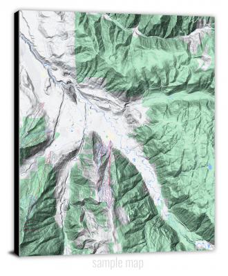
Enrich your office decor or home with a large canvas wrap Terrain map. It is designed for easy hanging with pre-installed hardware. Printed with archival inks and wrapped around a 1.5" thick gallery frame, your favorite map art will have a timeless and impressive look that fits with any decor. This map is fabricated with terrain imagery data from Google Maps, and bounding box coordinates from USGS.
Aberdeen, Maryland- Map Components- Imagery: Terrain of Aberdeen, Maryland. Bounding Box: Footprint of Aberdeen, Maryland at Longitude/Latitude Coordinates (-76.25 x -76.125 x 39.625 x 39.5).
Accident, Maryland- Map Components- Imagery: Terrain of Accident, Maryland. Bounding Box: Footprint of Accident, Maryland at Longitude/Latitude Coordinates (-79.375 x -79.25 x 39.75 x 39.625).
Annapolis, Maryland- Map Components- Imagery: Terrain of Annapolis, Maryland. Bounding Box: Footprint of Annapolis, Maryland at Longitude/Latitude Coordinates (-76.5 x -76.375 x 39 x 38.875).
Assawoman Bay, Maryland- Map Components- Imagery: Terrain of Assawoman Bay, Maryland. Bounding Box: Footprint of Assawoman Bay, Maryland at Longitude/Latitude Coordinates (-75.125 x -75 x 38.5 x 38.375).
Avilton, Maryland- Map Components- Imagery: Terrain of Avilton, Maryland. Bounding Box: Footprint of Avilton, Maryland at Longitude/Latitude Coordinates (-79.125 x -79 x 39.75 x 39.625).
Baltimore East, Maryland- Map Components- Imagery: Terrain of Baltimore East, Maryland. Bounding Box: Footprint of Baltimore East, Maryland at Longitude/Latitude Coordinates (-76.625 x -76.5 x 39.375 x 39.25).
Baltimore West, Maryland- Map Components- Imagery: Terrain of Baltimore West, Maryland. Bounding Box: Footprint of Baltimore West, Maryland at Longitude/Latitude Coordinates (-76.75 x -76.625 x 39.375 x 39.25).
Barren Island, Maryland- Map Components- Imagery: Terrain of Barren Island, Maryland. Bounding Box: Footprint of Barren Island, Maryland at Longitude/Latitude Coordinates (-76.375 x -76.25 x 38.375 x 38.25).
Barton, Maryland- Map Components- Imagery: Terrain of Barton, Maryland. Bounding Box: Footprint of Barton, Maryland at Longitude/Latitude Coordinates (-79.125 x -79 x 39.625 x 39.5).
Bay View, Maryland- Map Components- Imagery: Terrain of Bay View, Maryland. Bounding Box: Footprint of Bay View, Maryland at Longitude/Latitude Coordinates (-76 x -75.875 x 39.75 x 39.625).
Bel Air, Maryland- Map Components- Imagery: Terrain of Bel Air, Maryland. Bounding Box: Footprint of Bel Air, Maryland at Longitude/Latitude Coordinates (-76.375 x -76.25 x 39.625 x 39.5).
Bellegrove, Maryland- Map Components- Imagery: Terrain of Bellegrove, Maryland. Bounding Box: Footprint of Bellegrove, Maryland at Longitude/Latitude Coordinates (-78.375 x -78.25 x 39.75 x 39.625).
Beltsville, Maryland- Map Components- Imagery: Terrain of Beltsville, Maryland. Bounding Box: Footprint of Beltsville, Maryland at Longitude/Latitude Coordinates (-77 x -76.875 x 39.125 x 39).
Benedict, Maryland- Map Components- Imagery: Terrain of Benedict, Maryland. Bounding Box: Footprint of Benedict, Maryland at Longitude/Latitude Coordinates (-76.75 x -76.625 x 38.625 x 38.5).
Berlin, Maryland- Map Components- Imagery: Terrain of Berlin, Maryland. Bounding Box: Footprint of Berlin, Maryland at Longitude/Latitude Coordinates (-75.25 x -75.125 x 38.375 x 38.25).
Betterton, Maryland- Map Components- Imagery: Terrain of Betterton, Maryland. Bounding Box: Footprint of Betterton, Maryland at Longitude/Latitude Coordinates (-76.125 x -76 x 39.375 x 39.25).
Big Pool, Maryland- Map Components- Imagery: Terrain of Big Pool, Maryland. Bounding Box: Footprint of Big Pool, Maryland at Longitude/Latitude Coordinates (-78.125 x -78 x 39.625 x 39.5).
Bittinger, Maryland- Map Components- Imagery: Terrain of Bittinger, Maryland. Bounding Box: Footprint of Bittinger, Maryland at Longitude/Latitude Coordinates (-79.25 x -79.125 x 39.625 x 39.5).
Blackwater River, Maryland- Map Components- Imagery: Terrain of Blackwater River, Maryland. Bounding Box: Footprint of Blackwater River, Maryland at Longitude/Latitude Coordinates (-76.125 x -76 x 38.5 x 38.375).
Bloodsworth Island, Maryland- Map Components- Imagery: Terrain of Bloodsworth Island, Maryland. Bounding Box: Footprint of Bloodsworth Island, Maryland at Longitude/Latitude Coordinates (-76.125 x -76 x 38.25 x 38.125).
Bowie, Maryland- Map Components- Imagery: Terrain of Bowie, Maryland. Bounding Box: Footprint of Bowie, Maryland at Longitude/Latitude Coordinates (-76.75 x -76.625 x 39 x 38.875).
Boxiron, Maryland- Map Components- Imagery: Terrain of Boxiron, Maryland. Bounding Box: Footprint of Boxiron, Maryland at Longitude/Latitude Coordinates (-75.375 x -75.25 x 38.125 x 38).
Brandywine, Maryland- Map Components- Imagery: Terrain of Brandywine, Maryland. Bounding Box: Footprint of Brandywine, Maryland at Longitude/Latitude Coordinates (-76.875 x -76.75 x 38.75 x 38.625).
Bristol, Maryland- Map Components- Imagery: Terrain of Bristol, Maryland. Bounding Box: Footprint of Bristol, Maryland at Longitude/Latitude Coordinates (-76.75 x -76.625 x 38.875 x 38.75).
Broomes Island, Maryland- Map Components- Imagery: Terrain of Broomes Island, Maryland. Bounding Box: Footprint of Broomes Island, Maryland at Longitude/Latitude Coordinates (-76.625 x -76.5 x 38.5 x 38.375).
Buckeystown, Maryland- Map Components- Imagery: Terrain of Buckeystown, Maryland. Bounding Box: Footprint of Buckeystown, Maryland at Longitude/Latitude Coordinates (-77.5 x -77.375 x 39.375 x 39.25).
Burrsville, Maryland- Map Components- Imagery: Terrain of Burrsville, Maryland. Bounding Box: Footprint of Burrsville, Maryland at Longitude/Latitude Coordinates (-75.75 x -75.625 x 39 x 38.875).
Cambridge, Maryland- Map Components- Imagery: Terrain of Cambridge, Maryland. Bounding Box: Footprint of Cambridge, Maryland at Longitude/Latitude Coordinates (-76.125 x -76 x 38.625 x 38.5).
Catoctin Furnace, Maryland- Map Components- Imagery: Terrain of Catoctin Furnace, Maryland. Bounding Box: Footprint of Catoctin Furnace, Maryland at Longitude/Latitude Coordinates (-77.5 x -77.375 x 39.625 x 39.5).
Cecilton, Maryland- Map Components- Imagery: Terrain of Cecilton, Maryland. Bounding Box: Footprint of Cecilton, Maryland at Longitude/Latitude Coordinates (-75.875 x -75.75 x 39.5 x 39.375).
Centreville, Maryland- Map Components- Imagery: Terrain of Centreville, Maryland. Bounding Box: Footprint of Centreville, Maryland at Longitude/Latitude Coordinates (-76.125 x -76 x 39.125 x 39).
Charlotte Hall, Maryland- Map Components- Imagery: Terrain of Charlotte Hall, Maryland. Bounding Box: Footprint of Charlotte Hall, Maryland at Longitude/Latitude Coordinates (-76.875 x -76.75 x 38.5 x 38.375).
Chesapeake Bay 1 (All Water), Maryland- Map Components- Imagery: Terrain of Chesapeake Bay 1 (All Water), Maryland. Bounding Box: Footprint of Chesapeake Bay 1 (All Water), Maryland at Longitude/Latitude Coordinates (-76.5 x -76.375 x 38.75 x 38.625).
Chesapeake Bay 2 (All Water), Maryland- Map Components- Imagery: Terrain of Chesapeake Bay 2 (All Water), Maryland. Bounding Box: Footprint of Chesapeake Bay 2 (All Water), Maryland at Longitude/Latitude Coordinates (-76.5 x -76.375 x 38.625 x 38.5).
Chestertown, Maryland- Map Components- Imagery: Terrain of Chestertown, Maryland. Bounding Box: Footprint of Chestertown, Maryland at Longitude/Latitude Coordinates (-76.125 x -76 x 39.25 x 39.125).
Chicamacomico River, Maryland- Map Components- Imagery: Terrain of Chicamacomico River, Maryland. Bounding Box: Footprint of Chicamacomico River, Maryland at Longitude/Latitude Coordinates (-76 x -75.875 x 38.5 x 38.375).
Church Creek, Maryland- Map Components- Imagery: Terrain of Church Creek, Maryland. Bounding Box: Footprint of Church Creek, Maryland at Longitude/Latitude Coordinates (-76.25 x -76.125 x 38.625 x 38.5).
Church Hill, Maryland- Map Components- Imagery: Terrain of Church Hill, Maryland. Bounding Box: Footprint of Church Hill, Maryland at Longitude/Latitude Coordinates (-76 x -75.875 x 39.25 x 39.125).
Claiborne, Maryland- Map Components- Imagery: Terrain of Claiborne, Maryland. Bounding Box: Footprint of Claiborne, Maryland at Longitude/Latitude Coordinates (-76.375 x -76.25 x 38.875 x 38.75).
Clarksville, Maryland- Map Components- Imagery: Terrain of Clarksville, Maryland. Bounding Box: Footprint of Clarksville, Maryland at Longitude/Latitude Coordinates (-77 x -76.875 x 39.25 x 39.125).
Clear Spring, Maryland- Map Components- Imagery: Terrain of Clear Spring, Maryland. Bounding Box: Footprint of Clear Spring, Maryland at Longitude/Latitude Coordinates (-78 x -77.875 x 39.75 x 39.625).
Cockeysville, Maryland- Map Components- Imagery: Terrain of Cockeysville, Maryland. Bounding Box: Footprint of Cockeysville, Maryland at Longitude/Latitude Coordinates (-76.75 x -76.625 x 39.5 x 39.375).
Conowingo Dam, Maryland- Map Components- Imagery: Terrain of Conowingo Dam, Maryland. Bounding Box: Footprint of Conowingo Dam, Maryland at Longitude/Latitude Coordinates (-76.25 x -76.125 x 39.75 x 39.625).
Cove Point, Maryland- Map Components- Imagery: Terrain of Cove Point, Maryland. Bounding Box: Footprint of Cove Point, Maryland at Longitude/Latitude Coordinates (-76.5 x -76.375 x 38.5 x 38.375).
Cresaptown, Maryland- Map Components- Imagery: Terrain of Cresaptown, Maryland. Bounding Box: Footprint of Cresaptown, Maryland at Longitude/Latitude Coordinates (-78.875 x -78.75 x 39.625 x 39.5).
Crisfield, Maryland- Map Components- Imagery: Terrain of Crisfield, Maryland. Bounding Box: Footprint of Crisfield, Maryland at Longitude/Latitude Coordinates (-75.875 x -75.75 x 38 x 37.875).
Cumberland, Maryland- Map Components- Imagery: Terrain of Cumberland, Maryland. Bounding Box: Footprint of Cumberland, Maryland at Longitude/Latitude Coordinates (-78.875 x -78.75 x 39.75 x 39.625).
Curtis Bay, Maryland- Map Components- Imagery: Terrain of Curtis Bay, Maryland. Bounding Box: Footprint of Curtis Bay, Maryland at Longitude/Latitude Coordinates (-76.625 x -76.5 x 39.25 x 39.125).
Damascus, Maryland- Map Components- Imagery: Terrain of Damascus, Maryland. Bounding Box: Footprint of Damascus, Maryland at Longitude/Latitude Coordinates (-77.25 x -77.125 x 39.375 x 39.25).
Deal Island, Maryland- Map Components- Imagery: Terrain of Deal Island, Maryland. Bounding Box: Footprint of Deal Island, Maryland at Longitude/Latitude Coordinates (-76 x -75.875 x 38.25 x 38.125).
Deale, Maryland- Map Components- Imagery: Terrain of Deale, Maryland. Bounding Box: Footprint of Deale, Maryland at Longitude/Latitude Coordinates (-76.625 x -76.5 x 38.875 x 38.75).
Deale OE E, Maryland- Map Components- Imagery: Terrain of Deale OE E, Maryland. Bounding Box: Footprint of Deale OE E, Maryland at Longitude/Latitude Coordinates (-76.5 x -76.375 x 38.875 x 38.75).
Deer Park, Maryland- Map Components- Imagery: Terrain of Deer Park, Maryland. Bounding Box: Footprint of Deer Park, Maryland at Longitude/Latitude Coordinates (-79.375 x -79.25 x 39.5 x 39.375).
Delmar, Maryland- Map Components- Imagery: Terrain of Delmar, Maryland. Bounding Box: Footprint of Delmar, Maryland at Longitude/Latitude Coordinates (-75.625 x -75.5 x 38.5 x 38.375).
Denton, Maryland- Map Components- Imagery: Terrain of Denton, Maryland. Bounding Box: Footprint of Denton, Maryland at Longitude/Latitude Coordinates (-75.875 x -75.75 x 39 x 38.875).
Dividing Creek, Maryland- Map Components- Imagery: Terrain of Dividing Creek, Maryland. Bounding Box: Footprint of Dividing Creek, Maryland at Longitude/Latitude Coordinates (-75.625 x -75.5 x 38.25 x 38.125).
Earleville, Maryland- Map Components- Imagery: Terrain of Earleville, Maryland. Bounding Box: Footprint of Earleville, Maryland at Longitude/Latitude Coordinates (-76 x -75.875 x 39.5 x 39.375).
East New Market, Maryland- Map Components- Imagery: Terrain of East New Market, Maryland. Bounding Box: Footprint of East New Market, Maryland at Longitude/Latitude Coordinates (-76 x -75.875 x 38.625 x 38.5).
East of Point Lookout (All Water), Maryland- Map Components- Imagery: Terrain of East of Point Lookout (All Water), Maryland. Bounding Box: Footprint of East of Point Lookout (All Water), Maryland at Longitude/Latitude Coordinates (-76.25 x -76.125 x 38.125 x 38).
Easton, Maryland- Map Components- Imagery: Terrain of Easton, Maryland. Bounding Box: Footprint of Easton, Maryland at Longitude/Latitude Coordinates (-76.125 x -76 x 38.875 x 38.75).
Eden, Maryland- Map Components- Imagery: Terrain of Eden, Maryland. Bounding Box: Footprint of Eden, Maryland at Longitude/Latitude Coordinates (-75.75 x -75.625 x 38.375 x 38.25).
Edgewood, Maryland- Map Components- Imagery: Terrain of Edgewood, Maryland. Bounding Box: Footprint of Edgewood, Maryland at Longitude/Latitude Coordinates (-76.375 x -76.25 x 39.5 x 39.375).
Elkton, Maryland- Map Components- Imagery: Terrain of Elkton, Maryland. Bounding Box: Footprint of Elkton, Maryland at Longitude/Latitude Coordinates (-75.875 x -75.75 x 39.625 x 39.5).
Ellicott City, Maryland- Map Components- Imagery: Terrain of Ellicott City, Maryland. Bounding Box: Footprint of Ellicott City, Maryland at Longitude/Latitude Coordinates (-76.875 x -76.75 x 39.375 x 39.25).
Emmitsburg, Maryland- Map Components- Imagery: Terrain of Emmitsburg, Maryland. Bounding Box: Footprint of Emmitsburg, Maryland at Longitude/Latitude Coordinates (-77.375 x -77.25 x 39.75 x 39.625).
Evitts Creek, Maryland- Map Components- Imagery: Terrain of Evitts Creek, Maryland. Bounding Box: Footprint of Evitts Creek, Maryland at Longitude/Latitude Coordinates (-78.75 x -78.625 x 39.75 x 39.625).
Ewell, Maryland- Map Components- Imagery: Terrain of Ewell, Maryland. Bounding Box: Footprint of Ewell, Maryland at Longitude/Latitude Coordinates (-76.125 x -76 x 38 x 37.875).
Federalsburg, Maryland- Map Components- Imagery: Terrain of Federalsburg, Maryland. Bounding Box: Footprint of Federalsburg, Maryland at Longitude/Latitude Coordinates (-75.875 x -75.75 x 38.75 x 38.625).
Finksburg, Maryland- Map Components- Imagery: Terrain of Finksburg, Maryland. Bounding Box: Footprint of Finksburg, Maryland at Longitude/Latitude Coordinates (-77 x -76.875 x 39.5 x 39.375).
Flintstone, Maryland- Map Components- Imagery: Terrain of Flintstone, Maryland. Bounding Box: Footprint of Flintstone, Maryland at Longitude/Latitude Coordinates (-78.625 x -78.5 x 39.75 x 39.625).
Fowling Creek, Maryland- Map Components- Imagery: Terrain of Fowling Creek, Maryland. Bounding Box: Footprint of Fowling Creek, Maryland at Longitude/Latitude Coordinates (-76 x -75.875 x 38.875 x 38.75).
Frederick, Maryland- Map Components- Imagery: Terrain of Frederick, Maryland. Bounding Box: Footprint of Frederick, Maryland at Longitude/Latitude Coordinates (-77.5 x -77.375 x 39.5 x 39.375).
Friendsville, Maryland- Map Components- Imagery: Terrain of Friendsville, Maryland. Bounding Box: Footprint of Friendsville, Maryland at Longitude/Latitude Coordinates (-79.5 x -79.375 x 39.75 x 39.625).
Frostburg, Maryland- Map Components- Imagery: Terrain of Frostburg, Maryland. Bounding Box: Footprint of Frostburg, Maryland at Longitude/Latitude Coordinates (-79 x -78.875 x 39.75 x 39.625).
Funkstown, Maryland- Map Components- Imagery: Terrain of Funkstown, Maryland. Bounding Box: Footprint of Funkstown, Maryland at Longitude/Latitude Coordinates (-77.75 x -77.625 x 39.625 x 39.5).
Gaithersburg, Maryland- Map Components- Imagery: Terrain of Gaithersburg, Maryland. Bounding Box: Footprint of Gaithersburg, Maryland at Longitude/Latitude Coordinates (-77.25 x -77.125 x 39.25 x 39.125).
Galena, Maryland- Map Components- Imagery: Terrain of Galena, Maryland. Bounding Box: Footprint of Galena, Maryland at Longitude/Latitude Coordinates (-76 x -75.875 x 39.375 x 39.25).
Germantown, Maryland- Map Components- Imagery: Terrain of Germantown, Maryland. Bounding Box: Footprint of Germantown, Maryland at Longitude/Latitude Coordinates (-77.375 x -77.25 x 39.25 x 39.125).
Gibson Island, Maryland- Map Components- Imagery: Terrain of Gibson Island, Maryland. Bounding Box: Footprint of Gibson Island, Maryland at Longitude/Latitude Coordinates (-76.5 x -76.375 x 39.125 x 39).
Girdletree, Maryland- Map Components- Imagery: Terrain of Girdletree, Maryland. Bounding Box: Footprint of Girdletree, Maryland at Longitude/Latitude Coordinates (-75.5 x -75.375 x 38.125 x 38).
Golden Hill, Maryland- Map Components- Imagery: Terrain of Golden Hill, Maryland. Bounding Box: Footprint of Golden Hill, Maryland at Longitude/Latitude Coordinates (-76.25 x -76.125 x 38.5 x 38.375).
Goldsboro, Maryland- Map Components- Imagery: Terrain of Goldsboro, Maryland. Bounding Box: Footprint of Goldsboro, Maryland at Longitude/Latitude Coordinates (-75.875 x -75.75 x 39.125 x 39).
Gorman, Maryland- Map Components- Imagery: Terrain of Gorman, Maryland. Bounding Box: Footprint of Gorman, Maryland at Longitude/Latitude Coordinates (-79.375 x -79.25 x 39.375 x 39.25).
Grantsville, Maryland- Map Components- Imagery: Terrain of Grantsville, Maryland. Bounding Box: Footprint of Grantsville, Maryland at Longitude/Latitude Coordinates (-79.25 x -79.125 x 39.75 x 39.625).
Gunpowder Neck, Maryland- Map Components- Imagery: Terrain of Gunpowder Neck, Maryland. Bounding Box: Footprint of Gunpowder Neck, Maryland at Longitude/Latitude Coordinates (-76.375 x -76.25 x 39.375 x 39.25).
Hagerstown, Maryland- Map Components- Imagery: Terrain of Hagerstown, Maryland. Bounding Box: Footprint of Hagerstown, Maryland at Longitude/Latitude Coordinates (-77.75 x -77.625 x 39.75 x 39.625).
Hampstead, Maryland- Map Components- Imagery: Terrain of Hampstead, Maryland. Bounding Box: Footprint of Hampstead, Maryland at Longitude/Latitude Coordinates (-76.875 x -76.75 x 39.625 x 39.5).
Hancock, Maryland- Map Components- Imagery: Terrain of Hancock, Maryland. Bounding Box: Footprint of Hancock, Maryland at Longitude/Latitude Coordinates (-78.25 x -78.125 x 39.75 x 39.625).
Hanesville, Maryland- Map Components- Imagery: Terrain of Hanesville, Maryland. Bounding Box: Footprint of Hanesville, Maryland at Longitude/Latitude Coordinates (-76.25 x -76.125 x 39.375 x 39.25).
Havre De Grace, Maryland- Map Components- Imagery: Terrain of Havre De Grace, Maryland. Bounding Box: Footprint of Havre De Grace, Maryland at Longitude/Latitude Coordinates (-76.125 x -76 x 39.625 x 39.5).
Hebron, Maryland- Map Components- Imagery: Terrain of Hebron, Maryland. Bounding Box: Footprint of Hebron, Maryland at Longitude/Latitude Coordinates (-75.75 x -75.625 x 38.5 x 38.375).
Hereford, Maryland- Map Components- Imagery: Terrain of Hereford, Maryland. Bounding Box: Footprint of Hereford, Maryland at Longitude/Latitude Coordinates (-76.75 x -76.625 x 39.625 x 39.5).
Hobbs, Maryland- Map Components- Imagery: Terrain of Hobbs, Maryland. Bounding Box: Footprint of Hobbs, Maryland at Longitude/Latitude Coordinates (-75.875 x -75.75 x 38.875 x 38.75).
Hollywood, Maryland- Map Components- Imagery: Terrain of Hollywood, Maryland. Bounding Box: Footprint of Hollywood, Maryland at Longitude/Latitude Coordinates (-76.625 x -76.5 x 38.375 x 38.25).
Honga, Maryland- Map Components- Imagery: Terrain of Honga, Maryland. Bounding Box: Footprint of Honga, Maryland at Longitude/Latitude Coordinates (-76.25 x -76.125 x 38.375 x 38.25).
Hudson, Maryland- Map Components- Imagery: Terrain of Hudson, Maryland. Bounding Box: Footprint of Hudson, Maryland at Longitude/Latitude Coordinates (-76.375 x -76.25 x 38.625 x 38.5).
Hughesville, Maryland- Map Components- Imagery: Terrain of Hughesville, Maryland. Bounding Box: Footprint of Hughesville, Maryland at Longitude/Latitude Coordinates (-76.875 x -76.75 x 38.625 x 38.5).
Indian Head, Maryland- Map Components- Imagery: Terrain of Indian Head, Maryland. Bounding Box: Footprint of Indian Head, Maryland at Longitude/Latitude Coordinates (-77.25 x -77.125 x 38.625 x 38.5).
Jarrettsville, Maryland- Map Components- Imagery: Terrain of Jarrettsville, Maryland. Bounding Box: Footprint of Jarrettsville, Maryland at Longitude/Latitude Coordinates (-76.5 x -76.375 x 39.625 x 39.5).
Kedges Straits, Maryland- Map Components- Imagery: Terrain of Kedges Straits, Maryland. Bounding Box: Footprint of Kedges Straits, Maryland at Longitude/Latitude Coordinates (-76.125 x -76 x 38.125 x 38).
Keedysville, Maryland- Map Components- Imagery: Terrain of Keedysville, Maryland. Bounding Box: Footprint of Keedysville, Maryland at Longitude/Latitude Coordinates (-77.75 x -77.625 x 39.5 x 39.375).
Kensington, Maryland- Map Components- Imagery: Terrain of Kensington, Maryland. Bounding Box: Footprint of Kensington, Maryland at Longitude/Latitude Coordinates (-77.125 x -77 x 39.125 x 39).
Kent Island, Maryland- Map Components- Imagery: Terrain of Kent Island, Maryland. Bounding Box: Footprint of Kent Island, Maryland at Longitude/Latitude Coordinates (-76.375 x -76.25 x 39 x 38.875).
Kingston, Maryland- Map Components- Imagery: Terrain of Kingston, Maryland. Bounding Box: Footprint of Kingston, Maryland at Longitude/Latitude Coordinates (-75.75 x -75.625 x 38.125 x 38).
Kitzmiller, Maryland- Map Components- Imagery: Terrain of Kitzmiller, Maryland. Bounding Box: Footprint of Kitzmiller, Maryland at Longitude/Latitude Coordinates (-79.25 x -79.125 x 39.5 x 39.375).
La Plata, Maryland- Map Components- Imagery: Terrain of La Plata, Maryland. Bounding Box: Footprint of La Plata, Maryland at Longitude/Latitude Coordinates (-77 x -76.875 x 38.625 x 38.5).
Langford Creek, Maryland- Map Components- Imagery: Terrain of Langford Creek, Maryland. Bounding Box: Footprint of Langford Creek, Maryland at Longitude/Latitude Coordinates (-76.25 x -76.125 x 39.125 x 39).
Lanham, Maryland- Map Components- Imagery: Terrain of Lanham, Maryland. Bounding Box: Footprint of Lanham, Maryland at Longitude/Latitude Coordinates (-76.875 x -76.75 x 39 x 38.875).
Laurel, Maryland- Map Components- Imagery: Terrain of Laurel, Maryland. Bounding Box: Footprint of Laurel, Maryland at Longitude/Latitude Coordinates (-76.875 x -76.75 x 39.125 x 39).
Leonardtown, Maryland- Map Components- Imagery: Terrain of Leonardtown, Maryland. Bounding Box: Footprint of Leonardtown, Maryland at Longitude/Latitude Coordinates (-76.75 x -76.625 x 38.375 x 38.25).
Libertytown, Maryland- Map Components- Imagery: Terrain of Libertytown, Maryland. Bounding Box: Footprint of Libertytown, Maryland at Longitude/Latitude Coordinates (-77.25 x -77.125 x 39.5 x 39.375).
Lineboro, Maryland- Map Components- Imagery: Terrain of Lineboro, Maryland. Bounding Box: Footprint of Lineboro, Maryland at Longitude/Latitude Coordinates (-76.875 x -76.75 x 39.75 x 39.625).
Lonaconing, Maryland- Map Components- Imagery: Terrain of Lonaconing, Maryland. Bounding Box: Footprint of Lonaconing, Maryland at Longitude/Latitude Coordinates (-79 x -78.875 x 39.625 x 39.5).
Love Point, Maryland- Map Components- Imagery: Terrain of Love Point, Maryland. Bounding Box: Footprint of Love Point, Maryland at Longitude/Latitude Coordinates (-76.375 x -76.25 x 39.125 x 39).
Lower Marlboro, Maryland- Map Components- Imagery: Terrain of Lower Marlboro, Maryland. Bounding Box: Footprint of Lower Marlboro, Maryland at Longitude/Latitude Coordinates (-76.75 x -76.625 x 38.75 x 38.625).
Manchester, Maryland- Map Components- Imagery: Terrain of Manchester, Maryland. Bounding Box: Footprint of Manchester, Maryland at Longitude/Latitude Coordinates (-77 x -76.875 x 39.75 x 39.625).
Mardela Springs, Maryland- Map Components- Imagery: Terrain of Mardela Springs, Maryland. Bounding Box: Footprint of Mardela Springs, Maryland at Longitude/Latitude Coordinates (-75.875 x -75.75 x 38.5 x 38.375).
Marion, Maryland- Map Components- Imagery: Terrain of Marion, Maryland. Bounding Box: Footprint of Marion, Maryland at Longitude/Latitude Coordinates (-75.875 x -75.75 x 38.125 x 38).
Marydel, Maryland- Map Components- Imagery: Terrain of Marydel, Maryland. Bounding Box: Footprint of Marydel, Maryland at Longitude/Latitude Coordinates (-75.75 x -75.625 x 39.125 x 39).
McHenry, Maryland- Map Components- Imagery: Terrain of McHenry, Maryland. Bounding Box: Footprint of McHenry, Maryland at Longitude/Latitude Coordinates (-79.375 x -79.25 x 39.625 x 39.5).
Mechanicsville, Maryland- Map Components- Imagery: Terrain of Mechanicsville, Maryland. Bounding Box: Footprint of Mechanicsville, Maryland at Longitude/Latitude Coordinates (-76.75 x -76.625 x 38.5 x 38.375).
Middle River, Maryland- Map Components- Imagery: Terrain of Middle River, Maryland. Bounding Box: Footprint of Middle River, Maryland at Longitude/Latitude Coordinates (-76.5 x -76.375 x 39.375 x 39.25).
Middletown, Maryland- Map Components- Imagery: Terrain of Middletown, Maryland. Bounding Box: Footprint of Middletown, Maryland at Longitude/Latitude Coordinates (-77.625 x -77.5 x 39.5 x 39.375).
Millington, Maryland- Map Components- Imagery: Terrain of Millington, Maryland. Bounding Box: Footprint of Millington, Maryland at Longitude/Latitude Coordinates (-75.875 x -75.75 x 39.375 x 39.25).
Monie, Maryland- Map Components- Imagery: Terrain of Monie, Maryland. Bounding Box: Footprint of Monie, Maryland at Longitude/Latitude Coordinates (-75.875 x -75.75 x 38.25 x 38.125).
Myersville, Maryland- Map Components- Imagery: Terrain of Myersville, Maryland. Bounding Box: Footprint of Myersville, Maryland at Longitude/Latitude Coordinates (-77.625 x -77.5 x 39.625 x 39.5).
Nanjemoy, Maryland- Map Components- Imagery: Terrain of Nanjemoy, Maryland. Bounding Box: Footprint of Nanjemoy, Maryland at Longitude/Latitude Coordinates (-77.25 x -77.125 x 38.5 x 38.375).
Nanticoke, Maryland- Map Components- Imagery: Terrain of Nanticoke, Maryland. Bounding Box: Footprint of Nanticoke, Maryland at Longitude/Latitude Coordinates (-76 x -75.875 x 38.375 x 38.25).
New Windsor, Maryland- Map Components- Imagery: Terrain of New Windsor, Maryland. Bounding Box: Footprint of New Windsor, Maryland at Longitude/Latitude Coordinates (-77.125 x -77 x 39.625 x 39.5).
Ninepin Branch, Maryland- Map Components- Imagery: Terrain of Ninepin Branch, Maryland. Bounding Box: Footprint of Ninepin Branch, Maryland at Longitude/Latitude Coordinates (-75.375 x -75.25 x 38.375 x 38.25).
Norrisville, Maryland- Map Components- Imagery: Terrain of Norrisville, Maryland. Bounding Box: Footprint of Norrisville, Maryland at Longitude/Latitude Coordinates (-76.625 x -76.5 x 39.75 x 39.625).
North Beach, Maryland- Map Components- Imagery: Terrain of North Beach, Maryland. Bounding Box: Footprint of North Beach, Maryland at Longitude/Latitude Coordinates (-76.625 x -76.5 x 38.75 x 38.625).
North East, Maryland- Map Components- Imagery: Terrain of North East, Maryland. Bounding Box: Footprint of North East, Maryland at Longitude/Latitude Coordinates (-76 x -75.875 x 39.625 x 39.5).
Oakland, Maryland- Map Components- Imagery: Terrain of Oakland, Maryland. Bounding Box: Footprint of Oakland, Maryland at Longitude/Latitude Coordinates (-79.5 x -79.375 x 39.5 x 39.375).
Ocean City, Maryland- Map Components- Imagery: Terrain of Ocean City, Maryland. Bounding Box: Footprint of Ocean City, Maryland at Longitude/Latitude Coordinates (-75.125 x -75 x 38.375 x 38.25).
Odenton, Maryland- Map Components- Imagery: Terrain of Odenton, Maryland. Bounding Box: Footprint of Odenton, Maryland at Longitude/Latitude Coordinates (-76.75 x -76.625 x 39.125 x 39).
Oldtown, Maryland- Map Components- Imagery: Terrain of Oldtown, Maryland. Bounding Box: Footprint of Oldtown, Maryland at Longitude/Latitude Coordinates (-78.625 x -78.5 x 39.625 x 39.5).
Oxford, Maryland- Map Components- Imagery: Terrain of Oxford, Maryland. Bounding Box: Footprint of Oxford, Maryland at Longitude/Latitude Coordinates (-76.25 x -76.125 x 38.75 x 38.625).
Perryman, Maryland- Map Components- Imagery: Terrain of Perryman, Maryland. Bounding Box: Footprint of Perryman, Maryland at Longitude/Latitude Coordinates (-76.25 x -76.125 x 39.5 x 39.375).
Phoenix, Maryland- Map Components- Imagery: Terrain of Phoenix, Maryland. Bounding Box: Footprint of Phoenix, Maryland at Longitude/Latitude Coordinates (-76.625 x -76.5 x 39.625 x 39.5).
Piney Point, Maryland- Map Components- Imagery: Terrain of Piney Point, Maryland. Bounding Box: Footprint of Piney Point, Maryland at Longitude/Latitude Coordinates (-76.625 x -76.5 x 38.25 x 38.125).
Piscataway, Maryland- Map Components- Imagery: Terrain of Piscataway, Maryland. Bounding Box: Footprint of Piscataway, Maryland at Longitude/Latitude Coordinates (-77 x -76.875 x 38.75 x 38.625).
Pittsville, Maryland- Map Components- Imagery: Terrain of Pittsville, Maryland. Bounding Box: Footprint of Pittsville, Maryland at Longitude/Latitude Coordinates (-75.5 x -75.375 x 38.5 x 38.375).
Pocomoke City, Maryland- Map Components- Imagery: Terrain of Pocomoke City, Maryland. Bounding Box: Footprint of Pocomoke City, Maryland at Longitude/Latitude Coordinates (-75.625 x -75.5 x 38.125 x 38).
Point Lookout, Maryland- Map Components- Imagery: Terrain of Point Lookout, Maryland. Bounding Box: Footprint of Point Lookout, Maryland at Longitude/Latitude Coordinates (-76.375 x -76.25 x 38.125 x 38).
Point No Point, Maryland- Map Components- Imagery: Terrain of Point No Point, Maryland. Bounding Box: Footprint of Point No Point, Maryland at Longitude/Latitude Coordinates (-76.375 x -76.25 x 38.25 x 38.125).
Point of Rocks, Maryland- Map Components- Imagery: Terrain of Point of Rocks, Maryland. Bounding Box: Footprint of Point of Rocks, Maryland at Longitude/Latitude Coordinates (-77.625 x -77.5 x 39.375 x 39.25).
Poolesville, Maryland- Map Components- Imagery: Terrain of Poolesville, Maryland. Bounding Box: Footprint of Poolesville, Maryland at Longitude/Latitude Coordinates (-77.5 x -77.375 x 39.25 x 39.125).
Popes Creek, Maryland- Map Components- Imagery: Terrain of Popes Creek, Maryland. Bounding Box: Footprint of Popes Creek, Maryland at Longitude/Latitude Coordinates (-77 x -76.875 x 38.5 x 38.375).
Port Tobacco, Maryland- Map Components- Imagery: Terrain of Port Tobacco, Maryland. Bounding Box: Footprint of Port Tobacco, Maryland at Longitude/Latitude Coordinates (-77.125 x -77 x 38.625 x 38.5).
Preston, Maryland- Map Components- Imagery: Terrain of Preston, Maryland. Bounding Box: Footprint of Preston, Maryland at Longitude/Latitude Coordinates (-76 x -75.875 x 38.75 x 38.625).
Price, Maryland- Map Components- Imagery: Terrain of Price, Maryland. Bounding Box: Footprint of Price, Maryland at Longitude/Latitude Coordinates (-76 x -75.875 x 39.125 x 39).
Prince Frederick, Maryland- Map Components- Imagery: Terrain of Prince Frederick, Maryland. Bounding Box: Footprint of Prince Frederick, Maryland at Longitude/Latitude Coordinates (-76.625 x -76.5 x 38.625 x 38.5).
Princess Anne, Maryland- Map Components- Imagery: Terrain of Princess Anne, Maryland. Bounding Box: Footprint of Princess Anne, Maryland at Longitude/Latitude Coordinates (-75.75 x -75.625 x 38.25 x 38.125).
Public Landing, Maryland- Map Components- Imagery: Terrain of Public Landing, Maryland. Bounding Box: Footprint of Public Landing, Maryland at Longitude/Latitude Coordinates (-75.375 x -75.25 x 38.25 x 38.125).
Queenstown, Maryland- Map Components- Imagery: Terrain of Queenstown, Maryland. Bounding Box: Footprint of Queenstown, Maryland at Longitude/Latitude Coordinates (-76.25 x -76.125 x 39 x 38.875).
Reisterstown, Maryland- Map Components- Imagery: Terrain of Reisterstown, Maryland. Bounding Box: Footprint of Reisterstown, Maryland at Longitude/Latitude Coordinates (-76.875 x -76.75 x 39.5 x 39.375).
Relay, Maryland- Map Components- Imagery: Terrain of Relay, Maryland. Bounding Box: Footprint of Relay, Maryland at Longitude/Latitude Coordinates (-76.75 x -76.625 x 39.25 x 39.125).
Rhodesdale, Maryland- Map Components- Imagery: Terrain of Rhodesdale, Maryland. Bounding Box: Footprint of Rhodesdale, Maryland at Longitude/Latitude Coordinates (-75.875 x -75.75 x 38.625 x 38.5).
Richland Point, Maryland- Map Components- Imagery: Terrain of Richland Point, Maryland. Bounding Box: Footprint of Richland Point, Maryland at Longitude/Latitude Coordinates (-76.25 x -76.125 x 38.25 x 38.125).
Ridgely, Maryland- Map Components- Imagery: Terrain of Ridgely, Maryland. Bounding Box: Footprint of Ridgely, Maryland at Longitude/Latitude Coordinates (-76 x -75.875 x 39 x 38.875).
Rising Sun, Maryland- Map Components- Imagery: Terrain of Rising Sun, Maryland. Bounding Box: Footprint of Rising Sun, Maryland at Longitude/Latitude Coordinates (-76.125 x -76 x 39.75 x 39.625).
Rock Hall, Maryland- Map Components- Imagery: Terrain of Rock Hall, Maryland. Bounding Box: Footprint of Rock Hall, Maryland at Longitude/Latitude Coordinates (-76.25 x -76.125 x 39.25 x 39.125).
Rock Point, Maryland- Map Components- Imagery: Terrain of Rock Point, Maryland. Bounding Box: Footprint of Rock Point, Maryland at Longitude/Latitude Coordinates (-76.875 x -76.75 x 38.375 x 38.25).
Rockville, Maryland- Map Components- Imagery: Terrain of Rockville, Maryland. Bounding Box: Footprint of Rockville, Maryland at Longitude/Latitude Coordinates (-77.25 x -77.125 x 39.125 x 39).
Round Bay, Maryland- Map Components- Imagery: Terrain of Round Bay, Maryland. Bounding Box: Footprint of Round Bay, Maryland at Longitude/Latitude Coordinates (-76.625 x -76.5 x 39.125 x 39).
Saint Clements Island, Maryland- Map Components- Imagery: Terrain of Saint Clements Island, Maryland. Bounding Box: Footprint of Saint Clements Island, Maryland at Longitude/Latitude Coordinates (-76.75 x -76.625 x 38.25 x 38.125).
Saint George Island, Maryland- Map Components- Imagery: Terrain of Saint George Island, Maryland. Bounding Box: Footprint of Saint George Island, Maryland at Longitude/Latitude Coordinates (-76.5 x -76.375 x 38.125 x 38).
Saint Marys City, Maryland- Map Components- Imagery: Terrain of Saint Marys City, Maryland. Bounding Box: Footprint of Saint Marys City, Maryland at Longitude/Latitude Coordinates (-76.5 x -76.375 x 38.25 x 38.125).
Saint Michaels, Maryland- Map Components- Imagery: Terrain of Saint Michaels, Maryland. Bounding Box: Footprint of Saint Michaels, Maryland at Longitude/Latitude Coordinates (-76.25 x -76.125 x 38.875 x 38.75).
Salisbury, Maryland- Map Components- Imagery: Terrain of Salisbury, Maryland. Bounding Box: Footprint of Salisbury, Maryland at Longitude/Latitude Coordinates (-75.625 x -75.5 x 38.375 x 38.25).
Sandy Spring, Maryland- Map Components- Imagery: Terrain of Sandy Spring, Maryland. Bounding Box: Footprint of Sandy Spring, Maryland at Longitude/Latitude Coordinates (-77.125 x -77 x 39.25 x 39.125).
Sang Run, Maryland- Map Components- Imagery: Terrain of Sang Run, Maryland. Bounding Box: Footprint of Sang Run, Maryland at Longitude/Latitude Coordinates (-79.5 x -79.375 x 39.625 x 39.5).
Savage, Maryland- Map Components- Imagery: Terrain of Savage, Maryland. Bounding Box: Footprint of Savage, Maryland at Longitude/Latitude Coordinates (-76.875 x -76.75 x 39.25 x 39.125).
Seneca, Maryland- Map Components- Imagery: Terrain of Seneca, Maryland. Bounding Box: Footprint of Seneca, Maryland at Longitude/Latitude Coordinates (-77.375 x -77.25 x 39.125 x 39).
Sharptown, Maryland- Map Components- Imagery: Terrain of Sharptown, Maryland. Bounding Box: Footprint of Sharptown, Maryland at Longitude/Latitude Coordinates (-75.75 x -75.625 x 38.625 x 38.5).
Smithsburg, Maryland- Map Components- Imagery: Terrain of Smithsburg, Maryland. Bounding Box: Footprint of Smithsburg, Maryland at Longitude/Latitude Coordinates (-77.625 x -77.5 x 39.75 x 39.625).
Snow Hill, Maryland- Map Components- Imagery: Terrain of Snow Hill, Maryland. Bounding Box: Footprint of Snow Hill, Maryland at Longitude/Latitude Coordinates (-75.5 x -75.375 x 38.25 x 38.125).
Solomons Island, Maryland- Map Components- Imagery: Terrain of Solomons Island, Maryland. Bounding Box: Footprint of Solomons Island, Maryland at Longitude/Latitude Coordinates (-76.5 x -76.375 x 38.375 x 38.25).
South River, Maryland- Map Components- Imagery: Terrain of South River, Maryland. Bounding Box: Footprint of South River, Maryland at Longitude/Latitude Coordinates (-76.625 x -76.5 x 39 x 38.875).
Sparrows Point, Maryland- Map Components- Imagery: Terrain of Sparrows Point, Maryland. Bounding Box: Footprint of Sparrows Point, Maryland at Longitude/Latitude Coordinates (-76.5 x -76.375 x 39.25 x 39.125).
Spesutie, Maryland- Map Components- Imagery: Terrain of Spesutie, Maryland. Bounding Box: Footprint of Spesutie, Maryland at Longitude/Latitude Coordinates (-76.125 x -76 x 39.5 x 39.375).
Sudlersville, Maryland- Map Components- Imagery: Terrain of Sudlersville, Maryland. Bounding Box: Footprint of Sudlersville, Maryland at Longitude/Latitude Coordinates (-75.875 x -75.75 x 39.25 x 39.125).
Swan Point, Maryland- Map Components- Imagery: Terrain of Swan Point, Maryland. Bounding Box: Footprint of Swan Point, Maryland at Longitude/Latitude Coordinates (-76.375 x -76.25 x 39.25 x 39.125).
Sykesville, Maryland- Map Components- Imagery: Terrain of Sykesville, Maryland. Bounding Box: Footprint of Sykesville, Maryland at Longitude/Latitude Coordinates (-77 x -76.875 x 39.375 x 39.25).
Table Rock, Maryland- Map Components- Imagery: Terrain of Table Rock, Maryland. Bounding Box: Footprint of Table Rock, Maryland at Longitude/Latitude Coordinates (-79.5 x -79.375 x 39.375 x 39.25).
Taneytown, Maryland- Map Components- Imagery: Terrain of Taneytown, Maryland. Bounding Box: Footprint of Taneytown, Maryland at Longitude/Latitude Coordinates (-77.25 x -77.125 x 39.75 x 39.625).
Taylors Island, Maryland- Map Components- Imagery: Terrain of Taylors Island, Maryland. Bounding Box: Footprint of Taylors Island, Maryland at Longitude/Latitude Coordinates (-76.375 x -76.25 x 38.5 x 38.375).
Terrapin Sand Point, Maryland- Map Components- Imagery: Terrain of Terrapin Sand Point, Maryland. Bounding Box: Footprint of Terrapin Sand Point, Maryland at Longitude/Latitude Coordinates (-76 x -75.875 x 38.125 x 38).
Tilghman, Maryland- Map Components- Imagery: Terrain of Tilghman, Maryland. Bounding Box: Footprint of Tilghman, Maryland at Longitude/Latitude Coordinates (-76.375 x -76.25 x 38.75 x 38.625).
Tingles Island, Maryland- Map Components- Imagery: Terrain of Tingles Island, Maryland. Bounding Box: Footprint of Tingles Island, Maryland at Longitude/Latitude Coordinates (-75.25 x -75.125 x 38.25 x 38.125).
Towson, Maryland- Map Components- Imagery: Terrain of Towson, Maryland. Bounding Box: Footprint of Towson, Maryland at Longitude/Latitude Coordinates (-76.625 x -76.5 x 39.5 x 39.375).
Trappe, Maryland- Map Components- Imagery: Terrain of Trappe, Maryland. Bounding Box: Footprint of Trappe, Maryland at Longitude/Latitude Coordinates (-76.125 x -76 x 38.75 x 38.625).
Union Bridge, Maryland- Map Components- Imagery: Terrain of Union Bridge, Maryland. Bounding Box: Footprint of Union Bridge, Maryland at Longitude/Latitude Coordinates (-77.25 x -77.125 x 39.625 x 39.5).
Upper Marlboro, Maryland- Map Components- Imagery: Terrain of Upper Marlboro, Maryland. Bounding Box: Footprint of Upper Marlboro, Maryland at Longitude/Latitude Coordinates (-76.875 x -76.75 x 38.875 x 38.75).
Urbana, Maryland- Map Components- Imagery: Terrain of Urbana, Maryland. Bounding Box: Footprint of Urbana, Maryland at Longitude/Latitude Coordinates (-77.375 x -77.25 x 39.375 x 39.25).
Walkersville, Maryland- Map Components- Imagery: Terrain of Walkersville, Maryland. Bounding Box: Footprint of Walkersville, Maryland at Longitude/Latitude Coordinates (-77.375 x -77.25 x 39.5 x 39.375).
Wango, Maryland- Map Components- Imagery: Terrain of Wango, Maryland. Bounding Box: Footprint of Wango, Maryland at Longitude/Latitude Coordinates (-75.5 x -75.375 x 38.375 x 38.25).
Westernport, Maryland- Map Components- Imagery: Terrain of Westernport, Maryland. Bounding Box: Footprint of Westernport, Maryland at Longitude/Latitude Coordinates (-79.125 x -79 x 39.5 x 39.375).
Westminster, Maryland- Map Components- Imagery: Terrain of Westminster, Maryland. Bounding Box: Footprint of Westminster, Maryland at Longitude/Latitude Coordinates (-77 x -76.875 x 39.625 x 39.5).
Wetipquin, Maryland- Map Components- Imagery: Terrain of Wetipquin, Maryland. Bounding Box: Footprint of Wetipquin, Maryland at Longitude/Latitude Coordinates (-75.875 x -75.75 x 38.375 x 38.25).
Whaleyville, Maryland- Map Components- Imagery: Terrain of Whaleyville, Maryland. Bounding Box: Footprint of Whaleyville, Maryland at Longitude/Latitude Coordinates (-75.375 x -75.25 x 38.5 x 38.375).
White Marsh, Maryland- Map Components- Imagery: Terrain of White Marsh, Maryland. Bounding Box: Footprint of White Marsh, Maryland at Longitude/Latitude Coordinates (-76.5 x -76.375 x 39.5 x 39.375).
Whittington Point, Maryland- Map Components- Imagery: Terrain of Whittington Point, Maryland. Bounding Box: Footprint of Whittington Point, Maryland at Longitude/Latitude Coordinates (-75.25 x -75.125 x 38.125 x 38).
Williamsport, Maryland- Map Components- Imagery: Terrain of Williamsport, Maryland. Bounding Box: Footprint of Williamsport, Maryland at Longitude/Latitude Coordinates (-77.875 x -77.75 x 39.625 x 39.5).
Winfield, Maryland- Map Components- Imagery: Terrain of Winfield, Maryland. Bounding Box: Footprint of Winfield, Maryland at Longitude/Latitude Coordinates (-77.125 x -77 x 39.5 x 39.375).
Wingate, Maryland- Map Components- Imagery: Terrain of Wingate, Maryland. Bounding Box: Footprint of Wingate, Maryland at Longitude/Latitude Coordinates (-76.125 x -76 x 38.375 x 38.25).
Woodbine, Maryland- Map Components- Imagery: Terrain of Woodbine, Maryland. Bounding Box: Footprint of Woodbine, Maryland at Longitude/Latitude Coordinates (-77.125 x -77 x 39.375 x 39.25).
Woodsboro, Maryland- Map Components- Imagery: Terrain of Woodsboro, Maryland. Bounding Box: Footprint of Woodsboro, Maryland at Longitude/Latitude Coordinates (-77.375 x -77.25 x 39.625 x 39.5).
Wye Mills, Maryland- Map Components- Imagery: Terrain of Wye Mills, Maryland. Bounding Box: Footprint of Wye Mills, Maryland at Longitude/Latitude Coordinates (-76.125 x -76 x 39 x 38.875).
For large or custom orders, please contact us at 385-206-8700 or email at sales@whiteclouds.com
Superior Quality, Crafted By Hand
Our gallery quality large canvas wraps are each crafted by hand. They are professional canvas wraps meant to compliment any room. Built to last with precision around a wood frame, each canvas wrap is hand-stapled with care, so they stay firm with tight, clean corners for years to come. You will be able to easily hang your canvas wrap in minutes. Comes complete with a hanging kit at no extra cost.
Our archival inks prevent fading to preserve as much fine detail as possible over time. We use artist grade cotton/polyester canvas materials that are acid-free. These canvas materials are heavyweight for a quality feel.
The optional dust covers are designed for large canvas wraps to be used in high traffic areas or commercial spaces.
Our materials are gallery quality. Canvas prints are built with high quality, UV-resistant, environmentally-friendly, fade-resistant, latex archival inks and artist-grade poly-cotton canvas. Our archival inks prevent fading to preserve as much fine detail as possible over time.
Construction:
Built to last with precision around a 1.5 inch kiln-dried wood frame, a processed pine wood material that has all moisture removed to prevent further damage. Each frame also has extra support inside due to the large size of our canvas prints. Each canvas wrap is then hand-stapled with care to ensure tight corner folds and secure construction so they stay firm with tight, clean corners for years to come.
1.5" Kiln-Dried Framework

Hand Stretched, Tight Edges

Canvas material:
We use artist grade cotton/polyester canvas materials that are acid-free, specifically 65% Polyester and 35% Cotton. Polyester is used in order to preserve the durability, elasticity, and low cost of our products, yet still maintaining the natural, breathable qualities that cotton provides. Our acrylic coating further protects our canvas from damage and staining, keeping the canvas as low-maintenance as possible. Our final finish provides a Matte/Natural White look in order to maintain the neutrality of the base, so that our photos will look their best as they are stretched over the frame.
Our canvas prints are slightly more heavyweight for a quality feel, but it is much lighter than a standard framed painting and less likely to cause damage to the wall. With a medium weight of 320 grams per square meter (GSM) or 9.5 ounces per yard squared (OSY), our canvas is made to be just sturdy enough while still keeping the material light and flexible. There are 470 microns which measures the diameter of the fibers, making it about 7 times thicker than the average human hair! This thickness gives our canvas the durability it needs as well as the unique texture that accompanies canvas.
Clean Corner Fabrication

Printers and Ink
We have the latest HP Latex printers and archival ink to produce consistent and quality results. The inks are environment-friendly and reduce fading for up to 200 years according to HP.
Hanging hardware comes installed on each canvas wrap we fabricate. The type of hanger depends on the size of the art-piece. It may be a sawtooth hanger or a pre-installed cable bracket system for larger canvas wraps (see images below).
If you have chosen the finished back on your traditional canvas, we will cover the back of your canvas with a white dust cover. Installation is as easy as placing 1 or 2 screws/nails into the wall and then laying the cable or hanger over them. Lastly, tilt the canvas wrap until it is level.
Stainless steel cable hangers for larger canvas wraps

Sawtooth hangers for smaller canvas wraps

WhiteClouds is located in Ogden, Utah. All products are manufactured and shipped from our facilities. Various shipping methods will be used depending on the size of the product and the size of the order. Your shipment will be delivered by standard shipping carriers. Smaller packages will be delivered by USPS or FedEx. Larger and oversize packages will be delivered by UPS Freight or LTL carriers (motor cargo). Shipments may be divided up and delivered in multiple packages. When the package has been shipped, you will receive an email from us with tracking information.
For special shipping considerations, please contact us at 385-206-8700 or email at sales@whiteclouds.com
ORDER CANCELLATION: At WhiteClouds, we have a great team that works hard to fabricate and complete your order by hand, with the highest degree of quality. Once you place your order, our team begins the process of creating your unique canvas wrap.
To cancel your order, you must contact us within 24 hours of placing your order by calling 1-385-206-8700 or email us at support@whiteclouds.com.
Any cancellation requests after the 24-hour period will not be accepted.
DAMAGED ITEMS: Even though WhiteClouds takes great care in preparing items for shipment, occasionally there is damage during shipping. If you receive your order and it is damaged or broken, we will gladly replace your items.
If you receive the wrong canvas, we will gladly replace it at no extra cost to you!
Please report the damage within 24 hours of receiving the item(s) by contacting us at 1-385-206-8700 or email us at support@whiteclouds.com and we will send you a replacement.
To view our Return Policy and Satisfaction Guarantee, click here.
SATISFACTION GUARANTEE: We want you to be 100% satisfied with your purchase so we offer a 30-day money back guarantee. If you don't like your canvas, simply ship it back to us as per our instructions and we will provide you with a full refund.
Contact us at 1-385-206-8700 or email us at support@whiteclouds.com and we will instruct you on how to return your purchase.
Please note that we do not cover the cost of return shipping, it is the responsibility of the customer to cover return shipping costs.
To view our Return Policy and Satisfaction Guarantee, click here.
How long does it take to fabricate a large canvas wrap? Each canvas wrap is carefully crafted by hand and usually takes 1 -3 days.
Can WhiteClouds ship to multiple locations? Yes, there may be additional shipping and handling charges. Please contact us to discuss options.
What is the warranty? Whiteclouds canvas wraps are warranted against defects in material and workmanship for 3 full years from the date of shipment. Misuse, neglect or alteration of product is not covered under this warranty. To view our Return Policy and Satisfaction Guarantee, click here.
What if I want a different size canvas wrap? We can fabricate custom sizes for our canvas wraps. Please look at our fabrication services at https://www.whiteclouds.com, call us at 1-385-206-8700, or email us at sales@whiteclouds.com.
What types of organizations are WhiteClouds customers? We work with customers all over the world in many industries, including many Fortune 500 organizations. See some of our customers here.
Do you have a question we didn‘t answer? Don't hesitate to contact us at 1-385-206-8700 or email us at support@whiteclouds.com.