


To view terrain imagery and bounding box footprint of individual city/location maps, click below on specific links

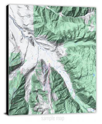
• Extra-Large Gallery Canvas Wrap Print
• Hand-Stretched, Expertly Crafted
• Artist Grade Canvas with Fade-Resistant Inks
• Ready to Hang with Pre-Installed Hardware
• 1.5" Thick Gallery Frame
Enrich your office decor or home with a large canvas wrap Terrain map. It is designed for easy hanging with pre-installed hardware. Printed with archival inks and wrapped around a 1.5" thick gallery frame, your favorite map art will have a timeless and impressive look that fits with any decor. This map is fabricated with terrain imagery data from Google Maps, and bounding box coordinates from USGS.
Adair, Michigan- Map Components- Imagery: Terrain of Adair, Michigan. Bounding Box: Footprint of Adair, Michigan at Longitude/Latitude Coordinates (-82.75 x -82.625 x 42.875 x 42.75).
Adams Park, Michigan- Map Components- Imagery: Terrain of Adams Park, Michigan. Bounding Box: Footprint of Adams Park, Michigan at Longitude/Latitude Coordinates (-85.5 x -85.375 x 42.25 x 42.125).
Adams Point, Michigan- Map Components- Imagery: Terrain of Adams Point, Michigan. Bounding Box: Footprint of Adams Point, Michigan at Longitude/Latitude Coordinates (-83.75 x -83.625 x 45.5 x 45.375).
Adamsville, Michigan- Map Components- Imagery: Terrain of Adamsville, Michigan. Bounding Box: Footprint of Adamsville, Michigan at Longitude/Latitude Coordinates (-86 x -85.875 x 41.875 x 41.75).
Addis Creek, Michigan- Map Components- Imagery: Terrain of Addis Creek, Michigan. Bounding Box: Footprint of Addis Creek, Michigan at Longitude/Latitude Coordinates (-85 x -84.875 x 44.5 x 44.375).
Addison, Michigan- Map Components- Imagery: Terrain of Addison, Michigan. Bounding Box: Footprint of Addison, Michigan at Longitude/Latitude Coordinates (-84.375 x -84.25 x 42 x 41.875).
Adrian, Michigan- Map Components- Imagery: Terrain of Adrian, Michigan. Bounding Box: Footprint of Adrian, Michigan at Longitude/Latitude Coordinates (-84.125 x -84 x 42 x 41.875).
Afton, Michigan- Map Components- Imagery: Terrain of Afton, Michigan. Bounding Box: Footprint of Afton, Michigan at Longitude/Latitude Coordinates (-84.5 x -84.375 x 45.375 x 45.25).
Ahmeek, Michigan- Map Components- Imagery: Terrain of Ahmeek, Michigan. Bounding Box: Footprint of Ahmeek, Michigan at Longitude/Latitude Coordinates (-88.5 x -88.375 x 47.375 x 47.25).
Alabaster, Michigan- Map Components- Imagery: Terrain of Alabaster, Michigan. Bounding Box: Footprint of Alabaster, Michigan at Longitude/Latitude Coordinates (-83.625 x -83.5 x 44.25 x 44.125).
Alamando, Michigan- Map Components- Imagery: Terrain of Alamando, Michigan. Bounding Box: Footprint of Alamando, Michigan at Longitude/Latitude Coordinates (-84.625 x -84.5 x 43.75 x 43.625).
Alanson, Michigan- Map Components- Imagery: Terrain of Alanson, Michigan. Bounding Box: Footprint of Alanson, Michigan at Longitude/Latitude Coordinates (-84.875 x -84.75 x 45.5 x 45.375).
Alba, Michigan- Map Components- Imagery: Terrain of Alba, Michigan. Bounding Box: Footprint of Alba, Michigan at Longitude/Latitude Coordinates (-85 x -84.875 x 45 x 44.875).
Albany Island, Michigan- Map Components- Imagery: Terrain of Albany Island, Michigan. Bounding Box: Footprint of Albany Island, Michigan at Longitude/Latitude Coordinates (-84.125 x -84 x 46 x 45.875).
Alberta, Michigan- Map Components- Imagery: Terrain of Alberta, Michigan. Bounding Box: Footprint of Alberta, Michigan at Longitude/Latitude Coordinates (-88.5 x -88.375 x 46.75 x 46.625).
Alcona Dam Pond, Michigan- Map Components- Imagery: Terrain of Alcona Dam Pond, Michigan. Bounding Box: Footprint of Alcona Dam Pond, Michigan at Longitude/Latitude Coordinates (-83.875 x -83.75 x 44.625 x 44.5).
Alden, Michigan- Map Components- Imagery: Terrain of Alden, Michigan. Bounding Box: Footprint of Alden, Michigan at Longitude/Latitude Coordinates (-85.375 x -85.25 x 45 x 44.875).
Aldridge Creek, Michigan- Map Components- Imagery: Terrain of Aldridge Creek, Michigan. Bounding Box: Footprint of Aldridge Creek, Michigan at Longitude/Latitude Coordinates (-89.75 x -89.625 x 46.75 x 46.625).
Alfred, Michigan- Map Components- Imagery: Terrain of Alfred, Michigan. Bounding Box: Footprint of Alfred, Michigan at Longitude/Latitude Coordinates (-87.75 x -87.625 x 46.125 x 46).
Algonac, Michigan- Map Components- Imagery: Terrain of Algonac, Michigan. Bounding Box: Footprint of Algonac, Michigan at Longitude/Latitude Coordinates (-82.625 x -82.5 x 42.625 x 42.5).
Alicia, Michigan- Map Components- Imagery: Terrain of Alicia, Michigan. Bounding Box: Footprint of Alicia, Michigan at Longitude/Latitude Coordinates (-84.125 x -84 x 43.375 x 43.25).
Allegan, Michigan- Map Components- Imagery: Terrain of Allegan, Michigan. Bounding Box: Footprint of Allegan, Michigan at Longitude/Latitude Coordinates (-85.875 x -85.75 x 42.625 x 42.5).
Allen, Michigan- Map Components- Imagery: Terrain of Allen, Michigan. Bounding Box: Footprint of Allen, Michigan at Longitude/Latitude Coordinates (-84.875 x -84.75 x 42 x 41.875).
Allendale, Michigan- Map Components- Imagery: Terrain of Allendale, Michigan. Bounding Box: Footprint of Allendale, Michigan at Longitude/Latitude Coordinates (-86 x -85.875 x 43 x 42.875).
Allenton, Michigan- Map Components- Imagery: Terrain of Allenton, Michigan. Bounding Box: Footprint of Allenton, Michigan at Longitude/Latitude Coordinates (-83 x -82.875 x 43 x 42.875).
Alma North, Michigan- Map Components- Imagery: Terrain of Alma North, Michigan. Bounding Box: Footprint of Alma North, Michigan at Longitude/Latitude Coordinates (-84.75 x -84.625 x 43.5 x 43.375).
Alma South, Michigan- Map Components- Imagery: Terrain of Alma South, Michigan. Bounding Box: Footprint of Alma South, Michigan at Longitude/Latitude Coordinates (-84.75 x -84.625 x 43.375 x 43.25).
Almont, Michigan- Map Components- Imagery: Terrain of Almont, Michigan. Bounding Box: Footprint of Almont, Michigan at Longitude/Latitude Coordinates (-83.125 x -83 x 43 x 42.875).
Aloha, Michigan- Map Components- Imagery: Terrain of Aloha, Michigan. Bounding Box: Footprint of Aloha, Michigan at Longitude/Latitude Coordinates (-84.5 x -84.375 x 45.625 x 45.5).
Alpena, Michigan- Map Components- Imagery: Terrain of Alpena, Michigan. Bounding Box: Footprint of Alpena, Michigan at Longitude/Latitude Coordinates (-83.5 x -83.375 x 45.125 x 45).
Alto, Michigan- Map Components- Imagery: Terrain of Alto, Michigan. Bounding Box: Footprint of Alto, Michigan at Longitude/Latitude Coordinates (-85.5 x -85.375 x 42.875 x 42.75).
Altona, Michigan- Map Components- Imagery: Terrain of Altona, Michigan. Bounding Box: Footprint of Altona, Michigan at Longitude/Latitude Coordinates (-85.375 x -85.25 x 43.625 x 43.5).
Amasa, Michigan- Map Components- Imagery: Terrain of Amasa, Michigan. Bounding Box: Footprint of Amasa, Michigan at Longitude/Latitude Coordinates (-88.5 x -88.375 x 46.25 x 46.125).
Anderson Lake, Michigan- Map Components- Imagery: Terrain of Anderson Lake, Michigan. Bounding Box: Footprint of Anderson Lake, Michigan at Longitude/Latitude Coordinates (-87.5 x -87.375 x 46.25 x 46.125).
Ann Arbor East, Michigan- Map Components- Imagery: Terrain of Ann Arbor East, Michigan. Bounding Box: Footprint of Ann Arbor East, Michigan at Longitude/Latitude Coordinates (-83.75 x -83.625 x 42.375 x 42.25).
Ann Arbor West, Michigan- Map Components- Imagery: Terrain of Ann Arbor West, Michigan. Bounding Box: Footprint of Ann Arbor West, Michigan at Longitude/Latitude Coordinates (-83.875 x -83.75 x 42.375 x 42.25).
Applegate, Michigan- Map Components- Imagery: Terrain of Applegate, Michigan. Bounding Box: Footprint of Applegate, Michigan at Longitude/Latitude Coordinates (-82.75 x -82.625 x 43.375 x 43.25).
Argyle, Michigan- Map Components- Imagery: Terrain of Argyle, Michigan. Bounding Box: Footprint of Argyle, Michigan at Longitude/Latitude Coordinates (-83 x -82.875 x 43.625 x 43.5).
Arlene, Michigan- Map Components- Imagery: Terrain of Arlene, Michigan. Bounding Box: Footprint of Arlene, Michigan at Longitude/Latitude Coordinates (-85.375 x -85.25 x 44.5 x 44.375).
Armada, Michigan- Map Components- Imagery: Terrain of Armada, Michigan. Bounding Box: Footprint of Armada, Michigan at Longitude/Latitude Coordinates (-83 x -82.875 x 42.875 x 42.75).
Arnold, Michigan- Map Components- Imagery: Terrain of Arnold, Michigan. Bounding Box: Footprint of Arnold, Michigan at Longitude/Latitude Coordinates (-87.5 x -87.375 x 46.125 x 46).
Arthur Bay, Michigan- Map Components- Imagery: Terrain of Arthur Bay, Michigan. Bounding Box: Footprint of Arthur Bay, Michigan at Longitude/Latitude Coordinates (-87.5 x -87.375 x 45.375 x 45.25).
Ashley, Michigan- Map Components- Imagery: Terrain of Ashley, Michigan. Bounding Box: Footprint of Ashley, Michigan at Longitude/Latitude Coordinates (-84.5 x -84.375 x 43.25 x 43.125).
Atlanta, Michigan- Map Components- Imagery: Terrain of Atlanta, Michigan. Bounding Box: Footprint of Atlanta, Michigan at Longitude/Latitude Coordinates (-84.25 x -84.125 x 45.125 x 45).
Atlanta SE, Michigan- Map Components- Imagery: Terrain of Atlanta SE, Michigan. Bounding Box: Footprint of Atlanta SE, Michigan at Longitude/Latitude Coordinates (-84.125 x -84 x 45.125 x 45).
Attica, Michigan- Map Components- Imagery: Terrain of Attica, Michigan. Bounding Box: Footprint of Attica, Michigan at Longitude/Latitude Coordinates (-83.25 x -83.125 x 43.125 x 43).
Atwood, Michigan- Map Components- Imagery: Terrain of Atwood, Michigan. Bounding Box: Footprint of Atwood, Michigan at Longitude/Latitude Coordinates (-85.375 x -85.25 x 45.25 x 45.125).
Atwood OE W, Michigan- Map Components- Imagery: Terrain of Atwood OE W, Michigan. Bounding Box: Footprint of Atwood OE W, Michigan at Longitude/Latitude Coordinates (-85.5 x -85.375 x 45.25 x 45.125).
Au Gres, Michigan- Map Components- Imagery: Terrain of Au Gres, Michigan. Bounding Box: Footprint of Au Gres, Michigan at Longitude/Latitude Coordinates (-83.75 x -83.625 x 44.125 x 44).
Au Gres OE S, Michigan- Map Components- Imagery: Terrain of Au Gres OE S, Michigan. Bounding Box: Footprint of Au Gres OE S, Michigan at Longitude/Latitude Coordinates (-83.75 x -83.625 x 44 x 43.875).
Au Sable Point, Michigan- Map Components- Imagery: Terrain of Au Sable Point, Michigan. Bounding Box: Footprint of Au Sable Point, Michigan at Longitude/Latitude Coordinates (-86.25 x -86.125 x 46.75 x 46.625).
Au Sable Point SE, Michigan- Map Components- Imagery: Terrain of Au Sable Point SE, Michigan. Bounding Box: Footprint of Au Sable Point SE, Michigan at Longitude/Latitude Coordinates (-86.125 x -86 x 46.625 x 46.5).
Au Sable Point SW, Michigan- Map Components- Imagery: Terrain of Au Sable Point SW, Michigan. Bounding Box: Footprint of Au Sable Point SW, Michigan at Longitude/Latitude Coordinates (-86.25 x -86.125 x 46.625 x 46.5).
Au Train, Michigan- Map Components- Imagery: Terrain of Au Train, Michigan. Bounding Box: Footprint of Au Train, Michigan at Longitude/Latitude Coordinates (-86.875 x -86.75 x 46.5 x 46.375).
Auburn, Michigan- Map Components- Imagery: Terrain of Auburn, Michigan. Bounding Box: Footprint of Auburn, Michigan at Longitude/Latitude Coordinates (-84.125 x -84 x 43.625 x 43.5).
Auger Lake, Michigan- Map Components- Imagery: Terrain of Auger Lake, Michigan. Bounding Box: Footprint of Auger Lake, Michigan at Longitude/Latitude Coordinates (-85.625 x -85.5 x 46.5 x 46.375).
Augusta, Michigan- Map Components- Imagery: Terrain of Augusta, Michigan. Bounding Box: Footprint of Augusta, Michigan at Longitude/Latitude Coordinates (-85.375 x -85.25 x 42.375 x 42.25).
Aura, Michigan- Map Components- Imagery: Terrain of Aura, Michigan. Bounding Box: Footprint of Aura, Michigan at Longitude/Latitude Coordinates (-88.375 x -88.25 x 46.875 x 46.75).
Aurelius, Michigan- Map Components- Imagery: Terrain of Aurelius, Michigan. Bounding Box: Footprint of Aurelius, Michigan at Longitude/Latitude Coordinates (-84.625 x -84.5 x 42.625 x 42.5).
Averill, Michigan- Map Components- Imagery: Terrain of Averill, Michigan. Bounding Box: Footprint of Averill, Michigan at Longitude/Latitude Coordinates (-84.375 x -84.25 x 43.75 x 43.625).
Avery, Michigan- Map Components- Imagery: Terrain of Avery, Michigan. Bounding Box: Footprint of Avery, Michigan at Longitude/Latitude Coordinates (-84.125 x -84 x 45 x 44.875).
Avoca, Michigan- Map Components- Imagery: Terrain of Avoca, Michigan. Bounding Box: Footprint of Avoca, Michigan at Longitude/Latitude Coordinates (-82.75 x -82.625 x 43.125 x 43).
Axin, Michigan- Map Components- Imagery: Terrain of Axin, Michigan. Bounding Box: Footprint of Axin, Michigan at Longitude/Latitude Coordinates (-85.625 x -85.5 x 44.25 x 44.125).
Backus Lake, Michigan- Map Components- Imagery: Terrain of Backus Lake, Michigan. Bounding Box: Footprint of Backus Lake, Michigan at Longitude/Latitude Coordinates (-84.625 x -84.5 x 44.375 x 44.25).
Bad Axe East, Michigan- Map Components- Imagery: Terrain of Bad Axe East, Michigan. Bounding Box: Footprint of Bad Axe East, Michigan at Longitude/Latitude Coordinates (-83 x -82.875 x 43.875 x 43.75).
Bad Axe SE, Michigan- Map Components- Imagery: Terrain of Bad Axe SE, Michigan. Bounding Box: Footprint of Bad Axe SE, Michigan at Longitude/Latitude Coordinates (-82.875 x -82.75 x 43.875 x 43.75).
Bad Axe West, Michigan- Map Components- Imagery: Terrain of Bad Axe West, Michigan. Bounding Box: Footprint of Bad Axe West, Michigan at Longitude/Latitude Coordinates (-83.125 x -83 x 43.875 x 43.75).
Baie de Wasai, Michigan- Map Components- Imagery: Terrain of Baie de Wasai, Michigan. Bounding Box: Footprint of Baie de Wasai, Michigan at Longitude/Latitude Coordinates (-84.25 x -84.125 x 46.5 x 46.375).
Baie de Wasai OE E, Michigan- Map Components- Imagery: Terrain of Baie de Wasai OE E, Michigan. Bounding Box: Footprint of Baie de Wasai OE E, Michigan at Longitude/Latitude Coordinates (-84.125 x -84 x 46.5 x 46.375).
Baker Creek, Michigan- Map Components- Imagery: Terrain of Baker Creek, Michigan. Bounding Box: Footprint of Baker Creek, Michigan at Longitude/Latitude Coordinates (-87 x -86.875 x 46.125 x 46).
Baldwin, Michigan- Map Components- Imagery: Terrain of Baldwin, Michigan. Bounding Box: Footprint of Baldwin, Michigan at Longitude/Latitude Coordinates (-85.875 x -85.75 x 44 x 43.875).
Banat, Michigan- Map Components- Imagery: Terrain of Banat, Michigan. Bounding Box: Footprint of Banat, Michigan at Longitude/Latitude Coordinates (-87.75 x -87.625 x 45.625 x 45.5).
Banfield, Michigan- Map Components- Imagery: Terrain of Banfield, Michigan. Bounding Box: Footprint of Banfield, Michigan at Longitude/Latitude Coordinates (-85.375 x -85.25 x 42.5 x 42.375).
Bangor, Michigan- Map Components- Imagery: Terrain of Bangor, Michigan. Bounding Box: Footprint of Bangor, Michigan at Longitude/Latitude Coordinates (-86.125 x -86 x 42.375 x 42.25).
Baraga Plains, Michigan- Map Components- Imagery: Terrain of Baraga Plains, Michigan. Bounding Box: Footprint of Baraga Plains, Michigan at Longitude/Latitude Coordinates (-88.625 x -88.5 x 46.75 x 46.625).
Barbeau, Michigan- Map Components- Imagery: Terrain of Barbeau, Michigan. Bounding Box: Footprint of Barbeau, Michigan at Longitude/Latitude Coordinates (-84.375 x -84.25 x 46.375 x 46.25).
Bark River, Michigan- Map Components- Imagery: Terrain of Bark River, Michigan. Bounding Box: Footprint of Bark River, Michigan at Longitude/Latitude Coordinates (-87.375 x -87.25 x 45.75 x 45.625).
Barnes Lake, Michigan- Map Components- Imagery: Terrain of Barnes Lake, Michigan. Bounding Box: Footprint of Barnes Lake, Michigan at Longitude/Latitude Coordinates (-83.375 x -83.25 x 43.25 x 43.125).
Baroda, Michigan- Map Components- Imagery: Terrain of Baroda, Michigan. Bounding Box: Footprint of Baroda, Michigan at Longitude/Latitude Coordinates (-86.5 x -86.375 x 42 x 41.875).
Barton City, Michigan- Map Components- Imagery: Terrain of Barton City, Michigan. Bounding Box: Footprint of Barton City, Michigan at Longitude/Latitude Coordinates (-83.625 x -83.5 x 44.75 x 44.625).
Bath, Michigan- Map Components- Imagery: Terrain of Bath, Michigan. Bounding Box: Footprint of Bath, Michigan at Longitude/Latitude Coordinates (-84.5 x -84.375 x 42.875 x 42.75).
Battle Creek, Michigan- Map Components- Imagery: Terrain of Battle Creek, Michigan. Bounding Box: Footprint of Battle Creek, Michigan at Longitude/Latitude Coordinates (-85.25 x -85.125 x 42.375 x 42.25).
Bay City, Michigan- Map Components- Imagery: Terrain of Bay City, Michigan. Bounding Box: Footprint of Bay City, Michigan at Longitude/Latitude Coordinates (-84 x -83.875 x 43.625 x 43.5).
Bay City NE, Michigan- Map Components- Imagery: Terrain of Bay City NE, Michigan. Bounding Box: Footprint of Bay City NE, Michigan at Longitude/Latitude Coordinates (-83.875 x -83.75 x 43.75 x 43.625).
Bay Port East, Michigan- Map Components- Imagery: Terrain of Bay Port East, Michigan. Bounding Box: Footprint of Bay Port East, Michigan at Longitude/Latitude Coordinates (-83.375 x -83.25 x 43.875 x 43.75).
Bay Port West, Michigan- Map Components- Imagery: Terrain of Bay Port West, Michigan. Bounding Box: Footprint of Bay Port West, Michigan at Longitude/Latitude Coordinates (-83.5 x -83.375 x 43.875 x 43.75).
Bay Shore, Michigan- Map Components- Imagery: Terrain of Bay Shore, Michigan. Bounding Box: Footprint of Bay Shore, Michigan at Longitude/Latitude Coordinates (-85.125 x -85 x 45.375 x 45.25).
Beacon Hill, Michigan- Map Components- Imagery: Terrain of Beacon Hill, Michigan. Bounding Box: Footprint of Beacon Hill, Michigan at Longitude/Latitude Coordinates (-88.875 x -88.75 x 47.25 x 47.125).
Bear Lake, Michigan- Map Components- Imagery: Terrain of Bear Lake, Michigan. Bounding Box: Footprint of Bear Lake, Michigan at Longitude/Latitude Coordinates (-86.25 x -86.125 x 44.5 x 44.375).
Bear Lake OE W, Michigan- Map Components- Imagery: Terrain of Bear Lake OE W, Michigan. Bounding Box: Footprint of Bear Lake OE W, Michigan at Longitude/Latitude Coordinates (-86.375 x -86.25 x 44.5 x 44.375).
Bear Point, Michigan- Map Components- Imagery: Terrain of Bear Point, Michigan. Bounding Box: Footprint of Bear Point, Michigan at Longitude/Latitude Coordinates (-87.875 x -87.75 x 45.375 x 45.25).
Bear Town, Michigan- Map Components- Imagery: Terrain of Bear Town, Michigan. Bounding Box: Footprint of Bear Town, Michigan at Longitude/Latitude Coordinates (-88.625 x -88.5 x 46.875 x 46.75).
Beaton, Michigan- Map Components- Imagery: Terrain of Beaton, Michigan. Bounding Box: Footprint of Beaton, Michigan at Longitude/Latitude Coordinates (-89.375 x -89.25 x 46.375 x 46.25).
Beaver Island North, Michigan- Map Components- Imagery: Terrain of Beaver Island North, Michigan. Bounding Box: Footprint of Beaver Island North, Michigan at Longitude/Latitude Coordinates (-85.625 x -85.5 x 45.75 x 45.625).
Beaver Island North OE E, Michigan- Map Components- Imagery: Terrain of Beaver Island North OE E, Michigan. Bounding Box: Footprint of Beaver Island North OE E, Michigan at Longitude/Latitude Coordinates (-85.5 x -85.375 x 45.75 x 45.625).
Beaver Island South, Michigan- Map Components- Imagery: Terrain of Beaver Island South, Michigan. Bounding Box: Footprint of Beaver Island South, Michigan at Longitude/Latitude Coordinates (-85.625 x -85.5 x 45.625 x 45.5).
Beaver Island South OE E, Michigan- Map Components- Imagery: Terrain of Beaver Island South OE E, Michigan. Bounding Box: Footprint of Beaver Island South OE E, Michigan at Longitude/Latitude Coordinates (-85.5 x -85.375 x 45.625 x 45.5).
Beaver Island South OE W, Michigan- Map Components- Imagery: Terrain of Beaver Island South OE W, Michigan. Bounding Box: Footprint of Beaver Island South OE W, Michigan at Longitude/Latitude Coordinates (-85.75 x -85.625 x 45.625 x 45.5).
Beaver Lake, Michigan- Map Components- Imagery: Terrain of Beaver Lake, Michigan. Bounding Box: Footprint of Beaver Lake, Michigan at Longitude/Latitude Coordinates (-83.875 x -83.75 x 45 x 44.875).
Bedford, Michigan- Map Components- Imagery: Terrain of Bedford, Michigan. Bounding Box: Footprint of Bedford, Michigan at Longitude/Latitude Coordinates (-85.25 x -85.125 x 42.5 x 42.375).
Beechwood, Michigan- Map Components- Imagery: Terrain of Beechwood, Michigan. Bounding Box: Footprint of Beechwood, Michigan at Longitude/Latitude Coordinates (-88.875 x -88.75 x 46.25 x 46.125).
Belding, Michigan- Map Components- Imagery: Terrain of Belding, Michigan. Bounding Box: Footprint of Belding, Michigan at Longitude/Latitude Coordinates (-85.25 x -85.125 x 43.125 x 43).
Bellaire, Michigan- Map Components- Imagery: Terrain of Bellaire, Michigan. Bounding Box: Footprint of Bellaire, Michigan at Longitude/Latitude Coordinates (-85.25 x -85.125 x 45 x 44.875).
Belle Harbor, Michigan- Map Components- Imagery: Terrain of Belle Harbor, Michigan. Bounding Box: Footprint of Belle Harbor, Michigan at Longitude/Latitude Coordinates (-88.625 x -88.5 x 48.25 x 48.125).
Belle Isle, Michigan- Map Components- Imagery: Terrain of Belle Isle, Michigan. Bounding Box: Footprint of Belle Isle, Michigan at Longitude/Latitude Coordinates (-83 x -82.875 x 42.375 x 42.25).
Belleville, Michigan- Map Components- Imagery: Terrain of Belleville, Michigan. Bounding Box: Footprint of Belleville, Michigan at Longitude/Latitude Coordinates (-83.5 x -83.375 x 42.25 x 42.125).
Bellevue, Michigan- Map Components- Imagery: Terrain of Bellevue, Michigan. Bounding Box: Footprint of Bellevue, Michigan at Longitude/Latitude Coordinates (-85.125 x -85 x 42.5 x 42.375).
Bentley, Michigan- Map Components- Imagery: Terrain of Bentley, Michigan. Bounding Box: Footprint of Bentley, Michigan at Longitude/Latitude Coordinates (-84.25 x -84.125 x 44 x 43.875).
Benton Harbor, Michigan- Map Components- Imagery: Terrain of Benton Harbor, Michigan. Bounding Box: Footprint of Benton Harbor, Michigan at Longitude/Latitude Coordinates (-86.5 x -86.375 x 42.125 x 42).
Benton Heights, Michigan- Map Components- Imagery: Terrain of Benton Heights, Michigan. Bounding Box: Footprint of Benton Heights, Michigan at Longitude/Latitude Coordinates (-86.5 x -86.375 x 42.25 x 42.125).
Benzonia, Michigan- Map Components- Imagery: Terrain of Benzonia, Michigan. Bounding Box: Footprint of Benzonia, Michigan at Longitude/Latitude Coordinates (-86.125 x -86 x 44.625 x 44.5).
Bergland, Michigan- Map Components- Imagery: Terrain of Bergland, Michigan. Bounding Box: Footprint of Bergland, Michigan at Longitude/Latitude Coordinates (-89.625 x -89.5 x 46.625 x 46.5).
Bergland NE, Michigan- Map Components- Imagery: Terrain of Bergland NE, Michigan. Bounding Box: Footprint of Bergland NE, Michigan at Longitude/Latitude Coordinates (-89.625 x -89.5 x 46.75 x 46.625).
Berrien Springs, Michigan- Map Components- Imagery: Terrain of Berrien Springs, Michigan. Bounding Box: Footprint of Berrien Springs, Michigan at Longitude/Latitude Coordinates (-86.375 x -86.25 x 42 x 41.875).
Bessemer, Michigan- Map Components- Imagery: Terrain of Bessemer, Michigan. Bounding Box: Footprint of Bessemer, Michigan at Longitude/Latitude Coordinates (-90.125 x -90 x 46.5 x 46.375).
Betsy Lake North, Michigan- Map Components- Imagery: Terrain of Betsy Lake North, Michigan. Bounding Box: Footprint of Betsy Lake North, Michigan at Longitude/Latitude Coordinates (-85.375 x -85.25 x 46.75 x 46.625).
Betsy Lake North OE N, Michigan- Map Components- Imagery: Terrain of Betsy Lake North OE N, Michigan. Bounding Box: Footprint of Betsy Lake North OE N, Michigan at Longitude/Latitude Coordinates (-85.375 x -85.25 x 46.875 x 46.75).
Betsy Lake NW, Michigan- Map Components- Imagery: Terrain of Betsy Lake NW, Michigan. Bounding Box: Footprint of Betsy Lake NW, Michigan at Longitude/Latitude Coordinates (-85.5 x -85.375 x 46.75 x 46.625).
Betsy Lake South, Michigan- Map Components- Imagery: Terrain of Betsy Lake South, Michigan. Bounding Box: Footprint of Betsy Lake South, Michigan at Longitude/Latitude Coordinates (-85.375 x -85.25 x 46.625 x 46.5).
Betsy Lake SW, Michigan- Map Components- Imagery: Terrain of Betsy Lake SW, Michigan. Bounding Box: Footprint of Betsy Lake SW, Michigan at Longitude/Latitude Coordinates (-85.5 x -85.375 x 46.625 x 46.5).
Beulah, Michigan- Map Components- Imagery: Terrain of Beulah, Michigan. Bounding Box: Footprint of Beulah, Michigan at Longitude/Latitude Coordinates (-86.125 x -86 x 44.75 x 44.625).
Big Bay, Michigan- Map Components- Imagery: Terrain of Big Bay, Michigan. Bounding Box: Footprint of Big Bay, Michigan at Longitude/Latitude Coordinates (-87.75 x -87.625 x 46.875 x 46.75).
Big Beaver Creek, Michigan- Map Components- Imagery: Terrain of Big Beaver Creek, Michigan. Bounding Box: Footprint of Big Beaver Creek, Michigan at Longitude/Latitude Coordinates (-85.25 x -85.125 x 46.5 x 46.375).
Big Bend, Michigan- Map Components- Imagery: Terrain of Big Bend, Michigan. Bounding Box: Footprint of Big Bend, Michigan at Longitude/Latitude Coordinates (-85.625 x -85.5 x 43.625 x 43.5).
Big Blue Lake, Michigan- Map Components- Imagery: Terrain of Big Blue Lake, Michigan. Bounding Box: Footprint of Big Blue Lake, Michigan at Longitude/Latitude Coordinates (-86.25 x -86.125 x 43.5 x 43.375).
Big Bradford Lake, Michigan- Map Components- Imagery: Terrain of Big Bradford Lake, Michigan. Bounding Box: Footprint of Big Bradford Lake, Michigan at Longitude/Latitude Coordinates (-84.75 x -84.625 x 44.875 x 44.75).
Big Prairie, Michigan- Map Components- Imagery: Terrain of Big Prairie, Michigan. Bounding Box: Footprint of Big Prairie, Michigan at Longitude/Latitude Coordinates (-85.75 x -85.625 x 43.625 x 43.5).
Big Rapids, Michigan- Map Components- Imagery: Terrain of Big Rapids, Michigan. Bounding Box: Footprint of Big Rapids, Michigan at Longitude/Latitude Coordinates (-85.5 x -85.375 x 43.75 x 43.625).
Big Ravine Creek, Michigan- Map Components- Imagery: Terrain of Big Ravine Creek, Michigan. Bounding Box: Footprint of Big Ravine Creek, Michigan at Longitude/Latitude Coordinates (-83.625 x -83.5 x 45 x 44.875).
Big Star Lake, Michigan- Map Components- Imagery: Terrain of Big Star Lake, Michigan. Bounding Box: Footprint of Big Star Lake, Michigan at Longitude/Latitude Coordinates (-86 x -85.875 x 43.875 x 43.75).
Big Stone Bay, Michigan- Map Components- Imagery: Terrain of Big Stone Bay, Michigan. Bounding Box: Footprint of Big Stone Bay, Michigan at Longitude/Latitude Coordinates (-85 x -84.875 x 45.875 x 45.75).
Bigsbie Lake, Michigan- Map Components- Imagery: Terrain of Bigsbie Lake, Michigan. Bounding Box: Footprint of Bigsbie Lake, Michigan at Longitude/Latitude Coordinates (-86.625 x -86.5 x 43.625 x 43.5).
Birch Creek, Michigan- Map Components- Imagery: Terrain of Birch Creek, Michigan. Bounding Box: Footprint of Birch Creek, Michigan at Longitude/Latitude Coordinates (-87.625 x -87.5 x 45.25 x 45.125).
Birch Run North, Michigan- Map Components- Imagery: Terrain of Birch Run North, Michigan. Bounding Box: Footprint of Birch Run North, Michigan at Longitude/Latitude Coordinates (-83.875 x -83.75 x 43.375 x 43.25).
Birch Run South, Michigan- Map Components- Imagery: Terrain of Birch Run South, Michigan. Bounding Box: Footprint of Birch Run South, Michigan at Longitude/Latitude Coordinates (-83.875 x -83.75 x 43.25 x 43.125).
Birmingham, Michigan- Map Components- Imagery: Terrain of Birmingham, Michigan. Bounding Box: Footprint of Birmingham, Michigan at Longitude/Latitude Coordinates (-83.25 x -83.125 x 42.625 x 42.5).
Black Creek, Michigan- Map Components- Imagery: Terrain of Black Creek, Michigan. Bounding Box: Footprint of Black Creek, Michigan at Longitude/Latitude Coordinates (-85 x -84.875 x 44.75 x 44.625).
Black Lake Bluffs, Michigan- Map Components- Imagery: Terrain of Black Lake Bluffs, Michigan. Bounding Box: Footprint of Black Lake Bluffs, Michigan at Longitude/Latitude Coordinates (-84.25 x -84.125 x 45.5 x 45.375).
Black River, Michigan- Map Components- Imagery: Terrain of Black River, Michigan. Bounding Box: Footprint of Black River, Michigan at Longitude/Latitude Coordinates (-83.375 x -83.25 x 44.875 x 44.75).
Black River Harbor, Michigan- Map Components- Imagery: Terrain of Black River Harbor, Michigan. Bounding Box: Footprint of Black River Harbor, Michigan at Longitude/Latitude Coordinates (-90.125 x -90 x 46.75 x 46.625).
Blanchard, Michigan- Map Components- Imagery: Terrain of Blanchard, Michigan. Bounding Box: Footprint of Blanchard, Michigan at Longitude/Latitude Coordinates (-85.125 x -85 x 43.625 x 43.5).
Blaney Park, Michigan- Map Components- Imagery: Terrain of Blaney Park, Michigan. Bounding Box: Footprint of Blaney Park, Michigan at Longitude/Latitude Coordinates (-86 x -85.875 x 46.125 x 46).
Bliss, Michigan- Map Components- Imagery: Terrain of Bliss, Michigan. Bounding Box: Footprint of Bliss, Michigan at Longitude/Latitude Coordinates (-85 x -84.875 x 45.75 x 45.625).
Blissfield, Michigan- Map Components- Imagery: Terrain of Blissfield, Michigan. Bounding Box: Footprint of Blissfield, Michigan at Longitude/Latitude Coordinates (-83.875 x -83.75 x 41.875 x 41.75).
Bloomingdale, Michigan- Map Components- Imagery: Terrain of Bloomingdale, Michigan. Bounding Box: Footprint of Bloomingdale, Michigan at Longitude/Latitude Coordinates (-86 x -85.875 x 42.5 x 42.375).
Boon, Michigan- Map Components- Imagery: Terrain of Boon, Michigan. Bounding Box: Footprint of Boon, Michigan at Longitude/Latitude Coordinates (-85.625 x -85.5 x 44.375 x 44.25).
Borculo, Michigan- Map Components- Imagery: Terrain of Borculo, Michigan. Bounding Box: Footprint of Borculo, Michigan at Longitude/Latitude Coordinates (-86.125 x -86 x 43 x 42.875).
Bowens Mill, Michigan- Map Components- Imagery: Terrain of Bowens Mill, Michigan. Bounding Box: Footprint of Bowens Mill, Michigan at Longitude/Latitude Coordinates (-85.625 x -85.5 x 42.75 x 42.625).
Boyne City, Michigan- Map Components- Imagery: Terrain of Boyne City, Michigan. Bounding Box: Footprint of Boyne City, Michigan at Longitude/Latitude Coordinates (-85.125 x -85 x 45.25 x 45.125).
Boyne Falls, Michigan- Map Components- Imagery: Terrain of Boyne Falls, Michigan. Bounding Box: Footprint of Boyne Falls, Michigan at Longitude/Latitude Coordinates (-85 x -84.875 x 45.25 x 45.125).
Breckenridge, Michigan- Map Components- Imagery: Terrain of Breckenridge, Michigan. Bounding Box: Footprint of Breckenridge, Michigan at Longitude/Latitude Coordinates (-84.5 x -84.375 x 43.5 x 43.375).
Brethren, Michigan- Map Components- Imagery: Terrain of Brethren, Michigan. Bounding Box: Footprint of Brethren, Michigan at Longitude/Latitude Coordinates (-86.125 x -86 x 44.375 x 44.25).
Brevort, Michigan- Map Components- Imagery: Terrain of Brevort, Michigan. Bounding Box: Footprint of Brevort, Michigan at Longitude/Latitude Coordinates (-85.125 x -85 x 46.125 x 46).
Bridgeport, Michigan- Map Components- Imagery: Terrain of Bridgeport, Michigan. Bounding Box: Footprint of Bridgeport, Michigan at Longitude/Latitude Coordinates (-84 x -83.875 x 43.375 x 43.25).
Bridgeton, Michigan- Map Components- Imagery: Terrain of Bridgeton, Michigan. Bounding Box: Footprint of Bridgeton, Michigan at Longitude/Latitude Coordinates (-86 x -85.875 x 43.375 x 43.25).
Bridgewater, Michigan- Map Components- Imagery: Terrain of Bridgewater, Michigan. Bounding Box: Footprint of Bridgewater, Michigan at Longitude/Latitude Coordinates (-84 x -83.875 x 42.25 x 42.125).
Bridgman, Michigan- Map Components- Imagery: Terrain of Bridgman, Michigan. Bounding Box: Footprint of Bridgman, Michigan at Longitude/Latitude Coordinates (-86.625 x -86.5 x 42 x 41.875).
Bridgman OE W, Michigan- Map Components- Imagery: Terrain of Bridgman OE W, Michigan. Bounding Box: Footprint of Bridgman OE W, Michigan at Longitude/Latitude Coordinates (-86.75 x -86.625 x 42 x 41.875).
Brighton, Michigan- Map Components- Imagery: Terrain of Brighton, Michigan. Bounding Box: Footprint of Brighton, Michigan at Longitude/Latitude Coordinates (-83.875 x -83.75 x 42.625 x 42.5).
Brimley, Michigan- Map Components- Imagery: Terrain of Brimley, Michigan. Bounding Box: Footprint of Brimley, Michigan at Longitude/Latitude Coordinates (-84.625 x -84.5 x 46.5 x 46.375).
Bristol, Michigan- Map Components- Imagery: Terrain of Bristol, Michigan. Bounding Box: Footprint of Bristol, Michigan at Longitude/Latitude Coordinates (-85.625 x -85.5 x 44.125 x 44).
Brockway, Michigan- Map Components- Imagery: Terrain of Brockway, Michigan. Bounding Box: Footprint of Brockway, Michigan at Longitude/Latitude Coordinates (-82.875 x -82.75 x 43.125 x 43).
Bronson North, Michigan- Map Components- Imagery: Terrain of Bronson North, Michigan. Bounding Box: Footprint of Bronson North, Michigan at Longitude/Latitude Coordinates (-85.25 x -85.125 x 42 x 41.875).
Bronson South, Michigan- Map Components- Imagery: Terrain of Bronson South, Michigan. Bounding Box: Footprint of Bronson South, Michigan at Longitude/Latitude Coordinates (-85.25 x -85.125 x 41.875 x 41.75).
Brown City, Michigan- Map Components- Imagery: Terrain of Brown City, Michigan. Bounding Box: Footprint of Brown City, Michigan at Longitude/Latitude Coordinates (-83 x -82.875 x 43.25 x 43.125).
Browns Corners, Michigan- Map Components- Imagery: Terrain of Browns Corners, Michigan. Bounding Box: Footprint of Browns Corners, Michigan at Longitude/Latitude Coordinates (-84.75 x -84.625 x 44 x 43.875).
Bruce Crossing, Michigan- Map Components- Imagery: Terrain of Bruce Crossing, Michigan. Bounding Box: Footprint of Bruce Crossing, Michigan at Longitude/Latitude Coordinates (-89.25 x -89.125 x 46.625 x 46.5).
Bruneau Creek, Michigan- Map Components- Imagery: Terrain of Bruneau Creek, Michigan. Bounding Box: Footprint of Bruneau Creek, Michigan at Longitude/Latitude Coordinates (-88.25 x -88.125 x 47.375 x 47.25).
Buckeye Lake, Michigan- Map Components- Imagery: Terrain of Buckeye Lake, Michigan. Bounding Box: Footprint of Buckeye Lake, Michigan at Longitude/Latitude Coordinates (-85.75 x -85.625 x 46.5 x 46.375).
Buckley, Michigan- Map Components- Imagery: Terrain of Buckley, Michigan. Bounding Box: Footprint of Buckley, Michigan at Longitude/Latitude Coordinates (-85.75 x -85.625 x 44.625 x 44.5).
Buckroe, Michigan- Map Components- Imagery: Terrain of Buckroe, Michigan. Bounding Box: Footprint of Buckroe, Michigan at Longitude/Latitude Coordinates (-87.625 x -87.5 x 46.75 x 46.625).
Bucks Pond, Michigan- Map Components- Imagery: Terrain of Bucks Pond, Michigan. Bounding Box: Footprint of Bucks Pond, Michigan at Longitude/Latitude Coordinates (-83.75 x -83.625 x 44.75 x 44.625).
Bulldog Lake, Michigan- Map Components- Imagery: Terrain of Bulldog Lake, Michigan. Bounding Box: Footprint of Bulldog Lake, Michigan at Longitude/Latitude Coordinates (-88 x -87.875 x 46.75 x 46.625).
Burdickville, Michigan- Map Components- Imagery: Terrain of Burdickville, Michigan. Bounding Box: Footprint of Burdickville, Michigan at Longitude/Latitude Coordinates (-86 x -85.875 x 44.875 x 44.75).
Burlington, Michigan- Map Components- Imagery: Terrain of Burlington, Michigan. Bounding Box: Footprint of Burlington, Michigan at Longitude/Latitude Coordinates (-85.125 x -85 x 42.125 x 42).
Burnips, Michigan- Map Components- Imagery: Terrain of Burnips, Michigan. Bounding Box: Footprint of Burnips, Michigan at Longitude/Latitude Coordinates (-85.875 x -85.75 x 42.75 x 42.625).
Burnside, Michigan- Map Components- Imagery: Terrain of Burnside, Michigan. Bounding Box: Footprint of Burnside, Michigan at Longitude/Latitude Coordinates (-83.125 x -83 x 43.25 x 43.125).
Burnt Island, Michigan- Map Components- Imagery: Terrain of Burnt Island, Michigan. Bounding Box: Footprint of Burnt Island, Michigan at Longitude/Latitude Coordinates (-83.875 x -83.75 x 46.125 x 46).
Burr Oak, Michigan- Map Components- Imagery: Terrain of Burr Oak, Michigan. Bounding Box: Footprint of Burr Oak, Michigan at Longitude/Latitude Coordinates (-85.375 x -85.25 x 41.875 x 41.75).
Burt Lake, Michigan- Map Components- Imagery: Terrain of Burt Lake, Michigan. Bounding Box: Footprint of Burt Lake, Michigan at Longitude/Latitude Coordinates (-84.75 x -84.625 x 45.5 x 45.375).
Butman, Michigan- Map Components- Imagery: Terrain of Butman, Michigan. Bounding Box: Footprint of Butman, Michigan at Longitude/Latitude Coordinates (-84.5 x -84.375 x 44.25 x 44.125).
Butternut, Michigan- Map Components- Imagery: Terrain of Butternut, Michigan. Bounding Box: Footprint of Butternut, Michigan at Longitude/Latitude Coordinates (-85 x -84.875 x 43.25 x 43.125).
Byron, Michigan- Map Components- Imagery: Terrain of Byron, Michigan. Bounding Box: Footprint of Byron, Michigan at Longitude/Latitude Coordinates (-84 x -83.875 x 42.875 x 42.75).
Cadillac North, Michigan- Map Components- Imagery: Terrain of Cadillac North, Michigan. Bounding Box: Footprint of Cadillac North, Michigan at Longitude/Latitude Coordinates (-85.5 x -85.375 x 44.375 x 44.25).
Cadillac South, Michigan- Map Components- Imagery: Terrain of Cadillac South, Michigan. Bounding Box: Footprint of Cadillac South, Michigan at Longitude/Latitude Coordinates (-85.5 x -85.375 x 44.25 x 44.125).
Caledonia, Michigan- Map Components- Imagery: Terrain of Caledonia, Michigan. Bounding Box: Footprint of Caledonia, Michigan at Longitude/Latitude Coordinates (-85.625 x -85.5 x 42.875 x 42.75).
California, Michigan- Map Components- Imagery: Terrain of California, Michigan. Bounding Box: Footprint of California, Michigan at Longitude/Latitude Coordinates (-85 x -84.875 x 41.875 x 41.75).
Camden, Michigan- Map Components- Imagery: Terrain of Camden, Michigan. Bounding Box: Footprint of Camden, Michigan at Longitude/Latitude Coordinates (-84.875 x -84.75 x 41.875 x 41.75).
Cannonsburg, Michigan- Map Components- Imagery: Terrain of Cannonsburg, Michigan. Bounding Box: Footprint of Cannonsburg, Michigan at Longitude/Latitude Coordinates (-85.5 x -85.375 x 43.125 x 43).
Capac, Michigan- Map Components- Imagery: Terrain of Capac, Michigan. Bounding Box: Footprint of Capac, Michigan at Longitude/Latitude Coordinates (-83 x -82.875 x 43.125 x 43).
Carleton, Michigan- Map Components- Imagery: Terrain of Carleton, Michigan. Bounding Box: Footprint of Carleton, Michigan at Longitude/Latitude Coordinates (-83.5 x -83.375 x 42.125 x 42).
Carlshend, Michigan- Map Components- Imagery: Terrain of Carlshend, Michigan. Bounding Box: Footprint of Carlshend, Michigan at Longitude/Latitude Coordinates (-87.25 x -87.125 x 46.375 x 46.25).
Carney Lake, Michigan- Map Components- Imagery: Terrain of Carney Lake, Michigan. Bounding Box: Footprint of Carney Lake, Michigan at Longitude/Latitude Coordinates (-88 x -87.875 x 46 x 45.875).
Caro, Michigan- Map Components- Imagery: Terrain of Caro, Michigan. Bounding Box: Footprint of Caro, Michigan at Longitude/Latitude Coordinates (-83.5 x -83.375 x 43.5 x 43.375).
Carp River East, Michigan- Map Components- Imagery: Terrain of Carp River East, Michigan. Bounding Box: Footprint of Carp River East, Michigan at Longitude/Latitude Coordinates (-89.875 x -89.75 x 46.875 x 46.75).
Carp River West, Michigan- Map Components- Imagery: Terrain of Carp River West, Michigan. Bounding Box: Footprint of Carp River West, Michigan at Longitude/Latitude Coordinates (-90 x -89.875 x 46.875 x 46.75).
Carr, Michigan- Map Components- Imagery: Terrain of Carr, Michigan. Bounding Box: Footprint of Carr, Michigan at Longitude/Latitude Coordinates (-86.125 x -86 x 43.875 x 43.75).
Carson City, Michigan- Map Components- Imagery: Terrain of Carson City, Michigan. Bounding Box: Footprint of Carson City, Michigan at Longitude/Latitude Coordinates (-84.875 x -84.75 x 43.25 x 43.125).
Carsonville, Michigan- Map Components- Imagery: Terrain of Carsonville, Michigan. Bounding Box: Footprint of Carsonville, Michigan at Longitude/Latitude Coordinates (-82.75 x -82.625 x 43.5 x 43.375).
Cascade, Michigan- Map Components- Imagery: Terrain of Cascade, Michigan. Bounding Box: Footprint of Cascade, Michigan at Longitude/Latitude Coordinates (-85.5 x -85.375 x 43 x 42.875).
Caseville, Michigan- Map Components- Imagery: Terrain of Caseville, Michigan. Bounding Box: Footprint of Caseville, Michigan at Longitude/Latitude Coordinates (-83.375 x -83.25 x 44 x 43.875).
Casnovia, Michigan- Map Components- Imagery: Terrain of Casnovia, Michigan. Bounding Box: Footprint of Casnovia, Michigan at Longitude/Latitude Coordinates (-85.875 x -85.75 x 43.25 x 43.125).
Cass City, Michigan- Map Components- Imagery: Terrain of Cass City, Michigan. Bounding Box: Footprint of Cass City, Michigan at Longitude/Latitude Coordinates (-83.25 x -83.125 x 43.625 x 43.5).
Cataract Basin, Michigan- Map Components- Imagery: Terrain of Cataract Basin, Michigan. Bounding Box: Footprint of Cataract Basin, Michigan at Longitude/Latitude Coordinates (-87.625 x -87.5 x 46.375 x 46.25).
Cedar River, Michigan- Map Components- Imagery: Terrain of Cedar River, Michigan. Bounding Box: Footprint of Cedar River, Michigan at Longitude/Latitude Coordinates (-87.375 x -87.25 x 45.5 x 45.375).
Cedar Springs, Michigan- Map Components- Imagery: Terrain of Cedar Springs, Michigan. Bounding Box: Footprint of Cedar Springs, Michigan at Longitude/Latitude Coordinates (-85.625 x -85.5 x 43.25 x 43.125).
Cedar Springs SW, Michigan- Map Components- Imagery: Terrain of Cedar Springs SW, Michigan. Bounding Box: Footprint of Cedar Springs SW, Michigan at Longitude/Latitude Coordinates (-85.75 x -85.625 x 43.125 x 43).
Cedarville, Michigan- Map Components- Imagery: Terrain of Cedarville, Michigan. Bounding Box: Footprint of Cedarville, Michigan at Longitude/Latitude Coordinates (-84.375 x -84.25 x 46 x 45.875).
Cement City, Michigan- Map Components- Imagery: Terrain of Cement City, Michigan. Bounding Box: Footprint of Cement City, Michigan at Longitude/Latitude Coordinates (-84.375 x -84.25 x 42.125 x 42).
Central Lake, Michigan- Map Components- Imagery: Terrain of Central Lake, Michigan. Bounding Box: Footprint of Central Lake, Michigan at Longitude/Latitude Coordinates (-85.375 x -85.25 x 45.125 x 45).
Central Lake OE W, Michigan- Map Components- Imagery: Terrain of Central Lake OE W, Michigan. Bounding Box: Footprint of Central Lake OE W, Michigan at Longitude/Latitude Coordinates (-85.5 x -85.375 x 45.125 x 45).
Ceresco, Michigan- Map Components- Imagery: Terrain of Ceresco, Michigan. Bounding Box: Footprint of Ceresco, Michigan at Longitude/Latitude Coordinates (-85.125 x -85 x 42.375 x 42.25).
Chabeneau Lake, Michigan- Map Components- Imagery: Terrain of Chabeneau Lake, Michigan. Bounding Box: Footprint of Chabeneau Lake, Michigan at Longitude/Latitude Coordinates (-87.875 x -87.75 x 46.375 x 46.25).
Champion, Michigan- Map Components- Imagery: Terrain of Champion, Michigan. Bounding Box: Footprint of Champion, Michigan at Longitude/Latitude Coordinates (-88 x -87.875 x 46.625 x 46.5).
Chandler, Michigan- Map Components- Imagery: Terrain of Chandler, Michigan. Bounding Box: Footprint of Chandler, Michigan at Longitude/Latitude Coordinates (-87.25 x -87.125 x 45.875 x 45.75).
Chaney Lake, Michigan- Map Components- Imagery: Terrain of Chaney Lake, Michigan. Bounding Box: Footprint of Chaney Lake, Michigan at Longitude/Latitude Coordinates (-90 x -89.875 x 46.375 x 46.25).
Channing, Michigan- Map Components- Imagery: Terrain of Channing, Michigan. Bounding Box: Footprint of Channing, Michigan at Longitude/Latitude Coordinates (-88.125 x -88 x 46.25 x 46.125).
Chapin, Michigan- Map Components- Imagery: Terrain of Chapin, Michigan. Bounding Box: Footprint of Chapin, Michigan at Longitude/Latitude Coordinates (-84.375 x -84.25 x 43.25 x 43.125).
Chappee Rapids, Michigan- Map Components- Imagery: Terrain of Chappee Rapids, Michigan. Bounding Box: Footprint of Chappee Rapids, Michigan at Longitude/Latitude Coordinates (-87.75 x -87.625 x 45.25 x 45.125).
Charity Island, Michigan- Map Components- Imagery: Terrain of Charity Island, Michigan. Bounding Box: Footprint of Charity Island, Michigan at Longitude/Latitude Coordinates (-83.5 x -83.375 x 44.125 x 44).
Charles, Michigan- Map Components- Imagery: Terrain of Charles, Michigan. Bounding Box: Footprint of Charles, Michigan at Longitude/Latitude Coordinates (-84.75 x -84.625 x 46.125 x 46).
Charlevoix, Michigan- Map Components- Imagery: Terrain of Charlevoix, Michigan. Bounding Box: Footprint of Charlevoix, Michigan at Longitude/Latitude Coordinates (-85.375 x -85.25 x 45.375 x 45.25).
Charlevoix OE W, Michigan- Map Components- Imagery: Terrain of Charlevoix OE W, Michigan. Bounding Box: Footprint of Charlevoix OE W, Michigan at Longitude/Latitude Coordinates (-85.5 x -85.375 x 45.375 x 45.25).
Charlotte, Michigan- Map Components- Imagery: Terrain of Charlotte, Michigan. Bounding Box: Footprint of Charlotte, Michigan at Longitude/Latitude Coordinates (-84.875 x -84.75 x 42.625 x 42.5).
Chase, Michigan- Map Components- Imagery: Terrain of Chase, Michigan. Bounding Box: Footprint of Chase, Michigan at Longitude/Latitude Coordinates (-85.75 x -85.625 x 44 x 43.875).
Chassell, Michigan- Map Components- Imagery: Terrain of Chassell, Michigan. Bounding Box: Footprint of Chassell, Michigan at Longitude/Latitude Coordinates (-88.625 x -88.5 x 47.125 x 47).
Chatham, Michigan- Map Components- Imagery: Terrain of Chatham, Michigan. Bounding Box: Footprint of Chatham, Michigan at Longitude/Latitude Coordinates (-87 x -86.875 x 46.375 x 46.25).
Cheboygan, Michigan- Map Components- Imagery: Terrain of Cheboygan, Michigan. Bounding Box: Footprint of Cheboygan, Michigan at Longitude/Latitude Coordinates (-84.5 x -84.375 x 45.75 x 45.625).
Chelsea, Michigan- Map Components- Imagery: Terrain of Chelsea, Michigan. Bounding Box: Footprint of Chelsea, Michigan at Longitude/Latitude Coordinates (-84.125 x -84 x 42.375 x 42.25).
Chesaning East, Michigan- Map Components- Imagery: Terrain of Chesaning East, Michigan. Bounding Box: Footprint of Chesaning East, Michigan at Longitude/Latitude Coordinates (-84.125 x -84 x 43.25 x 43.125).
Chesaning West, Michigan- Map Components- Imagery: Terrain of Chesaning West, Michigan. Bounding Box: Footprint of Chesaning West, Michigan at Longitude/Latitude Coordinates (-84.25 x -84.125 x 43.25 x 43.125).
Chester, Michigan- Map Components- Imagery: Terrain of Chester, Michigan. Bounding Box: Footprint of Chester, Michigan at Longitude/Latitude Coordinates (-85 x -84.875 x 42.625 x 42.5).
Chestonia, Michigan- Map Components- Imagery: Terrain of Chestonia, Michigan. Bounding Box: Footprint of Chestonia, Michigan at Longitude/Latitude Coordinates (-85.125 x -85 x 45.125 x 45).
Chippewa Lake North, Michigan- Map Components- Imagery: Terrain of Chippewa Lake North, Michigan. Bounding Box: Footprint of Chippewa Lake North, Michigan at Longitude/Latitude Coordinates (-85.375 x -85.25 x 43.875 x 43.75).
Chippewa Lake South, Michigan- Map Components- Imagery: Terrain of Chippewa Lake South, Michigan. Bounding Box: Footprint of Chippewa Lake South, Michigan at Longitude/Latitude Coordinates (-85.375 x -85.25 x 43.75 x 43.625).
Chippewa Point, Michigan- Map Components- Imagery: Terrain of Chippewa Point, Michigan. Bounding Box: Footprint of Chippewa Point, Michigan at Longitude/Latitude Coordinates (-86.875 x -86.75 x 45.75 x 45.625).
Choate, Michigan- Map Components- Imagery: Terrain of Choate, Michigan. Bounding Box: Footprint of Choate, Michigan at Longitude/Latitude Coordinates (-89.375 x -89.25 x 46.5 x 46.375).
Clare, Michigan- Map Components- Imagery: Terrain of Clare, Michigan. Bounding Box: Footprint of Clare, Michigan at Longitude/Latitude Coordinates (-84.875 x -84.75 x 43.875 x 43.75).
Clarkston, Michigan- Map Components- Imagery: Terrain of Clarkston, Michigan. Bounding Box: Footprint of Clarkston, Michigan at Longitude/Latitude Coordinates (-83.5 x -83.375 x 42.75 x 42.625).
Clayton, Michigan- Map Components- Imagery: Terrain of Clayton, Michigan. Bounding Box: Footprint of Clayton, Michigan at Longitude/Latitude Coordinates (-84.25 x -84.125 x 41.875 x 41.75).
Clifford, Michigan- Map Components- Imagery: Terrain of Clifford, Michigan. Bounding Box: Footprint of Clifford, Michigan at Longitude/Latitude Coordinates (-83.25 x -83.125 x 43.375 x 43.25).
Climax, Michigan- Map Components- Imagery: Terrain of Climax, Michigan. Bounding Box: Footprint of Climax, Michigan at Longitude/Latitude Coordinates (-85.375 x -85.25 x 42.25 x 42.125).
Clio, Michigan- Map Components- Imagery: Terrain of Clio, Michigan. Bounding Box: Footprint of Clio, Michigan at Longitude/Latitude Coordinates (-83.75 x -83.625 x 43.25 x 43.125).
Cloverdale, Michigan- Map Components- Imagery: Terrain of Cloverdale, Michigan. Bounding Box: Footprint of Cloverdale, Michigan at Longitude/Latitude Coordinates (-85.5 x -85.375 x 42.625 x 42.5).
Coldwater East, Michigan- Map Components- Imagery: Terrain of Coldwater East, Michigan. Bounding Box: Footprint of Coldwater East, Michigan at Longitude/Latitude Coordinates (-85 x -84.875 x 42 x 41.875).
Coldwater West, Michigan- Map Components- Imagery: Terrain of Coldwater West, Michigan. Bounding Box: Footprint of Coldwater West, Michigan at Longitude/Latitude Coordinates (-85.125 x -85 x 42 x 41.875).
Coleman, Michigan- Map Components- Imagery: Terrain of Coleman, Michigan. Bounding Box: Footprint of Coleman, Michigan at Longitude/Latitude Coordinates (-84.625 x -84.5 x 43.875 x 43.75).
Coleman NE, Michigan- Map Components- Imagery: Terrain of Coleman NE, Michigan. Bounding Box: Footprint of Coleman NE, Michigan at Longitude/Latitude Coordinates (-84.625 x -84.5 x 44 x 43.875).
Colling, Michigan- Map Components- Imagery: Terrain of Colling, Michigan. Bounding Box: Footprint of Colling, Michigan at Longitude/Latitude Coordinates (-83.5 x -83.375 x 43.625 x 43.5).
Coloma, Michigan- Map Components- Imagery: Terrain of Coloma, Michigan. Bounding Box: Footprint of Coloma, Michigan at Longitude/Latitude Coordinates (-86.375 x -86.25 x 42.25 x 42.125).
Colon, Michigan- Map Components- Imagery: Terrain of Colon, Michigan. Bounding Box: Footprint of Colon, Michigan at Longitude/Latitude Coordinates (-85.375 x -85.25 x 42 x 41.875).
Columbiaville, Michigan- Map Components- Imagery: Terrain of Columbiaville, Michigan. Bounding Box: Footprint of Columbiaville, Michigan at Longitude/Latitude Coordinates (-83.5 x -83.375 x 43.25 x 43.125).
Comins, Michigan- Map Components- Imagery: Terrain of Comins, Michigan. Bounding Box: Footprint of Comins, Michigan at Longitude/Latitude Coordinates (-84.125 x -84 x 44.875 x 44.75).
Comstock Hills, Michigan- Map Components- Imagery: Terrain of Comstock Hills, Michigan. Bounding Box: Footprint of Comstock Hills, Michigan at Longitude/Latitude Coordinates (-84.375 x -84.25 x 44.875 x 44.75).
Constantine, Michigan- Map Components- Imagery: Terrain of Constantine, Michigan. Bounding Box: Footprint of Constantine, Michigan at Longitude/Latitude Coordinates (-85.75 x -85.625 x 41.875 x 41.75).
Cooks, Michigan- Map Components- Imagery: Terrain of Cooks, Michigan. Bounding Box: Footprint of Cooks, Michigan at Longitude/Latitude Coordinates (-86.5 x -86.375 x 46 x 45.875).
Coopersville, Michigan- Map Components- Imagery: Terrain of Coopersville, Michigan. Bounding Box: Footprint of Coopersville, Michigan at Longitude/Latitude Coordinates (-86 x -85.875 x 43.125 x 43).
Cooperton, Michigan- Map Components- Imagery: Terrain of Cooperton, Michigan. Bounding Box: Footprint of Cooperton, Michigan at Longitude/Latitude Coordinates (-84.875 x -84.75 x 44.25 x 44.125).
Copemish, Michigan- Map Components- Imagery: Terrain of Copemish, Michigan. Bounding Box: Footprint of Copemish, Michigan at Longitude/Latitude Coordinates (-86 x -85.875 x 44.5 x 44.375).
Copper Peak, Michigan- Map Components- Imagery: Terrain of Copper Peak, Michigan. Bounding Box: Footprint of Copper Peak, Michigan at Longitude/Latitude Coordinates (-90.125 x -90 x 46.625 x 46.5).
Coral, Michigan- Map Components- Imagery: Terrain of Coral, Michigan. Bounding Box: Footprint of Coral, Michigan at Longitude/Latitude Coordinates (-85.5 x -85.375 x 43.375 x 43.25).
Cordwood Point, Michigan- Map Components- Imagery: Terrain of Cordwood Point, Michigan. Bounding Box: Footprint of Cordwood Point, Michigan at Longitude/Latitude Coordinates (-84.375 x -84.25 x 45.75 x 45.625).
Cornell, Michigan- Map Components- Imagery: Terrain of Cornell, Michigan. Bounding Box: Footprint of Cornell, Michigan at Longitude/Latitude Coordinates (-87.25 x -87.125 x 46 x 45.875).
Corner Lake, Michigan- Map Components- Imagery: Terrain of Corner Lake, Michigan. Bounding Box: Footprint of Corner Lake, Michigan at Longitude/Latitude Coordinates (-86.625 x -86.5 x 46.25 x 46.125).
Corunna, Michigan- Map Components- Imagery: Terrain of Corunna, Michigan. Bounding Box: Footprint of Corunna, Michigan at Longitude/Latitude Coordinates (-84.125 x -84 x 43 x 42.875).
Corunna SE, Michigan- Map Components- Imagery: Terrain of Corunna SE, Michigan. Bounding Box: Footprint of Corunna SE, Michigan at Longitude/Latitude Coordinates (-84.125 x -84 x 42.875 x 42.75).
Cote Dame Marie, Michigan- Map Components- Imagery: Terrain of Cote Dame Marie, Michigan. Bounding Box: Footprint of Cote Dame Marie, Michigan at Longitude/Latitude Coordinates (-84.875 x -84.75 x 44.625 x 44.5).
Covert, Michigan- Map Components- Imagery: Terrain of Covert, Michigan. Bounding Box: Footprint of Covert, Michigan at Longitude/Latitude Coordinates (-86.375 x -86.25 x 42.375 x 42.25).
Covington, Michigan- Map Components- Imagery: Terrain of Covington, Michigan. Bounding Box: Footprint of Covington, Michigan at Longitude/Latitude Coordinates (-88.625 x -88.5 x 46.625 x 46.5).
Cranberry Lake, Michigan- Map Components- Imagery: Terrain of Cranberry Lake, Michigan. Bounding Box: Footprint of Cranberry Lake, Michigan at Longitude/Latitude Coordinates (-84.125 x -84 x 45.25 x 45.125).
Creighton, Michigan- Map Components- Imagery: Terrain of Creighton, Michigan. Bounding Box: Footprint of Creighton, Michigan at Longitude/Latitude Coordinates (-86.375 x -86.25 x 46.375 x 46.25).
Crooked Lake, Michigan- Map Components- Imagery: Terrain of Crooked Lake, Michigan. Bounding Box: Footprint of Crooked Lake, Michigan at Longitude/Latitude Coordinates (-84.25 x -84.125 x 45 x 44.875).
Cross Village, Michigan- Map Components- Imagery: Terrain of Cross Village, Michigan. Bounding Box: Footprint of Cross Village, Michigan at Longitude/Latitude Coordinates (-85.125 x -85 x 45.75 x 45.625).
Croswell, Michigan- Map Components- Imagery: Terrain of Croswell, Michigan. Bounding Box: Footprint of Croswell, Michigan at Longitude/Latitude Coordinates (-82.625 x -82.5 x 43.375 x 43.25).
Croton, Michigan- Map Components- Imagery: Terrain of Croton, Michigan. Bounding Box: Footprint of Croton, Michigan at Longitude/Latitude Coordinates (-85.75 x -85.625 x 43.5 x 43.375).
Crump, Michigan- Map Components- Imagery: Terrain of Crump, Michigan. Bounding Box: Footprint of Crump, Michigan at Longitude/Latitude Coordinates (-84.125 x -84 x 43.875 x 43.75).
Crystal, Michigan- Map Components- Imagery: Terrain of Crystal, Michigan. Bounding Box: Footprint of Crystal, Michigan at Longitude/Latitude Coordinates (-85 x -84.875 x 43.375 x 43.25).
Crystal Falls, Michigan- Map Components- Imagery: Terrain of Crystal Falls, Michigan. Bounding Box: Footprint of Crystal Falls, Michigan at Longitude/Latitude Coordinates (-88.375 x -88.25 x 46.125 x 46).
Crystal Valley, Michigan- Map Components- Imagery: Terrain of Crystal Valley, Michigan. Bounding Box: Footprint of Crystal Valley, Michigan at Longitude/Latitude Coordinates (-86.25 x -86.125 x 43.875 x 43.75).
Cunard, Michigan- Map Components- Imagery: Terrain of Cunard, Michigan. Bounding Box: Footprint of Cunard, Michigan at Longitude/Latitude Coordinates (-87.75 x -87.625 x 45.75 x 45.625).
Cup Lake, Michigan- Map Components- Imagery: Terrain of Cup Lake, Michigan. Bounding Box: Footprint of Cup Lake, Michigan at Longitude/Latitude Coordinates (-89.5 x -89.375 x 46.5 x 46.375).
Curran, Michigan- Map Components- Imagery: Terrain of Curran, Michigan. Bounding Box: Footprint of Curran, Michigan at Longitude/Latitude Coordinates (-83.875 x -83.75 x 44.75 x 44.625).
Curtis East, Michigan- Map Components- Imagery: Terrain of Curtis East, Michigan. Bounding Box: Footprint of Curtis East, Michigan at Longitude/Latitude Coordinates (-85.75 x -85.625 x 46.25 x 46.125).
Curtis West, Michigan- Map Components- Imagery: Terrain of Curtis West, Michigan. Bounding Box: Footprint of Curtis West, Michigan at Longitude/Latitude Coordinates (-85.875 x -85.75 x 46.25 x 46.125).
Cusino, Michigan- Map Components- Imagery: Terrain of Cusino, Michigan. Bounding Box: Footprint of Cusino, Michigan at Longitude/Latitude Coordinates (-86.375 x -86.25 x 46.5 x 46.375).
Custer, Michigan- Map Components- Imagery: Terrain of Custer, Michigan. Bounding Box: Footprint of Custer, Michigan at Longitude/Latitude Coordinates (-86.25 x -86.125 x 44 x 43.875).
Cutlerville, Michigan- Map Components- Imagery: Terrain of Cutlerville, Michigan. Bounding Box: Footprint of Cutlerville, Michigan at Longitude/Latitude Coordinates (-85.75 x -85.625 x 42.875 x 42.75).
Dafter, Michigan- Map Components- Imagery: Terrain of Dafter, Michigan. Bounding Box: Footprint of Dafter, Michigan at Longitude/Latitude Coordinates (-84.5 x -84.375 x 46.375 x 46.25).
Dalton, Michigan- Map Components- Imagery: Terrain of Dalton, Michigan. Bounding Box: Footprint of Dalton, Michigan at Longitude/Latitude Coordinates (-86.375 x -86.25 x 43.375 x 43.25).
Damon, Michigan- Map Components- Imagery: Terrain of Damon, Michigan. Bounding Box: Footprint of Damon, Michigan at Longitude/Latitude Coordinates (-84.25 x -84.125 x 44.5 x 44.375).
Dansville, Michigan- Map Components- Imagery: Terrain of Dansville, Michigan. Bounding Box: Footprint of Dansville, Michigan at Longitude/Latitude Coordinates (-84.375 x -84.25 x 42.625 x 42.5).
Davisburg, Michigan- Map Components- Imagery: Terrain of Davisburg, Michigan. Bounding Box: Footprint of Davisburg, Michigan at Longitude/Latitude Coordinates (-83.625 x -83.5 x 42.875 x 42.75).
Davison, Michigan- Map Components- Imagery: Terrain of Davison, Michigan. Bounding Box: Footprint of Davison, Michigan at Longitude/Latitude Coordinates (-83.625 x -83.5 x 43.125 x 43).
Dayton Center, Michigan- Map Components- Imagery: Terrain of Dayton Center, Michigan. Bounding Box: Footprint of Dayton Center, Michigan at Longitude/Latitude Coordinates (-86 x -85.875 x 43.625 x 43.5).
De Tour Village, Michigan- Map Components- Imagery: Terrain of De Tour Village, Michigan. Bounding Box: Footprint of De Tour Village, Michigan at Longitude/Latitude Coordinates (-84 x -83.875 x 46 x 45.875).
Deadmans Hill, Michigan- Map Components- Imagery: Terrain of Deadmans Hill, Michigan. Bounding Box: Footprint of Deadmans Hill, Michigan at Longitude/Latitude Coordinates (-85 x -84.875 x 45.125 x 45).
Dearborn, Michigan- Map Components- Imagery: Terrain of Dearborn, Michigan. Bounding Box: Footprint of Dearborn, Michigan at Longitude/Latitude Coordinates (-83.25 x -83.125 x 42.375 x 42.25).
Decatur, Michigan- Map Components- Imagery: Terrain of Decatur, Michigan. Bounding Box: Footprint of Decatur, Michigan at Longitude/Latitude Coordinates (-86 x -85.875 x 42.125 x 42).
Decker, Michigan- Map Components- Imagery: Terrain of Decker, Michigan. Bounding Box: Footprint of Decker, Michigan at Longitude/Latitude Coordinates (-83.125 x -83 x 43.5 x 43.375).
Deckerville, Michigan- Map Components- Imagery: Terrain of Deckerville, Michigan. Bounding Box: Footprint of Deckerville, Michigan at Longitude/Latitude Coordinates (-82.75 x -82.625 x 43.625 x 43.5).
Deer Lake, Michigan- Map Components- Imagery: Terrain of Deer Lake, Michigan. Bounding Box: Footprint of Deer Lake, Michigan at Longitude/Latitude Coordinates (-88.125 x -88 x 47.375 x 47.25).
Deerfield, Michigan- Map Components- Imagery: Terrain of Deerfield, Michigan. Bounding Box: Footprint of Deerfield, Michigan at Longitude/Latitude Coordinates (-83.875 x -83.75 x 42 x 41.875).
Delaware, Michigan- Map Components- Imagery: Terrain of Delaware, Michigan. Bounding Box: Footprint of Delaware, Michigan at Longitude/Latitude Coordinates (-88.125 x -88 x 47.5 x 47.375).
Delton, Michigan- Map Components- Imagery: Terrain of Delton, Michigan. Bounding Box: Footprint of Delton, Michigan at Longitude/Latitude Coordinates (-85.5 x -85.375 x 42.5 x 42.375).
Denton, Michigan- Map Components- Imagery: Terrain of Denton, Michigan. Bounding Box: Footprint of Denton, Michigan at Longitude/Latitude Coordinates (-83.625 x -83.5 x 42.375 x 42.25).
Detroit, Michigan- Map Components- Imagery: Terrain of Detroit, Michigan. Bounding Box: Footprint of Detroit, Michigan at Longitude/Latitude Coordinates (-83.125 x -83 x 42.375 x 42.25).
Devils Corner, Michigan- Map Components- Imagery: Terrain of Devils Corner, Michigan. Bounding Box: Footprint of Devils Corner, Michigan at Longitude/Latitude Coordinates (-86.625 x -86.5 x 45.75 x 45.625).
Dexter, Michigan- Map Components- Imagery: Terrain of Dexter, Michigan. Bounding Box: Footprint of Dexter, Michigan at Longitude/Latitude Coordinates (-84 x -83.875 x 42.375 x 42.25).
Diffin, Michigan- Map Components- Imagery: Terrain of Diffin, Michigan. Bounding Box: Footprint of Diffin, Michigan at Longitude/Latitude Coordinates (-87.125 x -87 x 46.25 x 46.125).
Dighton, Michigan- Map Components- Imagery: Terrain of Dighton, Michigan. Bounding Box: Footprint of Dighton, Michigan at Longitude/Latitude Coordinates (-85.375 x -85.25 x 44.125 x 44).
Dimondale, Michigan- Map Components- Imagery: Terrain of Dimondale, Michigan. Bounding Box: Footprint of Dimondale, Michigan at Longitude/Latitude Coordinates (-84.75 x -84.625 x 42.75 x 42.625).
Dinca, Michigan- Map Components- Imagery: Terrain of Dinca, Michigan. Bounding Box: Footprint of Dinca, Michigan at Longitude/Latitude Coordinates (-85.125 x -85 x 44.375 x 44.25).
Diorite, Michigan- Map Components- Imagery: Terrain of Diorite, Michigan. Bounding Box: Footprint of Diorite, Michigan at Longitude/Latitude Coordinates (-87.875 x -87.75 x 46.625 x 46.5).
Dollar Settlement, Michigan- Map Components- Imagery: Terrain of Dollar Settlement, Michigan. Bounding Box: Footprint of Dollar Settlement, Michigan at Longitude/Latitude Coordinates (-84.75 x -84.625 x 46.5 x 46.375).
Donken, Michigan- Map Components- Imagery: Terrain of Donken, Michigan. Bounding Box: Footprint of Donken, Michigan at Longitude/Latitude Coordinates (-88.875 x -88.75 x 47 x 46.875).
Dowagiac, Michigan- Map Components- Imagery: Terrain of Dowagiac, Michigan. Bounding Box: Footprint of Dowagiac, Michigan at Longitude/Latitude Coordinates (-86.125 x -86 x 42 x 41.875).
Dowling, Michigan- Map Components- Imagery: Terrain of Dowling, Michigan. Bounding Box: Footprint of Dowling, Michigan at Longitude/Latitude Coordinates (-85.375 x -85.25 x 42.625 x 42.5).
Driggs Lake, Michigan- Map Components- Imagery: Terrain of Driggs Lake, Michigan. Bounding Box: Footprint of Driggs Lake, Michigan at Longitude/Latitude Coordinates (-86.25 x -86.125 x 46.5 x 46.375).
Driggs Lake SE, Michigan- Map Components- Imagery: Terrain of Driggs Lake SE, Michigan. Bounding Box: Footprint of Driggs Lake SE, Michigan at Longitude/Latitude Coordinates (-86.125 x -86 x 46.375 x 46.25).
Drummond, Michigan- Map Components- Imagery: Terrain of Drummond, Michigan. Bounding Box: Footprint of Drummond, Michigan at Longitude/Latitude Coordinates (-83.75 x -83.625 x 46.125 x 46).
Drummond Lake, Michigan- Map Components- Imagery: Terrain of Drummond Lake, Michigan. Bounding Box: Footprint of Drummond Lake, Michigan at Longitude/Latitude Coordinates (-88.5 x -88.375 x 46.5 x 46.375).
Drummond SE, Michigan- Map Components- Imagery: Terrain of Drummond SE, Michigan. Bounding Box: Footprint of Drummond SE, Michigan at Longitude/Latitude Coordinates (-83.625 x -83.5 x 46.125 x 46).
Duck Lake, Michigan- Map Components- Imagery: Terrain of Duck Lake, Michigan. Bounding Box: Footprint of Duck Lake, Michigan at Longitude/Latitude Coordinates (-84.875 x -84.75 x 42.5 x 42.375).
Dundee, Michigan- Map Components- Imagery: Terrain of Dundee, Michigan. Bounding Box: Footprint of Dundee, Michigan at Longitude/Latitude Coordinates (-83.75 x -83.625 x 42 x 41.875).
Durand, Michigan- Map Components- Imagery: Terrain of Durand, Michigan. Bounding Box: Footprint of Durand, Michigan at Longitude/Latitude Coordinates (-84 x -83.875 x 43 x 42.875).
Eagle, Michigan- Map Components- Imagery: Terrain of Eagle, Michigan. Bounding Box: Footprint of Eagle, Michigan at Longitude/Latitude Coordinates (-84.875 x -84.75 x 42.875 x 42.75).
Eagle Harbor, Michigan- Map Components- Imagery: Terrain of Eagle Harbor, Michigan. Bounding Box: Footprint of Eagle Harbor, Michigan at Longitude/Latitude Coordinates (-88.25 x -88.125 x 47.5 x 47.375).
East Dayton, Michigan- Map Components- Imagery: Terrain of East Dayton, Michigan. Bounding Box: Footprint of East Dayton, Michigan at Longitude/Latitude Coordinates (-83.375 x -83.25 x 43.5 x 43.375).
East Lansing, Michigan- Map Components- Imagery: Terrain of East Lansing, Michigan. Bounding Box: Footprint of East Lansing, Michigan at Longitude/Latitude Coordinates (-84.5 x -84.375 x 42.75 x 42.625).
East Leroy, Michigan- Map Components- Imagery: Terrain of East Leroy, Michigan. Bounding Box: Footprint of East Leroy, Michigan at Longitude/Latitude Coordinates (-85.25 x -85.125 x 42.25 x 42.125).
East Tawas, Michigan- Map Components- Imagery: Terrain of East Tawas, Michigan. Bounding Box: Footprint of East Tawas, Michigan at Longitude/Latitude Coordinates (-83.5 x -83.375 x 44.375 x 44.25).
East Tawas OE S, Michigan- Map Components- Imagery: Terrain of East Tawas OE S, Michigan. Bounding Box: Footprint of East Tawas OE S, Michigan at Longitude/Latitude Coordinates (-83.5 x -83.375 x 44.25 x 44.125).
Easton, Michigan- Map Components- Imagery: Terrain of Easton, Michigan. Bounding Box: Footprint of Easton, Michigan at Longitude/Latitude Coordinates (-84.125 x -84 x 43.125 x 43).
Eaton Rapids, Michigan- Map Components- Imagery: Terrain of Eaton Rapids, Michigan. Bounding Box: Footprint of Eaton Rapids, Michigan at Longitude/Latitude Coordinates (-84.75 x -84.625 x 42.625 x 42.5).
Echo Lake, Michigan- Map Components- Imagery: Terrain of Echo Lake, Michigan. Bounding Box: Footprint of Echo Lake, Michigan at Longitude/Latitude Coordinates (-88.875 x -88.75 x 46.625 x 46.5).
Eckerman, Michigan- Map Components- Imagery: Terrain of Eckerman, Michigan. Bounding Box: Footprint of Eckerman, Michigan at Longitude/Latitude Coordinates (-85.125 x -85 x 46.375 x 46.25).
Edenville, Michigan- Map Components- Imagery: Terrain of Edenville, Michigan. Bounding Box: Footprint of Edenville, Michigan at Longitude/Latitude Coordinates (-84.5 x -84.375 x 43.875 x 43.75).
Edmore, Michigan- Map Components- Imagery: Terrain of Edmore, Michigan. Bounding Box: Footprint of Edmore, Michigan at Longitude/Latitude Coordinates (-85.125 x -85 x 43.5 x 43.375).
Edwards, Michigan- Map Components- Imagery: Terrain of Edwards, Michigan. Bounding Box: Footprint of Edwards, Michigan at Longitude/Latitude Coordinates (-84.375 x -84.25 x 44.25 x 44.125).
Edwardsburg, Michigan- Map Components- Imagery: Terrain of Edwardsburg, Michigan. Bounding Box: Footprint of Edwardsburg, Michigan at Longitude/Latitude Coordinates (-86.125 x -86 x 41.875 x 41.75).
Elba, Michigan- Map Components- Imagery: Terrain of Elba, Michigan. Bounding Box: Footprint of Elba, Michigan at Longitude/Latitude Coordinates (-83.5 x -83.375 x 43.125 x 43).
Elberta, Michigan- Map Components- Imagery: Terrain of Elberta, Michigan. Bounding Box: Footprint of Elberta, Michigan at Longitude/Latitude Coordinates (-86.25 x -86.125 x 44.625 x 44.5).
Eldorado, Michigan- Map Components- Imagery: Terrain of Eldorado, Michigan. Bounding Box: Footprint of Eldorado, Michigan at Longitude/Latitude Coordinates (-84.5 x -84.375 x 44.625 x 44.5).
Elk Rapids, Michigan- Map Components- Imagery: Terrain of Elk Rapids, Michigan. Bounding Box: Footprint of Elk Rapids, Michigan at Longitude/Latitude Coordinates (-85.5 x -85.375 x 45 x 44.875).
Elkton, Michigan- Map Components- Imagery: Terrain of Elkton, Michigan. Bounding Box: Footprint of Elkton, Michigan at Longitude/Latitude Coordinates (-83.25 x -83.125 x 43.875 x 43.75).
Ellington, Michigan- Map Components- Imagery: Terrain of Ellington, Michigan. Bounding Box: Footprint of Ellington, Michigan at Longitude/Latitude Coordinates (-83.375 x -83.25 x 43.625 x 43.5).
Ellis Corners, Michigan- Map Components- Imagery: Terrain of Ellis Corners, Michigan. Bounding Box: Footprint of Ellis Corners, Michigan at Longitude/Latitude Coordinates (-85.125 x -85 x 42.25 x 42.125).
Ellsworth, Michigan- Map Components- Imagery: Terrain of Ellsworth, Michigan. Bounding Box: Footprint of Ellsworth, Michigan at Longitude/Latitude Coordinates (-85.25 x -85.125 x 45.25 x 45.125).
Elmira, Michigan- Map Components- Imagery: Terrain of Elmira, Michigan. Bounding Box: Footprint of Elmira, Michigan at Longitude/Latitude Coordinates (-84.875 x -84.75 x 45.125 x 45).
Emerson, Michigan- Map Components- Imagery: Terrain of Emerson, Michigan. Bounding Box: Footprint of Emerson, Michigan at Longitude/Latitude Coordinates (-85.125 x -85 x 46.625 x 46.5).
Emerson OE E, Michigan- Map Components- Imagery: Terrain of Emerson OE E, Michigan. Bounding Box: Footprint of Emerson OE E, Michigan at Longitude/Latitude Coordinates (-85 x -84.875 x 46.625 x 46.5).
Empire, Michigan- Map Components- Imagery: Terrain of Empire, Michigan. Bounding Box: Footprint of Empire, Michigan at Longitude/Latitude Coordinates (-86.125 x -86 x 44.875 x 44.75).
Engadine, Michigan- Map Components- Imagery: Terrain of Engadine, Michigan. Bounding Box: Footprint of Engadine, Michigan at Longitude/Latitude Coordinates (-85.625 x -85.5 x 46.125 x 46).
Ensign, Michigan- Map Components- Imagery: Terrain of Ensign, Michigan. Bounding Box: Footprint of Ensign, Michigan at Longitude/Latitude Coordinates (-86.875 x -86.75 x 46 x 45.875).
Epoufette, Michigan- Map Components- Imagery: Terrain of Epoufette, Michigan. Bounding Box: Footprint of Epoufette, Michigan at Longitude/Latitude Coordinates (-85.25 x -85.125 x 46.125 x 46).
Epsilon, Michigan- Map Components- Imagery: Terrain of Epsilon, Michigan. Bounding Box: Footprint of Epsilon, Michigan at Longitude/Latitude Coordinates (-84.875 x -84.75 x 45.375 x 45.25).
Erie, Michigan- Map Components- Imagery: Terrain of Erie, Michigan. Bounding Box: Footprint of Erie, Michigan at Longitude/Latitude Coordinates (-83.5 x -83.375 x 41.875 x 41.75).
Escanaba, Michigan- Map Components- Imagery: Terrain of Escanaba, Michigan. Bounding Box: Footprint of Escanaba, Michigan at Longitude/Latitude Coordinates (-87.125 x -87 x 45.75 x 45.625).
Essexville, Michigan- Map Components- Imagery: Terrain of Essexville, Michigan. Bounding Box: Footprint of Essexville, Michigan at Longitude/Latitude Coordinates (-83.875 x -83.75 x 43.625 x 43.5).
Estey, Michigan- Map Components- Imagery: Terrain of Estey, Michigan. Bounding Box: Footprint of Estey, Michigan at Longitude/Latitude Coordinates (-84.25 x -84.125 x 43.875 x 43.75).
Estral Beach, Michigan- Map Components- Imagery: Terrain of Estral Beach, Michigan. Bounding Box: Footprint of Estral Beach, Michigan at Longitude/Latitude Coordinates (-83.25 x -83.125 x 42 x 41.875).
Evans, Michigan- Map Components- Imagery: Terrain of Evans, Michigan. Bounding Box: Footprint of Evans, Michigan at Longitude/Latitude Coordinates (-85.5 x -85.375 x 43.25 x 43.125).
Evans Creek, Michigan- Map Components- Imagery: Terrain of Evans Creek, Michigan. Bounding Box: Footprint of Evans Creek, Michigan at Longitude/Latitude Coordinates (-83.75 x -83.625 x 45 x 44.875).
Evart, Michigan- Map Components- Imagery: Terrain of Evart, Michigan. Bounding Box: Footprint of Evart, Michigan at Longitude/Latitude Coordinates (-85.375 x -85.25 x 44 x 43.875).
Evergreen Shores, Michigan- Map Components- Imagery: Terrain of Evergreen Shores, Michigan. Bounding Box: Footprint of Evergreen Shores, Michigan at Longitude/Latitude Coordinates (-84.75 x -84.625 x 46 x 45.875).
Ewen, Michigan- Map Components- Imagery: Terrain of Ewen, Michigan. Bounding Box: Footprint of Ewen, Michigan at Longitude/Latitude Coordinates (-89.375 x -89.25 x 46.625 x 46.5).
Fairgrove, Michigan- Map Components- Imagery: Terrain of Fairgrove, Michigan. Bounding Box: Footprint of Fairgrove, Michigan at Longitude/Latitude Coordinates (-83.625 x -83.5 x 43.625 x 43.5).
Fairport, Michigan- Map Components- Imagery: Terrain of Fairport, Michigan. Bounding Box: Footprint of Fairport, Michigan at Longitude/Latitude Coordinates (-86.75 x -86.625 x 45.625 x 45.5).
Fairport OE S, Michigan- Map Components- Imagery: Terrain of Fairport OE S, Michigan. Bounding Box: Footprint of Fairport OE S, Michigan at Longitude/Latitude Coordinates (-86.75 x -86.625 x 45.5 x 45.375).
Fairview, Michigan- Map Components- Imagery: Terrain of Fairview, Michigan. Bounding Box: Footprint of Fairview, Michigan at Longitude/Latitude Coordinates (-84.125 x -84 x 44.75 x 44.625).
Faithorn, Michigan- Map Components- Imagery: Terrain of Faithorn, Michigan. Bounding Box: Footprint of Faithorn, Michigan at Longitude/Latitude Coordinates (-87.875 x -87.75 x 45.75 x 45.625).
Falmouth, Michigan- Map Components- Imagery: Terrain of Falmouth, Michigan. Bounding Box: Footprint of Falmouth, Michigan at Longitude/Latitude Coordinates (-85.125 x -85 x 44.25 x 44.125).
Fayette, Michigan- Map Components- Imagery: Terrain of Fayette, Michigan. Bounding Box: Footprint of Fayette, Michigan at Longitude/Latitude Coordinates (-86.75 x -86.625 x 45.75 x 45.625).
Felch, Michigan- Map Components- Imagery: Terrain of Felch, Michigan. Bounding Box: Footprint of Felch, Michigan at Longitude/Latitude Coordinates (-87.875 x -87.75 x 46 x 45.875).
Feldtmann Lake, Michigan- Map Components- Imagery: Terrain of Feldtmann Lake, Michigan. Bounding Box: Footprint of Feldtmann Lake, Michigan at Longitude/Latitude Coordinates (-89.25 x -89.125 x 47.875 x 47.75).
Feldtmann Lake OE W, Michigan- Map Components- Imagery: Terrain of Feldtmann Lake OE W, Michigan. Bounding Box: Footprint of Feldtmann Lake OE W, Michigan at Longitude/Latitude Coordinates (-89.375 x -89.25 x 47.875 x 47.75).
Feldtmann Ridge, Michigan- Map Components- Imagery: Terrain of Feldtmann Ridge, Michigan. Bounding Box: Footprint of Feldtmann Ridge, Michigan at Longitude/Latitude Coordinates (-89.125 x -89 x 47.875 x 47.75).
Fennville, Michigan- Map Components- Imagery: Terrain of Fennville, Michigan. Bounding Box: Footprint of Fennville, Michigan at Longitude/Latitude Coordinates (-86.125 x -86 x 42.625 x 42.5).
Fenton, Michigan- Map Components- Imagery: Terrain of Fenton, Michigan. Bounding Box: Footprint of Fenton, Michigan at Longitude/Latitude Coordinates (-83.75 x -83.625 x 42.875 x 42.75).
Ferry, Michigan- Map Components- Imagery: Terrain of Ferry, Michigan. Bounding Box: Footprint of Ferry, Michigan at Longitude/Latitude Coordinates (-86.25 x -86.125 x 43.625 x 43.5).
Fibre, Michigan- Map Components- Imagery: Terrain of Fibre, Michigan. Bounding Box: Footprint of Fibre, Michigan at Longitude/Latitude Coordinates (-84.75 x -84.625 x 46.25 x 46.125).
Fife Lake, Michigan- Map Components- Imagery: Terrain of Fife Lake, Michigan. Bounding Box: Footprint of Fife Lake, Michigan at Longitude/Latitude Coordinates (-85.375 x -85.25 x 44.625 x 44.5).
Firesteel, Michigan- Map Components- Imagery: Terrain of Firesteel, Michigan. Bounding Box: Footprint of Firesteel, Michigan at Longitude/Latitude Coordinates (-89.25 x -89.125 x 46.875 x 46.75).
Fish Point, Michigan- Map Components- Imagery: Terrain of Fish Point, Michigan. Bounding Box: Footprint of Fish Point, Michigan at Longitude/Latitude Coordinates (-83.625 x -83.5 x 43.75 x 43.625).
Flat Rock, Michigan- Map Components- Imagery: Terrain of Flat Rock, Michigan. Bounding Box: Footprint of Flat Rock, Michigan at Longitude/Latitude Coordinates (-83.375 x -83.25 x 42.125 x 42).
Flat Rock NE, Michigan- Map Components- Imagery: Terrain of Flat Rock NE, Michigan. Bounding Box: Footprint of Flat Rock NE, Michigan at Longitude/Latitude Coordinates (-83.375 x -83.25 x 42.25 x 42.125).
Fletcher, Michigan- Map Components- Imagery: Terrain of Fletcher, Michigan. Bounding Box: Footprint of Fletcher, Michigan at Longitude/Latitude Coordinates (-85 x -84.875 x 44.625 x 44.5).
Flint North, Michigan- Map Components- Imagery: Terrain of Flint North, Michigan. Bounding Box: Footprint of Flint North, Michigan at Longitude/Latitude Coordinates (-83.75 x -83.625 x 43.125 x 43).
Flint South, Michigan- Map Components- Imagery: Terrain of Flint South, Michigan. Bounding Box: Footprint of Flint South, Michigan at Longitude/Latitude Coordinates (-83.75 x -83.625 x 43 x 42.875).
Flower Creek, Michigan- Map Components- Imagery: Terrain of Flower Creek, Michigan. Bounding Box: Footprint of Flower Creek, Michigan at Longitude/Latitude Coordinates (-86.5 x -86.375 x 43.5 x 43.375).
Floyd, Michigan- Map Components- Imagery: Terrain of Floyd, Michigan. Bounding Box: Footprint of Floyd, Michigan at Longitude/Latitude Coordinates (-84.5 x -84.375 x 43.625 x 43.5).
Floyd Lake, Michigan- Map Components- Imagery: Terrain of Floyd Lake, Michigan. Bounding Box: Footprint of Floyd Lake, Michigan at Longitude/Latitude Coordinates (-83.75 x -83.625 x 44.375 x 44.25).
Flushing, Michigan- Map Components- Imagery: Terrain of Flushing, Michigan. Bounding Box: Footprint of Flushing, Michigan at Longitude/Latitude Coordinates (-83.875 x -83.75 x 43.125 x 43).
Foote Site Village, Michigan- Map Components- Imagery: Terrain of Foote Site Village, Michigan. Bounding Box: Footprint of Foote Site Village, Michigan at Longitude/Latitude Coordinates (-83.5 x -83.375 x 44.5 x 44.375).
Ford River, Michigan- Map Components- Imagery: Terrain of Ford River, Michigan. Bounding Box: Footprint of Ford River, Michigan at Longitude/Latitude Coordinates (-87.25 x -87.125 x 45.75 x 45.625).
Forest Beach, Michigan- Map Components- Imagery: Terrain of Forest Beach, Michigan. Bounding Box: Footprint of Forest Beach, Michigan at Longitude/Latitude Coordinates (-85.125 x -85 x 45.5 x 45.375).
Forest Lake, Michigan- Map Components- Imagery: Terrain of Forest Lake, Michigan. Bounding Box: Footprint of Forest Lake, Michigan at Longitude/Latitude Coordinates (-86.875 x -86.75 x 46.375 x 46.25).
Forestville, Michigan- Map Components- Imagery: Terrain of Forestville, Michigan. Bounding Box: Footprint of Forestville, Michigan at Longitude/Latitude Coordinates (-82.625 x -82.5 x 43.75 x 43.625).
Fort Wilkins, Michigan- Map Components- Imagery: Terrain of Fort Wilkins, Michigan. Bounding Box: Footprint of Fort Wilkins, Michigan at Longitude/Latitude Coordinates (-87.875 x -87.75 x 47.5 x 47.375).
Fortune Lakes, Michigan- Map Components- Imagery: Terrain of Fortune Lakes, Michigan. Bounding Box: Footprint of Fortune Lakes, Michigan at Longitude/Latitude Coordinates (-88.5 x -88.375 x 46.125 x 46).
Foster City, Michigan- Map Components- Imagery: Terrain of Foster City, Michigan. Bounding Box: Footprint of Foster City, Michigan at Longitude/Latitude Coordinates (-87.75 x -87.625 x 46 x 45.875).
Four Corners, Michigan- Map Components- Imagery: Terrain of Four Corners, Michigan. Bounding Box: Footprint of Four Corners, Michigan at Longitude/Latitude Coordinates (-89.125 x -89 x 47 x 46.875).
Four Corners OE N, Michigan- Map Components- Imagery: Terrain of Four Corners OE N, Michigan. Bounding Box: Footprint of Four Corners OE N, Michigan at Longitude/Latitude Coordinates (-89.125 x -89 x 47.125 x 47).
Fowlerville, Michigan- Map Components- Imagery: Terrain of Fowlerville, Michigan. Bounding Box: Footprint of Fowlerville, Michigan at Longitude/Latitude Coordinates (-84.125 x -84 x 42.75 x 42.625).
Frankenmuth, Michigan- Map Components- Imagery: Terrain of Frankenmuth, Michigan. Bounding Box: Footprint of Frankenmuth, Michigan at Longitude/Latitude Coordinates (-83.75 x -83.625 x 43.375 x 43.25).
Frankfort, Michigan- Map Components- Imagery: Terrain of Frankfort, Michigan. Bounding Box: Footprint of Frankfort, Michigan at Longitude/Latitude Coordinates (-86.25 x -86.125 x 44.75 x 44.625).
Frankfort OE W, Michigan- Map Components- Imagery: Terrain of Frankfort OE W, Michigan. Bounding Box: Footprint of Frankfort OE W, Michigan at Longitude/Latitude Coordinates (-86.375 x -86.25 x 44.75 x 44.625).
Frederic, Michigan- Map Components- Imagery: Terrain of Frederic, Michigan. Bounding Box: Footprint of Frederic, Michigan at Longitude/Latitude Coordinates (-84.875 x -84.75 x 44.875 x 44.75).
Free Soil, Michigan- Map Components- Imagery: Terrain of Free Soil, Michigan. Bounding Box: Footprint of Free Soil, Michigan at Longitude/Latitude Coordinates (-86.25 x -86.125 x 44.125 x 44).
Freedom, Michigan- Map Components- Imagery: Terrain of Freedom, Michigan. Bounding Box: Footprint of Freedom, Michigan at Longitude/Latitude Coordinates (-84.75 x -84.625 x 45.75 x 45.625).
Freeport, Michigan- Map Components- Imagery: Terrain of Freeport, Michigan. Bounding Box: Footprint of Freeport, Michigan at Longitude/Latitude Coordinates (-85.375 x -85.25 x 42.875 x 42.75).
Fremont, Michigan- Map Components- Imagery: Terrain of Fremont, Michigan. Bounding Box: Footprint of Fremont, Michigan at Longitude/Latitude Coordinates (-86 x -85.875 x 43.5 x 43.375).
Frontier, Michigan- Map Components- Imagery: Terrain of Frontier, Michigan. Bounding Box: Footprint of Frontier, Michigan at Longitude/Latitude Coordinates (-84.625 x -84.5 x 41.875 x 41.75).
Fuller, Michigan- Map Components- Imagery: Terrain of Fuller, Michigan. Bounding Box: Footprint of Fuller, Michigan at Longitude/Latitude Coordinates (-89.125 x -89 x 46.375 x 46.25).
Gaastra, Michigan- Map Components- Imagery: Terrain of Gaastra, Michigan. Bounding Box: Footprint of Gaastra, Michigan at Longitude/Latitude Coordinates (-88.625 x -88.5 x 46.125 x 46).
Gagetown, Michigan- Map Components- Imagery: Terrain of Gagetown, Michigan. Bounding Box: Footprint of Gagetown, Michigan at Longitude/Latitude Coordinates (-83.25 x -83.125 x 43.75 x 43.625).
Galesburg, Michigan- Map Components- Imagery: Terrain of Galesburg, Michigan. Bounding Box: Footprint of Galesburg, Michigan at Longitude/Latitude Coordinates (-85.5 x -85.375 x 42.375 x 42.25).
Galien, Michigan- Map Components- Imagery: Terrain of Galien, Michigan. Bounding Box: Footprint of Galien, Michigan at Longitude/Latitude Coordinates (-86.5 x -86.375 x 41.875 x 41.75).
Garden, Michigan- Map Components- Imagery: Terrain of Garden, Michigan. Bounding Box: Footprint of Garden, Michigan at Longitude/Latitude Coordinates (-86.625 x -86.5 x 45.875 x 45.75).
Garden Corners, Michigan- Map Components- Imagery: Terrain of Garden Corners, Michigan. Bounding Box: Footprint of Garden Corners, Michigan at Longitude/Latitude Coordinates (-86.625 x -86.5 x 46 x 45.875).
Garden Island West, Michigan- Map Components- Imagery: Terrain of Garden Island West, Michigan. Bounding Box: Footprint of Garden Island West, Michigan at Longitude/Latitude Coordinates (-85.625 x -85.5 x 45.875 x 45.75).
Garnet, Michigan- Map Components- Imagery: Terrain of Garnet, Michigan. Bounding Box: Footprint of Garnet, Michigan at Longitude/Latitude Coordinates (-85.375 x -85.25 x 46.25 x 46.125).
Gay, Michigan- Map Components- Imagery: Terrain of Gay, Michigan. Bounding Box: Footprint of Gay, Michigan at Longitude/Latitude Coordinates (-88.25 x -88.125 x 47.25 x 47.125).
Gay OE E, Michigan- Map Components- Imagery: Terrain of Gay OE E, Michigan. Bounding Box: Footprint of Gay OE E, Michigan at Longitude/Latitude Coordinates (-88.125 x -88 x 47.25 x 47.125).
Gaylord, Michigan- Map Components- Imagery: Terrain of Gaylord, Michigan. Bounding Box: Footprint of Gaylord, Michigan at Longitude/Latitude Coordinates (-84.75 x -84.625 x 45.125 x 45).
Germfask, Michigan- Map Components- Imagery: Terrain of Germfask, Michigan. Bounding Box: Footprint of Germfask, Michigan at Longitude/Latitude Coordinates (-86 x -85.875 x 46.25 x 46.125).
Gibbs City, Michigan- Map Components- Imagery: Terrain of Gibbs City, Michigan. Bounding Box: Footprint of Gibbs City, Michigan at Longitude/Latitude Coordinates (-88.75 x -88.625 x 46.25 x 46.125).
Gilchrist, Michigan- Map Components- Imagery: Terrain of Gilchrist, Michigan. Bounding Box: Footprint of Gilchrist, Michigan at Longitude/Latitude Coordinates (-85.5 x -85.375 x 46.25 x 46.125).
Gilford, Michigan- Map Components- Imagery: Terrain of Gilford, Michigan. Bounding Box: Footprint of Gilford, Michigan at Longitude/Latitude Coordinates (-83.625 x -83.5 x 43.5 x 43.375).
Gilletts Lake, Michigan- Map Components- Imagery: Terrain of Gilletts Lake, Michigan. Bounding Box: Footprint of Gilletts Lake, Michigan at Longitude/Latitude Coordinates (-84.375 x -84.25 x 42.375 x 42.25).
Gills Pier, Michigan- Map Components- Imagery: Terrain of Gills Pier, Michigan. Bounding Box: Footprint of Gills Pier, Michigan at Longitude/Latitude Coordinates (-85.75 x -85.625 x 45.125 x 45).
Gimlet Creek, Michigan- Map Components- Imagery: Terrain of Gimlet Creek, Michigan. Bounding Box: Footprint of Gimlet Creek, Michigan at Longitude/Latitude Coordinates (-85.375 x -85.25 x 46.5 x 46.375).
Gladstone, Michigan- Map Components- Imagery: Terrain of Gladstone, Michigan. Bounding Box: Footprint of Gladstone, Michigan at Longitude/Latitude Coordinates (-87.125 x -87 x 45.875 x 45.75).
Gladwin, Michigan- Map Components- Imagery: Terrain of Gladwin, Michigan. Bounding Box: Footprint of Gladwin, Michigan at Longitude/Latitude Coordinates (-84.5 x -84.375 x 44 x 43.875).
Glen Arbor, Michigan- Map Components- Imagery: Terrain of Glen Arbor, Michigan. Bounding Box: Footprint of Glen Arbor, Michigan at Longitude/Latitude Coordinates (-86 x -85.875 x 45 x 44.875).
Glen Haven, Michigan- Map Components- Imagery: Terrain of Glen Haven, Michigan. Bounding Box: Footprint of Glen Haven, Michigan at Longitude/Latitude Coordinates (-86.125 x -86 x 45 x 44.875).
Glenn, Michigan- Map Components- Imagery: Terrain of Glenn, Michigan. Bounding Box: Footprint of Glenn, Michigan at Longitude/Latitude Coordinates (-86.25 x -86.125 x 42.625 x 42.5).
Glennie, Michigan- Map Components- Imagery: Terrain of Glennie, Michigan. Bounding Box: Footprint of Glennie, Michigan at Longitude/Latitude Coordinates (-83.75 x -83.625 x 44.625 x 44.5).
Glitter Lake, Michigan- Map Components- Imagery: Terrain of Glitter Lake, Michigan. Bounding Box: Footprint of Glitter Lake, Michigan at Longitude/Latitude Coordinates (-88.875 x -88.75 x 46.5 x 46.375).
Glovers Corner, Michigan- Map Components- Imagery: Terrain of Glovers Corner, Michigan. Bounding Box: Footprint of Glovers Corner, Michigan at Longitude/Latitude Coordinates (-88.125 x -88 x 47 x 46.875).
Gobles East, Michigan- Map Components- Imagery: Terrain of Gobles East, Michigan. Bounding Box: Footprint of Gobles East, Michigan at Longitude/Latitude Coordinates (-85.875 x -85.75 x 42.375 x 42.25).
Gobles West, Michigan- Map Components- Imagery: Terrain of Gobles West, Michigan. Bounding Box: Footprint of Gobles West, Michigan at Longitude/Latitude Coordinates (-86 x -85.875 x 42.375 x 42.25).
Goetzville, Michigan- Map Components- Imagery: Terrain of Goetzville, Michigan. Bounding Box: Footprint of Goetzville, Michigan at Longitude/Latitude Coordinates (-84.125 x -84 x 46.125 x 46).
Gogebic, Michigan- Map Components- Imagery: Terrain of Gogebic, Michigan. Bounding Box: Footprint of Gogebic, Michigan at Longitude/Latitude Coordinates (-89.625 x -89.5 x 46.375 x 46.25).
Golden Lake, Michigan- Map Components- Imagery: Terrain of Golden Lake, Michigan. Bounding Box: Footprint of Golden Lake, Michigan at Longitude/Latitude Coordinates (-89 x -88.875 x 46.25 x 46.125).
Good Harbor Bay, Michigan- Map Components- Imagery: Terrain of Good Harbor Bay, Michigan. Bounding Box: Footprint of Good Harbor Bay, Michigan at Longitude/Latitude Coordinates (-85.875 x -85.75 x 45 x 44.875).
Good Hart, Michigan- Map Components- Imagery: Terrain of Good Hart, Michigan. Bounding Box: Footprint of Good Hart, Michigan at Longitude/Latitude Coordinates (-85.125 x -85 x 45.625 x 45.5).
Goodar, Michigan- Map Components- Imagery: Terrain of Goodar, Michigan. Bounding Box: Footprint of Goodar, Michigan at Longitude/Latitude Coordinates (-84 x -83.875 x 44.625 x 44.5).
Goodells, Michigan- Map Components- Imagery: Terrain of Goodells, Michigan. Bounding Box: Footprint of Goodells, Michigan at Longitude/Latitude Coordinates (-82.75 x -82.625 x 43 x 42.875).
Goodrich, Michigan- Map Components- Imagery: Terrain of Goodrich, Michigan. Bounding Box: Footprint of Goodrich, Michigan at Longitude/Latitude Coordinates (-83.625 x -83.5 x 43 x 42.875).
Goose Island, Michigan- Map Components- Imagery: Terrain of Goose Island, Michigan. Bounding Box: Footprint of Goose Island, Michigan at Longitude/Latitude Coordinates (-84.5 x -84.375 x 46 x 45.875).
Gooseneck Lake, Michigan- Map Components- Imagery: Terrain of Gooseneck Lake, Michigan. Bounding Box: Footprint of Gooseneck Lake, Michigan at Longitude/Latitude Coordinates (-86.625 x -86.5 x 46.125 x 46).
Gordonville, Michigan- Map Components- Imagery: Terrain of Gordonville, Michigan. Bounding Box: Footprint of Gordonville, Michigan at Longitude/Latitude Coordinates (-84.375 x -84.25 x 43.625 x 43.5).
Gould City, Michigan- Map Components- Imagery: Terrain of Gould City, Michigan. Bounding Box: Footprint of Gould City, Michigan at Longitude/Latitude Coordinates (-85.75 x -85.625 x 46.125 x 46).
Gourley, Michigan- Map Components- Imagery: Terrain of Gourley, Michigan. Bounding Box: Footprint of Gourley, Michigan at Longitude/Latitude Coordinates (-87.5 x -87.375 x 45.625 x 45.5).
Government Peak, Michigan- Map Components- Imagery: Terrain of Government Peak, Michigan. Bounding Box: Footprint of Government Peak, Michigan at Longitude/Latitude Coordinates (-89.75 x -89.625 x 46.875 x 46.75).
Grace, Michigan- Map Components- Imagery: Terrain of Grace, Michigan. Bounding Box: Footprint of Grace, Michigan at Longitude/Latitude Coordinates (-84.25 x -84.125 x 45.625 x 45.5).
Grace OE E, Michigan- Map Components- Imagery: Terrain of Grace OE E, Michigan. Bounding Box: Footprint of Grace OE E, Michigan at Longitude/Latitude Coordinates (-84.125 x -84 x 45.625 x 45.5).
Grand Haven, Michigan- Map Components- Imagery: Terrain of Grand Haven, Michigan. Bounding Box: Footprint of Grand Haven, Michigan at Longitude/Latitude Coordinates (-86.25 x -86.125 x 43.125 x 43).
Grand Haven OE W, Michigan- Map Components- Imagery: Terrain of Grand Haven OE W, Michigan. Bounding Box: Footprint of Grand Haven OE W, Michigan at Longitude/Latitude Coordinates (-86.375 x -86.25 x 43.125 x 43).
Grand Marais, Michigan- Map Components- Imagery: Terrain of Grand Marais, Michigan. Bounding Box: Footprint of Grand Marais, Michigan at Longitude/Latitude Coordinates (-86 x -85.875 x 46.75 x 46.625).
Grand Marais NE, Michigan- Map Components- Imagery: Terrain of Grand Marais NE, Michigan. Bounding Box: Footprint of Grand Marais NE, Michigan at Longitude/Latitude Coordinates (-85.875 x -85.75 x 46.75 x 46.625).
Grand Marais SE, Michigan- Map Components- Imagery: Terrain of Grand Marais SE, Michigan. Bounding Box: Footprint of Grand Marais SE, Michigan at Longitude/Latitude Coordinates (-85.875 x -85.75 x 46.625 x 46.5).
Grand Portal Point, Michigan- Map Components- Imagery: Terrain of Grand Portal Point, Michigan. Bounding Box: Footprint of Grand Portal Point, Michigan at Longitude/Latitude Coordinates (-86.5 x -86.375 x 46.625 x 46.5).
Grand Rapids East, Michigan- Map Components- Imagery: Terrain of Grand Rapids East, Michigan. Bounding Box: Footprint of Grand Rapids East, Michigan at Longitude/Latitude Coordinates (-85.625 x -85.5 x 43 x 42.875).
Grand Rapids West, Michigan- Map Components- Imagery: Terrain of Grand Rapids West, Michigan. Bounding Box: Footprint of Grand Rapids West, Michigan at Longitude/Latitude Coordinates (-85.75 x -85.625 x 43 x 42.875).
Grand Sable Lake, Michigan- Map Components- Imagery: Terrain of Grand Sable Lake, Michigan. Bounding Box: Footprint of Grand Sable Lake, Michigan at Longitude/Latitude Coordinates (-86.125 x -86 x 46.75 x 46.625).
Grandville, Michigan- Map Components- Imagery: Terrain of Grandville, Michigan. Bounding Box: Footprint of Grandville, Michigan at Longitude/Latitude Coordinates (-85.875 x -85.75 x 43 x 42.875).
Granite Point, Michigan- Map Components- Imagery: Terrain of Granite Point, Michigan. Bounding Box: Footprint of Granite Point, Michigan at Longitude/Latitude Coordinates (-87.625 x -87.5 x 46.875 x 46.75).
Grant, Michigan- Map Components- Imagery: Terrain of Grant, Michigan. Bounding Box: Footprint of Grant, Michigan at Longitude/Latitude Coordinates (-85.875 x -85.75 x 43.375 x 43.25).
Grass Lake, Michigan- Map Components- Imagery: Terrain of Grass Lake, Michigan. Bounding Box: Footprint of Grass Lake, Michigan at Longitude/Latitude Coordinates (-84.25 x -84.125 x 42.375 x 42.25).
Graveraet River, Michigan- Map Components- Imagery: Terrain of Graveraet River, Michigan. Bounding Box: Footprint of Graveraet River, Michigan at Longitude/Latitude Coordinates (-88.875 x -88.75 x 47.125 x 47).
Grawn, Michigan- Map Components- Imagery: Terrain of Grawn, Michigan. Bounding Box: Footprint of Grawn, Michigan at Longitude/Latitude Coordinates (-85.75 x -85.625 x 44.75 x 44.625).
Grayling, Michigan- Map Components- Imagery: Terrain of Grayling, Michigan. Bounding Box: Footprint of Grayling, Michigan at Longitude/Latitude Coordinates (-84.75 x -84.625 x 44.75 x 44.625).
Green, Michigan- Map Components- Imagery: Terrain of Green, Michigan. Bounding Box: Footprint of Green, Michigan at Longitude/Latitude Coordinates (-89.5 x -89.375 x 46.875 x 46.75).
Green Hills, Michigan- Map Components- Imagery: Terrain of Green Hills, Michigan. Bounding Box: Footprint of Green Hills, Michigan at Longitude/Latitude Coordinates (-87.75 x -87.625 x 46.375 x 46.25).
Green Timbers, Michigan- Map Components- Imagery: Terrain of Green Timbers, Michigan. Bounding Box: Footprint of Green Timbers, Michigan at Longitude/Latitude Coordinates (-84.625 x -84.5 x 45.25 x 45.125).
Greenbush, Michigan- Map Components- Imagery: Terrain of Greenbush, Michigan. Bounding Box: Footprint of Greenbush, Michigan at Longitude/Latitude Coordinates (-83.375 x -83.25 x 44.625 x 44.5).
Greenland, Michigan- Map Components- Imagery: Terrain of Greenland, Michigan. Bounding Box: Footprint of Greenland, Michigan at Longitude/Latitude Coordinates (-89.125 x -89 x 46.875 x 46.75).
Greenville East, Michigan- Map Components- Imagery: Terrain of Greenville East, Michigan. Bounding Box: Footprint of Greenville East, Michigan at Longitude/Latitude Coordinates (-85.25 x -85.125 x 43.25 x 43.125).
Greenville West, Michigan- Map Components- Imagery: Terrain of Greenville West, Michigan. Bounding Box: Footprint of Greenville West, Michigan at Longitude/Latitude Coordinates (-85.375 x -85.25 x 43.25 x 43.125).
Greenwood, Michigan- Map Components- Imagery: Terrain of Greenwood, Michigan. Bounding Box: Footprint of Greenwood, Michigan at Longitude/Latitude Coordinates (-87.875 x -87.75 x 46.5 x 46.375).
Gregory, Michigan- Map Components- Imagery: Terrain of Gregory, Michigan. Bounding Box: Footprint of Gregory, Michigan at Longitude/Latitude Coordinates (-84.125 x -84 x 42.5 x 42.375).
Grosse Pointe, Michigan- Map Components- Imagery: Terrain of Grosse Pointe, Michigan. Bounding Box: Footprint of Grosse Pointe, Michigan at Longitude/Latitude Coordinates (-83 x -82.875 x 42.5 x 42.375).
Grosse Pointe OE E, Michigan- Map Components- Imagery: Terrain of Grosse Pointe OE E, Michigan. Bounding Box: Footprint of Grosse Pointe OE E, Michigan at Longitude/Latitude Coordinates (-82.875 x -82.75 x 42.5 x 42.375).
Gull Island, Michigan- Map Components- Imagery: Terrain of Gull Island, Michigan. Bounding Box: Footprint of Gull Island, Michigan at Longitude/Latitude Coordinates (-85.875 x -85.75 x 45.75 x 45.625).
Gulliver, Michigan- Map Components- Imagery: Terrain of Gulliver, Michigan. Bounding Box: Footprint of Gulliver, Michigan at Longitude/Latitude Coordinates (-86.125 x -86 x 46 x 45.875).
Gwinn, Michigan- Map Components- Imagery: Terrain of Gwinn, Michigan. Bounding Box: Footprint of Gwinn, Michigan at Longitude/Latitude Coordinates (-87.5 x -87.375 x 46.375 x 46.25).
Hadley, Michigan- Map Components- Imagery: Terrain of Hadley, Michigan. Bounding Box: Footprint of Hadley, Michigan at Longitude/Latitude Coordinates (-83.5 x -83.375 x 43 x 42.875).
Hagerman Lake, Michigan- Map Components- Imagery: Terrain of Hagerman Lake, Michigan. Bounding Box: Footprint of Hagerman Lake, Michigan at Longitude/Latitude Coordinates (-88.875 x -88.75 x 46.125 x 46).
Hale, Michigan- Map Components- Imagery: Terrain of Hale, Michigan. Bounding Box: Footprint of Hale, Michigan at Longitude/Latitude Coordinates (-83.875 x -83.75 x 44.5 x 44.375).
Hale SE, Michigan- Map Components- Imagery: Terrain of Hale SE, Michigan. Bounding Box: Footprint of Hale SE, Michigan at Longitude/Latitude Coordinates (-83.875 x -83.75 x 44.375 x 44.25).
Hamburg, Michigan- Map Components- Imagery: Terrain of Hamburg, Michigan. Bounding Box: Footprint of Hamburg, Michigan at Longitude/Latitude Coordinates (-83.875 x -83.75 x 42.5 x 42.375).
Hamilton East, Michigan- Map Components- Imagery: Terrain of Hamilton East, Michigan. Bounding Box: Footprint of Hamilton East, Michigan at Longitude/Latitude Coordinates (-86 x -85.875 x 42.75 x 42.625).
Hamilton West, Michigan- Map Components- Imagery: Terrain of Hamilton West, Michigan. Bounding Box: Footprint of Hamilton West, Michigan at Longitude/Latitude Coordinates (-86.125 x -86 x 42.75 x 42.625).
Hamlin Lake, Michigan- Map Components- Imagery: Terrain of Hamlin Lake, Michigan. Bounding Box: Footprint of Hamlin Lake, Michigan at Longitude/Latitude Coordinates (-86.5 x -86.375 x 44.125 x 44).
Hamlin Lake OE W, Michigan- Map Components- Imagery: Terrain of Hamlin Lake OE W, Michigan. Bounding Box: Footprint of Hamlin Lake OE W, Michigan at Longitude/Latitude Coordinates (-86.625 x -86.5 x 44.125 x 44).
Hancock, Michigan- Map Components- Imagery: Terrain of Hancock, Michigan. Bounding Box: Footprint of Hancock, Michigan at Longitude/Latitude Coordinates (-88.625 x -88.5 x 47.25 x 47.125).
Hangore Heights, Michigan- Map Components- Imagery: Terrain of Hangore Heights, Michigan. Bounding Box: Footprint of Hangore Heights, Michigan at Longitude/Latitude Coordinates (-84.375 x -84.25 x 45.5 x 45.375).
Hanover, Michigan- Map Components- Imagery: Terrain of Hanover, Michigan. Bounding Box: Footprint of Hanover, Michigan at Longitude/Latitude Coordinates (-84.625 x -84.5 x 42.125 x 42).
Harbor Beach, Michigan- Map Components- Imagery: Terrain of Harbor Beach, Michigan. Bounding Box: Footprint of Harbor Beach, Michigan at Longitude/Latitude Coordinates (-82.75 x -82.625 x 43.875 x 43.75).
Harbor Beach OE E, Michigan- Map Components- Imagery: Terrain of Harbor Beach OE E, Michigan. Bounding Box: Footprint of Harbor Beach OE E, Michigan at Longitude/Latitude Coordinates (-82.625 x -82.5 x 43.875 x 43.75).
Harbor Springs, Michigan- Map Components- Imagery: Terrain of Harbor Springs, Michigan. Bounding Box: Footprint of Harbor Springs, Michigan at Longitude/Latitude Coordinates (-85 x -84.875 x 45.5 x 45.375).
Hardwood Island, Michigan- Map Components- Imagery: Terrain of Hardwood Island, Michigan. Bounding Box: Footprint of Hardwood Island, Michigan at Longitude/Latitude Coordinates (-85.875 x -85.75 x 46.375 x 46.25).
Hardwood Lake, Michigan- Map Components- Imagery: Terrain of Hardwood Lake, Michigan. Bounding Box: Footprint of Hardwood Lake, Michigan at Longitude/Latitude Coordinates (-84.5 x -84.375 x 45.25 x 45.125).
Harlan, Michigan- Map Components- Imagery: Terrain of Harlan, Michigan. Bounding Box: Footprint of Harlan, Michigan at Longitude/Latitude Coordinates (-85.875 x -85.75 x 44.5 x 44.375).
Harrietta, Michigan- Map Components- Imagery: Terrain of Harrietta, Michigan. Bounding Box: Footprint of Harrietta, Michigan at Longitude/Latitude Coordinates (-85.75 x -85.625 x 44.375 x 44.25).
Harrison, Michigan- Map Components- Imagery: Terrain of Harrison, Michigan. Bounding Box: Footprint of Harrison, Michigan at Longitude/Latitude Coordinates (-84.875 x -84.75 x 44.125 x 44).
Harrisville, Michigan- Map Components- Imagery: Terrain of Harrisville, Michigan. Bounding Box: Footprint of Harrisville, Michigan at Longitude/Latitude Coordinates (-83.375 x -83.25 x 44.75 x 44.625).
Hart, Michigan- Map Components- Imagery: Terrain of Hart, Michigan. Bounding Box: Footprint of Hart, Michigan at Longitude/Latitude Coordinates (-86.375 x -86.25 x 43.75 x 43.625).
Hartford, Michigan- Map Components- Imagery: Terrain of Hartford, Michigan. Bounding Box: Footprint of Hartford, Michigan at Longitude/Latitude Coordinates (-86.25 x -86.125 x 42.25 x 42.125).
Hartland, Michigan- Map Components- Imagery: Terrain of Hartland, Michigan. Bounding Box: Footprint of Hartland, Michigan at Longitude/Latitude Coordinates (-83.875 x -83.75 x 42.75 x 42.625).
Harvey, Michigan- Map Components- Imagery: Terrain of Harvey, Michigan. Bounding Box: Footprint of Harvey, Michigan at Longitude/Latitude Coordinates (-87.375 x -87.25 x 46.5 x 46.375).
Hastings, Michigan- Map Components- Imagery: Terrain of Hastings, Michigan. Bounding Box: Footprint of Hastings, Michigan at Longitude/Latitude Coordinates (-85.375 x -85.25 x 42.75 x 42.625).
Hatton, Michigan- Map Components- Imagery: Terrain of Hatton, Michigan. Bounding Box: Footprint of Hatton, Michigan at Longitude/Latitude Coordinates (-84.875 x -84.75 x 44 x 43.875).
Hawks, Michigan- Map Components- Imagery: Terrain of Hawks, Michigan. Bounding Box: Footprint of Hawks, Michigan at Longitude/Latitude Coordinates (-84 x -83.875 x 45.375 x 45.25).
Helena, Michigan- Map Components- Imagery: Terrain of Helena, Michigan. Bounding Box: Footprint of Helena, Michigan at Longitude/Latitude Coordinates (-87.375 x -87.25 x 46.25 x 46.125).
Helps, Michigan- Map Components- Imagery: Terrain of Helps, Michigan. Bounding Box: Footprint of Helps, Michigan at Longitude/Latitude Coordinates (-87.625 x -87.5 x 46 x 45.875).
Hemlock, Michigan- Map Components- Imagery: Terrain of Hemlock, Michigan. Bounding Box: Footprint of Hemlock, Michigan at Longitude/Latitude Coordinates (-84.25 x -84.125 x 43.5 x 43.375).
Henderson Lakes, Michigan- Map Components- Imagery: Terrain of Henderson Lakes, Michigan. Bounding Box: Footprint of Henderson Lakes, Michigan at Longitude/Latitude Coordinates (-87.25 x -87.125 x 45.625 x 45.5).
Herman, Michigan- Map Components- Imagery: Terrain of Herman, Michigan. Bounding Box: Footprint of Herman, Michigan at Longitude/Latitude Coordinates (-88.375 x -88.25 x 46.75 x 46.625).
Hermansville, Michigan- Map Components- Imagery: Terrain of Hermansville, Michigan. Bounding Box: Footprint of Hermansville, Michigan at Longitude/Latitude Coordinates (-87.625 x -87.5 x 45.75 x 45.625).
Hersey, Michigan- Map Components- Imagery: Terrain of Hersey, Michigan. Bounding Box: Footprint of Hersey, Michigan at Longitude/Latitude Coordinates (-85.5 x -85.375 x 43.875 x 43.75).
Hesperia, Michigan- Map Components- Imagery: Terrain of Hesperia, Michigan. Bounding Box: Footprint of Hesperia, Michigan at Longitude/Latitude Coordinates (-86.125 x -86 x 43.625 x 43.5).
Hessel, Michigan- Map Components- Imagery: Terrain of Hessel, Michigan. Bounding Box: Footprint of Hessel, Michigan at Longitude/Latitude Coordinates (-84.5 x -84.375 x 46.125 x 46).
Hetherton, Michigan- Map Components- Imagery: Terrain of Hetherton, Michigan. Bounding Box: Footprint of Hetherton, Michigan at Longitude/Latitude Coordinates (-84.375 x -84.25 x 45.125 x 45).
Hiawatha, Michigan- Map Components- Imagery: Terrain of Hiawatha, Michigan. Bounding Box: Footprint of Hiawatha, Michigan at Longitude/Latitude Coordinates (-86.375 x -86.25 x 46.125 x 46).
Hickman Lake, Michigan- Map Components- Imagery: Terrain of Hickman Lake, Michigan. Bounding Box: Footprint of Hickman Lake, Michigan at Longitude/Latitude Coordinates (-88.25 x -88.125 x 46.375 x 46.25).
High Island, Michigan- Map Components- Imagery: Terrain of High Island, Michigan. Bounding Box: Footprint of High Island, Michigan at Longitude/Latitude Coordinates (-85.75 x -85.625 x 45.75 x 45.625).
Highland, Michigan- Map Components- Imagery: Terrain of Highland, Michigan. Bounding Box: Footprint of Highland, Michigan at Longitude/Latitude Coordinates (-83.625 x -83.5 x 42.75 x 42.625).
Highland Park, Michigan- Map Components- Imagery: Terrain of Highland Park, Michigan. Bounding Box: Footprint of Highland Park, Michigan at Longitude/Latitude Coordinates (-83.125 x -83 x 42.5 x 42.375).
Hillman, Michigan- Map Components- Imagery: Terrain of Hillman, Michigan. Bounding Box: Footprint of Hillman, Michigan at Longitude/Latitude Coordinates (-84 x -83.875 x 45.125 x 45).
Hillman NE, Michigan- Map Components- Imagery: Terrain of Hillman NE, Michigan. Bounding Box: Footprint of Hillman NE, Michigan at Longitude/Latitude Coordinates (-83.875 x -83.75 x 45.25 x 45.125).
Hillsdale, Michigan- Map Components- Imagery: Terrain of Hillsdale, Michigan. Bounding Box: Footprint of Hillsdale, Michigan at Longitude/Latitude Coordinates (-84.75 x -84.625 x 42 x 41.875).
Hiram Point, Michigan- Map Components- Imagery: Terrain of Hiram Point, Michigan. Bounding Box: Footprint of Hiram Point, Michigan at Longitude/Latitude Coordinates (-86.5 x -86.375 x 45.875 x 45.75).
Hiram Point OE S, Michigan- Map Components- Imagery: Terrain of Hiram Point OE S, Michigan. Bounding Box: Footprint of Hiram Point OE S, Michigan at Longitude/Latitude Coordinates (-86.5 x -86.375 x 45.75 x 45.625).
Hog Island East, Michigan- Map Components- Imagery: Terrain of Hog Island East, Michigan. Bounding Box: Footprint of Hog Island East, Michigan at Longitude/Latitude Coordinates (-85.375 x -85.25 x 45.875 x 45.75).
Hog Island Point, Michigan- Map Components- Imagery: Terrain of Hog Island Point, Michigan. Bounding Box: Footprint of Hog Island Point, Michigan at Longitude/Latitude Coordinates (-85.375 x -85.25 x 46.125 x 46).
Hog Island West, Michigan- Map Components- Imagery: Terrain of Hog Island West, Michigan. Bounding Box: Footprint of Hog Island West, Michigan at Longitude/Latitude Coordinates (-85.5 x -85.375 x 45.875 x 45.75).
Holland East, Michigan- Map Components- Imagery: Terrain of Holland East, Michigan. Bounding Box: Footprint of Holland East, Michigan at Longitude/Latitude Coordinates (-86.125 x -86 x 42.875 x 42.75).
Holland West, Michigan- Map Components- Imagery: Terrain of Holland West, Michigan. Bounding Box: Footprint of Holland West, Michigan at Longitude/Latitude Coordinates (-86.25 x -86.125 x 42.875 x 42.75).
Holton, Michigan- Map Components- Imagery: Terrain of Holton, Michigan. Bounding Box: Footprint of Holton, Michigan at Longitude/Latitude Coordinates (-86.125 x -86 x 43.5 x 43.375).
Hope, Michigan- Map Components- Imagery: Terrain of Hope, Michigan. Bounding Box: Footprint of Hope, Michigan at Longitude/Latitude Coordinates (-84.375 x -84.25 x 43.875 x 43.75).
Houghton Lake, Michigan- Map Components- Imagery: Terrain of Houghton Lake, Michigan. Bounding Box: Footprint of Houghton Lake, Michigan at Longitude/Latitude Coordinates (-84.875 x -84.75 x 44.375 x 44.25).
Howard City, Michigan- Map Components- Imagery: Terrain of Howard City, Michigan. Bounding Box: Footprint of Howard City, Michigan at Longitude/Latitude Coordinates (-85.5 x -85.375 x 43.5 x 43.375).
Howe Lake, Michigan- Map Components- Imagery: Terrain of Howe Lake, Michigan. Bounding Box: Footprint of Howe Lake, Michigan at Longitude/Latitude Coordinates (-88 x -87.875 x 47 x 46.875).
Howell, Michigan- Map Components- Imagery: Terrain of Howell, Michigan. Bounding Box: Footprint of Howell, Michigan at Longitude/Latitude Coordinates (-84 x -83.875 x 42.625 x 42.5).
Hoxeyville, Michigan- Map Components- Imagery: Terrain of Hoxeyville, Michigan. Bounding Box: Footprint of Hoxeyville, Michigan at Longitude/Latitude Coordinates (-85.75 x -85.625 x 44.25 x 44.125).
Hoytville, Michigan- Map Components- Imagery: Terrain of Hoytville, Michigan. Bounding Box: Footprint of Hoytville, Michigan at Longitude/Latitude Coordinates (-85 x -84.875 x 42.75 x 42.625).
Hubbard Lake, Michigan- Map Components- Imagery: Terrain of Hubbard Lake, Michigan. Bounding Box: Footprint of Hubbard Lake, Michigan at Longitude/Latitude Coordinates (-83.625 x -83.5 x 44.875 x 44.75).
Hubbard Lake SW, Michigan- Map Components- Imagery: Terrain of Hubbard Lake SW, Michigan. Bounding Box: Footprint of Hubbard Lake SW, Michigan at Longitude/Latitude Coordinates (-83.75 x -83.625 x 44.875 x 44.75).
Hubbardston, Michigan- Map Components- Imagery: Terrain of Hubbardston, Michigan. Bounding Box: Footprint of Hubbardston, Michigan at Longitude/Latitude Coordinates (-84.875 x -84.75 x 43.125 x 43).
Hudson, Michigan- Map Components- Imagery: Terrain of Hudson, Michigan. Bounding Box: Footprint of Hudson, Michigan at Longitude/Latitude Coordinates (-84.375 x -84.25 x 41.875 x 41.75).
Hudsonville East, Michigan- Map Components- Imagery: Terrain of Hudsonville East, Michigan. Bounding Box: Footprint of Hudsonville East, Michigan at Longitude/Latitude Coordinates (-85.875 x -85.75 x 42.875 x 42.75).
Hudsonville West, Michigan- Map Components- Imagery: Terrain of Hudsonville West, Michigan. Bounding Box: Footprint of Hudsonville West, Michigan at Longitude/Latitude Coordinates (-86 x -85.875 x 42.875 x 42.75).
Hughes Point, Michigan- Map Components- Imagery: Terrain of Hughes Point, Michigan. Bounding Box: Footprint of Hughes Point, Michigan at Longitude/Latitude Coordinates (-85.875 x -85.75 x 46 x 45.875).
Hulbert, Michigan- Map Components- Imagery: Terrain of Hulbert, Michigan. Bounding Box: Footprint of Hulbert, Michigan at Longitude/Latitude Coordinates (-85.25 x -85.125 x 46.375 x 46.25).
Huron City, Michigan- Map Components- Imagery: Terrain of Huron City, Michigan. Bounding Box: Footprint of Huron City, Michigan at Longitude/Latitude Coordinates (-82.875 x -82.75 x 44.125 x 44).
Huron Mountain, Michigan- Map Components- Imagery: Terrain of Huron Mountain, Michigan. Bounding Box: Footprint of Huron Mountain, Michigan at Longitude/Latitude Coordinates (-87.875 x -87.75 x 47 x 46.875).
Ida, Michigan- Map Components- Imagery: Terrain of Ida, Michigan. Bounding Box: Footprint of Ida, Michigan at Longitude/Latitude Coordinates (-83.625 x -83.5 x 42 x 41.875).
Imlay City, Michigan- Map Components- Imagery: Terrain of Imlay City, Michigan. Bounding Box: Footprint of Imlay City, Michigan at Longitude/Latitude Coordinates (-83.125 x -83 x 43.125 x 43).
Imp Lake, Michigan- Map Components- Imagery: Terrain of Imp Lake, Michigan. Bounding Box: Footprint of Imp Lake, Michigan at Longitude/Latitude Coordinates (-89.125 x -89 x 46.25 x 46.125).
Indian River, Michigan- Map Components- Imagery: Terrain of Indian River, Michigan. Bounding Box: Footprint of Indian River, Michigan at Longitude/Latitude Coordinates (-84.625 x -84.5 x 45.5 x 45.375).
Indian Town, Michigan- Map Components- Imagery: Terrain of Indian Town, Michigan. Bounding Box: Footprint of Indian Town, Michigan at Longitude/Latitude Coordinates (-86.625 x -86.5 x 46.5 x 46.375).
Indianville, Michigan- Map Components- Imagery: Terrain of Indianville, Michigan. Bounding Box: Footprint of Indianville, Michigan at Longitude/Latitude Coordinates (-84.75 x -84.625 x 45.625 x 45.5).
Inkster, Michigan- Map Components- Imagery: Terrain of Inkster, Michigan. Bounding Box: Footprint of Inkster, Michigan at Longitude/Latitude Coordinates (-83.375 x -83.25 x 42.375 x 42.25).
Ionia, Michigan- Map Components- Imagery: Terrain of Ionia, Michigan. Bounding Box: Footprint of Ionia, Michigan at Longitude/Latitude Coordinates (-85.125 x -85 x 43 x 42.875).
Iron Mountain, Michigan- Map Components- Imagery: Terrain of Iron Mountain, Michigan. Bounding Box: Footprint of Iron Mountain, Michigan at Longitude/Latitude Coordinates (-88.125 x -88 x 45.875 x 45.75).
Iron River, Michigan- Map Components- Imagery: Terrain of Iron River, Michigan. Bounding Box: Footprint of Iron River, Michigan at Longitude/Latitude Coordinates (-88.75 x -88.625 x 46.125 x 46).
Ironton, Michigan- Map Components- Imagery: Terrain of Ironton, Michigan. Bounding Box: Footprint of Ironton, Michigan at Longitude/Latitude Coordinates (-85.25 x -85.125 x 45.375 x 45.25).
Ironwood, Michigan- Map Components- Imagery: Terrain of Ironwood, Michigan. Bounding Box: Footprint of Ironwood, Michigan at Longitude/Latitude Coordinates (-90.25 x -90.125 x 46.5 x 46.375).
Ishpeming, Michigan- Map Components- Imagery: Terrain of Ishpeming, Michigan. Bounding Box: Footprint of Ishpeming, Michigan at Longitude/Latitude Coordinates (-87.75 x -87.625 x 46.5 x 46.375).
Island Lake, Michigan- Map Components- Imagery: Terrain of Island Lake, Michigan. Bounding Box: Footprint of Island Lake, Michigan at Longitude/Latitude Coordinates (-84.25 x -84.125 x 44.625 x 44.5).
Ithaca, Michigan- Map Components- Imagery: Terrain of Ithaca, Michigan. Bounding Box: Footprint of Ithaca, Michigan at Longitude/Latitude Coordinates (-84.625 x -84.5 x 43.375 x 43.25).
Ives Hill, Michigan- Map Components- Imagery: Terrain of Ives Hill, Michigan. Bounding Box: Footprint of Ives Hill, Michigan at Longitude/Latitude Coordinates (-87.875 x -87.75 x 46.875 x 46.75).
Jacks Landing, Michigan- Map Components- Imagery: Terrain of Jacks Landing, Michigan. Bounding Box: Footprint of Jacks Landing, Michigan at Longitude/Latitude Coordinates (-85.5 x -85.375 x 44.75 x 44.625).
Jackson North, Michigan- Map Components- Imagery: Terrain of Jackson North, Michigan. Bounding Box: Footprint of Jackson North, Michigan at Longitude/Latitude Coordinates (-84.5 x -84.375 x 42.375 x 42.25).
Jackson South, Michigan- Map Components- Imagery: Terrain of Jackson South, Michigan. Bounding Box: Footprint of Jackson South, Michigan at Longitude/Latitude Coordinates (-84.5 x -84.375 x 42.25 x 42.125).
Jasper, Michigan- Map Components- Imagery: Terrain of Jasper, Michigan. Bounding Box: Footprint of Jasper, Michigan at Longitude/Latitude Coordinates (-84.125 x -84 x 41.875 x 41.75).
Jeddo, Michigan- Map Components- Imagery: Terrain of Jeddo, Michigan. Bounding Box: Footprint of Jeddo, Michigan at Longitude/Latitude Coordinates (-82.625 x -82.5 x 43.25 x 43.125).
Jeddo OE E, Michigan- Map Components- Imagery: Terrain of Jeddo OE E, Michigan. Bounding Box: Footprint of Jeddo OE E, Michigan at Longitude/Latitude Coordinates (-82.5 x -82.375 x 43.25 x 43.125).
Jennings, Michigan- Map Components- Imagery: Terrain of Jennings, Michigan. Bounding Box: Footprint of Jennings, Michigan at Longitude/Latitude Coordinates (-85.375 x -85.25 x 44.375 x 44.25).
Jewett Creek, Michigan- Map Components- Imagery: Terrain of Jewett Creek, Michigan. Bounding Box: Footprint of Jewett Creek, Michigan at Longitude/Latitude Coordinates (-83.875 x -83.75 x 45.125 x 45).
Johannesburg, Michigan- Map Components- Imagery: Terrain of Johannesburg, Michigan. Bounding Box: Footprint of Johannesburg, Michigan at Longitude/Latitude Coordinates (-84.5 x -84.375 x 45 x 44.875).
Jones, Michigan- Map Components- Imagery: Terrain of Jones, Michigan. Bounding Box: Footprint of Jones, Michigan at Longitude/Latitude Coordinates (-85.875 x -85.75 x 42 x 41.875).
Juhl, Michigan- Map Components- Imagery: Terrain of Juhl, Michigan. Bounding Box: Footprint of Juhl, Michigan at Longitude/Latitude Coordinates (-83 x -82.875 x 43.375 x 43.25).
Juniata, Michigan- Map Components- Imagery: Terrain of Juniata, Michigan. Bounding Box: Footprint of Juniata, Michigan at Longitude/Latitude Coordinates (-83.5 x -83.375 x 43.375 x 43.25).
Juniper, Michigan- Map Components- Imagery: Terrain of Juniper, Michigan. Bounding Box: Footprint of Juniper, Michigan at Longitude/Latitude Coordinates (-86.625 x -86.5 x 46.375 x 46.25).
K P Lake, Michigan- Map Components- Imagery: Terrain of K P Lake, Michigan. Bounding Box: Footprint of K P Lake, Michigan at Longitude/Latitude Coordinates (-84.625 x -84.5 x 44.875 x 44.75).
Kalamazoo, Michigan- Map Components- Imagery: Terrain of Kalamazoo, Michigan. Bounding Box: Footprint of Kalamazoo, Michigan at Longitude/Latitude Coordinates (-85.625 x -85.5 x 42.375 x 42.25).
Kalamazoo NE, Michigan- Map Components- Imagery: Terrain of Kalamazoo NE, Michigan. Bounding Box: Footprint of Kalamazoo NE, Michigan at Longitude/Latitude Coordinates (-85.625 x -85.5 x 42.5 x 42.375).
Kalamazoo SW, Michigan- Map Components- Imagery: Terrain of Kalamazoo SW, Michigan. Bounding Box: Footprint of Kalamazoo SW, Michigan at Longitude/Latitude Coordinates (-85.75 x -85.625 x 42.375 x 42.25).
Kalkaska, Michigan- Map Components- Imagery: Terrain of Kalkaska, Michigan. Bounding Box: Footprint of Kalkaska, Michigan at Longitude/Latitude Coordinates (-85.25 x -85.125 x 44.75 x 44.625).
Karlin, Michigan- Map Components- Imagery: Terrain of Karlin, Michigan. Bounding Box: Footprint of Karlin, Michigan at Longitude/Latitude Coordinates (-85.875 x -85.75 x 44.625 x 44.5).
Kawkawlin, Michigan- Map Components- Imagery: Terrain of Kawkawlin, Michigan. Bounding Box: Footprint of Kawkawlin, Michigan at Longitude/Latitude Coordinates (-84 x -83.875 x 43.75 x 43.625).
Kelso Junction, Michigan- Map Components- Imagery: Terrain of Kelso Junction, Michigan. Bounding Box: Footprint of Kelso Junction, Michigan at Longitude/Latitude Coordinates (-88.375 x -88.25 x 46.25 x 46.125).
Kenneth, Michigan- Map Components- Imagery: Terrain of Kenneth, Michigan. Bounding Box: Footprint of Kenneth, Michigan at Longitude/Latitude Coordinates (-85 x -84.875 x 46.125 x 46).
Kent Lake, Michigan- Map Components- Imagery: Terrain of Kent Lake, Michigan. Bounding Box: Footprint of Kent Lake, Michigan at Longitude/Latitude Coordinates (-83.75 x -83.625 x 42.625 x 42.5).
Kenton, Michigan- Map Components- Imagery: Terrain of Kenton, Michigan. Bounding Box: Footprint of Kenton, Michigan at Longitude/Latitude Coordinates (-89 x -88.875 x 46.5 x 46.375).
Keweenaw Bay NE, Michigan- Map Components- Imagery: Terrain of Keweenaw Bay NE, Michigan. Bounding Box: Footprint of Keweenaw Bay NE, Michigan at Longitude/Latitude Coordinates (-88.375 x -88.25 x 47 x 46.875).
Kiernan, Michigan- Map Components- Imagery: Terrain of Kiernan, Michigan. Bounding Box: Footprint of Kiernan, Michigan at Longitude/Latitude Coordinates (-88.25 x -88.125 x 46.25 x 46.125).
Kinde East, Michigan- Map Components- Imagery: Terrain of Kinde East, Michigan. Bounding Box: Footprint of Kinde East, Michigan at Longitude/Latitude Coordinates (-83 x -82.875 x 44 x 43.875).
Kinde West, Michigan- Map Components- Imagery: Terrain of Kinde West, Michigan. Bounding Box: Footprint of Kinde West, Michigan at Longitude/Latitude Coordinates (-83.125 x -83 x 44 x 43.875).
Kinderhook, Michigan- Map Components- Imagery: Terrain of Kinderhook, Michigan. Bounding Box: Footprint of Kinderhook, Michigan at Longitude/Latitude Coordinates (-85.125 x -85 x 41.875 x 41.75).
Kings Corners, Michigan- Map Components- Imagery: Terrain of Kings Corners, Michigan. Bounding Box: Footprint of Kings Corners, Michigan at Longitude/Latitude Coordinates (-86.375 x -86.25 x 44.125 x 44).
Kingsley, Michigan- Map Components- Imagery: Terrain of Kingsley, Michigan. Bounding Box: Footprint of Kingsley, Michigan at Longitude/Latitude Coordinates (-85.625 x -85.5 x 44.625 x 44.5).
Kingston, Michigan- Map Components- Imagery: Terrain of Kingston, Michigan. Bounding Box: Footprint of Kingston, Michigan at Longitude/Latitude Coordinates (-83.25 x -83.125 x 43.5 x 43.375).
Kinross, Michigan- Map Components- Imagery: Terrain of Kinross, Michigan. Bounding Box: Footprint of Kinross, Michigan at Longitude/Latitude Coordinates (-84.625 x -84.5 x 46.375 x 46.25).
Klinger Lake, Michigan- Map Components- Imagery: Terrain of Klinger Lake, Michigan. Bounding Box: Footprint of Klinger Lake, Michigan at Longitude/Latitude Coordinates (-85.625 x -85.5 x 41.875 x 41.75).
La Branche, Michigan- Map Components- Imagery: Terrain of La Branche, Michigan. Bounding Box: Footprint of La Branche, Michigan at Longitude/Latitude Coordinates (-87.5 x -87.375 x 46 x 45.875).
Lachine, Michigan- Map Components- Imagery: Terrain of Lachine, Michigan. Bounding Box: Footprint of Lachine, Michigan at Longitude/Latitude Coordinates (-83.75 x -83.625 x 45.125 x 45).
Lacota, Michigan- Map Components- Imagery: Terrain of Lacota, Michigan. Bounding Box: Footprint of Lacota, Michigan at Longitude/Latitude Coordinates (-86.25 x -86.125 x 42.5 x 42.375).
Ladoga, Michigan- Map Components- Imagery: Terrain of Ladoga, Michigan. Bounding Box: Footprint of Ladoga, Michigan at Longitude/Latitude Coordinates (-87.125 x -87 x 46.375 x 46.25).
Laingsburg, Michigan- Map Components- Imagery: Terrain of Laingsburg, Michigan. Bounding Box: Footprint of Laingsburg, Michigan at Longitude/Latitude Coordinates (-84.375 x -84.25 x 43 x 42.875).
Lake, Michigan- Map Components- Imagery: Terrain of Lake, Michigan. Bounding Box: Footprint of Lake, Michigan at Longitude/Latitude Coordinates (-85.125 x -85 x 43.875 x 43.75).
Lake Ann, Michigan- Map Components- Imagery: Terrain of Lake Ann, Michigan. Bounding Box: Footprint of Lake Ann, Michigan at Longitude/Latitude Coordinates (-85.875 x -85.75 x 44.75 x 44.625).
Lake Arrowhead, Michigan- Map Components- Imagery: Terrain of Lake Arrowhead, Michigan. Bounding Box: Footprint of Lake Arrowhead, Michigan at Longitude/Latitude Coordinates (-84.875 x -84.75 x 45 x 44.875).
Lake City, Michigan- Map Components- Imagery: Terrain of Lake City, Michigan. Bounding Box: Footprint of Lake City, Michigan at Longitude/Latitude Coordinates (-85.25 x -85.125 x 44.375 x 44.25).
Lake Geneva, Michigan- Map Components- Imagery: Terrain of Lake Geneva, Michigan. Bounding Box: Footprint of Lake Geneva, Michigan at Longitude/Latitude Coordinates (-84.25 x -84.125 x 45.25 x 45.125).
Lake George, Michigan- Map Components- Imagery: Terrain of Lake George, Michigan. Bounding Box: Footprint of Lake George, Michigan at Longitude/Latitude Coordinates (-85 x -84.875 x 44 x 43.875).
Lake Margrethe, Michigan- Map Components- Imagery: Terrain of Lake Margrethe, Michigan. Bounding Box: Footprint of Lake Margrethe, Michigan at Longitude/Latitude Coordinates (-84.875 x -84.75 x 44.75 x 44.625).
Lake Mary, Michigan- Map Components- Imagery: Terrain of Lake Mary, Michigan. Bounding Box: Footprint of Lake Mary, Michigan at Longitude/Latitude Coordinates (-88.25 x -88.125 x 46.125 x 46).
Lake Medora, Michigan- Map Components- Imagery: Terrain of Lake Medora, Michigan. Bounding Box: Footprint of Lake Medora, Michigan at Longitude/Latitude Coordinates (-88 x -87.875 x 47.5 x 47.375).
Lake Mitigwaki, Michigan- Map Components- Imagery: Terrain of Lake Mitigwaki, Michigan. Bounding Box: Footprint of Lake Mitigwaki, Michigan at Longitude/Latitude Coordinates (-89 x -88.875 x 46.375 x 46.25).
Lake NE, Michigan- Map Components- Imagery: Terrain of Lake NE, Michigan. Bounding Box: Footprint of Lake NE, Michigan at Longitude/Latitude Coordinates (-85.125 x -85 x 44 x 43.875).
Lake Odessa, Michigan- Map Components- Imagery: Terrain of Lake Odessa, Michigan. Bounding Box: Footprint of Lake Odessa, Michigan at Longitude/Latitude Coordinates (-85.25 x -85.125 x 42.875 x 42.75).
Lake Orion, Michigan- Map Components- Imagery: Terrain of Lake Orion, Michigan. Bounding Box: Footprint of Lake Orion, Michigan at Longitude/Latitude Coordinates (-83.25 x -83.125 x 42.875 x 42.75).
Lake Richie, Michigan- Map Components- Imagery: Terrain of Lake Richie, Michigan. Bounding Box: Footprint of Lake Richie, Michigan at Longitude/Latitude Coordinates (-88.75 x -88.625 x 48.125 x 48).
Lake Richie OE S, Michigan- Map Components- Imagery: Terrain of Lake Richie OE S, Michigan. Bounding Box: Footprint of Lake Richie OE S, Michigan at Longitude/Latitude Coordinates (-88.75 x -88.625 x 48 x 47.875).
Lake Stella, Michigan- Map Components- Imagery: Terrain of Lake Stella, Michigan. Bounding Box: Footprint of Lake Stella, Michigan at Longitude/Latitude Coordinates (-86.875 x -86.75 x 46.25 x 46.125).
Lake Winyah, Michigan- Map Components- Imagery: Terrain of Lake Winyah, Michigan. Bounding Box: Footprint of Lake Winyah, Michigan at Longitude/Latitude Coordinates (-83.625 x -83.5 x 45.125 x 45).
Lakefield, Michigan- Map Components- Imagery: Terrain of Lakefield, Michigan. Bounding Box: Footprint of Lakefield, Michigan at Longitude/Latitude Coordinates (-84.375 x -84.25 x 43.375 x 43.25).
Lakeport, Michigan- Map Components- Imagery: Terrain of Lakeport, Michigan. Bounding Box: Footprint of Lakeport, Michigan at Longitude/Latitude Coordinates (-82.5 x -82.375 x 43.125 x 43).
Lakeview, Michigan- Map Components- Imagery: Terrain of Lakeview, Michigan. Bounding Box: Footprint of Lakeview, Michigan at Longitude/Latitude Coordinates (-85.375 x -85.25 x 43.5 x 43.375).
Lambertville East, Michigan- Map Components- Imagery: Terrain of Lambertville East, Michigan. Bounding Box: Footprint of Lambertville East, Michigan at Longitude/Latitude Coordinates (-83.625 x -83.5 x 41.875 x 41.75).
Lambertville West, Michigan- Map Components- Imagery: Terrain of Lambertville West, Michigan. Bounding Box: Footprint of Lambertville West, Michigan at Longitude/Latitude Coordinates (-83.75 x -83.625 x 41.875 x 41.75).
Langston, Michigan- Map Components- Imagery: Terrain of Langston, Michigan. Bounding Box: Footprint of Langston, Michigan at Longitude/Latitude Coordinates (-85.25 x -85.125 x 43.375 x 43.25).
L'Anse, Michigan- Map Components- Imagery: Terrain of L'Anse, Michigan. Bounding Box: Footprint of L'Anse, Michigan at Longitude/Latitude Coordinates (-88.5 x -88.375 x 46.875 x 46.75).
Lansing North, Michigan- Map Components- Imagery: Terrain of Lansing North, Michigan. Bounding Box: Footprint of Lansing North, Michigan at Longitude/Latitude Coordinates (-84.625 x -84.5 x 42.875 x 42.75).
Lansing South, Michigan- Map Components- Imagery: Terrain of Lansing South, Michigan. Bounding Box: Footprint of Lansing South, Michigan at Longitude/Latitude Coordinates (-84.625 x -84.5 x 42.75 x 42.625).
Lapeer, Michigan- Map Components- Imagery: Terrain of Lapeer, Michigan. Bounding Box: Footprint of Lapeer, Michigan at Longitude/Latitude Coordinates (-83.375 x -83.25 x 43.125 x 43).
Larks Lake, Michigan- Map Components- Imagery: Terrain of Larks Lake, Michigan. Bounding Box: Footprint of Larks Lake, Michigan at Longitude/Latitude Coordinates (-85 x -84.875 x 45.625 x 45.5).
Laughing Fish Point, Michigan- Map Components- Imagery: Terrain of Laughing Fish Point, Michigan. Bounding Box: Footprint of Laughing Fish Point, Michigan at Longitude/Latitude Coordinates (-87.125 x -87 x 46.625 x 46.5).
Laughing Fish Point OE E, Michigan- Map Components- Imagery: Terrain of Laughing Fish Point OE E, Michigan. Bounding Box: Footprint of Laughing Fish Point OE E, Michigan at Longitude/Latitude Coordinates (-87 x -86.875 x 46.625 x 46.5).
Laurium, Michigan- Map Components- Imagery: Terrain of Laurium, Michigan. Bounding Box: Footprint of Laurium, Michigan at Longitude/Latitude Coordinates (-88.5 x -88.375 x 47.25 x 47.125).
Lawrence, Michigan- Map Components- Imagery: Terrain of Lawrence, Michigan. Bounding Box: Footprint of Lawrence, Michigan at Longitude/Latitude Coordinates (-86.125 x -86 x 42.25 x 42.125).
Lawton, Michigan- Map Components- Imagery: Terrain of Lawton, Michigan. Bounding Box: Footprint of Lawton, Michigan at Longitude/Latitude Coordinates (-85.875 x -85.75 x 42.25 x 42.125).
Le Roy, Michigan- Map Components- Imagery: Terrain of Le Roy, Michigan. Bounding Box: Footprint of Le Roy, Michigan at Longitude/Latitude Coordinates (-85.5 x -85.375 x 44.125 x 44).
Leaton, Michigan- Map Components- Imagery: Terrain of Leaton, Michigan. Bounding Box: Footprint of Leaton, Michigan at Longitude/Latitude Coordinates (-84.75 x -84.625 x 43.75 x 43.625).
Leetsville, Michigan- Map Components- Imagery: Terrain of Leetsville, Michigan. Bounding Box: Footprint of Leetsville, Michigan at Longitude/Latitude Coordinates (-85.25 x -85.125 x 44.875 x 44.75).
Legrand, Michigan- Map Components- Imagery: Terrain of Legrand, Michigan. Bounding Box: Footprint of Legrand, Michigan at Longitude/Latitude Coordinates (-84.5 x -84.375 x 45.5 x 45.375).
Leland, Michigan- Map Components- Imagery: Terrain of Leland, Michigan. Bounding Box: Footprint of Leland, Michigan at Longitude/Latitude Coordinates (-85.875 x -85.75 x 45.125 x 45).
Leonidas, Michigan- Map Components- Imagery: Terrain of Leonidas, Michigan. Bounding Box: Footprint of Leonidas, Michigan at Longitude/Latitude Coordinates (-85.375 x -85.25 x 42.125 x 42).
Leslie, Michigan- Map Components- Imagery: Terrain of Leslie, Michigan. Bounding Box: Footprint of Leslie, Michigan at Longitude/Latitude Coordinates (-84.5 x -84.375 x 42.5 x 42.375).
Levering, Michigan- Map Components- Imagery: Terrain of Levering, Michigan. Bounding Box: Footprint of Levering, Michigan at Longitude/Latitude Coordinates (-84.875 x -84.75 x 45.75 x 45.625).
Lewiston, Michigan- Map Components- Imagery: Terrain of Lewiston, Michigan. Bounding Box: Footprint of Lewiston, Michigan at Longitude/Latitude Coordinates (-84.375 x -84.25 x 45 x 44.875).
Lime Island, Michigan- Map Components- Imagery: Terrain of Lime Island, Michigan. Bounding Box: Footprint of Lime Island, Michigan at Longitude/Latitude Coordinates (-84 x -83.875 x 46.125 x 46).
Lincoln, Michigan- Map Components- Imagery: Terrain of Lincoln, Michigan. Bounding Box: Footprint of Lincoln, Michigan at Longitude/Latitude Coordinates (-83.5 x -83.375 x 44.75 x 44.625).
Linden, Michigan- Map Components- Imagery: Terrain of Linden, Michigan. Bounding Box: Footprint of Linden, Michigan at Longitude/Latitude Coordinates (-83.875 x -83.75 x 42.875 x 42.75).
Litchfield, Michigan- Map Components- Imagery: Terrain of Litchfield, Michigan. Bounding Box: Footprint of Litchfield, Michigan at Longitude/Latitude Coordinates (-84.875 x -84.75 x 42.125 x 42).
Little Girls Point, Michigan- Map Components- Imagery: Terrain of Little Girls Point, Michigan. Bounding Box: Footprint of Little Girls Point, Michigan at Longitude/Latitude Coordinates (-90.375 x -90.25 x 46.625 x 46.5).
Little Lake, Michigan- Map Components- Imagery: Terrain of Little Lake, Michigan. Bounding Box: Footprint of Little Lake, Michigan at Longitude/Latitude Coordinates (-87.375 x -87.25 x 46.375 x 46.25).
Little Point Sable, Michigan- Map Components- Imagery: Terrain of Little Point Sable, Michigan. Bounding Box: Footprint of Little Point Sable, Michigan at Longitude/Latitude Coordinates (-86.625 x -86.5 x 43.75 x 43.625).
Little Todd Harbor, Michigan- Map Components- Imagery: Terrain of Little Todd Harbor, Michigan. Bounding Box: Footprint of Little Todd Harbor, Michigan at Longitude/Latitude Coordinates (-89 x -88.875 x 48.125 x 48).
Long Lake East, Michigan- Map Components- Imagery: Terrain of Long Lake East, Michigan. Bounding Box: Footprint of Long Lake East, Michigan at Longitude/Latitude Coordinates (-83.5 x -83.375 x 45.25 x 45.125).
Long Lake West, Michigan- Map Components- Imagery: Terrain of Long Lake West, Michigan. Bounding Box: Footprint of Long Lake West, Michigan at Longitude/Latitude Coordinates (-83.625 x -83.5 x 45.25 x 45.125).
Loomis, Michigan- Map Components- Imagery: Terrain of Loomis, Michigan. Bounding Box: Footprint of Loomis, Michigan at Longitude/Latitude Coordinates (-84.75 x -84.625 x 43.875 x 43.75).
Loud Dam, Michigan- Map Components- Imagery: Terrain of Loud Dam, Michigan. Bounding Box: Footprint of Loud Dam, Michigan at Longitude/Latitude Coordinates (-83.75 x -83.625 x 44.5 x 44.375).
Lovells, Michigan- Map Components- Imagery: Terrain of Lovells, Michigan. Bounding Box: Footprint of Lovells, Michigan at Longitude/Latitude Coordinates (-84.5 x -84.375 x 44.875 x 44.75).
Lowell, Michigan- Map Components- Imagery: Terrain of Lowell, Michigan. Bounding Box: Footprint of Lowell, Michigan at Longitude/Latitude Coordinates (-85.375 x -85.25 x 43 x 42.875).
Lucas, Michigan- Map Components- Imagery: Terrain of Lucas, Michigan. Bounding Box: Footprint of Lucas, Michigan at Longitude/Latitude Coordinates (-85.375 x -85.25 x 44.25 x 44.125).
Ludington, Michigan- Map Components- Imagery: Terrain of Ludington, Michigan. Bounding Box: Footprint of Ludington, Michigan at Longitude/Latitude Coordinates (-86.5 x -86.375 x 44 x 43.875).
Luther, Michigan- Map Components- Imagery: Terrain of Luther, Michigan. Bounding Box: Footprint of Luther, Michigan at Longitude/Latitude Coordinates (-85.75 x -85.625 x 44.125 x 44).
Luzerne, Michigan- Map Components- Imagery: Terrain of Luzerne, Michigan. Bounding Box: Footprint of Luzerne, Michigan at Longitude/Latitude Coordinates (-84.375 x -84.25 x 44.625 x 44.5).
Luzerne NW, Michigan- Map Components- Imagery: Terrain of Luzerne NW, Michigan. Bounding Box: Footprint of Luzerne NW, Michigan at Longitude/Latitude Coordinates (-84.5 x -84.375 x 44.75 x 44.625).
Lyon Lake, Michigan- Map Components- Imagery: Terrain of Lyon Lake, Michigan. Bounding Box: Footprint of Lyon Lake, Michigan at Longitude/Latitude Coordinates (-85 x -84.875 x 42.25 x 42.125).
Lyon Manor, Michigan- Map Components- Imagery: Terrain of Lyon Manor, Michigan. Bounding Box: Footprint of Lyon Manor, Michigan at Longitude/Latitude Coordinates (-84.75 x -84.625 x 44.5 x 44.375).
Mack Lake, Michigan- Map Components- Imagery: Terrain of Mack Lake, Michigan. Bounding Box: Footprint of Mack Lake, Michigan at Longitude/Latitude Coordinates (-84.125 x -84 x 44.625 x 44.5).
Macon, Michigan- Map Components- Imagery: Terrain of Macon, Michigan. Bounding Box: Footprint of Macon, Michigan at Longitude/Latitude Coordinates (-83.875 x -83.75 x 42.125 x 42).
Malone Bay, Michigan- Map Components- Imagery: Terrain of Malone Bay, Michigan. Bounding Box: Footprint of Malone Bay, Michigan at Longitude/Latitude Coordinates (-88.875 x -88.75 x 48 x 47.875).
Mancelona, Michigan- Map Components- Imagery: Terrain of Mancelona, Michigan. Bounding Box: Footprint of Mancelona, Michigan at Longitude/Latitude Coordinates (-85.125 x -85 x 45 x 44.875).
Manchester, Michigan- Map Components- Imagery: Terrain of Manchester, Michigan. Bounding Box: Footprint of Manchester, Michigan at Longitude/Latitude Coordinates (-84.125 x -84 x 42.25 x 42.125).
Manistee, Michigan- Map Components- Imagery: Terrain of Manistee, Michigan. Bounding Box: Footprint of Manistee, Michigan at Longitude/Latitude Coordinates (-86.375 x -86.25 x 44.25 x 44.125).
Manistee NW, Michigan- Map Components- Imagery: Terrain of Manistee NW, Michigan. Bounding Box: Footprint of Manistee NW, Michigan at Longitude/Latitude Coordinates (-86.5 x -86.375 x 44.25 x 44.125).
Manistique East, Michigan- Map Components- Imagery: Terrain of Manistique East, Michigan. Bounding Box: Footprint of Manistique East, Michigan at Longitude/Latitude Coordinates (-86.25 x -86.125 x 46 x 45.875).
Manistique West, Michigan- Map Components- Imagery: Terrain of Manistique West, Michigan. Bounding Box: Footprint of Manistique West, Michigan at Longitude/Latitude Coordinates (-86.375 x -86.25 x 46 x 45.875).
Manitou Island, Michigan- Map Components- Imagery: Terrain of Manitou Island, Michigan. Bounding Box: Footprint of Manitou Island, Michigan at Longitude/Latitude Coordinates (-87.75 x -87.625 x 47.5 x 47.375).
Manitou Island OE E, Michigan- Map Components- Imagery: Terrain of Manitou Island OE E, Michigan. Bounding Box: Footprint of Manitou Island OE E, Michigan at Longitude/Latitude Coordinates (-87.625 x -87.5 x 47.5 x 47.375).
Manning, Michigan- Map Components- Imagery: Terrain of Manning, Michigan. Bounding Box: Footprint of Manning, Michigan at Longitude/Latitude Coordinates (-84.375 x -84.25 x 45.625 x 45.5).
Manton, Michigan- Map Components- Imagery: Terrain of Manton, Michigan. Bounding Box: Footprint of Manton, Michigan at Longitude/Latitude Coordinates (-85.5 x -85.375 x 44.5 x 44.375).
Maple City, Michigan- Map Components- Imagery: Terrain of Maple City, Michigan. Bounding Box: Footprint of Maple City, Michigan at Longitude/Latitude Coordinates (-85.875 x -85.75 x 44.875 x 44.75).
Maple Grove, Michigan- Map Components- Imagery: Terrain of Maple Grove, Michigan. Bounding Box: Footprint of Maple Grove, Michigan at Longitude/Latitude Coordinates (-85.25 x -85.125 x 42.625 x 42.5).
Maple Rapids, Michigan- Map Components- Imagery: Terrain of Maple Rapids, Michigan. Bounding Box: Footprint of Maple Rapids, Michigan at Longitude/Latitude Coordinates (-84.75 x -84.625 x 43.125 x 43).
Mapleton, Michigan- Map Components- Imagery: Terrain of Mapleton, Michigan. Bounding Box: Footprint of Mapleton, Michigan at Longitude/Latitude Coordinates (-85.625 x -85.5 x 45 x 44.875).
Marble Head, Michigan- Map Components- Imagery: Terrain of Marble Head, Michigan. Bounding Box: Footprint of Marble Head, Michigan at Longitude/Latitude Coordinates (-83.625 x -83.5 x 46 x 45.875).
Marble Head OE E, Michigan- Map Components- Imagery: Terrain of Marble Head OE E, Michigan. Bounding Box: Footprint of Marble Head OE E, Michigan at Longitude/Latitude Coordinates (-83.5 x -83.375 x 46 x 45.875).
Marcellus, Michigan- Map Components- Imagery: Terrain of Marcellus, Michigan. Bounding Box: Footprint of Marcellus, Michigan at Longitude/Latitude Coordinates (-85.875 x -85.75 x 42.125 x 42).
Marenisco, Michigan- Map Components- Imagery: Terrain of Marenisco, Michigan. Bounding Box: Footprint of Marenisco, Michigan at Longitude/Latitude Coordinates (-89.75 x -89.625 x 46.5 x 46.375).
Marilla, Michigan- Map Components- Imagery: Terrain of Marilla, Michigan. Bounding Box: Footprint of Marilla, Michigan at Longitude/Latitude Coordinates (-86 x -85.875 x 44.375 x 44.25).
Marine City, Michigan- Map Components- Imagery: Terrain of Marine City, Michigan. Bounding Box: Footprint of Marine City, Michigan at Longitude/Latitude Coordinates (-82.625 x -82.5 x 42.75 x 42.625).
Marine City OE E, Michigan- Map Components- Imagery: Terrain of Marine City OE E, Michigan. Bounding Box: Footprint of Marine City OE E, Michigan at Longitude/Latitude Coordinates (-82.5 x -82.375 x 42.75 x 42.625).
Marion, Michigan- Map Components- Imagery: Terrain of Marion, Michigan. Bounding Box: Footprint of Marion, Michigan at Longitude/Latitude Coordinates (-85.25 x -85.125 x 44.125 x 44).
Marlborough, Michigan- Map Components- Imagery: Terrain of Marlborough, Michigan. Bounding Box: Footprint of Marlborough, Michigan at Longitude/Latitude Coordinates (-85.875 x -85.75 x 43.875 x 43.75).
Marlette, Michigan- Map Components- Imagery: Terrain of Marlette, Michigan. Bounding Box: Footprint of Marlette, Michigan at Longitude/Latitude Coordinates (-83.125 x -83 x 43.375 x 43.25).
Marne, Michigan- Map Components- Imagery: Terrain of Marne, Michigan. Bounding Box: Footprint of Marne, Michigan at Longitude/Latitude Coordinates (-85.875 x -85.75 x 43.125 x 43).
Marquette, Michigan- Map Components- Imagery: Terrain of Marquette, Michigan. Bounding Box: Footprint of Marquette, Michigan at Longitude/Latitude Coordinates (-87.5 x -87.375 x 46.625 x 46.5).
Marquette NW, Michigan- Map Components- Imagery: Terrain of Marquette NW, Michigan. Bounding Box: Footprint of Marquette NW, Michigan at Longitude/Latitude Coordinates (-87.5 x -87.375 x 46.75 x 46.625).
Marquette OE E, Michigan- Map Components- Imagery: Terrain of Marquette OE E, Michigan. Bounding Box: Footprint of Marquette OE E, Michigan at Longitude/Latitude Coordinates (-87.375 x -87.25 x 46.625 x 46.5).
Marsh Creek Pool, Michigan- Map Components- Imagery: Terrain of Marsh Creek Pool, Michigan. Bounding Box: Footprint of Marsh Creek Pool, Michigan at Longitude/Latitude Coordinates (-86.125 x -86 x 46.25 x 46.125).
Marsh Creek Pool NW, Michigan- Map Components- Imagery: Terrain of Marsh Creek Pool NW, Michigan. Bounding Box: Footprint of Marsh Creek Pool NW, Michigan at Longitude/Latitude Coordinates (-86.25 x -86.125 x 46.25 x 46.125).
Marshall, Michigan- Map Components- Imagery: Terrain of Marshall, Michigan. Bounding Box: Footprint of Marshall, Michigan at Longitude/Latitude Coordinates (-85 x -84.875 x 42.375 x 42.25).
Marshall Creek, Michigan- Map Components- Imagery: Terrain of Marshall Creek, Michigan. Bounding Box: Footprint of Marshall Creek, Michigan at Longitude/Latitude Coordinates (-89.625 x -89.5 x 46.5 x 46.375).
Marten Lake, Michigan- Map Components- Imagery: Terrain of Marten Lake, Michigan. Bounding Box: Footprint of Marten Lake, Michigan at Longitude/Latitude Coordinates (-88.75 x -88.625 x 46.5 x 46.375).
Martin, Michigan- Map Components- Imagery: Terrain of Martin, Michigan. Bounding Box: Footprint of Martin, Michigan at Longitude/Latitude Coordinates (-85.75 x -85.625 x 42.625 x 42.5).
Mason, Michigan- Map Components- Imagery: Terrain of Mason, Michigan. Bounding Box: Footprint of Mason, Michigan at Longitude/Latitude Coordinates (-84.5 x -84.375 x 42.625 x 42.5).
Matchwood, Michigan- Map Components- Imagery: Terrain of Matchwood, Michigan. Bounding Box: Footprint of Matchwood, Michigan at Longitude/Latitude Coordinates (-89.5 x -89.375 x 46.625 x 46.5).
Matchwood NW, Michigan- Map Components- Imagery: Terrain of Matchwood NW, Michigan. Bounding Box: Footprint of Matchwood NW, Michigan at Longitude/Latitude Coordinates (-89.5 x -89.375 x 46.75 x 46.625).
Maybee, Michigan- Map Components- Imagery: Terrain of Maybee, Michigan. Bounding Box: Footprint of Maybee, Michigan at Longitude/Latitude Coordinates (-83.625 x -83.5 x 42.125 x 42).
Mayfield, Michigan- Map Components- Imagery: Terrain of Mayfield, Michigan. Bounding Box: Footprint of Mayfield, Michigan at Longitude/Latitude Coordinates (-85.625 x -85.5 x 44.75 x 44.625).
Mayville, Michigan- Map Components- Imagery: Terrain of Mayville, Michigan. Bounding Box: Footprint of Mayville, Michigan at Longitude/Latitude Coordinates (-83.375 x -83.25 x 43.375 x 43.25).
Maywood, Michigan- Map Components- Imagery: Terrain of Maywood, Michigan. Bounding Box: Footprint of Maywood, Michigan at Longitude/Latitude Coordinates (-87 x -86.875 x 45.875 x 45.75).
McBain, Michigan- Map Components- Imagery: Terrain of McBain, Michigan. Bounding Box: Footprint of McBain, Michigan at Longitude/Latitude Coordinates (-85.25 x -85.125 x 44.25 x 44.125).
McCargoe Cove, Michigan- Map Components- Imagery: Terrain of McCargoe Cove, Michigan. Bounding Box: Footprint of McCargoe Cove, Michigan at Longitude/Latitude Coordinates (-88.75 x -88.625 x 48.25 x 48.125).
McCollum Lake, Michigan- Map Components- Imagery: Terrain of McCollum Lake, Michigan. Bounding Box: Footprint of McCollum Lake, Michigan at Longitude/Latitude Coordinates (-84 x -83.875 x 44.875 x 44.75).
McComb Corner, Michigan- Map Components- Imagery: Terrain of McComb Corner, Michigan. Bounding Box: Footprint of McComb Corner, Michigan at Longitude/Latitude Coordinates (-88.125 x -88 x 46.875 x 46.75).
McDonald, Michigan- Map Components- Imagery: Terrain of McDonald, Michigan. Bounding Box: Footprint of McDonald, Michigan at Longitude/Latitude Coordinates (-86.25 x -86.125 x 42.375 x 42.25).
McFarland, Michigan- Map Components- Imagery: Terrain of McFarland, Michigan. Bounding Box: Footprint of McFarland, Michigan at Longitude/Latitude Coordinates (-87.25 x -87.125 x 46.25 x 46.125).
McGinn Creek, Michigan- Map Components- Imagery: Terrain of McGinn Creek, Michigan. Bounding Box: Footprint of McGinn Creek, Michigan at Longitude/Latitude Coordinates (-83.875 x -83.75 x 44.875 x 44.75).
McGulpin Point, Michigan- Map Components- Imagery: Terrain of McGulpin Point, Michigan. Bounding Box: Footprint of McGulpin Point, Michigan at Longitude/Latitude Coordinates (-84.875 x -84.75 x 45.875 x 45.75).
McKeever, Michigan- Map Components- Imagery: Terrain of McKeever, Michigan. Bounding Box: Footprint of McKeever, Michigan at Longitude/Latitude Coordinates (-89.125 x -89 x 46.75 x 46.625).
McKinley, Michigan- Map Components- Imagery: Terrain of McKinley, Michigan. Bounding Box: Footprint of McKinley, Michigan at Longitude/Latitude Coordinates (-84 x -83.875 x 44.75 x 44.625).
McMillan, Michigan- Map Components- Imagery: Terrain of McMillan, Michigan. Bounding Box: Footprint of McMillan, Michigan at Longitude/Latitude Coordinates (-85.75 x -85.625 x 46.375 x 46.25).
McNearney Lake, Michigan- Map Components- Imagery: Terrain of McNearney Lake, Michigan. Bounding Box: Footprint of McNearney Lake, Michigan at Longitude/Latitude Coordinates (-85 x -84.875 x 46.5 x 46.375).
McRae Bay, Michigan- Map Components- Imagery: Terrain of McRae Bay, Michigan. Bounding Box: Footprint of McRae Bay, Michigan at Longitude/Latitude Coordinates (-84.5 x -84.375 x 45.875 x 45.75).
McRae Bay OE E, Michigan- Map Components- Imagery: Terrain of McRae Bay OE E, Michigan. Bounding Box: Footprint of McRae Bay OE E, Michigan at Longitude/Latitude Coordinates (-84.375 x -84.25 x 45.875 x 45.75).
Meade Island, Michigan- Map Components- Imagery: Terrain of Meade Island, Michigan. Bounding Box: Footprint of Meade Island, Michigan at Longitude/Latitude Coordinates (-83.75 x -83.625 x 46 x 45.875).
Meads Landing, Michigan- Map Components- Imagery: Terrain of Meads Landing, Michigan. Bounding Box: Footprint of Meads Landing, Michigan at Longitude/Latitude Coordinates (-84.875 x -84.75 x 44.5 x 44.375).
Mears, Michigan- Map Components- Imagery: Terrain of Mears, Michigan. Bounding Box: Footprint of Mears, Michigan at Longitude/Latitude Coordinates (-86.5 x -86.375 x 43.75 x 43.625).
Mecosta, Michigan- Map Components- Imagery: Terrain of Mecosta, Michigan. Bounding Box: Footprint of Mecosta, Michigan at Longitude/Latitude Coordinates (-85.25 x -85.125 x 43.625 x 43.5).
Mecosta NW, Michigan- Map Components- Imagery: Terrain of Mecosta NW, Michigan. Bounding Box: Footprint of Mecosta NW, Michigan at Longitude/Latitude Coordinates (-85.25 x -85.125 x 43.75 x 43.625).
Melstrand, Michigan- Map Components- Imagery: Terrain of Melstrand, Michigan. Bounding Box: Footprint of Melstrand, Michigan at Longitude/Latitude Coordinates (-86.5 x -86.375 x 46.5 x 46.375).
Memphis, Michigan- Map Components- Imagery: Terrain of Memphis, Michigan. Bounding Box: Footprint of Memphis, Michigan at Longitude/Latitude Coordinates (-82.875 x -82.75 x 43 x 42.875).
Mendon, Michigan- Map Components- Imagery: Terrain of Mendon, Michigan. Bounding Box: Footprint of Mendon, Michigan at Longitude/Latitude Coordinates (-85.5 x -85.375 x 42.125 x 42).
Meredith, Michigan- Map Components- Imagery: Terrain of Meredith, Michigan. Bounding Box: Footprint of Meredith, Michigan at Longitude/Latitude Coordinates (-84.625 x -84.5 x 44.25 x 44.125).
Meredith NW, Michigan- Map Components- Imagery: Terrain of Meredith NW, Michigan. Bounding Box: Footprint of Meredith NW, Michigan at Longitude/Latitude Coordinates (-84.75 x -84.625 x 44.25 x 44.125).
Meredith SW, Michigan- Map Components- Imagery: Terrain of Meredith SW, Michigan. Bounding Box: Footprint of Meredith SW, Michigan at Longitude/Latitude Coordinates (-84.75 x -84.625 x 44.125 x 44).
Merrill, Michigan- Map Components- Imagery: Terrain of Merrill, Michigan. Bounding Box: Footprint of Merrill, Michigan at Longitude/Latitude Coordinates (-84.375 x -84.25 x 43.5 x 43.375).
Merrill Lake, Michigan- Map Components- Imagery: Terrain of Merrill Lake, Michigan. Bounding Box: Footprint of Merrill Lake, Michigan at Longitude/Latitude Coordinates (-85.25 x -85.125 x 43.875 x 43.75).
Merritt, Michigan- Map Components- Imagery: Terrain of Merritt, Michigan. Bounding Box: Footprint of Merritt, Michigan at Longitude/Latitude Coordinates (-85 x -84.875 x 44.375 x 44.25).
Merriweather, Michigan- Map Components- Imagery: Terrain of Merriweather, Michigan. Bounding Box: Footprint of Merriweather, Michigan at Longitude/Latitude Coordinates (-89.75 x -89.625 x 46.625 x 46.5).
Merson, Michigan- Map Components- Imagery: Terrain of Merson, Michigan. Bounding Box: Footprint of Merson, Michigan at Longitude/Latitude Coordinates (-85.875 x -85.75 x 42.5 x 42.375).
Merwin Lake, Michigan- Map Components- Imagery: Terrain of Merwin Lake, Michigan. Bounding Box: Footprint of Merwin Lake, Michigan at Longitude/Latitude Coordinates (-86.125 x -86 x 46.125 x 46).
Mesick, Michigan- Map Components- Imagery: Terrain of Mesick, Michigan. Bounding Box: Footprint of Mesick, Michigan at Longitude/Latitude Coordinates (-85.75 x -85.625 x 44.5 x 44.375).
Mesick NE, Michigan- Map Components- Imagery: Terrain of Mesick NE, Michigan. Bounding Box: Footprint of Mesick NE, Michigan at Longitude/Latitude Coordinates (-85.625 x -85.5 x 44.5 x 44.375).
Metamora, Michigan- Map Components- Imagery: Terrain of Metamora, Michigan. Bounding Box: Footprint of Metamora, Michigan at Longitude/Latitude Coordinates (-83.375 x -83.25 x 43 x 42.875).
Metz, Michigan- Map Components- Imagery: Terrain of Metz, Michigan. Bounding Box: Footprint of Metz, Michigan at Longitude/Latitude Coordinates (-83.875 x -83.75 x 45.375 x 45.25).
Michigamme, Michigan- Map Components- Imagery: Terrain of Michigamme, Michigan. Bounding Box: Footprint of Michigamme, Michigan at Longitude/Latitude Coordinates (-88.125 x -88 x 46.625 x 46.5).
Michigan Center, Michigan- Map Components- Imagery: Terrain of Michigan Center, Michigan. Bounding Box: Footprint of Michigan Center, Michigan at Longitude/Latitude Coordinates (-84.375 x -84.25 x 42.25 x 42.125).
Michillinda, Michigan- Map Components- Imagery: Terrain of Michillinda, Michigan. Bounding Box: Footprint of Michillinda, Michigan at Longitude/Latitude Coordinates (-86.5 x -86.375 x 43.375 x 43.25).
Middle Island, Michigan- Map Components- Imagery: Terrain of Middle Island, Michigan. Bounding Box: Footprint of Middle Island, Michigan at Longitude/Latitude Coordinates (-83.375 x -83.25 x 45.25 x 45.125).
Middleville, Michigan- Map Components- Imagery: Terrain of Middleville, Michigan. Bounding Box: Footprint of Middleville, Michigan at Longitude/Latitude Coordinates (-85.5 x -85.375 x 42.75 x 42.625).
Midland North, Michigan- Map Components- Imagery: Terrain of Midland North, Michigan. Bounding Box: Footprint of Midland North, Michigan at Longitude/Latitude Coordinates (-84.25 x -84.125 x 43.75 x 43.625).
Midland South, Michigan- Map Components- Imagery: Terrain of Midland South, Michigan. Bounding Box: Footprint of Midland South, Michigan at Longitude/Latitude Coordinates (-84.25 x -84.125 x 43.625 x 43.5).
Mikado, Michigan- Map Components- Imagery: Terrain of Mikado, Michigan. Bounding Box: Footprint of Mikado, Michigan at Longitude/Latitude Coordinates (-83.5 x -83.375 x 44.625 x 44.5).
Milakokia Lake, Michigan- Map Components- Imagery: Terrain of Milakokia Lake, Michigan. Bounding Box: Footprint of Milakokia Lake, Michigan at Longitude/Latitude Coordinates (-85.875 x -85.75 x 46.125 x 46).
Milan, Michigan- Map Components- Imagery: Terrain of Milan, Michigan. Bounding Box: Footprint of Milan, Michigan at Longitude/Latitude Coordinates (-83.75 x -83.625 x 42.125 x 42).
Milford, Michigan- Map Components- Imagery: Terrain of Milford, Michigan. Bounding Box: Footprint of Milford, Michigan at Longitude/Latitude Coordinates (-83.625 x -83.5 x 42.625 x 42.5).
Millecoquins, Michigan- Map Components- Imagery: Terrain of Millecoquins, Michigan. Bounding Box: Footprint of Millecoquins, Michigan at Longitude/Latitude Coordinates (-85.625 x -85.5 x 46.25 x 46.125).
Millersburg, Michigan- Map Components- Imagery: Terrain of Millersburg, Michigan. Bounding Box: Footprint of Millersburg, Michigan at Longitude/Latitude Coordinates (-84.125 x -84 x 45.375 x 45.25).
Millerton, Michigan- Map Components- Imagery: Terrain of Millerton, Michigan. Bounding Box: Footprint of Millerton, Michigan at Longitude/Latitude Coordinates (-86.125 x -86 x 44.125 x 44).
Millgrove, Michigan- Map Components- Imagery: Terrain of Millgrove, Michigan. Bounding Box: Footprint of Millgrove, Michigan at Longitude/Latitude Coordinates (-86 x -85.875 x 42.625 x 42.5).
Millville, Michigan- Map Components- Imagery: Terrain of Millville, Michigan. Bounding Box: Footprint of Millville, Michigan at Longitude/Latitude Coordinates (-84.25 x -84.125 x 42.625 x 42.5).
Minden City, Michigan- Map Components- Imagery: Terrain of Minden City, Michigan. Bounding Box: Footprint of Minden City, Michigan at Longitude/Latitude Coordinates (-82.875 x -82.75 x 43.75 x 43.625).
Mio, Michigan- Map Components- Imagery: Terrain of Mio, Michigan. Bounding Box: Footprint of Mio, Michigan at Longitude/Latitude Coordinates (-84.25 x -84.125 x 44.75 x 44.625).
Moddersville, Michigan- Map Components- Imagery: Terrain of Moddersville, Michigan. Bounding Box: Footprint of Moddersville, Michigan at Longitude/Latitude Coordinates (-85 x -84.875 x 44.25 x 44.125).
Mohawk, Michigan- Map Components- Imagery: Terrain of Mohawk, Michigan. Bounding Box: Footprint of Mohawk, Michigan at Longitude/Latitude Coordinates (-88.375 x -88.25 x 47.375 x 47.25).
Moltke, Michigan- Map Components- Imagery: Terrain of Moltke, Michigan. Bounding Box: Footprint of Moltke, Michigan at Longitude/Latitude Coordinates (-84 x -83.875 x 45.5 x 45.375).
Monroe, Michigan- Map Components- Imagery: Terrain of Monroe, Michigan. Bounding Box: Footprint of Monroe, Michigan at Longitude/Latitude Coordinates (-83.5 x -83.375 x 42 x 41.875).
Montague, Michigan- Map Components- Imagery: Terrain of Montague, Michigan. Bounding Box: Footprint of Montague, Michigan at Longitude/Latitude Coordinates (-86.375 x -86.25 x 43.5 x 43.375).
Montrose, Michigan- Map Components- Imagery: Terrain of Montrose, Michigan. Bounding Box: Footprint of Montrose, Michigan at Longitude/Latitude Coordinates (-84 x -83.875 x 43.25 x 43.125).
Moran, Michigan- Map Components- Imagery: Terrain of Moran, Michigan. Bounding Box: Footprint of Moran, Michigan at Longitude/Latitude Coordinates (-84.875 x -84.75 x 46 x 45.875).
Morenci, Michigan- Map Components- Imagery: Terrain of Morenci, Michigan. Bounding Box: Footprint of Morenci, Michigan at Longitude/Latitude Coordinates (-84.25 x -84.125 x 41.75 x 41.625).
Morey, Michigan- Map Components- Imagery: Terrain of Morey, Michigan. Bounding Box: Footprint of Morey, Michigan at Longitude/Latitude Coordinates (-85.25 x -85.125 x 44.5 x 44.375).
Mosherville, Michigan- Map Components- Imagery: Terrain of Mosherville, Michigan. Bounding Box: Footprint of Mosherville, Michigan at Longitude/Latitude Coordinates (-84.75 x -84.625 x 42.125 x 42).
Mott Island, Michigan- Map Components- Imagery: Terrain of Mott Island, Michigan. Bounding Box: Footprint of Mott Island, Michigan at Longitude/Latitude Coordinates (-88.625 x -88.5 x 48.125 x 48).
Mottville, Michigan- Map Components- Imagery: Terrain of Mottville, Michigan. Bounding Box: Footprint of Mottville, Michigan at Longitude/Latitude Coordinates (-85.875 x -85.75 x 41.875 x 41.75).
Mount Clemens East, Michigan- Map Components- Imagery: Terrain of Mount Clemens East, Michigan. Bounding Box: Footprint of Mount Clemens East, Michigan at Longitude/Latitude Coordinates (-82.875 x -82.75 x 42.625 x 42.5).
Mount Clemens West, Michigan- Map Components- Imagery: Terrain of Mount Clemens West, Michigan. Bounding Box: Footprint of Mount Clemens West, Michigan at Longitude/Latitude Coordinates (-83 x -82.875 x 42.625 x 42.5).
Mount Curwood, Michigan- Map Components- Imagery: Terrain of Mount Curwood, Michigan. Bounding Box: Footprint of Mount Curwood, Michigan at Longitude/Latitude Coordinates (-88.25 x -88.125 x 46.75 x 46.625).
Mount Forest, Michigan- Map Components- Imagery: Terrain of Mount Forest, Michigan. Bounding Box: Footprint of Mount Forest, Michigan at Longitude/Latitude Coordinates (-84.125 x -84 x 44 x 43.875).
Mount Pleasant, Michigan- Map Components- Imagery: Terrain of Mount Pleasant, Michigan. Bounding Box: Footprint of Mount Pleasant, Michigan at Longitude/Latitude Coordinates (-84.875 x -84.75 x 43.625 x 43.5).
Mountain Lake, Michigan- Map Components- Imagery: Terrain of Mountain Lake, Michigan. Bounding Box: Footprint of Mountain Lake, Michigan at Longitude/Latitude Coordinates (-88 x -87.875 x 46.875 x 46.75).
Muggun Creek, Michigan- Map Components- Imagery: Terrain of Muggun Creek, Michigan. Bounding Box: Footprint of Muggun Creek, Michigan at Longitude/Latitude Coordinates (-88.625 x -88.5 x 47.375 x 47.25).
Mullett Lake, Michigan- Map Components- Imagery: Terrain of Mullett Lake, Michigan. Bounding Box: Footprint of Mullett Lake, Michigan at Longitude/Latitude Coordinates (-84.625 x -84.5 x 45.625 x 45.5).
Munising, Michigan- Map Components- Imagery: Terrain of Munising, Michigan. Bounding Box: Footprint of Munising, Michigan at Longitude/Latitude Coordinates (-86.75 x -86.625 x 46.5 x 46.375).
Munuscong, Michigan- Map Components- Imagery: Terrain of Munuscong, Michigan. Bounding Box: Footprint of Munuscong, Michigan at Longitude/Latitude Coordinates (-84.25 x -84.125 x 46.25 x 46.125).
Munuscong NE, Michigan- Map Components- Imagery: Terrain of Munuscong NE, Michigan. Bounding Box: Footprint of Munuscong NE, Michigan at Longitude/Latitude Coordinates (-84.125 x -84 x 46.25 x 46.125).
Muskallonge Lake East, Michigan- Map Components- Imagery: Terrain of Muskallonge Lake East, Michigan. Bounding Box: Footprint of Muskallonge Lake East, Michigan at Longitude/Latitude Coordinates (-85.625 x -85.5 x 46.75 x 46.625).
Muskallonge Lake SE, Michigan- Map Components- Imagery: Terrain of Muskallonge Lake SE, Michigan. Bounding Box: Footprint of Muskallonge Lake SE, Michigan at Longitude/Latitude Coordinates (-85.625 x -85.5 x 46.625 x 46.5).
Muskallonge Lake SW, Michigan- Map Components- Imagery: Terrain of Muskallonge Lake SW, Michigan. Bounding Box: Footprint of Muskallonge Lake SW, Michigan at Longitude/Latitude Coordinates (-85.75 x -85.625 x 46.625 x 46.5).
Muskallonge Lake West, Michigan- Map Components- Imagery: Terrain of Muskallonge Lake West, Michigan. Bounding Box: Footprint of Muskallonge Lake West, Michigan at Longitude/Latitude Coordinates (-85.75 x -85.625 x 46.75 x 46.625).
Muskegon East, Michigan- Map Components- Imagery: Terrain of Muskegon East, Michigan. Bounding Box: Footprint of Muskegon East, Michigan at Longitude/Latitude Coordinates (-86.25 x -86.125 x 43.25 x 43.125).
Muskegon West, Michigan- Map Components- Imagery: Terrain of Muskegon West, Michigan. Bounding Box: Footprint of Muskegon West, Michigan at Longitude/Latitude Coordinates (-86.375 x -86.25 x 43.25 x 43.125).
Nadeau, Michigan- Map Components- Imagery: Terrain of Nadeau, Michigan. Bounding Box: Footprint of Nadeau, Michigan at Longitude/Latitude Coordinates (-87.625 x -87.5 x 45.625 x 45.5).
Nahma, Michigan- Map Components- Imagery: Terrain of Nahma, Michigan. Bounding Box: Footprint of Nahma, Michigan at Longitude/Latitude Coordinates (-86.75 x -86.625 x 45.875 x 45.75).
Nashville, Michigan- Map Components- Imagery: Terrain of Nashville, Michigan. Bounding Box: Footprint of Nashville, Michigan at Longitude/Latitude Coordinates (-85.125 x -85 x 42.625 x 42.5).
National City, Michigan- Map Components- Imagery: Terrain of National City, Michigan. Bounding Box: Footprint of National City, Michigan at Longitude/Latitude Coordinates (-83.75 x -83.625 x 44.25 x 44.125).
Naubinway, Michigan- Map Components- Imagery: Terrain of Naubinway, Michigan. Bounding Box: Footprint of Naubinway, Michigan at Longitude/Latitude Coordinates (-85.5 x -85.375 x 46.125 x 46).
Naults, Michigan- Map Components- Imagery: Terrain of Naults, Michigan. Bounding Box: Footprint of Naults, Michigan at Longitude/Latitude Coordinates (-88.5 x -88.375 x 46 x 45.875).
Nawakwa Lake, Michigan- Map Components- Imagery: Terrain of Nawakwa Lake, Michigan. Bounding Box: Footprint of Nawakwa Lake, Michigan at Longitude/Latitude Coordinates (-86 x -85.875 x 46.625 x 46.5).
Ned Lake, Michigan- Map Components- Imagery: Terrain of Ned Lake, Michigan. Bounding Box: Footprint of Ned Lake, Michigan at Longitude/Latitude Coordinates (-88.375 x -88.25 x 46.5 x 46.375).
Ned Lake SE, Michigan- Map Components- Imagery: Terrain of Ned Lake SE, Michigan. Bounding Box: Footprint of Ned Lake SE, Michigan at Longitude/Latitude Coordinates (-88.375 x -88.25 x 46.375 x 46.25).
Needmore, Michigan- Map Components- Imagery: Terrain of Needmore, Michigan. Bounding Box: Footprint of Needmore, Michigan at Longitude/Latitude Coordinates (-84.875 x -84.75 x 42.75 x 42.625).
Negaunee, Michigan- Map Components- Imagery: Terrain of Negaunee, Michigan. Bounding Box: Footprint of Negaunee, Michigan at Longitude/Latitude Coordinates (-87.625 x -87.5 x 46.625 x 46.5).
Negaunee NW, Michigan- Map Components- Imagery: Terrain of Negaunee NW, Michigan. Bounding Box: Footprint of Negaunee NW, Michigan at Longitude/Latitude Coordinates (-87.75 x -87.625 x 46.75 x 46.625).
Negaunee SW, Michigan- Map Components- Imagery: Terrain of Negaunee SW, Michigan. Bounding Box: Footprint of Negaunee SW, Michigan at Longitude/Latitude Coordinates (-87.75 x -87.625 x 46.625 x 46.5).
Nelson Lake, Michigan- Map Components- Imagery: Terrain of Nelson Lake, Michigan. Bounding Box: Footprint of Nelson Lake, Michigan at Longitude/Latitude Coordinates (-88.25 x -88.125 x 46.5 x 46.375).
Nestoria, Michigan- Map Components- Imagery: Terrain of Nestoria, Michigan. Bounding Box: Footprint of Nestoria, Michigan at Longitude/Latitude Coordinates (-88.375 x -88.25 x 46.625 x 46.5).
New Baltimore, Michigan- Map Components- Imagery: Terrain of New Baltimore, Michigan. Bounding Box: Footprint of New Baltimore, Michigan at Longitude/Latitude Coordinates (-82.75 x -82.625 x 42.75 x 42.625).
New Buffalo East, Michigan- Map Components- Imagery: Terrain of New Buffalo East, Michigan. Bounding Box: Footprint of New Buffalo East, Michigan at Longitude/Latitude Coordinates (-86.75 x -86.625 x 41.875 x 41.75).
New Buffalo West, Michigan- Map Components- Imagery: Terrain of New Buffalo West, Michigan. Bounding Box: Footprint of New Buffalo West, Michigan at Longitude/Latitude Coordinates (-86.875 x -86.75 x 41.875 x 41.75).
New Greenleaf, Michigan- Map Components- Imagery: Terrain of New Greenleaf, Michigan. Bounding Box: Footprint of New Greenleaf, Michigan at Longitude/Latitude Coordinates (-83.125 x -83 x 43.75 x 43.625).
New Haven, Michigan- Map Components- Imagery: Terrain of New Haven, Michigan. Bounding Box: Footprint of New Haven, Michigan at Longitude/Latitude Coordinates (-82.875 x -82.75 x 42.75 x 42.625).
New Lothrop, Michigan- Map Components- Imagery: Terrain of New Lothrop, Michigan. Bounding Box: Footprint of New Lothrop, Michigan at Longitude/Latitude Coordinates (-84 x -83.875 x 43.125 x 43).
Newaygo, Michigan- Map Components- Imagery: Terrain of Newaygo, Michigan. Bounding Box: Footprint of Newaygo, Michigan at Longitude/Latitude Coordinates (-85.875 x -85.75 x 43.5 x 43.375).
Newberry, Michigan- Map Components- Imagery: Terrain of Newberry, Michigan. Bounding Box: Footprint of Newberry, Michigan at Longitude/Latitude Coordinates (-85.625 x -85.5 x 46.375 x 46.25).
Nighthawk Creek, Michigan- Map Components- Imagery: Terrain of Nighthawk Creek, Michigan. Bounding Box: Footprint of Nighthawk Creek, Michigan at Longitude/Latitude Coordinates (-90.25 x -90.125 x 46.75 x 46.625).
Niles East, Michigan- Map Components- Imagery: Terrain of Niles East, Michigan. Bounding Box: Footprint of Niles East, Michigan at Longitude/Latitude Coordinates (-86.25 x -86.125 x 41.875 x 41.75).
Niles West, Michigan- Map Components- Imagery: Terrain of Niles West, Michigan. Bounding Box: Footprint of Niles West, Michigan at Longitude/Latitude Coordinates (-86.375 x -86.25 x 41.875 x 41.75).
Ninemile Point, Michigan- Map Components- Imagery: Terrain of Ninemile Point, Michigan. Bounding Box: Footprint of Ninemile Point, Michigan at Longitude/Latitude Coordinates (-84.25 x -84.125 x 45.75 x 45.625).
Nisula, Michigan- Map Components- Imagery: Terrain of Nisula, Michigan. Bounding Box: Footprint of Nisula, Michigan at Longitude/Latitude Coordinates (-88.875 x -88.75 x 46.875 x 46.75).
North Adams, Michigan- Map Components- Imagery: Terrain of North Adams, Michigan. Bounding Box: Footprint of North Adams, Michigan at Longitude/Latitude Coordinates (-84.625 x -84.5 x 42 x 41.875).
North Branch, Michigan- Map Components- Imagery: Terrain of North Branch, Michigan. Bounding Box: Footprint of North Branch, Michigan at Longitude/Latitude Coordinates (-83.25 x -83.125 x 43.25 x 43.125).
North Ironwood, Michigan- Map Components- Imagery: Terrain of North Ironwood, Michigan. Bounding Box: Footprint of North Ironwood, Michigan at Longitude/Latitude Coordinates (-90.25 x -90.125 x 46.625 x 46.5).
North Lake, Michigan- Map Components- Imagery: Terrain of North Lake, Michigan. Bounding Box: Footprint of North Lake, Michigan at Longitude/Latitude Coordinates (-87.5 x -87.375 x 45.5 x 45.375).
North Manitou Island, Michigan- Map Components- Imagery: Terrain of North Manitou Island, Michigan. Bounding Box: Footprint of North Manitou Island, Michigan at Longitude/Latitude Coordinates (-86.125 x -86 x 45.125 x 45).
North Manitou Island OE E, Michigan- Map Components- Imagery: Terrain of North Manitou Island OE E, Michigan. Bounding Box: Footprint of North Manitou Island OE E, Michigan at Longitude/Latitude Coordinates (-86 x -85.875 x 45.125 x 45).
North Manitou Island OE N, Michigan- Map Components- Imagery: Terrain of North Manitou Island OE N, Michigan. Bounding Box: Footprint of North Manitou Island OE N, Michigan at Longitude/Latitude Coordinates (-86.125 x -86 x 45.25 x 45.125).
North Manitou Island OE NE, Michigan- Map Components- Imagery: Terrain of North Manitou Island OE NE, Michigan. Bounding Box: Footprint of North Manitou Island OE NE, Michigan at Longitude/Latitude Coordinates (-86 x -85.875 x 45.25 x 45.125).
North Point, Michigan- Map Components- Imagery: Terrain of North Point, Michigan. Bounding Box: Footprint of North Point, Michigan at Longitude/Latitude Coordinates (-83.375 x -83.25 x 45.125 x 45).
Northeast Albion, Michigan- Map Components- Imagery: Terrain of Northeast Albion, Michigan. Bounding Box: Footprint of Northeast Albion, Michigan at Longitude/Latitude Coordinates (-84.75 x -84.625 x 42.375 x 42.25).
Northland, Michigan- Map Components- Imagery: Terrain of Northland, Michigan. Bounding Box: Footprint of Northland, Michigan at Longitude/Latitude Coordinates (-87.625 x -87.5 x 46.125 x 46).
Northland NE, Michigan- Map Components- Imagery: Terrain of Northland NE, Michigan. Bounding Box: Footprint of Northland NE, Michigan at Longitude/Latitude Coordinates (-87.625 x -87.5 x 46.25 x 46.125).
Northland NW, Michigan- Map Components- Imagery: Terrain of Northland NW, Michigan. Bounding Box: Footprint of Northland NW, Michigan at Longitude/Latitude Coordinates (-87.75 x -87.625 x 46.25 x 46.125).
Northport, Michigan- Map Components- Imagery: Terrain of Northport, Michigan. Bounding Box: Footprint of Northport, Michigan at Longitude/Latitude Coordinates (-85.625 x -85.5 x 45.25 x 45.125).
Northport NW, Michigan- Map Components- Imagery: Terrain of Northport NW, Michigan. Bounding Box: Footprint of Northport NW, Michigan at Longitude/Latitude Coordinates (-85.75 x -85.625 x 45.25 x 45.125).
Northville, Michigan- Map Components- Imagery: Terrain of Northville, Michigan. Bounding Box: Footprint of Northville, Michigan at Longitude/Latitude Coordinates (-83.5 x -83.375 x 42.5 x 42.375).
Northwest Albion, Michigan- Map Components- Imagery: Terrain of Northwest Albion, Michigan. Bounding Box: Footprint of Northwest Albion, Michigan at Longitude/Latitude Coordinates (-84.875 x -84.75 x 42.375 x 42.25).
Norvell, Michigan- Map Components- Imagery: Terrain of Norvell, Michigan. Bounding Box: Footprint of Norvell, Michigan at Longitude/Latitude Coordinates (-84.25 x -84.125 x 42.25 x 42.125).
Norway, Michigan- Map Components- Imagery: Terrain of Norway, Michigan. Bounding Box: Footprint of Norway, Michigan at Longitude/Latitude Coordinates (-88 x -87.875 x 45.875 x 45.75).
Nottawa, Michigan- Map Components- Imagery: Terrain of Nottawa, Michigan. Bounding Box: Footprint of Nottawa, Michigan at Longitude/Latitude Coordinates (-85.5 x -85.375 x 42 x 41.875).
Nunica, Michigan- Map Components- Imagery: Terrain of Nunica, Michigan. Bounding Box: Footprint of Nunica, Michigan at Longitude/Latitude Coordinates (-86.125 x -86 x 43.125 x 43).
Oak Bluff, Michigan- Map Components- Imagery: Terrain of Oak Bluff, Michigan. Bounding Box: Footprint of Oak Bluff, Michigan at Longitude/Latitude Coordinates (-89.375 x -89.25 x 46.75 x 46.625).
Oak Grove, Michigan- Map Components- Imagery: Terrain of Oak Grove, Michigan. Bounding Box: Footprint of Oak Grove, Michigan at Longitude/Latitude Coordinates (-84 x -83.875 x 42.75 x 42.625).
Oak Lake, Michigan- Map Components- Imagery: Terrain of Oak Lake, Michigan. Bounding Box: Footprint of Oak Lake, Michigan at Longitude/Latitude Coordinates (-84.25 x -84.125 x 44.875 x 44.75).
Oak Ridge, Michigan- Map Components- Imagery: Terrain of Oak Ridge, Michigan. Bounding Box: Footprint of Oak Ridge, Michigan at Longitude/Latitude Coordinates (-84.25 x -84.125 x 46.375 x 46.25).
Oak Ridge OE E, Michigan- Map Components- Imagery: Terrain of Oak Ridge OE E, Michigan. Bounding Box: Footprint of Oak Ridge OE E, Michigan at Longitude/Latitude Coordinates (-84.125 x -84 x 46.375 x 46.25).
Ocqueoc, Michigan- Map Components- Imagery: Terrain of Ocqueoc, Michigan. Bounding Box: Footprint of Ocqueoc, Michigan at Longitude/Latitude Coordinates (-84.125 x -84 x 45.5 x 45.375).
Ogemaw Springs, Michigan- Map Components- Imagery: Terrain of Ogemaw Springs, Michigan. Bounding Box: Footprint of Ogemaw Springs, Michigan at Longitude/Latitude Coordinates (-84.375 x -84.25 x 44.375 x 44.25).
Ogontz, Michigan- Map Components- Imagery: Terrain of Ogontz, Michigan. Bounding Box: Footprint of Ogontz, Michigan at Longitude/Latitude Coordinates (-86.875 x -86.75 x 45.875 x 45.75).
Olivet, Michigan- Map Components- Imagery: Terrain of Olivet, Michigan. Bounding Box: Footprint of Olivet, Michigan at Longitude/Latitude Coordinates (-85 x -84.875 x 42.5 x 42.375).
Omena, Michigan- Map Components- Imagery: Terrain of Omena, Michigan. Bounding Box: Footprint of Omena, Michigan at Longitude/Latitude Coordinates (-85.625 x -85.5 x 45.125 x 45).
Omer, Michigan- Map Components- Imagery: Terrain of Omer, Michigan. Bounding Box: Footprint of Omer, Michigan at Longitude/Latitude Coordinates (-83.875 x -83.75 x 44.125 x 44).
Omer SW, Michigan- Map Components- Imagery: Terrain of Omer SW, Michigan. Bounding Box: Footprint of Omer SW, Michigan at Longitude/Latitude Coordinates (-84 x -83.875 x 44.125 x 44).
Onaway, Michigan- Map Components- Imagery: Terrain of Onaway, Michigan. Bounding Box: Footprint of Onaway, Michigan at Longitude/Latitude Coordinates (-84.25 x -84.125 x 45.375 x 45.25).
Onekama, Michigan- Map Components- Imagery: Terrain of Onekama, Michigan. Bounding Box: Footprint of Onekama, Michigan at Longitude/Latitude Coordinates (-86.25 x -86.125 x 44.375 x 44.25).
Onondaga, Michigan- Map Components- Imagery: Terrain of Onondaga, Michigan. Bounding Box: Footprint of Onondaga, Michigan at Longitude/Latitude Coordinates (-84.625 x -84.5 x 42.5 x 42.375).
Onsted, Michigan- Map Components- Imagery: Terrain of Onsted, Michigan. Bounding Box: Footprint of Onsted, Michigan at Longitude/Latitude Coordinates (-84.25 x -84.125 x 42.125 x 42).
Ontonagon North, Michigan- Map Components- Imagery: Terrain of Ontonagon North, Michigan. Bounding Box: Footprint of Ontonagon North, Michigan at Longitude/Latitude Coordinates (-89.375 x -89.25 x 47 x 46.875).
Ontonagon South, Michigan- Map Components- Imagery: Terrain of Ontonagon South, Michigan. Bounding Box: Footprint of Ontonagon South, Michigan at Longitude/Latitude Coordinates (-89.375 x -89.25 x 46.875 x 46.75).
Orangeville, Michigan- Map Components- Imagery: Terrain of Orangeville, Michigan. Bounding Box: Footprint of Orangeville, Michigan at Longitude/Latitude Coordinates (-85.625 x -85.5 x 42.625 x 42.5).
Ortonville, Michigan- Map Components- Imagery: Terrain of Ortonville, Michigan. Bounding Box: Footprint of Ortonville, Michigan at Longitude/Latitude Coordinates (-83.5 x -83.375 x 42.875 x 42.75).
Oscoda, Michigan- Map Components- Imagery: Terrain of Oscoda, Michigan. Bounding Box: Footprint of Oscoda, Michigan at Longitude/Latitude Coordinates (-83.375 x -83.25 x 44.5 x 44.375).
Oskar, Michigan- Map Components- Imagery: Terrain of Oskar, Michigan. Bounding Box: Footprint of Oskar, Michigan at Longitude/Latitude Coordinates (-88.75 x -88.625 x 47.25 x 47.125).
Ossineke, Michigan- Map Components- Imagery: Terrain of Ossineke, Michigan. Bounding Box: Footprint of Ossineke, Michigan at Longitude/Latitude Coordinates (-83.5 x -83.375 x 45 x 44.875).
Otisville, Michigan- Map Components- Imagery: Terrain of Otisville, Michigan. Bounding Box: Footprint of Otisville, Michigan at Longitude/Latitude Coordinates (-83.625 x -83.5 x 43.25 x 43.125).
Otsego, Michigan- Map Components- Imagery: Terrain of Otsego, Michigan. Bounding Box: Footprint of Otsego, Michigan at Longitude/Latitude Coordinates (-85.75 x -85.625 x 42.5 x 42.375).
Otsego Lake, Michigan- Map Components- Imagery: Terrain of Otsego Lake, Michigan. Bounding Box: Footprint of Otsego Lake, Michigan at Longitude/Latitude Coordinates (-84.75 x -84.625 x 45 x 44.875).
Otter Lake, Michigan- Map Components- Imagery: Terrain of Otter Lake, Michigan. Bounding Box: Footprint of Otter Lake, Michigan at Longitude/Latitude Coordinates (-88.625 x -88.5 x 47 x 46.875).
Ovid East, Michigan- Map Components- Imagery: Terrain of Ovid East, Michigan. Bounding Box: Footprint of Ovid East, Michigan at Longitude/Latitude Coordinates (-84.375 x -84.25 x 43.125 x 43).
Ovid West, Michigan- Map Components- Imagery: Terrain of Ovid West, Michigan. Bounding Box: Footprint of Ovid West, Michigan at Longitude/Latitude Coordinates (-84.5 x -84.375 x 43.125 x 43).
Owendale, Michigan- Map Components- Imagery: Terrain of Owendale, Michigan. Bounding Box: Footprint of Owendale, Michigan at Longitude/Latitude Coordinates (-83.375 x -83.25 x 43.75 x 43.625).
Owosso North, Michigan- Map Components- Imagery: Terrain of Owosso North, Michigan. Bounding Box: Footprint of Owosso North, Michigan at Longitude/Latitude Coordinates (-84.25 x -84.125 x 43.125 x 43).
Owosso South, Michigan- Map Components- Imagery: Terrain of Owosso South, Michigan. Bounding Box: Footprint of Owosso South, Michigan at Longitude/Latitude Coordinates (-84.25 x -84.125 x 43 x 42.875).
Oxford, Michigan- Map Components- Imagery: Terrain of Oxford, Michigan. Bounding Box: Footprint of Oxford, Michigan at Longitude/Latitude Coordinates (-83.375 x -83.25 x 42.875 x 42.75).
Ozark, Michigan- Map Components- Imagery: Terrain of Ozark, Michigan. Bounding Box: Footprint of Ozark, Michigan at Longitude/Latitude Coordinates (-85 x -84.875 x 46.25 x 46.125).
Ozark NE, Michigan- Map Components- Imagery: Terrain of Ozark NE, Michigan. Bounding Box: Footprint of Ozark NE, Michigan at Longitude/Latitude Coordinates (-84.875 x -84.75 x 46.25 x 46.125).
Ozark SE, Michigan- Map Components- Imagery: Terrain of Ozark SE, Michigan. Bounding Box: Footprint of Ozark SE, Michigan at Longitude/Latitude Coordinates (-84.875 x -84.75 x 46.125 x 46).
Palmer, Michigan- Map Components- Imagery: Terrain of Palmer, Michigan. Bounding Box: Footprint of Palmer, Michigan at Longitude/Latitude Coordinates (-87.625 x -87.5 x 46.5 x 46.375).
Palms, Michigan- Map Components- Imagery: Terrain of Palms, Michigan. Bounding Box: Footprint of Palms, Michigan at Longitude/Latitude Coordinates (-82.875 x -82.75 x 43.625 x 43.5).
Palmyra, Michigan- Map Components- Imagery: Terrain of Palmyra, Michigan. Bounding Box: Footprint of Palmyra, Michigan at Longitude/Latitude Coordinates (-84 x -83.875 x 41.875 x 41.75).
Palo, Michigan- Map Components- Imagery: Terrain of Palo, Michigan. Bounding Box: Footprint of Palo, Michigan at Longitude/Latitude Coordinates (-85 x -84.875 x 43.125 x 43).
Parkdale, Michigan- Map Components- Imagery: Terrain of Parkdale, Michigan. Bounding Box: Footprint of Parkdale, Michigan at Longitude/Latitude Coordinates (-86.375 x -86.25 x 44.375 x 44.25).
Parkers Corners, Michigan- Map Components- Imagery: Terrain of Parkers Corners, Michigan. Bounding Box: Footprint of Parkers Corners, Michigan at Longitude/Latitude Coordinates (-84.125 x -84 x 42.625 x 42.5).
Parma, Michigan- Map Components- Imagery: Terrain of Parma, Michigan. Bounding Box: Footprint of Parma, Michigan at Longitude/Latitude Coordinates (-84.625 x -84.5 x 42.375 x 42.25).
Passage Island, Michigan- Map Components- Imagery: Terrain of Passage Island, Michigan. Bounding Box: Footprint of Passage Island, Michigan at Longitude/Latitude Coordinates (-88.375 x -88.25 x 48.25 x 48.125).
Passage Island OE N, Michigan- Map Components- Imagery: Terrain of Passage Island OE N, Michigan. Bounding Box: Footprint of Passage Island OE N, Michigan at Longitude/Latitude Coordinates (-88.375 x -88.25 x 48.375 x 48.25).
Paulding, Michigan- Map Components- Imagery: Terrain of Paulding, Michigan. Bounding Box: Footprint of Paulding, Michigan at Longitude/Latitude Coordinates (-89.25 x -89.125 x 46.5 x 46.375).
Paw Paw, Michigan- Map Components- Imagery: Terrain of Paw Paw, Michigan. Bounding Box: Footprint of Paw Paw, Michigan at Longitude/Latitude Coordinates (-86 x -85.875 x 42.25 x 42.125).
Payment, Michigan- Map Components- Imagery: Terrain of Payment, Michigan. Bounding Box: Footprint of Payment, Michigan at Longitude/Latitude Coordinates (-84.25 x -84.125 x 46.625 x 46.5).
Payment OE E, Michigan- Map Components- Imagery: Terrain of Payment OE E, Michigan. Bounding Box: Footprint of Payment OE E, Michigan at Longitude/Latitude Coordinates (-84.125 x -84 x 46.625 x 46.5).
Paynesville, Michigan- Map Components- Imagery: Terrain of Paynesville, Michigan. Bounding Box: Footprint of Paynesville, Michigan at Longitude/Latitude Coordinates (-89.125 x -89 x 46.625 x 46.5).
Peacock, Michigan- Map Components- Imagery: Terrain of Peacock, Michigan. Bounding Box: Footprint of Peacock, Michigan at Longitude/Latitude Coordinates (-86 x -85.875 x 44.125 x 44).
Peck, Michigan- Map Components- Imagery: Terrain of Peck, Michigan. Bounding Box: Footprint of Peck, Michigan at Longitude/Latitude Coordinates (-82.875 x -82.75 x 43.375 x 43.25).
Pelkie, Michigan- Map Components- Imagery: Terrain of Pelkie, Michigan. Bounding Box: Footprint of Pelkie, Michigan at Longitude/Latitude Coordinates (-88.75 x -88.625 x 46.875 x 46.75).
Pellston, Michigan- Map Components- Imagery: Terrain of Pellston, Michigan. Bounding Box: Footprint of Pellston, Michigan at Longitude/Latitude Coordinates (-84.875 x -84.75 x 45.625 x 45.5).
Pendills Lake, Michigan- Map Components- Imagery: Terrain of Pendills Lake, Michigan. Bounding Box: Footprint of Pendills Lake, Michigan at Longitude/Latitude Coordinates (-84.875 x -84.75 x 46.5 x 46.375).
Peninsula Point, Michigan- Map Components- Imagery: Terrain of Peninsula Point, Michigan. Bounding Box: Footprint of Peninsula Point, Michigan at Longitude/Latitude Coordinates (-87 x -86.875 x 45.75 x 45.625).
Pentwater, Michigan- Map Components- Imagery: Terrain of Pentwater, Michigan. Bounding Box: Footprint of Pentwater, Michigan at Longitude/Latitude Coordinates (-86.5 x -86.375 x 43.875 x 43.75).
Perch Lake, Michigan- Map Components- Imagery: Terrain of Perch Lake, Michigan. Bounding Box: Footprint of Perch Lake, Michigan at Longitude/Latitude Coordinates (-88.75 x -88.625 x 46.375 x 46.25).
Pere Cheney, Michigan- Map Components- Imagery: Terrain of Pere Cheney, Michigan. Bounding Box: Footprint of Pere Cheney, Michigan at Longitude/Latitude Coordinates (-84.75 x -84.625 x 44.625 x 44.5).
Perkins, Michigan- Map Components- Imagery: Terrain of Perkins, Michigan. Bounding Box: Footprint of Perkins, Michigan at Longitude/Latitude Coordinates (-87.125 x -87 x 46 x 45.875).
Perrinton, Michigan- Map Components- Imagery: Terrain of Perrinton, Michigan. Bounding Box: Footprint of Perrinton, Michigan at Longitude/Latitude Coordinates (-84.75 x -84.625 x 43.25 x 43.125).
Perry, Michigan- Map Components- Imagery: Terrain of Perry, Michigan. Bounding Box: Footprint of Perry, Michigan at Longitude/Latitude Coordinates (-84.25 x -84.125 x 42.875 x 42.75).
Petoskey, Michigan- Map Components- Imagery: Terrain of Petoskey, Michigan. Bounding Box: Footprint of Petoskey, Michigan at Longitude/Latitude Coordinates (-85 x -84.875 x 45.375 x 45.25).
Phoenix, Michigan- Map Components- Imagery: Terrain of Phoenix, Michigan. Bounding Box: Footprint of Phoenix, Michigan at Longitude/Latitude Coordinates (-88.375 x -88.25 x 47.5 x 47.375).
Phoenix OE W, Michigan- Map Components- Imagery: Terrain of Phoenix OE W, Michigan. Bounding Box: Footprint of Phoenix OE W, Michigan at Longitude/Latitude Coordinates (-88.5 x -88.375 x 47.5 x 47.375).
Piatt Lake, Michigan- Map Components- Imagery: Terrain of Piatt Lake, Michigan. Bounding Box: Footprint of Piatt Lake, Michigan at Longitude/Latitude Coordinates (-85.125 x -85 x 46.5 x 46.375).
Pickford, Michigan- Map Components- Imagery: Terrain of Pickford, Michigan. Bounding Box: Footprint of Pickford, Michigan at Longitude/Latitude Coordinates (-84.375 x -84.25 x 46.25 x 46.125).
Pickford NW, Michigan- Map Components- Imagery: Terrain of Pickford NW, Michigan. Bounding Box: Footprint of Pickford NW, Michigan at Longitude/Latitude Coordinates (-84.5 x -84.375 x 46.25 x 46.125).
Pickford SE, Michigan- Map Components- Imagery: Terrain of Pickford SE, Michigan. Bounding Box: Footprint of Pickford SE, Michigan at Longitude/Latitude Coordinates (-84.375 x -84.25 x 46.125 x 46).
Pinckney, Michigan- Map Components- Imagery: Terrain of Pinckney, Michigan. Bounding Box: Footprint of Pinckney, Michigan at Longitude/Latitude Coordinates (-84 x -83.875 x 42.5 x 42.375).
Pinconning, Michigan- Map Components- Imagery: Terrain of Pinconning, Michigan. Bounding Box: Footprint of Pinconning, Michigan at Longitude/Latitude Coordinates (-84 x -83.875 x 43.875 x 43.75).
Pine Lake, Michigan- Map Components- Imagery: Terrain of Pine Lake, Michigan. Bounding Box: Footprint of Pine Lake, Michigan at Longitude/Latitude Coordinates (-88.75 x -88.625 x 47 x 46.875).
Pittsford, Michigan- Map Components- Imagery: Terrain of Pittsford, Michigan. Bounding Box: Footprint of Pittsford, Michigan at Longitude/Latitude Coordinates (-84.5 x -84.375 x 41.875 x 41.75).
Platte River, Michigan- Map Components- Imagery: Terrain of Platte River, Michigan. Bounding Box: Footprint of Platte River, Michigan at Longitude/Latitude Coordinates (-86 x -85.875 x 44.75 x 44.625).
Pleasant Lake, Michigan- Map Components- Imagery: Terrain of Pleasant Lake, Michigan. Bounding Box: Footprint of Pleasant Lake, Michigan at Longitude/Latitude Coordinates (-84.375 x -84.25 x 42.5 x 42.375).
Pleasant Valley, Michigan- Map Components- Imagery: Terrain of Pleasant Valley, Michigan. Bounding Box: Footprint of Pleasant Valley, Michigan at Longitude/Latitude Coordinates (-84.625 x -84.5 x 43.625 x 43.5).
Pleasanton, Michigan- Map Components- Imagery: Terrain of Pleasanton, Michigan. Bounding Box: Footprint of Pleasanton, Michigan at Longitude/Latitude Coordinates (-86.125 x -86 x 44.5 x 44.375).
Point Aux Barques, Michigan- Map Components- Imagery: Terrain of Point Aux Barques, Michigan. Bounding Box: Footprint of Point Aux Barques, Michigan at Longitude/Latitude Coordinates (-86.375 x -86.25 x 45.875 x 45.75).
Point Detour, Michigan- Map Components- Imagery: Terrain of Point Detour, Michigan. Bounding Box: Footprint of Point Detour, Michigan at Longitude/Latitude Coordinates (-86.625 x -86.5 x 45.625 x 45.5).
Point Houghton, Michigan- Map Components- Imagery: Terrain of Point Houghton, Michigan. Bounding Box: Footprint of Point Houghton, Michigan at Longitude/Latitude Coordinates (-89 x -88.875 x 48 x 47.875).
Point Houghton OE S, Michigan- Map Components- Imagery: Terrain of Point Houghton OE S, Michigan. Bounding Box: Footprint of Point Houghton OE S, Michigan at Longitude/Latitude Coordinates (-89 x -88.875 x 47.875 x 47.75).
Point Isabelle, Michigan- Map Components- Imagery: Terrain of Point Isabelle, Michigan. Bounding Box: Footprint of Point Isabelle, Michigan at Longitude/Latitude Coordinates (-88 x -87.875 x 47.375 x 47.25).
Point Lookout, Michigan- Map Components- Imagery: Terrain of Point Lookout, Michigan. Bounding Box: Footprint of Point Lookout, Michigan at Longitude/Latitude Coordinates (-83.625 x -83.5 x 44.125 x 44).
Point Mills, Michigan- Map Components- Imagery: Terrain of Point Mills, Michigan. Bounding Box: Footprint of Point Mills, Michigan at Longitude/Latitude Coordinates (-88.5 x -88.375 x 47.125 x 47).
Point Nipigon, Michigan- Map Components- Imagery: Terrain of Point Nipigon, Michigan. Bounding Box: Footprint of Point Nipigon, Michigan at Longitude/Latitude Coordinates (-84.625 x -84.5 x 45.75 x 45.625).
Point Patterson, Michigan- Map Components- Imagery: Terrain of Point Patterson, Michigan. Bounding Box: Footprint of Point Patterson, Michigan at Longitude/Latitude Coordinates (-85.75 x -85.625 x 46 x 45.875).
Pointe aux Chenes, Michigan- Map Components- Imagery: Terrain of Pointe aux Chenes, Michigan. Bounding Box: Footprint of Pointe aux Chenes, Michigan at Longitude/Latitude Coordinates (-85 x -84.875 x 46 x 45.875).
Polaski, Michigan- Map Components- Imagery: Terrain of Polaski, Michigan. Bounding Box: Footprint of Polaski, Michigan at Longitude/Latitude Coordinates (-83.75 x -83.625 x 45.25 x 45.125).
Pompeii, Michigan- Map Components- Imagery: Terrain of Pompeii, Michigan. Bounding Box: Footprint of Pompeii, Michigan at Longitude/Latitude Coordinates (-84.625 x -84.5 x 43.25 x 43.125).
Pontchartrain Shores, Michigan- Map Components- Imagery: Terrain of Pontchartrain Shores, Michigan. Bounding Box: Footprint of Pontchartrain Shores, Michigan at Longitude/Latitude Coordinates (-84.625 x -84.5 x 46.125 x 46).
Pontiac North, Michigan- Map Components- Imagery: Terrain of Pontiac North, Michigan. Bounding Box: Footprint of Pontiac North, Michigan at Longitude/Latitude Coordinates (-83.375 x -83.25 x 42.75 x 42.625).
Pontiac South, Michigan- Map Components- Imagery: Terrain of Pontiac South, Michigan. Bounding Box: Footprint of Pontiac South, Michigan at Longitude/Latitude Coordinates (-83.375 x -83.25 x 42.625 x 42.5).
Poplar Lake, Michigan- Map Components- Imagery: Terrain of Poplar Lake, Michigan. Bounding Box: Footprint of Poplar Lake, Michigan at Longitude/Latitude Coordinates (-86.875 x -86.75 x 46.125 x 46).
Port Austin East, Michigan- Map Components- Imagery: Terrain of Port Austin East, Michigan. Bounding Box: Footprint of Port Austin East, Michigan at Longitude/Latitude Coordinates (-83 x -82.875 x 44.125 x 44).
Port Austin West, Michigan- Map Components- Imagery: Terrain of Port Austin West, Michigan. Bounding Box: Footprint of Port Austin West, Michigan at Longitude/Latitude Coordinates (-83.125 x -83 x 44.125 x 44).
Port Hope, Michigan- Map Components- Imagery: Terrain of Port Hope, Michigan. Bounding Box: Footprint of Port Hope, Michigan at Longitude/Latitude Coordinates (-82.75 x -82.625 x 44 x 43.875).
Port Huron, Michigan- Map Components- Imagery: Terrain of Port Huron, Michigan. Bounding Box: Footprint of Port Huron, Michigan at Longitude/Latitude Coordinates (-82.5 x -82.375 x 43 x 42.875).
Port Sanilac, Michigan- Map Components- Imagery: Terrain of Port Sanilac, Michigan. Bounding Box: Footprint of Port Sanilac, Michigan at Longitude/Latitude Coordinates (-82.625 x -82.5 x 43.5 x 43.375).
Port Sheldon, Michigan- Map Components- Imagery: Terrain of Port Sheldon, Michigan. Bounding Box: Footprint of Port Sheldon, Michigan at Longitude/Latitude Coordinates (-86.25 x -86.125 x 43 x 42.875).
Portage, Michigan- Map Components- Imagery: Terrain of Portage, Michigan. Bounding Box: Footprint of Portage, Michigan at Longitude/Latitude Coordinates (-85.625 x -85.5 x 42.25 x 42.125).
Portage Entry, Michigan- Map Components- Imagery: Terrain of Portage Entry, Michigan. Bounding Box: Footprint of Portage Entry, Michigan at Longitude/Latitude Coordinates (-88.5 x -88.375 x 47 x 46.875).
Porter Lake, Michigan- Map Components- Imagery: Terrain of Porter Lake, Michigan. Bounding Box: Footprint of Porter Lake, Michigan at Longitude/Latitude Coordinates (-88.625 x -88.5 x 46.375 x 46.25).
Portland North, Michigan- Map Components- Imagery: Terrain of Portland North, Michigan. Bounding Box: Footprint of Portland North, Michigan at Longitude/Latitude Coordinates (-85 x -84.875 x 43 x 42.875).
Portland South, Michigan- Map Components- Imagery: Terrain of Portland South, Michigan. Bounding Box: Footprint of Portland South, Michigan at Longitude/Latitude Coordinates (-85 x -84.875 x 42.875 x 42.75).
Posen, Michigan- Map Components- Imagery: Terrain of Posen, Michigan. Bounding Box: Footprint of Posen, Michigan at Longitude/Latitude Coordinates (-83.75 x -83.625 x 45.375 x 45.25).
Powell Lake, Michigan- Map Components- Imagery: Terrain of Powell Lake, Michigan. Bounding Box: Footprint of Powell Lake, Michigan at Longitude/Latitude Coordinates (-86.75 x -86.625 x 46.375 x 46.25).
Prentiss Bay, Michigan- Map Components- Imagery: Terrain of Prentiss Bay, Michigan. Bounding Box: Footprint of Prentiss Bay, Michigan at Longitude/Latitude Coordinates (-84.25 x -84.125 x 46 x 45.875).
Prescott, Michigan- Map Components- Imagery: Terrain of Prescott, Michigan. Bounding Box: Footprint of Prescott, Michigan at Longitude/Latitude Coordinates (-84 x -83.875 x 44.25 x 44.125).
Presque Isle, Michigan- Map Components- Imagery: Terrain of Presque Isle, Michigan. Bounding Box: Footprint of Presque Isle, Michigan at Longitude/Latitude Coordinates (-83.5 x -83.375 x 45.375 x 45.25).
Prestle Creek, Michigan- Map Components- Imagery: Terrain of Prestle Creek, Michigan. Bounding Box: Footprint of Prestle Creek, Michigan at Longitude/Latitude Coordinates (-85 x -84.875 x 44.125 x 44).
Price, Michigan- Map Components- Imagery: Terrain of Price, Michigan. Bounding Box: Footprint of Price, Michigan at Longitude/Latitude Coordinates (-84.5 x -84.375 x 43 x 42.875).
Prickett Lake, Michigan- Map Components- Imagery: Terrain of Prickett Lake, Michigan. Bounding Box: Footprint of Prickett Lake, Michigan at Longitude/Latitude Coordinates (-88.75 x -88.625 x 46.75 x 46.625).
Prudenville, Michigan- Map Components- Imagery: Terrain of Prudenville, Michigan. Bounding Box: Footprint of Prudenville, Michigan at Longitude/Latitude Coordinates (-84.75 x -84.625 x 44.375 x 44.25).
Pullman, Michigan- Map Components- Imagery: Terrain of Pullman, Michigan. Bounding Box: Footprint of Pullman, Michigan at Longitude/Latitude Coordinates (-86.125 x -86 x 42.5 x 42.375).
Quanicassee, Michigan- Map Components- Imagery: Terrain of Quanicassee, Michigan. Bounding Box: Footprint of Quanicassee, Michigan at Longitude/Latitude Coordinates (-83.75 x -83.625 x 43.625 x 43.5).
Quanicassee OE N, Michigan- Map Components- Imagery: Terrain of Quanicassee OE N, Michigan. Bounding Box: Footprint of Quanicassee OE N, Michigan at Longitude/Latitude Coordinates (-83.75 x -83.625 x 43.75 x 43.625).
Raco, Michigan- Map Components- Imagery: Terrain of Raco, Michigan. Bounding Box: Footprint of Raco, Michigan at Longitude/Latitude Coordinates (-84.75 x -84.625 x 46.375 x 46.25).
Ralph, Michigan- Map Components- Imagery: Terrain of Ralph, Michigan. Bounding Box: Footprint of Ralph, Michigan at Longitude/Latitude Coordinates (-87.875 x -87.75 x 46.125 x 46).
Ralph NE, Michigan- Map Components- Imagery: Terrain of Ralph NE, Michigan. Bounding Box: Footprint of Ralph NE, Michigan at Longitude/Latitude Coordinates (-87.875 x -87.75 x 46.25 x 46.125).
Ralph NW, Michigan- Map Components- Imagery: Terrain of Ralph NW, Michigan. Bounding Box: Footprint of Ralph NW, Michigan at Longitude/Latitude Coordinates (-88 x -87.875 x 46.25 x 46.125).
Ralph SW, Michigan- Map Components- Imagery: Terrain of Ralph SW, Michigan. Bounding Box: Footprint of Ralph SW, Michigan at Longitude/Latitude Coordinates (-88 x -87.875 x 46.125 x 46).
Randville, Michigan- Map Components- Imagery: Terrain of Randville, Michigan. Bounding Box: Footprint of Randville, Michigan at Longitude/Latitude Coordinates (-88.125 x -88 x 46 x 45.875).
Rapid River, Michigan- Map Components- Imagery: Terrain of Rapid River, Michigan. Bounding Box: Footprint of Rapid River, Michigan at Longitude/Latitude Coordinates (-87 x -86.875 x 46 x 45.875).
Rathbone, Michigan- Map Components- Imagery: Terrain of Rathbone, Michigan. Bounding Box: Footprint of Rathbone, Michigan at Longitude/Latitude Coordinates (-84.5 x -84.375 x 43.375 x 43.25).
Rattle Run, Michigan- Map Components- Imagery: Terrain of Rattle Run, Michigan. Bounding Box: Footprint of Rattle Run, Michigan at Longitude/Latitude Coordinates (-82.625 x -82.5 x 42.875 x 42.75).
Ravenna, Michigan- Map Components- Imagery: Terrain of Ravenna, Michigan. Bounding Box: Footprint of Ravenna, Michigan at Longitude/Latitude Coordinates (-86 x -85.875 x 43.25 x 43.125).
Reading, Michigan- Map Components- Imagery: Terrain of Reading, Michigan. Bounding Box: Footprint of Reading, Michigan at Longitude/Latitude Coordinates (-84.75 x -84.625 x 41.875 x 41.75).
Red Oak, Michigan- Map Components- Imagery: Terrain of Red Oak, Michigan. Bounding Box: Footprint of Red Oak, Michigan at Longitude/Latitude Coordinates (-84.375 x -84.25 x 44.75 x 44.625).
Redford, Michigan- Map Components- Imagery: Terrain of Redford, Michigan. Bounding Box: Footprint of Redford, Michigan at Longitude/Latitude Coordinates (-83.375 x -83.25 x 42.5 x 42.375).
Redman, Michigan- Map Components- Imagery: Terrain of Redman, Michigan. Bounding Box: Footprint of Redman, Michigan at Longitude/Latitude Coordinates (-82.875 x -82.75 x 44 x 43.875).
Reed City North, Michigan- Map Components- Imagery: Terrain of Reed City North, Michigan. Bounding Box: Footprint of Reed City North, Michigan at Longitude/Latitude Coordinates (-85.625 x -85.5 x 44 x 43.875).
Reed City South, Michigan- Map Components- Imagery: Terrain of Reed City South, Michigan. Bounding Box: Footprint of Reed City South, Michigan at Longitude/Latitude Coordinates (-85.625 x -85.5 x 43.875 x 43.75).
Reese, Michigan- Map Components- Imagery: Terrain of Reese, Michigan. Bounding Box: Footprint of Reese, Michigan at Longitude/Latitude Coordinates (-83.75 x -83.625 x 43.5 x 43.375).
Republic, Michigan- Map Components- Imagery: Terrain of Republic, Michigan. Bounding Box: Footprint of Republic, Michigan at Longitude/Latitude Coordinates (-88 x -87.875 x 46.5 x 46.375).
Republic SW, Michigan- Map Components- Imagery: Terrain of Republic SW, Michigan. Bounding Box: Footprint of Republic SW, Michigan at Longitude/Latitude Coordinates (-88 x -87.875 x 46.375 x 46.25).
Resort Lake, Michigan- Map Components- Imagery: Terrain of Resort Lake, Michigan. Bounding Box: Footprint of Resort Lake, Michigan at Longitude/Latitude Coordinates (-87.875 x -87.75 x 45.5 x 45.375).
Rexton, Michigan- Map Components- Imagery: Terrain of Rexton, Michigan. Bounding Box: Footprint of Rexton, Michigan at Longitude/Latitude Coordinates (-85.25 x -85.125 x 46.25 x 46.125).
Rice Lake, Michigan- Map Components- Imagery: Terrain of Rice Lake, Michigan. Bounding Box: Footprint of Rice Lake, Michigan at Longitude/Latitude Coordinates (-88.375 x -88.25 x 47.25 x 47.125).
Richmond, Michigan- Map Components- Imagery: Terrain of Richmond, Michigan. Bounding Box: Footprint of Richmond, Michigan at Longitude/Latitude Coordinates (-82.875 x -82.75 x 42.875 x 42.75).
Richmondville, Michigan- Map Components- Imagery: Terrain of Richmondville, Michigan. Bounding Box: Footprint of Richmondville, Michigan at Longitude/Latitude Coordinates (-82.625 x -82.5 x 43.625 x 43.5).
Riley, Michigan- Map Components- Imagery: Terrain of Riley, Michigan. Bounding Box: Footprint of Riley, Michigan at Longitude/Latitude Coordinates (-84.75 x -84.625 x 43 x 42.875).
Riverdale, Michigan- Map Components- Imagery: Terrain of Riverdale, Michigan. Bounding Box: Footprint of Riverdale, Michigan at Longitude/Latitude Coordinates (-84.875 x -84.75 x 43.5 x 43.375).
Roberts Corner, Michigan- Map Components- Imagery: Terrain of Roberts Corner, Michigan. Bounding Box: Footprint of Roberts Corner, Michigan at Longitude/Latitude Coordinates (-85.5 x -85.375 x 46.375 x 46.25).
Rochester, Michigan- Map Components- Imagery: Terrain of Rochester, Michigan. Bounding Box: Footprint of Rochester, Michigan at Longitude/Latitude Coordinates (-83.25 x -83.125 x 42.75 x 42.625).
Rock, Michigan- Map Components- Imagery: Terrain of Rock, Michigan. Bounding Box: Footprint of Rock, Michigan at Longitude/Latitude Coordinates (-87.25 x -87.125 x 46.125 x 46).
Rock Harbor Lodge, Michigan- Map Components- Imagery: Terrain of Rock Harbor Lodge, Michigan. Bounding Box: Footprint of Rock Harbor Lodge, Michigan at Longitude/Latitude Coordinates (-88.5 x -88.375 x 48.25 x 48.125).
Rock River, Michigan- Map Components- Imagery: Terrain of Rock River, Michigan. Bounding Box: Footprint of Rock River, Michigan at Longitude/Latitude Coordinates (-87 x -86.875 x 46.5 x 46.375).
Rock SE, Michigan- Map Components- Imagery: Terrain of Rock SE, Michigan. Bounding Box: Footprint of Rock SE, Michigan at Longitude/Latitude Coordinates (-87.125 x -87 x 46.125 x 46).
Rockford, Michigan- Map Components- Imagery: Terrain of Rockford, Michigan. Bounding Box: Footprint of Rockford, Michigan at Longitude/Latitude Coordinates (-85.625 x -85.5 x 43.125 x 43).
Rockhouse Point, Michigan- Map Components- Imagery: Terrain of Rockhouse Point, Michigan. Bounding Box: Footprint of Rockhouse Point, Michigan at Longitude/Latitude Coordinates (-89 x -88.875 x 47.125 x 47).
Rockland, Michigan- Map Components- Imagery: Terrain of Rockland, Michigan. Bounding Box: Footprint of Rockland, Michigan at Longitude/Latitude Coordinates (-89.25 x -89.125 x 46.75 x 46.625).
Rockwood, Michigan- Map Components- Imagery: Terrain of Rockwood, Michigan. Bounding Box: Footprint of Rockwood, Michigan at Longitude/Latitude Coordinates (-83.25 x -83.125 x 42.125 x 42).
Rockwood OE E, Michigan- Map Components- Imagery: Terrain of Rockwood OE E, Michigan. Bounding Box: Footprint of Rockwood OE E, Michigan at Longitude/Latitude Coordinates (-83.125 x -83 x 42.125 x 42).
Rogers City, Michigan- Map Components- Imagery: Terrain of Rogers City, Michigan. Bounding Box: Footprint of Rogers City, Michigan at Longitude/Latitude Coordinates (-83.875 x -83.75 x 45.5 x 45.375).
Rome Center, Michigan- Map Components- Imagery: Terrain of Rome Center, Michigan. Bounding Box: Footprint of Rome Center, Michigan at Longitude/Latitude Coordinates (-84.25 x -84.125 x 42 x 41.875).
Romeo, Michigan- Map Components- Imagery: Terrain of Romeo, Michigan. Bounding Box: Footprint of Romeo, Michigan at Longitude/Latitude Coordinates (-83.125 x -83 x 42.875 x 42.75).
Roscommon North, Michigan- Map Components- Imagery: Terrain of Roscommon North, Michigan. Bounding Box: Footprint of Roscommon North, Michigan at Longitude/Latitude Coordinates (-84.625 x -84.5 x 44.625 x 44.5).
Roscommon South, Michigan- Map Components- Imagery: Terrain of Roscommon South, Michigan. Bounding Box: Footprint of Roscommon South, Michigan at Longitude/Latitude Coordinates (-84.625 x -84.5 x 44.5 x 44.375).
Rose City, Michigan- Map Components- Imagery: Terrain of Rose City, Michigan. Bounding Box: Footprint of Rose City, Michigan at Longitude/Latitude Coordinates (-84.125 x -84 x 44.5 x 44.375).
Roseburg, Michigan- Map Components- Imagery: Terrain of Roseburg, Michigan. Bounding Box: Footprint of Roseburg, Michigan at Longitude/Latitude Coordinates (-82.75 x -82.625 x 43.25 x 43.125).
Rosebush, Michigan- Map Components- Imagery: Terrain of Rosebush, Michigan. Bounding Box: Footprint of Rosebush, Michigan at Longitude/Latitude Coordinates (-84.875 x -84.75 x 43.75 x 43.625).
Round Island, Michigan- Map Components- Imagery: Terrain of Round Island, Michigan. Bounding Box: Footprint of Round Island, Michigan at Longitude/Latitude Coordinates (-84.625 x -84.5 x 45.875 x 45.75).
Rousseau, Michigan- Map Components- Imagery: Terrain of Rousseau, Michigan. Bounding Box: Footprint of Rousseau, Michigan at Longitude/Latitude Coordinates (-89 x -88.875 x 46.75 x 46.625).
Roy Lake, Michigan- Map Components- Imagery: Terrain of Roy Lake, Michigan. Bounding Box: Footprint of Roy Lake, Michigan at Longitude/Latitude Coordinates (-85.5 x -85.375 x 46.5 x 46.375).
Royal Oak, Michigan- Map Components- Imagery: Terrain of Royal Oak, Michigan. Bounding Box: Footprint of Royal Oak, Michigan at Longitude/Latitude Coordinates (-83.25 x -83.125 x 42.5 x 42.375).
Royston, Michigan- Map Components- Imagery: Terrain of Royston, Michigan. Bounding Box: Footprint of Royston, Michigan at Longitude/Latitude Coordinates (-84 x -83.875 x 45.25 x 45.125).
Ruby, Michigan- Map Components- Imagery: Terrain of Ruby, Michigan. Bounding Box: Footprint of Ruby, Michigan at Longitude/Latitude Coordinates (-82.625 x -82.5 x 43.125 x 43).
Rudyard, Michigan- Map Components- Imagery: Terrain of Rudyard, Michigan. Bounding Box: Footprint of Rudyard, Michigan at Longitude/Latitude Coordinates (-84.625 x -84.5 x 46.25 x 46.125).
Rush Lake, Michigan- Map Components- Imagery: Terrain of Rush Lake, Michigan. Bounding Box: Footprint of Rush Lake, Michigan at Longitude/Latitude Coordinates (-83.25 x -83.125 x 44 x 43.875).
Rust, Michigan- Map Components- Imagery: Terrain of Rust, Michigan. Bounding Box: Footprint of Rust, Michigan at Longitude/Latitude Coordinates (-84 x -83.875 x 45 x 44.875).
Ruth, Michigan- Map Components- Imagery: Terrain of Ruth, Michigan. Bounding Box: Footprint of Ruth, Michigan at Longitude/Latitude Coordinates (-82.75 x -82.625 x 43.75 x 43.625).
Sage Lake, Michigan- Map Components- Imagery: Terrain of Sage Lake, Michigan. Bounding Box: Footprint of Sage Lake, Michigan at Longitude/Latitude Coordinates (-84 x -83.875 x 44.375 x 44.25).
Saginaw, Michigan- Map Components- Imagery: Terrain of Saginaw, Michigan. Bounding Box: Footprint of Saginaw, Michigan at Longitude/Latitude Coordinates (-84 x -83.875 x 43.5 x 43.375).
Saginaw NE, Michigan- Map Components- Imagery: Terrain of Saginaw NE, Michigan. Bounding Box: Footprint of Saginaw NE, Michigan at Longitude/Latitude Coordinates (-83.875 x -83.75 x 43.5 x 43.375).
Sagola, Michigan- Map Components- Imagery: Terrain of Sagola, Michigan. Bounding Box: Footprint of Sagola, Michigan at Longitude/Latitude Coordinates (-88.125 x -88 x 46.125 x 46).
Saint Charles, Michigan- Map Components- Imagery: Terrain of Saint Charles, Michigan. Bounding Box: Footprint of Saint Charles, Michigan at Longitude/Latitude Coordinates (-84.25 x -84.125 x 43.375 x 43.25).
Saint Clair Flats, Michigan- Map Components- Imagery: Terrain of Saint Clair Flats, Michigan. Bounding Box: Footprint of Saint Clair Flats, Michigan at Longitude/Latitude Coordinates (-82.75 x -82.625 x 42.625 x 42.5).
Saint Helen, Michigan- Map Components- Imagery: Terrain of Saint Helen, Michigan. Bounding Box: Footprint of Saint Helen, Michigan at Longitude/Latitude Coordinates (-84.5 x -84.375 x 44.375 x 44.25).
Saint Helen NE, Michigan- Map Components- Imagery: Terrain of Saint Helen NE, Michigan. Bounding Box: Footprint of Saint Helen NE, Michigan at Longitude/Latitude Coordinates (-84.375 x -84.25 x 44.5 x 44.375).
Saint Helen NW, Michigan- Map Components- Imagery: Terrain of Saint Helen NW, Michigan. Bounding Box: Footprint of Saint Helen NW, Michigan at Longitude/Latitude Coordinates (-84.5 x -84.375 x 44.5 x 44.375).
Saint Ignace, Michigan- Map Components- Imagery: Terrain of Saint Ignace, Michigan. Bounding Box: Footprint of Saint Ignace, Michigan at Longitude/Latitude Coordinates (-84.75 x -84.625 x 45.875 x 45.75).
Saint Jacques, Michigan- Map Components- Imagery: Terrain of Saint Jacques, Michigan. Bounding Box: Footprint of Saint Jacques, Michigan at Longitude/Latitude Coordinates (-86.75 x -86.625 x 46 x 45.875).
Saint Johns North, Michigan- Map Components- Imagery: Terrain of Saint Johns North, Michigan. Bounding Box: Footprint of Saint Johns North, Michigan at Longitude/Latitude Coordinates (-84.625 x -84.5 x 43.125 x 43).
Saint Johns South, Michigan- Map Components- Imagery: Terrain of Saint Johns South, Michigan. Bounding Box: Footprint of Saint Johns South, Michigan at Longitude/Latitude Coordinates (-84.625 x -84.5 x 43 x 42.875).
Saint Louis, Michigan- Map Components- Imagery: Terrain of Saint Louis, Michigan. Bounding Box: Footprint of Saint Louis, Michigan at Longitude/Latitude Coordinates (-84.625 x -84.5 x 43.5 x 43.375).
Saint Martin Island, Michigan- Map Components- Imagery: Terrain of Saint Martin Island, Michigan. Bounding Box: Footprint of Saint Martin Island, Michigan at Longitude/Latitude Coordinates (-84.625 x -84.5 x 46 x 45.875).
Salem, Michigan- Map Components- Imagery: Terrain of Salem, Michigan. Bounding Box: Footprint of Salem, Michigan at Longitude/Latitude Coordinates (-83.625 x -83.5 x 42.5 x 42.375).
Saline, Michigan- Map Components- Imagery: Terrain of Saline, Michigan. Bounding Box: Footprint of Saline, Michigan at Longitude/Latitude Coordinates (-83.875 x -83.75 x 42.25 x 42.125).
Sand Lake, Michigan- Map Components- Imagery: Terrain of Sand Lake, Michigan. Bounding Box: Footprint of Sand Lake, Michigan at Longitude/Latitude Coordinates (-85.625 x -85.5 x 43.375 x 43.25).
Sand Lake SW, Michigan- Map Components- Imagery: Terrain of Sand Lake SW, Michigan. Bounding Box: Footprint of Sand Lake SW, Michigan at Longitude/Latitude Coordinates (-85.75 x -85.625 x 43.375 x 43.25).
Sand Point, Michigan- Map Components- Imagery: Terrain of Sand Point, Michigan. Bounding Box: Footprint of Sand Point, Michigan at Longitude/Latitude Coordinates (-83.5 x -83.375 x 44 x 43.875).
Sand River, Michigan- Map Components- Imagery: Terrain of Sand River, Michigan. Bounding Box: Footprint of Sand River, Michigan at Longitude/Latitude Coordinates (-87.125 x -87 x 46.5 x 46.375).
Sands, Michigan- Map Components- Imagery: Terrain of Sands, Michigan. Bounding Box: Footprint of Sands, Michigan at Longitude/Latitude Coordinates (-87.5 x -87.375 x 46.5 x 46.375).
Sandusky, Michigan- Map Components- Imagery: Terrain of Sandusky, Michigan. Bounding Box: Footprint of Sandusky, Michigan at Longitude/Latitude Coordinates (-82.875 x -82.75 x 43.5 x 43.375).
Sanford, Michigan- Map Components- Imagery: Terrain of Sanford, Michigan. Bounding Box: Footprint of Sanford, Michigan at Longitude/Latitude Coordinates (-84.5 x -84.375 x 43.75 x 43.625).
Saranac, Michigan- Map Components- Imagery: Terrain of Saranac, Michigan. Bounding Box: Footprint of Saranac, Michigan at Longitude/Latitude Coordinates (-85.25 x -85.125 x 43 x 42.875).
Saubee Lake, Michigan- Map Components- Imagery: Terrain of Saubee Lake, Michigan. Bounding Box: Footprint of Saubee Lake, Michigan at Longitude/Latitude Coordinates (-85.125 x -85 x 42.75 x 42.625).
Saugatuck, Michigan- Map Components- Imagery: Terrain of Saugatuck, Michigan. Bounding Box: Footprint of Saugatuck, Michigan at Longitude/Latitude Coordinates (-86.25 x -86.125 x 42.75 x 42.625).
Sault Ste. Marie South, Michigan- Map Components- Imagery: Terrain of Sault Ste. Marie South, Michigan. Bounding Box: Footprint of Sault Ste. Marie South, Michigan at Longitude/Latitude Coordinates (-84.375 x -84.25 x 46.5 x 46.375).
Sault Ste. Marie South OE N, Michigan- Map Components- Imagery: Terrain of Sault Ste. Marie South OE N, Michigan. Bounding Box: Footprint of Sault Ste. Marie South OE N, Michigan at Longitude/Latitude Coordinates (-84.375 x -84.25 x 46.625 x 46.5).
Saunders Creek, Michigan- Map Components- Imagery: Terrain of Saunders Creek, Michigan. Bounding Box: Footprint of Saunders Creek, Michigan at Longitude/Latitude Coordinates (-84.5 x -84.375 x 45.125 x 45).
Schaffer, Michigan- Map Components- Imagery: Terrain of Schaffer, Michigan. Bounding Box: Footprint of Schaffer, Michigan at Longitude/Latitude Coordinates (-87.375 x -87.25 x 45.875 x 45.75).
Schoolcraft, Michigan- Map Components- Imagery: Terrain of Schoolcraft, Michigan. Bounding Box: Footprint of Schoolcraft, Michigan at Longitude/Latitude Coordinates (-85.75 x -85.625 x 42.125 x 42).
Schoolcraft NW, Michigan- Map Components- Imagery: Terrain of Schoolcraft NW, Michigan. Bounding Box: Footprint of Schoolcraft NW, Michigan at Longitude/Latitude Coordinates (-85.75 x -85.625 x 42.25 x 42.125).
Scotts Lake, Michigan- Map Components- Imagery: Terrain of Scotts Lake, Michigan. Bounding Box: Footprint of Scotts Lake, Michigan at Longitude/Latitude Coordinates (-85.25 x -85.125 x 45.125 x 45).
Scottville, Michigan- Map Components- Imagery: Terrain of Scottville, Michigan. Bounding Box: Footprint of Scottville, Michigan at Longitude/Latitude Coordinates (-86.375 x -86.25 x 44 x 43.875).
Seagull Point, Michigan- Map Components- Imagery: Terrain of Seagull Point, Michigan. Bounding Box: Footprint of Seagull Point, Michigan at Longitude/Latitude Coordinates (-87.375 x -87.25 x 45.625 x 45.5).
Sears, Michigan- Map Components- Imagery: Terrain of Sears, Michigan. Bounding Box: Footprint of Sears, Michigan at Longitude/Latitude Coordinates (-85.25 x -85.125 x 44 x 43.875).
Sebewaing, Michigan- Map Components- Imagery: Terrain of Sebewaing, Michigan. Bounding Box: Footprint of Sebewaing, Michigan at Longitude/Latitude Coordinates (-83.5 x -83.375 x 43.75 x 43.625).
Secord Lake, Michigan- Map Components- Imagery: Terrain of Secord Lake, Michigan. Bounding Box: Footprint of Secord Lake, Michigan at Longitude/Latitude Coordinates (-84.375 x -84.25 x 44.125 x 44).
Selkirk, Michigan- Map Components- Imagery: Terrain of Selkirk, Michigan. Bounding Box: Footprint of Selkirk, Michigan at Longitude/Latitude Coordinates (-84.125 x -84 x 44.375 x 44.25).
Seney, Michigan- Map Components- Imagery: Terrain of Seney, Michigan. Bounding Box: Footprint of Seney, Michigan at Longitude/Latitude Coordinates (-86 x -85.875 x 46.375 x 46.25).
Seney NW, Michigan- Map Components- Imagery: Terrain of Seney NW, Michigan. Bounding Box: Footprint of Seney NW, Michigan at Longitude/Latitude Coordinates (-86 x -85.875 x 46.5 x 46.375).
Seul Choix Point, Michigan- Map Components- Imagery: Terrain of Seul Choix Point, Michigan. Bounding Box: Footprint of Seul Choix Point, Michigan at Longitude/Latitude Coordinates (-86 x -85.875 x 46 x 45.875).
Shabbona, Michigan- Map Components- Imagery: Terrain of Shabbona, Michigan. Bounding Box: Footprint of Shabbona, Michigan at Longitude/Latitude Coordinates (-83.125 x -83 x 43.625 x 43.5).
Shaftsburg, Michigan- Map Components- Imagery: Terrain of Shaftsburg, Michigan. Bounding Box: Footprint of Shaftsburg, Michigan at Longitude/Latitude Coordinates (-84.375 x -84.25 x 42.875 x 42.75).
Shallows, Michigan- Map Components- Imagery: Terrain of Shallows, Michigan. Bounding Box: Footprint of Shallows, Michigan at Longitude/Latitude Coordinates (-84.5 x -84.375 x 46.5 x 46.375).
Shallows OE N, Michigan- Map Components- Imagery: Terrain of Shallows OE N, Michigan. Bounding Box: Footprint of Shallows OE N, Michigan at Longitude/Latitude Coordinates (-84.5 x -84.375 x 46.625 x 46.5).
Sharon, Michigan- Map Components- Imagery: Terrain of Sharon, Michigan. Bounding Box: Footprint of Sharon, Michigan at Longitude/Latitude Coordinates (-85.125 x -85 x 44.625 x 44.5).
Sheephead Lake, Michigan- Map Components- Imagery: Terrain of Sheephead Lake, Michigan. Bounding Box: Footprint of Sheephead Lake, Michigan at Longitude/Latitude Coordinates (-85.25 x -85.125 x 46.75 x 46.625).
Shelby, Michigan- Map Components- Imagery: Terrain of Shelby, Michigan. Bounding Box: Footprint of Shelby, Michigan at Longitude/Latitude Coordinates (-86.375 x -86.25 x 43.625 x 43.5).
Shelldrake, Michigan- Map Components- Imagery: Terrain of Shelldrake, Michigan. Bounding Box: Footprint of Shelldrake, Michigan at Longitude/Latitude Coordinates (-85.125 x -85 x 46.75 x 46.625).
Shepherd, Michigan- Map Components- Imagery: Terrain of Shepherd, Michigan. Bounding Box: Footprint of Shepherd, Michigan at Longitude/Latitude Coordinates (-84.75 x -84.625 x 43.625 x 43.5).
Sheridan, Michigan- Map Components- Imagery: Terrain of Sheridan, Michigan. Bounding Box: Footprint of Sheridan, Michigan at Longitude/Latitude Coordinates (-85.125 x -85 x 43.25 x 43.125).
Sherman City, Michigan- Map Components- Imagery: Terrain of Sherman City, Michigan. Bounding Box: Footprint of Sherman City, Michigan at Longitude/Latitude Coordinates (-85.125 x -85 x 43.75 x 43.625).
Shields, Michigan- Map Components- Imagery: Terrain of Shields, Michigan. Bounding Box: Footprint of Shields, Michigan at Longitude/Latitude Coordinates (-84.125 x -84 x 43.5 x 43.375).
Shiloh, Michigan- Map Components- Imagery: Terrain of Shiloh, Michigan. Bounding Box: Footprint of Shiloh, Michigan at Longitude/Latitude Coordinates (-85.125 x -85 x 43.125 x 43).
Shingleton, Michigan- Map Components- Imagery: Terrain of Shingleton, Michigan. Bounding Box: Footprint of Shingleton, Michigan at Longitude/Latitude Coordinates (-86.5 x -86.375 x 46.375 x 46.25).
Shot Point, Michigan- Map Components- Imagery: Terrain of Shot Point, Michigan. Bounding Box: Footprint of Shot Point, Michigan at Longitude/Latitude Coordinates (-87.25 x -87.125 x 46.625 x 46.5).
Sid Town, Michigan- Map Components- Imagery: Terrain of Sid Town, Michigan. Bounding Box: Footprint of Sid Town, Michigan at Longitude/Latitude Coordinates (-83.625 x -83.5 x 44.5 x 44.375).
Sidnaw, Michigan- Map Components- Imagery: Terrain of Sidnaw, Michigan. Bounding Box: Footprint of Sidnaw, Michigan at Longitude/Latitude Coordinates (-88.75 x -88.625 x 46.625 x 46.5).
Sigma, Michigan- Map Components- Imagery: Terrain of Sigma, Michigan. Bounding Box: Footprint of Sigma, Michigan at Longitude/Latitude Coordinates (-85.125 x -85 x 44.75 x 44.625).
Silver Lake, Michigan- Map Components- Imagery: Terrain of Silver Lake, Michigan. Bounding Box: Footprint of Silver Lake, Michigan at Longitude/Latitude Coordinates (-84.375 x -84.25 x 45.25 x 45.125).
Silver Lake Basin, Michigan- Map Components- Imagery: Terrain of Silver Lake Basin, Michigan. Bounding Box: Footprint of Silver Lake Basin, Michigan at Longitude/Latitude Coordinates (-87.875 x -87.75 x 46.75 x 46.625).
Sister Lakes, Michigan- Map Components- Imagery: Terrain of Sister Lakes, Michigan. Bounding Box: Footprint of Sister Lakes, Michigan at Longitude/Latitude Coordinates (-86.25 x -86.125 x 42.125 x 42).
Six Lakes, Michigan- Map Components- Imagery: Terrain of Six Lakes, Michigan. Bounding Box: Footprint of Six Lakes, Michigan at Longitude/Latitude Coordinates (-85.25 x -85.125 x 43.5 x 43.375).
Skandia, Michigan- Map Components- Imagery: Terrain of Skandia, Michigan. Bounding Box: Footprint of Skandia, Michigan at Longitude/Latitude Coordinates (-87.25 x -87.125 x 46.5 x 46.375).
Skanee North, Michigan- Map Components- Imagery: Terrain of Skanee North, Michigan. Bounding Box: Footprint of Skanee North, Michigan at Longitude/Latitude Coordinates (-88.25 x -88.125 x 47 x 46.875).
Skanee South, Michigan- Map Components- Imagery: Terrain of Skanee South, Michigan. Bounding Box: Footprint of Skanee South, Michigan at Longitude/Latitude Coordinates (-88.25 x -88.125 x 46.875 x 46.75).
Skeels, Michigan- Map Components- Imagery: Terrain of Skeels, Michigan. Bounding Box: Footprint of Skeels, Michigan at Longitude/Latitude Coordinates (-84.625 x -84.5 x 44.125 x 44).
Skidway Lake, Michigan- Map Components- Imagery: Terrain of Skidway Lake, Michigan. Bounding Box: Footprint of Skidway Lake, Michigan at Longitude/Latitude Coordinates (-84.125 x -84 x 44.25 x 44.125).
Slaybaugh Corner, Michigan- Map Components- Imagery: Terrain of Slaybaugh Corner, Michigan. Bounding Box: Footprint of Slaybaugh Corner, Michigan at Longitude/Latitude Coordinates (-85.5 x -85.375 x 44 x 43.875).
Smith Lake, Michigan- Map Components- Imagery: Terrain of Smith Lake, Michigan. Bounding Box: Footprint of Smith Lake, Michigan at Longitude/Latitude Coordinates (-86.25 x -86.125 x 46.125 x 46).
Smiths Creek, Michigan- Map Components- Imagery: Terrain of Smiths Creek, Michigan. Bounding Box: Footprint of Smiths Creek, Michigan at Longitude/Latitude Coordinates (-82.625 x -82.5 x 43 x 42.875).
Smithville, Michigan- Map Components- Imagery: Terrain of Smithville, Michigan. Bounding Box: Footprint of Smithville, Michigan at Longitude/Latitude Coordinates (-85.25 x -85.125 x 44.625 x 44.5).
Smoky Lake, Michigan- Map Components- Imagery: Terrain of Smoky Lake, Michigan. Bounding Box: Footprint of Smoky Lake, Michigan at Longitude/Latitude Coordinates (-89 x -88.875 x 46.125 x 46).
Smyrna, Michigan- Map Components- Imagery: Terrain of Smyrna, Michigan. Bounding Box: Footprint of Smyrna, Michigan at Longitude/Latitude Coordinates (-85.375 x -85.25 x 43.125 x 43).
Snover, Michigan- Map Components- Imagery: Terrain of Snover, Michigan. Bounding Box: Footprint of Snover, Michigan at Longitude/Latitude Coordinates (-83 x -82.875 x 43.5 x 43.375).
Sodus, Michigan- Map Components- Imagery: Terrain of Sodus, Michigan. Bounding Box: Footprint of Sodus, Michigan at Longitude/Latitude Coordinates (-86.375 x -86.25 x 42.125 x 42).
Somerset Center, Michigan- Map Components- Imagery: Terrain of Somerset Center, Michigan. Bounding Box: Footprint of Somerset Center, Michigan at Longitude/Latitude Coordinates (-84.5 x -84.375 x 42.125 x 42).
Soo Junction, Michigan- Map Components- Imagery: Terrain of Soo Junction, Michigan. Bounding Box: Footprint of Soo Junction, Michigan at Longitude/Latitude Coordinates (-85.375 x -85.25 x 46.375 x 46.25).
South Boardman, Michigan- Map Components- Imagery: Terrain of South Boardman, Michigan. Bounding Box: Footprint of South Boardman, Michigan at Longitude/Latitude Coordinates (-85.375 x -85.25 x 44.75 x 44.625).
South Branch, Michigan- Map Components- Imagery: Terrain of South Branch, Michigan. Bounding Box: Footprint of South Branch, Michigan at Longitude/Latitude Coordinates (-84 x -83.875 x 44.5 x 44.375).
South Fox Island, Michigan- Map Components- Imagery: Terrain of South Fox Island, Michigan. Bounding Box: Footprint of South Fox Island, Michigan at Longitude/Latitude Coordinates (-85.875 x -85.75 x 45.5 x 45.375).
South Fox Island OE W, Michigan- Map Components- Imagery: Terrain of South Fox Island OE W, Michigan. Bounding Box: Footprint of South Fox Island OE W, Michigan at Longitude/Latitude Coordinates (-86 x -85.875 x 45.5 x 45.375).
South Haven, Michigan- Map Components- Imagery: Terrain of South Haven, Michigan. Bounding Box: Footprint of South Haven, Michigan at Longitude/Latitude Coordinates (-86.375 x -86.25 x 42.5 x 42.375).
South Lyon, Michigan- Map Components- Imagery: Terrain of South Lyon, Michigan. Bounding Box: Footprint of South Lyon, Michigan at Longitude/Latitude Coordinates (-83.75 x -83.625 x 42.5 x 42.375).
South Manitou Island, Michigan- Map Components- Imagery: Terrain of South Manitou Island, Michigan. Bounding Box: Footprint of South Manitou Island, Michigan at Longitude/Latitude Coordinates (-86.25 x -86.125 x 45.125 x 45).
South Manitou Island OE S, Michigan- Map Components- Imagery: Terrain of South Manitou Island OE S, Michigan. Bounding Box: Footprint of South Manitou Island OE S, Michigan at Longitude/Latitude Coordinates (-86.25 x -86.125 x 45 x 44.875).
South Point, Michigan- Map Components- Imagery: Terrain of South Point, Michigan. Bounding Box: Footprint of South Point, Michigan at Longitude/Latitude Coordinates (-83.375 x -83.25 x 45 x 44.875).
South Range, Michigan- Map Components- Imagery: Terrain of South Range, Michigan. Bounding Box: Footprint of South Range, Michigan at Longitude/Latitude Coordinates (-88.75 x -88.625 x 47.125 x 47).
Southeast Albion, Michigan- Map Components- Imagery: Terrain of Southeast Albion, Michigan. Bounding Box: Footprint of Southeast Albion, Michigan at Longitude/Latitude Coordinates (-84.75 x -84.625 x 42.25 x 42.125).
Southwest Albion, Michigan- Map Components- Imagery: Terrain of Southwest Albion, Michigan. Bounding Box: Footprint of Southwest Albion, Michigan at Longitude/Latitude Coordinates (-84.875 x -84.75 x 42.25 x 42.125).
Sparr, Michigan- Map Components- Imagery: Terrain of Sparr, Michigan. Bounding Box: Footprint of Sparr, Michigan at Longitude/Latitude Coordinates (-84.625 x -84.5 x 45.125 x 45).
Sparrow Rapids, Michigan- Map Components- Imagery: Terrain of Sparrow Rapids, Michigan. Bounding Box: Footprint of Sparrow Rapids, Michigan at Longitude/Latitude Coordinates (-89 x -88.875 x 46.625 x 46.5).
Sparta, Michigan- Map Components- Imagery: Terrain of Sparta, Michigan. Bounding Box: Footprint of Sparta, Michigan at Longitude/Latitude Coordinates (-85.75 x -85.625 x 43.25 x 43.125).
Spencer Lake, Michigan- Map Components- Imagery: Terrain of Spencer Lake, Michigan. Bounding Box: Footprint of Spencer Lake, Michigan at Longitude/Latitude Coordinates (-83.375 x -83.25 x 44.375 x 44.25).
Spring Arbor, Michigan- Map Components- Imagery: Terrain of Spring Arbor, Michigan. Bounding Box: Footprint of Spring Arbor, Michigan at Longitude/Latitude Coordinates (-84.625 x -84.5 x 42.25 x 42.125).
Springport, Michigan- Map Components- Imagery: Terrain of Springport, Michigan. Bounding Box: Footprint of Springport, Michigan at Longitude/Latitude Coordinates (-84.75 x -84.625 x 42.5 x 42.375).
Sprinkler Lake, Michigan- Map Components- Imagery: Terrain of Sprinkler Lake, Michigan. Bounding Box: Footprint of Sprinkler Lake, Michigan at Longitude/Latitude Coordinates (-83.625 x -83.5 x 44.625 x 44.5).
Spruce, Michigan- Map Components- Imagery: Terrain of Spruce, Michigan. Bounding Box: Footprint of Spruce, Michigan at Longitude/Latitude Coordinates (-83.5 x -83.375 x 44.875 x 44.75).
St. Clair, Michigan- Map Components- Imagery: Terrain of St. Clair, Michigan. Bounding Box: Footprint of St. Clair, Michigan at Longitude/Latitude Coordinates (-82.5 x -82.375 x 42.875 x 42.75).
Stalwart, Michigan- Map Components- Imagery: Terrain of Stalwart, Michigan. Bounding Box: Footprint of Stalwart, Michigan at Longitude/Latitude Coordinates (-84.25 x -84.125 x 46.125 x 46).
Standish, Michigan- Map Components- Imagery: Terrain of Standish, Michigan. Bounding Box: Footprint of Standish, Michigan at Longitude/Latitude Coordinates (-84 x -83.875 x 44 x 43.875).
Standish NE, Michigan- Map Components- Imagery: Terrain of Standish NE, Michigan. Bounding Box: Footprint of Standish NE, Michigan at Longitude/Latitude Coordinates (-83.875 x -83.75 x 44 x 43.875).
Stanton, Michigan- Map Components- Imagery: Terrain of Stanton, Michigan. Bounding Box: Footprint of Stanton, Michigan at Longitude/Latitude Coordinates (-85.125 x -85 x 43.375 x 43.25).
Stanwood, Michigan- Map Components- Imagery: Terrain of Stanwood, Michigan. Bounding Box: Footprint of Stanwood, Michigan at Longitude/Latitude Coordinates (-85.5 x -85.375 x 43.625 x 43.5).
Star Corners, Michigan- Map Components- Imagery: Terrain of Star Corners, Michigan. Bounding Box: Footprint of Star Corners, Michigan at Longitude/Latitude Coordinates (-86.25 x -86.125 x 44.25 x 44.125).
Starvation Lake, Michigan- Map Components- Imagery: Terrain of Starvation Lake, Michigan. Bounding Box: Footprint of Starvation Lake, Michigan at Longitude/Latitude Coordinates (-85 x -84.875 x 44.875 x 44.75).
Stateline Lake, Michigan- Map Components- Imagery: Terrain of Stateline Lake, Michigan. Bounding Box: Footprint of Stateline Lake, Michigan at Longitude/Latitude Coordinates (-89.75 x -89.625 x 46.375 x 46.25).
Stephenson, Michigan- Map Components- Imagery: Terrain of Stephenson, Michigan. Bounding Box: Footprint of Stephenson, Michigan at Longitude/Latitude Coordinates (-87.625 x -87.5 x 45.5 x 45.375).
Sterling, Michigan- Map Components- Imagery: Terrain of Sterling, Michigan. Bounding Box: Footprint of Sterling, Michigan at Longitude/Latitude Coordinates (-84.125 x -84 x 44.125 x 44).
Sterling NW, Michigan- Map Components- Imagery: Terrain of Sterling NW, Michigan. Bounding Box: Footprint of Sterling NW, Michigan at Longitude/Latitude Coordinates (-84.25 x -84.125 x 44.25 x 44.125).
Sterling SW, Michigan- Map Components- Imagery: Terrain of Sterling SW, Michigan. Bounding Box: Footprint of Sterling SW, Michigan at Longitude/Latitude Coordinates (-84.25 x -84.125 x 44.125 x 44).
Steuben, Michigan- Map Components- Imagery: Terrain of Steuben, Michigan. Bounding Box: Footprint of Steuben, Michigan at Longitude/Latitude Coordinates (-86.5 x -86.375 x 46.25 x 46.125).
Steuben NE, Michigan- Map Components- Imagery: Terrain of Steuben NE, Michigan. Bounding Box: Footprint of Steuben NE, Michigan at Longitude/Latitude Coordinates (-86.375 x -86.25 x 46.25 x 46.125).
Stevensville, Michigan- Map Components- Imagery: Terrain of Stevensville, Michigan. Bounding Box: Footprint of Stevensville, Michigan at Longitude/Latitude Coordinates (-86.625 x -86.5 x 42.125 x 42).
Stewart Lake, Michigan- Map Components- Imagery: Terrain of Stewart Lake, Michigan. Bounding Box: Footprint of Stewart Lake, Michigan at Longitude/Latitude Coordinates (-85.875 x -85.75 x 44.125 x 44).
Stittsville, Michigan- Map Components- Imagery: Terrain of Stittsville, Michigan. Bounding Box: Footprint of Stittsville, Michigan at Longitude/Latitude Coordinates (-85.125 x -85 x 44.5 x 44.375).
Stockbridge, Michigan- Map Components- Imagery: Terrain of Stockbridge, Michigan. Bounding Box: Footprint of Stockbridge, Michigan at Longitude/Latitude Coordinates (-84.25 x -84.125 x 42.5 x 42.375).
Stony Point, Michigan- Map Components- Imagery: Terrain of Stony Point, Michigan. Bounding Box: Footprint of Stony Point, Michigan at Longitude/Latitude Coordinates (-83.375 x -83.25 x 42 x 41.875).
Stony Point OE S, Michigan- Map Components- Imagery: Terrain of Stony Point OE S, Michigan. Bounding Box: Footprint of Stony Point OE S, Michigan at Longitude/Latitude Coordinates (-83.375 x -83.25 x 41.875 x 41.75).
Strongs, Michigan- Map Components- Imagery: Terrain of Strongs, Michigan. Bounding Box: Footprint of Strongs, Michigan at Longitude/Latitude Coordinates (-85 x -84.875 x 46.375 x 46.25).
Sturgis, Michigan- Map Components- Imagery: Terrain of Sturgis, Michigan. Bounding Box: Footprint of Sturgis, Michigan at Longitude/Latitude Coordinates (-85.5 x -85.375 x 41.875 x 41.75).
Sugar Mountain, Michigan- Map Components- Imagery: Terrain of Sugar Mountain, Michigan. Bounding Box: Footprint of Sugar Mountain, Michigan at Longitude/Latitude Coordinates (-89.125 x -89 x 48 x 47.875).
Sullivan, Michigan- Map Components- Imagery: Terrain of Sullivan, Michigan. Bounding Box: Footprint of Sullivan, Michigan at Longitude/Latitude Coordinates (-86.125 x -86 x 43.25 x 43.125).
Sullivan Creek, Michigan- Map Components- Imagery: Terrain of Sullivan Creek, Michigan. Bounding Box: Footprint of Sullivan Creek, Michigan at Longitude/Latitude Coordinates (-84.875 x -84.75 x 46.375 x 46.25).
Summit Lake, Michigan- Map Components- Imagery: Terrain of Summit Lake, Michigan. Bounding Box: Footprint of Summit Lake, Michigan at Longitude/Latitude Coordinates (-88.125 x -88 x 46.75 x 46.625).
Sumner, Michigan- Map Components- Imagery: Terrain of Sumner, Michigan. Bounding Box: Footprint of Sumner, Michigan at Longitude/Latitude Coordinates (-84.875 x -84.75 x 43.375 x 43.25).
Sumnerville, Michigan- Map Components- Imagery: Terrain of Sumnerville, Michigan. Bounding Box: Footprint of Sumnerville, Michigan at Longitude/Latitude Coordinates (-86.25 x -86.125 x 42 x 41.875).
Sunken Lake, Michigan- Map Components- Imagery: Terrain of Sunken Lake, Michigan. Bounding Box: Footprint of Sunken Lake, Michigan at Longitude/Latitude Coordinates (-86.125 x -86 x 46.5 x 46.375).
Sunset Lake, Michigan- Map Components- Imagery: Terrain of Sunset Lake, Michigan. Bounding Box: Footprint of Sunset Lake, Michigan at Longitude/Latitude Coordinates (-88.625 x -88.5 x 46.25 x 46.125).
Suttons Bay, Michigan- Map Components- Imagery: Terrain of Suttons Bay, Michigan. Bounding Box: Footprint of Suttons Bay, Michigan at Longitude/Latitude Coordinates (-85.75 x -85.625 x 45 x 44.875).
Swanson, Michigan- Map Components- Imagery: Terrain of Swanson, Michigan. Bounding Box: Footprint of Swanson, Michigan at Longitude/Latitude Coordinates (-87.75 x -87.625 x 45.5 x 45.375).
Swartz Creek, Michigan- Map Components- Imagery: Terrain of Swartz Creek, Michigan. Bounding Box: Footprint of Swartz Creek, Michigan at Longitude/Latitude Coordinates (-83.875 x -83.75 x 43 x 42.875).
Swimming Hole Creek, Michigan- Map Components- Imagery: Terrain of Swimming Hole Creek, Michigan. Bounding Box: Footprint of Swimming Hole Creek, Michigan at Longitude/Latitude Coordinates (-87.375 x -87.25 x 46.125 x 46).
Tahquamenon Lakes, Michigan- Map Components- Imagery: Terrain of Tahquamenon Lakes, Michigan. Bounding Box: Footprint of Tahquamenon Lakes, Michigan at Longitude/Latitude Coordinates (-85.875 x -85.75 x 46.5 x 46.375).
Tallman, Michigan- Map Components- Imagery: Terrain of Tallman, Michigan. Bounding Box: Footprint of Tallman, Michigan at Longitude/Latitude Coordinates (-86.125 x -86 x 44 x 43.875).
Tawas City, Michigan- Map Components- Imagery: Terrain of Tawas City, Michigan. Bounding Box: Footprint of Tawas City, Michigan at Longitude/Latitude Coordinates (-83.625 x -83.5 x 44.375 x 44.25).
Tecumseh North, Michigan- Map Components- Imagery: Terrain of Tecumseh North, Michigan. Bounding Box: Footprint of Tecumseh North, Michigan at Longitude/Latitude Coordinates (-84 x -83.875 x 42.125 x 42).
Tecumseh South, Michigan- Map Components- Imagery: Terrain of Tecumseh South, Michigan. Bounding Box: Footprint of Tecumseh South, Michigan at Longitude/Latitude Coordinates (-84 x -83.875 x 42 x 41.875).
Tekonsha, Michigan- Map Components- Imagery: Terrain of Tekonsha, Michigan. Bounding Box: Footprint of Tekonsha, Michigan at Longitude/Latitude Coordinates (-85 x -84.875 x 42.125 x 42).
Temple, Michigan- Map Components- Imagery: Terrain of Temple, Michigan. Bounding Box: Footprint of Temple, Michigan at Longitude/Latitude Coordinates (-85.125 x -85 x 44.125 x 44).
Tenmile Point, Michigan- Map Components- Imagery: Terrain of Tenmile Point, Michigan. Bounding Box: Footprint of Tenmile Point, Michigan at Longitude/Latitude Coordinates (-89.25 x -89.125 x 47 x 46.875).
Thayer, Michigan- Map Components- Imagery: Terrain of Thayer, Michigan. Bounding Box: Footprint of Thayer, Michigan at Longitude/Latitude Coordinates (-89.5 x -89.375 x 46.375 x 46.25).
Thomaston, Michigan- Map Components- Imagery: Terrain of Thomaston, Michigan. Bounding Box: Footprint of Thomaston, Michigan at Longitude/Latitude Coordinates (-90 x -89.875 x 46.625 x 46.5).
Thompsons Harbor, Michigan- Map Components- Imagery: Terrain of Thompsons Harbor, Michigan. Bounding Box: Footprint of Thompsons Harbor, Michigan at Longitude/Latitude Coordinates (-83.625 x -83.5 x 45.375 x 45.25).
Thompsonville, Michigan- Map Components- Imagery: Terrain of Thompsonville, Michigan. Bounding Box: Footprint of Thompsonville, Michigan at Longitude/Latitude Coordinates (-86 x -85.875 x 44.625 x 44.5).
Thornville, Michigan- Map Components- Imagery: Terrain of Thornville, Michigan. Bounding Box: Footprint of Thornville, Michigan at Longitude/Latitude Coordinates (-83.25 x -83.125 x 43 x 42.875).
Thousand Island Lake, Michigan- Map Components- Imagery: Terrain of Thousand Island Lake, Michigan. Bounding Box: Footprint of Thousand Island Lake, Michigan at Longitude/Latitude Coordinates (-89.5 x -89.375 x 46.25 x 46.125).
Three Lakes, Michigan- Map Components- Imagery: Terrain of Three Lakes, Michigan. Bounding Box: Footprint of Three Lakes, Michigan at Longitude/Latitude Coordinates (-88.25 x -88.125 x 46.625 x 46.5).
Three Oaks, Michigan- Map Components- Imagery: Terrain of Three Oaks, Michigan. Bounding Box: Footprint of Three Oaks, Michigan at Longitude/Latitude Coordinates (-86.625 x -86.5 x 41.875 x 41.75).
Three Rivers East, Michigan- Map Components- Imagery: Terrain of Three Rivers East, Michigan. Bounding Box: Footprint of Three Rivers East, Michigan at Longitude/Latitude Coordinates (-85.625 x -85.5 x 42 x 41.875).
Three Rivers West, Michigan- Map Components- Imagery: Terrain of Three Rivers West, Michigan. Bounding Box: Footprint of Three Rivers West, Michigan at Longitude/Latitude Coordinates (-85.75 x -85.625 x 42 x 41.875).
Thumb Lake, Michigan- Map Components- Imagery: Terrain of Thumb Lake, Michigan. Bounding Box: Footprint of Thumb Lake, Michigan at Longitude/Latitude Coordinates (-84.875 x -84.75 x 45.25 x 45.125).
Thunder Bay Island, Michigan- Map Components- Imagery: Terrain of Thunder Bay Island, Michigan. Bounding Box: Footprint of Thunder Bay Island, Michigan at Longitude/Latitude Coordinates (-83.25 x -83.125 x 45.125 x 45).
Thunder Lake, Michigan- Map Components- Imagery: Terrain of Thunder Lake, Michigan. Bounding Box: Footprint of Thunder Lake, Michigan at Longitude/Latitude Coordinates (-86.5 x -86.375 x 46.125 x 46).
Tie Lake, Michigan- Map Components- Imagery: Terrain of Tie Lake, Michigan. Bounding Box: Footprint of Tie Lake, Michigan at Longitude/Latitude Coordinates (-86.75 x -86.625 x 46.25 x 46.125).
Tiebel Creek, Michigan- Map Components- Imagery: Terrain of Tiebel Creek, Michigan. Bounding Box: Footprint of Tiebel Creek, Michigan at Longitude/Latitude Coordinates (-90 x -89.875 x 46.75 x 46.625).
Tift Corner, Michigan- Map Components- Imagery: Terrain of Tift Corner, Michigan. Bounding Box: Footprint of Tift Corner, Michigan at Longitude/Latitude Coordinates (-85.625 x -85.5 x 43.5 x 43.375).
Timberlost, Michigan- Map Components- Imagery: Terrain of Timberlost, Michigan. Bounding Box: Footprint of Timberlost, Michigan at Longitude/Latitude Coordinates (-85.25 x -85.125 x 46.625 x 46.5).
Tipton, Michigan- Map Components- Imagery: Terrain of Tipton, Michigan. Bounding Box: Footprint of Tipton, Michigan at Longitude/Latitude Coordinates (-84.125 x -84 x 42.125 x 42).
Todd Harbor, Michigan- Map Components- Imagery: Terrain of Todd Harbor, Michigan. Bounding Box: Footprint of Todd Harbor, Michigan at Longitude/Latitude Coordinates (-88.875 x -88.75 x 48.125 x 48).
Torch River, Michigan- Map Components- Imagery: Terrain of Torch River, Michigan. Bounding Box: Footprint of Torch River, Michigan at Longitude/Latitude Coordinates (-85.375 x -85.25 x 44.875 x 44.75).
Tower, Michigan- Map Components- Imagery: Terrain of Tower, Michigan. Bounding Box: Footprint of Tower, Michigan at Longitude/Latitude Coordinates (-84.375 x -84.25 x 45.375 x 45.25).
Town Corners, Michigan- Map Components- Imagery: Terrain of Town Corners, Michigan. Bounding Box: Footprint of Town Corners, Michigan at Longitude/Latitude Coordinates (-86.5 x -86.375 x 43.625 x 43.5).
Townsend Lake, Michigan- Map Components- Imagery: Terrain of Townsend Lake, Michigan. Bounding Box: Footprint of Townsend Lake, Michigan at Longitude/Latitude Coordinates (-86 x -85.875 x 44 x 43.875).
Trappers Lake, Michigan- Map Components- Imagery: Terrain of Trappers Lake, Michigan. Bounding Box: Footprint of Trappers Lake, Michigan at Longitude/Latitude Coordinates (-86.375 x -86.25 x 46.625 x 46.5).
Traverse City SE, Michigan- Map Components- Imagery: Terrain of Traverse City SE, Michigan. Bounding Box: Footprint of Traverse City SE, Michigan at Longitude/Latitude Coordinates (-85.625 x -85.5 x 44.875 x 44.75).
Traverse City SW, Michigan- Map Components- Imagery: Terrain of Traverse City SW, Michigan. Bounding Box: Footprint of Traverse City SW, Michigan at Longitude/Latitude Coordinates (-85.75 x -85.625 x 44.875 x 44.75).
Traverse Island, Michigan- Map Components- Imagery: Terrain of Traverse Island, Michigan. Bounding Box: Footprint of Traverse Island, Michigan at Longitude/Latitude Coordinates (-88.375 x -88.25 x 47.125 x 47).
Trenary, Michigan- Map Components- Imagery: Terrain of Trenary, Michigan. Bounding Box: Footprint of Trenary, Michigan at Longitude/Latitude Coordinates (-87 x -86.875 x 46.25 x 46.125).
Triangle Ranch, Michigan- Map Components- Imagery: Terrain of Triangle Ranch, Michigan. Bounding Box: Footprint of Triangle Ranch, Michigan at Longitude/Latitude Coordinates (-88.5 x -88.375 x 46.375 x 46.25).
Trout Creek, Michigan- Map Components- Imagery: Terrain of Trout Creek, Michigan. Bounding Box: Footprint of Trout Creek, Michigan at Longitude/Latitude Coordinates (-89.125 x -89 x 46.5 x 46.375).
Trout Island, Michigan- Map Components- Imagery: Terrain of Trout Island, Michigan. Bounding Box: Footprint of Trout Island, Michigan at Longitude/Latitude Coordinates (-85.75 x -85.625 x 45.875 x 45.75).
Trout Lake, Michigan- Map Components- Imagery: Terrain of Trout Lake, Michigan. Bounding Box: Footprint of Trout Lake, Michigan at Longitude/Latitude Coordinates (-85.125 x -85 x 46.25 x 46.125).
Trufant, Michigan- Map Components- Imagery: Terrain of Trufant, Michigan. Bounding Box: Footprint of Trufant, Michigan at Longitude/Latitude Coordinates (-85.375 x -85.25 x 43.375 x 43.25).
Tula, Michigan- Map Components- Imagery: Terrain of Tula, Michigan. Bounding Box: Footprint of Tula, Michigan at Longitude/Latitude Coordinates (-89.875 x -89.75 x 46.625 x 46.5).
Tunis, Michigan- Map Components- Imagery: Terrain of Tunis, Michigan. Bounding Box: Footprint of Tunis, Michigan at Longitude/Latitude Coordinates (-88.625 x -88.5 x 46.5 x 46.375).
Turtle Lake, Michigan- Map Components- Imagery: Terrain of Turtle Lake, Michigan. Bounding Box: Footprint of Turtle Lake, Michigan at Longitude/Latitude Coordinates (-84.625 x -84.5 x 45 x 44.875).
Twin Lake, Michigan- Map Components- Imagery: Terrain of Twin Lake, Michigan. Bounding Box: Footprint of Twin Lake, Michigan at Longitude/Latitude Coordinates (-86.25 x -86.125 x 43.375 x 43.25).
Twin Lakes, Michigan- Map Components- Imagery: Terrain of Twin Lakes, Michigan. Bounding Box: Footprint of Twin Lakes, Michigan at Longitude/Latitude Coordinates (-86.125 x -86 x 42.125 x 42).
Ubly, Michigan- Map Components- Imagery: Terrain of Ubly, Michigan. Bounding Box: Footprint of Ubly, Michigan at Longitude/Latitude Coordinates (-83 x -82.875 x 43.75 x 43.625).
Udell, Michigan- Map Components- Imagery: Terrain of Udell, Michigan. Bounding Box: Footprint of Udell, Michigan at Longitude/Latitude Coordinates (-86.125 x -86 x 44.25 x 44.125).
Underwood Hill, Michigan- Map Components- Imagery: Terrain of Underwood Hill, Michigan. Bounding Box: Footprint of Underwood Hill, Michigan at Longitude/Latitude Coordinates (-89.875 x -89.75 x 46.75 x 46.625).
Union City, Michigan- Map Components- Imagery: Terrain of Union City, Michigan. Bounding Box: Footprint of Union City, Michigan at Longitude/Latitude Coordinates (-85.25 x -85.125 x 42.125 x 42).
Utica, Michigan- Map Components- Imagery: Terrain of Utica, Michigan. Bounding Box: Footprint of Utica, Michigan at Longitude/Latitude Coordinates (-83.125 x -83 x 42.75 x 42.625).
Vandalia, Michigan- Map Components- Imagery: Terrain of Vandalia, Michigan. Bounding Box: Footprint of Vandalia, Michigan at Longitude/Latitude Coordinates (-86 x -85.875 x 42 x 41.875).
Vanderbilt, Michigan- Map Components- Imagery: Terrain of Vanderbilt, Michigan. Bounding Box: Footprint of Vanderbilt, Michigan at Longitude/Latitude Coordinates (-84.75 x -84.625 x 45.25 x 45.125).
Vassar, Michigan- Map Components- Imagery: Terrain of Vassar, Michigan. Bounding Box: Footprint of Vassar, Michigan at Longitude/Latitude Coordinates (-83.625 x -83.5 x 43.375 x 43.25).
Vega, Michigan- Map Components- Imagery: Terrain of Vega, Michigan. Bounding Box: Footprint of Vega, Michigan at Longitude/Latitude Coordinates (-87.625 x -87.5 x 45.875 x 45.75).
Vermilac, Michigan- Map Components- Imagery: Terrain of Vermilac, Michigan. Bounding Box: Footprint of Vermilac, Michigan at Longitude/Latitude Coordinates (-88.5 x -88.375 x 46.625 x 46.5).
Vermilion, Michigan- Map Components- Imagery: Terrain of Vermilion, Michigan. Bounding Box: Footprint of Vermilion, Michigan at Longitude/Latitude Coordinates (-85.25 x -85.125 x 46.875 x 46.75).
Vermilion SE, Michigan- Map Components- Imagery: Terrain of Vermilion SE, Michigan. Bounding Box: Footprint of Vermilion SE, Michigan at Longitude/Latitude Coordinates (-85.125 x -85 x 46.875 x 46.75).
Vestaburg, Michigan- Map Components- Imagery: Terrain of Vestaburg, Michigan. Bounding Box: Footprint of Vestaburg, Michigan at Longitude/Latitude Coordinates (-85 x -84.875 x 43.5 x 43.375).
Vicksburg, Michigan- Map Components- Imagery: Terrain of Vicksburg, Michigan. Bounding Box: Footprint of Vicksburg, Michigan at Longitude/Latitude Coordinates (-85.625 x -85.5 x 42.125 x 42).
Vista Falls, Michigan- Map Components- Imagery: Terrain of Vista Falls, Michigan. Bounding Box: Footprint of Vista Falls, Michigan at Longitude/Latitude Coordinates (-88.875 x -88.75 x 46.75 x 46.625).
Vulcan, Michigan- Map Components- Imagery: Terrain of Vulcan, Michigan. Bounding Box: Footprint of Vulcan, Michigan at Longitude/Latitude Coordinates (-87.875 x -87.75 x 45.875 x 45.75).
Waco Lake, Michigan- Map Components- Imagery: Terrain of Waco Lake, Michigan. Bounding Box: Footprint of Waco Lake, Michigan at Longitude/Latitude Coordinates (-86.75 x -86.625 x 46.125 x 46).
Wacousta, Michigan- Map Components- Imagery: Terrain of Wacousta, Michigan. Bounding Box: Footprint of Wacousta, Michigan at Longitude/Latitude Coordinates (-84.75 x -84.625 x 42.875 x 42.75).
Wagarville, Michigan- Map Components- Imagery: Terrain of Wagarville, Michigan. Bounding Box: Footprint of Wagarville, Michigan at Longitude/Latitude Coordinates (-84.5 x -84.375 x 44.125 x 44).
Wakefield, Michigan- Map Components- Imagery: Terrain of Wakefield, Michigan. Bounding Box: Footprint of Wakefield, Michigan at Longitude/Latitude Coordinates (-90 x -89.875 x 46.5 x 46.375).
Wakefield NE, Michigan- Map Components- Imagery: Terrain of Wakefield NE, Michigan. Bounding Box: Footprint of Wakefield NE, Michigan at Longitude/Latitude Coordinates (-89.875 x -89.75 x 46.5 x 46.375).
Wakeley Lake, Michigan- Map Components- Imagery: Terrain of Wakeley Lake, Michigan. Bounding Box: Footprint of Wakeley Lake, Michigan at Longitude/Latitude Coordinates (-84.625 x -84.5 x 44.75 x 44.625).
Waldenburg, Michigan- Map Components- Imagery: Terrain of Waldenburg, Michigan. Bounding Box: Footprint of Waldenburg, Michigan at Longitude/Latitude Coordinates (-83 x -82.875 x 42.75 x 42.625).
Walkerville East, Michigan- Map Components- Imagery: Terrain of Walkerville East, Michigan. Bounding Box: Footprint of Walkerville East, Michigan at Longitude/Latitude Coordinates (-86.125 x -86 x 43.75 x 43.625).
Walkerville West, Michigan- Map Components- Imagery: Terrain of Walkerville West, Michigan. Bounding Box: Footprint of Walkerville West, Michigan at Longitude/Latitude Coordinates (-86.25 x -86.125 x 43.75 x 43.625).
Walkup Lake, Michigan- Map Components- Imagery: Terrain of Walkup Lake, Michigan. Bounding Box: Footprint of Walkup Lake, Michigan at Longitude/Latitude Coordinates (-86 x -85.875 x 43.75 x 43.625).
Wallace, Michigan- Map Components- Imagery: Terrain of Wallace, Michigan. Bounding Box: Footprint of Wallace, Michigan at Longitude/Latitude Coordinates (-87.625 x -87.5 x 45.375 x 45.25).
Walled Lake, Michigan- Map Components- Imagery: Terrain of Walled Lake, Michigan. Bounding Box: Footprint of Walled Lake, Michigan at Longitude/Latitude Coordinates (-83.5 x -83.375 x 42.625 x 42.5).
Walsh, Michigan- Map Components- Imagery: Terrain of Walsh, Michigan. Bounding Box: Footprint of Walsh, Michigan at Longitude/Latitude Coordinates (-86.25 x -86.125 x 46.375 x 46.25).
Walton, Michigan- Map Components- Imagery: Terrain of Walton, Michigan. Bounding Box: Footprint of Walton, Michigan at Longitude/Latitude Coordinates (-85.5 x -85.375 x 44.625 x 44.5).
Warren, Michigan- Map Components- Imagery: Terrain of Warren, Michigan. Bounding Box: Footprint of Warren, Michigan at Longitude/Latitude Coordinates (-83.125 x -83 x 42.625 x 42.5).
Washington Island NE OE N, Michigan- Map Components- Imagery: Terrain of Washington Island NE OE N, Michigan. Bounding Box: Footprint of Washington Island NE OE N, Michigan at Longitude/Latitude Coordinates (-86.875 x -86.75 x 45.625 x 45.5).
Watersmeet, Michigan- Map Components- Imagery: Terrain of Watersmeet, Michigan. Bounding Box: Footprint of Watersmeet, Michigan at Longitude/Latitude Coordinates (-89.25 x -89.125 x 46.375 x 46.25).
Waucedah, Michigan- Map Components- Imagery: Terrain of Waucedah, Michigan. Bounding Box: Footprint of Waucedah, Michigan at Longitude/Latitude Coordinates (-87.75 x -87.625 x 45.875 x 45.75).
Waugoshance Island, Michigan- Map Components- Imagery: Terrain of Waugoshance Island, Michigan. Bounding Box: Footprint of Waugoshance Island, Michigan at Longitude/Latitude Coordinates (-85.125 x -85 x 45.875 x 45.75).
Wayland, Michigan- Map Components- Imagery: Terrain of Wayland, Michigan. Bounding Box: Footprint of Wayland, Michigan at Longitude/Latitude Coordinates (-85.75 x -85.625 x 42.75 x 42.625).
Wayne, Michigan- Map Components- Imagery: Terrain of Wayne, Michigan. Bounding Box: Footprint of Wayne, Michigan at Longitude/Latitude Coordinates (-83.5 x -83.375 x 42.375 x 42.25).
Webberville, Michigan- Map Components- Imagery: Terrain of Webberville, Michigan. Bounding Box: Footprint of Webberville, Michigan at Longitude/Latitude Coordinates (-84.25 x -84.125 x 42.75 x 42.625).
Weidman, Michigan- Map Components- Imagery: Terrain of Weidman, Michigan. Bounding Box: Footprint of Weidman, Michigan at Longitude/Latitude Coordinates (-85 x -84.875 x 43.75 x 43.625).
Wellston, Michigan- Map Components- Imagery: Terrain of Wellston, Michigan. Bounding Box: Footprint of Wellston, Michigan at Longitude/Latitude Coordinates (-86 x -85.875 x 44.25 x 44.125).
Wellston NE, Michigan- Map Components- Imagery: Terrain of Wellston NE, Michigan. Bounding Box: Footprint of Wellston NE, Michigan at Longitude/Latitude Coordinates (-85.875 x -85.75 x 44.25 x 44.125).
West Branch, Michigan- Map Components- Imagery: Terrain of West Branch, Michigan. Bounding Box: Footprint of West Branch, Michigan at Longitude/Latitude Coordinates (-84.25 x -84.125 x 44.375 x 44.25).
West Highland, Michigan- Map Components- Imagery: Terrain of West Highland, Michigan. Bounding Box: Footprint of West Highland, Michigan at Longitude/Latitude Coordinates (-83.75 x -83.625 x 42.75 x 42.625).
Westphalia, Michigan- Map Components- Imagery: Terrain of Westphalia, Michigan. Bounding Box: Footprint of Westphalia, Michigan at Longitude/Latitude Coordinates (-84.875 x -84.75 x 43 x 42.875).
Westwood, Michigan- Map Components- Imagery: Terrain of Westwood, Michigan. Bounding Box: Footprint of Westwood, Michigan at Longitude/Latitude Coordinates (-85.125 x -85 x 44.875 x 44.75).
Wheatland, Michigan- Map Components- Imagery: Terrain of Wheatland, Michigan. Bounding Box: Footprint of Wheatland, Michigan at Longitude/Latitude Coordinates (-84.5 x -84.375 x 42 x 41.875).
Whipple Lake, Michigan- Map Components- Imagery: Terrain of Whipple Lake, Michigan. Bounding Box: Footprint of Whipple Lake, Michigan at Longitude/Latitude Coordinates (-85.75 x -85.625 x 43.875 x 43.75).
White Cloud, Michigan- Map Components- Imagery: Terrain of White Cloud, Michigan. Bounding Box: Footprint of White Cloud, Michigan at Longitude/Latitude Coordinates (-85.875 x -85.75 x 43.625 x 43.5).
White Pine, Michigan- Map Components- Imagery: Terrain of White Pine, Michigan. Bounding Box: Footprint of White Pine, Michigan at Longitude/Latitude Coordinates (-89.625 x -89.5 x 46.875 x 46.75).
Whitefish Point, Michigan- Map Components- Imagery: Terrain of Whitefish Point, Michigan. Bounding Box: Footprint of Whitefish Point, Michigan at Longitude/Latitude Coordinates (-85 x -84.875 x 46.875 x 46.75).
Whitefish Point OE S, Michigan- Map Components- Imagery: Terrain of Whitefish Point OE S, Michigan. Bounding Box: Footprint of Whitefish Point OE S, Michigan at Longitude/Latitude Coordinates (-85 x -84.875 x 46.75 x 46.625).
Whitney, Michigan- Map Components- Imagery: Terrain of Whitney, Michigan. Bounding Box: Footprint of Whitney, Michigan at Longitude/Latitude Coordinates (-87.5 x -87.375 x 45.875 x 45.75).
Whitney Bay, Michigan- Map Components- Imagery: Terrain of Whitney Bay, Michigan. Bounding Box: Footprint of Whitney Bay, Michigan at Longitude/Latitude Coordinates (-83.875 x -83.75 x 46 x 45.875).
Whittemore, Michigan- Map Components- Imagery: Terrain of Whittemore, Michigan. Bounding Box: Footprint of Whittemore, Michigan at Longitude/Latitude Coordinates (-83.875 x -83.75 x 44.25 x 44.125).
Wildwood, Michigan- Map Components- Imagery: Terrain of Wildwood, Michigan. Bounding Box: Footprint of Wildwood, Michigan at Longitude/Latitude Coordinates (-84.75 x -84.625 x 45.375 x 45.25).
Wiley, Michigan- Map Components- Imagery: Terrain of Wiley, Michigan. Bounding Box: Footprint of Wiley, Michigan at Longitude/Latitude Coordinates (-86.375 x -86.25 x 43.875 x 43.75).
Willard, Michigan- Map Components- Imagery: Terrain of Willard, Michigan. Bounding Box: Footprint of Willard, Michigan at Longitude/Latitude Coordinates (-84.125 x -84 x 43.75 x 43.625).
Williamsburg, Michigan- Map Components- Imagery: Terrain of Williamsburg, Michigan. Bounding Box: Footprint of Williamsburg, Michigan at Longitude/Latitude Coordinates (-85.5 x -85.375 x 44.875 x 44.75).
Williamston, Michigan- Map Components- Imagery: Terrain of Williamston, Michigan. Bounding Box: Footprint of Williamston, Michigan at Longitude/Latitude Coordinates (-84.375 x -84.25 x 42.75 x 42.625).
Wilson, Michigan- Map Components- Imagery: Terrain of Wilson, Michigan. Bounding Box: Footprint of Wilson, Michigan at Longitude/Latitude Coordinates (-87.5 x -87.375 x 45.75 x 45.625).
Windigo, Michigan- Map Components- Imagery: Terrain of Windigo, Michigan. Bounding Box: Footprint of Windigo, Michigan at Longitude/Latitude Coordinates (-89.25 x -89.125 x 48 x 47.875).
Windigo OE W, Michigan- Map Components- Imagery: Terrain of Windigo OE W, Michigan. Bounding Box: Footprint of Windigo OE W, Michigan at Longitude/Latitude Coordinates (-89.375 x -89.25 x 48 x 47.875).
Winn, Michigan- Map Components- Imagery: Terrain of Winn, Michigan. Bounding Box: Footprint of Winn, Michigan at Longitude/Latitude Coordinates (-85 x -84.875 x 43.625 x 43.5).
Winona North, Michigan- Map Components- Imagery: Terrain of Winona North, Michigan. Bounding Box: Footprint of Winona North, Michigan at Longitude/Latitude Coordinates (-89 x -88.875 x 47 x 46.875).
Winona South, Michigan- Map Components- Imagery: Terrain of Winona South, Michigan. Bounding Box: Footprint of Winona South, Michigan at Longitude/Latitude Coordinates (-89 x -88.875 x 46.875 x 46.75).
Winslow Lake, Michigan- Map Components- Imagery: Terrain of Winslow Lake, Michigan. Bounding Box: Footprint of Winslow Lake, Michigan at Longitude/Latitude Coordinates (-88.875 x -88.75 x 46.375 x 46.25).
Witch Lake, Michigan- Map Components- Imagery: Terrain of Witch Lake, Michigan. Bounding Box: Footprint of Witch Lake, Michigan at Longitude/Latitude Coordinates (-88.125 x -88 x 46.375 x 46.25).
Witch Lake NE, Michigan- Map Components- Imagery: Terrain of Witch Lake NE, Michigan. Bounding Box: Footprint of Witch Lake NE, Michigan at Longitude/Latitude Coordinates (-88.125 x -88 x 46.5 x 46.375).
Wolf Lake, Michigan- Map Components- Imagery: Terrain of Wolf Lake, Michigan. Bounding Box: Footprint of Wolf Lake, Michigan at Longitude/Latitude Coordinates (-86.125 x -86 x 43.375 x 43.25).
Wolverine, Michigan- Map Components- Imagery: Terrain of Wolverine, Michigan. Bounding Box: Footprint of Wolverine, Michigan at Longitude/Latitude Coordinates (-84.625 x -84.5 x 45.375 x 45.25).
Wood Island, Michigan- Map Components- Imagery: Terrain of Wood Island, Michigan. Bounding Box: Footprint of Wood Island, Michigan at Longitude/Latitude Coordinates (-86.75 x -86.625 x 46.625 x 46.5).
Wood Island SE, Michigan- Map Components- Imagery: Terrain of Wood Island SE, Michigan. Bounding Box: Footprint of Wood Island SE, Michigan at Longitude/Latitude Coordinates (-86.625 x -86.5 x 46.625 x 46.5).
Woodbury, Michigan- Map Components- Imagery: Terrain of Woodbury, Michigan. Bounding Box: Footprint of Woodbury, Michigan at Longitude/Latitude Coordinates (-85.125 x -85 x 42.875 x 42.75).
Wooden Shoe Village, Michigan- Map Components- Imagery: Terrain of Wooden Shoe Village, Michigan. Bounding Box: Footprint of Wooden Shoe Village, Michigan at Longitude/Latitude Coordinates (-84.375 x -84.25 x 44 x 43.875).
Woodland, Michigan- Map Components- Imagery: Terrain of Woodland, Michigan. Bounding Box: Footprint of Woodland, Michigan at Longitude/Latitude Coordinates (-85.25 x -85.125 x 42.75 x 42.625).
Woodland Park, Michigan- Map Components- Imagery: Terrain of Woodland Park, Michigan. Bounding Box: Footprint of Woodland Park, Michigan at Longitude/Latitude Coordinates (-85.875 x -85.75 x 43.75 x 43.625).
Woodlawn, Michigan- Map Components- Imagery: Terrain of Woodlawn, Michigan. Bounding Box: Footprint of Woodlawn, Michigan at Longitude/Latitude Coordinates (-87.375 x -87.25 x 46 x 45.875).
Woods, Michigan- Map Components- Imagery: Terrain of Woods, Michigan. Bounding Box: Footprint of Woods, Michigan at Longitude/Latitude Coordinates (-85 x -84.875 x 43.875 x 43.75).
Woodville, Michigan- Map Components- Imagery: Terrain of Woodville, Michigan. Bounding Box: Footprint of Woodville, Michigan at Longitude/Latitude Coordinates (-85.75 x -85.625 x 43.75 x 43.625).
Woodville NE, Michigan- Map Components- Imagery: Terrain of Woodville NE, Michigan. Bounding Box: Footprint of Woodville NE, Michigan at Longitude/Latitude Coordinates (-85.625 x -85.5 x 43.75 x 43.625).
Wyandotte, Michigan- Map Components- Imagery: Terrain of Wyandotte, Michigan. Bounding Box: Footprint of Wyandotte, Michigan at Longitude/Latitude Coordinates (-83.25 x -83.125 x 42.25 x 42.125).
Wyandotte OE E, Michigan- Map Components- Imagery: Terrain of Wyandotte OE E, Michigan. Bounding Box: Footprint of Wyandotte OE E, Michigan at Longitude/Latitude Coordinates (-83.125 x -83 x 42.25 x 42.125).
Yale, Michigan- Map Components- Imagery: Terrain of Yale, Michigan. Bounding Box: Footprint of Yale, Michigan at Longitude/Latitude Coordinates (-82.875 x -82.75 x 43.25 x 43.125).
Ypsilanti East, Michigan- Map Components- Imagery: Terrain of Ypsilanti East, Michigan. Bounding Box: Footprint of Ypsilanti East, Michigan at Longitude/Latitude Coordinates (-83.625 x -83.5 x 42.25 x 42.125).
Ypsilanti West, Michigan- Map Components- Imagery: Terrain of Ypsilanti West, Michigan. Bounding Box: Footprint of Ypsilanti West, Michigan at Longitude/Latitude Coordinates (-83.75 x -83.625 x 42.25 x 42.125).
Yuma, Michigan- Map Components- Imagery: Terrain of Yuma, Michigan. Bounding Box: Footprint of Yuma, Michigan at Longitude/Latitude Coordinates (-85.875 x -85.75 x 44.375 x 44.25).
For large or custom orders, please contact us at 385-206-8700 or email at sales@whiteclouds.com
Superior Quality, Crafted By Hand
Our gallery quality large canvas wraps are each crafted by hand. They are professional canvas wraps meant to compliment any room. Built to last with precision around a wood frame, each canvas wrap is hand-stapled with care, so they stay firm with tight, clean corners for years to come. You will be able to easily hang your canvas wrap in minutes. Comes complete with a hanging kit at no extra cost.
Our archival inks prevent fading to preserve as much fine detail as possible over time. We use artist grade cotton/polyester canvas materials that are acid-free. These canvas materials are heavyweight for a quality feel.
The optional dust covers are designed for large canvas wraps to be used in high traffic areas or commercial spaces.
Our materials are gallery quality. Canvas prints are built with high quality, UV-resistant, environmentally-friendly, fade-resistant, latex archival inks and artist-grade poly-cotton canvas. Our archival inks prevent fading to preserve as much fine detail as possible over time.
Construction:
Built to last with precision around a 1.5 inch kiln-dried wood frame, a processed pine wood material that has all moisture removed to prevent further damage. Each frame also has extra support inside due to the large size of our canvas prints. Each canvas wrap is then hand-stapled with care to ensure tight corner folds and secure construction so they stay firm with tight, clean corners for years to come.
1.5" Kiln-Dried Framework

Hand Stretched, Tight Edges

Canvas material:
We use artist grade cotton/polyester canvas materials that are acid-free, specifically 65% Polyester and 35% Cotton. Polyester is used in order to preserve the durability, elasticity, and low cost of our products, yet still maintaining the natural, breathable qualities that cotton provides. Our acrylic coating further protects our canvas from damage and staining, keeping the canvas as low-maintenance as possible. Our final finish provides a Matte/Natural White look in order to maintain the neutrality of the base, so that our photos will look their best as they are stretched over the frame.
Our canvas prints are slightly more heavyweight for a quality feel, but it is much lighter than a standard framed painting and less likely to cause damage to the wall. With a medium weight of 320 grams per square meter (GSM) or 9.5 ounces per yard squared (OSY), our canvas is made to be just sturdy enough while still keeping the material light and flexible. There are 470 microns which measures the diameter of the fibers, making it about 7 times thicker than the average human hair! This thickness gives our canvas the durability it needs as well as the unique texture that accompanies canvas.
Clean Corner Fabrication

Printers and Ink
We have the latest HP Latex printers and archival ink to produce consistent and quality results. The inks are environment-friendly and reduce fading for up to 200 years according to HP.
Hanging hardware comes installed on each canvas wrap we fabricate. The type of hanger depends on the size of the art-piece. It may be a sawtooth hanger or a pre-installed cable bracket system for larger canvas wraps (see images below).
If you have chosen the finished back on your traditional canvas, we will cover the back of your canvas with a white dust cover. Installation is as easy as placing 1 or 2 screws/nails into the wall and then laying the cable or hanger over them. Lastly, tilt the canvas wrap until it is level.
Stainless steel cable hangers for larger canvas wraps

Sawtooth hangers for smaller canvas wraps

WhiteClouds is located in Ogden, Utah. All products are manufactured and shipped from our facilities. Various shipping methods will be used depending on the size of the product and the size of the order. Your shipment will be delivered by standard shipping carriers. Smaller packages will be delivered by USPS or FedEx. Larger and oversize packages will be delivered by UPS Freight or LTL carriers (motor cargo). Shipments may be divided up and delivered in multiple packages. When the package has been shipped, you will receive an email from us with tracking information.
For special shipping considerations, please contact us at 385-206-8700 or email at sales@whiteclouds.com
ORDER CANCELLATION: At WhiteClouds, we have a great team that works hard to fabricate and complete your order by hand, with the highest degree of quality. Once you place your order, our team begins the process of creating your unique canvas wrap.
To cancel your order, you must contact us within 24 hours of placing your order by calling 1-385-206-8700 or email us at support@whiteclouds.com.
Any cancellation requests after the 24-hour period will not be accepted.
DAMAGED ITEMS: Even though WhiteClouds takes great care in preparing items for shipment, occasionally there is damage during shipping. If you receive your order and it is damaged or broken, we will gladly replace your items.
If you receive the wrong canvas, we will gladly replace it at no extra cost to you!
Please report the damage within 24 hours of receiving the item(s) by contacting us at 1-385-206-8700 or email us at support@whiteclouds.com and we will send you a replacement.
To view our Return Policy and Satisfaction Guarantee, click here.
SATISFACTION GUARANTEE: We want you to be 100% satisfied with your purchase so we offer a 30-day money back guarantee. If you don't like your canvas, simply ship it back to us as per our instructions and we will provide you with a full refund.
Contact us at 1-385-206-8700 or email us at support@whiteclouds.com and we will instruct you on how to return your purchase.
Please note that we do not cover the cost of return shipping, it is the responsibility of the customer to cover return shipping costs.
To view our Return Policy and Satisfaction Guarantee, click here.
How long does it take to fabricate a large canvas wrap? Each canvas wrap is carefully crafted by hand and usually takes 1 -3 days.
Can WhiteClouds ship to multiple locations? Yes, there may be additional shipping and handling charges. Please contact us to discuss options.
What is the warranty? Whiteclouds canvas wraps are warranted against defects in material and workmanship for 3 full years from the date of shipment. Misuse, neglect or alteration of product is not covered under this warranty. To view our Return Policy and Satisfaction Guarantee, click here.
What if I want a different size canvas wrap? We can fabricate custom sizes for our canvas wraps. Please look at our fabrication services at https://www.whiteclouds.com, call us at 1-385-206-8700, or email us at sales@whiteclouds.com.
What types of organizations are WhiteClouds customers? We work with customers all over the world in many industries, including many Fortune 500 organizations. See some of our customers here.
Do you have a question we didn‘t answer? Don't hesitate to contact us at 1-385-206-8700 or email us at support@whiteclouds.com.