


To view terrain imagery and bounding box footprint of individual city/location maps, click below on specific links

• Extra-Large Gallery Canvas Wrap Print
• Hand-Stretched, Expertly Crafted
• Artist Grade Canvas with Fade-Resistant Inks
• Ready to Hang with Pre-Installed Hardware
• 1.5" Thick Gallery Frame
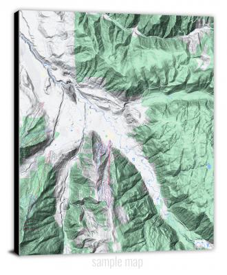
Enrich your office decor or home with a large canvas wrap Terrain map. It is designed for easy hanging with pre-installed hardware. Printed with archival inks and wrapped around a 1.5" thick gallery frame, your favorite map art will have a timeless and impressive look that fits with any decor. This map is fabricated with terrain imagery data from Google Maps, and bounding box coordinates from USGS.
aa-Tiipi Flat, Oregon- Map Components- Imagery: Terrain of aa-Tiipi Flat, Oregon. Bounding Box: Footprint of aa-Tiipi Flat, Oregon at Longitude/Latitude Coordinates (-117.375 x -117.25 x 42.625 x 42.5).
Abbott Butte, Oregon- Map Components- Imagery: Terrain of Abbott Butte, Oregon. Bounding Box: Footprint of Abbott Butte, Oregon at Longitude/Latitude Coordinates (-122.625 x -122.5 x 43 x 42.875).
Acker Rock, Oregon- Map Components- Imagery: Terrain of Acker Rock, Oregon. Bounding Box: Footprint of Acker Rock, Oregon at Longitude/Latitude Coordinates (-122.75 x -122.625 x 43.125 x 43).
Acty Mountain, Oregon- Map Components- Imagery: Terrain of Acty Mountain, Oregon. Bounding Box: Footprint of Acty Mountain, Oregon at Longitude/Latitude Coordinates (-119.25 x -119.125 x 42.125 x 42).
Acty Mountain NE, Oregon- Map Components- Imagery: Terrain of Acty Mountain NE, Oregon. Bounding Box: Footprint of Acty Mountain NE, Oregon at Longitude/Latitude Coordinates (-119.125 x -119 x 42.25 x 42.125).
Acty Mountain NW, Oregon- Map Components- Imagery: Terrain of Acty Mountain NW, Oregon. Bounding Box: Footprint of Acty Mountain NW, Oregon at Longitude/Latitude Coordinates (-119.25 x -119.125 x 42.25 x 42.125).
Adams, Oregon- Map Components- Imagery: Terrain of Adams, Oregon. Bounding Box: Footprint of Adams, Oregon at Longitude/Latitude Coordinates (-118.625 x -118.5 x 45.875 x 45.75).
Adel, Oregon- Map Components- Imagery: Terrain of Adel, Oregon. Bounding Box: Footprint of Adel, Oregon at Longitude/Latitude Coordinates (-120 x -119.875 x 42.25 x 42.125).
Adobe Flat, Oregon- Map Components- Imagery: Terrain of Adobe Flat, Oregon. Bounding Box: Footprint of Adobe Flat, Oregon at Longitude/Latitude Coordinates (-118.625 x -118.5 x 43.25 x 43.125).
Adrian, Oregon- Map Components- Imagery: Terrain of Adrian, Oregon. Bounding Box: Footprint of Adrian, Oregon at Longitude/Latitude Coordinates (-117.125 x -117 x 43.75 x 43.625).
Agency Lake, Oregon- Map Components- Imagery: Terrain of Agency Lake, Oregon. Bounding Box: Footprint of Agency Lake, Oregon at Longitude/Latitude Coordinates (-122 x -121.875 x 42.625 x 42.5).
Agness, Oregon- Map Components- Imagery: Terrain of Agness, Oregon. Bounding Box: Footprint of Agness, Oregon at Longitude/Latitude Coordinates (-124.125 x -124 x 42.625 x 42.5).
Airlie North, Oregon- Map Components- Imagery: Terrain of Airlie North, Oregon. Bounding Box: Footprint of Airlie North, Oregon at Longitude/Latitude Coordinates (-123.375 x -123.25 x 44.875 x 44.75).
Airlie South, Oregon- Map Components- Imagery: Terrain of Airlie South, Oregon. Bounding Box: Footprint of Airlie South, Oregon at Longitude/Latitude Coordinates (-123.375 x -123.25 x 44.75 x 44.625).
Akawa Butte, Oregon- Map Components- Imagery: Terrain of Akawa Butte, Oregon. Bounding Box: Footprint of Akawa Butte, Oregon at Longitude/Latitude Coordinates (-121.5 x -121.375 x 44.5 x 44.375).
Akers Butte, Oregon- Map Components- Imagery: Terrain of Akers Butte, Oregon. Bounding Box: Footprint of Akers Butte, Oregon at Longitude/Latitude Coordinates (-117.625 x -117.5 x 45.75 x 45.625).
Albany, Oregon- Map Components- Imagery: Terrain of Albany, Oregon. Bounding Box: Footprint of Albany, Oregon at Longitude/Latitude Coordinates (-123.125 x -123 x 44.75 x 44.625).
Alder Creek, Oregon- Map Components- Imagery: Terrain of Alder Creek, Oregon. Bounding Box: Footprint of Alder Creek, Oregon at Longitude/Latitude Coordinates (-117.875 x -117.75 x 43.625 x 43.5).
Aldrich Gulch, Oregon- Map Components- Imagery: Terrain of Aldrich Gulch, Oregon. Bounding Box: Footprint of Aldrich Gulch, Oregon at Longitude/Latitude Coordinates (-119.625 x -119.5 x 44.375 x 44.25).
Aldrich Mountain North, Oregon- Map Components- Imagery: Terrain of Aldrich Mountain North, Oregon. Bounding Box: Footprint of Aldrich Mountain North, Oregon at Longitude/Latitude Coordinates (-119.5 x -119.375 x 44.5 x 44.375).
Aldrich Mountain South, Oregon- Map Components- Imagery: Terrain of Aldrich Mountain South, Oregon. Bounding Box: Footprint of Aldrich Mountain South, Oregon at Longitude/Latitude Coordinates (-119.5 x -119.375 x 44.375 x 44.25).
Alec Butte, Oregon- Map Components- Imagery: Terrain of Alec Butte, Oregon. Bounding Box: Footprint of Alec Butte, Oregon at Longitude/Latitude Coordinates (-119.75 x -119.625 x 43.375 x 43.25).
Alfalfa, Oregon- Map Components- Imagery: Terrain of Alfalfa, Oregon. Bounding Box: Footprint of Alfalfa, Oregon at Longitude/Latitude Coordinates (-121.125 x -121 x 44.125 x 44).
Alger Lake, Oregon- Map Components- Imagery: Terrain of Alger Lake, Oregon. Bounding Box: Footprint of Alger Lake, Oregon at Longitude/Latitude Coordinates (-119.625 x -119.5 x 42.375 x 42.25).
Alkali Buttes, Oregon- Map Components- Imagery: Terrain of Alkali Buttes, Oregon. Bounding Box: Footprint of Alkali Buttes, Oregon at Longitude/Latitude Coordinates (-120.125 x -120 x 43.125 x 43).
Alkali Flat, Oregon- Map Components- Imagery: Terrain of Alkali Flat, Oregon. Bounding Box: Footprint of Alkali Flat, Oregon at Longitude/Latitude Coordinates (-120.75 x -120.625 x 44.125 x 44).
Alkali Lake, Oregon- Map Components- Imagery: Terrain of Alkali Lake, Oregon. Bounding Box: Footprint of Alkali Lake, Oregon at Longitude/Latitude Coordinates (-120.125 x -120 x 43 x 42.875).
Allegany, Oregon- Map Components- Imagery: Terrain of Allegany, Oregon. Bounding Box: Footprint of Allegany, Oregon at Longitude/Latitude Coordinates (-124.125 x -124 x 43.5 x 43.375).
Alsea, Oregon- Map Components- Imagery: Terrain of Alsea, Oregon. Bounding Box: Footprint of Alsea, Oregon at Longitude/Latitude Coordinates (-123.625 x -123.5 x 44.5 x 44.375).
Alsup Mountain, Oregon- Map Components- Imagery: Terrain of Alsup Mountain, Oregon. Bounding Box: Footprint of Alsup Mountain, Oregon at Longitude/Latitude Coordinates (-119.375 x -119.25 x 44 x 43.875).
Altamont, Oregon- Map Components- Imagery: Terrain of Altamont, Oregon. Bounding Box: Footprint of Altamont, Oregon at Longitude/Latitude Coordinates (-121.75 x -121.625 x 42.25 x 42.125).
Alvord Hot Springs, Oregon- Map Components- Imagery: Terrain of Alvord Hot Springs, Oregon. Bounding Box: Footprint of Alvord Hot Springs, Oregon at Longitude/Latitude Coordinates (-118.625 x -118.5 x 42.625 x 42.5).
Amity, Oregon- Map Components- Imagery: Terrain of Amity, Oregon. Bounding Box: Footprint of Amity, Oregon at Longitude/Latitude Coordinates (-123.25 x -123.125 x 45.125 x 45).
Ana River, Oregon- Map Components- Imagery: Terrain of Ana River, Oregon. Bounding Box: Footprint of Ana River, Oregon at Longitude/Latitude Coordinates (-120.75 x -120.625 x 43 x 42.875).
Ancient Lake Well, Oregon- Map Components- Imagery: Terrain of Ancient Lake Well, Oregon. Bounding Box: Footprint of Ancient Lake Well, Oregon at Longitude/Latitude Coordinates (-118.25 x -118.125 x 42.75 x 42.625).
Anderson Mountain, Oregon- Map Components- Imagery: Terrain of Anderson Mountain, Oregon. Bounding Box: Footprint of Anderson Mountain, Oregon at Longitude/Latitude Coordinates (-118.5 x -118.375 x 43.125 x 43).
Anderson Reservoir, Oregon- Map Components- Imagery: Terrain of Anderson Reservoir, Oregon. Bounding Box: Footprint of Anderson Reservoir, Oregon at Longitude/Latitude Coordinates (-117.875 x -117.75 x 42.75 x 42.625).
Andies Prairie, Oregon- Map Components- Imagery: Terrain of Andies Prairie, Oregon. Bounding Box: Footprint of Andies Prairie, Oregon at Longitude/Latitude Coordinates (-118.125 x -118 x 45.75 x 45.625).
Andrews, Oregon- Map Components- Imagery: Terrain of Andrews, Oregon. Bounding Box: Footprint of Andrews, Oregon at Longitude/Latitude Coordinates (-118.625 x -118.5 x 42.5 x 42.375).
Aneroid Mountain, Oregon- Map Components- Imagery: Terrain of Aneroid Mountain, Oregon. Bounding Box: Footprint of Aneroid Mountain, Oregon at Longitude/Latitude Coordinates (-117.25 x -117.125 x 45.25 x 45.125).
Angell Butte, Oregon- Map Components- Imagery: Terrain of Angell Butte, Oregon. Bounding Box: Footprint of Angell Butte, Oregon at Longitude/Latitude Coordinates (-119.875 x -119.75 x 44.125 x 44).
Ankle Creek, Oregon- Map Components- Imagery: Terrain of Ankle Creek, Oregon. Bounding Box: Footprint of Ankle Creek, Oregon at Longitude/Latitude Coordinates (-118.75 x -118.625 x 42.625 x 42.5).
Anns Butte, Oregon- Map Components- Imagery: Terrain of Anns Butte, Oregon. Bounding Box: Footprint of Anns Butte, Oregon at Longitude/Latitude Coordinates (-121.5 x -121.375 x 43.875 x 43.75).
Antelope, Oregon- Map Components- Imagery: Terrain of Antelope, Oregon. Bounding Box: Footprint of Antelope, Oregon at Longitude/Latitude Coordinates (-120.75 x -120.625 x 45 x 44.875).
Antelope Butte, Oregon- Map Components- Imagery: Terrain of Antelope Butte, Oregon. Bounding Box: Footprint of Antelope Butte, Oregon at Longitude/Latitude Coordinates (-119.5 x -119.375 x 42.125 x 42).
Antelope Mountain, Oregon- Map Components- Imagery: Terrain of Antelope Mountain, Oregon. Bounding Box: Footprint of Antelope Mountain, Oregon at Longitude/Latitude Coordinates (-121.375 x -121.25 x 43.25 x 43.125).
Antelope Reservoir, Oregon- Map Components- Imagery: Terrain of Antelope Reservoir, Oregon. Bounding Box: Footprint of Antelope Reservoir, Oregon at Longitude/Latitude Coordinates (-117.25 x -117.125 x 43 x 42.875).
Anthony Butte, Oregon- Map Components- Imagery: Terrain of Anthony Butte, Oregon. Bounding Box: Footprint of Anthony Butte, Oregon at Longitude/Latitude Coordinates (-118.25 x -118.125 x 45.125 x 45).
Anthony Lakes, Oregon- Map Components- Imagery: Terrain of Anthony Lakes, Oregon. Bounding Box: Footprint of Anthony Lakes, Oregon at Longitude/Latitude Coordinates (-118.25 x -118.125 x 45 x 44.875).
Antler Point, Oregon- Map Components- Imagery: Terrain of Antler Point, Oregon. Bounding Box: Footprint of Antler Point, Oregon at Longitude/Latitude Coordinates (-121 x -120.875 x 42.125 x 42).
Antone, Oregon- Map Components- Imagery: Terrain of Antone, Oregon. Bounding Box: Footprint of Antone, Oregon at Longitude/Latitude Coordinates (-119.875 x -119.75 x 44.5 x 44.375).
Applegate, Oregon- Map Components- Imagery: Terrain of Applegate, Oregon. Bounding Box: Footprint of Applegate, Oregon at Longitude/Latitude Coordinates (-123.25 x -123.125 x 42.375 x 42.25).
Applegate Butte, Oregon- Map Components- Imagery: Terrain of Applegate Butte, Oregon. Bounding Box: Footprint of Applegate Butte, Oregon at Longitude/Latitude Coordinates (-121.75 x -121.625 x 42.75 x 42.625).
Arbuckle Mountain, Oregon- Map Components- Imagery: Terrain of Arbuckle Mountain, Oregon. Bounding Box: Footprint of Arbuckle Mountain, Oregon at Longitude/Latitude Coordinates (-119.375 x -119.25 x 45.25 x 45.125).
Arch Cape, Oregon- Map Components- Imagery: Terrain of Arch Cape, Oregon. Bounding Box: Footprint of Arch Cape, Oregon at Longitude/Latitude Coordinates (-124 x -123.875 x 45.875 x 45.75).
Arkansas Flat, Oregon- Map Components- Imagery: Terrain of Arkansas Flat, Oregon. Bounding Box: Footprint of Arkansas Flat, Oregon at Longitude/Latitude Coordinates (-120.875 x -120.75 x 42.25 x 42.125).
Arlington, Oregon- Map Components- Imagery: Terrain of Arlington, Oregon. Bounding Box: Footprint of Arlington, Oregon at Longitude/Latitude Coordinates (-120.25 x -120.125 x 45.75 x 45.625).
Arock, Oregon- Map Components- Imagery: Terrain of Arock, Oregon. Bounding Box: Footprint of Arock, Oregon at Longitude/Latitude Coordinates (-117.625 x -117.5 x 43 x 42.875).
Arrastra Butte, Oregon- Map Components- Imagery: Terrain of Arrastra Butte, Oregon. Bounding Box: Footprint of Arrastra Butte, Oregon at Longitude/Latitude Coordinates (-120.625 x -120.5 x 44.875 x 44.75).
Arrowwood Point, Oregon- Map Components- Imagery: Terrain of Arrowwood Point, Oregon. Bounding Box: Footprint of Arrowwood Point, Oregon at Longitude/Latitude Coordinates (-120.25 x -120.125 x 44.125 x 44).
Ashland, Oregon- Map Components- Imagery: Terrain of Ashland, Oregon. Bounding Box: Footprint of Ashland, Oregon at Longitude/Latitude Coordinates (-122.75 x -122.625 x 42.25 x 42.125).
Ashwood, Oregon- Map Components- Imagery: Terrain of Ashwood, Oregon. Bounding Box: Footprint of Ashwood, Oregon at Longitude/Latitude Coordinates (-120.875 x -120.75 x 44.75 x 44.625).
Aspen Lake, Oregon- Map Components- Imagery: Terrain of Aspen Lake, Oregon. Bounding Box: Footprint of Aspen Lake, Oregon at Longitude/Latitude Coordinates (-122.125 x -122 x 42.375 x 42.25).
Astoria, Oregon- Map Components- Imagery: Terrain of Astoria, Oregon. Bounding Box: Footprint of Astoria, Oregon at Longitude/Latitude Coordinates (-123.875 x -123.75 x 46.25 x 46.125).
Athena, Oregon- Map Components- Imagery: Terrain of Athena, Oregon. Bounding Box: Footprint of Athena, Oregon at Longitude/Latitude Coordinates (-118.5 x -118.375 x 45.875 x 45.75).
Austin, Oregon- Map Components- Imagery: Terrain of Austin, Oregon. Bounding Box: Footprint of Austin, Oregon at Longitude/Latitude Coordinates (-118.5 x -118.375 x 44.625 x 44.5).
Avery Creek, Oregon- Map Components- Imagery: Terrain of Avery Creek, Oregon. Bounding Box: Footprint of Avery Creek, Oregon at Longitude/Latitude Coordinates (-117.75 x -117.625 x 43.75 x 43.625).
Axehandle Butte, Oregon- Map Components- Imagery: Terrain of Axehandle Butte, Oregon. Bounding Box: Footprint of Axehandle Butte, Oregon at Longitude/Latitude Coordinates (-120.75 x -120.625 x 44.75 x 44.625).
Bacona, Oregon- Map Components- Imagery: Terrain of Bacona, Oregon. Bounding Box: Footprint of Bacona, Oregon at Longitude/Latitude Coordinates (-123.125 x -123 x 45.875 x 45.75).
Badger Lake, Oregon- Map Components- Imagery: Terrain of Badger Lake, Oregon. Bounding Box: Footprint of Badger Lake, Oregon at Longitude/Latitude Coordinates (-121.625 x -121.5 x 45.375 x 45.25).
Bagby Hot Springs, Oregon- Map Components- Imagery: Terrain of Bagby Hot Springs, Oregon. Bounding Box: Footprint of Bagby Hot Springs, Oregon at Longitude/Latitude Coordinates (-122.25 x -122.125 x 45 x 44.875).
Baker City, Oregon- Map Components- Imagery: Terrain of Baker City, Oregon. Bounding Box: Footprint of Baker City, Oregon at Longitude/Latitude Coordinates (-117.875 x -117.75 x 44.875 x 44.75).
Baker Point, Oregon- Map Components- Imagery: Terrain of Baker Point, Oregon. Bounding Box: Footprint of Baker Point, Oregon at Longitude/Latitude Coordinates (-123.125 x -123 x 46 x 45.875).
Baldy Mountain, Oregon- Map Components- Imagery: Terrain of Baldy Mountain, Oregon. Bounding Box: Footprint of Baldy Mountain, Oregon at Longitude/Latitude Coordinates (-123.875 x -123.75 x 44 x 43.875).
Balls Lake, Oregon- Map Components- Imagery: Terrain of Balls Lake, Oregon. Bounding Box: Footprint of Balls Lake, Oregon at Longitude/Latitude Coordinates (-119.5 x -119.375 x 43 x 42.875).
Ballston, Oregon- Map Components- Imagery: Terrain of Ballston, Oregon. Bounding Box: Footprint of Ballston, Oregon at Longitude/Latitude Coordinates (-123.375 x -123.25 x 45.125 x 45).
Bally Mountain, Oregon- Map Components- Imagery: Terrain of Bally Mountain, Oregon. Bounding Box: Footprint of Bally Mountain, Oregon at Longitude/Latitude Coordinates (-118.625 x -118.5 x 45.375 x 45.25).
Balm Canyon, Oregon- Map Components- Imagery: Terrain of Balm Canyon, Oregon. Bounding Box: Footprint of Balm Canyon, Oregon at Longitude/Latitude Coordinates (-119.625 x -119.5 x 45.25 x 45.125).
Balm Creek Reservoir, Oregon- Map Components- Imagery: Terrain of Balm Creek Reservoir, Oregon. Bounding Box: Footprint of Balm Creek Reservoir, Oregon at Longitude/Latitude Coordinates (-117.5 x -117.375 x 45 x 44.875).
Bandon, Oregon- Map Components- Imagery: Terrain of Bandon, Oregon. Bounding Box: Footprint of Bandon, Oregon at Longitude/Latitude Coordinates (-124.5 x -124.375 x 43.125 x 43).
Bannock Ridge, Oregon- Map Components- Imagery: Terrain of Bannock Ridge, Oregon. Bounding Box: Footprint of Bannock Ridge, Oregon at Longitude/Latitude Coordinates (-117.25 x -117.125 x 43.375 x 43.25).
Barklow Mountain, Oregon- Map Components- Imagery: Terrain of Barklow Mountain, Oregon. Bounding Box: Footprint of Barklow Mountain, Oregon at Longitude/Latitude Coordinates (-124.25 x -124.125 x 42.875 x 42.75).
Barnes Valley, Oregon- Map Components- Imagery: Terrain of Barnes Valley, Oregon. Bounding Box: Footprint of Barnes Valley, Oregon at Longitude/Latitude Coordinates (-121 x -120.875 x 42.25 x 42.125).
Barnhart, Oregon- Map Components- Imagery: Terrain of Barnhart, Oregon. Bounding Box: Footprint of Barnhart, Oregon at Longitude/Latitude Coordinates (-119 x -118.875 x 45.75 x 45.625).
Bartlett Mountain, Oregon- Map Components- Imagery: Terrain of Bartlett Mountain, Oregon. Bounding Box: Footprint of Bartlett Mountain, Oregon at Longitude/Latitude Coordinates (-118.5 x -118.375 x 43.75 x 43.625).
Barton Lake, Oregon- Map Components- Imagery: Terrain of Barton Lake, Oregon. Bounding Box: Footprint of Barton Lake, Oregon at Longitude/Latitude Coordinates (-118.75 x -118.625 x 43.25 x 43.125).
Basque, Oregon- Map Components- Imagery: Terrain of Basque, Oregon. Bounding Box: Footprint of Basque, Oregon at Longitude/Latitude Coordinates (-117.875 x -117.75 x 42.5 x 42.375).
Bassey Creek, Oregon- Map Components- Imagery: Terrain of Bassey Creek, Oregon. Bounding Box: Footprint of Bassey Creek, Oregon at Longitude/Latitude Coordinates (-118.625 x -118.5 x 45.5 x 45.375).
Bates, Oregon- Map Components- Imagery: Terrain of Bates, Oregon. Bounding Box: Footprint of Bates, Oregon at Longitude/Latitude Coordinates (-118.625 x -118.5 x 44.625 x 44.5).
Bath Canyon, Oregon- Map Components- Imagery: Terrain of Bath Canyon, Oregon. Bounding Box: Footprint of Bath Canyon, Oregon at Longitude/Latitude Coordinates (-120.625 x -120.5 x 45.125 x 45).
Battle Ax, Oregon- Map Components- Imagery: Terrain of Battle Ax, Oregon. Bounding Box: Footprint of Battle Ax, Oregon at Longitude/Latitude Coordinates (-122.25 x -122.125 x 44.875 x 44.75).
Battle Creek Ranch, Oregon- Map Components- Imagery: Terrain of Battle Creek Ranch, Oregon. Bounding Box: Footprint of Battle Creek Ranch, Oregon at Longitude/Latitude Coordinates (-117.75 x -117.625 x 42.5 x 42.375).
Battle Mountain, Oregon- Map Components- Imagery: Terrain of Battle Mountain, Oregon. Bounding Box: Footprint of Battle Mountain, Oregon at Longitude/Latitude Coordinates (-117.75 x -117.625 x 42.375 x 42.25).
Bear Butte, Oregon- Map Components- Imagery: Terrain of Bear Butte, Oregon. Bounding Box: Footprint of Bear Butte, Oregon at Longitude/Latitude Coordinates (-121.5 x -121.375 x 43.125 x 43).
Bear Canyon Butte, Oregon- Map Components- Imagery: Terrain of Bear Canyon Butte, Oregon. Bounding Box: Footprint of Bear Canyon Butte, Oregon at Longitude/Latitude Coordinates (-119.5 x -119.375 x 43.875 x 43.75).
Bearbones Mountain, Oregon- Map Components- Imagery: Terrain of Bearbones Mountain, Oregon. Bounding Box: Footprint of Bearbones Mountain, Oregon at Longitude/Latitude Coordinates (-122.625 x -122.5 x 43.625 x 43.5).
Beatty, Oregon- Map Components- Imagery: Terrain of Beatty, Oregon. Bounding Box: Footprint of Beatty, Oregon at Longitude/Latitude Coordinates (-121.375 x -121.25 x 42.5 x 42.375).
Beatys Butte, Oregon- Map Components- Imagery: Terrain of Beatys Butte, Oregon. Bounding Box: Footprint of Beatys Butte, Oregon at Longitude/Latitude Coordinates (-119.375 x -119.25 x 42.5 x 42.375).
Beatys Butte NW, Oregon- Map Components- Imagery: Terrain of Beatys Butte NW, Oregon. Bounding Box: Footprint of Beatys Butte NW, Oregon at Longitude/Latitude Coordinates (-119.5 x -119.375 x 42.5 x 42.375).
Beaver, Oregon- Map Components- Imagery: Terrain of Beaver, Oregon. Bounding Box: Footprint of Beaver, Oregon at Longitude/Latitude Coordinates (-123.875 x -123.75 x 45.375 x 45.25).
Beaver Butte, Oregon- Map Components- Imagery: Terrain of Beaver Butte, Oregon. Bounding Box: Footprint of Beaver Butte, Oregon at Longitude/Latitude Coordinates (-121.625 x -121.5 x 45.125 x 45).
Beaver Charlie Breaks, Oregon- Map Components- Imagery: Terrain of Beaver Charlie Breaks, Oregon. Bounding Box: Footprint of Beaver Charlie Breaks, Oregon at Longitude/Latitude Coordinates (-117.125 x -117 x 42.375 x 42.25).
Beaver Creek, Oregon- Map Components- Imagery: Terrain of Beaver Creek, Oregon. Bounding Box: Footprint of Beaver Creek, Oregon at Longitude/Latitude Coordinates (-123.5 x -123.375 x 43.875 x 43.75).
Beaverdam Creek, Oregon- Map Components- Imagery: Terrain of Beaverdam Creek, Oregon. Bounding Box: Footprint of Beaverdam Creek, Oregon at Longitude/Latitude Coordinates (-118.125 x -118 x 44.625 x 44.5).
Beaverton, Oregon- Map Components- Imagery: Terrain of Beaverton, Oregon. Bounding Box: Footprint of Beaverton, Oregon at Longitude/Latitude Coordinates (-122.875 x -122.75 x 45.5 x 45.375).
Becker Creek, Oregon- Map Components- Imagery: Terrain of Becker Creek, Oregon. Bounding Box: Footprint of Becker Creek, Oregon at Longitude/Latitude Coordinates (-117.625 x -117.5 x 44.375 x 44.25).
Bedford Point, Oregon- Map Components- Imagery: Terrain of Bedford Point, Oregon. Bounding Box: Footprint of Bedford Point, Oregon at Longitude/Latitude Coordinates (-122.25 x -122.125 x 45.25 x 45.125).
Belknap Springs, Oregon- Map Components- Imagery: Terrain of Belknap Springs, Oregon. Bounding Box: Footprint of Belknap Springs, Oregon at Longitude/Latitude Coordinates (-122.125 x -122 x 44.25 x 44.125).
Belshaw Meadows, Oregon- Map Components- Imagery: Terrain of Belshaw Meadows, Oregon. Bounding Box: Footprint of Belshaw Meadows, Oregon at Longitude/Latitude Coordinates (-119.25 x -119.125 x 44.625 x 44.5).
Bend, Oregon- Map Components- Imagery: Terrain of Bend, Oregon. Bounding Box: Footprint of Bend, Oregon at Longitude/Latitude Coordinates (-121.375 x -121.25 x 44.125 x 44).
Bend Airport, Oregon- Map Components- Imagery: Terrain of Bend Airport, Oregon. Bounding Box: Footprint of Bend Airport, Oregon at Longitude/Latitude Coordinates (-121.25 x -121.125 x 44.125 x 44).
Benham Falls, Oregon- Map Components- Imagery: Terrain of Benham Falls, Oregon. Bounding Box: Footprint of Benham Falls, Oregon at Longitude/Latitude Coordinates (-121.5 x -121.375 x 44 x 43.875).
Benjamin Lake, Oregon- Map Components- Imagery: Terrain of Benjamin Lake, Oregon. Bounding Box: Footprint of Benjamin Lake, Oregon at Longitude/Latitude Coordinates (-120.375 x -120.25 x 43.625 x 43.5).
Bennet Peak, Oregon- Map Components- Imagery: Terrain of Bennet Peak, Oregon. Bounding Box: Footprint of Bennet Peak, Oregon at Longitude/Latitude Coordinates (-117.5 x -117.375 x 45.125 x 45).
Beulah, Oregon- Map Components- Imagery: Terrain of Beulah, Oregon. Bounding Box: Footprint of Beulah, Oregon at Longitude/Latitude Coordinates (-118.25 x -118.125 x 44 x 43.875).
Big Baldy, Oregon- Map Components- Imagery: Terrain of Big Baldy, Oregon. Bounding Box: Footprint of Big Baldy, Oregon at Longitude/Latitude Coordinates (-120.5 x -120.375 x 42.375 x 42.25).
Big Butte Springs, Oregon- Map Components- Imagery: Terrain of Big Butte Springs, Oregon. Bounding Box: Footprint of Big Butte Springs, Oregon at Longitude/Latitude Coordinates (-122.5 x -122.375 x 42.625 x 42.5).
Big Canyon, Oregon- Map Components- Imagery: Terrain of Big Canyon, Oregon. Bounding Box: Footprint of Big Canyon, Oregon at Longitude/Latitude Coordinates (-118.875 x -118.75 x 44.25 x 44.125).
Big Craggies, Oregon- Map Components- Imagery: Terrain of Big Craggies, Oregon. Bounding Box: Footprint of Big Craggies, Oregon at Longitude/Latitude Coordinates (-124.125 x -124 x 42.375 x 42.25).
Big Hole, Oregon- Map Components- Imagery: Terrain of Big Hole, Oregon. Bounding Box: Footprint of Big Hole, Oregon at Longitude/Latitude Coordinates (-121.375 x -121.25 x 43.5 x 43.375).
Big Lookout Mountain, Oregon- Map Components- Imagery: Terrain of Big Lookout Mountain, Oregon. Bounding Box: Footprint of Big Lookout Mountain, Oregon at Longitude/Latitude Coordinates (-117.375 x -117.25 x 44.625 x 44.5).
Big Meadows, Oregon- Map Components- Imagery: Terrain of Big Meadows, Oregon. Bounding Box: Footprint of Big Meadows, Oregon at Longitude/Latitude Coordinates (-118.125 x -118 x 46 x 45.875).
Big Mowich Mountain, Oregon- Map Components- Imagery: Terrain of Big Mowich Mountain, Oregon. Bounding Box: Footprint of Big Mowich Mountain, Oregon at Longitude/Latitude Coordinates (-119.625 x -119.5 x 44 x 43.875).
Big Mud Flat, Oregon- Map Components- Imagery: Terrain of Big Mud Flat, Oregon. Bounding Box: Footprint of Big Mud Flat, Oregon at Longitude/Latitude Coordinates (-117.625 x -117.5 x 43.375 x 43.25).
Big Pasture Creek, Oregon- Map Components- Imagery: Terrain of Big Pasture Creek, Oregon. Bounding Box: Footprint of Big Pasture Creek, Oregon at Longitude/Latitude Coordinates (-118.625 x -118.5 x 42.875 x 42.75).
Big Rock Flat, Oregon- Map Components- Imagery: Terrain of Big Rock Flat, Oregon. Bounding Box: Footprint of Big Rock Flat, Oregon at Longitude/Latitude Coordinates (-119.625 x -119.5 x 45.125 x 45).
Big Weasel Springs, Oregon- Map Components- Imagery: Terrain of Big Weasel Springs, Oregon. Bounding Box: Footprint of Big Weasel Springs, Oregon at Longitude/Latitude Coordinates (-119.375 x -119.25 x 44.375 x 44.25).
Biggs Junction, Oregon- Map Components- Imagery: Terrain of Biggs Junction, Oregon. Bounding Box: Footprint of Biggs Junction, Oregon at Longitude/Latitude Coordinates (-120.875 x -120.75 x 45.75 x 45.625).
Bill Peak, Oregon- Map Components- Imagery: Terrain of Bill Peak, Oregon. Bounding Box: Footprint of Bill Peak, Oregon at Longitude/Latitude Coordinates (-124.375 x -124.25 x 43.125 x 43).
Billy Meadows, Oregon- Map Components- Imagery: Terrain of Billy Meadows, Oregon. Bounding Box: Footprint of Billy Meadows, Oregon at Longitude/Latitude Coordinates (-117.125 x -117 x 45.875 x 45.75).
Bingham Springs, Oregon- Map Components- Imagery: Terrain of Bingham Springs, Oregon. Bounding Box: Footprint of Bingham Springs, Oregon at Longitude/Latitude Coordinates (-118.25 x -118.125 x 45.75 x 45.625).
Birch Creek Meadow, Oregon- Map Components- Imagery: Terrain of Birch Creek Meadow, Oregon. Bounding Box: Footprint of Birch Creek Meadow, Oregon at Longitude/Latitude Coordinates (-117.5 x -117.375 x 44.375 x 44.25).
Birkenfeld, Oregon- Map Components- Imagery: Terrain of Birkenfeld, Oregon. Bounding Box: Footprint of Birkenfeld, Oregon at Longitude/Latitude Coordinates (-123.375 x -123.25 x 46 x 45.875).
Biscuit Hill, Oregon- Map Components- Imagery: Terrain of Biscuit Hill, Oregon. Bounding Box: Footprint of Biscuit Hill, Oregon at Longitude/Latitude Coordinates (-124 x -123.875 x 42.125 x 42).
Biscuit Point, Oregon- Map Components- Imagery: Terrain of Biscuit Point, Oregon. Bounding Box: Footprint of Biscuit Point, Oregon at Longitude/Latitude Coordinates (-120.375 x -120.25 x 42.875 x 42.75).
Black Butte, Oregon- Map Components- Imagery: Terrain of Black Butte, Oregon. Bounding Box: Footprint of Black Butte, Oregon at Longitude/Latitude Coordinates (-121.75 x -121.625 x 44.5 x 44.375).
Black Crater, Oregon- Map Components- Imagery: Terrain of Black Crater, Oregon. Bounding Box: Footprint of Black Crater, Oregon at Longitude/Latitude Coordinates (-121.75 x -121.625 x 44.375 x 44.25).
Black Rock Springs, Oregon- Map Components- Imagery: Terrain of Black Rock Springs, Oregon. Bounding Box: Footprint of Black Rock Springs, Oregon at Longitude/Latitude Coordinates (-119 x -118.875 x 42.125 x 42).
Blaine, Oregon- Map Components- Imagery: Terrain of Blaine, Oregon. Bounding Box: Footprint of Blaine, Oregon at Longitude/Latitude Coordinates (-123.75 x -123.625 x 45.375 x 45.25).
Blair Lake, Oregon- Map Components- Imagery: Terrain of Blair Lake, Oregon. Bounding Box: Footprint of Blair Lake, Oregon at Longitude/Latitude Coordinates (-122.25 x -122.125 x 43.875 x 43.75).
Blalock Mountain, Oregon- Map Components- Imagery: Terrain of Blalock Mountain, Oregon. Bounding Box: Footprint of Blalock Mountain, Oregon at Longitude/Latitude Coordinates (-118.25 x -118.125 x 45.875 x 45.75).
Blitzen, Oregon- Map Components- Imagery: Terrain of Blitzen, Oregon. Bounding Box: Footprint of Blitzen, Oregon at Longitude/Latitude Coordinates (-119.125 x -119 x 42.625 x 42.5).
Blitzen NW, Oregon- Map Components- Imagery: Terrain of Blitzen NW, Oregon. Bounding Box: Footprint of Blitzen NW, Oregon at Longitude/Latitude Coordinates (-119.25 x -119.125 x 42.75 x 42.625).
Blitzen SW, Oregon- Map Components- Imagery: Terrain of Blitzen SW, Oregon. Bounding Box: Footprint of Blitzen SW, Oregon at Longitude/Latitude Coordinates (-119.25 x -119.125 x 42.625 x 42.5).
Blizzard Gap, Oregon- Map Components- Imagery: Terrain of Blizzard Gap, Oregon. Bounding Box: Footprint of Blizzard Gap, Oregon at Longitude/Latitude Coordinates (-119.75 x -119.625 x 42.125 x 42).
Blue Canyon, Oregon- Map Components- Imagery: Terrain of Blue Canyon, Oregon. Bounding Box: Footprint of Blue Canyon, Oregon at Longitude/Latitude Coordinates (-118 x -117.875 x 44.75 x 44.625).
Blue Mountain, Oregon- Map Components- Imagery: Terrain of Blue Mountain, Oregon. Bounding Box: Footprint of Blue Mountain, Oregon at Longitude/Latitude Coordinates (-123 x -122.875 x 43.75 x 43.625).
Blue Mountain Basin, Oregon- Map Components- Imagery: Terrain of Blue Mountain Basin, Oregon. Bounding Box: Footprint of Blue Mountain Basin, Oregon at Longitude/Latitude Coordinates (-118 x -117.875 x 42.375 x 42.25).
Blue Mountain Pass, Oregon- Map Components- Imagery: Terrain of Blue Mountain Pass, Oregon. Bounding Box: Footprint of Blue Mountain Pass, Oregon at Longitude/Latitude Coordinates (-117.875 x -117.75 x 42.375 x 42.25).
Blue River, Oregon- Map Components- Imagery: Terrain of Blue River, Oregon. Bounding Box: Footprint of Blue River, Oregon at Longitude/Latitude Coordinates (-122.375 x -122.25 x 44.25 x 44.125).
Bluejoint Lake East, Oregon- Map Components- Imagery: Terrain of Bluejoint Lake East, Oregon. Bounding Box: Footprint of Bluejoint Lake East, Oregon at Longitude/Latitude Coordinates (-119.625 x -119.5 x 42.75 x 42.625).
Bluejoint Lake West, Oregon- Map Components- Imagery: Terrain of Bluejoint Lake West, Oregon. Bounding Box: Footprint of Bluejoint Lake West, Oregon at Longitude/Latitude Coordinates (-119.75 x -119.625 x 42.75 x 42.625).
Bly, Oregon- Map Components- Imagery: Terrain of Bly, Oregon. Bounding Box: Footprint of Bly, Oregon at Longitude/Latitude Coordinates (-121.125 x -121 x 42.5 x 42.375).
Boardman, Oregon- Map Components- Imagery: Terrain of Boardman, Oregon. Bounding Box: Footprint of Boardman, Oregon at Longitude/Latitude Coordinates (-119.75 x -119.625 x 45.875 x 45.75).
Boghole Spring, Oregon- Map Components- Imagery: Terrain of Boghole Spring, Oregon. Bounding Box: Footprint of Boghole Spring, Oregon at Longitude/Latitude Coordinates (-117.875 x -117.75 x 42.125 x 42).
Bogus Bench, Oregon- Map Components- Imagery: Terrain of Bogus Bench, Oregon. Bounding Box: Footprint of Bogus Bench, Oregon at Longitude/Latitude Coordinates (-117.625 x -117.5 x 43.125 x 43).
Bologna Basin, Oregon- Map Components- Imagery: Terrain of Bologna Basin, Oregon. Bounding Box: Footprint of Bologna Basin, Oregon at Longitude/Latitude Coordinates (-119.625 x -119.5 x 44.875 x 44.75).
Bonanza, Oregon- Map Components- Imagery: Terrain of Bonanza, Oregon. Bounding Box: Footprint of Bonanza, Oregon at Longitude/Latitude Coordinates (-121.5 x -121.375 x 42.25 x 42.125).
Bone Mountain, Oregon- Map Components- Imagery: Terrain of Bone Mountain, Oregon. Bounding Box: Footprint of Bone Mountain, Oregon at Longitude/Latitude Coordinates (-123.875 x -123.75 x 43 x 42.875).
Bone Spring, Oregon- Map Components- Imagery: Terrain of Bone Spring, Oregon. Bounding Box: Footprint of Bone Spring, Oregon at Longitude/Latitude Coordinates (-118 x -117.875 x 46 x 45.875).
Bonneville Dam, Oregon- Map Components- Imagery: Terrain of Bonneville Dam, Oregon. Bounding Box: Footprint of Bonneville Dam, Oregon at Longitude/Latitude Coordinates (-122 x -121.875 x 45.75 x 45.625).
Borax Lake, Oregon- Map Components- Imagery: Terrain of Borax Lake, Oregon. Bounding Box: Footprint of Borax Lake, Oregon at Longitude/Latitude Coordinates (-118.625 x -118.5 x 42.375 x 42.25).
Bosley Butte, Oregon- Map Components- Imagery: Terrain of Bosley Butte, Oregon. Bounding Box: Footprint of Bosley Butte, Oregon at Longitude/Latitude Coordinates (-124.25 x -124.125 x 42.25 x 42.125).
Boswell Mountain, Oregon- Map Components- Imagery: Terrain of Boswell Mountain, Oregon. Bounding Box: Footprint of Boswell Mountain, Oregon at Longitude/Latitude Coordinates (-123 x -122.875 x 42.625 x 42.5).
Boulder Butte, Oregon- Map Components- Imagery: Terrain of Boulder Butte, Oregon. Bounding Box: Footprint of Boulder Butte, Oregon at Longitude/Latitude Coordinates (-118.75 x -118.625 x 44.75 x 44.625).
Boulder Lake, Oregon- Map Components- Imagery: Terrain of Boulder Lake, Oregon. Bounding Box: Footprint of Boulder Lake, Oregon at Longitude/Latitude Coordinates (-121.75 x -121.625 x 44.875 x 44.75).
Bourne, Oregon- Map Components- Imagery: Terrain of Bourne, Oregon. Bounding Box: Footprint of Bourne, Oregon at Longitude/Latitude Coordinates (-118.25 x -118.125 x 44.875 x 44.75).
Bowden Ranch, Oregon- Map Components- Imagery: Terrain of Bowden Ranch, Oregon. Bounding Box: Footprint of Bowden Ranch, Oregon at Longitude/Latitude Coordinates (-117.75 x -117.625 x 42.625 x 42.5).
Bowden Waterhole, Oregon- Map Components- Imagery: Terrain of Bowden Waterhole, Oregon. Bounding Box: Footprint of Bowden Waterhole, Oregon at Longitude/Latitude Coordinates (-117.875 x -117.75 x 42.25 x 42.125).
Bowen Valley, Oregon- Map Components- Imagery: Terrain of Bowen Valley, Oregon. Bounding Box: Footprint of Bowen Valley, Oregon at Longitude/Latitude Coordinates (-117.875 x -117.75 x 44.75 x 44.625).
Bowlus Hill, Oregon- Map Components- Imagery: Terrain of Bowlus Hill, Oregon. Bounding Box: Footprint of Bowlus Hill, Oregon at Longitude/Latitude Coordinates (-118.375 x -118.25 x 46 x 45.875).
Bowman Dam, Oregon- Map Components- Imagery: Terrain of Bowman Dam, Oregon. Bounding Box: Footprint of Bowman Dam, Oregon at Longitude/Latitude Coordinates (-120.875 x -120.75 x 44.125 x 44).
Brady Butte, Oregon- Map Components- Imagery: Terrain of Brady Butte, Oregon. Bounding Box: Footprint of Brady Butte, Oregon at Longitude/Latitude Coordinates (-121.125 x -121 x 42.125 x 42).
Brady Creek, Oregon- Map Components- Imagery: Terrain of Brady Creek, Oregon. Bounding Box: Footprint of Brady Creek, Oregon at Longitude/Latitude Coordinates (-117.75 x -117.625 x 44.25 x 44.125).
Brandy Peak, Oregon- Map Components- Imagery: Terrain of Brandy Peak, Oregon. Bounding Box: Footprint of Brandy Peak, Oregon at Longitude/Latitude Coordinates (-124 x -123.875 x 42.625 x 42.5).
Brannan Gulch, Oregon- Map Components- Imagery: Terrain of Brannan Gulch, Oregon. Bounding Box: Footprint of Brannan Gulch, Oregon at Longitude/Latitude Coordinates (-118 x -117.875 x 44.625 x 44.5).
Breitenbush Hot Springs, Oregon- Map Components- Imagery: Terrain of Breitenbush Hot Springs, Oregon. Bounding Box: Footprint of Breitenbush Hot Springs, Oregon at Longitude/Latitude Coordinates (-122 x -121.875 x 44.875 x 44.75).
Bretz Mine, Oregon- Map Components- Imagery: Terrain of Bretz Mine, Oregon. Bounding Box: Footprint of Bretz Mine, Oregon at Longitude/Latitude Coordinates (-118 x -117.875 x 42.125 x 42).
Brewer Reservoir, Oregon- Map Components- Imagery: Terrain of Brewer Reservoir, Oregon. Bounding Box: Footprint of Brewer Reservoir, Oregon at Longitude/Latitude Coordinates (-121 x -120.875 x 44.625 x 44.5).
Brewster Reservoir, Oregon- Map Components- Imagery: Terrain of Brewster Reservoir, Oregon. Bounding Box: Footprint of Brewster Reservoir, Oregon at Longitude/Latitude Coordinates (-117.125 x -117 x 42.625 x 42.5).
Bridal Veil, Oregon- Map Components- Imagery: Terrain of Bridal Veil, Oregon. Bounding Box: Footprint of Bridal Veil, Oregon at Longitude/Latitude Coordinates (-122.25 x -122.125 x 45.625 x 45.5).
Bridge, Oregon- Map Components- Imagery: Terrain of Bridge, Oregon. Bounding Box: Footprint of Bridge, Oregon at Longitude/Latitude Coordinates (-124.125 x -124 x 43.125 x 43).
Bridge Creek, Oregon- Map Components- Imagery: Terrain of Bridge Creek, Oregon. Bounding Box: Footprint of Bridge Creek, Oregon at Longitude/Latitude Coordinates (-119 x -118.875 x 45.125 x 45).
Bridge Creek Draw, Oregon- Map Components- Imagery: Terrain of Bridge Creek Draw, Oregon. Bounding Box: Footprint of Bridge Creek Draw, Oregon at Longitude/Latitude Coordinates (-121.25 x -121.125 x 43.125 x 43).
Bridgeport, Oregon- Map Components- Imagery: Terrain of Bridgeport, Oregon. Bounding Box: Footprint of Bridgeport, Oregon at Longitude/Latitude Coordinates (-117.75 x -117.625 x 44.5 x 44.375).
Brightwood, Oregon- Map Components- Imagery: Terrain of Brightwood, Oregon. Bounding Box: Footprint of Brightwood, Oregon at Longitude/Latitude Coordinates (-122.125 x -122 x 45.5 x 45.375).
Brogan, Oregon- Map Components- Imagery: Terrain of Brogan, Oregon. Bounding Box: Footprint of Brogan, Oregon at Longitude/Latitude Coordinates (-117.625 x -117.5 x 44.25 x 44.125).
Broken Top, Oregon- Map Components- Imagery: Terrain of Broken Top, Oregon. Bounding Box: Footprint of Broken Top, Oregon at Longitude/Latitude Coordinates (-121.75 x -121.625 x 44.125 x 44).
Bronx Canyon, Oregon- Map Components- Imagery: Terrain of Bronx Canyon, Oregon. Bounding Box: Footprint of Bronx Canyon, Oregon at Longitude/Latitude Coordinates (-120.875 x -120.75 x 45.25 x 45.125).
Brookings, Oregon- Map Components- Imagery: Terrain of Brookings, Oregon. Bounding Box: Footprint of Brookings, Oregon at Longitude/Latitude Coordinates (-124.375 x -124.25 x 42.125 x 42).
Brothers, Oregon- Map Components- Imagery: Terrain of Brothers, Oregon. Bounding Box: Footprint of Brothers, Oregon at Longitude/Latitude Coordinates (-120.625 x -120.5 x 43.875 x 43.75).
Brothers SW, Oregon- Map Components- Imagery: Terrain of Brothers SW, Oregon. Bounding Box: Footprint of Brothers SW, Oregon at Longitude/Latitude Coordinates (-120.75 x -120.625 x 43.875 x 43.75).
Brown Creek, Oregon- Map Components- Imagery: Terrain of Brown Creek, Oregon. Bounding Box: Footprint of Brown Creek, Oregon at Longitude/Latitude Coordinates (-121.375 x -121.25 x 45.625 x 45.5).
Brown Mountain, Oregon- Map Components- Imagery: Terrain of Brown Mountain, Oregon. Bounding Box: Footprint of Brown Mountain, Oregon at Longitude/Latitude Coordinates (-122.375 x -122.25 x 42.375 x 42.25).
Brownlee Dam, Oregon- Map Components- Imagery: Terrain of Brownlee Dam, Oregon. Bounding Box: Footprint of Brownlee Dam, Oregon at Longitude/Latitude Coordinates (-117 x -116.875 x 44.875 x 44.75).
Brownsboro, Oregon- Map Components- Imagery: Terrain of Brownsboro, Oregon. Bounding Box: Footprint of Brownsboro, Oregon at Longitude/Latitude Coordinates (-122.75 x -122.625 x 42.5 x 42.375).
Brownsville, Oregon- Map Components- Imagery: Terrain of Brownsville, Oregon. Bounding Box: Footprint of Brownsville, Oregon at Longitude/Latitude Coordinates (-123 x -122.875 x 44.5 x 44.375).
Brushy Bald Mountain, Oregon- Map Components- Imagery: Terrain of Brushy Bald Mountain, Oregon. Bounding Box: Footprint of Brushy Bald Mountain, Oregon at Longitude/Latitude Coordinates (-124.375 x -124.25 x 42.625 x 42.5).
Bryant Mountain, Oregon- Map Components- Imagery: Terrain of Bryant Mountain, Oregon. Bounding Box: Footprint of Bryant Mountain, Oregon at Longitude/Latitude Coordinates (-121.375 x -121.25 x 42.125 x 42).
Buchanan, Oregon- Map Components- Imagery: Terrain of Buchanan, Oregon. Bounding Box: Footprint of Buchanan, Oregon at Longitude/Latitude Coordinates (-118.75 x -118.625 x 43.75 x 43.625).
Buck Butte, Oregon- Map Components- Imagery: Terrain of Buck Butte, Oregon. Bounding Box: Footprint of Buck Butte, Oregon at Longitude/Latitude Coordinates (-121.125 x -121 x 44.625 x 44.5).
Buck Spring, Oregon- Map Components- Imagery: Terrain of Buck Spring, Oregon. Bounding Box: Footprint of Buck Spring, Oregon at Longitude/Latitude Coordinates (-119.75 x -119.625 x 43.875 x 43.75).
Buck Trough Spring, Oregon- Map Components- Imagery: Terrain of Buck Trough Spring, Oregon. Bounding Box: Footprint of Buck Trough Spring, Oregon at Longitude/Latitude Coordinates (-118.375 x -118.25 x 44.125 x 44).
Buckbrush Creek, Oregon- Map Components- Imagery: Terrain of Buckbrush Creek, Oregon. Bounding Box: Footprint of Buckbrush Creek, Oregon at Longitude/Latitude Coordinates (-117.75 x -117.625 x 44.125 x 44).
Buckeye Lake, Oregon- Map Components- Imagery: Terrain of Buckeye Lake, Oregon. Bounding Box: Footprint of Buckeye Lake, Oregon at Longitude/Latitude Coordinates (-122.625 x -122.5 x 43.125 x 43).
Buckhorn Canyon, Oregon- Map Components- Imagery: Terrain of Buckhorn Canyon, Oregon. Bounding Box: Footprint of Buckhorn Canyon, Oregon at Longitude/Latitude Coordinates (-120.375 x -120.25 x 45.125 x 45).
Buckhorn Springs, Oregon- Map Components- Imagery: Terrain of Buckhorn Springs, Oregon. Bounding Box: Footprint of Buckhorn Springs, Oregon at Longitude/Latitude Coordinates (-121.625 x -121.5 x 42.875 x 42.75).
Buckskin Peak, Oregon- Map Components- Imagery: Terrain of Buckskin Peak, Oregon. Bounding Box: Footprint of Buckskin Peak, Oregon at Longitude/Latitude Coordinates (-123.875 x -123.75 x 42.125 x 42).
Buffalo Well, Oregon- Map Components- Imagery: Terrain of Buffalo Well, Oregon. Bounding Box: Footprint of Buffalo Well, Oregon at Longitude/Latitude Coordinates (-120.375 x -120.25 x 43.25 x 43.125).
Bulger Ridge, Oregon- Map Components- Imagery: Terrain of Bulger Ridge, Oregon. Bounding Box: Footprint of Bulger Ridge, Oregon at Longitude/Latitude Coordinates (-119.875 x -119.75 x 43.75 x 43.625).
Bull Lake, Oregon- Map Components- Imagery: Terrain of Bull Lake, Oregon. Bounding Box: Footprint of Bull Lake, Oregon at Longitude/Latitude Coordinates (-120.5 x -120.375 x 43 x 42.875).
Bull of the Woods, Oregon- Map Components- Imagery: Terrain of Bull of the Woods, Oregon. Bounding Box: Footprint of Bull of the Woods, Oregon at Longitude/Latitude Coordinates (-122.125 x -122 x 45 x 44.875).
Bull Run, Oregon- Map Components- Imagery: Terrain of Bull Run, Oregon. Bounding Box: Footprint of Bull Run, Oregon at Longitude/Latitude Coordinates (-122.25 x -122.125 x 45.5 x 45.375).
Bull Run Lake, Oregon- Map Components- Imagery: Terrain of Bull Run Lake, Oregon. Bounding Box: Footprint of Bull Run Lake, Oregon at Longitude/Latitude Coordinates (-121.875 x -121.75 x 45.5 x 45.375).
Bullards, Oregon- Map Components- Imagery: Terrain of Bullards, Oregon. Bounding Box: Footprint of Bullards, Oregon at Longitude/Latitude Coordinates (-124.5 x -124.375 x 43.25 x 43.125).
Bullock Gulch, Oregon- Map Components- Imagery: Terrain of Bullock Gulch, Oregon. Bounding Box: Footprint of Bullock Gulch, Oregon at Longitude/Latitude Coordinates (-119.25 x -119.125 x 44.875 x 44.75).
Bullrun Rock, Oregon- Map Components- Imagery: Terrain of Bullrun Rock, Oregon. Bounding Box: Footprint of Bullrun Rock, Oregon at Longitude/Latitude Coordinates (-118.375 x -118.25 x 44.375 x 44.25).
Bunker Creek, Oregon- Map Components- Imagery: Terrain of Bunker Creek, Oregon. Bounding Box: Footprint of Bunker Creek, Oregon at Longitude/Latitude Coordinates (-123.75 x -123.625 x 42.75 x 42.625).
Burn Butte, Oregon- Map Components- Imagery: Terrain of Burn Butte, Oregon. Bounding Box: Footprint of Burn Butte, Oregon at Longitude/Latitude Coordinates (-122 x -121.875 x 43.375 x 43.25).
Burns, Oregon- Map Components- Imagery: Terrain of Burns, Oregon. Bounding Box: Footprint of Burns, Oregon at Longitude/Latitude Coordinates (-119.125 x -119 x 43.625 x 43.5).
Burns Butte, Oregon- Map Components- Imagery: Terrain of Burns Butte, Oregon. Bounding Box: Footprint of Burns Butte, Oregon at Longitude/Latitude Coordinates (-119.25 x -119.125 x 43.625 x 43.5).
Burns Junction, Oregon- Map Components- Imagery: Terrain of Burns Junction, Oregon. Bounding Box: Footprint of Burns Junction, Oregon at Longitude/Latitude Coordinates (-117.875 x -117.75 x 42.875 x 42.75).
Burns NW, Oregon- Map Components- Imagery: Terrain of Burns NW, Oregon. Bounding Box: Footprint of Burns NW, Oregon at Longitude/Latitude Coordinates (-119.25 x -119.125 x 43.75 x 43.625).
Burnt Flat, Oregon- Map Components- Imagery: Terrain of Burnt Flat, Oregon. Bounding Box: Footprint of Burnt Flat, Oregon at Longitude/Latitude Coordinates (-117.875 x -117.75 x 43.375 x 43.25).
Burnt Mountain, Oregon- Map Components- Imagery: Terrain of Burnt Mountain, Oregon. Bounding Box: Footprint of Burnt Mountain, Oregon at Longitude/Latitude Coordinates (-123 x -122.875 x 43.625 x 43.5).
Butler Butte, Oregon- Map Components- Imagery: Terrain of Butler Butte, Oregon. Bounding Box: Footprint of Butler Butte, Oregon at Longitude/Latitude Coordinates (-122.75 x -122.625 x 43 x 42.875).
Butler Hill, Oregon- Map Components- Imagery: Terrain of Butler Hill, Oregon. Bounding Box: Footprint of Butler Hill, Oregon at Longitude/Latitude Coordinates (-119.125 x -119 x 42.75 x 42.625).
Butte Falls, Oregon- Map Components- Imagery: Terrain of Butte Falls, Oregon. Bounding Box: Footprint of Butte Falls, Oregon at Longitude/Latitude Coordinates (-122.625 x -122.5 x 42.625 x 42.5).
Butter Creek Junction, Oregon- Map Components- Imagery: Terrain of Butter Creek Junction, Oregon. Bounding Box: Footprint of Butter Creek Junction, Oregon at Longitude/Latitude Coordinates (-119.5 x -119.375 x 45.625 x 45.5).
Buttermilk Canyon, Oregon- Map Components- Imagery: Terrain of Buttermilk Canyon, Oregon. Bounding Box: Footprint of Buttermilk Canyon, Oregon at Longitude/Latitude Coordinates (-119.875 x -119.75 x 45.25 x 45.125).
Buttes of the Gods, Oregon- Map Components- Imagery: Terrain of Buttes of the Gods, Oregon. Bounding Box: Footprint of Buttes of the Gods, Oregon at Longitude/Latitude Coordinates (-121.625 x -121.5 x 42.625 x 42.5).
Buxton, Oregon- Map Components- Imagery: Terrain of Buxton, Oregon. Bounding Box: Footprint of Buxton, Oregon at Longitude/Latitude Coordinates (-123.25 x -123.125 x 45.75 x 45.625).
Cabbage Hill, Oregon- Map Components- Imagery: Terrain of Cabbage Hill, Oregon. Bounding Box: Footprint of Cabbage Hill, Oregon at Longitude/Latitude Coordinates (-118.625 x -118.5 x 45.625 x 45.5).
Cabin Lake, Oregon- Map Components- Imagery: Terrain of Cabin Lake, Oregon. Bounding Box: Footprint of Cabin Lake, Oregon at Longitude/Latitude Coordinates (-121.125 x -121 x 43.5 x 43.375).
Cactus Mountain, Oregon- Map Components- Imagery: Terrain of Cactus Mountain, Oregon. Bounding Box: Footprint of Cactus Mountain, Oregon at Longitude/Latitude Coordinates (-116.75 x -116.625 x 45.875 x 45.75).
Cadle Butte, Oregon- Map Components- Imagery: Terrain of Cadle Butte, Oregon. Bounding Box: Footprint of Cadle Butte, Oregon at Longitude/Latitude Coordinates (-120.625 x -120.5 x 44.375 x 44.25).
Cairo, Oregon- Map Components- Imagery: Terrain of Cairo, Oregon. Bounding Box: Footprint of Cairo, Oregon at Longitude/Latitude Coordinates (-117.125 x -117 x 44 x 43.875).
Calamity Butte, Oregon- Map Components- Imagery: Terrain of Calamity Butte, Oregon. Bounding Box: Footprint of Calamity Butte, Oregon at Longitude/Latitude Coordinates (-118.875 x -118.75 x 44 x 43.875).
Calderwood Reservoir, Oregon- Map Components- Imagery: Terrain of Calderwood Reservoir, Oregon. Bounding Box: Footprint of Calderwood Reservoir, Oregon at Longitude/Latitude Coordinates (-119.875 x -119.75 x 42.25 x 42.125).
Calf Ranch Mountain, Oregon- Map Components- Imagery: Terrain of Calf Ranch Mountain, Oregon. Bounding Box: Footprint of Calf Ranch Mountain, Oregon at Longitude/Latitude Coordinates (-124.375 x -124.25 x 43 x 42.875).
Calimus Butte, Oregon- Map Components- Imagery: Terrain of Calimus Butte, Oregon. Bounding Box: Footprint of Calimus Butte, Oregon at Longitude/Latitude Coordinates (-121.625 x -121.5 x 42.75 x 42.625).
Callahan, Oregon- Map Components- Imagery: Terrain of Callahan, Oregon. Bounding Box: Footprint of Callahan, Oregon at Longitude/Latitude Coordinates (-123.625 x -123.5 x 43.375 x 43.25).
Camas Valley, Oregon- Map Components- Imagery: Terrain of Camas Valley, Oregon. Bounding Box: Footprint of Camas Valley, Oregon at Longitude/Latitude Coordinates (-123.75 x -123.625 x 43.125 x 43).
Camp Currey Spring, Oregon- Map Components- Imagery: Terrain of Camp Currey Spring, Oregon. Bounding Box: Footprint of Camp Currey Spring, Oregon at Longitude/Latitude Coordinates (-119.75 x -119.625 x 43.75 x 43.625).
Campbell Lake, Oregon- Map Components- Imagery: Terrain of Campbell Lake, Oregon. Bounding Box: Footprint of Campbell Lake, Oregon at Longitude/Latitude Coordinates (-119.75 x -119.625 x 42.625 x 42.5).
Campbell Reservoir, Oregon- Map Components- Imagery: Terrain of Campbell Reservoir, Oregon. Bounding Box: Footprint of Campbell Reservoir, Oregon at Longitude/Latitude Coordinates (-121 x -120.875 x 42.5 x 42.375).
Canby, Oregon- Map Components- Imagery: Terrain of Canby, Oregon. Bounding Box: Footprint of Canby, Oregon at Longitude/Latitude Coordinates (-122.75 x -122.625 x 45.375 x 45.25).
Candle Creek, Oregon- Map Components- Imagery: Terrain of Candle Creek, Oregon. Bounding Box: Footprint of Candle Creek, Oregon at Longitude/Latitude Coordinates (-121.75 x -121.625 x 44.625 x 44.5).
Cannibal Mountain, Oregon- Map Components- Imagery: Terrain of Cannibal Mountain, Oregon. Bounding Box: Footprint of Cannibal Mountain, Oregon at Longitude/Latitude Coordinates (-124 x -123.875 x 44.375 x 44.25).
Canyon Mountain, Oregon- Map Components- Imagery: Terrain of Canyon Mountain, Oregon. Bounding Box: Footprint of Canyon Mountain, Oregon at Longitude/Latitude Coordinates (-119 x -118.875 x 44.375 x 44.25).
Canyonville, Oregon- Map Components- Imagery: Terrain of Canyonville, Oregon. Bounding Box: Footprint of Canyonville, Oregon at Longitude/Latitude Coordinates (-123.375 x -123.25 x 43 x 42.875).
Cape Arago, Oregon- Map Components- Imagery: Terrain of Cape Arago, Oregon. Bounding Box: Footprint of Cape Arago, Oregon at Longitude/Latitude Coordinates (-124.5 x -124.375 x 43.375 x 43.25).
Cape Blanco, Oregon- Map Components- Imagery: Terrain of Cape Blanco, Oregon. Bounding Box: Footprint of Cape Blanco, Oregon at Longitude/Latitude Coordinates (-124.625 x -124.5 x 42.875 x 42.75).
Cape Blanco OE W, Oregon- Map Components- Imagery: Terrain of Cape Blanco OE W, Oregon. Bounding Box: Footprint of Cape Blanco OE W, Oregon at Longitude/Latitude Coordinates (-124.75 x -124.625 x 42.875 x 42.75).
Cape Sebastian, Oregon- Map Components- Imagery: Terrain of Cape Sebastian, Oregon. Bounding Box: Footprint of Cape Sebastian, Oregon at Longitude/Latitude Coordinates (-124.5 x -124.375 x 42.375 x 42.25).
Capehart Lake, Oregon- Map Components- Imagery: Terrain of Capehart Lake, Oregon. Bounding Box: Footprint of Capehart Lake, Oregon at Longitude/Latitude Coordinates (-119.625 x -119.5 x 43.5 x 43.375).
Carberry Creek, Oregon- Map Components- Imagery: Terrain of Carberry Creek, Oregon. Bounding Box: Footprint of Carberry Creek, Oregon at Longitude/Latitude Coordinates (-123.25 x -123.125 x 42.125 x 42).
Carlton, Oregon- Map Components- Imagery: Terrain of Carlton, Oregon. Bounding Box: Footprint of Carlton, Oregon at Longitude/Latitude Coordinates (-123.25 x -123.125 x 45.375 x 45.25).
Carney Butte, Oregon- Map Components- Imagery: Terrain of Carney Butte, Oregon. Bounding Box: Footprint of Carney Butte, Oregon at Longitude/Latitude Coordinates (-119 x -118.875 x 45.375 x 45.25).
Carpenter Mountain, Oregon- Map Components- Imagery: Terrain of Carpenter Mountain, Oregon. Bounding Box: Footprint of Carpenter Mountain, Oregon at Longitude/Latitude Coordinates (-122.25 x -122.125 x 44.375 x 44.25).
Carpenterville, Oregon- Map Components- Imagery: Terrain of Carpenterville, Oregon. Bounding Box: Footprint of Carpenterville, Oregon at Longitude/Latitude Coordinates (-124.375 x -124.25 x 42.25 x 42.125).
Carson Point, Oregon- Map Components- Imagery: Terrain of Carson Point, Oregon. Bounding Box: Footprint of Carson Point, Oregon at Longitude/Latitude Coordinates (-118.75 x -118.625 x 43.625 x 43.5).
Cascade Gorge, Oregon- Map Components- Imagery: Terrain of Cascade Gorge, Oregon. Bounding Box: Footprint of Cascade Gorge, Oregon at Longitude/Latitude Coordinates (-122.625 x -122.5 x 42.75 x 42.625).
Cascadia, Oregon- Map Components- Imagery: Terrain of Cascadia, Oregon. Bounding Box: Footprint of Cascadia, Oregon at Longitude/Latitude Coordinates (-122.5 x -122.375 x 44.5 x 44.375).
Castle Creek, Oregon- Map Components- Imagery: Terrain of Castle Creek, Oregon. Bounding Box: Footprint of Castle Creek, Oregon at Longitude/Latitude Coordinates (-118.875 x -118.75 x 44.5 x 44.375).
Castle Rock, Oregon- Map Components- Imagery: Terrain of Castle Rock, Oregon. Bounding Box: Footprint of Castle Rock, Oregon at Longitude/Latitude Coordinates (-118.25 x -118.125 x 44.125 x 44).
Cathlamet Bay, Oregon- Map Components- Imagery: Terrain of Cathlamet Bay, Oregon. Bounding Box: Footprint of Cathlamet Bay, Oregon at Longitude/Latitude Coordinates (-123.75 x -123.625 x 46.25 x 46.125).
Cave Junction, Oregon- Map Components- Imagery: Terrain of Cave Junction, Oregon. Bounding Box: Footprint of Cave Junction, Oregon at Longitude/Latitude Coordinates (-123.75 x -123.625 x 42.25 x 42.125).
Caviatta Ridge, Oregon- Map Components- Imagery: Terrain of Caviatta Ridge, Oregon. Bounding Box: Footprint of Caviatta Ridge, Oregon at Longitude/Latitude Coordinates (-117.5 x -117.375 x 42.625 x 42.5).
Cayuse, Oregon- Map Components- Imagery: Terrain of Cayuse, Oregon. Bounding Box: Footprint of Cayuse, Oregon at Longitude/Latitude Coordinates (-118.625 x -118.5 x 45.75 x 45.625).
Cecil, Oregon- Map Components- Imagery: Terrain of Cecil, Oregon. Bounding Box: Footprint of Cecil, Oregon at Longitude/Latitude Coordinates (-120 x -119.875 x 45.625 x 45.5).
Cedar Butte, Oregon- Map Components- Imagery: Terrain of Cedar Butte, Oregon. Bounding Box: Footprint of Cedar Butte, Oregon at Longitude/Latitude Coordinates (-123.75 x -123.625 x 45.625 x 45.5).
Cedar Creek, Oregon- Map Components- Imagery: Terrain of Cedar Creek, Oregon. Bounding Box: Footprint of Cedar Creek, Oregon at Longitude/Latitude Coordinates (-123.75 x -123.625 x 43.375 x 43.25).
Cedar Mountain, Oregon- Map Components- Imagery: Terrain of Cedar Mountain, Oregon. Bounding Box: Footprint of Cedar Mountain, Oregon at Longitude/Latitude Coordinates (-117.75 x -117.625 x 43.375 x 43.25).
Cedar Springs Mountain, Oregon- Map Components- Imagery: Terrain of Cedar Springs Mountain, Oregon. Bounding Box: Footprint of Cedar Springs Mountain, Oregon at Longitude/Latitude Coordinates (-123.125 x -123 x 42.875 x 42.75).
Chandler Mountain, Oregon- Map Components- Imagery: Terrain of Chandler Mountain, Oregon. Bounding Box: Footprint of Chandler Mountain, Oregon at Longitude/Latitude Coordinates (-122.75 x -122.625 x 44.375 x 44.25).
Chapin Creek, Oregon- Map Components- Imagery: Terrain of Chapin Creek, Oregon. Bounding Box: Footprint of Chapin Creek, Oregon at Longitude/Latitude Coordinates (-119.75 x -119.625 x 45.125 x 45).
Chapman, Oregon- Map Components- Imagery: Terrain of Chapman, Oregon. Bounding Box: Footprint of Chapman, Oregon at Longitude/Latitude Coordinates (-123 x -122.875 x 45.875 x 45.75).
Charleston, Oregon- Map Components- Imagery: Terrain of Charleston, Oregon. Bounding Box: Footprint of Charleston, Oregon at Longitude/Latitude Coordinates (-124.375 x -124.25 x 43.375 x 43.25).
Chemult, Oregon- Map Components- Imagery: Terrain of Chemult, Oregon. Bounding Box: Footprint of Chemult, Oregon at Longitude/Latitude Coordinates (-121.875 x -121.75 x 43.25 x 43.125).
Cherryville, Oregon- Map Components- Imagery: Terrain of Cherryville, Oregon. Bounding Box: Footprint of Cherryville, Oregon at Longitude/Latitude Coordinates (-122.25 x -122.125 x 45.375 x 45.25).
Cheshire, Oregon- Map Components- Imagery: Terrain of Cheshire, Oregon. Bounding Box: Footprint of Cheshire, Oregon at Longitude/Latitude Coordinates (-123.375 x -123.25 x 44.25 x 44.125).
Chetco Peak, Oregon- Map Components- Imagery: Terrain of Chetco Peak, Oregon. Bounding Box: Footprint of Chetco Peak, Oregon at Longitude/Latitude Coordinates (-124 x -123.875 x 42.25 x 42.125).
Chicago Valley, Oregon- Map Components- Imagery: Terrain of Chicago Valley, Oregon. Bounding Box: Footprint of Chicago Valley, Oregon at Longitude/Latitude Coordinates (-120.25 x -120.125 x 43.5 x 43.375).
Chicken Hills, Oregon- Map Components- Imagery: Terrain of Chicken Hills, Oregon. Bounding Box: Footprint of Chicken Hills, Oregon at Longitude/Latitude Coordinates (-122.125 x -122 x 42.125 x 42).
Chicken Spring, Oregon- Map Components- Imagery: Terrain of Chicken Spring, Oregon. Bounding Box: Footprint of Chicken Spring, Oregon at Longitude/Latitude Coordinates (-118.25 x -118.125 x 42.125 x 42).
Chief Joseph Mountain, Oregon- Map Components- Imagery: Terrain of Chief Joseph Mountain, Oregon. Bounding Box: Footprint of Chief Joseph Mountain, Oregon at Longitude/Latitude Coordinates (-117.375 x -117.25 x 45.375 x 45.25).
Chilcoot Mountain, Oregon- Map Components- Imagery: Terrain of Chilcoot Mountain, Oregon. Bounding Box: Footprint of Chilcoot Mountain, Oregon at Longitude/Latitude Coordinates (-122.75 x -122.625 x 43.5 x 43.375).
Chiloquin, Oregon- Map Components- Imagery: Terrain of Chiloquin, Oregon. Bounding Box: Footprint of Chiloquin, Oregon at Longitude/Latitude Coordinates (-121.875 x -121.75 x 42.625 x 42.5).
Chimney Peak, Oregon- Map Components- Imagery: Terrain of Chimney Peak, Oregon. Bounding Box: Footprint of Chimney Peak, Oregon at Longitude/Latitude Coordinates (-122.25 x -122.125 x 44.625 x 44.5).
Chimney Rock, Oregon- Map Components- Imagery: Terrain of Chimney Rock, Oregon. Bounding Box: Footprint of Chimney Rock, Oregon at Longitude/Latitude Coordinates (-119.375 x -119.25 x 42.25 x 42.125).
Chimney Springs, Oregon- Map Components- Imagery: Terrain of Chimney Springs, Oregon. Bounding Box: Footprint of Chimney Springs, Oregon at Longitude/Latitude Coordinates (-120.5 x -120.375 x 45.125 x 45).
China Cap, Oregon- Map Components- Imagery: Terrain of China Cap, Oregon. Bounding Box: Footprint of China Cap, Oregon at Longitude/Latitude Coordinates (-117.625 x -117.5 x 45.25 x 45.125).
China Flat, Oregon- Map Components- Imagery: Terrain of China Flat, Oregon. Bounding Box: Footprint of China Flat, Oregon at Longitude/Latitude Coordinates (-124.125 x -124 x 42.875 x 42.75).
China Hat, Oregon- Map Components- Imagery: Terrain of China Hat, Oregon. Bounding Box: Footprint of China Hat, Oregon at Longitude/Latitude Coordinates (-121.125 x -121 x 43.75 x 43.625).
Chipmunk Basin, Oregon- Map Components- Imagery: Terrain of Chipmunk Basin, Oregon. Bounding Box: Footprint of Chipmunk Basin, Oregon at Longitude/Latitude Coordinates (-117.5 x -117.375 x 42.25 x 42.125).
Chipmunk Ridge, Oregon- Map Components- Imagery: Terrain of Chipmunk Ridge, Oregon. Bounding Box: Footprint of Chipmunk Ridge, Oregon at Longitude/Latitude Coordinates (-123.75 x -123.625 x 43 x 42.875).
Christmas Lake, Oregon- Map Components- Imagery: Terrain of Christmas Lake, Oregon. Bounding Box: Footprint of Christmas Lake, Oregon at Longitude/Latitude Coordinates (-120.625 x -120.5 x 43.375 x 43.25).
Christmas Valley, Oregon- Map Components- Imagery: Terrain of Christmas Valley, Oregon. Bounding Box: Footprint of Christmas Valley, Oregon at Longitude/Latitude Coordinates (-120.75 x -120.625 x 43.25 x 43.125).
Chrome Ridge, Oregon- Map Components- Imagery: Terrain of Chrome Ridge, Oregon. Bounding Box: Footprint of Chrome Ridge, Oregon at Longitude/Latitude Coordinates (-123.75 x -123.625 x 42.5 x 42.375).
Chucksney Mountain, Oregon- Map Components- Imagery: Terrain of Chucksney Mountain, Oregon. Bounding Box: Footprint of Chucksney Mountain, Oregon at Longitude/Latitude Coordinates (-122.125 x -122 x 44 x 43.875).
Circle Bar, Oregon- Map Components- Imagery: Terrain of Circle Bar, Oregon. Bounding Box: Footprint of Circle Bar, Oregon at Longitude/Latitude Coordinates (-118.5 x -118.375 x 43.375 x 43.25).
Clarke, Oregon- Map Components- Imagery: Terrain of Clarke, Oregon. Bounding Box: Footprint of Clarke, Oregon at Longitude/Latitude Coordinates (-119.625 x -119.5 x 45.875 x 45.75).
Clarno, Oregon- Map Components- Imagery: Terrain of Clarno, Oregon. Bounding Box: Footprint of Clarno, Oregon at Longitude/Latitude Coordinates (-120.5 x -120.375 x 45 x 44.875).
Clatskanie, Oregon- Map Components- Imagery: Terrain of Clatskanie, Oregon. Bounding Box: Footprint of Clatskanie, Oregon at Longitude/Latitude Coordinates (-123.25 x -123.125 x 46.125 x 46).
Clatsop Spit, Oregon- Map Components- Imagery: Terrain of Clatsop Spit, Oregon. Bounding Box: Footprint of Clatsop Spit, Oregon at Longitude/Latitude Coordinates (-124.125 x -124 x 46.25 x 46.125).
Clay Creek, Oregon- Map Components- Imagery: Terrain of Clay Creek, Oregon. Bounding Box: Footprint of Clay Creek, Oregon at Longitude/Latitude Coordinates (-123.625 x -123.5 x 44 x 43.875).
Clear Creek, Oregon- Map Components- Imagery: Terrain of Clear Creek, Oregon. Bounding Box: Footprint of Clear Creek, Oregon at Longitude/Latitude Coordinates (-123.375 x -123.25 x 45.875 x 45.75).
Clear Lake, Oregon- Map Components- Imagery: Terrain of Clear Lake, Oregon. Bounding Box: Footprint of Clear Lake, Oregon at Longitude/Latitude Coordinates (-122 x -121.875 x 44.375 x 44.25).
Clear Lake Ridge, Oregon- Map Components- Imagery: Terrain of Clear Lake Ridge, Oregon. Bounding Box: Footprint of Clear Lake Ridge, Oregon at Longitude/Latitude Coordinates (-117 x -116.875 x 45.5 x 45.375).
Cleveland Ridge, Oregon- Map Components- Imagery: Terrain of Cleveland Ridge, Oregon. Bounding Box: Footprint of Cleveland Ridge, Oregon at Longitude/Latitude Coordinates (-123 x -122.875 x 42.75 x 42.625).
Clevenger Butte, Oregon- Map Components- Imagery: Terrain of Clevenger Butte, Oregon. Bounding Box: Footprint of Clevenger Butte, Oregon at Longitude/Latitude Coordinates (-118.25 x -118.125 x 44.25 x 44.125).
Cline Falls, Oregon- Map Components- Imagery: Terrain of Cline Falls, Oregon. Bounding Box: Footprint of Cline Falls, Oregon at Longitude/Latitude Coordinates (-121.375 x -121.25 x 44.375 x 44.25).
Clover Creek Ranch, Oregon- Map Components- Imagery: Terrain of Clover Creek Ranch, Oregon. Bounding Box: Footprint of Clover Creek Ranch, Oregon at Longitude/Latitude Coordinates (-118 x -117.875 x 44.25 x 44.125).
Clover Flat, Oregon- Map Components- Imagery: Terrain of Clover Flat, Oregon. Bounding Box: Footprint of Clover Flat, Oregon at Longitude/Latitude Coordinates (-120.5 x -120.375 x 42.5 x 42.375).
Clover Swale, Oregon- Map Components- Imagery: Terrain of Clover Swale, Oregon. Bounding Box: Footprint of Clover Swale, Oregon at Longitude/Latitude Coordinates (-119.375 x -119.25 x 43 x 42.875).
Coburg, Oregon- Map Components- Imagery: Terrain of Coburg, Oregon. Bounding Box: Footprint of Coburg, Oregon at Longitude/Latitude Coordinates (-123.125 x -123 x 44.25 x 44.125).
Cochran, Oregon- Map Components- Imagery: Terrain of Cochran, Oregon. Bounding Box: Footprint of Cochran, Oregon at Longitude/Latitude Coordinates (-123.5 x -123.375 x 45.75 x 45.625).
Coffeepot Creek, Oregon- Map Components- Imagery: Terrain of Coffeepot Creek, Oregon. Bounding Box: Footprint of Coffeepot Creek, Oregon at Longitude/Latitude Coordinates (-120.75 x -120.625 x 42.625 x 42.5).
Coffin Butte, Oregon- Map Components- Imagery: Terrain of Coffin Butte, Oregon. Bounding Box: Footprint of Coffin Butte, Oregon at Longitude/Latitude Coordinates (-118.375 x -118.25 x 42.875 x 42.75).
Coffin Mountain, Oregon- Map Components- Imagery: Terrain of Coffin Mountain, Oregon. Bounding Box: Footprint of Coffin Mountain, Oregon at Longitude/Latitude Coordinates (-122.125 x -122 x 44.625 x 44.5).
Coglan Buttes, Oregon- Map Components- Imagery: Terrain of Coglan Buttes, Oregon. Bounding Box: Footprint of Coglan Buttes, Oregon at Longitude/Latitude Coordinates (-120.5 x -120.375 x 42.75 x 42.625).
Coglan Buttes NE, Oregon- Map Components- Imagery: Terrain of Coglan Buttes NE, Oregon. Bounding Box: Footprint of Coglan Buttes NE, Oregon at Longitude/Latitude Coordinates (-120.375 x -120.25 x 42.75 x 42.625).
Coglan Buttes SE, Oregon- Map Components- Imagery: Terrain of Coglan Buttes SE, Oregon. Bounding Box: Footprint of Coglan Buttes SE, Oregon at Longitude/Latitude Coordinates (-120.375 x -120.25 x 42.625 x 42.5).
Coleman Hills, Oregon- Map Components- Imagery: Terrain of Coleman Hills, Oregon. Bounding Box: Footprint of Coleman Hills, Oregon at Longitude/Latitude Coordinates (-120.125 x -120 x 42.875 x 42.75).
Coleman Lake, Oregon- Map Components- Imagery: Terrain of Coleman Lake, Oregon. Bounding Box: Footprint of Coleman Lake, Oregon at Longitude/Latitude Coordinates (-119.875 x -119.75 x 42.125 x 42).
Coleman Mountain, Oregon- Map Components- Imagery: Terrain of Coleman Mountain, Oregon. Bounding Box: Footprint of Coleman Mountain, Oregon at Longitude/Latitude Coordinates (-118.5 x -118.375 x 43.625 x 43.5).
Coleman Point, Oregon- Map Components- Imagery: Terrain of Coleman Point, Oregon. Bounding Box: Footprint of Coleman Point, Oregon at Longitude/Latitude Coordinates (-120.75 x -120.625 x 42.5 x 42.375).
Collier Butte, Oregon- Map Components- Imagery: Terrain of Collier Butte, Oregon. Bounding Box: Footprint of Collier Butte, Oregon at Longitude/Latitude Coordinates (-124.25 x -124.125 x 42.375 x 42.25).
Collins Butte, Oregon- Map Components- Imagery: Terrain of Collins Butte, Oregon. Bounding Box: Footprint of Collins Butte, Oregon at Longitude/Latitude Coordinates (-119.875 x -119.75 x 45 x 44.875).
Collins Rim, Oregon- Map Components- Imagery: Terrain of Collins Rim, Oregon. Bounding Box: Footprint of Collins Rim, Oregon at Longitude/Latitude Coordinates (-120.125 x -120 x 42.125 x 42).
Colony Ranch, Oregon- Map Components- Imagery: Terrain of Colony Ranch, Oregon. Bounding Box: Footprint of Colony Ranch, Oregon at Longitude/Latitude Coordinates (-118.625 x -118.5 x 42.125 x 42).
Colton, Oregon- Map Components- Imagery: Terrain of Colton, Oregon. Bounding Box: Footprint of Colton, Oregon at Longitude/Latitude Coordinates (-122.5 x -122.375 x 45.25 x 45.125).
Comegys Lake, Oregon- Map Components- Imagery: Terrain of Comegys Lake, Oregon. Bounding Box: Footprint of Comegys Lake, Oregon at Longitude/Latitude Coordinates (-118.5 x -118.375 x 43 x 42.875).
Committee Creek, Oregon- Map Components- Imagery: Terrain of Committee Creek, Oregon. Bounding Box: Footprint of Committee Creek, Oregon at Longitude/Latitude Coordinates (-120.25 x -120.125 x 44.25 x 44.125).
Commodore Ridge, Oregon- Map Components- Imagery: Terrain of Commodore Ridge, Oregon. Bounding Box: Footprint of Commodore Ridge, Oregon at Longitude/Latitude Coordinates (-120.125 x -120 x 42.75 x 42.625).
Conant Basin, Oregon- Map Components- Imagery: Terrain of Conant Basin, Oregon. Bounding Box: Footprint of Conant Basin, Oregon at Longitude/Latitude Coordinates (-120.625 x -120.5 x 44.125 x 44).
Condon, Oregon- Map Components- Imagery: Terrain of Condon, Oregon. Bounding Box: Footprint of Condon, Oregon at Longitude/Latitude Coordinates (-120.25 x -120.125 x 45.25 x 45.125).
Conley, Oregon- Map Components- Imagery: Terrain of Conley, Oregon. Bounding Box: Footprint of Conley, Oregon at Longitude/Latitude Coordinates (-118 x -117.875 x 45.375 x 45.25).
Connor Creek, Oregon- Map Components- Imagery: Terrain of Connor Creek, Oregon. Bounding Box: Footprint of Connor Creek, Oregon at Longitude/Latitude Coordinates (-117.25 x -117.125 x 44.625 x 44.5).
Cook Creek, Oregon- Map Components- Imagery: Terrain of Cook Creek, Oregon. Bounding Box: Footprint of Cook Creek, Oregon at Longitude/Latitude Coordinates (-123.75 x -123.625 x 45.75 x 45.625).
Cooks Mountain, Oregon- Map Components- Imagery: Terrain of Cooks Mountain, Oregon. Bounding Box: Footprint of Cooks Mountain, Oregon at Longitude/Latitude Coordinates (-121.5 x -121.375 x 42.625 x 42.5).
Coombs Canyon, Oregon- Map Components- Imagery: Terrain of Coombs Canyon, Oregon. Bounding Box: Footprint of Coombs Canyon, Oregon at Longitude/Latitude Coordinates (-119 x -118.875 x 45.625 x 45.5).
Cooper Draw, Oregon- Map Components- Imagery: Terrain of Cooper Draw, Oregon. Bounding Box: Footprint of Cooper Draw, Oregon at Longitude/Latitude Coordinates (-120.125 x -120 x 42.625 x 42.5).
Coos Bay, Oregon- Map Components- Imagery: Terrain of Coos Bay, Oregon. Bounding Box: Footprint of Coos Bay, Oregon at Longitude/Latitude Coordinates (-124.25 x -124.125 x 43.375 x 43.25).
Coos Mountain, Oregon- Map Components- Imagery: Terrain of Coos Mountain, Oregon. Bounding Box: Footprint of Coos Mountain, Oregon at Longitude/Latitude Coordinates (-124 x -123.875 x 43.375 x 43.25).
Copeland Reservoirs, Oregon- Map Components- Imagery: Terrain of Copeland Reservoirs, Oregon. Bounding Box: Footprint of Copeland Reservoirs, Oregon at Longitude/Latitude Coordinates (-117.75 x -117.625 x 43.5 x 43.375).
Coquille, Oregon- Map Components- Imagery: Terrain of Coquille, Oregon. Bounding Box: Footprint of Coquille, Oregon at Longitude/Latitude Coordinates (-124.25 x -124.125 x 43.25 x 43.125).
Corn Lake, Oregon- Map Components- Imagery: Terrain of Corn Lake, Oregon. Bounding Box: Footprint of Corn Lake, Oregon at Longitude/Latitude Coordinates (-119.875 x -119.75 x 42.875 x 42.75).
Cornucopia, Oregon- Map Components- Imagery: Terrain of Cornucopia, Oregon. Bounding Box: Footprint of Cornucopia, Oregon at Longitude/Latitude Coordinates (-117.25 x -117.125 x 45.125 x 45).
Corporation Rim, Oregon- Map Components- Imagery: Terrain of Corporation Rim, Oregon. Bounding Box: Footprint of Corporation Rim, Oregon at Longitude/Latitude Coordinates (-119.75 x -119.625 x 42.875 x 42.75).
Corvallis, Oregon- Map Components- Imagery: Terrain of Corvallis, Oregon. Bounding Box: Footprint of Corvallis, Oregon at Longitude/Latitude Coordinates (-123.375 x -123.25 x 44.625 x 44.5).
Cottage Grove, Oregon- Map Components- Imagery: Terrain of Cottage Grove, Oregon. Bounding Box: Footprint of Cottage Grove, Oregon at Longitude/Latitude Coordinates (-123.125 x -123 x 43.875 x 43.75).
Cottage Grove Lake, Oregon- Map Components- Imagery: Terrain of Cottage Grove Lake, Oregon. Bounding Box: Footprint of Cottage Grove Lake, Oregon at Longitude/Latitude Coordinates (-123.125 x -123 x 43.75 x 43.625).
Cottonwood Reservoir, Oregon- Map Components- Imagery: Terrain of Cottonwood Reservoir, Oregon. Bounding Box: Footprint of Cottonwood Reservoir, Oregon at Longitude/Latitude Coordinates (-118.375 x -118.25 x 44 x 43.875).
Cougar Mountain, Oregon- Map Components- Imagery: Terrain of Cougar Mountain, Oregon. Bounding Box: Footprint of Cougar Mountain, Oregon at Longitude/Latitude Coordinates (-121 x -120.875 x 43.5 x 43.375).
Cougar Peak, Oregon- Map Components- Imagery: Terrain of Cougar Peak, Oregon. Bounding Box: Footprint of Cougar Peak, Oregon at Longitude/Latitude Coordinates (-120.75 x -120.625 x 42.375 x 42.25).
Cougar Reservoir, Oregon- Map Components- Imagery: Terrain of Cougar Reservoir, Oregon. Bounding Box: Footprint of Cougar Reservoir, Oregon at Longitude/Latitude Coordinates (-122.25 x -122.125 x 44.125 x 44).
Cougar Rock, Oregon- Map Components- Imagery: Terrain of Cougar Rock, Oregon. Bounding Box: Footprint of Cougar Rock, Oregon at Longitude/Latitude Coordinates (-118.875 x -118.75 x 44.625 x 44.5).
Courthouse Rock, Oregon- Map Components- Imagery: Terrain of Courthouse Rock, Oregon. Bounding Box: Footprint of Courthouse Rock, Oregon at Longitude/Latitude Coordinates (-119.5 x -119.375 x 44.75 x 44.625).
Cove, Oregon- Map Components- Imagery: Terrain of Cove, Oregon. Bounding Box: Footprint of Cove, Oregon at Longitude/Latitude Coordinates (-117.875 x -117.75 x 45.375 x 45.25).
Cow Lakes, Oregon- Map Components- Imagery: Terrain of Cow Lakes, Oregon. Bounding Box: Footprint of Cow Lakes, Oregon at Longitude/Latitude Coordinates (-117.375 x -117.25 x 43.125 x 43).
Cow Valley East, Oregon- Map Components- Imagery: Terrain of Cow Valley East, Oregon. Bounding Box: Footprint of Cow Valley East, Oregon at Longitude/Latitude Coordinates (-117.75 x -117.625 x 44.375 x 44.25).
Cow Valley West, Oregon- Map Components- Imagery: Terrain of Cow Valley West, Oregon. Bounding Box: Footprint of Cow Valley West, Oregon at Longitude/Latitude Coordinates (-117.875 x -117.75 x 44.375 x 44.25).
Cowhorn Mountain, Oregon- Map Components- Imagery: Terrain of Cowhorn Mountain, Oregon. Bounding Box: Footprint of Cowhorn Mountain, Oregon at Longitude/Latitude Coordinates (-122.125 x -122 x 43.5 x 43.375).
Cox Canyon, Oregon- Map Components- Imagery: Terrain of Cox Canyon, Oregon. Bounding Box: Footprint of Cox Canyon, Oregon at Longitude/Latitude Coordinates (-119.875 x -119.75 x 43.125 x 43).
Cox Flat, Oregon- Map Components- Imagery: Terrain of Cox Flat, Oregon. Bounding Box: Footprint of Cox Flat, Oregon at Longitude/Latitude Coordinates (-120.625 x -120.5 x 42.375 x 42.25).
Coyote Buttes, Oregon- Map Components- Imagery: Terrain of Coyote Buttes, Oregon. Bounding Box: Footprint of Coyote Buttes, Oregon at Longitude/Latitude Coordinates (-119 x -118.875 x 43.25 x 43.125).
Coyote Gap, Oregon- Map Components- Imagery: Terrain of Coyote Gap, Oregon. Bounding Box: Footprint of Coyote Gap, Oregon at Longitude/Latitude Coordinates (-119.125 x -119 x 42.5 x 42.375).
Coyote Gap SE, Oregon- Map Components- Imagery: Terrain of Coyote Gap SE, Oregon. Bounding Box: Footprint of Coyote Gap SE, Oregon at Longitude/Latitude Coordinates (-119.125 x -119 x 42.375 x 42.25).
Coyote Lake East, Oregon- Map Components- Imagery: Terrain of Coyote Lake East, Oregon. Bounding Box: Footprint of Coyote Lake East, Oregon at Longitude/Latitude Coordinates (-118.125 x -118 x 42.625 x 42.5).
Coyote Lake West, Oregon- Map Components- Imagery: Terrain of Coyote Lake West, Oregon. Bounding Box: Footprint of Coyote Lake West, Oregon at Longitude/Latitude Coordinates (-118.25 x -118.125 x 42.625 x 42.5).
Coyote Meadows, Oregon- Map Components- Imagery: Terrain of Coyote Meadows, Oregon. Bounding Box: Footprint of Coyote Meadows, Oregon at Longitude/Latitude Coordinates (-118.25 x -118.125 x 42.5 x 42.375).
Crabtree, Oregon- Map Components- Imagery: Terrain of Crabtree, Oregon. Bounding Box: Footprint of Crabtree, Oregon at Longitude/Latitude Coordinates (-123 x -122.875 x 44.75 x 44.625).
Crack In The Ground, Oregon- Map Components- Imagery: Terrain of Crack In The Ground, Oregon. Bounding Box: Footprint of Crack In The Ground, Oregon at Longitude/Latitude Coordinates (-120.75 x -120.625 x 43.375 x 43.25).
Craft Point, Oregon- Map Components- Imagery: Terrain of Craft Point, Oregon. Bounding Box: Footprint of Craft Point, Oregon at Longitude/Latitude Coordinates (-118.75 x -118.625 x 43.875 x 43.75).
Craig Mountain, Oregon- Map Components- Imagery: Terrain of Craig Mountain, Oregon. Bounding Box: Footprint of Craig Mountain, Oregon at Longitude/Latitude Coordinates (-118 x -117.875 x 45.25 x 45.125).
Crane, Oregon- Map Components- Imagery: Terrain of Crane, Oregon. Bounding Box: Footprint of Crane, Oregon at Longitude/Latitude Coordinates (-118.625 x -118.5 x 43.5 x 43.375).
Crane Creek, Oregon- Map Components- Imagery: Terrain of Crane Creek, Oregon. Bounding Box: Footprint of Crane Creek, Oregon at Longitude/Latitude Coordinates (-120.375 x -120.25 x 42.125 x 42).
Crane Mountain, Oregon- Map Components- Imagery: Terrain of Crane Mountain, Oregon. Bounding Box: Footprint of Crane Mountain, Oregon at Longitude/Latitude Coordinates (-120.25 x -120.125 x 42.125 x 42).
Crane Prairie, Oregon- Map Components- Imagery: Terrain of Crane Prairie, Oregon. Bounding Box: Footprint of Crane Prairie, Oregon at Longitude/Latitude Coordinates (-118.5 x -118.375 x 44.25 x 44.125).
Crane Prairie Reservoir, Oregon- Map Components- Imagery: Terrain of Crane Prairie Reservoir, Oregon. Bounding Box: Footprint of Crane Prairie Reservoir, Oregon at Longitude/Latitude Coordinates (-121.875 x -121.75 x 43.875 x 43.75).
Crater Lake East, Oregon- Map Components- Imagery: Terrain of Crater Lake East, Oregon. Bounding Box: Footprint of Crater Lake East, Oregon at Longitude/Latitude Coordinates (-122.125 x -122 x 43 x 42.875).
Crater Lake West, Oregon- Map Components- Imagery: Terrain of Crater Lake West, Oregon. Bounding Box: Footprint of Crater Lake West, Oregon at Longitude/Latitude Coordinates (-122.25 x -122.125 x 43 x 42.875).
Crawfish Lake, Oregon- Map Components- Imagery: Terrain of Crawfish Lake, Oregon. Bounding Box: Footprint of Crawfish Lake, Oregon at Longitude/Latitude Coordinates (-118.375 x -118.25 x 45 x 44.875).
Crawfordsville, Oregon- Map Components- Imagery: Terrain of Crawfordsville, Oregon. Bounding Box: Footprint of Crawfordsville, Oregon at Longitude/Latitude Coordinates (-122.875 x -122.75 x 44.375 x 44.25).
Crescent, Oregon- Map Components- Imagery: Terrain of Crescent, Oregon. Bounding Box: Footprint of Crescent, Oregon at Longitude/Latitude Coordinates (-121.75 x -121.625 x 43.5 x 43.375).
Crescent Lake, Oregon- Map Components- Imagery: Terrain of Crescent Lake, Oregon. Bounding Box: Footprint of Crescent Lake, Oregon at Longitude/Latitude Coordinates (-122 x -121.875 x 43.5 x 43.375).
Crescent NE, Oregon- Map Components- Imagery: Terrain of Crescent NE, Oregon. Bounding Box: Footprint of Crescent NE, Oregon at Longitude/Latitude Coordinates (-121.625 x -121.5 x 43.5 x 43.375).
Creswell, Oregon- Map Components- Imagery: Terrain of Creswell, Oregon. Bounding Box: Footprint of Creswell, Oregon at Longitude/Latitude Coordinates (-123.125 x -123 x 44 x 43.875).
Cricket Flat, Oregon- Map Components- Imagery: Terrain of Cricket Flat, Oregon. Bounding Box: Footprint of Cricket Flat, Oregon at Longitude/Latitude Coordinates (-117.875 x -117.75 x 45.625 x 45.5).
Criterion, Oregon- Map Components- Imagery: Terrain of Criterion, Oregon. Bounding Box: Footprint of Criterion, Oregon at Longitude/Latitude Coordinates (-121 x -120.875 x 45.125 x 45).
Crook Peak, Oregon- Map Components- Imagery: Terrain of Crook Peak, Oregon. Bounding Box: Footprint of Crook Peak, Oregon at Longitude/Latitude Coordinates (-120.25 x -120.125 x 42.375 x 42.25).
Crooked Creek Valley, Oregon- Map Components- Imagery: Terrain of Crooked Creek Valley, Oregon. Bounding Box: Footprint of Crooked Creek Valley, Oregon at Longitude/Latitude Coordinates (-120.375 x -120.25 x 42.375 x 42.25).
Crow, Oregon- Map Components- Imagery: Terrain of Crow, Oregon. Bounding Box: Footprint of Crow, Oregon at Longitude/Latitude Coordinates (-123.375 x -123.25 x 44 x 43.875).
Crowley, Oregon- Map Components- Imagery: Terrain of Crowley, Oregon. Bounding Box: Footprint of Crowley, Oregon at Longitude/Latitude Coordinates (-118 x -117.875 x 43.375 x 43.25).
Crump Lake, Oregon- Map Components- Imagery: Terrain of Crump Lake, Oregon. Bounding Box: Footprint of Crump Lake, Oregon at Longitude/Latitude Coordinates (-119.875 x -119.75 x 42.375 x 42.25).
Cryder Butte, Oregon- Map Components- Imagery: Terrain of Cryder Butte, Oregon. Bounding Box: Footprint of Cryder Butte, Oregon at Longitude/Latitude Coordinates (-121.75 x -121.625 x 43.625 x 43.5).
Crystal Spring, Oregon- Map Components- Imagery: Terrain of Crystal Spring, Oregon. Bounding Box: Footprint of Crystal Spring, Oregon at Longitude/Latitude Coordinates (-122.125 x -122 x 42.625 x 42.5).
Culp Creek, Oregon- Map Components- Imagery: Terrain of Culp Creek, Oregon. Bounding Box: Footprint of Culp Creek, Oregon at Longitude/Latitude Coordinates (-122.875 x -122.75 x 43.75 x 43.625).
Culver, Oregon- Map Components- Imagery: Terrain of Culver, Oregon. Bounding Box: Footprint of Culver, Oregon at Longitude/Latitude Coordinates (-121.25 x -121.125 x 44.625 x 44.5).
Cummins Peak, Oregon- Map Components- Imagery: Terrain of Cummins Peak, Oregon. Bounding Box: Footprint of Cummins Peak, Oregon at Longitude/Latitude Coordinates (-124 x -123.875 x 44.25 x 44.125).
Curtin, Oregon- Map Components- Imagery: Terrain of Curtin, Oregon. Bounding Box: Footprint of Curtin, Oregon at Longitude/Latitude Coordinates (-123.25 x -123.125 x 43.75 x 43.625).
Dairy, Oregon- Map Components- Imagery: Terrain of Dairy, Oregon. Bounding Box: Footprint of Dairy, Oregon at Longitude/Latitude Coordinates (-121.625 x -121.5 x 42.25 x 42.125).
Dale, Oregon- Map Components- Imagery: Terrain of Dale, Oregon. Bounding Box: Footprint of Dale, Oregon at Longitude/Latitude Coordinates (-119 x -118.875 x 45 x 44.875).
Dallas, Oregon- Map Components- Imagery: Terrain of Dallas, Oregon. Bounding Box: Footprint of Dallas, Oregon at Longitude/Latitude Coordinates (-123.375 x -123.25 x 45 x 44.875).
Dalreed Butte, Oregon- Map Components- Imagery: Terrain of Dalreed Butte, Oregon. Bounding Box: Footprint of Dalreed Butte, Oregon at Longitude/Latitude Coordinates (-120 x -119.875 x 45.75 x 45.625).
Daly Creek, Oregon- Map Components- Imagery: Terrain of Daly Creek, Oregon. Bounding Box: Footprint of Daly Creek, Oregon at Longitude/Latitude Coordinates (-117.25 x -117.125 x 44.75 x 44.625).
Damascus, Oregon- Map Components- Imagery: Terrain of Damascus, Oregon. Bounding Box: Footprint of Damascus, Oregon at Longitude/Latitude Coordinates (-122.5 x -122.375 x 45.5 x 45.375).
Daniels Creek, Oregon- Map Components- Imagery: Terrain of Daniels Creek, Oregon. Bounding Box: Footprint of Daniels Creek, Oregon at Longitude/Latitude Coordinates (-124.125 x -124 x 43.375 x 43.25).
Danner, Oregon- Map Components- Imagery: Terrain of Danner, Oregon. Bounding Box: Footprint of Danner, Oregon at Longitude/Latitude Coordinates (-117.375 x -117.25 x 43 x 42.875).
Dant, Oregon- Map Components- Imagery: Terrain of Dant, Oregon. Bounding Box: Footprint of Dant, Oregon at Longitude/Latitude Coordinates (-121.125 x -121 x 45.125 x 45).
Davis Mountain, Oregon- Map Components- Imagery: Terrain of Davis Mountain, Oregon. Bounding Box: Footprint of Davis Mountain, Oregon at Longitude/Latitude Coordinates (-121.875 x -121.75 x 43.75 x 43.625).
Day Basin, Oregon- Map Components- Imagery: Terrain of Day Basin, Oregon. Bounding Box: Footprint of Day Basin, Oregon at Longitude/Latitude Coordinates (-119.75 x -119.625 x 44.5 x 44.375).
Days Creek, Oregon- Map Components- Imagery: Terrain of Days Creek, Oregon. Bounding Box: Footprint of Days Creek, Oregon at Longitude/Latitude Coordinates (-123.25 x -123.125 x 43 x 42.875).
Dayton, Oregon- Map Components- Imagery: Terrain of Dayton, Oregon. Bounding Box: Footprint of Dayton, Oregon at Longitude/Latitude Coordinates (-123.125 x -123 x 45.25 x 45.125).
Dayville, Oregon- Map Components- Imagery: Terrain of Dayville, Oregon. Bounding Box: Footprint of Dayville, Oregon at Longitude/Latitude Coordinates (-119.625 x -119.5 x 44.5 x 44.375).
De Armond Mountain, Oregon- Map Components- Imagery: Terrain of De Armond Mountain, Oregon. Bounding Box: Footprint of De Armond Mountain, Oregon at Longitude/Latitude Coordinates (-118.125 x -118 x 44 x 43.875).
De Bord Peaks, Oregon- Map Components- Imagery: Terrain of De Bord Peaks, Oregon. Bounding Box: Footprint of De Bord Peaks, Oregon at Longitude/Latitude Coordinates (-118.125 x -118 x 44.25 x 44.125).
Deacon Crossing, Oregon- Map Components- Imagery: Terrain of Deacon Crossing, Oregon. Bounding Box: Footprint of Deacon Crossing, Oregon at Longitude/Latitude Coordinates (-117.125 x -117 x 42.5 x 42.375).
Dead Dog Canyon, Oregon- Map Components- Imagery: Terrain of Dead Dog Canyon, Oregon. Bounding Box: Footprint of Dead Dog Canyon, Oregon at Longitude/Latitude Coordinates (-121 x -120.875 x 45.25 x 45.125).
Deadhorse Ridge, Oregon- Map Components- Imagery: Terrain of Deadhorse Ridge, Oregon. Bounding Box: Footprint of Deadhorse Ridge, Oregon at Longitude/Latitude Coordinates (-116.875 x -116.75 x 45.875 x 45.75).
Deadman Mountain, Oregon- Map Components- Imagery: Terrain of Deadman Mountain, Oregon. Bounding Box: Footprint of Deadman Mountain, Oregon at Longitude/Latitude Coordinates (-123 x -122.875 x 43.125 x 43).
Deadman Point, Oregon- Map Components- Imagery: Terrain of Deadman Point, Oregon. Bounding Box: Footprint of Deadman Point, Oregon at Longitude/Latitude Coordinates (-117.125 x -117 x 45.125 x 45).
Deardorff Mountain, Oregon- Map Components- Imagery: Terrain of Deardorff Mountain, Oregon. Bounding Box: Footprint of Deardorff Mountain, Oregon at Longitude/Latitude Coordinates (-118.5 x -118.375 x 44.5 x 44.375).
Dee, Oregon- Map Components- Imagery: Terrain of Dee, Oregon. Bounding Box: Footprint of Dee, Oregon at Longitude/Latitude Coordinates (-121.75 x -121.625 x 45.625 x 45.5).
Deep Creek, Oregon- Map Components- Imagery: Terrain of Deep Creek, Oregon. Bounding Box: Footprint of Deep Creek, Oregon at Longitude/Latitude Coordinates (-117.75 x -117.625 x 45.875 x 45.75).
Deer Flat, Oregon- Map Components- Imagery: Terrain of Deer Flat, Oregon. Bounding Box: Footprint of Deer Flat, Oregon at Longitude/Latitude Coordinates (-117.5 x -117.375 x 42.125 x 42).
Deer Head Point, Oregon- Map Components- Imagery: Terrain of Deer Head Point, Oregon. Bounding Box: Footprint of Deer Head Point, Oregon at Longitude/Latitude Coordinates (-124 x -123.875 x 43.75 x 43.625).
Deer Island, Oregon- Map Components- Imagery: Terrain of Deer Island, Oregon. Bounding Box: Footprint of Deer Island, Oregon at Longitude/Latitude Coordinates (-122.875 x -122.75 x 46 x 45.875).
Deerhorn Creek, Oregon- Map Components- Imagery: Terrain of Deerhorn Creek, Oregon. Bounding Box: Footprint of Deerhorn Creek, Oregon at Longitude/Latitude Coordinates (-119.125 x -119 x 45.125 x 45).
Defeat Butte, Oregon- Map Components- Imagery: Terrain of Defeat Butte, Oregon. Bounding Box: Footprint of Defeat Butte, Oregon at Longitude/Latitude Coordinates (-117.125 x -117 x 42.25 x 42.125).
Degner Canyon, Oregon- Map Components- Imagery: Terrain of Degner Canyon, Oregon. Bounding Box: Footprint of Degner Canyon, Oregon at Longitude/Latitude Coordinates (-120.875 x -120.75 x 44.875 x 44.75).
Delena, Oregon- Map Components- Imagery: Terrain of Delena, Oregon. Bounding Box: Footprint of Delena, Oregon at Longitude/Latitude Coordinates (-123.125 x -123 x 46.125 x 46).
Delintment Lake, Oregon- Map Components- Imagery: Terrain of Delintment Lake, Oregon. Bounding Box: Footprint of Delintment Lake, Oregon at Longitude/Latitude Coordinates (-119.75 x -119.625 x 44 x 43.875).
Dement Creek, Oregon- Map Components- Imagery: Terrain of Dement Creek, Oregon. Bounding Box: Footprint of Dement Creek, Oregon at Longitude/Latitude Coordinates (-124.25 x -124.125 x 43 x 42.875).
Depoe Bay, Oregon- Map Components- Imagery: Terrain of Depoe Bay, Oregon. Bounding Box: Footprint of Depoe Bay, Oregon at Longitude/Latitude Coordinates (-124.125 x -124 x 44.875 x 44.75).
Derr Meadows, Oregon- Map Components- Imagery: Terrain of Derr Meadows, Oregon. Bounding Box: Footprint of Derr Meadows, Oregon at Longitude/Latitude Coordinates (-120 x -119.875 x 44.5 x 44.375).
Desolation Butte, Oregon- Map Components- Imagery: Terrain of Desolation Butte, Oregon. Bounding Box: Footprint of Desolation Butte, Oregon at Longitude/Latitude Coordinates (-118.75 x -118.625 x 44.875 x 44.75).
Detroit, Oregon- Map Components- Imagery: Terrain of Detroit, Oregon. Bounding Box: Footprint of Detroit, Oregon at Longitude/Latitude Coordinates (-122.25 x -122.125 x 44.75 x 44.625).
Devils Backbone, Oregon- Map Components- Imagery: Terrain of Devils Backbone, Oregon. Bounding Box: Footprint of Devils Backbone, Oregon at Longitude/Latitude Coordinates (-120.375 x -120.25 x 45.5 x 45.375).
Devils Gap, Oregon- Map Components- Imagery: Terrain of Devils Gap, Oregon. Bounding Box: Footprint of Devils Gap, Oregon at Longitude/Latitude Coordinates (-120.125 x -120 x 45.375 x 45.25).
Devils Graveyard, Oregon- Map Components- Imagery: Terrain of Devils Graveyard, Oregon. Bounding Box: Footprint of Devils Graveyard, Oregon at Longitude/Latitude Coordinates (-123.75 x -123.625 x 43.75 x 43.625).
Devils Heel, Oregon- Map Components- Imagery: Terrain of Devils Heel, Oregon. Bounding Box: Footprint of Devils Heel, Oregon at Longitude/Latitude Coordinates (-118 x -117.875 x 44.5 x 44.375).
Devils Lake, Oregon- Map Components- Imagery: Terrain of Devils Lake, Oregon. Bounding Box: Footprint of Devils Lake, Oregon at Longitude/Latitude Coordinates (-124 x -123.875 x 45 x 44.875).
Devils Peak, Oregon- Map Components- Imagery: Terrain of Devils Peak, Oregon. Bounding Box: Footprint of Devils Peak, Oregon at Longitude/Latitude Coordinates (-122.25 x -122.125 x 42.75 x 42.625).
Devine Ridge North, Oregon- Map Components- Imagery: Terrain of Devine Ridge North, Oregon. Bounding Box: Footprint of Devine Ridge North, Oregon at Longitude/Latitude Coordinates (-119 x -118.875 x 43.875 x 43.75).
Devine Ridge South, Oregon- Map Components- Imagery: Terrain of Devine Ridge South, Oregon. Bounding Box: Footprint of Devine Ridge South, Oregon at Longitude/Latitude Coordinates (-119 x -118.875 x 43.75 x 43.625).
Diablo Peak, Oregon- Map Components- Imagery: Terrain of Diablo Peak, Oregon. Bounding Box: Footprint of Diablo Peak, Oregon at Longitude/Latitude Coordinates (-120.625 x -120.5 x 43 x 42.875).
Diamond, Oregon- Map Components- Imagery: Terrain of Diamond, Oregon. Bounding Box: Footprint of Diamond, Oregon at Longitude/Latitude Coordinates (-118.75 x -118.625 x 43.125 x 43).
Diamond Butte, Oregon- Map Components- Imagery: Terrain of Diamond Butte, Oregon. Bounding Box: Footprint of Diamond Butte, Oregon at Longitude/Latitude Coordinates (-117.5 x -117.375 x 43.375 x 43.25).
Diamond Lake, Oregon- Map Components- Imagery: Terrain of Diamond Lake, Oregon. Bounding Box: Footprint of Diamond Lake, Oregon at Longitude/Latitude Coordinates (-122.25 x -122.125 x 43.25 x 43.125).
Diamond Peak, Oregon- Map Components- Imagery: Terrain of Diamond Peak, Oregon. Bounding Box: Footprint of Diamond Peak, Oregon at Longitude/Latitude Coordinates (-122.25 x -122.125 x 43.625 x 43.5).
Diamond Swamp, Oregon- Map Components- Imagery: Terrain of Diamond Swamp, Oregon. Bounding Box: Footprint of Diamond Swamp, Oregon at Longitude/Latitude Coordinates (-118.875 x -118.75 x 43.125 x 43).
Diatomite Reservoir, Oregon- Map Components- Imagery: Terrain of Diatomite Reservoir, Oregon. Bounding Box: Footprint of Diatomite Reservoir, Oregon at Longitude/Latitude Coordinates (-120.375 x -120.25 x 43 x 42.875).
Dickerson Flat, Oregon- Map Components- Imagery: Terrain of Dickerson Flat, Oregon. Bounding Box: Footprint of Dickerson Flat, Oregon at Longitude/Latitude Coordinates (-120.75 x -120.625 x 43.75 x 43.625).
Digger Mountain, Oregon- Map Components- Imagery: Terrain of Digger Mountain, Oregon. Bounding Box: Footprint of Digger Mountain, Oregon at Longitude/Latitude Coordinates (-123.75 x -123.625 x 44.375 x 44.25).
Dixie Meadows, Oregon- Map Components- Imagery: Terrain of Dixie Meadows, Oregon. Bounding Box: Footprint of Dixie Meadows, Oregon at Longitude/Latitude Coordinates (-118.75 x -118.625 x 44.625 x 44.5).
Dixie Mountain, Oregon- Map Components- Imagery: Terrain of Dixie Mountain, Oregon. Bounding Box: Footprint of Dixie Mountain, Oregon at Longitude/Latitude Coordinates (-123 x -122.875 x 45.75 x 45.625).
Dixonville, Oregon- Map Components- Imagery: Terrain of Dixonville, Oregon. Bounding Box: Footprint of Dixonville, Oregon at Longitude/Latitude Coordinates (-123.25 x -123.125 x 43.25 x 43.125).
Dodson Butte, Oregon- Map Components- Imagery: Terrain of Dodson Butte, Oregon. Bounding Box: Footprint of Dodson Butte, Oregon at Longitude/Latitude Coordinates (-123.25 x -123.125 x 43.125 x 43).
Dog Lake, Oregon- Map Components- Imagery: Terrain of Dog Lake, Oregon. Bounding Box: Footprint of Dog Lake, Oregon at Longitude/Latitude Coordinates (-120.75 x -120.625 x 42.125 x 42).
Dog Mountain, Oregon- Map Components- Imagery: Terrain of Dog Mountain, Oregon. Bounding Box: Footprint of Dog Mountain, Oregon at Longitude/Latitude Coordinates (-119.125 x -119 x 43.5 x 43.375).
Dog River, Oregon- Map Components- Imagery: Terrain of Dog River, Oregon. Bounding Box: Footprint of Dog River, Oregon at Longitude/Latitude Coordinates (-121.625 x -121.5 x 45.5 x 45.375).
Dollar Basin, Oregon- Map Components- Imagery: Terrain of Dollar Basin, Oregon. Bounding Box: Footprint of Dollar Basin, Oregon at Longitude/Latitude Coordinates (-118.625 x -118.5 x 44.125 x 44).
Dolph, Oregon- Map Components- Imagery: Terrain of Dolph, Oregon. Bounding Box: Footprint of Dolph, Oregon at Longitude/Latitude Coordinates (-123.875 x -123.75 x 45.125 x 45).
Donaldson Creek, Oregon- Map Components- Imagery: Terrain of Donaldson Creek, Oregon. Bounding Box: Footprint of Donaldson Creek, Oregon at Longitude/Latitude Coordinates (-119.375 x -119.25 x 44.625 x 44.5).
Donnelly Butte, Oregon- Map Components- Imagery: Terrain of Donnelly Butte, Oregon. Bounding Box: Footprint of Donnelly Butte, Oregon at Longitude/Latitude Coordinates (-119.625 x -119.5 x 43.875 x 43.75).
Donnybrook, Oregon- Map Components- Imagery: Terrain of Donnybrook, Oregon. Bounding Box: Footprint of Donnybrook, Oregon at Longitude/Latitude Coordinates (-120.75 x -120.625 x 44.875 x 44.75).
Dooley Mountain, Oregon- Map Components- Imagery: Terrain of Dooley Mountain, Oregon. Bounding Box: Footprint of Dooley Mountain, Oregon at Longitude/Latitude Coordinates (-117.875 x -117.75 x 44.625 x 44.5).
Doolittle Creek, Oregon- Map Components- Imagery: Terrain of Doolittle Creek, Oregon. Bounding Box: Footprint of Doolittle Creek, Oregon at Longitude/Latitude Coordinates (-118.125 x -118 x 42.25 x 42.125).
Dora, Oregon- Map Components- Imagery: Terrain of Dora, Oregon. Bounding Box: Footprint of Dora, Oregon at Longitude/Latitude Coordinates (-124 x -123.875 x 43.25 x 43.125).
Dorena Lake, Oregon- Map Components- Imagery: Terrain of Dorena Lake, Oregon. Bounding Box: Footprint of Dorena Lake, Oregon at Longitude/Latitude Coordinates (-123 x -122.875 x 43.875 x 43.75).
Double Mountain, Oregon- Map Components- Imagery: Terrain of Double Mountain, Oregon. Bounding Box: Footprint of Double Mountain, Oregon at Longitude/Latitude Coordinates (-117.375 x -117.25 x 43.875 x 43.75).
Dovre Peak, Oregon- Map Components- Imagery: Terrain of Dovre Peak, Oregon. Bounding Box: Footprint of Dovre Peak, Oregon at Longitude/Latitude Coordinates (-123.625 x -123.5 x 45.375 x 45.25).
Dowell Butte, Oregon- Map Components- Imagery: Terrain of Dowell Butte, Oregon. Bounding Box: Footprint of Dowell Butte, Oregon at Longitude/Latitude Coordinates (-118.125 x -118 x 43.25 x 43.125).
Downey Canyon, Oregon- Map Components- Imagery: Terrain of Downey Canyon, Oregon. Bounding Box: Footprint of Downey Canyon, Oregon at Longitude/Latitude Coordinates (-117.25 x -117.125 x 43.125 x 43).
Drain, Oregon- Map Components- Imagery: Terrain of Drain, Oregon. Bounding Box: Footprint of Drain, Oregon at Longitude/Latitude Coordinates (-123.375 x -123.25 x 43.75 x 43.625).
Drake Butte, Oregon- Map Components- Imagery: Terrain of Drake Butte, Oregon. Bounding Box: Footprint of Drake Butte, Oregon at Longitude/Latitude Coordinates (-120.375 x -120.25 x 44.125 x 44).
Drake Crossing, Oregon- Map Components- Imagery: Terrain of Drake Crossing, Oregon. Bounding Box: Footprint of Drake Crossing, Oregon at Longitude/Latitude Coordinates (-122.75 x -122.625 x 45 x 44.875).
Drake Peak, Oregon- Map Components- Imagery: Terrain of Drake Peak, Oregon. Bounding Box: Footprint of Drake Peak, Oregon at Longitude/Latitude Coordinates (-120.125 x -120 x 42.375 x 42.25).
Drake Peak NE, Oregon- Map Components- Imagery: Terrain of Drake Peak NE, Oregon. Bounding Box: Footprint of Drake Peak NE, Oregon at Longitude/Latitude Coordinates (-120.125 x -120 x 42.5 x 42.375).
Drews Gap, Oregon- Map Components- Imagery: Terrain of Drews Gap, Oregon. Bounding Box: Footprint of Drews Gap, Oregon at Longitude/Latitude Coordinates (-120.625 x -120.5 x 42.25 x 42.125).
Drews Reservoir, Oregon- Map Components- Imagery: Terrain of Drews Reservoir, Oregon. Bounding Box: Footprint of Drews Reservoir, Oregon at Longitude/Latitude Coordinates (-120.75 x -120.625 x 42.25 x 42.125).
Drewsey, Oregon- Map Components- Imagery: Terrain of Drewsey, Oregon. Bounding Box: Footprint of Drewsey, Oregon at Longitude/Latitude Coordinates (-118.5 x -118.375 x 43.875 x 43.75).
Drinkwater Pass, Oregon- Map Components- Imagery: Terrain of Drinkwater Pass, Oregon. Bounding Box: Footprint of Drinkwater Pass, Oregon at Longitude/Latitude Coordinates (-118.375 x -118.25 x 43.875 x 43.75).
Drumhill Ridge, Oregon- Map Components- Imagery: Terrain of Drumhill Ridge, Oregon. Bounding Box: Footprint of Drumhill Ridge, Oregon at Longitude/Latitude Coordinates (-118.25 x -118.125 x 45.5 x 45.375).
Drummond Basin, Oregon- Map Components- Imagery: Terrain of Drummond Basin, Oregon. Bounding Box: Footprint of Drummond Basin, Oregon at Longitude/Latitude Coordinates (-117.25 x -117.125 x 42.5 x 42.375).
Dry Creek Bench, Oregon- Map Components- Imagery: Terrain of Dry Creek Bench, Oregon. Bounding Box: Footprint of Dry Creek Bench, Oregon at Longitude/Latitude Coordinates (-118.125 x -118 x 42.375 x 42.25).
Dry Creek Rim, Oregon- Map Components- Imagery: Terrain of Dry Creek Rim, Oregon. Bounding Box: Footprint of Dry Creek Rim, Oregon at Longitude/Latitude Coordinates (-117.5 x -117.375 x 42.875 x 42.75).
Dry Mountain, Oregon- Map Components- Imagery: Terrain of Dry Mountain, Oregon. Bounding Box: Footprint of Dry Mountain, Oregon at Longitude/Latitude Coordinates (-119.625 x -119.5 x 43.75 x 43.625).
Dry Prairie, Oregon- Map Components- Imagery: Terrain of Dry Prairie, Oregon. Bounding Box: Footprint of Dry Prairie, Oregon at Longitude/Latitude Coordinates (-121.25 x -121.125 x 42.375 x 42.25).
Dry Valley Rim, Oregon- Map Components- Imagery: Terrain of Dry Valley Rim, Oregon. Bounding Box: Footprint of Dry Valley Rim, Oregon at Longitude/Latitude Coordinates (-119.75 x -119.625 x 43.125 x 43).
Duck Creek, Oregon- Map Components- Imagery: Terrain of Duck Creek, Oregon. Bounding Box: Footprint of Duck Creek, Oregon at Longitude/Latitude Coordinates (-117 x -116.875 x 45.125 x 45).
Duck Creek Butte, Oregon- Map Components- Imagery: Terrain of Duck Creek Butte, Oregon. Bounding Box: Footprint of Duck Creek Butte, Oregon at Longitude/Latitude Coordinates (-118.25 x -118.125 x 43.25 x 43.125).
Dufur East, Oregon- Map Components- Imagery: Terrain of Dufur East, Oregon. Bounding Box: Footprint of Dufur East, Oregon at Longitude/Latitude Coordinates (-121.125 x -121 x 45.5 x 45.375).
Dufur West, Oregon- Map Components- Imagery: Terrain of Dufur West, Oregon. Bounding Box: Footprint of Dufur West, Oregon at Longitude/Latitude Coordinates (-121.25 x -121.125 x 45.5 x 45.375).
Duhaime Flat East, Oregon- Map Components- Imagery: Terrain of Duhaime Flat East, Oregon. Bounding Box: Footprint of Duhaime Flat East, Oregon at Longitude/Latitude Coordinates (-119.25 x -119.125 x 42.875 x 42.75).
Duhaime Flat West, Oregon- Map Components- Imagery: Terrain of Duhaime Flat West, Oregon. Bounding Box: Footprint of Duhaime Flat West, Oregon at Longitude/Latitude Coordinates (-119.375 x -119.25 x 42.875 x 42.75).
Dumont Creek, Oregon- Map Components- Imagery: Terrain of Dumont Creek, Oregon. Bounding Box: Footprint of Dumont Creek, Oregon at Longitude/Latitude Coordinates (-122.875 x -122.75 x 43.125 x 43).
Duncan, Oregon- Map Components- Imagery: Terrain of Duncan, Oregon. Bounding Box: Footprint of Duncan, Oregon at Longitude/Latitude Coordinates (-118.375 x -118.25 x 45.625 x 45.5).
Duncan Reservoir, Oregon- Map Components- Imagery: Terrain of Duncan Reservoir, Oregon. Bounding Box: Footprint of Duncan Reservoir, Oregon at Longitude/Latitude Coordinates (-121 x -120.875 x 43.125 x 43).
Dundee, Oregon- Map Components- Imagery: Terrain of Dundee, Oregon. Bounding Box: Footprint of Dundee, Oregon at Longitude/Latitude Coordinates (-123.125 x -123 x 45.375 x 45.25).
Dunnean, Oregon- Map Components- Imagery: Terrain of Dunnean, Oregon. Bounding Box: Footprint of Dunnean, Oregon at Longitude/Latitude Coordinates (-118.375 x -118.25 x 43.5 x 43.375).
Durkee, Oregon- Map Components- Imagery: Terrain of Durkee, Oregon. Bounding Box: Footprint of Durkee, Oregon at Longitude/Latitude Coordinates (-117.5 x -117.375 x 44.625 x 44.5).
Dust Bowl, Oregon- Map Components- Imagery: Terrain of Dust Bowl, Oregon. Bounding Box: Footprint of Dust Bowl, Oregon at Longitude/Latitude Coordinates (-120 x -119.875 x 43.75 x 43.625).
Dutchman Butte, Oregon- Map Components- Imagery: Terrain of Dutchman Butte, Oregon. Bounding Box: Footprint of Dutchman Butte, Oregon at Longitude/Latitude Coordinates (-123.75 x -123.625 x 42.875 x 42.75).
Dutchman Creek, Oregon- Map Components- Imagery: Terrain of Dutchman Creek, Oregon. Bounding Box: Footprint of Dutchman Creek, Oregon at Longitude/Latitude Coordinates (-120.75 x -120.625 x 44.625 x 44.5).
Dutchman Peak, Oregon- Map Components- Imagery: Terrain of Dutchman Peak, Oregon. Bounding Box: Footprint of Dutchman Peak, Oregon at Longitude/Latitude Coordinates (-123 x -122.875 x 42.125 x 42).
Eagle Butte, Oregon- Map Components- Imagery: Terrain of Eagle Butte, Oregon. Bounding Box: Footprint of Eagle Butte, Oregon at Longitude/Latitude Coordinates (-121.25 x -121.125 x 44.875 x 44.75).
Eagle Cap, Oregon- Map Components- Imagery: Terrain of Eagle Cap, Oregon. Bounding Box: Footprint of Eagle Cap, Oregon at Longitude/Latitude Coordinates (-117.375 x -117.25 x 45.25 x 45.125).
Eagle Point, Oregon- Map Components- Imagery: Terrain of Eagle Point, Oregon. Bounding Box: Footprint of Eagle Point, Oregon at Longitude/Latitude Coordinates (-122.875 x -122.75 x 42.5 x 42.375).
Eagle Rock, Oregon- Map Components- Imagery: Terrain of Eagle Rock, Oregon. Bounding Box: Footprint of Eagle Rock, Oregon at Longitude/Latitude Coordinates (-120.75 x -120.625 x 44.25 x 44.125).
East Lake, Oregon- Map Components- Imagery: Terrain of East Lake, Oregon. Bounding Box: Footprint of East Lake, Oregon at Longitude/Latitude Coordinates (-121.25 x -121.125 x 43.75 x 43.625).
Echo, Oregon- Map Components- Imagery: Terrain of Echo, Oregon. Bounding Box: Footprint of Echo, Oregon at Longitude/Latitude Coordinates (-119.25 x -119.125 x 45.75 x 45.625).
Echo Mountain, Oregon- Map Components- Imagery: Terrain of Echo Mountain, Oregon. Bounding Box: Footprint of Echo Mountain, Oregon at Longitude/Latitude Coordinates (-122.125 x -122 x 44.5 x 44.375).
Echo SE, Oregon- Map Components- Imagery: Terrain of Echo SE, Oregon. Bounding Box: Footprint of Echo SE, Oregon at Longitude/Latitude Coordinates (-119.125 x -119 x 45.625 x 45.5).
Echo SW, Oregon- Map Components- Imagery: Terrain of Echo SW, Oregon. Bounding Box: Footprint of Echo SW, Oregon at Longitude/Latitude Coordinates (-119.25 x -119.125 x 45.625 x 45.5).
Eddyville, Oregon- Map Components- Imagery: Terrain of Eddyville, Oregon. Bounding Box: Footprint of Eddyville, Oregon at Longitude/Latitude Coordinates (-123.875 x -123.75 x 44.75 x 44.625).
Eden Ridge, Oregon- Map Components- Imagery: Terrain of Eden Ridge, Oregon. Bounding Box: Footprint of Eden Ridge, Oregon at Longitude/Latitude Coordinates (-117.625 x -117.5 x 46 x 45.875).
Eden Valley, Oregon- Map Components- Imagery: Terrain of Eden Valley, Oregon. Bounding Box: Footprint of Eden Valley, Oregon at Longitude/Latitude Coordinates (-124 x -123.875 x 42.875 x 42.75).
Egli Rim, Oregon- Map Components- Imagery: Terrain of Egli Rim, Oregon. Bounding Box: Footprint of Egli Rim, Oregon at Longitude/Latitude Coordinates (-120.875 x -120.75 x 43.125 x 43).
Egypt Canyon, Oregon- Map Components- Imagery: Terrain of Egypt Canyon, Oregon. Bounding Box: Footprint of Egypt Canyon, Oregon at Longitude/Latitude Coordinates (-119.5 x -119.375 x 43.75 x 43.625).
Eight Dollar Mountain, Oregon- Map Components- Imagery: Terrain of Eight Dollar Mountain, Oregon. Bounding Box: Footprint of Eight Dollar Mountain, Oregon at Longitude/Latitude Coordinates (-123.75 x -123.625 x 42.375 x 42.25).
Eightmile, Oregon- Map Components- Imagery: Terrain of Eightmile, Oregon. Bounding Box: Footprint of Eightmile, Oregon at Longitude/Latitude Coordinates (-119.875 x -119.75 x 45.375 x 45.25).
Elbow Creek, Oregon- Map Components- Imagery: Terrain of Elbow Creek, Oregon. Bounding Box: Footprint of Elbow Creek, Oregon at Longitude/Latitude Coordinates (-117.75 x -117.625 x 46 x 45.875).
Eldorado Pass, Oregon- Map Components- Imagery: Terrain of Eldorado Pass, Oregon. Bounding Box: Footprint of Eldorado Pass, Oregon at Longitude/Latitude Coordinates (-118.125 x -118 x 44.375 x 44.25).
Elgin, Oregon- Map Components- Imagery: Terrain of Elgin, Oregon. Bounding Box: Footprint of Elgin, Oregon at Longitude/Latitude Coordinates (-118 x -117.875 x 45.625 x 45.5).
Elk Butte, Oregon- Map Components- Imagery: Terrain of Elk Butte, Oregon. Bounding Box: Footprint of Elk Butte, Oregon at Longitude/Latitude Coordinates (-120.25 x -120.125 x 43.375 x 43.25).
Elk City, Oregon- Map Components- Imagery: Terrain of Elk City, Oregon. Bounding Box: Footprint of Elk City, Oregon at Longitude/Latitude Coordinates (-123.875 x -123.75 x 44.625 x 44.5).
Elk Lake, Oregon- Map Components- Imagery: Terrain of Elk Lake, Oregon. Bounding Box: Footprint of Elk Lake, Oregon at Longitude/Latitude Coordinates (-121.875 x -121.75 x 44 x 43.875).
Elk Mountain, Oregon- Map Components- Imagery: Terrain of Elk Mountain, Oregon. Bounding Box: Footprint of Elk Mountain, Oregon at Longitude/Latitude Coordinates (-117.25 x -117.125 x 45.625 x 45.5).
Elk Mountain SE, Oregon- Map Components- Imagery: Terrain of Elk Mountain SE, Oregon. Bounding Box: Footprint of Elk Mountain SE, Oregon at Longitude/Latitude Coordinates (-117.125 x -117 x 45.625 x 45.5).
Elk Peak, Oregon- Map Components- Imagery: Terrain of Elk Peak, Oregon. Bounding Box: Footprint of Elk Peak, Oregon at Longitude/Latitude Coordinates (-124 x -123.875 x 43.625 x 43.5).
Elk Prairie, Oregon- Map Components- Imagery: Terrain of Elk Prairie, Oregon. Bounding Box: Footprint of Elk Prairie, Oregon at Longitude/Latitude Coordinates (-122.625 x -122.5 x 45 x 44.875).
Elkhorn, Oregon- Map Components- Imagery: Terrain of Elkhorn, Oregon. Bounding Box: Footprint of Elkhorn, Oregon at Longitude/Latitude Coordinates (-122.375 x -122.25 x 44.875 x 44.75).
Elkhorn Peak, Oregon- Map Components- Imagery: Terrain of Elkhorn Peak, Oregon. Bounding Box: Footprint of Elkhorn Peak, Oregon at Longitude/Latitude Coordinates (-118.125 x -118 x 44.875 x 44.75).
Elkton, Oregon- Map Components- Imagery: Terrain of Elkton, Oregon. Bounding Box: Footprint of Elkton, Oregon at Longitude/Latitude Coordinates (-123.625 x -123.5 x 43.75 x 43.625).
Ella, Oregon- Map Components- Imagery: Terrain of Ella, Oregon. Bounding Box: Footprint of Ella, Oregon at Longitude/Latitude Coordinates (-119.875 x -119.75 x 45.75 x 45.625).
Elsie, Oregon- Map Components- Imagery: Terrain of Elsie, Oregon. Bounding Box: Footprint of Elsie, Oregon at Longitude/Latitude Coordinates (-123.625 x -123.5 x 45.875 x 45.75).
Elwood, Oregon- Map Components- Imagery: Terrain of Elwood, Oregon. Bounding Box: Footprint of Elwood, Oregon at Longitude/Latitude Coordinates (-122.375 x -122.25 x 45.25 x 45.125).
Emerson, Oregon- Map Components- Imagery: Terrain of Emerson, Oregon. Bounding Box: Footprint of Emerson, Oregon at Longitude/Latitude Coordinates (-121 x -120.875 x 45.625 x 45.5).
Emigrant Butte, Oregon- Map Components- Imagery: Terrain of Emigrant Butte, Oregon. Bounding Box: Footprint of Emigrant Butte, Oregon at Longitude/Latitude Coordinates (-122.25 x -122.125 x 43.5 x 43.375).
Emigrant Lake, Oregon- Map Components- Imagery: Terrain of Emigrant Lake, Oregon. Bounding Box: Footprint of Emigrant Lake, Oregon at Longitude/Latitude Coordinates (-122.625 x -122.5 x 42.25 x 42.125).
Empire, Oregon- Map Components- Imagery: Terrain of Empire, Oregon. Bounding Box: Footprint of Empire, Oregon at Longitude/Latitude Coordinates (-124.375 x -124.25 x 43.5 x 43.375).
Encina, Oregon- Map Components- Imagery: Terrain of Encina, Oregon. Bounding Box: Footprint of Encina, Oregon at Longitude/Latitude Coordinates (-117.75 x -117.625 x 44.75 x 44.625).
Enterprise, Oregon- Map Components- Imagery: Terrain of Enterprise, Oregon. Bounding Box: Footprint of Enterprise, Oregon at Longitude/Latitude Coordinates (-117.375 x -117.25 x 45.5 x 45.375).
Erskine, Oregon- Map Components- Imagery: Terrain of Erskine, Oregon. Bounding Box: Footprint of Erskine, Oregon at Longitude/Latitude Coordinates (-120.875 x -120.75 x 45.5 x 45.375).
Esau Canyon, Oregon- Map Components- Imagery: Terrain of Esau Canyon, Oregon. Bounding Box: Footprint of Esau Canyon, Oregon at Longitude/Latitude Coordinates (-120.5 x -120.375 x 45.5 x 45.375).
Estacada, Oregon- Map Components- Imagery: Terrain of Estacada, Oregon. Bounding Box: Footprint of Estacada, Oregon at Longitude/Latitude Coordinates (-122.375 x -122.25 x 45.375 x 45.25).
Euchre Mountain, Oregon- Map Components- Imagery: Terrain of Euchre Mountain, Oregon. Bounding Box: Footprint of Euchre Mountain, Oregon at Longitude/Latitude Coordinates (-123.875 x -123.75 x 44.875 x 44.75).
Eugene East, Oregon- Map Components- Imagery: Terrain of Eugene East, Oregon. Bounding Box: Footprint of Eugene East, Oregon at Longitude/Latitude Coordinates (-123.125 x -123 x 44.125 x 44).
Eugene West, Oregon- Map Components- Imagery: Terrain of Eugene West, Oregon. Bounding Box: Footprint of Eugene West, Oregon at Longitude/Latitude Coordinates (-123.25 x -123.125 x 44.125 x 44).
Evans, Oregon- Map Components- Imagery: Terrain of Evans, Oregon. Bounding Box: Footprint of Evans, Oregon at Longitude/Latitude Coordinates (-117.5 x -117.375 x 45.625 x 45.5).
Evans Well, Oregon- Map Components- Imagery: Terrain of Evans Well, Oregon. Bounding Box: Footprint of Evans Well, Oregon at Longitude/Latitude Coordinates (-121.125 x -121 x 43.875 x 43.75).
Fairdale, Oregon- Map Components- Imagery: Terrain of Fairdale, Oregon. Bounding Box: Footprint of Fairdale, Oregon at Longitude/Latitude Coordinates (-123.375 x -123.25 x 45.375 x 45.25).
Fairview Peak, Oregon- Map Components- Imagery: Terrain of Fairview Peak, Oregon. Bounding Box: Footprint of Fairview Peak, Oregon at Longitude/Latitude Coordinates (-122.75 x -122.625 x 43.625 x 43.5).
Fall Creek Lake, Oregon- Map Components- Imagery: Terrain of Fall Creek Lake, Oregon. Bounding Box: Footprint of Fall Creek Lake, Oregon at Longitude/Latitude Coordinates (-122.75 x -122.625 x 44 x 43.875).
Fall Mountain, Oregon- Map Components- Imagery: Terrain of Fall Mountain, Oregon. Bounding Box: Footprint of Fall Mountain, Oregon at Longitude/Latitude Coordinates (-119.125 x -119 x 44.375 x 44.25).
Falls City, Oregon- Map Components- Imagery: Terrain of Falls City, Oregon. Bounding Box: Footprint of Falls City, Oregon at Longitude/Latitude Coordinates (-123.5 x -123.375 x 44.875 x 44.75).
Fandango Canyon, Oregon- Map Components- Imagery: Terrain of Fandango Canyon, Oregon. Bounding Box: Footprint of Fandango Canyon, Oregon at Longitude/Latitude Coordinates (-120.625 x -120.5 x 43.25 x 43.125).
Fanno Ridge, Oregon- Map Components- Imagery: Terrain of Fanno Ridge, Oregon. Bounding Box: Footprint of Fanno Ridge, Oregon at Longitude/Latitude Coordinates (-123.625 x -123.5 x 44.875 x 44.75).
Farmers Butte, Oregon- Map Components- Imagery: Terrain of Farmers Butte, Oregon. Bounding Box: Footprint of Farmers Butte, Oregon at Longitude/Latitude Coordinates (-122.625 x -122.5 x 44.375 x 44.25).
Father Mountain, Oregon- Map Components- Imagery: Terrain of Father Mountain, Oregon. Bounding Box: Footprint of Father Mountain, Oregon at Longitude/Latitude Coordinates (-124.375 x -124.25 x 42.75 x 42.625).
Ferguson Mountain, Oregon- Map Components- Imagery: Terrain of Ferguson Mountain, Oregon. Bounding Box: Footprint of Ferguson Mountain, Oregon at Longitude/Latitude Coordinates (-121.25 x -121.125 x 42.5 x 42.375).
Fernwood, Oregon- Map Components- Imagery: Terrain of Fernwood, Oregon. Bounding Box: Footprint of Fernwood, Oregon at Longitude/Latitude Coordinates (-122.5 x -122.375 x 45.125 x 45).
Fields, Oregon- Map Components- Imagery: Terrain of Fields, Oregon. Bounding Box: Footprint of Fields, Oregon at Longitude/Latitude Coordinates (-118.75 x -118.625 x 42.375 x 42.25).
Fields Basin, Oregon- Map Components- Imagery: Terrain of Fields Basin, Oregon. Bounding Box: Footprint of Fields Basin, Oregon at Longitude/Latitude Coordinates (-118.875 x -118.75 x 42.375 x 42.25).
Findley Buttes, Oregon- Map Components- Imagery: Terrain of Findley Buttes, Oregon. Bounding Box: Footprint of Findley Buttes, Oregon at Longitude/Latitude Coordinates (-117 x -116.875 x 45.625 x 45.5).
Fingerboard Saddle, Oregon- Map Components- Imagery: Terrain of Fingerboard Saddle, Oregon. Bounding Box: Footprint of Fingerboard Saddle, Oregon at Longitude/Latitude Coordinates (-116.75 x -116.625 x 45.75 x 45.625).
Finley Butte, Oregon- Map Components- Imagery: Terrain of Finley Butte, Oregon. Bounding Box: Footprint of Finley Butte, Oregon at Longitude/Latitude Coordinates (-121.5 x -121.375 x 43.75 x 43.625).
Fire Lake, Oregon- Map Components- Imagery: Terrain of Fire Lake, Oregon. Bounding Box: Footprint of Fire Lake, Oregon at Longitude/Latitude Coordinates (-120.375 x -120.25 x 43.125 x 43).
Firestone Butte, Oregon- Map Components- Imagery: Terrain of Firestone Butte, Oregon. Bounding Box: Footprint of Firestone Butte, Oregon at Longitude/Latitude Coordinates (-121 x -120.875 x 43.75 x 43.625).
Fish Creek Desert, Oregon- Map Components- Imagery: Terrain of Fish Creek Desert, Oregon. Bounding Box: Footprint of Fish Creek Desert, Oregon at Longitude/Latitude Coordinates (-122.5 x -122.375 x 43.25 x 43.125).
Fish Creek Mountain, Oregon- Map Components- Imagery: Terrain of Fish Creek Mountain, Oregon. Bounding Box: Footprint of Fish Creek Mountain, Oregon at Longitude/Latitude Coordinates (-122.125 x -122 x 45.125 x 45).
Fish Fin Rim, Oregon- Map Components- Imagery: Terrain of Fish Fin Rim, Oregon. Bounding Box: Footprint of Fish Fin Rim, Oregon at Longitude/Latitude Coordinates (-119.25 x -119.125 x 42.5 x 42.375).
Fish Lake, Oregon- Map Components- Imagery: Terrain of Fish Lake, Oregon. Bounding Box: Footprint of Fish Lake, Oregon at Longitude/Latitude Coordinates (-118.75 x -118.625 x 42.75 x 42.625).
Fish Mountain, Oregon- Map Components- Imagery: Terrain of Fish Mountain, Oregon. Bounding Box: Footprint of Fish Mountain, Oregon at Longitude/Latitude Coordinates (-122.5 x -122.375 x 43.125 x 43).
Fitzwater Point, Oregon- Map Components- Imagery: Terrain of Fitzwater Point, Oregon. Bounding Box: Footprint of Fitzwater Point, Oregon at Longitude/Latitude Coordinates (-120.625 x -120.5 x 42.125 x 42).
Five Hundred Flat, Oregon- Map Components- Imagery: Terrain of Five Hundred Flat, Oregon. Bounding Box: Footprint of Five Hundred Flat, Oregon at Longitude/Latitude Coordinates (-119.25 x -119.125 x 44.125 x 44).
Five Rivers, Oregon- Map Components- Imagery: Terrain of Five Rivers, Oregon. Bounding Box: Footprint of Five Rivers, Oregon at Longitude/Latitude Coordinates (-123.875 x -123.75 x 44.375 x 44.25).
Fivemile Butte, Oregon- Map Components- Imagery: Terrain of Fivemile Butte, Oregon. Bounding Box: Footprint of Fivemile Butte, Oregon at Longitude/Latitude Coordinates (-121.5 x -121.375 x 45.5 x 45.375).
Fivemile Creek, Oregon- Map Components- Imagery: Terrain of Fivemile Creek, Oregon. Bounding Box: Footprint of Fivemile Creek, Oregon at Longitude/Latitude Coordinates (-124.125 x -124 x 43.875 x 43.75).
Flag Point, Oregon- Map Components- Imagery: Terrain of Flag Point, Oregon. Bounding Box: Footprint of Flag Point, Oregon at Longitude/Latitude Coordinates (-121.5 x -121.375 x 45.375 x 45.25).
Flag Prairie, Oregon- Map Components- Imagery: Terrain of Flag Prairie, Oregon. Bounding Box: Footprint of Flag Prairie, Oregon at Longitude/Latitude Coordinates (-118.375 x -118.25 x 44.25 x 44.125).
Flagstaff Butte, Oregon- Map Components- Imagery: Terrain of Flagstaff Butte, Oregon. Bounding Box: Footprint of Flagstaff Butte, Oregon at Longitude/Latitude Coordinates (-117.625 x -117.5 x 45.125 x 45).
Flagstaff Lake, Oregon- Map Components- Imagery: Terrain of Flagstaff Lake, Oregon. Bounding Box: Footprint of Flagstaff Lake, Oregon at Longitude/Latitude Coordinates (-119.875 x -119.75 x 42.625 x 42.5).
Flagtail Mountain, Oregon- Map Components- Imagery: Terrain of Flagtail Mountain, Oregon. Bounding Box: Footprint of Flagtail Mountain, Oregon at Longitude/Latitude Coordinates (-119.375 x -119.25 x 44.25 x 44.125).
Flat Mountain, Oregon- Map Components- Imagery: Terrain of Flat Mountain, Oregon. Bounding Box: Footprint of Flat Mountain, Oregon at Longitude/Latitude Coordinates (-123.5 x -123.375 x 44.5 x 44.375).
Flat Top Mountain, Oregon- Map Components- Imagery: Terrain of Flat Top Mountain, Oregon. Bounding Box: Footprint of Flat Top Mountain, Oregon at Longitude/Latitude Coordinates (-118 x -117.875 x 42.75 x 42.625).
Flat Top Mountain SE, Oregon- Map Components- Imagery: Terrain of Flat Top Mountain SE, Oregon. Bounding Box: Footprint of Flat Top Mountain SE, Oregon at Longitude/Latitude Coordinates (-117.875 x -117.75 x 42.625 x 42.5).
Flook Lake, Oregon- Map Components- Imagery: Terrain of Flook Lake, Oregon. Bounding Box: Footprint of Flook Lake, Oregon at Longitude/Latitude Coordinates (-119.625 x -119.5 x 42.625 x 42.5).
Flora, Oregon- Map Components- Imagery: Terrain of Flora, Oregon. Bounding Box: Footprint of Flora, Oregon at Longitude/Latitude Coordinates (-117.375 x -117.25 x 46 x 45.875).
Floras Lake, Oregon- Map Components- Imagery: Terrain of Floras Lake, Oregon. Bounding Box: Footprint of Floras Lake, Oregon at Longitude/Latitude Coordinates (-124.625 x -124.5 x 43 x 42.875).
Florence, Oregon- Map Components- Imagery: Terrain of Florence, Oregon. Bounding Box: Footprint of Florence, Oregon at Longitude/Latitude Coordinates (-124.125 x -124 x 44 x 43.875).
Flowers Gulch, Oregon- Map Components- Imagery: Terrain of Flowers Gulch, Oregon. Bounding Box: Footprint of Flowers Gulch, Oregon at Longitude/Latitude Coordinates (-119.125 x -119 x 44.875 x 44.75).
Fly Creek, Oregon- Map Components- Imagery: Terrain of Fly Creek, Oregon. Bounding Box: Footprint of Fly Creek, Oregon at Longitude/Latitude Coordinates (-121.5 x -121.375 x 44.625 x 44.5).
Fly Valley, Oregon- Map Components- Imagery: Terrain of Fly Valley, Oregon. Bounding Box: Footprint of Fly Valley, Oregon at Longitude/Latitude Coordinates (-118.5 x -118.375 x 45.125 x 45).
Flybee Lake, Oregon- Map Components- Imagery: Terrain of Flybee Lake, Oregon. Bounding Box: Footprint of Flybee Lake, Oregon at Longitude/Latitude Coordinates (-119.5 x -119.375 x 43.125 x 43).
Foley Butte, Oregon- Map Components- Imagery: Terrain of Foley Butte, Oregon. Bounding Box: Footprint of Foley Butte, Oregon at Longitude/Latitude Coordinates (-120.875 x -120.75 x 44.625 x 44.5).
Foley Peak, Oregon- Map Components- Imagery: Terrain of Foley Peak, Oregon. Bounding Box: Footprint of Foley Peak, Oregon at Longitude/Latitude Coordinates (-123.875 x -123.75 x 45.75 x 45.625).
Folly Farm, Oregon- Map Components- Imagery: Terrain of Folly Farm, Oregon. Bounding Box: Footprint of Folly Farm, Oregon at Longitude/Latitude Coordinates (-118.25 x -118.125 x 43.125 x 43).
Foreman Point, Oregon- Map Components- Imagery: Terrain of Foreman Point, Oregon. Bounding Box: Footprint of Foreman Point, Oregon at Longitude/Latitude Coordinates (-121.5 x -121.375 x 45.125 x 45).
Forest Grove, Oregon- Map Components- Imagery: Terrain of Forest Grove, Oregon. Bounding Box: Footprint of Forest Grove, Oregon at Longitude/Latitude Coordinates (-123.125 x -123 x 45.625 x 45.5).
Forked Horn Butte, Oregon- Map Components- Imagery: Terrain of Forked Horn Butte, Oregon. Bounding Box: Footprint of Forked Horn Butte, Oregon at Longitude/Latitude Coordinates (-121.25 x -121.125 x 44.25 x 44.125).
Fort Butte, Oregon- Map Components- Imagery: Terrain of Fort Butte, Oregon. Bounding Box: Footprint of Fort Butte, Oregon at Longitude/Latitude Coordinates (-121.75 x -121.625 x 45 x 44.875).
Fort Klamath, Oregon- Map Components- Imagery: Terrain of Fort Klamath, Oregon. Bounding Box: Footprint of Fort Klamath, Oregon at Longitude/Latitude Coordinates (-122 x -121.875 x 42.75 x 42.625).
Fort Rock, Oregon- Map Components- Imagery: Terrain of Fort Rock, Oregon. Bounding Box: Footprint of Fort Rock, Oregon at Longitude/Latitude Coordinates (-121.125 x -121 x 43.375 x 43.25).
Fossil Lake, Oregon- Map Components- Imagery: Terrain of Fossil Lake, Oregon. Bounding Box: Footprint of Fossil Lake, Oregon at Longitude/Latitude Coordinates (-120.5 x -120.375 x 43.375 x 43.25).
Fossil North, Oregon- Map Components- Imagery: Terrain of Fossil North, Oregon. Bounding Box: Footprint of Fossil North, Oregon at Longitude/Latitude Coordinates (-120.25 x -120.125 x 45.125 x 45).
Fossil South, Oregon- Map Components- Imagery: Terrain of Fossil South, Oregon. Bounding Box: Footprint of Fossil South, Oregon at Longitude/Latitude Coordinates (-120.25 x -120.125 x 45 x 44.875).
Foster Butte, Oregon- Map Components- Imagery: Terrain of Foster Butte, Oregon. Bounding Box: Footprint of Foster Butte, Oregon at Longitude/Latitude Coordinates (-121 x -120.875 x 43 x 42.875).
Fourth of July Creek, Oregon- Map Components- Imagery: Terrain of Fourth of July Creek, Oregon. Bounding Box: Footprint of Fourth of July Creek, Oregon at Longitude/Latitude Coordinates (-124.125 x -124 x 42.125 x 42).
Fox, Oregon- Map Components- Imagery: Terrain of Fox, Oregon. Bounding Box: Footprint of Fox, Oregon at Longitude/Latitude Coordinates (-119.25 x -119.125 x 44.75 x 44.625).
Fox Butte, Oregon- Map Components- Imagery: Terrain of Fox Butte, Oregon. Bounding Box: Footprint of Fox Butte, Oregon at Longitude/Latitude Coordinates (-120.875 x -120.75 x 43.625 x 43.5).
Fox Hollow, Oregon- Map Components- Imagery: Terrain of Fox Hollow, Oregon. Bounding Box: Footprint of Fox Hollow, Oregon at Longitude/Latitude Coordinates (-123.25 x -123.125 x 44 x 43.875).
Fox Point, Oregon- Map Components- Imagery: Terrain of Fox Point, Oregon. Bounding Box: Footprint of Fox Point, Oregon at Longitude/Latitude Coordinates (-117.625 x -117.5 x 45.5 x 45.375).
Franklin Hill, Oregon- Map Components- Imagery: Terrain of Franklin Hill, Oregon. Bounding Box: Footprint of Franklin Hill, Oregon at Longitude/Latitude Coordinates (-119.25 x -119.125 x 45.5 x 45.375).
Frederick Butte, Oregon- Map Components- Imagery: Terrain of Frederick Butte, Oregon. Bounding Box: Footprint of Frederick Butte, Oregon at Longitude/Latitude Coordinates (-120.5 x -120.375 x 43.625 x 43.5).
Freezeout Ridge, Oregon- Map Components- Imagery: Terrain of Freezeout Ridge, Oregon. Bounding Box: Footprint of Freezeout Ridge, Oregon at Longitude/Latitude Coordinates (-119.375 x -119.25 x 45.375 x 45.25).
Fremont Point, Oregon- Map Components- Imagery: Terrain of Fremont Point, Oregon. Bounding Box: Footprint of Fremont Point, Oregon at Longitude/Latitude Coordinates (-120.875 x -120.75 x 42.875 x 42.75).
French Gulch, Oregon- Map Components- Imagery: Terrain of French Gulch, Oregon. Bounding Box: Footprint of French Gulch, Oregon at Longitude/Latitude Coordinates (-117.75 x -117.625 x 44.625 x 44.5).
French Mountain, Oregon- Map Components- Imagery: Terrain of French Mountain, Oregon. Bounding Box: Footprint of French Mountain, Oregon at Longitude/Latitude Coordinates (-122.125 x -122 x 44.125 x 44).
Frenchglen, Oregon- Map Components- Imagery: Terrain of Frenchglen, Oregon. Bounding Box: Footprint of Frenchglen, Oregon at Longitude/Latitude Coordinates (-119 x -118.875 x 42.875 x 42.75).
Friend, Oregon- Map Components- Imagery: Terrain of Friend, Oregon. Bounding Box: Footprint of Friend, Oregon at Longitude/Latitude Coordinates (-121.375 x -121.25 x 45.375 x 45.25).
Frog Hollow, Oregon- Map Components- Imagery: Terrain of Frog Hollow, Oregon. Bounding Box: Footprint of Frog Hollow, Oregon at Longitude/Latitude Coordinates (-120 x -119.875 x 44.625 x 44.5).
Fry Meadow, Oregon- Map Components- Imagery: Terrain of Fry Meadow, Oregon. Bounding Box: Footprint of Fry Meadow, Oregon at Longitude/Latitude Coordinates (-117.875 x -117.75 x 45.875 x 45.75).
Fuego, Oregon- Map Components- Imagery: Terrain of Fuego, Oregon. Bounding Box: Footprint of Fuego, Oregon at Longitude/Latitude Coordinates (-121.875 x -121.75 x 42.875 x 42.75).
Fuego Mountain, Oregon- Map Components- Imagery: Terrain of Fuego Mountain, Oregon. Bounding Box: Footprint of Fuego Mountain, Oregon at Longitude/Latitude Coordinates (-121.5 x -121.375 x 42.75 x 42.625).
Funny Butte, Oregon- Map Components- Imagery: Terrain of Funny Butte, Oregon. Bounding Box: Footprint of Funny Butte, Oregon at Longitude/Latitude Coordinates (-119.625 x -119.5 x 44.125 x 44).
Fuzztail Butte, Oregon- Map Components- Imagery: Terrain of Fuzztail Butte, Oregon. Bounding Box: Footprint of Fuzztail Butte, Oregon at Longitude/Latitude Coordinates (-121.25 x -121.125 x 43.875 x 43.75).
G I Ranch, Oregon- Map Components- Imagery: Terrain of G I Ranch, Oregon. Bounding Box: Footprint of G I Ranch, Oregon at Longitude/Latitude Coordinates (-120.125 x -120 x 43.875 x 43.75).
Gales Creek, Oregon- Map Components- Imagery: Terrain of Gales Creek, Oregon. Bounding Box: Footprint of Gales Creek, Oregon at Longitude/Latitude Coordinates (-123.25 x -123.125 x 45.625 x 45.5).
Galice, Oregon- Map Components- Imagery: Terrain of Galice, Oregon. Bounding Box: Footprint of Galice, Oregon at Longitude/Latitude Coordinates (-123.625 x -123.5 x 42.625 x 42.5).
Garden Valley, Oregon- Map Components- Imagery: Terrain of Garden Valley, Oregon. Bounding Box: Footprint of Garden Valley, Oregon at Longitude/Latitude Coordinates (-123.5 x -123.375 x 43.375 x 43.25).
Garibaldi, Oregon- Map Components- Imagery: Terrain of Garibaldi, Oregon. Bounding Box: Footprint of Garibaldi, Oregon at Longitude/Latitude Coordinates (-124 x -123.875 x 45.625 x 45.5).
Garrison Lake, Oregon- Map Components- Imagery: Terrain of Garrison Lake, Oregon. Bounding Box: Footprint of Garrison Lake, Oregon at Longitude/Latitude Coordinates (-119 x -118.875 x 42.5 x 42.375).
Garwood Butte, Oregon- Map Components- Imagery: Terrain of Garwood Butte, Oregon. Bounding Box: Footprint of Garwood Butte, Oregon at Longitude/Latitude Coordinates (-122.375 x -122.25 x 43.25 x 43.125).
Gasset Bluff, Oregon- Map Components- Imagery: Terrain of Gasset Bluff, Oregon. Bounding Box: Footprint of Gasset Bluff, Oregon at Longitude/Latitude Coordinates (-117.875 x -117.75 x 45.5 x 45.375).
Gaston, Oregon- Map Components- Imagery: Terrain of Gaston, Oregon. Bounding Box: Footprint of Gaston, Oregon at Longitude/Latitude Coordinates (-123.25 x -123.125 x 45.5 x 45.375).
Gateway, Oregon- Map Components- Imagery: Terrain of Gateway, Oregon. Bounding Box: Footprint of Gateway, Oregon at Longitude/Latitude Coordinates (-121.125 x -121 x 44.875 x 44.75).
Gawley Creek, Oregon- Map Components- Imagery: Terrain of Gawley Creek, Oregon. Bounding Box: Footprint of Gawley Creek, Oregon at Longitude/Latitude Coordinates (-122.5 x -122.375 x 45 x 44.875).
Gearhart, Oregon- Map Components- Imagery: Terrain of Gearhart, Oregon. Bounding Box: Footprint of Gearhart, Oregon at Longitude/Latitude Coordinates (-124 x -123.875 x 46.125 x 46).
Gearhart Mountain, Oregon- Map Components- Imagery: Terrain of Gearhart Mountain, Oregon. Bounding Box: Footprint of Gearhart Mountain, Oregon at Longitude/Latitude Coordinates (-120.875 x -120.75 x 42.5 x 42.375).
Gerber Reservoir, Oregon- Map Components- Imagery: Terrain of Gerber Reservoir, Oregon. Bounding Box: Footprint of Gerber Reservoir, Oregon at Longitude/Latitude Coordinates (-121.125 x -121 x 42.25 x 42.125).
Gerow Butte, Oregon- Map Components- Imagery: Terrain of Gerow Butte, Oregon. Bounding Box: Footprint of Gerow Butte, Oregon at Longitude/Latitude Coordinates (-120.5 x -120.375 x 44.375 x 44.25).
Gerry Mountain, Oregon- Map Components- Imagery: Terrain of Gerry Mountain, Oregon. Bounding Box: Footprint of Gerry Mountain, Oregon at Longitude/Latitude Coordinates (-120.25 x -120.125 x 44 x 43.875).
Gervais, Oregon- Map Components- Imagery: Terrain of Gervais, Oregon. Bounding Box: Footprint of Gervais, Oregon at Longitude/Latitude Coordinates (-123 x -122.875 x 45.125 x 45).
Gibbon, Oregon- Map Components- Imagery: Terrain of Gibbon, Oregon. Bounding Box: Footprint of Gibbon, Oregon at Longitude/Latitude Coordinates (-118.375 x -118.25 x 45.75 x 45.625).
Gladstone, Oregon- Map Components- Imagery: Terrain of Gladstone, Oregon. Bounding Box: Footprint of Gladstone, Oregon at Longitude/Latitude Coordinates (-122.625 x -122.5 x 45.5 x 45.375).
Glasgow Butte, Oregon- Map Components- Imagery: Terrain of Glasgow Butte, Oregon. Bounding Box: Footprint of Glasgow Butte, Oregon at Longitude/Latitude Coordinates (-117.5 x -117.375 x 44.875 x 44.75).
Glass Buttes, Oregon- Map Components- Imagery: Terrain of Glass Buttes, Oregon. Bounding Box: Footprint of Glass Buttes, Oregon at Longitude/Latitude Coordinates (-120.125 x -120 x 43.625 x 43.5).
Glass Hill, Oregon- Map Components- Imagery: Terrain of Glass Hill, Oregon. Bounding Box: Footprint of Glass Hill, Oregon at Longitude/Latitude Coordinates (-118.125 x -118 x 45.25 x 45.125).
Gleason Butte, Oregon- Map Components- Imagery: Terrain of Gleason Butte, Oregon. Bounding Box: Footprint of Gleason Butte, Oregon at Longitude/Latitude Coordinates (-119.5 x -119.375 x 45.5 x 45.375).
Glenbrook, Oregon- Map Components- Imagery: Terrain of Glenbrook, Oregon. Bounding Box: Footprint of Glenbrook, Oregon at Longitude/Latitude Coordinates (-123.5 x -123.375 x 44.375 x 44.25).
Glendale, Oregon- Map Components- Imagery: Terrain of Glendale, Oregon. Bounding Box: Footprint of Glendale, Oregon at Longitude/Latitude Coordinates (-123.5 x -123.375 x 42.75 x 42.625).
Glide, Oregon- Map Components- Imagery: Terrain of Glide, Oregon. Bounding Box: Footprint of Glide, Oregon at Longitude/Latitude Coordinates (-123.125 x -123 x 43.375 x 43.25).
Goat Point, Oregon- Map Components- Imagery: Terrain of Goat Point, Oregon. Bounding Box: Footprint of Goat Point, Oregon at Longitude/Latitude Coordinates (-122.625 x -122.5 x 44.125 x 44).
Gobblers Knob, Oregon- Map Components- Imagery: Terrain of Gobblers Knob, Oregon. Bounding Box: Footprint of Gobblers Knob, Oregon at Longitude/Latitude Coordinates (-123.5 x -123.375 x 45.5 x 45.375).
Gold Beach, Oregon- Map Components- Imagery: Terrain of Gold Beach, Oregon. Bounding Box: Footprint of Gold Beach, Oregon at Longitude/Latitude Coordinates (-124.5 x -124.375 x 42.5 x 42.375).
Gold Hill, Oregon- Map Components- Imagery: Terrain of Gold Hill, Oregon. Bounding Box: Footprint of Gold Hill, Oregon at Longitude/Latitude Coordinates (-123.125 x -123 x 42.5 x 42.375).
Golden, Oregon- Map Components- Imagery: Terrain of Golden, Oregon. Bounding Box: Footprint of Golden, Oregon at Longitude/Latitude Coordinates (-123.375 x -123.25 x 42.75 x 42.625).
Golden Falls, Oregon- Map Components- Imagery: Terrain of Golden Falls, Oregon. Bounding Box: Footprint of Golden Falls, Oregon at Longitude/Latitude Coordinates (-124 x -123.875 x 43.5 x 43.375).
Goodlow Mountain, Oregon- Map Components- Imagery: Terrain of Goodlow Mountain, Oregon. Bounding Box: Footprint of Goodlow Mountain, Oregon at Longitude/Latitude Coordinates (-121.25 x -121.125 x 42.25 x 42.125).
Goodrich Well, Oregon- Map Components- Imagery: Terrain of Goodrich Well, Oregon. Bounding Box: Footprint of Goodrich Well, Oregon at Longitude/Latitude Coordinates (-120.125 x -120 x 43.25 x 43.125).
Goodwin Peak, Oregon- Map Components- Imagery: Terrain of Goodwin Peak, Oregon. Bounding Box: Footprint of Goodwin Peak, Oregon at Longitude/Latitude Coordinates (-124 x -123.875 x 44 x 43.875).
Goose Egg Butte, Oregon- Map Components- Imagery: Terrain of Goose Egg Butte, Oregon. Bounding Box: Footprint of Goose Egg Butte, Oregon at Longitude/Latitude Coordinates (-119.75 x -119.625 x 43.25 x 43.125).
Goose Pasture, Oregon- Map Components- Imagery: Terrain of Goose Pasture, Oregon. Bounding Box: Footprint of Goose Pasture, Oregon at Longitude/Latitude Coordinates (-124.25 x -124.125 x 44 x 43.875).
Gooseberry, Oregon- Map Components- Imagery: Terrain of Gooseberry, Oregon. Bounding Box: Footprint of Gooseberry, Oregon at Longitude/Latitude Coordinates (-120 x -119.875 x 45.375 x 45.25).
Gordon Lake, Oregon- Map Components- Imagery: Terrain of Gordon Lake, Oregon. Bounding Box: Footprint of Gordon Lake, Oregon at Longitude/Latitude Coordinates (-121.5 x -121.375 x 43 x 42.875).
Government Camp, Oregon- Map Components- Imagery: Terrain of Government Camp, Oregon. Bounding Box: Footprint of Government Camp, Oregon at Longitude/Latitude Coordinates (-121.875 x -121.75 x 45.375 x 45.25).
Grand Ronde, Oregon- Map Components- Imagery: Terrain of Grand Ronde, Oregon. Bounding Box: Footprint of Grand Ronde, Oregon at Longitude/Latitude Coordinates (-123.625 x -123.5 x 45.125 x 45).
Granite, Oregon- Map Components- Imagery: Terrain of Granite, Oregon. Bounding Box: Footprint of Granite, Oregon at Longitude/Latitude Coordinates (-118.5 x -118.375 x 44.875 x 44.75).
Granite Meadows, Oregon- Map Components- Imagery: Terrain of Granite Meadows, Oregon. Bounding Box: Footprint of Granite Meadows, Oregon at Longitude/Latitude Coordinates (-118.875 x -118.75 x 45.375 x 45.25).
Grants Pass, Oregon- Map Components- Imagery: Terrain of Grants Pass, Oregon. Bounding Box: Footprint of Grants Pass, Oregon at Longitude/Latitude Coordinates (-123.375 x -123.25 x 42.5 x 42.375).
Grass Mountain, Oregon- Map Components- Imagery: Terrain of Grass Mountain, Oregon. Bounding Box: Footprint of Grass Mountain, Oregon at Longitude/Latitude Coordinates (-123.75 x -123.625 x 44.5 x 44.375).
Grass Valley, Oregon- Map Components- Imagery: Terrain of Grass Valley, Oregon. Bounding Box: Footprint of Grass Valley, Oregon at Longitude/Latitude Coordinates (-120.875 x -120.75 x 45.375 x 45.25).
Grass Well, Oregon- Map Components- Imagery: Terrain of Grass Well, Oregon. Bounding Box: Footprint of Grass Well, Oregon at Longitude/Latitude Coordinates (-121.5 x -121.375 x 43.5 x 43.375).
Grasshopper Flat North, Oregon- Map Components- Imagery: Terrain of Grasshopper Flat North, Oregon. Bounding Box: Footprint of Grasshopper Flat North, Oregon at Longitude/Latitude Coordinates (-117.625 x -117.5 x 42.375 x 42.25).
Grasshopper Flat South, Oregon- Map Components- Imagery: Terrain of Grasshopper Flat South, Oregon. Bounding Box: Footprint of Grasshopper Flat South, Oregon at Longitude/Latitude Coordinates (-117.625 x -117.5 x 42.25 x 42.125).
Grasshopper Mountain, Oregon- Map Components- Imagery: Terrain of Grasshopper Mountain, Oregon. Bounding Box: Footprint of Grasshopper Mountain, Oregon at Longitude/Latitude Coordinates (-122.25 x -122.125 x 44 x 43.875).
Grassy Mountain, Oregon- Map Components- Imagery: Terrain of Grassy Mountain, Oregon. Bounding Box: Footprint of Grassy Mountain, Oregon at Longitude/Latitude Coordinates (-117.375 x -117.25 x 43.75 x 43.625).
Grassy Ridge Well, Oregon- Map Components- Imagery: Terrain of Grassy Ridge Well, Oregon. Bounding Box: Footprint of Grassy Ridge Well, Oregon at Longitude/Latitude Coordinates (-118.125 x -118 x 42.75 x 42.625).
Gray Butte, Oregon- Map Components- Imagery: Terrain of Gray Butte, Oregon. Bounding Box: Footprint of Gray Butte, Oregon at Longitude/Latitude Coordinates (-121.125 x -121 x 44.5 x 44.375).
Grayback Mountain, Oregon- Map Components- Imagery: Terrain of Grayback Mountain, Oregon. Bounding Box: Footprint of Grayback Mountain, Oregon at Longitude/Latitude Coordinates (-123.375 x -123.25 x 42.125 x 42).
Graylock Butte, Oregon- Map Components- Imagery: Terrain of Graylock Butte, Oregon. Bounding Box: Footprint of Graylock Butte, Oregon at Longitude/Latitude Coordinates (-119.5 x -119.375 x 44.25 x 44.125).
Green Mountain, Oregon- Map Components- Imagery: Terrain of Green Mountain, Oregon. Bounding Box: Footprint of Green Mountain, Oregon at Longitude/Latitude Coordinates (-123.75 x -123.625 x 46.125 x 46).
Green Peter, Oregon- Map Components- Imagery: Terrain of Green Peter, Oregon. Bounding Box: Footprint of Green Peter, Oregon at Longitude/Latitude Coordinates (-122.625 x -122.5 x 44.5 x 44.375).
Greenberry, Oregon- Map Components- Imagery: Terrain of Greenberry, Oregon. Bounding Box: Footprint of Greenberry, Oregon at Longitude/Latitude Coordinates (-123.375 x -123.25 x 44.5 x 44.375).
Greenhorn, Oregon- Map Components- Imagery: Terrain of Greenhorn, Oregon. Bounding Box: Footprint of Greenhorn, Oregon at Longitude/Latitude Coordinates (-118.5 x -118.375 x 44.75 x 44.625).
Greenleaf, Oregon- Map Components- Imagery: Terrain of Greenleaf, Oregon. Bounding Box: Footprint of Greenleaf, Oregon at Longitude/Latitude Coordinates (-123.75 x -123.625 x 44.125 x 44).
Greenwood Butte, Oregon- Map Components- Imagery: Terrain of Greenwood Butte, Oregon. Bounding Box: Footprint of Greenwood Butte, Oregon at Longitude/Latitude Coordinates (-117.125 x -117 x 45.75 x 45.625).
Grizzly Mountain, Oregon- Map Components- Imagery: Terrain of Grizzly Mountain, Oregon. Bounding Box: Footprint of Grizzly Mountain, Oregon at Longitude/Latitude Coordinates (-121 x -120.875 x 44.5 x 44.375).
Grizzly Peak, Oregon- Map Components- Imagery: Terrain of Grizzly Peak, Oregon. Bounding Box: Footprint of Grizzly Peak, Oregon at Longitude/Latitude Coordinates (-122.625 x -122.5 x 42.375 x 42.25).
Groan Canyon, Oregon- Map Components- Imagery: Terrain of Groan Canyon, Oregon. Bounding Box: Footprint of Groan Canyon, Oregon at Longitude/Latitude Coordinates (-118.125 x -118 x 42.875 x 42.75).
Groundhog Mountain, Oregon- Map Components- Imagery: Terrain of Groundhog Mountain, Oregon. Bounding Box: Footprint of Groundhog Mountain, Oregon at Longitude/Latitude Coordinates (-122.375 x -122.25 x 43.625 x 43.5).
Guadalupe Meadows, Oregon- Map Components- Imagery: Terrain of Guadalupe Meadows, Oregon. Bounding Box: Footprint of Guadalupe Meadows, Oregon at Longitude/Latitude Coordinates (-117.375 x -117.25 x 42.25 x 42.125).
Guano Lake, Oregon- Map Components- Imagery: Terrain of Guano Lake, Oregon. Bounding Box: Footprint of Guano Lake, Oregon at Longitude/Latitude Coordinates (-119.625 x -119.5 x 42.25 x 42.125).
Guano Reservoir, Oregon- Map Components- Imagery: Terrain of Guano Reservoir, Oregon. Bounding Box: Footprint of Guano Reservoir, Oregon at Longitude/Latitude Coordinates (-119.375 x -119.25 x 42.625 x 42.5).
Gumboot Butte, Oregon- Map Components- Imagery: Terrain of Gumboot Butte, Oregon. Bounding Box: Footprint of Gumboot Butte, Oregon at Longitude/Latitude Coordinates (-117 x -116.875 x 45.25 x 45.125).
Gunter, Oregon- Map Components- Imagery: Terrain of Gunter, Oregon. Bounding Box: Footprint of Gunter, Oregon at Longitude/Latitude Coordinates (-123.625 x -123.5 x 43.875 x 43.75).
Gurdane, Oregon- Map Components- Imagery: Terrain of Gurdane, Oregon. Bounding Box: Footprint of Gurdane, Oregon at Longitude/Latitude Coordinates (-119.125 x -119 x 45.375 x 45.25).
Gwendolen, Oregon- Map Components- Imagery: Terrain of Gwendolen, Oregon. Bounding Box: Footprint of Gwendolen, Oregon at Longitude/Latitude Coordinates (-120.25 x -120.125 x 45.375 x 45.25).
Haas Hollow, Oregon- Map Components- Imagery: Terrain of Haas Hollow, Oregon. Bounding Box: Footprint of Haas Hollow, Oregon at Longitude/Latitude Coordinates (-116.875 x -116.75 x 45.75 x 45.625).
Hager Mountain, Oregon- Map Components- Imagery: Terrain of Hager Mountain, Oregon. Bounding Box: Footprint of Hager Mountain, Oregon at Longitude/Latitude Coordinates (-121.125 x -121 x 43.125 x 43).
Haines, Oregon- Map Components- Imagery: Terrain of Haines, Oregon. Bounding Box: Footprint of Haines, Oregon at Longitude/Latitude Coordinates (-118 x -117.875 x 45 x 44.875).
Halfway, Oregon- Map Components- Imagery: Terrain of Halfway, Oregon. Bounding Box: Footprint of Halfway, Oregon at Longitude/Latitude Coordinates (-117.125 x -117 x 45 x 44.875).
Halsey, Oregon- Map Components- Imagery: Terrain of Halsey, Oregon. Bounding Box: Footprint of Halsey, Oregon at Longitude/Latitude Coordinates (-123.125 x -123 x 44.5 x 44.375).
Hamaker Butte, Oregon- Map Components- Imagery: Terrain of Hamaker Butte, Oregon. Bounding Box: Footprint of Hamaker Butte, Oregon at Longitude/Latitude Coordinates (-122.375 x -122.25 x 43.125 x 43).
Hamaker Mountain, Oregon- Map Components- Imagery: Terrain of Hamaker Mountain, Oregon. Bounding Box: Footprint of Hamaker Mountain, Oregon at Longitude/Latitude Coordinates (-122 x -121.875 x 42.125 x 42).
Hamelton Butte, Oregon- Map Components- Imagery: Terrain of Hamelton Butte, Oregon. Bounding Box: Footprint of Hamelton Butte, Oregon at Longitude/Latitude Coordinates (-121.375 x -121.25 x 42.875 x 42.75).
Hamilton, Oregon- Map Components- Imagery: Terrain of Hamilton, Oregon. Bounding Box: Footprint of Hamilton, Oregon at Longitude/Latitude Coordinates (-119.375 x -119.25 x 44.75 x 44.625).
Hamlet, Oregon- Map Components- Imagery: Terrain of Hamlet, Oregon. Bounding Box: Footprint of Hamlet, Oregon at Longitude/Latitude Coordinates (-123.75 x -123.625 x 45.875 x 45.75).
Hamner Butte, Oregon- Map Components- Imagery: Terrain of Hamner Butte, Oregon. Bounding Box: Footprint of Hamner Butte, Oregon at Longitude/Latitude Coordinates (-121.875 x -121.75 x 43.625 x 43.5).
Hampton, Oregon- Map Components- Imagery: Terrain of Hampton, Oregon. Bounding Box: Footprint of Hampton, Oregon at Longitude/Latitude Coordinates (-120.25 x -120.125 x 43.75 x 43.625).
Hampton Butte, Oregon- Map Components- Imagery: Terrain of Hampton Butte, Oregon. Bounding Box: Footprint of Hampton Butte, Oregon at Longitude/Latitude Coordinates (-120.375 x -120.25 x 43.875 x 43.75).
Happy Valley, Oregon- Map Components- Imagery: Terrain of Happy Valley, Oregon. Bounding Box: Footprint of Happy Valley, Oregon at Longitude/Latitude Coordinates (-118.625 x -118.5 x 43.125 x 43).
Hardin Ranch, Oregon- Map Components- Imagery: Terrain of Hardin Ranch, Oregon. Bounding Box: Footprint of Hardin Ranch, Oregon at Longitude/Latitude Coordinates (-120 x -119.875 x 44 x 43.875).
Hardman, Oregon- Map Components- Imagery: Terrain of Hardman, Oregon. Bounding Box: Footprint of Hardman, Oregon at Longitude/Latitude Coordinates (-119.75 x -119.625 x 45.25 x 45.125).
Harl Butte, Oregon- Map Components- Imagery: Terrain of Harl Butte, Oregon. Bounding Box: Footprint of Harl Butte, Oregon at Longitude/Latitude Coordinates (-117 x -116.875 x 45.375 x 45.25).
Harlan, Oregon- Map Components- Imagery: Terrain of Harlan, Oregon. Bounding Box: Footprint of Harlan, Oregon at Longitude/Latitude Coordinates (-123.75 x -123.625 x 44.625 x 44.5).
Harmony, Oregon- Map Components- Imagery: Terrain of Harmony, Oregon. Bounding Box: Footprint of Harmony, Oregon at Longitude/Latitude Coordinates (-120.625 x -120.5 x 45.5 x 45.375).
Harness Mountain, Oregon- Map Components- Imagery: Terrain of Harness Mountain, Oregon. Bounding Box: Footprint of Harness Mountain, Oregon at Longitude/Latitude Coordinates (-123.125 x -123 x 43.625 x 43.5).
Harney, Oregon- Map Components- Imagery: Terrain of Harney, Oregon. Bounding Box: Footprint of Harney, Oregon at Longitude/Latitude Coordinates (-118.875 x -118.75 x 43.75 x 43.625).
Harper, Oregon- Map Components- Imagery: Terrain of Harper, Oregon. Bounding Box: Footprint of Harper, Oregon at Longitude/Latitude Coordinates (-117.625 x -117.5 x 43.875 x 43.75).
Harrington Creek, Oregon- Map Components- Imagery: Terrain of Harrington Creek, Oregon. Bounding Box: Footprint of Harrington Creek, Oregon at Longitude/Latitude Coordinates (-123 x -122.875 x 43.5 x 43.375).
Harrisburg, Oregon- Map Components- Imagery: Terrain of Harrisburg, Oregon. Bounding Box: Footprint of Harrisburg, Oregon at Longitude/Latitude Coordinates (-123.25 x -123.125 x 44.375 x 44.25).
Hart Lake, Oregon- Map Components- Imagery: Terrain of Hart Lake, Oregon. Bounding Box: Footprint of Hart Lake, Oregon at Longitude/Latitude Coordinates (-119.875 x -119.75 x 42.5 x 42.375).
Harter Mountain, Oregon- Map Components- Imagery: Terrain of Harter Mountain, Oregon. Bounding Box: Footprint of Harter Mountain, Oregon at Longitude/Latitude Coordinates (-122.25 x -122.125 x 44.5 x 44.375).
Harvey Creek, Oregon- Map Components- Imagery: Terrain of Harvey Creek, Oregon. Bounding Box: Footprint of Harvey Creek, Oregon at Longitude/Latitude Coordinates (-120.875 x -120.75 x 42.75 x 42.625).
Harvey Mountain, Oregon- Map Components- Imagery: Terrain of Harvey Mountain, Oregon. Bounding Box: Footprint of Harvey Mountain, Oregon at Longitude/Latitude Coordinates (-122.375 x -122.25 x 44.125 x 44).
Hastings Peak, Oregon- Map Components- Imagery: Terrain of Hastings Peak, Oregon. Bounding Box: Footprint of Hastings Peak, Oregon at Longitude/Latitude Coordinates (-120.625 x -120.5 x 45 x 44.875).
Hat Butte, Oregon- Map Components- Imagery: Terrain of Hat Butte, Oregon. Bounding Box: Footprint of Hat Butte, Oregon at Longitude/Latitude Coordinates (-120 x -119.875 x 43.625 x 43.5).
Hat Point, Oregon- Map Components- Imagery: Terrain of Hat Point, Oregon. Bounding Box: Footprint of Hat Point, Oregon at Longitude/Latitude Coordinates (-116.75 x -116.625 x 45.5 x 45.375).
Hat Rock, Oregon- Map Components- Imagery: Terrain of Hat Rock, Oregon. Bounding Box: Footprint of Hat Rock, Oregon at Longitude/Latitude Coordinates (-119.25 x -119.125 x 46 x 45.875).
Hawks Mountain, Oregon- Map Components- Imagery: Terrain of Hawks Mountain, Oregon. Bounding Box: Footprint of Hawks Mountain, Oregon at Longitude/Latitude Coordinates (-119.125 x -119 x 42.125 x 42).
Hay Lake, Oregon- Map Components- Imagery: Terrain of Hay Lake, Oregon. Bounding Box: Footprint of Hay Lake, Oregon at Longitude/Latitude Coordinates (-119.875 x -119.75 x 43.5 x 43.375).
Hebo, Oregon- Map Components- Imagery: Terrain of Hebo, Oregon. Bounding Box: Footprint of Hebo, Oregon at Longitude/Latitude Coordinates (-123.875 x -123.75 x 45.25 x 45.125).
Heceta Head, Oregon- Map Components- Imagery: Terrain of Heceta Head, Oregon. Bounding Box: Footprint of Heceta Head, Oregon at Longitude/Latitude Coordinates (-124.125 x -124 x 44.25 x 44.125).
Heceta Head OE W, Oregon- Map Components- Imagery: Terrain of Heceta Head OE W, Oregon. Bounding Box: Footprint of Heceta Head OE W, Oregon at Longitude/Latitude Coordinates (-124.25 x -124.125 x 44.25 x 44.125).
Hehe Butte, Oregon- Map Components- Imagery: Terrain of Hehe Butte, Oregon. Bounding Box: Footprint of Hehe Butte, Oregon at Longitude/Latitude Coordinates (-121.5 x -121.375 x 45 x 44.875).
Helix, Oregon- Map Components- Imagery: Terrain of Helix, Oregon. Bounding Box: Footprint of Helix, Oregon at Longitude/Latitude Coordinates (-118.75 x -118.625 x 45.875 x 45.75).
Hellion Rapids, Oregon- Map Components- Imagery: Terrain of Hellion Rapids, Oregon. Bounding Box: Footprint of Hellion Rapids, Oregon at Longitude/Latitude Coordinates (-123.875 x -123.75 x 44.5 x 44.375).
Henkle Butte, Oregon- Map Components- Imagery: Terrain of Henkle Butte, Oregon. Bounding Box: Footprint of Henkle Butte, Oregon at Longitude/Latitude Coordinates (-121.5 x -121.375 x 44.375 x 44.25).
Henry Gulch, Oregon- Map Components- Imagery: Terrain of Henry Gulch, Oregon. Bounding Box: Footprint of Henry Gulch, Oregon at Longitude/Latitude Coordinates (-117.25 x -117.125 x 44.125 x 44).
Hensley Butte, Oregon- Map Components- Imagery: Terrain of Hensley Butte, Oregon. Bounding Box: Footprint of Hensley Butte, Oregon at Longitude/Latitude Coordinates (-120.875 x -120.75 x 44.5 x 44.375).
Heppner, Oregon- Map Components- Imagery: Terrain of Heppner, Oregon. Bounding Box: Footprint of Heppner, Oregon at Longitude/Latitude Coordinates (-119.625 x -119.5 x 45.375 x 45.25).
Heppner Junction, Oregon- Map Components- Imagery: Terrain of Heppner Junction, Oregon. Bounding Box: Footprint of Heppner Junction, Oregon at Longitude/Latitude Coordinates (-120.125 x -120 x 45.875 x 45.75).
Hereford, Oregon- Map Components- Imagery: Terrain of Hereford, Oregon. Bounding Box: Footprint of Hereford, Oregon at Longitude/Latitude Coordinates (-118.125 x -118 x 44.5 x 44.375).
Herman Creek, Oregon- Map Components- Imagery: Terrain of Herman Creek, Oregon. Bounding Box: Footprint of Herman Creek, Oregon at Longitude/Latitude Coordinates (-123.875 x -123.75 x 44.25 x 44.125).
Hermiston, Oregon- Map Components- Imagery: Terrain of Hermiston, Oregon. Bounding Box: Footprint of Hermiston, Oregon at Longitude/Latitude Coordinates (-119.375 x -119.25 x 45.875 x 45.75).
Hickey Basin, Oregon- Map Components- Imagery: Terrain of Hickey Basin, Oregon. Bounding Box: Footprint of Hickey Basin, Oregon at Longitude/Latitude Coordinates (-118.125 x -118 x 43.5 x 43.375).
Hickland Butte, Oregon- Map Components- Imagery: Terrain of Hickland Butte, Oregon. Bounding Box: Footprint of Hickland Butte, Oregon at Longitude/Latitude Coordinates (-120.125 x -120 x 45.625 x 45.5).
Hickman Butte, Oregon- Map Components- Imagery: Terrain of Hickman Butte, Oregon. Bounding Box: Footprint of Hickman Butte, Oregon at Longitude/Latitude Coordinates (-122 x -121.875 x 45.5 x 45.375).
Hicks Spring, Oregon- Map Components- Imagery: Terrain of Hicks Spring, Oregon. Bounding Box: Footprint of Hicks Spring, Oregon at Longitude/Latitude Coordinates (-117.375 x -117.25 x 45.625 x 45.5).
High Point, Oregon- Map Components- Imagery: Terrain of High Point, Oregon. Bounding Box: Footprint of High Point, Oregon at Longitude/Latitude Coordinates (-123.5 x -123.375 x 44 x 43.875).
High Rock, Oregon- Map Components- Imagery: Terrain of High Rock, Oregon. Bounding Box: Footprint of High Rock, Oregon at Longitude/Latitude Coordinates (-122 x -121.875 x 45.25 x 45.125).
Hilgard, Oregon- Map Components- Imagery: Terrain of Hilgard, Oregon. Bounding Box: Footprint of Hilgard, Oregon at Longitude/Latitude Coordinates (-118.25 x -118.125 x 45.375 x 45.25).
Hillsboro, Oregon- Map Components- Imagery: Terrain of Hillsboro, Oregon. Bounding Box: Footprint of Hillsboro, Oregon at Longitude/Latitude Coordinates (-123 x -122.875 x 45.625 x 45.5).
Hinkle Creek, Oregon- Map Components- Imagery: Terrain of Hinkle Creek, Oregon. Bounding Box: Footprint of Hinkle Creek, Oregon at Longitude/Latitude Coordinates (-123.125 x -123 x 43.5 x 43.375).
Hobson Horn, Oregon- Map Components- Imagery: Terrain of Hobson Horn, Oregon. Bounding Box: Footprint of Hobson Horn, Oregon at Longitude/Latitude Coordinates (-123.875 x -123.75 x 42.625 x 42.5).
Hogback Butte, Oregon- Map Components- Imagery: Terrain of Hogback Butte, Oregon. Bounding Box: Footprint of Hogback Butte, Oregon at Longitude/Latitude Coordinates (-120.875 x -120.75 x 43.5 x 43.375).
Holdman, Oregon- Map Components- Imagery: Terrain of Holdman, Oregon. Bounding Box: Footprint of Holdman, Oregon at Longitude/Latitude Coordinates (-119 x -118.875 x 45.875 x 45.75).
Holdman SE, Oregon- Map Components- Imagery: Terrain of Holdman SE, Oregon. Bounding Box: Footprint of Holdman SE, Oregon at Longitude/Latitude Coordinates (-118.875 x -118.75 x 45.875 x 45.75).
Hole In The Ground, Oregon- Map Components- Imagery: Terrain of Hole In The Ground, Oregon. Bounding Box: Footprint of Hole In The Ground, Oregon at Longitude/Latitude Coordinates (-121.25 x -121.125 x 43.5 x 43.375).
Holland, Oregon- Map Components- Imagery: Terrain of Holland, Oregon. Bounding Box: Footprint of Holland, Oregon at Longitude/Latitude Coordinates (-123.625 x -123.5 x 42.25 x 42.125).
Holland Point, Oregon- Map Components- Imagery: Terrain of Holland Point, Oregon. Bounding Box: Footprint of Holland Point, Oregon at Longitude/Latitude Coordinates (-122.625 x -122.5 x 43.75 x 43.625).
Holmes Canyon, Oregon- Map Components- Imagery: Terrain of Holmes Canyon, Oregon. Bounding Box: Footprint of Holmes Canyon, Oregon at Longitude/Latitude Coordinates (-119.375 x -119.25 x 43.75 x 43.625).
Home Creek Butte, Oregon- Map Components- Imagery: Terrain of Home Creek Butte, Oregon. Bounding Box: Footprint of Home Creek Butte, Oregon at Longitude/Latitude Coordinates (-119 x -118.875 x 42.625 x 42.5).
Homestead, Oregon- Map Components- Imagery: Terrain of Homestead, Oregon. Bounding Box: Footprint of Homestead, Oregon at Longitude/Latitude Coordinates (-116.875 x -116.75 x 45.125 x 45).
Hood River, Oregon- Map Components- Imagery: Terrain of Hood River, Oregon. Bounding Box: Footprint of Hood River, Oregon at Longitude/Latitude Coordinates (-121.625 x -121.5 x 45.75 x 45.625).
Hoodlum Canyon, Oregon- Map Components- Imagery: Terrain of Hoodlum Canyon, Oregon. Bounding Box: Footprint of Hoodlum Canyon, Oregon at Longitude/Latitude Coordinates (-119.25 x -119.125 x 45.375 x 45.25).
Hooker Creek, Oregon- Map Components- Imagery: Terrain of Hooker Creek, Oregon. Bounding Box: Footprint of Hooker Creek, Oregon at Longitude/Latitude Coordinates (-117.125 x -117 x 43.125 x 43).
Hope Butte, Oregon- Map Components- Imagery: Terrain of Hope Butte, Oregon. Bounding Box: Footprint of Hope Butte, Oregon at Longitude/Latitude Coordinates (-117.5 x -117.375 x 44.125 x 44).
Hoppin Springs, Oregon- Map Components- Imagery: Terrain of Hoppin Springs, Oregon. Bounding Box: Footprint of Hoppin Springs, Oregon at Longitude/Latitude Coordinates (-117.625 x -117.5 x 42.125 x 42).
Horn Butte, Oregon- Map Components- Imagery: Terrain of Horn Butte, Oregon. Bounding Box: Footprint of Horn Butte, Oregon at Longitude/Latitude Coordinates (-120.125 x -120 x 45.75 x 45.625).
Horse Butte, Oregon- Map Components- Imagery: Terrain of Horse Butte, Oregon. Bounding Box: Footprint of Horse Butte, Oregon at Longitude/Latitude Coordinates (-121 x -120.875 x 44.125 x 44).
Horse Heaven Creek, Oregon- Map Components- Imagery: Terrain of Horse Heaven Creek, Oregon. Bounding Box: Footprint of Horse Heaven Creek, Oregon at Longitude/Latitude Coordinates (-120.625 x -120.5 x 44.75 x 44.625).
Horse Mountain, Oregon- Map Components- Imagery: Terrain of Horse Mountain, Oregon. Bounding Box: Footprint of Horse Mountain, Oregon at Longitude/Latitude Coordinates (-120.25 x -120.125 x 43.25 x 43.125).
Horse Prairie, Oregon- Map Components- Imagery: Terrain of Horse Prairie, Oregon. Bounding Box: Footprint of Horse Prairie, Oregon at Longitude/Latitude Coordinates (-120.25 x -120.125 x 42.25 x 42.125).
Horse Ridge, Oregon- Map Components- Imagery: Terrain of Horse Ridge, Oregon. Bounding Box: Footprint of Horse Ridge, Oregon at Longitude/Latitude Coordinates (-121.125 x -121 x 44 x 43.875).
Horse Sign Butte, Oregon- Map Components- Imagery: Terrain of Horse Sign Butte, Oregon. Bounding Box: Footprint of Horse Sign Butte, Oregon at Longitude/Latitude Coordinates (-124.125 x -124 x 42.5 x 42.375).
Horsefly Mountain, Oregon- Map Components- Imagery: Terrain of Horsefly Mountain, Oregon. Bounding Box: Footprint of Horsefly Mountain, Oregon at Longitude/Latitude Coordinates (-121.125 x -121 x 42.375 x 42.25).
Horseshoe Bend, Oregon- Map Components- Imagery: Terrain of Horseshoe Bend, Oregon. Bounding Box: Footprint of Horseshoe Bend, Oregon at Longitude/Latitude Coordinates (-120.625 x -120.5 x 45.25 x 45.125).
Horton, Oregon- Map Components- Imagery: Terrain of Horton, Oregon. Bounding Box: Footprint of Horton, Oregon at Longitude/Latitude Coordinates (-123.5 x -123.375 x 44.25 x 44.125).
House Butte, Oregon- Map Components- Imagery: Terrain of House Butte, Oregon. Bounding Box: Footprint of House Butte, Oregon at Longitude/Latitude Coordinates (-118.625 x -118.5 x 43.875 x 43.75).
Houston Lake, Oregon- Map Components- Imagery: Terrain of Houston Lake, Oregon. Bounding Box: Footprint of Houston Lake, Oregon at Longitude/Latitude Coordinates (-121 x -120.875 x 44.375 x 44.25).
Howard Bay, Oregon- Map Components- Imagery: Terrain of Howard Bay, Oregon. Bounding Box: Footprint of Howard Bay, Oregon at Longitude/Latitude Coordinates (-122 x -121.875 x 42.375 x 42.25).
Howard Butte, Oregon- Map Components- Imagery: Terrain of Howard Butte, Oregon. Bounding Box: Footprint of Howard Butte, Oregon at Longitude/Latitude Coordinates (-117.75 x -117.625 x 45.75 x 45.625).
Huckleberry Mountain, Oregon- Map Components- Imagery: Terrain of Huckleberry Mountain, Oregon. Bounding Box: Footprint of Huckleberry Mountain, Oregon at Longitude/Latitude Coordinates (-122.375 x -122.25 x 43.875 x 43.75).
Hughet Spring, Oregon- Map Components- Imagery: Terrain of Hughet Spring, Oregon. Bounding Box: Footprint of Hughet Spring, Oregon at Longitude/Latitude Coordinates (-119.375 x -119.25 x 43.25 x 43.125).
Hughet Valley, Oregon- Map Components- Imagery: Terrain of Hughet Valley, Oregon. Bounding Box: Footprint of Hughet Valley, Oregon at Longitude/Latitude Coordinates (-119.375 x -119.25 x 43.875 x 43.75).
Hunter Mountain, Oregon- Map Components- Imagery: Terrain of Hunter Mountain, Oregon. Bounding Box: Footprint of Hunter Mountain, Oregon at Longitude/Latitude Coordinates (-118.125 x -118 x 44.125 x 44).
Huntington, Oregon- Map Components- Imagery: Terrain of Huntington, Oregon. Bounding Box: Footprint of Huntington, Oregon at Longitude/Latitude Coordinates (-117.375 x -117.25 x 44.375 x 44.25).
Hurley Flat, Oregon- Map Components- Imagery: Terrain of Hurley Flat, Oregon. Bounding Box: Footprint of Hurley Flat, Oregon at Longitude/Latitude Coordinates (-117.625 x -117.5 x 43.625 x 43.5).
Huron, Oregon- Map Components- Imagery: Terrain of Huron, Oregon. Bounding Box: Footprint of Huron, Oregon at Longitude/Latitude Coordinates (-118.375 x -118.25 x 45.5 x 45.375).
Hyatt Reservoir, Oregon- Map Components- Imagery: Terrain of Hyatt Reservoir, Oregon. Bounding Box: Footprint of Hyatt Reservoir, Oregon at Longitude/Latitude Coordinates (-122.5 x -122.375 x 42.25 x 42.125).
Ibex Butte, Oregon- Map Components- Imagery: Terrain of Ibex Butte, Oregon. Bounding Box: Footprint of Ibex Butte, Oregon at Longitude/Latitude Coordinates (-120 x -119.875 x 43.875 x 43.75).
Idanha, Oregon- Map Components- Imagery: Terrain of Idanha, Oregon. Bounding Box: Footprint of Idanha, Oregon at Longitude/Latitude Coordinates (-122.125 x -122 x 44.75 x 44.625).
Igo Butte, Oregon- Map Components- Imagery: Terrain of Igo Butte, Oregon. Bounding Box: Footprint of Igo Butte, Oregon at Longitude/Latitude Coordinates (-120.375 x -120.25 x 45.375 x 45.25).
Illahe, Oregon- Map Components- Imagery: Terrain of Illahe, Oregon. Bounding Box: Footprint of Illahe, Oregon at Longitude/Latitude Coordinates (-124.125 x -124 x 42.75 x 42.625).
Illahee Rock, Oregon- Map Components- Imagery: Terrain of Illahee Rock, Oregon. Bounding Box: Footprint of Illahee Rock, Oregon at Longitude/Latitude Coordinates (-122.625 x -122.5 x 43.375 x 43.25).
Imbler, Oregon- Map Components- Imagery: Terrain of Imbler, Oregon. Bounding Box: Footprint of Imbler, Oregon at Longitude/Latitude Coordinates (-118 x -117.875 x 45.5 x 45.375).
Imnaha, Oregon- Map Components- Imagery: Terrain of Imnaha, Oregon. Bounding Box: Footprint of Imnaha, Oregon at Longitude/Latitude Coordinates (-116.875 x -116.75 x 45.625 x 45.5).
Imnaha Creek, Oregon- Map Components- Imagery: Terrain of Imnaha Creek, Oregon. Bounding Box: Footprint of Imnaha Creek, Oregon at Longitude/Latitude Coordinates (-122.375 x -122.25 x 42.75 x 42.625).
Imperial Valley North, Oregon- Map Components- Imagery: Terrain of Imperial Valley North, Oregon. Bounding Box: Footprint of Imperial Valley North, Oregon at Longitude/Latitude Coordinates (-120.5 x -120.375 x 43.875 x 43.75).
Imperial Valley South, Oregon- Map Components- Imagery: Terrain of Imperial Valley South, Oregon. Bounding Box: Footprint of Imperial Valley South, Oregon at Longitude/Latitude Coordinates (-120.5 x -120.375 x 43.75 x 43.625).
Indian Butte, Oregon- Map Components- Imagery: Terrain of Indian Butte, Oregon. Bounding Box: Footprint of Indian Butte, Oregon at Longitude/Latitude Coordinates (-121.25 x -121.125 x 43.625 x 43.5).
Indian Cove, Oregon- Map Components- Imagery: Terrain of Indian Cove, Oregon. Bounding Box: Footprint of Indian Cove, Oregon at Longitude/Latitude Coordinates (-120.625 x -120.5 x 45.375 x 45.25).
Indian Fort, Oregon- Map Components- Imagery: Terrain of Indian Fort, Oregon. Bounding Box: Footprint of Indian Fort, Oregon at Longitude/Latitude Coordinates (-117.5 x -117.375 x 42.75 x 42.625).
Indian Head, Oregon- Map Components- Imagery: Terrain of Indian Head, Oregon. Bounding Box: Footprint of Indian Head, Oregon at Longitude/Latitude Coordinates (-123.125 x -123 x 44.375 x 44.25).
Indian Spring, Oregon- Map Components- Imagery: Terrain of Indian Spring, Oregon. Bounding Box: Footprint of Indian Spring, Oregon at Longitude/Latitude Coordinates (-120.5 x -120.375 x 45.375 x 45.25).
Ione North, Oregon- Map Components- Imagery: Terrain of Ione North, Oregon. Bounding Box: Footprint of Ione North, Oregon at Longitude/Latitude Coordinates (-119.875 x -119.75 x 45.625 x 45.5).
Ione South, Oregon- Map Components- Imagery: Terrain of Ione South, Oregon. Bounding Box: Footprint of Ione South, Oregon at Longitude/Latitude Coordinates (-119.875 x -119.75 x 45.5 x 45.375).
Irish Lake, Oregon- Map Components- Imagery: Terrain of Irish Lake, Oregon. Bounding Box: Footprint of Irish Lake, Oregon at Longitude/Latitude Coordinates (-119 x -118.875 x 43 x 42.875).
Irish Mountain, Oregon- Map Components- Imagery: Terrain of Irish Mountain, Oregon. Bounding Box: Footprint of Irish Mountain, Oregon at Longitude/Latitude Coordinates (-122 x -121.875 x 43.875 x 43.75).
Iron Mountain, Oregon- Map Components- Imagery: Terrain of Iron Mountain, Oregon. Bounding Box: Footprint of Iron Mountain, Oregon at Longitude/Latitude Coordinates (-117.875 x -117.75 x 43 x 42.875).
Iron Mountain Flat, Oregon- Map Components- Imagery: Terrain of Iron Mountain Flat, Oregon. Bounding Box: Footprint of Iron Mountain Flat, Oregon at Longitude/Latitude Coordinates (-119.5 x -119.375 x 43.375 x 43.25).
Ironside, Oregon- Map Components- Imagery: Terrain of Ironside, Oregon. Bounding Box: Footprint of Ironside, Oregon at Longitude/Latitude Coordinates (-118 x -117.875 x 44.375 x 44.25).
Irrigon, Oregon- Map Components- Imagery: Terrain of Irrigon, Oregon. Bounding Box: Footprint of Irrigon, Oregon at Longitude/Latitude Coordinates (-119.5 x -119.375 x 46 x 45.875).
Isham Creek, Oregon- Map Components- Imagery: Terrain of Isham Creek, Oregon. Bounding Box: Footprint of Isham Creek, Oregon at Longitude/Latitude Coordinates (-118.625 x -118.5 x 44.5 x 44.375).
Ivers Peak, Oregon- Map Components- Imagery: Terrain of Ivers Peak, Oregon. Bounding Box: Footprint of Ivers Peak, Oregon at Longitude/Latitude Coordinates (-123.875 x -123.75 x 43.5 x 43.375).
Izee, Oregon- Map Components- Imagery: Terrain of Izee, Oregon. Bounding Box: Footprint of Izee, Oregon at Longitude/Latitude Coordinates (-119.5 x -119.375 x 44.125 x 44).
Jackass Butte, Oregon- Map Components- Imagery: Terrain of Jackass Butte, Oregon. Bounding Box: Footprint of Jackass Butte, Oregon at Longitude/Latitude Coordinates (-119 x -118.875 x 43.125 x 43).
Jackass Butte NE, Oregon- Map Components- Imagery: Terrain of Jackass Butte NE, Oregon. Bounding Box: Footprint of Jackass Butte NE, Oregon at Longitude/Latitude Coordinates (-118.875 x -118.75 x 43.25 x 43.125).
Jackies Butte, Oregon- Map Components- Imagery: Terrain of Jackies Butte, Oregon. Bounding Box: Footprint of Jackies Butte, Oregon at Longitude/Latitude Coordinates (-117.625 x -117.5 x 42.625 x 42.5).
Jacks Place, Oregon- Map Components- Imagery: Terrain of Jacks Place, Oregon. Bounding Box: Footprint of Jacks Place, Oregon at Longitude/Latitude Coordinates (-120.75 x -120.625 x 43.5 x 43.375).
Jackson Summit, Oregon- Map Components- Imagery: Terrain of Jackson Summit, Oregon. Bounding Box: Footprint of Jackson Summit, Oregon at Longitude/Latitude Coordinates (-117.75 x -117.625 x 42.25 x 42.125).
Jacobs Reservoir, Oregon- Map Components- Imagery: Terrain of Jacobs Reservoir, Oregon. Bounding Box: Footprint of Jacobs Reservoir, Oregon at Longitude/Latitude Coordinates (-119.75 x -119.625 x 42.375 x 42.25).
Jamieson, Oregon- Map Components- Imagery: Terrain of Jamieson, Oregon. Bounding Box: Footprint of Jamieson, Oregon at Longitude/Latitude Coordinates (-117.5 x -117.375 x 44.25 x 44.125).
Jasper, Oregon- Map Components- Imagery: Terrain of Jasper, Oregon. Bounding Box: Footprint of Jasper, Oregon at Longitude/Latitude Coordinates (-123 x -122.875 x 44 x 43.875).
Jaynes Ridge, Oregon- Map Components- Imagery: Terrain of Jaynes Ridge, Oregon. Bounding Box: Footprint of Jaynes Ridge, Oregon at Longitude/Latitude Coordinates (-116.875 x -116.75 x 45.375 x 45.25).
Jennies Peak, Oregon- Map Components- Imagery: Terrain of Jennies Peak, Oregon. Bounding Box: Footprint of Jennies Peak, Oregon at Longitude/Latitude Coordinates (-120.375 x -120.25 x 44.875 x 44.75).
Jim Creek Butte, Oregon- Map Components- Imagery: Terrain of Jim Creek Butte, Oregon. Bounding Box: Footprint of Jim Creek Butte, Oregon at Longitude/Latitude Coordinates (-117 x -116.875 x 46 x 45.875).
Jim White Ridge, Oregon- Map Components- Imagery: Terrain of Jim White Ridge, Oregon. Bounding Box: Footprint of Jim White Ridge, Oregon at Longitude/Latitude Coordinates (-117.625 x -117.5 x 45.375 x 45.25).
Jimtown, Oregon- Map Components- Imagery: Terrain of Jimtown, Oregon. Bounding Box: Footprint of Jimtown, Oregon at Longitude/Latitude Coordinates (-117.25 x -117.125 x 45 x 44.875).
John Day, Oregon- Map Components- Imagery: Terrain of John Day, Oregon. Bounding Box: Footprint of John Day, Oregon at Longitude/Latitude Coordinates (-119 x -118.875 x 44.5 x 44.375).
Johnny Cake Mountain, Oregon- Map Components- Imagery: Terrain of Johnny Cake Mountain, Oregon. Bounding Box: Footprint of Johnny Cake Mountain, Oregon at Longitude/Latitude Coordinates (-119.5 x -119.375 x 45 x 44.875).
Johnny Creek Spring, Oregon- Map Components- Imagery: Terrain of Johnny Creek Spring, Oregon. Bounding Box: Footprint of Johnny Creek Spring, Oregon at Longitude/Latitude Coordinates (-118.125 x -118 x 43 x 42.875).
Johnny Creek SW, Oregon- Map Components- Imagery: Terrain of Johnny Creek SW, Oregon. Bounding Box: Footprint of Johnny Creek SW, Oregon at Longitude/Latitude Coordinates (-118.25 x -118.125 x 42.875 x 42.75).
Johnson Heights, Oregon- Map Components- Imagery: Terrain of Johnson Heights, Oregon. Bounding Box: Footprint of Johnson Heights, Oregon at Longitude/Latitude Coordinates (-119.875 x -119.75 x 44.75 x 44.625).
Johnson Saddle, Oregon- Map Components- Imagery: Terrain of Johnson Saddle, Oregon. Bounding Box: Footprint of Johnson Saddle, Oregon at Longitude/Latitude Coordinates (-119.125 x -119 x 44.625 x 44.5).
Jonesboro, Oregon- Map Components- Imagery: Terrain of Jonesboro, Oregon. Bounding Box: Footprint of Jonesboro, Oregon at Longitude/Latitude Coordinates (-118 x -117.875 x 43.875 x 43.75).
Jordan, Oregon- Map Components- Imagery: Terrain of Jordan, Oregon. Bounding Box: Footprint of Jordan, Oregon at Longitude/Latitude Coordinates (-122.75 x -122.625 x 44.75 x 44.625).
Jordan Craters North, Oregon- Map Components- Imagery: Terrain of Jordan Craters North, Oregon. Bounding Box: Footprint of Jordan Craters North, Oregon at Longitude/Latitude Coordinates (-117.5 x -117.375 x 43.25 x 43.125).
Jordan Craters South, Oregon- Map Components- Imagery: Terrain of Jordan Craters South, Oregon. Bounding Box: Footprint of Jordan Craters South, Oregon at Longitude/Latitude Coordinates (-117.5 x -117.375 x 43.125 x 43).
Jordan Creek, Oregon- Map Components- Imagery: Terrain of Jordan Creek, Oregon. Bounding Box: Footprint of Jordan Creek, Oregon at Longitude/Latitude Coordinates (-123.625 x -123.5 x 45.625 x 45.5).
Jordan Valley, Oregon- Map Components- Imagery: Terrain of Jordan Valley, Oregon. Bounding Box: Footprint of Jordan Valley, Oregon at Longitude/Latitude Coordinates (-117.125 x -117 x 43 x 42.875).
Joseph, Oregon- Map Components- Imagery: Terrain of Joseph, Oregon. Bounding Box: Footprint of Joseph, Oregon at Longitude/Latitude Coordinates (-117.25 x -117.125 x 45.375 x 45.25).
Joseph NW, Oregon- Map Components- Imagery: Terrain of Joseph NW, Oregon. Bounding Box: Footprint of Joseph NW, Oregon at Longitude/Latitude Coordinates (-117.25 x -117.125 x 45.5 x 45.375).
Josephine Mountain, Oregon- Map Components- Imagery: Terrain of Josephine Mountain, Oregon. Bounding Box: Footprint of Josephine Mountain, Oregon at Longitude/Latitude Coordinates (-123.875 x -123.75 x 42.25 x 42.125).
Jubilee Lake, Oregon- Map Components- Imagery: Terrain of Jubilee Lake, Oregon. Bounding Box: Footprint of Jubilee Lake, Oregon at Longitude/Latitude Coordinates (-118 x -117.875 x 45.875 x 45.75).
Jump-off Joe Mountain, Oregon- Map Components- Imagery: Terrain of Jump-off Joe Mountain, Oregon. Bounding Box: Footprint of Jump-off Joe Mountain, Oregon at Longitude/Latitude Coordinates (-118.875 x -118.75 x 44.125 x 44).
Junction City, Oregon- Map Components- Imagery: Terrain of Junction City, Oregon. Bounding Box: Footprint of Junction City, Oregon at Longitude/Latitude Coordinates (-123.25 x -123.125 x 44.25 x 44.125).
Juniper, Oregon- Map Components- Imagery: Terrain of Juniper, Oregon. Bounding Box: Footprint of Juniper, Oregon at Longitude/Latitude Coordinates (-119.125 x -119 x 46 x 45.875).
Juniper Canyon, Oregon- Map Components- Imagery: Terrain of Juniper Canyon, Oregon. Bounding Box: Footprint of Juniper Canyon, Oregon at Longitude/Latitude Coordinates (-119 x -118.875 x 46 x 45.875).
Juniper Lake, Oregon- Map Components- Imagery: Terrain of Juniper Lake, Oregon. Bounding Box: Footprint of Juniper Lake, Oregon at Longitude/Latitude Coordinates (-118.375 x -118.25 x 43 x 42.875).
Juniper Mountain, Oregon- Map Components- Imagery: Terrain of Juniper Mountain, Oregon. Bounding Box: Footprint of Juniper Mountain, Oregon at Longitude/Latitude Coordinates (-120 x -119.875 x 43 x 42.875).
Juniper Point, Oregon- Map Components- Imagery: Terrain of Juniper Point, Oregon. Bounding Box: Footprint of Juniper Point, Oregon at Longitude/Latitude Coordinates (-117.125 x -117 x 42.75 x 42.625).
Juniper Ridge, Oregon- Map Components- Imagery: Terrain of Juniper Ridge, Oregon. Bounding Box: Footprint of Juniper Ridge, Oregon at Longitude/Latitude Coordinates (-117.25 x -117.125 x 42.875 x 42.75).
Juntura, Oregon- Map Components- Imagery: Terrain of Juntura, Oregon. Bounding Box: Footprint of Juntura, Oregon at Longitude/Latitude Coordinates (-118.125 x -118 x 43.75 x 43.625).
Kamela SE, Oregon- Map Components- Imagery: Terrain of Kamela SE, Oregon. Bounding Box: Footprint of Kamela SE, Oregon at Longitude/Latitude Coordinates (-118.375 x -118.25 x 45.375 x 45.25).
Kane Spring Gulch, Oregon- Map Components- Imagery: Terrain of Kane Spring Gulch, Oregon. Bounding Box: Footprint of Kane Spring Gulch, Oregon at Longitude/Latitude Coordinates (-117.5 x -117.375 x 43.875 x 43.75).
Kaskela, Oregon- Map Components- Imagery: Terrain of Kaskela, Oregon. Bounding Box: Footprint of Kaskela, Oregon at Longitude/Latitude Coordinates (-121.125 x -121 x 45 x 44.875).
Keating, Oregon- Map Components- Imagery: Terrain of Keating, Oregon. Bounding Box: Footprint of Keating, Oregon at Longitude/Latitude Coordinates (-117.625 x -117.5 x 44.875 x 44.75).
Keating NW, Oregon- Map Components- Imagery: Terrain of Keating NW, Oregon. Bounding Box: Footprint of Keating NW, Oregon at Longitude/Latitude Coordinates (-117.75 x -117.625 x 45 x 44.875).
Keel Mountain, Oregon- Map Components- Imagery: Terrain of Keel Mountain, Oregon. Bounding Box: Footprint of Keel Mountain, Oregon at Longitude/Latitude Coordinates (-122.625 x -122.5 x 44.625 x 44.5).
Keeney Point, Oregon- Map Components- Imagery: Terrain of Keeney Point, Oregon. Bounding Box: Footprint of Keeney Point, Oregon at Longitude/Latitude Coordinates (-119 x -118.875 x 44.75 x 44.625).
Keeney Ridge, Oregon- Map Components- Imagery: Terrain of Keeney Ridge, Oregon. Bounding Box: Footprint of Keeney Ridge, Oregon at Longitude/Latitude Coordinates (-117.625 x -117.5 x 43.75 x 43.625).
Keg Springs Valley East, Oregon- Map Components- Imagery: Terrain of Keg Springs Valley East, Oregon. Bounding Box: Footprint of Keg Springs Valley East, Oregon at Longitude/Latitude Coordinates (-119.125 x -119 x 43 x 42.875).
Keg Springs Valley West, Oregon- Map Components- Imagery: Terrain of Keg Springs Valley West, Oregon. Bounding Box: Footprint of Keg Springs Valley West, Oregon at Longitude/Latitude Coordinates (-119.25 x -119.125 x 43 x 42.875).
Kellogg, Oregon- Map Components- Imagery: Terrain of Kellogg, Oregon. Bounding Box: Footprint of Kellogg, Oregon at Longitude/Latitude Coordinates (-123.625 x -123.5 x 43.625 x 43.5).
Kelly Butte, Oregon- Map Components- Imagery: Terrain of Kelly Butte, Oregon. Bounding Box: Footprint of Kelly Butte, Oregon at Longitude/Latitude Coordinates (-123.75 x -123.625 x 43.5 x 43.375).
Kelsay Butte, Oregon- Map Components- Imagery: Terrain of Kelsay Butte, Oregon. Bounding Box: Footprint of Kelsay Butte, Oregon at Longitude/Latitude Coordinates (-118.75 x -118.625 x 45 x 44.875).
Kelsey Butte, Oregon- Map Components- Imagery: Terrain of Kelsey Butte, Oregon. Bounding Box: Footprint of Kelsey Butte, Oregon at Longitude/Latitude Coordinates (-121.25 x -121.125 x 44 x 43.875).
Kelsey Peak, Oregon- Map Components- Imagery: Terrain of Kelsey Peak, Oregon. Bounding Box: Footprint of Kelsey Peak, Oregon at Longitude/Latitude Coordinates (-123.875 x -123.75 x 42.75 x 42.625).
Keno, Oregon- Map Components- Imagery: Terrain of Keno, Oregon. Bounding Box: Footprint of Keno, Oregon at Longitude/Latitude Coordinates (-122 x -121.875 x 42.25 x 42.125).
Kent, Oregon- Map Components- Imagery: Terrain of Kent, Oregon. Bounding Box: Footprint of Kent, Oregon at Longitude/Latitude Coordinates (-120.75 x -120.625 x 45.25 x 45.125).
Kenyon Mountain, Oregon- Map Components- Imagery: Terrain of Kenyon Mountain, Oregon. Bounding Box: Footprint of Kenyon Mountain, Oregon at Longitude/Latitude Coordinates (-123.875 x -123.75 x 43.125 x 43).
Kerby Peak, Oregon- Map Components- Imagery: Terrain of Kerby Peak, Oregon. Bounding Box: Footprint of Kerby Peak, Oregon at Longitude/Latitude Coordinates (-123.5 x -123.375 x 42.25 x 42.125).
Ketchum Reservoir, Oregon- Map Components- Imagery: Terrain of Ketchum Reservoir, Oregon. Bounding Box: Footprint of Ketchum Reservoir, Oregon at Longitude/Latitude Coordinates (-121.5 x -121.375 x 45.625 x 45.5).
Keyes Mountain, Oregon- Map Components- Imagery: Terrain of Keyes Mountain, Oregon. Bounding Box: Footprint of Keyes Mountain, Oregon at Longitude/Latitude Coordinates (-120.125 x -120 x 44.625 x 44.5).
Keys Creek, Oregon- Map Components- Imagery: Terrain of Keys Creek, Oregon. Bounding Box: Footprint of Keys Creek, Oregon at Longitude/Latitude Coordinates (-120.125 x -120 x 44.375 x 44.25).
Kilchis River, Oregon- Map Components- Imagery: Terrain of Kilchis River, Oregon. Bounding Box: Footprint of Kilchis River, Oregon at Longitude/Latitude Coordinates (-123.875 x -123.75 x 45.625 x 45.5).
Kimberly, Oregon- Map Components- Imagery: Terrain of Kimberly, Oregon. Bounding Box: Footprint of Kimberly, Oregon at Longitude/Latitude Coordinates (-119.75 x -119.625 x 44.875 x 44.75).
King Mountain, Oregon- Map Components- Imagery: Terrain of King Mountain, Oregon. Bounding Box: Footprint of King Mountain, Oregon at Longitude/Latitude Coordinates (-123.25 x -123.125 x 42.75 x 42.625).
Kings Valley, Oregon- Map Components- Imagery: Terrain of Kings Valley, Oregon. Bounding Box: Footprint of Kings Valley, Oregon at Longitude/Latitude Coordinates (-123.5 x -123.375 x 44.75 x 44.625).
Kinney Lake, Oregon- Map Components- Imagery: Terrain of Kinney Lake, Oregon. Bounding Box: Footprint of Kinney Lake, Oregon at Longitude/Latitude Coordinates (-117.125 x -117 x 45.375 x 45.25).
Kinzua, Oregon- Map Components- Imagery: Terrain of Kinzua, Oregon. Bounding Box: Footprint of Kinzua, Oregon at Longitude/Latitude Coordinates (-120.125 x -120 x 45 x 44.875).
Klamath Falls, Oregon- Map Components- Imagery: Terrain of Klamath Falls, Oregon. Bounding Box: Footprint of Klamath Falls, Oregon at Longitude/Latitude Coordinates (-121.875 x -121.75 x 42.25 x 42.125).
Klondike, Oregon- Map Components- Imagery: Terrain of Klondike, Oregon. Bounding Box: Footprint of Klondike, Oregon at Longitude/Latitude Coordinates (-120.625 x -120.5 x 45.625 x 45.5).
Kloster Mountain, Oregon- Map Components- Imagery: Terrain of Kloster Mountain, Oregon. Bounding Box: Footprint of Kloster Mountain, Oregon at Longitude/Latitude Coordinates (-122.875 x -122.75 x 43.875 x 43.75).
Knappa, Oregon- Map Components- Imagery: Terrain of Knappa, Oregon. Bounding Box: Footprint of Knappa, Oregon at Longitude/Latitude Coordinates (-123.625 x -123.5 x 46.25 x 46.125).
Knox Mountain, Oregon- Map Components- Imagery: Terrain of Knox Mountain, Oregon. Bounding Box: Footprint of Knox Mountain, Oregon at Longitude/Latitude Coordinates (-118.5 x -118.375 x 44.125 x 44).
Krag Peak, Oregon- Map Components- Imagery: Terrain of Krag Peak, Oregon. Bounding Box: Footprint of Krag Peak, Oregon at Longitude/Latitude Coordinates (-117.375 x -117.25 x 45.125 x 45).
Krumbo Reservoir, Oregon- Map Components- Imagery: Terrain of Krumbo Reservoir, Oregon. Bounding Box: Footprint of Krumbo Reservoir, Oregon at Longitude/Latitude Coordinates (-118.875 x -118.75 x 43 x 42.875).
Krumbo Ridge, Oregon- Map Components- Imagery: Terrain of Krumbo Ridge, Oregon. Bounding Box: Footprint of Krumbo Ridge, Oregon at Longitude/Latitude Coordinates (-118.75 x -118.625 x 43 x 42.875).
La Grande, Oregon- Map Components- Imagery: Terrain of La Grande, Oregon. Bounding Box: Footprint of La Grande, Oregon at Longitude/Latitude Coordinates (-118.125 x -118 x 45.375 x 45.25).
La Grande Reservoir, Oregon- Map Components- Imagery: Terrain of La Grande Reservoir, Oregon. Bounding Box: Footprint of La Grande Reservoir, Oregon at Longitude/Latitude Coordinates (-118.25 x -118.125 x 45.25 x 45.125).
La Pine, Oregon- Map Components- Imagery: Terrain of La Pine, Oregon. Bounding Box: Footprint of La Pine, Oregon at Longitude/Latitude Coordinates (-121.625 x -121.5 x 43.75 x 43.625).
Lacomb, Oregon- Map Components- Imagery: Terrain of Lacomb, Oregon. Bounding Box: Footprint of Lacomb, Oregon at Longitude/Latitude Coordinates (-122.75 x -122.625 x 44.625 x 44.5).
Ladycomb Peak, Oregon- Map Components- Imagery: Terrain of Ladycomb Peak, Oregon. Bounding Box: Footprint of Ladycomb Peak, Oregon at Longitude/Latitude Coordinates (-118.75 x -118.625 x 42.25 x 42.125).
Lake Abert North, Oregon- Map Components- Imagery: Terrain of Lake Abert North, Oregon. Bounding Box: Footprint of Lake Abert North, Oregon at Longitude/Latitude Coordinates (-120.25 x -120.125 x 42.75 x 42.625).
Lake Abert South, Oregon- Map Components- Imagery: Terrain of Lake Abert South, Oregon. Bounding Box: Footprint of Lake Abert South, Oregon at Longitude/Latitude Coordinates (-120.25 x -120.125 x 42.625 x 42.5).
Lake Creek, Oregon- Map Components- Imagery: Terrain of Lake Creek, Oregon. Bounding Box: Footprint of Lake Creek, Oregon at Longitude/Latitude Coordinates (-122.625 x -122.5 x 42.5 x 42.375).
Lake of the Woods North, Oregon- Map Components- Imagery: Terrain of Lake of the Woods North, Oregon. Bounding Box: Footprint of Lake of the Woods North, Oregon at Longitude/Latitude Coordinates (-122.25 x -122.125 x 42.5 x 42.375).
Lake of the Woods South, Oregon- Map Components- Imagery: Terrain of Lake of the Woods South, Oregon. Bounding Box: Footprint of Lake of the Woods South, Oregon at Longitude/Latitude Coordinates (-122.25 x -122.125 x 42.375 x 42.25).
Lake on the Trail, Oregon- Map Components- Imagery: Terrain of Lake on the Trail, Oregon. Bounding Box: Footprint of Lake on the Trail, Oregon at Longitude/Latitude Coordinates (-119.625 x -119.5 x 43.375 x 43.25).
Lake Oswego, Oregon- Map Components- Imagery: Terrain of Lake Oswego, Oregon. Bounding Box: Footprint of Lake Oswego, Oregon at Longitude/Latitude Coordinates (-122.75 x -122.625 x 45.5 x 45.375).
Lake Penland, Oregon- Map Components- Imagery: Terrain of Lake Penland, Oregon. Bounding Box: Footprint of Lake Penland, Oregon at Longitude/Latitude Coordinates (-119.375 x -119.25 x 45.125 x 45).
Lakeside, Oregon- Map Components- Imagery: Terrain of Lakeside, Oregon. Bounding Box: Footprint of Lakeside, Oregon at Longitude/Latitude Coordinates (-124.25 x -124.125 x 43.625 x 43.5).
Lakeside OE W, Oregon- Map Components- Imagery: Terrain of Lakeside OE W, Oregon. Bounding Box: Footprint of Lakeside OE W, Oregon at Longitude/Latitude Coordinates (-124.375 x -124.25 x 43.625 x 43.5).
Lakeview, Oregon- Map Components- Imagery: Terrain of Lakeview, Oregon. Bounding Box: Footprint of Lakeview, Oregon at Longitude/Latitude Coordinates (-120.375 x -120.25 x 42.25 x 42.125).
Lakeview Airport, Oregon- Map Components- Imagery: Terrain of Lakeview Airport, Oregon. Bounding Box: Footprint of Lakeview Airport, Oregon at Longitude/Latitude Coordinates (-120.5 x -120.375 x 42.25 x 42.125).
Lambert Rocks, Oregon- Map Components- Imagery: Terrain of Lambert Rocks, Oregon. Bounding Box: Footprint of Lambert Rocks, Oregon at Longitude/Latitude Coordinates (-117.75 x -117.625 x 43.125 x 43).
Lambing Canyon, Oregon- Map Components- Imagery: Terrain of Lambing Canyon, Oregon. Bounding Box: Footprint of Lambing Canyon, Oregon at Longitude/Latitude Coordinates (-118.375 x -118.25 x 43.125 x 43).
Landing Creek, Oregon- Map Components- Imagery: Terrain of Landing Creek, Oregon. Bounding Box: Footprint of Landing Creek, Oregon at Longitude/Latitude Coordinates (-119.25 x -119.125 x 43.875 x 43.75).
Lane Lake, Oregon- Map Components- Imagery: Terrain of Lane Lake, Oregon. Bounding Box: Footprint of Lane Lake, Oregon at Longitude/Latitude Coordinates (-120.875 x -120.75 x 43.375 x 43.25).
Lane Mountain, Oregon- Map Components- Imagery: Terrain of Lane Mountain, Oregon. Bounding Box: Footprint of Lane Mountain, Oregon at Longitude/Latitude Coordinates (-123.125 x -123 x 43.25 x 43.125).
Langell Valley, Oregon- Map Components- Imagery: Terrain of Langell Valley, Oregon. Bounding Box: Footprint of Langell Valley, Oregon at Longitude/Latitude Coordinates (-121.25 x -121.125 x 42.125 x 42).
Langlois, Oregon- Map Components- Imagery: Terrain of Langlois, Oregon. Bounding Box: Footprint of Langlois, Oregon at Longitude/Latitude Coordinates (-124.5 x -124.375 x 43 x 42.875).
Last Chance Lake, Oregon- Map Components- Imagery: Terrain of Last Chance Lake, Oregon. Bounding Box: Footprint of Last Chance Lake, Oregon at Longitude/Latitude Coordinates (-120.625 x -120.5 x 43.625 x 43.5).
Laurel Mountain, Oregon- Map Components- Imagery: Terrain of Laurel Mountain, Oregon. Bounding Box: Footprint of Laurel Mountain, Oregon at Longitude/Latitude Coordinates (-123.625 x -123.5 x 45 x 44.875).
Laurelwood, Oregon- Map Components- Imagery: Terrain of Laurelwood, Oregon. Bounding Box: Footprint of Laurelwood, Oregon at Longitude/Latitude Coordinates (-123.125 x -123 x 45.5 x 45.375).
Lava Butte, Oregon- Map Components- Imagery: Terrain of Lava Butte, Oregon. Bounding Box: Footprint of Lava Butte, Oregon at Longitude/Latitude Coordinates (-121.375 x -121.25 x 44 x 43.875).
Lava Cast Forest, Oregon- Map Components- Imagery: Terrain of Lava Cast Forest, Oregon. Bounding Box: Footprint of Lava Cast Forest, Oregon at Longitude/Latitude Coordinates (-121.375 x -121.25 x 43.875 x 43.75).
Lawen, Oregon- Map Components- Imagery: Terrain of Lawen, Oregon. Bounding Box: Footprint of Lawen, Oregon at Longitude/Latitude Coordinates (-118.875 x -118.75 x 43.5 x 43.375).
Lawhead Creek, Oregon- Map Components- Imagery: Terrain of Lawhead Creek, Oregon. Bounding Box: Footprint of Lawhead Creek, Oregon at Longitude/Latitude Coordinates (-122.375 x -122.25 x 44.75 x 44.625).
Lawrence Creek, Oregon- Map Components- Imagery: Terrain of Lawrence Creek, Oregon. Bounding Box: Footprint of Lawrence Creek, Oregon at Longitude/Latitude Coordinates (-117.5 x -117.375 x 44.75 x 44.625).
Lawson Mountain, Oregon- Map Components- Imagery: Terrain of Lawson Mountain, Oregon. Bounding Box: Footprint of Lawson Mountain, Oregon at Longitude/Latitude Coordinates (-120.375 x -120.25 x 44.625 x 44.5).
Leaburg, Oregon- Map Components- Imagery: Terrain of Leaburg, Oregon. Bounding Box: Footprint of Leaburg, Oregon at Longitude/Latitude Coordinates (-122.75 x -122.625 x 44.125 x 44).
Lebanon, Oregon- Map Components- Imagery: Terrain of Lebanon, Oregon. Bounding Box: Footprint of Lebanon, Oregon at Longitude/Latitude Coordinates (-123 x -122.875 x 44.625 x 44.5).
Lee Thomas Crossing, Oregon- Map Components- Imagery: Terrain of Lee Thomas Crossing, Oregon. Bounding Box: Footprint of Lee Thomas Crossing, Oregon at Longitude/Latitude Coordinates (-120.875 x -120.75 x 42.625 x 42.5).
Lefevre Prairie, Oregon- Map Components- Imagery: Terrain of Lefevre Prairie, Oregon. Bounding Box: Footprint of Lefevre Prairie, Oregon at Longitude/Latitude Coordinates (-119.875 x -119.75 x 45.125 x 45).
Lehman Springs, Oregon- Map Components- Imagery: Terrain of Lehman Springs, Oregon. Bounding Box: Footprint of Lehman Springs, Oregon at Longitude/Latitude Coordinates (-118.75 x -118.625 x 45.25 x 45.125).
Lemolo Lake, Oregon- Map Components- Imagery: Terrain of Lemolo Lake, Oregon. Bounding Box: Footprint of Lemolo Lake, Oregon at Longitude/Latitude Coordinates (-122.25 x -122.125 x 43.375 x 43.25).
Lena, Oregon- Map Components- Imagery: Terrain of Lena, Oregon. Bounding Box: Footprint of Lena, Oregon at Longitude/Latitude Coordinates (-119.375 x -119.25 x 45.5 x 45.375).
Lenz, Oregon- Map Components- Imagery: Terrain of Lenz, Oregon. Bounding Box: Footprint of Lenz, Oregon at Longitude/Latitude Coordinates (-121.875 x -121.75 x 43 x 42.875).
Letz Creek, Oregon- Map Components- Imagery: Terrain of Letz Creek, Oregon. Bounding Box: Footprint of Letz Creek, Oregon at Longitude/Latitude Coordinates (-123.375 x -123.25 x 43.875 x 43.75).
Lewis Creek, Oregon- Map Components- Imagery: Terrain of Lewis Creek, Oregon. Bounding Box: Footprint of Lewis Creek, Oregon at Longitude/Latitude Coordinates (-119.375 x -119.25 x 44.125 x 44).
Lewisburg, Oregon- Map Components- Imagery: Terrain of Lewisburg, Oregon. Bounding Box: Footprint of Lewisburg, Oregon at Longitude/Latitude Coordinates (-123.25 x -123.125 x 44.75 x 44.625).
Lexington, Oregon- Map Components- Imagery: Terrain of Lexington, Oregon. Bounding Box: Footprint of Lexington, Oregon at Longitude/Latitude Coordinates (-119.75 x -119.625 x 45.5 x 45.375).
Lick Creek, Oregon- Map Components- Imagery: Terrain of Lick Creek, Oregon. Bounding Box: Footprint of Lick Creek, Oregon at Longitude/Latitude Coordinates (-117.125 x -117 x 45.25 x 45.125).
Liggett Table, Oregon- Map Components- Imagery: Terrain of Liggett Table, Oregon. Bounding Box: Footprint of Liggett Table, Oregon at Longitude/Latitude Coordinates (-120.125 x -120 x 44.125 x 44).
Limber Jim Creek, Oregon- Map Components- Imagery: Terrain of Limber Jim Creek, Oregon. Bounding Box: Footprint of Limber Jim Creek, Oregon at Longitude/Latitude Coordinates (-118.375 x -118.25 x 45.125 x 45).
Lime, Oregon- Map Components- Imagery: Terrain of Lime, Oregon. Bounding Box: Footprint of Lime, Oregon at Longitude/Latitude Coordinates (-117.375 x -117.25 x 44.5 x 44.375).
Lincoln City, Oregon- Map Components- Imagery: Terrain of Lincoln City, Oregon. Bounding Box: Footprint of Lincoln City, Oregon at Longitude/Latitude Coordinates (-124.125 x -124 x 45 x 44.875).
Linnton, Oregon- Map Components- Imagery: Terrain of Linnton, Oregon. Bounding Box: Footprint of Linnton, Oregon at Longitude/Latitude Coordinates (-122.875 x -122.75 x 45.625 x 45.5).
Linton Lake, Oregon- Map Components- Imagery: Terrain of Linton Lake, Oregon. Bounding Box: Footprint of Linton Lake, Oregon at Longitude/Latitude Coordinates (-122 x -121.875 x 44.25 x 44.125).
Lionshead, Oregon- Map Components- Imagery: Terrain of Lionshead, Oregon. Bounding Box: Footprint of Lionshead, Oregon at Longitude/Latitude Coordinates (-121.75 x -121.625 x 44.75 x 44.625).
Little Akawa Butte, Oregon- Map Components- Imagery: Terrain of Little Akawa Butte, Oregon. Bounding Box: Footprint of Little Akawa Butte, Oregon at Longitude/Latitude Coordinates (-121.625 x -121.5 x 44.5 x 44.375).
Little Baldy Mountain, Oregon- Map Components- Imagery: Terrain of Little Baldy Mountain, Oregon. Bounding Box: Footprint of Little Baldy Mountain, Oregon at Longitude/Latitude Coordinates (-118.5 x -118.375 x 44.375 x 44.25).
Little Beaver Creek, Oregon- Map Components- Imagery: Terrain of Little Beaver Creek, Oregon. Bounding Box: Footprint of Little Beaver Creek, Oregon at Longitude/Latitude Coordinates (-118.375 x -118.25 x 45.25 x 45.125).
Little Black Canyon, Oregon- Map Components- Imagery: Terrain of Little Black Canyon, Oregon. Bounding Box: Footprint of Little Black Canyon, Oregon at Longitude/Latitude Coordinates (-117.875 x -117.75 x 44 x 43.875).
Little Catherine Creek, Oregon- Map Components- Imagery: Terrain of Little Catherine Creek, Oregon. Bounding Box: Footprint of Little Catherine Creek, Oregon at Longitude/Latitude Coordinates (-117.75 x -117.625 x 45.25 x 45.125).
Little Chinquapin Mountain, Oregon- Map Components- Imagery: Terrain of Little Chinquapin Mountain, Oregon. Bounding Box: Footprint of Little Chinquapin Mountain, Oregon at Longitude/Latitude Coordinates (-122.375 x -122.25 x 42.25 x 42.125).
Little Grassy Mountain, Oregon- Map Components- Imagery: Terrain of Little Grassy Mountain, Oregon. Bounding Box: Footprint of Little Grassy Mountain, Oregon at Longitude/Latitude Coordinates (-117.375 x -117.25 x 42.875 x 42.75).
Little Honey Creek, Oregon- Map Components- Imagery: Terrain of Little Honey Creek, Oregon. Bounding Box: Footprint of Little Honey Creek, Oregon at Longitude/Latitude Coordinates (-120.25 x -120.125 x 42.5 x 42.375).
Little Juniper Mountain, Oregon- Map Components- Imagery: Terrain of Little Juniper Mountain, Oregon. Bounding Box: Footprint of Little Juniper Mountain, Oregon at Longitude/Latitude Coordinates (-119.875 x -119.75 x 43.25 x 43.125).
Little Juniper Spring, Oregon- Map Components- Imagery: Terrain of Little Juniper Spring, Oregon. Bounding Box: Footprint of Little Juniper Spring, Oregon at Longitude/Latitude Coordinates (-118 x -117.875 x 44.125 x 44).
Little Lookout Mountain, Oregon- Map Components- Imagery: Terrain of Little Lookout Mountain, Oregon. Bounding Box: Footprint of Little Lookout Mountain, Oregon at Longitude/Latitude Coordinates (-117.375 x -117.25 x 44.75 x 44.625).
Little Summit Prairie, Oregon- Map Components- Imagery: Terrain of Little Summit Prairie, Oregon. Bounding Box: Footprint of Little Summit Prairie, Oregon at Longitude/Latitude Coordinates (-120 x -119.875 x 44.375 x 44.25).
Little Valley, Oregon- Map Components- Imagery: Terrain of Little Valley, Oregon. Bounding Box: Footprint of Little Valley, Oregon at Longitude/Latitude Coordinates (-117.625 x -117.5 x 44 x 43.875).
Little Whitehorse Creek, Oregon- Map Components- Imagery: Terrain of Little Whitehorse Creek, Oregon. Bounding Box: Footprint of Little Whitehorse Creek, Oregon at Longitude/Latitude Coordinates (-118.25 x -118.125 x 42.25 x 42.125).
Live Oak Mountain, Oregon- Map Components- Imagery: Terrain of Live Oak Mountain, Oregon. Bounding Box: Footprint of Live Oak Mountain, Oregon at Longitude/Latitude Coordinates (-123.625 x -123.5 x 43 x 42.875).
Location Butte, Oregon- Map Components- Imagery: Terrain of Location Butte, Oregon. Bounding Box: Footprint of Location Butte, Oregon at Longitude/Latitude Coordinates (-121.5 x -121.375 x 43.25 x 43.125).
Loco Lake, Oregon- Map Components- Imagery: Terrain of Loco Lake, Oregon. Bounding Box: Footprint of Loco Lake, Oregon at Longitude/Latitude Coordinates (-120.625 x -120.5 x 42.875 x 42.75).
Locust Butte, Oregon- Map Components- Imagery: Terrain of Locust Butte, Oregon. Bounding Box: Footprint of Locust Butte, Oregon at Longitude/Latitude Coordinates (-120 x -119.875 x 43.25 x 43.125).
Locust Grove, Oregon- Map Components- Imagery: Terrain of Locust Grove, Oregon. Bounding Box: Footprint of Locust Grove, Oregon at Longitude/Latitude Coordinates (-120.875 x -120.75 x 45.625 x 45.5).
Log Creek, Oregon- Map Components- Imagery: Terrain of Log Creek, Oregon. Bounding Box: Footprint of Log Creek, Oregon at Longitude/Latitude Coordinates (-117.875 x -117.75 x 44.125 x 44).
Logan Butte, Oregon- Map Components- Imagery: Terrain of Logan Butte, Oregon. Bounding Box: Footprint of Logan Butte, Oregon at Longitude/Latitude Coordinates (-120.375 x -120.25 x 44 x 43.875).
Logan Valley East, Oregon- Map Components- Imagery: Terrain of Logan Valley East, Oregon. Bounding Box: Footprint of Logan Valley East, Oregon at Longitude/Latitude Coordinates (-118.625 x -118.5 x 44.25 x 44.125).
Logan Valley West, Oregon- Map Components- Imagery: Terrain of Logan Valley West, Oregon. Bounding Box: Footprint of Logan Valley West, Oregon at Longitude/Latitude Coordinates (-118.75 x -118.625 x 44.25 x 44.125).
Logdell, Oregon- Map Components- Imagery: Terrain of Logdell, Oregon. Bounding Box: Footprint of Logdell, Oregon at Longitude/Latitude Coordinates (-119.25 x -119.125 x 44.25 x 44.125).
Lone Grave Butte, Oregon- Map Components- Imagery: Terrain of Lone Grave Butte, Oregon. Bounding Box: Footprint of Lone Grave Butte, Oregon at Longitude/Latitude Coordinates (-119.5 x -119.375 x 42.375 x 42.25).
Lone Rock Creek, Oregon- Map Components- Imagery: Terrain of Lone Rock Creek, Oregon. Bounding Box: Footprint of Lone Rock Creek, Oregon at Longitude/Latitude Coordinates (-120 x -119.875 x 45.25 x 45.125).
Lonerock, Oregon- Map Components- Imagery: Terrain of Lonerock, Oregon. Bounding Box: Footprint of Lonerock, Oregon at Longitude/Latitude Coordinates (-120 x -119.875 x 45.125 x 45).
Long Barn, Oregon- Map Components- Imagery: Terrain of Long Barn, Oregon. Bounding Box: Footprint of Long Barn, Oregon at Longitude/Latitude Coordinates (-120.25 x -120.125 x 43.875 x 43.75).
Long Creek, Oregon- Map Components- Imagery: Terrain of Long Creek, Oregon. Bounding Box: Footprint of Long Creek, Oregon at Longitude/Latitude Coordinates (-119.125 x -119 x 44.75 x 44.625).
Lookout Lake, Oregon- Map Components- Imagery: Terrain of Lookout Lake, Oregon. Bounding Box: Footprint of Lookout Lake, Oregon at Longitude/Latitude Coordinates (-117.25 x -117.125 x 42.125 x 42).
Lookout Mountain, Oregon- Map Components- Imagery: Terrain of Lookout Mountain, Oregon. Bounding Box: Footprint of Lookout Mountain, Oregon at Longitude/Latitude Coordinates (-120.375 x -120.25 x 44.375 x 44.25).
Loon Lake, Oregon- Map Components- Imagery: Terrain of Loon Lake, Oregon. Bounding Box: Footprint of Loon Lake, Oregon at Longitude/Latitude Coordinates (-123.875 x -123.75 x 43.625 x 43.5).
Lorane, Oregon- Map Components- Imagery: Terrain of Lorane, Oregon. Bounding Box: Footprint of Lorane, Oregon at Longitude/Latitude Coordinates (-123.25 x -123.125 x 43.875 x 43.75).
Lord Flat, Oregon- Map Components- Imagery: Terrain of Lord Flat, Oregon. Bounding Box: Footprint of Lord Flat, Oregon at Longitude/Latitude Coordinates (-116.625 x -116.5 x 45.75 x 45.625).
Lorella, Oregon- Map Components- Imagery: Terrain of Lorella, Oregon. Bounding Box: Footprint of Lorella, Oregon at Longitude/Latitude Coordinates (-121.375 x -121.25 x 42.25 x 42.125).
Lost Basin, Oregon- Map Components- Imagery: Terrain of Lost Basin, Oregon. Bounding Box: Footprint of Lost Basin, Oregon at Longitude/Latitude Coordinates (-117.625 x -117.5 x 44.625 x 44.5).
Lost River, Oregon- Map Components- Imagery: Terrain of Lost River, Oregon. Bounding Box: Footprint of Lost River, Oregon at Longitude/Latitude Coordinates (-121.75 x -121.625 x 42.125 x 42).
Lostine, Oregon- Map Components- Imagery: Terrain of Lostine, Oregon. Bounding Box: Footprint of Lostine, Oregon at Longitude/Latitude Coordinates (-117.5 x -117.375 x 45.5 x 45.375).
Lowell, Oregon- Map Components- Imagery: Terrain of Lowell, Oregon. Bounding Box: Footprint of Lowell, Oregon at Longitude/Latitude Coordinates (-122.875 x -122.75 x 44 x 43.875).
Lunch Lake, Oregon- Map Components- Imagery: Terrain of Lunch Lake, Oregon. Bounding Box: Footprint of Lunch Lake, Oregon at Longitude/Latitude Coordinates (-119.5 x -119.375 x 43.25 x 43.125).
Lyons, Oregon- Map Components- Imagery: Terrain of Lyons, Oregon. Bounding Box: Footprint of Lyons, Oregon at Longitude/Latitude Coordinates (-122.625 x -122.5 x 44.875 x 44.75).
Mace Mountain, Oregon- Map Components- Imagery: Terrain of Mace Mountain, Oregon. Bounding Box: Footprint of Mace Mountain, Oregon at Longitude/Latitude Coordinates (-122.875 x -122.75 x 43.375 x 43.25).
Mack Point, Oregon- Map Components- Imagery: Terrain of Mack Point, Oregon. Bounding Box: Footprint of Mack Point, Oregon at Longitude/Latitude Coordinates (-124.5 x -124.375 x 42.25 x 42.125).
Macken Canyon, Oregon- Map Components- Imagery: Terrain of Macken Canyon, Oregon. Bounding Box: Footprint of Macken Canyon, Oregon at Longitude/Latitude Coordinates (-120.75 x -120.625 x 45.125 x 45).
Mackey Butte, Oregon- Map Components- Imagery: Terrain of Mackey Butte, Oregon. Bounding Box: Footprint of Mackey Butte, Oregon at Longitude/Latitude Coordinates (-119.875 x -119.75 x 43.875 x 43.75).
Madison Butte, Oregon- Map Components- Imagery: Terrain of Madison Butte, Oregon. Bounding Box: Footprint of Madison Butte, Oregon at Longitude/Latitude Coordinates (-119.5 x -119.375 x 45.125 x 45).
Madras East, Oregon- Map Components- Imagery: Terrain of Madras East, Oregon. Bounding Box: Footprint of Madras East, Oregon at Longitude/Latitude Coordinates (-121.125 x -121 x 44.75 x 44.625).
Madras West, Oregon- Map Components- Imagery: Terrain of Madras West, Oregon. Bounding Box: Footprint of Madras West, Oregon at Longitude/Latitude Coordinates (-121.25 x -121.125 x 44.75 x 44.625).
Magone Lake, Oregon- Map Components- Imagery: Terrain of Magone Lake, Oregon. Bounding Box: Footprint of Magone Lake, Oregon at Longitude/Latitude Coordinates (-119 x -118.875 x 44.625 x 44.5).
Magpie Peak, Oregon- Map Components- Imagery: Terrain of Magpie Peak, Oregon. Bounding Box: Footprint of Magpie Peak, Oregon at Longitude/Latitude Coordinates (-117.875 x -117.75 x 45 x 44.875).
Magpie Table, Oregon- Map Components- Imagery: Terrain of Magpie Table, Oregon. Bounding Box: Footprint of Magpie Table, Oregon at Longitude/Latitude Coordinates (-118.75 x -118.625 x 44.125 x 44).
Mahogany Butte, Oregon- Map Components- Imagery: Terrain of Mahogany Butte, Oregon. Bounding Box: Footprint of Mahogany Butte, Oregon at Longitude/Latitude Coordinates (-119.375 x -119.25 x 42.375 x 42.25).
Mahogany Gap, Oregon- Map Components- Imagery: Terrain of Mahogany Gap, Oregon. Bounding Box: Footprint of Mahogany Gap, Oregon at Longitude/Latitude Coordinates (-117.25 x -117.125 x 43.25 x 43.125).
Mahon Creek, Oregon- Map Components- Imagery: Terrain of Mahon Creek, Oregon. Bounding Box: Footprint of Mahon Creek, Oregon at Longitude/Latitude Coordinates (-118.625 x -118.5 x 43.625 x 43.5).
Maklaks Crater, Oregon- Map Components- Imagery: Terrain of Maklaks Crater, Oregon. Bounding Box: Footprint of Maklaks Crater, Oregon at Longitude/Latitude Coordinates (-122.125 x -122 x 42.875 x 42.75).
Malheur Butte, Oregon- Map Components- Imagery: Terrain of Malheur Butte, Oregon. Bounding Box: Footprint of Malheur Butte, Oregon at Longitude/Latitude Coordinates (-117.125 x -117 x 44.125 x 44).
Malheur Lake East, Oregon- Map Components- Imagery: Terrain of Malheur Lake East, Oregon. Bounding Box: Footprint of Malheur Lake East, Oregon at Longitude/Latitude Coordinates (-118.75 x -118.625 x 43.375 x 43.25).
Malheur Lake West, Oregon- Map Components- Imagery: Terrain of Malheur Lake West, Oregon. Bounding Box: Footprint of Malheur Lake West, Oregon at Longitude/Latitude Coordinates (-118.875 x -118.75 x 43.375 x 43.25).
Malin, Oregon- Map Components- Imagery: Terrain of Malin, Oregon. Bounding Box: Footprint of Malin, Oregon at Longitude/Latitude Coordinates (-121.5 x -121.375 x 42.125 x 42).
Mann Lake, Oregon- Map Components- Imagery: Terrain of Mann Lake, Oregon. Bounding Box: Footprint of Mann Lake, Oregon at Longitude/Latitude Coordinates (-118.5 x -118.375 x 42.875 x 42.75).
Mapleton, Oregon- Map Components- Imagery: Terrain of Mapleton, Oregon. Bounding Box: Footprint of Mapleton, Oregon at Longitude/Latitude Coordinates (-123.875 x -123.75 x 44.125 x 44).
Marcola, Oregon- Map Components- Imagery: Terrain of Marcola, Oregon. Bounding Box: Footprint of Marcola, Oregon at Longitude/Latitude Coordinates (-122.875 x -122.75 x 44.25 x 44.125).
Mares Egg Spring, Oregon- Map Components- Imagery: Terrain of Mares Egg Spring, Oregon. Bounding Box: Footprint of Mares Egg Spring, Oregon at Longitude/Latitude Coordinates (-122.125 x -122 x 42.75 x 42.625).
Marial, Oregon- Map Components- Imagery: Terrain of Marial, Oregon. Bounding Box: Footprint of Marial, Oregon at Longitude/Latitude Coordinates (-124 x -123.875 x 42.75 x 42.625).
Marion Forks, Oregon- Map Components- Imagery: Terrain of Marion Forks, Oregon. Bounding Box: Footprint of Marion Forks, Oregon at Longitude/Latitude Coordinates (-122 x -121.875 x 44.625 x 44.5).
Marion Lake, Oregon- Map Components- Imagery: Terrain of Marion Lake, Oregon. Bounding Box: Footprint of Marion Lake, Oregon at Longitude/Latitude Coordinates (-121.875 x -121.75 x 44.625 x 44.5).
Marley Creek, Oregon- Map Components- Imagery: Terrain of Marley Creek, Oregon. Bounding Box: Footprint of Marley Creek, Oregon at Longitude/Latitude Coordinates (-118.5 x -118.375 x 45.25 x 45.125).
Marshland, Oregon- Map Components- Imagery: Terrain of Marshland, Oregon. Bounding Box: Footprint of Marshland, Oregon at Longitude/Latitude Coordinates (-123.375 x -123.25 x 46.125 x 46).
Marys Peak, Oregon- Map Components- Imagery: Terrain of Marys Peak, Oregon. Bounding Box: Footprint of Marys Peak, Oregon at Longitude/Latitude Coordinates (-123.625 x -123.5 x 44.625 x 44.5).
Masiker Mountain, Oregon- Map Components- Imagery: Terrain of Masiker Mountain, Oregon. Bounding Box: Footprint of Masiker Mountain, Oregon at Longitude/Latitude Coordinates (-120 x -119.875 x 44.875 x 44.75).
Masten Butte, Oregon- Map Components- Imagery: Terrain of Masten Butte, Oregon. Bounding Box: Footprint of Masten Butte, Oregon at Longitude/Latitude Coordinates (-121.625 x -121.5 x 43.625 x 43.5).
Matlock Prairie, Oregon- Map Components- Imagery: Terrain of Matlock Prairie, Oregon. Bounding Box: Footprint of Matlock Prairie, Oregon at Longitude/Latitude Coordinates (-119.25 x -119.125 x 45.25 x 45.125).
Matney Flat, Oregon- Map Components- Imagery: Terrain of Matney Flat, Oregon. Bounding Box: Footprint of Matney Flat, Oregon at Longitude/Latitude Coordinates (-120.125 x -120 x 45.25 x 45.125).
Maupin, Oregon- Map Components- Imagery: Terrain of Maupin, Oregon. Bounding Box: Footprint of Maupin, Oregon at Longitude/Latitude Coordinates (-121.125 x -121 x 45.25 x 45.125).
Maupin Butte, Oregon- Map Components- Imagery: Terrain of Maupin Butte, Oregon. Bounding Box: Footprint of Maupin Butte, Oregon at Longitude/Latitude Coordinates (-120 x -119.875 x 44.125 x 44).
Maupin SW, Oregon- Map Components- Imagery: Terrain of Maupin SW, Oregon. Bounding Box: Footprint of Maupin SW, Oregon at Longitude/Latitude Coordinates (-121.25 x -121.125 x 45.125 x 45).
May Lake, Oregon- Map Components- Imagery: Terrain of May Lake, Oregon. Bounding Box: Footprint of May Lake, Oregon at Longitude/Latitude Coordinates (-120 x -119.875 x 42.125 x 42).
Mazama, Oregon- Map Components- Imagery: Terrain of Mazama, Oregon. Bounding Box: Footprint of Mazama, Oregon at Longitude/Latitude Coordinates (-121.875 x -121.75 x 43.125 x 43).
McCain Creek, Oregon- Map Components- Imagery: Terrain of McCain Creek, Oregon. Bounding Box: Footprint of McCain Creek, Oregon at Longitude/Latitude Coordinates (-117.375 x -117.25 x 43.25 x 43.125).
McCarthy Ridge, Oregon- Map Components- Imagery: Terrain of McCarthy Ridge, Oregon. Bounding Box: Footprint of McCarthy Ridge, Oregon at Longitude/Latitude Coordinates (-117.375 x -117.25 x 44.25 x 44.125).
McCarty Butte, Oregon- Map Components- Imagery: Terrain of McCarty Butte, Oregon. Bounding Box: Footprint of McCarty Butte, Oregon at Longitude/Latitude Coordinates (-121.25 x -121.125 x 43.375 x 43.25).
McClellan Mountain, Oregon- Map Components- Imagery: Terrain of McClellan Mountain, Oregon. Bounding Box: Footprint of McClellan Mountain, Oregon at Longitude/Latitude Coordinates (-119.25 x -119.125 x 44.375 x 44.25).
McConville Peak, Oregon- Map Components- Imagery: Terrain of McConville Peak, Oregon. Bounding Box: Footprint of McConville Peak, Oregon at Longitude/Latitude Coordinates (-123.125 x -123 x 42.625 x 42.5).
McCoy Ridge, Oregon- Map Components- Imagery: Terrain of McCoy Ridge, Oregon. Bounding Box: Footprint of McCoy Ridge, Oregon at Longitude/Latitude Coordinates (-118.75 x -118.625 x 42.875 x 42.75).
McCredie Springs, Oregon- Map Components- Imagery: Terrain of McCredie Springs, Oregon. Bounding Box: Footprint of McCredie Springs, Oregon at Longitude/Latitude Coordinates (-122.375 x -122.25 x 43.75 x 43.625).
McCullough Creek, Oregon- Map Components- Imagery: Terrain of McCullough Creek, Oregon. Bounding Box: Footprint of McCullough Creek, Oregon at Longitude/Latitude Coordinates (-123.5 x -123.375 x 42.875 x 42.75).
McDonald, Oregon- Map Components- Imagery: Terrain of McDonald, Oregon. Bounding Box: Footprint of McDonald, Oregon at Longitude/Latitude Coordinates (-120.5 x -120.375 x 45.625 x 45.5).
McEwen Butte, Oregon- Map Components- Imagery: Terrain of McEwen Butte, Oregon. Bounding Box: Footprint of McEwen Butte, Oregon at Longitude/Latitude Coordinates (-118.25 x -118.125 x 43.5 x 43.375).
McIntyre Creek, Oregon- Map Components- Imagery: Terrain of McIntyre Creek, Oregon. Bounding Box: Footprint of McIntyre Creek, Oregon at Longitude/Latitude Coordinates (-118.5 x -118.375 x 45.375 x 45.25).
McKay Reservoir, Oregon- Map Components- Imagery: Terrain of McKay Reservoir, Oregon. Bounding Box: Footprint of McKay Reservoir, Oregon at Longitude/Latitude Coordinates (-118.875 x -118.75 x 45.625 x 45.5).
McKenzie Bridge, Oregon- Map Components- Imagery: Terrain of McKenzie Bridge, Oregon. Bounding Box: Footprint of McKenzie Bridge, Oregon at Longitude/Latitude Coordinates (-122.25 x -122.125 x 44.25 x 44.125).
McKinley, Oregon- Map Components- Imagery: Terrain of McKinley, Oregon. Bounding Box: Footprint of McKinley, Oregon at Longitude/Latitude Coordinates (-124.125 x -124 x 43.25 x 43.125).
McLain Gulch, Oregon- Map Components- Imagery: Terrain of McLain Gulch, Oregon. Bounding Box: Footprint of McLain Gulch, Oregon at Longitude/Latitude Coordinates (-117 x -116.875 x 45 x 44.875).
McLeod, Oregon- Map Components- Imagery: Terrain of McLeod, Oregon. Bounding Box: Footprint of McLeod, Oregon at Longitude/Latitude Coordinates (-122.75 x -122.625 x 42.75 x 42.625).
McMinnville, Oregon- Map Components- Imagery: Terrain of McMinnville, Oregon. Bounding Box: Footprint of McMinnville, Oregon at Longitude/Latitude Coordinates (-123.25 x -123.125 x 45.25 x 45.125).
Meacham, Oregon- Map Components- Imagery: Terrain of Meacham, Oregon. Bounding Box: Footprint of Meacham, Oregon at Longitude/Latitude Coordinates (-118.5 x -118.375 x 45.625 x 45.5).
Meacham Corner, Oregon- Map Components- Imagery: Terrain of Meacham Corner, Oregon. Bounding Box: Footprint of Meacham Corner, Oregon at Longitude/Latitude Coordinates (-123.125 x -123 x 45.75 x 45.625).
Meacham Lake, Oregon- Map Components- Imagery: Terrain of Meacham Lake, Oregon. Bounding Box: Footprint of Meacham Lake, Oregon at Longitude/Latitude Coordinates (-118.5 x -118.375 x 45.5 x 45.375).
Meadow Brook Summit, Oregon- Map Components- Imagery: Terrain of Meadow Brook Summit, Oregon. Bounding Box: Footprint of Meadow Brook Summit, Oregon at Longitude/Latitude Coordinates (-119.125 x -119 x 45 x 44.875).
Meadow Lake, Oregon- Map Components- Imagery: Terrain of Meadow Lake, Oregon. Bounding Box: Footprint of Meadow Lake, Oregon at Longitude/Latitude Coordinates (-119.375 x -119.25 x 43.125 x 43).
Mean Rock Well, Oregon- Map Components- Imagery: Terrain of Mean Rock Well, Oregon. Bounding Box: Footprint of Mean Rock Well, Oregon at Longitude/Latitude Coordinates (-120.5 x -120.375 x 43.5 x 43.375).
Medford East, Oregon- Map Components- Imagery: Terrain of Medford East, Oregon. Bounding Box: Footprint of Medford East, Oregon at Longitude/Latitude Coordinates (-122.875 x -122.75 x 42.375 x 42.25).
Medford West, Oregon- Map Components- Imagery: Terrain of Medford West, Oregon. Bounding Box: Footprint of Medford West, Oregon at Longitude/Latitude Coordinates (-123 x -122.875 x 42.375 x 42.25).
Medical Springs, Oregon- Map Components- Imagery: Terrain of Medical Springs, Oregon. Bounding Box: Footprint of Medical Springs, Oregon at Longitude/Latitude Coordinates (-117.75 x -117.625 x 45.125 x 45).
Mercer Lake, Oregon- Map Components- Imagery: Terrain of Mercer Lake, Oregon. Bounding Box: Footprint of Mercer Lake, Oregon at Longitude/Latitude Coordinates (-124.125 x -124 x 44.125 x 44).
Mercer Lake OE W, Oregon- Map Components- Imagery: Terrain of Mercer Lake OE W, Oregon. Bounding Box: Footprint of Mercer Lake OE W, Oregon at Longitude/Latitude Coordinates (-124.25 x -124.125 x 44.125 x 44).
Merlin, Oregon- Map Components- Imagery: Terrain of Merlin, Oregon. Bounding Box: Footprint of Merlin, Oregon at Longitude/Latitude Coordinates (-123.5 x -123.375 x 42.625 x 42.5).
Merrill, Oregon- Map Components- Imagery: Terrain of Merrill, Oregon. Bounding Box: Footprint of Merrill, Oregon at Longitude/Latitude Coordinates (-121.625 x -121.5 x 42.125 x 42).
Metolius Bench, Oregon- Map Components- Imagery: Terrain of Metolius Bench, Oregon. Bounding Box: Footprint of Metolius Bench, Oregon at Longitude/Latitude Coordinates (-121.5 x -121.375 x 44.75 x 44.625).
Mickey Springs, Oregon- Map Components- Imagery: Terrain of Mickey Springs, Oregon. Bounding Box: Footprint of Mickey Springs, Oregon at Longitude/Latitude Coordinates (-118.375 x -118.25 x 42.75 x 42.625).
Midway, Oregon- Map Components- Imagery: Terrain of Midway, Oregon. Bounding Box: Footprint of Midway, Oregon at Longitude/Latitude Coordinates (-123.75 x -123.625 x 45.125 x 45).
Mikkalo, Oregon- Map Components- Imagery: Terrain of Mikkalo, Oregon. Bounding Box: Footprint of Mikkalo, Oregon at Longitude/Latitude Coordinates (-120.25 x -120.125 x 45.5 x 45.375).
Military Crossing, Oregon- Map Components- Imagery: Terrain of Military Crossing, Oregon. Bounding Box: Footprint of Military Crossing, Oregon at Longitude/Latitude Coordinates (-121.75 x -121.625 x 43 x 42.875).
Mill City North, Oregon- Map Components- Imagery: Terrain of Mill City North, Oregon. Bounding Box: Footprint of Mill City North, Oregon at Longitude/Latitude Coordinates (-122.5 x -122.375 x 44.875 x 44.75).
Mill City South, Oregon- Map Components- Imagery: Terrain of Mill City South, Oregon. Bounding Box: Footprint of Mill City South, Oregon at Longitude/Latitude Coordinates (-122.5 x -122.375 x 44.75 x 44.625).
Miller Flat, Oregon- Map Components- Imagery: Terrain of Miller Flat, Oregon. Bounding Box: Footprint of Miller Flat, Oregon at Longitude/Latitude Coordinates (-119.625 x -119.5 x 44.75 x 44.625).
Miller Lake, Oregon- Map Components- Imagery: Terrain of Miller Lake, Oregon. Bounding Box: Footprint of Miller Lake, Oregon at Longitude/Latitude Coordinates (-122 x -121.875 x 43.25 x 43.125).
Millican, Oregon- Map Components- Imagery: Terrain of Millican, Oregon. Bounding Box: Footprint of Millican, Oregon at Longitude/Latitude Coordinates (-121 x -120.875 x 44 x 43.875).
Millican SE, Oregon- Map Components- Imagery: Terrain of Millican SE, Oregon. Bounding Box: Footprint of Millican SE, Oregon at Longitude/Latitude Coordinates (-120.875 x -120.75 x 43.875 x 43.75).
Milo, Oregon- Map Components- Imagery: Terrain of Milo, Oregon. Bounding Box: Footprint of Milo, Oregon at Longitude/Latitude Coordinates (-123.125 x -123 x 43 x 42.875).
Milton-Freewater, Oregon- Map Components- Imagery: Terrain of Milton-Freewater, Oregon. Bounding Box: Footprint of Milton-Freewater, Oregon at Longitude/Latitude Coordinates (-118.5 x -118.375 x 46 x 45.875).
Minam, Oregon- Map Components- Imagery: Terrain of Minam, Oregon. Bounding Box: Footprint of Minam, Oregon at Longitude/Latitude Coordinates (-117.75 x -117.625 x 45.625 x 45.5).
Miranda Flat, Oregon- Map Components- Imagery: Terrain of Miranda Flat, Oregon. Bounding Box: Footprint of Miranda Flat, Oregon at Longitude/Latitude Coordinates (-118.5 x -118.375 x 42.75 x 42.625).
Miranda Flat SE, Oregon- Map Components- Imagery: Terrain of Miranda Flat SE, Oregon. Bounding Box: Footprint of Miranda Flat SE, Oregon at Longitude/Latitude Coordinates (-118.375 x -118.25 x 42.625 x 42.5).
Miranda Flat SW, Oregon- Map Components- Imagery: Terrain of Miranda Flat SW, Oregon. Bounding Box: Footprint of Miranda Flat SW, Oregon at Longitude/Latitude Coordinates (-118.5 x -118.375 x 42.625 x 42.5).
Misery Flat, Oregon- Map Components- Imagery: Terrain of Misery Flat, Oregon. Bounding Box: Footprint of Misery Flat, Oregon at Longitude/Latitude Coordinates (-120.125 x -120 x 43.75 x 43.625).
Mission, Oregon- Map Components- Imagery: Terrain of Mission, Oregon. Bounding Box: Footprint of Mission, Oregon at Longitude/Latitude Coordinates (-118.75 x -118.625 x 45.75 x 45.625).
Mission Bottom, Oregon- Map Components- Imagery: Terrain of Mission Bottom, Oregon. Bounding Box: Footprint of Mission Bottom, Oregon at Longitude/Latitude Coordinates (-123.125 x -123 x 45.125 x 45).
Mitchell, Oregon- Map Components- Imagery: Terrain of Mitchell, Oregon. Bounding Box: Footprint of Mitchell, Oregon at Longitude/Latitude Coordinates (-120.25 x -120.125 x 44.625 x 44.5).
Mitchell Butte, Oregon- Map Components- Imagery: Terrain of Mitchell Butte, Oregon. Bounding Box: Footprint of Mitchell Butte, Oregon at Longitude/Latitude Coordinates (-117.25 x -117.125 x 43.875 x 43.75).
Modoc Point, Oregon- Map Components- Imagery: Terrain of Modoc Point, Oregon. Bounding Box: Footprint of Modoc Point, Oregon at Longitude/Latitude Coordinates (-121.875 x -121.75 x 42.5 x 42.375).
Moffit Table, Oregon- Map Components- Imagery: Terrain of Moffit Table, Oregon. Bounding Box: Footprint of Moffit Table, Oregon at Longitude/Latitude Coordinates (-118.625 x -118.5 x 44 x 43.875).
Moffitt Butte, Oregon- Map Components- Imagery: Terrain of Moffitt Butte, Oregon. Bounding Box: Footprint of Moffitt Butte, Oregon at Longitude/Latitude Coordinates (-121.5 x -121.375 x 43.625 x 43.5).
Mohawk, Oregon- Map Components- Imagery: Terrain of Mohawk, Oregon. Bounding Box: Footprint of Mohawk, Oregon at Longitude/Latitude Coordinates (-123 x -122.875 x 44.25 x 44.125).
Molalla, Oregon- Map Components- Imagery: Terrain of Molalla, Oregon. Bounding Box: Footprint of Molalla, Oregon at Longitude/Latitude Coordinates (-122.625 x -122.5 x 45.25 x 45.125).
Monmouth, Oregon- Map Components- Imagery: Terrain of Monmouth, Oregon. Bounding Box: Footprint of Monmouth, Oregon at Longitude/Latitude Coordinates (-123.25 x -123.125 x 44.875 x 44.75).
Monroe, Oregon- Map Components- Imagery: Terrain of Monroe, Oregon. Bounding Box: Footprint of Monroe, Oregon at Longitude/Latitude Coordinates (-123.375 x -123.25 x 44.375 x 44.25).
Monument, Oregon- Map Components- Imagery: Terrain of Monument, Oregon. Bounding Box: Footprint of Monument, Oregon at Longitude/Latitude Coordinates (-119.5 x -119.375 x 44.875 x 44.75).
Monument Peak, Oregon- Map Components- Imagery: Terrain of Monument Peak, Oregon. Bounding Box: Footprint of Monument Peak, Oregon at Longitude/Latitude Coordinates (-118 x -117.875 x 43.75 x 43.625).
Moon Reservoir, Oregon- Map Components- Imagery: Terrain of Moon Reservoir, Oregon. Bounding Box: Footprint of Moon Reservoir, Oregon at Longitude/Latitude Coordinates (-119.5 x -119.375 x 43.5 x 43.375).
Moonlight Butte, Oregon- Map Components- Imagery: Terrain of Moonlight Butte, Oregon. Bounding Box: Footprint of Moonlight Butte, Oregon at Longitude/Latitude Coordinates (-120.375 x -120.25 x 43.5 x 43.375).
Moores Hollow, Oregon- Map Components- Imagery: Terrain of Moores Hollow, Oregon. Bounding Box: Footprint of Moores Hollow, Oregon at Longitude/Latitude Coordinates (-117.125 x -117 x 44.25 x 44.125).
Morgan Butte, Oregon- Map Components- Imagery: Terrain of Morgan Butte, Oregon. Bounding Box: Footprint of Morgan Butte, Oregon at Longitude/Latitude Coordinates (-120.625 x -120.5 x 42.625 x 42.5).
Mormon Basin, Oregon- Map Components- Imagery: Terrain of Mormon Basin, Oregon. Bounding Box: Footprint of Mormon Basin, Oregon at Longitude/Latitude Coordinates (-117.625 x -117.5 x 44.5 x 44.375).
Moro, Oregon- Map Components- Imagery: Terrain of Moro, Oregon. Bounding Box: Footprint of Moro, Oregon at Longitude/Latitude Coordinates (-120.75 x -120.625 x 45.5 x 45.375).
Mosquito Flat, Oregon- Map Components- Imagery: Terrain of Mosquito Flat, Oregon. Bounding Box: Footprint of Mosquito Flat, Oregon at Longitude/Latitude Coordinates (-119.125 x -119 x 43.875 x 43.75).
Mosquito Mountain, Oregon- Map Components- Imagery: Terrain of Mosquito Mountain, Oregon. Bounding Box: Footprint of Mosquito Mountain, Oregon at Longitude/Latitude Coordinates (-118.125 x -118 x 43.625 x 43.5).
Mother Lode Mountain, Oregon- Map Components- Imagery: Terrain of Mother Lode Mountain, Oregon. Bounding Box: Footprint of Mother Lode Mountain, Oregon at Longitude/Latitude Coordinates (-122.125 x -122 x 44.875 x 44.75).
Mount Ashland, Oregon- Map Components- Imagery: Terrain of Mount Ashland, Oregon. Bounding Box: Footprint of Mount Ashland, Oregon at Longitude/Latitude Coordinates (-122.75 x -122.625 x 42.125 x 42).
Mount Bachelor, Oregon- Map Components- Imagery: Terrain of Mount Bachelor, Oregon. Bounding Box: Footprint of Mount Bachelor, Oregon at Longitude/Latitude Coordinates (-121.75 x -121.625 x 44 x 43.875).
Mount Bolivar, Oregon- Map Components- Imagery: Terrain of Mount Bolivar, Oregon. Bounding Box: Footprint of Mount Bolivar, Oregon at Longitude/Latitude Coordinates (-123.875 x -123.75 x 42.875 x 42.75).
Mount Bruno, Oregon- Map Components- Imagery: Terrain of Mount Bruno, Oregon. Bounding Box: Footprint of Mount Bruno, Oregon at Longitude/Latitude Coordinates (-122 x -121.875 x 44.75 x 44.625).
Mount Butler, Oregon- Map Components- Imagery: Terrain of Mount Butler, Oregon. Bounding Box: Footprint of Mount Butler, Oregon at Longitude/Latitude Coordinates (-124.375 x -124.25 x 42.875 x 42.75).
Mount David Douglas, Oregon- Map Components- Imagery: Terrain of Mount David Douglas, Oregon. Bounding Box: Footprint of Mount David Douglas, Oregon at Longitude/Latitude Coordinates (-122.25 x -122.125 x 43.75 x 43.625).
Mount Defiance, Oregon- Map Components- Imagery: Terrain of Mount Defiance, Oregon. Bounding Box: Footprint of Mount Defiance, Oregon at Longitude/Latitude Coordinates (-121.75 x -121.625 x 45.75 x 45.625).
Mount Emily, Oregon- Map Components- Imagery: Terrain of Mount Emily, Oregon. Bounding Box: Footprint of Mount Emily, Oregon at Longitude/Latitude Coordinates (-124.25 x -124.125 x 42.125 x 42).
Mount Fanny, Oregon- Map Components- Imagery: Terrain of Mount Fanny, Oregon. Bounding Box: Footprint of Mount Fanny, Oregon at Longitude/Latitude Coordinates (-117.75 x -117.625 x 45.375 x 45.25).
Mount Gurney, Oregon- Map Components- Imagery: Terrain of Mount Gurney, Oregon. Bounding Box: Footprint of Mount Gurney, Oregon at Longitude/Latitude Coordinates (-123.75 x -123.625 x 43.25 x 43.125).
Mount Hagan, Oregon- Map Components- Imagery: Terrain of Mount Hagan, Oregon. Bounding Box: Footprint of Mount Hagan, Oregon at Longitude/Latitude Coordinates (-122.5 x -122.375 x 44.25 x 44.125).
Mount Hood North, Oregon- Map Components- Imagery: Terrain of Mount Hood North, Oregon. Bounding Box: Footprint of Mount Hood North, Oregon at Longitude/Latitude Coordinates (-121.75 x -121.625 x 45.5 x 45.375).
Mount Hood South, Oregon- Map Components- Imagery: Terrain of Mount Hood South, Oregon. Bounding Box: Footprint of Mount Hood South, Oregon at Longitude/Latitude Coordinates (-121.75 x -121.625 x 45.375 x 45.25).
Mount Ireland, Oregon- Map Components- Imagery: Terrain of Mount Ireland, Oregon. Bounding Box: Footprint of Mount Ireland, Oregon at Longitude/Latitude Coordinates (-118.375 x -118.25 x 44.875 x 44.75).
Mount Isabelle, Oregon- Map Components- Imagery: Terrain of Mount Isabelle, Oregon. Bounding Box: Footprint of Mount Isabelle, Oregon at Longitude/Latitude Coordinates (-123.125 x -123 x 42.375 x 42.25).
Mount Jefferson, Oregon- Map Components- Imagery: Terrain of Mount Jefferson, Oregon. Bounding Box: Footprint of Mount Jefferson, Oregon at Longitude/Latitude Coordinates (-121.875 x -121.75 x 44.75 x 44.625).
Mount June, Oregon- Map Components- Imagery: Terrain of Mount June, Oregon. Bounding Box: Footprint of Mount June, Oregon at Longitude/Latitude Coordinates (-122.75 x -122.625 x 43.875 x 43.75).
Mount Lowe, Oregon- Map Components- Imagery: Terrain of Mount Lowe, Oregon. Bounding Box: Footprint of Mount Lowe, Oregon at Longitude/Latitude Coordinates (-122 x -121.875 x 45 x 44.875).
Mount McLoughlin, Oregon- Map Components- Imagery: Terrain of Mount McLoughlin, Oregon. Bounding Box: Footprint of Mount McLoughlin, Oregon at Longitude/Latitude Coordinates (-122.375 x -122.25 x 42.5 x 42.375).
Mount Misery, Oregon- Map Components- Imagery: Terrain of Mount Misery, Oregon. Bounding Box: Footprint of Mount Misery, Oregon at Longitude/Latitude Coordinates (-119.75 x -119.625 x 44.75 x 44.625).
Mount Mitchell, Oregon- Map Components- Imagery: Terrain of Mount Mitchell, Oregon. Bounding Box: Footprint of Mount Mitchell, Oregon at Longitude/Latitude Coordinates (-122 x -121.875 x 45.125 x 45).
Mount Moriah, Oregon- Map Components- Imagery: Terrain of Mount Moriah, Oregon. Bounding Box: Footprint of Mount Moriah, Oregon at Longitude/Latitude Coordinates (-117.75 x -117.625 x 45.5 x 45.375).
Mount Nebo, Oregon- Map Components- Imagery: Terrain of Mount Nebo, Oregon. Bounding Box: Footprint of Mount Nebo, Oregon at Longitude/Latitude Coordinates (-122.75 x -122.625 x 44.25 x 44.125).
Mount Peavine, Oregon- Map Components- Imagery: Terrain of Mount Peavine, Oregon. Bounding Box: Footprint of Mount Peavine, Oregon at Longitude/Latitude Coordinates (-123.75 x -123.625 x 42.625 x 42.5).
Mount Pisgah, Oregon- Map Components- Imagery: Terrain of Mount Pisgah, Oregon. Bounding Box: Footprint of Mount Pisgah, Oregon at Longitude/Latitude Coordinates (-120.25 x -120.125 x 44.5 x 44.375).
Mount Reuben, Oregon- Map Components- Imagery: Terrain of Mount Reuben, Oregon. Bounding Box: Footprint of Mount Reuben, Oregon at Longitude/Latitude Coordinates (-123.625 x -123.5 x 42.75 x 42.625).
Mount Tabor, Oregon- Map Components- Imagery: Terrain of Mount Tabor, Oregon. Bounding Box: Footprint of Mount Tabor, Oregon at Longitude/Latitude Coordinates (-122.625 x -122.5 x 45.625 x 45.5).
Mount Thielsen, Oregon- Map Components- Imagery: Terrain of Mount Thielsen, Oregon. Bounding Box: Footprint of Mount Thielsen, Oregon at Longitude/Latitude Coordinates (-122.125 x -122 x 43.25 x 43.125).
Mount Vernon, Oregon- Map Components- Imagery: Terrain of Mount Vernon, Oregon. Bounding Box: Footprint of Mount Vernon, Oregon at Longitude/Latitude Coordinates (-119.125 x -119 x 44.5 x 44.375).
Mount Washington, Oregon- Map Components- Imagery: Terrain of Mount Washington, Oregon. Bounding Box: Footprint of Mount Washington, Oregon at Longitude/Latitude Coordinates (-121.875 x -121.75 x 44.375 x 44.25).
Mount Wilson, Oregon- Map Components- Imagery: Terrain of Mount Wilson, Oregon. Bounding Box: Footprint of Mount Wilson, Oregon at Longitude/Latitude Coordinates (-121.75 x -121.625 x 45.125 x 45).
Mowrey Landing, Oregon- Map Components- Imagery: Terrain of Mowrey Landing, Oregon. Bounding Box: Footprint of Mowrey Landing, Oregon at Longitude/Latitude Coordinates (-124 x -123.875 x 44.875 x 44.75).
Mud Lake Reservoir, Oregon- Map Components- Imagery: Terrain of Mud Lake Reservoir, Oregon. Bounding Box: Footprint of Mud Lake Reservoir, Oregon at Longitude/Latitude Coordinates (-119.75 x -119.625 x 42.25 x 42.125).
Mud Spring, Oregon- Map Components- Imagery: Terrain of Mud Spring, Oregon. Bounding Box: Footprint of Mud Spring, Oregon at Longitude/Latitude Coordinates (-119.875 x -119.75 x 44.25 x 44.125).
Muddy Ranch, Oregon- Map Components- Imagery: Terrain of Muddy Ranch, Oregon. Bounding Box: Footprint of Muddy Ranch, Oregon at Longitude/Latitude Coordinates (-120.5 x -120.375 x 44.875 x 44.75).
Muddy Valley, Oregon- Map Components- Imagery: Terrain of Muddy Valley, Oregon. Bounding Box: Footprint of Muddy Valley, Oregon at Longitude/Latitude Coordinates (-123.375 x -123.25 x 45.25 x 45.125).
Mule Deer Ridge, Oregon- Map Components- Imagery: Terrain of Mule Deer Ridge, Oregon. Bounding Box: Footprint of Mule Deer Ridge, Oregon at Longitude/Latitude Coordinates (-120.5 x -120.375 x 44.125 x 44).
Mule Hill, Oregon- Map Components- Imagery: Terrain of Mule Hill, Oregon. Bounding Box: Footprint of Mule Hill, Oregon at Longitude/Latitude Coordinates (-122.25 x -122.125 x 42.125 x 42).
Mule Mountain, Oregon- Map Components- Imagery: Terrain of Mule Mountain, Oregon. Bounding Box: Footprint of Mule Mountain, Oregon at Longitude/Latitude Coordinates (-123.125 x -123 x 42.125 x 42).
Multnomah Falls, Oregon- Map Components- Imagery: Terrain of Multnomah Falls, Oregon. Bounding Box: Footprint of Multnomah Falls, Oregon at Longitude/Latitude Coordinates (-122.125 x -122 x 45.625 x 45.5).
Murphy, Oregon- Map Components- Imagery: Terrain of Murphy, Oregon. Bounding Box: Footprint of Murphy, Oregon at Longitude/Latitude Coordinates (-123.375 x -123.25 x 42.375 x 42.25).
Murphy Mountain, Oregon- Map Components- Imagery: Terrain of Murphy Mountain, Oregon. Bounding Box: Footprint of Murphy Mountain, Oregon at Longitude/Latitude Coordinates (-123.5 x -123.375 x 42.375 x 42.25).
Murphy Waterholes, Oregon- Map Components- Imagery: Terrain of Murphy Waterholes, Oregon. Bounding Box: Footprint of Murphy Waterholes, Oregon at Longitude/Latitude Coordinates (-119.5 x -119.375 x 42.625 x 42.5).
Murphy Waterholes NE, Oregon- Map Components- Imagery: Terrain of Murphy Waterholes NE, Oregon. Bounding Box: Footprint of Murphy Waterholes NE, Oregon at Longitude/Latitude Coordinates (-119.375 x -119.25 x 42.75 x 42.625).
Mustang Butte, Oregon- Map Components- Imagery: Terrain of Mustang Butte, Oregon. Bounding Box: Footprint of Mustang Butte, Oregon at Longitude/Latitude Coordinates (-118 x -117.875 x 43.25 x 43.125).
Mutton Mountain, Oregon- Map Components- Imagery: Terrain of Mutton Mountain, Oregon. Bounding Box: Footprint of Mutton Mountain, Oregon at Longitude/Latitude Coordinates (-121.25 x -121.125 x 45 x 44.875).
Muttonchop Butte, Oregon- Map Components- Imagery: Terrain of Muttonchop Butte, Oregon. Bounding Box: Footprint of Muttonchop Butte, Oregon at Longitude/Latitude Coordinates (-121.875 x -121.75 x 43.375 x 43.25).
Myrtle Creek, Oregon- Map Components- Imagery: Terrain of Myrtle Creek, Oregon. Bounding Box: Footprint of Myrtle Creek, Oregon at Longitude/Latitude Coordinates (-123.375 x -123.25 x 43.125 x 43).
Myrtle Park Meadows, Oregon- Map Components- Imagery: Terrain of Myrtle Park Meadows, Oregon. Bounding Box: Footprint of Myrtle Park Meadows, Oregon at Longitude/Latitude Coordinates (-119.125 x -119 x 44 x 43.875).
Myrtle Point, Oregon- Map Components- Imagery: Terrain of Myrtle Point, Oregon. Bounding Box: Footprint of Myrtle Point, Oregon at Longitude/Latitude Coordinates (-124.25 x -124.125 x 43.125 x 43).
Namorf, Oregon- Map Components- Imagery: Terrain of Namorf, Oregon. Bounding Box: Footprint of Namorf, Oregon at Longitude/Latitude Coordinates (-117.75 x -117.625 x 43.875 x 43.75).
Necanicum Junction, Oregon- Map Components- Imagery: Terrain of Necanicum Junction, Oregon. Bounding Box: Footprint of Necanicum Junction, Oregon at Longitude/Latitude Coordinates (-123.875 x -123.75 x 46 x 45.875).
Nehalem, Oregon- Map Components- Imagery: Terrain of Nehalem, Oregon. Bounding Box: Footprint of Nehalem, Oregon at Longitude/Latitude Coordinates (-124 x -123.875 x 45.75 x 45.625).
Neskowin, Oregon- Map Components- Imagery: Terrain of Neskowin, Oregon. Bounding Box: Footprint of Neskowin, Oregon at Longitude/Latitude Coordinates (-124 x -123.875 x 45.125 x 45).
Neskowin OE W, Oregon- Map Components- Imagery: Terrain of Neskowin OE W, Oregon. Bounding Box: Footprint of Neskowin OE W, Oregon at Longitude/Latitude Coordinates (-124.125 x -124 x 45.125 x 45).
Nestucca Bay, Oregon- Map Components- Imagery: Terrain of Nestucca Bay, Oregon. Bounding Box: Footprint of Nestucca Bay, Oregon at Longitude/Latitude Coordinates (-124 x -123.875 x 45.25 x 45.125).
Netarts, Oregon- Map Components- Imagery: Terrain of Netarts, Oregon. Bounding Box: Footprint of Netarts, Oregon at Longitude/Latitude Coordinates (-124 x -123.875 x 45.5 x 45.375).
New Princeton, Oregon- Map Components- Imagery: Terrain of New Princeton, Oregon. Bounding Box: Footprint of New Princeton, Oregon at Longitude/Latitude Coordinates (-118.625 x -118.5 x 43.375 x 43.25).
Newberg, Oregon- Map Components- Imagery: Terrain of Newberg, Oregon. Bounding Box: Footprint of Newberg, Oregon at Longitude/Latitude Coordinates (-123 x -122.875 x 45.375 x 45.25).
Newport North, Oregon- Map Components- Imagery: Terrain of Newport North, Oregon. Bounding Box: Footprint of Newport North, Oregon at Longitude/Latitude Coordinates (-124.125 x -124 x 44.75 x 44.625).
Newport South, Oregon- Map Components- Imagery: Terrain of Newport South, Oregon. Bounding Box: Footprint of Newport South, Oregon at Longitude/Latitude Coordinates (-124.125 x -124 x 44.625 x 44.5).
Niagara Creek, Oregon- Map Components- Imagery: Terrain of Niagara Creek, Oregon. Bounding Box: Footprint of Niagara Creek, Oregon at Longitude/Latitude Coordinates (-123.75 x -123.625 x 45.25 x 45.125).
Nickel Mountain, Oregon- Map Components- Imagery: Terrain of Nickel Mountain, Oregon. Bounding Box: Footprint of Nickel Mountain, Oregon at Longitude/Latitude Coordinates (-123.5 x -123.375 x 43 x 42.875).
Nicolai Mountain, Oregon- Map Components- Imagery: Terrain of Nicolai Mountain, Oregon. Bounding Box: Footprint of Nicolai Mountain, Oregon at Longitude/Latitude Coordinates (-123.5 x -123.375 x 46.125 x 46).
Nimrod, Oregon- Map Components- Imagery: Terrain of Nimrod, Oregon. Bounding Box: Footprint of Nimrod, Oregon at Longitude/Latitude Coordinates (-122.5 x -122.375 x 44.125 x 44).
Ninemile Slough, Oregon- Map Components- Imagery: Terrain of Ninemile Slough, Oregon. Bounding Box: Footprint of Ninemile Slough, Oregon at Longitude/Latitude Coordinates (-118.875 x -118.75 x 43.625 x 43.5).
No Crossing Crossing, Oregon- Map Components- Imagery: Terrain of No Crossing Crossing, Oregon. Bounding Box: Footprint of No Crossing Crossing, Oregon at Longitude/Latitude Coordinates (-117.375 x -117.25 x 42.5 x 42.375).
Nolin, Oregon- Map Components- Imagery: Terrain of Nolin, Oregon. Bounding Box: Footprint of Nolin, Oregon at Longitude/Latitude Coordinates (-119.125 x -119 x 45.75 x 45.625).
Nonpareil, Oregon- Map Components- Imagery: Terrain of Nonpareil, Oregon. Bounding Box: Footprint of Nonpareil, Oregon at Longitude/Latitude Coordinates (-123.25 x -123.125 x 43.5 x 43.375).
North Bend, Oregon- Map Components- Imagery: Terrain of North Bend, Oregon. Bounding Box: Footprint of North Bend, Oregon at Longitude/Latitude Coordinates (-124.25 x -124.125 x 43.5 x 43.375).
North Fork, Oregon- Map Components- Imagery: Terrain of North Fork, Oregon. Bounding Box: Footprint of North Fork, Oregon at Longitude/Latitude Coordinates (-124 x -123.875 x 43.875 x 43.75).
North Minam Meadows, Oregon- Map Components- Imagery: Terrain of North Minam Meadows, Oregon. Bounding Box: Footprint of North Minam Meadows, Oregon at Longitude/Latitude Coordinates (-117.5 x -117.375 x 45.375 x 45.25).
North Powder, Oregon- Map Components- Imagery: Terrain of North Powder, Oregon. Bounding Box: Footprint of North Powder, Oregon at Longitude/Latitude Coordinates (-118 x -117.875 x 45.125 x 45).
North Sister, Oregon- Map Components- Imagery: Terrain of North Sister, Oregon. Bounding Box: Footprint of North Sister, Oregon at Longitude/Latitude Coordinates (-121.875 x -121.75 x 44.25 x 44.125).
Northeast Harney Lake, Oregon- Map Components- Imagery: Terrain of Northeast Harney Lake, Oregon. Bounding Box: Footprint of Northeast Harney Lake, Oregon at Longitude/Latitude Coordinates (-119.125 x -119 x 43.375 x 43.25).
Northwest Harney Lake, Oregon- Map Components- Imagery: Terrain of Northwest Harney Lake, Oregon. Bounding Box: Footprint of Northwest Harney Lake, Oregon at Longitude/Latitude Coordinates (-119.25 x -119.125 x 43.375 x 43.25).
Nortons, Oregon- Map Components- Imagery: Terrain of Nortons, Oregon. Bounding Box: Footprint of Nortons, Oregon at Longitude/Latitude Coordinates (-123.75 x -123.625 x 44.75 x 44.625).
Noti, Oregon- Map Components- Imagery: Terrain of Noti, Oregon. Bounding Box: Footprint of Noti, Oregon at Longitude/Latitude Coordinates (-123.5 x -123.375 x 44.125 x 44).
Nye, Oregon- Map Components- Imagery: Terrain of Nye, Oregon. Bounding Box: Footprint of Nye, Oregon at Longitude/Latitude Coordinates (-119 x -118.875 x 45.5 x 45.375).
Nyssa, Oregon- Map Components- Imagery: Terrain of Nyssa, Oregon. Bounding Box: Footprint of Nyssa, Oregon at Longitude/Latitude Coordinates (-117 x -116.875 x 44 x 43.875).
Oak Creek Valley, Oregon- Map Components- Imagery: Terrain of Oak Creek Valley, Oregon. Bounding Box: Footprint of Oak Creek Valley, Oregon at Longitude/Latitude Coordinates (-123.25 x -123.125 x 43.375 x 43.25).
Oakerman Lakes, Oregon- Map Components- Imagery: Terrain of Oakerman Lakes, Oregon. Bounding Box: Footprint of Oakerman Lakes, Oregon at Longitude/Latitude Coordinates (-119.5 x -119.375 x 43.625 x 43.5).
Oakridge, Oregon- Map Components- Imagery: Terrain of Oakridge, Oregon. Bounding Box: Footprint of Oakridge, Oregon at Longitude/Latitude Coordinates (-122.5 x -122.375 x 43.75 x 43.625).
Oatman Flat, Oregon- Map Components- Imagery: Terrain of Oatman Flat, Oregon. Bounding Box: Footprint of Oatman Flat, Oregon at Longitude/Latitude Coordinates (-121.25 x -121.125 x 43.25 x 43.125).
Obenchain Mountain, Oregon- Map Components- Imagery: Terrain of Obenchain Mountain, Oregon. Bounding Box: Footprint of Obenchain Mountain, Oregon at Longitude/Latitude Coordinates (-122.75 x -122.625 x 42.625 x 42.5).
O'Brien, Oregon- Map Components- Imagery: Terrain of O'Brien, Oregon. Bounding Box: Footprint of O'Brien, Oregon at Longitude/Latitude Coordinates (-123.75 x -123.625 x 42.125 x 42).
Ochoco Butte, Oregon- Map Components- Imagery: Terrain of Ochoco Butte, Oregon. Bounding Box: Footprint of Ochoco Butte, Oregon at Longitude/Latitude Coordinates (-120.375 x -120.25 x 44.5 x 44.375).
Ochoco Reservoir, Oregon- Map Components- Imagery: Terrain of Ochoco Reservoir, Oregon. Bounding Box: Footprint of Ochoco Reservoir, Oregon at Longitude/Latitude Coordinates (-120.75 x -120.625 x 44.375 x 44.25).
Odell Butte, Oregon- Map Components- Imagery: Terrain of Odell Butte, Oregon. Bounding Box: Footprint of Odell Butte, Oregon at Longitude/Latitude Coordinates (-121.875 x -121.75 x 43.5 x 43.375).
Odell Lake, Oregon- Map Components- Imagery: Terrain of Odell Lake, Oregon. Bounding Box: Footprint of Odell Lake, Oregon at Longitude/Latitude Coordinates (-122 x -121.875 x 43.625 x 43.5).
Olallie Butte, Oregon- Map Components- Imagery: Terrain of Olallie Butte, Oregon. Bounding Box: Footprint of Olallie Butte, Oregon at Longitude/Latitude Coordinates (-121.875 x -121.75 x 44.875 x 44.75).
Old Blue, Oregon- Map Components- Imagery: Terrain of Old Blue, Oregon. Bounding Box: Footprint of Old Blue, Oregon at Longitude/Latitude Coordinates (-123.75 x -123.625 x 43.625 x 43.5).
Old Fairview, Oregon- Map Components- Imagery: Terrain of Old Fairview, Oregon. Bounding Box: Footprint of Old Fairview, Oregon at Longitude/Latitude Coordinates (-123 x -122.875 x 43.375 x 43.25).
Olive Lake, Oregon- Map Components- Imagery: Terrain of Olive Lake, Oregon. Bounding Box: Footprint of Olive Lake, Oregon at Longitude/Latitude Coordinates (-118.625 x -118.5 x 44.875 x 44.75).
Olney, Oregon- Map Components- Imagery: Terrain of Olney, Oregon. Bounding Box: Footprint of Olney, Oregon at Longitude/Latitude Coordinates (-123.875 x -123.75 x 46.125 x 46).
Onehorse Slough, Oregon- Map Components- Imagery: Terrain of Onehorse Slough, Oregon. Bounding Box: Footprint of Onehorse Slough, Oregon at Longitude/Latitude Coordinates (-122.875 x -122.75 x 44.625 x 44.5).
O'Neil, Oregon- Map Components- Imagery: Terrain of O'Neil, Oregon. Bounding Box: Footprint of O'Neil, Oregon at Longitude/Latitude Coordinates (-121.125 x -121 x 44.375 x 44.25).
Onion Mountain, Oregon- Map Components- Imagery: Terrain of Onion Mountain, Oregon. Bounding Box: Footprint of Onion Mountain, Oregon at Longitude/Latitude Coordinates (-123.625 x -123.5 x 42.5 x 42.375).
Opal City, Oregon- Map Components- Imagery: Terrain of Opal City, Oregon. Bounding Box: Footprint of Opal City, Oregon at Longitude/Latitude Coordinates (-121.25 x -121.125 x 44.5 x 44.375).
Opal Mountain, Oregon- Map Components- Imagery: Terrain of Opal Mountain, Oregon. Bounding Box: Footprint of Opal Mountain, Oregon at Longitude/Latitude Coordinates (-120.625 x -120.5 x 44.625 x 44.5).
Ophir, Oregon- Map Components- Imagery: Terrain of Ophir, Oregon. Bounding Box: Footprint of Ophir, Oregon at Longitude/Latitude Coordinates (-124.5 x -124.375 x 42.625 x 42.5).
Ophir Mountain, Oregon- Map Components- Imagery: Terrain of Ophir Mountain, Oregon. Bounding Box: Footprint of Ophir Mountain, Oregon at Longitude/Latitude Coordinates (-124.25 x -124.125 x 42.75 x 42.625).
Ordnance, Oregon- Map Components- Imagery: Terrain of Ordnance, Oregon. Bounding Box: Footprint of Ordnance, Oregon at Longitude/Latitude Coordinates (-119.5 x -119.375 x 45.875 x 45.75).
Oregon Butte, Oregon- Map Components- Imagery: Terrain of Oregon Butte, Oregon. Bounding Box: Footprint of Oregon Butte, Oregon at Longitude/Latitude Coordinates (-117.375 x -117.25 x 42.125 x 42).
Oregon Canyon Ranch, Oregon- Map Components- Imagery: Terrain of Oregon Canyon Ranch, Oregon. Bounding Box: Footprint of Oregon Canyon Ranch, Oregon at Longitude/Latitude Coordinates (-118 x -117.875 x 42.25 x 42.125).
Oregon Caves, Oregon- Map Components- Imagery: Terrain of Oregon Caves, Oregon. Bounding Box: Footprint of Oregon Caves, Oregon at Longitude/Latitude Coordinates (-123.5 x -123.375 x 42.125 x 42).
Oregon City, Oregon- Map Components- Imagery: Terrain of Oregon City, Oregon. Bounding Box: Footprint of Oregon City, Oregon at Longitude/Latitude Coordinates (-122.625 x -122.5 x 45.375 x 45.25).
Oregon End Table, Oregon- Map Components- Imagery: Terrain of Oregon End Table, Oregon. Bounding Box: Footprint of Oregon End Table, Oregon at Longitude/Latitude Coordinates (-118.875 x -118.75 x 42.125 x 42).
Orejana Canyon, Oregon- Map Components- Imagery: Terrain of Orejana Canyon, Oregon. Bounding Box: Footprint of Orejana Canyon, Oregon at Longitude/Latitude Coordinates (-119.5 x -119.375 x 42.875 x 42.75).
Otis Mountain, Oregon- Map Components- Imagery: Terrain of Otis Mountain, Oregon. Bounding Box: Footprint of Otis Mountain, Oregon at Longitude/Latitude Coordinates (-118.5 x -118.375 x 44 x 43.875).
Owens Butte, Oregon- Map Components- Imagery: Terrain of Owens Butte, Oregon. Bounding Box: Footprint of Owens Butte, Oregon at Longitude/Latitude Coordinates (-118.875 x -118.75 x 45.25 x 45.125).
Owyhee, Oregon- Map Components- Imagery: Terrain of Owyhee, Oregon. Bounding Box: Footprint of Owyhee, Oregon at Longitude/Latitude Coordinates (-117.125 x -117 x 43.875 x 43.75).
Owyhee Butte, Oregon- Map Components- Imagery: Terrain of Owyhee Butte, Oregon. Bounding Box: Footprint of Owyhee Butte, Oregon at Longitude/Latitude Coordinates (-117.75 x -117.625 x 43 x 42.875).
Owyhee Dam, Oregon- Map Components- Imagery: Terrain of Owyhee Dam, Oregon. Bounding Box: Footprint of Owyhee Dam, Oregon at Longitude/Latitude Coordinates (-117.25 x -117.125 x 43.75 x 43.625).
Owyhee Ridge, Oregon- Map Components- Imagery: Terrain of Owyhee Ridge, Oregon. Bounding Box: Footprint of Owyhee Ridge, Oregon at Longitude/Latitude Coordinates (-117.25 x -117.125 x 43.625 x 43.5).
Oxbow, Oregon- Map Components- Imagery: Terrain of Oxbow, Oregon. Bounding Box: Footprint of Oxbow, Oregon at Longitude/Latitude Coordinates (-116.875 x -116.75 x 45 x 44.875).
Oxman, Oregon- Map Components- Imagery: Terrain of Oxman, Oregon. Bounding Box: Footprint of Oxman, Oregon at Longitude/Latitude Coordinates (-117.625 x -117.5 x 44.75 x 44.625).
Packsaddle Mountain, Oregon- Map Components- Imagery: Terrain of Packsaddle Mountain, Oregon. Bounding Box: Footprint of Packsaddle Mountain, Oregon at Longitude/Latitude Coordinates (-122 x -121.875 x 44 x 43.875).
Page Springs, Oregon- Map Components- Imagery: Terrain of Page Springs, Oregon. Bounding Box: Footprint of Page Springs, Oregon at Longitude/Latitude Coordinates (-118.875 x -118.75 x 42.875 x 42.75).
Painted Hills, Oregon- Map Components- Imagery: Terrain of Painted Hills, Oregon. Bounding Box: Footprint of Painted Hills, Oregon at Longitude/Latitude Coordinates (-120.375 x -120.25 x 44.75 x 44.625).
Paisley, Oregon- Map Components- Imagery: Terrain of Paisley, Oregon. Bounding Box: Footprint of Paisley, Oregon at Longitude/Latitude Coordinates (-120.625 x -120.5 x 42.75 x 42.625).
Paiute Butte, Oregon- Map Components- Imagery: Terrain of Paiute Butte, Oregon. Bounding Box: Footprint of Paiute Butte, Oregon at Longitude/Latitude Coordinates (-119.75 x -119.625 x 43.5 x 43.375).
Palomino Buttes, Oregon- Map Components- Imagery: Terrain of Palomino Buttes, Oregon. Bounding Box: Footprint of Palomino Buttes, Oregon at Longitude/Latitude Coordinates (-119.375 x -119.25 x 43.5 x 43.375).
Palomino Hills, Oregon- Map Components- Imagery: Terrain of Palomino Hills, Oregon. Bounding Box: Footprint of Palomino Hills, Oregon at Longitude/Latitude Coordinates (-118 x -117.875 x 42.875 x 42.75).
Palomino Lake, Oregon- Map Components- Imagery: Terrain of Palomino Lake, Oregon. Bounding Box: Footprint of Palomino Lake, Oregon at Longitude/Latitude Coordinates (-118 x -117.875 x 43 x 42.875).
Paradise, Oregon- Map Components- Imagery: Terrain of Paradise, Oregon. Bounding Box: Footprint of Paradise, Oregon at Longitude/Latitude Coordinates (-117.25 x -117.125 x 46 x 45.875).
Paradise Mountain, Oregon- Map Components- Imagery: Terrain of Paradise Mountain, Oregon. Bounding Box: Footprint of Paradise Mountain, Oregon at Longitude/Latitude Coordinates (-121 x -120.875 x 42.375 x 42.25).
Parkdale, Oregon- Map Components- Imagery: Terrain of Parkdale, Oregon. Bounding Box: Footprint of Parkdale, Oregon at Longitude/Latitude Coordinates (-121.625 x -121.5 x 45.625 x 45.5).
Parker Mountain, Oregon- Map Components- Imagery: Terrain of Parker Mountain, Oregon. Bounding Box: Footprint of Parker Mountain, Oregon at Longitude/Latitude Coordinates (-122.375 x -122.25 x 42.125 x 42).
Parsnip Peak, Oregon- Map Components- Imagery: Terrain of Parsnip Peak, Oregon. Bounding Box: Footprint of Parsnip Peak, Oregon at Longitude/Latitude Coordinates (-117.125 x -117 x 42.875 x 42.75).
Partin Butte, Oregon- Map Components- Imagery: Terrain of Partin Butte, Oregon. Bounding Box: Footprint of Partin Butte, Oregon at Longitude/Latitude Coordinates (-121.25 x -121.125 x 43 x 42.875).
Partridge Creek, Oregon- Map Components- Imagery: Terrain of Partridge Creek, Oregon. Bounding Box: Footprint of Partridge Creek, Oregon at Longitude/Latitude Coordinates (-118 x -117.875 x 45.75 x 45.625).
Paulina, Oregon- Map Components- Imagery: Terrain of Paulina, Oregon. Bounding Box: Footprint of Paulina, Oregon at Longitude/Latitude Coordinates (-120 x -119.875 x 44.25 x 44.125).
Paulina Peak, Oregon- Map Components- Imagery: Terrain of Paulina Peak, Oregon. Bounding Box: Footprint of Paulina Peak, Oregon at Longitude/Latitude Coordinates (-121.375 x -121.25 x 43.75 x 43.625).
Payne Creek, Oregon- Map Components- Imagery: Terrain of Payne Creek, Oregon. Bounding Box: Footprint of Payne Creek, Oregon at Longitude/Latitude Coordinates (-118.125 x -118 x 42.125 x 42).
Peacock Lake, Oregon- Map Components- Imagery: Terrain of Peacock Lake, Oregon. Bounding Box: Footprint of Peacock Lake, Oregon at Longitude/Latitude Coordinates (-117.5 x -117.375 x 42.5 x 42.375).
Pearsoll Peak, Oregon- Map Components- Imagery: Terrain of Pearsoll Peak, Oregon. Bounding Box: Footprint of Pearsoll Peak, Oregon at Longitude/Latitude Coordinates (-123.875 x -123.75 x 42.375 x 42.25).
Pearson Ridge, Oregon- Map Components- Imagery: Terrain of Pearson Ridge, Oregon. Bounding Box: Footprint of Pearson Ridge, Oregon at Longitude/Latitude Coordinates (-118.75 x -118.625 x 45.125 x 45).
Pelican Bay, Oregon- Map Components- Imagery: Terrain of Pelican Bay, Oregon. Bounding Box: Footprint of Pelican Bay, Oregon at Longitude/Latitude Coordinates (-122.125 x -122 x 42.5 x 42.375).
Pelican Butte, Oregon- Map Components- Imagery: Terrain of Pelican Butte, Oregon. Bounding Box: Footprint of Pelican Butte, Oregon at Longitude/Latitude Coordinates (-122.25 x -122.125 x 42.625 x 42.5).
Pelican Point, Oregon- Map Components- Imagery: Terrain of Pelican Point, Oregon. Bounding Box: Footprint of Pelican Point, Oregon at Longitude/Latitude Coordinates (-117.375 x -117.25 x 43.5 x 43.375).
Pendleton, Oregon- Map Components- Imagery: Terrain of Pendleton, Oregon. Bounding Box: Footprint of Pendleton, Oregon at Longitude/Latitude Coordinates (-118.875 x -118.75 x 45.75 x 45.625).
Peoria, Oregon- Map Components- Imagery: Terrain of Peoria, Oregon. Bounding Box: Footprint of Peoria, Oregon at Longitude/Latitude Coordinates (-123.25 x -123.125 x 44.5 x 44.375).
Peters Creek Sink, Oregon- Map Components- Imagery: Terrain of Peters Creek Sink, Oregon. Bounding Box: Footprint of Peters Creek Sink, Oregon at Longitude/Latitude Coordinates (-120.625 x -120.5 x 43.5 x 43.375).
Petersburg, Oregon- Map Components- Imagery: Terrain of Petersburg, Oregon. Bounding Box: Footprint of Petersburg, Oregon at Longitude/Latitude Coordinates (-121.125 x -121 x 45.625 x 45.5).
Peterson Point, Oregon- Map Components- Imagery: Terrain of Peterson Point, Oregon. Bounding Box: Footprint of Peterson Point, Oregon at Longitude/Latitude Coordinates (-120.125 x -120 x 44.5 x 44.375).
Peterson Ridge, Oregon- Map Components- Imagery: Terrain of Peterson Ridge, Oregon. Bounding Box: Footprint of Peterson Ridge, Oregon at Longitude/Latitude Coordinates (-118.25 x -118.125 x 46 x 45.875).
Petes Mountain, Oregon- Map Components- Imagery: Terrain of Petes Mountain, Oregon. Bounding Box: Footprint of Petes Mountain, Oregon at Longitude/Latitude Coordinates (-118.25 x -118.125 x 43.875 x 43.75).
Phillips Lake, Oregon- Map Components- Imagery: Terrain of Phillips Lake, Oregon. Bounding Box: Footprint of Phillips Lake, Oregon at Longitude/Latitude Coordinates (-118.125 x -118 x 44.75 x 44.625).
Pickett Butte, Oregon- Map Components- Imagery: Terrain of Pickett Butte, Oregon. Bounding Box: Footprint of Pickett Butte, Oregon at Longitude/Latitude Coordinates (-122.875 x -122.75 x 43 x 42.875).
Picture Gorge East, Oregon- Map Components- Imagery: Terrain of Picture Gorge East, Oregon. Bounding Box: Footprint of Picture Gorge East, Oregon at Longitude/Latitude Coordinates (-119.625 x -119.5 x 44.625 x 44.5).
Picture Gorge West, Oregon- Map Components- Imagery: Terrain of Picture Gorge West, Oregon. Bounding Box: Footprint of Picture Gorge West, Oregon at Longitude/Latitude Coordinates (-119.75 x -119.625 x 44.625 x 44.5).
Pilot Butte, Oregon- Map Components- Imagery: Terrain of Pilot Butte, Oregon. Bounding Box: Footprint of Pilot Butte, Oregon at Longitude/Latitude Coordinates (-120.625 x -120.5 x 44.25 x 44.125).
Pilot Rock, Oregon- Map Components- Imagery: Terrain of Pilot Rock, Oregon. Bounding Box: Footprint of Pilot Rock, Oregon at Longitude/Latitude Coordinates (-118.875 x -118.75 x 45.5 x 45.375).
Pine Creek Mountain, Oregon- Map Components- Imagery: Terrain of Pine Creek Mountain, Oregon. Bounding Box: Footprint of Pine Creek Mountain, Oregon at Longitude/Latitude Coordinates (-118.875 x -118.75 x 44.375 x 44.25).
Pine Mountain, Oregon- Map Components- Imagery: Terrain of Pine Mountain, Oregon. Bounding Box: Footprint of Pine Mountain, Oregon at Longitude/Latitude Coordinates (-121 x -120.875 x 43.875 x 43.75).
Pinhead Buttes, Oregon- Map Components- Imagery: Terrain of Pinhead Buttes, Oregon. Bounding Box: Footprint of Pinhead Buttes, Oregon at Longitude/Latitude Coordinates (-121.875 x -121.75 x 45 x 44.875).
Pistol Butte, Oregon- Map Components- Imagery: Terrain of Pistol Butte, Oregon. Bounding Box: Footprint of Pistol Butte, Oregon at Longitude/Latitude Coordinates (-121.625 x -121.5 x 43.875 x 43.75).
Pittsburg, Oregon- Map Components- Imagery: Terrain of Pittsburg, Oregon. Bounding Box: Footprint of Pittsburg, Oregon at Longitude/Latitude Coordinates (-123.25 x -123.125 x 46 x 45.875).
Piute Reservoir, Oregon- Map Components- Imagery: Terrain of Piute Reservoir, Oregon. Bounding Box: Footprint of Piute Reservoir, Oregon at Longitude/Latitude Coordinates (-119.625 x -119.5 x 42.125 x 42).
Plot Butte, Oregon- Map Components- Imagery: Terrain of Plot Butte, Oregon. Bounding Box: Footprint of Plot Butte, Oregon at Longitude/Latitude Coordinates (-120.875 x -120.75 x 43.75 x 43.625).
Plush, Oregon- Map Components- Imagery: Terrain of Plush, Oregon. Bounding Box: Footprint of Plush, Oregon at Longitude/Latitude Coordinates (-120 x -119.875 x 42.5 x 42.375).
Pogue Point, Oregon- Map Components- Imagery: Terrain of Pogue Point, Oregon. Bounding Box: Footprint of Pogue Point, Oregon at Longitude/Latitude Coordinates (-118.375 x -118.25 x 44.625 x 44.5).
Poison Creek, Oregon- Map Components- Imagery: Terrain of Poison Creek, Oregon. Bounding Box: Footprint of Poison Creek, Oregon at Longitude/Latitude Coordinates (-119.125 x -119 x 43.75 x 43.625).
Poison Creek Slough, Oregon- Map Components- Imagery: Terrain of Poison Creek Slough, Oregon. Bounding Box: Footprint of Poison Creek Slough, Oregon at Longitude/Latitude Coordinates (-119 x -118.875 x 43.625 x 43.5).
Poison Point, Oregon- Map Components- Imagery: Terrain of Poison Point, Oregon. Bounding Box: Footprint of Poison Point, Oregon at Longitude/Latitude Coordinates (-117 x -116.875 x 45.875 x 45.75).
Poison Springs, Oregon- Map Components- Imagery: Terrain of Poison Springs, Oregon. Bounding Box: Footprint of Poison Springs, Oregon at Longitude/Latitude Coordinates (-118.625 x -118.5 x 43 x 42.875).
Pole Butte, Oregon- Map Components- Imagery: Terrain of Pole Butte, Oregon. Bounding Box: Footprint of Pole Butte, Oregon at Longitude/Latitude Coordinates (-121 x -120.875 x 42.875 x 42.75).
Pole Canyon, Oregon- Map Components- Imagery: Terrain of Pole Canyon, Oregon. Bounding Box: Footprint of Pole Canyon, Oregon at Longitude/Latitude Coordinates (-118.375 x -118.25 x 42.25 x 42.125).
Pole Creek Top, Oregon- Map Components- Imagery: Terrain of Pole Creek Top, Oregon. Bounding Box: Footprint of Pole Creek Top, Oregon at Longitude/Latitude Coordinates (-117.125 x -117 x 43.5 x 43.375).
Ponina Butte, Oregon- Map Components- Imagery: Terrain of Ponina Butte, Oregon. Bounding Box: Footprint of Ponina Butte, Oregon at Longitude/Latitude Coordinates (-121.25 x -121.125 x 42.625 x 42.5).
Porcupine Butte, Oregon- Map Components- Imagery: Terrain of Porcupine Butte, Oregon. Bounding Box: Footprint of Porcupine Butte, Oregon at Longitude/Latitude Coordinates (-120.375 x -120.25 x 45 x 44.875).
Port Orford, Oregon- Map Components- Imagery: Terrain of Port Orford, Oregon. Bounding Box: Footprint of Port Orford, Oregon at Longitude/Latitude Coordinates (-124.5 x -124.375 x 42.75 x 42.625).
Port Orford OE W, Oregon- Map Components- Imagery: Terrain of Port Orford OE W, Oregon. Bounding Box: Footprint of Port Orford OE W, Oregon at Longitude/Latitude Coordinates (-124.625 x -124.5 x 42.75 x 42.625).
Porters Flat, Oregon- Map Components- Imagery: Terrain of Porters Flat, Oregon. Bounding Box: Footprint of Porters Flat, Oregon at Longitude/Latitude Coordinates (-117.125 x -117 x 44.375 x 44.25).
Portland, Oregon- Map Components- Imagery: Terrain of Portland, Oregon. Bounding Box: Footprint of Portland, Oregon at Longitude/Latitude Coordinates (-122.75 x -122.625 x 45.625 x 45.5).
Post, Oregon- Map Components- Imagery: Terrain of Post, Oregon. Bounding Box: Footprint of Post, Oregon at Longitude/Latitude Coordinates (-120.5 x -120.375 x 44.25 x 44.125).
Post Point, Oregon- Map Components- Imagery: Terrain of Post Point, Oregon. Bounding Box: Footprint of Post Point, Oregon at Longitude/Latitude Coordinates (-121.625 x -121.5 x 45.25 x 45.125).
Postage Stamp Butte, Oregon- Map Components- Imagery: Terrain of Postage Stamp Butte, Oregon. Bounding Box: Footprint of Postage Stamp Butte, Oregon at Longitude/Latitude Coordinates (-121.25 x -121.125 x 45.375 x 45.25).
Posy Valley, Oregon- Map Components- Imagery: Terrain of Posy Valley, Oregon. Bounding Box: Footprint of Posy Valley, Oregon at Longitude/Latitude Coordinates (-117.125 x -117 x 44.875 x 44.75).
Potato Hills, Oregon- Map Components- Imagery: Terrain of Potato Hills, Oregon. Bounding Box: Footprint of Potato Hills, Oregon at Longitude/Latitude Coordinates (-119.875 x -119.75 x 43.625 x 43.5).
Potato Lake, Oregon- Map Components- Imagery: Terrain of Potato Lake, Oregon. Bounding Box: Footprint of Potato Lake, Oregon at Longitude/Latitude Coordinates (-120.25 x -120.125 x 43.625 x 43.5).
Pothole Butte, Oregon- Map Components- Imagery: Terrain of Pothole Butte, Oregon. Bounding Box: Footprint of Pothole Butte, Oregon at Longitude/Latitude Coordinates (-122 x -121.875 x 43 x 42.875).
Potter Mountain, Oregon- Map Components- Imagery: Terrain of Potter Mountain, Oregon. Bounding Box: Footprint of Potter Mountain, Oregon at Longitude/Latitude Coordinates (-122.375 x -122.25 x 43.375 x 43.25).
Potters Ponds, Oregon- Map Components- Imagery: Terrain of Potters Ponds, Oregon. Bounding Box: Footprint of Potters Ponds, Oregon at Longitude/Latitude Coordinates (-121.5 x -121.375 x 44.875 x 44.75).
Poverty Basin North, Oregon- Map Components- Imagery: Terrain of Poverty Basin North, Oregon. Bounding Box: Footprint of Poverty Basin North, Oregon at Longitude/Latitude Coordinates (-120.25 x -120.125 x 43.125 x 43).
Poverty Basin South, Oregon- Map Components- Imagery: Terrain of Poverty Basin South, Oregon. Bounding Box: Footprint of Poverty Basin South, Oregon at Longitude/Latitude Coordinates (-120.25 x -120.125 x 43 x 42.875).
Powell Butte, Oregon- Map Components- Imagery: Terrain of Powell Butte, Oregon. Bounding Box: Footprint of Powell Butte, Oregon at Longitude/Latitude Coordinates (-121.125 x -121 x 44.25 x 44.125).
Powell Buttes, Oregon- Map Components- Imagery: Terrain of Powell Buttes, Oregon. Bounding Box: Footprint of Powell Buttes, Oregon at Longitude/Latitude Coordinates (-121 x -120.875 x 44.25 x 44.125).
Powell Mountain, Oregon- Map Components- Imagery: Terrain of Powell Mountain, Oregon. Bounding Box: Footprint of Powell Mountain, Oregon at Longitude/Latitude Coordinates (-119.75 x -119.625 x 44.25 x 44.125).
Powers, Oregon- Map Components- Imagery: Terrain of Powers, Oregon. Bounding Box: Footprint of Powers, Oregon at Longitude/Latitude Coordinates (-124.125 x -124 x 43 x 42.875).
Prairie City, Oregon- Map Components- Imagery: Terrain of Prairie City, Oregon. Bounding Box: Footprint of Prairie City, Oregon at Longitude/Latitude Coordinates (-118.75 x -118.625 x 44.5 x 44.375).
Prairie Farm Spring, Oregon- Map Components- Imagery: Terrain of Prairie Farm Spring, Oregon. Bounding Box: Footprint of Prairie Farm Spring, Oregon at Longitude/Latitude Coordinates (-121.625 x -121.5 x 44.625 x 44.5).
Prairie Hill, Oregon- Map Components- Imagery: Terrain of Prairie Hill, Oregon. Bounding Box: Footprint of Prairie Hill, Oregon at Longitude/Latitude Coordinates (-120.375 x -120.25 x 44.25 x 44.125).
Prairie Peak, Oregon- Map Components- Imagery: Terrain of Prairie Peak, Oregon. Bounding Box: Footprint of Prairie Peak, Oregon at Longitude/Latitude Coordinates (-123.625 x -123.5 x 44.375 x 44.25).
Priday Reservoir, Oregon- Map Components- Imagery: Terrain of Priday Reservoir, Oregon. Bounding Box: Footprint of Priday Reservoir, Oregon at Longitude/Latitude Coordinates (-120 x -119.875 x 42.375 x 42.25).
Prineville, Oregon- Map Components- Imagery: Terrain of Prineville, Oregon. Bounding Box: Footprint of Prineville, Oregon at Longitude/Latitude Coordinates (-120.875 x -120.75 x 44.375 x 44.25).
Pringle Flat, Oregon- Map Components- Imagery: Terrain of Pringle Flat, Oregon. Bounding Box: Footprint of Pringle Flat, Oregon at Longitude/Latitude Coordinates (-120.5 x -120.375 x 44 x 43.875).
Promise, Oregon- Map Components- Imagery: Terrain of Promise, Oregon. Bounding Box: Footprint of Promise, Oregon at Longitude/Latitude Coordinates (-117.625 x -117.5 x 45.875 x 45.75).
Prospect North, Oregon- Map Components- Imagery: Terrain of Prospect North, Oregon. Bounding Box: Footprint of Prospect North, Oregon at Longitude/Latitude Coordinates (-122.5 x -122.375 x 42.875 x 42.75).
Prospect South, Oregon- Map Components- Imagery: Terrain of Prospect South, Oregon. Bounding Box: Footprint of Prospect South, Oregon at Longitude/Latitude Coordinates (-122.5 x -122.375 x 42.75 x 42.625).
Puderbaugh Ridge, Oregon- Map Components- Imagery: Terrain of Puderbaugh Ridge, Oregon. Bounding Box: Footprint of Puderbaugh Ridge, Oregon at Longitude/Latitude Coordinates (-116.875 x -116.75 x 45.25 x 45.125).
Pumice Desert East, Oregon- Map Components- Imagery: Terrain of Pumice Desert East, Oregon. Bounding Box: Footprint of Pumice Desert East, Oregon at Longitude/Latitude Coordinates (-122.125 x -122 x 43.125 x 43).
Pumice Desert West, Oregon- Map Components- Imagery: Terrain of Pumice Desert West, Oregon. Bounding Box: Footprint of Pumice Desert West, Oregon at Longitude/Latitude Coordinates (-122.25 x -122.125 x 43.125 x 43).
Putnam Valley, Oregon- Map Components- Imagery: Terrain of Putnam Valley, Oregon. Bounding Box: Footprint of Putnam Valley, Oregon at Longitude/Latitude Coordinates (-123.5 x -123.375 x 43.75 x 43.625).
Quail Prairie Mountain, Oregon- Map Components- Imagery: Terrain of Quail Prairie Mountain, Oregon. Bounding Box: Footprint of Quail Prairie Mountain, Oregon at Longitude/Latitude Coordinates (-124.125 x -124 x 42.25 x 42.125).
Quartz Mountain, Oregon- Map Components- Imagery: Terrain of Quartz Mountain, Oregon. Bounding Box: Footprint of Quartz Mountain, Oregon at Longitude/Latitude Coordinates (-122.75 x -122.625 x 43.25 x 43.125).
Quartz Mountain Basin, Oregon- Map Components- Imagery: Terrain of Quartz Mountain Basin, Oregon. Bounding Box: Footprint of Quartz Mountain Basin, Oregon at Longitude/Latitude Coordinates (-117.5 x -117.375 x 43.5 x 43.375).
Quartz Valley, Oregon- Map Components- Imagery: Terrain of Quartz Valley, Oregon. Bounding Box: Footprint of Quartz Valley, Oregon at Longitude/Latitude Coordinates (-120.875 x -120.75 x 42.375 x 42.25).
Quartzville, Oregon- Map Components- Imagery: Terrain of Quartzville, Oregon. Bounding Box: Footprint of Quartzville, Oregon at Longitude/Latitude Coordinates (-122.375 x -122.25 x 44.625 x 44.5).
Quines Creek, Oregon- Map Components- Imagery: Terrain of Quines Creek, Oregon. Bounding Box: Footprint of Quines Creek, Oregon at Longitude/Latitude Coordinates (-123.375 x -123.25 x 42.875 x 42.75).
Quinton, Oregon- Map Components- Imagery: Terrain of Quinton, Oregon. Bounding Box: Footprint of Quinton, Oregon at Longitude/Latitude Coordinates (-120.625 x -120.5 x 45.75 x 45.625).
Quosatana Butte, Oregon- Map Components- Imagery: Terrain of Quosatana Butte, Oregon. Bounding Box: Footprint of Quosatana Butte, Oregon at Longitude/Latitude Coordinates (-124.25 x -124.125 x 42.5 x 42.375).
Rabbit Hills NE, Oregon- Map Components- Imagery: Terrain of Rabbit Hills NE, Oregon. Bounding Box: Footprint of Rabbit Hills NE, Oregon at Longitude/Latitude Coordinates (-119.875 x -119.75 x 42.75 x 42.625).
Rabbit Hills NW, Oregon- Map Components- Imagery: Terrain of Rabbit Hills NW, Oregon. Bounding Box: Footprint of Rabbit Hills NW, Oregon at Longitude/Latitude Coordinates (-120 x -119.875 x 42.75 x 42.625).
Rabbit Hills SW, Oregon- Map Components- Imagery: Terrain of Rabbit Hills SW, Oregon. Bounding Box: Footprint of Rabbit Hills SW, Oregon at Longitude/Latitude Coordinates (-120 x -119.875 x 42.625 x 42.5).
Rabbit Mountain, Oregon- Map Components- Imagery: Terrain of Rabbit Mountain, Oregon. Bounding Box: Footprint of Rabbit Mountain, Oregon at Longitude/Latitude Coordinates (-123.625 x -123.5 x 42.875 x 42.75).
Rabbit Valley, Oregon- Map Components- Imagery: Terrain of Rabbit Valley, Oregon. Bounding Box: Footprint of Rabbit Valley, Oregon at Longitude/Latitude Coordinates (-120.125 x -120 x 44.25 x 44.125).
Ragsdale Butte, Oregon- Map Components- Imagery: Terrain of Ragsdale Butte, Oregon. Bounding Box: Footprint of Ragsdale Butte, Oregon at Longitude/Latitude Coordinates (-122.875 x -122.75 x 42.875 x 42.75).
Rail Creek Butte, Oregon- Map Components- Imagery: Terrain of Rail Creek Butte, Oregon. Bounding Box: Footprint of Rail Creek Butte, Oregon at Longitude/Latitude Coordinates (-119.125 x -119 x 44.125 x 44).
Rail Gulch, Oregon- Map Components- Imagery: Terrain of Rail Gulch, Oregon. Bounding Box: Footprint of Rail Gulch, Oregon at Longitude/Latitude Coordinates (-118.375 x -118.25 x 44.5 x 44.375).
Rainier, Oregon- Map Components- Imagery: Terrain of Rainier, Oregon. Bounding Box: Footprint of Rainier, Oregon at Longitude/Latitude Coordinates (-123 x -122.875 x 46.125 x 46).
Rams Butte, Oregon- Map Components- Imagery: Terrain of Rams Butte, Oregon. Bounding Box: Footprint of Rams Butte, Oregon at Longitude/Latitude Coordinates (-120.125 x -120 x 43.375 x 43.25).
Rasler Creek, Oregon- Map Components- Imagery: Terrain of Rasler Creek, Oregon. Bounding Box: Footprint of Rasler Creek, Oregon at Longitude/Latitude Coordinates (-124 x -123.875 x 43 x 42.875).
Rastus Mountain, Oregon- Map Components- Imagery: Terrain of Rastus Mountain, Oregon. Bounding Box: Footprint of Rastus Mountain, Oregon at Longitude/Latitude Coordinates (-118.25 x -118.125 x 44.375 x 44.25).
Rattlesnake Canyon, Oregon- Map Components- Imagery: Terrain of Rattlesnake Canyon, Oregon. Bounding Box: Footprint of Rattlesnake Canyon, Oregon at Longitude/Latitude Coordinates (-117.625 x -117.5 x 42.5 x 42.375).
Rawhide Canyon, Oregon- Map Components- Imagery: Terrain of Rawhide Canyon, Oregon. Bounding Box: Footprint of Rawhide Canyon, Oregon at Longitude/Latitude Coordinates (-119.625 x -119.5 x 43.125 x 43).
Rawhide Pocket, Oregon- Map Components- Imagery: Terrain of Rawhide Pocket, Oregon. Bounding Box: Footprint of Rawhide Pocket, Oregon at Longitude/Latitude Coordinates (-117.25 x -117.125 x 42.375 x 42.25).
Rawhide Springs, Oregon- Map Components- Imagery: Terrain of Rawhide Springs, Oregon. Bounding Box: Footprint of Rawhide Springs, Oregon at Longitude/Latitude Coordinates (-117.375 x -117.25 x 42.375 x 42.25).
Red Bank Lakes, Oregon- Map Components- Imagery: Terrain of Red Bank Lakes, Oregon. Bounding Box: Footprint of Red Bank Lakes, Oregon at Longitude/Latitude Coordinates (-119.75 x -119.625 x 43 x 42.875).
Red Blanket Mountain, Oregon- Map Components- Imagery: Terrain of Red Blanket Mountain, Oregon. Bounding Box: Footprint of Red Blanket Mountain, Oregon at Longitude/Latitude Coordinates (-122.375 x -122.25 x 42.875 x 42.75).
Red Butte, Oregon- Map Components- Imagery: Terrain of Red Butte, Oregon. Bounding Box: Footprint of Red Butte, Oregon at Longitude/Latitude Coordinates (-123 x -122.875 x 43.25 x 43.125).
Red Lookout Butte, Oregon- Map Components- Imagery: Terrain of Red Lookout Butte, Oregon. Bounding Box: Footprint of Red Lookout Butte, Oregon at Longitude/Latitude Coordinates (-118.5 x -118.375 x 42.375 x 42.25).
Red Mountain, Oregon- Map Components- Imagery: Terrain of Red Mountain, Oregon. Bounding Box: Footprint of Red Mountain, Oregon at Longitude/Latitude Coordinates (-118.375 x -118.25 x 42.375 x 42.25).
Redess, Oregon- Map Components- Imagery: Terrain of Redess, Oregon. Bounding Box: Footprint of Redess, Oregon at Longitude/Latitude Coordinates (-119 x -118.875 x 43.5 x 43.375).
Redland, Oregon- Map Components- Imagery: Terrain of Redland, Oregon. Bounding Box: Footprint of Redland, Oregon at Longitude/Latitude Coordinates (-122.5 x -122.375 x 45.375 x 45.25).
Redmond, Oregon- Map Components- Imagery: Terrain of Redmond, Oregon. Bounding Box: Footprint of Redmond, Oregon at Longitude/Latitude Coordinates (-121.25 x -121.125 x 44.375 x 44.25).
Reedsport, Oregon- Map Components- Imagery: Terrain of Reedsport, Oregon. Bounding Box: Footprint of Reedsport, Oregon at Longitude/Latitude Coordinates (-124.125 x -124 x 43.75 x 43.625).
Remote, Oregon- Map Components- Imagery: Terrain of Remote, Oregon. Bounding Box: Footprint of Remote, Oregon at Longitude/Latitude Coordinates (-124 x -123.875 x 43.125 x 43).
Reston, Oregon- Map Components- Imagery: Terrain of Reston, Oregon. Bounding Box: Footprint of Reston, Oregon at Longitude/Latitude Coordinates (-123.625 x -123.5 x 43.25 x 43.125).
Reynolds Ridge, Oregon- Map Components- Imagery: Terrain of Reynolds Ridge, Oregon. Bounding Box: Footprint of Reynolds Ridge, Oregon at Longitude/Latitude Coordinates (-122.625 x -122.5 x 43.5 x 43.375).
Rhododendron, Oregon- Map Components- Imagery: Terrain of Rhododendron, Oregon. Bounding Box: Footprint of Rhododendron, Oregon at Longitude/Latitude Coordinates (-122 x -121.875 x 45.375 x 45.25).
Richland, Oregon- Map Components- Imagery: Terrain of Richland, Oregon. Bounding Box: Footprint of Richland, Oregon at Longitude/Latitude Coordinates (-117.25 x -117.125 x 44.875 x 44.75).
Richmond, Oregon- Map Components- Imagery: Terrain of Richmond, Oregon. Bounding Box: Footprint of Richmond, Oregon at Longitude/Latitude Coordinates (-120 x -119.875 x 44.75 x 44.625).
Richter Mountain, Oregon- Map Components- Imagery: Terrain of Richter Mountain, Oregon. Bounding Box: Footprint of Richter Mountain, Oregon at Longitude/Latitude Coordinates (-123 x -122.875 x 42.875 x 42.75).
Rickreall, Oregon- Map Components- Imagery: Terrain of Rickreall, Oregon. Bounding Box: Footprint of Rickreall, Oregon at Longitude/Latitude Coordinates (-123.25 x -123.125 x 45 x 44.875).
Rigdon Point, Oregon- Map Components- Imagery: Terrain of Rigdon Point, Oregon. Bounding Box: Footprint of Rigdon Point, Oregon at Longitude/Latitude Coordinates (-122.375 x -122.25 x 43.5 x 43.375).
Riley, Oregon- Map Components- Imagery: Terrain of Riley, Oregon. Bounding Box: Footprint of Riley, Oregon at Longitude/Latitude Coordinates (-119.625 x -119.5 x 43.625 x 43.5).
Rincon Flat, Oregon- Map Components- Imagery: Terrain of Rincon Flat, Oregon. Bounding Box: Footprint of Rincon Flat, Oregon at Longitude/Latitude Coordinates (-118.875 x -118.75 x 42.25 x 42.125).
Rinehart Canyon, Oregon- Map Components- Imagery: Terrain of Rinehart Canyon, Oregon. Bounding Box: Footprint of Rinehart Canyon, Oregon at Longitude/Latitude Coordinates (-117.75 x -117.625 x 43.25 x 43.125).
Ring, Oregon- Map Components- Imagery: Terrain of Ring, Oregon. Bounding Box: Footprint of Ring, Oregon at Longitude/Latitude Coordinates (-118.875 x -118.75 x 46 x 45.875).
Rio Canyon, Oregon- Map Components- Imagery: Terrain of Rio Canyon, Oregon. Bounding Box: Footprint of Rio Canyon, Oregon at Longitude/Latitude Coordinates (-122.75 x -122.625 x 42.375 x 42.25).
Ritter, Oregon- Map Components- Imagery: Terrain of Ritter, Oregon. Bounding Box: Footprint of Ritter, Oregon at Longitude/Latitude Coordinates (-119.25 x -119.125 x 45 x 44.875).
Riverbed Butte, Oregon- Map Components- Imagery: Terrain of Riverbed Butte, Oregon. Bounding Box: Footprint of Riverbed Butte, Oregon at Longitude/Latitude Coordinates (-121.125 x -121 x 42.75 x 42.625).
Riverbed Butte Spring, Oregon- Map Components- Imagery: Terrain of Riverbed Butte Spring, Oregon. Bounding Box: Footprint of Riverbed Butte Spring, Oregon at Longitude/Latitude Coordinates (-121.25 x -121.125 x 42.75 x 42.625).
Riverside, Oregon- Map Components- Imagery: Terrain of Riverside, Oregon. Bounding Box: Footprint of Riverside, Oregon at Longitude/Latitude Coordinates (-123.25 x -123.125 x 44.625 x 44.5).
Riverton, Oregon- Map Components- Imagery: Terrain of Riverton, Oregon. Bounding Box: Footprint of Riverton, Oregon at Longitude/Latitude Coordinates (-124.375 x -124.25 x 43.25 x 43.125).
Roaring Creek, Oregon- Map Components- Imagery: Terrain of Roaring Creek, Oregon. Bounding Box: Footprint of Roaring Creek, Oregon at Longitude/Latitude Coordinates (-123.375 x -123.25 x 45.625 x 45.5).
Roaring Springs, Oregon- Map Components- Imagery: Terrain of Roaring Springs, Oregon. Bounding Box: Footprint of Roaring Springs, Oregon at Longitude/Latitude Coordinates (-119 x -118.875 x 42.75 x 42.625).
Roaring Springs SE, Oregon- Map Components- Imagery: Terrain of Roaring Springs SE, Oregon. Bounding Box: Footprint of Roaring Springs SE, Oregon at Longitude/Latitude Coordinates (-118.875 x -118.75 x 42.625 x 42.5).
Robbers Roost, Oregon- Map Components- Imagery: Terrain of Robbers Roost, Oregon. Bounding Box: Footprint of Robbers Roost, Oregon at Longitude/Latitude Coordinates (-119 x -118.875 x 42.25 x 42.125).
Roberts Butte, Oregon- Map Components- Imagery: Terrain of Roberts Butte, Oregon. Bounding Box: Footprint of Roberts Butte, Oregon at Longitude/Latitude Coordinates (-117.25 x -117.125 x 45.75 x 45.625).
Roberts Creek, Oregon- Map Components- Imagery: Terrain of Roberts Creek, Oregon. Bounding Box: Footprint of Roberts Creek, Oregon at Longitude/Latitude Coordinates (-118.625 x -118.5 x 44.375 x 44.25).
Robinson Butte, Oregon- Map Components- Imagery: Terrain of Robinson Butte, Oregon. Bounding Box: Footprint of Robinson Butte, Oregon at Longitude/Latitude Coordinates (-122.5 x -122.375 x 42.375 x 42.25).
Rock Camp Draw, Oregon- Map Components- Imagery: Terrain of Rock Camp Draw, Oregon. Bounding Box: Footprint of Rock Camp Draw, Oregon at Longitude/Latitude Coordinates (-119.625 x -119.5 x 43 x 42.875).
Rock Creek, Oregon- Map Components- Imagery: Terrain of Rock Creek, Oregon. Bounding Box: Footprint of Rock Creek, Oregon at Longitude/Latitude Coordinates (-118.125 x -118 x 45 x 44.875).
Rock Creek Reservoir, Oregon- Map Components- Imagery: Terrain of Rock Creek Reservoir, Oregon. Bounding Box: Footprint of Rock Creek Reservoir, Oregon at Longitude/Latitude Coordinates (-121.5 x -121.375 x 45.25 x 45.125).
Rockhouse Reservoir, Oregon- Map Components- Imagery: Terrain of Rockhouse Reservoir, Oregon. Bounding Box: Footprint of Rockhouse Reservoir, Oregon at Longitude/Latitude Coordinates (-117.625 x -117.5 x 42.75 x 42.625).
Rockville, Oregon- Map Components- Imagery: Terrain of Rockville, Oregon. Bounding Box: Footprint of Rockville, Oregon at Longitude/Latitude Coordinates (-117.125 x -117 x 43.375 x 43.25).
Rocky Canyon, Oregon- Map Components- Imagery: Terrain of Rocky Canyon, Oregon. Bounding Box: Footprint of Rocky Canyon, Oregon at Longitude/Latitude Coordinates (-119.5 x -119.375 x 42.25 x 42.125).
Rodeo Butte, Oregon- Map Components- Imagery: Terrain of Rodeo Butte, Oregon. Bounding Box: Footprint of Rodeo Butte, Oregon at Longitude/Latitude Coordinates (-121.125 x -121 x 42.625 x 42.5).
Rodman Rim, Oregon- Map Components- Imagery: Terrain of Rodman Rim, Oregon. Bounding Box: Footprint of Rodman Rim, Oregon at Longitude/Latitude Coordinates (-120.75 x -120.625 x 44 x 43.875).
Rodman Rock, Oregon- Map Components- Imagery: Terrain of Rodman Rock, Oregon. Bounding Box: Footprint of Rodman Rock, Oregon at Longitude/Latitude Coordinates (-121.375 x -121.25 x 43.125 x 43).
Rogers Peak, Oregon- Map Components- Imagery: Terrain of Rogers Peak, Oregon. Bounding Box: Footprint of Rogers Peak, Oregon at Longitude/Latitude Coordinates (-123.625 x -123.5 x 45.75 x 45.625).
Rogue River, Oregon- Map Components- Imagery: Terrain of Rogue River, Oregon. Bounding Box: Footprint of Rogue River, Oregon at Longitude/Latitude Coordinates (-123.25 x -123.125 x 42.5 x 42.375).
Roman Nose Mountain, Oregon- Map Components- Imagery: Terrain of Roman Nose Mountain, Oregon. Bounding Box: Footprint of Roman Nose Mountain, Oregon at Longitude/Latitude Coordinates (-123.75 x -123.625 x 44 x 43.875).
Rome, Oregon- Map Components- Imagery: Terrain of Rome, Oregon. Bounding Box: Footprint of Rome, Oregon at Longitude/Latitude Coordinates (-117.75 x -117.625 x 42.875 x 42.75).
Rome State Airport, Oregon- Map Components- Imagery: Terrain of Rome State Airport, Oregon. Bounding Box: Footprint of Rome State Airport, Oregon at Longitude/Latitude Coordinates (-118 x -117.875 x 42.625 x 42.5).
Rondowa, Oregon- Map Components- Imagery: Terrain of Rondowa, Oregon. Bounding Box: Footprint of Rondowa, Oregon at Longitude/Latitude Coordinates (-117.875 x -117.75 x 45.75 x 45.625).
Rooster Comb, Oregon- Map Components- Imagery: Terrain of Rooster Comb, Oregon. Bounding Box: Footprint of Rooster Comb, Oregon at Longitude/Latitude Coordinates (-117.375 x -117.25 x 43.375 x 43.25).
Rooster Rock, Oregon- Map Components- Imagery: Terrain of Rooster Rock, Oregon. Bounding Box: Footprint of Rooster Rock, Oregon at Longitude/Latitude Coordinates (-122.375 x -122.25 x 45 x 44.875).
Rose Hill, Oregon- Map Components- Imagery: Terrain of Rose Hill, Oregon. Bounding Box: Footprint of Rose Hill, Oregon at Longitude/Latitude Coordinates (-122.75 x -122.625 x 43.75 x 43.625).
Roseburg East, Oregon- Map Components- Imagery: Terrain of Roseburg East, Oregon. Bounding Box: Footprint of Roseburg East, Oregon at Longitude/Latitude Coordinates (-123.375 x -123.25 x 43.25 x 43.125).
Roseburg West, Oregon- Map Components- Imagery: Terrain of Roseburg West, Oregon. Bounding Box: Footprint of Roseburg West, Oregon at Longitude/Latitude Coordinates (-123.5 x -123.375 x 43.25 x 43.125).
Rosebush, Oregon- Map Components- Imagery: Terrain of Rosebush, Oregon. Bounding Box: Footprint of Rosebush, Oregon at Longitude/Latitude Coordinates (-120.75 x -120.625 x 45.375 x 45.25).
Round Butte, Oregon- Map Components- Imagery: Terrain of Round Butte, Oregon. Bounding Box: Footprint of Round Butte, Oregon at Longitude/Latitude Coordinates (-121.75 x -121.625 x 43.125 x 43).
Round Butte Dam, Oregon- Map Components- Imagery: Terrain of Round Butte Dam, Oregon. Bounding Box: Footprint of Round Butte Dam, Oregon at Longitude/Latitude Coordinates (-121.375 x -121.25 x 44.625 x 44.5).
Round Mountain, Oregon- Map Components- Imagery: Terrain of Round Mountain, Oregon. Bounding Box: Footprint of Round Mountain, Oregon at Longitude/Latitude Coordinates (-121.75 x -121.625 x 43.875 x 43.75).
Round Top Butte, Oregon- Map Components- Imagery: Terrain of Round Top Butte, Oregon. Bounding Box: Footprint of Round Top Butte, Oregon at Longitude/Latitude Coordinates (-120 x -119.875 x 43.5 x 43.375).
Rowe Creek, Oregon- Map Components- Imagery: Terrain of Rowe Creek, Oregon. Bounding Box: Footprint of Rowe Creek, Oregon at Longitude/Latitude Coordinates (-120.25 x -120.125 x 44.875 x 44.75).
Ruch, Oregon- Map Components- Imagery: Terrain of Ruch, Oregon. Bounding Box: Footprint of Ruch, Oregon at Longitude/Latitude Coordinates (-123.125 x -123 x 42.25 x 42.125).
Rufino Butte, Oregon- Map Components- Imagery: Terrain of Rufino Butte, Oregon. Bounding Box: Footprint of Rufino Butte, Oregon at Longitude/Latitude Coordinates (-117.75 x -117.625 x 43.625 x 43.5).
Rufus, Oregon- Map Components- Imagery: Terrain of Rufus, Oregon. Bounding Box: Footprint of Rufus, Oregon at Longitude/Latitude Coordinates (-120.75 x -120.625 x 45.75 x 45.625).
Ruggs, Oregon- Map Components- Imagery: Terrain of Ruggs, Oregon. Bounding Box: Footprint of Ruggs, Oregon at Longitude/Latitude Coordinates (-119.75 x -119.625 x 45.375 x 45.25).
Rustler Peak, Oregon- Map Components- Imagery: Terrain of Rustler Peak, Oregon. Bounding Box: Footprint of Rustler Peak, Oregon at Longitude/Latitude Coordinates (-122.375 x -122.25 x 42.625 x 42.5).
Rye Valley, Oregon- Map Components- Imagery: Terrain of Rye Valley, Oregon. Bounding Box: Footprint of Rye Valley, Oregon at Longitude/Latitude Coordinates (-117.5 x -117.375 x 44.5 x 44.375).
Ryegrass Butte, Oregon- Map Components- Imagery: Terrain of Ryegrass Butte, Oregon. Bounding Box: Footprint of Ryegrass Butte, Oregon at Longitude/Latitude Coordinates (-118.25 x -118.125 x 43 x 42.875).
Sacramento Butte, Oregon- Map Components- Imagery: Terrain of Sacramento Butte, Oregon. Bounding Box: Footprint of Sacramento Butte, Oregon at Longitude/Latitude Coordinates (-117.875 x -117.75 x 43.25 x 43.125).
Saddle Butte, Oregon- Map Components- Imagery: Terrain of Saddle Butte, Oregon. Bounding Box: Footprint of Saddle Butte, Oregon at Longitude/Latitude Coordinates (-118 x -117.875 x 43.125 x 43).
Saddle Mountain, Oregon- Map Components- Imagery: Terrain of Saddle Mountain, Oregon. Bounding Box: Footprint of Saddle Mountain, Oregon at Longitude/Latitude Coordinates (-123.75 x -123.625 x 46 x 45.875).
Saddleblanket Mountain, Oregon- Map Components- Imagery: Terrain of Saddleblanket Mountain, Oregon. Bounding Box: Footprint of Saddleblanket Mountain, Oregon at Longitude/Latitude Coordinates (-122.625 x -122.5 x 44 x 43.875).
Sage Hen Butte, Oregon- Map Components- Imagery: Terrain of Sage Hen Butte, Oregon. Bounding Box: Footprint of Sage Hen Butte, Oregon at Longitude/Latitude Coordinates (-120.125 x -120 x 42.25 x 42.125).
Sage Hen Flats, Oregon- Map Components- Imagery: Terrain of Sage Hen Flats, Oregon. Bounding Box: Footprint of Sage Hen Flats, Oregon at Longitude/Latitude Coordinates (-119.375 x -119.25 x 42.125 x 42).
Sage Hen Hill, Oregon- Map Components- Imagery: Terrain of Sage Hen Hill, Oregon. Bounding Box: Footprint of Sage Hen Hill, Oregon at Longitude/Latitude Coordinates (-119.375 x -119.25 x 43.625 x 43.5).
Sagebrush Knoll, Oregon- Map Components- Imagery: Terrain of Sagebrush Knoll, Oregon. Bounding Box: Footprint of Sagebrush Knoll, Oregon at Longitude/Latitude Coordinates (-120 x -119.875 x 42.875 x 42.75).
Sager Creek, Oregon- Map Components- Imagery: Terrain of Sager Creek, Oregon. Bounding Box: Footprint of Sager Creek, Oregon at Longitude/Latitude Coordinates (-123.5 x -123.375 x 46 x 45.875).
Saint Helens, Oregon- Map Components- Imagery: Terrain of Saint Helens, Oregon. Bounding Box: Footprint of Saint Helens, Oregon at Longitude/Latitude Coordinates (-122.875 x -122.75 x 45.875 x 45.75).
Saint Patrick Mountain, Oregon- Map Components- Imagery: Terrain of Saint Patrick Mountain, Oregon. Bounding Box: Footprint of Saint Patrick Mountain, Oregon at Longitude/Latitude Coordinates (-120.625 x -120.5 x 43.125 x 43).
Saint Paul, Oregon- Map Components- Imagery: Terrain of Saint Paul, Oregon. Bounding Box: Footprint of Saint Paul, Oregon at Longitude/Latitude Coordinates (-123 x -122.875 x 45.25 x 45.125).
Salem East, Oregon- Map Components- Imagery: Terrain of Salem East, Oregon. Bounding Box: Footprint of Salem East, Oregon at Longitude/Latitude Coordinates (-123 x -122.875 x 45 x 44.875).
Salem West, Oregon- Map Components- Imagery: Terrain of Salem West, Oregon. Bounding Box: Footprint of Salem West, Oregon at Longitude/Latitude Coordinates (-123.125 x -123 x 45 x 44.875).
Salmon Fork, Oregon- Map Components- Imagery: Terrain of Salmon Fork, Oregon. Bounding Box: Footprint of Salmon Fork, Oregon at Longitude/Latitude Coordinates (-120.125 x -120 x 45.125 x 45).
Salt Butte, Oregon- Map Components- Imagery: Terrain of Salt Butte, Oregon. Bounding Box: Footprint of Salt Butte, Oregon at Longitude/Latitude Coordinates (-120.75 x -120.625 x 44.5 x 44.375).
Sams Valley, Oregon- Map Components- Imagery: Terrain of Sams Valley, Oregon. Bounding Box: Footprint of Sams Valley, Oregon at Longitude/Latitude Coordinates (-123 x -122.875 x 42.5 x 42.375).
Sand Gap, Oregon- Map Components- Imagery: Terrain of Sand Gap, Oregon. Bounding Box: Footprint of Sand Gap, Oregon at Longitude/Latitude Coordinates (-118.5 x -118.375 x 43.25 x 43.125).
Sand Hollow, Oregon- Map Components- Imagery: Terrain of Sand Hollow, Oregon. Bounding Box: Footprint of Sand Hollow, Oregon at Longitude/Latitude Coordinates (-120.125 x -120 x 44 x 43.875).
Sand Lake, Oregon- Map Components- Imagery: Terrain of Sand Lake, Oregon. Bounding Box: Footprint of Sand Lake, Oregon at Longitude/Latitude Coordinates (-124 x -123.875 x 45.375 x 45.25).
Sand Lake OE W, Oregon- Map Components- Imagery: Terrain of Sand Lake OE W, Oregon. Bounding Box: Footprint of Sand Lake OE W, Oregon at Longitude/Latitude Coordinates (-124.125 x -124 x 45.375 x 45.25).
Sand Rock, Oregon- Map Components- Imagery: Terrain of Sand Rock, Oregon. Bounding Box: Footprint of Sand Rock, Oregon at Longitude/Latitude Coordinates (-120.375 x -120.25 x 43.375 x 43.25).
Sanderson Spring, Oregon- Map Components- Imagery: Terrain of Sanderson Spring, Oregon. Bounding Box: Footprint of Sanderson Spring, Oregon at Longitude/Latitude Coordinates (-118.125 x -118 x 45.625 x 45.5).
Sandhill Crossing, Oregon- Map Components- Imagery: Terrain of Sandhill Crossing, Oregon. Bounding Box: Footprint of Sandhill Crossing, Oregon at Longitude/Latitude Coordinates (-121 x -120.875 x 42.625 x 42.5).
Sandrock Mountain, Oregon- Map Components- Imagery: Terrain of Sandrock Mountain, Oregon. Bounding Box: Footprint of Sandrock Mountain, Oregon at Longitude/Latitude Coordinates (-120.5 x -120.375 x 44.75 x 44.625).
Sandy, Oregon- Map Components- Imagery: Terrain of Sandy, Oregon. Bounding Box: Footprint of Sandy, Oregon at Longitude/Latitude Coordinates (-122.375 x -122.25 x 45.5 x 45.375).
Santiam Junction, Oregon- Map Components- Imagery: Terrain of Santiam Junction, Oregon. Bounding Box: Footprint of Santiam Junction, Oregon at Longitude/Latitude Coordinates (-122 x -121.875 x 44.5 x 44.375).
Sardine Butte, Oregon- Map Components- Imagery: Terrain of Sardine Butte, Oregon. Bounding Box: Footprint of Sardine Butte, Oregon at Longitude/Latitude Coordinates (-122.375 x -122.25 x 44 x 43.875).
Sauvie Island, Oregon- Map Components- Imagery: Terrain of Sauvie Island, Oregon. Bounding Box: Footprint of Sauvie Island, Oregon at Longitude/Latitude Coordinates (-122.875 x -122.75 x 45.75 x 45.625).
Sawed Horn, Oregon- Map Components- Imagery: Terrain of Sawed Horn, Oregon. Bounding Box: Footprint of Sawed Horn, Oregon at Longitude/Latitude Coordinates (-120.25 x -120.125 x 42.875 x 42.75).
Sawmill Butte, Oregon- Map Components- Imagery: Terrain of Sawmill Butte, Oregon. Bounding Box: Footprint of Sawmill Butte, Oregon at Longitude/Latitude Coordinates (-121.625 x -121.5 x 44.875 x 44.75).
Sawtooth Ridge, Oregon- Map Components- Imagery: Terrain of Sawtooth Ridge, Oregon. Bounding Box: Footprint of Sawtooth Ridge, Oregon at Longitude/Latitude Coordinates (-117.625 x -117.5 x 45 x 44.875).
Scaredman Creek, Oregon- Map Components- Imagery: Terrain of Scaredman Creek, Oregon. Bounding Box: Footprint of Scaredman Creek, Oregon at Longitude/Latitude Coordinates (-122.875 x -122.75 x 43.5 x 43.375).
Schaub Lake, Oregon- Map Components- Imagery: Terrain of Schaub Lake, Oregon. Bounding Box: Footprint of Schaub Lake, Oregon at Longitude/Latitude Coordinates (-121 x -120.875 x 43.375 x 43.25).
Scholls, Oregon- Map Components- Imagery: Terrain of Scholls, Oregon. Bounding Box: Footprint of Scholls, Oregon at Longitude/Latitude Coordinates (-123 x -122.875 x 45.5 x 45.375).
Schott Canyon, Oregon- Map Components- Imagery: Terrain of Schott Canyon, Oregon. Bounding Box: Footprint of Schott Canyon, Oregon at Longitude/Latitude Coordinates (-120.375 x -120.25 x 45.25 x 45.125).
Scio, Oregon- Map Components- Imagery: Terrain of Scio, Oregon. Bounding Box: Footprint of Scio, Oregon at Longitude/Latitude Coordinates (-122.875 x -122.75 x 44.75 x 44.625).
Scott Reservoir, Oregon- Map Components- Imagery: Terrain of Scott Reservoir, Oregon. Bounding Box: Footprint of Scott Reservoir, Oregon at Longitude/Latitude Coordinates (-117.625 x -117.5 x 42.875 x 42.75).
Scotts Mills, Oregon- Map Components- Imagery: Terrain of Scotts Mills, Oregon. Bounding Box: Footprint of Scotts Mills, Oregon at Longitude/Latitude Coordinates (-122.75 x -122.625 x 45.125 x 45).
Scotts Valley, Oregon- Map Components- Imagery: Terrain of Scotts Valley, Oregon. Bounding Box: Footprint of Scotts Valley, Oregon at Longitude/Latitude Coordinates (-123.25 x -123.125 x 43.625 x 43.5).
Scottsburg, Oregon- Map Components- Imagery: Terrain of Scottsburg, Oregon. Bounding Box: Footprint of Scottsburg, Oregon at Longitude/Latitude Coordinates (-123.875 x -123.75 x 43.75 x 43.625).
Scotty Creek, Oregon- Map Components- Imagery: Terrain of Scotty Creek, Oregon. Bounding Box: Footprint of Scotty Creek, Oregon at Longitude/Latitude Coordinates (-119.125 x -119 x 44.25 x 44.125).
Scratch Post Butte, Oregon- Map Components- Imagery: Terrain of Scratch Post Butte, Oregon. Bounding Box: Footprint of Scratch Post Butte, Oregon at Longitude/Latitude Coordinates (-117.875 x -117.75 x 44.25 x 44.125).
Seekseequa Junction, Oregon- Map Components- Imagery: Terrain of Seekseequa Junction, Oregon. Bounding Box: Footprint of Seekseequa Junction, Oregon at Longitude/Latitude Coordinates (-121.375 x -121.25 x 44.75 x 44.625).
Selle Gap, Oregon- Map Components- Imagery: Terrain of Selle Gap, Oregon. Bounding Box: Footprint of Selle Gap, Oregon at Longitude/Latitude Coordinates (-118.25 x -118.125 x 43.75 x 43.625).
Sellers Marsh, Oregon- Map Components- Imagery: Terrain of Sellers Marsh, Oregon. Bounding Box: Footprint of Sellers Marsh, Oregon at Longitude/Latitude Coordinates (-121.625 x -121.5 x 43.375 x 43.25).
Selma, Oregon- Map Components- Imagery: Terrain of Selma, Oregon. Bounding Box: Footprint of Selma, Oregon at Longitude/Latitude Coordinates (-123.625 x -123.5 x 42.375 x 42.25).
Seneca, Oregon- Map Components- Imagery: Terrain of Seneca, Oregon. Bounding Box: Footprint of Seneca, Oregon at Longitude/Latitude Coordinates (-119 x -118.875 x 44.25 x 44.125).
Service Buttes, Oregon- Map Components- Imagery: Terrain of Service Buttes, Oregon. Bounding Box: Footprint of Service Buttes, Oregon at Longitude/Latitude Coordinates (-119.375 x -119.25 x 45.75 x 45.625).
Service Creek, Oregon- Map Components- Imagery: Terrain of Service Creek, Oregon. Bounding Box: Footprint of Service Creek, Oregon at Longitude/Latitude Coordinates (-120.125 x -120 x 44.875 x 44.75).
Sevenmile Creek, Oregon- Map Components- Imagery: Terrain of Sevenmile Creek, Oregon. Bounding Box: Footprint of Sevenmile Creek, Oregon at Longitude/Latitude Coordinates (-118.75 x -118.625 x 45.5 x 45.375).
Sexton Mountain, Oregon- Map Components- Imagery: Terrain of Sexton Mountain, Oregon. Bounding Box: Footprint of Sexton Mountain, Oregon at Longitude/Latitude Coordinates (-123.375 x -123.25 x 42.625 x 42.5).
Shady Cove, Oregon- Map Components- Imagery: Terrain of Shady Cove, Oregon. Bounding Box: Footprint of Shady Cove, Oregon at Longitude/Latitude Coordinates (-122.875 x -122.75 x 42.625 x 42.5).
Shake Butte, Oregon- Map Components- Imagery: Terrain of Shake Butte, Oregon. Bounding Box: Footprint of Shake Butte, Oregon at Longitude/Latitude Coordinates (-121 x -120.875 x 42.75 x 42.625).
Shamrock Creek, Oregon- Map Components- Imagery: Terrain of Shamrock Creek, Oregon. Bounding Box: Footprint of Shamrock Creek, Oregon at Longitude/Latitude Coordinates (-117.375 x -117.25 x 45.875 x 45.75).
Shaniko, Oregon- Map Components- Imagery: Terrain of Shaniko, Oregon. Bounding Box: Footprint of Shaniko, Oregon at Longitude/Latitude Coordinates (-120.875 x -120.75 x 45.125 x 45).
Shaniko Junction, Oregon- Map Components- Imagery: Terrain of Shaniko Junction, Oregon. Bounding Box: Footprint of Shaniko Junction, Oregon at Longitude/Latitude Coordinates (-121 x -120.875 x 45 x 44.875).
Shaniko Summit, Oregon- Map Components- Imagery: Terrain of Shaniko Summit, Oregon. Bounding Box: Footprint of Shaniko Summit, Oregon at Longitude/Latitude Coordinates (-120.875 x -120.75 x 45 x 44.875).
Sharp Ridge, Oregon- Map Components- Imagery: Terrain of Sharp Ridge, Oregon. Bounding Box: Footprint of Sharp Ridge, Oregon at Longitude/Latitude Coordinates (-118.875 x -118.75 x 44.875 x 44.75).
Sharp Top, Oregon- Map Components- Imagery: Terrain of Sharp Top, Oregon. Bounding Box: Footprint of Sharp Top, Oregon at Longitude/Latitude Coordinates (-120.5 x -120.375 x 42.875 x 42.75).
Sheaville, Oregon- Map Components- Imagery: Terrain of Sheaville, Oregon. Bounding Box: Footprint of Sheaville, Oregon at Longitude/Latitude Coordinates (-117.125 x -117 x 43.25 x 43.125).
Sheep Creek Divide, Oregon- Map Components- Imagery: Terrain of Sheep Creek Divide, Oregon. Bounding Box: Footprint of Sheep Creek Divide, Oregon at Longitude/Latitude Coordinates (-116.875 x -116.75 x 45.5 x 45.375).
Sheep Ridge, Oregon- Map Components- Imagery: Terrain of Sheep Ridge, Oregon. Bounding Box: Footprint of Sheep Ridge, Oregon at Longitude/Latitude Coordinates (-119.5 x -119.375 x 44.625 x 44.5).
Sheep Rock, Oregon- Map Components- Imagery: Terrain of Sheep Rock, Oregon. Bounding Box: Footprint of Sheep Rock, Oregon at Longitude/Latitude Coordinates (-120.5 x -120.375 x 43.125 x 43).
Sheeplick Draw, Oregon- Map Components- Imagery: Terrain of Sheeplick Draw, Oregon. Bounding Box: Footprint of Sheeplick Draw, Oregon at Longitude/Latitude Coordinates (-120.75 x -120.625 x 43.125 x 43).
Sherars Bridge, Oregon- Map Components- Imagery: Terrain of Sherars Bridge, Oregon. Bounding Box: Footprint of Sherars Bridge, Oregon at Longitude/Latitude Coordinates (-121.125 x -121 x 45.375 x 45.25).
Sheridan, Oregon- Map Components- Imagery: Terrain of Sheridan, Oregon. Bounding Box: Footprint of Sheridan, Oregon at Longitude/Latitude Coordinates (-123.5 x -123.375 x 45.125 x 45).
Sherod Meadows, Oregon- Map Components- Imagery: Terrain of Sherod Meadows, Oregon. Bounding Box: Footprint of Sherod Meadows, Oregon at Longitude/Latitude Coordinates (-117.5 x -117.375 x 45.75 x 45.625).
Sherwood, Oregon- Map Components- Imagery: Terrain of Sherwood, Oregon. Bounding Box: Footprint of Sherwood, Oregon at Longitude/Latitude Coordinates (-122.875 x -122.75 x 45.375 x 45.25).
Shevlin Park, Oregon- Map Components- Imagery: Terrain of Shevlin Park, Oregon. Bounding Box: Footprint of Shevlin Park, Oregon at Longitude/Latitude Coordinates (-121.5 x -121.375 x 44.125 x 44).
Shitike Butte, Oregon- Map Components- Imagery: Terrain of Shitike Butte, Oregon. Bounding Box: Footprint of Shitike Butte, Oregon at Longitude/Latitude Coordinates (-121.625 x -121.5 x 44.75 x 44.625).
Shoalwater Bay, Oregon- Map Components- Imagery: Terrain of Shoalwater Bay, Oregon. Bounding Box: Footprint of Shoalwater Bay, Oregon at Longitude/Latitude Coordinates (-122 x -121.875 x 42.5 x 42.375).
Shoestring Butte, Oregon- Map Components- Imagery: Terrain of Shoestring Butte, Oregon. Bounding Box: Footprint of Shoestring Butte, Oregon at Longitude/Latitude Coordinates (-120.625 x -120.5 x 42.5 x 42.375).
Shoestring Ridge, Oregon- Map Components- Imagery: Terrain of Shoestring Ridge, Oregon. Bounding Box: Footprint of Shoestring Ridge, Oregon at Longitude/Latitude Coordinates (-120.5 x -120.375 x 45.25 x 45.125).
Shop Gulch, Oregon- Map Components- Imagery: Terrain of Shop Gulch, Oregon. Bounding Box: Footprint of Shop Gulch, Oregon at Longitude/Latitude Coordinates (-119.375 x -119.25 x 44.5 x 44.375).
Shumway Reservoir, Oregon- Map Components- Imagery: Terrain of Shumway Reservoir, Oregon. Bounding Box: Footprint of Shumway Reservoir, Oregon at Longitude/Latitude Coordinates (-118 x -117.875 x 43.625 x 43.5).
Shutler Flat, Oregon- Map Components- Imagery: Terrain of Shutler Flat, Oregon. Bounding Box: Footprint of Shutler Flat, Oregon at Longitude/Latitude Coordinates (-120.25 x -120.125 x 45.625 x 45.5).
Sidney, Oregon- Map Components- Imagery: Terrain of Sidney, Oregon. Bounding Box: Footprint of Sidney, Oregon at Longitude/Latitude Coordinates (-123.125 x -123 x 44.875 x 44.75).
Sidwalter Buttes, Oregon- Map Components- Imagery: Terrain of Sidwalter Buttes, Oregon. Bounding Box: Footprint of Sidwalter Buttes, Oregon at Longitude/Latitude Coordinates (-121.625 x -121.5 x 45 x 44.875).
Signal Buttes, Oregon- Map Components- Imagery: Terrain of Signal Buttes, Oregon. Bounding Box: Footprint of Signal Buttes, Oregon at Longitude/Latitude Coordinates (-124.375 x -124.25 x 42.5 x 42.375).
Silica Mountain, Oregon- Map Components- Imagery: Terrain of Silica Mountain, Oregon. Bounding Box: Footprint of Silica Mountain, Oregon at Longitude/Latitude Coordinates (-122.875 x -122.75 x 43.625 x 43.5).
Silver Butte, Oregon- Map Components- Imagery: Terrain of Silver Butte, Oregon. Bounding Box: Footprint of Silver Butte, Oregon at Longitude/Latitude Coordinates (-118.625 x -118.5 x 45 x 44.875).
Silver Dollar Flat, Oregon- Map Components- Imagery: Terrain of Silver Dollar Flat, Oregon. Bounding Box: Footprint of Silver Dollar Flat, Oregon at Longitude/Latitude Coordinates (-121.375 x -121.25 x 42.75 x 42.625).
Silver Lake, Oregon- Map Components- Imagery: Terrain of Silver Lake, Oregon. Bounding Box: Footprint of Silver Lake, Oregon at Longitude/Latitude Coordinates (-121.125 x -121 x 43.25 x 43.125).
Silver Peak, Oregon- Map Components- Imagery: Terrain of Silver Peak, Oregon. Bounding Box: Footprint of Silver Peak, Oregon at Longitude/Latitude Coordinates (-124 x -123.875 x 42.5 x 42.375).
Silverton, Oregon- Map Components- Imagery: Terrain of Silverton, Oregon. Bounding Box: Footprint of Silverton, Oregon at Longitude/Latitude Coordinates (-122.875 x -122.75 x 45.125 x 45).
Silvies, Oregon- Map Components- Imagery: Terrain of Silvies, Oregon. Bounding Box: Footprint of Silvies, Oregon at Longitude/Latitude Coordinates (-119 x -118.875 x 44.125 x 44).
Simnasho, Oregon- Map Components- Imagery: Terrain of Simnasho, Oregon. Bounding Box: Footprint of Simnasho, Oregon at Longitude/Latitude Coordinates (-121.375 x -121.25 x 45 x 44.875).
Sinamox, Oregon- Map Components- Imagery: Terrain of Sinamox, Oregon. Bounding Box: Footprint of Sinamox, Oregon at Longitude/Latitude Coordinates (-121 x -120.875 x 45.375 x 45.25).
Sinker Mountain, Oregon- Map Components- Imagery: Terrain of Sinker Mountain, Oregon. Bounding Box: Footprint of Sinker Mountain, Oregon at Longitude/Latitude Coordinates (-122.5 x -122.375 x 44 x 43.875).
Siskiyou Pass, Oregon- Map Components- Imagery: Terrain of Siskiyou Pass, Oregon. Bounding Box: Footprint of Siskiyou Pass, Oregon at Longitude/Latitude Coordinates (-122.625 x -122.5 x 42.125 x 42).
Siskiyou Peak, Oregon- Map Components- Imagery: Terrain of Siskiyou Peak, Oregon. Bounding Box: Footprint of Siskiyou Peak, Oregon at Longitude/Latitude Coordinates (-122.875 x -122.75 x 42.125 x 42).
Sisters, Oregon- Map Components- Imagery: Terrain of Sisters, Oregon. Bounding Box: Footprint of Sisters, Oregon at Longitude/Latitude Coordinates (-121.625 x -121.5 x 44.375 x 44.25).
Sitkum, Oregon- Map Components- Imagery: Terrain of Sitkum, Oregon. Bounding Box: Footprint of Sitkum, Oregon at Longitude/Latitude Coordinates (-123.875 x -123.75 x 43.25 x 43.125).
Six Corners, Oregon- Map Components- Imagery: Terrain of Six Corners, Oregon. Bounding Box: Footprint of Six Corners, Oregon at Longitude/Latitude Coordinates (-119.875 x -119.75 x 44.375 x 44.25).
Sixes, Oregon- Map Components- Imagery: Terrain of Sixes, Oregon. Bounding Box: Footprint of Sixes, Oregon at Longitude/Latitude Coordinates (-124.5 x -124.375 x 42.875 x 42.75).
Sixmile Draw, Oregon- Map Components- Imagery: Terrain of Sixmile Draw, Oregon. Bounding Box: Footprint of Sixmile Draw, Oregon at Longitude/Latitude Coordinates (-119.5 x -119.375 x 42.75 x 42.625).
Sixteen Butte, Oregon- Map Components- Imagery: Terrain of Sixteen Butte, Oregon. Bounding Box: Footprint of Sixteen Butte, Oregon at Longitude/Latitude Coordinates (-121 x -120.875 x 43.625 x 43.5).
Skeleton Mountain, Oregon- Map Components- Imagery: Terrain of Skeleton Mountain, Oregon. Bounding Box: Footprint of Skeleton Mountain, Oregon at Longitude/Latitude Coordinates (-123.125 x -123 x 42.75 x 42.625).
Skinners Fork, Oregon- Map Components- Imagery: Terrain of Skinners Fork, Oregon. Bounding Box: Footprint of Skinners Fork, Oregon at Longitude/Latitude Coordinates (-119.5 x -119.375 x 45.375 x 45.25).
Skull Creek, Oregon- Map Components- Imagery: Terrain of Skull Creek, Oregon. Bounding Box: Footprint of Skull Creek, Oregon at Longitude/Latitude Coordinates (-117.375 x -117.25 x 42.75 x 42.625).
Skull Creek Butte, Oregon- Map Components- Imagery: Terrain of Skull Creek Butte, Oregon. Bounding Box: Footprint of Skull Creek Butte, Oregon at Longitude/Latitude Coordinates (-118.875 x -118.75 x 42.5 x 42.375).
Skull Spring, Oregon- Map Components- Imagery: Terrain of Skull Spring, Oregon. Bounding Box: Footprint of Skull Spring, Oregon at Longitude/Latitude Coordinates (-117.875 x -117.75 x 43.5 x 43.375).
Sled Springs, Oregon- Map Components- Imagery: Terrain of Sled Springs, Oregon. Bounding Box: Footprint of Sled Springs, Oregon at Longitude/Latitude Coordinates (-117.375 x -117.25 x 45.75 x 45.625).
Sleepy Ridge, Oregon- Map Components- Imagery: Terrain of Sleepy Ridge, Oregon. Bounding Box: Footprint of Sleepy Ridge, Oregon at Longitude/Latitude Coordinates (-116.75 x -116.625 x 45.625 x 45.5).
Slickear Mountain, Oregon- Map Components- Imagery: Terrain of Slickear Mountain, Oregon. Bounding Box: Footprint of Slickear Mountain, Oregon at Longitude/Latitude Coordinates (-119.375 x -119.25 x 45 x 44.875).
Slide Mountain, Oregon- Map Components- Imagery: Terrain of Slide Mountain, Oregon. Bounding Box: Footprint of Slide Mountain, Oregon at Longitude/Latitude Coordinates (-120.75 x -120.625 x 42.75 x 42.625).
Smeltz, Oregon- Map Components- Imagery: Terrain of Smeltz, Oregon. Bounding Box: Footprint of Smeltz, Oregon at Longitude/Latitude Coordinates (-118.75 x -118.625 x 46 x 45.875).
Smith River Falls, Oregon- Map Components- Imagery: Terrain of Smith River Falls, Oregon. Bounding Box: Footprint of Smith River Falls, Oregon at Longitude/Latitude Coordinates (-123.875 x -123.75 x 43.875 x 43.75).
Snow Peak, Oregon- Map Components- Imagery: Terrain of Snow Peak, Oregon. Bounding Box: Footprint of Snow Peak, Oregon at Longitude/Latitude Coordinates (-122.625 x -122.5 x 44.75 x 44.625).
Soapstone Lake, Oregon- Map Components- Imagery: Terrain of Soapstone Lake, Oregon. Bounding Box: Footprint of Soapstone Lake, Oregon at Longitude/Latitude Coordinates (-123.875 x -123.75 x 45.875 x 45.75).
S'Ocholis Canyon, Oregon- Map Components- Imagery: Terrain of S'Ocholis Canyon, Oregon. Bounding Box: Footprint of S'Ocholis Canyon, Oregon at Longitude/Latitude Coordinates (-121.75 x -121.625 x 42.625 x 42.5).
Socialist Valley, Oregon- Map Components- Imagery: Terrain of Socialist Valley, Oregon. Bounding Box: Footprint of Socialist Valley, Oregon at Longitude/Latitude Coordinates (-123.5 x -123.375 x 45 x 44.875).
Soda Mountain, Oregon- Map Components- Imagery: Terrain of Soda Mountain, Oregon. Bounding Box: Footprint of Soda Mountain, Oregon at Longitude/Latitude Coordinates (-122.5 x -122.375 x 42.125 x 42).
Soldier Camp Mountain, Oregon- Map Components- Imagery: Terrain of Soldier Camp Mountain, Oregon. Bounding Box: Footprint of Soldier Camp Mountain, Oregon at Longitude/Latitude Coordinates (-124.25 x -124.125 x 42.625 x 42.5).
Soldiers Cap, Oregon- Map Components- Imagery: Terrain of Soldiers Cap, Oregon. Bounding Box: Footprint of Soldiers Cap, Oregon at Longitude/Latitude Coordinates (-120.625 x -120.5 x 43.75 x 43.625).
Soloman Butte, Oregon- Map Components- Imagery: Terrain of Soloman Butte, Oregon. Bounding Box: Footprint of Soloman Butte, Oregon at Longitude/Latitude Coordinates (-121.875 x -121.75 x 42.75 x 42.625).
Soosap Peak, Oregon- Map Components- Imagery: Terrain of Soosap Peak, Oregon. Bounding Box: Footprint of Soosap Peak, Oregon at Longitude/Latitude Coordinates (-122.375 x -122.25 x 45.125 x 45).
Sourdough Spring, Oregon- Map Components- Imagery: Terrain of Sourdough Spring, Oregon. Bounding Box: Footprint of Sourdough Spring, Oregon at Longitude/Latitude Coordinates (-117.5 x -117.375 x 43.75 x 43.625).
South Fork Reservoir, Oregon- Map Components- Imagery: Terrain of South Fork Reservoir, Oregon. Bounding Box: Footprint of South Fork Reservoir, Oregon at Longitude/Latitude Coordinates (-118.375 x -118.25 x 43.25 x 43.125).
South Ice Cave, Oregon- Map Components- Imagery: Terrain of South Ice Cave, Oregon. Bounding Box: Footprint of South Ice Cave, Oregon at Longitude/Latitude Coordinates (-121.125 x -121 x 43.625 x 43.5).
South Mountain, Oregon- Map Components- Imagery: Terrain of South Mountain, Oregon. Bounding Box: Footprint of South Mountain, Oregon at Longitude/Latitude Coordinates (-117.875 x -117.75 x 43.875 x 43.75).
South of Ana River, Oregon- Map Components- Imagery: Terrain of South of Ana River, Oregon. Bounding Box: Footprint of South of Ana River, Oregon at Longitude/Latitude Coordinates (-120.75 x -120.625 x 42.875 x 42.75).
South Sister, Oregon- Map Components- Imagery: Terrain of South Sister, Oregon. Bounding Box: Footprint of South Sister, Oregon at Longitude/Latitude Coordinates (-121.875 x -121.75 x 44.125 x 44).
Southeast Harney Lake, Oregon- Map Components- Imagery: Terrain of Southeast Harney Lake, Oregon. Bounding Box: Footprint of Southeast Harney Lake, Oregon at Longitude/Latitude Coordinates (-119.125 x -119 x 43.25 x 43.125).
Southwest Harney Lake, Oregon- Map Components- Imagery: Terrain of Southwest Harney Lake, Oregon. Bounding Box: Footprint of Southwest Harney Lake, Oregon at Longitude/Latitude Coordinates (-119.25 x -119.125 x 43.25 x 43.125).
Sparta, Oregon- Map Components- Imagery: Terrain of Sparta, Oregon. Bounding Box: Footprint of Sparta, Oregon at Longitude/Latitude Coordinates (-117.375 x -117.25 x 44.875 x 44.75).
Sparta Butte, Oregon- Map Components- Imagery: Terrain of Sparta Butte, Oregon. Bounding Box: Footprint of Sparta Butte, Oregon at Longitude/Latitude Coordinates (-117.375 x -117.25 x 45 x 44.875).
Spencer Creek, Oregon- Map Components- Imagery: Terrain of Spencer Creek, Oregon. Bounding Box: Footprint of Spencer Creek, Oregon at Longitude/Latitude Coordinates (-122.125 x -122 x 42.25 x 42.125).
Spodue Mountain, Oregon- Map Components- Imagery: Terrain of Spodue Mountain, Oregon. Bounding Box: Footprint of Spodue Mountain, Oregon at Longitude/Latitude Coordinates (-121.375 x -121.25 x 42.625 x 42.5).
Sprague River East, Oregon- Map Components- Imagery: Terrain of Sprague River East, Oregon. Bounding Box: Footprint of Sprague River East, Oregon at Longitude/Latitude Coordinates (-121.5 x -121.375 x 42.5 x 42.375).
Sprague River West, Oregon- Map Components- Imagery: Terrain of Sprague River West, Oregon. Bounding Box: Footprint of Sprague River West, Oregon at Longitude/Latitude Coordinates (-121.625 x -121.5 x 42.5 x 42.375).
Spray, Oregon- Map Components- Imagery: Terrain of Spray, Oregon. Bounding Box: Footprint of Spray, Oregon at Longitude/Latitude Coordinates (-119.875 x -119.75 x 44.875 x 44.75).
Spring Butte, Oregon- Map Components- Imagery: Terrain of Spring Butte, Oregon. Bounding Box: Footprint of Spring Butte, Oregon at Longitude/Latitude Coordinates (-121.375 x -121.25 x 43.625 x 43.5).
Springer Mountain, Oregon- Map Components- Imagery: Terrain of Springer Mountain, Oregon. Bounding Box: Footprint of Springer Mountain, Oregon at Longitude/Latitude Coordinates (-123.625 x -123.5 x 45.25 x 45.125).
Springfield, Oregon- Map Components- Imagery: Terrain of Springfield, Oregon. Bounding Box: Footprint of Springfield, Oregon at Longitude/Latitude Coordinates (-123 x -122.875 x 44.125 x 44).
Square Mountain, Oregon- Map Components- Imagery: Terrain of Square Mountain, Oregon. Bounding Box: Footprint of Square Mountain, Oregon at Longitude/Latitude Coordinates (-119 x -118.875 x 42.375 x 42.25).
Squirrel Prairie, Oregon- Map Components- Imagery: Terrain of Squirrel Prairie, Oregon. Bounding Box: Footprint of Squirrel Prairie, Oregon at Longitude/Latitude Coordinates (-116.75 x -116.625 x 45.375 x 45.25).
Staley Ridge, Oregon- Map Components- Imagery: Terrain of Staley Ridge, Oregon. Bounding Box: Footprint of Staley Ridge, Oregon at Longitude/Latitude Coordinates (-122.5 x -122.375 x 43.5 x 43.375).
Stams Mountain, Oregon- Map Components- Imagery: Terrain of Stams Mountain, Oregon. Bounding Box: Footprint of Stams Mountain, Oregon at Longitude/Latitude Coordinates (-121.5 x -121.375 x 43.375 x 43.25).
Stanfield, Oregon- Map Components- Imagery: Terrain of Stanfield, Oregon. Bounding Box: Footprint of Stanfield, Oregon at Longitude/Latitude Coordinates (-119.25 x -119.125 x 45.875 x 45.75).
Stanfield SE, Oregon- Map Components- Imagery: Terrain of Stanfield SE, Oregon. Bounding Box: Footprint of Stanfield SE, Oregon at Longitude/Latitude Coordinates (-119.125 x -119 x 45.875 x 45.75).
Star Creek Reservoir, Oregon- Map Components- Imagery: Terrain of Star Creek Reservoir, Oregon. Bounding Box: Footprint of Star Creek Reservoir, Oregon at Longitude/Latitude Coordinates (-118 x -117.875 x 43.5 x 43.375).
Star Valley Knoll, Oregon- Map Components- Imagery: Terrain of Star Valley Knoll, Oregon. Bounding Box: Footprint of Star Valley Knoll, Oregon at Longitude/Latitude Coordinates (-117.125 x -117 x 42.125 x 42).
Starvation Spring, Oregon- Map Components- Imagery: Terrain of Starvation Spring, Oregon. Bounding Box: Footprint of Starvation Spring, Oregon at Longitude/Latitude Coordinates (-117.5 x -117.375 x 42.375 x 42.25).
Starvout Creek, Oregon- Map Components- Imagery: Terrain of Starvout Creek, Oregon. Bounding Box: Footprint of Starvout Creek, Oregon at Longitude/Latitude Coordinates (-123.25 x -123.125 x 42.875 x 42.75).
Stayton, Oregon- Map Components- Imagery: Terrain of Stayton, Oregon. Bounding Box: Footprint of Stayton, Oregon at Longitude/Latitude Coordinates (-122.875 x -122.75 x 44.875 x 44.75).
Stayton NE, Oregon- Map Components- Imagery: Terrain of Stayton NE, Oregon. Bounding Box: Footprint of Stayton NE, Oregon at Longitude/Latitude Coordinates (-122.875 x -122.75 x 45 x 44.875).
Steamboat, Oregon- Map Components- Imagery: Terrain of Steamboat, Oregon. Bounding Box: Footprint of Steamboat, Oregon at Longitude/Latitude Coordinates (-122.75 x -122.625 x 43.375 x 43.25).
Steamboat Lake, Oregon- Map Components- Imagery: Terrain of Steamboat Lake, Oregon. Bounding Box: Footprint of Steamboat Lake, Oregon at Longitude/Latitude Coordinates (-117.5 x -117.375 x 45.25 x 45.125).
Steamboat Point, Oregon- Map Components- Imagery: Terrain of Steamboat Point, Oregon. Bounding Box: Footprint of Steamboat Point, Oregon at Longitude/Latitude Coordinates (-119.625 x -119.5 x 42.875 x 42.75).
Stearns Butte, Oregon- Map Components- Imagery: Terrain of Stearns Butte, Oregon. Bounding Box: Footprint of Stearns Butte, Oregon at Longitude/Latitude Coordinates (-120.875 x -120.75 x 44.25 x 44.125).
Steelhead Falls, Oregon- Map Components- Imagery: Terrain of Steelhead Falls, Oregon. Bounding Box: Footprint of Steelhead Falls, Oregon at Longitude/Latitude Coordinates (-121.375 x -121.25 x 44.5 x 44.375).
Steet Mountain, Oregon- Map Components- Imagery: Terrain of Steet Mountain, Oregon. Bounding Box: Footprint of Steet Mountain, Oregon at Longitude/Latitude Coordinates (-119.375 x -119.25 x 44.875 x 44.75).
Steins Pillar, Oregon- Map Components- Imagery: Terrain of Steins Pillar, Oregon. Bounding Box: Footprint of Steins Pillar, Oregon at Longitude/Latitude Coordinates (-120.625 x -120.5 x 44.5 x 44.375).
Stemler Ridge, Oregon- Map Components- Imagery: Terrain of Stemler Ridge, Oregon. Bounding Box: Footprint of Stemler Ridge, Oregon at Longitude/Latitude Coordinates (-118.125 x -118 x 43.875 x 43.75).
Stephenson Mountain, Oregon- Map Components- Imagery: Terrain of Stephenson Mountain, Oregon. Bounding Box: Footprint of Stephenson Mountain, Oregon at Longitude/Latitude Coordinates (-120.5 x -120.375 x 44.625 x 44.5).
Sterling Creek, Oregon- Map Components- Imagery: Terrain of Sterling Creek, Oregon. Bounding Box: Footprint of Sterling Creek, Oregon at Longitude/Latitude Coordinates (-123 x -122.875 x 42.25 x 42.125).
Stinking Lake, Oregon- Map Components- Imagery: Terrain of Stinking Lake, Oregon. Bounding Box: Footprint of Stinking Lake, Oregon at Longitude/Latitude Coordinates (-119.375 x -119.25 x 43.375 x 43.25).
Stinkingwater Pass, Oregon- Map Components- Imagery: Terrain of Stinkingwater Pass, Oregon. Bounding Box: Footprint of Stinkingwater Pass, Oregon at Longitude/Latitude Coordinates (-118.625 x -118.5 x 43.75 x 43.625).
Stockade Mountain, Oregon- Map Components- Imagery: Terrain of Stockade Mountain, Oregon. Bounding Box: Footprint of Stockade Mountain, Oregon at Longitude/Latitude Coordinates (-118.125 x -118 x 43.375 x 43.25).
Stoney Corral, Oregon- Map Components- Imagery: Terrain of Stoney Corral, Oregon. Bounding Box: Footprint of Stoney Corral, Oregon at Longitude/Latitude Coordinates (-117.25 x -117.125 x 42.25 x 42.125).
Stony Mountain, Oregon- Map Components- Imagery: Terrain of Stony Mountain, Oregon. Bounding Box: Footprint of Stony Mountain, Oregon at Longitude/Latitude Coordinates (-123.5 x -123.375 x 45.25 x 45.125).
Stott Mountain, Oregon- Map Components- Imagery: Terrain of Stott Mountain, Oregon. Bounding Box: Footprint of Stott Mountain, Oregon at Longitude/Latitude Coordinates (-123.875 x -123.75 x 45 x 44.875).
Stout Mountain, Oregon- Map Components- Imagery: Terrain of Stout Mountain, Oregon. Bounding Box: Footprint of Stout Mountain, Oregon at Longitude/Latitude Coordinates (-122.75 x -122.625 x 44.875 x 44.75).
Strawberry Butte, Oregon- Map Components- Imagery: Terrain of Strawberry Butte, Oregon. Bounding Box: Footprint of Strawberry Butte, Oregon at Longitude/Latitude Coordinates (-120.875 x -120.75 x 42.125 x 42).
Strawberry Canyon NE, Oregon- Map Components- Imagery: Terrain of Strawberry Canyon NE, Oregon. Bounding Box: Footprint of Strawberry Canyon NE, Oregon at Longitude/Latitude Coordinates (-119.625 x -119.5 x 45.75 x 45.625).
Strawberry Canyon SE, Oregon- Map Components- Imagery: Terrain of Strawberry Canyon SE, Oregon. Bounding Box: Footprint of Strawberry Canyon SE, Oregon at Longitude/Latitude Coordinates (-119.625 x -119.5 x 45.625 x 45.5).
Strawberry Canyon SW, Oregon- Map Components- Imagery: Terrain of Strawberry Canyon SW, Oregon. Bounding Box: Footprint of Strawberry Canyon SW, Oregon at Longitude/Latitude Coordinates (-119.75 x -119.625 x 45.625 x 45.5).
Strawberry Mountain, Oregon- Map Components- Imagery: Terrain of Strawberry Mountain, Oregon. Bounding Box: Footprint of Strawberry Mountain, Oregon at Longitude/Latitude Coordinates (-118.75 x -118.625 x 44.375 x 44.25).
Substitute Point, Oregon- Map Components- Imagery: Terrain of Substitute Point, Oregon. Bounding Box: Footprint of Substitute Point, Oregon at Longitude/Latitude Coordinates (-122 x -121.875 x 44.125 x 44).
Sugarbowl Creek, Oregon- Map Components- Imagery: Terrain of Sugarbowl Creek, Oregon. Bounding Box: Footprint of Sugarbowl Creek, Oregon at Longitude/Latitude Coordinates (-119.125 x -119 x 45.25 x 45.125).
Sugarloaf Butte, Oregon- Map Components- Imagery: Terrain of Sugarloaf Butte, Oregon. Bounding Box: Footprint of Sugarloaf Butte, Oregon at Longitude/Latitude Coordinates (-120.625 x -120.5 x 44 x 43.875).
Sugarpine Creek, Oregon- Map Components- Imagery: Terrain of Sugarpine Creek, Oregon. Bounding Box: Footprint of Sugarpine Creek, Oregon at Longitude/Latitude Coordinates (-122.75 x -122.625 x 42.875 x 42.75).
Sugarpine Mountain, Oregon- Map Components- Imagery: Terrain of Sugarpine Mountain, Oregon. Bounding Box: Footprint of Sugarpine Mountain, Oregon at Longitude/Latitude Coordinates (-121.625 x -121.5 x 43.125 x 43).
Sugarpine Mountain NW, Oregon- Map Components- Imagery: Terrain of Sugarpine Mountain NW, Oregon. Bounding Box: Footprint of Sugarpine Mountain NW, Oregon at Longitude/Latitude Coordinates (-121.75 x -121.625 x 43.25 x 43.125).
Sullivan Gulch, Oregon- Map Components- Imagery: Terrain of Sullivan Gulch, Oregon. Bounding Box: Footprint of Sullivan Gulch, Oregon at Longitude/Latitude Coordinates (-118.625 x -118.5 x 45.25 x 45.125).
Summer Lake, Oregon- Map Components- Imagery: Terrain of Summer Lake, Oregon. Bounding Box: Footprint of Summer Lake, Oregon at Longitude/Latitude Coordinates (-120.875 x -120.75 x 43 x 42.875).
Summerfield Ridge, Oregon- Map Components- Imagery: Terrain of Summerfield Ridge, Oregon. Bounding Box: Footprint of Summerfield Ridge, Oregon at Longitude/Latitude Coordinates (-119.5 x -119.375 x 45.25 x 45.125).
Summerville, Oregon- Map Components- Imagery: Terrain of Summerville, Oregon. Bounding Box: Footprint of Summerville, Oregon at Longitude/Latitude Coordinates (-118.125 x -118 x 45.5 x 45.375).
Summit, Oregon- Map Components- Imagery: Terrain of Summit, Oregon. Bounding Box: Footprint of Summit, Oregon at Longitude/Latitude Coordinates (-123.625 x -123.5 x 44.75 x 44.625).
Summit Ridge, Oregon- Map Components- Imagery: Terrain of Summit Ridge, Oregon. Bounding Box: Footprint of Summit Ridge, Oregon at Longitude/Latitude Coordinates (-121 x -120.875 x 45.5 x 45.375).
Sumpter, Oregon- Map Components- Imagery: Terrain of Sumpter, Oregon. Bounding Box: Footprint of Sumpter, Oregon at Longitude/Latitude Coordinates (-118.25 x -118.125 x 44.75 x 44.625).
Sun Pass, Oregon- Map Components- Imagery: Terrain of Sun Pass, Oregon. Bounding Box: Footprint of Sun Pass, Oregon at Longitude/Latitude Coordinates (-122 x -121.875 x 42.875 x 42.75).
Sundale NW, Oregon- Map Components- Imagery: Terrain of Sundale NW, Oregon. Bounding Box: Footprint of Sundale NW, Oregon at Longitude/Latitude Coordinates (-120.5 x -120.375 x 45.75 x 45.625).
Sundown Mountain, Oregon- Map Components- Imagery: Terrain of Sundown Mountain, Oregon. Bounding Box: Footprint of Sundown Mountain, Oregon at Longitude/Latitude Coordinates (-124.375 x -124.25 x 42.375 x 42.25).
Sunset Spring, Oregon- Map Components- Imagery: Terrain of Sunset Spring, Oregon. Bounding Box: Footprint of Sunset Spring, Oregon at Longitude/Latitude Coordinates (-123.5 x -123.375 x 45.875 x 45.75).
Suntex, Oregon- Map Components- Imagery: Terrain of Suntex, Oregon. Bounding Box: Footprint of Suntex, Oregon at Longitude/Latitude Coordinates (-119.75 x -119.625 x 43.625 x 43.5).
Suplee, Oregon- Map Components- Imagery: Terrain of Suplee, Oregon. Bounding Box: Footprint of Suplee, Oregon at Longitude/Latitude Coordinates (-119.75 x -119.625 x 44.125 x 44).
Suplee Butte, Oregon- Map Components- Imagery: Terrain of Suplee Butte, Oregon. Bounding Box: Footprint of Suplee Butte, Oregon at Longitude/Latitude Coordinates (-119.625 x -119.5 x 44.25 x 44.125).
Surveyor Mountain, Oregon- Map Components- Imagery: Terrain of Surveyor Mountain, Oregon. Bounding Box: Footprint of Surveyor Mountain, Oregon at Longitude/Latitude Coordinates (-122.25 x -122.125 x 42.25 x 42.125).
Surveyors Lake, Oregon- Map Components- Imagery: Terrain of Surveyors Lake, Oregon. Bounding Box: Footprint of Surveyors Lake, Oregon at Longitude/Latitude Coordinates (-119.25 x -119.125 x 42.375 x 42.25).
Susanville, Oregon- Map Components- Imagery: Terrain of Susanville, Oregon. Bounding Box: Footprint of Susanville, Oregon at Longitude/Latitude Coordinates (-118.875 x -118.75 x 44.75 x 44.625).
Sutherlin, Oregon- Map Components- Imagery: Terrain of Sutherlin, Oregon. Bounding Box: Footprint of Sutherlin, Oregon at Longitude/Latitude Coordinates (-123.375 x -123.25 x 43.5 x 43.375).
Sutton Mountain, Oregon- Map Components- Imagery: Terrain of Sutton Mountain, Oregon. Bounding Box: Footprint of Sutton Mountain, Oregon at Longitude/Latitude Coordinates (-120.25 x -120.125 x 44.75 x 44.625).
Swaggart Buttes, Oregon- Map Components- Imagery: Terrain of Swaggart Buttes, Oregon. Bounding Box: Footprint of Swaggart Buttes, Oregon at Longitude/Latitude Coordinates (-119.625 x -119.5 x 45.5 x 45.375).
Swamp Mountain, Oregon- Map Components- Imagery: Terrain of Swamp Mountain, Oregon. Bounding Box: Footprint of Swamp Mountain, Oregon at Longitude/Latitude Coordinates (-122.5 x -122.375 x 44.375 x 44.25).
Swan Lake, Oregon- Map Components- Imagery: Terrain of Swan Lake, Oregon. Bounding Box: Footprint of Swan Lake, Oregon at Longitude/Latitude Coordinates (-121.625 x -121.5 x 42.375 x 42.25).
Swan Lake Point, Oregon- Map Components- Imagery: Terrain of Swan Lake Point, Oregon. Bounding Box: Footprint of Swan Lake Point, Oregon at Longitude/Latitude Coordinates (-121.75 x -121.625 x 42.5 x 42.375).
Swede Flat, Oregon- Map Components- Imagery: Terrain of Swede Flat, Oregon. Bounding Box: Footprint of Swede Flat, Oregon at Longitude/Latitude Coordinates (-117.625 x -117.5 x 44.125 x 44).
Swede Knoll, Oregon- Map Components- Imagery: Terrain of Swede Knoll, Oregon. Bounding Box: Footprint of Swede Knoll, Oregon at Longitude/Latitude Coordinates (-119.625 x -119.5 x 42.5 x 42.375).
Sweet Home, Oregon- Map Components- Imagery: Terrain of Sweet Home, Oregon. Bounding Box: Footprint of Sweet Home, Oregon at Longitude/Latitude Coordinates (-122.75 x -122.625 x 44.5 x 44.375).
Sycan Marsh East, Oregon- Map Components- Imagery: Terrain of Sycan Marsh East, Oregon. Bounding Box: Footprint of Sycan Marsh East, Oregon at Longitude/Latitude Coordinates (-121.125 x -121 x 42.875 x 42.75).
Sycan Marsh West, Oregon- Map Components- Imagery: Terrain of Sycan Marsh West, Oregon. Bounding Box: Footprint of Sycan Marsh West, Oregon at Longitude/Latitude Coordinates (-121.25 x -121.125 x 42.875 x 42.75).
Table Mountain, Oregon- Map Components- Imagery: Terrain of Table Mountain, Oregon. Bounding Box: Footprint of Table Mountain, Oregon at Longitude/Latitude Coordinates (-117.25 x -117.125 x 45.875 x 45.75).
Table Rock, Oregon- Map Components- Imagery: Terrain of Table Rock, Oregon. Bounding Box: Footprint of Table Rock, Oregon at Longitude/Latitude Coordinates (-118.75 x -118.625 x 45.625 x 45.5).
Taft Mountain, Oregon- Map Components- Imagery: Terrain of Taft Mountain, Oregon. Bounding Box: Footprint of Taft Mountain, Oregon at Longitude/Latitude Coordinates (-122.875 x -122.75 x 43.25 x 43.125).
Tahkenitch Creek, Oregon- Map Components- Imagery: Terrain of Tahkenitch Creek, Oregon. Bounding Box: Footprint of Tahkenitch Creek, Oregon at Longitude/Latitude Coordinates (-124.25 x -124.125 x 43.875 x 43.75).
Takilma, Oregon- Map Components- Imagery: Terrain of Takilma, Oregon. Bounding Box: Footprint of Takilma, Oregon at Longitude/Latitude Coordinates (-123.625 x -123.5 x 42.125 x 42).
Talent, Oregon- Map Components- Imagery: Terrain of Talent, Oregon. Bounding Box: Footprint of Talent, Oregon at Longitude/Latitude Coordinates (-122.875 x -122.75 x 42.25 x 42.125).
Tallowbox Mountain, Oregon- Map Components- Imagery: Terrain of Tallowbox Mountain, Oregon. Bounding Box: Footprint of Tallowbox Mountain, Oregon at Longitude/Latitude Coordinates (-123.25 x -123.125 x 42.25 x 42.125).
Tamarack Gulch, Oregon- Map Components- Imagery: Terrain of Tamarack Gulch, Oregon. Bounding Box: Footprint of Tamarack Gulch, Oregon at Longitude/Latitude Coordinates (-118.75 x -118.625 x 45.375 x 45.25).
Tamolitch Falls, Oregon- Map Components- Imagery: Terrain of Tamolitch Falls, Oregon. Bounding Box: Footprint of Tamolitch Falls, Oregon at Longitude/Latitude Coordinates (-122.125 x -122 x 44.375 x 44.25).
Tangent, Oregon- Map Components- Imagery: Terrain of Tangent, Oregon. Bounding Box: Footprint of Tangent, Oregon at Longitude/Latitude Coordinates (-123.125 x -123 x 44.625 x 44.5).
Tanner Butte, Oregon- Map Components- Imagery: Terrain of Tanner Butte, Oregon. Bounding Box: Footprint of Tanner Butte, Oregon at Longitude/Latitude Coordinates (-122 x -121.875 x 45.625 x 45.5).
Tea Table Mountain, Oregon- Map Components- Imagery: Terrain of Tea Table Mountain, Oregon. Bounding Box: Footprint of Tea Table Mountain, Oregon at Longitude/Latitude Coordinates (-121.625 x -121.5 x 43.25 x 43.125).
Teepee Butte, Oregon- Map Components- Imagery: Terrain of Teepee Butte, Oregon. Bounding Box: Footprint of Teepee Butte, Oregon at Longitude/Latitude Coordinates (-117.125 x -117 x 46 x 45.875).
Telephone Butte, Oregon- Map Components- Imagery: Terrain of Telephone Butte, Oregon. Bounding Box: Footprint of Telephone Butte, Oregon at Longitude/Latitude Coordinates (-118.875 x -118.75 x 43.875 x 43.75).
Teller Butte, Oregon- Map Components- Imagery: Terrain of Teller Butte, Oregon. Bounding Box: Footprint of Teller Butte, Oregon at Longitude/Latitude Coordinates (-121 x -120.875 x 44.75 x 44.625).
Telocaset, Oregon- Map Components- Imagery: Terrain of Telocaset, Oregon. Bounding Box: Footprint of Telocaset, Oregon at Longitude/Latitude Coordinates (-117.875 x -117.75 x 45.125 x 45).
Temperance Creek, Oregon- Map Components- Imagery: Terrain of Temperance Creek, Oregon. Bounding Box: Footprint of Temperance Creek, Oregon at Longitude/Latitude Coordinates (-116.625 x -116.5 x 45.625 x 45.5).
Tenmile, Oregon- Map Components- Imagery: Terrain of Tenmile, Oregon. Bounding Box: Footprint of Tenmile, Oregon at Longitude/Latitude Coordinates (-123.625 x -123.5 x 43.125 x 43).
Tenmile Ranch, Oregon- Map Components- Imagery: Terrain of Tenmile Ranch, Oregon. Bounding Box: Footprint of Tenmile Ranch, Oregon at Longitude/Latitude Coordinates (-117.75 x -117.625 x 42.125 x 42).
The Basin, Oregon- Map Components- Imagery: Terrain of The Basin, Oregon. Bounding Box: Footprint of The Basin, Oregon at Longitude/Latitude Coordinates (-117.75 x -117.625 x 42.75 x 42.625).
The Bull Pasture, Oregon- Map Components- Imagery: Terrain of The Bull Pasture, Oregon. Bounding Box: Footprint of The Bull Pasture, Oregon at Longitude/Latitude Coordinates (-121.5 x -121.375 x 42.875 x 42.75).
The Cockscomb, Oregon- Map Components- Imagery: Terrain of The Cockscomb, Oregon. Bounding Box: Footprint of The Cockscomb, Oregon at Longitude/Latitude Coordinates (-118.875 x -118.75 x 45 x 44.875).
The Dalles North, Oregon- Map Components- Imagery: Terrain of The Dalles North, Oregon. Bounding Box: Footprint of The Dalles North, Oregon at Longitude/Latitude Coordinates (-121.25 x -121.125 x 45.75 x 45.625).
The Dalles South, Oregon- Map Components- Imagery: Terrain of The Dalles South, Oregon. Bounding Box: Footprint of The Dalles South, Oregon at Longitude/Latitude Coordinates (-121.25 x -121.125 x 45.625 x 45.5).
The Elbow, Oregon- Map Components- Imagery: Terrain of The Elbow, Oregon. Bounding Box: Footprint of The Elbow, Oregon at Longitude/Latitude Coordinates (-117.375 x -117.25 x 43.625 x 43.5).
The Hole in the Ground, Oregon- Map Components- Imagery: Terrain of The Hole in the Ground, Oregon. Bounding Box: Footprint of The Hole in the Ground, Oregon at Longitude/Latitude Coordinates (-117.625 x -117.5 x 43.25 x 43.125).
The Narrows, Oregon- Map Components- Imagery: Terrain of The Narrows, Oregon. Bounding Box: Footprint of The Narrows, Oregon at Longitude/Latitude Coordinates (-119 x -118.875 x 43.375 x 43.25).
The Peninsula, Oregon- Map Components- Imagery: Terrain of The Peninsula, Oregon. Bounding Box: Footprint of The Peninsula, Oregon at Longitude/Latitude Coordinates (-123.75 x -123.625 x 45.5 x 45.375).
The Twins, Oregon- Map Components- Imagery: Terrain of The Twins, Oregon. Bounding Box: Footprint of The Twins, Oregon at Longitude/Latitude Coordinates (-122 x -121.875 x 43.75 x 43.625).
The V, Oregon- Map Components- Imagery: Terrain of The V, Oregon. Bounding Box: Footprint of The V, Oregon at Longitude/Latitude Coordinates (-118.375 x -118.25 x 42.125 x 42).
Thimbleberry Mountain, Oregon- Map Components- Imagery: Terrain of Thimbleberry Mountain, Oregon. Bounding Box: Footprint of Thimbleberry Mountain, Oregon at Longitude/Latitude Coordinates (-118.25 x -118.125 x 45.625 x 45.5).
Thompson Flat, Oregon- Map Components- Imagery: Terrain of Thompson Flat, Oregon. Bounding Box: Footprint of Thompson Flat, Oregon at Longitude/Latitude Coordinates (-119.25 x -119.125 x 45.125 x 45).
Thompson Reservoir, Oregon- Map Components- Imagery: Terrain of Thompson Reservoir, Oregon. Bounding Box: Footprint of Thompson Reservoir, Oregon at Longitude/Latitude Coordinates (-121.125 x -121 x 43 x 42.875).
Thorn Hollow, Oregon- Map Components- Imagery: Terrain of Thorn Hollow, Oregon. Bounding Box: Footprint of Thorn Hollow, Oregon at Longitude/Latitude Coordinates (-118.5 x -118.375 x 45.75 x 45.625).
Thorn Lake, Oregon- Map Components- Imagery: Terrain of Thorn Lake, Oregon. Bounding Box: Footprint of Thorn Lake, Oregon at Longitude/Latitude Coordinates (-120.875 x -120.75 x 43.25 x 43.125).
Thousand Springs, Oregon- Map Components- Imagery: Terrain of Thousand Springs, Oregon. Bounding Box: Footprint of Thousand Springs, Oregon at Longitude/Latitude Coordinates (-122.375 x -122.25 x 43 x 42.875).
Three Creek Butte, Oregon- Map Components- Imagery: Terrain of Three Creek Butte, Oregon. Bounding Box: Footprint of Three Creek Butte, Oregon at Longitude/Latitude Coordinates (-121.625 x -121.5 x 44.25 x 44.125).
Three Fingered Jack, Oregon- Map Components- Imagery: Terrain of Three Fingered Jack, Oregon. Bounding Box: Footprint of Three Fingered Jack, Oregon at Longitude/Latitude Coordinates (-121.875 x -121.75 x 44.5 x 44.375).
Three Fingers Rock, Oregon- Map Components- Imagery: Terrain of Three Fingers Rock, Oregon. Bounding Box: Footprint of Three Fingers Rock, Oregon at Longitude/Latitude Coordinates (-117.25 x -117.125 x 43.5 x 43.375).
Three Forks, Oregon- Map Components- Imagery: Terrain of Three Forks, Oregon. Bounding Box: Footprint of Three Forks, Oregon at Longitude/Latitude Coordinates (-117.25 x -117.125 x 42.625 x 42.5).
Three Lakes Country, Oregon- Map Components- Imagery: Terrain of Three Lakes Country, Oregon. Bounding Box: Footprint of Three Lakes Country, Oregon at Longitude/Latitude Coordinates (-117.125 x -117 x 45.5 x 45.375).
Three Lynx, Oregon- Map Components- Imagery: Terrain of Three Lynx, Oregon. Bounding Box: Footprint of Three Lynx, Oregon at Longitude/Latitude Coordinates (-122.125 x -122 x 45.25 x 45.125).
Three Man Butte Well, Oregon- Map Components- Imagery: Terrain of Three Man Butte Well, Oregon. Bounding Box: Footprint of Three Man Butte Well, Oregon at Longitude/Latitude Coordinates (-118 x -117.875 x 42.5 x 42.375).
Threemile Hill, Oregon- Map Components- Imagery: Terrain of Threemile Hill, Oregon. Bounding Box: Footprint of Threemile Hill, Oregon at Longitude/Latitude Coordinates (-117.5 x -117.375 x 43 x 42.875).
Tidbits Mountain, Oregon- Map Components- Imagery: Terrain of Tidbits Mountain, Oregon. Bounding Box: Footprint of Tidbits Mountain, Oregon at Longitude/Latitude Coordinates (-122.375 x -122.25 x 44.375 x 44.25).
Tidewater, Oregon- Map Components- Imagery: Terrain of Tidewater, Oregon. Bounding Box: Footprint of Tidewater, Oregon at Longitude/Latitude Coordinates (-124 x -123.875 x 44.5 x 44.375).
Tiernan, Oregon- Map Components- Imagery: Terrain of Tiernan, Oregon. Bounding Box: Footprint of Tiernan, Oregon at Longitude/Latitude Coordinates (-124 x -123.875 x 44.125 x 44).
Tillamook, Oregon- Map Components- Imagery: Terrain of Tillamook, Oregon. Bounding Box: Footprint of Tillamook, Oregon at Longitude/Latitude Coordinates (-123.875 x -123.75 x 45.5 x 45.375).
Tillamook Head, Oregon- Map Components- Imagery: Terrain of Tillamook Head, Oregon. Bounding Box: Footprint of Tillamook Head, Oregon at Longitude/Latitude Coordinates (-124 x -123.875 x 46 x 45.875).
Tillamook Head OE W, Oregon- Map Components- Imagery: Terrain of Tillamook Head OE W, Oregon. Bounding Box: Footprint of Tillamook Head OE W, Oregon at Longitude/Latitude Coordinates (-124.125 x -124 x 46 x 45.875).
Tiller, Oregon- Map Components- Imagery: Terrain of Tiller, Oregon. Bounding Box: Footprint of Tiller, Oregon at Longitude/Latitude Coordinates (-123 x -122.875 x 43 x 42.875).
Timber, Oregon- Map Components- Imagery: Terrain of Timber, Oregon. Bounding Box: Footprint of Timber, Oregon at Longitude/Latitude Coordinates (-123.375 x -123.25 x 45.75 x 45.625).
Timothy Lake, Oregon- Map Components- Imagery: Terrain of Timothy Lake, Oregon. Bounding Box: Footprint of Timothy Lake, Oregon at Longitude/Latitude Coordinates (-121.875 x -121.75 x 45.125 x 45).
Tims Peak, Oregon- Map Components- Imagery: Terrain of Tims Peak, Oregon. Bounding Box: Footprint of Tims Peak, Oregon at Longitude/Latitude Coordinates (-117.875 x -117.75 x 43.75 x 43.625).
Tin Can Ridge, Oregon- Map Components- Imagery: Terrain of Tin Can Ridge, Oregon. Bounding Box: Footprint of Tin Can Ridge, Oregon at Longitude/Latitude Coordinates (-118.5 x -118.375 x 43.5 x 43.375).
Tincup Peak, Oregon- Map Components- Imagery: Terrain of Tincup Peak, Oregon. Bounding Box: Footprint of Tincup Peak, Oregon at Longitude/Latitude Coordinates (-124 x -123.875 x 42.375 x 42.25).
Tioga, Oregon- Map Components- Imagery: Terrain of Tioga, Oregon. Bounding Box: Footprint of Tioga, Oregon at Longitude/Latitude Coordinates (-123.875 x -123.75 x 43.375 x 43.25).
Tired Horse Butte, Oregon- Map Components- Imagery: Terrain of Tired Horse Butte, Oregon. Bounding Box: Footprint of Tired Horse Butte, Oregon at Longitude/Latitude Coordinates (-120.125 x -120 x 43.5 x 43.375).
Toketee Falls, Oregon- Map Components- Imagery: Terrain of Toketee Falls, Oregon. Bounding Box: Footprint of Toketee Falls, Oregon at Longitude/Latitude Coordinates (-122.5 x -122.375 x 43.375 x 43.25).
Toledo North, Oregon- Map Components- Imagery: Terrain of Toledo North, Oregon. Bounding Box: Footprint of Toledo North, Oregon at Longitude/Latitude Coordinates (-124 x -123.875 x 44.75 x 44.625).
Toledo South, Oregon- Map Components- Imagery: Terrain of Toledo South, Oregon. Bounding Box: Footprint of Toledo South, Oregon at Longitude/Latitude Coordinates (-124 x -123.875 x 44.625 x 44.5).
Tollgate, Oregon- Map Components- Imagery: Terrain of Tollgate, Oregon. Bounding Box: Footprint of Tollgate, Oregon at Longitude/Latitude Coordinates (-118.125 x -118 x 45.875 x 45.75).
Tolo Mountain, Oregon- Map Components- Imagery: Terrain of Tolo Mountain, Oregon. Bounding Box: Footprint of Tolo Mountain, Oregon at Longitude/Latitude Coordinates (-122.125 x -122 x 43.375 x 43.25).
Tombstone Canyon, Oregon- Map Components- Imagery: Terrain of Tombstone Canyon, Oregon. Bounding Box: Footprint of Tombstone Canyon, Oregon at Longitude/Latitude Coordinates (-118.875 x -118.75 x 42.75 x 42.625).
Toney Butte, Oregon- Map Components- Imagery: Terrain of Toney Butte, Oregon. Bounding Box: Footprint of Toney Butte, Oregon at Longitude/Latitude Coordinates (-120.125 x -120 x 44.75 x 44.625).
Tower Mountain, Oregon- Map Components- Imagery: Terrain of Tower Mountain, Oregon. Bounding Box: Footprint of Tower Mountain, Oregon at Longitude/Latitude Coordinates (-118.625 x -118.5 x 45.125 x 45).
Trail, Oregon- Map Components- Imagery: Terrain of Trail, Oregon. Bounding Box: Footprint of Trail, Oregon at Longitude/Latitude Coordinates (-122.875 x -122.75 x 42.75 x 42.625).
Trail Butte, Oregon- Map Components- Imagery: Terrain of Trail Butte, Oregon. Bounding Box: Footprint of Trail Butte, Oregon at Longitude/Latitude Coordinates (-124.125 x -124 x 43.625 x 43.5).
Trask, Oregon- Map Components- Imagery: Terrain of Trask, Oregon. Bounding Box: Footprint of Trask, Oregon at Longitude/Latitude Coordinates (-123.625 x -123.5 x 45.5 x 45.375).
Trask Mountain, Oregon- Map Components- Imagery: Terrain of Trask Mountain, Oregon. Bounding Box: Footprint of Trask Mountain, Oregon at Longitude/Latitude Coordinates (-123.5 x -123.375 x 45.375 x 45.25).
Trenholm, Oregon- Map Components- Imagery: Terrain of Trenholm, Oregon. Bounding Box: Footprint of Trenholm, Oregon at Longitude/Latitude Coordinates (-123 x -122.875 x 46 x 45.875).
Triangle Lake, Oregon- Map Components- Imagery: Terrain of Triangle Lake, Oregon. Bounding Box: Footprint of Triangle Lake, Oregon at Longitude/Latitude Coordinates (-123.625 x -123.5 x 44.25 x 44.125).
Trout Creek, Oregon- Map Components- Imagery: Terrain of Trout Creek, Oregon. Bounding Box: Footprint of Trout Creek, Oregon at Longitude/Latitude Coordinates (-119 x -118.875 x 44 x 43.875).
Trout Creek Butte, Oregon- Map Components- Imagery: Terrain of Trout Creek Butte, Oregon. Bounding Box: Footprint of Trout Creek Butte, Oregon at Longitude/Latitude Coordinates (-121.75 x -121.625 x 44.25 x 44.125).
Trout Creek Canyon, Oregon- Map Components- Imagery: Terrain of Trout Creek Canyon, Oregon. Bounding Box: Footprint of Trout Creek Canyon, Oregon at Longitude/Latitude Coordinates (-118.5 x -118.375 x 42.25 x 42.125).
Trout Meadows, Oregon- Map Components- Imagery: Terrain of Trout Meadows, Oregon. Bounding Box: Footprint of Trout Meadows, Oregon at Longitude/Latitude Coordinates (-118.5 x -118.375 x 45 x 44.875).
Troy, Oregon- Map Components- Imagery: Terrain of Troy, Oregon. Bounding Box: Footprint of Troy, Oregon at Longitude/Latitude Coordinates (-117.5 x -117.375 x 46 x 45.875).
Tub Mountain, Oregon- Map Components- Imagery: Terrain of Tub Mountain, Oregon. Bounding Box: Footprint of Tub Mountain, Oregon at Longitude/Latitude Coordinates (-117.25 x -117.125 x 44.25 x 44.125).
Tubb Spring, Oregon- Map Components- Imagery: Terrain of Tubb Spring, Oregon. Bounding Box: Footprint of Tubb Spring, Oregon at Longitude/Latitude Coordinates (-119.875 x -119.75 x 44.625 x 44.5).
Tucker Flat, Oregon- Map Components- Imagery: Terrain of Tucker Flat, Oregon. Bounding Box: Footprint of Tucker Flat, Oregon at Longitude/Latitude Coordinates (-118.125 x -118 x 45.125 x 45).
Tucker Hill, Oregon- Map Components- Imagery: Terrain of Tucker Hill, Oregon. Bounding Box: Footprint of Tucker Hill, Oregon at Longitude/Latitude Coordinates (-120.5 x -120.375 x 42.625 x 42.5).
Tuff Butte, Oregon- Map Components- Imagery: Terrain of Tuff Butte, Oregon. Bounding Box: Footprint of Tuff Butte, Oregon at Longitude/Latitude Coordinates (-121 x -120.875 x 43.25 x 43.125).
Tule Springs, Oregon- Map Components- Imagery: Terrain of Tule Springs, Oregon. Bounding Box: Footprint of Tule Springs, Oregon at Longitude/Latitude Coordinates (-118.5 x -118.375 x 42.5 x 42.375).
Tule Springs NE, Oregon- Map Components- Imagery: Terrain of Tule Springs NE, Oregon. Bounding Box: Footprint of Tule Springs NE, Oregon at Longitude/Latitude Coordinates (-118.375 x -118.25 x 42.5 x 42.375).
Tumalo, Oregon- Map Components- Imagery: Terrain of Tumalo, Oregon. Bounding Box: Footprint of Tumalo, Oregon at Longitude/Latitude Coordinates (-121.375 x -121.25 x 44.25 x 44.125).
Tumalo Dam, Oregon- Map Components- Imagery: Terrain of Tumalo Dam, Oregon. Bounding Box: Footprint of Tumalo Dam, Oregon at Longitude/Latitude Coordinates (-121.5 x -121.375 x 44.25 x 44.125).
Tumalo Falls, Oregon- Map Components- Imagery: Terrain of Tumalo Falls, Oregon. Bounding Box: Footprint of Tumalo Falls, Oregon at Longitude/Latitude Coordinates (-121.625 x -121.5 x 44.125 x 44).
Tumtum Lake, Oregon- Map Components- Imagery: Terrain of Tumtum Lake, Oregon. Bounding Box: Footprint of Tumtum Lake, Oregon at Longitude/Latitude Coordinates (-118.625 x -118.5 x 42.25 x 42.125).
Turnbull Peak, Oregon- Map Components- Imagery: Terrain of Turnbull Peak, Oregon. Bounding Box: Footprint of Turnbull Peak, Oregon at Longitude/Latitude Coordinates (-118.125 x -118 x 43.125 x 43).
Turner, Oregon- Map Components- Imagery: Terrain of Turner, Oregon. Bounding Box: Footprint of Turner, Oregon at Longitude/Latitude Coordinates (-123 x -122.875 x 44.875 x 44.75).
Turner Butte, Oregon- Map Components- Imagery: Terrain of Turner Butte, Oregon. Bounding Box: Footprint of Turner Butte, Oregon at Longitude/Latitude Coordinates (-120.375 x -120.25 x 45.625 x 45.5).
Turner Creek, Oregon- Map Components- Imagery: Terrain of Turner Creek, Oregon. Bounding Box: Footprint of Turner Creek, Oregon at Longitude/Latitude Coordinates (-123.375 x -123.25 x 45.5 x 45.375).
Turner Mountain, Oregon- Map Components- Imagery: Terrain of Turner Mountain, Oregon. Bounding Box: Footprint of Turner Mountain, Oregon at Longitude/Latitude Coordinates (-119.625 x -119.5 x 45 x 44.875).
Turpin Knoll, Oregon- Map Components- Imagery: Terrain of Turpin Knoll, Oregon. Bounding Box: Footprint of Turpin Knoll, Oregon at Longitude/Latitude Coordinates (-119.875 x -119.75 x 43 x 42.875).
Twelvemile Reservoir, Oregon- Map Components- Imagery: Terrain of Twelvemile Reservoir, Oregon. Bounding Box: Footprint of Twelvemile Reservoir, Oregon at Longitude/Latitude Coordinates (-119.875 x -119.75 x 44 x 43.875).
Twelvemile Ridge, Oregon- Map Components- Imagery: Terrain of Twelvemile Ridge, Oregon. Bounding Box: Footprint of Twelvemile Ridge, Oregon at Longitude/Latitude Coordinates (-118.125 x -118 x 42.5 x 42.375).
Twin Buttes, Oregon- Map Components- Imagery: Terrain of Twin Buttes, Oregon. Bounding Box: Footprint of Twin Buttes, Oregon at Longitude/Latitude Coordinates (-119.125 x -119 x 43.125 x 43).
Twin Lakes Mountain, Oregon- Map Components- Imagery: Terrain of Twin Lakes Mountain, Oregon. Bounding Box: Footprint of Twin Lakes Mountain, Oregon at Longitude/Latitude Coordinates (-122.625 x -122.5 x 43.25 x 43.125).
Twin Sisters, Oregon- Map Components- Imagery: Terrain of Twin Sisters, Oregon. Bounding Box: Footprint of Twin Sisters, Oregon at Longitude/Latitude Coordinates (-123.75 x -123.625 x 43.875 x 43.75).
Twin Springs, Oregon- Map Components- Imagery: Terrain of Twin Springs, Oregon. Bounding Box: Footprint of Twin Springs, Oregon at Longitude/Latitude Coordinates (-117.5 x -117.375 x 43.625 x 43.5).
Tyee, Oregon- Map Components- Imagery: Terrain of Tyee, Oregon. Bounding Box: Footprint of Tyee, Oregon at Longitude/Latitude Coordinates (-123.625 x -123.5 x 43.5 x 43.375).
Tyee Mountain, Oregon- Map Components- Imagery: Terrain of Tyee Mountain, Oregon. Bounding Box: Footprint of Tyee Mountain, Oregon at Longitude/Latitude Coordinates (-123.5 x -123.375 x 43.5 x 43.375).
Tygh Valley, Oregon- Map Components- Imagery: Terrain of Tygh Valley, Oregon. Bounding Box: Footprint of Tygh Valley, Oregon at Longitude/Latitude Coordinates (-121.25 x -121.125 x 45.25 x 45.125).
Ukiah, Oregon- Map Components- Imagery: Terrain of Ukiah, Oregon. Bounding Box: Footprint of Ukiah, Oregon at Longitude/Latitude Coordinates (-119 x -118.875 x 45.25 x 45.125).
Ukiah SE, Oregon- Map Components- Imagery: Terrain of Ukiah SE, Oregon. Bounding Box: Footprint of Ukiah SE, Oregon at Longitude/Latitude Coordinates (-118.875 x -118.75 x 45.125 x 45).
Umatilla, Oregon- Map Components- Imagery: Terrain of Umatilla, Oregon. Bounding Box: Footprint of Umatilla, Oregon at Longitude/Latitude Coordinates (-119.375 x -119.25 x 46 x 45.875).
Union, Oregon- Map Components- Imagery: Terrain of Union, Oregon. Bounding Box: Footprint of Union, Oregon at Longitude/Latitude Coordinates (-117.875 x -117.75 x 45.25 x 45.125).
Union Creek, Oregon- Map Components- Imagery: Terrain of Union Creek, Oregon. Bounding Box: Footprint of Union Creek, Oregon at Longitude/Latitude Coordinates (-122.5 x -122.375 x 43 x 42.875).
Union Peak, Oregon- Map Components- Imagery: Terrain of Union Peak, Oregon. Bounding Box: Footprint of Union Peak, Oregon at Longitude/Latitude Coordinates (-122.25 x -122.125 x 42.875 x 42.75).
Union Point, Oregon- Map Components- Imagery: Terrain of Union Point, Oregon. Bounding Box: Footprint of Union Point, Oregon at Longitude/Latitude Coordinates (-123 x -122.875 x 44.375 x 44.25).
Unity, Oregon- Map Components- Imagery: Terrain of Unity, Oregon. Bounding Box: Footprint of Unity, Oregon at Longitude/Latitude Coordinates (-118.25 x -118.125 x 44.5 x 44.375).
Unity Reservoir, Oregon- Map Components- Imagery: Terrain of Unity Reservoir, Oregon. Bounding Box: Footprint of Unity Reservoir, Oregon at Longitude/Latitude Coordinates (-118.25 x -118.125 x 44.625 x 44.5).
Upper Soda, Oregon- Map Components- Imagery: Terrain of Upper Soda, Oregon. Bounding Box: Footprint of Upper Soda, Oregon at Longitude/Latitude Coordinates (-122.375 x -122.25 x 44.5 x 44.375).
Upton Mountain, Oregon- Map Components- Imagery: Terrain of Upton Mountain, Oregon. Bounding Box: Footprint of Upton Mountain, Oregon at Longitude/Latitude Coordinates (-118.375 x -118.25 x 43.75 x 43.625).
Utts Butte, Oregon- Map Components- Imagery: Terrain of Utts Butte, Oregon. Bounding Box: Footprint of Utts Butte, Oregon at Longitude/Latitude Coordinates (-120 x -119.875 x 45.5 x 45.375).
V Lake, Oregon- Map Components- Imagery: Terrain of V Lake, Oregon. Bounding Box: Footprint of V Lake, Oregon at Longitude/Latitude Coordinates (-118.75 x -118.625 x 42.5 x 42.375).
Vale East, Oregon- Map Components- Imagery: Terrain of Vale East, Oregon. Bounding Box: Footprint of Vale East, Oregon at Longitude/Latitude Coordinates (-117.25 x -117.125 x 44 x 43.875).
Vale West, Oregon- Map Components- Imagery: Terrain of Vale West, Oregon. Bounding Box: Footprint of Vale West, Oregon at Longitude/Latitude Coordinates (-117.375 x -117.25 x 44 x 43.875).
Valley Falls, Oregon- Map Components- Imagery: Terrain of Valley Falls, Oregon. Bounding Box: Footprint of Valley Falls, Oregon at Longitude/Latitude Coordinates (-120.375 x -120.25 x 42.5 x 42.375).
Valsetz, Oregon- Map Components- Imagery: Terrain of Valsetz, Oregon. Bounding Box: Footprint of Valsetz, Oregon at Longitude/Latitude Coordinates (-123.75 x -123.625 x 44.875 x 44.75).
Van, Oregon- Map Components- Imagery: Terrain of Van, Oregon. Bounding Box: Footprint of Van, Oregon at Longitude/Latitude Coordinates (-118.75 x -118.625 x 44 x 43.875).
Van Horn Basin, Oregon- Map Components- Imagery: Terrain of Van Horn Basin, Oregon. Bounding Box: Footprint of Van Horn Basin, Oregon at Longitude/Latitude Coordinates (-118.75 x -118.625 x 42.125 x 42).
Vaughn Well, Oregon- Map Components- Imagery: Terrain of Vaughn Well, Oregon. Bounding Box: Footprint of Vaughn Well, Oregon at Longitude/Latitude Coordinates (-120.5 x -120.375 x 43.25 x 43.125).
Venator, Oregon- Map Components- Imagery: Terrain of Venator, Oregon. Bounding Box: Footprint of Venator, Oregon at Longitude/Latitude Coordinates (-118.375 x -118.25 x 43.375 x 43.25).
Venator Canyon, Oregon- Map Components- Imagery: Terrain of Venator Canyon, Oregon. Bounding Box: Footprint of Venator Canyon, Oregon at Longitude/Latitude Coordinates (-120 x -119.875 x 43.125 x 43).
Venator Reservoir, Oregon- Map Components- Imagery: Terrain of Venator Reservoir, Oregon. Bounding Box: Footprint of Venator Reservoir, Oregon at Longitude/Latitude Coordinates (-118.25 x -118.125 x 43.375 x 43.25).
Veneta, Oregon- Map Components- Imagery: Terrain of Veneta, Oregon. Bounding Box: Footprint of Veneta, Oregon at Longitude/Latitude Coordinates (-123.375 x -123.25 x 44.125 x 44).
Vernonia, Oregon- Map Components- Imagery: Terrain of Vernonia, Oregon. Bounding Box: Footprint of Vernonia, Oregon at Longitude/Latitude Coordinates (-123.25 x -123.125 x 45.875 x 45.75).
Vey Ranch, Oregon- Map Components- Imagery: Terrain of Vey Ranch, Oregon. Bounding Box: Footprint of Vey Ranch, Oregon at Longitude/Latitude Coordinates (-119.375 x -119.25 x 45.625 x 45.5).
Vida, Oregon- Map Components- Imagery: Terrain of Vida, Oregon. Bounding Box: Footprint of Vida, Oregon at Longitude/Latitude Coordinates (-122.625 x -122.5 x 44.25 x 44.125).
Vinegar Hill, Oregon- Map Components- Imagery: Terrain of Vinegar Hill, Oregon. Bounding Box: Footprint of Vinegar Hill, Oregon at Longitude/Latitude Coordinates (-118.625 x -118.5 x 44.75 x 44.625).
Vinemaple, Oregon- Map Components- Imagery: Terrain of Vinemaple, Oregon. Bounding Box: Footprint of Vinemaple, Oregon at Longitude/Latitude Coordinates (-123.625 x -123.5 x 46 x 45.875).
Vines Hill, Oregon- Map Components- Imagery: Terrain of Vines Hill, Oregon. Bounding Box: Footprint of Vines Hill, Oregon at Longitude/Latitude Coordinates (-117.5 x -117.375 x 44 x 43.875).
Vinson, Oregon- Map Components- Imagery: Terrain of Vinson, Oregon. Bounding Box: Footprint of Vinson, Oregon at Longitude/Latitude Coordinates (-119.125 x -119 x 45.5 x 45.375).
Virtue Flat, Oregon- Map Components- Imagery: Terrain of Virtue Flat, Oregon. Bounding Box: Footprint of Virtue Flat, Oregon at Longitude/Latitude Coordinates (-117.75 x -117.625 x 44.875 x 44.75).
Wagontire Mountain East, Oregon- Map Components- Imagery: Terrain of Wagontire Mountain East, Oregon. Bounding Box: Footprint of Wagontire Mountain East, Oregon at Longitude/Latitude Coordinates (-119.875 x -119.75 x 43.375 x 43.25).
Wagontire Mountain West, Oregon- Map Components- Imagery: Terrain of Wagontire Mountain West, Oregon. Bounding Box: Footprint of Wagontire Mountain West, Oregon at Longitude/Latitude Coordinates (-120 x -119.875 x 43.375 x 43.25).
Wahtum Lake, Oregon- Map Components- Imagery: Terrain of Wahtum Lake, Oregon. Bounding Box: Footprint of Wahtum Lake, Oregon at Longitude/Latitude Coordinates (-121.875 x -121.75 x 45.625 x 45.5).
Waldo Lake, Oregon- Map Components- Imagery: Terrain of Waldo Lake, Oregon. Bounding Box: Footprint of Waldo Lake, Oregon at Longitude/Latitude Coordinates (-122.125 x -122 x 43.75 x 43.625).
Waldo Mountain, Oregon- Map Components- Imagery: Terrain of Waldo Mountain, Oregon. Bounding Box: Footprint of Waldo Mountain, Oregon at Longitude/Latitude Coordinates (-122.125 x -122 x 43.875 x 43.75).
Waldport, Oregon- Map Components- Imagery: Terrain of Waldport, Oregon. Bounding Box: Footprint of Waldport, Oregon at Longitude/Latitude Coordinates (-124.125 x -124 x 44.5 x 44.375).
Walker Butte, Oregon- Map Components- Imagery: Terrain of Walker Butte, Oregon. Bounding Box: Footprint of Walker Butte, Oregon at Longitude/Latitude Coordinates (-120.75 x -120.625 x 43.625 x 43.5).
Walker Mountain, Oregon- Map Components- Imagery: Terrain of Walker Mountain, Oregon. Bounding Box: Footprint of Walker Mountain, Oregon at Longitude/Latitude Coordinates (-121.75 x -121.625 x 43.375 x 43.25).
Wall Rock Springs, Oregon- Map Components- Imagery: Terrain of Wall Rock Springs, Oregon. Bounding Box: Footprint of Wall Rock Springs, Oregon at Longitude/Latitude Coordinates (-117.625 x -117.5 x 43.5 x 43.375).
Wallowa, Oregon- Map Components- Imagery: Terrain of Wallowa, Oregon. Bounding Box: Footprint of Wallowa, Oregon at Longitude/Latitude Coordinates (-117.625 x -117.5 x 45.625 x 45.5).
Walls Lake, Oregon- Map Components- Imagery: Terrain of Walls Lake, Oregon. Bounding Box: Footprint of Walls Lake, Oregon at Longitude/Latitude Coordinates (-119.125 x -119 x 42.875 x 42.75).
Walterville, Oregon- Map Components- Imagery: Terrain of Walterville, Oregon. Bounding Box: Footprint of Walterville, Oregon at Longitude/Latitude Coordinates (-122.875 x -122.75 x 44.125 x 44).
Walton, Oregon- Map Components- Imagery: Terrain of Walton, Oregon. Bounding Box: Footprint of Walton, Oregon at Longitude/Latitude Coordinates (-123.625 x -123.5 x 44.125 x 44).
Wamic, Oregon- Map Components- Imagery: Terrain of Wamic, Oregon. Bounding Box: Footprint of Wamic, Oregon at Longitude/Latitude Coordinates (-121.375 x -121.25 x 45.25 x 45.125).
Wanderers Peak, Oregon- Map Components- Imagery: Terrain of Wanderers Peak, Oregon. Bounding Box: Footprint of Wanderers Peak, Oregon at Longitude/Latitude Coordinates (-122.25 x -122.125 x 45.125 x 45).
Wanoga Butte, Oregon- Map Components- Imagery: Terrain of Wanoga Butte, Oregon. Bounding Box: Footprint of Wanoga Butte, Oregon at Longitude/Latitude Coordinates (-121.625 x -121.5 x 44 x 43.875).
Wapinitia, Oregon- Map Components- Imagery: Terrain of Wapinitia, Oregon. Bounding Box: Footprint of Wapinitia, Oregon at Longitude/Latitude Coordinates (-121.375 x -121.25 x 45.125 x 45).
Wapinitia Pass, Oregon- Map Components- Imagery: Terrain of Wapinitia Pass, Oregon. Bounding Box: Footprint of Wapinitia Pass, Oregon at Longitude/Latitude Coordinates (-121.75 x -121.625 x 45.25 x 45.125).
Ward Butte, Oregon- Map Components- Imagery: Terrain of Ward Butte, Oregon. Bounding Box: Footprint of Ward Butte, Oregon at Longitude/Latitude Coordinates (-119.5 x -119.375 x 45.75 x 45.625).
Warm Springs, Oregon- Map Components- Imagery: Terrain of Warm Springs, Oregon. Bounding Box: Footprint of Warm Springs, Oregon at Longitude/Latitude Coordinates (-121.375 x -121.25 x 44.875 x 44.75).
Warm Springs Butte, Oregon- Map Components- Imagery: Terrain of Warm Springs Butte, Oregon. Bounding Box: Footprint of Warm Springs Butte, Oregon at Longitude/Latitude Coordinates (-118.75 x -118.625 x 43.5 x 43.375).
Warm Springs Creek, Oregon- Map Components- Imagery: Terrain of Warm Springs Creek, Oregon. Bounding Box: Footprint of Warm Springs Creek, Oregon at Longitude/Latitude Coordinates (-118.375 x -118.25 x 43.625 x 43.5).
Warm Springs Reservoir, Oregon- Map Components- Imagery: Terrain of Warm Springs Reservoir, Oregon. Bounding Box: Footprint of Warm Springs Reservoir, Oregon at Longitude/Latitude Coordinates (-118.25 x -118.125 x 43.625 x 43.5).
Warner Mountain, Oregon- Map Components- Imagery: Terrain of Warner Mountain, Oregon. Bounding Box: Footprint of Warner Mountain, Oregon at Longitude/Latitude Coordinates (-122.5 x -122.375 x 43.625 x 43.5).
Warner Peak, Oregon- Map Components- Imagery: Terrain of Warner Peak, Oregon. Bounding Box: Footprint of Warner Peak, Oregon at Longitude/Latitude Coordinates (-119.75 x -119.625 x 42.5 x 42.375).
Warnicke Creek, Oregon- Map Components- Imagery: Terrain of Warnicke Creek, Oregon. Bounding Box: Footprint of Warnicke Creek, Oregon at Longitude/Latitude Coordinates (-123.75 x -123.625 x 45 x 44.875).
Warrenton, Oregon- Map Components- Imagery: Terrain of Warrenton, Oregon. Bounding Box: Footprint of Warrenton, Oregon at Longitude/Latitude Coordinates (-124 x -123.875 x 46.25 x 46.125).
Wasco, Oregon- Map Components- Imagery: Terrain of Wasco, Oregon. Bounding Box: Footprint of Wasco, Oregon at Longitude/Latitude Coordinates (-120.75 x -120.625 x 45.625 x 45.5).
Waterloo, Oregon- Map Components- Imagery: Terrain of Waterloo, Oregon. Bounding Box: Footprint of Waterloo, Oregon at Longitude/Latitude Coordinates (-122.875 x -122.75 x 44.5 x 44.375).
Waterman, Oregon- Map Components- Imagery: Terrain of Waterman, Oregon. Bounding Box: Footprint of Waterman, Oregon at Longitude/Latitude Coordinates (-118.625 x -118.5 x 46 x 45.875).
Weaver Lake, Oregon- Map Components- Imagery: Terrain of Weaver Lake, Oregon. Bounding Box: Footprint of Weaver Lake, Oregon at Longitude/Latitude Coordinates (-119.25 x -119.125 x 43.5 x 43.375).
Weed Lake Butte, Oregon- Map Components- Imagery: Terrain of Weed Lake Butte, Oregon. Bounding Box: Footprint of Weed Lake Butte, Oregon at Longitude/Latitude Coordinates (-119.25 x -119.125 x 43.125 x 43).
Welch Butte, Oregon- Map Components- Imagery: Terrain of Welch Butte, Oregon. Bounding Box: Footprint of Welch Butte, Oregon at Longitude/Latitude Coordinates (-122 x -121.875 x 43.125 x 43).
Well Spring, Oregon- Map Components- Imagery: Terrain of Well Spring, Oregon. Bounding Box: Footprint of Well Spring, Oregon at Longitude/Latitude Coordinates (-119.75 x -119.625 x 45.75 x 45.625).
Wenaha Forks, Oregon- Map Components- Imagery: Terrain of Wenaha Forks, Oregon. Bounding Box: Footprint of Wenaha Forks, Oregon at Longitude/Latitude Coordinates (-117.875 x -117.75 x 46 x 45.875).
Wendt Butte, Oregon- Map Components- Imagery: Terrain of Wendt Butte, Oregon. Bounding Box: Footprint of Wendt Butte, Oregon at Longitude/Latitude Coordinates (-117.875 x -117.75 x 44.5 x 44.375).
West Butte, Oregon- Map Components- Imagery: Terrain of West Butte, Oregon. Bounding Box: Footprint of West Butte, Oregon at Longitude/Latitude Coordinates (-120.875 x -120.75 x 44 x 43.875).
West Myrtle Butte, Oregon- Map Components- Imagery: Terrain of West Myrtle Butte, Oregon. Bounding Box: Footprint of West Myrtle Butte, Oregon at Longitude/Latitude Coordinates (-119.25 x -119.125 x 44 x 43.875).
West of Hampton, Oregon- Map Components- Imagery: Terrain of West of Hampton, Oregon. Bounding Box: Footprint of West of Hampton, Oregon at Longitude/Latitude Coordinates (-120.375 x -120.25 x 43.75 x 43.625).
West Side, Oregon- Map Components- Imagery: Terrain of West Side, Oregon. Bounding Box: Footprint of West Side, Oregon at Longitude/Latitude Coordinates (-120.5 x -120.375 x 42.125 x 42).
Westfall, Oregon- Map Components- Imagery: Terrain of Westfall, Oregon. Bounding Box: Footprint of Westfall, Oregon at Longitude/Latitude Coordinates (-117.75 x -117.625 x 44 x 43.875).
Westfall Butte, Oregon- Map Components- Imagery: Terrain of Westfall Butte, Oregon. Bounding Box: Footprint of Westfall Butte, Oregon at Longitude/Latitude Coordinates (-118 x -117.875 x 44 x 43.875).
Westfir East, Oregon- Map Components- Imagery: Terrain of Westfir East, Oregon. Bounding Box: Footprint of Westfir East, Oregon at Longitude/Latitude Coordinates (-122.5 x -122.375 x 43.875 x 43.75).
Westfir West, Oregon- Map Components- Imagery: Terrain of Westfir West, Oregon. Bounding Box: Footprint of Westfir West, Oregon at Longitude/Latitude Coordinates (-122.625 x -122.5 x 43.875 x 43.75).
Weston Mountain, Oregon- Map Components- Imagery: Terrain of Weston Mountain, Oregon. Bounding Box: Footprint of Weston Mountain, Oregon at Longitude/Latitude Coordinates (-118.375 x -118.25 x 45.875 x 45.75).
Wheeler Point, Oregon- Map Components- Imagery: Terrain of Wheeler Point, Oregon. Bounding Box: Footprint of Wheeler Point, Oregon at Longitude/Latitude Coordinates (-120 x -119.875 x 45 x 44.875).
Whetstone Point, Oregon- Map Components- Imagery: Terrain of Whetstone Point, Oregon. Bounding Box: Footprint of Whetstone Point, Oregon at Longitude/Latitude Coordinates (-122.625 x -122.5 x 42.875 x 42.75).
Whiskey Mountain, Oregon- Map Components- Imagery: Terrain of Whiskey Mountain, Oregon. Bounding Box: Footprint of Whiskey Mountain, Oregon at Longitude/Latitude Coordinates (-119.5 x -119.375 x 44 x 43.875).
Whistler Point, Oregon- Map Components- Imagery: Terrain of Whistler Point, Oregon. Bounding Box: Footprint of Whistler Point, Oregon at Longitude/Latitude Coordinates (-120.5 x -120.375 x 44.5 x 44.375).
White Rock, Oregon- Map Components- Imagery: Terrain of White Rock, Oregon. Bounding Box: Footprint of White Rock, Oregon at Longitude/Latitude Coordinates (-123.125 x -123 x 43.125 x 43).
Whitehorse Butte, Oregon- Map Components- Imagery: Terrain of Whitehorse Butte, Oregon. Bounding Box: Footprint of Whitehorse Butte, Oregon at Longitude/Latitude Coordinates (-117.25 x -117.125 x 42.75 x 42.625).
Whitehorse Ranch, Oregon- Map Components- Imagery: Terrain of Whitehorse Ranch, Oregon. Bounding Box: Footprint of Whitehorse Ranch, Oregon at Longitude/Latitude Coordinates (-118.25 x -118.125 x 42.375 x 42.25).
Whiteline Reservoir, Oregon- Map Components- Imagery: Terrain of Whiteline Reservoir, Oregon. Bounding Box: Footprint of Whiteline Reservoir, Oregon at Longitude/Latitude Coordinates (-121.75 x -121.625 x 42.375 x 42.25).
Whitetail Butte, Oregon- Map Components- Imagery: Terrain of Whitetail Butte, Oregon. Bounding Box: Footprint of Whitetail Butte, Oregon at Longitude/Latitude Coordinates (-119.75 x -119.625 x 45 x 44.875).
Whitney, Oregon- Map Components- Imagery: Terrain of Whitney, Oregon. Bounding Box: Footprint of Whitney, Oregon at Longitude/Latitude Coordinates (-118.375 x -118.25 x 44.75 x 44.625).
Wickiup Dam, Oregon- Map Components- Imagery: Terrain of Wickiup Dam, Oregon. Bounding Box: Footprint of Wickiup Dam, Oregon at Longitude/Latitude Coordinates (-121.75 x -121.625 x 43.75 x 43.625).
Wickiup Mountain, Oregon- Map Components- Imagery: Terrain of Wickiup Mountain, Oregon. Bounding Box: Footprint of Wickiup Mountain, Oregon at Longitude/Latitude Coordinates (-123.625 x -123.5 x 46.125 x 46).
Wickiup Spring, Oregon- Map Components- Imagery: Terrain of Wickiup Spring, Oregon. Bounding Box: Footprint of Wickiup Spring, Oregon at Longitude/Latitude Coordinates (-121.375 x -121.25 x 43.375 x 43.25).
Wildcat Mountain, Oregon- Map Components- Imagery: Terrain of Wildcat Mountain, Oregon. Bounding Box: Footprint of Wildcat Mountain, Oregon at Longitude/Latitude Coordinates (-122.125 x -122 x 45.375 x 45.25).
Wildcat Point, Oregon- Map Components- Imagery: Terrain of Wildcat Point, Oregon. Bounding Box: Footprint of Wildcat Point, Oregon at Longitude/Latitude Coordinates (-119 x -118.875 x 44.875 x 44.75).
Wilderville, Oregon- Map Components- Imagery: Terrain of Wilderville, Oregon. Bounding Box: Footprint of Wilderville, Oregon at Longitude/Latitude Coordinates (-123.5 x -123.375 x 42.5 x 42.375).
Wildhorse Lake, Oregon- Map Components- Imagery: Terrain of Wildhorse Lake, Oregon. Bounding Box: Footprint of Wildhorse Lake, Oregon at Longitude/Latitude Coordinates (-118.625 x -118.5 x 42.75 x 42.625).
Wildhorse Ridge, Oregon- Map Components- Imagery: Terrain of Wildhorse Ridge, Oregon. Bounding Box: Footprint of Wildhorse Ridge, Oregon at Longitude/Latitude Coordinates (-121.625 x -121.5 x 43 x 42.875).
Wilhoit, Oregon- Map Components- Imagery: Terrain of Wilhoit, Oregon. Bounding Box: Footprint of Wilhoit, Oregon at Longitude/Latitude Coordinates (-122.625 x -122.5 x 45.125 x 45).
Willamette Pass, Oregon- Map Components- Imagery: Terrain of Willamette Pass, Oregon. Bounding Box: Footprint of Willamette Pass, Oregon at Longitude/Latitude Coordinates (-122.125 x -122 x 43.625 x 43.5).
Williams, Oregon- Map Components- Imagery: Terrain of Williams, Oregon. Bounding Box: Footprint of Williams, Oregon at Longitude/Latitude Coordinates (-123.375 x -123.25 x 42.25 x 42.125).
Williams Prairie, Oregon- Map Components- Imagery: Terrain of Williams Prairie, Oregon. Bounding Box: Footprint of Williams Prairie, Oregon at Longitude/Latitude Coordinates (-120.25 x -120.125 x 44.375 x 44.25).
Willow Lake, Oregon- Map Components- Imagery: Terrain of Willow Lake, Oregon. Bounding Box: Footprint of Willow Lake, Oregon at Longitude/Latitude Coordinates (-122.5 x -122.375 x 42.5 x 42.375).
Willowcreek, Oregon- Map Components- Imagery: Terrain of Willowcreek, Oregon. Bounding Box: Footprint of Willowcreek, Oregon at Longitude/Latitude Coordinates (-117.375 x -117.25 x 44.125 x 44).
Willowdale, Oregon- Map Components- Imagery: Terrain of Willowdale, Oregon. Bounding Box: Footprint of Willowdale, Oregon at Longitude/Latitude Coordinates (-121 x -120.875 x 44.875 x 44.75).
Wilson Butte, Oregon- Map Components- Imagery: Terrain of Wilson Butte, Oregon. Bounding Box: Footprint of Wilson Butte, Oregon at Longitude/Latitude Coordinates (-119.625 x -119.5 x 43.25 x 43.125).
Wimer, Oregon- Map Components- Imagery: Terrain of Wimer, Oregon. Bounding Box: Footprint of Wimer, Oregon at Longitude/Latitude Coordinates (-123.25 x -123.125 x 42.625 x 42.5).
Winchester, Oregon- Map Components- Imagery: Terrain of Winchester, Oregon. Bounding Box: Footprint of Winchester, Oregon at Longitude/Latitude Coordinates (-123.375 x -123.25 x 43.375 x 43.25).
Winchester Bay, Oregon- Map Components- Imagery: Terrain of Winchester Bay, Oregon. Bounding Box: Footprint of Winchester Bay, Oregon at Longitude/Latitude Coordinates (-124.25 x -124.125 x 43.75 x 43.625).
Windy Peak, Oregon- Map Components- Imagery: Terrain of Windy Peak, Oregon. Bounding Box: Footprint of Windy Peak, Oregon at Longitude/Latitude Coordinates (-123.75 x -123.625 x 44.25 x 44.125).
Windy Point, Oregon- Map Components- Imagery: Terrain of Windy Point, Oregon. Bounding Box: Footprint of Windy Point, Oregon at Longitude/Latitude Coordinates (-118.5 x -118.375 x 42.125 x 42).
Wingville, Oregon- Map Components- Imagery: Terrain of Wingville, Oregon. Bounding Box: Footprint of Wingville, Oregon at Longitude/Latitude Coordinates (-118 x -117.875 x 44.875 x 44.75).
Winston, Oregon- Map Components- Imagery: Terrain of Winston, Oregon. Bounding Box: Footprint of Winston, Oregon at Longitude/Latitude Coordinates (-123.5 x -123.375 x 43.125 x 43).
Wocus, Oregon- Map Components- Imagery: Terrain of Wocus, Oregon. Bounding Box: Footprint of Wocus, Oregon at Longitude/Latitude Coordinates (-121.875 x -121.75 x 42.375 x 42.25).
Wocus Bay, Oregon- Map Components- Imagery: Terrain of Wocus Bay, Oregon. Bounding Box: Footprint of Wocus Bay, Oregon at Longitude/Latitude Coordinates (-121.75 x -121.625 x 42.875 x 42.75).
Wolf Hollow Falls, Oregon- Map Components- Imagery: Terrain of Wolf Hollow Falls, Oregon. Bounding Box: Footprint of Wolf Hollow Falls, Oregon at Longitude/Latitude Coordinates (-120.125 x -120 x 45.5 x 45.375).
Wolf Mountain, Oregon- Map Components- Imagery: Terrain of Wolf Mountain, Oregon. Bounding Box: Footprint of Wolf Mountain, Oregon at Longitude/Latitude Coordinates (-119.75 x -119.625 x 44.375 x 44.25).
Wolf Peak, Oregon- Map Components- Imagery: Terrain of Wolf Peak, Oregon. Bounding Box: Footprint of Wolf Peak, Oregon at Longitude/Latitude Coordinates (-121.875 x -121.75 x 45.25 x 45.125).
Wolf Run, Oregon- Map Components- Imagery: Terrain of Wolf Run, Oregon. Bounding Box: Footprint of Wolf Run, Oregon at Longitude/Latitude Coordinates (-121.375 x -121.25 x 45.5 x 45.375).
Wolfinger Butte, Oregon- Map Components- Imagery: Terrain of Wolfinger Butte, Oregon. Bounding Box: Footprint of Wolfinger Butte, Oregon at Longitude/Latitude Coordinates (-119.25 x -119.125 x 44.5 x 44.375).
Wood Butte, Oregon- Map Components- Imagery: Terrain of Wood Butte, Oregon. Bounding Box: Footprint of Wood Butte, Oregon at Longitude/Latitude Coordinates (-117.5 x -117.375 x 45.875 x 45.75).
Woodburn, Oregon- Map Components- Imagery: Terrain of Woodburn, Oregon. Bounding Box: Footprint of Woodburn, Oregon at Longitude/Latitude Coordinates (-122.875 x -122.75 x 45.25 x 45.125).
Woods Point, Oregon- Map Components- Imagery: Terrain of Woods Point, Oregon. Bounding Box: Footprint of Woods Point, Oregon at Longitude/Latitude Coordinates (-123.5 x -123.375 x 45.625 x 45.5).
Worden, Oregon- Map Components- Imagery: Terrain of Worden, Oregon. Bounding Box: Footprint of Worden, Oregon at Longitude/Latitude Coordinates (-121.875 x -121.75 x 42.125 x 42).
Wrangle Butte, Oregon- Map Components- Imagery: Terrain of Wrangle Butte, Oregon. Bounding Box: Footprint of Wrangle Butte, Oregon at Longitude/Latitude Coordinates (-117.875 x -117.75 x 43.125 x 43).
Wren, Oregon- Map Components- Imagery: Terrain of Wren, Oregon. Bounding Box: Footprint of Wren, Oregon at Longitude/Latitude Coordinates (-123.5 x -123.375 x 44.625 x 44.5).
Yachats, Oregon- Map Components- Imagery: Terrain of Yachats, Oregon. Bounding Box: Footprint of Yachats, Oregon at Longitude/Latitude Coordinates (-124.125 x -124 x 44.375 x 44.25).
Yainax Butte, Oregon- Map Components- Imagery: Terrain of Yainax Butte, Oregon. Bounding Box: Footprint of Yainax Butte, Oregon at Longitude/Latitude Coordinates (-121.375 x -121.25 x 42.375 x 42.25).
Yamsay Mountain, Oregon- Map Components- Imagery: Terrain of Yamsay Mountain, Oregon. Bounding Box: Footprint of Yamsay Mountain, Oregon at Longitude/Latitude Coordinates (-121.375 x -121.25 x 43 x 42.875).
Yellow Butte, Oregon- Map Components- Imagery: Terrain of Yellow Butte, Oregon. Bounding Box: Footprint of Yellow Butte, Oregon at Longitude/Latitude Coordinates (-123.5 x -123.375 x 43.625 x 43.5).
Yellowstone Mountain, Oregon- Map Components- Imagery: Terrain of Yellowstone Mountain, Oregon. Bounding Box: Footprint of Yellowstone Mountain, Oregon at Longitude/Latitude Coordinates (-122.5 x -122.375 x 44.625 x 44.5).
Yoder, Oregon- Map Components- Imagery: Terrain of Yoder, Oregon. Bounding Box: Footprint of Yoder, Oregon at Longitude/Latitude Coordinates (-122.75 x -122.625 x 45.25 x 45.125).
Yoncalla, Oregon- Map Components- Imagery: Terrain of Yoncalla, Oregon. Bounding Box: Footprint of Yoncalla, Oregon at Longitude/Latitude Coordinates (-123.375 x -123.25 x 43.625 x 43.5).
Yonna, Oregon- Map Components- Imagery: Terrain of Yonna, Oregon. Bounding Box: Footprint of Yonna, Oregon at Longitude/Latitude Coordinates (-121.5 x -121.375 x 42.375 x 42.25).
York Butte, Oregon- Map Components- Imagery: Terrain of York Butte, Oregon. Bounding Box: Footprint of York Butte, Oregon at Longitude/Latitude Coordinates (-123.875 x -123.75 x 42.5 x 42.375).
Zumwalt, Oregon- Map Components- Imagery: Terrain of Zumwalt, Oregon. Bounding Box: Footprint of Zumwalt, Oregon at Longitude/Latitude Coordinates (-117 x -116.875 x 45.75 x 45.625).
For large or custom orders, please contact us at 385-206-8700 or email at sales@whiteclouds.com
Superior Quality, Crafted By Hand
Our gallery quality large canvas wraps are each crafted by hand. They are professional canvas wraps meant to compliment any room. Built to last with precision around a wood frame, each canvas wrap is hand-stapled with care, so they stay firm with tight, clean corners for years to come. You will be able to easily hang your canvas wrap in minutes. Comes complete with a hanging kit at no extra cost.
Our archival inks prevent fading to preserve as much fine detail as possible over time. We use artist grade cotton/polyester canvas materials that are acid-free. These canvas materials are heavyweight for a quality feel.
The optional dust covers are designed for large canvas wraps to be used in high traffic areas or commercial spaces.
Our materials are gallery quality. Canvas prints are built with high quality, UV-resistant, environmentally-friendly, fade-resistant, latex archival inks and artist-grade poly-cotton canvas. Our archival inks prevent fading to preserve as much fine detail as possible over time.
Construction:
Built to last with precision around a 1.5 inch kiln-dried wood frame, a processed pine wood material that has all moisture removed to prevent further damage. Each frame also has extra support inside due to the large size of our canvas prints. Each canvas wrap is then hand-stapled with care to ensure tight corner folds and secure construction so they stay firm with tight, clean corners for years to come.
1.5" Kiln-Dried Framework

Hand Stretched, Tight Edges

Canvas material:
We use artist grade cotton/polyester canvas materials that are acid-free, specifically 65% Polyester and 35% Cotton. Polyester is used in order to preserve the durability, elasticity, and low cost of our products, yet still maintaining the natural, breathable qualities that cotton provides. Our acrylic coating further protects our canvas from damage and staining, keeping the canvas as low-maintenance as possible. Our final finish provides a Matte/Natural White look in order to maintain the neutrality of the base, so that our photos will look their best as they are stretched over the frame.
Our canvas prints are slightly more heavyweight for a quality feel, but it is much lighter than a standard framed painting and less likely to cause damage to the wall. With a medium weight of 320 grams per square meter (GSM) or 9.5 ounces per yard squared (OSY), our canvas is made to be just sturdy enough while still keeping the material light and flexible. There are 470 microns which measures the diameter of the fibers, making it about 7 times thicker than the average human hair! This thickness gives our canvas the durability it needs as well as the unique texture that accompanies canvas.
Clean Corner Fabrication

Printers and Ink
We have the latest HP Latex printers and archival ink to produce consistent and quality results. The inks are environment-friendly and reduce fading for up to 200 years according to HP.
Hanging hardware comes installed on each canvas wrap we fabricate. The type of hanger depends on the size of the art-piece. It may be a sawtooth hanger or a pre-installed cable bracket system for larger canvas wraps (see images below).
If you have chosen the finished back on your traditional canvas, we will cover the back of your canvas with a white dust cover. Installation is as easy as placing 1 or 2 screws/nails into the wall and then laying the cable or hanger over them. Lastly, tilt the canvas wrap until it is level.
Stainless steel cable hangers for larger canvas wraps

Sawtooth hangers for smaller canvas wraps

WhiteClouds is located in Ogden, Utah. All products are manufactured and shipped from our facilities. Various shipping methods will be used depending on the size of the product and the size of the order. Your shipment will be delivered by standard shipping carriers. Smaller packages will be delivered by USPS or FedEx. Larger and oversize packages will be delivered by UPS Freight or LTL carriers (motor cargo). Shipments may be divided up and delivered in multiple packages. When the package has been shipped, you will receive an email from us with tracking information.
For special shipping considerations, please contact us at 385-206-8700 or email at sales@whiteclouds.com
ORDER CANCELLATION: At WhiteClouds, we have a great team that works hard to fabricate and complete your order by hand, with the highest degree of quality. Once you place your order, our team begins the process of creating your unique canvas wrap.
To cancel your order, you must contact us within 24 hours of placing your order by calling 1-385-206-8700 or email us at support@whiteclouds.com.
Any cancellation requests after the 24-hour period will not be accepted.
DAMAGED ITEMS: Even though WhiteClouds takes great care in preparing items for shipment, occasionally there is damage during shipping. If you receive your order and it is damaged or broken, we will gladly replace your items.
If you receive the wrong canvas, we will gladly replace it at no extra cost to you!
Please report the damage within 24 hours of receiving the item(s) by contacting us at 1-385-206-8700 or email us at support@whiteclouds.com and we will send you a replacement.
To view our Return Policy and Satisfaction Guarantee, click here.
SATISFACTION GUARANTEE: We want you to be 100% satisfied with your purchase so we offer a 30-day money back guarantee. If you don't like your canvas, simply ship it back to us as per our instructions and we will provide you with a full refund.
Contact us at 1-385-206-8700 or email us at support@whiteclouds.com and we will instruct you on how to return your purchase.
Please note that we do not cover the cost of return shipping, it is the responsibility of the customer to cover return shipping costs.
To view our Return Policy and Satisfaction Guarantee, click here.
How long does it take to fabricate a large canvas wrap? Each canvas wrap is carefully crafted by hand and usually takes 1 -3 days.
Can WhiteClouds ship to multiple locations? Yes, there may be additional shipping and handling charges. Please contact us to discuss options.
What is the warranty? Whiteclouds canvas wraps are warranted against defects in material and workmanship for 3 full years from the date of shipment. Misuse, neglect or alteration of product is not covered under this warranty. To view our Return Policy and Satisfaction Guarantee, click here.
What if I want a different size canvas wrap? We can fabricate custom sizes for our canvas wraps. Please look at our fabrication services at https://www.whiteclouds.com, call us at 1-385-206-8700, or email us at sales@whiteclouds.com.
What types of organizations are WhiteClouds customers? We work with customers all over the world in many industries, including many Fortune 500 organizations. See some of our customers here.
Do you have a question we didn‘t answer? Don't hesitate to contact us at 1-385-206-8700 or email us at support@whiteclouds.com.