


To view terrain imagery and bounding box footprint of individual city/location maps, click below on specific links

• Extra-Large Gallery Canvas Wrap Print
• Hand-Stretched, Expertly Crafted
• Artist Grade Canvas with Fade-Resistant Inks
• Ready to Hang with Pre-Installed Hardware
• 1.5" Thick Gallery Frame
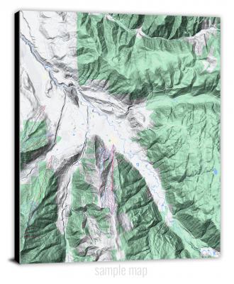
Enrich your office decor or home with a large canvas wrap Terrain map. It is designed for easy hanging with pre-installed hardware. Printed with archival inks and wrapped around a 1.5" thick gallery frame, your favorite map art will have a timeless and impressive look that fits with any decor. This map is fabricated with terrain imagery data from Google Maps, and bounding box coordinates from USGS.
Abajo Peak, Utah- Map Components- Imagery: Terrain of Abajo Peak, Utah. Bounding Box: Footprint of Abajo Peak, Utah at Longitude/Latitude Coordinates (-109.5 x -109.375 x 37.875 x 37.75).
Abes Knoll, Utah- Map Components- Imagery: Terrain of Abes Knoll, Utah. Bounding Box: Footprint of Abes Knoll, Utah at Longitude/Latitude Coordinates (-111.875 x -111.75 x 38.5 x 38.375).
Acord Lakes, Utah- Map Components- Imagery: Terrain of Acord Lakes, Utah. Bounding Box: Footprint of Acord Lakes, Utah at Longitude/Latitude Coordinates (-111.5 x -111.375 x 39 x 38.875).
Adams Head, Utah- Map Components- Imagery: Terrain of Adams Head, Utah. Bounding Box: Footprint of Adams Head, Utah at Longitude/Latitude Coordinates (-112.25 x -112.125 x 38 x 37.875).
Adamsville, Utah- Map Components- Imagery: Terrain of Adamsville, Utah. Bounding Box: Footprint of Adamsville, Utah at Longitude/Latitude Coordinates (-112.875 x -112.75 x 38.375 x 38.25).
Agate, Utah- Map Components- Imagery: Terrain of Agate, Utah. Bounding Box: Footprint of Agate, Utah at Longitude/Latitude Coordinates (-109.25 x -109.125 x 39.125 x 39).
Agency Draw NE, Utah- Map Components- Imagery: Terrain of Agency Draw NE, Utah. Bounding Box: Footprint of Agency Draw NE, Utah at Longitude/Latitude Coordinates (-109.625 x -109.5 x 39.75 x 39.625).
Agency Draw NW, Utah- Map Components- Imagery: Terrain of Agency Draw NW, Utah. Bounding Box: Footprint of Agency Draw NW, Utah at Longitude/Latitude Coordinates (-109.75 x -109.625 x 39.75 x 39.625).
Alcove Canyon, Utah- Map Components- Imagery: Terrain of Alcove Canyon, Utah. Bounding Box: Footprint of Alcove Canyon, Utah at Longitude/Latitude Coordinates (-110.75 x -110.625 x 37.375 x 37.25).
Allens Ranch, Utah- Map Components- Imagery: Terrain of Allens Ranch, Utah. Bounding Box: Footprint of Allens Ranch, Utah at Longitude/Latitude Coordinates (-112.125 x -112 x 40.125 x 40).
Altamont, Utah- Map Components- Imagery: Terrain of Altamont, Utah. Bounding Box: Footprint of Altamont, Utah at Longitude/Latitude Coordinates (-110.375 x -110.25 x 40.375 x 40.25).
Alton, Utah- Map Components- Imagery: Terrain of Alton, Utah. Bounding Box: Footprint of Alton, Utah at Longitude/Latitude Coordinates (-112.5 x -112.375 x 37.5 x 37.375).
Altonah, Utah- Map Components- Imagery: Terrain of Altonah, Utah. Bounding Box: Footprint of Altonah, Utah at Longitude/Latitude Coordinates (-110.375 x -110.25 x 40.5 x 40.375).
Aneth, Utah- Map Components- Imagery: Terrain of Aneth, Utah. Bounding Box: Footprint of Aneth, Utah at Longitude/Latitude Coordinates (-109.25 x -109.125 x 37.25 x 37.125).
Angel Cove, Utah- Map Components- Imagery: Terrain of Angel Cove, Utah. Bounding Box: Footprint of Angel Cove, Utah at Longitude/Latitude Coordinates (-110.625 x -110.5 x 38.375 x 38.25).
Angel Point, Utah- Map Components- Imagery: Terrain of Angel Point, Utah. Bounding Box: Footprint of Angel Point, Utah at Longitude/Latitude Coordinates (-110.5 x -110.375 x 38.375 x 38.25).
Angle, Utah- Map Components- Imagery: Terrain of Angle, Utah. Bounding Box: Footprint of Angle, Utah at Longitude/Latitude Coordinates (-112 x -111.875 x 38.25 x 38.125).
Annabella, Utah- Map Components- Imagery: Terrain of Annabella, Utah. Bounding Box: Footprint of Annabella, Utah at Longitude/Latitude Coordinates (-112.125 x -112 x 38.75 x 38.625).
Ant Knoll, Utah- Map Components- Imagery: Terrain of Ant Knoll, Utah. Bounding Box: Footprint of Ant Knoll, Utah at Longitude/Latitude Coordinates (-110.875 x -110.75 x 37.875 x 37.75).
Antelope Island, Utah- Map Components- Imagery: Terrain of Antelope Island, Utah. Bounding Box: Footprint of Antelope Island, Utah at Longitude/Latitude Coordinates (-112.25 x -112.125 x 41 x 40.875).
Antelope Island North, Utah- Map Components- Imagery: Terrain of Antelope Island North, Utah. Bounding Box: Footprint of Antelope Island North, Utah at Longitude/Latitude Coordinates (-112.25 x -112.125 x 41.125 x 41).
Antelope Island South, Utah- Map Components- Imagery: Terrain of Antelope Island South, Utah. Bounding Box: Footprint of Antelope Island South, Utah at Longitude/Latitude Coordinates (-112.25 x -112.125 x 40.875 x 40.75).
Antelope Peak, Utah- Map Components- Imagery: Terrain of Antelope Peak, Utah. Bounding Box: Footprint of Antelope Peak, Utah at Longitude/Latitude Coordinates (-113.5 x -113.375 x 37.875 x 37.75).
Antelope Range, Utah- Map Components- Imagery: Terrain of Antelope Range, Utah. Bounding Box: Footprint of Antelope Range, Utah at Longitude/Latitude Coordinates (-112.25 x -112.125 x 38.625 x 38.5).
Antelope Spring, Utah- Map Components- Imagery: Terrain of Antelope Spring, Utah. Bounding Box: Footprint of Antelope Spring, Utah at Longitude/Latitude Coordinates (-112.875 x -112.75 x 38.75 x 38.625).
Antelope Valley, Utah- Map Components- Imagery: Terrain of Antelope Valley, Utah. Bounding Box: Footprint of Antelope Valley, Utah at Longitude/Latitude Coordinates (-112.75 x -112.625 x 38.75 x 38.625).
Anthro Mountain, Utah- Map Components- Imagery: Terrain of Anthro Mountain, Utah. Bounding Box: Footprint of Anthro Mountain, Utah at Longitude/Latitude Coordinates (-110.5 x -110.375 x 40 x 39.875).
Anthro Mountain NE, Utah- Map Components- Imagery: Terrain of Anthro Mountain NE, Utah. Bounding Box: Footprint of Anthro Mountain NE, Utah at Longitude/Latitude Coordinates (-110.375 x -110.25 x 40 x 39.875).
Antimony, Utah- Map Components- Imagery: Terrain of Antimony, Utah. Bounding Box: Footprint of Antimony, Utah at Longitude/Latitude Coordinates (-112 x -111.875 x 38.125 x 38).
Antone Canyon, Utah- Map Components- Imagery: Terrain of Antone Canyon, Utah. Bounding Box: Footprint of Antone Canyon, Utah at Longitude/Latitude Coordinates (-109.375 x -109.25 x 39.25 x 39.125).
Aragonite, Utah- Map Components- Imagery: Terrain of Aragonite, Utah. Bounding Box: Footprint of Aragonite, Utah at Longitude/Latitude Coordinates (-113.125 x -113 x 40.75 x 40.625).
Aragonite NW, Utah- Map Components- Imagery: Terrain of Aragonite NW, Utah. Bounding Box: Footprint of Aragonite NW, Utah at Longitude/Latitude Coordinates (-113.25 x -113.125 x 40.75 x 40.625).
Aragonite SE, Utah- Map Components- Imagery: Terrain of Aragonite SE, Utah. Bounding Box: Footprint of Aragonite SE, Utah at Longitude/Latitude Coordinates (-113.125 x -113 x 40.625 x 40.5).
Aragonite SW, Utah- Map Components- Imagery: Terrain of Aragonite SW, Utah. Bounding Box: Footprint of Aragonite SW, Utah at Longitude/Latitude Coordinates (-113.25 x -113.125 x 40.625 x 40.5).
Archy Bench, Utah- Map Components- Imagery: Terrain of Archy Bench, Utah. Bounding Box: Footprint of Archy Bench, Utah at Longitude/Latitude Coordinates (-109.5 x -109.375 x 40 x 39.875).
Archy Bench SE, Utah- Map Components- Imagery: Terrain of Archy Bench SE, Utah. Bounding Box: Footprint of Archy Bench SE, Utah at Longitude/Latitude Coordinates (-109.375 x -109.25 x 39.875 x 39.75).
Arinosa, Utah- Map Components- Imagery: Terrain of Arinosa, Utah. Bounding Box: Footprint of Arinosa, Utah at Longitude/Latitude Coordinates (-113.75 x -113.625 x 40.75 x 40.625).
Arinosa NE, Utah- Map Components- Imagery: Terrain of Arinosa NE, Utah. Bounding Box: Footprint of Arinosa NE, Utah at Longitude/Latitude Coordinates (-113.625 x -113.5 x 40.75 x 40.625).
Arinosa SE, Utah- Map Components- Imagery: Terrain of Arinosa SE, Utah. Bounding Box: Footprint of Arinosa SE, Utah at Longitude/Latitude Coordinates (-113.625 x -113.5 x 40.625 x 40.5).
Arinosa SW, Utah- Map Components- Imagery: Terrain of Arinosa SW, Utah. Bounding Box: Footprint of Arinosa SW, Utah at Longitude/Latitude Coordinates (-113.75 x -113.625 x 40.625 x 40.5).
Arsons Garden, Utah- Map Components- Imagery: Terrain of Arsons Garden, Utah. Bounding Box: Footprint of Arsons Garden, Utah at Longitude/Latitude Coordinates (-110.625 x -110.5 x 38.875 x 38.75).
Asay Bench, Utah- Map Components- Imagery: Terrain of Asay Bench, Utah. Bounding Box: Footprint of Asay Bench, Utah at Longitude/Latitude Coordinates (-112.625 x -112.5 x 37.625 x 37.5).
Aspen Grove, Utah- Map Components- Imagery: Terrain of Aspen Grove, Utah. Bounding Box: Footprint of Aspen Grove, Utah at Longitude/Latitude Coordinates (-111.625 x -111.5 x 40.5 x 40.375).
Asphalt Wash, Utah- Map Components- Imagery: Terrain of Asphalt Wash, Utah. Bounding Box: Footprint of Asphalt Wash, Utah at Longitude/Latitude Coordinates (-109.375 x -109.25 x 40 x 39.875).
Atchison Creek, Utah- Map Components- Imagery: Terrain of Atchison Creek, Utah. Bounding Box: Footprint of Atchison Creek, Utah at Longitude/Latitude Coordinates (-114 x -113.875 x 38.25 x 38.125).
Aurora, Utah- Map Components- Imagery: Terrain of Aurora, Utah. Bounding Box: Footprint of Aurora, Utah at Longitude/Latitude Coordinates (-112 x -111.875 x 39 x 38.875).
Avintaquin Canyon, Utah- Map Components- Imagery: Terrain of Avintaquin Canyon, Utah. Bounding Box: Footprint of Avintaquin Canyon, Utah at Longitude/Latitude Coordinates (-110.875 x -110.75 x 40.125 x 40).
Avon, Utah- Map Components- Imagery: Terrain of Avon, Utah. Bounding Box: Footprint of Avon, Utah at Longitude/Latitude Coordinates (-113.375 x -113.25 x 38 x 37.875).
Avon NW, Utah- Map Components- Imagery: Terrain of Avon NW, Utah. Bounding Box: Footprint of Avon NW, Utah at Longitude/Latitude Coordinates (-113.5 x -113.375 x 38 x 37.875).
Avon SE, Utah- Map Components- Imagery: Terrain of Avon SE, Utah. Bounding Box: Footprint of Avon SE, Utah at Longitude/Latitude Coordinates (-113.375 x -113.25 x 37.875 x 37.75).
Baboon Peak, Utah- Map Components- Imagery: Terrain of Baboon Peak, Utah. Bounding Box: Footprint of Baboon Peak, Utah at Longitude/Latitude Coordinates (-113.125 x -113 x 38.125 x 38).
Badger Island, Utah- Map Components- Imagery: Terrain of Badger Island, Utah. Bounding Box: Footprint of Badger Island, Utah at Longitude/Latitude Coordinates (-112.625 x -112.5 x 41 x 40.875).
Badger Island NW, Utah- Map Components- Imagery: Terrain of Badger Island NW, Utah. Bounding Box: Footprint of Badger Island NW, Utah at Longitude/Latitude Coordinates (-112.75 x -112.625 x 41 x 40.875).
Badger Peak, Utah- Map Components- Imagery: Terrain of Badger Peak, Utah. Bounding Box: Footprint of Badger Peak, Utah at Longitude/Latitude Coordinates (-113.25 x -113.125 x 38.125 x 38).
Baileys Lake, Utah- Map Components- Imagery: Terrain of Baileys Lake, Utah. Bounding Box: Footprint of Baileys Lake, Utah at Longitude/Latitude Coordinates (-112.125 x -112 x 40.875 x 40.75).
Baker Hot Springs, Utah- Map Components- Imagery: Terrain of Baker Hot Springs, Utah. Bounding Box: Footprint of Baker Hot Springs, Utah at Longitude/Latitude Coordinates (-112.75 x -112.625 x 39.625 x 39.5).
Baking Skillet Knoll, Utah- Map Components- Imagery: Terrain of Baking Skillet Knoll, Utah. Bounding Box: Footprint of Baking Skillet Knoll, Utah at Longitude/Latitude Coordinates (-110.625 x -110.5 x 38.25 x 38.125).
Bald Knoll, Utah- Map Components- Imagery: Terrain of Bald Knoll, Utah. Bounding Box: Footprint of Bald Knoll, Utah at Longitude/Latitude Coordinates (-112.5 x -112.375 x 37.375 x 37.25).
Bannion Spring, Utah- Map Components- Imagery: Terrain of Bannion Spring, Utah. Bounding Box: Footprint of Bannion Spring, Utah at Longitude/Latitude Coordinates (-113.875 x -113.75 x 38 x 37.875).
Bar X Wash, Utah- Map Components- Imagery: Terrain of Bar X Wash, Utah. Bounding Box: Footprint of Bar X Wash, Utah at Longitude/Latitude Coordinates (-109.125 x -109 x 39.375 x 39.25).
Barker Reservoir, Utah- Map Components- Imagery: Terrain of Barker Reservoir, Utah. Bounding Box: Footprint of Barker Reservoir, Utah at Longitude/Latitude Coordinates (-111.875 x -111.75 x 38 x 37.875).
Barro, Utah- Map Components- Imagery: Terrain of Barro, Utah. Bounding Box: Footprint of Barro, Utah at Longitude/Latitude Coordinates (-113.5 x -113.375 x 40.75 x 40.625).
Basin Canyon, Utah- Map Components- Imagery: Terrain of Basin Canyon, Utah. Bounding Box: Footprint of Basin Canyon, Utah at Longitude/Latitude Coordinates (-111.375 x -111.25 x 37.5 x 37.375).
Bates Knolls, Utah- Map Components- Imagery: Terrain of Bates Knolls, Utah. Bounding Box: Footprint of Bates Knolls, Utah at Longitude/Latitude Coordinates (-109.5 x -109.375 x 39.75 x 39.625).
Bear Canyon, Utah- Map Components- Imagery: Terrain of Bear Canyon, Utah. Bounding Box: Footprint of Bear Canyon, Utah at Longitude/Latitude Coordinates (-111.25 x -111.125 x 38.125 x 38).
Bear Lake South, Utah- Map Components- Imagery: Terrain of Bear Lake South, Utah. Bounding Box: Footprint of Bear Lake South, Utah at Longitude/Latitude Coordinates (-111.375 x -111.25 x 42 x 41.875).
Bear River City, Utah- Map Components- Imagery: Terrain of Bear River City, Utah. Bounding Box: Footprint of Bear River City, Utah at Longitude/Latitude Coordinates (-112.25 x -112.125 x 41.625 x 41.5).
Bearskin Mountain, Utah- Map Components- Imagery: Terrain of Bearskin Mountain, Utah. Bounding Box: Footprint of Bearskin Mountain, Utah at Longitude/Latitude Coordinates (-112.875 x -112.75 x 38.5 x 38.375).
Beaver, Utah- Map Components- Imagery: Terrain of Beaver, Utah. Bounding Box: Footprint of Beaver, Utah at Longitude/Latitude Coordinates (-112.75 x -112.625 x 38.375 x 38.25).
Beehive Peak, Utah- Map Components- Imagery: Terrain of Beehive Peak, Utah. Bounding Box: Footprint of Beehive Peak, Utah at Longitude/Latitude Coordinates (-112.125 x -112 x 39 x 38.875).
Beryl, Utah- Map Components- Imagery: Terrain of Beryl, Utah. Bounding Box: Footprint of Beryl, Utah at Longitude/Latitude Coordinates (-113.75 x -113.625 x 38 x 37.875).
Beryl Junction, Utah- Map Components- Imagery: Terrain of Beryl Junction, Utah. Bounding Box: Footprint of Beryl Junction, Utah at Longitude/Latitude Coordinates (-113.75 x -113.625 x 37.75 x 37.625).
Bible Spring, Utah- Map Components- Imagery: Terrain of Bible Spring, Utah. Bounding Box: Footprint of Bible Spring, Utah at Longitude/Latitude Coordinates (-113.75 x -113.625 x 38.125 x 38).
Bicknell, Utah- Map Components- Imagery: Terrain of Bicknell, Utah. Bounding Box: Footprint of Bicknell, Utah at Longitude/Latitude Coordinates (-111.625 x -111.5 x 38.375 x 38.25).
Big Bench, Utah- Map Components- Imagery: Terrain of Big Bench, Utah. Bounding Box: Footprint of Big Bench, Utah at Longitude/Latitude Coordinates (-109.5 x -109.375 x 37.5 x 37.375).
Big Bend, Utah- Map Components- Imagery: Terrain of Big Bend, Utah. Bounding Box: Footprint of Big Bend, Utah at Longitude/Latitude Coordinates (-109.5 x -109.375 x 38.75 x 38.625).
Big Bend Draw, Utah- Map Components- Imagery: Terrain of Big Bend Draw, Utah. Bounding Box: Footprint of Big Bend Draw, Utah at Longitude/Latitude Coordinates (-111.125 x -111 x 38.875 x 38.75).
Big Dutch Hollow, Utah- Map Components- Imagery: Terrain of Big Dutch Hollow, Utah. Bounding Box: Footprint of Big Dutch Hollow, Utah at Longitude/Latitude Coordinates (-111.625 x -111.5 x 40.875 x 40.75).
Big Hollow, Utah- Map Components- Imagery: Terrain of Big Hollow, Utah. Bounding Box: Footprint of Big Hollow, Utah at Longitude/Latitude Coordinates (-111.625 x -111.5 x 39.75 x 39.625).
Big Hollow Wash, Utah- Map Components- Imagery: Terrain of Big Hollow Wash, Utah. Bounding Box: Footprint of Big Hollow Wash, Utah at Longitude/Latitude Coordinates (-111.25 x -111.125 x 37.5 x 37.375).
Big Horseshoe, Utah- Map Components- Imagery: Terrain of Big Horseshoe, Utah. Bounding Box: Footprint of Big Horseshoe, Utah at Longitude/Latitude Coordinates (-113.75 x -113.625 x 39.5 x 39.375).
Big Jensen Pass, Utah- Map Components- Imagery: Terrain of Big Jensen Pass, Utah. Bounding Box: Footprint of Big Jensen Pass, Utah at Longitude/Latitude Coordinates (-113.875 x -113.75 x 38.875 x 38.75).
Big Lake, Utah- Map Components- Imagery: Terrain of Big Lake, Utah. Bounding Box: Footprint of Big Lake, Utah at Longitude/Latitude Coordinates (-111.75 x -111.625 x 38.125 x 38).
Big Pack Mountain, Utah- Map Components- Imagery: Terrain of Big Pack Mountain, Utah. Bounding Box: Footprint of Big Pack Mountain, Utah at Longitude/Latitude Coordinates (-109.75 x -109.625 x 39.875 x 39.75).
Big Pack Mountain NE, Utah- Map Components- Imagery: Terrain of Big Pack Mountain NE, Utah. Bounding Box: Footprint of Big Pack Mountain NE, Utah at Longitude/Latitude Coordinates (-109.625 x -109.5 x 40 x 39.875).
Big Pack Mountain NW, Utah- Map Components- Imagery: Terrain of Big Pack Mountain NW, Utah. Bounding Box: Footprint of Big Pack Mountain NW, Utah at Longitude/Latitude Coordinates (-109.75 x -109.625 x 40 x 39.875).
Big Pack Mountain SE, Utah- Map Components- Imagery: Terrain of Big Pack Mountain SE, Utah. Bounding Box: Footprint of Big Pack Mountain SE, Utah at Longitude/Latitude Coordinates (-109.625 x -109.5 x 39.875 x 39.75).
Big Pass, Utah- Map Components- Imagery: Terrain of Big Pass, Utah. Bounding Box: Footprint of Big Pass, Utah at Longitude/Latitude Coordinates (-113.5 x -113.375 x 41.125 x 41).
Big Triangle, Utah- Map Components- Imagery: Terrain of Big Triangle, Utah. Bounding Box: Footprint of Big Triangle, Utah at Longitude/Latitude Coordinates (-109.25 x -109.125 x 39 x 38.875).
Big Water, Utah- Map Components- Imagery: Terrain of Big Water, Utah. Bounding Box: Footprint of Big Water, Utah at Longitude/Latitude Coordinates (-111.75 x -111.625 x 37.125 x 37).
Billies Mountain, Utah- Map Components- Imagery: Terrain of Billies Mountain, Utah. Bounding Box: Footprint of Billies Mountain, Utah at Longitude/Latitude Coordinates (-111.5 x -111.375 x 40.125 x 40).
Bingham Canyon, Utah- Map Components- Imagery: Terrain of Bingham Canyon, Utah. Bounding Box: Footprint of Bingham Canyon, Utah at Longitude/Latitude Coordinates (-112.25 x -112.125 x 40.625 x 40.5).
Birch Creek Reservoirs, Utah- Map Components- Imagery: Terrain of Birch Creek Reservoirs, Utah. Bounding Box: Footprint of Birch Creek Reservoirs, Utah at Longitude/Latitude Coordinates (-111.375 x -111.25 x 41.625 x 41.5).
Birdseye, Utah- Map Components- Imagery: Terrain of Birdseye, Utah. Bounding Box: Footprint of Birdseye, Utah at Longitude/Latitude Coordinates (-111.625 x -111.5 x 40 x 39.875).
Bitter Creek Divide, Utah- Map Components- Imagery: Terrain of Bitter Creek Divide, Utah. Bounding Box: Footprint of Bitter Creek Divide, Utah at Longitude/Latitude Coordinates (-111.125 x -111 x 38 x 37.875).
Bitter Creek Well, Utah- Map Components- Imagery: Terrain of Bitter Creek Well, Utah. Bounding Box: Footprint of Bitter Creek Well, Utah at Longitude/Latitude Coordinates (-109.125 x -109 x 39.25 x 39.125).
Black Butte, Utah- Map Components- Imagery: Terrain of Black Butte, Utah. Bounding Box: Footprint of Black Butte, Utah at Longitude/Latitude Coordinates (-113.25 x -113.125 x 41.875 x 41.75).
Black Knolls, Utah- Map Components- Imagery: Terrain of Black Knolls, Utah. Bounding Box: Footprint of Black Knolls, Utah at Longitude/Latitude Coordinates (-109.75 x -109.625 x 39.5 x 39.375).
Black Mesa Butte, Utah- Map Components- Imagery: Terrain of Black Mesa Butte, Utah. Bounding Box: Footprint of Black Mesa Butte, Utah at Longitude/Latitude Coordinates (-109.625 x -109.5 x 37.625 x 37.5).
Black Mountain, Utah- Map Components- Imagery: Terrain of Black Mountain, Utah. Bounding Box: Footprint of Black Mountain, Utah at Longitude/Latitude Coordinates (-111.625 x -111.5 x 39.25 x 39.125).
Black Point, Utah- Map Components- Imagery: Terrain of Black Point, Utah. Bounding Box: Footprint of Black Point, Utah at Longitude/Latitude Coordinates (-112.75 x -112.625 x 38.875 x 38.75).
Black Ridge, Utah- Map Components- Imagery: Terrain of Black Ridge, Utah. Bounding Box: Footprint of Black Ridge, Utah at Longitude/Latitude Coordinates (-112.625 x -112.5 x 38.375 x 38.25).
Black Rock, Utah- Map Components- Imagery: Terrain of Black Rock, Utah. Bounding Box: Footprint of Black Rock, Utah at Longitude/Latitude Coordinates (-113 x -112.875 x 38.75 x 38.625).
Black Steer Canyon, Utah- Map Components- Imagery: Terrain of Black Steer Canyon, Utah. Bounding Box: Footprint of Black Steer Canyon, Utah at Longitude/Latitude Coordinates (-110.125 x -110 x 37.875 x 37.75).
Black Table, Utah- Map Components- Imagery: Terrain of Black Table, Utah. Bounding Box: Footprint of Black Table, Utah at Longitude/Latitude Coordinates (-110.625 x -110.5 x 38 x 37.875).
Blackburn Canyon, Utah- Map Components- Imagery: Terrain of Blackburn Canyon, Utah. Bounding Box: Footprint of Blackburn Canyon, Utah at Longitude/Latitude Coordinates (-111.25 x -111.125 x 37.375 x 37.25).
Blacktail Mountain, Utah- Map Components- Imagery: Terrain of Blacktail Mountain, Utah. Bounding Box: Footprint of Blacktail Mountain, Utah at Longitude/Latitude Coordinates (-110.625 x -110.5 x 40.375 x 40.25).
Blair Basin, Utah- Map Components- Imagery: Terrain of Blair Basin, Utah. Bounding Box: Footprint of Blair Basin, Utah at Longitude/Latitude Coordinates (-109.375 x -109.25 x 40.75 x 40.625).
Blanding North, Utah- Map Components- Imagery: Terrain of Blanding North, Utah. Bounding Box: Footprint of Blanding North, Utah at Longitude/Latitude Coordinates (-109.5 x -109.375 x 37.75 x 37.625).
Blanding South, Utah- Map Components- Imagery: Terrain of Blanding South, Utah. Bounding Box: Footprint of Blanding South, Utah at Longitude/Latitude Coordinates (-109.5 x -109.375 x 37.625 x 37.5).
Blind Lake, Utah- Map Components- Imagery: Terrain of Blind Lake, Utah. Bounding Box: Footprint of Blind Lake, Utah at Longitude/Latitude Coordinates (-111.5 x -111.375 x 38.25 x 38.125).
Blind Spring Mountain, Utah- Map Components- Imagery: Terrain of Blind Spring Mountain, Utah. Bounding Box: Footprint of Blind Spring Mountain, Utah at Longitude/Latitude Coordinates (-112.375 x -112.25 x 38 x 37.875).
Blind Springs, Utah- Map Components- Imagery: Terrain of Blind Springs, Utah. Bounding Box: Footprint of Blind Springs, Utah at Longitude/Latitude Coordinates (-112.375 x -112.25 x 41.875 x 41.75).
Blue Castle Butte, Utah- Map Components- Imagery: Terrain of Blue Castle Butte, Utah. Bounding Box: Footprint of Blue Castle Butte, Utah at Longitude/Latitude Coordinates (-110.25 x -110.125 x 39.125 x 39).
Blue Chief Mesa, Utah- Map Components- Imagery: Terrain of Blue Chief Mesa, Utah. Bounding Box: Footprint of Blue Chief Mesa, Utah at Longitude/Latitude Coordinates (-109.25 x -109.125 x 38.875 x 38.75).
Blue Mountain, Utah- Map Components- Imagery: Terrain of Blue Mountain, Utah. Bounding Box: Footprint of Blue Mountain, Utah at Longitude/Latitude Coordinates (-113.5 x -113.375 x 38.25 x 38.125).
Bluebell, Utah- Map Components- Imagery: Terrain of Bluebell, Utah. Bounding Box: Footprint of Bluebell, Utah at Longitude/Latitude Coordinates (-110.25 x -110.125 x 40.375 x 40.25).
Bluff, Utah- Map Components- Imagery: Terrain of Bluff, Utah. Bounding Box: Footprint of Bluff, Utah at Longitude/Latitude Coordinates (-109.625 x -109.5 x 37.375 x 37.25).
Bluff NW, Utah- Map Components- Imagery: Terrain of Bluff NW, Utah. Bounding Box: Footprint of Bluff NW, Utah at Longitude/Latitude Coordinates (-109.75 x -109.625 x 37.5 x 37.375).
Bluff SW, Utah- Map Components- Imagery: Terrain of Bluff SW, Utah. Bounding Box: Footprint of Bluff SW, Utah at Longitude/Latitude Coordinates (-109.75 x -109.625 x 37.375 x 37.25).
Bob Hill Knoll, Utah- Map Components- Imagery: Terrain of Bob Hill Knoll, Utah. Bounding Box: Footprint of Bob Hill Knoll, Utah at Longitude/Latitude Coordinates (-110.75 x -110.625 x 39.25 x 39.125).
Bobby Canyon North, Utah- Map Components- Imagery: Terrain of Bobby Canyon North, Utah. Bounding Box: Footprint of Bobby Canyon North, Utah at Longitude/Latitude Coordinates (-110 x -109.875 x 39.25 x 39.125).
Bobby Canyon South, Utah- Map Components- Imagery: Terrain of Bobby Canyon South, Utah. Bounding Box: Footprint of Bobby Canyon South, Utah at Longitude/Latitude Coordinates (-110 x -109.875 x 39.125 x 39).
Bogart Canyon, Utah- Map Components- Imagery: Terrain of Bogart Canyon, Utah. Bounding Box: Footprint of Bogart Canyon, Utah at Longitude/Latitude Coordinates (-109.75 x -109.625 x 39.25 x 39.125).
Bollie Lake, Utah- Map Components- Imagery: Terrain of Bollie Lake, Utah. Bounding Box: Footprint of Bollie Lake, Utah at Longitude/Latitude Coordinates (-110.25 x -110.125 x 40.75 x 40.625).
Bonanza, Utah- Map Components- Imagery: Terrain of Bonanza, Utah. Bounding Box: Footprint of Bonanza, Utah at Longitude/Latitude Coordinates (-109.25 x -109.125 x 40.125 x 40).
Bonneville Racetrack, Utah- Map Components- Imagery: Terrain of Bonneville Racetrack, Utah. Bounding Box: Footprint of Bonneville Racetrack, Utah at Longitude/Latitude Coordinates (-113.875 x -113.75 x 40.875 x 40.75).
Boobe Hole Reservoir, Utah- Map Components- Imagery: Terrain of Boobe Hole Reservoir, Utah. Bounding Box: Footprint of Boobe Hole Reservoir, Utah at Longitude/Latitude Coordinates (-111.875 x -111.75 x 38.75 x 38.625).
Borden, Utah- Map Components- Imagery: Terrain of Borden, Utah. Bounding Box: Footprint of Borden, Utah at Longitude/Latitude Coordinates (-112.875 x -112.75 x 39 x 38.875).
Bottleneck Peak, Utah- Map Components- Imagery: Terrain of Bottleneck Peak, Utah. Bounding Box: Footprint of Bottleneck Peak, Utah at Longitude/Latitude Coordinates (-110.75 x -110.625 x 39.125 x 39).
Boulder Mountain, Utah- Map Components- Imagery: Terrain of Boulder Mountain, Utah. Bounding Box: Footprint of Boulder Mountain, Utah at Longitude/Latitude Coordinates (-111.625 x -111.5 x 41.75 x 41.625).
Boulder Town, Utah- Map Components- Imagery: Terrain of Boulder Town, Utah. Bounding Box: Footprint of Boulder Town, Utah at Longitude/Latitude Coordinates (-111.5 x -111.375 x 38 x 37.875).
Boulter Peak, Utah- Map Components- Imagery: Terrain of Boulter Peak, Utah. Bounding Box: Footprint of Boulter Peak, Utah at Longitude/Latitude Coordinates (-112.25 x -112.125 x 40.125 x 40).
Boundary Butte, Utah- Map Components- Imagery: Terrain of Boundary Butte, Utah. Bounding Box: Footprint of Boundary Butte, Utah at Longitude/Latitude Coordinates (-109.625 x -109.5 x 37.125 x 37).
Bountiful Peak, Utah- Map Components- Imagery: Terrain of Bountiful Peak, Utah. Bounding Box: Footprint of Bountiful Peak, Utah at Longitude/Latitude Coordinates (-111.875 x -111.75 x 41 x 40.875).
Bovine, Utah- Map Components- Imagery: Terrain of Bovine, Utah. Bounding Box: Footprint of Bovine, Utah at Longitude/Latitude Coordinates (-113.75 x -113.625 x 41.5 x 41.375).
Bovine SE, Utah- Map Components- Imagery: Terrain of Bovine SE, Utah. Bounding Box: Footprint of Bovine SE, Utah at Longitude/Latitude Coordinates (-113.625 x -113.5 x 41.375 x 41.25).
Bowdie Canyon East, Utah- Map Components- Imagery: Terrain of Bowdie Canyon East, Utah. Bounding Box: Footprint of Bowdie Canyon East, Utah at Longitude/Latitude Coordinates (-110.125 x -110 x 38 x 37.875).
Bowdie Canyon West, Utah- Map Components- Imagery: Terrain of Bowdie Canyon West, Utah. Bounding Box: Footprint of Bowdie Canyon West, Utah at Longitude/Latitude Coordinates (-110.25 x -110.125 x 38 x 37.875).
Bowknot Bend, Utah- Map Components- Imagery: Terrain of Bowknot Bend, Utah. Bounding Box: Footprint of Bowknot Bend, Utah at Longitude/Latitude Coordinates (-110.125 x -110 x 38.625 x 38.5).
Boyd Station, Utah- Map Components- Imagery: Terrain of Boyd Station, Utah. Bounding Box: Footprint of Boyd Station, Utah at Longitude/Latitude Coordinates (-113.625 x -113.5 x 39.875 x 39.75).
Bradford Canyon, Utah- Map Components- Imagery: Terrain of Bradford Canyon, Utah. Bounding Box: Footprint of Bradford Canyon, Utah at Longitude/Latitude Coordinates (-109.375 x -109.25 x 37.625 x 37.5).
Brennan Basin, Utah- Map Components- Imagery: Terrain of Brennan Basin, Utah. Bounding Box: Footprint of Brennan Basin, Utah at Longitude/Latitude Coordinates (-109.625 x -109.5 x 40.25 x 40.125).
Brian Head, Utah- Map Components- Imagery: Terrain of Brian Head, Utah. Bounding Box: Footprint of Brian Head, Utah at Longitude/Latitude Coordinates (-112.875 x -112.75 x 37.75 x 37.625).
Bridal Veil Falls, Utah- Map Components- Imagery: Terrain of Bridal Veil Falls, Utah. Bounding Box: Footprint of Bridal Veil Falls, Utah at Longitude/Latitude Coordinates (-111.625 x -111.5 x 40.375 x 40.25).
Bridgeland, Utah- Map Components- Imagery: Terrain of Bridgeland, Utah. Bounding Box: Footprint of Bridgeland, Utah at Longitude/Latitude Coordinates (-110.25 x -110.125 x 40.25 x 40.125).
Bridger Lake, Utah- Map Components- Imagery: Terrain of Bridger Lake, Utah. Bounding Box: Footprint of Bridger Lake, Utah at Longitude/Latitude Coordinates (-110.5 x -110.375 x 41 x 40.875).
Bridger Point, Utah- Map Components- Imagery: Terrain of Bridger Point, Utah. Bounding Box: Footprint of Bridger Point, Utah at Longitude/Latitude Coordinates (-111.875 x -111.75 x 37.125 x 37).
Brigham City, Utah- Map Components- Imagery: Terrain of Brigham City, Utah. Bounding Box: Footprint of Brigham City, Utah at Longitude/Latitude Coordinates (-112.125 x -112 x 41.625 x 41.5).
Brighton, Utah- Map Components- Imagery: Terrain of Brighton, Utah. Bounding Box: Footprint of Brighton, Utah at Longitude/Latitude Coordinates (-111.625 x -111.5 x 40.625 x 40.5).
Brown Knoll, Utah- Map Components- Imagery: Terrain of Brown Knoll, Utah. Bounding Box: Footprint of Brown Knoll, Utah at Longitude/Latitude Coordinates (-113.375 x -113.25 x 38.75 x 38.625).
Browns Hole, Utah- Map Components- Imagery: Terrain of Browns Hole, Utah. Bounding Box: Footprint of Browns Hole, Utah at Longitude/Latitude Coordinates (-111.75 x -111.625 x 41.375 x 41.25).
Bruin Point, Utah- Map Components- Imagery: Terrain of Bruin Point, Utah. Bounding Box: Footprint of Bruin Point, Utah at Longitude/Latitude Coordinates (-110.375 x -110.25 x 39.75 x 39.625).
Bryce Canyon, Utah- Map Components- Imagery: Terrain of Bryce Canyon, Utah. Bounding Box: Footprint of Bryce Canyon, Utah at Longitude/Latitude Coordinates (-112.25 x -112.125 x 37.75 x 37.625).
Bryce Point, Utah- Map Components- Imagery: Terrain of Bryce Point, Utah. Bounding Box: Footprint of Bryce Point, Utah at Longitude/Latitude Coordinates (-112.25 x -112.125 x 37.625 x 37.5).
Bryson Canyon, Utah- Map Components- Imagery: Terrain of Bryson Canyon, Utah. Bounding Box: Footprint of Bryson Canyon, Utah at Longitude/Latitude Coordinates (-109.25 x -109.125 x 39.375 x 39.25).
Buck Camp Canyon, Utah- Map Components- Imagery: Terrain of Buck Camp Canyon, Utah. Bounding Box: Footprint of Buck Camp Canyon, Utah at Longitude/Latitude Coordinates (-109.5 x -109.375 x 39.875 x 39.75).
Buck Hollow, Utah- Map Components- Imagery: Terrain of Buck Hollow, Utah. Bounding Box: Footprint of Buck Hollow, Utah at Longitude/Latitude Coordinates (-113.75 x -113.625 x 42 x 41.875).
Buck Knoll, Utah- Map Components- Imagery: Terrain of Buck Knoll, Utah. Bounding Box: Footprint of Buck Knoll, Utah at Longitude/Latitude Coordinates (-110.625 x -110.5 x 40.125 x 40).
Buckhorn Flat, Utah- Map Components- Imagery: Terrain of Buckhorn Flat, Utah. Bounding Box: Footprint of Buckhorn Flat, Utah at Longitude/Latitude Coordinates (-112.75 x -112.625 x 38.125 x 38).
Buckhorn Reservoir, Utah- Map Components- Imagery: Terrain of Buckhorn Reservoir, Utah. Bounding Box: Footprint of Buckhorn Reservoir, Utah at Longitude/Latitude Coordinates (-110.875 x -110.75 x 39.25 x 39.125).
Buckhorn Spring, Utah- Map Components- Imagery: Terrain of Buckhorn Spring, Utah. Bounding Box: Footprint of Buckhorn Spring, Utah at Longitude/Latitude Coordinates (-113.875 x -113.75 x 38.375 x 38.25).
Buckskin Hills, Utah- Map Components- Imagery: Terrain of Buckskin Hills, Utah. Bounding Box: Footprint of Buckskin Hills, Utah at Longitude/Latitude Coordinates (-113.875 x -113.75 x 39.125 x 39).
Buffalo Point, Utah- Map Components- Imagery: Terrain of Buffalo Point, Utah. Bounding Box: Footprint of Buffalo Point, Utah at Longitude/Latitude Coordinates (-112.375 x -112.25 x 41.125 x 41).
Bug Canyon, Utah- Map Components- Imagery: Terrain of Bug Canyon, Utah. Bounding Box: Footprint of Bug Canyon, Utah at Longitude/Latitude Coordinates (-109.25 x -109.125 x 37.625 x 37.5).
Bull Mountain, Utah- Map Components- Imagery: Terrain of Bull Mountain, Utah. Bounding Box: Footprint of Bull Mountain, Utah at Longitude/Latitude Coordinates (-110.75 x -110.625 x 38.25 x 38.125).
Bull Rush Peak, Utah- Map Components- Imagery: Terrain of Bull Rush Peak, Utah. Bounding Box: Footprint of Bull Rush Peak, Utah at Longitude/Latitude Coordinates (-112.375 x -112.25 x 38.125 x 38).
Bull Valley Gorge, Utah- Map Components- Imagery: Terrain of Bull Valley Gorge, Utah. Bounding Box: Footprint of Bull Valley Gorge, Utah at Longitude/Latitude Coordinates (-112.125 x -112 x 37.5 x 37.375).
Bullfrog, Utah- Map Components- Imagery: Terrain of Bullfrog, Utah. Bounding Box: Footprint of Bullfrog, Utah at Longitude/Latitude Coordinates (-110.75 x -110.625 x 37.625 x 37.5).
Bullgrass Knoll, Utah- Map Components- Imagery: Terrain of Bullgrass Knoll, Utah. Bounding Box: Footprint of Bullgrass Knoll, Utah at Longitude/Latitude Coordinates (-113.625 x -113.5 x 39.125 x 39).
Bulls Pass, Utah- Map Components- Imagery: Terrain of Bulls Pass, Utah. Bounding Box: Footprint of Bulls Pass, Utah at Longitude/Latitude Coordinates (-112.625 x -112.5 x 41.875 x 41.75).
Burbank Pass, Utah- Map Components- Imagery: Terrain of Burbank Pass, Utah. Bounding Box: Footprint of Burbank Pass, Utah at Longitude/Latitude Coordinates (-114 x -113.875 x 39 x 38.875).
Burmester, Utah- Map Components- Imagery: Terrain of Burmester, Utah. Bounding Box: Footprint of Burmester, Utah at Longitude/Latitude Coordinates (-112.5 x -112.375 x 40.75 x 40.625).
Burnout Canyon, Utah- Map Components- Imagery: Terrain of Burnout Canyon, Utah. Bounding Box: Footprint of Burnout Canyon, Utah at Longitude/Latitude Coordinates (-113.375 x -113.25 x 39 x 38.875).
Burns Knoll, Utah- Map Components- Imagery: Terrain of Burns Knoll, Utah. Bounding Box: Footprint of Burns Knoll, Utah at Longitude/Latitude Coordinates (-113.375 x -113.25 x 38.25 x 38.125).
Burnt Cabin Gorge, Utah- Map Components- Imagery: Terrain of Burnt Cabin Gorge, Utah. Bounding Box: Footprint of Burnt Cabin Gorge, Utah at Longitude/Latitude Coordinates (-109.5 x -109.375 x 40.75 x 40.625).
Burnt Mill Spring, Utah- Map Components- Imagery: Terrain of Burnt Mill Spring, Utah. Bounding Box: Footprint of Burnt Mill Spring, Utah at Longitude/Latitude Coordinates (-110.375 x -110.25 x 40.625 x 40.5).
Burnt Peak, Utah- Map Components- Imagery: Terrain of Burnt Peak, Utah. Bounding Box: Footprint of Burnt Peak, Utah at Longitude/Latitude Coordinates (-112.625 x -112.5 x 38.125 x 38).
Burnt Spring, Utah- Map Components- Imagery: Terrain of Burnt Spring, Utah. Bounding Box: Footprint of Burnt Spring, Utah at Longitude/Latitude Coordinates (-110.5 x -110.375 x 37.5 x 37.375).
Burnt Timber Canyon, Utah- Map Components- Imagery: Terrain of Burnt Timber Canyon, Utah. Bounding Box: Footprint of Burnt Timber Canyon, Utah at Longitude/Latitude Coordinates (-109.25 x -109.125 x 39.75 x 39.625).
Burr Point, Utah- Map Components- Imagery: Terrain of Burr Point, Utah. Bounding Box: Footprint of Burr Point, Utah at Longitude/Latitude Coordinates (-110.5 x -110.375 x 38.25 x 38.125).
Burrville, Utah- Map Components- Imagery: Terrain of Burrville, Utah. Bounding Box: Footprint of Burrville, Utah at Longitude/Latitude Coordinates (-111.875 x -111.75 x 38.625 x 38.5).
Butler Canyon, Utah- Map Components- Imagery: Terrain of Butler Canyon, Utah. Bounding Box: Footprint of Butler Canyon, Utah at Longitude/Latitude Coordinates (-110.125 x -110 x 39.25 x 39.125).
Butler Valley, Utah- Map Components- Imagery: Terrain of Butler Valley, Utah. Bounding Box: Footprint of Butler Valley, Utah at Longitude/Latitude Coordinates (-111.875 x -111.75 x 37.5 x 37.375).
Bybee Knoll, Utah- Map Components- Imagery: Terrain of Bybee Knoll, Utah. Bounding Box: Footprint of Bybee Knoll, Utah at Longitude/Latitude Coordinates (-111.625 x -111.5 x 41.25 x 41.125).
C Canyon, Utah- Map Components- Imagery: Terrain of C Canyon, Utah. Bounding Box: Footprint of C Canyon, Utah at Longitude/Latitude Coordinates (-111.375 x -111.25 x 39.875 x 39.75).
Caine Springs, Utah- Map Components- Imagery: Terrain of Caine Springs, Utah. Bounding Box: Footprint of Caine Springs, Utah at Longitude/Latitude Coordinates (-111.125 x -111 x 38.5 x 38.375).
Caineville, Utah- Map Components- Imagery: Terrain of Caineville, Utah. Bounding Box: Footprint of Caineville, Utah at Longitude/Latitude Coordinates (-111.125 x -111 x 38.375 x 38.25).
Calf Canyon, Utah- Map Components- Imagery: Terrain of Calf Canyon, Utah. Bounding Box: Footprint of Calf Canyon, Utah at Longitude/Latitude Coordinates (-109.625 x -109.5 x 39.125 x 39).
Calf Creek, Utah- Map Components- Imagery: Terrain of Calf Creek, Utah. Bounding Box: Footprint of Calf Creek, Utah at Longitude/Latitude Coordinates (-111.5 x -111.375 x 37.875 x 37.75).
Calico Peak, Utah- Map Components- Imagery: Terrain of Calico Peak, Utah. Bounding Box: Footprint of Calico Peak, Utah at Longitude/Latitude Coordinates (-112 x -111.875 x 37.375 x 37.25).
Callao, Utah- Map Components- Imagery: Terrain of Callao, Utah. Bounding Box: Footprint of Callao, Utah at Longitude/Latitude Coordinates (-113.75 x -113.625 x 40 x 39.875).
Callao NE, Utah- Map Components- Imagery: Terrain of Callao NE, Utah. Bounding Box: Footprint of Callao NE, Utah at Longitude/Latitude Coordinates (-113.625 x -113.5 x 40 x 39.875).
Camels Back Ridge NE, Utah- Map Components- Imagery: Terrain of Camels Back Ridge NE, Utah. Bounding Box: Footprint of Camels Back Ridge NE, Utah at Longitude/Latitude Coordinates (-112.875 x -112.75 x 40.25 x 40.125).
Camels Back Ridge NW, Utah- Map Components- Imagery: Terrain of Camels Back Ridge NW, Utah. Bounding Box: Footprint of Camels Back Ridge NW, Utah at Longitude/Latitude Coordinates (-113 x -112.875 x 40.25 x 40.125).
Camels Back Ridge SW, Utah- Map Components- Imagery: Terrain of Camels Back Ridge SW, Utah. Bounding Box: Footprint of Camels Back Ridge SW, Utah at Longitude/Latitude Coordinates (-113 x -112.875 x 40.125 x 40).
Canaan Creek, Utah- Map Components- Imagery: Terrain of Canaan Creek, Utah. Bounding Box: Footprint of Canaan Creek, Utah at Longitude/Latitude Coordinates (-111.75 x -111.625 x 37.75 x 37.625).
Canaan Peak, Utah- Map Components- Imagery: Terrain of Canaan Peak, Utah. Bounding Box: Footprint of Canaan Peak, Utah at Longitude/Latitude Coordinates (-111.875 x -111.75 x 37.625 x 37.5).
Candland Mountain, Utah- Map Components- Imagery: Terrain of Candland Mountain, Utah. Bounding Box: Footprint of Candland Mountain, Utah at Longitude/Latitude Coordinates (-111.25 x -111.125 x 39.625 x 39.5).
Candland Spring, Utah- Map Components- Imagery: Terrain of Candland Spring, Utah. Bounding Box: Footprint of Candland Spring, Utah at Longitude/Latitude Coordinates (-113 x -112.875 x 39 x 38.875).
Cannonville, Utah- Map Components- Imagery: Terrain of Cannonville, Utah. Bounding Box: Footprint of Cannonville, Utah at Longitude/Latitude Coordinates (-112.125 x -112 x 37.625 x 37.5).
Carcass Canyon, Utah- Map Components- Imagery: Terrain of Carcass Canyon, Utah. Bounding Box: Footprint of Carcass Canyon, Utah at Longitude/Latitude Coordinates (-111.625 x -111.5 x 37.625 x 37.5).
Carrington Island, Utah- Map Components- Imagery: Terrain of Carrington Island, Utah. Bounding Box: Footprint of Carrington Island, Utah at Longitude/Latitude Coordinates (-112.625 x -112.5 x 41.125 x 41).
Carrington Island NE, Utah- Map Components- Imagery: Terrain of Carrington Island NE, Utah. Bounding Box: Footprint of Carrington Island NE, Utah at Longitude/Latitude Coordinates (-112.625 x -112.5 x 41.25 x 41.125).
Carrington Island NW, Utah- Map Components- Imagery: Terrain of Carrington Island NW, Utah. Bounding Box: Footprint of Carrington Island NW, Utah at Longitude/Latitude Coordinates (-112.75 x -112.625 x 41.25 x 41.125).
Carrington Island SW, Utah- Map Components- Imagery: Terrain of Carrington Island SW, Utah. Bounding Box: Footprint of Carrington Island SW, Utah at Longitude/Latitude Coordinates (-112.75 x -112.625 x 41.125 x 41).
Cass Creek Peak, Utah- Map Components- Imagery: Terrain of Cass Creek Peak, Utah. Bounding Box: Footprint of Cass Creek Peak, Utah at Longitude/Latitude Coordinates (-110.75 x -110.625 x 38 x 37.875).
Castle Cliff, Utah- Map Components- Imagery: Terrain of Castle Cliff, Utah. Bounding Box: Footprint of Castle Cliff, Utah at Longitude/Latitude Coordinates (-114 x -113.875 x 37.125 x 37).
Castle Dale, Utah- Map Components- Imagery: Terrain of Castle Dale, Utah. Bounding Box: Footprint of Castle Dale, Utah at Longitude/Latitude Coordinates (-111.125 x -111 x 39.25 x 39.125).
Castle Rock, Utah- Map Components- Imagery: Terrain of Castle Rock, Utah. Bounding Box: Footprint of Castle Rock, Utah at Longitude/Latitude Coordinates (-111.25 x -111.125 x 41.125 x 41).
Casto Canyon, Utah- Map Components- Imagery: Terrain of Casto Canyon, Utah. Bounding Box: Footprint of Casto Canyon, Utah at Longitude/Latitude Coordinates (-112.375 x -112.25 x 37.875 x 37.75).
Cat Canyon, Utah- Map Components- Imagery: Terrain of Cat Canyon, Utah. Bounding Box: Footprint of Cat Canyon, Utah at Longitude/Latitude Coordinates (-113 x -112.875 x 38.875 x 38.75).
Cathedral Butte, Utah- Map Components- Imagery: Terrain of Cathedral Butte, Utah. Bounding Box: Footprint of Cathedral Butte, Utah at Longitude/Latitude Coordinates (-109.75 x -109.625 x 38 x 37.875).
Cathedral Canyon, Utah- Map Components- Imagery: Terrain of Cathedral Canyon, Utah. Bounding Box: Footprint of Cathedral Canyon, Utah at Longitude/Latitude Coordinates (-111.125 x -111 x 37.125 x 37).
Cathedral Mountain, Utah- Map Components- Imagery: Terrain of Cathedral Mountain, Utah. Bounding Box: Footprint of Cathedral Mountain, Utah at Longitude/Latitude Coordinates (-111.375 x -111.25 x 38.5 x 38.375).
Causey Dam, Utah- Map Components- Imagery: Terrain of Causey Dam, Utah. Bounding Box: Footprint of Causey Dam, Utah at Longitude/Latitude Coordinates (-111.625 x -111.5 x 41.375 x 41.25).
Cave Canyon, Utah- Map Components- Imagery: Terrain of Cave Canyon, Utah. Bounding Box: Footprint of Cave Canyon, Utah at Longitude/Latitude Coordinates (-113 x -112.875 x 38.375 x 38.25).
Cave Flat, Utah- Map Components- Imagery: Terrain of Cave Flat, Utah. Bounding Box: Footprint of Cave Flat, Utah at Longitude/Latitude Coordinates (-111 x -110.875 x 38 x 37.875).
Cedar, Utah- Map Components- Imagery: Terrain of Cedar, Utah. Bounding Box: Footprint of Cedar, Utah at Longitude/Latitude Coordinates (-110.5 x -110.375 x 39.5 x 39.375).
Cedar Camp Canyon, Utah- Map Components- Imagery: Terrain of Cedar Camp Canyon, Utah. Bounding Box: Footprint of Cedar Camp Canyon, Utah at Longitude/Latitude Coordinates (-109.5 x -109.375 x 39.5 x 39.375).
Cedar City, Utah- Map Components- Imagery: Terrain of Cedar City, Utah. Bounding Box: Footprint of Cedar City, Utah at Longitude/Latitude Coordinates (-113.125 x -113 x 37.75 x 37.625).
Cedar City NW, Utah- Map Components- Imagery: Terrain of Cedar City NW, Utah. Bounding Box: Footprint of Cedar City NW, Utah at Longitude/Latitude Coordinates (-113.25 x -113.125 x 37.75 x 37.625).
Cedar Fort, Utah- Map Components- Imagery: Terrain of Cedar Fort, Utah. Bounding Box: Footprint of Cedar Fort, Utah at Longitude/Latitude Coordinates (-112.125 x -112 x 40.375 x 40.25).
Cedar Mesa North, Utah- Map Components- Imagery: Terrain of Cedar Mesa North, Utah. Bounding Box: Footprint of Cedar Mesa North, Utah at Longitude/Latitude Coordinates (-110 x -109.875 x 37.5 x 37.375).
Cedar Mesa South, Utah- Map Components- Imagery: Terrain of Cedar Mesa South, Utah. Bounding Box: Footprint of Cedar Mesa South, Utah at Longitude/Latitude Coordinates (-110 x -109.875 x 37.375 x 37.25).
Cedar Mountain, Utah- Map Components- Imagery: Terrain of Cedar Mountain, Utah. Bounding Box: Footprint of Cedar Mountain, Utah at Longitude/Latitude Coordinates (-113.125 x -113 x 37.625 x 37.5).
Cedar Pass, Utah- Map Components- Imagery: Terrain of Cedar Pass, Utah. Bounding Box: Footprint of Cedar Pass, Utah at Longitude/Latitude Coordinates (-114 x -113.875 x 38.875 x 38.75).
Cedar Ridge Canyon, Utah- Map Components- Imagery: Terrain of Cedar Ridge Canyon, Utah. Bounding Box: Footprint of Cedar Ridge Canyon, Utah at Longitude/Latitude Coordinates (-110.125 x -110 x 39.75 x 39.625).
Center Creek, Utah- Map Components- Imagery: Terrain of Center Creek, Utah. Bounding Box: Footprint of Center Creek, Utah at Longitude/Latitude Coordinates (-111.375 x -111.25 x 40.5 x 40.375).
Central East, Utah- Map Components- Imagery: Terrain of Central East, Utah. Bounding Box: Footprint of Central East, Utah at Longitude/Latitude Coordinates (-113.625 x -113.5 x 37.5 x 37.375).
Central West, Utah- Map Components- Imagery: Terrain of Central West, Utah. Bounding Box: Footprint of Central West, Utah at Longitude/Latitude Coordinates (-113.75 x -113.625 x 37.5 x 37.375).
Chalk Knolls, Utah- Map Components- Imagery: Terrain of Chalk Knolls, Utah. Bounding Box: Footprint of Chalk Knolls, Utah at Longitude/Latitude Coordinates (-113.625 x -113.5 x 39.375 x 39.25).
Champlin Peak, Utah- Map Components- Imagery: Terrain of Champlin Peak, Utah. Bounding Box: Footprint of Champlin Peak, Utah at Longitude/Latitude Coordinates (-112.25 x -112.125 x 39.625 x 39.5).
Chandler Falls, Utah- Map Components- Imagery: Terrain of Chandler Falls, Utah. Bounding Box: Footprint of Chandler Falls, Utah at Longitude/Latitude Coordinates (-110.125 x -110 x 39.5 x 39.375).
Charleston, Utah- Map Components- Imagery: Terrain of Charleston, Utah. Bounding Box: Footprint of Charleston, Utah at Longitude/Latitude Coordinates (-111.5 x -111.375 x 40.5 x 40.375).
Chepeta Lake, Utah- Map Components- Imagery: Terrain of Chepeta Lake, Utah. Bounding Box: Footprint of Chepeta Lake, Utah at Longitude/Latitude Coordinates (-110.125 x -110 x 40.875 x 40.75).
Cherry Creek, Utah- Map Components- Imagery: Terrain of Cherry Creek, Utah. Bounding Box: Footprint of Cherry Creek, Utah at Longitude/Latitude Coordinates (-112.5 x -112.375 x 39.875 x 39.75).
Chester, Utah- Map Components- Imagery: Terrain of Chester, Utah. Bounding Box: Footprint of Chester, Utah at Longitude/Latitude Coordinates (-111.625 x -111.5 x 39.5 x 39.375).
Chicken Fork, Utah- Map Components- Imagery: Terrain of Chicken Fork, Utah. Bounding Box: Footprint of Chicken Fork, Utah at Longitude/Latitude Coordinates (-109.875 x -109.75 x 39.5 x 39.375).
Chimney Rock, Utah- Map Components- Imagery: Terrain of Chimney Rock, Utah. Bounding Box: Footprint of Chimney Rock, Utah at Longitude/Latitude Coordinates (-110.625 x -110.5 x 39.25 x 39.125).
Chippean Rocks, Utah- Map Components- Imagery: Terrain of Chippean Rocks, Utah. Bounding Box: Footprint of Chippean Rocks, Utah at Longitude/Latitude Coordinates (-109.75 x -109.625 x 37.875 x 37.75).
Chocolate Drop, Utah- Map Components- Imagery: Terrain of Chocolate Drop, Utah. Bounding Box: Footprint of Chocolate Drop, Utah at Longitude/Latitude Coordinates (-110.375 x -110.25 x 37.625 x 37.5).
Chriss Canyon, Utah- Map Components- Imagery: Terrain of Chriss Canyon, Utah. Bounding Box: Footprint of Chriss Canyon, Utah at Longitude/Latitude Coordinates (-111.875 x -111.75 x 39.5 x 39.375).
Christmas Meadows, Utah- Map Components- Imagery: Terrain of Christmas Meadows, Utah. Bounding Box: Footprint of Christmas Meadows, Utah at Longitude/Latitude Coordinates (-110.875 x -110.75 x 40.875 x 40.75).
Church Rock, Utah- Map Components- Imagery: Terrain of Church Rock, Utah. Bounding Box: Footprint of Church Rock, Utah at Longitude/Latitude Coordinates (-109.375 x -109.25 x 38.125 x 38).
Cigarette Spring Cave, Utah- Map Components- Imagery: Terrain of Cigarette Spring Cave, Utah. Bounding Box: Footprint of Cigarette Spring Cave, Utah at Longitude/Latitude Coordinates (-109.875 x -109.75 x 37.375 x 37.25).
Cinder Crater, Utah- Map Components- Imagery: Terrain of Cinder Crater, Utah. Bounding Box: Footprint of Cinder Crater, Utah at Longitude/Latitude Coordinates (-112.75 x -112.625 x 38.625 x 38.5).
Circleville, Utah- Map Components- Imagery: Terrain of Circleville, Utah. Bounding Box: Footprint of Circleville, Utah at Longitude/Latitude Coordinates (-112.375 x -112.25 x 38.25 x 38.125).
Circleville Mountain, Utah- Map Components- Imagery: Terrain of Circleville Mountain, Utah. Bounding Box: Footprint of Circleville Mountain, Utah at Longitude/Latitude Coordinates (-112.5 x -112.375 x 38.25 x 38.125).
Cisco, Utah- Map Components- Imagery: Terrain of Cisco, Utah. Bounding Box: Footprint of Cisco, Utah at Longitude/Latitude Coordinates (-109.375 x -109.25 x 39 x 38.875).
Cisco Springs, Utah- Map Components- Imagery: Terrain of Cisco Springs, Utah. Bounding Box: Footprint of Cisco Springs, Utah at Longitude/Latitude Coordinates (-109.5 x -109.375 x 39.125 x 39).
Cisco SW, Utah- Map Components- Imagery: Terrain of Cisco SW, Utah. Bounding Box: Footprint of Cisco SW, Utah at Longitude/Latitude Coordinates (-109.5 x -109.375 x 38.875 x 38.75).
Clark Farm, Utah- Map Components- Imagery: Terrain of Clark Farm, Utah. Bounding Box: Footprint of Clark Farm, Utah at Longitude/Latitude Coordinates (-113.625 x -113.5 x 37.875 x 37.75).
Clarkston, Utah- Map Components- Imagery: Terrain of Clarkston, Utah. Bounding Box: Footprint of Clarkston, Utah at Longitude/Latitude Coordinates (-112.125 x -112 x 42 x 41.875).
Clay Basin, Utah- Map Components- Imagery: Terrain of Clay Basin, Utah. Bounding Box: Footprint of Clay Basin, Utah at Longitude/Latitude Coordinates (-109.25 x -109.125 x 41 x 40.875).
Clay Hills, Utah- Map Components- Imagery: Terrain of Clay Hills, Utah. Bounding Box: Footprint of Clay Hills, Utah at Longitude/Latitude Coordinates (-110.375 x -110.25 x 37.5 x 37.375).
Clay Knoll, Utah- Map Components- Imagery: Terrain of Clay Knoll, Utah. Bounding Box: Footprint of Clay Knoll, Utah at Longitude/Latitude Coordinates (-113 x -112.875 x 39.375 x 39.25).
Clay Point, Utah- Map Components- Imagery: Terrain of Clay Point, Utah. Bounding Box: Footprint of Clay Point, Utah at Longitude/Latitude Coordinates (-110.875 x -110.75 x 37.75 x 37.625).
Clear Creek Mountain, Utah- Map Components- Imagery: Terrain of Clear Creek Mountain, Utah. Bounding Box: Footprint of Clear Creek Mountain, Utah at Longitude/Latitude Coordinates (-112.875 x -112.75 x 37.375 x 37.25).
Clear Lake, Utah- Map Components- Imagery: Terrain of Clear Lake, Utah. Bounding Box: Footprint of Clear Lake, Utah at Longitude/Latitude Coordinates (-112.75 x -112.625 x 39.125 x 39).
Clearfield, Utah- Map Components- Imagery: Terrain of Clearfield, Utah. Bounding Box: Footprint of Clearfield, Utah at Longitude/Latitude Coordinates (-112.125 x -112 x 41.125 x 41).
Clearwater Canyon, Utah- Map Components- Imagery: Terrain of Clearwater Canyon, Utah. Bounding Box: Footprint of Clearwater Canyon, Utah at Longitude/Latitude Coordinates (-110.25 x -110.125 x 38.125 x 38).
Cleopatras Chair, Utah- Map Components- Imagery: Terrain of Cleopatras Chair, Utah. Bounding Box: Footprint of Cleopatras Chair, Utah at Longitude/Latitude Coordinates (-110.125 x -110 x 38.375 x 38.25).
Cleveland, Utah- Map Components- Imagery: Terrain of Cleveland, Utah. Bounding Box: Footprint of Cleveland, Utah at Longitude/Latitude Coordinates (-110.875 x -110.75 x 39.375 x 39.25).
Cliff, Utah- Map Components- Imagery: Terrain of Cliff, Utah. Bounding Box: Footprint of Cliff, Utah at Longitude/Latitude Coordinates (-110.375 x -110.25 x 39.25 x 39.125).
Cliff Ridge, Utah- Map Components- Imagery: Terrain of Cliff Ridge, Utah. Bounding Box: Footprint of Cliff Ridge, Utah at Longitude/Latitude Coordinates (-109.25 x -109.125 x 40.375 x 40.25).
Clifton, Utah- Map Components- Imagery: Terrain of Clifton, Utah. Bounding Box: Footprint of Clifton, Utah at Longitude/Latitude Coordinates (-113.875 x -113.75 x 40.125 x 40).
Coalville, Utah- Map Components- Imagery: Terrain of Coalville, Utah. Bounding Box: Footprint of Coalville, Utah at Longitude/Latitude Coordinates (-111.5 x -111.375 x 41 x 40.875).
Cockscomb Ridge, Utah- Map Components- Imagery: Terrain of Cockscomb Ridge, Utah. Bounding Box: Footprint of Cockscomb Ridge, Utah at Longitude/Latitude Coordinates (-113.875 x -113.75 x 39.625 x 39.5).
Coffee Peak, Utah- Map Components- Imagery: Terrain of Coffee Peak, Utah. Bounding Box: Footprint of Coffee Peak, Utah at Longitude/Latitude Coordinates (-112.25 x -112.125 x 39.125 x 39).
Cogswell Point, Utah- Map Components- Imagery: Terrain of Cogswell Point, Utah. Bounding Box: Footprint of Cogswell Point, Utah at Longitude/Latitude Coordinates (-113 x -112.875 x 37.5 x 37.375).
Collet Top, Utah- Map Components- Imagery: Terrain of Collet Top, Utah. Bounding Box: Footprint of Collet Top, Utah at Longitude/Latitude Coordinates (-111.5 x -111.375 x 37.5 x 37.375).
Colton, Utah- Map Components- Imagery: Terrain of Colton, Utah. Bounding Box: Footprint of Colton, Utah at Longitude/Latitude Coordinates (-111.125 x -111 x 39.875 x 39.75).
Conger Mountain, Utah- Map Components- Imagery: Terrain of Conger Mountain, Utah. Bounding Box: Footprint of Conger Mountain, Utah at Longitude/Latitude Coordinates (-113.75 x -113.625 x 39.25 x 39.125).
Co-op Creek, Utah- Map Components- Imagery: Terrain of Co-op Creek, Utah. Bounding Box: Footprint of Co-op Creek, Utah at Longitude/Latitude Coordinates (-111.25 x -111.125 x 40.375 x 40.25).
Cooper Canyon, Utah- Map Components- Imagery: Terrain of Cooper Canyon, Utah. Bounding Box: Footprint of Cooper Canyon, Utah at Longitude/Latitude Coordinates (-109.375 x -109.25 x 39.75 x 39.625).
Copper Creek Benches, Utah- Map Components- Imagery: Terrain of Copper Creek Benches, Utah. Bounding Box: Footprint of Copper Creek Benches, Utah at Longitude/Latitude Coordinates (-110.75 x -110.625 x 37.875 x 37.75).
Copper Globe, Utah- Map Components- Imagery: Terrain of Copper Globe, Utah. Bounding Box: Footprint of Copper Globe, Utah at Longitude/Latitude Coordinates (-111 x -110.875 x 38.875 x 38.75).
Copper Point, Utah- Map Components- Imagery: Terrain of Copper Point, Utah. Bounding Box: Footprint of Copper Point, Utah at Longitude/Latitude Coordinates (-110.375 x -110.25 x 37.875 x 37.75).
Copperton, Utah- Map Components- Imagery: Terrain of Copperton, Utah. Bounding Box: Footprint of Copperton, Utah at Longitude/Latitude Coordinates (-112.125 x -112 x 40.625 x 40.5).
Corral Canyon, Utah- Map Components- Imagery: Terrain of Corral Canyon, Utah. Bounding Box: Footprint of Corral Canyon, Utah at Longitude/Latitude Coordinates (-112.625 x -112.5 x 40.875 x 40.75).
Cotton Thomas Basin, Utah- Map Components- Imagery: Terrain of Cotton Thomas Basin, Utah. Bounding Box: Footprint of Cotton Thomas Basin, Utah at Longitude/Latitude Coordinates (-113.875 x -113.75 x 42 x 41.875).
Cottonwood Mountain, Utah- Map Components- Imagery: Terrain of Cottonwood Mountain, Utah. Bounding Box: Footprint of Cottonwood Mountain, Utah at Longitude/Latitude Coordinates (-112.75 x -112.625 x 38 x 37.875).
Cove Fort, Utah- Map Components- Imagery: Terrain of Cove Fort, Utah. Bounding Box: Footprint of Cove Fort, Utah at Longitude/Latitude Coordinates (-112.625 x -112.5 x 38.625 x 38.5).
Cow Creek, Utah- Map Components- Imagery: Terrain of Cow Creek, Utah. Bounding Box: Footprint of Cow Creek, Utah at Longitude/Latitude Coordinates (-112.125 x -112 x 38 x 37.875).
Cow Flats, Utah- Map Components- Imagery: Terrain of Cow Flats, Utah. Bounding Box: Footprint of Cow Flats, Utah at Longitude/Latitude Coordinates (-110.75 x -110.625 x 39.375 x 39.25).
Cowboy Bench, Utah- Map Components- Imagery: Terrain of Cowboy Bench, Utah. Bounding Box: Footprint of Cowboy Bench, Utah at Longitude/Latitude Coordinates (-110.25 x -110.125 x 39.875 x 39.75).
Cowboy Pass, Utah- Map Components- Imagery: Terrain of Cowboy Pass, Utah. Bounding Box: Footprint of Cowboy Pass, Utah at Longitude/Latitude Coordinates (-113.75 x -113.625 x 39.375 x 39.25).
Coyote Knolls, Utah- Map Components- Imagery: Terrain of Coyote Knolls, Utah. Bounding Box: Footprint of Coyote Knolls, Utah at Longitude/Latitude Coordinates (-113.625 x -113.5 x 39.5 x 39.375).
Coyote Point, Utah- Map Components- Imagery: Terrain of Coyote Point, Utah. Bounding Box: Footprint of Coyote Point, Utah at Longitude/Latitude Coordinates (-112.875 x -112.75 x 41.625 x 41.5).
Coyote Springs, Utah- Map Components- Imagery: Terrain of Coyote Springs, Utah. Bounding Box: Footprint of Coyote Springs, Utah at Longitude/Latitude Coordinates (-112.875 x -112.75 x 40 x 39.875).
Crafts Lake, Utah- Map Components- Imagery: Terrain of Crafts Lake, Utah. Bounding Box: Footprint of Crafts Lake, Utah at Longitude/Latitude Coordinates (-112.875 x -112.75 x 39.375 x 39.25).
Crandall Canyon, Utah- Map Components- Imagery: Terrain of Crandall Canyon, Utah. Bounding Box: Footprint of Crandall Canyon, Utah at Longitude/Latitude Coordinates (-111.375 x -111.25 x 40.875 x 40.75).
Craner Peak, Utah- Map Components- Imagery: Terrain of Craner Peak, Utah. Bounding Box: Footprint of Craner Peak, Utah at Longitude/Latitude Coordinates (-112.875 x -112.75 x 41 x 40.875).
Crater Bench Reservoir, Utah- Map Components- Imagery: Terrain of Crater Bench Reservoir, Utah. Bounding Box: Footprint of Crater Bench Reservoir, Utah at Longitude/Latitude Coordinates (-112.75 x -112.625 x 39.75 x 39.625).
Crater Island, Utah- Map Components- Imagery: Terrain of Crater Island, Utah. Bounding Box: Footprint of Crater Island, Utah at Longitude/Latitude Coordinates (-113.875 x -113.75 x 41.125 x 41).
Crater Island East, Utah- Map Components- Imagery: Terrain of Crater Island East, Utah. Bounding Box: Footprint of Crater Island East, Utah at Longitude/Latitude Coordinates (-113.75 x -113.625 x 41.125 x 41).
Crater Island NW, Utah- Map Components- Imagery: Terrain of Crater Island NW, Utah. Bounding Box: Footprint of Crater Island NW, Utah at Longitude/Latitude Coordinates (-114 x -113.875 x 41.25 x 41.125).
Crater Island SW, Utah- Map Components- Imagery: Terrain of Crater Island SW, Utah. Bounding Box: Footprint of Crater Island SW, Utah at Longitude/Latitude Coordinates (-114 x -113.875 x 41.125 x 41).
Cream Pots, Utah- Map Components- Imagery: Terrain of Cream Pots, Utah. Bounding Box: Footprint of Cream Pots, Utah at Longitude/Latitude Coordinates (-109.75 x -109.625 x 37.75 x 37.625).
Crescent Junction, Utah- Map Components- Imagery: Terrain of Crescent Junction, Utah. Bounding Box: Footprint of Crescent Junction, Utah at Longitude/Latitude Coordinates (-109.875 x -109.75 x 39 x 38.875).
Crocodile Mountain NE, Utah- Map Components- Imagery: Terrain of Crocodile Mountain NE, Utah. Bounding Box: Footprint of Crocodile Mountain NE, Utah at Longitude/Latitude Coordinates (-113.125 x -113 x 41.75 x 41.625).
Crocodile Mountain SE, Utah- Map Components- Imagery: Terrain of Crocodile Mountain SE, Utah. Bounding Box: Footprint of Crocodile Mountain SE, Utah at Longitude/Latitude Coordinates (-113.125 x -113 x 41.625 x 41.5).
Cross Canyon, Utah- Map Components- Imagery: Terrain of Cross Canyon, Utah. Bounding Box: Footprint of Cross Canyon, Utah at Longitude/Latitude Coordinates (-110 x -109.875 x 38.125 x 38).
Crouse Reservoir, Utah- Map Components- Imagery: Terrain of Crouse Reservoir, Utah. Bounding Box: Footprint of Crouse Reservoir, Utah at Longitude/Latitude Coordinates (-109.25 x -109.125 x 40.75 x 40.625).
Crow Knoll, Utah- Map Components- Imagery: Terrain of Crow Knoll, Utah. Bounding Box: Footprint of Crow Knoll, Utah at Longitude/Latitude Coordinates (-110 x -109.875 x 40 x 39.875).
Crows Nest Spring, Utah- Map Components- Imagery: Terrain of Crows Nest Spring, Utah. Bounding Box: Footprint of Crows Nest Spring, Utah at Longitude/Latitude Coordinates (-110.5 x -110.375 x 38.75 x 38.625).
Cruz, Utah- Map Components- Imagery: Terrain of Cruz, Utah. Bounding Box: Footprint of Cruz, Utah at Longitude/Latitude Coordinates (-112.875 x -112.75 x 38.875 x 38.75).
Crystal Peak, Utah- Map Components- Imagery: Terrain of Crystal Peak, Utah. Bounding Box: Footprint of Crystal Peak, Utah at Longitude/Latitude Coordinates (-113.625 x -113.5 x 38.875 x 38.75).
Curlew Junction, Utah- Map Components- Imagery: Terrain of Curlew Junction, Utah. Bounding Box: Footprint of Curlew Junction, Utah at Longitude/Latitude Coordinates (-113.125 x -113 x 42 x 41.875).
Currant Canyon, Utah- Map Components- Imagery: Terrain of Currant Canyon, Utah. Bounding Box: Footprint of Currant Canyon, Utah at Longitude/Latitude Coordinates (-110.375 x -110.25 x 39.875 x 39.75).
Curtis Ridge, Utah- Map Components- Imagery: Terrain of Curtis Ridge, Utah. Bounding Box: Footprint of Curtis Ridge, Utah at Longitude/Latitude Coordinates (-111.5 x -111.375 x 41.625 x 41.5).
Cutler Dam, Utah- Map Components- Imagery: Terrain of Cutler Dam, Utah. Bounding Box: Footprint of Cutler Dam, Utah at Longitude/Latitude Coordinates (-112.125 x -112 x 41.875 x 41.75).
Cutler Point, Utah- Map Components- Imagery: Terrain of Cutler Point, Utah. Bounding Box: Footprint of Cutler Point, Utah at Longitude/Latitude Coordinates (-112.5 x -112.375 x 37.25 x 37.125).
Dairy Ridge, Utah- Map Components- Imagery: Terrain of Dairy Ridge, Utah. Bounding Box: Footprint of Dairy Ridge, Utah at Longitude/Latitude Coordinates (-111.5 x -111.375 x 41.5 x 41.375).
Danish Flat, Utah- Map Components- Imagery: Terrain of Danish Flat, Utah. Bounding Box: Footprint of Danish Flat, Utah at Longitude/Latitude Coordinates (-109.375 x -109.25 x 39.125 x 39).
Danish Knoll, Utah- Map Components- Imagery: Terrain of Danish Knoll, Utah. Bounding Box: Footprint of Danish Knoll, Utah at Longitude/Latitude Coordinates (-111.5 x -111.375 x 39.375 x 39.25).
Dark Canyon, Utah- Map Components- Imagery: Terrain of Dark Canyon, Utah. Bounding Box: Footprint of Dark Canyon, Utah at Longitude/Latitude Coordinates (-110.125 x -110 x 40.625 x 40.5).
Dave Canyon, Utah- Map Components- Imagery: Terrain of Dave Canyon, Utah. Bounding Box: Footprint of Dave Canyon, Utah at Longitude/Latitude Coordinates (-111.625 x -111.5 x 37.75 x 37.625).
Davis Canyon, Utah- Map Components- Imagery: Terrain of Davis Canyon, Utah. Bounding Box: Footprint of Davis Canyon, Utah at Longitude/Latitude Coordinates (-109.125 x -109 x 39.75 x 39.625).
Davis Gulch, Utah- Map Components- Imagery: Terrain of Davis Gulch, Utah. Bounding Box: Footprint of Davis Gulch, Utah at Longitude/Latitude Coordinates (-111 x -110.875 x 37.375 x 37.25).
Davis Knolls, Utah- Map Components- Imagery: Terrain of Davis Knolls, Utah. Bounding Box: Footprint of Davis Knolls, Utah at Longitude/Latitude Coordinates (-112.75 x -112.625 x 40.25 x 40.125).
Deadman Canyon, Utah- Map Components- Imagery: Terrain of Deadman Canyon, Utah. Bounding Box: Footprint of Deadman Canyon, Utah at Longitude/Latitude Coordinates (-110.75 x -110.625 x 39.75 x 39.625).
Deadman Mountain, Utah- Map Components- Imagery: Terrain of Deadman Mountain, Utah. Bounding Box: Footprint of Deadman Mountain, Utah at Longitude/Latitude Coordinates (-110.875 x -110.75 x 41 x 40.875).
Deadman Point, Utah- Map Components- Imagery: Terrain of Deadman Point, Utah. Bounding Box: Footprint of Deadman Point, Utah at Longitude/Latitude Coordinates (-113.875 x -113.75 x 39 x 38.875).
Deardens Knoll, Utah- Map Components- Imagery: Terrain of Deardens Knoll, Utah. Bounding Box: Footprint of Deardens Knoll, Utah at Longitude/Latitude Coordinates (-112.875 x -112.75 x 41.125 x 41).
Death Creek Reservoir, Utah- Map Components- Imagery: Terrain of Death Creek Reservoir, Utah. Bounding Box: Footprint of Death Creek Reservoir, Utah at Longitude/Latitude Coordinates (-114.125 x -114 x 41.75 x 41.625).
Death Ridge, Utah- Map Components- Imagery: Terrain of Death Ridge, Utah. Bounding Box: Footprint of Death Ridge, Utah at Longitude/Latitude Coordinates (-111.75 x -111.625 x 37.625 x 37.5).
Dee Pass, Utah- Map Components- Imagery: Terrain of Dee Pass, Utah. Bounding Box: Footprint of Dee Pass, Utah at Longitude/Latitude Coordinates (-110 x -109.875 x 38.875 x 38.75).
Deep Canyon North, Utah- Map Components- Imagery: Terrain of Deep Canyon North, Utah. Bounding Box: Footprint of Deep Canyon North, Utah at Longitude/Latitude Coordinates (-110.75 x -110.625 x 37.25 x 37.125).
Deep Canyon South, Utah- Map Components- Imagery: Terrain of Deep Canyon South, Utah. Bounding Box: Footprint of Deep Canyon South, Utah at Longitude/Latitude Coordinates (-110.75 x -110.625 x 37.125 x 37).
Deep Creek, Utah- Map Components- Imagery: Terrain of Deep Creek, Utah. Bounding Box: Footprint of Deep Creek, Utah at Longitude/Latitude Coordinates (-112.125 x -112 x 38.125 x 38).
Deep Creek Canyon, Utah- Map Components- Imagery: Terrain of Deep Creek Canyon, Utah. Bounding Box: Footprint of Deep Creek Canyon, Utah at Longitude/Latitude Coordinates (-111 x -110.875 x 40.25 x 40.125).
Deer Creek Lake, Utah- Map Components- Imagery: Terrain of Deer Creek Lake, Utah. Bounding Box: Footprint of Deer Creek Lake, Utah at Longitude/Latitude Coordinates (-111.5 x -111.375 x 38.125 x 38).
Deer Point, Utah- Map Components- Imagery: Terrain of Deer Point, Utah. Bounding Box: Footprint of Deer Point, Utah at Longitude/Latitude Coordinates (-111 x -110.875 x 37.75 x 37.625).
Deer Range Point, Utah- Map Components- Imagery: Terrain of Deer Range Point, Utah. Bounding Box: Footprint of Deer Range Point, Utah at Longitude/Latitude Coordinates (-112.125 x -112 x 37.375 x 37.25).
Deer Spring Point, Utah- Map Components- Imagery: Terrain of Deer Spring Point, Utah. Bounding Box: Footprint of Deer Spring Point, Utah at Longitude/Latitude Coordinates (-112.25 x -112.125 x 37.375 x 37.25).
Delano Peak, Utah- Map Components- Imagery: Terrain of Delano Peak, Utah. Bounding Box: Footprint of Delano Peak, Utah at Longitude/Latitude Coordinates (-112.375 x -112.25 x 38.375 x 38.25).
Delle, Utah- Map Components- Imagery: Terrain of Delle, Utah. Bounding Box: Footprint of Delle, Utah at Longitude/Latitude Coordinates (-112.875 x -112.75 x 40.875 x 40.75).
Delta, Utah- Map Components- Imagery: Terrain of Delta, Utah. Bounding Box: Footprint of Delta, Utah at Longitude/Latitude Coordinates (-112.625 x -112.5 x 39.375 x 39.25).
Delta NE, Utah- Map Components- Imagery: Terrain of Delta NE, Utah. Bounding Box: Footprint of Delta NE, Utah at Longitude/Latitude Coordinates (-112.625 x -112.5 x 39.5 x 39.375).
Dennis Hill, Utah- Map Components- Imagery: Terrain of Dennis Hill, Utah. Bounding Box: Footprint of Dennis Hill, Utah at Longitude/Latitude Coordinates (-113.625 x -113.5 x 41.875 x 41.75).
Deseret Peak East, Utah- Map Components- Imagery: Terrain of Deseret Peak East, Utah. Bounding Box: Footprint of Deseret Peak East, Utah at Longitude/Latitude Coordinates (-112.625 x -112.5 x 40.5 x 40.375).
Deseret Peak West, Utah- Map Components- Imagery: Terrain of Deseret Peak West, Utah. Bounding Box: Footprint of Deseret Peak West, Utah at Longitude/Latitude Coordinates (-112.75 x -112.625 x 40.5 x 40.375).
Desert, Utah- Map Components- Imagery: Terrain of Desert, Utah. Bounding Box: Footprint of Desert, Utah at Longitude/Latitude Coordinates (-110.375 x -110.25 x 39.125 x 39).
Desert Mound, Utah- Map Components- Imagery: Terrain of Desert Mound, Utah. Bounding Box: Footprint of Desert Mound, Utah at Longitude/Latitude Coordinates (-113.375 x -113.25 x 37.75 x 37.625).
Desert Mountain Pass, Utah- Map Components- Imagery: Terrain of Desert Mountain Pass, Utah. Bounding Box: Footprint of Desert Mountain Pass, Utah at Longitude/Latitude Coordinates (-112.625 x -112.5 x 39.875 x 39.75).
Desert Mountain Reservoir, Utah- Map Components- Imagery: Terrain of Desert Mountain Reservoir, Utah. Bounding Box: Footprint of Desert Mountain Reservoir, Utah at Longitude/Latitude Coordinates (-112.625 x -112.5 x 39.75 x 39.625).
Desert Peak, Utah- Map Components- Imagery: Terrain of Desert Peak, Utah. Bounding Box: Footprint of Desert Peak, Utah at Longitude/Latitude Coordinates (-113.375 x -113.25 x 41.25 x 41.125).
Devil Mesa, Utah- Map Components- Imagery: Terrain of Devil Mesa, Utah. Bounding Box: Footprint of Devil Mesa, Utah at Longitude/Latitude Coordinates (-109.375 x -109.25 x 37.75 x 37.625).
Devils Hole, Utah- Map Components- Imagery: Terrain of Devils Hole, Utah. Bounding Box: Footprint of Devils Hole, Utah at Longitude/Latitude Coordinates (-110.625 x -110.5 x 39.125 x 39).
Devils Slide, Utah- Map Components- Imagery: Terrain of Devils Slide, Utah. Bounding Box: Footprint of Devils Slide, Utah at Longitude/Latitude Coordinates (-111.625 x -111.5 x 41.125 x 41).
Dewey, Utah- Map Components- Imagery: Terrain of Dewey, Utah. Bounding Box: Footprint of Dewey, Utah at Longitude/Latitude Coordinates (-109.375 x -109.25 x 38.875 x 38.75).
Dinosaur NW, Utah- Map Components- Imagery: Terrain of Dinosaur NW, Utah. Bounding Box: Footprint of Dinosaur NW, Utah at Longitude/Latitude Coordinates (-109.25 x -109.125 x 40.25 x 40.125).
Dinosaur Quarry, Utah- Map Components- Imagery: Terrain of Dinosaur Quarry, Utah. Bounding Box: Footprint of Dinosaur Quarry, Utah at Longitude/Latitude Coordinates (-109.375 x -109.25 x 40.5 x 40.375).
Dodge Spring, Utah- Map Components- Imagery: Terrain of Dodge Spring, Utah. Bounding Box: Footprint of Dodge Spring, Utah at Longitude/Latitude Coordinates (-114.125 x -114 x 37.375 x 37.25).
Dog Knoll, Utah- Map Components- Imagery: Terrain of Dog Knoll, Utah. Bounding Box: Footprint of Dog Knoll, Utah at Longitude/Latitude Coordinates (-109.875 x -109.75 x 39.75 x 39.625).
Dog Valley Peak, Utah- Map Components- Imagery: Terrain of Dog Valley Peak, Utah. Bounding Box: Footprint of Dog Valley Peak, Utah at Longitude/Latitude Coordinates (-112.625 x -112.5 x 38.75 x 38.625).
Dolphin Island East, Utah- Map Components- Imagery: Terrain of Dolphin Island East, Utah. Bounding Box: Footprint of Dolphin Island East, Utah at Longitude/Latitude Coordinates (-113 x -112.875 x 41.5 x 41.375).
Dolphin Island West, Utah- Map Components- Imagery: Terrain of Dolphin Island West, Utah. Bounding Box: Footprint of Dolphin Island West, Utah at Longitude/Latitude Coordinates (-113.125 x -113 x 41.5 x 41.375).
Donkey Flat, Utah- Map Components- Imagery: Terrain of Donkey Flat, Utah. Bounding Box: Footprint of Donkey Flat, Utah at Longitude/Latitude Coordinates (-109.5 x -109.375 x 40.625 x 40.5).
Dowdell Canyon, Utah- Map Components- Imagery: Terrain of Dowdell Canyon, Utah. Bounding Box: Footprint of Dowdell Canyon, Utah at Longitude/Latitude Coordinates (-113.625 x -113.5 x 39.25 x 39.125).
Dragon, Utah- Map Components- Imagery: Terrain of Dragon, Utah. Bounding Box: Footprint of Dragon, Utah at Longitude/Latitude Coordinates (-109.125 x -109 x 39.875 x 39.75).
Draper, Utah- Map Components- Imagery: Terrain of Draper, Utah. Bounding Box: Footprint of Draper, Utah at Longitude/Latitude Coordinates (-111.875 x -111.75 x 40.625 x 40.5).
Dromedary Peak, Utah- Map Components- Imagery: Terrain of Dromedary Peak, Utah. Bounding Box: Footprint of Dromedary Peak, Utah at Longitude/Latitude Coordinates (-111.75 x -111.625 x 40.625 x 40.5).
Drowned Hole Draw, Utah- Map Components- Imagery: Terrain of Drowned Hole Draw, Utah. Bounding Box: Footprint of Drowned Hole Draw, Utah at Longitude/Latitude Coordinates (-110.625 x -110.5 x 39 x 38.875).
Druid Arch, Utah- Map Components- Imagery: Terrain of Druid Arch, Utah. Bounding Box: Footprint of Druid Arch, Utah at Longitude/Latitude Coordinates (-109.875 x -109.75 x 38.125 x 38).
Drum Mountains Well, Utah- Map Components- Imagery: Terrain of Drum Mountains Well, Utah. Bounding Box: Footprint of Drum Mountains Well, Utah at Longitude/Latitude Coordinates (-113 x -112.875 x 39.625 x 39.5).
Dry Canyon, Utah- Map Components- Imagery: Terrain of Dry Canyon, Utah. Bounding Box: Footprint of Dry Canyon, Utah at Longitude/Latitude Coordinates (-109.375 x -109.25 x 39.375 x 39.25).
Dry Canyon Mountain, Utah- Map Components- Imagery: Terrain of Dry Canyon Mountain, Utah. Bounding Box: Footprint of Dry Canyon Mountain, Utah at Longitude/Latitude Coordinates (-114 x -113.875 x 41.875 x 41.75).
Dry Fork, Utah- Map Components- Imagery: Terrain of Dry Fork, Utah. Bounding Box: Footprint of Dry Fork, Utah at Longitude/Latitude Coordinates (-109.75 x -109.625 x 40.625 x 40.5).
Dry Lakes Peak, Utah- Map Components- Imagery: Terrain of Dry Lakes Peak, Utah. Bounding Box: Footprint of Dry Lakes Peak, Utah at Longitude/Latitude Coordinates (-110.875 x -110.75 x 38.25 x 38.125).
Dry Mesa, Utah- Map Components- Imagery: Terrain of Dry Mesa, Utah. Bounding Box: Footprint of Dry Mesa, Utah at Longitude/Latitude Coordinates (-110.5 x -110.375 x 39.25 x 39.125).
Dry Mountain, Utah- Map Components- Imagery: Terrain of Dry Mountain, Utah. Bounding Box: Footprint of Dry Mountain, Utah at Longitude/Latitude Coordinates (-110.625 x -110.5 x 40.5 x 40.375).
Dry Willow Peak, Utah- Map Components- Imagery: Terrain of Dry Willow Peak, Utah. Bounding Box: Footprint of Dry Willow Peak, Utah at Longitude/Latitude Coordinates (-113 x -112.875 x 38.125 x 38).
Dubinky Wash, Utah- Map Components- Imagery: Terrain of Dubinky Wash, Utah. Bounding Box: Footprint of Dubinky Wash, Utah at Longitude/Latitude Coordinates (-110 x -109.875 x 38.75 x 38.625).
Duches Hole, Utah- Map Components- Imagery: Terrain of Duches Hole, Utah. Bounding Box: Footprint of Duches Hole, Utah at Longitude/Latitude Coordinates (-110 x -109.875 x 39.875 x 39.75).
Duchesne, Utah- Map Components- Imagery: Terrain of Duchesne, Utah. Bounding Box: Footprint of Duchesne, Utah at Longitude/Latitude Coordinates (-110.5 x -110.375 x 40.25 x 40.125).
Duchesne NE, Utah- Map Components- Imagery: Terrain of Duchesne NE, Utah. Bounding Box: Footprint of Duchesne NE, Utah at Longitude/Latitude Coordinates (-110.375 x -110.25 x 40.25 x 40.125).
Duchesne SE, Utah- Map Components- Imagery: Terrain of Duchesne SE, Utah. Bounding Box: Footprint of Duchesne SE, Utah at Longitude/Latitude Coordinates (-110.375 x -110.25 x 40.125 x 40).
Duchesne SW, Utah- Map Components- Imagery: Terrain of Duchesne SW, Utah. Bounding Box: Footprint of Duchesne SW, Utah at Longitude/Latitude Coordinates (-110.5 x -110.375 x 40.125 x 40).
Duggins Creek, Utah- Map Components- Imagery: Terrain of Duggins Creek, Utah. Bounding Box: Footprint of Duggins Creek, Utah at Longitude/Latitude Coordinates (-112.375 x -112.25 x 39.25 x 39.125).
Dugway Pass, Utah- Map Components- Imagery: Terrain of Dugway Pass, Utah. Bounding Box: Footprint of Dugway Pass, Utah at Longitude/Latitude Coordinates (-113.125 x -113 x 39.875 x 39.75).
Dugway Proving Ground NE, Utah- Map Components- Imagery: Terrain of Dugway Proving Ground NE, Utah. Bounding Box: Footprint of Dugway Proving Ground NE, Utah at Longitude/Latitude Coordinates (-113.125 x -113 x 40.25 x 40.125).
Dugway Proving Ground NW, Utah- Map Components- Imagery: Terrain of Dugway Proving Ground NW, Utah. Bounding Box: Footprint of Dugway Proving Ground NW, Utah at Longitude/Latitude Coordinates (-113.25 x -113.125 x 40.25 x 40.125).
Dugway Proving Ground SE, Utah- Map Components- Imagery: Terrain of Dugway Proving Ground SE, Utah. Bounding Box: Footprint of Dugway Proving Ground SE, Utah at Longitude/Latitude Coordinates (-113.125 x -113 x 40.125 x 40).
Dugway Proving Ground SW, Utah- Map Components- Imagery: Terrain of Dugway Proving Ground SW, Utah. Bounding Box: Footprint of Dugway Proving Ground SW, Utah at Longitude/Latitude Coordinates (-113.25 x -113.125 x 40.125 x 40).
Dugway Range NE, Utah- Map Components- Imagery: Terrain of Dugway Range NE, Utah. Bounding Box: Footprint of Dugway Range NE, Utah at Longitude/Latitude Coordinates (-113.125 x -113 x 40 x 39.875).
Dugway Range NW, Utah- Map Components- Imagery: Terrain of Dugway Range NW, Utah. Bounding Box: Footprint of Dugway Range NW, Utah at Longitude/Latitude Coordinates (-113.25 x -113.125 x 40 x 39.875).
Dugway Range SW, Utah- Map Components- Imagery: Terrain of Dugway Range SW, Utah. Bounding Box: Footprint of Dugway Range SW, Utah at Longitude/Latitude Coordinates (-113.25 x -113.125 x 39.875 x 39.75).
Durst Mountain, Utah- Map Components- Imagery: Terrain of Durst Mountain, Utah. Bounding Box: Footprint of Durst Mountain, Utah at Longitude/Latitude Coordinates (-111.75 x -111.625 x 41.25 x 41.125).
Dutch John, Utah- Map Components- Imagery: Terrain of Dutch John, Utah. Bounding Box: Footprint of Dutch John, Utah at Longitude/Latitude Coordinates (-109.5 x -109.375 x 41 x 40.875).
Dutch Peak, Utah- Map Components- Imagery: Terrain of Dutch Peak, Utah. Bounding Box: Footprint of Dutch Peak, Utah at Longitude/Latitude Coordinates (-112.5 x -112.375 x 40 x 39.875).
Dyer Mountain, Utah- Map Components- Imagery: Terrain of Dyer Mountain, Utah. Bounding Box: Footprint of Dyer Mountain, Utah at Longitude/Latitude Coordinates (-109.625 x -109.5 x 40.75 x 40.625).
East Canyon Reservoir, Utah- Map Components- Imagery: Terrain of East Canyon Reservoir, Utah. Bounding Box: Footprint of East Canyon Reservoir, Utah at Longitude/Latitude Coordinates (-111.625 x -111.5 x 41 x 40.875).
East of Gold Hill Wash, Utah- Map Components- Imagery: Terrain of East of Gold Hill Wash, Utah. Bounding Box: Footprint of East of Gold Hill Wash, Utah at Longitude/Latitude Coordinates (-113.625 x -113.5 x 40.25 x 40.125).
East of Goshute Wash, Utah- Map Components- Imagery: Terrain of East of Goshute Wash, Utah. Bounding Box: Footprint of East of Goshute Wash, Utah at Longitude/Latitude Coordinates (-113.625 x -113.5 x 40.125 x 40).
East of the Navajo, Utah- Map Components- Imagery: Terrain of East of the Navajo, Utah. Bounding Box: Footprint of East of the Navajo, Utah at Longitude/Latitude Coordinates (-111.375 x -111.25 x 37.375 x 37.25).
East Park Reservoir, Utah- Map Components- Imagery: Terrain of East Park Reservoir, Utah. Bounding Box: Footprint of East Park Reservoir, Utah at Longitude/Latitude Coordinates (-109.625 x -109.5 x 40.875 x 40.75).
East Promontory, Utah- Map Components- Imagery: Terrain of East Promontory, Utah. Bounding Box: Footprint of East Promontory, Utah at Longitude/Latitude Coordinates (-112.5 x -112.375 x 41.5 x 41.375).
Eastland, Utah- Map Components- Imagery: Terrain of Eastland, Utah. Bounding Box: Footprint of Eastland, Utah at Longitude/Latitude Coordinates (-109.25 x -109.125 x 37.875 x 37.75).
Eastland NW, Utah- Map Components- Imagery: Terrain of Eastland NW, Utah. Bounding Box: Footprint of Eastland NW, Utah at Longitude/Latitude Coordinates (-109.25 x -109.125 x 38 x 37.875).
Egypt, Utah- Map Components- Imagery: Terrain of Egypt, Utah. Bounding Box: Footprint of Egypt, Utah at Longitude/Latitude Coordinates (-111.25 x -111.125 x 37.625 x 37.5).
Eightmile Pass, Utah- Map Components- Imagery: Terrain of Eightmile Pass, Utah. Bounding Box: Footprint of Eightmile Pass, Utah at Longitude/Latitude Coordinates (-112.125 x -112 x 37.25 x 37.125).
Eightmile Rock, Utah- Map Components- Imagery: Terrain of Eightmile Rock, Utah. Bounding Box: Footprint of Eightmile Rock, Utah at Longitude/Latitude Coordinates (-109.625 x -109.5 x 38.375 x 38.25).
Eightmile Spring, Utah- Map Components- Imagery: Terrain of Eightmile Spring, Utah. Bounding Box: Footprint of Eightmile Spring, Utah at Longitude/Latitude Coordinates (-114 x -113.875 x 38 x 37.875).
Elaterite Basin, Utah- Map Components- Imagery: Terrain of Elaterite Basin, Utah. Bounding Box: Footprint of Elaterite Basin, Utah at Longitude/Latitude Coordinates (-110.125 x -110 x 38.25 x 38.125).
Elephant Butte, Utah- Map Components- Imagery: Terrain of Elephant Butte, Utah. Bounding Box: Footprint of Elephant Butte, Utah at Longitude/Latitude Coordinates (-112.875 x -112.75 x 37.125 x 37).
Elephant Knoll, Utah- Map Components- Imagery: Terrain of Elephant Knoll, Utah. Bounding Box: Footprint of Elephant Knoll, Utah at Longitude/Latitude Coordinates (-114 x -113.875 x 40.375 x 40.25).
Elephant Knoll NE, Utah- Map Components- Imagery: Terrain of Elephant Knoll NE, Utah. Bounding Box: Footprint of Elephant Knoll NE, Utah at Longitude/Latitude Coordinates (-113.875 x -113.75 x 40.5 x 40.375).
Elephant Knoll NW, Utah- Map Components- Imagery: Terrain of Elephant Knoll NW, Utah. Bounding Box: Footprint of Elephant Knoll NW, Utah at Longitude/Latitude Coordinates (-114 x -113.875 x 40.5 x 40.375).
Elephant Knoll SE, Utah- Map Components- Imagery: Terrain of Elephant Knoll SE, Utah. Bounding Box: Footprint of Elephant Knoll SE, Utah at Longitude/Latitude Coordinates (-113.875 x -113.75 x 40.375 x 40.25).
Elizabeth Mountain, Utah- Map Components- Imagery: Terrain of Elizabeth Mountain, Utah. Bounding Box: Footprint of Elizabeth Mountain, Utah at Longitude/Latitude Coordinates (-110.75 x -110.625 x 41 x 40.875).
Elk Park, Utah- Map Components- Imagery: Terrain of Elk Park, Utah. Bounding Box: Footprint of Elk Park, Utah at Longitude/Latitude Coordinates (-109.75 x -109.625 x 40.875 x 40.75).
Elmo, Utah- Map Components- Imagery: Terrain of Elmo, Utah. Bounding Box: Footprint of Elmo, Utah at Longitude/Latitude Coordinates (-110.875 x -110.75 x 39.5 x 39.375).
Elsinore, Utah- Map Components- Imagery: Terrain of Elsinore, Utah. Bounding Box: Footprint of Elsinore, Utah at Longitude/Latitude Coordinates (-112.25 x -112.125 x 38.75 x 38.625).
Emery East, Utah- Map Components- Imagery: Terrain of Emery East, Utah. Bounding Box: Footprint of Emery East, Utah at Longitude/Latitude Coordinates (-111.25 x -111.125 x 39 x 38.875).
Emery West, Utah- Map Components- Imagery: Terrain of Emery West, Utah. Bounding Box: Footprint of Emery West, Utah at Longitude/Latitude Coordinates (-111.375 x -111.25 x 39 x 38.875).
Emigrant Pass, Utah- Map Components- Imagery: Terrain of Emigrant Pass, Utah. Bounding Box: Footprint of Emigrant Pass, Utah at Longitude/Latitude Coordinates (-113.75 x -113.625 x 41.625 x 41.5).
Enoch, Utah- Map Components- Imagery: Terrain of Enoch, Utah. Bounding Box: Footprint of Enoch, Utah at Longitude/Latitude Coordinates (-113.125 x -113 x 37.875 x 37.75).
Enoch NE, Utah- Map Components- Imagery: Terrain of Enoch NE, Utah. Bounding Box: Footprint of Enoch NE, Utah at Longitude/Latitude Coordinates (-113.125 x -113 x 38 x 37.875).
Enoch NW, Utah- Map Components- Imagery: Terrain of Enoch NW, Utah. Bounding Box: Footprint of Enoch NW, Utah at Longitude/Latitude Coordinates (-113.25 x -113.125 x 38 x 37.875).
Enterprise, Utah- Map Components- Imagery: Terrain of Enterprise, Utah. Bounding Box: Footprint of Enterprise, Utah at Longitude/Latitude Coordinates (-113.75 x -113.625 x 37.625 x 37.5).
Ephraim, Utah- Map Components- Imagery: Terrain of Ephraim, Utah. Bounding Box: Footprint of Ephraim, Utah at Longitude/Latitude Coordinates (-111.625 x -111.5 x 39.375 x 39.25).
Erickson Basin, Utah- Map Components- Imagery: Terrain of Erickson Basin, Utah. Bounding Box: Footprint of Erickson Basin, Utah at Longitude/Latitude Coordinates (-111.125 x -111 x 40.75 x 40.625).
Erickson Knoll, Utah- Map Components- Imagery: Terrain of Erickson Knoll, Utah. Bounding Box: Footprint of Erickson Knoll, Utah at Longitude/Latitude Coordinates (-112.625 x -112.5 x 40 x 39.875).
Erickson Wash SW, Utah- Map Components- Imagery: Terrain of Erickson Wash SW, Utah. Bounding Box: Footprint of Erickson Wash SW, Utah at Longitude/Latitude Coordinates (-112.75 x -112.625 x 39.875 x 39.75).
Escalante, Utah- Map Components- Imagery: Terrain of Escalante, Utah. Bounding Box: Footprint of Escalante, Utah at Longitude/Latitude Coordinates (-111.625 x -111.5 x 37.875 x 37.75).
Eskdale, Utah- Map Components- Imagery: Terrain of Eskdale, Utah. Bounding Box: Footprint of Eskdale, Utah at Longitude/Latitude Coordinates (-114 x -113.875 x 39.125 x 39).
Eureka, Utah- Map Components- Imagery: Terrain of Eureka, Utah. Bounding Box: Footprint of Eureka, Utah at Longitude/Latitude Coordinates (-112.125 x -112 x 40 x 39.875).
Explorer Peak, Utah- Map Components- Imagery: Terrain of Explorer Peak, Utah. Bounding Box: Footprint of Explorer Peak, Utah at Longitude/Latitude Coordinates (-110.75 x -110.625 x 40.75 x 40.625).
Fable Valley, Utah- Map Components- Imagery: Terrain of Fable Valley, Utah. Bounding Box: Footprint of Fable Valley, Utah at Longitude/Latitude Coordinates (-110 x -109.875 x 38 x 37.875).
Factory Butte, Utah- Map Components- Imagery: Terrain of Factory Butte, Utah. Bounding Box: Footprint of Factory Butte, Utah at Longitude/Latitude Coordinates (-111 x -110.875 x 38.5 x 38.375).
Fairview, Utah- Map Components- Imagery: Terrain of Fairview, Utah. Bounding Box: Footprint of Fairview, Utah at Longitude/Latitude Coordinates (-111.5 x -111.375 x 39.75 x 39.625).
Fairview Lakes, Utah- Map Components- Imagery: Terrain of Fairview Lakes, Utah. Bounding Box: Footprint of Fairview Lakes, Utah at Longitude/Latitude Coordinates (-111.375 x -111.25 x 39.75 x 39.625).
Farm Creek Peak, Utah- Map Components- Imagery: Terrain of Farm Creek Peak, Utah. Bounding Box: Footprint of Farm Creek Peak, Utah at Longitude/Latitude Coordinates (-110.75 x -110.625 x 40.5 x 40.375).
Farmington, Utah- Map Components- Imagery: Terrain of Farmington, Utah. Bounding Box: Footprint of Farmington, Utah at Longitude/Latitude Coordinates (-112 x -111.875 x 41 x 40.875).
Farnsworth Peak, Utah- Map Components- Imagery: Terrain of Farnsworth Peak, Utah. Bounding Box: Footprint of Farnsworth Peak, Utah at Longitude/Latitude Coordinates (-112.25 x -112.125 x 40.75 x 40.625).
Faust, Utah- Map Components- Imagery: Terrain of Faust, Utah. Bounding Box: Footprint of Faust, Utah at Longitude/Latitude Coordinates (-112.5 x -112.375 x 40.25 x 40.125).
Ferron, Utah- Map Components- Imagery: Terrain of Ferron, Utah. Bounding Box: Footprint of Ferron, Utah at Longitude/Latitude Coordinates (-111.25 x -111.125 x 39.125 x 39).
Ferron Canyon, Utah- Map Components- Imagery: Terrain of Ferron Canyon, Utah. Bounding Box: Footprint of Ferron Canyon, Utah at Longitude/Latitude Coordinates (-111.375 x -111.25 x 39.25 x 39.125).
Ferron Reservoir, Utah- Map Components- Imagery: Terrain of Ferron Reservoir, Utah. Bounding Box: Footprint of Ferron Reservoir, Utah at Longitude/Latitude Coordinates (-111.5 x -111.375 x 39.25 x 39.125).
Fiddler Butte, Utah- Map Components- Imagery: Terrain of Fiddler Butte, Utah. Bounding Box: Footprint of Fiddler Butte, Utah at Longitude/Latitude Coordinates (-110.375 x -110.25 x 38.125 x 38).
Fifteenmile Point, Utah- Map Components- Imagery: Terrain of Fifteenmile Point, Utah. Bounding Box: Footprint of Fifteenmile Point, Utah at Longitude/Latitude Coordinates (-113.5 x -113.375 x 38.75 x 38.625).
Fillmore, Utah- Map Components- Imagery: Terrain of Fillmore, Utah. Bounding Box: Footprint of Fillmore, Utah at Longitude/Latitude Coordinates (-112.375 x -112.25 x 39 x 38.875).
Finger Ridge, Utah- Map Components- Imagery: Terrain of Finger Ridge, Utah. Bounding Box: Footprint of Finger Ridge, Utah at Longitude/Latitude Coordinates (-113.25 x -113.125 x 41 x 40.875).
Firewater Canyon North, Utah- Map Components- Imagery: Terrain of Firewater Canyon North, Utah. Bounding Box: Footprint of Firewater Canyon North, Utah at Longitude/Latitude Coordinates (-110 x -109.875 x 39.75 x 39.625).
Firewater Canyon South, Utah- Map Components- Imagery: Terrain of Firewater Canyon South, Utah. Bounding Box: Footprint of Firewater Canyon South, Utah at Longitude/Latitude Coordinates (-110 x -109.875 x 39.625 x 39.5).
Fish Lake, Utah- Map Components- Imagery: Terrain of Fish Lake, Utah. Bounding Box: Footprint of Fish Lake, Utah at Longitude/Latitude Coordinates (-111.75 x -111.625 x 38.625 x 38.5).
Fish Springs NE, Utah- Map Components- Imagery: Terrain of Fish Springs NE, Utah. Bounding Box: Footprint of Fish Springs NE, Utah at Longitude/Latitude Coordinates (-113.375 x -113.25 x 40 x 39.875).
Fish Springs NW, Utah- Map Components- Imagery: Terrain of Fish Springs NW, Utah. Bounding Box: Footprint of Fish Springs NW, Utah at Longitude/Latitude Coordinates (-113.5 x -113.375 x 40 x 39.875).
Fish Springs SE, Utah- Map Components- Imagery: Terrain of Fish Springs SE, Utah. Bounding Box: Footprint of Fish Springs SE, Utah at Longitude/Latitude Coordinates (-113.375 x -113.25 x 39.875 x 39.75).
Fish Springs SW, Utah- Map Components- Imagery: Terrain of Fish Springs SW, Utah. Bounding Box: Footprint of Fish Springs SW, Utah at Longitude/Latitude Coordinates (-113.5 x -113.375 x 39.875 x 39.75).
Fisher Towers, Utah- Map Components- Imagery: Terrain of Fisher Towers, Utah. Bounding Box: Footprint of Fisher Towers, Utah at Longitude/Latitude Coordinates (-109.375 x -109.25 x 38.75 x 38.625).
Fisher Valley, Utah- Map Components- Imagery: Terrain of Fisher Valley, Utah. Bounding Box: Footprint of Fisher Valley, Utah at Longitude/Latitude Coordinates (-109.25 x -109.125 x 38.75 x 38.625).
Fivemile Pass, Utah- Map Components- Imagery: Terrain of Fivemile Pass, Utah. Bounding Box: Footprint of Fivemile Pass, Utah at Longitude/Latitude Coordinates (-112.25 x -112.125 x 40.25 x 40.125).
Fivemile Ridge, Utah- Map Components- Imagery: Terrain of Fivemile Ridge, Utah. Bounding Box: Footprint of Fivemile Ridge, Utah at Longitude/Latitude Coordinates (-112.625 x -112.5 x 37.875 x 37.75).
Fivemile Valley, Utah- Map Components- Imagery: Terrain of Fivemile Valley, Utah. Bounding Box: Footprint of Fivemile Valley, Utah at Longitude/Latitude Coordinates (-112 x -111.875 x 37.25 x 37.125).
Flagstaff Peak, Utah- Map Components- Imagery: Terrain of Flagstaff Peak, Utah. Bounding Box: Footprint of Flagstaff Peak, Utah at Longitude/Latitude Coordinates (-111.375 x -111.25 x 39.125 x 39).
Flake Mountain East, Utah- Map Components- Imagery: Terrain of Flake Mountain East, Utah. Bounding Box: Footprint of Flake Mountain East, Utah at Longitude/Latitude Coordinates (-112.125 x -112 x 37.875 x 37.75).
Flake Mountain West, Utah- Map Components- Imagery: Terrain of Flake Mountain West, Utah. Bounding Box: Footprint of Flake Mountain West, Utah at Longitude/Latitude Coordinates (-112.25 x -112.125 x 37.875 x 37.75).
Flaming Gorge, Utah- Map Components- Imagery: Terrain of Flaming Gorge, Utah. Bounding Box: Footprint of Flaming Gorge, Utah at Longitude/Latitude Coordinates (-109.625 x -109.5 x 41 x 40.875).
Flanigan Arch, Utah- Map Components- Imagery: Terrain of Flanigan Arch, Utah. Bounding Box: Footprint of Flanigan Arch, Utah at Longitude/Latitude Coordinates (-113 x -112.875 x 37.75 x 37.625).
Flat Ridge, Utah- Map Components- Imagery: Terrain of Flat Ridge, Utah. Bounding Box: Footprint of Flat Ridge, Utah at Longitude/Latitude Coordinates (-111 x -110.875 x 40 x 39.875).
Flat Rock Mesa, Utah- Map Components- Imagery: Terrain of Flat Rock Mesa, Utah. Bounding Box: Footprint of Flat Rock Mesa, Utah at Longitude/Latitude Coordinates (-109.75 x -109.625 x 39.625 x 39.5).
Flat Top, Utah- Map Components- Imagery: Terrain of Flat Top, Utah. Bounding Box: Footprint of Flat Top, Utah at Longitude/Latitude Coordinates (-111.5 x -111.375 x 38.5 x 38.375).
Flattop Mountain, Utah- Map Components- Imagery: Terrain of Flattop Mountain, Utah. Bounding Box: Footprint of Flattop Mountain, Utah at Longitude/Latitude Coordinates (-110.625 x -110.5 x 39.375 x 39.25).
Floating Island, Utah- Map Components- Imagery: Terrain of Floating Island, Utah. Bounding Box: Footprint of Floating Island, Utah at Longitude/Latitude Coordinates (-113.75 x -113.625 x 41 x 40.875).
Floating Island NE, Utah- Map Components- Imagery: Terrain of Floating Island NE, Utah. Bounding Box: Footprint of Floating Island NE, Utah at Longitude/Latitude Coordinates (-113.625 x -113.5 x 41 x 40.875).
Floating Island SE, Utah- Map Components- Imagery: Terrain of Floating Island SE, Utah. Bounding Box: Footprint of Floating Island SE, Utah at Longitude/Latitude Coordinates (-113.625 x -113.5 x 40.875 x 40.75).
Floating Island SW, Utah- Map Components- Imagery: Terrain of Floating Island SW, Utah. Bounding Box: Footprint of Floating Island SW, Utah at Longitude/Latitude Coordinates (-113.75 x -113.625 x 40.875 x 40.75).
Flossie Knoll, Utah- Map Components- Imagery: Terrain of Flossie Knoll, Utah. Bounding Box: Footprint of Flossie Knoll, Utah at Longitude/Latitude Coordinates (-111.875 x -111.75 x 38.25 x 38.125).
Floy Canyon North, Utah- Map Components- Imagery: Terrain of Floy Canyon North, Utah. Bounding Box: Footprint of Floy Canyon North, Utah at Longitude/Latitude Coordinates (-109.875 x -109.75 x 39.25 x 39.125).
Floy Canyon South, Utah- Map Components- Imagery: Terrain of Floy Canyon South, Utah. Bounding Box: Footprint of Floy Canyon South, Utah at Longitude/Latitude Coordinates (-109.875 x -109.75 x 39.125 x 39).
Flume Canyon, Utah- Map Components- Imagery: Terrain of Flume Canyon, Utah. Bounding Box: Footprint of Flume Canyon, Utah at Longitude/Latitude Coordinates (-109.5 x -109.375 x 39.25 x 39.125).
Flux, Utah- Map Components- Imagery: Terrain of Flux, Utah. Bounding Box: Footprint of Flux, Utah at Longitude/Latitude Coordinates (-112.625 x -112.5 x 40.75 x 40.625).
Fool Creek Peak, Utah- Map Components- Imagery: Terrain of Fool Creek Peak, Utah. Bounding Box: Footprint of Fool Creek Peak, Utah at Longitude/Latitude Coordinates (-112.25 x -112.125 x 39.5 x 39.375).
Foote Range, Utah- Map Components- Imagery: Terrain of Foote Range, Utah. Bounding Box: Footprint of Foote Range, Utah at Longitude/Latitude Coordinates (-113.875 x -113.75 x 39.5 x 39.375).
Forsyth Reservoir, Utah- Map Components- Imagery: Terrain of Forsyth Reservoir, Utah. Bounding Box: Footprint of Forsyth Reservoir, Utah at Longitude/Latitude Coordinates (-111.625 x -111.5 x 38.625 x 38.5).
Fort Douglas, Utah- Map Components- Imagery: Terrain of Fort Douglas, Utah. Bounding Box: Footprint of Fort Douglas, Utah at Longitude/Latitude Coordinates (-111.875 x -111.75 x 40.875 x 40.75).
Fort Duchesne, Utah- Map Components- Imagery: Terrain of Fort Duchesne, Utah. Bounding Box: Footprint of Fort Duchesne, Utah at Longitude/Latitude Coordinates (-109.875 x -109.75 x 40.375 x 40.25).
Fountain Green North, Utah- Map Components- Imagery: Terrain of Fountain Green North, Utah. Bounding Box: Footprint of Fountain Green North, Utah at Longitude/Latitude Coordinates (-111.75 x -111.625 x 39.75 x 39.625).
Fountain Green South, Utah- Map Components- Imagery: Terrain of Fountain Green South, Utah. Bounding Box: Footprint of Fountain Green South, Utah at Longitude/Latitude Coordinates (-111.75 x -111.625 x 39.625 x 39.5).
Fourmile Bench, Utah- Map Components- Imagery: Terrain of Fourmile Bench, Utah. Bounding Box: Footprint of Fourmile Bench, Utah at Longitude/Latitude Coordinates (-111.75 x -111.625 x 37.375 x 37.25).
Fox Lake, Utah- Map Components- Imagery: Terrain of Fox Lake, Utah. Bounding Box: Footprint of Fox Lake, Utah at Longitude/Latitude Coordinates (-110.25 x -110.125 x 40.875 x 40.75).
Francis, Utah- Map Components- Imagery: Terrain of Francis, Utah. Bounding Box: Footprint of Francis, Utah at Longitude/Latitude Coordinates (-111.375 x -111.25 x 40.625 x 40.5).
Francis Canyon, Utah- Map Components- Imagery: Terrain of Francis Canyon, Utah. Bounding Box: Footprint of Francis Canyon, Utah at Longitude/Latitude Coordinates (-111.375 x -111.25 x 41.25 x 41.125).
Fremont Island, Utah- Map Components- Imagery: Terrain of Fremont Island, Utah. Bounding Box: Footprint of Fremont Island, Utah at Longitude/Latitude Coordinates (-112.375 x -112.25 x 41.25 x 41.125).
Fremont Island SW, Utah- Map Components- Imagery: Terrain of Fremont Island SW, Utah. Bounding Box: Footprint of Fremont Island SW, Utah at Longitude/Latitude Coordinates (-112.5 x -112.375 x 41.125 x 41).
Fremont Pass, Utah- Map Components- Imagery: Terrain of Fremont Pass, Utah. Bounding Box: Footprint of Fremont Pass, Utah at Longitude/Latitude Coordinates (-112.5 x -112.375 x 38.125 x 38).
Frisco, Utah- Map Components- Imagery: Terrain of Frisco, Utah. Bounding Box: Footprint of Frisco, Utah at Longitude/Latitude Coordinates (-113.375 x -113.25 x 38.5 x 38.375).
Frisco Peak, Utah- Map Components- Imagery: Terrain of Frisco Peak, Utah. Bounding Box: Footprint of Frisco Peak, Utah at Longitude/Latitude Coordinates (-113.375 x -113.25 x 38.625 x 38.5).
Frisco SW, Utah- Map Components- Imagery: Terrain of Frisco SW, Utah. Bounding Box: Footprint of Frisco SW, Utah at Longitude/Latitude Coordinates (-113.5 x -113.375 x 38.375 x 38.25).
Fruita, Utah- Map Components- Imagery: Terrain of Fruita, Utah. Bounding Box: Footprint of Fruita, Utah at Longitude/Latitude Coordinates (-111.25 x -111.125 x 38.375 x 38.25).
Fruita NW, Utah- Map Components- Imagery: Terrain of Fruita NW, Utah. Bounding Box: Footprint of Fruita NW, Utah at Longitude/Latitude Coordinates (-111.25 x -111.125 x 38.5 x 38.375).
Fruitland, Utah- Map Components- Imagery: Terrain of Fruitland, Utah. Bounding Box: Footprint of Fruitland, Utah at Longitude/Latitude Coordinates (-110.875 x -110.75 x 40.25 x 40.125).
Fry Spring, Utah- Map Components- Imagery: Terrain of Fry Spring, Utah. Bounding Box: Footprint of Fry Spring, Utah at Longitude/Latitude Coordinates (-110.25 x -110.125 x 37.625 x 37.5).
Fumarole Butte, Utah- Map Components- Imagery: Terrain of Fumarole Butte, Utah. Bounding Box: Footprint of Fumarole Butte, Utah at Longitude/Latitude Coordinates (-112.875 x -112.75 x 39.625 x 39.5).
Furner Ridge, Utah- Map Components- Imagery: Terrain of Furner Ridge, Utah. Bounding Box: Footprint of Furner Ridge, Utah at Longitude/Latitude Coordinates (-112.125 x -112 x 39.75 x 39.625).
Gandy, Utah- Map Components- Imagery: Terrain of Gandy, Utah. Bounding Box: Footprint of Gandy, Utah at Longitude/Latitude Coordinates (-114 x -113.875 x 39.5 x 39.375).
Gandy SW, Utah- Map Components- Imagery: Terrain of Gandy SW, Utah. Bounding Box: Footprint of Gandy SW, Utah at Longitude/Latitude Coordinates (-114 x -113.875 x 39.375 x 39.25).
Garden City, Utah- Map Components- Imagery: Terrain of Garden City, Utah. Bounding Box: Footprint of Garden City, Utah at Longitude/Latitude Coordinates (-111.5 x -111.375 x 42 x 41.875).
Garfield Basin, Utah- Map Components- Imagery: Terrain of Garfield Basin, Utah. Bounding Box: Footprint of Garfield Basin, Utah at Longitude/Latitude Coordinates (-110.5 x -110.375 x 40.75 x 40.625).
Garrison, Utah- Map Components- Imagery: Terrain of Garrison, Utah. Bounding Box: Footprint of Garrison, Utah at Longitude/Latitude Coordinates (-114.125 x -114 x 39 x 38.875).
George Mountain, Utah- Map Components- Imagery: Terrain of George Mountain, Utah. Bounding Box: Footprint of George Mountain, Utah at Longitude/Latitude Coordinates (-112.5 x -112.375 x 37.625 x 37.5).
Geyser Peak, Utah- Map Components- Imagery: Terrain of Geyser Peak, Utah. Bounding Box: Footprint of Geyser Peak, Utah at Longitude/Latitude Coordinates (-111.5 x -111.375 x 38.625 x 38.5).
Gilbert Peak NE, Utah- Map Components- Imagery: Terrain of Gilbert Peak NE, Utah. Bounding Box: Footprint of Gilbert Peak NE, Utah at Longitude/Latitude Coordinates (-110.375 x -110.25 x 41 x 40.875).
Gillies Hill, Utah- Map Components- Imagery: Terrain of Gillies Hill, Utah. Bounding Box: Footprint of Gillies Hill, Utah at Longitude/Latitude Coordinates (-112.75 x -112.625 x 38.5 x 38.375).
Gilson Butte, Utah- Map Components- Imagery: Terrain of Gilson Butte, Utah. Bounding Box: Footprint of Gilson Butte, Utah at Longitude/Latitude Coordinates (-110.625 x -110.5 x 38.625 x 38.5).
Gilsonite Draw, Utah- Map Components- Imagery: Terrain of Gilsonite Draw, Utah. Bounding Box: Footprint of Gilsonite Draw, Utah at Longitude/Latitude Coordinates (-110.25 x -110.125 x 40 x 39.875).
Glendale, Utah- Map Components- Imagery: Terrain of Glendale, Utah. Bounding Box: Footprint of Glendale, Utah at Longitude/Latitude Coordinates (-112.625 x -112.5 x 37.375 x 37.25).
Goblin Valley, Utah- Map Components- Imagery: Terrain of Goblin Valley, Utah. Bounding Box: Footprint of Goblin Valley, Utah at Longitude/Latitude Coordinates (-110.75 x -110.625 x 38.625 x 38.5).
Gold Bar Canyon, Utah- Map Components- Imagery: Terrain of Gold Bar Canyon, Utah. Bounding Box: Footprint of Gold Bar Canyon, Utah at Longitude/Latitude Coordinates (-109.75 x -109.625 x 38.625 x 38.5).
Gold Hill, Utah- Map Components- Imagery: Terrain of Gold Hill, Utah. Bounding Box: Footprint of Gold Hill, Utah at Longitude/Latitude Coordinates (-113.875 x -113.75 x 40.25 x 40.125).
Gold Hill Wash, Utah- Map Components- Imagery: Terrain of Gold Hill Wash, Utah. Bounding Box: Footprint of Gold Hill Wash, Utah at Longitude/Latitude Coordinates (-113.75 x -113.625 x 40.25 x 40.125).
Golden Spike Monument, Utah- Map Components- Imagery: Terrain of Golden Spike Monument, Utah. Bounding Box: Footprint of Golden Spike Monument, Utah at Longitude/Latitude Coordinates (-112.625 x -112.5 x 41.625 x 41.5).
Golden Throne, Utah- Map Components- Imagery: Terrain of Golden Throne, Utah. Bounding Box: Footprint of Golden Throne, Utah at Longitude/Latitude Coordinates (-111.25 x -111.125 x 38.25 x 38.125).
Goldstrike, Utah- Map Components- Imagery: Terrain of Goldstrike, Utah. Bounding Box: Footprint of Goldstrike, Utah at Longitude/Latitude Coordinates (-114 x -113.875 x 37.5 x 37.375).
Good Hope Bay, Utah- Map Components- Imagery: Terrain of Good Hope Bay, Utah. Bounding Box: Footprint of Good Hope Bay, Utah at Longitude/Latitude Coordinates (-110.5 x -110.375 x 37.75 x 37.625).
Gooseberry Creek, Utah- Map Components- Imagery: Terrain of Gooseberry Creek, Utah. Bounding Box: Footprint of Gooseberry Creek, Utah at Longitude/Latitude Coordinates (-111.75 x -111.625 x 38.875 x 38.75).
Gordon Flats, Utah- Map Components- Imagery: Terrain of Gordon Flats, Utah. Bounding Box: Footprint of Gordon Flats, Utah at Longitude/Latitude Coordinates (-110.25 x -110.125 x 38.25 x 38.125).
Goshen, Utah- Map Components- Imagery: Terrain of Goshen, Utah. Bounding Box: Footprint of Goshen, Utah at Longitude/Latitude Coordinates (-112 x -111.875 x 40 x 39.875).
Goshen Pass, Utah- Map Components- Imagery: Terrain of Goshen Pass, Utah. Bounding Box: Footprint of Goshen Pass, Utah at Longitude/Latitude Coordinates (-112.125 x -112 x 40.25 x 40.125).
Goshen Valley North, Utah- Map Components- Imagery: Terrain of Goshen Valley North, Utah. Bounding Box: Footprint of Goshen Valley North, Utah at Longitude/Latitude Coordinates (-112 x -111.875 x 40.125 x 40).
Goshute, Utah- Map Components- Imagery: Terrain of Goshute, Utah. Bounding Box: Footprint of Goshute, Utah at Longitude/Latitude Coordinates (-114 x -113.875 x 40 x 39.875).
Goshute Canyon, Utah- Map Components- Imagery: Terrain of Goshute Canyon, Utah. Bounding Box: Footprint of Goshute Canyon, Utah at Longitude/Latitude Coordinates (-113.875 x -113.75 x 40 x 39.875).
Goshute Wash, Utah- Map Components- Imagery: Terrain of Goshute Wash, Utah. Bounding Box: Footprint of Goshute Wash, Utah at Longitude/Latitude Coordinates (-113.75 x -113.625 x 40.125 x 40).
Goslin Mountain, Utah- Map Components- Imagery: Terrain of Goslin Mountain, Utah. Bounding Box: Footprint of Goslin Mountain, Utah at Longitude/Latitude Coordinates (-109.375 x -109.25 x 41 x 40.875).
Goulding, Utah- Map Components- Imagery: Terrain of Goulding, Utah. Bounding Box: Footprint of Goulding, Utah at Longitude/Latitude Coordinates (-110.25 x -110.125 x 37.125 x 37).
Goulding NE, Utah- Map Components- Imagery: Terrain of Goulding NE, Utah. Bounding Box: Footprint of Goulding NE, Utah at Longitude/Latitude Coordinates (-110.125 x -110 x 37.25 x 37.125).
Goulding NW, Utah- Map Components- Imagery: Terrain of Goulding NW, Utah. Bounding Box: Footprint of Goulding NW, Utah at Longitude/Latitude Coordinates (-110.25 x -110.125 x 37.25 x 37.125).
Government Point, Utah- Map Components- Imagery: Terrain of Government Point, Utah. Bounding Box: Footprint of Government Point, Utah at Longitude/Latitude Coordinates (-111.625 x -111.5 x 38.25 x 38.125).
Graham Peak, Utah- Map Components- Imagery: Terrain of Graham Peak, Utah. Bounding Box: Footprint of Graham Peak, Utah at Longitude/Latitude Coordinates (-113.875 x -113.75 x 41 x 40.875).
Grandaddy Lake, Utah- Map Components- Imagery: Terrain of Grandaddy Lake, Utah. Bounding Box: Footprint of Grandaddy Lake, Utah at Longitude/Latitude Coordinates (-110.875 x -110.75 x 40.625 x 40.5).
Granger Mountain, Utah- Map Components- Imagery: Terrain of Granger Mountain, Utah. Bounding Box: Footprint of Granger Mountain, Utah at Longitude/Latitude Coordinates (-111.5 x -111.375 x 40.25 x 40.125).
Granite Mountain, Utah- Map Components- Imagery: Terrain of Granite Mountain, Utah. Bounding Box: Footprint of Granite Mountain, Utah at Longitude/Latitude Coordinates (-113.75 x -113.625 x 39.625 x 39.5).
Granite Peak, Utah- Map Components- Imagery: Terrain of Granite Peak, Utah. Bounding Box: Footprint of Granite Peak, Utah at Longitude/Latitude Coordinates (-113.375 x -113.25 x 40.25 x 40.125).
Granite Peak NW, Utah- Map Components- Imagery: Terrain of Granite Peak NW, Utah. Bounding Box: Footprint of Granite Peak NW, Utah at Longitude/Latitude Coordinates (-113.5 x -113.375 x 40.25 x 40.125).
Granite Peak SE, Utah- Map Components- Imagery: Terrain of Granite Peak SE, Utah. Bounding Box: Footprint of Granite Peak SE, Utah at Longitude/Latitude Coordinates (-113.375 x -113.25 x 40.125 x 40).
Granite Peak SW, Utah- Map Components- Imagery: Terrain of Granite Peak SW, Utah. Bounding Box: Footprint of Granite Peak SW, Utah at Longitude/Latitude Coordinates (-113.5 x -113.375 x 40.125 x 40).
Grantsville, Utah- Map Components- Imagery: Terrain of Grantsville, Utah. Bounding Box: Footprint of Grantsville, Utah at Longitude/Latitude Coordinates (-112.5 x -112.375 x 40.625 x 40.5).
Grass Lakes, Utah- Map Components- Imagery: Terrain of Grass Lakes, Utah. Bounding Box: Footprint of Grass Lakes, Utah at Longitude/Latitude Coordinates (-112 x -111.875 x 38 x 37.875).
Grass Valley, Utah- Map Components- Imagery: Terrain of Grass Valley, Utah. Bounding Box: Footprint of Grass Valley, Utah at Longitude/Latitude Coordinates (-113.5 x -113.375 x 37.5 x 37.375).
Grassy, Utah- Map Components- Imagery: Terrain of Grassy, Utah. Bounding Box: Footprint of Grassy, Utah at Longitude/Latitude Coordinates (-110.5 x -110.375 x 39.375 x 39.25).
Grassy Cove, Utah- Map Components- Imagery: Terrain of Grassy Cove, Utah. Bounding Box: Footprint of Grassy Cove, Utah at Longitude/Latitude Coordinates (-113.625 x -113.5 x 38.75 x 38.625).
Grassy Mountains, Utah- Map Components- Imagery: Terrain of Grassy Mountains, Utah. Bounding Box: Footprint of Grassy Mountains, Utah at Longitude/Latitude Coordinates (-113.125 x -113 x 41 x 40.875).
Gray Head Peak, Utah- Map Components- Imagery: Terrain of Gray Head Peak, Utah. Bounding Box: Footprint of Gray Head Peak, Utah at Longitude/Latitude Coordinates (-110.875 x -110.75 x 40 x 39.875).
Gray Spot Rock, Utah- Map Components- Imagery: Terrain of Gray Spot Rock, Utah. Bounding Box: Footprint of Gray Spot Rock, Utah at Longitude/Latitude Coordinates (-109.5 x -109.375 x 37.125 x 37).
Grayback Hills, Utah- Map Components- Imagery: Terrain of Grayback Hills, Utah. Bounding Box: Footprint of Grayback Hills, Utah at Longitude/Latitude Coordinates (-113.25 x -113.125 x 40.875 x 40.75).
Greasewood Draw, Utah- Map Components- Imagery: Terrain of Greasewood Draw, Utah. Bounding Box: Footprint of Greasewood Draw, Utah at Longitude/Latitude Coordinates (-110.5 x -110.375 x 38.875 x 38.75).
Green River, Utah- Map Components- Imagery: Terrain of Green River, Utah. Bounding Box: Footprint of Green River, Utah at Longitude/Latitude Coordinates (-110.25 x -110.125 x 39 x 38.875).
Green River NE, Utah- Map Components- Imagery: Terrain of Green River NE, Utah. Bounding Box: Footprint of Green River NE, Utah at Longitude/Latitude Coordinates (-110.125 x -110 x 39 x 38.875).
Green River SE, Utah- Map Components- Imagery: Terrain of Green River SE, Utah. Bounding Box: Footprint of Green River SE, Utah at Longitude/Latitude Coordinates (-110.125 x -110 x 38.875 x 38.75).
Greenville Bench, Utah- Map Components- Imagery: Terrain of Greenville Bench, Utah. Bounding Box: Footprint of Greenville Bench, Utah at Longitude/Latitude Coordinates (-112.75 x -112.625 x 38.25 x 38.125).
Greenwich, Utah- Map Components- Imagery: Terrain of Greenwich, Utah. Bounding Box: Footprint of Greenwich, Utah at Longitude/Latitude Coordinates (-112 x -111.875 x 38.5 x 38.375).
Gregory Butte, Utah- Map Components- Imagery: Terrain of Gregory Butte, Utah. Bounding Box: Footprint of Gregory Butte, Utah at Longitude/Latitude Coordinates (-111.25 x -111.125 x 37.125 x 37).
Griffin Point, Utah- Map Components- Imagery: Terrain of Griffin Point, Utah. Bounding Box: Footprint of Griffin Point, Utah at Longitude/Latitude Coordinates (-111.875 x -111.75 x 37.875 x 37.75).
Groome, Utah- Map Components- Imagery: Terrain of Groome, Utah. Bounding Box: Footprint of Groome, Utah at Longitude/Latitude Coordinates (-113.375 x -113.25 x 41.375 x 41.25).
Grouse Creek, Utah- Map Components- Imagery: Terrain of Grouse Creek, Utah. Bounding Box: Footprint of Grouse Creek, Utah at Longitude/Latitude Coordinates (-114 x -113.875 x 41.75 x 41.625).
Grover, Utah- Map Components- Imagery: Terrain of Grover, Utah. Bounding Box: Footprint of Grover, Utah at Longitude/Latitude Coordinates (-111.375 x -111.25 x 38.25 x 38.125).
Gunlock, Utah- Map Components- Imagery: Terrain of Gunlock, Utah. Bounding Box: Footprint of Gunlock, Utah at Longitude/Latitude Coordinates (-113.875 x -113.75 x 37.375 x 37.25).
Gunnison, Utah- Map Components- Imagery: Terrain of Gunnison, Utah. Bounding Box: Footprint of Gunnison, Utah at Longitude/Latitude Coordinates (-111.875 x -111.75 x 39.25 x 39.125).
Gunnison Island, Utah- Map Components- Imagery: Terrain of Gunnison Island, Utah. Bounding Box: Footprint of Gunnison Island, Utah at Longitude/Latitude Coordinates (-112.875 x -112.75 x 41.375 x 41.25).
Gunnison Island NE, Utah- Map Components- Imagery: Terrain of Gunnison Island NE, Utah. Bounding Box: Footprint of Gunnison Island NE, Utah at Longitude/Latitude Coordinates (-112.875 x -112.75 x 41.5 x 41.375).
Gunnison Island SW, Utah- Map Components- Imagery: Terrain of Gunnison Island SW, Utah. Bounding Box: Footprint of Gunnison Island SW, Utah at Longitude/Latitude Coordinates (-113 x -112.875 x 41.375 x 41.25).
Gunsight Butte, Utah- Map Components- Imagery: Terrain of Gunsight Butte, Utah. Bounding Box: Footprint of Gunsight Butte, Utah at Longitude/Latitude Coordinates (-111.375 x -111.25 x 37.125 x 37).
Hadden Holes, Utah- Map Components- Imagery: Terrain of Hadden Holes, Utah. Bounding Box: Footprint of Hadden Holes, Utah at Longitude/Latitude Coordinates (-111 x -110.875 x 39.25 x 39.125).
Halfway Summit, Utah- Map Components- Imagery: Terrain of Halfway Summit, Utah. Bounding Box: Footprint of Halfway Summit, Utah at Longitude/Latitude Coordinates (-113.875 x -113.75 x 38.625 x 38.5).
Hall Mesa, Utah- Map Components- Imagery: Terrain of Hall Mesa, Utah. Bounding Box: Footprint of Hall Mesa, Utah at Longitude/Latitude Coordinates (-110.875 x -110.75 x 37.625 x 37.5).
Halls Crossing, Utah- Map Components- Imagery: Terrain of Halls Crossing, Utah. Bounding Box: Footprint of Halls Crossing, Utah at Longitude/Latitude Coordinates (-110.75 x -110.625 x 37.5 x 37.375).
Halls Crossing NE, Utah- Map Components- Imagery: Terrain of Halls Crossing NE, Utah. Bounding Box: Footprint of Halls Crossing NE, Utah at Longitude/Latitude Coordinates (-110.625 x -110.5 x 37.5 x 37.375).
Hancock Cove, Utah- Map Components- Imagery: Terrain of Hancock Cove, Utah. Bounding Box: Footprint of Hancock Cove, Utah at Longitude/Latitude Coordinates (-110.125 x -110 x 40.375 x 40.25).
Hanksville, Utah- Map Components- Imagery: Terrain of Hanksville, Utah. Bounding Box: Footprint of Hanksville, Utah at Longitude/Latitude Coordinates (-110.75 x -110.625 x 38.375 x 38.25).
Hanna, Utah- Map Components- Imagery: Terrain of Hanna, Utah. Bounding Box: Footprint of Hanna, Utah at Longitude/Latitude Coordinates (-110.875 x -110.75 x 40.5 x 40.375).
Harding, Utah- Map Components- Imagery: Terrain of Harding, Utah. Bounding Box: Footprint of Harding, Utah at Longitude/Latitude Coordinates (-112.5 x -112.375 x 39.375 x 39.25).
Hardware Ranch, Utah- Map Components- Imagery: Terrain of Hardware Ranch, Utah. Bounding Box: Footprint of Hardware Ranch, Utah at Longitude/Latitude Coordinates (-111.625 x -111.5 x 41.625 x 41.5).
Harley Dome, Utah- Map Components- Imagery: Terrain of Harley Dome, Utah. Bounding Box: Footprint of Harley Dome, Utah at Longitude/Latitude Coordinates (-109.25 x -109.125 x 39.25 x 39.125).
Harrisburg Junction, Utah- Map Components- Imagery: Terrain of Harrisburg Junction, Utah. Bounding Box: Footprint of Harrisburg Junction, Utah at Longitude/Latitude Coordinates (-113.5 x -113.375 x 37.25 x 37.125).
Harts Point North, Utah- Map Components- Imagery: Terrain of Harts Point North, Utah. Bounding Box: Footprint of Harts Point North, Utah at Longitude/Latitude Coordinates (-109.625 x -109.5 x 38.25 x 38.125).
Harts Point South, Utah- Map Components- Imagery: Terrain of Harts Point South, Utah. Bounding Box: Footprint of Harts Point South, Utah at Longitude/Latitude Coordinates (-109.625 x -109.5 x 38.125 x 38).
Hastings Pass, Utah- Map Components- Imagery: Terrain of Hastings Pass, Utah. Bounding Box: Footprint of Hastings Pass, Utah at Longitude/Latitude Coordinates (-113 x -112.875 x 40.75 x 40.625).
Hastings Pass NE, Utah- Map Components- Imagery: Terrain of Hastings Pass NE, Utah. Bounding Box: Footprint of Hastings Pass NE, Utah at Longitude/Latitude Coordinates (-112.875 x -112.75 x 40.75 x 40.625).
Hastings Pass SE, Utah- Map Components- Imagery: Terrain of Hastings Pass SE, Utah. Bounding Box: Footprint of Hastings Pass SE, Utah at Longitude/Latitude Coordinates (-112.875 x -112.75 x 40.625 x 40.5).
Hatch, Utah- Map Components- Imagery: Terrain of Hatch, Utah. Bounding Box: Footprint of Hatch, Utah at Longitude/Latitude Coordinates (-112.5 x -112.375 x 37.75 x 37.625).
Hatch Mesa, Utah- Map Components- Imagery: Terrain of Hatch Mesa, Utah. Bounding Box: Footprint of Hatch Mesa, Utah at Longitude/Latitude Coordinates (-110 x -109.875 x 39 x 38.875).
Hatch Rock, Utah- Map Components- Imagery: Terrain of Hatch Rock, Utah. Bounding Box: Footprint of Hatch Rock, Utah at Longitude/Latitude Coordinates (-109.5 x -109.375 x 38.25 x 38.125).
Hatch Trading Post, Utah- Map Components- Imagery: Terrain of Hatch Trading Post, Utah. Bounding Box: Footprint of Hatch Trading Post, Utah at Longitude/Latitude Coordinates (-109.25 x -109.125 x 37.5 x 37.375).
Haycock Mountain, Utah- Map Components- Imagery: Terrain of Haycock Mountain, Utah. Bounding Box: Footprint of Haycock Mountain, Utah at Longitude/Latitude Coordinates (-112.625 x -112.5 x 37.75 x 37.625).
Hayden Peak, Utah- Map Components- Imagery: Terrain of Hayden Peak, Utah. Bounding Box: Footprint of Hayden Peak, Utah at Longitude/Latitude Coordinates (-110.875 x -110.75 x 40.75 x 40.625).
Hayes Canyon, Utah- Map Components- Imagery: Terrain of Hayes Canyon, Utah. Bounding Box: Footprint of Hayes Canyon, Utah at Longitude/Latitude Coordinates (-112 x -111.875 x 39.25 x 39.125).
Head Spur, Utah- Map Components- Imagery: Terrain of Head Spur, Utah. Bounding Box: Footprint of Head Spur, Utah at Longitude/Latitude Coordinates (-110.25 x -110.125 x 38.375 x 38.25).
Headlight Mountain, Utah- Map Components- Imagery: Terrain of Headlight Mountain, Utah. Bounding Box: Footprint of Headlight Mountain, Utah at Longitude/Latitude Coordinates (-113.125 x -113 x 38.875 x 38.75).
Heber City, Utah- Map Components- Imagery: Terrain of Heber City, Utah. Bounding Box: Footprint of Heber City, Utah at Longitude/Latitude Coordinates (-111.5 x -111.375 x 40.625 x 40.5).
Heber Mountain, Utah- Map Components- Imagery: Terrain of Heber Mountain, Utah. Bounding Box: Footprint of Heber Mountain, Utah at Longitude/Latitude Coordinates (-111.25 x -111.125 x 40.5 x 40.375).
Hebron, Utah- Map Components- Imagery: Terrain of Hebron, Utah. Bounding Box: Footprint of Hebron, Utah at Longitude/Latitude Coordinates (-113.875 x -113.75 x 37.625 x 37.5).
Heiners Creek, Utah- Map Components- Imagery: Terrain of Heiners Creek, Utah. Bounding Box: Footprint of Heiners Creek, Utah at Longitude/Latitude Coordinates (-111.375 x -111.25 x 41.125 x 41).
Heist, Utah- Map Components- Imagery: Terrain of Heist, Utah. Bounding Box: Footprint of Heist, Utah at Longitude/Latitude Coordinates (-113.875 x -113.75 x 37.875 x 37.75).
Heliotrope Mountain, Utah- Map Components- Imagery: Terrain of Heliotrope Mountain, Utah. Bounding Box: Footprint of Heliotrope Mountain, Utah at Longitude/Latitude Coordinates (-111.5 x -111.375 x 39.125 x 39).
Heller Lake, Utah- Map Components- Imagery: Terrain of Heller Lake, Utah. Bounding Box: Footprint of Heller Lake, Utah at Longitude/Latitude Coordinates (-110.25 x -110.125 x 40.625 x 40.5).
Hell'n Moriah Canyon, Utah- Map Components- Imagery: Terrain of Hell'n Moriah Canyon, Utah. Bounding Box: Footprint of Hell'n Moriah Canyon, Utah at Longitude/Latitude Coordinates (-113.5 x -113.375 x 39.125 x 39).
Hells Kitchen Canyon SE, Utah- Map Components- Imagery: Terrain of Hells Kitchen Canyon SE, Utah. Bounding Box: Footprint of Hells Kitchen Canyon SE, Utah at Longitude/Latitude Coordinates (-111.875 x -111.75 x 39.375 x 39.25).
Hells Kitchen Canyon SW, Utah- Map Components- Imagery: Terrain of Hells Kitchen Canyon SW, Utah. Bounding Box: Footprint of Hells Kitchen Canyon SW, Utah at Longitude/Latitude Coordinates (-112 x -111.875 x 39.375 x 39.25).
Helper, Utah- Map Components- Imagery: Terrain of Helper, Utah. Bounding Box: Footprint of Helper, Utah at Longitude/Latitude Coordinates (-110.875 x -110.75 x 39.75 x 39.625).
Henefer, Utah- Map Components- Imagery: Terrain of Henefer, Utah. Bounding Box: Footprint of Henefer, Utah at Longitude/Latitude Coordinates (-111.5 x -111.375 x 41.125 x 41).
Henrie Knolls, Utah- Map Components- Imagery: Terrain of Henrie Knolls, Utah. Bounding Box: Footprint of Henrie Knolls, Utah at Longitude/Latitude Coordinates (-112.75 x -112.625 x 37.625 x 37.5).
Henrieville, Utah- Map Components- Imagery: Terrain of Henrieville, Utah. Bounding Box: Footprint of Henrieville, Utah at Longitude/Latitude Coordinates (-112 x -111.875 x 37.625 x 37.5).
Hiawatha, Utah- Map Components- Imagery: Terrain of Hiawatha, Utah. Bounding Box: Footprint of Hiawatha, Utah at Longitude/Latitude Coordinates (-111.125 x -111 x 39.5 x 39.375).
Hickman Knolls, Utah- Map Components- Imagery: Terrain of Hickman Knolls, Utah. Bounding Box: Footprint of Hickman Knolls, Utah at Longitude/Latitude Coordinates (-112.875 x -112.75 x 40.5 x 40.375).
Hidden Lake, Utah- Map Components- Imagery: Terrain of Hidden Lake, Utah. Bounding Box: Footprint of Hidden Lake, Utah at Longitude/Latitude Coordinates (-111.25 x -111.125 x 40.875 x 40.75).
High Rock, Utah- Map Components- Imagery: Terrain of High Rock, Utah. Bounding Box: Footprint of High Rock, Utah at Longitude/Latitude Coordinates (-113.25 x -113.125 x 38.625 x 38.5).
Hildale, Utah- Map Components- Imagery: Terrain of Hildale, Utah. Bounding Box: Footprint of Hildale, Utah at Longitude/Latitude Coordinates (-113 x -112.875 x 37.125 x 37).
Hilgard Mountain, Utah- Map Components- Imagery: Terrain of Hilgard Mountain, Utah. Bounding Box: Footprint of Hilgard Mountain, Utah at Longitude/Latitude Coordinates (-111.625 x -111.5 x 38.75 x 38.625).
Hinckley, Utah- Map Components- Imagery: Terrain of Hinckley, Utah. Bounding Box: Footprint of Hinckley, Utah at Longitude/Latitude Coordinates (-112.75 x -112.625 x 39.375 x 39.25).
Hite North, Utah- Map Components- Imagery: Terrain of Hite North, Utah. Bounding Box: Footprint of Hite North, Utah at Longitude/Latitude Coordinates (-110.5 x -110.375 x 38 x 37.875).
Hite South, Utah- Map Components- Imagery: Terrain of Hite South, Utah. Bounding Box: Footprint of Hite South, Utah at Longitude/Latitude Coordinates (-110.5 x -110.375 x 37.875 x 37.75).
Hogan Mesa, Utah- Map Components- Imagery: Terrain of Hogan Mesa, Utah. Bounding Box: Footprint of Hogan Mesa, Utah at Longitude/Latitude Coordinates (-109.5 x -109.375 x 37.25 x 37.125).
Hogup Bar, Utah- Map Components- Imagery: Terrain of Hogup Bar, Utah. Bounding Box: Footprint of Hogup Bar, Utah at Longitude/Latitude Coordinates (-113.25 x -113.125 x 41.625 x 41.5).
Hogup Ridge North, Utah- Map Components- Imagery: Terrain of Hogup Ridge North, Utah. Bounding Box: Footprint of Hogup Ridge North, Utah at Longitude/Latitude Coordinates (-113.125 x -113 x 41.375 x 41.25).
Hogup Ridge South, Utah- Map Components- Imagery: Terrain of Hogup Ridge South, Utah. Bounding Box: Footprint of Hogup Ridge South, Utah at Longitude/Latitude Coordinates (-113.125 x -113 x 41.25 x 41.125).
Holden, Utah- Map Components- Imagery: Terrain of Holden, Utah. Bounding Box: Footprint of Holden, Utah at Longitude/Latitude Coordinates (-112.375 x -112.25 x 39.125 x 39).
Hole in the Ground, Utah- Map Components- Imagery: Terrain of Hole in the Ground, Utah. Bounding Box: Footprint of Hole in the Ground, Utah at Longitude/Latitude Coordinates (-114 x -113.875 x 39.25 x 39.125).
Hole In The Rock, Utah- Map Components- Imagery: Terrain of Hole In The Rock, Utah. Bounding Box: Footprint of Hole In The Rock, Utah at Longitude/Latitude Coordinates (-110.25 x -110.125 x 41 x 40.875).
Hole-in-the-Wall Reservoir, Utah- Map Components- Imagery: Terrain of Hole-in-the-Wall Reservoir, Utah. Bounding Box: Footprint of Hole-in-the-Wall Reservoir, Utah at Longitude/Latitude Coordinates (-113.75 x -113.625 x 39.75 x 39.625).
Honeyville, Utah- Map Components- Imagery: Terrain of Honeyville, Utah. Bounding Box: Footprint of Honeyville, Utah at Longitude/Latitude Coordinates (-112.125 x -112 x 41.75 x 41.625).
Hoop Lake, Utah- Map Components- Imagery: Terrain of Hoop Lake, Utah. Bounding Box: Footprint of Hoop Lake, Utah at Longitude/Latitude Coordinates (-110.125 x -110 x 41 x 40.875).
Horn Silver Gulch, Utah- Map Components- Imagery: Terrain of Horn Silver Gulch, Utah. Bounding Box: Footprint of Horn Silver Gulch, Utah at Longitude/Latitude Coordinates (-111 x -110.875 x 39.125 x 39).
Horse Bench East, Utah- Map Components- Imagery: Terrain of Horse Bench East, Utah. Bounding Box: Footprint of Horse Bench East, Utah at Longitude/Latitude Coordinates (-110.25 x -110.125 x 38.875 x 38.75).
Horse Bench West, Utah- Map Components- Imagery: Terrain of Horse Bench West, Utah. Bounding Box: Footprint of Horse Bench West, Utah at Longitude/Latitude Coordinates (-110.375 x -110.25 x 38.875 x 38.75).
Horse Flat, Utah- Map Components- Imagery: Terrain of Horse Flat, Utah. Bounding Box: Footprint of Horse Flat, Utah at Longitude/Latitude Coordinates (-111.875 x -111.75 x 37.375 x 37.25).
Horse Mountain, Utah- Map Components- Imagery: Terrain of Horse Mountain, Utah. Bounding Box: Footprint of Horse Mountain, Utah at Longitude/Latitude Coordinates (-111.75 x -111.625 x 37.5 x 37.375).
Horse Pasture Mesa, Utah- Map Components- Imagery: Terrain of Horse Pasture Mesa, Utah. Bounding Box: Footprint of Horse Pasture Mesa, Utah at Longitude/Latitude Coordinates (-111.125 x -111 x 37.75 x 37.625).
Horse Ridge, Utah- Map Components- Imagery: Terrain of Horse Ridge, Utah. Bounding Box: Footprint of Horse Ridge, Utah at Longitude/Latitude Coordinates (-111.5 x -111.375 x 41.375 x 41.25).
Horse Valley, Utah- Map Components- Imagery: Terrain of Horse Valley, Utah. Bounding Box: Footprint of Horse Valley, Utah at Longitude/Latitude Coordinates (-110.875 x -110.75 x 38.75 x 38.625).
Horsehead Point, Utah- Map Components- Imagery: Terrain of Horsehead Point, Utah. Bounding Box: Footprint of Horsehead Point, Utah at Longitude/Latitude Coordinates (-109.25 x -109.125 x 37.75 x 37.625).
Horsethief Canyon, Utah- Map Components- Imagery: Terrain of Horsethief Canyon, Utah. Bounding Box: Footprint of Horsethief Canyon, Utah at Longitude/Latitude Coordinates (-110.125 x -110 x 38.5 x 38.375).
Hotel Rock, Utah- Map Components- Imagery: Terrain of Hotel Rock, Utah. Bounding Box: Footprint of Hotel Rock, Utah at Longitude/Latitude Coordinates (-109.75 x -109.625 x 37.625 x 37.5).
House Park Butte, Utah- Map Components- Imagery: Terrain of House Park Butte, Utah. Bounding Box: Footprint of House Park Butte, Utah at Longitude/Latitude Coordinates (-109.875 x -109.75 x 38 x 37.875).
Howell, Utah- Map Components- Imagery: Terrain of Howell, Utah. Bounding Box: Footprint of Howell, Utah at Longitude/Latitude Coordinates (-112.5 x -112.375 x 41.875 x 41.75).
Hoy Mountain, Utah- Map Components- Imagery: Terrain of Hoy Mountain, Utah. Bounding Box: Footprint of Hoy Mountain, Utah at Longitude/Latitude Coordinates (-109.125 x -109 x 40.75 x 40.625).
Hoyt Peak, Utah- Map Components- Imagery: Terrain of Hoyt Peak, Utah. Bounding Box: Footprint of Hoyt Peak, Utah at Longitude/Latitude Coordinates (-111.25 x -111.125 x 40.75 x 40.625).
Hunt Draw, Utah- Map Components- Imagery: Terrain of Hunt Draw, Utah. Bounding Box: Footprint of Hunt Draw, Utah at Longitude/Latitude Coordinates (-111 x -110.875 x 38.625 x 38.5).
Huntington, Utah- Map Components- Imagery: Terrain of Huntington, Utah. Bounding Box: Footprint of Huntington, Utah at Longitude/Latitude Coordinates (-111 x -110.875 x 39.375 x 39.25).
Huntington Reservoir, Utah- Map Components- Imagery: Terrain of Huntington Reservoir, Utah. Bounding Box: Footprint of Huntington Reservoir, Utah at Longitude/Latitude Coordinates (-111.375 x -111.25 x 39.625 x 39.5).
Huntsville, Utah- Map Components- Imagery: Terrain of Huntsville, Utah. Bounding Box: Footprint of Huntsville, Utah at Longitude/Latitude Coordinates (-111.875 x -111.75 x 41.375 x 41.25).
Hurricane, Utah- Map Components- Imagery: Terrain of Hurricane, Utah. Bounding Box: Footprint of Hurricane, Utah at Longitude/Latitude Coordinates (-113.375 x -113.25 x 37.25 x 37.125).
Ibapah, Utah- Map Components- Imagery: Terrain of Ibapah, Utah. Bounding Box: Footprint of Ibapah, Utah at Longitude/Latitude Coordinates (-114 x -113.875 x 40.125 x 40).
Ibapah Peak, Utah- Map Components- Imagery: Terrain of Ibapah Peak, Utah. Bounding Box: Footprint of Ibapah Peak, Utah at Longitude/Latitude Coordinates (-114 x -113.875 x 39.875 x 39.75).
Ice Cave Peak, Utah- Map Components- Imagery: Terrain of Ice Cave Peak, Utah. Bounding Box: Footprint of Ice Cave Peak, Utah at Longitude/Latitude Coordinates (-110 x -109.875 x 40.625 x 40.5).
Indian Cove, Utah- Map Components- Imagery: Terrain of Indian Cove, Utah. Bounding Box: Footprint of Indian Cove, Utah at Longitude/Latitude Coordinates (-112.625 x -112.5 x 41.375 x 41.25).
Indian Farm Creek, Utah- Map Components- Imagery: Terrain of Indian Farm Creek, Utah. Bounding Box: Footprint of Indian Farm Creek, Utah at Longitude/Latitude Coordinates (-113.875 x -113.75 x 39.875 x 39.75).
Indian Head Pass, Utah- Map Components- Imagery: Terrain of Indian Head Pass, Utah. Bounding Box: Footprint of Indian Head Pass, Utah at Longitude/Latitude Coordinates (-110.25 x -110.125 x 37.875 x 37.75).
Indian Peaks, Utah- Map Components- Imagery: Terrain of Indian Peaks, Utah. Bounding Box: Footprint of Indian Peaks, Utah at Longitude/Latitude Coordinates (-112.75 x -112.625 x 40.125 x 40).
Indian Springs, Utah- Map Components- Imagery: Terrain of Indian Springs, Utah. Bounding Box: Footprint of Indian Springs, Utah at Longitude/Latitude Coordinates (-112.75 x -112.625 x 40 x 39.875).
Indianola, Utah- Map Components- Imagery: Terrain of Indianola, Utah. Bounding Box: Footprint of Indianola, Utah at Longitude/Latitude Coordinates (-111.5 x -111.375 x 39.875 x 39.75).
Ingham Canyon, Utah- Map Components- Imagery: Terrain of Ingham Canyon, Utah. Bounding Box: Footprint of Ingham Canyon, Utah at Longitude/Latitude Coordinates (-113.875 x -113.75 x 41.75 x 41.625).
Ireland Mesa, Utah- Map Components- Imagery: Terrain of Ireland Mesa, Utah. Bounding Box: Footprint of Ireland Mesa, Utah at Longitude/Latitude Coordinates (-111.125 x -111 x 38.75 x 38.625).
Iron Mine Mountain, Utah- Map Components- Imagery: Terrain of Iron Mine Mountain, Utah. Bounding Box: Footprint of Iron Mine Mountain, Utah at Longitude/Latitude Coordinates (-111 x -110.875 x 40.625 x 40.5).
Iron Mine Pass, Utah- Map Components- Imagery: Terrain of Iron Mine Pass, Utah. Bounding Box: Footprint of Iron Mine Pass, Utah at Longitude/Latitude Coordinates (-113.25 x -113.125 x 38.75 x 38.625).
Island Park, Utah- Map Components- Imagery: Terrain of Island Park, Utah. Bounding Box: Footprint of Island Park, Utah at Longitude/Latitude Coordinates (-109.25 x -109.125 x 40.625 x 40.5).
Jack Henry Knoll, Utah- Map Components- Imagery: Terrain of Jack Henry Knoll, Utah. Bounding Box: Footprint of Jack Henry Knoll, Utah at Longitude/Latitude Coordinates (-112.875 x -112.75 x 38.125 x 38).
Jacks Knob, Utah- Map Components- Imagery: Terrain of Jacks Knob, Utah. Bounding Box: Footprint of Jacks Knob, Utah at Longitude/Latitude Coordinates (-110.375 x -110.25 x 38.625 x 38.5).
Jackson, Utah- Map Components- Imagery: Terrain of Jackson, Utah. Bounding Box: Footprint of Jackson, Utah at Longitude/Latitude Coordinates (-113.75 x -113.625 x 41.375 x 41.25).
Jackson Draw, Utah- Map Components- Imagery: Terrain of Jackson Draw, Utah. Bounding Box: Footprint of Jackson Draw, Utah at Longitude/Latitude Coordinates (-109.375 x -109.25 x 40.875 x 40.75).
Jacobs Chair, Utah- Map Components- Imagery: Terrain of Jacobs Chair, Utah. Bounding Box: Footprint of Jacobs Chair, Utah at Longitude/Latitude Coordinates (-110.25 x -110.125 x 37.75 x 37.625).
Jacobs Monument, Utah- Map Components- Imagery: Terrain of Jacobs Monument, Utah. Bounding Box: Footprint of Jacobs Monument, Utah at Longitude/Latitude Coordinates (-110.5 x -110.375 x 37.125 x 37).
Jacobs Reservoir, Utah- Map Components- Imagery: Terrain of Jacobs Reservoir, Utah. Bounding Box: Footprint of Jacobs Reservoir, Utah at Longitude/Latitude Coordinates (-111.625 x -111.5 x 38.125 x 38).
Jakes Knoll, Utah- Map Components- Imagery: Terrain of Jakes Knoll, Utah. Bounding Box: Footprint of Jakes Knoll, Utah at Longitude/Latitude Coordinates (-111.875 x -111.75 x 38.375 x 38.25).
James Peak, Utah- Map Components- Imagery: Terrain of James Peak, Utah. Bounding Box: Footprint of James Peak, Utah at Longitude/Latitude Coordinates (-111.875 x -111.75 x 41.5 x 41.375).
Jarvis Peak, Utah- Map Components- Imagery: Terrain of Jarvis Peak, Utah. Bounding Box: Footprint of Jarvis Peak, Utah at Longitude/Latitude Coordinates (-113.875 x -113.75 x 37.125 x 37).
Jenny Canyon, Utah- Map Components- Imagery: Terrain of Jenny Canyon, Utah. Bounding Box: Footprint of Jenny Canyon, Utah at Longitude/Latitude Coordinates (-110.25 x -110.125 x 39.25 x 39.125).
Jensen, Utah- Map Components- Imagery: Terrain of Jensen, Utah. Bounding Box: Footprint of Jensen, Utah at Longitude/Latitude Coordinates (-109.375 x -109.25 x 40.375 x 40.25).
Jensen Ridge, Utah- Map Components- Imagery: Terrain of Jensen Ridge, Utah. Bounding Box: Footprint of Jensen Ridge, Utah at Longitude/Latitude Coordinates (-109.375 x -109.25 x 40.625 x 40.5).
Jericho, Utah- Map Components- Imagery: Terrain of Jericho, Utah. Bounding Box: Footprint of Jericho, Utah at Longitude/Latitude Coordinates (-112.25 x -112.125 x 39.75 x 39.625).
Jessen Butte, Utah- Map Components- Imagery: Terrain of Jessen Butte, Utah. Bounding Box: Footprint of Jessen Butte, Utah at Longitude/Latitude Coordinates (-109.875 x -109.75 x 41 x 40.875).
Jessies Twist, Utah- Map Components- Imagery: Terrain of Jessies Twist, Utah. Bounding Box: Footprint of Jessies Twist, Utah at Longitude/Latitude Coordinates (-110.375 x -110.25 x 39 x 38.875).
Jim Canyon, Utah- Map Components- Imagery: Terrain of Jim Canyon, Utah. Bounding Box: Footprint of Jim Canyon, Utah at Longitude/Latitude Coordinates (-109.125 x -109 x 39.5 x 39.375).
Jimmies Point, Utah- Map Components- Imagery: Terrain of Jimmies Point, Utah. Bounding Box: Footprint of Jimmies Point, Utah at Longitude/Latitude Coordinates (-111.125 x -111 x 40.375 x 40.25).
Joes Valley Reservoir, Utah- Map Components- Imagery: Terrain of Joes Valley Reservoir, Utah. Bounding Box: Footprint of Joes Valley Reservoir, Utah at Longitude/Latitude Coordinates (-111.375 x -111.25 x 39.375 x 39.25).
Johns Peak, Utah- Map Components- Imagery: Terrain of Johns Peak, Utah. Bounding Box: Footprint of Johns Peak, Utah at Longitude/Latitude Coordinates (-111.5 x -111.375 x 38.75 x 38.625).
Johnson Lakes, Utah- Map Components- Imagery: Terrain of Johnson Lakes, Utah. Bounding Box: Footprint of Johnson Lakes, Utah at Longitude/Latitude Coordinates (-112.375 x -112.25 x 37.125 x 37).
Johnson Pass, Utah- Map Components- Imagery: Terrain of Johnson Pass, Utah. Bounding Box: Footprint of Johnson Pass, Utah at Longitude/Latitude Coordinates (-112.625 x -112.5 x 40.375 x 40.25).
Jones Hole, Utah- Map Components- Imagery: Terrain of Jones Hole, Utah. Bounding Box: Footprint of Jones Hole, Utah at Longitude/Latitude Coordinates (-109.125 x -109 x 40.625 x 40.5).
Jones Hollow, Utah- Map Components- Imagery: Terrain of Jones Hollow, Utah. Bounding Box: Footprint of Jones Hollow, Utah at Longitude/Latitude Coordinates (-110.75 x -110.625 x 40 x 39.875).
Jordan Narrows, Utah- Map Components- Imagery: Terrain of Jordan Narrows, Utah. Bounding Box: Footprint of Jordan Narrows, Utah at Longitude/Latitude Coordinates (-112 x -111.875 x 40.5 x 40.375).
Joseph Peak, Utah- Map Components- Imagery: Terrain of Joseph Peak, Utah. Bounding Box: Footprint of Joseph Peak, Utah at Longitude/Latitude Coordinates (-112.375 x -112.25 x 38.75 x 38.625).
Juab, Utah- Map Components- Imagery: Terrain of Juab, Utah. Bounding Box: Footprint of Juab, Utah at Longitude/Latitude Coordinates (-112 x -111.875 x 39.625 x 39.5).
Judd Mountain, Utah- Map Components- Imagery: Terrain of Judd Mountain, Utah. Bounding Box: Footprint of Judd Mountain, Utah at Longitude/Latitude Coordinates (-114.125 x -114 x 41.875 x 41.75).
Jug Rock, Utah- Map Components- Imagery: Terrain of Jug Rock, Utah. Bounding Box: Footprint of Jug Rock, Utah at Longitude/Latitude Coordinates (-109.875 x -109.75 x 38.75 x 38.625).
Jump Creek, Utah- Map Components- Imagery: Terrain of Jump Creek, Utah. Bounding Box: Footprint of Jump Creek, Utah at Longitude/Latitude Coordinates (-111.125 x -111 x 39.75 x 39.625).
Junction, Utah- Map Components- Imagery: Terrain of Junction, Utah. Bounding Box: Footprint of Junction, Utah at Longitude/Latitude Coordinates (-112.25 x -112.125 x 38.25 x 38.125).
Kamas, Utah- Map Components- Imagery: Terrain of Kamas, Utah. Bounding Box: Footprint of Kamas, Utah at Longitude/Latitude Coordinates (-111.375 x -111.25 x 40.75 x 40.625).
Kanab, Utah- Map Components- Imagery: Terrain of Kanab, Utah. Bounding Box: Footprint of Kanab, Utah at Longitude/Latitude Coordinates (-112.625 x -112.5 x 37.125 x 37).
Kanarraville, Utah- Map Components- Imagery: Terrain of Kanarraville, Utah. Bounding Box: Footprint of Kanarraville, Utah at Longitude/Latitude Coordinates (-113.25 x -113.125 x 37.625 x 37.5).
Kane Canyon, Utah- Map Components- Imagery: Terrain of Kane Canyon, Utah. Bounding Box: Footprint of Kane Canyon, Utah at Longitude/Latitude Coordinates (-112.625 x -112.5 x 38.25 x 38.125).
Kane Gulch, Utah- Map Components- Imagery: Terrain of Kane Gulch, Utah. Bounding Box: Footprint of Kane Gulch, Utah at Longitude/Latitude Coordinates (-110 x -109.875 x 37.625 x 37.5).
Kane Springs, Utah- Map Components- Imagery: Terrain of Kane Springs, Utah. Bounding Box: Footprint of Kane Springs, Utah at Longitude/Latitude Coordinates (-109.5 x -109.375 x 38.5 x 38.375).
Kanosh, Utah- Map Components- Imagery: Terrain of Kanosh, Utah. Bounding Box: Footprint of Kanosh, Utah at Longitude/Latitude Coordinates (-112.5 x -112.375 x 38.875 x 38.75).
Kaysville, Utah- Map Components- Imagery: Terrain of Kaysville, Utah. Bounding Box: Footprint of Kaysville, Utah at Longitude/Latitude Coordinates (-112 x -111.875 x 41.125 x 41).
Keg Knoll, Utah- Map Components- Imagery: Terrain of Keg Knoll, Utah. Bounding Box: Footprint of Keg Knoll, Utah at Longitude/Latitude Coordinates (-110.25 x -110.125 x 38.625 x 38.5).
Keg Mountain Ranch, Utah- Map Components- Imagery: Terrain of Keg Mountain Ranch, Utah. Bounding Box: Footprint of Keg Mountain Ranch, Utah at Longitude/Latitude Coordinates (-112.875 x -112.75 x 39.875 x 39.75).
Keg Pass, Utah- Map Components- Imagery: Terrain of Keg Pass, Utah. Bounding Box: Footprint of Keg Pass, Utah at Longitude/Latitude Coordinates (-113 x -112.875 x 39.875 x 39.75).
Keller Well, Utah- Map Components- Imagery: Terrain of Keller Well, Utah. Bounding Box: Footprint of Keller Well, Utah at Longitude/Latitude Coordinates (-113.375 x -113.25 x 41.125 x 41).
Kelton Pass, Utah- Map Components- Imagery: Terrain of Kelton Pass, Utah. Bounding Box: Footprint of Kelton Pass, Utah at Longitude/Latitude Coordinates (-113.25 x -113.125 x 42 x 41.875).
Kelton Pass SE, Utah- Map Components- Imagery: Terrain of Kelton Pass SE, Utah. Bounding Box: Footprint of Kelton Pass SE, Utah at Longitude/Latitude Coordinates (-113.125 x -113 x 41.875 x 41.75).
Kidney Lake, Utah- Map Components- Imagery: Terrain of Kidney Lake, Utah. Bounding Box: Footprint of Kidney Lake, Utah at Longitude/Latitude Coordinates (-110.625 x -110.5 x 40.625 x 40.5).
Kigalia Point, Utah- Map Components- Imagery: Terrain of Kigalia Point, Utah. Bounding Box: Footprint of Kigalia Point, Utah at Longitude/Latitude Coordinates (-109.875 x -109.75 x 37.75 x 37.625).
Kimbell Creek, Utah- Map Components- Imagery: Terrain of Kimbell Creek, Utah. Bounding Box: Footprint of Kimbell Creek, Utah at Longitude/Latitude Coordinates (-113.875 x -113.75 x 41.875 x 41.75).
King Bench, Utah- Map Components- Imagery: Terrain of King Bench, Utah. Bounding Box: Footprint of King Bench, Utah at Longitude/Latitude Coordinates (-111.375 x -111.25 x 37.875 x 37.75).
King Mesa, Utah- Map Components- Imagery: Terrain of King Mesa, Utah. Bounding Box: Footprint of King Mesa, Utah at Longitude/Latitude Coordinates (-111.125 x -111 x 37.5 x 37.375).
King Top, Utah- Map Components- Imagery: Terrain of King Top, Utah. Bounding Box: Footprint of King Top, Utah at Longitude/Latitude Coordinates (-113.625 x -113.5 x 39 x 38.875).
Kings Peak, Utah- Map Components- Imagery: Terrain of Kings Peak, Utah. Bounding Box: Footprint of Kings Peak, Utah at Longitude/Latitude Coordinates (-110.375 x -110.25 x 40.875 x 40.75).
Klondike Bluffs, Utah- Map Components- Imagery: Terrain of Klondike Bluffs, Utah. Bounding Box: Footprint of Klondike Bluffs, Utah at Longitude/Latitude Coordinates (-109.75 x -109.625 x 38.875 x 38.75).
Knoll Hill, Utah- Map Components- Imagery: Terrain of Knoll Hill, Utah. Bounding Box: Footprint of Knoll Hill, Utah at Longitude/Latitude Coordinates (-113.875 x -113.75 x 39.25 x 39.125).
Knolls, Utah- Map Components- Imagery: Terrain of Knolls, Utah. Bounding Box: Footprint of Knolls, Utah at Longitude/Latitude Coordinates (-113.375 x -113.25 x 40.75 x 40.625).
Knolls SE, Utah- Map Components- Imagery: Terrain of Knolls SE, Utah. Bounding Box: Footprint of Knolls SE, Utah at Longitude/Latitude Coordinates (-113.375 x -113.25 x 40.625 x 40.5).
Knolls SW, Utah- Map Components- Imagery: Terrain of Knolls SW, Utah. Bounding Box: Footprint of Knolls SW, Utah at Longitude/Latitude Coordinates (-113.5 x -113.375 x 40.625 x 40.5).
Knowles Canyon, Utah- Map Components- Imagery: Terrain of Knowles Canyon, Utah. Bounding Box: Footprint of Knowles Canyon, Utah at Longitude/Latitude Coordinates (-110.625 x -110.5 x 37.625 x 37.5).
Kolob Arch, Utah- Map Components- Imagery: Terrain of Kolob Arch, Utah. Bounding Box: Footprint of Kolob Arch, Utah at Longitude/Latitude Coordinates (-113.25 x -113.125 x 37.5 x 37.375).
Kolob Reservoir, Utah- Map Components- Imagery: Terrain of Kolob Reservoir, Utah. Bounding Box: Footprint of Kolob Reservoir, Utah at Longitude/Latitude Coordinates (-113.125 x -113 x 37.5 x 37.375).
Koosharem, Utah- Map Components- Imagery: Terrain of Koosharem, Utah. Bounding Box: Footprint of Koosharem, Utah at Longitude/Latitude Coordinates (-112 x -111.875 x 38.625 x 38.5).
Kyune, Utah- Map Components- Imagery: Terrain of Kyune, Utah. Bounding Box: Footprint of Kyune, Utah at Longitude/Latitude Coordinates (-111 x -110.875 x 39.875 x 39.75).
La Sal East, Utah- Map Components- Imagery: Terrain of La Sal East, Utah. Bounding Box: Footprint of La Sal East, Utah at Longitude/Latitude Coordinates (-109.25 x -109.125 x 38.375 x 38.25).
La Sal Junction, Utah- Map Components- Imagery: Terrain of La Sal Junction, Utah. Bounding Box: Footprint of La Sal Junction, Utah at Longitude/Latitude Coordinates (-109.5 x -109.375 x 38.375 x 38.25).
La Sal West, Utah- Map Components- Imagery: Terrain of La Sal West, Utah. Bounding Box: Footprint of La Sal West, Utah at Longitude/Latitude Coordinates (-109.375 x -109.25 x 38.375 x 38.25).
Lady Laird Peak, Utah- Map Components- Imagery: Terrain of Lady Laird Peak, Utah. Bounding Box: Footprint of Lady Laird Peak, Utah at Longitude/Latitude Coordinates (-113.125 x -113 x 39.625 x 39.5).
Lake Fork Mountain, Utah- Map Components- Imagery: Terrain of Lake Fork Mountain, Utah. Bounding Box: Footprint of Lake Fork Mountain, Utah at Longitude/Latitude Coordinates (-110.5 x -110.375 x 40.625 x 40.5).
Lake Mountain, Utah- Map Components- Imagery: Terrain of Lake Mountain, Utah. Bounding Box: Footprint of Lake Mountain, Utah at Longitude/Latitude Coordinates (-109.875 x -109.75 x 40.625 x 40.5).
Lake Ridge, Utah- Map Components- Imagery: Terrain of Lake Ridge, Utah. Bounding Box: Footprint of Lake Ridge, Utah at Longitude/Latitude Coordinates (-112.75 x -112.625 x 41.75 x 41.625).
Lakeside, Utah- Map Components- Imagery: Terrain of Lakeside, Utah. Bounding Box: Footprint of Lakeside, Utah at Longitude/Latitude Coordinates (-112.875 x -112.75 x 41.25 x 41.125).
Laketown, Utah- Map Components- Imagery: Terrain of Laketown, Utah. Bounding Box: Footprint of Laketown, Utah at Longitude/Latitude Coordinates (-111.375 x -111.25 x 41.875 x 41.75).
Lamerdorf Peak, Utah- Map Components- Imagery: Terrain of Lamerdorf Peak, Utah. Bounding Box: Footprint of Lamerdorf Peak, Utah at Longitude/Latitude Coordinates (-113.625 x -113.5 x 38.375 x 38.25).
Lamerdorf Peak NW, Utah- Map Components- Imagery: Terrain of Lamerdorf Peak NW, Utah. Bounding Box: Footprint of Lamerdorf Peak NW, Utah at Longitude/Latitude Coordinates (-113.75 x -113.625 x 38.5 x 38.375).
Lamp Stand, Utah- Map Components- Imagery: Terrain of Lamp Stand, Utah. Bounding Box: Footprint of Lamp Stand, Utah at Longitude/Latitude Coordinates (-111.25 x -111.125 x 38 x 37.875).
Lampo Junction, Utah- Map Components- Imagery: Terrain of Lampo Junction, Utah. Bounding Box: Footprint of Lampo Junction, Utah at Longitude/Latitude Coordinates (-112.5 x -112.375 x 41.75 x 41.625).
Lance Canyon, Utah- Map Components- Imagery: Terrain of Lance Canyon, Utah. Bounding Box: Footprint of Lance Canyon, Utah at Longitude/Latitude Coordinates (-110.625 x -110.5 x 40 x 39.875).
Lapoint, Utah- Map Components- Imagery: Terrain of Lapoint, Utah. Bounding Box: Footprint of Lapoint, Utah at Longitude/Latitude Coordinates (-109.875 x -109.75 x 40.5 x 40.375).
Latimer, Utah- Map Components- Imagery: Terrain of Latimer, Utah. Bounding Box: Footprint of Latimer, Utah at Longitude/Latitude Coordinates (-113.375 x -113.25 x 38.125 x 38).
Lehi, Utah- Map Components- Imagery: Terrain of Lehi, Utah. Bounding Box: Footprint of Lehi, Utah at Longitude/Latitude Coordinates (-111.875 x -111.75 x 40.5 x 40.375).
Leidy Peak, Utah- Map Components- Imagery: Terrain of Leidy Peak, Utah. Bounding Box: Footprint of Leidy Peak, Utah at Longitude/Latitude Coordinates (-109.875 x -109.75 x 40.875 x 40.75).
Lemay, Utah- Map Components- Imagery: Terrain of Lemay, Utah. Bounding Box: Footprint of Lemay, Utah at Longitude/Latitude Coordinates (-113.5 x -113.375 x 41.375 x 41.25).
Lemay Island, Utah- Map Components- Imagery: Terrain of Lemay Island, Utah. Bounding Box: Footprint of Lemay Island, Utah at Longitude/Latitude Coordinates (-113.875 x -113.75 x 41.25 x 41.125).
Levan, Utah- Map Components- Imagery: Terrain of Levan, Utah. Bounding Box: Footprint of Levan, Utah at Longitude/Latitude Coordinates (-111.875 x -111.75 x 39.625 x 39.5).
Lighthouse Canyon, Utah- Map Components- Imagery: Terrain of Lighthouse Canyon, Utah. Bounding Box: Footprint of Lighthouse Canyon, Utah at Longitude/Latitude Coordinates (-110.25 x -110.125 x 39.5 x 39.375).
Lila Point, Utah- Map Components- Imagery: Terrain of Lila Point, Utah. Bounding Box: Footprint of Lila Point, Utah at Longitude/Latitude Coordinates (-110.375 x -110.25 x 39.5 x 39.375).
Lime Mountain, Utah- Map Components- Imagery: Terrain of Lime Mountain, Utah. Bounding Box: Footprint of Lime Mountain, Utah at Longitude/Latitude Coordinates (-113.125 x -113 x 38.625 x 38.5).
Limekiln Knoll, Utah- Map Components- Imagery: Terrain of Limekiln Knoll, Utah. Bounding Box: Footprint of Limekiln Knoll, Utah at Longitude/Latitude Coordinates (-112.375 x -112.25 x 42 x 41.875).
Lincoln Point, Utah- Map Components- Imagery: Terrain of Lincoln Point, Utah. Bounding Box: Footprint of Lincoln Point, Utah at Longitude/Latitude Coordinates (-111.875 x -111.75 x 40.25 x 40.125).
Lion Canyon, Utah- Map Components- Imagery: Terrain of Lion Canyon, Utah. Bounding Box: Footprint of Lion Canyon, Utah at Longitude/Latitude Coordinates (-110 x -109.875 x 39.375 x 39.25).
Lisbon Gap, Utah- Map Components- Imagery: Terrain of Lisbon Gap, Utah. Bounding Box: Footprint of Lisbon Gap, Utah at Longitude/Latitude Coordinates (-109.125 x -109 x 38.25 x 38.125).
Lisbon Valley, Utah- Map Components- Imagery: Terrain of Lisbon Valley, Utah. Bounding Box: Footprint of Lisbon Valley, Utah at Longitude/Latitude Coordinates (-109.25 x -109.125 x 38.25 x 38.125).
Little Creek Mountain, Utah- Map Components- Imagery: Terrain of Little Creek Mountain, Utah. Bounding Box: Footprint of Little Creek Mountain, Utah at Longitude/Latitude Coordinates (-113.25 x -113.125 x 37.125 x 37).
Little Creek Peak, Utah- Map Components- Imagery: Terrain of Little Creek Peak, Utah. Bounding Box: Footprint of Little Creek Peak, Utah at Longitude/Latitude Coordinates (-112.625 x -112.5 x 38 x 37.875).
Little Drum Pass, Utah- Map Components- Imagery: Terrain of Little Drum Pass, Utah. Bounding Box: Footprint of Little Drum Pass, Utah at Longitude/Latitude Coordinates (-113.125 x -113 x 39.5 x 39.375).
Little Wild Horse Mesa, Utah- Map Components- Imagery: Terrain of Little Wild Horse Mesa, Utah. Bounding Box: Footprint of Little Wild Horse Mesa, Utah at Longitude/Latitude Coordinates (-110.875 x -110.75 x 38.625 x 38.5).
Loa, Utah- Map Components- Imagery: Terrain of Loa, Utah. Bounding Box: Footprint of Loa, Utah at Longitude/Latitude Coordinates (-111.75 x -111.625 x 38.5 x 38.375).
Lockhart Basin, Utah- Map Components- Imagery: Terrain of Lockhart Basin, Utah. Bounding Box: Footprint of Lockhart Basin, Utah at Longitude/Latitude Coordinates (-109.75 x -109.625 x 38.375 x 38.25).
Locomotive Springs, Utah- Map Components- Imagery: Terrain of Locomotive Springs, Utah. Bounding Box: Footprint of Locomotive Springs, Utah at Longitude/Latitude Coordinates (-113 x -112.875 x 41.75 x 41.625).
Lofgreen, Utah- Map Components- Imagery: Terrain of Lofgreen, Utah. Bounding Box: Footprint of Lofgreen, Utah at Longitude/Latitude Coordinates (-112.375 x -112.25 x 40.125 x 40).
Logan, Utah- Map Components- Imagery: Terrain of Logan, Utah. Bounding Box: Footprint of Logan, Utah at Longitude/Latitude Coordinates (-111.875 x -111.75 x 41.75 x 41.625).
Logan Peak, Utah- Map Components- Imagery: Terrain of Logan Peak, Utah. Bounding Box: Footprint of Logan Peak, Utah at Longitude/Latitude Coordinates (-111.75 x -111.625 x 41.75 x 41.625).
Lone Rock, Utah- Map Components- Imagery: Terrain of Lone Rock, Utah. Bounding Box: Footprint of Lone Rock, Utah at Longitude/Latitude Coordinates (-111.625 x -111.5 x 37.125 x 37).
Long Ridge, Utah- Map Components- Imagery: Terrain of Long Ridge, Utah. Bounding Box: Footprint of Long Ridge, Utah at Longitude/Latitude Coordinates (-113.125 x -113 x 39.25 x 39.125).
Long Ridge Reservoir, Utah- Map Components- Imagery: Terrain of Long Ridge Reservoir, Utah. Bounding Box: Footprint of Long Ridge Reservoir, Utah at Longitude/Latitude Coordinates (-113.25 x -113.125 x 39.25 x 39.125).
Long Ridge SE, Utah- Map Components- Imagery: Terrain of Long Ridge SE, Utah. Bounding Box: Footprint of Long Ridge SE, Utah at Longitude/Latitude Coordinates (-113.125 x -113 x 39.125 x 39).
Long Ridge SW, Utah- Map Components- Imagery: Terrain of Long Ridge SW, Utah. Bounding Box: Footprint of Long Ridge SW, Utah at Longitude/Latitude Coordinates (-113.25 x -113.125 x 39.125 x 39).
Long Valley Junction, Utah- Map Components- Imagery: Terrain of Long Valley Junction, Utah. Bounding Box: Footprint of Long Valley Junction, Utah at Longitude/Latitude Coordinates (-112.625 x -112.5 x 37.5 x 37.375).
Lookout Pass, Utah- Map Components- Imagery: Terrain of Lookout Pass, Utah. Bounding Box: Footprint of Lookout Pass, Utah at Longitude/Latitude Coordinates (-112.625 x -112.5 x 40.125 x 40).
Lopers Spring, Utah- Map Components- Imagery: Terrain of Lopers Spring, Utah. Bounding Box: Footprint of Lopers Spring, Utah at Longitude/Latitude Coordinates (-114 x -113.875 x 38.5 x 38.375).
Lost Creek Dam, Utah- Map Components- Imagery: Terrain of Lost Creek Dam, Utah. Bounding Box: Footprint of Lost Creek Dam, Utah at Longitude/Latitude Coordinates (-111.5 x -111.375 x 41.25 x 41.125).
Lost Spring, Utah- Map Components- Imagery: Terrain of Lost Spring, Utah. Bounding Box: Footprint of Lost Spring, Utah at Longitude/Latitude Coordinates (-110.75 x -110.625 x 37.75 x 37.625).
Low, Utah- Map Components- Imagery: Terrain of Low, Utah. Bounding Box: Footprint of Low, Utah at Longitude/Latitude Coordinates (-113 x -112.875 x 40.875 x 40.75).
Lowe Peak, Utah- Map Components- Imagery: Terrain of Lowe Peak, Utah. Bounding Box: Footprint of Lowe Peak, Utah at Longitude/Latitude Coordinates (-112.25 x -112.125 x 40.5 x 40.375).
Lower Bowns Reservoir, Utah- Map Components- Imagery: Terrain of Lower Bowns Reservoir, Utah. Bounding Box: Footprint of Lower Bowns Reservoir, Utah at Longitude/Latitude Coordinates (-111.375 x -111.25 x 38.125 x 38).
Lower Coyote Spring, Utah- Map Components- Imagery: Terrain of Lower Coyote Spring, Utah. Bounding Box: Footprint of Lower Coyote Spring, Utah at Longitude/Latitude Coordinates (-111.875 x -111.75 x 37.25 x 37.125).
Lucin, Utah- Map Components- Imagery: Terrain of Lucin, Utah. Bounding Box: Footprint of Lucin, Utah at Longitude/Latitude Coordinates (-114 x -113.875 x 41.375 x 41.25).
Lucin NE, Utah- Map Components- Imagery: Terrain of Lucin NE, Utah. Bounding Box: Footprint of Lucin NE, Utah at Longitude/Latitude Coordinates (-113.875 x -113.75 x 41.5 x 41.375).
Lucin NW, Utah- Map Components- Imagery: Terrain of Lucin NW, Utah. Bounding Box: Footprint of Lucin NW, Utah at Longitude/Latitude Coordinates (-114 x -113.875 x 41.5 x 41.375).
Lund, Utah- Map Components- Imagery: Terrain of Lund, Utah. Bounding Box: Footprint of Lund, Utah at Longitude/Latitude Coordinates (-113.5 x -113.375 x 38.125 x 38).
Lyman, Utah- Map Components- Imagery: Terrain of Lyman, Utah. Bounding Box: Footprint of Lyman, Utah at Longitude/Latitude Coordinates (-111.625 x -111.5 x 38.5 x 38.375).
Lyman Lake, Utah- Map Components- Imagery: Terrain of Lyman Lake, Utah. Bounding Box: Footprint of Lyman Lake, Utah at Longitude/Latitude Coordinates (-110.625 x -110.5 x 41 x 40.875).
Lynn Reservoir, Utah- Map Components- Imagery: Terrain of Lynn Reservoir, Utah. Bounding Box: Footprint of Lynn Reservoir, Utah at Longitude/Latitude Coordinates (-113.75 x -113.625 x 41.875 x 41.75).
Lynndyl East, Utah- Map Components- Imagery: Terrain of Lynndyl East, Utah. Bounding Box: Footprint of Lynndyl East, Utah at Longitude/Latitude Coordinates (-112.375 x -112.25 x 39.625 x 39.5).
Lynndyl NW, Utah- Map Components- Imagery: Terrain of Lynndyl NW, Utah. Bounding Box: Footprint of Lynndyl NW, Utah at Longitude/Latitude Coordinates (-112.5 x -112.375 x 39.75 x 39.625).
Lynndyl West, Utah- Map Components- Imagery: Terrain of Lynndyl West, Utah. Bounding Box: Footprint of Lynndyl West, Utah at Longitude/Latitude Coordinates (-112.5 x -112.375 x 39.625 x 39.5).
Magna, Utah- Map Components- Imagery: Terrain of Magna, Utah. Bounding Box: Footprint of Magna, Utah at Longitude/Latitude Coordinates (-112.125 x -112 x 40.75 x 40.625).
Mahogany Point, Utah- Map Components- Imagery: Terrain of Mahogany Point, Utah. Bounding Box: Footprint of Mahogany Point, Utah at Longitude/Latitude Coordinates (-111.25 x -111.125 x 39.375 x 39.25).
Malmsten Peak, Utah- Map Components- Imagery: Terrain of Malmsten Peak, Utah. Bounding Box: Footprint of Malmsten Peak, Utah at Longitude/Latitude Coordinates (-112.125 x -112 x 38.375 x 38.25).
Mancos Jim Butte, Utah- Map Components- Imagery: Terrain of Mancos Jim Butte, Utah. Bounding Box: Footprint of Mancos Jim Butte, Utah at Longitude/Latitude Coordinates (-109.625 x -109.5 x 37.75 x 37.625).
Mancos Mesa, Utah- Map Components- Imagery: Terrain of Mancos Mesa, Utah. Bounding Box: Footprint of Mancos Mesa, Utah at Longitude/Latitude Coordinates (-110.5 x -110.375 x 37.625 x 37.5).
Mancos Mesa NE, Utah- Map Components- Imagery: Terrain of Mancos Mesa NE, Utah. Bounding Box: Footprint of Mancos Mesa NE, Utah at Longitude/Latitude Coordinates (-110.375 x -110.25 x 37.75 x 37.625).
Manila, Utah- Map Components- Imagery: Terrain of Manila, Utah. Bounding Box: Footprint of Manila, Utah at Longitude/Latitude Coordinates (-109.75 x -109.625 x 41 x 40.875).
Manti, Utah- Map Components- Imagery: Terrain of Manti, Utah. Bounding Box: Footprint of Manti, Utah at Longitude/Latitude Coordinates (-111.75 x -111.625 x 39.375 x 39.25).
Mantua, Utah- Map Components- Imagery: Terrain of Mantua, Utah. Bounding Box: Footprint of Mantua, Utah at Longitude/Latitude Coordinates (-112 x -111.875 x 41.5 x 41.375).
Maple Peak, Utah- Map Components- Imagery: Terrain of Maple Peak, Utah. Bounding Box: Footprint of Maple Peak, Utah at Longitude/Latitude Coordinates (-112.375 x -112.25 x 39.875 x 39.75).
Maple Ridge, Utah- Map Components- Imagery: Terrain of Maple Ridge, Utah. Bounding Box: Footprint of Maple Ridge, Utah at Longitude/Latitude Coordinates (-113.875 x -113.75 x 37.5 x 37.375).
Marble Canyon, Utah- Map Components- Imagery: Terrain of Marble Canyon, Utah. Bounding Box: Footprint of Marble Canyon, Utah at Longitude/Latitude Coordinates (-109.125 x -109 x 39 x 38.875).
Marjum Pass, Utah- Map Components- Imagery: Terrain of Marjum Pass, Utah. Bounding Box: Footprint of Marjum Pass, Utah at Longitude/Latitude Coordinates (-113.375 x -113.25 x 39.375 x 39.25).
Marsh Peak, Utah- Map Components- Imagery: Terrain of Marsh Peak, Utah. Bounding Box: Footprint of Marsh Peak, Utah at Longitude/Latitude Coordinates (-109.875 x -109.75 x 40.75 x 40.625).
Marysvale, Utah- Map Components- Imagery: Terrain of Marysvale, Utah. Bounding Box: Footprint of Marysvale, Utah at Longitude/Latitude Coordinates (-112.25 x -112.125 x 38.5 x 38.375).
Marysvale Canyon, Utah- Map Components- Imagery: Terrain of Marysvale Canyon, Utah. Bounding Box: Footprint of Marysvale Canyon, Utah at Longitude/Latitude Coordinates (-112.375 x -112.25 x 38.625 x 38.5).
Marysvale Peak, Utah- Map Components- Imagery: Terrain of Marysvale Peak, Utah. Bounding Box: Footprint of Marysvale Peak, Utah at Longitude/Latitude Coordinates (-112.125 x -112 x 38.5 x 38.375).
Matlin, Utah- Map Components- Imagery: Terrain of Matlin, Utah. Bounding Box: Footprint of Matlin, Utah at Longitude/Latitude Coordinates (-113.375 x -113.25 x 41.625 x 41.5).
Matts Summit, Utah- Map Components- Imagery: Terrain of Matts Summit, Utah. Bounding Box: Footprint of Matts Summit, Utah at Longitude/Latitude Coordinates (-110.875 x -110.75 x 39.875 x 39.75).
Mayfield, Utah- Map Components- Imagery: Terrain of Mayfield, Utah. Bounding Box: Footprint of Mayfield, Utah at Longitude/Latitude Coordinates (-111.75 x -111.625 x 39.125 x 39).
Mazuki Point, Utah- Map Components- Imagery: Terrain of Mazuki Point, Utah. Bounding Box: Footprint of Mazuki Point, Utah at Longitude/Latitude Coordinates (-111.25 x -111.125 x 37.25 x 37.125).
McCornick, Utah- Map Components- Imagery: Terrain of McCornick, Utah. Bounding Box: Footprint of McCornick, Utah at Longitude/Latitude Coordinates (-112.5 x -112.375 x 39.25 x 39.125).
McCracken Spring, Utah- Map Components- Imagery: Terrain of McCracken Spring, Utah. Bounding Box: Footprint of McCracken Spring, Utah at Longitude/Latitude Coordinates (-109.375 x -109.25 x 37.5 x 37.375).
McIntyre, Utah- Map Components- Imagery: Terrain of McIntyre, Utah. Bounding Box: Footprint of McIntyre, Utah at Longitude/Latitude Coordinates (-112.25 x -112.125 x 39.875 x 39.75).
McKay Hollow, Utah- Map Components- Imagery: Terrain of McKay Hollow, Utah. Bounding Box: Footprint of McKay Hollow, Utah at Longitude/Latitude Coordinates (-111.25 x -111.125 x 41.375 x 41.25).
Meachum Ridge, Utah- Map Components- Imagery: Terrain of Meachum Ridge, Utah. Bounding Box: Footprint of Meachum Ridge, Utah at Longitude/Latitude Coordinates (-111.375 x -111.25 x 41.5 x 41.375).
Meadow, Utah- Map Components- Imagery: Terrain of Meadow, Utah. Bounding Box: Footprint of Meadow, Utah at Longitude/Latitude Coordinates (-112.5 x -112.375 x 39 x 38.875).
Meadow Spring, Utah- Map Components- Imagery: Terrain of Meadow Spring, Utah. Bounding Box: Footprint of Meadow Spring, Utah at Longitude/Latitude Coordinates (-113.25 x -113.125 x 41.375 x 41.25).
Meadowville, Utah- Map Components- Imagery: Terrain of Meadowville, Utah. Bounding Box: Footprint of Meadowville, Utah at Longitude/Latitude Coordinates (-111.5 x -111.375 x 41.875 x 41.75).
Mercur, Utah- Map Components- Imagery: Terrain of Mercur, Utah. Bounding Box: Footprint of Mercur, Utah at Longitude/Latitude Coordinates (-112.25 x -112.125 x 40.375 x 40.25).
Merrimac Butte, Utah- Map Components- Imagery: Terrain of Merrimac Butte, Utah. Bounding Box: Footprint of Merrimac Butte, Utah at Longitude/Latitude Coordinates (-109.75 x -109.625 x 38.75 x 38.625).
Mesa Butte, Utah- Map Components- Imagery: Terrain of Mesa Butte, Utah. Bounding Box: Footprint of Mesa Butte, Utah at Longitude/Latitude Coordinates (-111.25 x -111.125 x 38.875 x 38.75).
Messix Peak, Utah- Map Components- Imagery: Terrain of Messix Peak, Utah. Bounding Box: Footprint of Messix Peak, Utah at Longitude/Latitude Coordinates (-112.625 x -112.5 x 41.5 x 41.375).
Mexican Hat, Utah- Map Components- Imagery: Terrain of Mexican Hat, Utah. Bounding Box: Footprint of Mexican Hat, Utah at Longitude/Latitude Coordinates (-109.875 x -109.75 x 37.25 x 37.125).
Mexican Hat SE, Utah- Map Components- Imagery: Terrain of Mexican Hat SE, Utah. Bounding Box: Footprint of Mexican Hat SE, Utah at Longitude/Latitude Coordinates (-109.875 x -109.75 x 37.125 x 37).
Mexican Hat SW, Utah- Map Components- Imagery: Terrain of Mexican Hat SW, Utah. Bounding Box: Footprint of Mexican Hat SW, Utah at Longitude/Latitude Coordinates (-110 x -109.875 x 37.125 x 37).
Mexican Mountain, Utah- Map Components- Imagery: Terrain of Mexican Mountain, Utah. Bounding Box: Footprint of Mexican Mountain, Utah at Longitude/Latitude Coordinates (-110.5 x -110.375 x 39.125 x 39).
Middle Mountain, Utah- Map Components- Imagery: Terrain of Middle Mountain, Utah. Bounding Box: Footprint of Middle Mountain, Utah at Longitude/Latitude Coordinates (-113.75 x -113.625 x 38.875 x 38.75).
Middle Range North, Utah- Map Components- Imagery: Terrain of Middle Range North, Utah. Bounding Box: Footprint of Middle Range North, Utah at Longitude/Latitude Coordinates (-113.625 x -113.5 x 39.75 x 39.625).
Middle Range South, Utah- Map Components- Imagery: Terrain of Middle Range South, Utah. Bounding Box: Footprint of Middle Range South, Utah at Longitude/Latitude Coordinates (-113.625 x -113.5 x 39.625 x 39.5).
Midvale, Utah- Map Components- Imagery: Terrain of Midvale, Utah. Bounding Box: Footprint of Midvale, Utah at Longitude/Latitude Coordinates (-112 x -111.875 x 40.625 x 40.5).
Mikes Mesa, Utah- Map Components- Imagery: Terrain of Mikes Mesa, Utah. Bounding Box: Footprint of Mikes Mesa, Utah at Longitude/Latitude Coordinates (-110.5 x -110.375 x 37.375 x 37.25).
Milford, Utah- Map Components- Imagery: Terrain of Milford, Utah. Bounding Box: Footprint of Milford, Utah at Longitude/Latitude Coordinates (-113.125 x -113 x 38.5 x 38.375).
Milford Flat, Utah- Map Components- Imagery: Terrain of Milford Flat, Utah. Bounding Box: Footprint of Milford Flat, Utah at Longitude/Latitude Coordinates (-113.125 x -113 x 38.375 x 38.25).
Milford NW, Utah- Map Components- Imagery: Terrain of Milford NW, Utah. Bounding Box: Footprint of Milford NW, Utah at Longitude/Latitude Coordinates (-113.25 x -113.125 x 38.5 x 38.375).
Mill Fork, Utah- Map Components- Imagery: Terrain of Mill Fork, Utah. Bounding Box: Footprint of Mill Fork, Utah at Longitude/Latitude Coordinates (-111.375 x -111.25 x 40 x 39.875).
Miller Cove, Utah- Map Components- Imagery: Terrain of Miller Cove, Utah. Bounding Box: Footprint of Miller Cove, Utah at Longitude/Latitude Coordinates (-113.375 x -113.25 x 39.25 x 39.125).
Mills, Utah- Map Components- Imagery: Terrain of Mills, Utah. Bounding Box: Footprint of Mills, Utah at Longitude/Latitude Coordinates (-112.125 x -112 x 39.5 x 39.375).
Mills Junction, Utah- Map Components- Imagery: Terrain of Mills Junction, Utah. Bounding Box: Footprint of Mills Junction, Utah at Longitude/Latitude Coordinates (-112.375 x -112.25 x 40.75 x 40.625).
Mineral Canyon, Utah- Map Components- Imagery: Terrain of Mineral Canyon, Utah. Bounding Box: Footprint of Mineral Canyon, Utah at Longitude/Latitude Coordinates (-110 x -109.875 x 38.625 x 38.5).
Miners Basin, Utah- Map Components- Imagery: Terrain of Miners Basin, Utah. Bounding Box: Footprint of Miners Basin, Utah at Longitude/Latitude Coordinates (-113.5 x -113.375 x 41.25 x 41.125).
Miners Cabin Wash, Utah- Map Components- Imagery: Terrain of Miners Cabin Wash, Utah. Bounding Box: Footprint of Miners Cabin Wash, Utah at Longitude/Latitude Coordinates (-114 x -113.875 x 38.375 x 38.25).
Minersville, Utah- Map Components- Imagery: Terrain of Minersville, Utah. Bounding Box: Footprint of Minersville, Utah at Longitude/Latitude Coordinates (-113 x -112.875 x 38.25 x 38.125).
Minersville Reservoir, Utah- Map Components- Imagery: Terrain of Minersville Reservoir, Utah. Bounding Box: Footprint of Minersville Reservoir, Utah at Longitude/Latitude Coordinates (-112.875 x -112.75 x 38.25 x 38.125).
Minnie Maud Creek East, Utah- Map Components- Imagery: Terrain of Minnie Maud Creek East, Utah. Bounding Box: Footprint of Minnie Maud Creek East, Utah at Longitude/Latitude Coordinates (-110.625 x -110.5 x 39.875 x 39.75).
Minnie Maud Creek West, Utah- Map Components- Imagery: Terrain of Minnie Maud Creek West, Utah. Bounding Box: Footprint of Minnie Maud Creek West, Utah at Longitude/Latitude Coordinates (-110.75 x -110.625 x 39.875 x 39.75).
Mirror Lake, Utah- Map Components- Imagery: Terrain of Mirror Lake, Utah. Bounding Box: Footprint of Mirror Lake, Utah at Longitude/Latitude Coordinates (-111 x -110.875 x 40.75 x 40.625).
Miry Wash, Utah- Map Components- Imagery: Terrain of Miry Wash, Utah. Bounding Box: Footprint of Miry Wash, Utah at Longitude/Latitude Coordinates (-113.75 x -113.625 x 41.25 x 41.125).
Moab, Utah- Map Components- Imagery: Terrain of Moab, Utah. Bounding Box: Footprint of Moab, Utah at Longitude/Latitude Coordinates (-109.625 x -109.5 x 38.625 x 38.5).
Modena, Utah- Map Components- Imagery: Terrain of Modena, Utah. Bounding Box: Footprint of Modena, Utah at Longitude/Latitude Coordinates (-114 x -113.875 x 37.875 x 37.75).
Molen, Utah- Map Components- Imagery: Terrain of Molen, Utah. Bounding Box: Footprint of Molen, Utah at Longitude/Latitude Coordinates (-111.125 x -111 x 39.125 x 39).
Mollie Hogans, Utah- Map Components- Imagery: Terrain of Mollie Hogans, Utah. Bounding Box: Footprint of Mollie Hogans, Utah at Longitude/Latitude Coordinates (-109.625 x -109.5 x 38.875 x 38.75).
Mona, Utah- Map Components- Imagery: Terrain of Mona, Utah. Bounding Box: Footprint of Mona, Utah at Longitude/Latitude Coordinates (-111.875 x -111.75 x 39.875 x 39.75).
Monitor Butte, Utah- Map Components- Imagery: Terrain of Monitor Butte, Utah. Bounding Box: Footprint of Monitor Butte, Utah at Longitude/Latitude Coordinates (-110.5 x -110.375 x 37.25 x 37.125).
Monroe Peak, Utah- Map Components- Imagery: Terrain of Monroe Peak, Utah. Bounding Box: Footprint of Monroe Peak, Utah at Longitude/Latitude Coordinates (-112.125 x -112 x 38.625 x 38.5).
Monte Cristo Peak, Utah- Map Components- Imagery: Terrain of Monte Cristo Peak, Utah. Bounding Box: Footprint of Monte Cristo Peak, Utah at Longitude/Latitude Coordinates (-111.625 x -111.5 x 41.5 x 41.375).
Montezuma Creek, Utah- Map Components- Imagery: Terrain of Montezuma Creek, Utah. Bounding Box: Footprint of Montezuma Creek, Utah at Longitude/Latitude Coordinates (-109.375 x -109.25 x 37.375 x 37.25).
Monticello Lake, Utah- Map Components- Imagery: Terrain of Monticello Lake, Utah. Bounding Box: Footprint of Monticello Lake, Utah at Longitude/Latitude Coordinates (-109.5 x -109.375 x 38 x 37.875).
Monticello North, Utah- Map Components- Imagery: Terrain of Monticello North, Utah. Bounding Box: Footprint of Monticello North, Utah at Longitude/Latitude Coordinates (-109.375 x -109.25 x 38 x 37.875).
Monticello South, Utah- Map Components- Imagery: Terrain of Monticello South, Utah. Bounding Box: Footprint of Monticello South, Utah at Longitude/Latitude Coordinates (-109.375 x -109.25 x 37.875 x 37.75).
Monument Basin, Utah- Map Components- Imagery: Terrain of Monument Basin, Utah. Bounding Box: Footprint of Monument Basin, Utah at Longitude/Latitude Coordinates (-109.875 x -109.75 x 38.375 x 38.25).
Monument Pass, Utah- Map Components- Imagery: Terrain of Monument Pass, Utah. Bounding Box: Footprint of Monument Pass, Utah at Longitude/Latitude Coordinates (-110.125 x -110 x 37.125 x 37).
Monument Peak, Utah- Map Components- Imagery: Terrain of Monument Peak, Utah. Bounding Box: Footprint of Monument Peak, Utah at Longitude/Latitude Coordinates (-112.875 x -112.75 x 41.875 x 41.75).
Monument Peak NE, Utah- Map Components- Imagery: Terrain of Monument Peak NE, Utah. Bounding Box: Footprint of Monument Peak NE, Utah at Longitude/Latitude Coordinates (-112.875 x -112.75 x 42 x 41.875).
Monument Peak NW, Utah- Map Components- Imagery: Terrain of Monument Peak NW, Utah. Bounding Box: Footprint of Monument Peak NW, Utah at Longitude/Latitude Coordinates (-113 x -112.875 x 42 x 41.875).
Monument Peak SW, Utah- Map Components- Imagery: Terrain of Monument Peak SW, Utah. Bounding Box: Footprint of Monument Peak SW, Utah at Longitude/Latitude Coordinates (-113 x -112.875 x 41.875 x 41.75).
Monument Point, Utah- Map Components- Imagery: Terrain of Monument Point, Utah. Bounding Box: Footprint of Monument Point, Utah at Longitude/Latitude Coordinates (-112.875 x -112.75 x 41.75 x 41.625).
Moon Bottom, Utah- Map Components- Imagery: Terrain of Moon Bottom, Utah. Bounding Box: Footprint of Moon Bottom, Utah at Longitude/Latitude Coordinates (-109.875 x -109.75 x 40 x 39.875).
Moonshine Wash, Utah- Map Components- Imagery: Terrain of Moonshine Wash, Utah. Bounding Box: Footprint of Moonshine Wash, Utah at Longitude/Latitude Coordinates (-110.25 x -110.125 x 38.75 x 38.625).
Moonwater Point, Utah- Map Components- Imagery: Terrain of Moonwater Point, Utah. Bounding Box: Footprint of Moonwater Point, Utah at Longitude/Latitude Coordinates (-110 x -109.875 x 39.5 x 39.375).
Morgan, Utah- Map Components- Imagery: Terrain of Morgan, Utah. Bounding Box: Footprint of Morgan, Utah at Longitude/Latitude Coordinates (-111.75 x -111.625 x 41.125 x 41).
Mormon Gap, Utah- Map Components- Imagery: Terrain of Mormon Gap, Utah. Bounding Box: Footprint of Mormon Gap, Utah at Longitude/Latitude Coordinates (-114 x -113.875 x 38.75 x 38.625).
Moroni, Utah- Map Components- Imagery: Terrain of Moroni, Utah. Bounding Box: Footprint of Moroni, Utah at Longitude/Latitude Coordinates (-111.625 x -111.5 x 39.625 x 39.5).
Moroni Peak, Utah- Map Components- Imagery: Terrain of Moroni Peak, Utah. Bounding Box: Footprint of Moroni Peak, Utah at Longitude/Latitude Coordinates (-111.75 x -111.625 x 38.375 x 38.25).
Moses Rock, Utah- Map Components- Imagery: Terrain of Moses Rock, Utah. Bounding Box: Footprint of Moses Rock, Utah at Longitude/Latitude Coordinates (-109.75 x -109.625 x 37.125 x 37).
Moss Back Butte, Utah- Map Components- Imagery: Terrain of Moss Back Butte, Utah. Bounding Box: Footprint of Moss Back Butte, Utah at Longitude/Latitude Coordinates (-110.125 x -110 x 37.625 x 37.5).
Motoqua, Utah- Map Components- Imagery: Terrain of Motoqua, Utah. Bounding Box: Footprint of Motoqua, Utah at Longitude/Latitude Coordinates (-114 x -113.875 x 37.375 x 37.25).
Mounds, Utah- Map Components- Imagery: Terrain of Mounds, Utah. Bounding Box: Footprint of Mounds, Utah at Longitude/Latitude Coordinates (-110.625 x -110.5 x 39.5 x 39.375).
Mount Aire, Utah- Map Components- Imagery: Terrain of Mount Aire, Utah. Bounding Box: Footprint of Mount Aire, Utah at Longitude/Latitude Coordinates (-111.75 x -111.625 x 40.75 x 40.625).
Mount Bartles, Utah- Map Components- Imagery: Terrain of Mount Bartles, Utah. Bounding Box: Footprint of Mount Bartles, Utah at Longitude/Latitude Coordinates (-110.5 x -110.375 x 39.75 x 39.625).
Mount Belknap, Utah- Map Components- Imagery: Terrain of Mount Belknap, Utah. Bounding Box: Footprint of Mount Belknap, Utah at Longitude/Latitude Coordinates (-112.5 x -112.375 x 38.5 x 38.375).
Mount Brigham, Utah- Map Components- Imagery: Terrain of Mount Brigham, Utah. Bounding Box: Footprint of Mount Brigham, Utah at Longitude/Latitude Coordinates (-112.375 x -112.25 x 38.5 x 38.375).
Mount Carmel, Utah- Map Components- Imagery: Terrain of Mount Carmel, Utah. Bounding Box: Footprint of Mount Carmel, Utah at Longitude/Latitude Coordinates (-112.75 x -112.625 x 37.25 x 37.125).
Mount Catherine, Utah- Map Components- Imagery: Terrain of Mount Catherine, Utah. Bounding Box: Footprint of Mount Catherine, Utah at Longitude/Latitude Coordinates (-112.25 x -112.125 x 39 x 38.875).
Mount Dutton, Utah- Map Components- Imagery: Terrain of Mount Dutton, Utah. Bounding Box: Footprint of Mount Dutton, Utah at Longitude/Latitude Coordinates (-112.25 x -112.125 x 38.125 x 38).
Mount Ellen, Utah- Map Components- Imagery: Terrain of Mount Ellen, Utah. Bounding Box: Footprint of Mount Ellen, Utah at Longitude/Latitude Coordinates (-110.875 x -110.75 x 38.125 x 38).
Mount Elmer, Utah- Map Components- Imagery: Terrain of Mount Elmer, Utah. Bounding Box: Footprint of Mount Elmer, Utah at Longitude/Latitude Coordinates (-111.75 x -111.625 x 41.875 x 41.75).
Mount Emmons, Utah- Map Components- Imagery: Terrain of Mount Emmons, Utah. Bounding Box: Footprint of Mount Emmons, Utah at Longitude/Latitude Coordinates (-110.375 x -110.25 x 40.75 x 40.625).
Mount Escalante, Utah- Map Components- Imagery: Terrain of Mount Escalante, Utah. Bounding Box: Footprint of Mount Escalante, Utah at Longitude/Latitude Coordinates (-114 x -113.875 x 37.75 x 37.625).
Mount Holmes, Utah- Map Components- Imagery: Terrain of Mount Holmes, Utah. Bounding Box: Footprint of Mount Holmes, Utah at Longitude/Latitude Coordinates (-110.625 x -110.5 x 37.875 x 37.75).
Mount Lena, Utah- Map Components- Imagery: Terrain of Mount Lena, Utah. Bounding Box: Footprint of Mount Lena, Utah at Longitude/Latitude Coordinates (-109.5 x -109.375 x 40.875 x 40.75).
Mount Linnaeus, Utah- Map Components- Imagery: Terrain of Mount Linnaeus, Utah. Bounding Box: Footprint of Mount Linnaeus, Utah at Longitude/Latitude Coordinates (-109.625 x -109.5 x 37.875 x 37.75).
Mount Lovenia, Utah- Map Components- Imagery: Terrain of Mount Lovenia, Utah. Bounding Box: Footprint of Mount Lovenia, Utah at Longitude/Latitude Coordinates (-110.625 x -110.5 x 40.875 x 40.75).
Mount Peale, Utah- Map Components- Imagery: Terrain of Mount Peale, Utah. Bounding Box: Footprint of Mount Peale, Utah at Longitude/Latitude Coordinates (-109.25 x -109.125 x 38.5 x 38.375).
Mount Pennell, Utah- Map Components- Imagery: Terrain of Mount Pennell, Utah. Bounding Box: Footprint of Mount Pennell, Utah at Longitude/Latitude Coordinates (-110.875 x -110.75 x 38 x 37.875).
Mount Pisgah, Utah- Map Components- Imagery: Terrain of Mount Pisgah, Utah. Bounding Box: Footprint of Mount Pisgah, Utah at Longitude/Latitude Coordinates (-112 x -111.875 x 41.625 x 41.5).
Mount Pleasant, Utah- Map Components- Imagery: Terrain of Mount Pleasant, Utah. Bounding Box: Footprint of Mount Pleasant, Utah at Longitude/Latitude Coordinates (-111.5 x -111.375 x 39.625 x 39.5).
Mount Powell, Utah- Map Components- Imagery: Terrain of Mount Powell, Utah. Bounding Box: Footprint of Mount Powell, Utah at Longitude/Latitude Coordinates (-110.5 x -110.375 x 40.875 x 40.75).
Mount Terrill, Utah- Map Components- Imagery: Terrain of Mount Terrill, Utah. Bounding Box: Footprint of Mount Terrill, Utah at Longitude/Latitude Coordinates (-111.75 x -111.625 x 38.75 x 38.625).
Mount Tukuhnikivatz, Utah- Map Components- Imagery: Terrain of Mount Tukuhnikivatz, Utah. Bounding Box: Footprint of Mount Tukuhnikivatz, Utah at Longitude/Latitude Coordinates (-109.375 x -109.25 x 38.5 x 38.375).
Mount Waas, Utah- Map Components- Imagery: Terrain of Mount Waas, Utah. Bounding Box: Footprint of Mount Waas, Utah at Longitude/Latitude Coordinates (-109.25 x -109.125 x 38.625 x 38.5).
Mountain Dell, Utah- Map Components- Imagery: Terrain of Mountain Dell, Utah. Bounding Box: Footprint of Mountain Dell, Utah at Longitude/Latitude Coordinates (-111.75 x -111.625 x 40.875 x 40.75).
Mountain Home, Utah- Map Components- Imagery: Terrain of Mountain Home, Utah. Bounding Box: Footprint of Mountain Home, Utah at Longitude/Latitude Coordinates (-110.5 x -110.375 x 40.5 x 40.375).
Mountain Home Pass, Utah- Map Components- Imagery: Terrain of Mountain Home Pass, Utah. Bounding Box: Footprint of Mountain Home Pass, Utah at Longitude/Latitude Coordinates (-114 x -113.875 x 38.625 x 38.5).
Mountain Spring Peak, Utah- Map Components- Imagery: Terrain of Mountain Spring Peak, Utah. Bounding Box: Footprint of Mountain Spring Peak, Utah at Longitude/Latitude Coordinates (-113.625 x -113.5 x 38.125 x 38).
Mouth of Bear River, Utah- Map Components- Imagery: Terrain of Mouth of Bear River, Utah. Bounding Box: Footprint of Mouth of Bear River, Utah at Longitude/Latitude Coordinates (-112.375 x -112.25 x 41.5 x 41.375).
Mud Lake Reservoir, Utah- Map Components- Imagery: Terrain of Mud Lake Reservoir, Utah. Bounding Box: Footprint of Mud Lake Reservoir, Utah at Longitude/Latitude Coordinates (-113.75 x -113.625 x 39.875 x 39.75).
Murphy Ridge, Utah- Map Components- Imagery: Terrain of Murphy Ridge, Utah. Bounding Box: Footprint of Murphy Ridge, Utah at Longitude/Latitude Coordinates (-111.125 x -111 x 41.375 x 41.25).
Musselman Arch, Utah- Map Components- Imagery: Terrain of Musselman Arch, Utah. Bounding Box: Footprint of Musselman Arch, Utah at Longitude/Latitude Coordinates (-109.875 x -109.75 x 38.5 x 38.375).
Mussentuchit Flat, Utah- Map Components- Imagery: Terrain of Mussentuchit Flat, Utah. Bounding Box: Footprint of Mussentuchit Flat, Utah at Longitude/Latitude Coordinates (-111.25 x -111.125 x 38.75 x 38.625).
Myton, Utah- Map Components- Imagery: Terrain of Myton, Utah. Bounding Box: Footprint of Myton, Utah at Longitude/Latitude Coordinates (-110.125 x -110 x 40.25 x 40.125).
Myton SE, Utah- Map Components- Imagery: Terrain of Myton SE, Utah. Bounding Box: Footprint of Myton SE, Utah at Longitude/Latitude Coordinates (-110.125 x -110 x 40.125 x 40).
Myton SW, Utah- Map Components- Imagery: Terrain of Myton SW, Utah. Bounding Box: Footprint of Myton SW, Utah at Longitude/Latitude Coordinates (-110.25 x -110.125 x 40.125 x 40).
Naomi Peak, Utah- Map Components- Imagery: Terrain of Naomi Peak, Utah. Bounding Box: Footprint of Naomi Peak, Utah at Longitude/Latitude Coordinates (-111.75 x -111.625 x 42 x 41.875).
Naples, Utah- Map Components- Imagery: Terrain of Naples, Utah. Bounding Box: Footprint of Naples, Utah at Longitude/Latitude Coordinates (-109.5 x -109.375 x 40.5 x 40.375).
Nasja Mesa, Utah- Map Components- Imagery: Terrain of Nasja Mesa, Utah. Bounding Box: Footprint of Nasja Mesa, Utah at Longitude/Latitude Coordinates (-111 x -110.875 x 37.25 x 37.125).
Navajo Begay, Utah- Map Components- Imagery: Terrain of Navajo Begay, Utah. Bounding Box: Footprint of Navajo Begay, Utah at Longitude/Latitude Coordinates (-110.875 x -110.75 x 37.125 x 37).
Navajo Canyon, Utah- Map Components- Imagery: Terrain of Navajo Canyon, Utah. Bounding Box: Footprint of Navajo Canyon, Utah at Longitude/Latitude Coordinates (-109.25 x -109.125 x 37.375 x 37.25).
Navajo Lake, Utah- Map Components- Imagery: Terrain of Navajo Lake, Utah. Bounding Box: Footprint of Navajo Lake, Utah at Longitude/Latitude Coordinates (-112.875 x -112.75 x 37.625 x 37.5).
Navajo Point, Utah- Map Components- Imagery: Terrain of Navajo Point, Utah. Bounding Box: Footprint of Navajo Point, Utah at Longitude/Latitude Coordinates (-111.125 x -111 x 37.25 x 37.125).
Nebo Basin, Utah- Map Components- Imagery: Terrain of Nebo Basin, Utah. Bounding Box: Footprint of Nebo Basin, Utah at Longitude/Latitude Coordinates (-111.75 x -111.625 x 39.875 x 39.75).
Needle Eye Point, Utah- Map Components- Imagery: Terrain of Needle Eye Point, Utah. Bounding Box: Footprint of Needle Eye Point, Utah at Longitude/Latitude Coordinates (-111.5 x -111.375 x 37.375 x 37.25).
Needle Point, Utah- Map Components- Imagery: Terrain of Needle Point, Utah. Bounding Box: Footprint of Needle Point, Utah at Longitude/Latitude Coordinates (-113.25 x -113.125 x 39 x 38.875).
Needle Point Spring, Utah- Map Components- Imagery: Terrain of Needle Point Spring, Utah. Bounding Box: Footprint of Needle Point Spring, Utah at Longitude/Latitude Coordinates (-114.125 x -114 x 38.875 x 38.75).
Neels, Utah- Map Components- Imagery: Terrain of Neels, Utah. Bounding Box: Footprint of Neels, Utah at Longitude/Latitude Coordinates (-112.875 x -112.75 x 39.125 x 39).
Neola, Utah- Map Components- Imagery: Terrain of Neola, Utah. Bounding Box: Footprint of Neola, Utah at Longitude/Latitude Coordinates (-110.125 x -110 x 40.5 x 40.375).
Neola NW, Utah- Map Components- Imagery: Terrain of Neola NW, Utah. Bounding Box: Footprint of Neola NW, Utah at Longitude/Latitude Coordinates (-110.25 x -110.125 x 40.5 x 40.375).
Nephi, Utah- Map Components- Imagery: Terrain of Nephi, Utah. Bounding Box: Footprint of Nephi, Utah at Longitude/Latitude Coordinates (-111.875 x -111.75 x 39.75 x 39.625).
Nephi Point, Utah- Map Components- Imagery: Terrain of Nephi Point, Utah. Bounding Box: Footprint of Nephi Point, Utah at Longitude/Latitude Coordinates (-112.25 x -112.125 x 37.25 x 37.125).
Neponset Reservoir NE, Utah- Map Components- Imagery: Terrain of Neponset Reservoir NE, Utah. Bounding Box: Footprint of Neponset Reservoir NE, Utah at Longitude/Latitude Coordinates (-111.125 x -111 x 41.5 x 41.375).
Neponset Reservoir NW, Utah- Map Components- Imagery: Terrain of Neponset Reservoir NW, Utah. Bounding Box: Footprint of Neponset Reservoir NW, Utah at Longitude/Latitude Coordinates (-111.25 x -111.125 x 41.5 x 41.375).
New Harmony, Utah- Map Components- Imagery: Terrain of New Harmony, Utah. Bounding Box: Footprint of New Harmony, Utah at Longitude/Latitude Coordinates (-113.375 x -113.25 x 37.5 x 37.375).
Newcastle, Utah- Map Components- Imagery: Terrain of Newcastle, Utah. Bounding Box: Footprint of Newcastle, Utah at Longitude/Latitude Coordinates (-113.625 x -113.5 x 37.75 x 37.625).
Newton, Utah- Map Components- Imagery: Terrain of Newton, Utah. Bounding Box: Footprint of Newton, Utah at Longitude/Latitude Coordinates (-112 x -111.875 x 41.875 x 41.75).
Ninemile Knoll, Utah- Map Components- Imagery: Terrain of Ninemile Knoll, Utah. Bounding Box: Footprint of Ninemile Knoll, Utah at Longitude/Latitude Coordinates (-113.125 x -113 x 38.25 x 38.125).
Nipple Butte, Utah- Map Components- Imagery: Terrain of Nipple Butte, Utah. Bounding Box: Footprint of Nipple Butte, Utah at Longitude/Latitude Coordinates (-111.75 x -111.625 x 37.25 x 37.125).
No Mans Mesa North, Utah- Map Components- Imagery: Terrain of No Mans Mesa North, Utah. Bounding Box: Footprint of No Mans Mesa North, Utah at Longitude/Latitude Coordinates (-110.625 x -110.5 x 37.25 x 37.125).
No Mans Mesa South, Utah- Map Components- Imagery: Terrain of No Mans Mesa South, Utah. Bounding Box: Footprint of No Mans Mesa South, Utah at Longitude/Latitude Coordinates (-110.625 x -110.5 x 37.125 x 37).
Nokai Dome, Utah- Map Components- Imagery: Terrain of Nokai Dome, Utah. Bounding Box: Footprint of Nokai Dome, Utah at Longitude/Latitude Coordinates (-110.625 x -110.5 x 37.375 x 37.25).
No-Mans Island, Utah- Map Components- Imagery: Terrain of No-Mans Island, Utah. Bounding Box: Footprint of No-Mans Island, Utah at Longitude/Latitude Coordinates (-109.625 x -109.5 x 37.5 x 37.375).
North Knoll Spring, Utah- Map Components- Imagery: Terrain of North Knoll Spring, Utah. Bounding Box: Footprint of North Knoll Spring, Utah at Longitude/Latitude Coordinates (-113.875 x -113.75 x 39.375 x 39.25).
North of Barro, Utah- Map Components- Imagery: Terrain of North of Barro, Utah. Bounding Box: Footprint of North of Barro, Utah at Longitude/Latitude Coordinates (-113.5 x -113.375 x 40.875 x 40.75).
North of Gold Hill Wash, Utah- Map Components- Imagery: Terrain of North of Gold Hill Wash, Utah. Bounding Box: Footprint of North of Gold Hill Wash, Utah at Longitude/Latitude Coordinates (-113.75 x -113.625 x 40.375 x 40.25).
North of Knolls, Utah- Map Components- Imagery: Terrain of North of Knolls, Utah. Bounding Box: Footprint of North of Knolls, Utah at Longitude/Latitude Coordinates (-113.375 x -113.25 x 40.875 x 40.75).
North Ogden, Utah- Map Components- Imagery: Terrain of North Ogden, Utah. Bounding Box: Footprint of North Ogden, Utah at Longitude/Latitude Coordinates (-112 x -111.875 x 41.375 x 41.25).
North Six-shooter Peak, Utah- Map Components- Imagery: Terrain of North Six-shooter Peak, Utah. Bounding Box: Footprint of North Six-shooter Peak, Utah at Longitude/Latitude Coordinates (-109.75 x -109.625 x 38.25 x 38.125).
North Willow Canyon, Utah- Map Components- Imagery: Terrain of North Willow Canyon, Utah. Bounding Box: Footprint of North Willow Canyon, Utah at Longitude/Latitude Coordinates (-112.625 x -112.5 x 40.625 x 40.5).
Notch Peak, Utah- Map Components- Imagery: Terrain of Notch Peak, Utah. Bounding Box: Footprint of Notch Peak, Utah at Longitude/Latitude Coordinates (-113.5 x -113.375 x 39.25 x 39.125).
Notom, Utah- Map Components- Imagery: Terrain of Notom, Utah. Bounding Box: Footprint of Notom, Utah at Longitude/Latitude Coordinates (-111.125 x -111 x 38.25 x 38.125).
Nutters Hole, Utah- Map Components- Imagery: Terrain of Nutters Hole, Utah. Bounding Box: Footprint of Nutters Hole, Utah at Longitude/Latitude Coordinates (-109.875 x -109.75 x 39.875 x 39.75).
Oak City North, Utah- Map Components- Imagery: Terrain of Oak City North, Utah. Bounding Box: Footprint of Oak City North, Utah at Longitude/Latitude Coordinates (-112.375 x -112.25 x 39.5 x 39.375).
Oak City South, Utah- Map Components- Imagery: Terrain of Oak City South, Utah. Bounding Box: Footprint of Oak City South, Utah at Longitude/Latitude Coordinates (-112.375 x -112.25 x 39.375 x 39.25).
Observation Knoll, Utah- Map Components- Imagery: Terrain of Observation Knoll, Utah. Bounding Box: Footprint of Observation Knoll, Utah at Longitude/Latitude Coordinates (-113.75 x -113.625 x 38.25 x 38.125).
Ochre Mountain, Utah- Map Components- Imagery: Terrain of Ochre Mountain, Utah. Bounding Box: Footprint of Ochre Mountain, Utah at Longitude/Latitude Coordinates (-114 x -113.875 x 40.25 x 40.125).
Ogden, Utah- Map Components- Imagery: Terrain of Ogden, Utah. Bounding Box: Footprint of Ogden, Utah at Longitude/Latitude Coordinates (-112 x -111.875 x 41.25 x 41.125).
Ogden Bay, Utah- Map Components- Imagery: Terrain of Ogden Bay, Utah. Bounding Box: Footprint of Ogden Bay, Utah at Longitude/Latitude Coordinates (-112.25 x -112.125 x 41.25 x 41.125).
Old Canyon, Utah- Map Components- Imagery: Terrain of Old Canyon, Utah. Bounding Box: Footprint of Old Canyon, Utah at Longitude/Latitude Coordinates (-111.375 x -111.25 x 41.75 x 41.625).
Old Woman Plateau, Utah- Map Components- Imagery: Terrain of Old Woman Plateau, Utah. Bounding Box: Footprint of Old Woman Plateau, Utah at Longitude/Latitude Coordinates (-111.5 x -111.375 x 38.875 x 38.75).
Old Woman Wash, Utah- Map Components- Imagery: Terrain of Old Woman Wash, Utah. Bounding Box: Footprint of Old Woman Wash, Utah at Longitude/Latitude Coordinates (-110.625 x -110.5 x 38.75 x 38.625).
Oljato, Utah- Map Components- Imagery: Terrain of Oljato, Utah. Bounding Box: Footprint of Oljato, Utah at Longitude/Latitude Coordinates (-110.375 x -110.25 x 37.125 x 37).
Oljato NE, Utah- Map Components- Imagery: Terrain of Oljato NE, Utah. Bounding Box: Footprint of Oljato NE, Utah at Longitude/Latitude Coordinates (-110.375 x -110.25 x 37.25 x 37.125).
Olsen Reservoir, Utah- Map Components- Imagery: Terrain of Olsen Reservoir, Utah. Bounding Box: Footprint of Olsen Reservoir, Utah at Longitude/Latitude Coordinates (-110.75 x -110.625 x 39.5 x 39.375).
Onaqui Mountains South, Utah- Map Components- Imagery: Terrain of Onaqui Mountains South, Utah. Bounding Box: Footprint of Onaqui Mountains South, Utah at Longitude/Latitude Coordinates (-112.625 x -112.5 x 40.25 x 40.125).
Ophir, Utah- Map Components- Imagery: Terrain of Ophir, Utah. Bounding Box: Footprint of Ophir, Utah at Longitude/Latitude Coordinates (-112.375 x -112.25 x 40.375 x 40.25).
Orderville, Utah- Map Components- Imagery: Terrain of Orderville, Utah. Bounding Box: Footprint of Orderville, Utah at Longitude/Latitude Coordinates (-112.75 x -112.625 x 37.375 x 37.25).
Orem, Utah- Map Components- Imagery: Terrain of Orem, Utah. Bounding Box: Footprint of Orem, Utah at Longitude/Latitude Coordinates (-111.75 x -111.625 x 40.375 x 40.25).
Ouray, Utah- Map Components- Imagery: Terrain of Ouray, Utah. Bounding Box: Footprint of Ouray, Utah at Longitude/Latitude Coordinates (-109.75 x -109.625 x 40.125 x 40).
Ouray SE, Utah- Map Components- Imagery: Terrain of Ouray SE, Utah. Bounding Box: Footprint of Ouray SE, Utah at Longitude/Latitude Coordinates (-109.625 x -109.5 x 40.125 x 40).
Oweep Creek, Utah- Map Components- Imagery: Terrain of Oweep Creek, Utah. Bounding Box: Footprint of Oweep Creek, Utah at Longitude/Latitude Coordinates (-110.625 x -110.5 x 40.75 x 40.625).
P R Spring, Utah- Map Components- Imagery: Terrain of P R Spring, Utah. Bounding Box: Footprint of P R Spring, Utah at Longitude/Latitude Coordinates (-109.375 x -109.25 x 39.5 x 39.375).
Page Ranch, Utah- Map Components- Imagery: Terrain of Page Ranch, Utah. Bounding Box: Footprint of Page Ranch, Utah at Longitude/Latitude Coordinates (-113.5 x -113.375 x 37.625 x 37.5).
Pahvant Butte North, Utah- Map Components- Imagery: Terrain of Pahvant Butte North, Utah. Bounding Box: Footprint of Pahvant Butte North, Utah at Longitude/Latitude Coordinates (-112.625 x -112.5 x 39.25 x 39.125).
Pahvant Butte South, Utah- Map Components- Imagery: Terrain of Pahvant Butte South, Utah. Bounding Box: Footprint of Pahvant Butte South, Utah at Longitude/Latitude Coordinates (-112.625 x -112.5 x 39.125 x 39).
Panguitch, Utah- Map Components- Imagery: Terrain of Panguitch, Utah. Bounding Box: Footprint of Panguitch, Utah at Longitude/Latitude Coordinates (-112.5 x -112.375 x 37.875 x 37.75).
Panguitch Lake, Utah- Map Components- Imagery: Terrain of Panguitch Lake, Utah. Bounding Box: Footprint of Panguitch Lake, Utah at Longitude/Latitude Coordinates (-112.75 x -112.625 x 37.75 x 37.625).
Panguitch NW, Utah- Map Components- Imagery: Terrain of Panguitch NW, Utah. Bounding Box: Footprint of Panguitch NW, Utah at Longitude/Latitude Coordinates (-112.5 x -112.375 x 38 x 37.875).
Papoose Canyon, Utah- Map Components- Imagery: Terrain of Papoose Canyon, Utah. Bounding Box: Footprint of Papoose Canyon, Utah at Longitude/Latitude Coordinates (-109.125 x -109 x 37.625 x 37.5).
Paradise, Utah- Map Components- Imagery: Terrain of Paradise, Utah. Bounding Box: Footprint of Paradise, Utah at Longitude/Latitude Coordinates (-111.875 x -111.75 x 41.625 x 41.5).
Paradise Park, Utah- Map Components- Imagery: Terrain of Paradise Park, Utah. Bounding Box: Footprint of Paradise Park, Utah at Longitude/Latitude Coordinates (-110 x -109.875 x 40.75 x 40.625).
Paragonah, Utah- Map Components- Imagery: Terrain of Paragonah, Utah. Bounding Box: Footprint of Paragonah, Utah at Longitude/Latitude Coordinates (-112.875 x -112.75 x 38 x 37.875).
Pariette Draw SW, Utah- Map Components- Imagery: Terrain of Pariette Draw SW, Utah. Bounding Box: Footprint of Pariette Draw SW, Utah at Longitude/Latitude Coordinates (-110 x -109.875 x 40.125 x 40).
Park City East, Utah- Map Components- Imagery: Terrain of Park City East, Utah. Bounding Box: Footprint of Park City East, Utah at Longitude/Latitude Coordinates (-111.5 x -111.375 x 40.75 x 40.625).
Park City West, Utah- Map Components- Imagery: Terrain of Park City West, Utah. Bounding Box: Footprint of Park City West, Utah at Longitude/Latitude Coordinates (-111.625 x -111.5 x 40.75 x 40.625).
Park Valley, Utah- Map Components- Imagery: Terrain of Park Valley, Utah. Bounding Box: Footprint of Park Valley, Utah at Longitude/Latitude Coordinates (-113.375 x -113.25 x 41.875 x 41.75).
Parker Knoll, Utah- Map Components- Imagery: Terrain of Parker Knoll, Utah. Bounding Box: Footprint of Parker Knoll, Utah at Longitude/Latitude Coordinates (-112 x -111.875 x 38.375 x 38.25).
Parowan, Utah- Map Components- Imagery: Terrain of Parowan, Utah. Bounding Box: Footprint of Parowan, Utah at Longitude/Latitude Coordinates (-112.875 x -112.75 x 37.875 x 37.75).
Parowan Gap, Utah- Map Components- Imagery: Terrain of Parowan Gap, Utah. Bounding Box: Footprint of Parowan Gap, Utah at Longitude/Latitude Coordinates (-113 x -112.875 x 38 x 37.875).
Partoun, Utah- Map Components- Imagery: Terrain of Partoun, Utah. Bounding Box: Footprint of Partoun, Utah at Longitude/Latitude Coordinates (-114 x -113.875 x 39.75 x 39.625).
Patmos Head, Utah- Map Components- Imagery: Terrain of Patmos Head, Utah. Bounding Box: Footprint of Patmos Head, Utah at Longitude/Latitude Coordinates (-110.375 x -110.25 x 39.625 x 39.5).
Patterson Pass, Utah- Map Components- Imagery: Terrain of Patterson Pass, Utah. Bounding Box: Footprint of Patterson Pass, Utah at Longitude/Latitude Coordinates (-114.125 x -114 x 41.25 x 41.125).
Payson Lakes, Utah- Map Components- Imagery: Terrain of Payson Lakes, Utah. Bounding Box: Footprint of Payson Lakes, Utah at Longitude/Latitude Coordinates (-111.75 x -111.625 x 40 x 39.875).
Peck Canyon, Utah- Map Components- Imagery: Terrain of Peck Canyon, Utah. Bounding Box: Footprint of Peck Canyon, Utah at Longitude/Latitude Coordinates (-111.375 x -111.25 x 41.375 x 41.25).
Pelican Lake, Utah- Map Components- Imagery: Terrain of Pelican Lake, Utah. Bounding Box: Footprint of Pelican Lake, Utah at Longitude/Latitude Coordinates (-109.75 x -109.625 x 40.25 x 40.125).
Pelican Point, Utah- Map Components- Imagery: Terrain of Pelican Point, Utah. Bounding Box: Footprint of Pelican Point, Utah at Longitude/Latitude Coordinates (-111.875 x -111.75 x 40.375 x 40.25).
Peplin Flats, Utah- Map Components- Imagery: Terrain of Peplin Flats, Utah. Bounding Box: Footprint of Peplin Flats, Utah at Longitude/Latitude Coordinates (-113.25 x -113.125 x 41.75 x 41.625).
Peters Nipple, Utah- Map Components- Imagery: Terrain of Peters Nipple, Utah. Bounding Box: Footprint of Peters Nipple, Utah at Longitude/Latitude Coordinates (-109.125 x -109 x 37.25 x 37.125).
Peterson, Utah- Map Components- Imagery: Terrain of Peterson, Utah. Bounding Box: Footprint of Peterson, Utah at Longitude/Latitude Coordinates (-111.875 x -111.75 x 41.125 x 41).
Petes Cove, Utah- Map Components- Imagery: Terrain of Petes Cove, Utah. Bounding Box: Footprint of Petes Cove, Utah at Longitude/Latitude Coordinates (-111.625 x -111.5 x 37.5 x 37.375).
Petrified Hollow, Utah- Map Components- Imagery: Terrain of Petrified Hollow, Utah. Bounding Box: Footprint of Petrified Hollow, Utah at Longitude/Latitude Coordinates (-112.25 x -112.125 x 37.125 x 37).
Phil Pico Mountain, Utah- Map Components- Imagery: Terrain of Phil Pico Mountain, Utah. Bounding Box: Footprint of Phil Pico Mountain, Utah at Longitude/Latitude Coordinates (-110 x -109.875 x 41 x 40.875).
Phonolite Hill, Utah- Map Components- Imagery: Terrain of Phonolite Hill, Utah. Bounding Box: Footprint of Phonolite Hill, Utah at Longitude/Latitude Coordinates (-112.125 x -112 x 38.25 x 38.125).
Photograph Gap, Utah- Map Components- Imagery: Terrain of Photograph Gap, Utah. Bounding Box: Footprint of Photograph Gap, Utah at Longitude/Latitude Coordinates (-109.5 x -109.375 x 38.125 x 38).
Picacho Peak, Utah- Map Components- Imagery: Terrain of Picacho Peak, Utah. Bounding Box: Footprint of Picacho Peak, Utah at Longitude/Latitude Coordinates (-113.25 x -113.125 x 38.375 x 38.25).
Picture Rock Hills, Utah- Map Components- Imagery: Terrain of Picture Rock Hills, Utah. Bounding Box: Footprint of Picture Rock Hills, Utah at Longitude/Latitude Coordinates (-113 x -112.875 x 39.75 x 39.625).
Pigeon Mountain, Utah- Map Components- Imagery: Terrain of Pigeon Mountain, Utah. Bounding Box: Footprint of Pigeon Mountain, Utah at Longitude/Latitude Coordinates (-113.875 x -113.75 x 41.375 x 41.25).
Pine Canyon, Utah- Map Components- Imagery: Terrain of Pine Canyon, Utah. Bounding Box: Footprint of Pine Canyon, Utah at Longitude/Latitude Coordinates (-110.625 x -110.5 x 39.75 x 39.625).
Pine Grove Reservoir, Utah- Map Components- Imagery: Terrain of Pine Grove Reservoir, Utah. Bounding Box: Footprint of Pine Grove Reservoir, Utah at Longitude/Latitude Coordinates (-113.75 x -113.625 x 38.375 x 38.25).
Pine Hollow Canyon, Utah- Map Components- Imagery: Terrain of Pine Hollow Canyon, Utah. Bounding Box: Footprint of Pine Hollow Canyon, Utah at Longitude/Latitude Coordinates (-112.125 x -112 x 37.125 x 37).
Pine Lake, Utah- Map Components- Imagery: Terrain of Pine Lake, Utah. Bounding Box: Footprint of Pine Lake, Utah at Longitude/Latitude Coordinates (-112 x -111.875 x 37.75 x 37.625).
Pine Park, Utah- Map Components- Imagery: Terrain of Pine Park, Utah. Bounding Box: Footprint of Pine Park, Utah at Longitude/Latitude Coordinates (-114.125 x -114 x 37.625 x 37.5).
Pine Point, Utah- Map Components- Imagery: Terrain of Pine Point, Utah. Bounding Box: Footprint of Pine Point, Utah at Longitude/Latitude Coordinates (-112.375 x -112.25 x 37.25 x 37.125).
Pine Spring Canyon, Utah- Map Components- Imagery: Terrain of Pine Spring Canyon, Utah. Bounding Box: Footprint of Pine Spring Canyon, Utah at Longitude/Latitude Coordinates (-109.5 x -109.375 x 39.625 x 39.5).
Pine Valley Hardpan North, Utah- Map Components- Imagery: Terrain of Pine Valley Hardpan North, Utah. Bounding Box: Footprint of Pine Valley Hardpan North, Utah at Longitude/Latitude Coordinates (-113.75 x -113.625 x 38.75 x 38.625).
Pine Valley Hardpan South, Utah- Map Components- Imagery: Terrain of Pine Valley Hardpan South, Utah. Bounding Box: Footprint of Pine Valley Hardpan South, Utah at Longitude/Latitude Coordinates (-113.75 x -113.625 x 38.625 x 38.5).
Pinnacle Canyon, Utah- Map Components- Imagery: Terrain of Pinnacle Canyon, Utah. Bounding Box: Footprint of Pinnacle Canyon, Utah at Longitude/Latitude Coordinates (-110.125 x -110 x 39.875 x 39.75).
Pinnacle Pass, Utah- Map Components- Imagery: Terrain of Pinnacle Pass, Utah. Bounding Box: Footprint of Pinnacle Pass, Utah at Longitude/Latitude Coordinates (-112.875 x -112.75 x 38.625 x 38.5).
Pinnacle Peak, Utah- Map Components- Imagery: Terrain of Pinnacle Peak, Utah. Bounding Box: Footprint of Pinnacle Peak, Utah at Longitude/Latitude Coordinates (-111 x -110.875 x 39.625 x 39.5).
Pinon Point, Utah- Map Components- Imagery: Terrain of Pinon Point, Utah. Bounding Box: Footprint of Pinon Point, Utah at Longitude/Latitude Coordinates (-113.875 x -113.75 x 37.75 x 37.625).
Pinto, Utah- Map Components- Imagery: Terrain of Pinto, Utah. Bounding Box: Footprint of Pinto, Utah at Longitude/Latitude Coordinates (-113.625 x -113.5 x 37.625 x 37.5).
Pinto Spring, Utah- Map Components- Imagery: Terrain of Pinto Spring, Utah. Bounding Box: Footprint of Pinto Spring, Utah at Longitude/Latitude Coordinates (-113.875 x -113.75 x 38.25 x 38.125).
Pintura, Utah- Map Components- Imagery: Terrain of Pintura, Utah. Bounding Box: Footprint of Pintura, Utah at Longitude/Latitude Coordinates (-113.375 x -113.25 x 37.375 x 37.25).
Pioneer Mesa, Utah- Map Components- Imagery: Terrain of Pioneer Mesa, Utah. Bounding Box: Footprint of Pioneer Mesa, Utah at Longitude/Latitude Coordinates (-111.25 x -111.125 x 37.875 x 37.75).
Piute Knoll, Utah- Map Components- Imagery: Terrain of Piute Knoll, Utah. Bounding Box: Footprint of Piute Knoll, Utah at Longitude/Latitude Coordinates (-109.125 x -109 x 38 x 37.875).
Piute Reservoir, Utah- Map Components- Imagery: Terrain of Piute Reservoir, Utah. Bounding Box: Footprint of Piute Reservoir, Utah at Longitude/Latitude Coordinates (-112.25 x -112.125 x 38.375 x 38.25).
Plain City, Utah- Map Components- Imagery: Terrain of Plain City, Utah. Bounding Box: Footprint of Plain City, Utah at Longitude/Latitude Coordinates (-112.125 x -112 x 41.375 x 41.25).
Plain City SW, Utah- Map Components- Imagery: Terrain of Plain City SW, Utah. Bounding Box: Footprint of Plain City SW, Utah at Longitude/Latitude Coordinates (-112.25 x -112.125 x 41.375 x 41.25).
Plug Peak, Utah- Map Components- Imagery: Terrain of Plug Peak, Utah. Bounding Box: Footprint of Plug Peak, Utah at Longitude/Latitude Coordinates (-112.5 x -112.375 x 40.875 x 40.75).
Plug Peak NE, Utah- Map Components- Imagery: Terrain of Plug Peak NE, Utah. Bounding Box: Footprint of Plug Peak NE, Utah at Longitude/Latitude Coordinates (-112.375 x -112.25 x 41 x 40.875).
Plug Peak NW, Utah- Map Components- Imagery: Terrain of Plug Peak NW, Utah. Bounding Box: Footprint of Plug Peak NW, Utah at Longitude/Latitude Coordinates (-112.5 x -112.375 x 41 x 40.875).
Plug Peak SE, Utah- Map Components- Imagery: Terrain of Plug Peak SE, Utah. Bounding Box: Footprint of Plug Peak SE, Utah at Longitude/Latitude Coordinates (-112.375 x -112.25 x 40.875 x 40.75).
Podunk Creek, Utah- Map Components- Imagery: Terrain of Podunk Creek, Utah. Bounding Box: Footprint of Podunk Creek, Utah at Longitude/Latitude Coordinates (-112.375 x -112.25 x 37.5 x 37.375).
Point of Rocks East, Utah- Map Components- Imagery: Terrain of Point of Rocks East, Utah. Bounding Box: Footprint of Point of Rocks East, Utah at Longitude/Latitude Coordinates (-110.5 x -110.375 x 38.5 x 38.375).
Point of Rocks West, Utah- Map Components- Imagery: Terrain of Point of Rocks West, Utah. Bounding Box: Footprint of Point of Rocks West, Utah at Longitude/Latitude Coordinates (-110.625 x -110.5 x 38.5 x 38.375).
Poison Canyon, Utah- Map Components- Imagery: Terrain of Poison Canyon, Utah. Bounding Box: Footprint of Poison Canyon, Utah at Longitude/Latitude Coordinates (-109.875 x -109.75 x 37.875 x 37.75).
Poison Spring Bench, Utah- Map Components- Imagery: Terrain of Poison Spring Bench, Utah. Bounding Box: Footprint of Poison Spring Bench, Utah at Longitude/Latitude Coordinates (-111 x -110.875 x 39.5 x 39.375).
Pokes Point, Utah- Map Components- Imagery: Terrain of Pokes Point, Utah. Bounding Box: Footprint of Pokes Point, Utah at Longitude/Latitude Coordinates (-112.5 x -112.375 x 41.375 x 41.25).
Pole Creek, Utah- Map Components- Imagery: Terrain of Pole Creek, Utah. Bounding Box: Footprint of Pole Creek, Utah at Longitude/Latitude Coordinates (-114 x -113.875 x 42 x 41.875).
Pole Mountain, Utah- Map Components- Imagery: Terrain of Pole Mountain, Utah. Bounding Box: Footprint of Pole Mountain, Utah at Longitude/Latitude Coordinates (-112.625 x -112.5 x 38.5 x 38.375).
Pollys Pasture, Utah- Map Components- Imagery: Terrain of Pollys Pasture, Utah. Bounding Box: Footprint of Pollys Pasture, Utah at Longitude/Latitude Coordinates (-110.125 x -110 x 37.5 x 37.375).
Pollywog Lake, Utah- Map Components- Imagery: Terrain of Pollywog Lake, Utah. Bounding Box: Footprint of Pollywog Lake, Utah at Longitude/Latitude Coordinates (-111.875 x -111.75 x 38.125 x 38).
Porcupine Reservoir, Utah- Map Components- Imagery: Terrain of Porcupine Reservoir, Utah. Bounding Box: Footprint of Porcupine Reservoir, Utah at Longitude/Latitude Coordinates (-111.75 x -111.625 x 41.625 x 41.5).
Porcupine Ridge, Utah- Map Components- Imagery: Terrain of Porcupine Ridge, Utah. Bounding Box: Footprint of Porcupine Ridge, Utah at Longitude/Latitude Coordinates (-111.125 x -111 x 41.125 x 41).
Portage, Utah- Map Components- Imagery: Terrain of Portage, Utah. Bounding Box: Footprint of Portage, Utah at Longitude/Latitude Coordinates (-112.25 x -112.125 x 42 x 41.875).
Porterville, Utah- Map Components- Imagery: Terrain of Porterville, Utah. Bounding Box: Footprint of Porterville, Utah at Longitude/Latitude Coordinates (-111.75 x -111.625 x 41 x 40.875).
Posy Lake, Utah- Map Components- Imagery: Terrain of Posy Lake, Utah. Bounding Box: Footprint of Posy Lake, Utah at Longitude/Latitude Coordinates (-111.75 x -111.625 x 38 x 37.875).
Pot Mountain, Utah- Map Components- Imagery: Terrain of Pot Mountain, Utah. Bounding Box: Footprint of Pot Mountain, Utah at Longitude/Latitude Coordinates (-112.875 x -112.75 x 39.25 x 39.125).
Potters Creek, Utah- Map Components- Imagery: Terrain of Potters Creek, Utah. Bounding Box: Footprint of Potters Creek, Utah at Longitude/Latitude Coordinates (-113.75 x -113.625 x 41.75 x 41.625).
Poverty Point, Utah- Map Components- Imagery: Terrain of Poverty Point, Utah. Bounding Box: Footprint of Poverty Point, Utah at Longitude/Latitude Coordinates (-112.75 x -112.625 x 40.875 x 40.75).
Preacher Canyon, Utah- Map Components- Imagery: Terrain of Preacher Canyon, Utah. Bounding Box: Footprint of Preacher Canyon, Utah at Longitude/Latitude Coordinates (-109.5 x -109.375 x 39.375 x 39.25).
Price, Utah- Map Components- Imagery: Terrain of Price, Utah. Bounding Box: Footprint of Price, Utah at Longitude/Latitude Coordinates (-110.875 x -110.75 x 39.625 x 39.5).
Prohibition Spring, Utah- Map Components- Imagery: Terrain of Prohibition Spring, Utah. Bounding Box: Footprint of Prohibition Spring, Utah at Longitude/Latitude Coordinates (-113.625 x -113.5 x 41.625 x 41.5).
Promontory Point, Utah- Map Components- Imagery: Terrain of Promontory Point, Utah. Bounding Box: Footprint of Promontory Point, Utah at Longitude/Latitude Coordinates (-112.5 x -112.375 x 41.25 x 41.125).
Provo, Utah- Map Components- Imagery: Terrain of Provo, Utah. Bounding Box: Footprint of Provo, Utah at Longitude/Latitude Coordinates (-111.75 x -111.625 x 40.25 x 40.125).
Public Shooting Grounds, Utah- Map Components- Imagery: Terrain of Public Shooting Grounds, Utah. Bounding Box: Footprint of Public Shooting Grounds, Utah at Longitude/Latitude Coordinates (-112.375 x -112.25 x 41.625 x 41.5).
Puddle Valley Knolls, Utah- Map Components- Imagery: Terrain of Puddle Valley Knolls, Utah. Bounding Box: Footprint of Puddle Valley Knolls, Utah at Longitude/Latitude Coordinates (-113 x -112.875 x 41 x 40.875).
Pyramid Knoll, Utah- Map Components- Imagery: Terrain of Pyramid Knoll, Utah. Bounding Box: Footprint of Pyramid Knoll, Utah at Longitude/Latitude Coordinates (-113.75 x -113.625 x 39 x 38.875).
Quincy Spring, Utah- Map Components- Imagery: Terrain of Quincy Spring, Utah. Bounding Box: Footprint of Quincy Spring, Utah at Longitude/Latitude Coordinates (-113 x -112.875 x 40.625 x 40.5).
Rabbit Gulch, Utah- Map Components- Imagery: Terrain of Rabbit Gulch, Utah. Bounding Box: Footprint of Rabbit Gulch, Utah at Longitude/Latitude Coordinates (-110.625 x -110.5 x 40.25 x 40.125).
Raggy Canyon, Utah- Map Components- Imagery: Terrain of Raggy Canyon, Utah. Bounding Box: Footprint of Raggy Canyon, Utah at Longitude/Latitude Coordinates (-110.75 x -110.625 x 38.125 x 38).
Rain Lake, Utah- Map Components- Imagery: Terrain of Rain Lake, Utah. Bounding Box: Footprint of Rain Lake, Utah at Longitude/Latitude Coordinates (-112.625 x -112.5 x 39.625 x 39.5).
Rainbow, Utah- Map Components- Imagery: Terrain of Rainbow, Utah. Bounding Box: Footprint of Rainbow, Utah at Longitude/Latitude Coordinates (-109.25 x -109.125 x 39.875 x 39.75).
Rainbow Bridge, Utah- Map Components- Imagery: Terrain of Rainbow Bridge, Utah. Bounding Box: Footprint of Rainbow Bridge, Utah at Longitude/Latitude Coordinates (-111 x -110.875 x 37.125 x 37).
Rainbow Point, Utah- Map Components- Imagery: Terrain of Rainbow Point, Utah. Bounding Box: Footprint of Rainbow Point, Utah at Longitude/Latitude Coordinates (-112.25 x -112.125 x 37.5 x 37.375).
Ranch Canyon, Utah- Map Components- Imagery: Terrain of Ranch Canyon, Utah. Bounding Box: Footprint of Ranch Canyon, Utah at Longitude/Latitude Coordinates (-113 x -112.875 x 38.5 x 38.375).
Randlett, Utah- Map Components- Imagery: Terrain of Randlett, Utah. Bounding Box: Footprint of Randlett, Utah at Longitude/Latitude Coordinates (-109.875 x -109.75 x 40.25 x 40.125).
Randolph, Utah- Map Components- Imagery: Terrain of Randolph, Utah. Bounding Box: Footprint of Randolph, Utah at Longitude/Latitude Coordinates (-111.25 x -111.125 x 41.75 x 41.625).
Rasmussen Hollow, Utah- Map Components- Imagery: Terrain of Rasmussen Hollow, Utah. Bounding Box: Footprint of Rasmussen Hollow, Utah at Longitude/Latitude Coordinates (-109.5 x -109.375 x 40.375 x 40.25).
Rasmussen Lakes, Utah- Map Components- Imagery: Terrain of Rasmussen Lakes, Utah. Bounding Box: Footprint of Rasmussen Lakes, Utah at Longitude/Latitude Coordinates (-110.125 x -110 x 40.75 x 40.625).
Raspberry Knoll, Utah- Map Components- Imagery: Terrain of Raspberry Knoll, Utah. Bounding Box: Footprint of Raspberry Knoll, Utah at Longitude/Latitude Coordinates (-111 x -110.875 x 40.375 x 40.25).
Rat Hole Ridge, Utah- Map Components- Imagery: Terrain of Rat Hole Ridge, Utah. Bounding Box: Footprint of Rat Hole Ridge, Utah at Longitude/Latitude Coordinates (-109.125 x -109 x 39.625 x 39.5).
Rattlesnake Pass, Utah- Map Components- Imagery: Terrain of Rattlesnake Pass, Utah. Bounding Box: Footprint of Rattlesnake Pass, Utah at Longitude/Latitude Coordinates (-112.625 x -112.5 x 42 x 41.875).
Ray Mesa, Utah- Map Components- Imagery: Terrain of Ray Mesa, Utah. Bounding Box: Footprint of Ray Mesa, Utah at Longitude/Latitude Coordinates (-109.125 x -109 x 38.375 x 38.25).
Rays Valley, Utah- Map Components- Imagery: Terrain of Rays Valley, Utah. Bounding Box: Footprint of Rays Valley, Utah at Longitude/Latitude Coordinates (-111.375 x -111.25 x 40.125 x 40).
Read, Utah- Map Components- Imagery: Terrain of Read, Utah. Bounding Box: Footprint of Read, Utah at Longitude/Latitude Coordinates (-113 x -112.875 x 38.625 x 38.5).
Recapture Pocket, Utah- Map Components- Imagery: Terrain of Recapture Pocket, Utah. Bounding Box: Footprint of Recapture Pocket, Utah at Longitude/Latitude Coordinates (-109.5 x -109.375 x 37.375 x 37.25).
Red Breaks, Utah- Map Components- Imagery: Terrain of Red Breaks, Utah. Bounding Box: Footprint of Red Breaks, Utah at Longitude/Latitude Coordinates (-111.375 x -111.25 x 37.75 x 37.625).
Red Creek Reservoir, Utah- Map Components- Imagery: Terrain of Red Creek Reservoir, Utah. Bounding Box: Footprint of Red Creek Reservoir, Utah at Longitude/Latitude Coordinates (-112.75 x -112.625 x 37.875 x 37.75).
Red Dome, Utah- Map Components- Imagery: Terrain of Red Dome, Utah. Bounding Box: Footprint of Red Dome, Utah at Longitude/Latitude Coordinates (-113.5 x -113.375 x 41.625 x 41.5).
Red Hole, Utah- Map Components- Imagery: Terrain of Red Hole, Utah. Bounding Box: Footprint of Red Hole, Utah at Longitude/Latitude Coordinates (-111.125 x -111 x 41 x 40.875).
Red House Spring, Utah- Map Components- Imagery: Terrain of Red House Spring, Utah. Bounding Box: Footprint of Red House Spring, Utah at Longitude/Latitude Coordinates (-110.25 x -110.125 x 37.5 x 37.375).
Red Knob, Utah- Map Components- Imagery: Terrain of Red Knob, Utah. Bounding Box: Footprint of Red Knob, Utah at Longitude/Latitude Coordinates (-110.75 x -110.625 x 40.875 x 40.75).
Red Knolls, Utah- Map Components- Imagery: Terrain of Red Knolls, Utah. Bounding Box: Footprint of Red Knolls, Utah at Longitude/Latitude Coordinates (-113.125 x -113 x 39.375 x 39.25).
Red Pass, Utah- Map Components- Imagery: Terrain of Red Pass, Utah. Bounding Box: Footprint of Red Pass, Utah at Longitude/Latitude Coordinates (-113 x -112.875 x 39.125 x 39).
Red Point, Utah- Map Components- Imagery: Terrain of Red Point, Utah. Bounding Box: Footprint of Red Point, Utah at Longitude/Latitude Coordinates (-111.125 x -111 x 39.375 x 39.25).
Red Ridge, Utah- Map Components- Imagery: Terrain of Red Ridge, Utah. Bounding Box: Footprint of Red Ridge, Utah at Longitude/Latitude Coordinates (-112.5 x -112.375 x 38.75 x 38.625).
Red Rock Knoll, Utah- Map Components- Imagery: Terrain of Red Rock Knoll, Utah. Bounding Box: Footprint of Red Rock Knoll, Utah at Longitude/Latitude Coordinates (-113.125 x -113 x 38.75 x 38.625).
Red Spur Mountain, Utah- Map Components- Imagery: Terrain of Red Spur Mountain, Utah. Bounding Box: Footprint of Red Spur Mountain, Utah at Longitude/Latitude Coordinates (-111.5 x -111.375 x 41.75 x 41.625).
Red Tops, Utah- Map Components- Imagery: Terrain of Red Tops, Utah. Bounding Box: Footprint of Red Tops, Utah at Longitude/Latitude Coordinates (-113.375 x -113.25 x 38.875 x 38.75).
Red Wash, Utah- Map Components- Imagery: Terrain of Red Wash, Utah. Bounding Box: Footprint of Red Wash, Utah at Longitude/Latitude Coordinates (-109.375 x -109.25 x 40.25 x 40.125).
Red Wash NW, Utah- Map Components- Imagery: Terrain of Red Wash NW, Utah. Bounding Box: Footprint of Red Wash NW, Utah at Longitude/Latitude Coordinates (-109.5 x -109.375 x 40.25 x 40.125).
Red Wash SE, Utah- Map Components- Imagery: Terrain of Red Wash SE, Utah. Bounding Box: Footprint of Red Wash SE, Utah at Longitude/Latitude Coordinates (-109.375 x -109.25 x 40.125 x 40).
Red Wash SW, Utah- Map Components- Imagery: Terrain of Red Wash SW, Utah. Bounding Box: Footprint of Red Wash SW, Utah at Longitude/Latitude Coordinates (-109.5 x -109.375 x 40.125 x 40).
Redmond, Utah- Map Components- Imagery: Terrain of Redmond, Utah. Bounding Box: Footprint of Redmond, Utah at Longitude/Latitude Coordinates (-111.875 x -111.75 x 39.125 x 39).
Redmond Canyon, Utah- Map Components- Imagery: Terrain of Redmond Canyon, Utah. Bounding Box: Footprint of Redmond Canyon, Utah at Longitude/Latitude Coordinates (-112 x -111.875 x 39.125 x 39).
Rex Peak, Utah- Map Components- Imagery: Terrain of Rex Peak, Utah. Bounding Box: Footprint of Rex Peak, Utah at Longitude/Latitude Coordinates (-111.125 x -111 x 41.75 x 41.625).
Rex Reservoir, Utah- Map Components- Imagery: Terrain of Rex Reservoir, Utah. Bounding Box: Footprint of Rex Reservoir, Utah at Longitude/Latitude Coordinates (-111.875 x -111.75 x 38.875 x 38.75).
Rice Mountain, Utah- Map Components- Imagery: Terrain of Rice Mountain, Utah. Bounding Box: Footprint of Rice Mountain, Utah at Longitude/Latitude Coordinates (-114.125 x -114 x 38.125 x 38).
Richfield, Utah- Map Components- Imagery: Terrain of Richfield, Utah. Bounding Box: Footprint of Richfield, Utah at Longitude/Latitude Coordinates (-112.125 x -112 x 38.875 x 38.75).
Richmond, Utah- Map Components- Imagery: Terrain of Richmond, Utah. Bounding Box: Footprint of Richmond, Utah at Longitude/Latitude Coordinates (-111.875 x -111.75 x 42 x 41.875).
Ridgedale Pass, Utah- Map Components- Imagery: Terrain of Ridgedale Pass, Utah. Bounding Box: Footprint of Ridgedale Pass, Utah at Longitude/Latitude Coordinates (-112.5 x -112.375 x 42 x 41.875).
Rilda Canyon, Utah- Map Components- Imagery: Terrain of Rilda Canyon, Utah. Bounding Box: Footprint of Rilda Canyon, Utah at Longitude/Latitude Coordinates (-111.25 x -111.125 x 39.5 x 39.375).
Rill Creek, Utah- Map Components- Imagery: Terrain of Rill Creek, Utah. Bounding Box: Footprint of Rill Creek, Utah at Longitude/Latitude Coordinates (-109.5 x -109.375 x 38.625 x 38.5).
Ripple Valley, Utah- Map Components- Imagery: Terrain of Ripple Valley, Utah. Bounding Box: Footprint of Ripple Valley, Utah at Longitude/Latitude Coordinates (-113.125 x -113 x 40.875 x 40.75).
Riverside, Utah- Map Components- Imagery: Terrain of Riverside, Utah. Bounding Box: Footprint of Riverside, Utah at Longitude/Latitude Coordinates (-112.25 x -112.125 x 41.875 x 41.75).
Robbers Roost Flats, Utah- Map Components- Imagery: Terrain of Robbers Roost Flats, Utah. Bounding Box: Footprint of Robbers Roost Flats, Utah at Longitude/Latitude Coordinates (-110.375 x -110.25 x 38.375 x 38.25).
Rocky Knoll, Utah- Map Components- Imagery: Terrain of Rocky Knoll, Utah. Bounding Box: Footprint of Rocky Knoll, Utah at Longitude/Latitude Coordinates (-113 x -112.875 x 39.25 x 39.125).
Rocky Pass Peak, Utah- Map Components- Imagery: Terrain of Rocky Pass Peak, Utah. Bounding Box: Footprint of Rocky Pass Peak, Utah at Longitude/Latitude Coordinates (-113.875 x -113.75 x 41.625 x 41.5).
Roger Peak, Utah- Map Components- Imagery: Terrain of Roger Peak, Utah. Bounding Box: Footprint of Roger Peak, Utah at Longitude/Latitude Coordinates (-111.625 x -111.5 x 38 x 37.875).
Roosevelt, Utah- Map Components- Imagery: Terrain of Roosevelt, Utah. Bounding Box: Footprint of Roosevelt, Utah at Longitude/Latitude Coordinates (-110 x -109.875 x 40.375 x 40.25).
Rosette, Utah- Map Components- Imagery: Terrain of Rosette, Utah. Bounding Box: Footprint of Rosette, Utah at Longitude/Latitude Coordinates (-113.5 x -113.375 x 41.875 x 41.75).
Rosevere Point, Utah- Map Components- Imagery: Terrain of Rosevere Point, Utah. Bounding Box: Footprint of Rosevere Point, Utah at Longitude/Latitude Coordinates (-113.375 x -113.25 x 42 x 41.875).
Round Mountain, Utah- Map Components- Imagery: Terrain of Round Mountain, Utah. Bounding Box: Footprint of Round Mountain, Utah at Longitude/Latitude Coordinates (-113.125 x -113 x 41.125 x 41).
Round Mountain NW, Utah- Map Components- Imagery: Terrain of Round Mountain NW, Utah. Bounding Box: Footprint of Round Mountain NW, Utah at Longitude/Latitude Coordinates (-113.25 x -113.125 x 41.25 x 41.125).
Round Mountain SW, Utah- Map Components- Imagery: Terrain of Round Mountain SW, Utah. Bounding Box: Footprint of Round Mountain SW, Utah at Longitude/Latitude Coordinates (-113.25 x -113.125 x 41.125 x 41).
Roy, Utah- Map Components- Imagery: Terrain of Roy, Utah. Bounding Box: Footprint of Roy, Utah at Longitude/Latitude Coordinates (-112.125 x -112 x 41.25 x 41.125).
Rozel, Utah- Map Components- Imagery: Terrain of Rozel, Utah. Bounding Box: Footprint of Rozel, Utah at Longitude/Latitude Coordinates (-112.75 x -112.625 x 41.625 x 41.5).
Rozel Point, Utah- Map Components- Imagery: Terrain of Rozel Point, Utah. Bounding Box: Footprint of Rozel Point, Utah at Longitude/Latitude Coordinates (-112.75 x -112.625 x 41.5 x 41.375).
Rozel Point SW, Utah- Map Components- Imagery: Terrain of Rozel Point SW, Utah. Bounding Box: Footprint of Rozel Point SW, Utah at Longitude/Latitude Coordinates (-112.75 x -112.625 x 41.375 x 41.25).
Ruin Point, Utah- Map Components- Imagery: Terrain of Ruin Point, Utah. Bounding Box: Footprint of Ruin Point, Utah at Longitude/Latitude Coordinates (-109.125 x -109 x 37.5 x 37.375).
Runswick Wash, Utah- Map Components- Imagery: Terrain of Runswick Wash, Utah. Bounding Box: Footprint of Runswick Wash, Utah at Longitude/Latitude Coordinates (-113.5 x -113.375 x 41.75 x 41.625).
Russian Knoll, Utah- Map Components- Imagery: Terrain of Russian Knoll, Utah. Bounding Box: Footprint of Russian Knoll, Utah at Longitude/Latitude Coordinates (-113.375 x -113.25 x 41.75 x 41.625).
Sabie Mountain, Utah- Map Components- Imagery: Terrain of Sabie Mountain, Utah. Bounding Box: Footprint of Sabie Mountain, Utah at Longitude/Latitude Coordinates (-112.375 x -112.25 x 40 x 39.875).
Saddle Mountain, Utah- Map Components- Imagery: Terrain of Saddle Mountain, Utah. Bounding Box: Footprint of Saddle Mountain, Utah at Longitude/Latitude Coordinates (-113.625 x -113.5 x 37.375 x 37.25).
Sage Creek, Utah- Map Components- Imagery: Terrain of Sage Creek, Utah. Bounding Box: Footprint of Sage Creek, Utah at Longitude/Latitude Coordinates (-111.25 x -111.125 x 41.875 x 41.75).
Sage Valley, Utah- Map Components- Imagery: Terrain of Sage Valley, Utah. Bounding Box: Footprint of Sage Valley, Utah at Longitude/Latitude Coordinates (-112.125 x -112 x 39.625 x 39.5).
Sagers Flat, Utah- Map Components- Imagery: Terrain of Sagers Flat, Utah. Bounding Box: Footprint of Sagers Flat, Utah at Longitude/Latitude Coordinates (-109.625 x -109.5 x 39 x 38.875).
Saint George, Utah- Map Components- Imagery: Terrain of Saint George, Utah. Bounding Box: Footprint of Saint George, Utah at Longitude/Latitude Coordinates (-113.625 x -113.5 x 37.125 x 37).
Saint John, Utah- Map Components- Imagery: Terrain of Saint John, Utah. Bounding Box: Footprint of Saint John, Utah at Longitude/Latitude Coordinates (-112.5 x -112.375 x 40.375 x 40.25).
Salduro, Utah- Map Components- Imagery: Terrain of Salduro, Utah. Bounding Box: Footprint of Salduro, Utah at Longitude/Latitude Coordinates (-113.875 x -113.75 x 40.75 x 40.625).
Salduro SE, Utah- Map Components- Imagery: Terrain of Salduro SE, Utah. Bounding Box: Footprint of Salduro SE, Utah at Longitude/Latitude Coordinates (-113.875 x -113.75 x 40.625 x 40.5).
Salduro SW, Utah- Map Components- Imagery: Terrain of Salduro SW, Utah. Bounding Box: Footprint of Salduro SW, Utah at Longitude/Latitude Coordinates (-114 x -113.875 x 40.625 x 40.5).
Salina, Utah- Map Components- Imagery: Terrain of Salina, Utah. Bounding Box: Footprint of Salina, Utah at Longitude/Latitude Coordinates (-111.875 x -111.75 x 39 x 38.875).
Sally Mountain, Utah- Map Components- Imagery: Terrain of Sally Mountain, Utah. Bounding Box: Footprint of Sally Mountain, Utah at Longitude/Latitude Coordinates (-113 x -112.875 x 41.125 x 41).
Salt Lake City North, Utah- Map Components- Imagery: Terrain of Salt Lake City North, Utah. Bounding Box: Footprint of Salt Lake City North, Utah at Longitude/Latitude Coordinates (-112 x -111.875 x 40.875 x 40.75).
Salt Lake City South, Utah- Map Components- Imagery: Terrain of Salt Lake City South, Utah. Bounding Box: Footprint of Salt Lake City South, Utah at Longitude/Latitude Coordinates (-112 x -111.875 x 40.75 x 40.625).
Salt Mountain, Utah- Map Components- Imagery: Terrain of Salt Mountain, Utah. Bounding Box: Footprint of Salt Mountain, Utah at Longitude/Latitude Coordinates (-112.75 x -112.625 x 40.625 x 40.5).
Salt Wells, Utah- Map Components- Imagery: Terrain of Salt Wells, Utah. Bounding Box: Footprint of Salt Wells, Utah at Longitude/Latitude Coordinates (-112.75 x -112.625 x 41.875 x 41.75).
Saltair NE, Utah- Map Components- Imagery: Terrain of Saltair NE, Utah. Bounding Box: Footprint of Saltair NE, Utah at Longitude/Latitude Coordinates (-112.125 x -112 x 41 x 40.875).
Salvation Creek, Utah- Map Components- Imagery: Terrain of Salvation Creek, Utah. Bounding Box: Footprint of Salvation Creek, Utah at Longitude/Latitude Coordinates (-111.25 x -111.125 x 38.625 x 38.5).
Sams Canyon, Utah- Map Components- Imagery: Terrain of Sams Canyon, Utah. Bounding Box: Footprint of Sams Canyon, Utah at Longitude/Latitude Coordinates (-110.75 x -110.625 x 40.125 x 40).
San Arroyo Ridge, Utah- Map Components- Imagery: Terrain of San Arroyo Ridge, Utah. Bounding Box: Footprint of San Arroyo Ridge, Utah at Longitude/Latitude Coordinates (-109.25 x -109.125 x 39.5 x 39.375).
San Juan Hill, Utah- Map Components- Imagery: Terrain of San Juan Hill, Utah. Bounding Box: Footprint of San Juan Hill, Utah at Longitude/Latitude Coordinates (-109.75 x -109.625 x 37.25 x 37.125).
San Rafael Knob, Utah- Map Components- Imagery: Terrain of San Rafael Knob, Utah. Bounding Box: Footprint of San Rafael Knob, Utah at Longitude/Latitude Coordinates (-110.875 x -110.75 x 38.875 x 38.75).
Sand Pass, Utah- Map Components- Imagery: Terrain of Sand Pass, Utah. Bounding Box: Footprint of Sand Pass, Utah at Longitude/Latitude Coordinates (-113.5 x -113.375 x 39.625 x 39.5).
Sand Pass NE, Utah- Map Components- Imagery: Terrain of Sand Pass NE, Utah. Bounding Box: Footprint of Sand Pass NE, Utah at Longitude/Latitude Coordinates (-113.375 x -113.25 x 39.75 x 39.625).
Sand Pass NW, Utah- Map Components- Imagery: Terrain of Sand Pass NW, Utah. Bounding Box: Footprint of Sand Pass NW, Utah at Longitude/Latitude Coordinates (-113.5 x -113.375 x 39.75 x 39.625).
Sand Pass SE, Utah- Map Components- Imagery: Terrain of Sand Pass SE, Utah. Bounding Box: Footprint of Sand Pass SE, Utah at Longitude/Latitude Coordinates (-113.375 x -113.25 x 39.625 x 39.5).
Sand Ridge, Utah- Map Components- Imagery: Terrain of Sand Ridge, Utah. Bounding Box: Footprint of Sand Ridge, Utah at Longitude/Latitude Coordinates (-112.75 x -112.625 x 39 x 38.875).
Sandstone Draw, Utah- Map Components- Imagery: Terrain of Sandstone Draw, Utah. Bounding Box: Footprint of Sandstone Draw, Utah at Longitude/Latitude Coordinates (-109.375 x -109.25 x 38.25 x 38.125).
Sandy Creek Benches, Utah- Map Components- Imagery: Terrain of Sandy Creek Benches, Utah. Bounding Box: Footprint of Sandy Creek Benches, Utah at Longitude/Latitude Coordinates (-111.125 x -111 x 38.125 x 38).
Santa Clara, Utah- Map Components- Imagery: Terrain of Santa Clara, Utah. Bounding Box: Footprint of Santa Clara, Utah at Longitude/Latitude Coordinates (-113.75 x -113.625 x 37.25 x 37.125).
Santaquin, Utah- Map Components- Imagery: Terrain of Santaquin, Utah. Bounding Box: Footprint of Santaquin, Utah at Longitude/Latitude Coordinates (-111.875 x -111.75 x 40 x 39.875).
Saratoga Springs, Utah- Map Components- Imagery: Terrain of Saratoga Springs, Utah. Bounding Box: Footprint of Saratoga Springs, Utah at Longitude/Latitude Coordinates (-112 x -111.875 x 40.375 x 40.25).
Sawtooth Peak, Utah- Map Components- Imagery: Terrain of Sawtooth Peak, Utah. Bounding Box: Footprint of Sawtooth Peak, Utah at Longitude/Latitude Coordinates (-113.875 x -113.75 x 38.5 x 38.375).
Scarecrow Peak, Utah- Map Components- Imagery: Terrain of Scarecrow Peak, Utah. Bounding Box: Footprint of Scarecrow Peak, Utah at Longitude/Latitude Coordinates (-114.125 x -114 x 37.25 x 37.125).
Scipio Lake, Utah- Map Components- Imagery: Terrain of Scipio Lake, Utah. Bounding Box: Footprint of Scipio Lake, Utah at Longitude/Latitude Coordinates (-112.125 x -112 x 39.125 x 39).
Scipio North, Utah- Map Components- Imagery: Terrain of Scipio North, Utah. Bounding Box: Footprint of Scipio North, Utah at Longitude/Latitude Coordinates (-112.125 x -112 x 39.375 x 39.25).
Scipio Pass, Utah- Map Components- Imagery: Terrain of Scipio Pass, Utah. Bounding Box: Footprint of Scipio Pass, Utah at Longitude/Latitude Coordinates (-112.25 x -112.125 x 39.25 x 39.125).
Scipio South, Utah- Map Components- Imagery: Terrain of Scipio South, Utah. Bounding Box: Footprint of Scipio South, Utah at Longitude/Latitude Coordinates (-112.125 x -112 x 39.25 x 39.125).
Scofield, Utah- Map Components- Imagery: Terrain of Scofield, Utah. Bounding Box: Footprint of Scofield, Utah at Longitude/Latitude Coordinates (-111.25 x -111.125 x 39.75 x 39.625).
Scofield Reservoir, Utah- Map Components- Imagery: Terrain of Scofield Reservoir, Utah. Bounding Box: Footprint of Scofield Reservoir, Utah at Longitude/Latitude Coordinates (-111.25 x -111.125 x 39.875 x 39.75).
Scorpion Gulch, Utah- Map Components- Imagery: Terrain of Scorpion Gulch, Utah. Bounding Box: Footprint of Scorpion Gulch, Utah at Longitude/Latitude Coordinates (-111.125 x -111 x 37.625 x 37.5).
Seep Canyon, Utah- Map Components- Imagery: Terrain of Seep Canyon, Utah. Bounding Box: Footprint of Seep Canyon, Utah at Longitude/Latitude Coordinates (-109.375 x -109.25 x 39.625 x 39.5).
Seep Flat, Utah- Map Components- Imagery: Terrain of Seep Flat, Utah. Bounding Box: Footprint of Seep Flat, Utah at Longitude/Latitude Coordinates (-111.5 x -111.375 x 37.625 x 37.5).
Sego Canyon, Utah- Map Components- Imagery: Terrain of Sego Canyon, Utah. Bounding Box: Footprint of Sego Canyon, Utah at Longitude/Latitude Coordinates (-109.75 x -109.625 x 39.125 x 39).
Seven Tree Flat, Utah- Map Components- Imagery: Terrain of Seven Tree Flat, Utah. Bounding Box: Footprint of Seven Tree Flat, Utah at Longitude/Latitude Coordinates (-111 x -110.875 x 41 x 40.875).
Sevier Lake NE, Utah- Map Components- Imagery: Terrain of Sevier Lake NE, Utah. Bounding Box: Footprint of Sevier Lake NE, Utah at Longitude/Latitude Coordinates (-113.125 x -113 x 39 x 38.875).
Sevier Lake SW, Utah- Map Components- Imagery: Terrain of Sevier Lake SW, Utah. Bounding Box: Footprint of Sevier Lake SW, Utah at Longitude/Latitude Coordinates (-113.25 x -113.125 x 38.875 x 38.75).
Sewing Machine, Utah- Map Components- Imagery: Terrain of Sewing Machine, Utah. Bounding Box: Footprint of Sewing Machine, Utah at Longitude/Latitude Coordinates (-110.375 x -110.25 x 38 x 37.875).
Sewing Machine Pass, Utah- Map Components- Imagery: Terrain of Sewing Machine Pass, Utah. Bounding Box: Footprint of Sewing Machine Pass, Utah at Longitude/Latitude Coordinates (-113.625 x -113.5 x 38.5 x 38.375).
Shafer Basin, Utah- Map Components- Imagery: Terrain of Shafer Basin, Utah. Bounding Box: Footprint of Shafer Basin, Utah at Longitude/Latitude Coordinates (-109.75 x -109.625 x 38.5 x 38.375).
Sharp Mountain, Utah- Map Components- Imagery: Terrain of Sharp Mountain, Utah. Bounding Box: Footprint of Sharp Mountain, Utah at Longitude/Latitude Coordinates (-111.75 x -111.625 x 41.5 x 41.375).
Shay Mountain, Utah- Map Components- Imagery: Terrain of Shay Mountain, Utah. Bounding Box: Footprint of Shay Mountain, Utah at Longitude/Latitude Coordinates (-109.625 x -109.5 x 38 x 37.875).
Shearing Corral, Utah- Map Components- Imagery: Terrain of Shearing Corral, Utah. Bounding Box: Footprint of Shearing Corral, Utah at Longitude/Latitude Coordinates (-111.25 x -111.125 x 41.25 x 41.125).
Sheep Mountain, Utah- Map Components- Imagery: Terrain of Sheep Mountain, Utah. Bounding Box: Footprint of Sheep Mountain, Utah at Longitude/Latitude Coordinates (-113.375 x -113.25 x 41.5 x 41.375).
Sheeppen Creek, Utah- Map Components- Imagery: Terrain of Sheeppen Creek, Utah. Bounding Box: Footprint of Sheeppen Creek, Utah at Longitude/Latitude Coordinates (-111.25 x -111.125 x 42 x 41.875).
Shelly Baldy Peak, Utah- Map Components- Imagery: Terrain of Shelly Baldy Peak, Utah. Bounding Box: Footprint of Shelly Baldy Peak, Utah at Longitude/Latitude Coordinates (-112.5 x -112.375 x 38.375 x 38.25).
Ship Mountain Point, Utah- Map Components- Imagery: Terrain of Ship Mountain Point, Utah. Bounding Box: Footprint of Ship Mountain Point, Utah at Longitude/Latitude Coordinates (-111.625 x -111.5 x 37.375 x 37.25).
Shivwits, Utah- Map Components- Imagery: Terrain of Shivwits, Utah. Bounding Box: Footprint of Shivwits, Utah at Longitude/Latitude Coordinates (-113.875 x -113.75 x 37.25 x 37.125).
Short Canyon, Utah- Map Components- Imagery: Terrain of Short Canyon, Utah. Bounding Box: Footprint of Short Canyon, Utah at Longitude/Latitude Coordinates (-111.125 x -111 x 39 x 38.875).
Sid And Charley, Utah- Map Components- Imagery: Terrain of Sid And Charley, Utah. Bounding Box: Footprint of Sid And Charley, Utah at Longitude/Latitude Coordinates (-111 x -110.875 x 39 x 38.875).
Sids Mountain, Utah- Map Components- Imagery: Terrain of Sids Mountain, Utah. Bounding Box: Footprint of Sids Mountain, Utah at Longitude/Latitude Coordinates (-110.875 x -110.75 x 39.125 x 39).
Signal Peak, Utah- Map Components- Imagery: Terrain of Signal Peak, Utah. Bounding Box: Footprint of Signal Peak, Utah at Longitude/Latitude Coordinates (-113.5 x -113.375 x 37.375 x 37.25).
Sigurd, Utah- Map Components- Imagery: Terrain of Sigurd, Utah. Bounding Box: Footprint of Sigurd, Utah at Longitude/Latitude Coordinates (-112 x -111.875 x 38.875 x 38.75).
Silsbee, Utah- Map Components- Imagery: Terrain of Silsbee, Utah. Bounding Box: Footprint of Silsbee, Utah at Longitude/Latitude Coordinates (-114 x -113.875 x 40.75 x 40.625).
Silver Falls Bench, Utah- Map Components- Imagery: Terrain of Silver Falls Bench, Utah. Bounding Box: Footprint of Silver Falls Bench, Utah at Longitude/Latitude Coordinates (-111.25 x -111.125 x 37.75 x 37.625).
Silver Island Pass, Utah- Map Components- Imagery: Terrain of Silver Island Pass, Utah. Bounding Box: Footprint of Silver Island Pass, Utah at Longitude/Latitude Coordinates (-114 x -113.875 x 41 x 40.875).
Silver Peak, Utah- Map Components- Imagery: Terrain of Silver Peak, Utah. Bounding Box: Footprint of Silver Peak, Utah at Longitude/Latitude Coordinates (-113.5 x -113.375 x 37.75 x 37.625).
Simpson Springs, Utah- Map Components- Imagery: Terrain of Simpson Springs, Utah. Bounding Box: Footprint of Simpson Springs, Utah at Longitude/Latitude Coordinates (-112.875 x -112.75 x 40.125 x 40).
Sit Down Bench, Utah- Map Components- Imagery: Terrain of Sit Down Bench, Utah. Bounding Box: Footprint of Sit Down Bench, Utah at Longitude/Latitude Coordinates (-111.375 x -111.25 x 37.25 x 37.125).
Sixmile Point, Utah- Map Components- Imagery: Terrain of Sixmile Point, Utah. Bounding Box: Footprint of Sixmile Point, Utah at Longitude/Latitude Coordinates (-112.625 x -112.5 x 38.875 x 38.75).
Skinner Peaks, Utah- Map Components- Imagery: Terrain of Skinner Peaks, Utah. Bounding Box: Footprint of Skinner Peaks, Utah at Longitude/Latitude Coordinates (-112 x -111.875 x 39.5 x 39.375).
Skull Rock Pass, Utah- Map Components- Imagery: Terrain of Skull Rock Pass, Utah. Bounding Box: Footprint of Skull Rock Pass, Utah at Longitude/Latitude Coordinates (-113.375 x -113.25 x 39.125 x 39).
Skutumpah Creek, Utah- Map Components- Imagery: Terrain of Skutumpah Creek, Utah. Bounding Box: Footprint of Skutumpah Creek, Utah at Longitude/Latitude Coordinates (-112.375 x -112.25 x 37.375 x 37.25).
Skyline Rim, Utah- Map Components- Imagery: Terrain of Skyline Rim, Utah. Bounding Box: Footprint of Skyline Rim, Utah at Longitude/Latitude Coordinates (-110.875 x -110.75 x 38.5 x 38.375).
Slader Basin, Utah- Map Components- Imagery: Terrain of Slader Basin, Utah. Bounding Box: Footprint of Slader Basin, Utah at Longitude/Latitude Coordinates (-111.125 x -111 x 40.875 x 40.75).
Slate Jack Canyon, Utah- Map Components- Imagery: Terrain of Slate Jack Canyon, Utah. Bounding Box: Footprint of Slate Jack Canyon, Utah at Longitude/Latitude Coordinates (-112 x -111.875 x 39.875 x 39.75).
Slickhorn Canyon East, Utah- Map Components- Imagery: Terrain of Slickhorn Canyon East, Utah. Bounding Box: Footprint of Slickhorn Canyon East, Utah at Longitude/Latitude Coordinates (-110.125 x -110 x 37.375 x 37.25).
Slickhorn Canyon West, Utah- Map Components- Imagery: Terrain of Slickhorn Canyon West, Utah. Bounding Box: Footprint of Slickhorn Canyon West, Utah at Longitude/Latitude Coordinates (-110.25 x -110.125 x 37.375 x 37.25).
Slickrock Bench, Utah- Map Components- Imagery: Terrain of Slickrock Bench, Utah. Bounding Box: Footprint of Slickrock Bench, Utah at Longitude/Latitude Coordinates (-112 x -111.875 x 37.5 x 37.375).
Smelter Knolls East, Utah- Map Components- Imagery: Terrain of Smelter Knolls East, Utah. Bounding Box: Footprint of Smelter Knolls East, Utah at Longitude/Latitude Coordinates (-112.875 x -112.75 x 39.5 x 39.375).
Smelter Knolls West, Utah- Map Components- Imagery: Terrain of Smelter Knolls West, Utah. Bounding Box: Footprint of Smelter Knolls West, Utah at Longitude/Latitude Coordinates (-113 x -112.875 x 39.5 x 39.375).
Smith Mesa, Utah- Map Components- Imagery: Terrain of Smith Mesa, Utah. Bounding Box: Footprint of Smith Mesa, Utah at Longitude/Latitude Coordinates (-113.25 x -113.125 x 37.375 x 37.25).
Smithfield, Utah- Map Components- Imagery: Terrain of Smithfield, Utah. Bounding Box: Footprint of Smithfield, Utah at Longitude/Latitude Coordinates (-111.875 x -111.75 x 41.875 x 41.75).
Smithsonian Butte, Utah- Map Components- Imagery: Terrain of Smithsonian Butte, Utah. Bounding Box: Footprint of Smithsonian Butte, Utah at Longitude/Latitude Coordinates (-113.125 x -113 x 37.125 x 37).
Smoky Hollow, Utah- Map Components- Imagery: Terrain of Smoky Hollow, Utah. Bounding Box: Footprint of Smoky Hollow, Utah at Longitude/Latitude Coordinates (-111.5 x -111.375 x 37.25 x 37.125).
Smooth Knoll, Utah- Map Components- Imagery: Terrain of Smooth Knoll, Utah. Bounding Box: Footprint of Smooth Knoll, Utah at Longitude/Latitude Coordinates (-111.75 x -111.625 x 38.25 x 38.125).
Snake John Reef, Utah- Map Components- Imagery: Terrain of Snake John Reef, Utah. Bounding Box: Footprint of Snake John Reef, Utah at Longitude/Latitude Coordinates (-109.125 x -109 x 40.375 x 40.25).
Snow Basin, Utah- Map Components- Imagery: Terrain of Snow Basin, Utah. Bounding Box: Footprint of Snow Basin, Utah at Longitude/Latitude Coordinates (-111.875 x -111.75 x 41.25 x 41.125).
Snow Flat Spring Cave, Utah- Map Components- Imagery: Terrain of Snow Flat Spring Cave, Utah. Bounding Box: Footprint of Snow Flat Spring Cave, Utah at Longitude/Latitude Coordinates (-109.875 x -109.75 x 37.5 x 37.375).
Snowville, Utah- Map Components- Imagery: Terrain of Snowville, Utah. Bounding Box: Footprint of Snowville, Utah at Longitude/Latitude Coordinates (-112.75 x -112.625 x 42 x 41.875).
Soapstone Basin, Utah- Map Components- Imagery: Terrain of Soapstone Basin, Utah. Bounding Box: Footprint of Soapstone Basin, Utah at Longitude/Latitude Coordinates (-111.125 x -111 x 40.625 x 40.5).
Soldier Summit, Utah- Map Components- Imagery: Terrain of Soldier Summit, Utah. Bounding Box: Footprint of Soldier Summit, Utah at Longitude/Latitude Coordinates (-111.125 x -111 x 40 x 39.875).
Soldiers Pass, Utah- Map Components- Imagery: Terrain of Soldiers Pass, Utah. Bounding Box: Footprint of Soldiers Pass, Utah at Longitude/Latitude Coordinates (-112 x -111.875 x 40.25 x 40.125).
Solomons Temple, Utah- Map Components- Imagery: Terrain of Solomons Temple, Utah. Bounding Box: Footprint of Solomons Temple, Utah at Longitude/Latitude Coordinates (-111.375 x -111.25 x 38.625 x 38.5).
Sooner Bench, Utah- Map Components- Imagery: Terrain of Sooner Bench, Utah. Bounding Box: Footprint of Sooner Bench, Utah at Longitude/Latitude Coordinates (-111.125 x -111 x 37.375 x 37.25).
Sop Canyon, Utah- Map Components- Imagery: Terrain of Sop Canyon, Utah. Bounding Box: Footprint of Sop Canyon, Utah at Longitude/Latitude Coordinates (-109.25 x -109.125 x 38.125 x 38).
South Lake, Utah- Map Components- Imagery: Terrain of South Lake, Utah. Bounding Box: Footprint of South Lake, Utah at Longitude/Latitude Coordinates (-111.125 x -111 x 42 x 41.875).
South Long Point, Utah- Map Components- Imagery: Terrain of South Long Point, Utah. Bounding Box: Footprint of South Long Point, Utah at Longitude/Latitude Coordinates (-109.875 x -109.75 x 37.625 x 37.5).
South Mountain, Utah- Map Components- Imagery: Terrain of South Mountain, Utah. Bounding Box: Footprint of South Mountain, Utah at Longitude/Latitude Coordinates (-112.5 x -112.375 x 40.5 x 40.375).
South of Arinosa SE, Utah- Map Components- Imagery: Terrain of South of Arinosa SE, Utah. Bounding Box: Footprint of South of Arinosa SE, Utah at Longitude/Latitude Coordinates (-113.625 x -113.5 x 40.5 x 40.375).
South of Arinosa SW, Utah- Map Components- Imagery: Terrain of South of Arinosa SW, Utah. Bounding Box: Footprint of South of Arinosa SW, Utah at Longitude/Latitude Coordinates (-113.75 x -113.625 x 40.5 x 40.375).
South of Big Pass, Utah- Map Components- Imagery: Terrain of South of Big Pass, Utah. Bounding Box: Footprint of South of Big Pass, Utah at Longitude/Latitude Coordinates (-113.5 x -113.375 x 41 x 40.875).
South of Keller Well, Utah- Map Components- Imagery: Terrain of South of Keller Well, Utah. Bounding Box: Footprint of South of Keller Well, Utah at Longitude/Latitude Coordinates (-113.375 x -113.25 x 41 x 40.875).
South Six-shooter Peak, Utah- Map Components- Imagery: Terrain of South Six-shooter Peak, Utah. Bounding Box: Footprint of South Six-shooter Peak, Utah at Longitude/Latitude Coordinates (-109.75 x -109.625 x 38.125 x 38).
South Tent Mountain, Utah- Map Components- Imagery: Terrain of South Tent Mountain, Utah. Bounding Box: Footprint of South Tent Mountain, Utah at Longitude/Latitude Coordinates (-111.375 x -111.25 x 39.5 x 39.375).
Southam Canyon, Utah- Map Components- Imagery: Terrain of Southam Canyon, Utah. Bounding Box: Footprint of Southam Canyon, Utah at Longitude/Latitude Coordinates (-109.25 x -109.125 x 40 x 39.875).
Spanish Bottom, Utah- Map Components- Imagery: Terrain of Spanish Bottom, Utah. Bounding Box: Footprint of Spanish Bottom, Utah at Longitude/Latitude Coordinates (-110 x -109.875 x 38.25 x 38.125).
Spanish Fork, Utah- Map Components- Imagery: Terrain of Spanish Fork, Utah. Bounding Box: Footprint of Spanish Fork, Utah at Longitude/Latitude Coordinates (-111.75 x -111.625 x 40.125 x 40).
Spanish Fork Peak, Utah- Map Components- Imagery: Terrain of Spanish Fork Peak, Utah. Bounding Box: Footprint of Spanish Fork Peak, Utah at Longitude/Latitude Coordinates (-111.625 x -111.5 x 40.125 x 40).
Spencer Canyon, Utah- Map Components- Imagery: Terrain of Spencer Canyon, Utah. Bounding Box: Footprint of Spencer Canyon, Utah at Longitude/Latitude Coordinates (-111.625 x -111.5 x 39.875 x 39.75).
Split Mountain, Utah- Map Components- Imagery: Terrain of Split Mountain, Utah. Bounding Box: Footprint of Split Mountain, Utah at Longitude/Latitude Coordinates (-109.25 x -109.125 x 40.5 x 40.375).
Spotted Wolf Canyon, Utah- Map Components- Imagery: Terrain of Spotted Wolf Canyon, Utah. Bounding Box: Footprint of Spotted Wolf Canyon, Utah at Longitude/Latitude Coordinates (-110.5 x -110.375 x 39 x 38.875).
Spring Bay SW, Utah- Map Components- Imagery: Terrain of Spring Bay SW, Utah. Bounding Box: Footprint of Spring Bay SW, Utah at Longitude/Latitude Coordinates (-113 x -112.875 x 41.625 x 41.5).
Spring Canyon, Utah- Map Components- Imagery: Terrain of Spring Canyon, Utah. Bounding Box: Footprint of Spring Canyon, Utah at Longitude/Latitude Coordinates (-110.375 x -110.25 x 38.75 x 38.625).
Spring City, Utah- Map Components- Imagery: Terrain of Spring City, Utah. Bounding Box: Footprint of Spring City, Utah at Longitude/Latitude Coordinates (-111.5 x -111.375 x 39.5 x 39.375).
Spring Mountain, Utah- Map Components- Imagery: Terrain of Spring Mountain, Utah. Bounding Box: Footprint of Spring Mountain, Utah at Longitude/Latitude Coordinates (-114.125 x -114 x 39.5 x 39.375).
Springdale East, Utah- Map Components- Imagery: Terrain of Springdale East, Utah. Bounding Box: Footprint of Springdale East, Utah at Longitude/Latitude Coordinates (-113 x -112.875 x 37.25 x 37.125).
Springdale West, Utah- Map Components- Imagery: Terrain of Springdale West, Utah. Bounding Box: Footprint of Springdale West, Utah at Longitude/Latitude Coordinates (-113.125 x -113 x 37.25 x 37.125).
Springville, Utah- Map Components- Imagery: Terrain of Springville, Utah. Bounding Box: Footprint of Springville, Utah at Longitude/Latitude Coordinates (-111.625 x -111.5 x 40.25 x 40.125).
Stair Canyon, Utah- Map Components- Imagery: Terrain of Stair Canyon, Utah. Bounding Box: Footprint of Stair Canyon, Utah at Longitude/Latitude Coordinates (-110.5 x -110.375 x 38.125 x 38).
Standardville, Utah- Map Components- Imagery: Terrain of Standardville, Utah. Bounding Box: Footprint of Standardville, Utah at Longitude/Latitude Coordinates (-111 x -110.875 x 39.75 x 39.625).
Standrod, Utah- Map Components- Imagery: Terrain of Standrod, Utah. Bounding Box: Footprint of Standrod, Utah at Longitude/Latitude Coordinates (-113.5 x -113.375 x 42 x 41.875).
Steamboat Mesa, Utah- Map Components- Imagery: Terrain of Steamboat Mesa, Utah. Bounding Box: Footprint of Steamboat Mesa, Utah at Longitude/Latitude Coordinates (-109.125 x -109 x 38.875 x 38.75).
Steamboat Mountain, Utah- Map Components- Imagery: Terrain of Steamboat Mountain, Utah. Bounding Box: Footprint of Steamboat Mountain, Utah at Longitude/Latitude Coordinates (-113.875 x -113.75 x 38.125 x 38).
Steamboat Mountain SW, Utah- Map Components- Imagery: Terrain of Steamboat Mountain SW, Utah. Bounding Box: Footprint of Steamboat Mountain SW, Utah at Longitude/Latitude Coordinates (-114 x -113.875 x 38.125 x 38).
Steamboat Point, Utah- Map Components- Imagery: Terrain of Steamboat Point, Utah. Bounding Box: Footprint of Steamboat Point, Utah at Longitude/Latitude Coordinates (-110.875 x -110.75 x 38.375 x 38.25).
Steele Butte, Utah- Map Components- Imagery: Terrain of Steele Butte, Utah. Bounding Box: Footprint of Steele Butte, Utah at Longitude/Latitude Coordinates (-111 x -110.875 x 38.125 x 38).
Steep Creek Bench, Utah- Map Components- Imagery: Terrain of Steep Creek Bench, Utah. Bounding Box: Footprint of Steep Creek Bench, Utah at Longitude/Latitude Coordinates (-111.375 x -111.25 x 38 x 37.875).
Steer Ridge Canyon, Utah- Map Components- Imagery: Terrain of Steer Ridge Canyon, Utah. Bounding Box: Footprint of Steer Ridge Canyon, Utah at Longitude/Latitude Coordinates (-110.125 x -110 x 39.625 x 39.5).
Steinaker Reservoir, Utah- Map Components- Imagery: Terrain of Steinaker Reservoir, Utah. Bounding Box: Footprint of Steinaker Reservoir, Utah at Longitude/Latitude Coordinates (-109.625 x -109.5 x 40.625 x 40.5).
Sterling, Utah- Map Components- Imagery: Terrain of Sterling, Utah. Bounding Box: Footprint of Sterling, Utah at Longitude/Latitude Coordinates (-111.75 x -111.625 x 39.25 x 39.125).
Stevens Canyon North, Utah- Map Components- Imagery: Terrain of Stevens Canyon North, Utah. Bounding Box: Footprint of Stevens Canyon North, Utah at Longitude/Latitude Coordinates (-111 x -110.875 x 37.625 x 37.5).
Stevens Canyon South, Utah- Map Components- Imagery: Terrain of Stevens Canyon South, Utah. Bounding Box: Footprint of Stevens Canyon South, Utah at Longitude/Latitude Coordinates (-111 x -110.875 x 37.5 x 37.375).
Stevens Mesa, Utah- Map Components- Imagery: Terrain of Stevens Mesa, Utah. Bounding Box: Footprint of Stevens Mesa, Utah at Longitude/Latitude Coordinates (-111 x -110.875 x 38.25 x 38.125).
Steves Mountain, Utah- Map Components- Imagery: Terrain of Steves Mountain, Utah. Bounding Box: Footprint of Steves Mountain, Utah at Longitude/Latitude Coordinates (-111.75 x -111.625 x 39 x 38.875).
Stockton, Utah- Map Components- Imagery: Terrain of Stockton, Utah. Bounding Box: Footprint of Stockton, Utah at Longitude/Latitude Coordinates (-112.375 x -112.25 x 40.5 x 40.375).
Stoddard Mountain, Utah- Map Components- Imagery: Terrain of Stoddard Mountain, Utah. Bounding Box: Footprint of Stoddard Mountain, Utah at Longitude/Latitude Coordinates (-113.375 x -113.25 x 37.625 x 37.5).
Straight Canyon, Utah- Map Components- Imagery: Terrain of Straight Canyon, Utah. Bounding Box: Footprint of Straight Canyon, Utah at Longitude/Latitude Coordinates (-112.875 x -112.75 x 37.5 x 37.375).
Strawberry Peak, Utah- Map Components- Imagery: Terrain of Strawberry Peak, Utah. Bounding Box: Footprint of Strawberry Peak, Utah at Longitude/Latitude Coordinates (-111 x -110.875 x 40.125 x 40).
Strawberry Pinnacles, Utah- Map Components- Imagery: Terrain of Strawberry Pinnacles, Utah. Bounding Box: Footprint of Strawberry Pinnacles, Utah at Longitude/Latitude Coordinates (-110.75 x -110.625 x 40.25 x 40.125).
Strawberry Point, Utah- Map Components- Imagery: Terrain of Strawberry Point, Utah. Bounding Box: Footprint of Strawberry Point, Utah at Longitude/Latitude Coordinates (-112.75 x -112.625 x 37.5 x 37.375).
Strawberry Reservoir NE, Utah- Map Components- Imagery: Terrain of Strawberry Reservoir NE, Utah. Bounding Box: Footprint of Strawberry Reservoir NE, Utah at Longitude/Latitude Coordinates (-111.125 x -111 x 40.25 x 40.125).
Strawberry Reservoir NW, Utah- Map Components- Imagery: Terrain of Strawberry Reservoir NW, Utah. Bounding Box: Footprint of Strawberry Reservoir NW, Utah at Longitude/Latitude Coordinates (-111.25 x -111.125 x 40.25 x 40.125).
Strawberry Reservoir SE, Utah- Map Components- Imagery: Terrain of Strawberry Reservoir SE, Utah. Bounding Box: Footprint of Strawberry Reservoir SE, Utah at Longitude/Latitude Coordinates (-111.125 x -111 x 40.125 x 40).
Strawberry Reservoir SW, Utah- Map Components- Imagery: Terrain of Strawberry Reservoir SW, Utah. Bounding Box: Footprint of Strawberry Reservoir SW, Utah at Longitude/Latitude Coordinates (-111.25 x -111.125 x 40.125 x 40).
Strong, Utah- Map Components- Imagery: Terrain of Strong, Utah. Bounding Box: Footprint of Strong, Utah at Longitude/Latitude Coordinates (-112.5 x -112.375 x 39.5 x 39.375).
Strongs Knob, Utah- Map Components- Imagery: Terrain of Strongs Knob, Utah. Bounding Box: Footprint of Strongs Knob, Utah at Longitude/Latitude Coordinates (-113 x -112.875 x 41.25 x 41.125).
Sugar House, Utah- Map Components- Imagery: Terrain of Sugar House, Utah. Bounding Box: Footprint of Sugar House, Utah at Longitude/Latitude Coordinates (-111.875 x -111.75 x 40.75 x 40.625).
Sugarloaf, Utah- Map Components- Imagery: Terrain of Sugarloaf, Utah. Bounding Box: Footprint of Sugarloaf, Utah at Longitude/Latitude Coordinates (-112 x -111.875 x 39.75 x 39.625).
Sugarloaf Butte, Utah- Map Components- Imagery: Terrain of Sugarloaf Butte, Utah. Bounding Box: Footprint of Sugarloaf Butte, Utah at Longitude/Latitude Coordinates (-110.25 x -110.125 x 38.5 x 38.375).
Summerhouse Ridge, Utah- Map Components- Imagery: Terrain of Summerhouse Ridge, Utah. Bounding Box: Footprint of Summerhouse Ridge, Utah at Longitude/Latitude Coordinates (-110.25 x -110.125 x 39.625 x 39.5).
Summit, Utah- Map Components- Imagery: Terrain of Summit, Utah. Bounding Box: Footprint of Summit, Utah at Longitude/Latitude Coordinates (-113 x -112.875 x 37.875 x 37.75).
Summit Point, Utah- Map Components- Imagery: Terrain of Summit Point, Utah. Bounding Box: Footprint of Summit Point, Utah at Longitude/Latitude Coordinates (-109.125 x -109 x 38.125 x 38).
Sunnyside, Utah- Map Components- Imagery: Terrain of Sunnyside, Utah. Bounding Box: Footprint of Sunnyside, Utah at Longitude/Latitude Coordinates (-110.5 x -110.375 x 39.625 x 39.5).
Sunnyside Junction, Utah- Map Components- Imagery: Terrain of Sunnyside Junction, Utah. Bounding Box: Footprint of Sunnyside Junction, Utah at Longitude/Latitude Coordinates (-110.625 x -110.5 x 39.625 x 39.5).
Sunset Flat, Utah- Map Components- Imagery: Terrain of Sunset Flat, Utah. Bounding Box: Footprint of Sunset Flat, Utah at Longitude/Latitude Coordinates (-111.375 x -111.25 x 37.625 x 37.5).
Sunset Pass, Utah- Map Components- Imagery: Terrain of Sunset Pass, Utah. Bounding Box: Footprint of Sunset Pass, Utah at Longitude/Latitude Coordinates (-112.625 x -112.5 x 41.75 x 41.625).
Sunset Peak, Utah- Map Components- Imagery: Terrain of Sunset Peak, Utah. Bounding Box: Footprint of Sunset Peak, Utah at Longitude/Latitude Coordinates (-112.375 x -112.25 x 38.875 x 38.75).
Sunstone Knoll, Utah- Map Components- Imagery: Terrain of Sunstone Knoll, Utah. Bounding Box: Footprint of Sunstone Knoll, Utah at Longitude/Latitude Coordinates (-112.75 x -112.625 x 39.25 x 39.125).
Supply Canyon, Utah- Map Components- Imagery: Terrain of Supply Canyon, Utah. Bounding Box: Footprint of Supply Canyon, Utah at Longitude/Latitude Coordinates (-109.75 x -109.625 x 39.375 x 39.25).
Sutherland, Utah- Map Components- Imagery: Terrain of Sutherland, Utah. Bounding Box: Footprint of Sutherland, Utah at Longitude/Latitude Coordinates (-112.75 x -112.625 x 39.5 x 39.375).
Swallow Canyon, Utah- Map Components- Imagery: Terrain of Swallow Canyon, Utah. Bounding Box: Footprint of Swallow Canyon, Utah at Longitude/Latitude Coordinates (-109.125 x -109 x 40.875 x 40.75).
Swasey Peak, Utah- Map Components- Imagery: Terrain of Swasey Peak, Utah. Bounding Box: Footprint of Swasey Peak, Utah at Longitude/Latitude Coordinates (-113.375 x -113.25 x 39.5 x 39.375).
Swasey Peak NW, Utah- Map Components- Imagery: Terrain of Swasey Peak NW, Utah. Bounding Box: Footprint of Swasey Peak NW, Utah at Longitude/Latitude Coordinates (-113.5 x -113.375 x 39.5 x 39.375).
Swasey Peak SW, Utah- Map Components- Imagery: Terrain of Swasey Peak SW, Utah. Bounding Box: Footprint of Swasey Peak SW, Utah at Longitude/Latitude Coordinates (-113.5 x -113.375 x 39.375 x 39.25).
Sweetwater Creek, Utah- Map Components- Imagery: Terrain of Sweetwater Creek, Utah. Bounding Box: Footprint of Sweetwater Creek, Utah at Longitude/Latitude Coordinates (-112 x -111.875 x 37.875 x 37.75).
Tabby Mountain, Utah- Map Components- Imagery: Terrain of Tabby Mountain, Utah. Bounding Box: Footprint of Tabby Mountain, Utah at Longitude/Latitude Coordinates (-110.875 x -110.75 x 40.375 x 40.25).
Tabbys Peak, Utah- Map Components- Imagery: Terrain of Tabbys Peak, Utah. Bounding Box: Footprint of Tabbys Peak, Utah at Longitude/Latitude Coordinates (-113 x -112.875 x 40.5 x 40.375).
Tabbys Peak SE, Utah- Map Components- Imagery: Terrain of Tabbys Peak SE, Utah. Bounding Box: Footprint of Tabbys Peak SE, Utah at Longitude/Latitude Coordinates (-112.875 x -112.75 x 40.375 x 40.25).
Tabbys Peak SW, Utah- Map Components- Imagery: Terrain of Tabbys Peak SW, Utah. Bounding Box: Footprint of Tabbys Peak SW, Utah at Longitude/Latitude Coordinates (-113 x -112.875 x 40.375 x 40.25).
Tabernacle Hill, Utah- Map Components- Imagery: Terrain of Tabernacle Hill, Utah. Bounding Box: Footprint of Tabernacle Hill, Utah at Longitude/Latitude Coordinates (-112.625 x -112.5 x 39 x 38.875).
Tabiona, Utah- Map Components- Imagery: Terrain of Tabiona, Utah. Bounding Box: Footprint of Tabiona, Utah at Longitude/Latitude Coordinates (-110.75 x -110.625 x 40.375 x 40.25).
Table Mountain, Utah- Map Components- Imagery: Terrain of Table Mountain, Utah. Bounding Box: Footprint of Table Mountain, Utah at Longitude/Latitude Coordinates (-113 x -112.875 x 40 x 39.875).
Talmage, Utah- Map Components- Imagery: Terrain of Talmage, Utah. Bounding Box: Footprint of Talmage, Utah at Longitude/Latitude Coordinates (-110.5 x -110.375 x 40.375 x 40.25).
Tangent Peak, Utah- Map Components- Imagery: Terrain of Tangent Peak, Utah. Bounding Box: Footprint of Tangent Peak, Utah at Longitude/Latitude Coordinates (-113.25 x -113.125 x 41.5 x 41.375).
Tanner Creek Narrows, Utah- Map Components- Imagery: Terrain of Tanner Creek Narrows, Utah. Bounding Box: Footprint of Tanner Creek Narrows, Utah at Longitude/Latitude Coordinates (-112.375 x -112.25 x 39.75 x 39.625).
Taylor Mountain, Utah- Map Components- Imagery: Terrain of Taylor Mountain, Utah. Bounding Box: Footprint of Taylor Mountain, Utah at Longitude/Latitude Coordinates (-109.75 x -109.625 x 40.75 x 40.625).
Teapot Rock, Utah- Map Components- Imagery: Terrain of Teapot Rock, Utah. Bounding Box: Footprint of Teapot Rock, Utah at Longitude/Latitude Coordinates (-110.125 x -110 x 38.125 x 38).
Temple Mountain, Utah- Map Components- Imagery: Terrain of Temple Mountain, Utah. Bounding Box: Footprint of Temple Mountain, Utah at Longitude/Latitude Coordinates (-110.75 x -110.625 x 38.75 x 38.625).
Temple of Sinawava, Utah- Map Components- Imagery: Terrain of Temple of Sinawava, Utah. Bounding Box: Footprint of Temple of Sinawava, Utah at Longitude/Latitude Coordinates (-113 x -112.875 x 37.375 x 37.25).
Temple Peak, Utah- Map Components- Imagery: Terrain of Temple Peak, Utah. Bounding Box: Footprint of Temple Peak, Utah at Longitude/Latitude Coordinates (-111.625 x -111.5 x 41.875 x 41.75).
Tenmile Canyon North, Utah- Map Components- Imagery: Terrain of Tenmile Canyon North, Utah. Bounding Box: Footprint of Tenmile Canyon North, Utah at Longitude/Latitude Coordinates (-109.625 x -109.5 x 39.5 x 39.375).
Tenmile Canyon South, Utah- Map Components- Imagery: Terrain of Tenmile Canyon South, Utah. Bounding Box: Footprint of Tenmile Canyon South, Utah at Longitude/Latitude Coordinates (-109.625 x -109.5 x 39.375 x 39.25).
Tenmile Flat, Utah- Map Components- Imagery: Terrain of Tenmile Flat, Utah. Bounding Box: Footprint of Tenmile Flat, Utah at Longitude/Latitude Coordinates (-111.5 x -111.375 x 37.75 x 37.625).
Tenmile Point, Utah- Map Components- Imagery: Terrain of Tenmile Point, Utah. Bounding Box: Footprint of Tenmile Point, Utah at Longitude/Latitude Coordinates (-110.125 x -110 x 38.75 x 38.625).
Tepee Canyon, Utah- Map Components- Imagery: Terrain of Tepee Canyon, Utah. Bounding Box: Footprint of Tepee Canyon, Utah at Longitude/Latitude Coordinates (-109.625 x -109.5 x 39.25 x 39.125).
Terra, Utah- Map Components- Imagery: Terrain of Terra, Utah. Bounding Box: Footprint of Terra, Utah at Longitude/Latitude Coordinates (-112.75 x -112.625 x 40.375 x 40.25).
Terrace Mountain East, Utah- Map Components- Imagery: Terrain of Terrace Mountain East, Utah. Bounding Box: Footprint of Terrace Mountain East, Utah at Longitude/Latitude Coordinates (-113.5 x -113.375 x 41.5 x 41.375).
Terrace Mountain West, Utah- Map Components- Imagery: Terrain of Terrace Mountain West, Utah. Bounding Box: Footprint of Terrace Mountain West, Utah at Longitude/Latitude Coordinates (-113.625 x -113.5 x 41.5 x 41.375).
Tetzlaff Peak, Utah- Map Components- Imagery: Terrain of Tetzlaff Peak, Utah. Bounding Box: Footprint of Tetzlaff Peak, Utah at Longitude/Latitude Coordinates (-114 x -113.875 x 40.875 x 40.75).
Thatcher Mountain, Utah- Map Components- Imagery: Terrain of Thatcher Mountain, Utah. Bounding Box: Footprint of Thatcher Mountain, Utah at Longitude/Latitude Coordinates (-112.375 x -112.25 x 41.75 x 41.625).
Thatcher Mountain SW, Utah- Map Components- Imagery: Terrain of Thatcher Mountain SW, Utah. Bounding Box: Footprint of Thatcher Mountain SW, Utah at Longitude/Latitude Coordinates (-112.5 x -112.375 x 41.625 x 41.5).
The Barn, Utah- Map Components- Imagery: Terrain of The Barn, Utah. Bounding Box: Footprint of The Barn, Utah at Longitude/Latitude Coordinates (-113.5 x -113.375 x 39 x 38.875).
The Barracks, Utah- Map Components- Imagery: Terrain of The Barracks, Utah. Bounding Box: Footprint of The Barracks, Utah at Longitude/Latitude Coordinates (-112.875 x -112.75 x 37.25 x 37.125).
The Blocks, Utah- Map Components- Imagery: Terrain of The Blocks, Utah. Bounding Box: Footprint of The Blocks, Utah at Longitude/Latitude Coordinates (-110.875 x -110.75 x 39 x 38.875).
The Cap, Utah- Map Components- Imagery: Terrain of The Cap, Utah. Bounding Box: Footprint of The Cap, Utah at Longitude/Latitude Coordinates (-111.25 x -111.125 x 39.25 x 39.125).
The Cheesebox, Utah- Map Components- Imagery: Terrain of The Cheesebox, Utah. Bounding Box: Footprint of The Cheesebox, Utah at Longitude/Latitude Coordinates (-110.125 x -110 x 37.75 x 37.625).
The Divide, Utah- Map Components- Imagery: Terrain of The Divide, Utah. Bounding Box: Footprint of The Divide, Utah at Longitude/Latitude Coordinates (-113.375 x -113.25 x 37.125 x 37).
The Flat Tops, Utah- Map Components- Imagery: Terrain of The Flat Tops, Utah. Bounding Box: Footprint of The Flat Tops, Utah at Longitude/Latitude Coordinates (-110.5 x -110.375 x 38.625 x 38.5).
The Frying Pan, Utah- Map Components- Imagery: Terrain of The Frying Pan, Utah. Bounding Box: Footprint of The Frying Pan, Utah at Longitude/Latitude Coordinates (-111.125 x -111 x 38.625 x 38.5).
The Goosenecks, Utah- Map Components- Imagery: Terrain of The Goosenecks, Utah. Bounding Box: Footprint of The Goosenecks, Utah at Longitude/Latitude Coordinates (-110 x -109.875 x 37.25 x 37.125).
The Guardian Angels, Utah- Map Components- Imagery: Terrain of The Guardian Angels, Utah. Bounding Box: Footprint of The Guardian Angels, Utah at Longitude/Latitude Coordinates (-113.125 x -113 x 37.375 x 37.25).
The Hogback, Utah- Map Components- Imagery: Terrain of The Hogback, Utah. Bounding Box: Footprint of The Hogback, Utah at Longitude/Latitude Coordinates (-112.875 x -112.75 x 39.75 x 39.625).
The Knoll, Utah- Map Components- Imagery: Terrain of The Knoll, Utah. Bounding Box: Footprint of The Knoll, Utah at Longitude/Latitude Coordinates (-109.875 x -109.75 x 38.625 x 38.5).
The Loop, Utah- Map Components- Imagery: Terrain of The Loop, Utah. Bounding Box: Footprint of The Loop, Utah at Longitude/Latitude Coordinates (-109.875 x -109.75 x 38.25 x 38.125).
The Notch, Utah- Map Components- Imagery: Terrain of The Notch, Utah. Bounding Box: Footprint of The Notch, Utah at Longitude/Latitude Coordinates (-110.75 x -110.625 x 38.5 x 38.375).
The Pinnacle, Utah- Map Components- Imagery: Terrain of The Pinnacle, Utah. Bounding Box: Footprint of The Pinnacle, Utah at Longitude/Latitude Coordinates (-110.375 x -110.25 x 38.25 x 38.125).
The Post, Utah- Map Components- Imagery: Terrain of The Post, Utah. Bounding Box: Footprint of The Post, Utah at Longitude/Latitude Coordinates (-111 x -110.875 x 37.875 x 37.75).
The Rincon, Utah- Map Components- Imagery: Terrain of The Rincon, Utah. Bounding Box: Footprint of The Rincon, Utah at Longitude/Latitude Coordinates (-110.875 x -110.75 x 37.375 x 37.25).
The Rincon NE, Utah- Map Components- Imagery: Terrain of The Rincon NE, Utah. Bounding Box: Footprint of The Rincon NE, Utah at Longitude/Latitude Coordinates (-110.875 x -110.75 x 37.5 x 37.375).
The Sink, Utah- Map Components- Imagery: Terrain of The Sink, Utah. Bounding Box: Footprint of The Sink, Utah at Longitude/Latitude Coordinates (-112.5 x -112.375 x 39.125 x 39).
The Tetons, Utah- Map Components- Imagery: Terrain of The Tetons, Utah. Bounding Box: Footprint of The Tetons, Utah at Longitude/Latitude Coordinates (-113.625 x -113.5 x 38.25 x 38.125).
The Three Peaks, Utah- Map Components- Imagery: Terrain of The Three Peaks, Utah. Bounding Box: Footprint of The Three Peaks, Utah at Longitude/Latitude Coordinates (-113.25 x -113.125 x 37.875 x 37.75).
The Wickiup, Utah- Map Components- Imagery: Terrain of The Wickiup, Utah. Bounding Box: Footprint of The Wickiup, Utah at Longitude/Latitude Coordinates (-110.75 x -110.625 x 39 x 38.875).
The Windows Section, Utah- Map Components- Imagery: Terrain of The Windows Section, Utah. Bounding Box: Footprint of The Windows Section, Utah at Longitude/Latitude Coordinates (-109.625 x -109.5 x 38.75 x 38.625).
Thermo, Utah- Map Components- Imagery: Terrain of Thermo, Utah. Bounding Box: Footprint of Thermo, Utah at Longitude/Latitude Coordinates (-113.25 x -113.125 x 38.25 x 38.125).
Thistle, Utah- Map Components- Imagery: Terrain of Thistle, Utah. Bounding Box: Footprint of Thistle, Utah at Longitude/Latitude Coordinates (-111.5 x -111.375 x 40 x 39.875).
Thompson Knoll, Utah- Map Components- Imagery: Terrain of Thompson Knoll, Utah. Bounding Box: Footprint of Thompson Knoll, Utah at Longitude/Latitude Coordinates (-113.75 x -113.625 x 39.125 x 39).
Thompson Point, Utah- Map Components- Imagery: Terrain of Thompson Point, Utah. Bounding Box: Footprint of Thompson Point, Utah at Longitude/Latitude Coordinates (-112.5 x -112.375 x 37.125 x 37).
Thompson Springs, Utah- Map Components- Imagery: Terrain of Thompson Springs, Utah. Bounding Box: Footprint of Thompson Springs, Utah at Longitude/Latitude Coordinates (-109.75 x -109.625 x 39 x 38.875).
Three Fords Canyon, Utah- Map Components- Imagery: Terrain of Three Fords Canyon, Utah. Bounding Box: Footprint of Three Fords Canyon, Utah at Longitude/Latitude Coordinates (-110.125 x -110 x 39.375 x 39.25).
Tibbet Bench, Utah- Map Components- Imagery: Terrain of Tibbet Bench, Utah. Bounding Box: Footprint of Tibbet Bench, Utah at Longitude/Latitude Coordinates (-111.625 x -111.5 x 37.25 x 37.125).
Ticaboo Mesa, Utah- Map Components- Imagery: Terrain of Ticaboo Mesa, Utah. Bounding Box: Footprint of Ticaboo Mesa, Utah at Longitude/Latitude Coordinates (-110.625 x -110.5 x 37.75 x 37.625).
Tickville Spring, Utah- Map Components- Imagery: Terrain of Tickville Spring, Utah. Bounding Box: Footprint of Tickville Spring, Utah at Longitude/Latitude Coordinates (-112.125 x -112 x 40.5 x 40.375).
Timpanogos Cave, Utah- Map Components- Imagery: Terrain of Timpanogos Cave, Utah. Bounding Box: Footprint of Timpanogos Cave, Utah at Longitude/Latitude Coordinates (-111.75 x -111.625 x 40.5 x 40.375).
Timpie, Utah- Map Components- Imagery: Terrain of Timpie, Utah. Bounding Box: Footprint of Timpie, Utah at Longitude/Latitude Coordinates (-112.75 x -112.625 x 40.75 x 40.625).
Tintic Junction, Utah- Map Components- Imagery: Terrain of Tintic Junction, Utah. Bounding Box: Footprint of Tintic Junction, Utah at Longitude/Latitude Coordinates (-112.25 x -112.125 x 40 x 39.875).
Tintic Mountain, Utah- Map Components- Imagery: Terrain of Tintic Mountain, Utah. Bounding Box: Footprint of Tintic Mountain, Utah at Longitude/Latitude Coordinates (-112.125 x -112 x 39.875 x 39.75).
Tom Patterson Canyon, Utah- Map Components- Imagery: Terrain of Tom Patterson Canyon, Utah. Bounding Box: Footprint of Tom Patterson Canyon, Utah at Longitude/Latitude Coordinates (-109.25 x -109.125 x 39.625 x 39.5).
Toms Cabin Spring, Utah- Map Components- Imagery: Terrain of Toms Cabin Spring, Utah. Bounding Box: Footprint of Toms Cabin Spring, Utah at Longitude/Latitude Coordinates (-114 x -113.875 x 41.625 x 41.5).
Tomsich Butte, Utah- Map Components- Imagery: Terrain of Tomsich Butte, Utah. Bounding Box: Footprint of Tomsich Butte, Utah at Longitude/Latitude Coordinates (-111 x -110.875 x 38.75 x 38.625).
Tony Grove Creek, Utah- Map Components- Imagery: Terrain of Tony Grove Creek, Utah. Bounding Box: Footprint of Tony Grove Creek, Utah at Longitude/Latitude Coordinates (-111.625 x -111.5 x 42 x 41.875).
Tooele, Utah- Map Components- Imagery: Terrain of Tooele, Utah. Bounding Box: Footprint of Tooele, Utah at Longitude/Latitude Coordinates (-112.375 x -112.25 x 40.625 x 40.5).
Topaz Mountain East, Utah- Map Components- Imagery: Terrain of Topaz Mountain East, Utah. Bounding Box: Footprint of Topaz Mountain East, Utah at Longitude/Latitude Coordinates (-113.125 x -113 x 39.75 x 39.625).
Topaz Mountain SW, Utah- Map Components- Imagery: Terrain of Topaz Mountain SW, Utah. Bounding Box: Footprint of Topaz Mountain SW, Utah at Longitude/Latitude Coordinates (-113.25 x -113.125 x 39.625 x 39.5).
Topaz Mountain West, Utah- Map Components- Imagery: Terrain of Topaz Mountain West, Utah. Bounding Box: Footprint of Topaz Mountain West, Utah at Longitude/Latitude Coordinates (-113.25 x -113.125 x 39.75 x 39.625).
Torrey, Utah- Map Components- Imagery: Terrain of Torrey, Utah. Bounding Box: Footprint of Torrey, Utah at Longitude/Latitude Coordinates (-111.5 x -111.375 x 38.375 x 38.25).
Town Point, Utah- Map Components- Imagery: Terrain of Town Point, Utah. Bounding Box: Footprint of Town Point, Utah at Longitude/Latitude Coordinates (-111 x -110.875 x 38.375 x 38.25).
Trail Mountain, Utah- Map Components- Imagery: Terrain of Trail Mountain, Utah. Bounding Box: Footprint of Trail Mountain, Utah at Longitude/Latitude Coordinates (-112.5 x -112.375 x 38.625 x 38.5).
Tremonton, Utah- Map Components- Imagery: Terrain of Tremonton, Utah. Bounding Box: Footprint of Tremonton, Utah at Longitude/Latitude Coordinates (-112.25 x -112.125 x 41.75 x 41.625).
Trenton, Utah- Map Components- Imagery: Terrain of Trenton, Utah. Bounding Box: Footprint of Trenton, Utah at Longitude/Latitude Coordinates (-112 x -111.875 x 42 x 41.875).
Tropic Canyon, Utah- Map Components- Imagery: Terrain of Tropic Canyon, Utah. Bounding Box: Footprint of Tropic Canyon, Utah at Longitude/Latitude Coordinates (-112.125 x -112 x 37.75 x 37.625).
Tropic Reservoir, Utah- Map Components- Imagery: Terrain of Tropic Reservoir, Utah. Bounding Box: Footprint of Tropic Reservoir, Utah at Longitude/Latitude Coordinates (-112.375 x -112.25 x 37.625 x 37.5).
Trough Springs Canyon, Utah- Map Components- Imagery: Terrain of Trough Springs Canyon, Utah. Bounding Box: Footprint of Trough Springs Canyon, Utah at Longitude/Latitude Coordinates (-109.625 x -109.5 x 38.5 x 38.375).
Trout Creek, Utah- Map Components- Imagery: Terrain of Trout Creek, Utah. Bounding Box: Footprint of Trout Creek, Utah at Longitude/Latitude Coordinates (-113.875 x -113.75 x 39.75 x 39.625).
Trout Creek SW, Utah- Map Components- Imagery: Terrain of Trout Creek SW, Utah. Bounding Box: Footprint of Trout Creek SW, Utah at Longitude/Latitude Coordinates (-114 x -113.875 x 39.625 x 39.5).
Tucker, Utah- Map Components- Imagery: Terrain of Tucker, Utah. Bounding Box: Footprint of Tucker, Utah at Longitude/Latitude Coordinates (-111.25 x -111.125 x 40 x 39.875).
Tunnel Spring, Utah- Map Components- Imagery: Terrain of Tunnel Spring, Utah. Bounding Box: Footprint of Tunnel Spring, Utah at Longitude/Latitude Coordinates (-113.875 x -113.75 x 38.75 x 38.625).
Turkey Knob, Utah- Map Components- Imagery: Terrain of Turkey Knob, Utah. Bounding Box: Footprint of Turkey Knob, Utah at Longitude/Latitude Coordinates (-110.625 x -110.5 x 38.125 x 38).
Turks Head, Utah- Map Components- Imagery: Terrain of Turks Head, Utah. Bounding Box: Footprint of Turks Head, Utah at Longitude/Latitude Coordinates (-110 x -109.875 x 38.375 x 38.25).
Turner Hollow, Utah- Map Components- Imagery: Terrain of Turner Hollow, Utah. Bounding Box: Footprint of Turner Hollow, Utah at Longitude/Latitude Coordinates (-111.375 x -111.25 x 41 x 40.875).
Turtle Canyon, Utah- Map Components- Imagery: Terrain of Turtle Canyon, Utah. Bounding Box: Footprint of Turtle Canyon, Utah at Longitude/Latitude Coordinates (-110.25 x -110.125 x 39.375 x 39.25).
Tusher Canyon, Utah- Map Components- Imagery: Terrain of Tusher Canyon, Utah. Bounding Box: Footprint of Tusher Canyon, Utah at Longitude/Latitude Coordinates (-110.125 x -110 x 39.125 x 39).
Twin Hollow, Utah- Map Components- Imagery: Terrain of Twin Hollow, Utah. Bounding Box: Footprint of Twin Hollow, Utah at Longitude/Latitude Coordinates (-110.25 x -110.125 x 39.75 x 39.625).
Twin Knolls, Utah- Map Components- Imagery: Terrain of Twin Knolls, Utah. Bounding Box: Footprint of Twin Knolls, Utah at Longitude/Latitude Coordinates (-110.75 x -110.625 x 38.875 x 38.75).
Twin Peaks, Utah- Map Components- Imagery: Terrain of Twin Peaks, Utah. Bounding Box: Footprint of Twin Peaks, Utah at Longitude/Latitude Coordinates (-111.375 x -111.25 x 40.375 x 40.25).
Twin Rocks, Utah- Map Components- Imagery: Terrain of Twin Rocks, Utah. Bounding Box: Footprint of Twin Rocks, Utah at Longitude/Latitude Coordinates (-111.375 x -111.25 x 38.375 x 38.25).
Two Tom Hill, Utah- Map Components- Imagery: Terrain of Two Tom Hill, Utah. Bounding Box: Footprint of Two Tom Hill, Utah at Longitude/Latitude Coordinates (-111.375 x -111.25 x 40.25 x 40.125).
Tworoose Pass, Utah- Map Components- Imagery: Terrain of Tworoose Pass, Utah. Bounding Box: Footprint of Tworoose Pass, Utah at Longitude/Latitude Coordinates (-110.75 x -110.625 x 40.625 x 40.5).
Upheaval Dome, Utah- Map Components- Imagery: Terrain of Upheaval Dome, Utah. Bounding Box: Footprint of Upheaval Dome, Utah at Longitude/Latitude Coordinates (-110 x -109.875 x 38.5 x 38.375).
Upper Valley, Utah- Map Components- Imagery: Terrain of Upper Valley, Utah. Bounding Box: Footprint of Upper Valley, Utah at Longitude/Latitude Coordinates (-111.875 x -111.75 x 37.75 x 37.625).
Upton, Utah- Map Components- Imagery: Terrain of Upton, Utah. Bounding Box: Footprint of Upton, Utah at Longitude/Latitude Coordinates (-111.25 x -111.125 x 41 x 40.875).
Utah Peak, Utah- Map Components- Imagery: Terrain of Utah Peak, Utah. Bounding Box: Footprint of Utah Peak, Utah at Longitude/Latitude Coordinates (-114.125 x -114 x 40.375 x 40.25).
Uteland Butte, Utah- Map Components- Imagery: Terrain of Uteland Butte, Utah. Bounding Box: Footprint of Uteland Butte, Utah at Longitude/Latitude Coordinates (-109.875 x -109.75 x 40.125 x 40).
Uvada, Utah- Map Components- Imagery: Terrain of Uvada, Utah. Bounding Box: Footprint of Uvada, Utah at Longitude/Latitude Coordinates (-114.125 x -114 x 37.75 x 37.625).
Valley City, Utah- Map Components- Imagery: Terrain of Valley City, Utah. Bounding Box: Footprint of Valley City, Utah at Longitude/Latitude Coordinates (-109.875 x -109.75 x 38.875 x 38.75).
Vernal NE, Utah- Map Components- Imagery: Terrain of Vernal NE, Utah. Bounding Box: Footprint of Vernal NE, Utah at Longitude/Latitude Coordinates (-109.625 x -109.5 x 40.5 x 40.375).
Vernal NW, Utah- Map Components- Imagery: Terrain of Vernal NW, Utah. Bounding Box: Footprint of Vernal NW, Utah at Longitude/Latitude Coordinates (-109.75 x -109.625 x 40.5 x 40.375).
Vernal SE, Utah- Map Components- Imagery: Terrain of Vernal SE, Utah. Bounding Box: Footprint of Vernal SE, Utah at Longitude/Latitude Coordinates (-109.625 x -109.5 x 40.375 x 40.25).
Vernal SW, Utah- Map Components- Imagery: Terrain of Vernal SW, Utah. Bounding Box: Footprint of Vernal SW, Utah at Longitude/Latitude Coordinates (-109.75 x -109.625 x 40.375 x 40.25).
Vernon, Utah- Map Components- Imagery: Terrain of Vernon, Utah. Bounding Box: Footprint of Vernon, Utah at Longitude/Latitude Coordinates (-112.5 x -112.375 x 40.125 x 40).
Vernon NE, Utah- Map Components- Imagery: Terrain of Vernon NE, Utah. Bounding Box: Footprint of Vernon NE, Utah at Longitude/Latitude Coordinates (-112.375 x -112.25 x 40.25 x 40.125).
Veyo, Utah- Map Components- Imagery: Terrain of Veyo, Utah. Bounding Box: Footprint of Veyo, Utah at Longitude/Latitude Coordinates (-113.75 x -113.625 x 37.375 x 37.25).
Virgin, Utah- Map Components- Imagery: Terrain of Virgin, Utah. Bounding Box: Footprint of Virgin, Utah at Longitude/Latitude Coordinates (-113.25 x -113.125 x 37.25 x 37.125).
Wagon Box Mesa, Utah- Map Components- Imagery: Terrain of Wagon Box Mesa, Utah. Bounding Box: Footprint of Wagon Box Mesa, Utah at Longitude/Latitude Coordinates (-111.125 x -111 x 37.875 x 37.75).
Wah Wah Cove, Utah- Map Components- Imagery: Terrain of Wah Wah Cove, Utah. Bounding Box: Footprint of Wah Wah Cove, Utah at Longitude/Latitude Coordinates (-113.5 x -113.375 x 38.625 x 38.5).
Wah Wah Summit, Utah- Map Components- Imagery: Terrain of Wah Wah Summit, Utah. Bounding Box: Footprint of Wah Wah Summit, Utah at Longitude/Latitude Coordinates (-113.625 x -113.5 x 38.625 x 38.5).
Wahsatch, Utah- Map Components- Imagery: Terrain of Wahsatch, Utah. Bounding Box: Footprint of Wahsatch, Utah at Longitude/Latitude Coordinates (-111.125 x -111 x 41.25 x 41.125).
Wales, Utah- Map Components- Imagery: Terrain of Wales, Utah. Bounding Box: Footprint of Wales, Utah at Longitude/Latitude Coordinates (-111.75 x -111.625 x 39.5 x 39.375).
Walker Flat, Utah- Map Components- Imagery: Terrain of Walker Flat, Utah. Bounding Box: Footprint of Walker Flat, Utah at Longitude/Latitude Coordinates (-111.375 x -111.25 x 38.875 x 38.75).
Walker Point, Utah- Map Components- Imagery: Terrain of Walker Point, Utah. Bounding Box: Footprint of Walker Point, Utah at Longitude/Latitude Coordinates (-109.875 x -109.75 x 39.375 x 39.25).
Wallaces Peak, Utah- Map Components- Imagery: Terrain of Wallaces Peak, Utah. Bounding Box: Footprint of Wallaces Peak, Utah at Longitude/Latitude Coordinates (-113.5 x -113.375 x 38.5 x 38.375).
Wallsburg Ridge, Utah- Map Components- Imagery: Terrain of Wallsburg Ridge, Utah. Bounding Box: Footprint of Wallsburg Ridge, Utah at Longitude/Latitude Coordinates (-111.5 x -111.375 x 40.375 x 40.25).
Walsh Knolls, Utah- Map Components- Imagery: Terrain of Walsh Knolls, Utah. Bounding Box: Footprint of Walsh Knolls, Utah at Longitude/Latitude Coordinates (-109.125 x -109 x 40.125 x 40).
Wanship, Utah- Map Components- Imagery: Terrain of Wanship, Utah. Bounding Box: Footprint of Wanship, Utah at Longitude/Latitude Coordinates (-111.5 x -111.375 x 40.875 x 40.75).
Warm Creek Bay, Utah- Map Components- Imagery: Terrain of Warm Creek Bay, Utah. Bounding Box: Footprint of Warm Creek Bay, Utah at Longitude/Latitude Coordinates (-111.5 x -111.375 x 37.125 x 37).
Warm Point, Utah- Map Components- Imagery: Terrain of Warm Point, Utah. Bounding Box: Footprint of Warm Point, Utah at Longitude/Latitude Coordinates (-113.5 x -113.375 x 38.875 x 38.75).
Warm Spring Hills, Utah- Map Components- Imagery: Terrain of Warm Spring Hills, Utah. Bounding Box: Footprint of Warm Spring Hills, Utah at Longitude/Latitude Coordinates (-113.625 x -113.5 x 41.75 x 41.625).
Warner Lake, Utah- Map Components- Imagery: Terrain of Warner Lake, Utah. Bounding Box: Footprint of Warner Lake, Utah at Longitude/Latitude Coordinates (-109.375 x -109.25 x 38.625 x 38.5).
Warren Canyon, Utah- Map Components- Imagery: Terrain of Warren Canyon, Utah. Bounding Box: Footprint of Warren Canyon, Utah at Longitude/Latitude Coordinates (-110 x -109.875 x 37.875 x 37.75).
Warren Draw, Utah- Map Components- Imagery: Terrain of Warren Draw, Utah. Bounding Box: Footprint of Warren Draw, Utah at Longitude/Latitude Coordinates (-109.25 x -109.125 x 40.875 x 40.75).
Washington, Utah- Map Components- Imagery: Terrain of Washington, Utah. Bounding Box: Footprint of Washington, Utah at Longitude/Latitude Coordinates (-113.625 x -113.5 x 37.25 x 37.125).
Washington Dome, Utah- Map Components- Imagery: Terrain of Washington Dome, Utah. Bounding Box: Footprint of Washington Dome, Utah at Longitude/Latitude Coordinates (-113.5 x -113.375 x 37.125 x 37).
Water Canyon Peak, Utah- Map Components- Imagery: Terrain of Water Canyon Peak, Utah. Bounding Box: Footprint of Water Canyon Peak, Utah at Longitude/Latitude Coordinates (-114 x -113.875 x 37.625 x 37.5).
Water Creek Canyon, Utah- Map Components- Imagery: Terrain of Water Creek Canyon, Utah. Bounding Box: Footprint of Water Creek Canyon, Utah at Longitude/Latitude Coordinates (-112 x -111.875 x 38.75 x 38.625).
Water Hollow Ridge, Utah- Map Components- Imagery: Terrain of Water Hollow Ridge, Utah. Bounding Box: Footprint of Water Hollow Ridge, Utah at Longitude/Latitude Coordinates (-111.625 x -111.5 x 39 x 38.875).
Wattis, Utah- Map Components- Imagery: Terrain of Wattis, Utah. Bounding Box: Footprint of Wattis, Utah at Longitude/Latitude Coordinates (-111.125 x -111 x 39.625 x 39.5).
Weaver Ridge, Utah- Map Components- Imagery: Terrain of Weaver Ridge, Utah. Bounding Box: Footprint of Weaver Ridge, Utah at Longitude/Latitude Coordinates (-109.125 x -109 x 40 x 39.875).
Webster Flat, Utah- Map Components- Imagery: Terrain of Webster Flat, Utah. Bounding Box: Footprint of Webster Flat, Utah at Longitude/Latitude Coordinates (-113 x -112.875 x 37.625 x 37.5).
Wellington, Utah- Map Components- Imagery: Terrain of Wellington, Utah. Bounding Box: Footprint of Wellington, Utah at Longitude/Latitude Coordinates (-110.75 x -110.625 x 39.625 x 39.5).
Wellsville, Utah- Map Components- Imagery: Terrain of Wellsville, Utah. Bounding Box: Footprint of Wellsville, Utah at Longitude/Latitude Coordinates (-112 x -111.875 x 41.75 x 41.625).
Wendover, Utah- Map Components- Imagery: Terrain of Wendover, Utah. Bounding Box: Footprint of Wendover, Utah at Longitude/Latitude Coordinates (-114.125 x -114 x 40.75 x 40.625).
West Clark Bench, Utah- Map Components- Imagery: Terrain of West Clark Bench, Utah. Bounding Box: Footprint of West Clark Bench, Utah at Longitude/Latitude Coordinates (-112 x -111.875 x 37.125 x 37).
West Mountain, Utah- Map Components- Imagery: Terrain of West Mountain, Utah. Bounding Box: Footprint of West Mountain, Utah at Longitude/Latitude Coordinates (-111.875 x -111.75 x 40.125 x 40).
West Mountain Peak, Utah- Map Components- Imagery: Terrain of West Mountain Peak, Utah. Bounding Box: Footprint of West Mountain Peak, Utah at Longitude/Latitude Coordinates (-114 x -113.875 x 37.25 x 37.125).
West of Big Pass, Utah- Map Components- Imagery: Terrain of West of Big Pass, Utah. Bounding Box: Footprint of West of Big Pass, Utah at Longitude/Latitude Coordinates (-113.625 x -113.5 x 41.125 x 41).
West of Miners Basin, Utah- Map Components- Imagery: Terrain of West of Miners Basin, Utah. Bounding Box: Footprint of West of Miners Basin, Utah at Longitude/Latitude Coordinates (-113.625 x -113.5 x 41.25 x 41.125).
West of Wildcat Mountain SW, Utah- Map Components- Imagery: Terrain of West of Wildcat Mountain SW, Utah. Bounding Box: Footprint of West of Wildcat Mountain SW, Utah at Longitude/Latitude Coordinates (-113.625 x -113.5 x 40.375 x 40.25).
Westwater, Utah- Map Components- Imagery: Terrain of Westwater, Utah. Bounding Box: Footprint of Westwater, Utah at Longitude/Latitude Coordinates (-109.125 x -109 x 39.125 x 39).
Whirlwind Draw, Utah- Map Components- Imagery: Terrain of Whirlwind Draw, Utah. Bounding Box: Footprint of Whirlwind Draw, Utah at Longitude/Latitude Coordinates (-110.375 x -110.25 x 37.375 x 37.25).
Whirlwind Valley NW, Utah- Map Components- Imagery: Terrain of Whirlwind Valley NW, Utah. Bounding Box: Footprint of Whirlwind Valley NW, Utah at Longitude/Latitude Coordinates (-113.25 x -113.125 x 39.5 x 39.375).
Whirlwind Valley SW, Utah- Map Components- Imagery: Terrain of Whirlwind Valley SW, Utah. Bounding Box: Footprint of Whirlwind Valley SW, Utah at Longitude/Latitude Coordinates (-113.25 x -113.125 x 39.375 x 39.25).
Whistler Canal, Utah- Map Components- Imagery: Terrain of Whistler Canal, Utah. Bounding Box: Footprint of Whistler Canal, Utah at Longitude/Latitude Coordinates (-112.25 x -112.125 x 41.5 x 41.375).
Whitbeck Knoll, Utah- Map Components- Imagery: Terrain of Whitbeck Knoll, Utah. Bounding Box: Footprint of Whitbeck Knoll, Utah at Longitude/Latitude Coordinates (-110.375 x -110.25 x 38.5 x 38.375).
White Hills, Utah- Map Components- Imagery: Terrain of White Hills, Utah. Bounding Box: Footprint of White Hills, Utah at Longitude/Latitude Coordinates (-113.75 x -113.625 x 37.125 x 37).
White House, Utah- Map Components- Imagery: Terrain of White House, Utah. Bounding Box: Footprint of White House, Utah at Longitude/Latitude Coordinates (-109.5 x -109.375 x 39 x 38.875).
White Mesa Village, Utah- Map Components- Imagery: Terrain of White Mesa Village, Utah. Bounding Box: Footprint of White Mesa Village, Utah at Longitude/Latitude Coordinates (-109.375 x -109.25 x 37.25 x 37.125).
White Mesa Village SE, Utah- Map Components- Imagery: Terrain of White Mesa Village SE, Utah. Bounding Box: Footprint of White Mesa Village SE, Utah at Longitude/Latitude Coordinates (-109.375 x -109.25 x 37.125 x 37).
White Mountain, Utah- Map Components- Imagery: Terrain of White Mountain, Utah. Bounding Box: Footprint of White Mountain, Utah at Longitude/Latitude Coordinates (-113.375 x -113.25 x 38.375 x 38.25).
White Pine Peak, Utah- Map Components- Imagery: Terrain of White Pine Peak, Utah. Bounding Box: Footprint of White Pine Peak, Utah at Longitude/Latitude Coordinates (-112.25 x -112.125 x 38.875 x 38.75).
White Rock Point, Utah- Map Components- Imagery: Terrain of White Rock Point, Utah. Bounding Box: Footprint of White Rock Point, Utah at Longitude/Latitude Coordinates (-109.625 x -109.5 x 37.25 x 37.125).
White Tower, Utah- Map Components- Imagery: Terrain of White Tower, Utah. Bounding Box: Footprint of White Tower, Utah at Longitude/Latitude Coordinates (-112.625 x -112.5 x 37.25 x 37.125).
Whiterocks, Utah- Map Components- Imagery: Terrain of Whiterocks, Utah. Bounding Box: Footprint of Whiterocks, Utah at Longitude/Latitude Coordinates (-110 x -109.875 x 40.5 x 40.375).
Whiterocks Lake, Utah- Map Components- Imagery: Terrain of Whiterocks Lake, Utah. Bounding Box: Footprint of Whiterocks Lake, Utah at Longitude/Latitude Coordinates (-110 x -109.875 x 40.875 x 40.75).
Whitney Reservoir, Utah- Map Components- Imagery: Terrain of Whitney Reservoir, Utah. Bounding Box: Footprint of Whitney Reservoir, Utah at Longitude/Latitude Coordinates (-111 x -110.875 x 40.875 x 40.75).
Wickiup Canyon, Utah- Map Components- Imagery: Terrain of Wickiup Canyon, Utah. Bounding Box: Footprint of Wickiup Canyon, Utah at Longitude/Latitude Coordinates (-109.125 x -109 x 37.375 x 37.25).
Wide Hollow Reservoir, Utah- Map Components- Imagery: Terrain of Wide Hollow Reservoir, Utah. Bounding Box: Footprint of Wide Hollow Reservoir, Utah at Longitude/Latitude Coordinates (-111.75 x -111.625 x 37.875 x 37.75).
Wig Mountain, Utah- Map Components- Imagery: Terrain of Wig Mountain, Utah. Bounding Box: Footprint of Wig Mountain, Utah at Longitude/Latitude Coordinates (-113.125 x -113 x 40.375 x 40.25).
Wig Mountain NE, Utah- Map Components- Imagery: Terrain of Wig Mountain NE, Utah. Bounding Box: Footprint of Wig Mountain NE, Utah at Longitude/Latitude Coordinates (-113.125 x -113 x 40.5 x 40.375).
Wig Mountain NW, Utah- Map Components- Imagery: Terrain of Wig Mountain NW, Utah. Bounding Box: Footprint of Wig Mountain NW, Utah at Longitude/Latitude Coordinates (-113.25 x -113.125 x 40.5 x 40.375).
Wig Mountain SW, Utah- Map Components- Imagery: Terrain of Wig Mountain SW, Utah. Bounding Box: Footprint of Wig Mountain SW, Utah at Longitude/Latitude Coordinates (-113.25 x -113.125 x 40.375 x 40.25).
Wildcat Mountain, Utah- Map Components- Imagery: Terrain of Wildcat Mountain, Utah. Bounding Box: Footprint of Wildcat Mountain, Utah at Longitude/Latitude Coordinates (-113.375 x -113.25 x 40.5 x 40.375).
Wildcat Mountain NW, Utah- Map Components- Imagery: Terrain of Wildcat Mountain NW, Utah. Bounding Box: Footprint of Wildcat Mountain NW, Utah at Longitude/Latitude Coordinates (-113.5 x -113.375 x 40.5 x 40.375).
Wildcat Mountain SE, Utah- Map Components- Imagery: Terrain of Wildcat Mountain SE, Utah. Bounding Box: Footprint of Wildcat Mountain SE, Utah at Longitude/Latitude Coordinates (-113.375 x -113.25 x 40.375 x 40.25).
Wildcat Mountain SW, Utah- Map Components- Imagery: Terrain of Wildcat Mountain SW, Utah. Bounding Box: Footprint of Wildcat Mountain SW, Utah at Longitude/Latitude Coordinates (-113.5 x -113.375 x 40.375 x 40.25).
Wilkin Ridge, Utah- Map Components- Imagery: Terrain of Wilkin Ridge, Utah. Bounding Box: Footprint of Wilkin Ridge, Utah at Longitude/Latitude Coordinates (-110.125 x -110 x 40 x 39.875).
Willard, Utah- Map Components- Imagery: Terrain of Willard, Utah. Bounding Box: Footprint of Willard, Utah at Longitude/Latitude Coordinates (-112.125 x -112 x 41.5 x 41.375).
Willard Spur, Utah- Map Components- Imagery: Terrain of Willard Spur, Utah. Bounding Box: Footprint of Willard Spur, Utah at Longitude/Latitude Coordinates (-112.375 x -112.25 x 41.375 x 41.25).
Williams Peak, Utah- Map Components- Imagery: Terrain of Williams Peak, Utah. Bounding Box: Footprint of Williams Peak, Utah at Longitude/Latitude Coordinates (-112.25 x -112.125 x 39.375 x 39.25).
Willow Creek Butte, Utah- Map Components- Imagery: Terrain of Willow Creek Butte, Utah. Bounding Box: Footprint of Willow Creek Butte, Utah at Longitude/Latitude Coordinates (-109.125 x -109 x 41 x 40.875).
Willow Springs, Utah- Map Components- Imagery: Terrain of Willow Springs, Utah. Bounding Box: Footprint of Willow Springs, Utah at Longitude/Latitude Coordinates (-111.375 x -111.25 x 38.75 x 38.625).
Wilson Creek, Utah- Map Components- Imagery: Terrain of Wilson Creek, Utah. Bounding Box: Footprint of Wilson Creek, Utah at Longitude/Latitude Coordinates (-110.875 x -110.75 x 37.25 x 37.125).
Wilson Peak, Utah- Map Components- Imagery: Terrain of Wilson Peak, Utah. Bounding Box: Footprint of Wilson Peak, Utah at Longitude/Latitude Coordinates (-112.375 x -112.25 x 37.75 x 37.625).
Windy Ridge, Utah- Map Components- Imagery: Terrain of Windy Ridge, Utah. Bounding Box: Footprint of Windy Ridge, Utah at Longitude/Latitude Coordinates (-110 x -109.875 x 40.25 x 40.125).
Wolf Creek, Utah- Map Components- Imagery: Terrain of Wolf Creek, Utah. Bounding Box: Footprint of Wolf Creek, Utah at Longitude/Latitude Coordinates (-111 x -110.875 x 40.5 x 40.375).
Wolf Creek Summit, Utah- Map Components- Imagery: Terrain of Wolf Creek Summit, Utah. Bounding Box: Footprint of Wolf Creek Summit, Utah at Longitude/Latitude Coordinates (-111.125 x -111 x 40.5 x 40.375).
Wolf Flat, Utah- Map Components- Imagery: Terrain of Wolf Flat, Utah. Bounding Box: Footprint of Wolf Flat, Utah at Longitude/Latitude Coordinates (-109.875 x -109.75 x 39.625 x 39.5).
Wolf Point, Utah- Map Components- Imagery: Terrain of Wolf Point, Utah. Bounding Box: Footprint of Wolf Point, Utah at Longitude/Latitude Coordinates (-109.625 x -109.5 x 39.625 x 39.5).
Wood Canyon, Utah- Map Components- Imagery: Terrain of Wood Canyon, Utah. Bounding Box: Footprint of Wood Canyon, Utah at Longitude/Latitude Coordinates (-110.5 x -110.375 x 39.875 x 39.75).
Woodenshoe Buttes, Utah- Map Components- Imagery: Terrain of Woodenshoe Buttes, Utah. Bounding Box: Footprint of Woodenshoe Buttes, Utah at Longitude/Latitude Coordinates (-110 x -109.875 x 37.75 x 37.625).
Woodland, Utah- Map Components- Imagery: Terrain of Woodland, Utah. Bounding Box: Footprint of Woodland, Utah at Longitude/Latitude Coordinates (-111.25 x -111.125 x 40.625 x 40.5).
Woodruff, Utah- Map Components- Imagery: Terrain of Woodruff, Utah. Bounding Box: Footprint of Woodruff, Utah at Longitude/Latitude Coordinates (-111.25 x -111.125 x 41.625 x 41.5).
Woods Lake, Utah- Map Components- Imagery: Terrain of Woods Lake, Utah. Bounding Box: Footprint of Woods Lake, Utah at Longitude/Latitude Coordinates (-111.625 x -111.5 x 39.125 x 39).
Woodside, Utah- Map Components- Imagery: Terrain of Woodside, Utah. Bounding Box: Footprint of Woodside, Utah at Longitude/Latitude Coordinates (-110.375 x -110.25 x 39.375 x 39.25).
Yale Crossing, Utah- Map Components- Imagery: Terrain of Yale Crossing, Utah. Bounding Box: Footprint of Yale Crossing, Utah at Longitude/Latitude Coordinates (-113.75 x -113.625 x 37.875 x 37.75).
Yellow Rock Point East, Utah- Map Components- Imagery: Terrain of Yellow Rock Point East, Utah. Bounding Box: Footprint of Yellow Rock Point East, Utah at Longitude/Latitude Coordinates (-109.125 x -109 x 37.125 x 37).
Yellow Rock Point West, Utah- Map Components- Imagery: Terrain of Yellow Rock Point West, Utah. Bounding Box: Footprint of Yellow Rock Point West, Utah at Longitude/Latitude Coordinates (-109.25 x -109.125 x 37.125 x 37).
Yellowjacket Canyon, Utah- Map Components- Imagery: Terrain of Yellowjacket Canyon, Utah. Bounding Box: Footprint of Yellowjacket Canyon, Utah at Longitude/Latitude Coordinates (-112.75 x -112.625 x 37.125 x 37).
Yogo Creek, Utah- Map Components- Imagery: Terrain of Yogo Creek, Utah. Bounding Box: Footprint of Yogo Creek, Utah at Longitude/Latitude Coordinates (-111.625 x -111.5 x 38.875 x 38.75).
Yost, Utah- Map Components- Imagery: Terrain of Yost, Utah. Bounding Box: Footprint of Yost, Utah at Longitude/Latitude Coordinates (-113.625 x -113.5 x 42 x 41.875).
Zane, Utah- Map Components- Imagery: Terrain of Zane, Utah. Bounding Box: Footprint of Zane, Utah at Longitude/Latitude Coordinates (-113.625 x -113.5 x 38 x 37.875).
For large or custom orders, please contact us at 385-206-8700 or email at sales@whiteclouds.com
Superior Quality, Crafted By Hand
Our gallery quality large canvas wraps are each crafted by hand. They are professional canvas wraps meant to compliment any room. Built to last with precision around a wood frame, each canvas wrap is hand-stapled with care, so they stay firm with tight, clean corners for years to come. You will be able to easily hang your canvas wrap in minutes. Comes complete with a hanging kit at no extra cost.
Our archival inks prevent fading to preserve as much fine detail as possible over time. We use artist grade cotton/polyester canvas materials that are acid-free. These canvas materials are heavyweight for a quality feel.
The optional dust covers are designed for large canvas wraps to be used in high traffic areas or commercial spaces.
Our materials are gallery quality. Canvas prints are built with high quality, UV-resistant, environmentally-friendly, fade-resistant, latex archival inks and artist-grade poly-cotton canvas. Our archival inks prevent fading to preserve as much fine detail as possible over time.
Construction:
Built to last with precision around a 1.5 inch kiln-dried wood frame, a processed pine wood material that has all moisture removed to prevent further damage. Each frame also has extra support inside due to the large size of our canvas prints. Each canvas wrap is then hand-stapled with care to ensure tight corner folds and secure construction so they stay firm with tight, clean corners for years to come.
1.5" Kiln-Dried Framework

Hand Stretched, Tight Edges

Canvas material:
We use artist grade cotton/polyester canvas materials that are acid-free, specifically 65% Polyester and 35% Cotton. Polyester is used in order to preserve the durability, elasticity, and low cost of our products, yet still maintaining the natural, breathable qualities that cotton provides. Our acrylic coating further protects our canvas from damage and staining, keeping the canvas as low-maintenance as possible. Our final finish provides a Matte/Natural White look in order to maintain the neutrality of the base, so that our photos will look their best as they are stretched over the frame.
Our canvas prints are slightly more heavyweight for a quality feel, but it is much lighter than a standard framed painting and less likely to cause damage to the wall. With a medium weight of 320 grams per square meter (GSM) or 9.5 ounces per yard squared (OSY), our canvas is made to be just sturdy enough while still keeping the material light and flexible. There are 470 microns which measures the diameter of the fibers, making it about 7 times thicker than the average human hair! This thickness gives our canvas the durability it needs as well as the unique texture that accompanies canvas.
Clean Corner Fabrication

Printers and Ink
We have the latest HP Latex printers and archival ink to produce consistent and quality results. The inks are environment-friendly and reduce fading for up to 200 years according to HP.
Hanging hardware comes installed on each canvas wrap we fabricate. The type of hanger depends on the size of the art-piece. It may be a sawtooth hanger or a pre-installed cable bracket system for larger canvas wraps (see images below).
If you have chosen the finished back on your traditional canvas, we will cover the back of your canvas with a white dust cover. Installation is as easy as placing 1 or 2 screws/nails into the wall and then laying the cable or hanger over them. Lastly, tilt the canvas wrap until it is level.
Stainless steel cable hangers for larger canvas wraps

Sawtooth hangers for smaller canvas wraps

WhiteClouds is located in Ogden, Utah. All products are manufactured and shipped from our facilities. Various shipping methods will be used depending on the size of the product and the size of the order. Your shipment will be delivered by standard shipping carriers. Smaller packages will be delivered by USPS or FedEx. Larger and oversize packages will be delivered by UPS Freight or LTL carriers (motor cargo). Shipments may be divided up and delivered in multiple packages. When the package has been shipped, you will receive an email from us with tracking information.
For special shipping considerations, please contact us at 385-206-8700 or email at sales@whiteclouds.com
ORDER CANCELLATION: At WhiteClouds, we have a great team that works hard to fabricate and complete your order by hand, with the highest degree of quality. Once you place your order, our team begins the process of creating your unique canvas wrap.
To cancel your order, you must contact us within 24 hours of placing your order by calling 1-385-206-8700 or email us at support@whiteclouds.com.
Any cancellation requests after the 24-hour period will not be accepted.
DAMAGED ITEMS: Even though WhiteClouds takes great care in preparing items for shipment, occasionally there is damage during shipping. If you receive your order and it is damaged or broken, we will gladly replace your items.
If you receive the wrong canvas, we will gladly replace it at no extra cost to you!
Please report the damage within 24 hours of receiving the item(s) by contacting us at 1-385-206-8700 or email us at support@whiteclouds.com and we will send you a replacement.
To view our Return Policy and Satisfaction Guarantee, click here.
SATISFACTION GUARANTEE: We want you to be 100% satisfied with your purchase so we offer a 30-day money back guarantee. If you don't like your canvas, simply ship it back to us as per our instructions and we will provide you with a full refund.
Contact us at 1-385-206-8700 or email us at support@whiteclouds.com and we will instruct you on how to return your purchase.
Please note that we do not cover the cost of return shipping, it is the responsibility of the customer to cover return shipping costs.
To view our Return Policy and Satisfaction Guarantee, click here.
How long does it take to fabricate a large canvas wrap? Each canvas wrap is carefully crafted by hand and usually takes 1 -3 days.
Can WhiteClouds ship to multiple locations? Yes, there may be additional shipping and handling charges. Please contact us to discuss options.
What is the warranty? Whiteclouds canvas wraps are warranted against defects in material and workmanship for 3 full years from the date of shipment. Misuse, neglect or alteration of product is not covered under this warranty. To view our Return Policy and Satisfaction Guarantee, click here.
What if I want a different size canvas wrap? We can fabricate custom sizes for our canvas wraps. Please look at our fabrication services at https://www.whiteclouds.com, call us at 1-385-206-8700, or email us at sales@whiteclouds.com.
What types of organizations are WhiteClouds customers? We work with customers all over the world in many industries, including many Fortune 500 organizations. See some of our customers here.
Do you have a question we didn‘t answer? Don't hesitate to contact us at 1-385-206-8700 or email us at support@whiteclouds.com.