


• Extraordinary Realism
• Automated 3D Fabrication
• Epoxy Coating for Strength and Waterproofing
• Made in the USA (2-4 weeks for production)
• GPS Map co-ordinates defined by Customer/WhiteClouds
• Customer approves design proof before fabrication begins
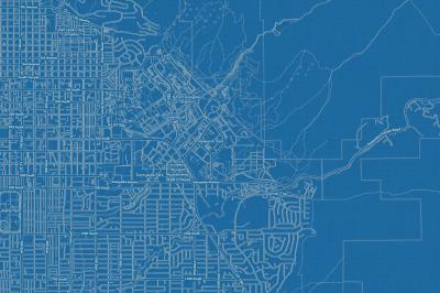
Enrich your office decor or home with a 3D Topographical Raised Relief Map. It is designed for easy hanging with pre-installed hardware. Many people struggle with reading 2D topographical maps, but everyone understands 3D Raised Relief maps. The realism is phenomenal. Ski runs, trails, pathways, and waterways can all come alive with these detailed topographical models.
This 3D topographical map is built from GPS map co-ordinates provided by the customer in consultation with WhiteClouds. WhiteClouds designers will then complete the design work at which point a final proof will be sent to the customer for approval.
3D Printing and 3D CNC routers are used to fabricate the models which make the topographical models extremely accurate. These models are strong - they are coated with epoxy, then finished with a sealer providing a weatherproof matt-finish. These are not meant to be used in direct sunlight. If that is a requirement, please let us know and we can alter our normal fabrication process.
For large or custom orders, please contact us at 385-206-8700 or email at sales@whiteclouds.com
Our materials are gallery quality. 3D raised relief models are built with high quality, UV-resistant, environmentally-friendly, fade-resistant, latex archival inks. Our archival inks prevent fading to preserve as much fine detail as possible over time.
Construction:
Built to last with a rugged composite core of 3D printed plastic and a double coated 2-part epoxy hardener. This core is mounted to a 5/8" engineered wood composite of Medium Density Fiberboard (MDF) that is wrapped in vinyl for easy cleaning. The model is extremely strong and very accurate. Finishing of the model is done with a special sealer providing a weatherproof, stain-resistant matt-finish. A flocking is applied to all edges to give a high-end museum quality finish.
Museum-quality edges

Remarkably Strong: Watch a 1-ton truck drive over our topography models
We create our 3D models to scale as accurately as are the original imagery and digital elevation files.
Printers and Ink
We have the latest HP Latex printers and archival ink to produce consistent and quality results. The inks are environment-friendly and reduce fading for up to 200 years according to HP.
If you purchased the tabletop model, there is no installation. For the wall hanging model, hardware comes installed on the 3D raised relief map/topography. The type of hanger depends on the size of the art-piece. It may be a sawtooth hanger or a pre-installed cable bracket system for larger 3D raised relief maps.
Installation is as easy as placing 1 or 2 screws/nails into the wall and then laying the cable or hanger over them. Lastly, tilt the 3D raised relief model until it is level.
Stainless steel cable hangers for larger raised relief models

Sawtooth hangers for smaller raised relief models

WhiteClouds is located in Ogden, Utah. All products are manufactured and shipped from our facilities. Various shipping methods will be used depending on the size of the topographical model:
Topographical maps are packaged to make sure they arrive un-damaged.
If there are any questions concerning shipping, please contact us at 385-206-8700 or email at sales@whiteclouds.com
How long does it take to fabricate a large topographical raised-relief map? Each raised-relief map usually takes 2-4 weeks. If there is extensive design involved, it will take longer.
What happens after the online order is completed? We will reach out to you through email or we can schedule a phone call. We will define/review the GPS map co-ordinates and map styles of the topographical map. If you have ordered a wood-base we will determine your choice of wood; cherry, oak, pine, etc. If you have a file, we can probably work with it – we work with all architectural CAD programs including AutoCAD, Revit, Chief Architect, ArchiCAD, and Sketchup, just to name a few. We will create a proof for you to approve before fabrication begins.
What is the largest topographical model WhiteClouds can build? There is really no limit, but there are challenges with larger models. You can contact us at 1-385-206-8700 or email us at sales@whiteclouds.com to discuss options for larger models.
Can we change something or add to the order? Yes. Early in the process is the best time to initiate a change order.
What is the warranty? Whiteclouds canvas wraps are warranted against defects in material and workmanship for 3 full years from the date of shipment. Misuse, neglect or alteration of product is not covered under this warranty.
What types of organizations are WhiteClouds customers? We work with customers all over the world in all industries including many Fortune 500 organizations. See some of our customers here.
Can I return my purchased product? Unfortunately, this item cannot be returned. This is a customized order and we cannot resell it. Please make sure that you thoroughly review the map before you give final approval for WhiteClouds to begin fabrication.
Do you have a question we didn‘t answer? Don't hesitate to contact us at 1-385-206-8700 or email us at sales@whiteclouds.com.